

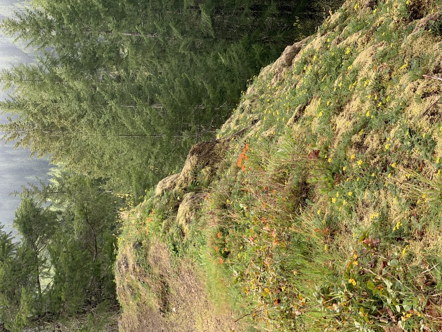
2020 Trips

 1
1
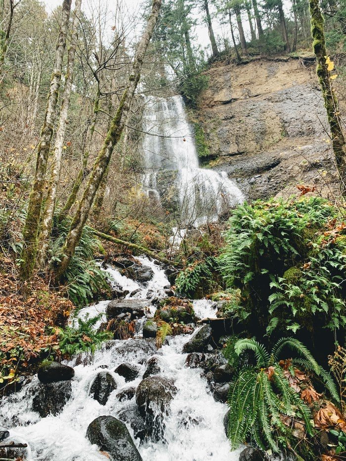
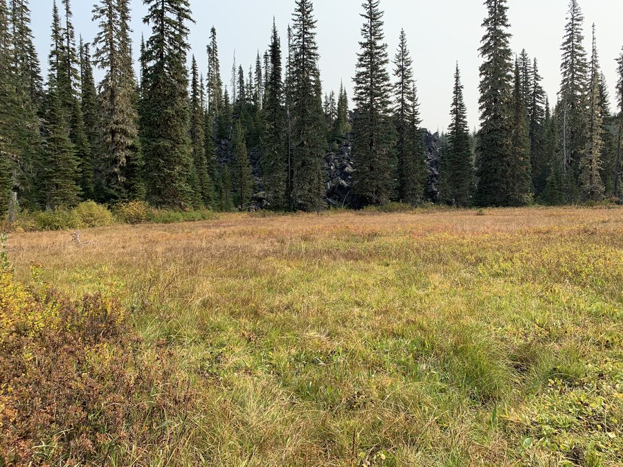
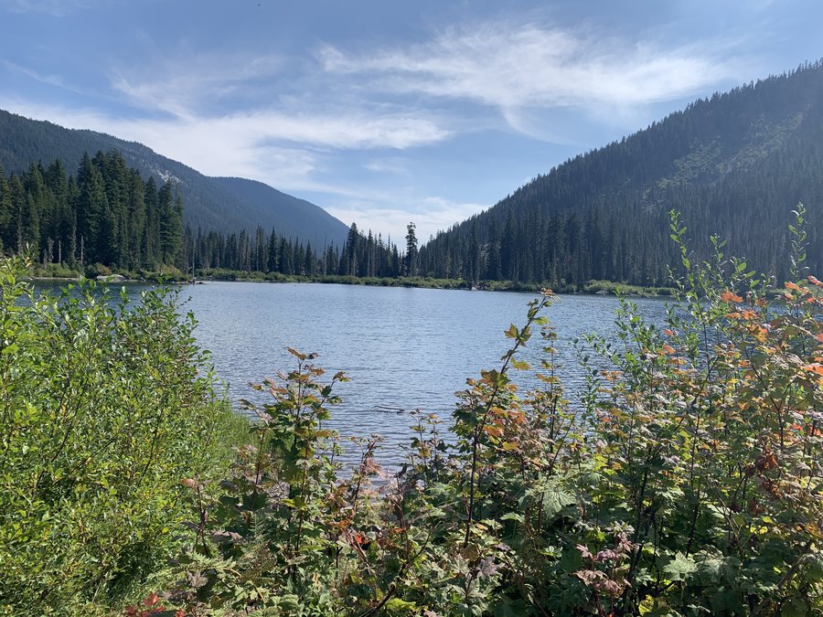
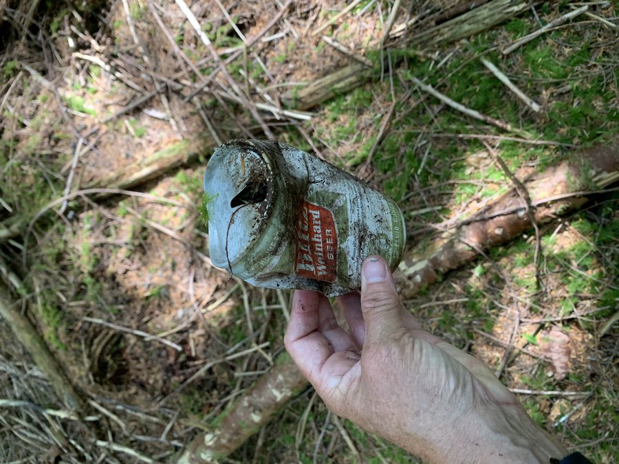
FP Maple Trail
7.5 miles of hiking • 750' elevation gain •
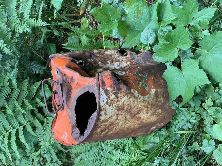
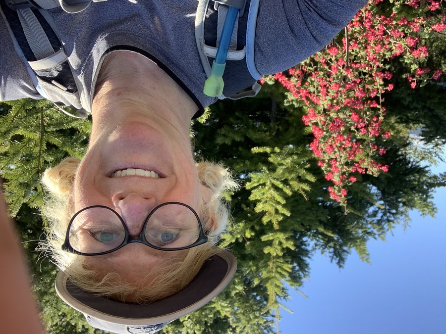
Was here two weeks ago on a similar loop, and I lost my hat along the way. Today, I came upon it hooked on a branch on the Wildwood!

December 23, 2020

 1
1
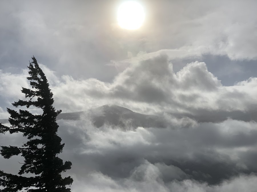
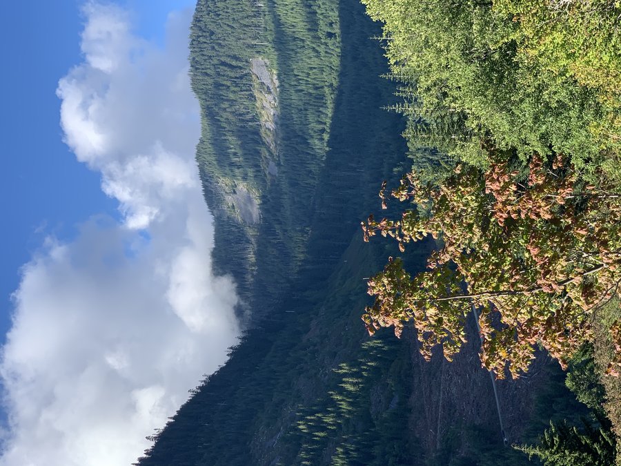
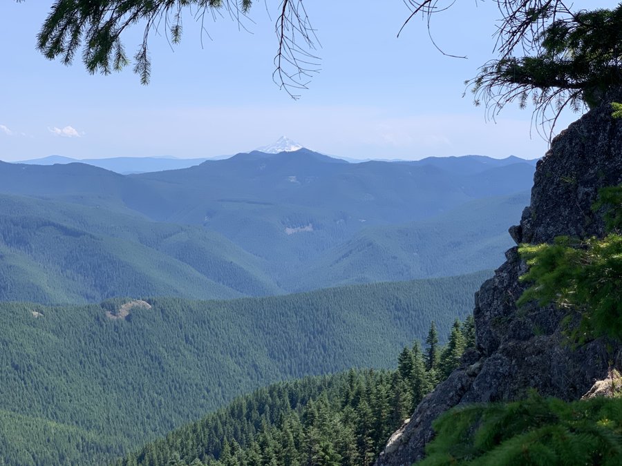
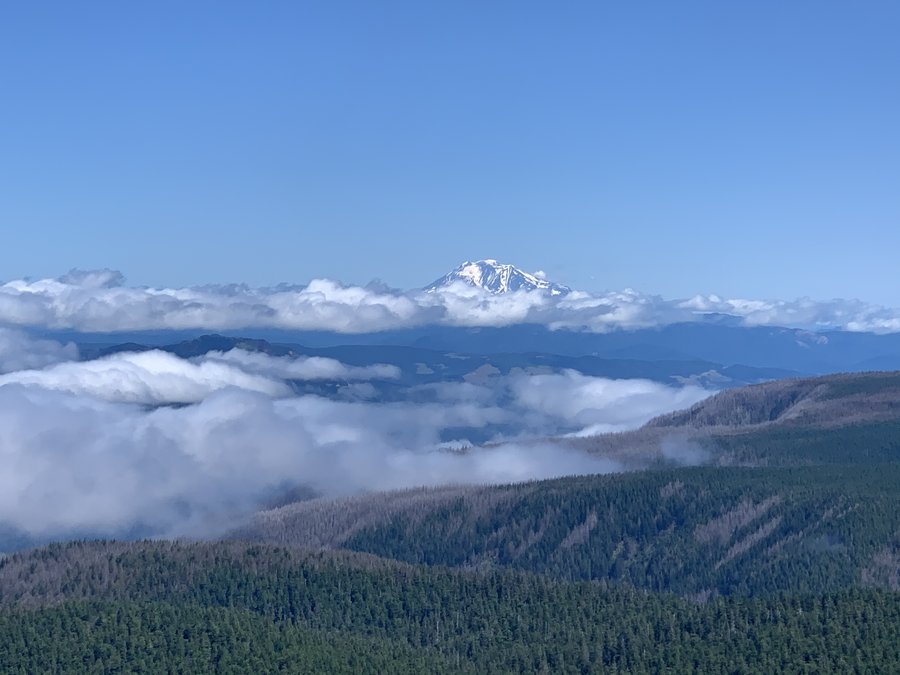
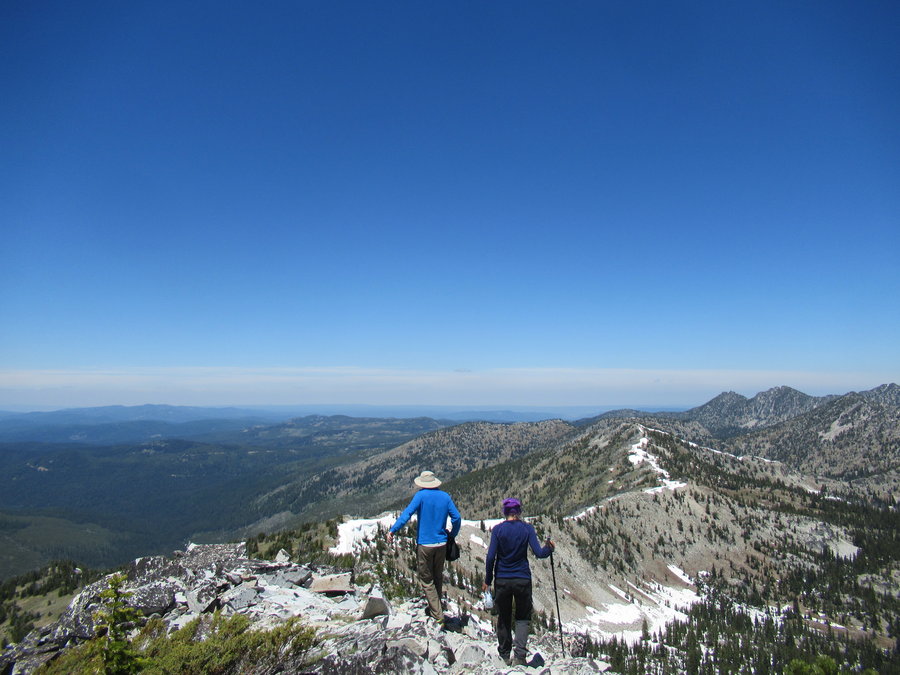
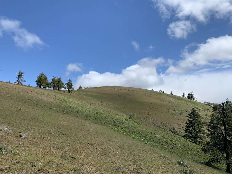
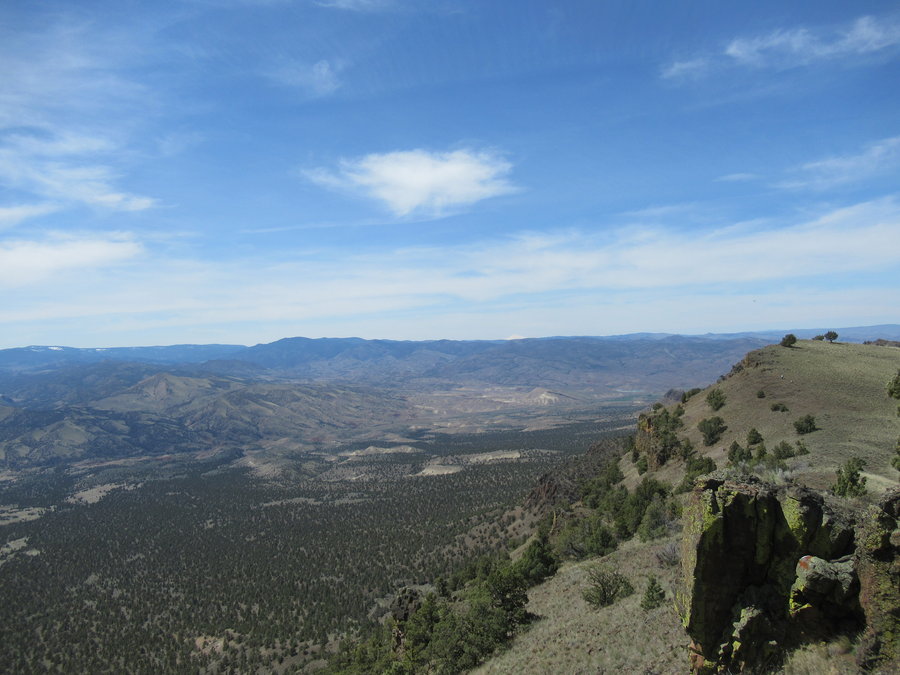
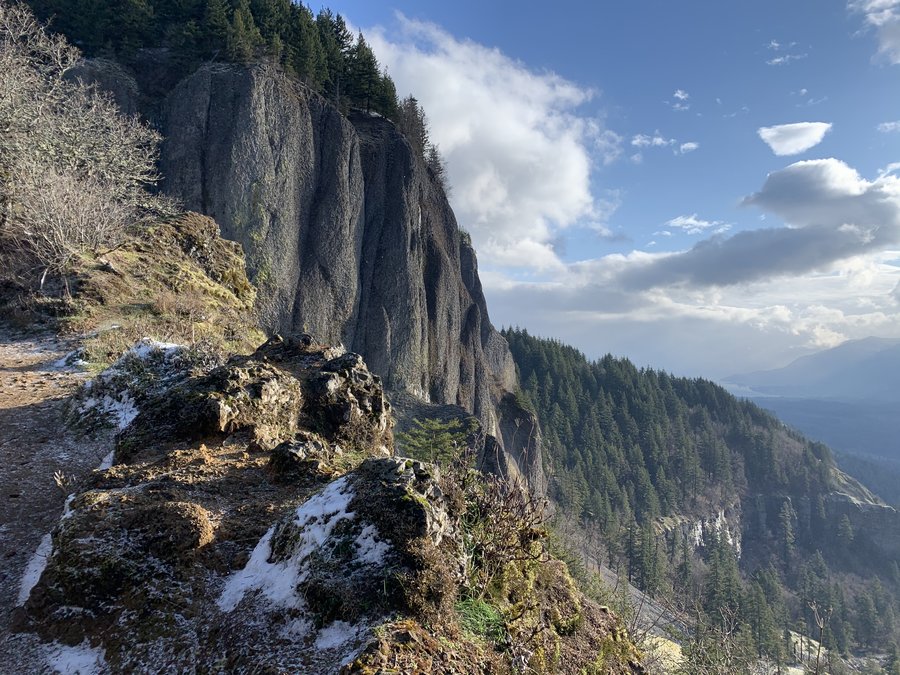
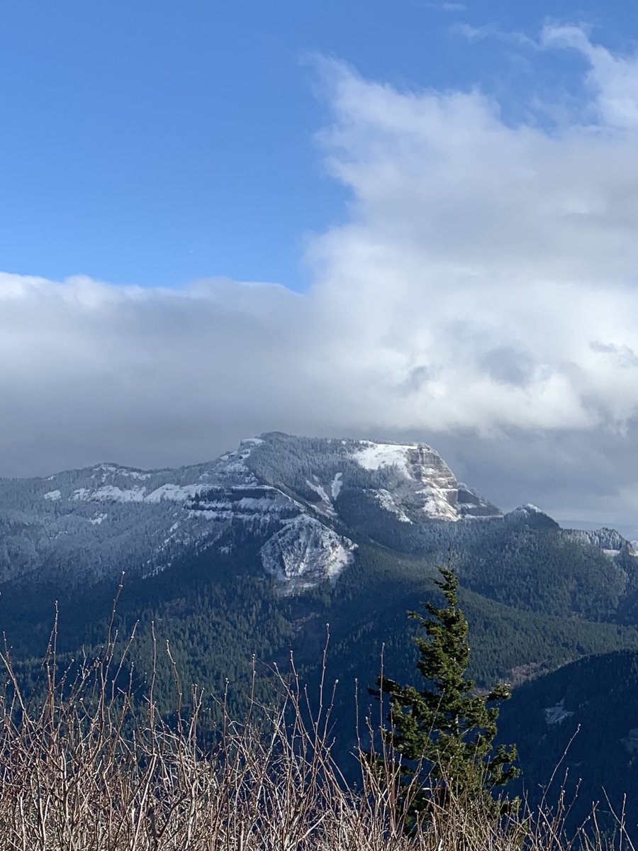
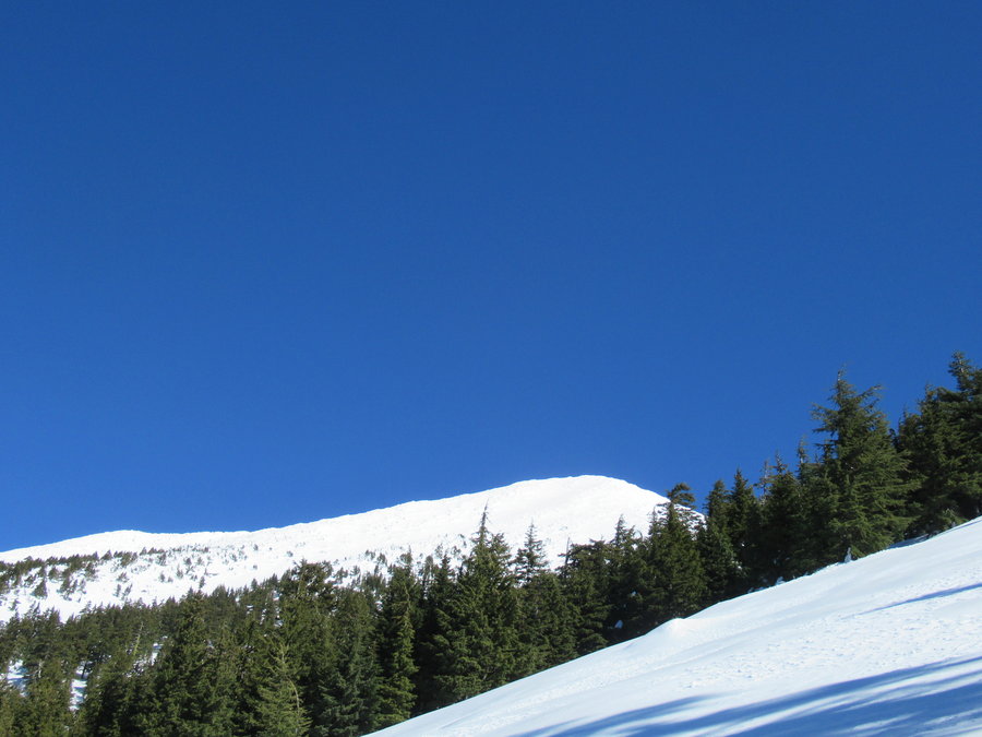
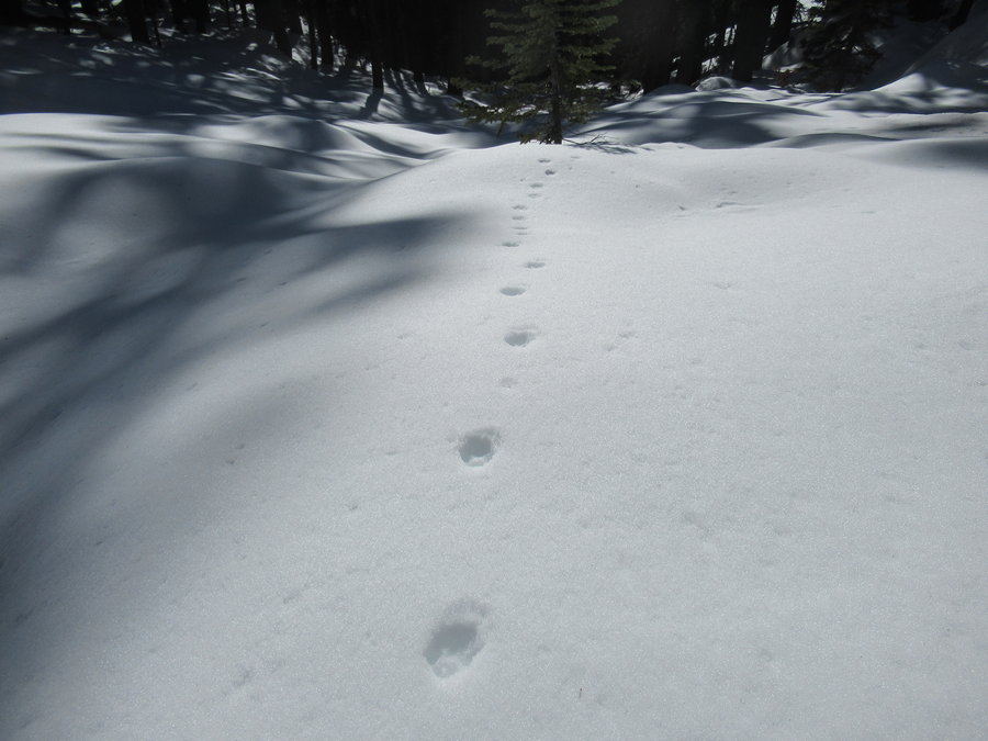
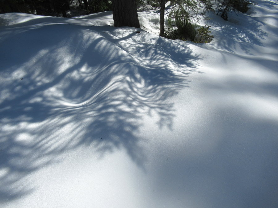
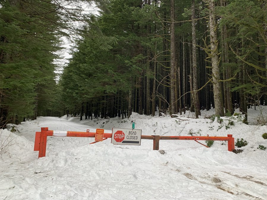
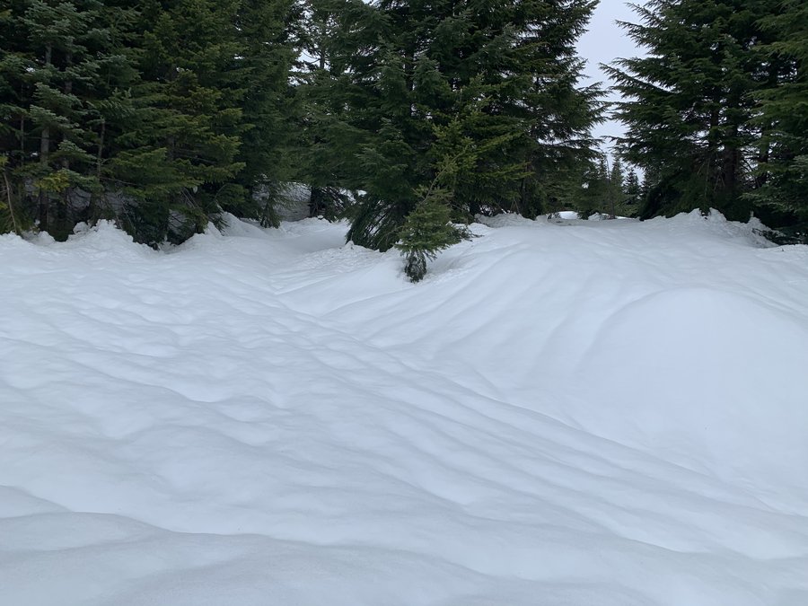
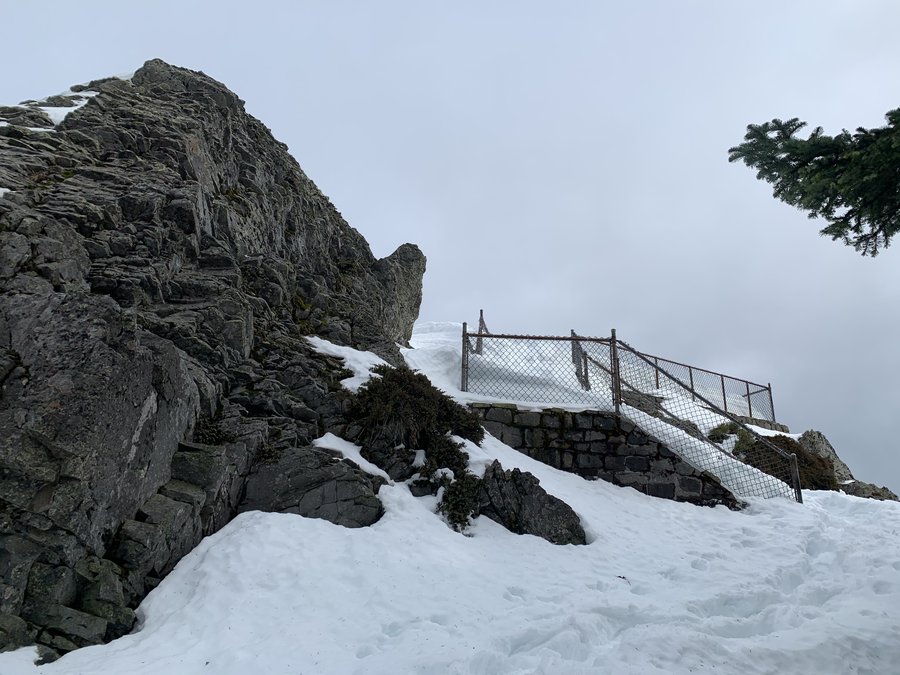
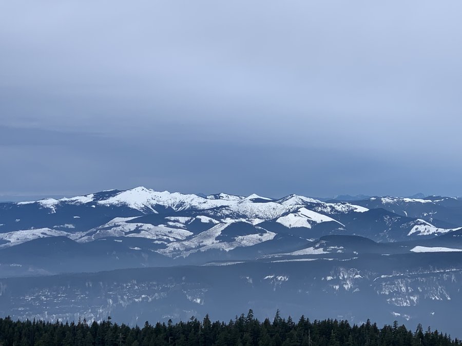
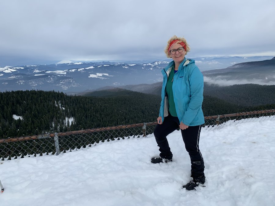
Dog Mountain
7.5 miles of hiking • 2750' elevation gain •
Umbrella Hike up to Puppy Point. Donned the microspikes at about 2000 ft. Zero visibility and windy up top, trail was a slushfest, but nice to be out in the snow. Trail pretty quiet today.
December 14, 2020

 1
1
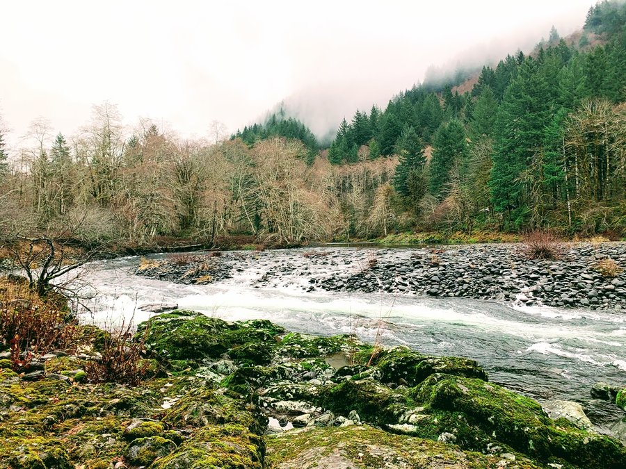
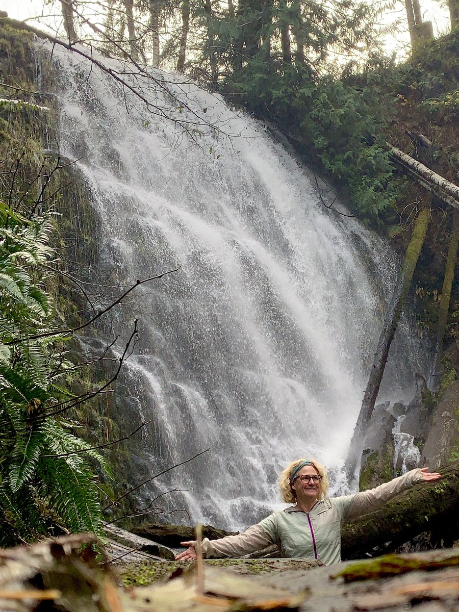
Wilson Falls
6.5 miles of hiking • 750' elevation gain •
Started at Smith Creek Homestead Site and went west on Wilson River trail. A few detours along the way. Eerie fun wandering through empty campground.
December 13, 2020

 1
1
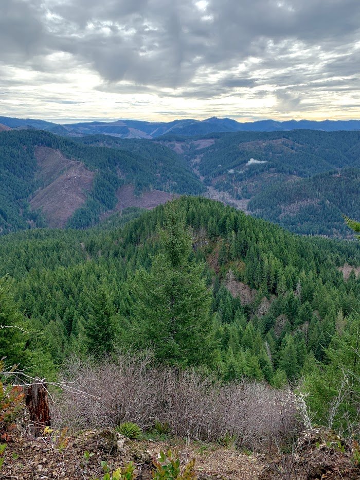
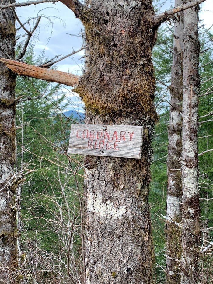
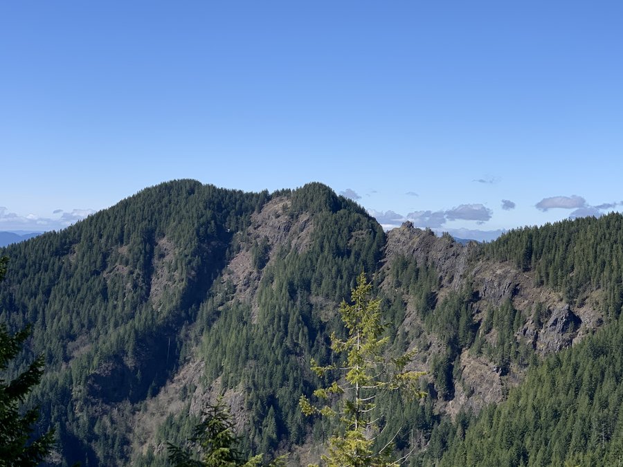
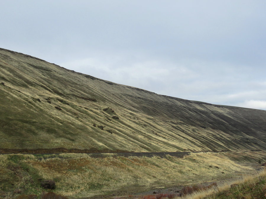
Coronary Ridge
4.5 miles of hiking • 1500' elevation gain •
Little hike up Kings Mountain trail to 2200 ft and turned off on Coronary Ridge and followed it west down to the Wilson River Trail to return.
December 6, 2020

 2
2
Hamiltion/Cedar Loop
9 miles of hiking • 2500' elevation gain •
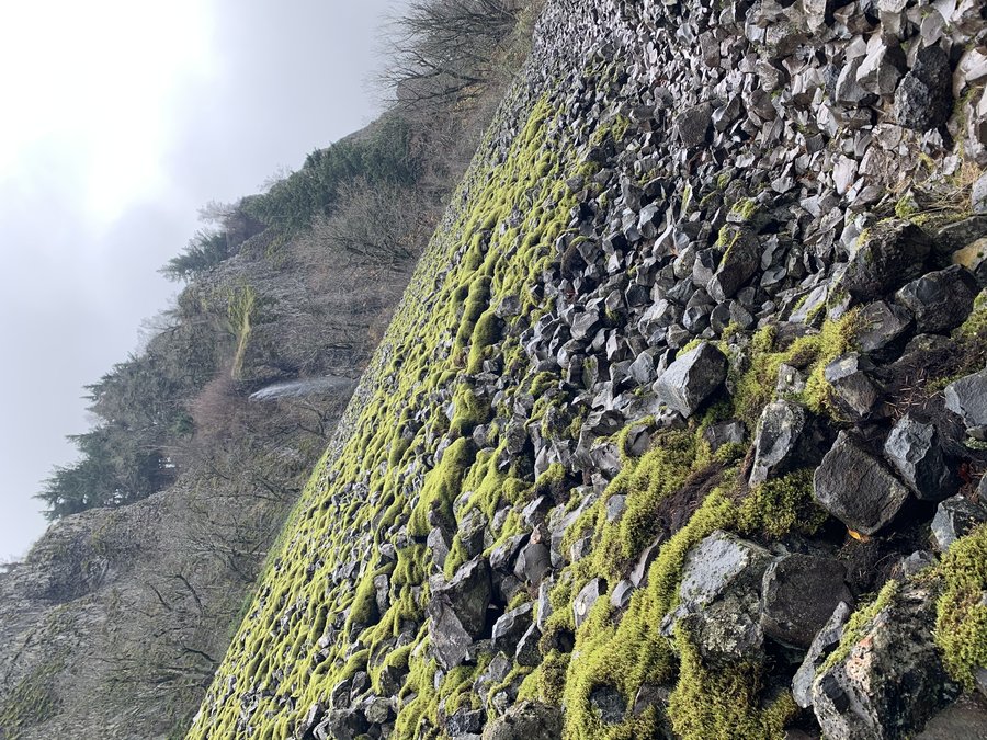
Biked from Bonneville to the old Aldrich TH and stashed my bike in the bushes. Visited Cedar Falls and then took the old RR grade along Hamilton Creek. It's really overgrown with that trailing blackberry, but tread findable. Some of the ropes are still there in the creek crossings. After a few miles, I bushwacked straight up the hill and made my way over to the north section of the Cedar Mountain trail, and took it to the PCT for a return. Short days, late start and the last two miles were by headlamp (+ the bike). Just saw one dude at the Cedar Creek crossing-bridge is in, but not necessary.
December 3, 2020

.jpg)
 1
1
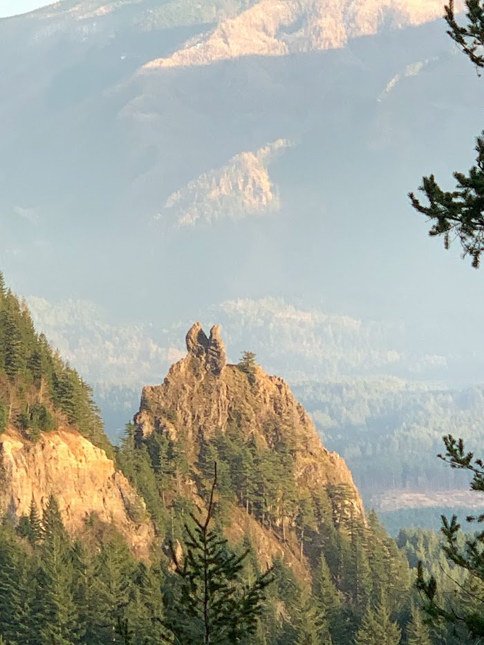
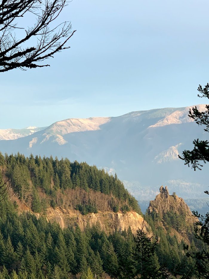
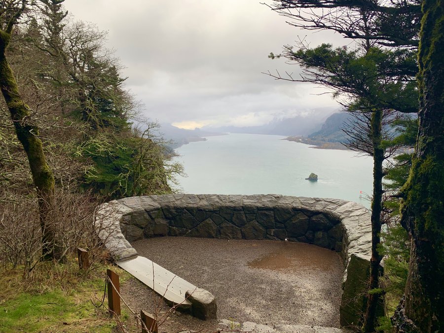
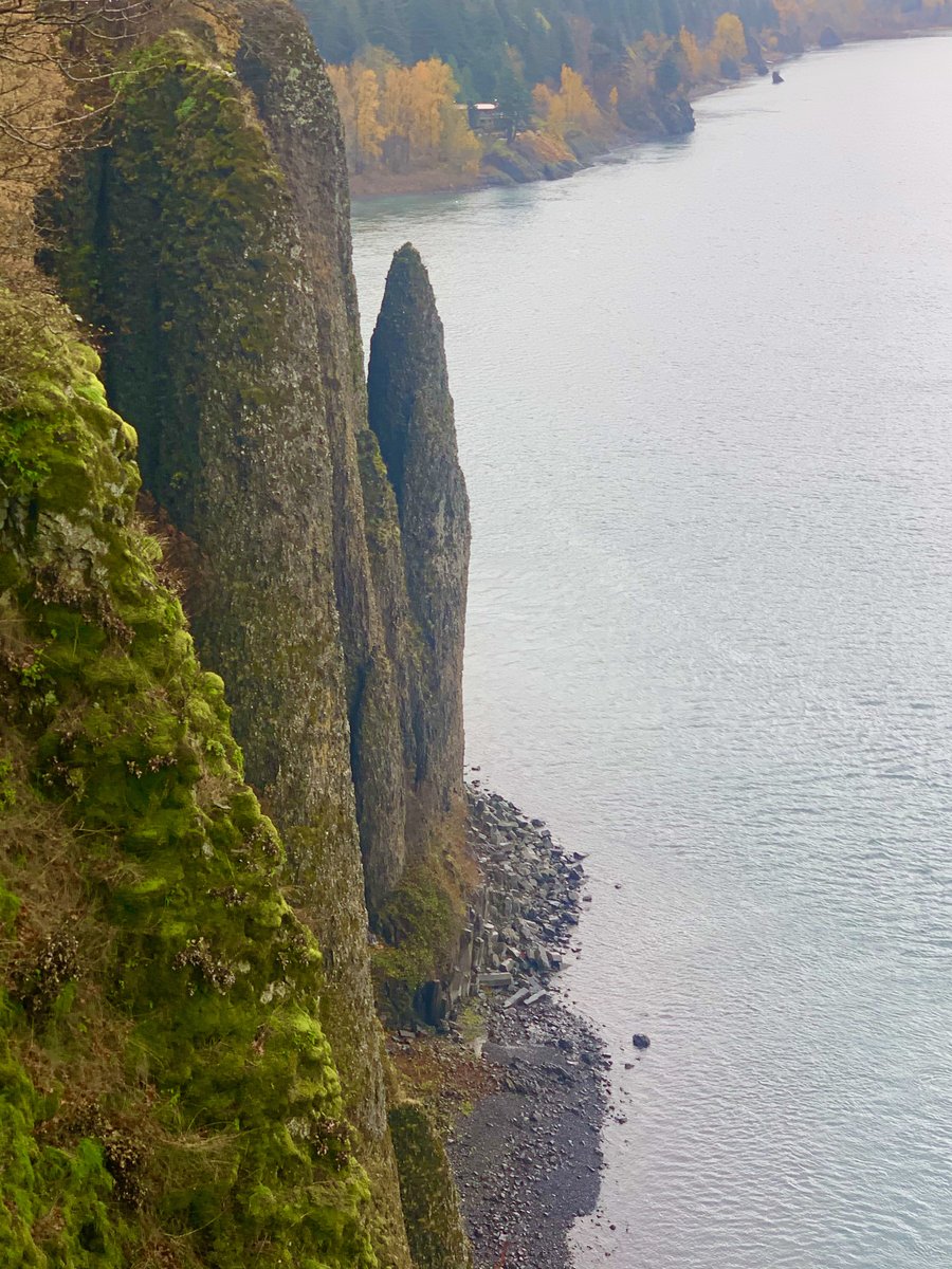
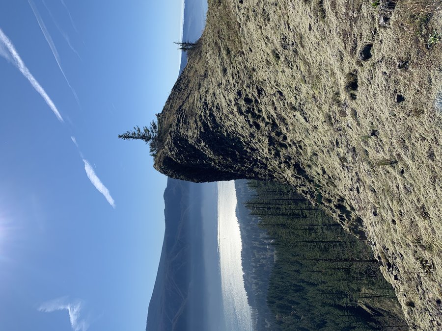
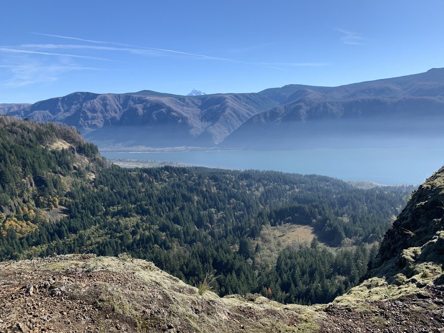
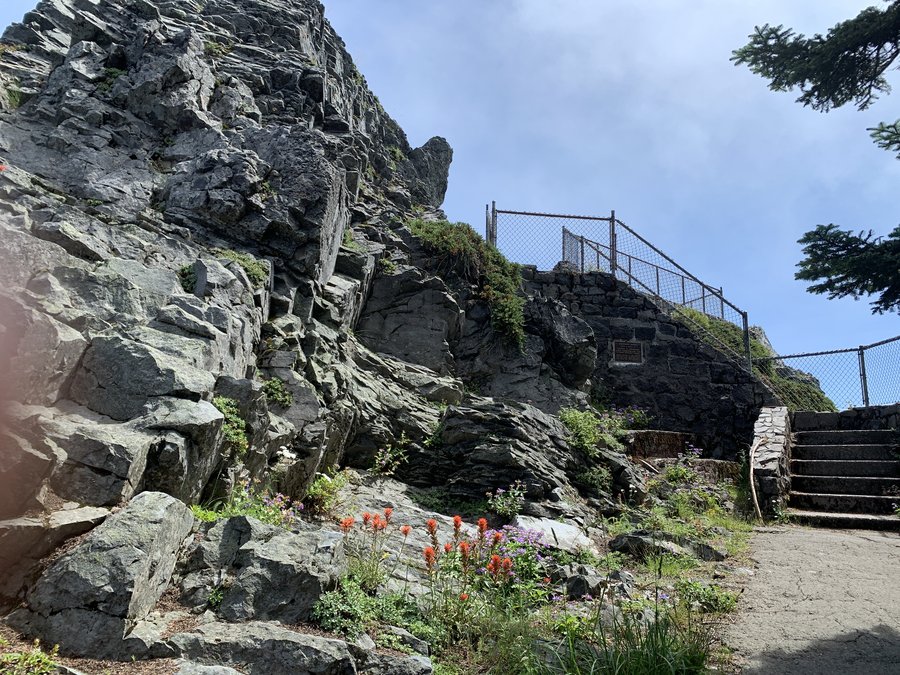
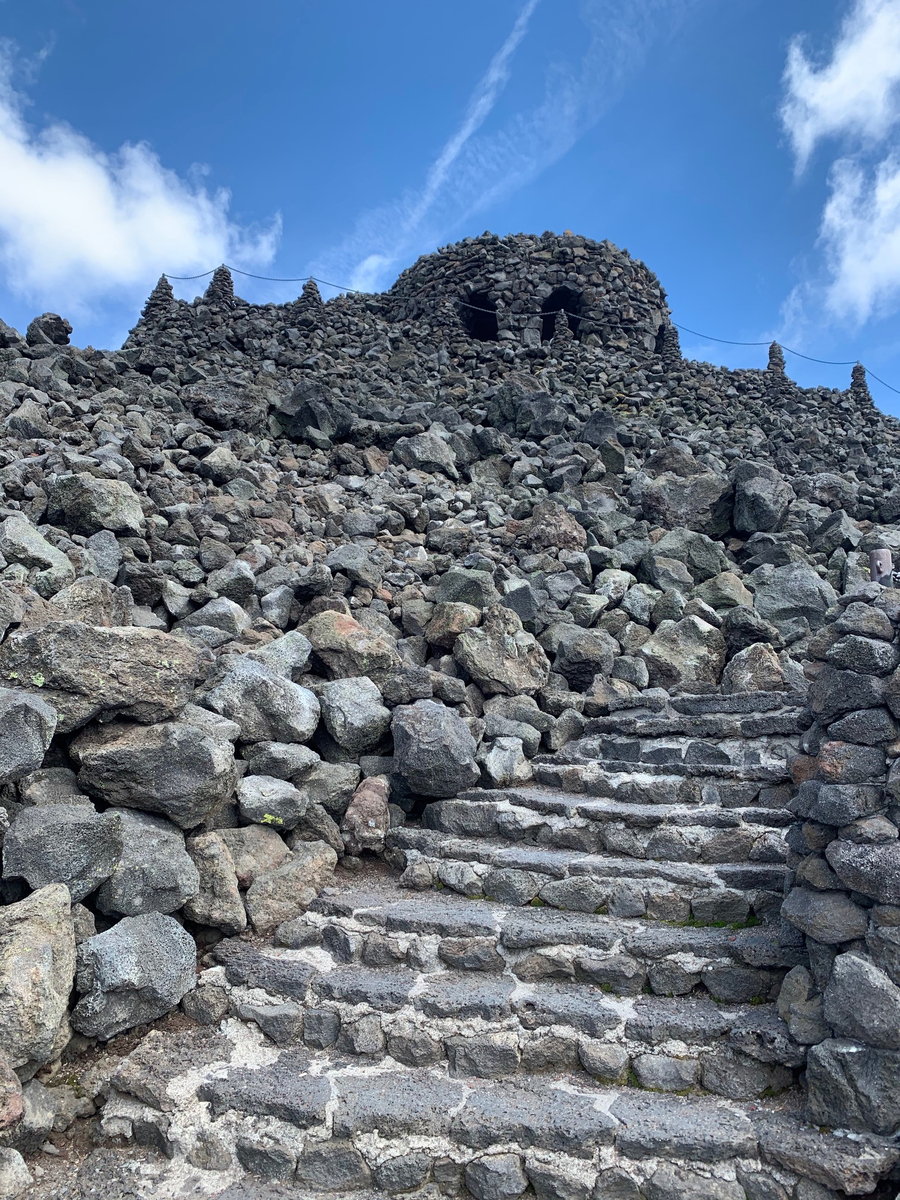
Cape Horn
7.5 miles of hiking • 1250' elevation gain •
Trail keeps getting fancier! Two new stonework viewpoints added this year. Miss the old secret trail. Can't help but imagine this is Archer's fate someday soon.
November 25, 2020

 1
1
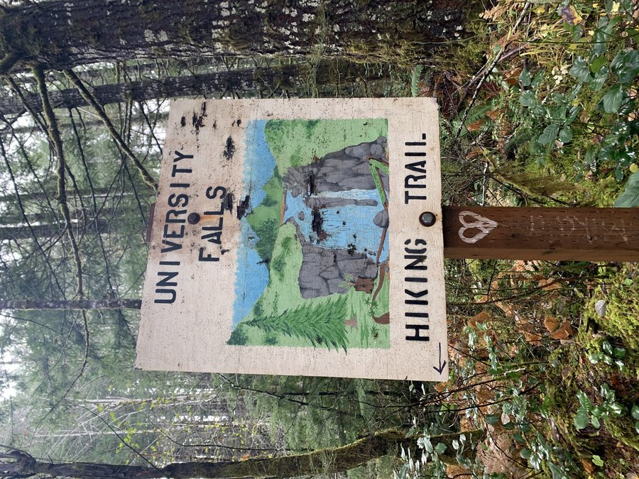
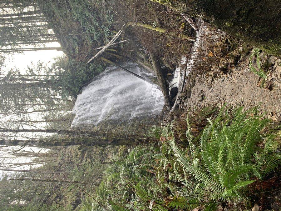
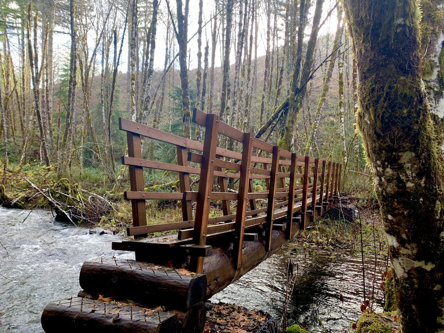
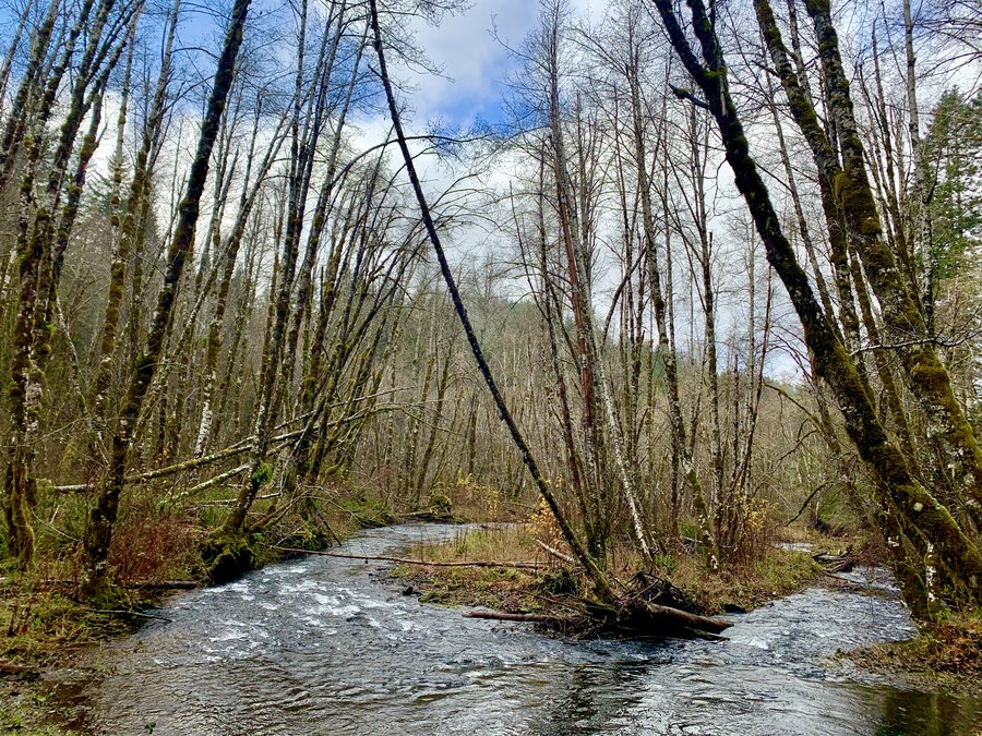
University Falls
7.5 miles of hiking • 1250' elevation gain •
For the second time in a row, I drove out of drizzly dreary PDX into sunshine at the coast range! No one around. Route was via Storey Burn and Gravelle Bros trails.
November 23, 2020

 1
1
Step Creek Variation
8 miles of hiking • 1000' elevation gain •
Was foggy from PDX to Banks, but sun was out in Timber. Surprised how busy the trail was, but it got quiet on the upper portion. Mushrooms still out. Added on a few of the grassy side roads to my exploration. Love the alder hallways on the Step Creek trail.
November 21, 2020
 2
2
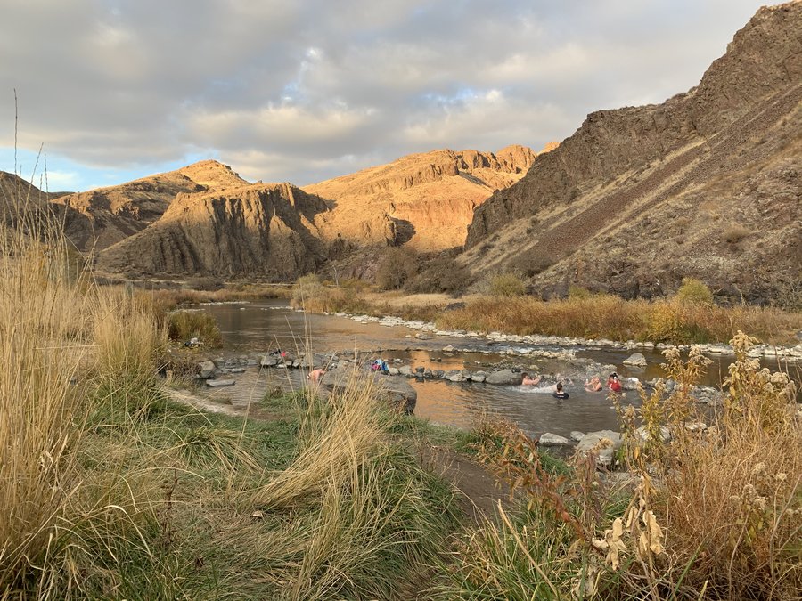
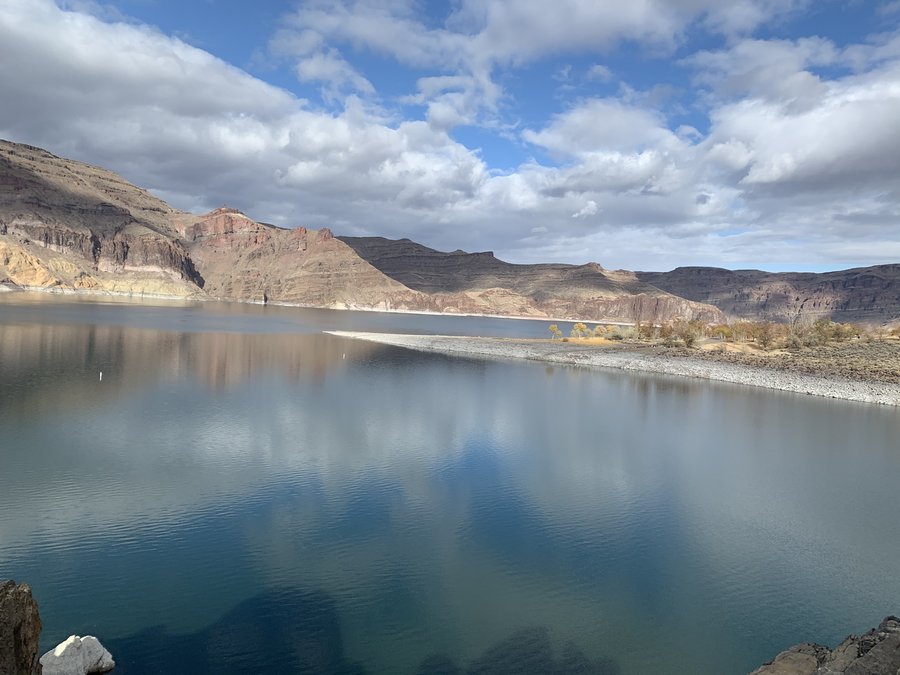
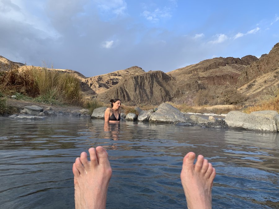
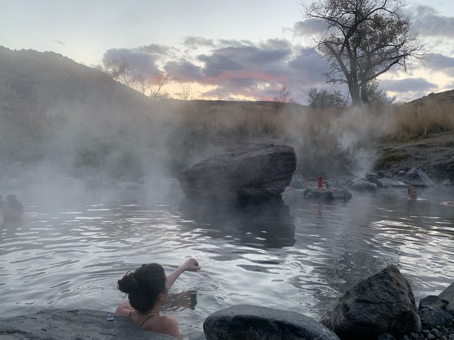
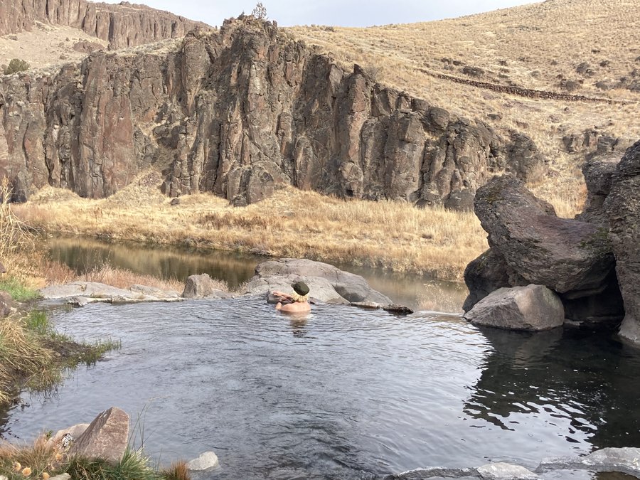
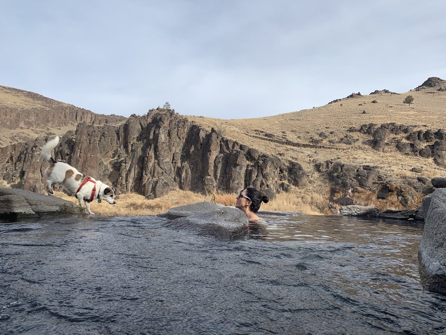
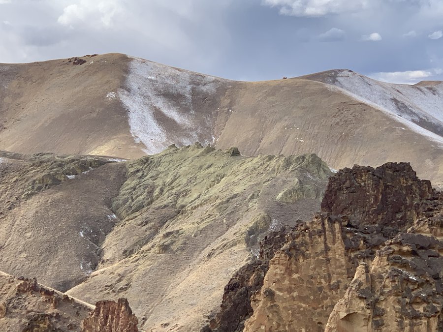
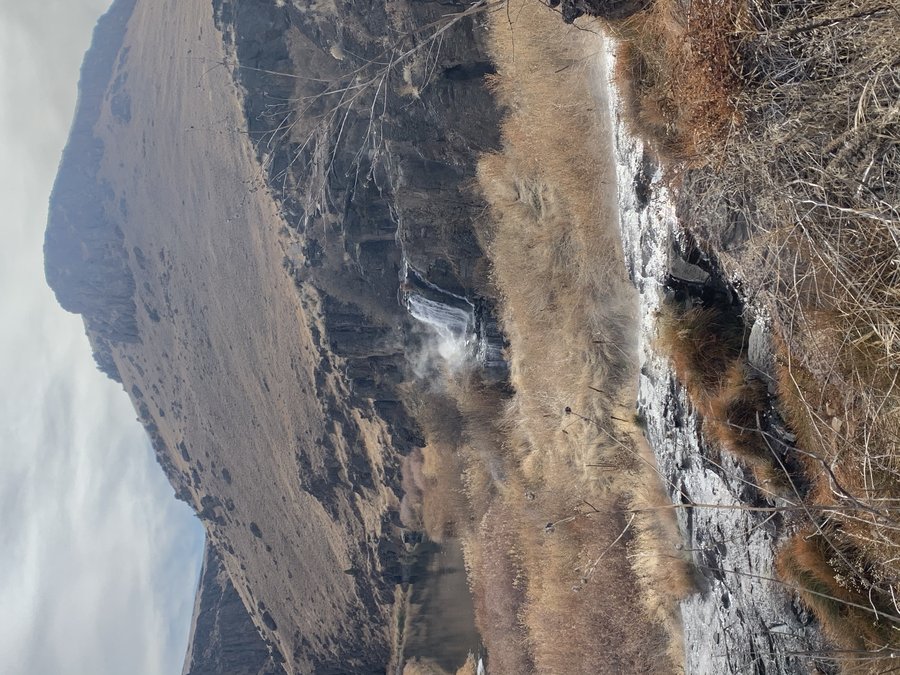
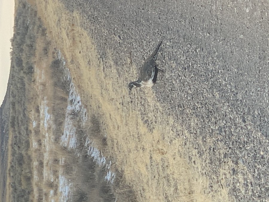
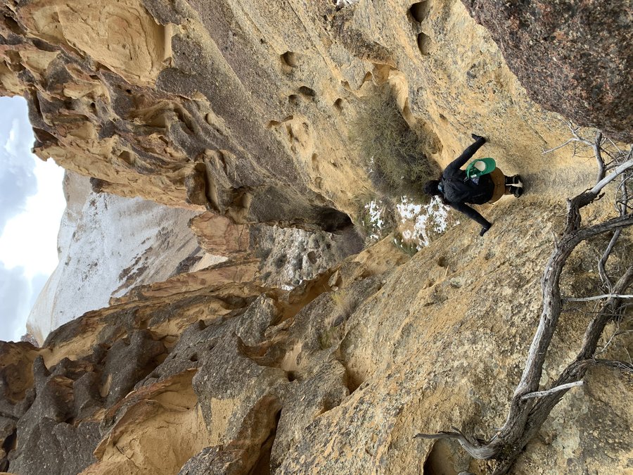
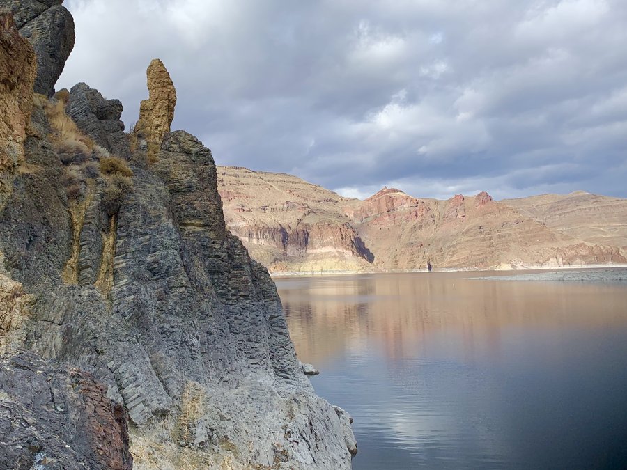
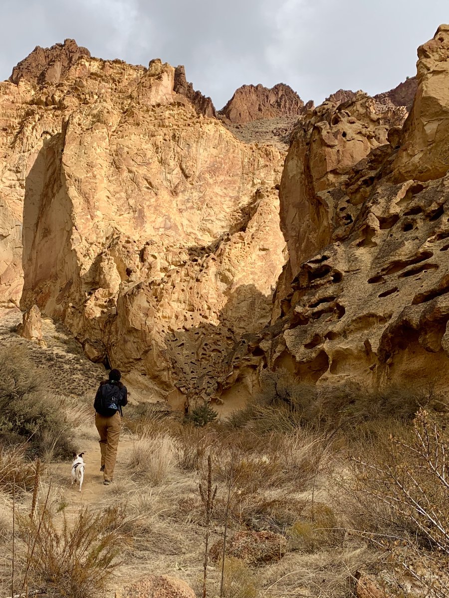
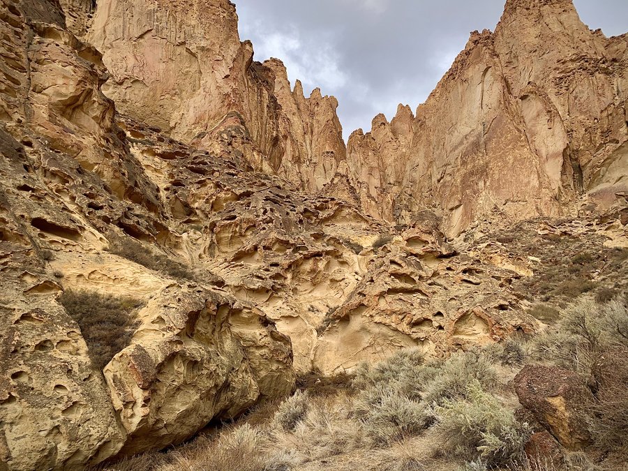
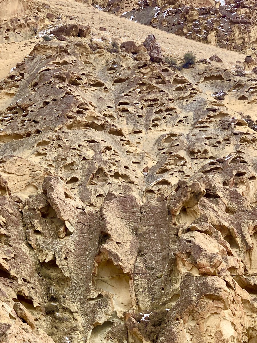
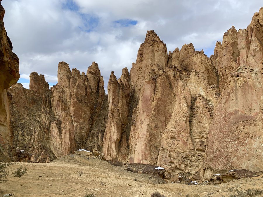
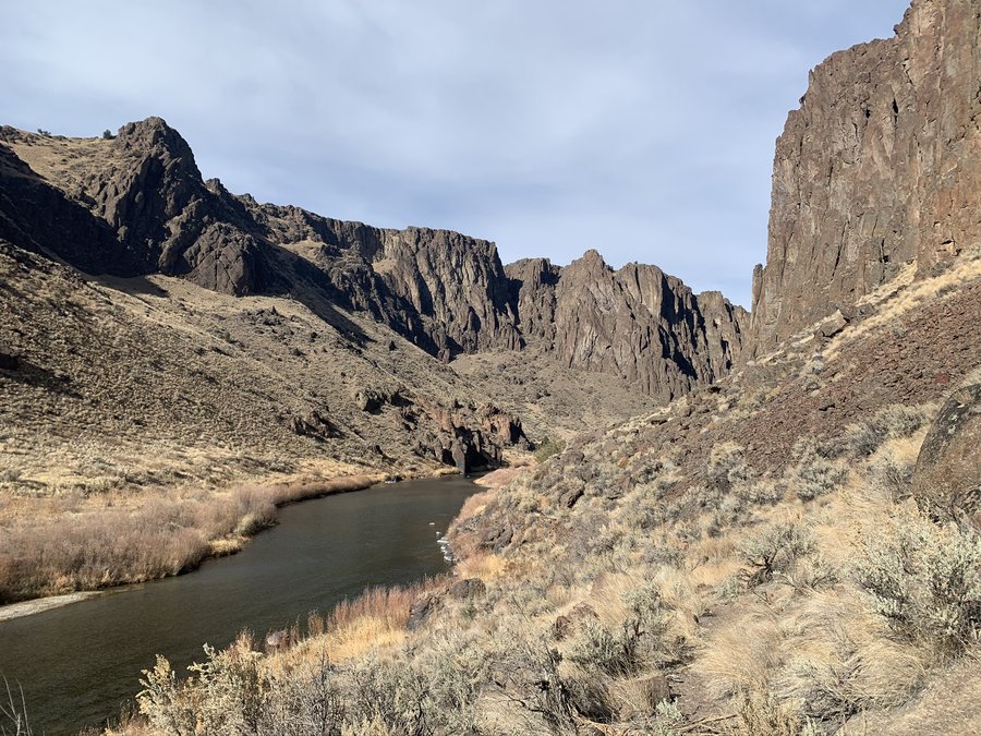
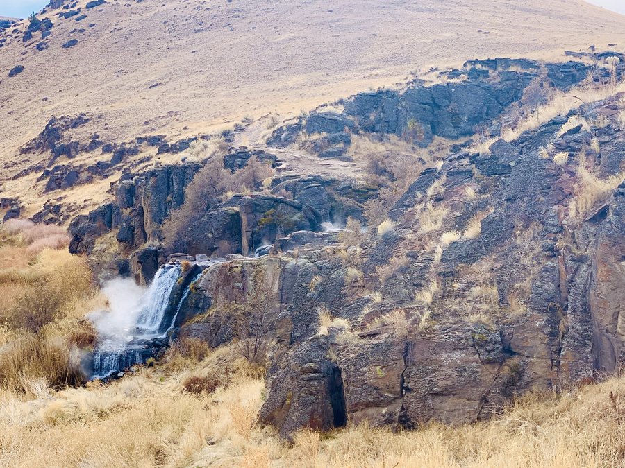
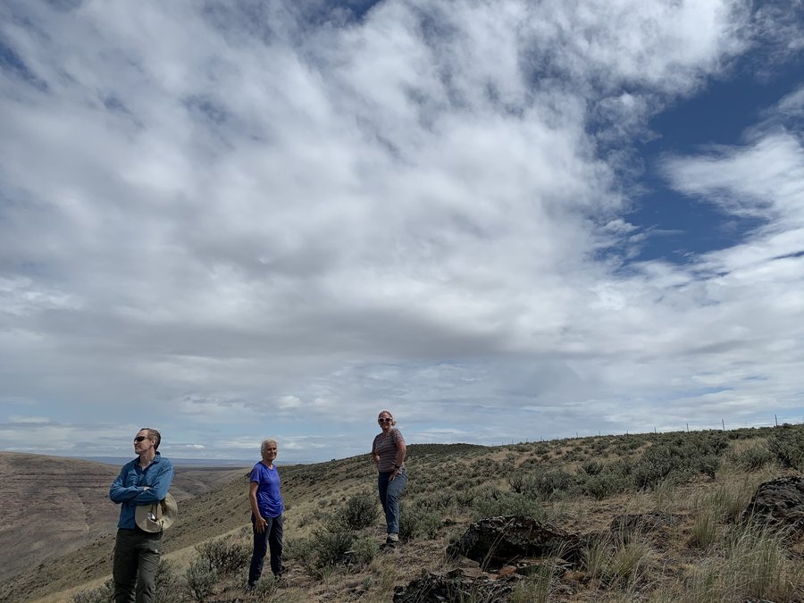
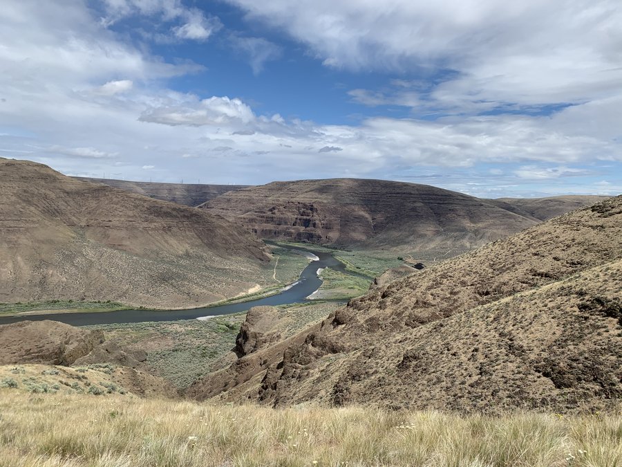
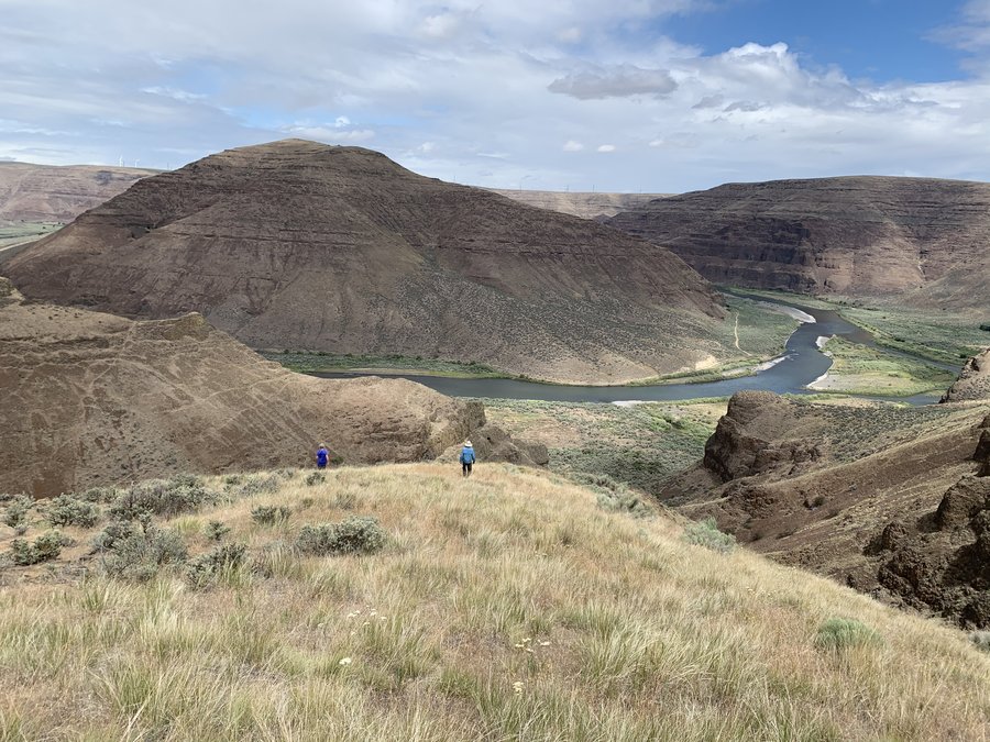
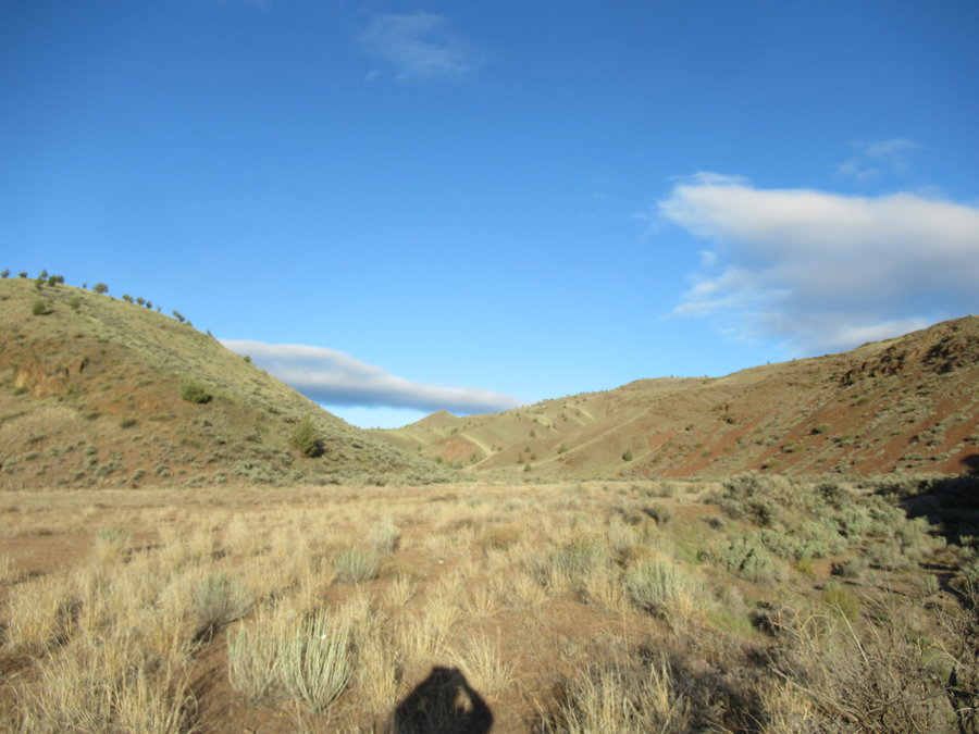
Owyhee
13 miles of hiking • 2000' elevation gain •
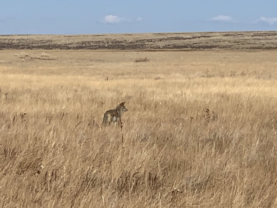
We rented a cabin at Owyhee Lake State Park. We were the only ones there. Went on a hike each day, and soaked at nearby Snively Hot Springs twice. First day-hiked above the campground to the top of the canyon. Second day-Honeycombs! It was only about 20 miles downstream as the crow flies but it took over two hours to drive there. A little sketchy with snow on the gravel roads, but it was a magical place. Third day-a 3 hour drive to Three Forks Hot Springs. We started at the North Fork boat ramp and hiked upstream to a hot springs waterfall in a magnificent canyon. Worth it. No people seen on any of these adventures. Just stupid cows chewing up, shitting and trampling all over the fragile desert and our public land.
November 9, 2020


 1
1
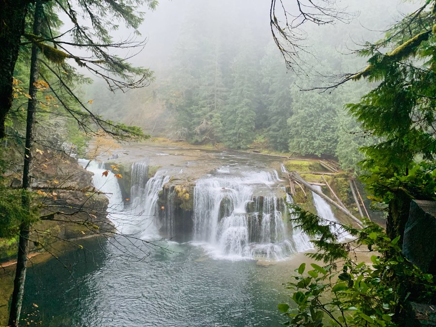
Lewis River
10 miles of hiking • 1000' elevation gain •
The next batch of rains have started and it was pouring all day today. I donned pack cover, rain pants and umbrella! Stayed dry for five hours. Saw two people and some elks.
November 3, 2020


 3
3
Archer Mtn
4 miles of hiking • 1000' elevation gain •
Hubby took the day off to go on a hike with me. The rogue trail builder of Archer Mountain has been very busy! Lots of new trails and even blazes on trees,,,grrrrr. We went down to Gable Falls and some of the trails are freshly grubbed out, like yesterday.
October 28, 2020

 2
2
Palmer Mill to Multnomah Basin
11.5 miles of hiking • 1750' elevation gain •
My ramble got a lot longer than I expected. Explored a bit of the area in the basin that has been closed for more than 3 years, it's ridiculous!
Also excited to find that Palmer Mill Road from Angels Rest is open again.
October 27, 2020
 2
2
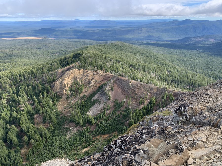
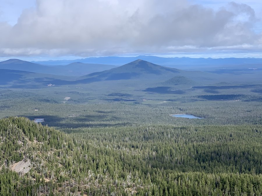
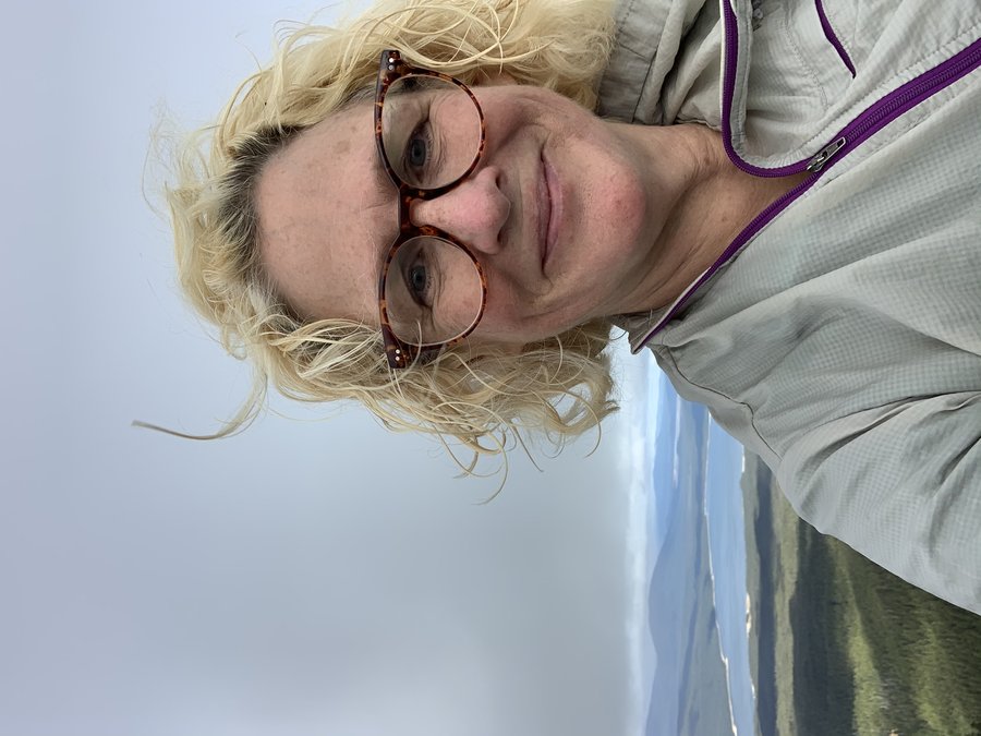
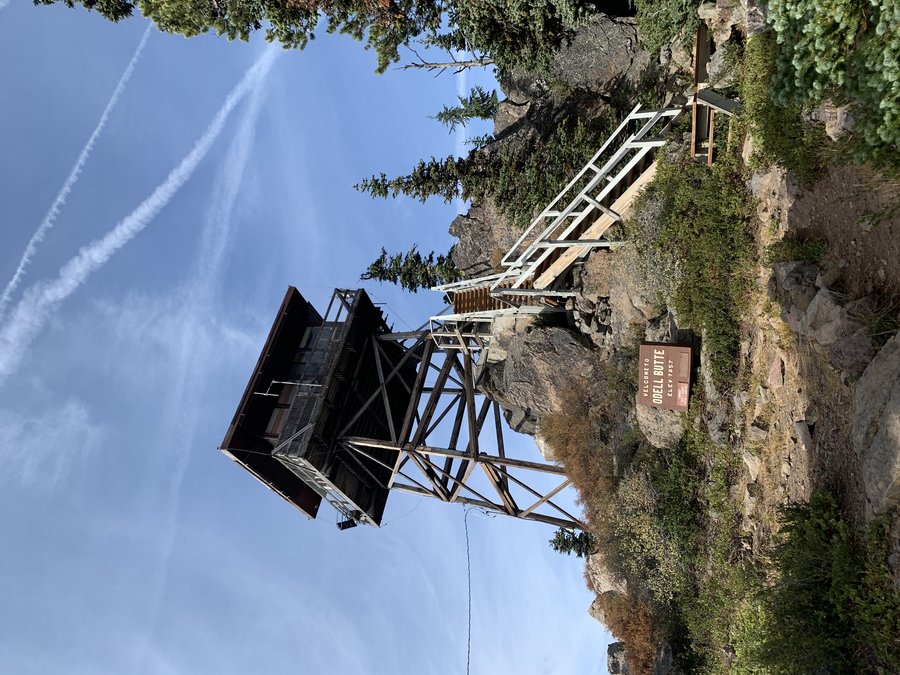
Mountain and Desert Getaway
31.5 miles of hiking • 6000' elevation gain •
A little escape from reality. I decided not to camp on this trip. Too cold and dark this time of year. Stayed at AirBnBs- two nights near Willamette Pass and two nights in Plush, Oregon. Went on a hike every day. One big one.
1) Fuji Mountain 3.5 miles, 1000 ft eg. This is a great quick hike if you are travelling over Willamette Pass and dont have all day. Huge payoff in views at the end!
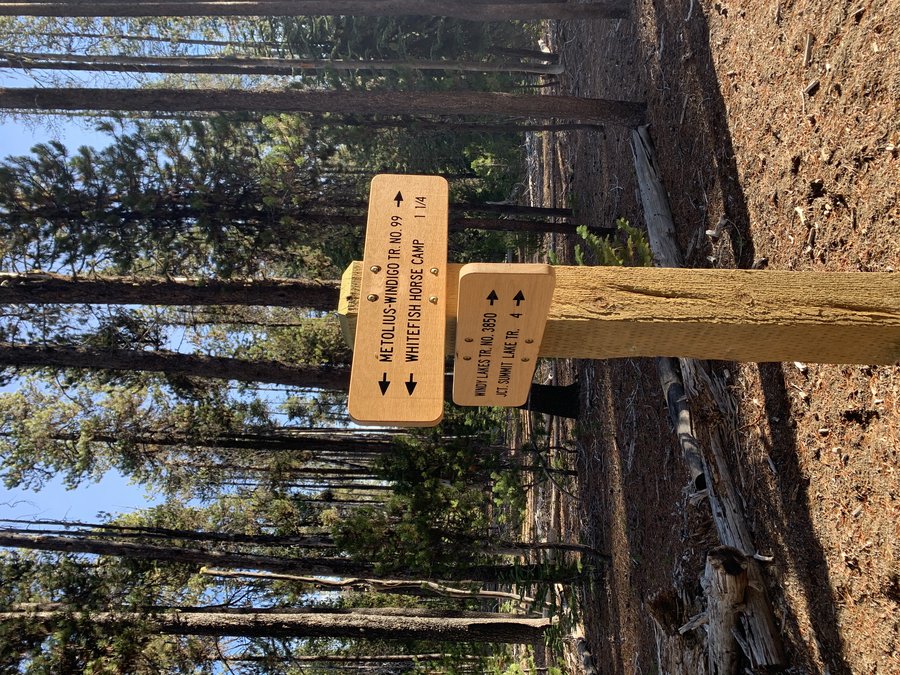
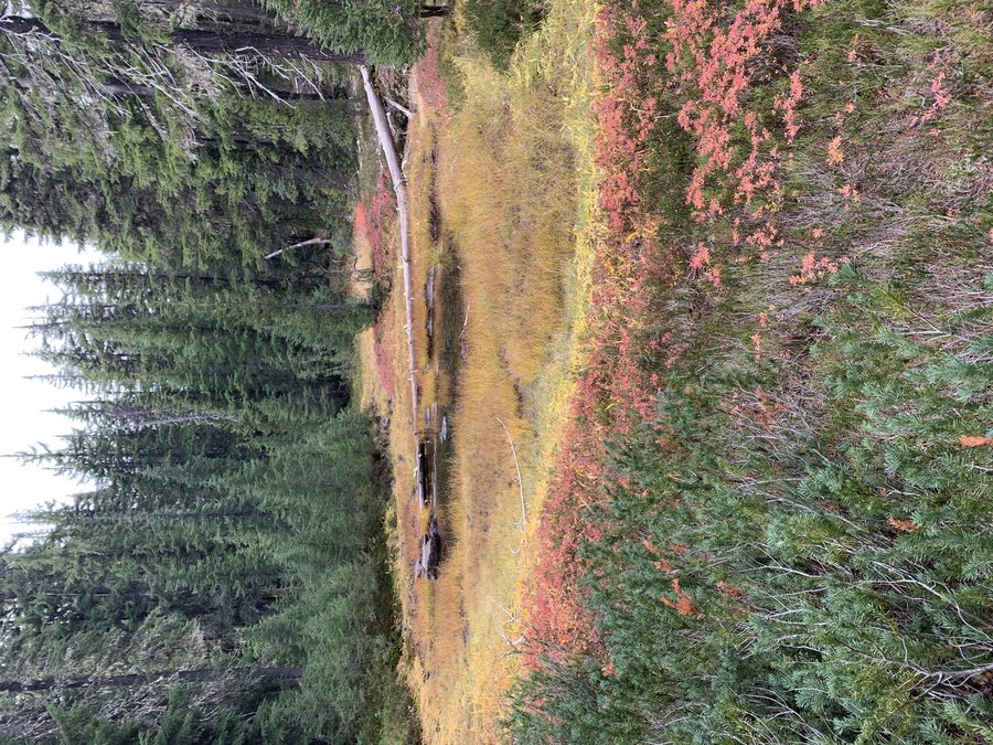
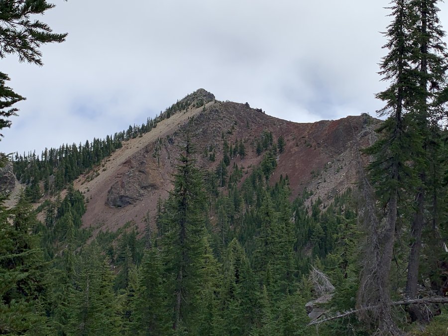
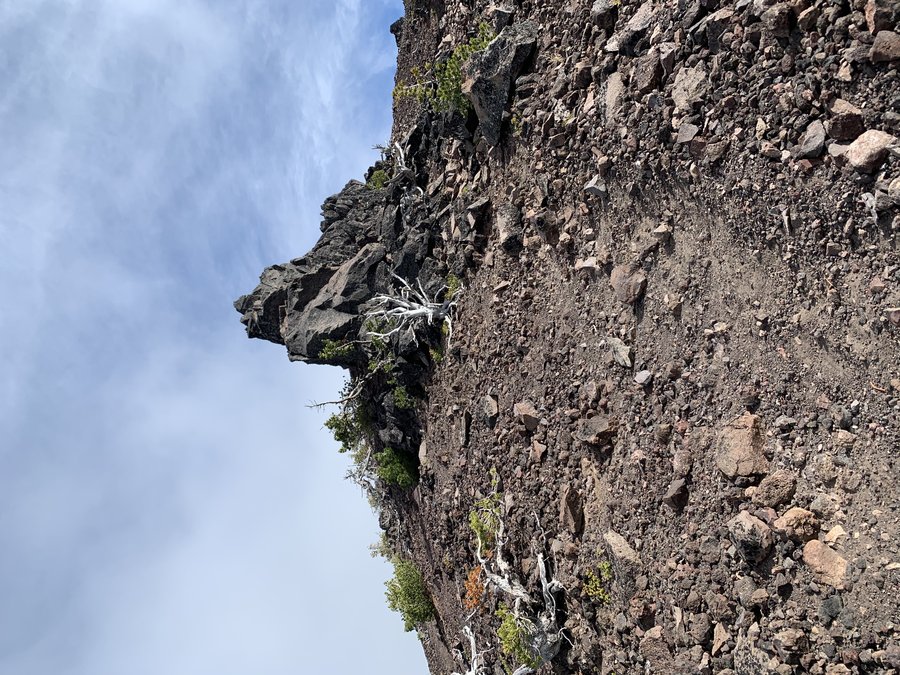
2) Cowhorn Mountain 15.5 miles, 3000 ft eg. I did a big loop with several miles of bushwacking. Took all day. Started at Crescent Lake and took the Windy Lakes trail west to the final lake. Then it was a short steep climb up to the PCT. Headed south to Cowhorn and after summitting, I circled around the south face and wandered for hours in the forest-was quite pleasant. Joined the Metolius-Windago trail near Bingham Lakes for fast return in the gloaming.
3) Odell Butte 2.5 miles, 750 eg. This perfect cone dominates the landscape. Very busy summit with several antennas and control buildings in addition to the lookout site-which was still staffed for fire season with several active fires to the south!
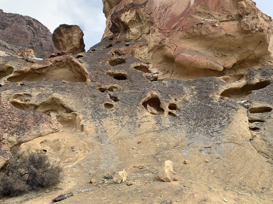
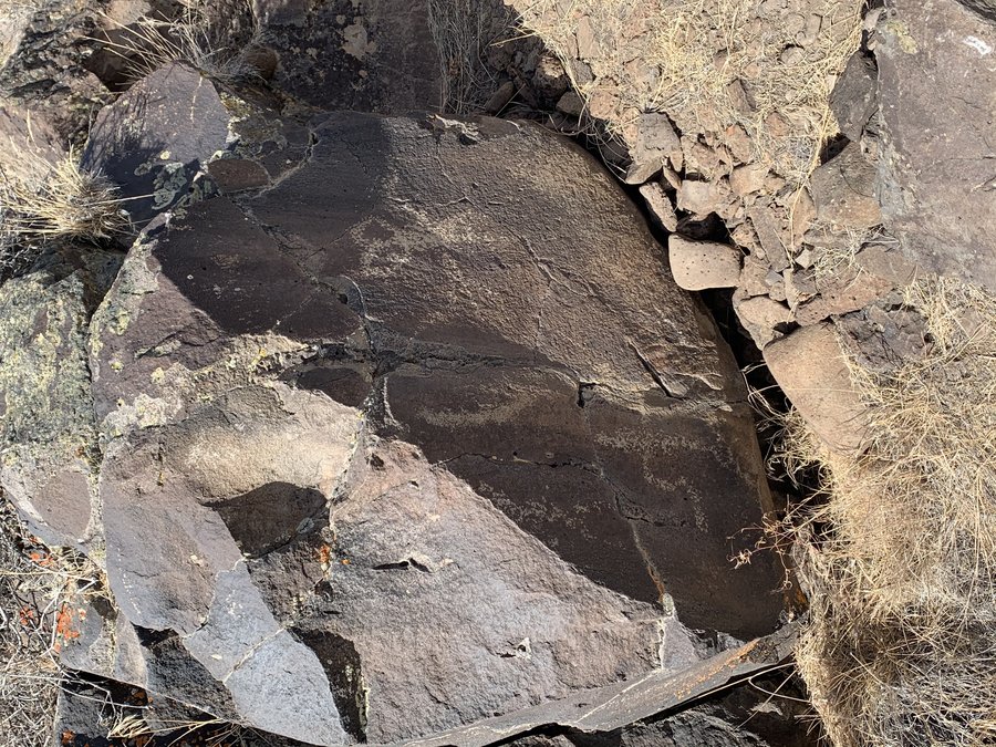
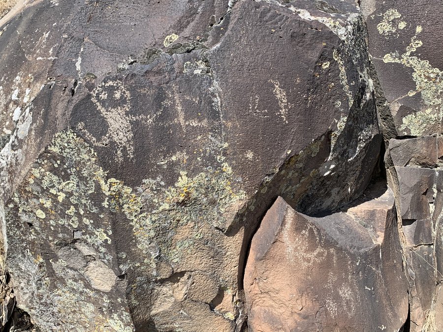
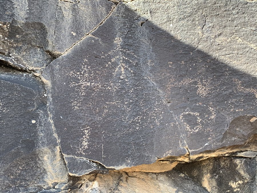
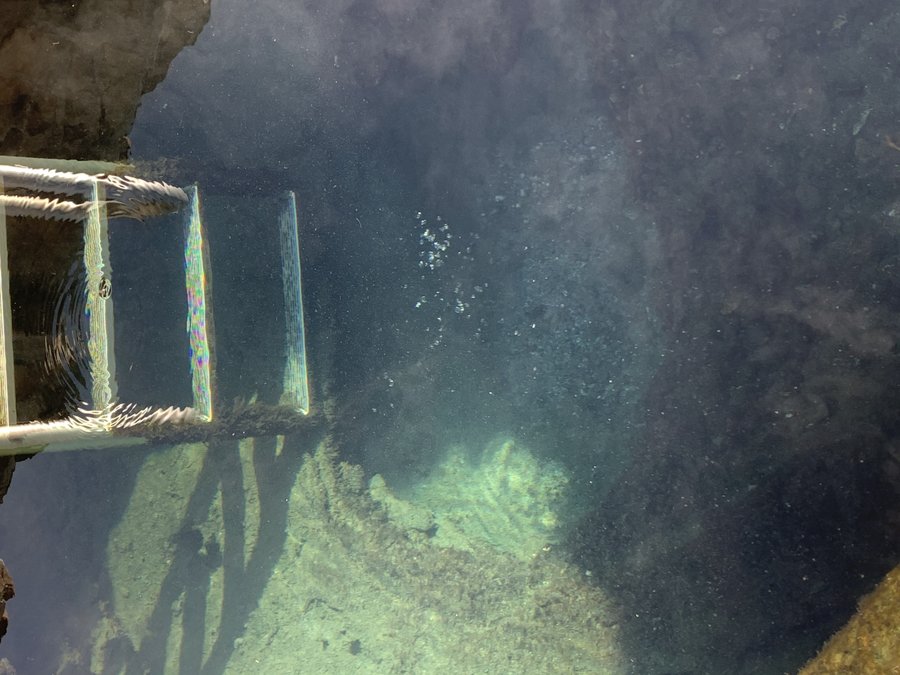
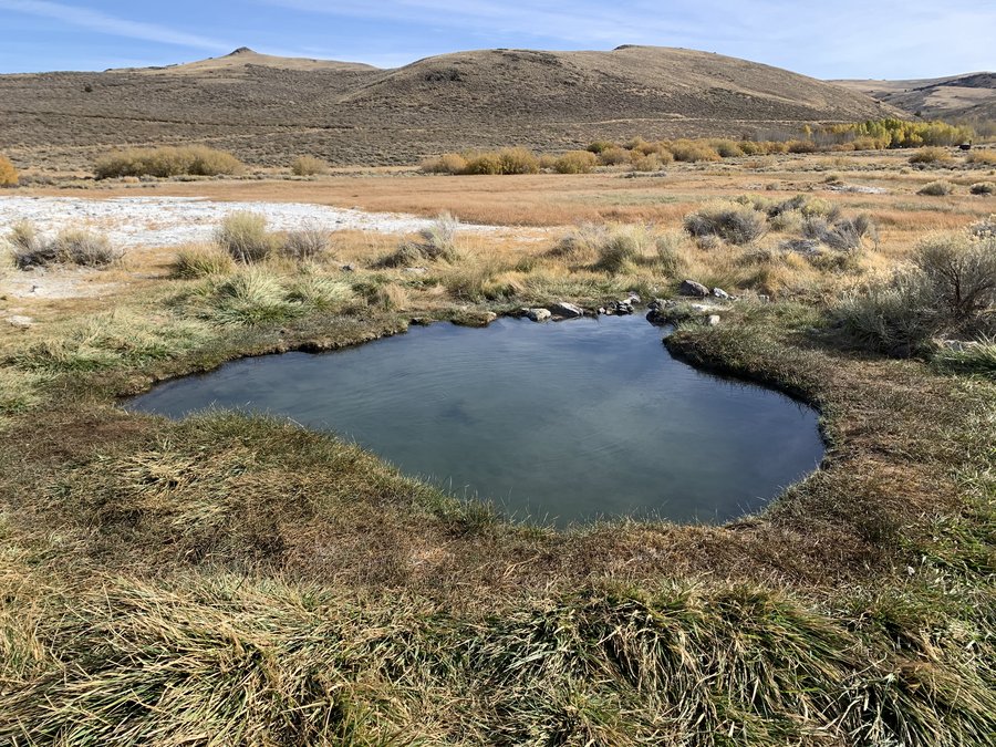
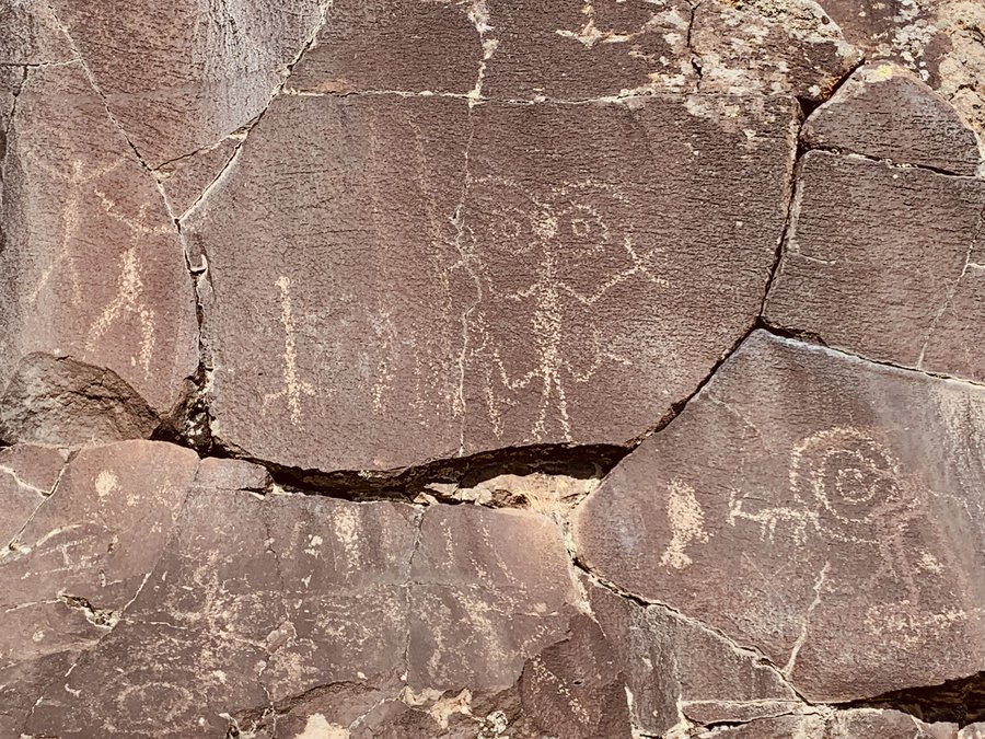
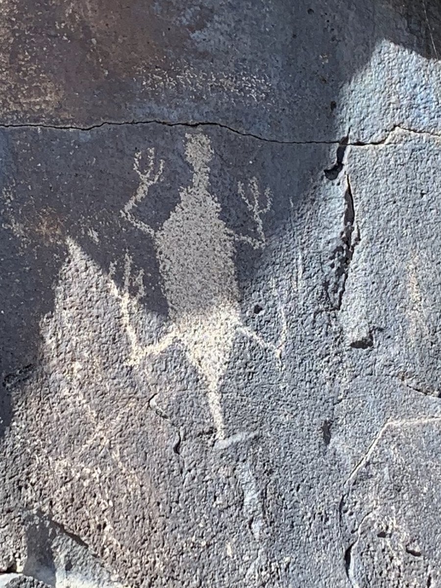
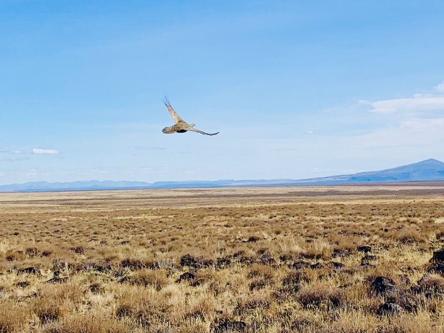
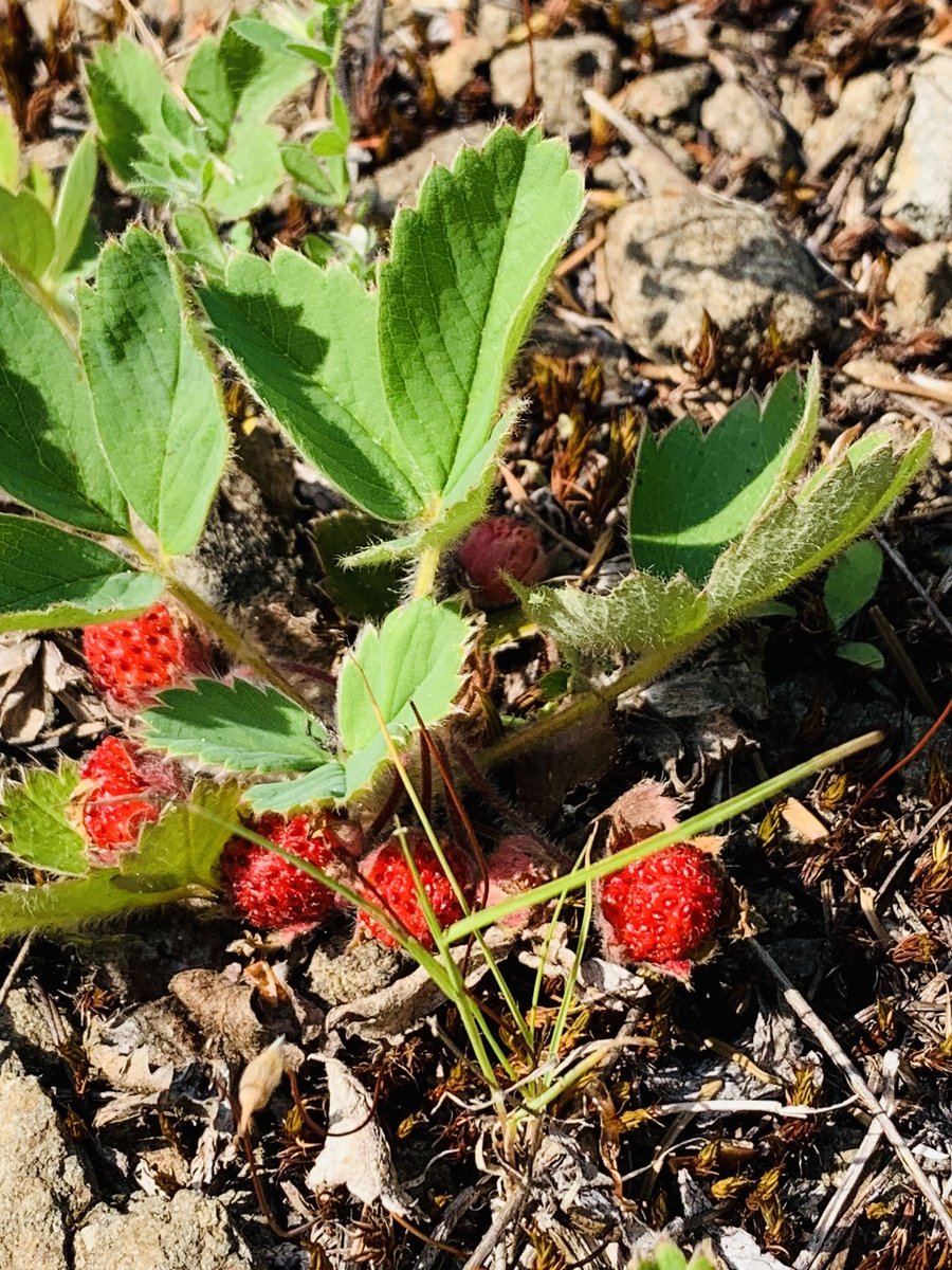
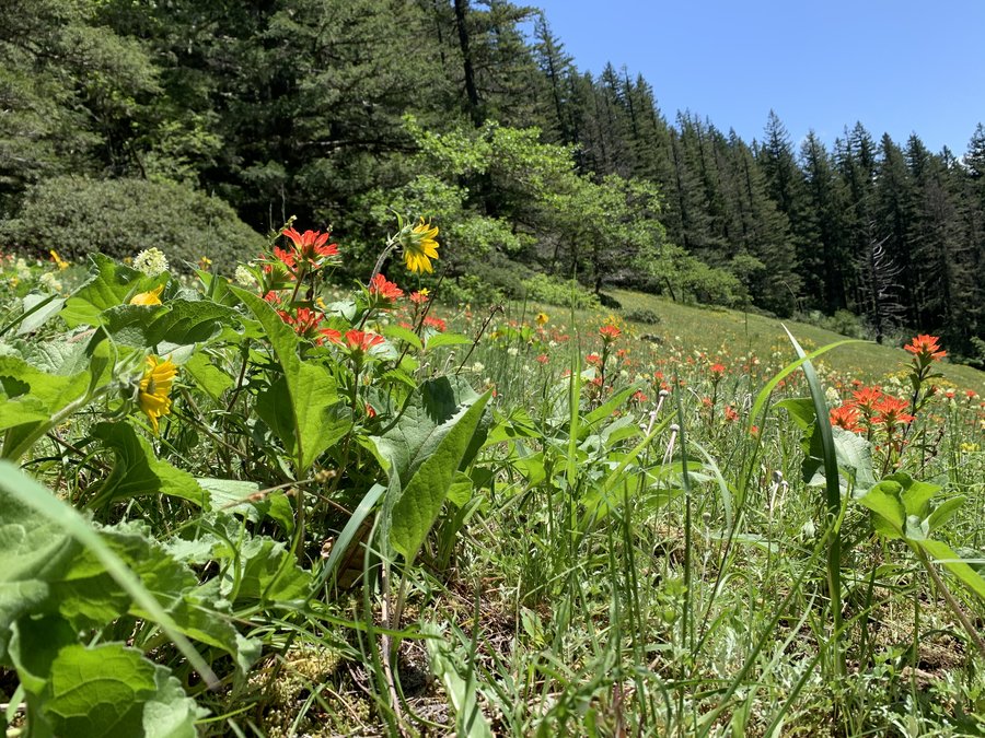
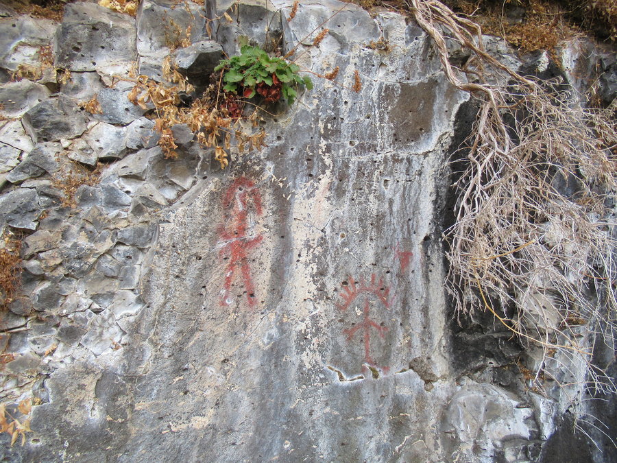
4) Petroglyph Lake, Hart Mtn -the bestest of my trip! 5 miles, 500 ft eg. I drove up to the Hart Mountain Plateau and parked. Wandered the rim of Poker Jim ridge and eventually made my way over to Petroglyph Lake(which was dry). I thought I would be lucky to find a few figures, but the autumn light was perfect for picking up the prolific display of glyphs in the rimrock lining the lake. I saw more than 40 figures. Some obvious, some faint, some otherworldly. Afterward, I drove over to the Hart Mountain Hot springs at the campground. No one was there, so I enjoyed the "bath house" and one of the meadow pools. I then sketched and napped with my feet dangling in the hot water surrounded by golden colors of the desert.
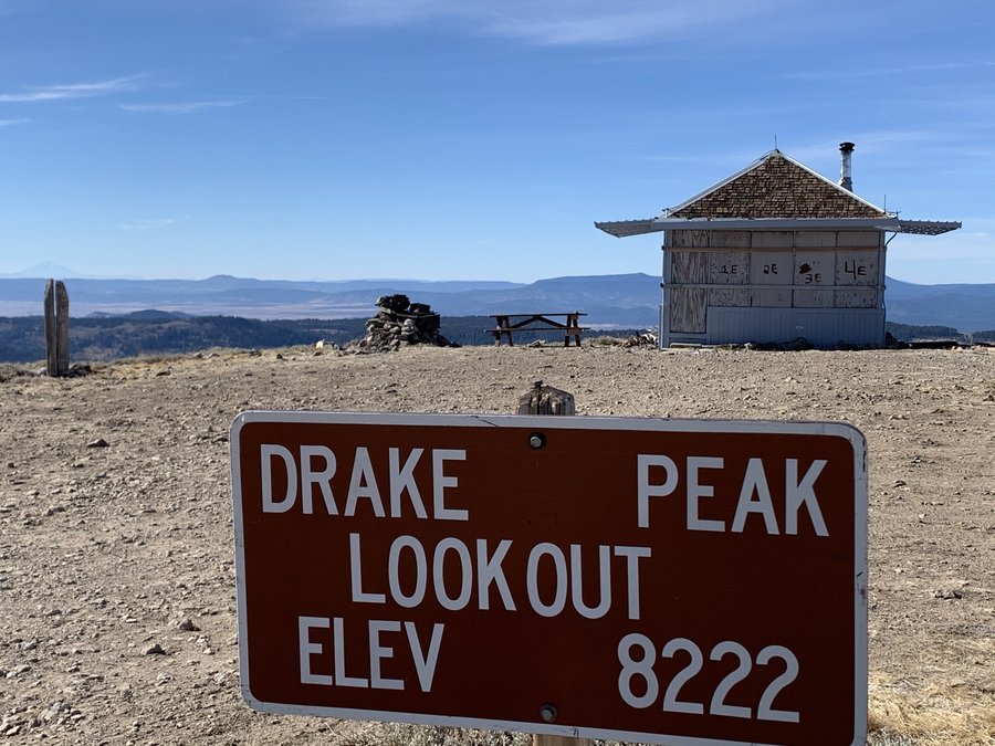
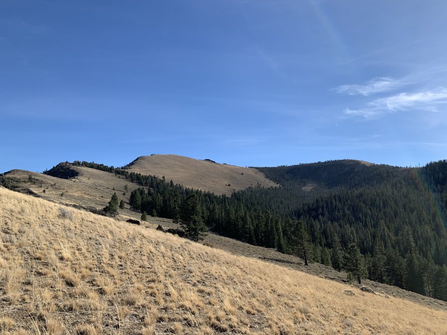
5) Drake and LIght Peak, 5 miles 1750 eg. The highest intact lookout tower in Oregon, Drake Peak LO (el 8200 ft) is available for rental, but is now closed up for the season. I started at the S Fork Crooked Creek TH, and wandered upward. After visiting the LO site, I had a spectacular rim walk over to LIght Peak and Fence Pass, and then picked up the Fremont Trail near Twelvemile Peak and headed down through golden quaking aspen stands. The area is stunning but very disturbed by roads and tree cutting and cow poo! Would be so much lovelier if they kept out the bovines and ORVs.
October 23, 2020


 3
3
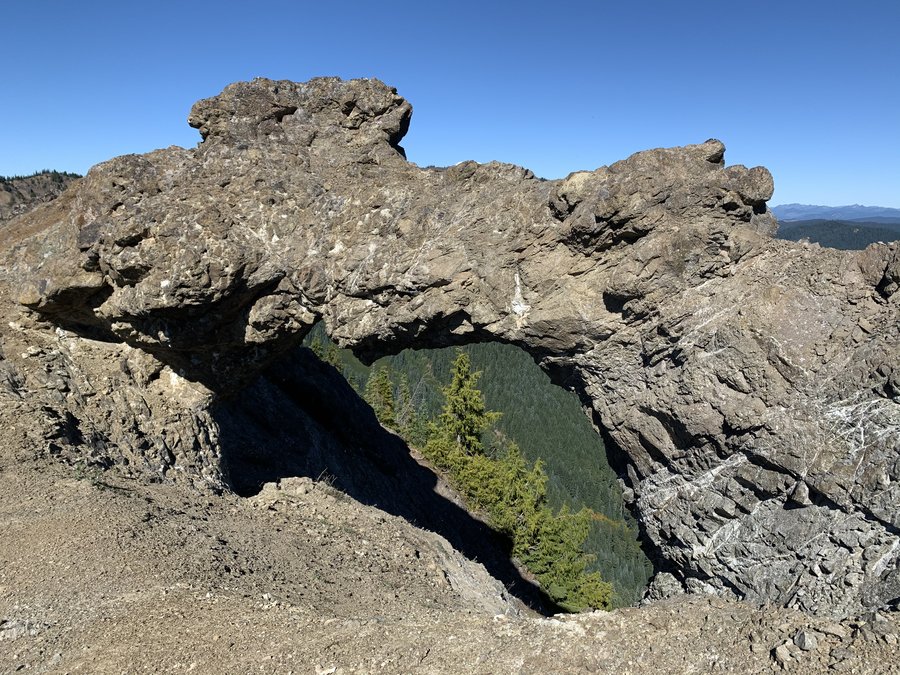
Adventures in the Gifford
31 miles of hiking • 4750' elevation gain • 2 nights
Starting at Jackpot Lake, I explored 2 different parts of the 17 mile Klickitat Trail #7, near Packwood.
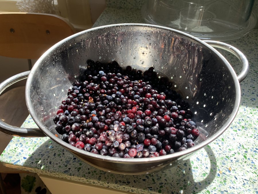
The first day I went NW and visited Cispus and Pompey Peaks-two old fire LO sites about 5 miles apart. Lovely subalpine meadowsbelow Twin Sisters and Castle Butte between the two, and huckleberries still ripe.
Day two, I went the other direction -southeasterly. It is more forested and more ups and downs as you pass below Horseshoe mountain and Cold Springs Buttte. Near Mission Mountain I scrambled up to the ridge and successfully located the Sanctuary Arch! Took a swim in St John Lake on the return trip. The only person I saw was a mountain biker an his two dogs who told me that a helicopter had crashed not far from Jackpot Lake and there were many rescue vehicles and FAA folk near the TH. I didnt see any of this though and know no further details.
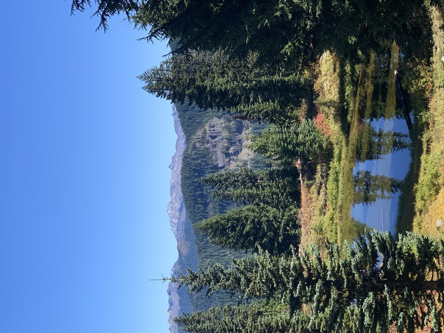
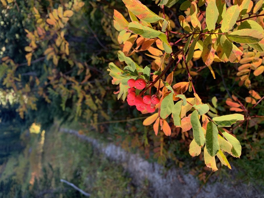
On the third day I drove out to Randle and took FS 23(now repaired!) all the way to Trout Lake. Stopped at the closed North Fork Campground and did the little loop trail 122 that starts behind the historic Guard Station. Then I drove down to Taklakh Lake and hiked that loop trail which circles the lake, goes by pretty meadows and skirts a giant lava flow. Grabbed the primo picnic table back at the lake and ate my lunch and sketched, reluctant to return to reality.
September 28 – September 30, 2020


 1
1
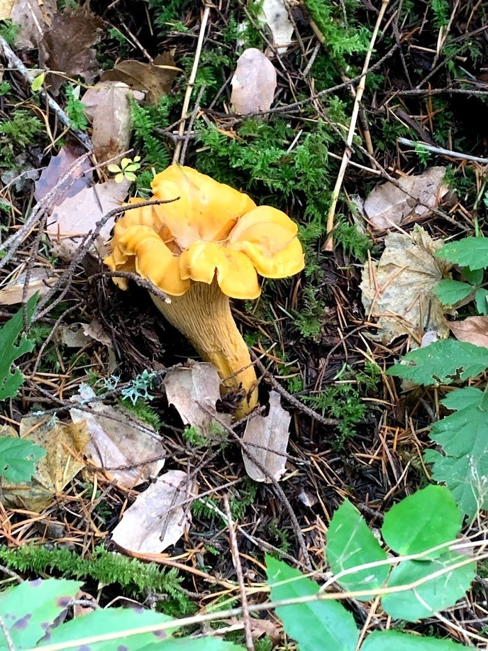
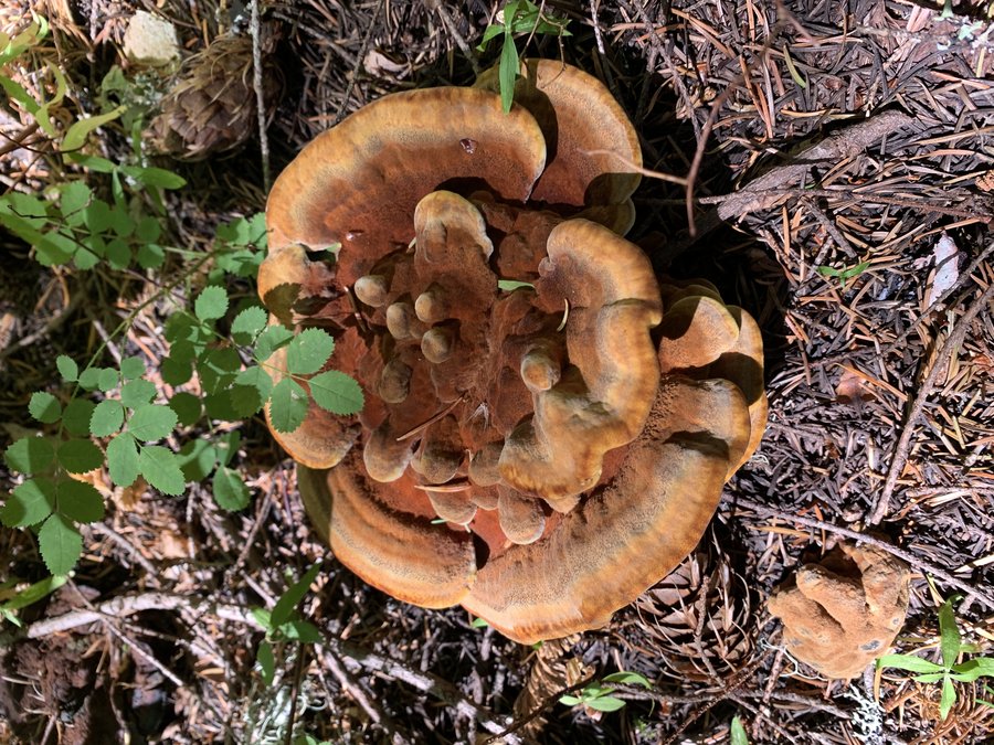
Palmer Mill
5.5 miles of hiking • 500' elevation gain •
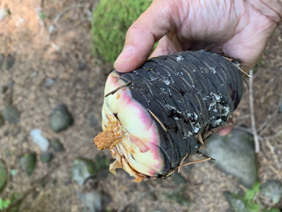
Just looking for some mushrooms. Found lots of lobsters + cauliflower and chicken of the woods. Only a few measly chanterelles which are usually the most abundant around here.
September 26, 2020
 1
1
Big Huckeberry
12 miles of hiking • 2500' elevation gain •
Via Grassy Knoll trail. Summit is a bit underwhelming, but route was pleasant and I was the only one out there. Good to be out on the trail again!
September 22, 2020
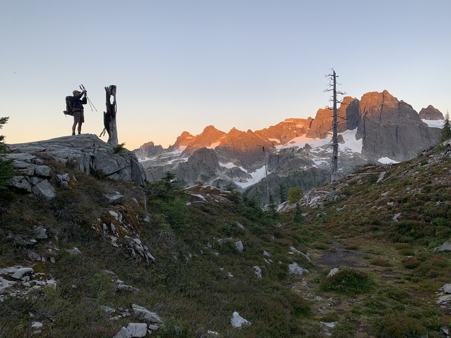
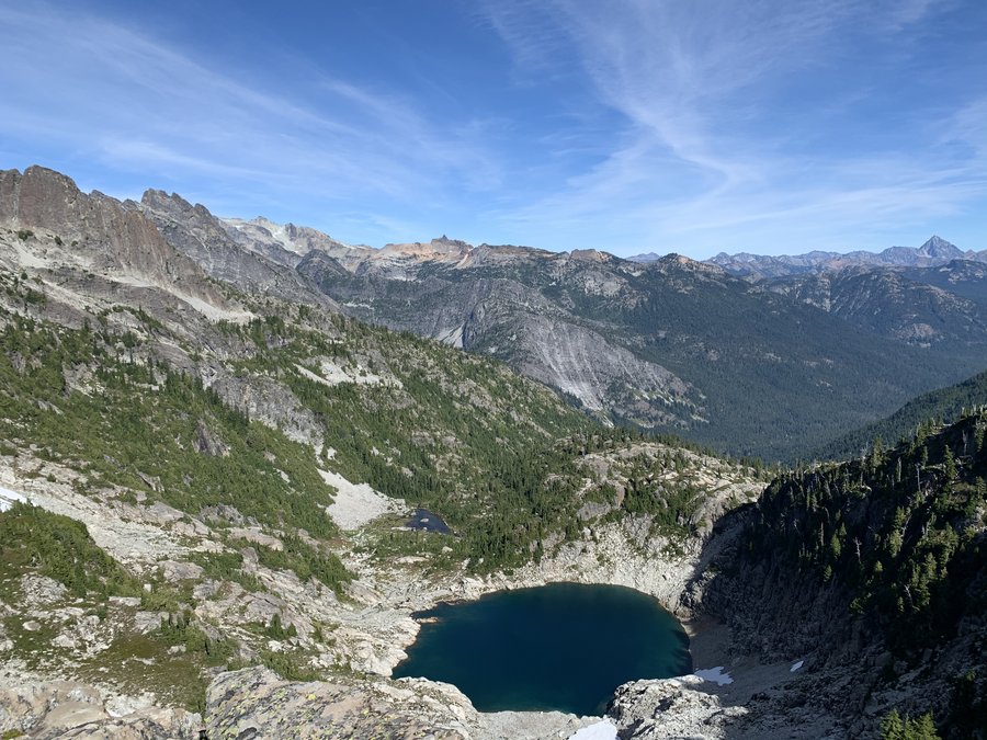
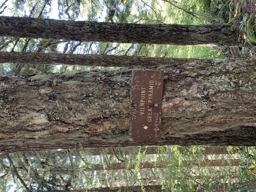
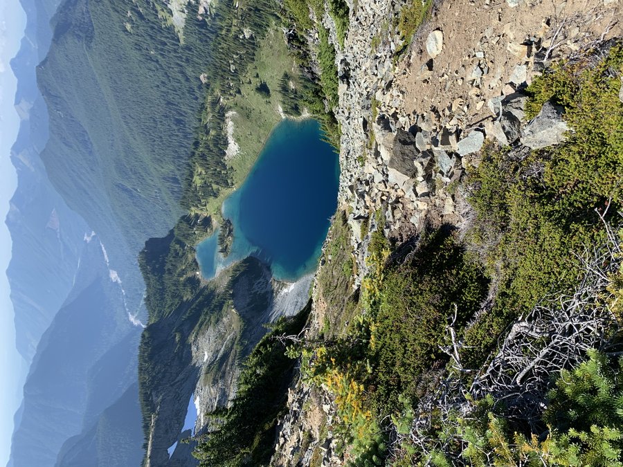
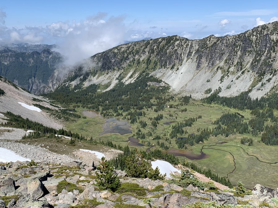
 3
3
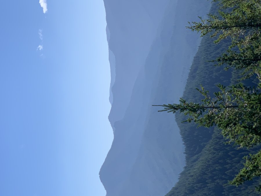
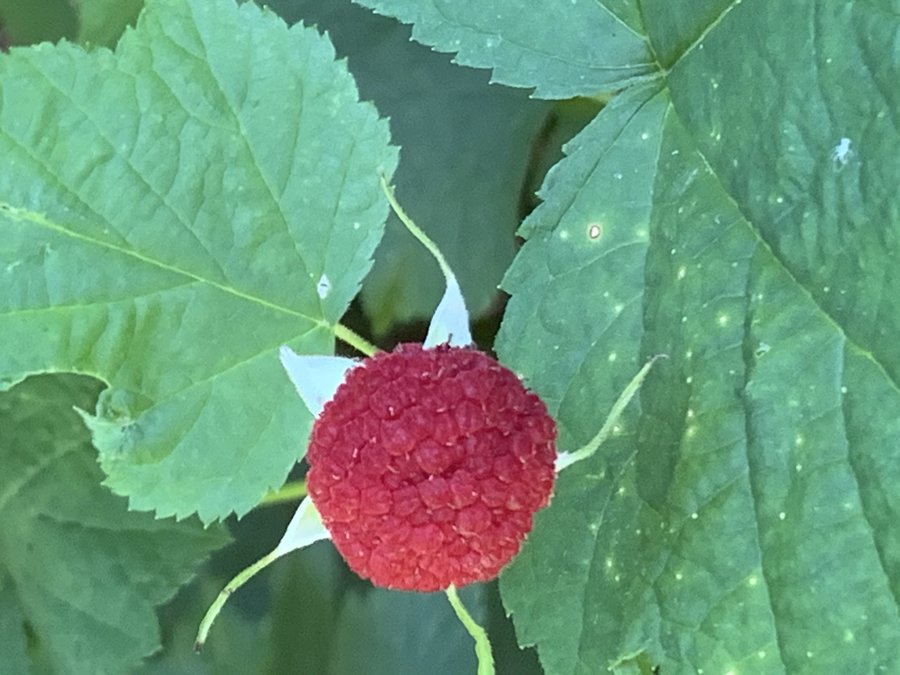
(Just shy of) Summit Chief Mountain, Alpine Lakes Wilderness
30.5 miles of hiking • 6000' elevation gain • 2 nights
We started noon on Saturday at Pete's Lake Trail. Was very busy, with many families and large groups heading to Pete's Lake, an easy 4 miles with very little eg. Most people stopped there. After another mile, you hit the PCT. We went north(go south to head to Spectacle lake), and climbed 2000ft over 5 miles and 23 switchbacks to reach the heavenly alpine terrain. Ripe huckleberries all along this route. Camped at some little tarns-unnamed on my map, but leader called them "Vista Lakes".
Started out early Sunday morning to climb Summit Chief Mountain, using the Beckey route. Lovely cross country travel over that granite rock. Pretty blue lakes, sea of mountains and views all around, but very little vegetation, and almost no goat sign.
Approaching the summit there was a nice big snow gulley to climb. Unfortunately, the final upper basin had melted out and we were stymied. The steep, loose rock and dirt slopes prevented us from attaining the summit ridge without protection. Some in our group were very uncomfortable with the sketchy scrambling, and after several different approaches we gave up 300 ft below the top.
Mon morning, team packed up early. I elected to stay, pick berries and planned to slowly make my way over to Spectacle Lake. However, the smoke came in the afternoon. The pleasant mountain ambience transformed to a malevolent apocolyptic scene, so I hiked out to my car and drove to hotel in Cle Ellum.
September 5 – September 7, 2020


 1
1
Ski Bowl to Wind Lake
5.5 miles of hiking • 1500' elevation gain •
Solitude until I returned back to lower bowl area. Moved slowly....Huckleberries!
September 1, 2020


 1
1
Hunchback mtn
9.5 miles of hiking • 3000' elevation gain •
Meh. Nice exercise, and plenty of solitude, but pretty boring. Now I can say.... been there, done that.
August 30, 2020

 2
2
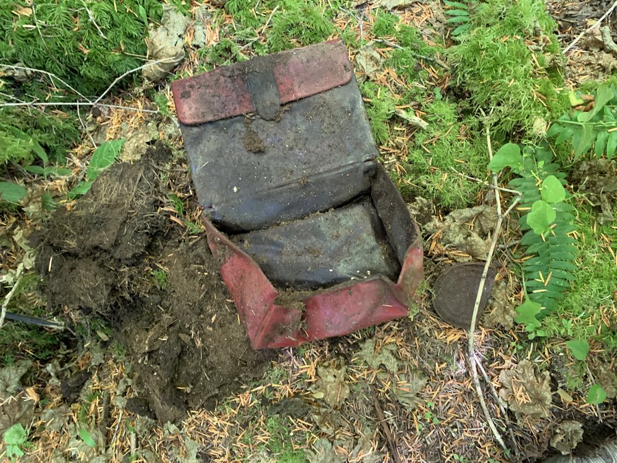
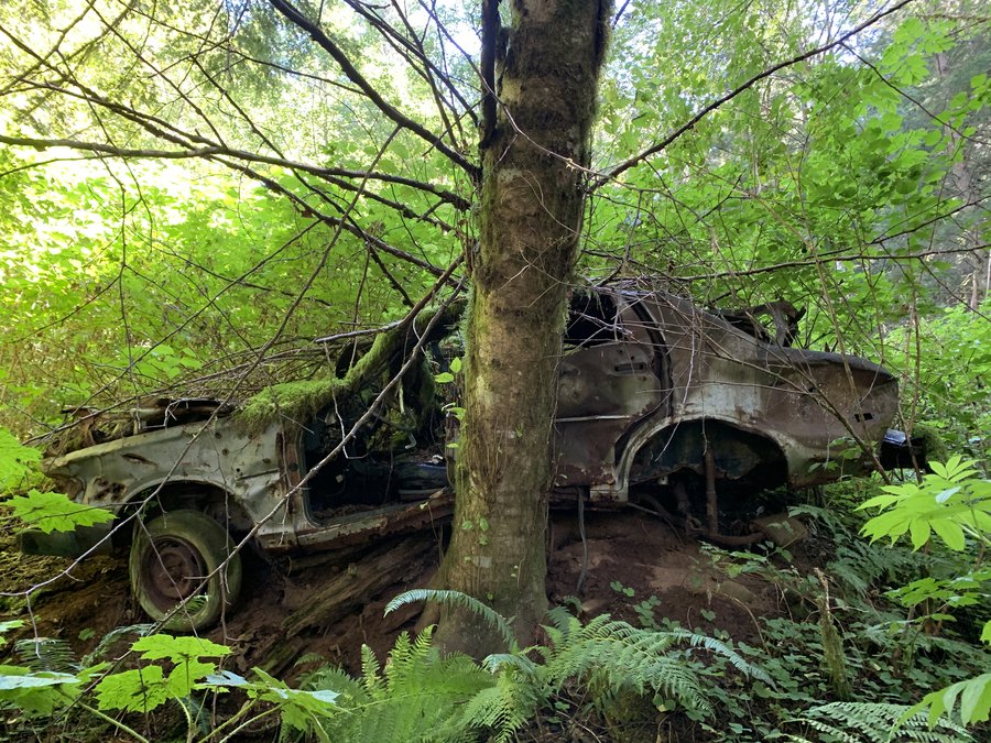
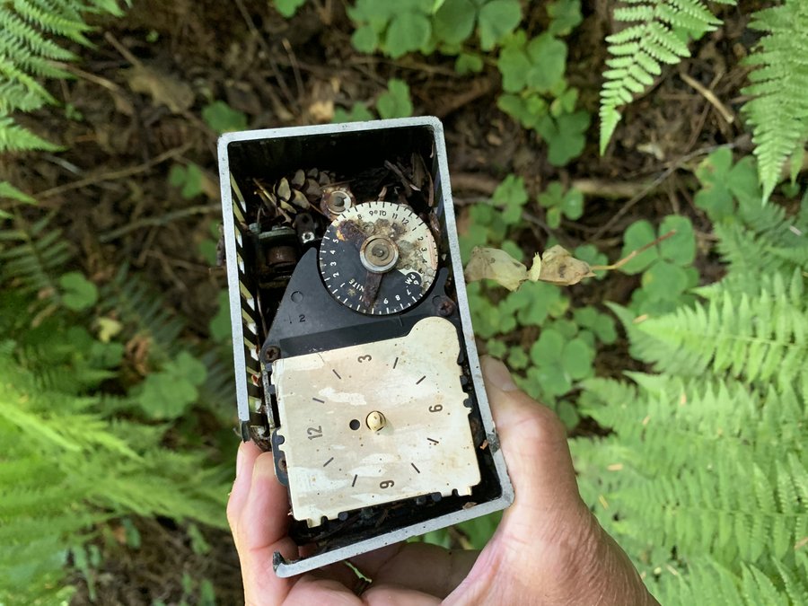
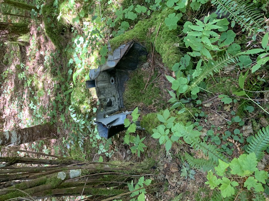
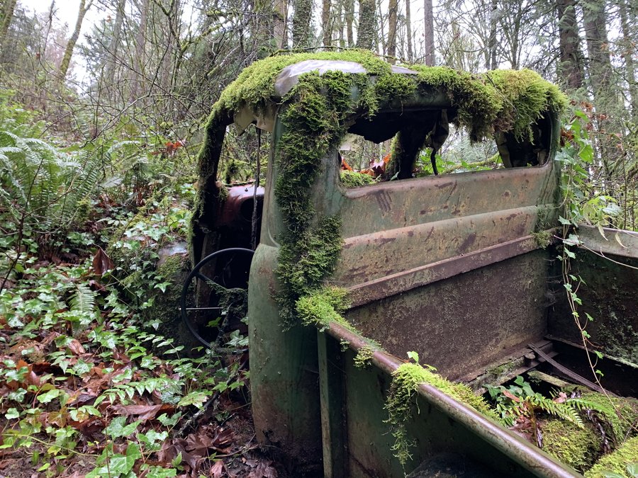
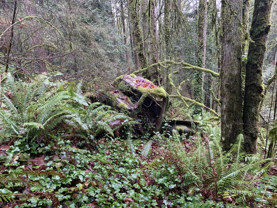
Coopey Creek
7 miles of hiking • 1500' elevation gain •
Found the “Coopey Creek Datsun”, plus several other cardavers.
August 25, 2020


 1
1
Above Timberline Lodge
5 miles of hiking • 2000' elevation gain •
Out for a little hike with a friend. Smoke crept over from a wildfire near Bonney Butte
August 22, 2020


 1
1
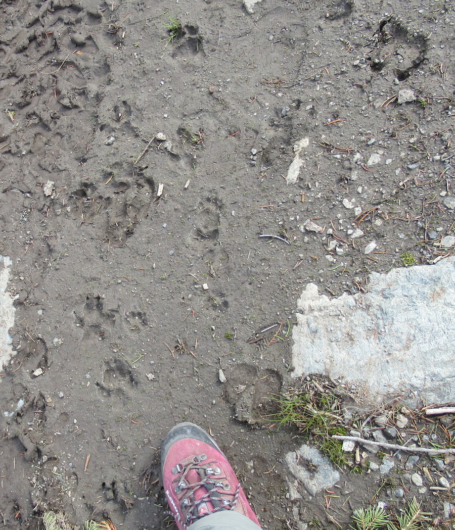
Tieton Ridge
20 miles of hiking • 4000' elevation gain • 1 night
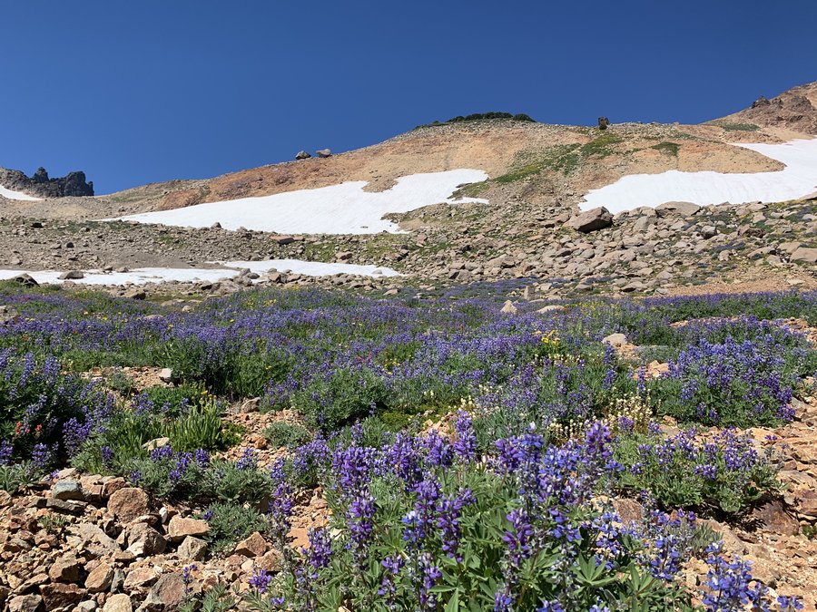
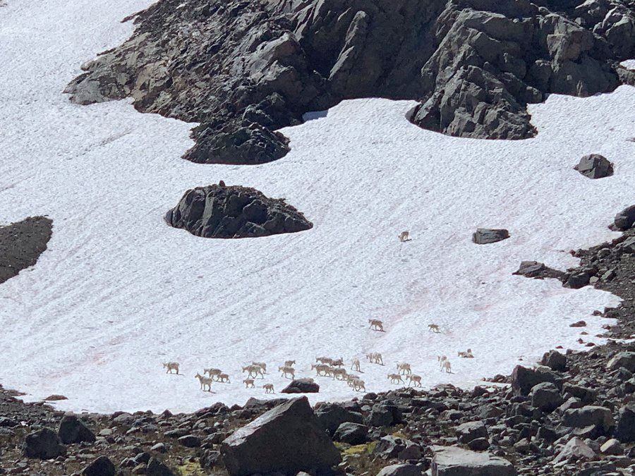
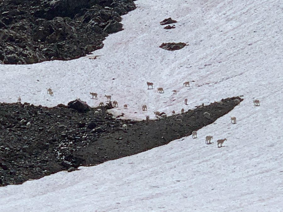
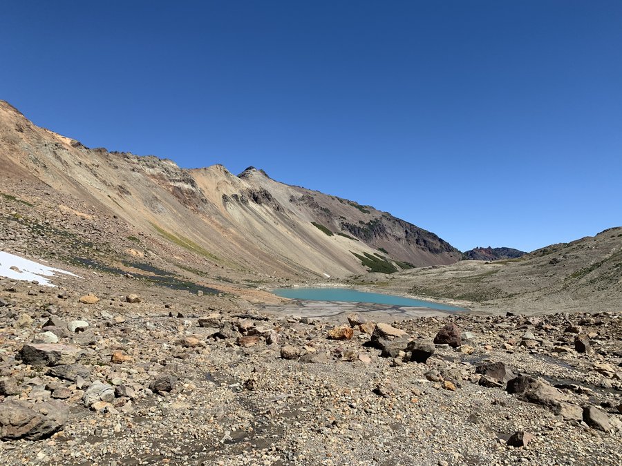
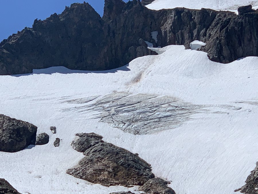
Eleven years ago, I did Mt Curtis Gilbert as a dayhike from Conrad Meadows,with a bike assist.I remember looking down at the Conrad Basin and wanting to return. Finally got back and finished my vacation with a dreamy stroll through spectacular alpine terrain.
Started at Conrad Meadows where there were many horsecampers and hikers parked, and biked up the 1000 road to where it intersects the S Fork Tieton Trail. Stashed bike in the woods at the wilderness border. I went just a short distance, and picked up the abandoned 1131 trail which heads up along the northern side of Conrad Creek. The trail has seen some maintenance-especially in the first few miles,and it traverses some huge meadows, but is mostly through forest. There is plenty of blowdown, but you can see the tread, the old cut logs and blazes for most of the route. I lost the trail several times but found it again, it led all the way up to the alpine area just below the Devil's Horns.
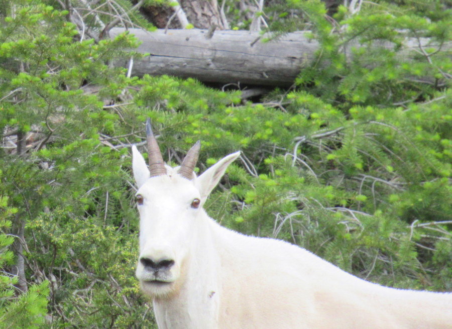
I went over the Tieton Ridge at a pass just west of Devil's Horn, and took a well worn trail( maintained by goats) over to the Devil's Wasbasin where I had a refreshing swim-water was just perfect! I then returned back below the saddle and headed westerly to a nice platueau below Tieton and made camp. Enjoyed amazingly long sunset.
Next day, I crossed back over another saddle and traversed below Tieton all the way up to the Conrad Glacier and Lake-spectacular!!! It was here I saw the first humans, and high up on the glacier, a band of 38 goats trying to keep cool. Long ambulation out and over towards Warm Lake, which I skipped when I saw multiple tents dotting the landscape as I approached.
August 14 – August 15, 2020


 1
1
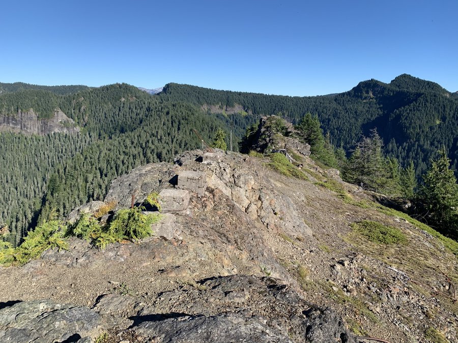
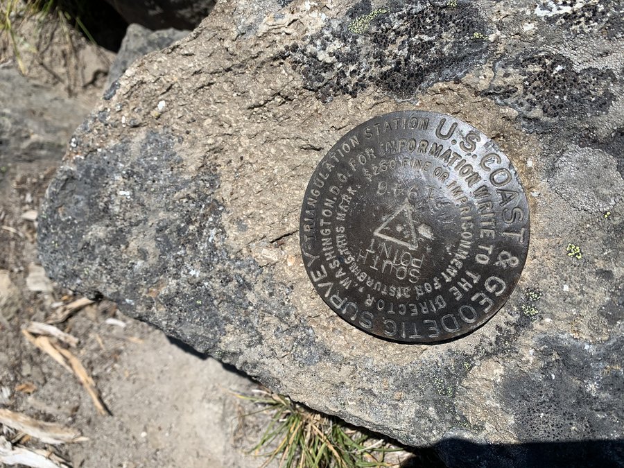
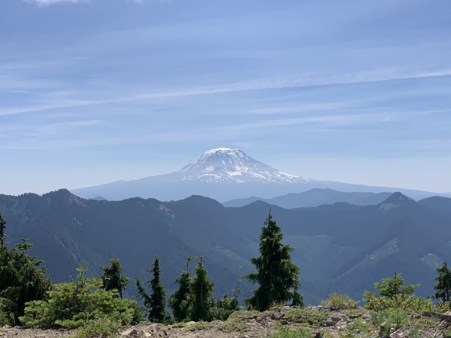
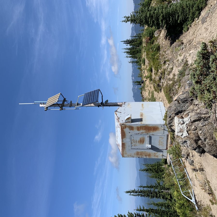
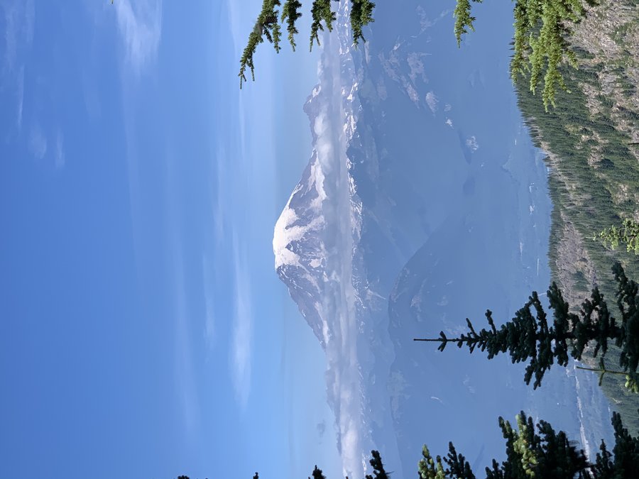
South Point Mountain and Kloochman Rock
9 miles of hiking • 3500' elevation gain • 1 night
I stayed in Packwood for a night between my trips. Looking up from town, I noticed a distinctive summit. I thought it was South Point Mountain, but I was wrong, it was the adjacent Smith Point on Smith Ridge. I liked the pictures from FGS's reports, so I decided to try the South Pt mountain hike. Great summit 360 degree view, and with relics from the old LO tower. Makes me want to come back and hike Angry Mountain, and try the Klickitat Trail to visit Cispus/ Sisters/Castle and Pompey. Saw one other hiker.
I drove over towards Goat Rocks and stopped at Kloochman Butte. Been wanting to try this for years! Found the climbers trail and went up as far as I was comfortable. It is supposed to be a doable scramble, but i was alone and didnt have it on my agenda, so I stopped at final gulley. Camped nearby. A few ATVers around.
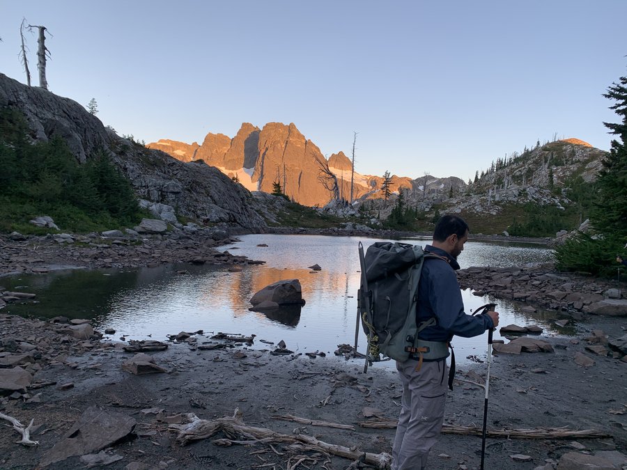
August 13 – August 14, 2020


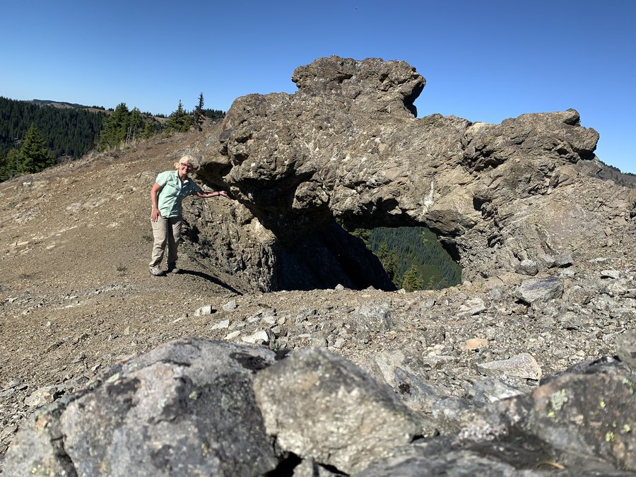
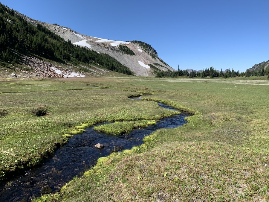
 3
3
Elysian Sisters
21.5 miles of hiking • 6500' elevation gain • 3 nights
Parking a zoo at Carbon River Entrance, but most of them humans did not stray far from their vehicles. We biked up the closed road to Ipsut Campground (reservations required), and spent the night in a beautiful old growth forest along the Carbon River.
Next day we hiked up to Windy Gap via Wonderland to the Northern Loop trail. We then entered the magnificent alpine backcountry and didn’t see any people until we tumbled back onto the Wonderland two days later. Climbed up thru Crescent Gap (this was the crux with a bit of sketchy stuff), and camped on the summit of Crescent Mountain. Heaven!!!!!
Next day we dropped down into the Elysian Field, wandered around, then climbed Old Desolate-an easy scramble. We then dreamily wandered over to our last nights camp on a high plateau in Moraine Park, carefully picking out the perfect tent spot. Goat watching and meteors.
Nutty downclimb the next day back to the human parade of the Wland, and a fast walk out losing all the eg we earned. Sad to leave the alpine. Super fun zoomy bike ride downhill back to TH.
August 9 – August 12, 2020


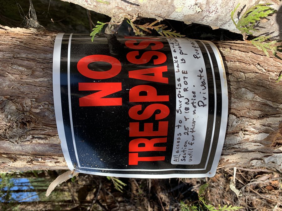
 1
1
Cayada
5 miles of hiking • 1000' elevation gain • 1 night
First trip of my vacation. I was meeting friends next day for our backpack adventure and I wanted to test out my new tent and the bikepack set up. There were city hikers, burly trucks and ATVs all over this area, so I immediately cancelled my plan to go to Summit Lake. Stopped at a gate where no-one was parked, and hiked a few miles out and back on this old grassy forest road. Just a few peek aboo views of Carbon River and backside of Tirzah. Found a perfect camp spot in a meadow and went back to car, retrieved bike and gear. There is a new clearcut at start of road, but only first half mile. Wandered up an even older road up Cayada Mtn, but did not summit. Got a good view of Old Baldy and decided to head over that way in the morning.
Took the Kennedy Creek road up towards Surprise Lake, but access to our public land has been blocked. Just before the last crossing of Kennedy Creek, I found an old road that was likely the LO access road. I took it up a ways until it entered a heavy brush area-tread still visible, but I turned around realizing it would take a few hours to get up the remaining climb to the summit. Saw bench of road higher up-want to return!!! All these peaks on the Carbon Ridge look so inviting.
August 8 – August 9, 2020

 1
1
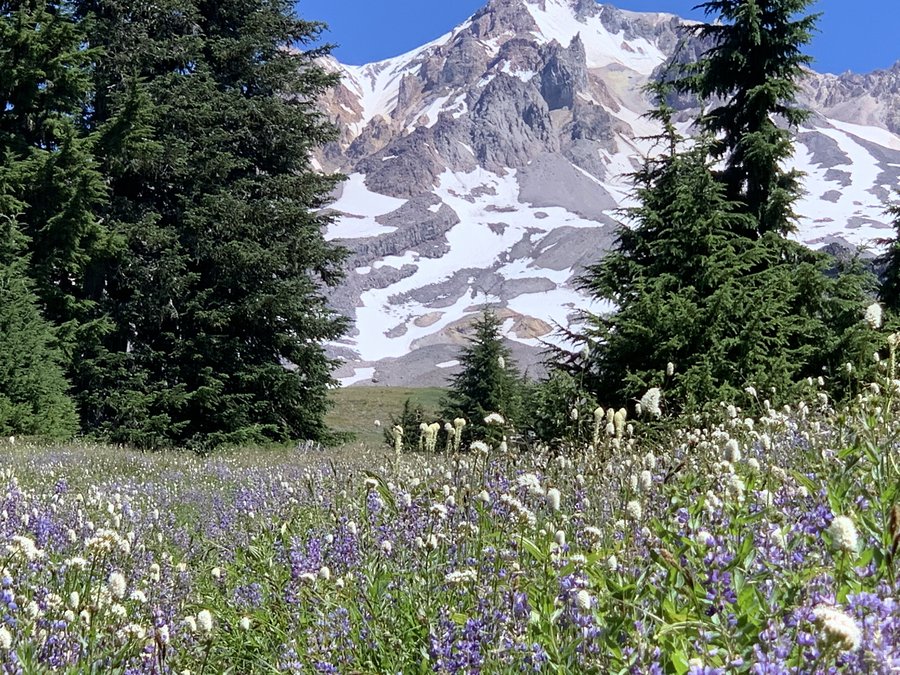
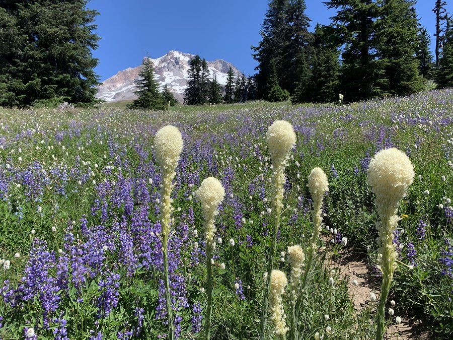
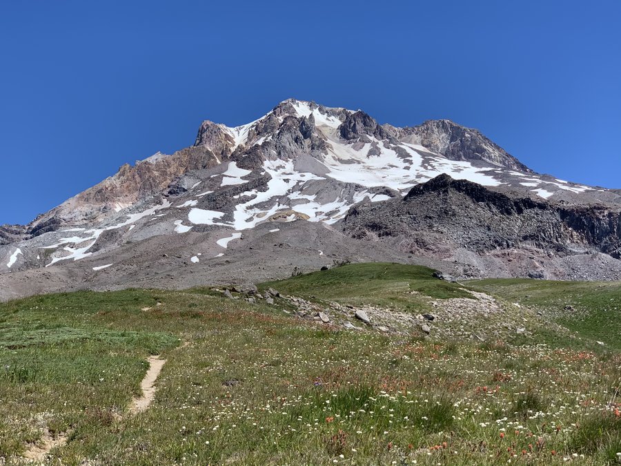
Paradise
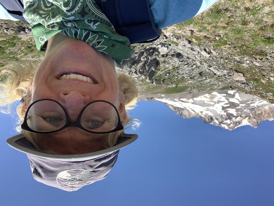
15.5 miles of hiking • 3500' elevation gain •
Took the Paradise Park Trail #778 from Kiwanis Camp Rd. Although the trip is longer and in the forest, the trail has a very gentle grade and the miles go by fast. Lots of saprophytes along this trail. All the blowdown has been cleared. Only saw 2 people on the 6 1/2 mile out and back portion of this trip.
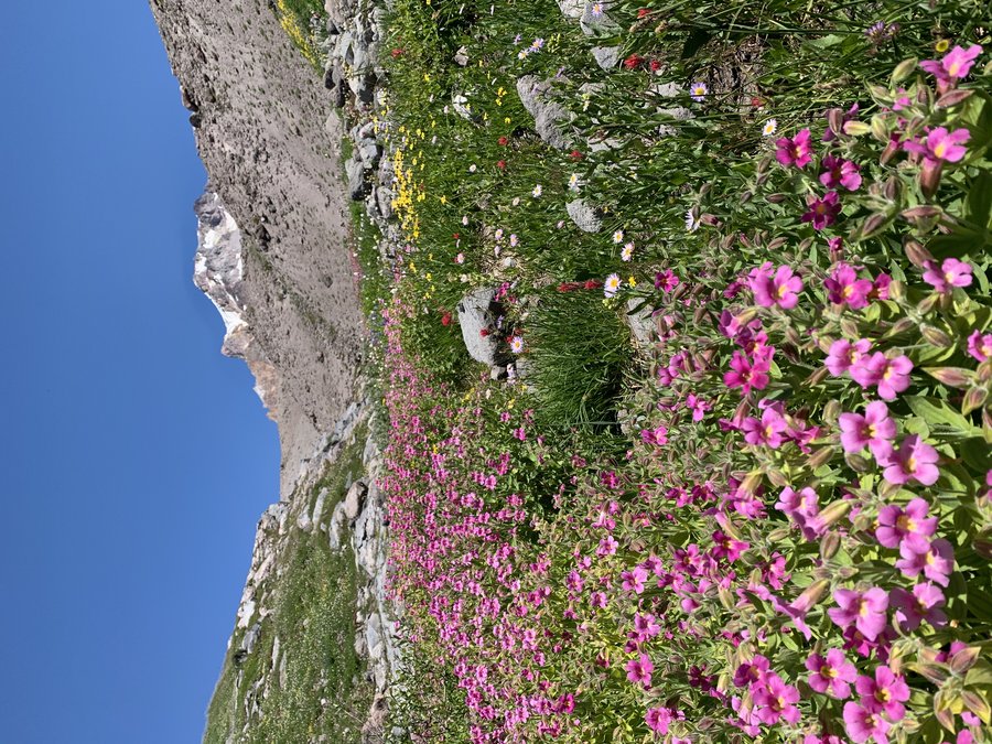
At Paradise Park, there were surprisingly few people. The flower fields fantastic and fragrant, bugs minimal. I climbed up alongside the Zigzag Canyon, stopping to look down at the waterfalls as I had lunch. Then I traversed over to Split Rock-fun navigating the drainages.
Gorgeous day.
August 4, 2020


 1
1
Huffman and Siouxon Peaks
9.5 miles of hiking • 2250' elevation gain •
Started at the airy Huffman Peak trailhead, off 6403. Big views from the get-go. Pleasant rambling, nice forest and shady sections. Berries starting to ripen. No humans. Great day in the Gifford!
July 28, 2020


Larch Mountain
9.5 miles of hiking • 2250' elevation gain •
Biked up from the gate at MP 10, did the loop, plus a secret side trip. Saw zero people and as I was zooming downhill,I blasted my tunes, fun ride out!
July 21, 2020


 3
3
Lost Lake drain hole and volcanic crater
3 miles of hiking • 500' elevation gain •
There are so many Lost Lakes. This is the one just off highway 20 just west of Santiam Pass. It has a fascinating natural phenomenon. The lake actually drains INTO two lava tubes on the north side. I've been here three different times, with varying water levels. The first time was in 2015(first pic). Today you could see the lava tubes, but they didn't have the waterfall effect. After visiting the lake, I climbed up to the adjacent little volcano that abuts the highway. When I dropped into the forested crater, all sounds of the traffic disappeared and I felt like I had entered the "Land of the Lost". Was also attacked by huge swarms of wee beasties. Had to don the bug baffler which I carry with me June July and August for just such occasions.
July 18, 2020


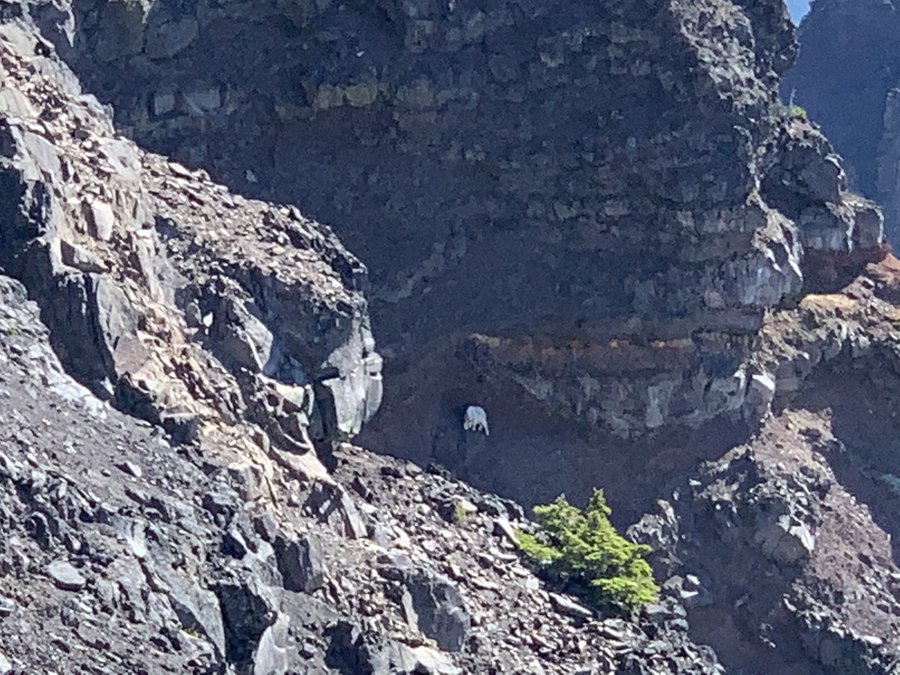
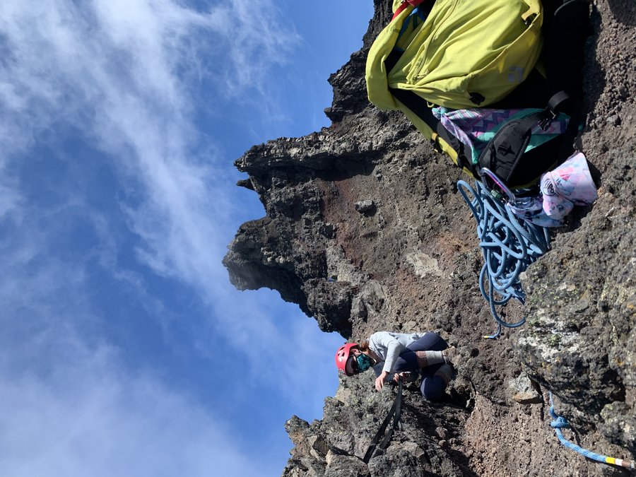
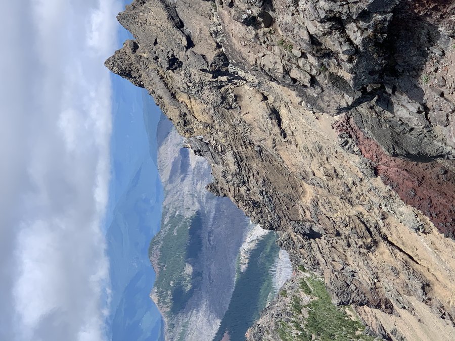
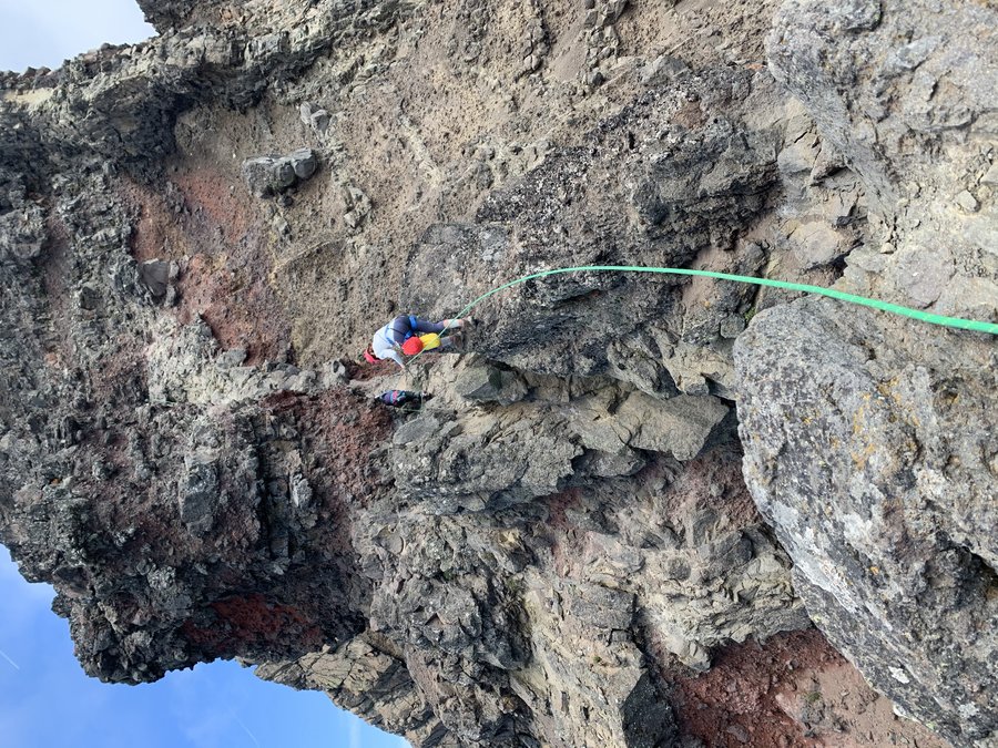
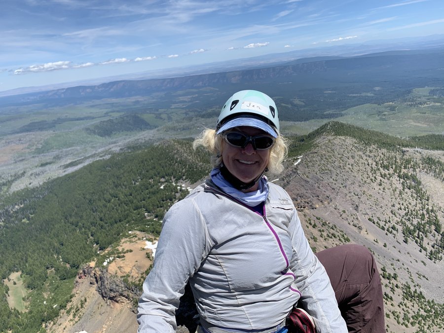
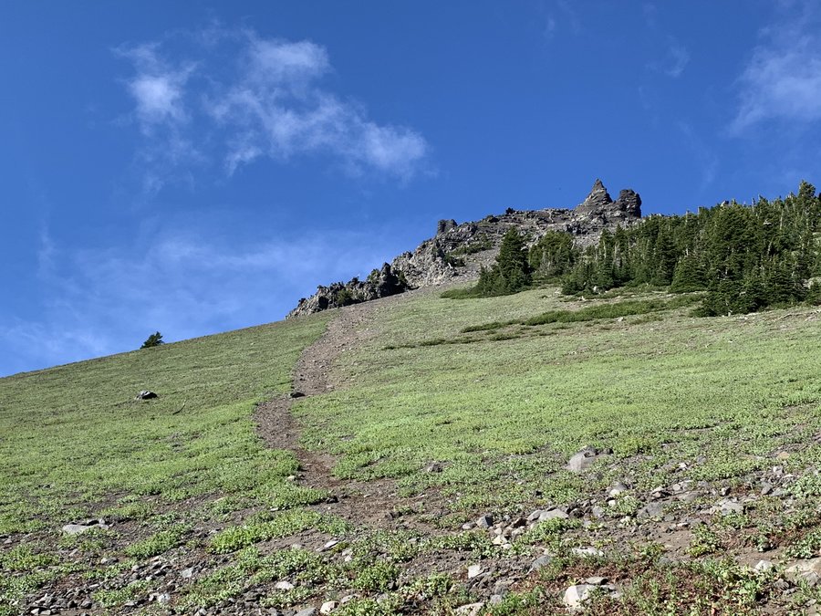
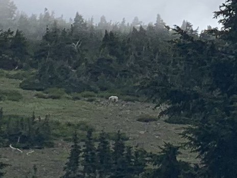
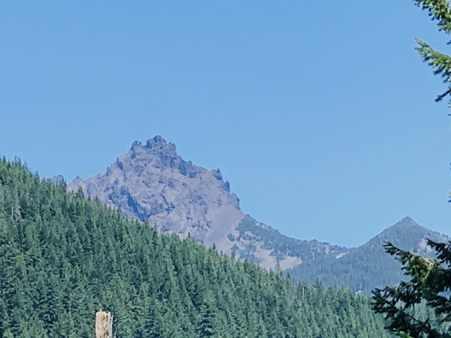 3
3
Three Fingered Jack
13.5 miles of hiking • 3000' elevation gain •
Easy five mile approach from Santiam Pass on the PCT. Then it is all up. Saw a few goats. Perfect weather with a kind breeze to beat off the heat. Moved efficiently with a party of four, but it somehow still took us 14 hrs. The climbing section was great, with three protected traverses(including "the crawl") and then a vertical climb to the summit block. Very little space on the airy summit. Fun rappel down. The sketchy approach to the summit ridge was intense requiring laser focus. I knew a young person who died coming down from the summit here in 2005, but I mostly kept it out of my mind while I was on that section.
July 17, 2020


 2
2
Newton Creek Loop
7 miles of hiking • 1750' elevation gain •
It was our anniversary and the spouse took the day off to go hiking with me! Quite a few cars at the Elk Meadows TH for a Monday, so we went a bit further and started off in the nordic ski lot and then turned uphill on the Newton Creek Trail where it was very quiet. Beautiful day on the mountain. We especially enjoyed the Heather Canyon area on Clark Creek.
July 13, 2020

 2
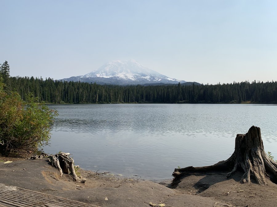
2
June Lake/Ape Canyon bike shuttle
11.5 miles of hiking • 2750' elevation gain •
Started off with 5 mile bike ride from June Lake to Ape Canyon TH. Threw bike in bushes and hiked up Ape Canyon to Loowit, and headed CW back to the June. The dang mountain was covered by clouds all day.
July 9, 2020


 1
1
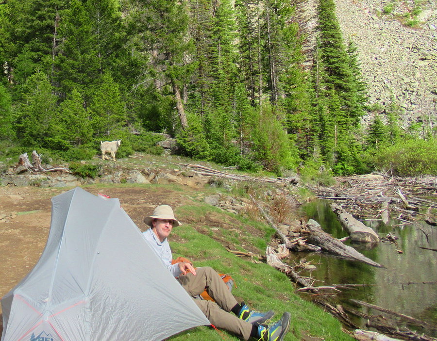
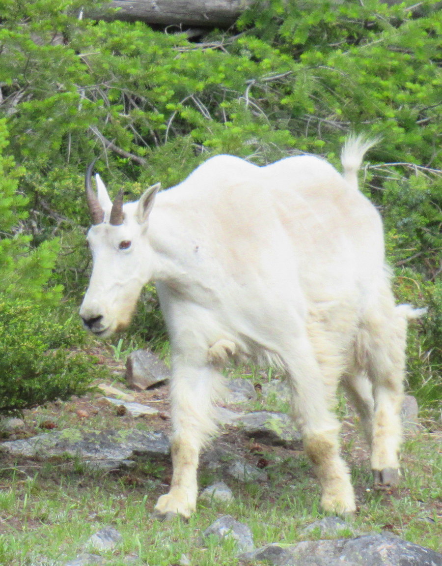
Elkhorns
39.5 miles of hiking • 9750' elevation gain • 4 nights
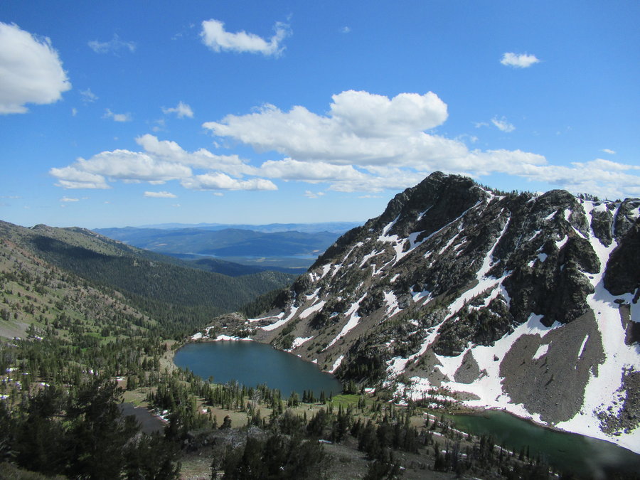
Fun tour of the Elkhorns, traveling most of the crest trail, with some side trips up the local peaks. We started from Pine Creek road for an easy car shuttle from Anthony Lakes.
Walked the four miles from end of pavement up the road to Pine Creek Reservoir where we spent the night. We had the place to ourselves( + the resident goats).
There is no trail from the Pine Creek Basin to the crest trail, but the cross country travel was delightful. After gaining the crest we dropped our packs and climbed up to Rock Creek Butte( no trail but easy walk up). We then backtracked south on the crest trail to the gorgeous Twin Lakes to camp on night two.
There were a few other human groups at Twin Lakes, and hundreds of goats who have become habituated to people visiting in the summer. It was enjoyable to watch them graze the hillsides, but not so fun shooing them away from camp.
Our third day involved a 13 mile hike along the crest trail and we turned off to camp at Summit Lake a mile to the east. Wow, that place is just gorgeous! Much bigger than we expected, and set in a dramatic bowl surrounded by granite peaks. It truly rivals Colchuck in beauty. There were several other parties at the lake, but we found an excellent lakeside campsite.
Day four was the funnest because we were in the granite territory and we scrambled up Mt Ruth (easy fun) and Mt Angell (dicey!). Spent last night camped along the Crawfish Basin trail.
Notes: 1) The northern half of the crest trail still has a lot of snow covering the tread. It was soft enough to travel on top of, but I wouldn't recommend trail runners. 2) Mosquitoes not too bad, appeared in the evening around the lakes, but we all had some tick visitors on this trip.
July 1 – July 5, 2020


 2
2
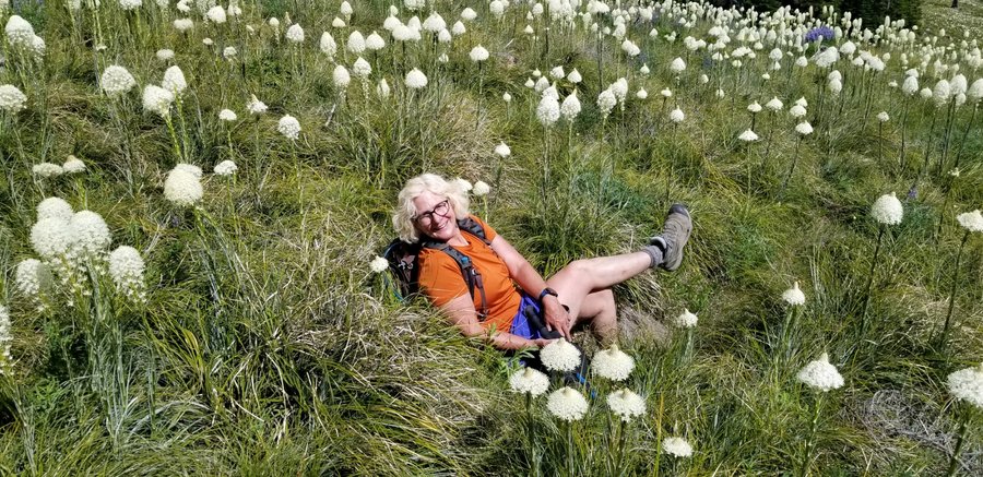
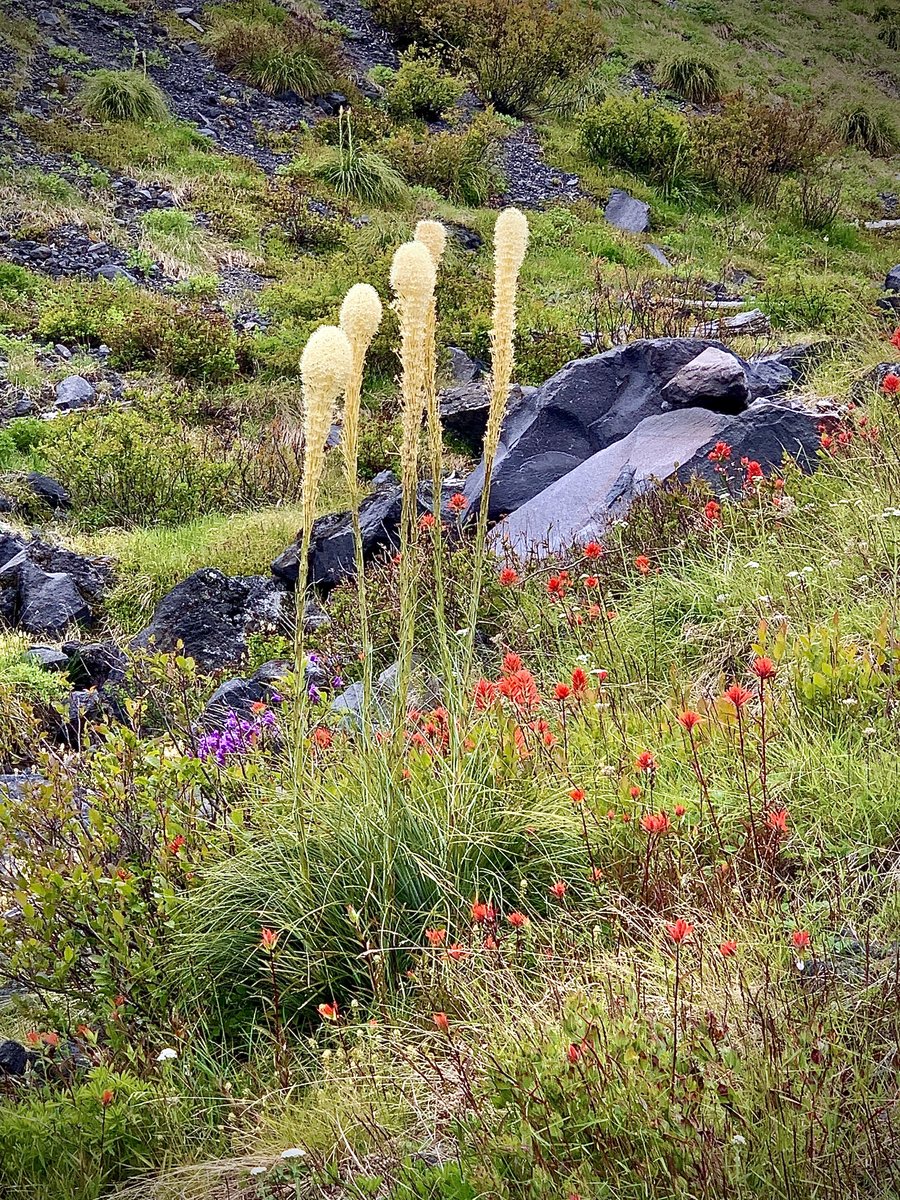
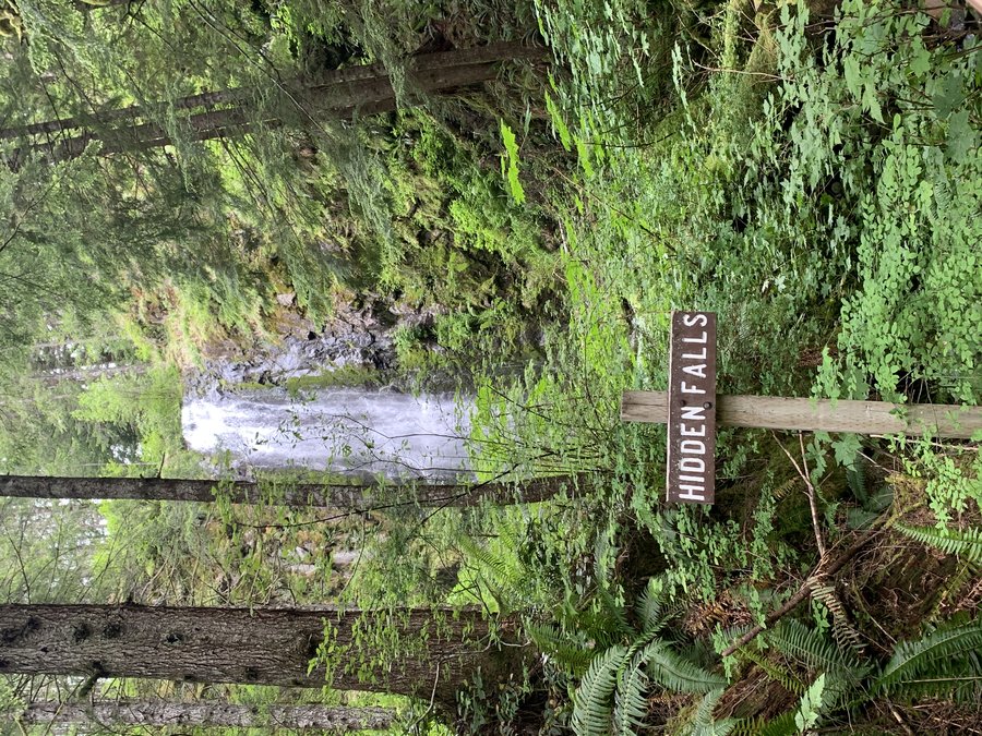
Silver Star and Hidden Falls
13 miles of hiking • 3000' elevation gain •
Did the loop and added on out and back to Hidden Falls from the Sturgeon Rock/Tarbell junction.
Not happy about more clearcuts on the Tarbell Trail.
Flowers going strong up there, with some nice beargrass fields too. No goats today.
June 24, 2020


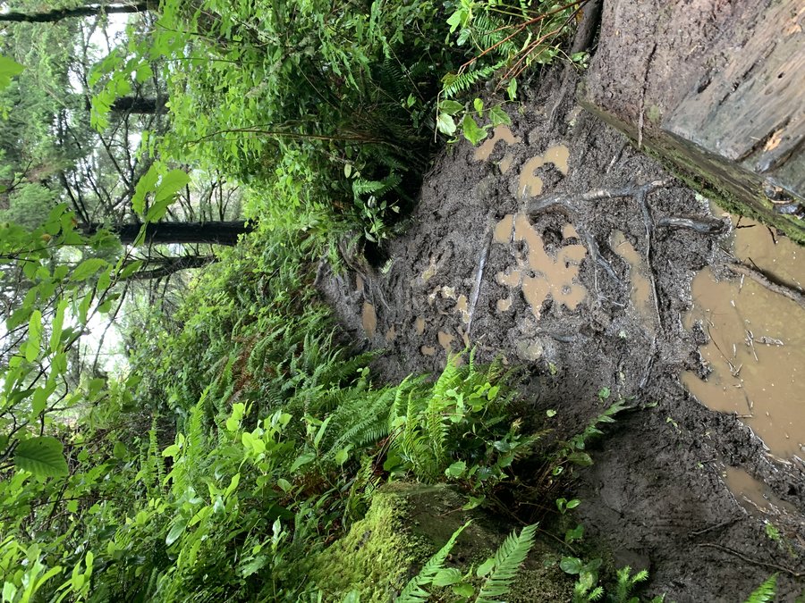
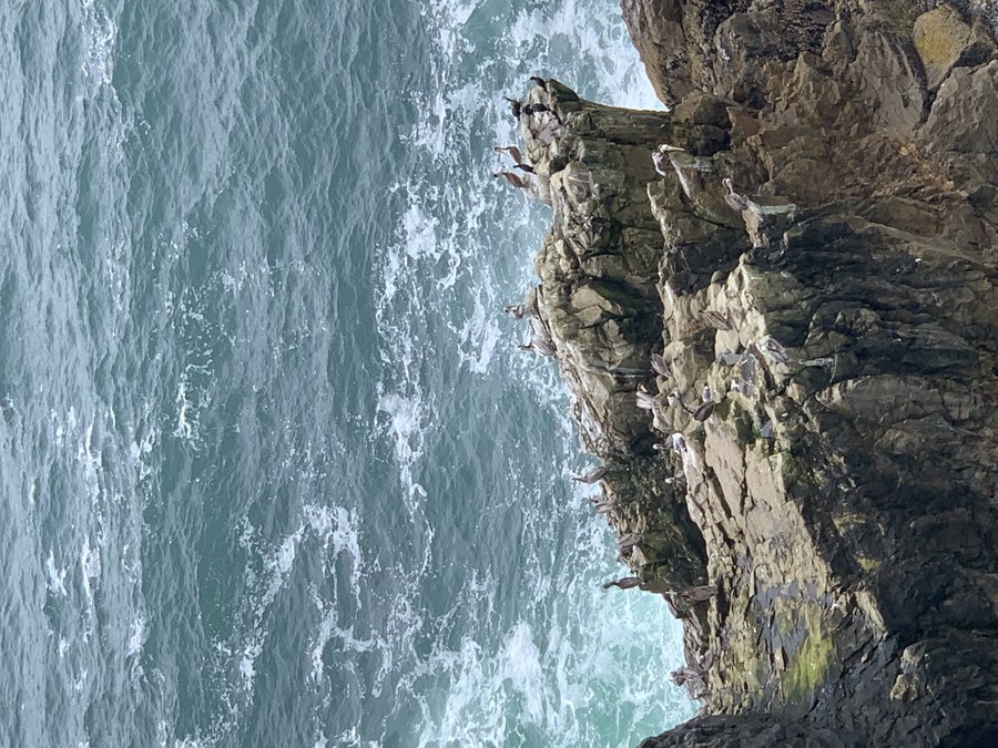
Cape Falcon
4.5 miles of hiking • 500' elevation gain •
Staying at the beach with family. Up early for a quick jaunt. Previous day very rainy, trail was terrible- roots mud and long stretches of standing water. Required lots of attention to footwork. Loved the big trees and when I reached the tip of the point, enjoyed watching numerous seabirds below including at least 20 pelicans.
Low tide. On the return trip I took a scramble trail adjacent to the waterfall down to Short Sand beach. Almost calamity slipping on the rocks of the last cliff band. Saved by clinging to spruce branch until I got my footing.
June 21, 2020


 2
2
Too Spur-Ramona Loop
11.5 miles of hiking • 2750' elevation gain •
Great day but Hood never came out of the clouds. Feet got a little wet crossing the Muddy Fork.
June 17, 2020


 1
1
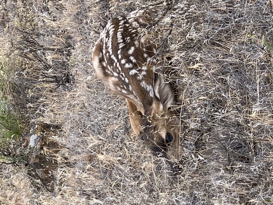
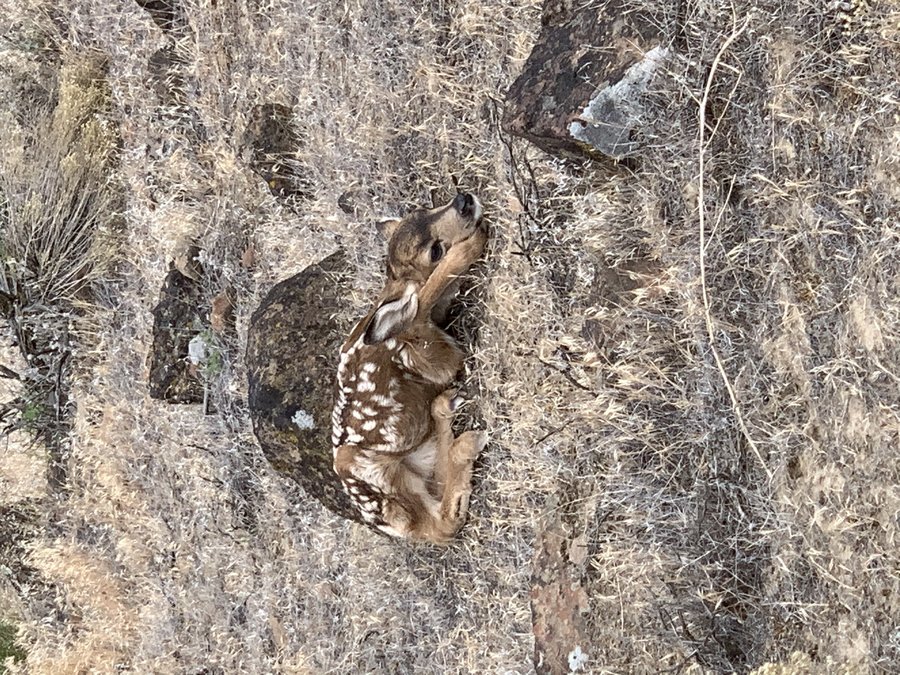
Esau Canyon on John Day River
16 miles of hiking • 2000' elevation gain • 1 night
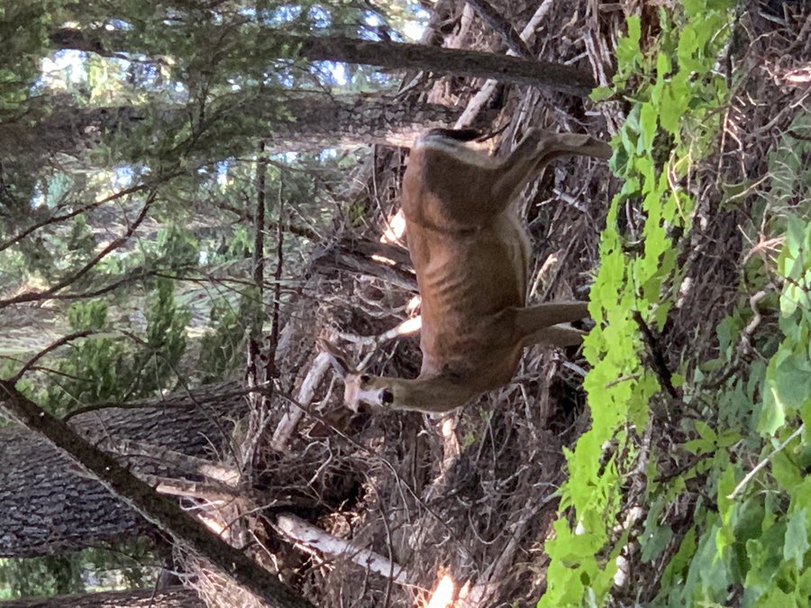
This is in the Cottonwood Canyon State Park. Met my pals at the TH. We hiked up past the Lost Corral and set up camp above the mouth of Esau Canyon, then went a-wandering the hills above. Saw some baby deers! They froze and were camoflaged very well. (Used zoom on my camera, didnt get too close) Love all the gorgeous basalt. Explored the Rattlesnake Canyon and falls too. Very cool.
Beautiful evening in camp, we hung out in the dark after dinner and listened to the birds and crickets. So nice to NOT be shivering at night and feel like you have to dive immediately into your tent-yay summer!
June 8 – June 9, 2020


 3
3
Rooster Rock (Molalla) via High ridge Bike Shuttle
7.5 miles of hiking • 3750' elevation gain •
I drove up to the Rooster Rock TH and threw my bike in the bushes. Then drove down and started at the Old Bridge TH. I was expecting a ridge walk, but this was more of a "below the ridge walk", in the cool woods for several hours with just a few wildflower meadows and viewpoints along the way. Trail is very well maintained. It was a pleasant gradual uphill grade, just one steep section around mile 3. After 5 1/2 miles and over 3500 ft gain, I reached "Chicken Rock", which gives great views of Rooster Rock and other pinnacles, plus all the surrounding cascade mountains. Continued on the trail towards Pechuck, but ultimately decided to skip it this time. and just dropped down to the upper Rooster Rock TH. Zero humans. Fun bomber ride down the gravel road back to my car.
June 1, 2020

 1
1
Donahue Creek on Larch Mountain
5 miles of hiking • 500' elevation gain •
Well I heard the Larch area was open so I headed up to one of my favorite areas to wander. Had been avoiding this for a few years because of a massive clearcut around 2015 at the Palmer mill townsite. The young trees are now tall enough to obscure the carnage. Still some big trees and cool alder hallways around. The trails have been lightly trod in recent times.
May 28, 2020
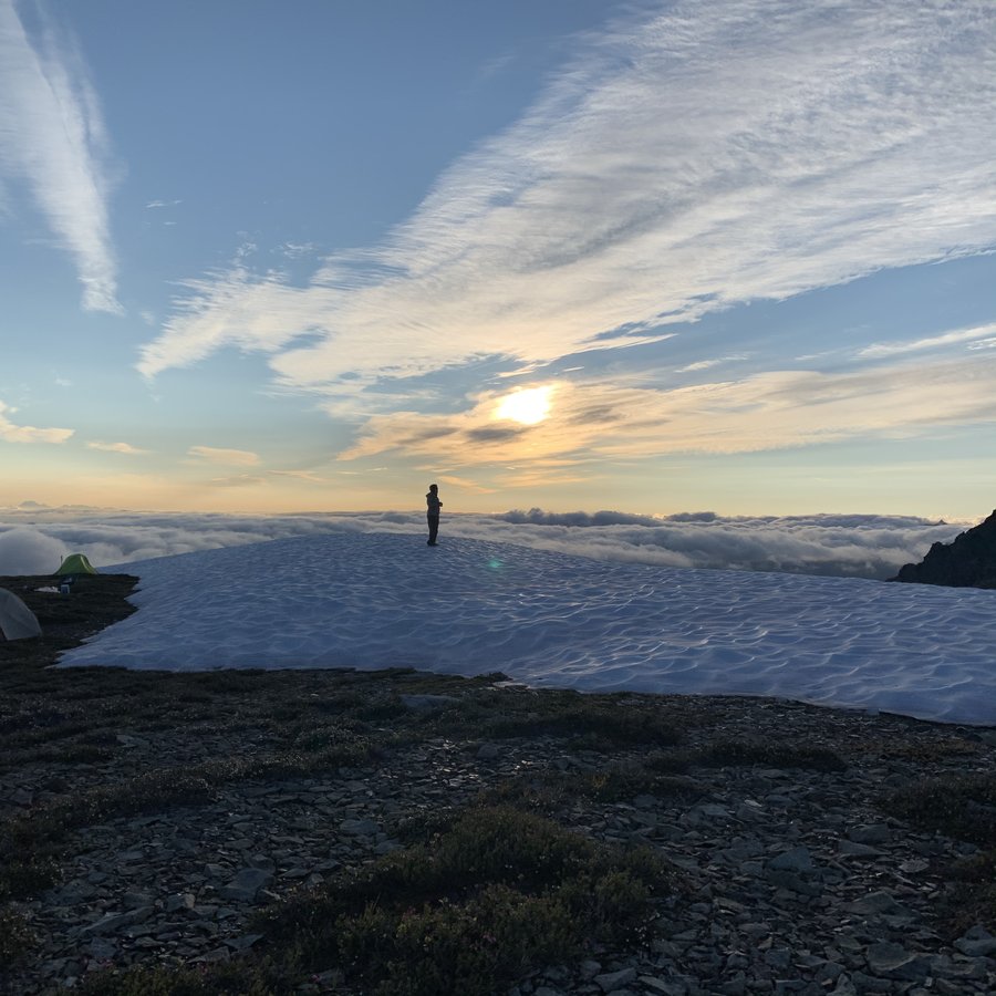
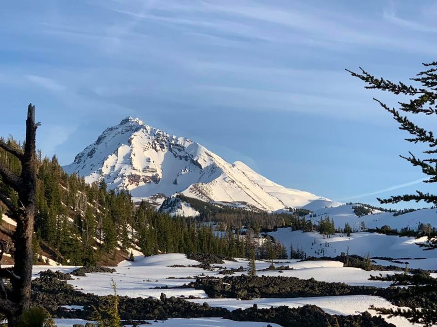
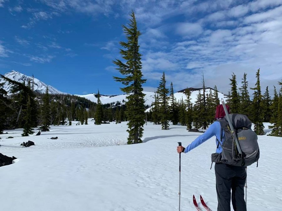
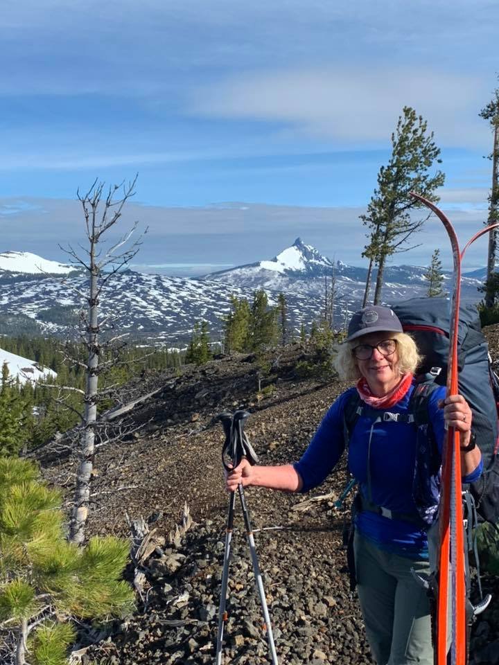
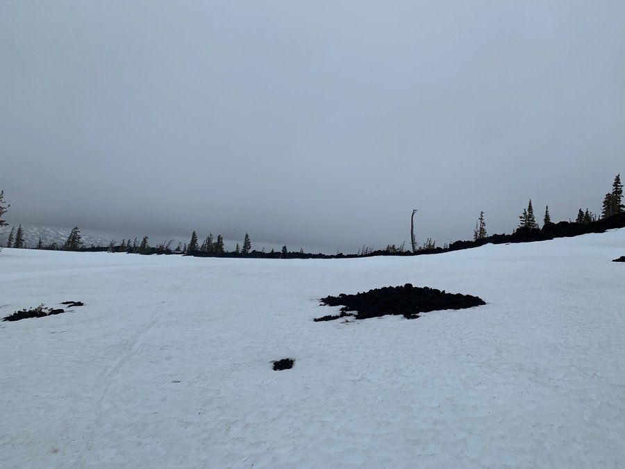
 3
3
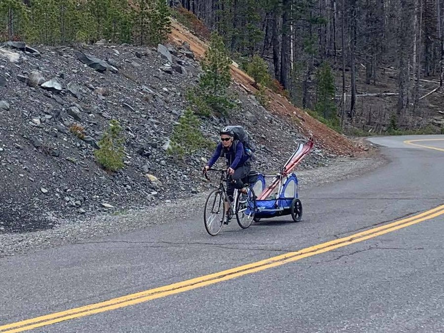
South Matthieu Lake
16 miles of hiking • 2000' elevation gain • 2 nights
I've been wanting to do this bike/ski/climb trip for the past few years. Now have an adventure buddy who can rock all three.
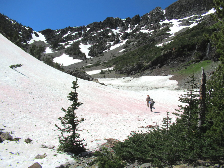
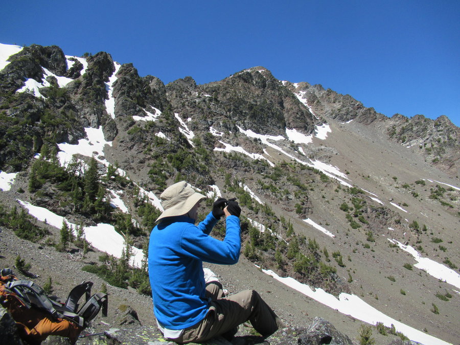
Sunday: We put our skis in a kiddie trailer and slowly rode up McKenzie Pass from the gate. Stashed our bikes and trailer at Lava Camp Lake, and attempted to ski south on the PCT. Well it was a little too late this year for the skiing. The snow was patchy for the first couple miles until N Matthieu, then it was steeply forested. We hiked/postholed and carried our skis about as much as we skiied. After several hours navigating through the wilderness, we were very surprised to find three groups already camped at South Matthieu lake-including a family with barking dog and a fire near a "no campfires" sign. Grrr. Apparently there is an easier way in from the east via the Scott trail. Luckily everyone left the next day.
Well, the views looking south from our campsite were magnificent. The starry sky the first night was incredible, I saw the Milky Way and a satellite!
The next day we did a 10 mile tour through the lavalands. Our objective was Little Brother. We skiied until it started getting steep, then switched to our mtn boots, but the snow was soft and it was arduous. The beginning of our climb,but we were pretty fatigued. The morning was gorgeous, but the weather had turned by the time we reached Opie Dilldock Pass. We decided to climb Collier Cone instead and then suddenly the clouds just covered everything up and it started to rain. So we bailed on the climb, rats. The ski back to camp was a hoot! Navigating around the lava flows, so much fun. We took a little side trip up Yapoah Crater when the rain stopped. Fun downhill on the soft snow with our BC nordic skis. Definitely my favorite part of the trip.
Skiing out of there the next day was a challenge because going downhill on icy surface with a heavy pack through trees was beyond my skill level. The tree wells un-nerved me. After falling several times, I got this ominous feeling that an injury was looming, so I just carried them for rest of the return trip to the bikes.
We then stowed all of our gear near the road and went on a nice bike tour of the pass area before heading back down to the gate. Great adventure!
May 24 – May 26, 2020


 1
1
Various trips during COVID times
63 miles of hiking • 9500' elevation gain •
I've been active, but was reluctant to post. Using this one for all the little local forays I did in Forest Park, Marquam trails, Tillamook Forest and such. Will post separate TRs for the more interesting trips.
Fri March 27, 2020. Maple Loop variation: 8miles, 1000 ft. 10 humans one dog. Forest perennials coming up. Violet and trillium blooming. Tread a bit messy. Moist day.
Monday March 30,2020 Gales Creek Trail, 5 miles 500ft eg. Rainy. Saw no-one. The Tillamook Forest is open for hiking!
Tuesday March 31, 2020 Urban hike-Mount Tabor, 5 miles 500ft, hundreds of people.
Friday April 3rd 8 miles 1500 eg, Gales Creek Story Burn loop. One pair of hikers. Delighted by skunk cabbage, snow at the top!
Sunday April 12th 7.5 miles, 900 gain, Step Creek Trail in Tillamook SF. After a couple hours of solitude, saw 8 people in last half mile near TH.
Tuesday April 14th 4.5 miles, 750 gain Marquam, Flicker and Warbler Loop also using Fairmont and Sherwood roads. Passed only 6 humans.
Saturday April 18th-Reeher’s Camp loop: Gales Creek trail to Bell Camp Road and logging road rambles around Round Top mountain-13.5 miles, 2500 ft. Plus I got a tick! One pair of runners at bottom.
Friday April 24th Council Crest Hike 3.5 miles, 750 ft Misty morning, passed 7 people 1 dog on trail, saw a few milling around on top.
Thursday April 30th-Forest Park Maple-Koenig loop 6.5 miles 750 eg. Saw 10 people on foot, 3 cyclists and one dog.
Tuesday May 19th- Just got NP swabbed for the 3rd time. Gave me a headache that the forest couldnt fix. Really nice to be back in green moist lush PDX! 2.5 miles 250 ft
May 18, 2020
 1
1
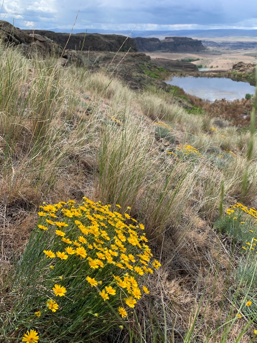
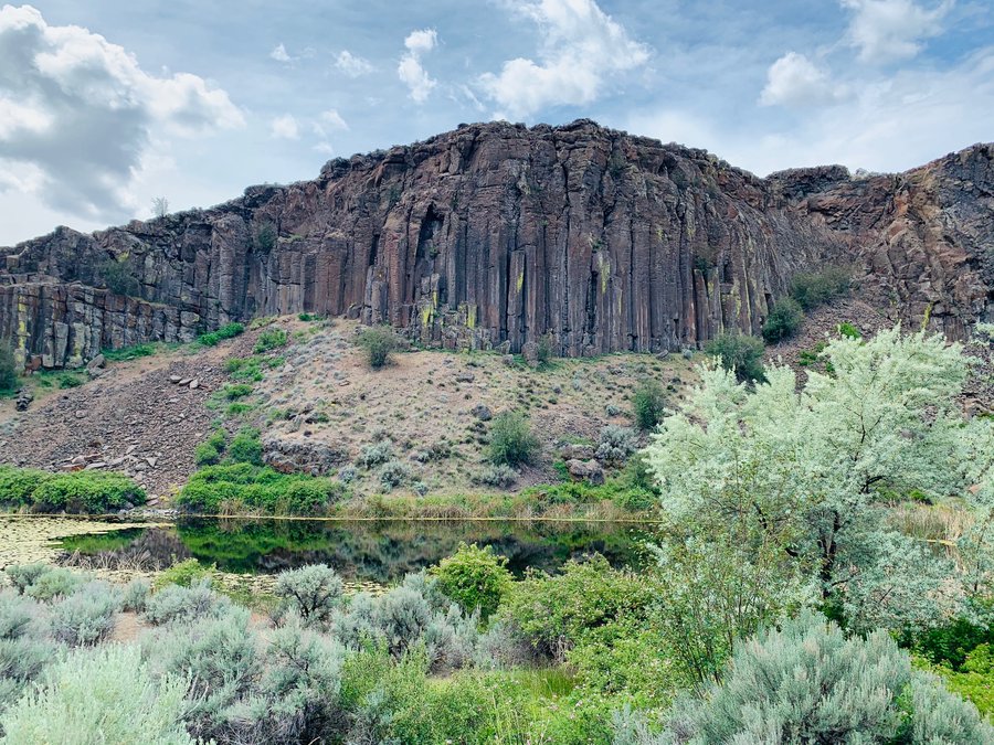
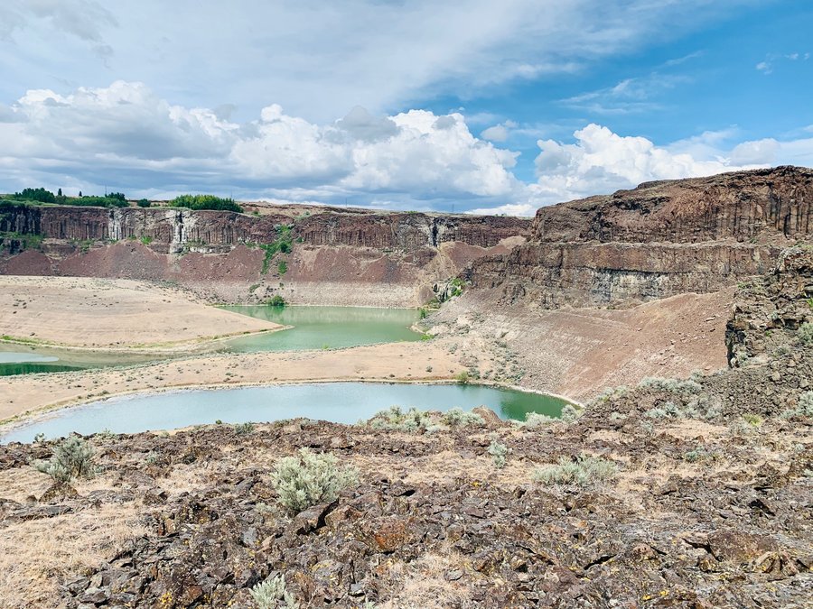
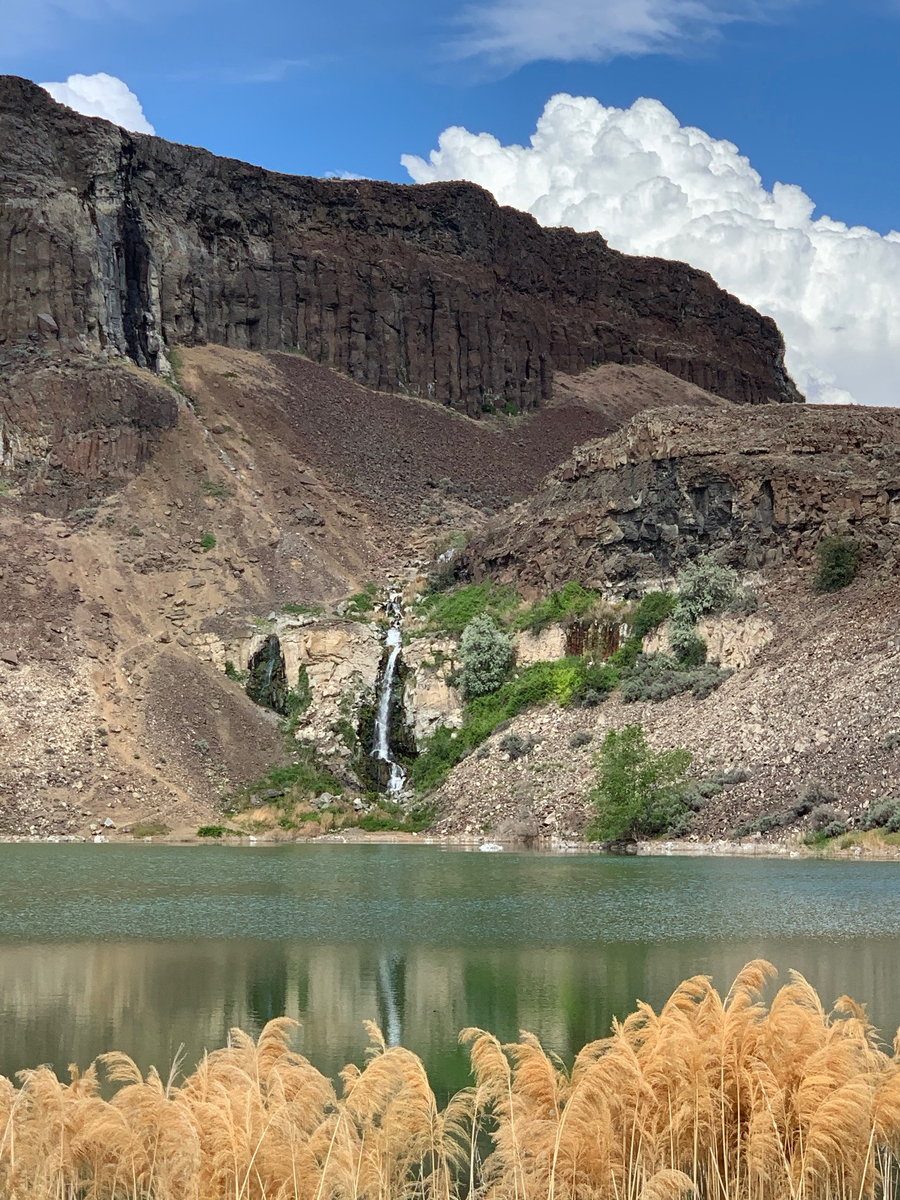
Ancient Lake, WA
7.5 miles of hiking • 750' elevation gain •
Who doesn't love a waterfall in the desert? Spectacular area.
May 18, 2020

.jpg)
 1
1
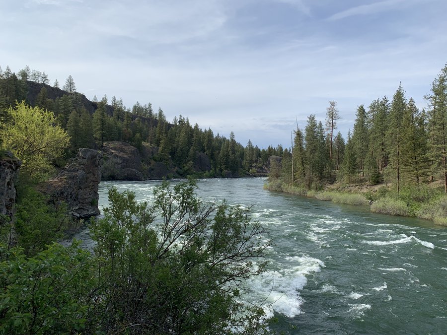
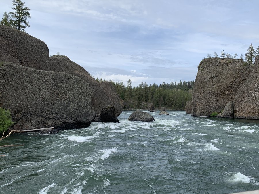
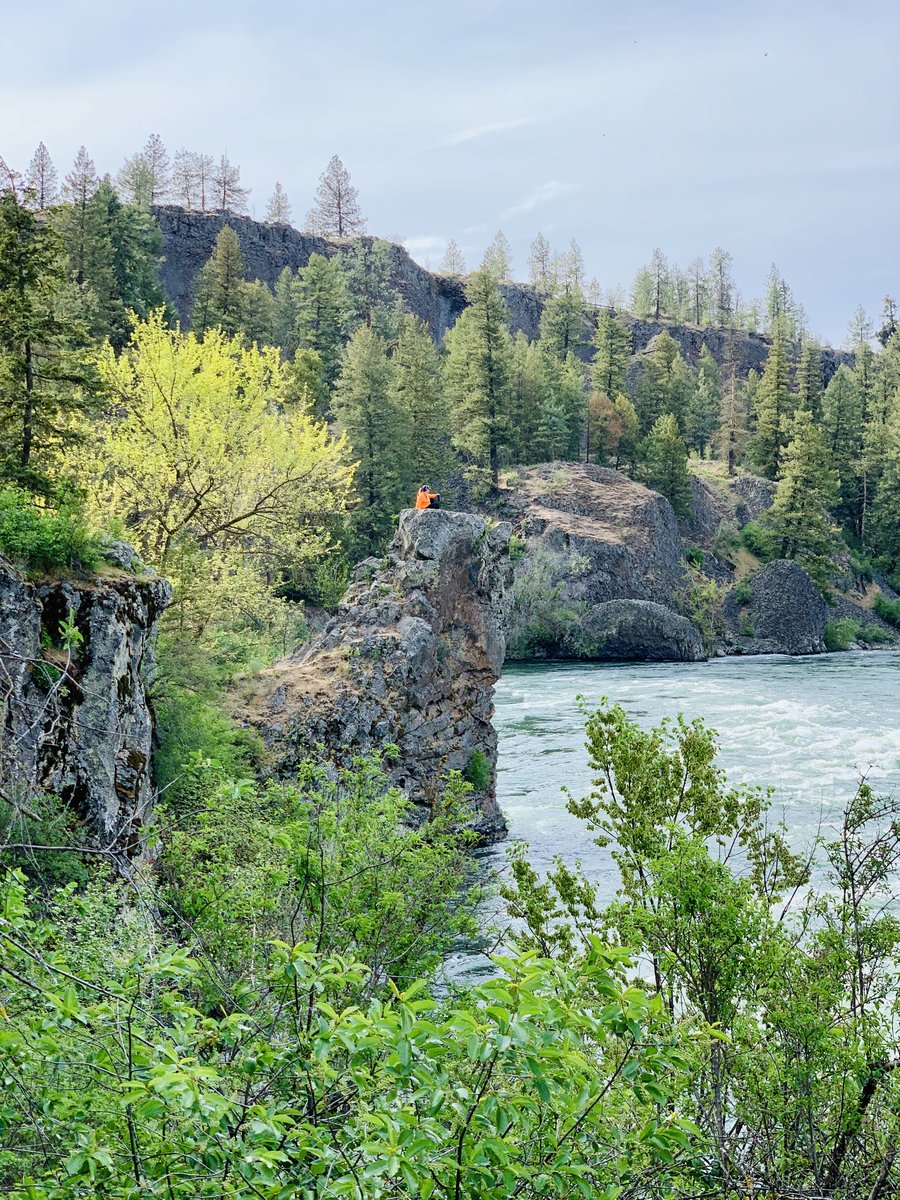
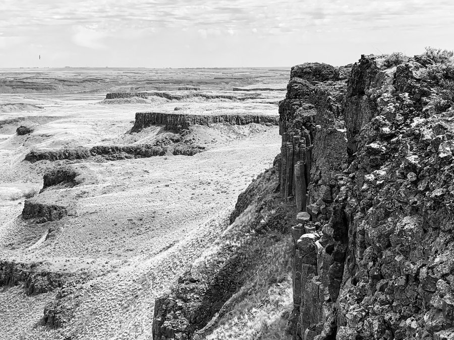
Riverside State Park, Spokane
4 miles of hiking • 250' elevation gain •
The park had just reopened a few days before my visit. Started in the equestrian area and it really had a wild, abandoned feel to it. Biome similar to Bend, with Pondersa pine and open understory. This river feels like it's in the wilderness, rather than in the suburbs of a small city. Love the basalt formations here.
May 11, 2020


Blythe Lake, WA
3 miles of hiking • 250' elevation gain •
Enroute to a 2 week deployment in Spokane for a COVID outbreak. My intention was to go to Potholes Coulee, but Google maps brought me to Potholes State Park. This is mostly an anglers boat ramp with very little hiking so after a frustrating lakeside wander, I headed to nearby Blythe Lake which was awesome! Followed a deer trail to a cool rim. Fun scrambly ridgewalk. Almost stepped on a rattler. Very dramatic.
May 5, 2020

 1
1
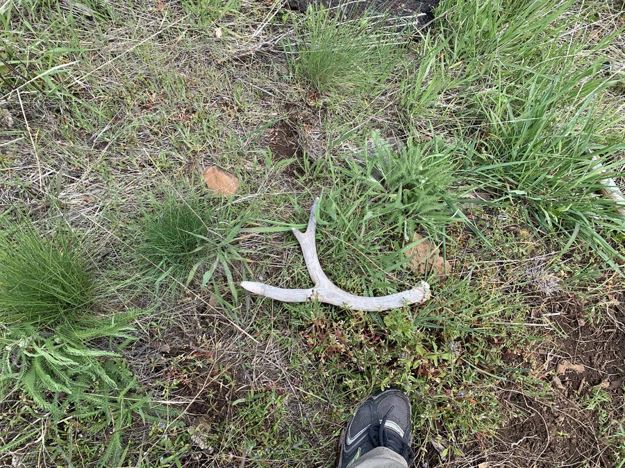
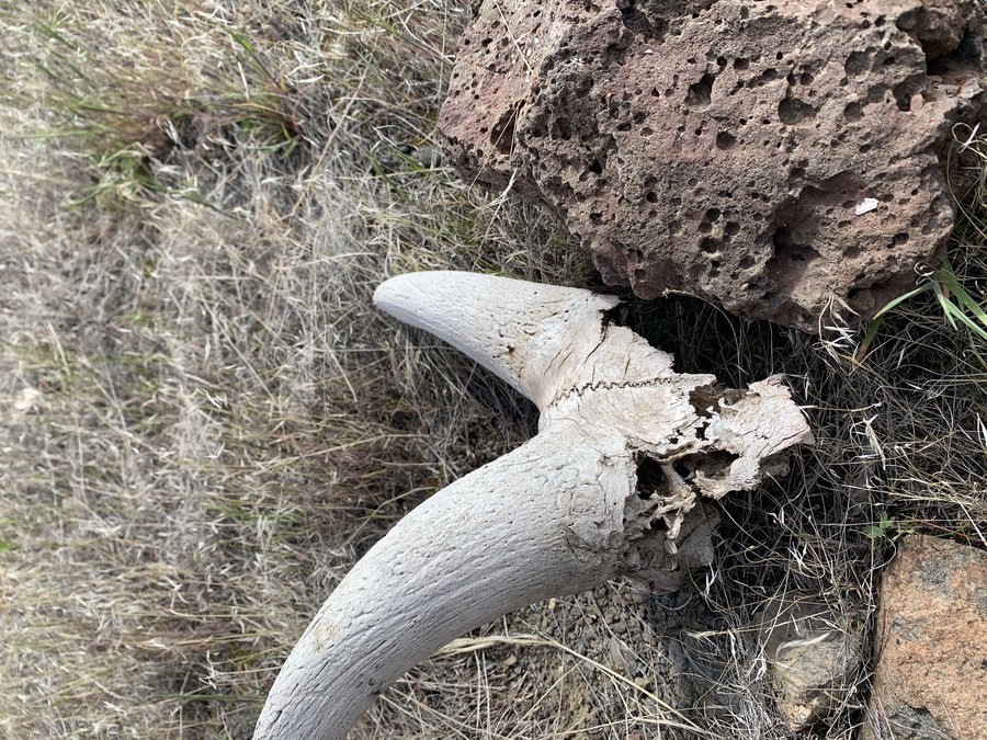
Mill Creek Ridge
6 miles of hiking • 1250' elevation gain •
The drive is a bit creepy on the approach to TH. Hoping for some spring Morchellas. No morels but found an antler. Saw 2 cyclists, tons of elk sign, nice flowers and birds.
May 3, 2020


 1
1
Pat's Cabin Canyon
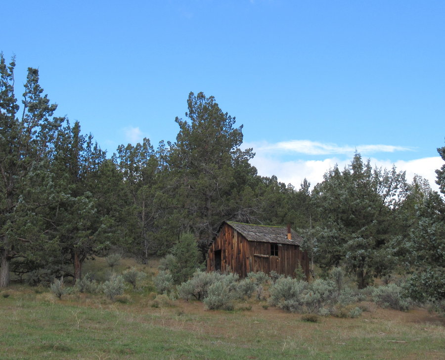
8 miles of hiking • 1500' elevation gain • 1 night
Pat's Cabin Canyon is a BLM wilderness study area. Located just north of the Painted Hills Unit on Burnt Ranch Road. It is just beautiful. So dreamy wandering up and down here. You travel along an old road or in the canyon creek bed (dry). Too bad there isnt a year round water source up in the canyon, although I did see some seeps. I camped near the mouth at Bridge Creek. No-one around.
April 27 – April 28, 2020


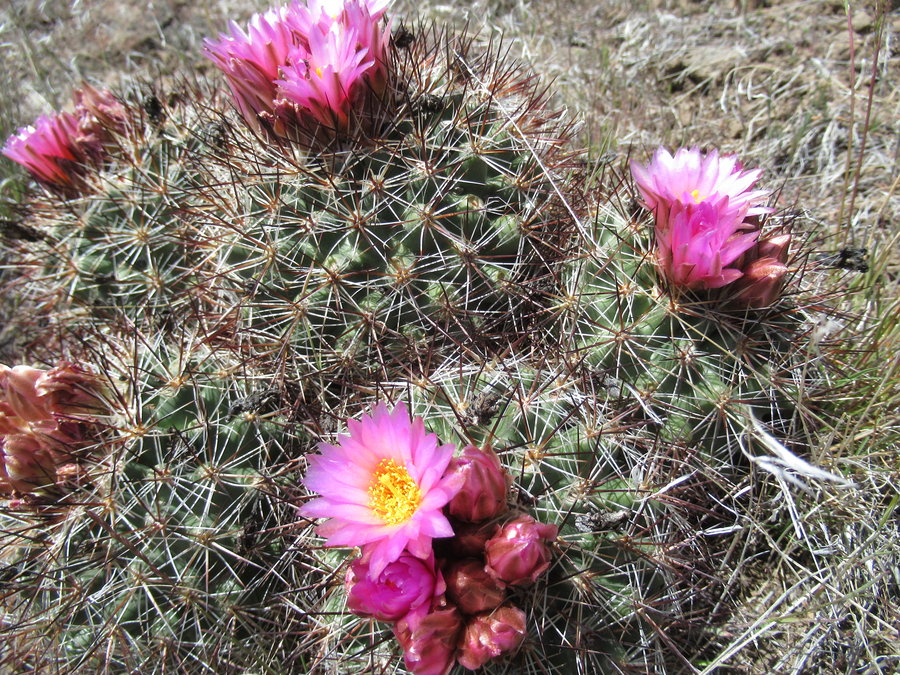
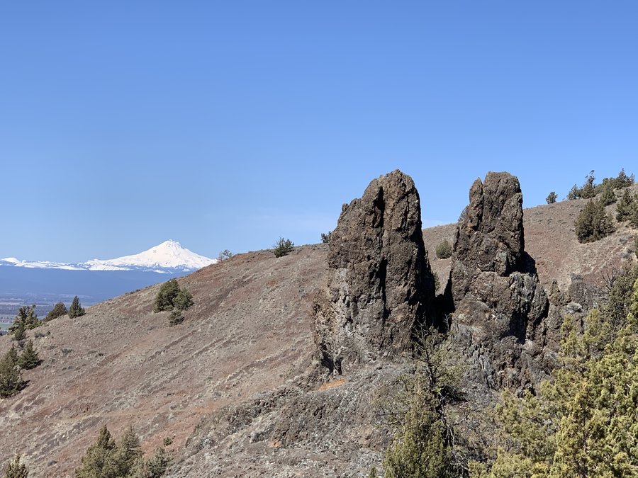
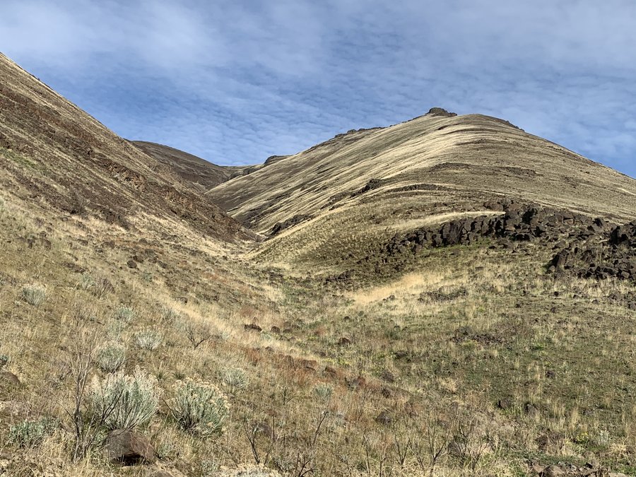
Sutton Mountain
6.5 miles of hiking • 1750' elevation gain •
Escape to the high desert! Took the off trail route suggested by Barbara Bond in her 75 scrambles book. Had fun wandering the upper basalt layers of the Carroll Rim. Hedgehogs blooming on the summit. Looked down on the Painted Hills unit, which was closed.
April 26, 2020


 1
1
Elk-Kings Traverse
10.5 miles of hiking • 3750' elevation gain •
Started early, ran the river trail and some of the traverse. Saw only 1 person on traverse, and then about 15 people and 7 dogs on the final 3 mile leg down Kings which is a brutal descent, don’t care for it at all.
April 20, 2020


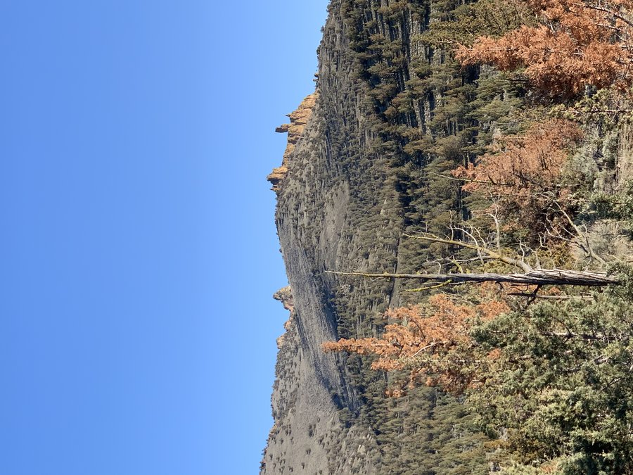
Hanging Rock
9 miles of hiking • 2000' elevation gain •
You've all seen these cool pinnacles north of Smith Rock from the highway. This is within the Crooked River National Grassland. I started at the equestrian corrals just outside of the Henderson OHV. Wide open country for ridgetop ramblings, cool pinnacles and rock formations for scramblings, no-one around at all. Fun to look DOWN on Smith Rock.
April 7, 2020


 3
3
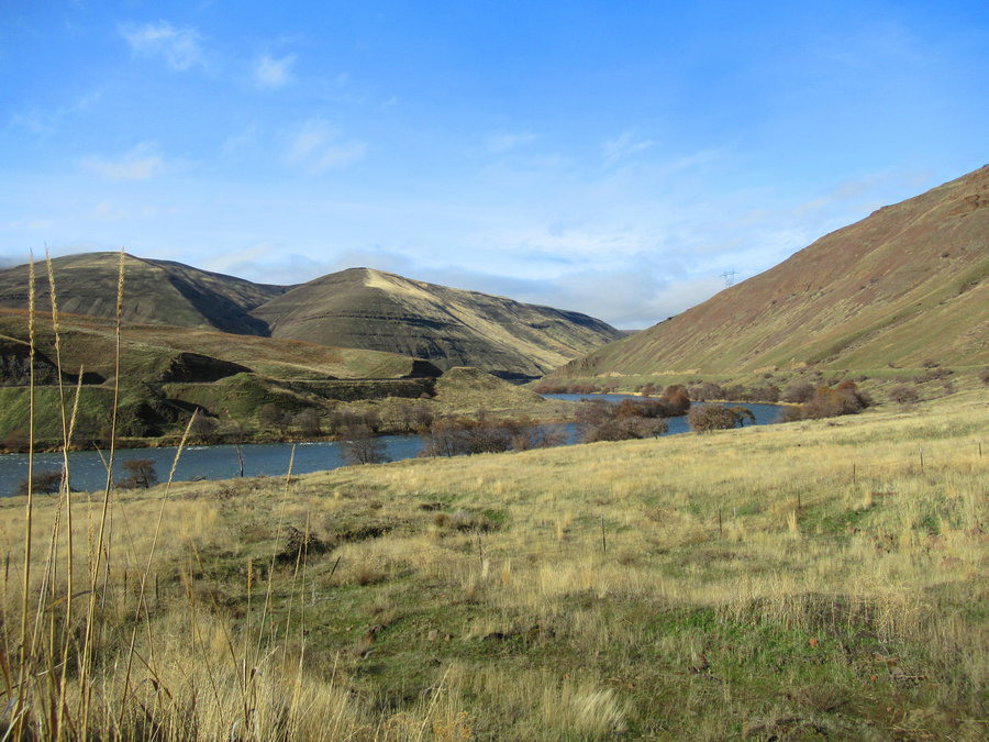
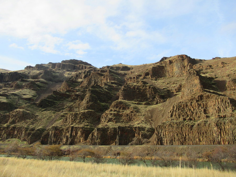
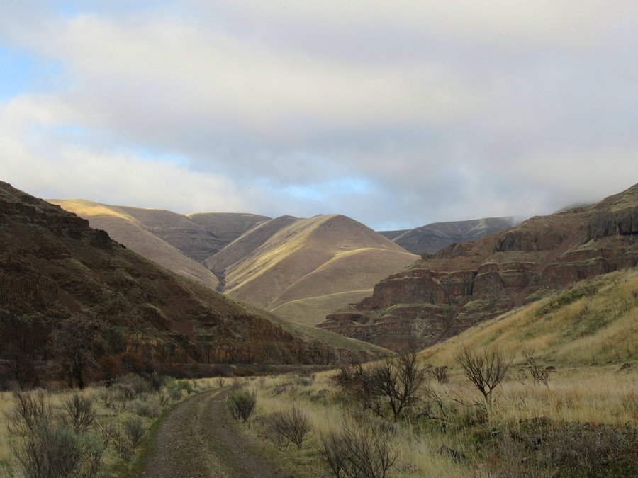
Deschutes River: Mack's to Snake Box Canyon
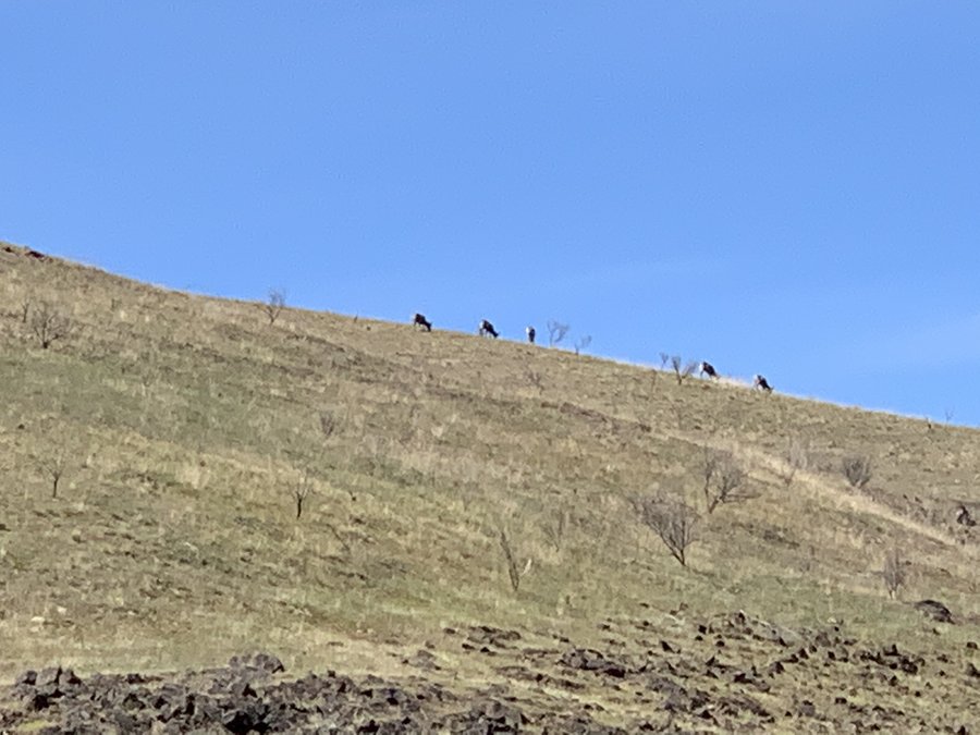
12.5 miles of hiking • 1000' elevation gain • 1 night
Magificent! Love the high desert solitude. Basalt formations excellent. Watched bighorn graze the hillside across the river from my camp.
March 22 – March 23, 2020


 3
3
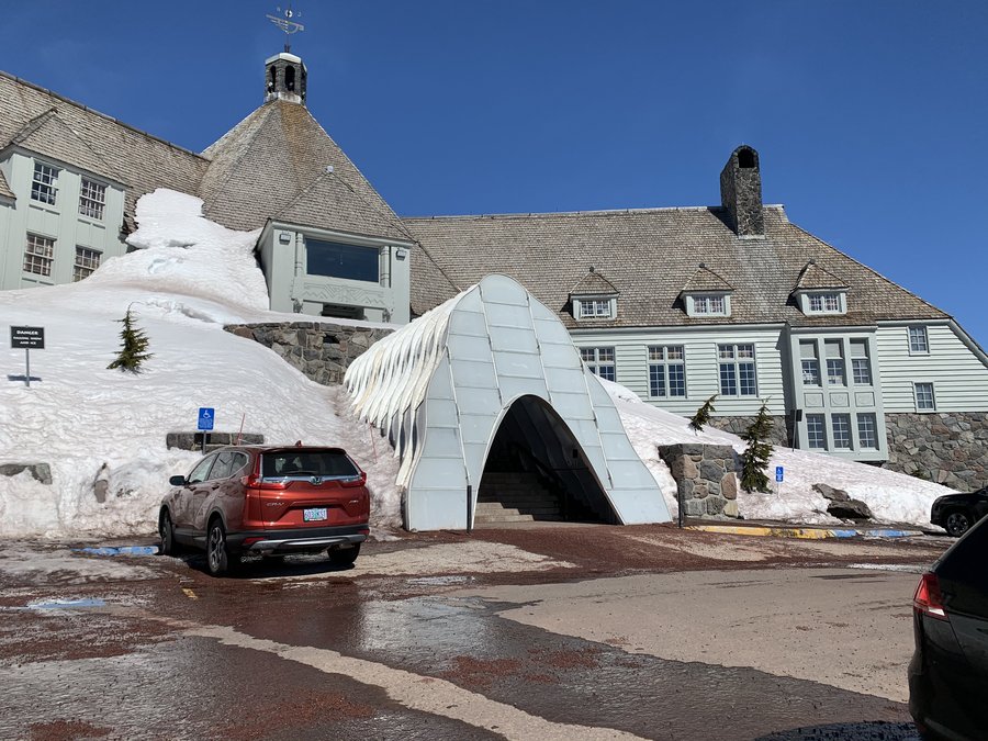
Timberline Lodge via West Leg
5.5 miles of hiking • 2000' elevation gain •
Well since the ski area was closed we decided to just take over the slopes, ha ha! It was surreal to be traversing the slopes on this bluebird day with no-one around and the chairlifts stilled.
I rented BC Nordic skis that weren't so great on the 3 hour long trip upwards on the stiff, sometimes icy surface of West Leg Road, but they sure helped me carve some turns on the way down via the Glade and Alpine runs. The Timberline Ski Area and Wyeast Lodge are closed, but we were surprised to find that Timberline Lodge (and dining room) itself was still open.... with guests.
I only counted the uphill mileage.
March 17, 2020


 2
2
March 15, 2020

 1
1
Gorge wanderings
7 miles of hiking • 2500' elevation gain •
Whacked a lot of bushes today. Stick in the eye, attacked by pricker bush, and a sharp scree rock pierced my favorite hiking pants. Excellent fun!
March 11, 2020


Tryon
5 miles of hiking • 500' elevation gain •
Very pretty spring morning. Only a few trilliums blooming today, but lots of indian plum. In some areas there was a continuous carpet of waterleaf. In most of the other areas, the evil ivy rules.
March 3, 2020
 1
1
February 29, 2020
 2
2
West of The Rest
7.5 miles of hiking • 2000' elevation gain •
Started out with a ridiculous bushwack, but then spent hours wandering the woods in my favorite go to wonderland. Didnt see anyone.
February 25, 2020
 1
1
White River
7 miles of hiking • 1000' elevation gain •
Ski/snowshoe combo up to the critter cam. No good animal pictures this time, but a banner day to be out on the mountain!
February 18, 2020
 1
1
Oldman Pass
7 miles of hiking • 500' elevation gain •
Last class with the students-a ski tour inside a snowglobe!
February 16, 2020
 1
1
Willow Prairie Cabin
8 miles of hiking • 3000' elevation gain •
We rented this extremely rustic cabin for the night. Fun ski in. Had some issues with the woodstove and got a few facefulls of dust and smoke. Next day, my asthma was terrible.
In the morning, we skiied east to a landing area at 5300 ft. I was short of breath and having trouble keeping up with my fast moving friends. I sent them onward to climb Mt Mcloughlin and I slowly followed behind. They successfully summitted, but I turned back at the "South Tip".
February 13, 2020


February 4, 2020
 1
1
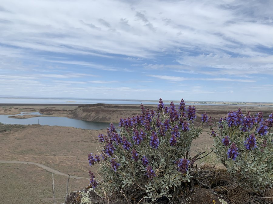
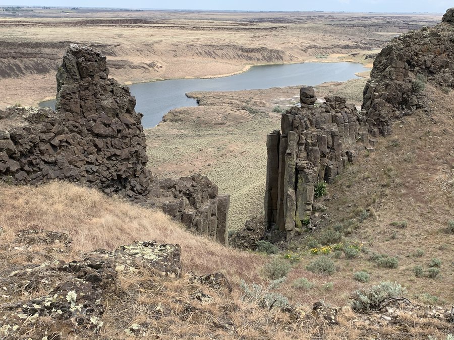
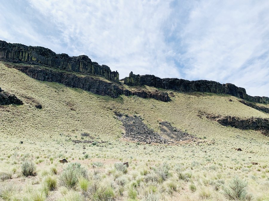
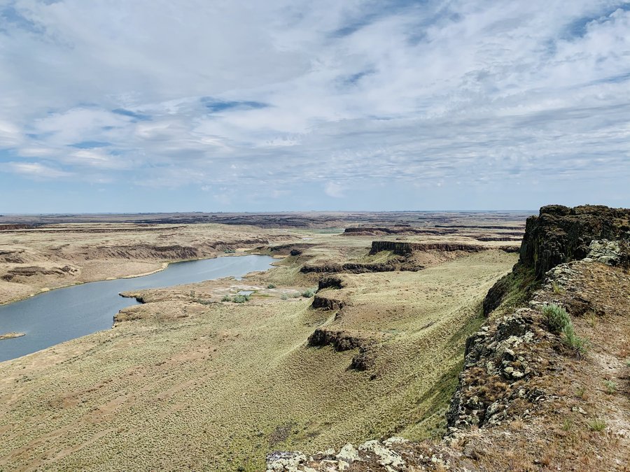
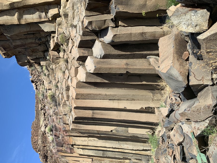
Deschutes River Bike Trip
1 miles of hiking • 250' elevation gain •
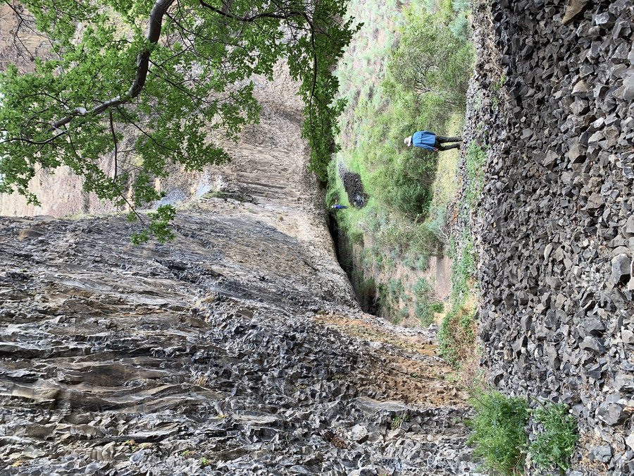
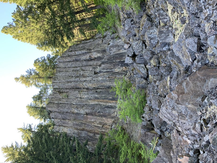
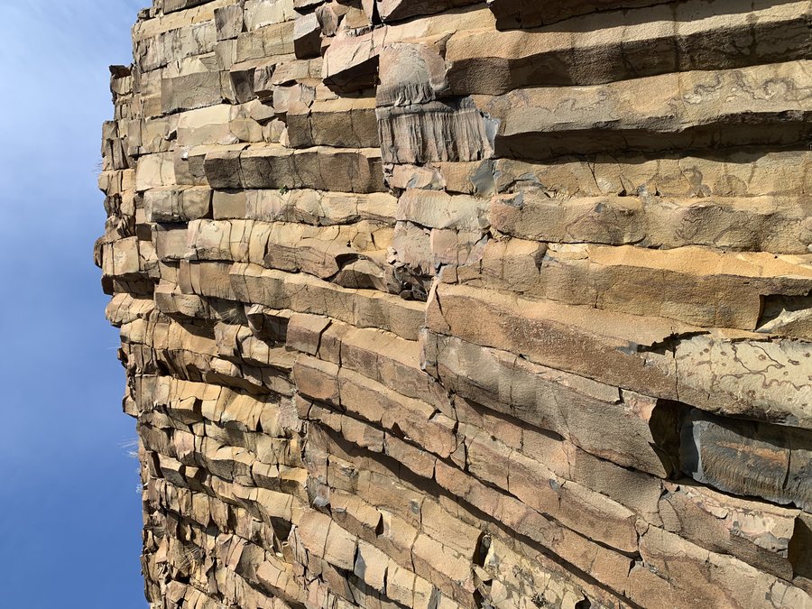
This was a 33 mile bike trip, but I did stop and hike up the Harris Canyon and another gully. Wanted to log it here just so I could post some pictures! It was so very beautiful. The best part is between mp 10 and 13- such excellent basalt formations, pinnacles and caves, all inviting exploration.
I want to go back soon and camp. Hard to travel across a scree field in bike cleats.
January 30, 2020


 1
1
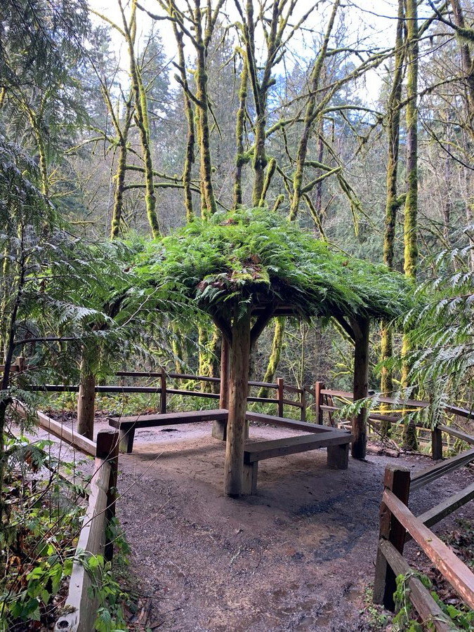
Birch/Holman/Wildwood Loop
4 miles of hiking • 500' elevation gain •
Struggling with my asthma and SAD. Got a good fix up from the forest. Found an interesting rogue trail,with art. Pretty soaked.
January 28, 2020
 1
1
Pocket Creek
6 miles of hiking • 500' elevation gain •
Helping out with Mazamas Nordic Ski School, assisting with the same class I took 5 years ago! It was slow going for our novice skiiers, but I did get a good little workout in when I had to accompany some folks out early, up and down the same road twice.
January 26, 2020
 2
2
Larch Mountain
12 miles of hiking • 1500' elevation gain •
Starting from about MP 9 on Larch Mountain Road(where they stopped plowing). Grueling uphill grind through heavy wet snow. Was pleased to have mild winds and some views under the cloud deck at the summit. Totally gassed afterward.
January 20, 2020


 1
1
Lower Macleay to Collins Sanctuary
6 miles of hiking • 750' elevation gain •
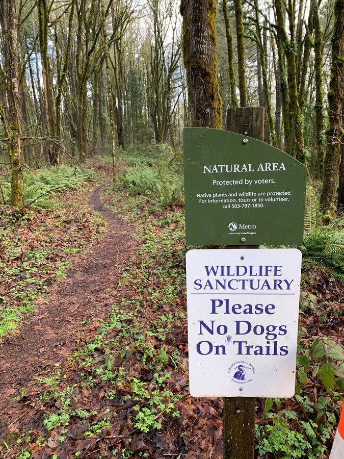
Another exploration of our wonderful urban trails. I forgot how gorgeous Balch Creek Canyon is, very quiet in the morning,and then extremely crowded in the afternoon on return. Instead of going up to Pittock Mansion, I looped the Audobon trails. The Collins Sanctuary was delightful. Looks so pretty with NO IVY!
January 19, 2020


 1
1
Markham loop
4 miles of hiking • 750' elevation gain •
Variation on the last trip, just wanted to explore more of this trail system. Trails are quieter than Forest Park, but the ivy is frightening in some areas.
January 16, 2020
 1
1
Who needs an umbrella when you have trees?
4 miles of hiking • 750' elevation gain •
Did a loop with the Marquam, flicker and Towhee trails. How lucky are we to have such wonderful trails right in town? Dreary moods begone!
January 11, 2020

 1
1
Tolinda Trail-Forest Park
3.5 miles of hiking • 500' elevation gain •
New trail to me-connects lower part of Germantown Rd to Leif Ericson drive. Evidence of old homesite. Muddy and slippery fun.
January 6, 2020

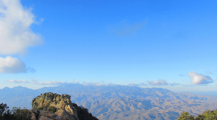
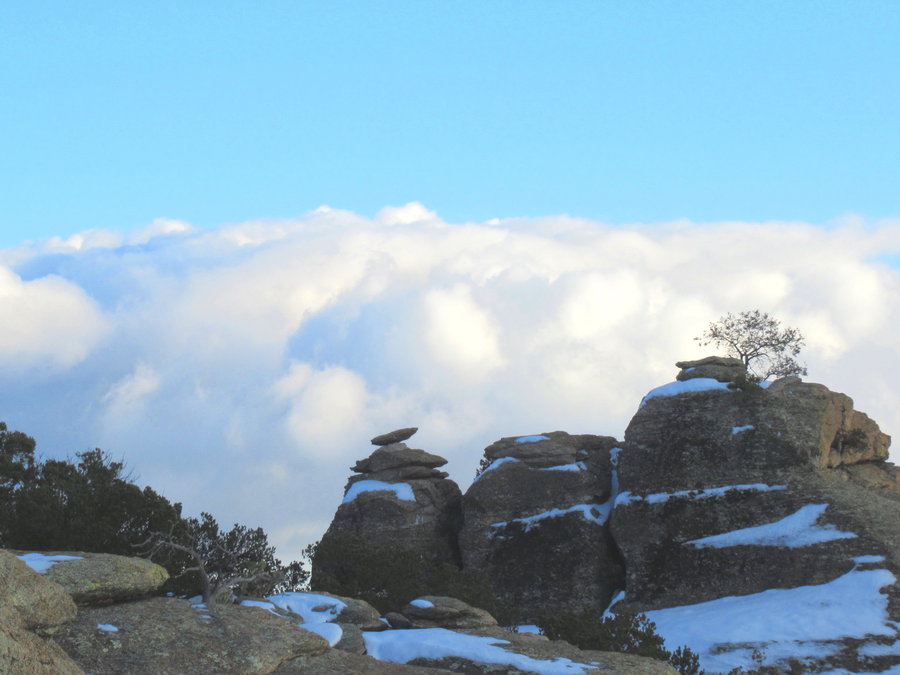
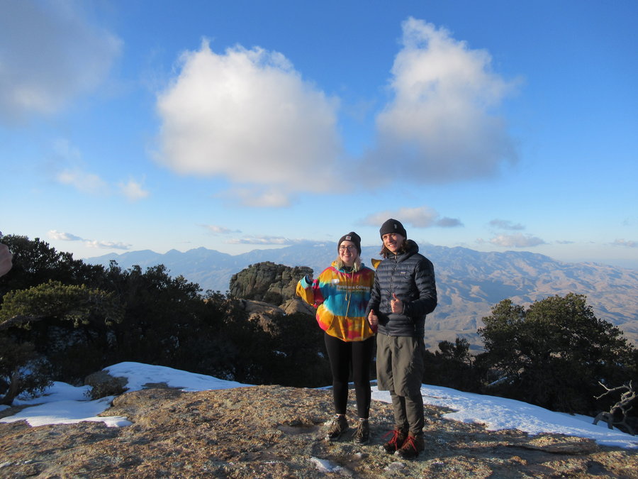
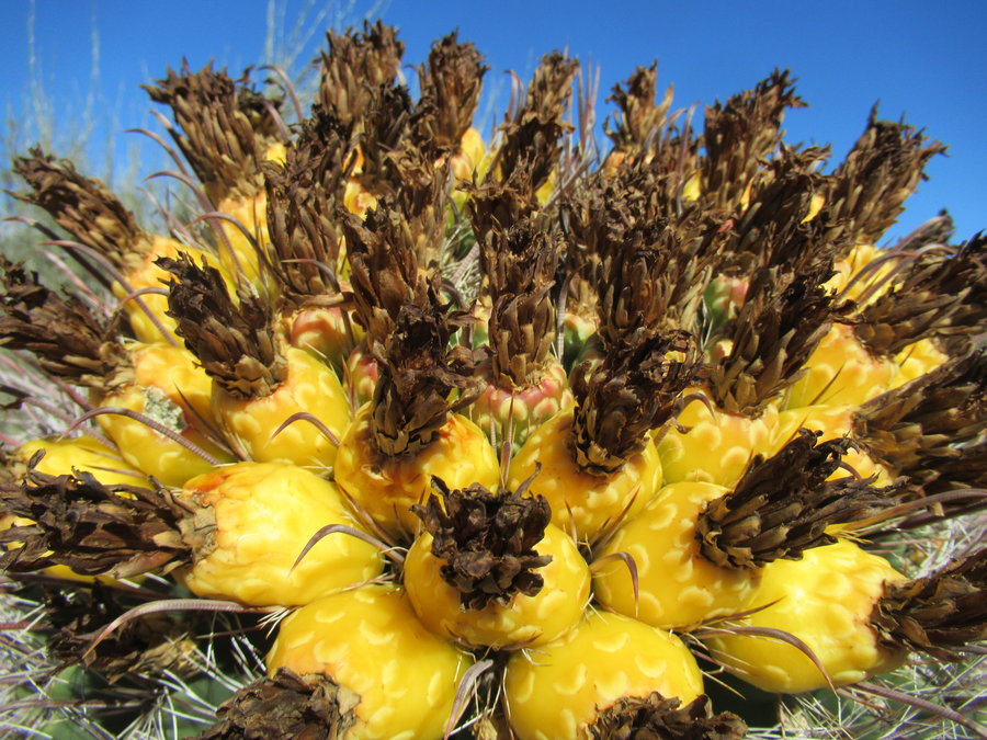
Tanque Verde Ridge, Saguaro NP
18 miles of hiking • 5250' elevation gain • 1 night
A challenging trip in the desert to start the year. Went up Tanque Verde Ridge to camp at Juniper Basin, 6000 ft where there was some crusty snow. We set up camp then climbed Tanque Verde Peak. Sun went down and temps plummeted. Cold night in the tent, need to fix that situation.
January 2 – January 3, 2020


 2
2
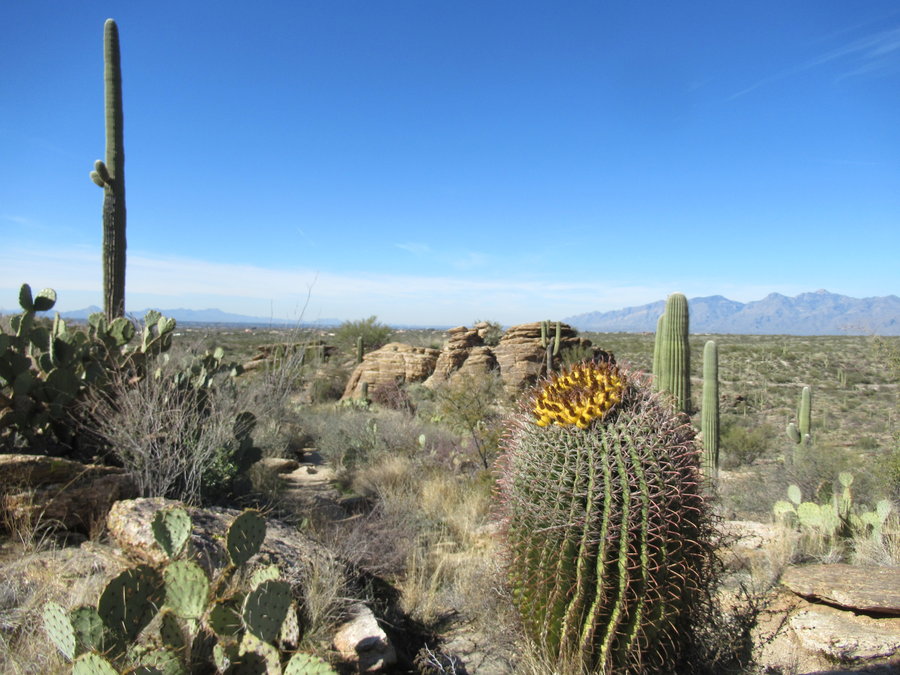
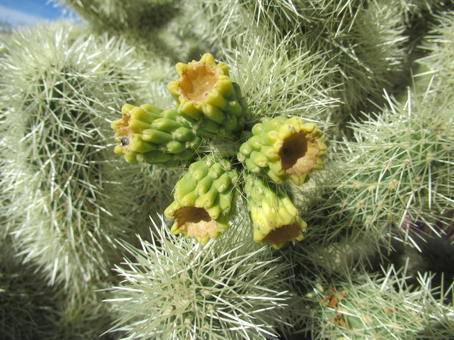
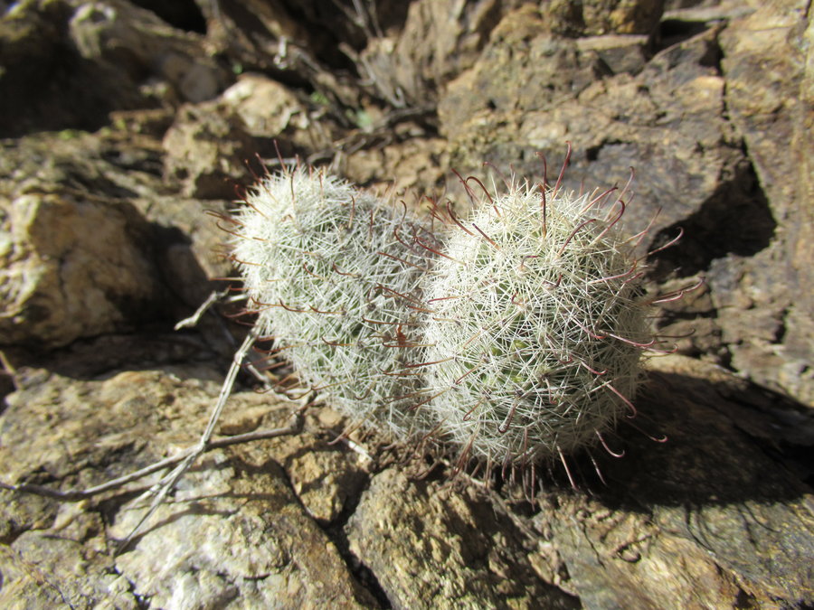
Cactus Forest -Saguaro National Park
4.5 miles of hiking • 500' elevation gain •
On vacation with family. First foray into the desert, scouting out next trip.
Lovely day.
January 1, 2020


View trips from: 2011 2012 2013 2014 2015 2017 2016 2018 2019 2021 2022 2023 2024 2025 2026