

2023 Trips


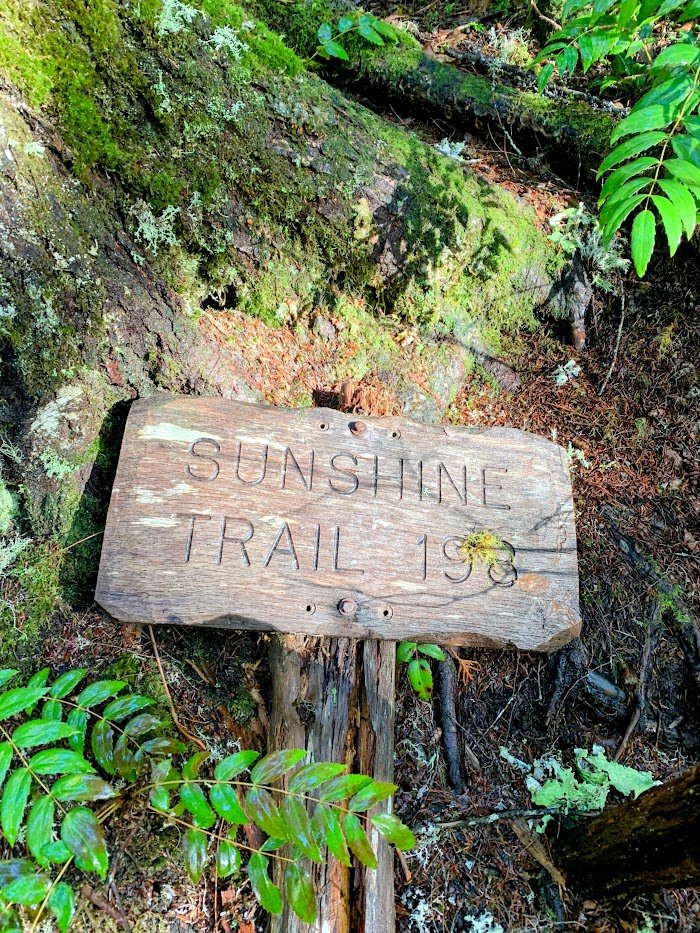
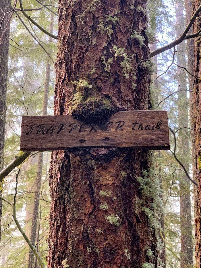
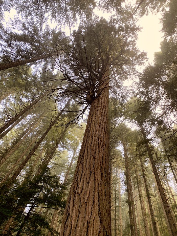
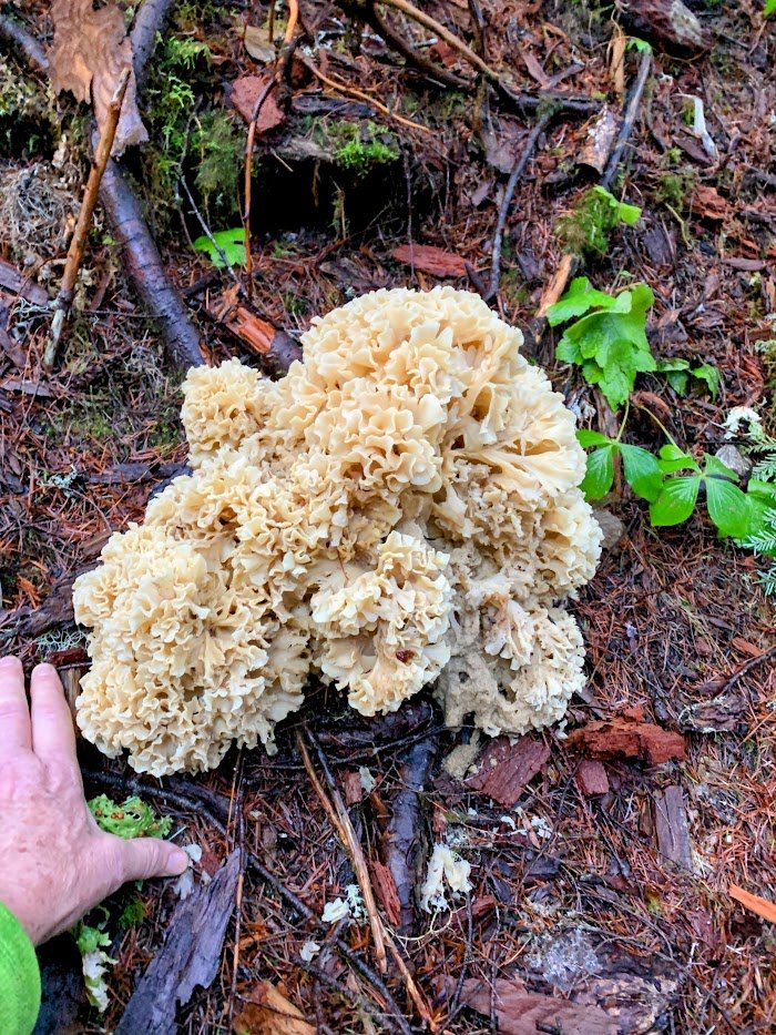
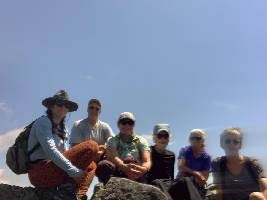
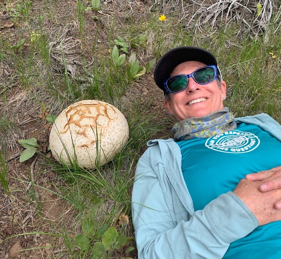
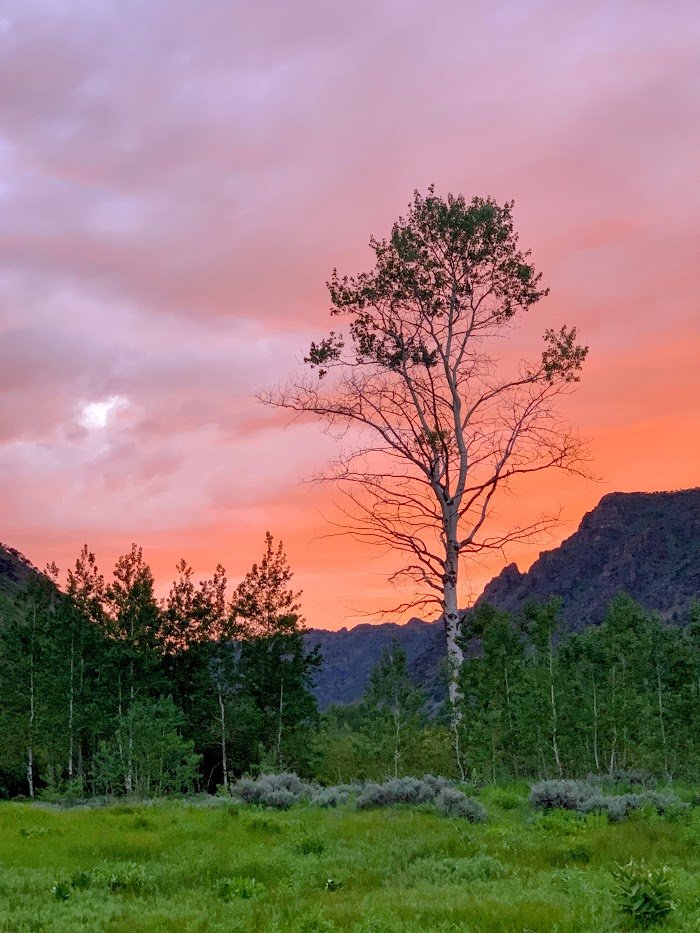
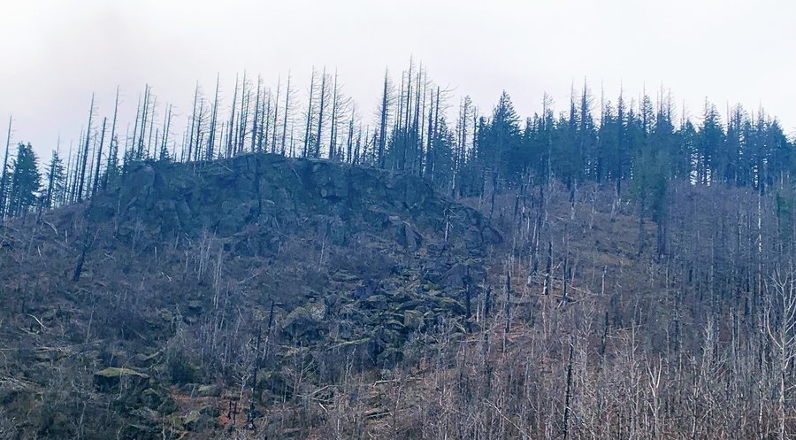
Trapper Creek
8.5 miles of hiking • 1750' elevation gain •
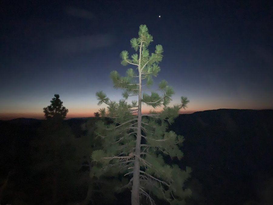
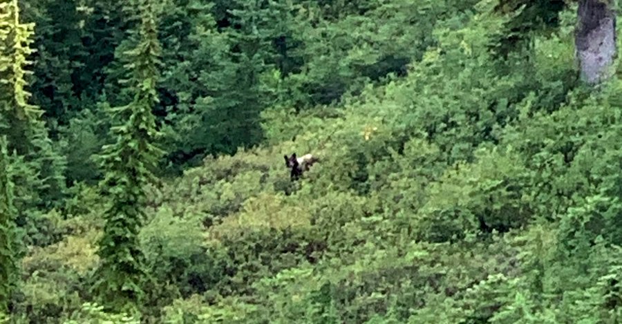
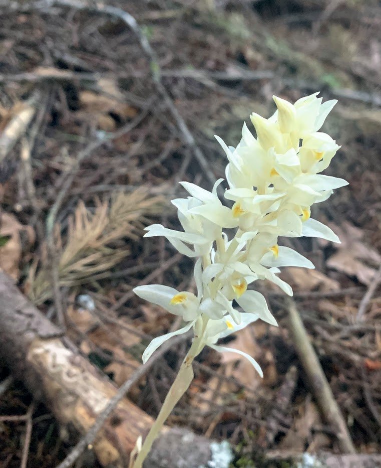
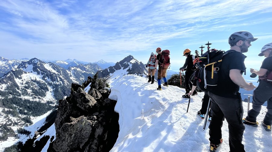
Actually 12/31, I meant to go up to Observation Peak but I got onto the Sunshine Trail and it was a terrible mess of downed trees and brush and then something happened inside my knee. Turned back. Found a massive cauliflower mushroom on the way out.

December 30, 2023

 1
1
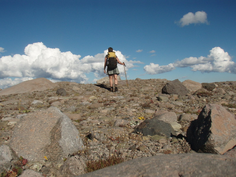
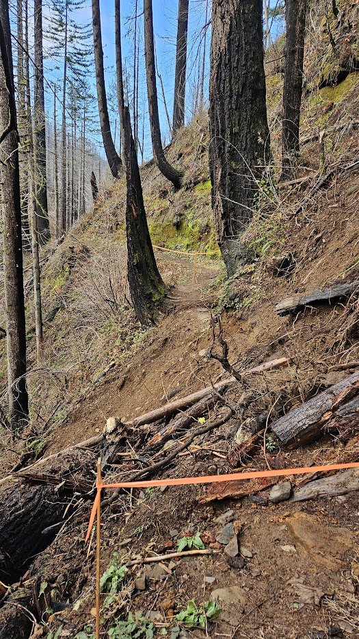
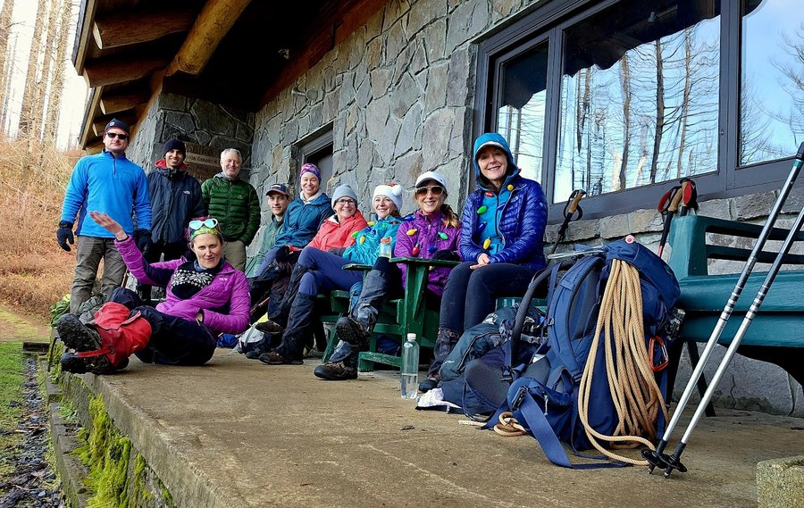
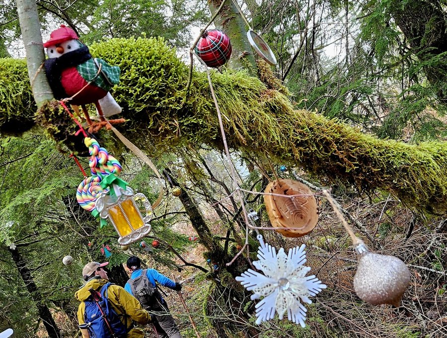
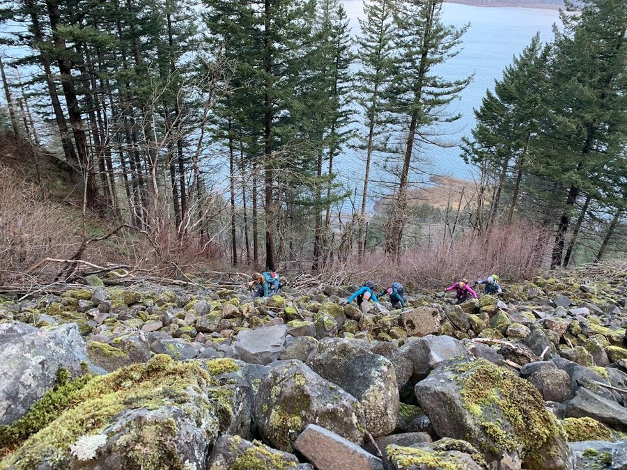
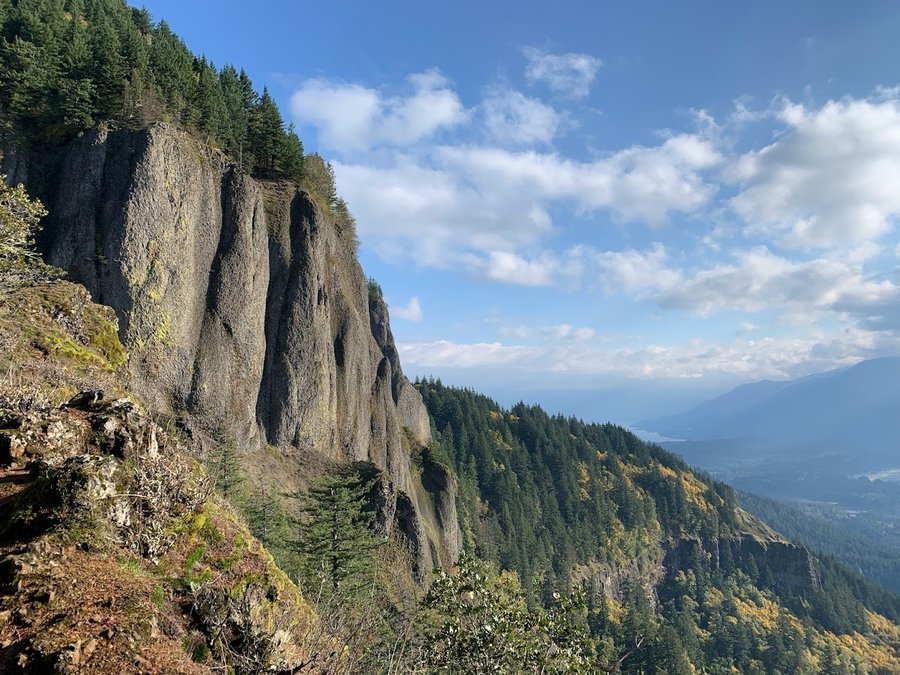
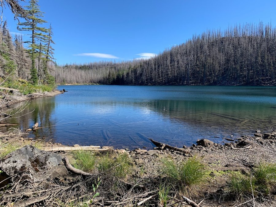
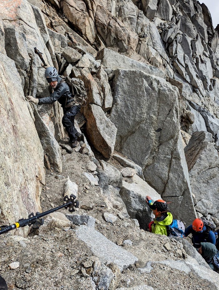
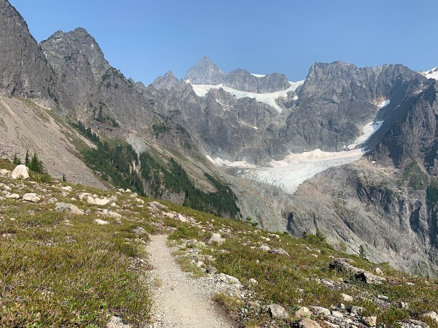
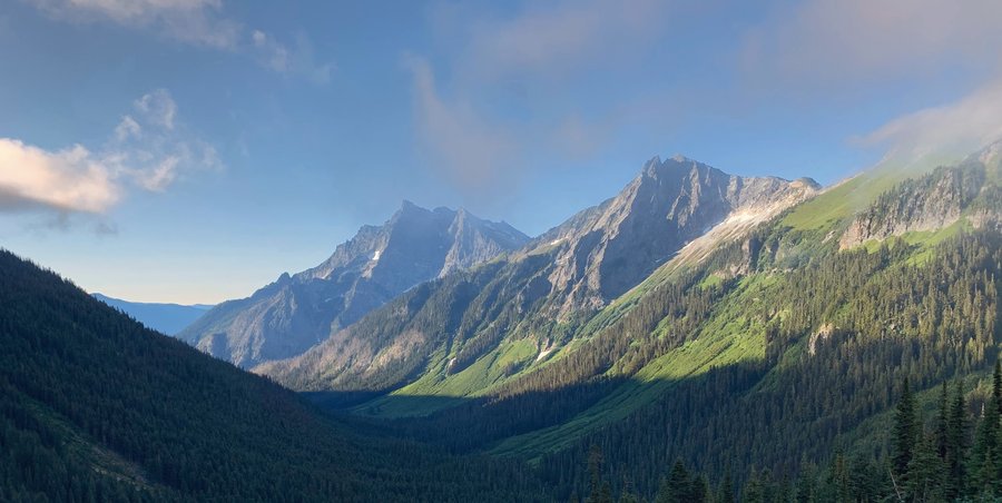
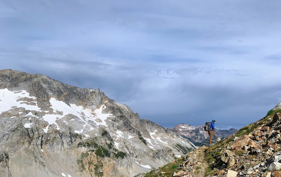
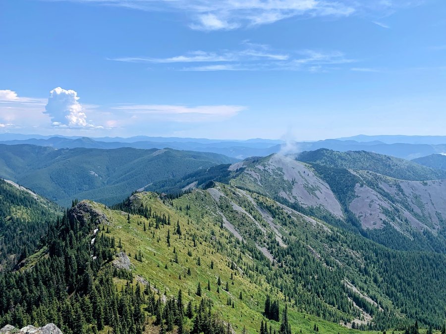
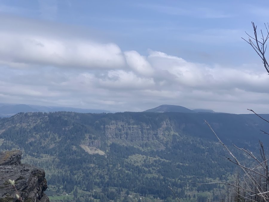
Elevator Shaft
7.5 miles of hiking • 2000' elevation gain •
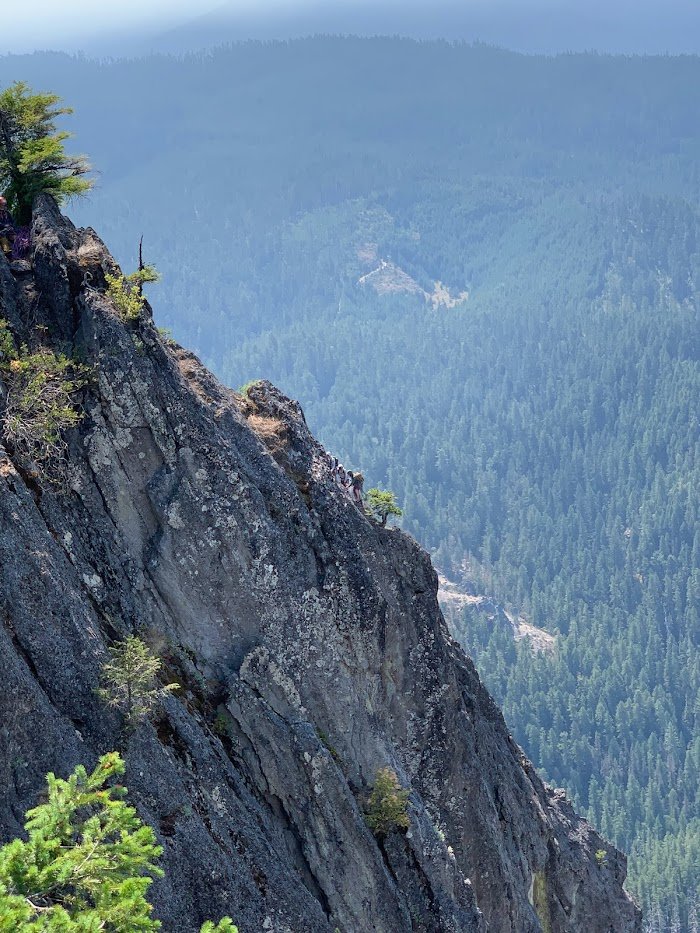
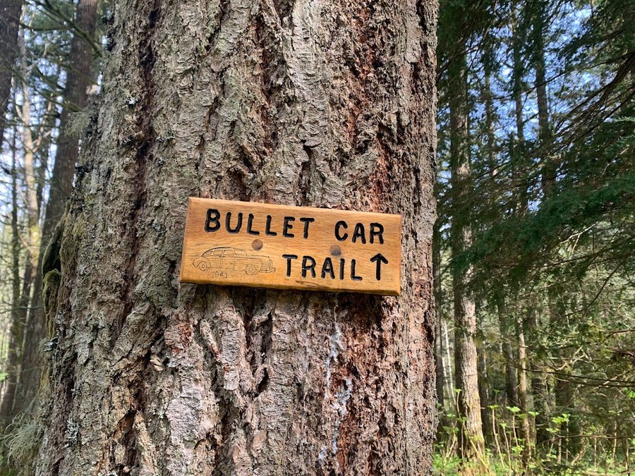
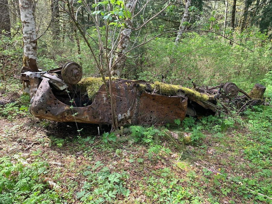
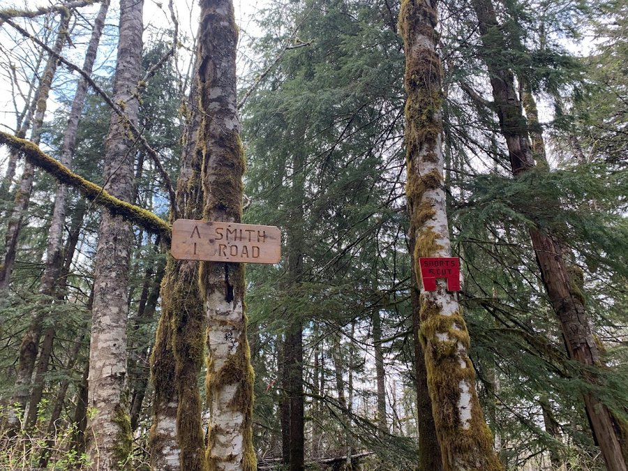
The Elevator Shaft has not improved since my last visit 2 years ago. Brushy with PO at the bottom. Bushwack through burnt part of basin at top. Good times for my hearty crew who were up for the adventure. We went over to Nesika and came back through the XMas Ornament Trail.
We were going to return via Franklin Ridge and the Oneonta trail, but team was curious about the landslide on the Larch Mtn trail, and we heard some people were crossing it. There was a bit of exposure so I brought a rope and put in a handline, which made everyone more comfortable for the couple of of sketchy steps. We were mildly accosted by a ranger, but since we were coming down from another area, she didn't give us a ticket. There were no signs saying the trail was closed, but it probably should be. Does not seem safe for the casual tourists who wander up this trail.
December 20, 2023

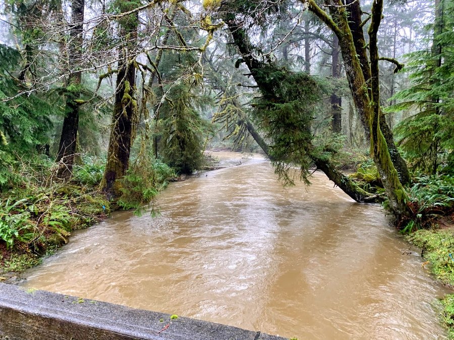
Ecola Creek Reserve
4 miles of hiking • 500' elevation gain •
Enjoying the coast during the "river of atmosphere". Ground saturated, and all creeks at flood stage.
December 10, 2023

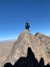
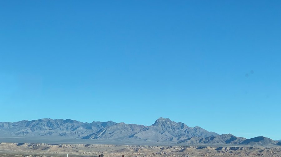
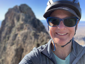
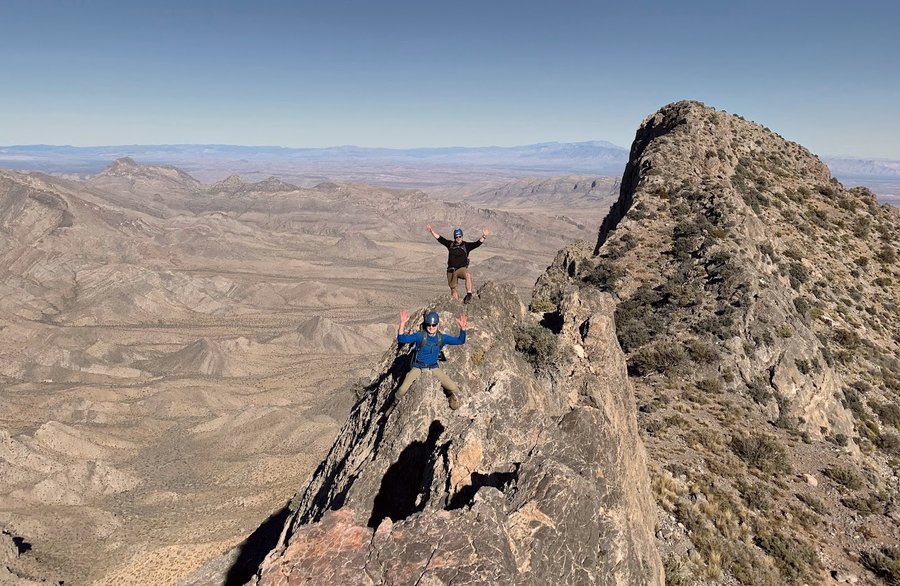
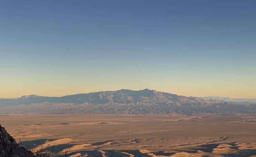
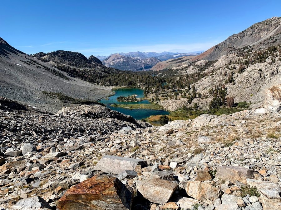
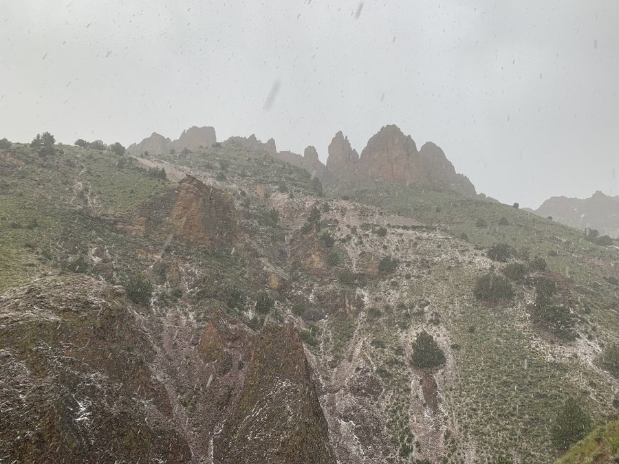
Moapa Peak, NV
6.5 miles of hiking • 3250' elevation gain •
Cool desert scramble with knife edge ridge. No trail. Approached using a wash, then following intermittent cairns up through ledges and ramps. HIked out in dark
November 21, 2023

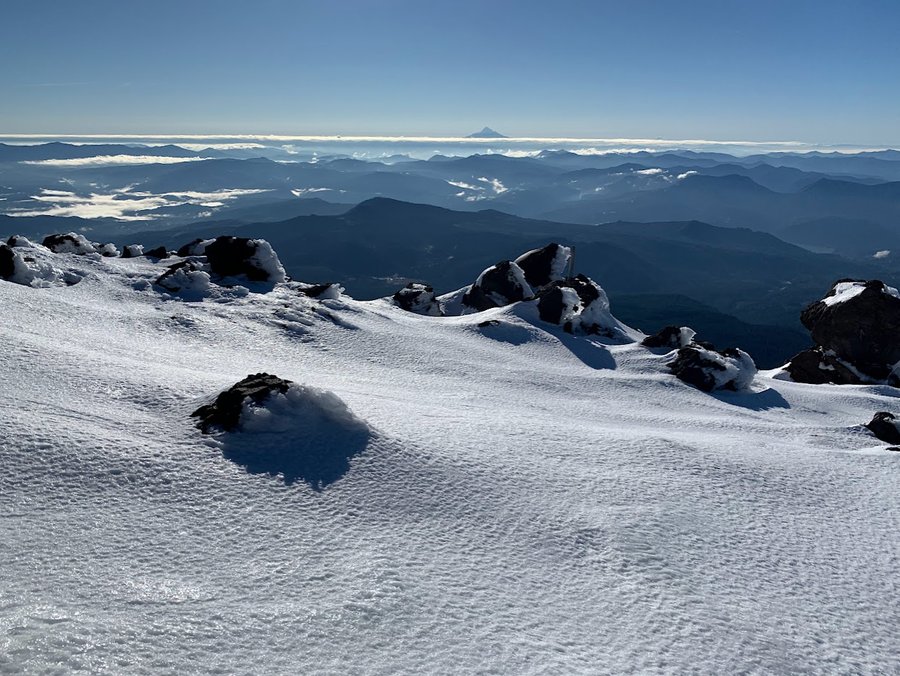
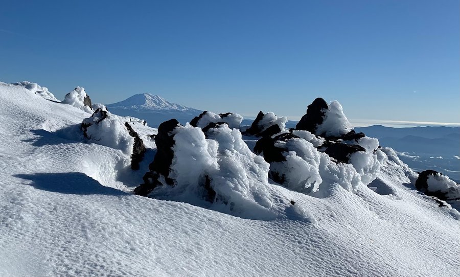
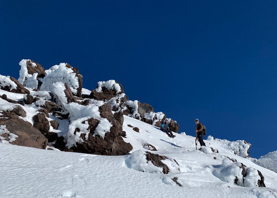
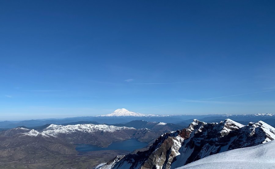
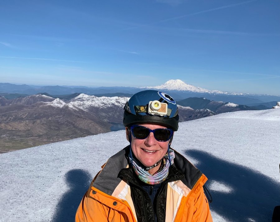
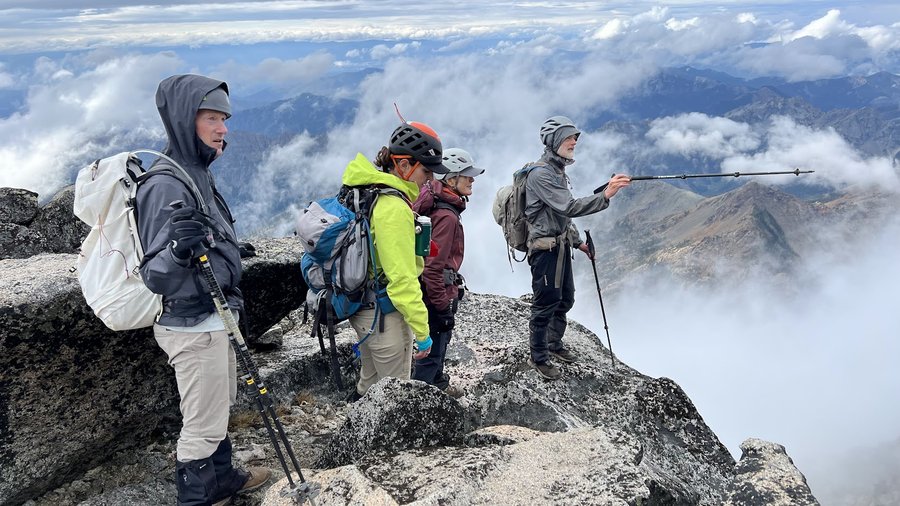
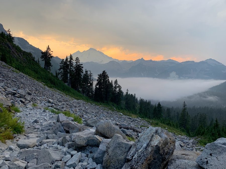
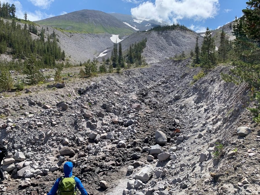
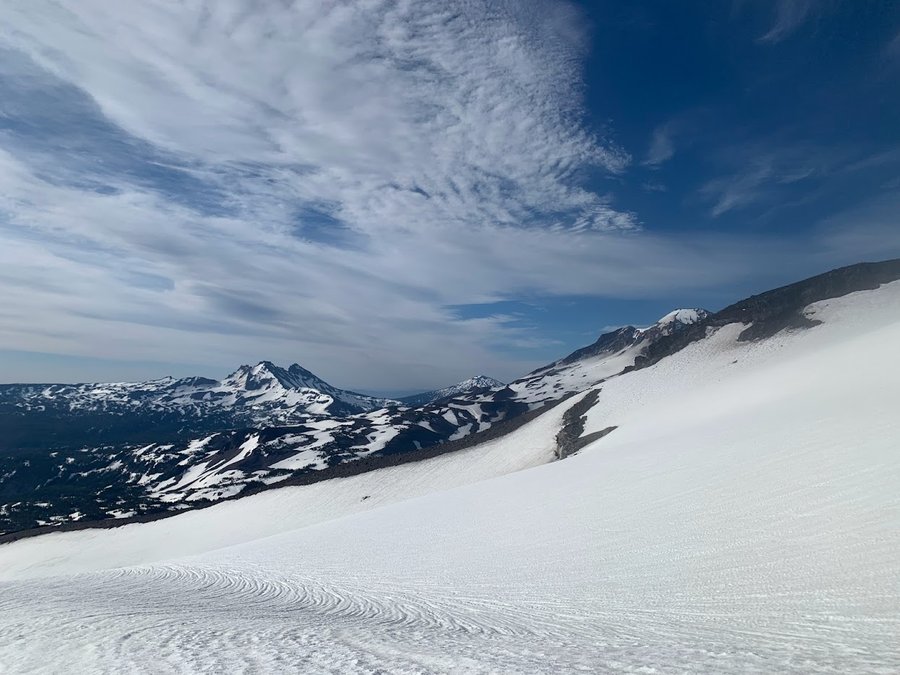
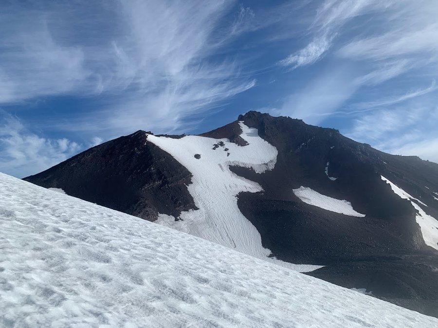
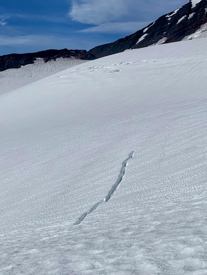
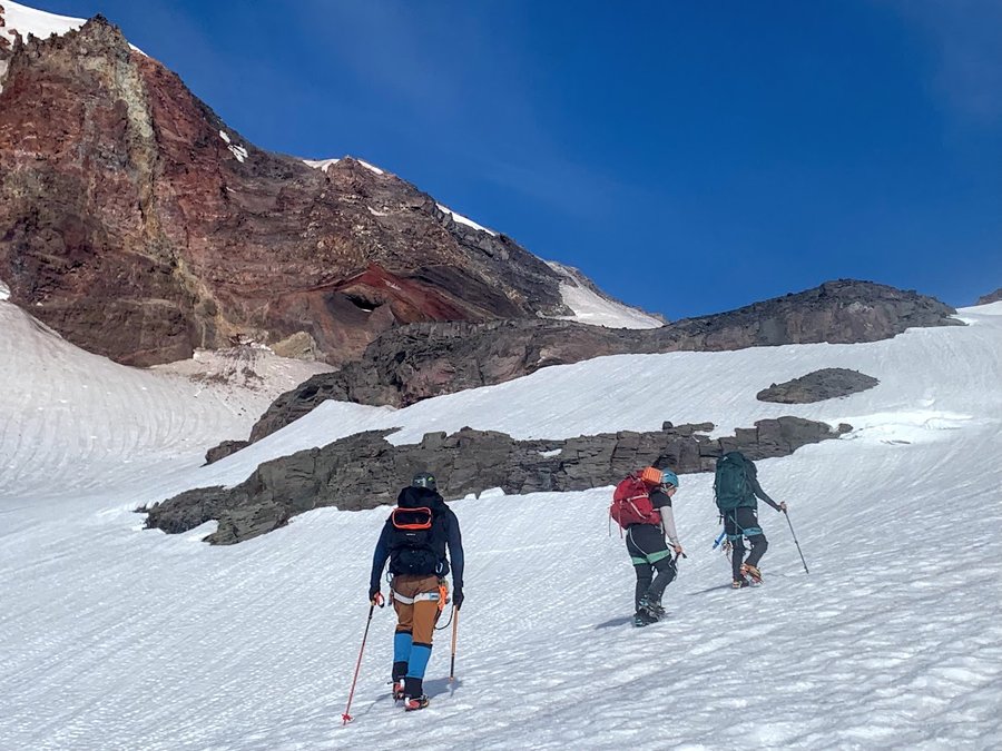
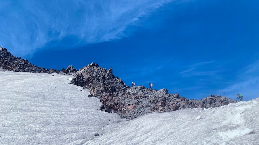
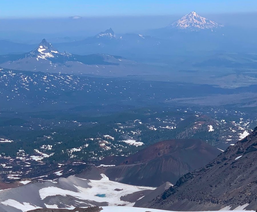
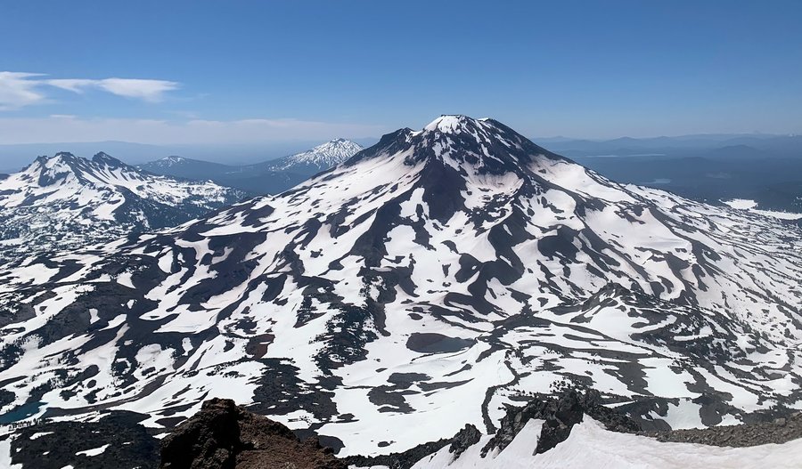
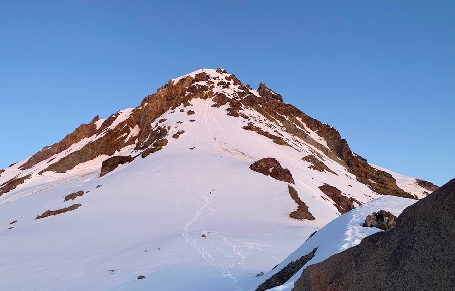
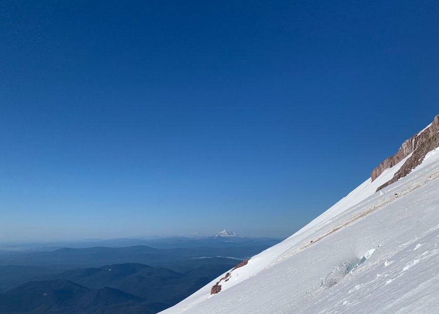
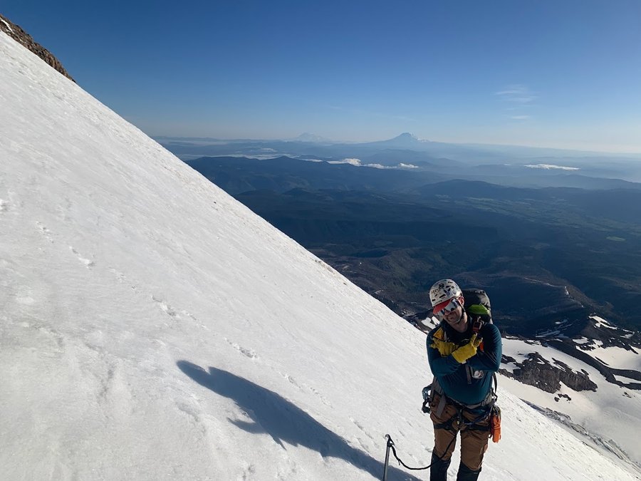
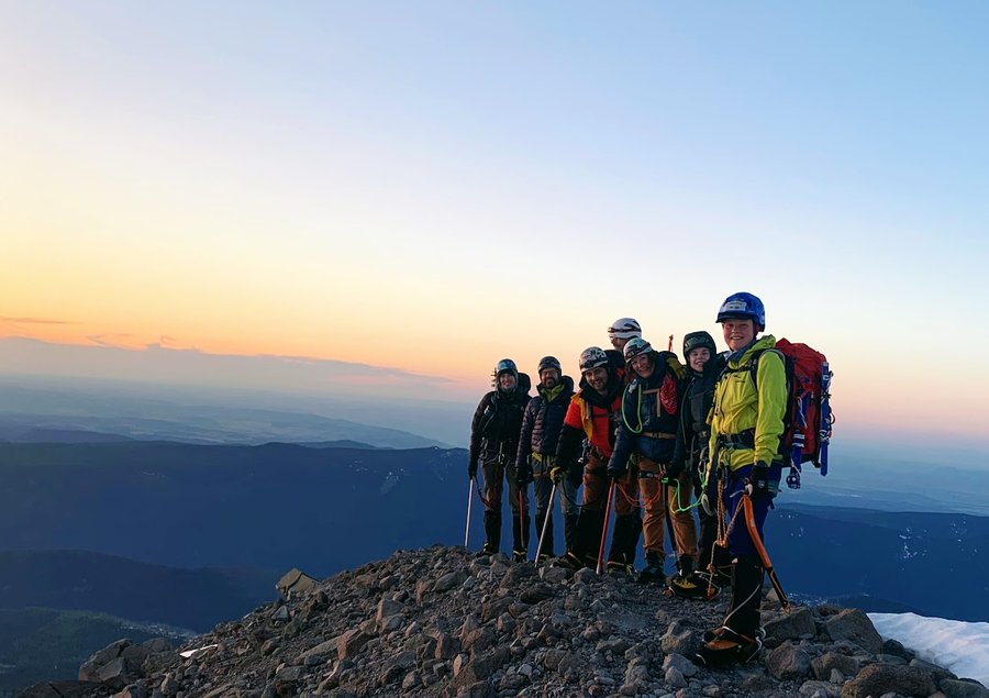
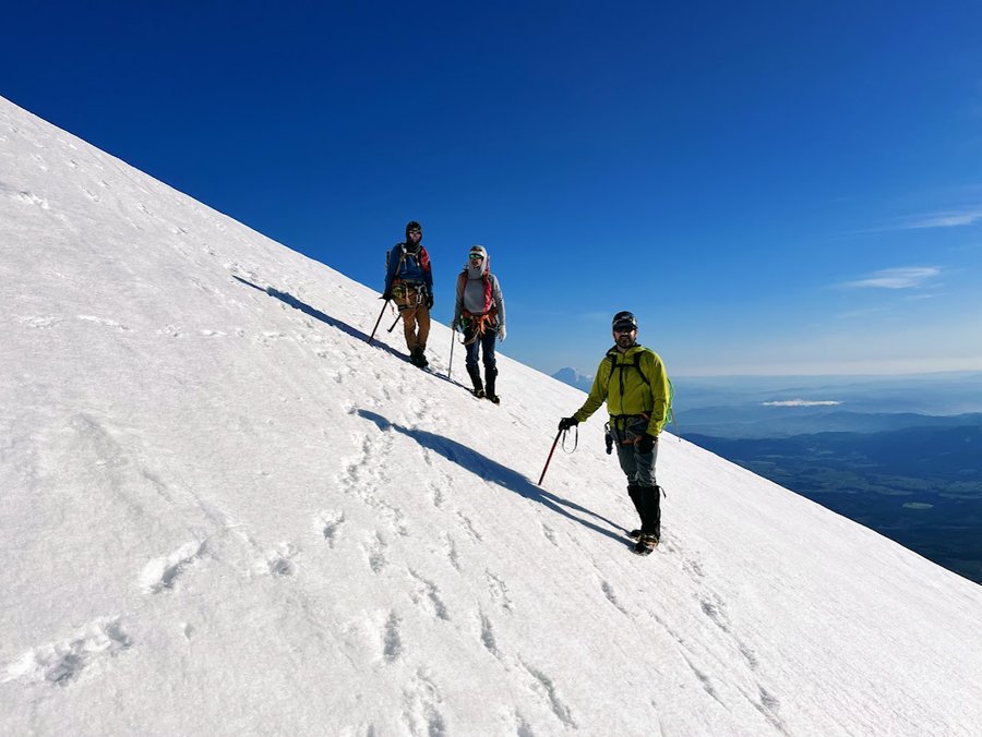
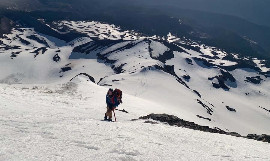
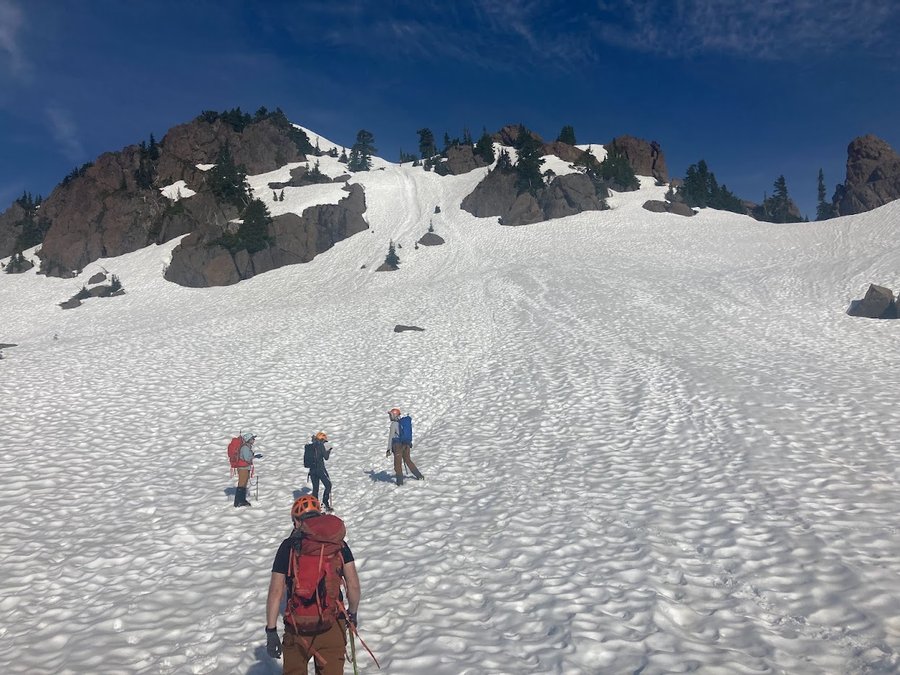
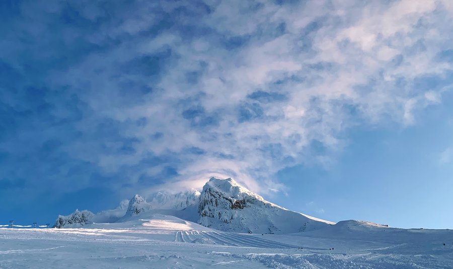
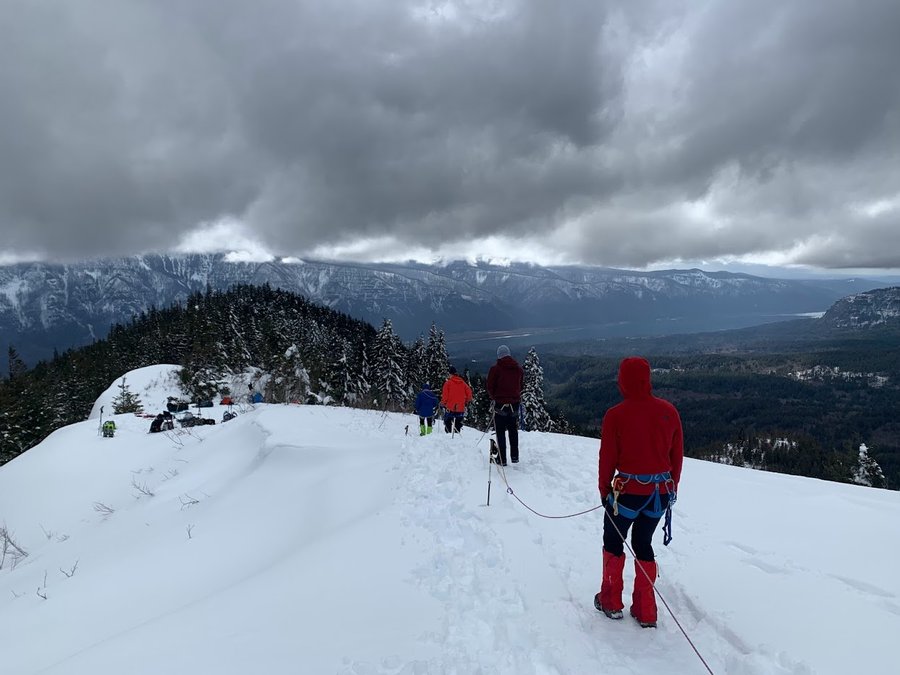
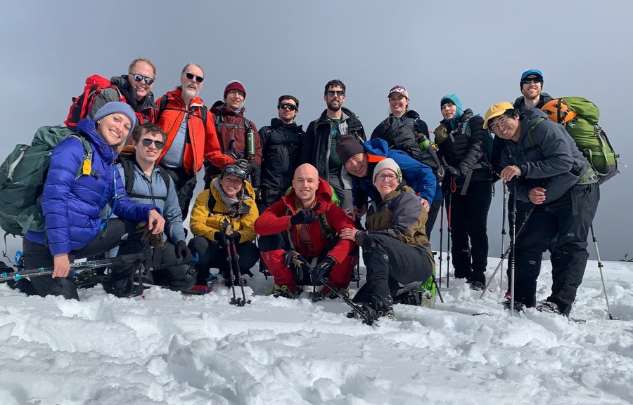
MSH via Monitor Ridge
8.5 miles of hiking • 4500' elevation gain •
Started from Climber's Bivouac. Road there is still snow free and the gate was open, but there is some ambiguity about when it's going to close. Some sources say it is closed already, and a sign enroute also says closed. Another party came up from Marble Mountain and felt some anguish when they discovered that they could have saved 1300 ft of gain.
Snow started about a mile and a half up the trail. Was a bit icy in the morning, had to don spikes or crampons soon after getting up on the ridge. Winds died down for a very pleasant summit lunch break. Love sunny days in November!!!
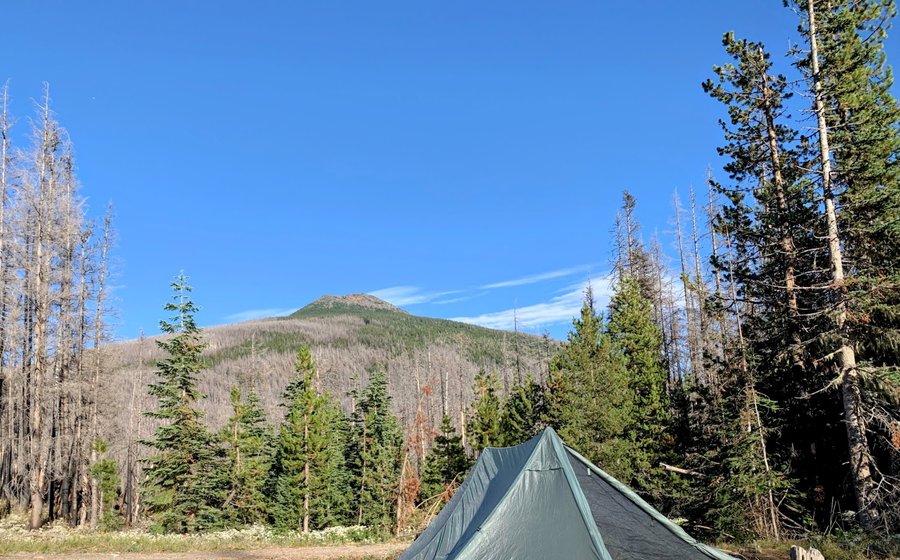
November 16, 2023

 1
1
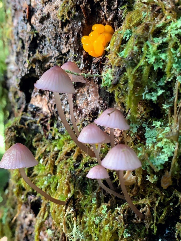
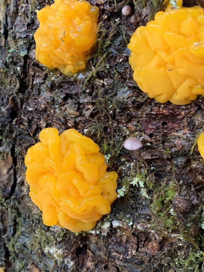
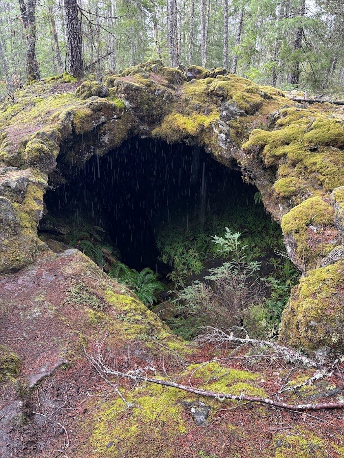
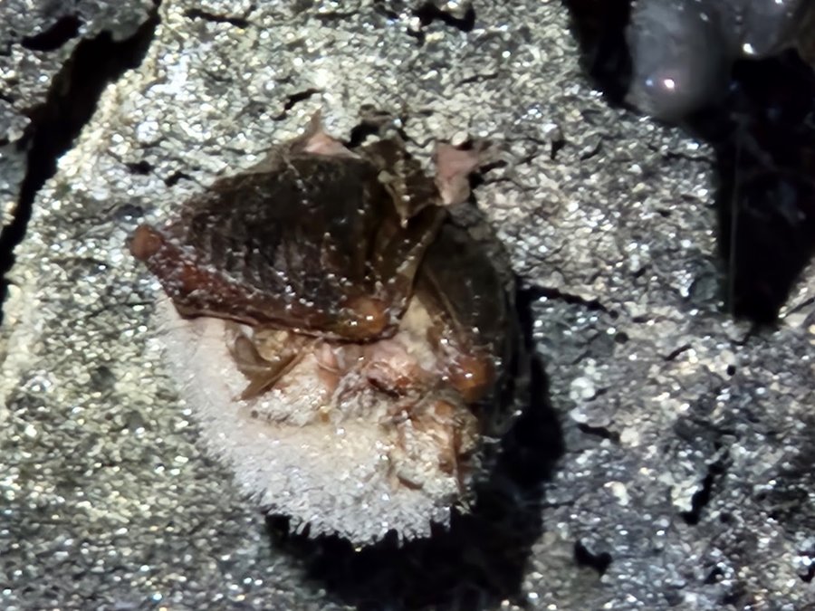
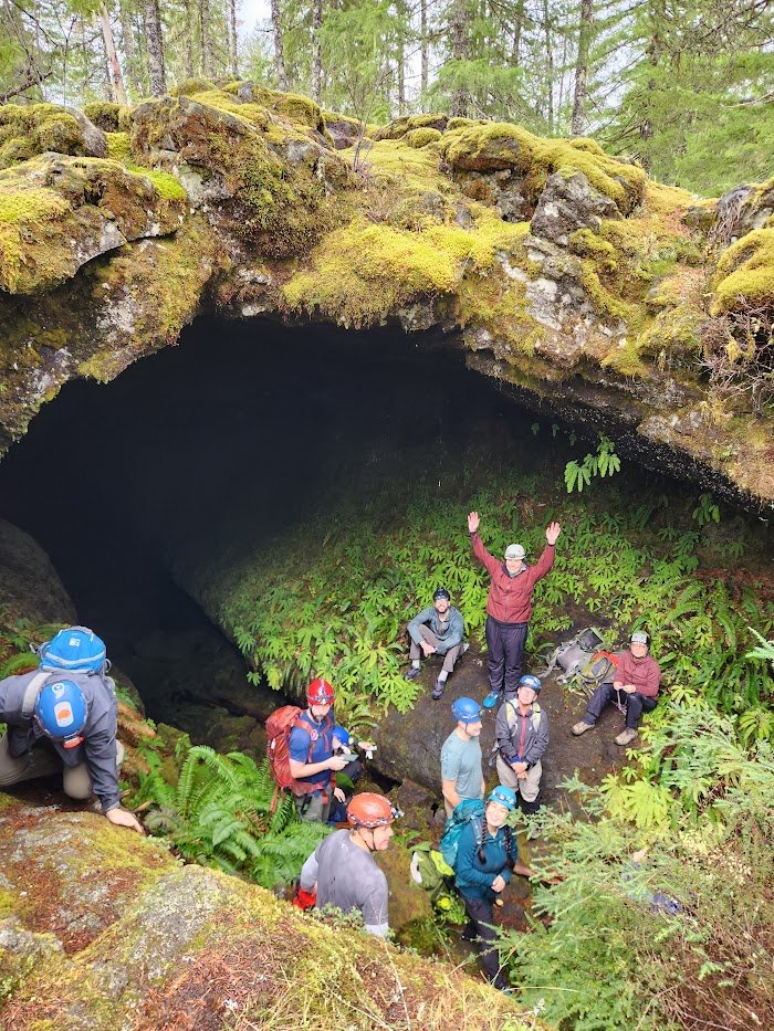
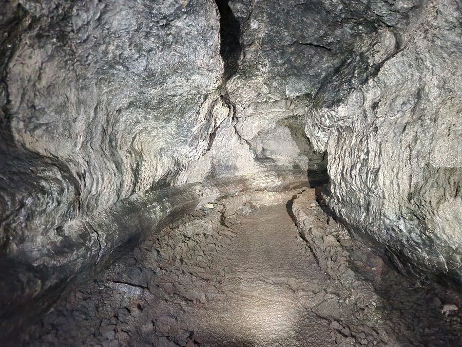
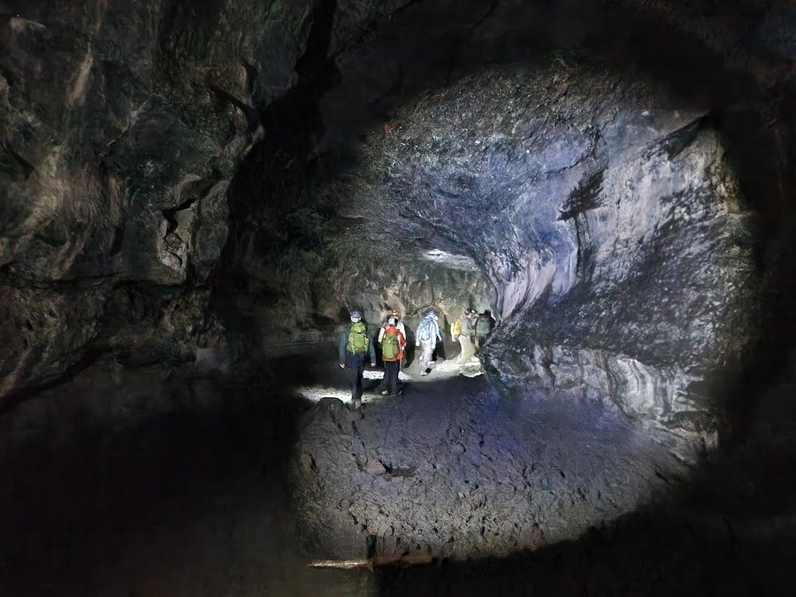
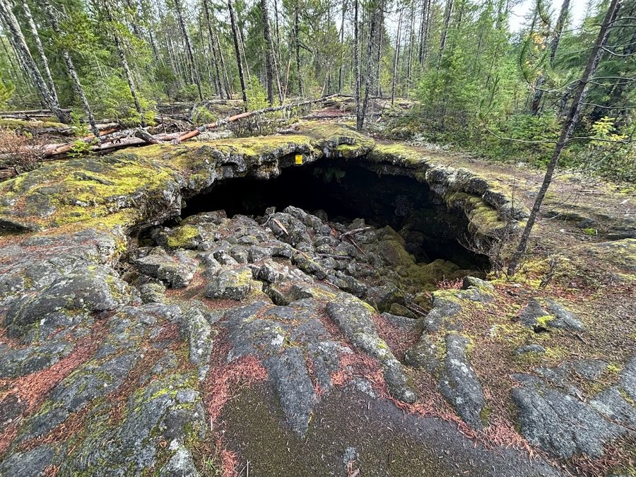
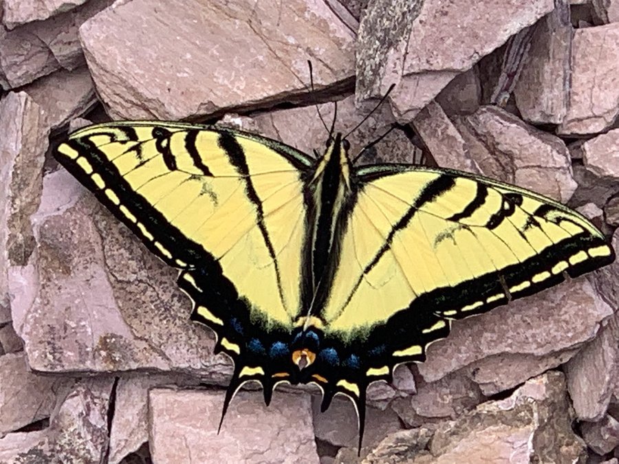
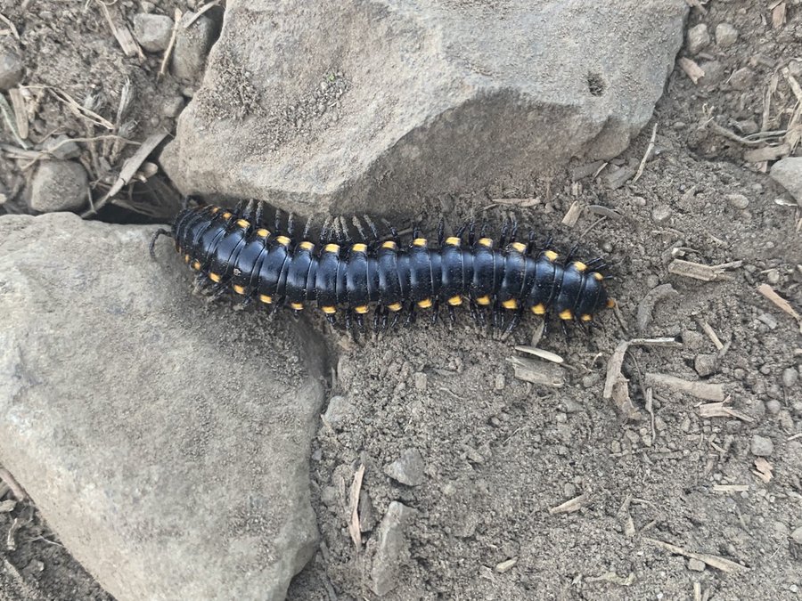
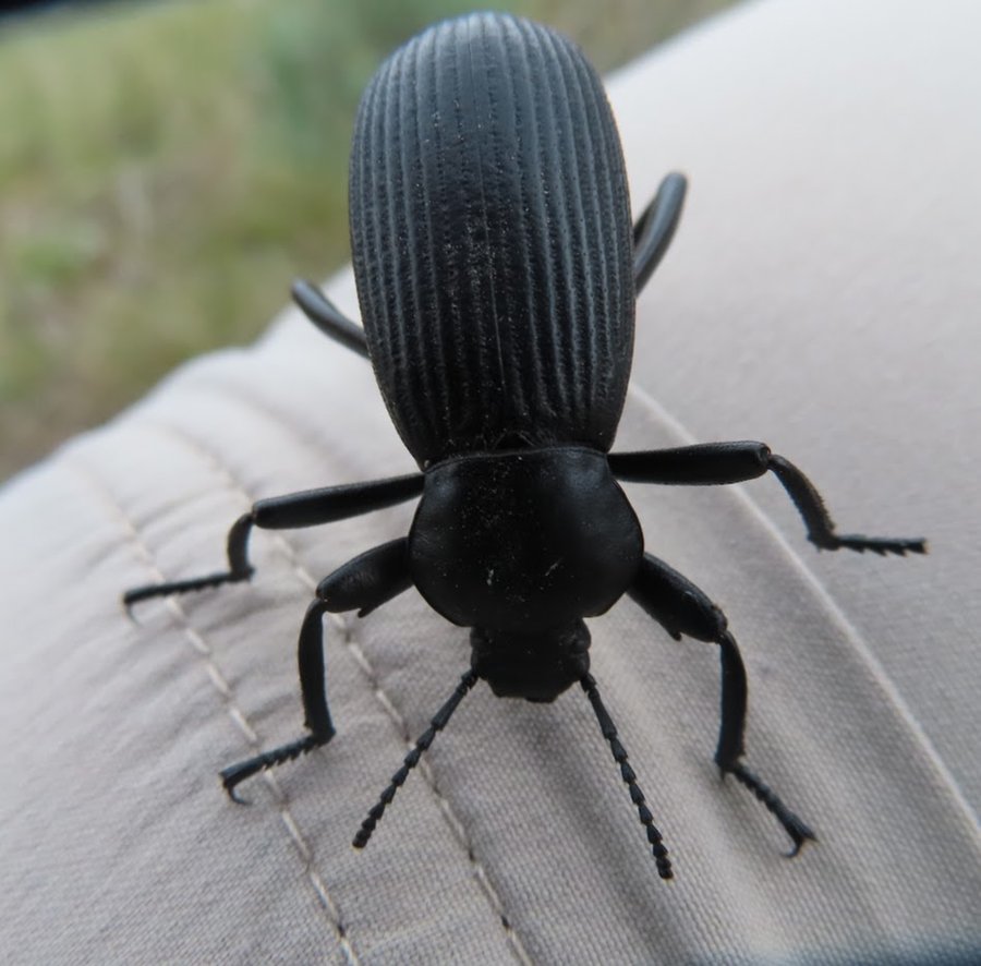
Ole's Cave
5 miles of hiking • 250' elevation gain •
Fun trip to Ole's Cave, and collected mushrooms on the way out.
November 4, 2023

October 27, 2023

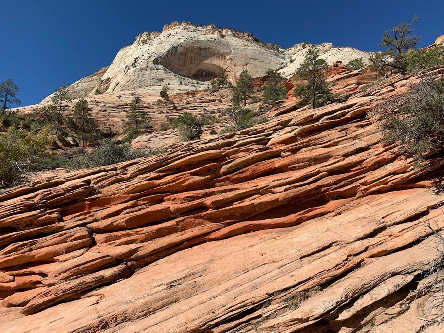
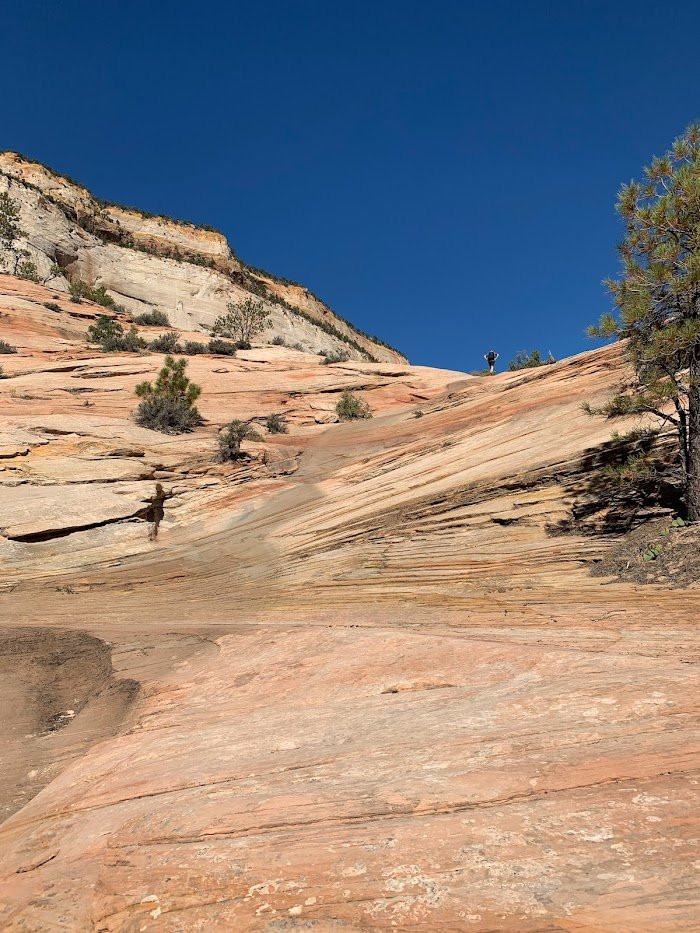
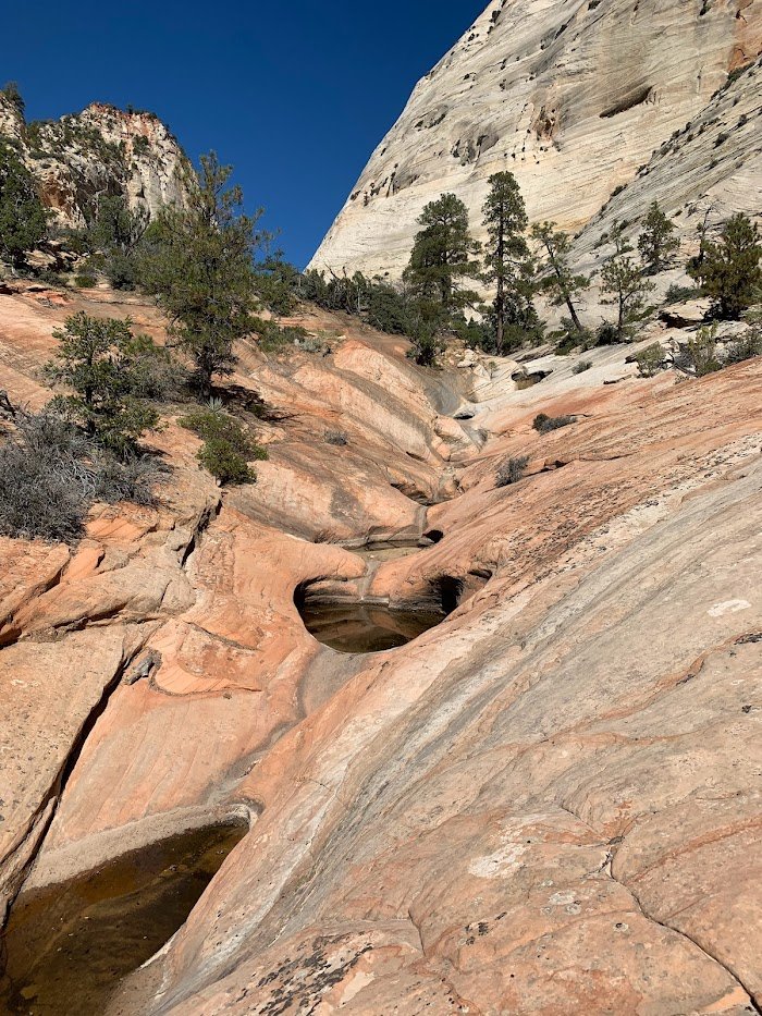
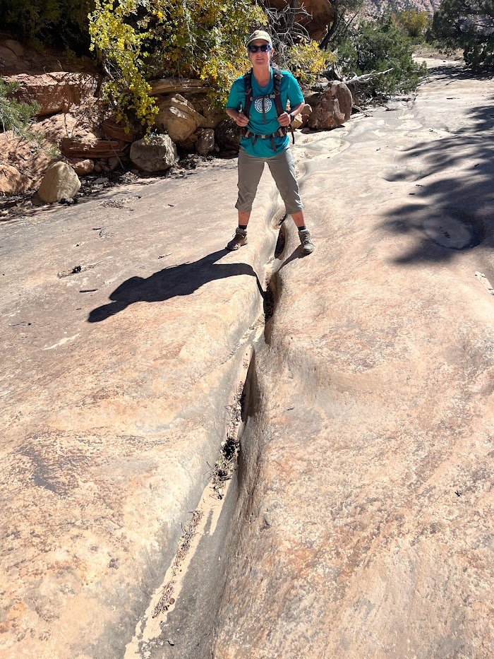
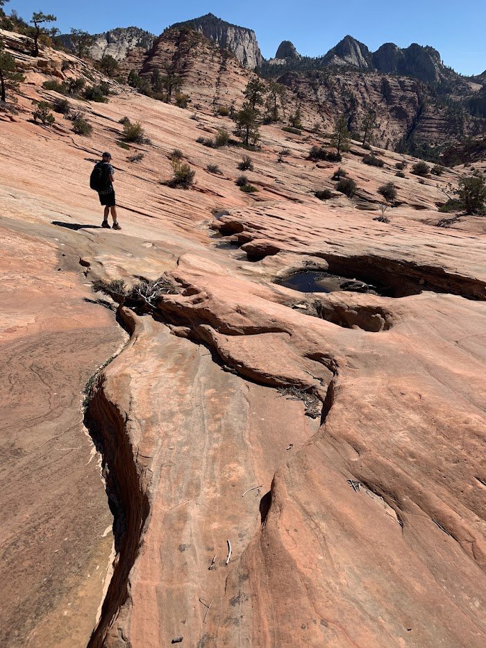
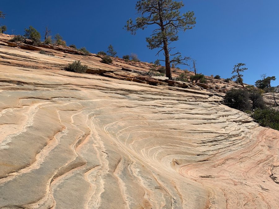
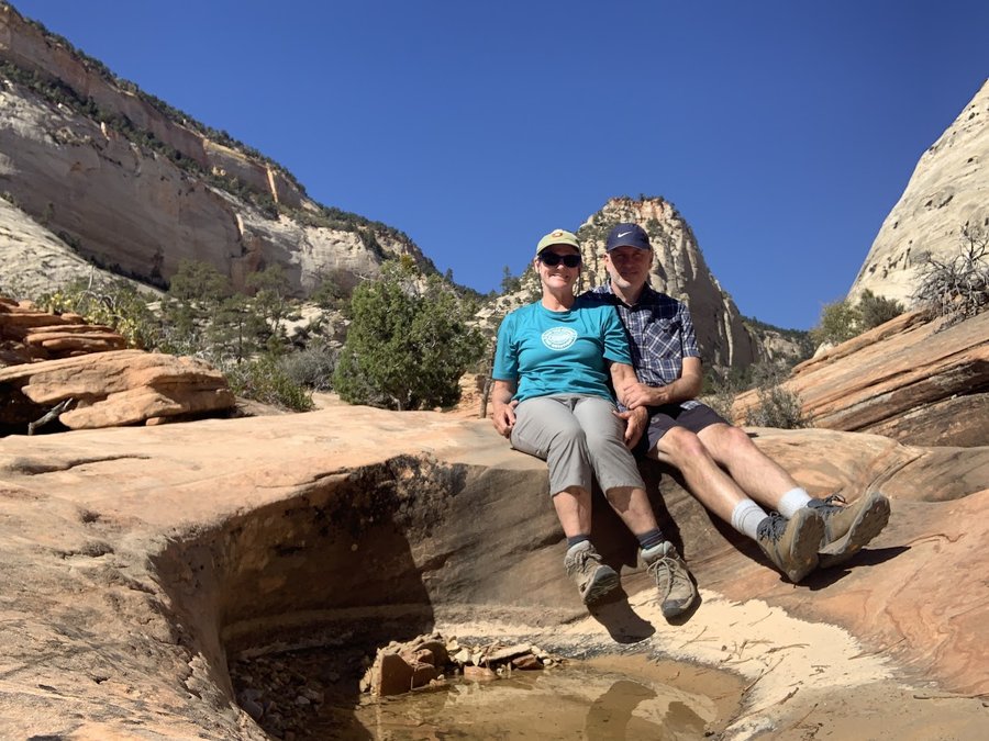
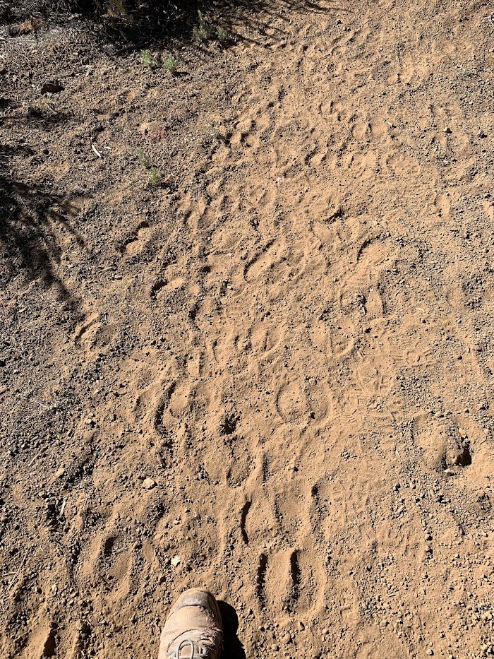
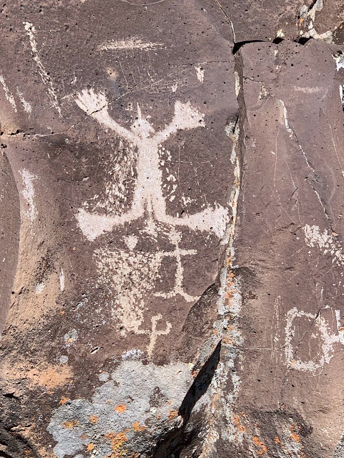
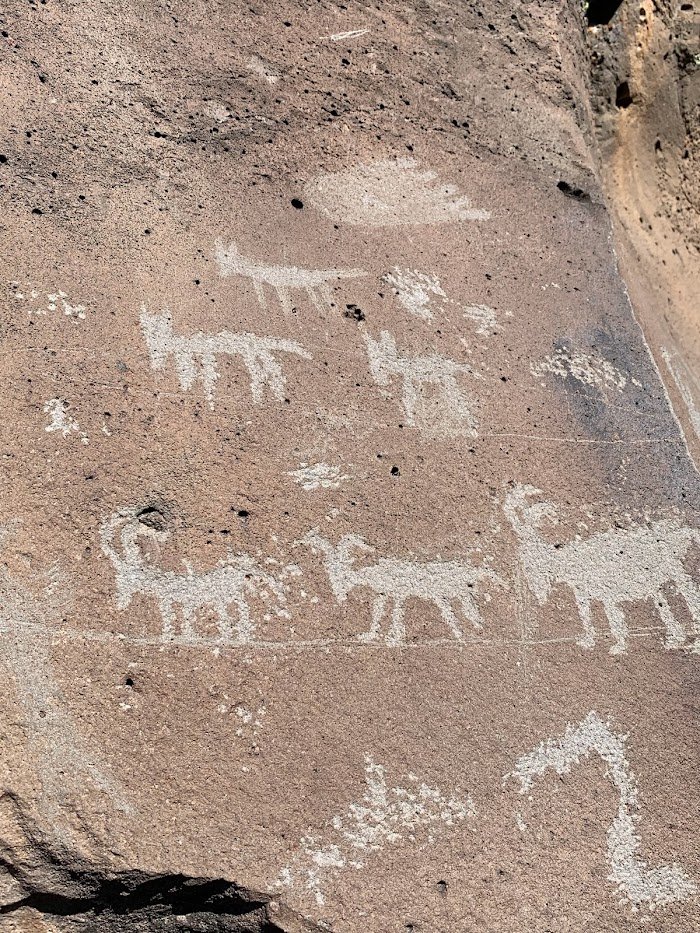
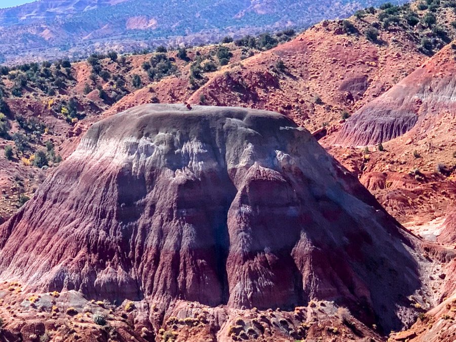
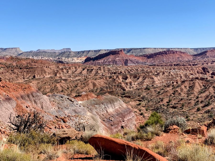
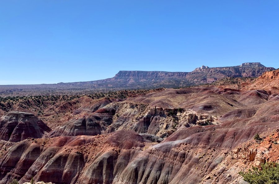
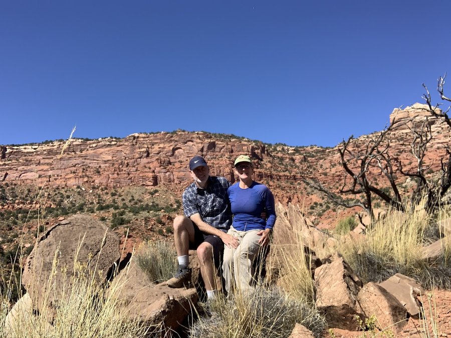
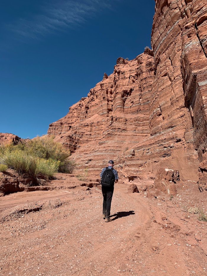
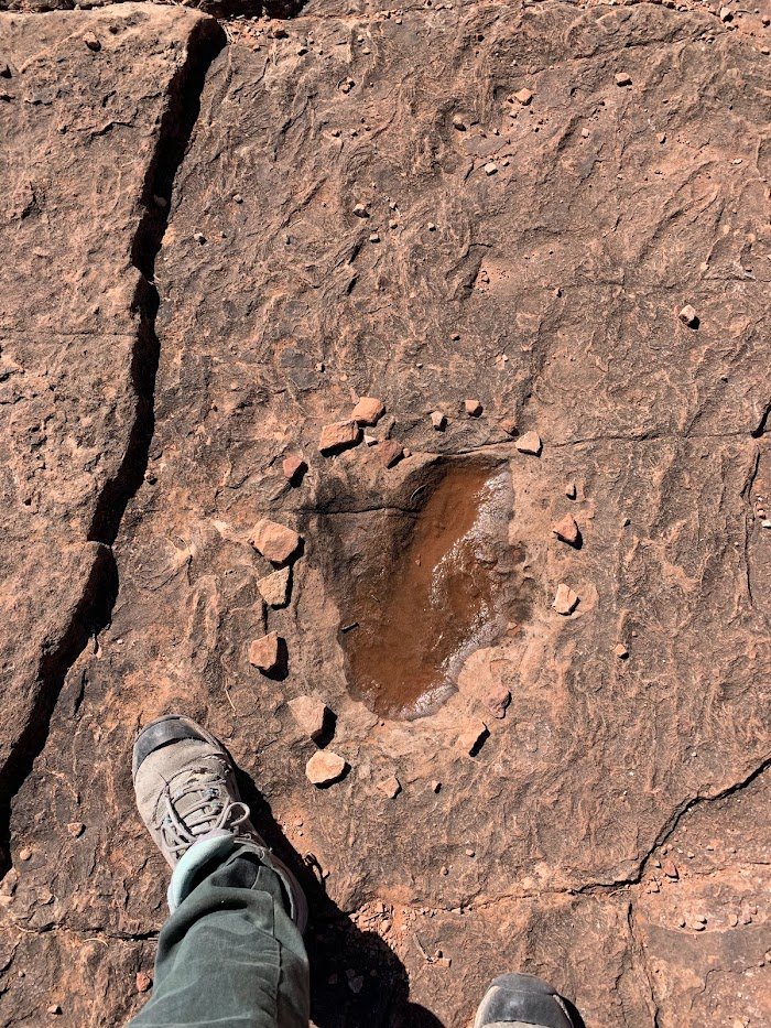
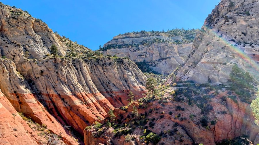
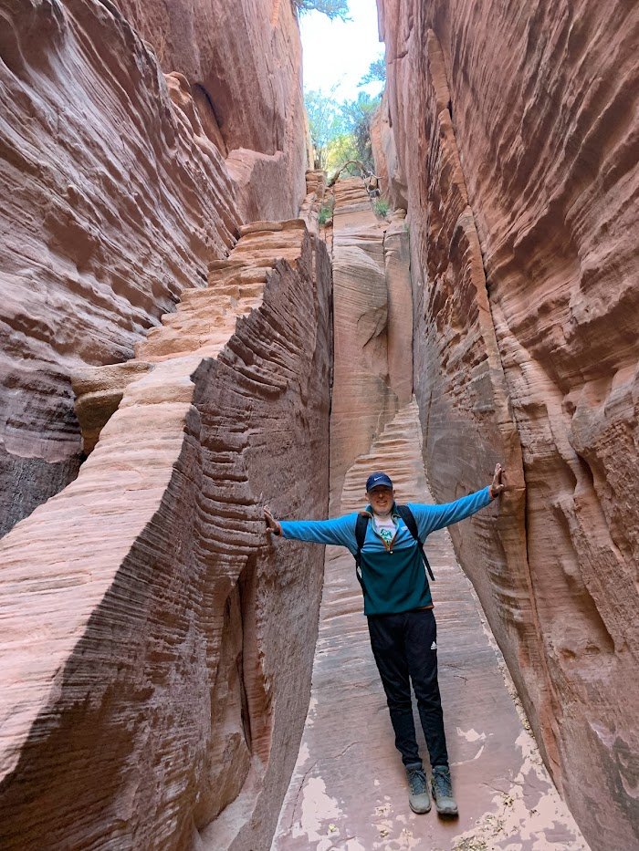
Southern Utah
27 miles of hiking • 3000' elevation gain •
We stayed in Kanab and went hiking every day!
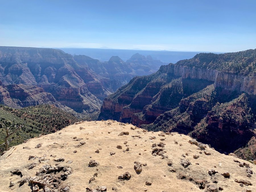
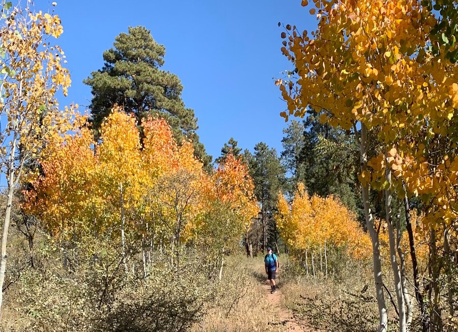
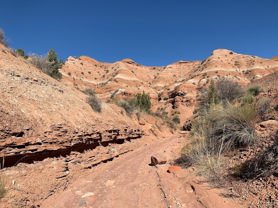
1) Red Canyon and Dino tracks 4 miles, 500 ft 2) Starlight Canyon 8 miles 1150 ft 3) North Rim GC, Uncle Jim trail-beautiful aspens 7.5, 500 ft 4) Nampoweap=the best, many petroglyphs 3 mi, 300 ft 5) Many Pools slickrock scramble4 miles, 750 ft
October 13, 2023

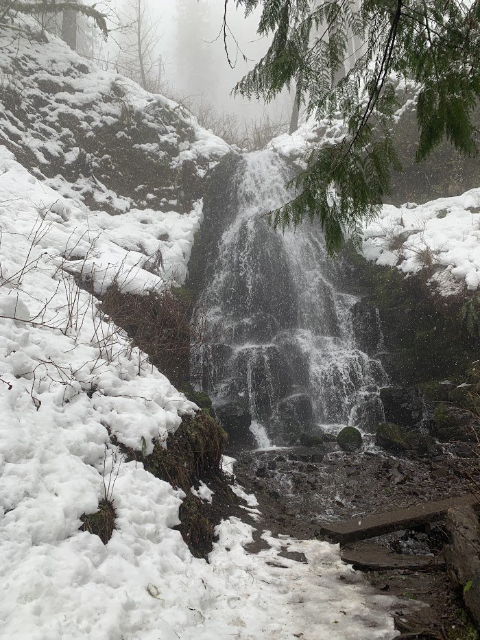
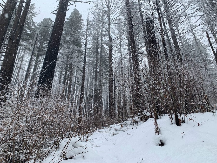
Clackamas area foraging
4 miles of hiking • 750' elevation gain •
Wandering in the woods for hours. Got soaked. Found some fungi!
October 3, 2023

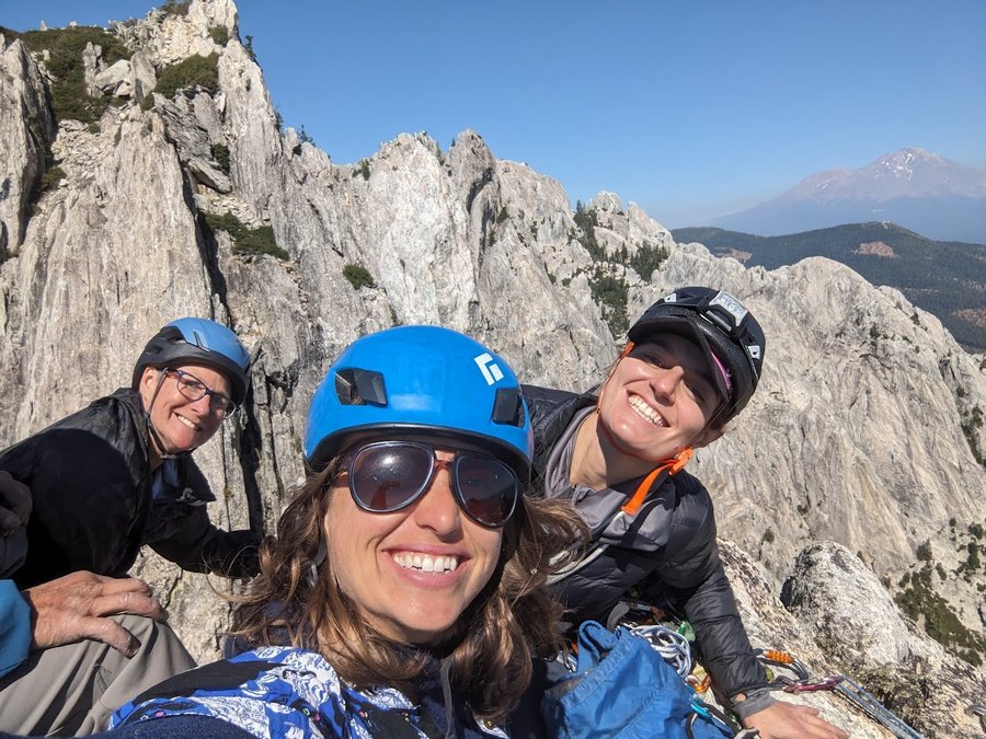
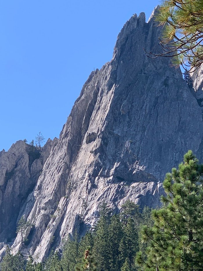
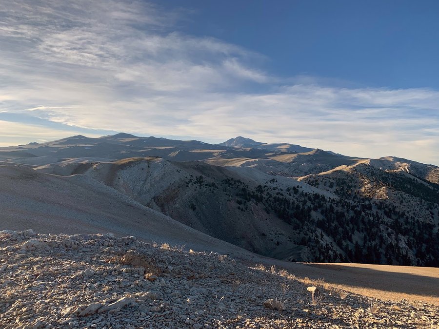
California Road Trip
51 miles of hiking • 13750' elevation gain • 7 nights
I went to California for 10 days and had some fun hikes.
1) Castle Lake- 4 miles, 750 ft
2) Mt Hubris-with the Mazamas. 5 pitches of glorious granite. Amazing lofty summit. Nice park but the campground is unfortunately very close to I-5. Trucks and trains roaring all night. 6 miles, 2250 ft
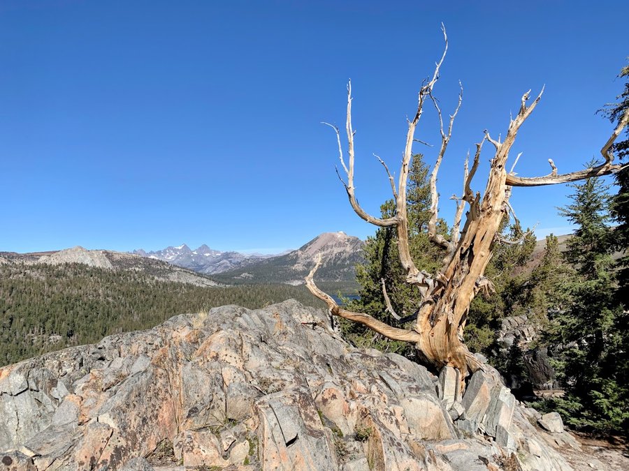
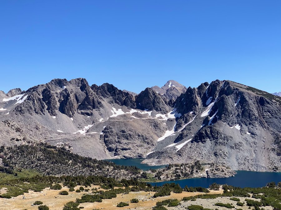
3) Deer Pass in the Sierras. Started in Mammoth Lakes. Wanted to visit the Minarets, but they are now only opening the approach road on the weekends. Beautiful area, but busy with peoples. 9.5 miles, 2200 ft
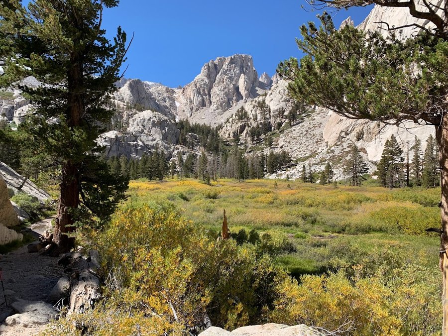
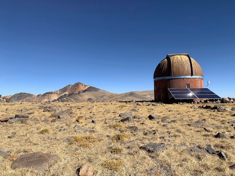
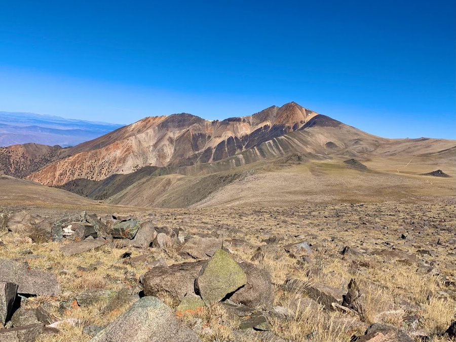
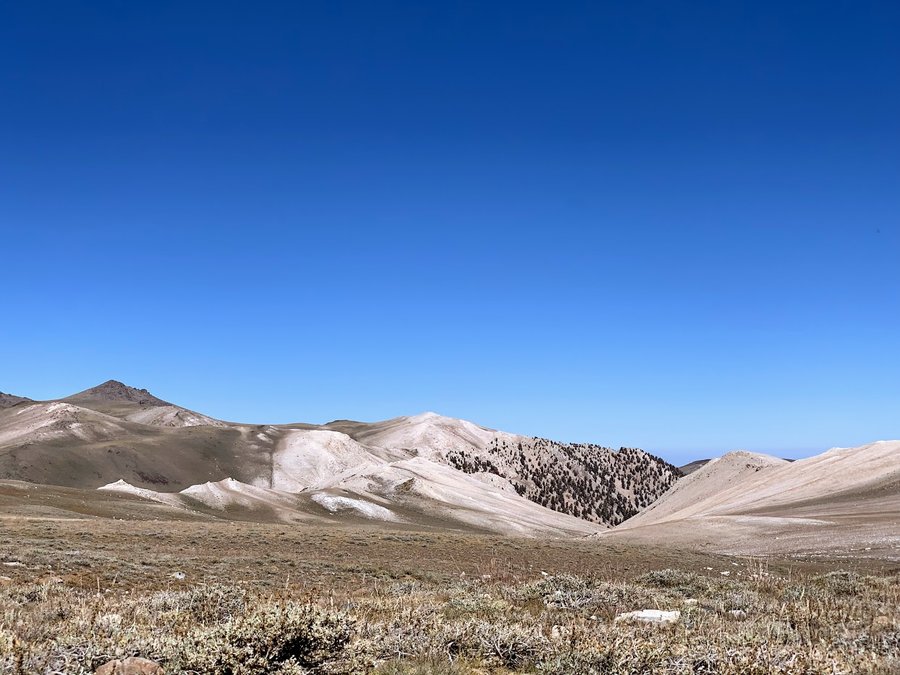
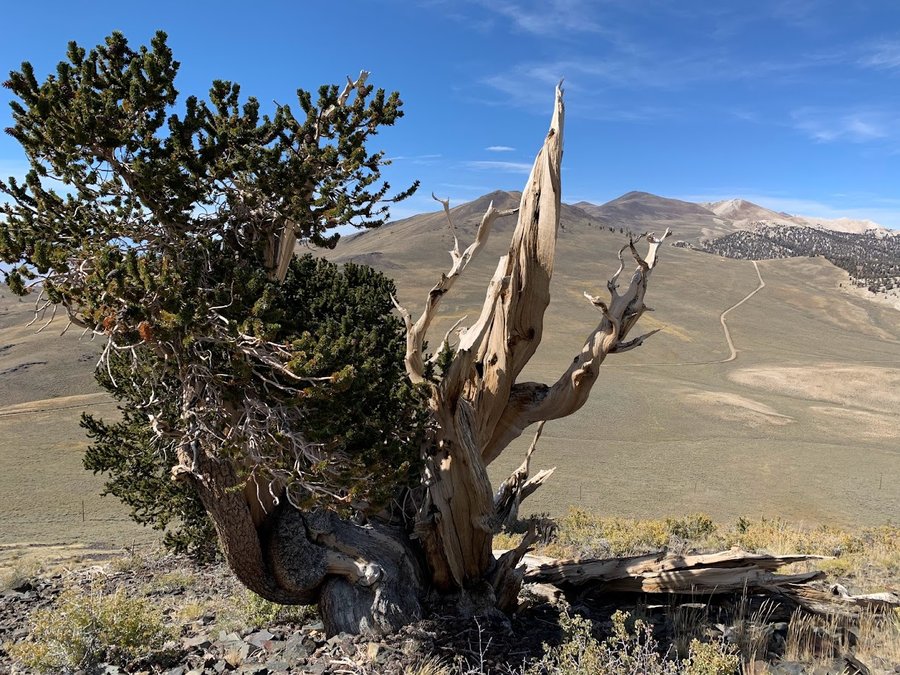
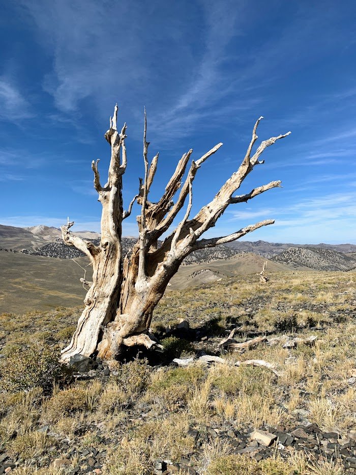
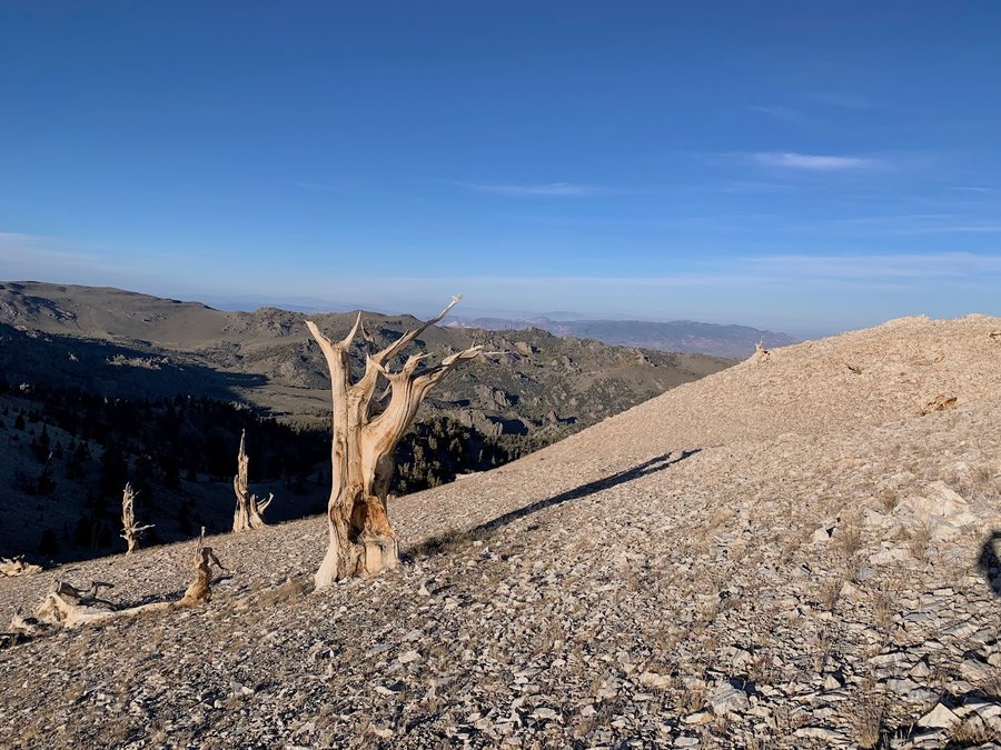
4) White Mountains/Ancient Bristlecone Pine area. This was my favorite part of the trip. Hiked up County Line Hill(4.5 miles, 1300 ft), camped at 11,600 ft, and then hiked Mt Barcroft (map marker) the next day( 5miles, 1300 ft eg). The area around White Mountain is surrreal. Want to go back and climb that one. It's over 14K feet and so pretty! I didnt do it because I was resting for Whitney.
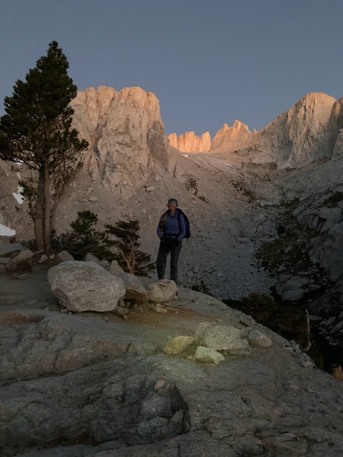
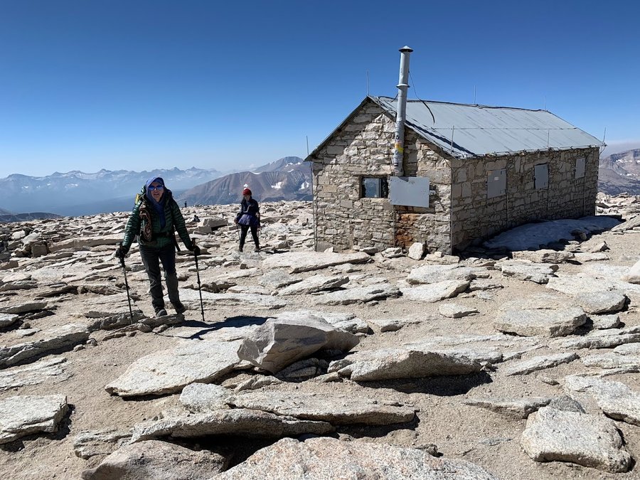
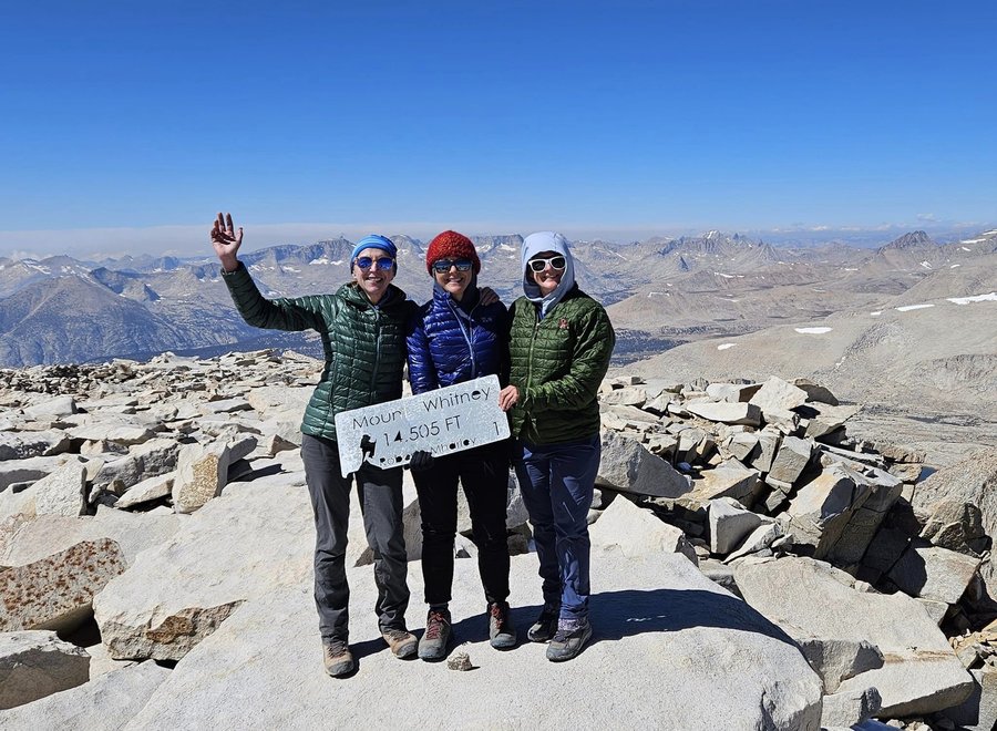
5) Alabama Hills and Mt Whitney. 22 miles, 6K ft eg. Kind of a zoo. An extreme tourist hike. Many unprepared people. Had to do a a rescue of one person suffering from HACE and dehydration, They improved as we ferried them down to the lower camp. They refused further assistance which stressed us nurses out even more!
September 20 – September 27, 2023


Palmer Mill
5 miles of hiking • 1000' elevation gain •
Just a pleasant and cool wander on the piney paths in the forest. Still love this place.
September 14, 2023

Olallie Lakes Basin
4 miles of hiking • 250' elevation gain • 1 night
I went up to check on a couple wildlife cameras for Cascadia Wild. Forgot to bring hiking shoes. HIked in flipflops and toes socks for first camera. Found a single shoe at trailhead that was just my size- used it for second camera.
Bummer coming up through the burn area on the Clackamas. Miles of the canyon are completely scorched. Olallie area is a mosaic burn. Temps down to the high 30s overnight, but I was cozy in my tent.
September 6 – September 7, 2023

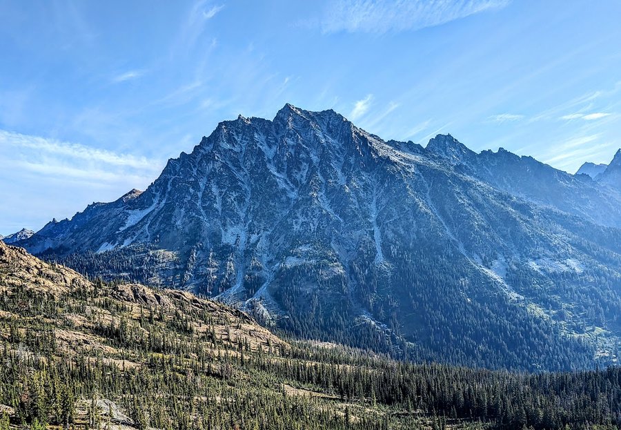
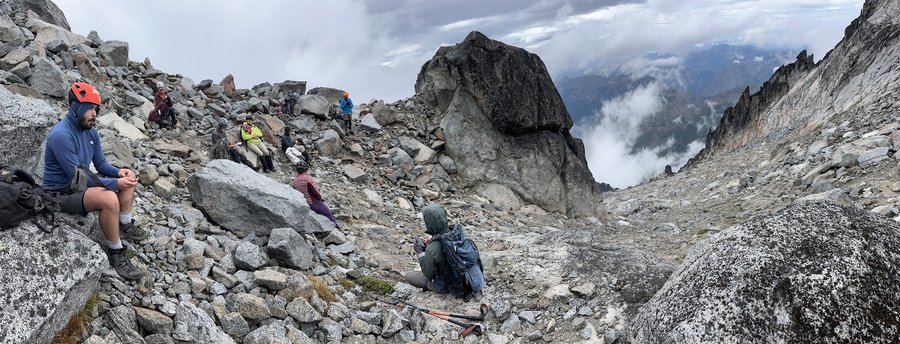
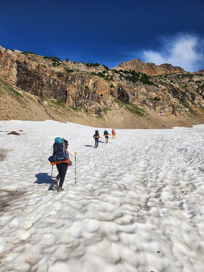
Mt Stuart via Cascadian Couloir
13.5 miles of hiking • 7750' elevation gain • 2 nights
Really fun climb. We hiked in to a base camp on Ingalls Creek, then spent the next day scrambling up 4500 feet of granite. Only sketchy in one spot really with loose dirt and rockfall. The upper couloir is supposed to have a persistent snow field, but not this year. Some rain came through on approach day and climb day was nice and cool. Views limited, but we really appreciated the cloud cover. Got to relax in camp on a second night and hike out on the third day.
August 31 – September 2, 2023

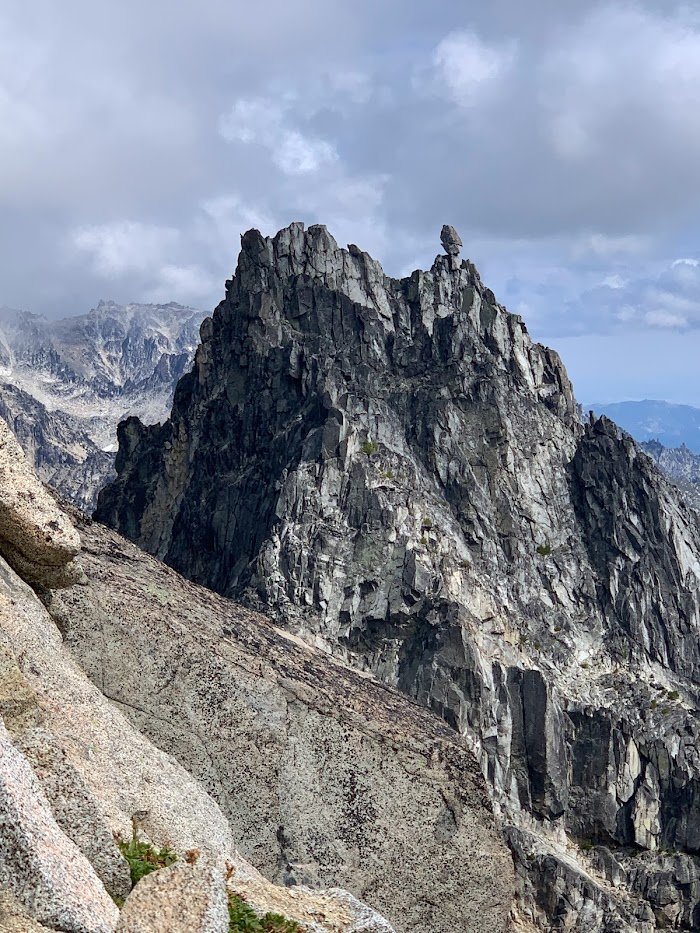
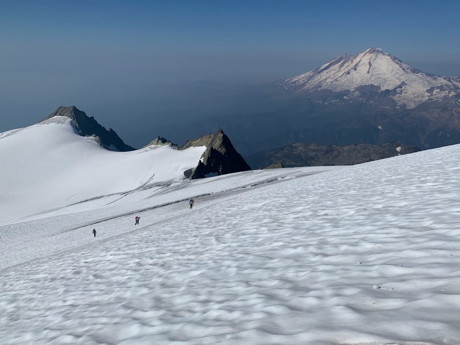
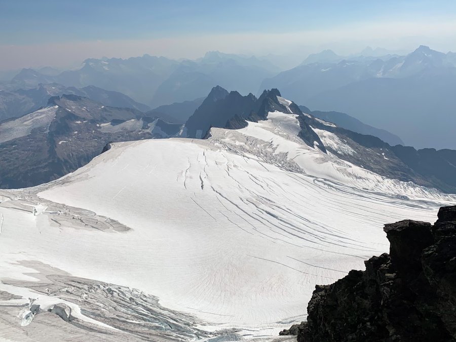
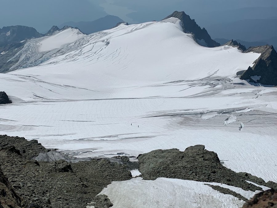
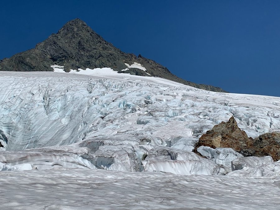
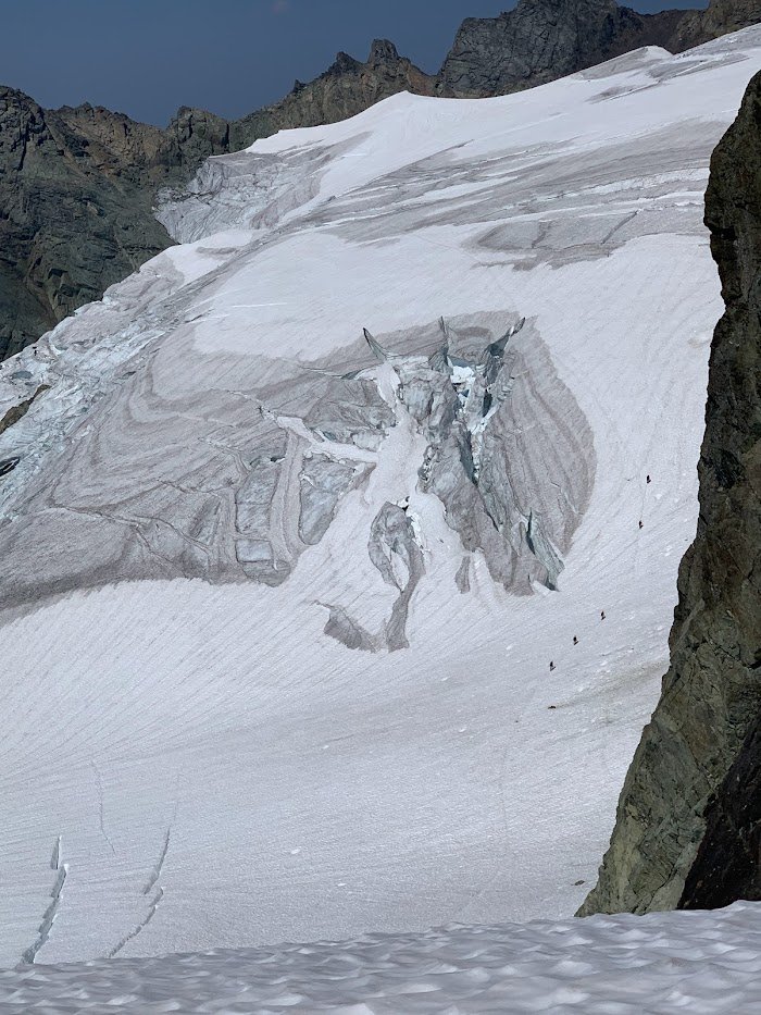
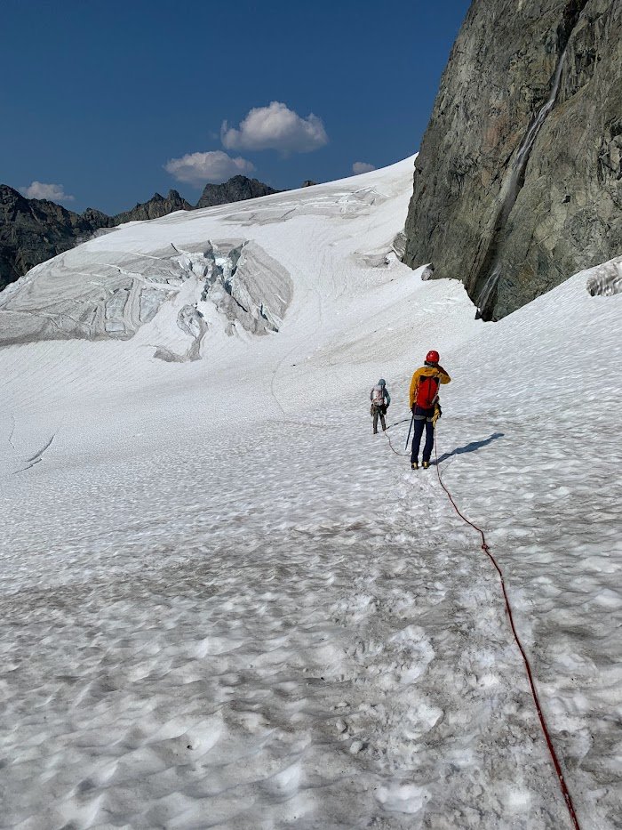
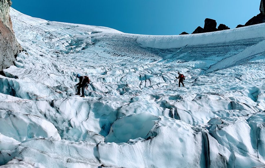
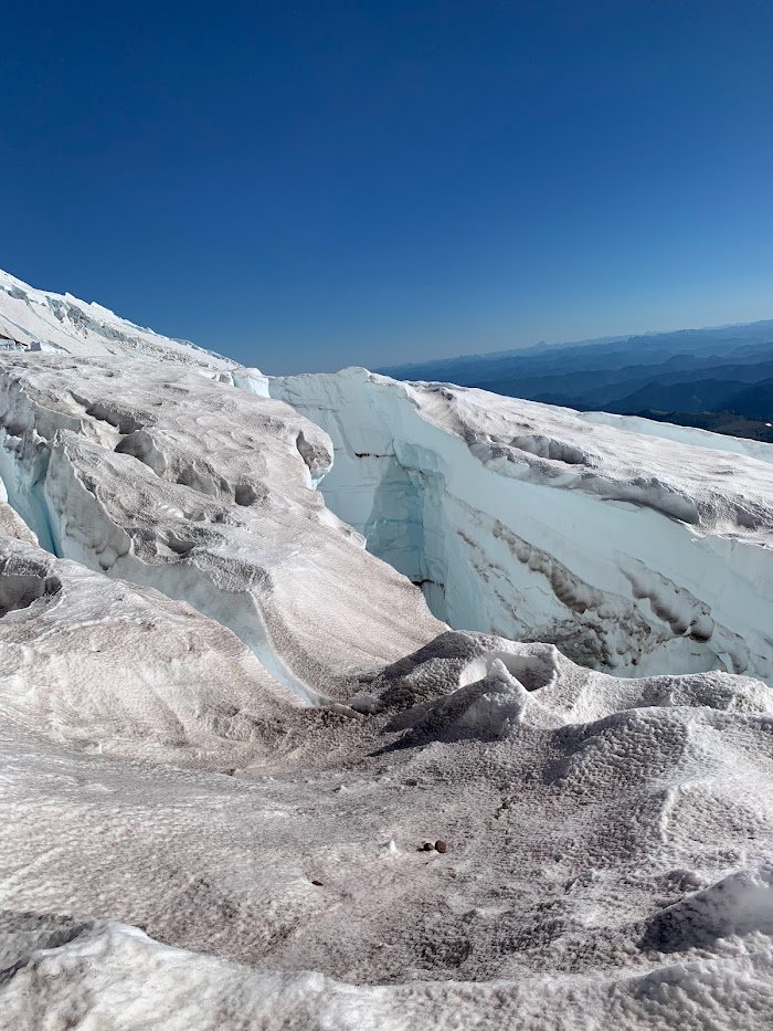
Shuksan Fisher Chimneys take 2
18 miles of hiking • 6750' elevation gain • 2 nights
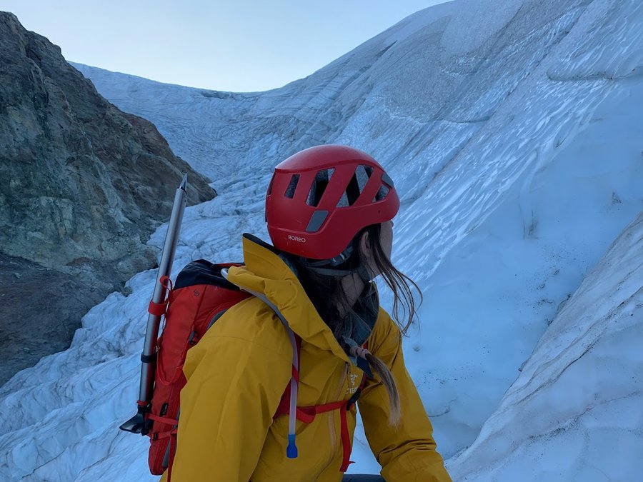
Conditions very different from last year's attempt. Glaciers melted out and mazed with crevasses. Winnies Slide and the Hourglass features were ice walls, got to use my ice screws! We had to turn back after the first pitch on the summit block because a party ahead of us slowed us down and we were very worried about returning through the crevasses in the dark. Definitely the sketchiest glacer travel I have experienced. Luckily the weather was nice. Happy to be with trusted pals with level heads. Employed all the skills this weekend.
August 25 – August 27, 2023

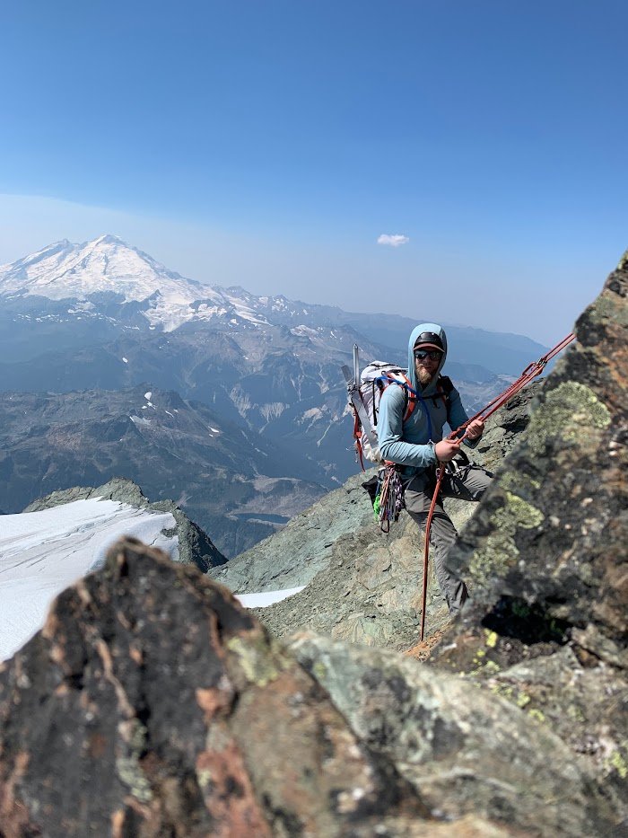
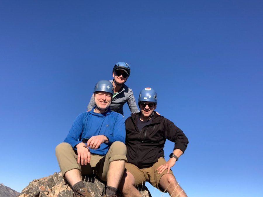
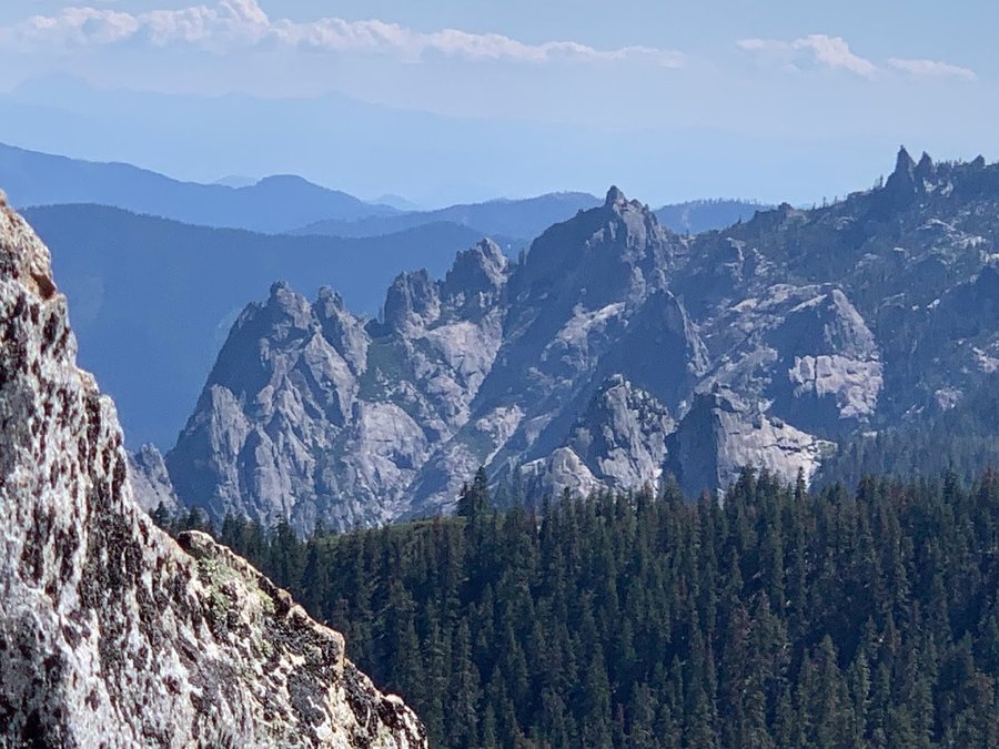
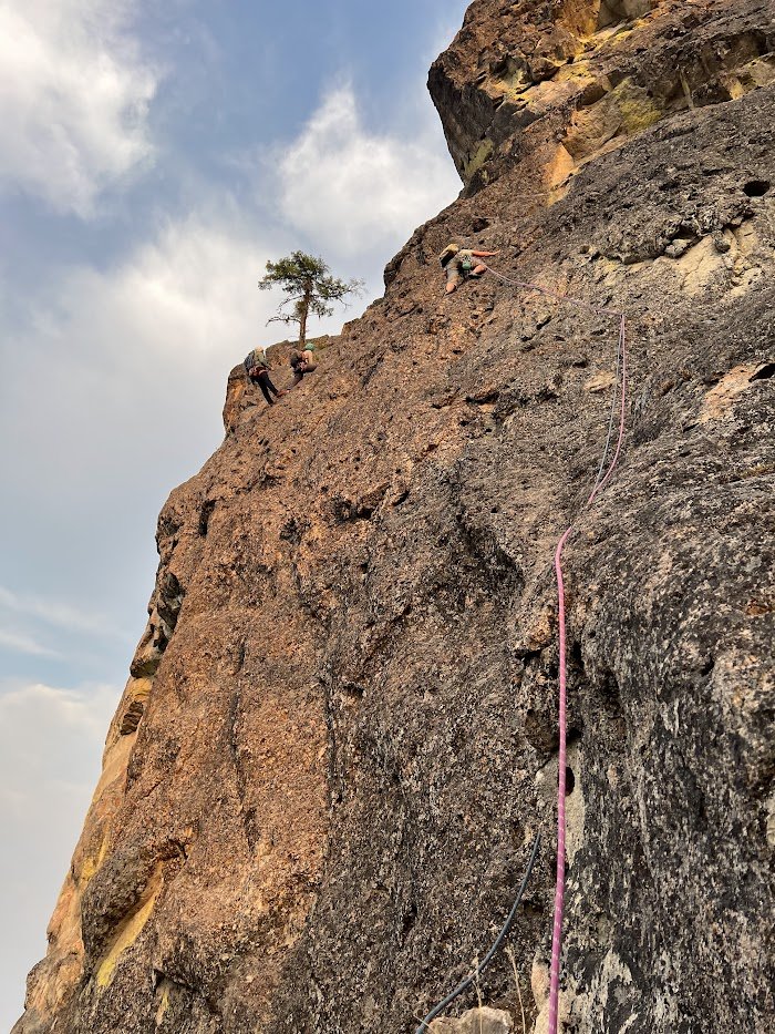
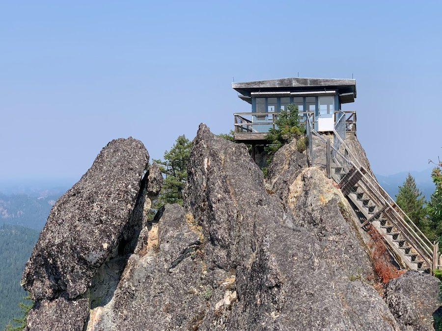
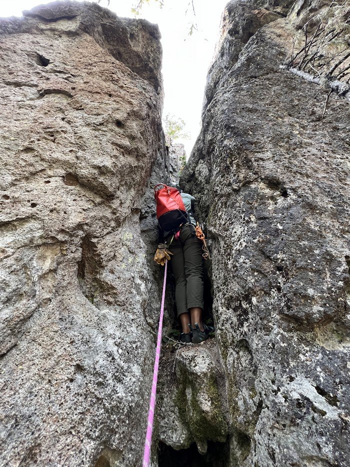
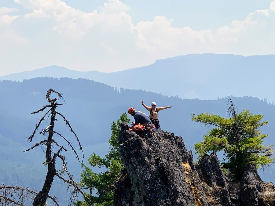
Acker Rock
2 miles of hiking • 500' elevation gain •
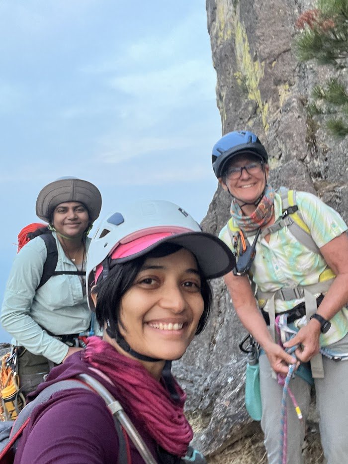
I was taking part in a Mazama multipitch course over two days on Acker Rock. Went up and down to the LO tower twice. Climbed the 10 pitch SW face once. What a thrill!
August 19, 2023

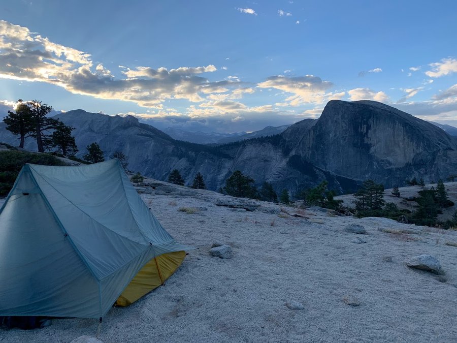
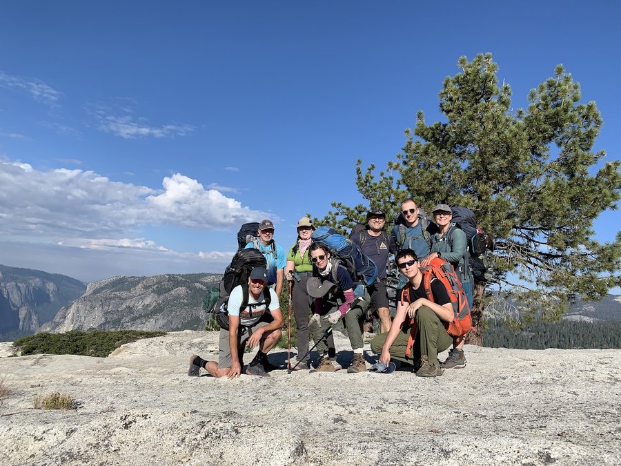
North Rim Yosemite
37 miles of hiking • 8250' elevation gain • 3 nights
Family backpack like the old days! Everyone loved it.
August 8 – August 11, 2023

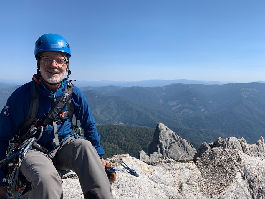
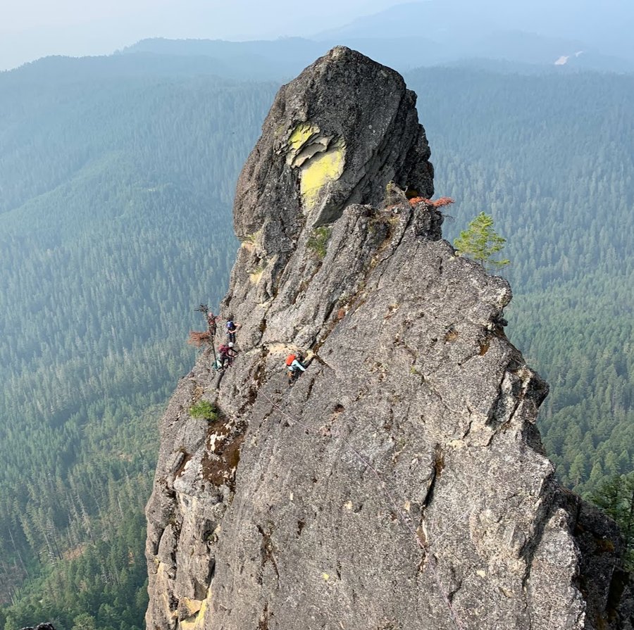
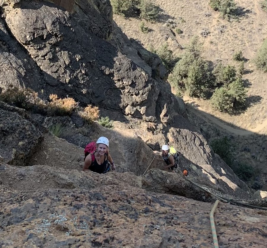
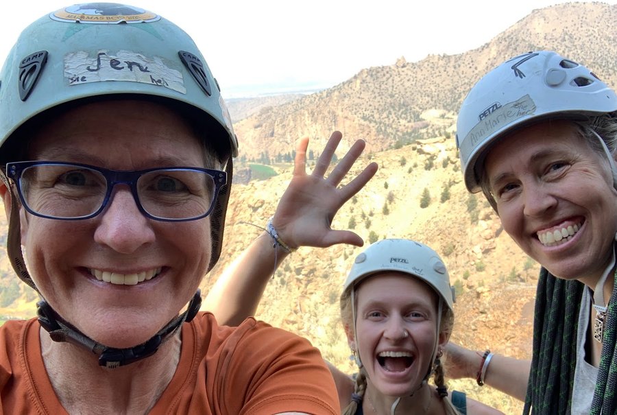
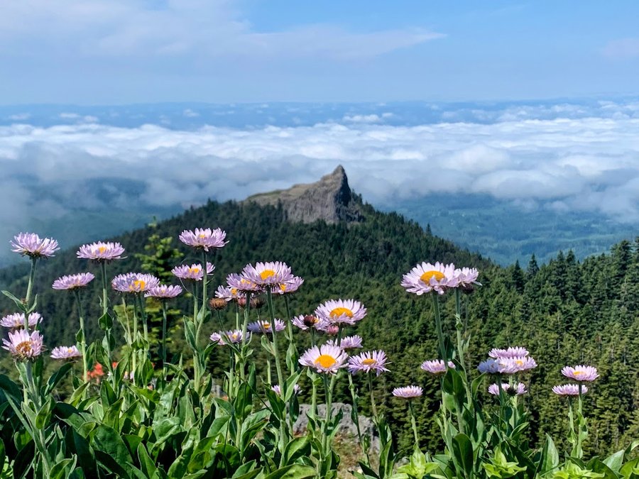
Misery Ridge
4 miles of hiking • 1750' elevation gain •
Went climbing. Had to hike up over Misery Ridge twice with heavy packs. Not bad in the morning, but brutal in the afternoon. Successfully led three of the five pitches of a route called First Kiss, what a thrill!
August 2, 2023

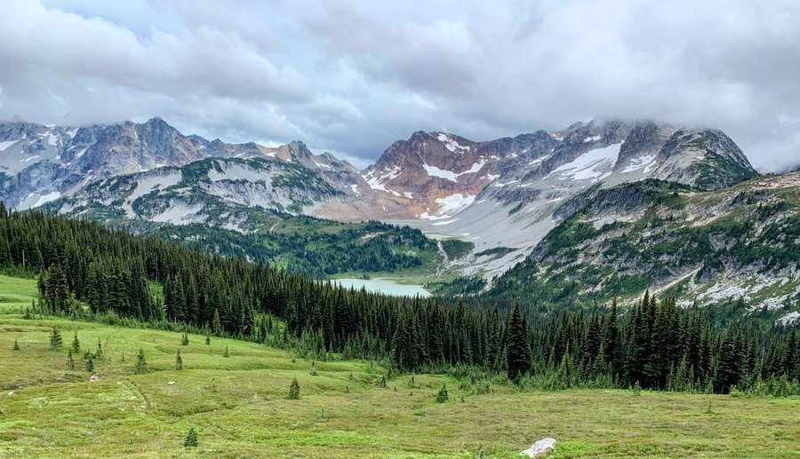
Spider Gap-Buck Creek Pass
37 miles of hiking • 8500' elevation gain • 3 nights
Carefully planned Olympus climb foiled by rain! We chose this lovely backpacking loop and did a bit of scrambling too. The Lyman Basin and Buck Creek Pass areas were just spectacular. Team pretty happy with plan B.
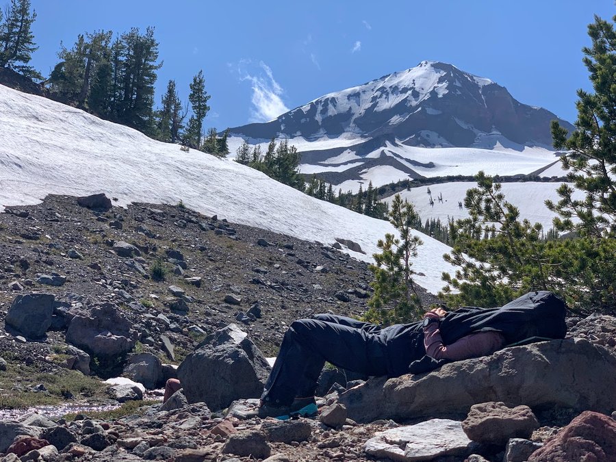
July 23 – July 26, 2023


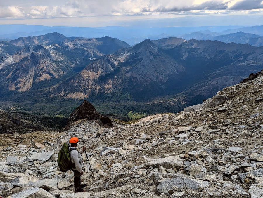
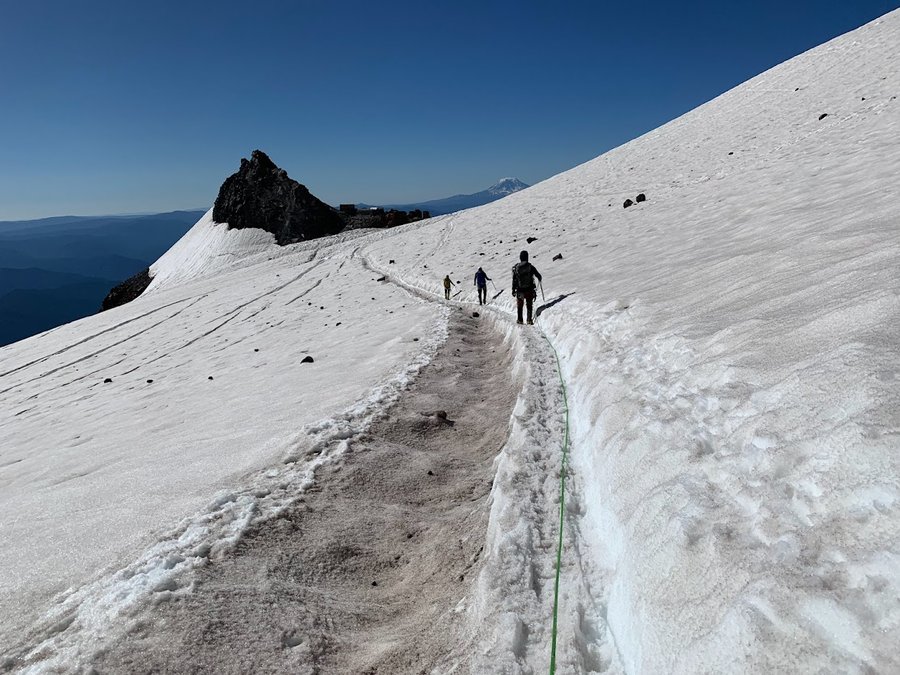
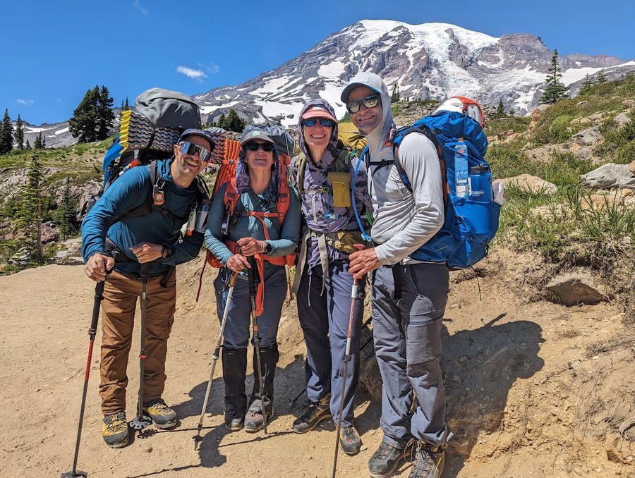
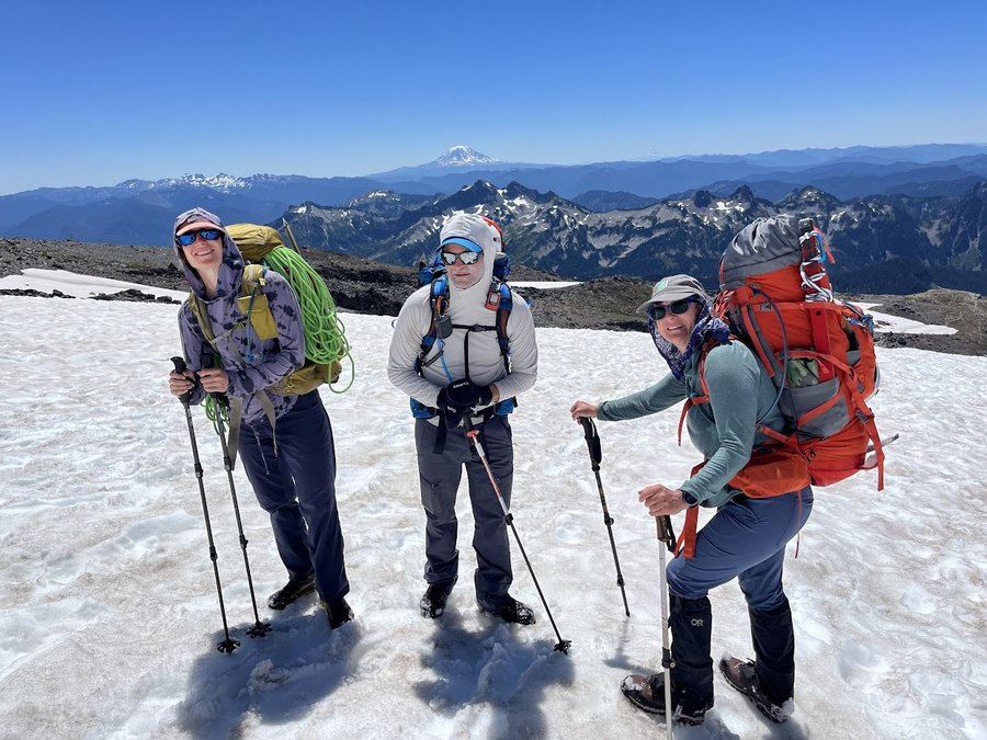
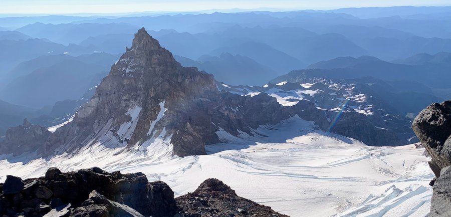
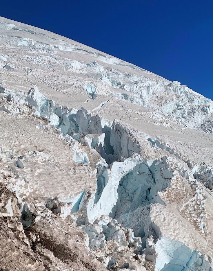
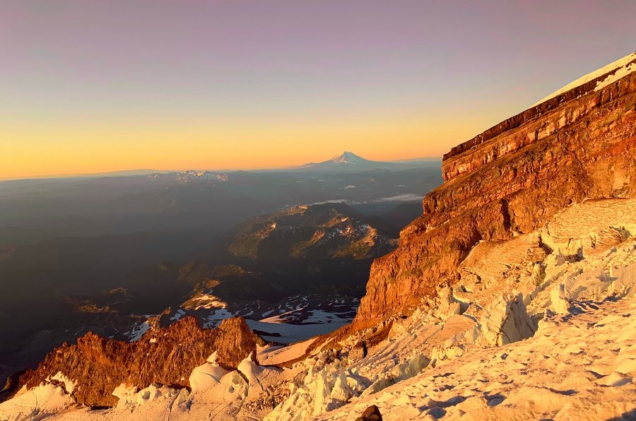
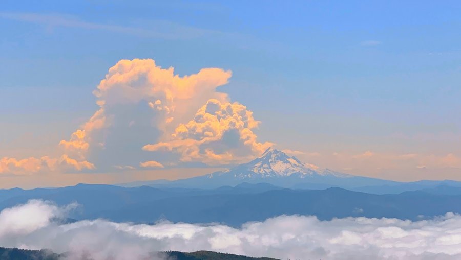
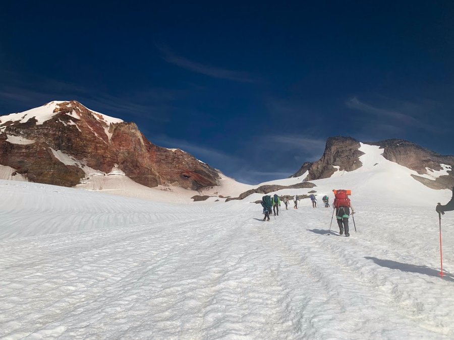
Disappointment Cleaver
12 miles of hiking • 7000' elevation gain • 1 night
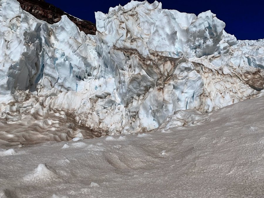
We were going for the summit via the well defined DC route. Originally scheduled for the day before, but 50 mph winds had us almost cancel, with the forecast vastly improved for the next day, we went for it. Slept for a couple hours at Camp Muir, then started heading up at midnight. Just as we were finishing the rock scramble on the cleaver, a bunch of teams came down together. They informed us that there was a collapse several hundred feet above, and the route was not passable. A ladder had fallen into a long crevasse, and an end runaround onto the Emmons Glacier was the only option. It was the first time climbing Rainier for all of us, so we decided we weren't prepared to do anything fancy, and turned around. It was humbling enough to move over the Cowlitz and Ingraham Glaciers, and get up close views into so many massive crevasses!
On approach day, I struggled with back pain from a new pack overloaded and not fitting properly. I was fatigued and somewhat nauseous on summit day. I think next time I will add in an extra day to acclimate and rest beforehand, but I don't see how you could rest much at Camp Muir.
July 18 – July 19, 2023

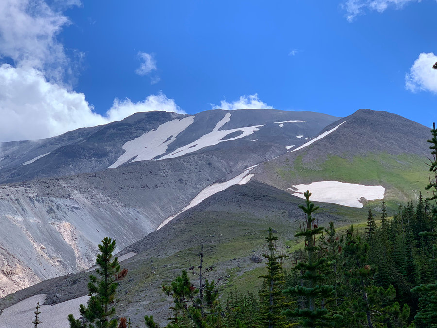
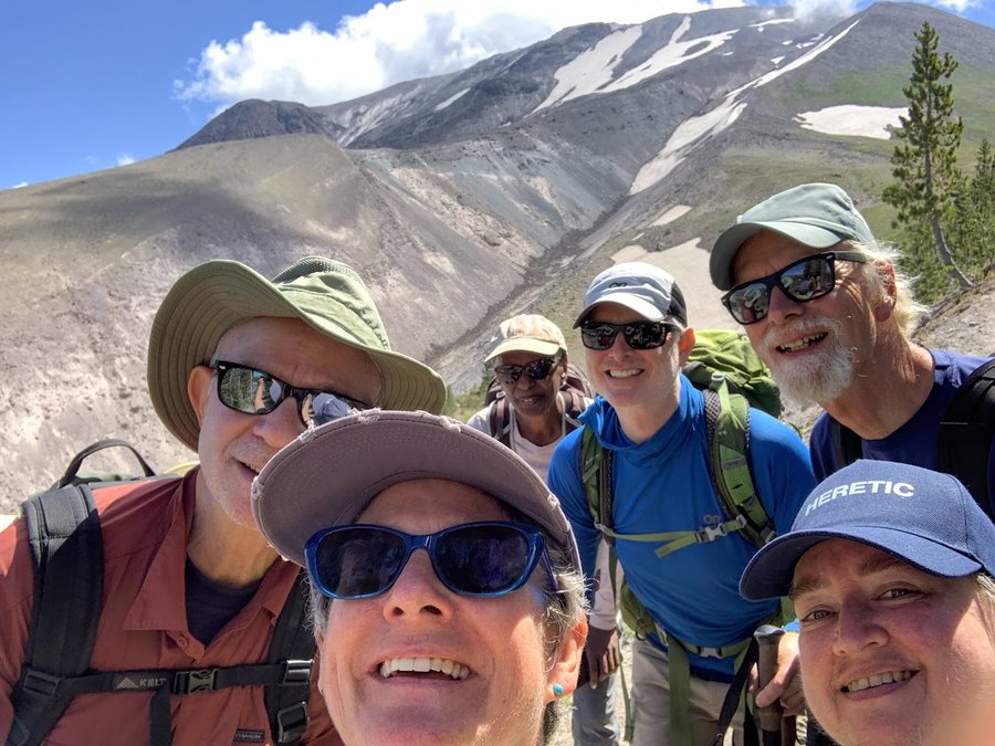
Sheep Canyon Loop
12 miles of hiking • 3000' elevation gain •
Wonderful old growth forest on the edge of the blast zone
July 12, 2023

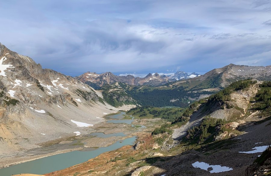
Pyramid Park and Pinnacle Peak
26 miles of hiking • 9000' elevation gain • 2 nights
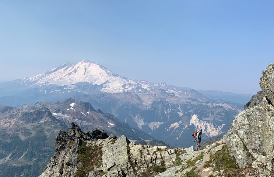
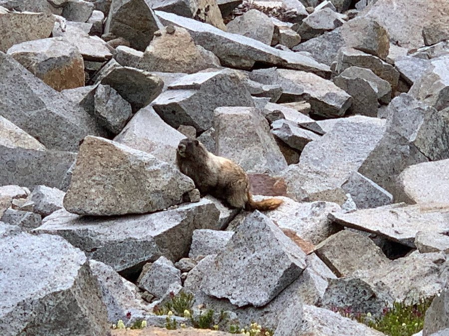
Got a cross country permit for the Pyramid zone. Approached from Longmire via the Wonderland to Indian Henry's patrol cabin, then turned up the Mirror Lake trail. Had so much fun travelling up to the alpine over slabs of glacier scoured rock with waterfalls and snowfields. I set up camp on a saddle just north of Pyramid Peak with Tahoma, Pyramid and Kautz glaciers looming over me. Tatoosh in view too. One of the best tent sites ever. Mosquitos were really bad when I arrived in the evening. Next day a nice breeze kept them at bay for hours and I wandered around the Pyramid Park area, up to about 7300 ft. Saw quite a few small groups of goats, very squittish. No humans anywhere. Bushwacked over to the top of Pearl Falls, but a better view would be from the bottom.
Mosquitoes returned late afternoon, and when I got back to my camp, I could not sketch or even prepare food. I was fully covered, had a bug shirt on, but they were incessant. Bummer that I could not relax and enjoy this amazing viewpoint.
Lost my phone while bushwacking, searched for hours, never located.
Hiked out the next morning back to Longmire, where I met up with a friend and we drove over to Reflection Lakes and climbed Pinnacle Peak!
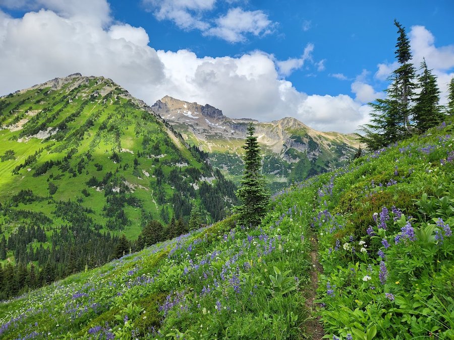
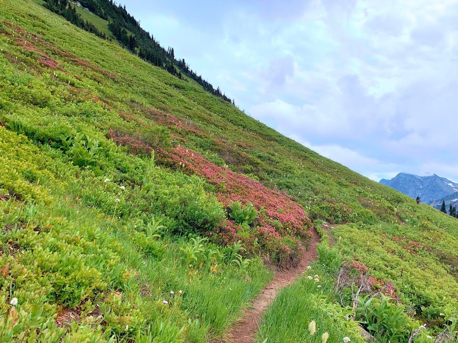
July 7 – July 9, 2023

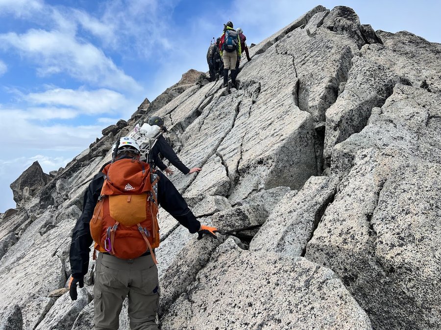
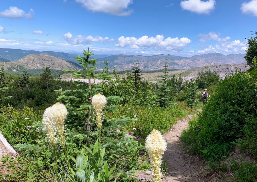
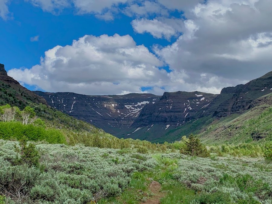
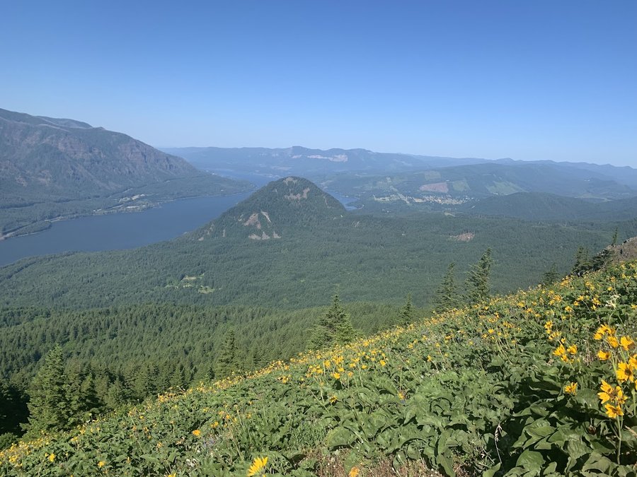
Silver Star South Ridge
7 miles of hiking • 2750' elevation gain •
We set up a car shuttle, then went up the south ridge and came down Grouse Vista. Stopped for a scramble up Pyramid Rock on the way down. Not a big bear grass bloom this year, but lots of lovely flowers.
June 26, 2023

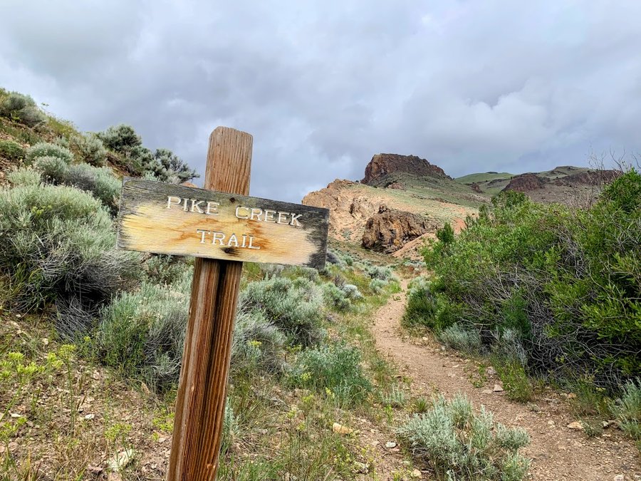
Pike Creek Canyon
5 miles of hiking • 1250' elevation gain •
Another trail maintenance trip thwarted by hailstorms. So beautiful anyhow.Flowers blooming and the smell of the sage delicious.
June 20, 2023

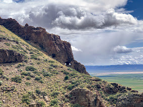
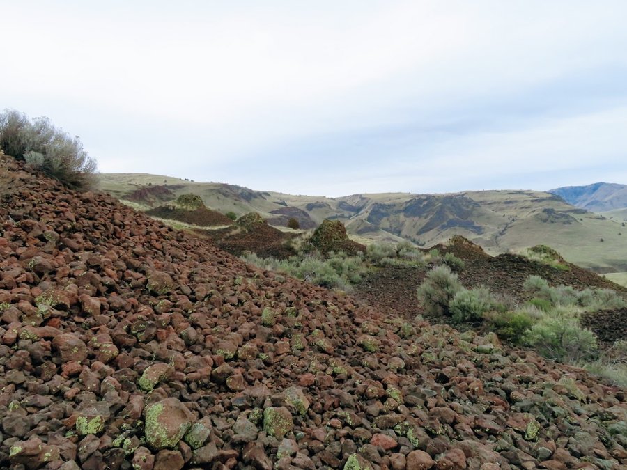
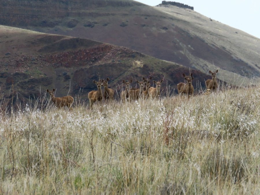
Big I Canyon, Steens
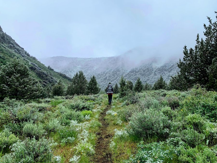
13.5 miles of hiking • 1500' elevation gain • 1 night
Here to do trail maintenance for ONDA. 3 creek crossings between miles 2 and 3. Fast and swift. 2 of them mid thigh deep. We crossed in our underwear and sandals. Camped around 6900 ft under some big cottonwoods, in view of the headwall-gorgeous! We got hailed and snowed on overnight and awoke to a light snow fall. Had planned to do trail maintenance further up, but conditions seemed worse at higher elvations, so we packed up and headed out, bummer. More hail, streams a bit deeper and faster.
June 18 – June 19, 2023

 1
1
Middle Sister via Hayden Glacier
14.5 miles of hiking • 5000' elevation gain • 1 night
So nice to camp up in the alpine again! Bugs have not started quite yet, but they are waking up.
June 14 – June 15, 2023

Dog Mountain
6.5 miles of hiking • 2750' elevation gain •
Early morning hike with friend to beat the heat. Flowers on the wane, and the summit is buggy, we didnt linger.
June 6, 2023


15 Mile Creek
5 miles of hiking • 1000' elevation gain •
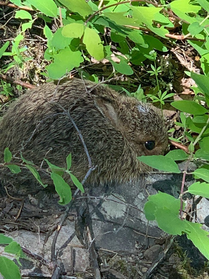
Did two different hikes in the area, a lot of off trail. Looking for morels, but I'm a few weeks late, only found 3. But I did spot a baby bunny!
June 3, 2023


Cooper Spur
11 miles of hiking • 6000' elevation gain •
Summit attempt, but we turned back at 9850 ft. The route had melted out significantly during the recent heat wave. A few teams ahead of us were knocking down rocks. As we began climbing the steepest section, rockfall became more frequent, and we didnt feel safe. We stopped to reconsider. When a small rock came down without warning from above and hit our team member(no injury), we decide to turn back.
Really beautiful on this side of the mountain. Learned some lessons. I'd like to try again next year-a bit earlier.
May 27, 2023

Mt Ellinor
6 miles of hiking • 3250' elevation gain •
Came back for the views! With Mazama pals and some new BCEP grads. You can drive to lower TH and glissade chutes were funl
May 20, 2023


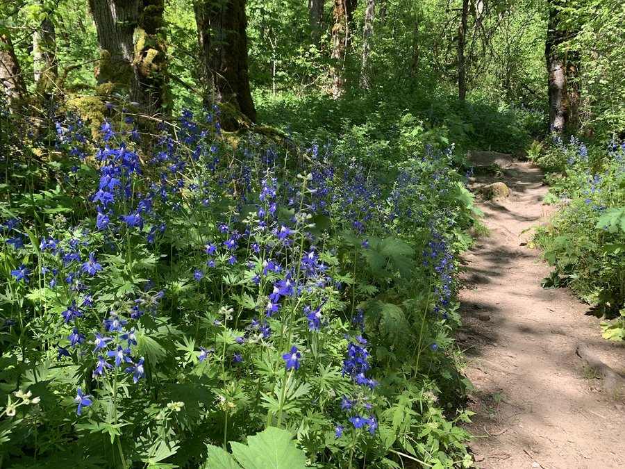
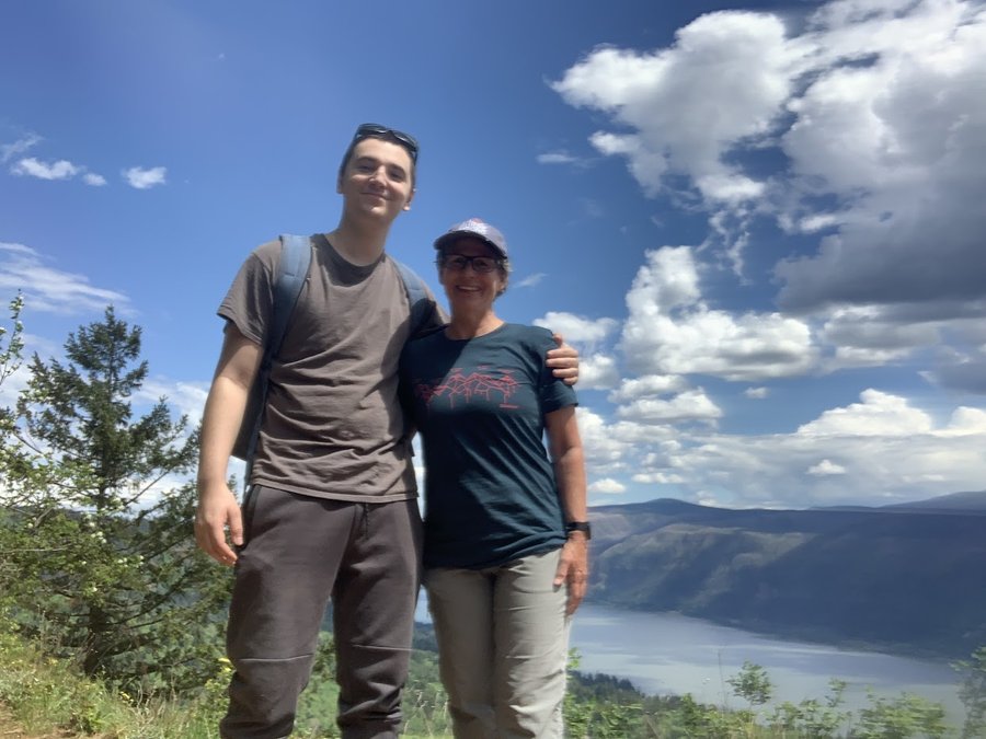
Cape Horn
5 miles of hiking • 1000' elevation gain •
Got the kid to go hiking with me! Cant do the full loop yet, so we just went up to the observation deck. Found a bit of shade and relaxed and sketched, listening to the wind in the trees. Best Mother's Day present. Delphiniums lining the first half mile of trail.
May 15, 2023

 1
1
BV Plateau
12 miles of hiking • 1750' elevation gain •
Came up here two days in a row.
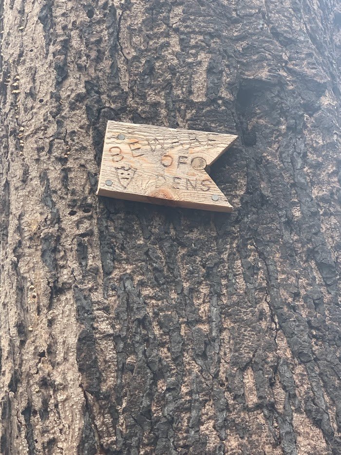
The ghost of Basil Clark has been very busy in the area. The firebreak roads now have some well maintained single track with lovely wooden signs.
Unfortunately, someone also completely festooned the trails with flagging. So much flagging. Flagging ad nauseum. Flagging on every other tree. Several times I stood in one spot and saw 8-10 flags- yellow, pink, orange, stripes, and completely unnecessary, the trail tread is unambiguous and well defined. I have mixed feelings about rogue trailbuilding, but flagging is definitely litter on our public land. It detracts from the experience and the fun of navigating with natural cues. In the modern day, everyone has a gps and can use "virtual flagging" to retrace their steps. If you need to depend on flagging to guide you up here in this forest, you shouldnt be up here. End rant.
I also got to do some lovely off trail wanderings in the fairy lands with no neon ribbons in sight.
May 7, 2023


Thunderhail on the Dog
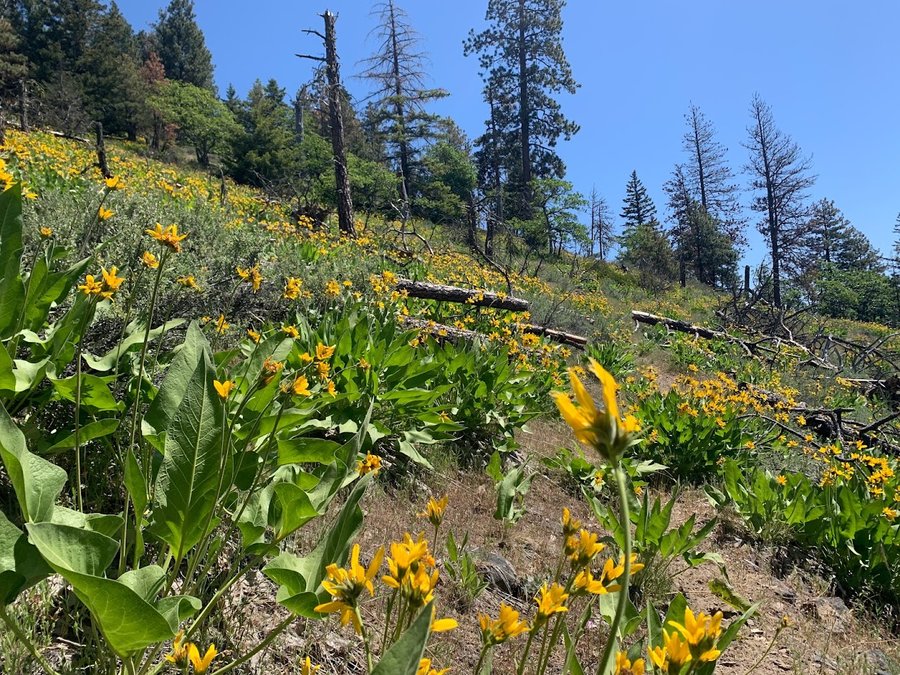
7 miles of hiking • 2750' elevation gain •
The understory was warm and only a little drippy, but the open meadows were socked in and wind was roaring. Scurried up and down that section. Not many out today. Balsamroot and friends just starting to open up in the lowest meadow. Feels like the snow just melted off the top. There was some snow coming down, but not likely to stick.
May 3, 2023


Angel-Devil
8 miles of hiking • 2250' elevation gain •
Spring has begun! Havent been on some of these trails since before the fire. Interesting mosaic burn pattern,with scorched hillsides alternating with intact old growth. The Primrose Path is now nicely grubbed out with signs. Larkspurs just starting to bloom down low near Coopey Falls.
May 2, 2023

 1
1
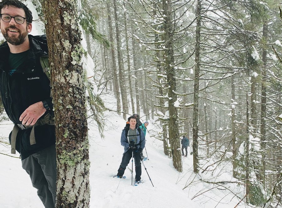
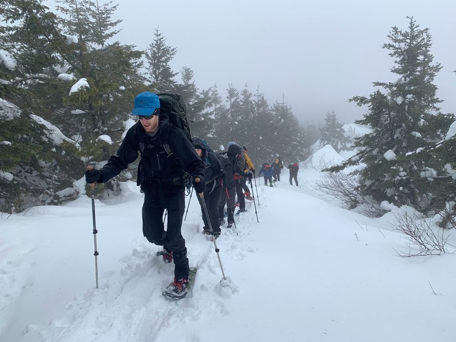
April 22, 2023

Elk Mountain/Creek Loop
9 miles of hiking • 2750' elevation gain •
We were supposed to do the Elk /King traverse, but had to curtail our plans. Large group and deep wet snow above 2200 ft slowed us considerably. We were breaking trail for most of the trip beyond Elk Mtn. Very surprised to see multiple avalanche debris fields on the way out. Forecast was iffy, so we were happy it turned out to be a dry day!
April 15, 2023


 2
2
Deschutes hikes
16 miles of hiking • 1750' elevation gain • 1 night
Escape to the High Desert. Did three different hikes. The first two were off trail wanders up and down the rimrock basalt bluffs above the Deschutes. The first night I camped- it was warm and pleasant. Explored Tenmile Creek and Gate Spring Canyon(waypoint). On the second day I visited the lower section of the Criterion Tract ( Lost Valley). Was going to head over to camp in Mack's Canyon, but heavy rain came in so I stayed in a cabin in Maupin. Explored Rowena and the Old Quarry Road on the way home.
April 8 – April 9, 2023


Hospital Hill
7.5 miles of hiking • 2000' elevation gain •
We were expecting terrible weather, but it was actually quite nice. Lovely fluffy snow for an hour or two at the top, but not much rain or wind, even a few sun breaks.
April 1, 2023
 1
1
Palmer
4.5 miles of hiking • 2500' elevation gain •
Fun day up on Mt Hood. Alpinish start with great weather.
March 18, 2023


 2
2
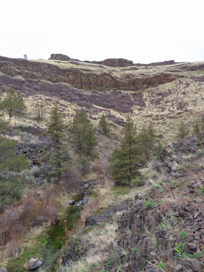
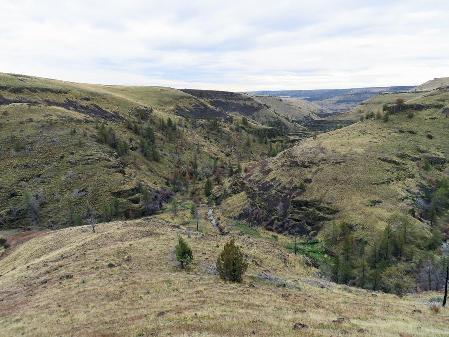
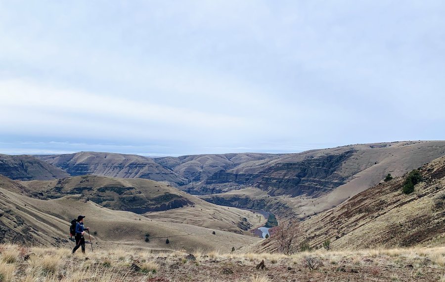
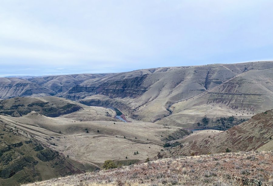
John Day River: Cottonwood Canyon and Thirty Mile Wilderness Study Area
11.5 miles of hiking • 2250' elevation gain •
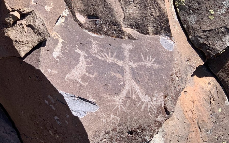
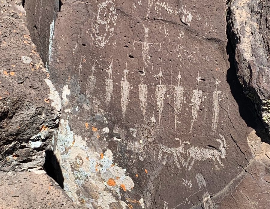
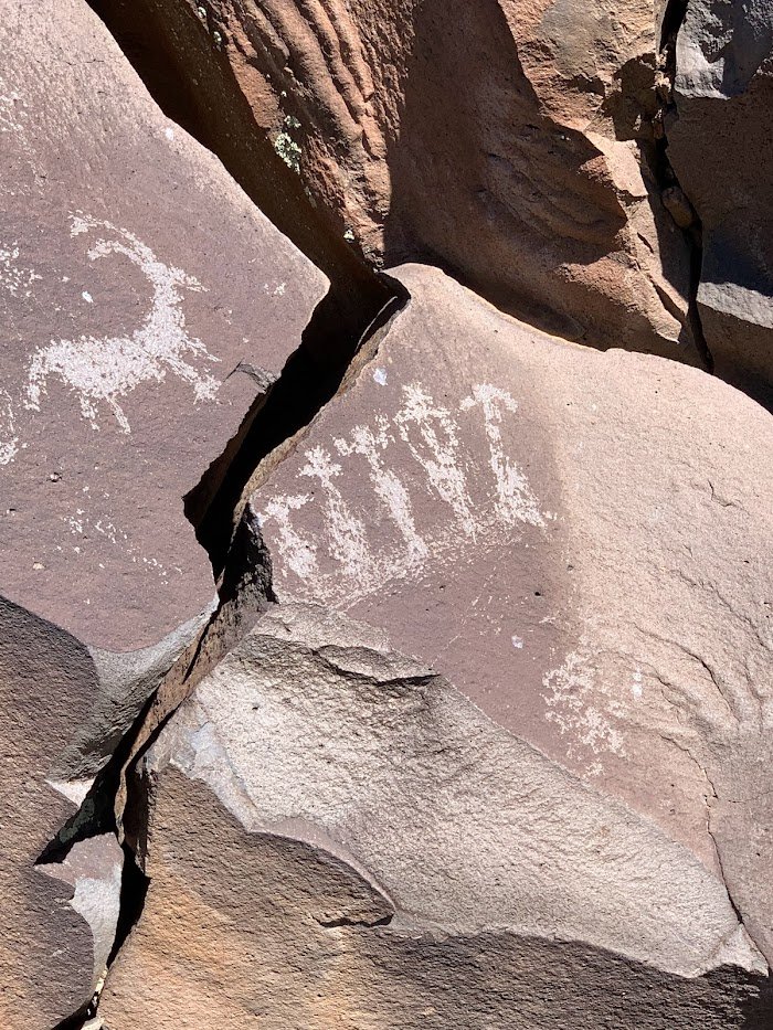
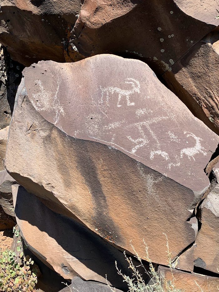
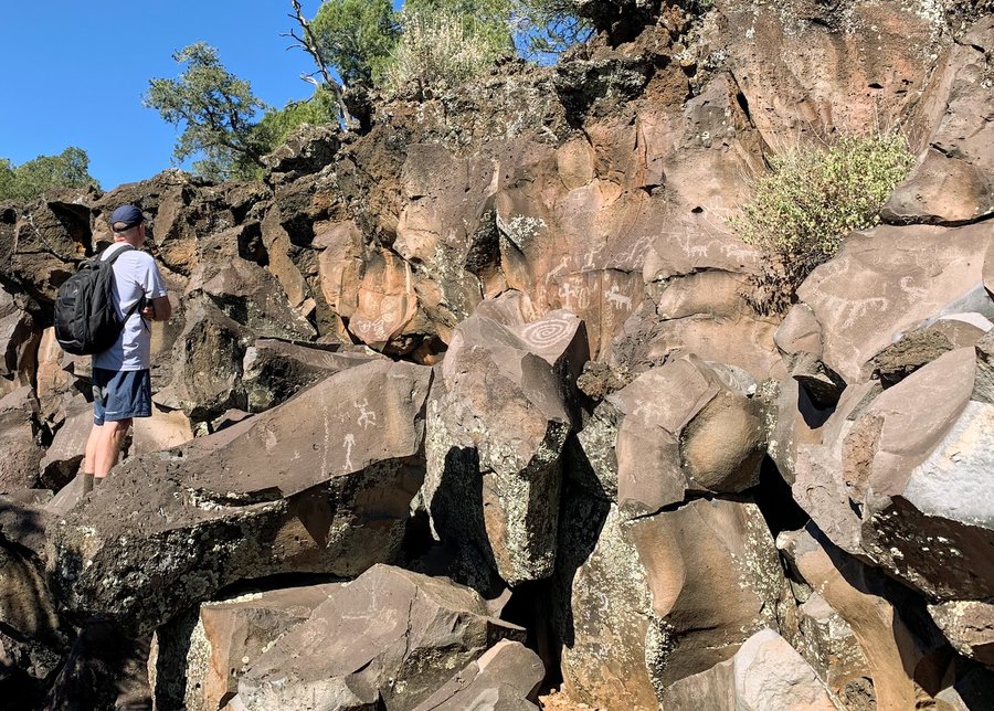
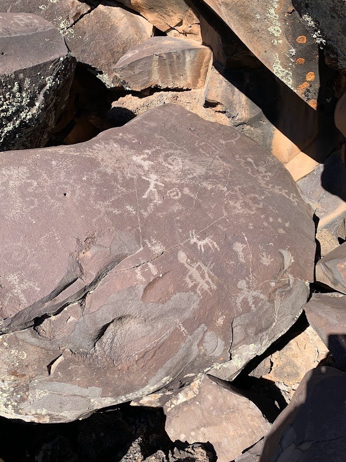
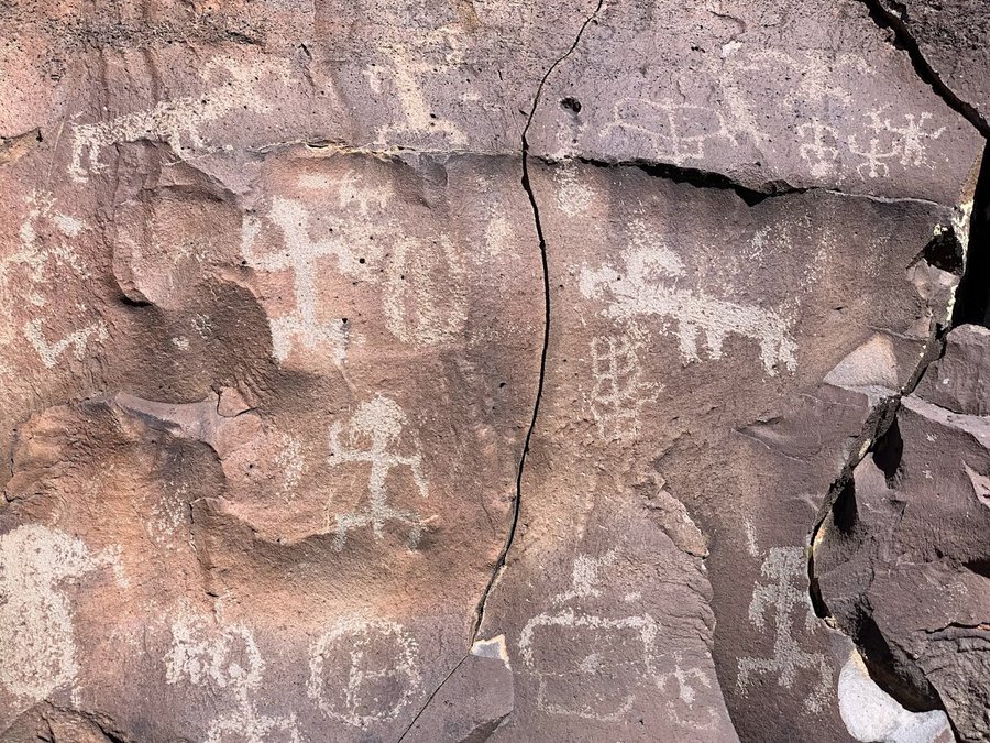
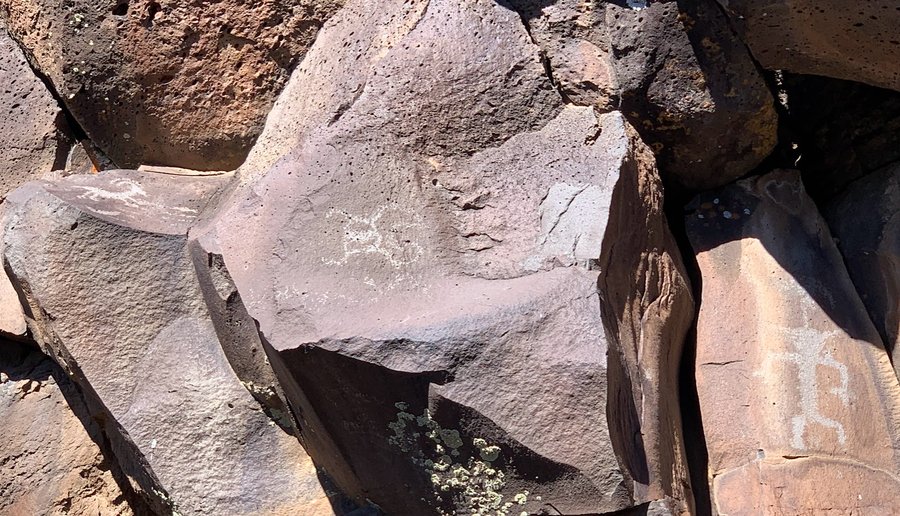
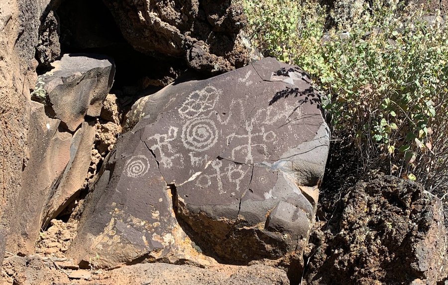
Got a cabin for two nights at Cottonwood Canyon SP. Weather was a little rough on the first day, we hiked the Pinnacle Trail in the park. The second day was perfect for our big adventure: dropping down into the John Day canyon from the high tablelands above. The goal was to find some petroglyphs, and that was successful, but the journey was what made the trip so wonderful. The desert a perfect balm for our soggy souls.
March 14, 2023

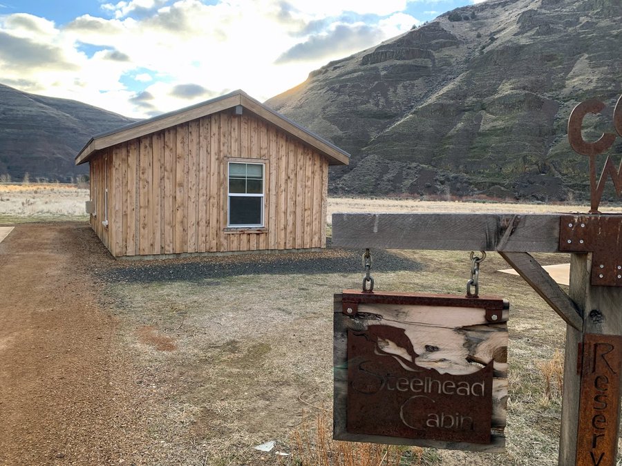
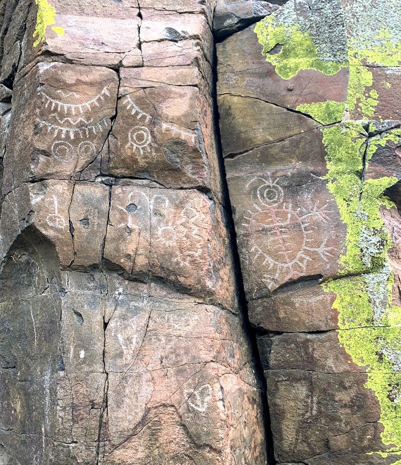
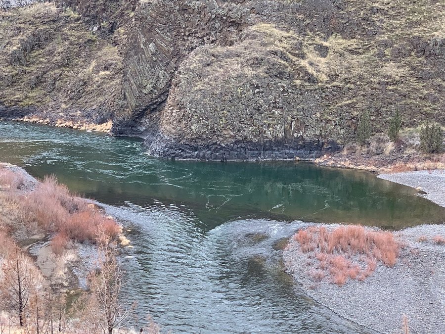


March 11, 2023

Newton-BPA Loop
5.5 miles of hiking • 1000' elevation gain •
The 2023 BCEP class has begun! First hike with the Alpenhounds. They were good sports in the dreary weather and were game when I suggested a switch up to get a bit of steep climbing in.
March 4, 2023

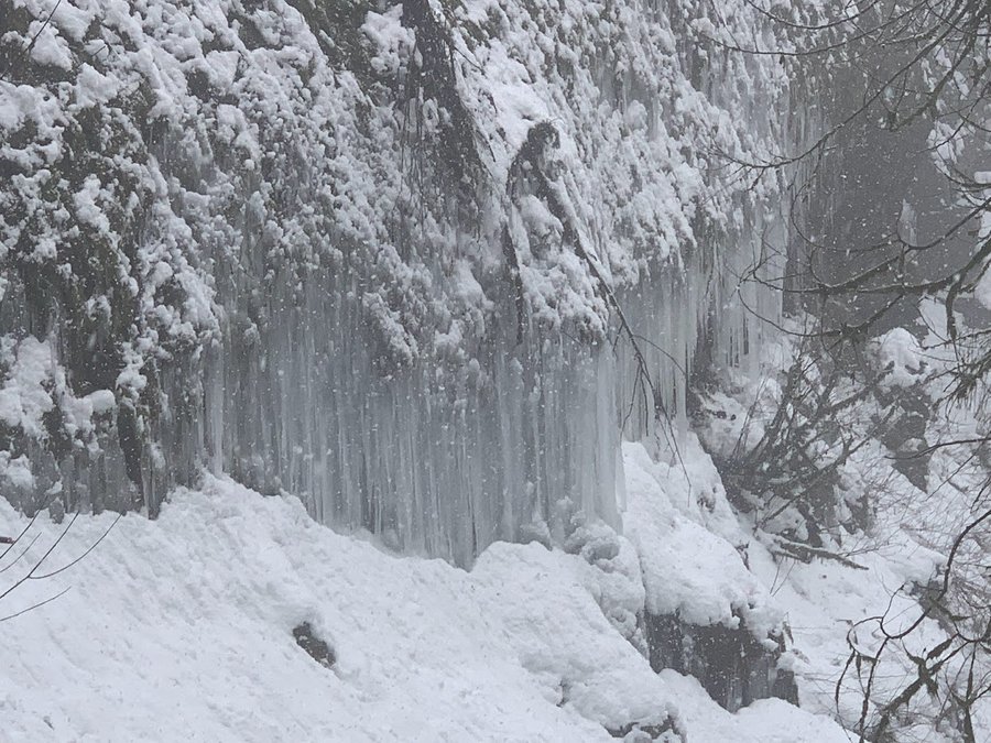
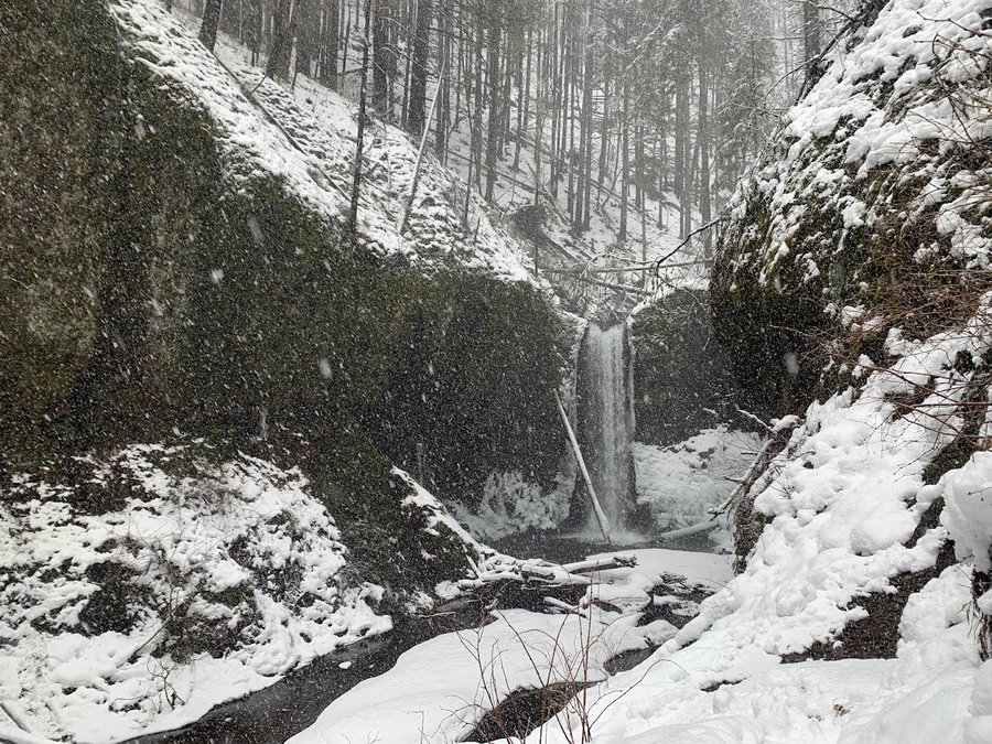
Multnomah Wahkeena Loop
5.5 miles of hiking • 1500' elevation gain •
I've been working too much, and mostly skiing and climbing on my days off. It was nice to get out for a quiet hike. I didnt see anyone except near the trailhead. Snow floating down all day, it was magical. I took the Vista Trail above Fairy Falls and had to break trail in knee deep powder!
February 28, 2023

 1
1
Archer Loop
7 miles of hiking • 2000' elevation gain •
First hike o the year at my favorite place in the gorge.
January 24, 2023

View trips from: 2011 2012 2013 2014 2015 2017 2016 2018 2019 2020 2021 2022 2024 2025 2026