

2022 Trips


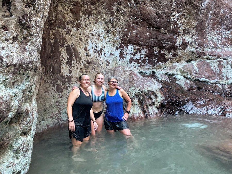
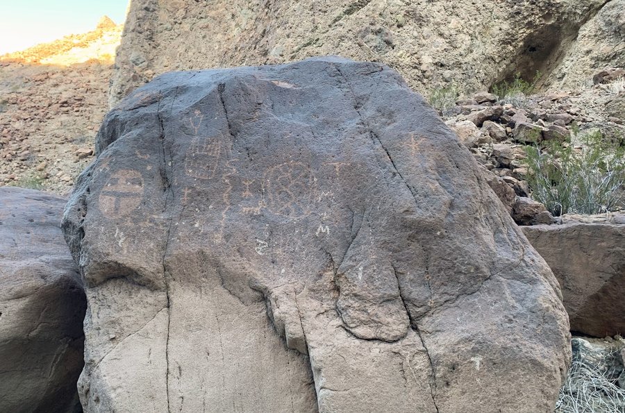
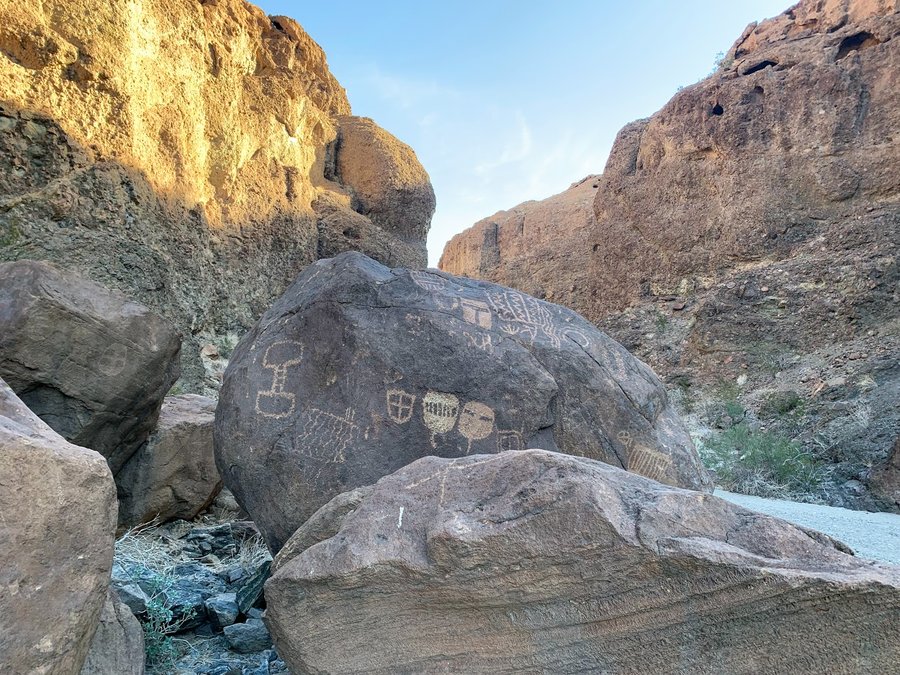
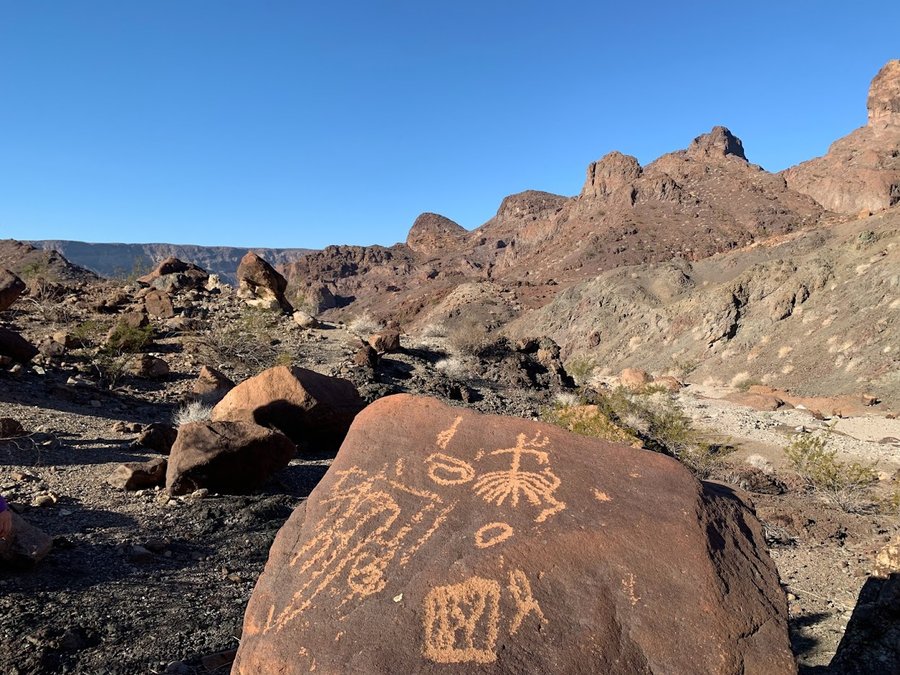
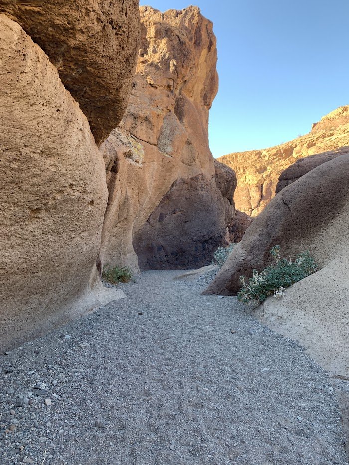
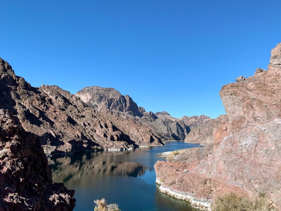
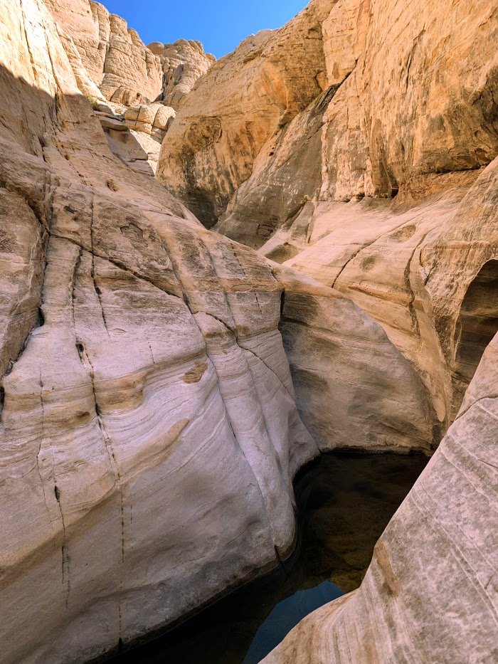
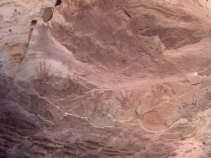
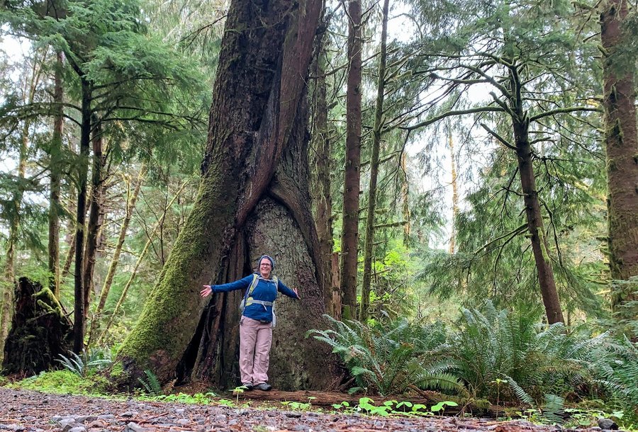
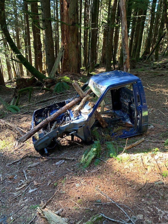
Arizona Hotsprings
6 miles of hiking • 1250' elevation gain •
Hotspring in a slot canyon in Arizona. Side trip to see some petroglyphs. Would like to try this by boat some day.

December 21, 2022


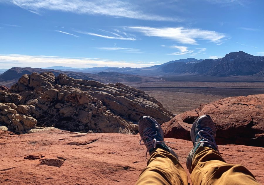
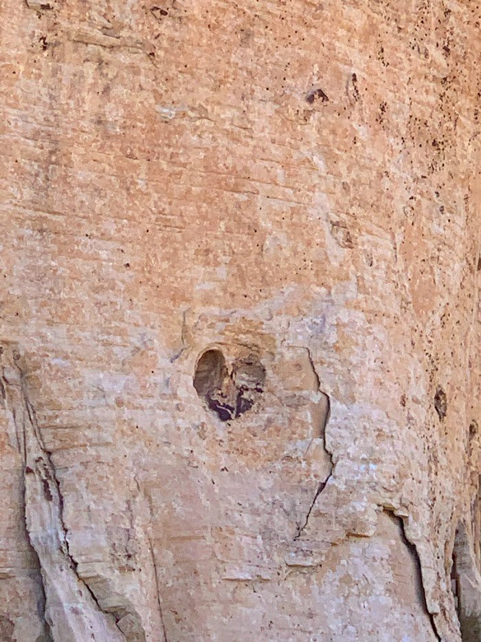
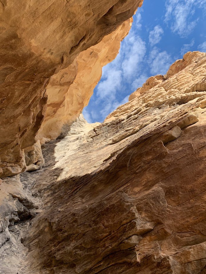
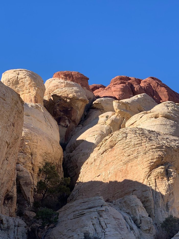
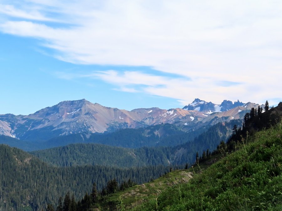
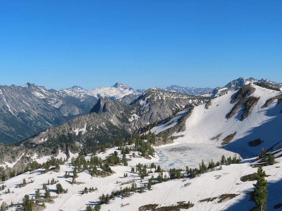
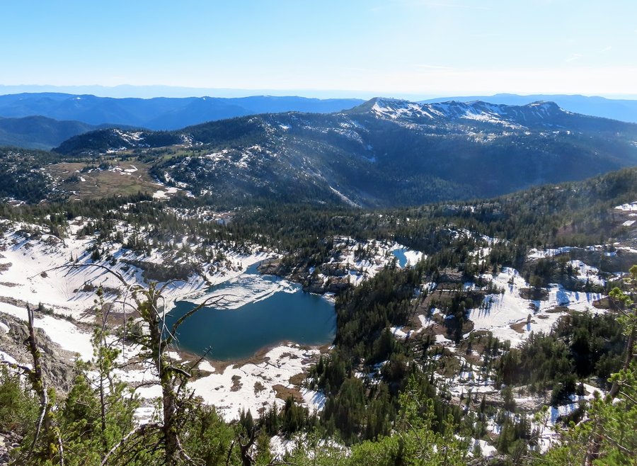
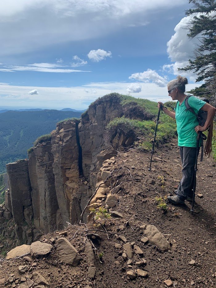
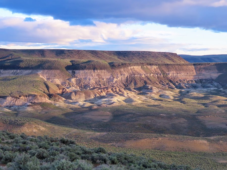
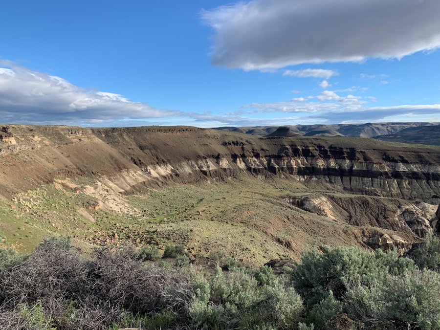
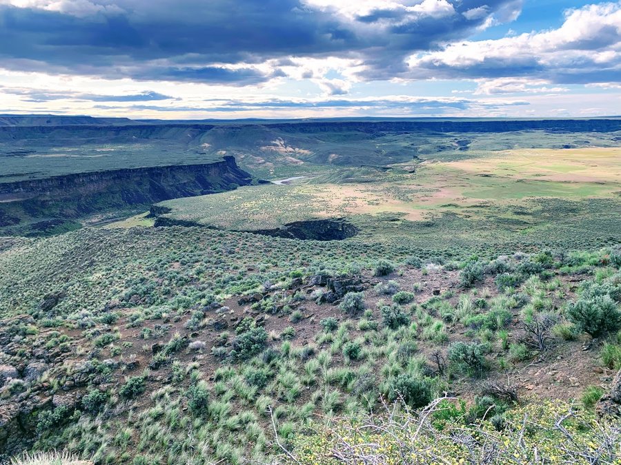
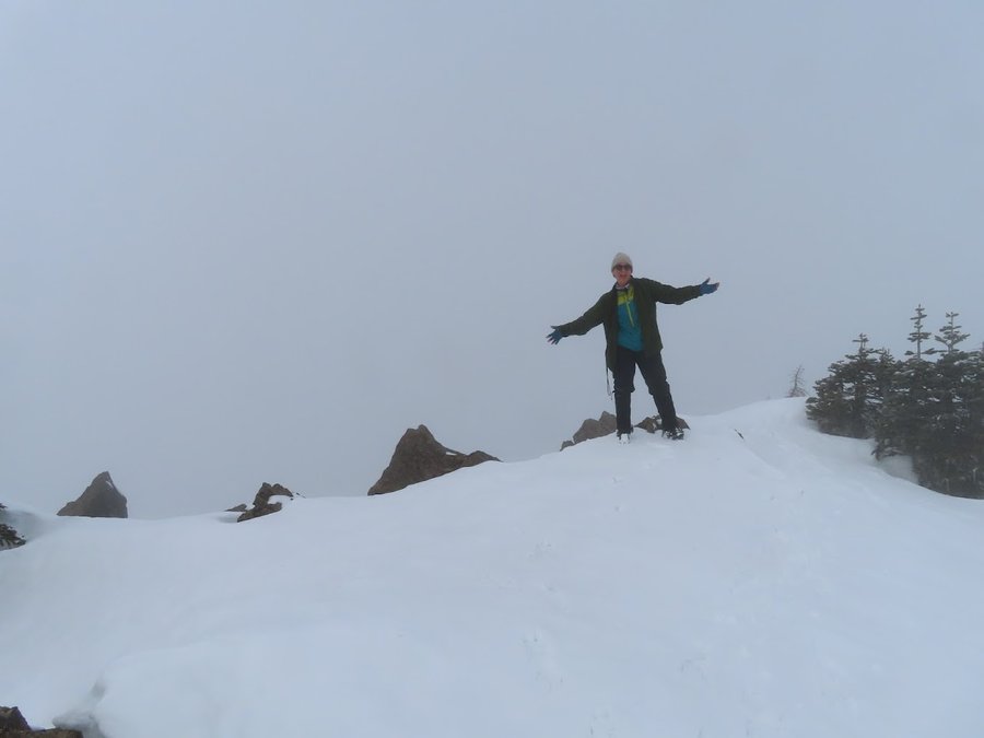
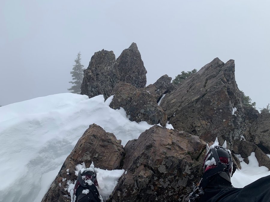
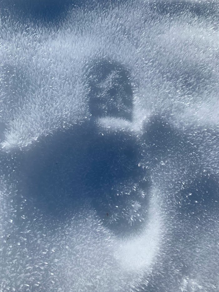
Red Cap-Calico Hills
3 miles of hiking • 1000' elevation gain •
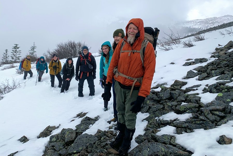
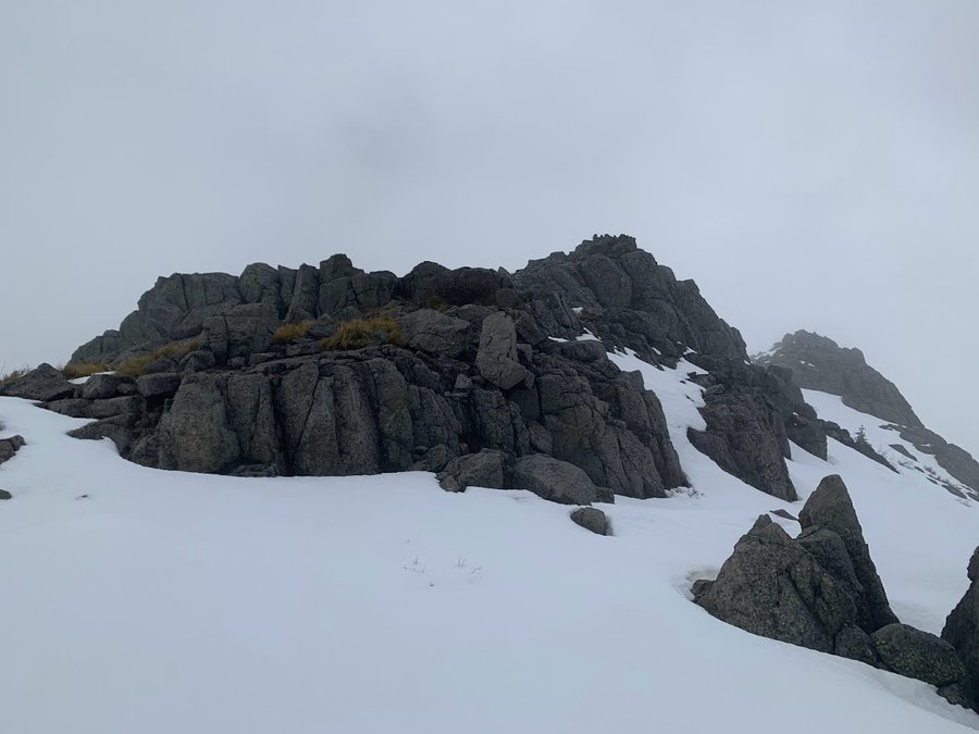
Spent two days climbing at Red Rocks. The climbing was fun, but there is a lot of standing around. We were surrounded by spectacular desert beauty in every direction, but didnt go anywhere but the crag. On the third day, I decided to skip climbing and go for a hike instead. Fun scramble up to the high point of the Calico Hills. Started from the Sandstone Quarry trailhead. Got away from the tourists in 10 minutes. Solitude on high amongst the yellow and red sandstones of this beautiful place. Used my skills to navigate through a slot canyon and up a sketchy gully. Zigzagging, meandering downclimb on ramps and ledges. Heaven!!!
December 20, 2022


 1
1
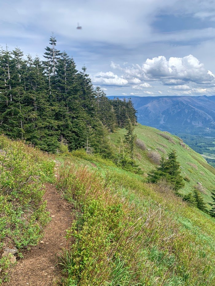
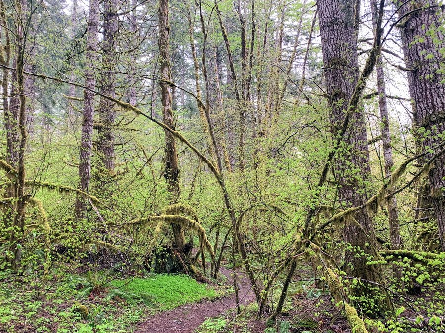
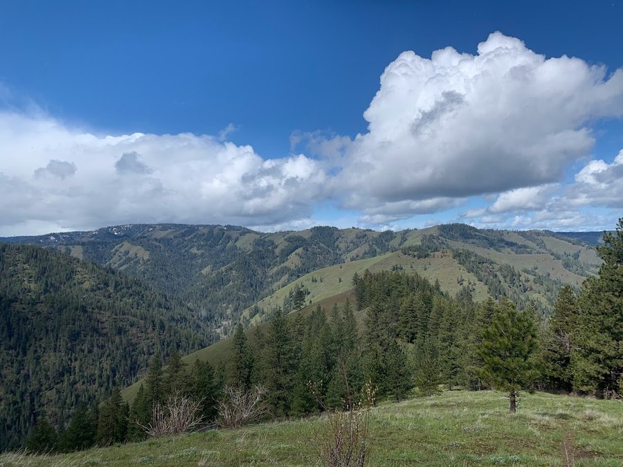
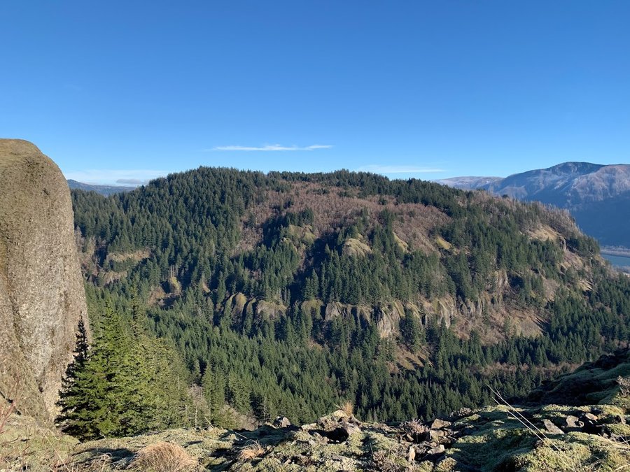
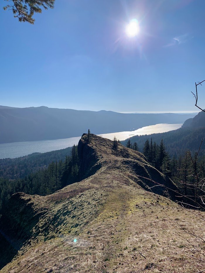
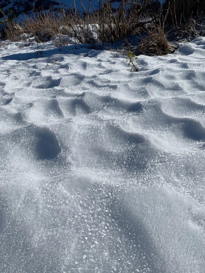
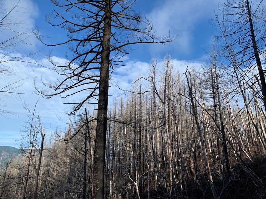
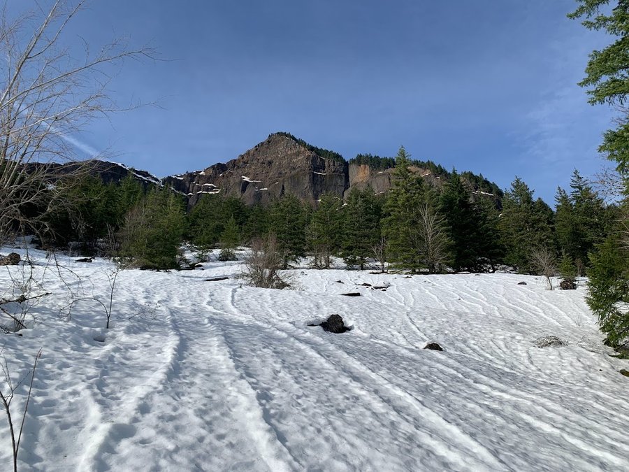
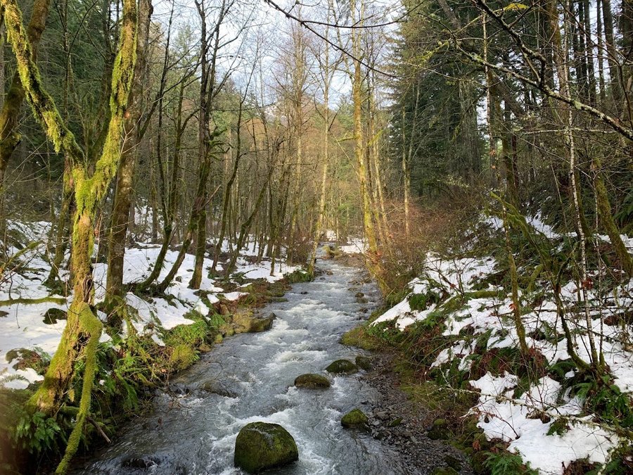
Multnomah Basin
9 miles of hiking • 2000' elevation gain •
Weather pretty good today. Warm and dry for 95% of the hike. Now in a melt phase. Snow persistent above Wahkeena turnoff, but soft, spikes not necessary but helpful.
December 12, 2022

 1
1
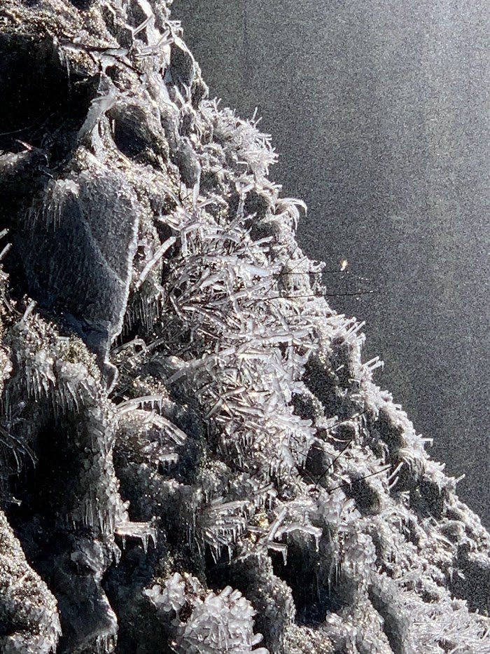
Tunnel Falls
14 miles of hiking • 1750' elevation gain •
Great hike in the rain. Return trip in a deluge.Glad I brought my umbrella.
November 21, 2022


November 19, 2022

Elk Meadows/Gnarl Ridge
8.5 miles of hiking • 1750' elevation gain •
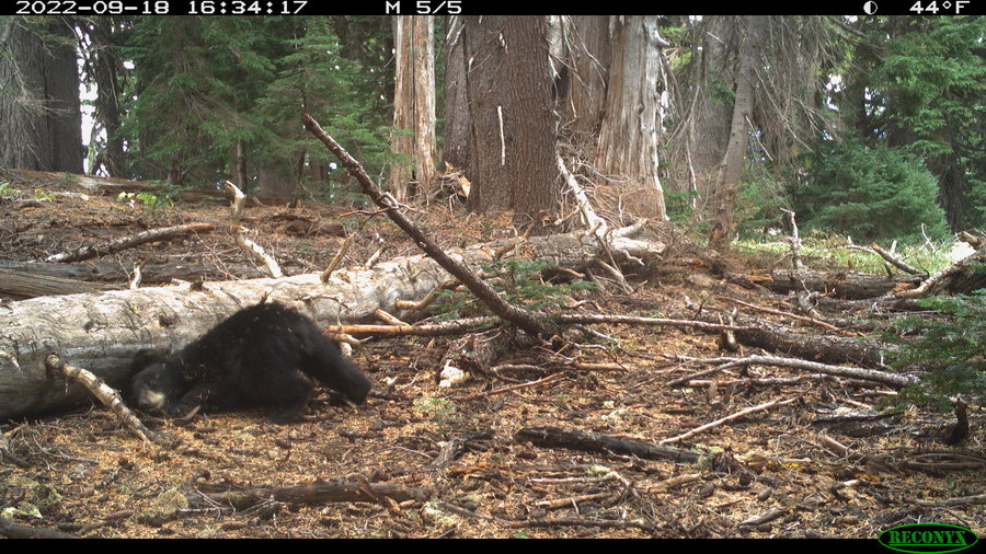
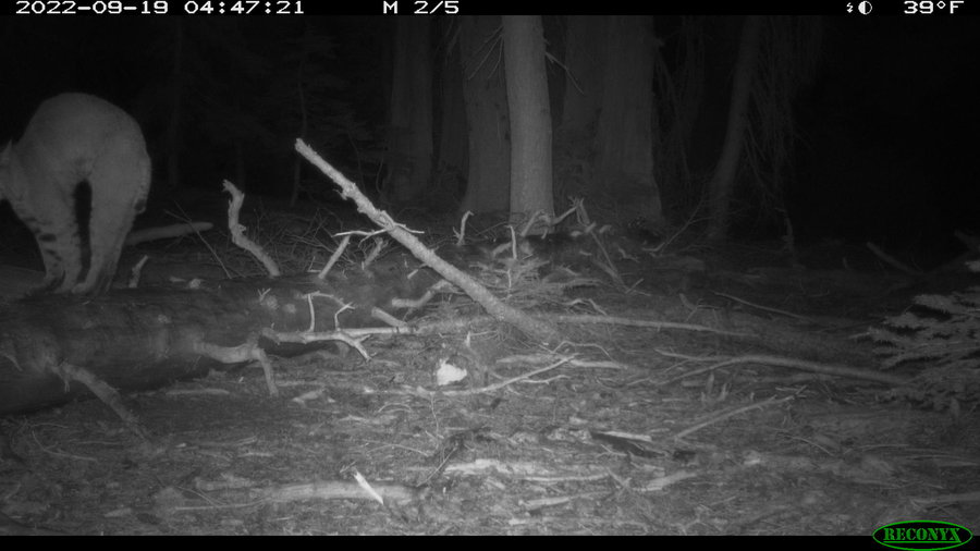
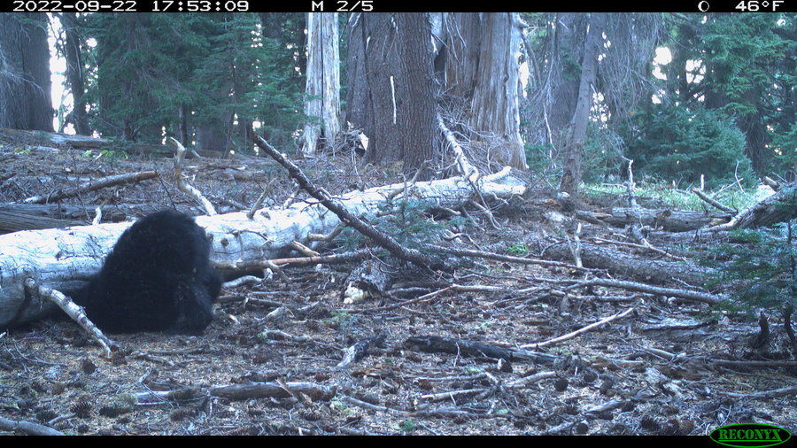
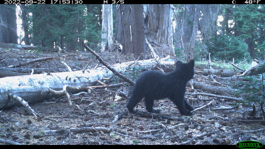
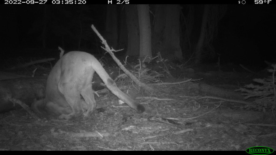
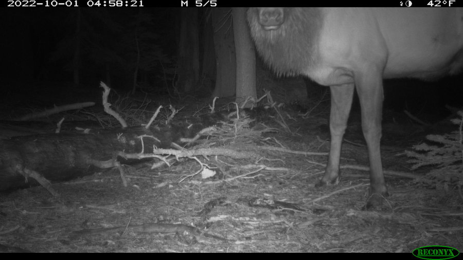
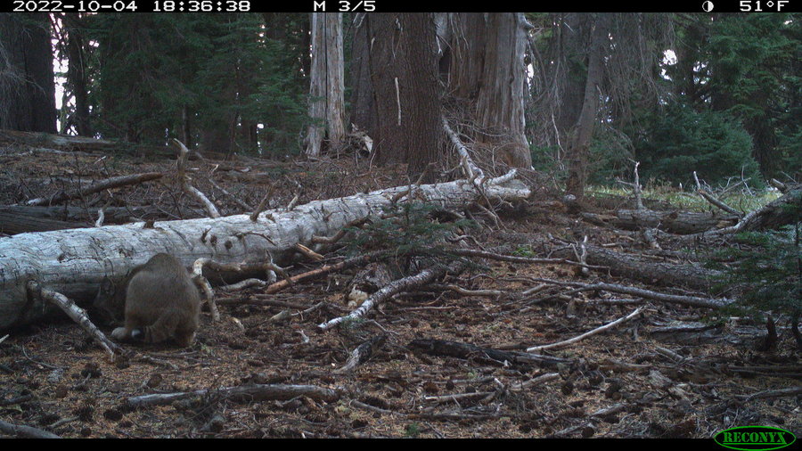
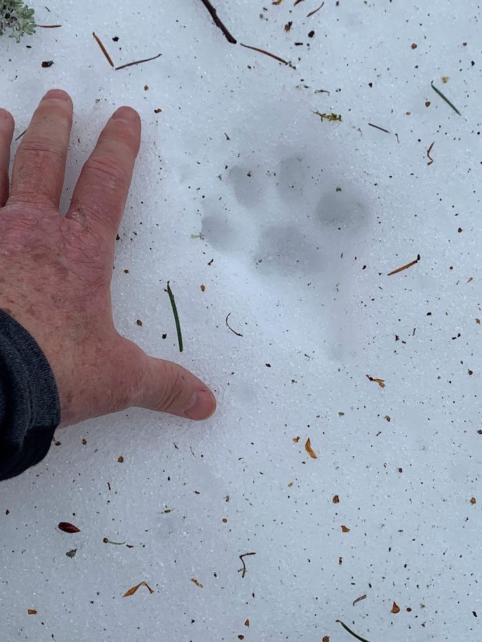
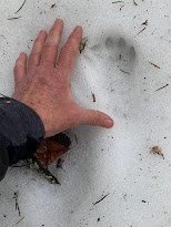
Set out to help with two wildlife cameras. What a beautiful fall day. There were some great sets on the camera. Big bear, coyote and deer at the Elk Meadows cam, and up on Gnarl Ridge, we captured buck deer, bull elk, bobcat plus huge sets of juvenile bear and mountain lion footage. So exciting to see who lives in the forest! Will try to share some pics
October 13, 2022

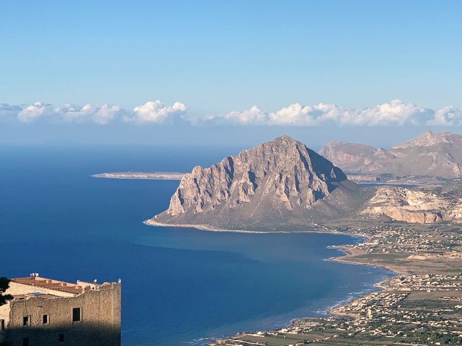
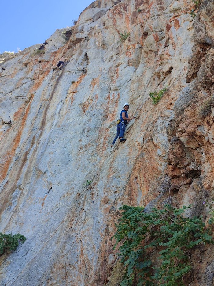
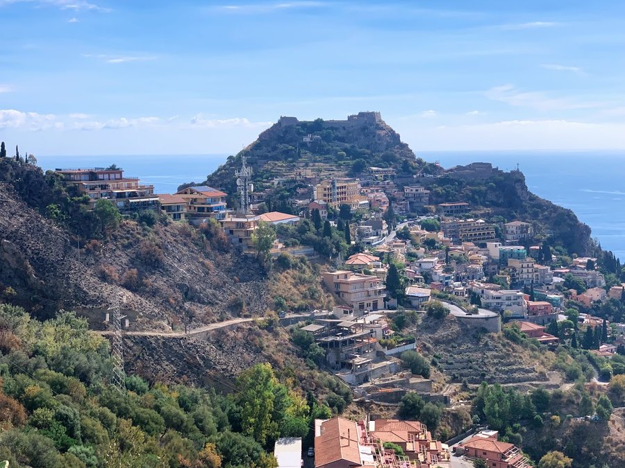
Hiking in Sicily
22 miles of hiking • 6250' elevation gain •
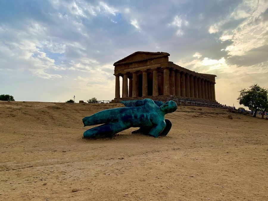
Had 12 fabulous days in Sicily. We put in a lot of steps in the cities and ruins, and went on a few hikes. I even was able to go climbing for a day with a guide! Here are the hikes:
1) Pantalica- this is an ancient necropolis, located in the steep walls of a canyon, thought have been developed early in xxx BC by the Sicel peoples. Hundreds of rectangular rooms carved out of the limestone cliffs for laying the dead to rest. Later developed by Byzantine Christians and occupied by various peoples throughout the ages. Fascinating. 8 miles, 1500 ft
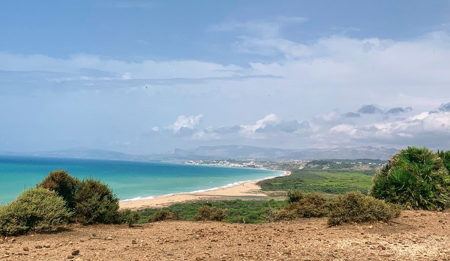
2) Eraclea Minoa- another remote ruin developed by Greeks and later taken over by Saracens, Romans and Normans. Built on a headland of fragile white chalky limestone, much of the city has been devoured by the sea. Spectacular headland and beach, very few people. 4 miles, 750 feet
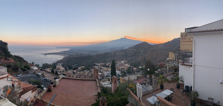
3) Castelmola- early morning trip up to the medieval fortress town above Taormina. I actually bushwacked to find the old Saracen road behind some houses. Dreamy with Etna looming over this whole valley. 4 miles 1750 feet
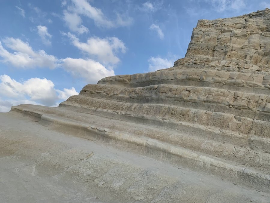
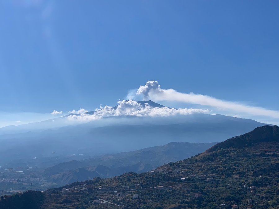
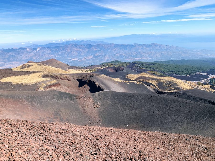
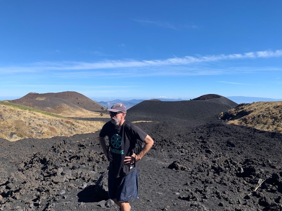
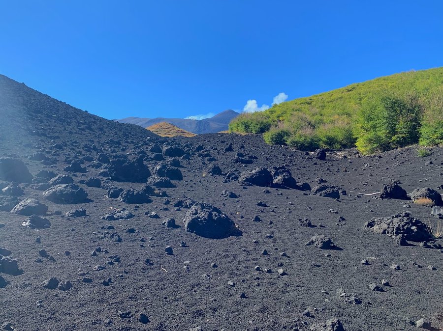
4) Monte Etna. It has been very active this year, and now they only allow you to go to the summit with a guide. It was a bit too pricey for us, so we hiked around the site of the 2002 eruption at Piano Provenzana on the north side. We wandered the lava flows and walked along several satellite craters. There was some output from the summit while we were hiking, but when we arrived back at our apartment, we saw Etna spewing huge plumes of smoke into the sky from two different summit craters. 6 miles 2250 ft
October 1, 2022


September 13, 2022


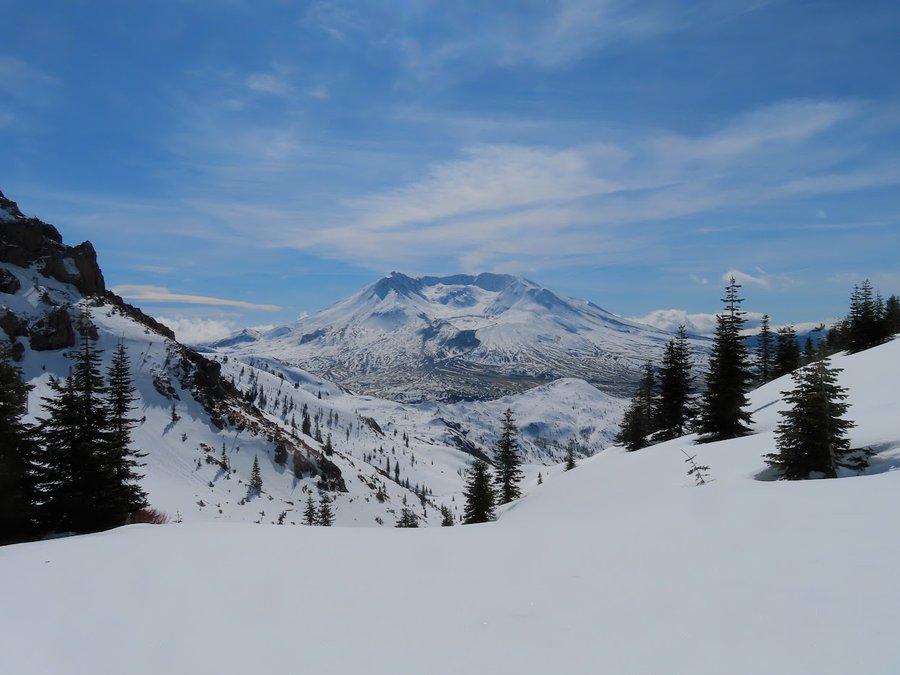
Crystal Lake
12.5 miles of hiking • 2750' elevation gain •
Lovely alpine swimming lake, not too cold, I actually paddled around a bit. Frequent loud rockfall from up on the mountain. Bugs on the wane. Lots of meadows with huckleberries on the Riley Camp Trail.
September 6, 2022


 1
1
Riley Camp jaunt
6.5 miles of hiking • 1500' elevation gain •
In Hood River for the weekend with my honey. We hiked up to a little lake and enjoyed lunch with mountain views. Read, napped and sketched, Huckleberries ripe. Bugs were minimal.
August 27, 2022
 2
2
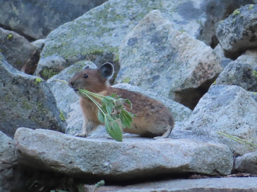
Pika Watch in the Goat Rocks
26 miles of hiking • 7250' elevation gain • 2 nights
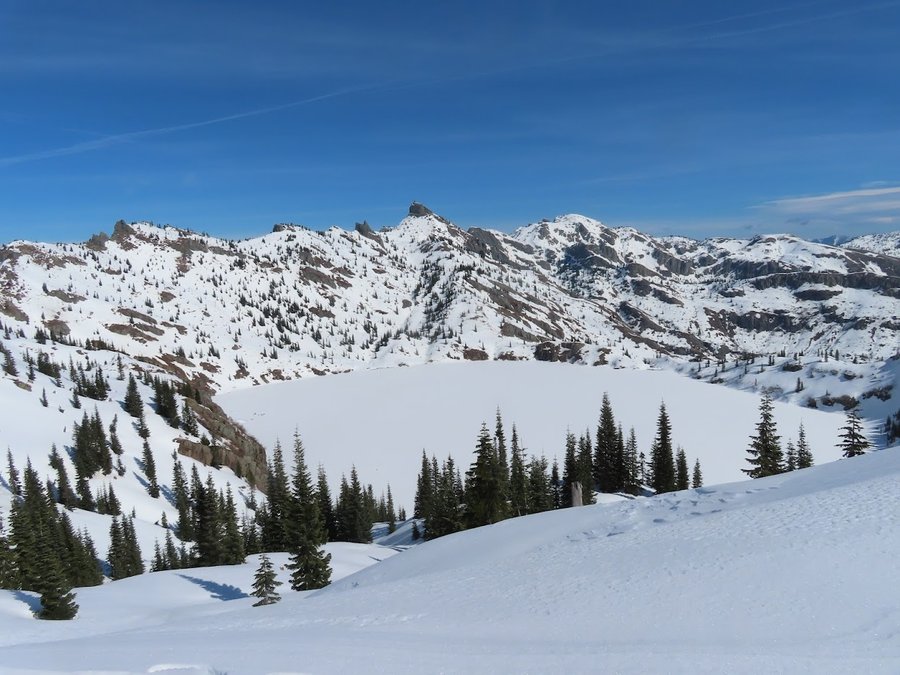
Visited several sites to monitor pikas. Was successful hearing many, seeing some, and even photographing a few individuals. Did two trips: 1) Clear Lost trail to Lost Lake lookout. The most amazing tent spot,and goat watching. 14.5 miles, 4000 ft gain.
When I got done, I drove through Packwood and picked up some beer, then stayed the next night at Chambers Lake Campground next to the Goat Ridge trailhead. It was free and there was only one other tenant. Sketched, relaxed and swam in lake. Woke up early for next hike up Goat Ridge through Jordan Basin to Hawkeye Point. 11.5 miles, 3250 ft gain.
August 21 – August 23, 2022


 2
2
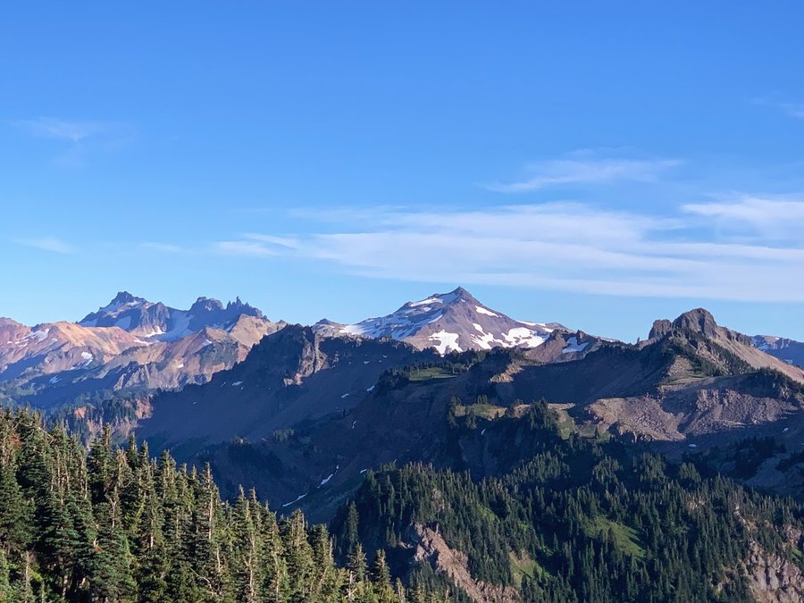
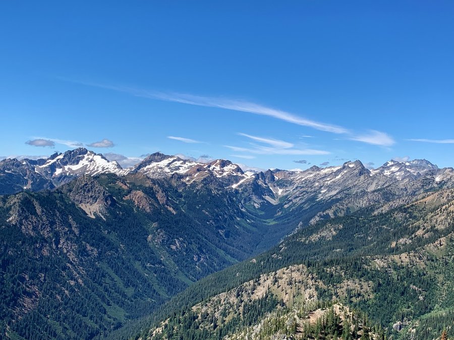
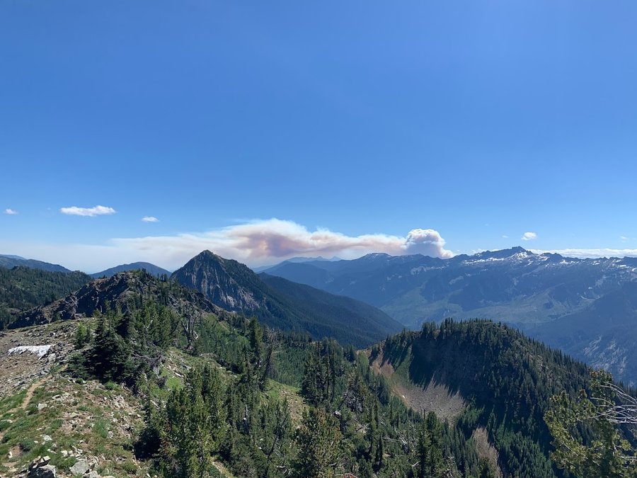
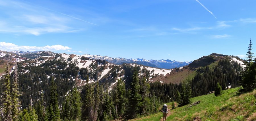
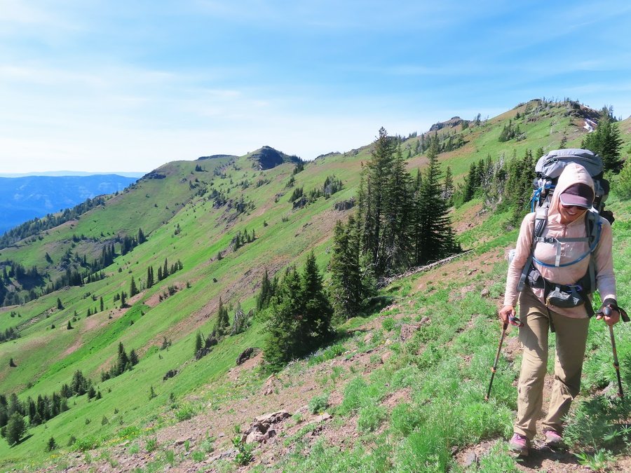
Carne Mountain High Route
22.5 miles of hiking • 7500' elevation gain • 2 nights
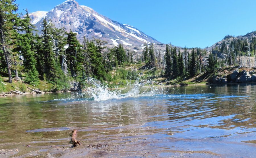
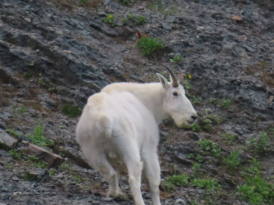
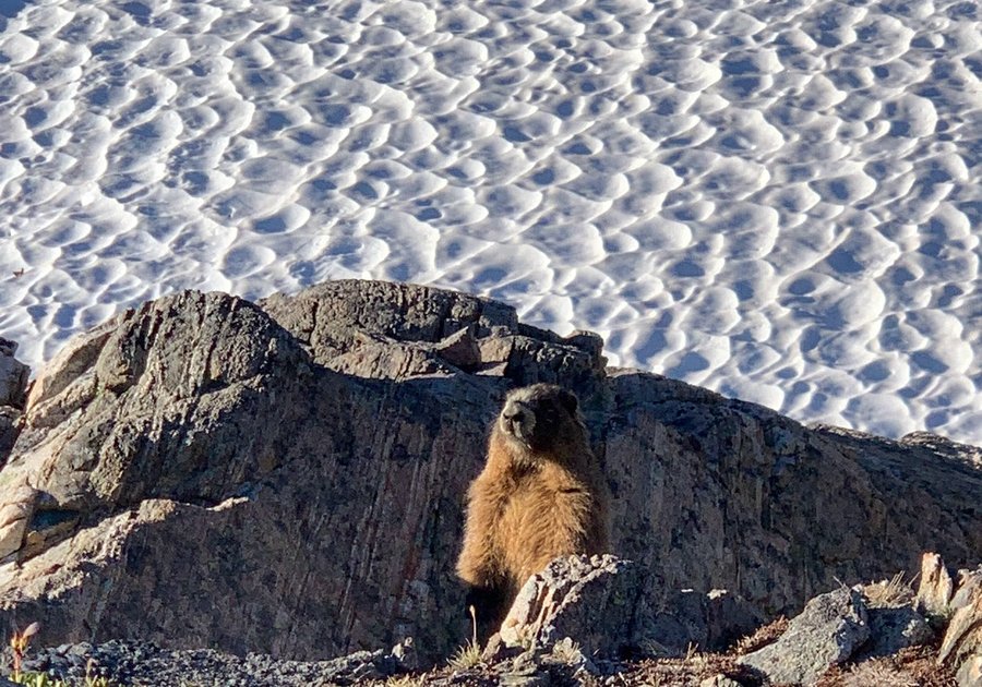
There were about 50 cars at the Phelps Creek Trailhead, but all were headed to Spider Gap and we only saw a few groups on our 3 day trip. Easy side scramble up to Carne Mountain. We saw a fire blow up down on Wenatchee Ridge. Menacing. The smoke came in and out the next two days, but the majority of it was blown eastward and skies were mostly clear. We camped along the ridge near a burbling stream, and the bugs came out in the evening. They were still sleeping when we got up the next day.
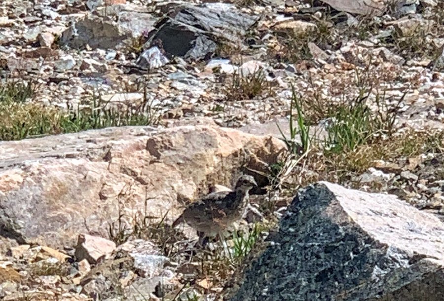
On the second day, we summitted Mt Maude, and then decided to stay at Ice Lake instead of continuing on to Leroy Basin. That place is so beautiful. We were the only campers that evening. The bugs were not present here at all, yay! We took a dip in the lake, and enjoyed spotting marmots and ptarmigans. On the third day, we decided to skip 7 Fingered Jack and just noodle around the lakes instead, reluctant to leave. Spectacle Buttes looked really inviting for a future trip.
Bugs annoying at times, but not terrible.
August 13 – August 15, 2022


 1
1
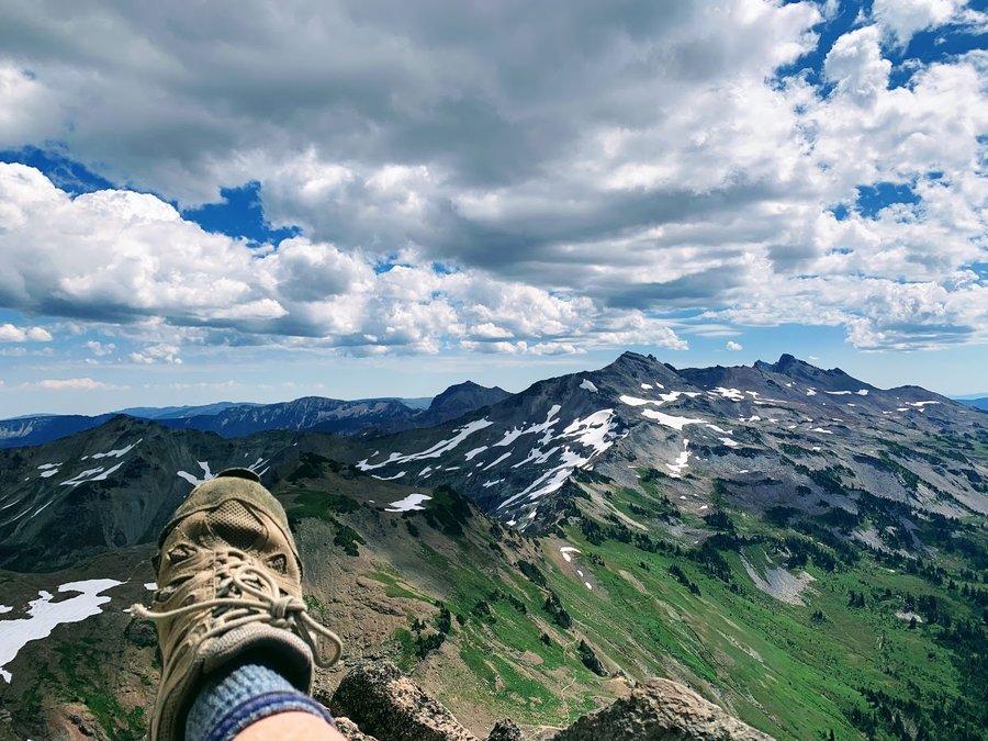
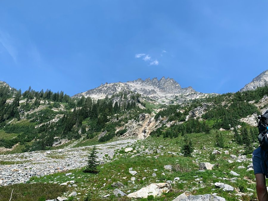
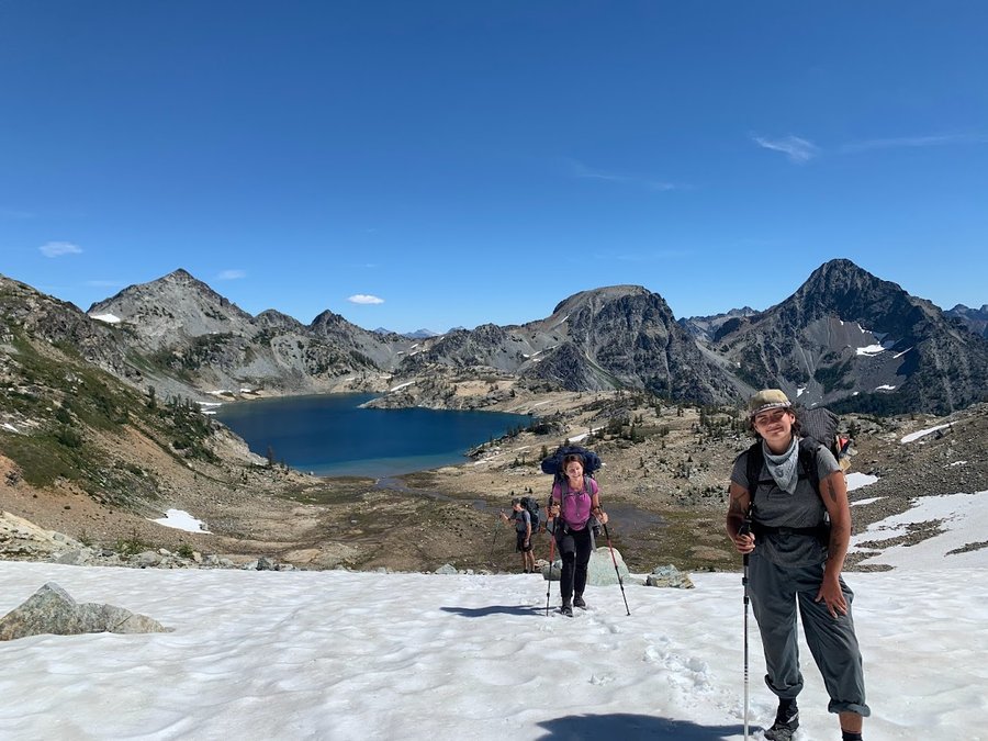
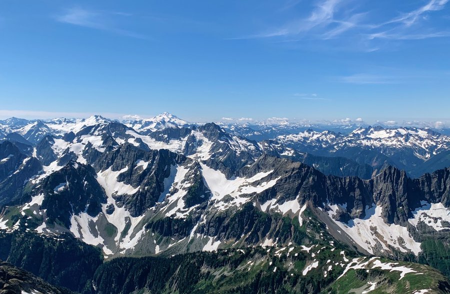
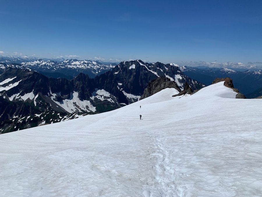
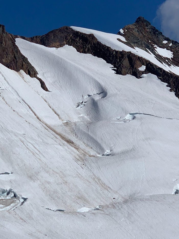
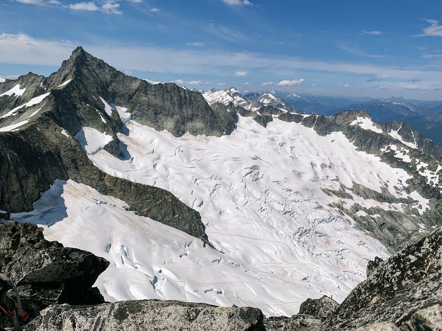
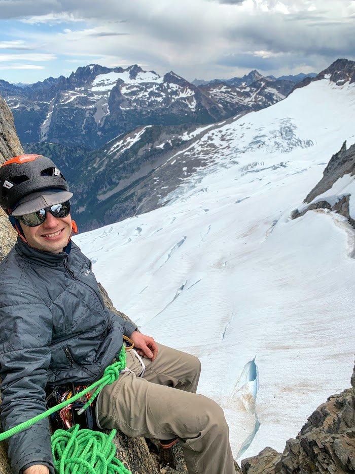
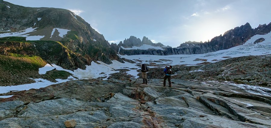
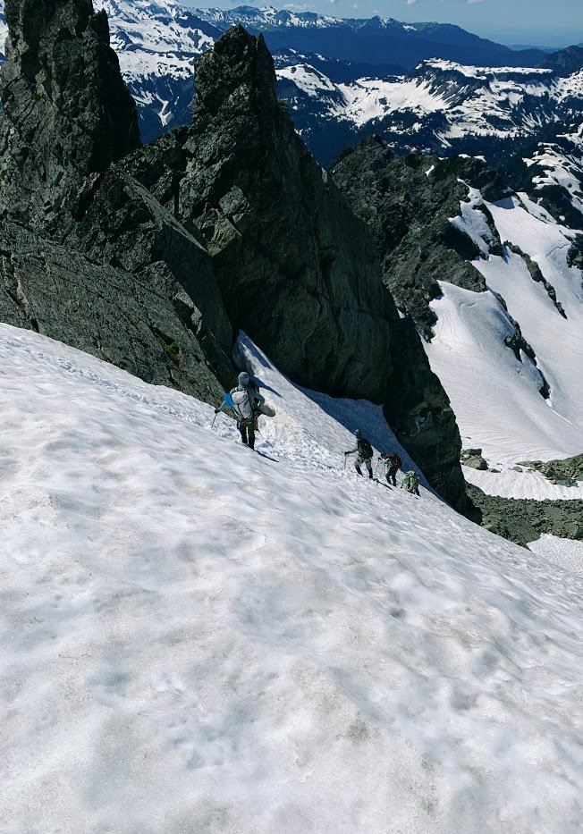
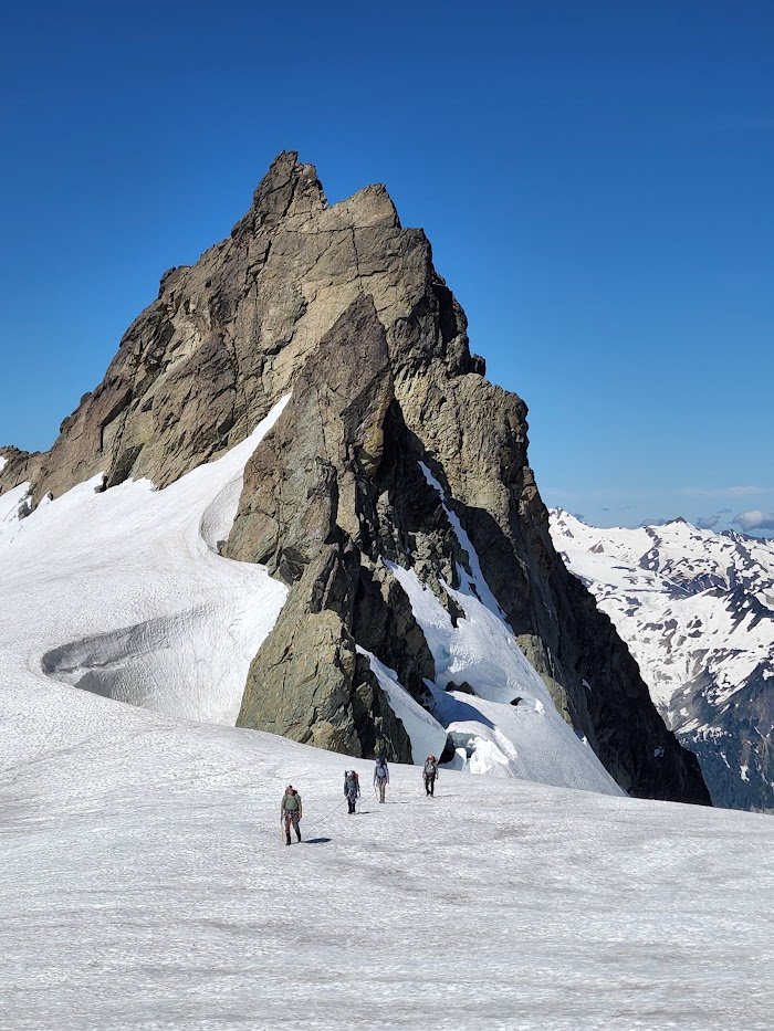
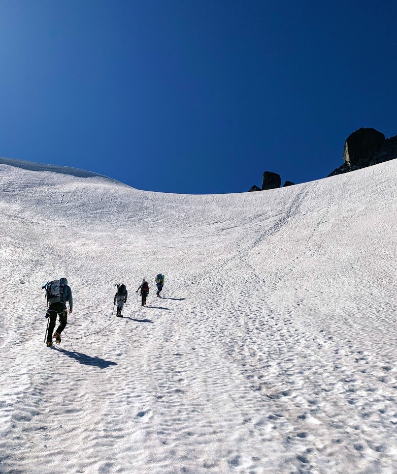
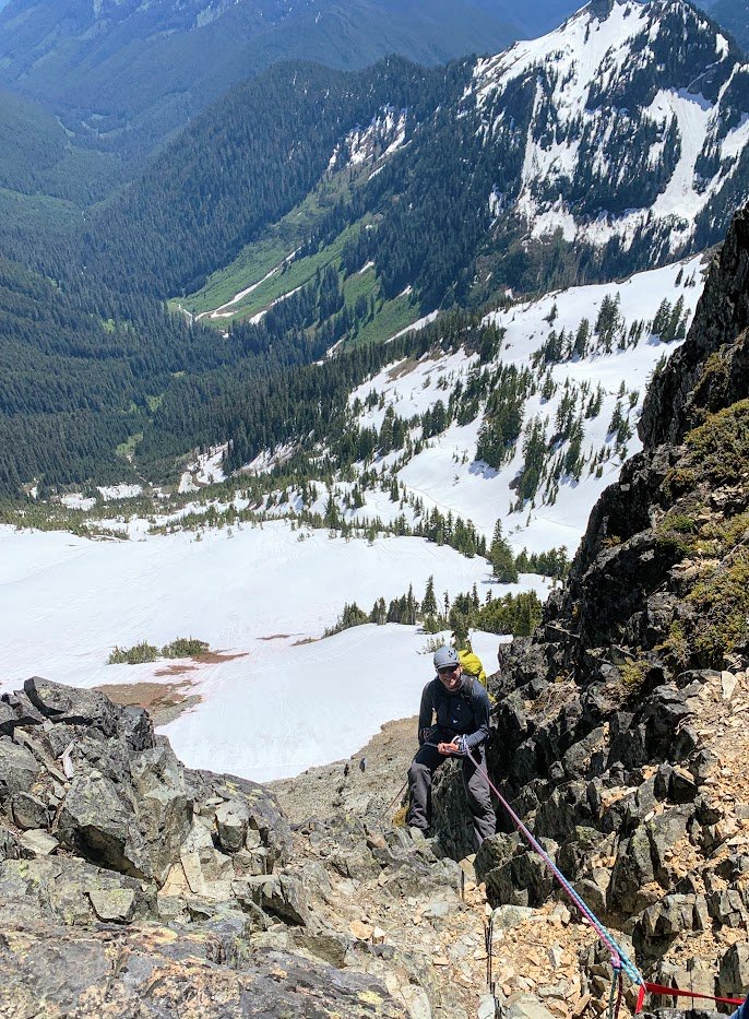
Boston Basin
22 miles of hiking • 9000' elevation gain • 2 nights
Alpine adventure with a couple friends from climb school. We stayed two nights in Boston Basin. On day 2 we climbed Sharkfin Tower. On the third day, we went up over Sahale via Quien Sabe Glacier and down the other side to Sahale Arm. Rock climbing, glacier travel, lots of rapelling, plus goats, bears and marmots. Temps were prefect, no tent fly needed, shooting stars at night.
Sahale Arm is one of the most spectacular trails I have ever put boot on. Did not care for the 6K downhill back to car, but worth it.
July 31 – August 2, 2022

 3
3
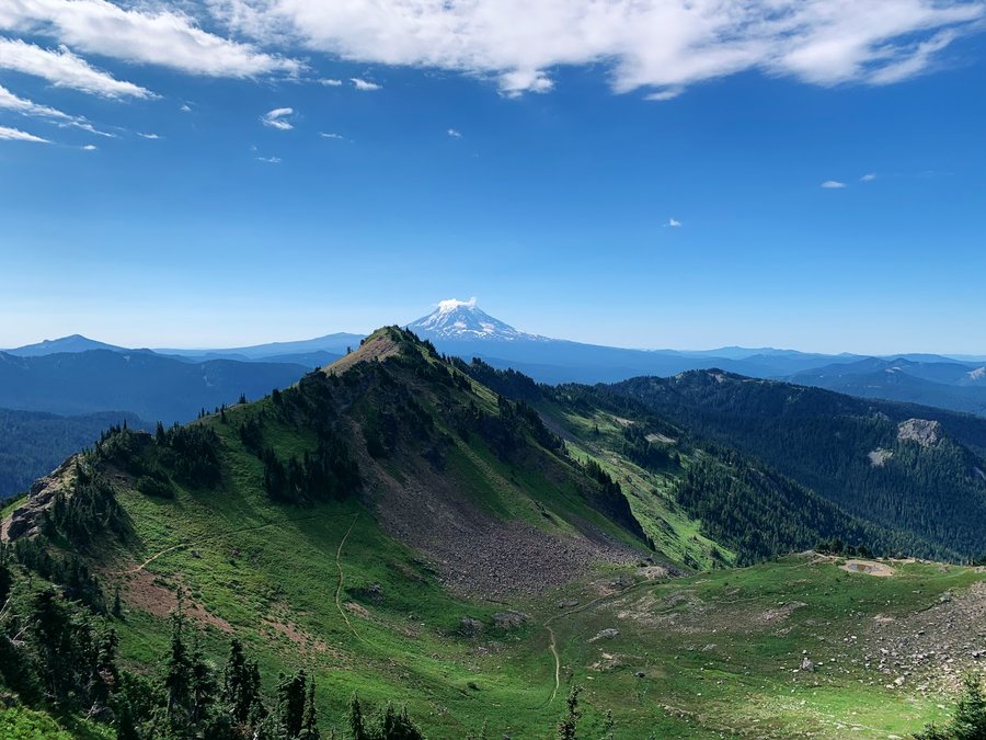
Killen Creek
7 miles of hiking • 1500' elevation gain •
I signed up for a pika monitoring gig. This was the only day I had to visit the site this month. I knew it was a bad choice. Late start, and arrived as the heat of the day was turning from warm to hot. Pikas not likely to be active, but I did see sign and heard one peep.
July 27, 2022


 2
2
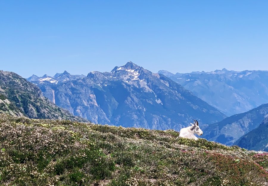
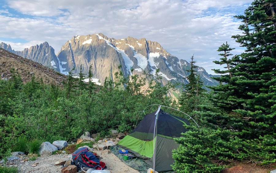
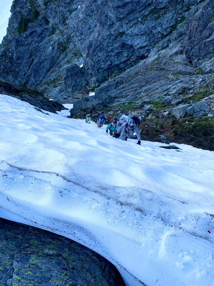
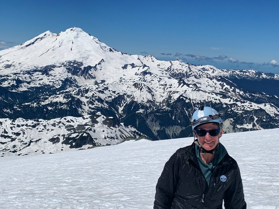
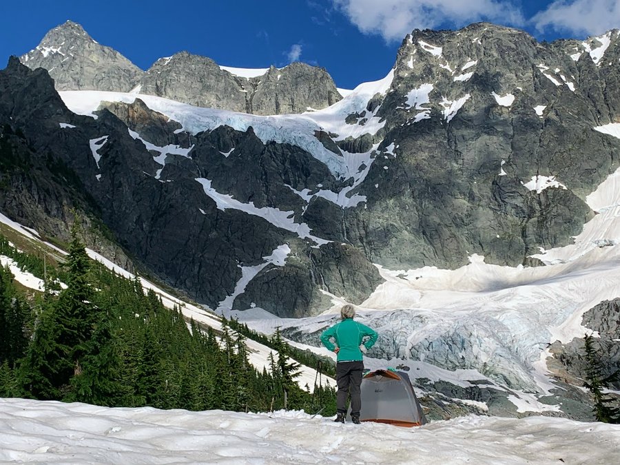
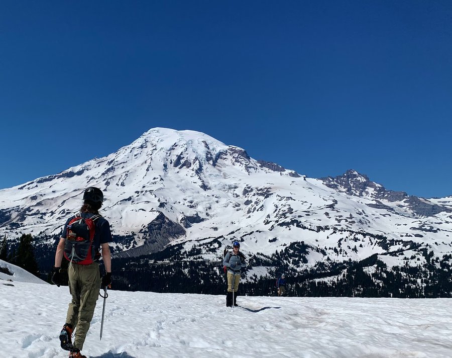
Fischer Chimneys
15.5 miles of hiking • 5500' elevation gain • 2 nights
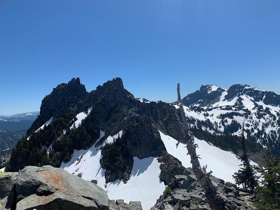
Shuksan climb. We hiked in to Lake Ann which is still mostly frozen. Found running water just east of it, beautiful campsite. So much snow up here, including in one of the Fischer Chimneys. Took us longer than expected to ascend, but it was so beautiful! Our leader called it at the base of the summit pinnacle, concerned about getting back before dark. Well it took us 16 hours to descend. Rappelling with a group of 8 us slow business, and on the second rap, our rope got stuck. Snow traverses were sketchy with steps blowing out in the soft snow. Transitioning from snow to rock also time consuming. We were fine and all our headlamps worked. Great learning experience.
July 19 – July 21, 2022


 3
3
Bear Creek Loop
42 miles of hiking • 7000' elevation gain • 4 nights
Wallowas awesome! Hiked Washbaord Ridge and Bear Creek trail for a wonderful loop.
Only saw one group back country on day 2.
Fun ridges, steep meadows and rock gardens. Snow navigation in higher elevation, but fine summer weather to enjoy it. The meltout feels so alive. Bugs only noticeable at night.
We are so fortunate!
July 9 – July 13, 2022


 1
1
Mickey D's
12.5 miles of hiking • 5000' elevation gain •
2nd time this year, why? It did seem easier, but still it is a tedious hike. Will train elsewhere from now on.
July 3, 2022


 1
1
Pinnacle Peak-East Ridge
3 miles of hiking • 1750' elevation gain •
Fun climb. Escaped the heat. Got a little bit of everything- steep snow, rock climbing, rapelling, glissading and bushwacking! I would call that a perfect day.
June 26, 2022

 1
1
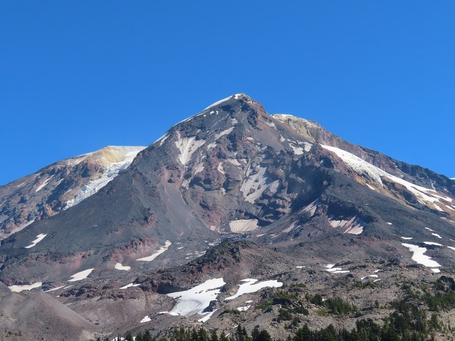
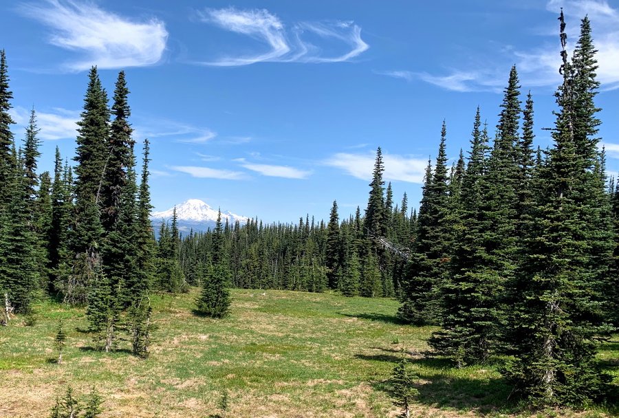
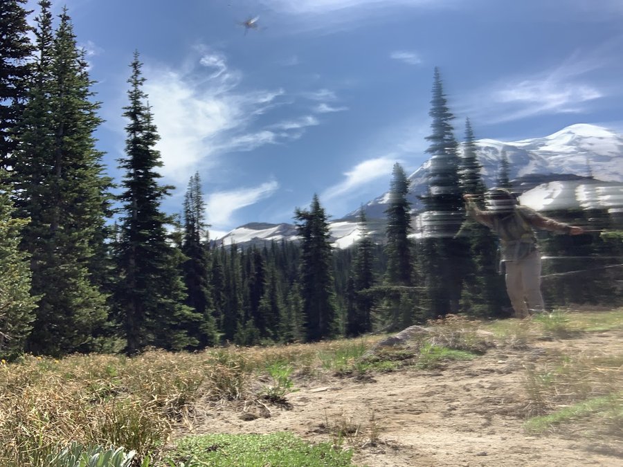
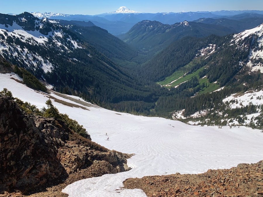
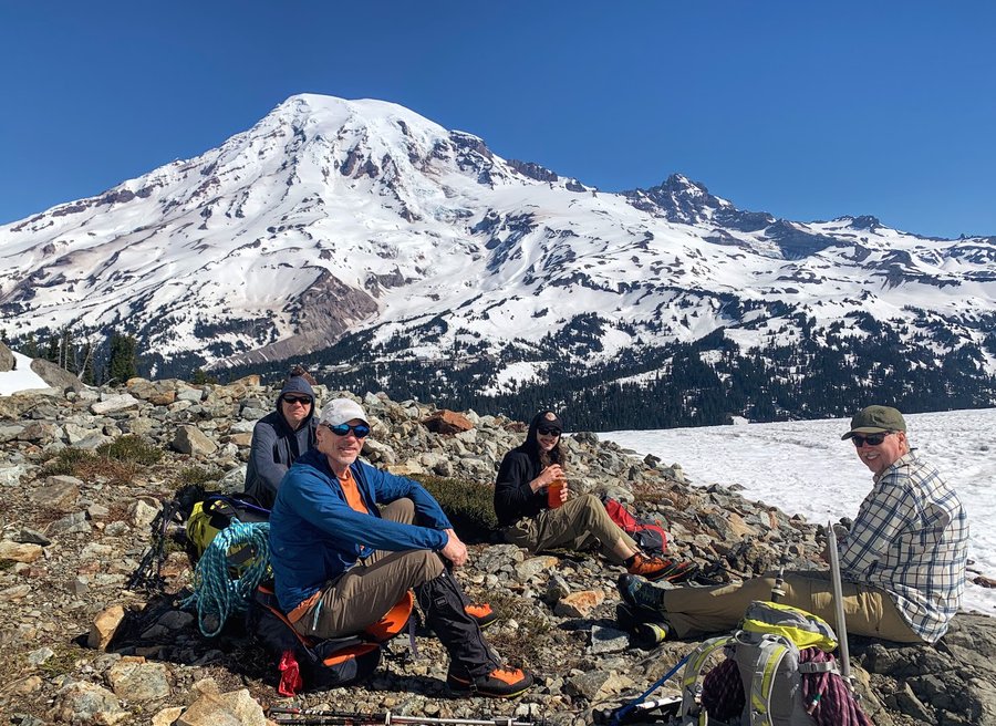
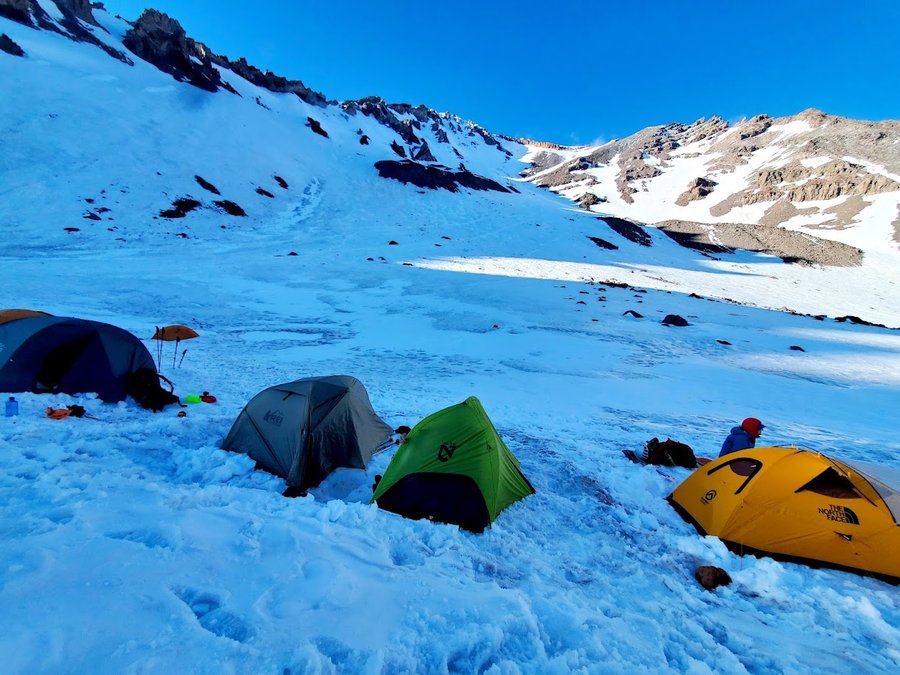
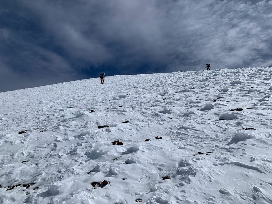
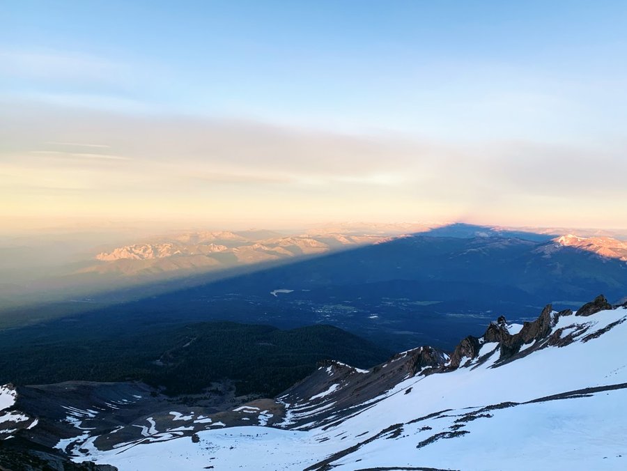
Mt Shasta
13.5 miles of hiking • 8750' elevation gain • 2 nights
Came down early to acclimate, and our climb was again pushed back another day , hoping for a weather window. So I did a little hiking around the mountain on Saturday, then we started our climb on Sunday. Weather was great, and 8 out of 10 of us summited.
June 18 – June 20, 2022


 1
1
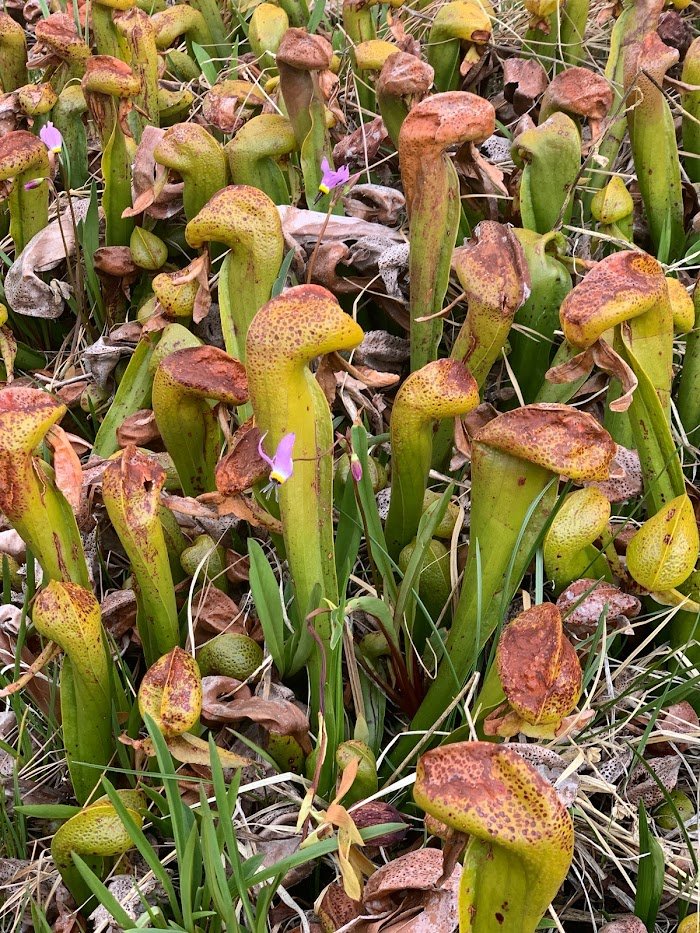
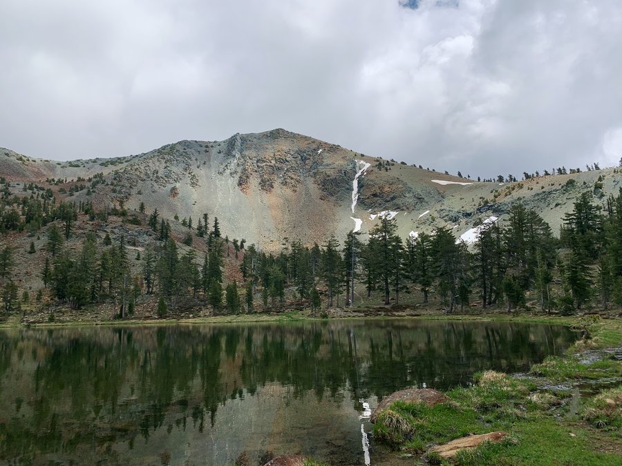
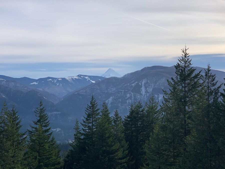
Mt Eddy, CA
12 miles of hiking • 2750' elevation gain •
Started at Park Creek summit and took the PCT to Deadfall Lakes. Loved the alpine parkland with Jeffrey Pines, Shasta firs and cool serpentine rocks all around. Was surprised to find big meadows of Darlingtonia at 8000 ft elevation. Mt Eddy is a former LO site, with some remnants, a very nice mountaintop with cool ridges to explore. I wandered along one of them, then had to downclimb sketchy scree field and traverse a beautiful alpine basin to return to the PCT. Shasta is supposed to be in your face, but it was hiding behind cloud all day. Hiked out in a snowstorm.
June 17, 2022

 1
1
Gales Creek
7.5 miles of hiking • 1000' elevation gain •
Stayed mostly dry despite the forecast! Trail is in great shape.
June 11, 2022
 1
1
Dog in Bloom
6.5 miles of hiking • 2750' elevation gain •
Little weather window! Balsamroot is bangin.
June 6, 2022

 1
1
Table Mtn Adventure
11 miles of hiking • 3500' elevation gain •
Came up via south scree fields and shimmied up a notch to gain Heartbreak Ridge. What a hoot!
June 1, 2022


 1
1
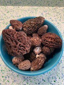
Kniebal Springs-Bottle Prairie Loop
9.5 miles of hiking • 1500' elevation gain •
Found a few morels.
May 26, 2022

 1
1
Chehalem Ridge
10 miles of hiking • 1000' elevation gain •
Exploring new park. The drive was so lovely, so bucolic! Nice trails.
May 25, 2022
 2
2
PCT Trout Creek to Sedum Point
10.5 miles of hiking • 2000' elevation gain •
Nice day in the woods. Passed a PCT crew logging out this section.
May 21, 2022
 2
2
Surveyor's Ridge
7.5 miles of hiking • 2000' elevation gain •
Came up via the Oak Ridge Trail. Found some morels.
May 18, 2022
 1
1
Reeher's Camp
3 miles of hiking • 250' elevation gain •
Finally tried the Triple C trail, plus a little out and back on Gales Creek, didnt last too long today. Soggy day, mucky trails, but the many hues of green were soothing.
May 12, 2022

Mt Defiance
12.5 miles of hiking • 5000' elevation gain •
What a slog! But weather was decent for once. Snow above 3500 ft, good consolidated boot tracks to follow today.
May 10, 2022


 1
1
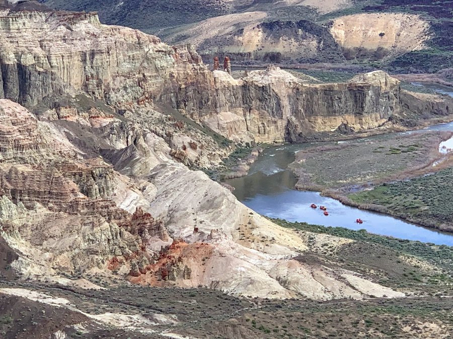
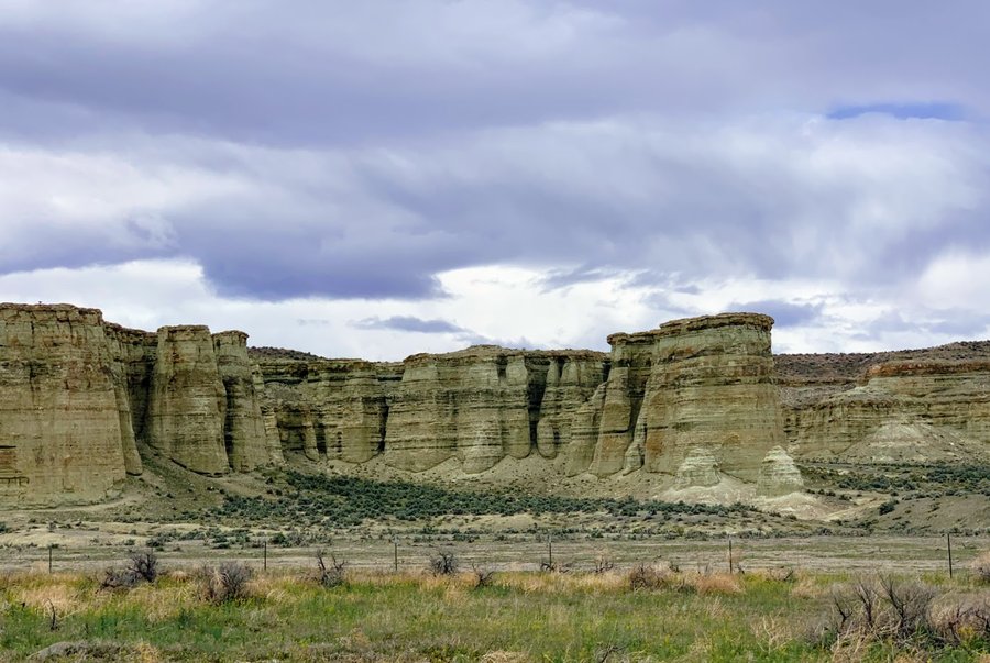
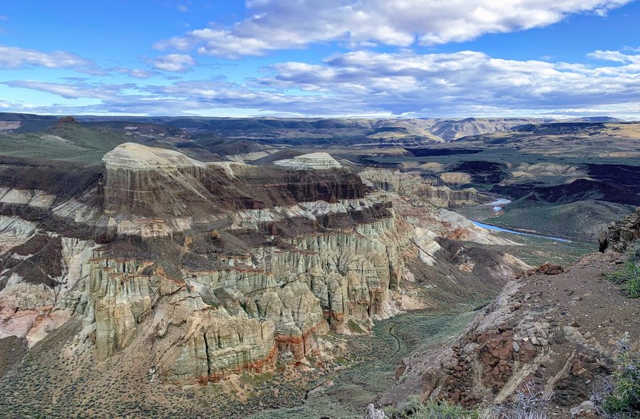
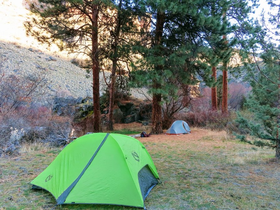
Oregon Outback
17.5 miles of hiking • 3250' elevation gain • 2 nights
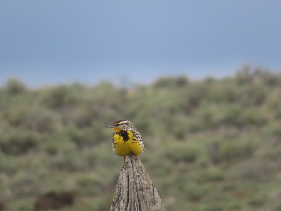
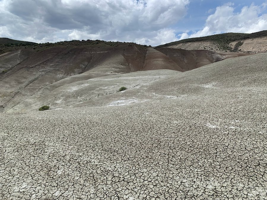
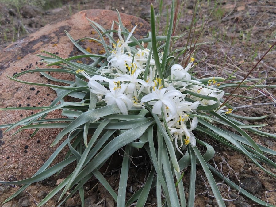
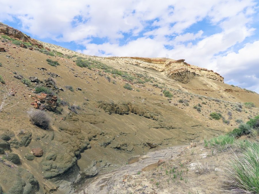
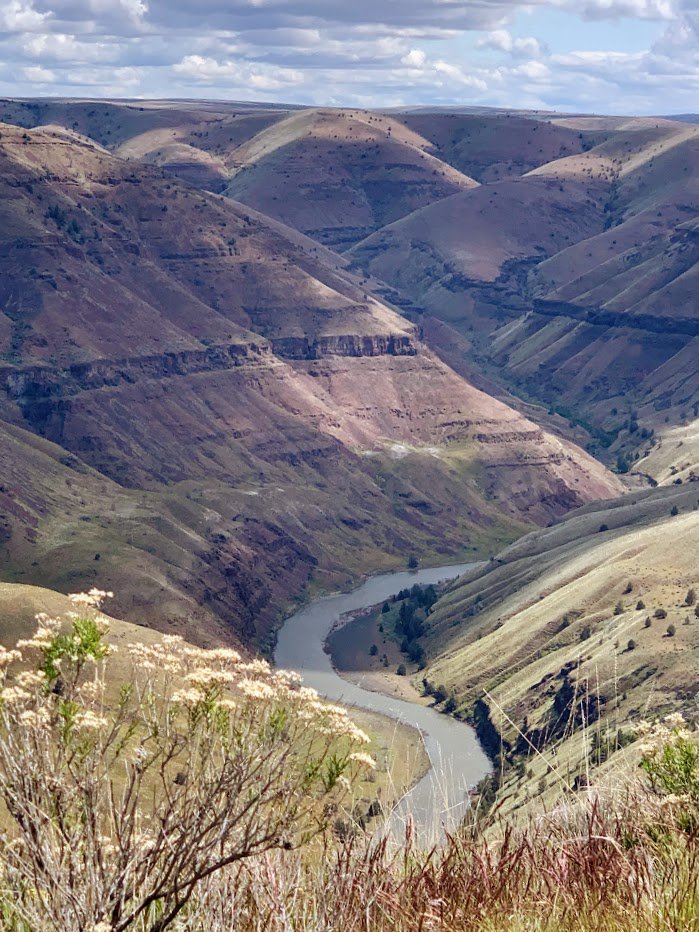
Had a trip to SE Oregon with several stops. I had a volunteer project with ONDA monitoring cattle impacts on BLM land near Juntura. Struggled with the weather, high winds, hail, rain, wet tent and stayed in hotel for two of the 4 nights. I went down to Chalk Basin, which is just magnificent. Stopped on my way home to hike Nine Mile Ridge east of Pendleton( snowshowers and flowers!).
May 5 – May 7, 2022


 2
2
Silver Star South Ridge
6 miles of hiking • 2250' elevation gain •
All kinds of weather and trudging through wet snow. After gaining the south ridge near the vision pits, we decided that was enough. Got some of that sideways hail that stings your face on the way down.
April 30, 2022


 1
1
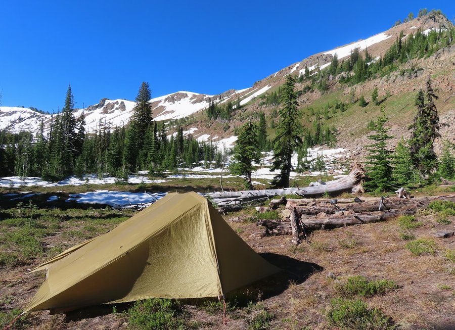
High and Lonesome
17.5 miles of hiking • 3500' elevation gain • 1 night
Explored Spring Basin Wilderness near Clarno. We carried full backpacks but couldn't find a running spring, so circled back to car and camped near the trailhead. 13.5 mi 3000 ft. Next day explored bluffs above the river near Kent. 4 miles 500 ft.
April 25 – April 26, 2022


 1
1
April 23, 2022

 1
1
Newton-BPA Loop
6 miles of hiking • 1000' elevation gain •
February conditions. Downed trees, slippery trails, rain and hail.
April 18, 2022
 2
2
Coast Trip
7 miles of hiking • 1000' elevation gain •
At the coast with the hubs for the weekend. We visited the Ecola Forest Preserve, then hiked Neahkahnie after the snow storm. Breaking trail on a tourist hike, and getting bombed by slushballs, fun times.
April 10, 2022

 1
1
Archer Loop
7.5 miles of hiking • 2000' elevation gain •
We were supposed to do Hamilton, but I convinced our leaders that a group of 16 on a Sunday was too high of an impact. Dont want to be part of a boorish herd of Mazamas.
Only one other person had been here before, and everyone loved it. Spectacular finish with Cloud Point and some sketchy down climbing, the students got a real adventure hike. Hope I didn't scare anybody off.
March 27, 2022

 2
2
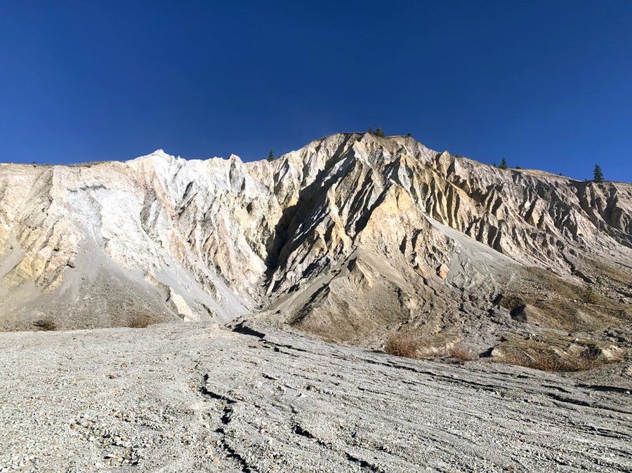
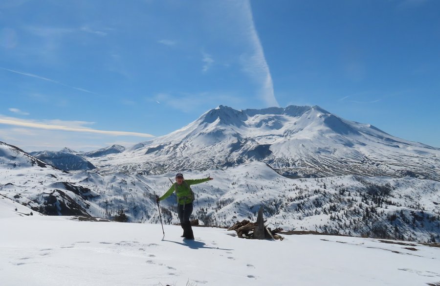
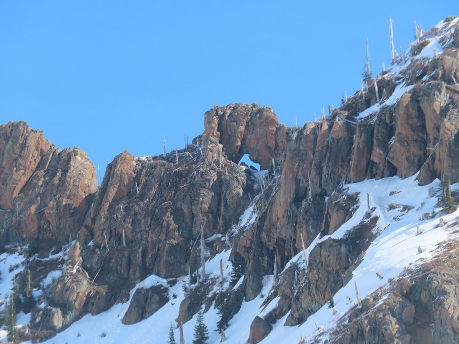
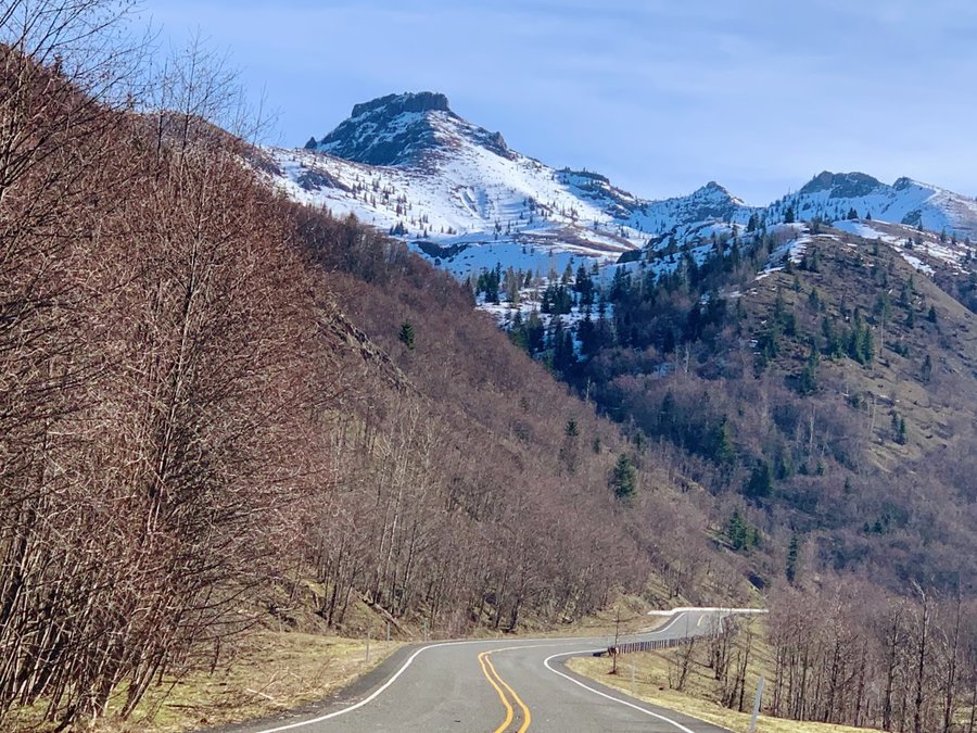
MSH in bad weather
8 miles of hiking • 3250' elevation gain •
This was a dumb idea. We turned around at 6200 ft. 100s of others out there too in this lousy weather, what were they thinking?
March 25, 2022
 1
1
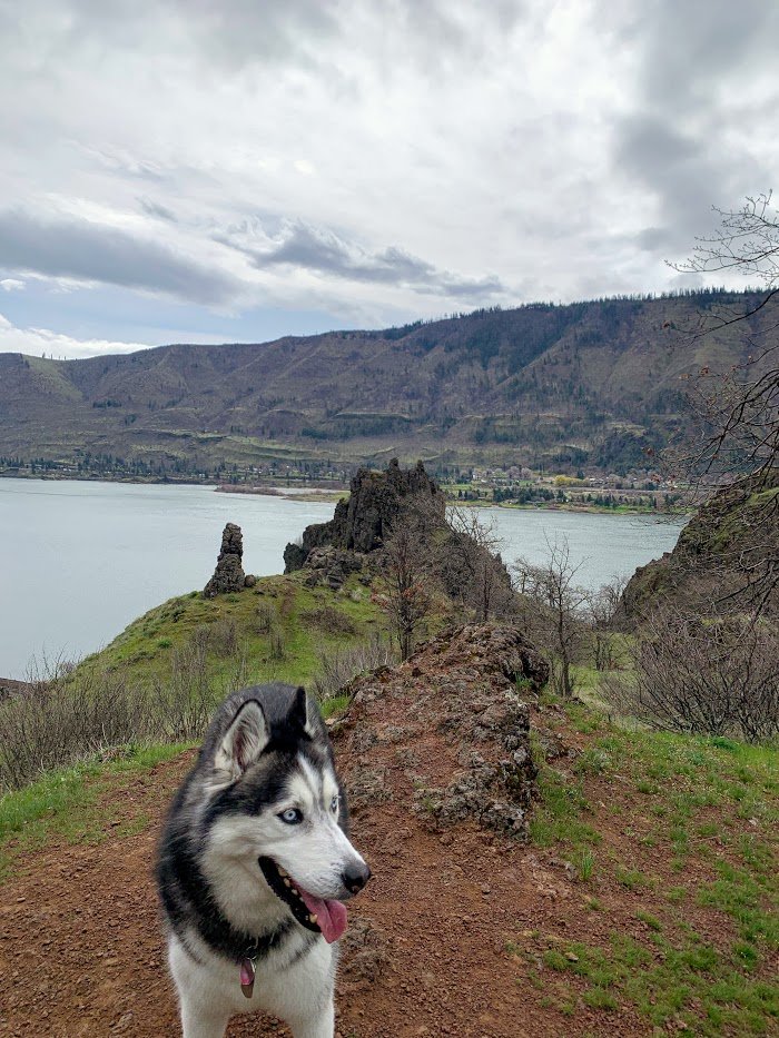
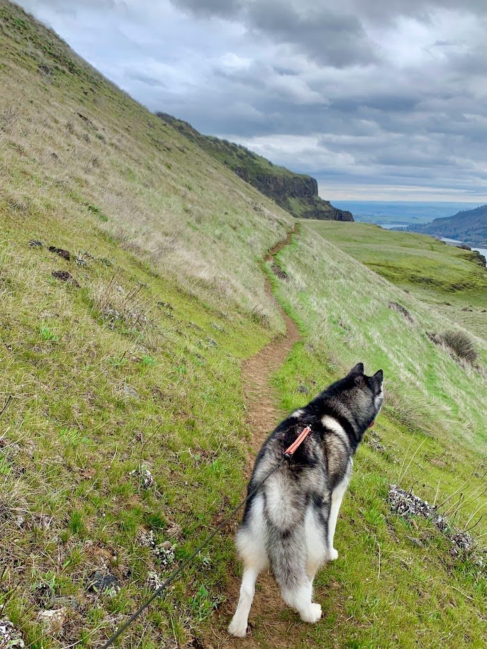
Lyle Cherry Orchard
7 miles of hiking • 1250' elevation gain •
Brought my neighbor Kenai on this hike. He was a pretty good companion.
March 23, 2022


 2
2
Deschutes/Whychus
9 miles of hiking • 1000' elevation gain • 1 night
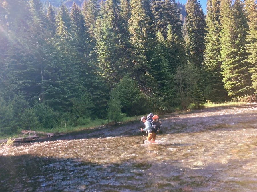
Third time doing this trip, first was in 2013, then 2017. Love coming here before they open the Holmes Road gate on 4/1. We started on the Geneva side,carefully avoiding private property. Descended via Carcass Canyon, fun scrambling. Camped near the confluence. Hiked out up Whychus. Very pleasant trip.
March 16 – March 17, 2022


 1
1
Saltzman-Maple Loop
7.5 miles of hiking • 750' elevation gain •
First get to know you hike for my BCEP group this year. A little sloppy but the trails were quiet.
The students are like eager puppies and we are all craving the socialness and excited about the season!
March 13, 2022
 2
2
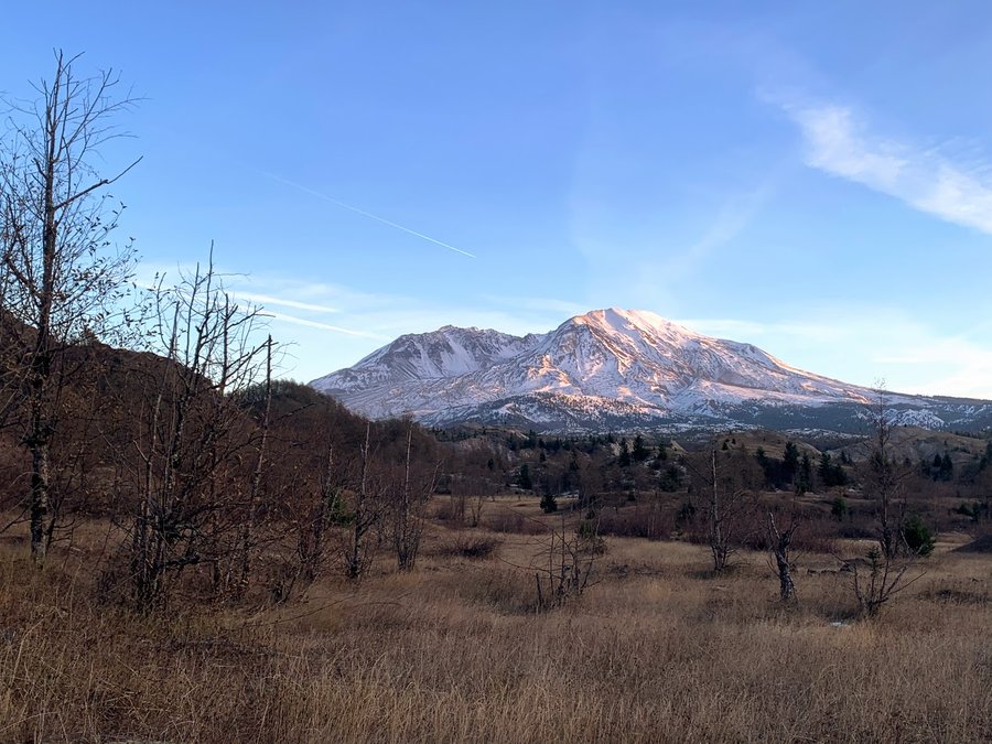
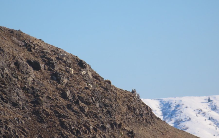
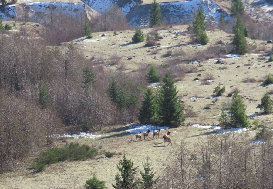
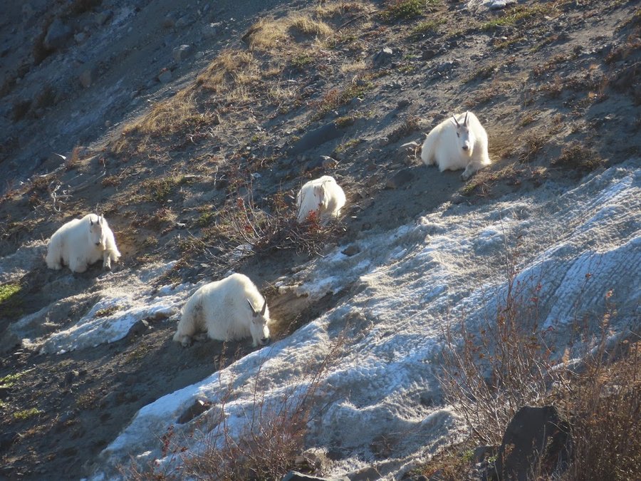
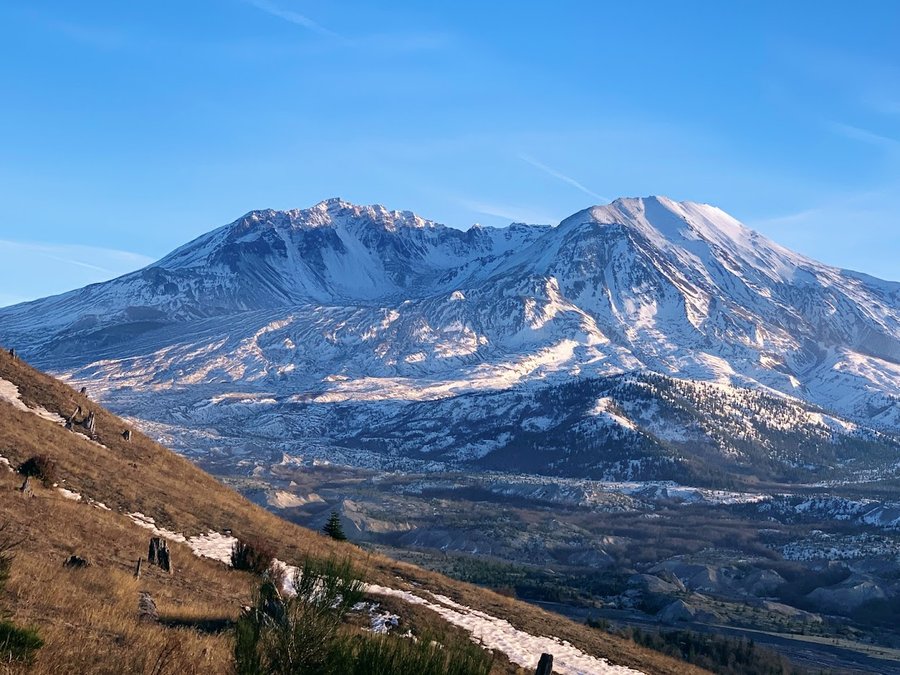
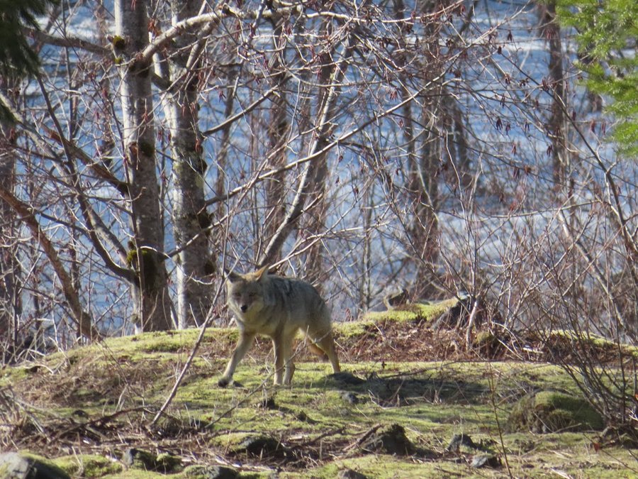
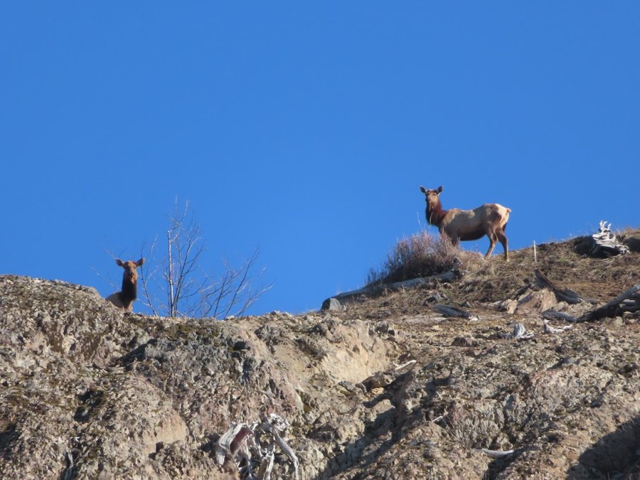
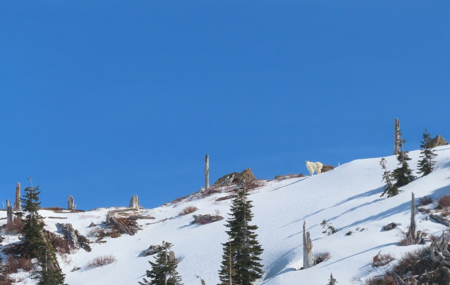
Harry's Ridge
5 miles of hiking • 2250' elevation gain •
I parked my car at the hummocks and slowly rode my bike 4 miles up to the hairpin turn where it crosses S Coldwater Creek. This is where they stopped plowing. Dropped bike and headed up to Coldwater Ridge and spent the rest of the day wandering around traversing some very steep snow fields. Saw coyotes, elks and goats. Epic views all day. Snow got really soft. Glad I had my ice axe and microspikes. One slip and fall with arrest-runout was not sure death, but it was kinda scary. Had a few good glissades too..
March 7, 2022


 2
2
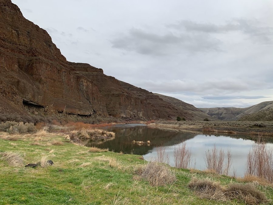
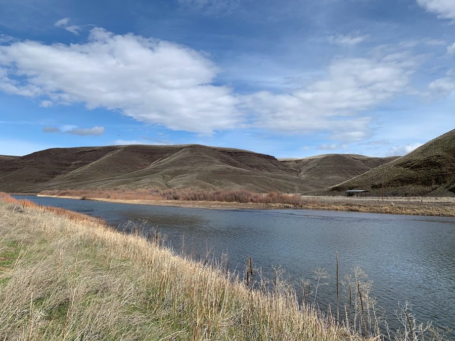
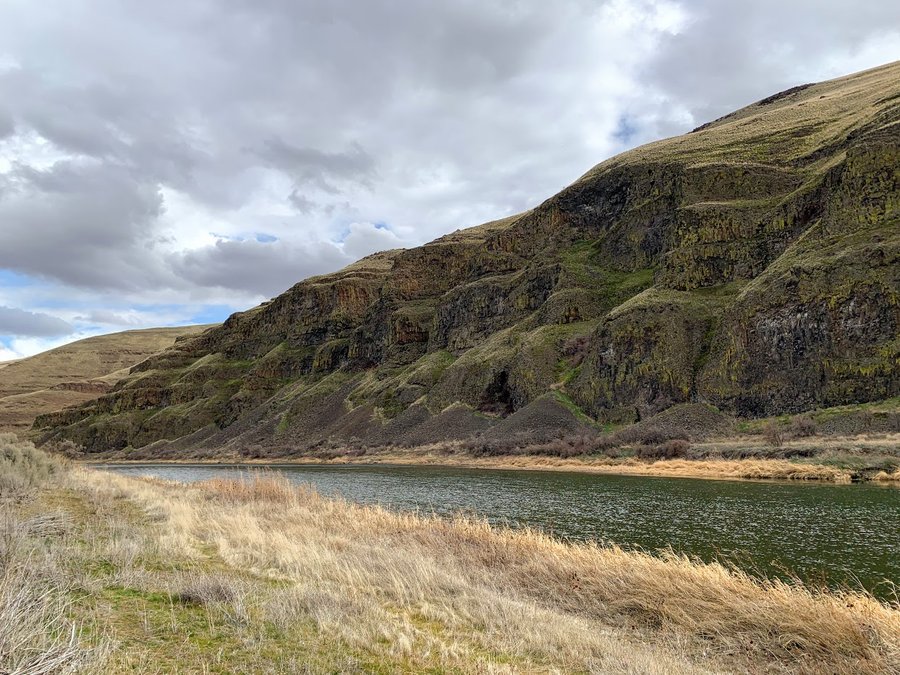
John Day
9 miles of hiking • 250' elevation gain •
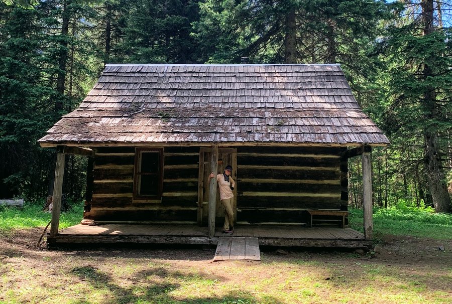
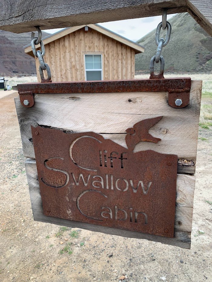
I had two days in the high desert this week. Tuesday for hiking, and Wednesday for a volunteer gig with ONDA at Clarno. I started at the Starvation boat ramp, downstream from Cottonwood Canyon SP main entrance, but still part of the park.Dreamy walk up and down the river. Unfortunately a little corner of private land with a gate and no trespassing sign prevents you from walking all the way upstream to the Pinnacles trail. I did hear from an ONDA person that it may become public in the future!
Snagged a cabin reservation for the night-the cabins are clean and new with heat and electricity, and have lovely front porches. Had a pleasant evening walk downstream from the campground, return by headlamp. Stars fantastic.
March 1, 2022

 2
2
Hospital Hill
8 miles of hiking • 1500' elevation gain •
Enjoyed a quiet wander on the sun kissed slopes above White Salmon.
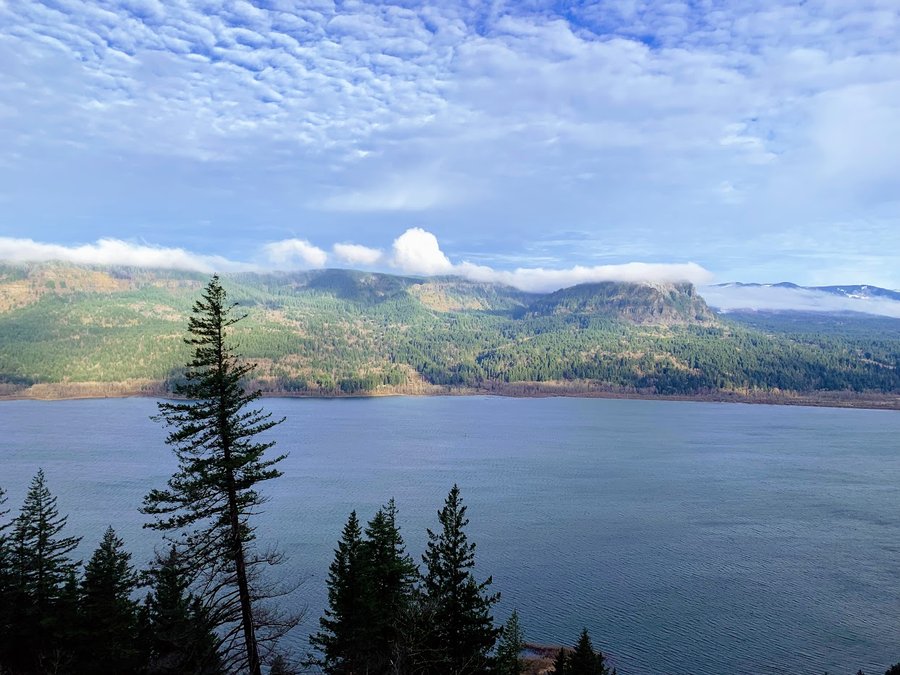
February 22, 2022

 1
1
Mt Ellinor
10 miles of hiking • 4250' elevation gain •
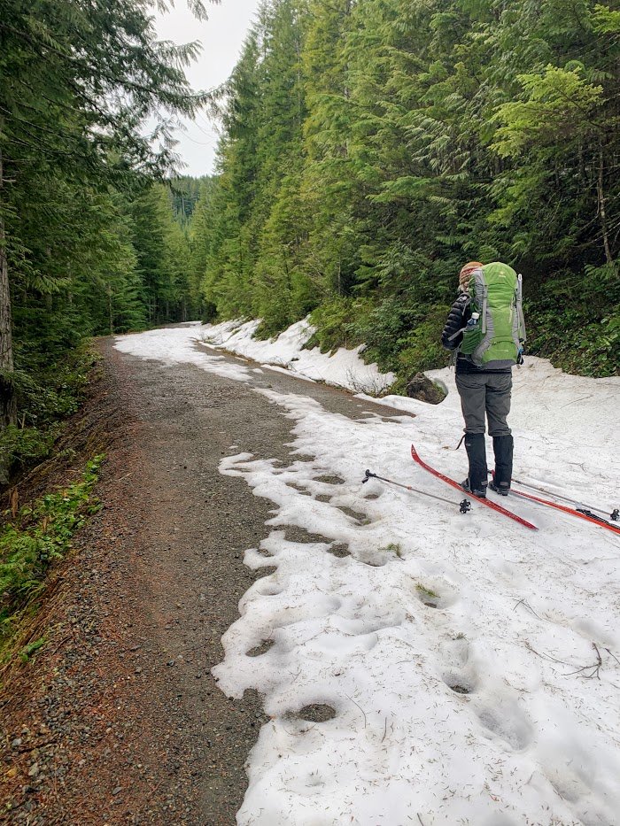
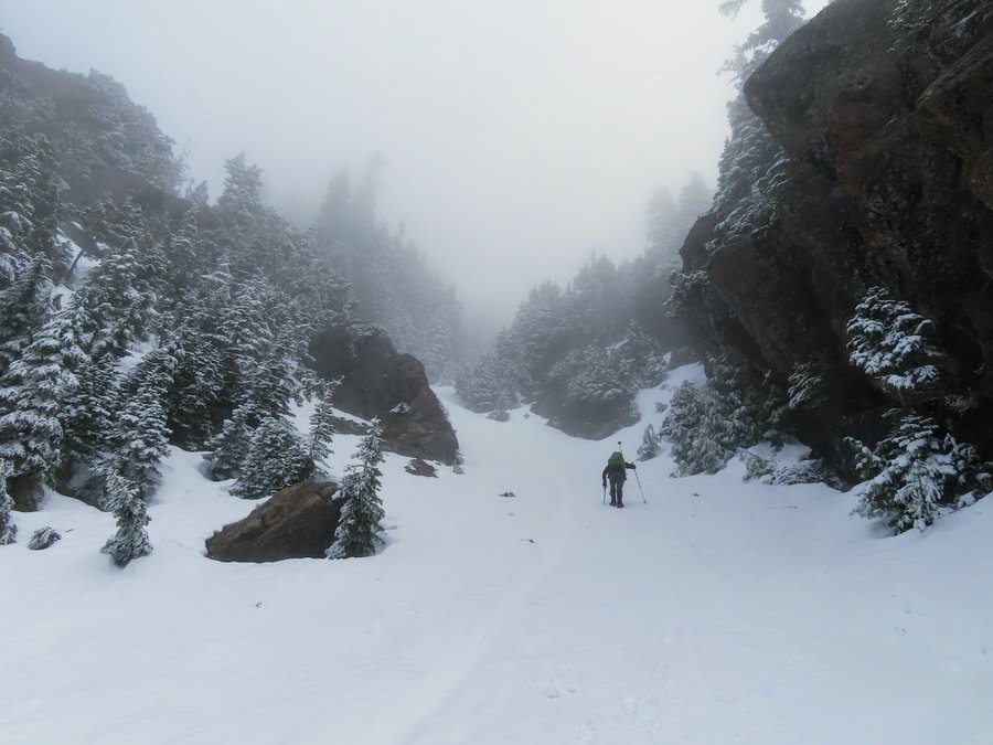
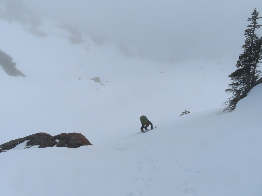
We were treated to some gorgeous views of the Olympic peaks on the drive and were very excited about the day. Decent forecast. We parked along the road where a snowbank kept us from driving further. The snow was not persistent for the first mile and half, so we carried our skis up and then eventually put them. The road snow was stiff and pockmarked with postholes, not a fun ski, but better than walking. We skiied up to the middle TH where we switched back to boots. At about 4K ft we encountered a light layer of new snow and the trees were flocked-magical! We also entered what we hoped was just a marine layer of clouds, and only had intermittent views of the summit ridge. By the time we arrived at the base of the winter chute, we were totally socked in. The climb up the chute was several inches of new wet snow over a firm crust. Had to use our skillz with intense focus. Top narrow section was a bit frightening as the snow was more windswept, and we front pointed up and down this part.
Upper ridges total whiteout and it was rather disorienting to navigate to summit. Never got any views.
On the way down the light was so flat, we could not tell what the slope was like, just had to feel it change under our feet. After coming down the top narrow sxn of the chute, I decided to go for the glissade. My partner declined. Started out with some short slides and practice arresting just to figure out the control, then I let 'er rip!!!!
February 15, 2022


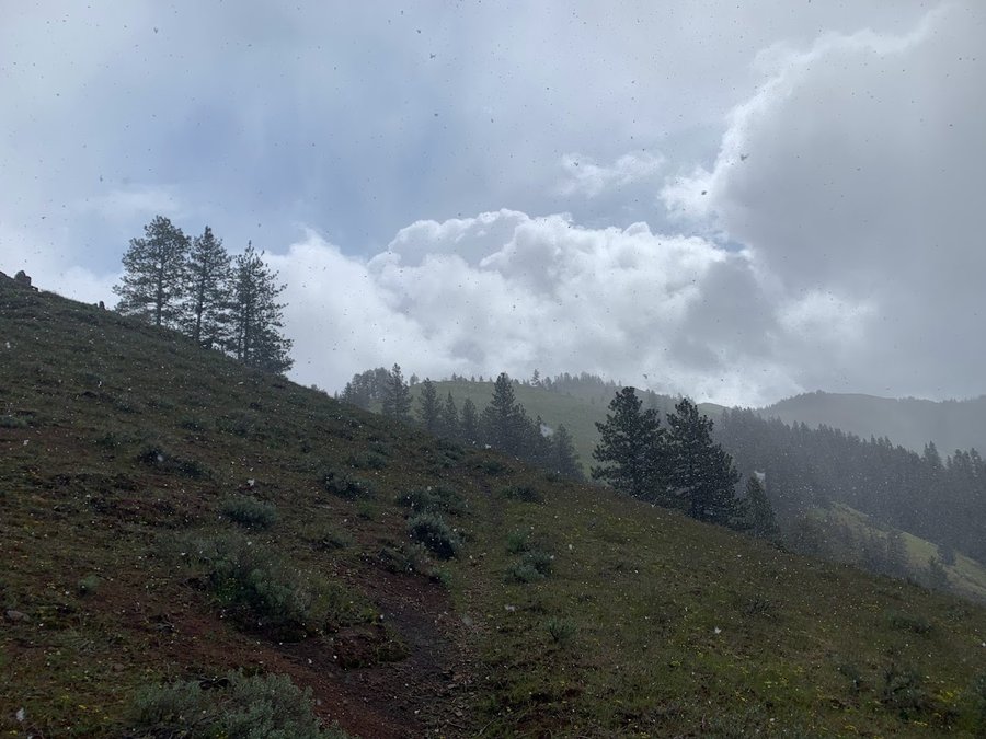
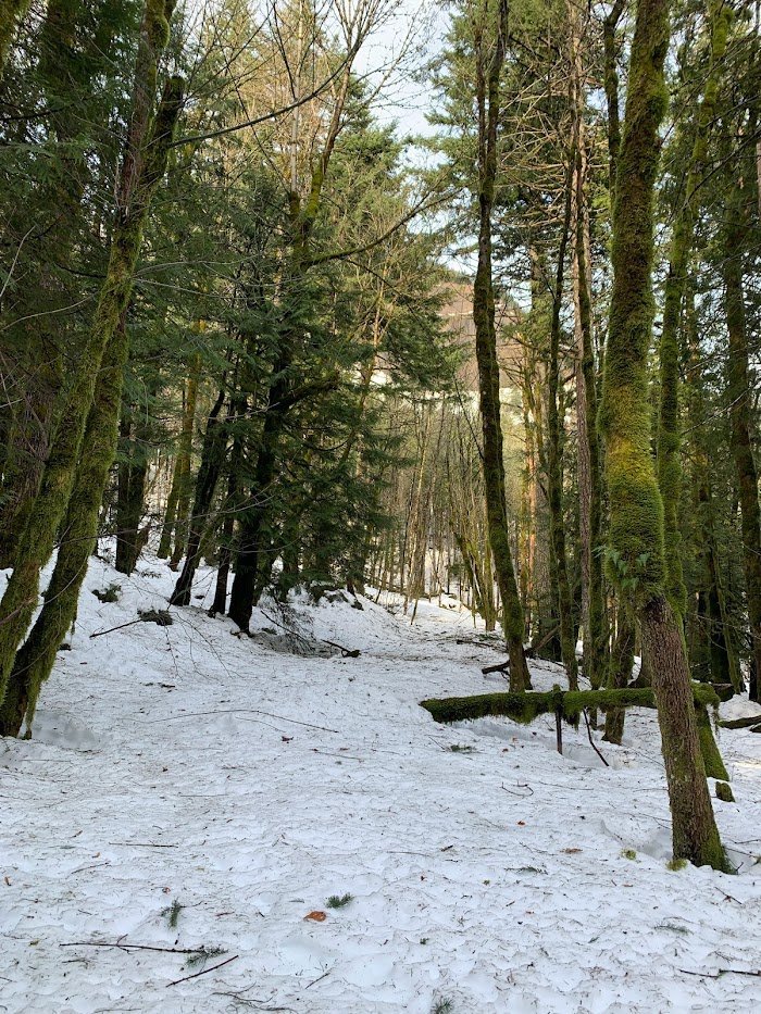
Tilly Jane
6.5 miles of hiking • 2500' elevation gain •
New winter camera assignment. Snow falling all day. Sustained wind on open ridges, but not as strong as forecasted. Was very pleasant to break trail in 8-12 inches of fresh snow with a solid crust underneath. Very few animal pictures on this set, but I look forward to returning several times this season to see how things change.
January 31, 2022


 2
2
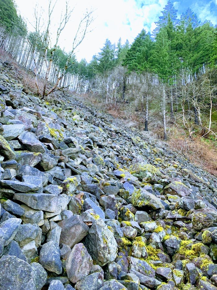
Archer Mtn
7.5 miles of hiking • 2250' elevation gain •
Wow some of the trails here have been really fancified!
More northerly trails are less maintained with faint tread and some blowdown, yay!
All the snow I encountered (back part of loop) was stiff and easy to walk on. Still got some great bushwacking in and found a few more cardavers. Perfect day.
January 26, 2022

Elevator Shaft
8 miles of hiking • 2000' elevation gain •
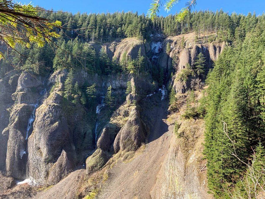
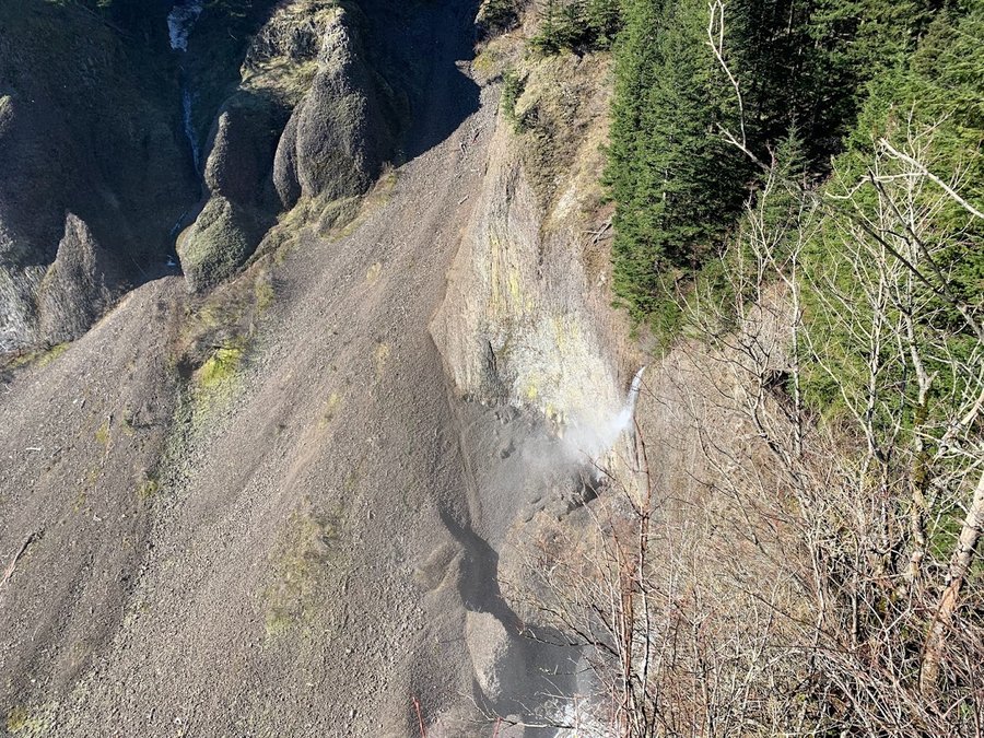
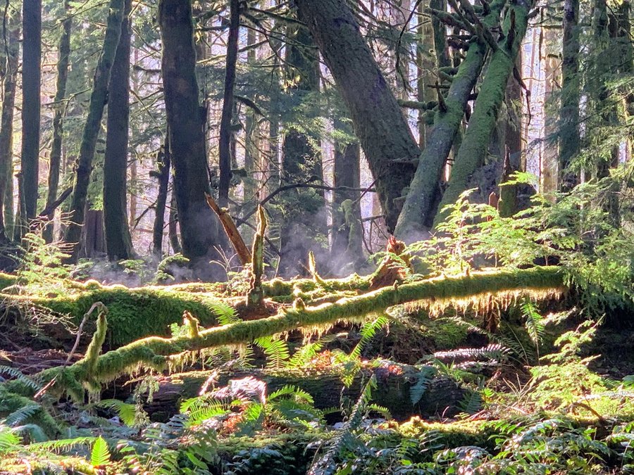
Well the 400 is now open, so I took a trip up the Elevator Shaft. Fun as ever,with poison oak down low and icy scree scrambles up top. I then had a nice bushwacking, postholing wander up through Multnomah Basin, visiting Cougar Rock and Nesika Lodge Didnt see anyone for 6 hours until I entered the flowing parade of humanity at Multhomah Falls.
January 16, 2022

Scouting
10 miles of hiking • 1500' elevation gain •
Was scouting out for a trip in the future. Trying to find closer approach than Bonneville. Started at Kidney Lake and was able to skip those boring ugly miles on the pCT, and use the nice bridge to cross Greenleaf Creek, but still had to contend with a long stretch of the Two Chiefs trail. Last mile before Greenleaf Creek was deep, wet snow, breaking trail tiresome! Blue Lake side approach better except for that creek crossing. New small landslide at the creek.
January 12, 2022

 2
2
Tualatin Hills Nature Reserve
5 miles of hiking • 0' elevation gain •
This morning, I found myself in Beaverton- a place I've been avoiding for a decade. Decided to go visit this park afterwards. It's quite lovely, but despite the name, there are no hills. Looped all the trails. This area is well loved and cared for, and it was nice to enjoy a suburban park with no dogs.
January 10, 2022

 1
1
Newton-BPA Loop
5 miles of hiking • 1000' elevation gain •
Well I forgot microspikes, but that made it more exciting! Frozen mud, black ice, and just a little bit of nice snow here and there. Newton Road was fine, BPA road was sketchier but it was wide enough that you could zigzag around the worst parts. Wildwood was the worst.
January 2, 2022

View trips from: 2011 2012 2013 2014 2015 2017 2016 2018 2019 2020 2021 2023 2024 2025 2026