

2017 Trips

 1
1
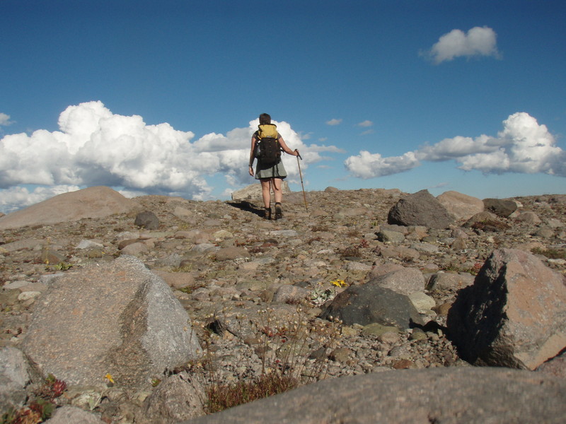
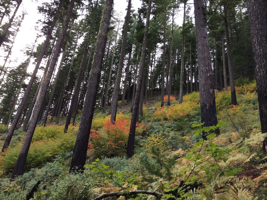
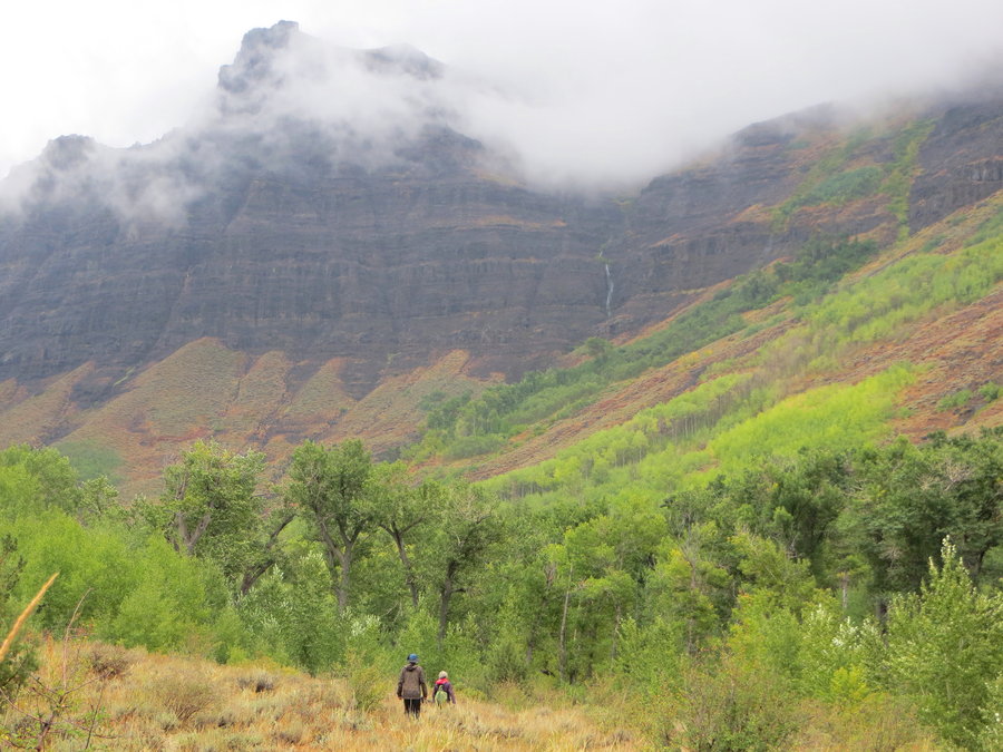
Silver Star and Sturgeon Rock
9 miles of hiking • 2500' elevation gain •
Did the loop starting from Grouse Vista. The top of Sturgeon still feels like Scotland!
Unfortunately, there are two huge new roads cutting across the Tarbell trail with a giant logging deck in place. There might be a clearcut just south of that trail soon.

October 31, 2017

Greenleaf Point
5.5 miles of hiking • 1250' elevation gain •
I was planning to go up to Sedum Ridge, but there is a landslide on CG 2000. Intead I returned to Greenleaf Basin and did some more exploring. Lots of old roads to stumble on to and follow. Made it up to Greenleaf Point, nice summit.
October 23, 2017


Greenleaf Basin
7 miles of hiking • 1250' elevation gain •
Had fun wandering around here, vine maple looking good!
October 17, 2017

Castle Rock
6 miles of hiking • 1750' elevation gain •
Topped off this afternoon hike with a soak at Terwilliger Hotsprings!
October 10, 2017

 1
1
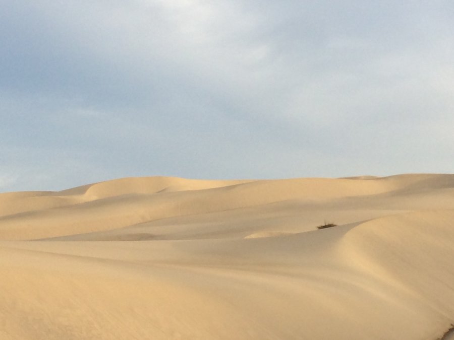
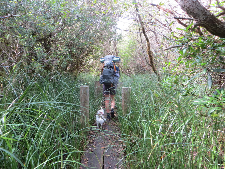
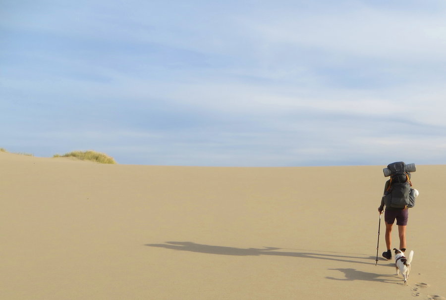
Oregon Dunes Backpack
12.5 miles of hiking • 1250' elevation gain • 1 night
The Dunes are disappearing. Last did this trip 10 years ago. Beach grass clumps have become islands of shrubs and trees, interrupting the dunes throughout.
The FS has added a nice elevated boardwalk to section of the John Dellenback trail leading to the beach through the deflation plain that has always been a marshy slog. No-one on the beach except a very healthy population of snowy plovers.
October 9 – October 10, 2017


Table/Greenleaf
7.6 miles of hiking • 2000' elevation gain •
Working on some unfinished business from the last trip
October 3, 2017

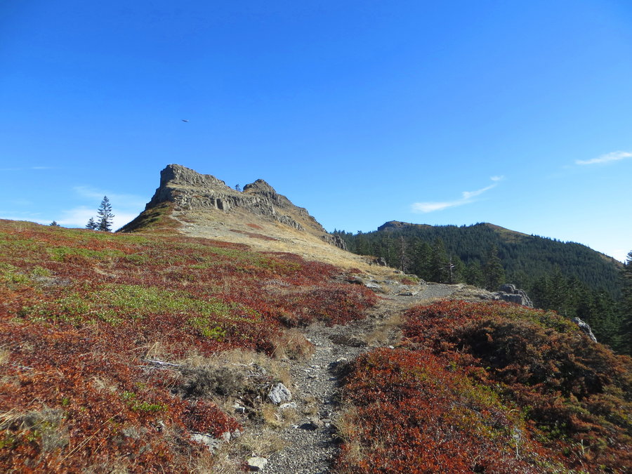
Two Chiefs
7 miles of hiking • 1750' elevation gain •
Wandered around below the cliffs of Table Mountain.
September 24, 2017
 1
1
Big Indian Gorge
18.5 miles of hiking • 3500' elevation gain • 1 night
We tried to escape the smoke and upcoming wet forecast, but got rained on the second day. Intended to do the loop up Big Indian, spend a night at Wild Horse Lake, then Down Little Blitzen. Ended up just doing an out and back in Big Indian Gorge. It was beautiful despite sogginess!
September 17 – September 18, 2017

 1
1
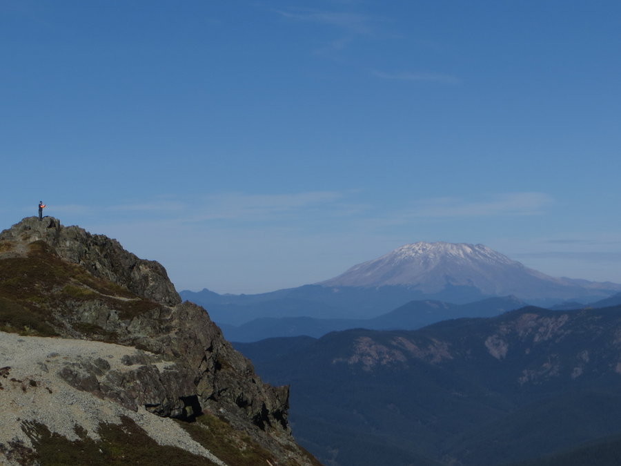
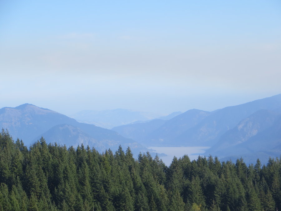
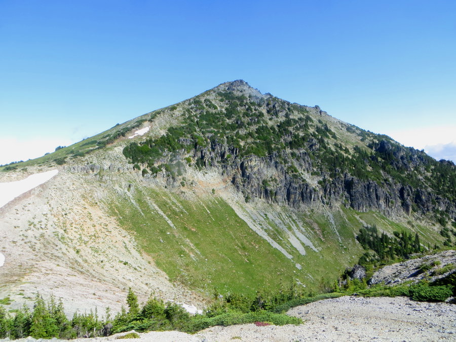
Sugarloaf
7 miles of hiking • 1750' elevation gain •
Fun hike along the alt trail to Mt Mitchell. The picture is of the base of the cliffs below Sugarloaf Ridge. Just beyond it is Mt Mitchell.
September 9, 2017

 2
2
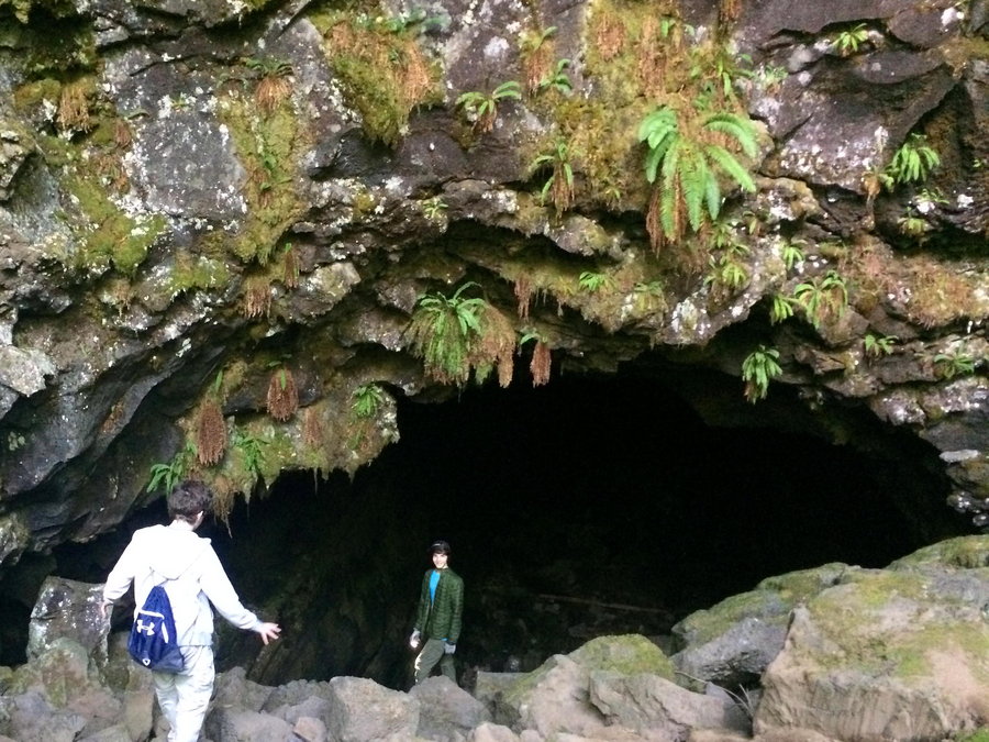
Falls Creek cave
3 miles of hiking • 250' elevation gain •
Falls Creek Cave- what a hoot! We were in there scrambling for hours. Troglodyte fun.
August 25, 2017

 1
1
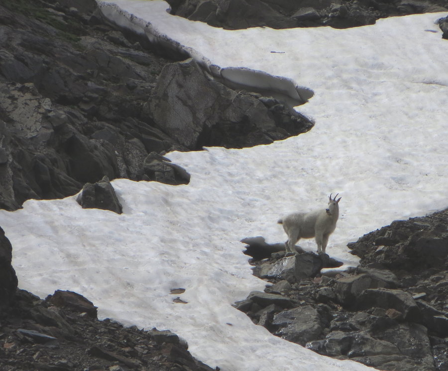
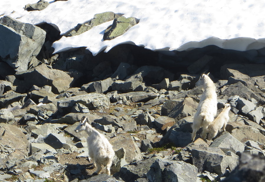
Rock Creek Lake, Elkhorns
18 miles of hiking • 5500' elevation gain • 3 nights
Family backpack to watch the eclipse in the totality zone. Had fun scrambling around the basin and visiting nearby Bucket Lake. Lots of goat watching.
August 19 – August 22, 2017


High Lake
8 miles of hiking • 2250' elevation gain •
There is nothing better than swimming in an alpine lake on a hot day.
August 9, 2017
 1
1
Nannie Ridge Trailwork with WTA
14 miles of hiking • 4500' elevation gain • 2 nights
My first gig with the WTA. We combined with a PCT crew and got to stay at their camp with a kitchen tent. They made us dinner on Sat night.
August 4 – August 6, 2017

Forest Park
6 miles of hiking • 1250' elevation gain •
Quiet loop with the Ridge trail and Firelane 7
July 23, 2017

Oakridge Environs
9 miles of hiking • 1250' elevation gain •
Leisurely three day trip with friends. We stayed at a cabin on the edge of the NF. Did a little bit of everything: mountain biking, hotsprings, kayaking and even visited the Oregon Hell Hole. Our hikes were around Warner Peak and Moon Point where the beargrass and wildflower meadows were terrific.
July 19, 2017

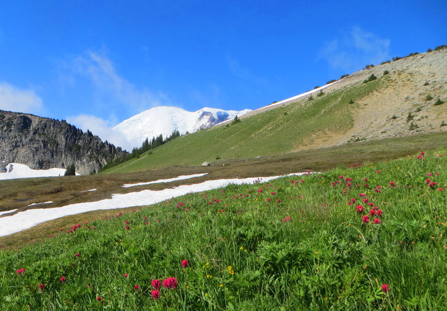
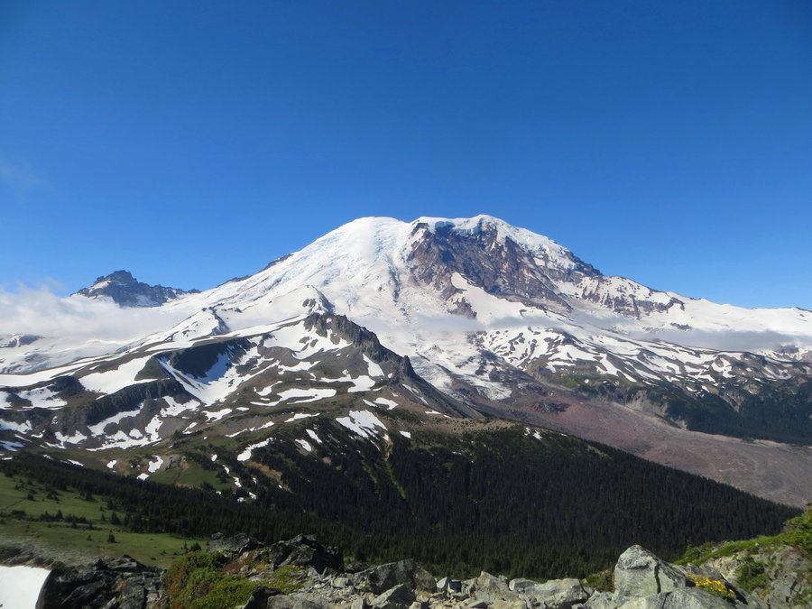
Dark Divide and MRNP
26.5 miles of hiking • 5250' elevation gain • 3 nights
I took a few days to travel around exploring in Washington. Car camped in remote spots. Saw a bear in the Dark Divide, marmots and goats in MRNP, and shooting stars at night.
1) Big Creek Trail near Lewis River, 2 miles 300 ft eg 2) FS 9341 Road walk. On my way to the Snagtooth TH, there is a rock slide blocking the road 3 miles from TH. I walked up to the TH and back as a little evening hike, 6 miles 750 ft, bear crossed road in front of me. Didn't wait for me to grab my camera. 3) Hike and Bike to Snagtooth Mountain. Woke up and biked up to the TH, then hiked up to the Snagtooth summit. Steep snowfields persisting on the north slopes, no bugs! 4 miles, 650 ft hiking. 4) Taklakh Lake, then Natchez Peak in MRNP. 5 miles, 1400 ft 5) Sunrise to Skyscraper to 2nd Burroughs in MRNP. Goats and marmots. 9. 6 miles, 2400 ft eg
July 13 – July 16, 2017

July 7, 2017

Lost Creek Old Growth
3.5 miles of hiking • 500' elevation gain •
Woodsy wanderings, with way too much bushwacking on this trip. Heavy vegetation, could not see under the continuous carpet of vanilla leaf. Having flashes of "how Jen dislocated her new hip" every time I tripped. Big logs still a big challenge. Can't wait to get my monkey back.
July 3, 2017

Palmer Mill
6.5 miles of hiking • 1000' elevation gain •
New L hip (#2) now in place. First hike 17 days post-op. I am now the double bionic woman. Hear me click!
July 2, 2017
 1
1
15 mile creek loop
12.5 miles of hiking • 2250' elevation gain • 1 night
Perfect weather for an overnighter. The trail is popular with mountain bikers, but it hasn't been logged out yet. Had it to myself on this weekday. Flowers everywhere. The Cedar Creek trail has a lovely rolling ridgetop ramble.
May 31 – June 1, 2017

Old Man Pass and Puff Creek Falls
4 miles of hiking • 500' elevation gain •
We first skiied up at Old Man Pass and the snow was patchy, so we decided to go visit this hidden waterfall. It's written up in Curious Gorge. Just a half mile bushwack up a creek bed through beautfiul old growth forest. And boom, you come around a corner to a gorgeous thundering waterfall
May 19, 2017

Oak Ridge Trail
6 miles of hiking • 1500' elevation gain •
With the family on a weekend in Hood River.
April 15, 2017

Trillium
6 miles of hiking • 500' elevation gain •
Spring ski loop with my son. Near the end of the trip we were in t-shirts!
April 3, 2017

Whychus Confluence
13 miles of hiking • 1250' elevation gain • 2 nights
We took a trip down Carcass Canyon in the low desert and camped near the confluence of Whychus and Deschutes. Hiked upstream on the Whychus and spent the second night at Alder Springs. Had it to ourselves because the main TH has not opened yet. The winter was very hard on the deer population and we encountered many dead animals, so many that some had not been predated or scavanged. Just rotting away, sometimes right on the trail.
March 25 – March 27, 2017
 1
1
Humbug Mountain
6.5 miles of hiking • 1250' elevation gain •
There's more to this mountain..........
March 18, 2017
 1
1
Columbial Hills
5.5 miles of hiking • 1000' elevation gain •
I stopped first to checkout Spearfish park and took a loop around the lake, then had a nice ramble up 8 mile Creek. I don't care if it's sideways raining, I'm hiking!
March 14, 2017

Cat Creek/Major Creek
4.5 miles of hiking • 1000' elevation gain •
Wide open rambles. Grass widows just starting to emerge. A few more weeks til the big bloom.
March 2, 2017


Hoyt Arboretum
3 miles of hiking • 250' elevation gain •
I just got a new hip and this was my first hike. Still tender around the incision, but it felt so good to ambulate without the old hip pain. Time to get back in shape!
February 22, 2017

View trips from: 2011 2012 2013 2014 2015 2016 2018 2019 2020 2021 2022 2023 2024 2025 2026