

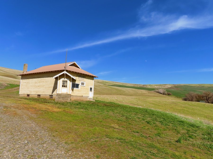
2021 Trips

 1
1
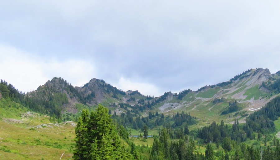
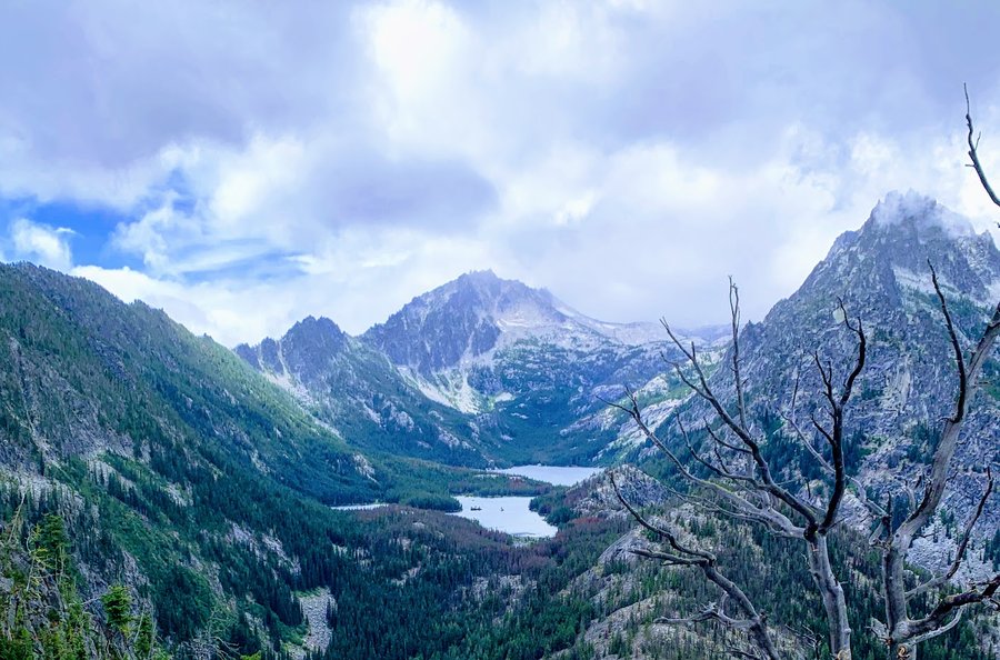
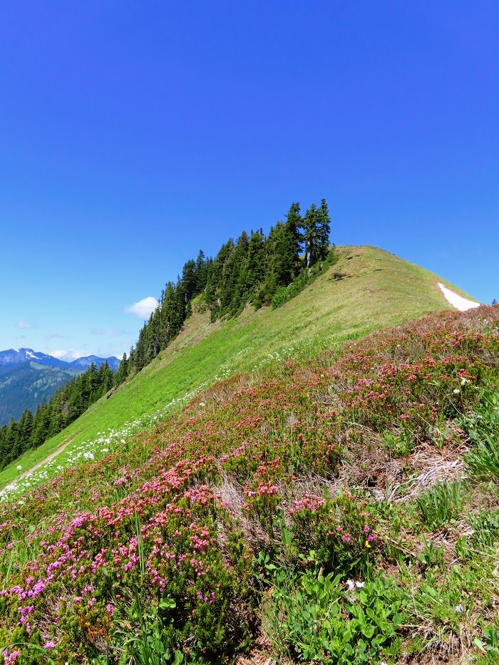
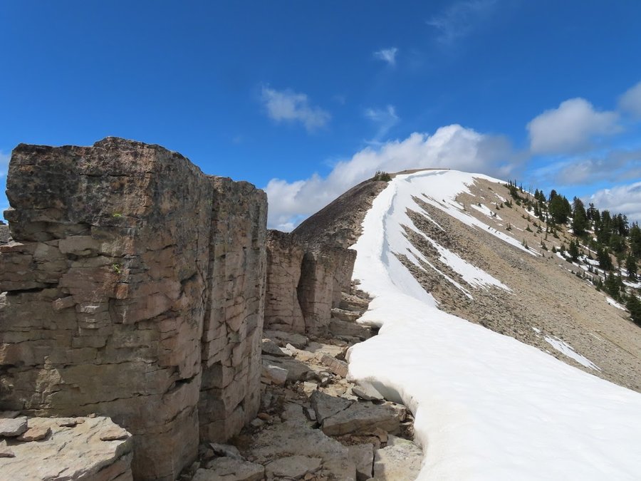
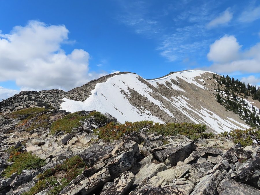
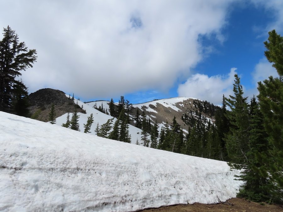
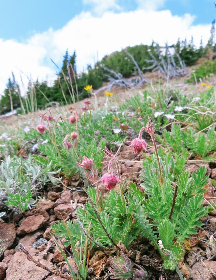
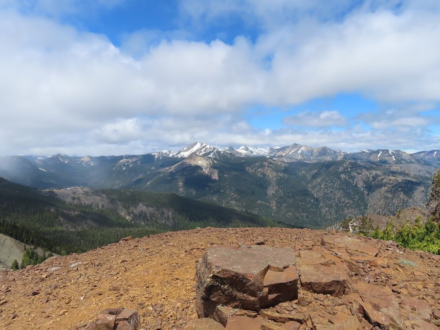
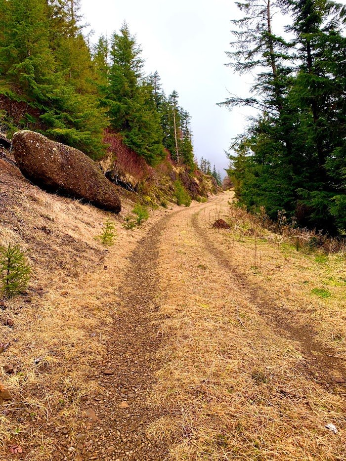
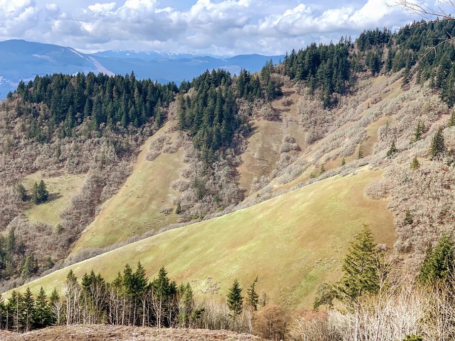
Elk-Kings Traverse + Junior
11 miles of hiking • 3250' elevation gain •
Nice day in the coast range! Went with ICS pals and pace was brisk. Some icy rocks to negotiate on the traverse. Found out we all loathe the coming down Kings, so we took Coronary Ridge to the Wilson River trail(Kings Jr), and that was much more pleasant and only added an extra half mile distance.

December 5, 2021
 1
1
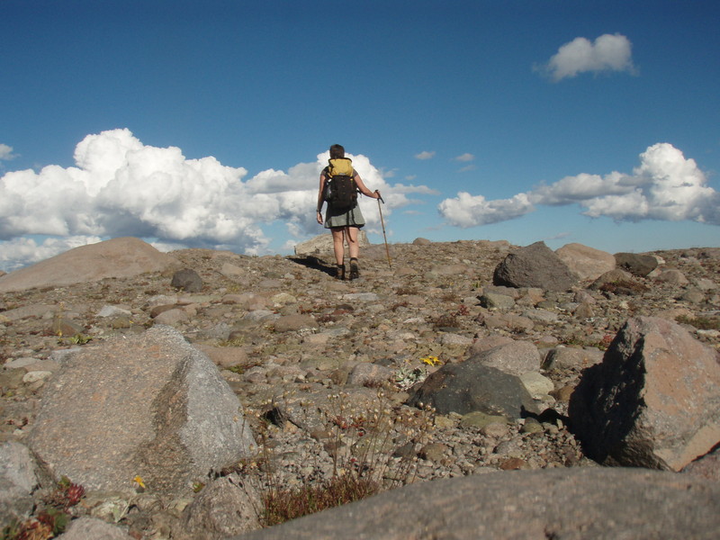
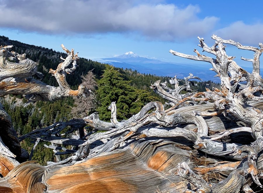
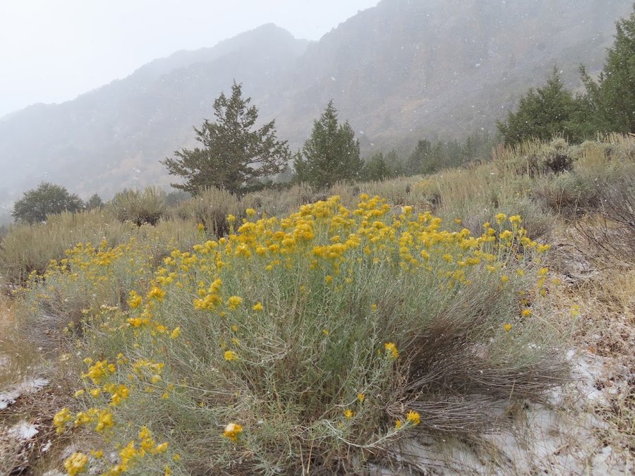
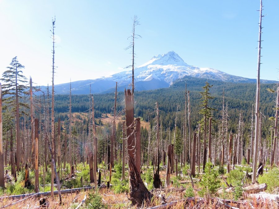
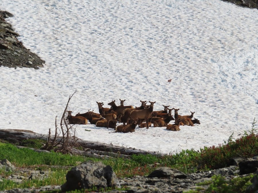
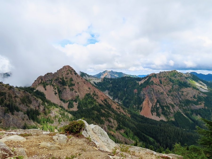
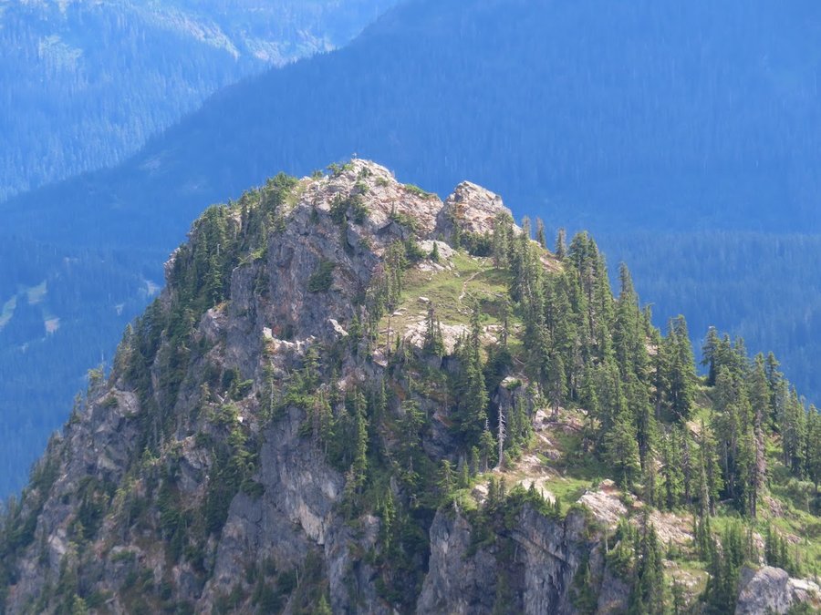
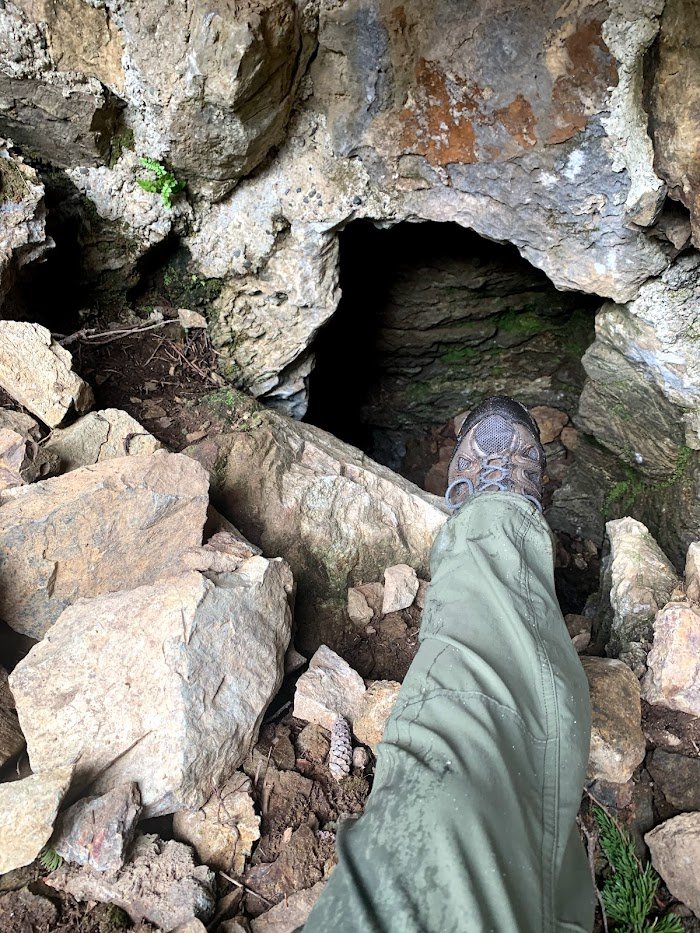
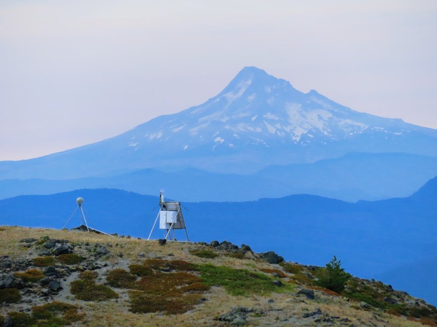
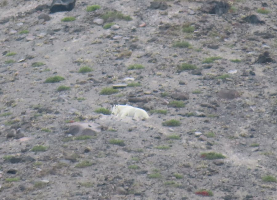
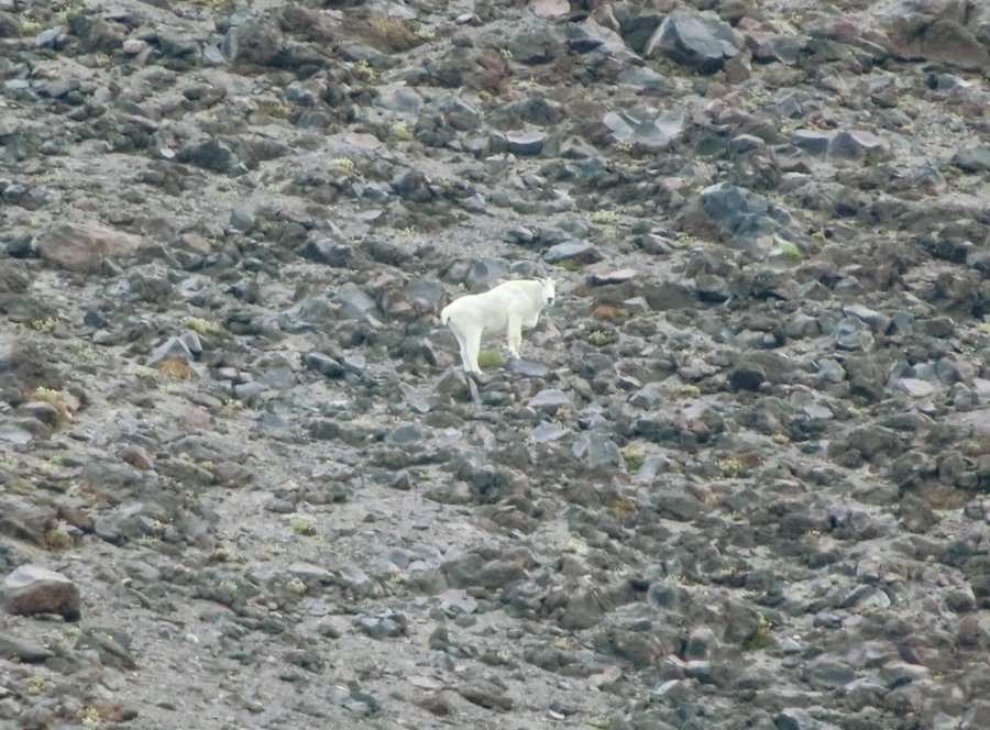
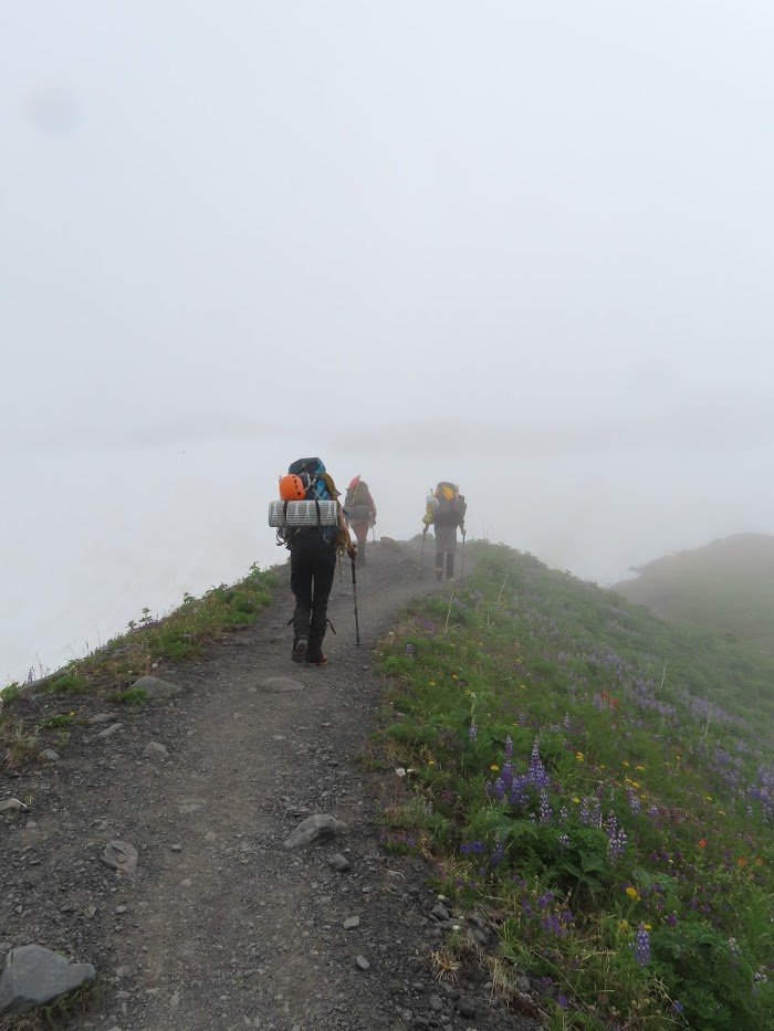
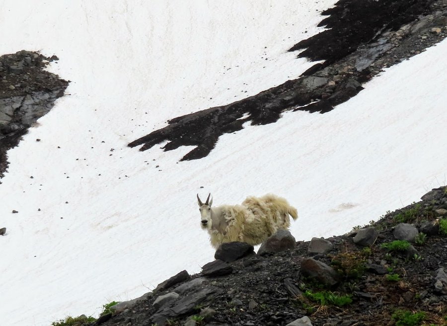
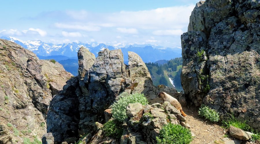
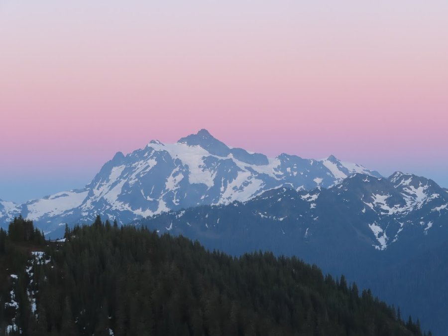
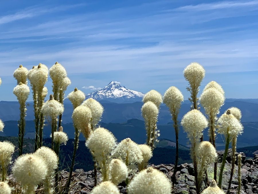
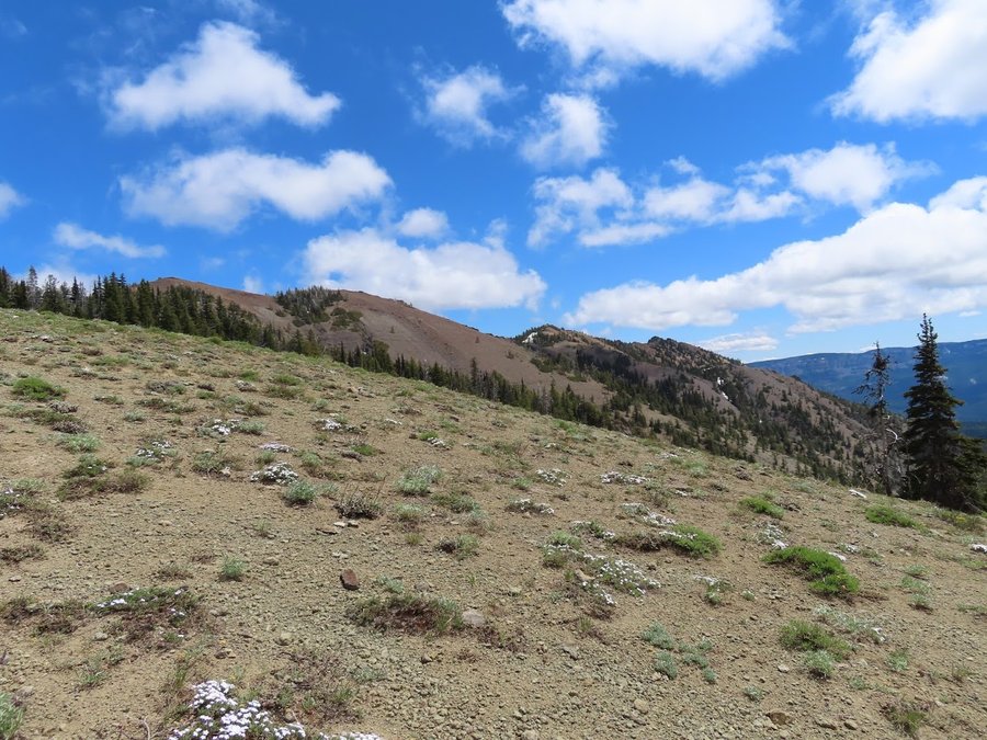
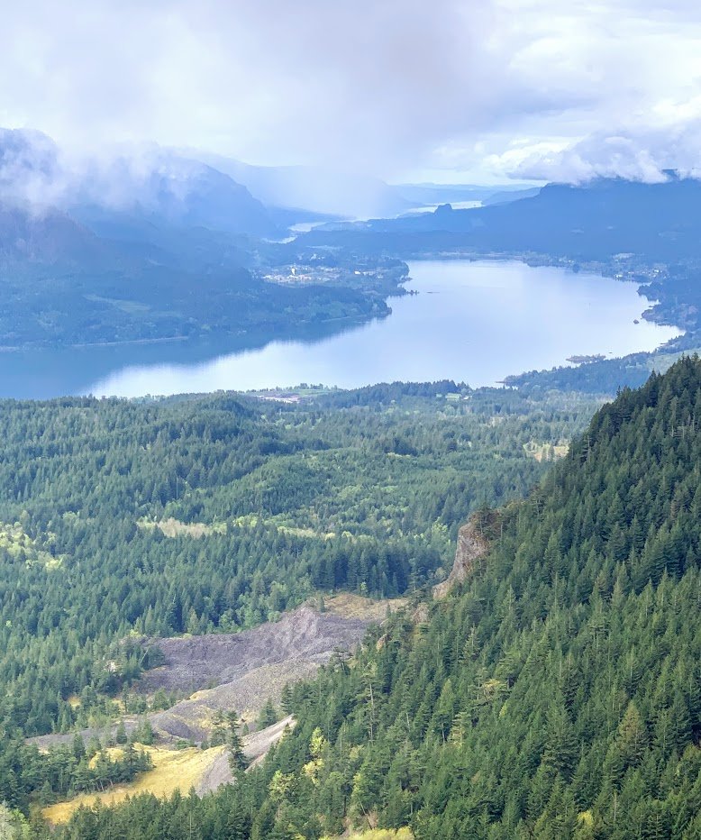
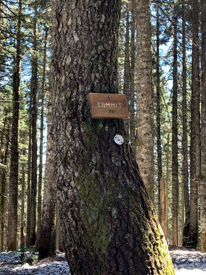
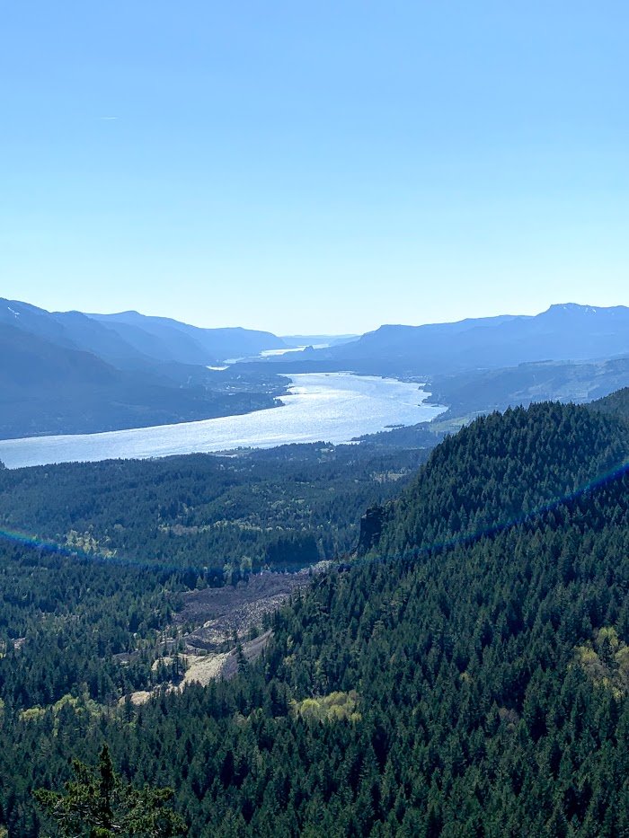
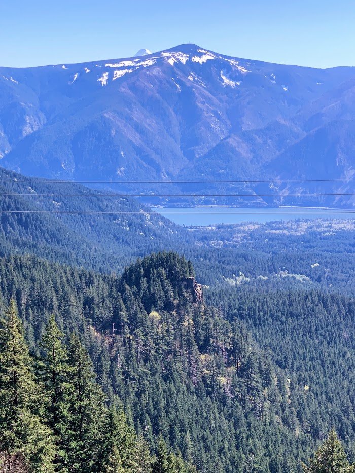
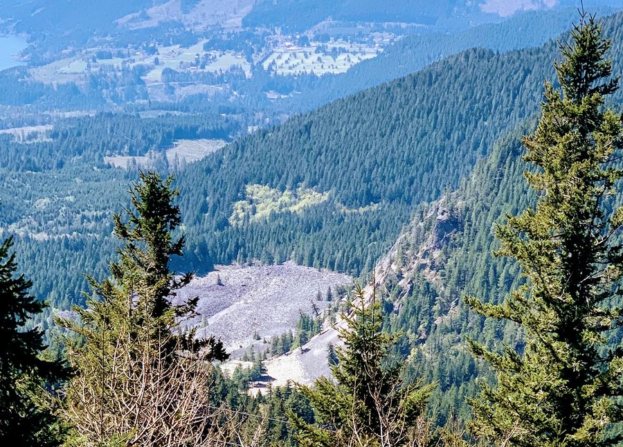
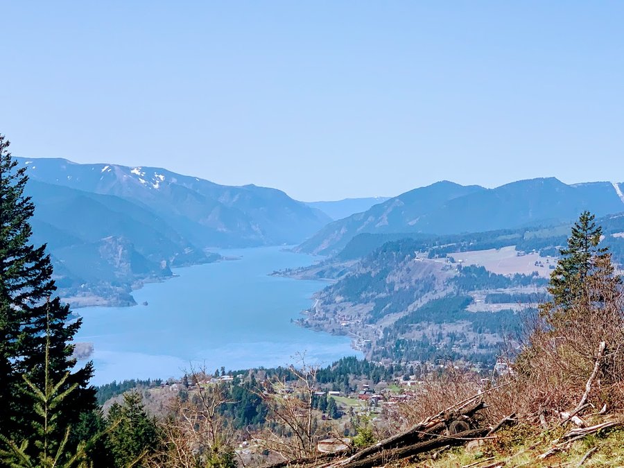
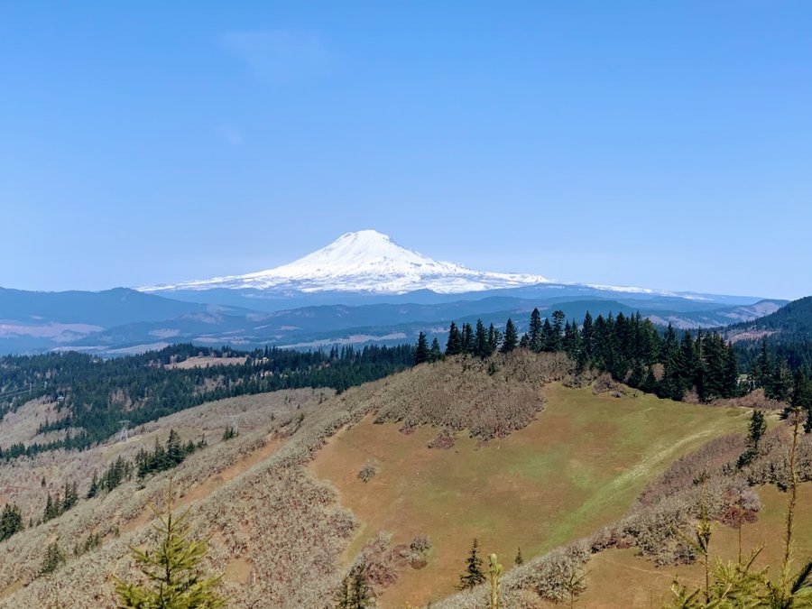
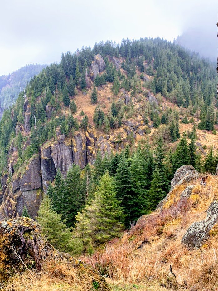
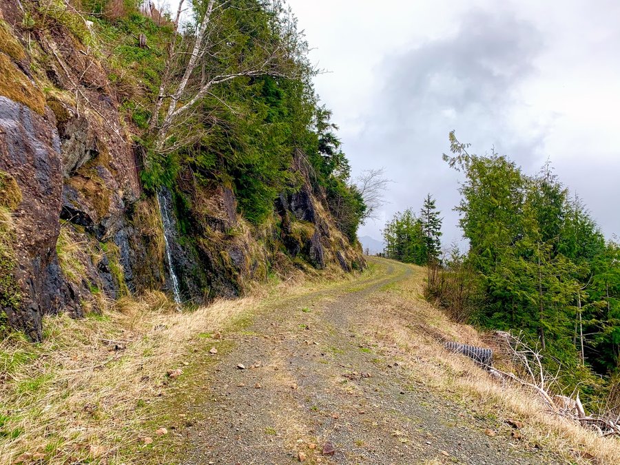
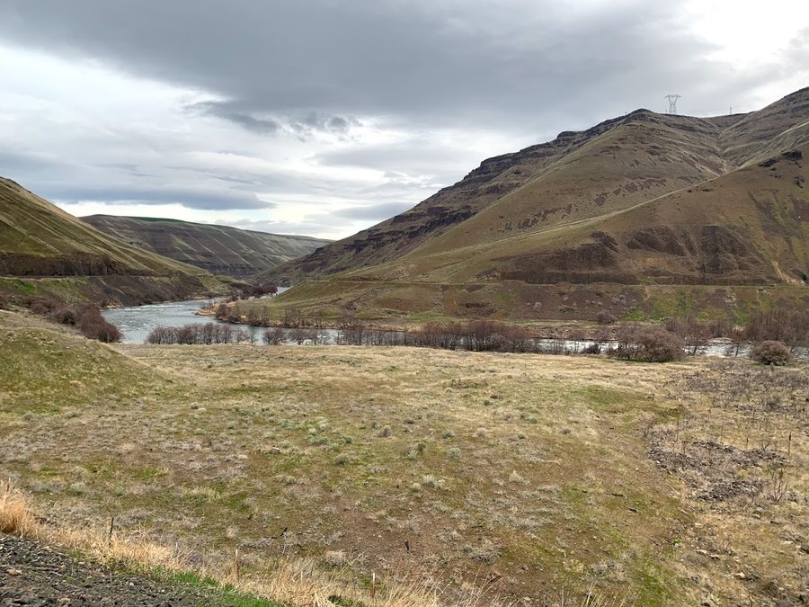
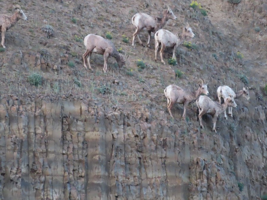
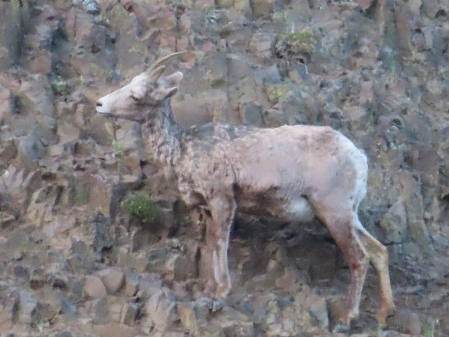
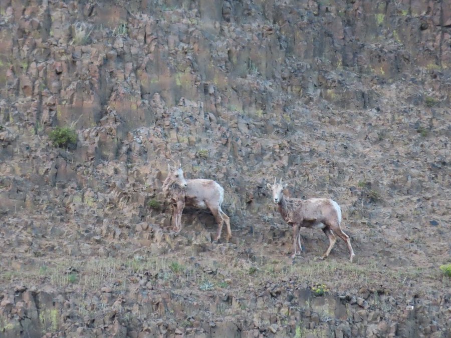
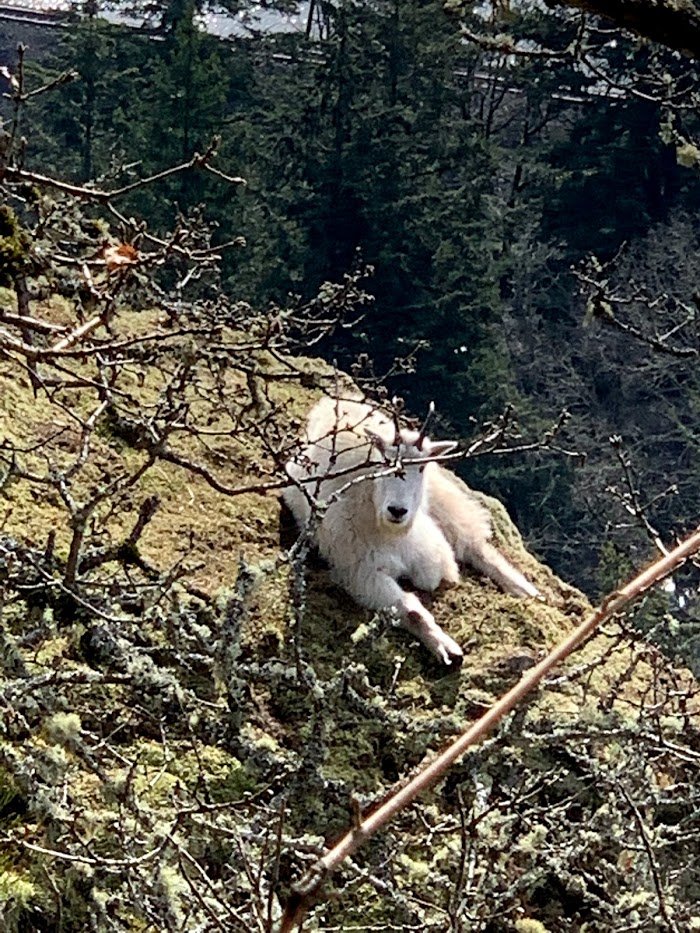
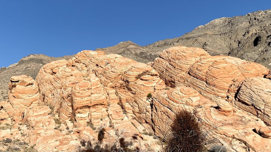
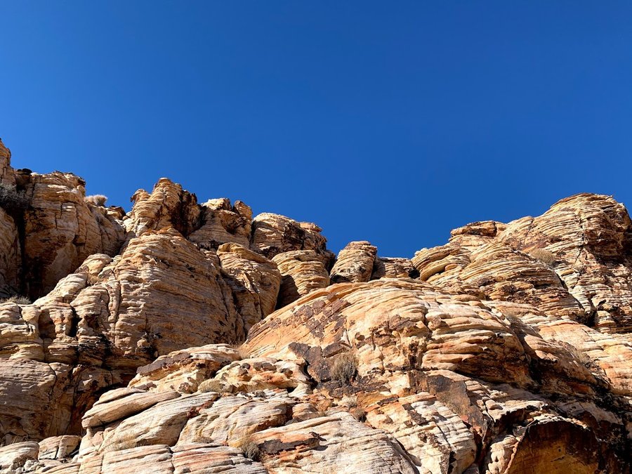
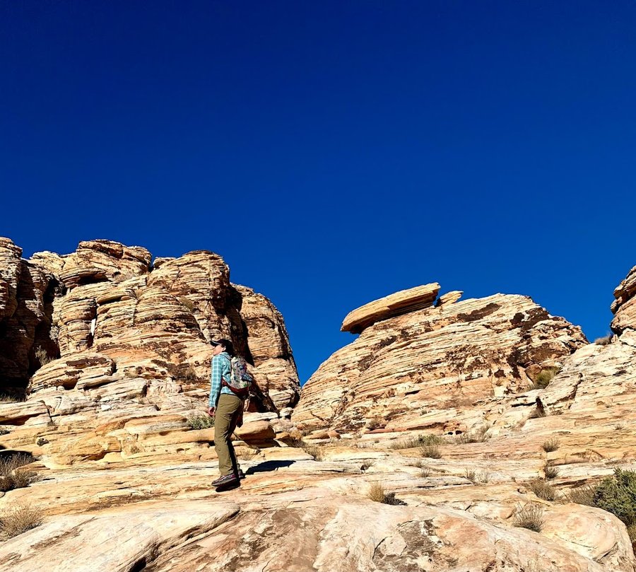
Chasing Phantom Goats on Dog Mountain
7.5 miles of hiking • 3000' elevation gain •
I was heading east on I-84 and looked over and saw goats on Dog Spine, plain as day. Okay, four white blobs, but I was convinced and immediately changed my hiking plans to see if I could find them.
Left the trail rather early and spent hours bushwacking the steep south facing slopes, heading easterly. It was mostly pleasant. Unfortunately I overshot the Dog Spine and ended up at the next ridge over. Had a nice lunch viewpoint, and continued up to the summit, decided to come down the Aug trail and come back another day with my zoomie camera and maybe a critter cam!
December 2, 2021


 1
1
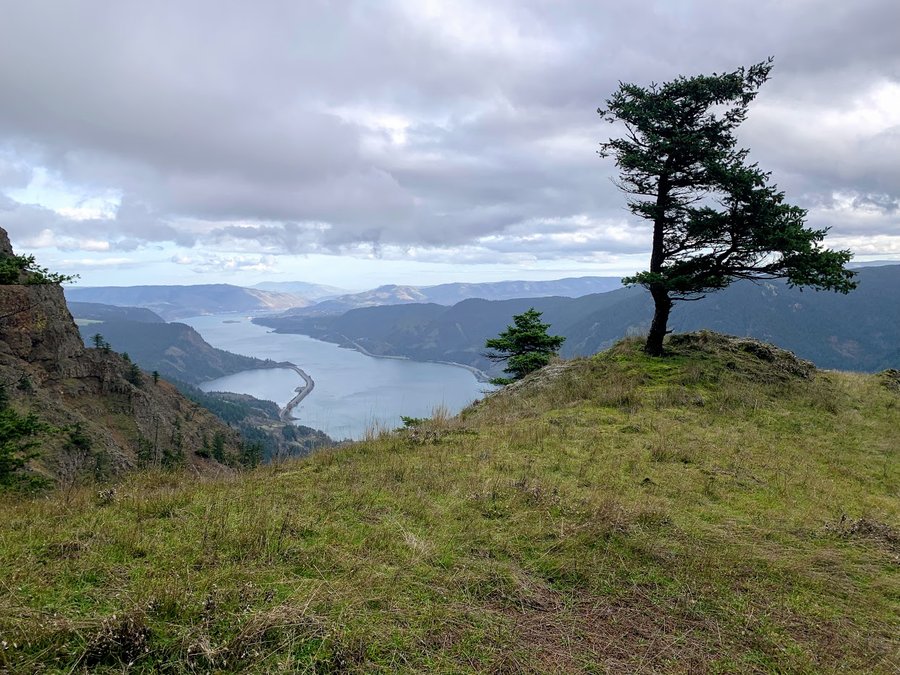
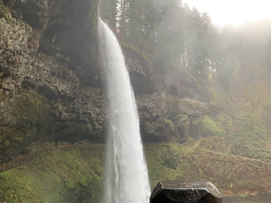
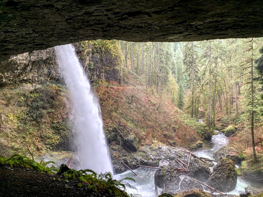
Silver Falls
7 miles of hiking • 750' elevation gain •
Haven't been here in over 15 years. It was so very lovely this morning and fairly quiet, just a bit busy near North and South Falls. I vow to return in less than a decade!
November 24, 2021

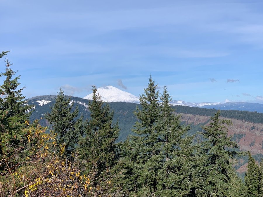
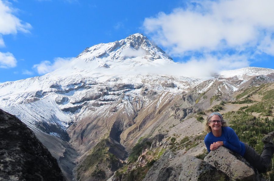
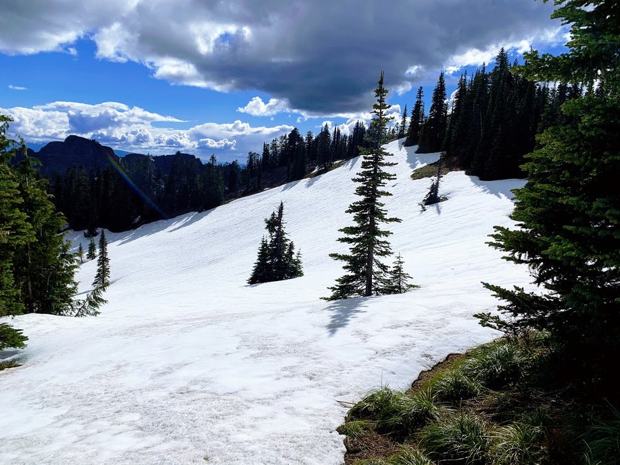
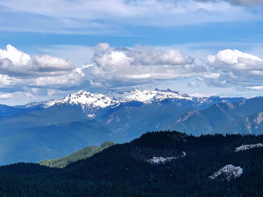
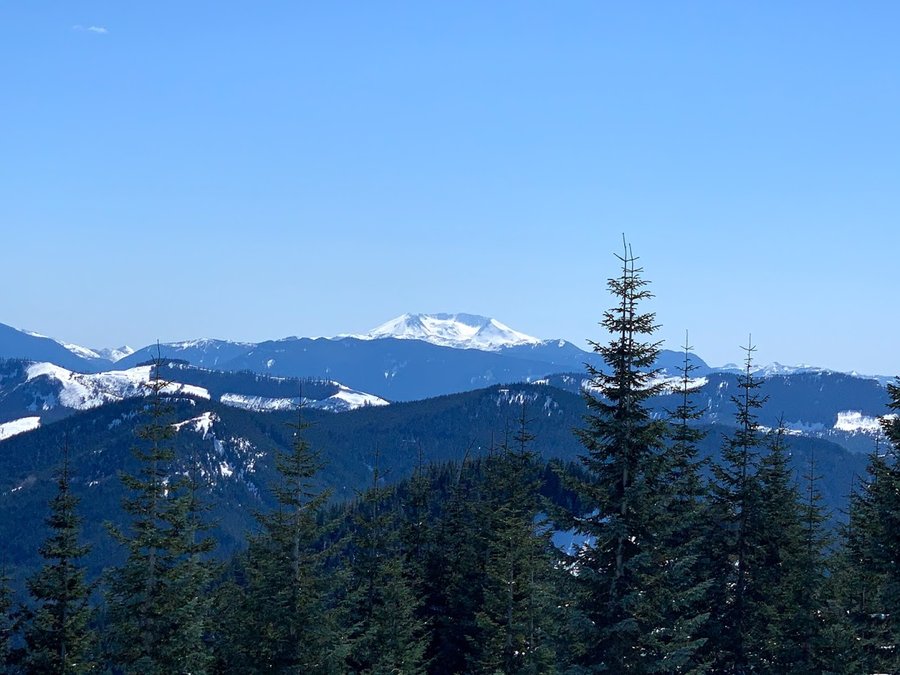
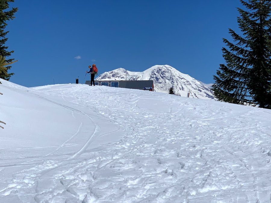
 3
3
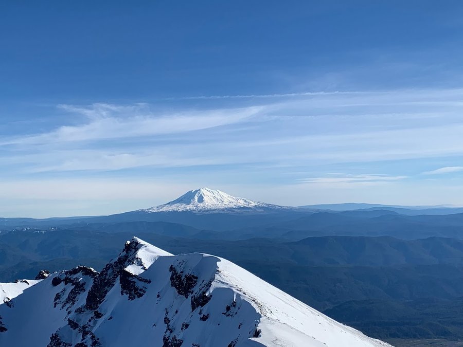
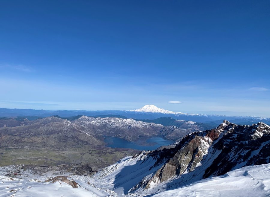
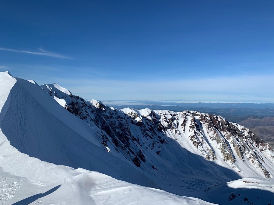
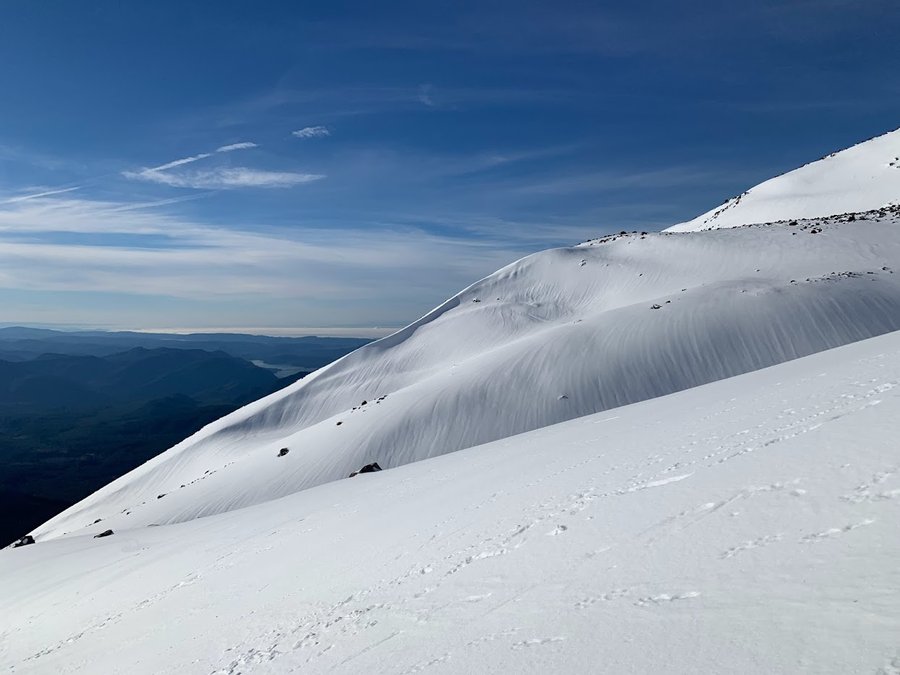
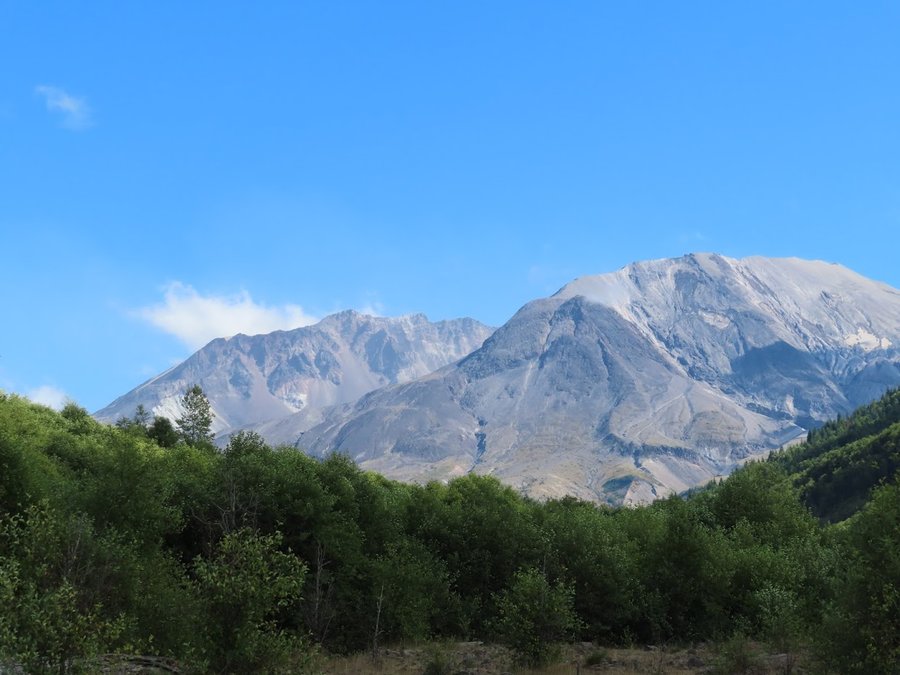
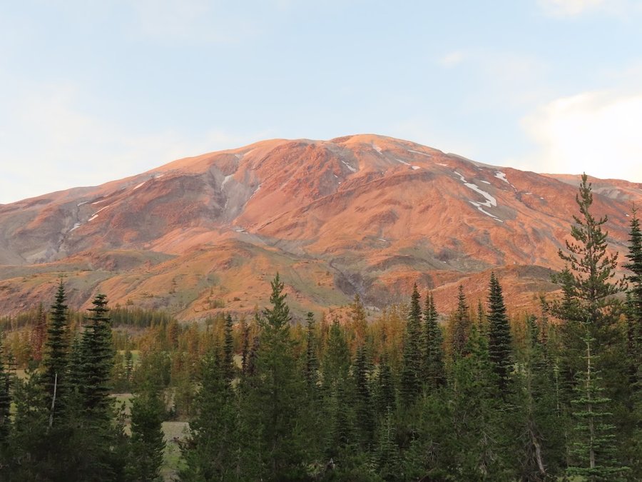
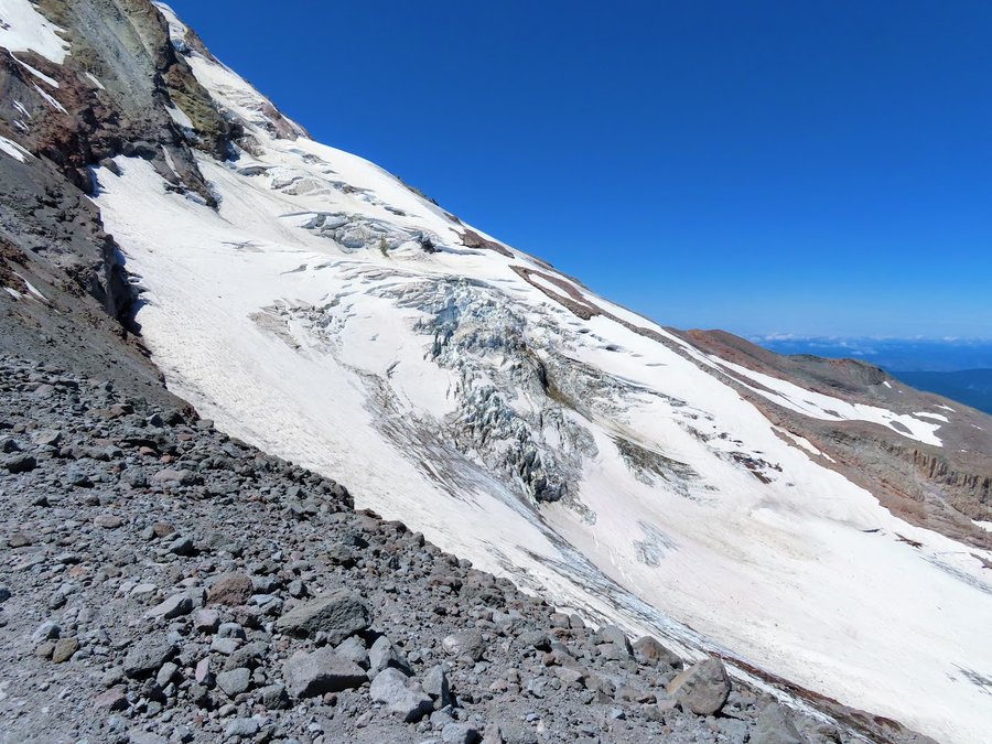
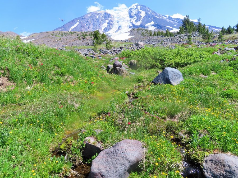
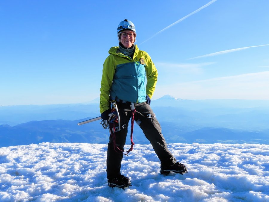
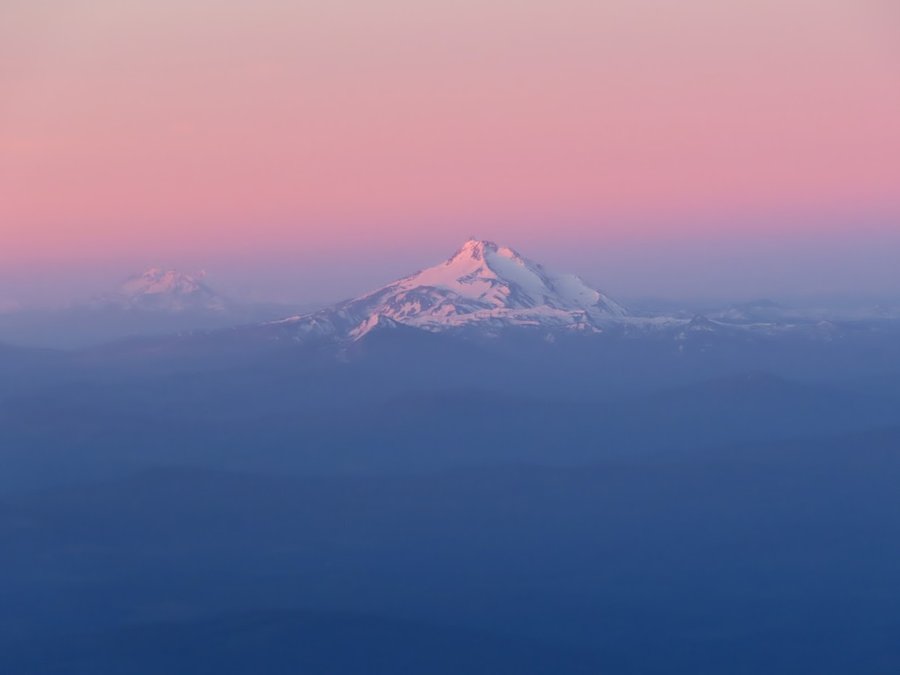
MSH
10 miles of hiking • 5500' elevation gain •
Hard hike with scant snow below 6K. But it was a beautiful day.
November 21, 2021


 1
1
Meadow Butte Crows Nest
7.5 miles of hiking • 1000' elevation gain •
Definitely interested in exploring this area more.
November 16, 2021
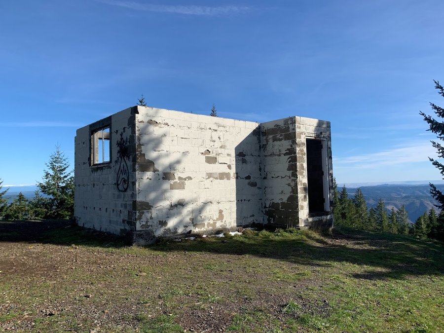
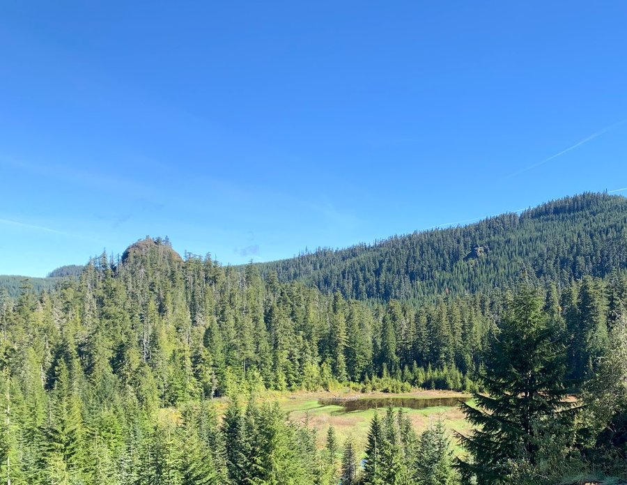
 2
2
Nestor Peak
8.5 miles of hiking • 2000' elevation gain •
Pleasant day reading the forest. The Buck Creek Trail is designed for mountain bikers. Mellow grade. Just a hollow cement structure left on top at this former LO site.
November 8, 2021


 2
2
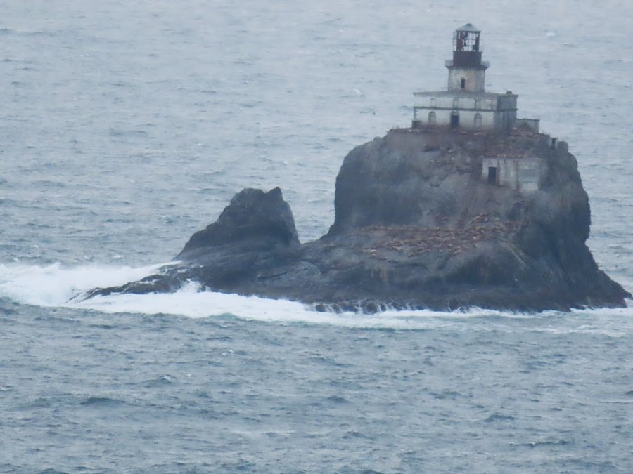
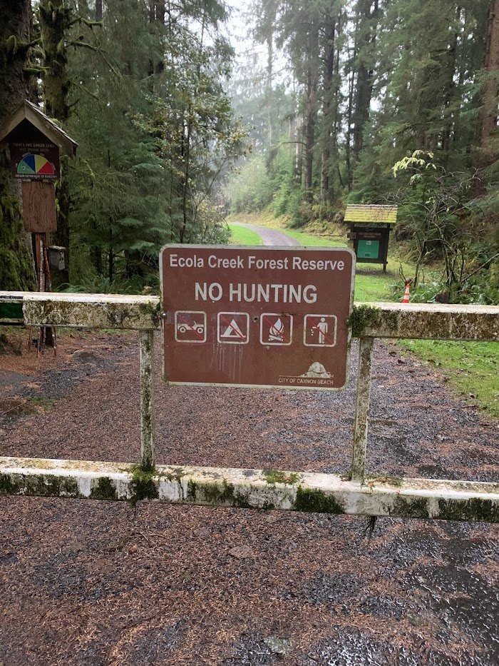
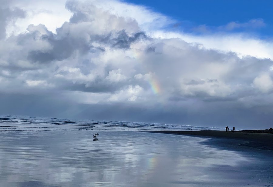
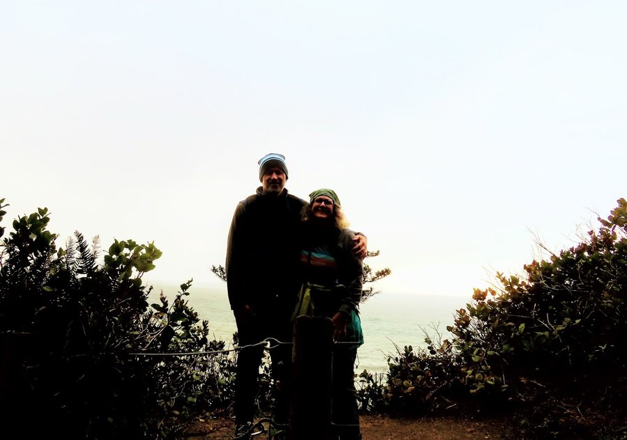
King Tides at coast
10 miles of hiking • 1500' elevation gain •
Did a couple different hikes on a wild and wet weekend at the coast with the hubs. Tillamook Head, Ecola Forest Preserve, and Oswald West.
November 6, 2021

 1
1
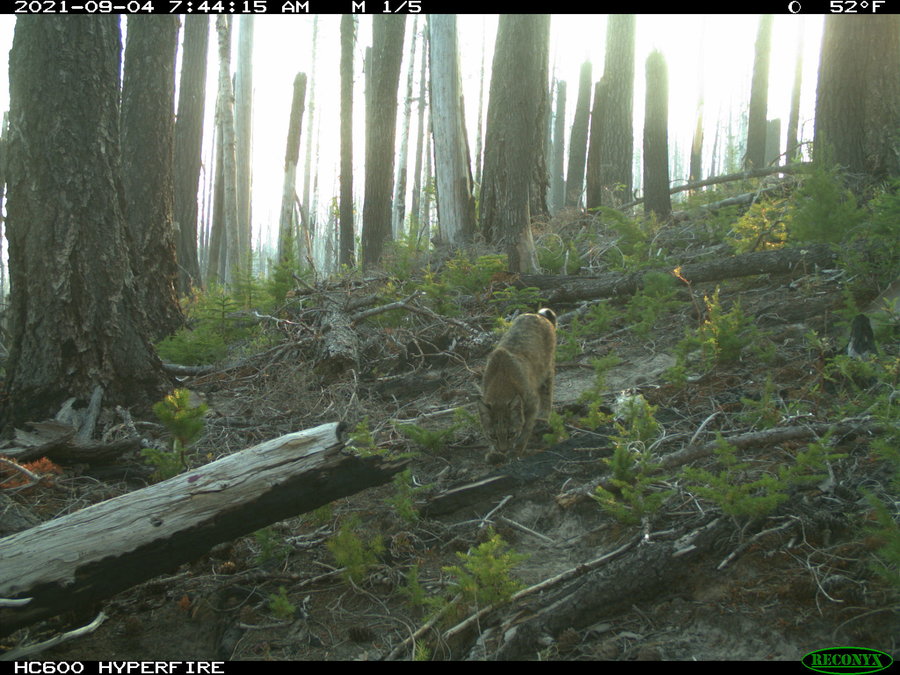
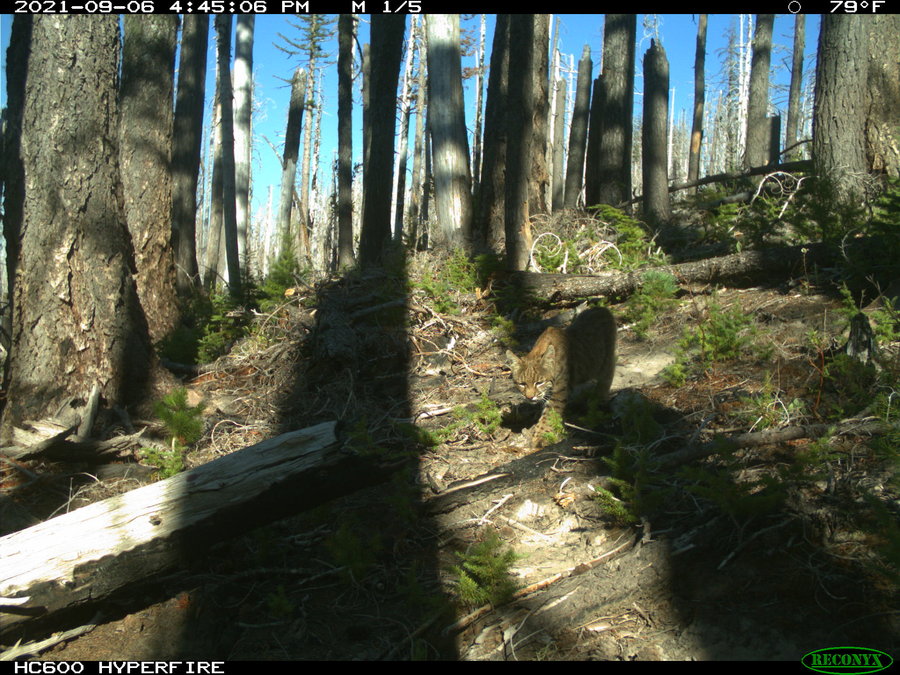
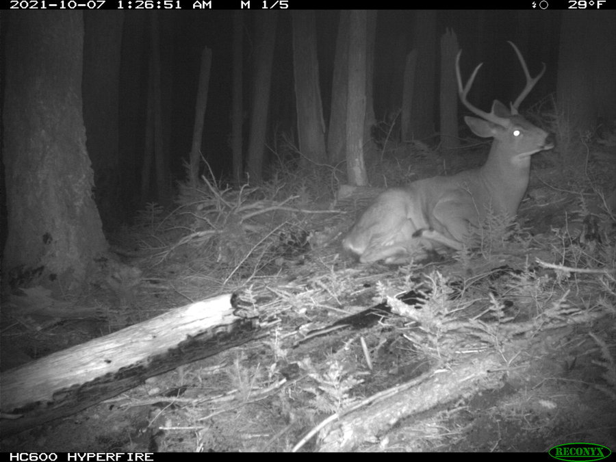
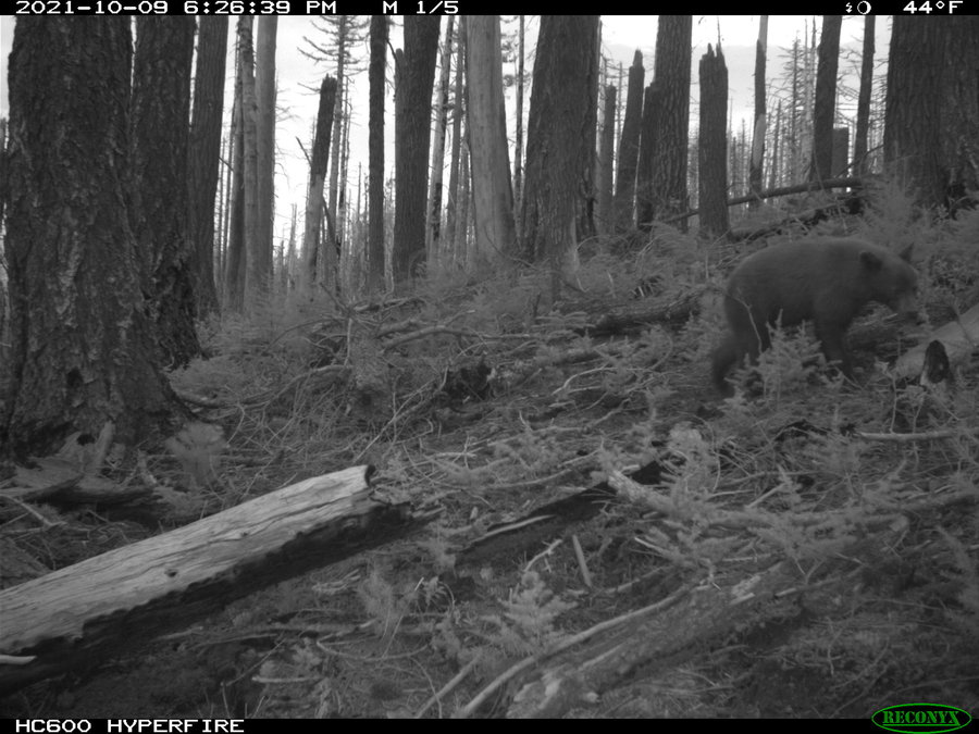
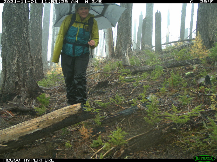
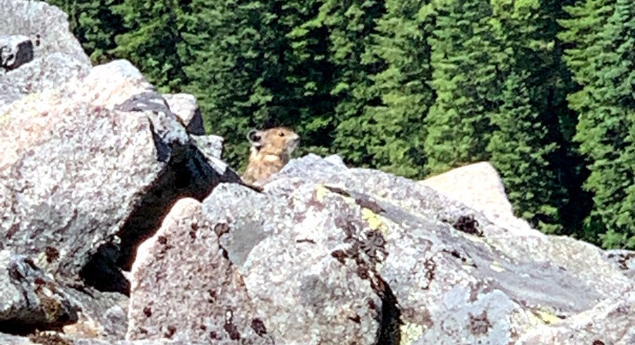
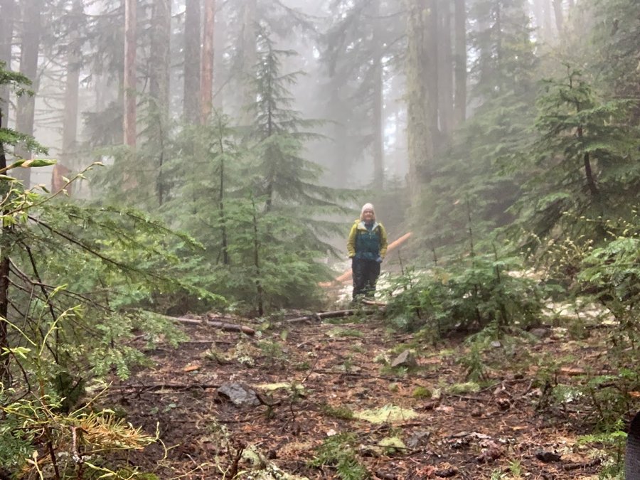
Elk Cove Trail
6.5 miles of hiking • 1500' elevation gain •
Very rainy, had to retrieve another critter cam. Had some great sets- will include a few of the best shots.
November 1, 2021


 1
1
October 30, 2021


 2
2
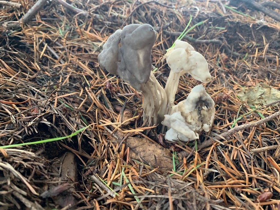
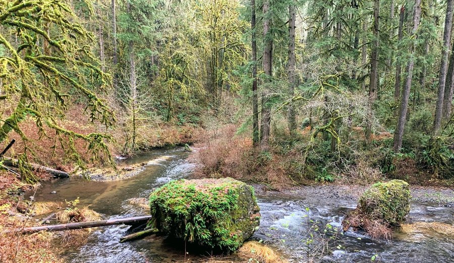
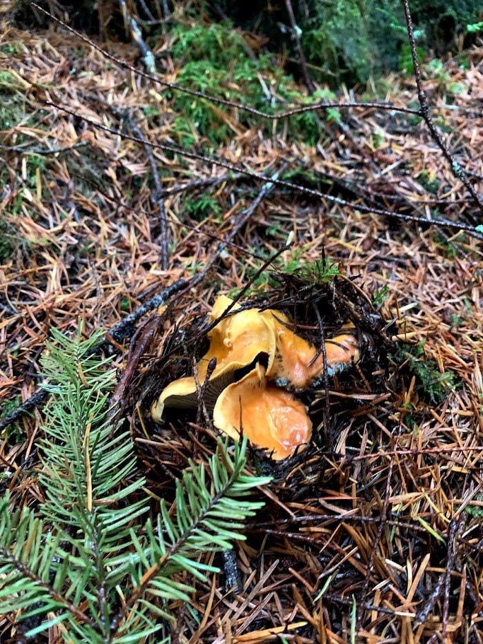
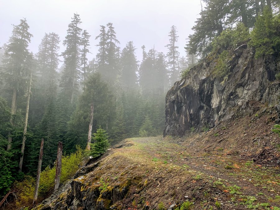
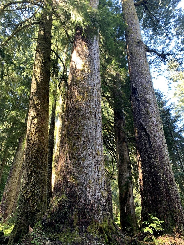
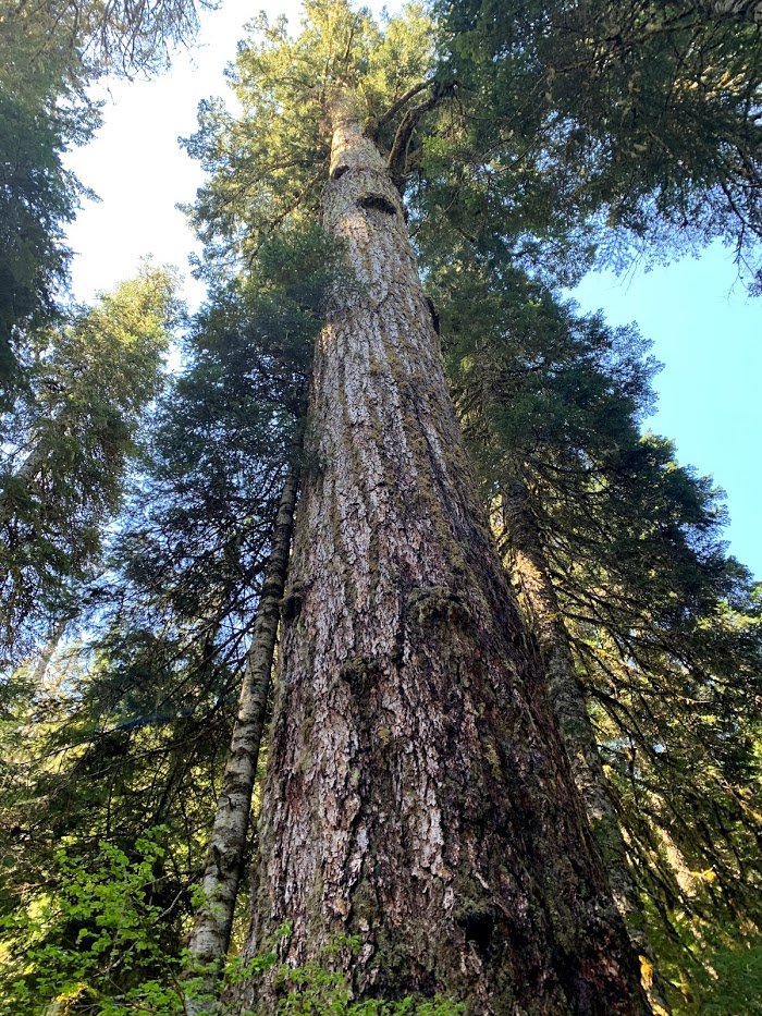
Secret Old Growth Forest
5.5 miles of hiking • 500' elevation gain •
Went out in the river of atmosphere. It rained the entire time. Had an umbrella, got soaked anyhow. And, only a few mushrooms, grrr! Clearcuts and industrial forest must be passed before you reach the old growth. Now access is cut off by Weyerhauser. They shaved the steep slopes of Teal Creek Canyon, next to the cliffs where falcons nested. Who is watching them???
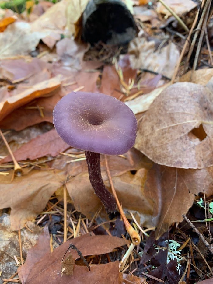
October 25, 2021

 1
1
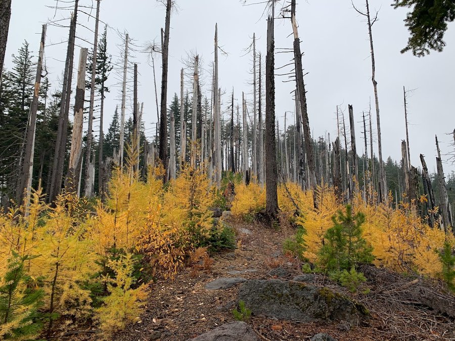
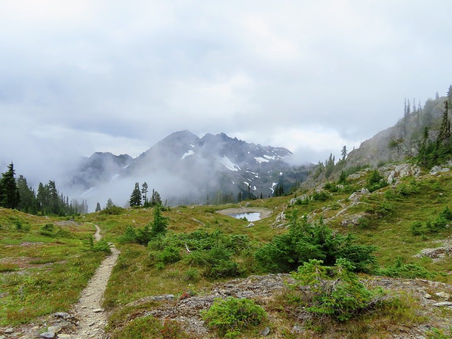
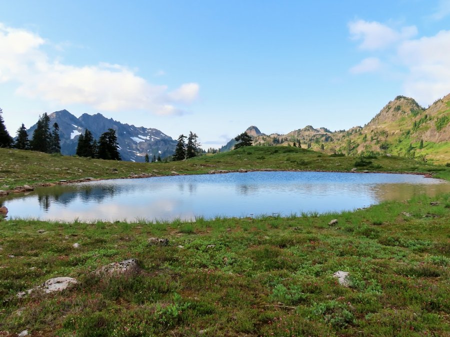
Gnarl Ridge
10.5 miles of hiking • 2500' elevation gain •
3rd time up here this year and it doesnt get old. Pulling down the critter cam to be redeployed for winter.
I started from Teacup and wandered the low woodlands south of Clark Creek before I picked up the Elk Meadows trail. Some lovely western larches in bright autumn display.
October 18, 2021


 2
2
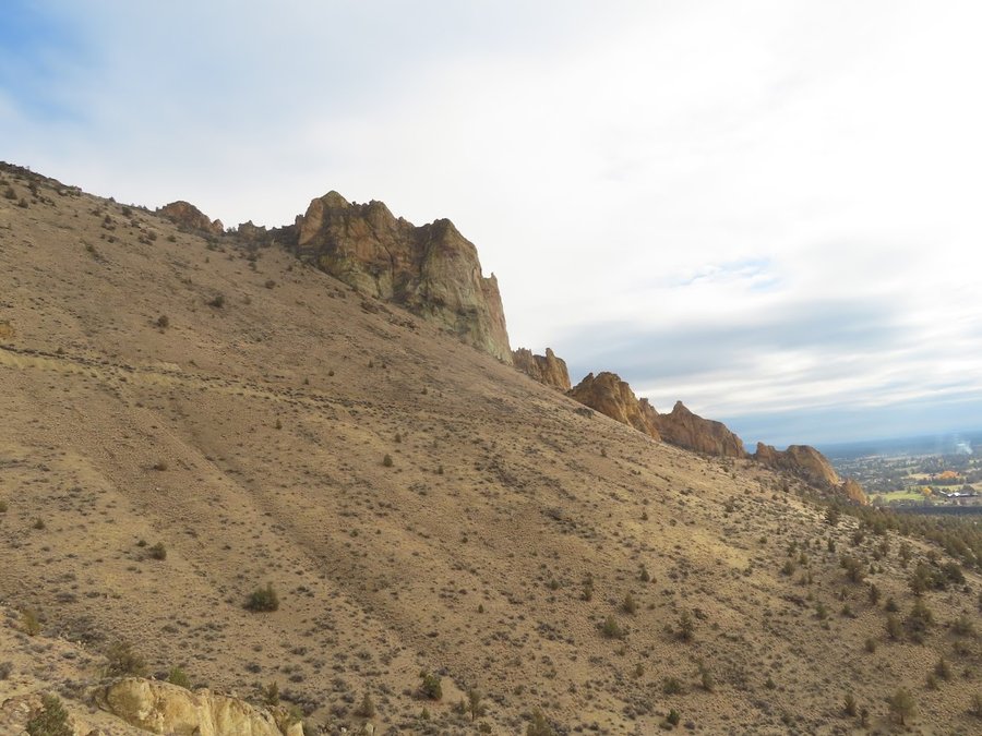
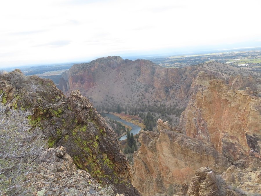
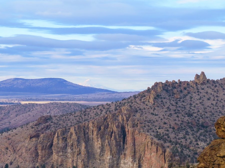
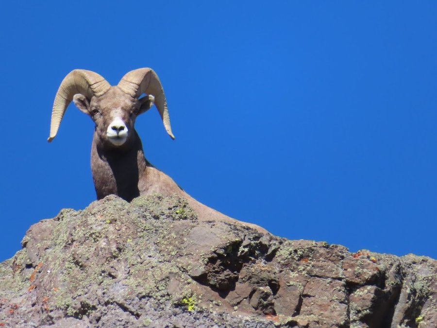
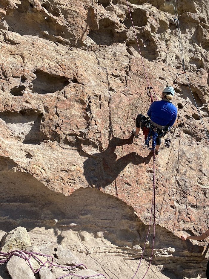
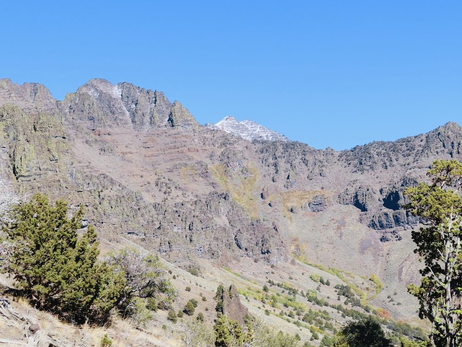
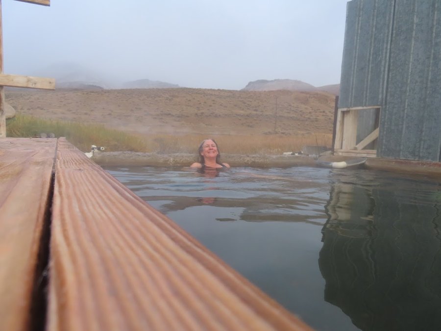
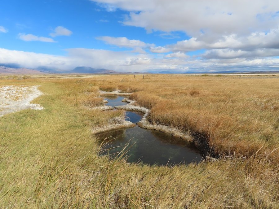
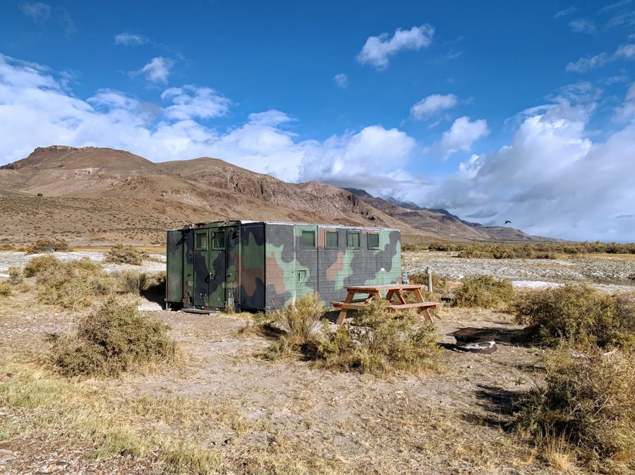
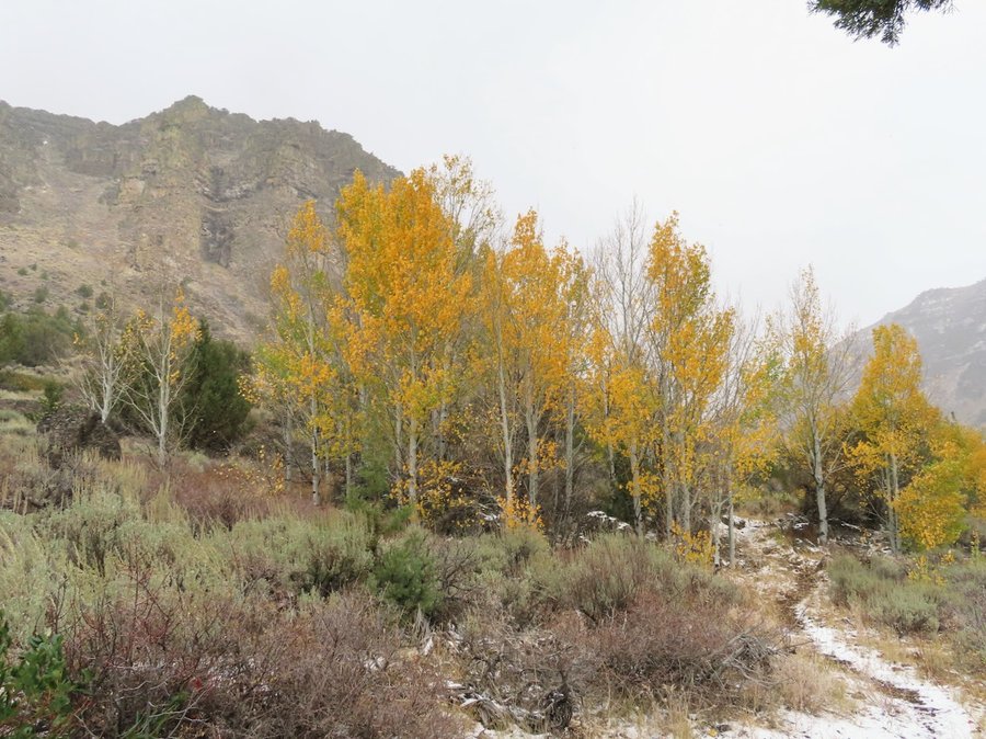
High and Dry
16 miles of hiking • 4750' elevation gain • 1 night
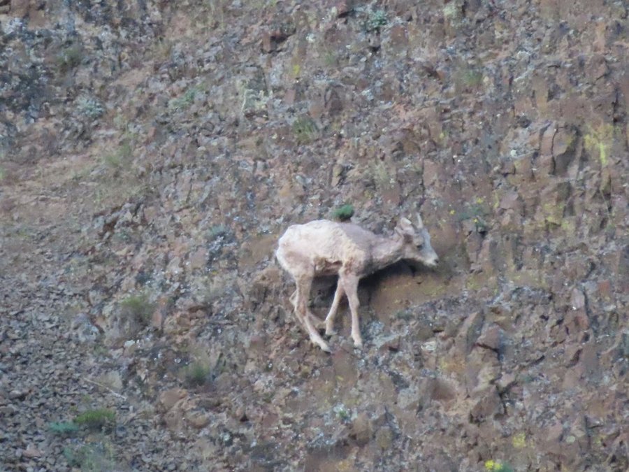
I spent the weekend climbing at Smith Rock, but instead of heading back to Portland, I headed south to the Steens and the Alvord Desert. Camped the first night at Haystack Reservoir, then stayed two nights at the Alvord Hot Springs in a military bunker-what fun! The light in the desert this time of year is beautiful.
Did three hikes: 1) Little Blitzen Gorge in a snowstorm! Saw wild horses on the drive in. Aspen turning golden. 2) Pike Canyon-gorgeous canyon and headwall. Left the trail at 6000 ft and made it up to the Steens rim at 7900 feet. Nifty scrambling. Met a bighorn ram. 3) Borax Hotsprings-macabre place of ethereal beauty.
October 12 – October 13, 2021


 3
3
Yocum Ridge
18 miles of hiking • 3750' elevation gain •
Cascadia Wild asked if I could go up and retrieve a stranded critter cam that has been up here for over a year. It's a long hike, would love to return for an overnighter. So beautiful with the light dusting of snow on the slopes above, and the fall colors. Rain held off until just after our turnaround. Had to deploy the umbrellas on the way down.
September 30, 2021
 1
1
Hello Autumn
3.5 miles of hiking • 500' elevation gain •
Sevreral hours of umbrella hiking. Fungi are starting to emerge.
September 28, 2021

 3
3
Lamberson Butte and Elk Mountain Loop
10.5 miles of hiking • 2500' elevation gain •
The air feels so clean! Mountain looks lovely again.
September 20, 2021

 1
1
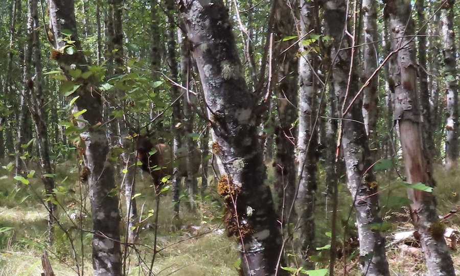
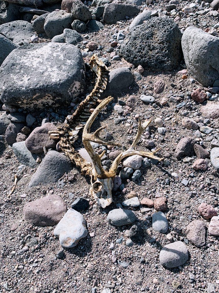
Toutles!
7.5 miles of hiking • 1000' elevation gain •
Went for a swim in Castle Lake!
Saw elk poos, elk bedrooms, elk skeletons and even a few elks.
September 5, 2021


 1
1
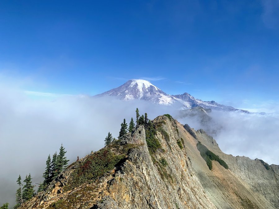
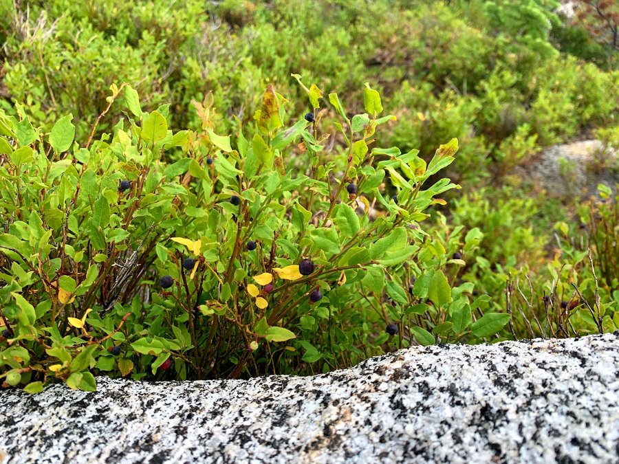
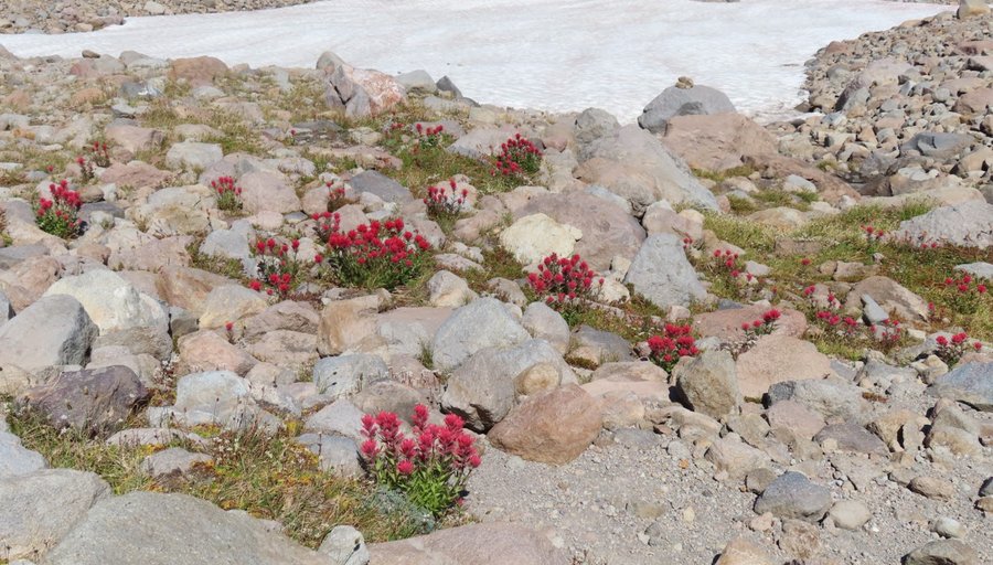
Behind Tatoosh Peak
17.5 miles of hiking • 4750' elevation gain • 1 night
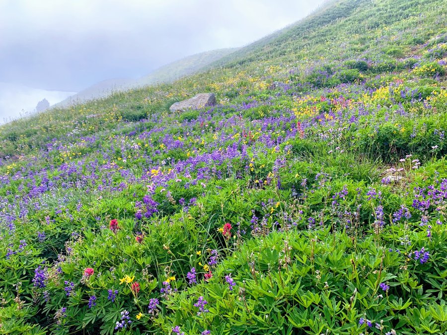
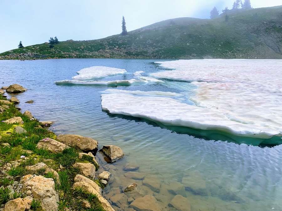
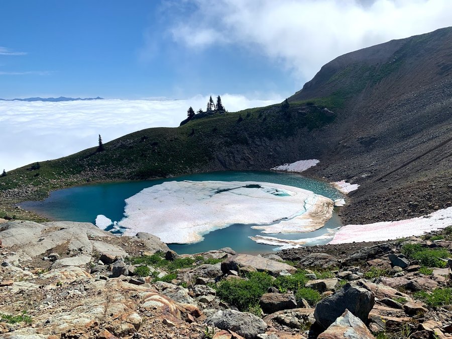
I started at the south Tatoosh trailhead. Long slog upwards, but once you pass the turnoff for Butter Peak, you get a lovely rolling trip through subalpine meadows and ripe huckleberries as you travel north below the ridge approaching Tatoosh Peak. The eastern flanks of the ridge are just mesmerizing, reminds me of the Wallowas. Acres of steep hanging meadows coming off the ridge walls must have been gorgeous during peak bloom time.
After summitting Tatoosh Peak, I scrambled down to the half frozen tarn below. My dreams of a relaxing evening sketch session with sunset were dashed by fierce winds. There were a few hours of calm overnight, but the winds picked up again in the morning and I woke up inside a cloud. I explored this gorgeous glacier scoured basin for a few hours, it felt so wild and untouched! Cute little tarns, mossy seeps, remnant snowfields and blooming rock gardens. Flowers still going strong, saw some far off goats. Really special place-this dramatic basin just north of Tatoosh Peak.
August 29 – August 30, 2021

 2
2
Olympic NP
45 miles of hiking • 11000' elevation gain • 4 nights
Day 1: Staircase -> N Fork Skokomish to 2 Bear Camp. Day 2: 2 Bear Camp to N side of Hopper Mtn (headwaters of Home Sweet Home Creek), fun scramble up to Mt Hopper! Day 3 down to the Duckabush via HSH trail and up to LaCrosse Basin. Day 4 back to First Divide-camped along Mt Steel climbers trail. Day 5: Long slog out. Pics to follow
August 14 – August 18, 2021


 1
1
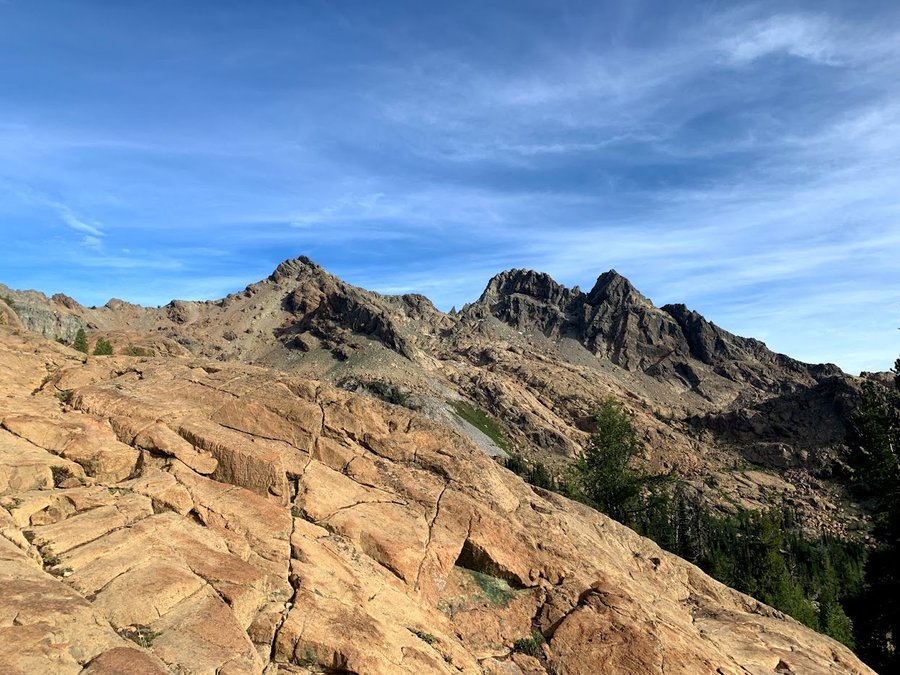
Ingalls Peak
10.5 miles of hiking • 3750' elevation gain • 2 nights
My first multipitch climb! Camped in Headlight Basin
August 8 – August 10, 2021


 1
1
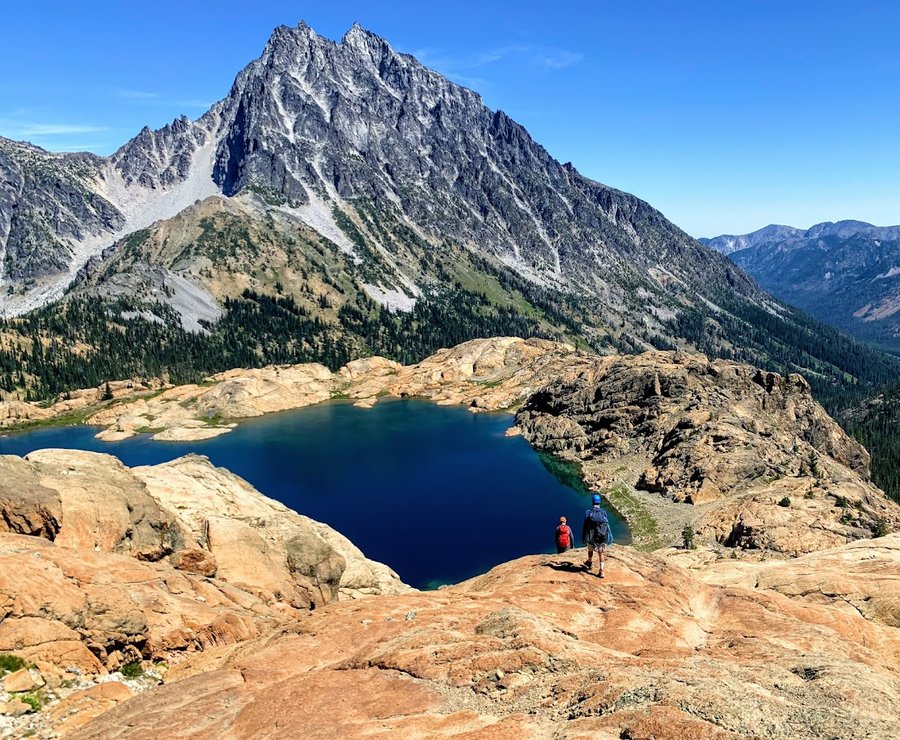
Wedge Mountain
4.5 miles of hiking • 2500' elevation gain •
The road up was gnarly, but there were only a few hikers on the trail on a Saturday.
Wedge mountain is the eastern ridge overlooking the lower part of the Enchantments. I enjoyed the overcast day, but the views were not far ranging. Still magical! Trail leads up to a point on the ridge at 6200. True summit is an easy trip south for half a mile and 700 ft more eg.
August 7, 2021

 1
1
Cave Ridge and Snoqualmie Mountain
5 miles of hiking • 3500' elevation gain •
Got this from the 75 scrambles book. Was going to do Guye, then Snoqualmie, but I got distracted by Cave Ridge and a geocache. Started out the hike in a light overcast drizzle that eventually diminished to just moody clouds. Very refreshing. Really liked that area. Caves, marmots, huckleberrries. Decided to head straight up to Snoqualmie from the Cave Ridge saddle. Really fun alpine scrambling. Climbed up to the east pinnacle and got sketched out, downclimbed and traversed to true summit.
Although there were about 50 cars at the Alpental lot, I did not encounter anyone on my trip, just saw one group from afar.
August 6, 2021


 1
1
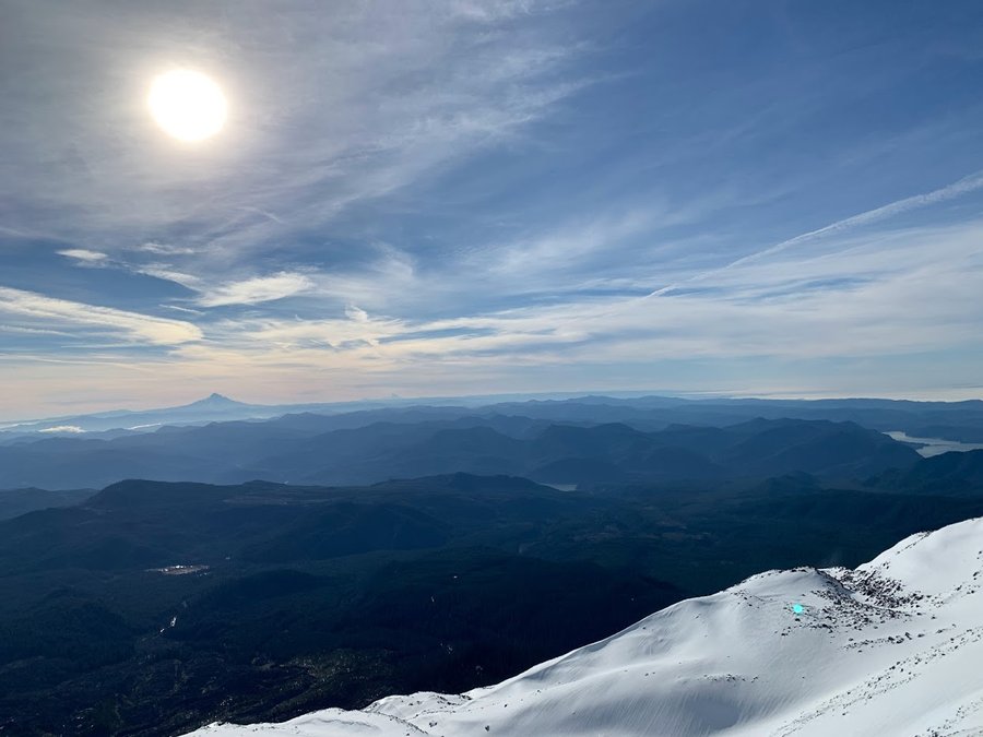
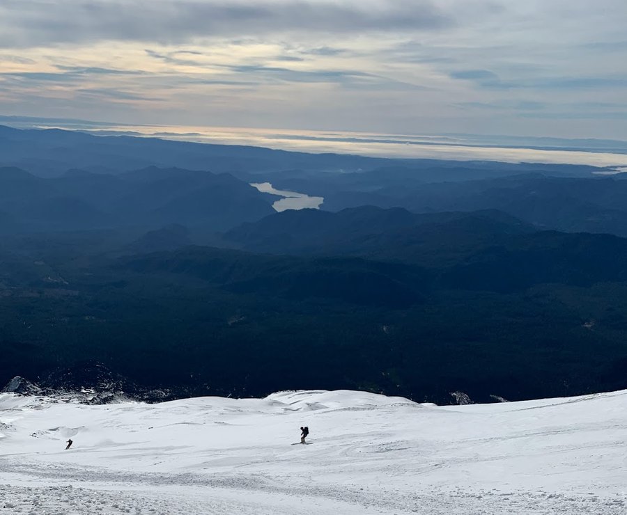
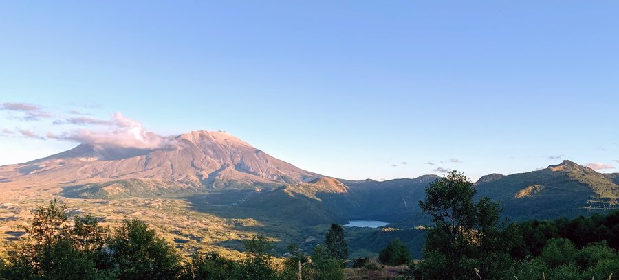
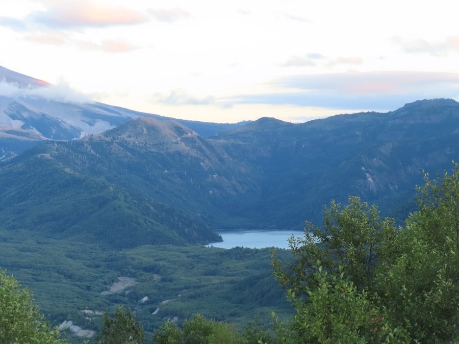
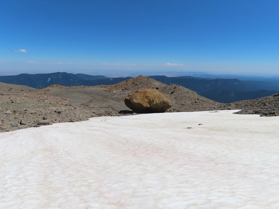
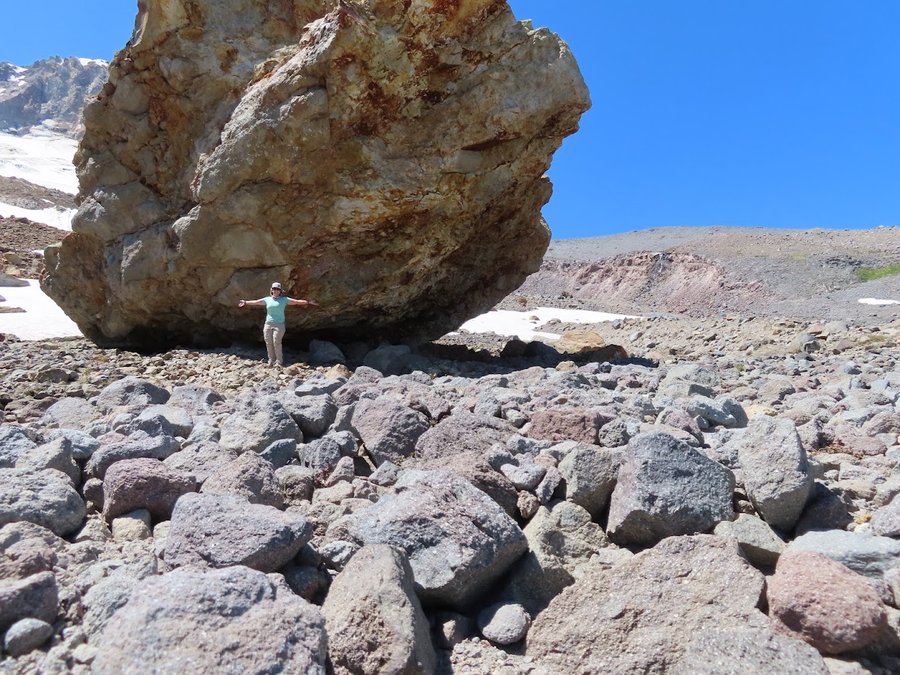
MSH-West
15 miles of hiking • 4250' elevation gain • 1 night
Started at Red Rock Pass and found a great campsite on E side of Butte Camp Dome- unfortunately no water, the whole side of the mountain on the Loowit trail is dry until the Toutle.
Next day went on a scramble up the slopes chasing goats admiring the unsanctioned routes. Found ripe huckleberries at 3000-3500 ft elevation too!
July 27 – July 28, 2021

 1
1
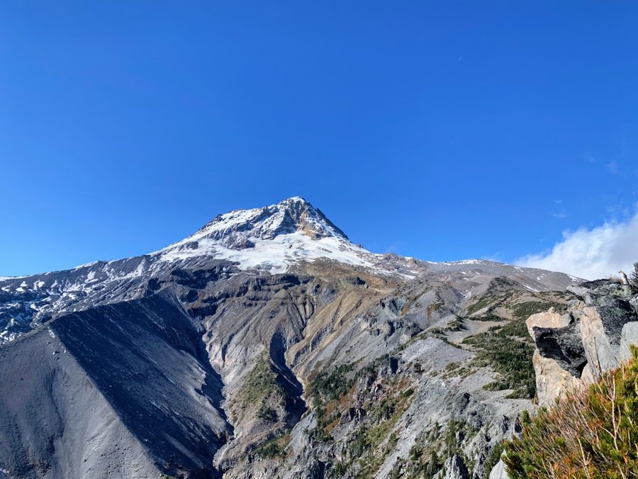
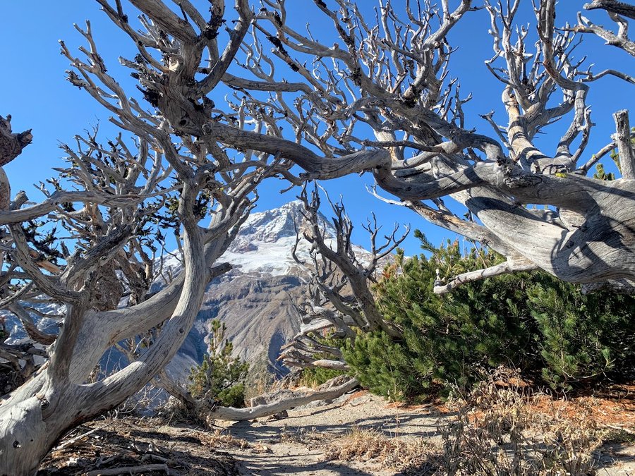
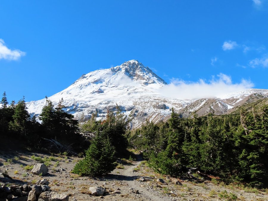
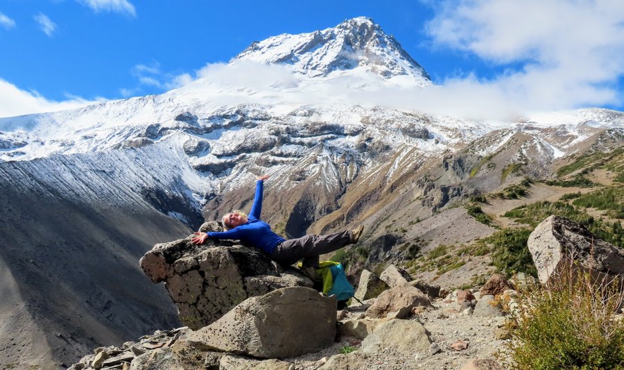
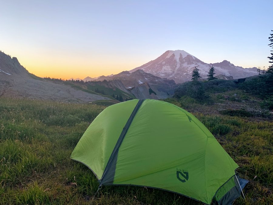
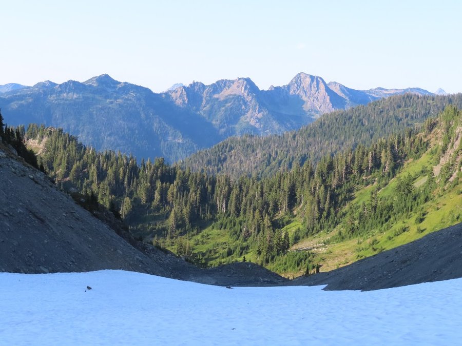
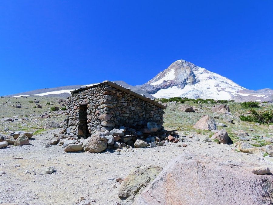
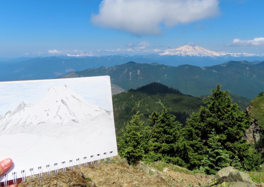
Mount Hood- east
17 miles of hiking • 4750' elevation gain • 1 night
Hiked up Cooper Spur, then dropped down and traversed below the Newton-Clark Glacier. Visited the Bandit Boulder! Fun scrambles all around, then dropped down to the Timberline to loop back to Cloud Cap.
Stayed at the Tilly Jane Campground for the night, where I was the only tenant and it was free.
The next day, I drove over to Elk Meadows trailhead and met up with my partner on the wildlife camera crew. We hiked up to check on our camera on Gnarl Ridge.
No bugs on either day(except butterflies)!
July 20 – July 21, 2021


 2
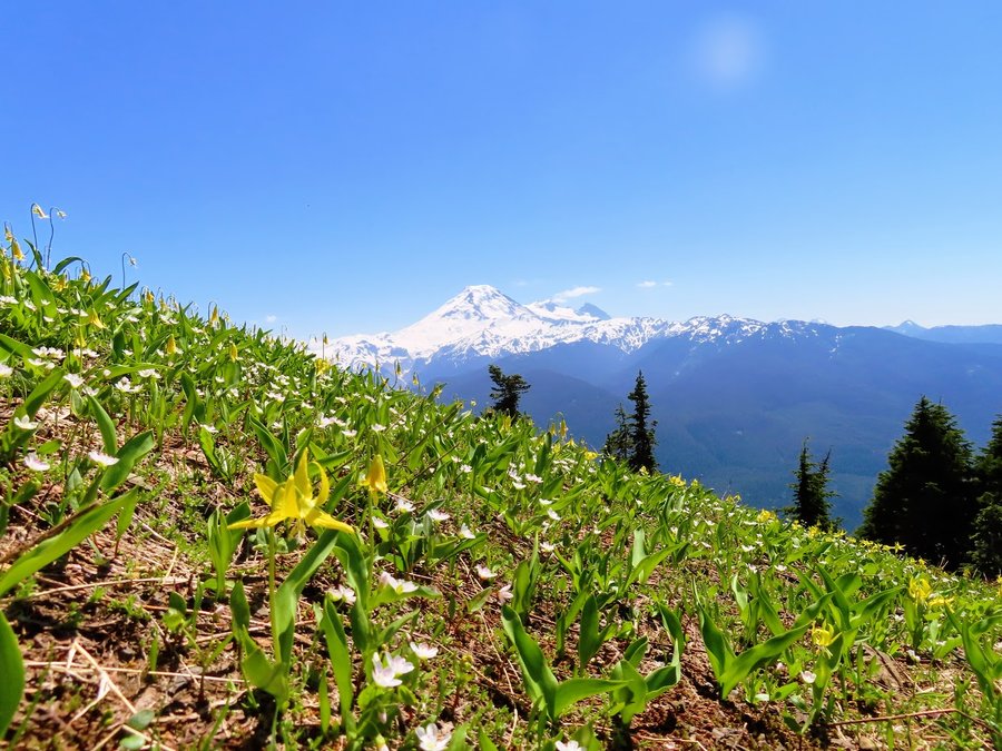
2
Mt Adams North
9.5 miles of hiking • 2250' elevation gain • 1 night
My niece is visiting from NYC. I wanted to bring her up to the alpine for a quick overnighter. The weather, wildflowers and scenery were gorgeous but the mosquitoes were awful, from TH to 7200 ft just below the Adams Glacier, they relentlessly tried to penetrate our bug bafflers. A comic sufferfest. Could not relax in camp unless inside tent. Packed up and ran out the next morning.
July 11 – July 12, 2021


 3
3
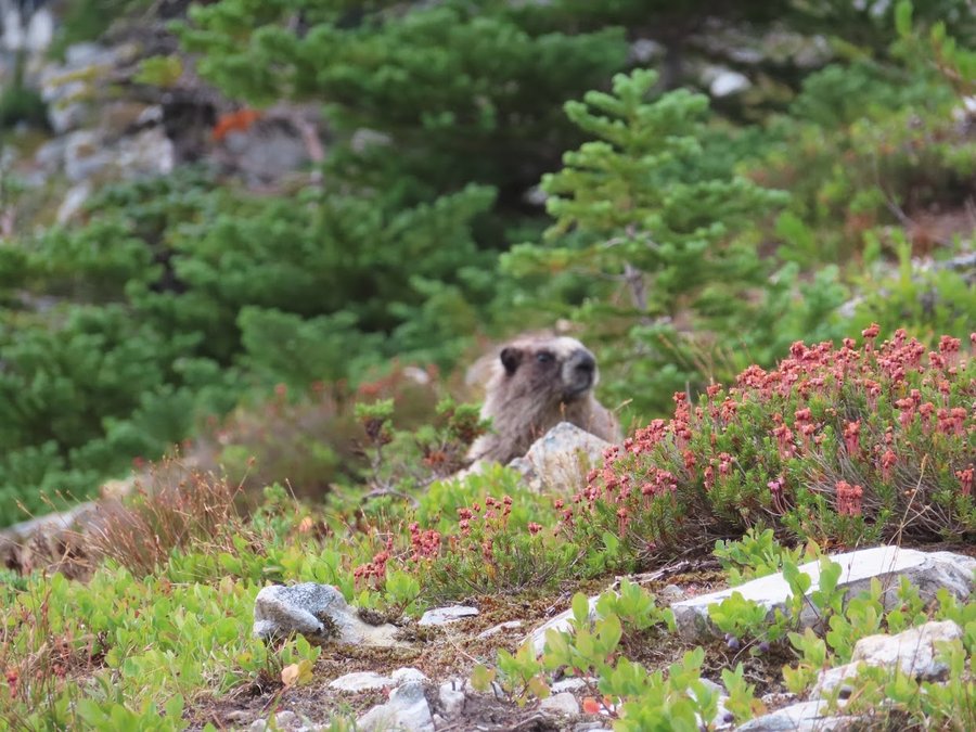
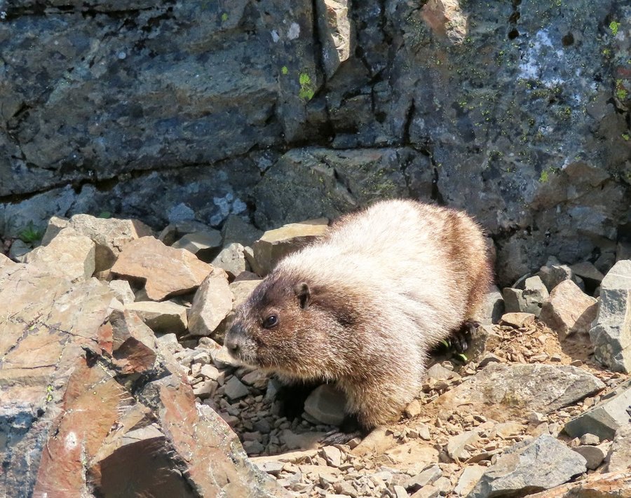
Fun in the North Cascades!
25 miles of hiking • 8000' elevation gain • 3 nights
Finally got up here! For the past several years, I've signed up for climbs on various mountains in these parts( Ragged Ridge x2) that were always cancelled. For rain-in August!
This year I got onto a Baker climb during my vacation week, and scheduled several days of explore time afterwards.
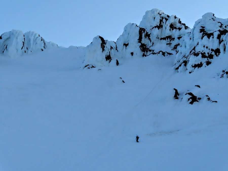
We did not complete the climb. Went up Heliotrope Ridge and camped on the Colman Glacier at 7300 ft. It was a great spot, but we were inside a cloud most of the time. It cleared for a few hours to provide spectacular glacier views as we made our dinners and prepared for our alpine start in a few hours. One of our group became sick and none of us slept well attending to her and fretting about her welfare. I was quite cold sleeping on the snow until I added the rope underneath me! Next time will bring two pads. At 230, we woke up to soggy tents and no visibility and didnt feel comfortable leaving our team member(who had recovered but was not going to join the summit bid) in camp. We went back to sleep and awoke a few hours lager still inside the cloud, packed up and descended . 7 miles 3500 ft.
On the second night I stayed on Wells Creek Road and explored a bit of Cougar Ridge, but still a lot of snow. Saw so much bear scat on this wild rugged road which is pretty quiet with no official trail off it, 4 miles, 500 ft.
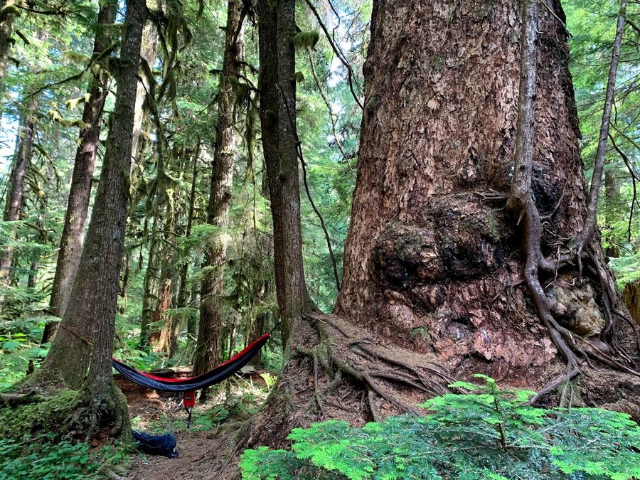
Third day/night was a great overnighter on the High Ridge trail near Excelsior Pass. Approached from Damfino Lakes. Snowy on north side, but the ridgetops and south slopes were melted out. Alpine heaven! 9 miles, 2250 ft.
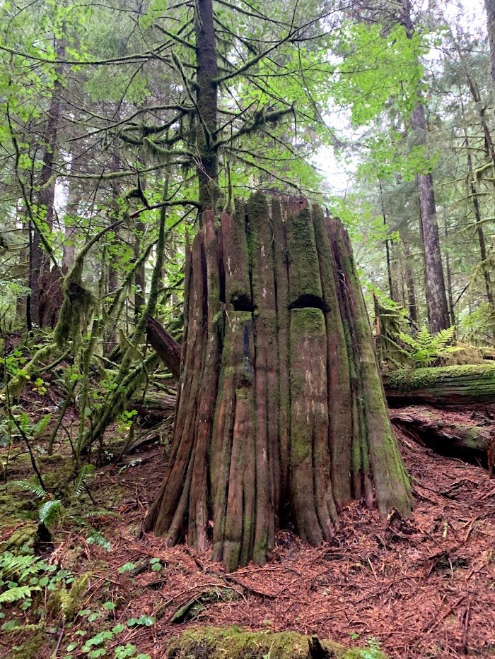
On the 4th of July, I drove up to the end of Baker highway, which is gated at Heather Meadows. It was a zoo of course. Later I visited a really cool old growth forest hidden trail. It was hot and I was feeling fatigued, so I brought my hammock and took a nap beneath the canopy of a behemoth.
Last hike-Sauk Mountain! This was a wonderful surprise. I chose it because it was short and close to the highway. Love the steep hanging meadows covered with wildflowers and butterflies. Snowfield on the back side had most of the plodders turning back before the summit block, so I had the top to myself for quite some time. Sat and sketched, feeling sad about the end of my trip. Local marmot browsing nearby. 4 miles 1250 ft.
July 1 – July 4, 2021


 1
1
Silver Star
8 miles of hiking • 2750' elevation gain •
Went up via the south ridge and Indian Pits. Was here exactly one year ago, where there was some beargrass here and there. Today, every single beargrass plant was blooming from 3500 ft on up. I'm covered with pollen!
GLORIOUS
June 24, 2021


 1
1
June 22, 2021
 2
2
Shellrock Peak-WODWA
10 miles of hiking • 3000' elevation gain •
Wow, this was a really cool mountaintop! A long cirque ridge, with cool layered pillars. It felt like walking the outer walls of an ancient fortress.
I was able to drive to the Ironstone Mtn TH at over 6000 ft on Bethel Ridge. All of the open south facing slopes were lovely with xeric rock gardens, but on north side of ridge, and in the saddles, there were patches of forest with persistent snow cover. Slowed down my navigation. Had a few sustained high wind periods and snow squalls. Big mountains never came out, but the clouds were racing around and very entertaining. Took 9 hours to do these 10 miles, but very pleasant. Moat on summit rim allowed for easy walk up. Textures on top were really trippy! Very unique mountain. Burnt Mountain was nice too.
June 10, 2021


 2
2
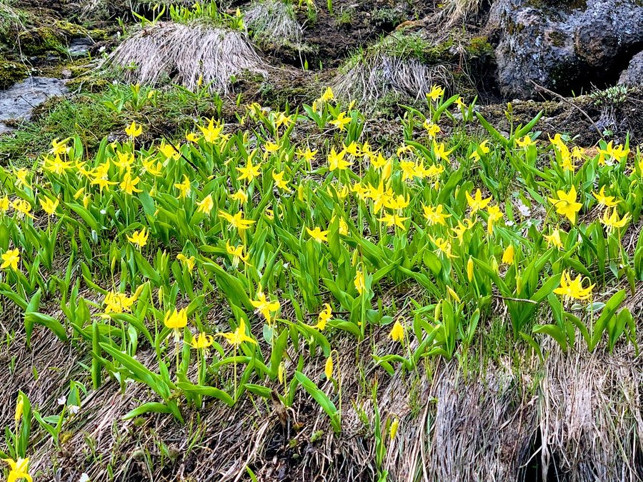
Purcell Mountain
7 miles of hiking • 2750' elevation gain •
Snow above 4000 ft made for slow going, but I was still able to follow the trail for the most part. Lovely steep meadows up high full of glacier lillies.
June 9, 2021


 3
3
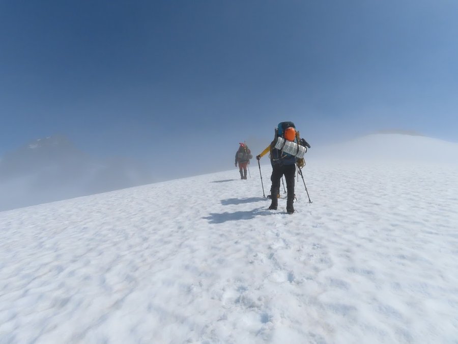
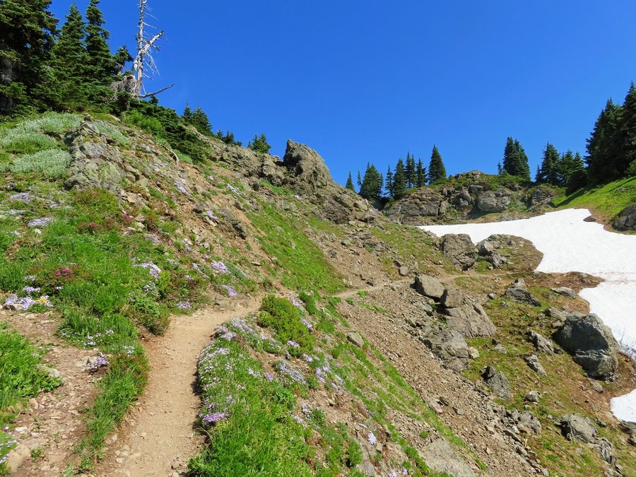
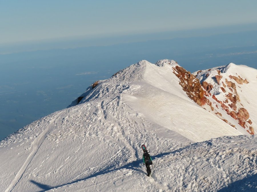
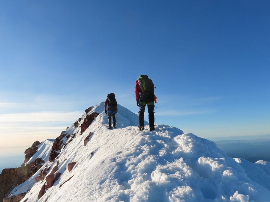
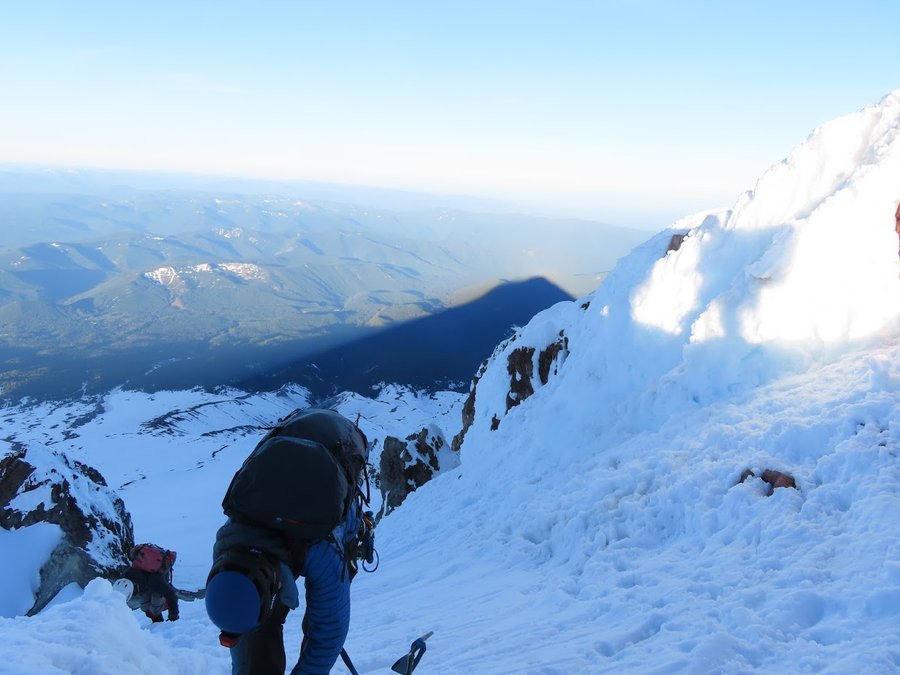
Mt Hood Summit!
7 miles of hiking • 5250' elevation gain •
Went with a small Mazamas group. Tuesday after Memorial Day and the mountain was very quiet, only one person ahead of us who gave us the summit to ourselves when we arrived.
Due to concern for the warm weather, we left Tline at 11pm. Traversed the Hot Rocks and came up the old chute. Conditions soft, but not yet mashed potatoes. Got some good glissades below Triangle Moraine.
May 31, 2021

 1
1
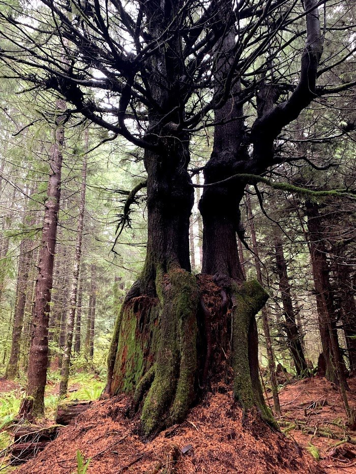
The Search for King Tut
11.5 miles of hiking • 2250' elevation gain • 2 nights
The forecast told me the rain would cease after 11am. I got to the TH for Crabtree Valley at 1pm and it was still raining hard. I took the short hike to nearby Crabtree mountain instead. Logging road with intermittent snow drifts. The rain did stop, but the trees kept on with their drip drip drip. Camped nearby and awoke to sunny skies next day.
Lots of old growth all around this area. As you hike down into the valley, you look into the canopy of the trees rising up from below. I wandered the established trail around the lake, then set off on a deteriorating hidden logging road towards King Tut. It petered out after a mile, and then there was postholing in soft drifts, bushwacking through wet shrubs, and stream crossing-my kind of fun just to hug a tree. Got soaked again.
May 26 – May 28, 2021


 3
3
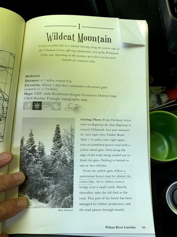
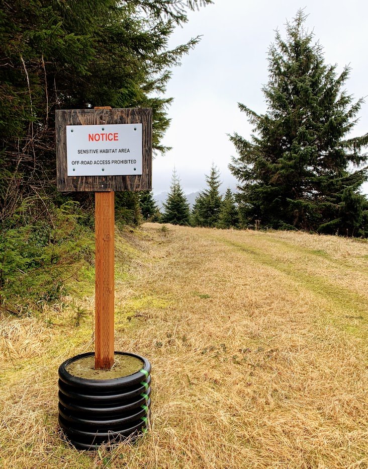
Wildcat Mountain- Tillamook SF.
12 miles of hiking • 1500' elevation gain •
This was the first hike described in the 2001 edition of "50 Hikes in the Tillamook State Forest". I can only recommend it as a winter hike. Gentle climb on logging road with a few bits of mature forest. However, I will definitely return on mountain bike! Lots of roads to explore, behind locked gates, no OHVs allowed. No sign of party pigs. The summit road leads to a landing that overlooks a gravel pit. Got to travel some lovely abandoned roads, scramble through two gravel pits and do some fun bushwacking. I even found single track trail that is well maintained, but very lightly used. Did a loop and trespassed onto Weyerhauser land for a bit.
Unfortunately, the only people I saw were two forest engineers who were surveying for a timber sale along Wildcat Mountain road- they made it seem like it was imminent, bummer.
May 18, 2021

 1
1
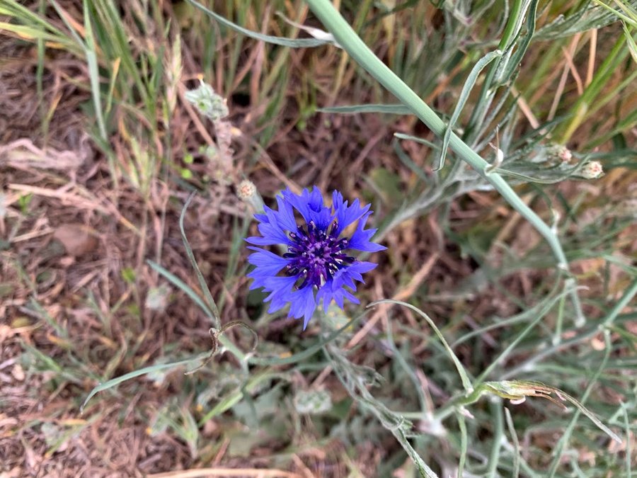
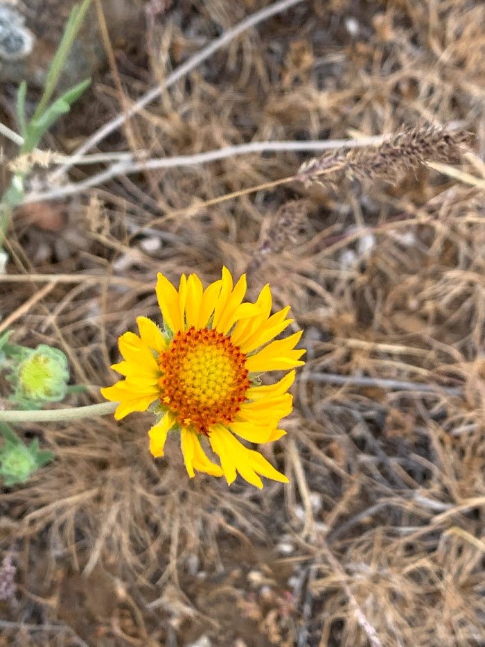
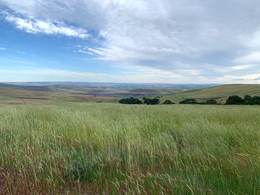
Dalles Mtn Ranch
4 miles of hiking • 750' elevation gain •
Had an afternoon thing in The Dalles, so I went for a little stroll across the river afterwards. The big flower display is done, but some hardy summer flowers are out. It was quite windy, and the 2-3 foot high grasses undulating in the wind was mesmerizing.
May 17, 2021

 2
2
East side exploring
5 miles of hiking • 500' elevation gain •
Checked out the Underhill Trail and a few other spots. Looking for morels. Big zero. Even in the areas where the snow was still receding, it seemed too late. Feels so dry over there.
May 13, 2021
 1
1
The Spot
10.5 miles of hiking • 2750' elevation gain •
Took a trip to visit a weird geological anomaly I found on GE a few years ago.
May 11, 2021
 1
1
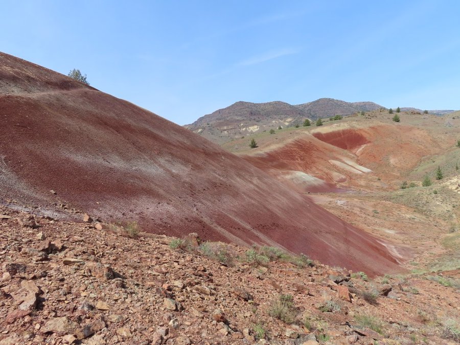
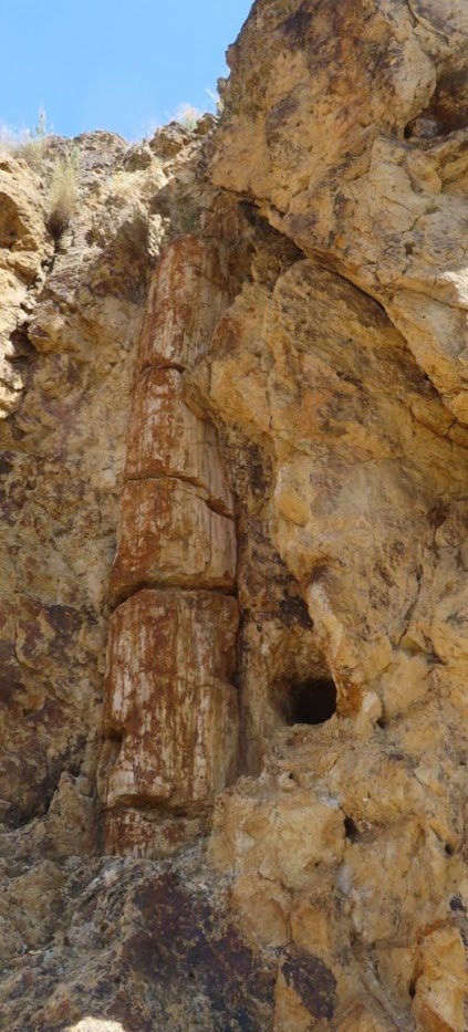
John Day Country
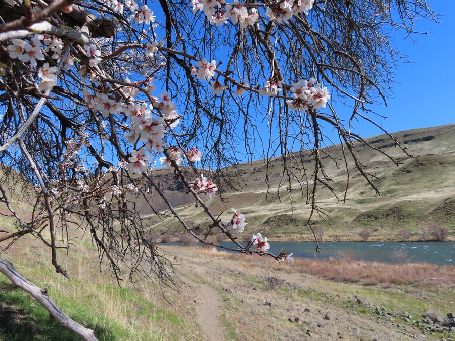
13.5 miles of hiking • 3000' elevation gain • 1 night
Had a great trip in the vicinity of Clarno. I first went to the Hanock Field Station and did a loop hike in the Clarno Unit backcountry. Saw fossils, a petrified tree, and visited the Red Hill and Whitecapped Knoll. 4.5 miles, 750 ft gain.
I then drove down nearby Clarno Road to the Spring Basin Wilderness trailheads. Was going to car camp there and get an early start, but the camping sites were bleak compared to the gorgeous bluffs above the river, so I packed up my gear and an extra gallon of water and hiked up the nearest canyon to find a perfect spot. Lovely warm evening! Next day, I hiked a big loop through Spring Basin and up and over Horse Mountain. Marvelous ridgetop rambling, with views and wildflowers galore.
April 27 – April 28, 2021


 3
3
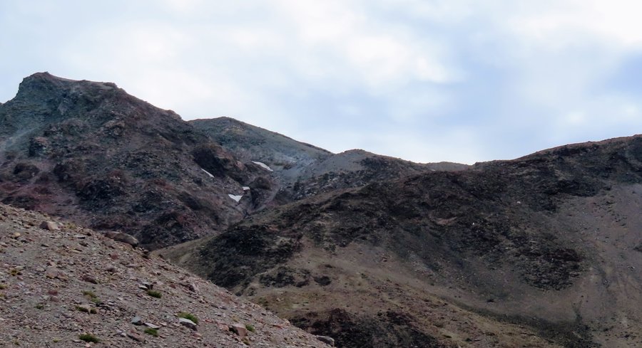
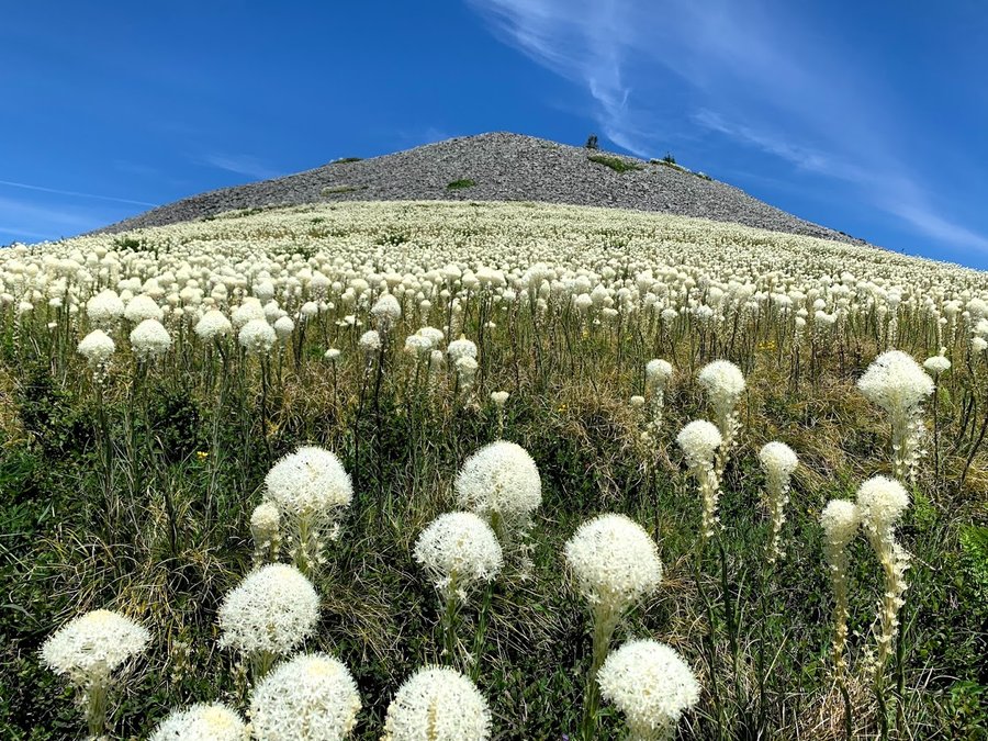
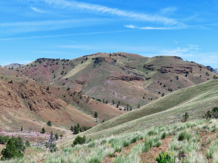
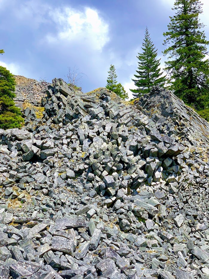
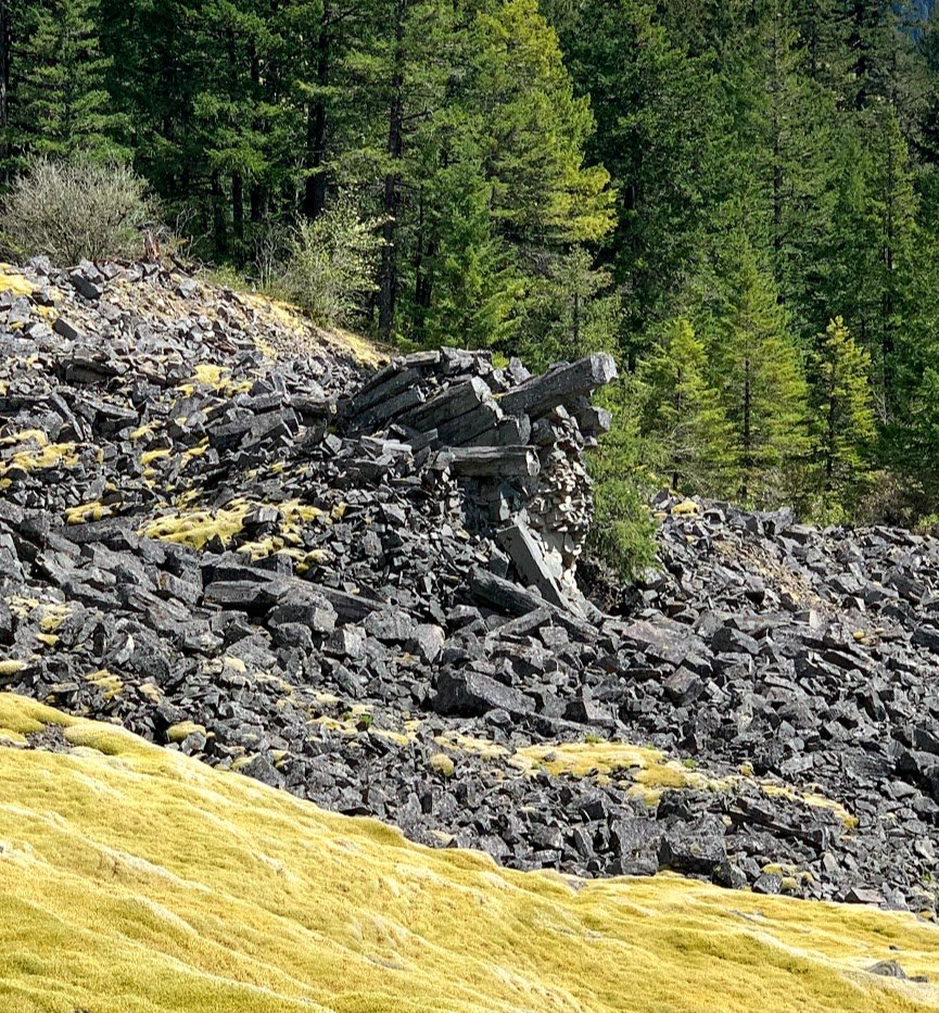
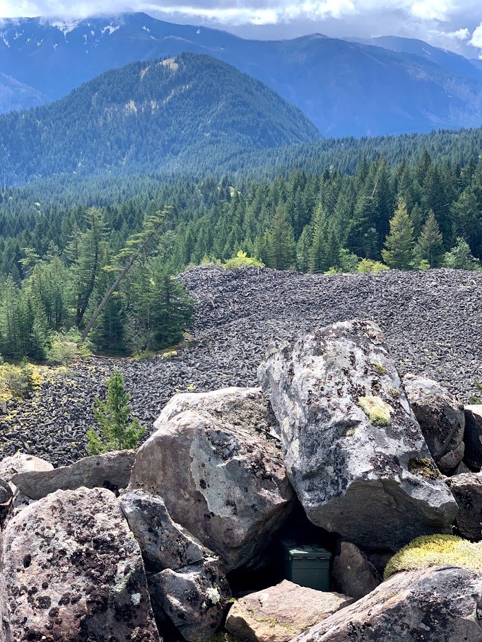
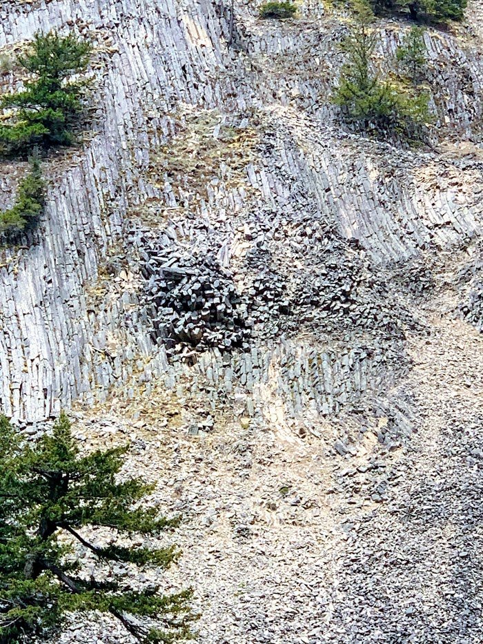
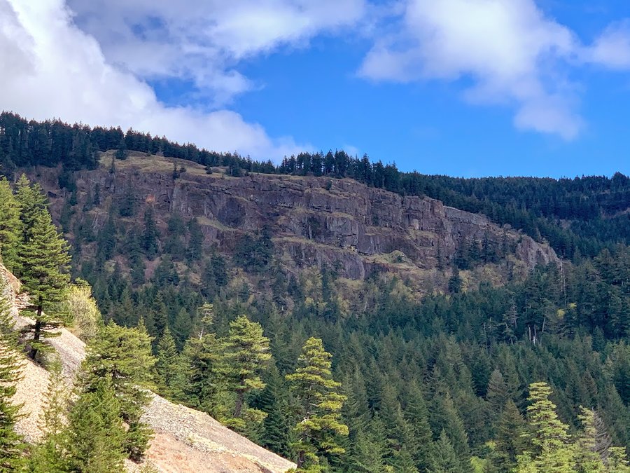
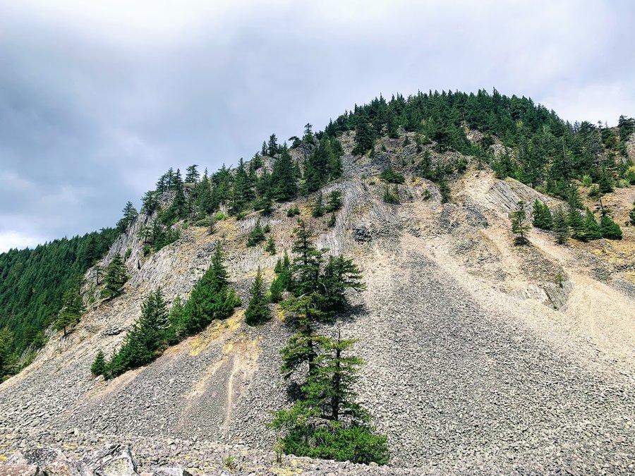
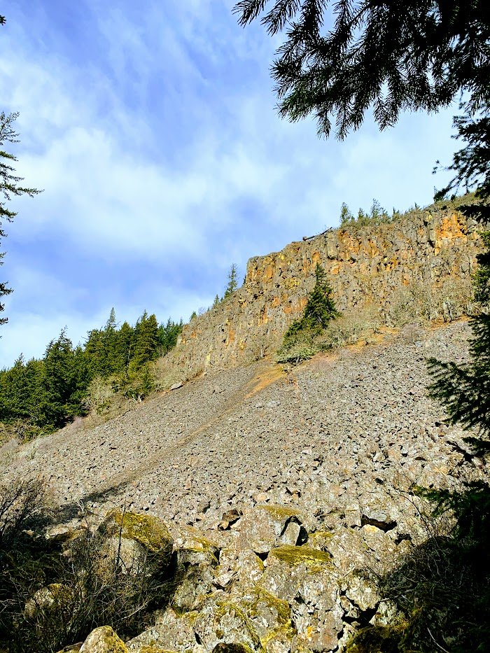
Secret Scree Field
9 miles of hiking • 2250' elevation gain •
Roaming around, with some pleasant flailing. Found all kinds of old revegetating roads and helpful critter trails. The scree field is epic! Untouched. Magnificent views all around. I witnessed a big chunk of basalt do two endos and hit the cliff on the way down bringing even more with it. I think I saw some goats up high too. Found some more old road to take up to the top of the cliffs and snooped around but couldn't find them. Maybe it was my imaginative squinting.
April 25, 2021


 1
1
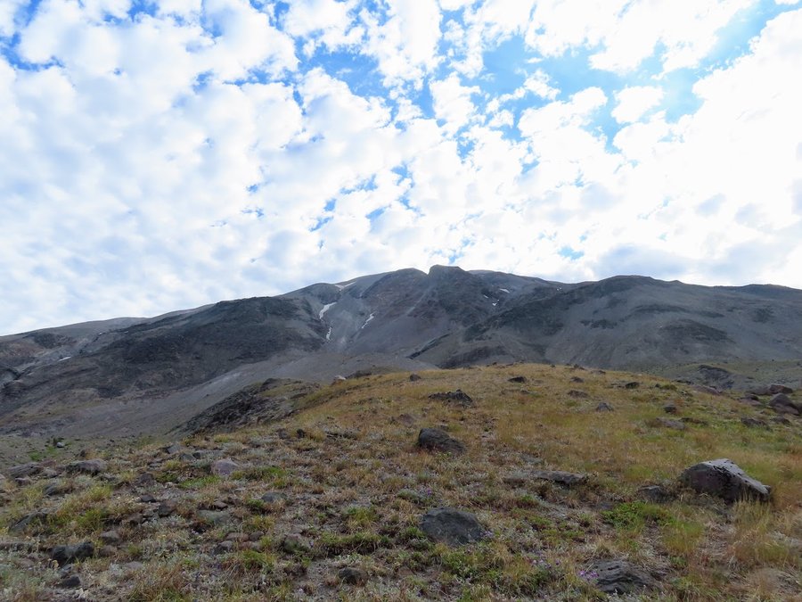
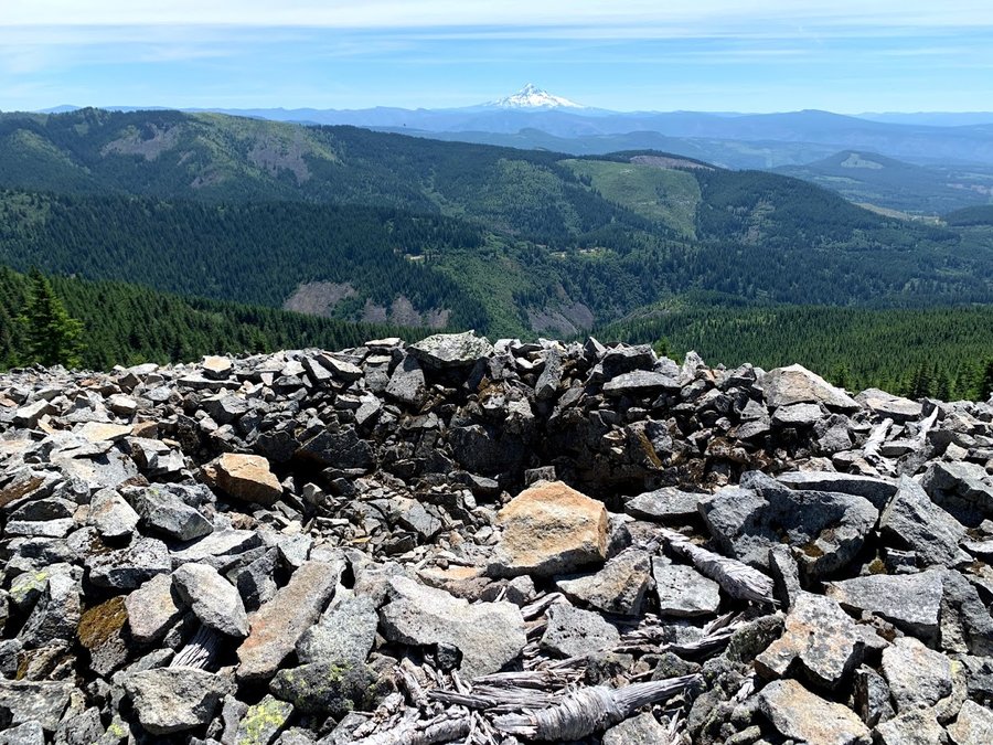
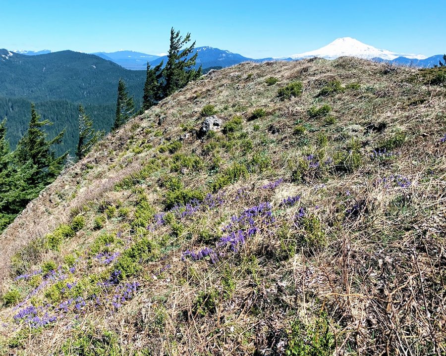
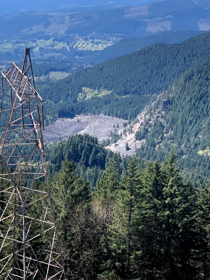
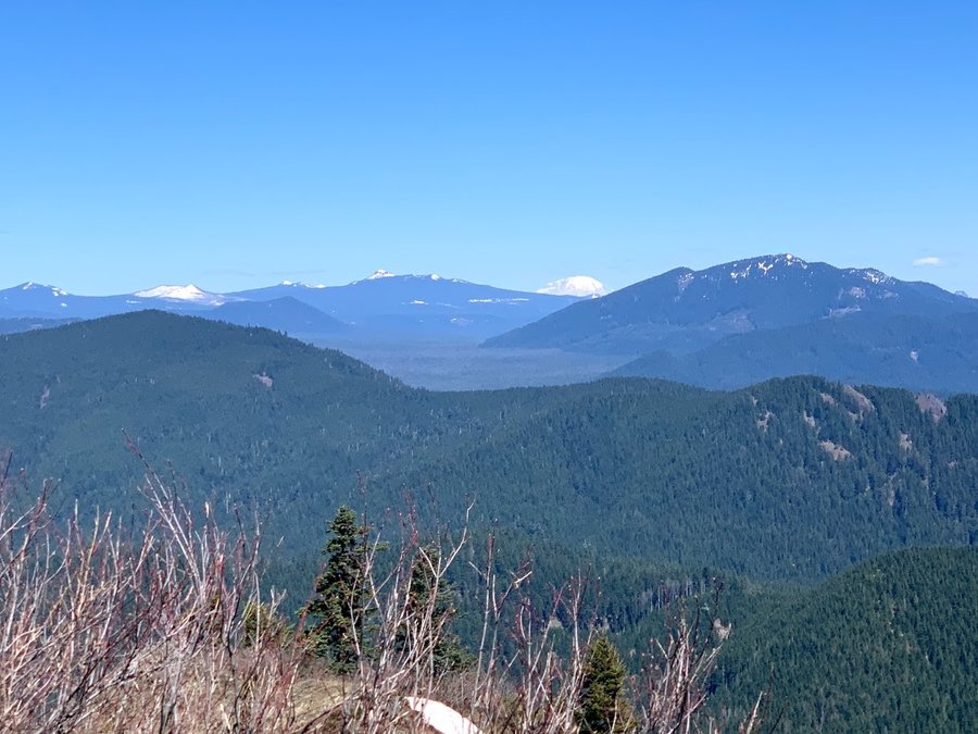
North Augspurger
10 miles of hiking • 2500' elevation gain •
Dog TH packed at 0900 on a Tuesday, and the flower show has not even begun yet! Drove around to the Northern Augsperger TH. I went up via Berge Road to sometimes rough 2700 (but you can also go up on the east side from Willard).
Only saw one other hiker on the Augsperger trail, it's a bit brushy, some snow in the trees just north of the summit, but trail not really necessary-just stay on ridge. A few miles south of summit, I turned off onto the powerline access road, heading northwest, trying to get to the "secret scree field"(zoomed in last picture). Didnt quite get there, but now have an approach figured out. The views from the northern mile of Augsperger are terrific, it's basically the whole Gifford! You can see from Table Mountain all the way to Adams. So much more to explore up here!
April 20, 2021

 3
3
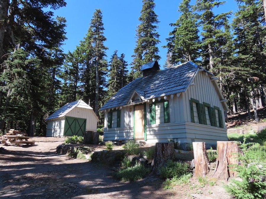
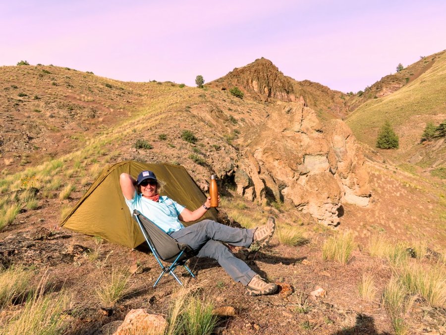
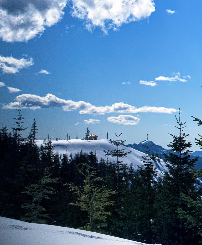
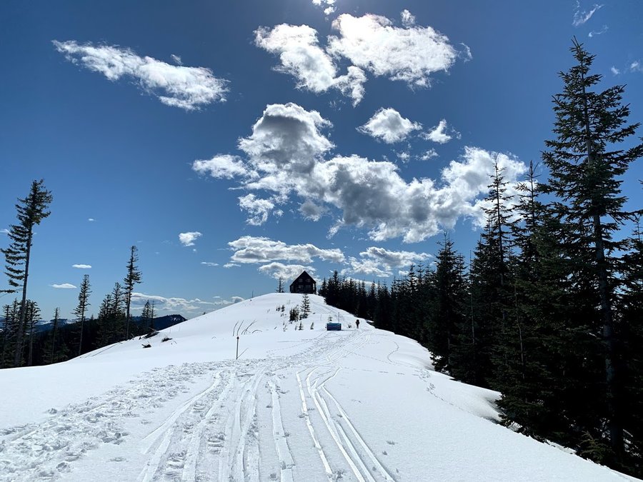
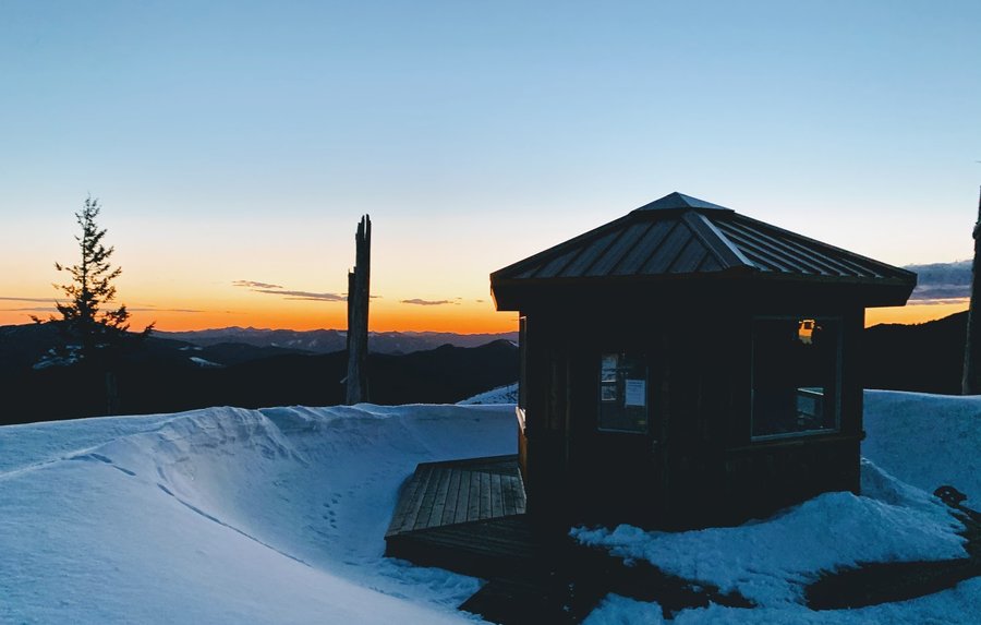
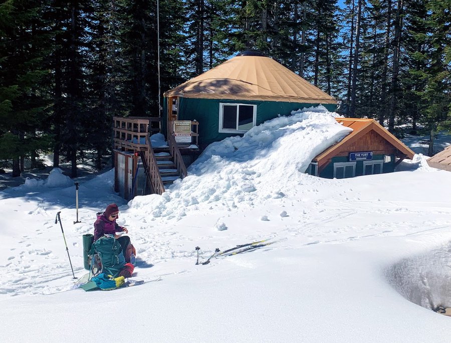
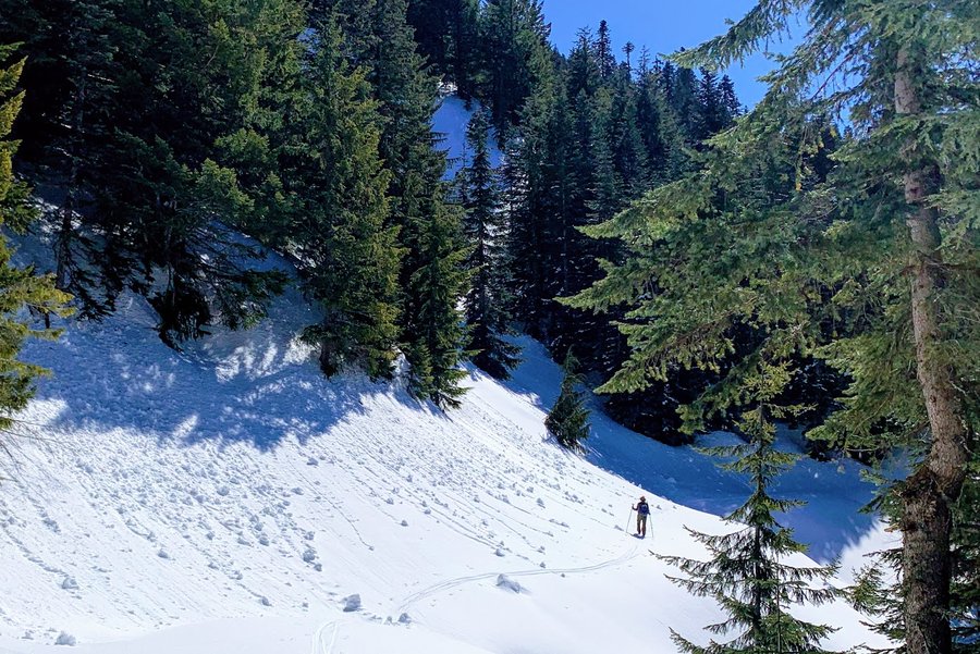
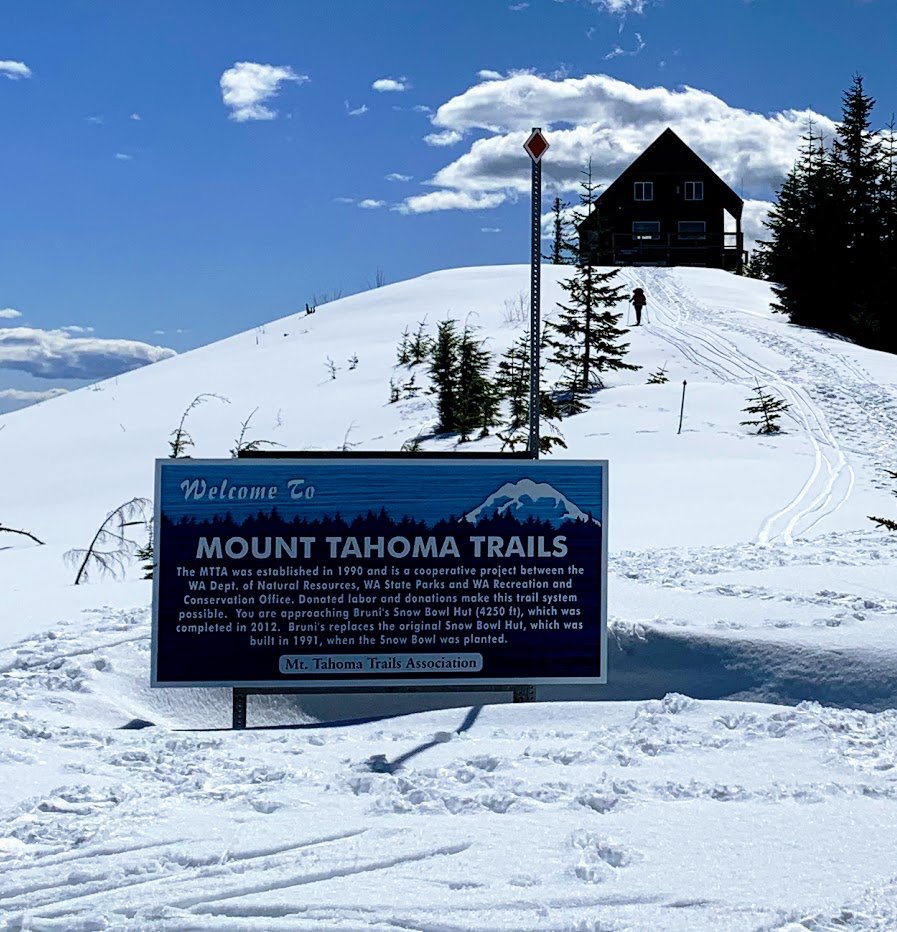
Mt Griffin
1 miles of hiking • 500' elevation gain • 1 night
The Mount Tahoma Trails Association has developed a system of ski trails with alpine huts and yurts on state land near Ashford, WA. The forest itself is bland reprod and the trails are logging roads which are great for skiing, maybe not so great for hiking. But the views from the huts are worth it! We visited the High Hut, then Snowbowl hut and camped nearby. The next day we went to the yurt and then climbed Mt Griffin!
This was a 19 mile ski trip with 4000 ft gain, but I'm just counting the climb. Wanted to post some pics .
April 12 – April 13, 2021


 1
1
Up Snowden
6 miles of hiking • 500' elevation gain •
Accessed the north side of the White Salmon trails via Bates Road. Saw some ticks, deers and a lone mtn biker.
April 6, 2021

 2
2
West Onion Peak
12.5 miles of hiking • 2500' elevation gain •
Took Hug Point Road to Onion Peak Road to Dave's Spur. Didn't quite make it to summit via bushwack. Got chilled with wet shrubs and rain. Want to return with my bike to get to Onion Peak proper.
March 30, 2021


 2
2
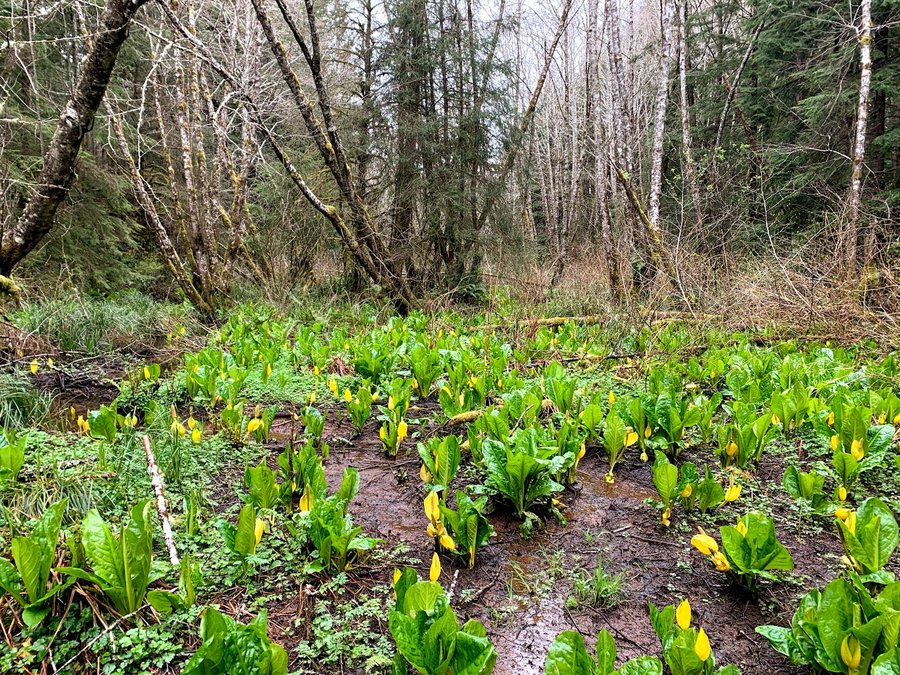
Fort to Sea trail
13 miles of hiking • 750' elevation gain •
On Monday, I hiked the Kwis Kwis/Fort to Sea figure 8 loop. It goes through the coastal forest of the park and you pass some lovely wetlands. Lots of skunk cabbage. Very pleasant hike, saw only 2 pairs of hikers.
Wednesday, I returned and started at Sunset Beach, heading east on the Fort to Sea trail. After you leave the forested state park, you are led around Camp Rilea, and through cow pastures via a creepy fenced hallway. Then you take a tunnel under highway 101. It's interesting, but I cant really recommend this section unless you like scotch broom, barbed wire and the roar of traffic.
March 29, 2021


 2
2
Deschutes West
9 miles of hiking • 1000' elevation gain • 1 night
I visited two different spots on the west side of the Deschutes River. First I parked at the Heritage Boat Ramp and walked upriver on the Rockpile Trail. I went up about 2 miles and stopped to sketch and relax in my chair. I had gone well past the trail end line on my map, not sure how long it continues.
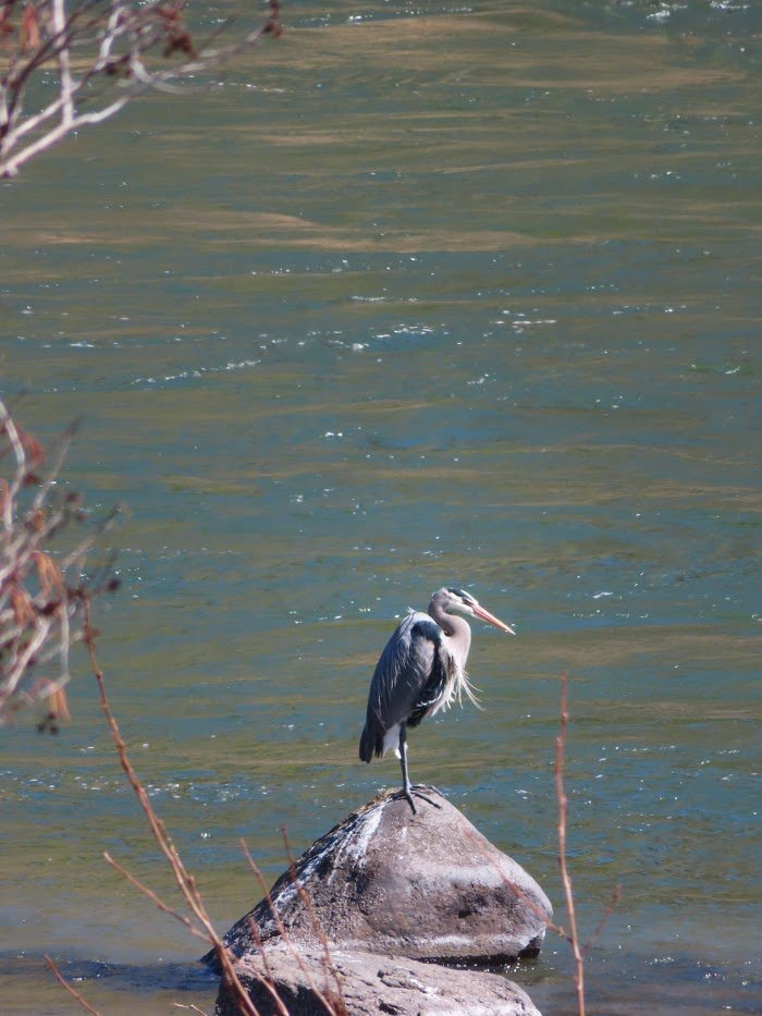
I then had to do some driving to get to my next spot-Freebridge! I took the Fifteen Mile Creek road to get there. When the road starts to drop down into the river canyon, there is a gate and a sign warning of primitive narrow conditions. I parked at a safe flat spot and walked down. Very pleasant. I had to walk on the RR tracks for a bit to get upstream to my camp. Didnt see any other humans. Enjoyed watching the sheep on the hillside across the river from my camp.
March 23 – March 24, 2021


 1
1
Cruzatt
9 miles of hiking • 2000' elevation gain •
Went up towards St Cloud, but veered off to visit Gable Falls. Fun bushwacking up to Cruzatt Rim. The long flat walk westerly on the plateau was very pleasant. Lots of old roads and trails to explore out here.
March 16, 2021

 2
2
Lower Greenleaf Falls and Mosslandia
9 miles of hiking • 1500' elevation gain •
Was inspired by Sarah's recent trip to the area. Bushwacking through poison oak involved.
March 14, 2021


 2
2
Hospital Hill
10 miles of hiking • 1750' elevation gain •
Love these steep oak covered woodlands. The vegetation is waking up, a few flowers starting to pop. Spring will be here soon!
March 9, 2021


 2
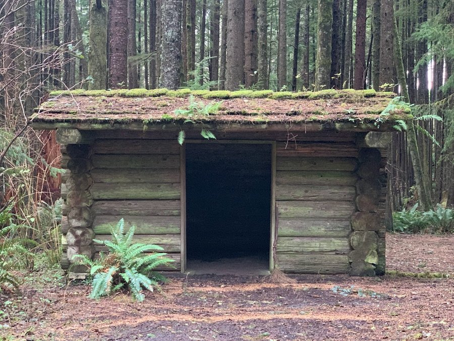
2
Dog Thief Point
4 miles of hiking • 750' elevation gain •
This is just a logging road hike on Stimson Lumber property to a former LO site. I parked at the gate on Military Creek road, then hiked up to 303, then 303A, then bushwacked up a ridge. Also found on some pretty good elk trails.
Arrived in a snowstorm, but then the sky turned blue all around, luring me out of the car with inadequate footwear. . It was really a giant suckerhole, but it mostly held for my couple hours in the woods.
March 7, 2021

 1
1
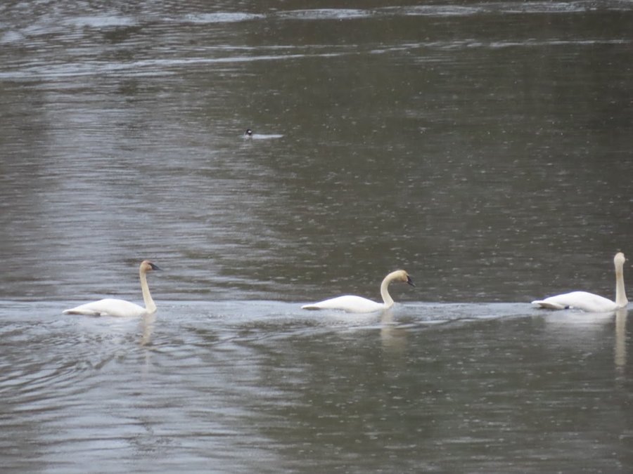
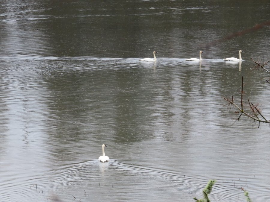
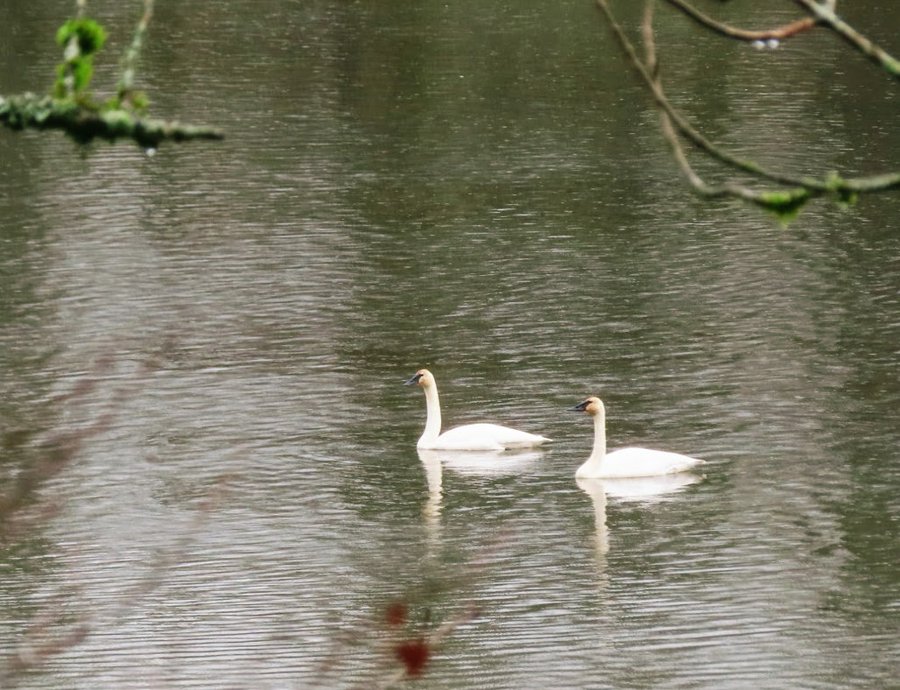
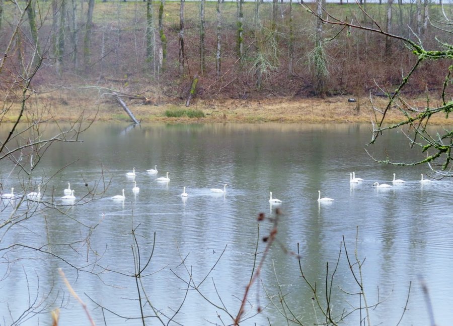
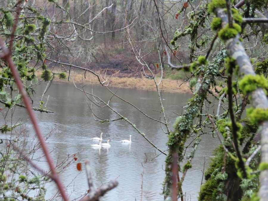
Crown Point Basin
4 miles of hiking • 750' elevation gain •
Bushwack in the rain without a care in the world! Well for a few hours anyhow. Went down to the lake to photograph the tundra swans. Someone has turned the cement building at the old Knierem home site into a shelter- might still be living there-creepy!
March 5, 2021

 2
2
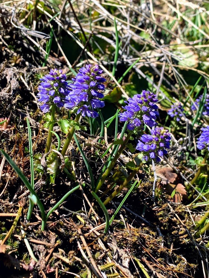
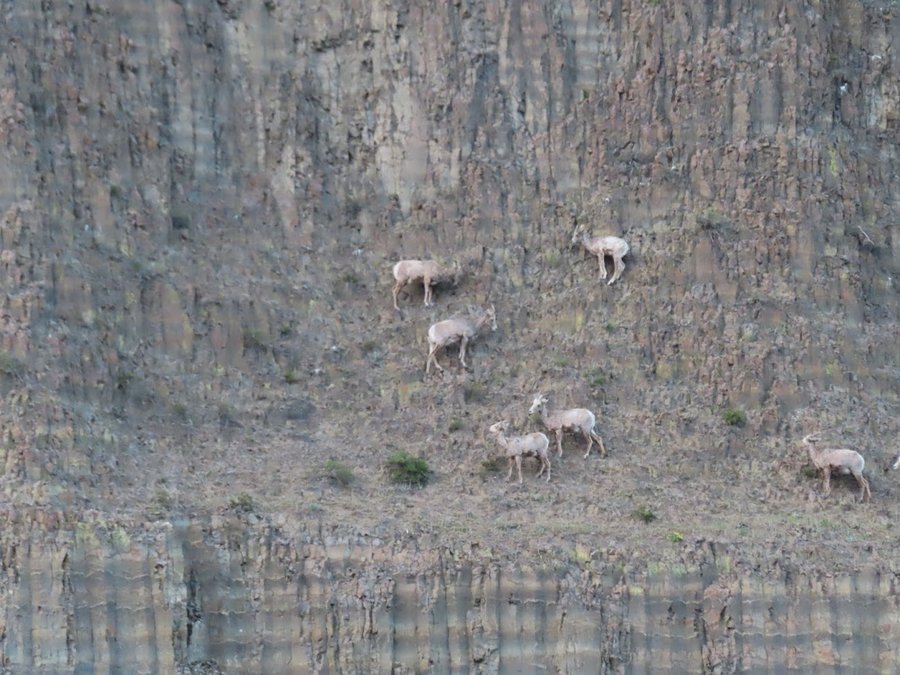
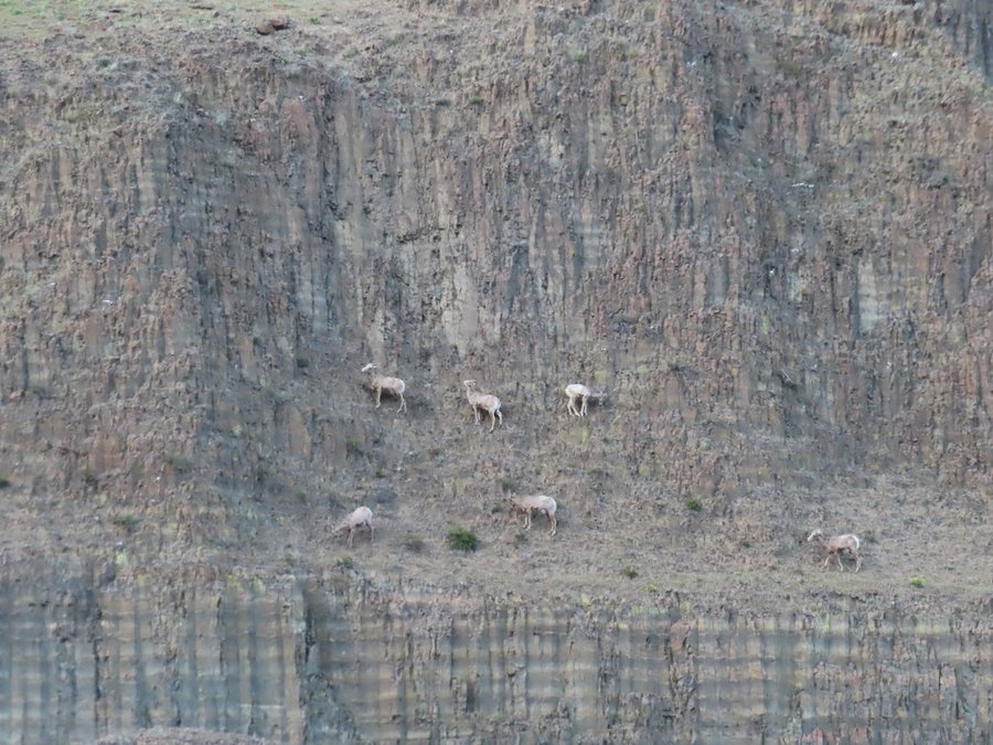
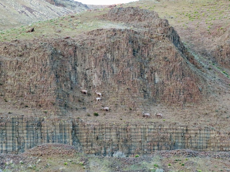
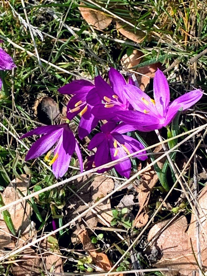
Coyote Wall Loop
7 miles of hiking • 1500' elevation gain •
Came up Coyote Creek to the Wizard Trail(trail closed signs on top ,but not on bottom-oops!). Grass widows are blooming. Gorgeous day. Also stopped and had a visit with Sweeney the resident mountain goat near Stevenson.
March 2, 2021


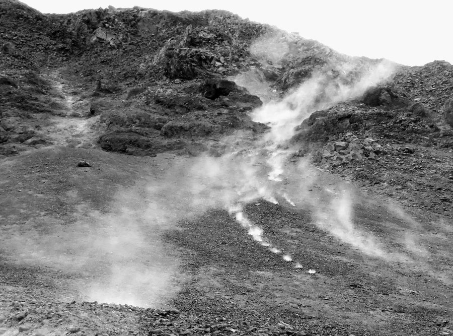
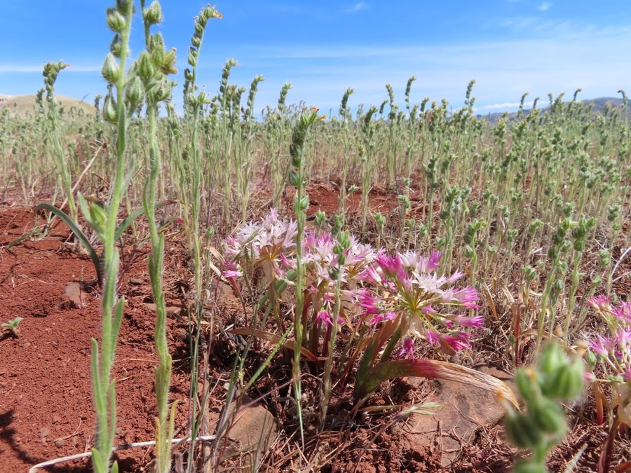
 4
4
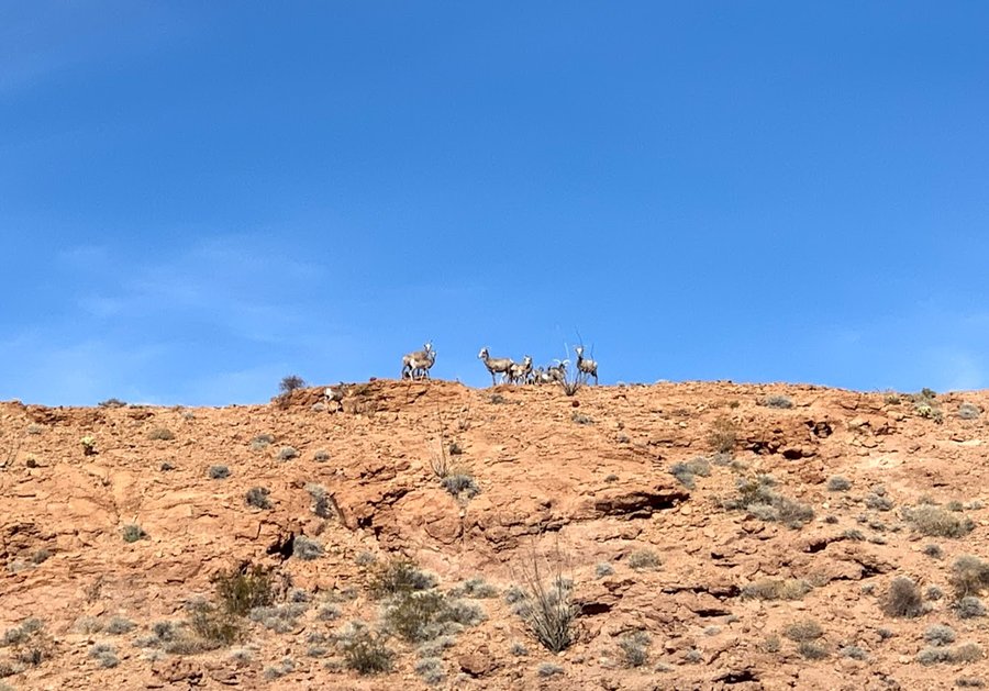
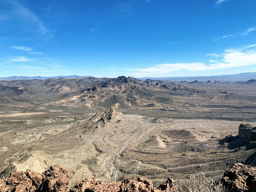
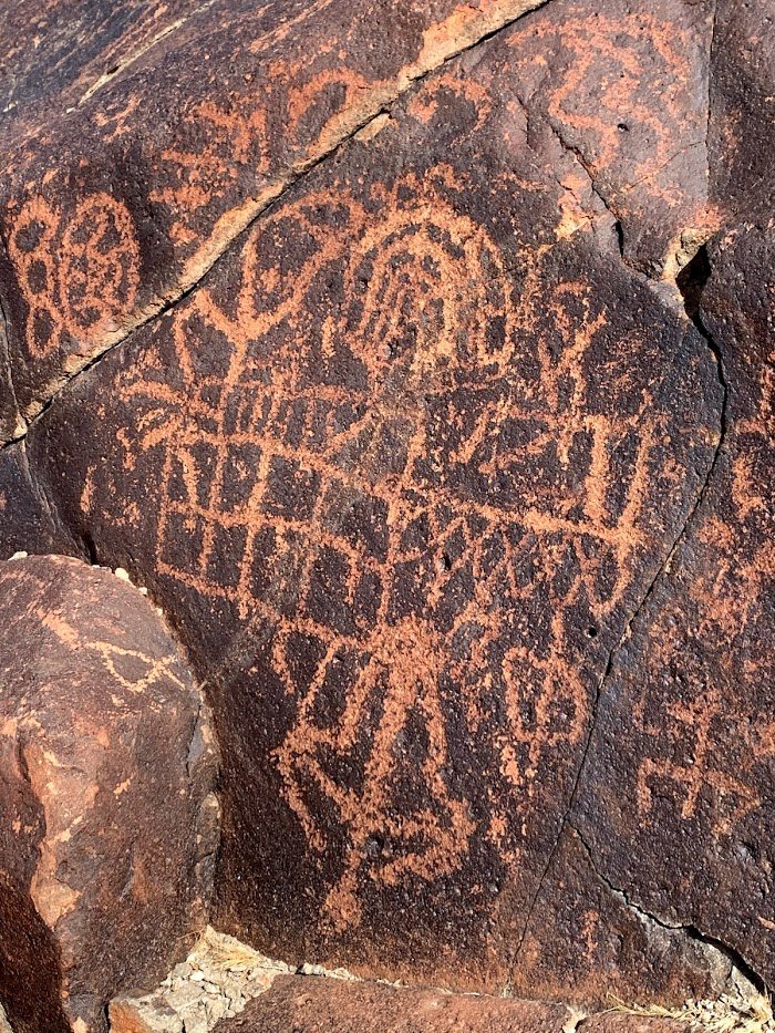
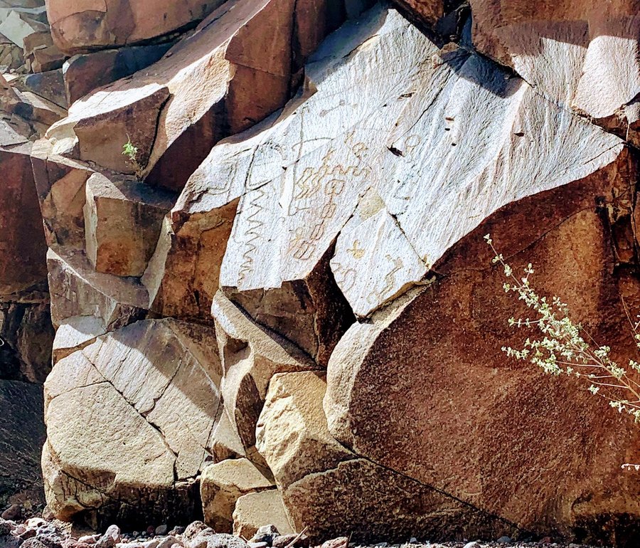
Desert Escape
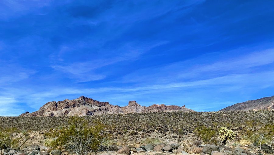
37 miles of hiking • 7000' elevation gain • 4 nights
Had a 6 day trip to the desert. Camped 4 nights, stayed in hotel first and last night. Rented a jeep so I could access the remote spots. Had some fun desert hiking every day!
1) Clark Mountain-highpoint of Mojave National Preserve.Visited plane crash site, but then failed to summit because I got sketched out on knife edge ridge. No trails, alone in the wilderness, figured I should play it safe. Drove to Kingman AZ and stayed in hotel. 4 mi, 1700 ft
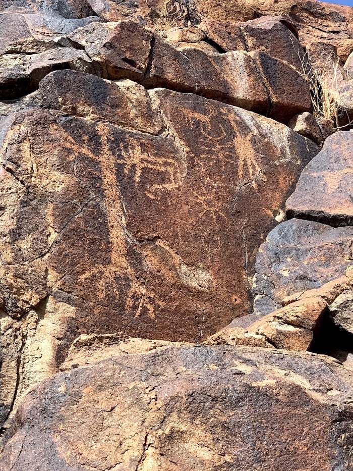
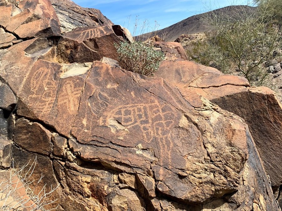
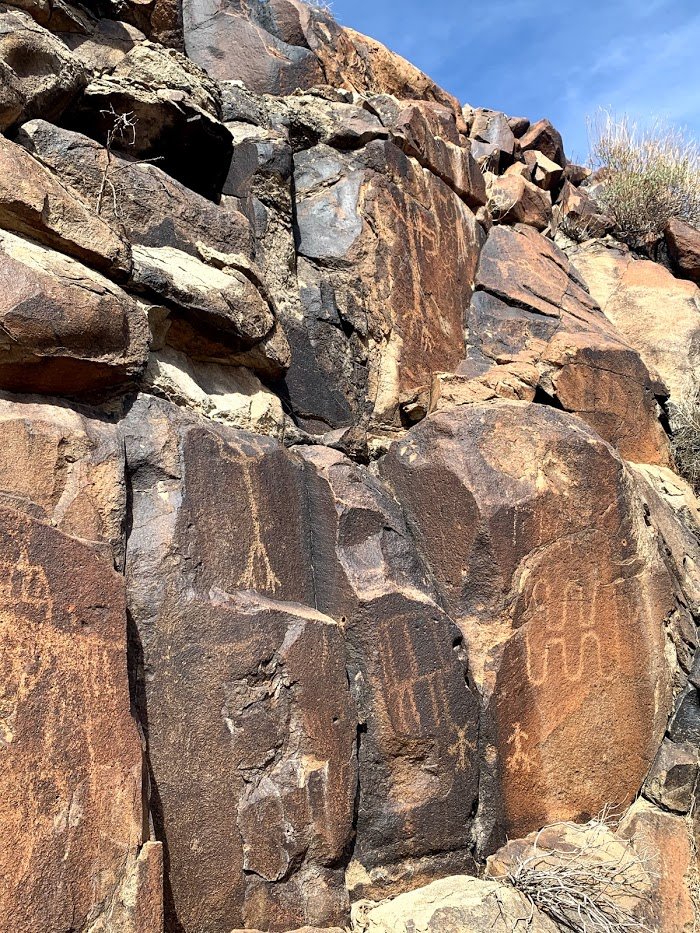
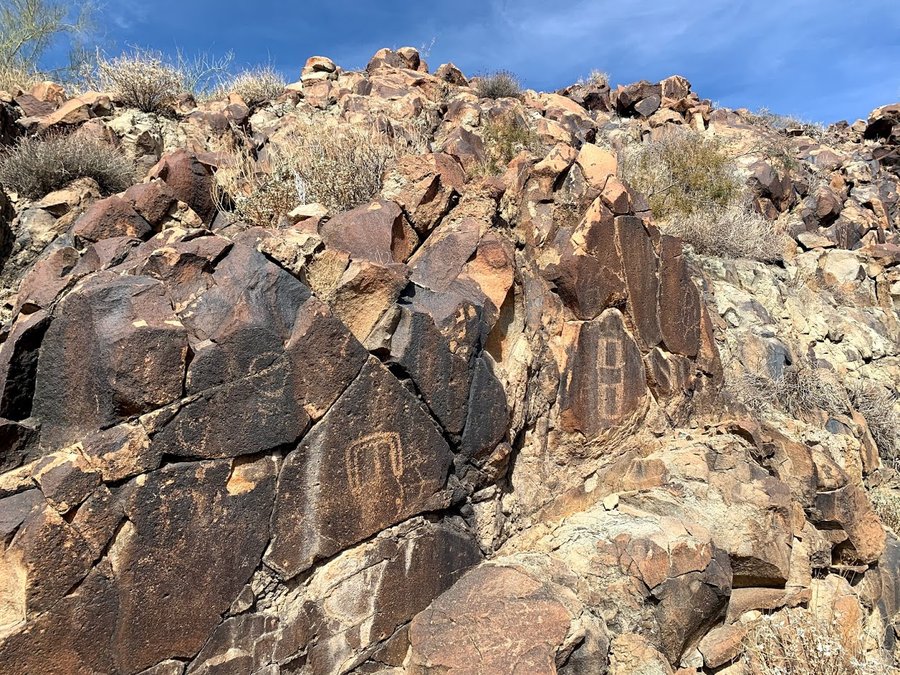
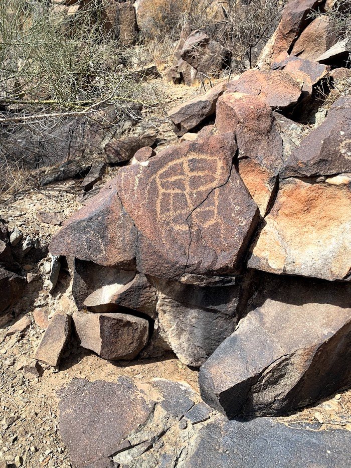
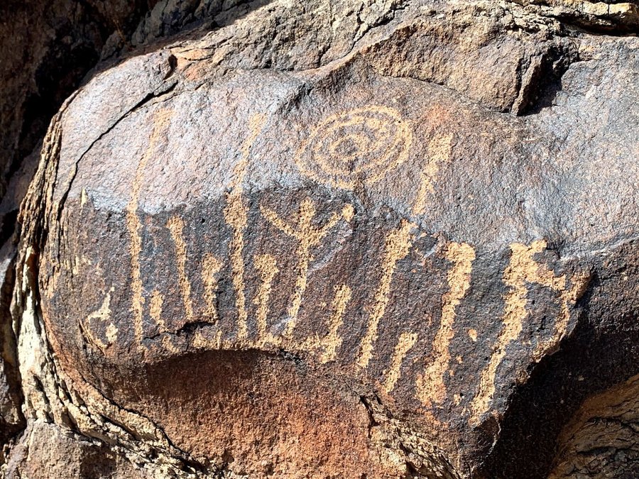
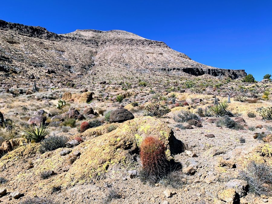
2) Warm Spring Butte-highpoint of Warm Springs Wilderness, east of Golden Shores AZ. Very rough road in. My favorite hike of the trip- part of the motivation was the petroglyphs. Tons! Also fun desert rambling and scrambling and route finding.Saw burros, a herd of bighorn and A FOX! Wonderful warm comfy night in camp with bright moon and the occasional braying burro. 6 mi, 1800 ft.
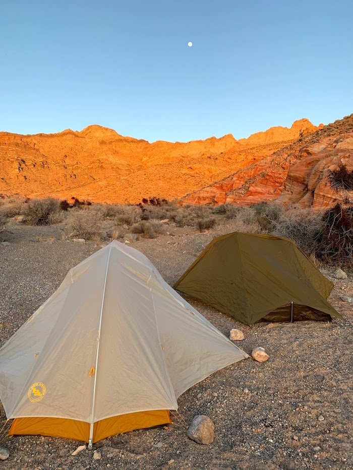
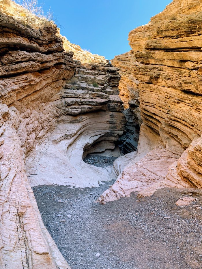
3) Buffington Pockets. Drove back to Vegas and picked up my buddy at the airport. we then headed over to the Valley of Fire area, and took the "Bitter Springs Back Country Byway" to Buffington Pockets. The road was so gnarly, even in the high clearance jeep. But we had solitude. Very cool layered sandstone rock formations, fun slot canyon wanderings. However soon after we set up our tents in a very pretty spot, the winds came in and howled all night. We had to reinforce stakes with stacks of rocks and even put rocks inside the tent! At times my tent poles would push on my head as my tent was flattened on top of me. Very noisy, down to the 29 degrees. In the morning, despite the bright sun we had trouble warming up, so instead of going to nearby Valley of Fire, we decided to head south to Mojave. 3 miles 500 ft.
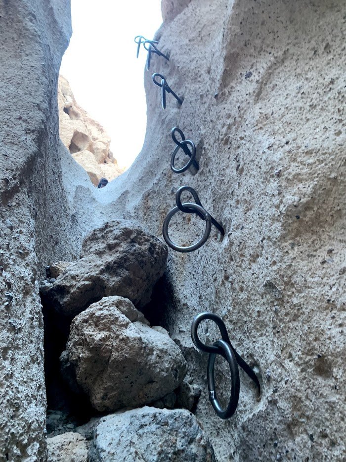
4) Hole in the Wall-Barber Peak and Ring loop. Mojave National Preserve. This loop hike, actually goes around the mountain. The best part is Banshee Canyon which has eroded holes in the tuff like the Honeycombs, some slot canyons, and the "ring sections" which are sturdy metal rings to assist climbing up two of the slots. Long drive, stayed at campground which was tolerable, but it was too cold to hang out after the sun went down.6 miles, 700 ft
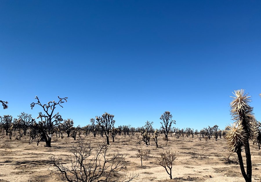
5) Teutonia Peak-in Mojave National Preserve. This formation is on the shoulder of Cima Dome, and was (formerly) located in the densest stand of Joshua Trees. Unfortunately much of the JT forest burned last year. The landscape was bleak, with no new growth apparent yet on the desert floor. Fun scrambling on the top! 3.5 mi, 800 ft
6) Arizona Hot Spring. We drove to the area near Hoover Dam the night before, found a canyon wash to drive up, and stayed in Horsethief Canyon. Wonderful warm night under a full moon. Did not have to dive into our tents when the sun went down. Drank too much whiskey. We did manage to get to TH early as this is a very popular hike. Hiked down one canyon to Hotsprings, then visited the Colorado River and hiked up the adjacent canyon. The long trudge out in loose gravel was more challenging than we expected. Hangover did not help. 7 mi 750 ft
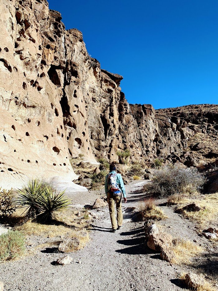
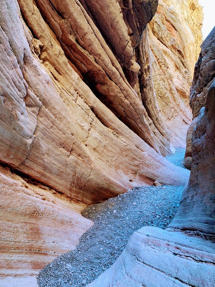
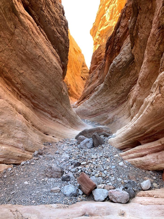
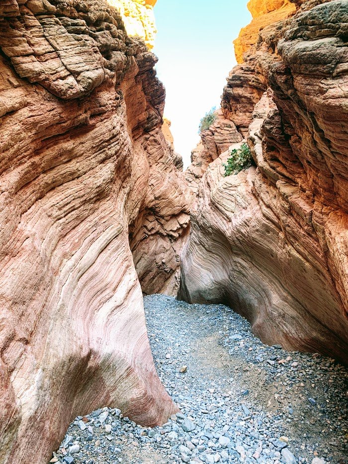
7) Anniversary Narrows. We stayed in a hotel the last night because my buddy had an early flight. I however had all day. Went to the Lake Mead NRA, east of Vegas, and visited this cool slot canyon off the North Shore Road. Fantastic! Added some fun side scrambles. 7.5 miles, 800 ft
February 21 – February 25, 2021


 3
3
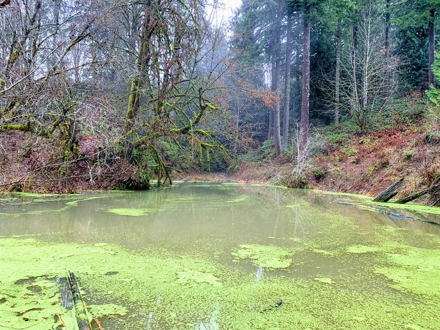
Newton Road upper loop
5 miles of hiking • 750' elevation gain •
Sad week. I've been caring for my mom on hospice for the past two months,and she died on Wednesday. Feeling really numb. The woods were just the balm I needed.
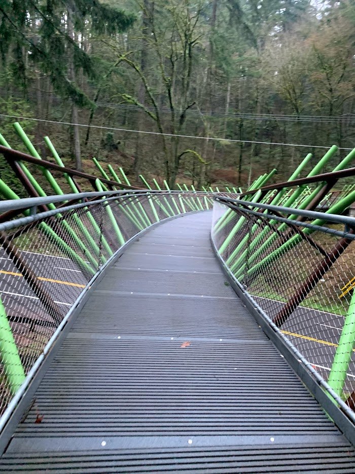
Forest Park was eerily quiet. Germantown and Cornell Road are both closed-due to storm damage I assume. Newton TH was accessible. Only saw one trail runner in the 2 1/2 hours I was out there. Combined FL 10, Lief Erickson, Waterline and Wildwood for a perfect 5 mile loop. Trails are fine, just bits of blow down here and there. Not much snow left.
February 19, 2021
 1
1
Council Crest
6.5 miles of hiking • 1250' elevation gain •
Misty day. Started at the Markham Shelter on a standard loop, but ended up wandering around the Hillsdale neighborhood with all kinds of nifty little paths between the streets and some cool old houses, fancy houses, houses on stilts. Got a little confused with my directions but eventually made my way back to the east side and trails.
February 5, 2021


 3
3
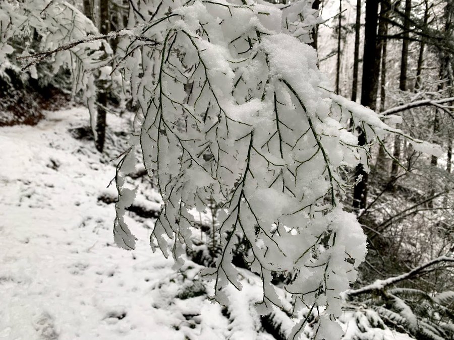
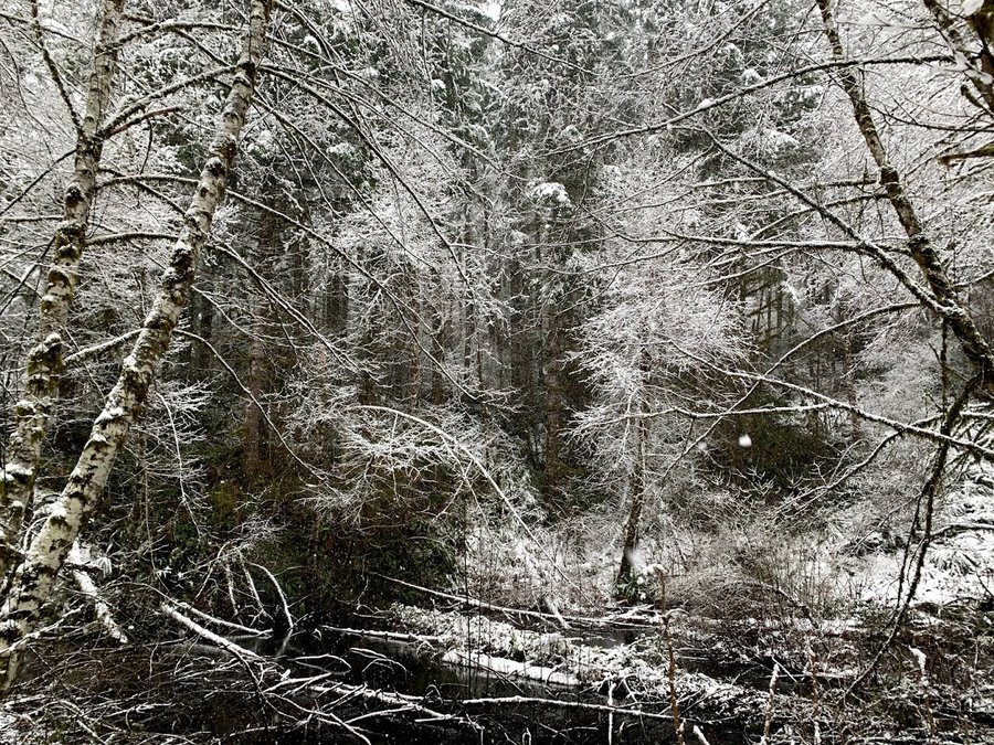
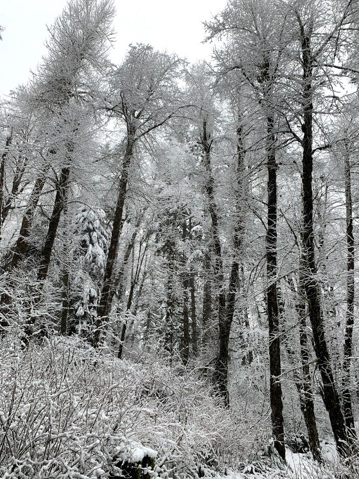
Gales Creek in the snow
5.5 miles of hiking • 750' elevation gain •
Was not expecting snow! Luckily my microspikes were in the car. Surprised to have fresh tracks on the weekend. Just lovely.
January 24, 2021


 1
1
FL 15, Newton and BPA loop
6 miles of hiking • 1250' elevation gain •
THs overflowing with cars, but plenty of room to spread out. You can get some nice steep ups if you link up BPA road and FL 15. Still a bit of a mudfest, but Newton Creek is back to a rock hop.
January 17, 2021

 1
1
Stub Stewart
5.5 miles of hiking • 750' elevation gain •
Umbrella Hike. First time here. interesting network of trails, with fun names. Took Bumpscooter to the bike trail, then came up Bark Spur and Caddywhomper to Hare Canyon and the Unfit Settlement trail. Had the place all to myself.
January 12, 2021

 1
1
January 9, 2021


 1
1
Marquam shelter to Council Crest
3.5 miles of hiking • 750' elevation gain •
Just a little speedwork. Surprisingly quiet trail in the afternoon.
January 5, 2021
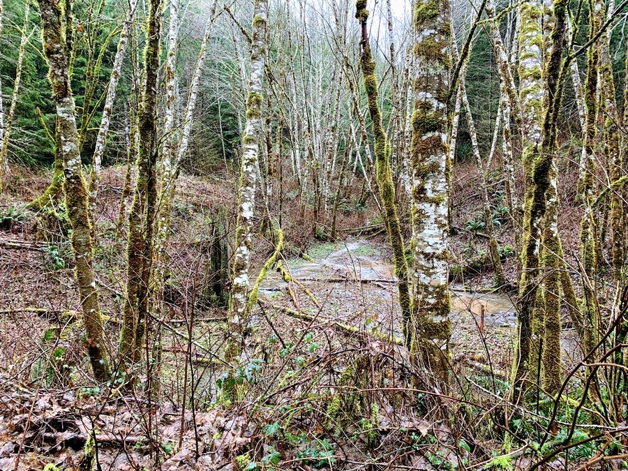
2
Wilwood/Newton/BPA Loop
6.5 miles of hiking • 1000' elevation gain •
Muddy day-even the Wildwood required close attention to footwork. Newton Creek in full spate. Happy morning dose of greenwalls.
January 3, 2021
 2
2
Markham to Council Crest
5.5 miles of hiking • 1000' elevation gain •
Caring for my ailing mom in my home now. Adventures more limited. Feel lucky that I can still get away for short trips.
Started 2021 with a big fat dose of green.
January 1, 2021

View trips from: 2011 2012 2013 2014 2015 2017 2016 2018 2019 2020 2022 2023 2024 2025 2026