

2013 Trips


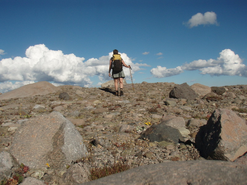
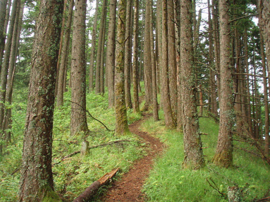
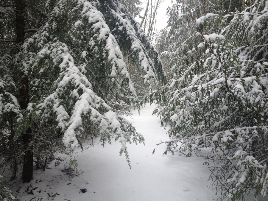
Forest Park
3 miles of hiking • 250' elevation gain •
Another little hike with an awesome labradoodle.

December 30, 2013
 1
1
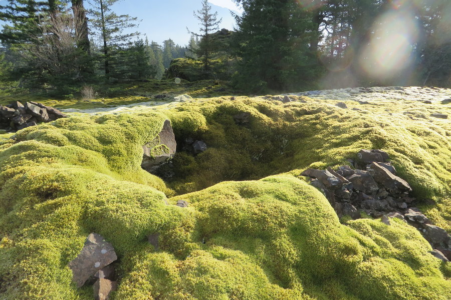
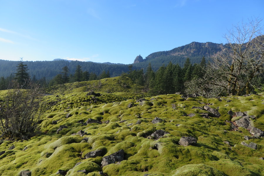
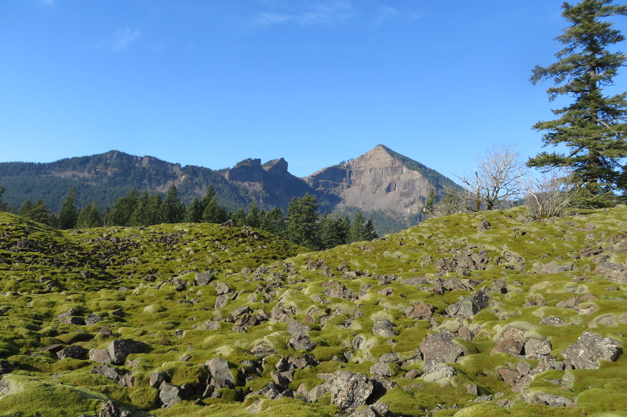
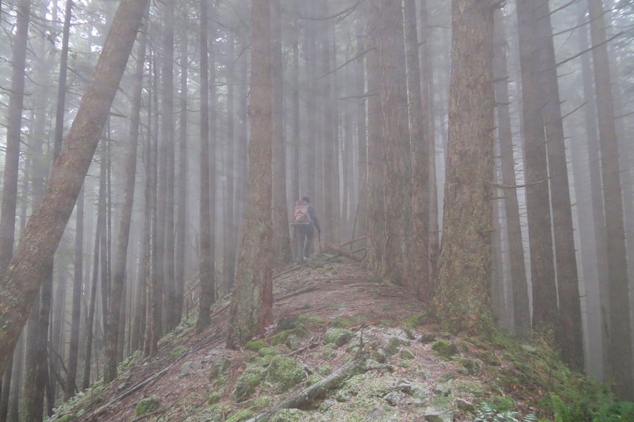
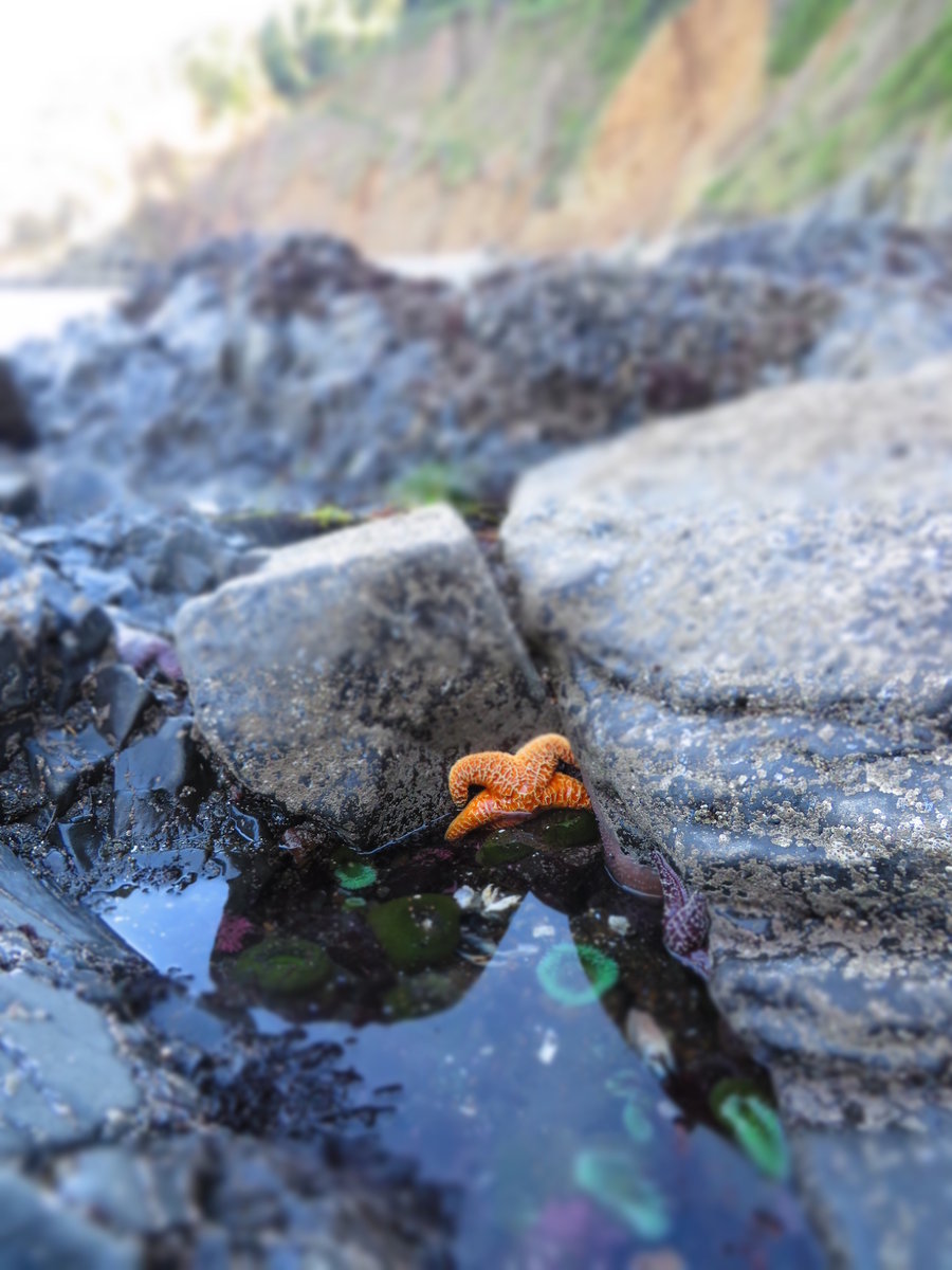
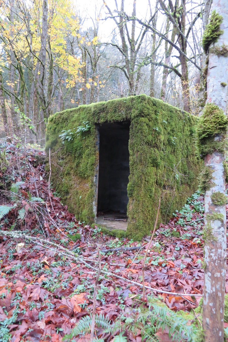
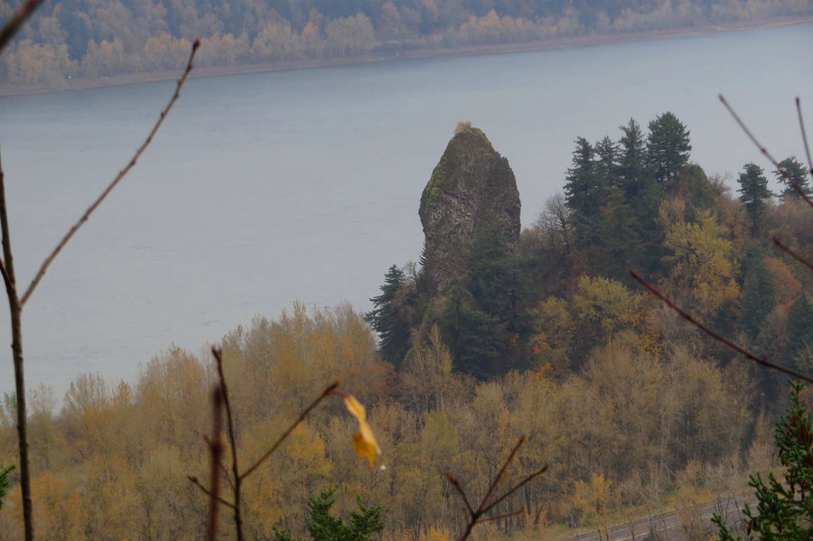
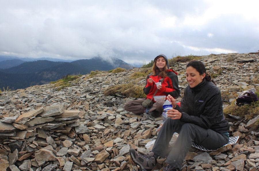
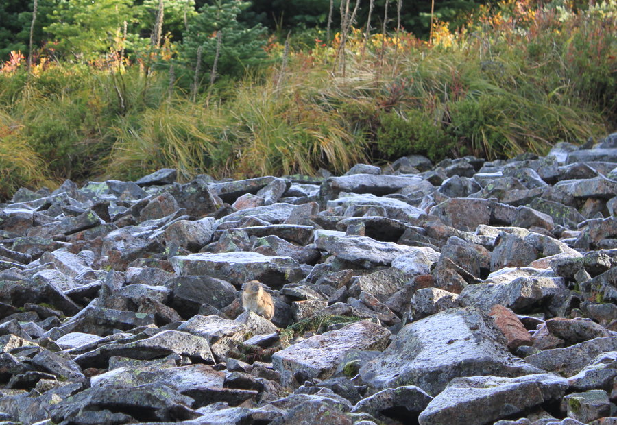
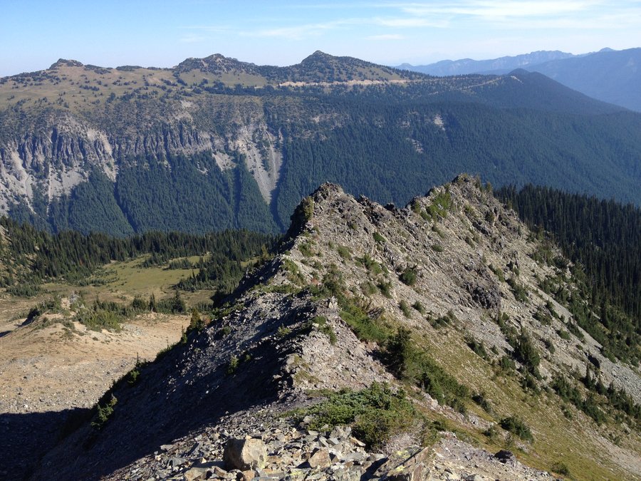
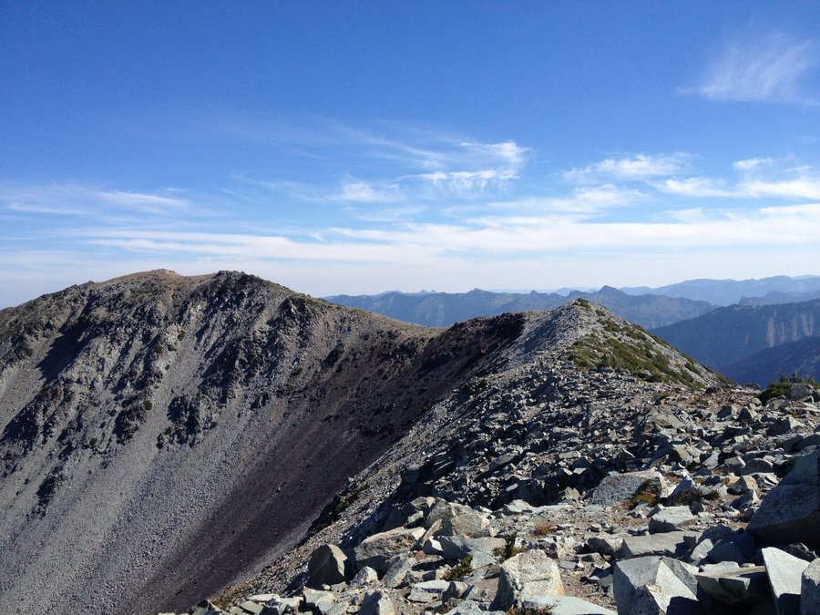
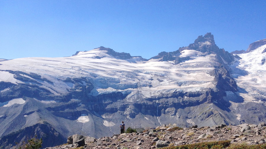
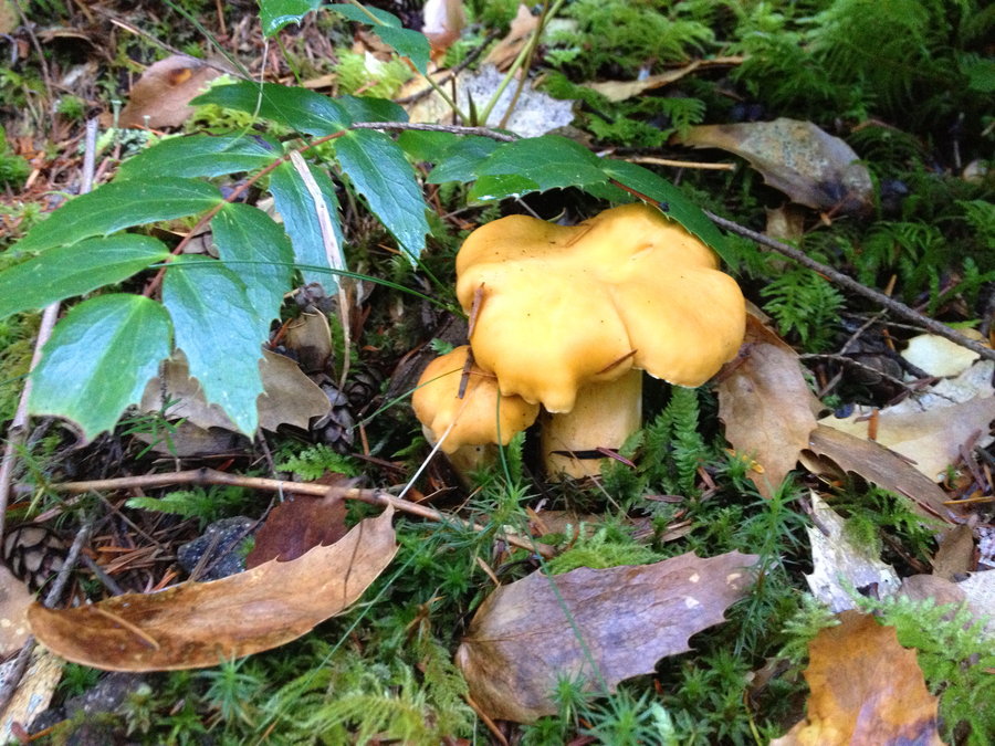
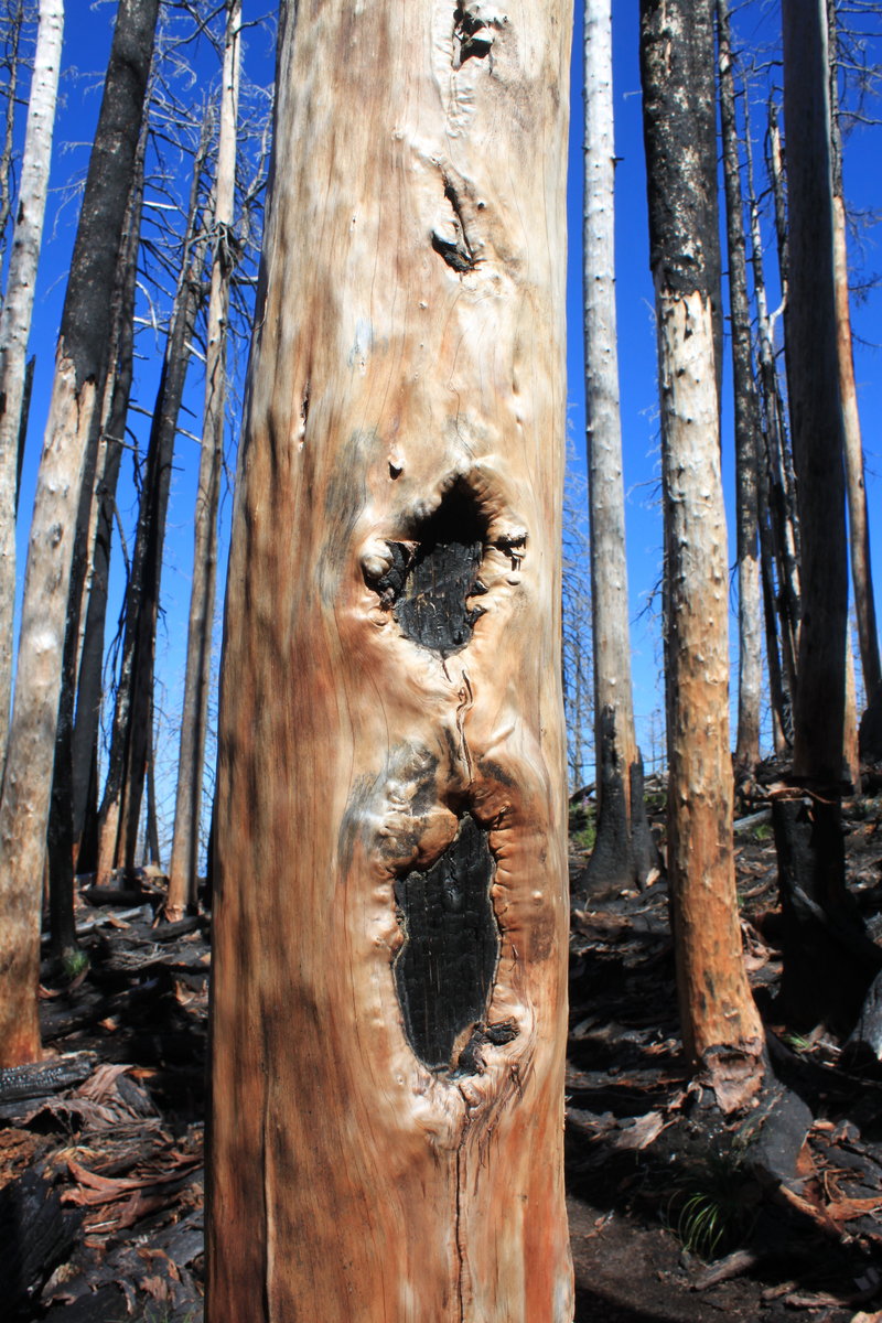
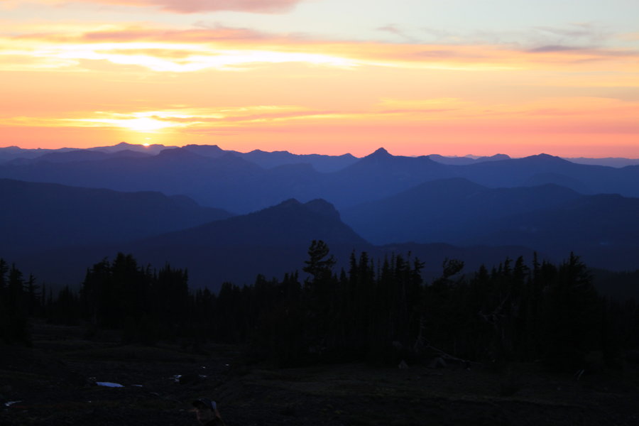
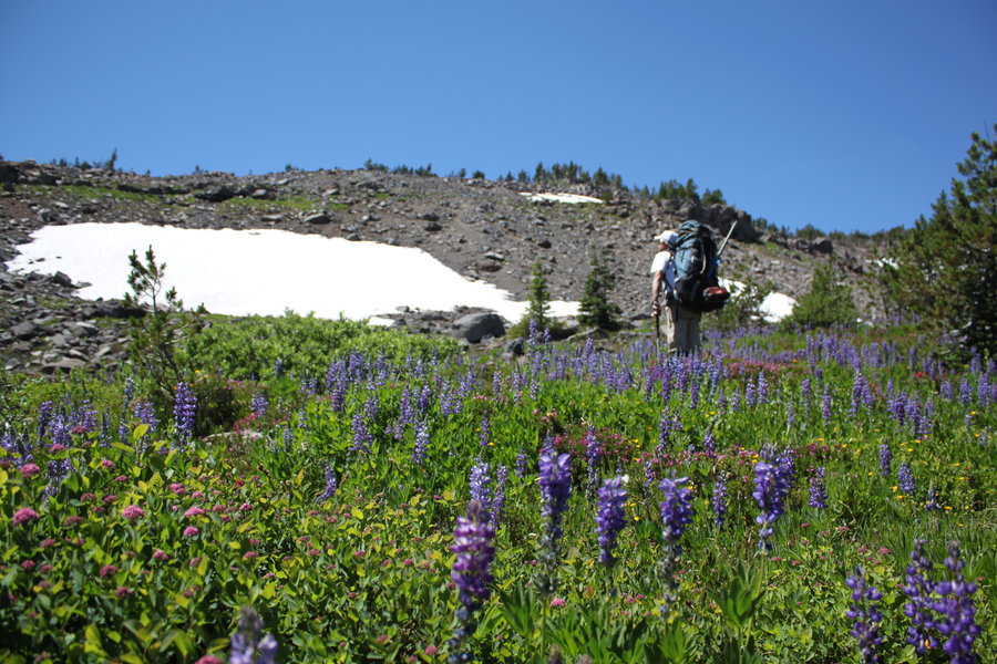
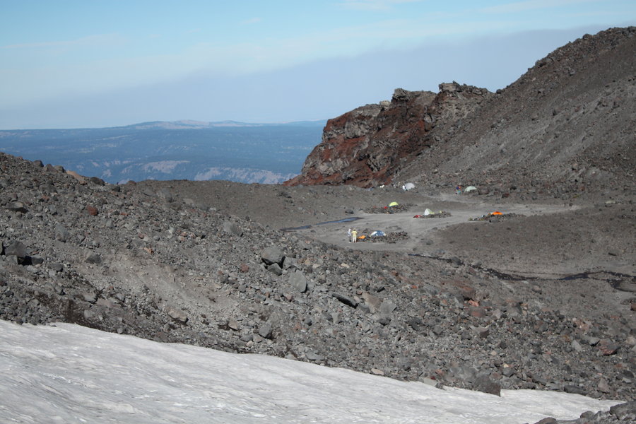
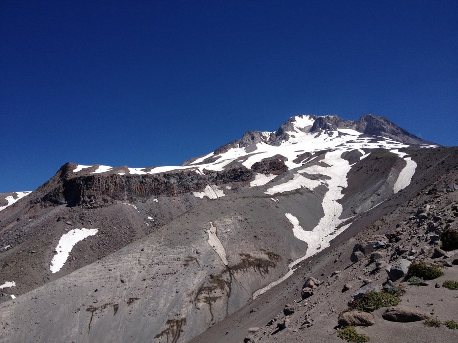
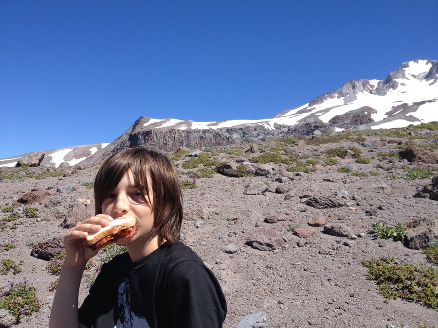
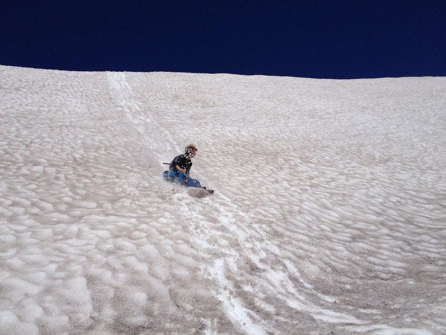
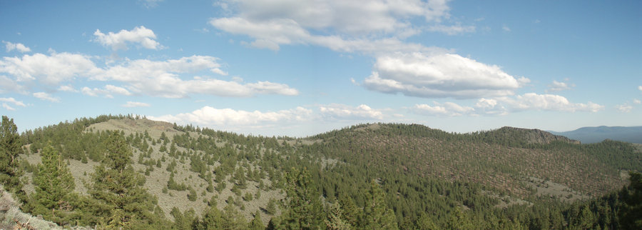
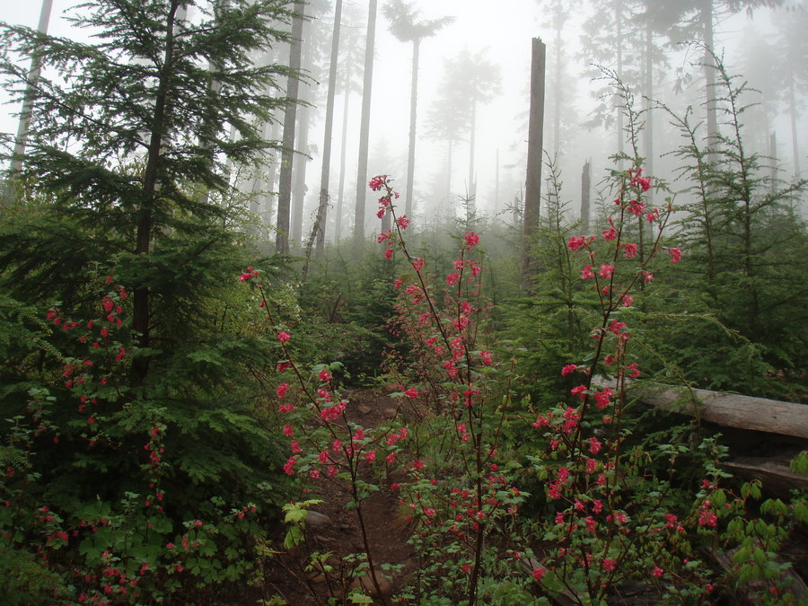
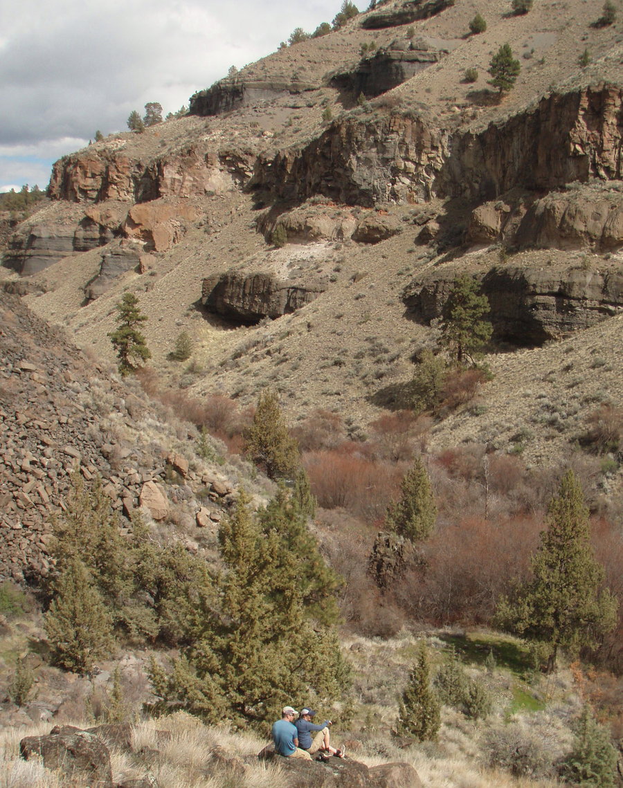
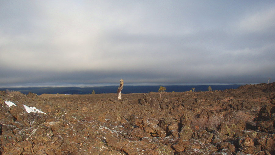
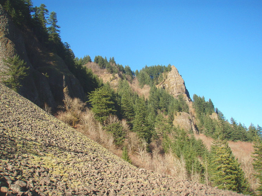
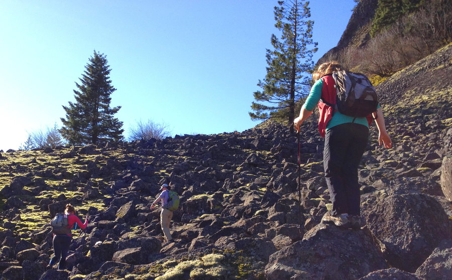
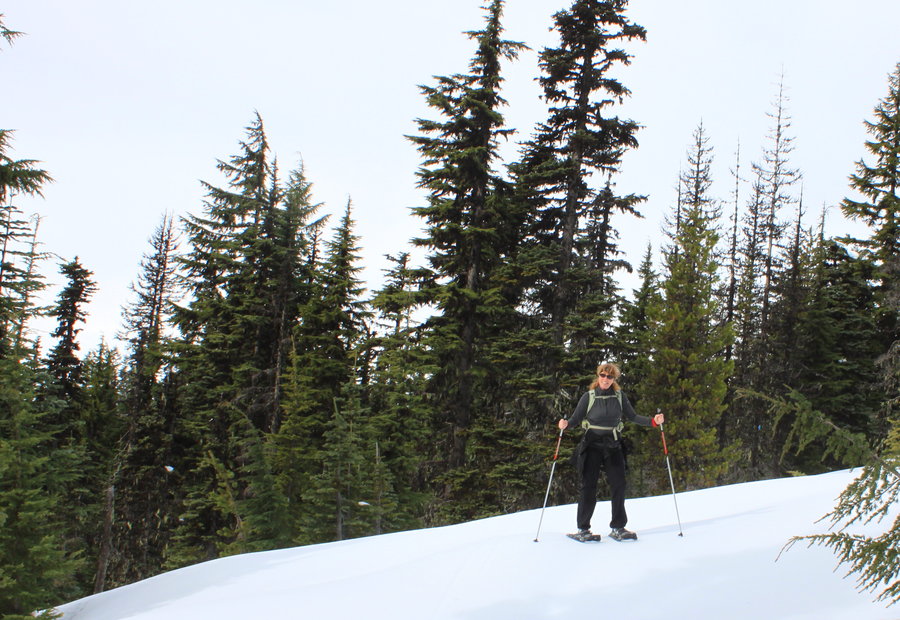
Mossy Scree Fields below Table
4.5 miles of hiking • 500' elevation gain •
Brought a friend and the kids to this amazing wonderland. The area is huge, the views dramatic, and the whole place is covered with thick soft bright green moss. We counted at least 6 vision quest pits.
December 27, 2013


Forest Park
4 miles of hiking • 250' elevation gain •
Out for a romp with the dog we are babysitting. Might have been her first real hike. She was a boundless bundle of joy.
December 25, 2013

Powell Butte
6 miles of hiking • 250' elevation gain •
The main parking lot is closed, so I approached via the Springwater Trail from the east. Only saw one other person in the park on a Sunday!
December 22, 2013

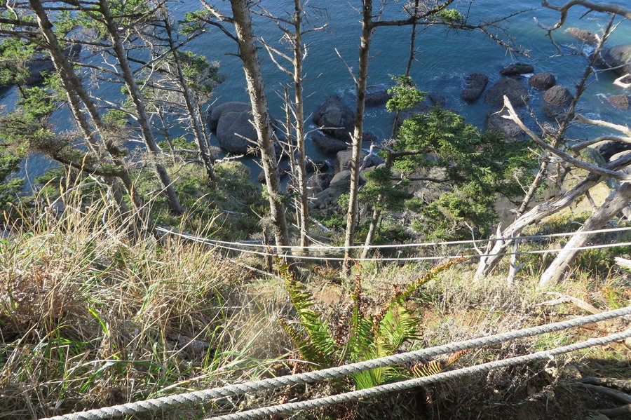
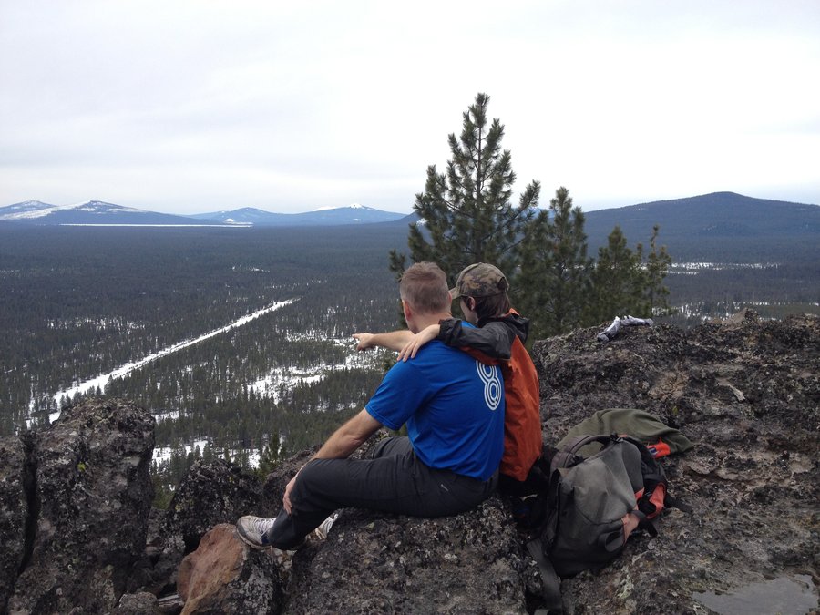
Franklin Ridge and Multnomah Basin
10 miles of hiking • 2250' elevation gain •
Bushwacked up for a long ridgewalk on Franklin Ridge from low down on the Oneonta trail. Fun scrambles.
December 20, 2013


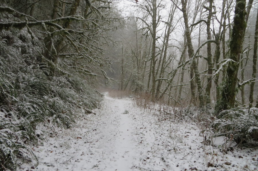
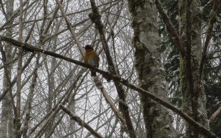
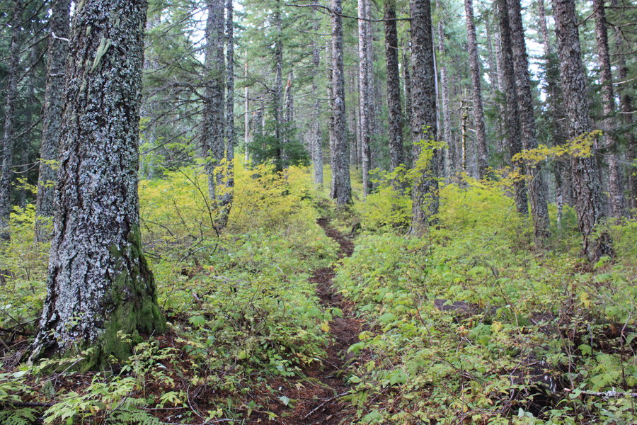
Palmer Mill Area
6.5 miles of hiking • 1500' elevation gain •
Wandering around in the woods in my favorite area on a snowy day. Explored a few side trails that I hadn't ventured on before. Was disturbed to see someone has marked the trees with paint. Does not look like logging plans, just someone making ugly orange trail markers on trees where the trail is quite obvious (it's mostly old roads out here!).
December 6, 2013


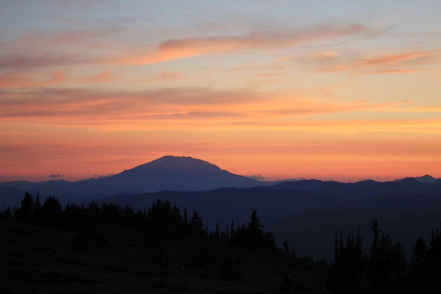
Bonney Butte
6.5 miles of hiking • 1750' elevation gain •
Hiked up the south side from 4890 via the Bonney Meadows Trail 471. Hit snow after half a mile. Signs of snow machines around, but it was quiet on my hike.
November 30, 2013


Crown Pt Basin and Palmer Mill Rd
5 miles of hiking • 500' elevation gain •
More wanderings in the woods on a sunny day.
November 20, 2013

Chanticleer Basin
5 miles of hiking • 750' elevation gain •
I took the old road down from the Women's Forum to Rooster Rock SP via the RR tracks. Had one bushwack detour. Good times rambling in the woods.
November 15, 2013

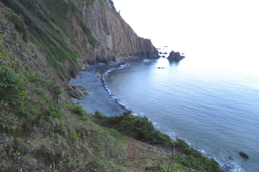
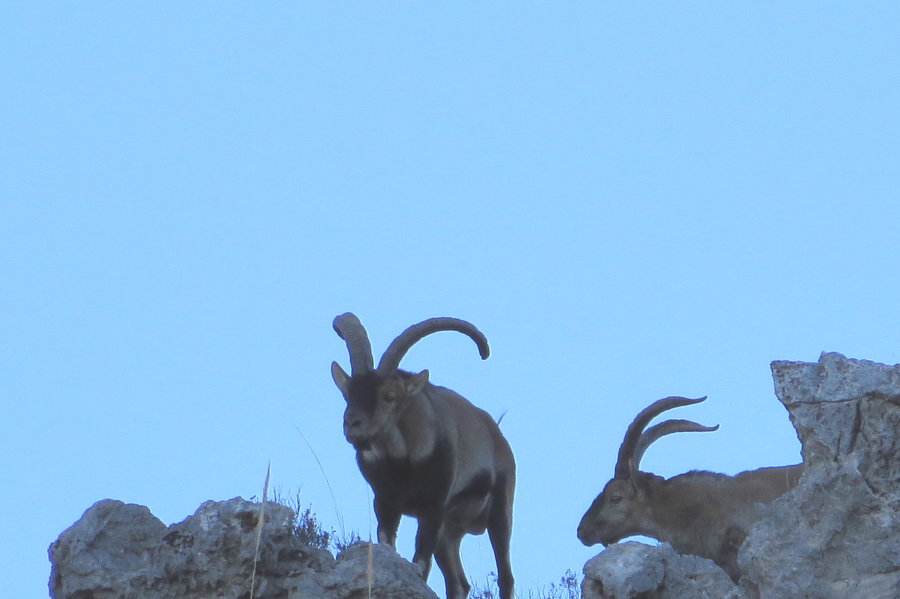
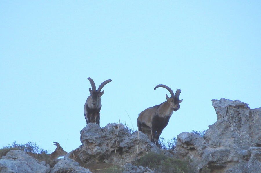
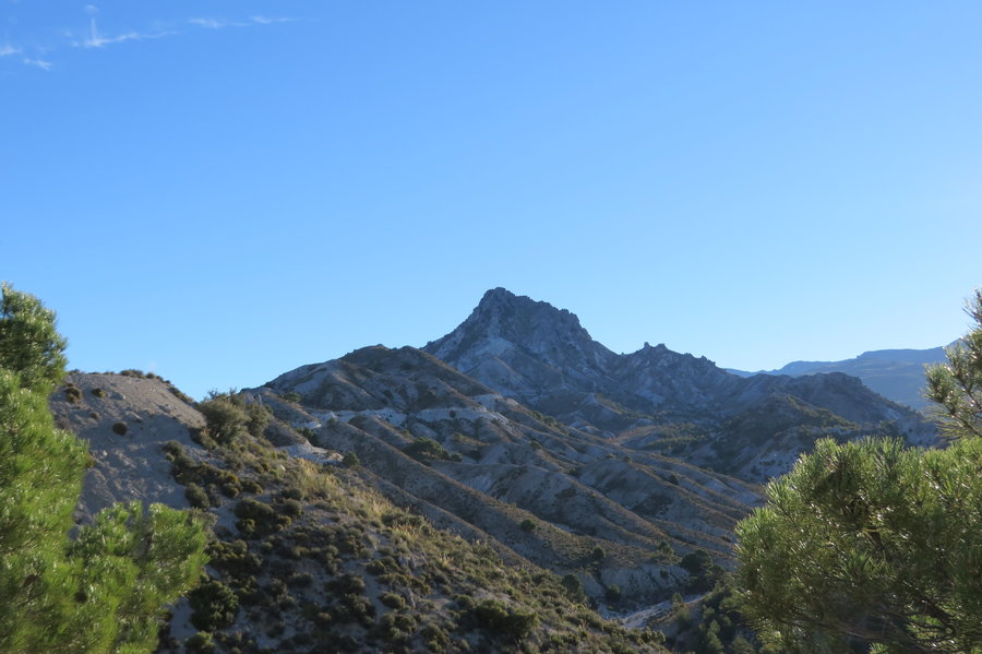
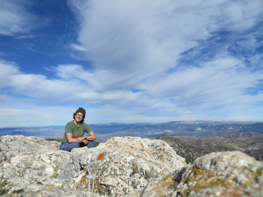
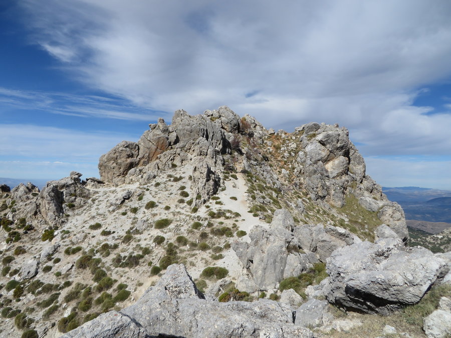
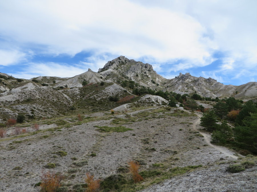
El Trevenque
9.5 miles of hiking • 2750' elevation gain •
I was on vacation with my family in Spain, and was granted a day to go off on a hike. I chose El Trevenque ,located in Sierra Nevada National Park, just south of the Andalusian city of Granada.
November 7, 2013


Larch mtn
5 miles of hiking • 500' elevation gain •
Wandered around upper Bridal Veil/Palmer Mill area. Still lots of mushrooms. Founds some relics
October 20, 2013

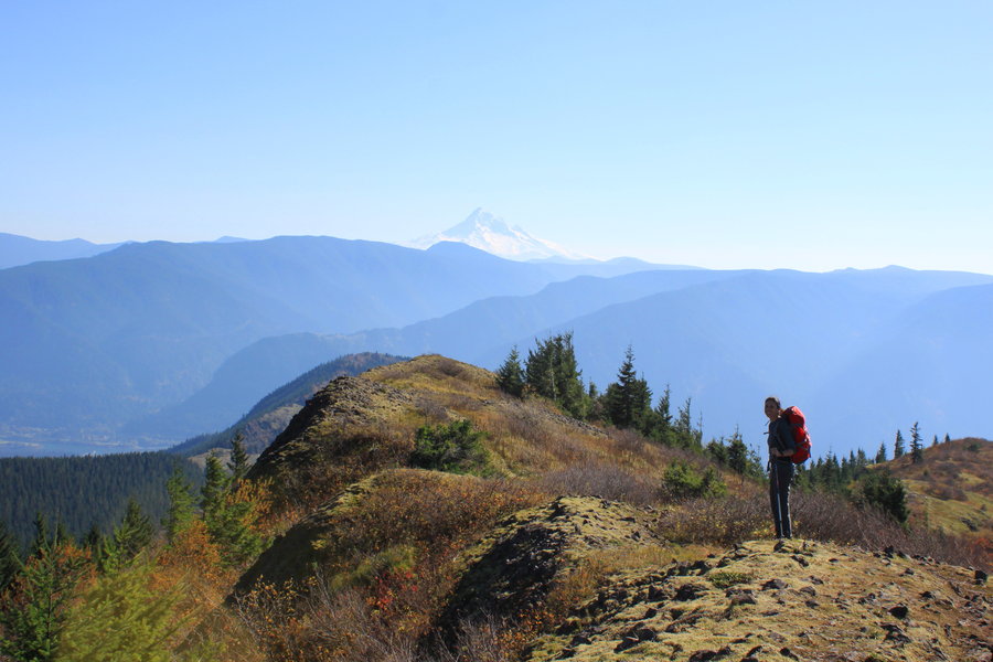
Hardy Ridge
7.5 miles of hiking • 2000' elevation gain •
Got a sunburn today, and saw a phlox blooming on Phlox Point. It's October!
October 17, 2013


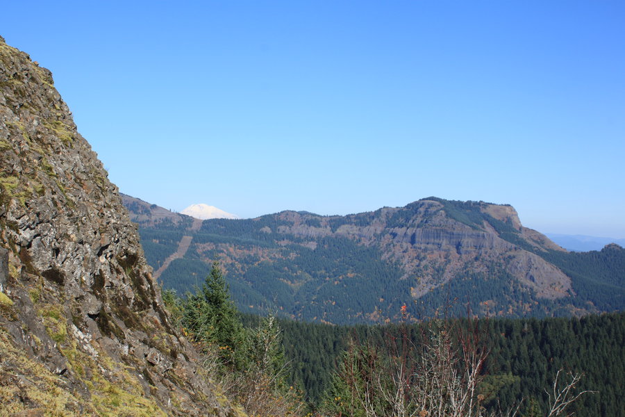
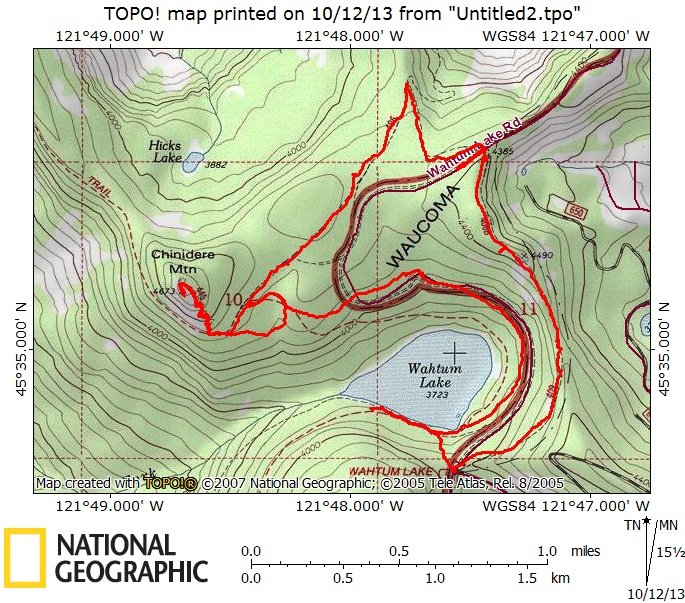
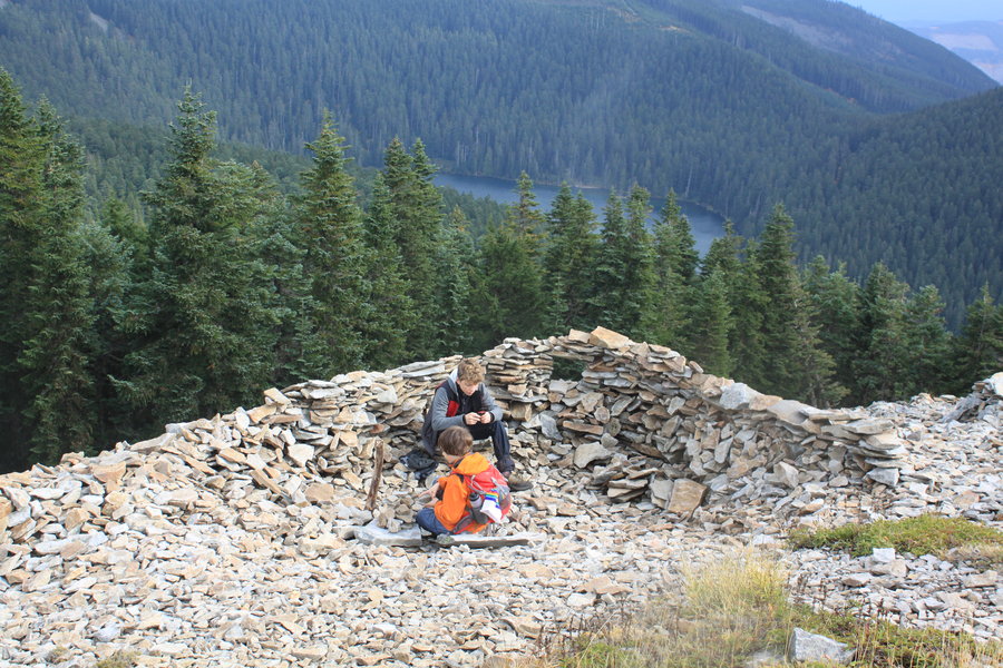
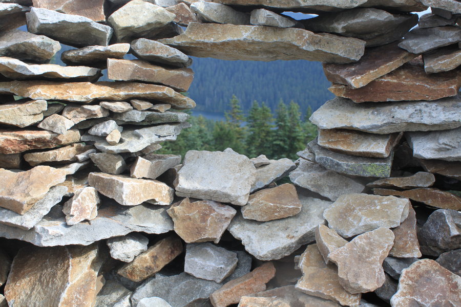
Chinidere
7 miles of hiking • 1500' elevation gain •
No school on my hiking day, so my friend and I brought the kids along. You can still drive to Wahtum Lake, and no snow on any of the summits around here except Hood. We did a nice loop around Wahtum Lake using several of sometimes confusing network of trails. Nice and quiet. Views limited, but fall colors and mushrooms made up for it and helped keep kids engaged.
October 11, 2013


Little Huckleberry
6 miles of hiking • 2000' elevation gain •
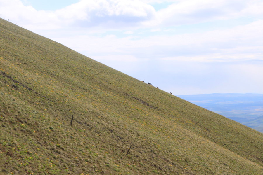
Little Huckleberry is a nice little leg stretcher hike to a former LO site that gives big views of the area. I started early on a frosty morning of this bluebird fall day.
Hiking alone without a dog gives you a much better chance for wildlife encounters and today I saw three elk and two young buck deer near the summit. Grouse in the forest and a rather friendly pika in a scree field on top.
I finished earlier than expected so had an extra hour to wander around in the Big Lava Bed. I had seen the SAR helicopter searching for the lost hiker in the Goose Lake area. It gave a sobering perspective of how vast it is in there. Probably about the worst place you want to be lost. I also visited the Lost creek drainage area looking for a hidden trail. At Lost creek I collected a big batch of chanterelles and watched a dipper diving swimming dipping and chittering-seemingly all for my entertainment.
October 4, 2013


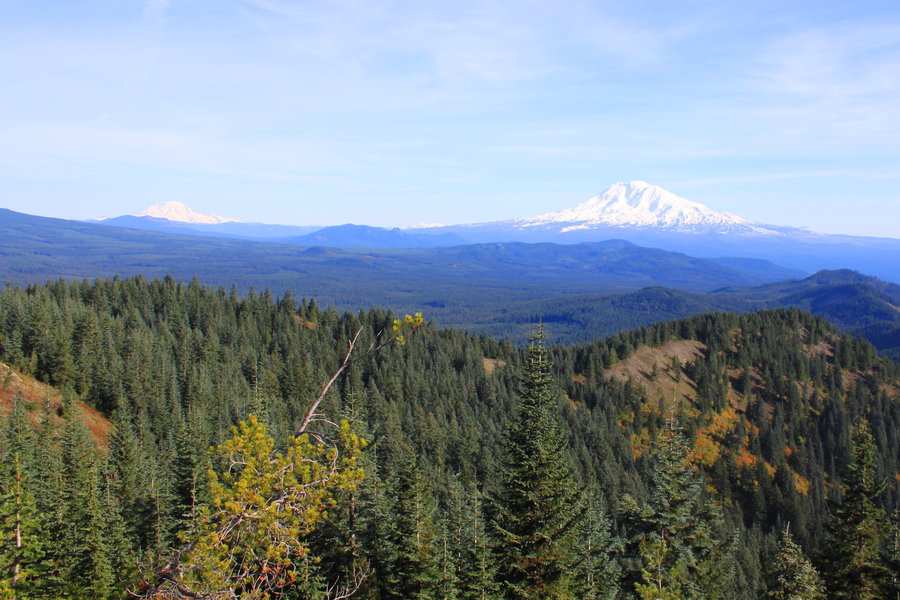
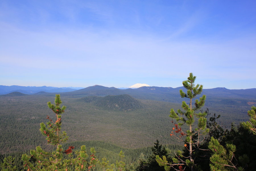
Cold Springs
5 miles of hiking • 1000' elevation gain •
Wet wanderings trying to find parts of an abandoned trail the Trail Advocates are starting to reopen. Should eventually lead all the way down to the Wash Creek/Fish Creek drainage.
September 27, 2013

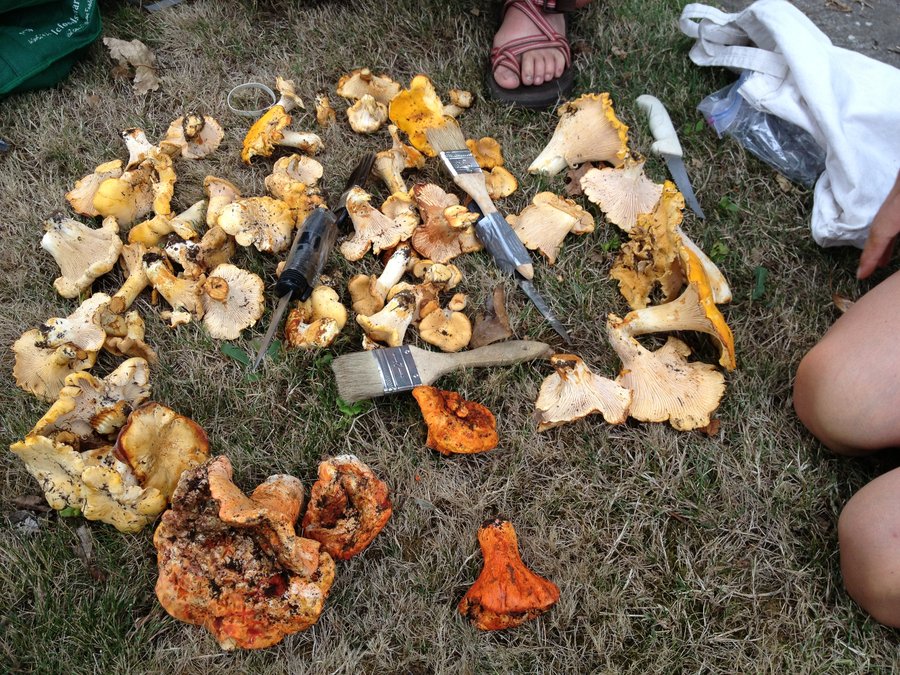
Cedar Mountain
7 miles of hiking • 2250' elevation gain •
Out on a quick hike/mushroom hunt with friends. The woods have already dried out from last week's rain, but we did find enough fungi for each of us to make a nice meal.
September 20, 2013

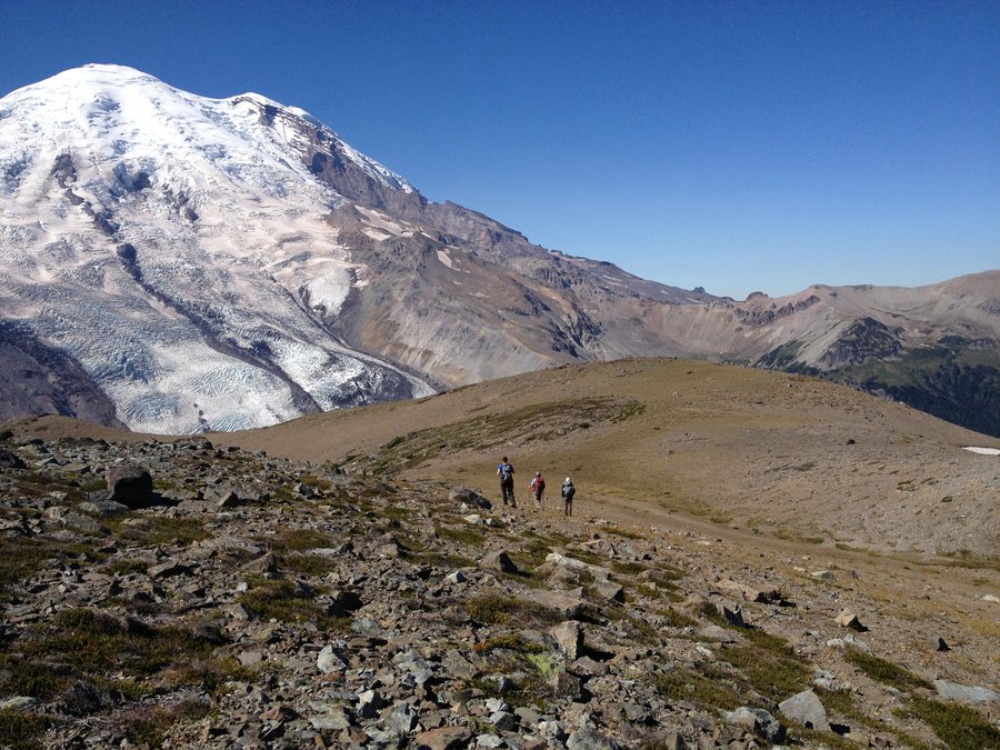
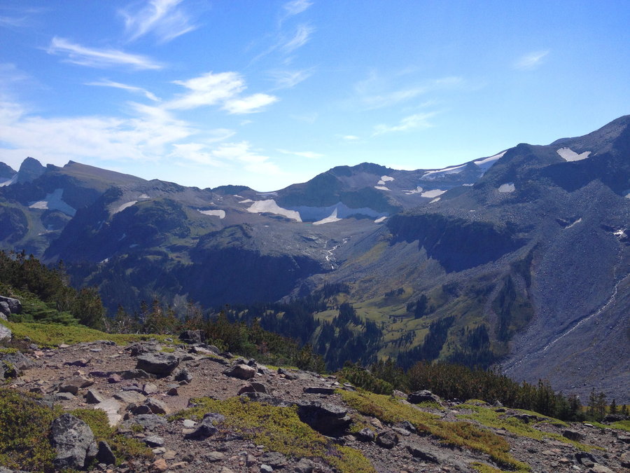
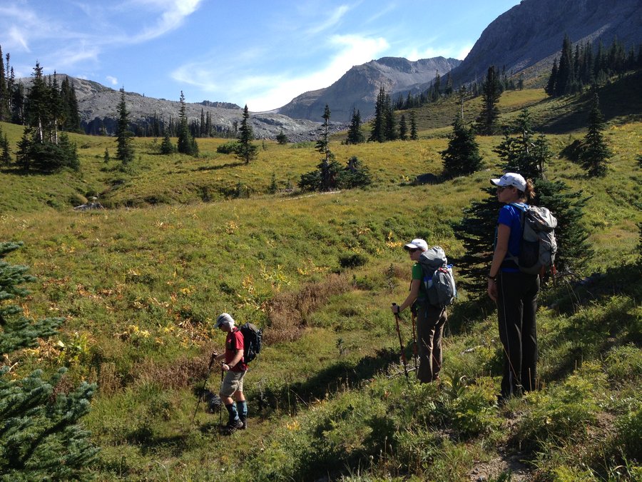
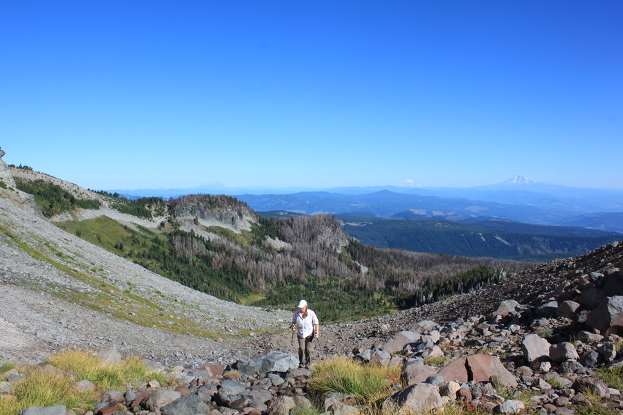
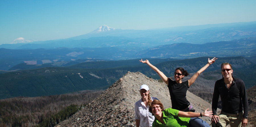
Goat Island Mountain
11 miles of hiking • 3750' elevation gain •
This was a super dayhike. We scrambled up the eastern ridge of the mountain and had 2 miles of "Sound of Music" ridgetop rambling. Epic vistas in all directions, but mighty Tahoma took up most of the forward viewfield. We dropped down through steep hanging meadows to the Frying Pan Valley, rock hopped across the silty creek and entered Summerland. Joined the hordes on the Wonderland Trail for the hike out.
September 14, 2013

Larch/Bridal Veil
5 miles of hiking • 500' elevation gain •
Wandering around on old logging roads, looking for the first mushrooms of the season. Success!
September 8, 2013

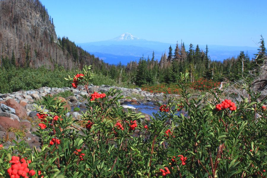
Elk Cove
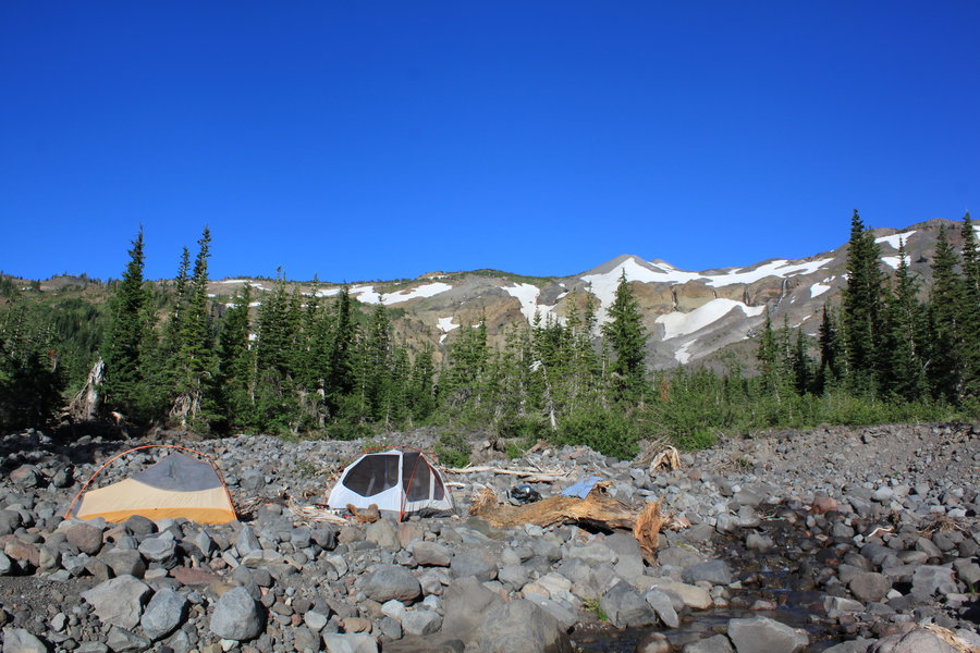
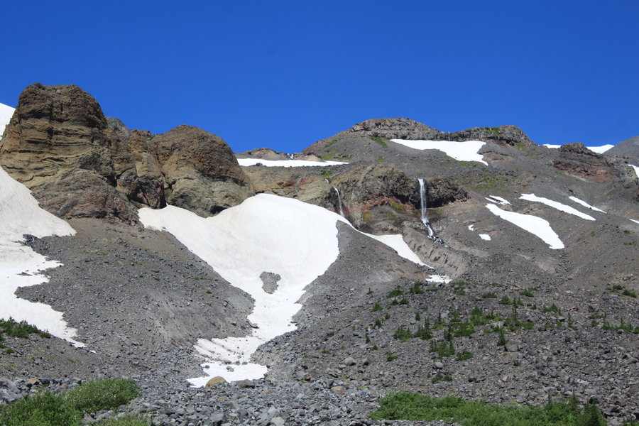
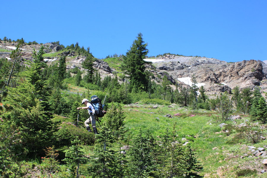
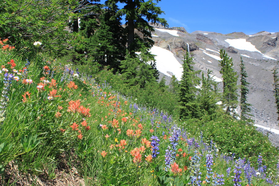
14 miles of hiking • 3000' elevation gain • 1 night
Nice overnighter loop using the eerie half burnt Elk Cove and Pinnacle Ridge Trails. We connected the two THs using a bushwack instead of walking the road(per recent report by Adam Schnieder). The Timberline Trail was pretty busy this weekend, we were glad we arrived in the afternoon to claim a nice roomy campsite at the Elk Cove/Tline junction.
Flowers still going strong above the Timberline Trail, plus ripe huckleberries and mountain ash berries. Visited the edge of the Coe Glacier.
August 30 – August 31, 2013

Taconic Crest Tral
6.5 miles of hiking • 750' elevation gain •
Took the Taconic Crest Trail to the Snow Hole. The snow hole is really just a deep crack in the ground, supposed to have snow in it year round, but global warming has changed that and locals say it is a rare year that the snow persists.
August 23, 2013

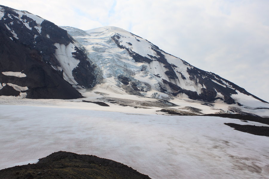
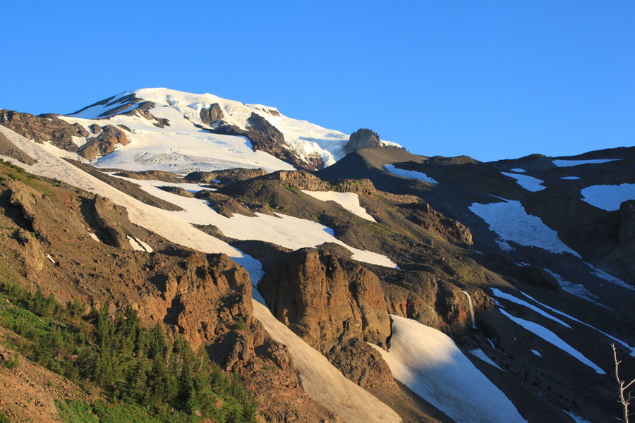
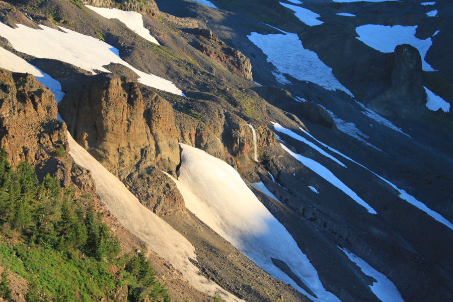
Mt Adams North
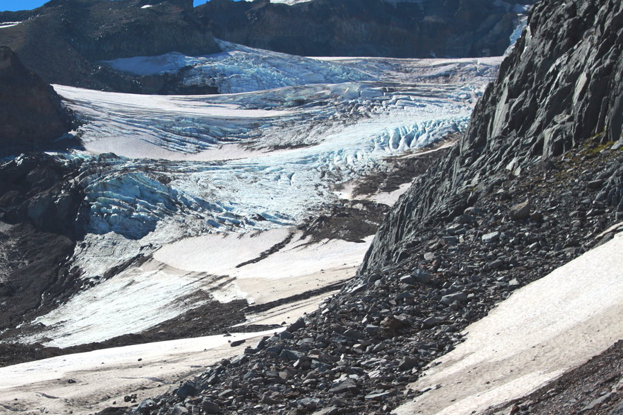
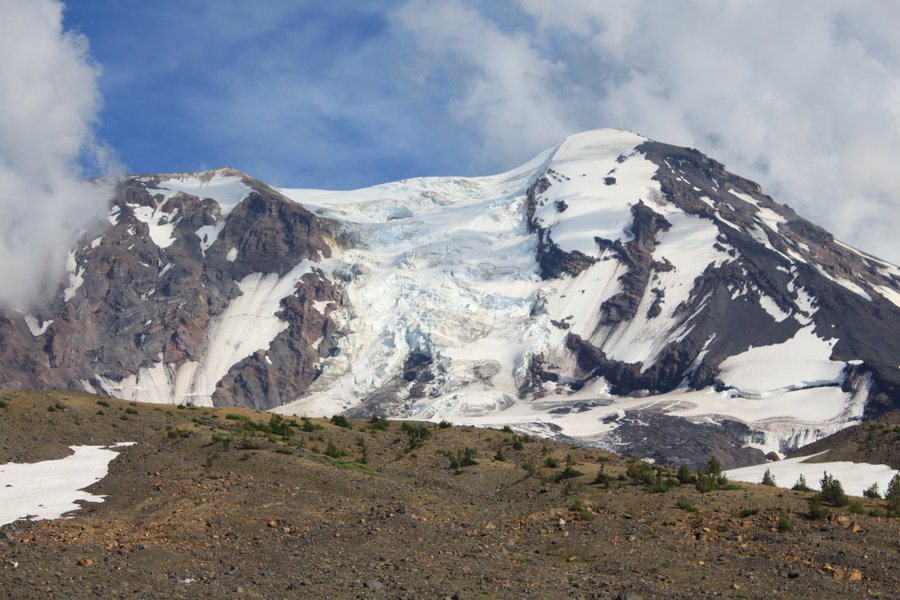
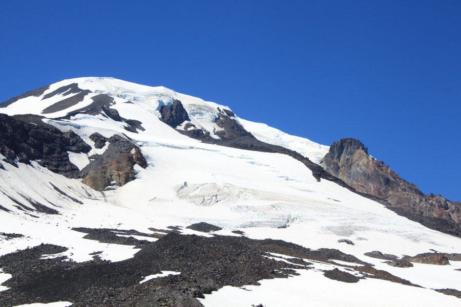
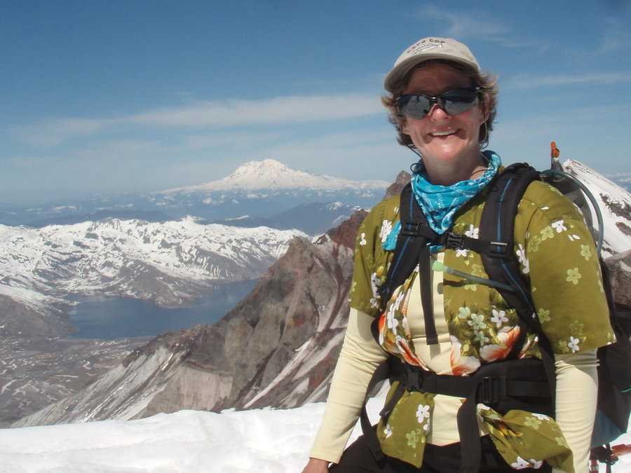
16 miles of hiking • 3750' elevation gain • 2 nights
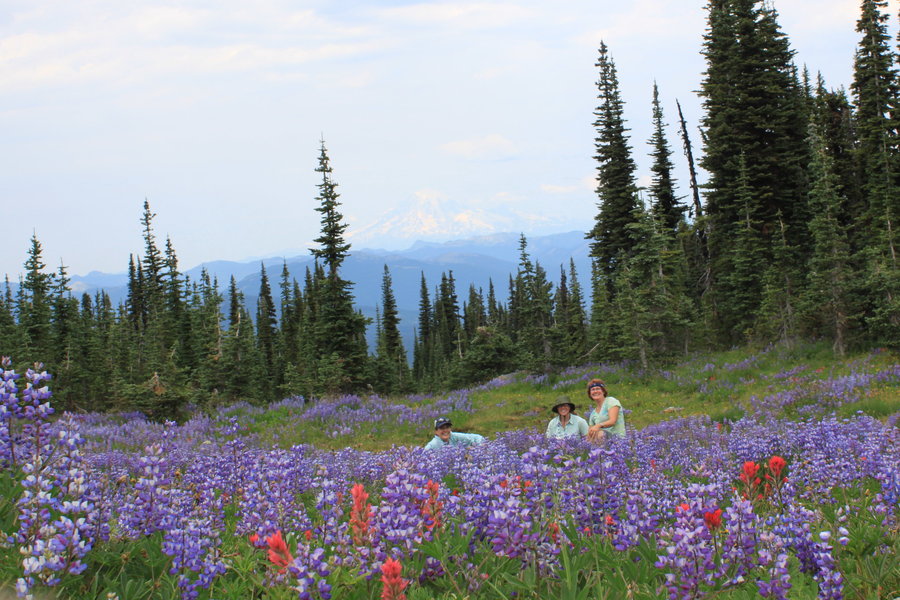
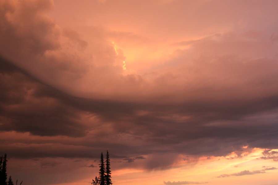
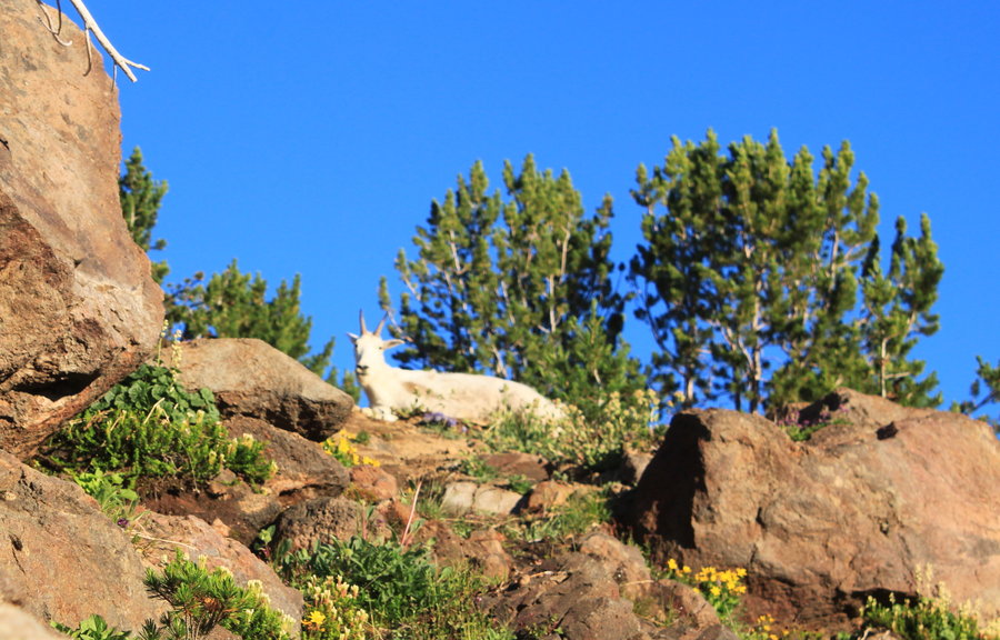
Spent two nights in alpine wonderland on the NW flank of Mt Adams below the Adams Glacier. Marmots, goats and awesome wildflowers. Amazing sunsets and a frightening thunderstorm at dusk.
August 8 – August 10, 2013


 2
2
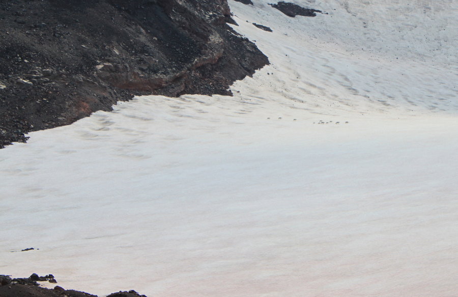
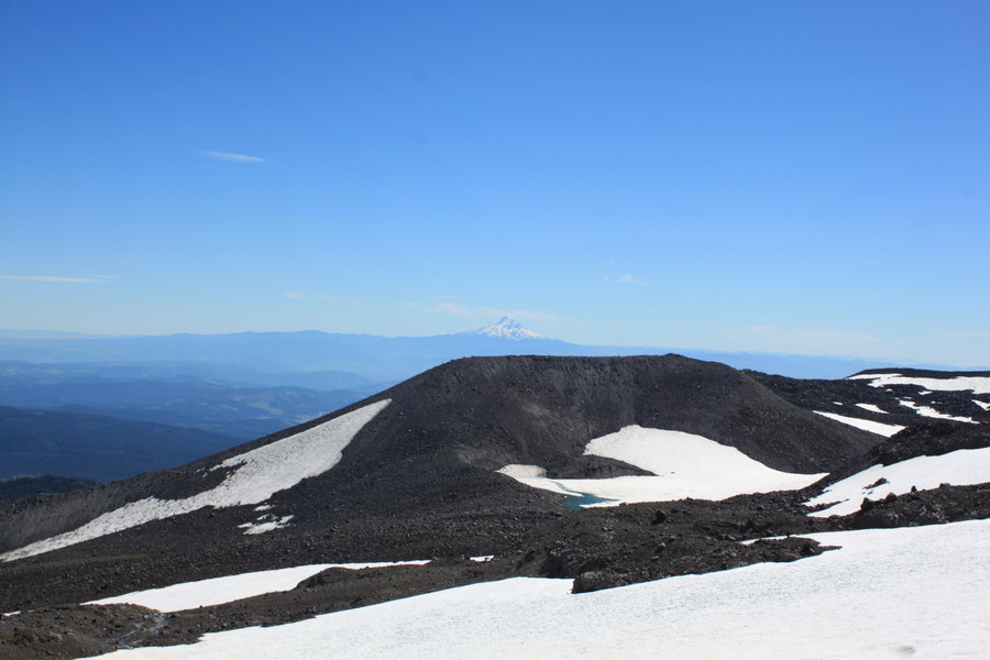
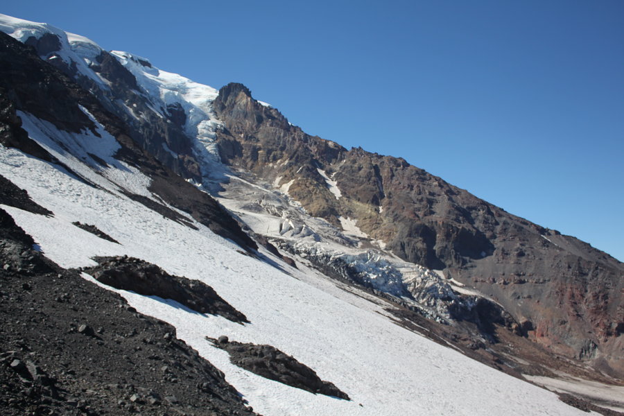
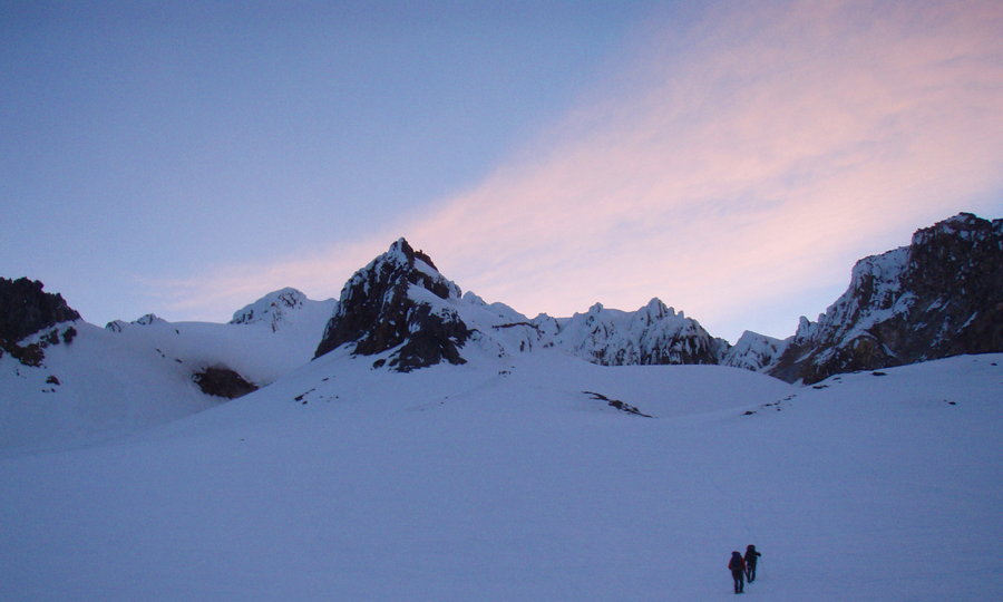
Hellroaring Canyon
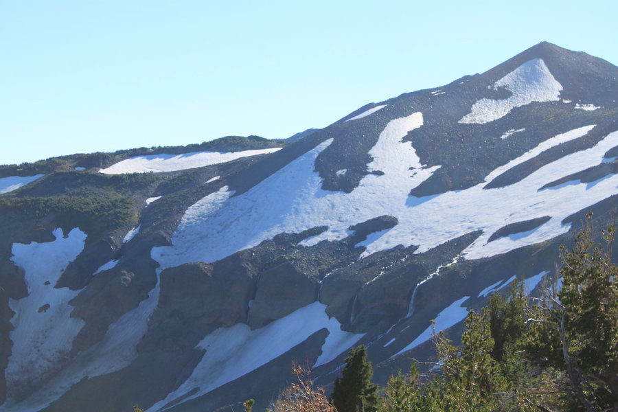
17 miles of hiking • 5500' elevation gain • 2 nights
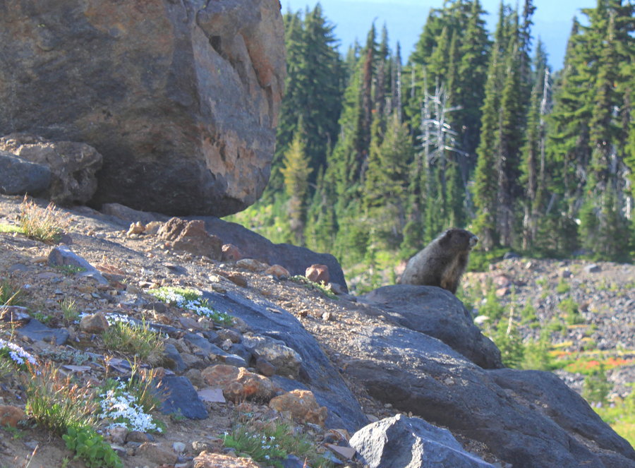
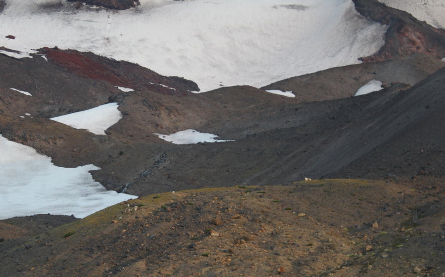
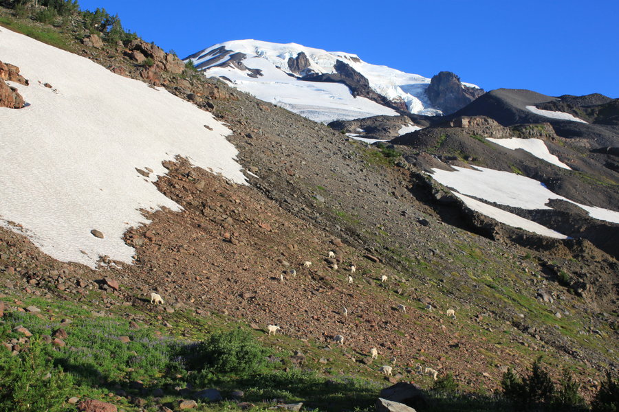
Big Adventure on the east side of Mt Adams. A friend and I attempted to hike the Ridge of Wonders from Bench Lake to Sunrise Camp. It was extremely hot on our fist day. My friend's pack was too heavy. We ran out of water on the dry ridge. We began to get thirsty looking at all the waterfalls shooting over Hellroaring Canyon (there were a few snowfields left to melt if it came to that). At about 7000 feet we came to a section that was just not passable in our condition. If we had smaller packs and more energy we would have attempted it, but we decided to drop down into the canyon. I had done a similar trip three years ago, descending from Lil Mt Adams to Heart lake. However the gully we descended on Friday was treacherous and we had to take off our packs and down climb a few sketchy scramble sections. Anyhow, we dropped 1500 feet down to the Hellroaring Canyon floor and it was just beautiful! Our campsite for the night was spectacular.
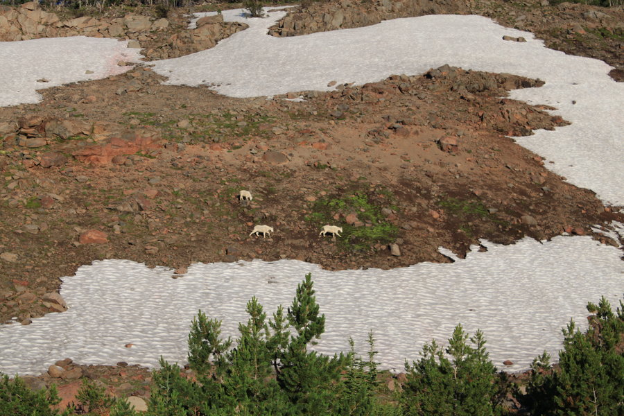
On Saturday we climbed out of the canyon on the southwest side through an idyllic hanging meadow. I set up my camp in an alpine wonderland on the canyon rim and my friend went home. I decided to head up to the Mazama glacier. Two Mazama climbing groups were camped at Sunrise Camp. One had just summited, the other was preparing to climb the next morning. Saw a goat herd and some marmots.
The next morning I awoke to sunrise lighting up the mountain and waterfalls, and spied another goat herd on the bench above me getting up out of bed. Watching them graze the hillside as I had my oatmeal and coffee, well it just doesn't get any better than that. I can die now. What a great trip.
July 26 – July 28, 2013


Zigzag canyon
5.5 miles of hiking • 1750' elevation gain •
Had plans to bring the kids over to Mississippi Head, but it was just a little too much for them. We had fun wandering around above Timberline, and glissading some of the remaining snowfields.
July 19, 2013


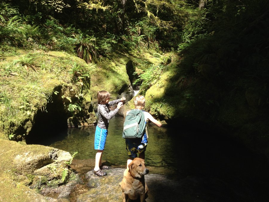
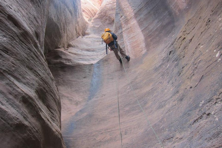
Duncan Creek
4 miles of hiking • 750' elevation gain •
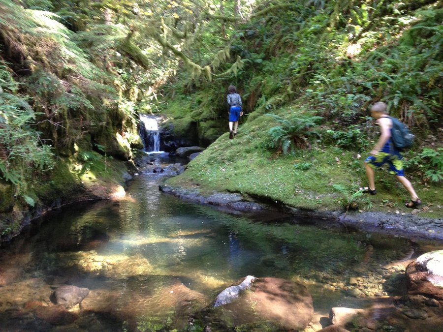
Canyoneering with kids, what a hoot! Pools, grottos, waterfalls and a beautiful forest.
July 15, 2013

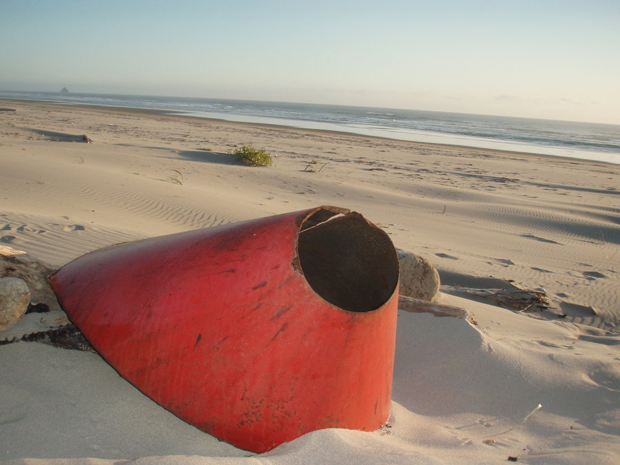
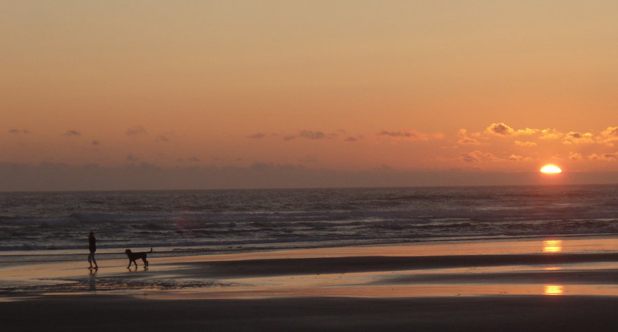
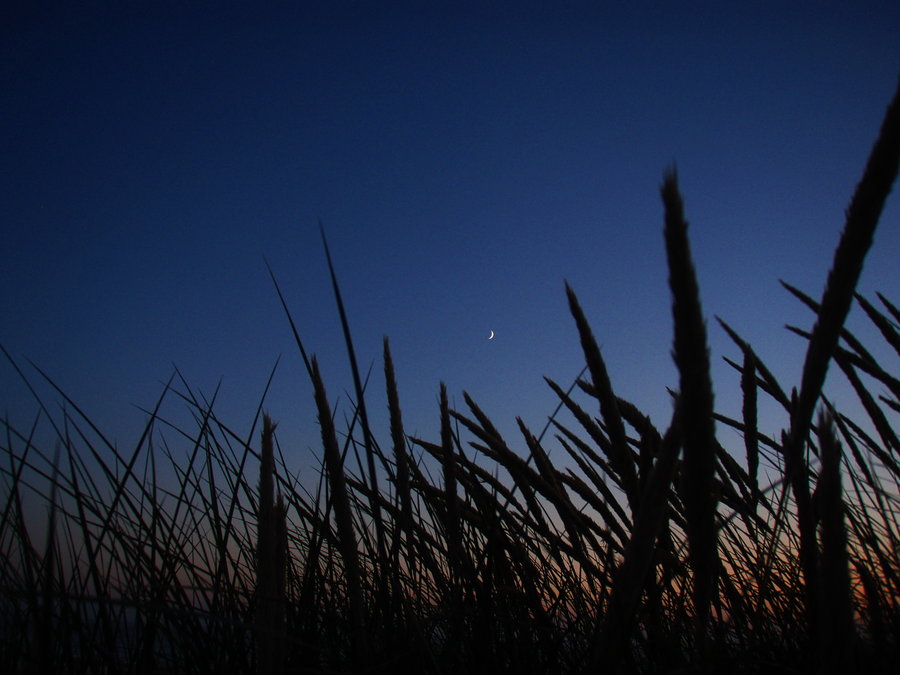
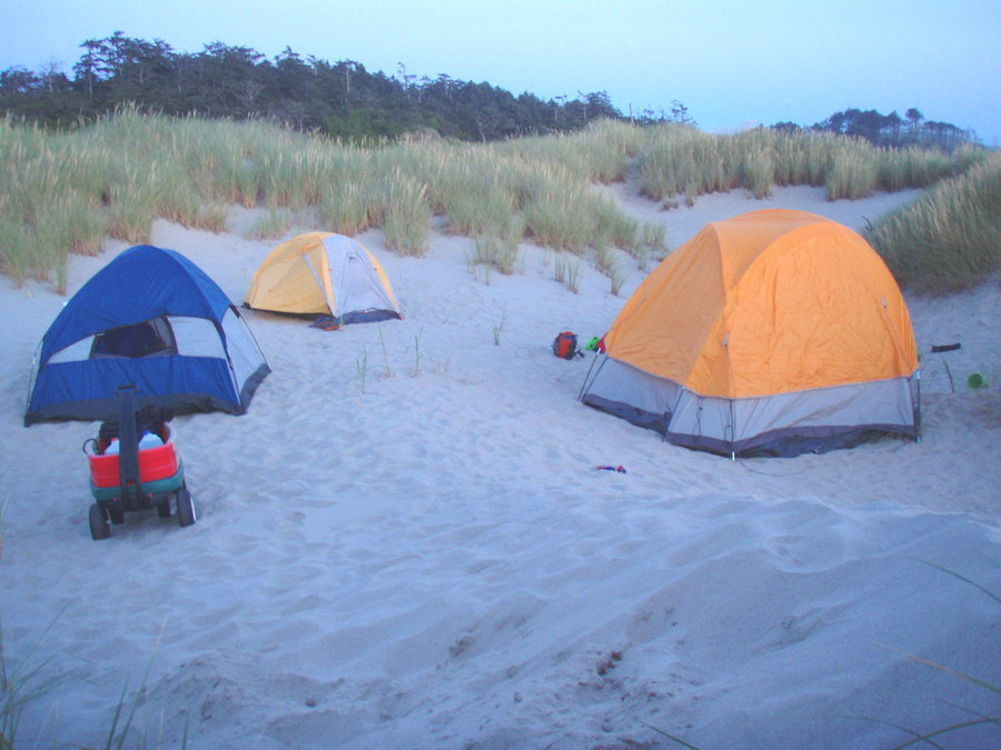
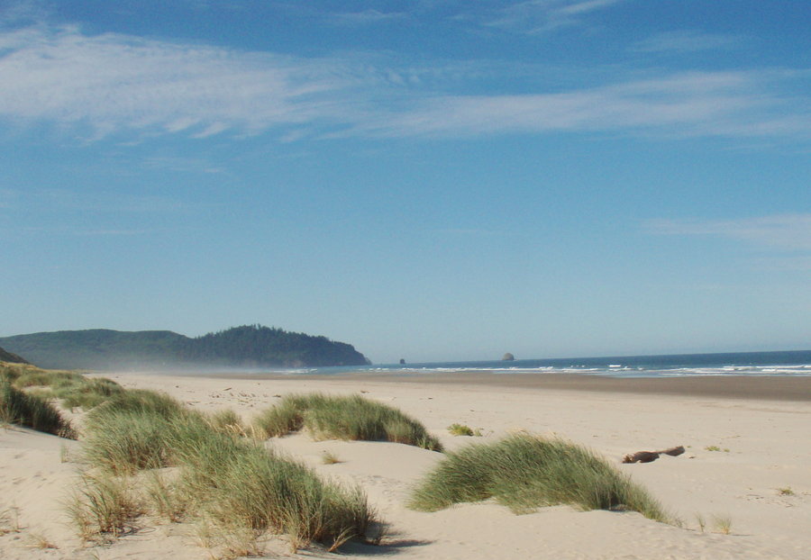
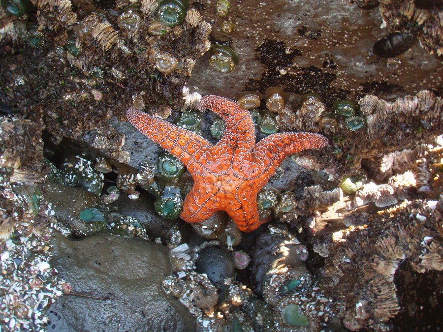
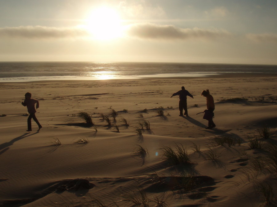
Bayocean Spit
10 miles of hiking • 0' elevation gain • 2 nights
Fun times camping on the beach. Gorgeous sunsets and amazing stars at night. Sand in every crevice of our bodies, Kids had a blast. Sand broke my camera, hope I can repair it and recover those photos!
July 12 – July 14, 2013

Pine Mountain
6 miles of hiking • 1000' elevation gain • 1 night
I was up here for a geocaching/stargazing event. Took an afternoon stroll/scramble around the southern ridgetops of the mountain.
June 29 – June 30, 2013


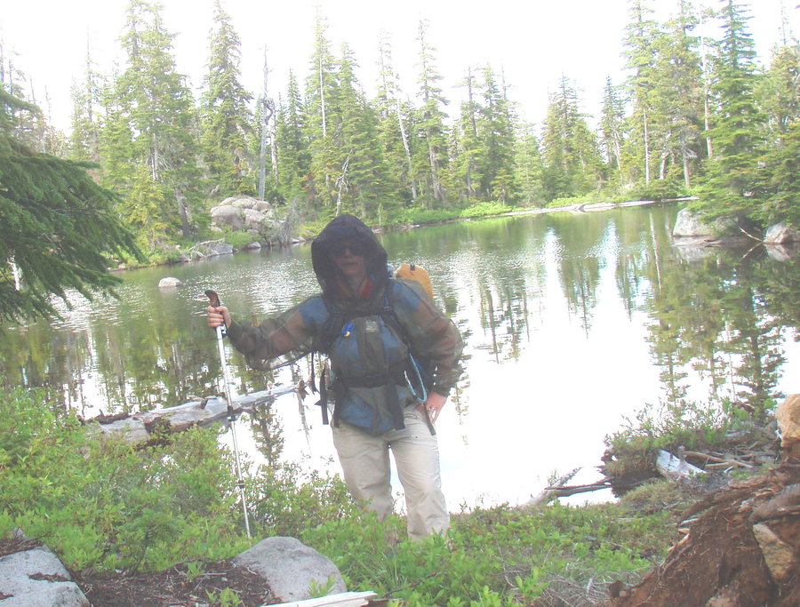
Olallie
16.5 miles of hiking • 3500' elevation gain • 1 night
My first time visiting this beautiful area. In the morning I hiked Olallie Butte. What a fantastic summit with great rock formations and bits of an old lookout.
In the afternoon, I drove over to Olallie Lake and took the Red Lake Trail and the Top Lake Trail to the PCT and camped at Upper Lake. Had a nice evening hike south on the PCT to Ruddy Hill. Mosquitoes were bad in the Upper Lake area, but not an issue around Olallie Butte or Olallie Lake. I hope to go back later this summer when buggies are gone!
June 28 – June 29, 2013

Hoyt Arboretum
4 miles of hiking • 250' elevation gain •
Evening jaunt with my husband. Surprisingly quiet on the trails this evening.
We saw an owl! It swooped right over us and watched us from a nearby branch rather annoyed. It might've been a barred owl, but it did not vocalize.
June 27, 2013

June 21, 2013


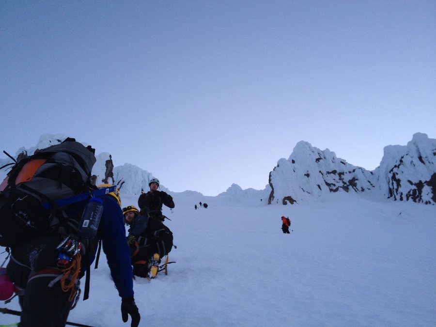
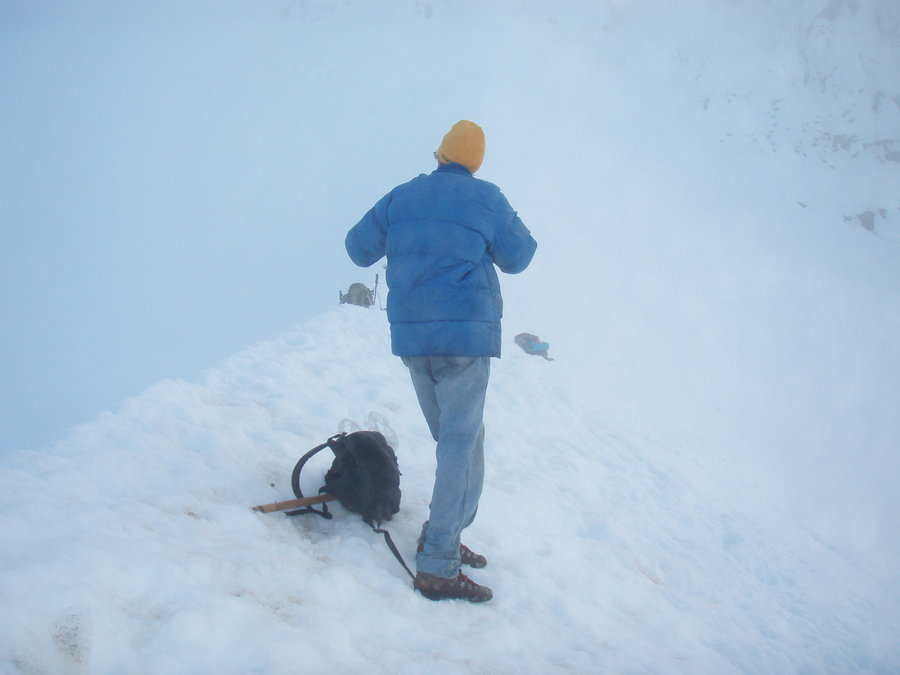
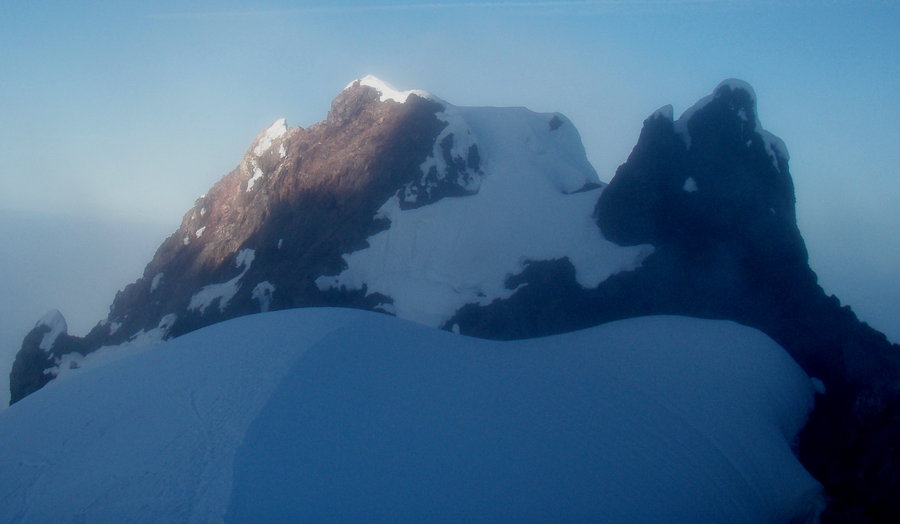
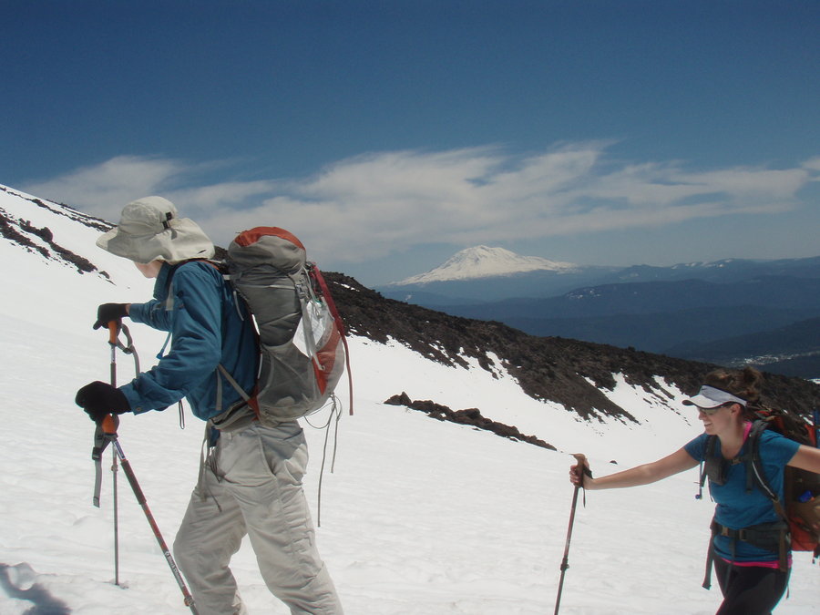
Mt Hood Old Chute
7 miles of hiking • 5250' elevation gain •
Went with a small Mazama group, and got to the summit today. Started earlier,got up there very fast, ahead of the hordes. Snow much firmer this week for ascent, but too icy to glissade down from Hogsback, then turned to mashed potatoes below Palmer on the return.
Very busy today. I ran into a friend on the summit!
I forgot to put my camera battery in, so only took a few phone pics, but maybe I'll post some from the team.
June 15, 2013


Tumala Mountain
4 miles of hiking • 750' elevation gain •
I brought my son and a friend up to do this hike on a lovely day. We took the Old Baldy trail. Still some snow patches, but navigation is not a problem. On the way up, we met Dennis, creator of the NWhiker website, http://www.nwhiker.com/. He is adding this trip to his huge library of virtual hikes.
June 9, 2013

 1
1
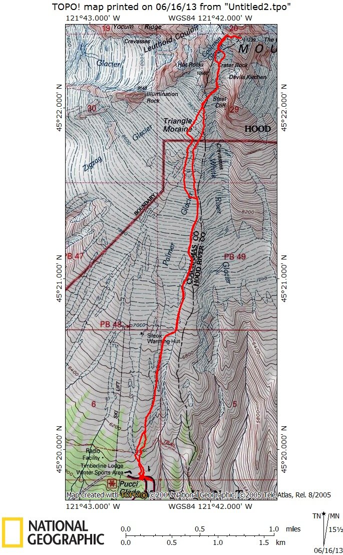
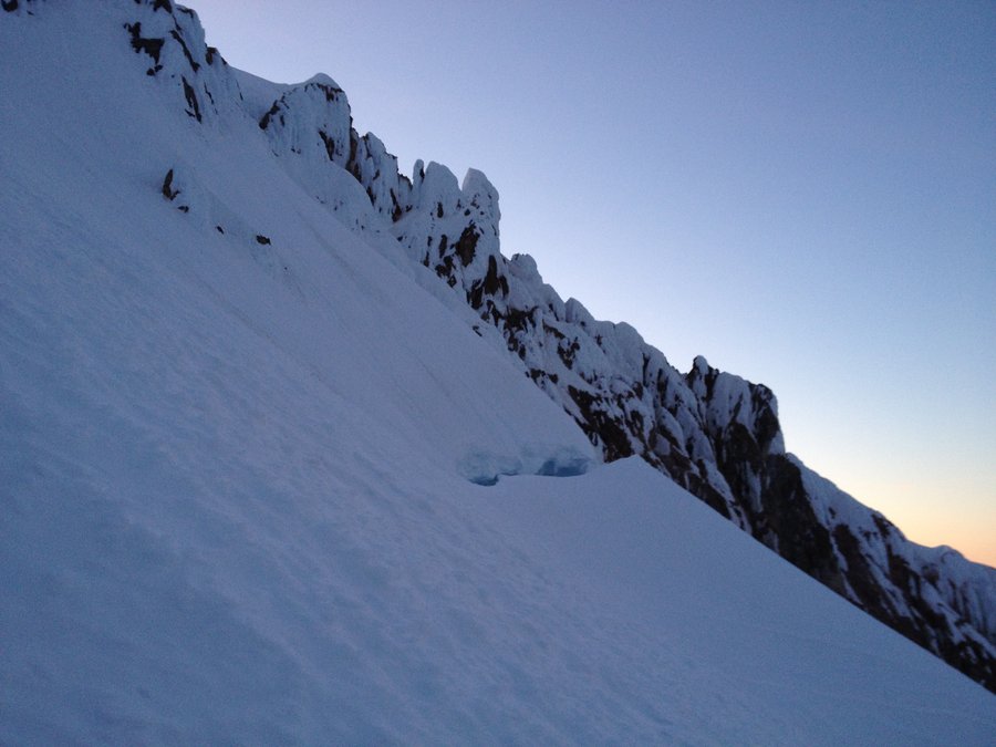
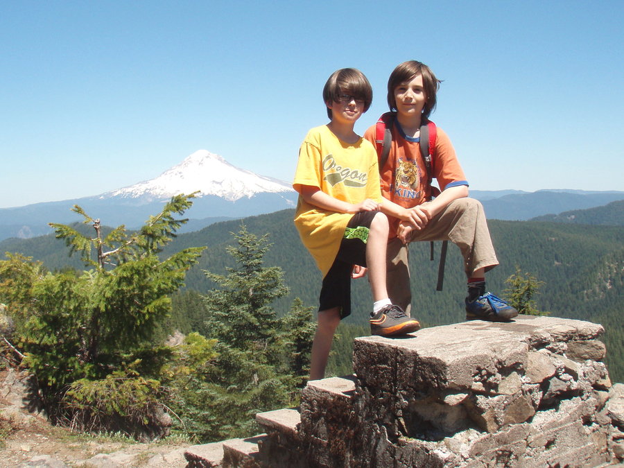
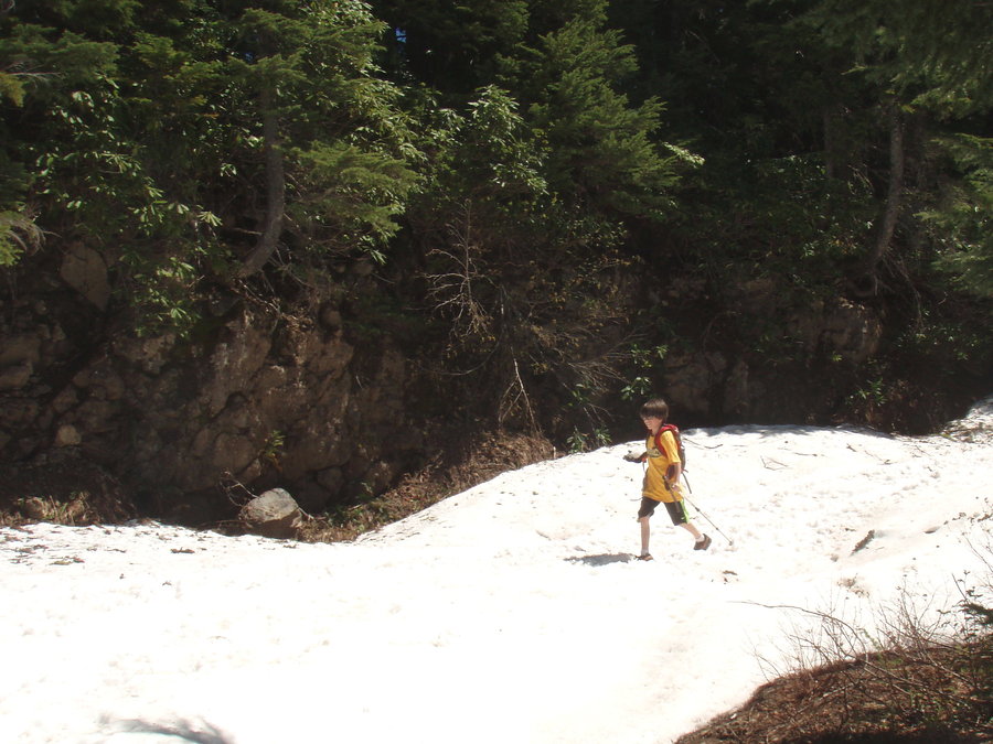
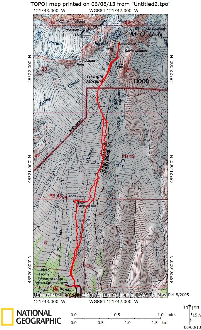
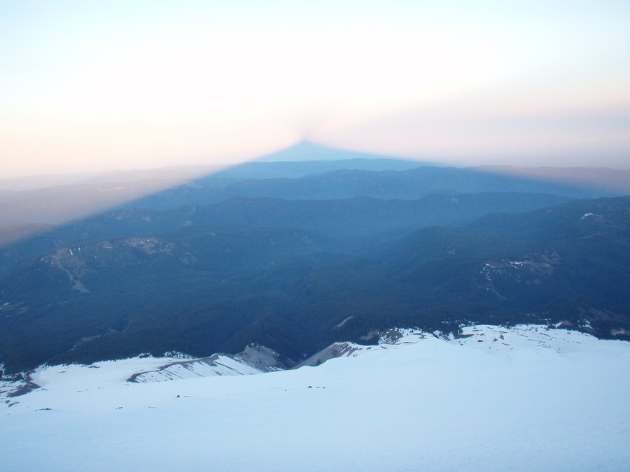
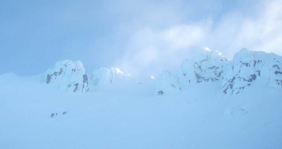
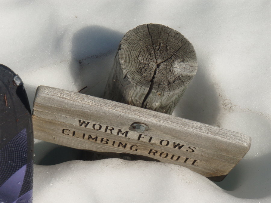
Crater Rock Mt Hood
6 miles of hiking • 4500' elevation gain •
New moon and a very dark and quiet morning on the mountain. Clear until about 7am but windy.
Feeling strong at the Hogsback, but I was alone and a little scared by the looks of the traverse to the Old Chute. One rope team crossed it, but two other groups turned back here. I decided that was enough for me. I'll have to summit another day( or year).
June 7, 2013


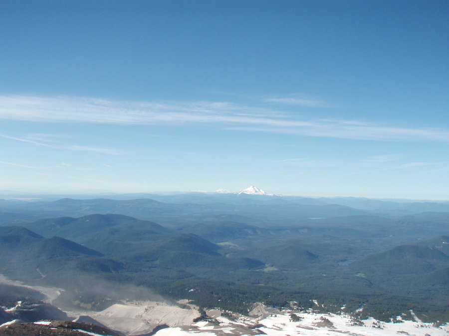
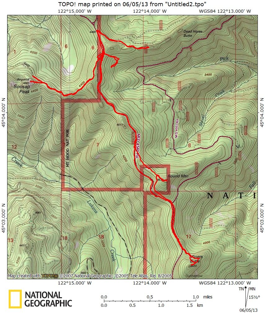
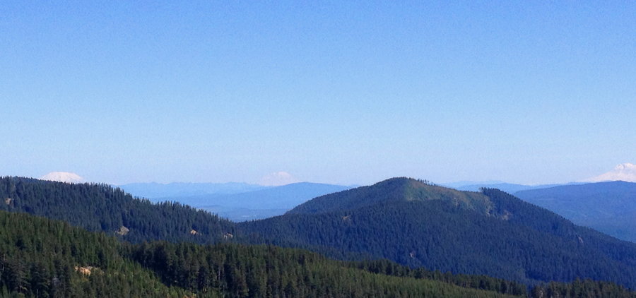
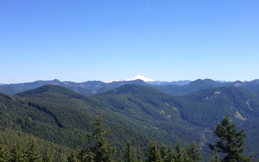
Soosap Peak and then some
11.5 miles of hiking • 2000' elevation gain •
Wandered around up in the Clackamas Foothills visiting Miner's Butte, Round Mountain and Soosap peak. Stumbled across some old abandoned trails and artifacts. Fun times on a gorgeous day.
June 4, 2013


June 3, 2013
 2
2
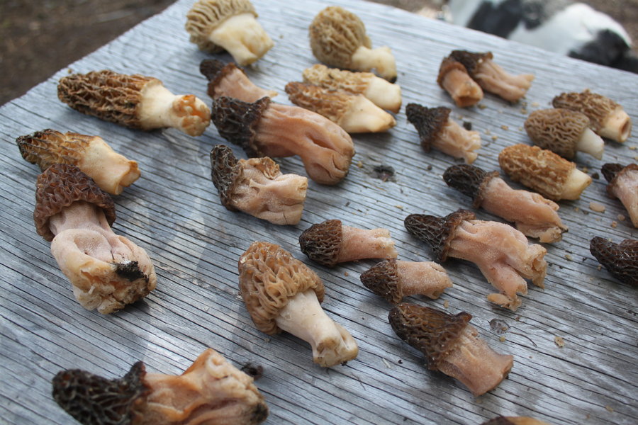
Badger Creek Wilderness
10.5 miles of hiking • 3000' elevation gain • 1 night
Our mission was to find some morels on a quick overnighter. We chose Romann's trip described in the PH Field Guide, but in the reverse direction, starting at the Little Badger TH.
We hiked up the Little Badger Trail, and set up camp near Helispot 122 which has a spring nearby. We then went cross country, ambling up the nearby ridge looking for morels. I think the knob we circled is called "Felt Tip". It was a very pleasant activity- slowly wandering around in the woods staring intently at the ground and noticing things you would usually miss if you were hiking at a regular pace. Not a bonanza, but we collected enough for dinner and a few more to bring home.
Lovely evening in camp; warm, no bugs, great scenery, just perfect. School House Canyon was an enjoyable trail with nice views, lovely oak woods, and we ended with a fun cross country bushwack back over to Little Badger and our car.
Thanks Romann!
May 31 – June 1, 2013


May 24, 2013

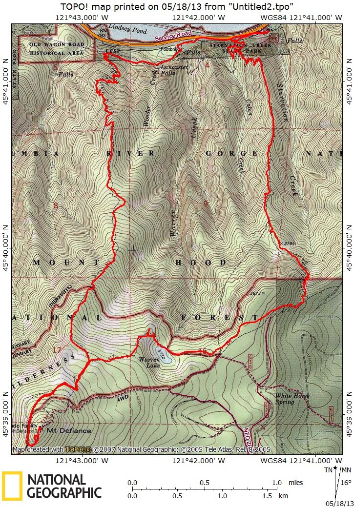
Mt Defiance
12 miles of hiking • 5000' elevation gain •
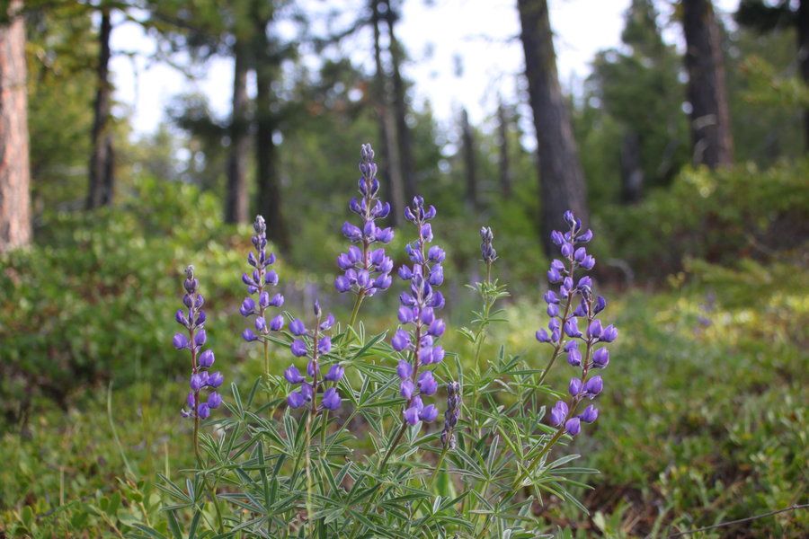
Pleasant day and solitude on this loop up Starvation Ridge. Most of the snow is gone except for a few drifts on the north side above 4000 ft. Views were limited, but the wildflowers were delightful.
May 17, 2013


 2
2
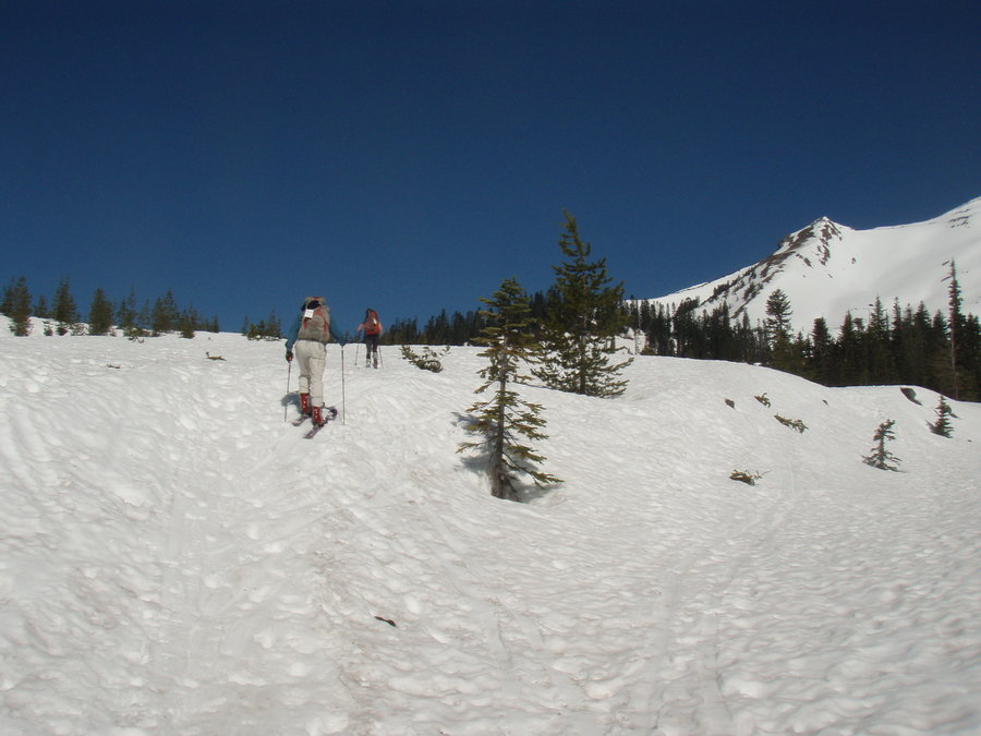
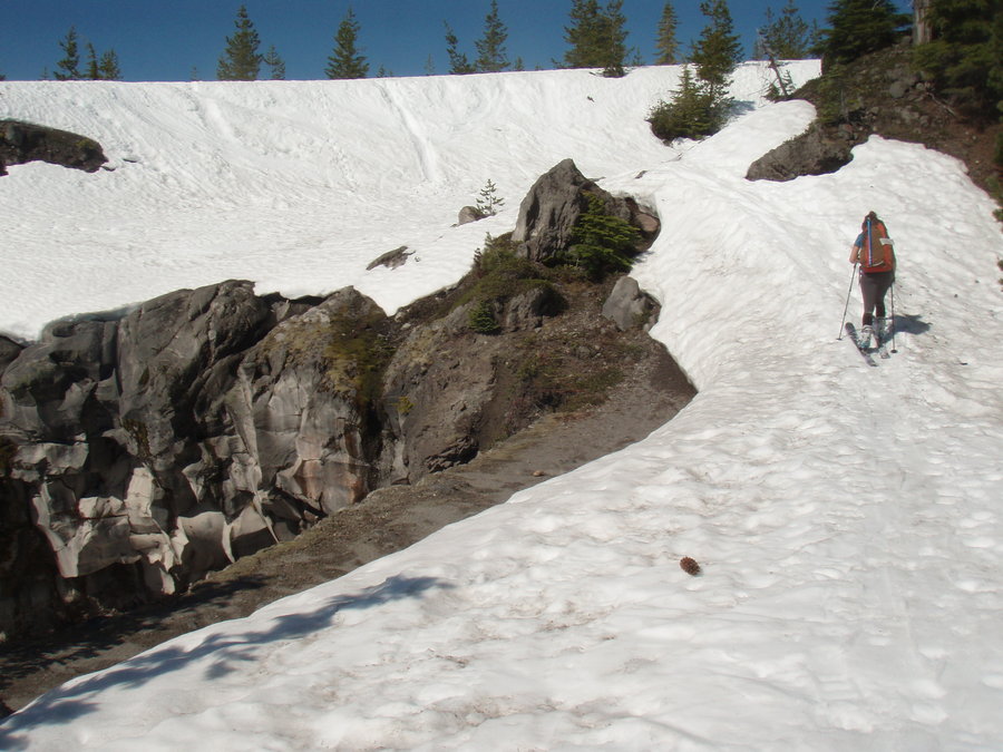
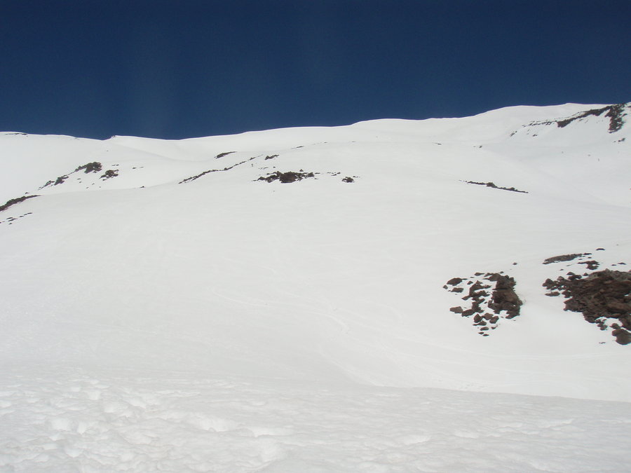
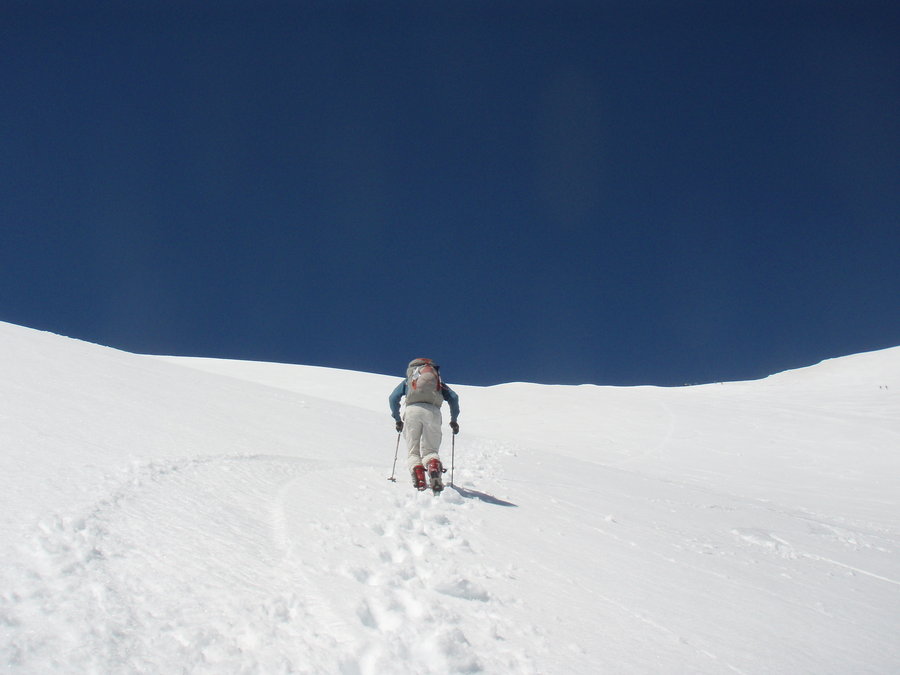
MSH ski-climb-glissade-ski
5 miles of hiking • 5500' elevation gain •
Well I'll just count the uphill part because it was sort of like hiking. We rented AT skis and skinned up to about 6000 feet. Then we climbed the rest of the way up to the summit. Glissaded back down to our skis and zoomed out. What a hoot!
May 3, 2013


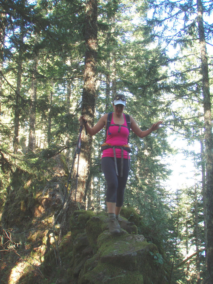
Ruckel Ridge/Creek Loop
9.5 miles of hiking • 3750' elevation gain •
Brought a friend along to show her this classic hike. Beautiful day- not much snow left on Benson Plateau.
April 26, 2013

 1
1
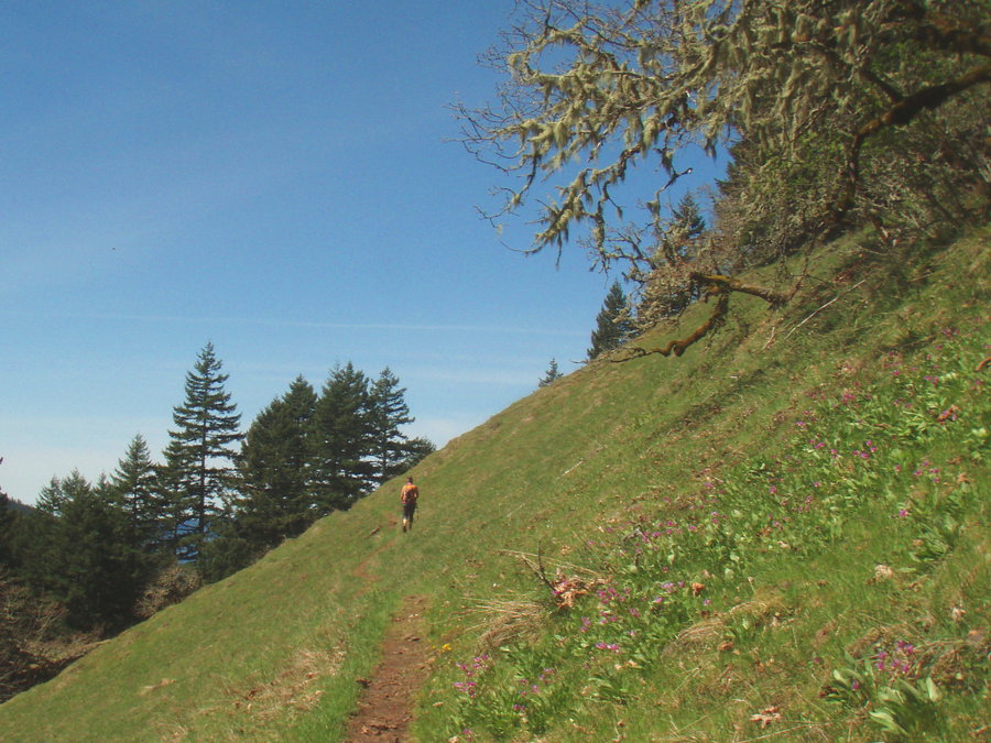
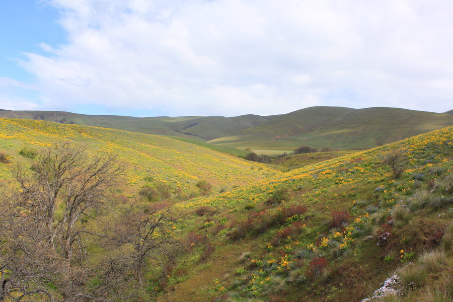
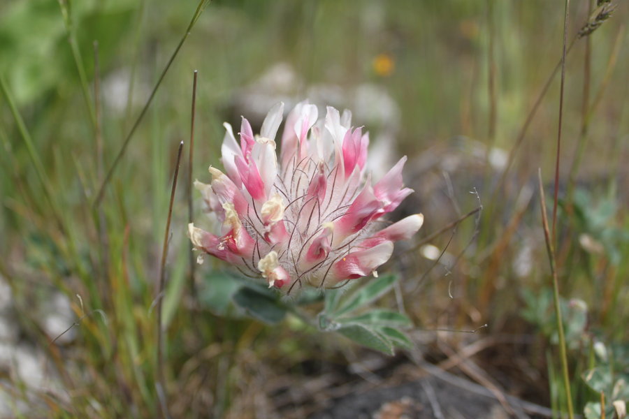
Columbia Hills
8 miles of hiking • 2250' elevation gain •
What a florgasm today in the Columbia Hills SP. I started on highway 14, where they are building a new trailhead, and hiked up to the parasailing butte on the ridge east of Stacker Butte.
Met a fellow from Backcountry Horsemen who has been working on getting this trail system approved for many years. He says there will be 8 miles of trail in the area. I saw some flagging, and obvious boot tread near the start, but I mostly just followed deer paths and went cross country. The area is so open, - great rambles! Watch out for ticks.
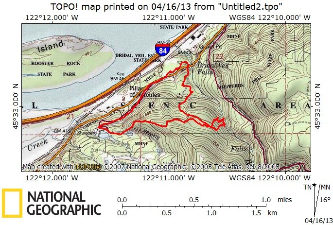
April 16, 2013

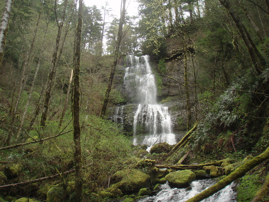
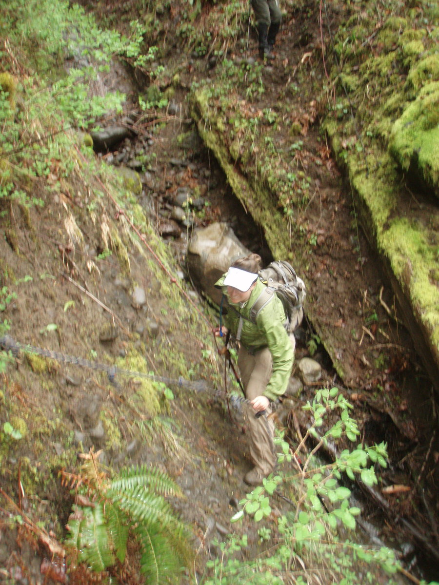
Bridal Veil Wanderings
3 miles of hiking • 1000' elevation gain •
3 miles in 3 hours, looking for an old cabin. Lots of elk trails petering in and out, but the middle hour was all bushwack. So close to the human world, but it feels so remote in there- and not a single shred of stupid flagging!!!
April 15, 2013

Hamilton Basin
7 miles of hiking • 1750' elevation gain •
Brought some friends along to my favorite go-to rainy day hike.
April 5, 2013


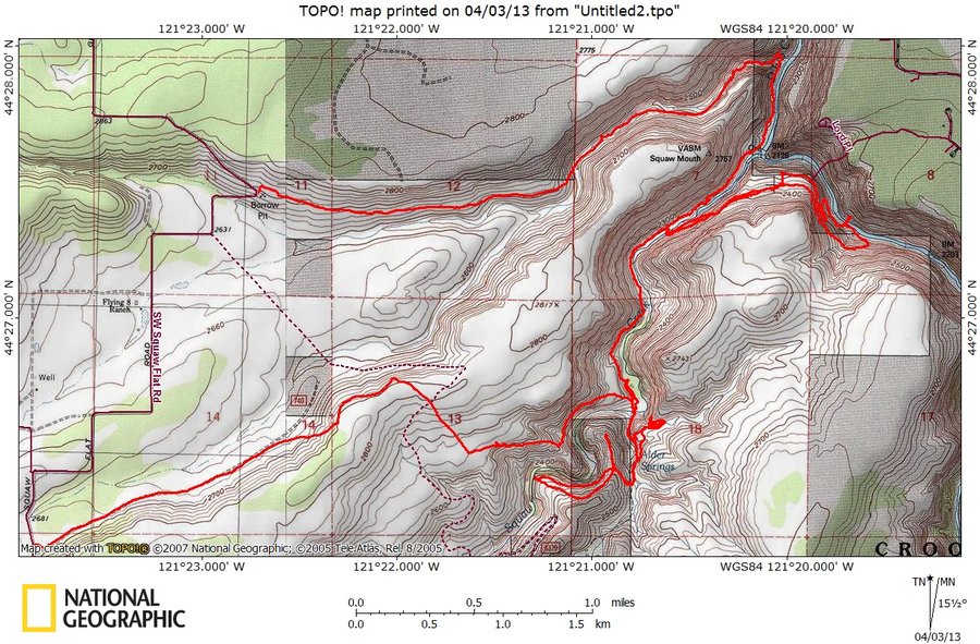
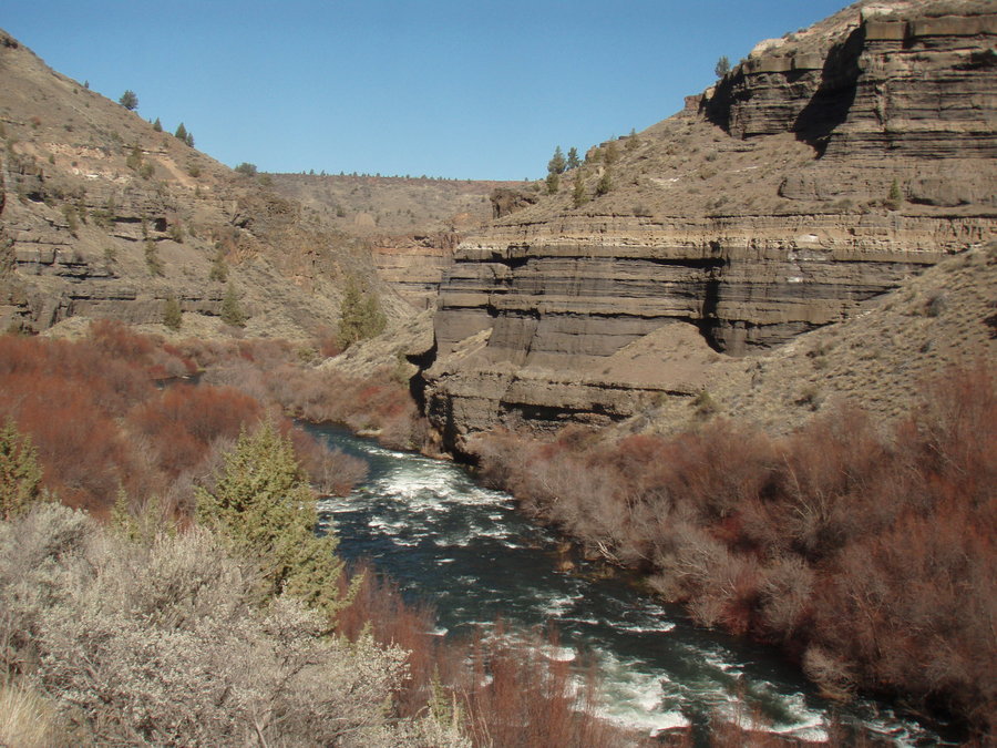
Deschutes Backpack
13.5 miles of hiking • 2000' elevation gain • 2 nights
Perfect weather for a canyon backpack. We got in there the back way before the Alder Springs TH opened for the season. Followed deer trails and marveled in the geology and magnificent desert scenery. Did not see another human.
March 29 – March 31, 2013


Bedford Point LO site
5 miles of hiking • 750' elevation gain •
I had higher elevation plans today up the Clackamas, but there was fresh snow on all the access roads. It got too sketchy for the mommymobile at 2600 ft so I turned around and decided to go visit this old lookout site up the N Fork Road. A lovely few hours of wandering in the quiet woods.
I found and reported an illegal hunters tree stand.
March 22, 2013


Tryon Creek SP
4 miles of hiking • 250' elevation gain •
Little morning jaunt. Trilliums are coming up!
March 15, 2013

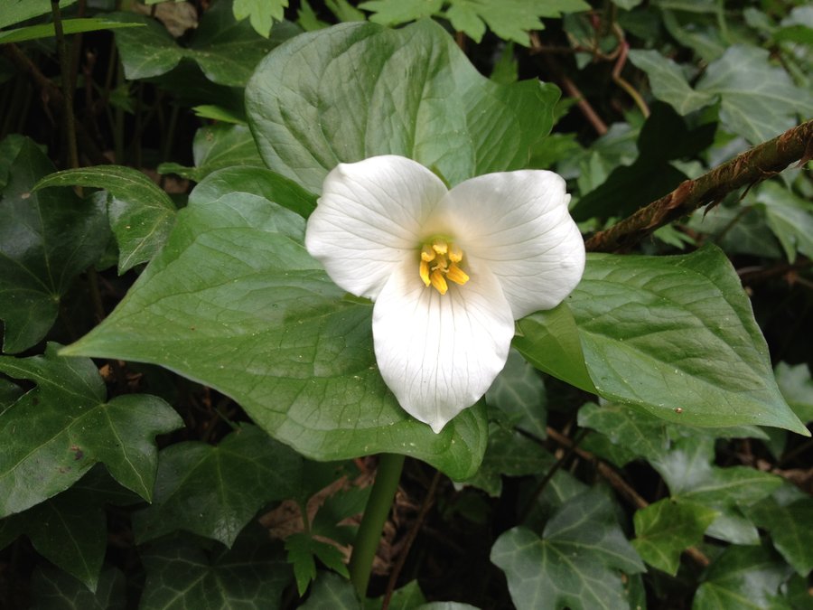
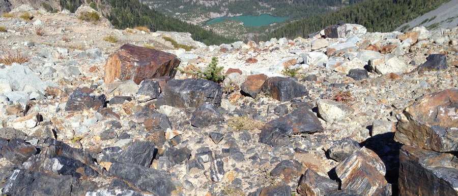
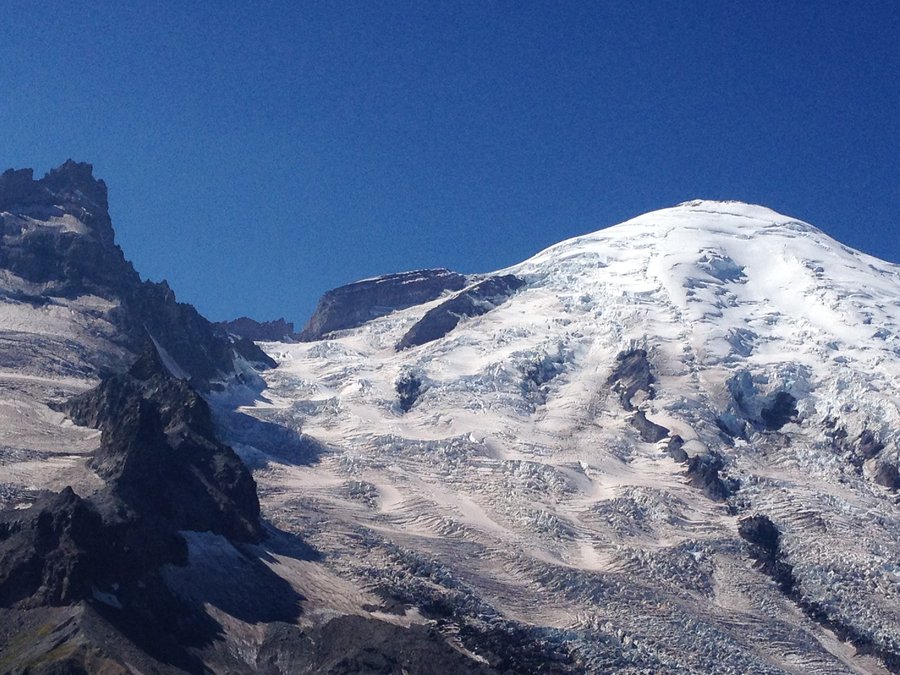
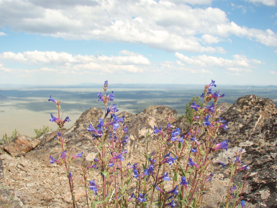
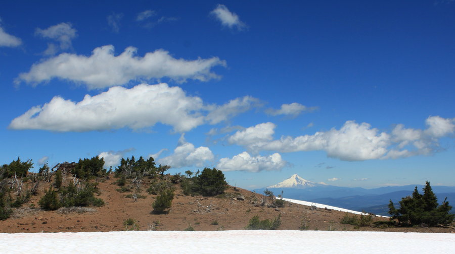
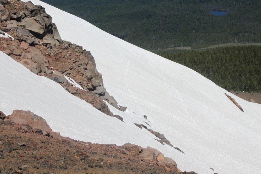
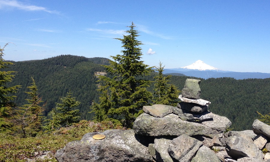
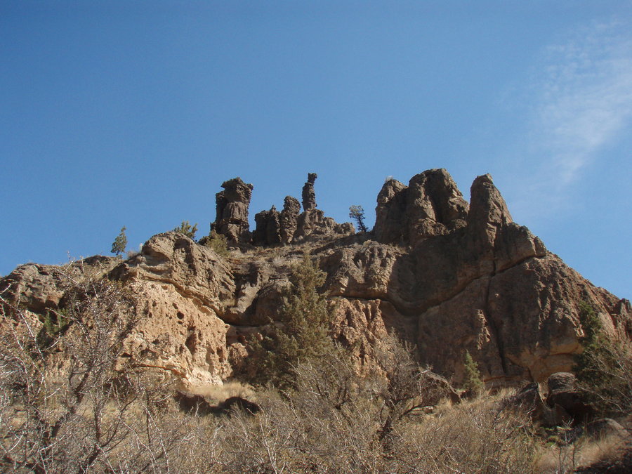
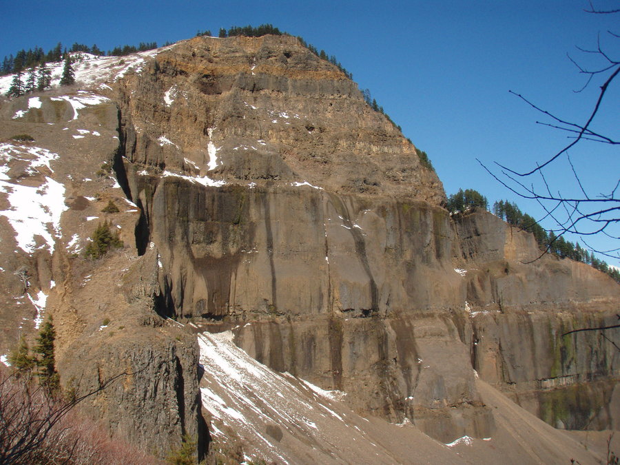
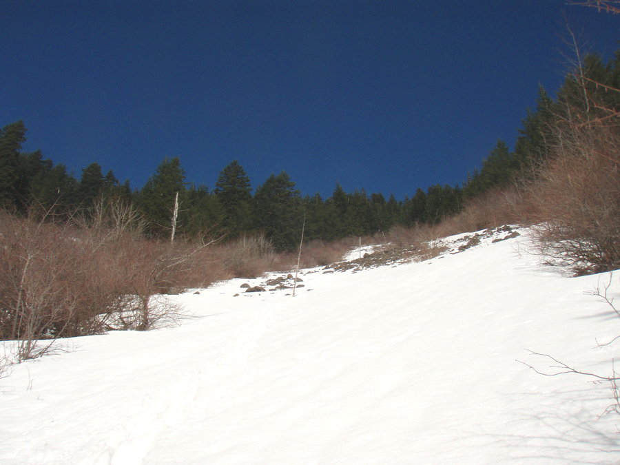
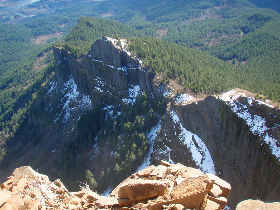
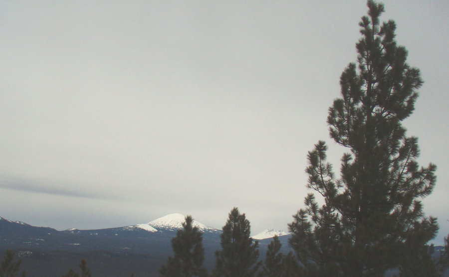
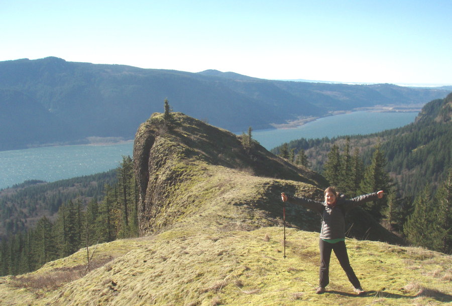
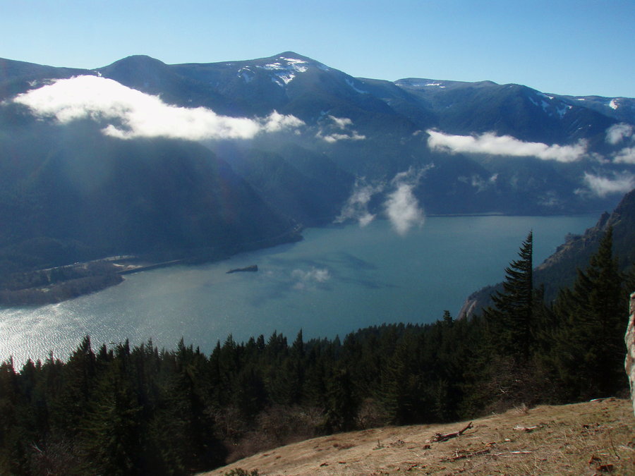
Table Mountain
8.5 miles of hiking • 3250' elevation gain •
Gorgeous day for a hike up Table. Snow starts just after the Heartbreak Ridge viewpoint area next to the Two Chiefs. The snow actually makes it easier to climb the boulder field. Fresh thick stuff from this week and very few tracks up top.
March 8, 2013

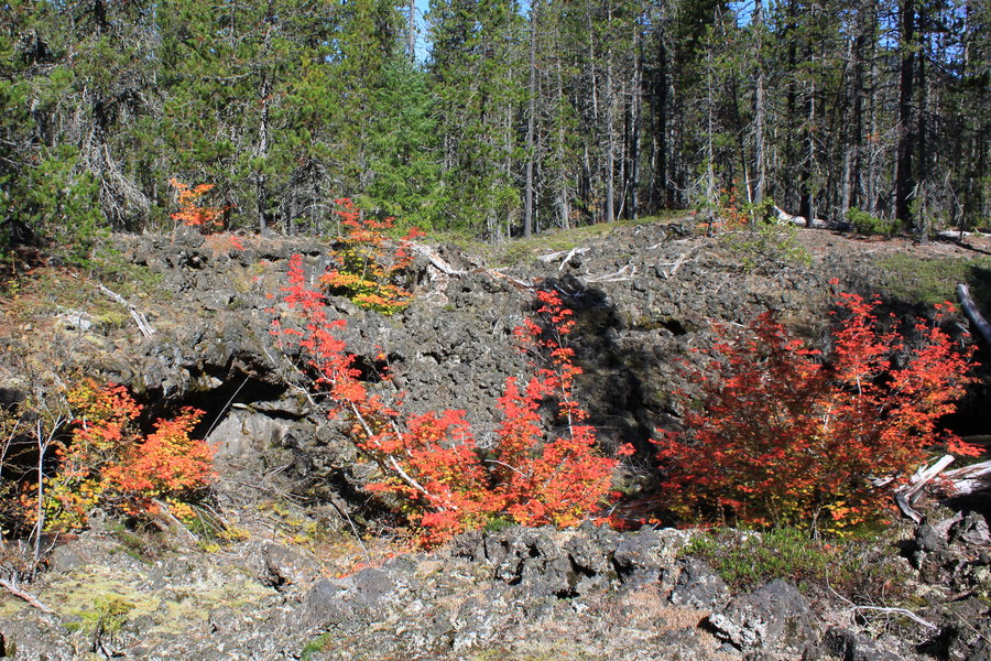
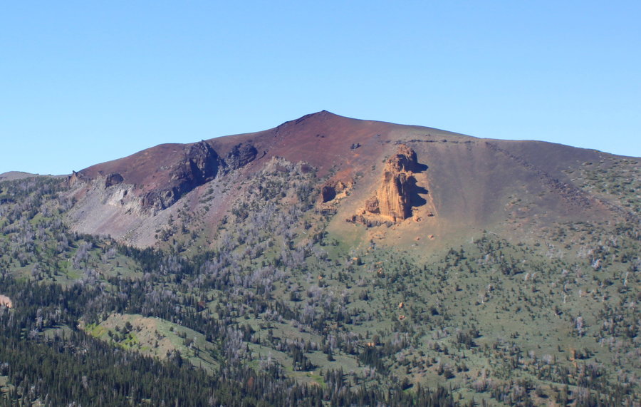
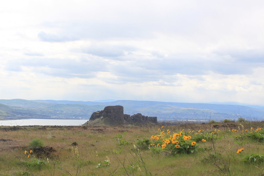
Lava Butte
5 miles of hiking • 750' elevation gain •
I've always avoided this place because of all the RVs and tourists at the visitor center. It's closed for the winter, but you can park here and walk around the interpretive trail and hike up to the butte. I had it all to myself today, really enjoyed the walk over the lava bed and the visit to the breach where the lava blew out the side of the volcano. WOW it is a stunning spot with a cool red cindered crater that you can walk around, and really nice LO tower that is staffed in the summer, I never knew! I definitely recommend stopping here in the off-season.
March 3, 2013

Pistol Butte
4 miles of hiking • 1000' elevation gain •
In Sunriver for the weekend with my family. They indulged me with a little hike up this little butte which is a former LO tower location. We just parked along Century Drive and went cross country heading up the hill . Just as the manzanita was getting thick and annoying, we stumbled onto a trail. Easily avoidable patches of snow the whole way up with some persistent drifts on top. Nice basalt bluffs on the SW side. I'm sure the views are great from here, but it was a pretty cloudy day so we just saw a few of the nearest smaller bumps below the cloud deck.
March 2, 2013


 5
5
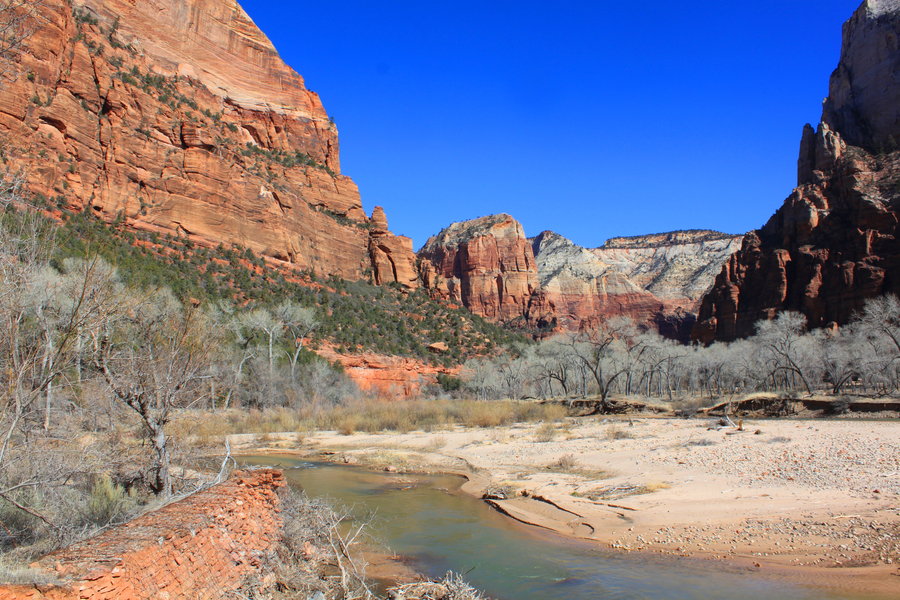
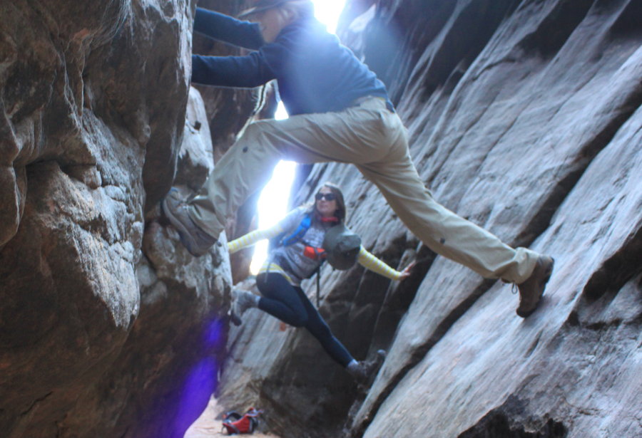
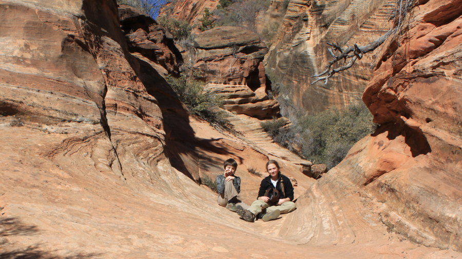
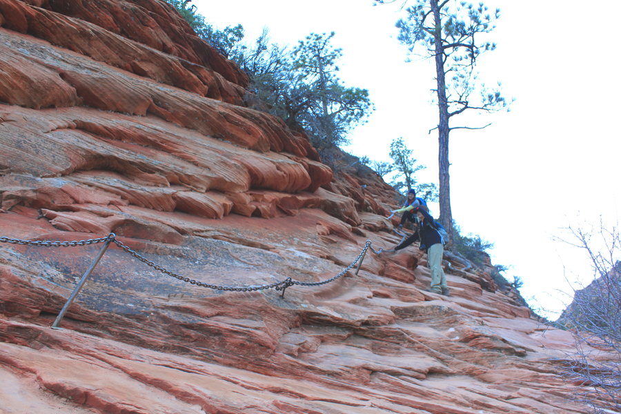
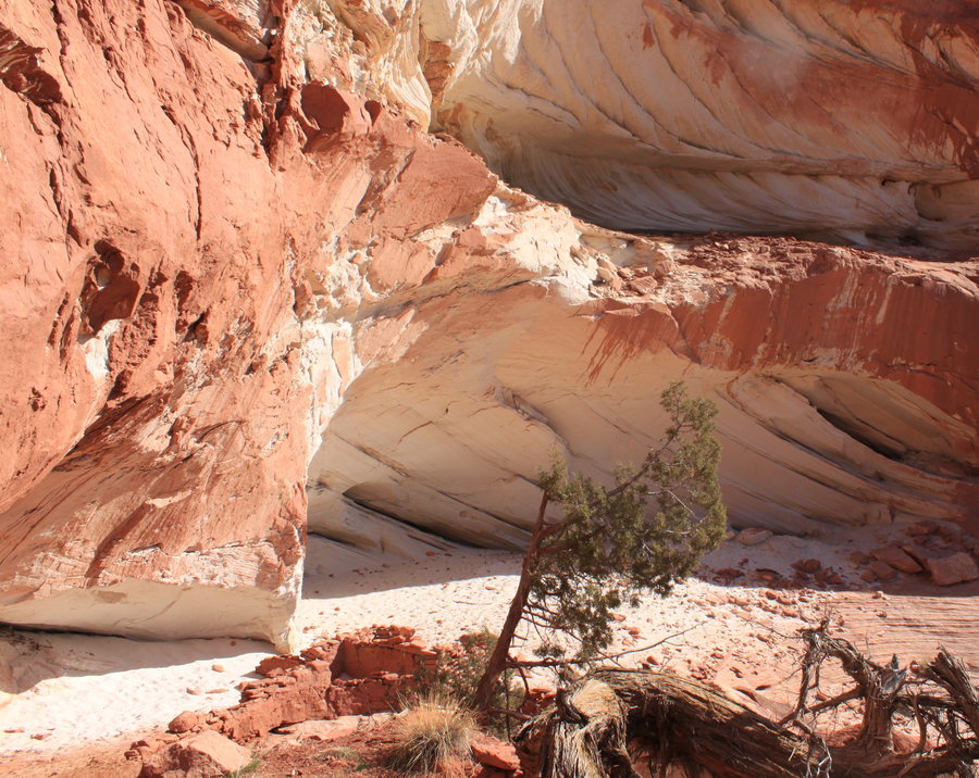
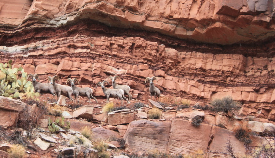
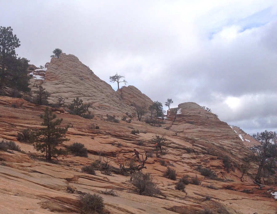
Zion National Park
16 miles of hiking • 3750' elevation gain •
Spent three days of redrock fun in the park with my son, sister in law and her son. The two boys ages 10 and 12 had a blast.
We went on 7 trips, including a guided slot canyoneering adventure. Loved the slickrock, planning our next trip back to the area.
- Emerald Pools Loop : 3.5 miles, 350 ft.
- Shelf Canyon-a short dry slot canyon- what a hoot! 1 mile 100 feet elevation
- Angel's Landing: 5 miles 1500 feet gain. Did this at sunset, saw just a few groups coming down and had the top to ourselves.
- Anasazi ruins exploration in Kanab Canyon. 1 mile 200 ft- did this as a diversion after driving all the way to Kanab and not getting a lottery permit to "The Wave".
- Lamb's Knoll Canyoneering adventure in Snake Canyon. 1 mile 300 feet of slickrock scrambling, slithering and rappelling.
- The Watchman: 3 miles and 300 ft. in new snow- was not planning on doing this hike until we heard there were bighorn sheep sighted the day before. Sure enough, we saw us some sheeps!
- Progeny Peak: 1.6 miles 1100 ft. Awesome off trail slickrock scramble to an arch and a lofty summit with amazing 360 degree views.
February 16, 2013

 2
2
Columbia Falls
7 miles of hiking • 1750' elevation gain •
Brought some friends along for another exploration of the Archer Mtn Complex. Banner day, I think they liked it
February 15, 2013

Cook Hill
7.5 miles of hiking • 3000' elevation gain •
Just a few nice snowfields to traverse at the top. Not a single bootprint. Had a nap in a meadow on a warm spectacular day in February.
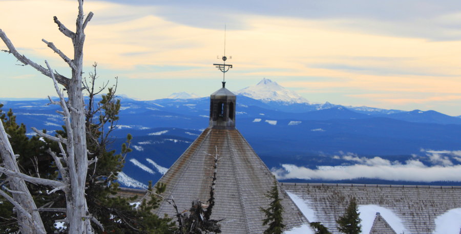
February 8, 2013


Mazama Lodge to Timberline
4.5 miles of hiking • 2000' elevation gain •
Stayed overnight at the Mazama Lodge. Climbed up toTimberline lodge for a hearty lunch. Hitched a ride back down the hill with some Chemeketans!
February 3, 2013

January 24, 2013

Hamilton Creek
7 miles of hiking • 1750' elevation gain •
Cool old logging road up the east side of Hamilton Creek
January 8, 2013

View trips from: 2011 2012 2014 2015 2017 2016 2018 2019 2020 2021 2022 2023 2024 2025 2026