

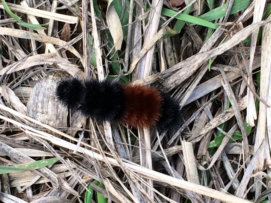
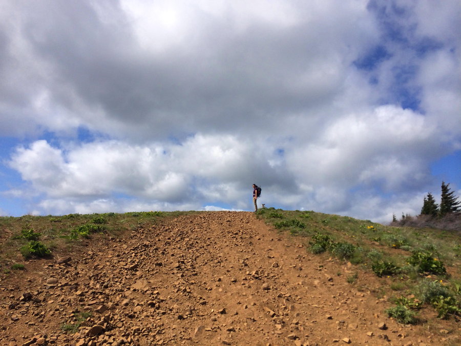
2015 Trips


October 17, 2015


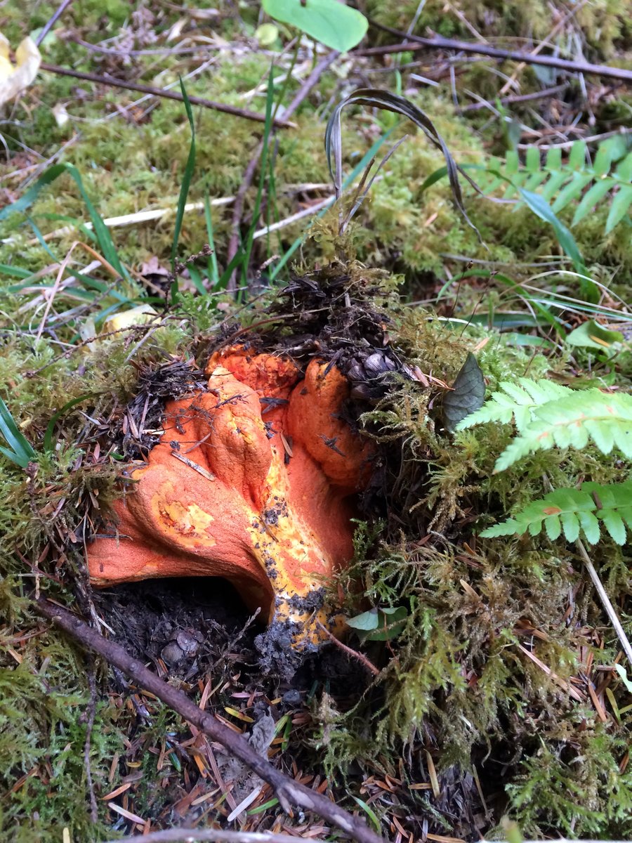
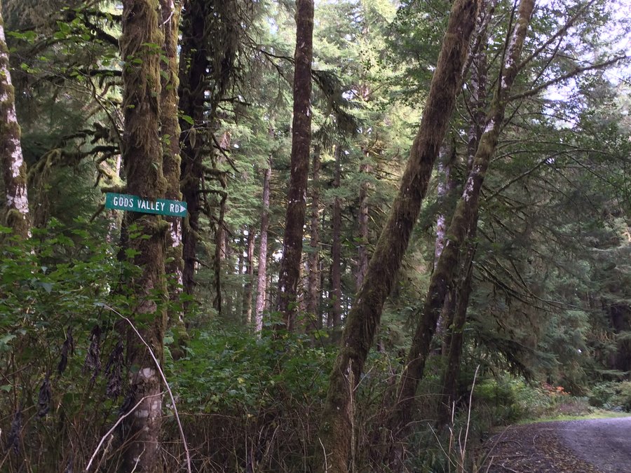
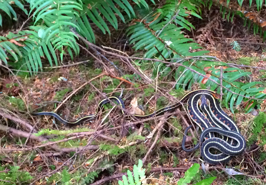
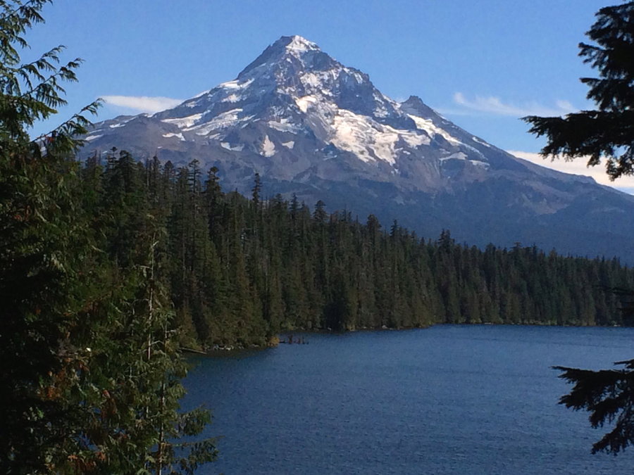
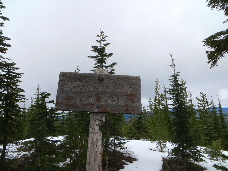
God's Valley
2.5 miles of hiking • 250' elevation gain •
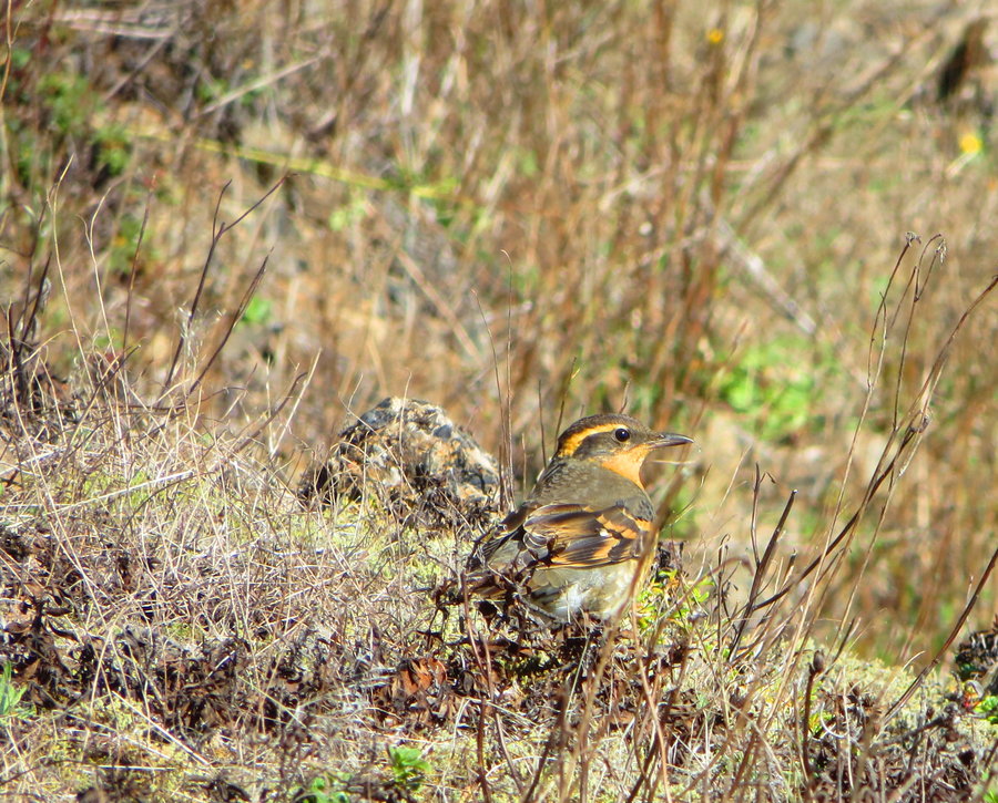
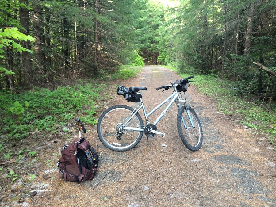
Biked 7 miles to God's Valley, an old homestead now maintained by ODFW for winter elk grazing, and salmon habitat in the N Fork Nehalem river. Wandered the massive meadows and bushwacked in some mighty spruce forests. Found a few more mushrooms; chanterelles and lobsters.
October 6, 2015


 1
1
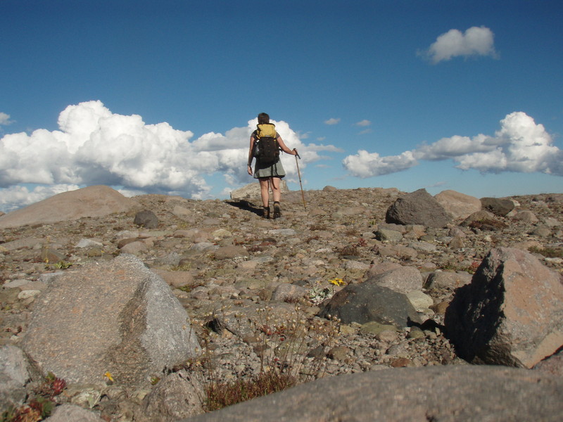
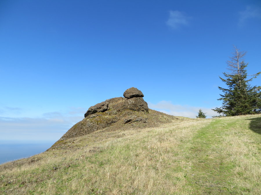
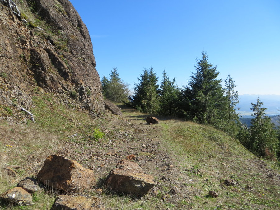
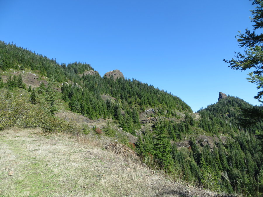
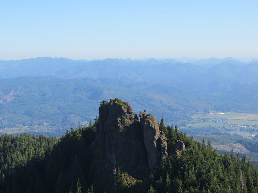
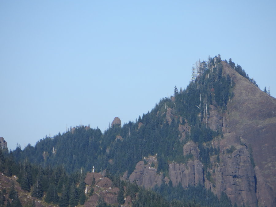
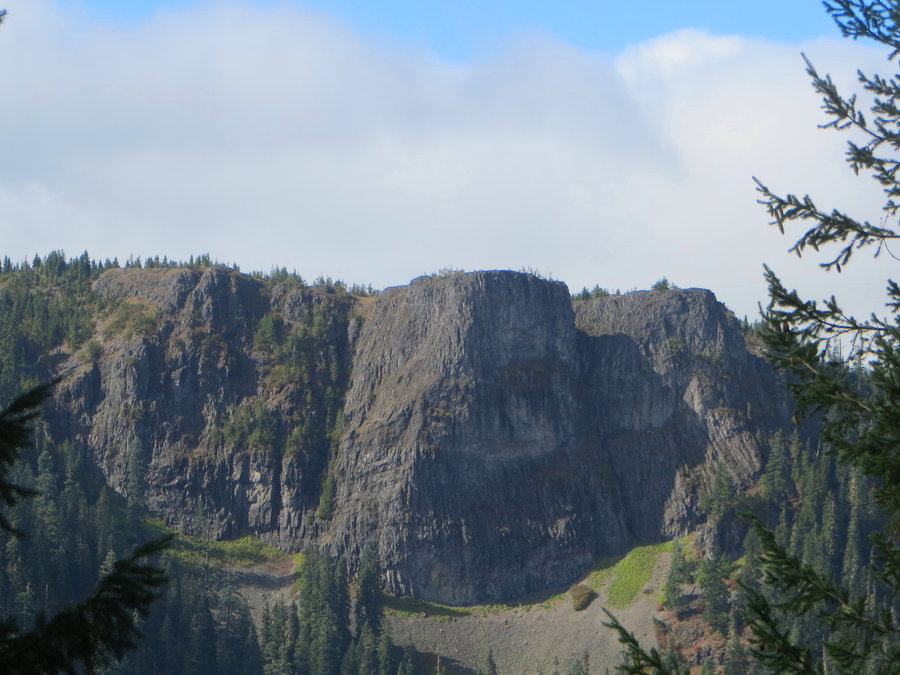
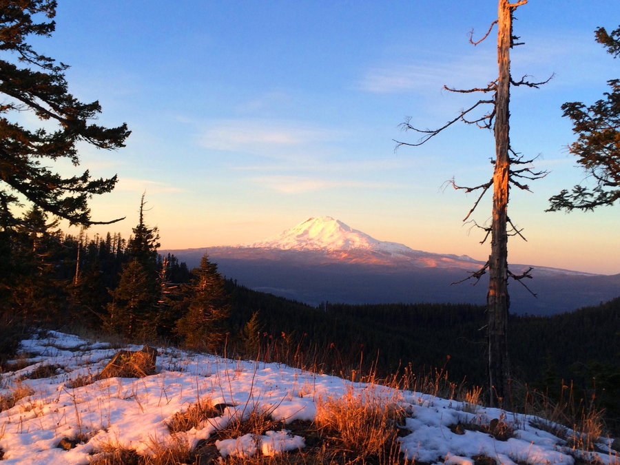
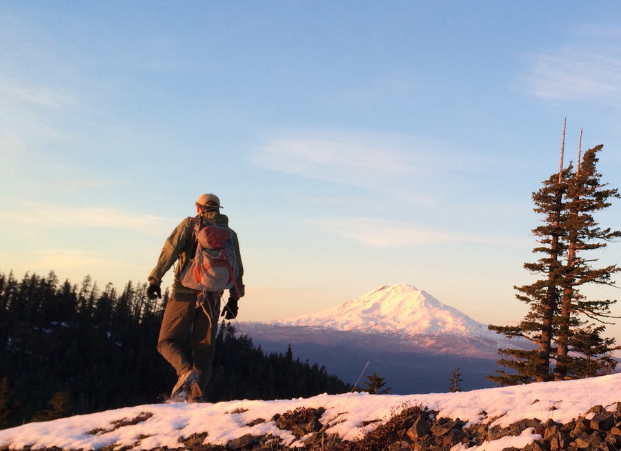
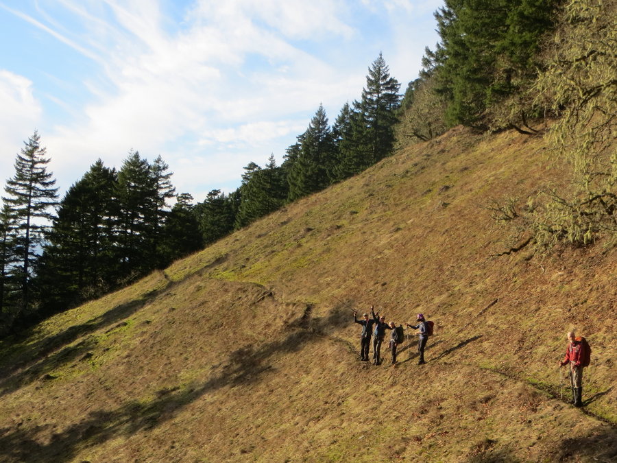
Angora Peak H & B
6 miles of hiking • 1500' elevation gain •
I tried to bike all the way up, but it was just too steep and rocky. Threw my bike in the bushes after two miles. Forgot my hiking shoes and ended up hiking in my bike cleats, which worked surprising well. Found some chanterelles. After getting past the yucky clearcuts, it's just gorgeous up there!
September 30, 2015

 1
1
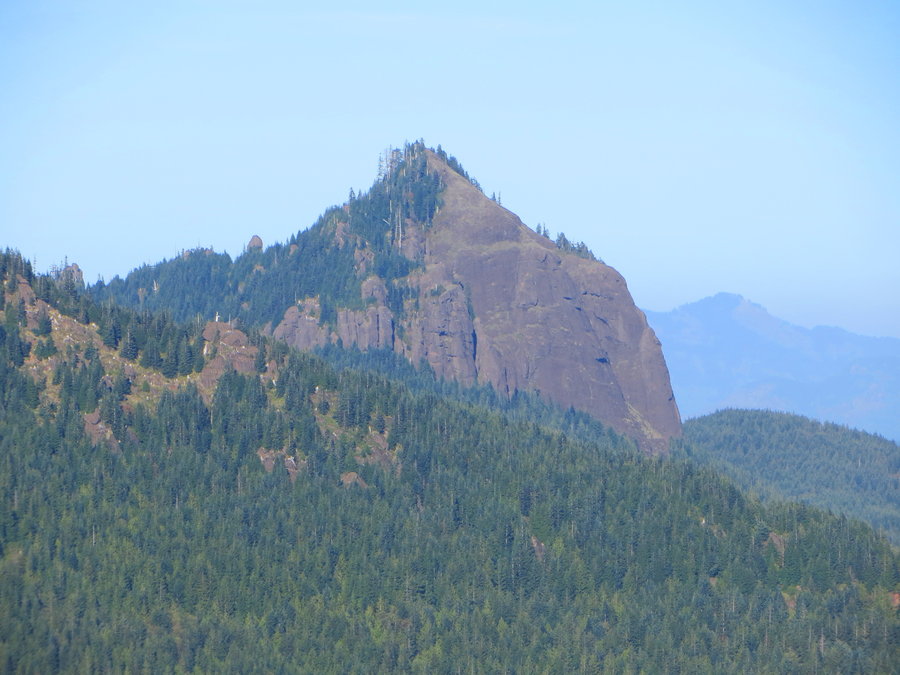
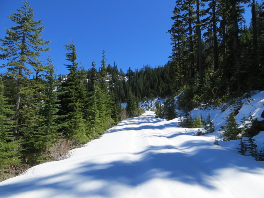
Butcher Knife Peak/Lost Lake hike n bike
3.5 miles of hiking • 500' elevation gain •
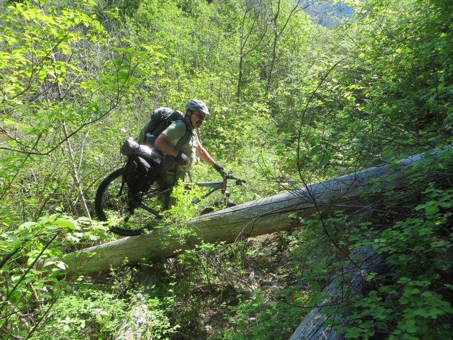
I had a fun trip on a lovely fall day. I continue to suffer from hip pain. Really trying to keep my hiking mileage down, but I still need my weekly fix of the great outdoors. This time, I biked up the 1340 Jones Creek Road-a slow easy grind, and wandered around on Butcher Knife Peak Ridge. I then rode down to Lost Lake and explored the lakeside on a very quiet day. Finished with a screaming downhill back to my car on the paved Lost Lake road. I highly recommend this loop! Next time I will add on Lost Lake Butte.
September 22, 2015


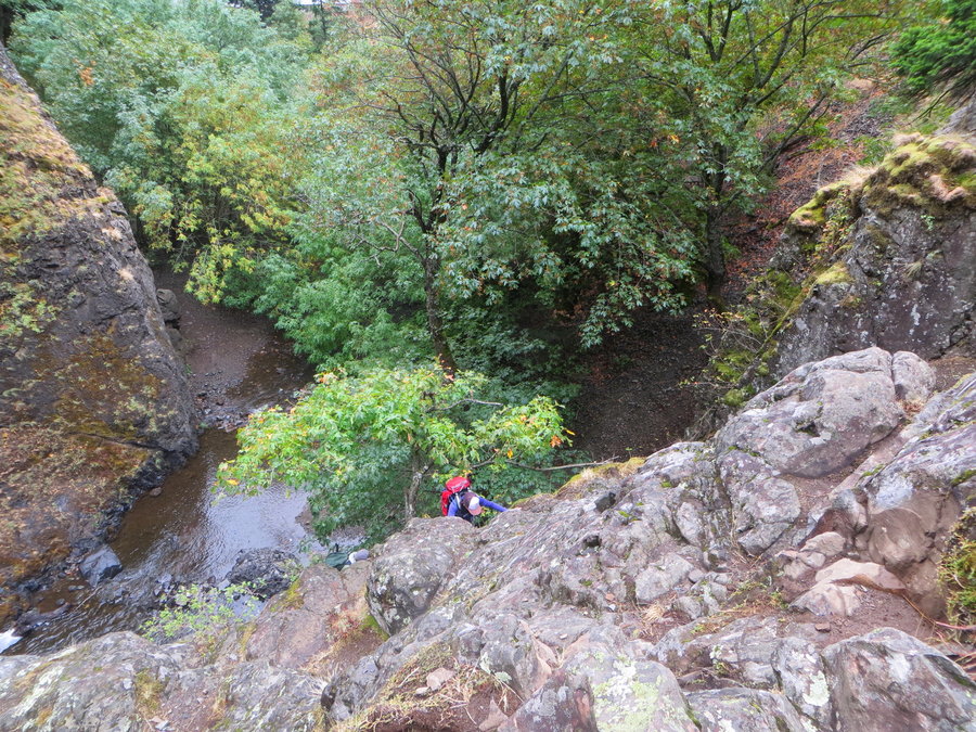
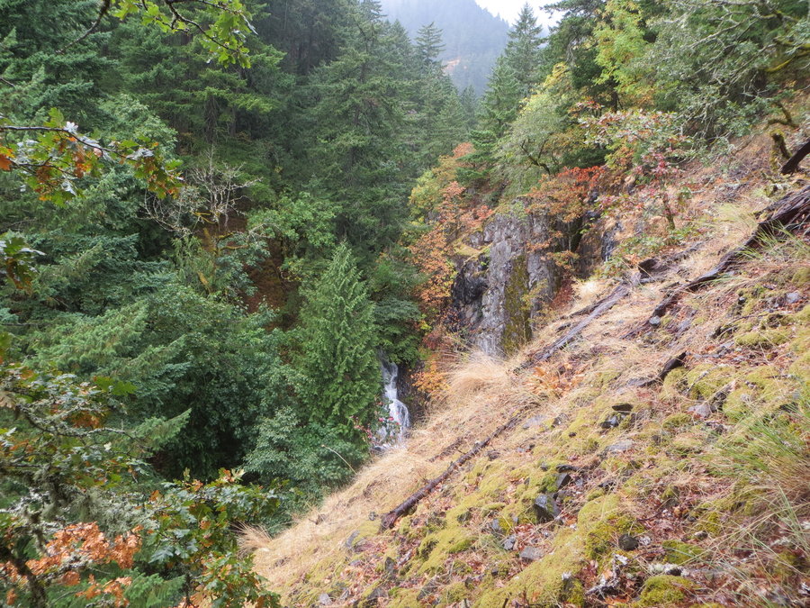
Dog Creek Debacle
4 miles of hiking • 2000' elevation gain •
This was stupid, bouldering up wet basalt in the rain. I was with 2 other members of a local mountaineering club who are supposed to be safe while climbing, and we certainly weren't. Once the rain really kicked in, we became very concerned about downclimbing the way came in and decided to "bail up" . We scrambled up to Cook Hill, 2000 feet in less than half a mile, through poison oak. Of course, then the sun came out. We then walked the old Cook Hill road down to highway 14.
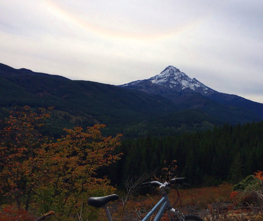
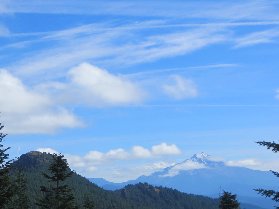
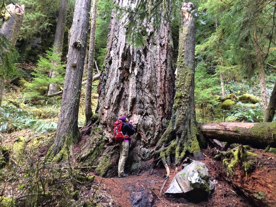
September 2, 2015

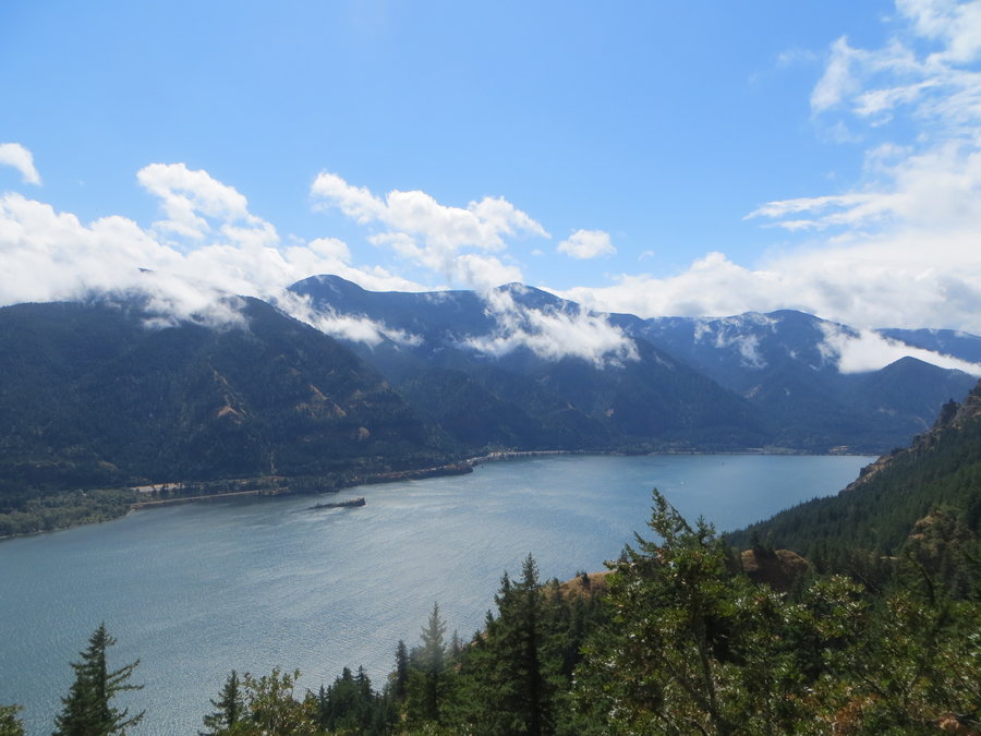
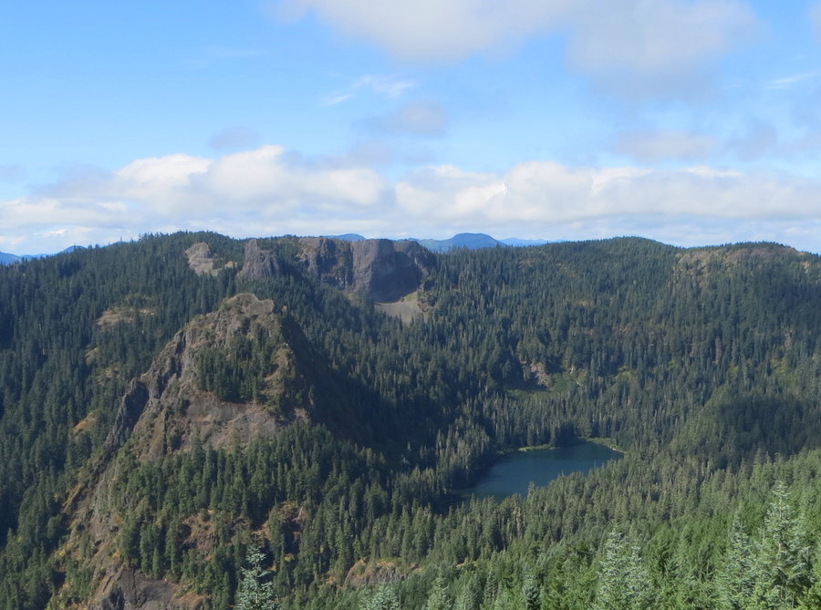
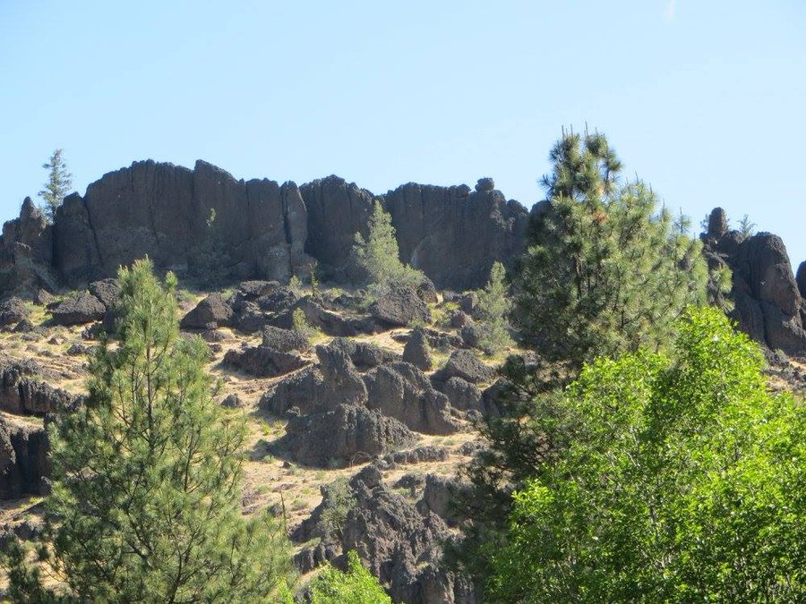
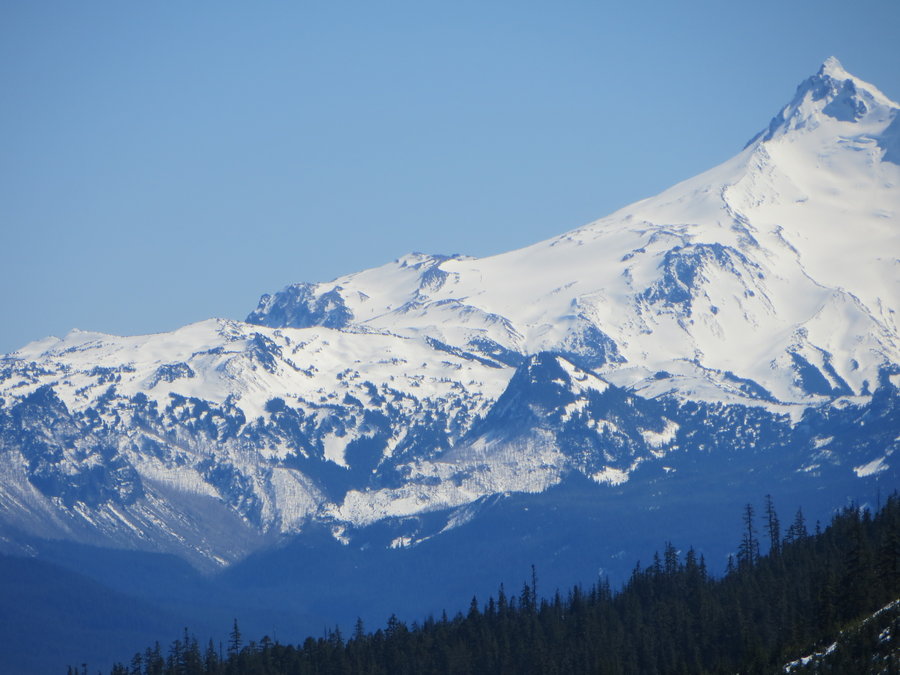
Dome Rock and Breitenbush area
11 miles of hiking • 1500' elevation gain •
I've had the good fortune to be a volunteer at Bretientbush Retreat Center for the past two years and while there, I take short trips in the area. Each visit, I have been exploring the surrounding forest and there is so much to offer! This weekend I navigated a section of the upper Devil's Creek drainage which is ringed by some really cool basalt pinnacles.On the way home, I stopped at Dome Rock(last time I was here was in 2001 with the Chemeketans!). Got some great ideas for more hike 'n bikes from the resort and ridge explorations based out of Knutsen Saddle exploring the rim of the Tumble Lake Basin.
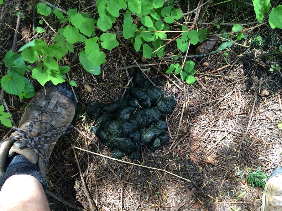
August 28, 2015

 1
1
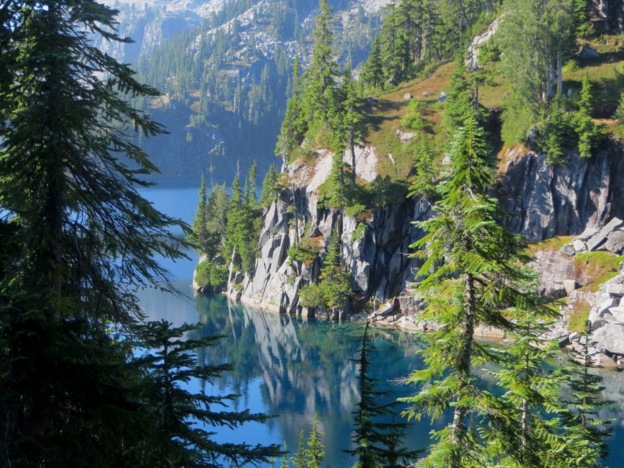
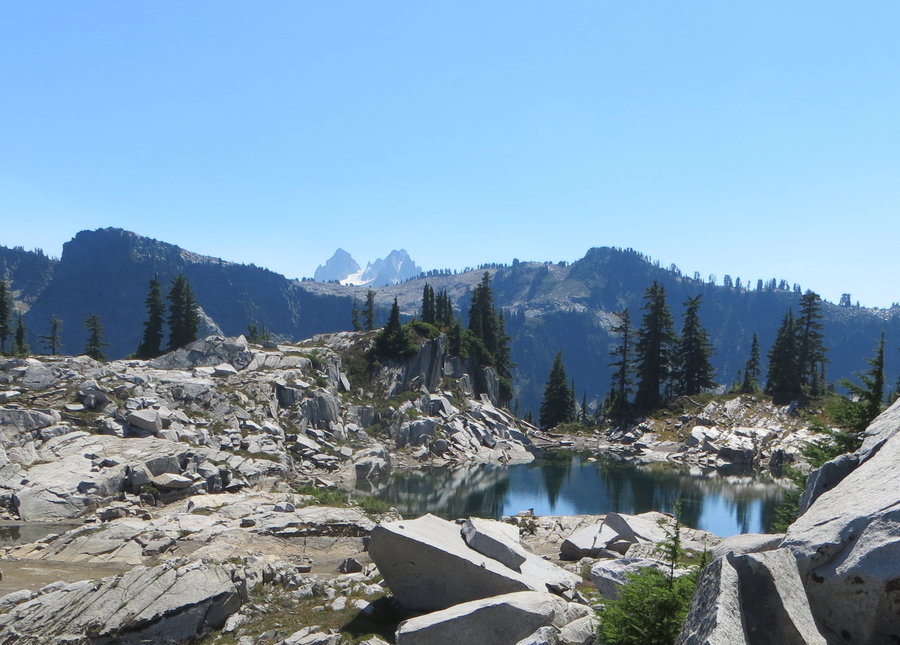
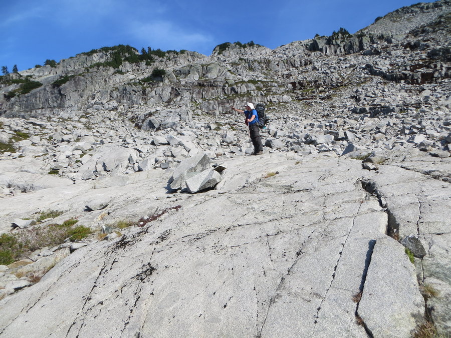
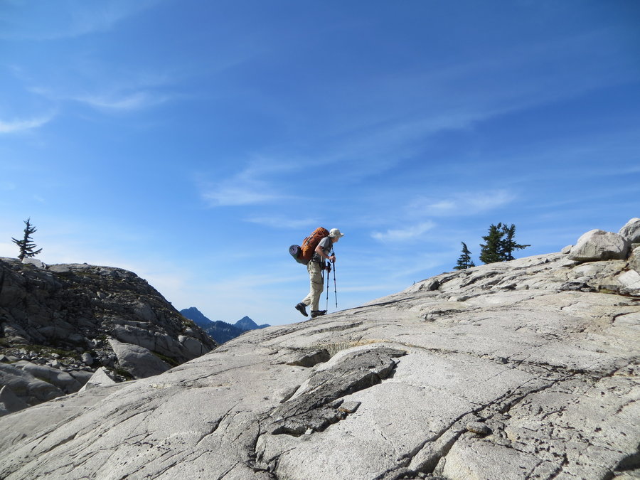
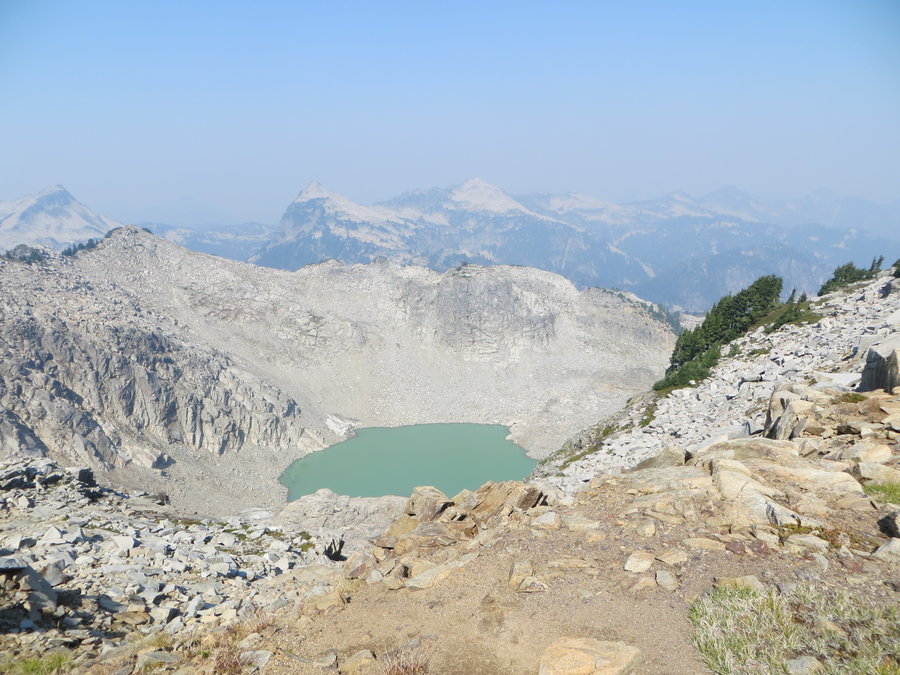
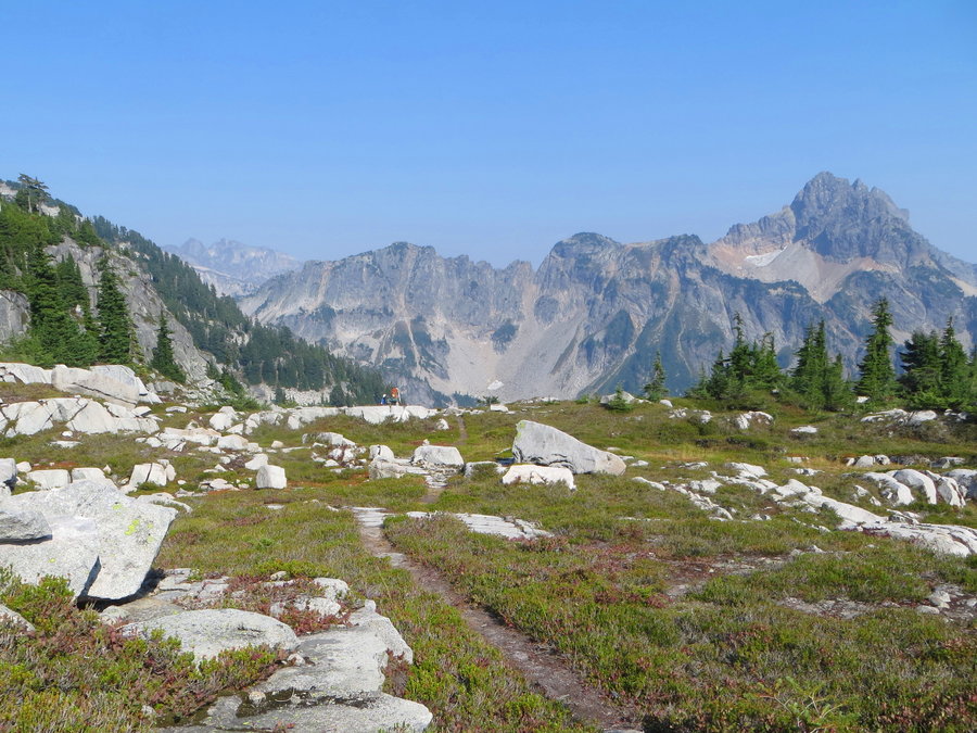
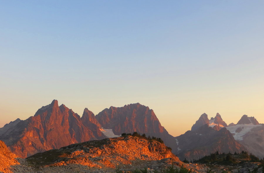
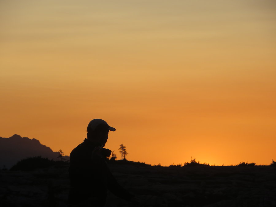
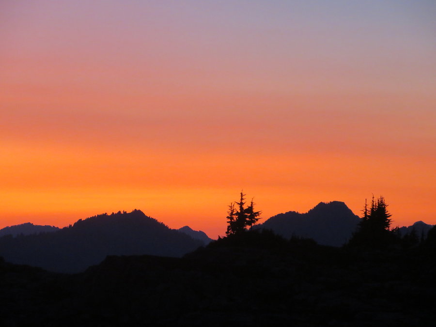
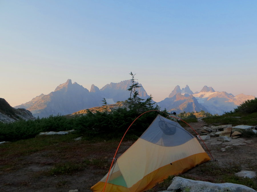
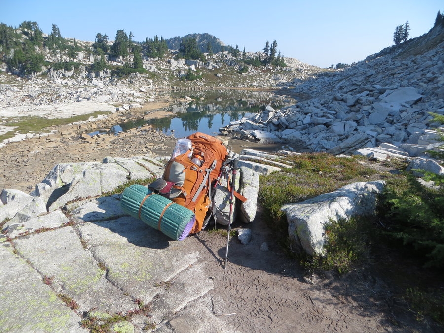
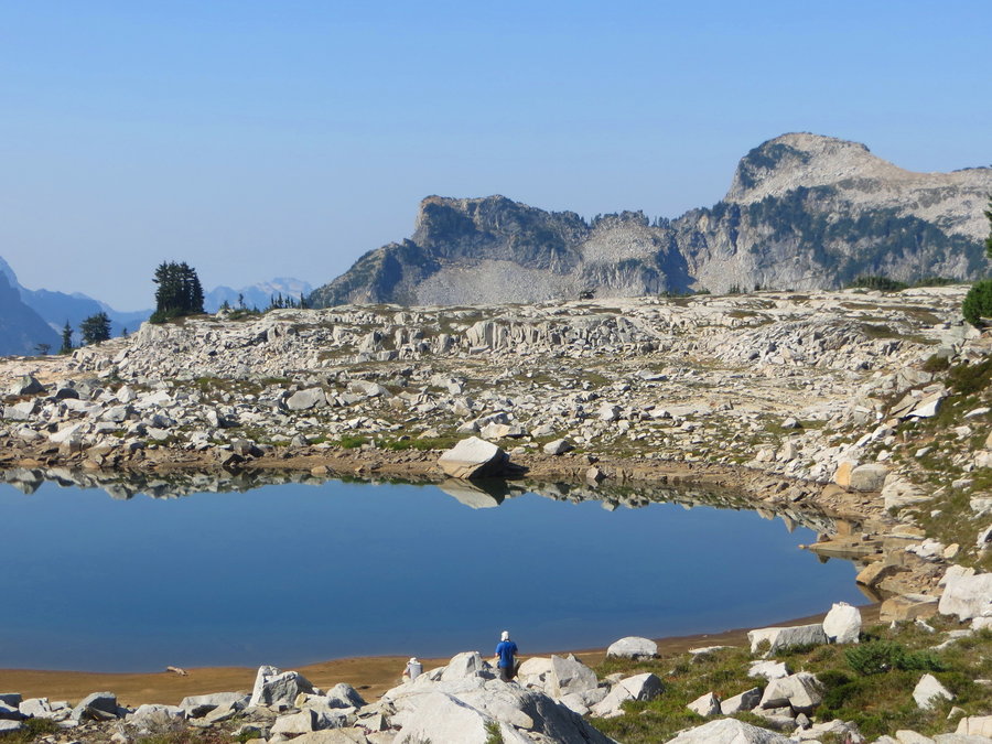
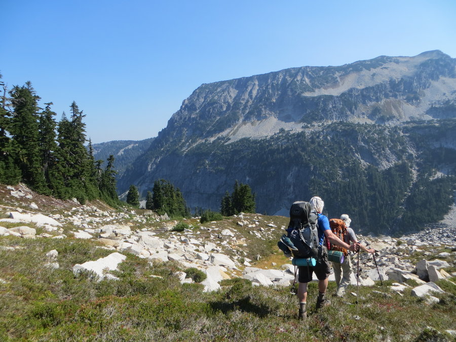
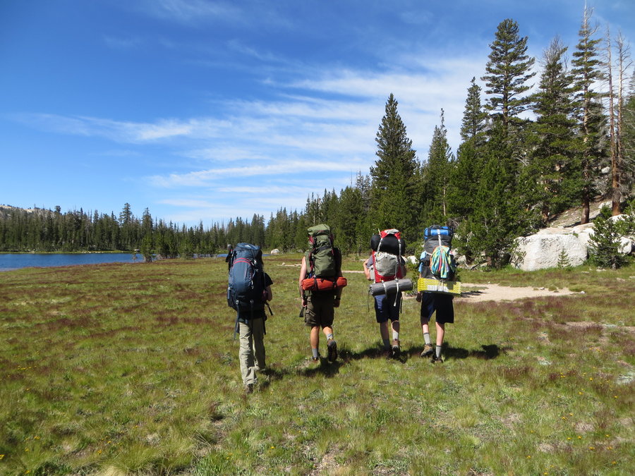
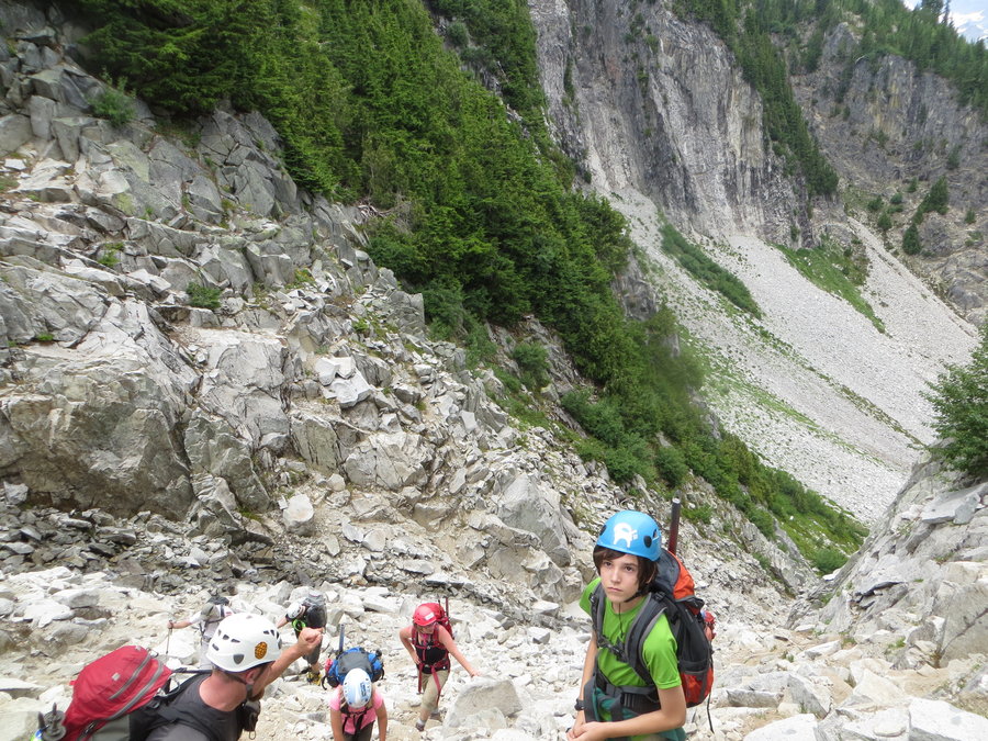
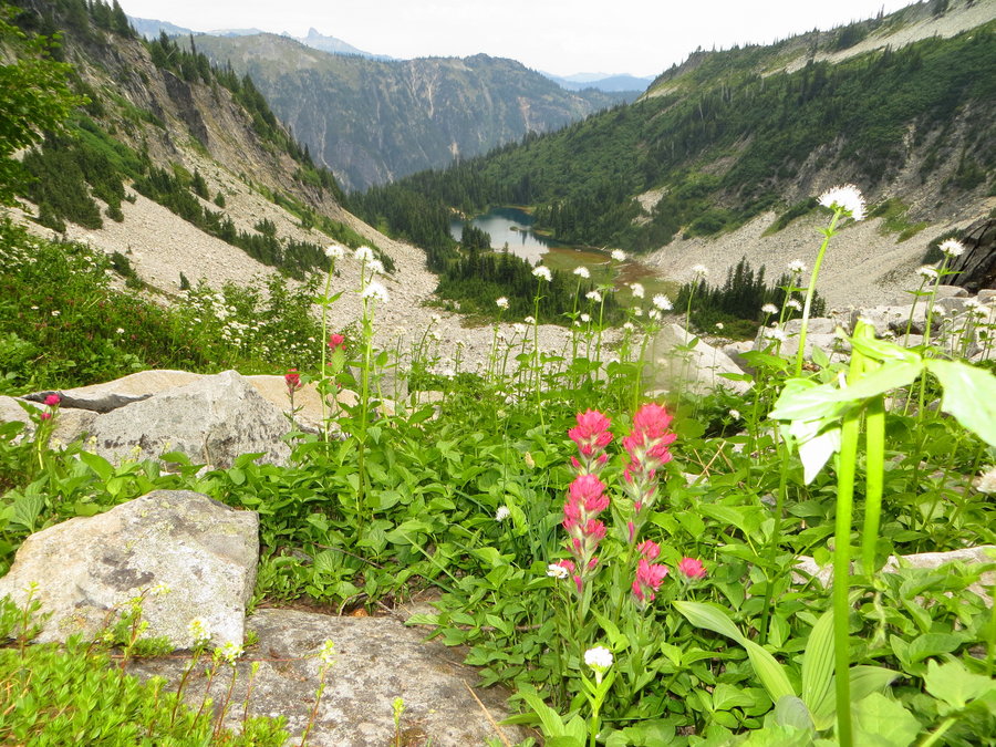
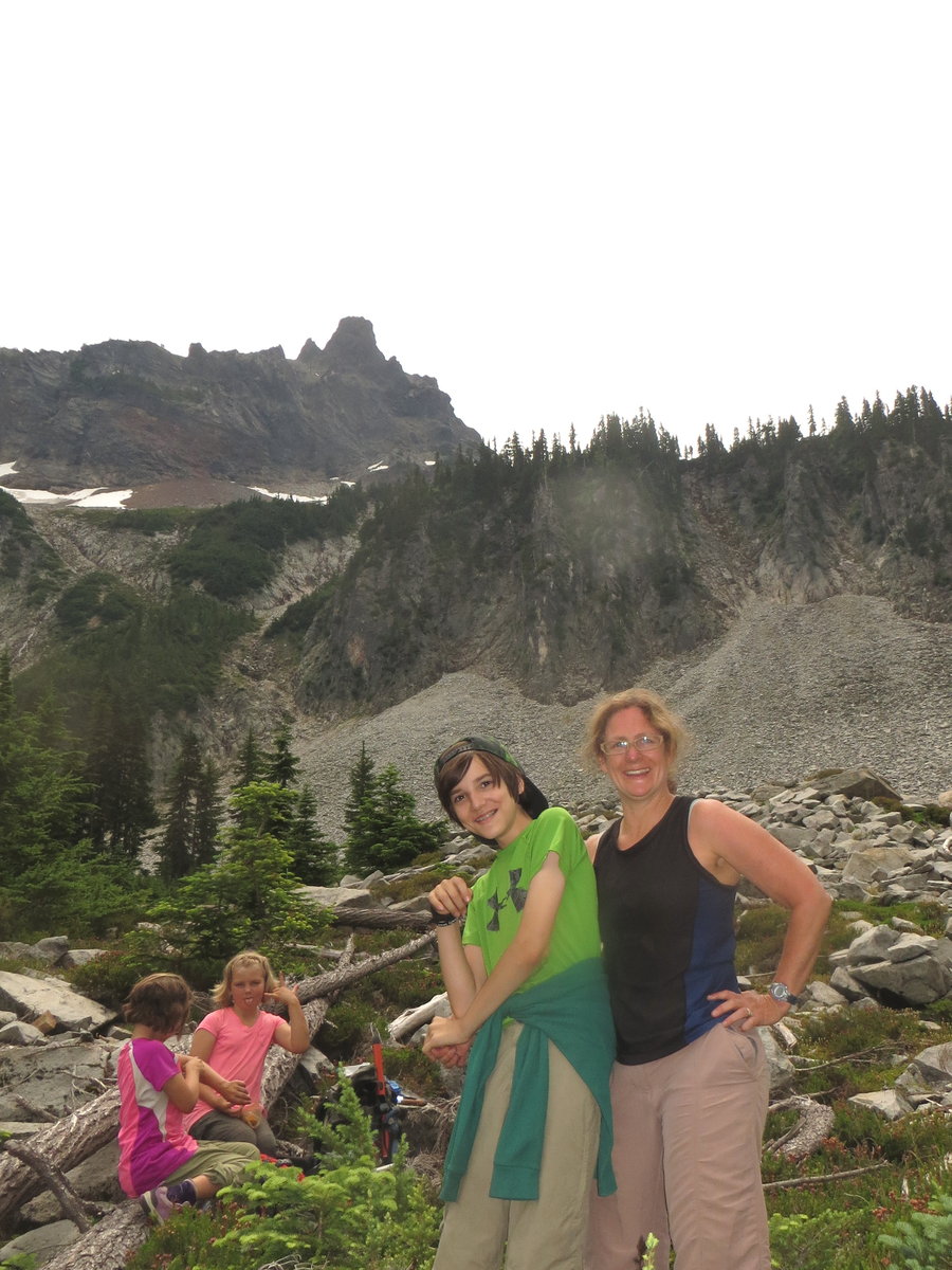
Alpine Lakes High Route
32 miles of hiking • 8000' elevation gain • 4 nights
We were supposed to be going Round the Mountain this week, but had to change plans because of the fire. A look at one of the air quality maps indicated that the west side of the WA Cascades would be a good bet so we zeroed in on that area. I recalled TRs from Bosterson and Awildman of this area and the beautiful pictures(thank you for the inspiration!) and shared with my team. We got excited about heading up to the granite wonderland.
Hid a bike near the Necklace Valley TH and drove to the W Fork Foss TH. Started late afternoon on Sunday and hiked up W Fork Foss Creek as the hoards were exiting. We made it to Little Heart Lake for first night's camp.
Things just got better from there. We slowly climbed up past the gorgeous blue waters of Big Heart Lake, passed Angeline Lake and then stopped to swim at a pretty tarn above Chetwoot Lake. From here on it was all scrambling, mostly on giant granite boulder fields which is fun, but challenging with a heavy pack on. We camped at Iron Cap Lake on night two.
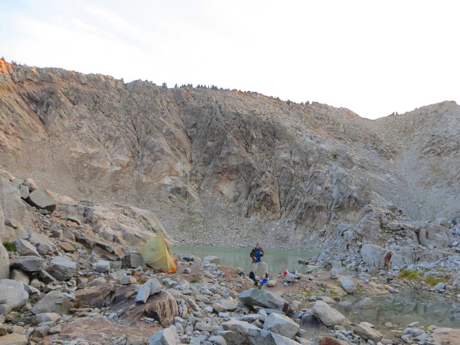
We woke to the smell of smoke and watched it creep from the east over the rim of Iron Cap and down into our little glacial basin. Very disconcerting. We packed up and scrambled up to the northern rim of Iron Cap and dropped our packs to head up the ridge to the summit. So much fun to scramble up this without the 35 pound monster on my back! Views not so good, but we spied Tank Lakes, our next destination. It looked so close, but it took us 5 hours to cover the 5 miles to get there following cairns through boulder field after boulder field. Not good for arthritic hip. Spent the night on n amazing perch above Lower Tank Lake with a sunset that went on forever. The smoke had slowly dissipated throughout the day, I guess we can thank Pacific breeezes for that.
Day four, we wandered around the Tank Lakes Basin, eventually down toward Necklace Valley. We considered dropping our packs and heading up to LaBohn Gap but were just too tired after 4 miles of downscrambling. So we just relaxed and enjoyed the real trail and little lakes of the Necklace Valley(Lakes in the W Fork Foss were much bigger and prettier IMHO). Last night camp at Jade Lake.
We were a bit sad and reluctant to leave. The long slog out was interminable, and we got to Seattle just in time for those awesome traffic jams! We blasted the tunes,and allowed our minds to continue wandering in the high country.
August 16 – August 20, 2015


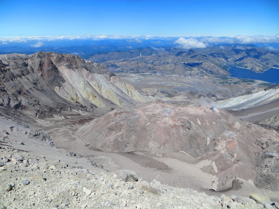
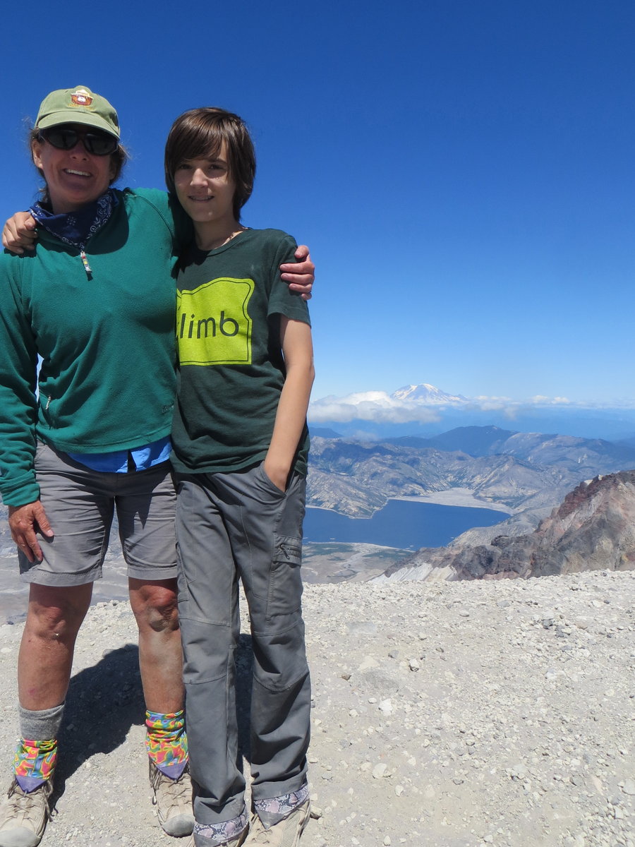
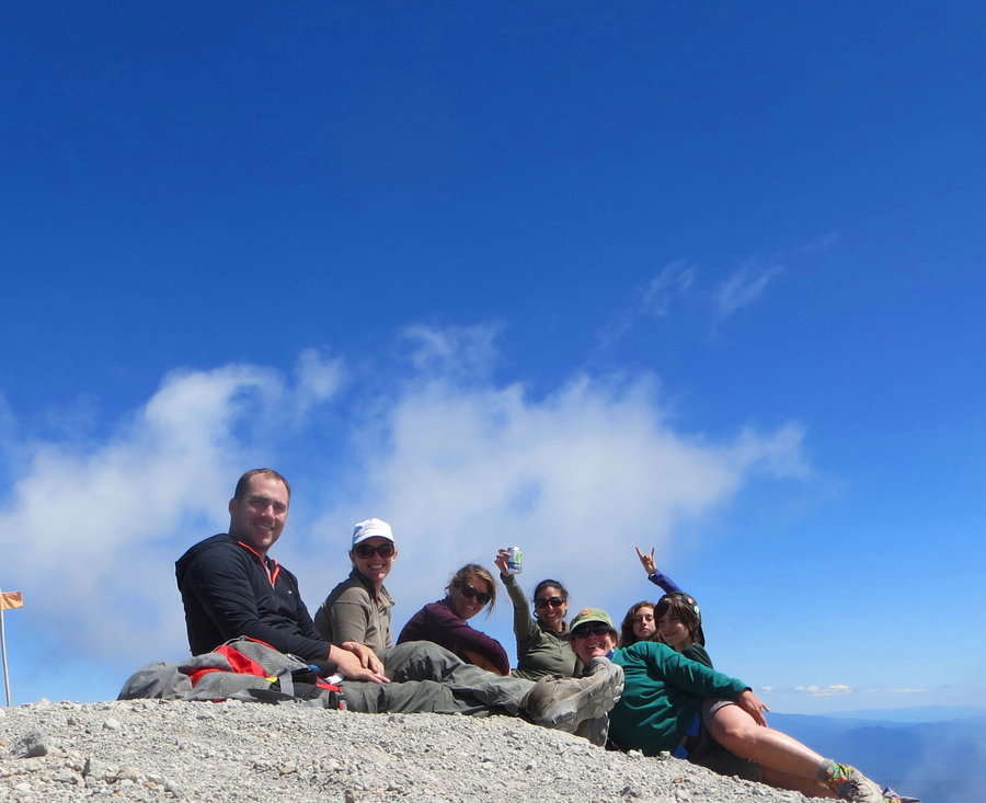
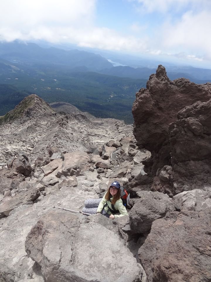
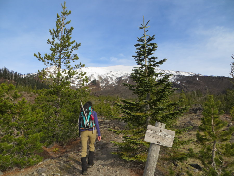
MSH
9.5 miles of hiking • 4500' elevation gain •
Got my 12 year old and few other first timers to the top on a glorious day. After an active summer of backpacking and ultimate frisbee, my skinny kid CRUSHED it, all I had to do was feed him regularly.
August 6, 2015

Olallie
4 miles of hiking • 500' elevation gain • 1 night
Quick escape from heatlandia. We hiked along the PCT and then went off trail to a hidden lake. Swam, picked huckleberries and enjoyed the high country. No bugs! Kayaked on Olallie lake the next day.
July 29 – July 30, 2015

 1
1
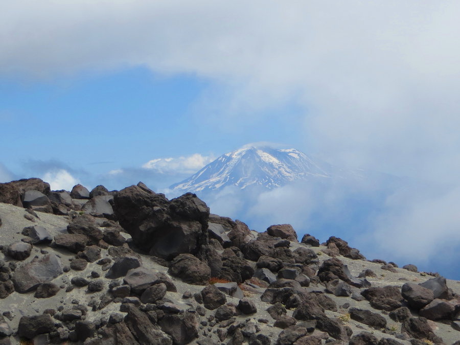
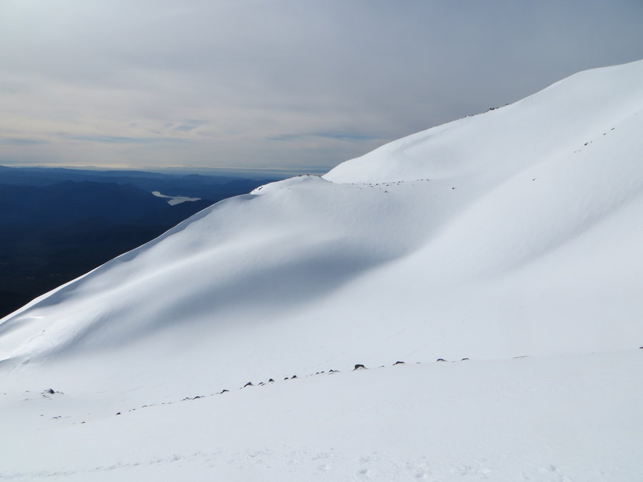
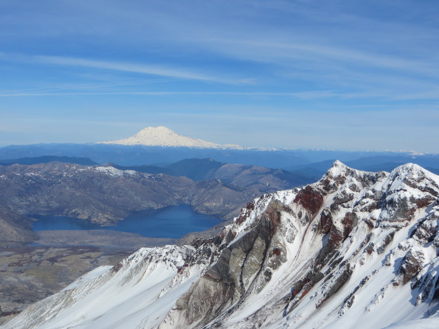
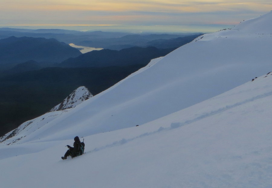
Monitor Ridge
7.5 miles of hiking • 3000' elevation gain •
I bought the permits in February. My 16 yo niece from Brooklyn NY decided to visit us for a few weeks this summer, so I invited her to join us on the climb. She was very enthusiastic and we started out at a good pace. However, the city girl found the terrain above timberline to be increasingly difficult as we ascended. We got up to the monitor station, and that was enough volcano for her. The others in our group went on to summit as we slowly made our way back down. Although we didn't make it to the crater rim, it felt like a grand adventure to her, and she was proud of her achievement The conditions and views were great today: starting out misty and mysterious then clearing to allow us the full vista on the return trip.
July 23, 2015


 1
1
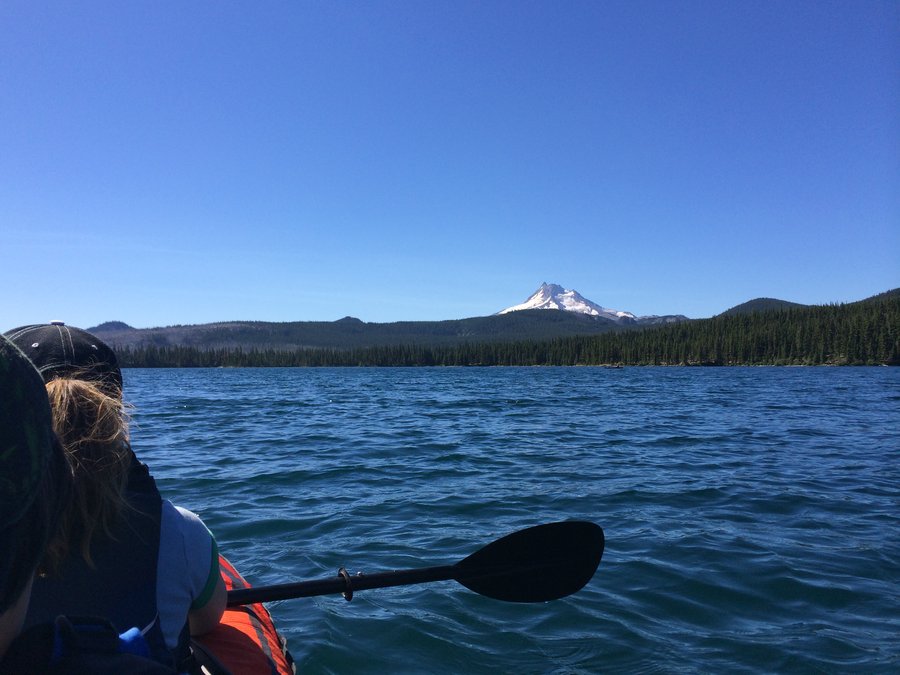
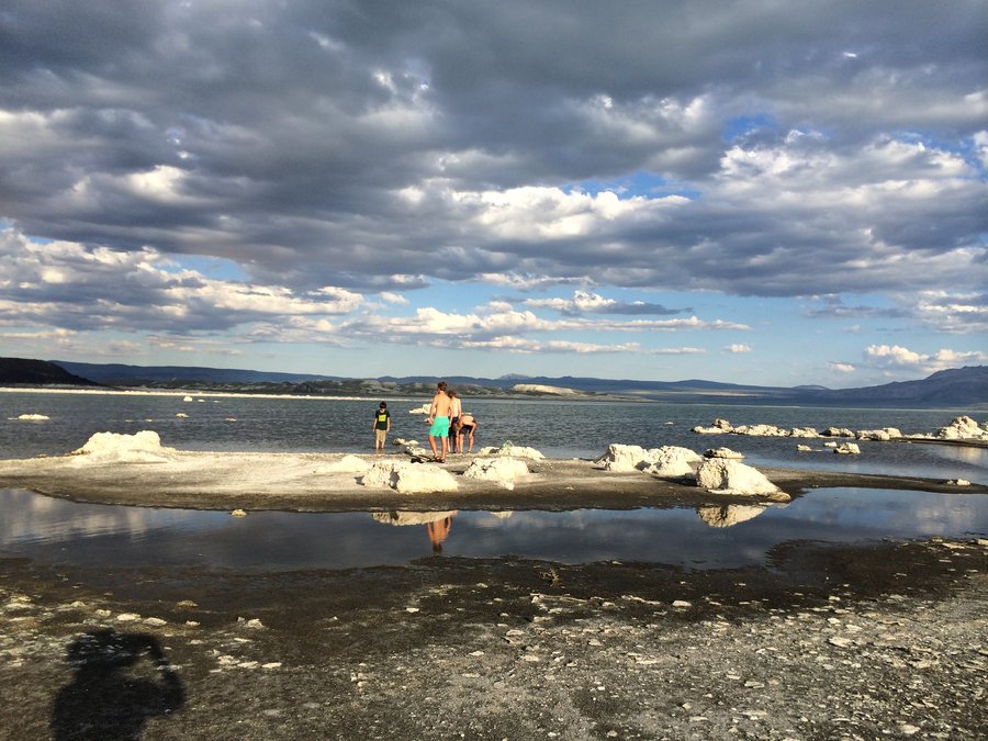
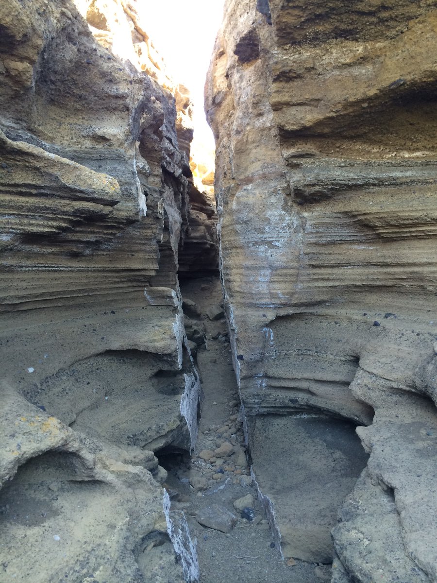
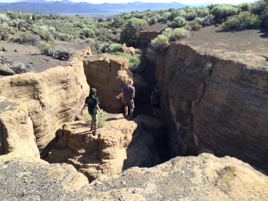
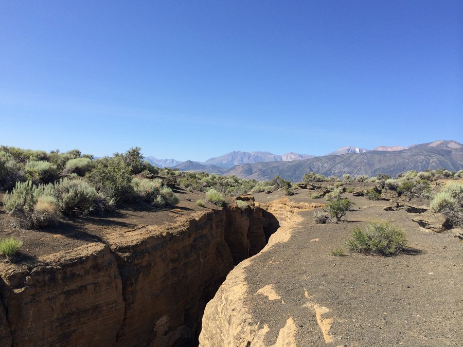
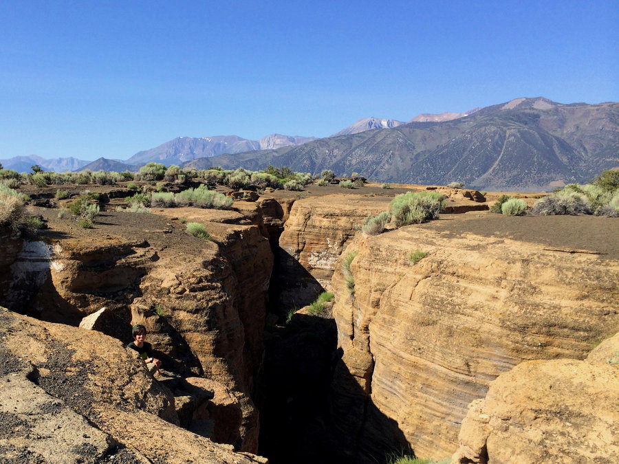
Mono Lake
4 miles of hiking • 750' elevation gain • 1 night
Primitive camping is allowed on the north shore of Mono Lake, you can walk in from a gate off the cemetary road. We were the only humans around this bleak but beautiful place. After a calm night on the lunar-like surface of the lakeshore, we trudged up nearby Black Point which is a volcano that long agos was submerged under the lake. When it erupted underwater, the cooling lava fractured forming big cracks on the top, now known as the Black Point Fissures. The kids had a blast exploring the cracks, similar to Oregon's "Crack in the Ground".
July 15 – July 16, 2015


 1
1
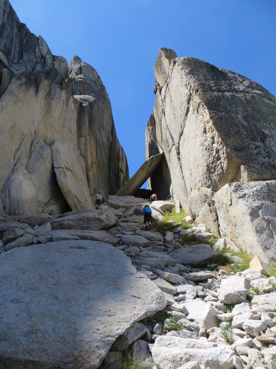
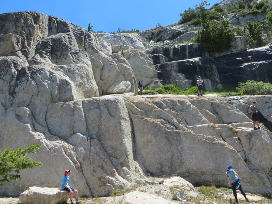
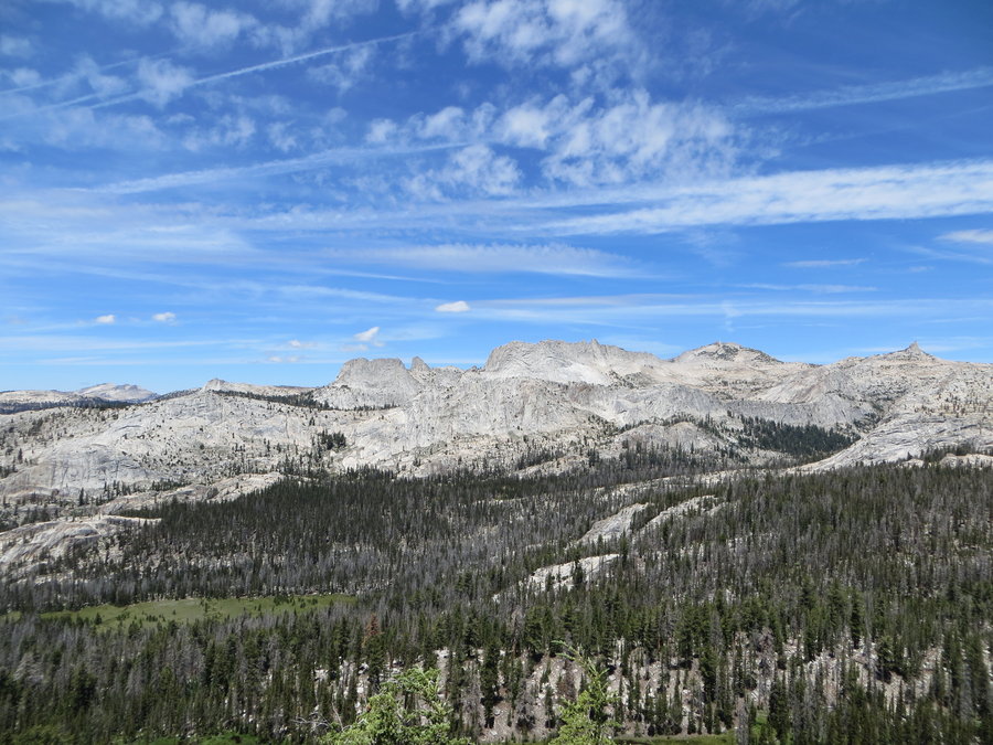
Cathedral Range Yosemite National Park
24 miles of hiking • 6000' elevation gain • 3 nights
Wonderful family trip: 3 adults, 4 teenagers, almost all off trail. Spectacular alpine campsites at Nelson and Echo Lakes. Solitude until we hit the JMT for the last few miles out.
July 12 – July 15, 2015


Unicorn
6 miles of hiking • 2000' elevation gain • 1 night
Went with the Mazama Families Group. Third time I've done this trip, but the first time with no snow. The gully above Snow Lake is much slower going without that snow. It took us so long to gain the ridge, we decided not to attempt the summit block. But the weather was great, the scenery spectacular and the kids were cheerful the whole way.
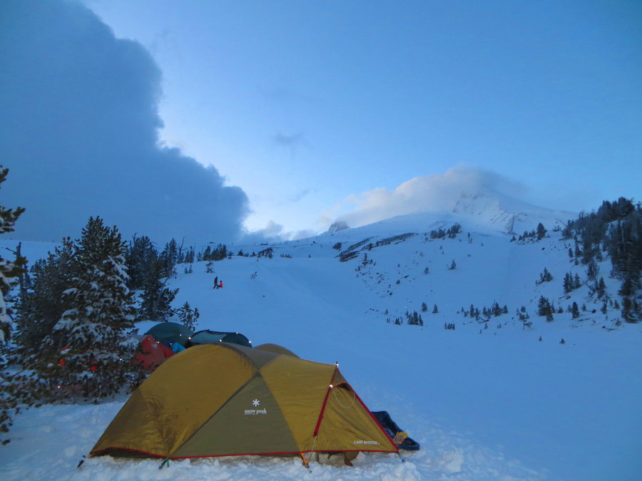
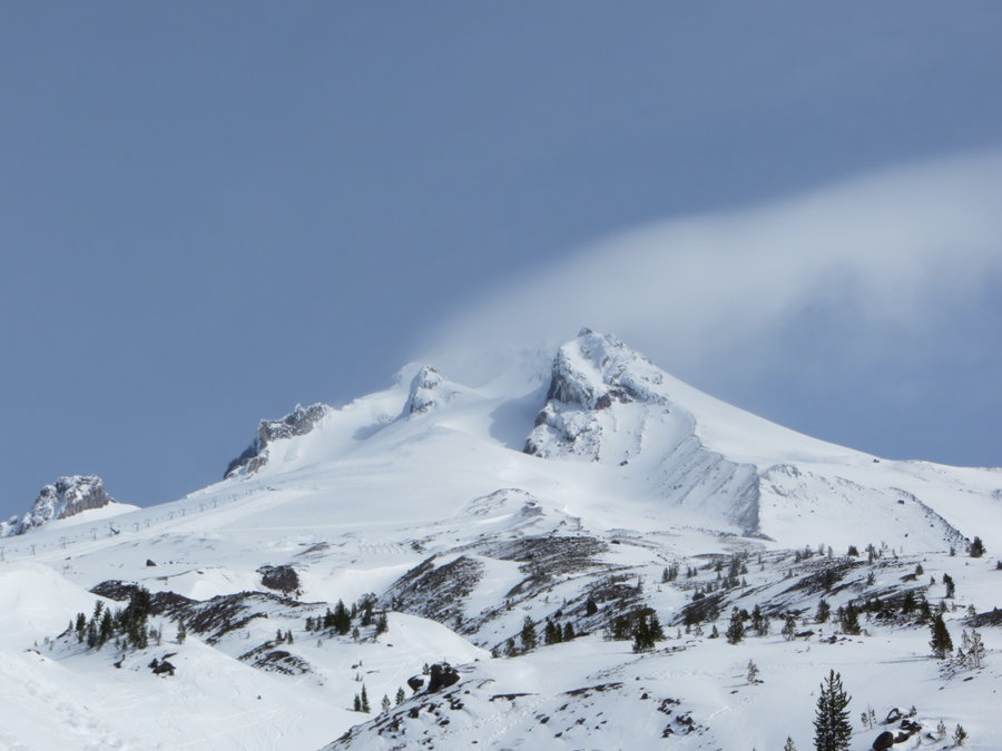
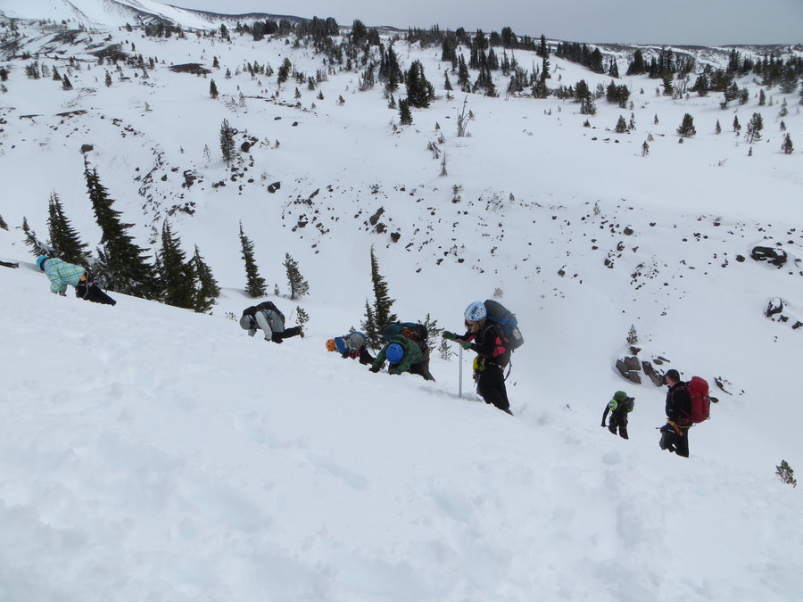
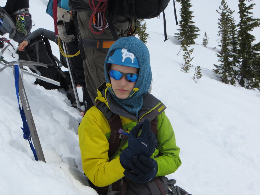
June 20 – June 21, 2015

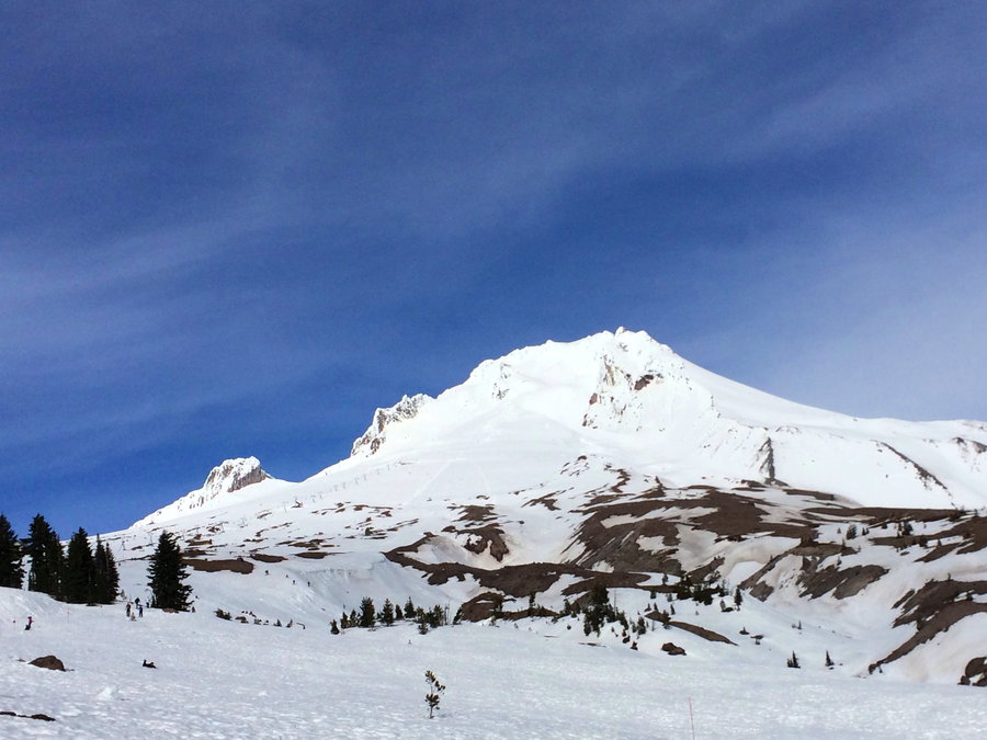
 2
2
Mt Hood via Mazama Chute
6 miles of hiking • 5500' elevation gain •
Pretty windy today, had the summit to ourselves!
June 9, 2015


Butcher Knife Ridge
5 miles of hiking • 750' elevation gain •
Late start, poor planning and rainy weather turned this trip into just a little exploration, but I'll be back!
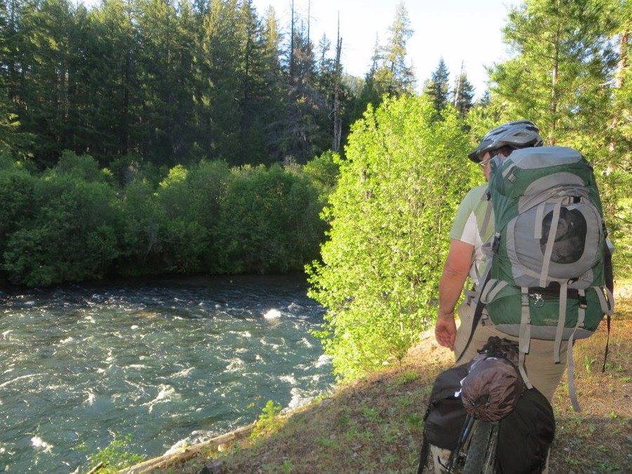
June 2, 2015

Metolius bikepack
11 miles of hiking • 3000' elevation gain • 2 nights
My first bikepacking trip, we went around the Metolius Horn, about 24 miles one way. The downstream portion of this riverbefore it rounds the horn and becomes Lake Billy Chinook feels really wild. No-one past the first few miles beyond the gate for the whole trip. On the remotest part of this route( the Shut In Trail), it was more of a bikeschwack where we were often pulling our bikes over and under fallen logs. It was also helpful to have our helmets on while plowing through overhanging vegetation, what a blast.
On the second day we hiked: up to the top of Green Ridge using the mysterious Reservation Trail, and floundered through manzanita in a fruitless attempt to get close to Castle Rock.
May 24 – May 26, 2015

Cook Aug bike shuttle
8.5 miles of hiking • 3750' elevation gain •
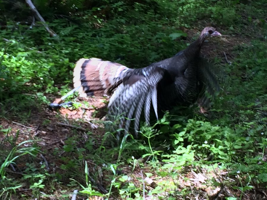
Well I didn't get to see a bear like Romann, but I saw tons of bear poo. Enjoyed the solitude, wildflowers, and views. Spooked a mama turkey hen who was roosting on about 10 fuzzy turkey chicks. 4 1/2 hours of dreamy hiking, 35 minutes back to the car on a screaming ride down the east side.
May 19, 2015


GP wanderings
7.5 miles of hiking • 2250' elevation gain •
Gorgeous day in the moist lush forest with absolute solitude.
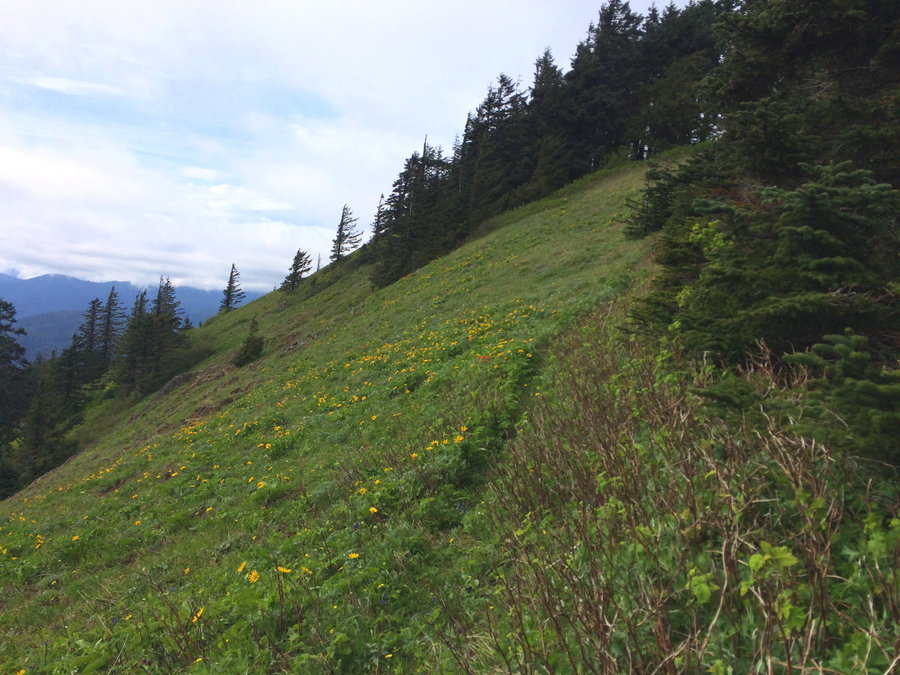
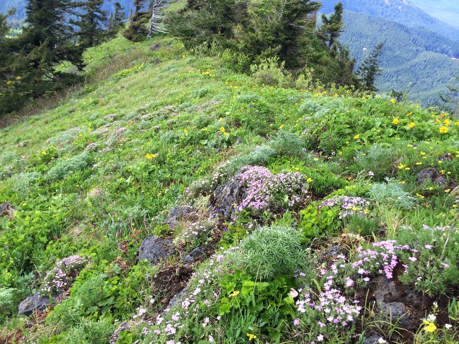
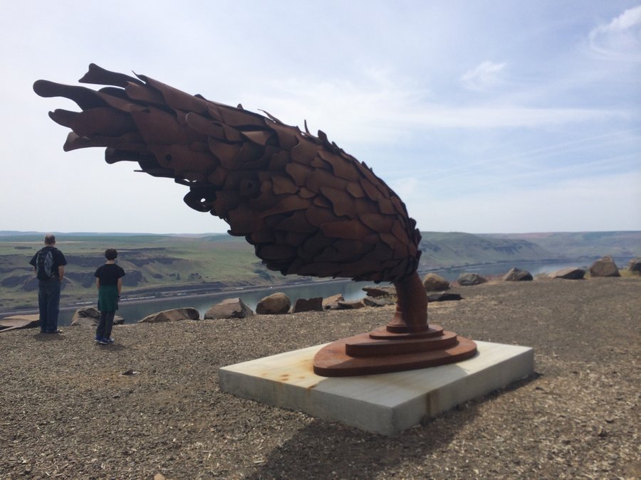
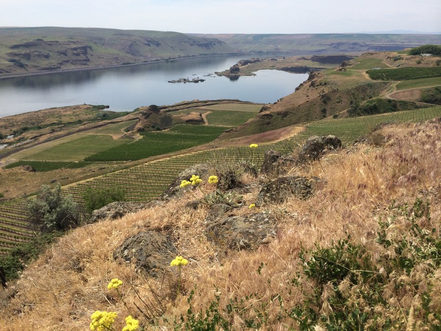
May 12, 2015

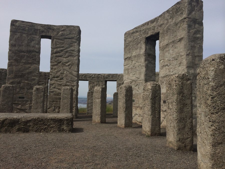
Dalles Mountain Ranch
4 miles of hiking • 500' elevation gain •
Short hike for Mother's Day after visiting the Maryhill Museum and Stonehenge. Happy to have my husband, son and 81 year old father in law along to enjoy the summer hot day.
May 10, 2015

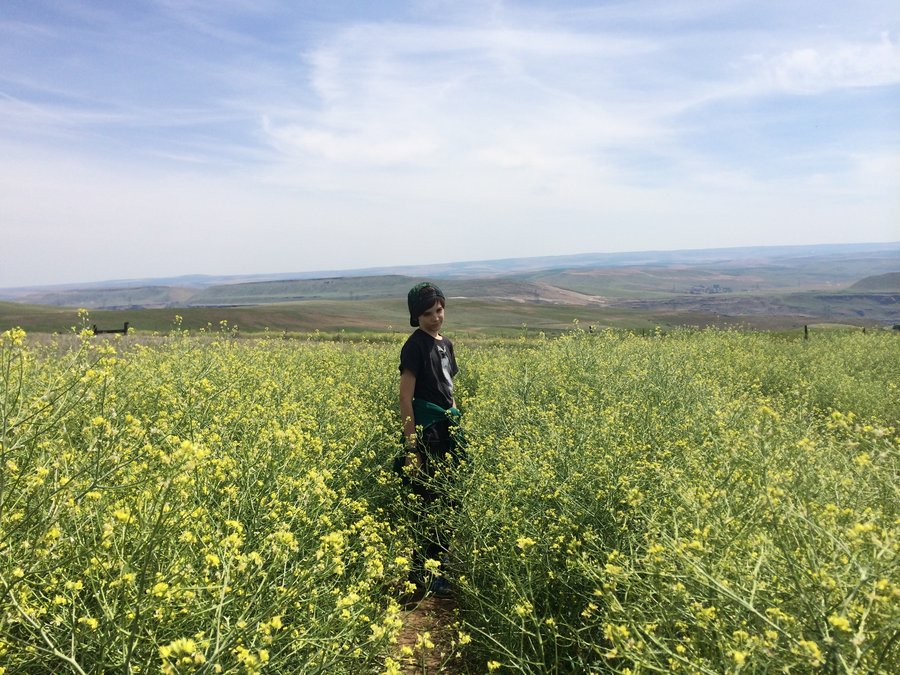
McCall Point
5 miles of hiking • 750' elevation gain •
Flowers still looking good up high, fading down below.
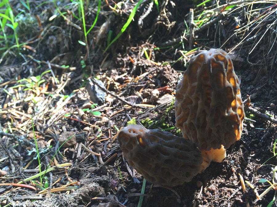
May 9, 2015

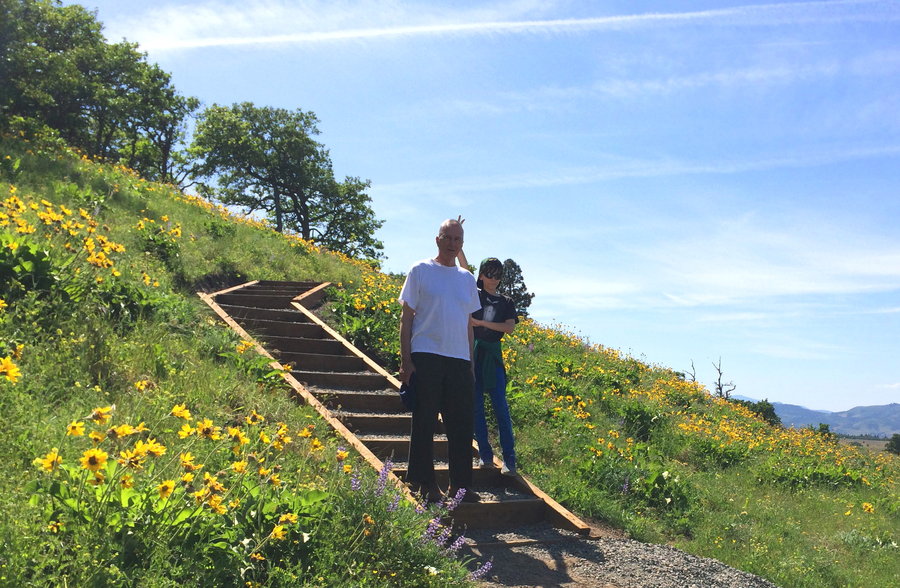
Bald Butte via Oak Ridge
10 miles of hiking • 2500' elevation gain •
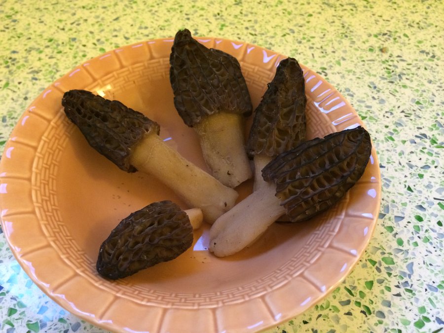
Lovely wildflowers blooming on the Oak Ridge Trail. After heading south on Surveyor's Ridge to retrieve my game camera (abysmal results), we turned north to climb up the steep gravel ATV road to Bald Butte.
Bald Butte would be a lovely summit except for the massive scars from motorized vehicles, it's a bummer to see that damage.
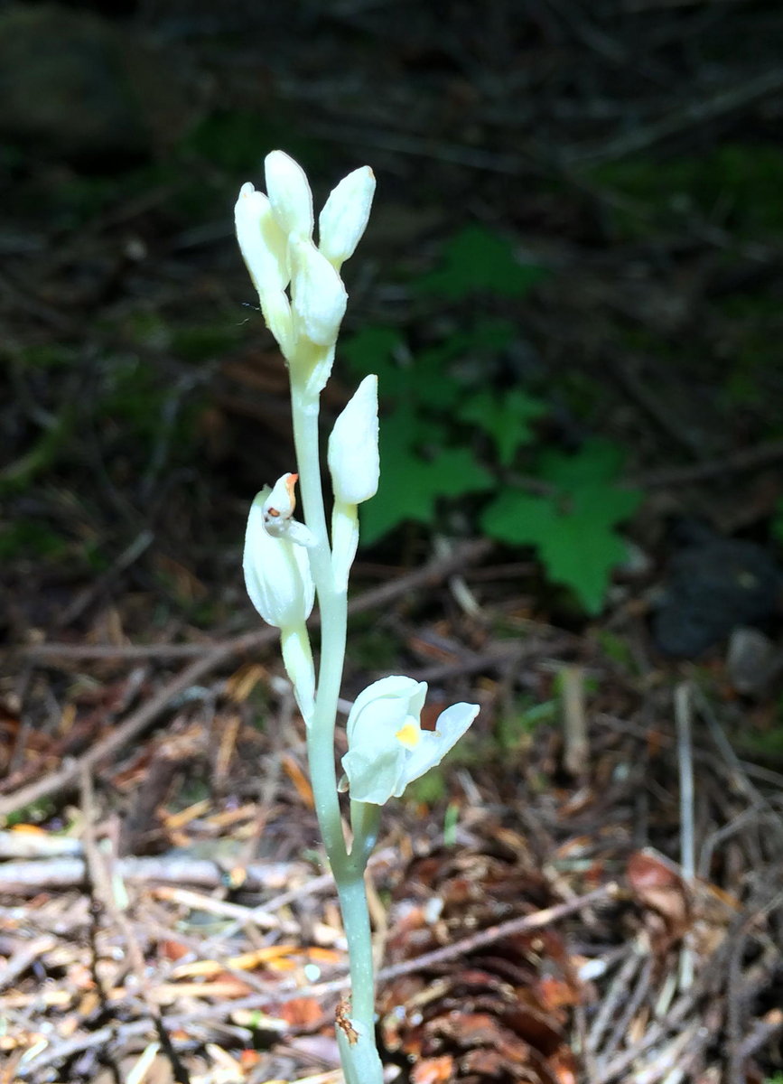
p.s. morels are starting to pop!
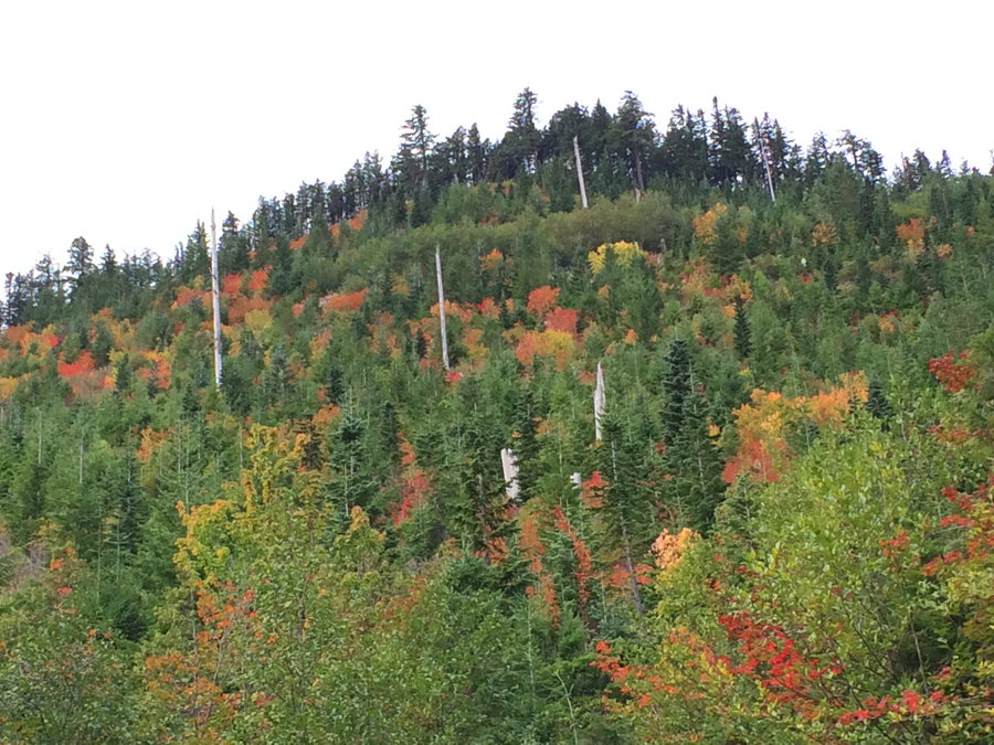
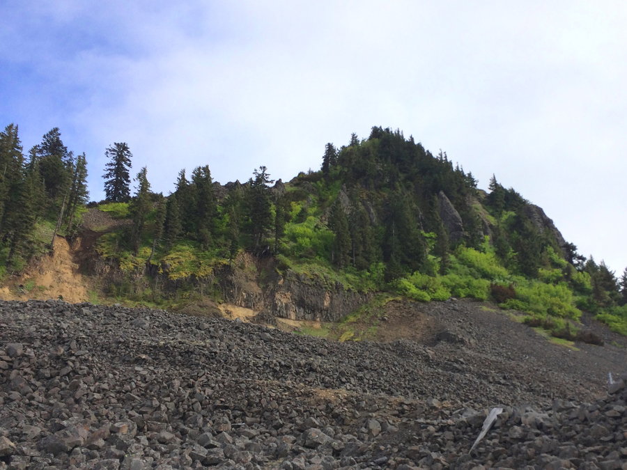
April 29, 2015

 2
2
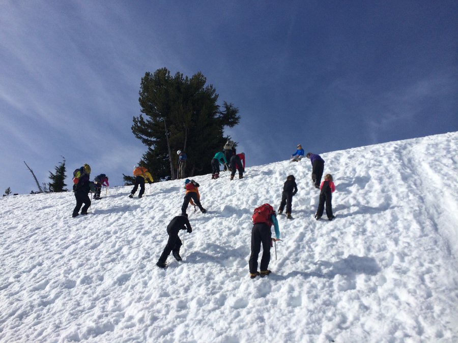
Timberline Snow Camp
5 miles of hiking • 1000' elevation gain • 1 night
We had a great weather window for a family snow camp out on Mount Hood with some hearty Mazama families. A challenging experience for my erratic planning abilities after a third night shift in the hospital. I learned quite a few things and was thankful Mother Nature was gentle to us that night. Snow skills and roped team travel practice the next day, kids and parents exhausted!
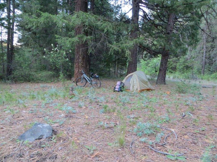
April 25 – April 26, 2015


C-Z trail
4.5 miles of hiking • 500' elevation gain •
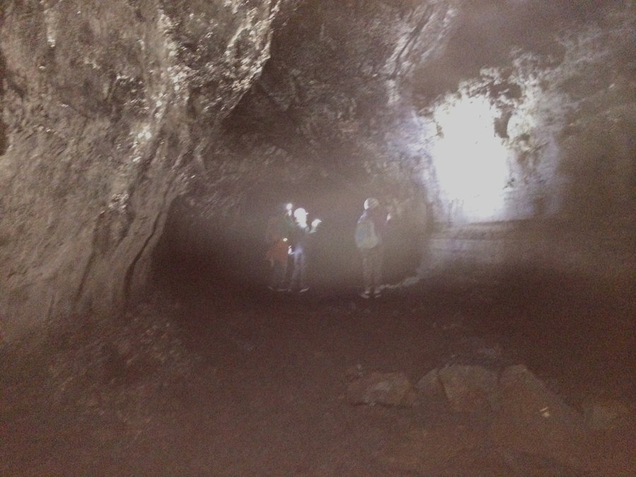
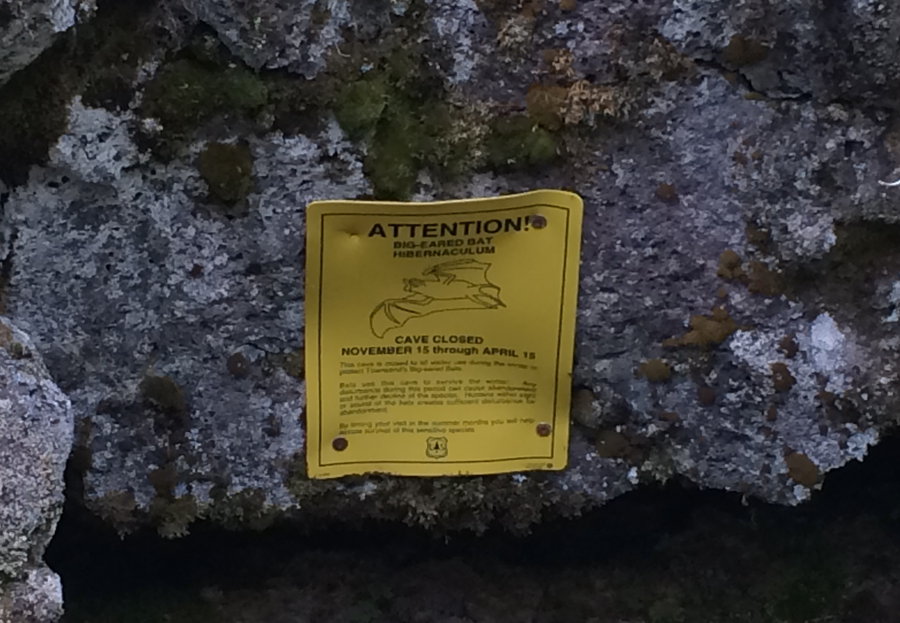
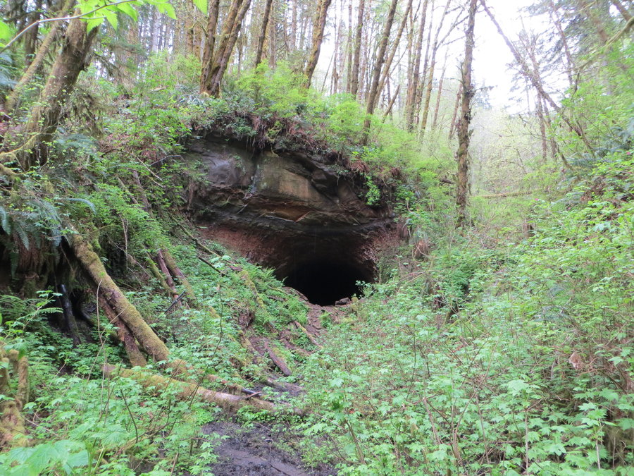
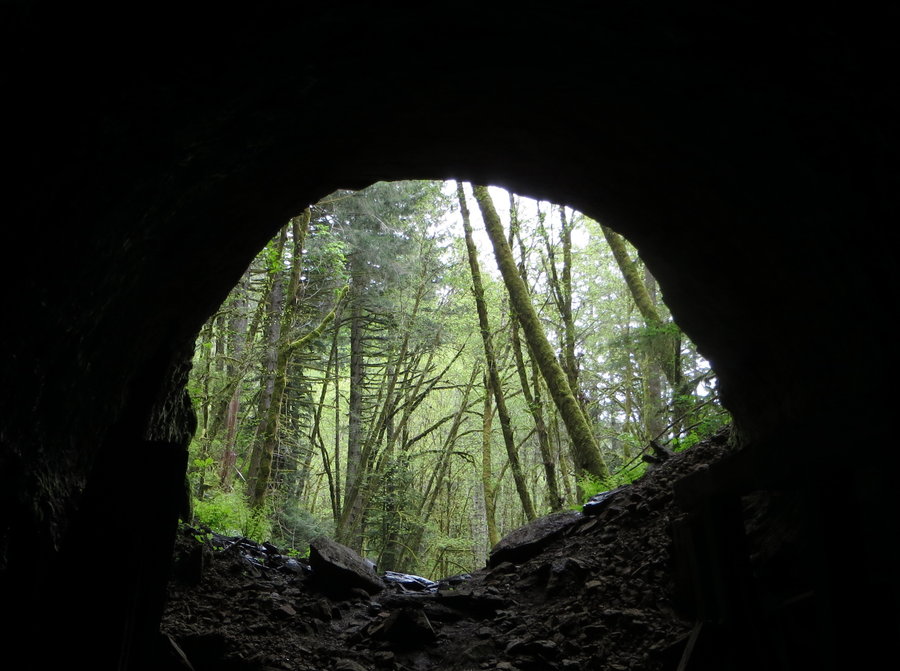
I biked the wonderful Crown Zellerbach trail to the Nehalem Divide summit and went bushwacking around the top looking for the old trail tunnel. Found out it is a big mistake to bushwack through stinging nettle in shorts and bike cleats. Came back the next day and drove to the top and hiked around with my boots and pants on. Found the tunnel!
April 21, 2015

Leone Lake
5 miles of hiking • 1000' elevation gain •
I had a challenging ride up the hill from Breitenbush and then a short steep hike to a ridge that overlooked this lovely lake set in a wooded basin. Dropped down into some big trees surrounding the lake, similar in feel to Wahtum lake. Was amazed to find a dad and his two small children in a sturdy rowboat fishing in this lake on a perfect spring day. How the heck did he get the boat there???
April 18, 2015

Granite Peaks
5 miles of hiking • 500' elevation gain •
Wandering around snowy roads and some fun scrambles in the hills.
April 17, 2015

April 10, 2015

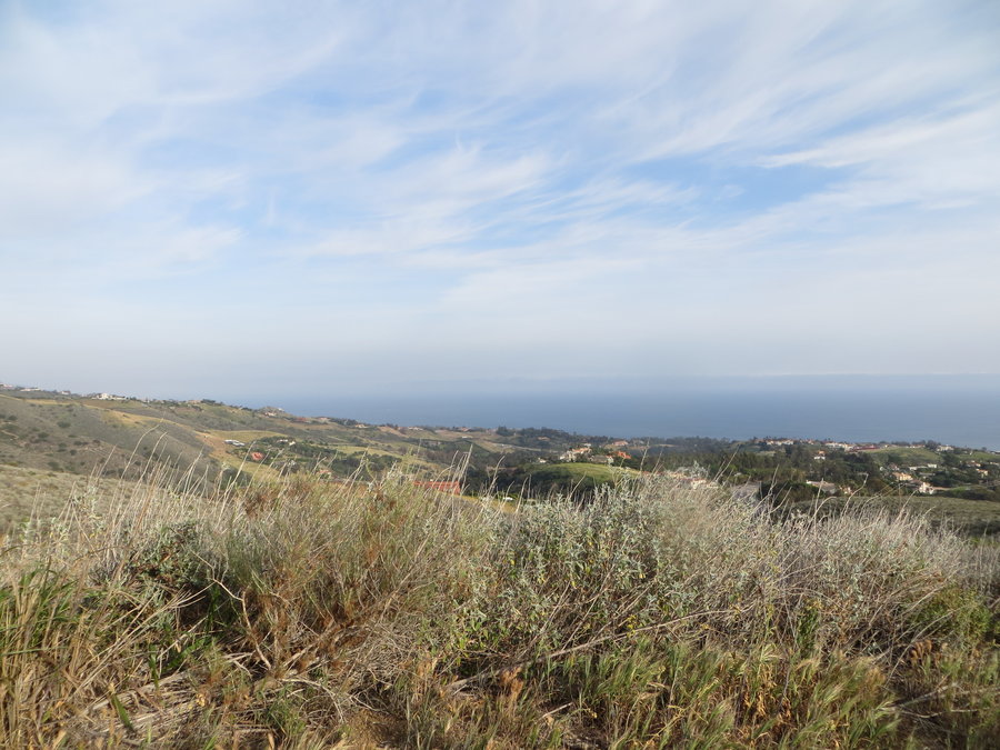
LA area hiking
14 miles of hiking • 1500' elevation gain •
Spent a few days in LA with family for spring break. Got to hike a little every day, including one big free day for me, while my husband and son went to Universal Studios.
We all hiked Zuma Canyon and El Matador beach near Malibu, Griffith Park, and the Burbank foothills. On my solo day, I hiked around the old Mt Lowe railbed and summited Mt Lowe and Mt Markham in the San Gabriel Mountains.
March 22, 2015


March 19, 2015

Monte Cristo Traverse
11 miles of hiking • 3500' elevation gain •
Our plans were a bit overambitious for the late start. A few inches of fresh snow remaining on some of the shaded areas above 3000 ft. We left bikes near the northern TH and drove back down near Oklahoma Campground to begin our traverse on the Monte Carlo Trail. The northern section of this traverse over Monto Carlo and Monte Cristo is lovely. Moonlight snow biking on the way out for the first few miles, what a hoot!
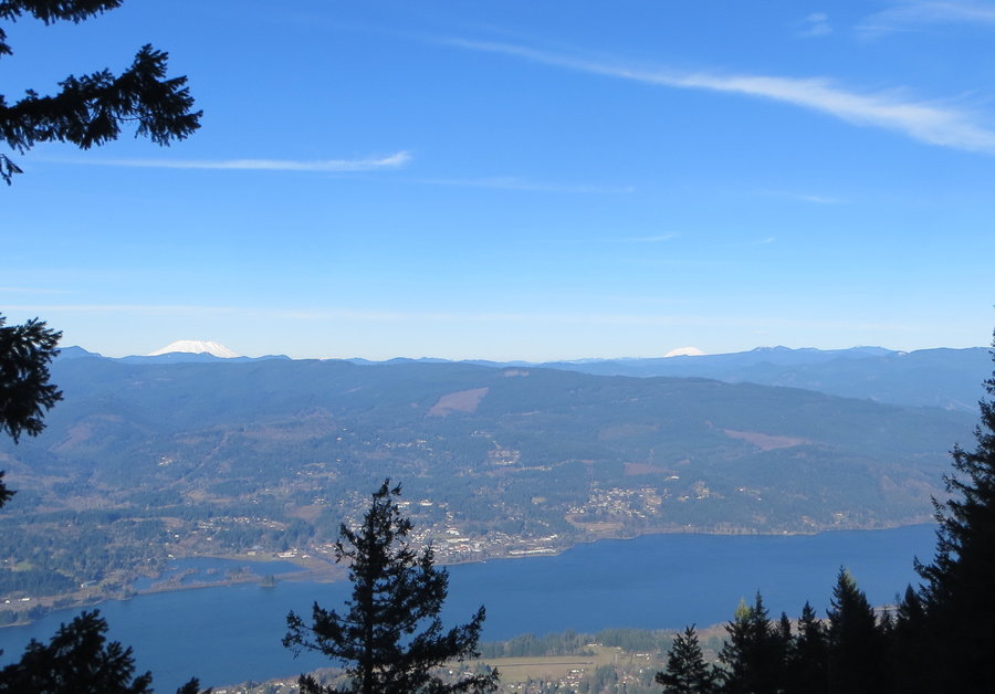
March 3, 2015


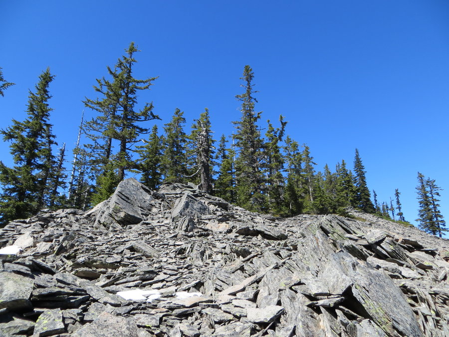
Sisi Butte
6 miles of hiking • 1500' elevation gain •
On my way to Breitenbush. Road 46 is open all the way to Detroit.
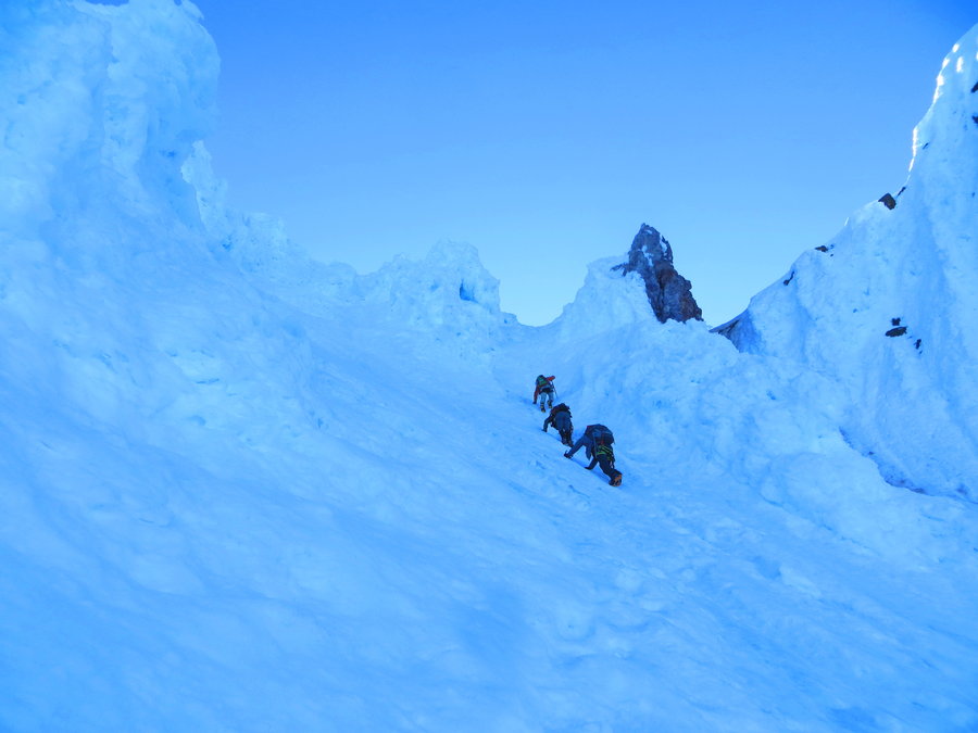
February 18, 2015


 1
1
MSH
11 miles of hiking • 5500' elevation gain •
Well when we finally got to the snow at about 5600 feet, conditions were perfect.
February 13, 2015


Gov Camp
4 miles of hiking • 500' elevation gain •
Mazama Family Mountaineering Class. After mostly standing around on all day helping kids learn how to use crampons and ice axe, I was able to go for a wander on the trails off West Leg Road.
January 31, 2015

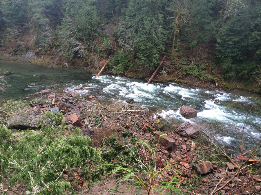
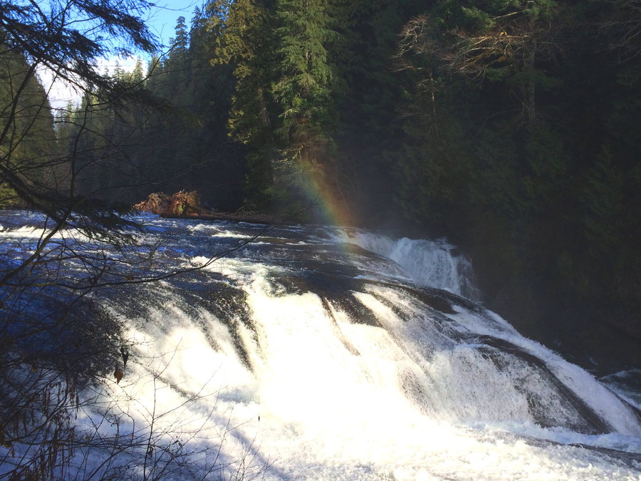
Antidote to SAD
8.5 miles of hiking • 750' elevation gain •
Had fun noodling around on the Lewis River Trail. No one around, warm, cozy,elk musk, rainbows.
There is a massive new slide to behold below the Middle Falls. Geology in action.
January 15, 2015


January 7, 2015


View trips from: 2011 2012 2013 2014 2017 2016 2018 2019 2020 2021 2022 2023 2024 2025 2026