2024 Trips

December 19, 2024
Tucson area hikes
22.5 miles of hiking • 4750' elevation gain •
Hiked every day while in Tuscon:
1) Wasson Peak in Saguaro NP 8 miles, 1800 eg 2) Little Elephant Head, Santa Rita mtns, 4 5 miles, 1000 ft eg 3) Cochise Stronghold Trail, Dragoon Mtns, 6 miles, 1400 eg 4) Pima Canyon, Catalina mtns, 4 miles, 500 gain
December 10, 2024
Multnomah Basin Road
7 miles of hiking • 750' elevation gain •
I drove up to the winter gate(closed) on Larch Mountain road with my skis, expecting snow. None. Went hiking instead. Took Palmer Mill down to Multnomah Basin Road and wandered around. Looks like folks are carrying on Red Shorts' projects.
Valley of Fire Peak x 2
13 miles of hiking • 1750' elevation gain •
Crazy route finding adventure in the sandstone. Had a blast navigating slabs and dryfalls, gazing in wonder at all the sculptural features around us. We failed on our first attempt, but spotted a viable option on the way out. Not enough daylight left to try it. We also hiked up the nearby petroglyph trail- tons of images! We wondered why there, and we didnt see anything on our 7 hours of hiking through the maze across the street, and we were scrutinizing all of the varnished faces.
Did some research and decided to try again before our flight home to PDX. We made fast time to the hidden slot canyon that gave a more direct approach to the 3rd class ramps leading up to the summit. It was very satisfying to come back and get all the way up there. Views were magnificent.
Apparently an event company has permits, and it is popular to fly to the summit and get married, there are picnic benches up there for such events. We didnt see anybody today but a nice bighorn ram who was not very concerned about us.
Mt Sutor and Canine Crag
9 miles of hiking • 1750' elevation gain •
Cool approach via the Petroglyph Trail in the Sloan Canyon NCA. I really enjoyed scrambling around inthe Canine Crag area. Did not see anyone all day.
Oregon Desert Canyons
9.5 miles of hiking • 750' elevation gain •
Spent two nights at Cottonwood Canyon SP in the cabins. Such a great desert getaway!
Enroute, we stopped at Deschutes River and biked up that canyon for about 7 miles, then my partner got a flat tire. We imagined spending a night there doing some winter camping at one of the rafters sites, now on the list!
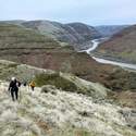
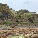
Cold starry nights in the canyon- no wifi, blissful. We explored Hay Canyon and wandered the high bluffs, and the Hard Stone trail where we relaxed by the river and a nice sized big horn ram strolled into view. Everything was golden and sundrenched.
Smith again and Mecca Flat
16 miles of hiking • 2500' elevation gain • 2 nights
Had two more days at Smith, camping at Haystack Reservoir. Friday was ethereal, with little cirrus clouds flowing across the sky. This place is so beautiful. Met up with friends on Saturday for climbing, and we visited multiple crags in the park.
The rain came in overnight and we woke up to a drizzling Sunday morning, decided to just head home. But the weather cleared it was blue skies when I hit Warm Springs and I was not ready to return to a dreary week in PDX, so I turned off the highway onto the BLM road and went a few miles east to Mecca Flat on The Deschutes. This was a beautiful flat walk down the canyon a couple of miles towards Trout Creek.
There were quite a few cars in the day use area, but I was the only hiker. This is where all the fly fisherpeople go. Currently, it is Steelhead trout they are after. It was interesting to observe the anglers in their obsessive hobby. Seems very meditative. They take good care of the access trails, cleaner than the rafter and hunter areas I have visited. Maybe when I get older I'll try it. Not ready to slow down yet. Saw quite a few (wild/feral?) horses across the river on the tribal land.
Fall in the Gifford
4.5 miles of hiking • 250' elevation gain •
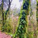
Just a pleasant day of wandering in the woods, perfect timing for the golden chanterelle bloom.
Smith
8 miles of hiking • 2500' elevation gain • 2 nights
Spent multiple days hiking and climbing. Camped at Haystack. Saturday and Sunday trips were to the Marsupials where I led several students on multipitch routes. Birds in a Rut on the Wombat and Living Blindly on the Possum.
Melakwa Lakes
10 miles of hiking • 2500' elevation gain •
Started early to beat the crowds, but they never showed up! Just me and the pikas. Had the lakes to myself and just saw a few folks coming in on my return trip. Would love to return for a backpack and scramble up the local summits.
The only drawback to this hike is it takes quite awhile to get away from the drone of I-90. It's like the gorge, but louder.
Kachess Ridge-shortened
3.5 miles of hiking • 1250' elevation gain •
My intention was to hike up to Mt Thomas via the Domerie Divide trail. When I was gearing up at the trailhead, a fish and wildlife officer came along and told me there was a report of an aggressive mountain lion up on the ridge where I was headed. I decided I wasn’t concerned and started the hike.
After crossing SilverCreek, a big fat, fuzzy bear jumped on the trail in front of me. It took two steps toward me, then suddenly stopped when it saw me did a 180 and ran away . I got a picture of its butt. It looked well prepared for the winter, happy hibernation good bear!
Soon after, I met up with the woman who had the cougar encounter. She said it stalked and menaced her in the vicinity of Mt Baldy, where I was headed. She had to yell and throw sticks until it finally ran away. She was pretty distressed and advised me not to go up there. I was considering turning back but after a couple mountain bikers and a hiker came by and kept going up, I decided to press on.
But I was rattled, vigilant, anxious, and could not fully enjoy the beautiful fall day. After lunch at a viewpoint, I headed back down, scanning the forest and looking behind me regularly, rock in one hand trekking pole in the other.
Liberty Bell
5 miles of hiking • 2500' elevation gain •
It seemed like all of WA state was out with their dogs on this perfect fall day. 100s of cars lined the highway near the Blue Lake trailhead. Climbing was also busy and we had to wait to get onto the Beckey Route. Lovely to climb on granite.Got benighted again, but luckily it was after we had rappelled and then down climbed the "unpleasant gully".
Tasmanian Devil and The Zoo
7 miles of hiking • 1500' elevation gain •
East of Smith Rock, north of Skull Hollow Campground. Pleasant day of wandering. Winter gates are closed, keeping the ATVs out. Great trail system out here! Desert sageland hiking is very restorative.
Fall forage
5 miles of hiking • 1000' elevation gain •
Mushrooms are popping, understory warm and barely moist. pretty good haul today.
Putvin Traverse
16 miles of hiking • 6000' elevation gain • 1 night
We stashed a bike at the Putvin TH, then drove back down the Hamma Hamma road and started up the Lena Lakes trail. Continued to Upper Lena where we were supposed to camp and climb Mt Bretherton. We were inside a cloud with limited visibility so we decided to skip the climb and continue on the Scout Lake Trail. This was heavenly terrain, undulating through heather and huckleberry. The dwarf huckleberries are ripe and so sweet. We hoped to see some bears, but we only saw their sign. Although it did not rain, it was misty and the soggy vegetation soaked our legs and feet despite rain pants and gaiters. Camped at Deerheart Lake.
We were very happy to unzip our tents to blue sky the next morning, and the views were delightful as we continued on the traverse through golden meadows and numerous ponds on the Stone Ponds Way Trail . St Peter's Gate was very sketchy, guarded by an icy snow traverse, then a steep loose class 4 scramble. We dropped down via boulder field and thick snarly bushwack near Lake of the Angels and landed on the notorious Putvin trail for the descent. It seemed trivial compared to what we had just done. Rain started during the last hour, and the bike ride back down to retrieve the car in a deluge was 50/50 thrill, sufferfest.
Pinnacle and Tatoosh Peaks
16.5 miles of hiking • 6000' elevation gain • 2 nights
Climbed Pinnacle peak with friends and stayed one night at La Wis Wis. On the second day we went up Tatoosh Peak trail to the most amazing spot, as wonderful as my visit 3 years ago, and weather was perfect. We should have stayed two nights there.
Ramona loop
8 miles of hiking • 1250' elevation gain •
Relaxing day. Sat in the dynamic streambed of the Sandy River and skecthed for awhile. The mountain is very colorful this time of year.
Ingalls Peak
11 miles of hiking • 3750' elevation gain • 1 night
Great trip in the alpine. We had a gorgeous campsite with Mt Stuart looming above us. Beautiful evening with alpenglow and pika song. Saw a pair of goats at the lake. This is a busy area, and can be extremely crowded during the larch peak time.
Started early for our ascent of Ingalls Peak and had it to ourselves for awhile. Congestion on the way down because you have to rappel down the upward route.Interesting to negotiate that with the other climbing teams, but everyone was nice and accommodating and it was a beautiful day!
A big storm came in just as we returned to the TH, phew!
Cruzatt Rim
6 miles of hiking • 1750' elevation gain •
Took the Prindle Mountain trail up. Lots of bear scat down low, and elk duds up on the pleateau. Love the big cedars, firs and hemlocks of the enchanted forest.
Castle Pinnacle
4 miles of hiking • 1750' elevation gain •
Climbed Castle and Pinnacle on a magnificent day
Boulder Creek
3 miles of hiking • 500' elevation gain •
My son came with me on a camera check for Cascadia Wild. A lot of critters visited our site(bears, bobcat, deer and coyote), but none of the target species.
It was a hot day, but we enjoyed some relaxation in the shade near the creek. We also found a patch of ripe huckleberries.
Sloan Attempt and Vesper Success
12 miles of hiking • 5250' elevation gain • 2 nights
Started out with an attempt of Sloan Peak in the North Cascades. We were bushwacking in steep terrain when one of our climbers sustained an ankle injury and could not bear weight on it. Successfully used iphone SOS feature to get 911. SAR rescue ensued, took 10 hrs and 18 volunteers to carve a path and haul them out on a litter. Great learning experience.
We rested the next day and then hiked up to the base of Vesper Peak. We veered off the trail to the north side to climb to the summit via Ragged Edge; a 6 pitch 5.7 trad route, what a hoot! Had to hike out the last few miles via headlamp, but at least we had a trail.
Mt Aix
12 miles of hiking • 4250' elevation gain • 1 night
Highest point in the William O Douglas Wilderness.
We started early and got to the top at 11am.
Lovely ridgetop, flowers going strong. Bugs not too bad. Fun summit scramble.
July 6, 2024
Shale Lake
15 miles of hiking • 2750' elevation gain • 1 night
This was supposed to be a Mt Jefferson climb. We weren't sure of the summit conditions but had suspicions it would not be tenable. About four miles in, we were able to see the final approach to the summit block. A storm last week resulted in rime ice on the summit, precariously wind loaded on the western face. The warm temps would make the "terrible traverse" treacherous with ice fall. Climb was cancelled at this point.
Some of our group turned back, but 4 us went on to the Shale Lake area which is still under about 3 feet of snow. We had a pleasant night this first eve of summer. No bugs whatsoever, just bird and creek songs. Hiked out the next morning.
Unicorn Peak
6 miles of hiking • 2750' elevation gain •
Took up a group of 10. First time leading trad on alpine rock in mountain boots! Luckily it was very easy climbing. The moat has opened up but is just a slightly spicy hop-over. Fun glissades down. We did not glissade the couloir, careful plunge stepping, it is melting out and was posthole city. We caught the tail end of the weather window, started to rain when we got back to parking lot.
Camp Schurman
12.5 miles of hiking • 5250' elevation gain • 1 night
It took us all day to get up here. 10-12 inches of new snow, got soft in the afternoon. Breaking trail from Glacier Basin Camp all the way up the Interglacier, was quite exhausting. We were supposed to have an acclimation day at Camp Schurman before a summit attempt, but the weather window closed up so we headed back down.
Rimrocks
6 miles of hiking • 500' elevation gain • 1 night
I was meeting friends in the evening at the Steelhead Falls campground, so I explored some trails at Crooked River Ranch and along the Deschutes. There are long trails along both river canyons. Went climbing at Smith the next day.
Eastside Foray
4.5 miles of hiking • 500' elevation gain •
I go out every year and usually find a few. This year, we hit the jackpot!
Defiance
11 miles of hiking • 4250' elevation gain •
I decided not to turn off to hit the summit. Raining, windy, inside a cloud.
May 21, 2024
May 16, 2024
Gales Creek/Storey Burn Loop
7.5 miles of hiking • 1750' elevation gain •
Nice loop hike enjoying the filled out understory.
May 14, 2024
Waterworks Canyon
4 miles of hiking • 750' elevation gain •
Came up to climb nearby at Royal Columns. Had a nice evening hike before cragging. Beautiful canyon in bloom.
Tilly Jane
6.5 miles of hiking • 2250' elevation gain •
Spectacular Day! Came up to check on the wildlife camera. No critter shots, but we saw all the big volcanoes and some ravens and bluebirds
Ochocos
15 miles of hiking • 3000' elevation gain •
We stayed at the Ochoco Ranger House for two nights. Snow at higher elevations. On the first day we got to ski on frozen Walton Lake. Hiked up the Lookout Mountain trail to Duncan Butte on day 2. Stopped at Lake Billy Chinook on the way home and hiked the Tam-a-Lau Trail.
March 19, 2024
Dog x2
12.5 miles of hiking • 5750' elevation gain •
So fun, I went back again the next day! Pretty much melted out now.
March 9, 2024
Cottonwood Canyon
17 miles of hiking • 2750' elevation gain •
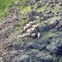
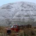
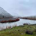
Stayed in a cabin for two nights for Galentines Day. Saw lots of sheep. Explored an old homestead. On the second night a storm came in and we awoke to snow in the desert. Magical!
January 23, 2024
View trips from: 2011 2012 2013 2014 2015 2017 2016 2018 2019 2020 2021 2022 2023 2025


