

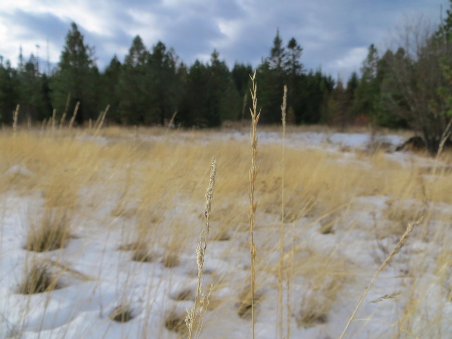
2014 Trips


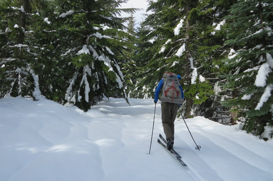
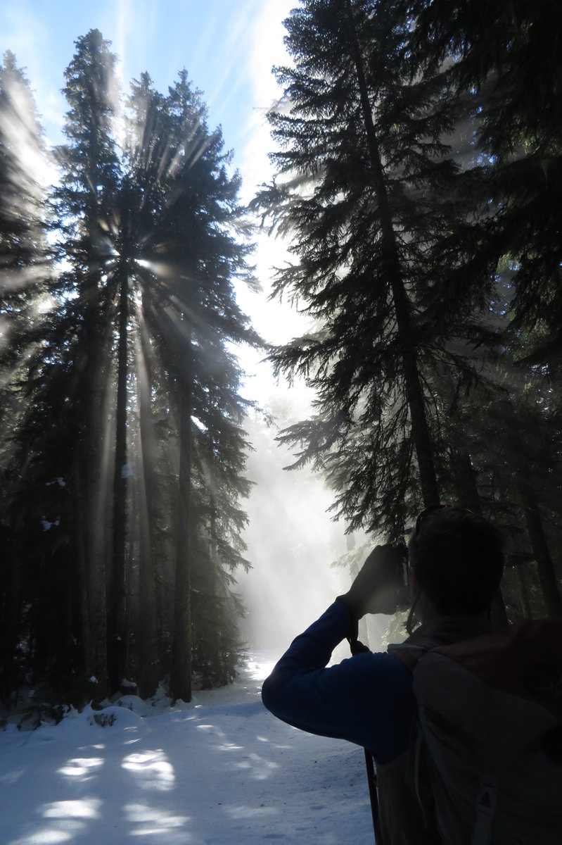
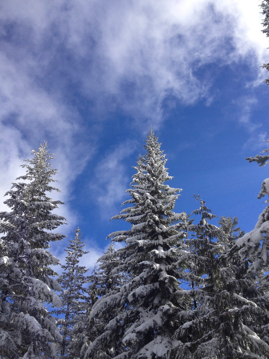
Larch
6 miles of hiking • 1000' elevation gain •
Headed up from the gate on MP 10. A winter wonderland of wanderings.

December 28, 2014

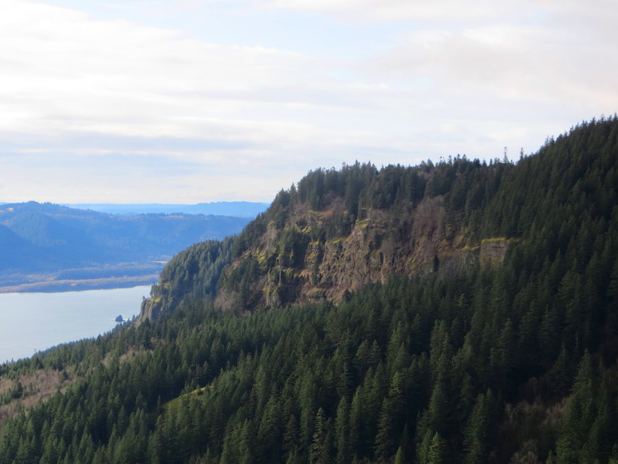
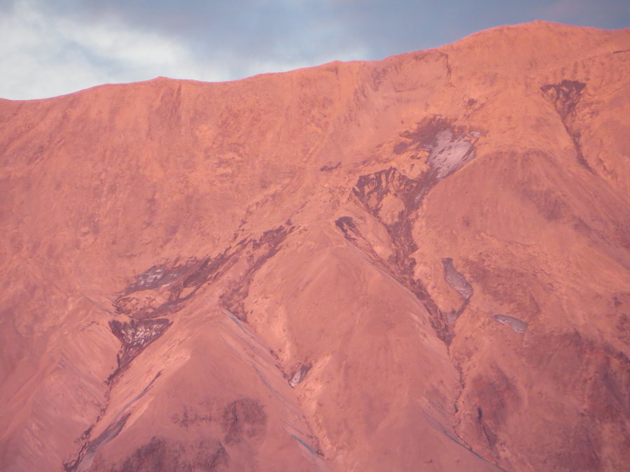
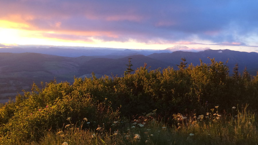
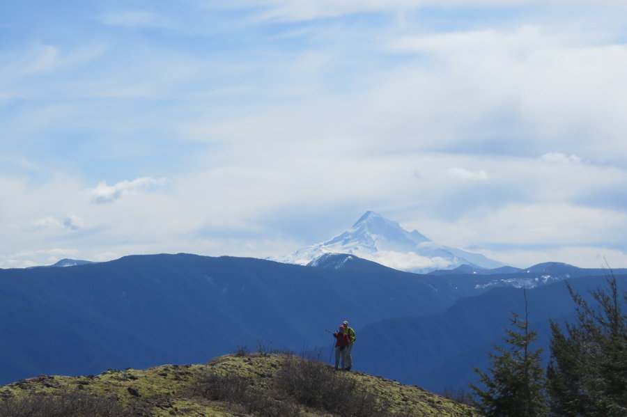
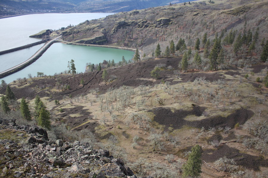
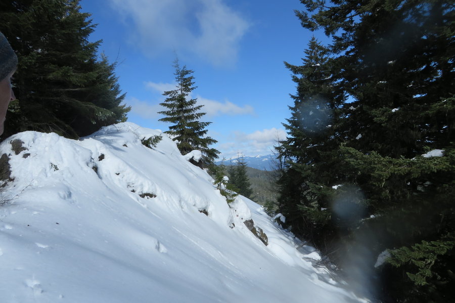
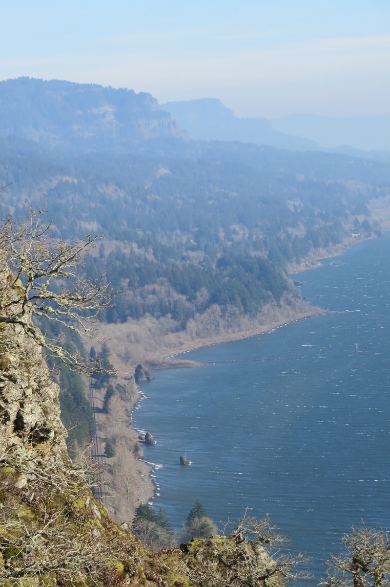
Skamania west
5 miles of hiking • 1000' elevation gain •
Beautiful day, but I had to stop, hip hurty. Had a great lunch with a spectacular view.
December 19, 2014

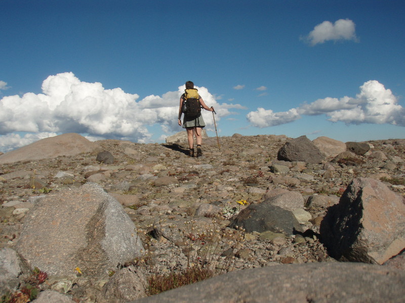
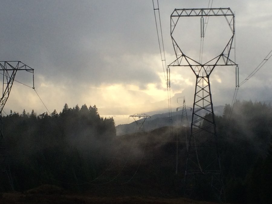
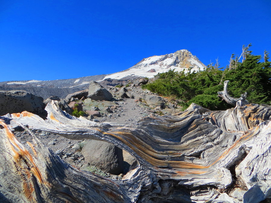
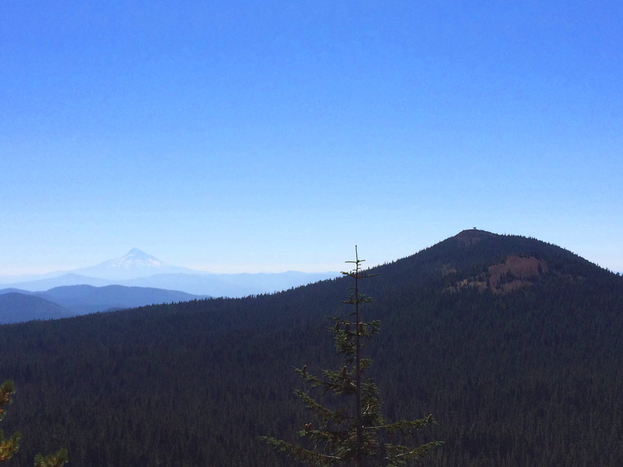
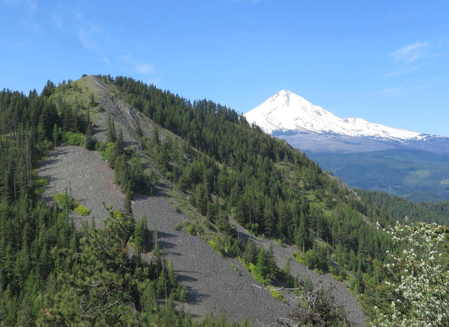
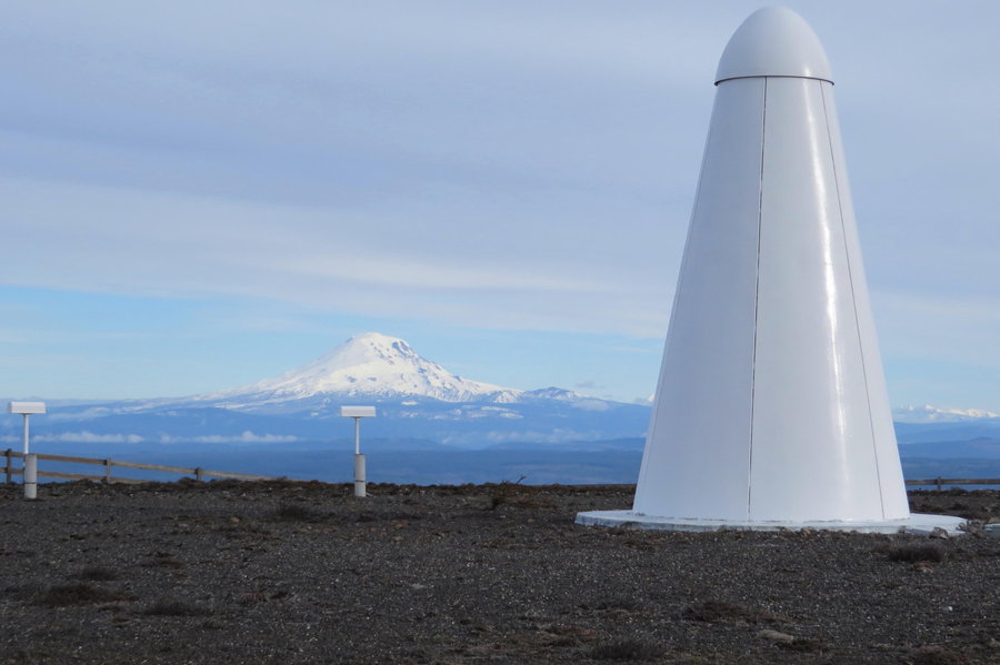
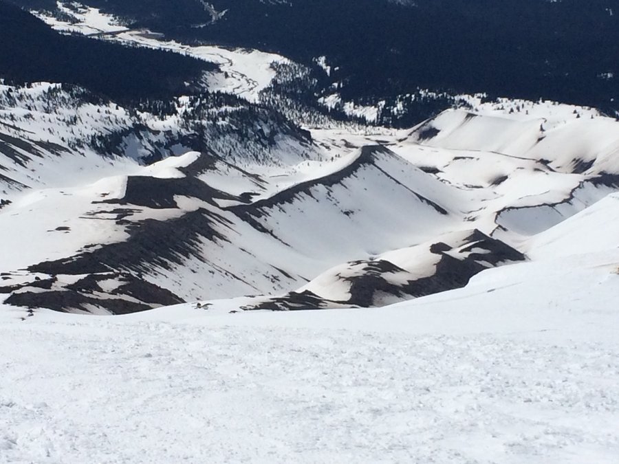
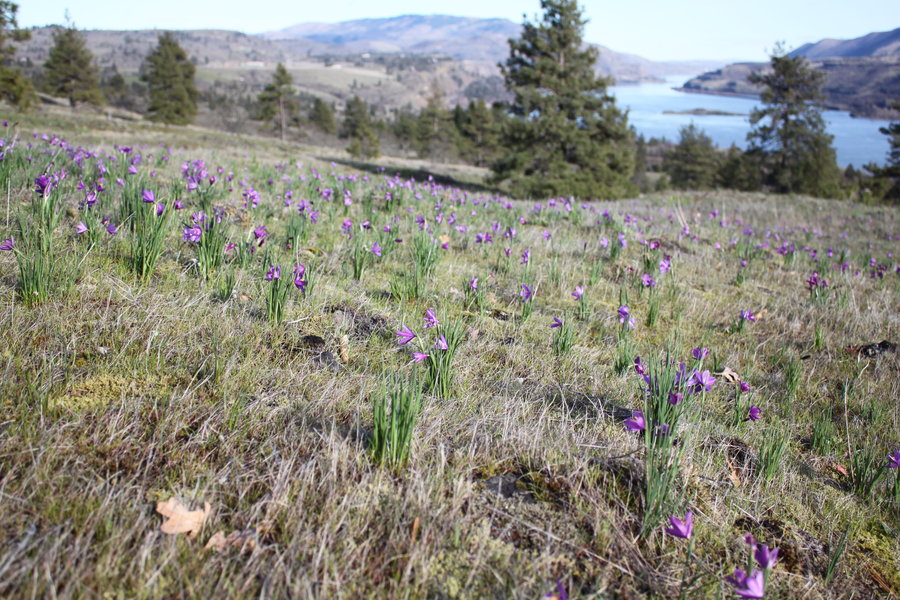
Augspurger from the back
11 miles of hiking • 2000' elevation gain •
Started up Berge Road on my bike, but it was a bit too muddy and steep and I had some technical difficulties, so I threw the bike in the bushes and hiked the rest.Lots of interesting little side roads to explore. I have an idea for a loop next time. Really nice big scree fields on the northern end of Aug. Pikas still out.
December 12, 2014

December 5, 2014

Surveyor's Ridge
6 miles of hiking • 750' elevation gain •
Had a great wander in the snow. No boot tracks, just lots of critter prints. Left my new trail cam up there.
November 24, 2014


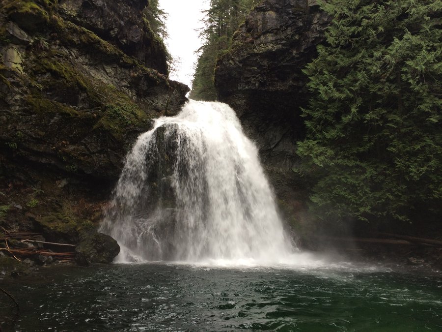
Triple Falls
4 miles of hiking • 500' elevation gain •
First time hiking with an umbrella. Got it secured hands free. Raining hard, dry girl!
November 21, 2014
 2
2
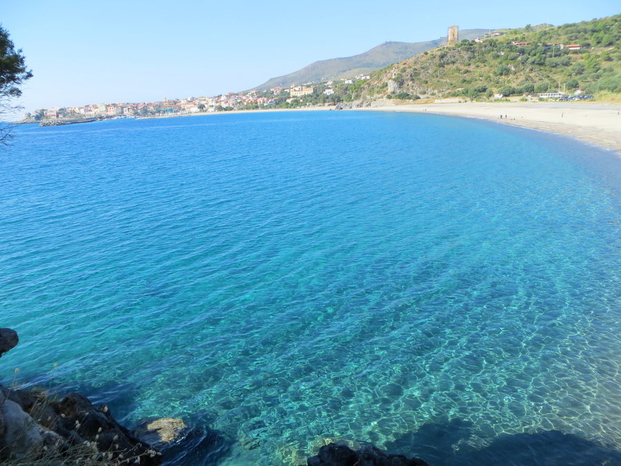
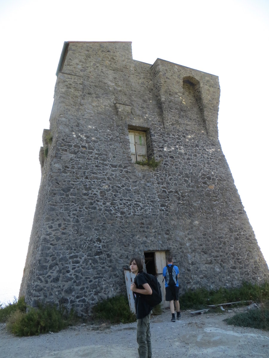
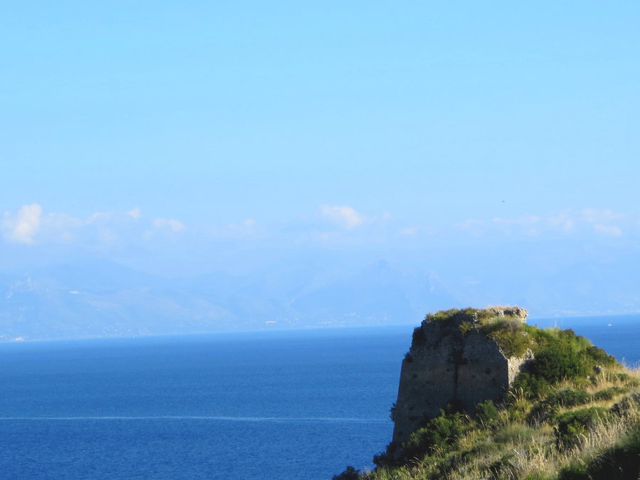
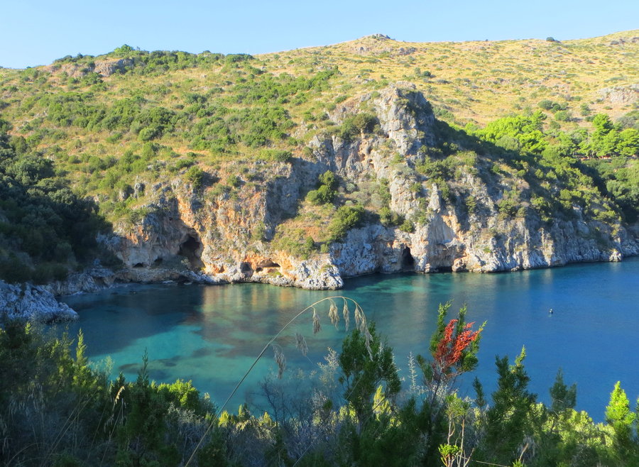
Porto Degli Infreschi, Cilento Coast Italy
6 miles of hiking • 1000' elevation gain •
Got rained out on my Vesuvius hike, but I was able to convince family to join me( OK I lied a little about the distance) on this fabulous hike to a secluded cove with spring fed caves on the edge of the Tyrrhenian Sea. We had it to ourselves on a gorgeous day and went for a swim. The water was a bit cool, but warmer than the Pacific in July! We were the only ones there. Passed 4 Saracen towers on the way.
November 2, 2014

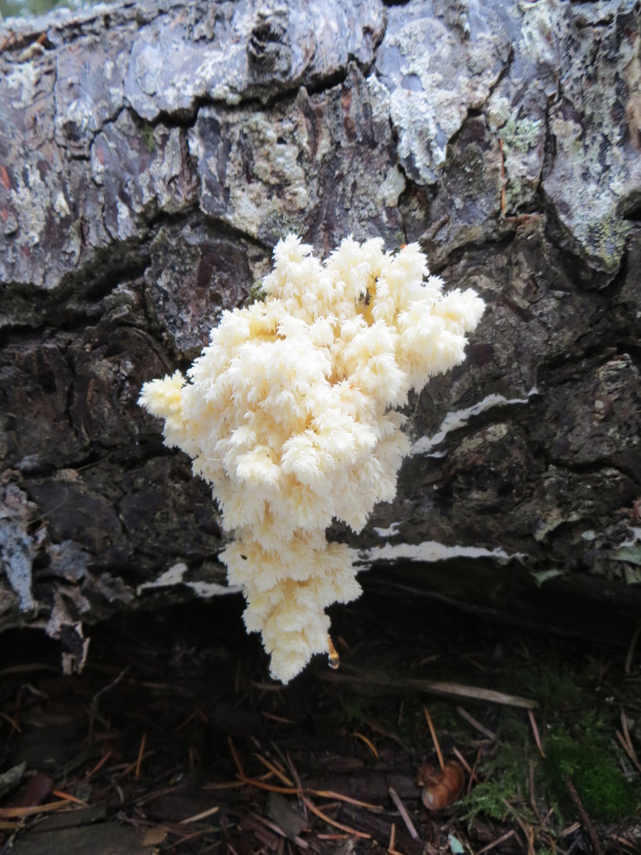
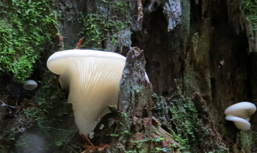
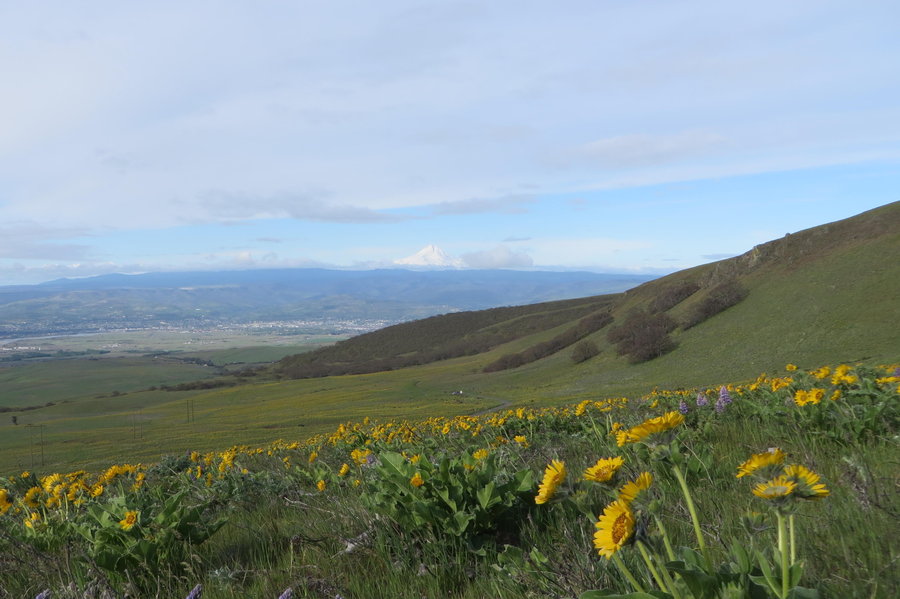
Larch/Palmer
4 miles of hiking • 500' elevation gain •
Mountain biking and mushroom hunting, the season has begun!
October 17, 2014

Lower Deschutes
5 miles of hiking • 500' elevation gain •
Quick morning hike during a climbing weekend at Horsethief
October 12, 2014

 1
1
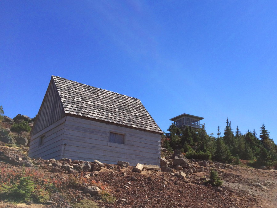
Goat Mountain near MSH
6 miles of hiking • 2000' elevation gain • 1 night
I've been wanting to get up to this Goat Mountain for years! Had a fun scrambe, then wandered around behind a gate off 8117 trying to get down to the Toutle. Camped at an amazing spot on a perfect night, warm, no wind, views, stars, moon, and owl.
October 4 – October 5, 2014


October 3, 2014

September 25, 2014
 1
1
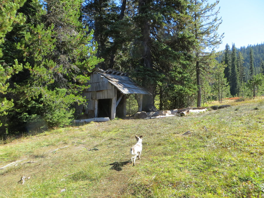
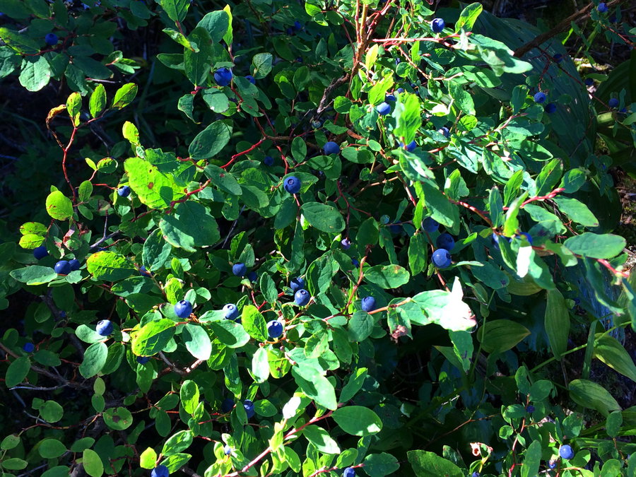
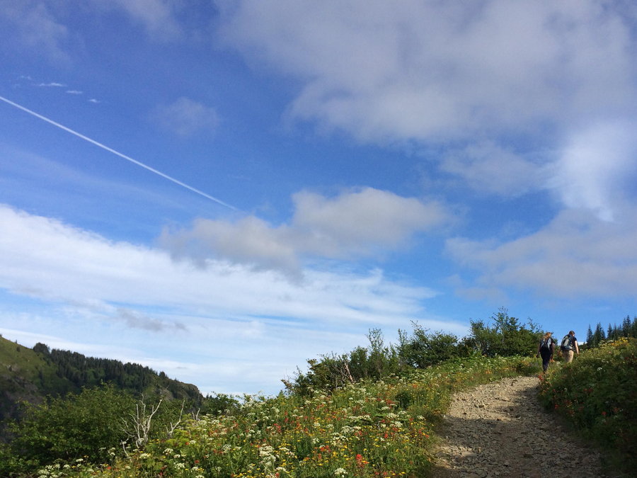
Indian Heaven, Basin Lakes
12 miles of hiking • 2500' elevation gain •
Using a bike shuttle I was able to traverse the SW corner of Indian Heaven and visit Red Mountain Lookout. Got a few handfuls of huckleberries in the Lakes Basin. Someday I'll come back and visit " The Wart",
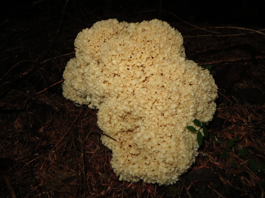
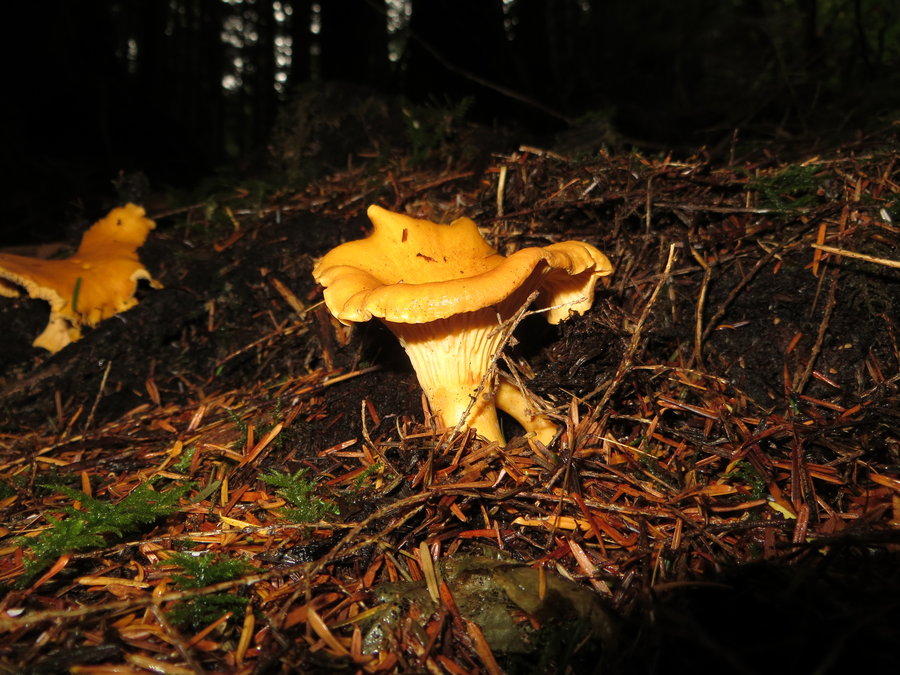
September 12, 2014


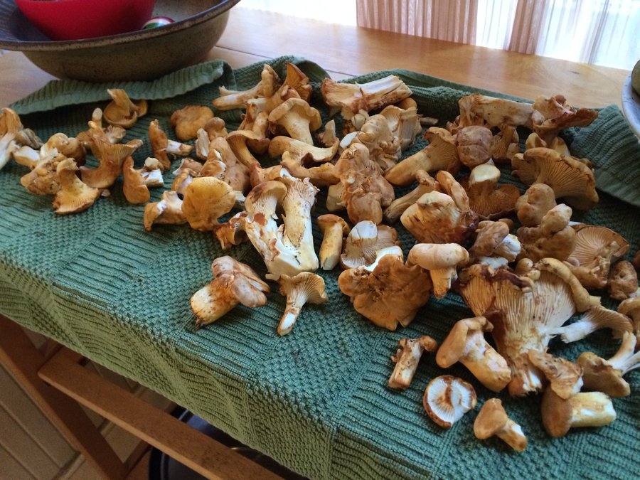
S Fork Toutle
4 miles of hiking • 500' elevation gain •
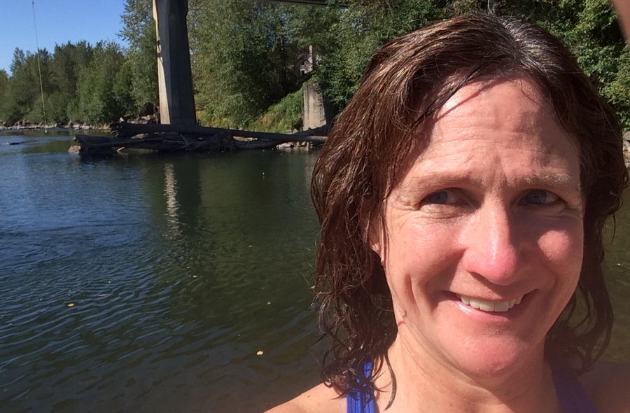
Failed attempt to drive to Castle Lake. Salvaged the day by stopping at a nice chunk of forest for a wander. Collected several pounds of chanterelles. On the way home I found an awesome swimming hole with rope swing, ripe blackberries, and no party pigs in sight!
September 5, 2014


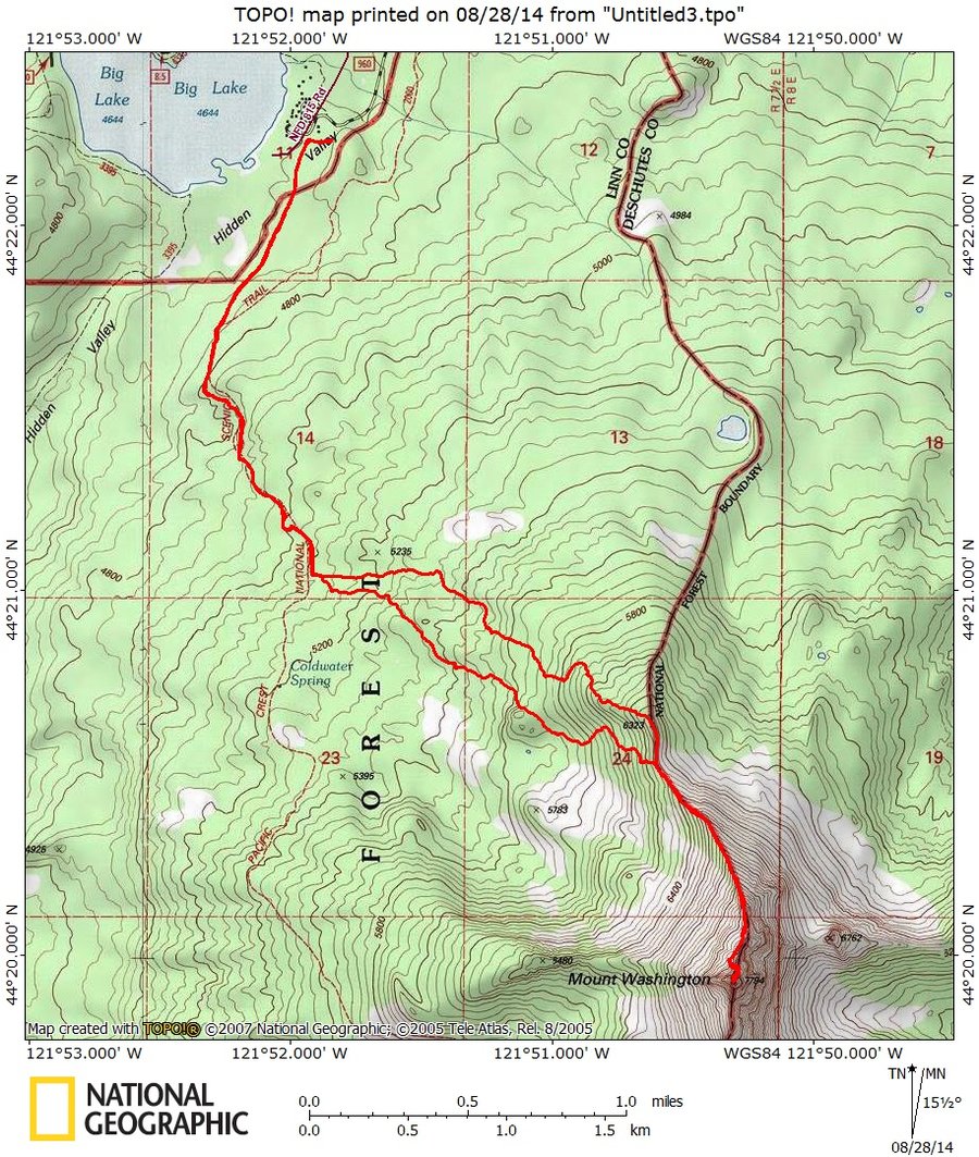
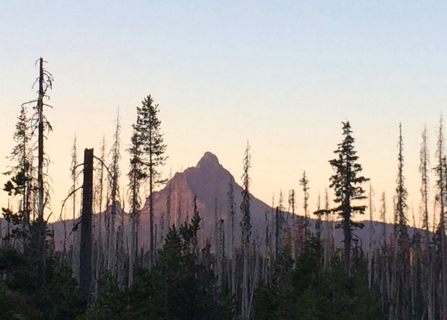
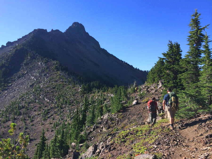
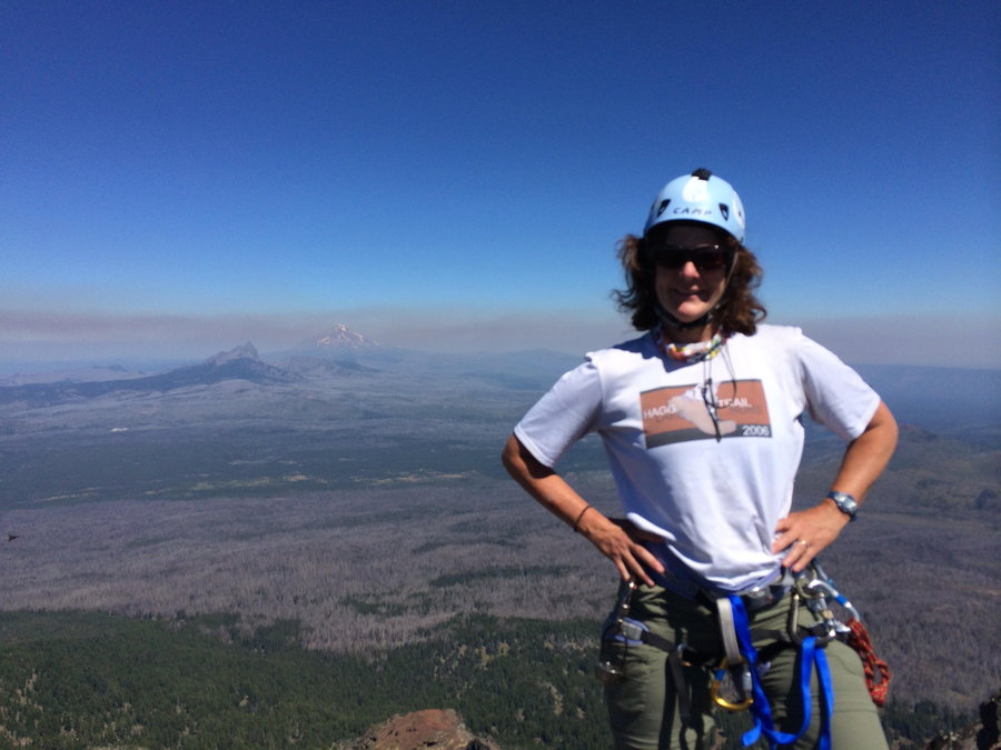
Mt Washington
8.5 miles of hiking • 3250' elevation gain • 1 night
Great day to climb a pointy volcano!
August 27 – August 28, 2014


 1
1
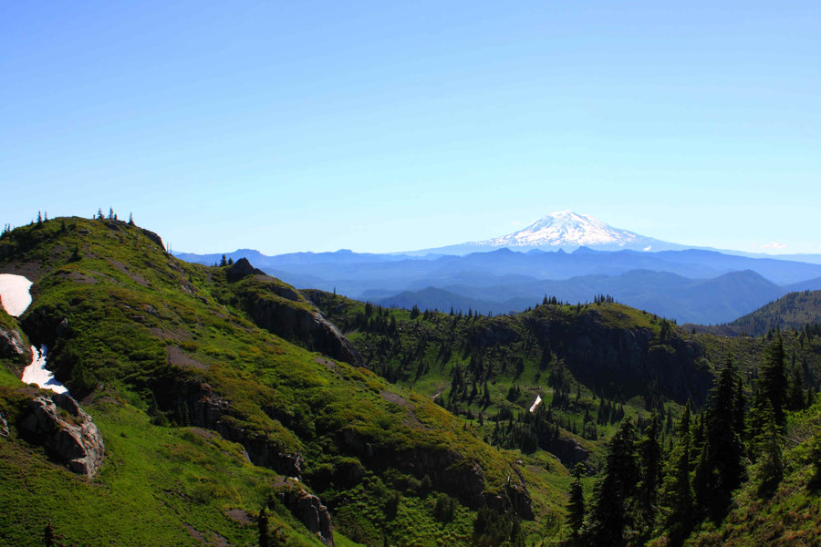
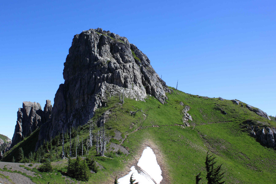
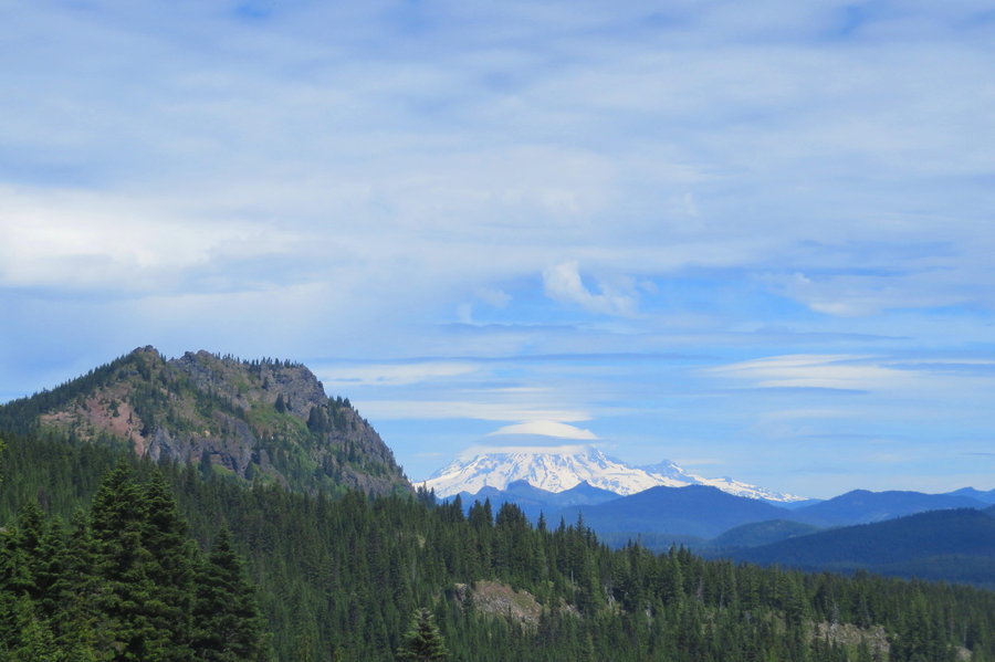
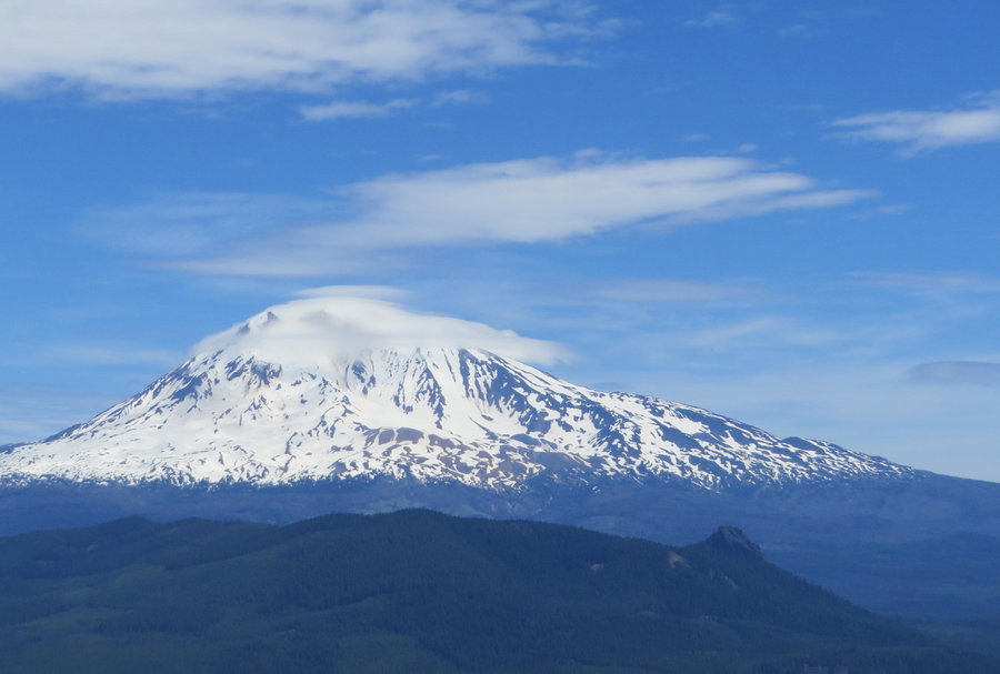
East side Mt Adams wanderings
18 miles of hiking • 4000' elevation gain • 2 nights
Original Plans to Avalanche Valley changed with conditions and unexpected terrain issues. Had fun anyhow exploring the mountain, including a lovely swim in Heart Lake!
August 15 – August 17, 2014


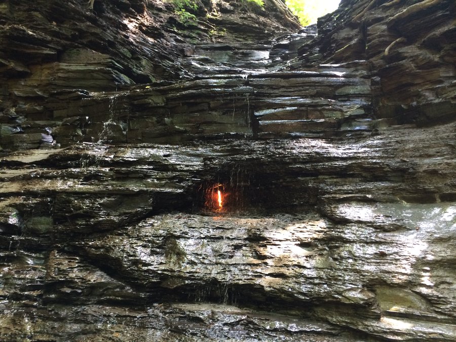
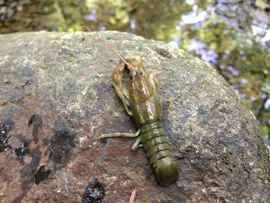
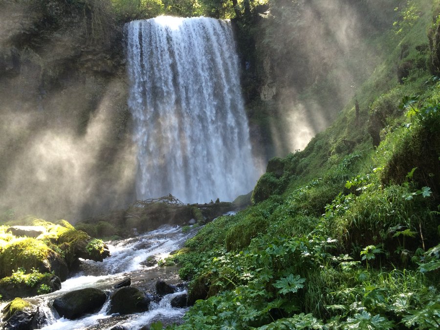
Eternal Flame Falls
3.5 miles of hiking • 250' elevation gain •
Very cool phenomenon. Slatey creekbed with lovely little cascades everywhere. Natural gas leak in a cove behind the falls, lit up to provide an eternal flame! Super fun scrambles with my son. Will upload pictures soon, but check out the link above for this nifty place.
August 12, 2014


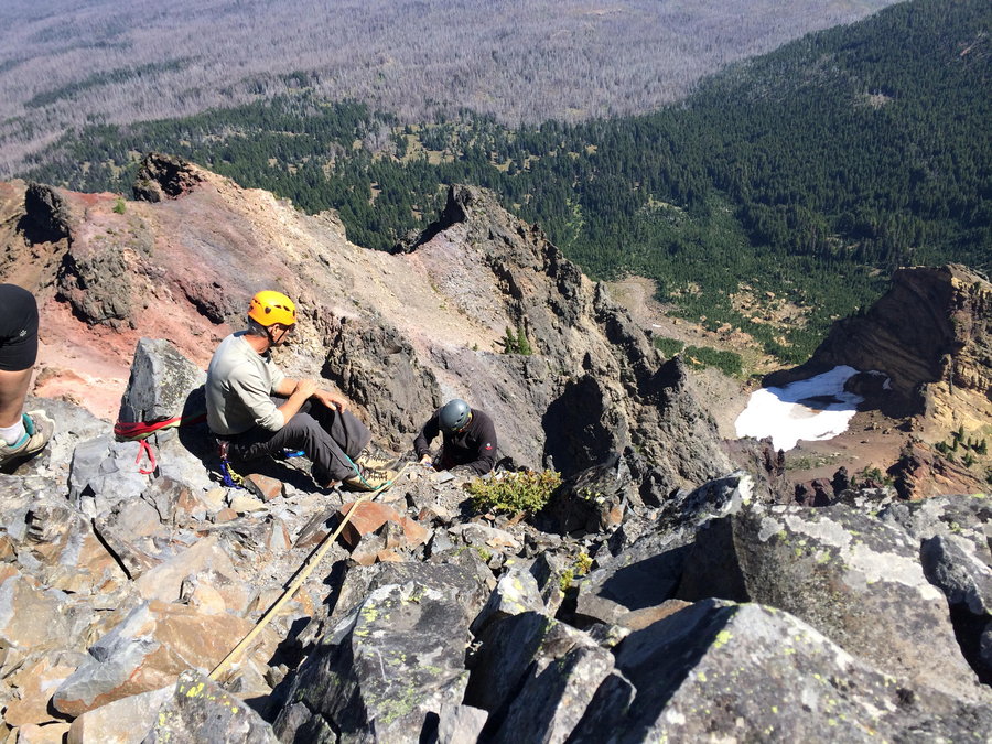
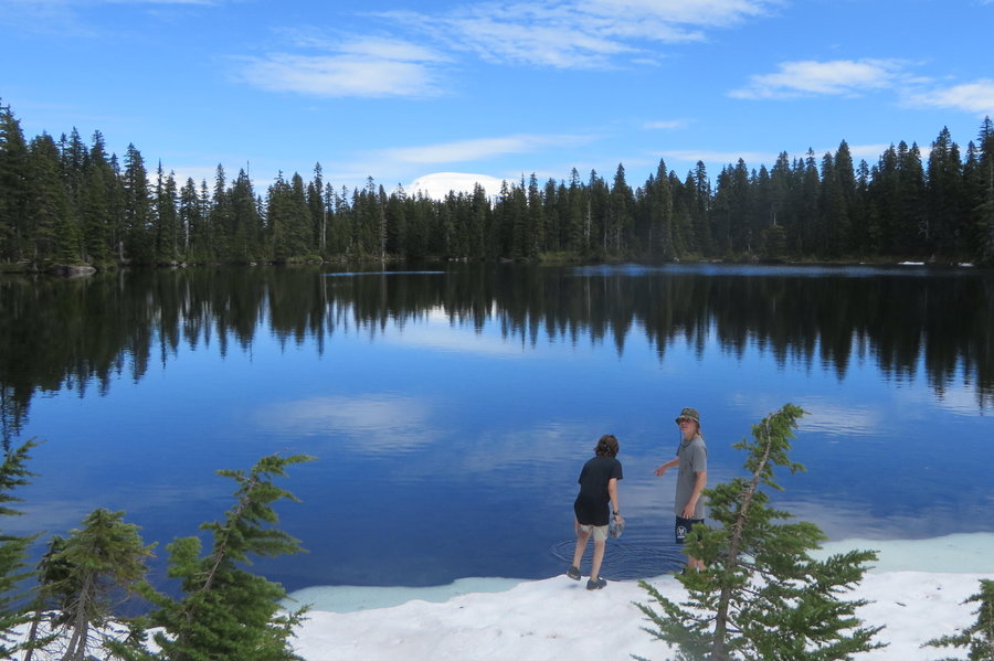
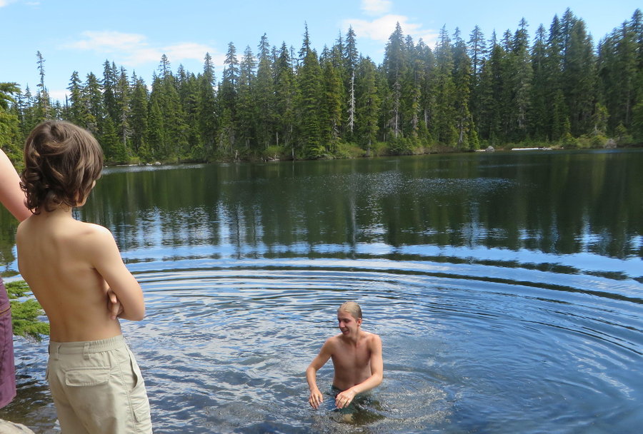
 5
5
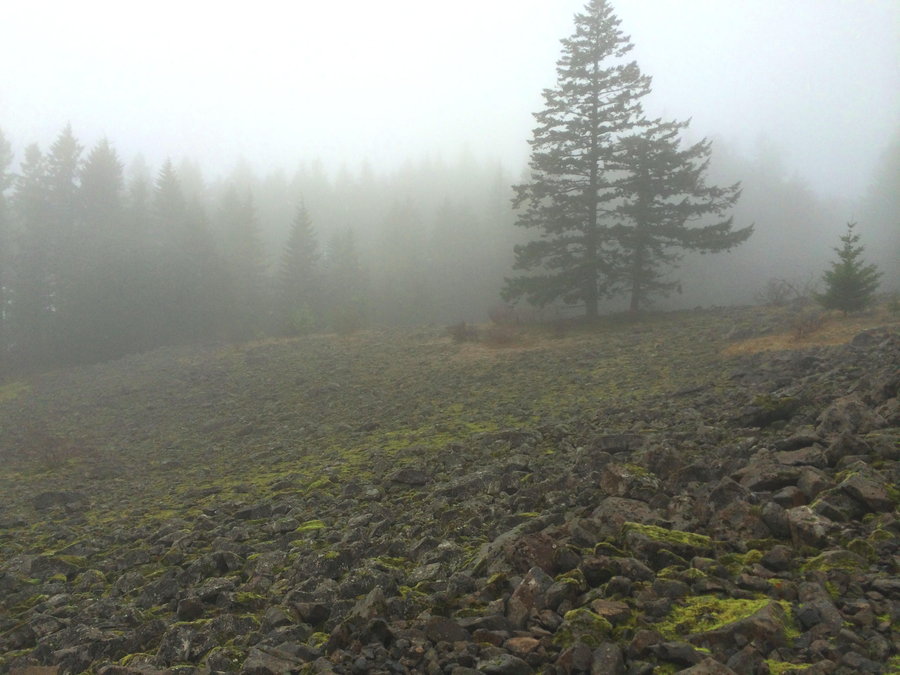
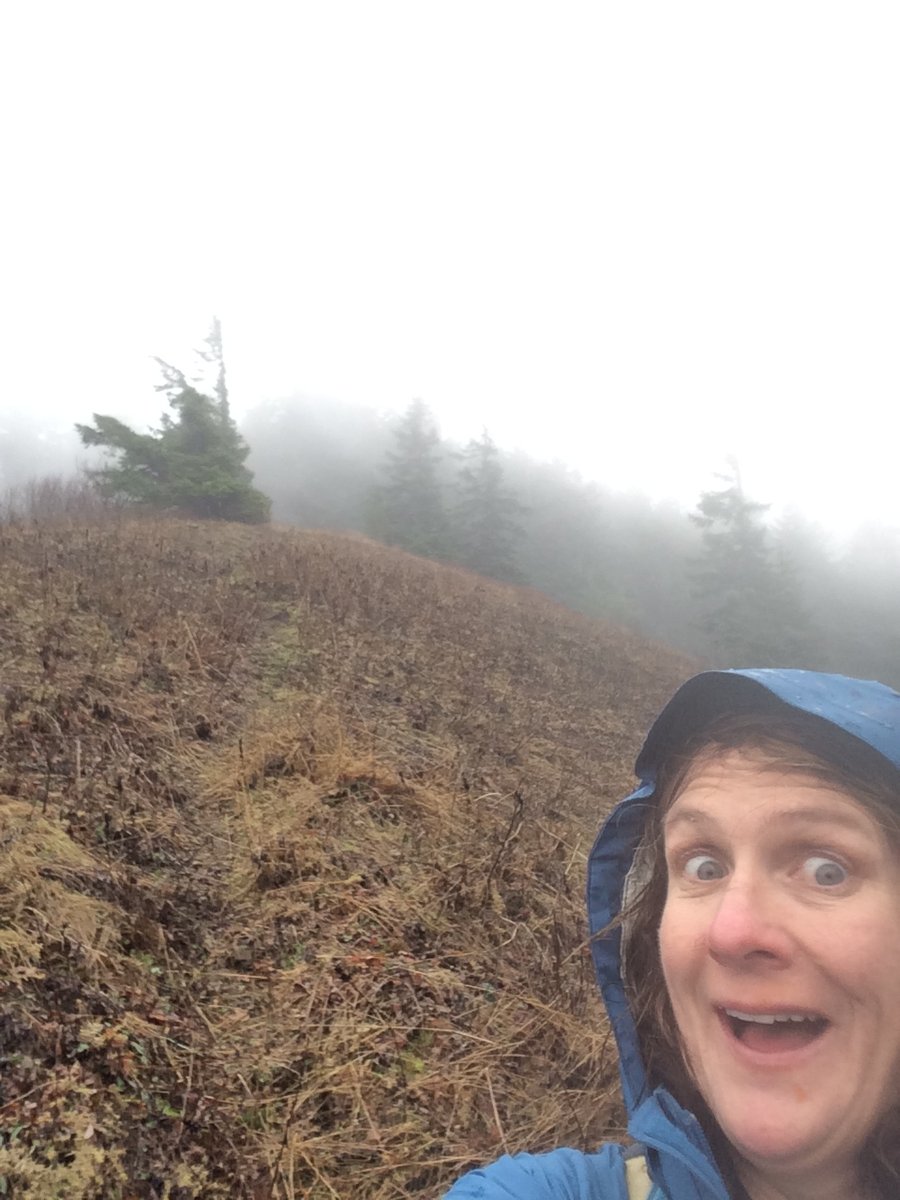
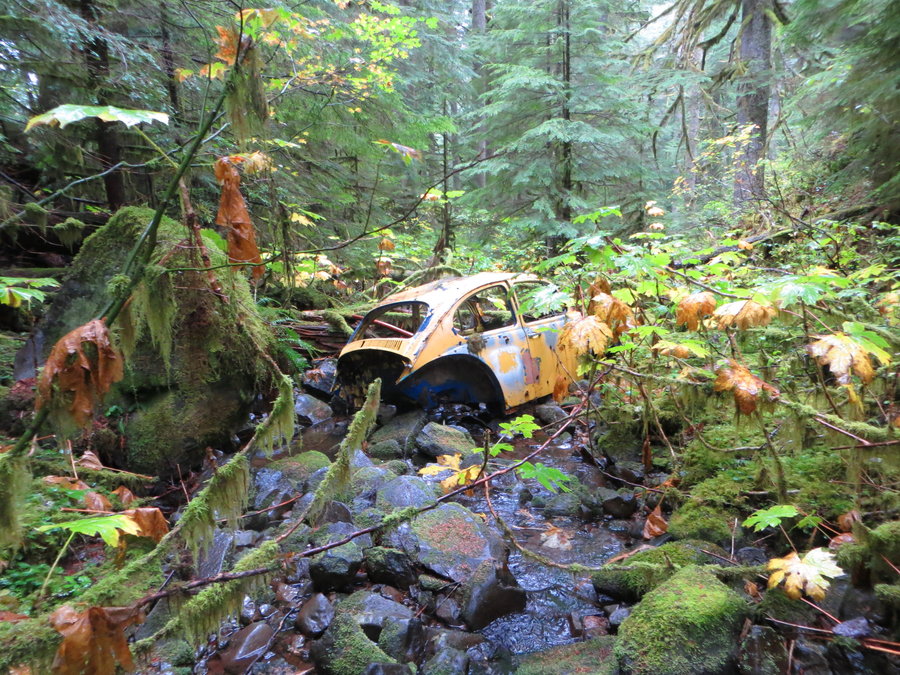
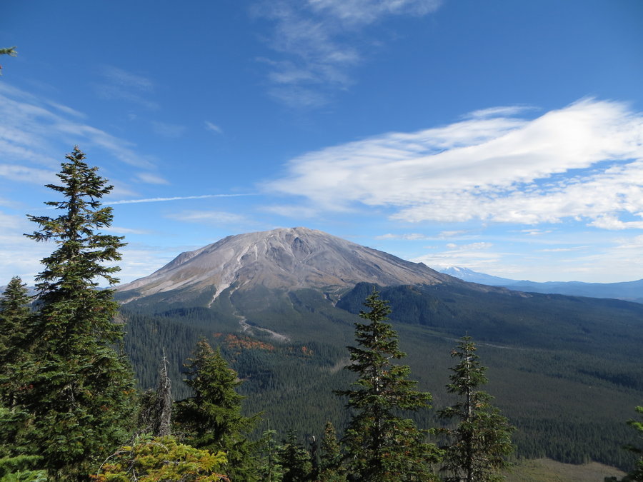
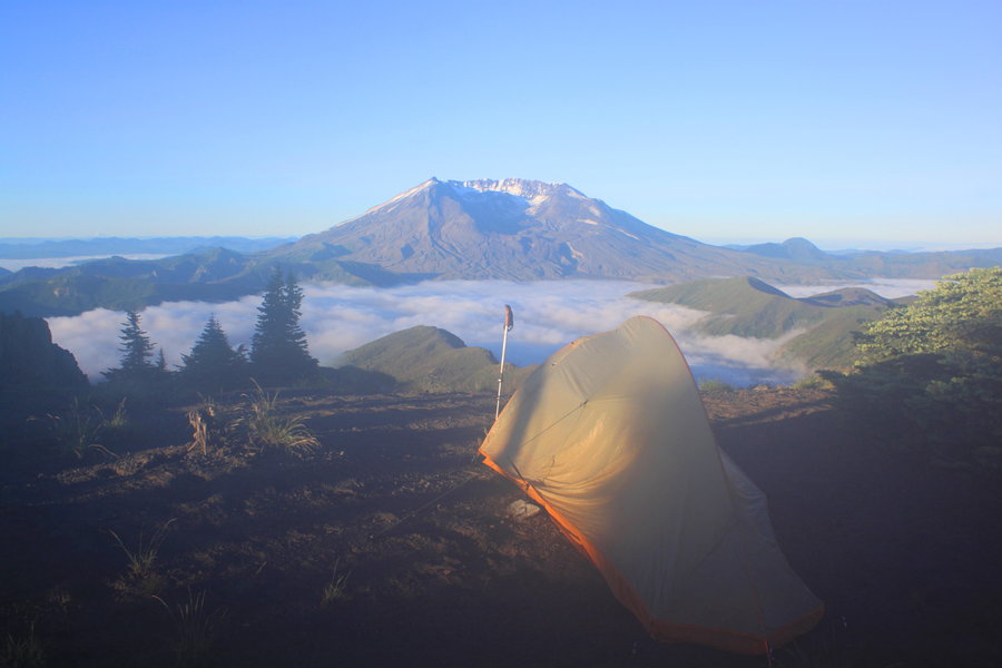
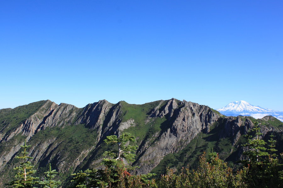
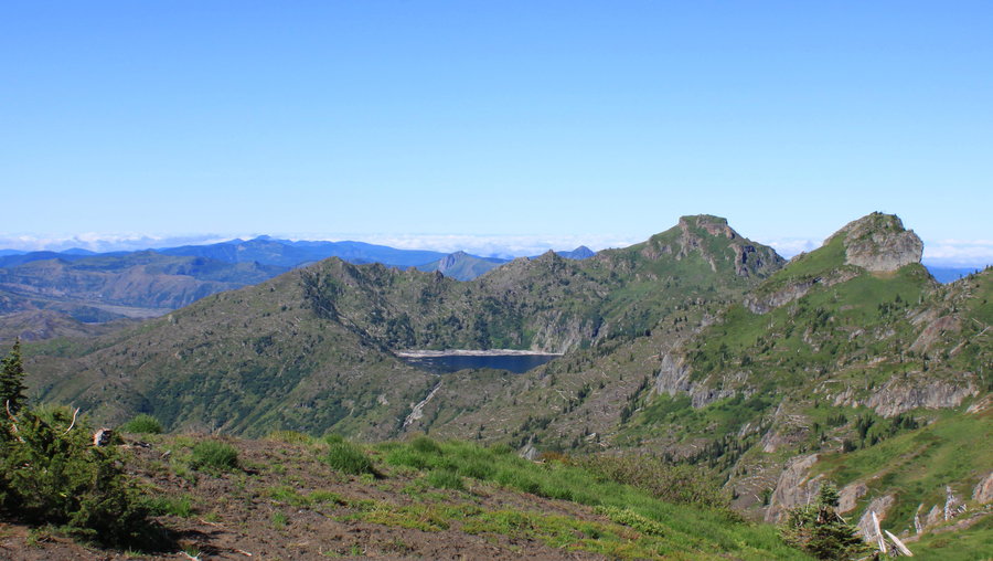
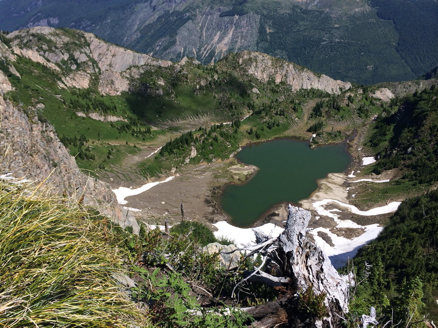
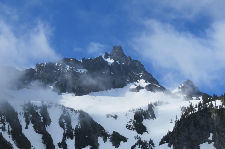
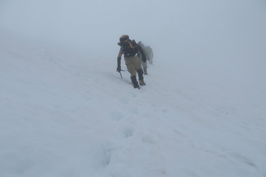
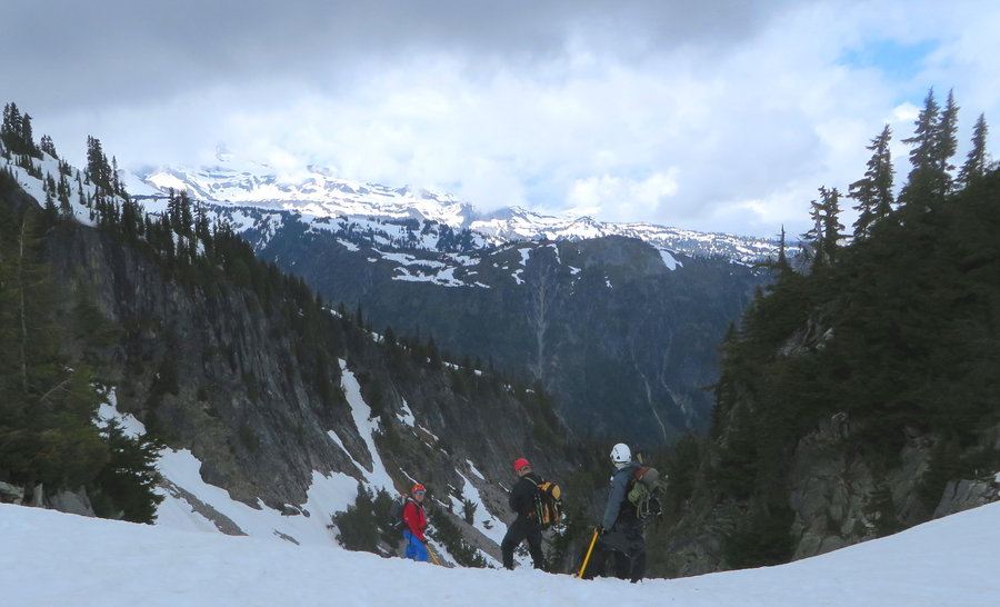
Solo Mt Margaret Backcountry
17.5 miles of hiking • 4250' elevation gain • 2 nights
This trip tested my inner whatchamacallit for sure, pretty strenuous and I was alone. I started out from Norway Pass at mid-day, in foggy moisture expecting it to clear. It did not. It got worse, all my stuff got wet. I was the only idiot out there. Made it to a camp on the Boundary trail between Mt Marge and the Dome, and hunkered down for the night in my warm dry tent. The rain DID eventually stop overnight and I opened the tent flap in the morning to reveal the most amazing scenery all around me. A sea of fog covered Spirit lake and lazing elks, several herds were visible from one spot. MSH in your face, Rainier over one shoulder, and Adams over the next. The charm of hanging St Helens Lake below the bowl topped by Coldwater Peak, I've only seen it frozen. What a fantastic area, this stretch of the Boundary trail!
I scrambled around in the morning enjoying this incredible country without a heavy backpack for a few hours waiting for my stuff to dry, couldnt get enough of it, I was reluctant to leave..... but I had a new adventure awaiting.
I headed back east on the Boundary Trail past Mt Margaret and started on the Whittier Ridge Trail; aka the infamous Whittier Traverse. What a hoot! Scramblin fun! Wish I wasn't carrying 30 pounds on my back. My center of gravity was off, but the conditions were just perfect, the snow is gone. Took my time and I just lost the trail a couple times, found it after backtracking, or when lead astray by goat track, just head for the ridgetop!
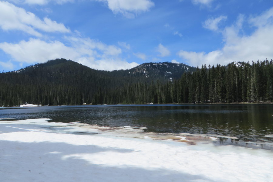
Went down to the Lakes trail, and made it to my camp on Obscurity Lake and jumped in for a swim, heavenly!
July 24 – July 26, 2014


July 20, 2014

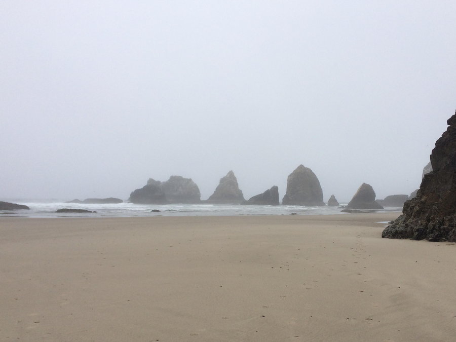
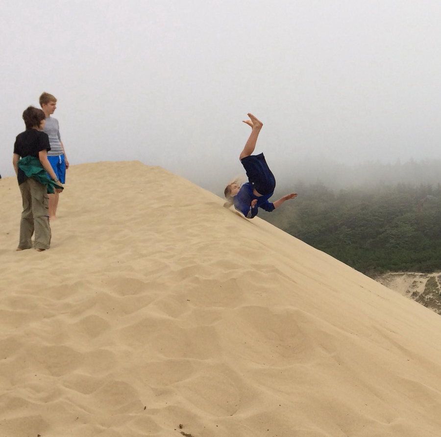
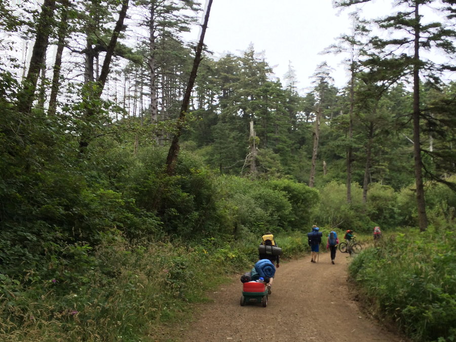
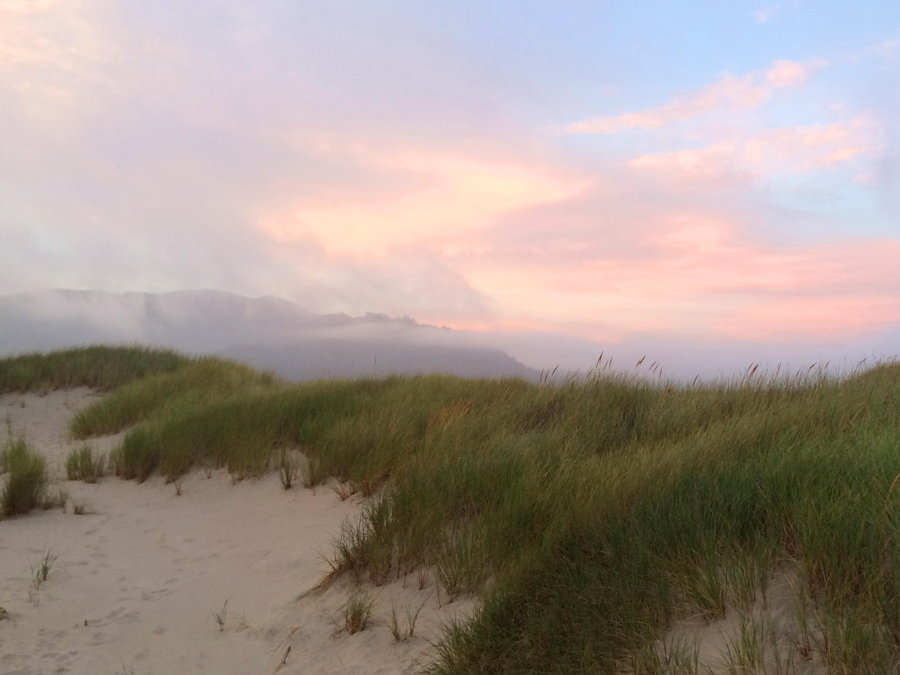
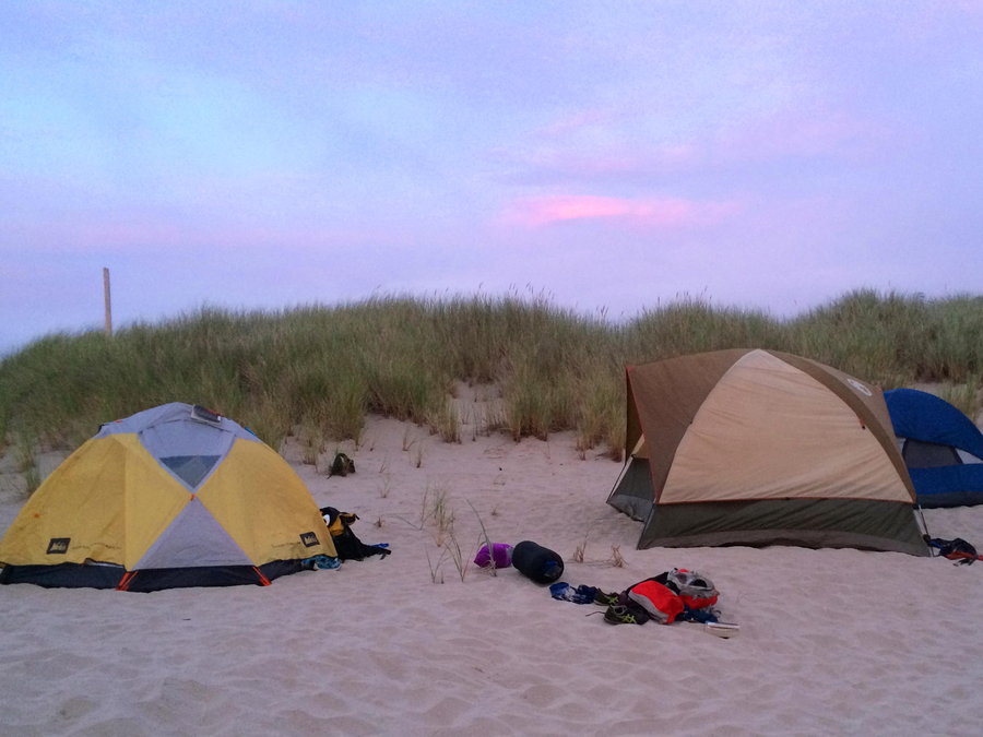
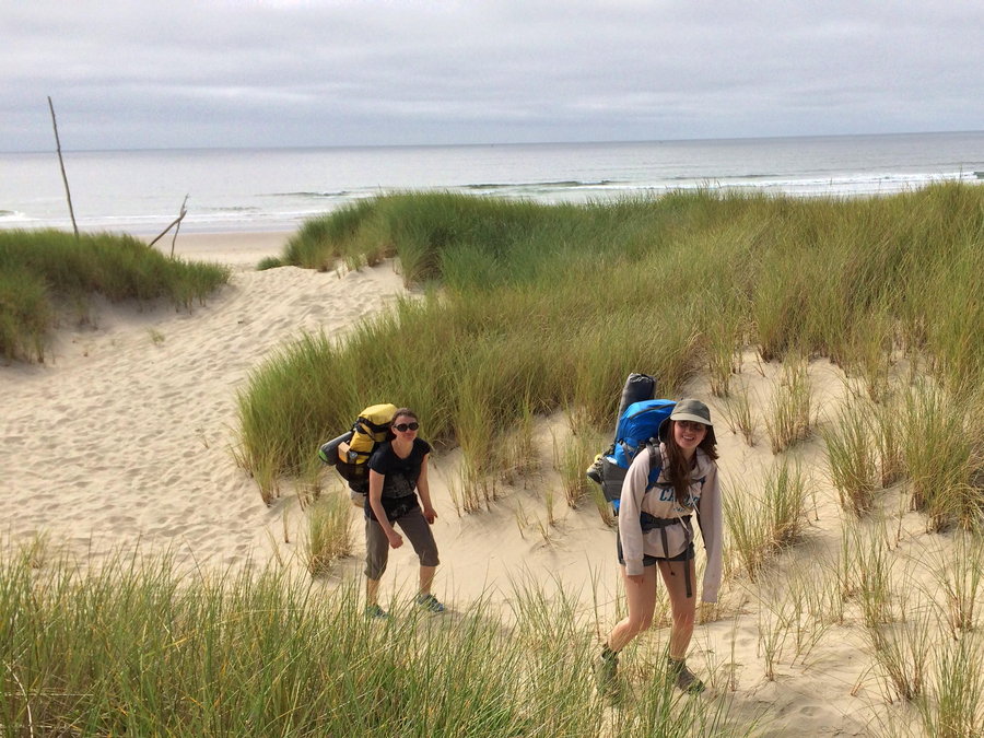
Coast Adventures with Family
10 miles of hiking • 1000' elevation gain • 1 night
WE spent two days in Oceanside and were able to visit the Lost Boys beach at an early minus tide. We also visited Maxwell Mountain, Tunnel Beach, Whalen Island, Cape Lookout's South Beach, and Cape Kiwanda x2. Then we left the comfy beach vacation rental and backpacked up the Bayocean Spit and spent a just as comfortable night in the dunes. Brought two bikes for the 8 of us, and we all took turns riding up and down the beach, extra fun!
July 12 – July 13, 2014

Deep Lake Indian Heaven
5.5 miles of hiking • 1500' elevation gain •
Still some snow above 4800 feet, but Deep and Cultus Lake are melted out. The bugs are just about gone, might be bad at dusk, but not mid day.
Jumped in for a swim, 4 teenagers from PDX, Chicago and NYC, plus one 50 year old mama in an alpine lake. Then we relaxed on the shore, reading, sketching and basking in the sun on a beeyooteeful day. This is what we work so hard for!
July 5, 2014

 1
1
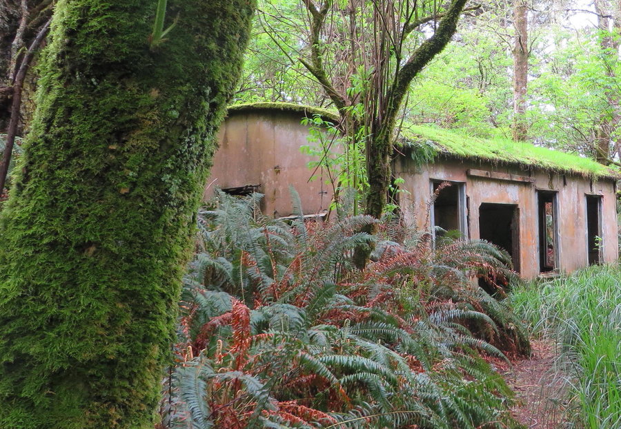
Falls Creek Cave
3 miles of hiking • 250' elevation gain • 1 night
We camped overnight at the cave entrance and hiked one route in the evening and went back to do some side tubes the next day.
July 4 – July 5, 2014


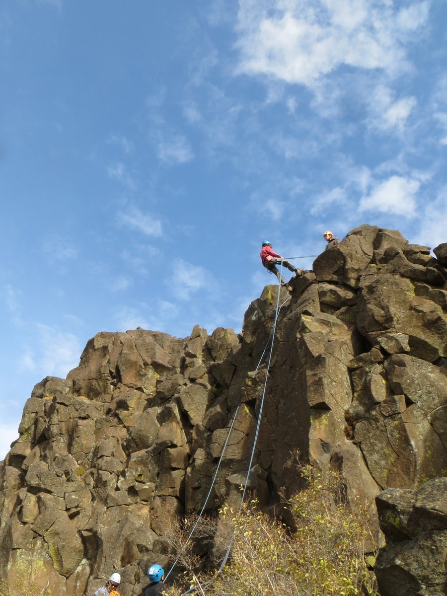
Silver Star
5 miles of hiking • 1500' elevation gain •
Family visiting from NYC, took them up Ed's Trail to enjoy the spectacle as an evening hike. Cloud came down and sat on top of us, but we had nice sunset.
Oh that road is terrible!
July 3, 2014


GP Bike Shuttle
6 miles of hiking • 1500' elevation gain •
Loving the bike shuttle these days. Hike up trail, ride down old logging road. Lets me get out there, but diminishes the hip damage. Love the forest in the rain. Got to ride an overgrown road bed, blindly bombing down a gauntlet of salmonberry bushes. Took a header, didn't care, bloody but victorious!
June 27, 2014

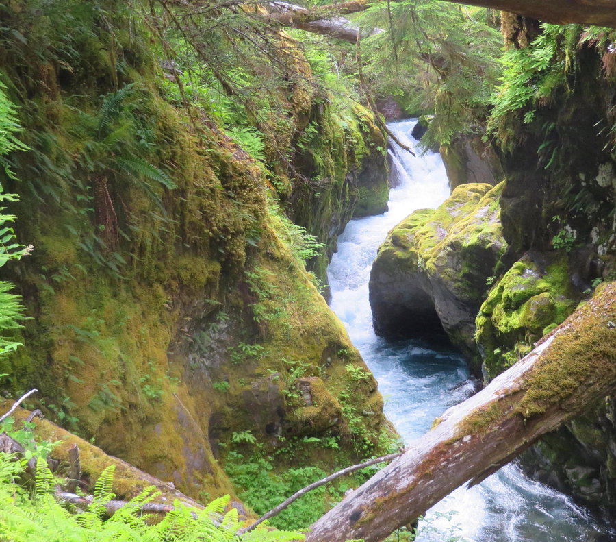
Solstice at Breitenbush
9 miles of hiking • 1750' elevation gain •
Went on three different hikes while staying at Breitenbush for the Solstice celebration: Triangulation Peak and Boca Cave, Fire Camp Lakes Basin and the S Breitenbush Gorge Trail.
June 21, 2014


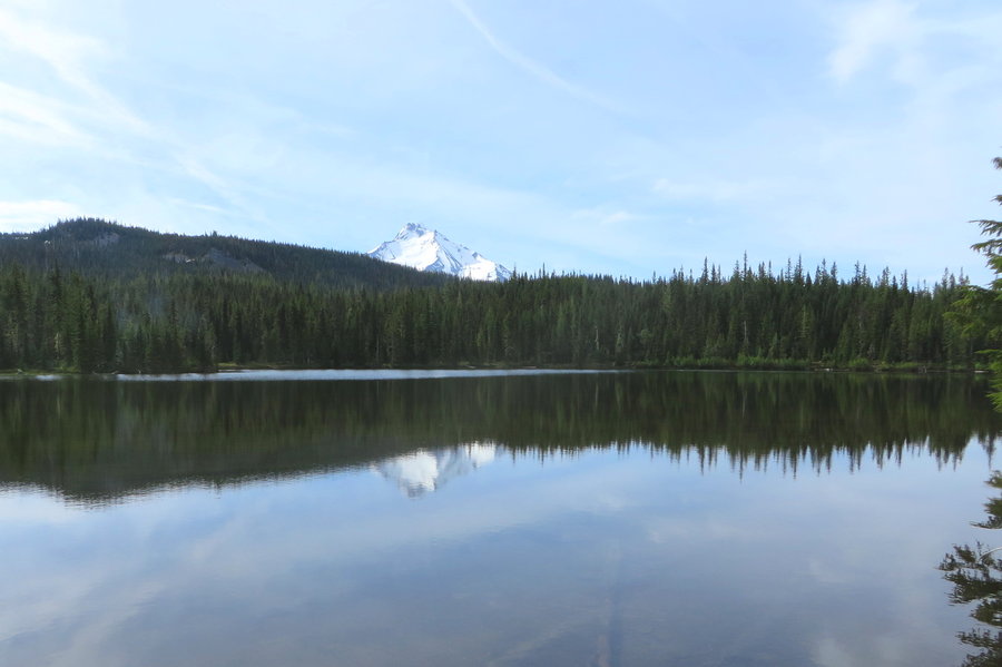
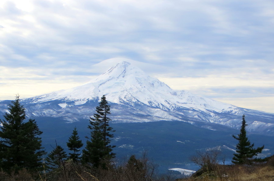
Paradise
3 miles of hiking • 500' elevation gain •
Little morning jaunt to get closer to the mountain.
June 11, 2014


Jug Lake
7 miles of hiking • 1750' elevation gain •
With an 11 am start, my plans ended up a bit overambitious. My intention was to summit Fryingpan Mountain via the Cowlitz Trail from the west. I imagined wandering through flower dotted meadows with lakes in this area of the William O Douglas Wilderness that is well known by equestrians. Hit persistent snow at 4400 feet and it felt a bit like the Benson Plateau in April. Had to turn back before even hitting the turnoff to the summit of Fryingpan. Did not see another human and the only tracks in the snow I saw were cloven.
June 9, 2014

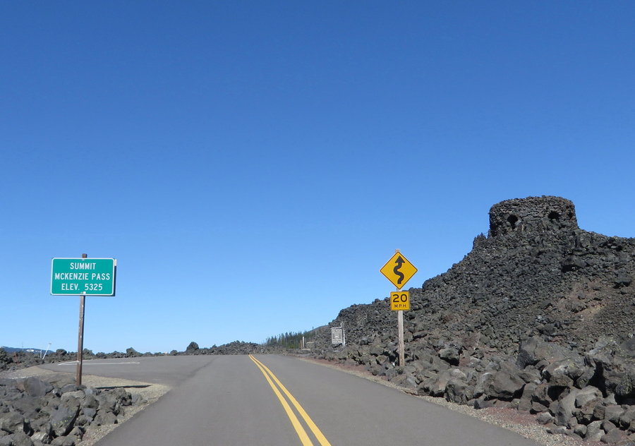
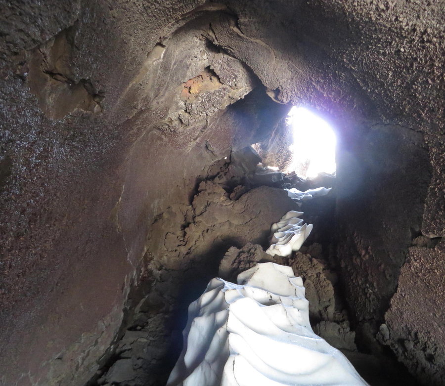
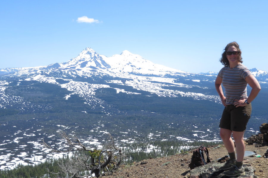
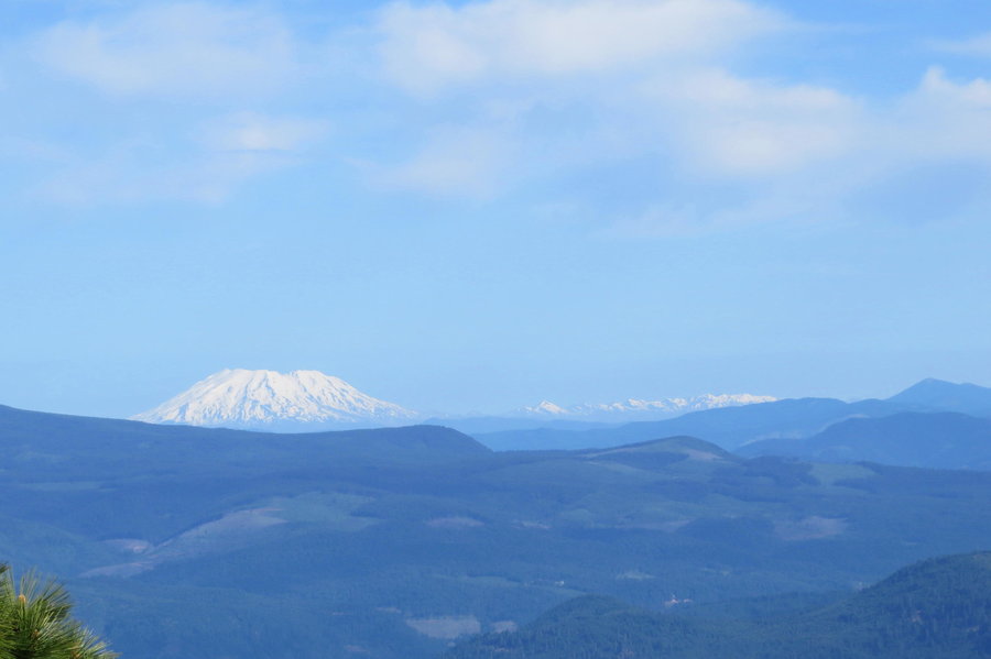
Belknap Crater
8.5 miles of hiking • 1750' elevation gain •
We biked up McKenzie Pass from the east gate, then ditched our bikes and headed north on the PCT through the lava lands. Volcanoes in every direction. Little Belknap has some cool caves. Belknap had a big well formed crater, plus two more little ones. Fun glissade down.
June 6, 2014


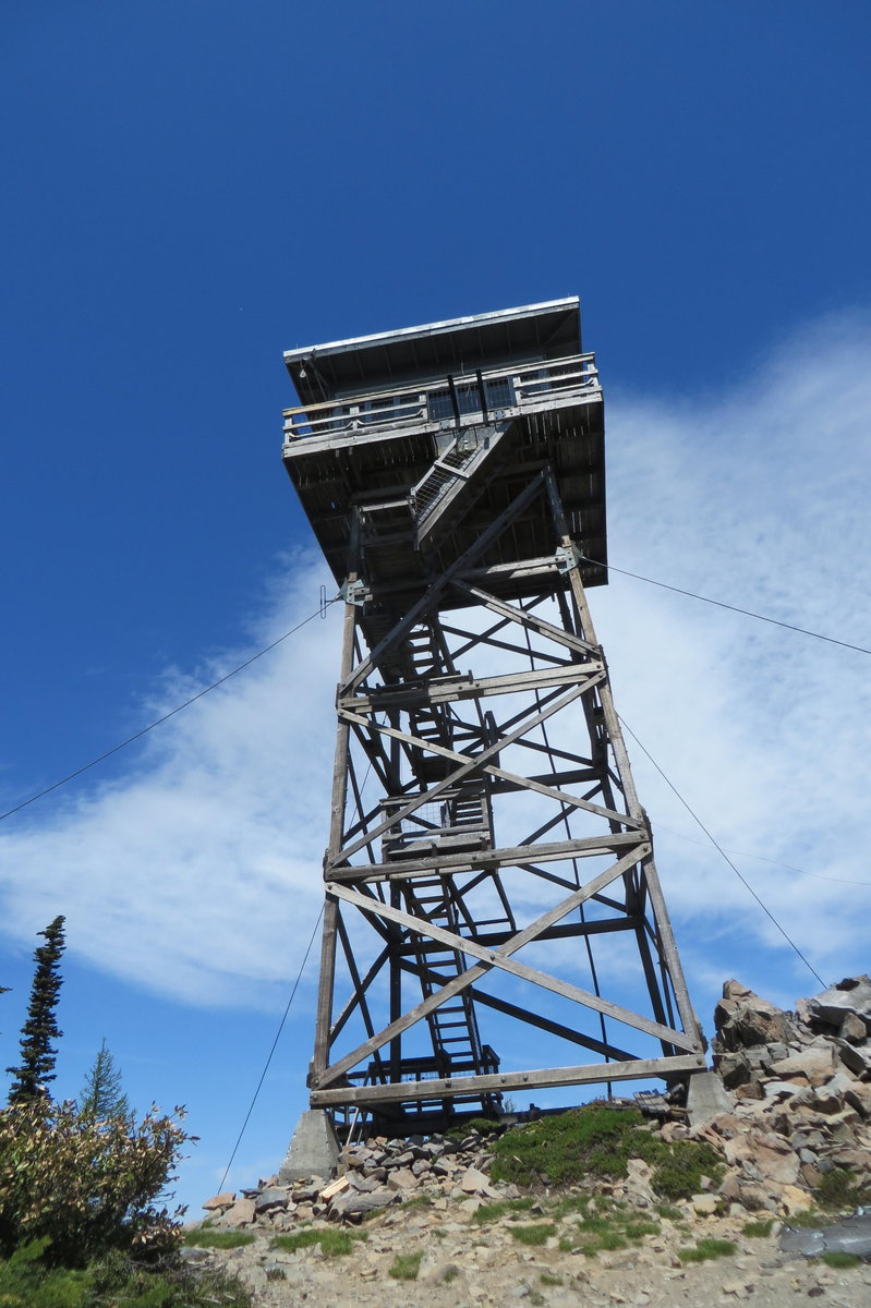
Flag Point and Shellrock Mtn
5 miles of hiking • 1000' elevation gain •
I came back to bike more of the Surveyor's Ridge Trail. I'm going to try to do more hike/bike combos this year. Helps cover some ground quickly, and is kinder to my aging hip joint. This was hard work today, 18 miles total, 13 on two wheels. Took a side trip up Shellrock Mtn. Finished early and drove over towards the Flag Point Lookout for a short hike. Some snow still on the road so I walked the rest of the way in.
May 30, 2014


 1
1
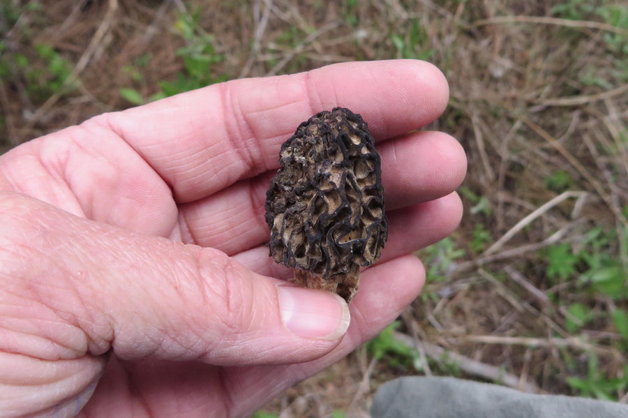
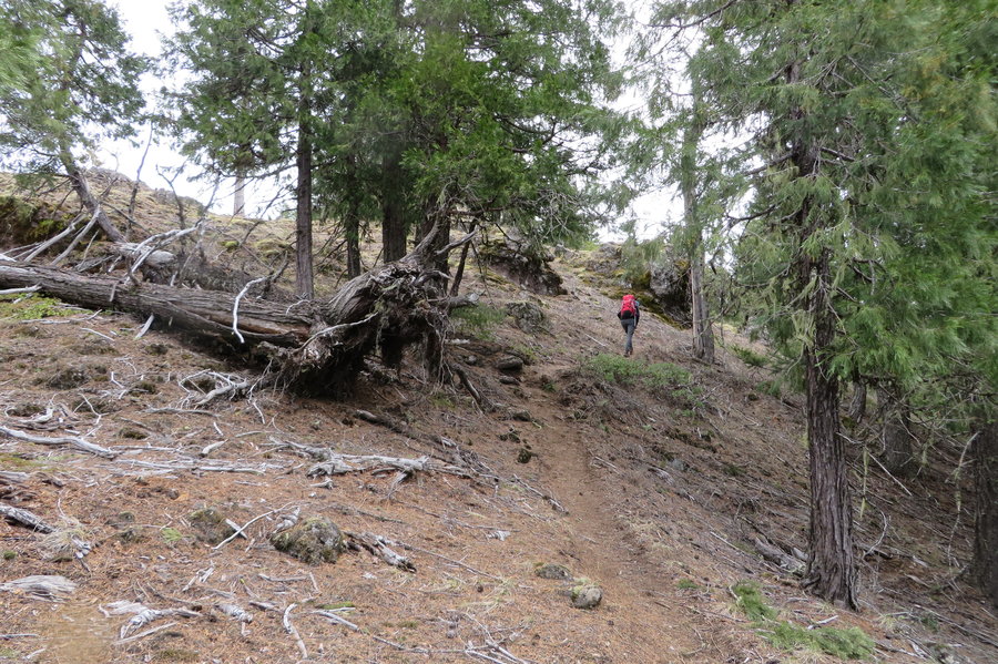
Surveyor's Ridge
3 miles of hiking • 750' elevation gain •
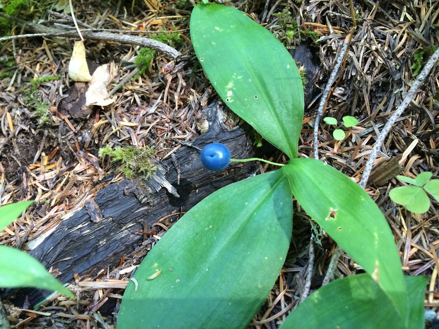
Most of my 11 miles distance was on a mountain bike, but I also spent 3 hours slowly wandering an unnamed knob in the woods looking for morels. Only found a few, but it was sure pleasant to be out there alone on a lovely day. Not a human in sight. Tons of bear poo, but I didnt meet the maker.
May 28, 2014


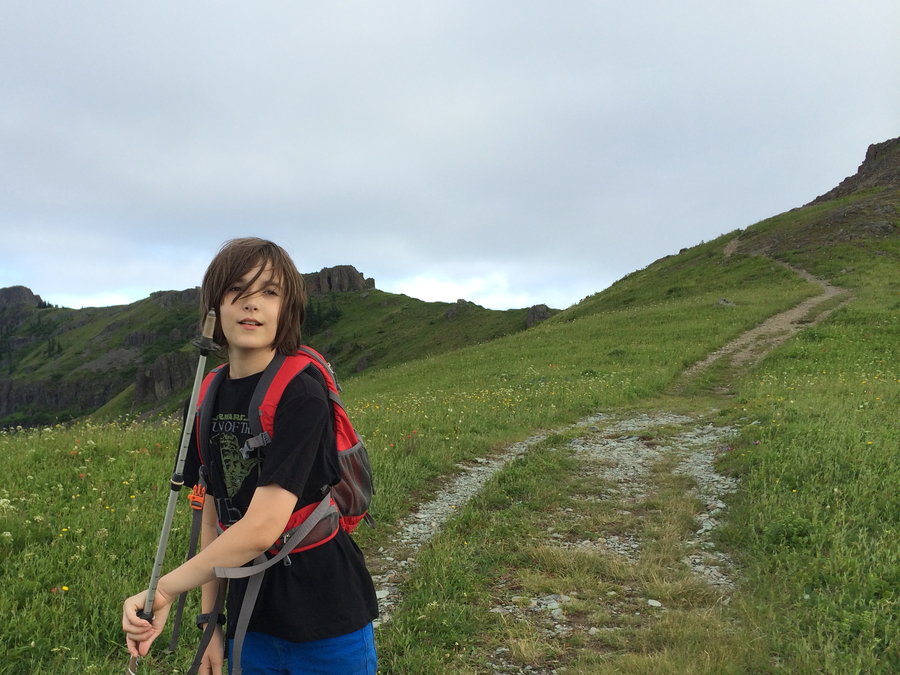
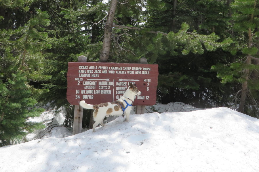
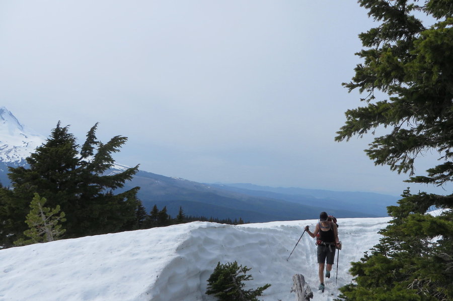
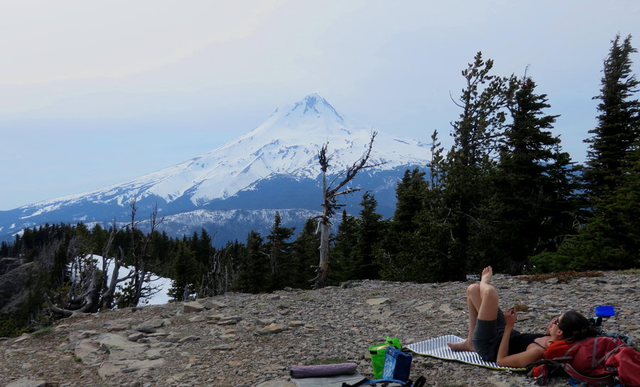
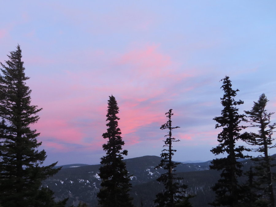
Lookout Mountain
11 miles of hiking • 3000' elevation gain • 1 night
Had plans to spend the night on Flagpoint Mountain and enjoy the full moon. We hiked up to the Bennet Pass road, and there was still lots of snow above 5200 feet, so we shortened our goal by 3 miles and aimed for Lookout Mountain. Very slow moving northward just staying on ridgetops instead of trying to follow the Divide Trail. The Lookout Mountain summit was bare and inviting, perfect conditions in the late afternoon for an overnight spot. We set up camp and took a nap. The winds kicked in after nap time, and we had dinner huddled behind an old whitebark pine. The winds got worse, and we realized sleep would not be very peaceful on the summit, so we decided to break down our camp and descend below into the forest at sunset. It was interesting hiking in the snow in the dark. Found a calmer spot lower down on the Divide Trail in the trees.
May 15 – May 16, 2014


Breitenbush
4 miles of hiking • 500' elevation gain •
Today I was there for a meeting and was able to escape for an evening hike. I spent too much time driving around on the forest roads, but now have a better idea of the different trailheads available.
When the rain is pouring down, the best place to be is deep in the emerald forest.
May 4, 2014


 1
1
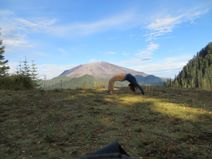
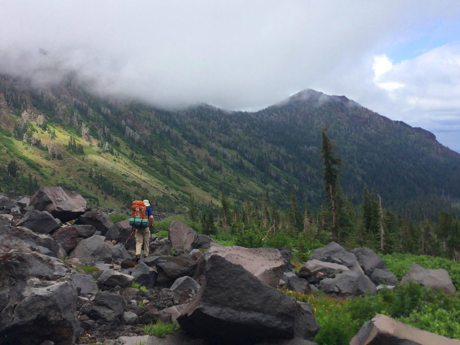
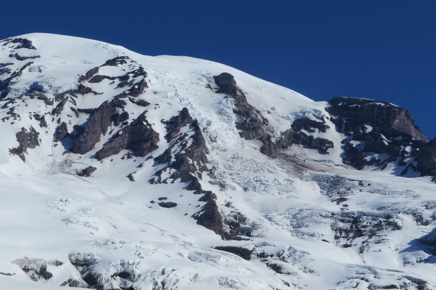
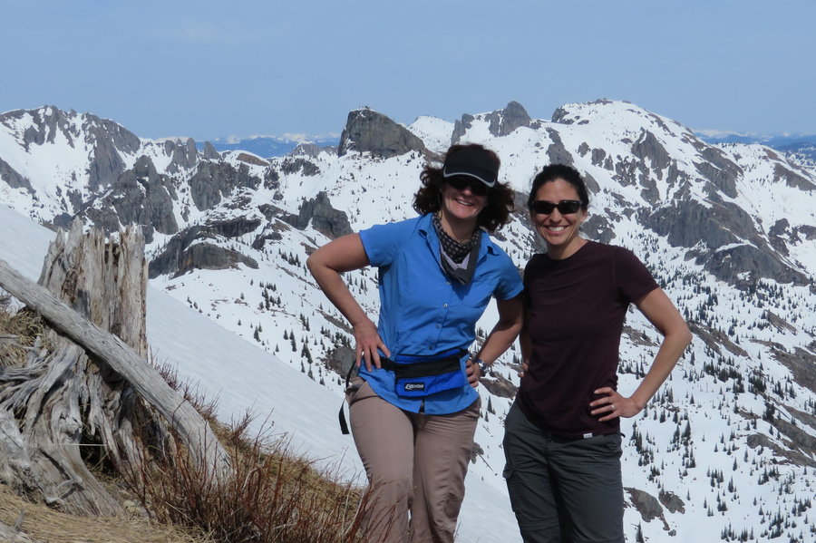
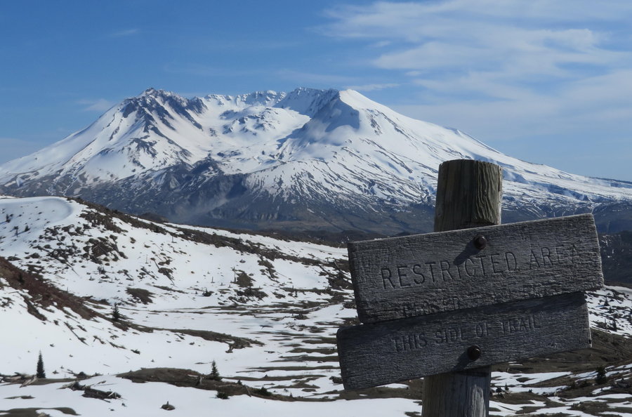
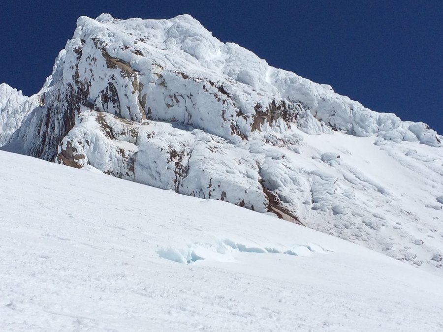
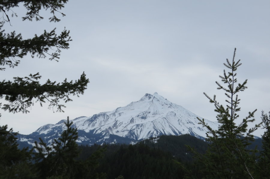
Coldwater Peak
13.5 miles of hiking • 3500' elevation gain •
Glorious day with Loowit watching over us. We were going to summit MSH, but the extreme avy danger put us off. Instead we decided to just look at her all day from the north.
Our original hike plan was to start at JRO and take the Boundary Trail, but the gate was locked at Coldwater Lake. Instead, we walked up the road and took the Coldwater Ridge Trail approach. This was actually fortuitous because most of our route had exposed southern aspect and was snow free. The Boundary Trail approach looked pretty treacherous above St Helens Lake. We were only able to reach the base of the summit block because the snow was just too soft to traverse to the backside.
May 1, 2014


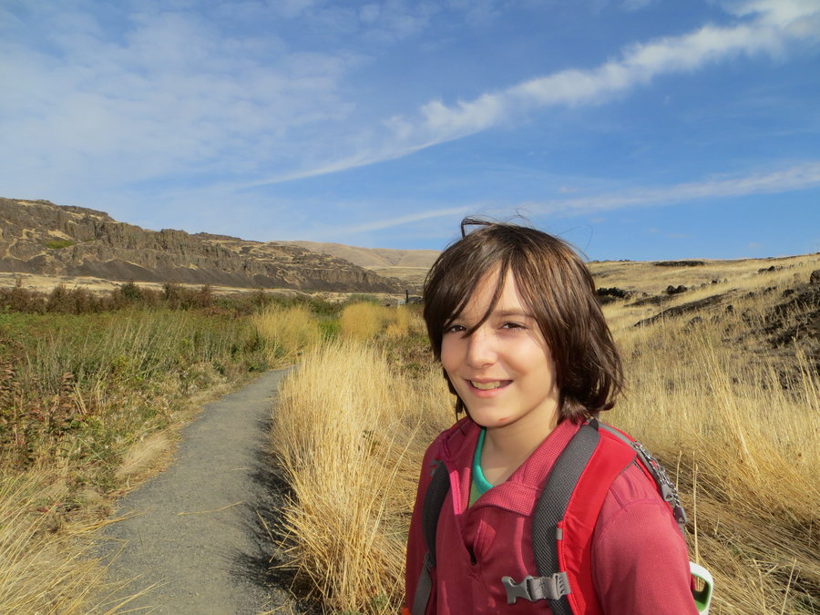
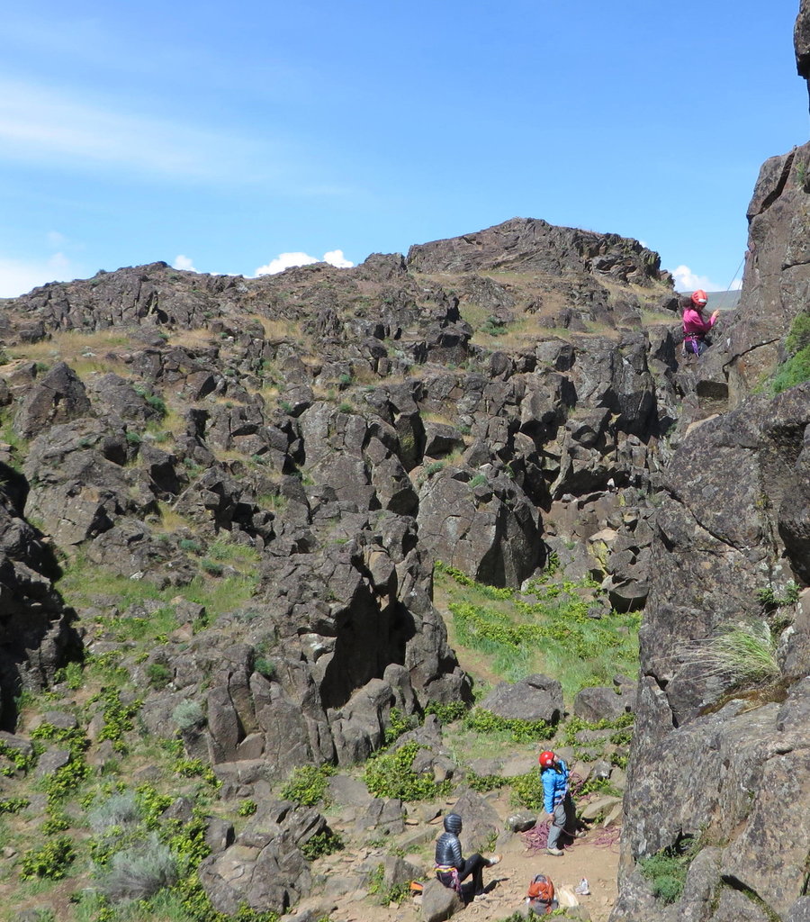
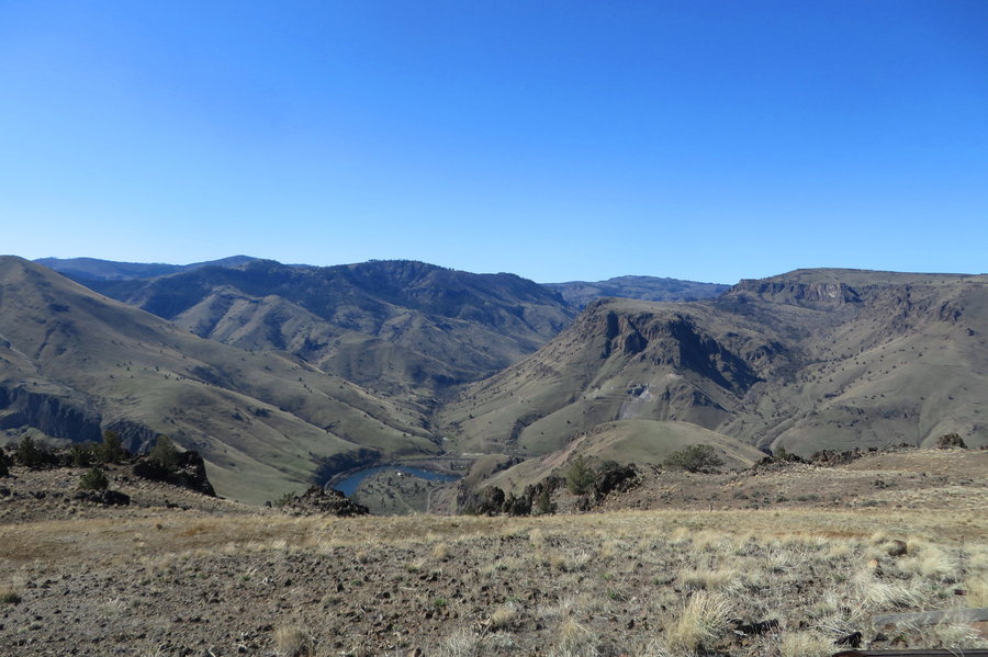
Columbia Hills
7 miles of hiking • 1750' elevation gain •
I got up early and took a little hike up to Stacker Butte. Spent the rest of the day climbing at Horsethief
April 25, 2014

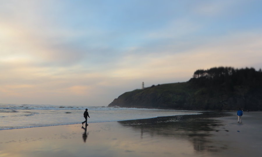
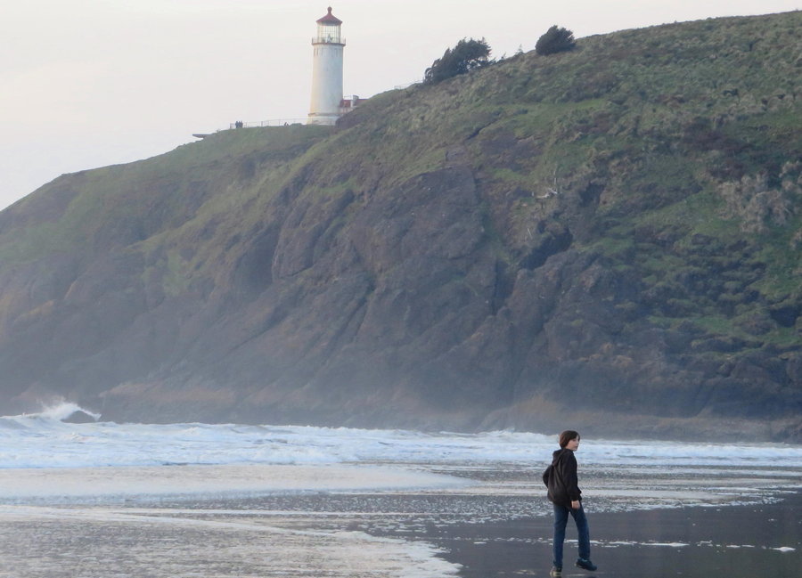
Cape Disappointment
5 miles of hiking • 500' elevation gain •
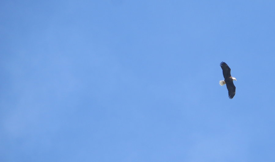
Spent a couple nights in a yurt at this nice state park with a great variety of outdoor amsuements. Ambulations were mostly beach walking with the family, but I also had a chance to hike an inland trail with massive sitka spruce, colossal ferns and slugs as big as my arms(jk)! Saw lots of eagles and even some bear poo. Super high tide this morning washed away all evidence of humans on the beach and filled the north jetty parking lot with sand.
April 19, 2014


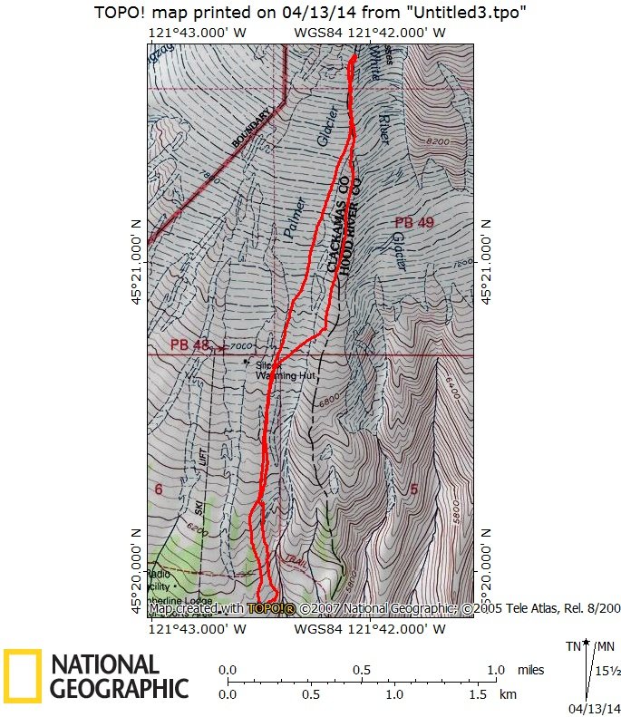
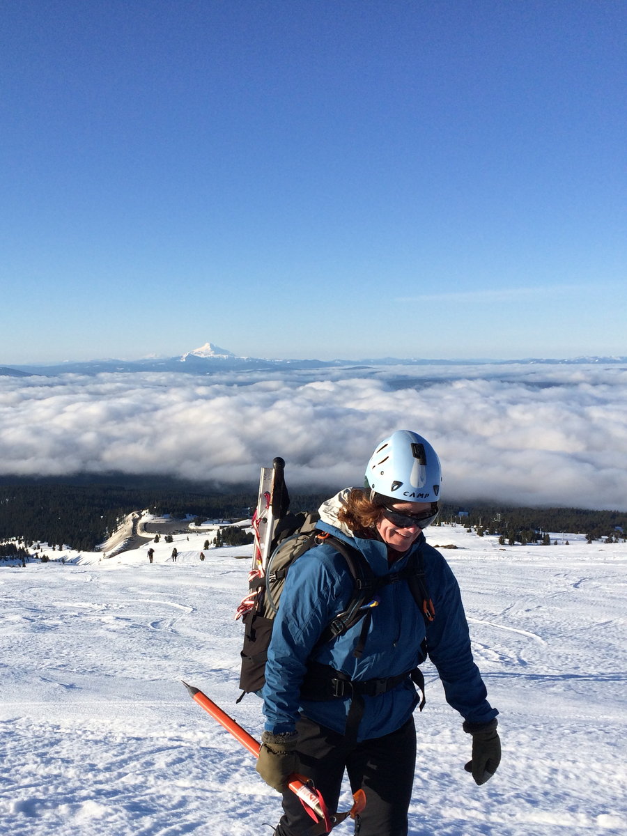
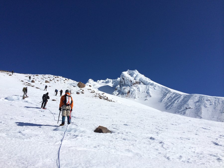
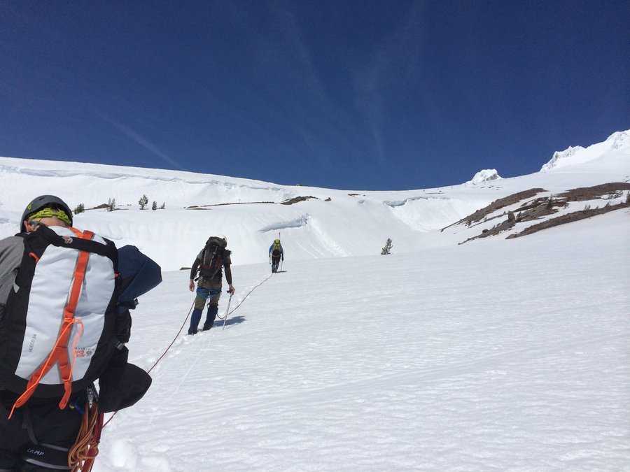
Palmer
4.5 miles of hiking • 3000' elevation gain •
Gorgeous day for climbing. Practiced rope travel and other alpine delights.
April 12, 2014

April 11, 2014


Springville Rd
6 miles of hiking • 1750' elevation gain •
Quick morning hike before climbing wall practice
April 4, 2014

.jpg)
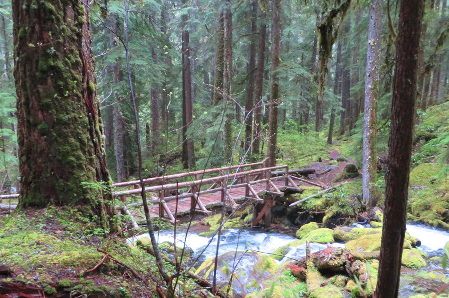
Soggy Devils
10.5 miles of hiking • 3250' elevation gain •
Rained all day, but the temp was mild and everyone's feet stayed dry. Because of the moisture and the well known route, I traveled this hike without my glasses on. It was an interesting experience to observe everything in 'soft focus'. Quite beautiful, big trees and so many shades of green, and it was nice to see all the burgeoning foliage of the delphiniums and other forest perennials.
March 28, 2014

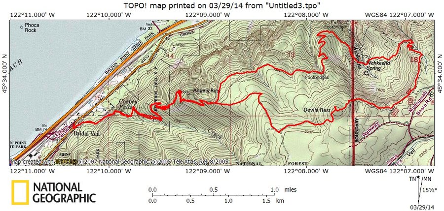
Hardy Ridge
8.5 miles of hiking • 2250' elevation gain •
1st official BCEP training hike for the Lucky Friday Team
March 21, 2014

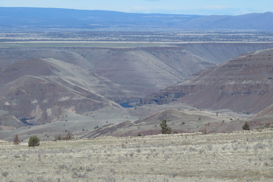
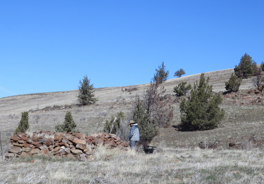
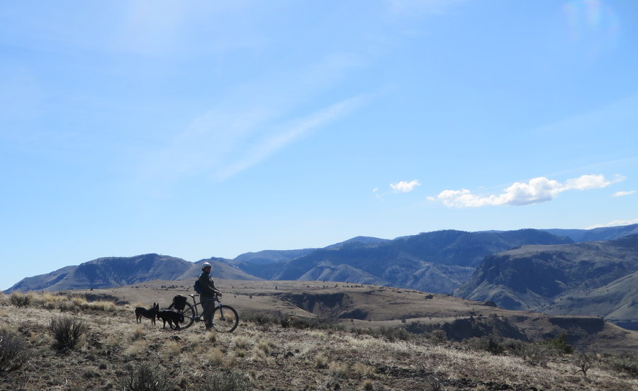
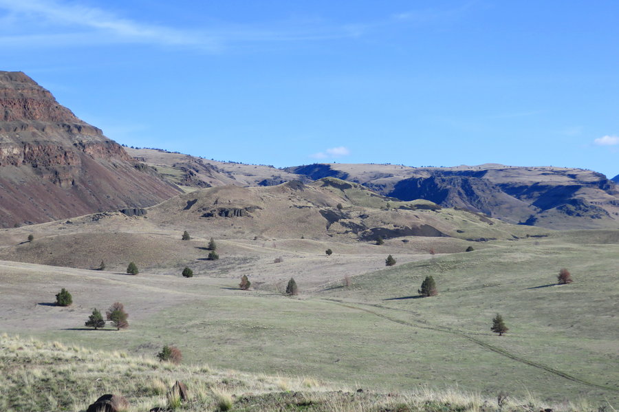
Criterion
4 miles of hiking • 1000' elevation gain •
This was mostly a mountain bike trip, but we dropped the bikes and explored several bluffs and had to do some hike-a bike through brush when we lost the road. Stunning canyon scenery, perfect day. We found an old homestead with interesting relics and structures along the way.
March 18, 2014

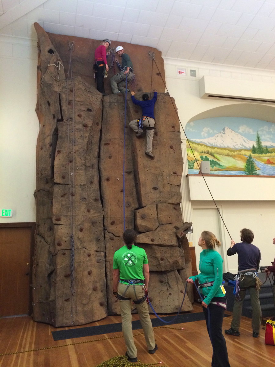
Forest Park
6.5 miles of hiking • 1000' elevation gain •
Unofficial 1st meet n greet hike with the Mazamas BCEP Fun Friday team. I get to be an assistant this year.
March 14, 2014
 1
1
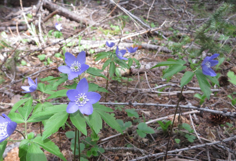
Rowland
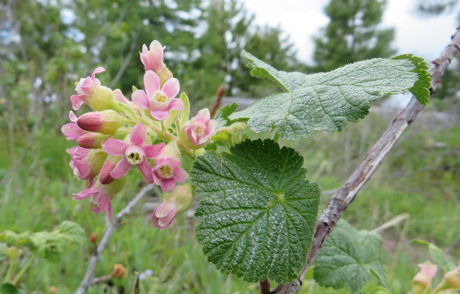
7 miles of hiking • 1750' elevation gain •
Wandered and basked, flowers are coming on fast now. Ticks hatched and popping all over the place.
March 7, 2014

February 28, 2014


Council Crest
4 miles of hiking • 1000' elevation gain •
Little morning jaunt before going back to the grind.
February 23, 2014

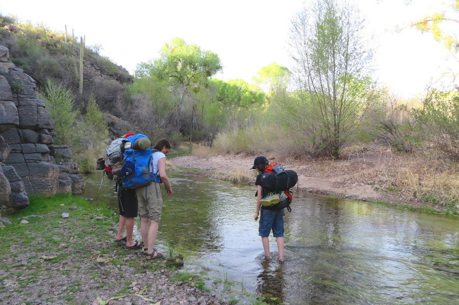
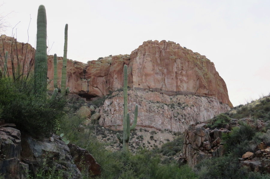
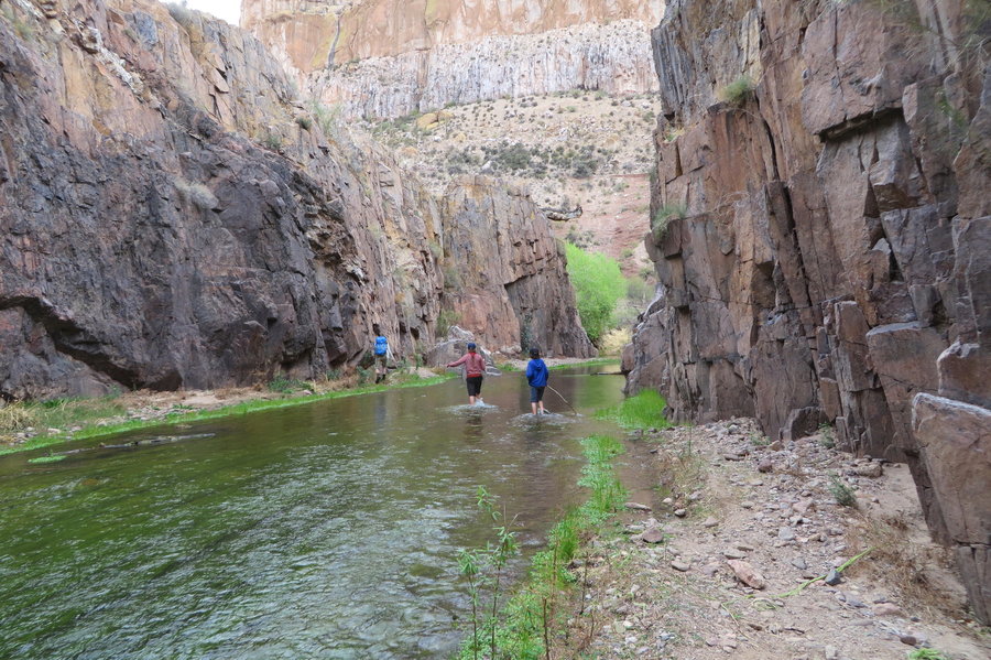
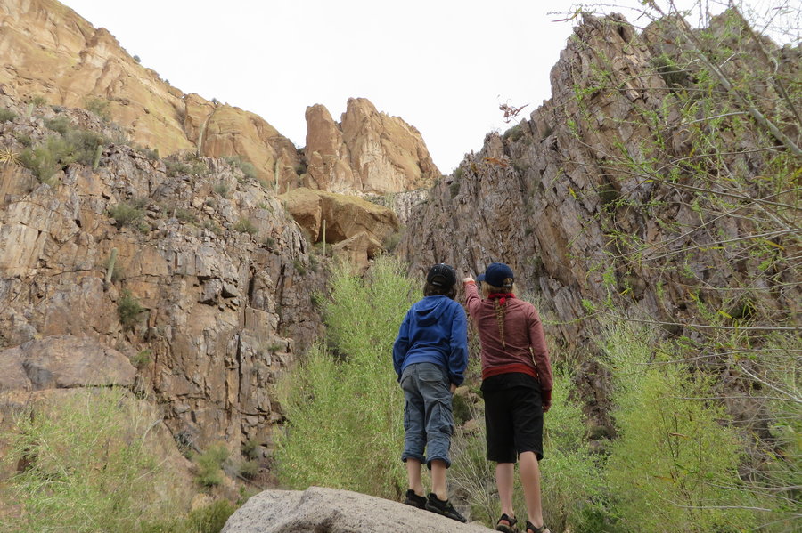
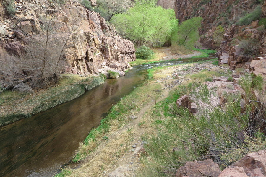
Aravaipa Canyon
18 miles of hiking • 1000' elevation gain • 2 nights
This area is fantastic! Evan and I met up with my sister in law and her son, and we backpacked into this gorgeous riparian canyon surrounded by incredible 1000 foot cliffs. How wonderful to sleep under the stars in the desert and wander up creek beds scrambling over rocks and bouldering along the lower edges of massive cliff faces.
February 18 – February 20, 2014


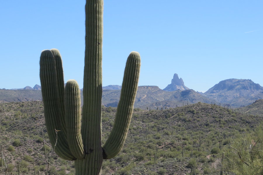
Weaver's Needle
4 miles of hiking • 500' elevation gain •
Short little hike on a hot day to a nice view of Weaver's Needle
February 17, 2014

Urban Ski Touring
12 miles of hiking • 1000' elevation gain •
Three days, four ski trips starting at my front door. Laurelhurst, Mt Tabor and many laps on the Hosford Hill.
February 7, 2014

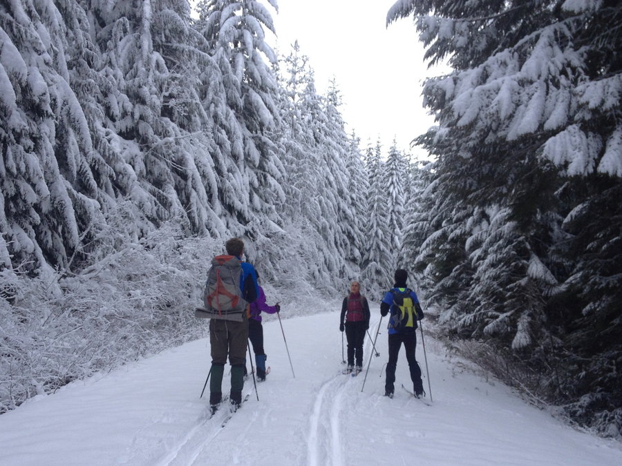
Mud Creek
8 miles of hiking • 750' elevation gain •
Out for the last tour with my Nordic ski class. Once we turned off on the Mud Creek Loop, we were making fresh tracks and saw no-one for hours. Blue skies, new snow, awesome!
February 1, 2014

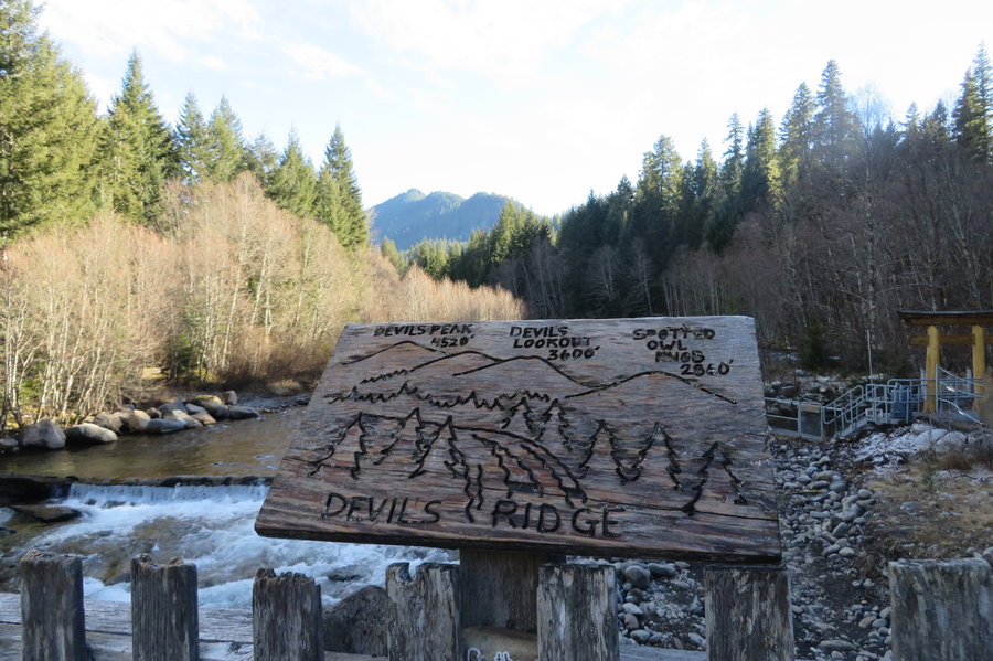
Devil's Peak
7.5 miles of hiking • 2500' elevation gain •
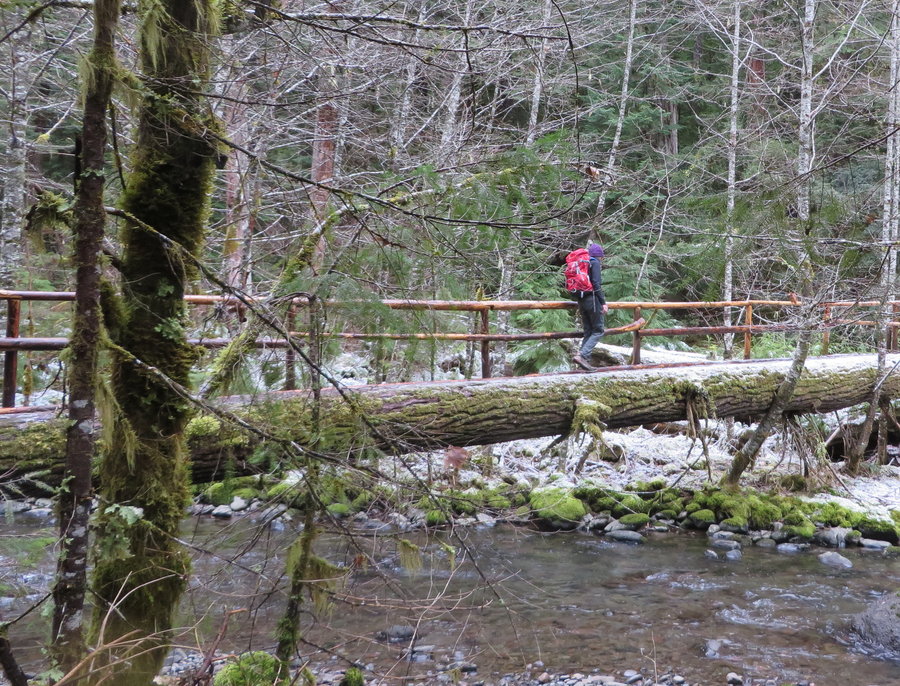
A warm cozy night in the cabin,a relaxing morning soak in the hot springs, and an invigorating hike up Devils Ridge, Heaven!
Multiple loop options in the area, this one had a beautiful lush forest at the lower elevations, followed by a steep Ruckelish climb(but shorter). Then a long forested ridgewalk to the summit with several rock outcroppings for views, and I was surprised to see a hearty population of Alaska Cedar on top of the ridge. Overcast, but we got some views of Jefferson.
January 27, 2014

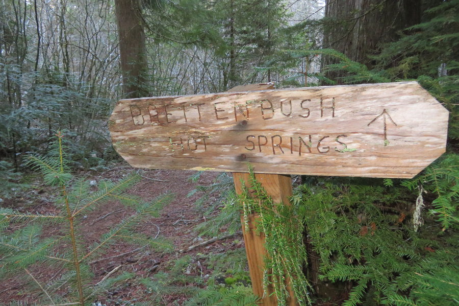
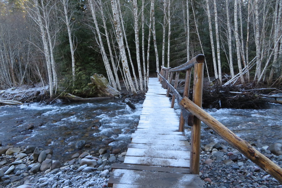
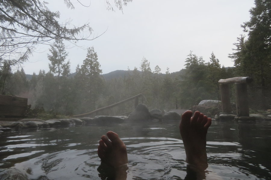
Breitenbush
6.5 miles of hiking • 500' elevation gain •
A friend volunteers here and invited me down as her guest. While she sat in meetings at the lodge, I soaked and hiked!
January 26, 2014

Teacup ski
8 miles of hiking • 1000' elevation gain •
Working on my skiing skills, very busy here today. Snow is bleak but the weather was fantastic.
January 25, 2014

January 25, 2014

January 18, 2014

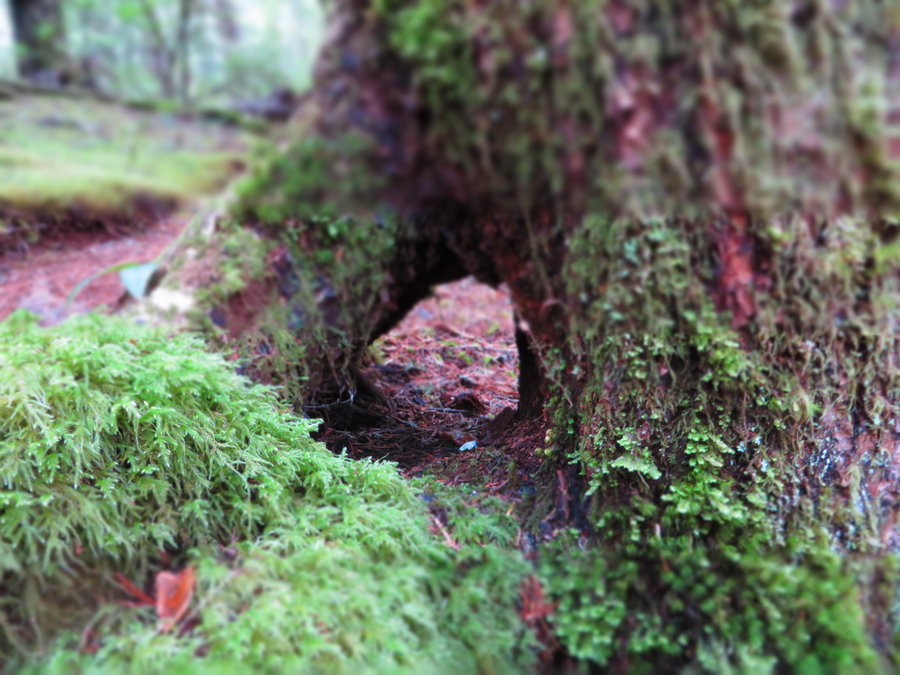
Cape Horn
7 miles of hiking • 1750' elevation gain •
Each time I hike this trail, a little chunk of fun has been removed. No more roots, rocks, walking under waterfalls, crossing treacherous gulleys, peering over RR tunnel, crossing the road. 6 months off limits. I hear the scree field is going next.
January 17, 2014

January 16, 2014

Wildwood
2.5 miles of hiking • 0' elevation gain •
Small consolation after debacle higher up the mountain.
January 12, 2014

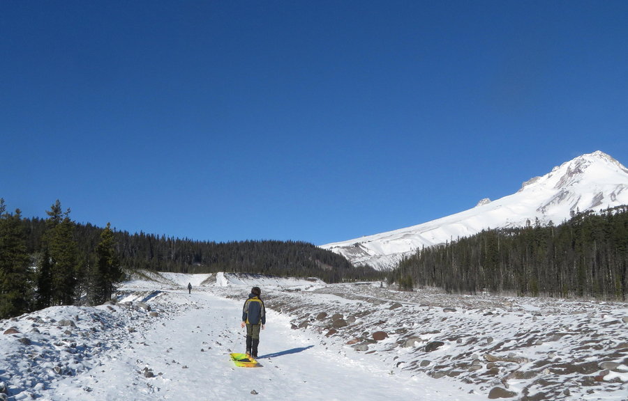
Fun on the mountain with kids
5 miles of hiking • 500' elevation gain •
Took a friend and kids up to the Mazama Lodge for the weekend. Visited Flag Mountain on the way, and White River Snow Park the next day. Not much snow for sledding, but it was a gorgeous day.
January 4, 2014

View trips from: 2011 2012 2013 2015 2017 2016 2018 2019 2020 2021 2022 2023 2024 2025 2026