

2018 Trips


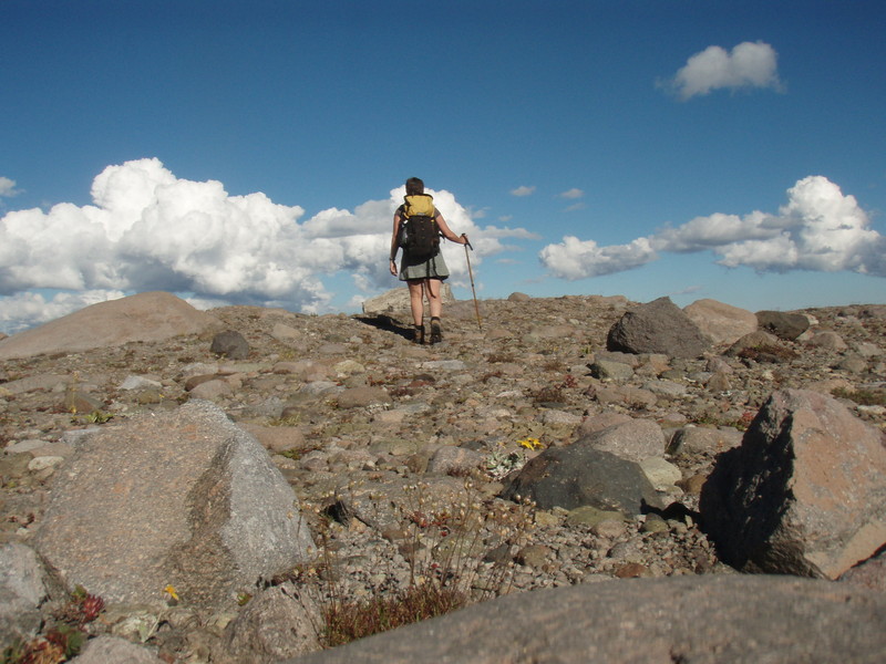
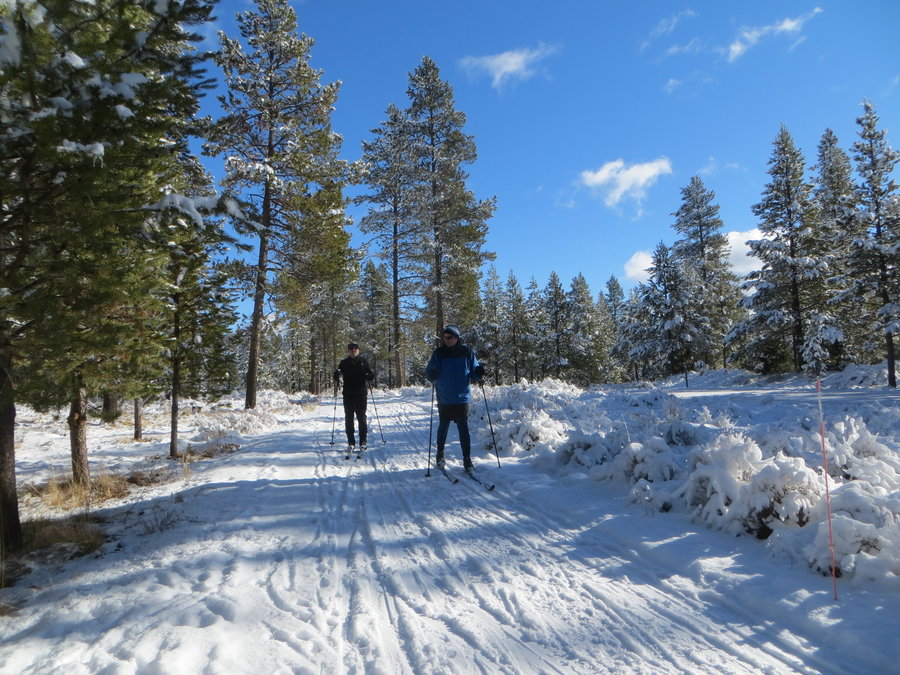
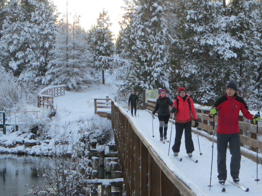
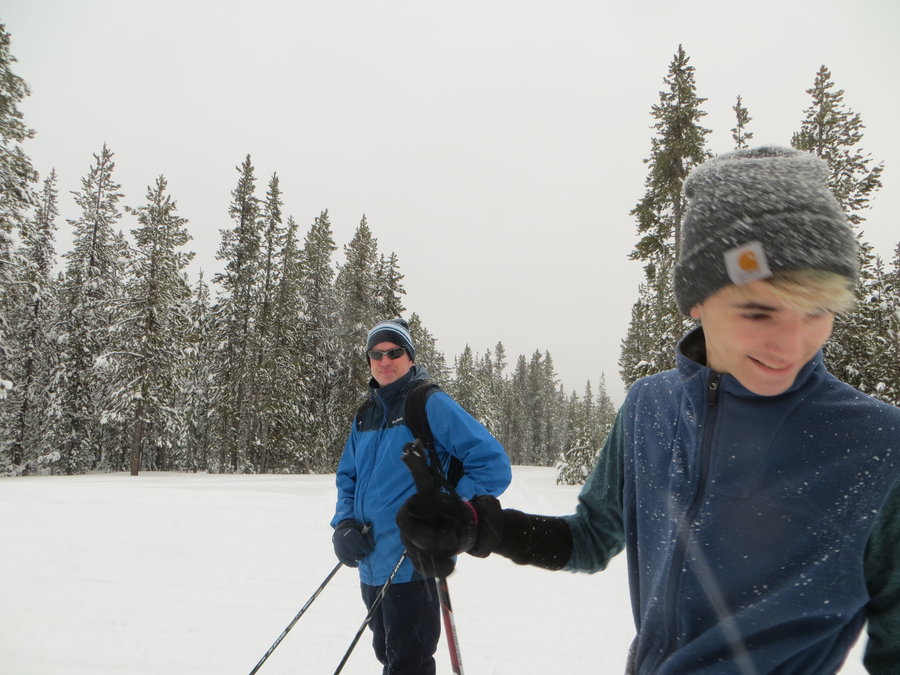
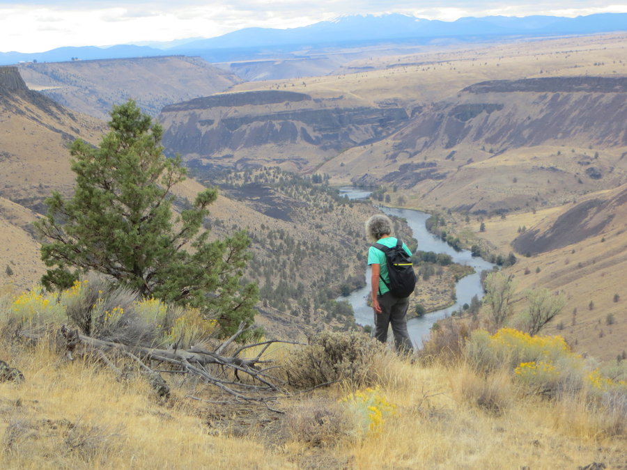
Sunriver
25 miles of hiking • 1000' elevation gain •
Stayed at Sunriver for a few days. On the first day we were able to ski out the door. Visited Benham Falls and Swampy Lakes Snow park.
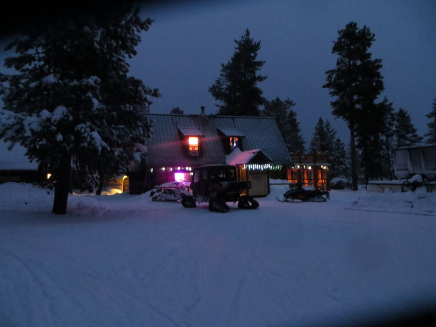
Highlight of the trip was getting a cat ride up to Paulina Lake from the 10 mile Snowpark. We skiied around for a few hours, then had dinner at the lodge.

December 30, 2018

 1
1
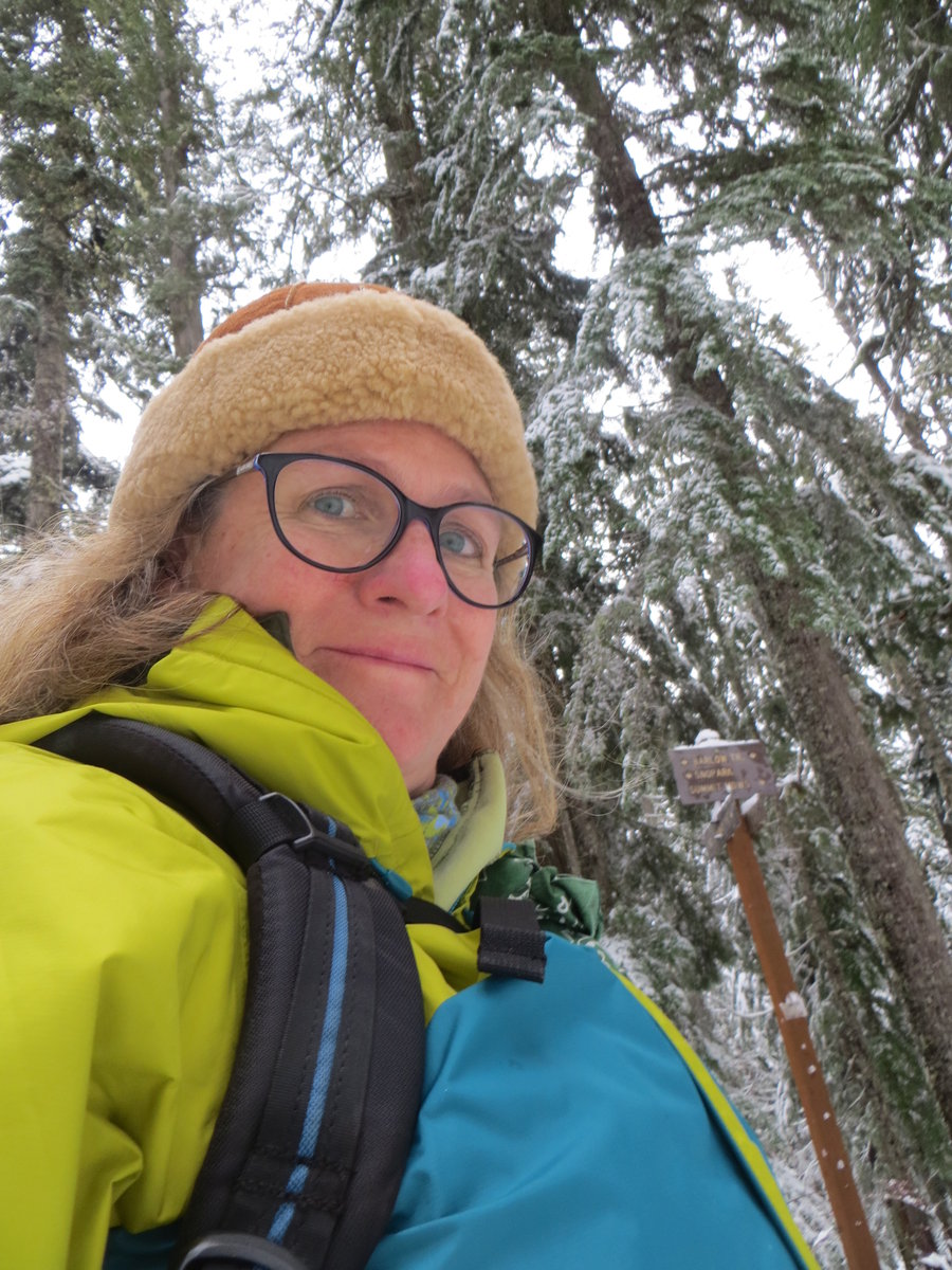
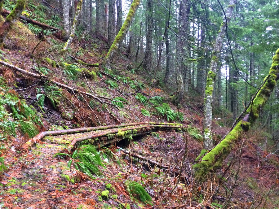
Trillium/Mud Creek loop
13.5 miles of hiking • 1500' elevation gain •
Started at Mazama Snow Park and took the Barlow Trail to Trillium. Then miles of fresh tracks on the Mud Creek loop.
December 14, 2018

 1
1
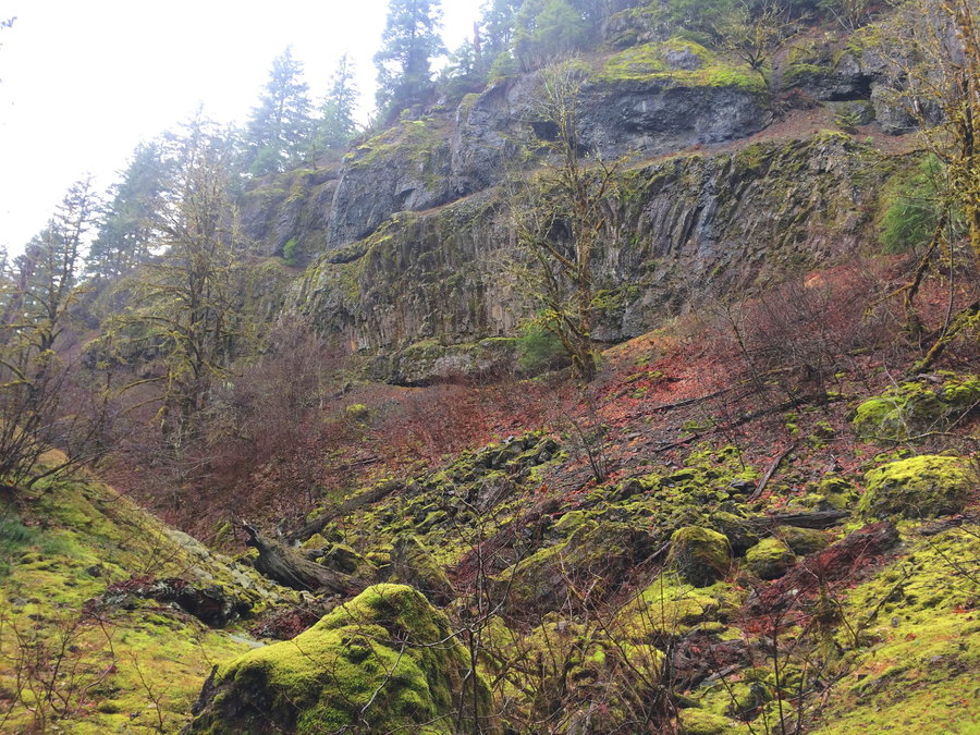
Scappoose logging roads
7.5 miles of hiking • 1000' elevation gain •
Quiet day in the Coast Range with friends.
December 12, 2018

Multnomah basin
10 miles of hiking • 3000' elevation gain •
So happy to be out in the woods. Grinning for hours. PSA: it's time to start carrying microspikes!
December 6, 2018

 1
1
Into the woods
4 miles of hiking • 750' elevation gain •
All of my recent adventure plans have been thwarted by responsibilities. Today I was able to sneak in a morning romp. It was wet,but I was happy to get out and be absolutely alone in the woods.
December 2, 2018

Powell Butte
4.5 miles of hiking • 500' elevation gain •
Trying to burn a few calories before I consume several thousand.
November 22, 2018
 1
1
November 18, 2018

 1
1
East Coast Walks
16 miles of hiking • 500' elevation gain •
Spent time with the aged ones in North Carolina and Connecticut. Saw the devastation from the recent hurricane in the south. Just missed the peak of fall in New England.
November 10, 2018
 2
2
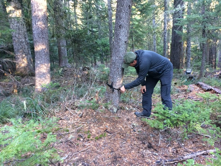
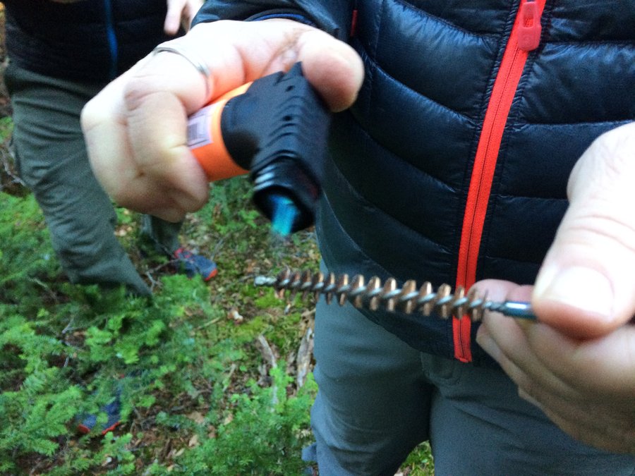
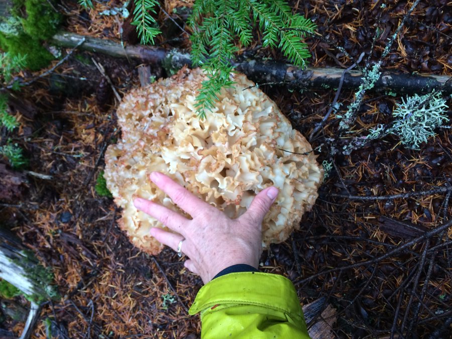
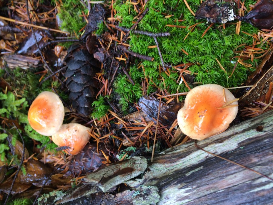
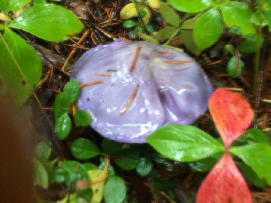
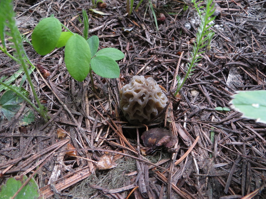
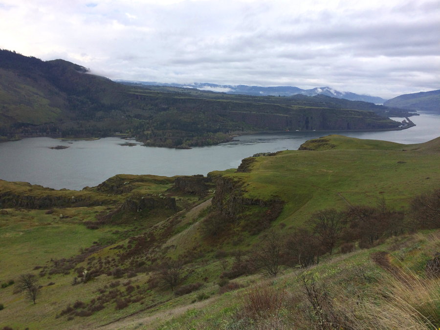
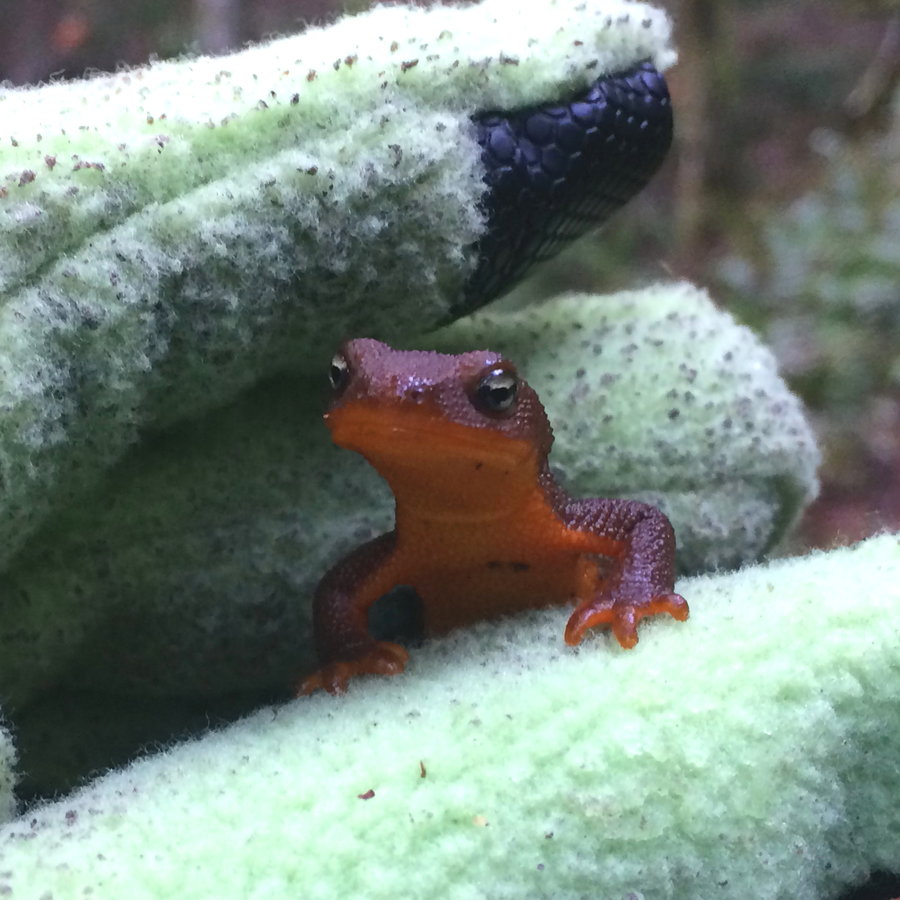
Clackamas Area Foraging
3.5 miles of hiking • 750' elevation gain •
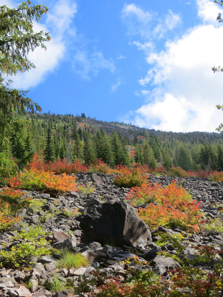
Tons of mushrooms out there, but I did not find many edibles- just a few chanterelles plus some yellowfeet and early hedgehogs. Totally soaked, but I carried some hot soup with me and enjoyed a misty mountain lunch hunkered under a massive hemlock. Posted are some beauties I did not collect.
November 2, 2018

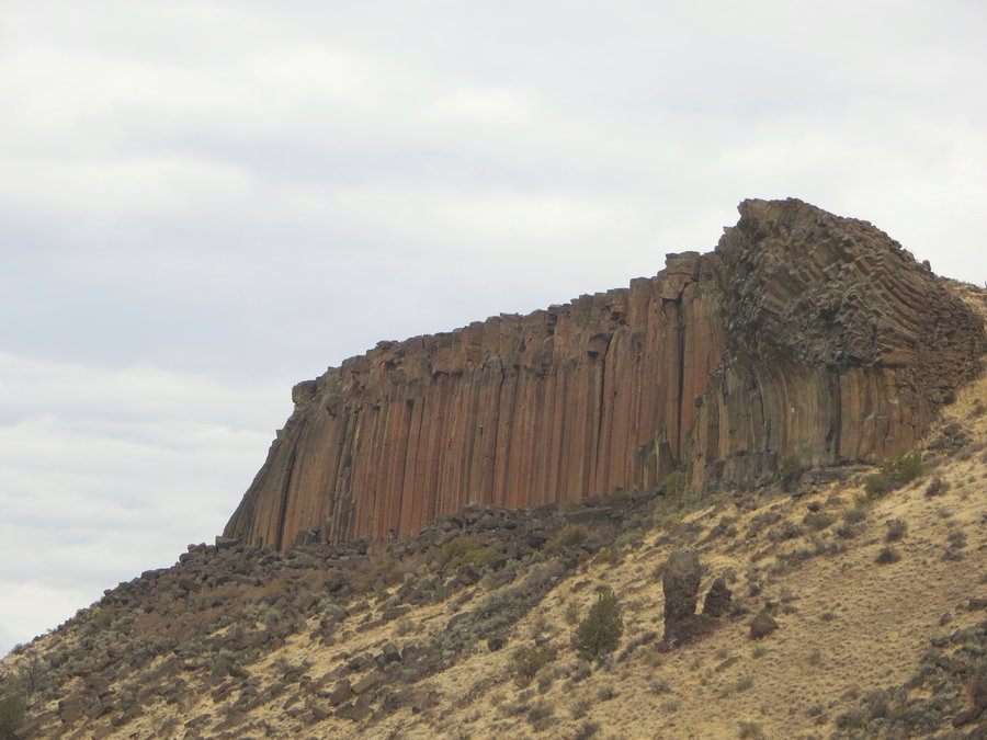
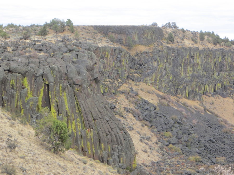
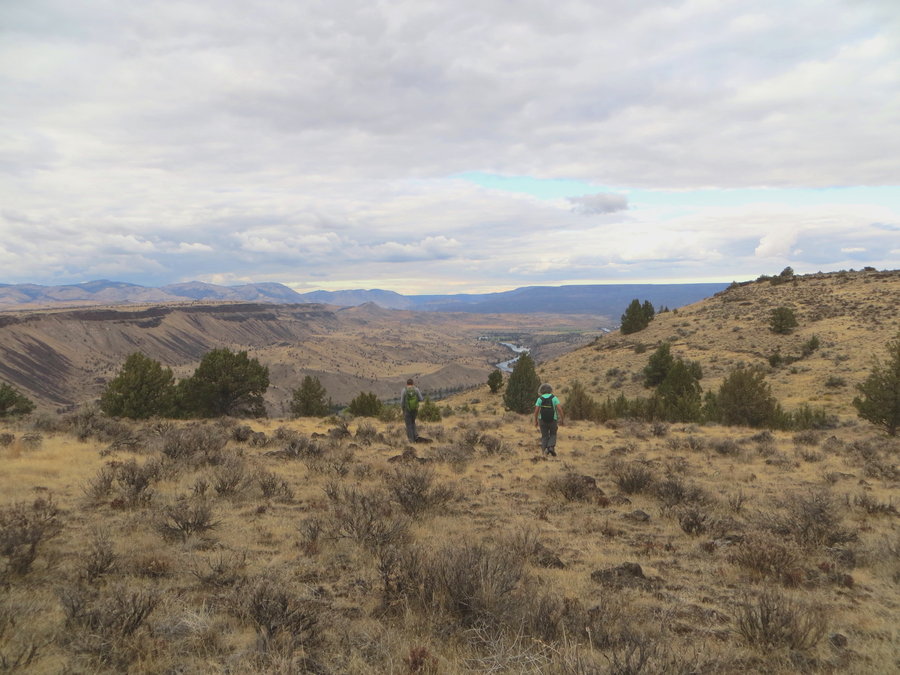
Rock Creek Drainage
5 miles of hiking • 1000' elevation gain •
Wet woods wanderings, searching for gold
October 26, 2018

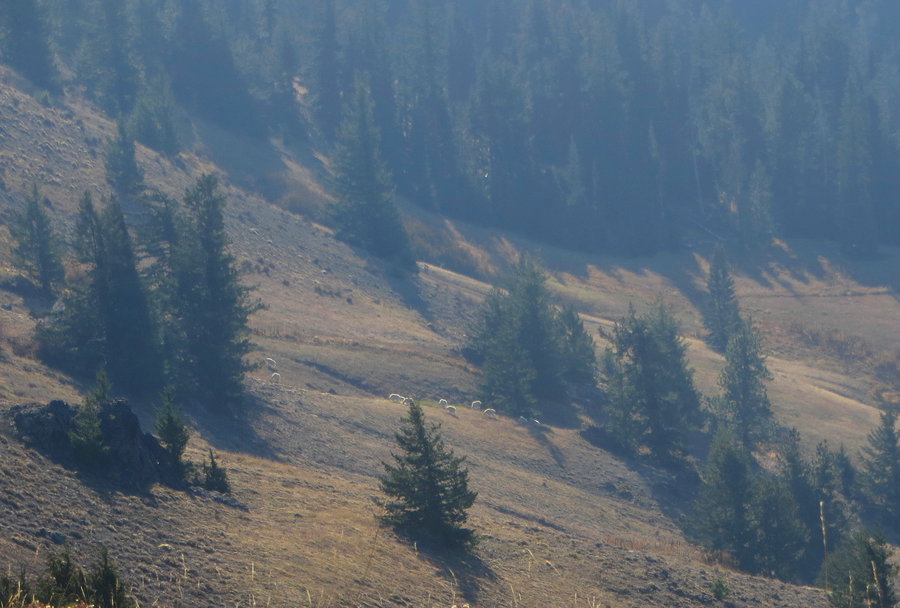
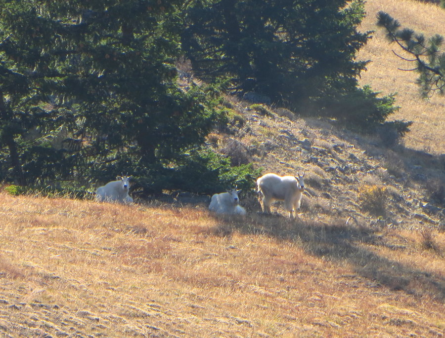
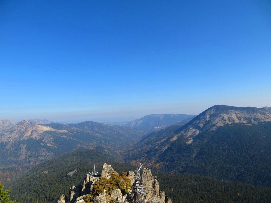
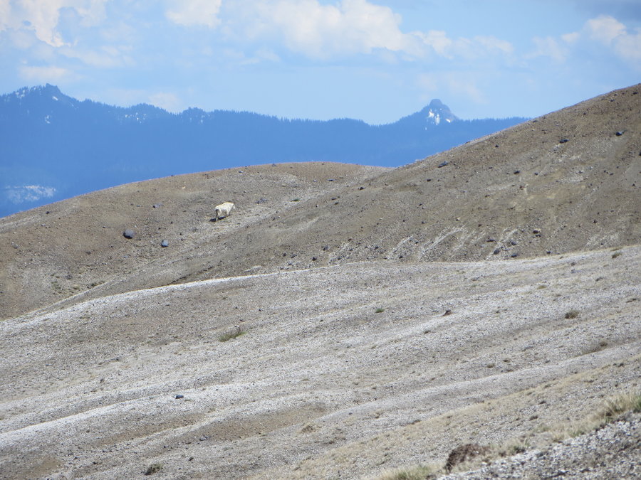
Mcneil Peak, WODWA
10.5 miles of hiking • 3250' elevation gain •
Beautiful October Day. Saw 8 goats and 0 people! I meant to go to Shellrock too, but took a nap in a meadow instead.
October 22, 2018

October 10 – October 11, 2018

 1
1
FP Firelane 15
7.5 miles of hiking • 1000' elevation gain •
Monday exercise, two different Mondays here:10/1 and 10/8.
October 1, 2018
 1
1
Mushroom hike x 2
5 miles of hiking • 1000' elevation gain •
No luck on first try. Hit the jackpot after some rain and dogged persistence.
October 1, 2018

 1
1
Bird Mountain, Indian Heaven
10.5 miles of hiking • 2000' elevation gain •
Lovely Loop on a perfect fall day.
September 26, 2018

 1
1
FP am exercise
3.5 miles of hiking • 500' elevation gain •
Just a little pulmonary rehab, recovering from a cold.
September 24, 2018
 3
3
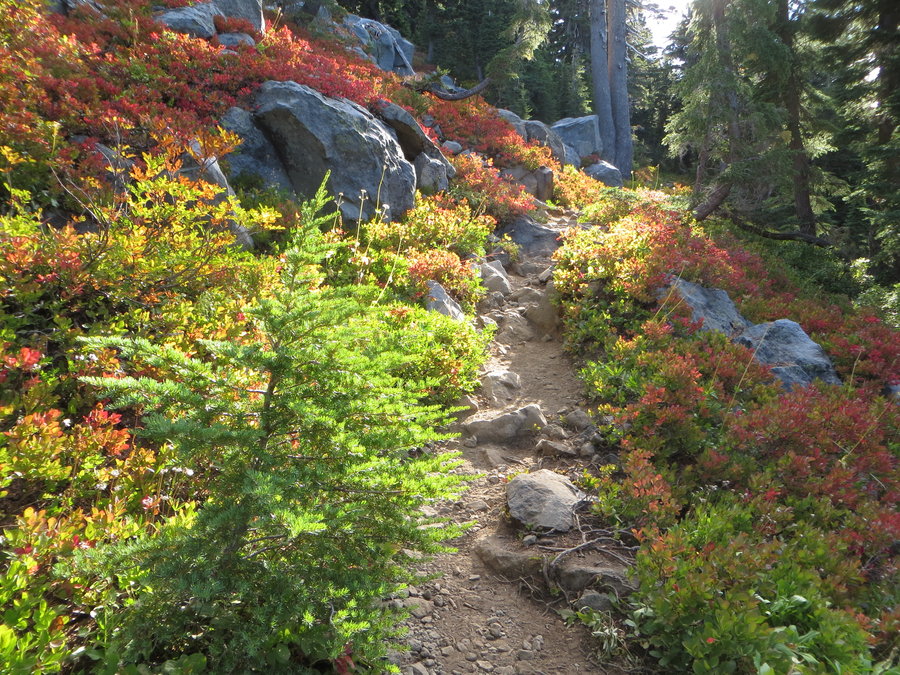
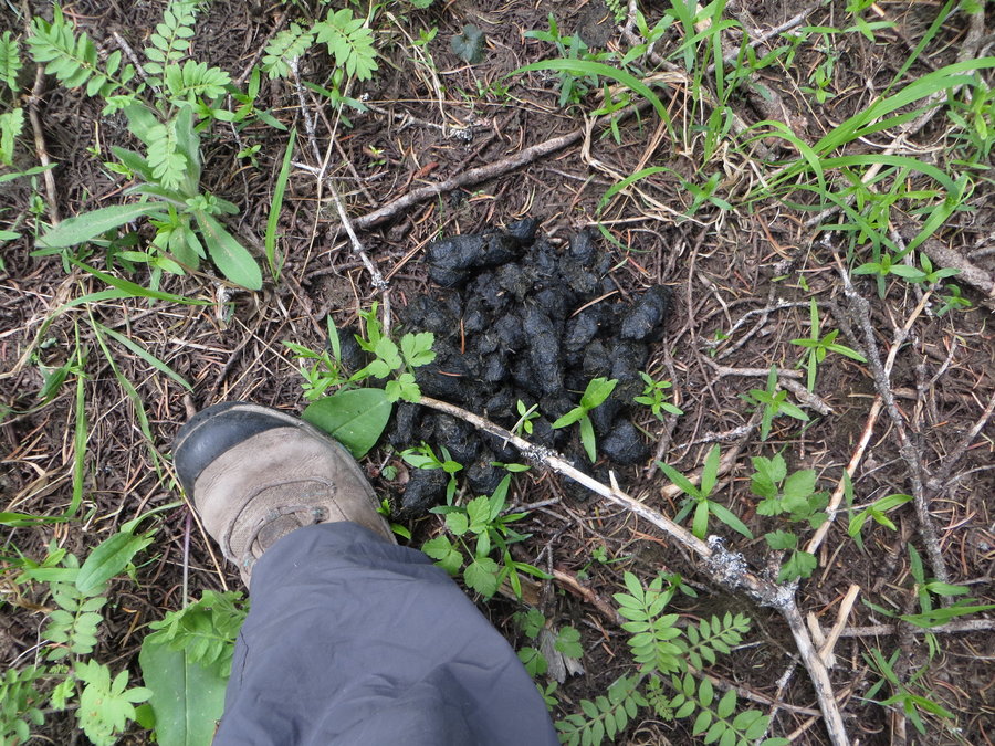
Bear Point/Crown Lake bike shuttle
7 miles of hiking • 3250' elevation gain •
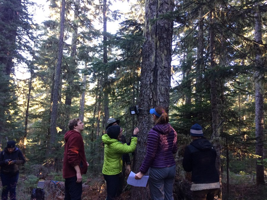
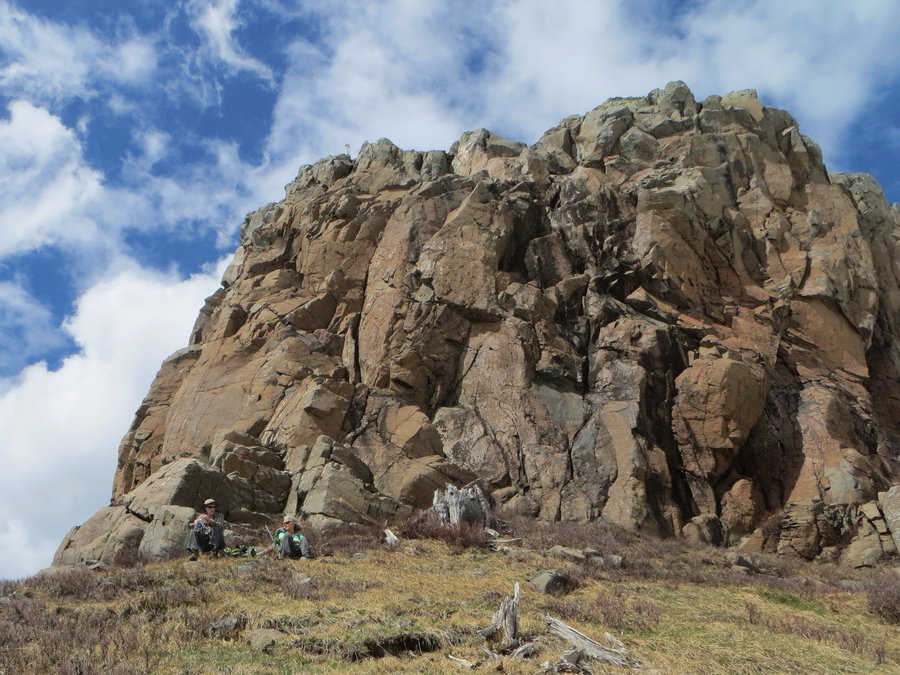
Finishing what I started last week. I had left my bike hidden at the Crown Lake trailhead, but made a navigational error and ended up in the Mildred Lakes basin(arduous bushwack) and came out a different road. Hitched a ride with a hunter back to my car and drove straight home. Today I returned and started at S Breitenbush TH, hiked up to Bear Point and went cross country on the ridge leading into Firecamp Lakes basin, found my bike safe and sound, then cruised the 4 miles downhill (not included in this mileage)back to the Brietenbush TH.
September 18, 2018


 1
1
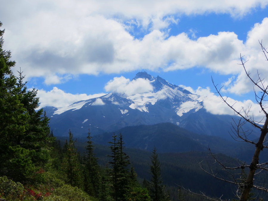
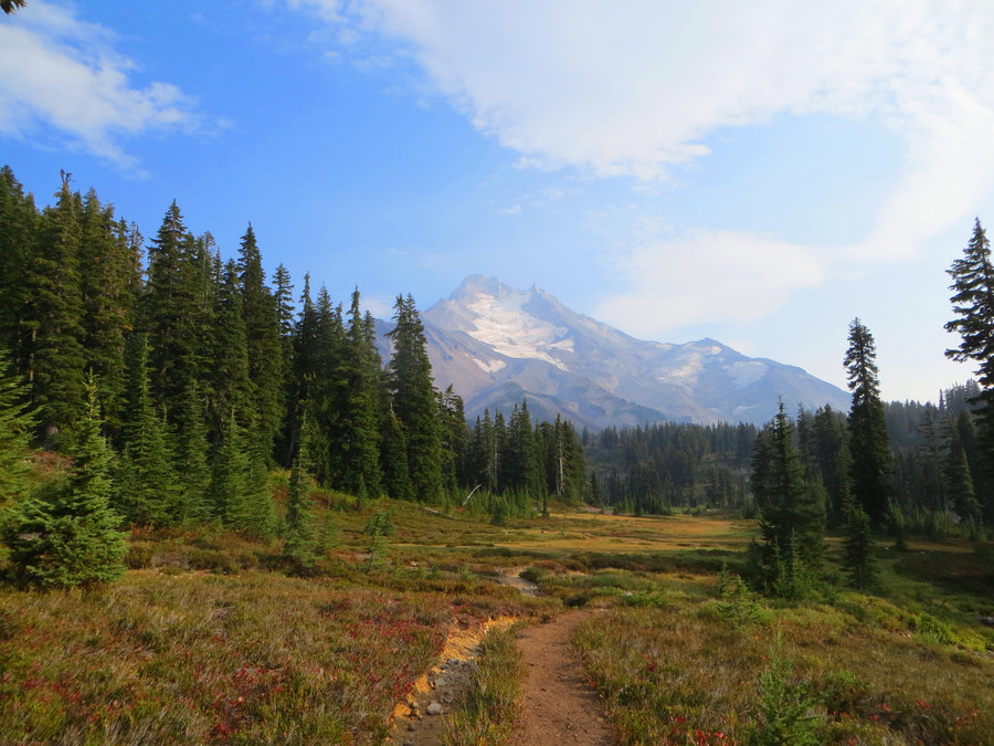
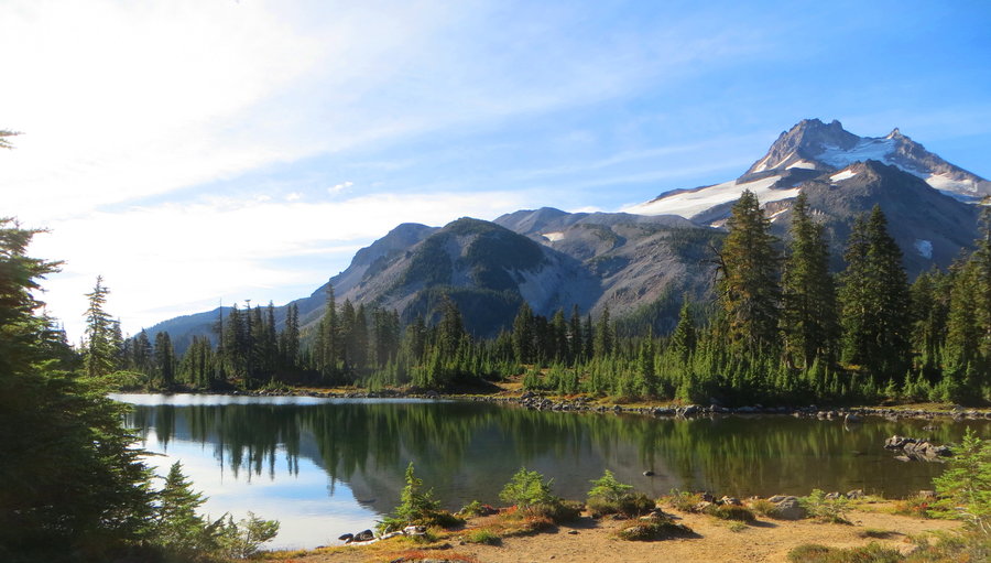
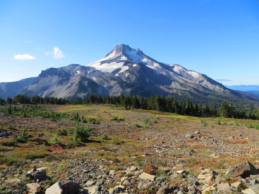
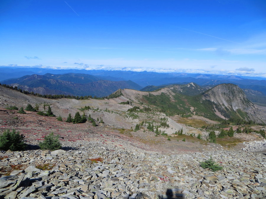
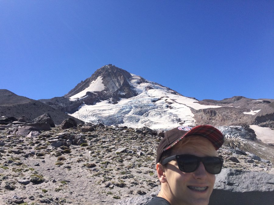
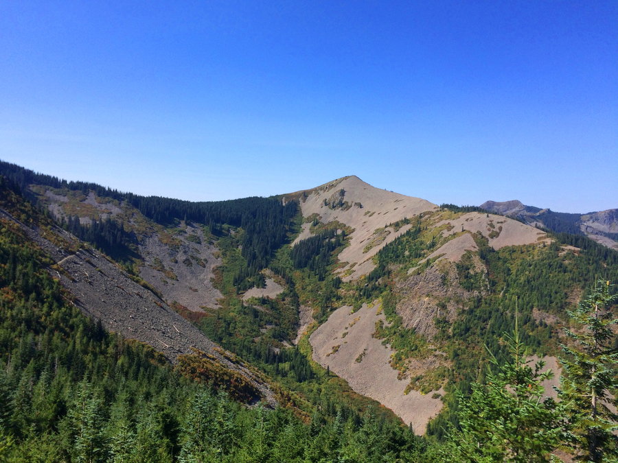
Jeff Park and Adventure Ridge
28.5 miles of hiking • 9000' elevation gain • 3 nights
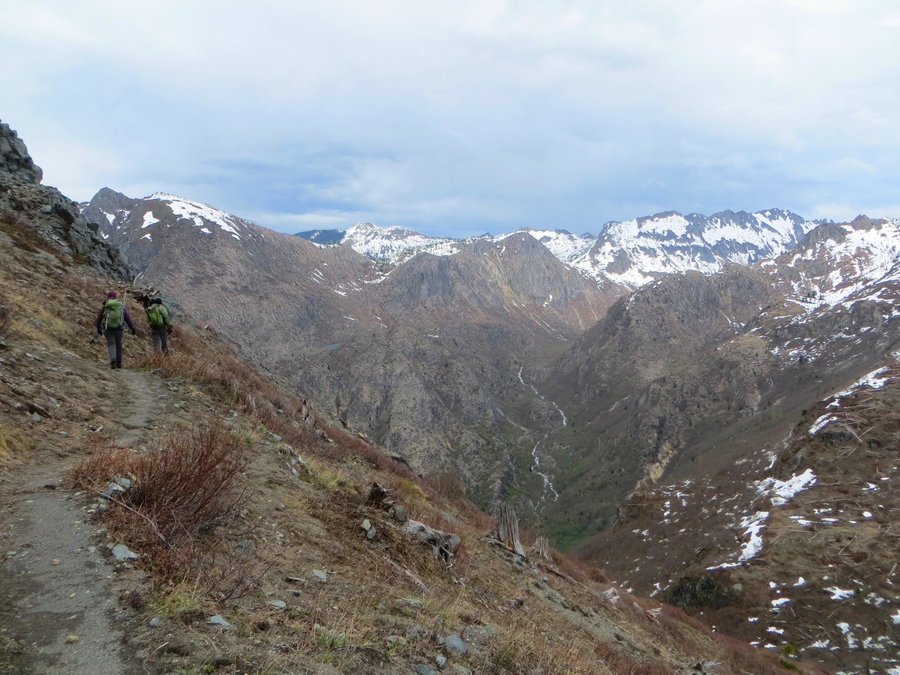
Glorious! Fall color coming on, huckleberries still plentiful. Went up the S Brietenbush trail to Jefferson Park and stayed two nights at a designated site on Russell Lake. Climbed up the NW side of Jeff to the base of the Whitewater Glacier on day 2. On the third day I took the PCT to Park Ridge and headed off cross country, traveling north on Adventure Ridge-magnificent scenery. Spent the night at Bear Lake. Third day was a 10 hours of slogging through the Mildred Lakes basin- I do not recommend. Came out on a road at 5pm that would lead me back to my car in 8 miles! Luckily a hunter came along so I only walked half of it. yes I got into a car with a stranger with a gun, and didn't think twice!
I really want to return and spend some time in the basin below Dyna-Mo Peak and climb that peak and Park Butte.
September 7 – September 10, 2018

 1
1
Cooper Spur
5.5 miles of hiking • 2000' elevation gain •
Very busy up there today. Went with family and friends, and a Corgi. Terrain was rough for Pickles, he ate a lot of dust.
September 1, 2018

 1
1
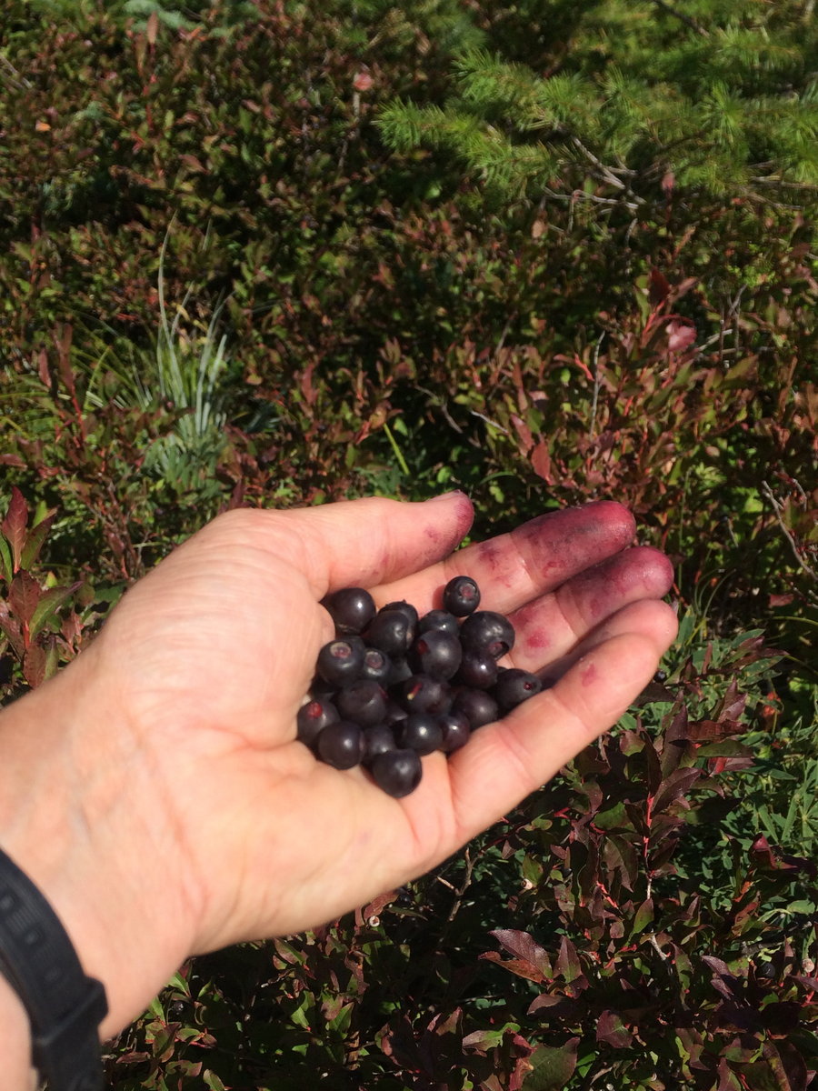
Little Baldy
9 miles of hiking • 2000' elevation gain •
Via Bluff Mountain Trail. Return trip very slow, collecting huckleberries!
August 28, 2018

 1
1
FP quickie
4.5 miles of hiking • 500' elevation gain •
The Wildwood is a concrete sidewalk. Ditto the connector trails. Thank god Lief Ericson and the firelanes have a little give.
August 27, 2018
 1
1
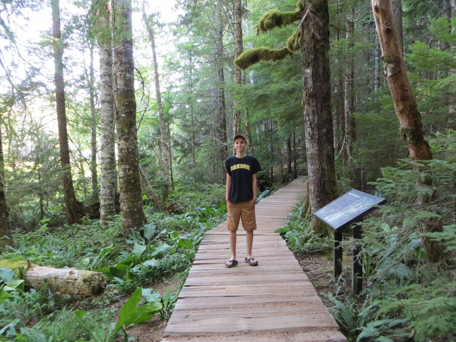
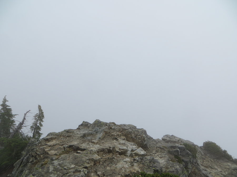
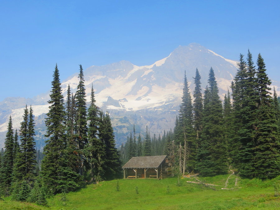
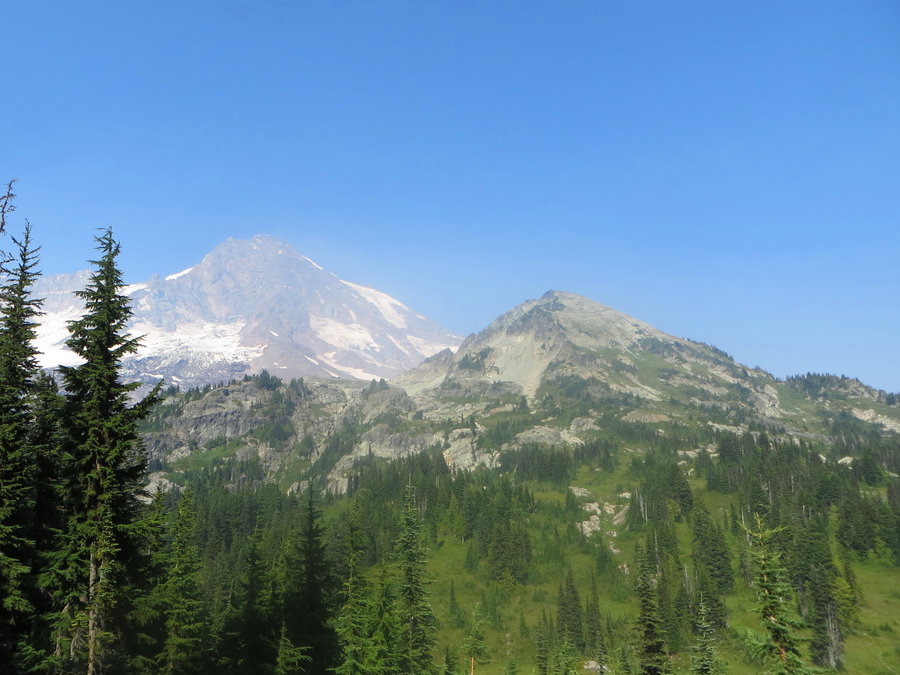
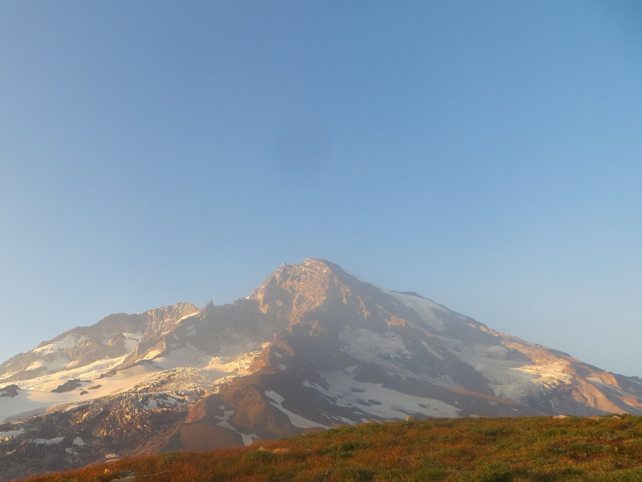
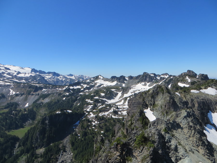
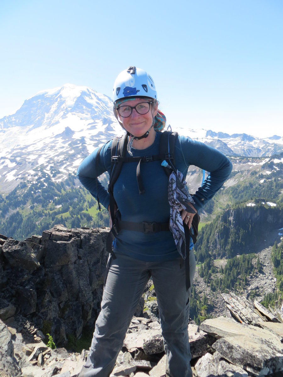
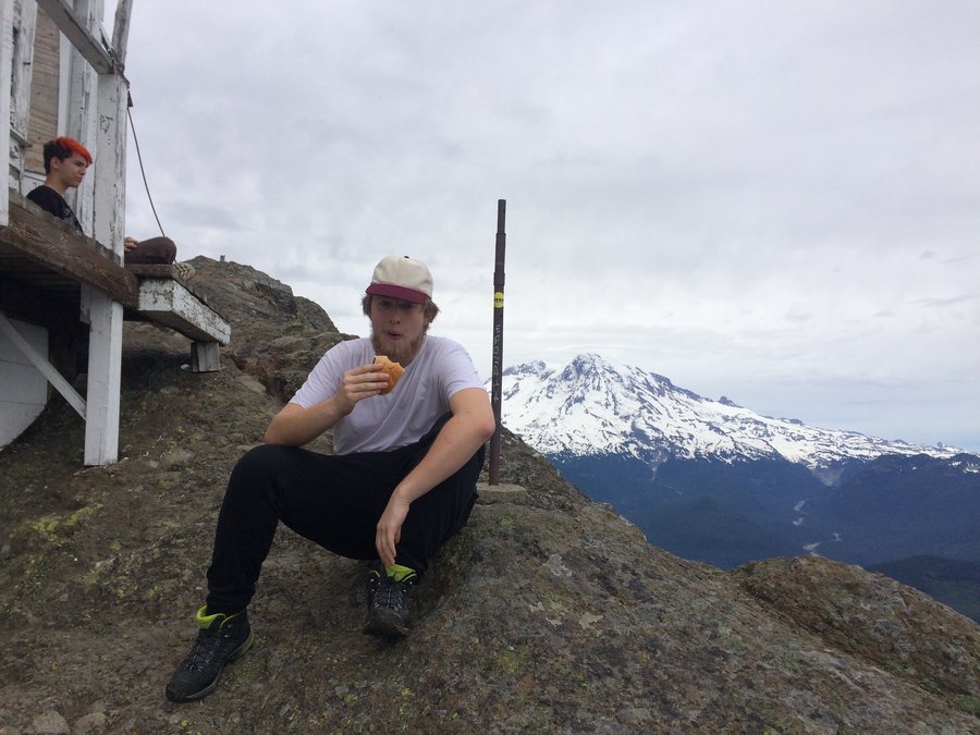
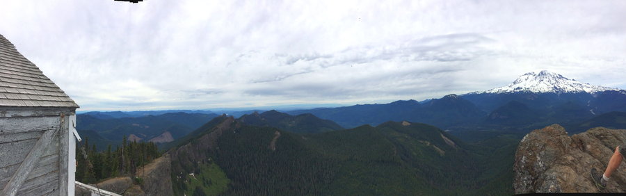
MRNP: Longmire,Paradise, Plummer and Denman
8 miles of hiking • 2000' elevation gain • 1 night
Brought my son up to Mt Rainier. Last time we came up here it was rainy and overcast. We started out Thursday in the Portland smog and were delighted to find blue skies and the mountain out. We wandered around Longmire, set up camp and went up to Paradise after dinner. Had a wonderful evening up there, brought our chairs and sketchpads. Set up above Alta vistaon the Skyline Trail and sketched. Tahoma was wearing a cloudy cap but the Tatoosh Range was lit up for the sunset.
Next day we joined a Mazama group for the hike up to Plummer and Denman. Straightforward up to Pinnacle Saddle, but the fog was so thick, and there are many braided social trails up there,we had a little trouble navigating and got to do some scrambling before we found access to the summits. Totally socked in the whole trip, but pleasant nonetheless. Just happy to get my kid out on a hike.
August 23 – August 24, 2018


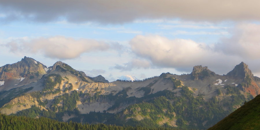


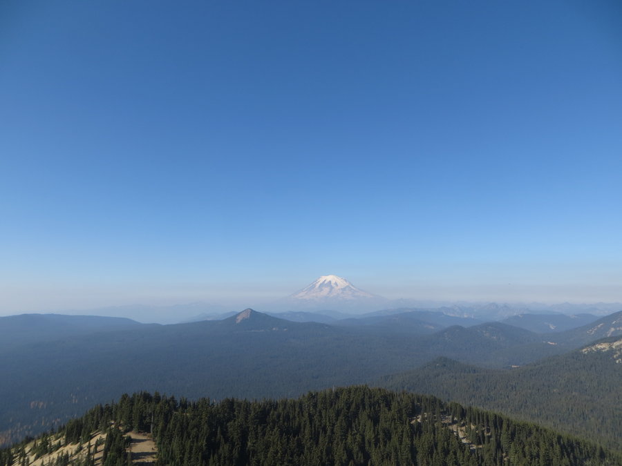
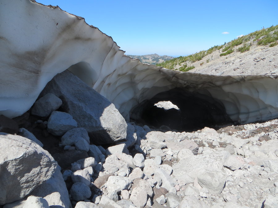
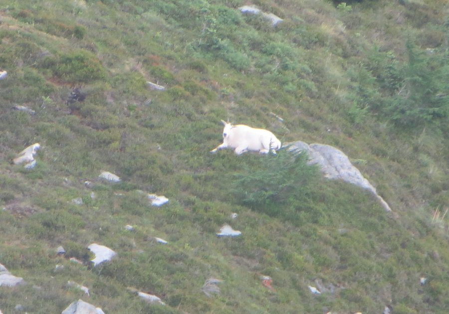
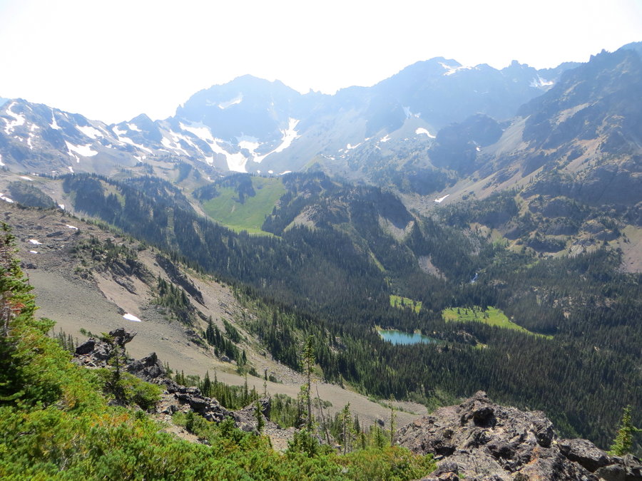
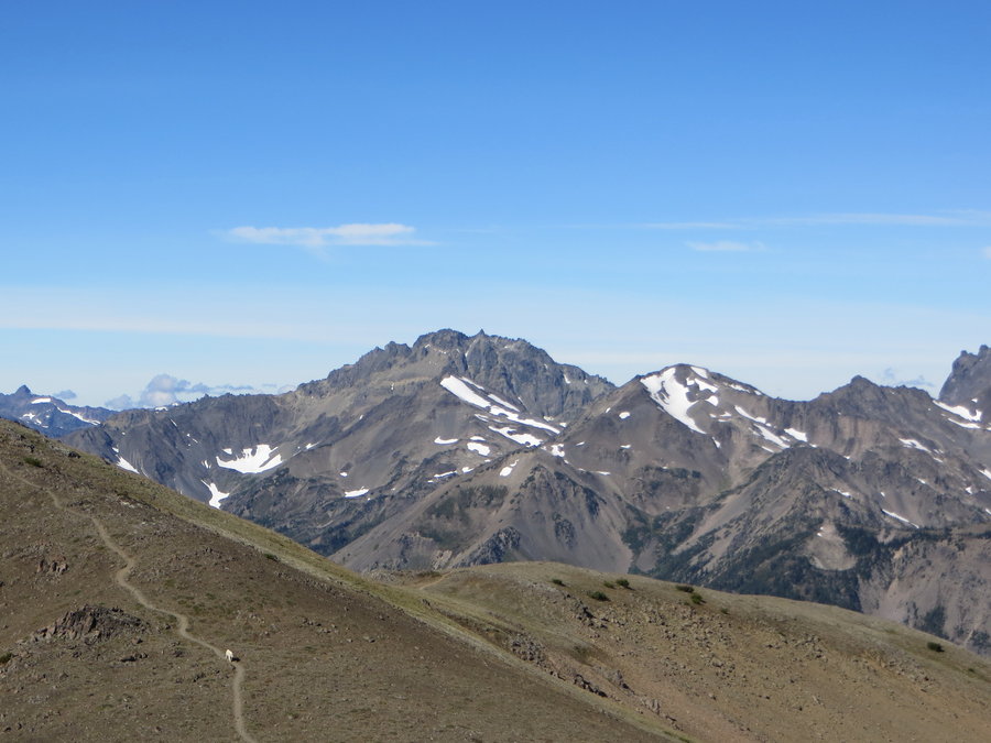
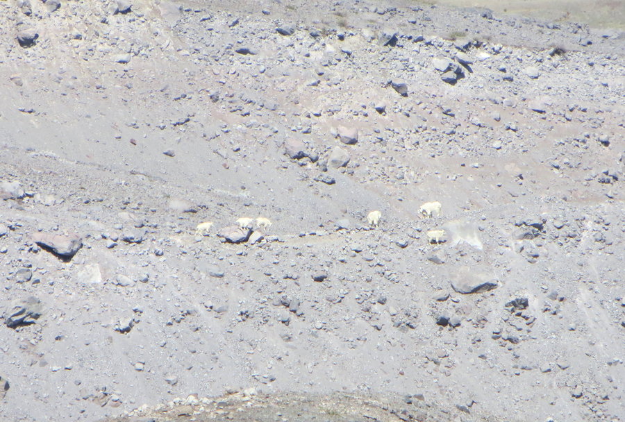
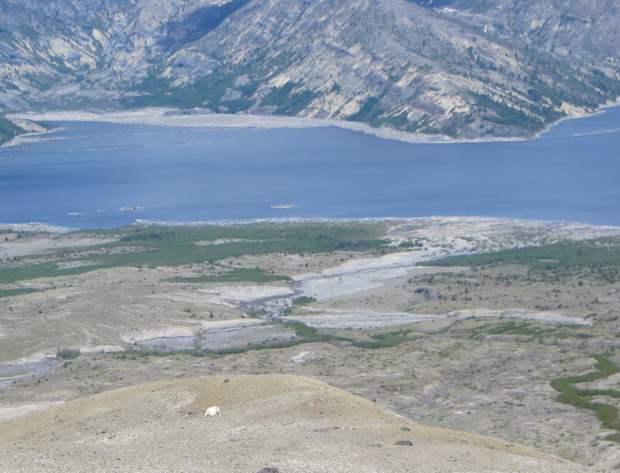
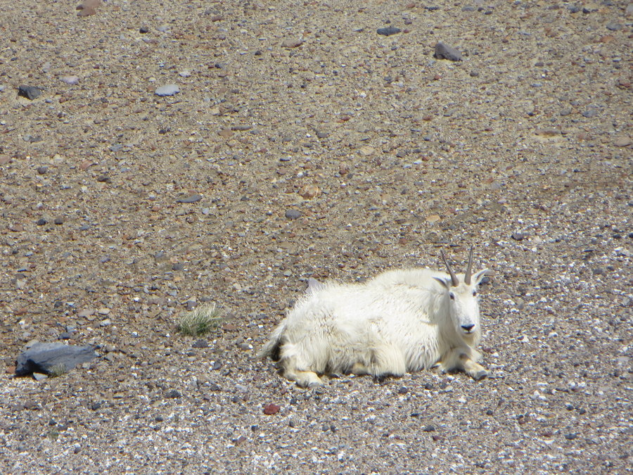
Pyramid Peak, MRNP
19 miles of hiking • 5500' elevation gain • 1 night
Started out at Longmire and took the Wonderland to Indian Henry, then headed up above Mirror Lakes. Rather buggy between 3500-5000 ft, but once in the alpine area, it was really nice.However, the whole area is very smoky/hazy. The meadows between Mirror Lakes and Pyramid Peak are lovely. Just need a cross country permit to camp there,I was the only one. Pyramid Peak has a trail all the way to the top, but the final few hundred ft are sketchy with loose rock. Saw some goats. Got to see some great meteor blazes too! Got an idea from the internet to take Fisher's Hornpipe Creek back down to the Wonderland. Kinda dumb. Took 3 hrs to cover 1.5 miles, but at least I didnt have to go back the way I came.
August 13 – August 14, 2018


 2
2
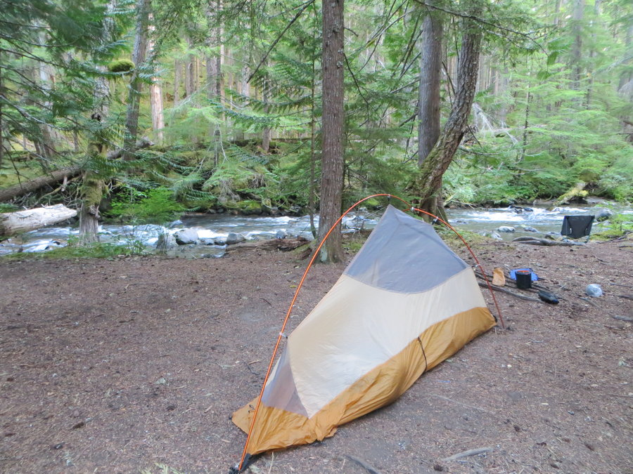
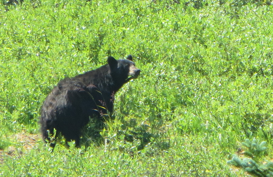
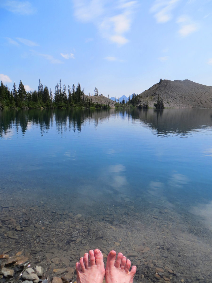
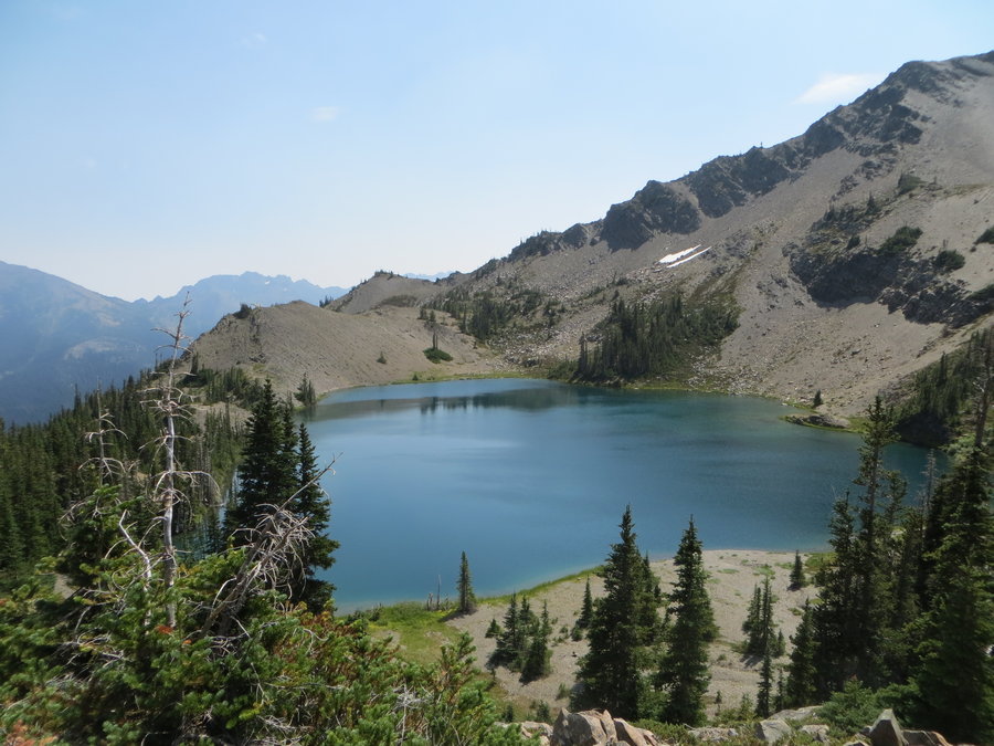
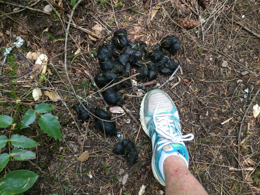
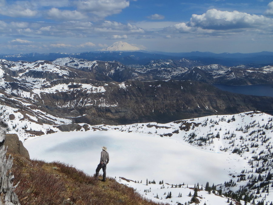
Goat Lake/Royal Basin Loop, Olympics
17 miles of hiking • 5000' elevation gain • 1 night
This was a (mostly) fun solo adventure. I started at 5pm at the Upper Dungeness TH and hiked in to the junction with Royal Creek and set up camp. Next day I hiked up the Dungeness to the super steep Goat Lake trail.
Saw a bear!
Swam in a gorgeous alpine lake! Took a nap next to a gorgeous alpine lake!
After lounging over an hour at the lake, I scrambled up above the lake and had fun goofing around on the bits of snowfield and nice grippy pillow basalt. Then I went over the other side down into Royal Basin-this part of the trip was sketchy and brutal ending with a nightmarish bushwack through soggy willow thicket. Last two easy miles out by headlamp. I'm pooped!
August 6 – August 7, 2018

 2
2
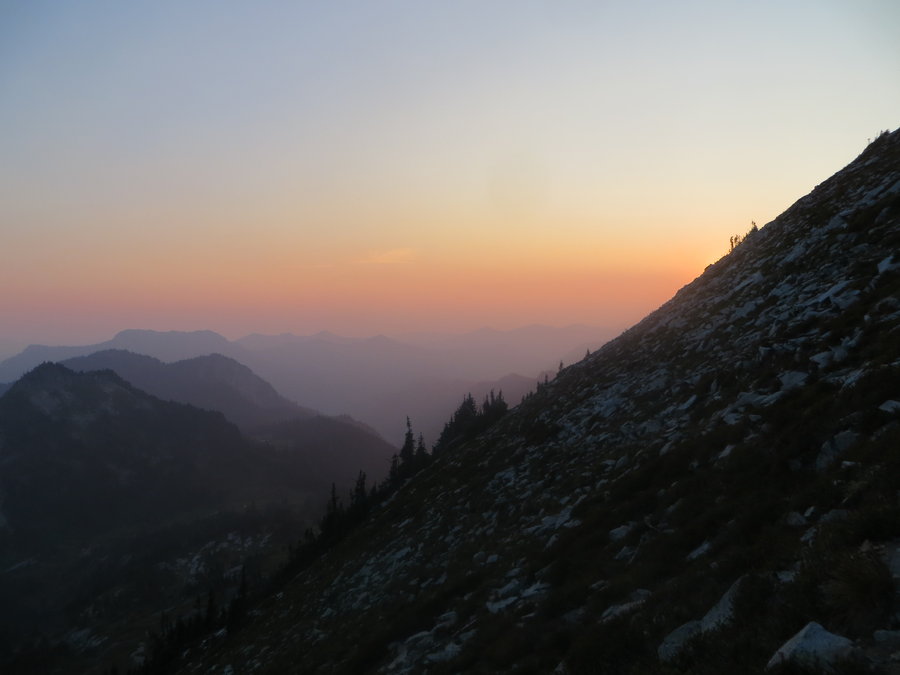
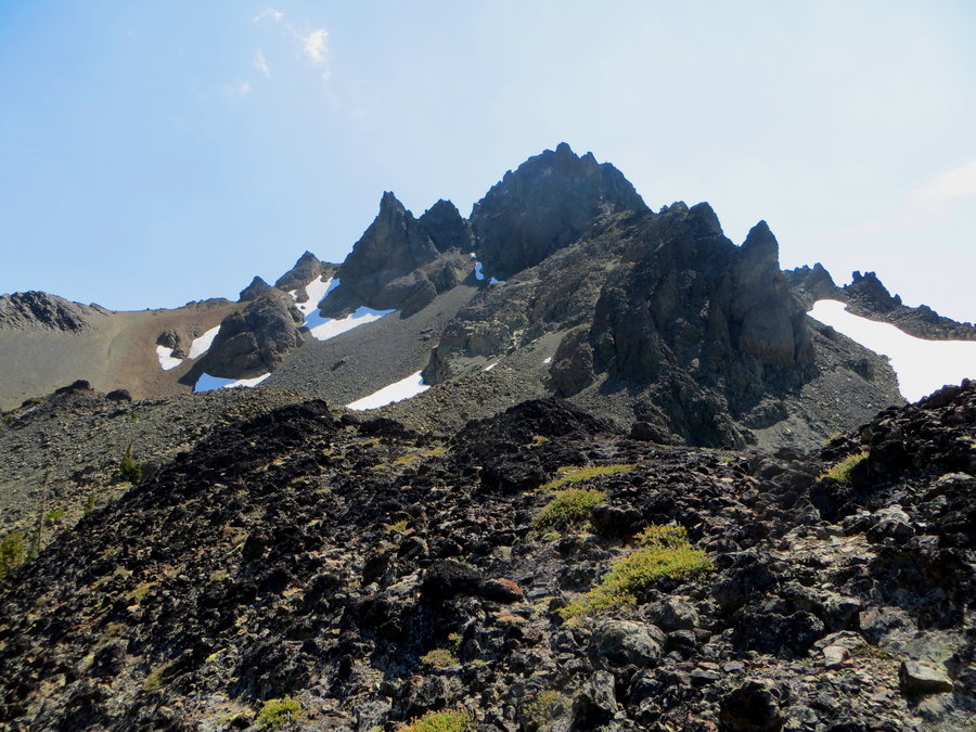
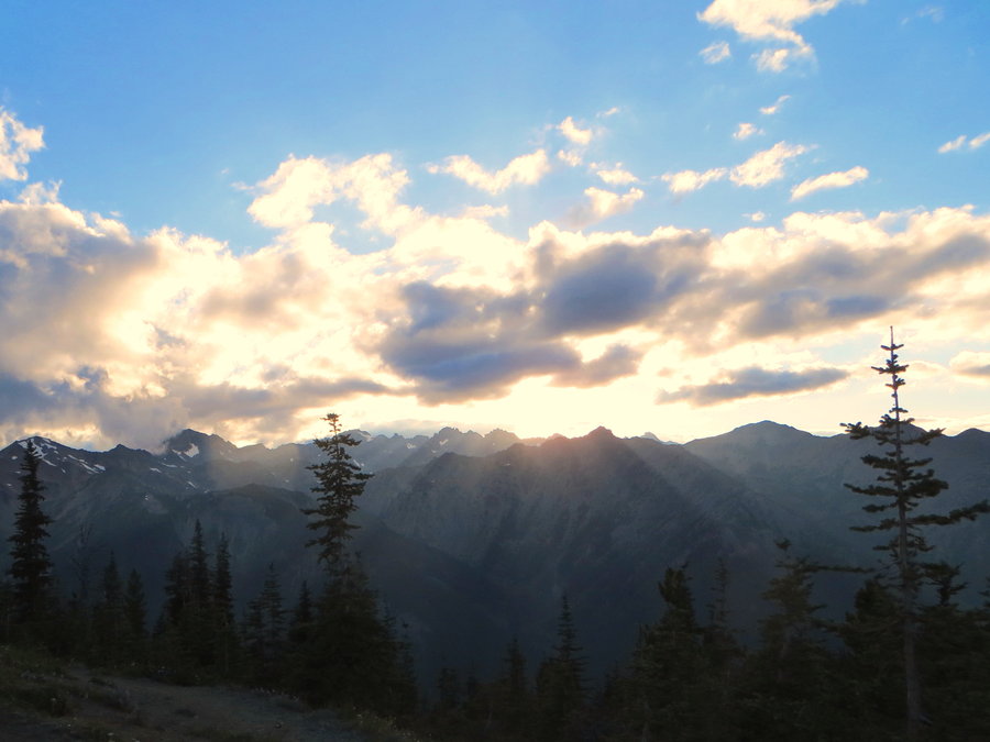
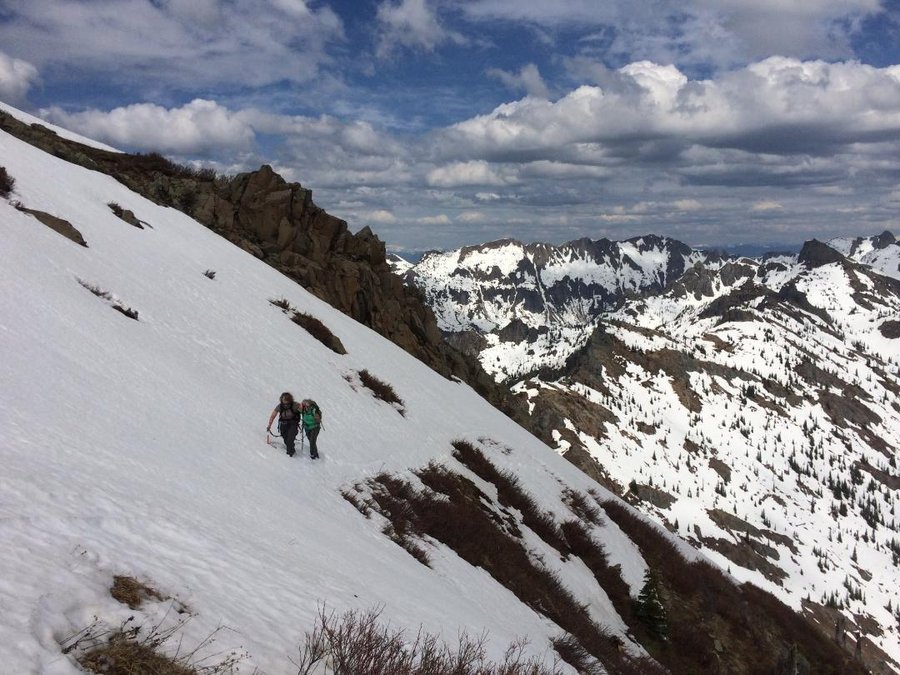
Buckhorn Peak, Olympics
14 miles of hiking • 4750' elevation gain • 1 night
We started in the late afternoon and hiked up the Upper Big Quilcene. Set up camp in the meadows just below Marmot Pass. Beautiful sunset. Got up early the next morning to summit Buckhorn, then returned to camp, packed up and headed out. Very nice day.
August 5 – August 6, 2018


Hoyt Arboretum
4.5 miles of hiking • 500' elevation gain •
Trying to get a little am exercise before the oven turns on.
July 24, 2018

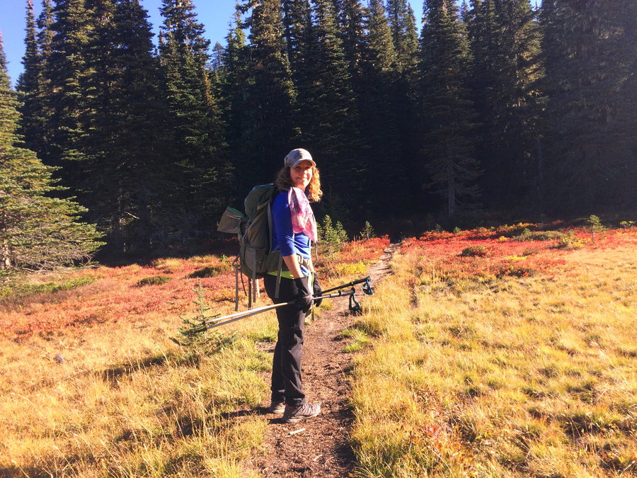
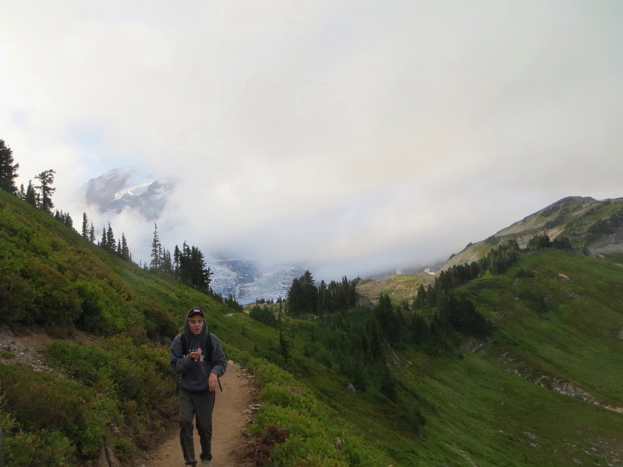
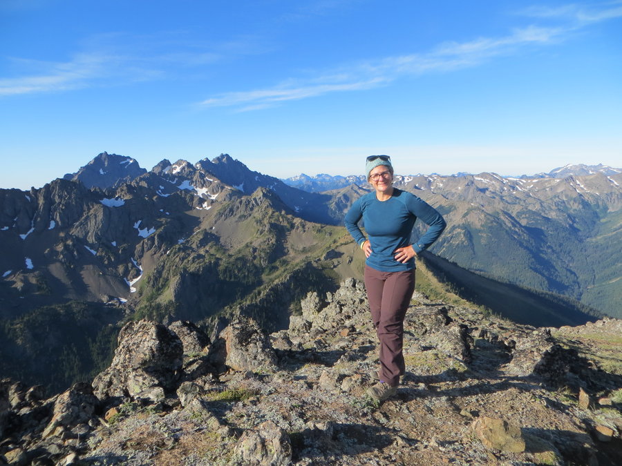
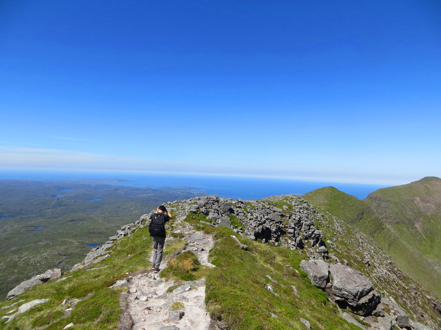
Second Mother Mountain, MRNP
7.7 miles of hiking • 3750' elevation gain • 1 night
What a great day of off trail rambling in alpine terrain. Alternating travel between rock, snow and meadows kept it interesting. Saw one goat and lots of marmots.
July 18 – July 19, 2018


 1
1
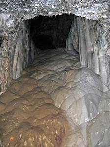
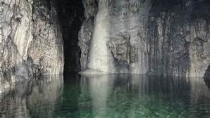
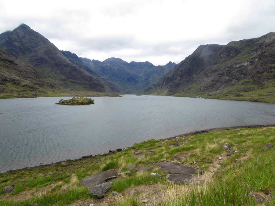
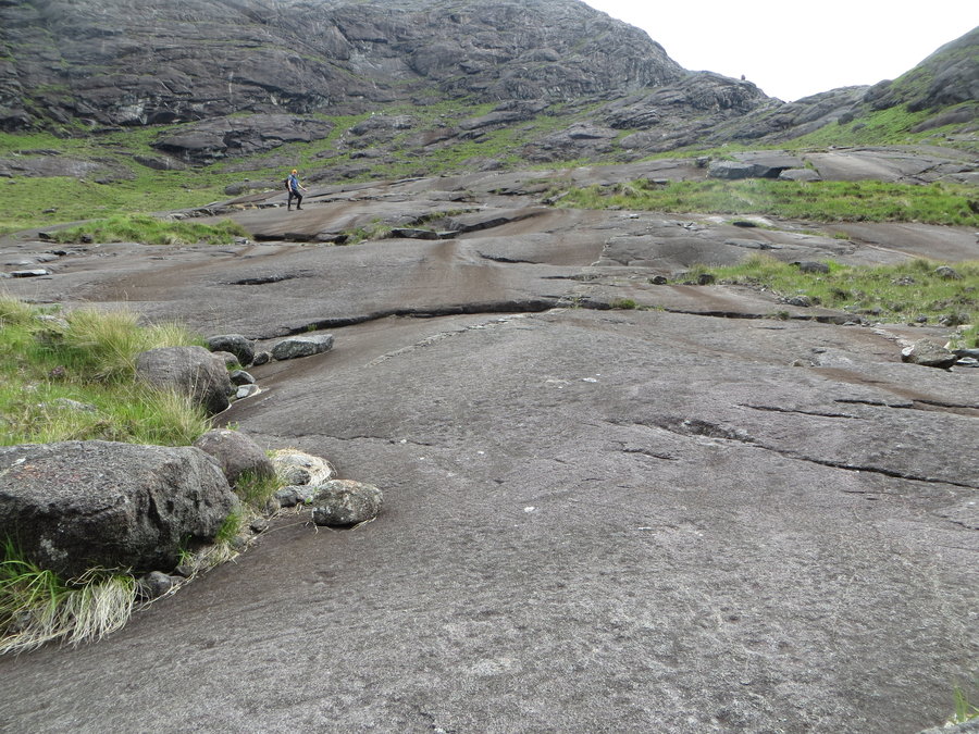
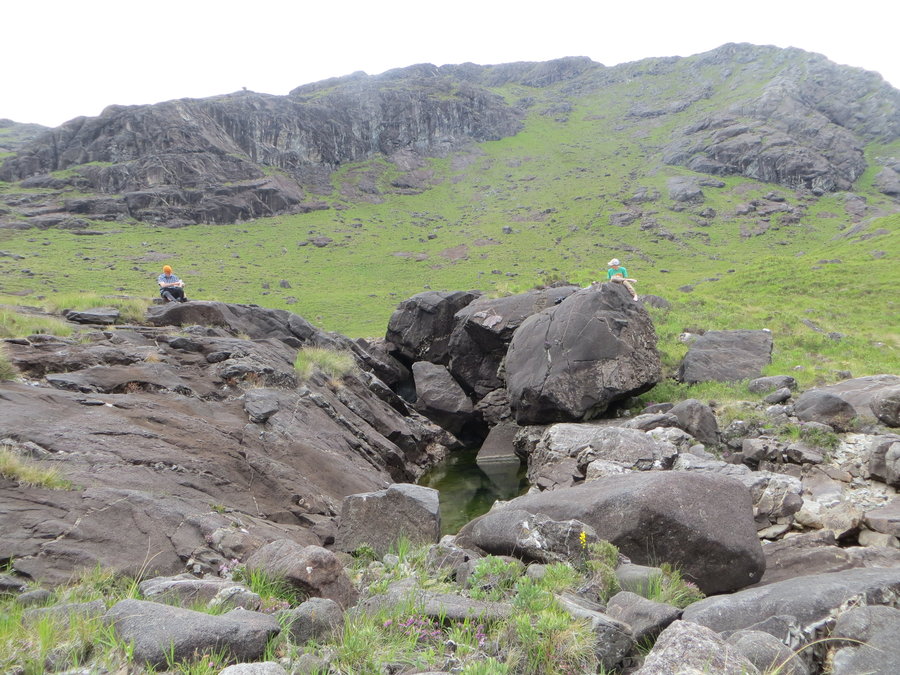
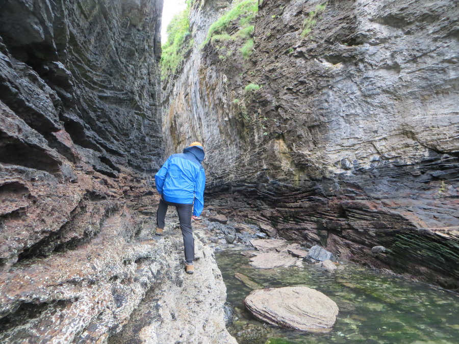
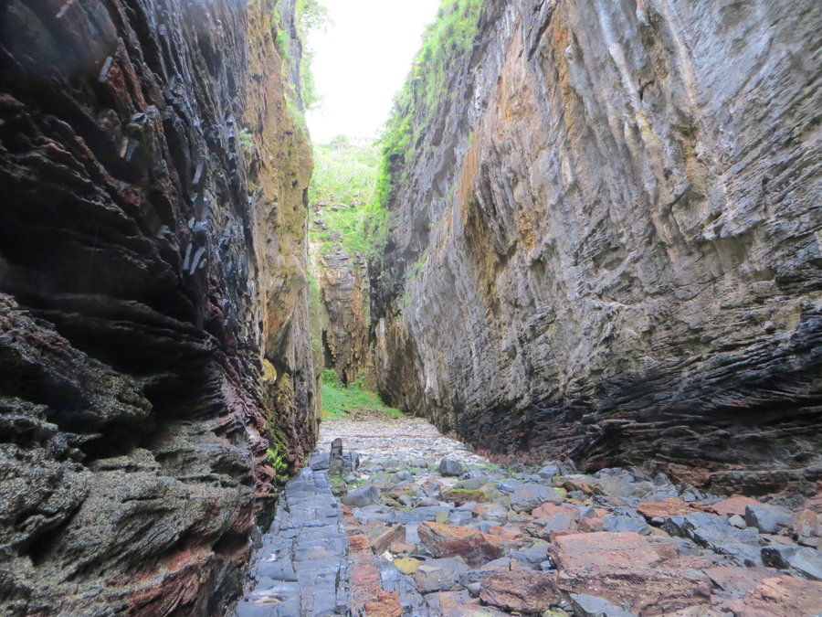
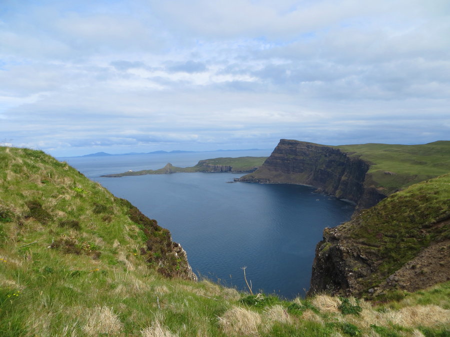
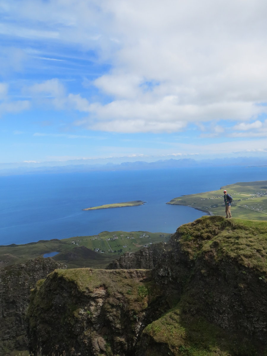
Loch Coruisk and Spar Cave, Isle of Skye
5.5 miles of hiking • 750' elevation gain •
Our last day in Skye: an introduction to the Black Cuillins. This is where I would return for backpacking. Jagged ridges, high lonesome lochs. Best of all-no sheeps! Makes a big difference in the botanical diversity. The big gabbro slabs are so grippy and invite scrambling up the ridges. It was an overcast day, and my pictures do no justice to the ominous beauty of this place.
We took a boat across the bay,but many people walk it from Elgol going round Camasunary Bay, which is idyllic. We sat on massive boulders and dreamily sketched, and oops,we just missed the last boat back to Elgol. Luckily the boat company did not want to strand its customers, so we got picked up by a speedy RIB boat and blasted our way back to town.
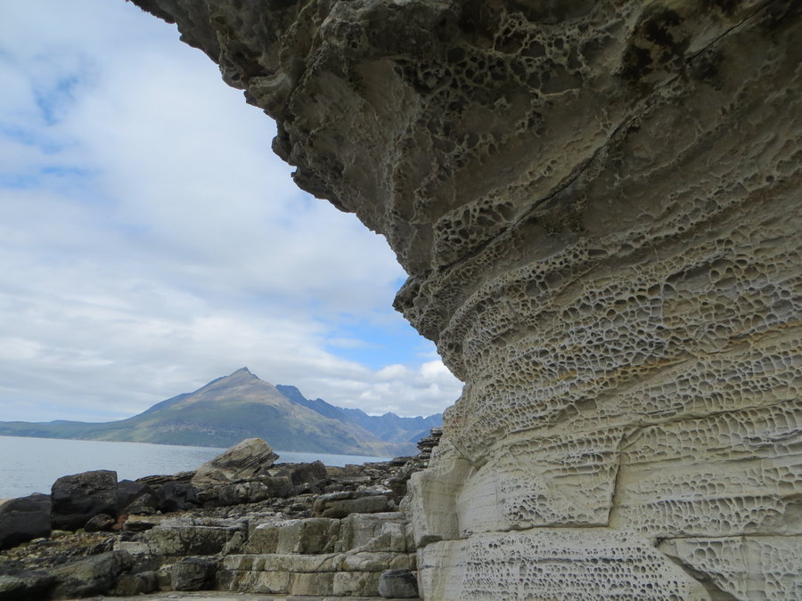
WE thought we had timed the tide right to visit nearby Spar Cave. It was going out but the when we neared the cave entrance,the channel still had knee to thigh deep water, so we got to do some fun climbing along the edge! Spar is another term for limestone aka calcium carbonate. This cave is really an amazing feat of geology. It is located up a narrow sea canyon(called a geo), and inside is what looks like a frozen waterfall with a continuous thin layer of water cascading over it. It looks like ice, but the texture is not smooth- you can climb it. When you reach the top you find yourself in a chamber of macabre shapes and textures and an amazing color variety. On the other side is the mermaid pool and you can walk down to it. We were blown away. About the coolest place ever that you could take a 15 year old. Of course my camera battery died trying to figure out flash adjustments in side the cave, so the first two pictures were borrowed from the internet to give you an idea of what we saw inside.
July 7, 2018


 1
1
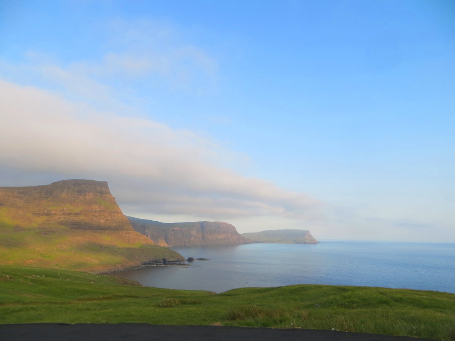
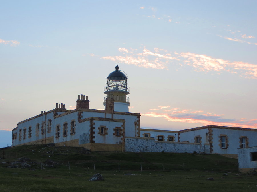
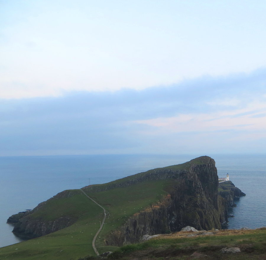
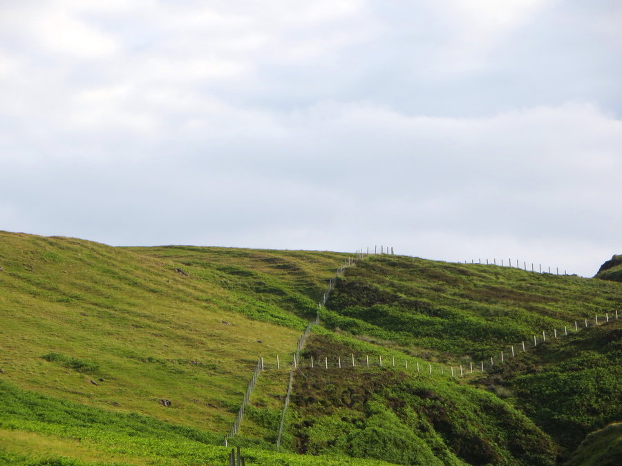
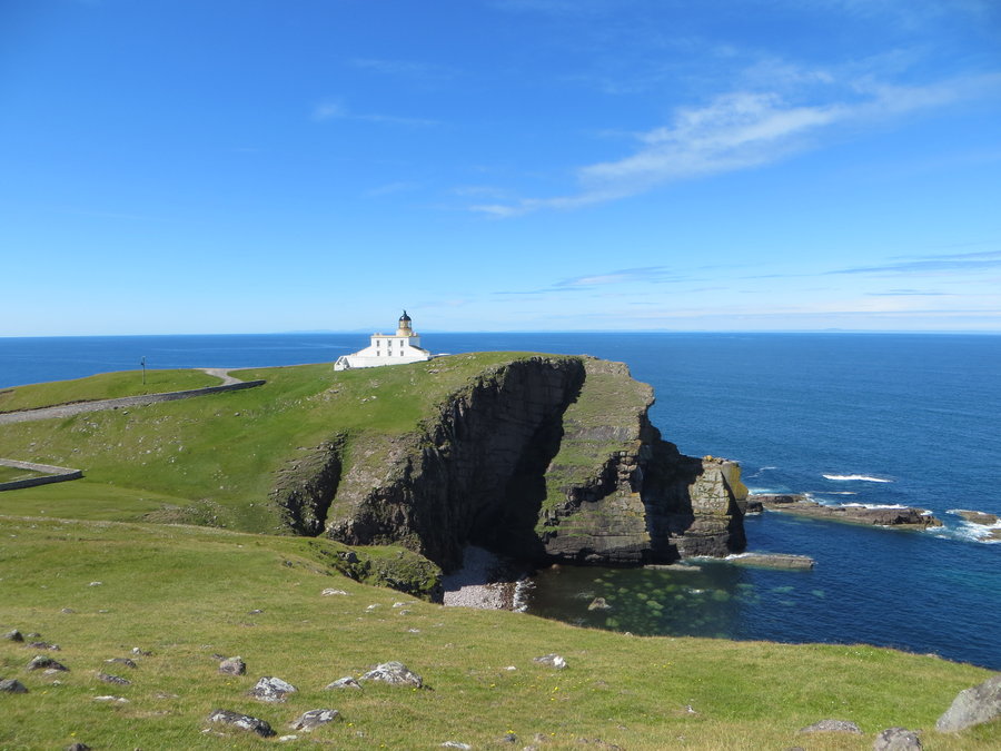
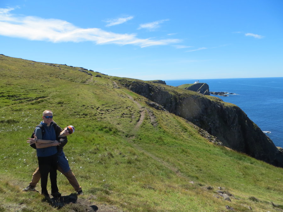
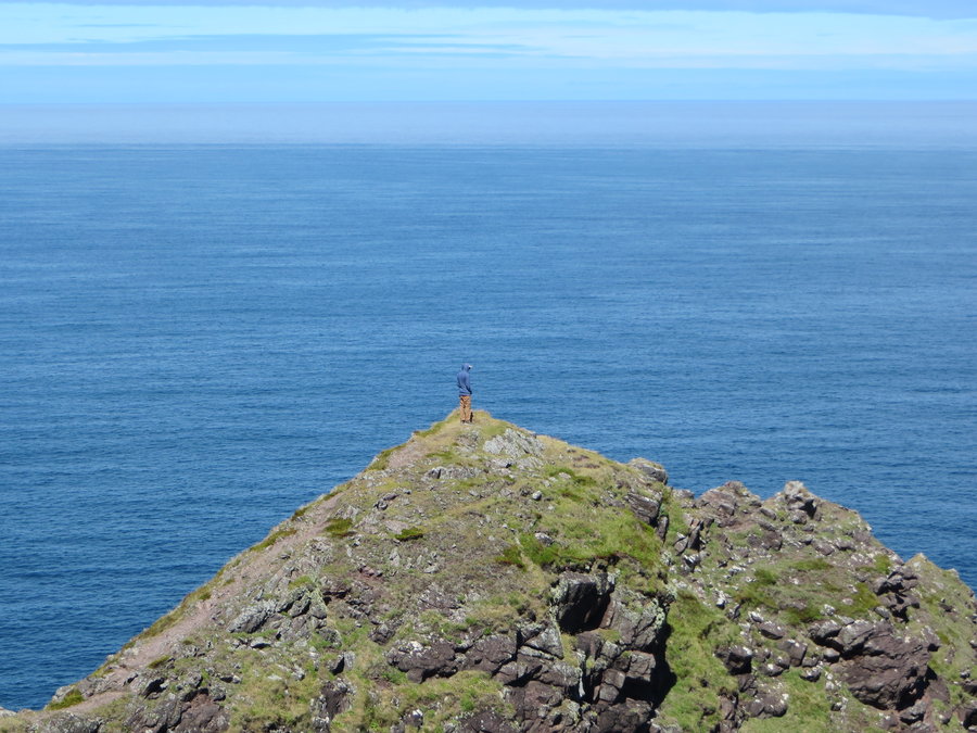
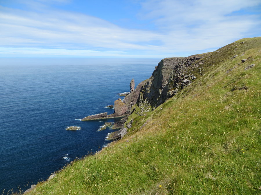
The Hoe, Waterstein Head and Neist Point, Isle of Skye
16 miles of hiking • 3000' elevation gain •
Two different hikes in the same area. Coastal cliffwalks overlooking "The Minch". One of these was solo and I had absolute solitude(except for the sheeps).
July 6, 2018

 1
1
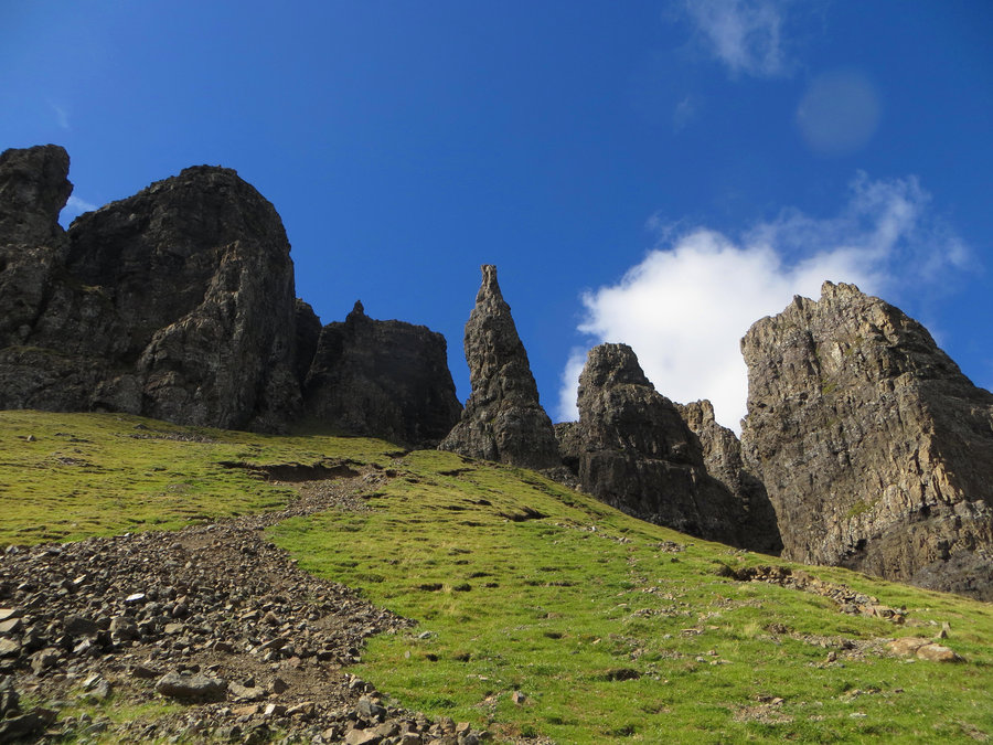
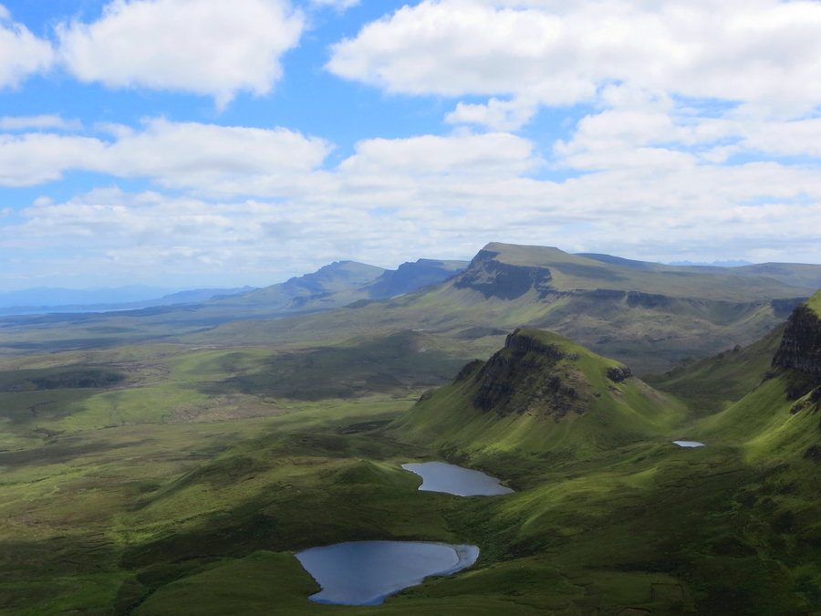
The Quirang Circuit, Isle of Skye Scotland
4.5 miles of hiking • 1250' elevation gain •
Absolutely spectacular loop hike.
July 5, 2018

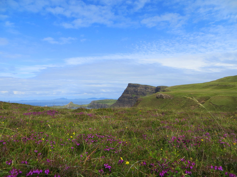
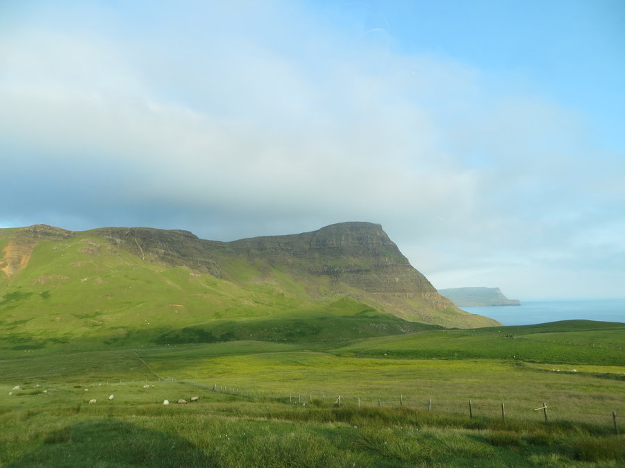
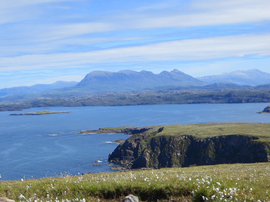
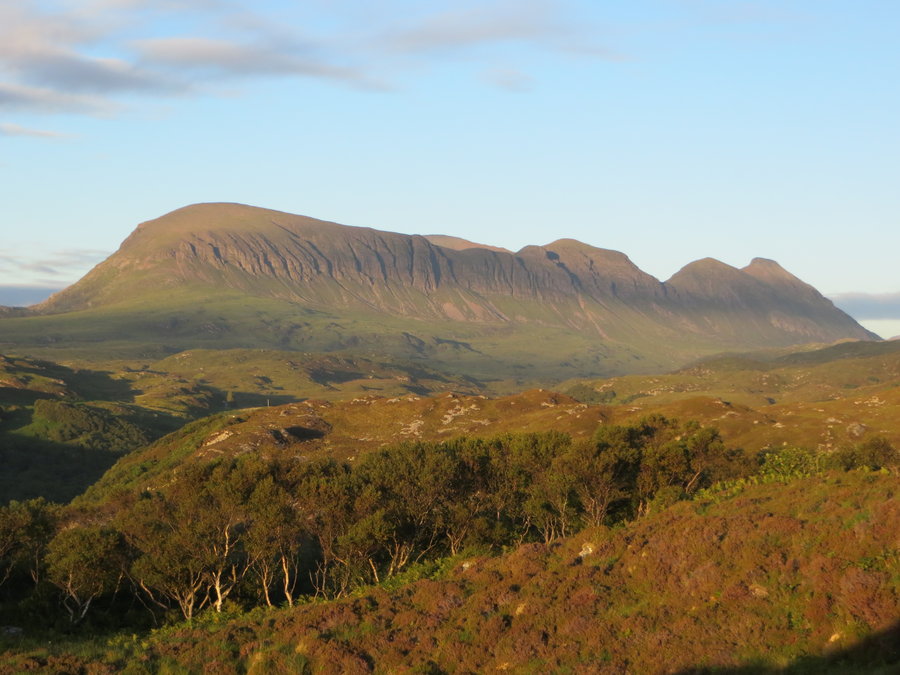
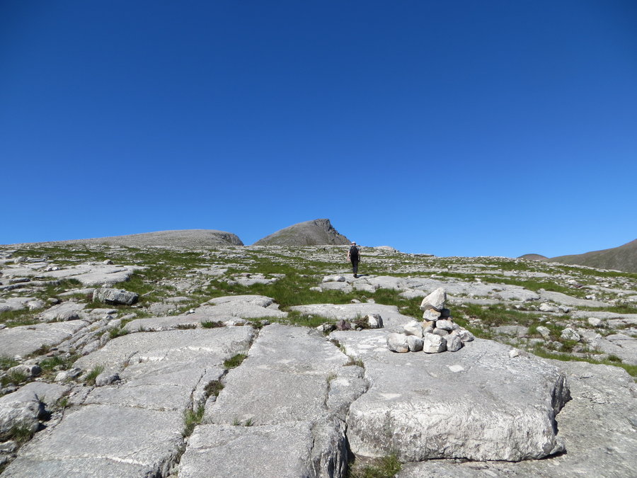
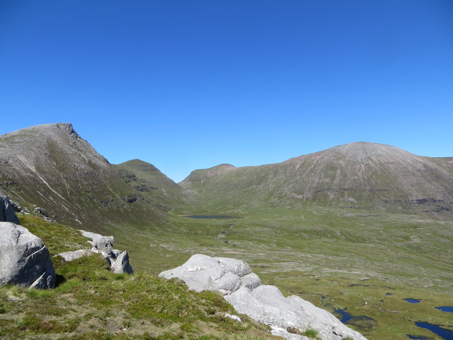
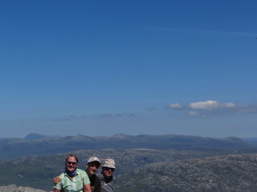
The Quinag, Scottish Highlands
8 miles of hiking • 3500' elevation gain •
The Quinag(pronounced Coon-yak) is a Gaelic word for milk pail. We stared at this massive sky island for 3 days, and then climbed it! It was hot and there are no trees on this mountain. Magnificent views all around and fun ridgewalking on the top.
Never saw the milk pail resemblance, oh well.
July 3, 2018

 2
2
Old Man of Stoer, Scotttish Highlands
5.2 miles of hiking • 1000' elevation gain •
First hike on our trip to Scotland. Bonnie weather and crackin views!
July 2, 2018


 1
1
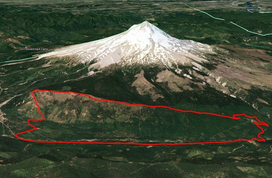
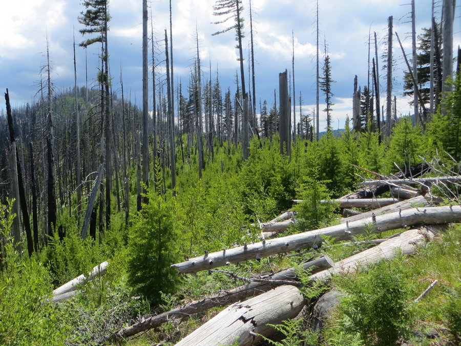
Bluegrass Ridge bike shuttle
12.8 miles of hiking • 3500' elevation gain •
Can't recommend this trail. So much blowdown from 2009 fire. We started at Tamanawas and took it to Polallie to the Bluegrass Ridge trail. Took it south for the long slog over a million logs. At Elk Mtn,, we dived down 2000 feet of crazy bushwhacking,which would have been fun if we handt been crawling through blowdown for the previous 3 hours. The best part of the trip was walking out through the closed Robin hood campground, totally wiped out by a major flood of Newton Creek. That place is worth returning to for further exploration.
June 19, 2018


Forest Park
9 miles of hiking • 2000' elevation gain •
Cool, early morning wanderings. The understory is SO BUSHED OUT right now.
June 16, 2018

June 13, 2018

 1
1
June 12, 2018


Douglas Trail
8.5 miles of hiking • 1250' elevation gain •
Started at the Eagle Creek end and went up to Wildcat. First two miles of trail are overgrown, wearing shorts, shins pulped.
June 6, 2018

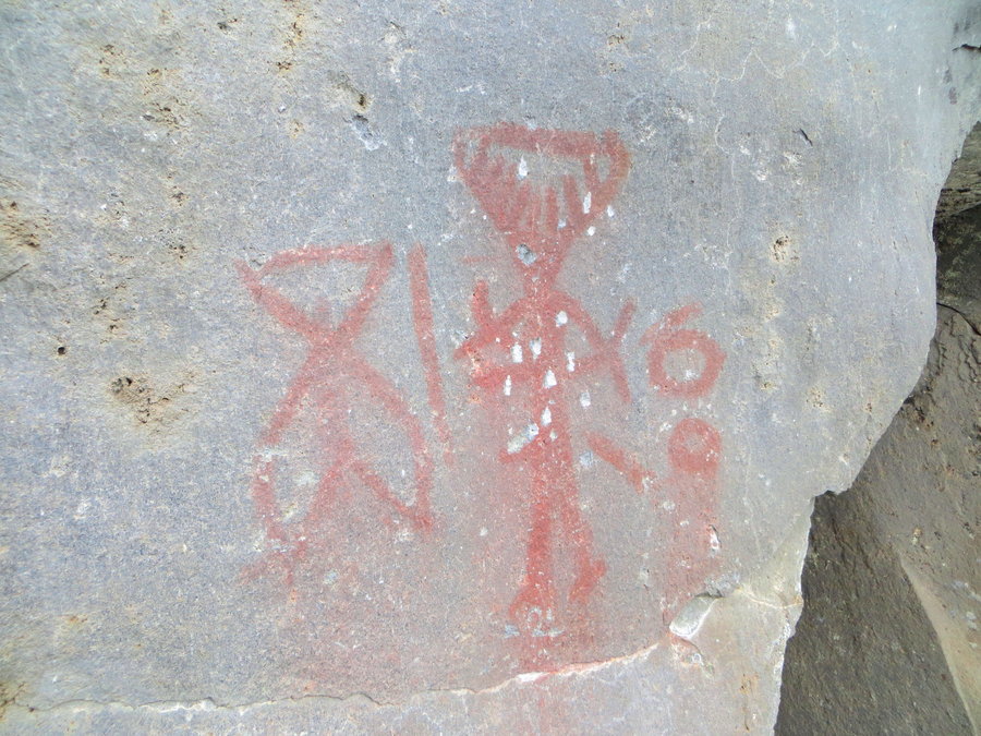
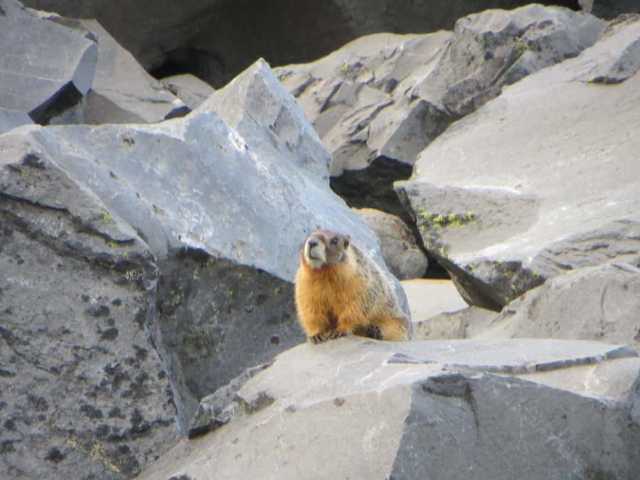
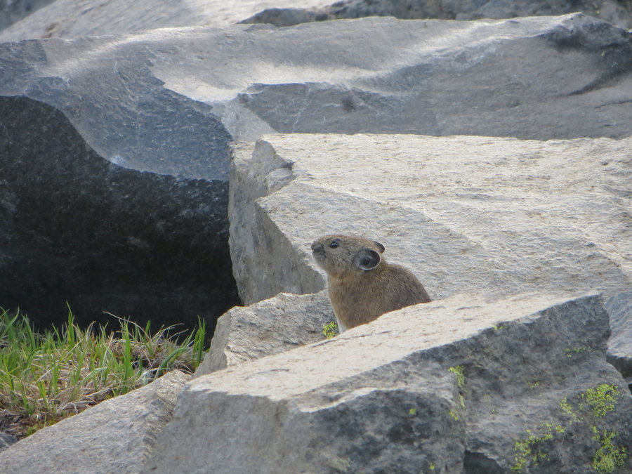
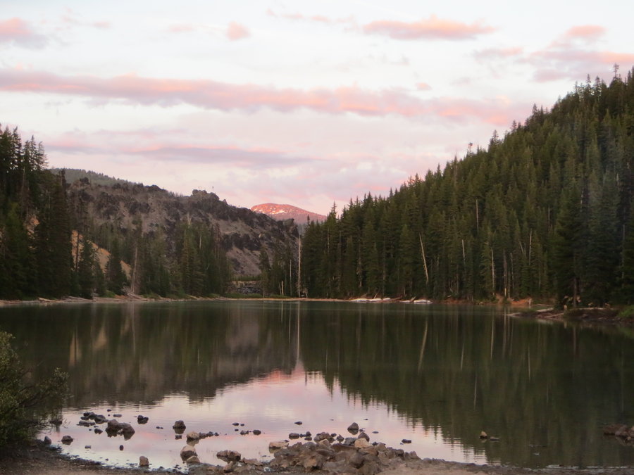
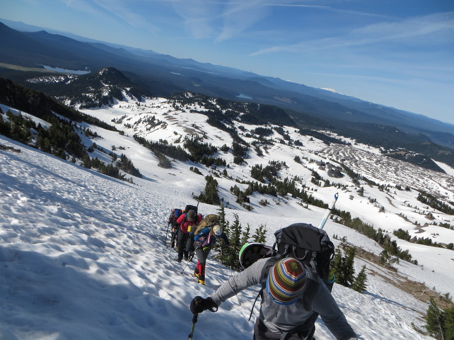
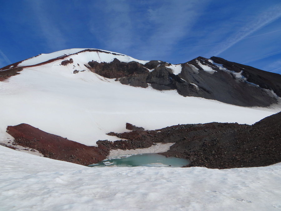
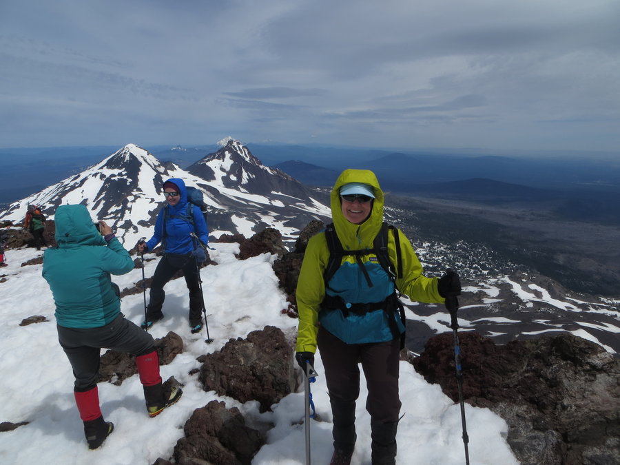
South Sister
15.5 miles of hiking • 5250' elevation gain • 1 night
Did S Sister on a Mazama Climb. Gorgeous day. Also included in the mileage is the little hike I did the night before around Devil's Lake to Devil's Garden which is a magical area with pictographs, marmots and pikas!
June 3 – June 4, 2018

May 24, 2018


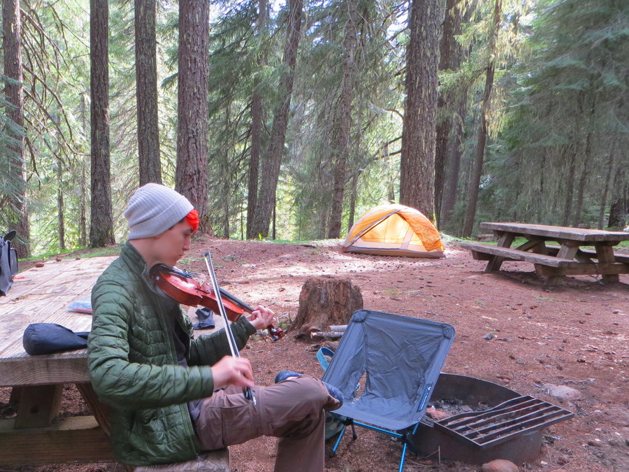
Mt Hood Campout
7.5 miles of hiking • 1750' elevation gain • 1 night
Took the kids camping. The Clear Creek campground is a gem, just 7 well spaced spots, very quiet. Although I usually avoid campgrounds like the plague, this is where the trailhead is, and it was so inviting, we decided to stay! Did the Camas Prairie Loop hike, and the next day we visited Mill Creek Buttes, east of Surveyor's Ridge.
May 19 – May 20, 2018


Cooper Spur
10.2 miles of hiking • 3250' elevation gain •
Gorgeous day, we were the only ones up there! Road to Cloud Cap still gated. Snow appeared around the Tilly Jane Campground ~5700 ft.
May 16, 2018


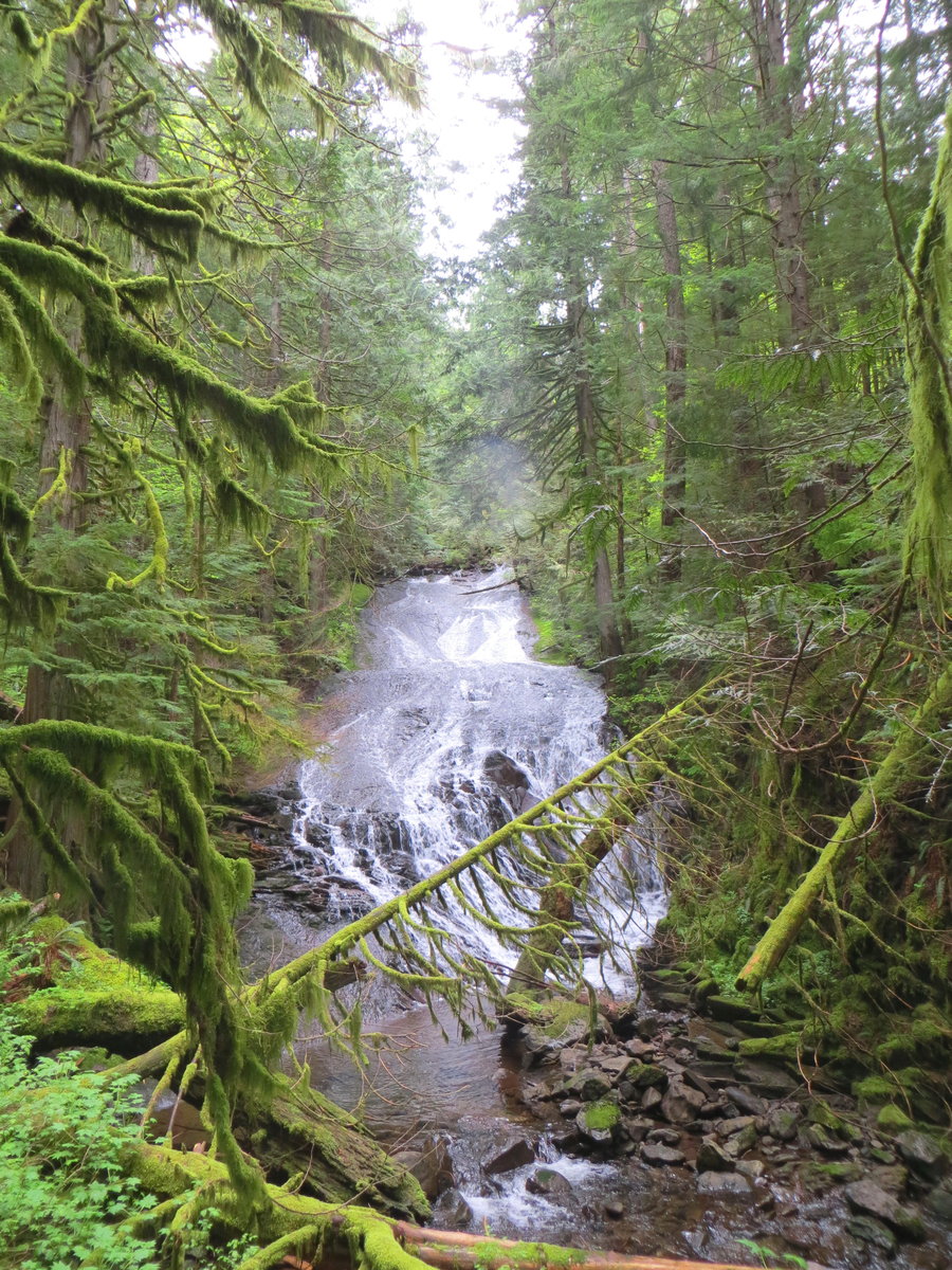
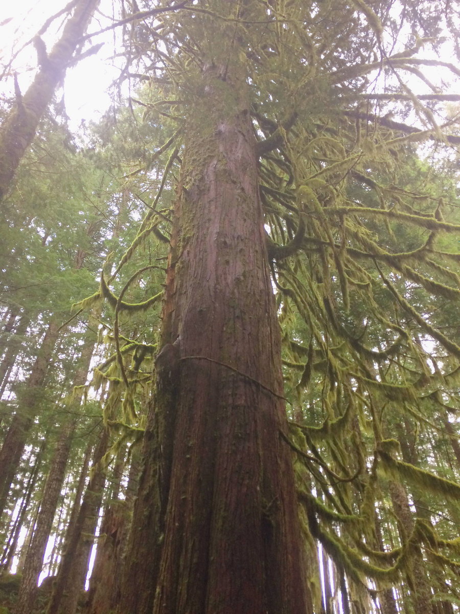
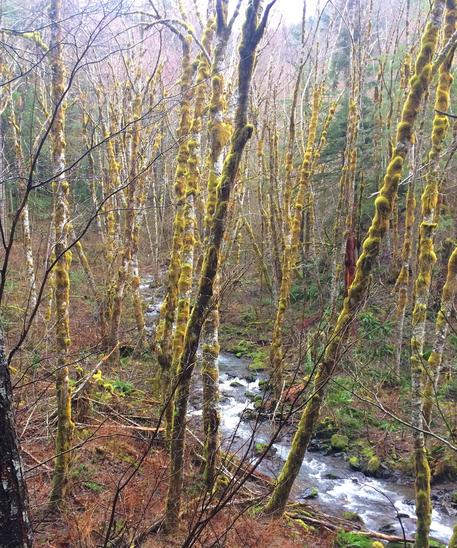
Apron Falls
8 miles of hiking • 2000' elevation gain •
Had fun in the magical forest around Duncan Creek. I continued upstream beyond RailcarFalls and found myself in a maze of Weyerhauser logging roads.Tedious wandering through clearcuts and monoculture reprod, what a sad juxtaposition to the fairyland I had departed! Ended up on the backside of Archer and came down the powerline.
May 11, 2018


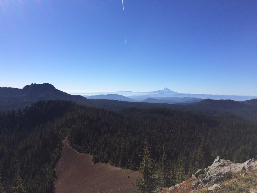
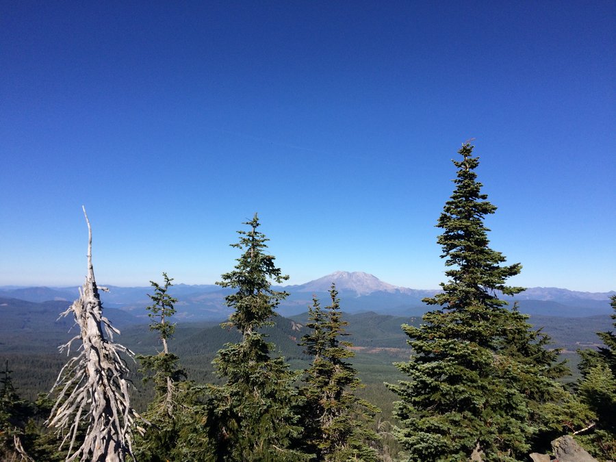
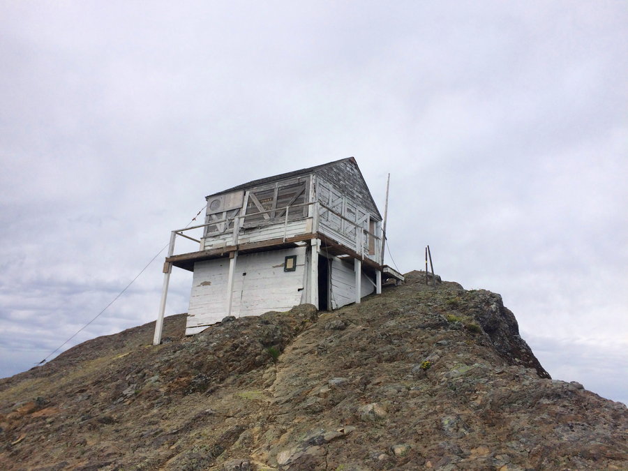
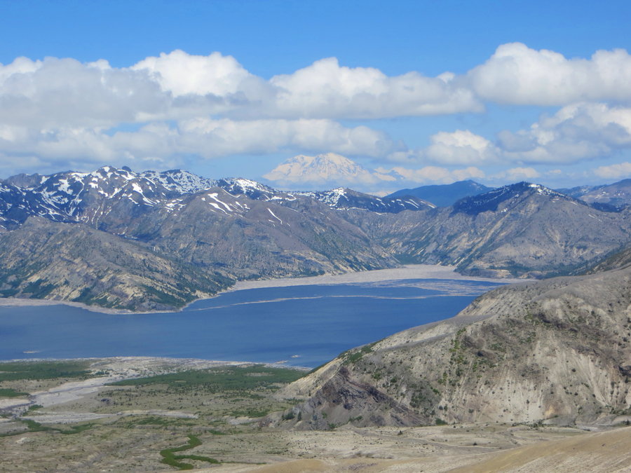
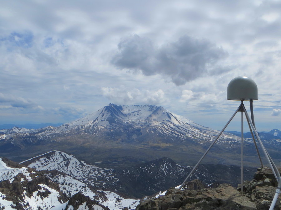
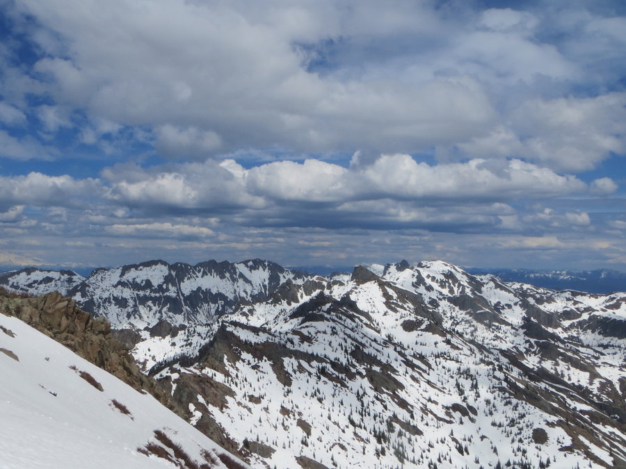
Coldwater Peak
16 miles of hiking • 4500' elevation gain •
Long day but conditions were perfect. Last time we were stymied by the snowfield above St Helens Lake. This time we brought Ice axe and crampons. Only used the former. Snow very soft.
May 8, 2018

May 6, 2018

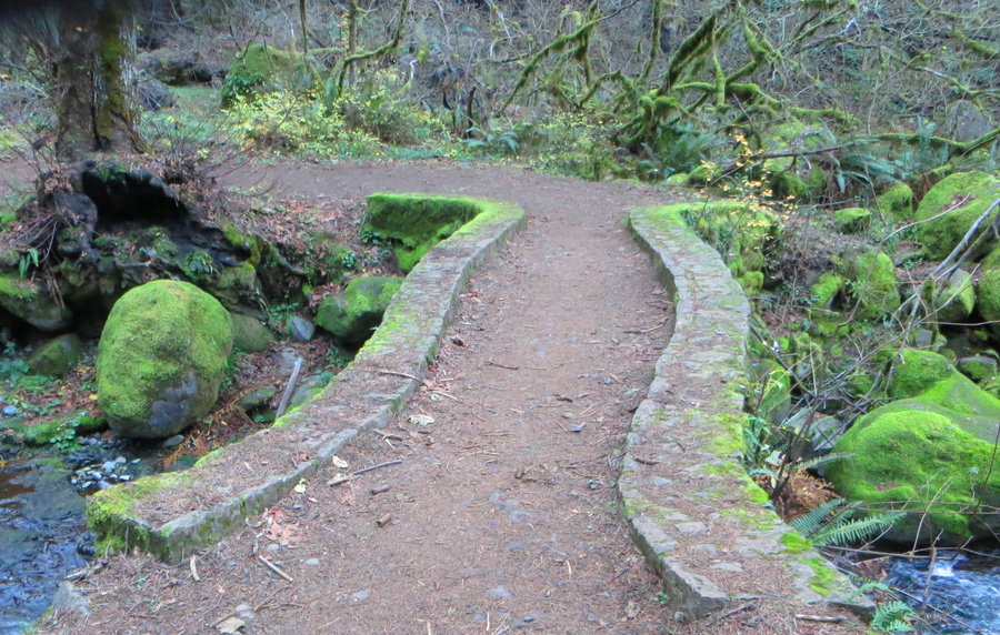
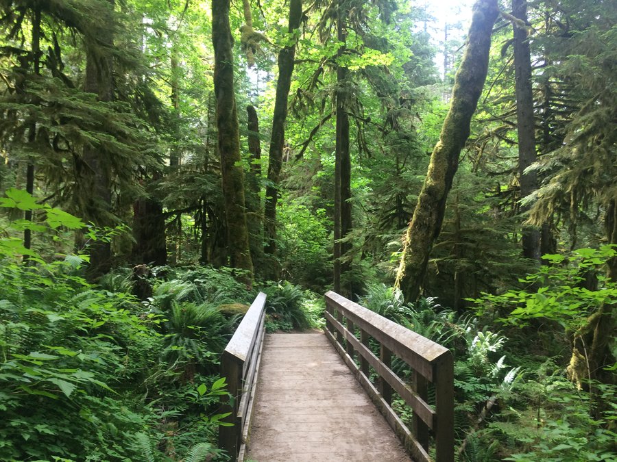
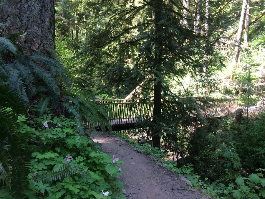
Forest Park-Maple Trail Loop
8 miles of hiking • 1000' elevation gain •
New bridge in Saltzman Canyon!
April 26, 2018

Clackamas River-bike shuttle
8 miles of hiking • 1750' elevation gain •
Beautiful day. This is the perfect bike shuttle, uphill on foot via trail, downstream along the road by bike.
April 24, 2018

April 23, 2018

April 18, 2018

Lyle Cherry Orchard and Rattlesnake Falls
8.5 miles of hiking • 2000' elevation gain •
Escaped the rain. Flowers coming on strong!
April 10, 2018

April 7, 2018

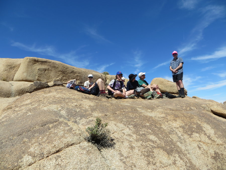
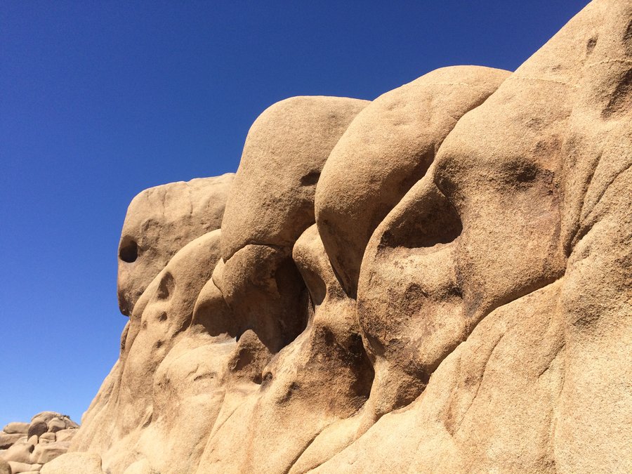
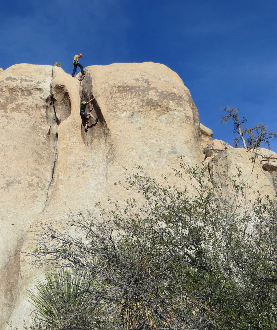
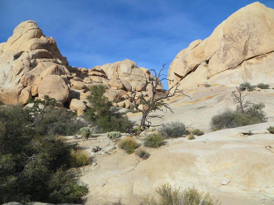
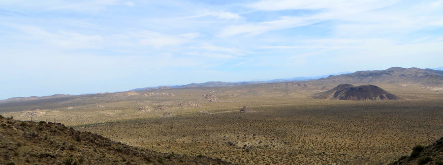
Spring Break in Joshua Tree
20 miles of hiking • 2500' elevation gain •
Family Trip to LA and our first time to Joshua Tree NP. Had fun climbing, hiking and running in the desert.
March 30, 2018

March 20, 2018

March 15, 2018

March 14, 2018
 1
1
Cat Creek meander
6.5 miles of hiking • 2250' elevation gain •
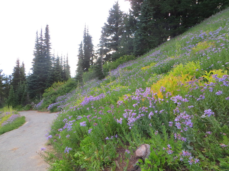
Quiet day up there, flowers emerging, ticks are jumping, and poison oak is waking up!
March 7, 2018


February 21, 2018
 2
2
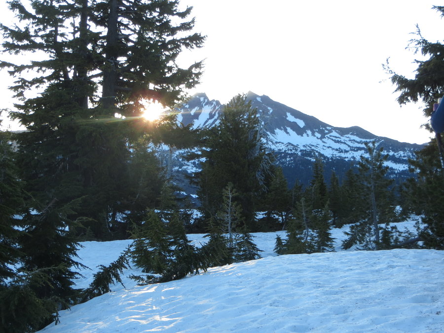
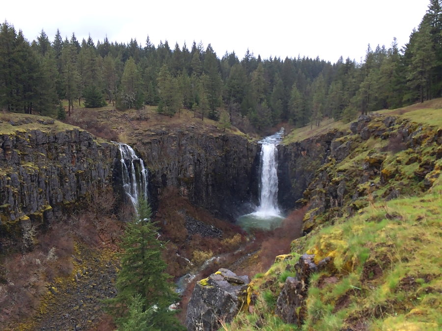
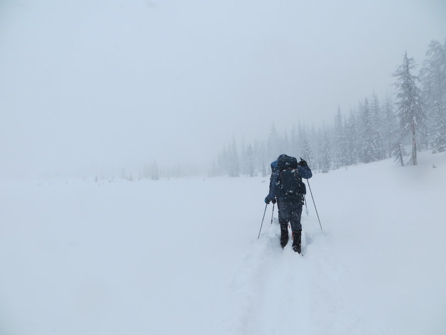
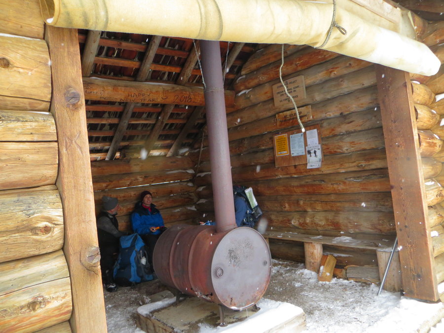
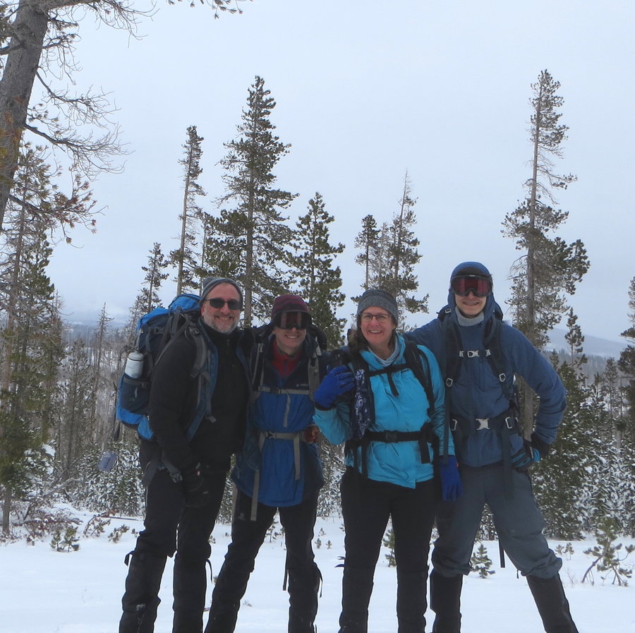
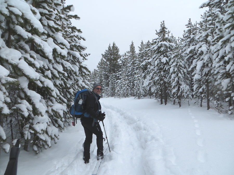
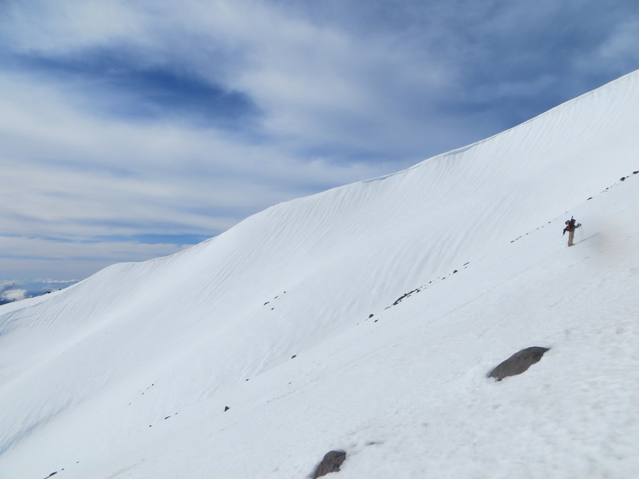
Sisters Backcountry
18 miles of hiking • 2000' elevation gain •
We attempted to do the traverse from Dutchman Flat to Three Creeks, but had to start in a snow storm, temp in the low teens, visibility poor. After 3 miles and 3 hours of breaking trail in knee deep powder, we knew we were not going to make the first hut before nightfall. We turned back and regrouped at a hotel.
The next day the hut owners gave us a snowmobile ride up to Three Creek Lake and we got to spend the night at the second hut. Fun skiing around that area, and the ski out the next day was mighty fine!
February 19, 2018


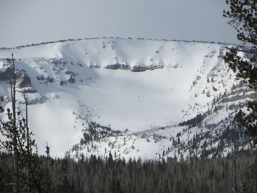
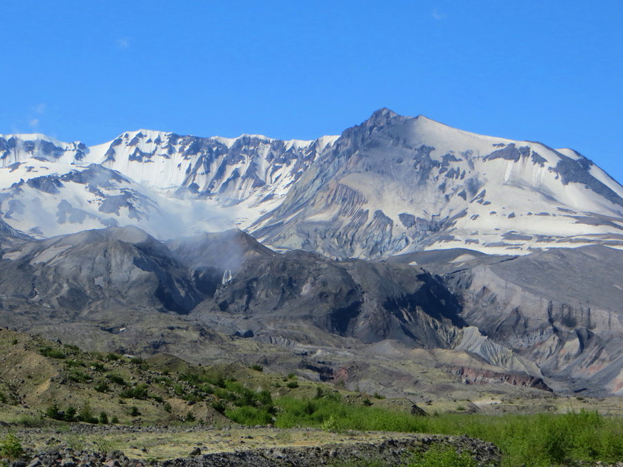
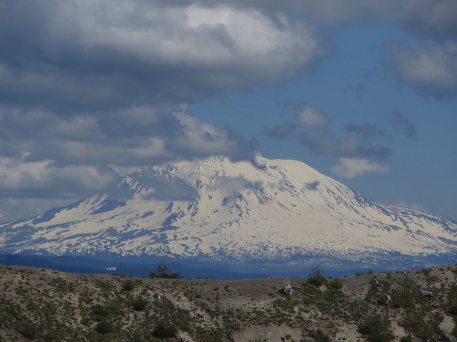
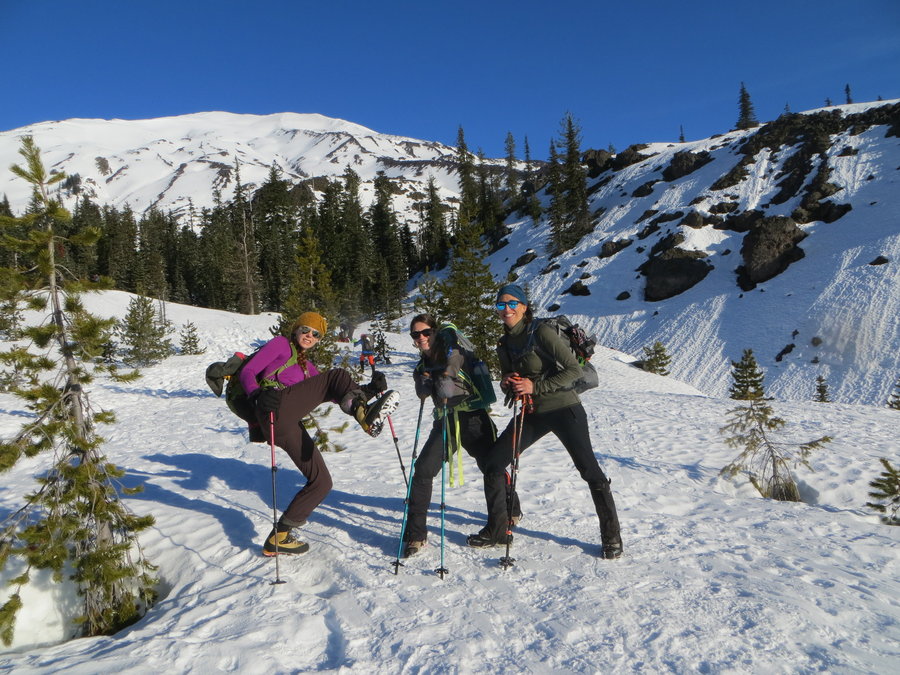
MSH
9 miles of hiking • 4500' elevation gain •
Gorgeous day, tons of people on the mountain, including many skiers, snowboarders and dogs! Seemed like a tourist trail and quite a few plodders not very well prepared. Above 6000 feet the temp dropped and snow was very icy, crampons needed.
At 7000 ft we saw a scary accident. A fellow tried to glissade a very steep and icy section, he quickly lost control and made no attempt to self arrest. He hit the rocks, ice axe flying through the air, and tumbled down into the adjacent gully. He raised his hand after a minute, and a group went to his rescue, I don't know what kind of injuries he sustained. We were all shaken witnessing this. Had two folks who had no previous crampon/ice axe experience. We decided to turn around and make our leisurely way down the mountain. Got quite a few good glissades in the softer snow at lower elevation.
February 10, 2018

Archer
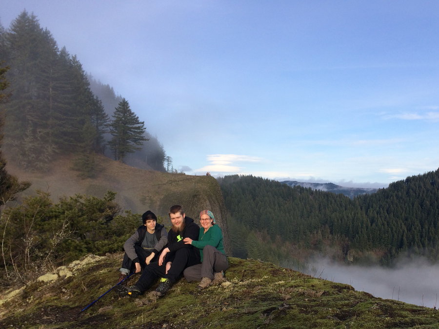
3.5 miles of hiking • 1000' elevation gain •
We have an exchange student from Germany who recently joined our family. I wanted to show him the gorge.
January 28, 2018


 2
2
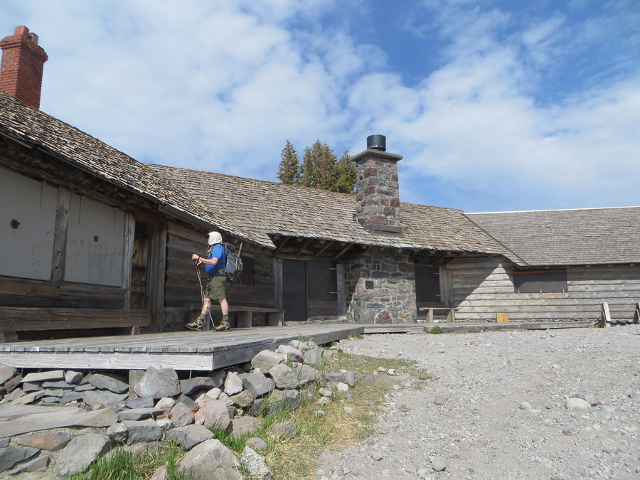
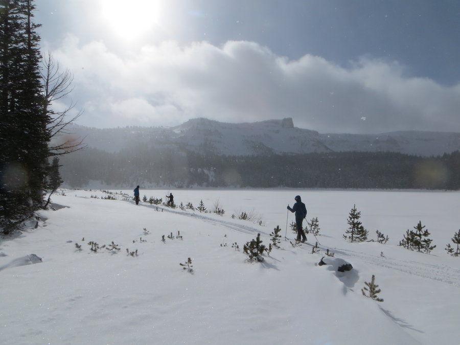
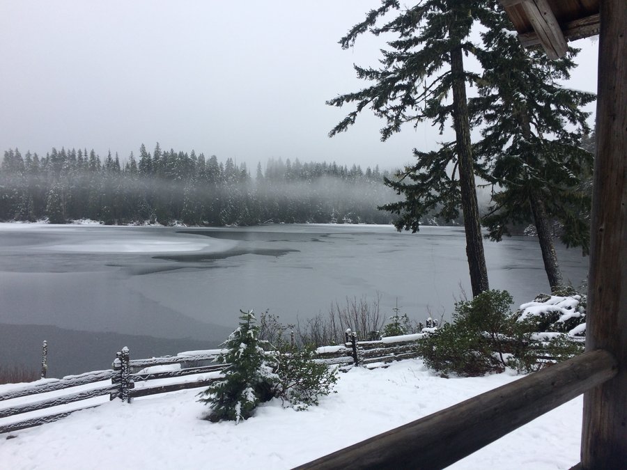
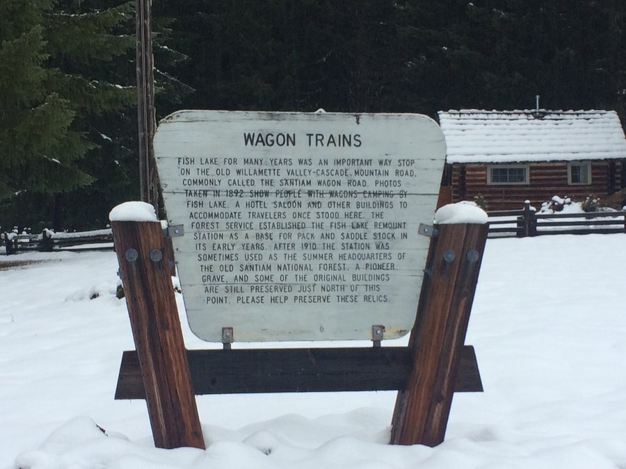
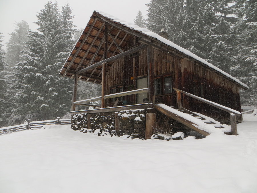
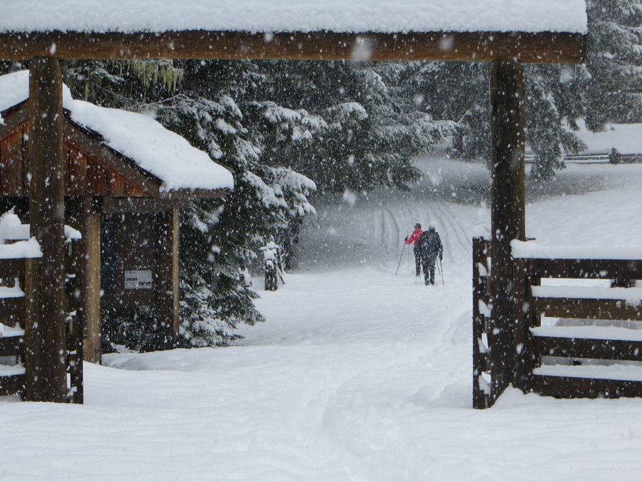
Fish Lake Guard Station
8 miles of hiking • 1500' elevation gain •
We rented some Forest Service cabins at this historic site on the Santiam Wagon Road. Has been around for 100 years as a waypoint for pack trains. Really delightful cabin with a great porch overlooking the lake. First two days were rainy, had to drive further up to Santiam Pass to get some snow action. On the third day we woke to a magical new layer of snow all around us flocking the forest and muffling the air. Fish Lake sits on a holey lava bed and drains in the summer to become a meadow. Hiked and skiied all around the area, complete solitude.
January 25, 2018

 1
1
Sedum Ridge via PCT
12 miles of hiking • 2250' elevation gain •
Trying to reach the special spot. Haven't made it yet.
January 16, 2018

January 14, 2018

Sedum Ridge Trail
8 miles of hiking • 1750' elevation gain •
First hike of the year! Did not hit persistent snow until 2600 ft.
January 8, 2018

View trips from: 2011 2012 2013 2014 2015 2017 2016 2019 2020 2021 2022 2023 2024 2025 2026