

2012 Trips


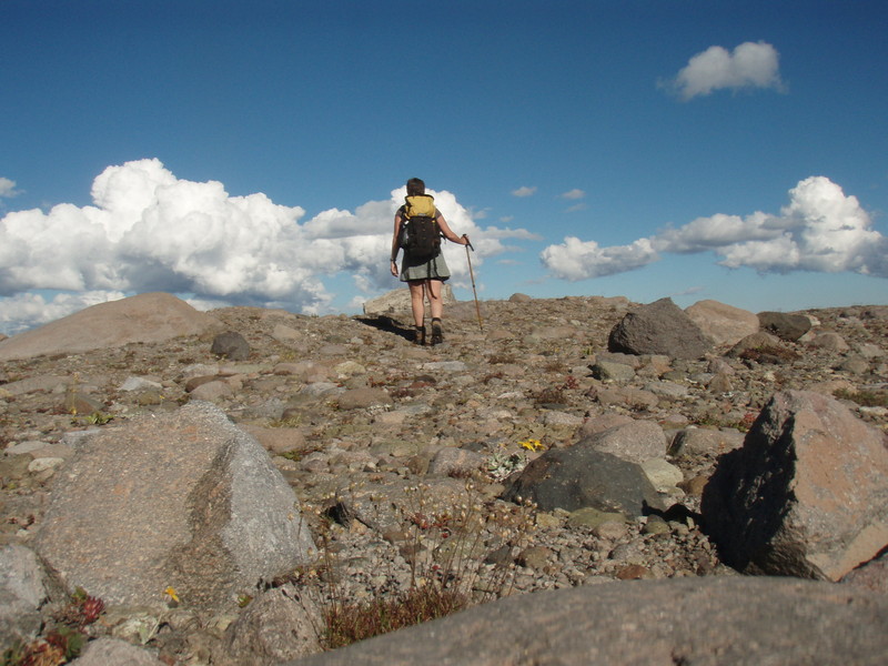
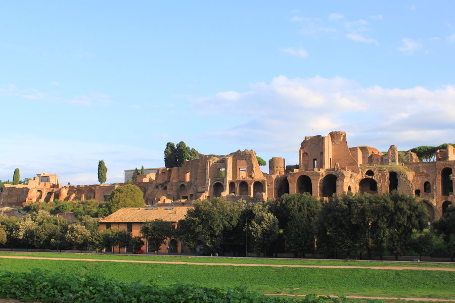
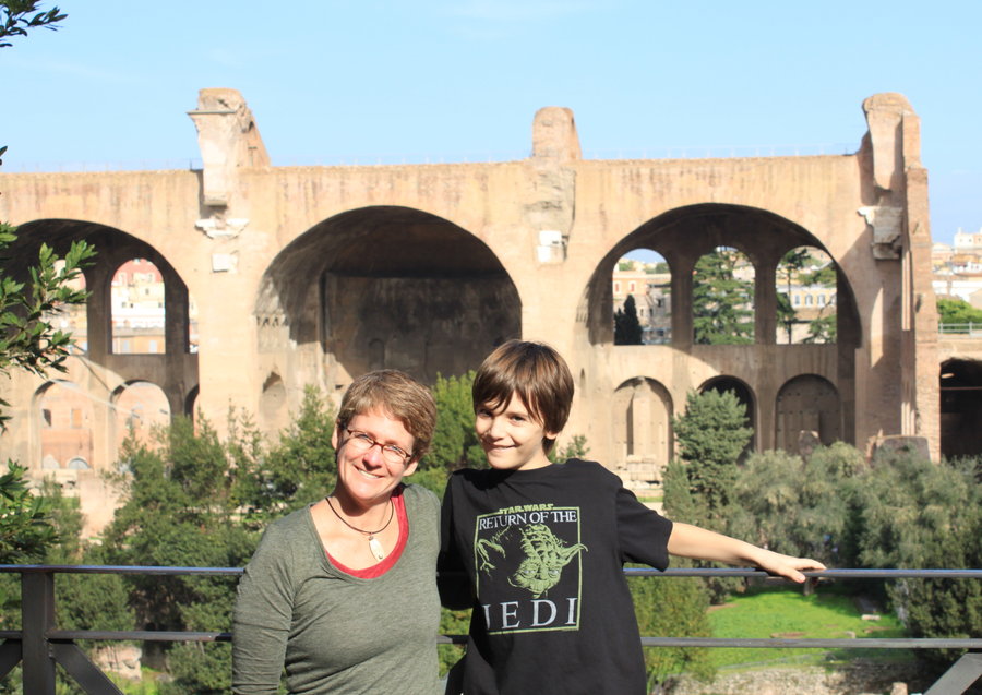
Roma
10 miles of hiking • 1000' elevation gain •
We spent 8 dreamy days in Rome and wandered the streets, hills, museums,churches and ruins, enjoying La Dolce Vita!

November 9, 2012


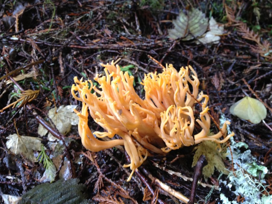
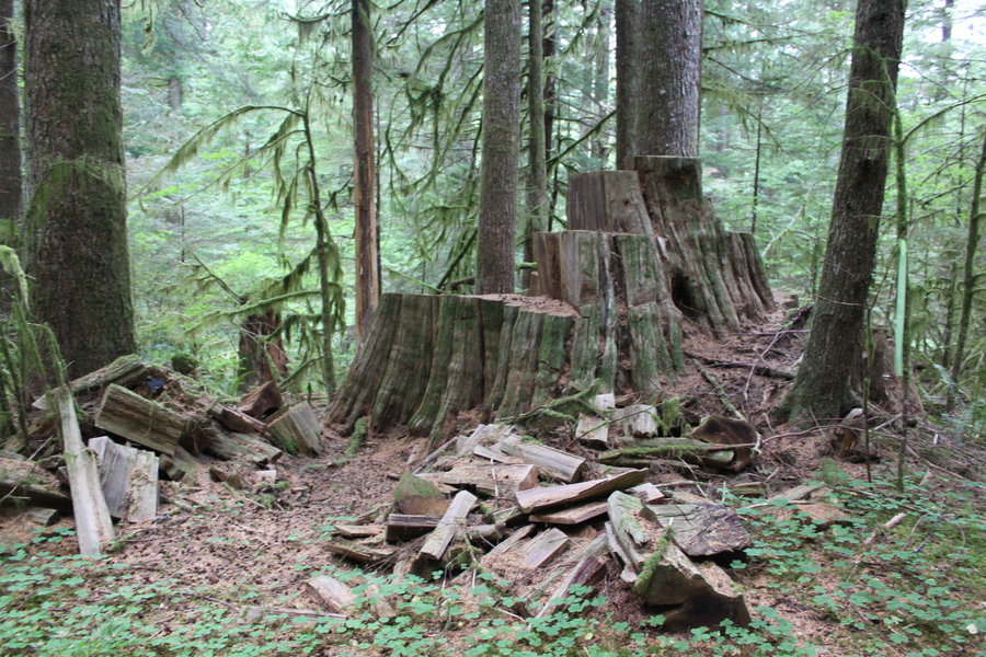
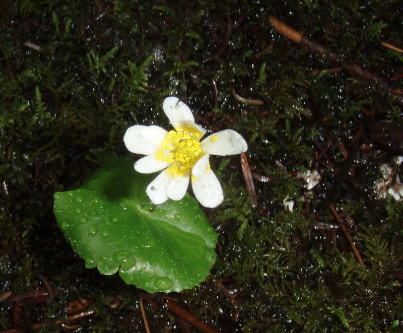
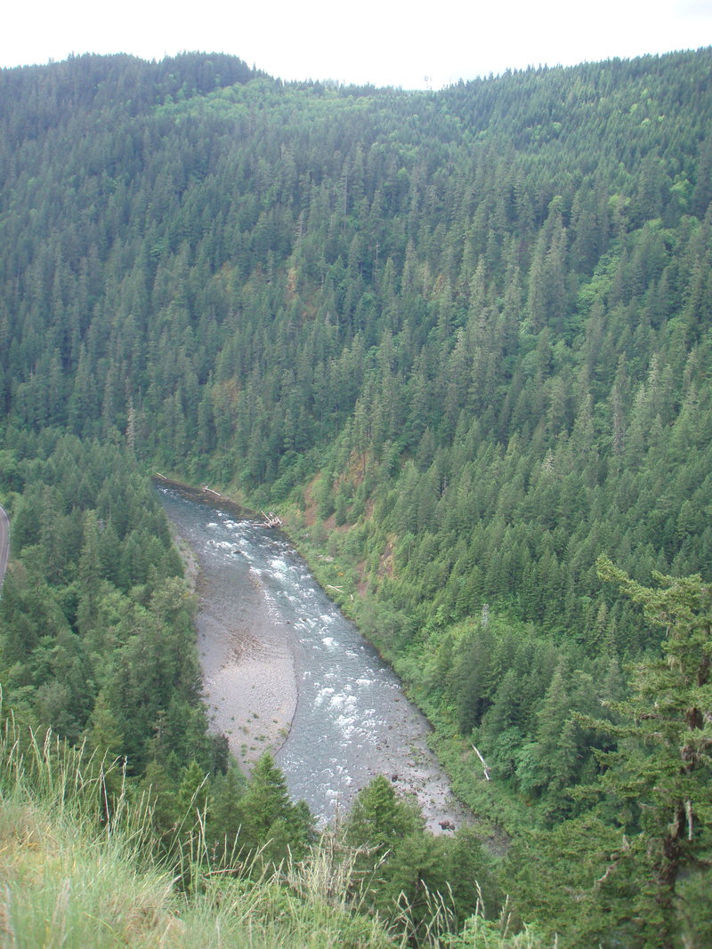
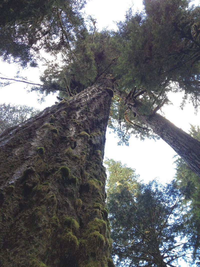
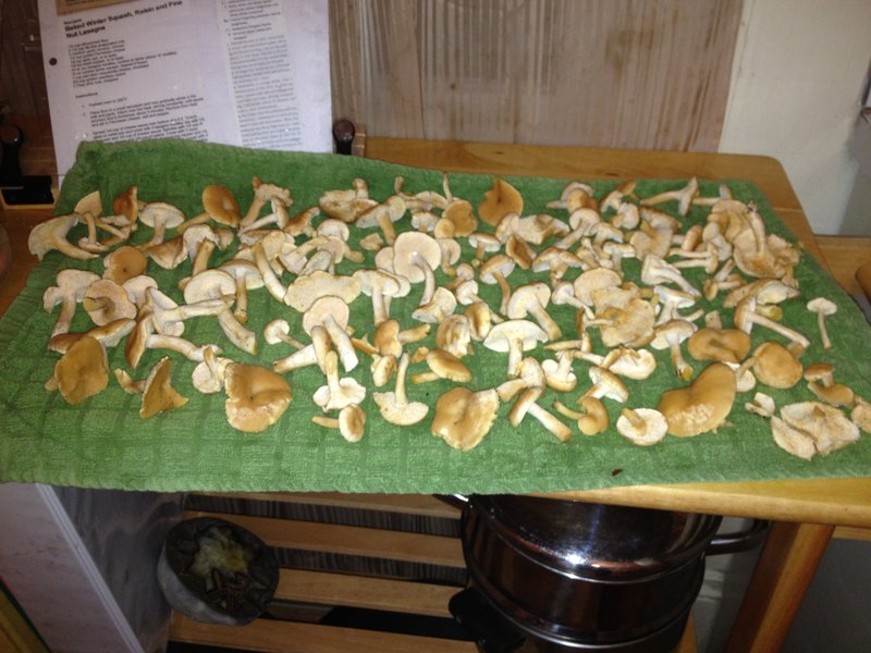
Clackamas area mushroom hunt
4 miles of hiking • 250' elevation gain •
Delightful wanderings in the woods off the Abbot Road. Mushrooms very sparse, no edibles.
November 2, 2012

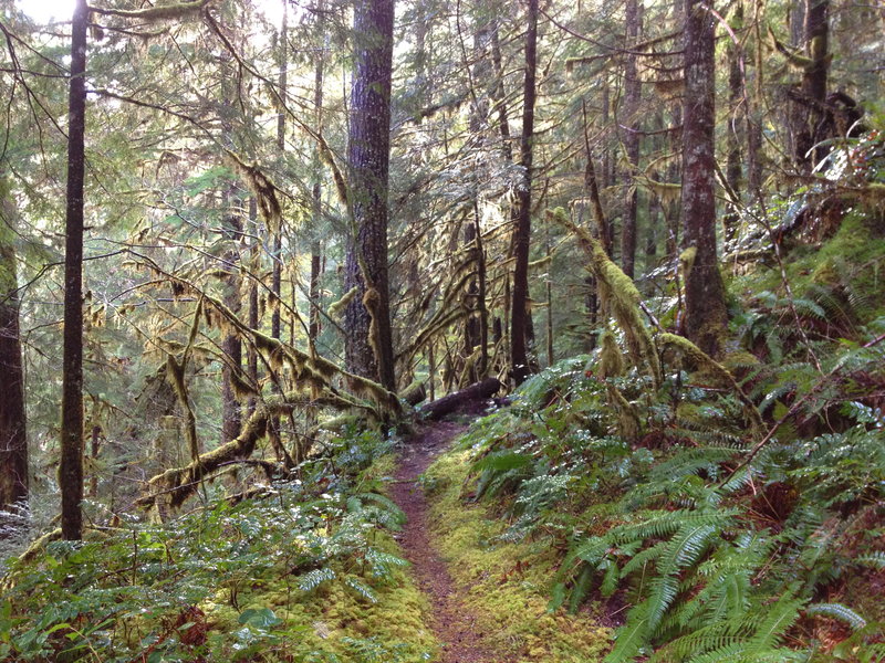
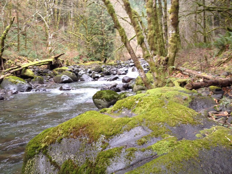
Secret Relic Trail
6 miles of hiking • 750' elevation gain •
Brought some friends along to visit one my favorite areas.
October 26, 2012


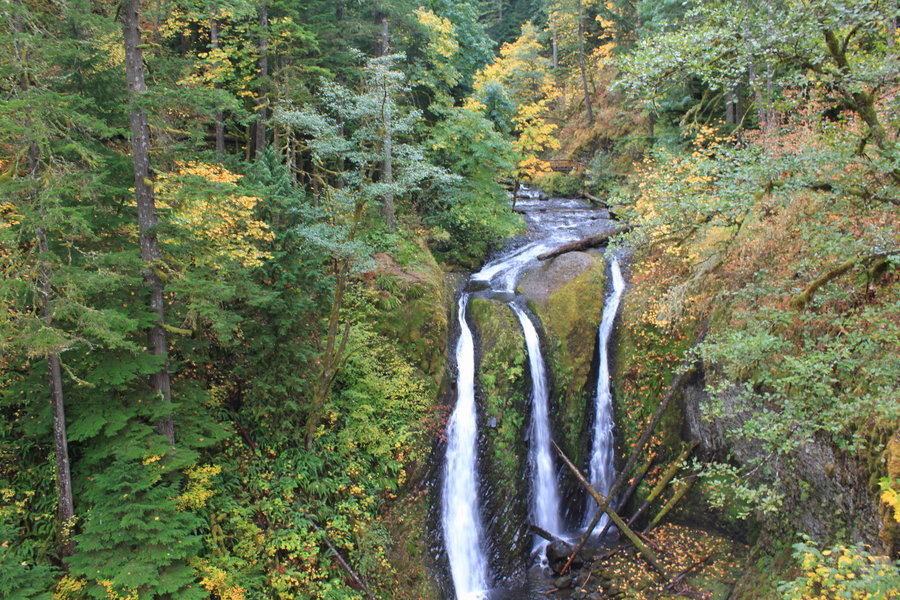
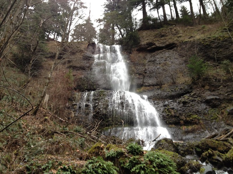
Triple Falls
3.5 miles of hiking • 750' elevation gain •
Took a friend visiting from D.C. on this classic hike.
October 19, 2012

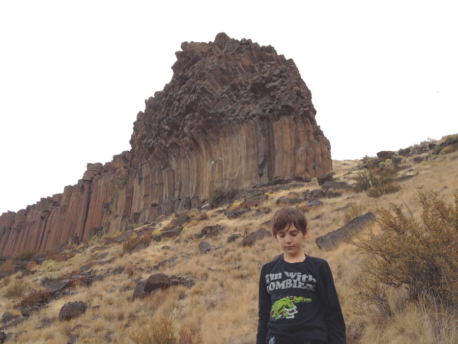
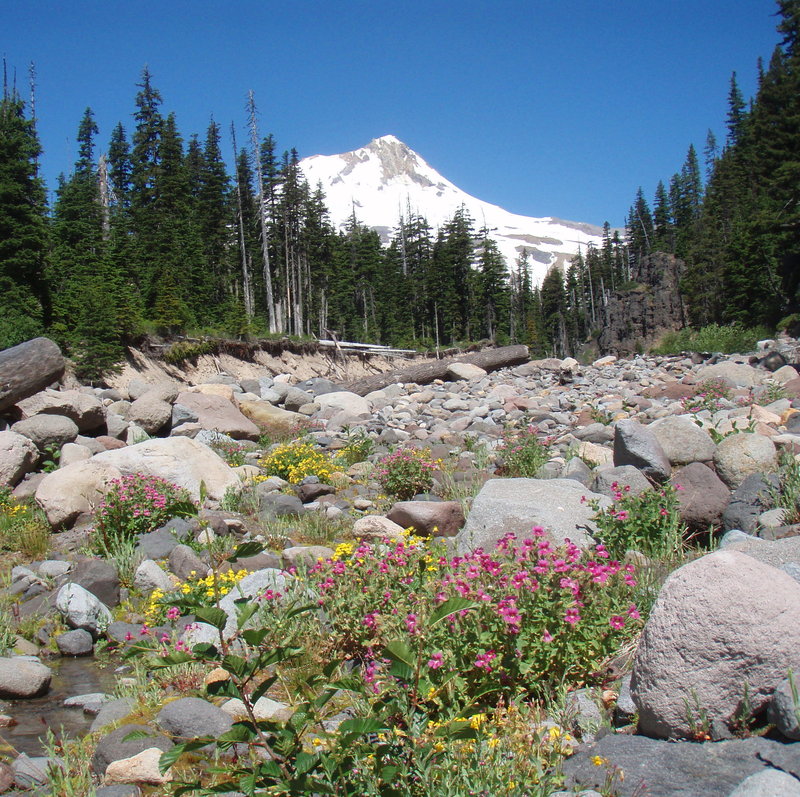
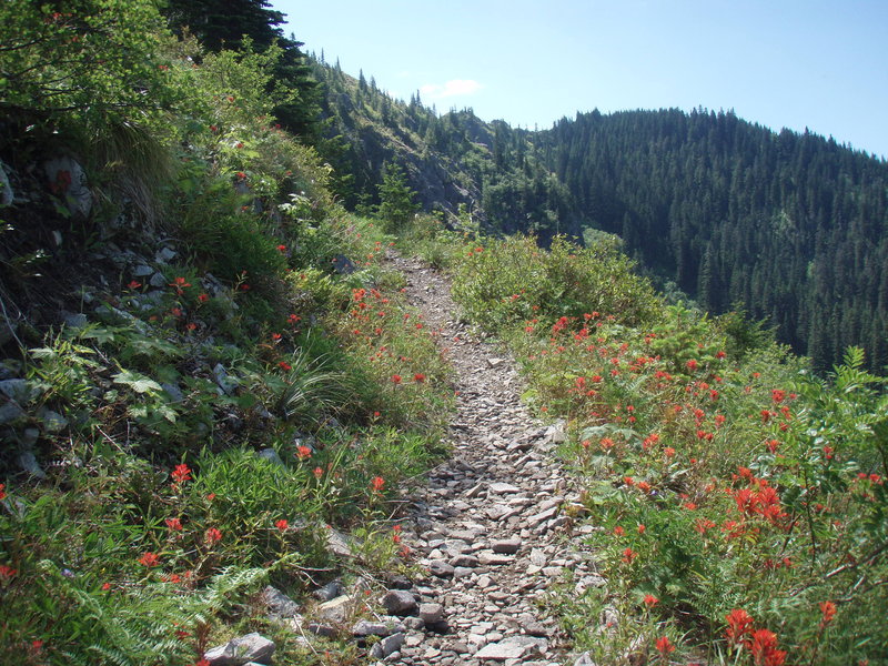
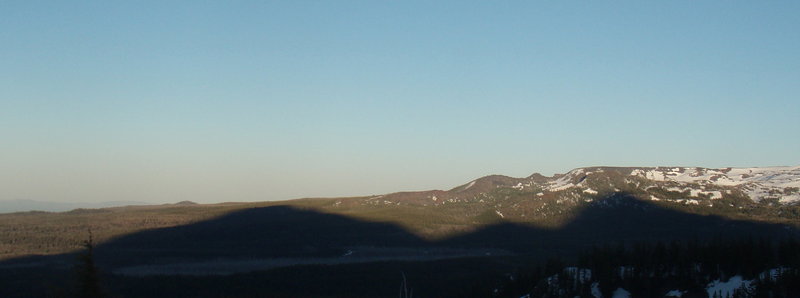
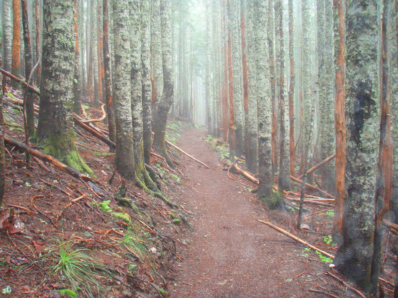
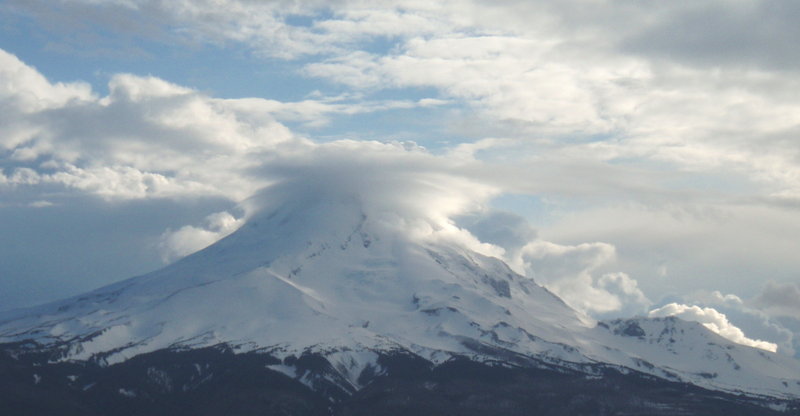
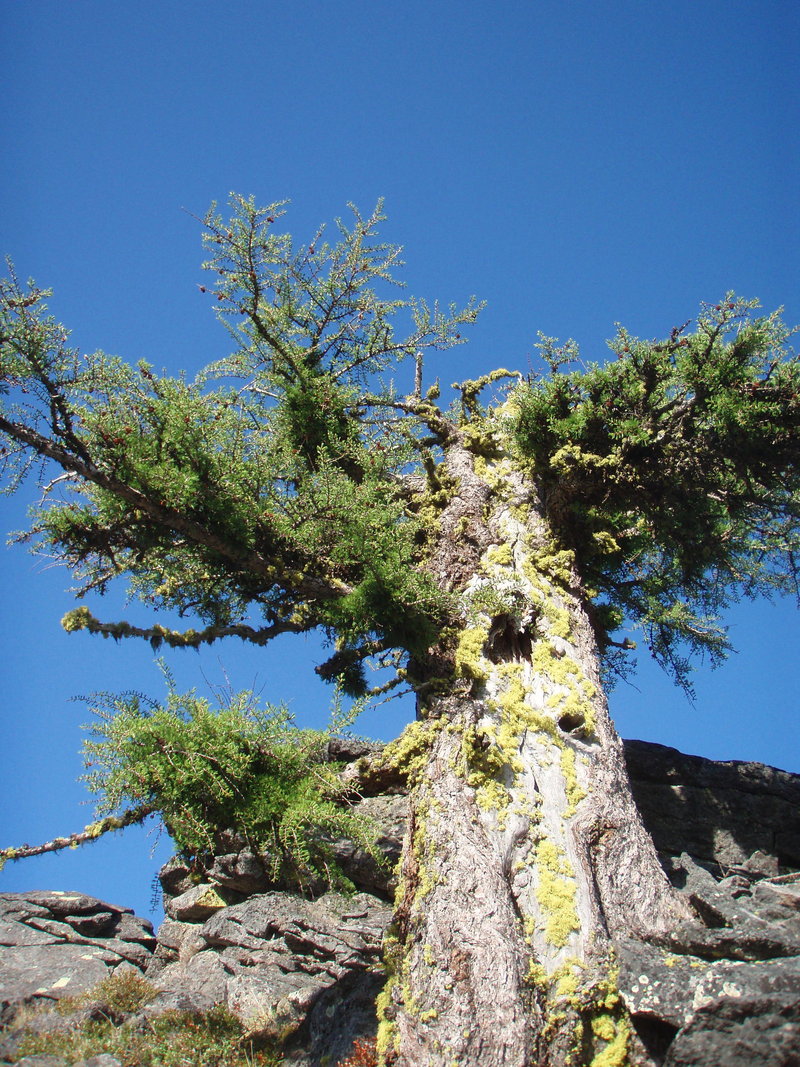
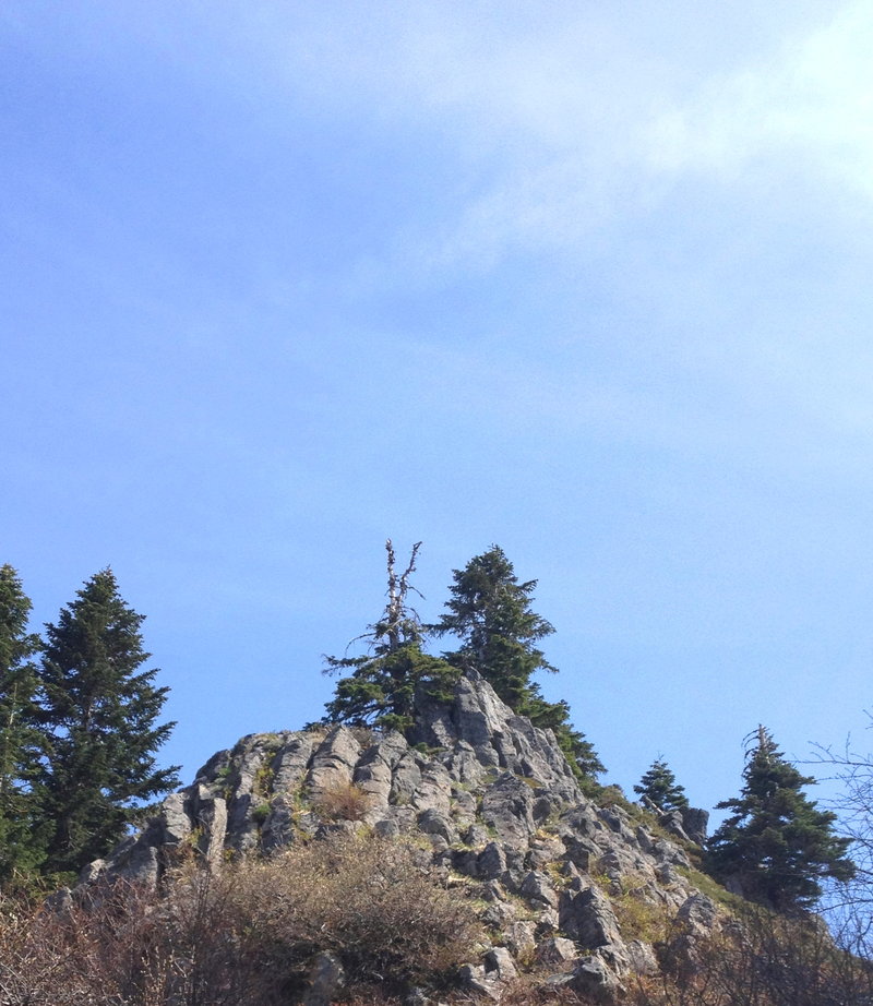
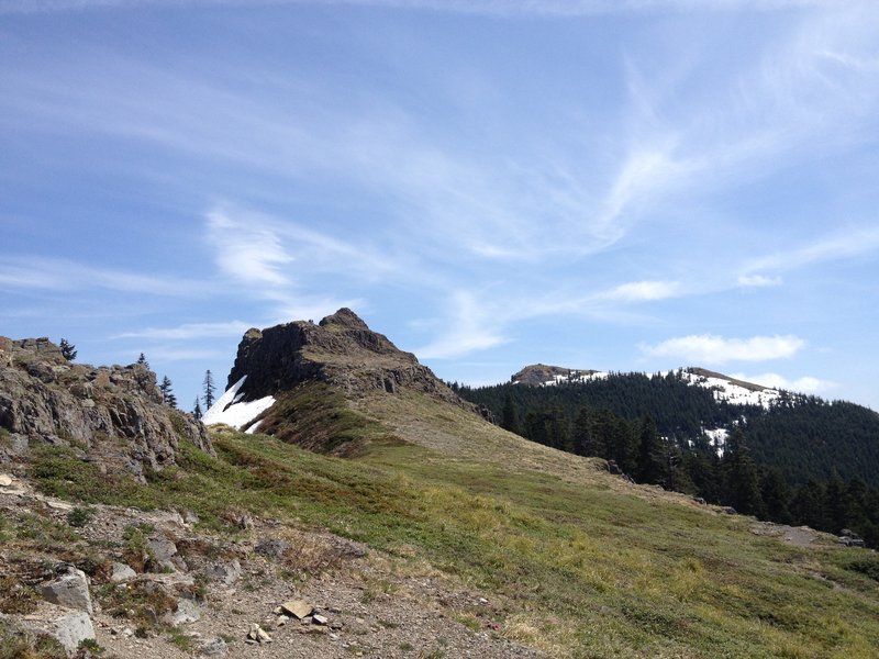
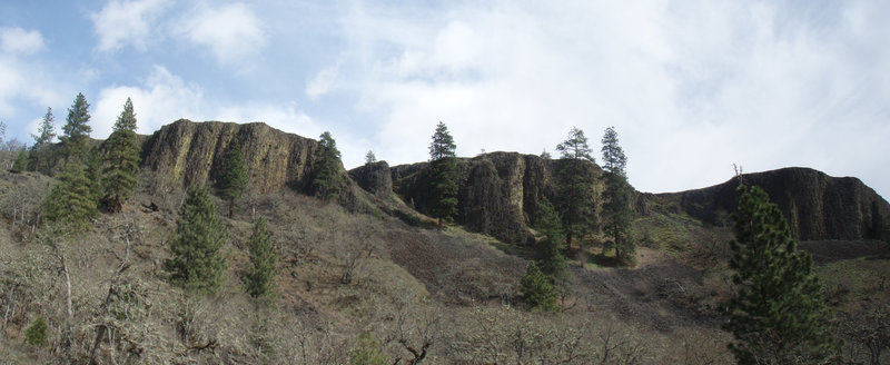
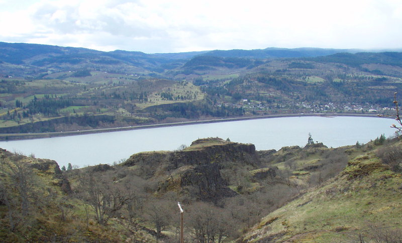
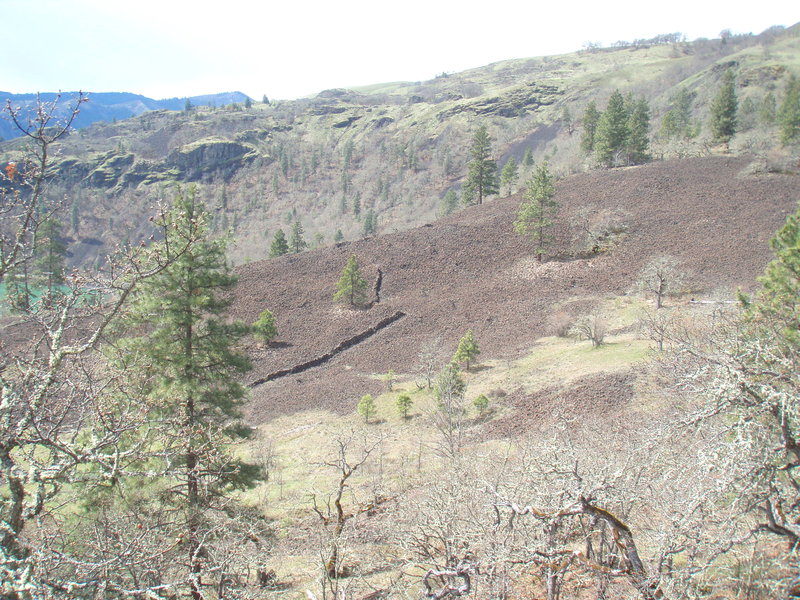
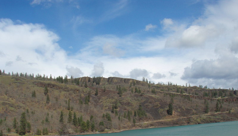
Trout Creek Butte
5 miles of hiking • 750' elevation gain •
Evan and I explored this wonderful bluff of massive hexagonal basalt columns
October 12, 2012

Larch Mtn mushroom hunt
4 miles of hiking • 250' elevation gain •
No mushrooms, but fun off trail exploring off Larch Mtn Rd
September 22, 2012

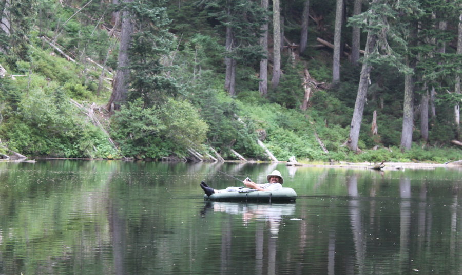
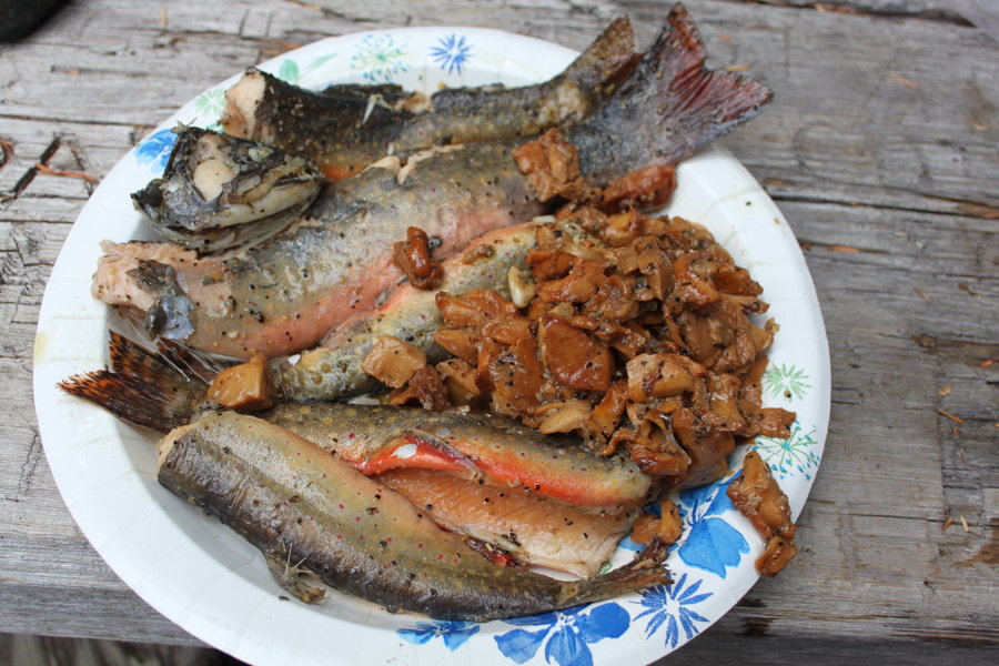
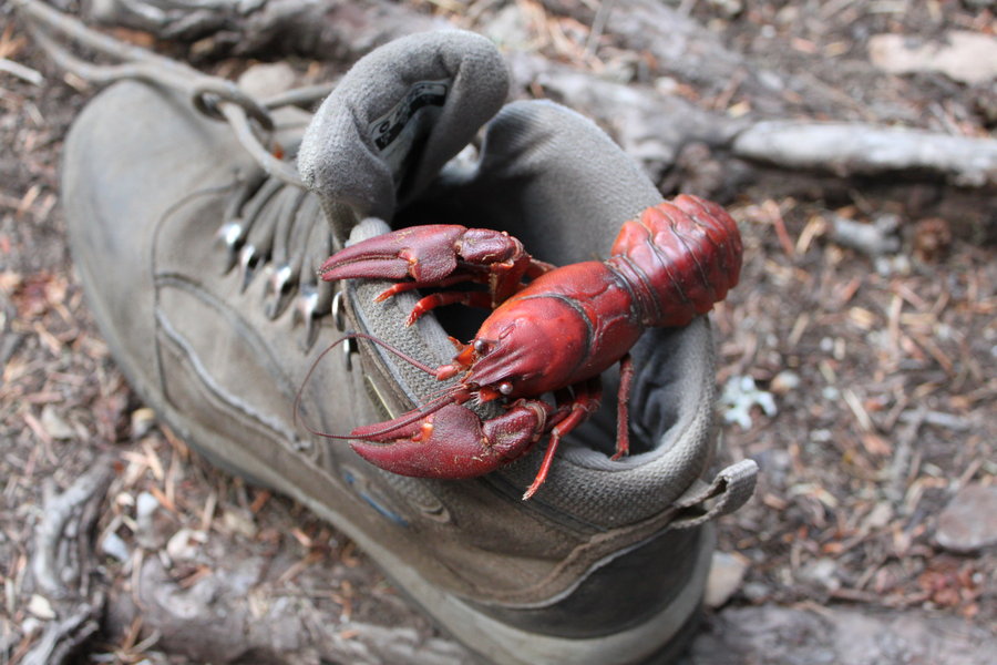
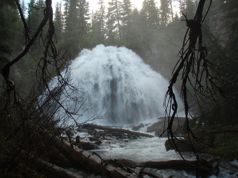
Skookum Lake Backpack
8 miles of hiking • 1000' elevation gain • 2 nights
Deep swimmable lake in the Clackamas watershed. Full of trout and crawdads. Short enough hike for kids. Many options for dayhikes from here. What a great location!
September 8 – September 10, 2012

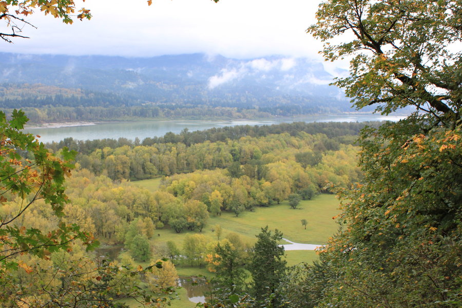
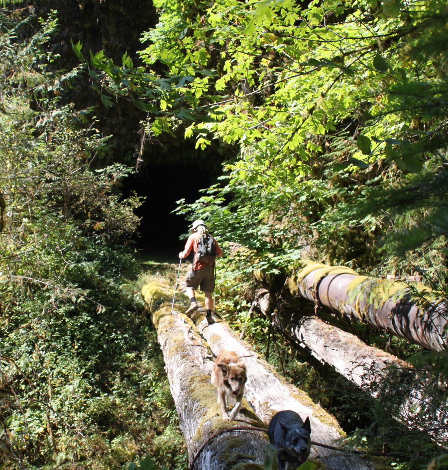
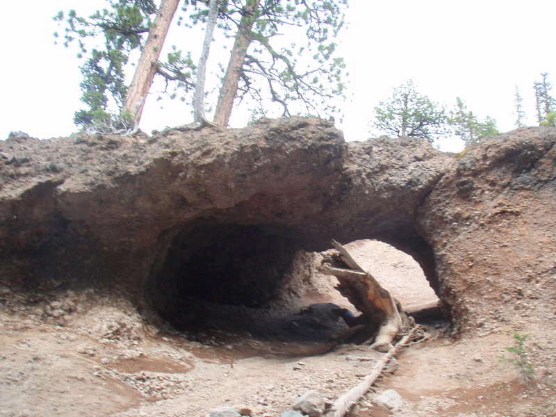
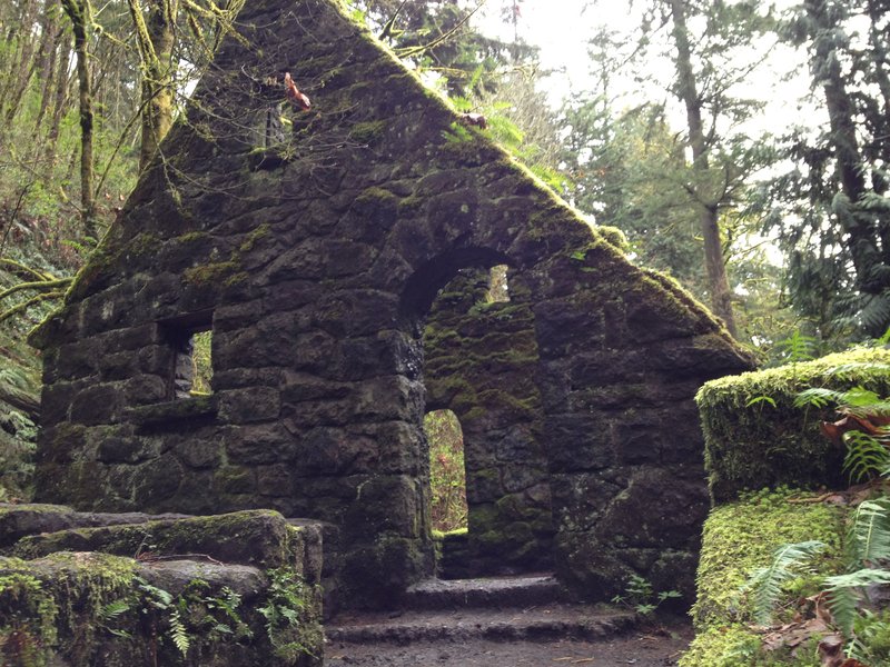
Memaloose tunnels
5 miles of hiking • 500' elevation gain •
Showed friends from Bend this wonderful old bit of history.
September 7, 2012

 1
1
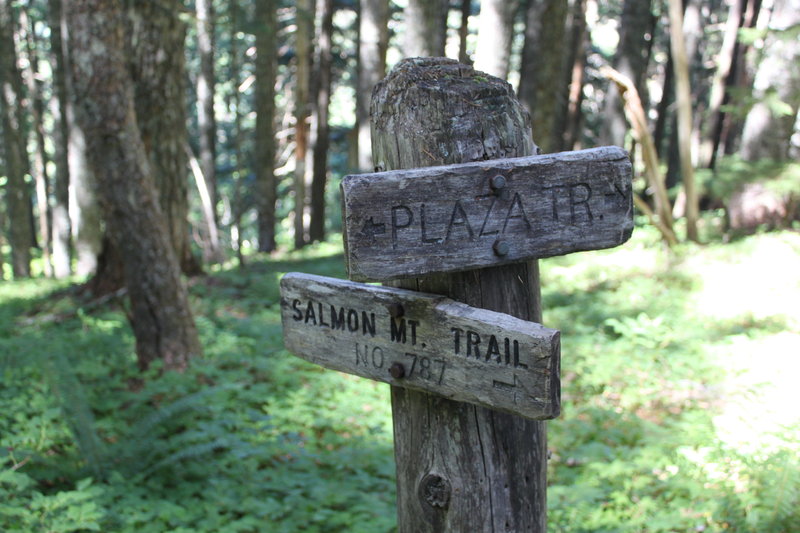
Salmon Mountain via Plaza Trail
8.5 miles of hiking • 1750' elevation gain •
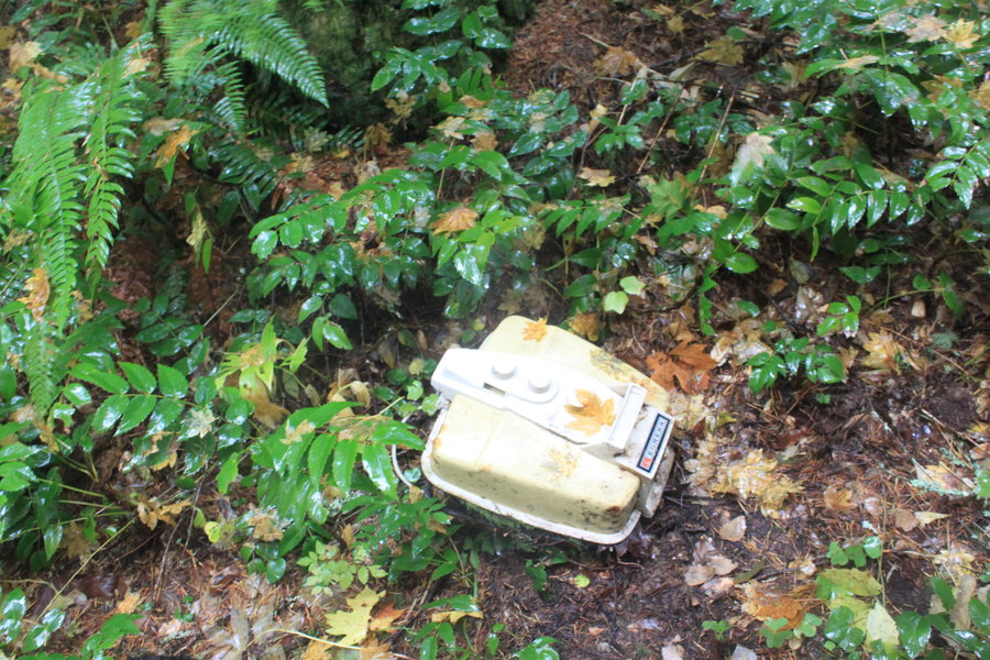
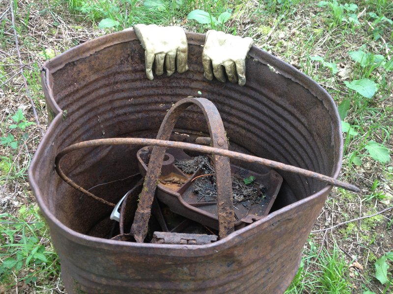
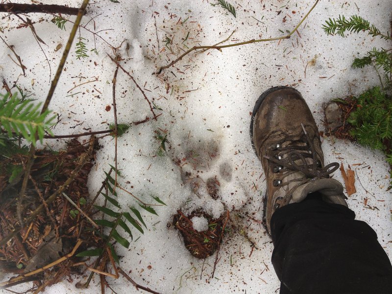
I hiked along the Plaza Trail from Abbot Road and visited Sheepshead Rock, then continued to the junction with the Salmon Mountain Trail and headed out that ridgeline. I tried to find the DC-9 crash site and failed, but I did find the nearby helicopter crash site- the search party that went looking for the plane the next day.
I also found someone's camera, way off trial, and was able to return it to the owner!
I put the pushpin at the approximate location of the helicopter.
August 22, 2012


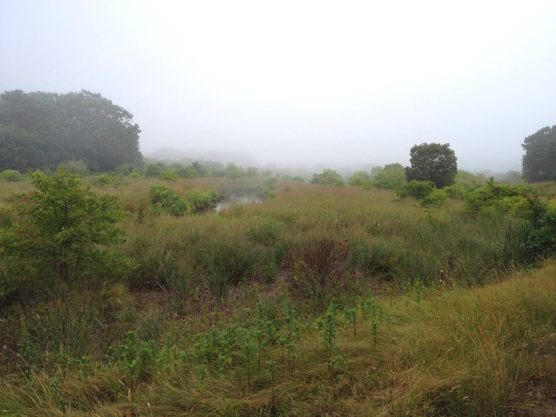
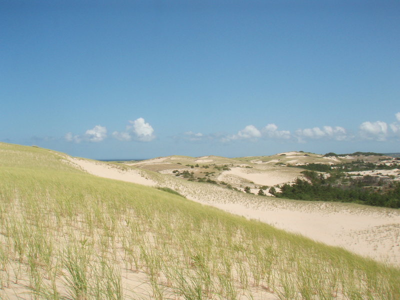
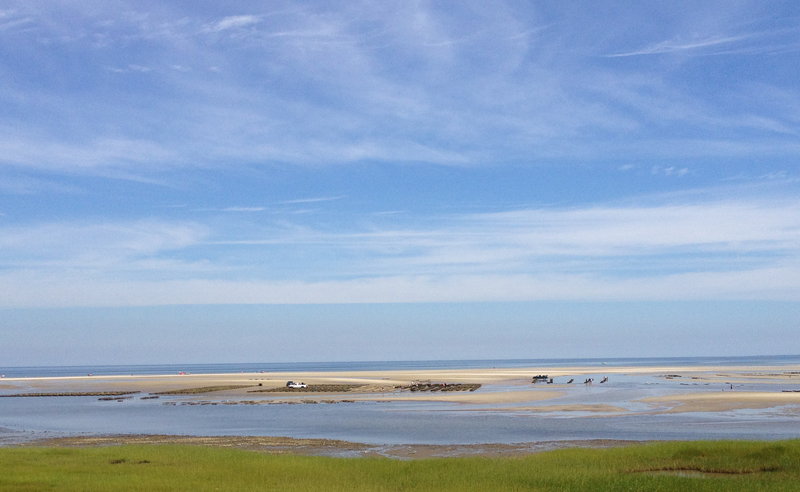
Cape Cod National Seashore and more
10 miles of hiking • 250' elevation gain •
On a famliy vacation, I was able to visit the Cape Cod National Seashore - multiple locations including Coast Guard Beach, First Encounter Beach, a bog wildlife area in Harwich, and a conservancy site in Dennis. My favorite spot was the dunes area near Provincetown- very much like our own Oregon Dunes!
August 2, 2012


 2
2
Loowit Trail Backpack
30 miles of hiking • 8000' elevation gain • 3 nights
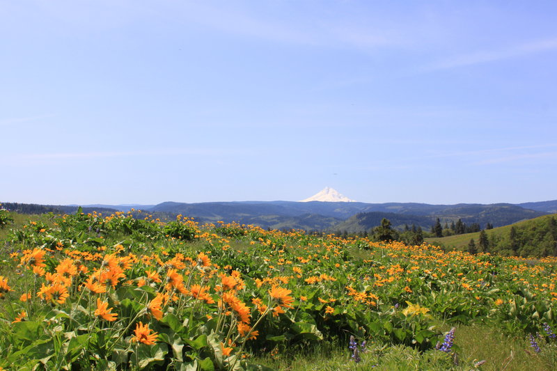
Fun backpack with Awildman. The flowers on the Plains of Abraham were spectacular.
July 26 – July 29, 2012


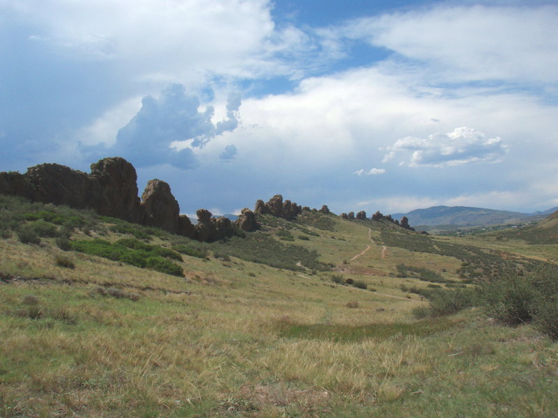
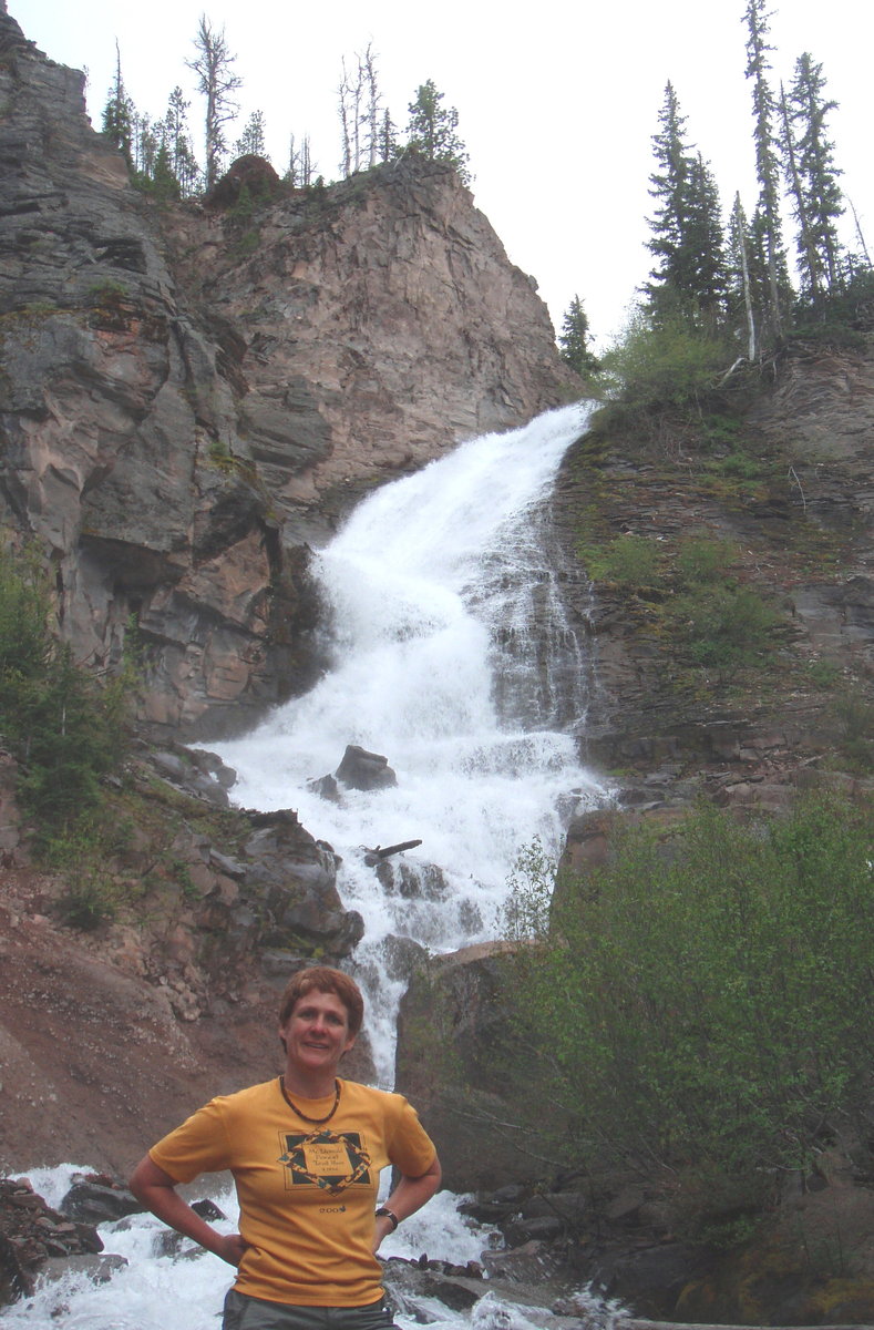
Devils Backbone
5 miles of hiking • 250' elevation gain •
really interesing geological feature near Loveland CO
July 21, 2012


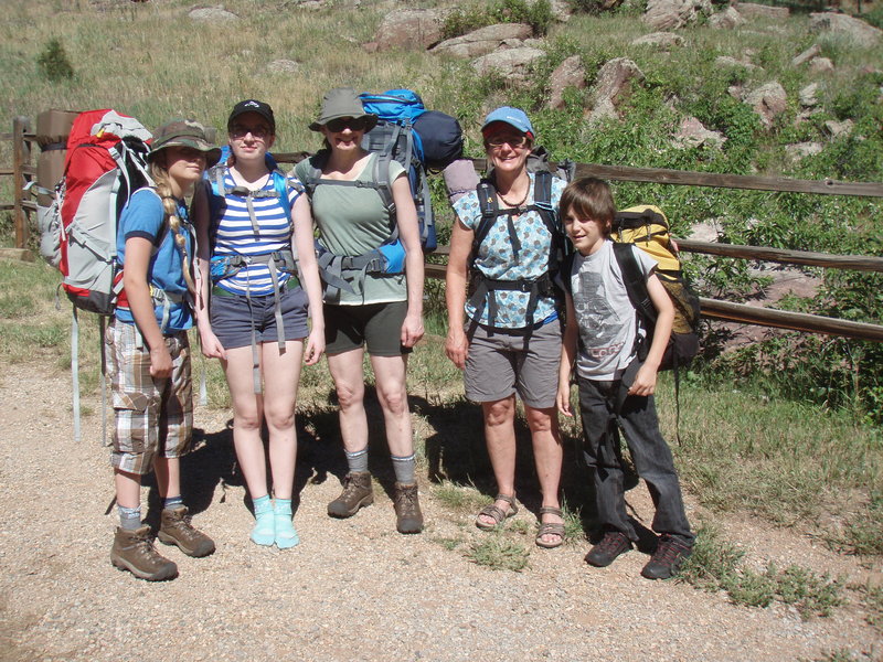
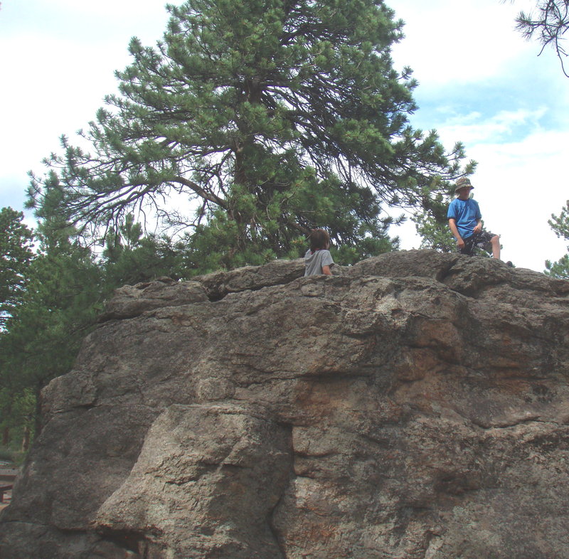
Mt McGregor Rocky Mtn National Park
10 miles of hiking • 1500' elevation gain • 2 nights
I had a short few days in Colorado and met up with my sister in law from Brooklyn to take the kids ( ages 9,11 and 13) backpacking in RMNP. We had Gem Lake in mind, but the closest camping spot was McGregor Mountain. The kids had a blast.
July 18 – July 20, 2012

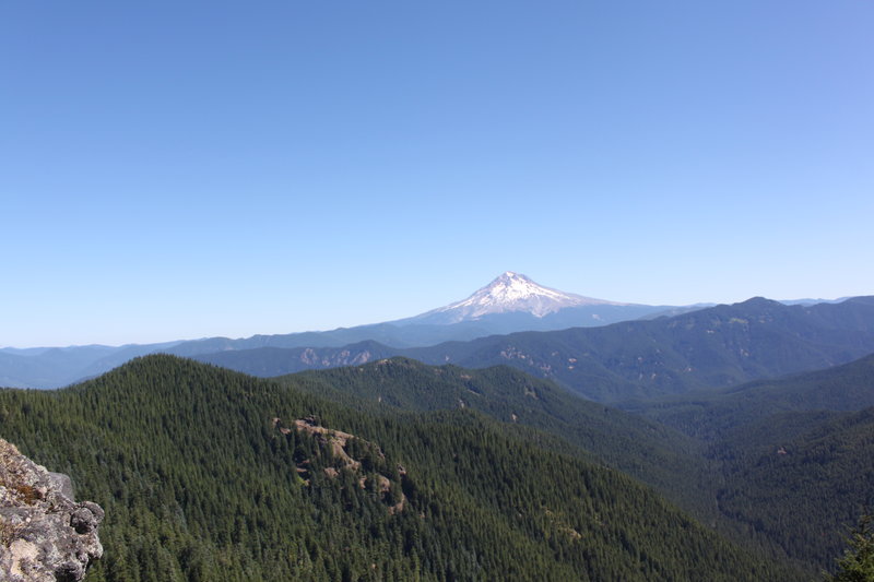
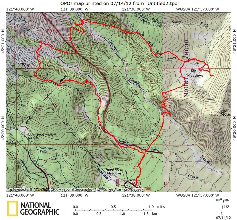
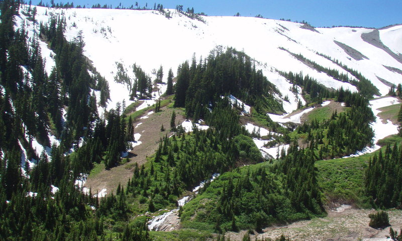
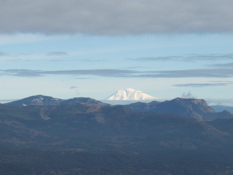
Elk Meadows and Clark Creek Canyon
10.5 miles of hiking • 2500' elevation gain •
I headed out to Elk Meadows on a gorgeous summer day. No bugs and I had the place to myself. Afterwards I headed up the Gnarl Ridge trail and turned west on the Timberline Trail.
I didn't run into any snow until the Clark Creek Canyon. This creek bottom is beautiful with several waterfalls. Climbing up out of there was tricky with several steep snowfield traverses and route finding challenges to stay on the Timberline Trail. I finally just went cross country up to the top of the ridge to the ski area and wandered around on the ski slopes- found an iphone and it still works! Unfortunately it is password protected so I'm not sure how to return it to its owner. It sure was hot out. I ran out of water, then found- a bottle of water!!
I bushwacked Southeasterly back into the Clark Creek Canyon (via a foolhardy route) and had a wonderful time heading downstream in the creek bed. It was about a mile back down to the bridge on the Elk Meadows trail, but it took over an hour. So many critter tracks in the sand. I had to cross the creek about 5 times. There is clear evidence of a former trail here- obvious tread and cut alders, but then the creek suddenly switches direction and obliterates the trail, and alder thickets are growing fast in the more stabilized spots on the bank.
July 13, 2012


Little Baldy
8.5 miles of hiking • 2000' elevation gain •
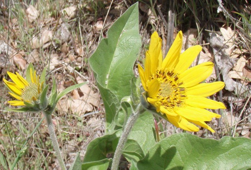
Went via the Bluff Mountain Trail. Widlfowers are starting to put on a big show!
July 6, 2012

Huckelberry Lake McKenzie Pass
3 miles of hiking • 250' elevation gain •
I t was a dreary day, and I was tired and sore from climbing Middle Sister, but I was in the area with some time to spare, and McKenzie Pass had just opened. So for kicks, I drove on up and wandered cross country in the lava lands to Huckleberry Lake to find a geocache.
June 22, 2012


 4
4
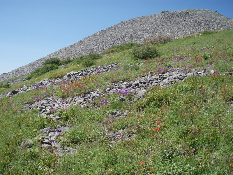
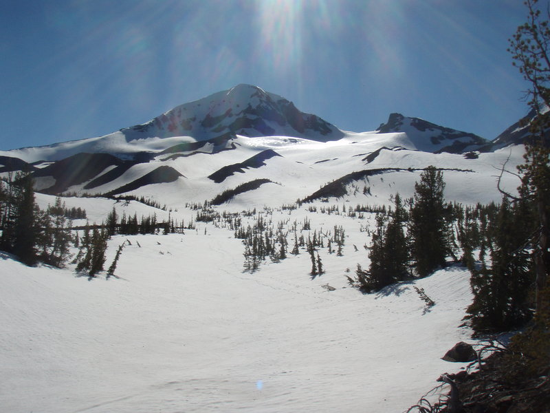
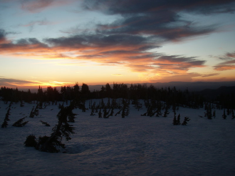
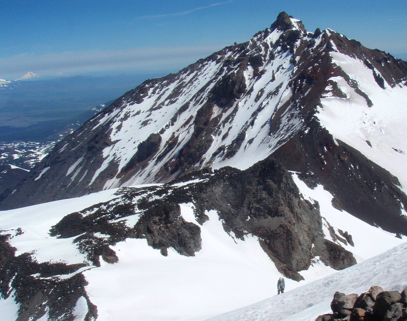
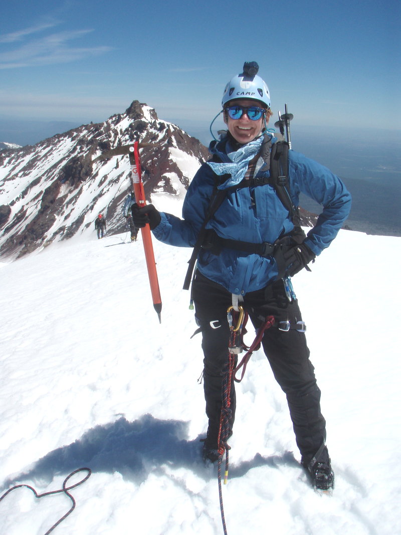
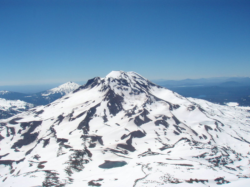
Middle Sister
13.5 miles of hiking • 4750' elevation gain • 1 night
I did this trip with the Mazamas on the longest day of the year. It was a perfect weather window. We started at the Pole Creek trailhead and took the Pole Creek Trail to the Chambers Lakes Trail, then headed off cross country towards the east flank of the mountain. We found a perfect snow free tree island to make camp, with nearby stream for water- approx 6800 ft elevation, just below tree line. Amazing views all around, stunning sunset and a very warm cozy night with just a bit of wind.
Started out at 5am and snow conditions were perfect. Wind was almost non-existent. We headed up along the north edge of the Hayden Glacier. Roped up below Prouty Point and continued up to the saddle between Middle and North Sister. From there we scrambled through rock scree along the ridge until we came to a very steep snowfield that required protection for about a 120 ft? rope length. Another group turned back here- they were Outward Bounders who had zoomed past us. They had ropes, matching helmets, gaiters and ice axes, but no crampons! Anyhow, our leader ascended slowly placing pickets and we followed along improving the steps. It was a bit scary because of the exposure but conditions were darn good. After the crux section, it was just a nice walk up the remaining 300 foot gain to the summit where celebrations ensued.
As we were descending we looked back and saw clouds approaching from the west and begin to crawl over the summit we had just visited. We packed up camp quickly and skeedaddled out of there. It was just starting to rain as we closed the last mile to the TH. As we were throwing down our packs and taking off our boots, it began to hail. We felt so fortunate to have such perfect conditions for our trip- especially considering the rainy weather that followed that evening and the next day.
June 20 – June 21, 2012

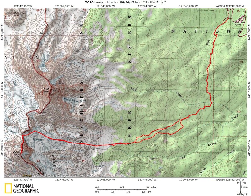


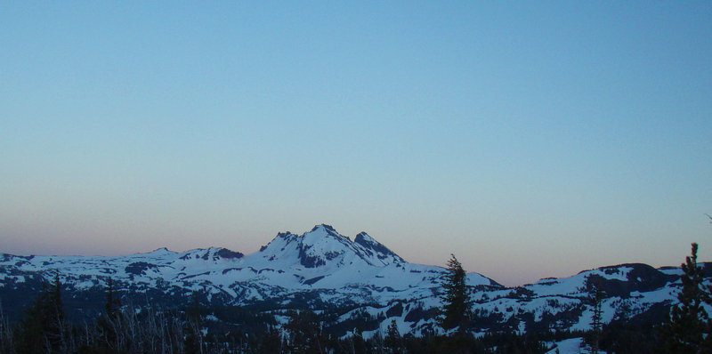

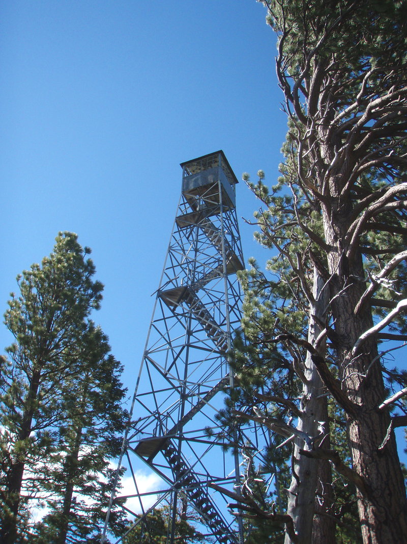
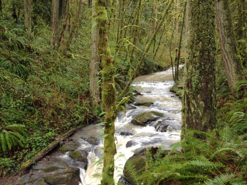
Whychus Creek/Trout Creek Butte Lookout
5.5 miles of hiking • 1000' elevation gain •
I got to the Sisters in the late afternoon, but had some time to do a little exploring. I visited three waterfalls on the Upper Whychus Creek drainage, and the Trout Creek Butee lookout tower off Pole Creek Rd.
June 19, 2012

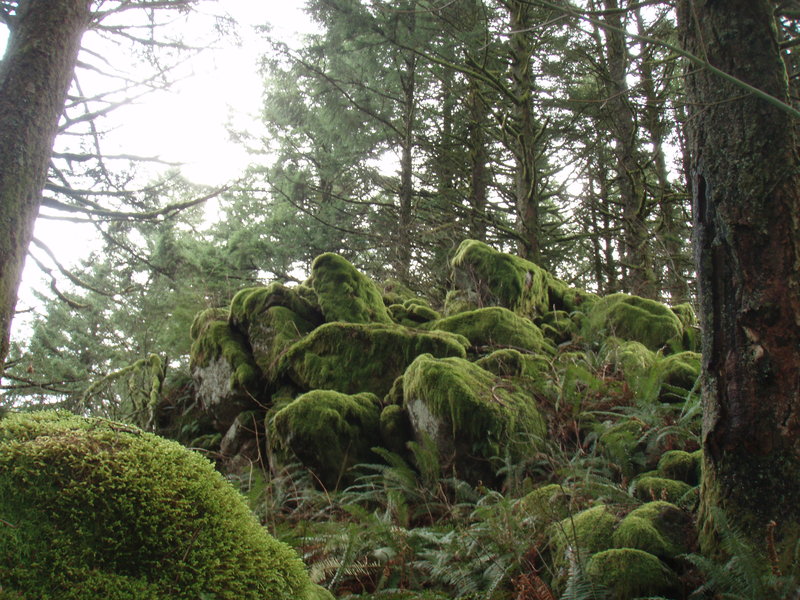
Larch Mtn Crater Loop
6 miles of hiking • 1250' elevation gain •
The upper gate is open now. It was a soggy day. I started at the hairpin turn and did the clockwise loop took the LMT down to the Multnomah Way Trail to the Oneonta Trail. The forest has such variety on this loop. The crater meadows are full of blooming marsh marigold and shooting star. The Multnomah Way Trail is a creek. Only saw one other hiker on a Saturday!
June 9, 2012


Clackamas Canyon Bushwack
3 miles of hiking • 750' elevation gain •
I bushwacked up a steep hillside to visit some hanging meadows overlooking the Clackamas.
June 1, 2012

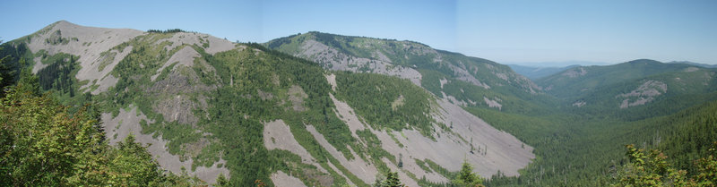
Surveyor's Ridge
10 miles of hiking • 500' elevation gain •
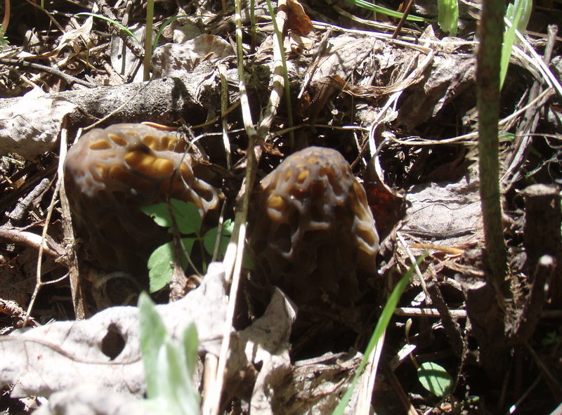
Surveyor's Ridge Trail is well maintained by mountain bikers, although I only saw a few on this Friday before the Memorial Day Weekend. There are multiple access points and lots of off-trail scrambling available. Got really slowed down after I found a few morels, could not stop searching for them.
May 25, 2012


Sturgeon Rock
8.5 miles of hiking • 1750' elevation gain •
Moseyed on up to Sturgeon Rock via the Tarbell Trail. It's pretty nice up there!
May 18, 2012


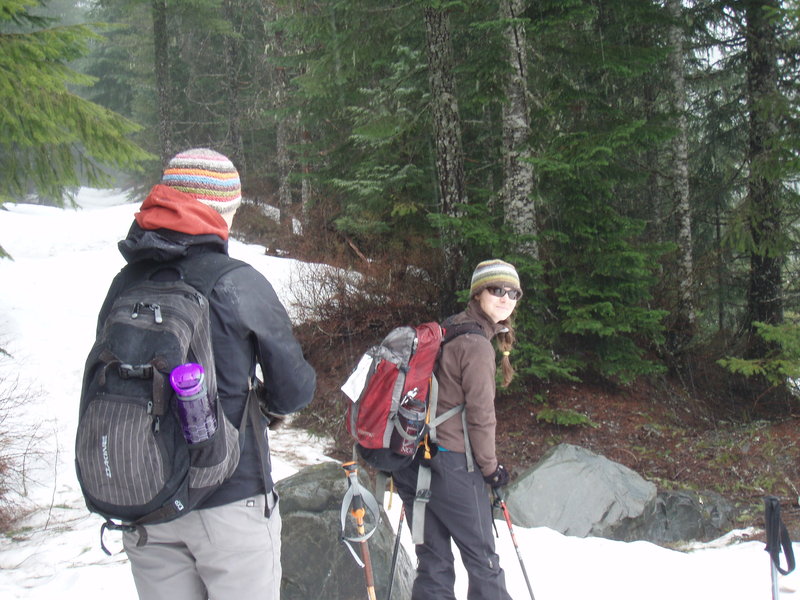
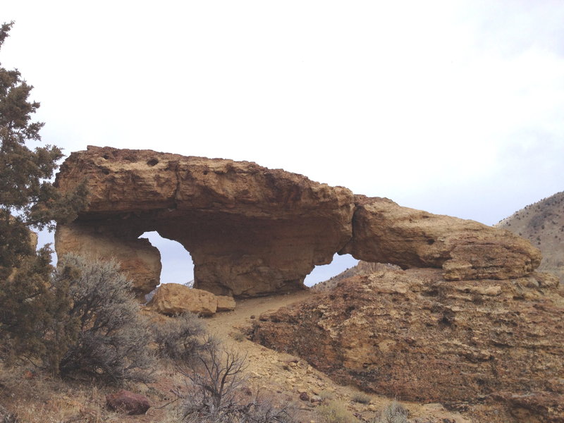
Palmer Mill Wanderings
8 miles of hiking • 1250' elevation gain •
Wandered around on some wonderful old roads off Palmer Mill Road, west of Angels/ Devils Rest. Found some trails maintained by someone and relics of old ( near old and old-old). Bushwacked over to Devils Rest and saw two people. Bushwacked away and was alone for the rest of my hike. On the drive out I noticed the Angel's rest TH was full. See ya!!! Solitude is important to me.
May 17, 2012


May 11, 2012

Ridge Trail Loop- Forest Park
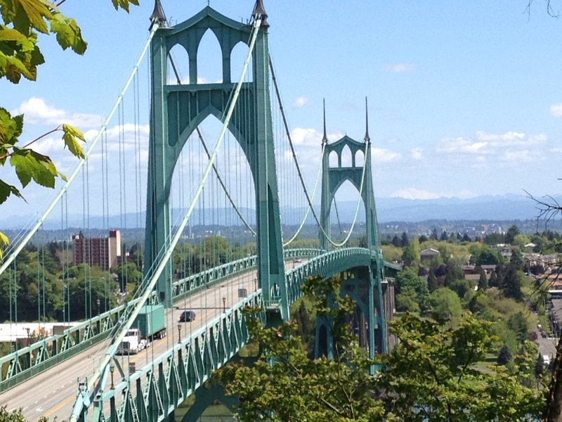
5 miles of hiking • 750' elevation gain •
The Ridge Trail starts at the western end of the St Johns Bridge. It's a great starting place for loops incorporating the Firelanes, Wildwood, Lief Erickson, and Hardesty Trails.
May 10, 2012

 3
3
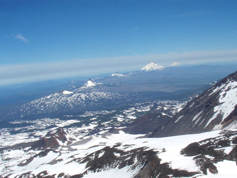
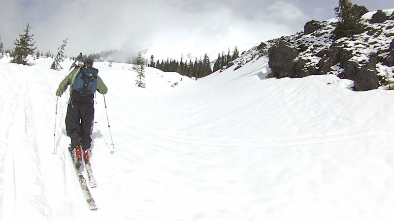
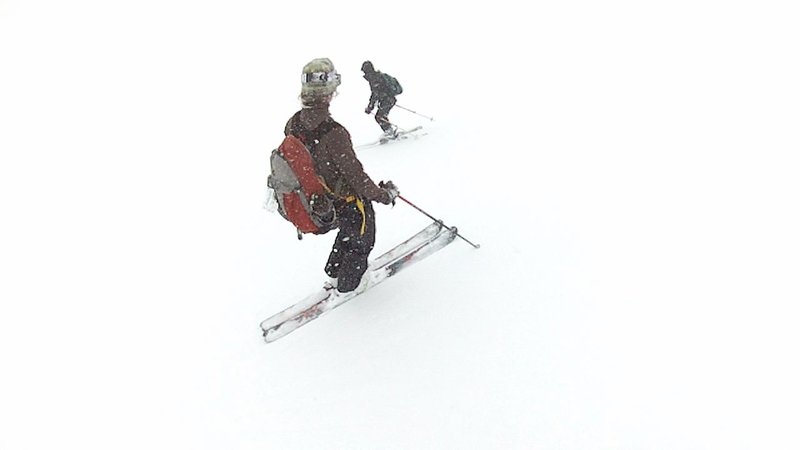
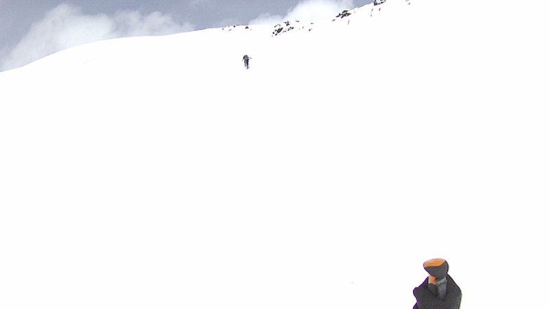
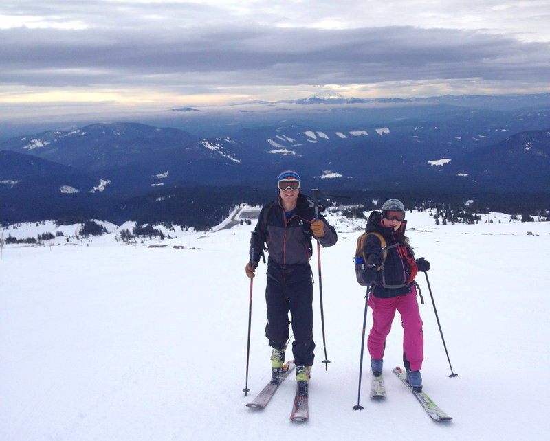
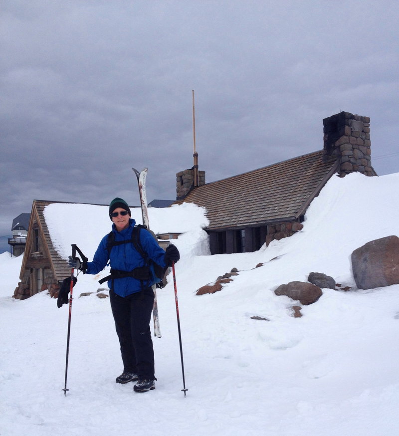
MSH
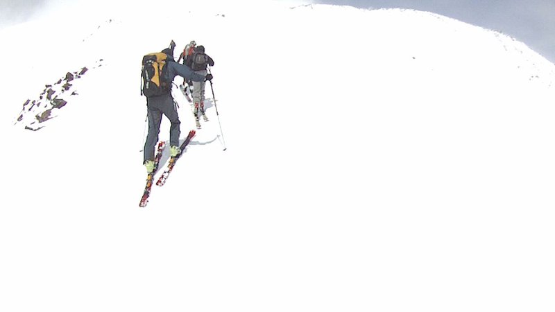
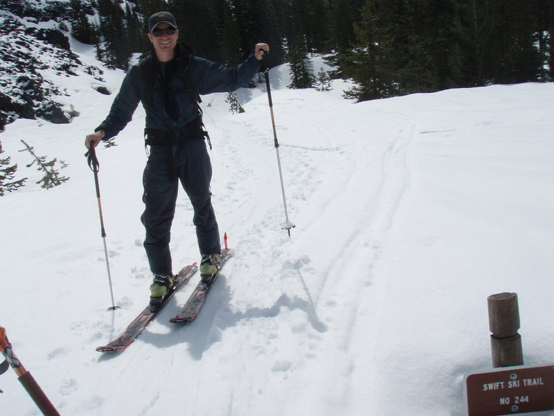
4.5 miles of hiking • 4500' elevation gain •
I got my butt kicked on Loowit. I went with a group of friends; we've been planning this trip for a long time. The forecast did not look good, but it is so hard to arrange our schedules, we decided to go for it anyhow. We rented AT skis at the Mountain Shop, 4 of us doing this for the first time. Started at the Marble Mountain Snow Park, skinned up and came up via Swift Creek. The weather was actually pretty nice- snowing at the bottom and warm. The clouds started clearing when we came out of the trees and onto the Worm Flows, and we had some nice glimpses of the summit.
I had trouble with the fit of my boots and began to suffer blisters. I put on those fancy blister bandaids which helped, but I still had to deal with pain management- which made my trip less enjoyable, and I slowed the group down.
By the time we reached 7000 feet ( 4 hrs) the weather had turned again and the wind was blowing hard, no visibility. The snow was very crusty and we decided it was time to go down. We were pretty nervous on the first part of our descent because of whiteout conditions, just making two or three turns and stopping. We had one nice run of perfect snow for about 500 feet, then it turned into mashed potatoes. Very tiring to make turns, but we emerged from the big cloud surrounding the summit and visibility was good again. The bottom section was a hoot just skiing in tracks the whole way back through the trees.My legs were on fire, I've got to get in shape!
May 4, 2012

 1
1
Mowich Butte
9 miles of hiking • 2000' elevation gain •
This section of the PCT is so beautiful. Huge stands of alder along the N Fork of Rock Creek some nice moss covered scree fields, and multiple waterfalls. Snow starts at 2800 ft, but it's melting fast!
April 28, 2012
 2
2
Elevator Shaft to Nesika
7 miles of hiking • 2000' elevation gain •
I brought a friend up the Elevator Shaft and then we crossed Multnomah Basin to Nesika Lodge. We then headed up to Franklin Ridge and came down the Larch Mountain Trail- what a zoo on a sunny Saturday!
April 21, 2012

Cherry Orchard
6.5 miles of hiking • 1750' elevation gain •
Escaped the rain and had a nice quiet hike today. Rambbled up above the old orchard on a 4WD road and did some bushwacking. Can't seem to load my pics!
April 19, 2012

Cape Lookout
5 miles of hiking • 750' elevation gain •
Early morning run to beat the crowds and I had the trail to myself. I was hoping to see some whales, but no luck this year. I will include a picture from 2006 to show that this is the best whale watching spot (on land) in Oregon!
April 14, 2012
 1
1
Labyrinth
7 miles of hiking • 1750' elevation gain •
I had a nice rambling loop up through the Labyrinth and down through the vision quest pits area wet of Catherine Creek.
April 5, 2012


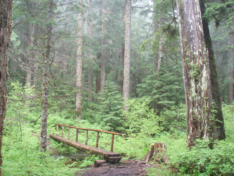
Wildwood- Audobon
5 miles of hiking • 500' elevation gain •
Took Balch Creek up to the Wildwood and looped around the Audbon trails.
March 31, 2012

Eagle Creek- almost flood stage
3 miles of hiking • 250' elevation gain •
Rain dumping, totally soaked. Had to turn back at Metlako Falls because of a dicey creek crossing. We planned to try another trail, but upon returning to the parking lot, we lost all motivation to hike for the rest of the day. Stuffed our faces instead.
March 30, 2012

Forest Park- Maple trail
5 miles of hiking • 500' elevation gain •
Part of the Maple Trail is closed (east of Firelane 4) due to a bridge out. You can climb up FL 4 to Lief Erickson, but it's slick as snot!
March 22, 2012
 3
3
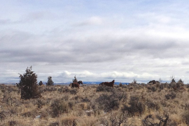
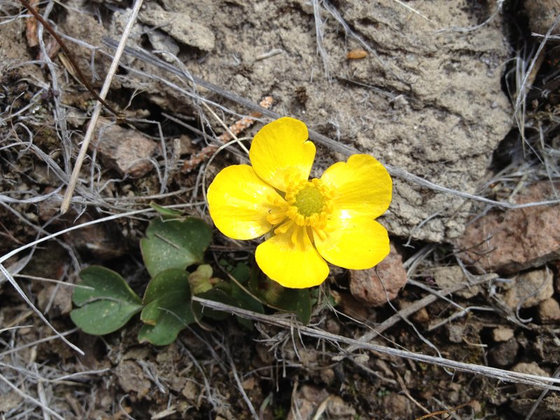
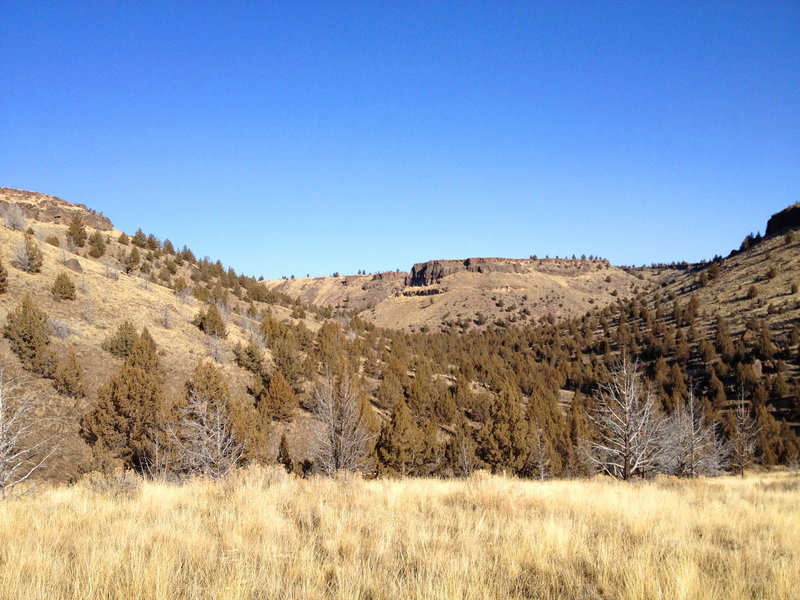
South Fork Crooked River
12 miles of hiking • 750' elevation gain • 1 night
My first backpack of the year- in the beautiful Oregon Outback! This is a BLM "Wilderness Study Area", almost completely surrounded by private ranch land. Unfortunately the cows do graze in the area, but we only saw one small group on our trip. But they also have wild horses! We saw a trio and a very shy pair at the head of Pickett Canyon.
March 3 – March 4, 2012


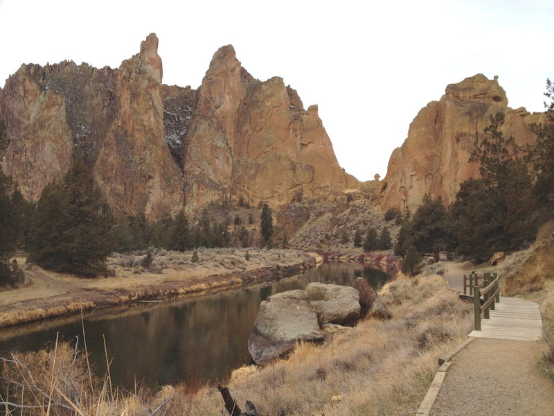
Smith Rock State Park
4 miles of hiking • 750' elevation gain •
Beautiful quiet day in the park. I ran on the river trail up to Misery Ridge and then scrambled around up top for awhile before heading back down.
March 2, 2012


Warrior Point- Sauvie Island
7 miles of hiking • 0' elevation gain •
I had a nice little morning run followed by ye olde bushwack through blackberries and stinging nettles! My bloody claves are still buzzing.
On the way back I stalked a huge flock of tundra swans at "Millionares Lake". They were so loud, a veritable cacophony, those magestic creatures sounded like a pack of hyenas!
February 26, 2012

Cedar Falls/Hamilton Creek
6 miles of hiking • 1000' elevation gain •
Wandered up Hamilton Creek today. very soggy day, the creeks were roaring, and I passed about 8 waterfalls shooting off the E side of Hamilton Mountain. Having troubles with my game camera.
February 21, 2012
 2
2
Devil's Rest- the back way
9 miles of hiking • 1250' elevation gain •
The plan was to ride my bike up Palmer Mill Road, but there was just too much blowdown. I threw my bike in the bushes after hauling it over the sixth tree in the first half mile. Glad I thought to bring my boots along. Luckily, I found a new trail! It parallels Palmer Mill and cuts through a really nice section of forest and meets Mult Basin Road just west of Devils Rest. Wandered around up there a bit. Listened to two owls hooting to each other. I recorded, will try to post.
February 12, 2012

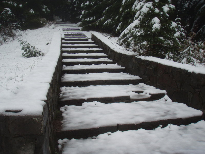
Timberline to Palmer Glacier
2 miles of hiking • 2000' elevation gain •
Preparing for a St Helens hike/ski in a few months. Hiked up from Timberline on the east side of the Palmer lift and skied down. We intended to go higher up, but the weather was turning, the wind was picking up, conditions were icy and they just pulled an unfortunate climber's body off the mountain.
Skis and boots are heavy! Not sure carrying them up is the best strategy. I've got some fitness to work on for sure. My friend rented AT boots and skinned up so she had a lighter load, but she wasn't happy with the skis and was missing her alpine sticks on that hard crusty descent. Still better than walking down.
February 7, 2012

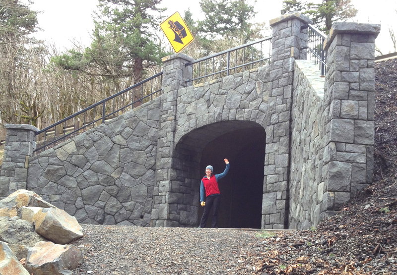
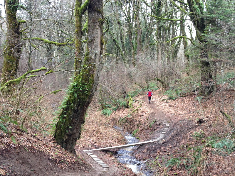
Cape Horn
7 miles of hiking • 1500' elevation gain •
Last day before falcon closure to do the whole loop. I went on a run/hike in the counterclockwise direction ( getting the road portion out of the way first) with my friend Meghann.
We went through one of the two tunnels that goes under highway 14. They are wonderful, and mimic the masonry from Samuel Lancaster's days.
January 31, 2012


 1
1
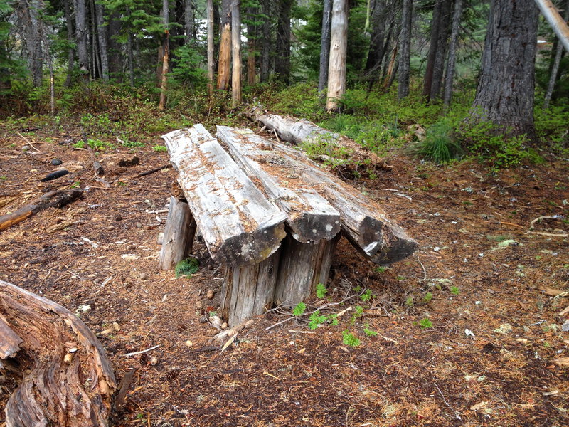
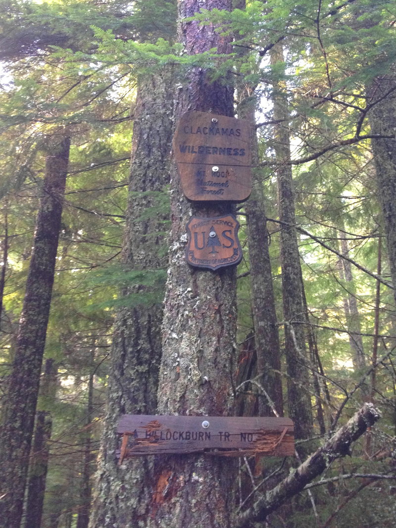
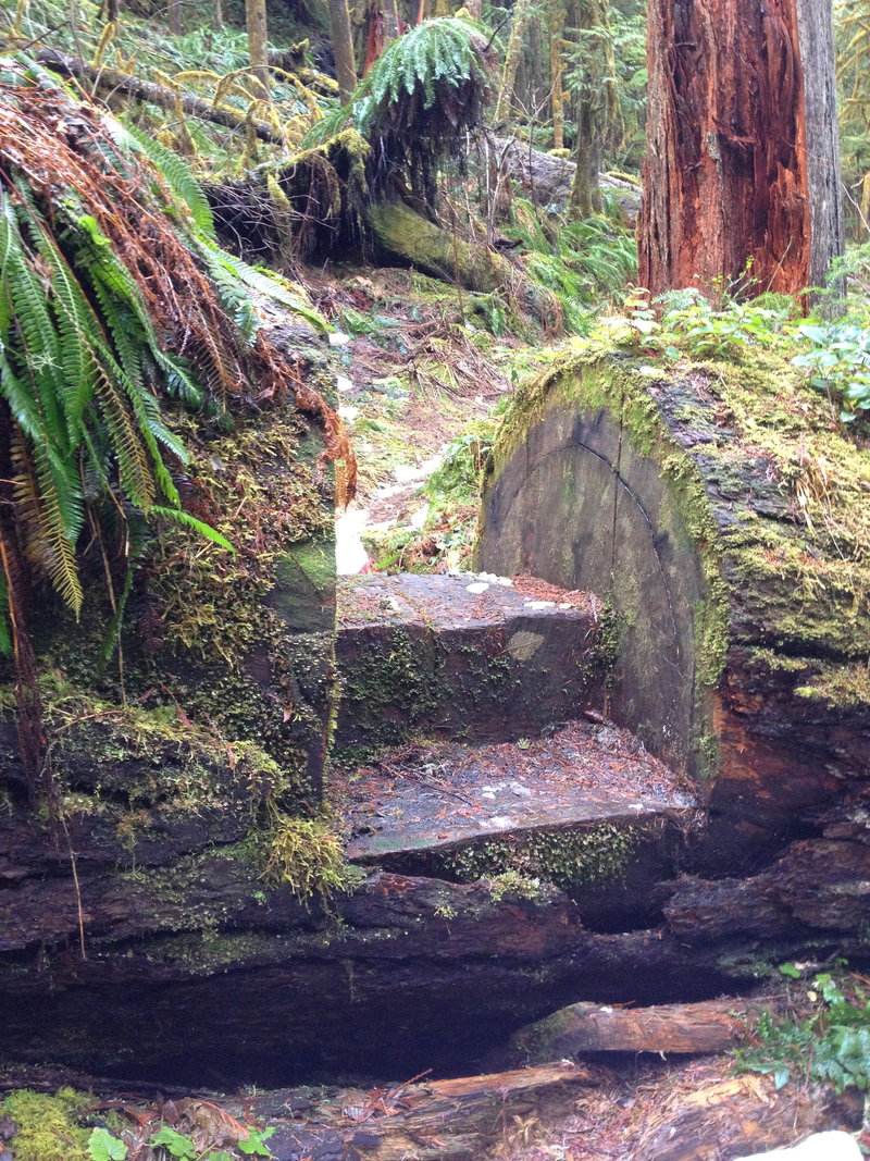
Hillockburn Spring, Hillockburn Trail and S Fork Clackamas River
5 miles of hiking • 1000' elevation gain •
Two different short hikes off Hillockburn Road.
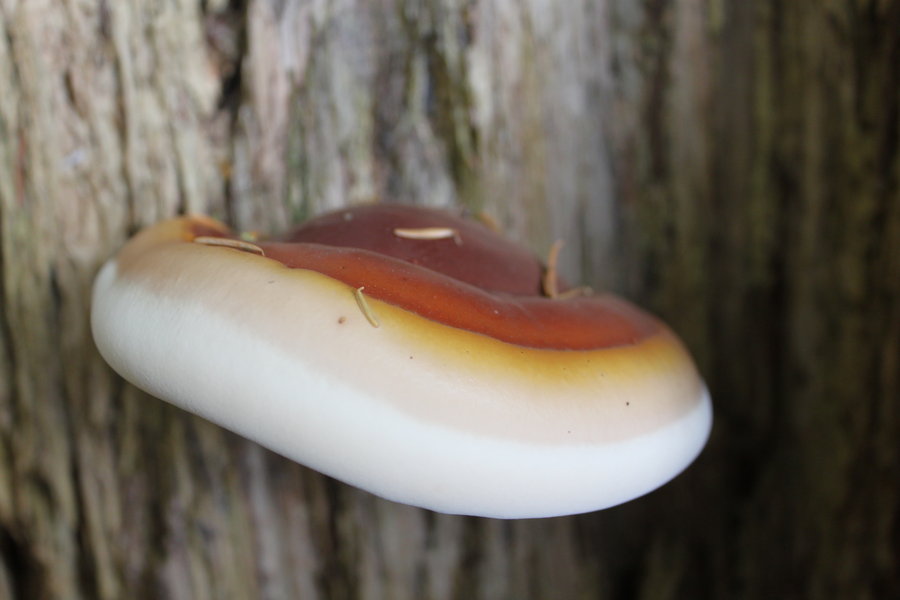
1) Hillockburn Spring is a clear little springfed pond that sits in the middle of a reprod unit of 10 year old trees about a mile up gated "Resort Road". As with many roadsides in the Clackamas forest, at the gate, rednecks have turned the area into their personal shooting gallery/dumping ground. But lucklily these folks don't venture far from their trucks and have no lung capacity, so after a short distance up the road their evidence has dissappeared. Today I visited the spring, but I'd like to come back another time to scout out an alternative route to the S Fork Falls and tunnels. There were actually two small adjacent ponds. The larger is edged with concrete, perhaps the remnants of an effort to make it more swimmable?
2) Hillockburn Trail begins another mile or so up the road at another unmarked pulloff marred by trash and shotgun shells. It descends along the western slope of the S Fork Canyon to a gorgeous riverside flat of deep moss and giant trees. The river was going full bore today with a nice slide falls to view on the opposite slope. Supposedly you can cross the South Fork and find an old flagged/unmaintained trail into a pristine section of forest on the ridge separating the S Fork from Memaloose Creek, but that will have to wait for lower water another day.
On the way back up, I collected a big bounty of hedgehog mushrooms!
January 25, 2012


Marquam Trail
5 miles of hiking • 500' elevation gain •
OK now it's my turn to post a lame urban hike. It was sort of a run hike, just got new shoes, breaking them in. Despite the recent deluges, the trail is still in pretty good shape. I guess because we've had such a dry winter so far. A few of the little steep pitches are slick as snot, but the puddles of pudding have not formed yet. Explored some interesting side trails on the southern end of the trail.
January 20, 2012

Cedar falls/Hamilton Creek
5 miles of hiking • 1000' elevation gain •
Messin around in my favorite area. Cedar creek was an easy rock hop, some nice seasonal waterfalls coming down the east side of Hamilton.
I put my field camera back out in a spot that smelled like elk and had lots of prints and poos, fingers crossed.
January 14, 2012

Withlacoochee State Forest
5 miles of hiking • 0' elevation gain •
I visited some cool limestone caves in the Citrus Tract of WSF.
January 4, 2012

Morris bridge park Tampa
5 miles of hiking • 0' elevation gain •
It's pretty flat here but I got to do some bushwacking today!
January 2, 2012

St Pete beach Florida
4 miles of hiking • 0' elevation gain •
Sun sand swimming yoga parasailing plus a little morning run
January 1, 2012

View trips from: 2011 2013 2014 2015 2017 2016 2018 2019 2020 2021 2022 2023 2024 2025 2026