

2026 Trips To Date


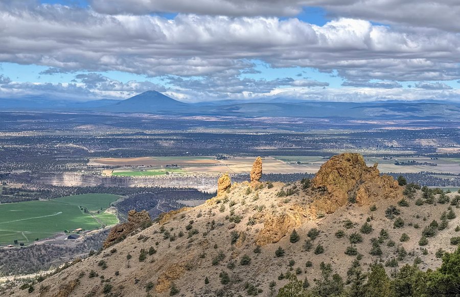
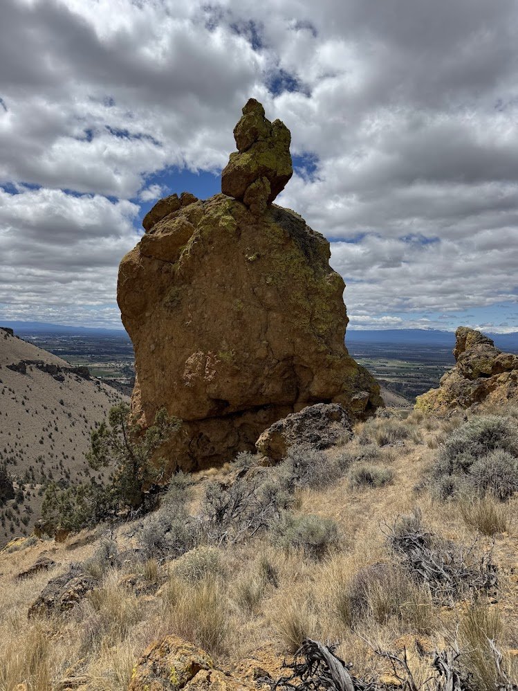
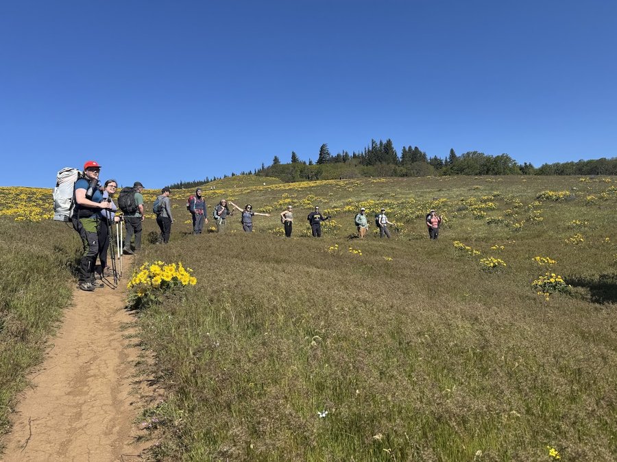
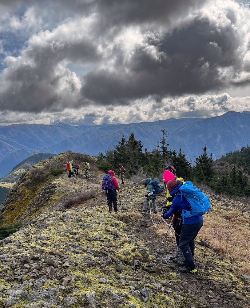
Crooked River National Grasslands Pinnacles
6 miles of hiking • 1500' elevation gain •
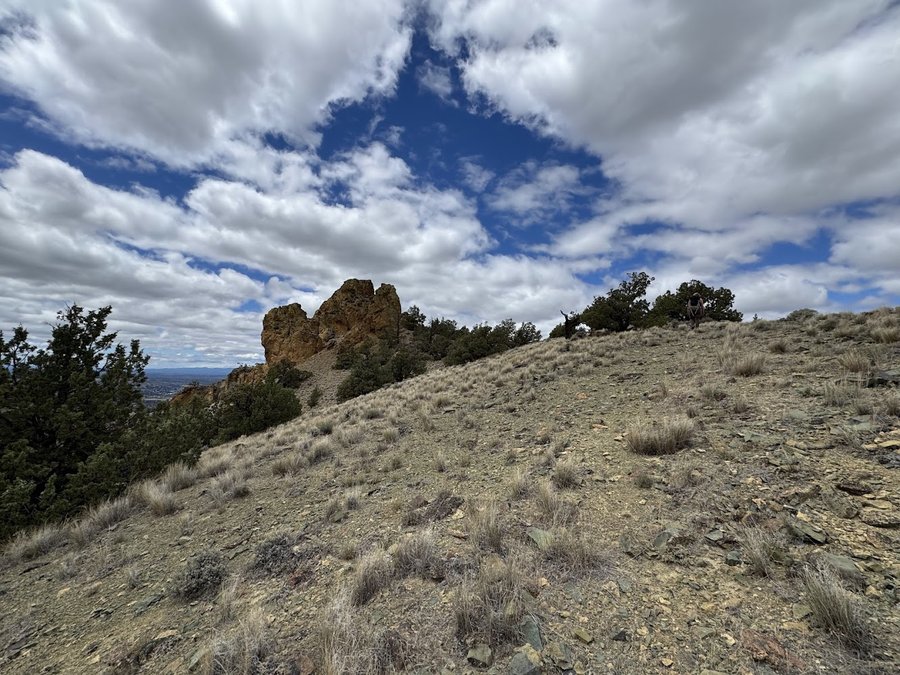
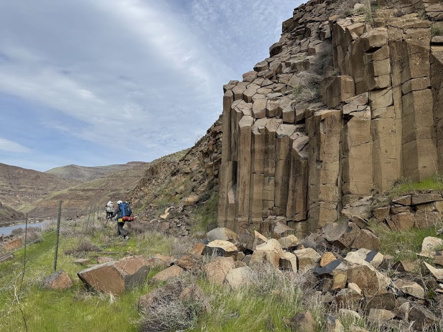
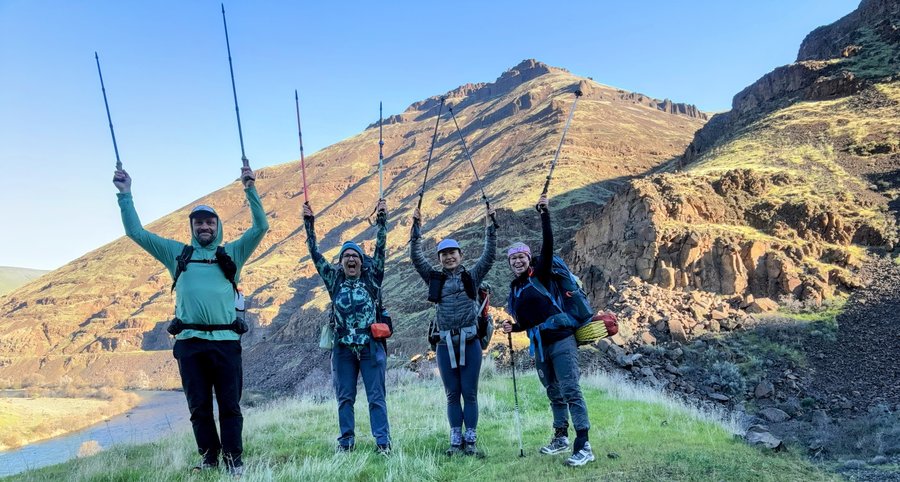
As you drive south on 26/97 from Madras to Terrebonne, look east, just north of Smith. You will see several ridgetop pinnacles. This area is referred to as Mendenhall Ridge on Mountain Project. The biggest horn shaped tower has an offensive name, but I call it Picnic Rock. The precarious pinnacle with a narrow base has been called both Hanging Rock and the Poplar. Anyhow, because of our recent fun times climbing towers in Sedona, Melinda and I decided to explore them and consider climbing them. We carried our climbing gear- rope and trad rack, making our packs heavy-good training for our upcoming objectives.
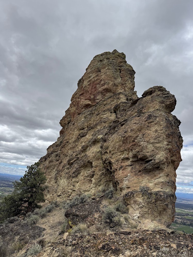
The weather was lovely and we enjoyed the desert rambling. Got to Picnic Rock and examined a potential two pitch route to the summit using a crack system that looked decent for taking gear, but the rock was suspect. We wondered why there was no mention on MP as this was the most prominent of the pinnacles in the area (We later saw that it was well documented with several routes in the Watts Guide). Chickened out on the climb, but enjoyed our lunch here.
We then sidehilled over to the adjacent ridge to examine the routes on " The Poplar and The Sapling". These look so cool from a distance, but up close- not as aesthetic. We were getting hot and tired, and the chimney on Poplar was full of bird poo, so we decided to skip it and just hike out. We need one of them testosterone laden rope guns to lead this type o climb.

June 28, 2026

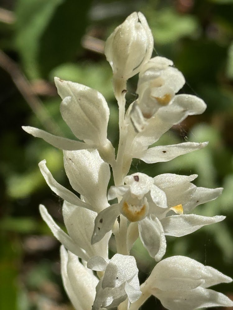
Dog Mountain
6.5 miles of hiking • 2750' elevation gain •
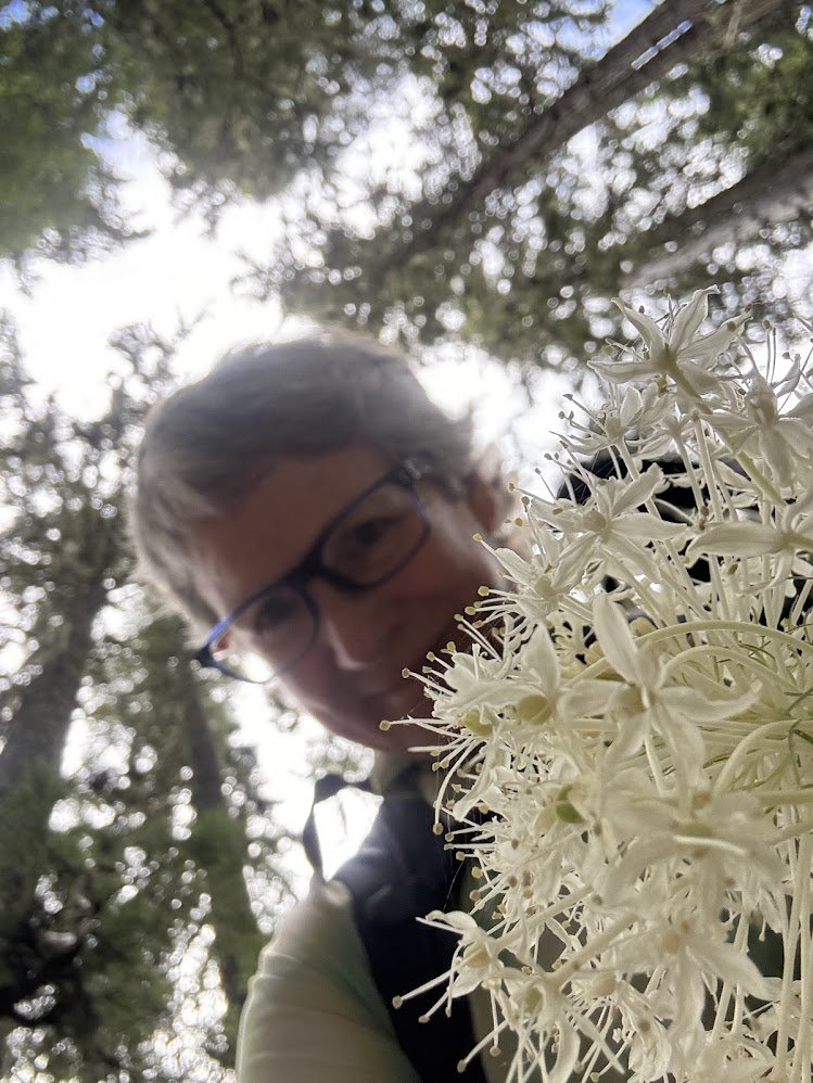
Quick sprint up the Dog. Balsamroot is done, but other flowers are out to enjoy,
June 24, 2026

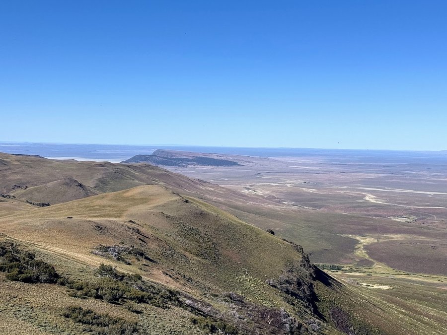
Great Basin Road Trip
25 miles of hiking • 5500' elevation gain • 3 nights
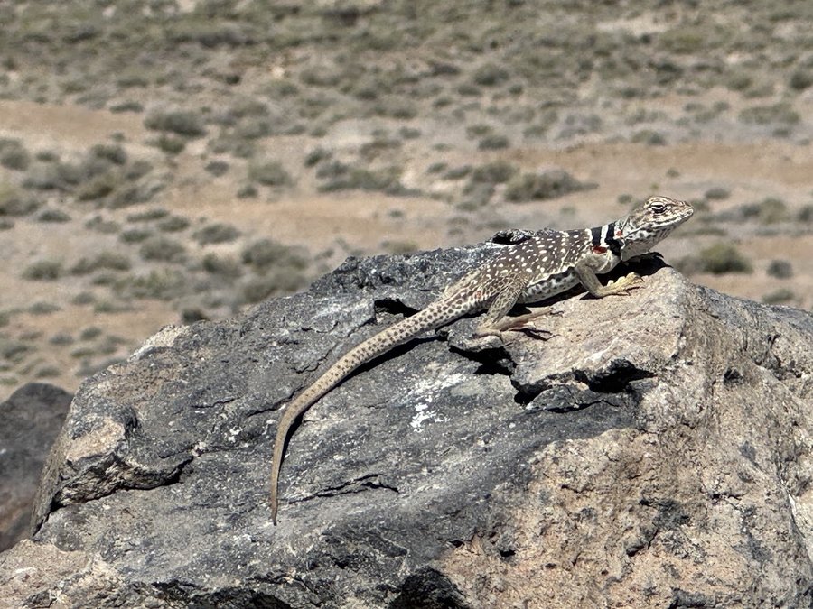
I had 3 days to get to Lake Tahoe for a climbing trip, so I decide to explore some desert peaks and look for petroglyphs in the Great Basin.
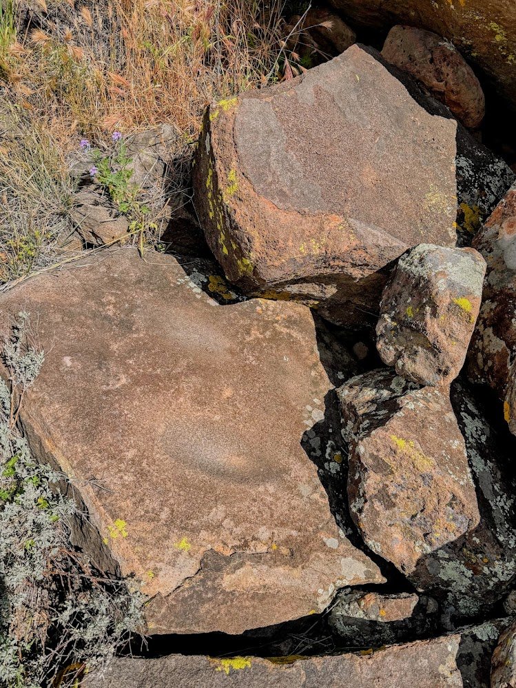
1) Diablo Peak. This is northeast of Summer Lake OR. Crossed a sand flat, then wandered up to the Diablo Rim. Stopped at Picture Rock pass to find a panel. 9 miles 1700 feet.
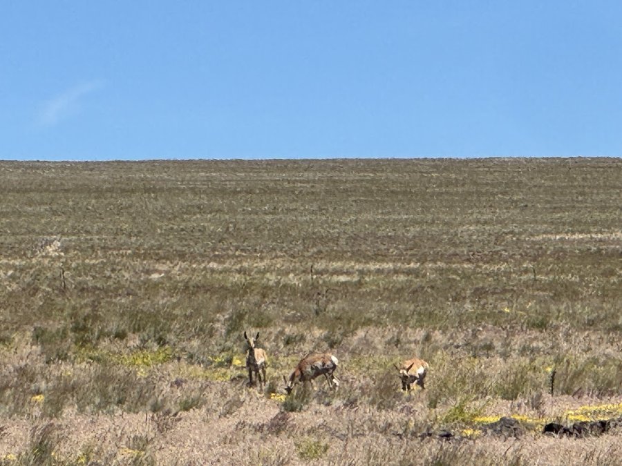
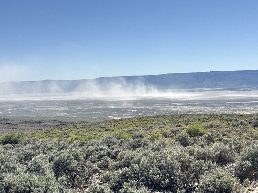
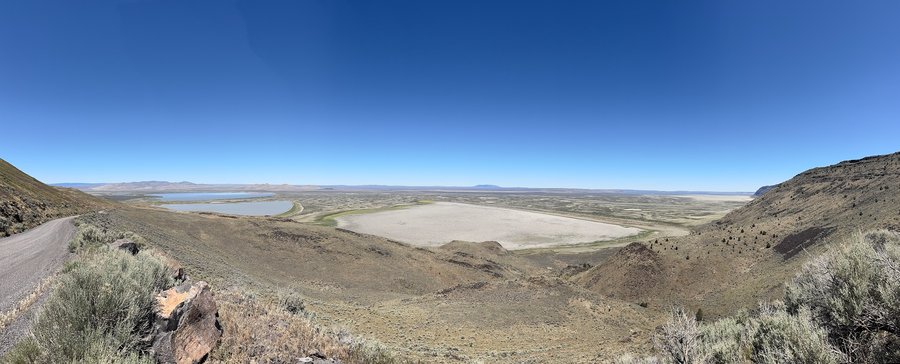
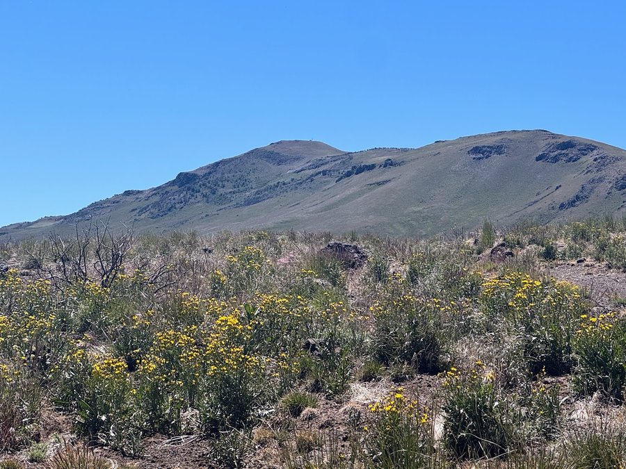
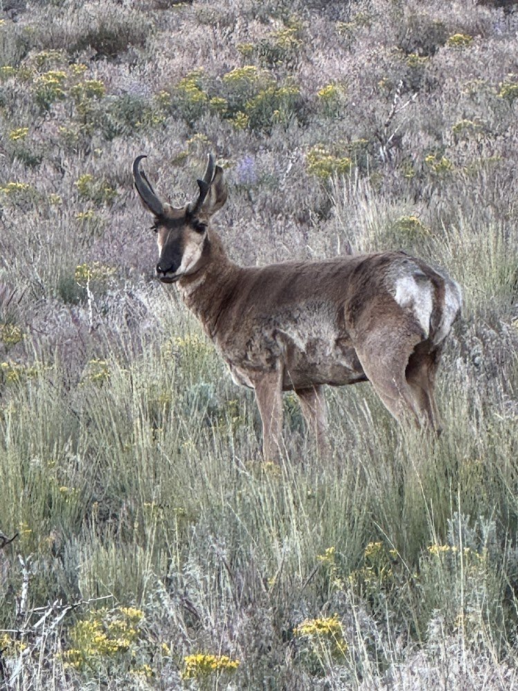
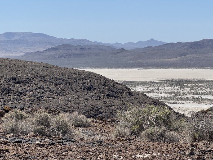
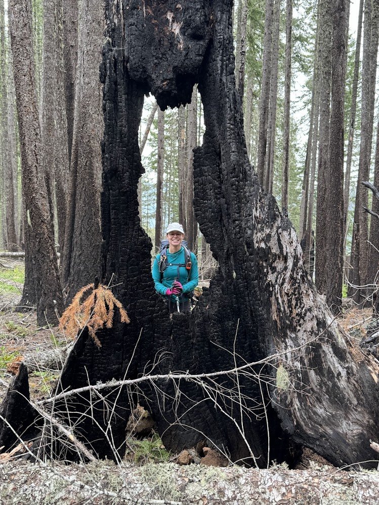
2) Warner Peak at Hart Mountain National Antelope Refuge. This was my favorite. Started from the Hotsprings campground. Saw plenty of jackrabbits. antelope and a huge flock of Franklin's gulls enjoying the updrafts. Walked Barnhardy road (gated until August) to a saddle below the peak. From there it was a steep scramble up the north side of the peak. There was a fire here two years ago. Some of the aspen and mountain mahogany groves have burned, but not all. All of the sagebrush bushes burned, and the whole area was now covered with knee to thigh high waving grasses and wildflowers. 10 miles, 2450 ft eg.
I meant to hike Pueblo Mountain, but it was just too hot when I got there at 10 am. Drove on to Nevada
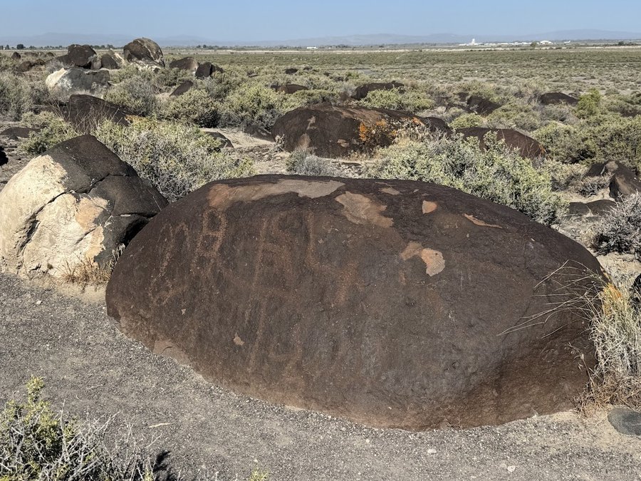
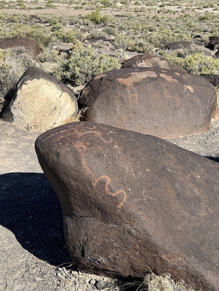
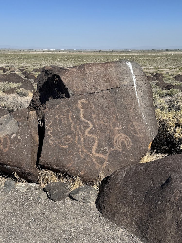
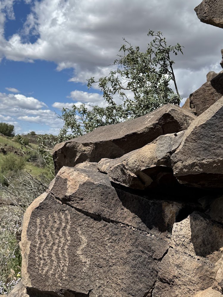
3) Grimes Point near Fallon NV- 6 miles, 1200 ft eg. Walked an interpretive trail, with many petroglyphs. Went beyond to adjacent ridges, and saw a few more. Sketched on a ridgetop looking out at the great basin topography.
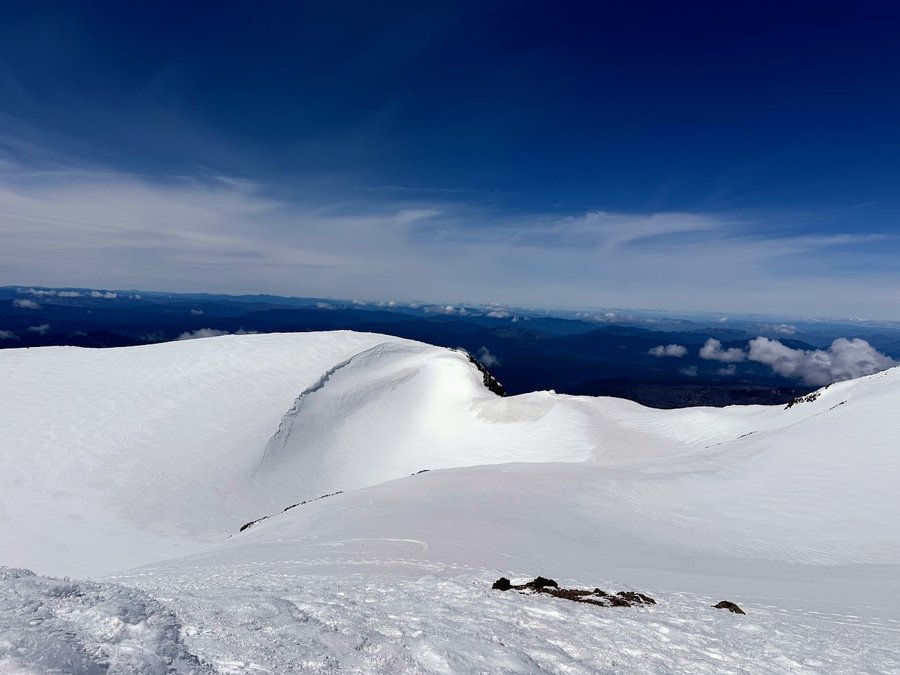
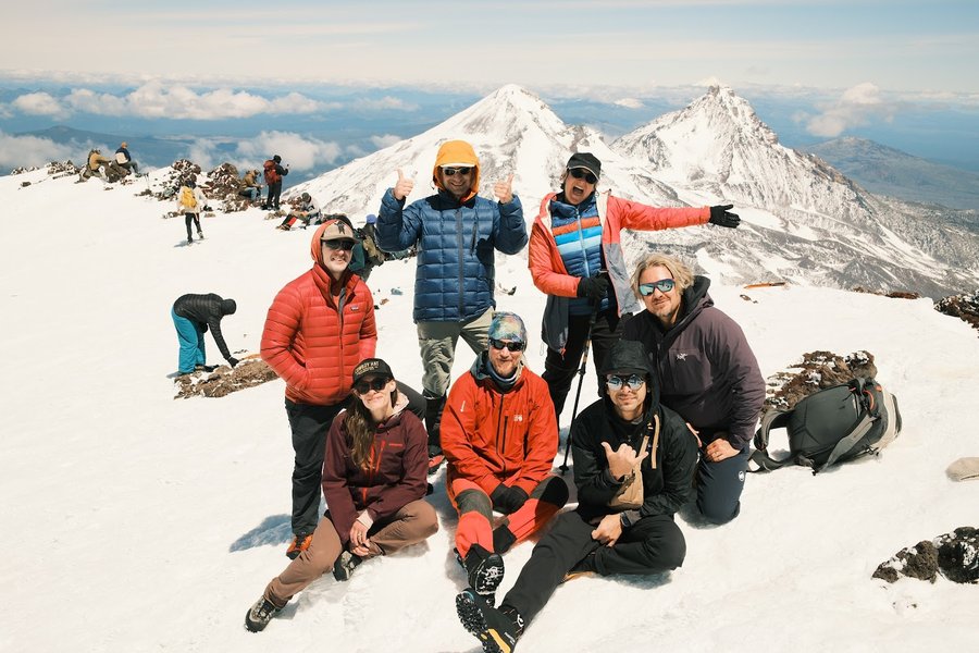
June 10 – June 13, 2026

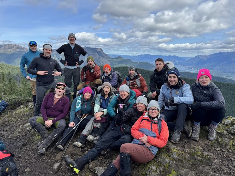
South Sister
12 miles of hiking • 5000' elevation gain •
Fun trip with the Mazamas up the standard south side route. Original plan was to camp at Green Lakes, then circle around to the north side, and ascend via Prouty Glacier, but the weather came in on Saturday, so we bumped it to a one day climb on Sunday. Weather was perfect!
June 7, 2026

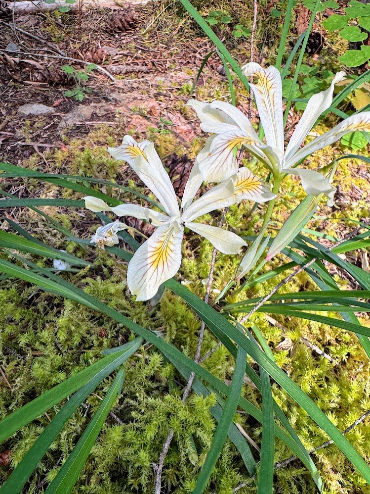
Hidden Lake Trail
5 miles of hiking • 750' elevation gain •
Nice little leg stretcher in the woods. Rhodies and beargrass are in bloom
June 3, 2026

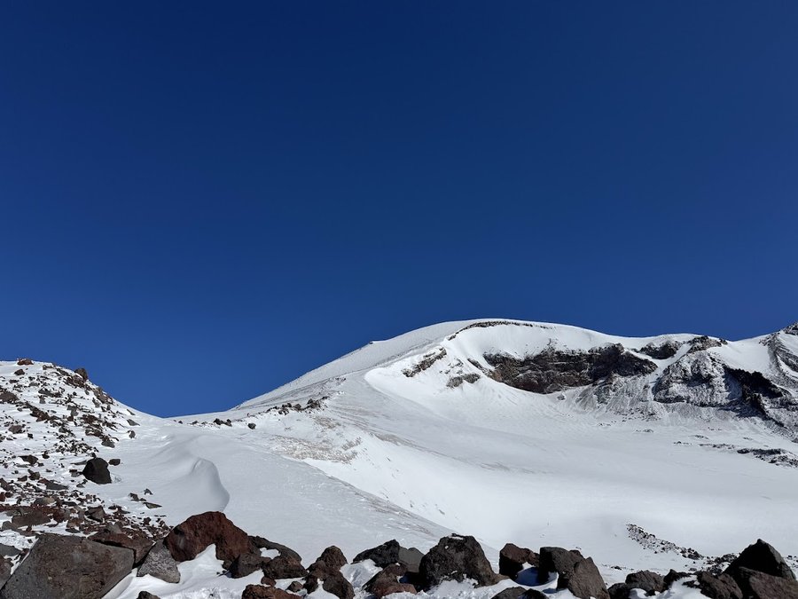
Steamboat Prow
12 miles of hiking • 5500' elevation gain • 1 night
First Mazama lead of 2026. Steamboat Prow (9700 ft) is a peak on the east side of Mt Rainier near Camp Sherman. We hiked in to the Glacier Basin back country camp and had the place to ourselves. What a pleasant evening watching the marmots frolic in the nearby meadow and the clouds roaming around the mountaintop. Woke up to goats grazing on the hillside, and nice stiff snow for ascending to our objective. The snow softened by noon for some long glissades back down.
May 29 – May 30, 2026

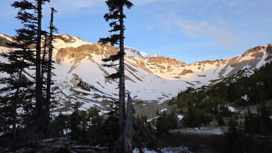
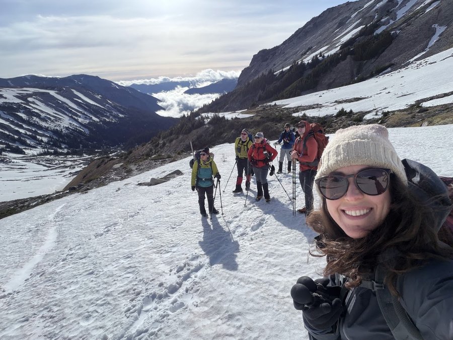
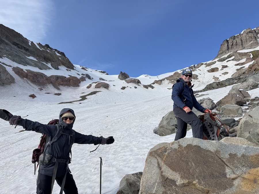
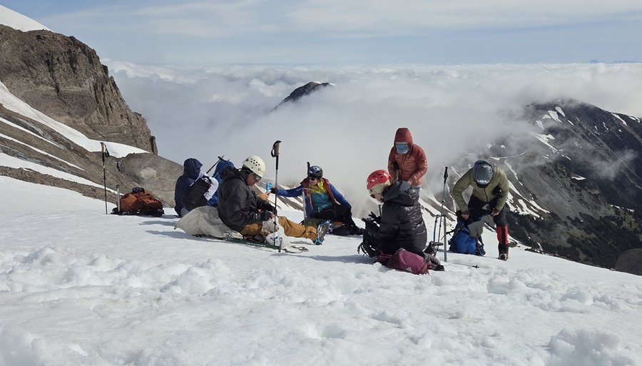
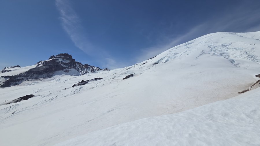
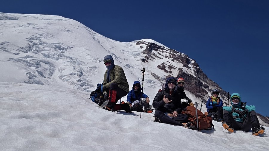
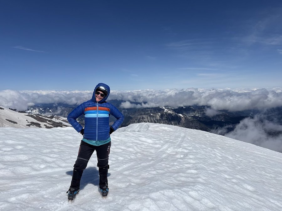
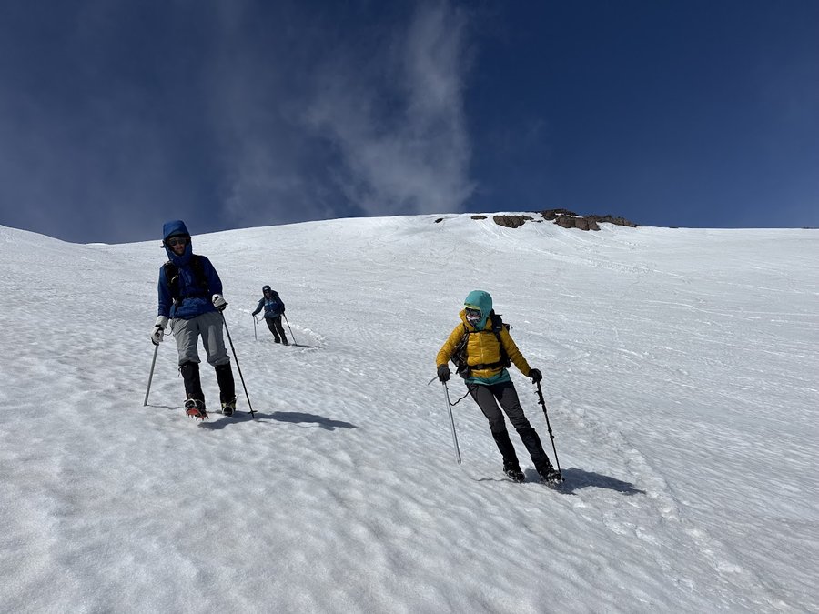
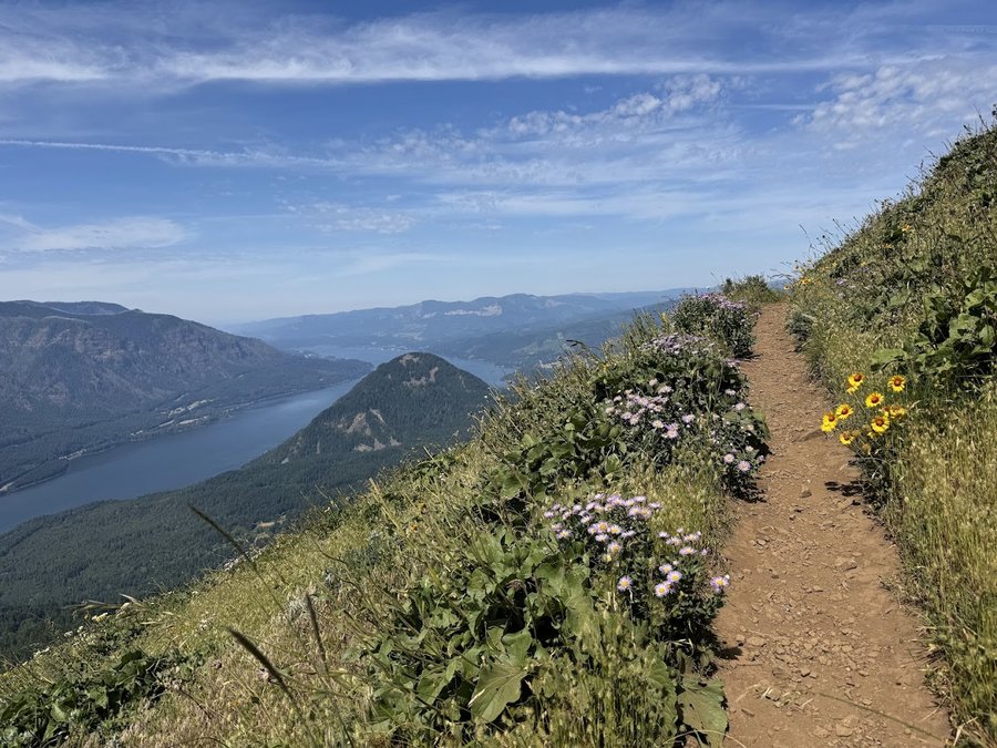
Table Mountain
9 miles of hiking • 3250' elevation gain •
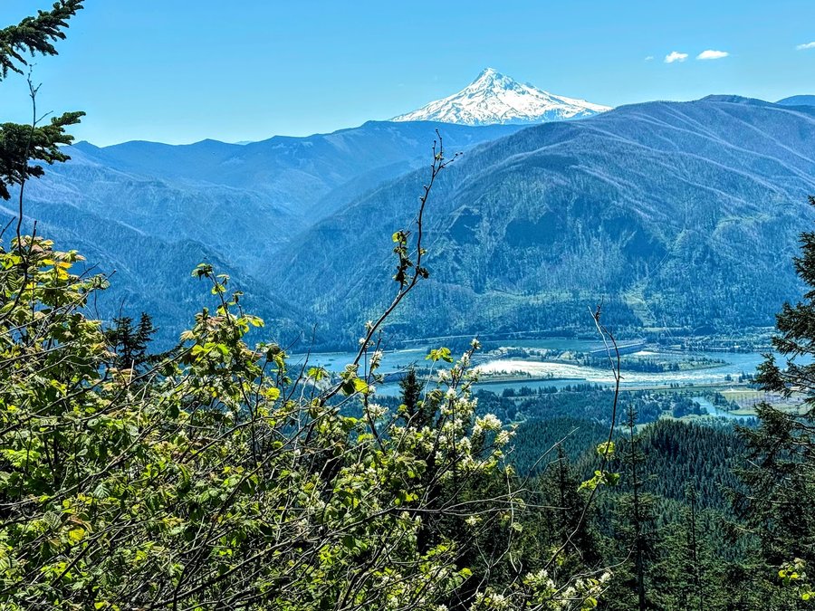
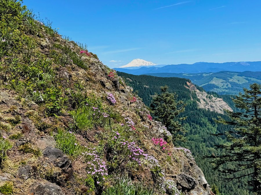
Started from Bonneville Hot Springs. Trails are in great condition with lots of signs. Views and flowers were delightful, but the buggies are very active above 2000 ft. Had to keep moving.
May 21, 2026

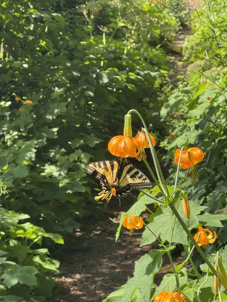
Lowder Mtn Area , Willamette NF
10 miles of hiking • 3500' elevation gain •
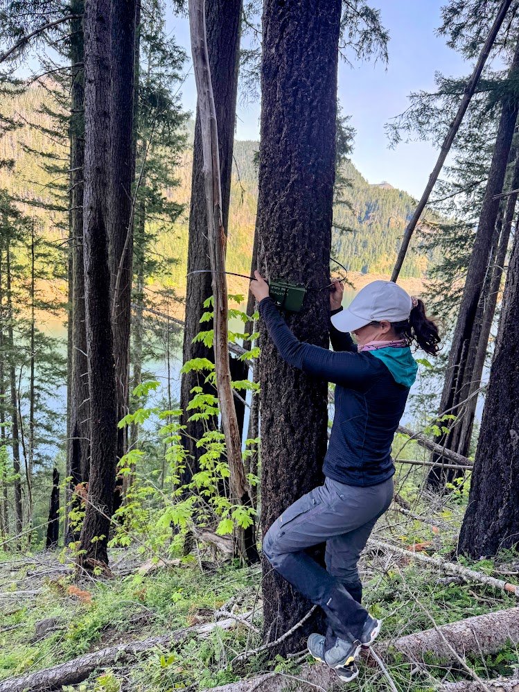
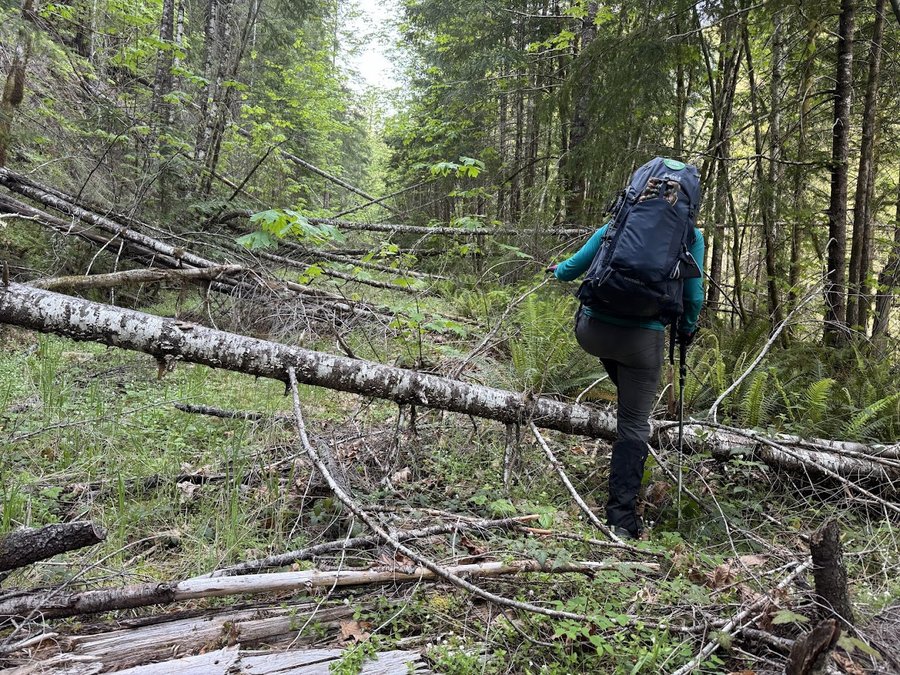
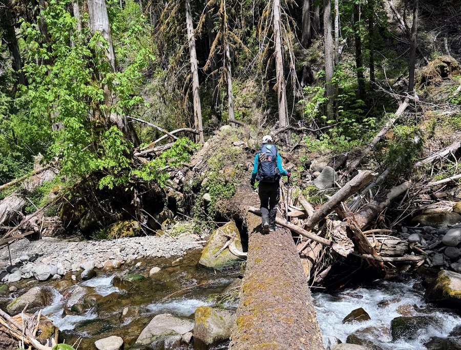
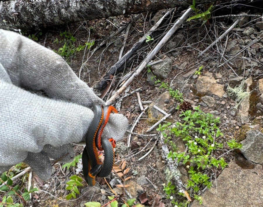
I was recruited by a friend to help place some acoustic monitoring devices for songbird data collection. The trails in this area have been abandoned, and hit by the Holiday Farm fire of 2020. Although we didnt cover many miles or eg, it was strenuos bushwacking for all four placements. Slightly ridiculous but also fun in a type 2 way.
May 9, 2026

Ruckels
5 miles of hiking • 750' elevation gain •
Attempted to go up Ruckel Ridge, but the PO is pretty bad after Buck Point so I turned around. There is a large landslide (likely from the December river of atmosphere event) onto the paved gorge trail just west of Ruckel Creek, but there is a well worn workaround footpath. The Ruckel Creek trail is still closed with a piece of fence and do not enter sign at the start. This is infuriating, it's been over 8 years!
May 6, 2026

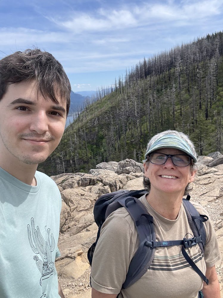
Angel's rest
4.5 miles of hiking • 1250' elevation gain •
Lucky Day- my son agreed to go on a hike with me!
April 30, 2026

April 25, 2026

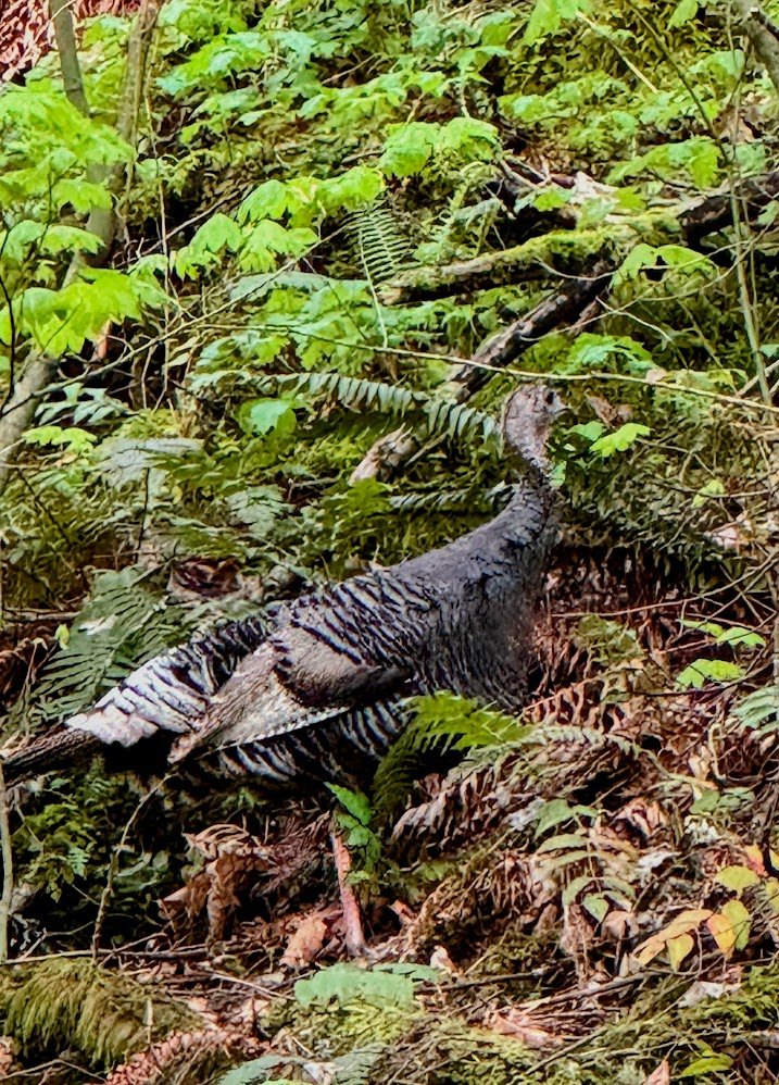
Bonneville Trails
6 miles of hiking • 1000' elevation gain •
Lovely Earth Day. Spring coming on strong. Enjoying more of the new trails around Bonneville. Got in some ridiculous bushwacking too, looking for a quarry marked on the map. No trace of the quarry visible, but I did have a wild turkey encounter.
April 23, 2026

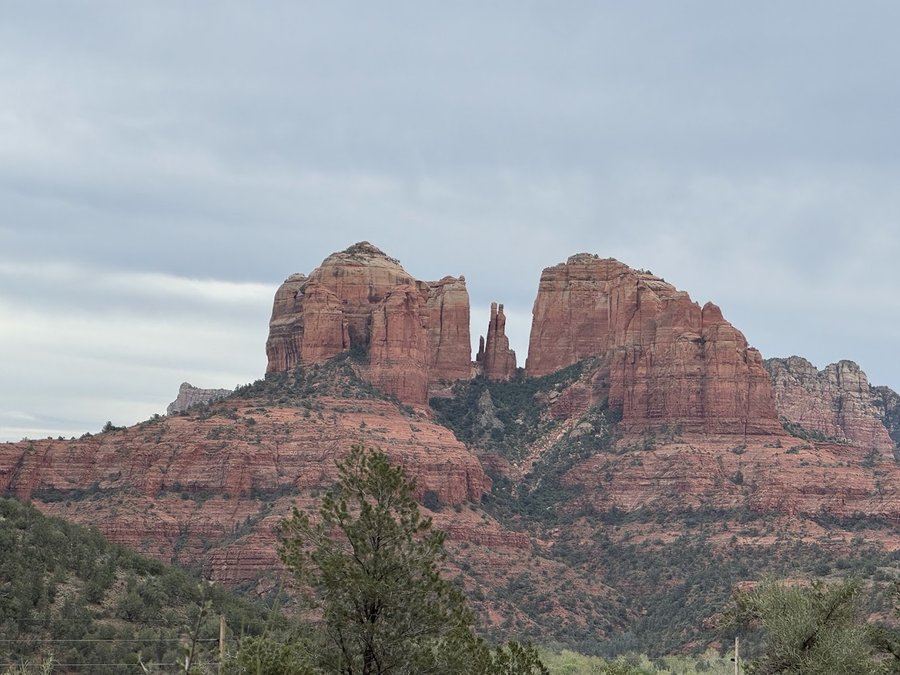
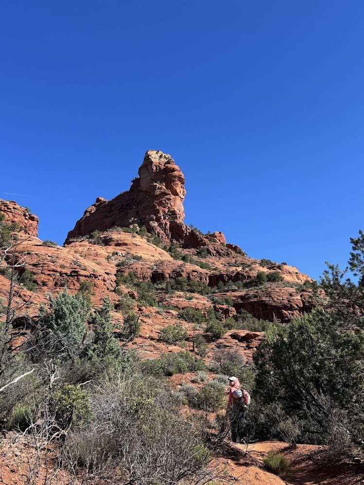
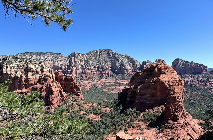
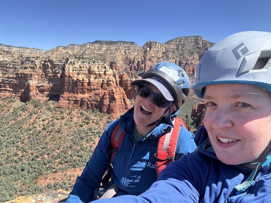
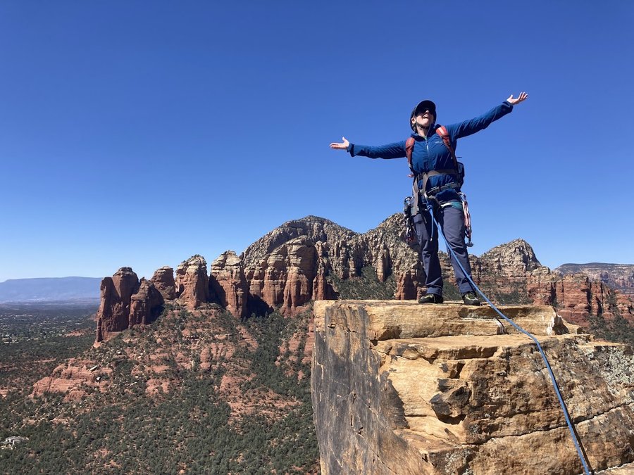
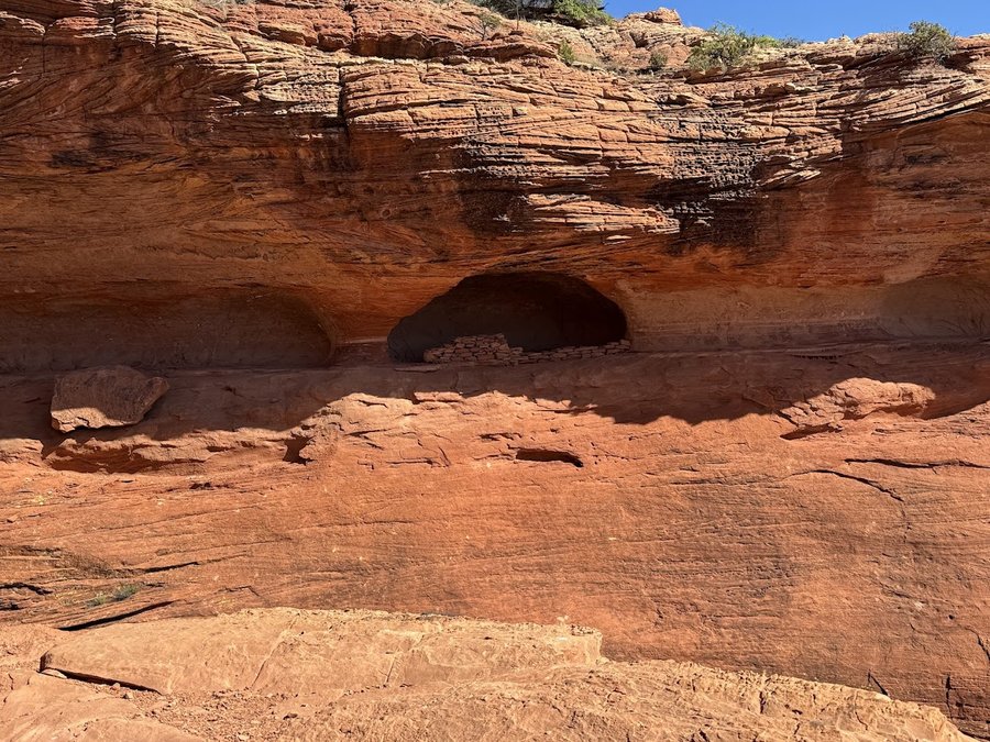
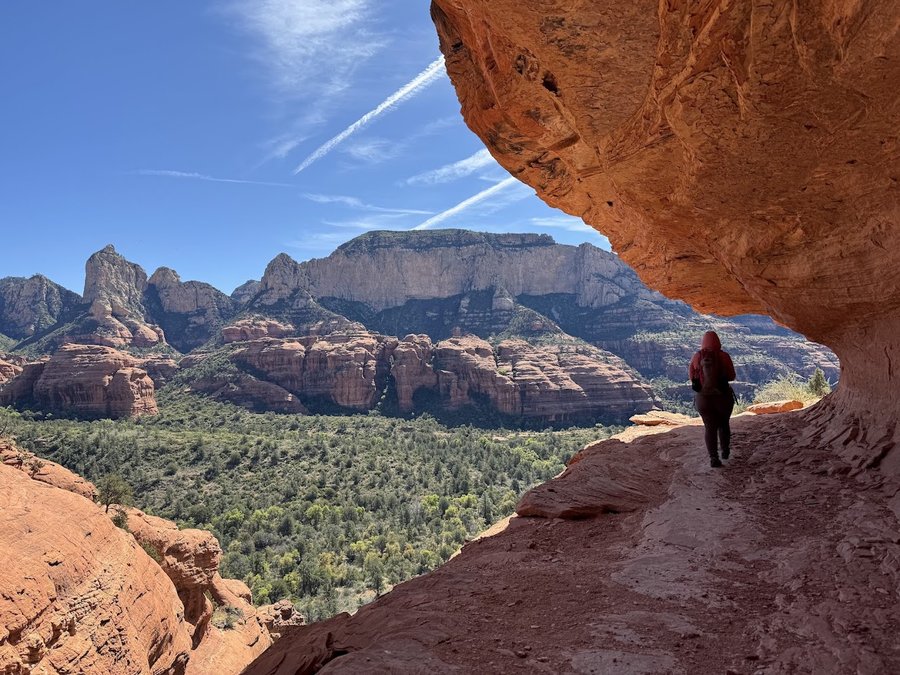
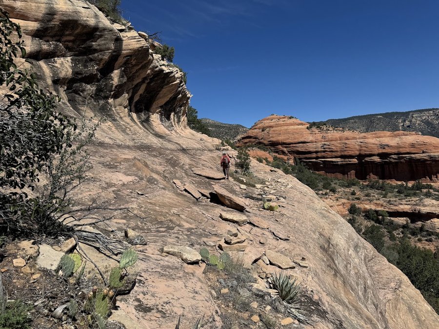
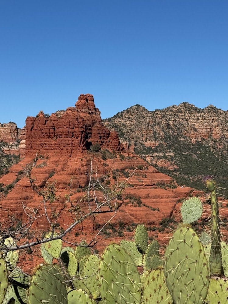
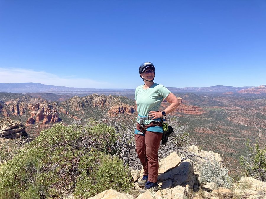
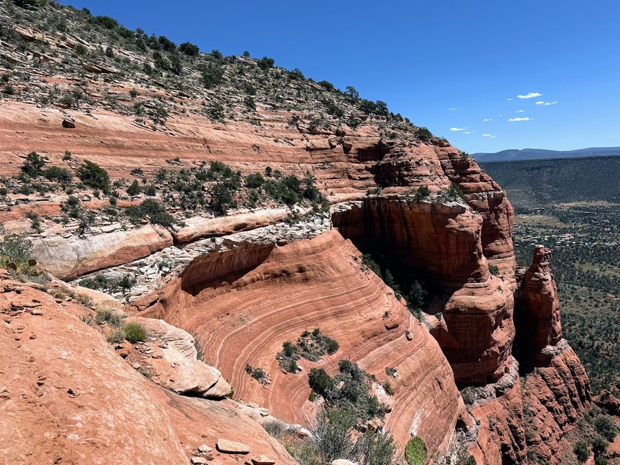
Sedona
22 miles of hiking • 4500' elevation gain •
Trip to the Arizona desert.
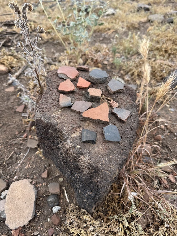
Day 1- visited Perry Mesa in the Agua Fria National Monument. This plateau has 7 or 8 pueblo ruins and many petroglyphs. I visited Pueblo La Plata, then ventured onto rugged roads toward Baby Canyon. Maybe I took the wrong road, because my rental SUV could not handle it. So I stopped and just headed down a side canyon and found some petroglyphs and a double metate!
Day 2- Cragging in Sedona- did several routes on Fun Ship, getting acquainted with the sandstone.
Day 3 we climbed Morning Glory Spire- what a thrill!
Day 4- Loy Butte hike/scramble. Probably the coolest thing we did. Loved the slots and ledges, and visited some delightful hanging cliff ruins.
Day 5- Courthouse Butte this was a prickly scramble with a bit of climbing up a huge butte. It was hot, I bonked for a little while. Spectacular location though.
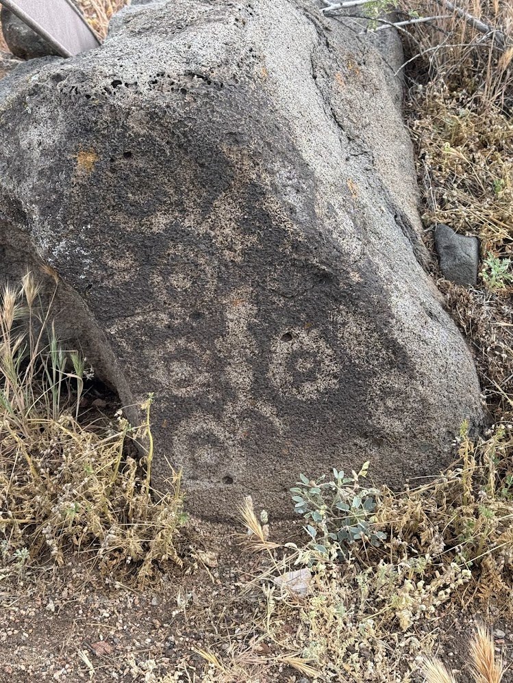
Day 6 Crane petroglyph site and Wet Beaver Creek. We visited the stewarded site, then hiked up the creek. It's more fun to stumble upon the ancient rock art in the wild.
April 1, 2026

March 28, 2026

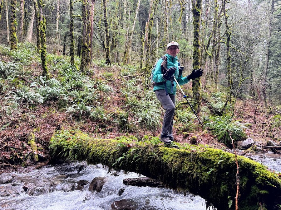
Lower Greenleaf
5 miles of hiking • 750' elevation gain •
Explored some of the new trails being built in the area. Lower Greenleaf Falls has had some big washouts since the last time I visited, including taking out part of a new trail.
March 27, 2026

Mack's Canyon
12.5 miles of hiking • 1750' elevation gain • 1 night
This was supposed to be a ski trip to the Tilly Jane Cabin. But there was thin cover and rain predicted, so we pivoted to the Deschutes! It's so beautiful here.
March 20 – March 21, 2026

Broughton
4 miles of hiking • 500' elevation gain •
Goofing around at Broughton Bluff. Walked the " Phone Home Boulders" Trail, and examined some of the crags.
March 19, 2026


January 23, 2026

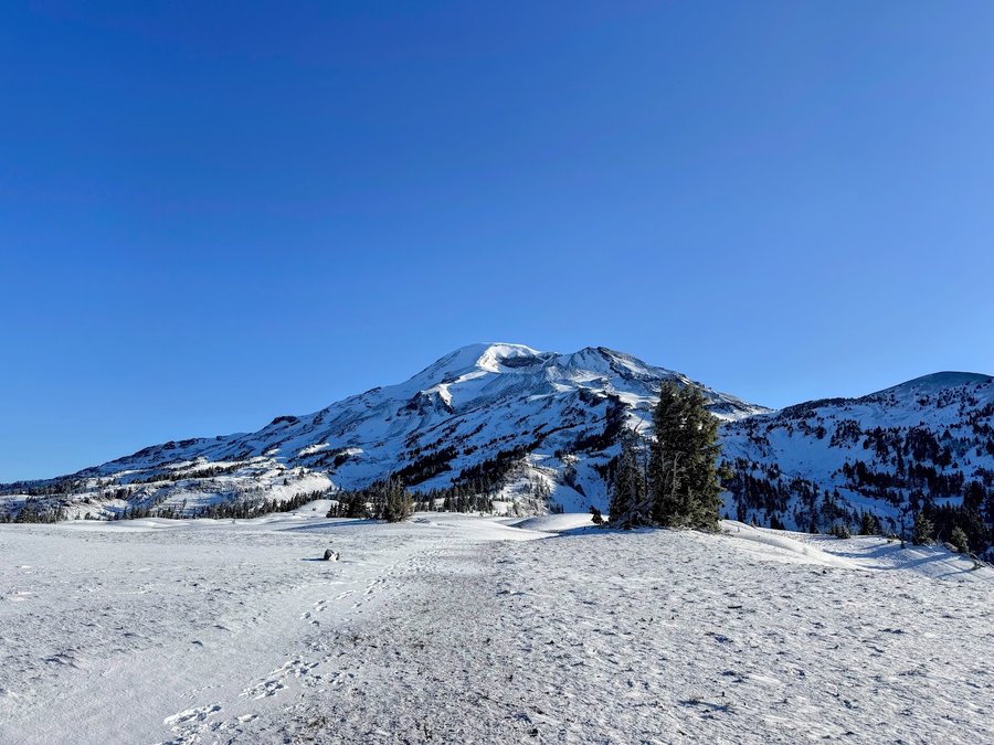
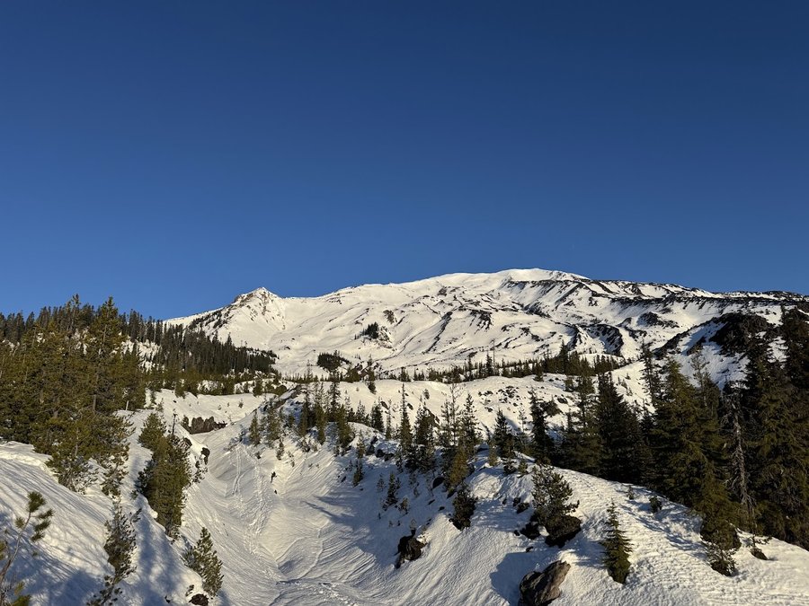
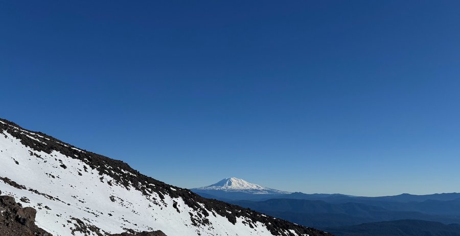
MSH
8 miles of hiking • 3000' elevation gain •
Beautiful sunny day. So warm. Lower mountain did not refreeze overnight. We forgot snowshoes. I thought there would be a good bootpack- nope. It was total mashed potatoes, posthole city, exhausting. Very thin coverage on the Worm flows, so we were able to scramble along the rock spine for a bit, but that was slow too. Then I tweaked my knee and became very worried about further injury, so we turned around. Stressful climbing down, but was such a pleasant view! Lesson learned.
January 15, 2026

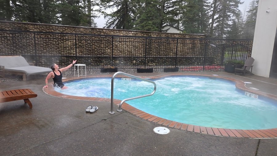
Cedar Falls
6 miles of hiking • 1250' elevation gain •
It was a rainy day so we did a short hike from Bonneville Hot Springs to the Cedar Falls overlook. Since the reopening of the Dick Thomas trail, the whole area has been resigned and well maintained. Look forward to going back and revisiting the trail system that has been hard to access for several years. Soaked at the hot springs afterward ( 25$ for 2 hours).
January 8, 2026

View trips from: 2011 2012 2013 2014 2015 2017 2016 2018 2019 2020 2021 2022 2023 2024 2025