


2019 Trips


 1
1
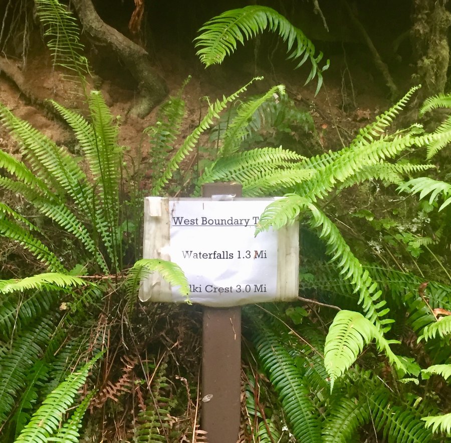
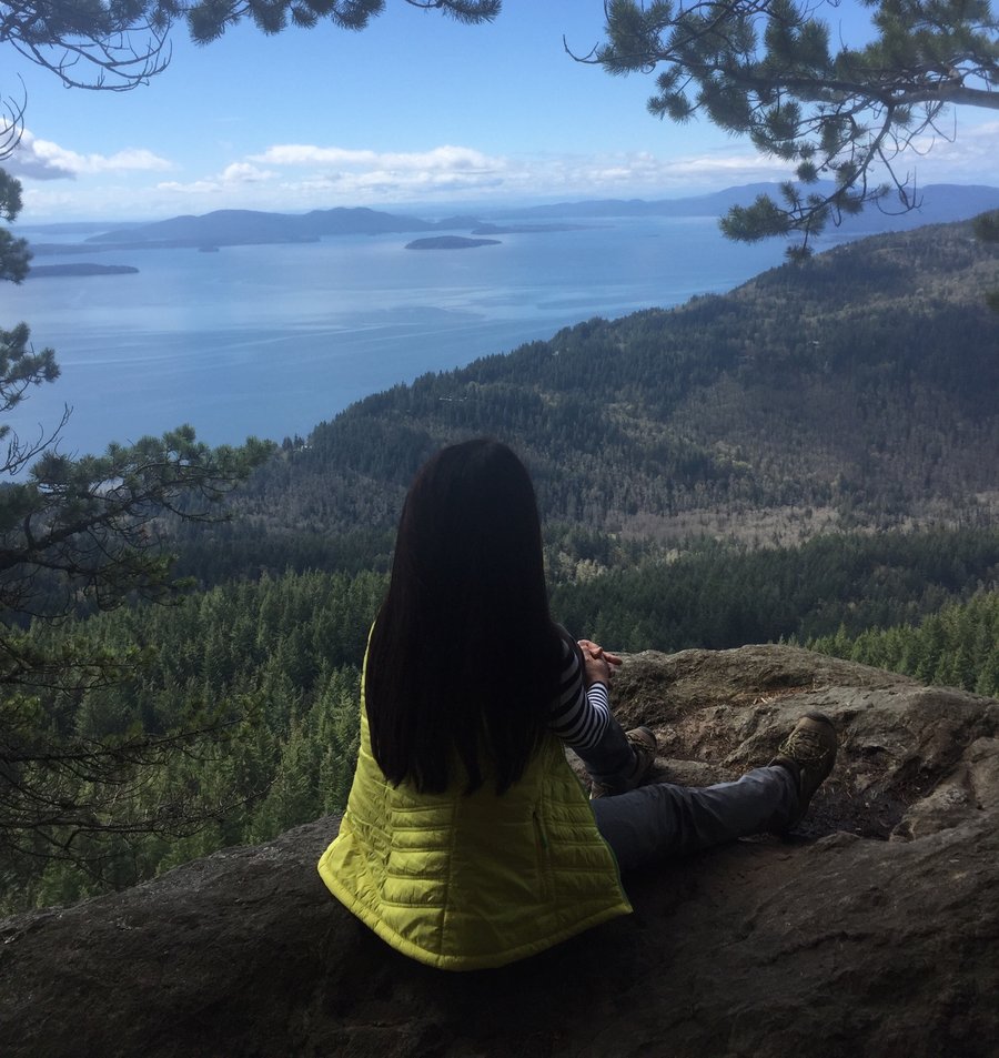
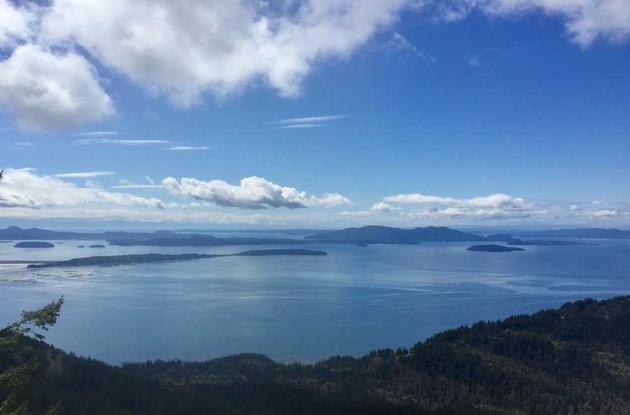
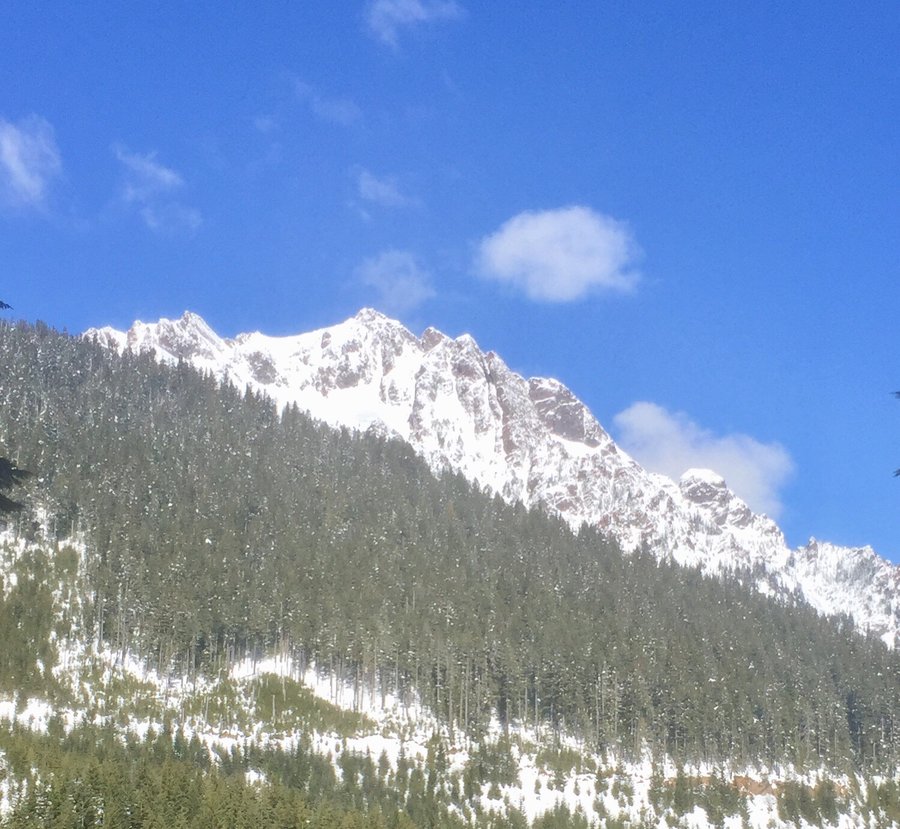
Tiger Mtn.--Poo Poo Point
4.18 miles of hiking • 1750' elevation gain •
Chirico Trail up to Poo Pop Point.
December 26, 2019

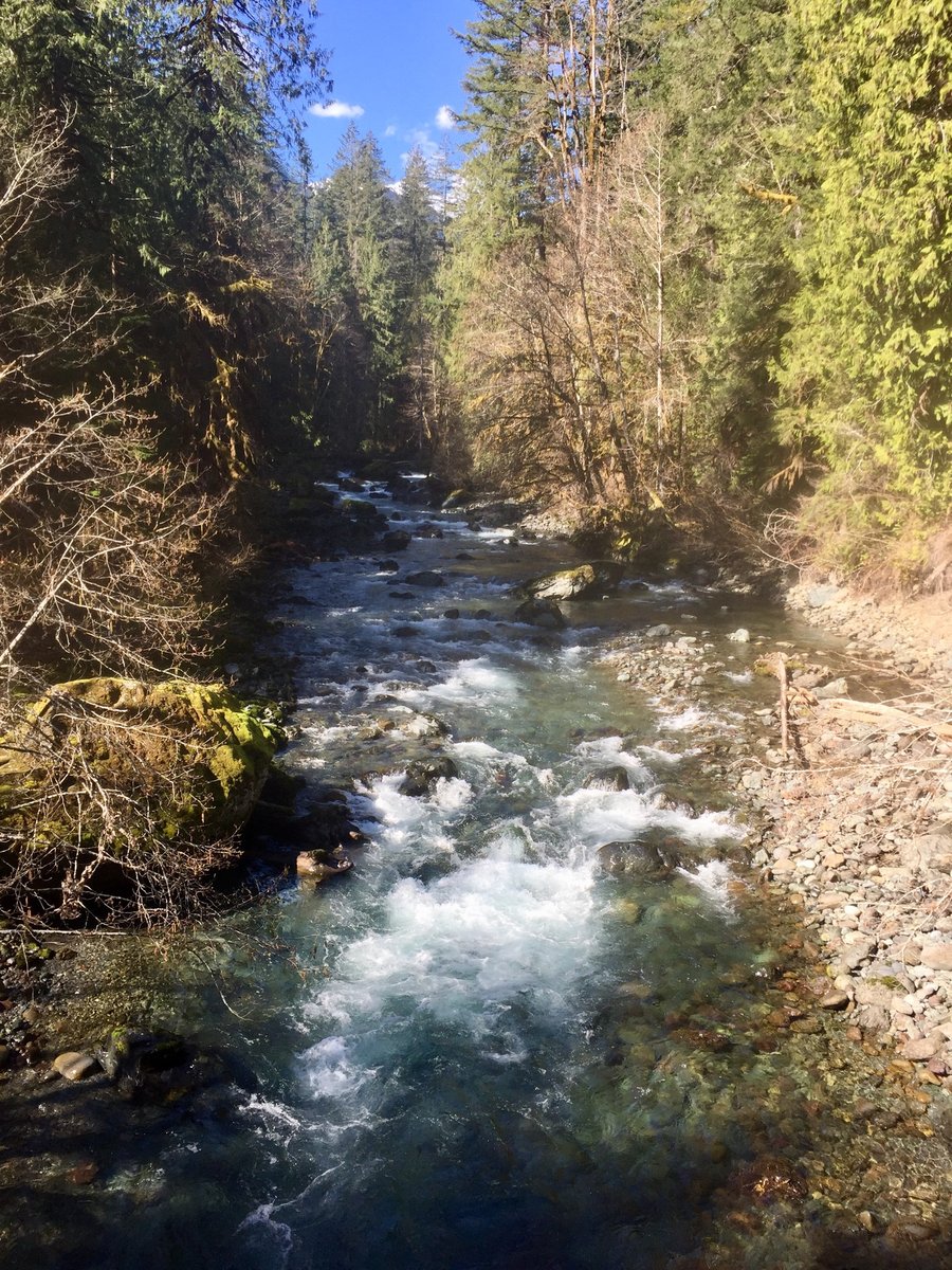
Pack Forrest
5.4 miles of hiking • 1250' elevation gain •
Hiked up to Hugo Peak and then The Trail of the Giants.
December 25, 2019

 2
2
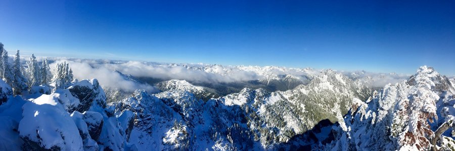
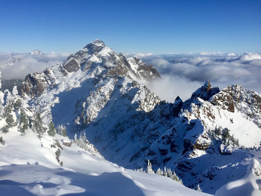
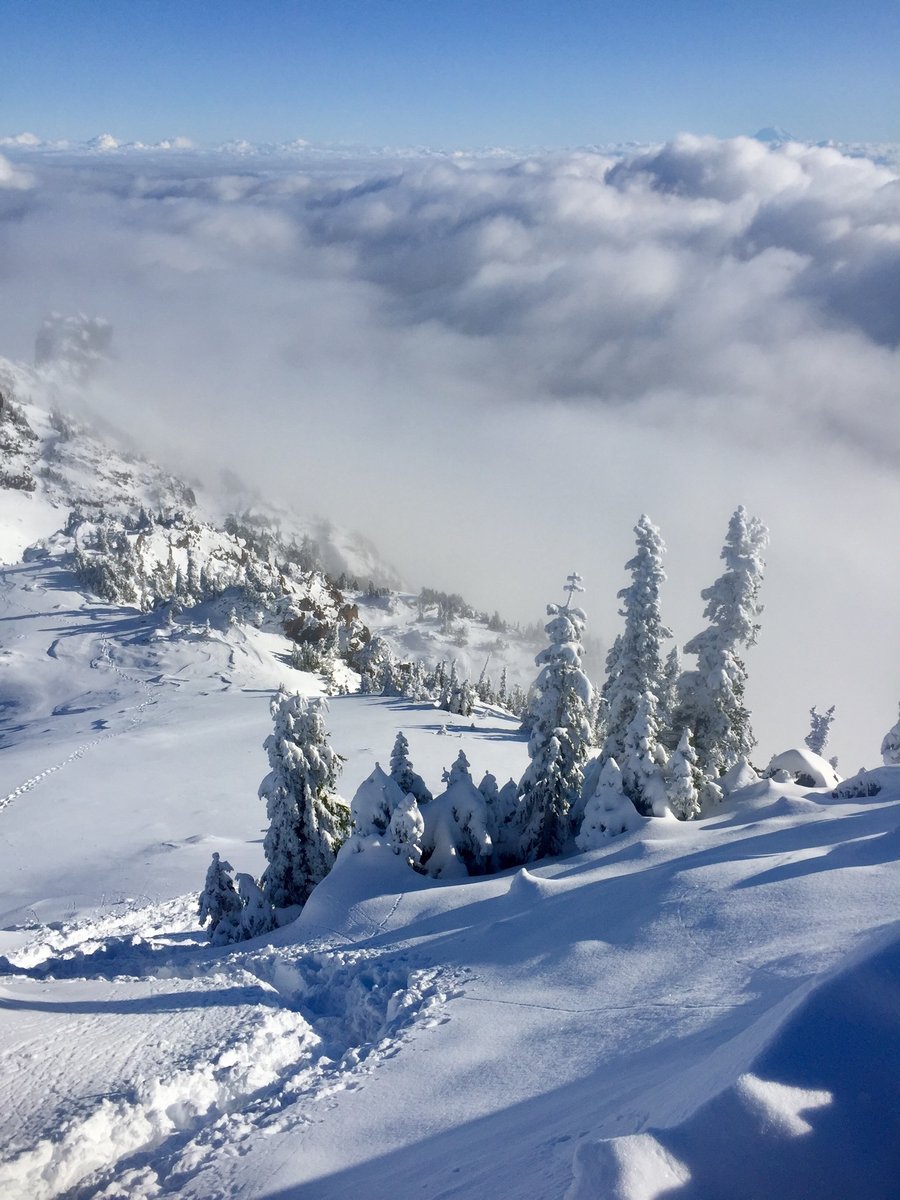
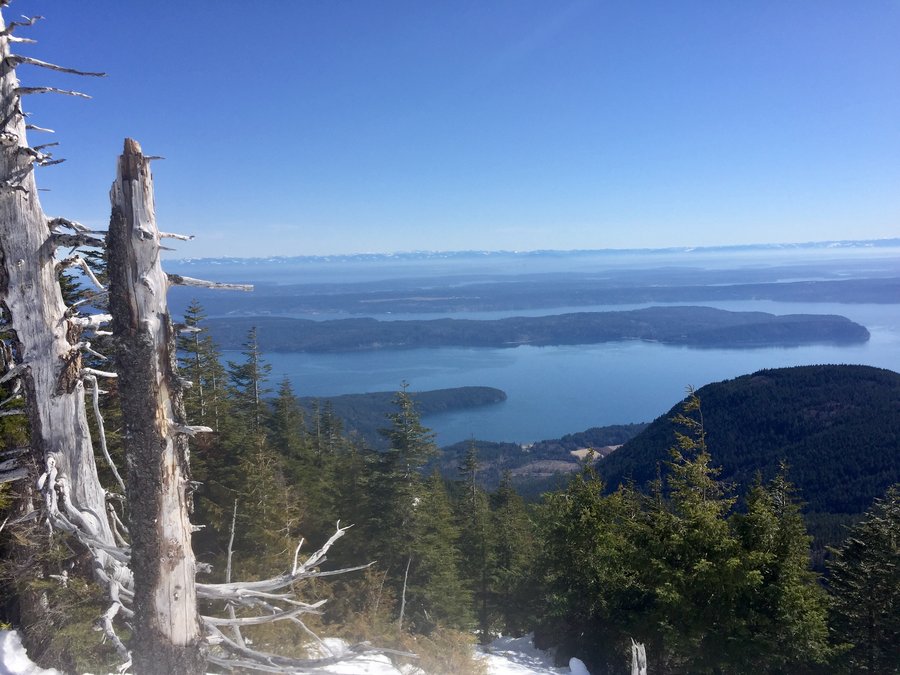
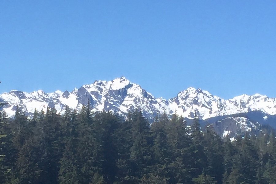
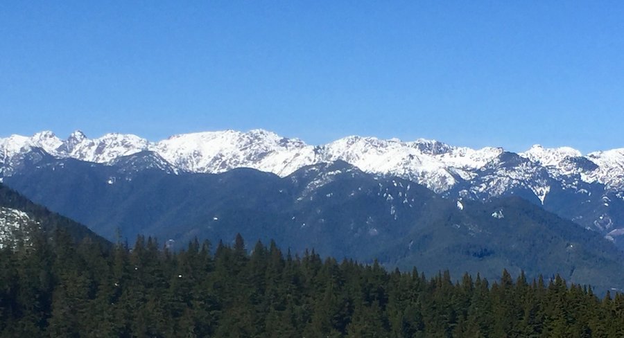
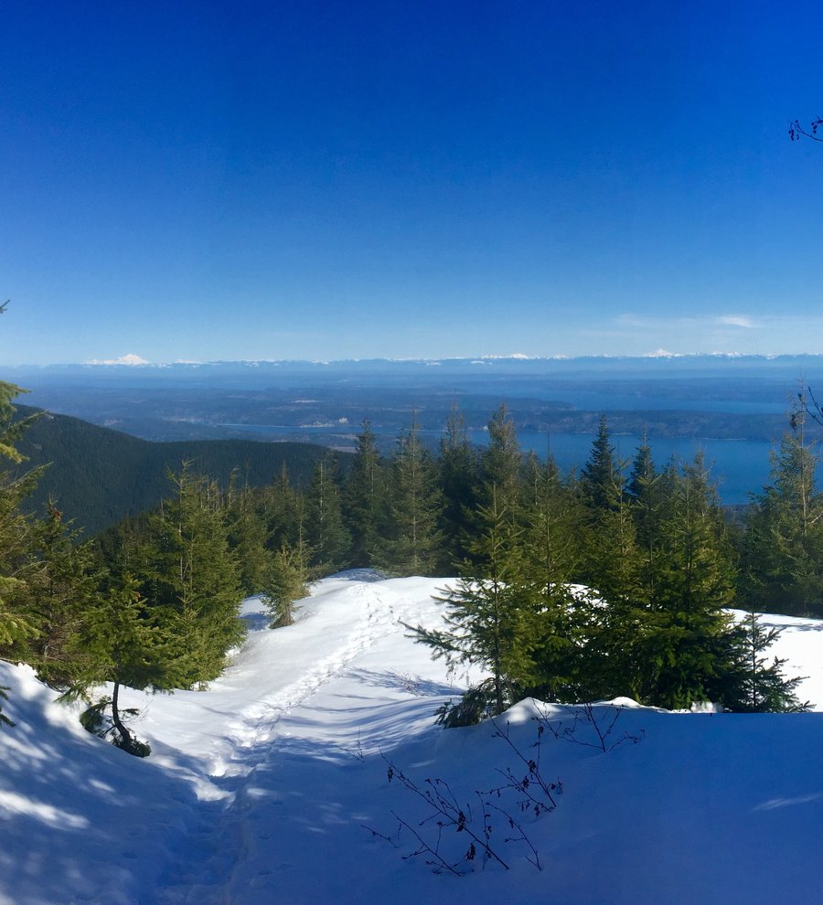
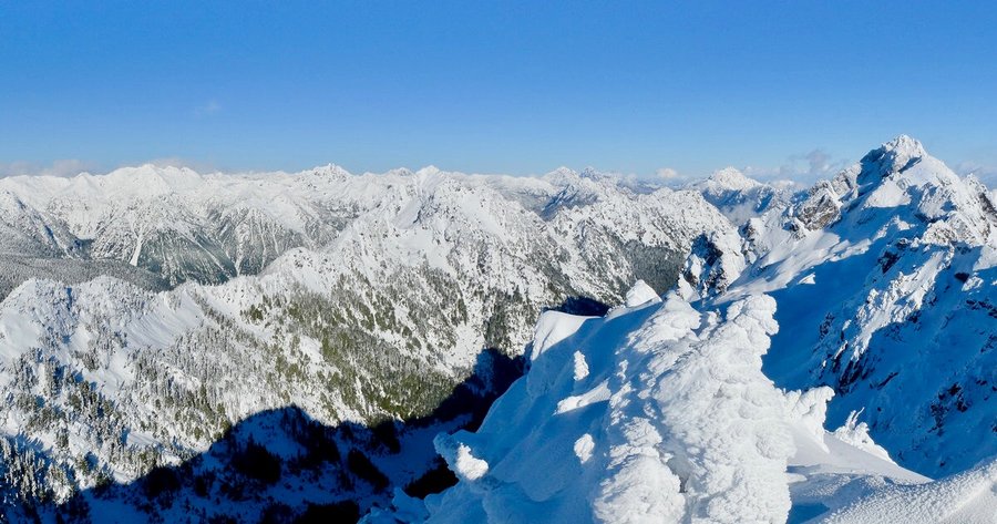
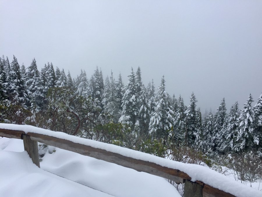
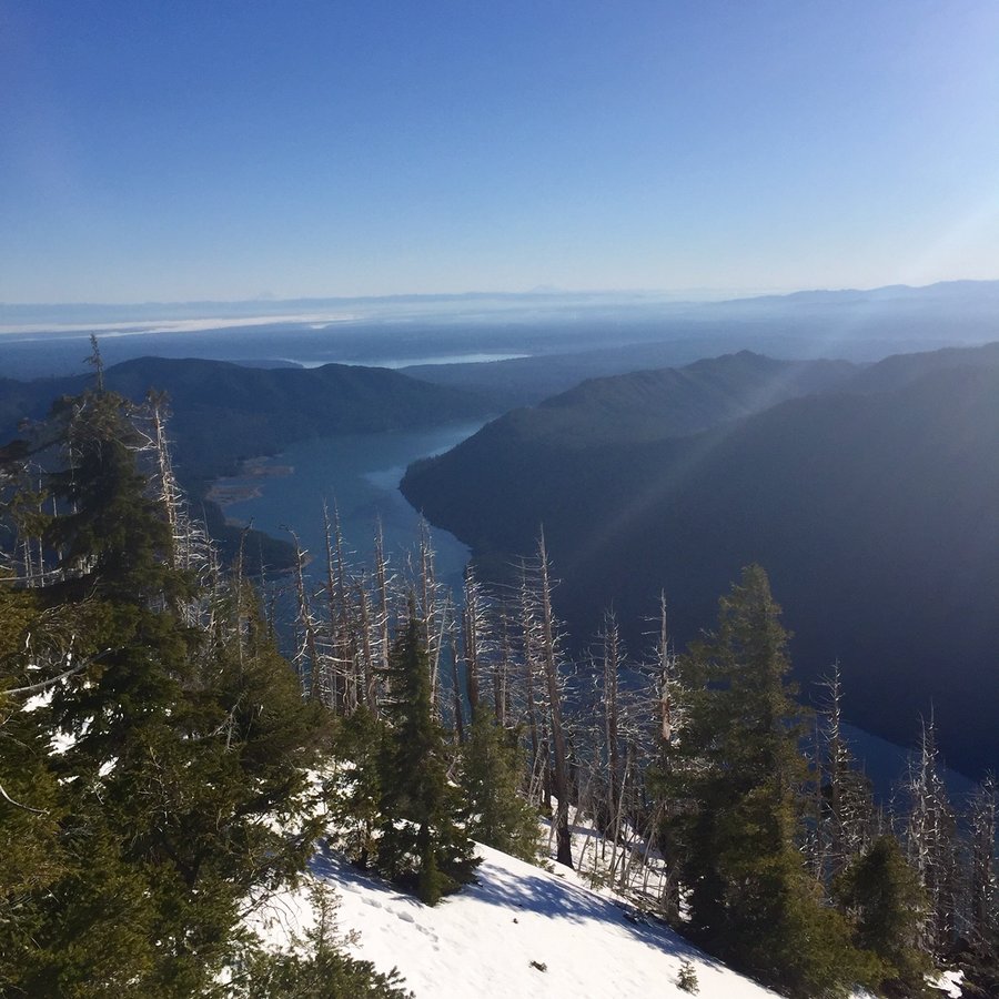
Mt. Ellinor
6.59 miles of hiking • 3250' elevation gain •
Started at the lower TH and snow begin a bit before the upper TH. That's where I put on the micro spikes. Was able to take the summer trail all the way to the summit.
December 15, 2019


 3
3
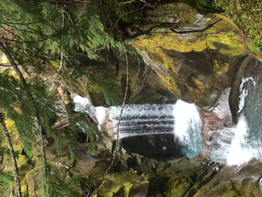
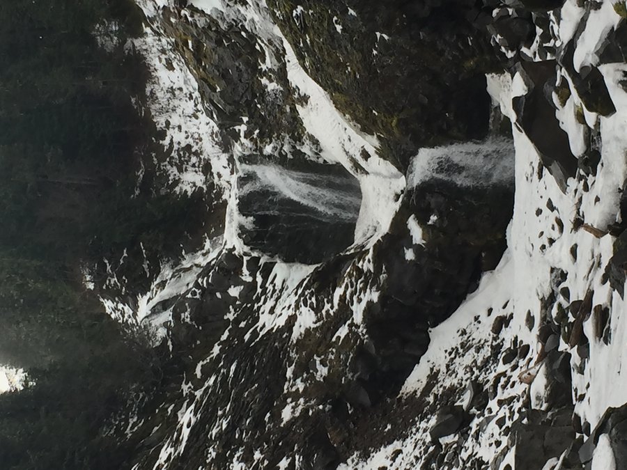
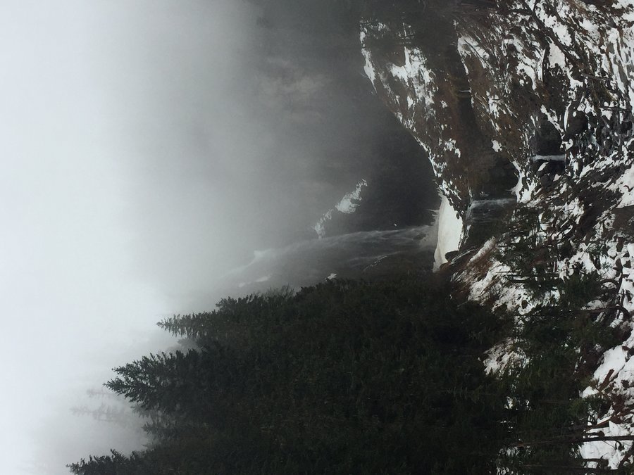
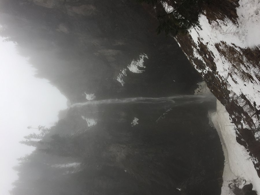
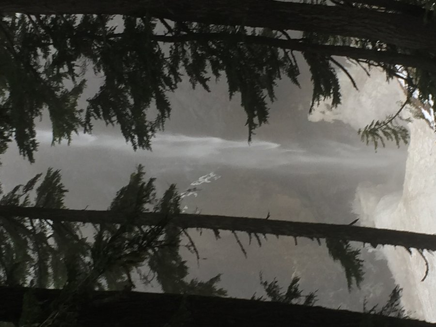
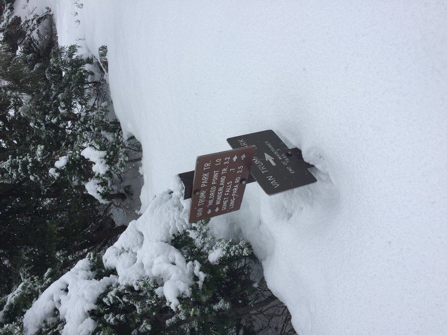
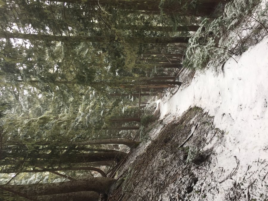
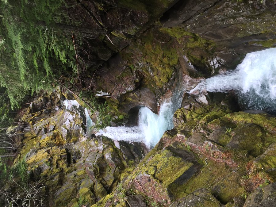
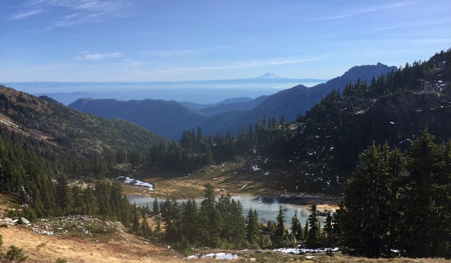
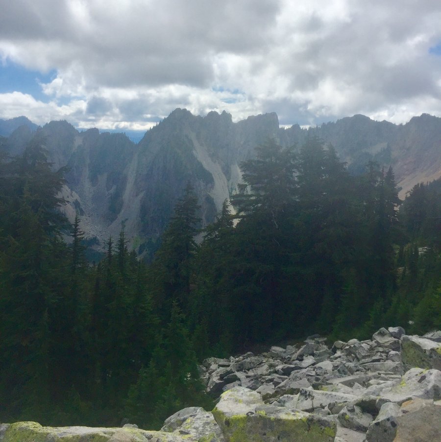
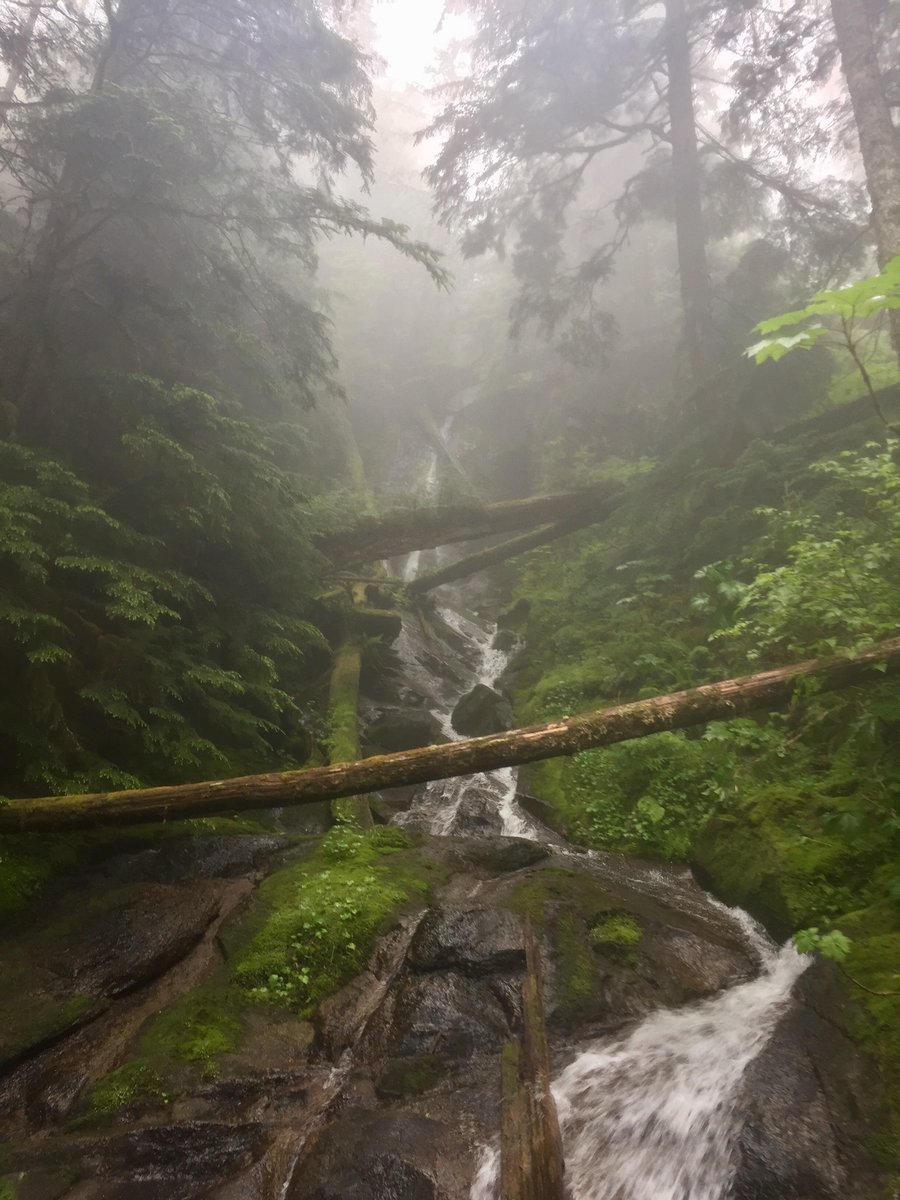
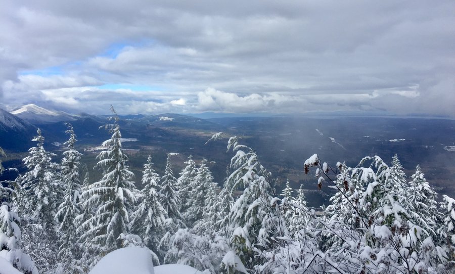
MRNP-Comet Falls & Van Trump Park
6 miles of hiking • 2250' elevation gain •
The hike to the falls is a nice hike on a foggy, drizzly day. Hike is mostly snow free which is odd for this time of season. Snow began in earnest a bit above the falls and and It looked like I was the first person to venture past the falls in a while as I broke trail pretty much to Van Trump Park.
December 9, 2019


 1
1
December 1, 2019
 1
1
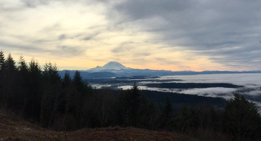
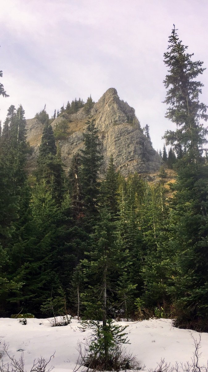
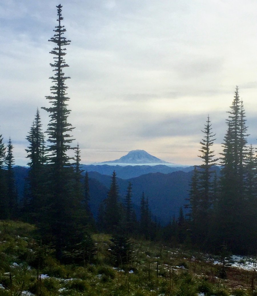
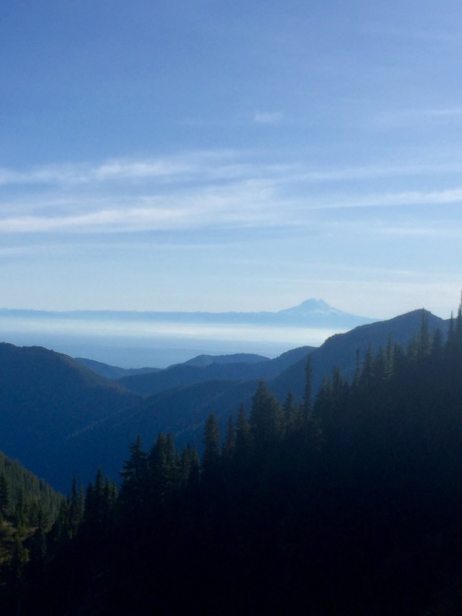
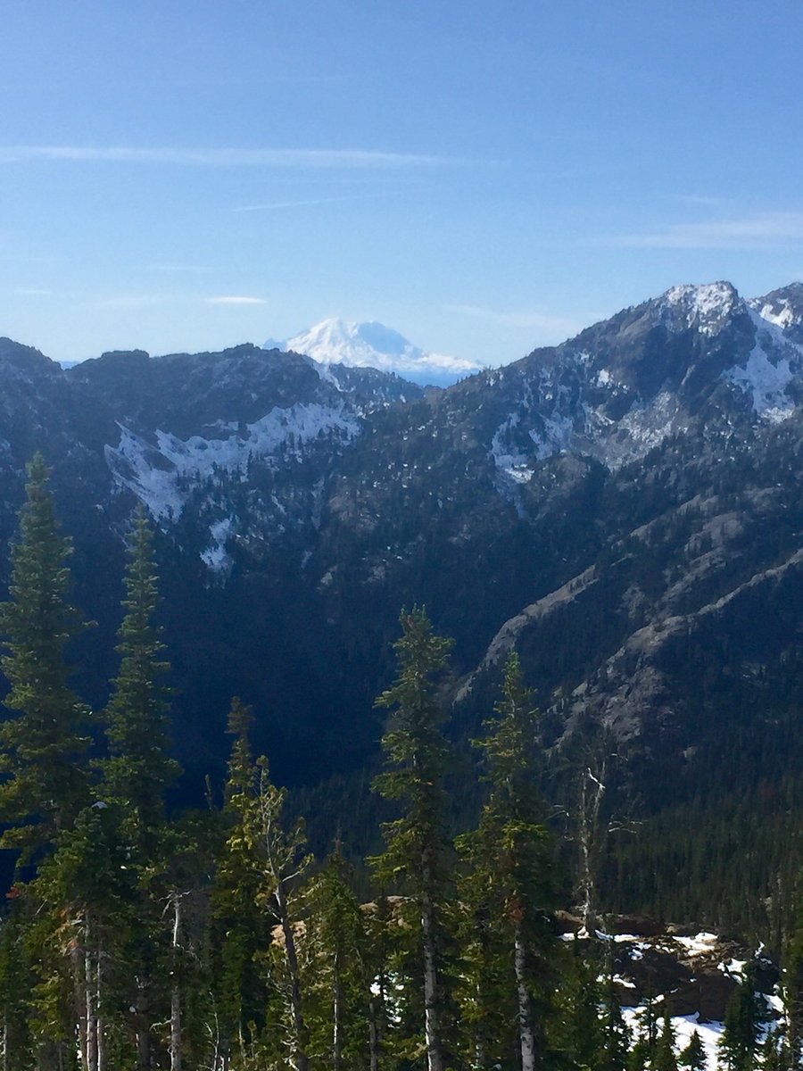
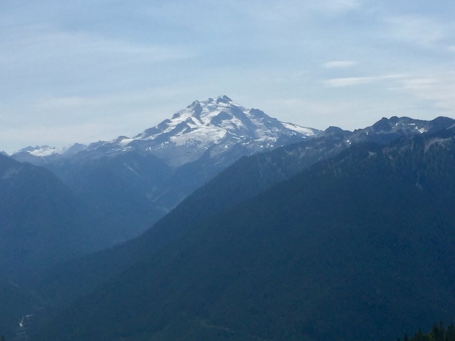
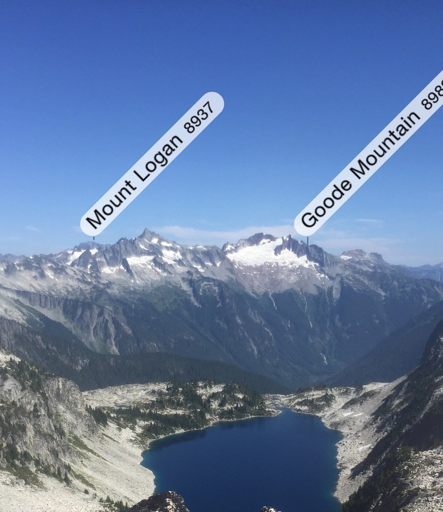
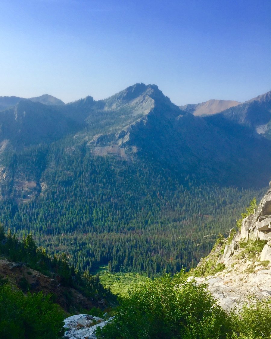
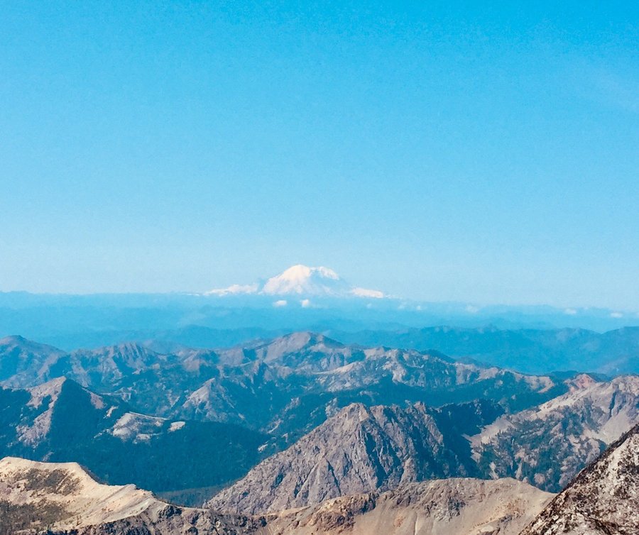
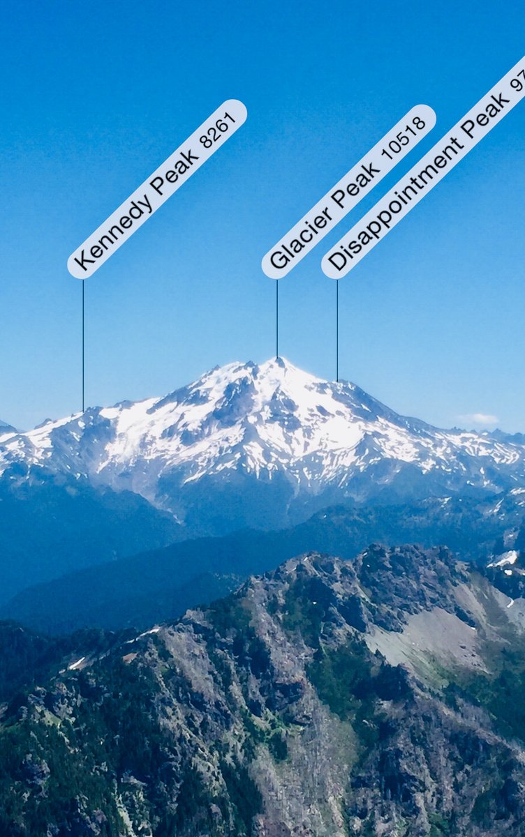
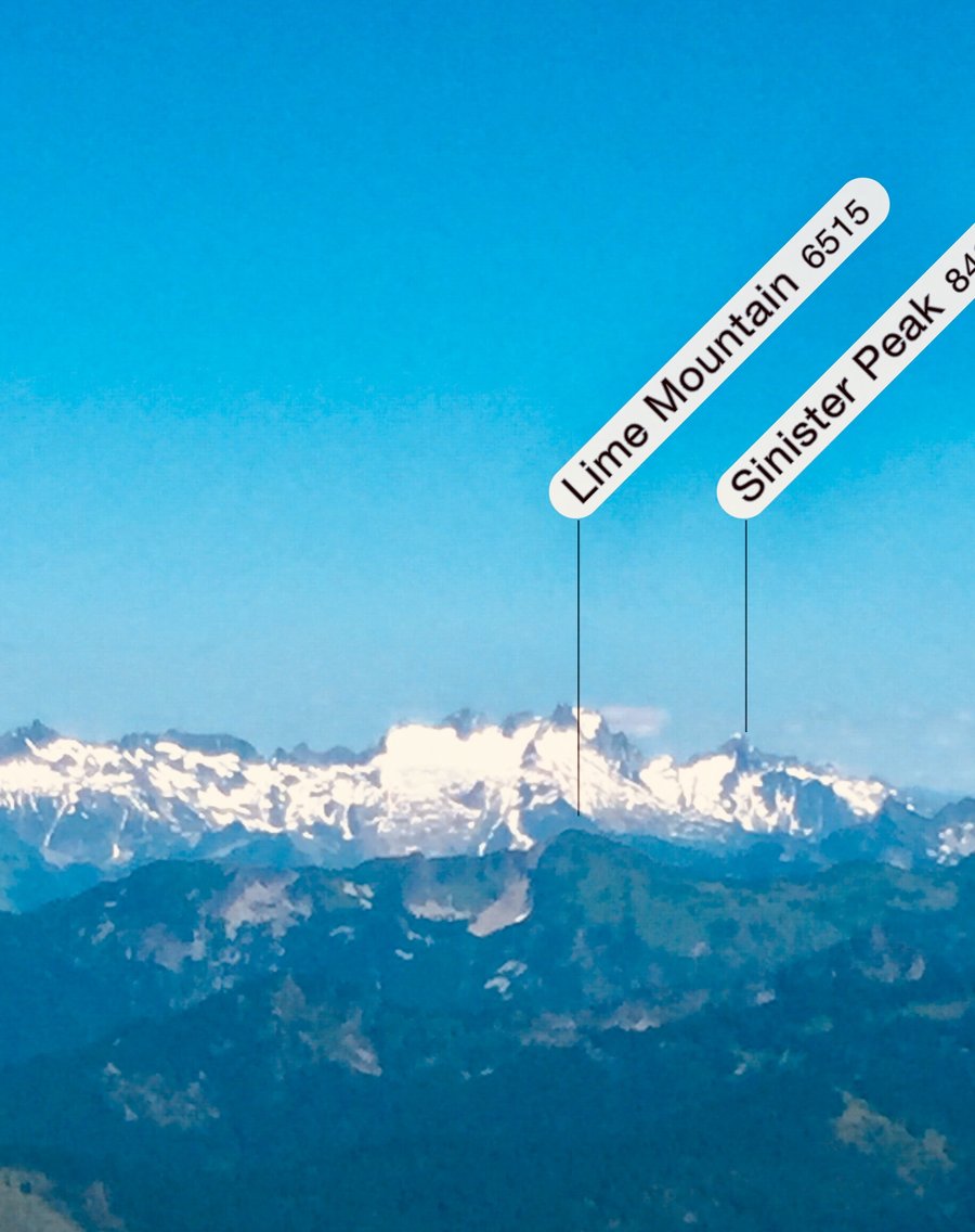
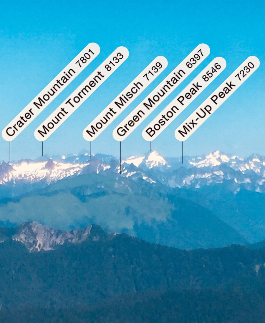
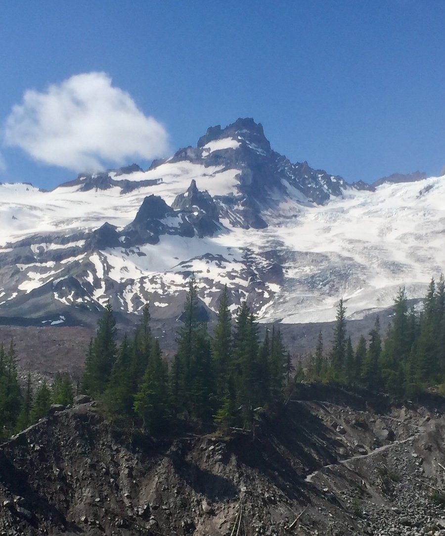
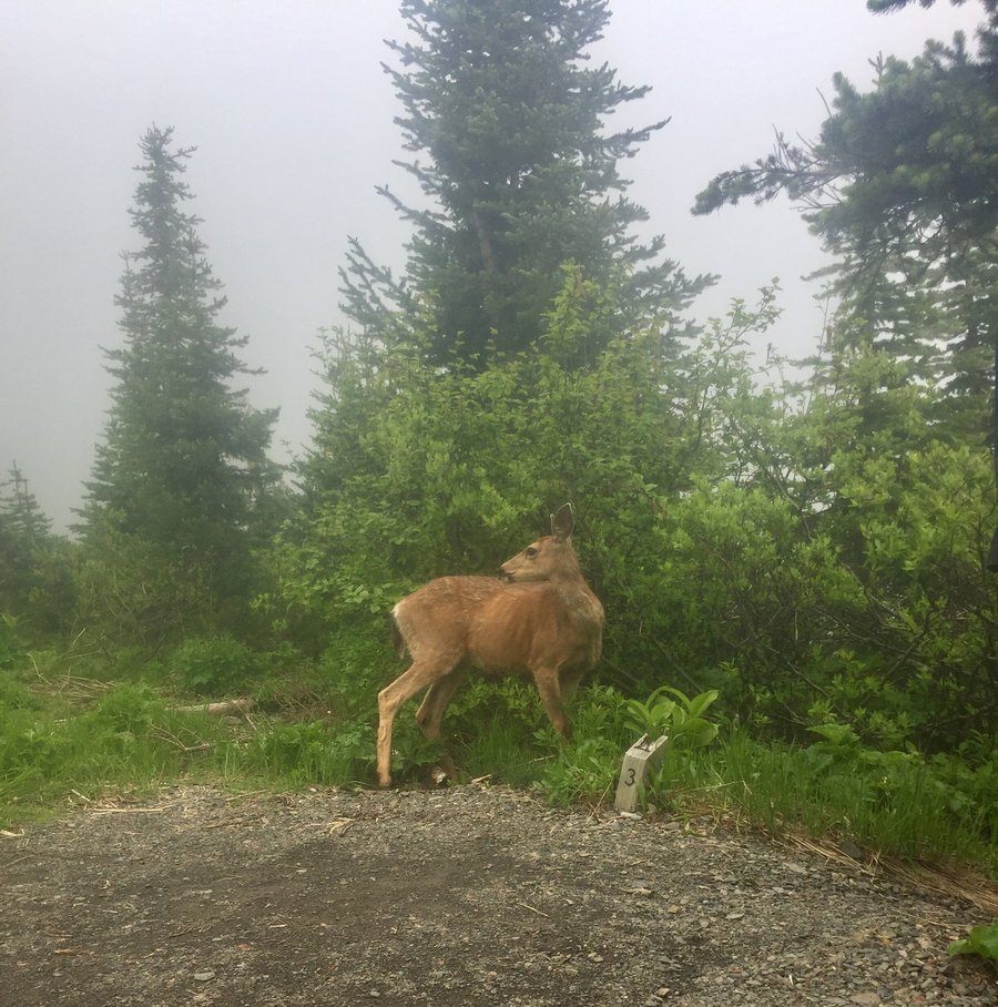
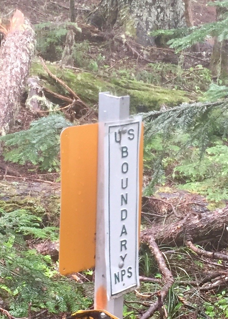
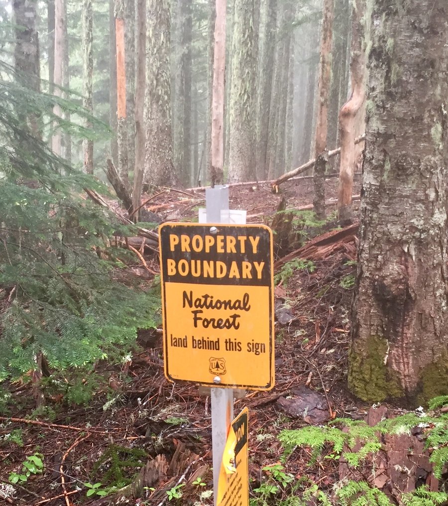
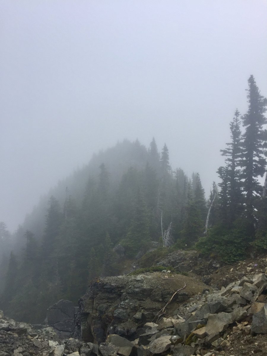
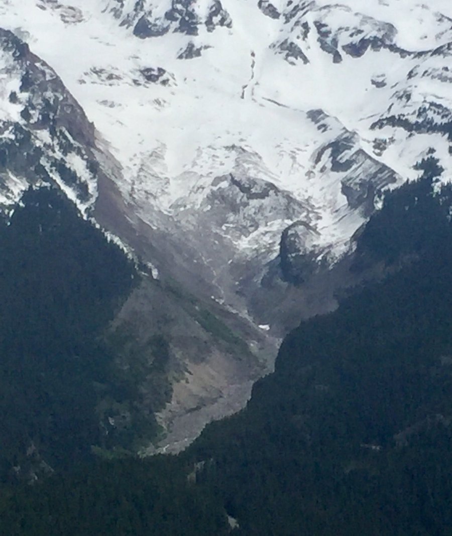
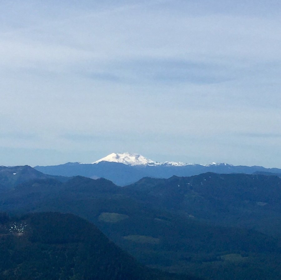
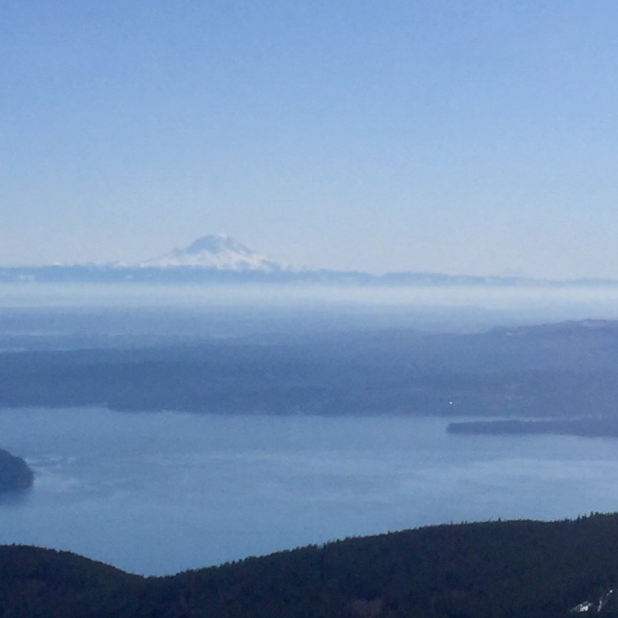
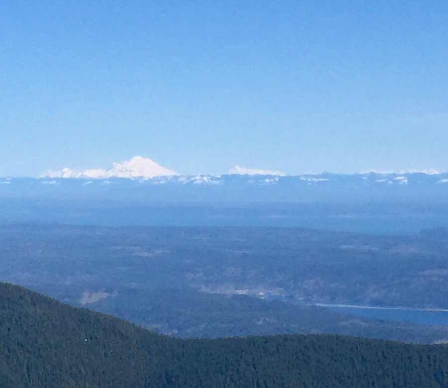
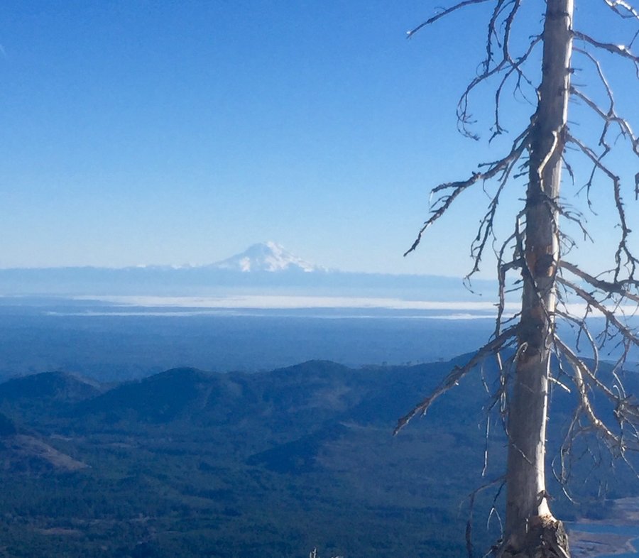
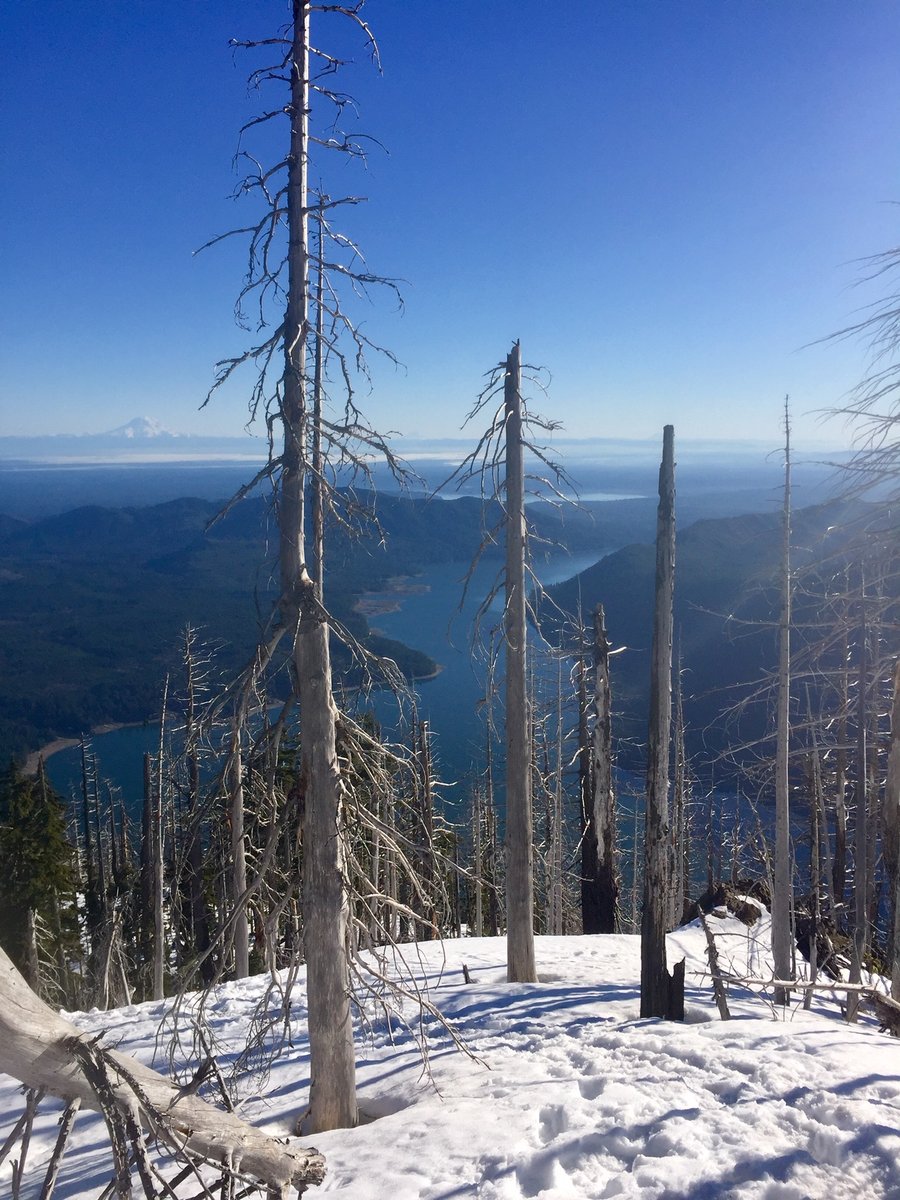
MRNP--Kautz Creek to Mt. Arafat
10.28 miles of hiking • 3500' elevation gain •
Never done this trail before. Saw some deer and mt. goats but not a single person during the entire hike. Rainier was a bit cloudy but could see Adams, St Helens and even a glimpse of Mt. Hood in the distance. Hiked as far as Mt. Arafat and it looks like from where I stopped Arafat would be a non-technical 4-500' scramble to its 6000' summit. Will have to check that out in more depth when the days are a bit longer.
November 23, 2019


 1
1
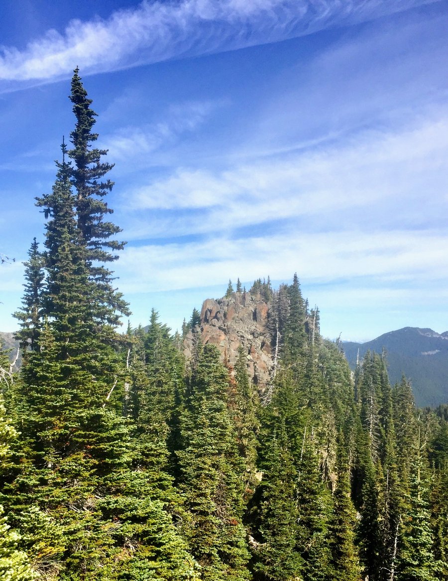
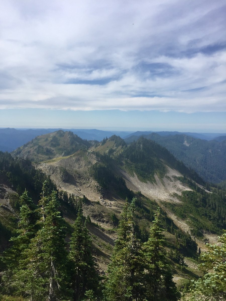
Tiger Mountain Trifecta
8.56 miles of hiking • 3500' elevation gain •
My favorite conditioning hike on foggy, drizzly autumn days.
November 10, 2019
 1
1
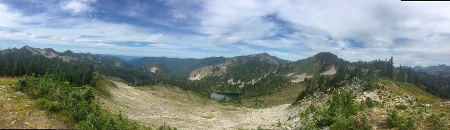
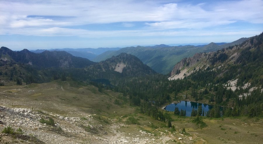
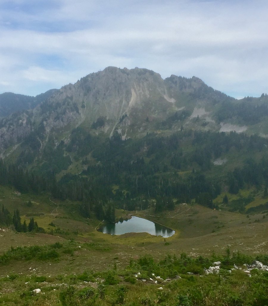
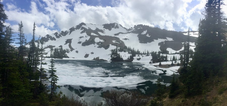
Lake of the Angels
7.7 miles of hiking • 4000' elevation gain •
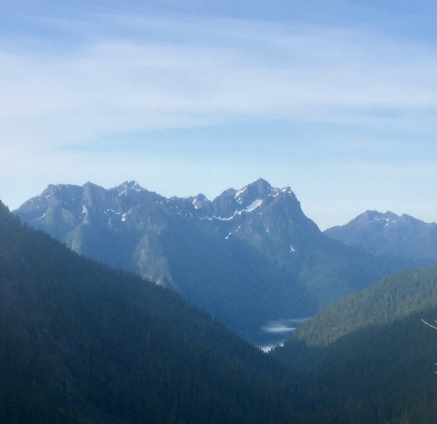
Hiked this trail back in 2016 but due to foggy weather conditions could not see much. Saturday conditions were picture perfect. This is a fun challenging hike with 2 areas where you utilize ropes to scale a couple head walls. Nothing terribly technical though. The trail was snow free but pretty muddy just after The Lake of the False Prophet, which I understand is not unusual. The Lake of the Angels though was mostly frozen over. After eating lunch I hiked up to one of the ridges above the lake which gave some nice panoramic views of the surrounding mountains.
November 2, 2019


 2
2
5k Zombie Run-JBLM
3.1 miles of hiking • 250' elevation gain •
Not a hike but thought I would put in on here. Ran the event with my daughter, son-in-law and 4 year old Granddaughter. My Granddaughter ran the Not So Scary 1k dressed as Elsa of Frozen.
October 26, 2019


 2
2
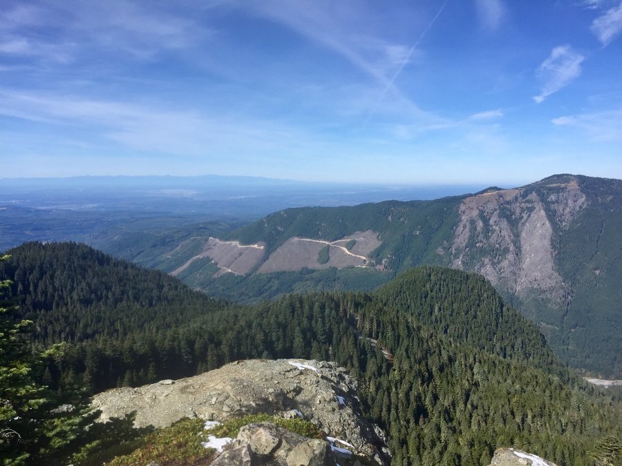
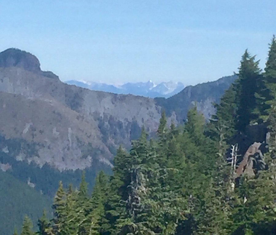
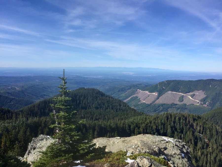
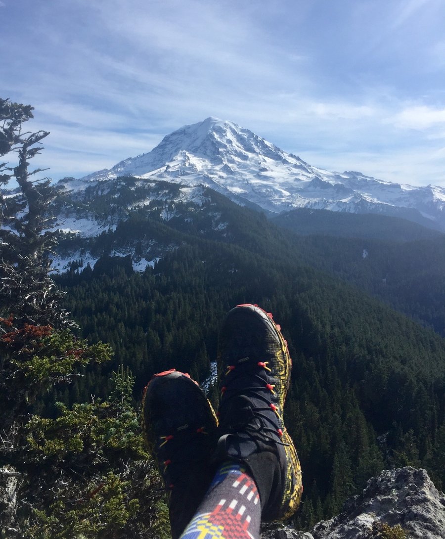
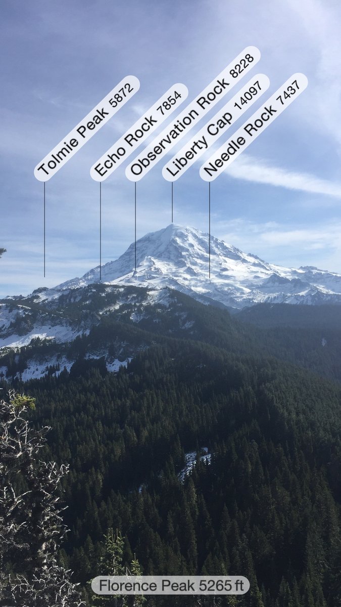
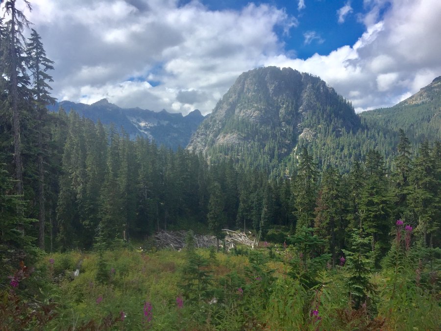
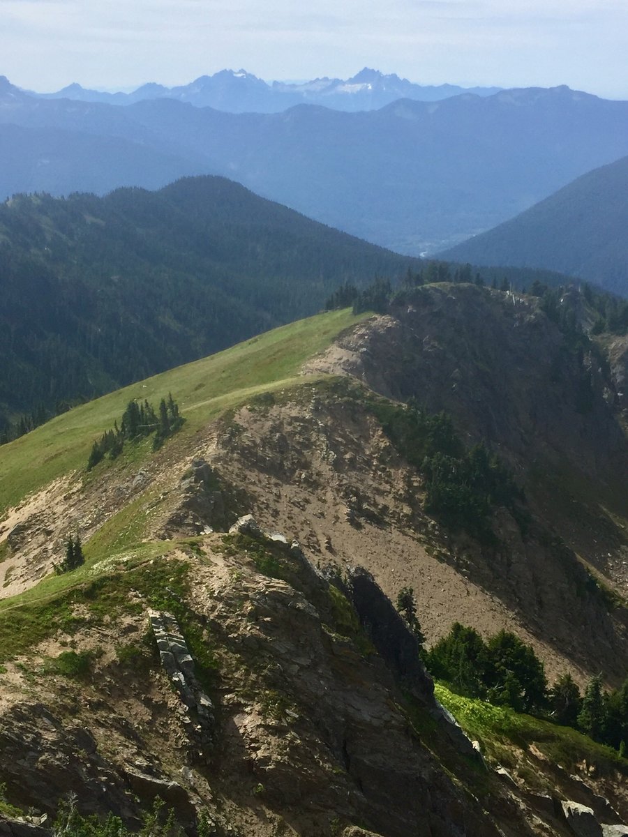
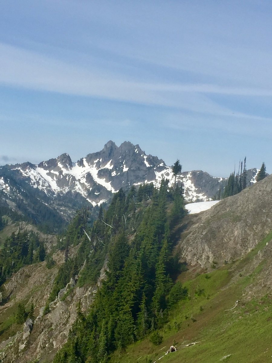
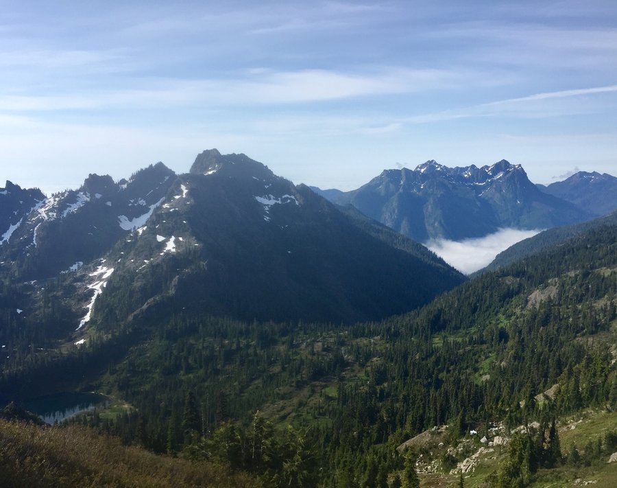
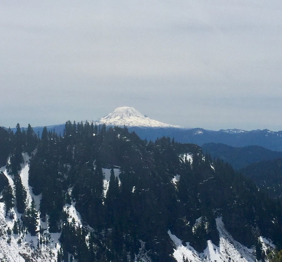
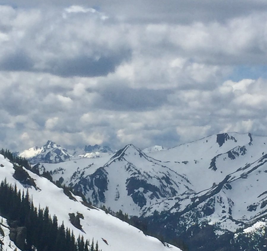
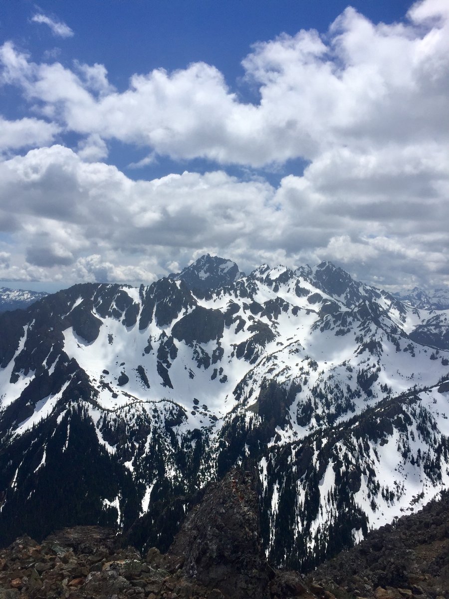
Florence Peak--Mt Rainier NP
8.24 miles of hiking • 3750' elevation gain •
The first 3 miles is nice old growth with a water fall thrown in at the mile and a half mark. Once you reach the ridge at approx. 3 miles take the faint climbers trail to the left and the trail will meander along the ridge for a bit and will end at Florence Peak.
October 11, 2019

 1
1
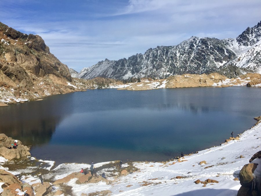
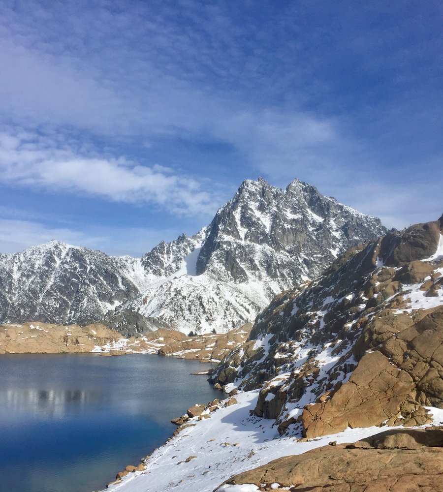
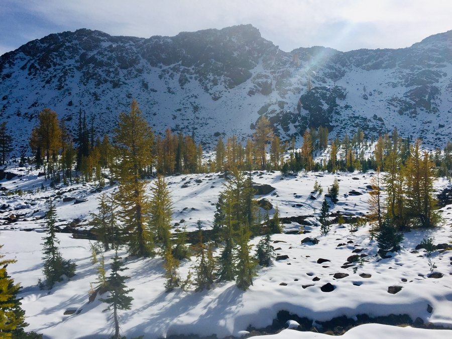
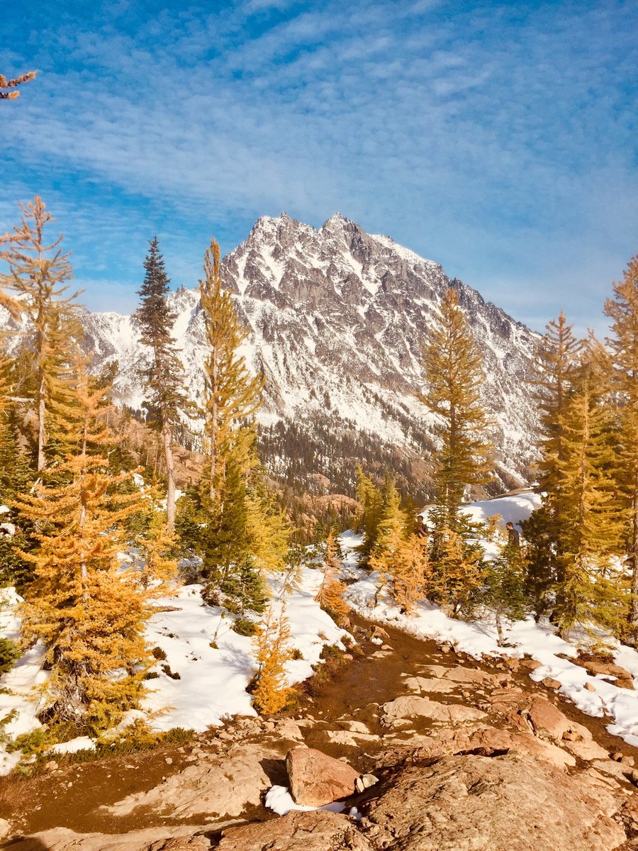
Lake Ingalls
9.4 miles of hiking • 3250' elevation gain •
The larches are just changing color. Lots of people...the trail was really crowded.
October 7, 2019


 1
1
Mt.Si
6.64 miles of hiking • 3250' elevation gain •
Up and down the old trail. A dusting of snow on the haystack.
September 29, 2019
 1
1
Tiger MTN. Trifecta
8.56 miles of hiking • 3500' elevation gain •
Hiked to all 3 summits plus to the Hikers Hut.
September 14, 2019
 3
3
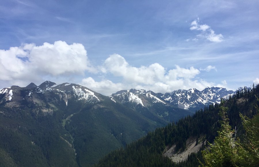
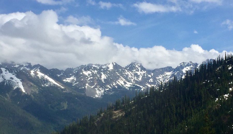
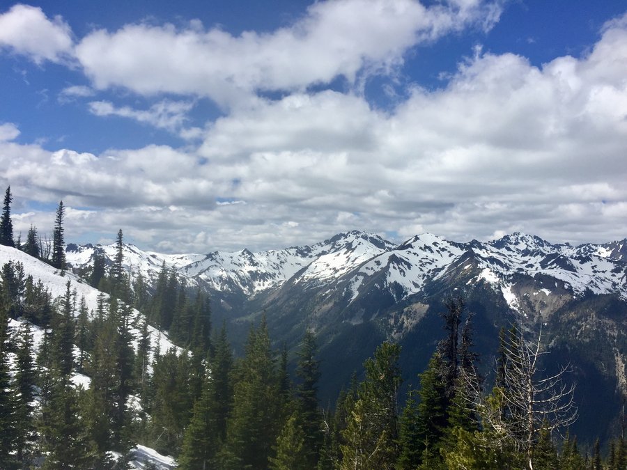
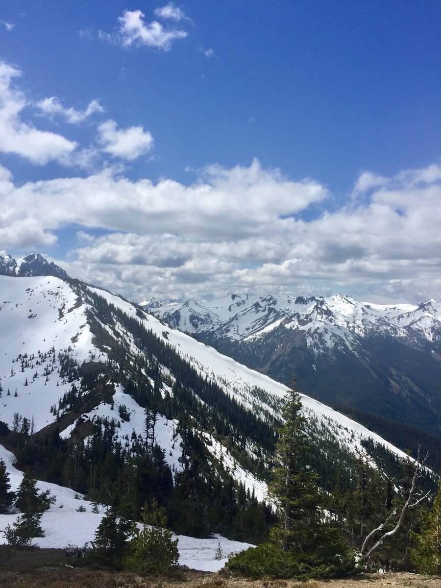
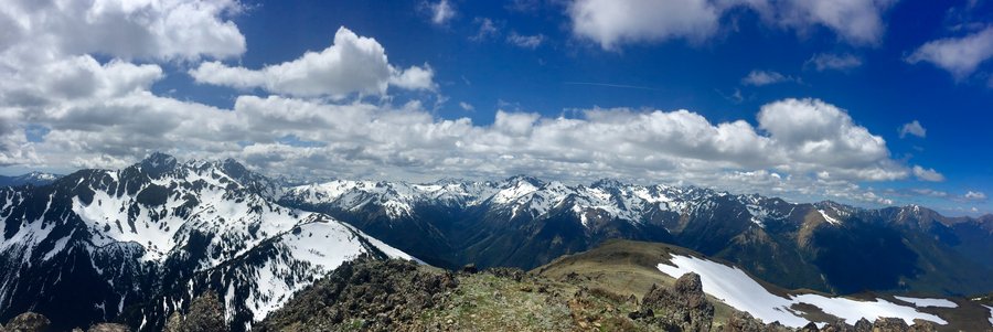
Seven Lakes Basin-High Divide
18.67 miles of hiking • 6000' elevation gain • 2 nights
Camped at Deer Lake first night and Solduc Park the 2nd. Tagged Bogachiel Peak during the trip. Thought there would be more bear activity but only saw one bear during the trip.
September 4 – September 6, 2019


 1
1
September 3, 2019
 2
2
September 1, 2019


 2
2
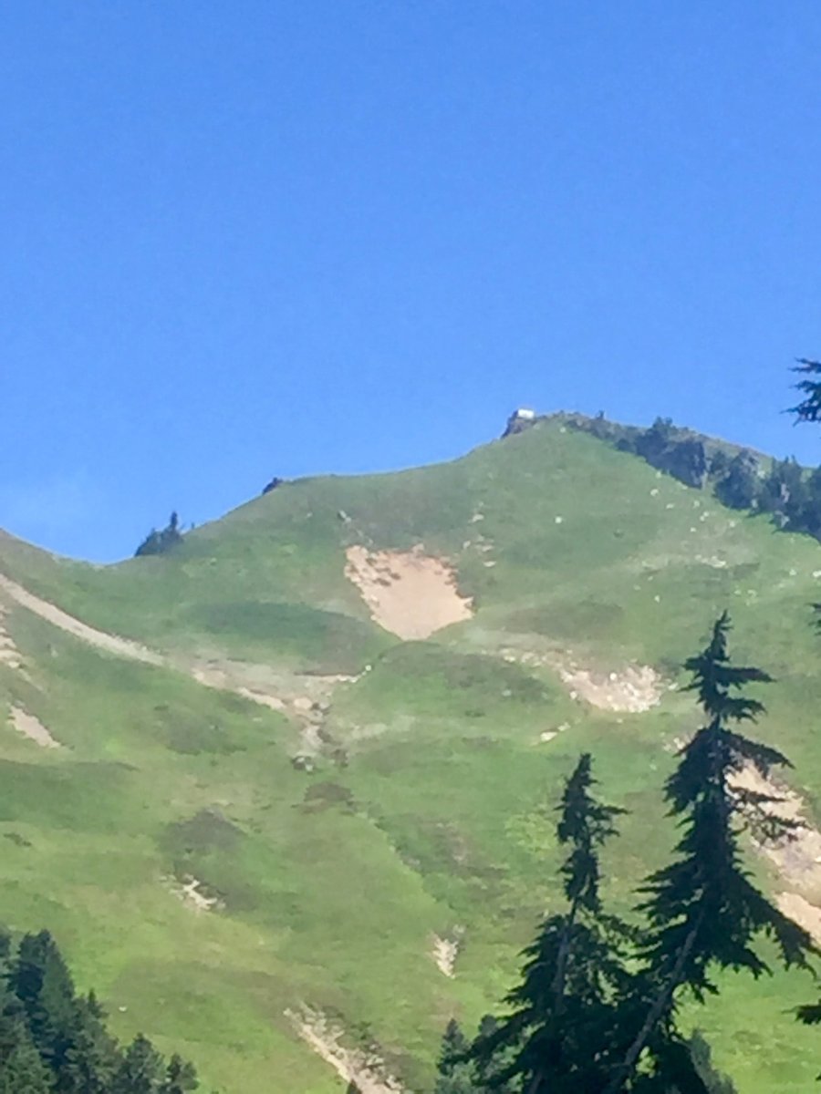
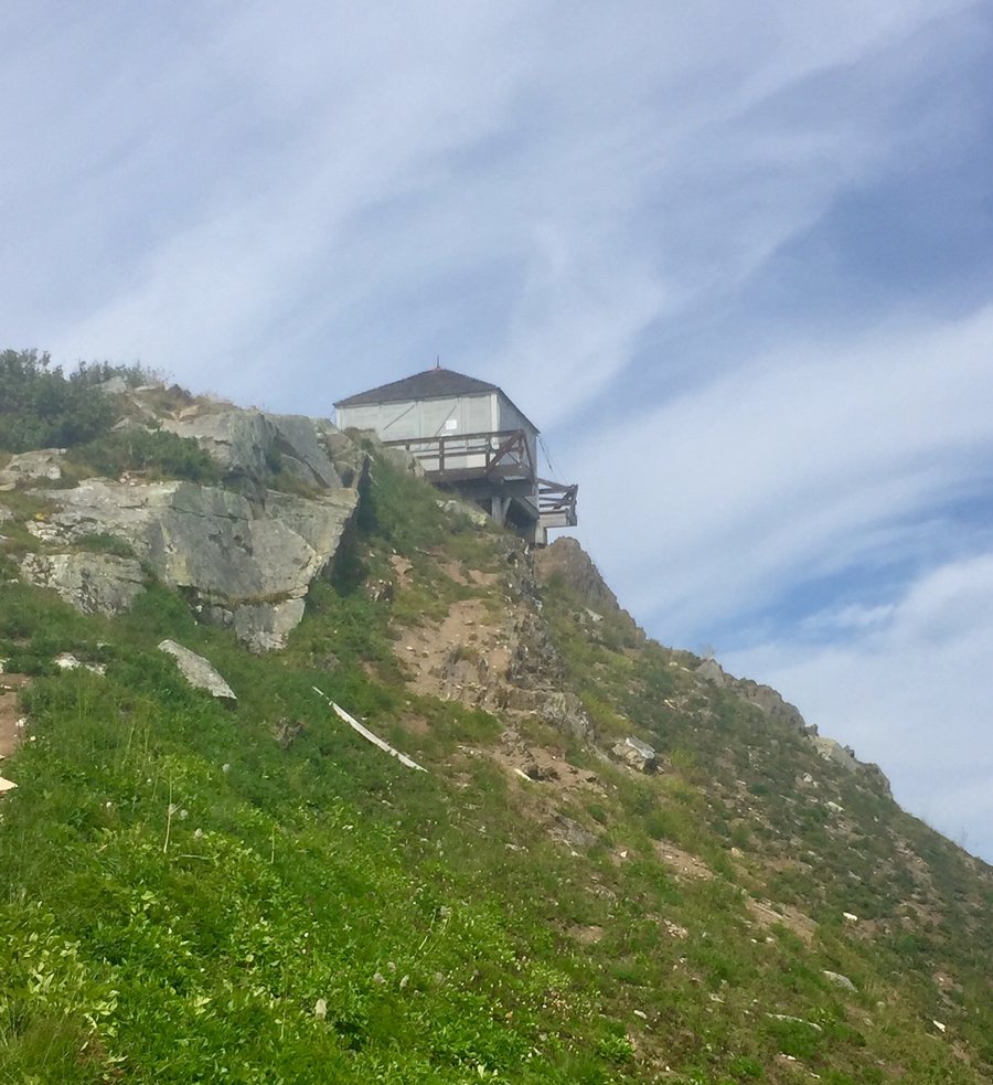
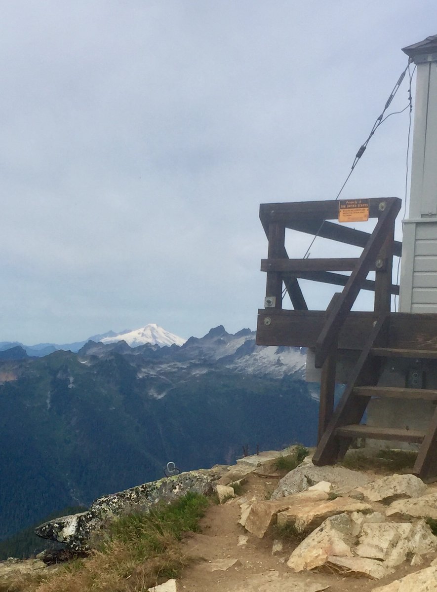
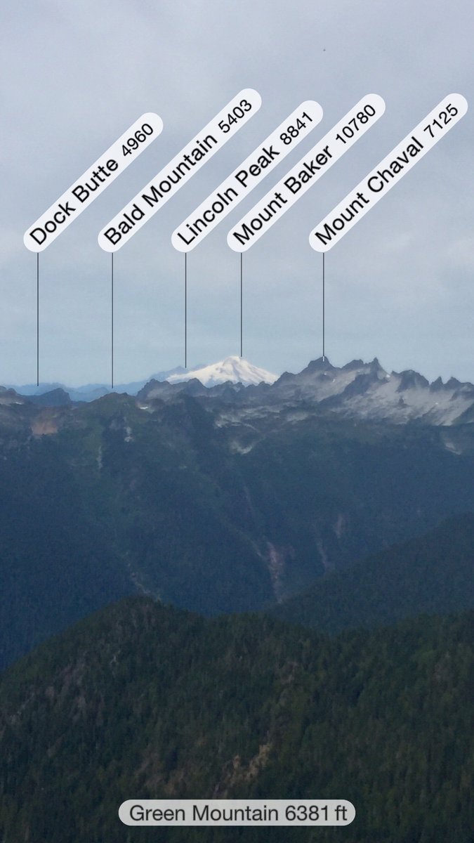
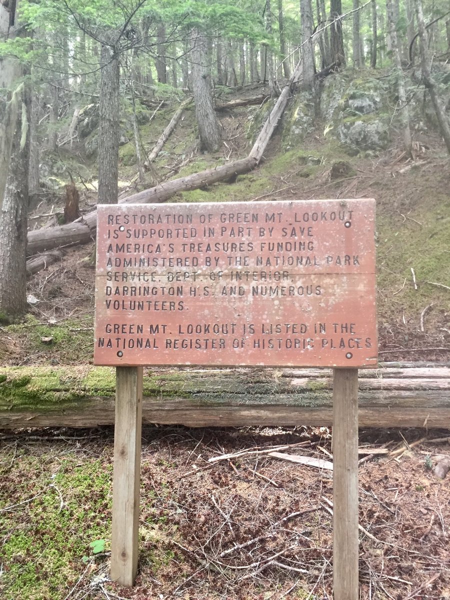
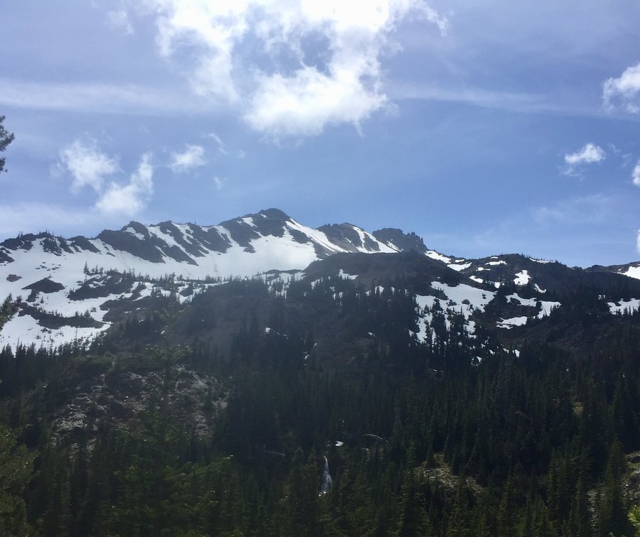
Green Mountain Lookout
8 miles of hiking • 3250' elevation gain • 1 night
The Lookout can only be reserved by the volunteers who maintain it but there are some nice camping spots by a couple small ponds in the meadows below the Lookout site. There was a really nice couple manning the Lookout who gave us the full Monty tour of the place and told us about the organization they volunteer with which maintains the Lookout.
August 20 – August 21, 2019


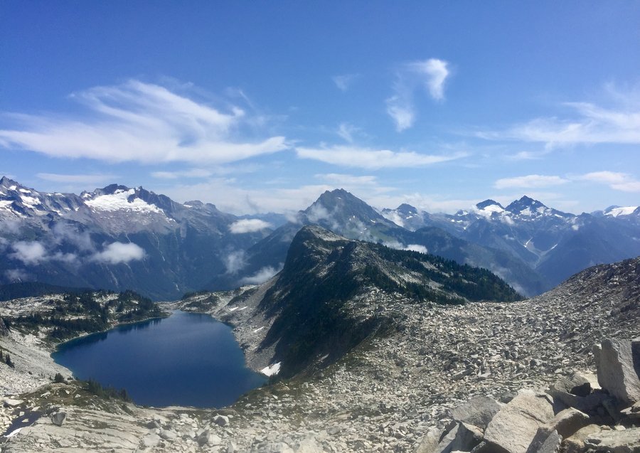
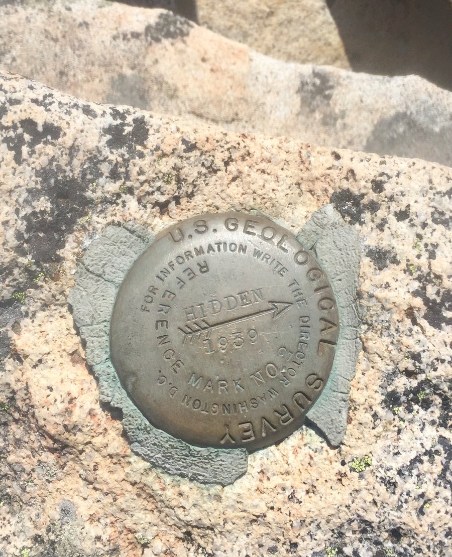
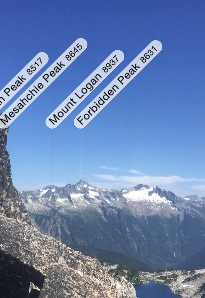
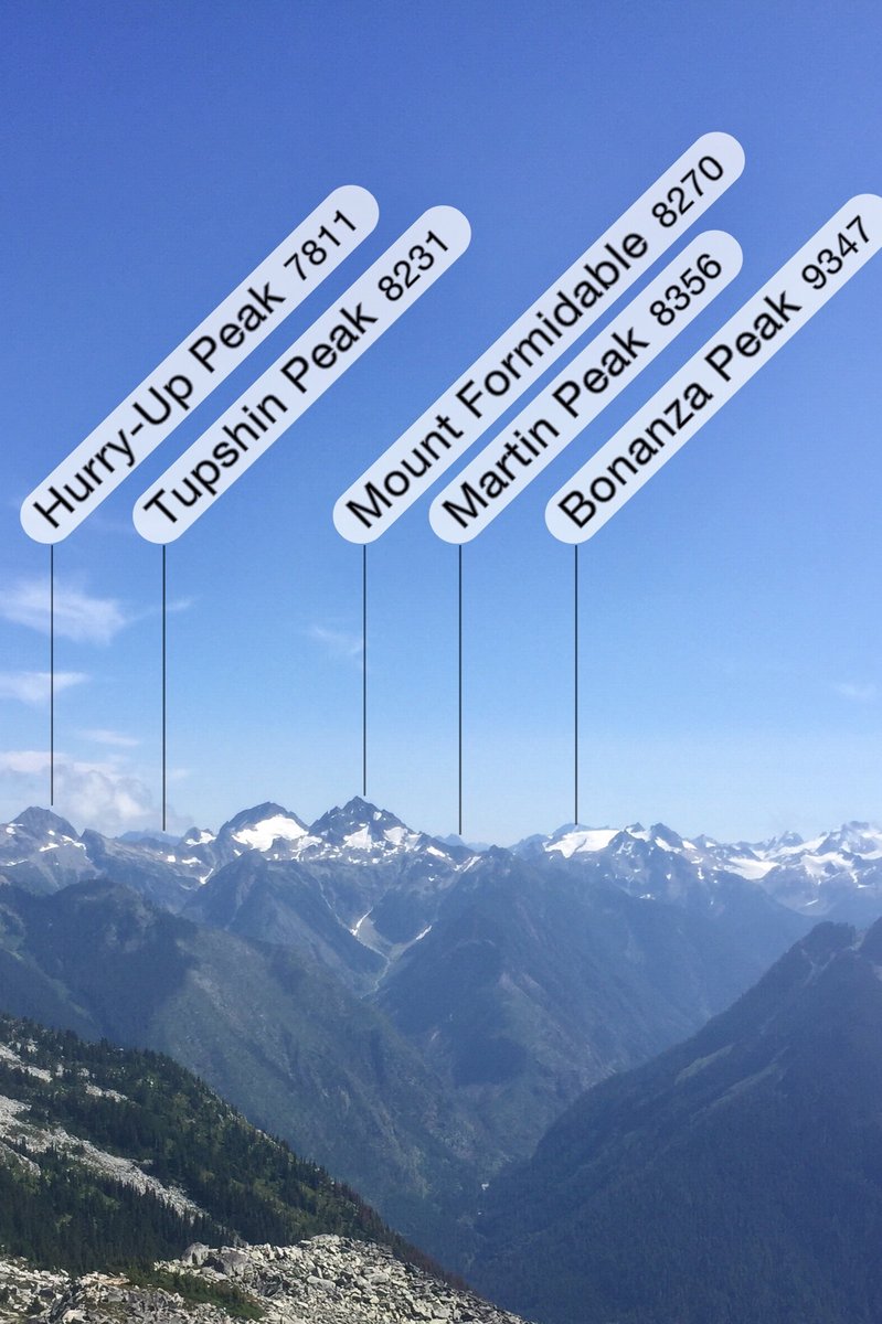
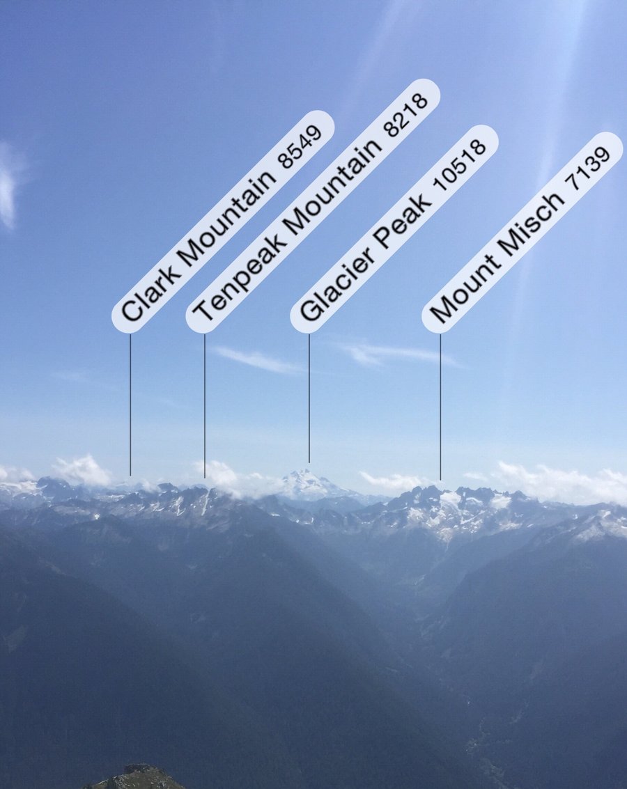
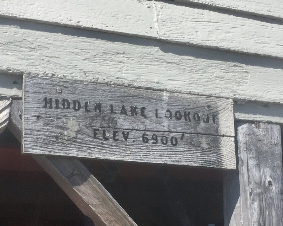
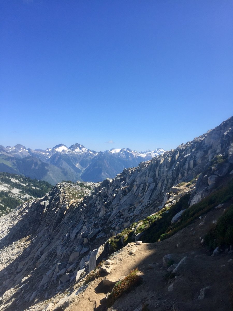
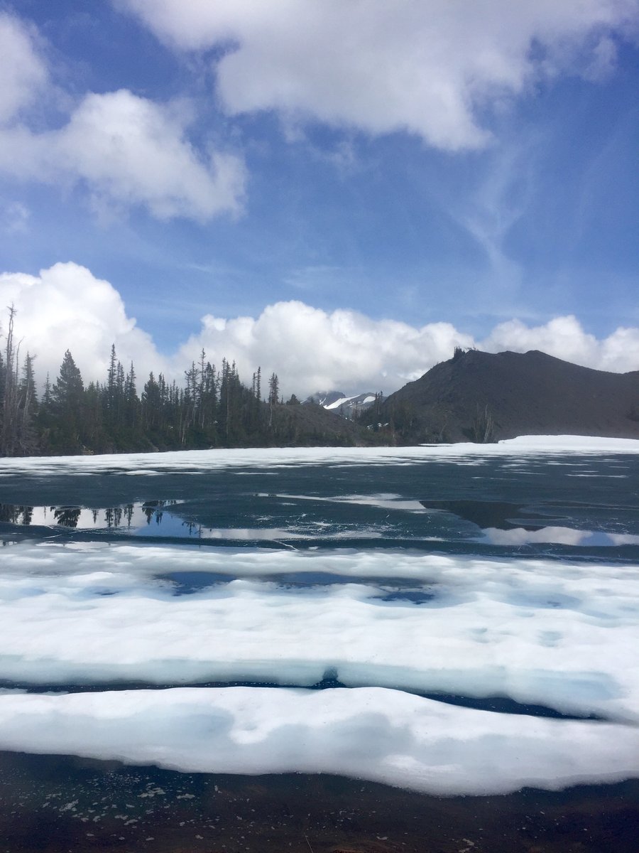
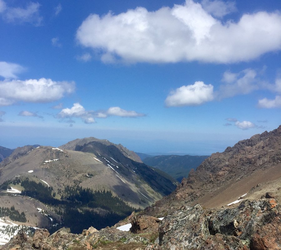
Hidden Lake Lookout
9 miles of hiking • 3250' elevation gain • 2 nights
The Lookout was occupied so we camped at the lake.
August 18 – August 20, 2019


 1
1
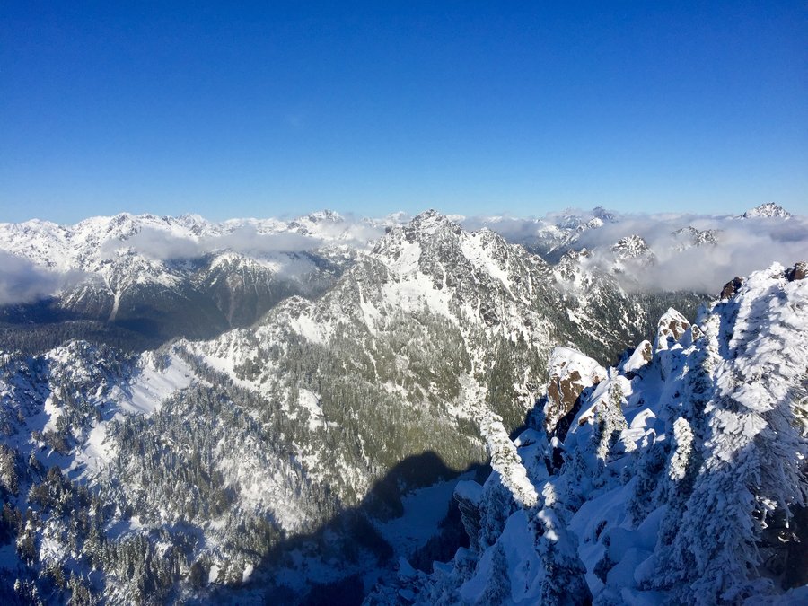
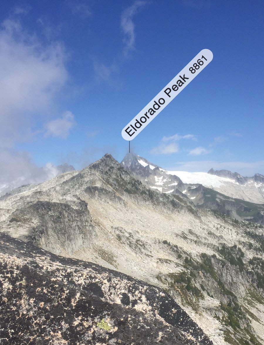
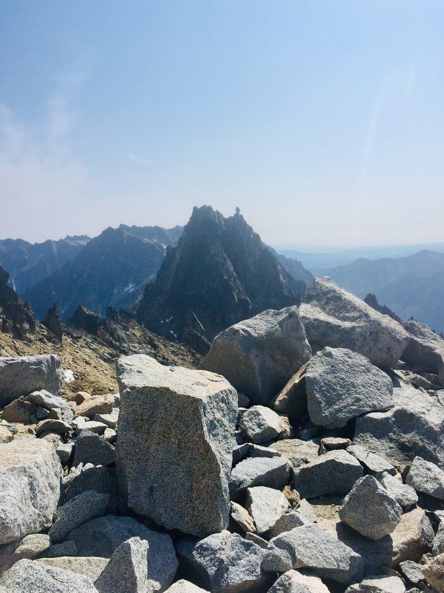
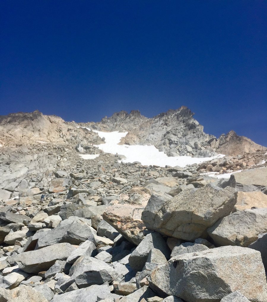
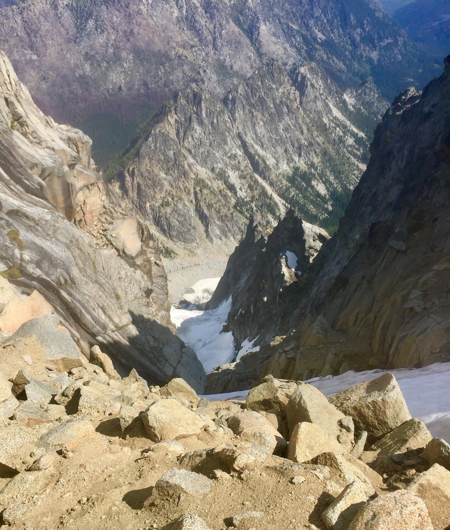
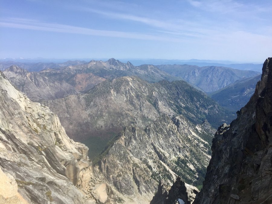
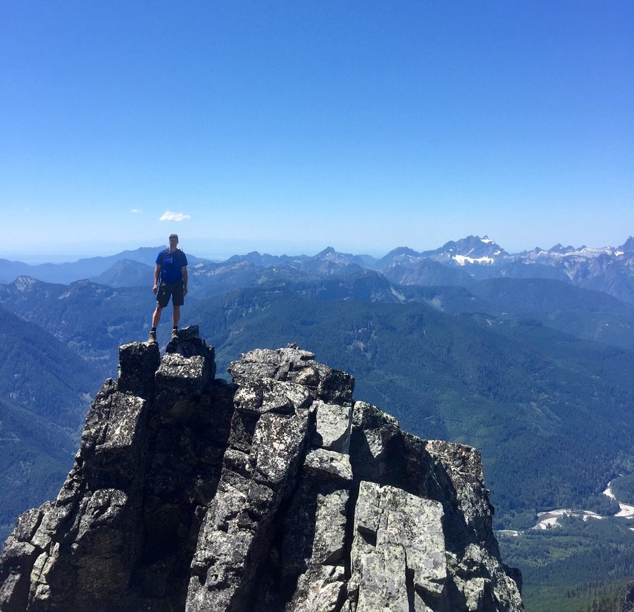
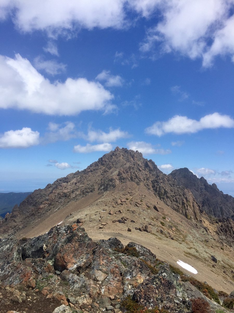
Sherpa Peak-Cascadian Couloir
11.5 miles of hiking • 7250' elevation gain • 2 nights
I have a friend who is climbing the Bulger Top 100 Peaks and he asked if I was interesting in a 3 day 2 night backpacking trip which would include a climb of Mt. Stuart using the Cascadian Couloir route. I climbed Stuart via this route many years ago and was not really interested in doing it again but told him I would go on the trip and climb as far as the upper snow field below the false summit. The route we took was up Longs Pass, down the climbers trail to Ingalls Creek where we set up camp. Next morning started the climb @ around 7:30 AM, I stopped where planned at around 8600' near Sherpa Peak and found a nice granite slab where I took a nap in the sun and ate some lunch. My friend reached the summit around noon and we then make it back to camp around 4PM. Next day hiked out reaching the TH around 10AM.
August 2 – August 4, 2019


 1
1
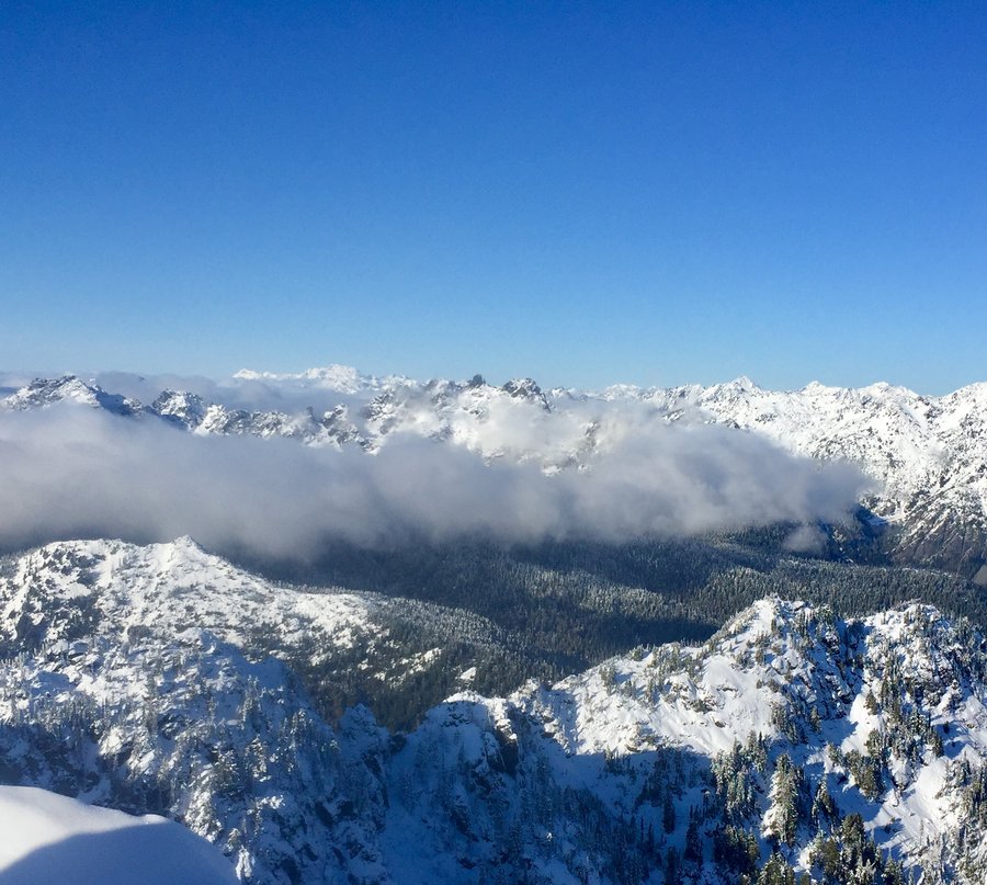
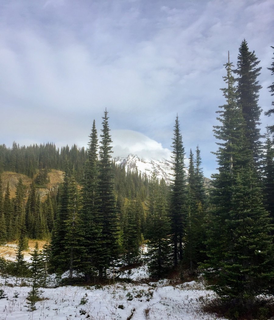
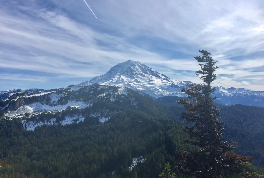
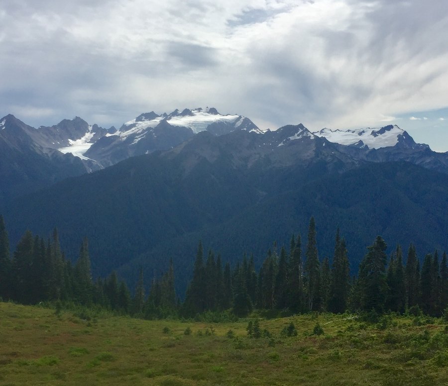
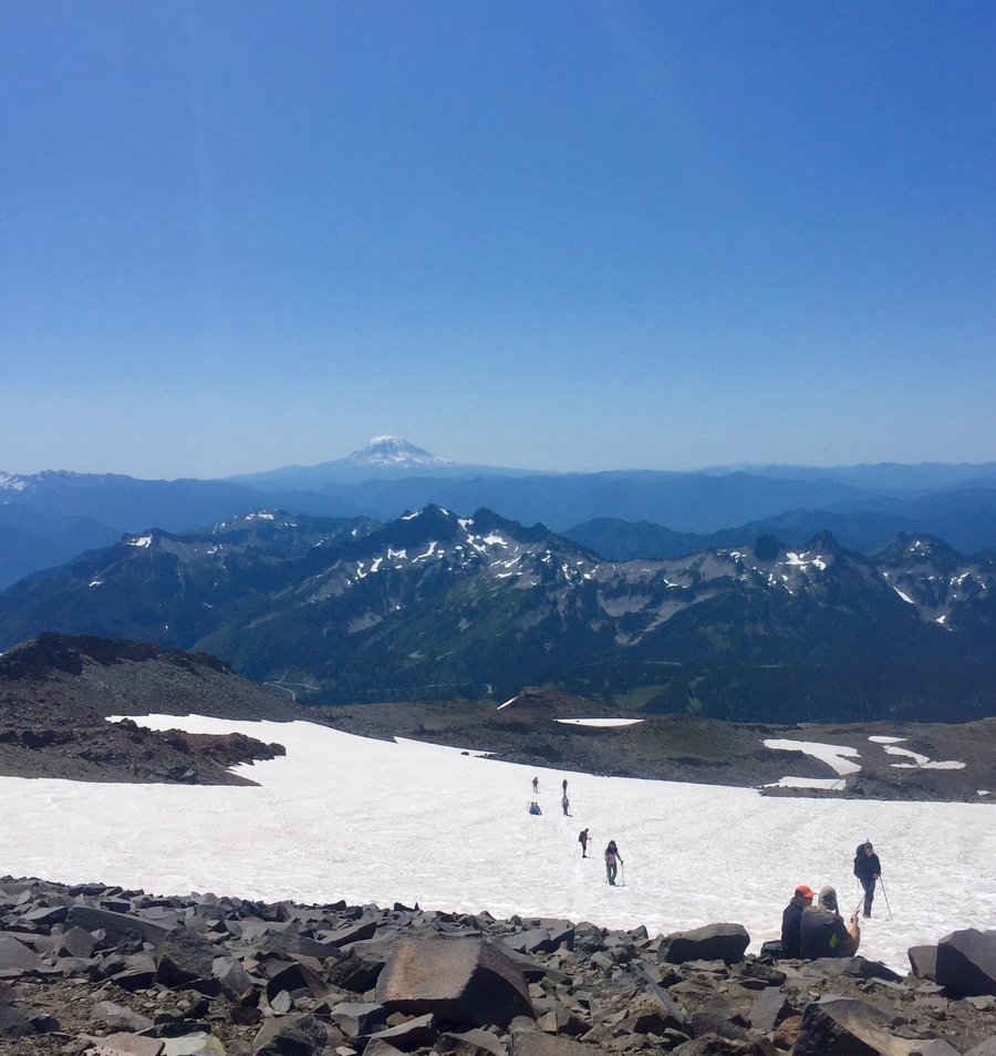
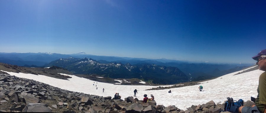
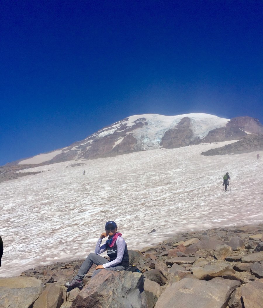
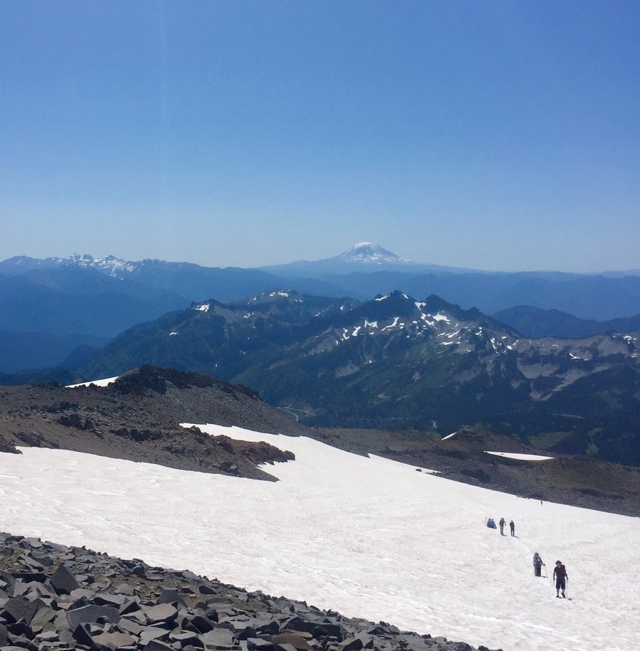
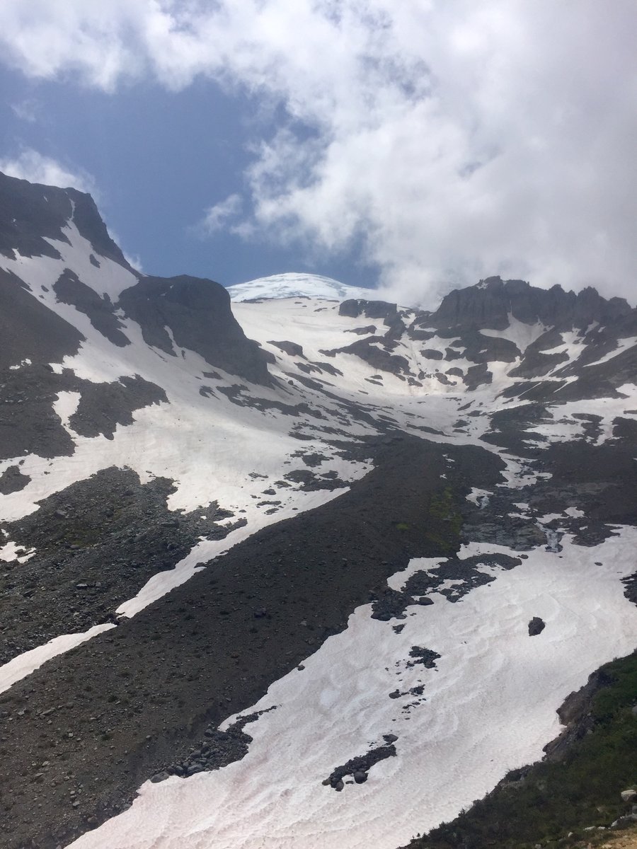
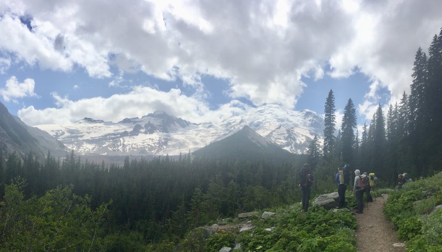
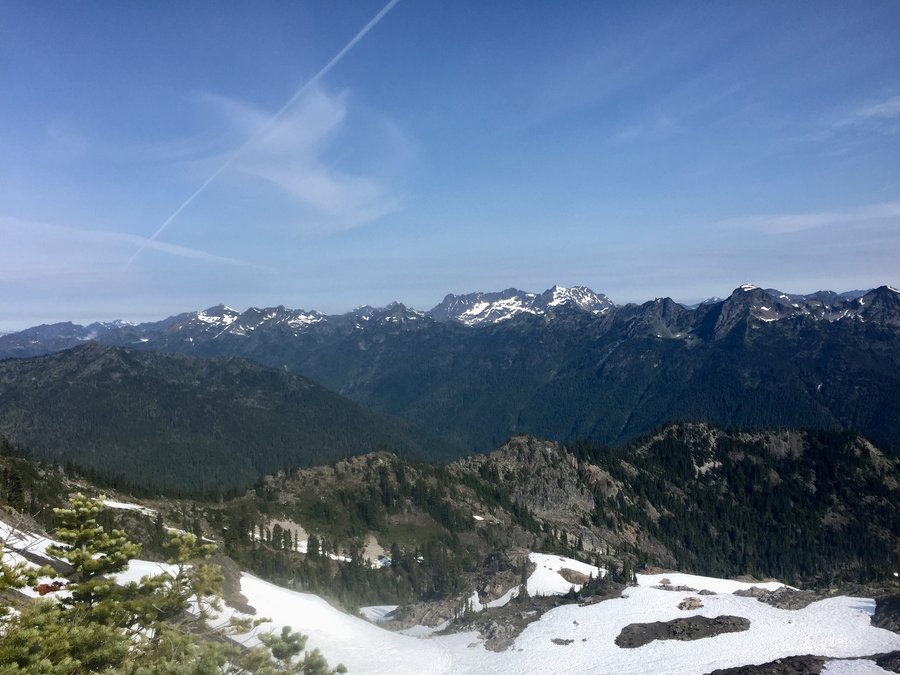
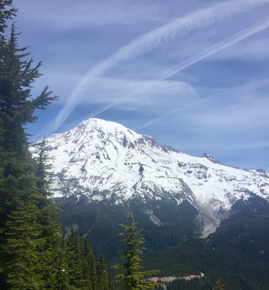
Mt. Rainier--Camp Muir
9.5 miles of hiking • 4750' elevation gain •
Paradise was outrageously crowded. We got there @ 8:30AM and the main parking lot was already full. Crowds pretty much everywhere until you got up to Pebble Creek. From there the crowds thinned out as that's where the snow really takes over and the climb up to Camp Muir begins in earnest. Lot's of people at Muir preparing for the summit push.The temps and winds at Muir were the mildest that I can ever recall. Basically t-shirt weather. It was the wife's first trip up to Muir and she had a blast glissading back down the Muir snowfield.
July 28, 2019

 2
2
Mt. Pugh
11.2 miles of hiking • 5250' elevation gain •
Fun hike and scramble to Mt. Pugh's 7200' summit.
July 21, 2019


 1
1
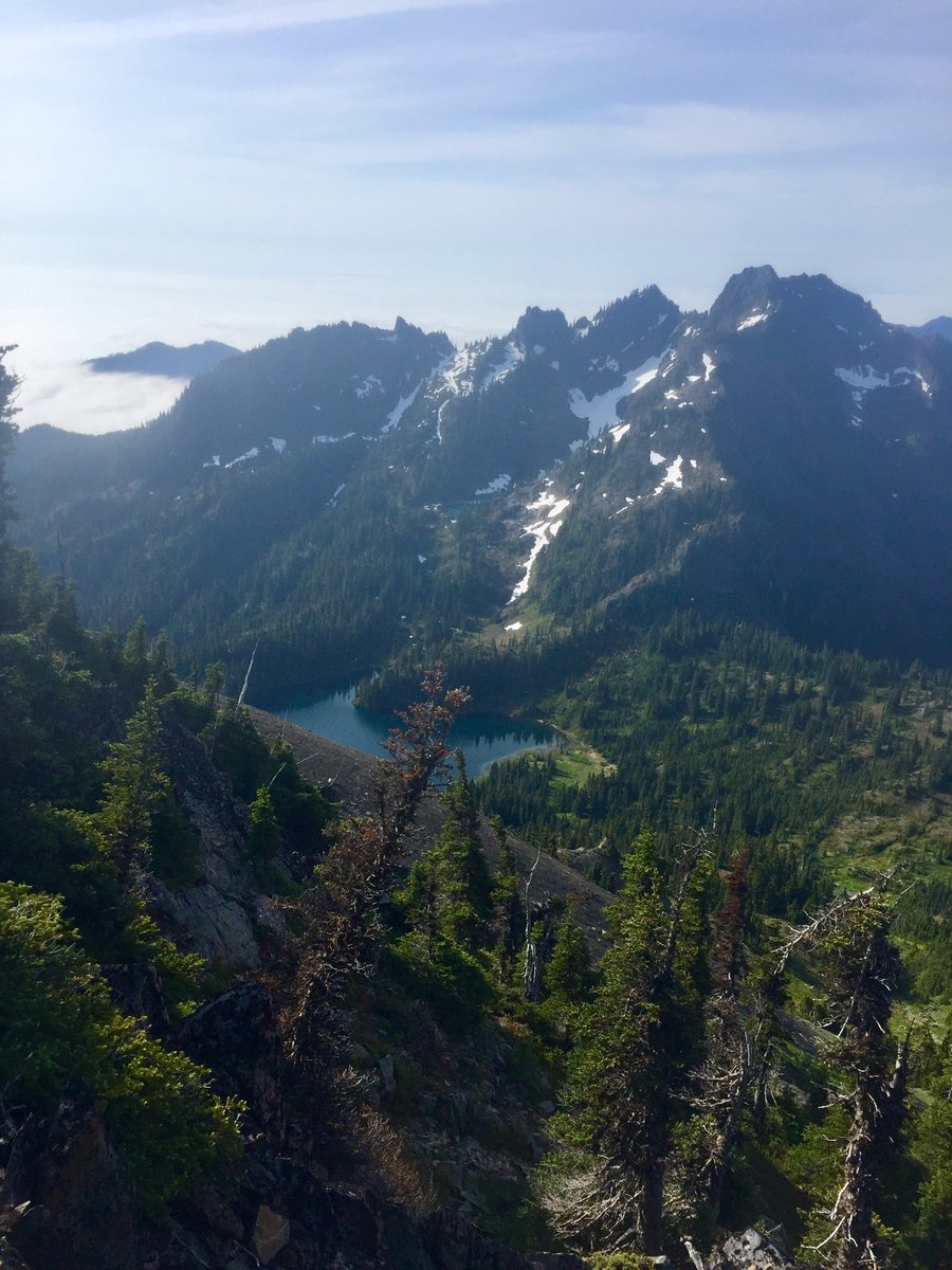
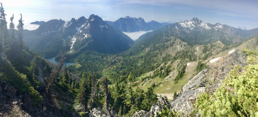
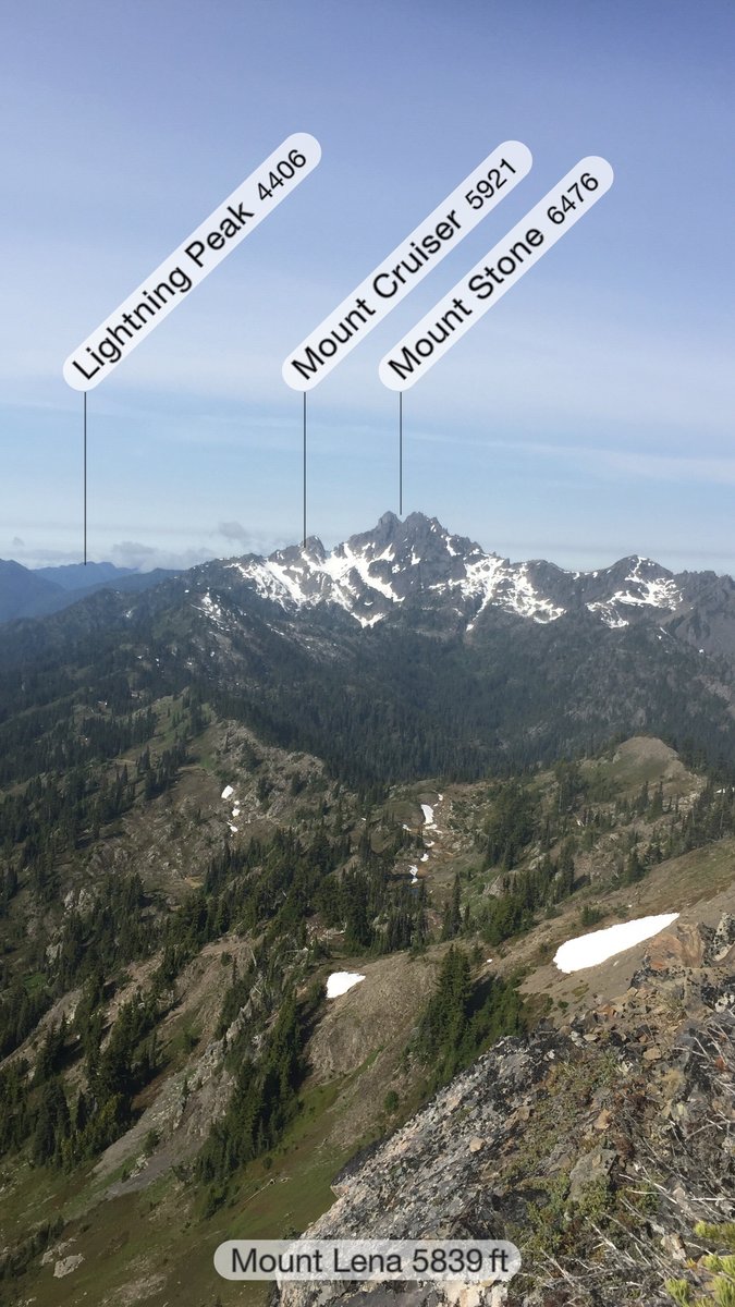
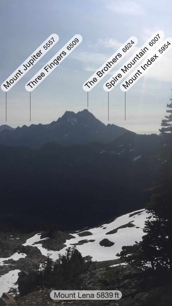
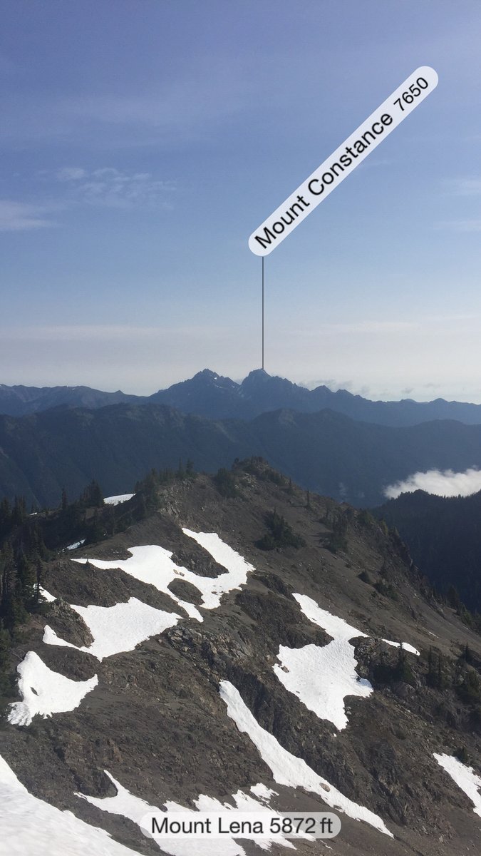
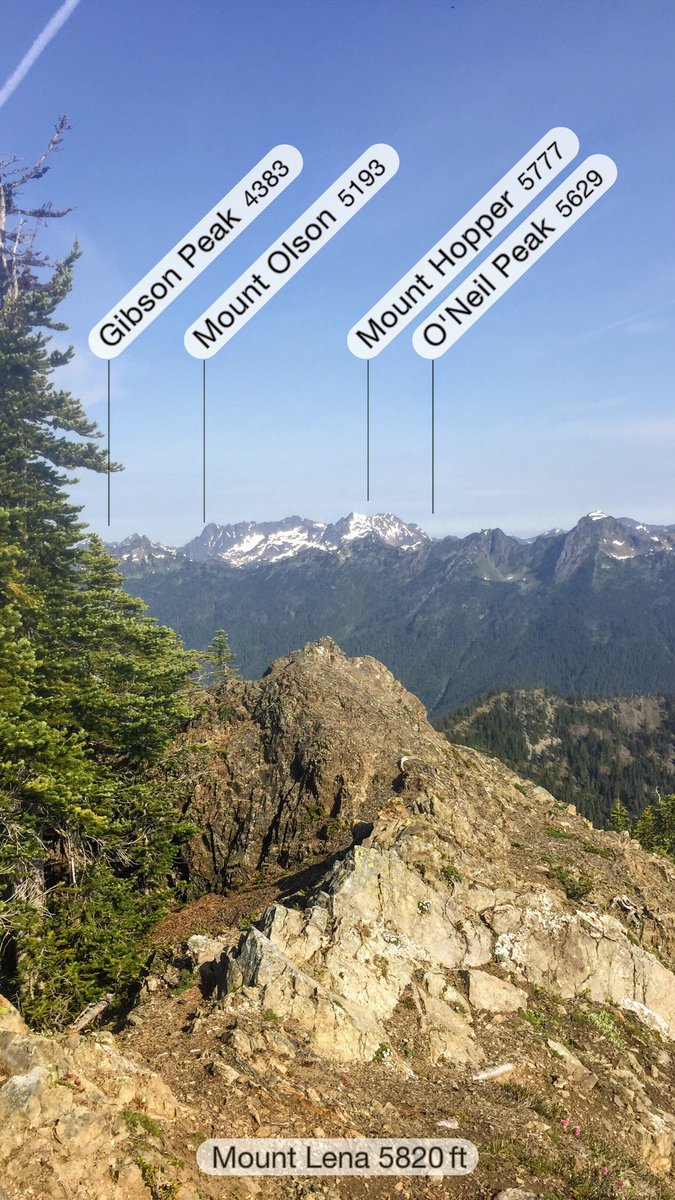
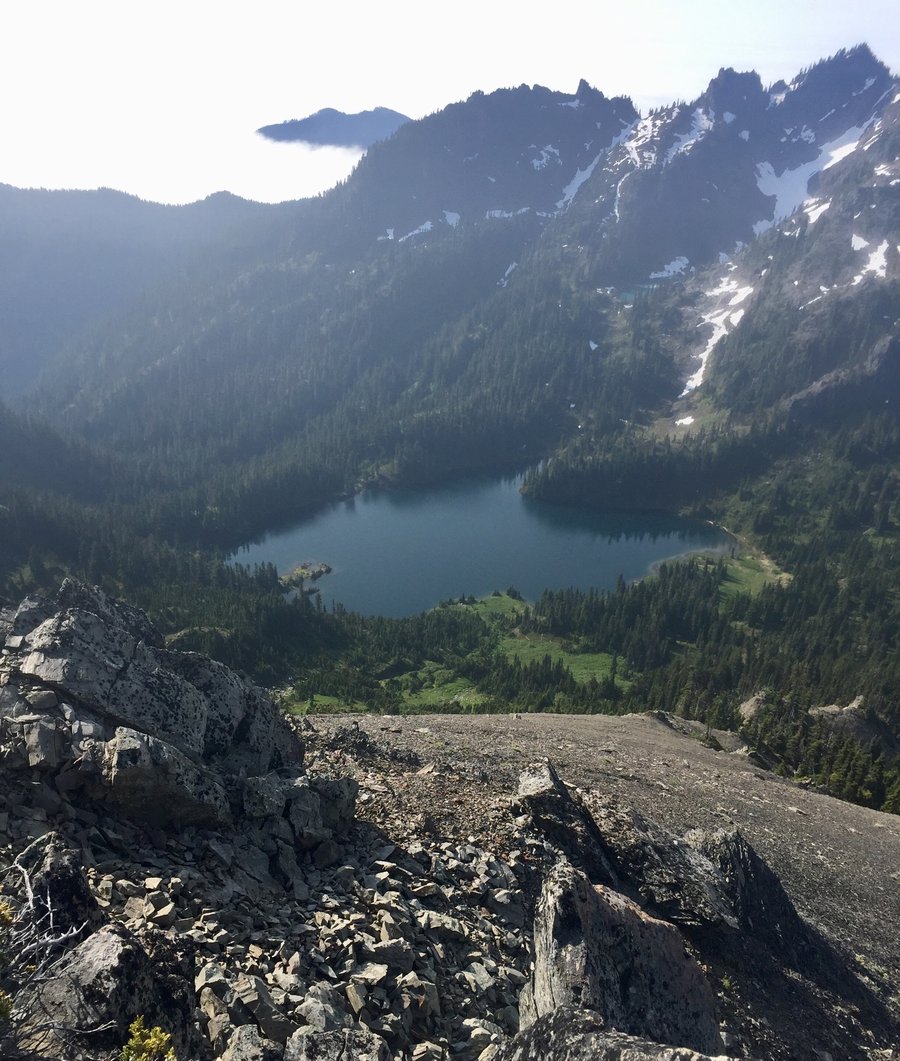
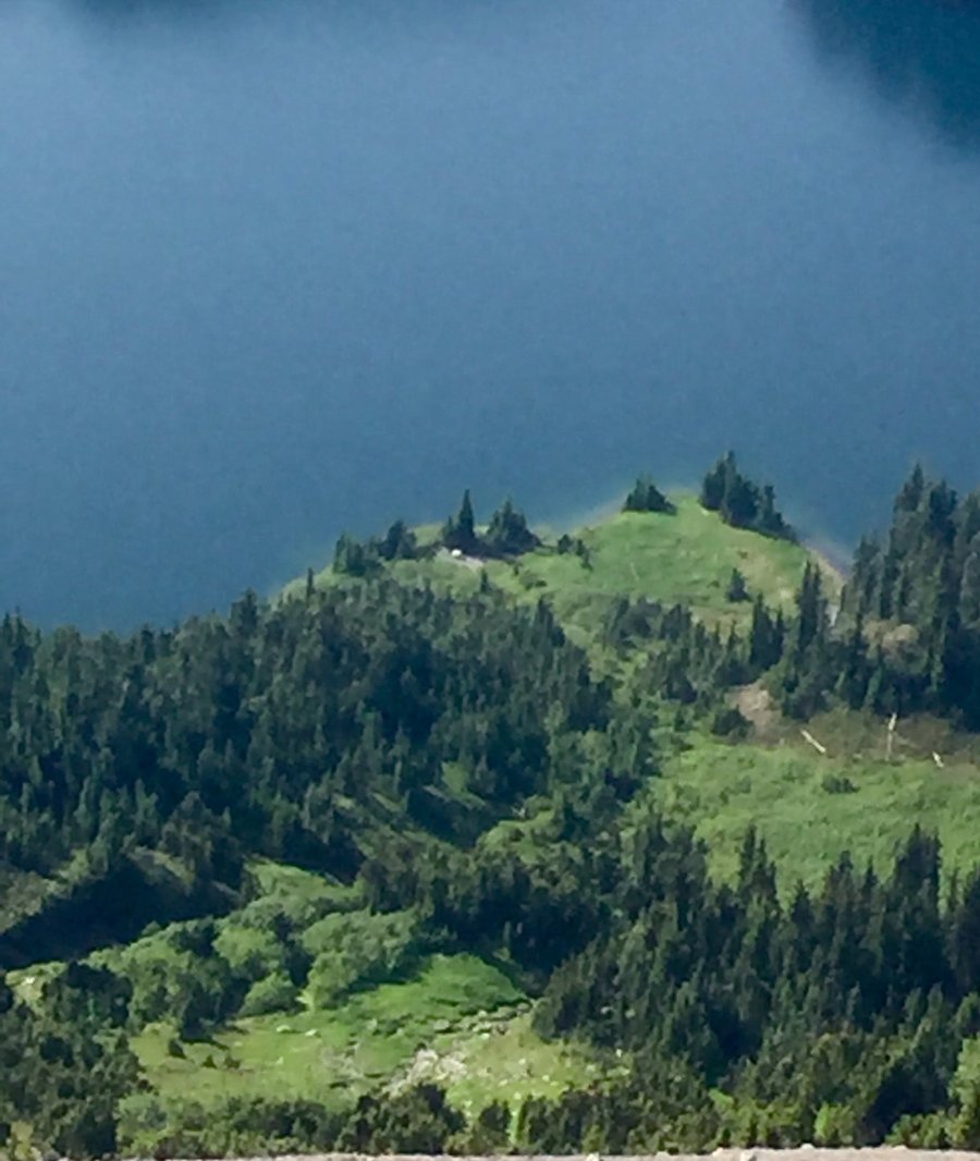
Upper Lena Lake & Beyond
19.72 miles of hiking • 5750' elevation gain • 2 nights
I have hiked up to the upper lake several times but have never done the scramble up Mt. Lena. It was really foggy at the lake when I arrived on the 3rd so I had my doubts whether the Lena climb was in the cards. Woke up early on the 4th to clear sunny weather so it was go time. Hiked the Scout Lake trail to a small unamed lake and then assended Mt. Lena via the stream/avalanche chute which was snow free. Great 360 degree views from the summit.
July 3 – July 5, 2019


 1
1
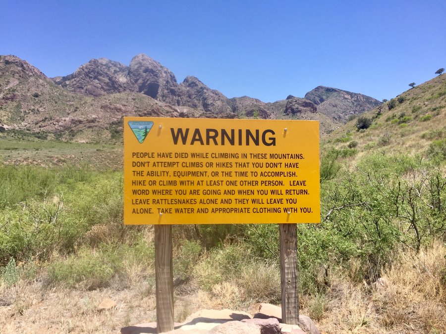
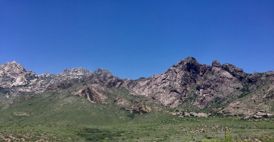
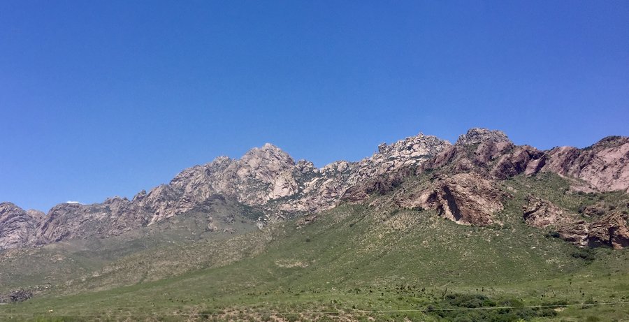
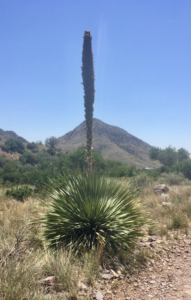
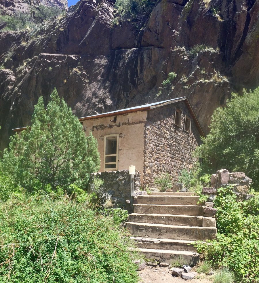
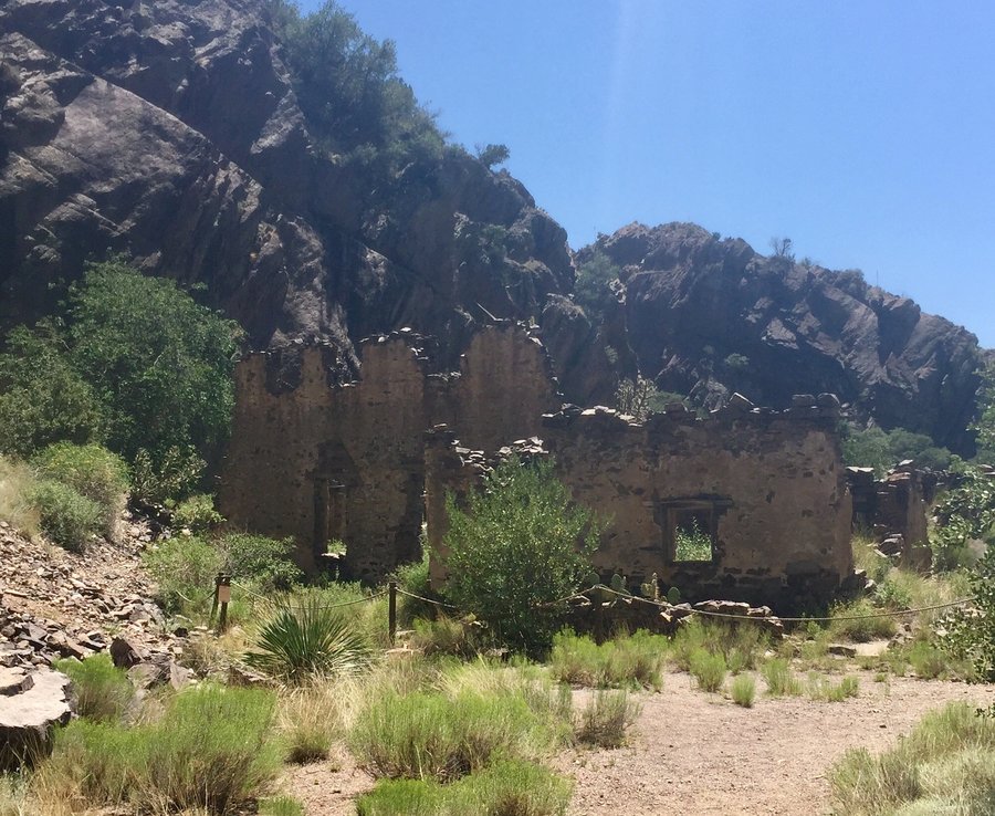
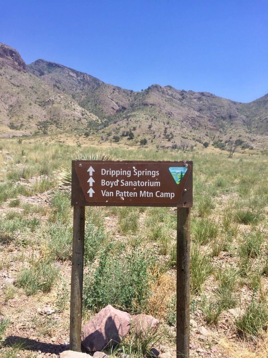
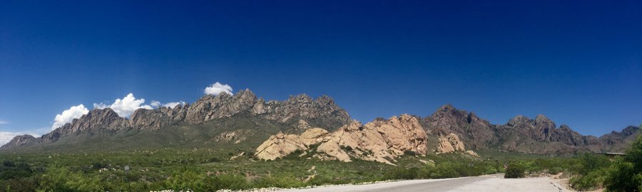
Organ Peaks National Monument—Las Cruces, NM
3.2 miles of hiking • 250' elevation gain •
Had an afternoon off from a business trip and decided to check this place out. Nice little visitor center. Was told the highest peak is around 9000’. Went on a short hike to to Dripping Springs but the heat, around 100 degrees, was a bit unpleasant.
June 27, 2019

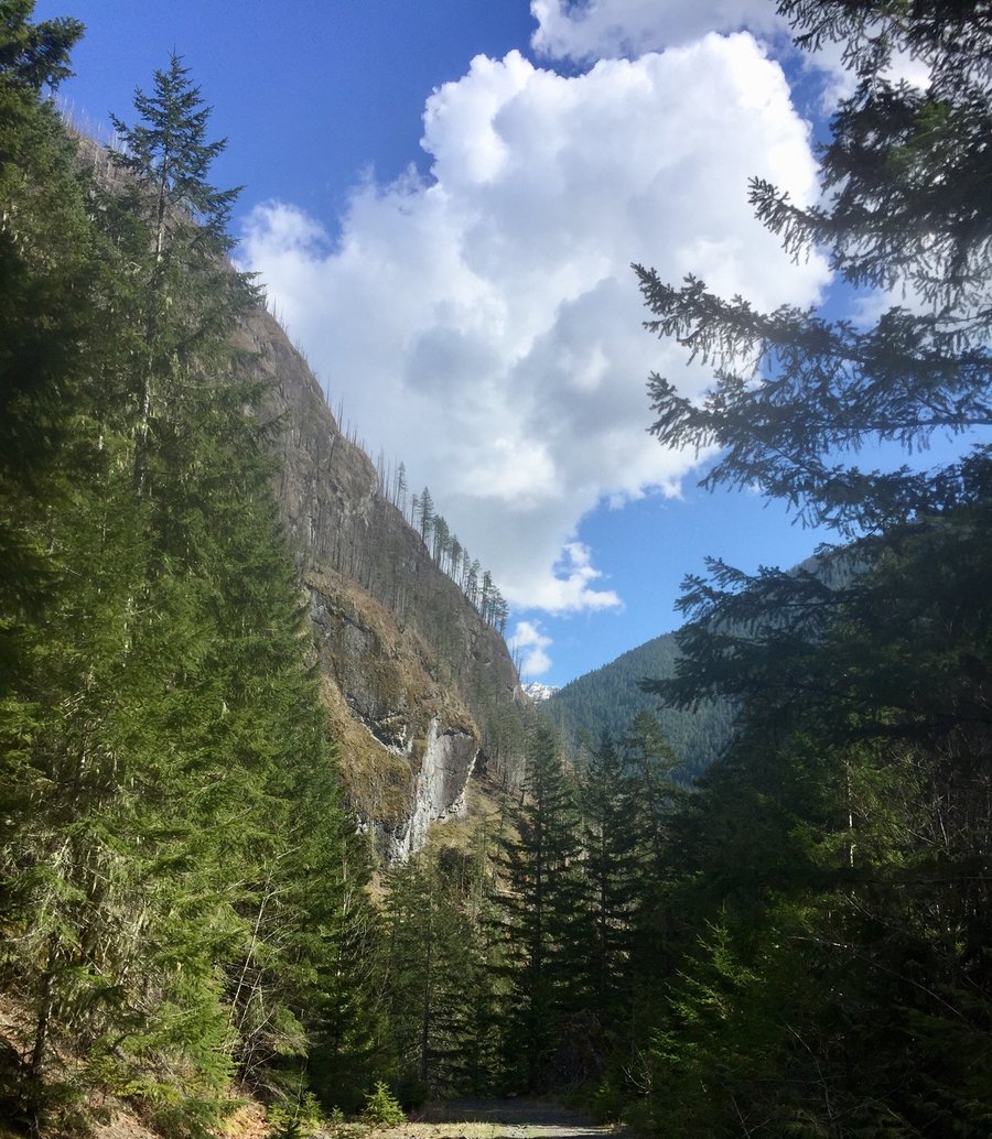
Florence Peak-Mt. Rainier NP
8.24 miles of hiking • 3750' elevation gain •
I am sure the views from the peak are nice but I did not see any of them because of the foggy, misty weather conditions. Nice waterfall at the 1.5 mile mark. Hike is on my fair weather re-do list.
June 23, 2019


 2
2
Mt. Rainier-Eagle Peak Saddle
7.2 miles of hiking • 3250' elevation gain •
Sloppy snow present the last 1/2 mile. Could clearly see Rainier, Adams, St. Helens and Hood from the top.
June 9, 2019


 1
1
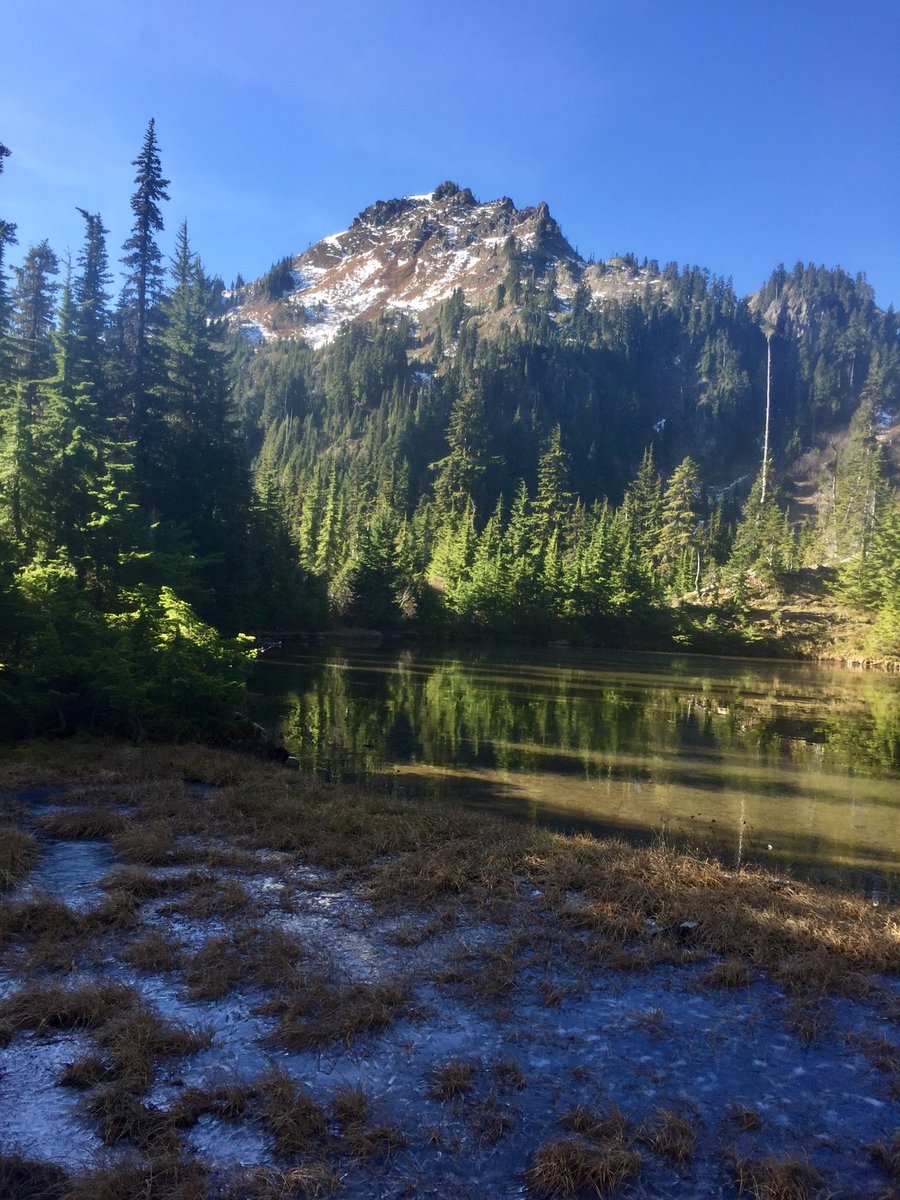
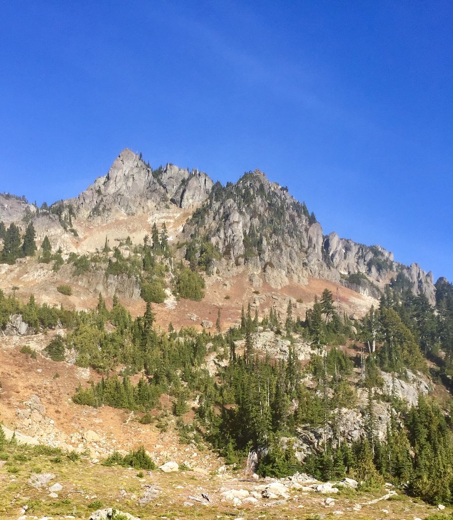
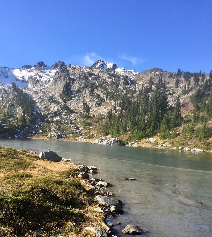
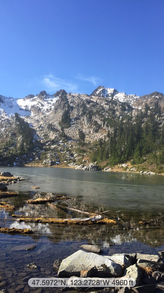
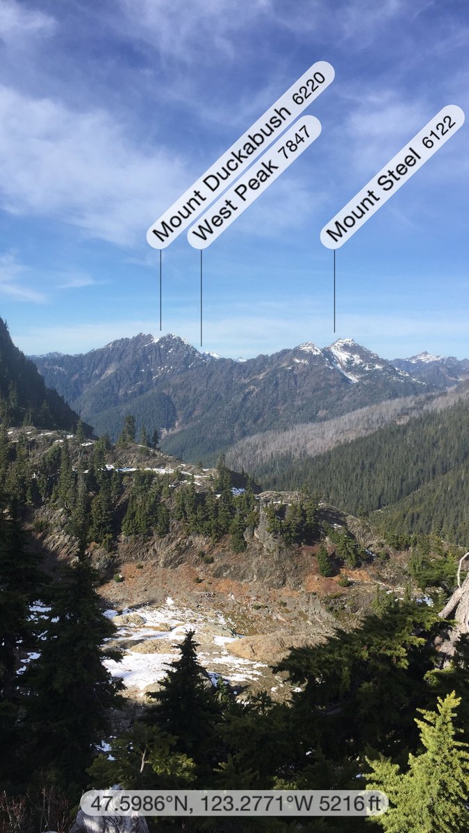
Goat Lake--Olympics
12.25 miles of hiking • 3750' elevation gain •
I've heard about this hike but never have attempted it before. It is a workout. The hike begins at the Upper Dungeness River TH and is a nice, easy stroll along the river until you reach Camp Handy. From there you cross the Dungeness River and pick up the Goat Lake way trail. We had a little bit of trail finding at that point but if you keep the river heading down to the Dungeness to your left you will pu the trail. From there keeping that river to your left will help. A bit after crossing the Dungeness things really get down to business as you will climb around 3000' in just over 2 miles to reach the lake. The lake is situated a bit over 5900' and was still mostly frozen over.
June 1, 2019


Marmot Pass
12.47 miles of hiking • 4500' elevation gain •
Began hike at the Upper Big Quilcene River TH. Quite a bit of snow remains above Camp Mystery but no traction devices needed. From the pass hiked up to Buckhorn Mtns. false summit which is at 6840’.
May 27, 2019


 3
3
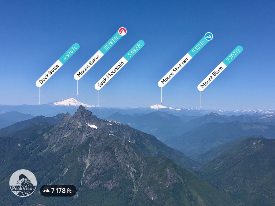
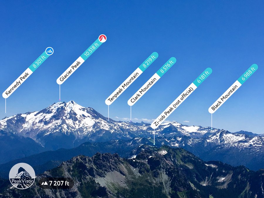
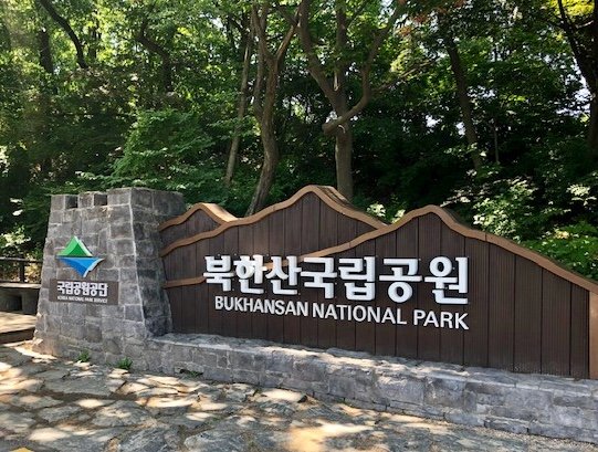
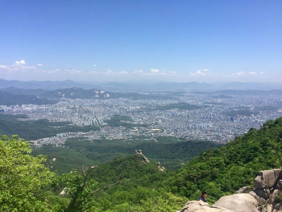
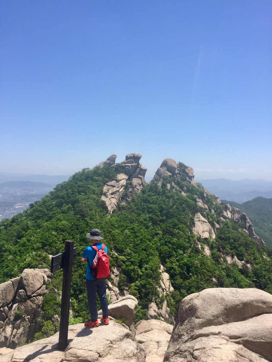
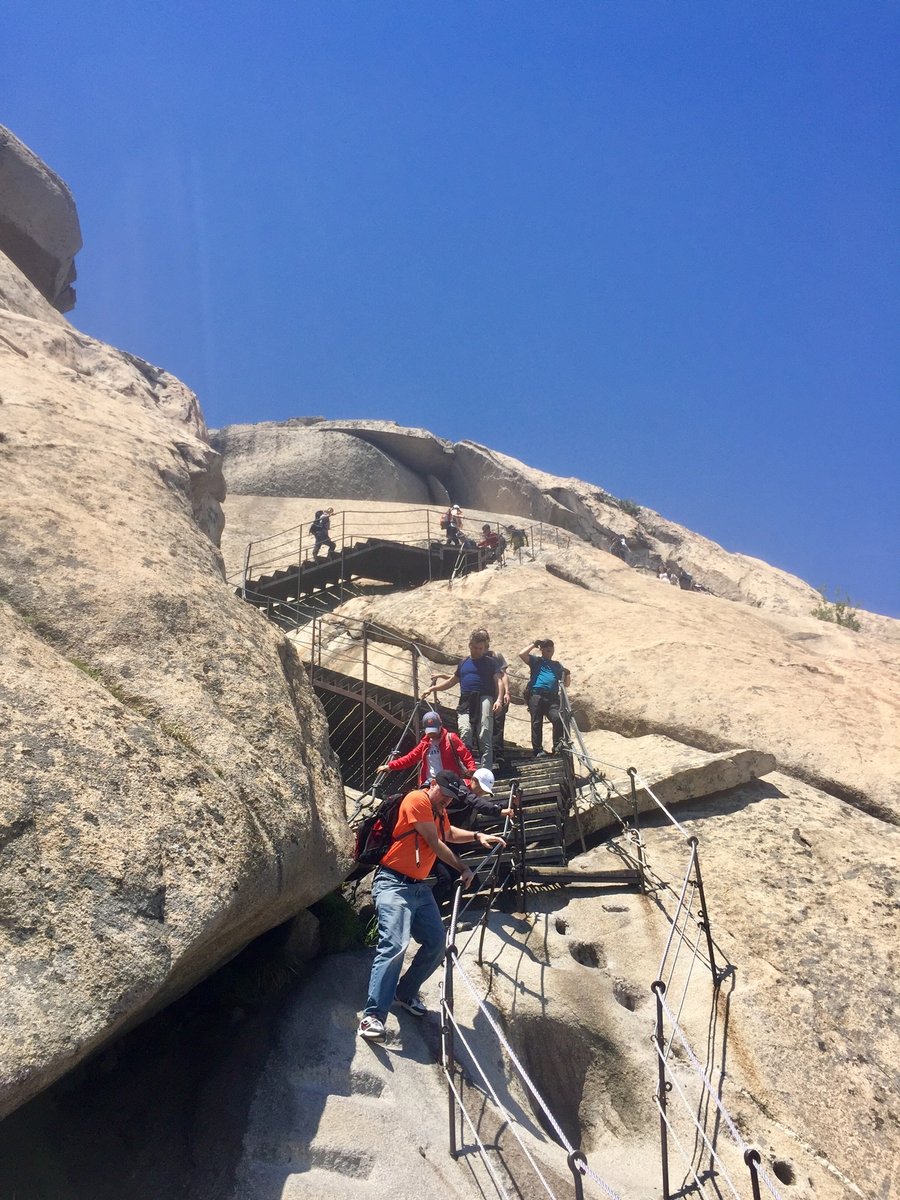
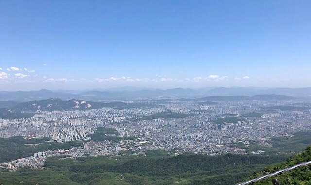
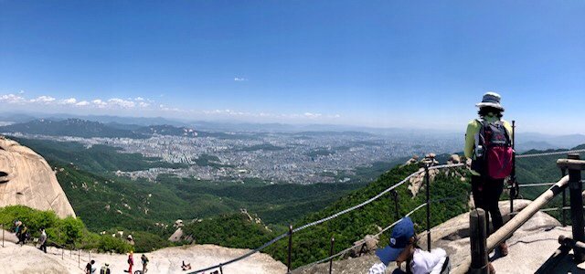
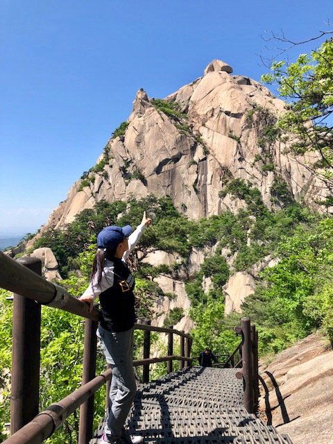
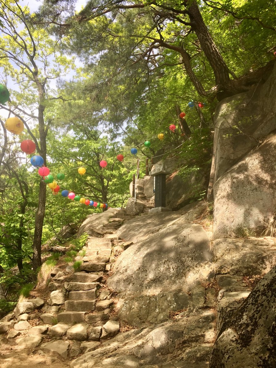
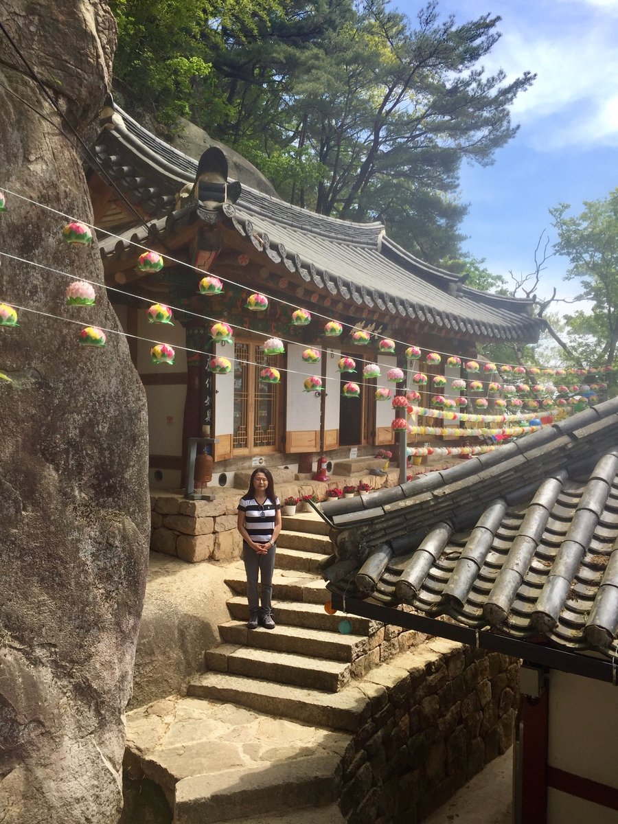
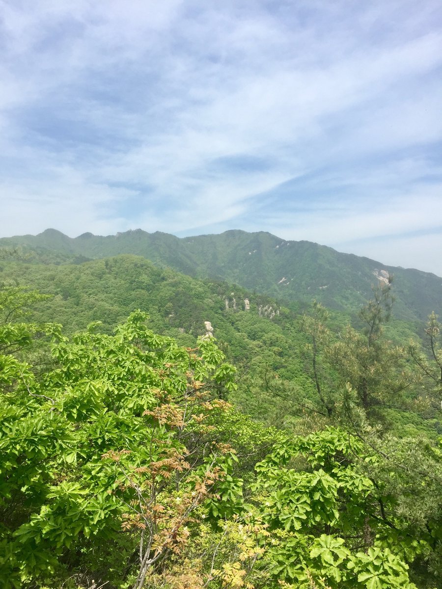
Bukhansan National Park-S. Korea
5.69 miles of hiking • 3250' elevation gain •
Hiked the tallest peak within the park Baegundae Peak.
May 20, 2019


 2
2
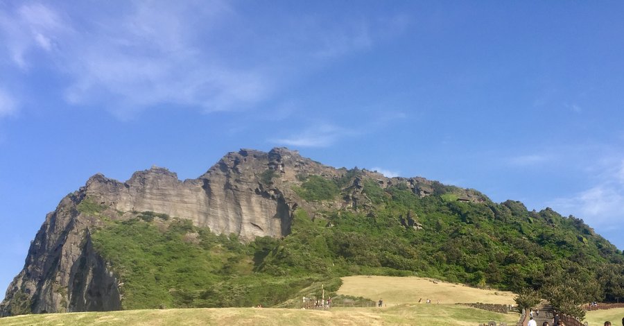
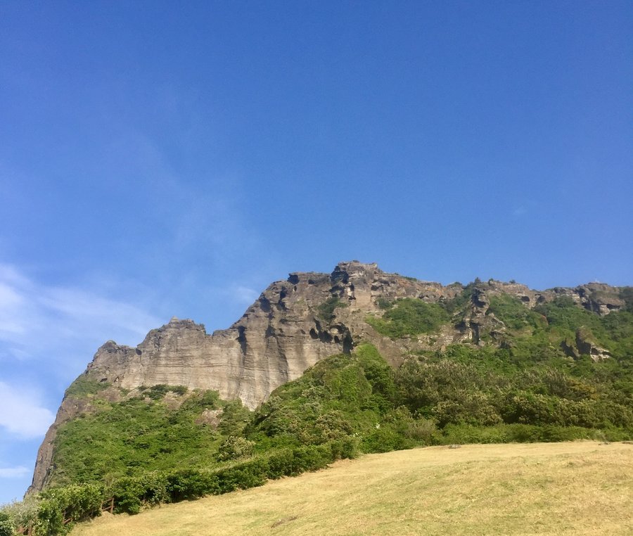
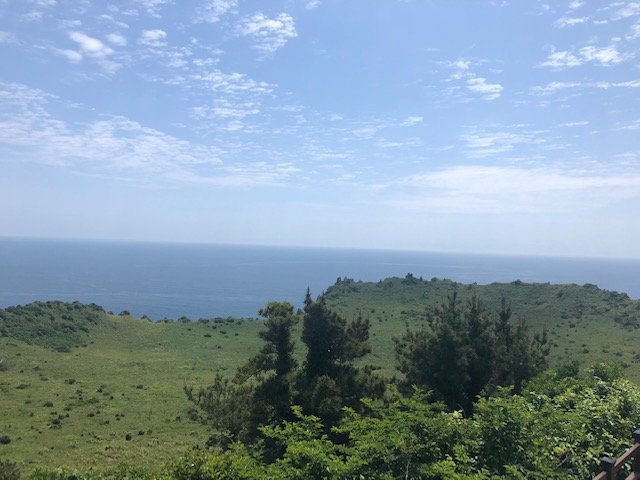
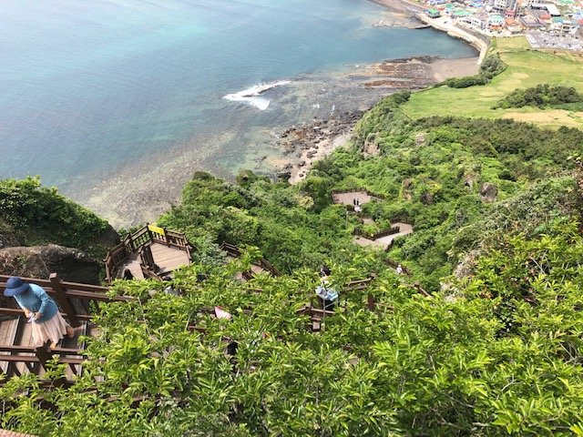
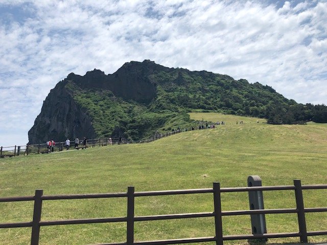
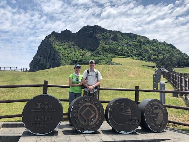
Soongsan ILchulbong (Sunrise Rock) Jeju Island, S. Korea
1 miles of hiking • 500' elevation gain •
May 16, 2019

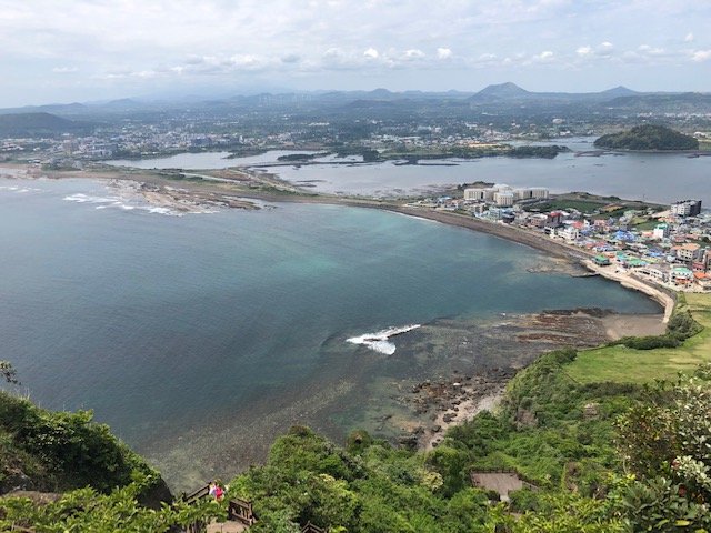
 2
2
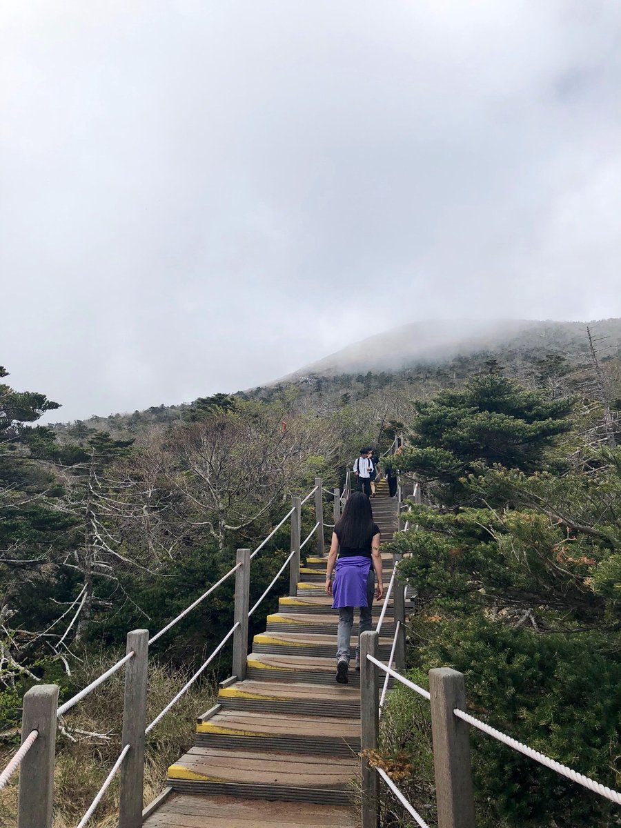
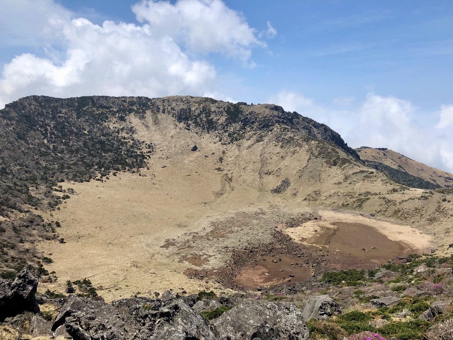
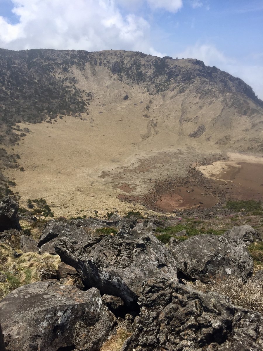
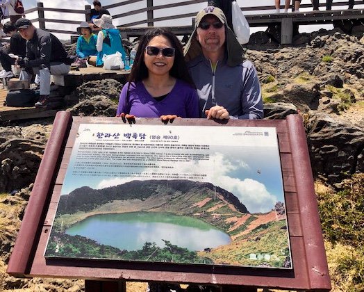
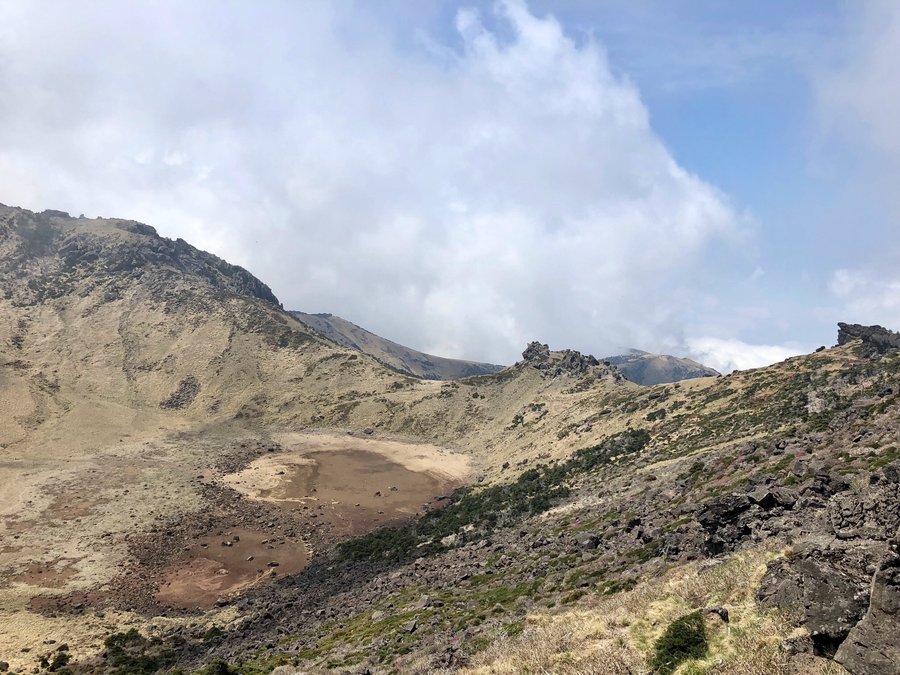
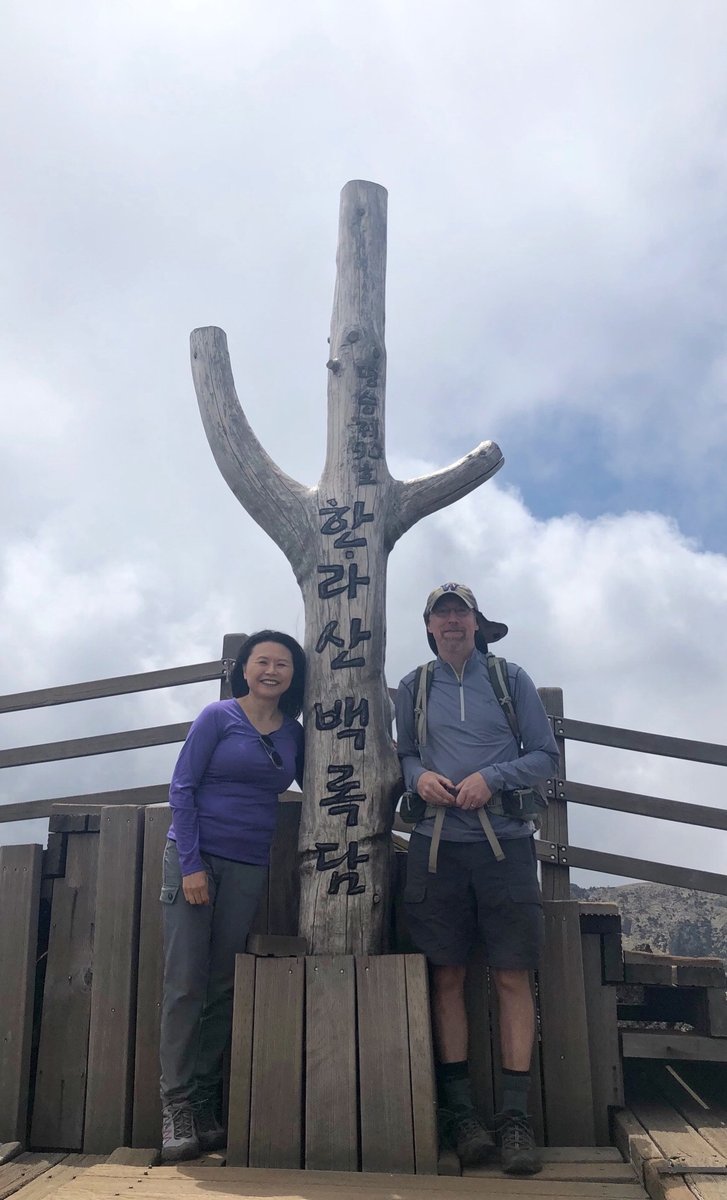
Jeju Island-Halla Mtn.—S. Korea
11.86 miles of hiking • 3750' elevation gain •
Mountain is a dormant volcano and is the tallest mountain in S. Korea at just over 6200’. Hiked up to the Baengnokdom crater.
May 13, 2019

May 7, 2019


 1
1
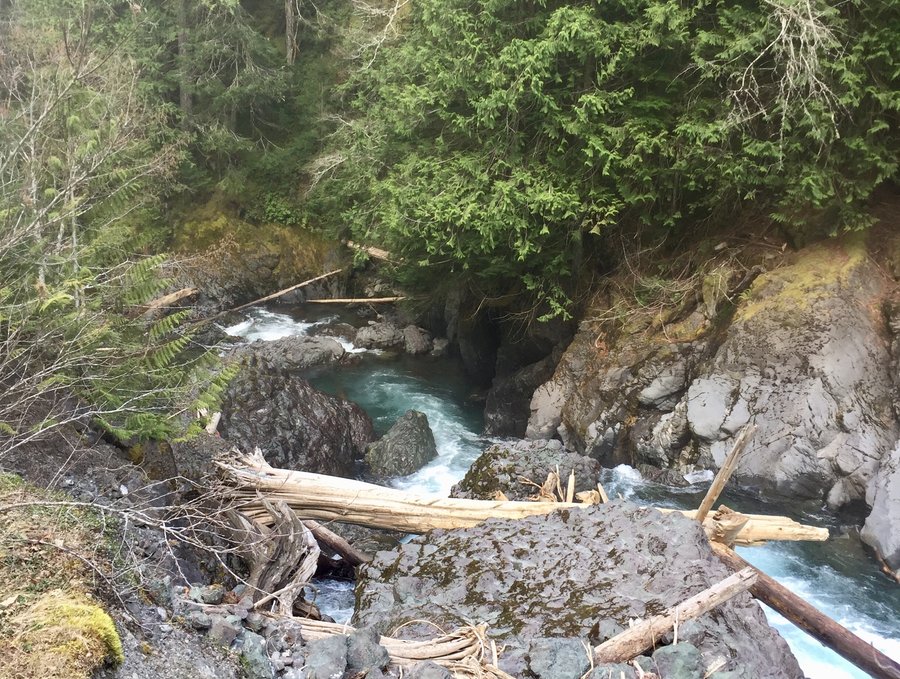
Copper Creek
5.93 miles of hiking • 2750' elevation gain •
The ONP entrance to Staircase remains closed due to construction so a lot of people were parking near the Copper Creek TH to enter the park via the Shady Lane Trail. As usual little traffic on the Copper Creek Trail which was snow free. Completed the upper loop counter clock wise where in typical PNW weather it was nice & sunny on the climb up and breezy, cold with sleet/snow at the top.
April 27, 2019
 1
1
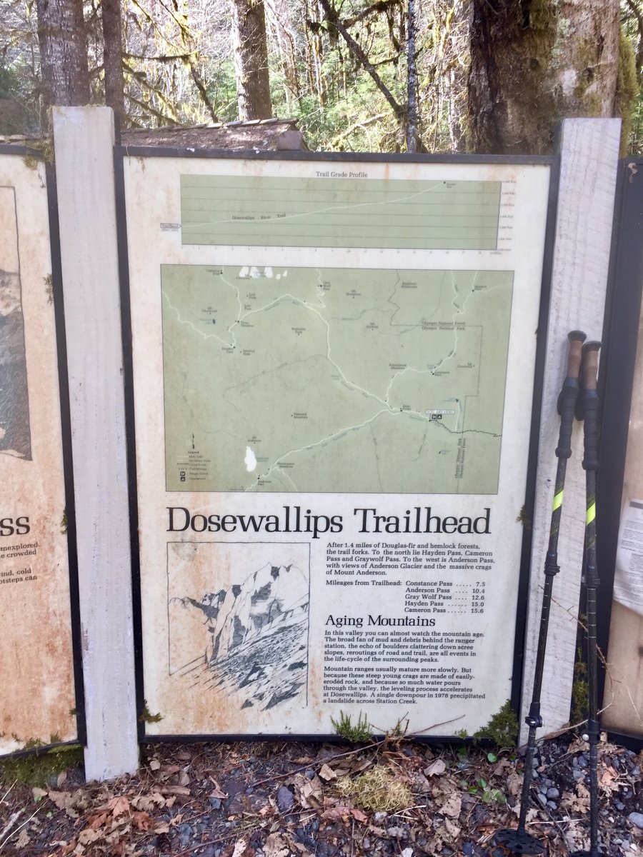
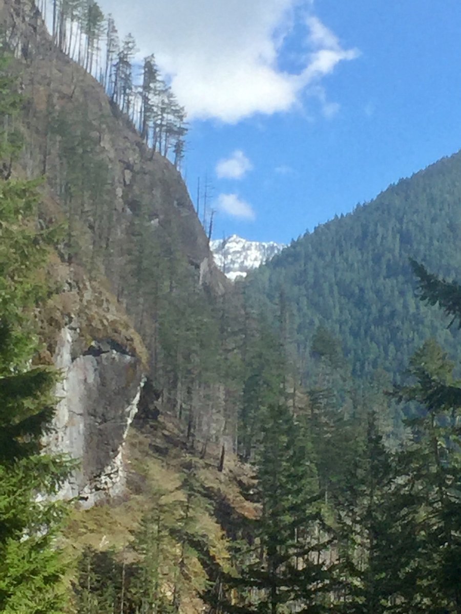
Dosewallips to 5050 Pass
6.52 miles of hiking • 4500' elevation gain •
This has to be one of the steepest trails in the ONF and is one of the few trails in the Olympics that I have never hiked before. The TH is approx. 1/4 of a mile from the Dosewallips washout parking area and is signed as Tunnel Creek TH #841. The climb to 5050 pass is 4500' in little more than 3 miles. Snow became fairly consistent at 4600' and I used snowshoes from there to the pass. The plan was to climb Mt. Valhalla which would have added around another 500' of ascent to the day, but due to foggy/misty conditions with limited visibility decided to call it a day after reaching the pass.
April 20, 2019

 2
2
Oyster Dome
5.51 miles of hiking • 1000' elevation gain •
After visiting our youngest son who lives up in Bellingham we did a quick hike up to Oyster Dome. Nice views with minimal effort.
April 7, 2019


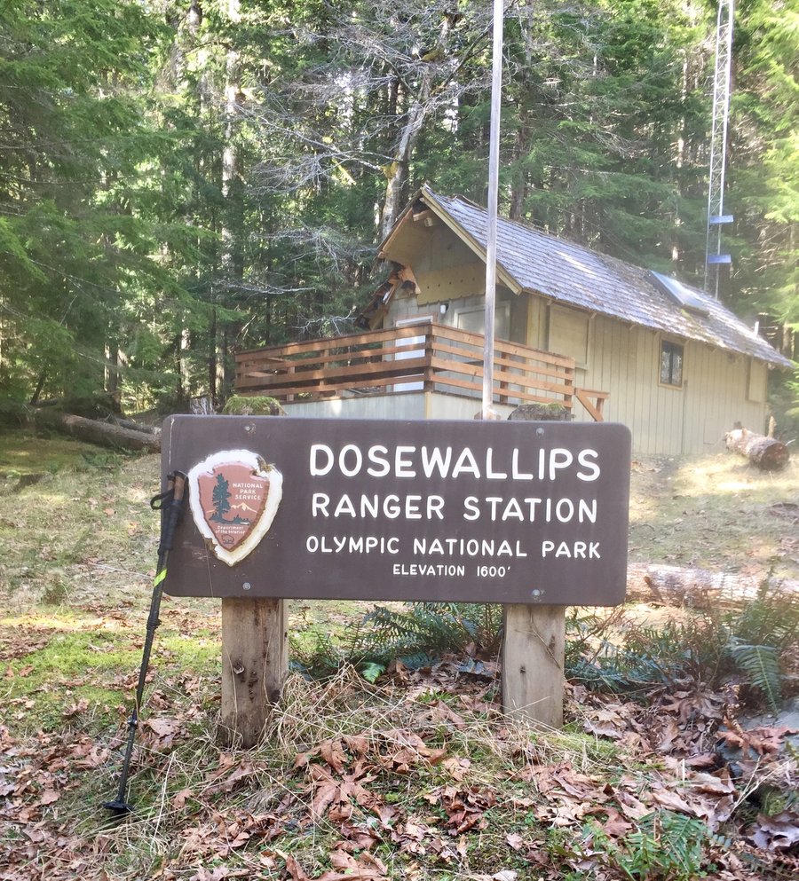
Up the Dosewallips
18.33 miles of hiking • 2250' elevation gain •
The hike to the old ONP Campground/Ranger Station gets longer and longer. The road up the Dosewallips is now blocked a little more than a mile from the old major washout because of a more recent road washout. This adds about 2 1/2 miles roundtrip to the hike. We went about a mile and half passed the Ranger Station. Fair bit of people were camping at Elkhorn and at the ONP Campground. Wished I had brought my overnight gear as the camping conditions were pretty sweet.
March 30, 2019

 2
2
Buck Mountain
10.3 miles of hiking • 3250' elevation gain •
Started hike from the Elbo Creek TH. Some snow on the trail higher up but no traction devices used. Once I hit the road put on the snow shoes and used them all the way to the 3700' summit. Did not see a single person the entire day on the trail.
March 17, 2019

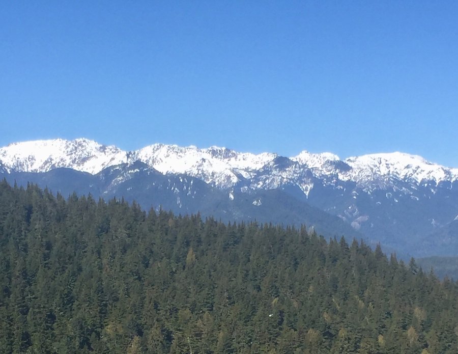
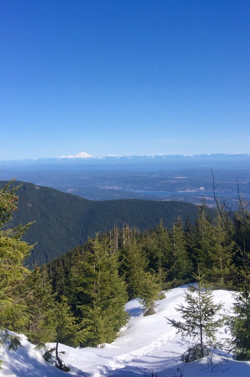

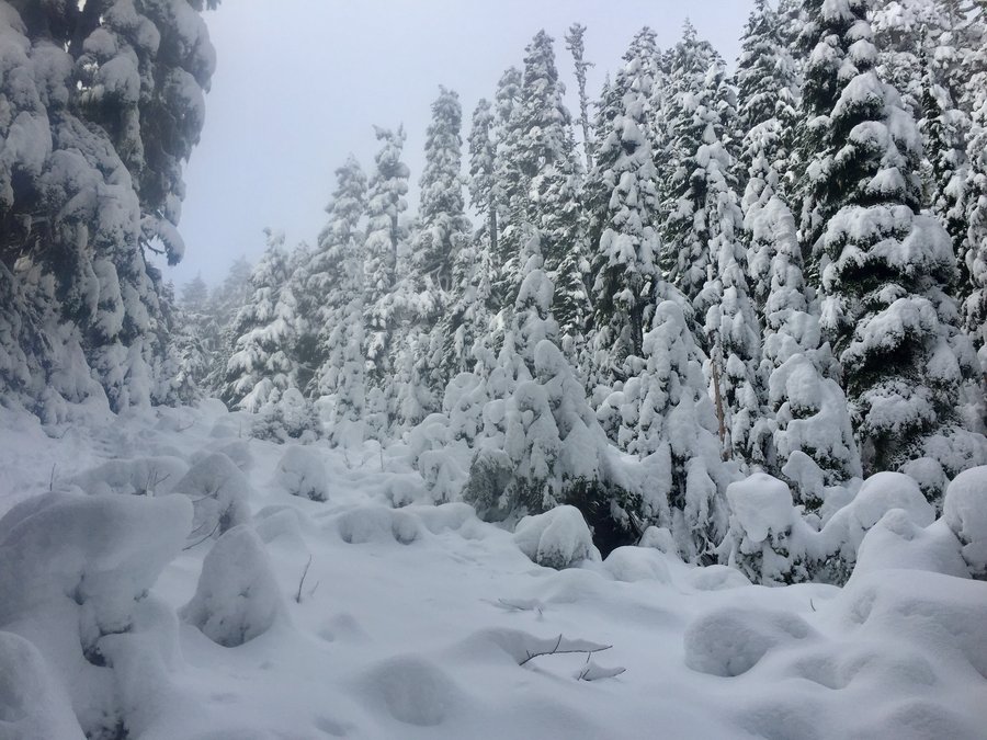
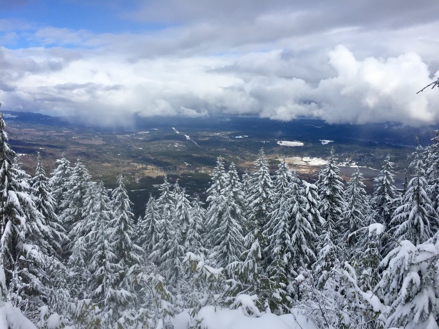
Mt. Ellinor
13.8 miles of hiking • 5000' elevation gain •
One still cannot reach the normal Ellinor TH's due to snow so began hike at the Big Creek TH. Have never attempted an Ellinor hike/climb from this TH and it does make for a long day. Used microspikes from the parking lot up to the upper Ellinor TH then switched to snowshoes until the avalanche chute. Used crampons from there to the summit. There was an easy to follow broken trail pretty much from top to bottom. Perfect conditions.
March 3, 2019


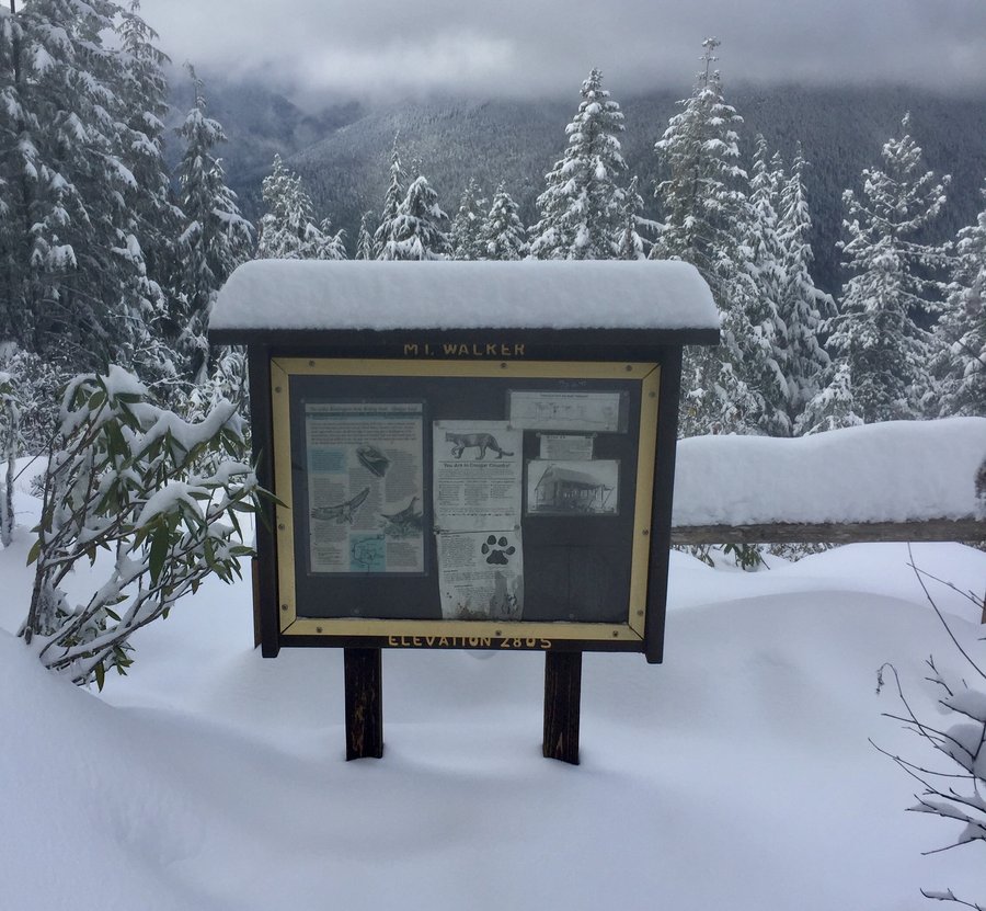
Mt. Walker
5.85 miles of hiking • 2250' elevation gain •
HIked to both the North & South Viewpoints. Over a foot of snow at the top.
February 24, 2019


Pinnacle Peak
4 miles of hiking • 2000' elevation gain •
Up the north trail, down the south, then repeated.
February 17, 2019
 1
1
Tiger Mountain
11.45 miles of hiking • 3000' elevation gain •
Entered via the Highline TH and took various trails up to summit 1. Conditions were mellow with a little snow dusting when approaching summit 1. Once we got to the exposed area/viewpoint near the Hikers Hut the snow and wind were howling pretty good necessitating taking our lunch break within the shelter of the Hut. After lunch headed back down taking various trails and exiting @ Highline.
February 3, 2019

Dry Creek
8.15 miles of hiking • 1500' elevation gain •
Our destination was Dry Mtn. but while attempting to ford Dry Creek, which is anything but dry this time of year, my hiking partner slipped off the crossing log and took a bath in the creek. Thankfully no injuries but it was decided at that point retuning to the car was the prudent decision due to his cold, soggy condition.
January 27, 2019

January 20, 2019

 1
1
Mt. Rose
6.5 miles of hiking • 3750' elevation gain •
Did the loop clock wise. Put on the micro spikes at around 3400'. Was nice and warm sitting on the summit rock. Could clearly see Rainier, Adams & St. Helens from the summit.
January 13, 2019


View trips from: 2012 2013 2014 2015 2016 2017 2018 2020 2021 2022