


2018 Trips


 2
2
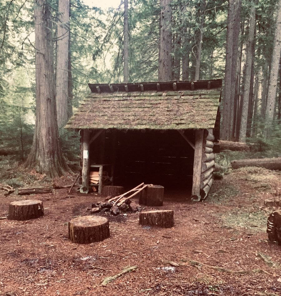
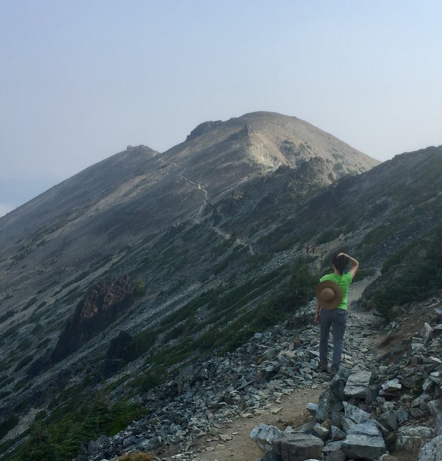
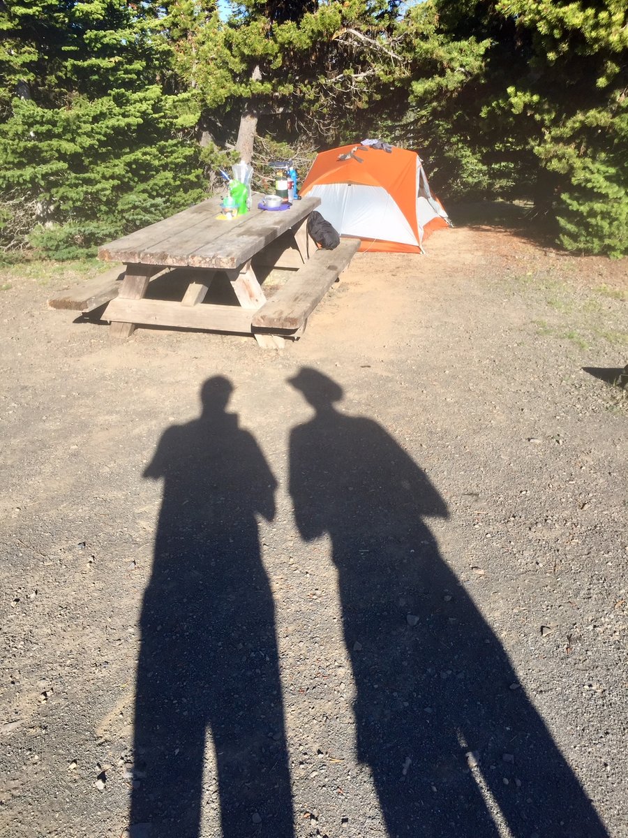
Tiger Mtn. Trifecta
8.5 miles of hiking • 3500' elevation gain •
Hit all 3 summits plus the Hiking Hut. No snow anywhere.
December 23, 2018

Mt. Townsend
10.76 miles of hiking • 3500' elevation gain •
There are 4 trails to the summit of Townsend. I have never hiked it from the lower TH off of forest road 27 before & it adds approx. 1.2 miles & 600’ to the assent compared to starting @ the upper TH. Trail was in nice condition with a bit of snow on & off the final 1000’ from the summit.
December 8, 2018


Big Creek
8.6 miles of hiking • 2500' elevation gain •
Hiked up to where the trail connects with the Mt. Ellinor lower trail. Trail currently snow free.
December 2, 2018

 1
1
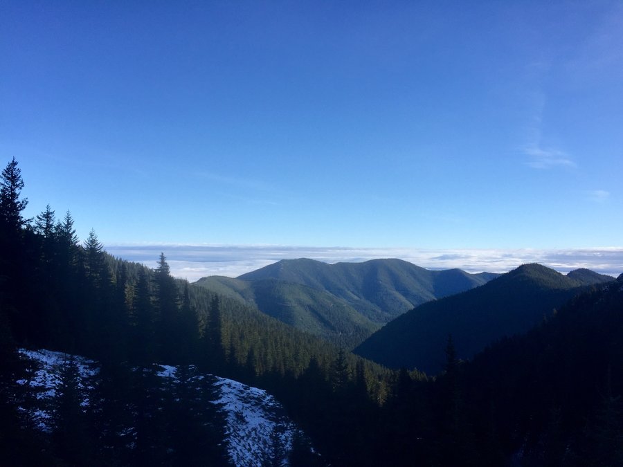
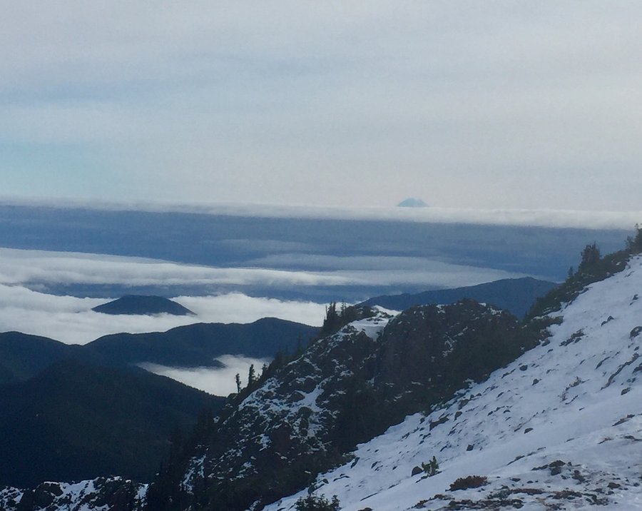
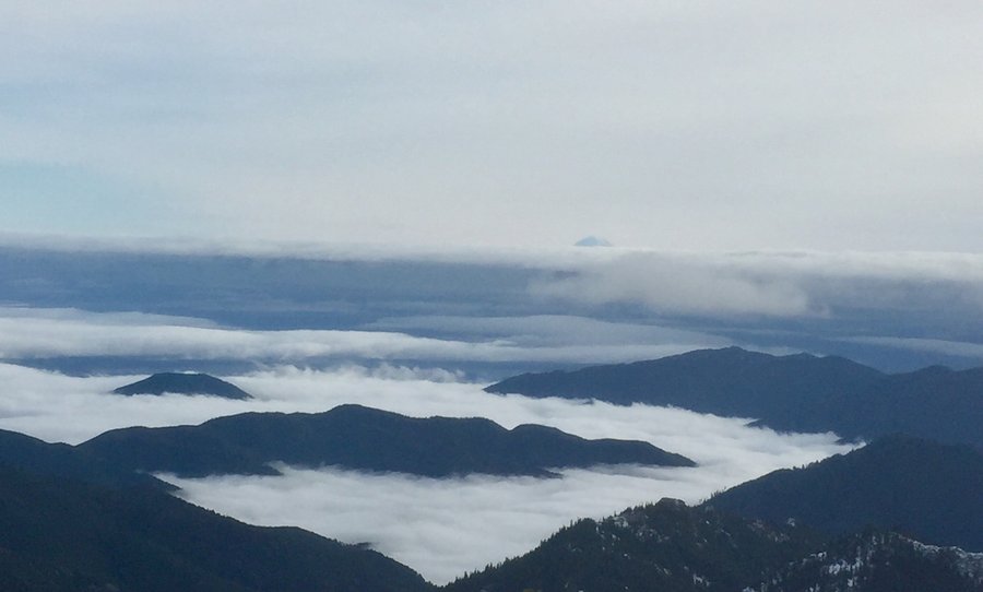
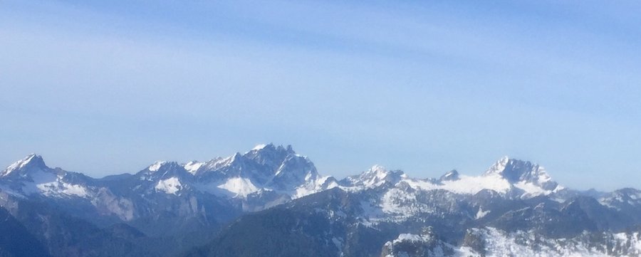
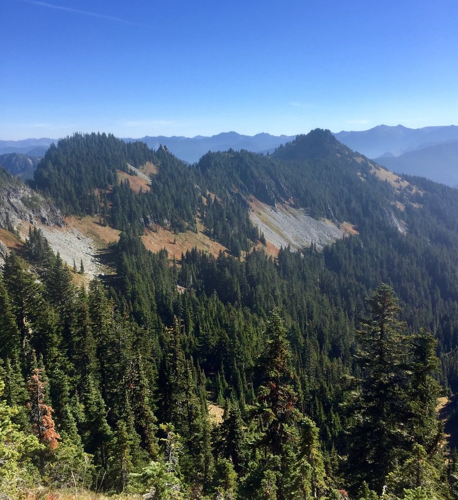
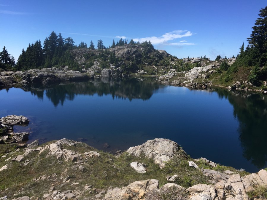
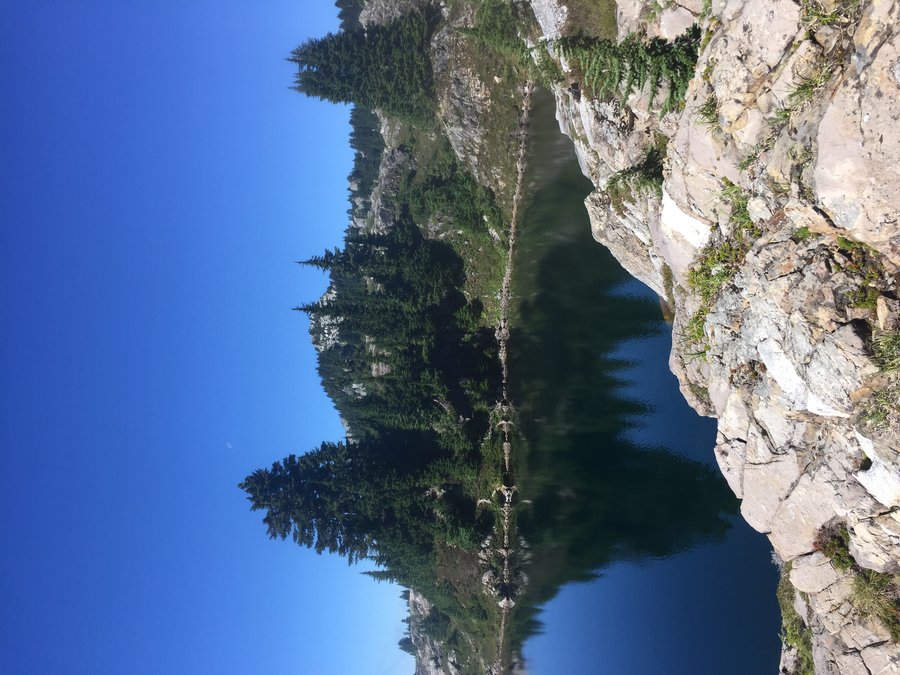
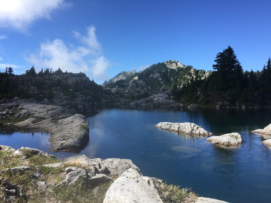
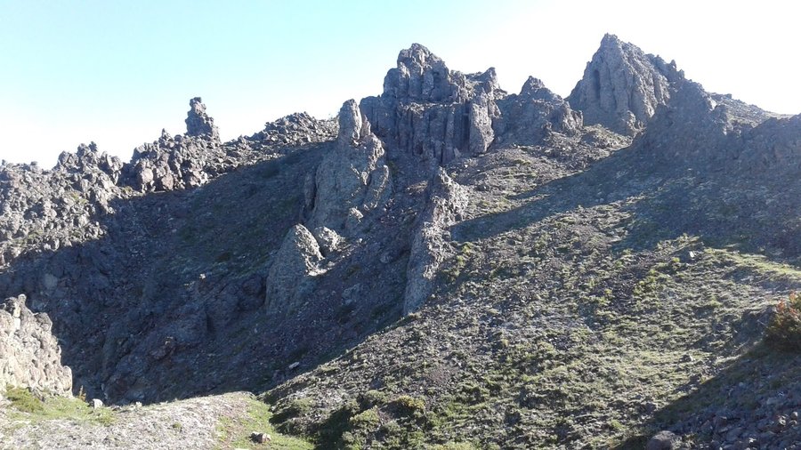
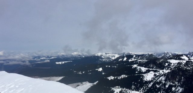
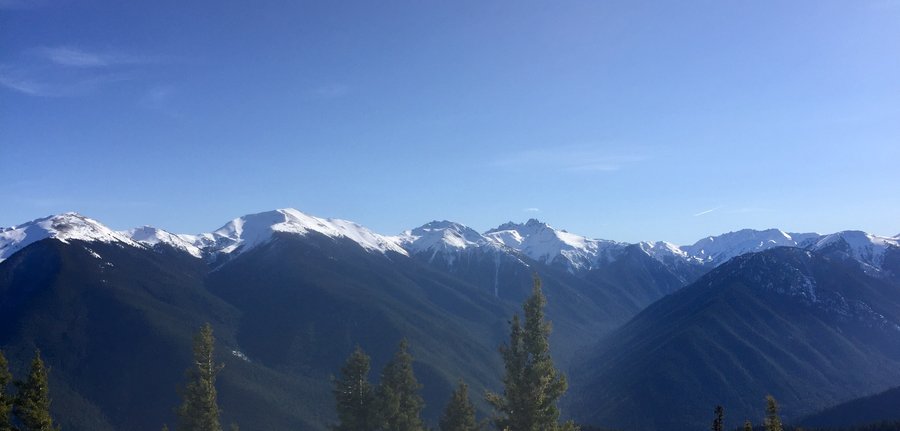
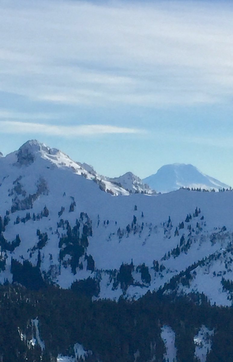
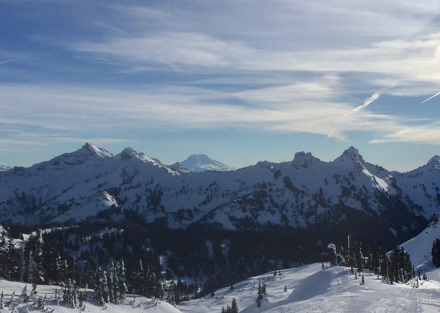
Tunnel Creek--Valhalla Peak
9.65 miles of hiking • 3000' elevation gain •
Pretty cold and frosty at the TH.....around 35 degrees but once you got above the saddle to Valhalla Peak it got downright balmy. On this day it was perfect at the summit, warm with no breeze, and one could clearly see 4 volcanoes along with Mt. Constance looming in your face to the NW.
November 18, 2018

 1
1
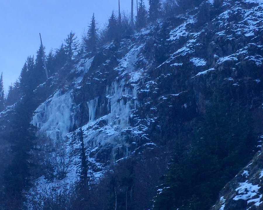
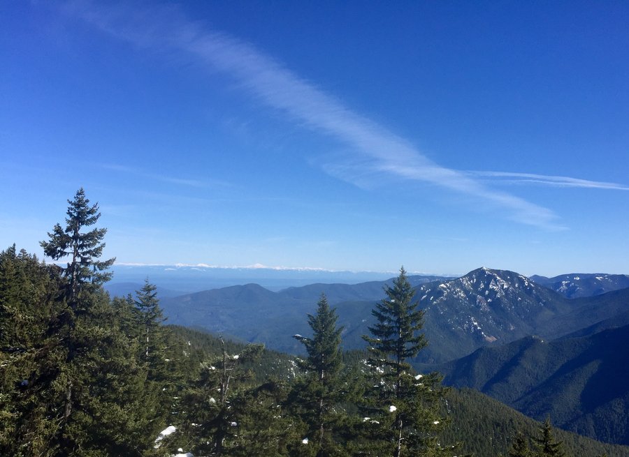
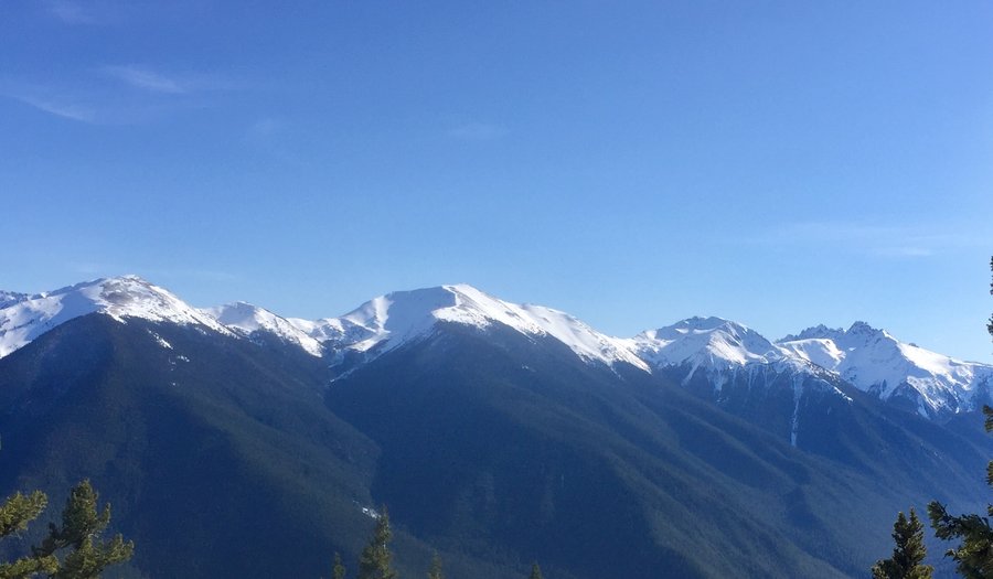
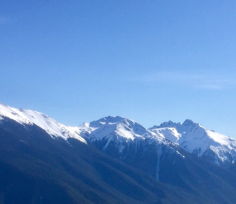
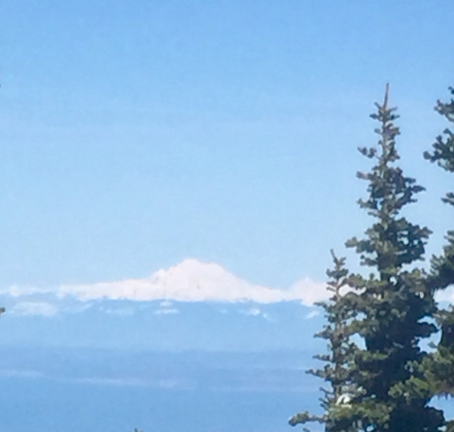
Mt. Dickerman
9.04 miles of hiking • 4000' elevation gain •
Winter has arrived in the N. Cascades. Great views from the top with clear views of Mt. Baker, Glacier Peak, etc... Could even see the Eastern Olympic range to the S/W & the top of Rainier to the South. Snow began in earnest approx. 1 1/2 miles and 1200' from the summit but there is a very pronounced boot path so no route finding was involved. Microspikes were useful but unless you plan to partake in some off trail exploring snowshoes are currently not needed.
November 11, 2018


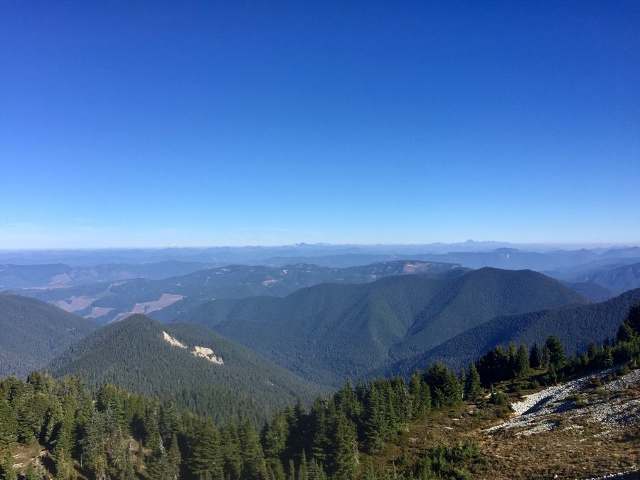
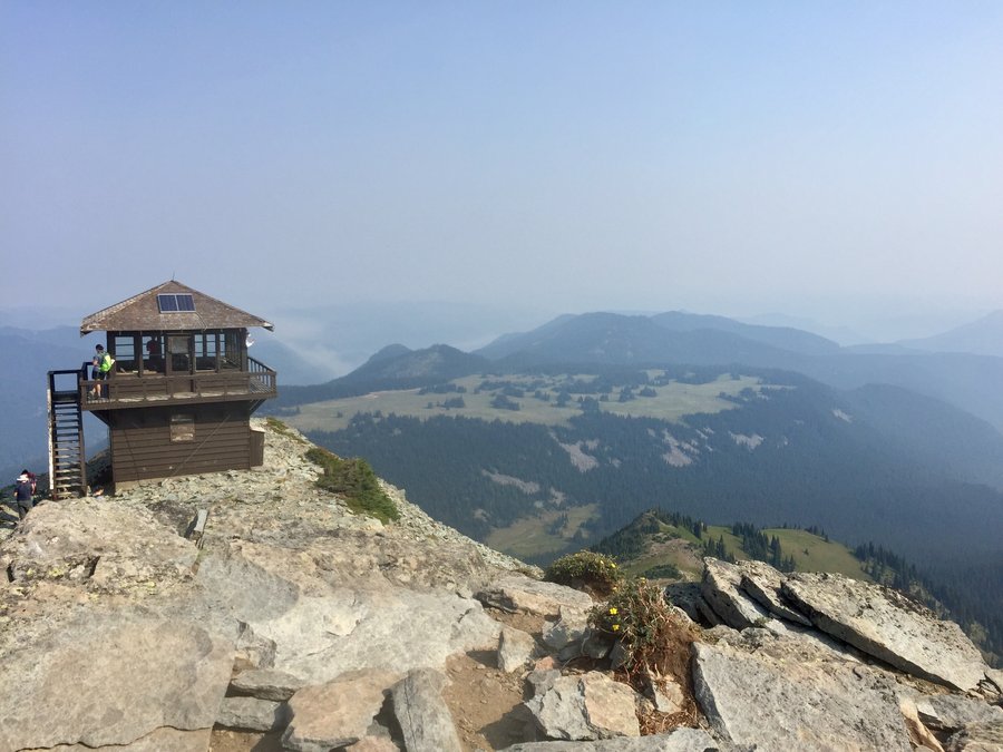
Bearhead Mtn.
6.03 miles of hiking • 2000' elevation gain •
Hike originates from the Summit Lake TH but very few hike to Bearhead’s summit. Only ran into 3 people once I got onto the Bearhead Mtn. trail. BH Summit used to have a fire Lookout so views are quite nice. Was the perfect hike to get above the fog & stagnant air present in the lowlands. Because of the inversion layer it was pretty much t-shirt and shorts weather once you broke out of the trees.
October 21, 2018


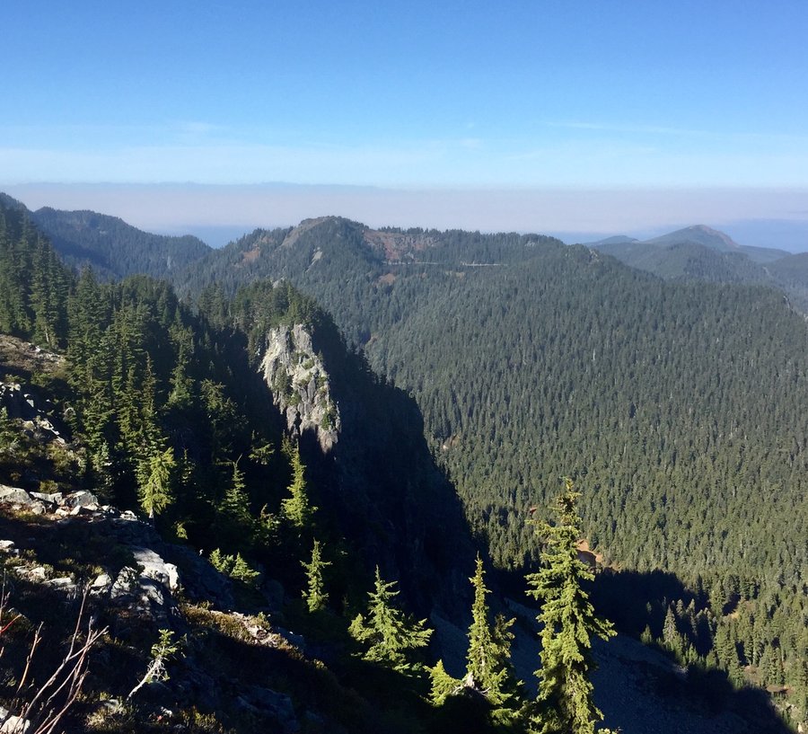
Mt. Defiance
11.13 miles of hiking • 4000' elevation gain •
This is one of the few hikes off of I-90 east of North Bend that I have never done. Very few people venture further than Mason Lake but those who put in the effort will will be rewarded with 360 degree views from the summit.
October 12, 2018


 2
2
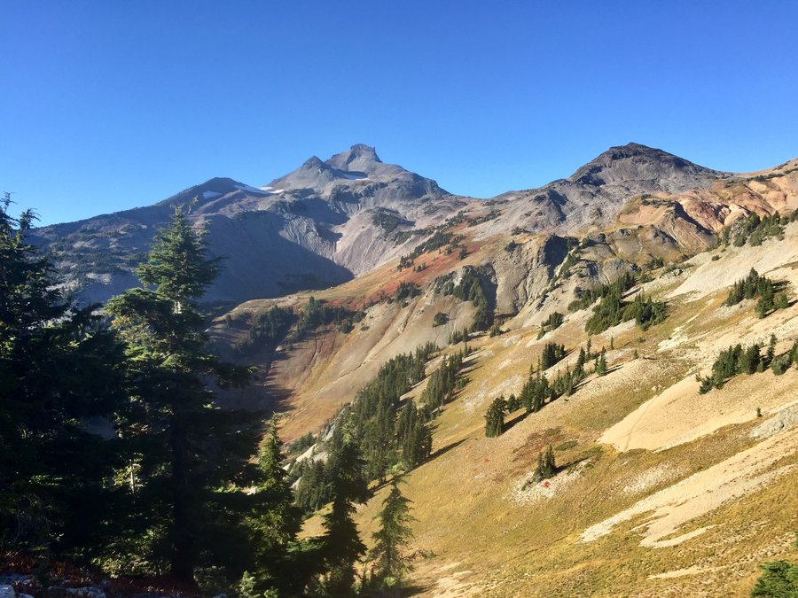
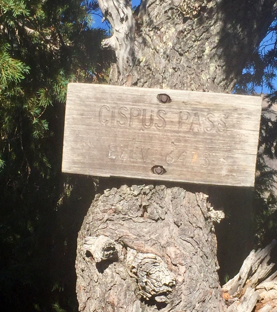
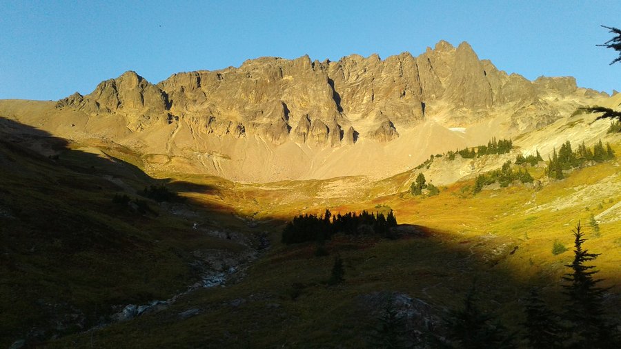
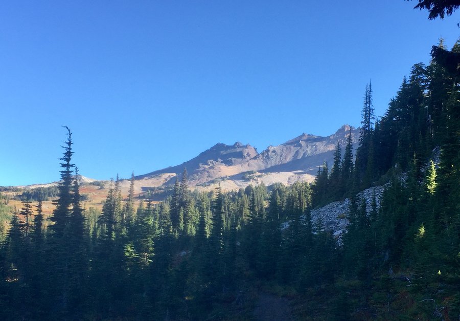
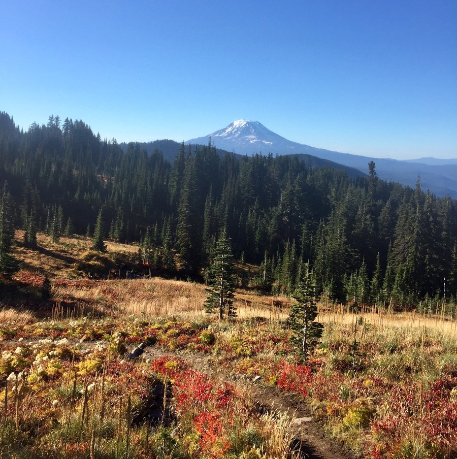
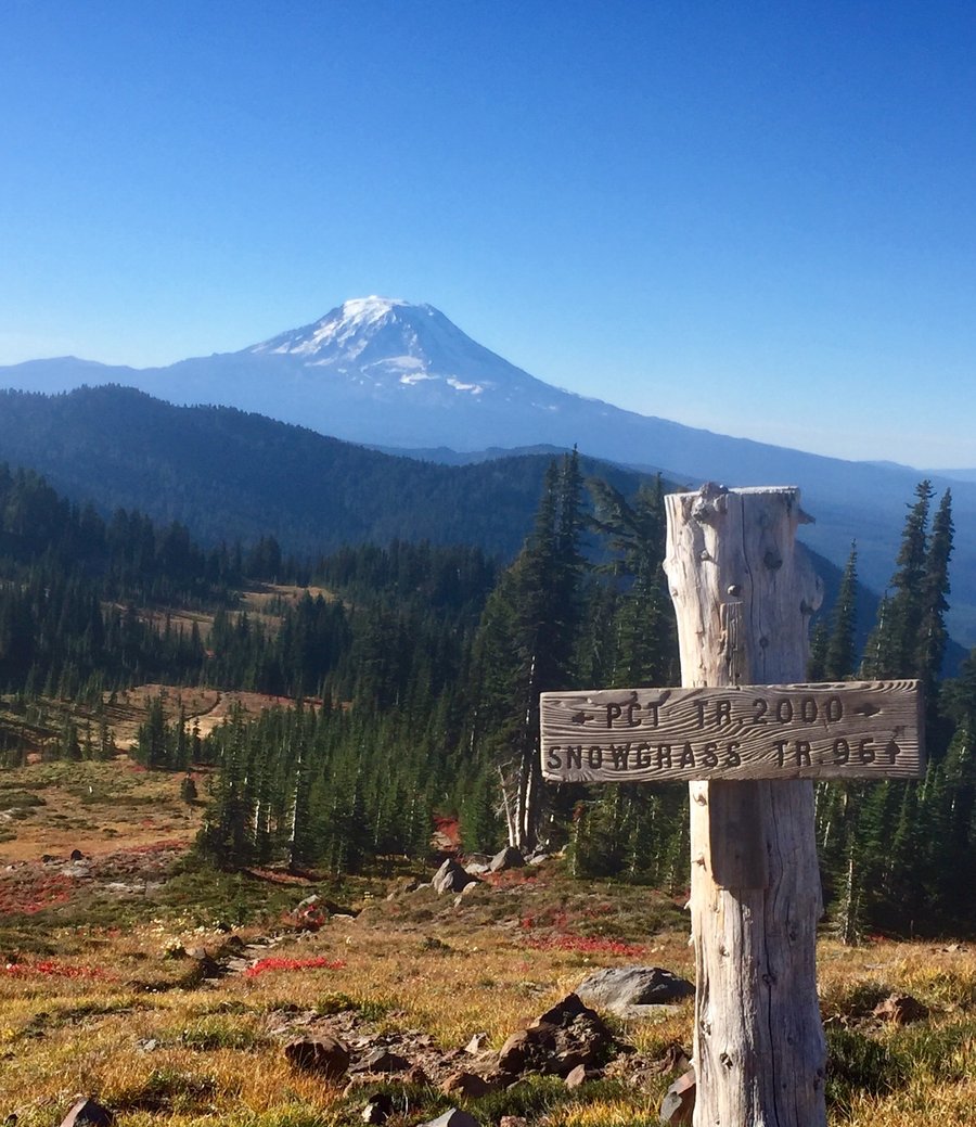
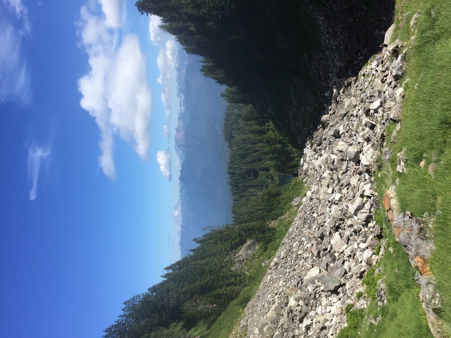
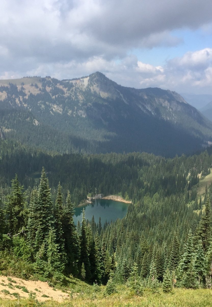
Goat Rocks-Cispus Basin/Pass & Snowgrass Flats
17.3 miles of hiking • 3750' elevation gain • 2 nights
Entered via the Snowgrass Flats TH & found a nice campsite within the basin right next to the Cispus River. Set up camp & climbed to the pass. Great views! Slept in the next morning, packed up & took the PCT to Snowgrass Flats which was completely empty of campers. Grabbed a nice campsite up on the ridge overlooking the Flats with an awesome view of Mt. Adams. Next day hiked out via Snowgrass Flat Trail.
September 27 – September 29, 2018


 1
1
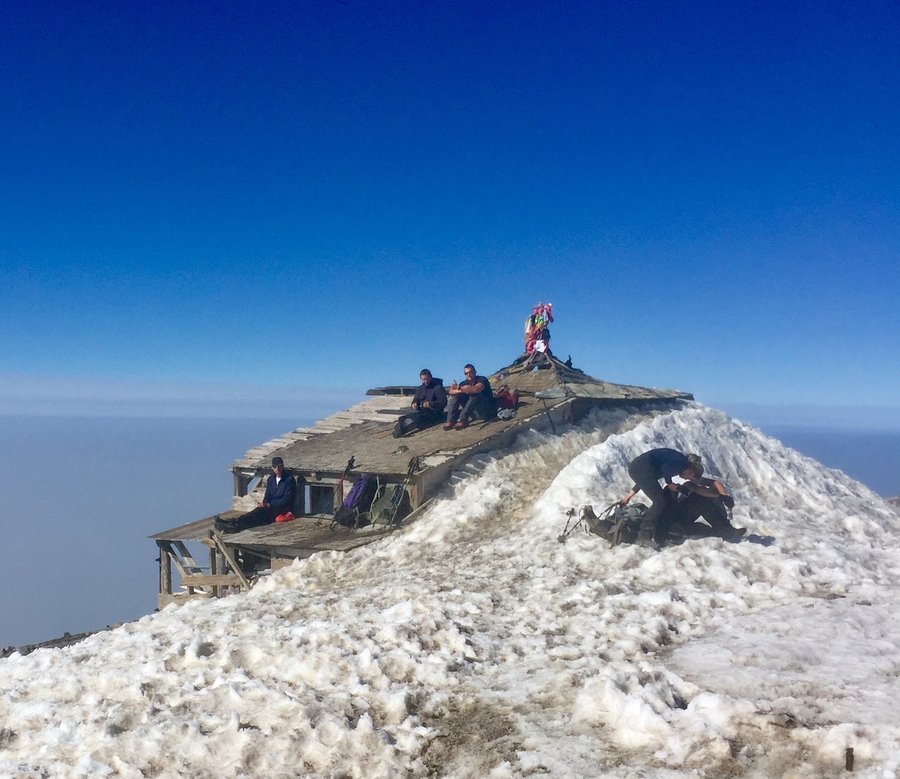
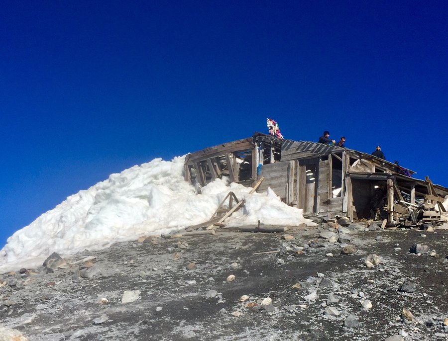
Tiger Mtn. Trifecta
8.66 miles of hiking • 3500' elevation gain •
An oldie, but a goodie. Up Section Line to summit 3, than over to summit 2, than hit the Hikers Hut. Next up to summit 1 and than down & out via the Hig School Trail.
September 23, 2018
 1
1
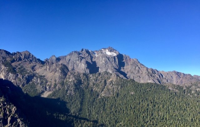
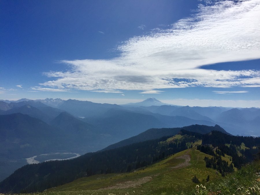
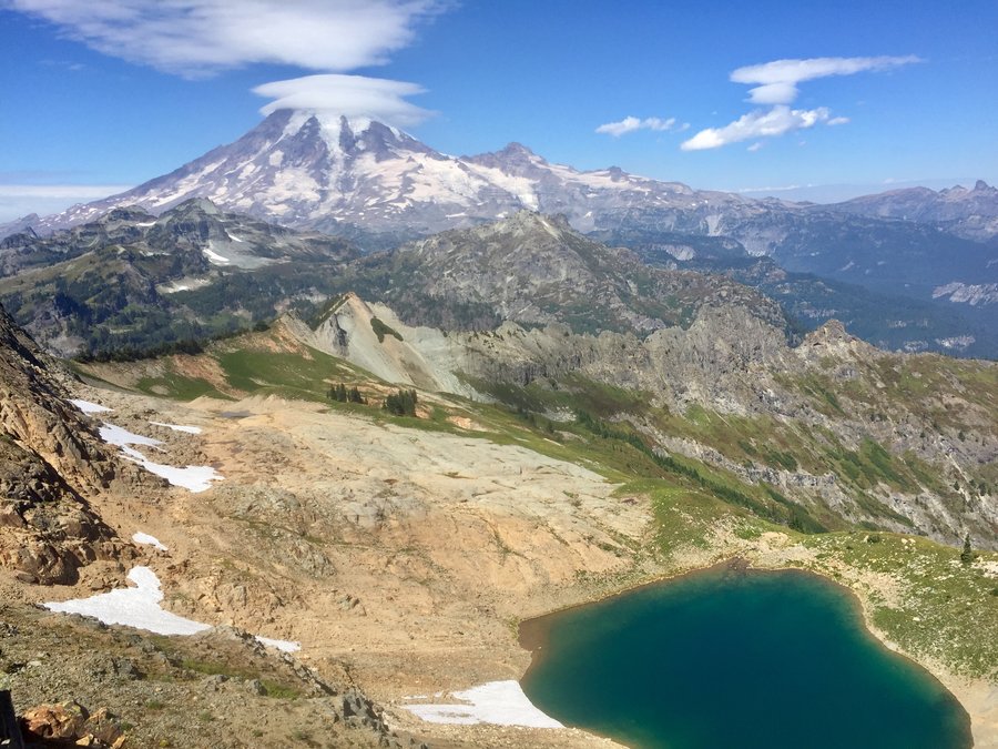
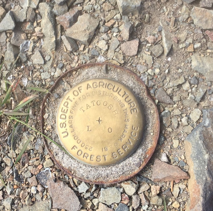
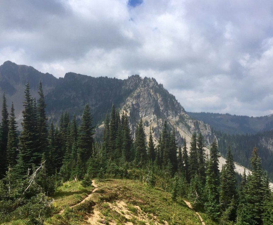
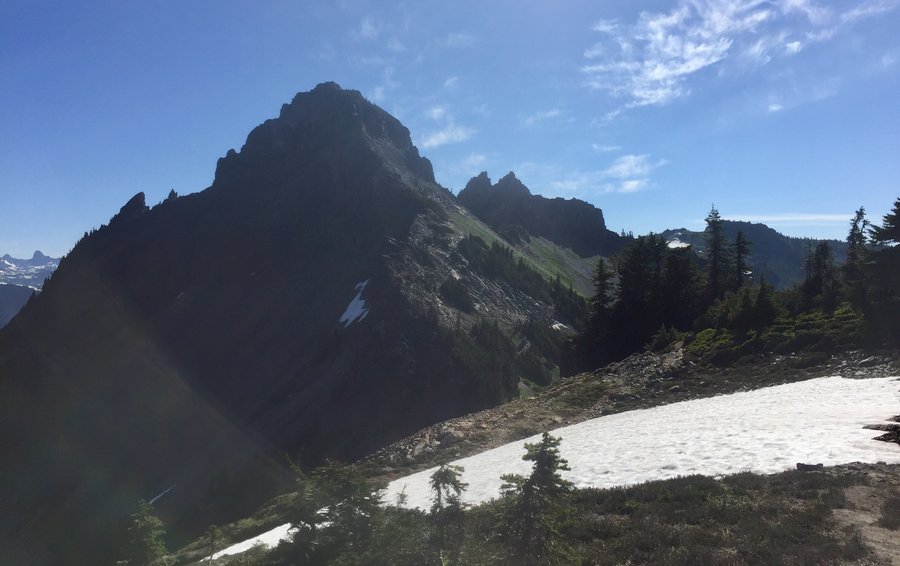
Tatoosh Peak
10.67 miles of hiking • 4250' elevation gain •
Peak is the site of a former fire lookout so the views are expansive. The majority of the elevation gain is at the beginning of the hike and than it is a moderate up & down ridge hike until you hit the way trail to Tatoosh Peak.... where it gets a bit steap once again as you make the final accent to the peak. Only saw 3 people the entire day.
September 7, 2018

 1
1
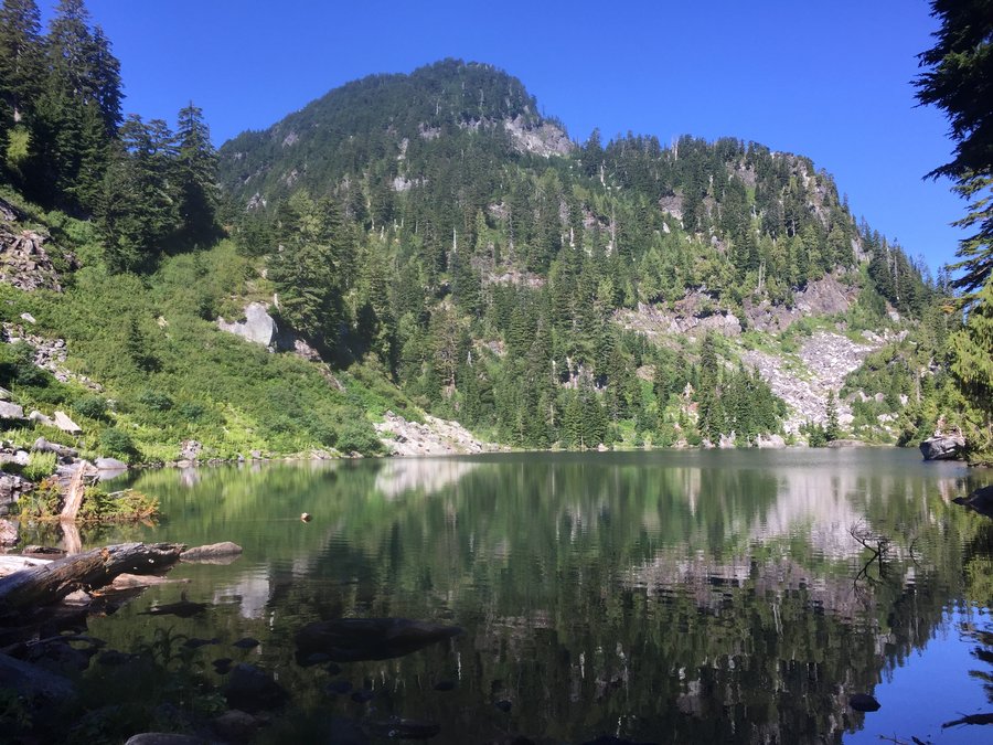
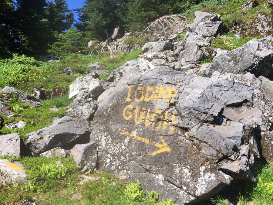
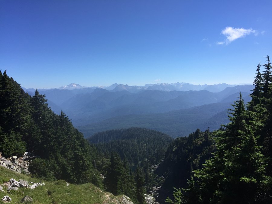
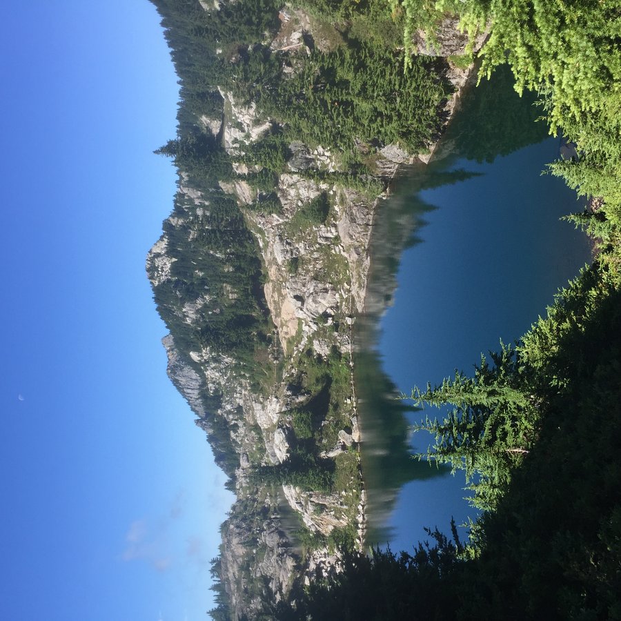
Bathtub Lakes
6.93 miles of hiking • 3000' elevation gain •
Apparently this is a secret squirrel location my friend knew about but if you search the internet it’s not to difficult to locate. 6 tiny lakes in a granite setting kinda a miniaturized Enchantments. Nice views of Glacier Peak from the top of the gulch.
September 2, 2018

 1
1
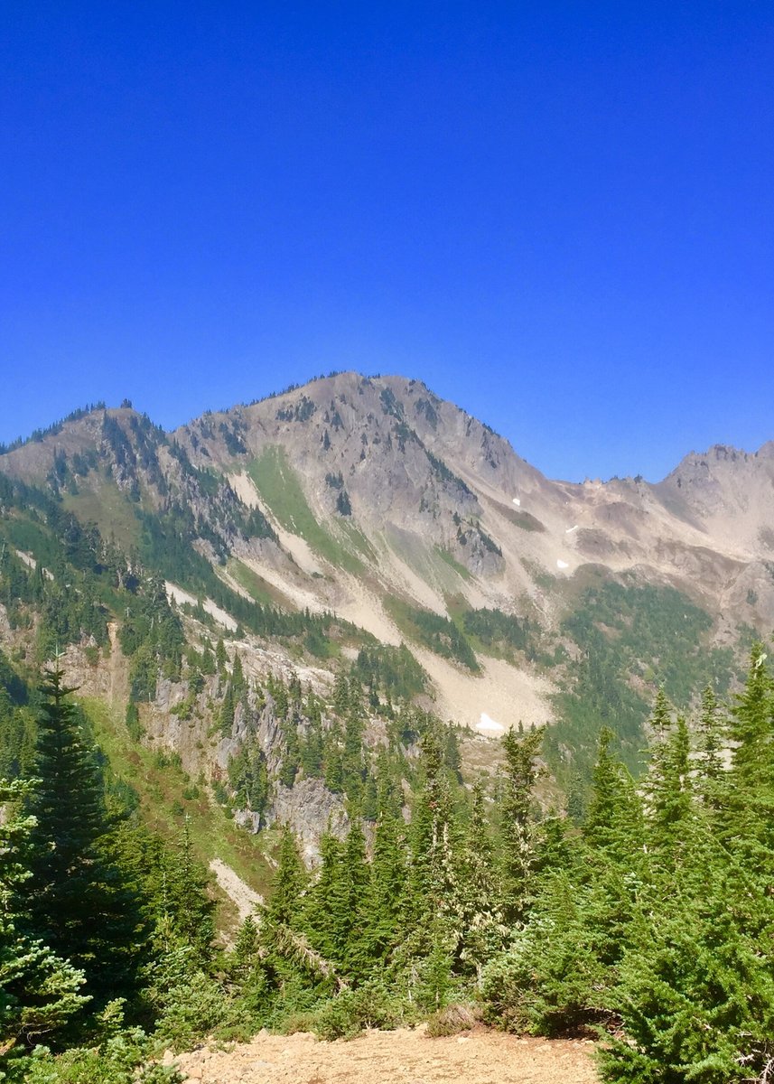
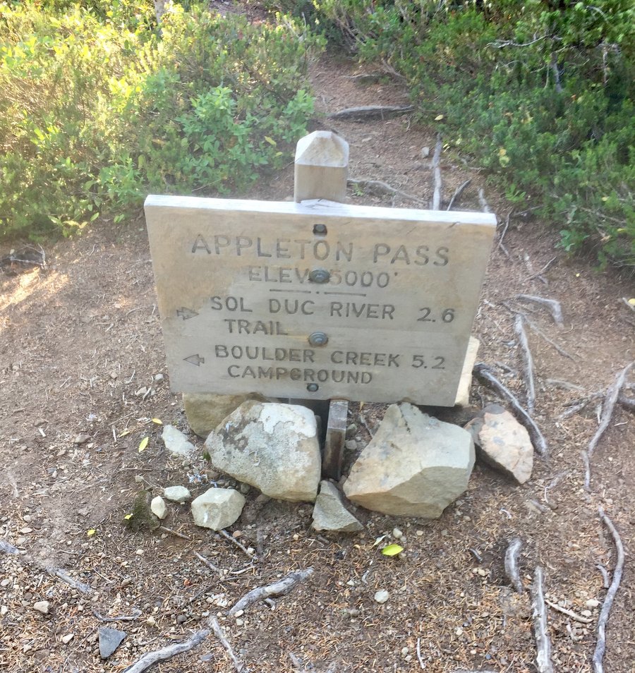
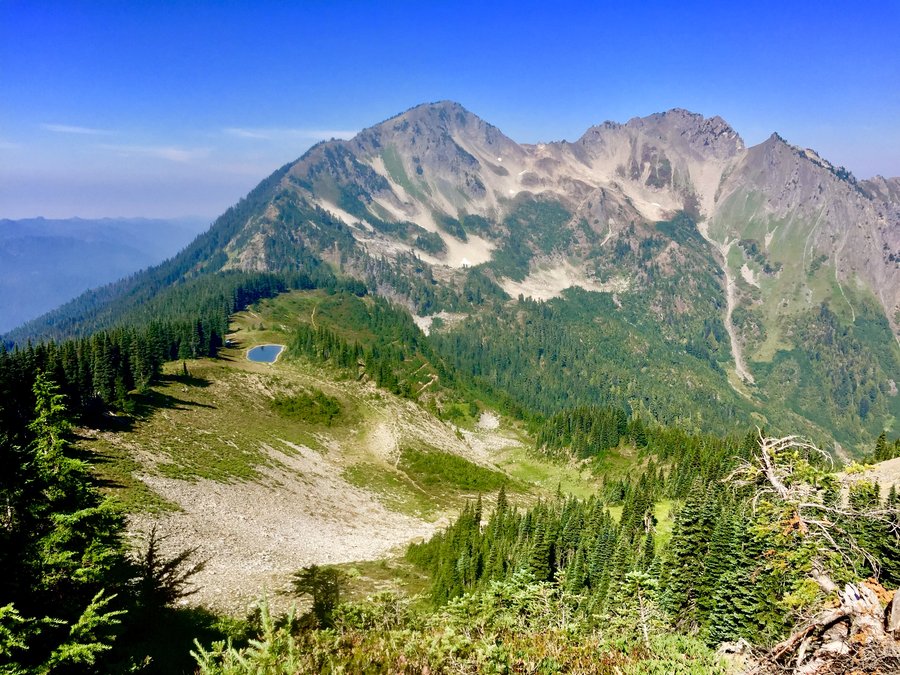
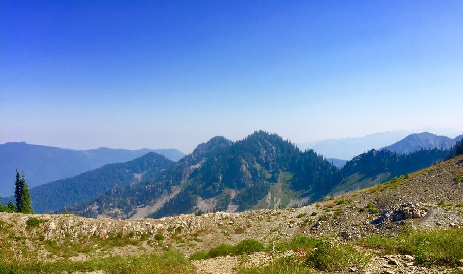
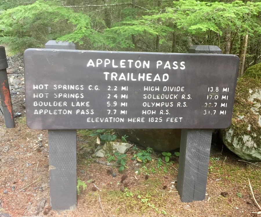
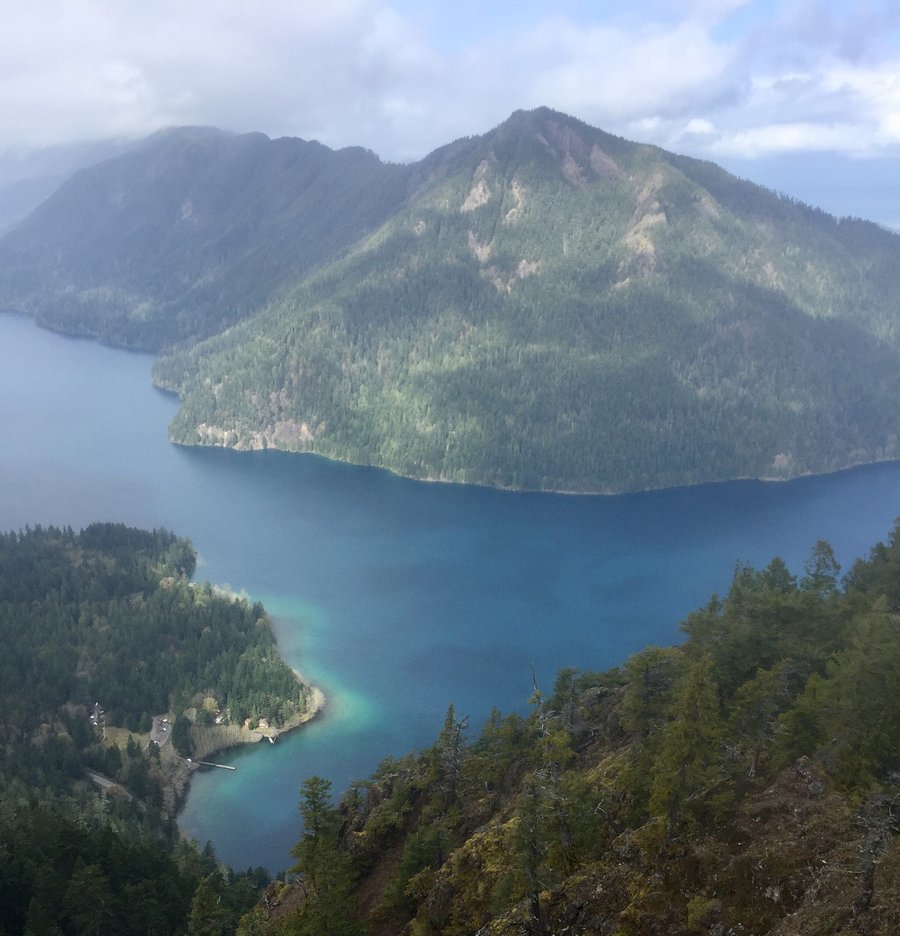
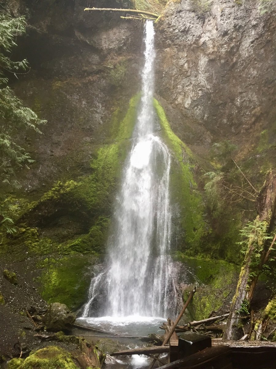
Appleton Pass—Up the Elwha-Out the Soleduck
38.18 miles of hiking • 8000' elevation gain • 2 nights
In the not to distant past the Boulder Creek Campgound & hot springs would be overflowing this time of year but ever since the Elwha took out the road approx 2 miles from hwy101, necessating a now 8 mile road walk to the Appleton Pass TH, one basically has solitude on this hike all the way to Appleton Pass. In fact I had the campground & hot springs entirely to myself which was nice but kinda eerie in a way. The hike up to Appleton Pass on day 2 was pleasant with many water sources & the lower Boulder Creek Falls is definitely worth a view. Found a nice site @ Appleton Pass & spent the rest of the day exploring. Very nice views in which Mt. Olympus can be seen to the S/W. Next day took the way trail down to Cat Basin & from there back to the High Divide/Seven Lakes Basin area which was teaming with hikers and made my way to the Soleduck TH.
August 27 – August 29, 2018


 1
1
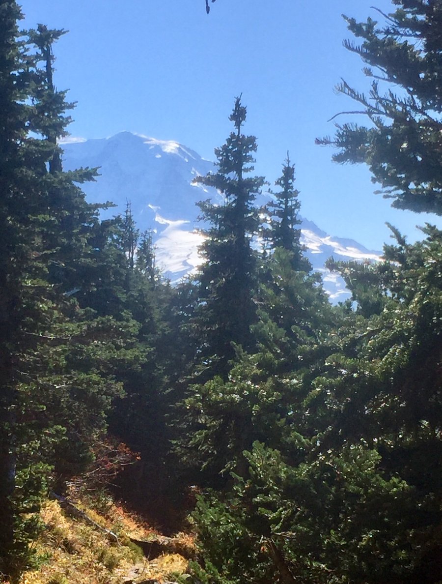
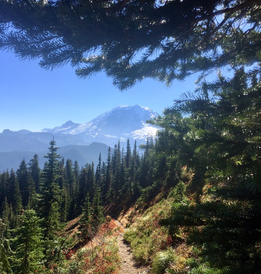
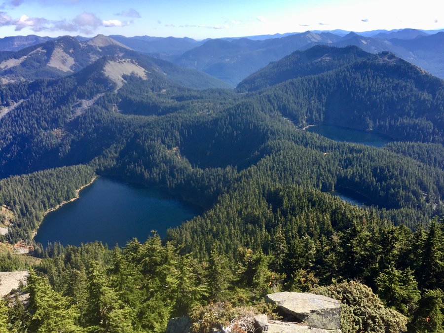
Mt. Rainier—Lotalakes
8.09 miles of hiking • 2500' elevation gain •
While I like to call this the “Lotalakes hike”.... as in 4 miles you can view 9 lakes, if you include within your itinerary a short scramble up Browns Peak, the actual TH is Palisades Lakes up by Sunrise. Felt a bit like fall as it was 39 degrees up at Sunrise when I arrived at around 10AM.
August 24, 2018

 2
2
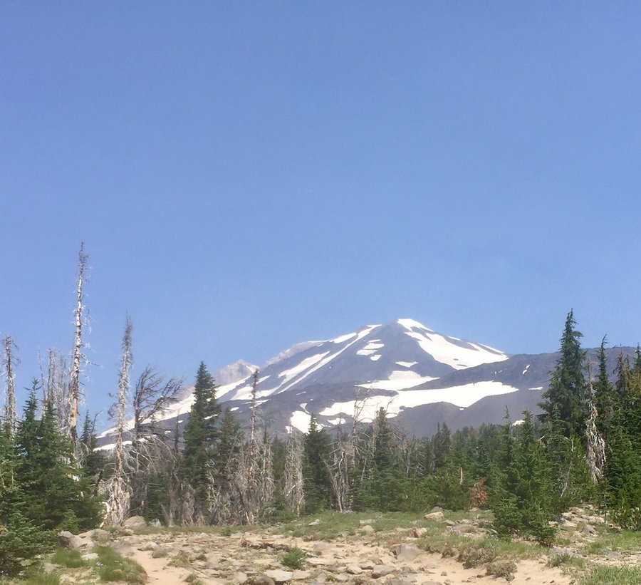
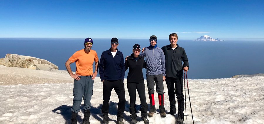
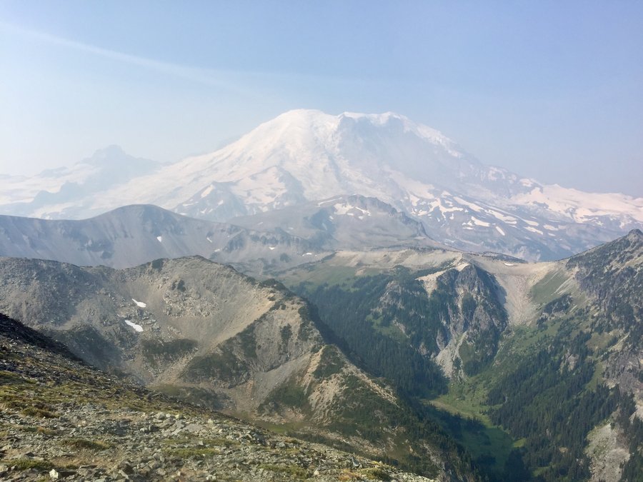
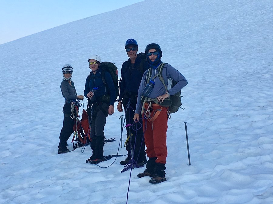
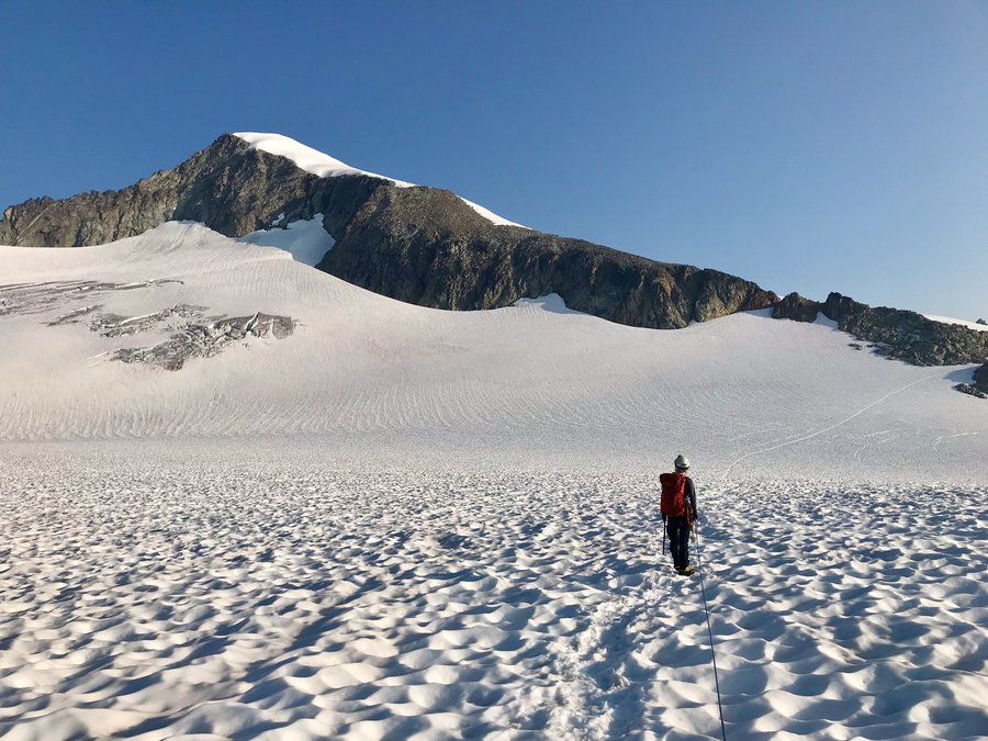
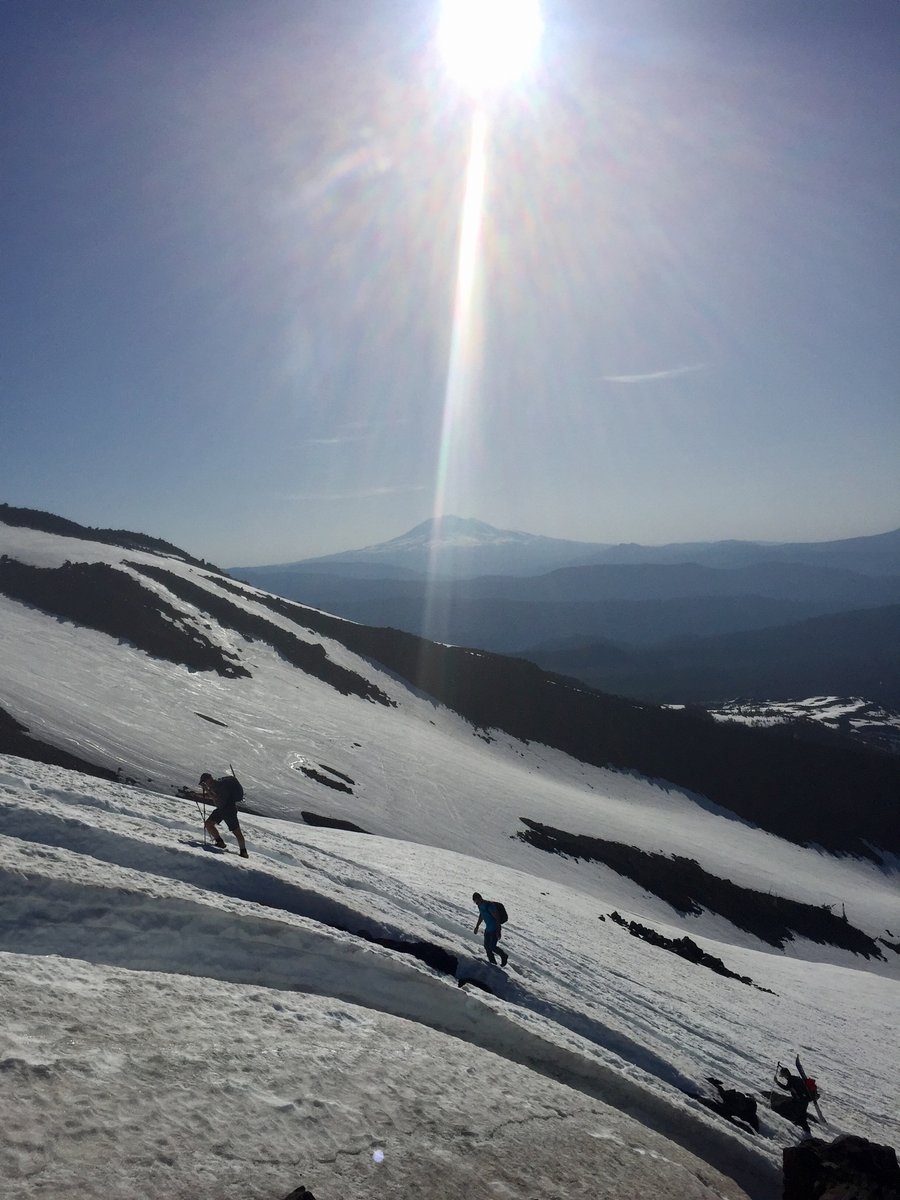
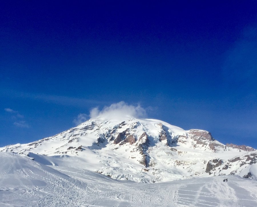
Mt. Adams
12 miles of hiking • 6750' elevation gain • 3 nights
I have not climbed Adams since sometime in the 1990's so when a friend from Gresham invited me to climb with him and his 2 college age kids I could not pass it up. One thing I forgot though was how bloody far away it is from my house ..... almost 6 hours, and as we were meeting at the TH Monday morning @ 10:30 I decided to head down Sunday afternoon and camp at the TH which did have some nice camp sites and clean privy's. Heading out on Monday morning we arrived at the Lunch Counter & camped at a bit over 9000'. Got up the next morning at 4:30AM and was heading up around 5. Snow conditions were perfect and we arrived at Pikers Peak in a few hours. After Pikers Peak I could not believe how little snow was present. From there we discarded the Crampons and just booted our way to the summit where the old sulfur mine was clearly visible. We spend a couple of hours at the top as the temps were very mild and the winds were surprisingly non existent. The hazy conditions did unfortunately limit the views. The decent was mostly glissading and we were back down at camp within a couple hours. Our climbing partners from Gresham packed up and headed down while we spent another night at the Lunch Counter drinking the beers we had lugged up from the TH. Next morning packed up and were back at the TH by 10:30AM and all ready for the LONG drive back home.
August 12 – August 15, 2018


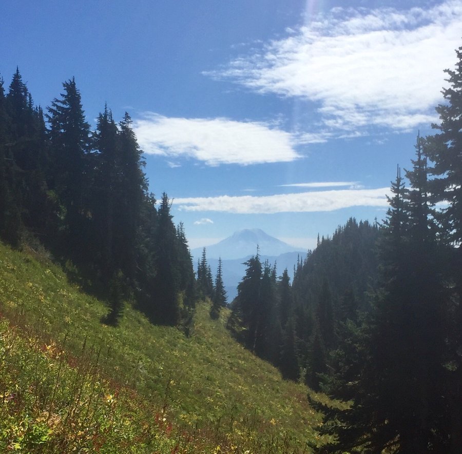
Sunrise Ramblings
9.75 miles of hiking • 2000' elevation gain • 2 nights
Camped @ White River & spent a day up at Sunrise hiking to the Fremont Lookout & up to Dege Peak. Hot & hazy conditions.
August 8 – August 10, 2018


 2
2
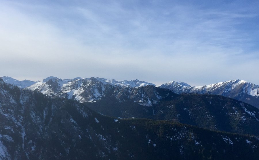
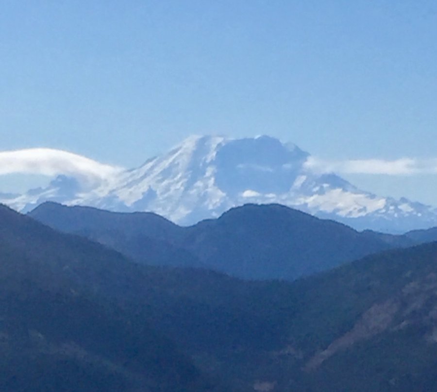
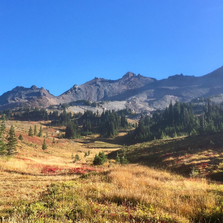
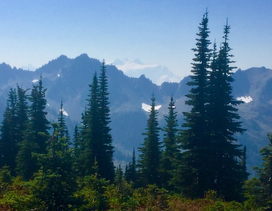
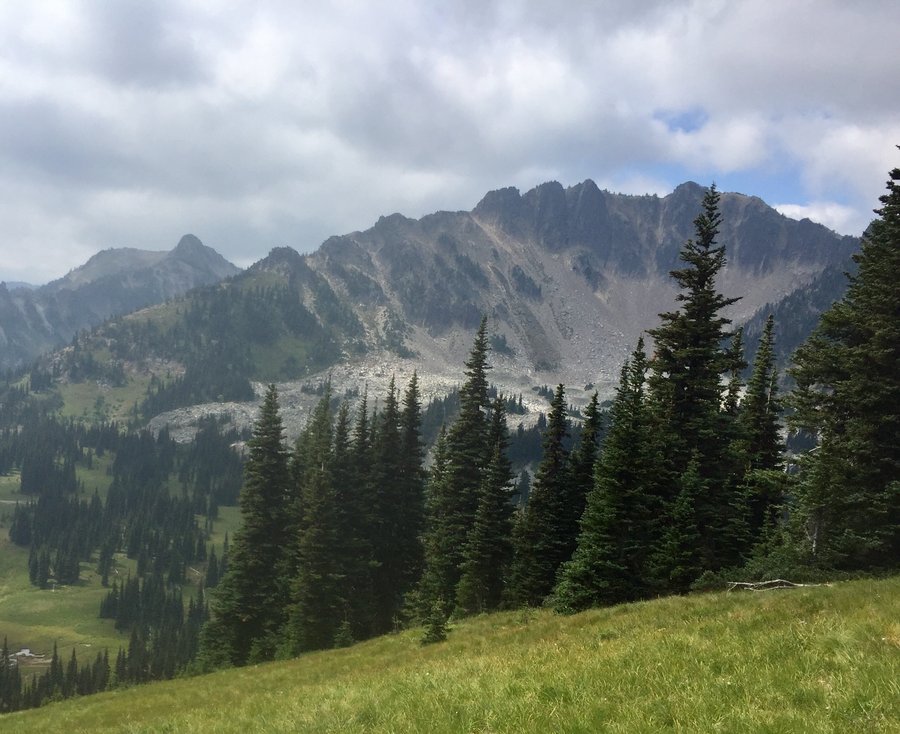
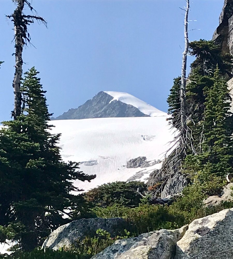
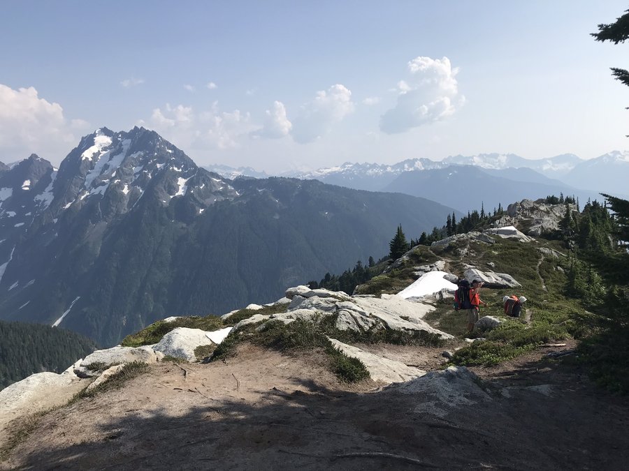
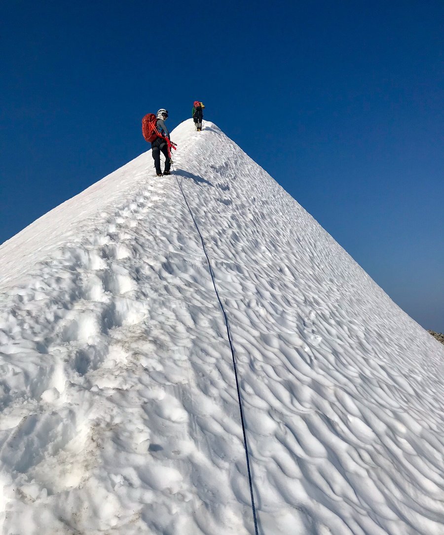
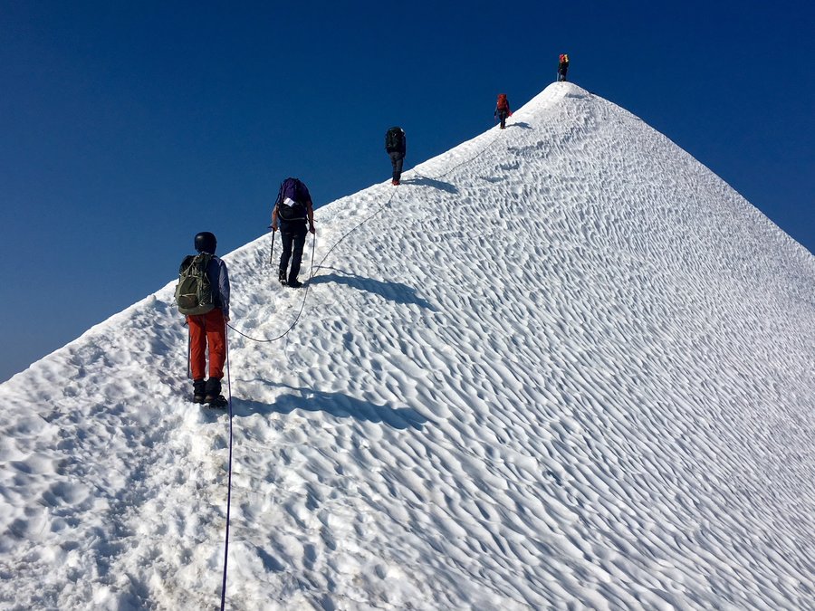
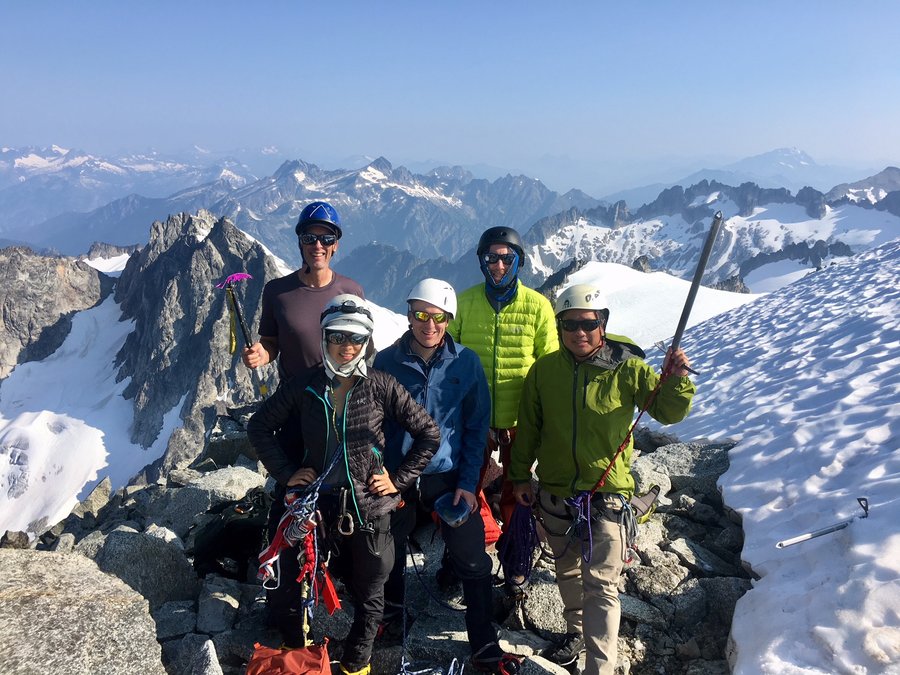
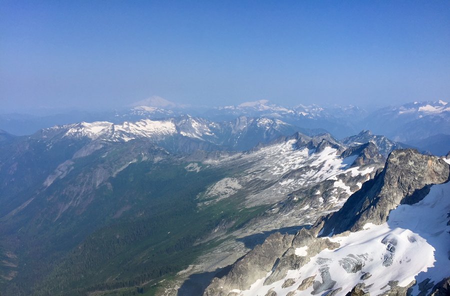
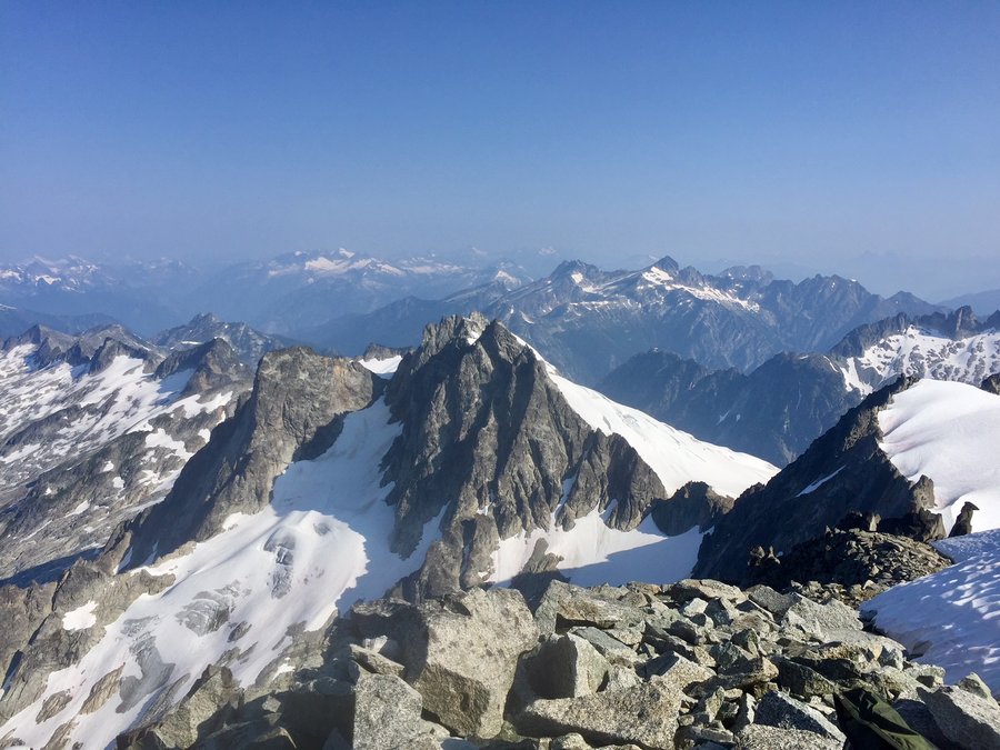
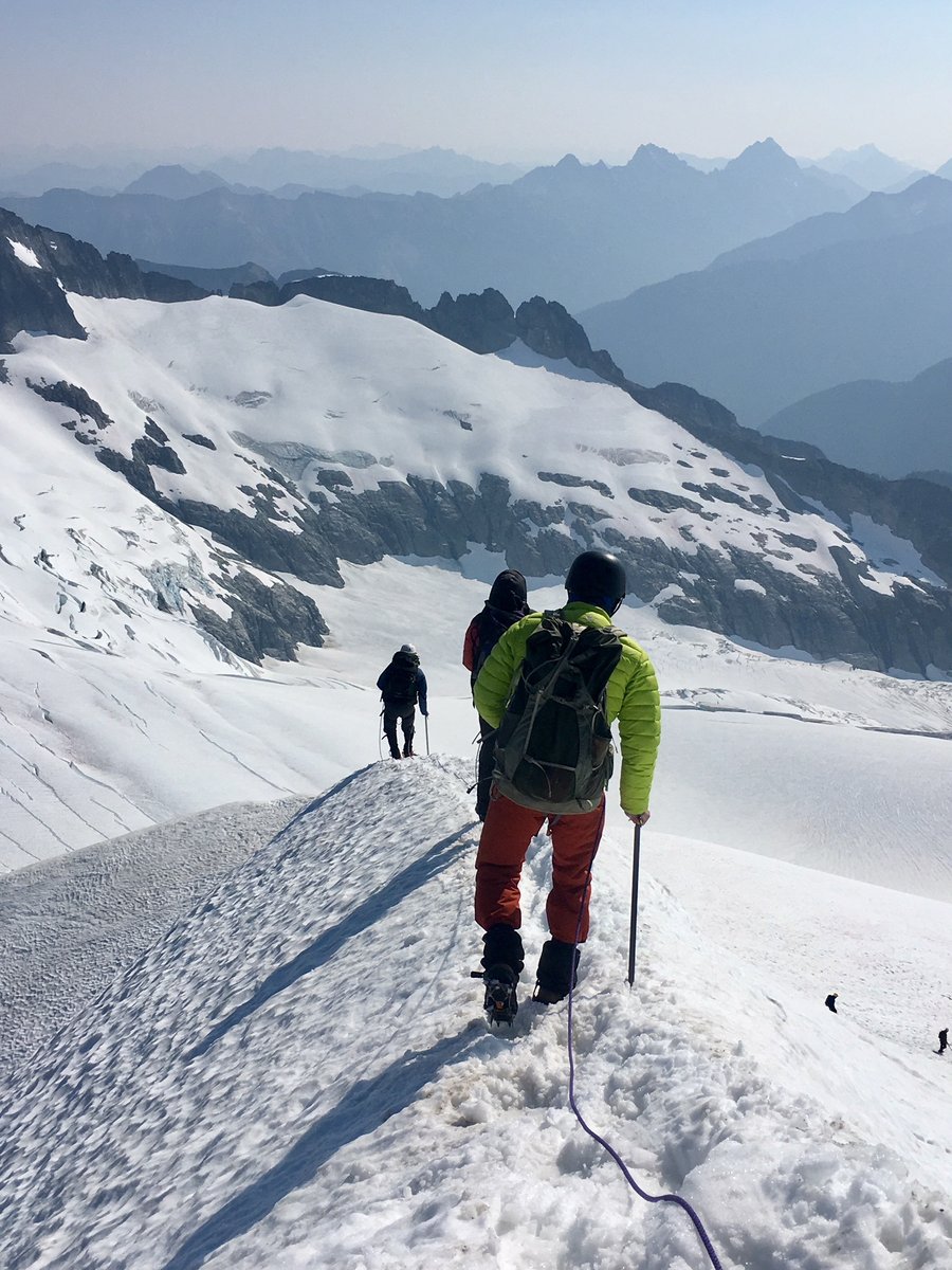
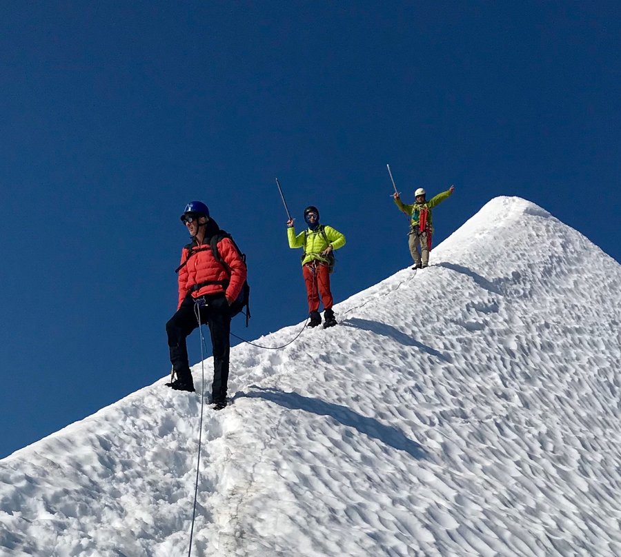
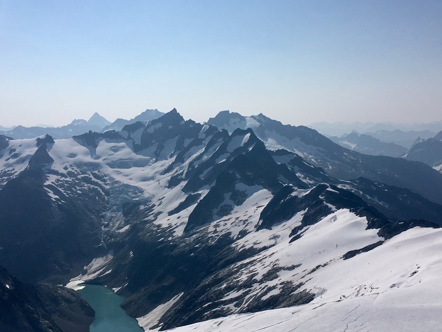
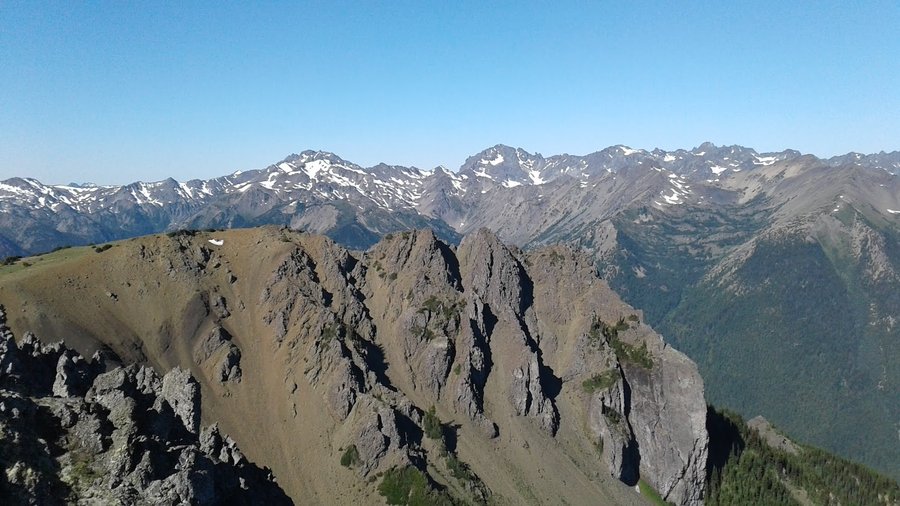
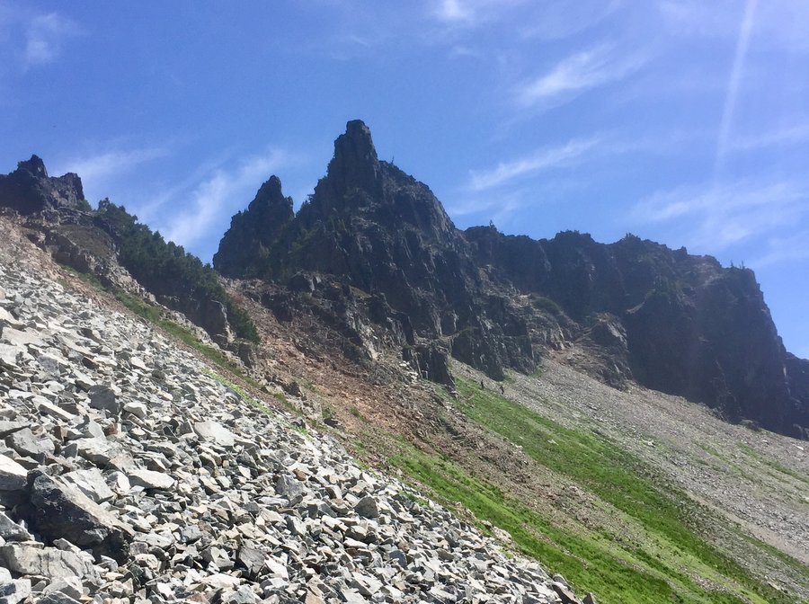
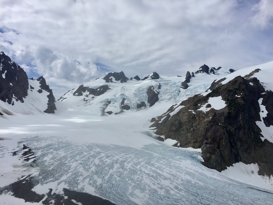
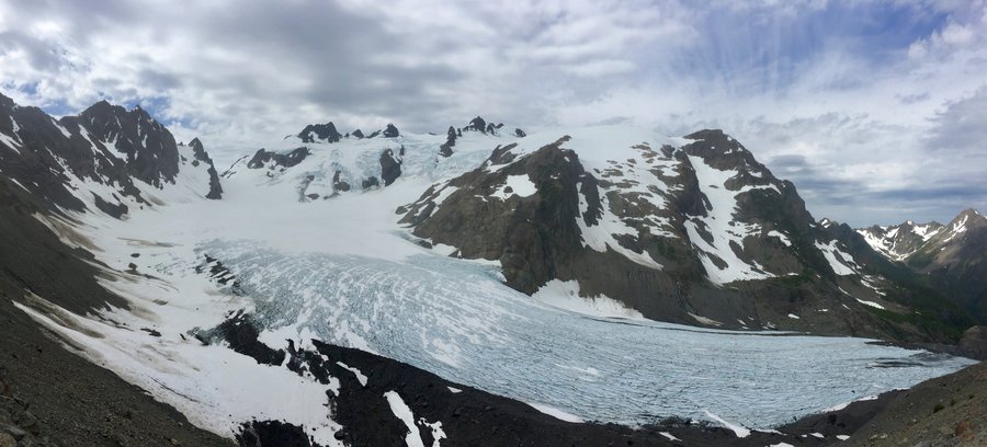
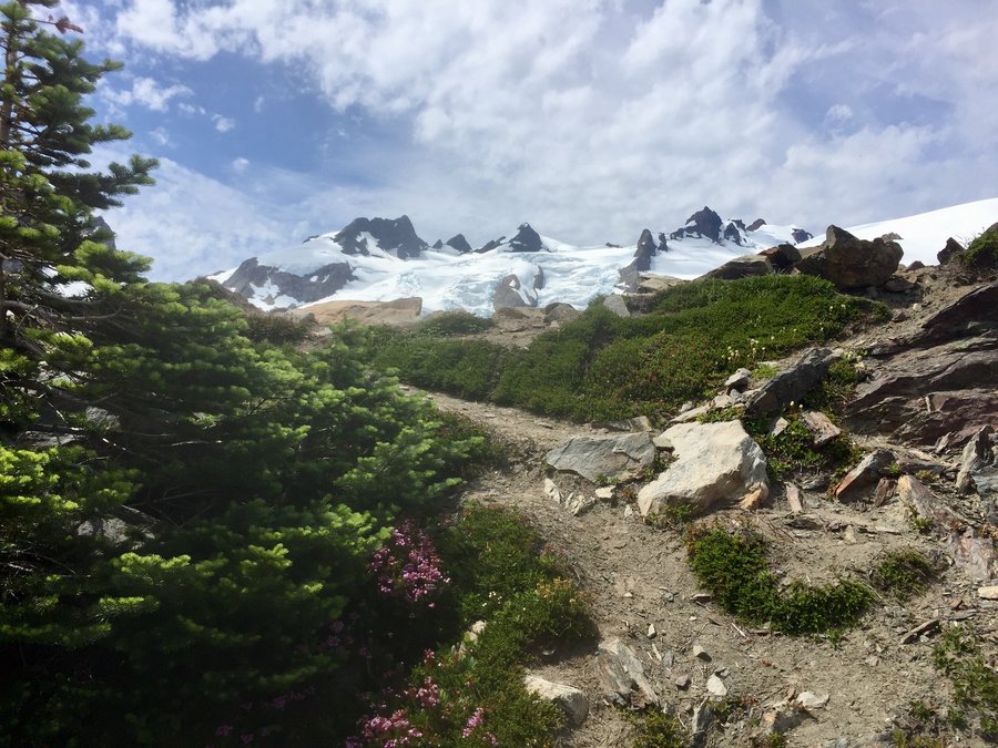
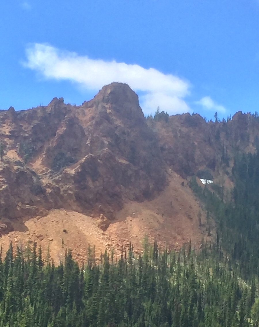
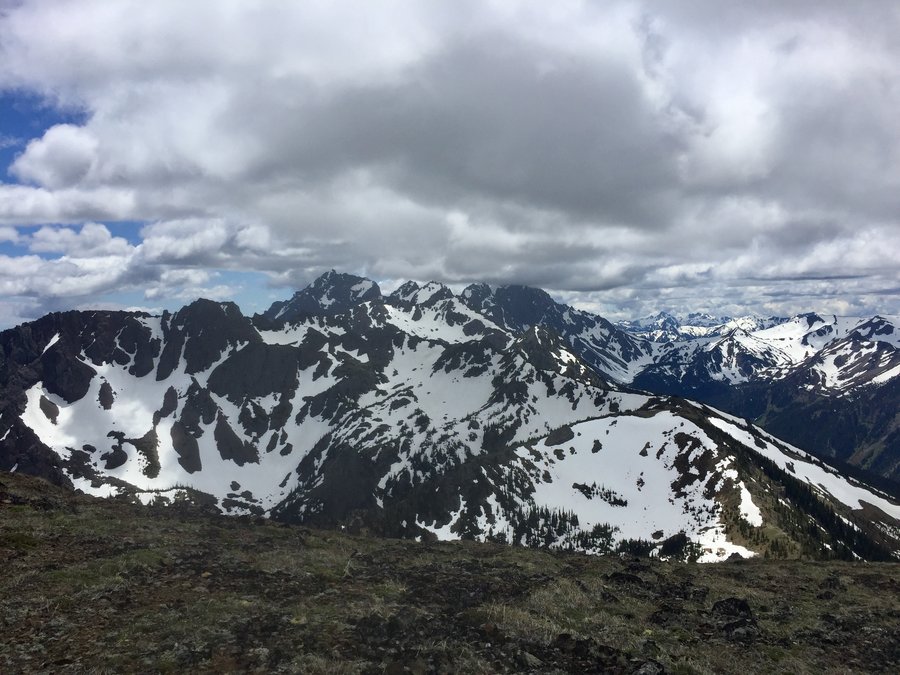
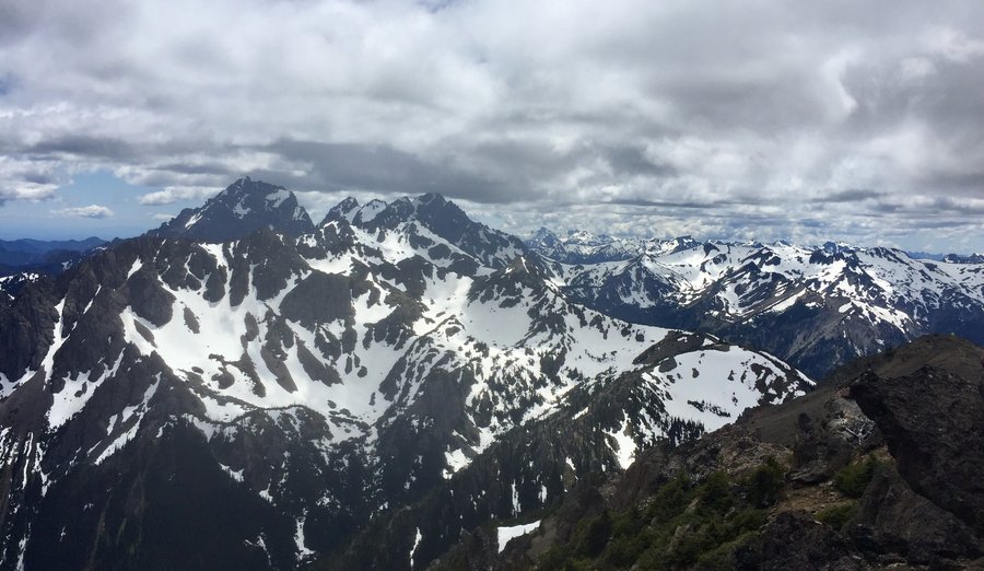
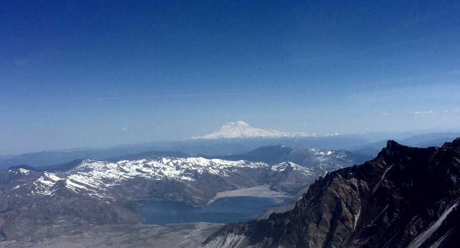
Eldorado Peak--"The Knife Edge"
10 miles of hiking • 7250' elevation gain • 1 night
This was a tough climb. We climbed via the East Ridge. The approach is brutal, you climb 4000' in the first 2 miles with 1000' being a boulder scramble..... and with a 30lb+ pack and the hot weather we were pretty gassed when we made it to camp at the Roush Creek Basin just below the Eldorado Glacier. Day 2.... climbing to the top of Eldorado's 8868' peak, was a fair bit easier then the previous days grueling approach. Ascending/descending the "Knife Edge" to reach the summit was a true alpine experience in itself. From the summit you have views into Marble Creek, Dorado Needle, Forbidden Peak, Mount Buckner, Logan, Johannesburg and the other peaks of the Ptarmigan Traverse. The climb down from the peak to the TH though was again brutal and even hotter then the day before and by the time we made it to the car we were all pretty much on fumes and ready for a drop of something cheerful.
July 28 – July 29, 2018


 2
2
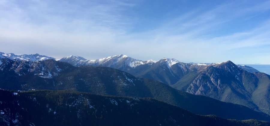
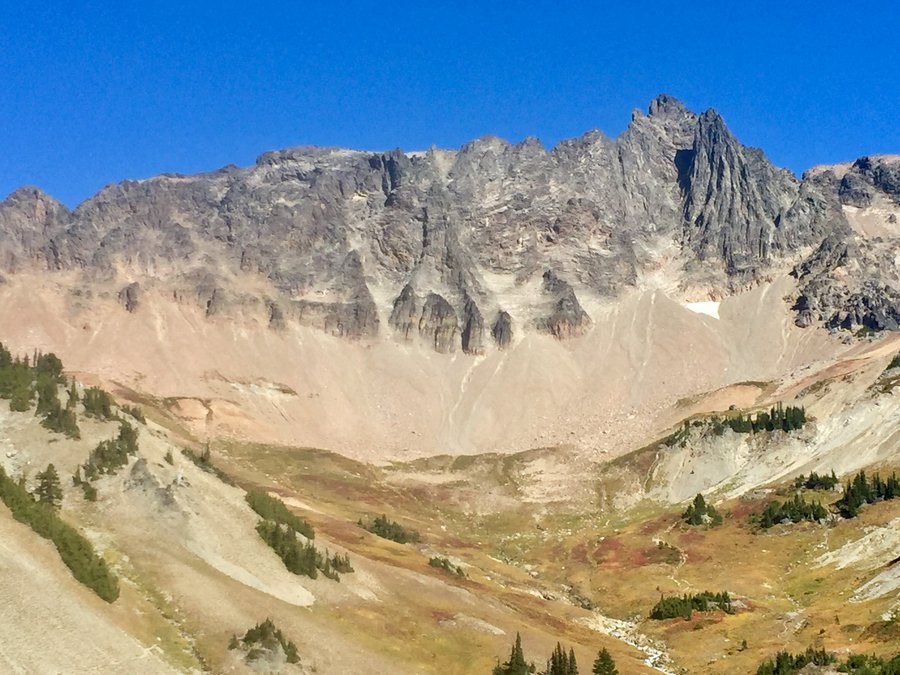
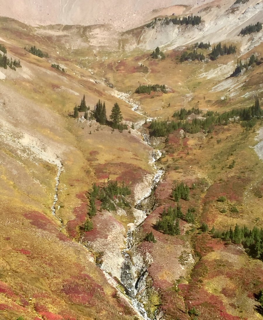
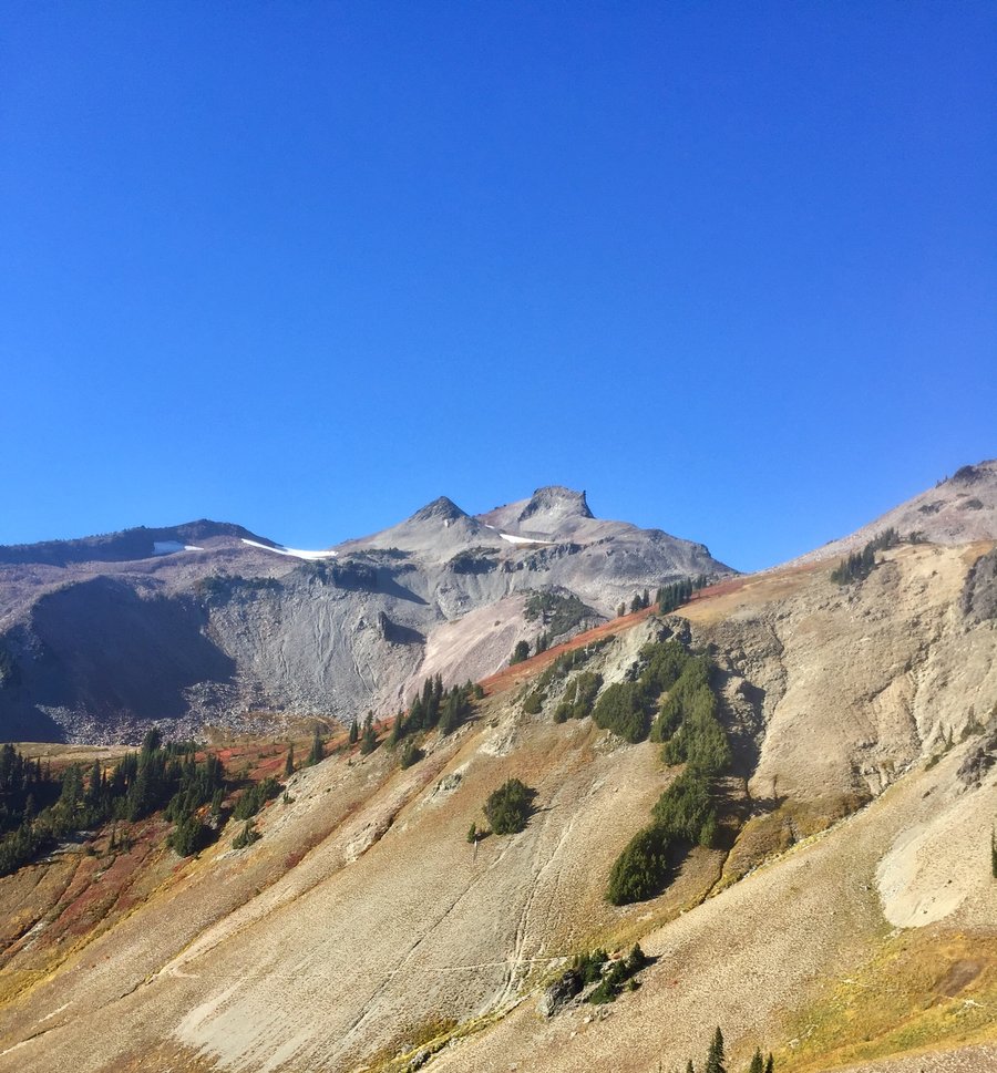
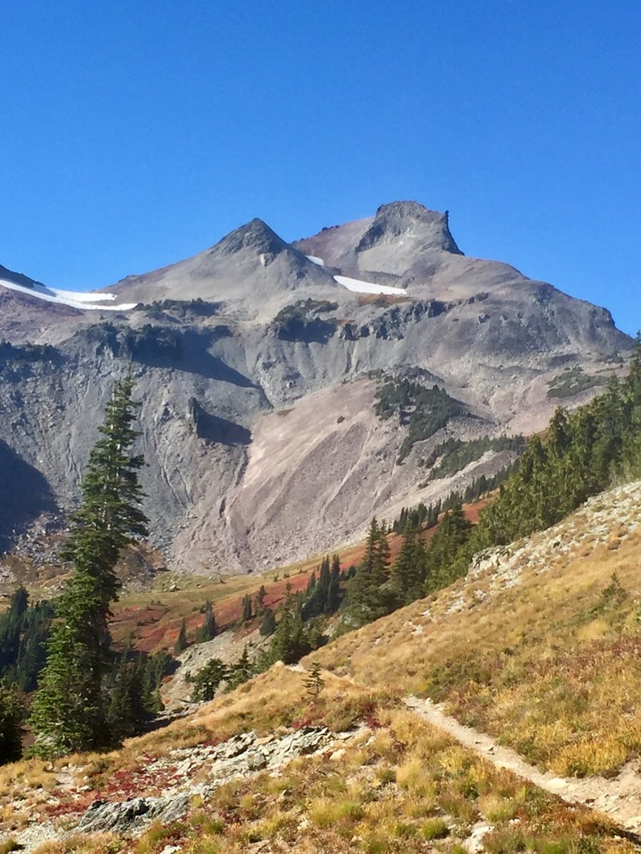
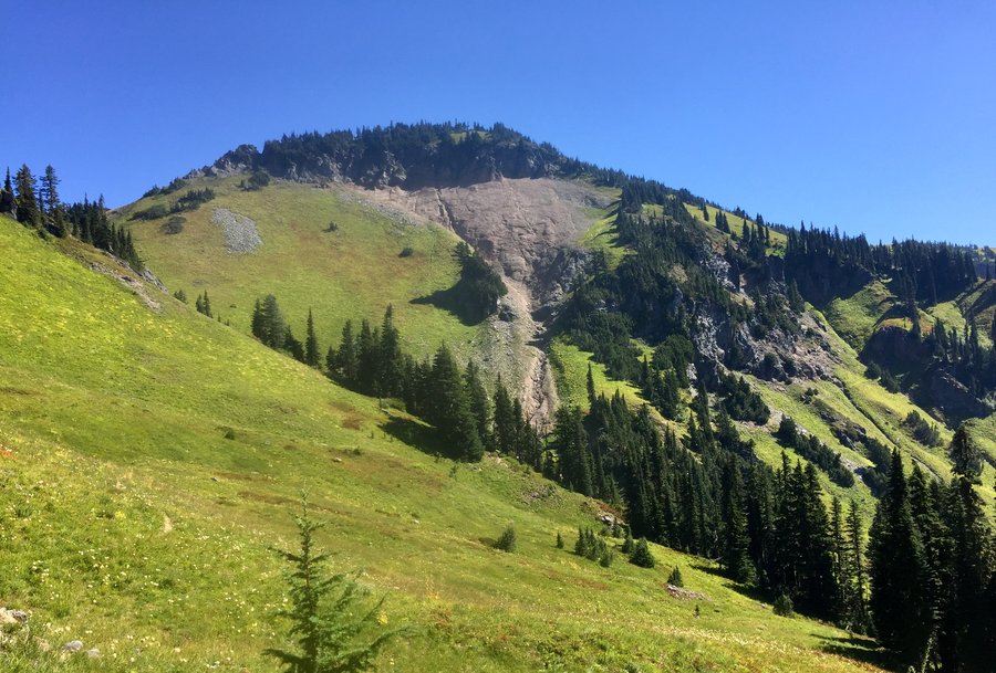
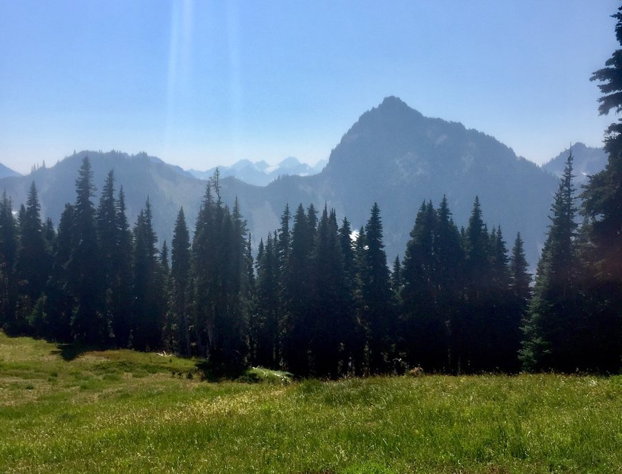
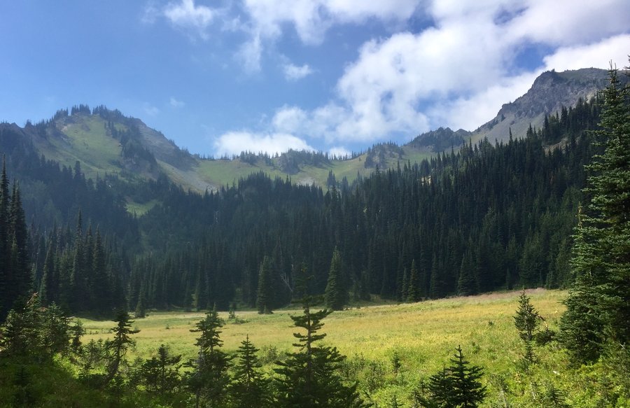
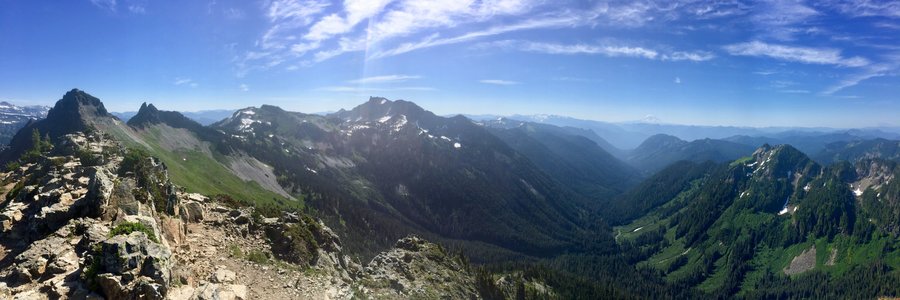
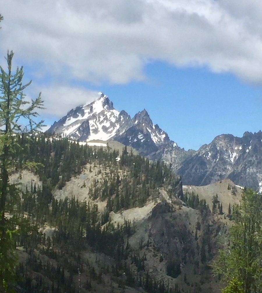
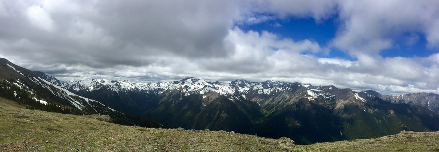
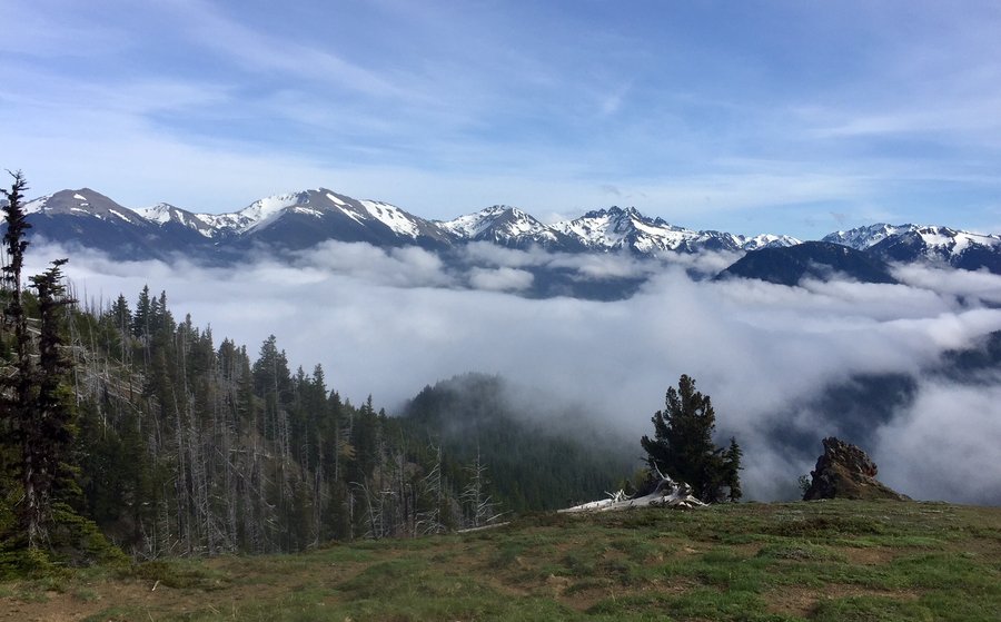
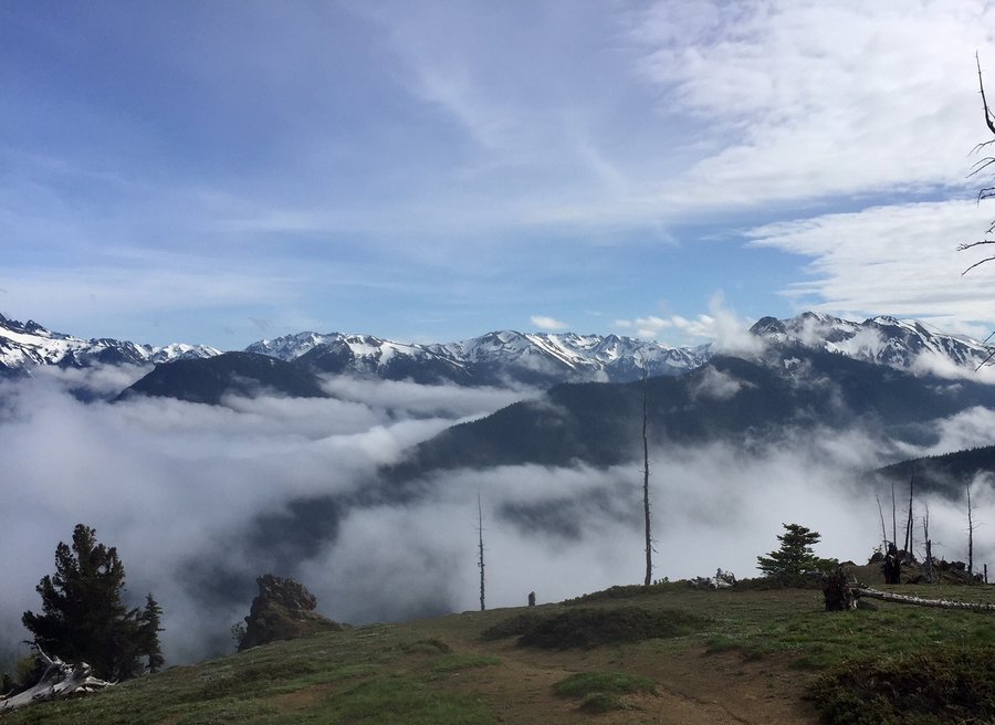
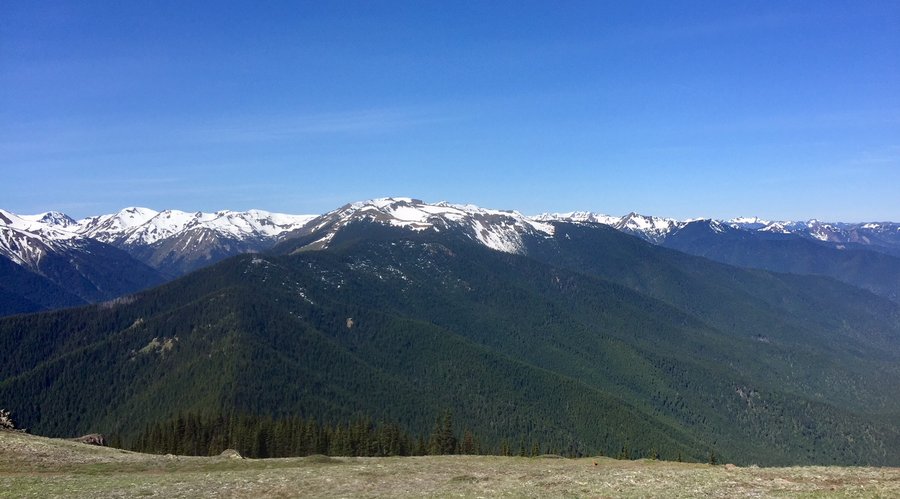
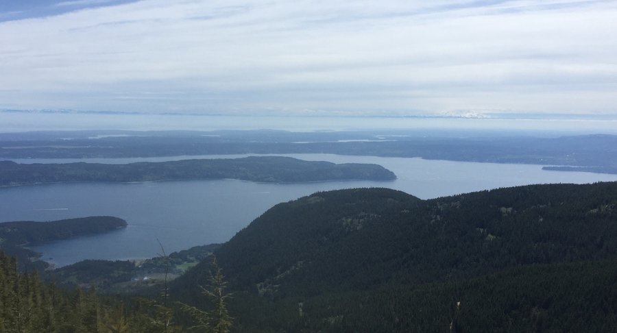
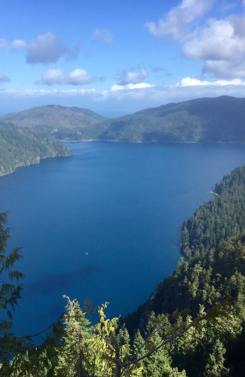
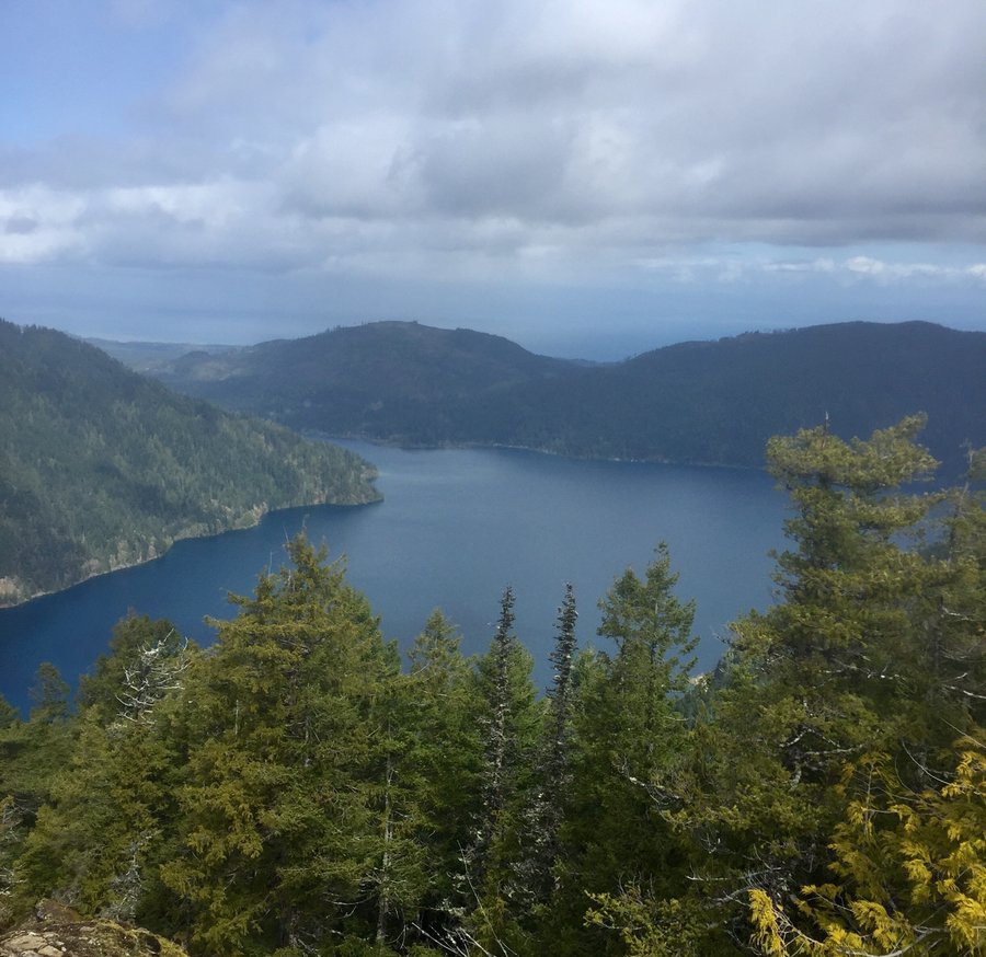
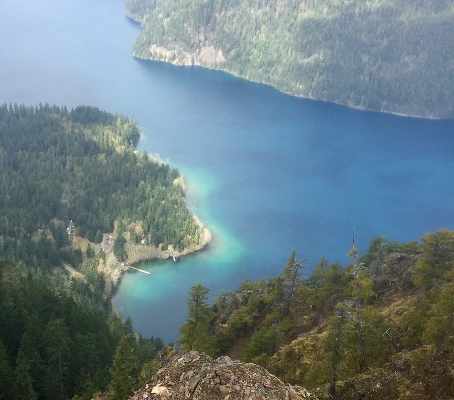
Olympics--Buckhorn Pass to "The Castle"
20.81 miles of hiking • 5000' elevation gain • 1 night
When hiking up Buckhorn Pass/Peak I have been intrigued by a rock formation to the N/E of Buckhorn located on a high ridge. Doing a little research I was able to determine that while the formation has no official name it was called by area miners as " The Castle". We entered at the Tubal Cain Mine TH and made camp just below Buckhorn Pass. Picture perfect evening. Next morning followed various climber and game trails to the saddle of the rock formation known as "The Castle" From there it was a non technical easy climb to the top. Great views of Puget Sound, B.C., Mt. Baker, Glacier Peak and the Olympic Interior from the approx. 6500' summit
July 21 – July 22, 2018


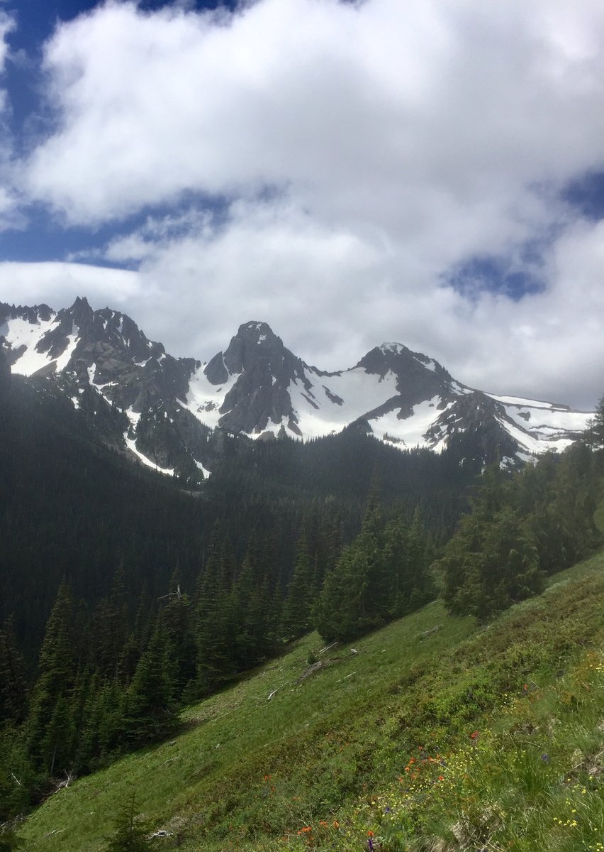
 1
1
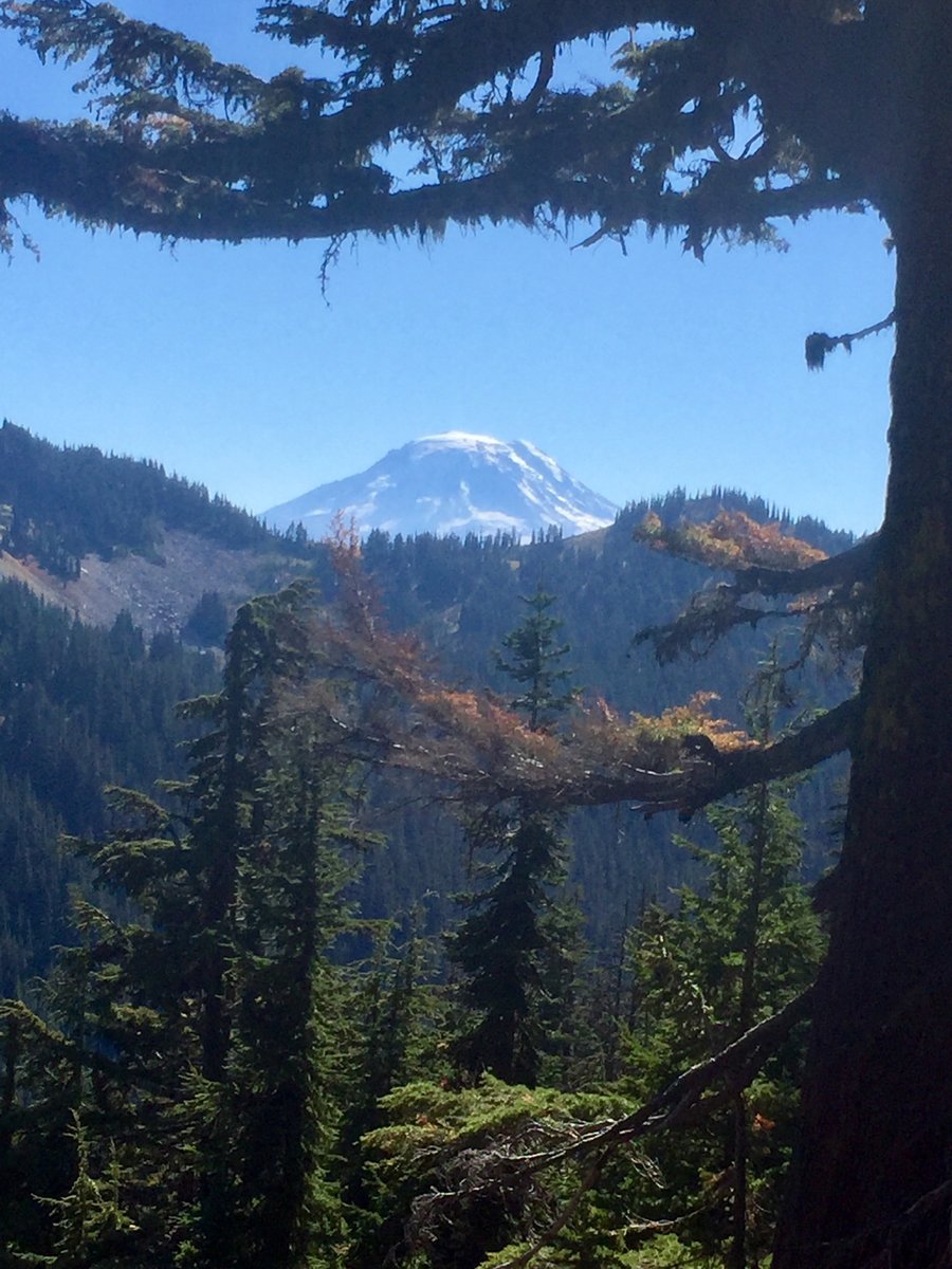
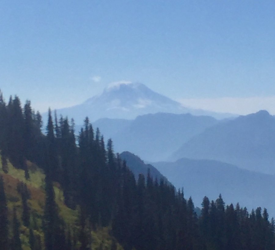
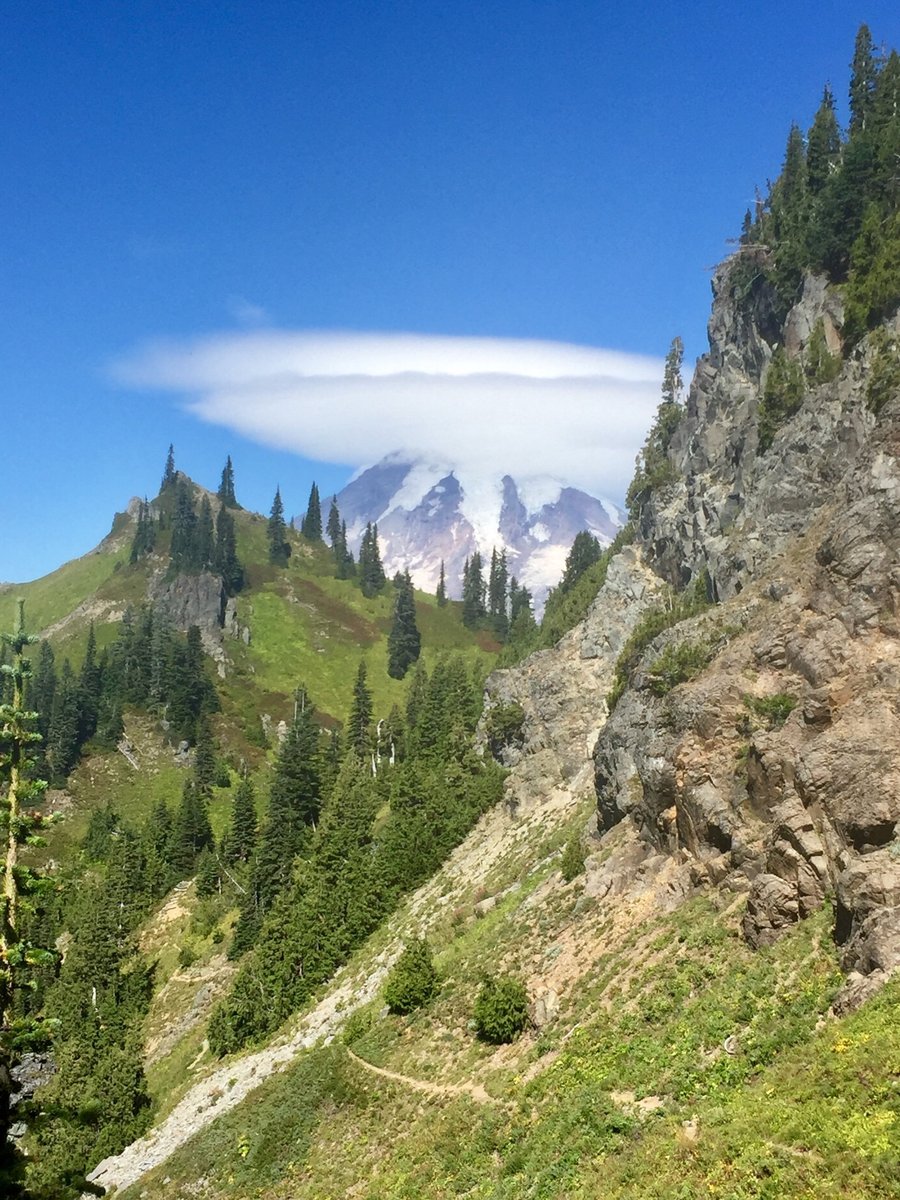
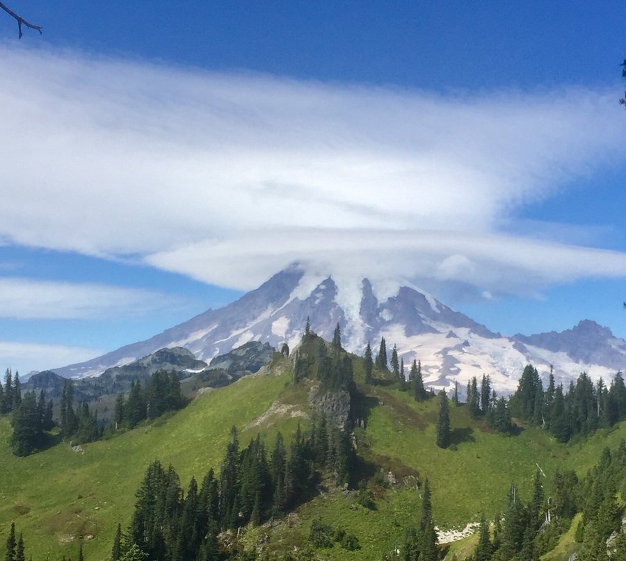
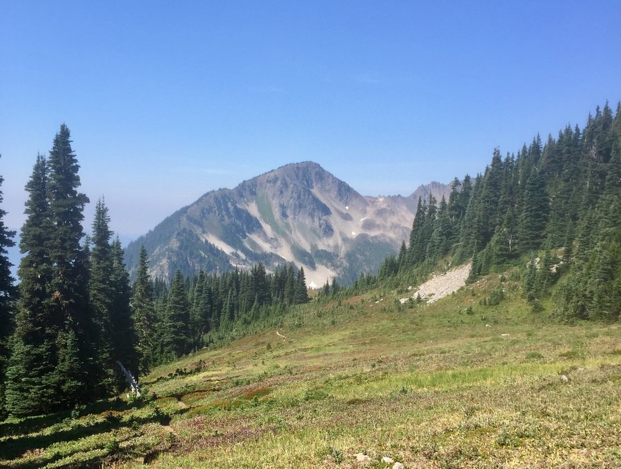
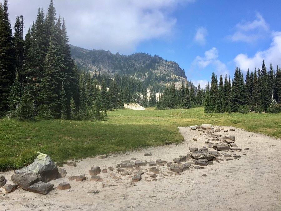
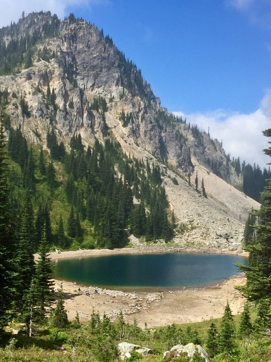
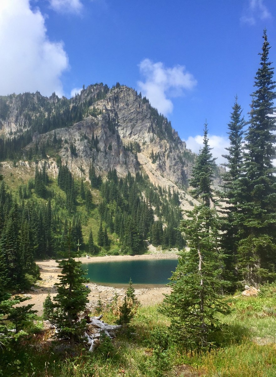
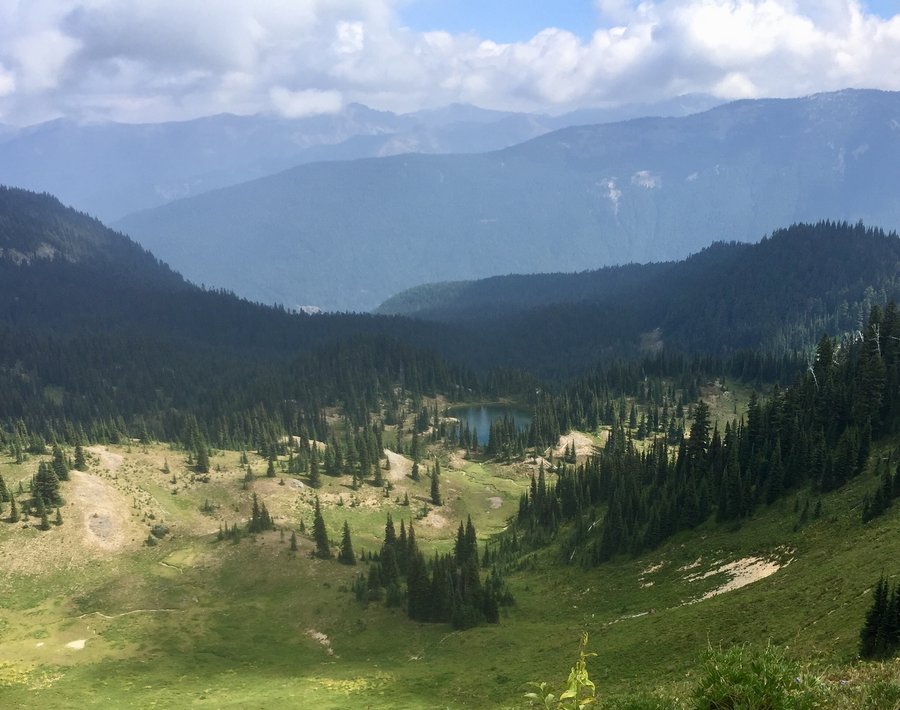
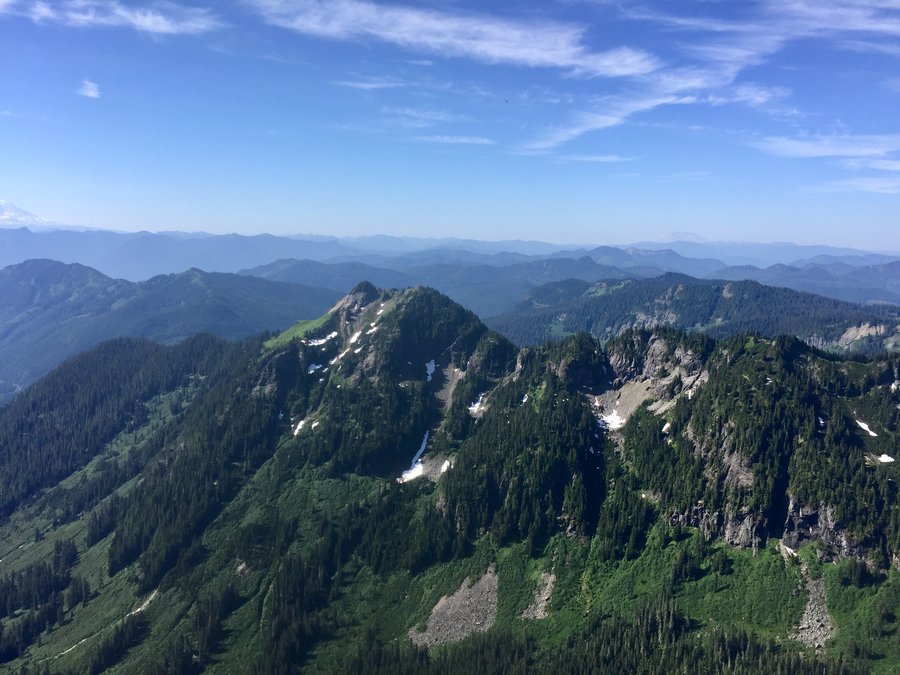
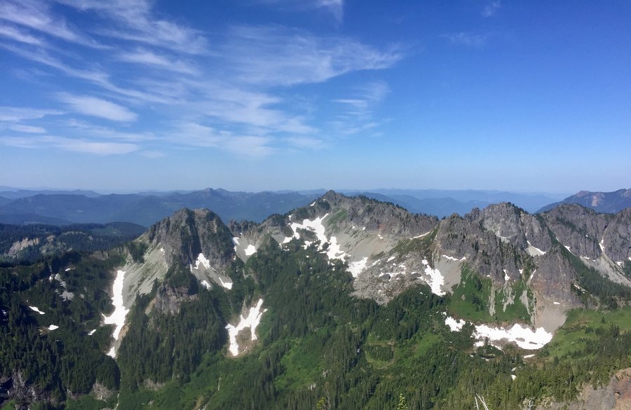
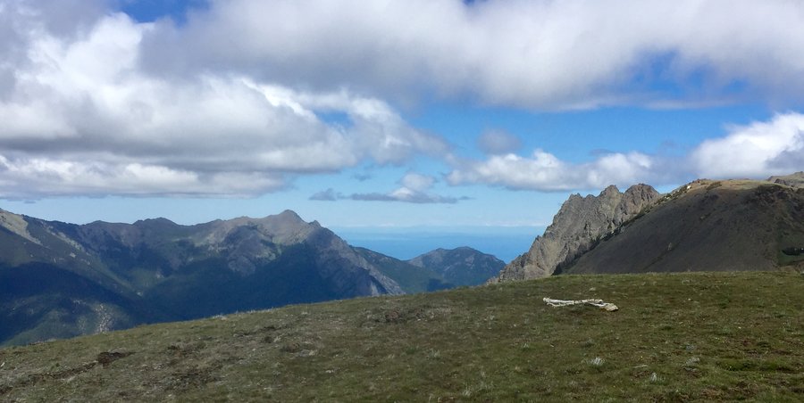
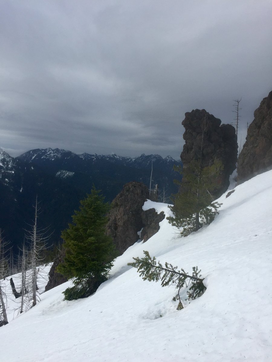
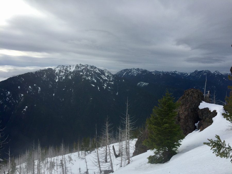
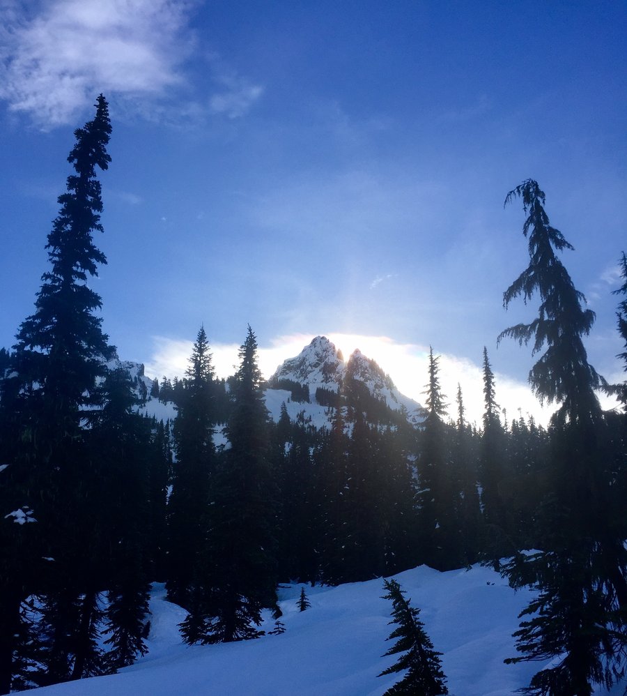
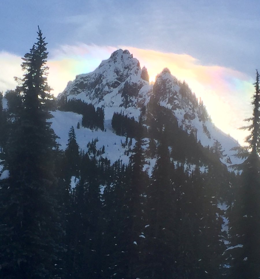
Mt. Rainier- Pinnacle Saddle & Beyond
4.2 miles of hiking • 2000' elevation gain •
Took the trail to the saddle of Pinnacle and then climbed to the 6374’ summit of Plummer Peak. It is an easy climb to the summit w/ no exposure. All class 2 stuff. Views from the peak were 360 & very nice. Then returned to the saddle and followed the climbers trail to the saddle of The Castle. Summiting the Castle is a much more difficult climb which is beyond my comfort level so I just found a nice ledge a bit up from the saddle & ate some lunch, soaking in the sunshine & the scenery.
July 15, 2018


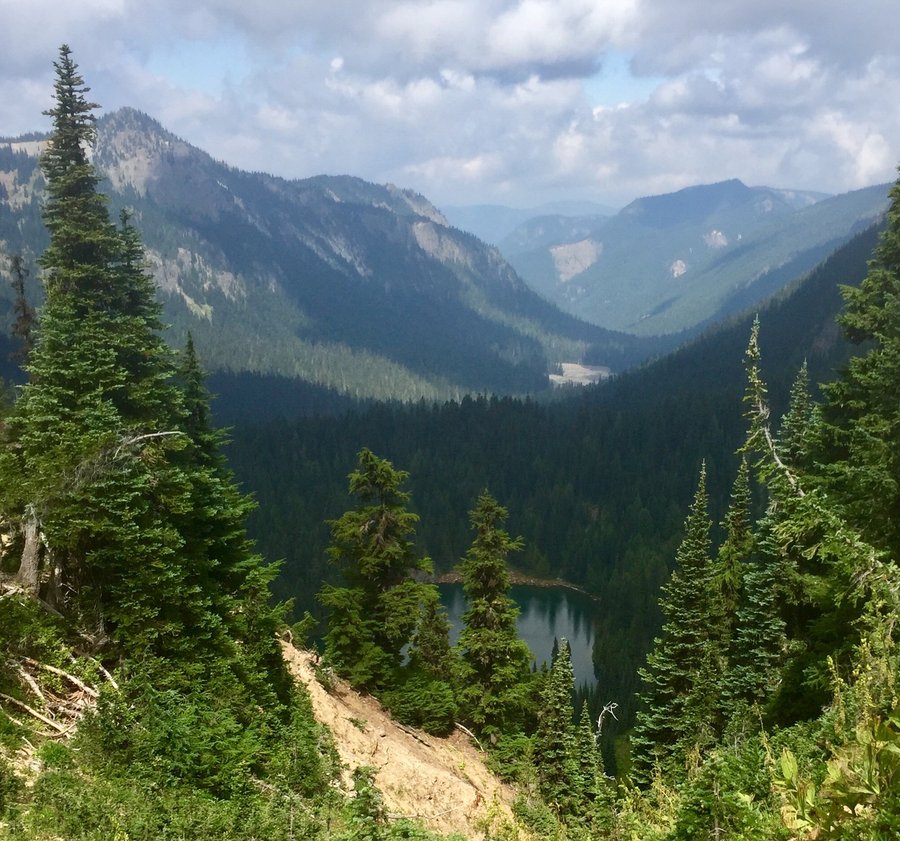
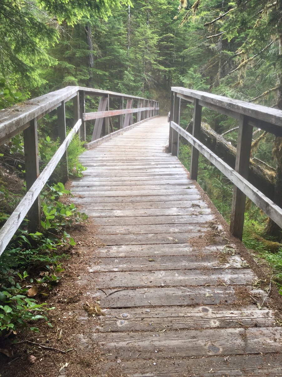
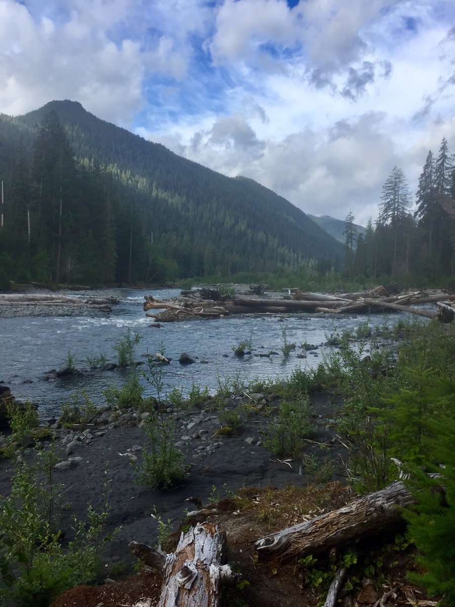
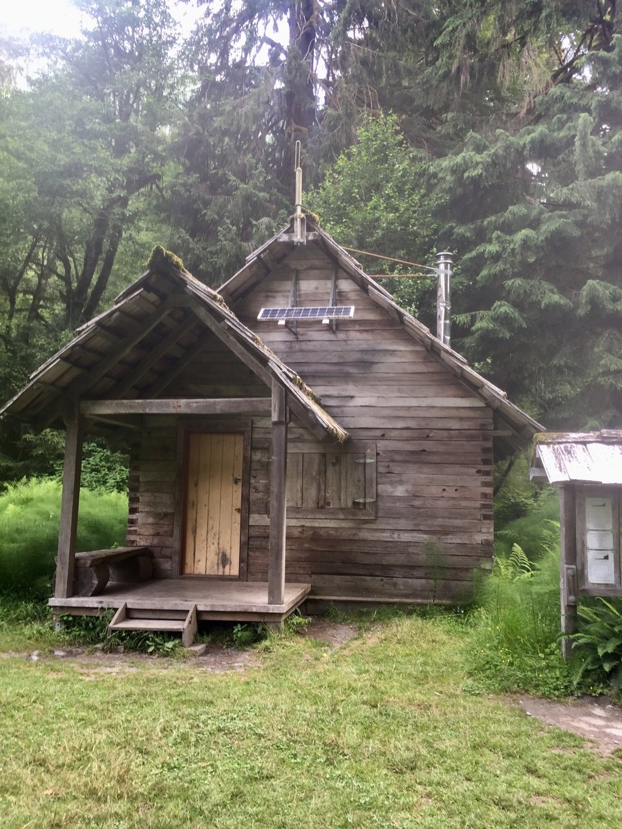
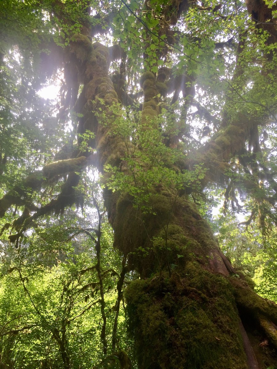
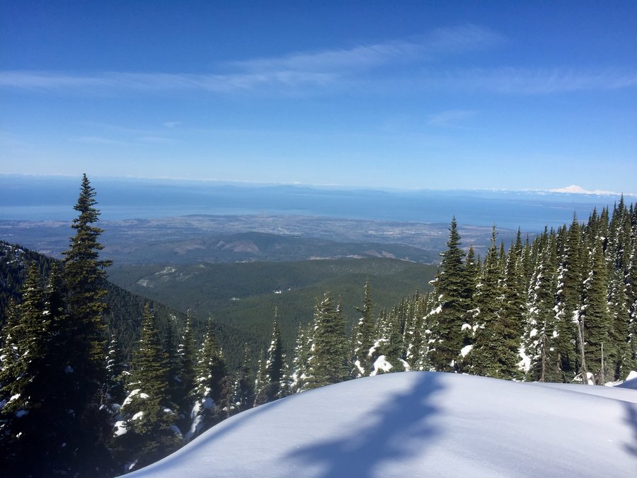
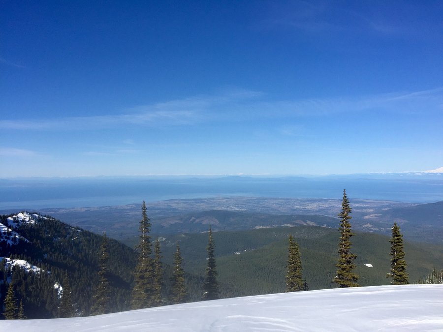
 4
4
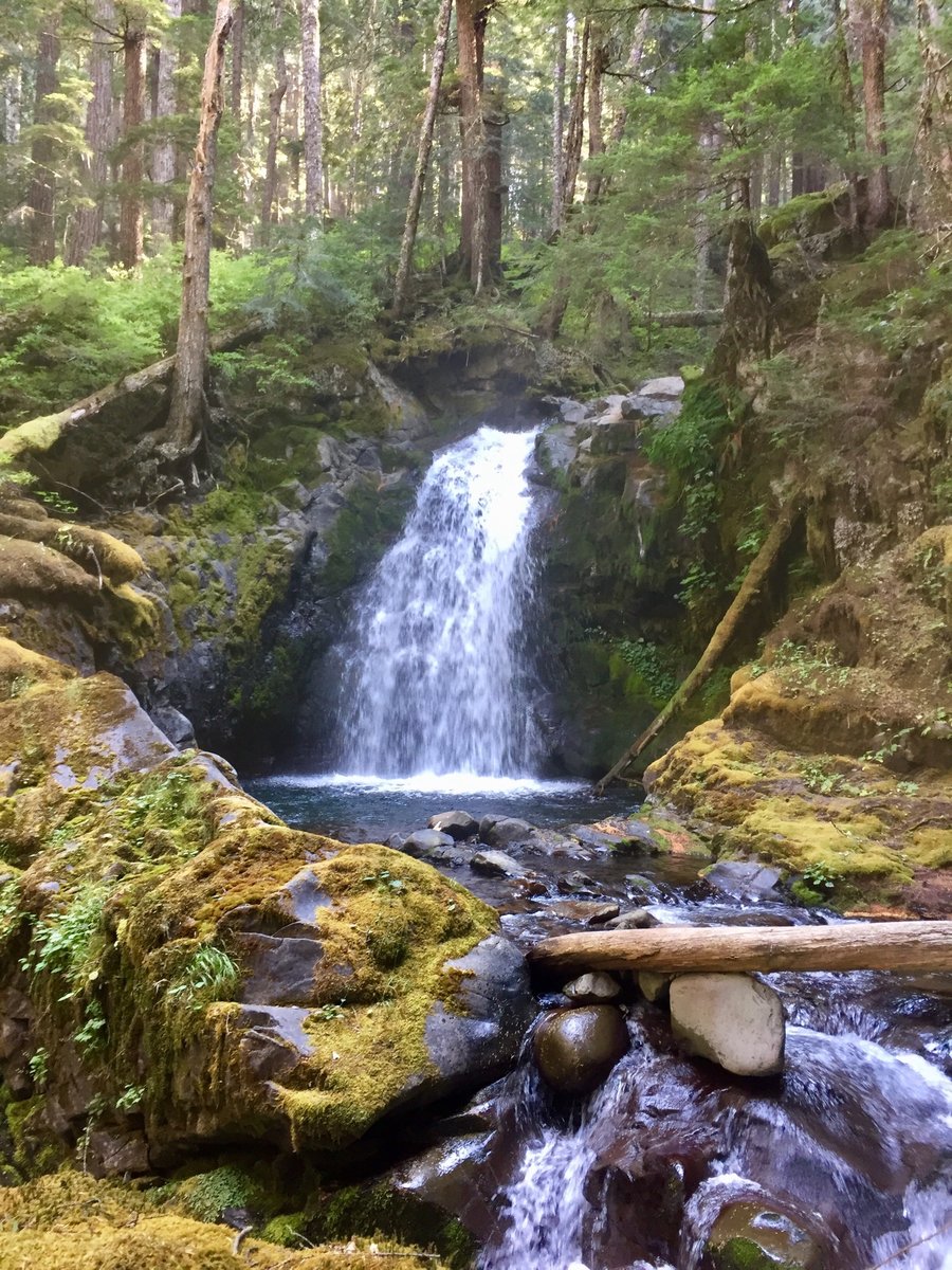
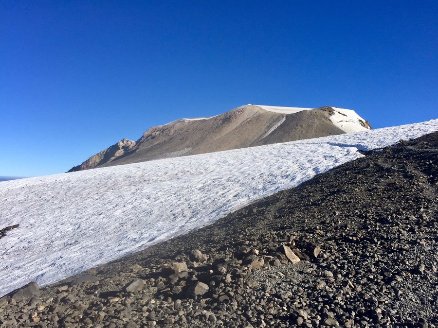
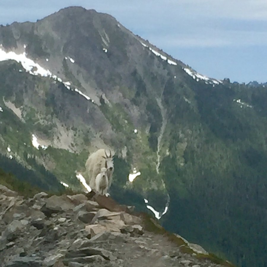
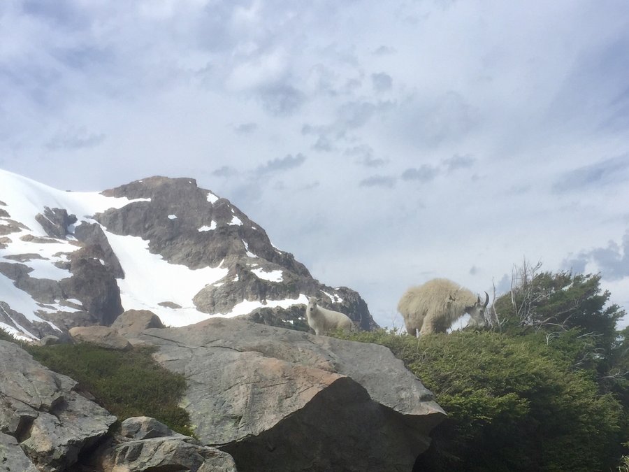
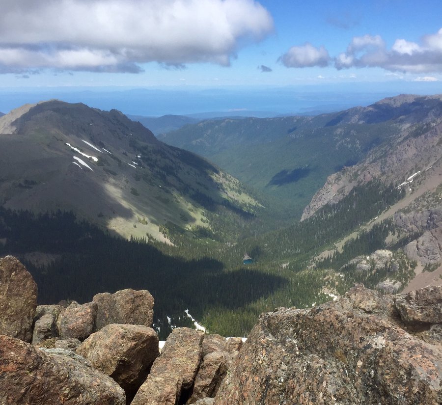
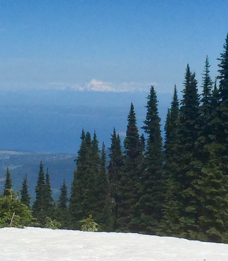
Hoh River Trail to Blue Glacier
39.64 miles of hiking • 7500' elevation gain • 2 nights
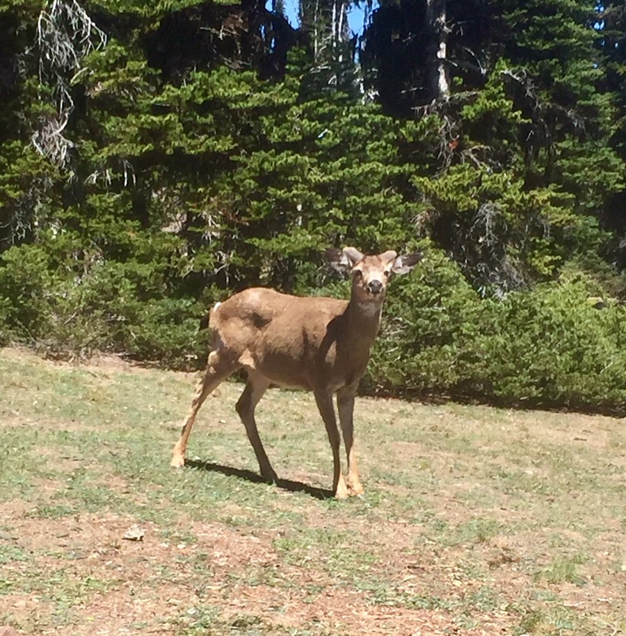
Started trip from the Hoh Rain Forest Visitor Center TH. Hiked in about 15 miles on day one and set up camp at Martins Creek. Very nice campsites there. Day 2 day hiked up to Elk Lake, Glacier Meadows and up to the Blue Glacier via the Lateral Moraine Trail. From the Lateral Moraine Mt. Olympus is right in your face...just awesome views. Spent a couple of hours there just soaking in the scenery and watching through my binoculars a couple climbers down climb Olympus. Just me & a couple of mtn. goats the entire time. Hiked back down to Martins Creek and then the next day hiked the 15 miles back to the TH where I was greeted with an overflowing parking lot filled with visitors. What a contrast from 24 hours earlier.
July 4 – July 6, 2018


 1
1
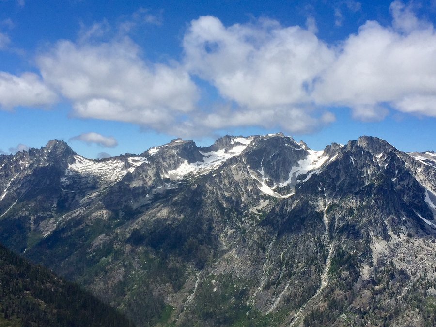
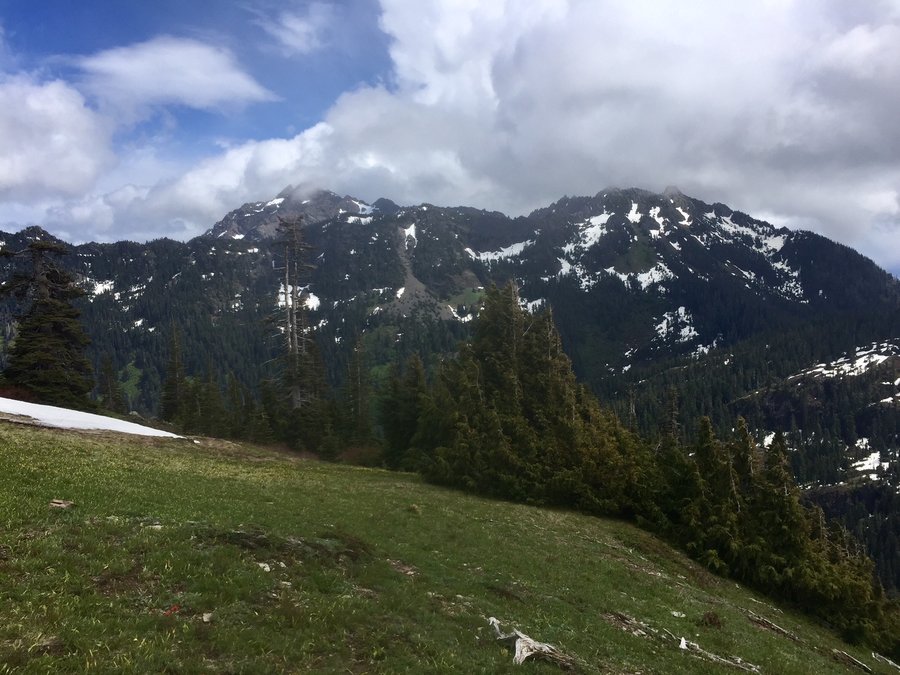
Navaho Pass/Peak
13.75 miles of hiking • 4250' elevation gain •
This is not a hike if one is looking for solitude. The majority of hikers though appeared to be backpackers heading to "the meadow" to set up camp. There were surprisingly few people at the pass and even fewer who ventured the steep climb to the peak. The views of the Stuart Range & The Enchantments were nice from the pass but from the peak they were outstanding and one could also see Rainier and Adams to the south.
June 23, 2018


 2
2
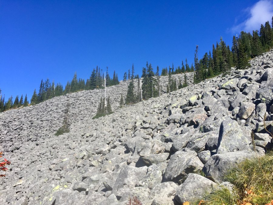
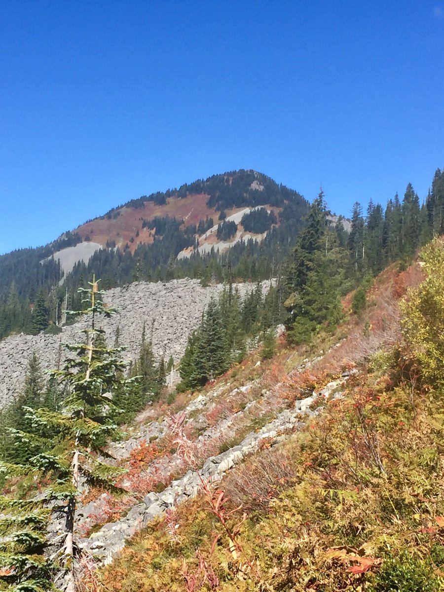
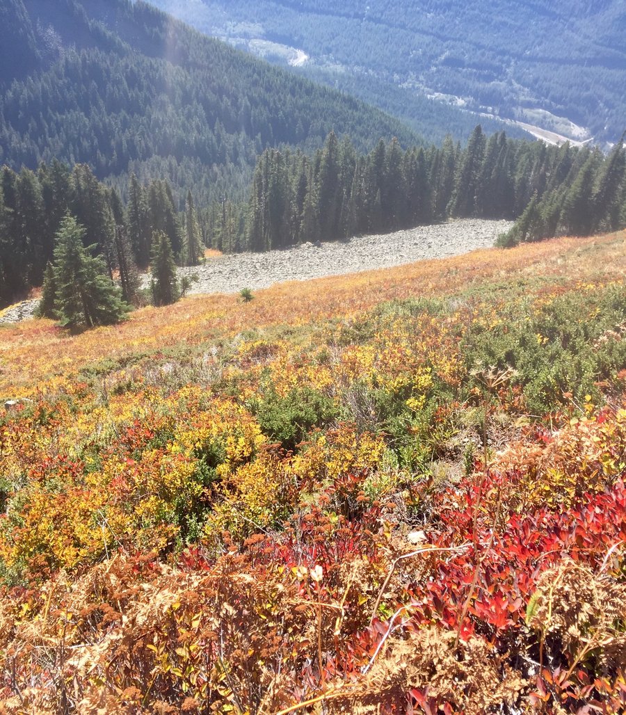
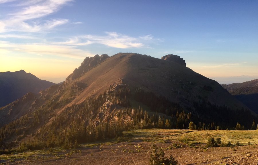
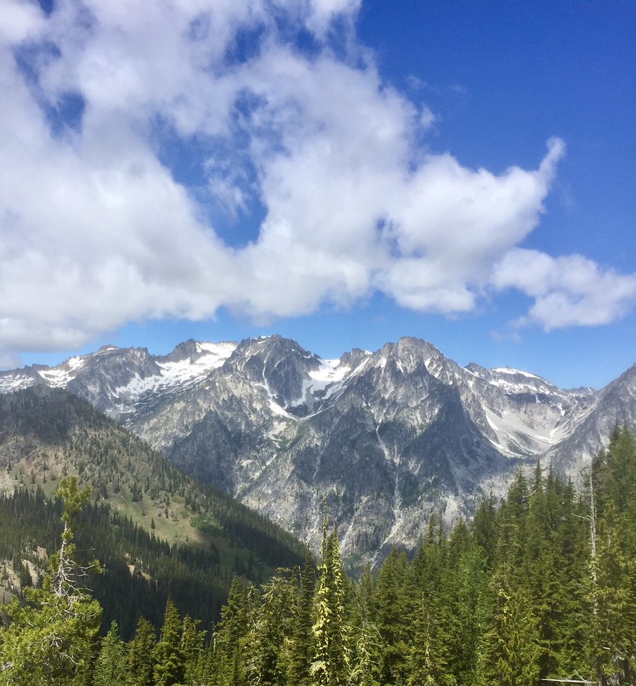
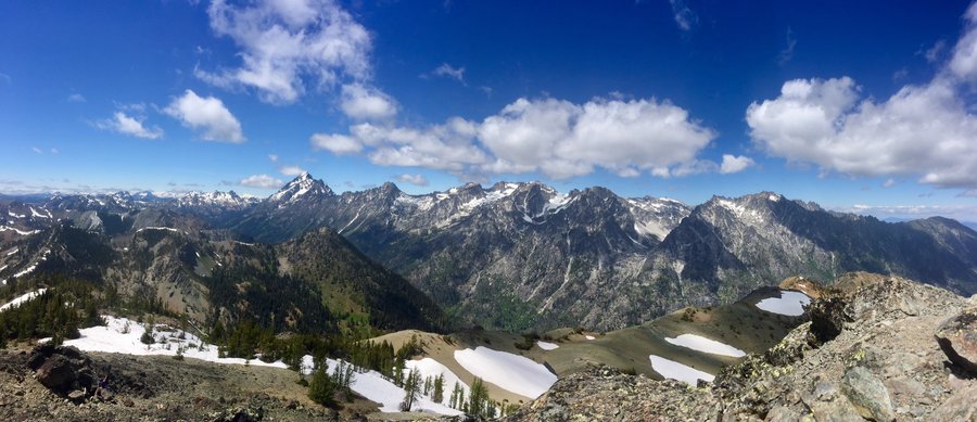
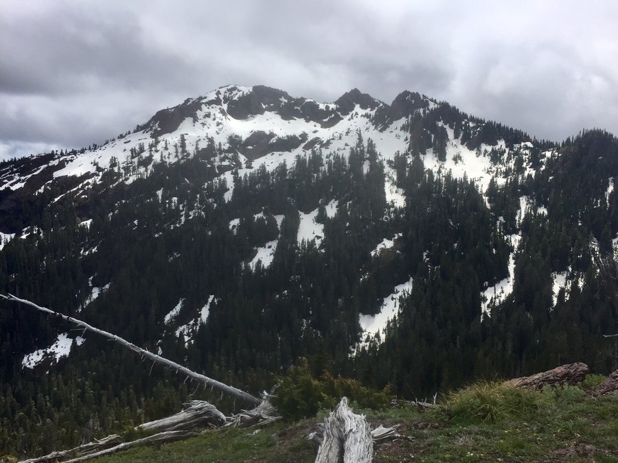
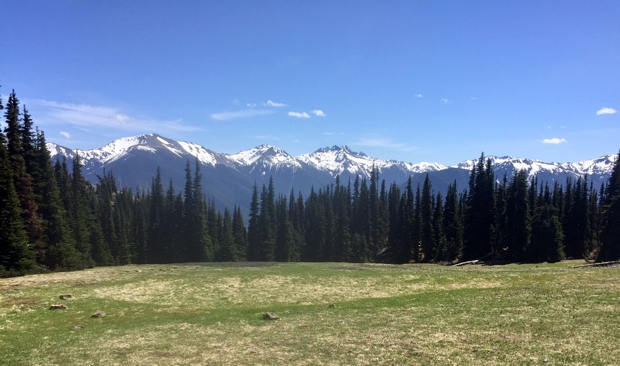
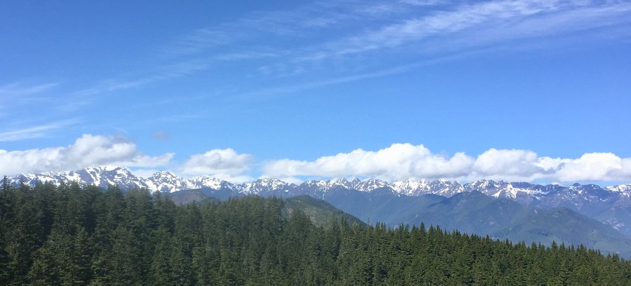
Olympics—Buckhorn Mtn
16.89 miles of hiking • 4250' elevation gain •
Took the long approach to Buckhorn via the Tubal Cain Trail. A few patches of snow near the top of Buckhorn Pass but nothing which require traction devices & once the pass is reached it is snow free to Buckhorn’s almost 7000’ Peak.
June 16, 2018


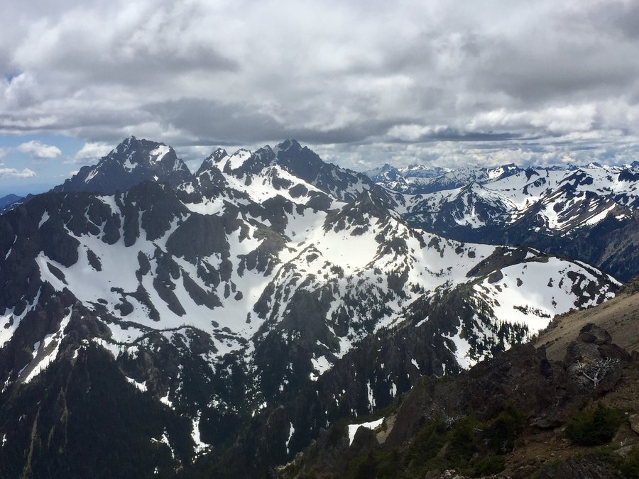
 2
2
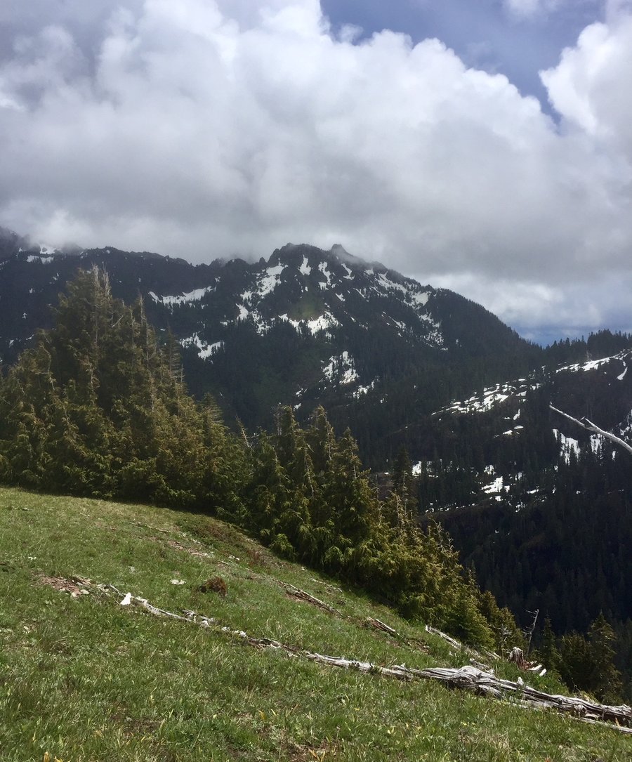
ONP--Wagon Wheel lake to Silver Snag
6.66 miles of hiking • 4000' elevation gain •
Typical Junuary day in the PNW. One minute raining, the next sunny, then hail and even snowing around 4000'. While I have hiked up to Wagon Wheel Lake before, a fairly unimpressive lake IMO, I have never taken the climbers trail which climbs around 800" feet above the lake to the Silver Snag plateau and also to Cub Peak. The views up on Silver Snag were fairly impressive and I sat up there for about an hour watching the weather move in and our of the area. The climb of Cub Peak does have some exposure and because I was alone along with the weather conditions making the tread a bit slippery decided to save its climb for another day.
June 10, 2018


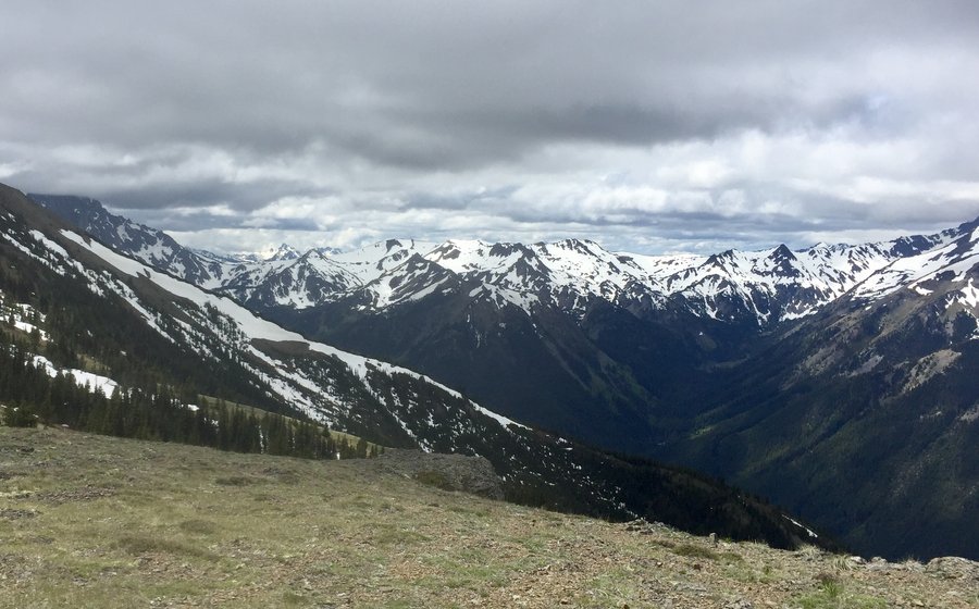
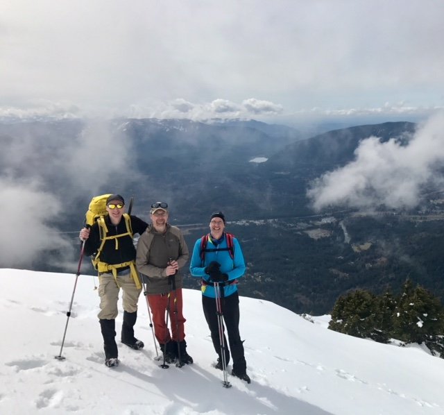
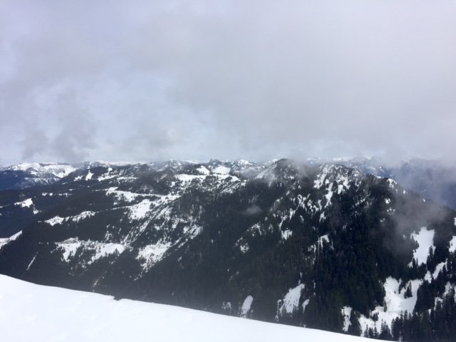
Olympics---Deer Park
20 miles of hiking • 6250' elevation gain • 2 nights
Hiked from the Slab Camp TH and made base camp at the Deer Park Campground. Deer Ridge and the campground are completely snow free. Day hiked from there up Blue & Green Mountains. Attempted an assent of Maiden Peak but still a bit to much snow and turned around about 500' from the summit.
May 26 – May 28, 2018

 1
1
Mt. St. Helens
11 miles of hiking • 5750' elevation gain • 1 night
Started the climb around 5 AM & Worm Flow route taken. Was told Monitor Ridge route will open June 1st. Snow is melting out quickly & the first half mile or so was snow free. Put on crampons after crossing the rocky section. Took us about 5 hours to reach the top. Glissade a fair amount on the way down which cut about a mile on the decent.
May 14 – May 15, 2018


Buck Mtn.
10.33 miles of hiking • 3250' elevation gain •
Accessed Buck Mtn. via the Elbo Creek TH. Trail to the summit entirely snow free. Lots of eagle activity in the area must of seen around a dozen of them flying around while on the summit....both bald & golden.
May 5, 2018


 1
1
Mt. Washington
8.67 miles of hiking • 3250' elevation gain •
Snow present for the last 1 1/2 miles of the assent. I used crampons for that section but one could make it to the summit w/o traction devices. Light snow showers at the 4200’ summit. No views due to the weather.
April 28, 2018

April 21, 2018


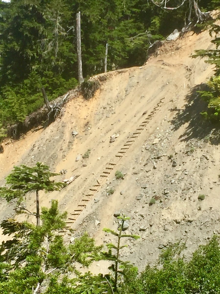
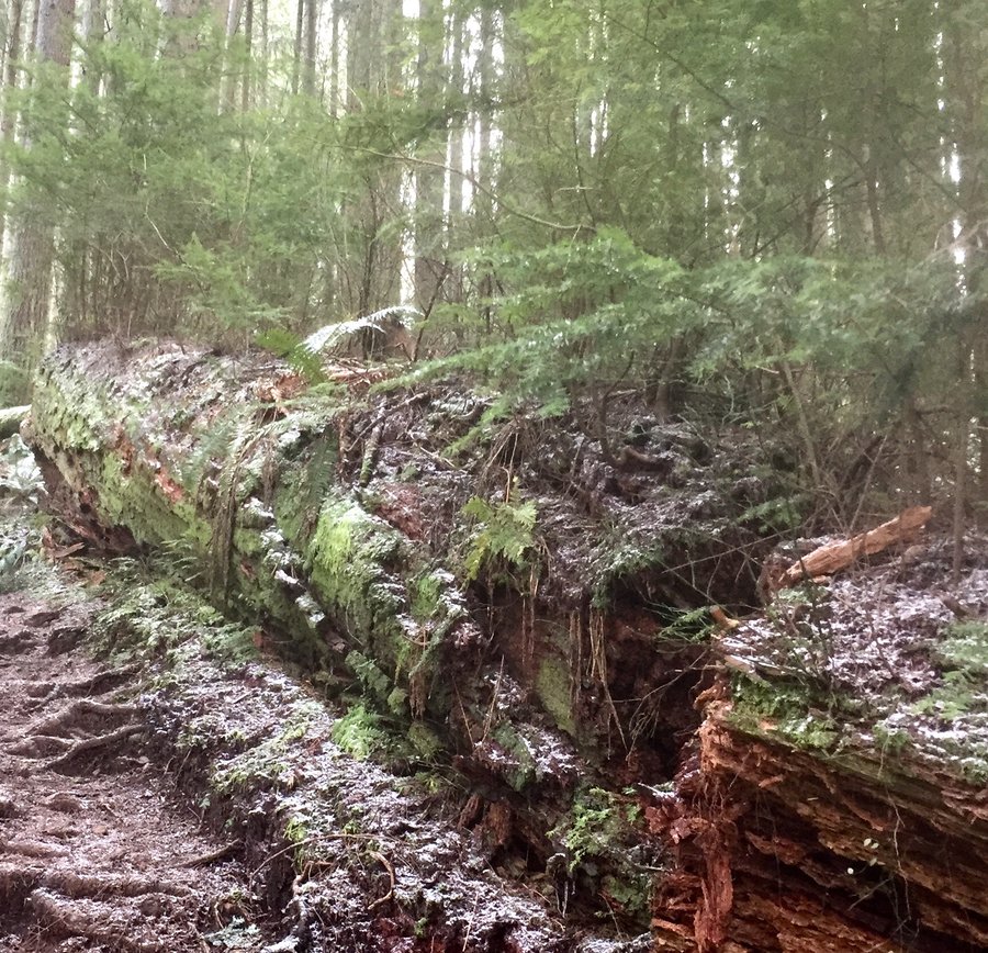
Pack Forest-Hugo Peak
4.7 miles of hiking • 1500' elevation gain •
I have not done this hike for several years and decided to give it a go again as the Grandson had a football game the Puyallup area. Quite a bit of trail work has been done since I last hiked here with some elevated wooded pathways now over the really wet and muddy sections and in a couple places the trail has been re-routed due to what appears to be excessive erosion. To get some good vertical climb though one really has to do the steep section twice. Overall not a bad somewhat close to town hike for a wet, drippy day
April 15, 2018
 1
1
Mt. Teneriffe
8.52 miles of hiking • 4250' elevation gain •
The new Teneriffe TH parking lot is nice but it does add a lot of foot traffic to Teneriffe Falls. From the Falls we took the Kamikaze trail to the summit of Teneriffe. According to my GPS from the Falls the elevation gain is 2000’ in just over a mile so it is a steep climb. The last 1000’ is snow covered and microspikes were helpful in getting to the summit.
March 31, 2018

Pinnacle Peak
4.18 miles of hiking • 2000' elevation gain •
This is a nice short steep conditioning hike but you really need to go up one side to the summit, down the other side, and than repeat.... for it to be worthwhile.
March 25, 2018
 1
1
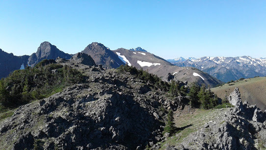
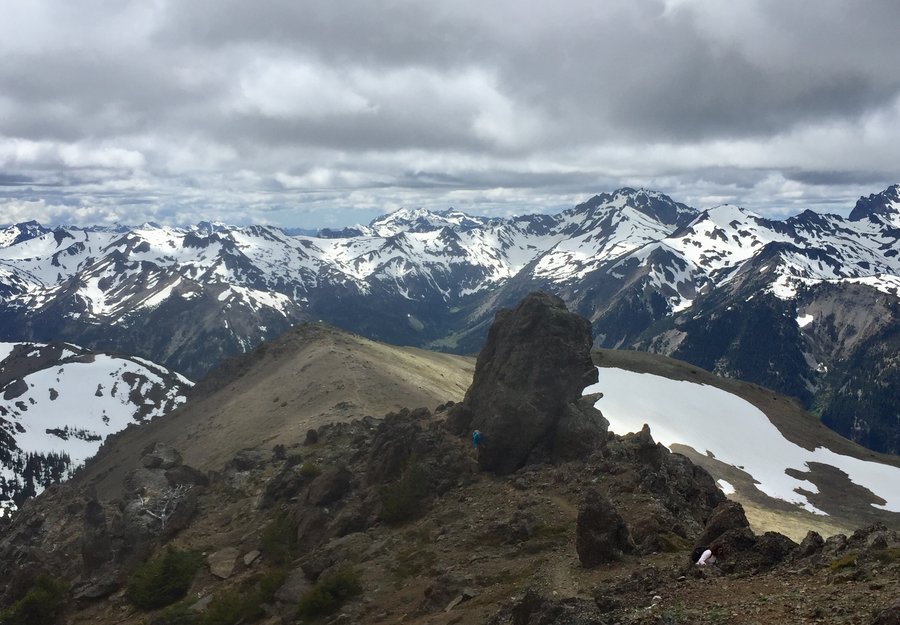
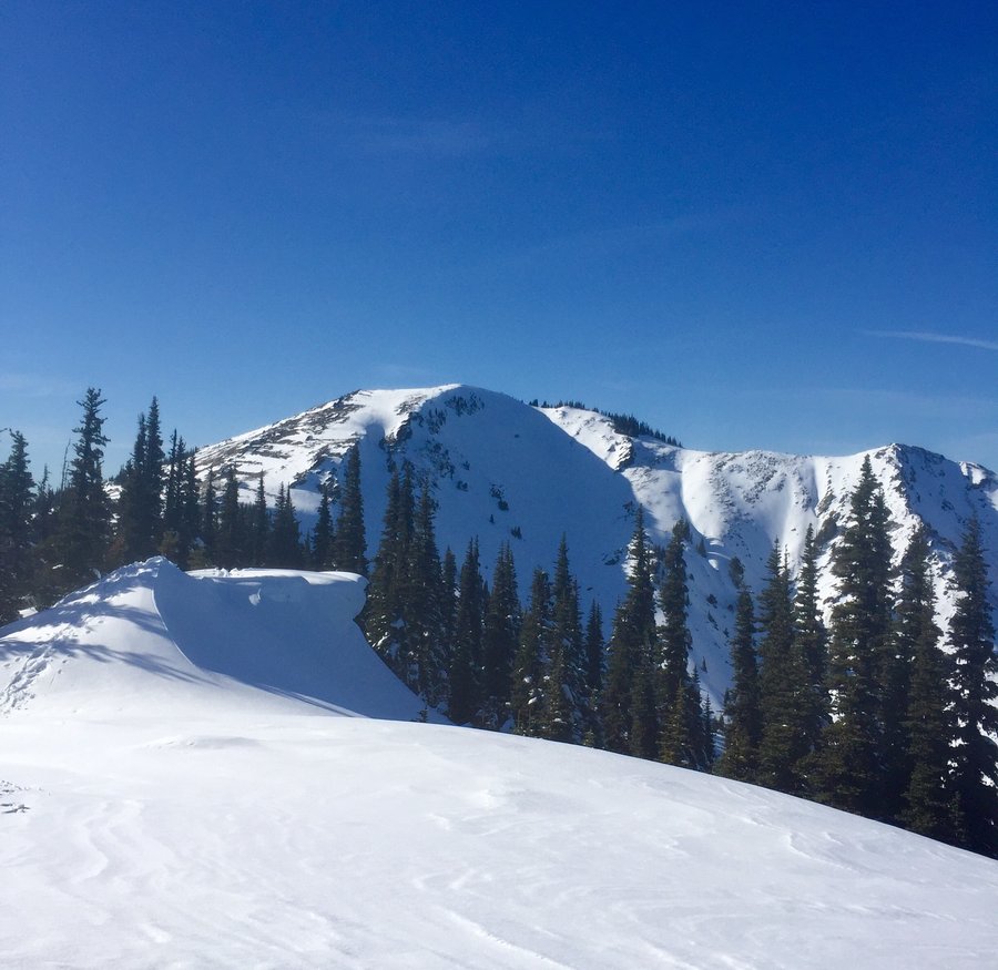
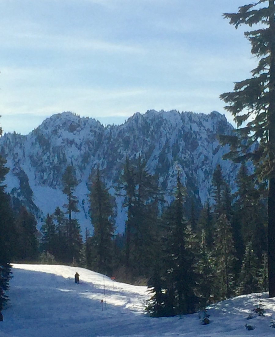
Tiger Mtn.—Summits 2 & 3
6.5 miles of hiking • 2750' elevation gain •
Started from the Highpoint TH & took various trails up to summit 2. From their hike over to summit 3 & then descended via the Cable Line Trail.
March 17, 2018
 1
1
Olympics-Deer Ridge
9 miles of hiking • 3500' elevation gain •
Was shooting for the summit of Blue Mtn. but got a late start & settled on getting up to the top of Deer Ridge which was at approx 5700’. Microspikes used for the first 3 miles or so & than we swtched to snowshoes for the final bit.
March 10, 2018

Tiger Mt—Summit 3
5.98 miles of hiking • 2750' elevation gain •
Took Section Line Trail up to the summit of Tiger 3. Top 3rd of the trail was extremely icy & microspikes were used.
March 3, 2018

Olympics—Big Creek
8.6 miles of hiking • 2500' elevation gain •
Hiked as far up as where the trail intersects with the lower Mt. Ellinor Trail. On this day the entire route was snow covered but no traction devices were used.
February 24, 2018

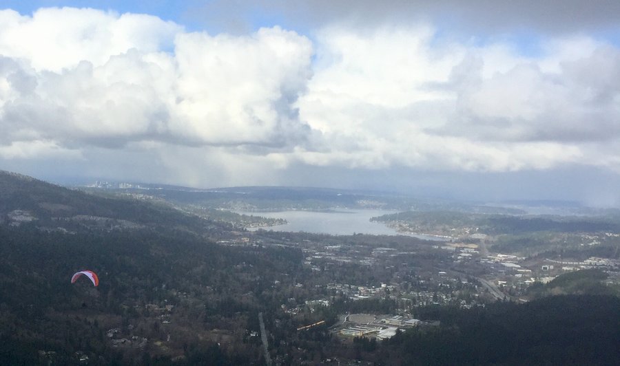
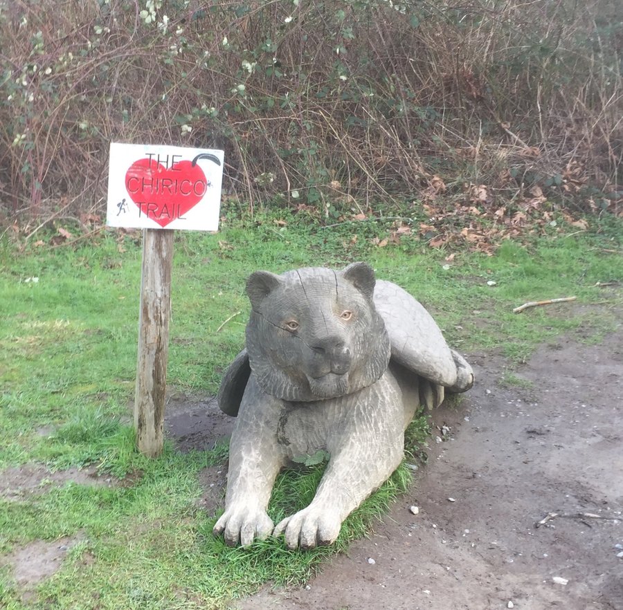
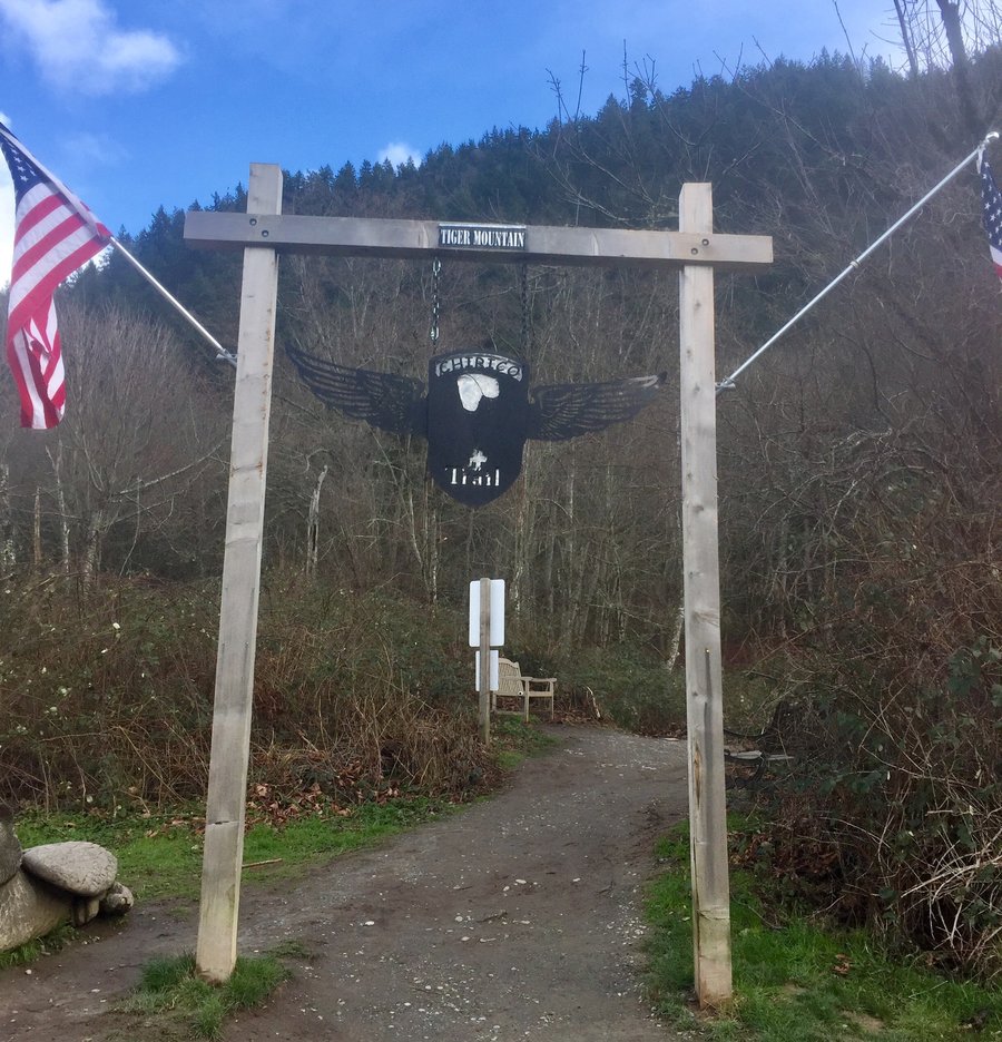
Tiger Mtn.—Poo Poo Point
5.28 miles of hiking • 2000' elevation gain •
Took the Chirico Trail up to Poo Poo Point. They have really gentrified this trail with lots of new switchbacks & stone steps. For a short training hike the old trail was much better.
February 18, 2018

Tiger Mtn.
5.73 miles of hiking • 2750' elevation gain •
Section Line Trail to the summit of Tiger 3
February 10, 2018

Mt. Rose
6 miles of hiking • 3500' elevation gain •
Snow began a bit before the summit loop junction & while I used micro spikes I wish I had brought the snowshoes as the postholing became a pain the higher one climbed due to the warm temps.Trail to the top is relatively easy to follow after the junction. Just keep your eyes open for the orange ribbons.
February 3, 2018


Pt. Defiance Park
4.75 miles of hiking • 1250' elevation gain •
Windy, rainy, muddy.....just a typical winter hike @ Pt. Defiance Park.
January 21, 2018
 4
4
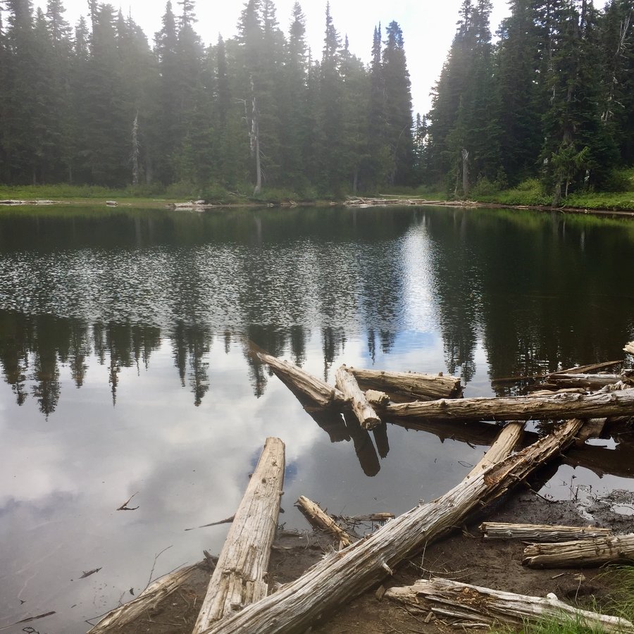
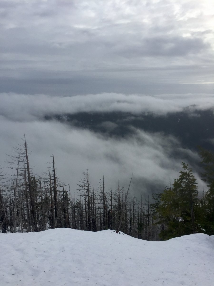
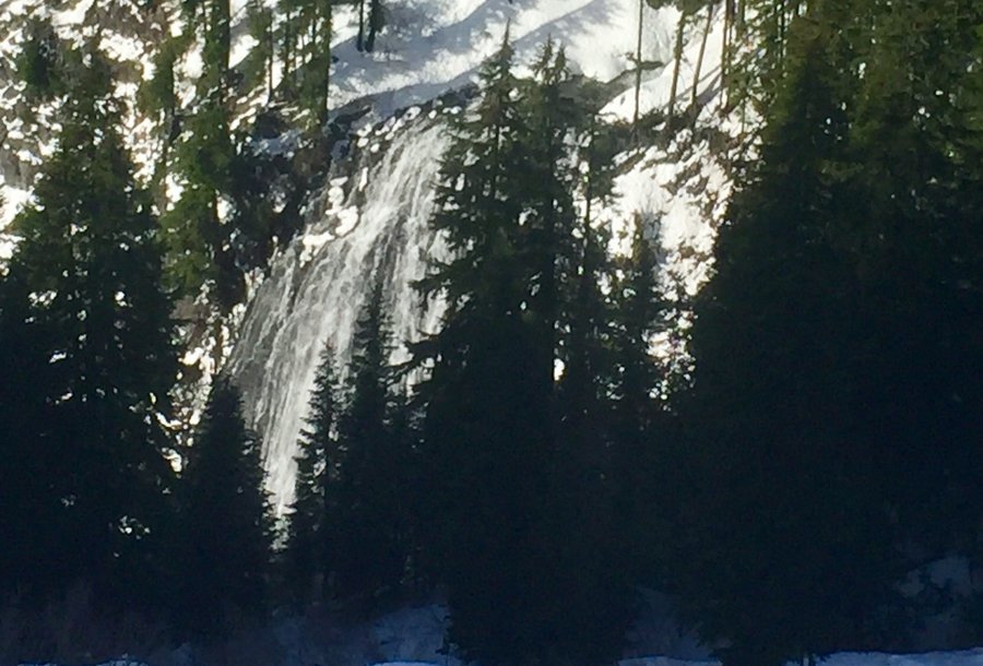
Mt. Rainier-Reflection Lake & Pinnacle Saddle Attempt
5.31 miles of hiking • 1250' elevation gain •
Began the hike at the Narada Falls TH. Snowshoe trails were clearly marked & easy to follow to the lake. The trail up to Pinnacle Saddle required some route finding & we quit when the post holing got hip deep.
January 13, 2018


Pt. Defiance
4.72 miles of hiking • 1250' elevation gain •
Typical seasonal sloppy muddy trails. The dog is always up for a good sloppy hike with a quick clean up swim in the sound. Woof!
January 6, 2018

Mt. Walker
5.5 miles of hiking • 2250' elevation gain •
Nice views. One could clearly see 3 volcanoes along with downtown Seattle.
January 3, 2018

Mt. Rainier-Paradise
3.17 miles of hiking • 1000' elevation gain •
Annual New Years day hike with the family. Place was a zoo but once you hiked about a mile up from the visitor center the crowds thinned out.
January 1, 2018

View trips from: 2012 2013 2014 2015 2016 2017 2019 2020 2021 2022