


2017 Trips


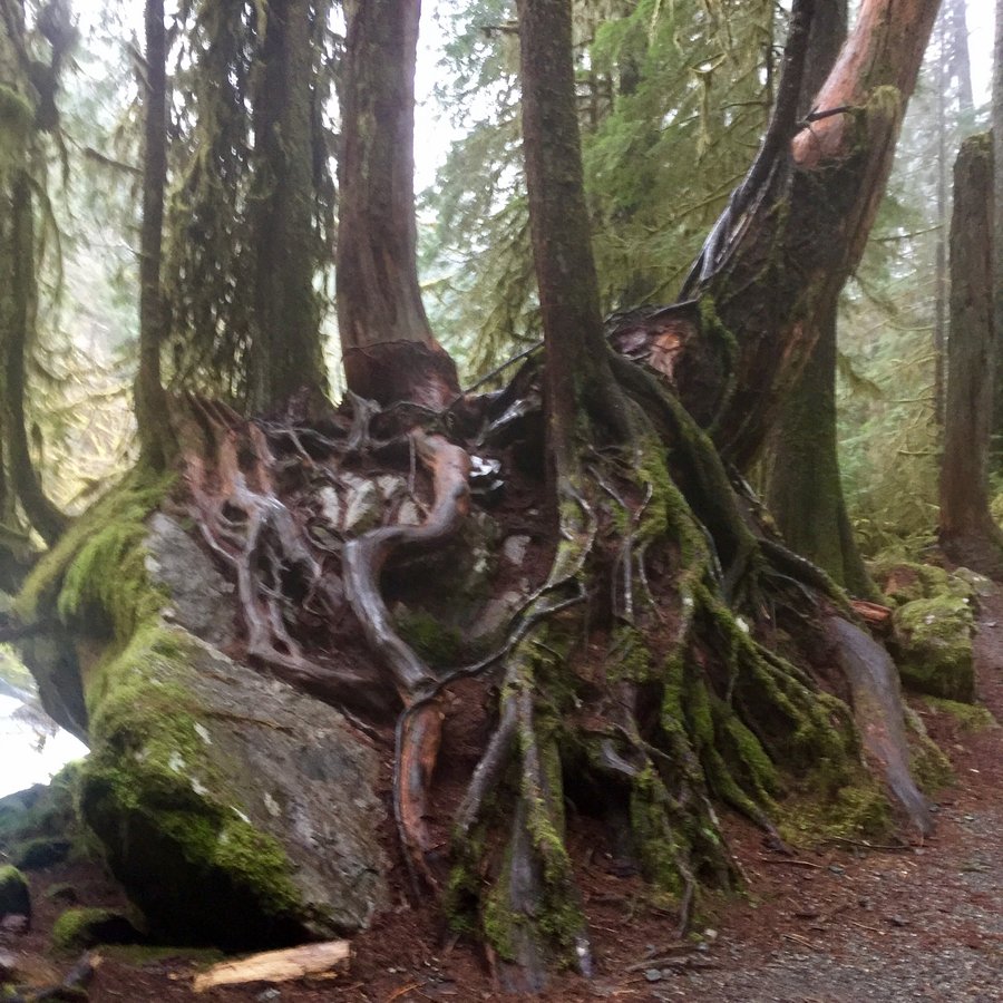
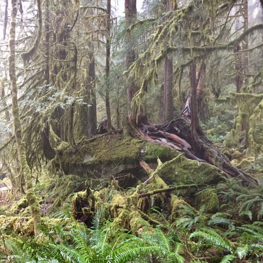
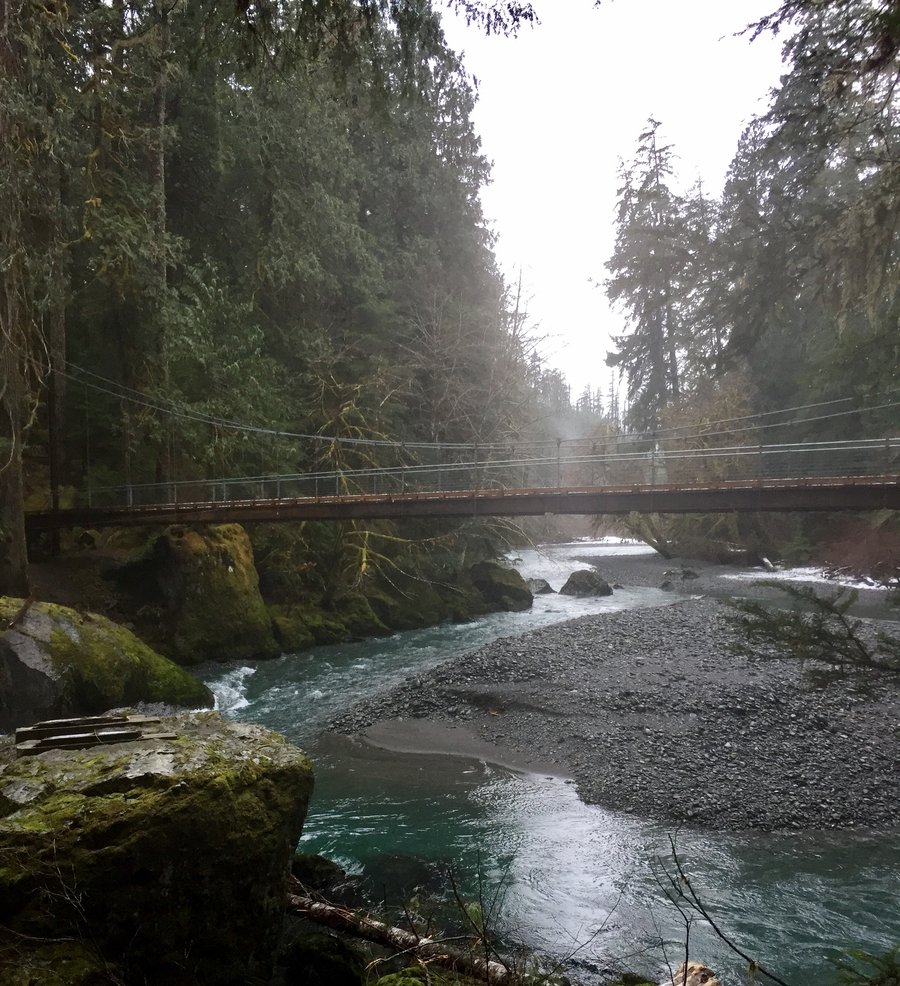
Olympics-Staircase
7.5 miles of hiking • 1250' elevation gain •
Checked out the recent road washout prior to the park entrance which prevents car travel into the park. Was told by the on site ranger that plans are to repair the road in the Spring. I entered the park via the Shady Lane Trail & then hiked the 4 Streams Trail to its end. Than backtracked and reconnected with the Staircase Rapids Trail completing the loop back to the Ranger Station. Hiked back to the car via Shady Lane.

December 22, 2017

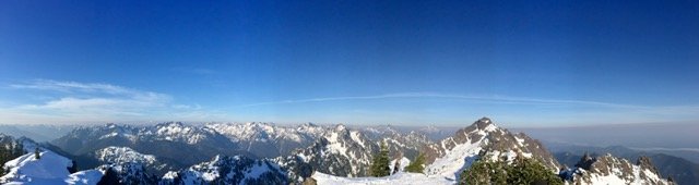
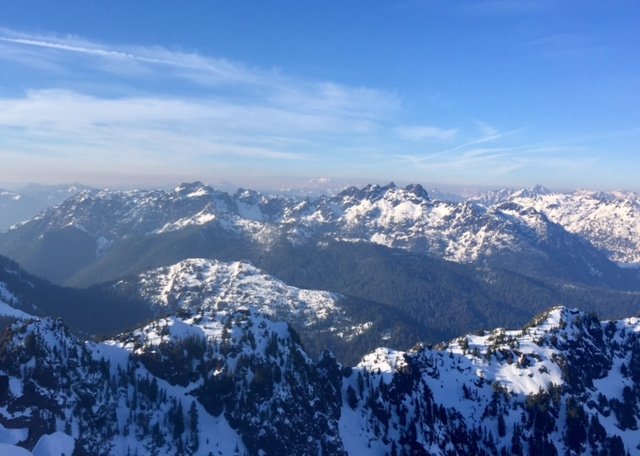
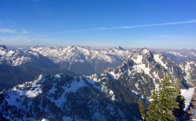
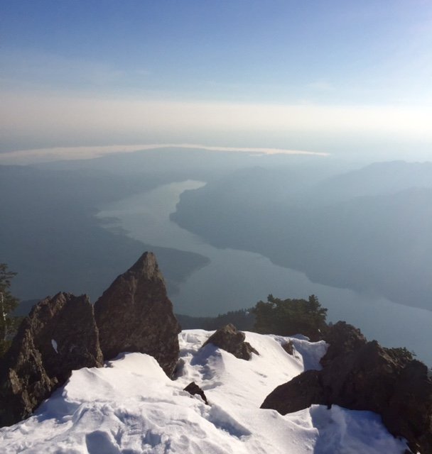
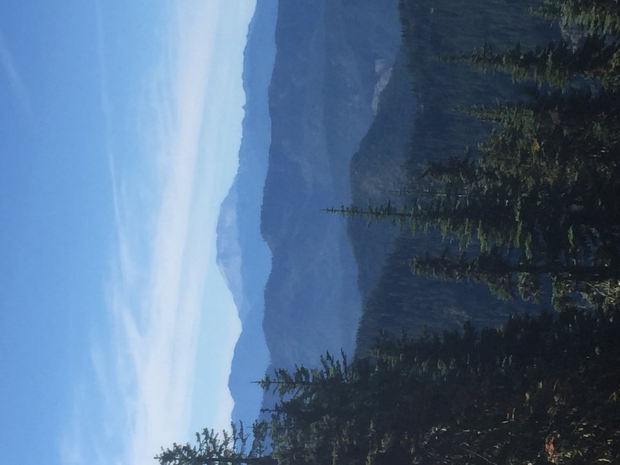
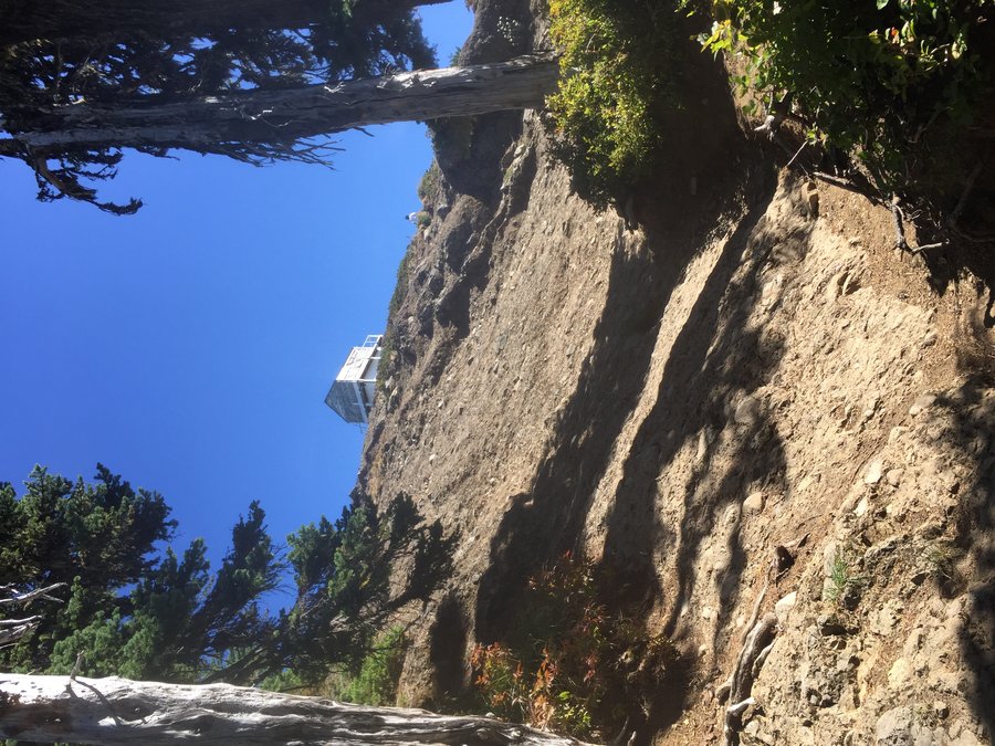
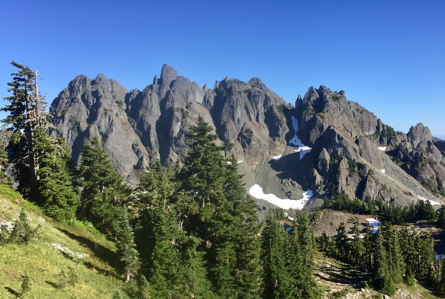
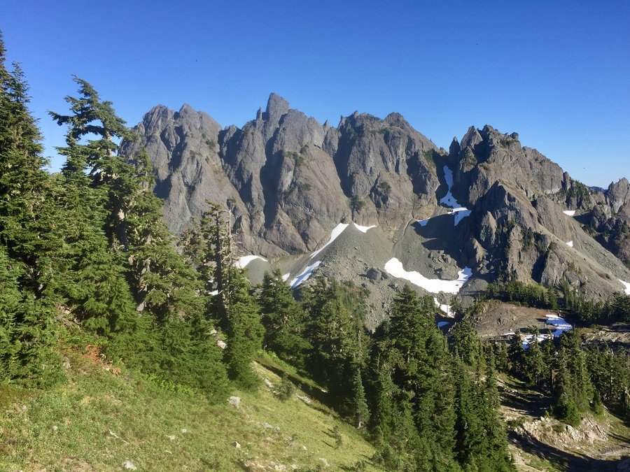
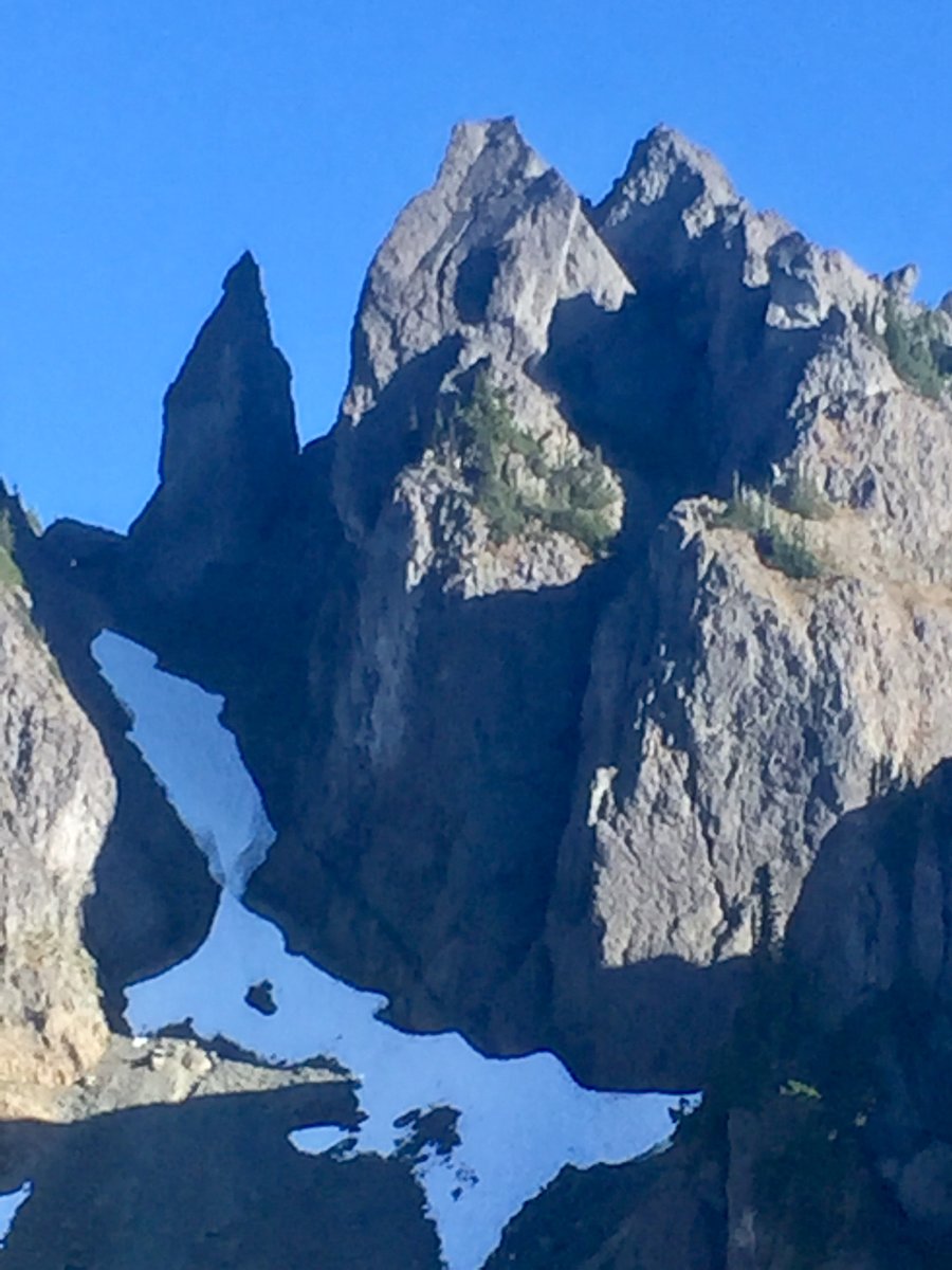
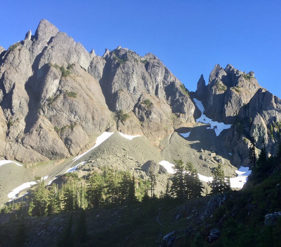
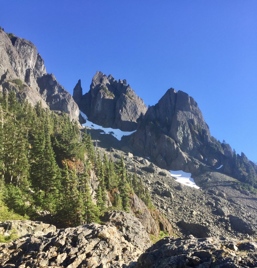
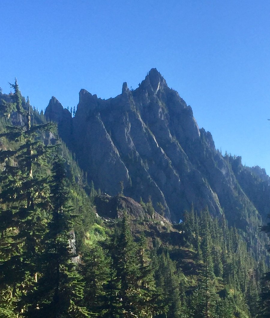
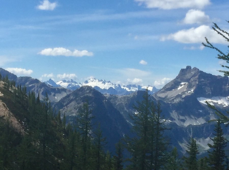
Mt. Ellinor
4.76 miles of hiking • 3000' elevation gain •
Started hike between the lower and upper TH. Could not quite make it to the upper TH due to snow. Took the winter route up the avalanche shoot. Above the inversion layer it was quite balmy, t-shirt weather.
December 10, 2017


 1
1
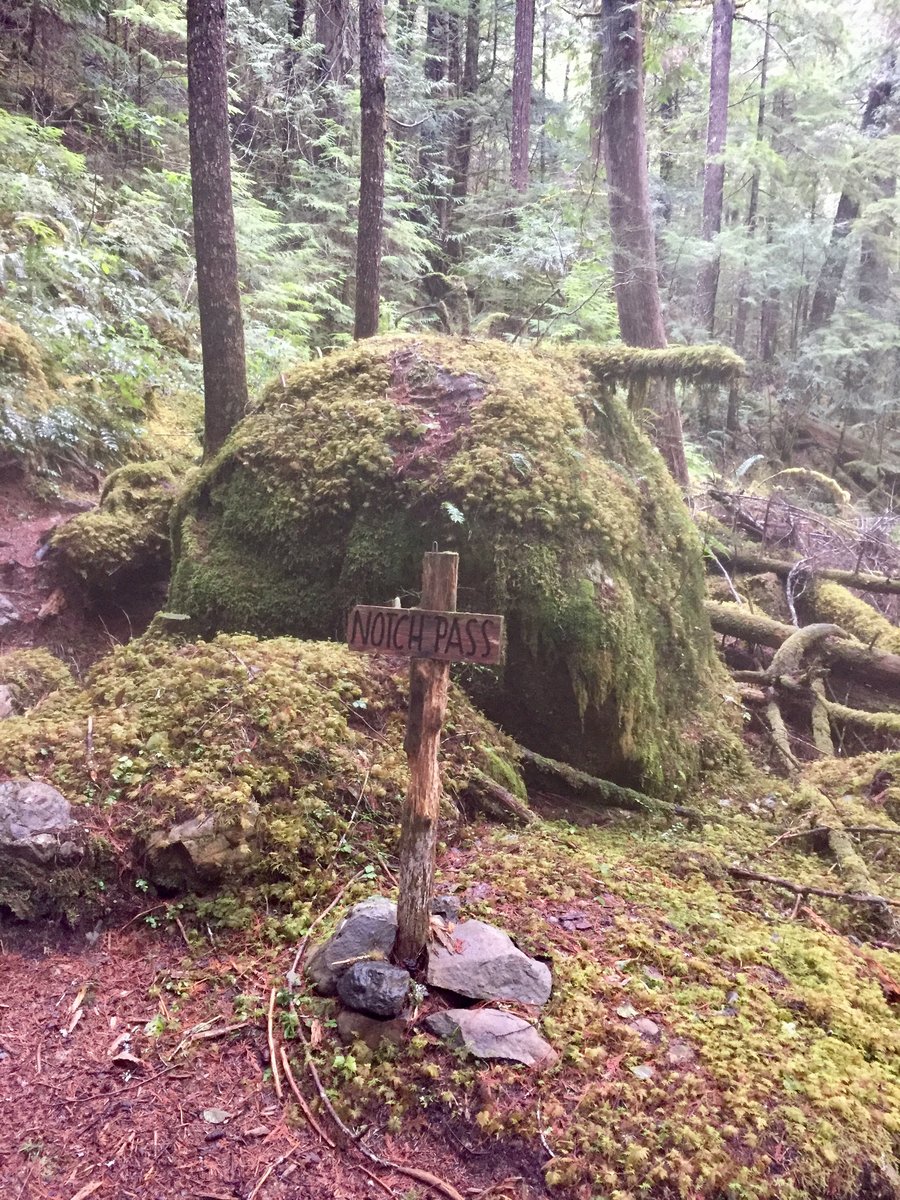
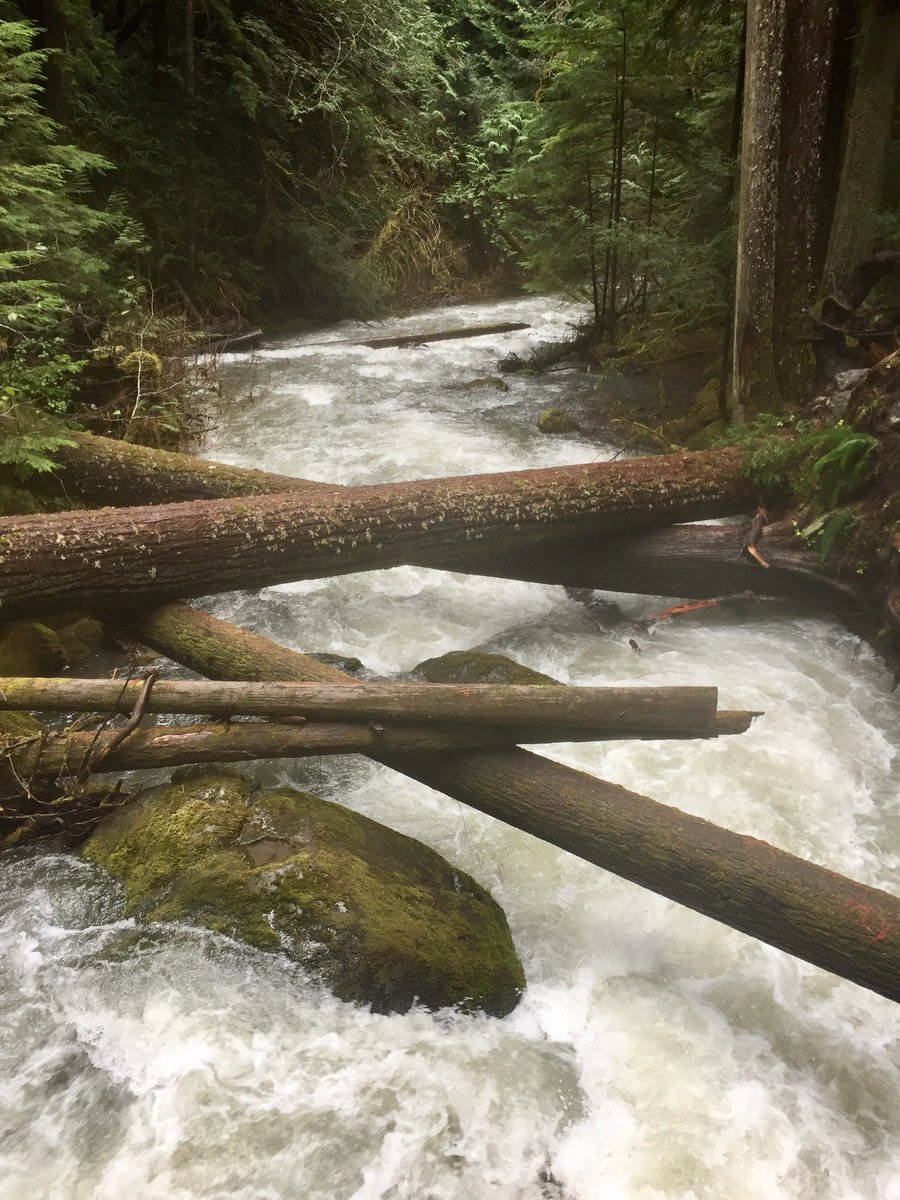
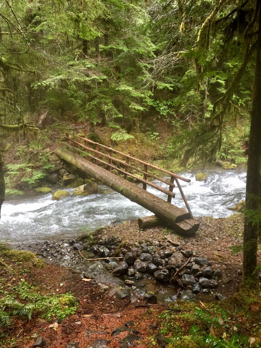
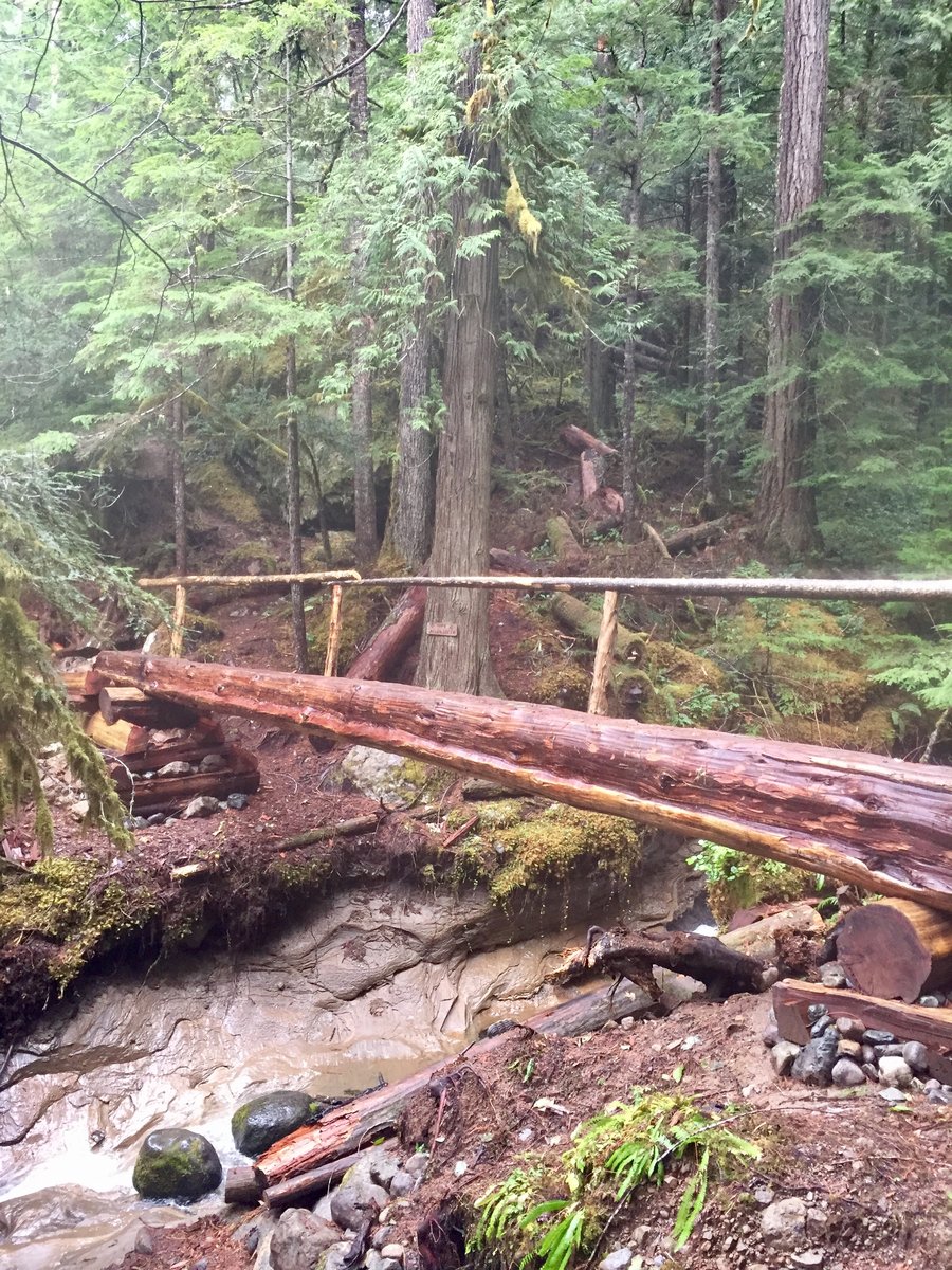
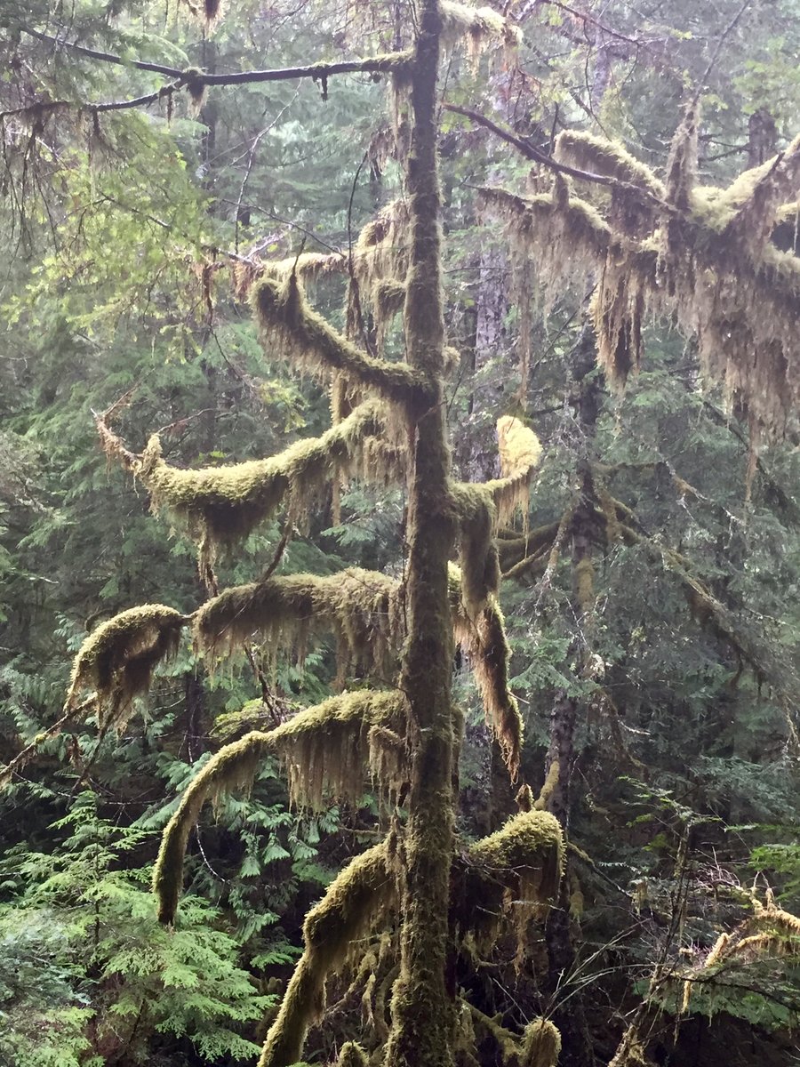
Notch Pass--Big Quilcene
8.71 miles of hiking • 3000' elevation gain •
This is one of my favorite winter hikes. Some good elevation gain, a mossy wonderland, a roaring river & solitude. Just me & some quality time with my 4 legged best friend.....woof!
November 24, 2017


Tiger Mtn- Trifecta
8.73 miles of hiking • 3500' elevation gain •
Up Section Line to summit 3 then hit summits 2, the Hiker Hut viewpoint, @ summit 1. Exited back down to the car via the High School trail.
November 18, 2017


 1
1
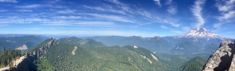
Mt. Rainier-Comet Falls, Mildred Point & Van Trump Park
8 miles of hiking • 3000' elevation gain •
Weather was positively spring like. 3 volcanoes could be clearly seen. This is a great hike as you get 2 drastically different views of Rainier from one trail along with a close up view of one of the highest water falls within the park.
October 29, 2017


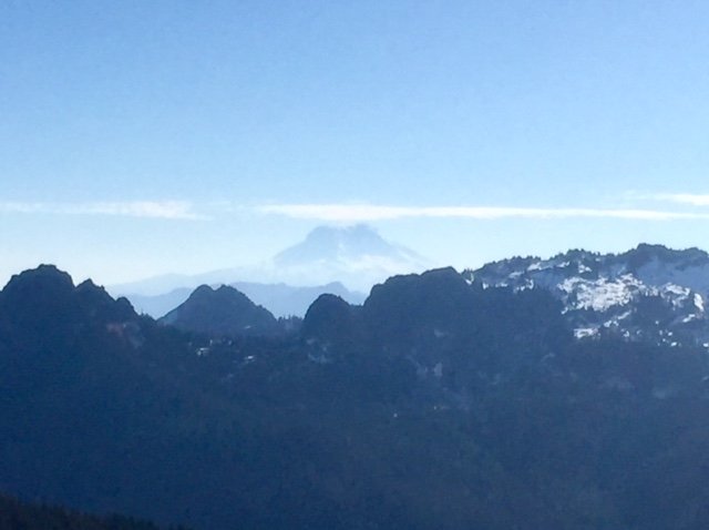

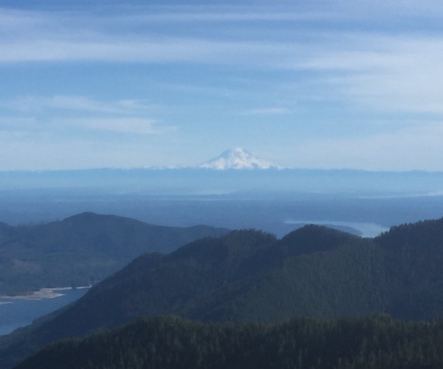
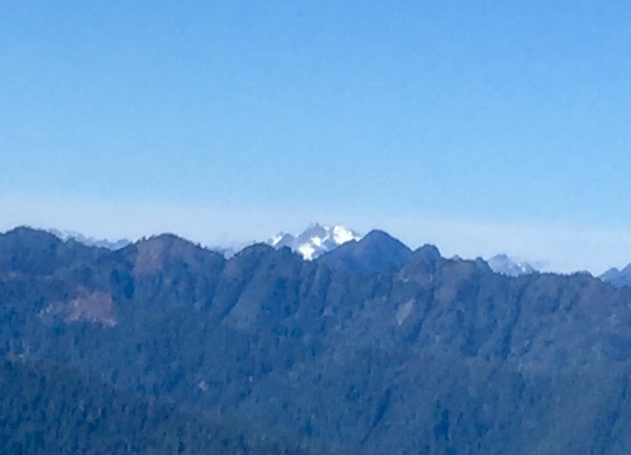
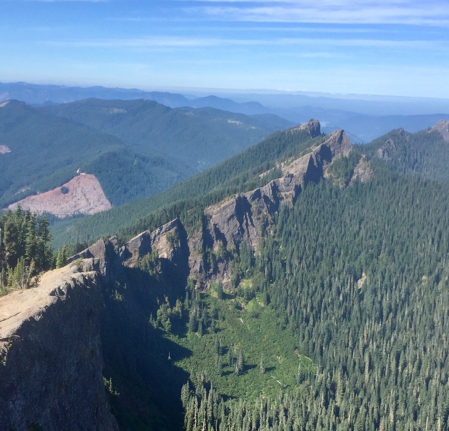
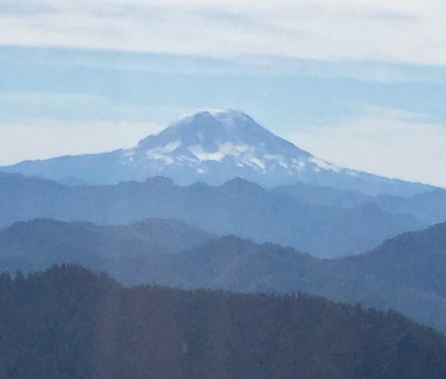
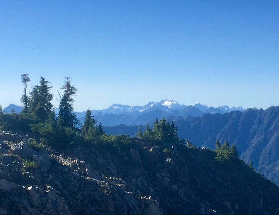
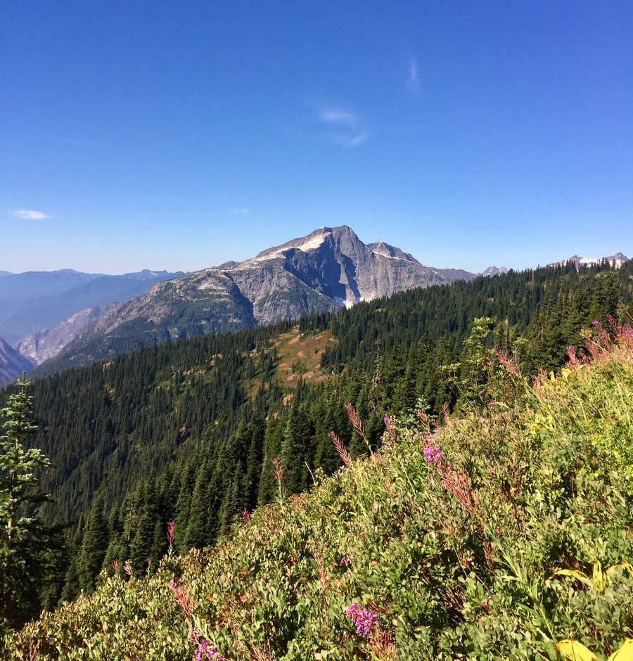
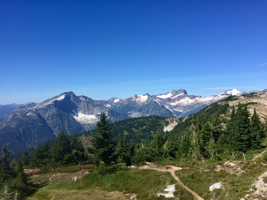
Olympics-Timber Mtn.
7.62 miles of hiking • 4000' elevation gain •
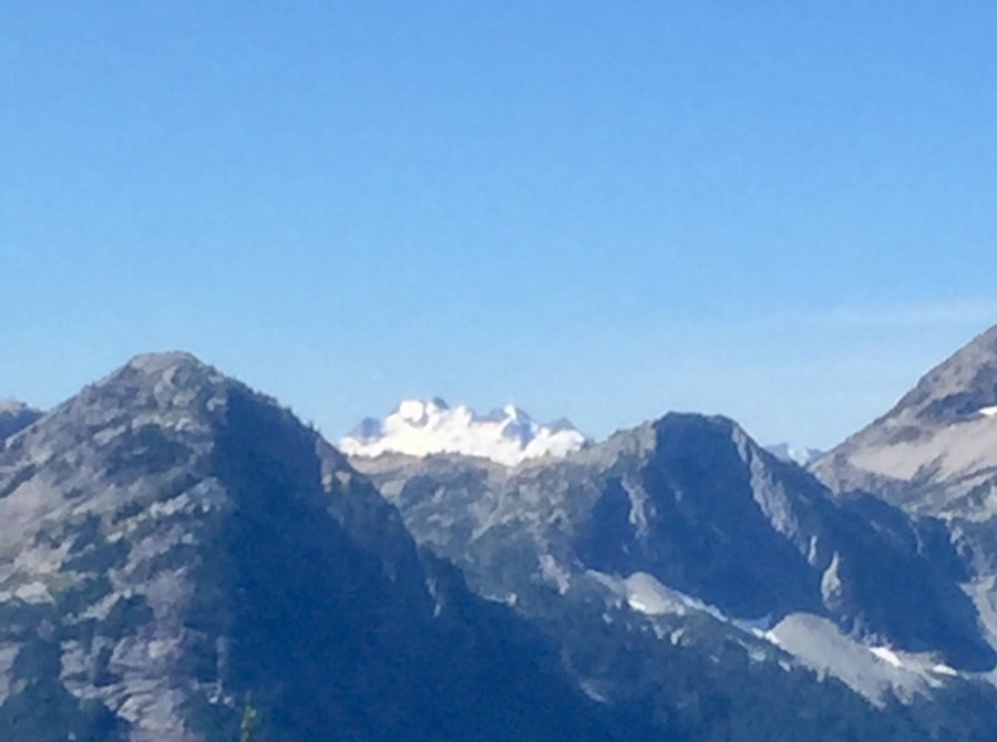
Timber Mtn. is accessed from the Copper Creek Trail. Once you leave the maintained trail it is a climbers trail and the way is marked with sporadic ribbons and cairns. Nice views of Lake Cushman and surrounding mountains from the 4400' summit. One could clearly see to the east Mt. Rainier, Adams and St. Helens along with downtown Seattle. The tops of Mt. Olympus and Mt Anderson were also visible to the NW.
October 15, 2017


7 Lakes Basin-Washout
10.7 miles of hiking • 2000' elevation gain • 1 night
The plan was to spend 3 nights up the Sol Duc River making base camp @ the Appleton Pass junction. From there we would day hike up to the High Divide & 7 Lakes Basin & than spend a day hiking up to Appleton Pass. Mother Nature did not cooperate as it rained steadily from the time we left the Sol Duc TH on 10/6 to the time we got back to our vehicle around 4pm the next day.
October 6 – October 7, 2017
 1
1
Mt. Rainier-Comet Falls
4.5 miles of hiking • 1500' elevation gain •
Perfect hike for a wet misty day.
October 1, 2017

 1
1
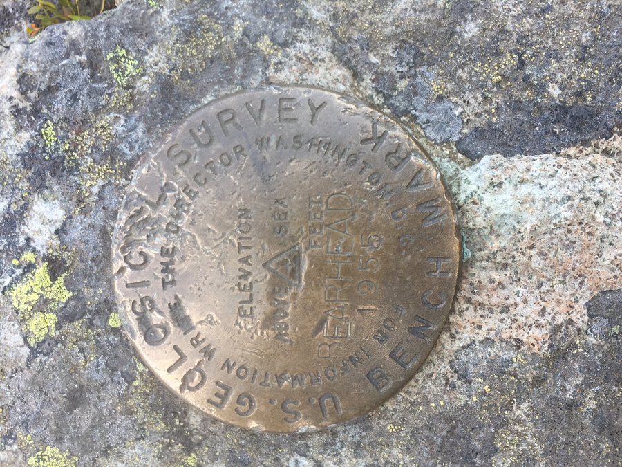
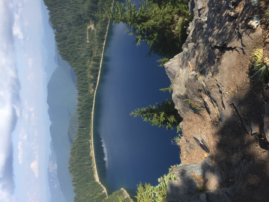
Bearhead Mtn. & Summit Lake
10.51 miles of hiking • 3000' elevation gain •
Unfortunately clouds & hazy smoke from the Norse Peak fire obscured long range views from Bearhead Peak & Summit Lake. Summit Lake as always was beautiful.
September 14, 2017


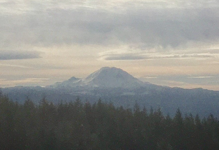
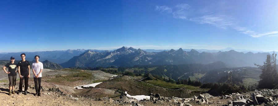
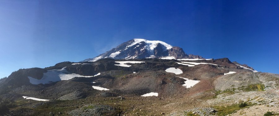
Mt. Rainier
9.53 miles of hiking • 3000' elevation gain • 2 nights
Had a nephew visiting from Korea who had never gone camping so camped @ Cougar Rock & hiked up to Panorama Point up @ Paradise on day one. On day 2 hike the Grove of the Patriarchs and then left the park & hiked up to the High Rock Fire Lookout. Great views from the lookout & one could clearly see 4 volcanoes and the most eastern Olympic Mtn. range.
September 11 – September 13, 2017


 1
1
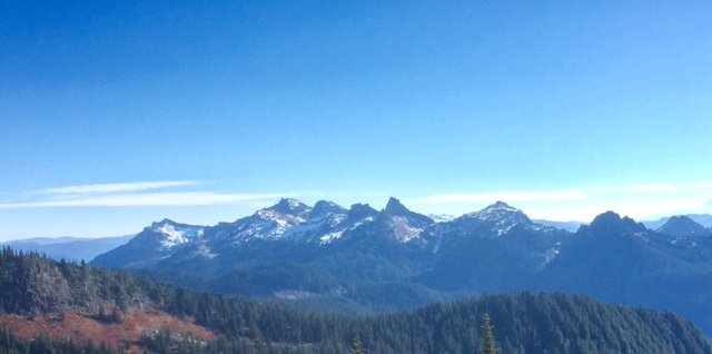
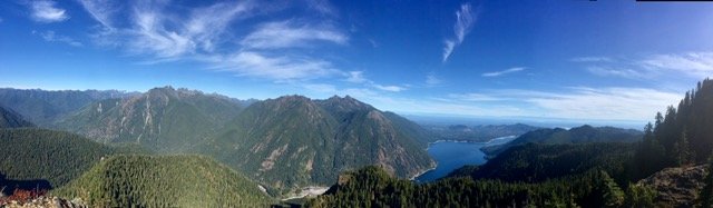
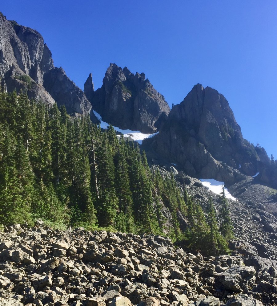
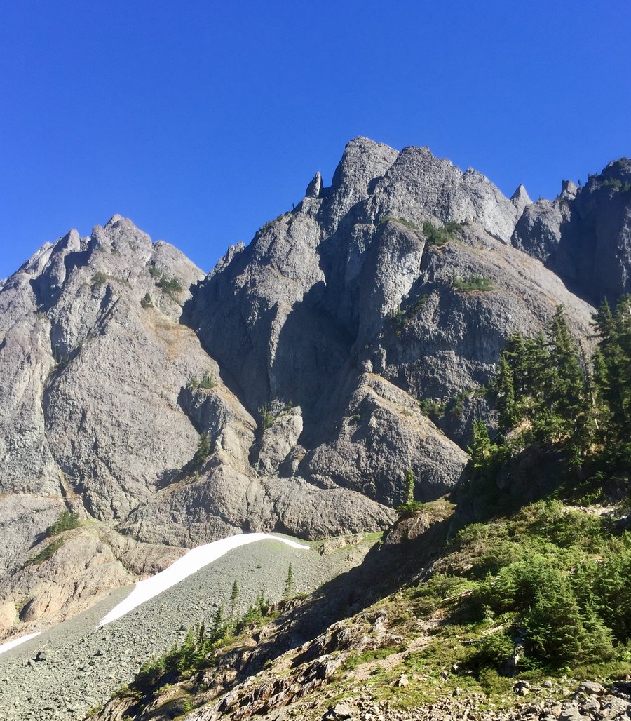
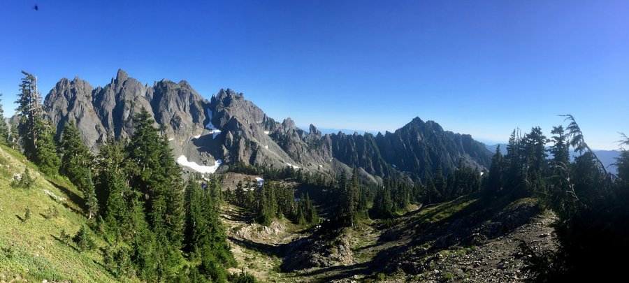
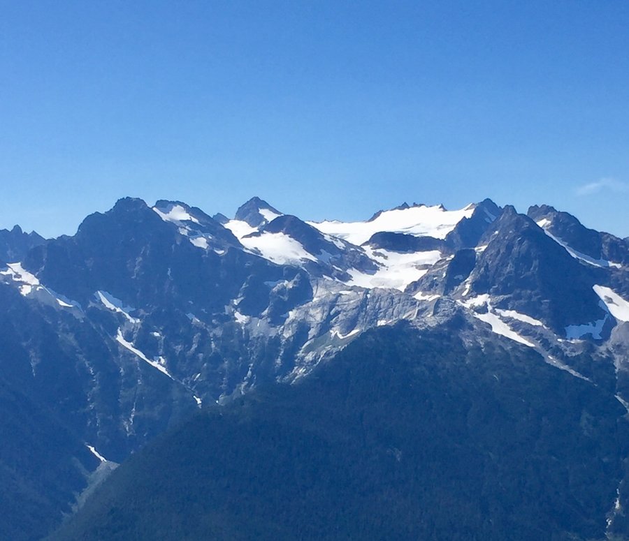
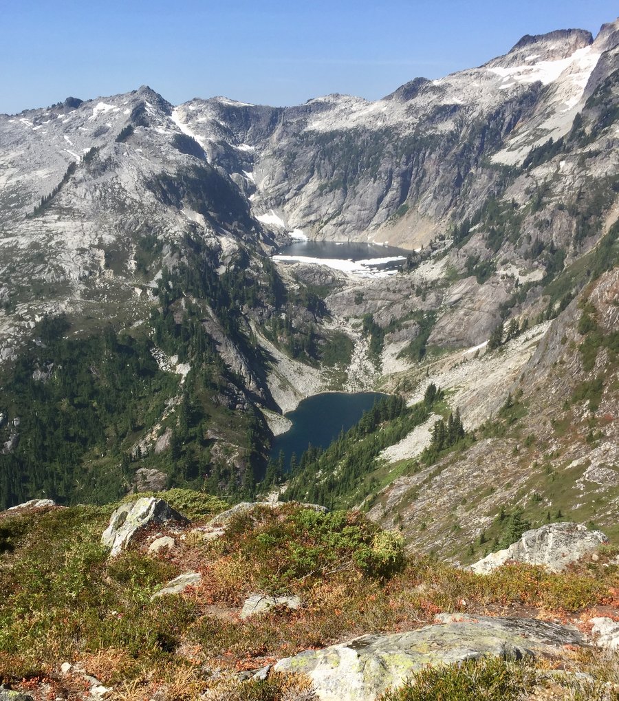
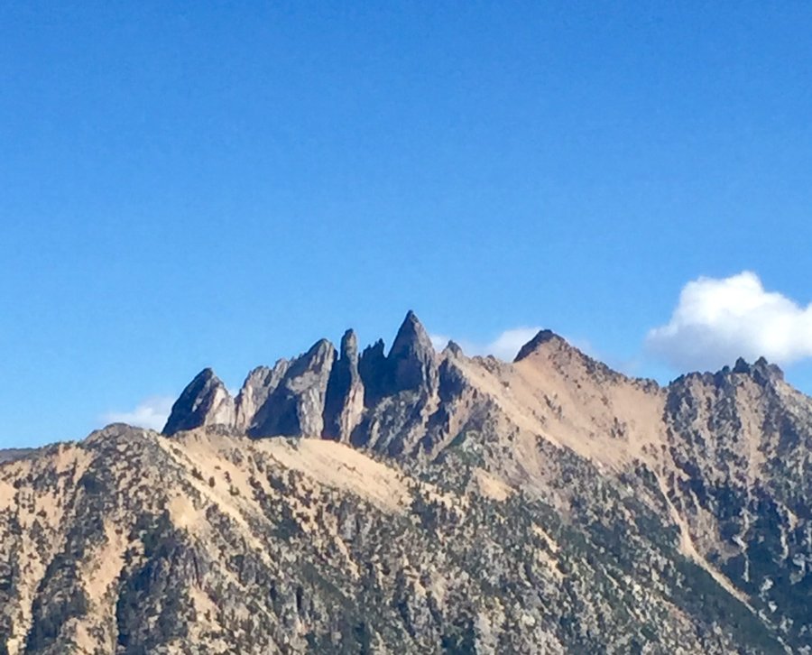
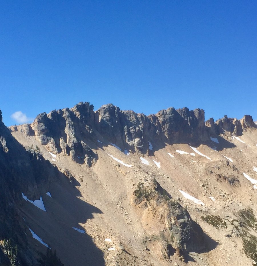
ONP-Staircase: 4 Lakes, 1 Divide & a Peak
26.5 miles of hiking • 7500' elevation gain • 2 nights
Entered Park @ the Staircase entrance & made camp approx. 7.5 miles in @ Donahue Creek. Then hiked up to Flapjack Lakes up through Gladys Divide & summited Mt. Gladys. Expansive views @ the 5600 summit with clear views of Mt. Olympus, Sawtooth Ridge, Mt. Cruiser, Mt. Lincoln & surrounding peaks. Next day hiked up to Black & White Lakes & then a very steep descent down to Smith Lake. Tons of ripe blueberries on the B & W and Smith Lakes trails. Saw a few bears in the area so some caution should be taken while hiking here this time of season.
September 2 – September 4, 2017


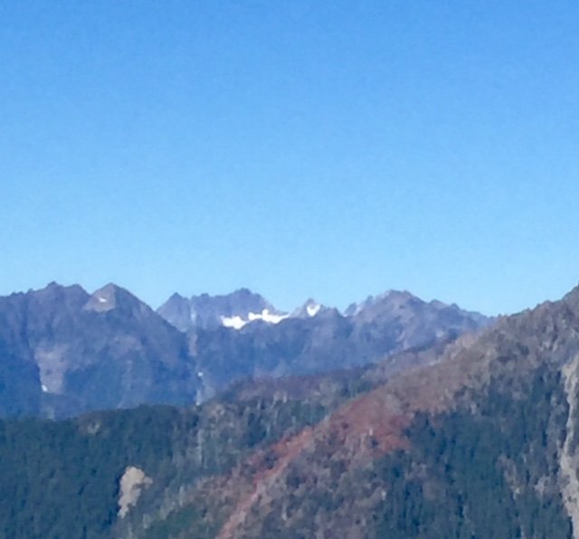
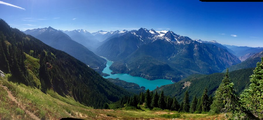
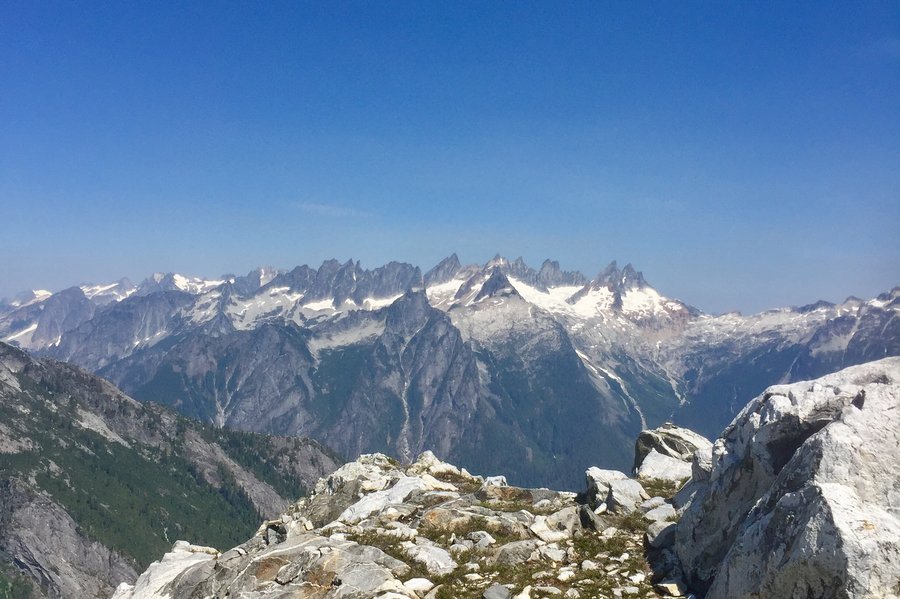
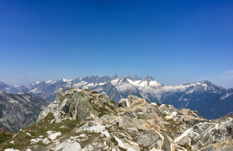
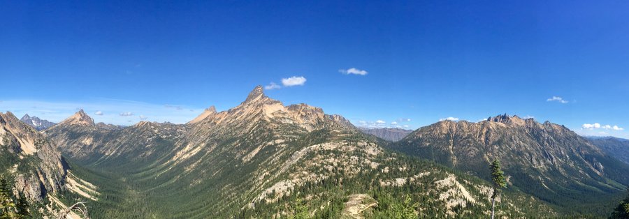
North Cascades
40.33 miles of hiking • 12750' elevation gain • 4 nights
Established base camp@ Colonial Creek & hiked the following trails:
Thunder Creek as far as the Fourth of July TH--- 6.08 miles. 829'
Sourdough Mtn --- 11.22 miles. 5622'
Thornton Lakes TH summited Trapper Peak ---10.60 miles. 3850'
Cutthroat Pass to Granite Pass --- 12.43 miles. 2367'
All hikes were assessed off of North Cascades Hwy 20.
August 20 – August 24, 2017


 2
2
Olympic 5 Lake Extravaganza
27.66 miles of hiking • 8500' elevation gain • 3 nights
While 7 Lakes Basin is the go to place to see lakes in the ONP this area is a less crowded alternative once you get above Lower Lena Lake.....which is not in the ONP so no permit is required. We got a late start & spent the first night at Lower Lena. Next day we hoofed it up to Upper Lena Lake. Trail is fairly steep, rocky, rooty, dusty, muddy, brushy & gets buggier the closer you get to the upper lake. Bugs at Upper Lena Lake were a pain. Mostly biting flys. Spent the rest of the day swimming in an attempt to stay cool & keep the bugs away. Next day hiked to Milk Lake, Scout Lake & Hagen Lake. Saw zero people. Again bugs at the lakes were pretty bad but as long as you kept moving things were fine. Was going to assend Mt. Lena but the wild fire haze was still present so decided to save that for another day. Over all a great trip.
August 6 – August 9, 2017
 2
2
Tatoosh Lake & Ridge
7.61 miles of hiking • 3750' elevation gain •
Flowers are in full bloom on the ridge. A bit buggy but not to bad if one keeps moving.
July 23, 2017

Olympic Smorgasbord
35 miles of hiking • 13000' elevation gain • 4 nights
Made base camp @ Boulder Shelter & then day hiked from there to Marmot Pass, climbing Buckhorn Mtn. Then Home Lake, Constance Pass & Del Monte Ridge. On the final day hiked to and around Charlia Lake.
July 17 – July 21, 2017

Mt. Townsend
7.51 miles of hiking • 2750' elevation gain •
Hiked via the Little Quilcene trail. Clear day so great 360 degree views.
July 8, 2017

July 2, 2017

Colonel Bob Trail
9.01 miles of hiking • 3000' elevation gain •
Hiked a bit past the Mulkey Shelter.
July 1, 2017

Olympics-Mt. Muller
13.38 miles of hiking • 3750' elevation gain •
I did the loop hike clockwise. Great views of Mt. Olympus & Lake Crescent.
June 24, 2017

Tiger Mountain Trifecta
8.71 miles of hiking • 3500' elevation gain •
Hiked to all 3 summits plus the Hikers Hut.
June 10, 2017
 1
1
ONP: Deer Park-Blue Mtn-Grand Ridge
18.65 miles of hiking • 5250' elevation gain • 2 nights
Hiked from the Slab Camp TH up to Deer Ridge and then onto Deer Park. Since the road to Deer Park is still closed had the camp ground entirely to myself..... sweet! Next morning hiked up Blue Mtn.& the views @ its 6000+ peak were again.... sweet! Could clearly see Mt. Olympus, Mt. Baker, Glacier Peak, Hurricane Ridge, & multiple peaks from the summit. Descended Blue Mtn., located the Grand Ridge trail & followed the trail a couple miles up Green Mtn. until the snow got to deep. Headed back down the next morning.
May 26 – May 28, 2017

Tubal Cain-Buckhorn Lake
11.54 miles of hiking • 2250' elevation gain •
Could not make it to the lake due to snow. Trail is pretty much snow covered from the Buckhorn Lake cutoff & I quit when I began postholing up to my crouch & could not locate any signs of the trail.
May 19, 2017

Deer Ridge Trail-Deer Park
10.43 miles of hiking • 3250' elevation gain •
Sun,rain,hail,snow this day had it all weather wise. The Deer Park campground is still pretty much snow covered. Some snow on the trail but traction devices not needed. This hike is on my sunny day re-do list.
May 6, 2017

Palisades -Dalles Ridge
8.9 miles of hiking • 2250' elevation gain •
Hiked to the 3rd viewpoint. After the logged out area trail was pretty much solid snow until viewpoint 3. If I had remembered my microspikes I would have used them.
April 29, 2017


Buck Mountain
10.19 miles of hiking • 3250' elevation gain •
Entered via the Elbo Creek TH. Just a few patches of snow during the road walk but no traction devices required. Very nice 360 degree views from the summit.
April 16, 2017


ONP-Lake Angeles
8 miles of hiking • 2750' elevation gain •
Lots of ice & snow at the lake. Enough that you can walk upon the lake to the island.
March 25, 2017
 1
1
Mt. Rainier-Carbon River-Ranger Falls-Green Lake
10.55 miles of hiking • 2000' elevation gain •
Due to the road wash out @ the Carbon River entrance it is a 3 mile hike to get to the TH. There was about 4 feet of snow @ the lake & the lake was completely snow covered.
March 12, 2017

Olympics--Elbo Creek
9.12 miles of hiking • 3000' elevation gain •
Hiked the trail up to FS Rd. 030 where I donned the snowshoes & continued up to viewpoint a couple miles up the road off of FS Rd. 043. Did not see a single soul the entire day.
March 4, 2017


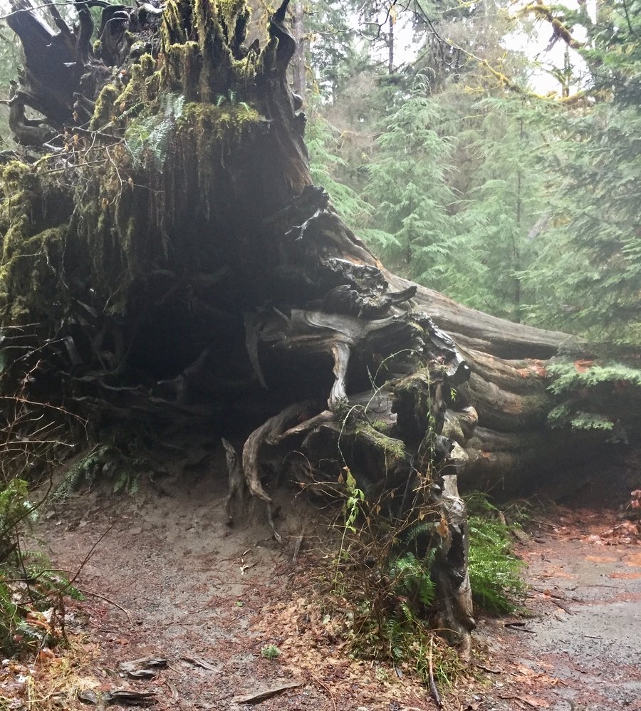
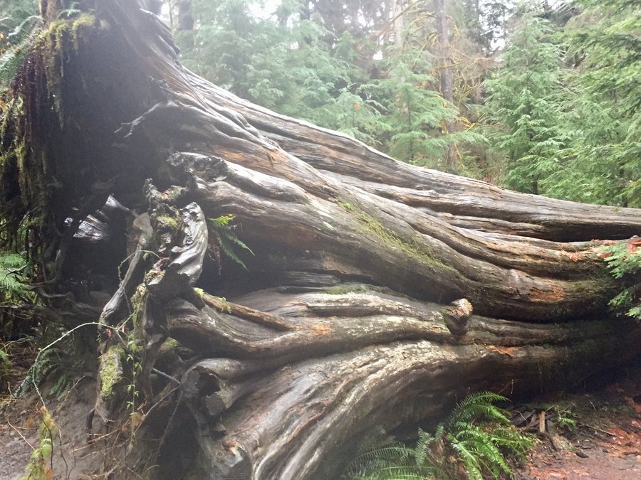
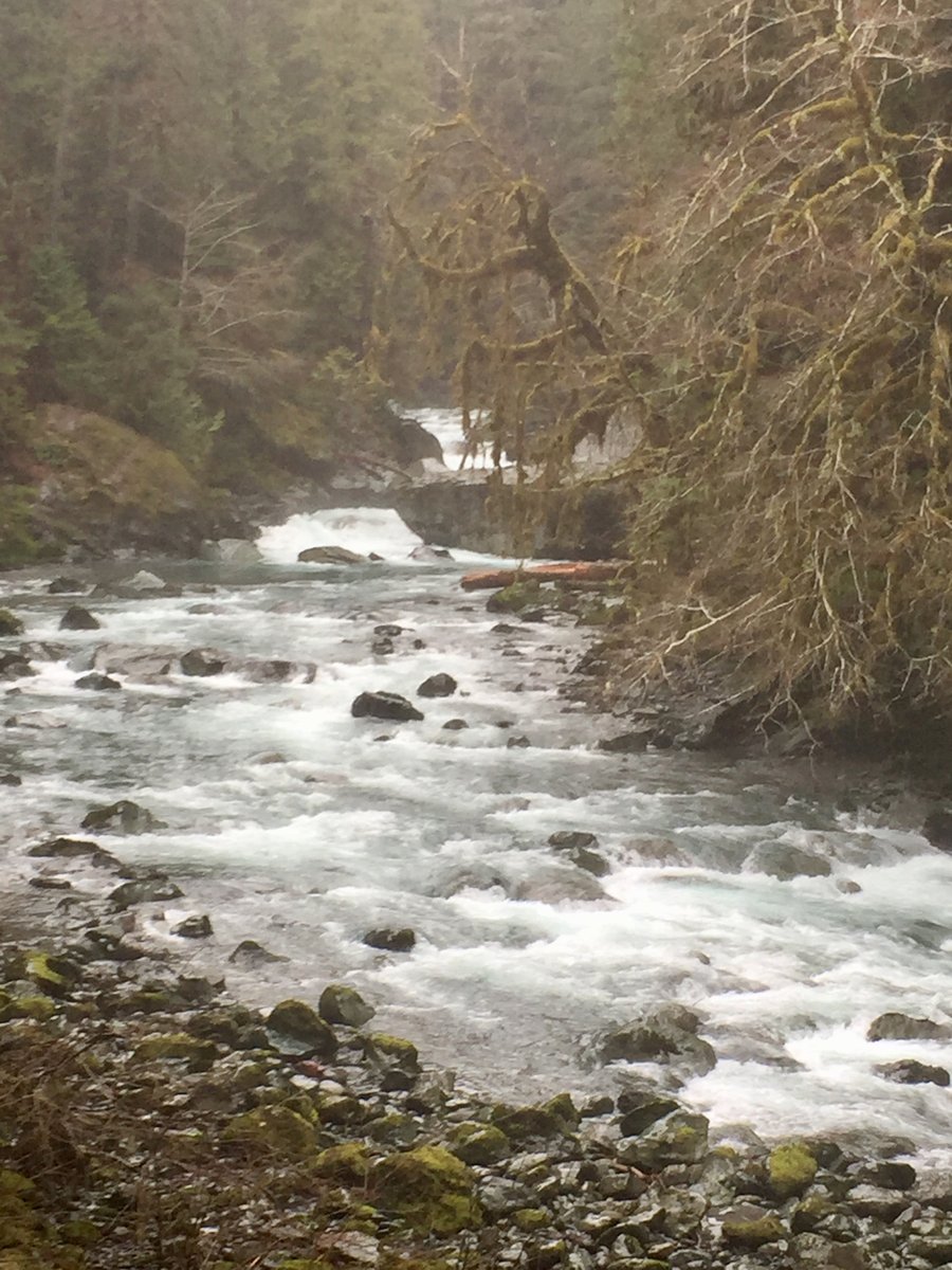
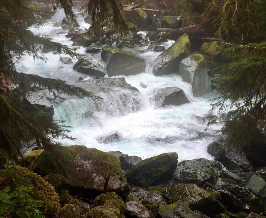
ONP-Staircase Rapids
9.44 miles of hiking • 1250' elevation gain •
Leisurely hike in the Olympics. Hiked a bit passed the junction with the Flapjack Lakes TH.
February 12, 2017

February 5, 2017
 1
1
Lower Big Quilcene River Trail-Olympics
14.1 miles of hiking • 2250' elevation gain •
Hiked the lower trail to the upper trail head. The upper trail head leads to Marmot Pass. Trail was very icy and micro spikes needed.
January 29, 2017


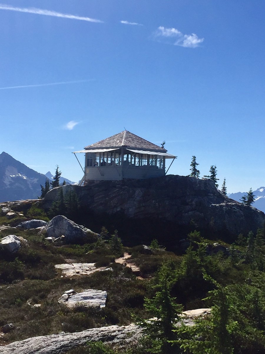
Suntop Mtn. Snowshoe
12.48 miles of hiking • 3500' elevation gain •
Hike is mostly in the trees until approx. the last half mile. Old fire lookout @ the top. Great 360 degree views.
January 15, 2017


Olympics-Big Creek
5.39 miles of hiking • 1500' elevation gain •
Annual New Years day hike with the family.
January 1, 2017

View trips from: 2012 2013 2014 2015 2016 2018 2019 2020 2021 2022