


2020 Trips

 1
1
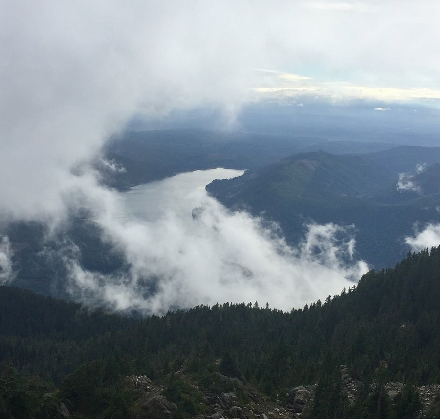
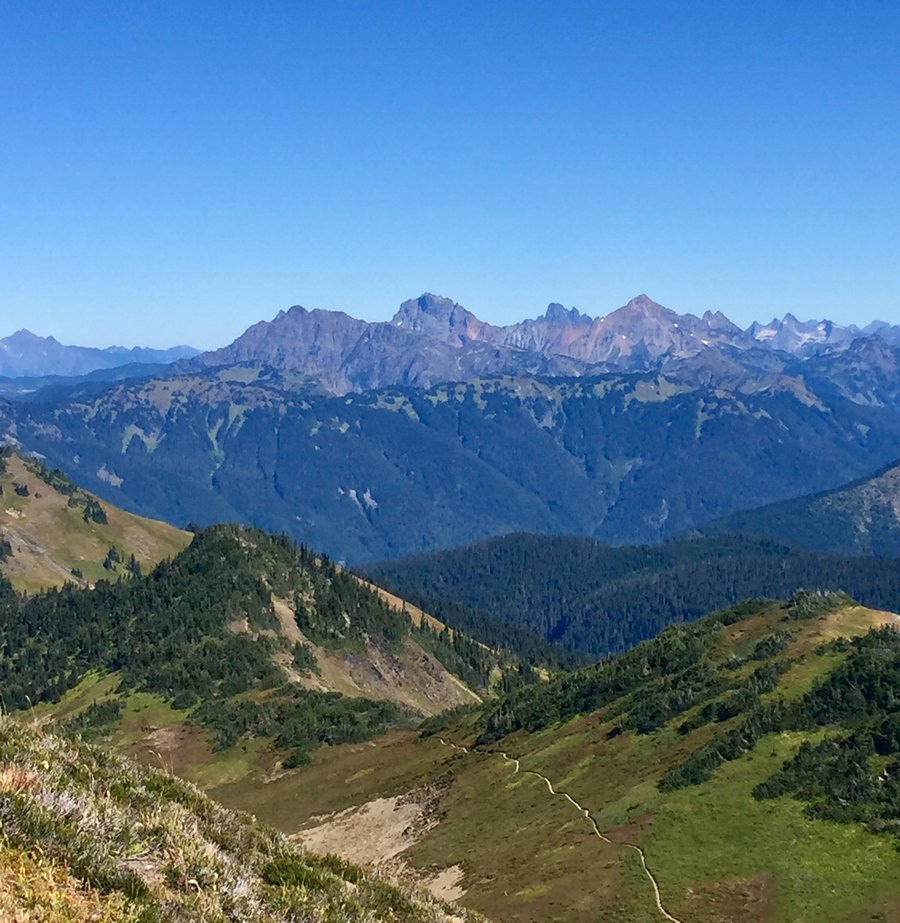
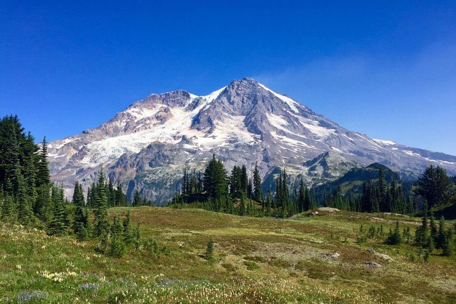
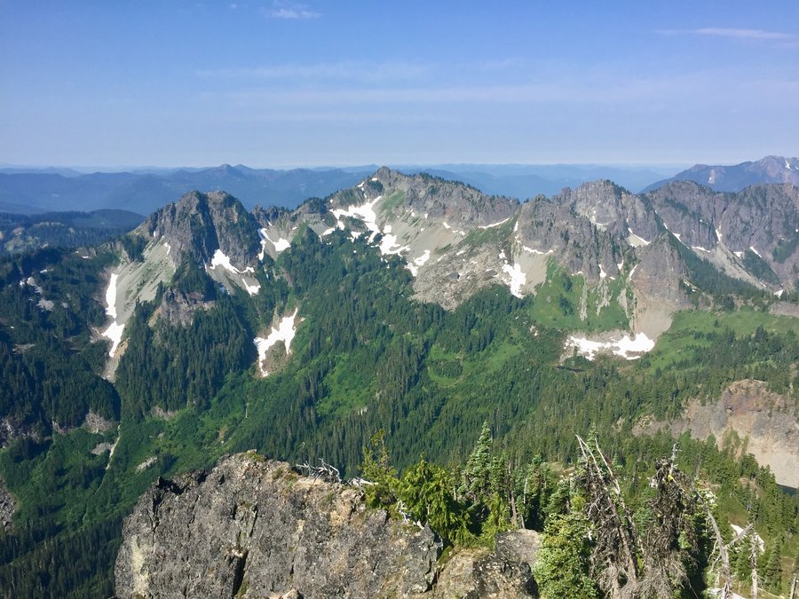
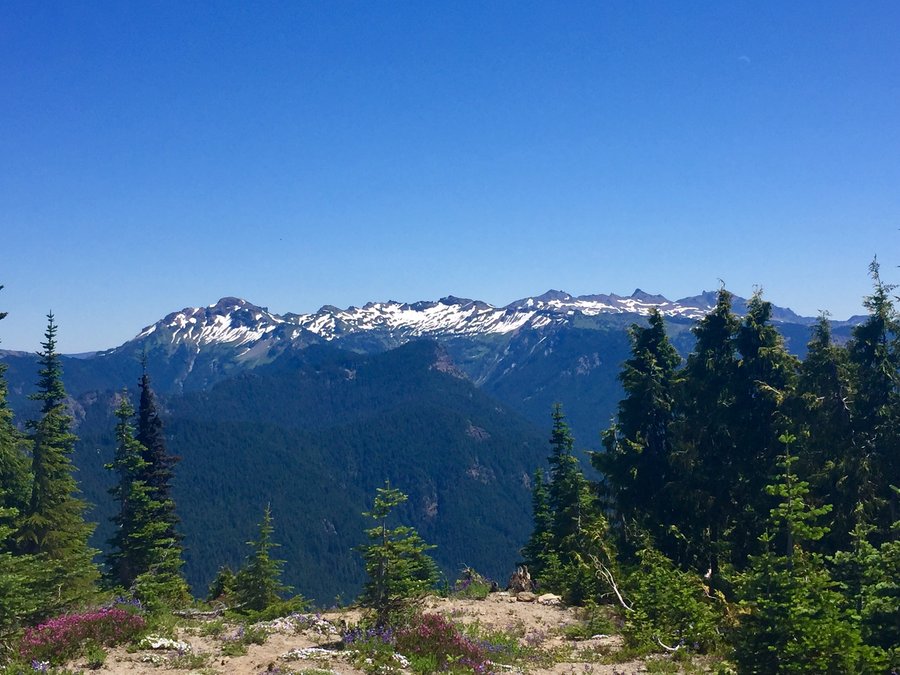
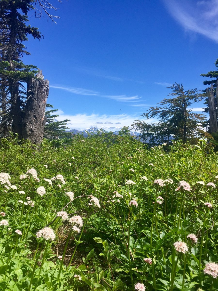
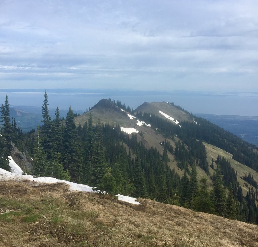
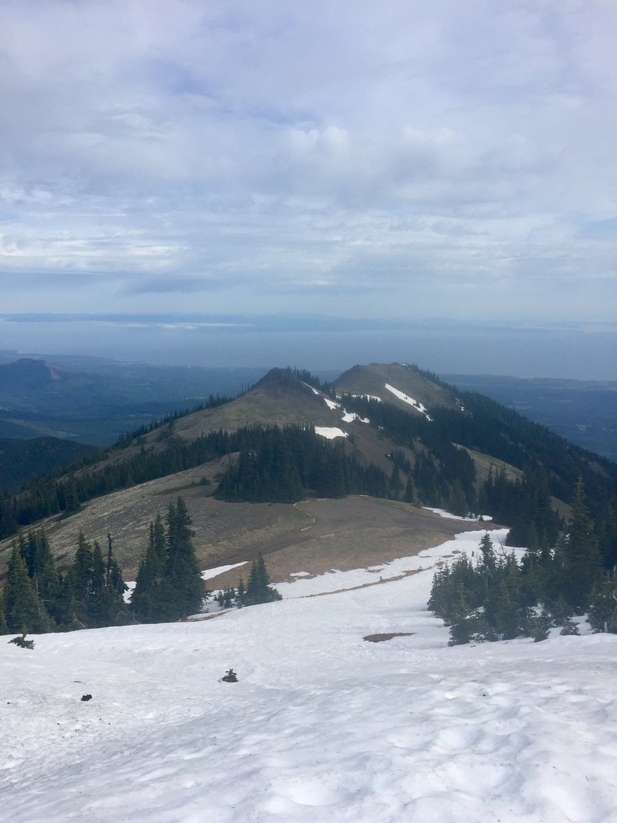
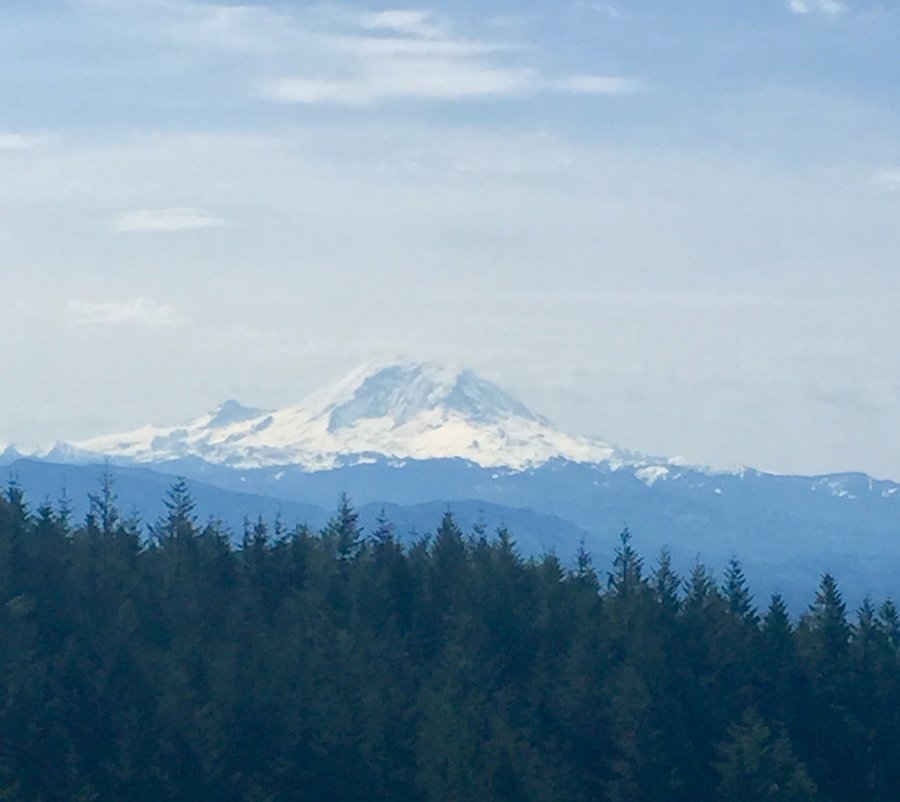
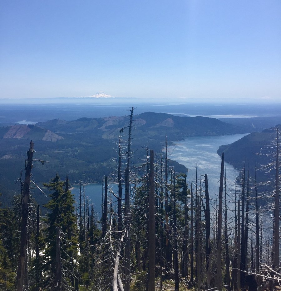
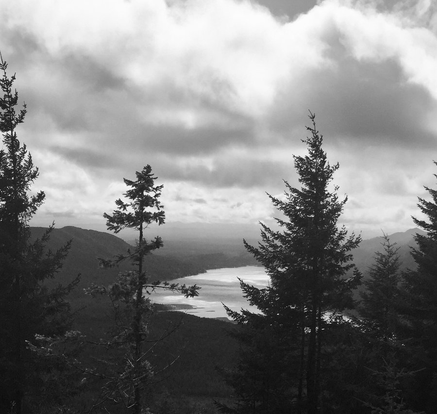
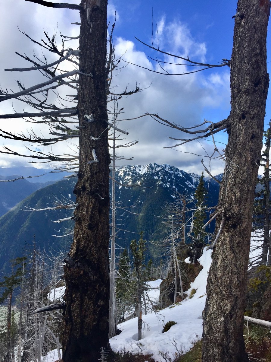
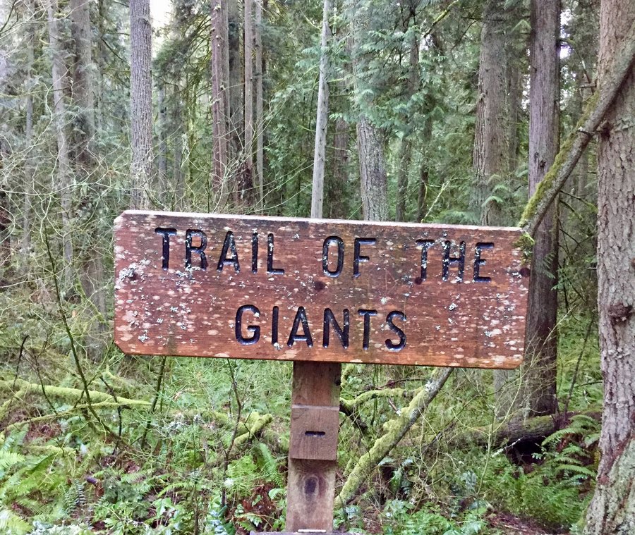
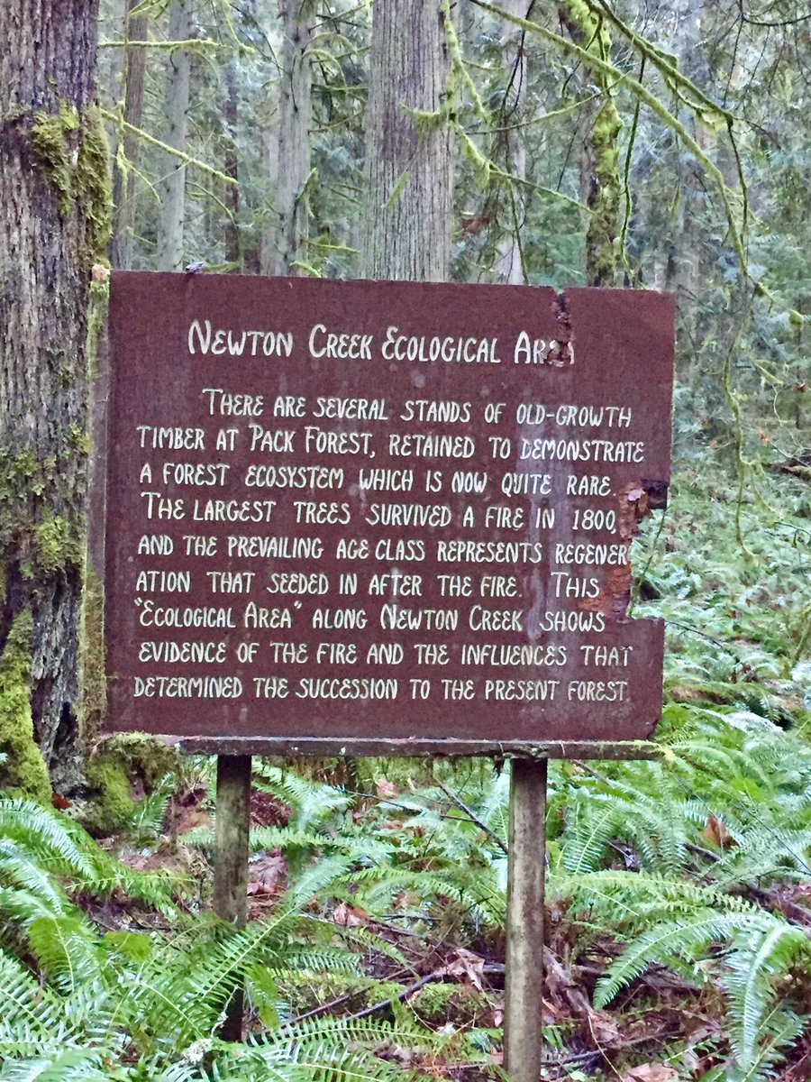
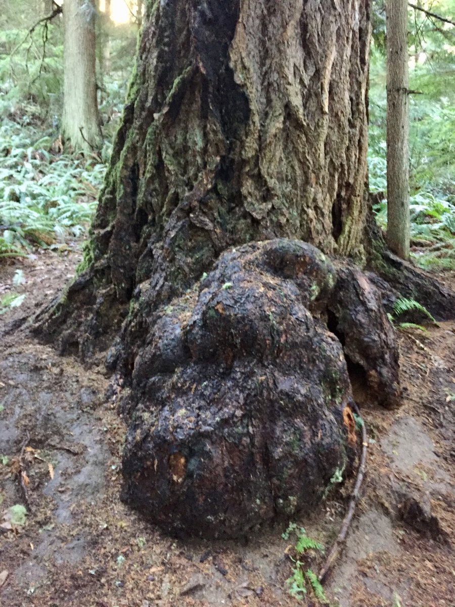
Pack Forest
8.21 miles of hiking • 1500' elevation gain •
Hiked up to Hugo Peak then hiked the Trail of the Giants trail to the Mt. Rainier viewpoint.

December 23, 2020

 1
1
December 12, 2020
 3
3
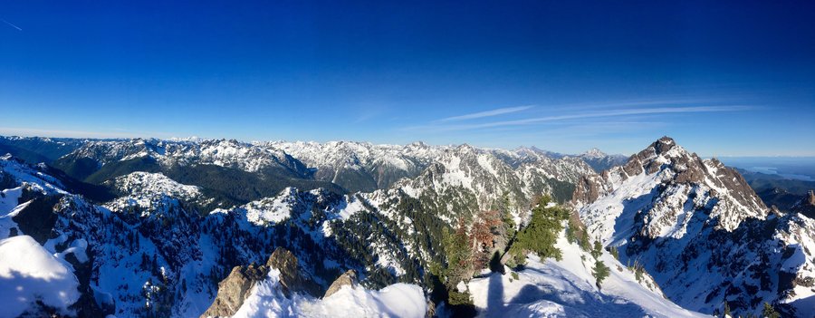
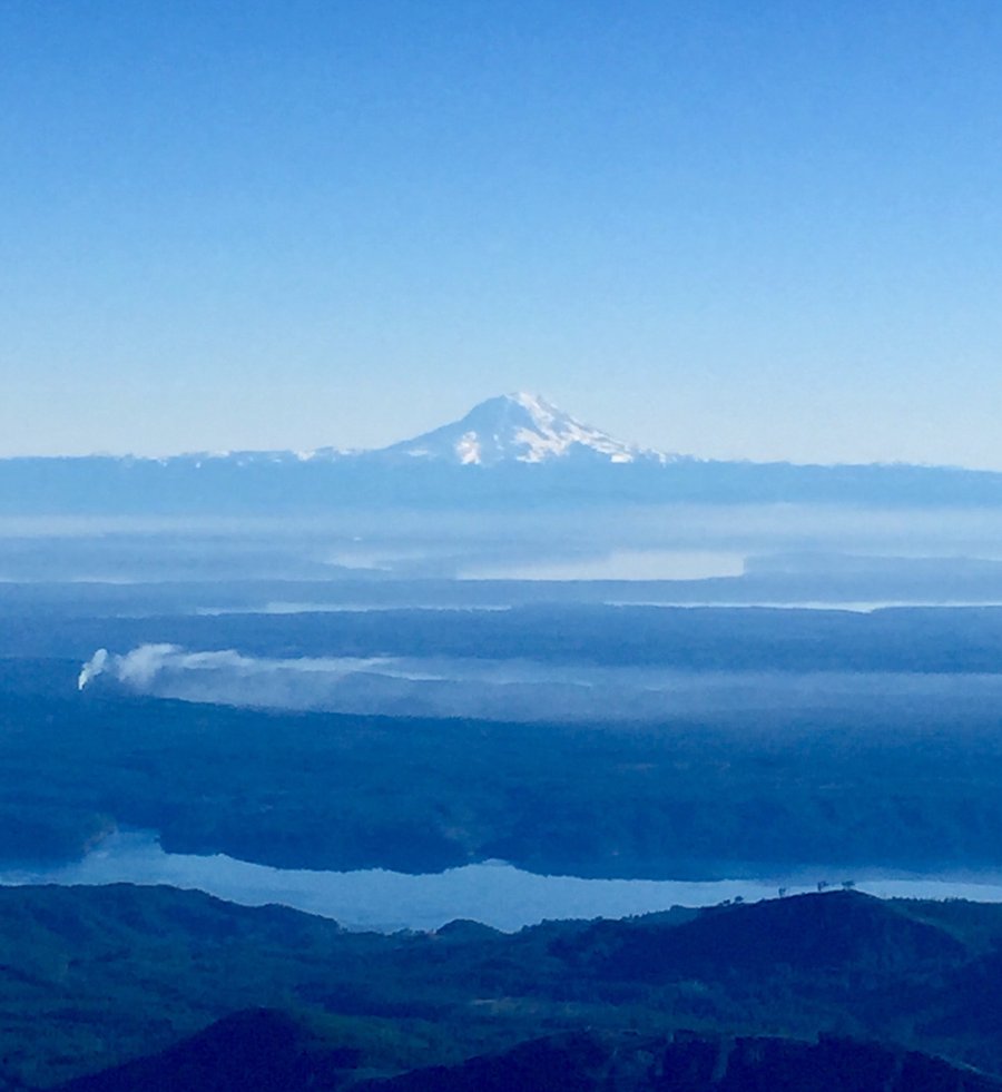
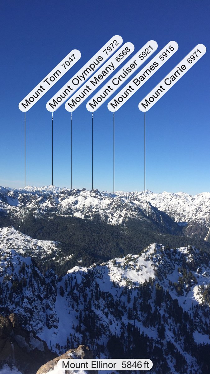
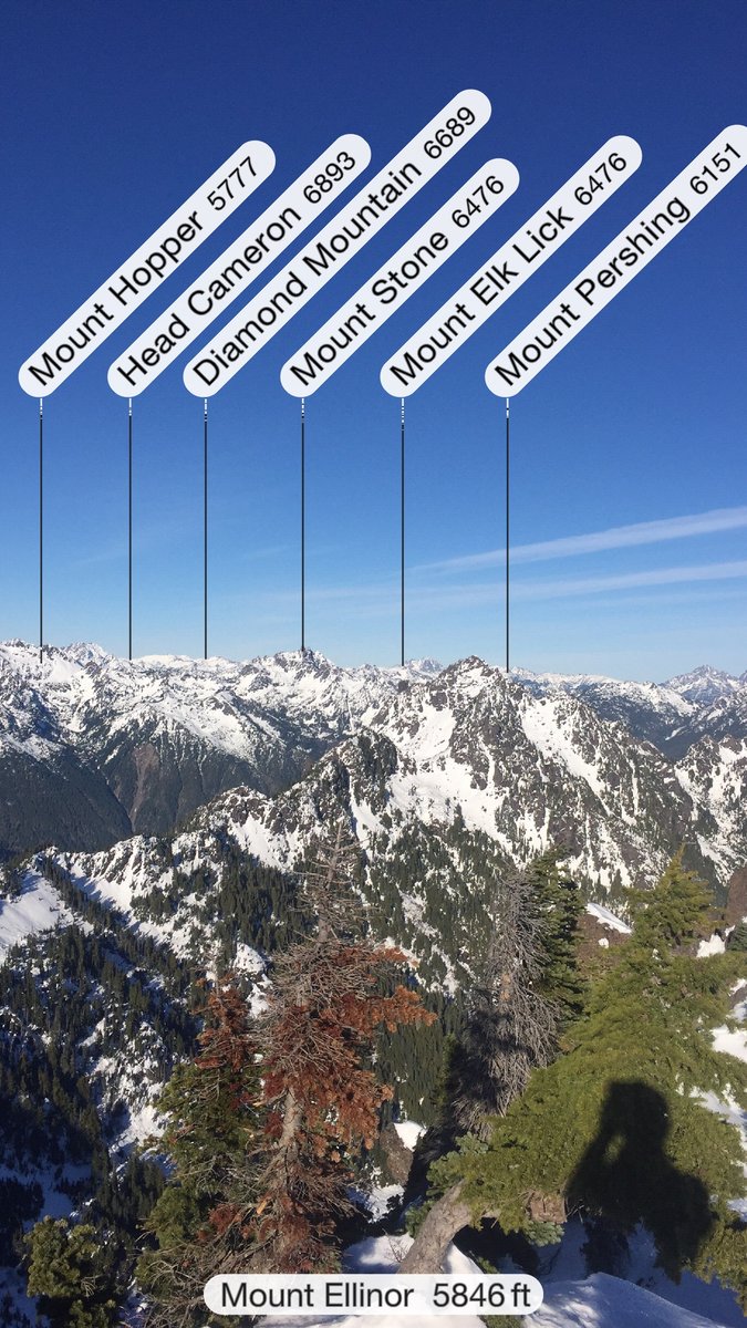
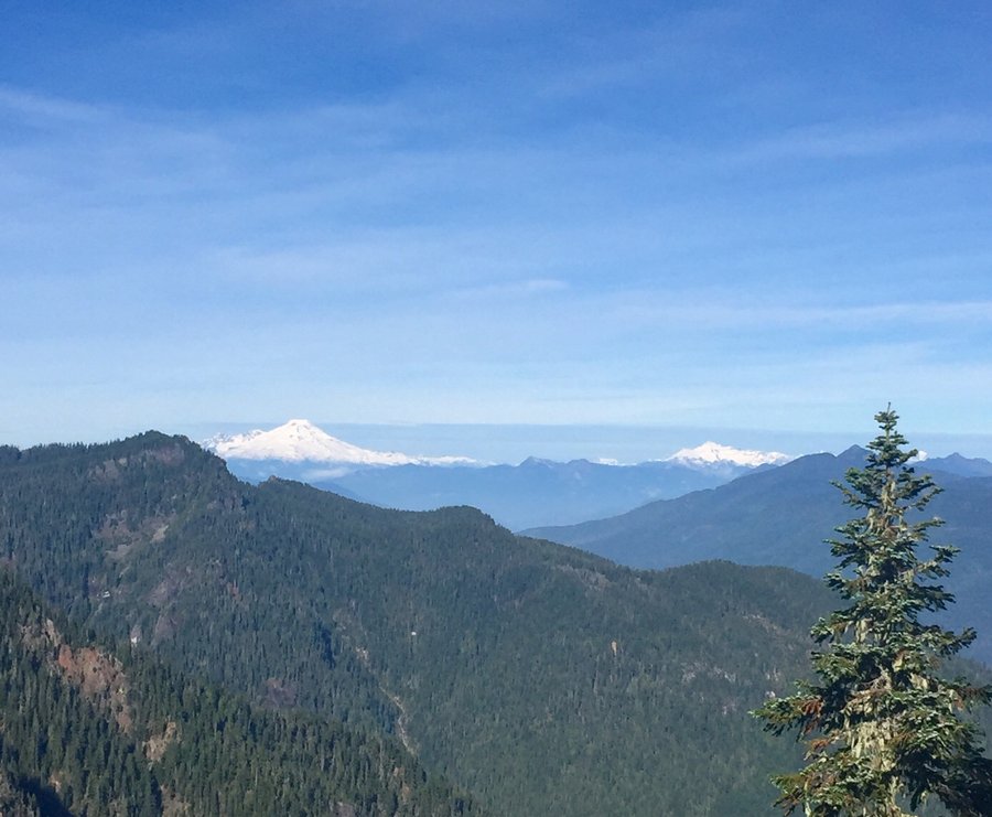
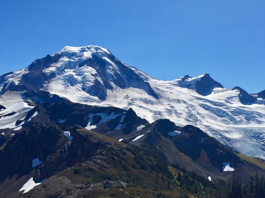
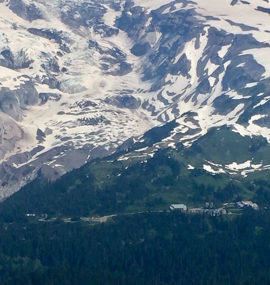
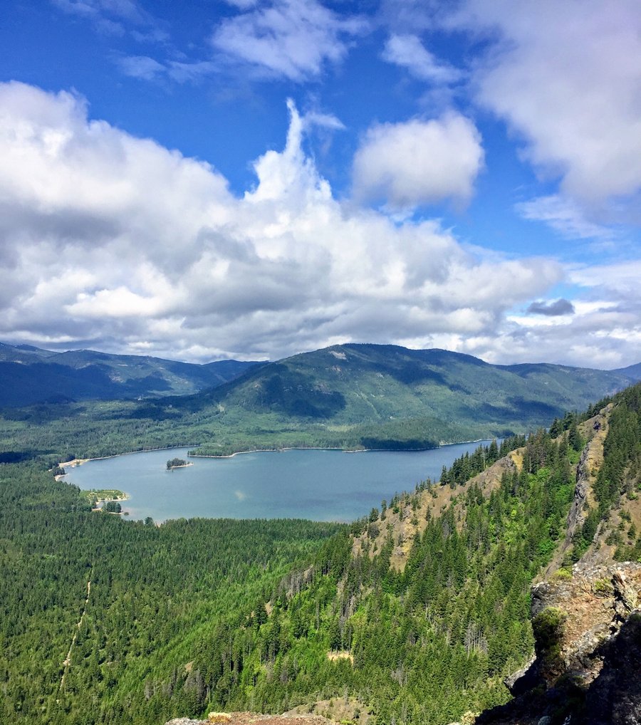
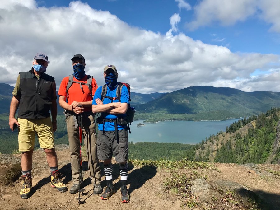
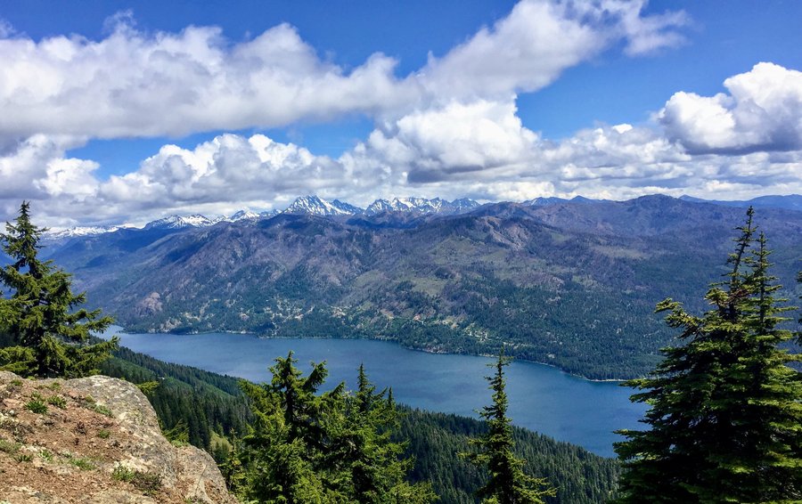
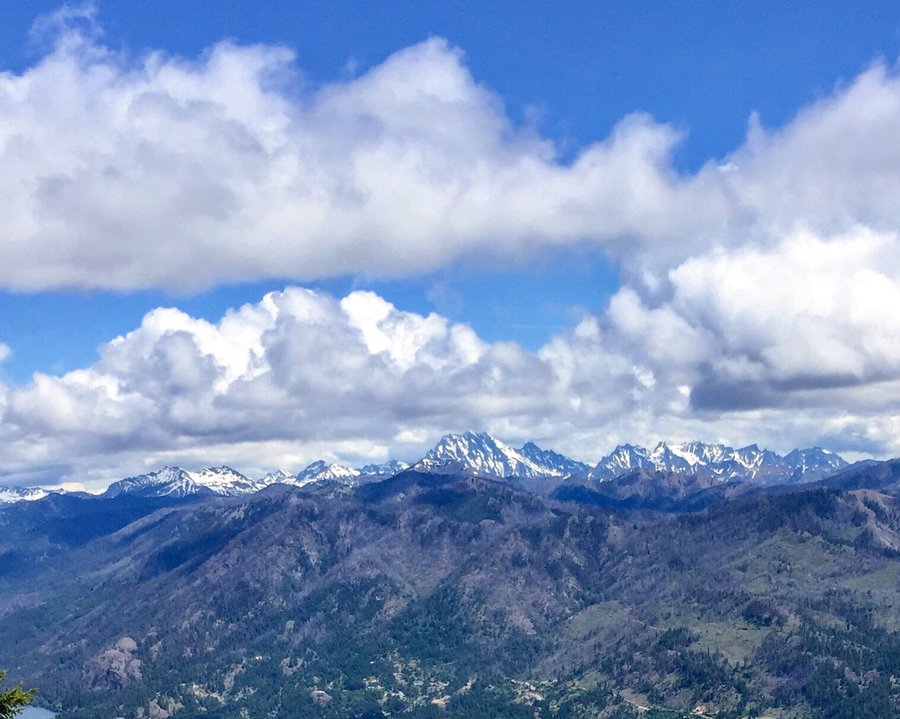
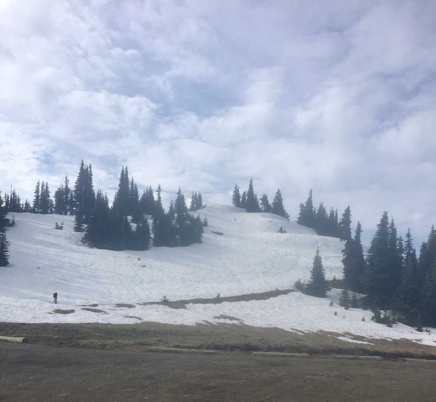
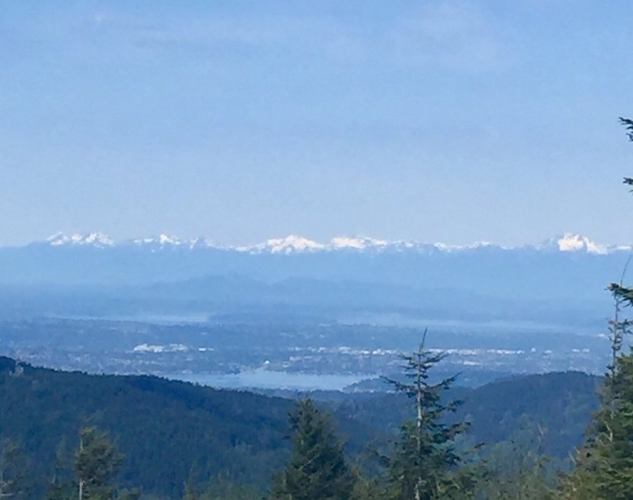
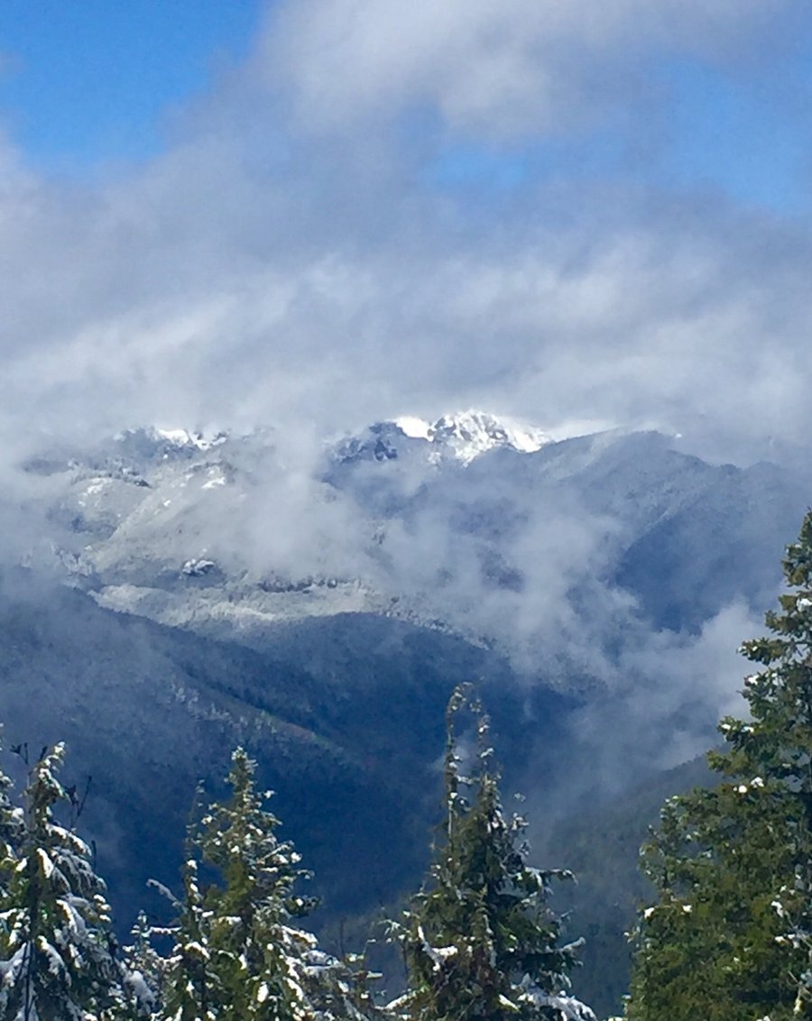
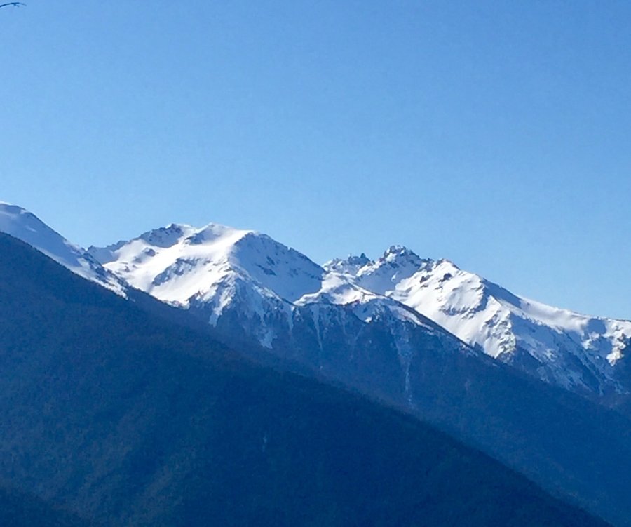
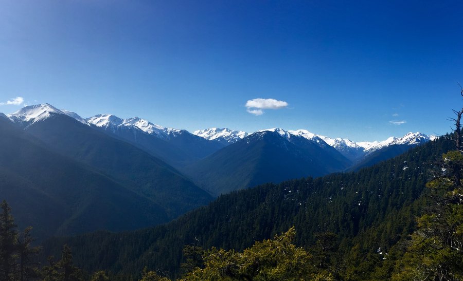
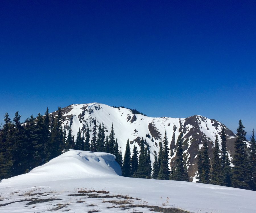
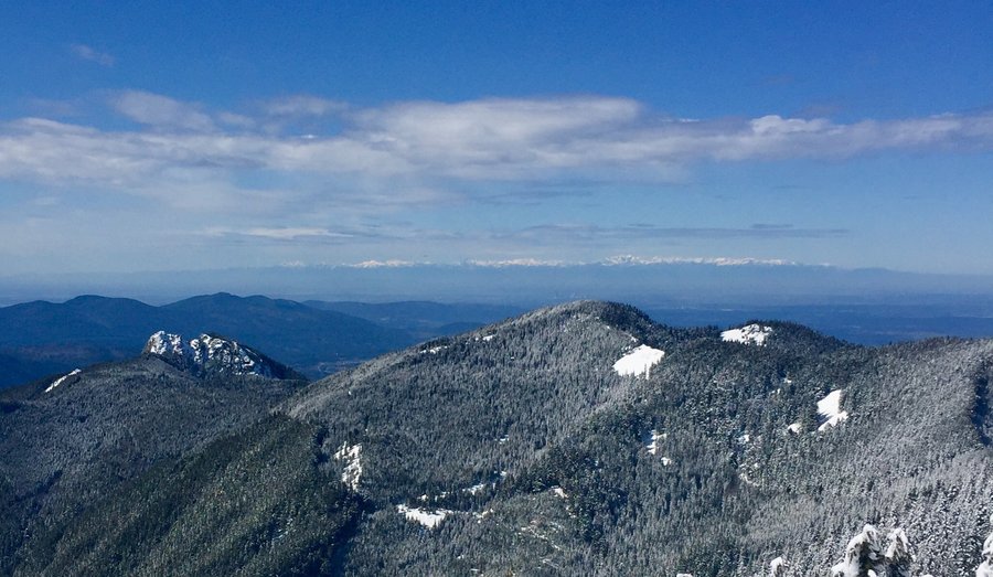
Mt. Ellinor
6.1 miles of hiking • 3250' elevation gain •
No issues driving to the lower TH. Snow on the trail began a bit after the junction with the upper TH. Took the winter route up the avalanche chute. Snow was a bit mushy so used crampons. Had the summit entirely to myself which was pretty sweet. It was a very clear day and I could see all 5 of Washington's volcanoes from Ellinor's summit.
December 4, 2020


 1
1
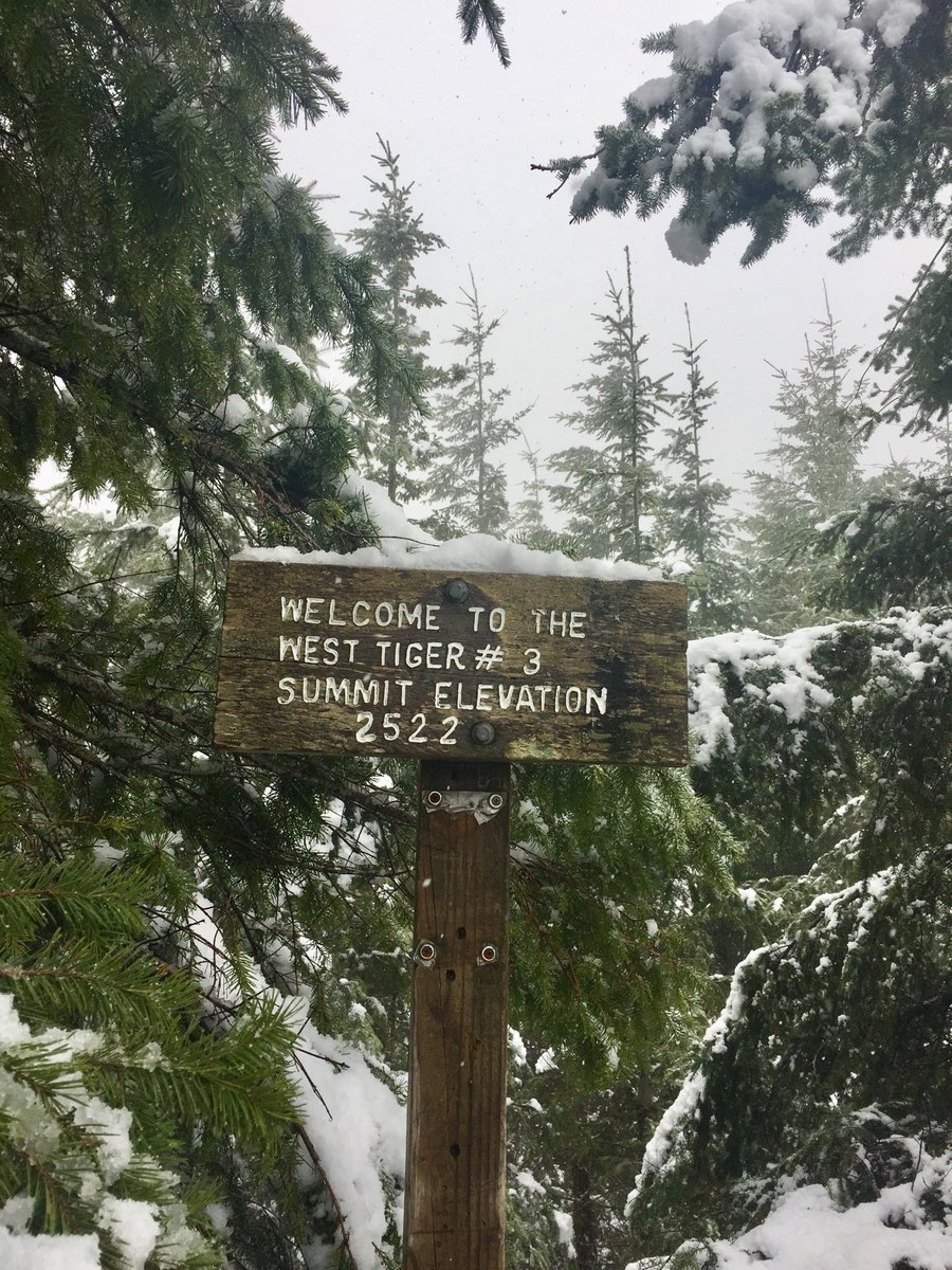
Tiger Mountain Trifecta
8.22 miles of hiking • 3250' elevation gain •
Up Section Line Trail to summit 3 then hiked to summit 2, the Hikers Hut, and finally to summit # 1. Back to the car via the High School Trail. Zero snow.
November 27, 2020
 1
1
Up the Duckabush
10.44 miles of hiking • 2500' elevation gain •
Hiked as far as 5 mile camp. Trail is notorious for its blow downs due to past fire damage and as expected there were some, I would say around 20ish, but they were all easy to negotiate.
November 21, 2020


 1
1
November 15, 2020
 1
1
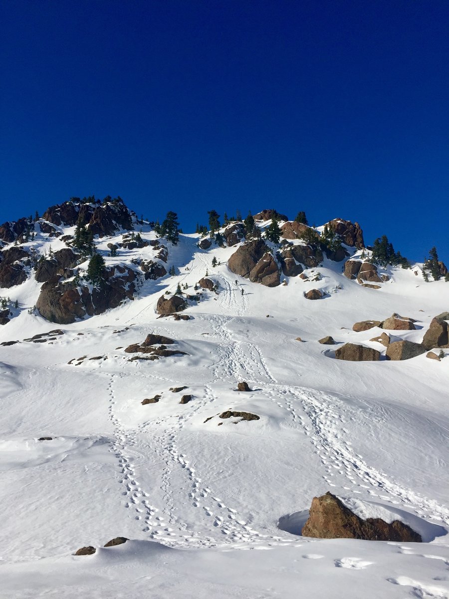
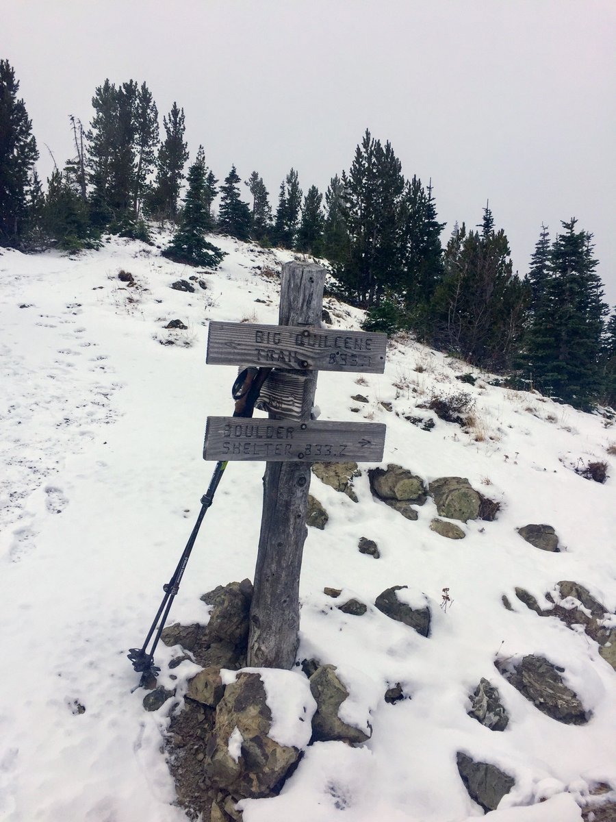
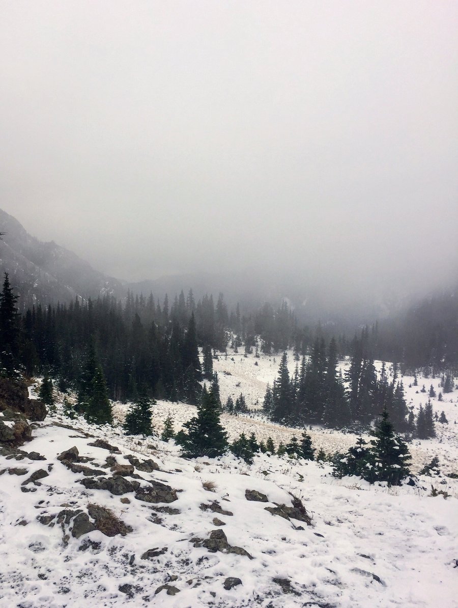
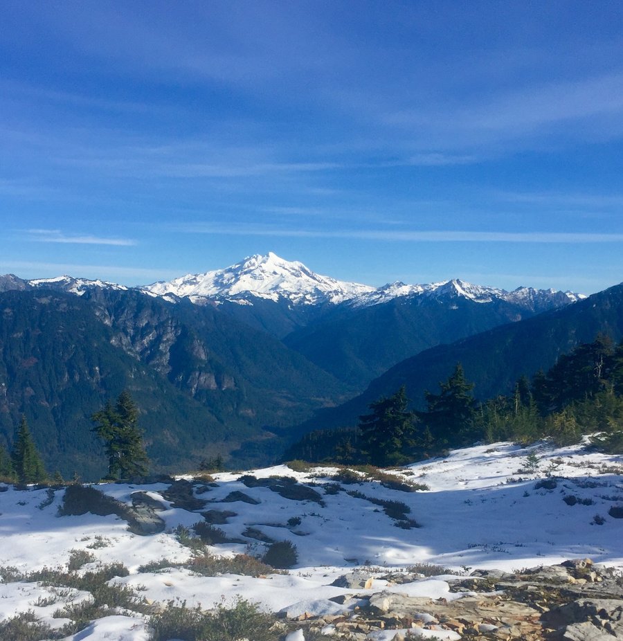
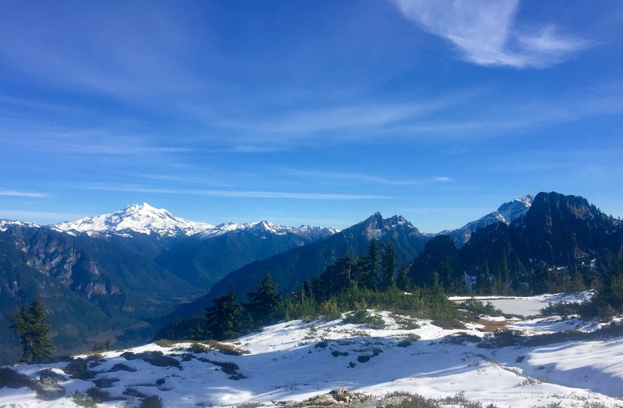
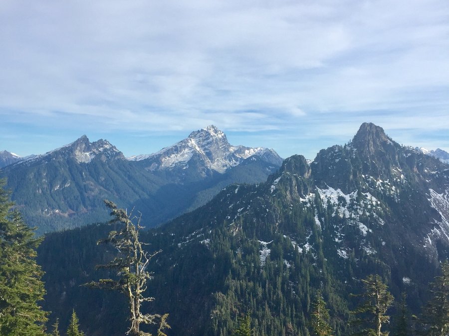
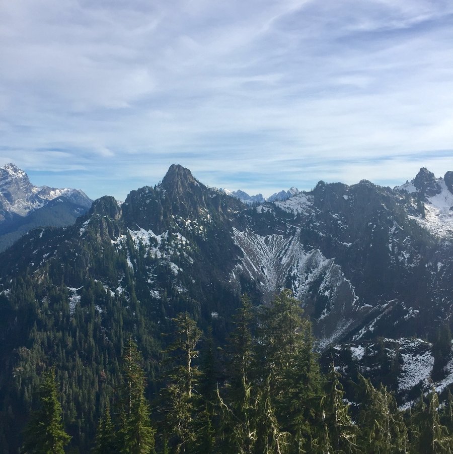
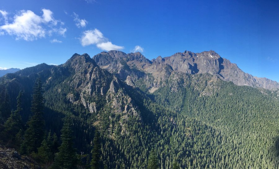
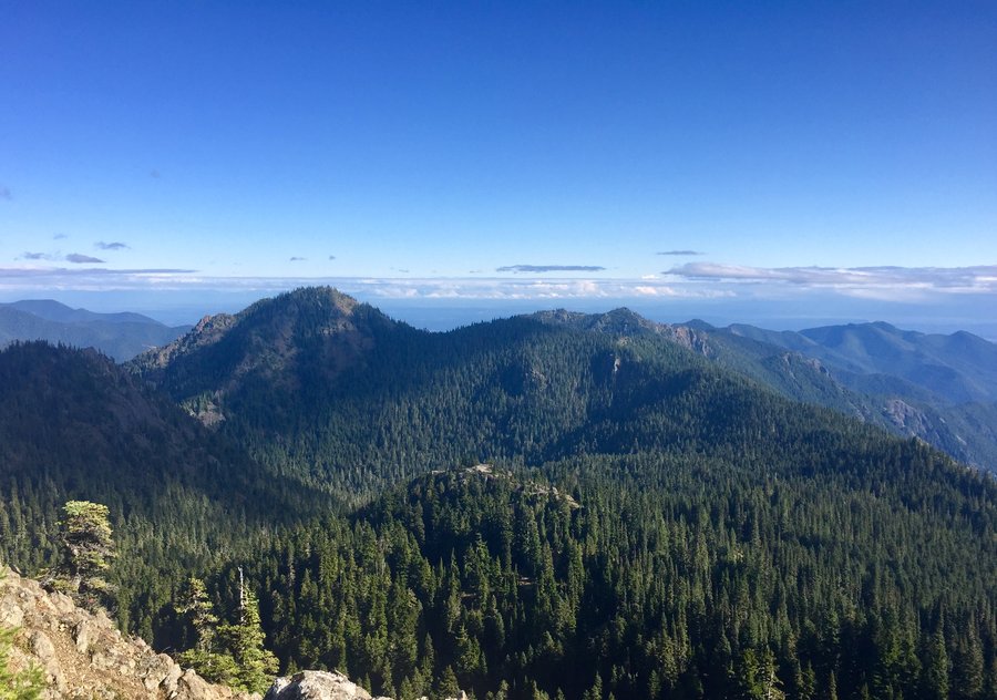
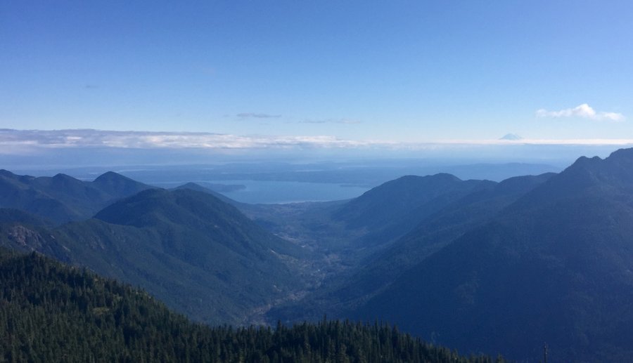
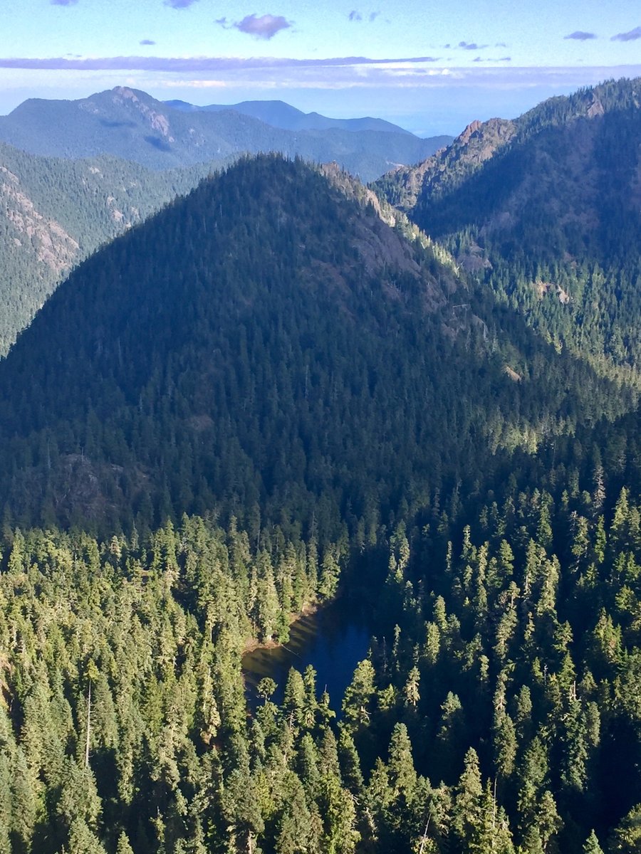
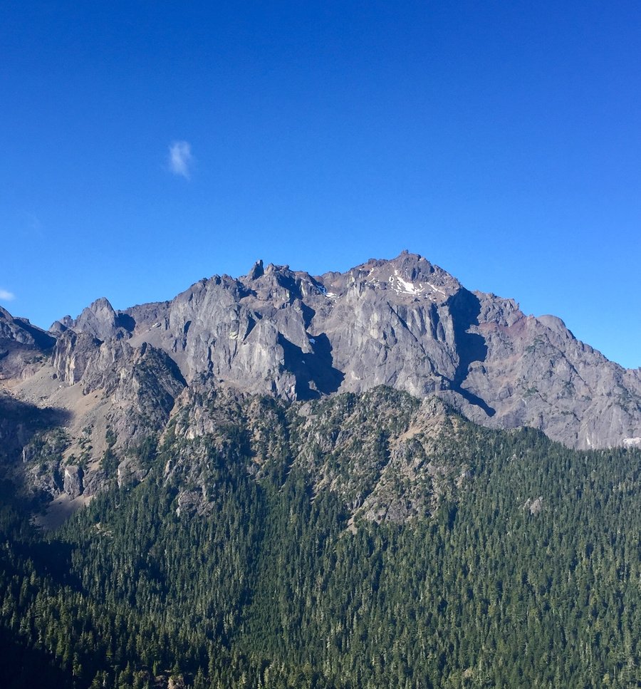
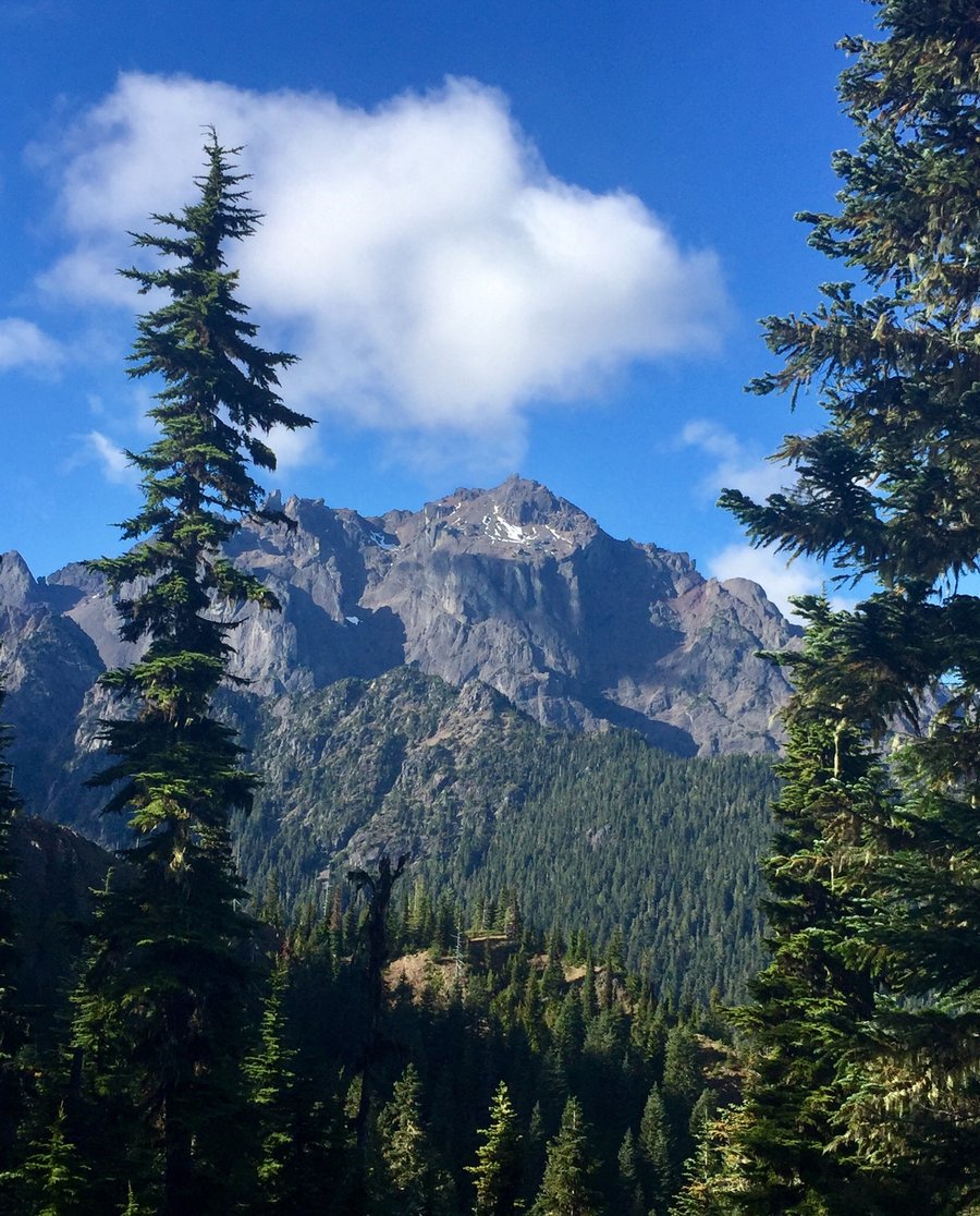
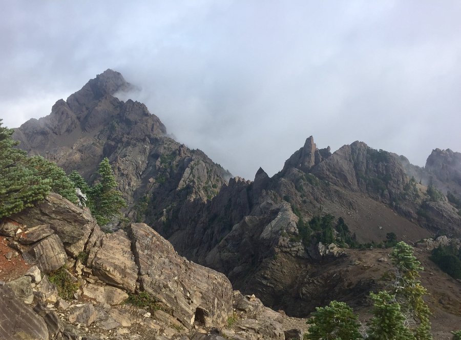
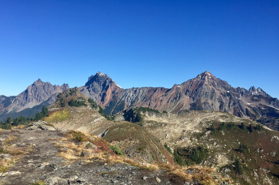
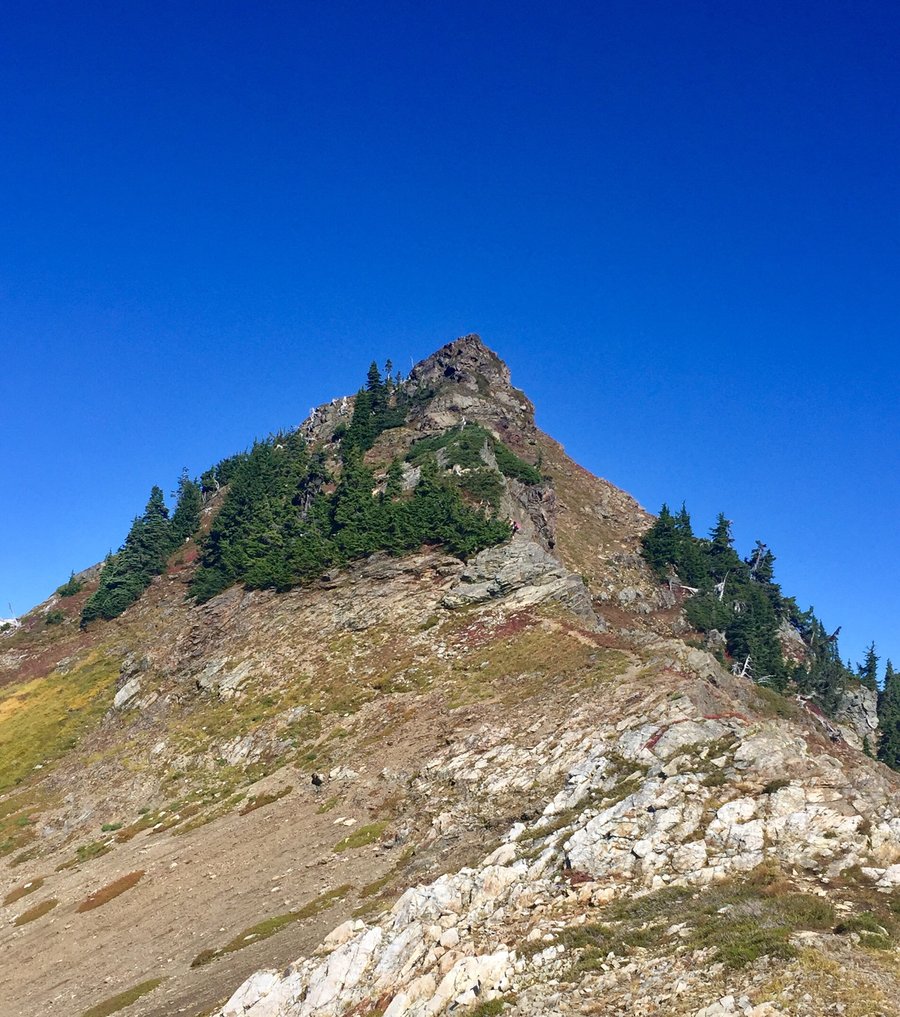
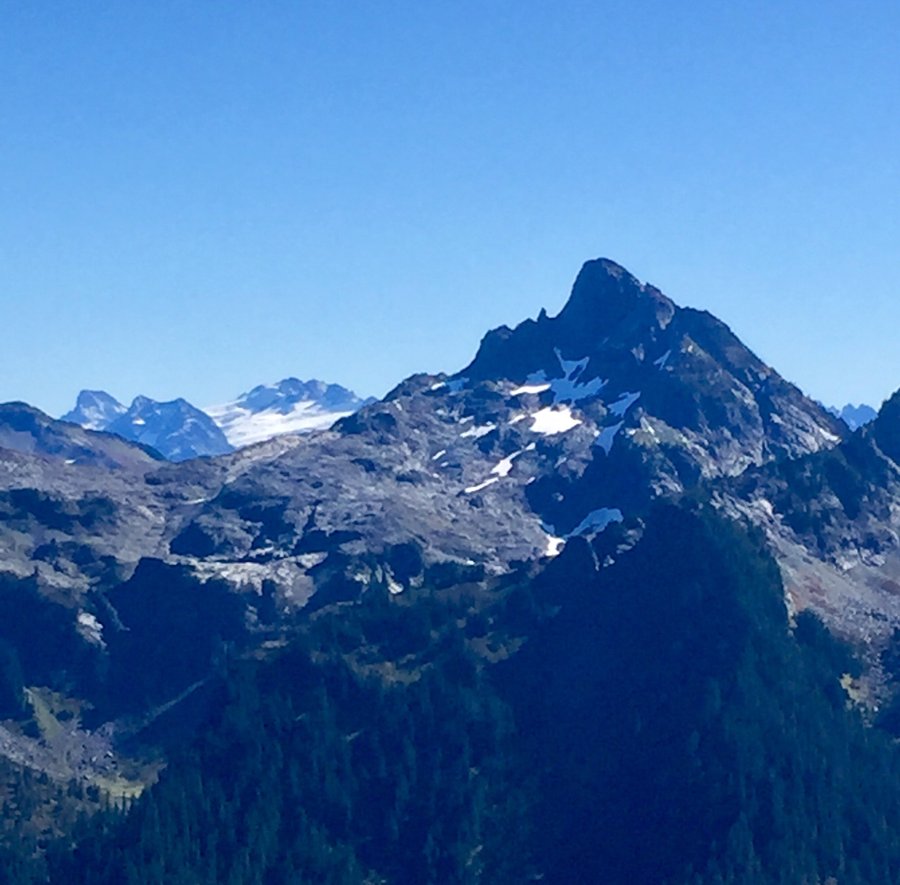
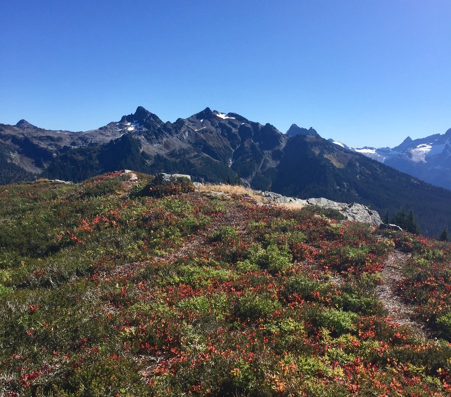
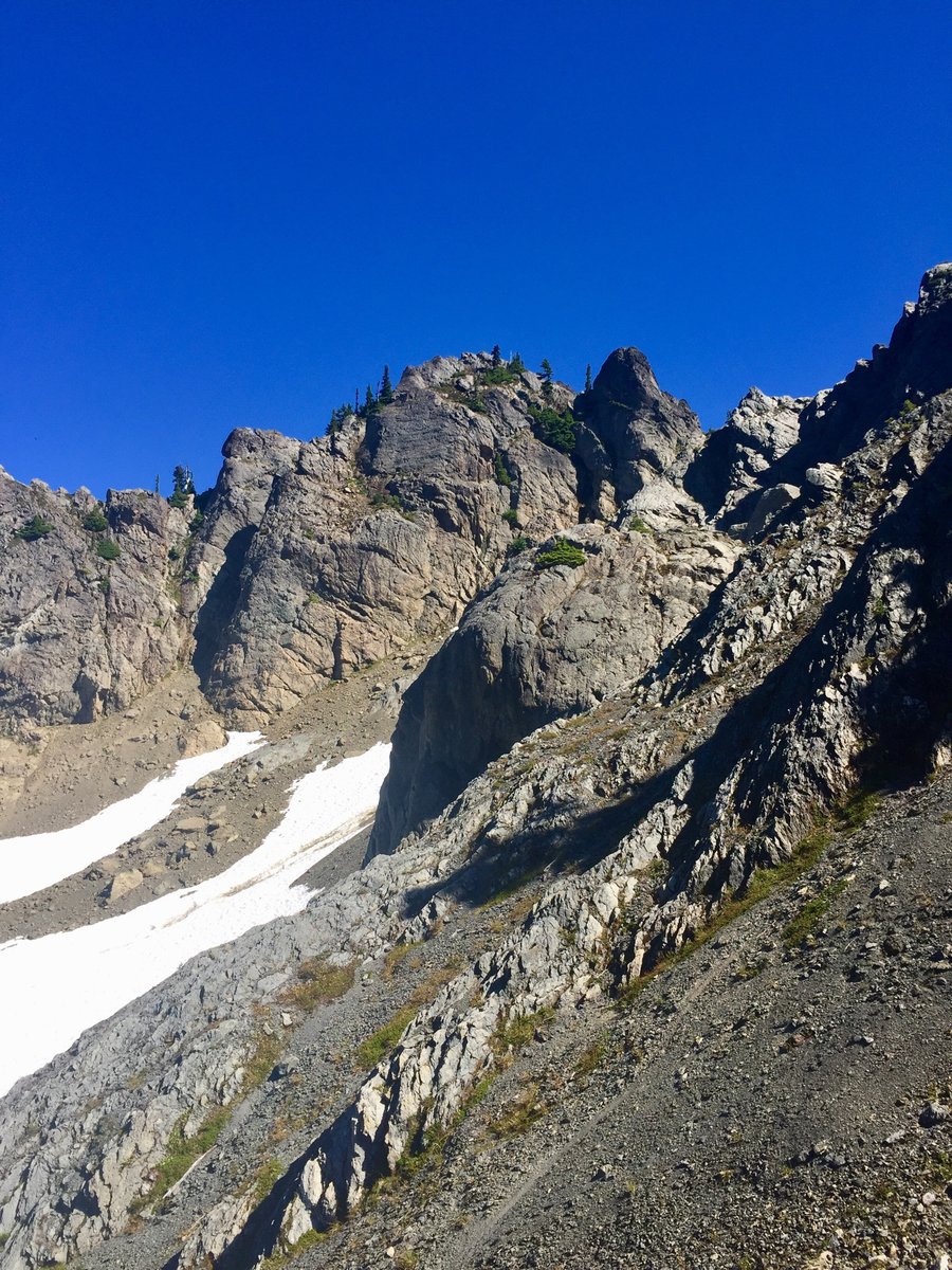
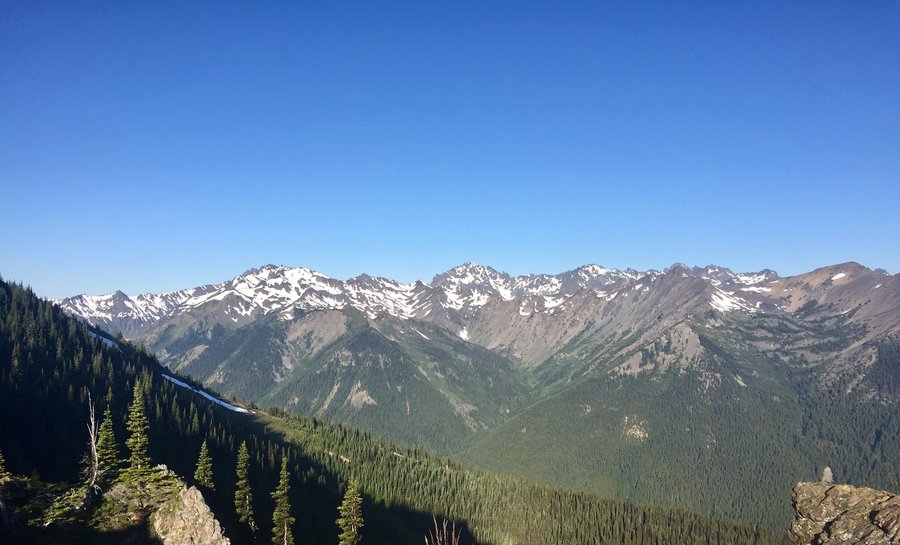
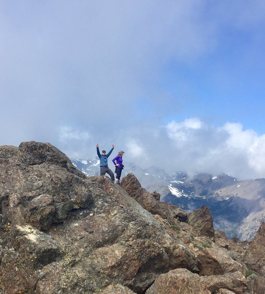
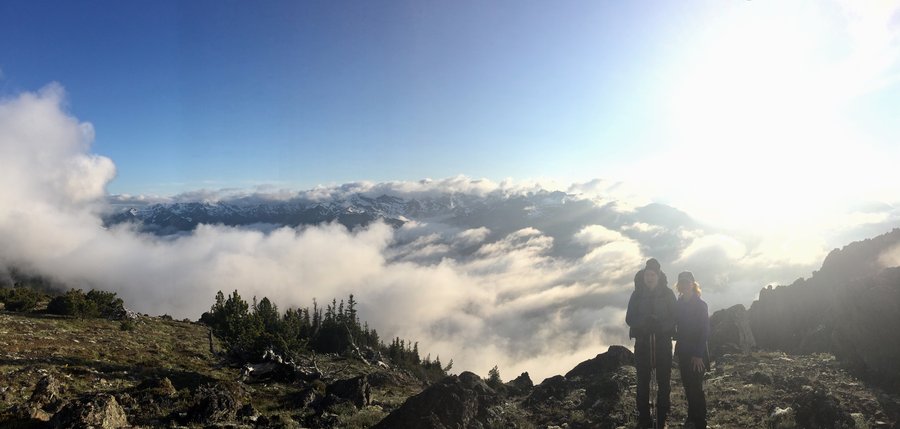
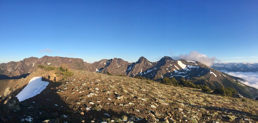
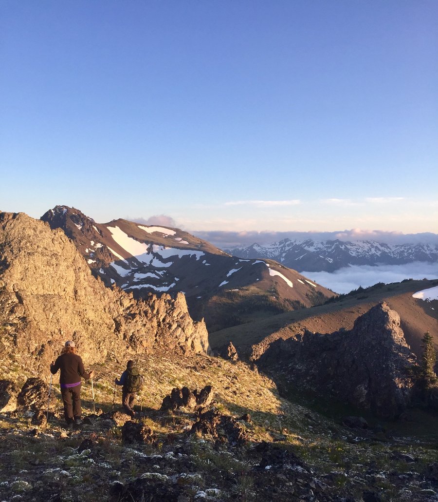
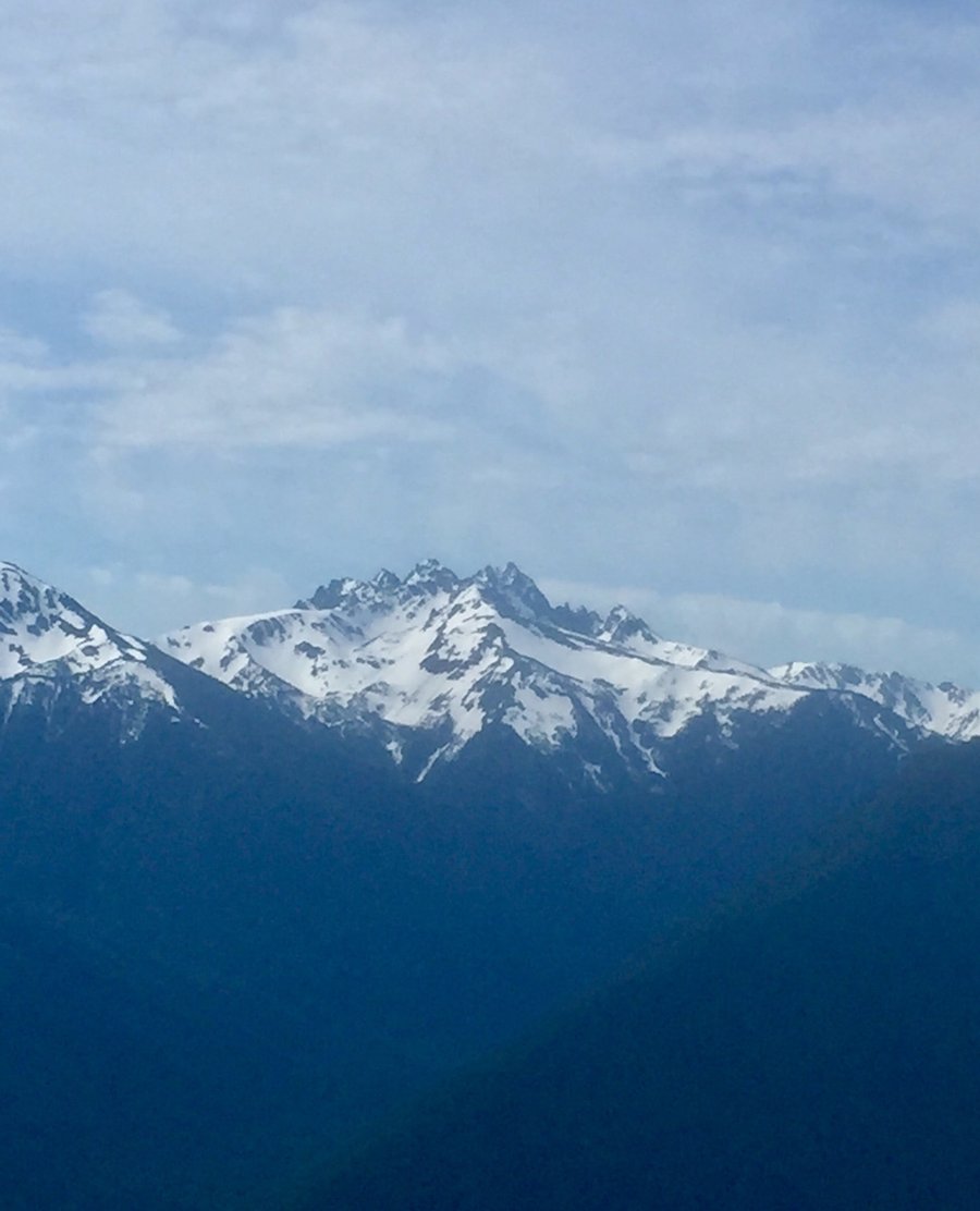
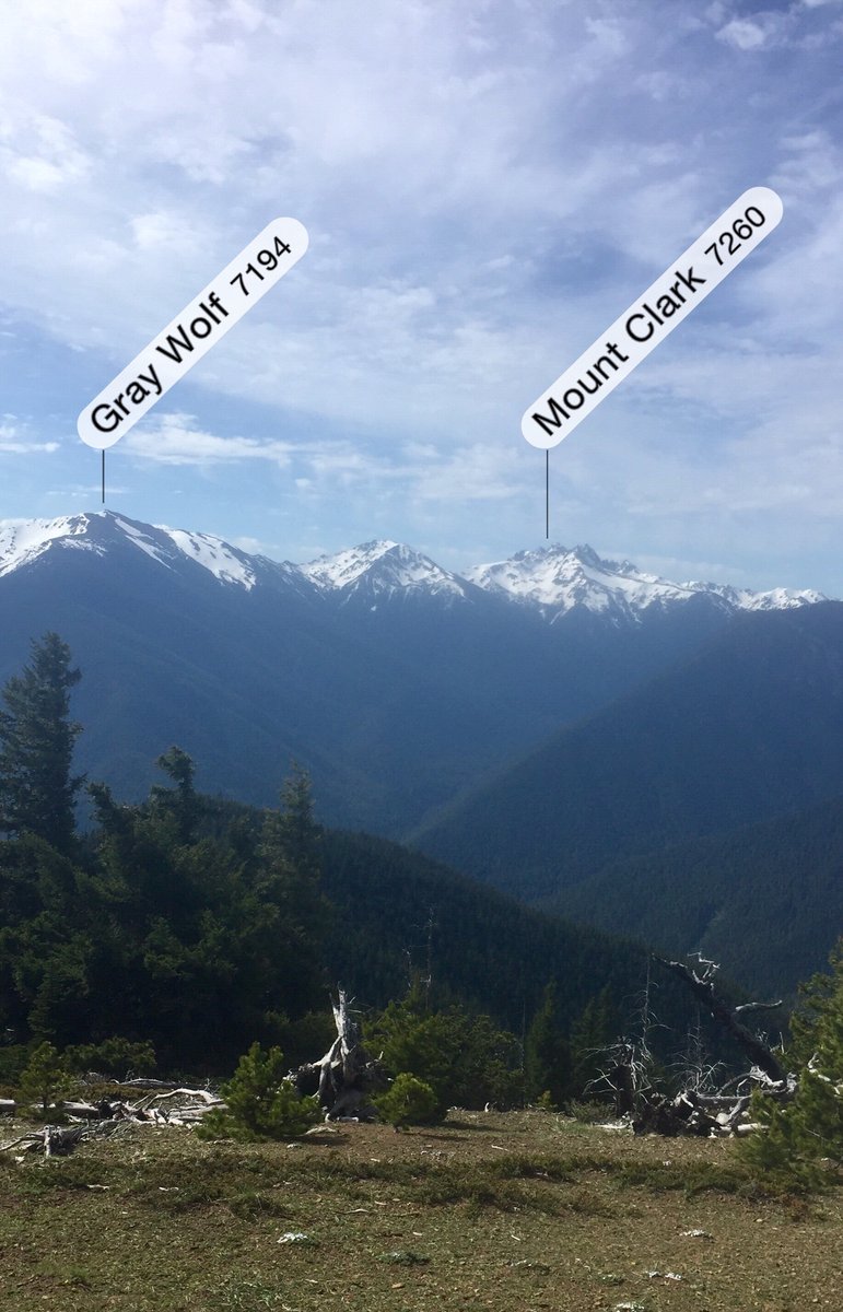
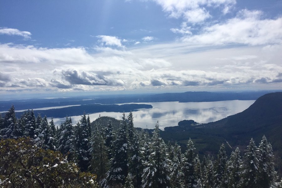
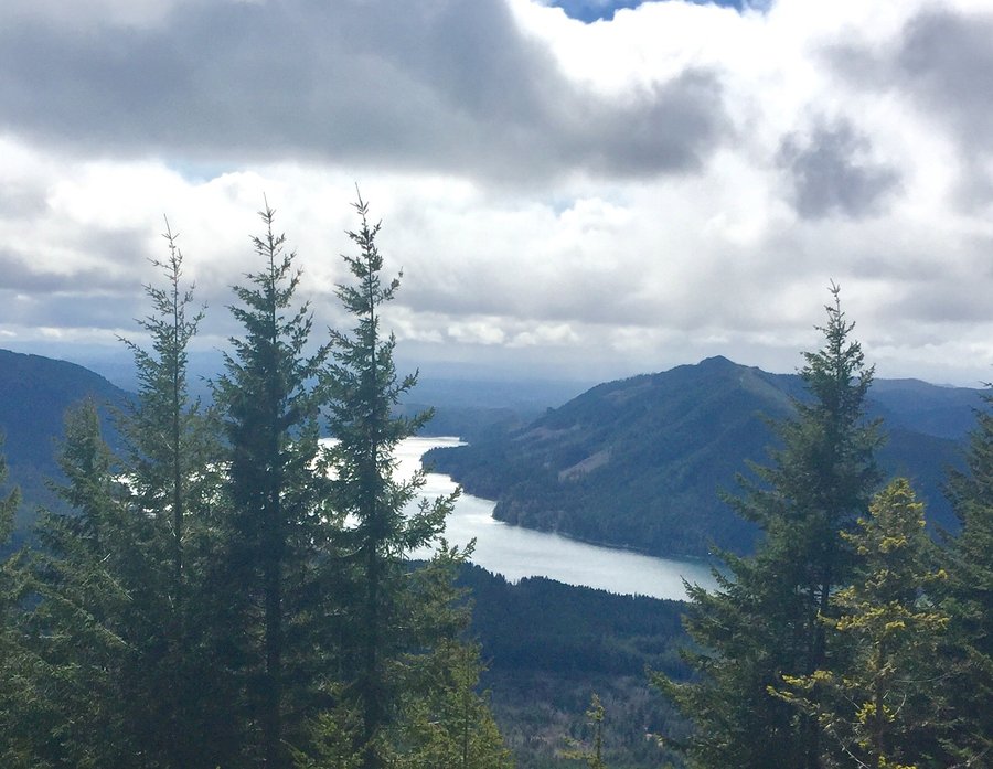
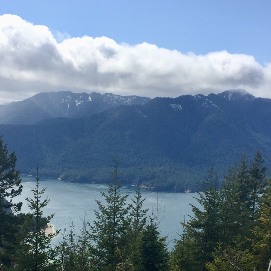
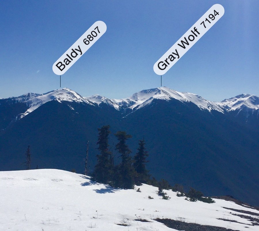
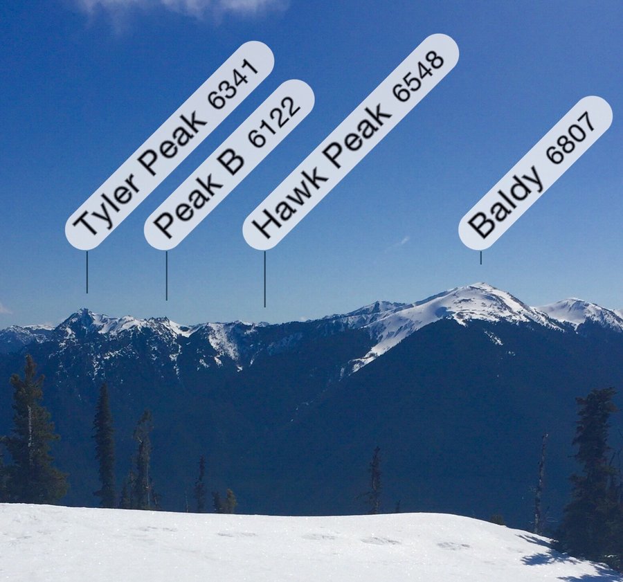
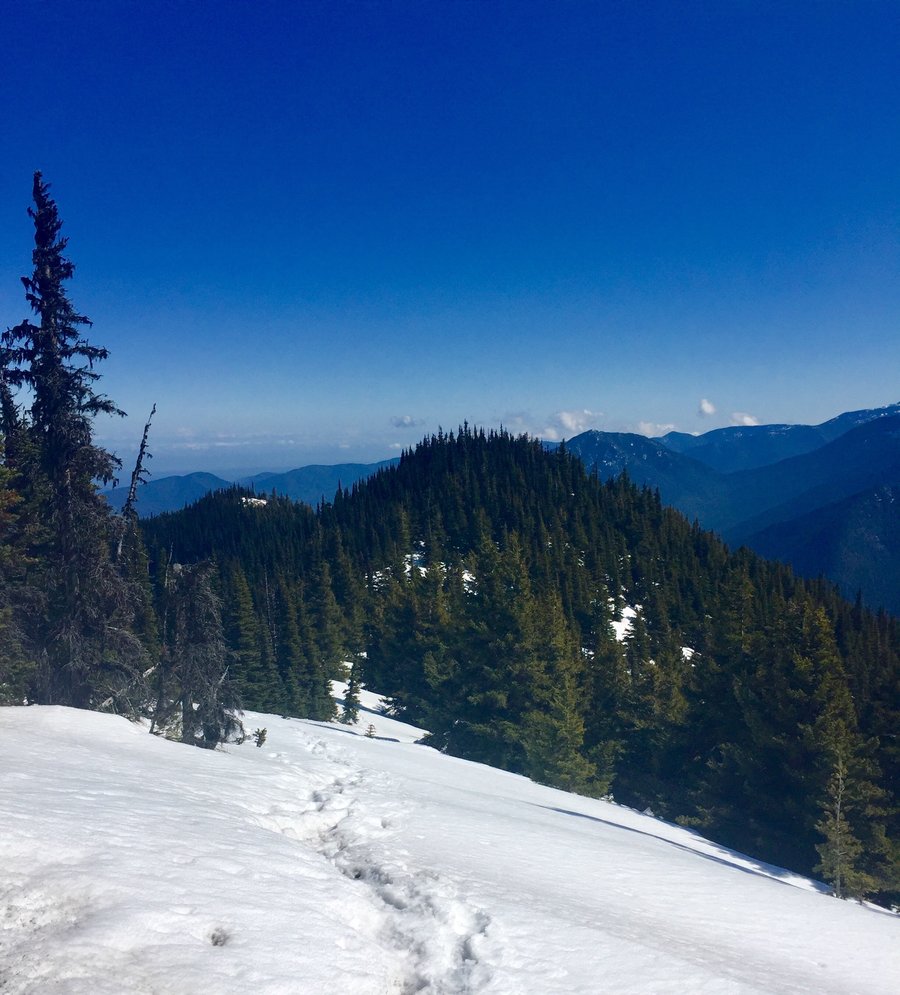
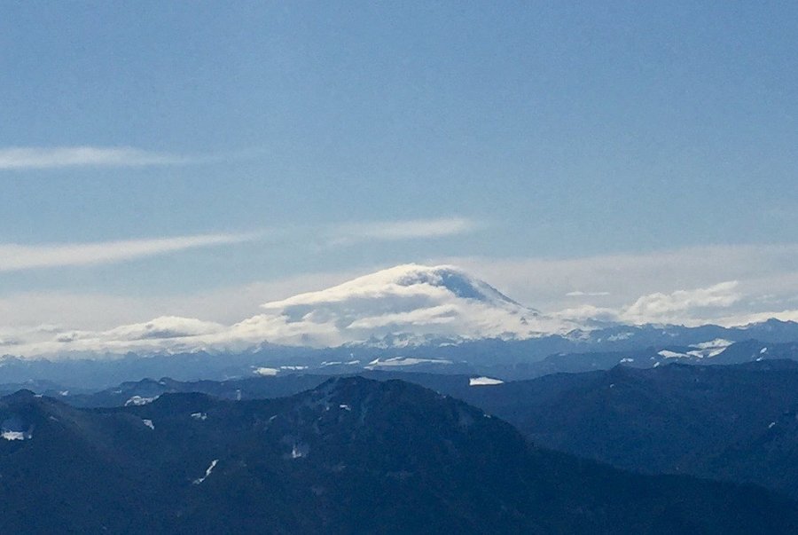
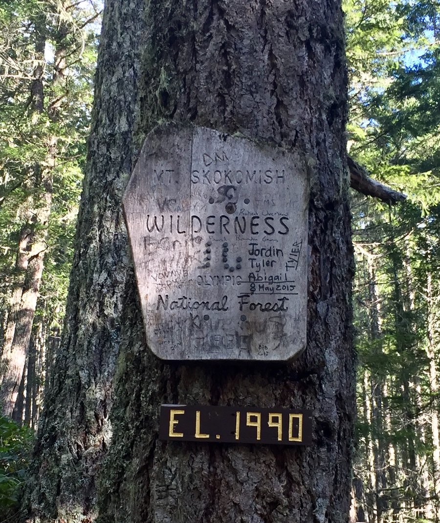
Marmot Pass-Boulder Ridge
11 miles of hiking • 3750' elevation gain •
Began the hike at the Upper Big Quilcene TH. Weather forecast looked promising for sunny conditions but the sun never materialized and the day was mostly foggy with occasional light snow showers. Still a great day in the mountains nevertheless.
November 7, 2020


 1
1
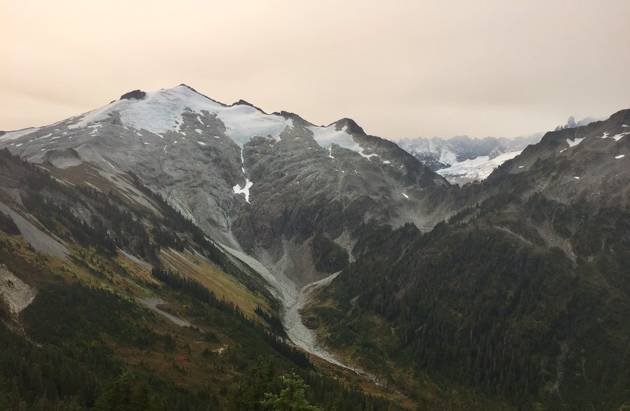
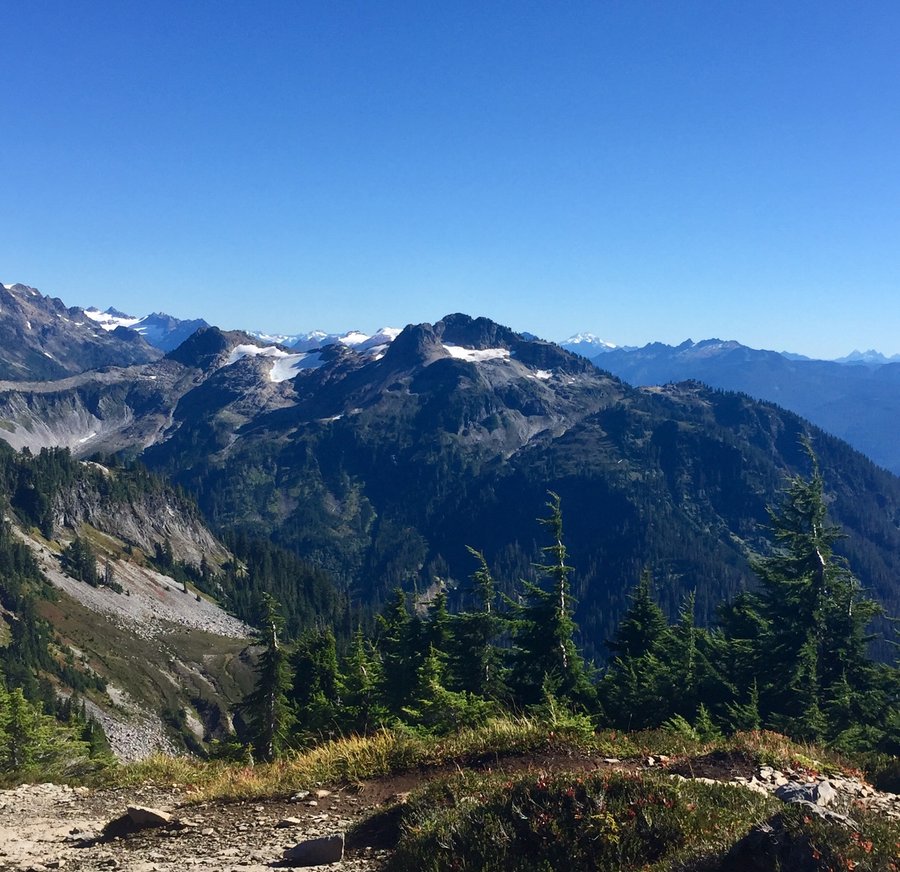
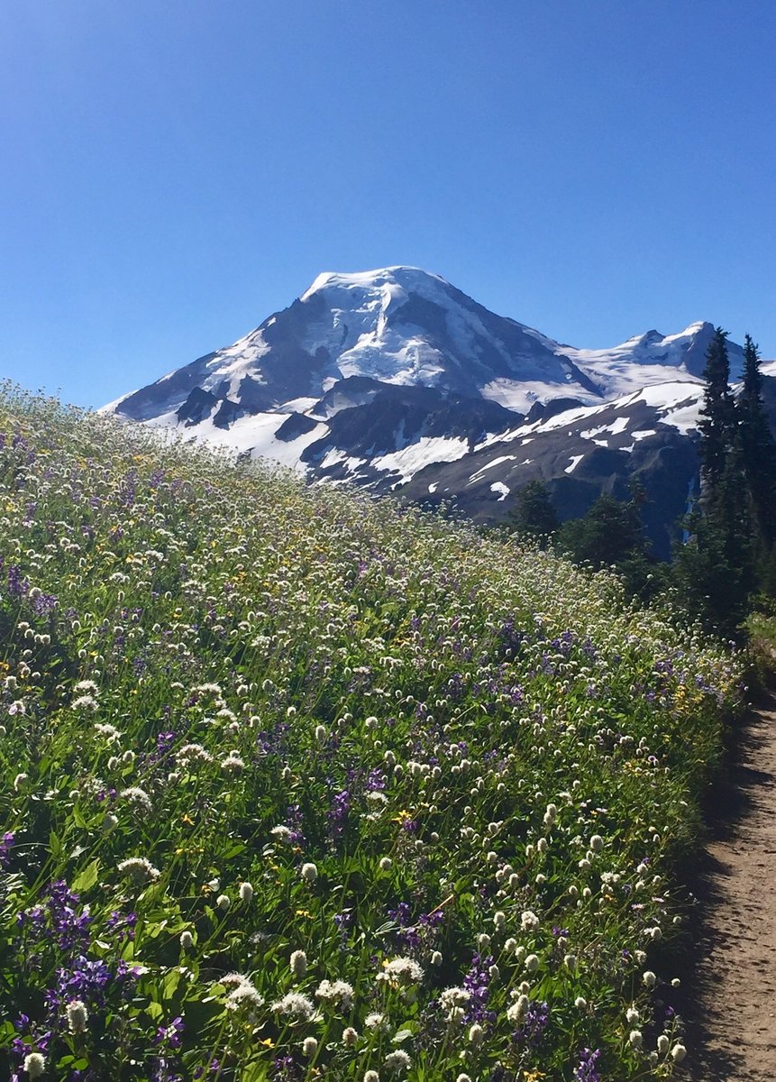
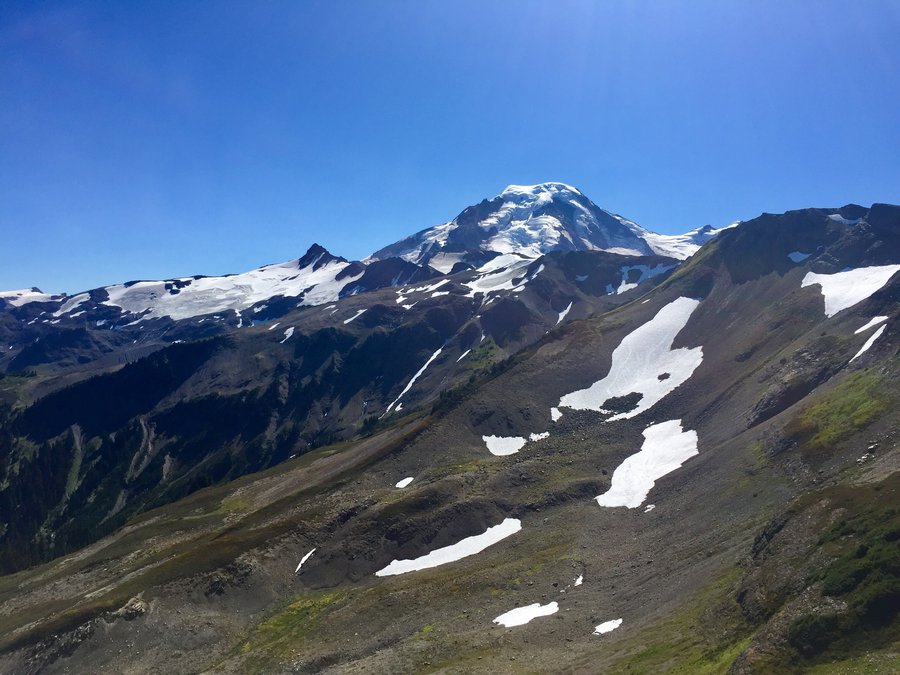
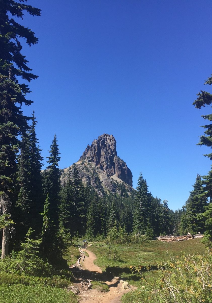
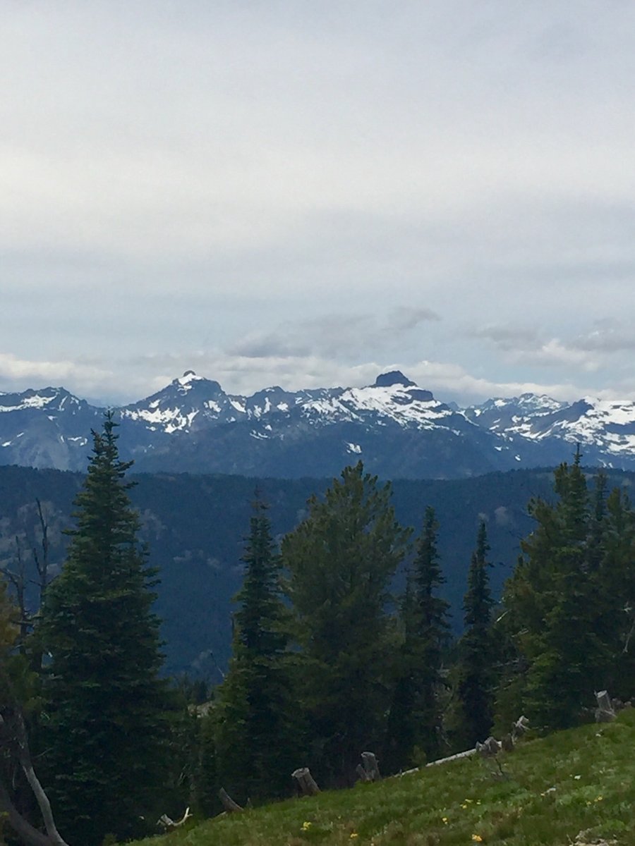
Perry Creek to Mt. Forgotten
12.17 miles of hiking • 4500' elevation gain •
The plan was to take the Perry Creek Trail to Mt. Forgotten Meadows and from there determine if a climb to the summit was feasible within our turn around time, 1430 hours, and with the gear we had brought, micro spikes and ice axes. When we got to the meadows we decided to give it a go and at least attempt to find the climbers trail to the summit. It took us a bit more time to find the trail then expected and because of the snowy/icy conditions it was slow going. Really could of used crampons in some of the steep, icy areas which were a bit sketchy in the spikes and necessitated a bit of veggie belaying. One of our party made it to the summit but me and my brother got approx. 400' from the top when we hit our turn around time. From where we stopped it looked like due to the conditions we had another 30 minutes to reach the summit so we decided to stop for the day. In retrospect it was a good call as we made it back to the car just a bit after dark.
October 31, 2020


 2
2
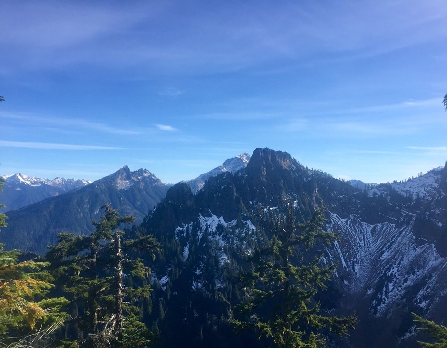
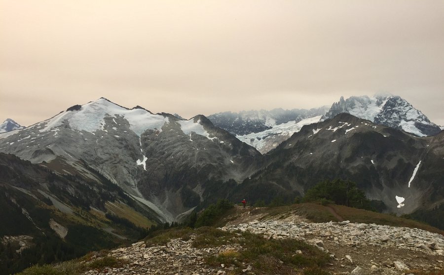
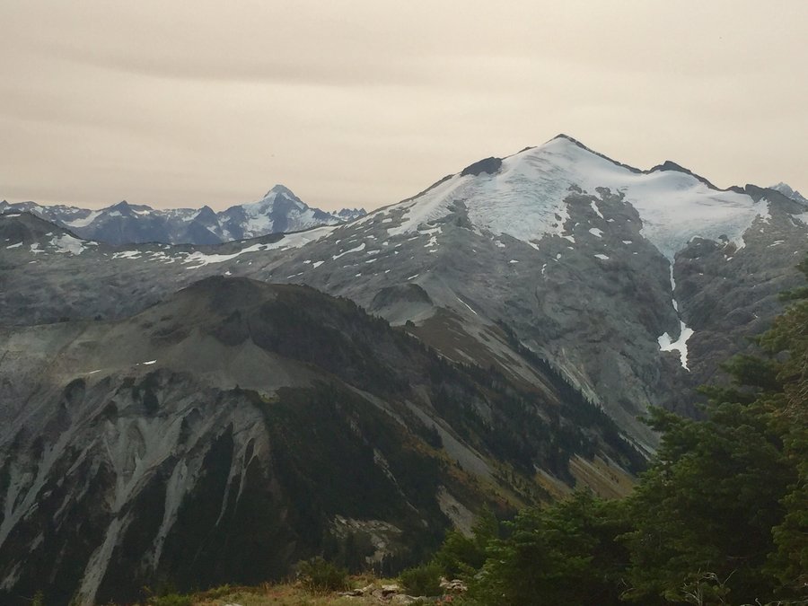
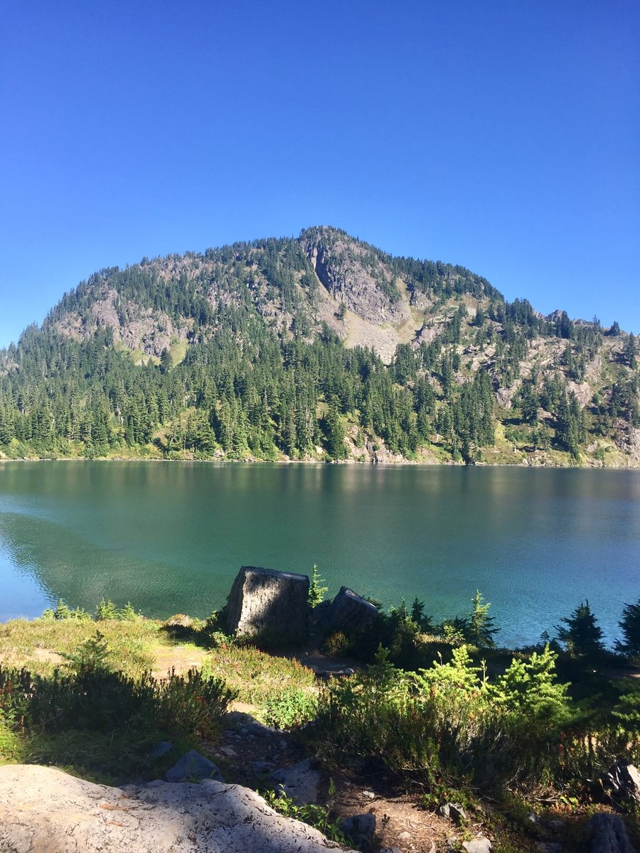
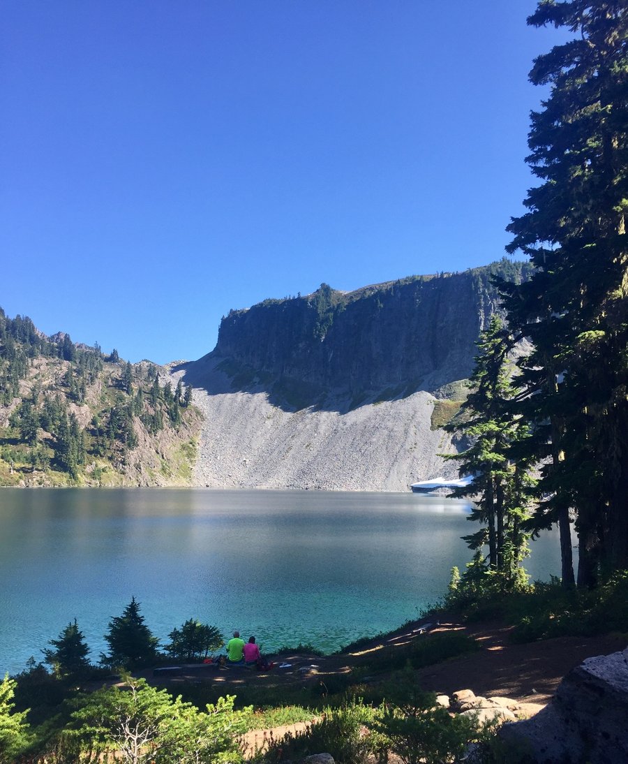
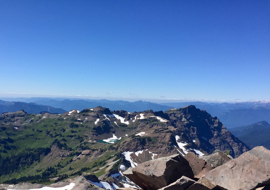
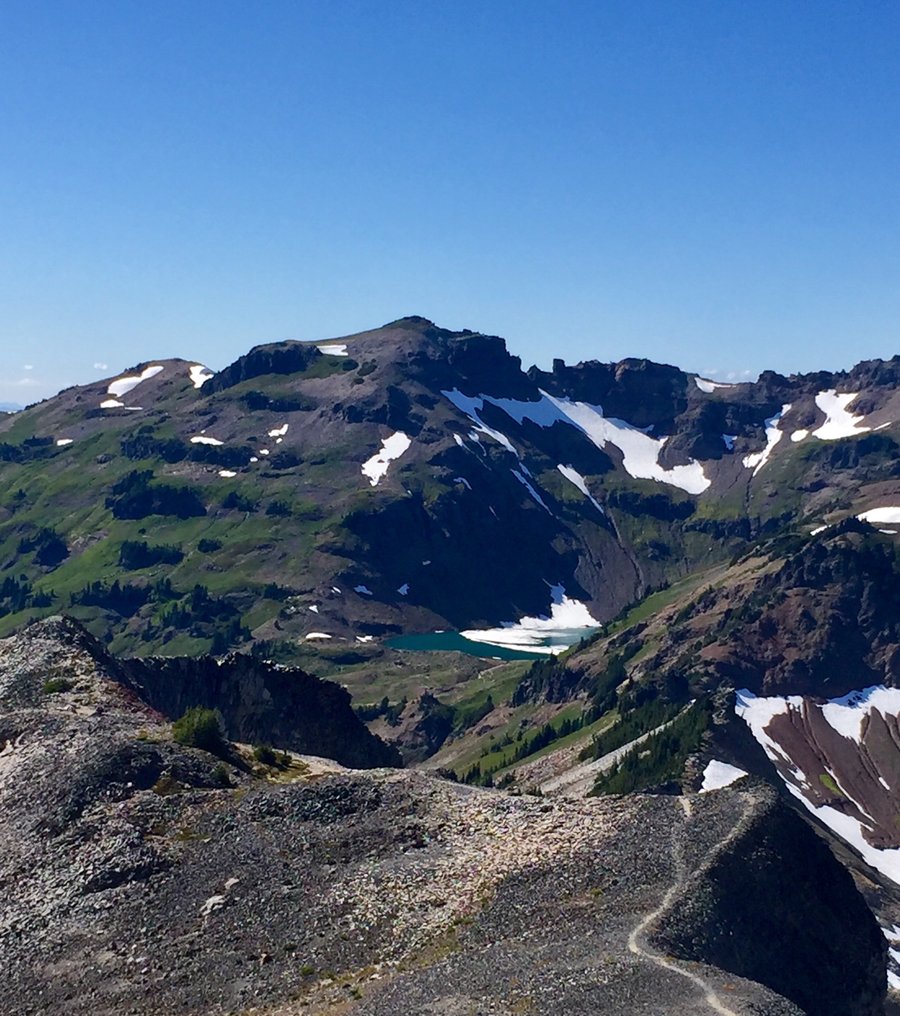
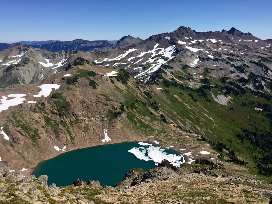
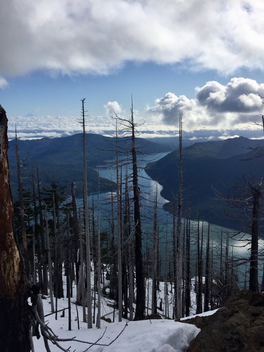
Valhalla Peak
8.85 miles of hiking • 3000' elevation gain •
Started the hike on the Tunnel Creek TH which follows the south fork of Tunnel Creek. At around 2 1/2 miles you reach the Tunnel Creek Shelter and from there the climbing steepens. After climbing approx. 1000 vertical feet you will reach Harrison Lake and get your first glimpse of Valhalla Peak. A 1/2 mile past the lake you reach 5050' Pass where there are nice peek-a view views of Mt. Constance. From there the "official" trail ends but there is a well defined boot path to Valhalla's 5300' summit.
October 24, 2020


 1
1
Mt. Ellinor
6.11 miles of hiking • 3250' elevation gain •
A "mostly sunny" weather forcast became a mostly foggy reality. Only a few fleeting peek-a-boo views from the top.
October 19, 2020

 1
1
October 8, 2020
 2
2
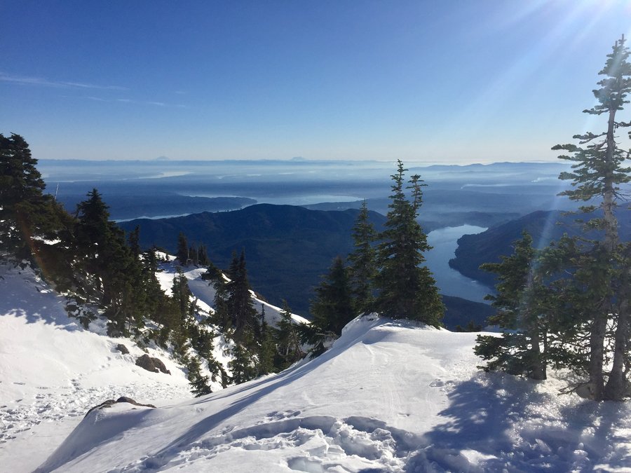
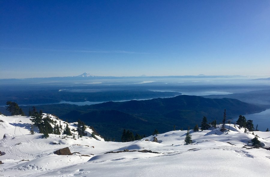
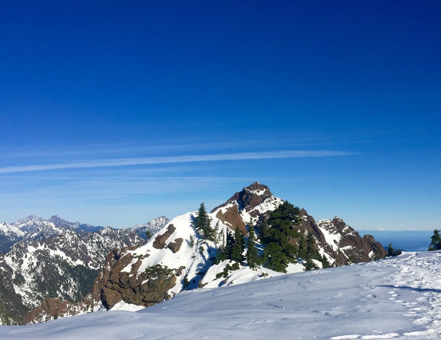
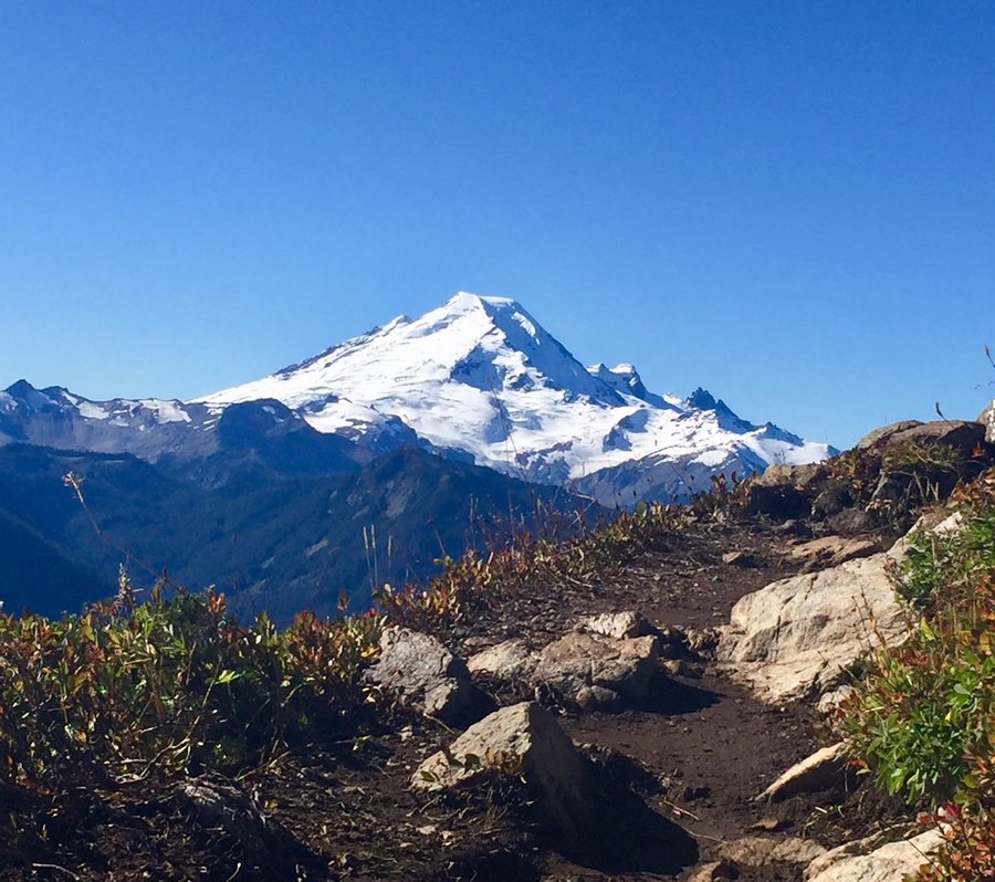
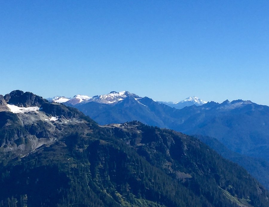
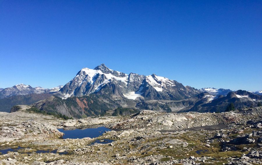
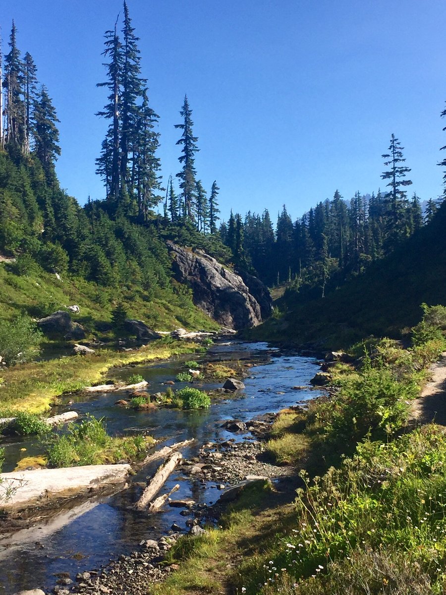
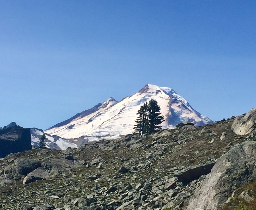
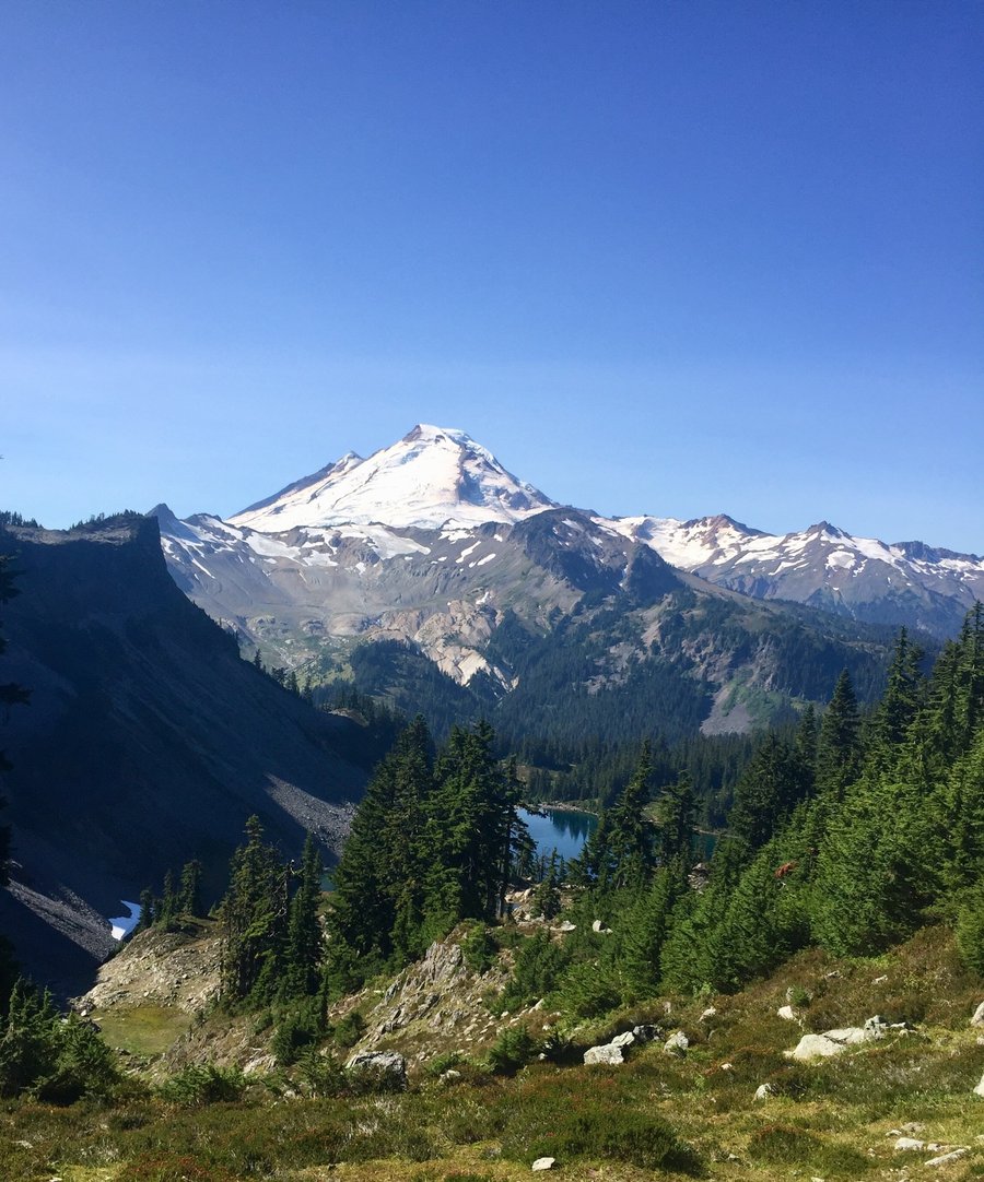
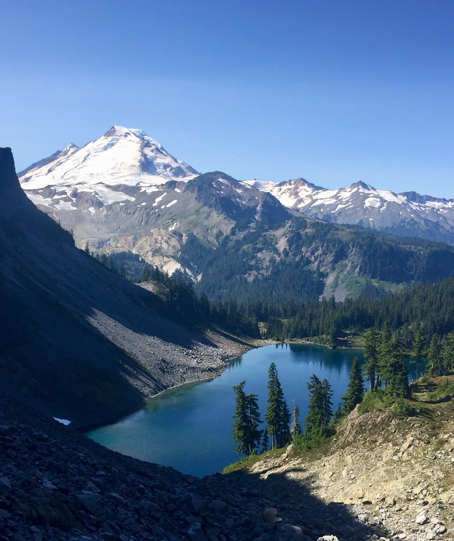
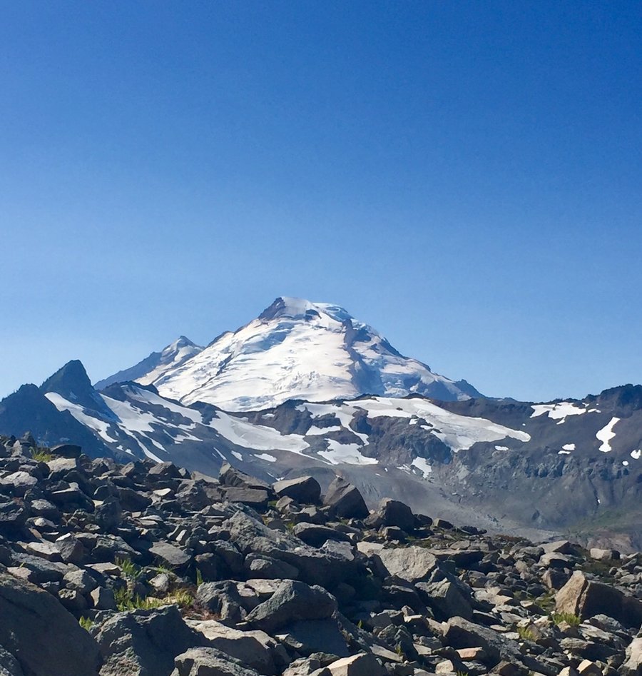
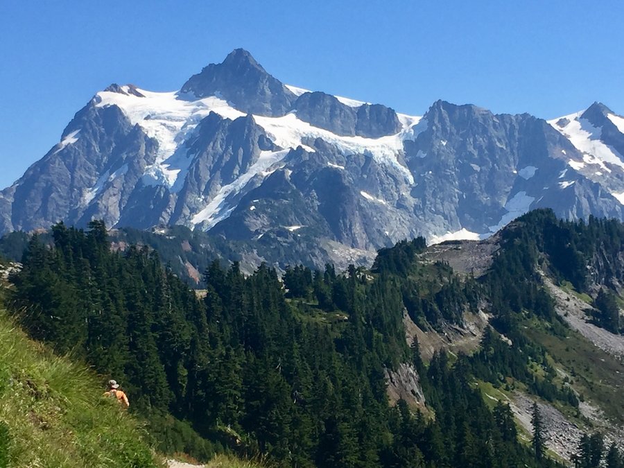
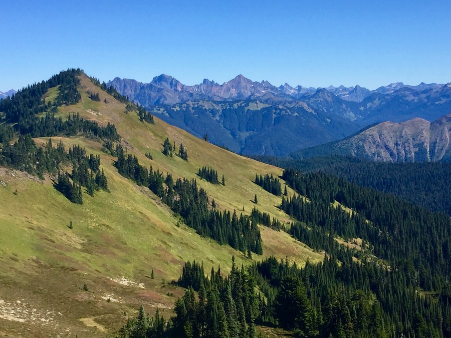
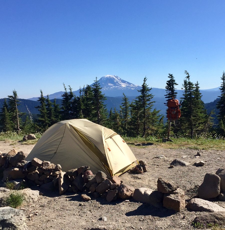
Hannegan Peak
10.95 miles of hiking • 3500' elevation gain • 1 night
Hazy smoke and fog moved into the area on Wednesday. I camped within the Mt. Baker/Snoqualmie National Forest so no permit was needed to overnight but if you go beyond the Hannegan Pass cut off up to Boundary Camp a National Park permit is required. Nice views of Mt. Ruth, Shuksan and surrounding peaks but Mt. Baker was obscured due the hazy conditions.
September 30 – October 1, 2020

 3
3
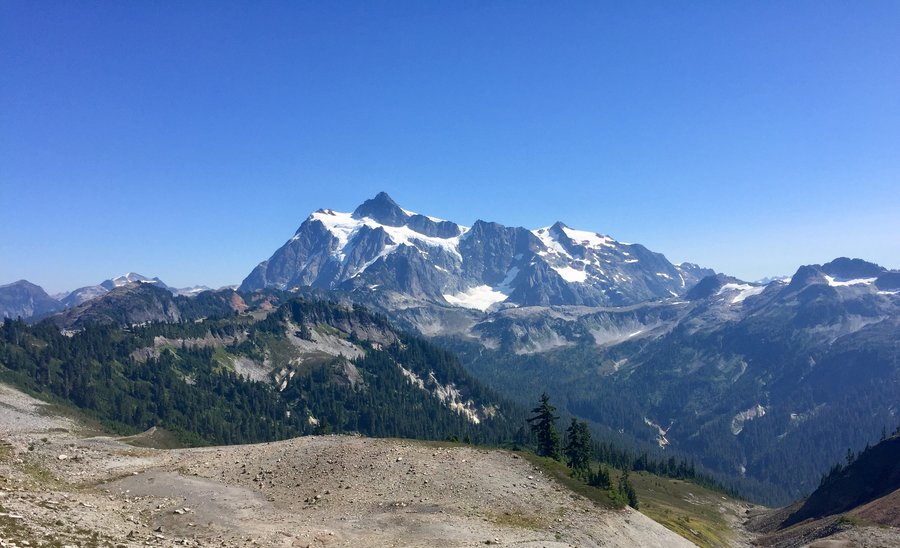
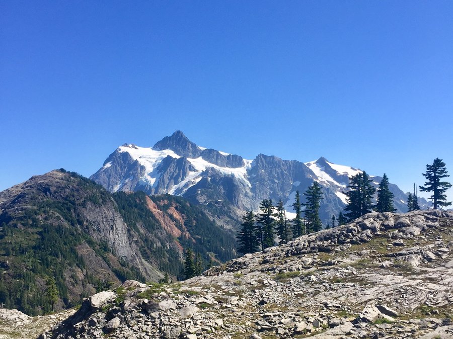
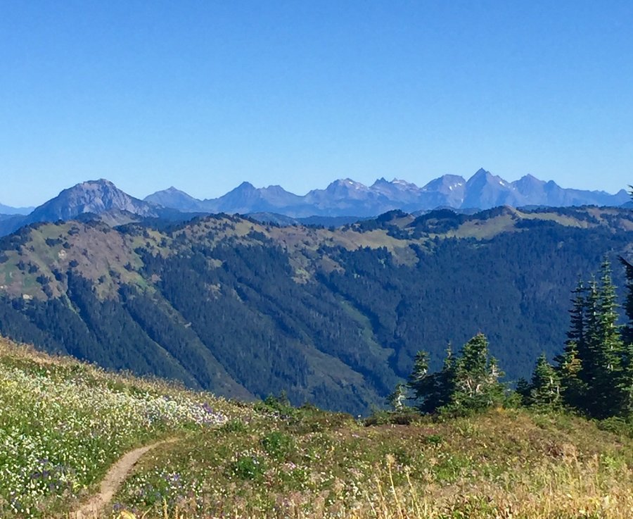
Yellow Aster Butte
8.23 miles of hiking • 3000' elevation gain • 1 night
This is a crowded trail even for a Tuesday. One can see why though with the great views. Lots of available places to camp and no permit is required as it is not in the National Park. Also, water supplies are abundant. I would like to return and spend more time exploring the area as there are multiple peaks one could scramble up. The views of Canadian peaks from Yellow Aster were pretty awesome.
September 29 – September 30, 2020


 1
1
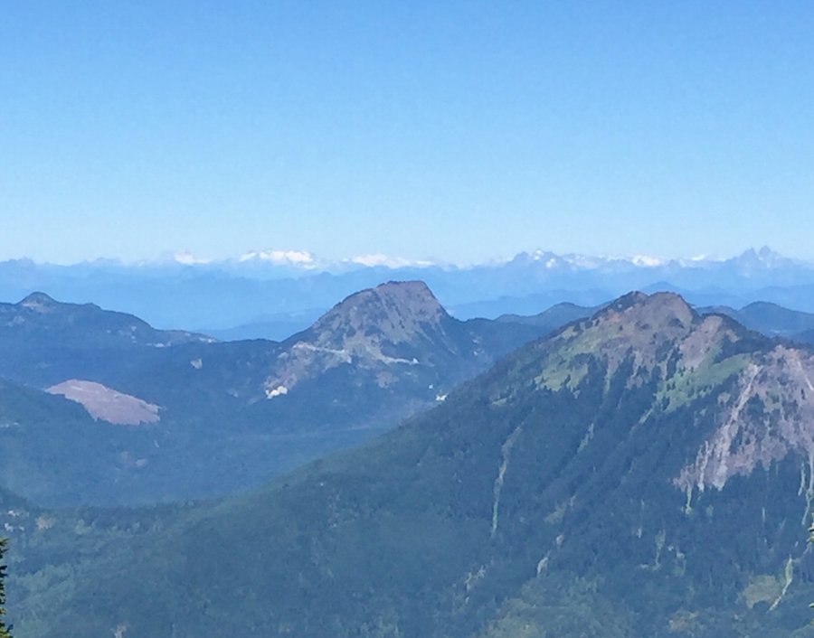
Table Mountain
3.09 miles of hiking • 750' elevation gain • 1 night
Was going to sleep in my car at the Mt. Baker Ski area but decided the short hike up Table Mountain and camping up there would be much more fun. Not sure if it was legal to camp up there this time of year, I did not have a permit, but there is plenty of space up there to stay hidden from the day hikers.
September 28 – September 29, 2020


 1
1
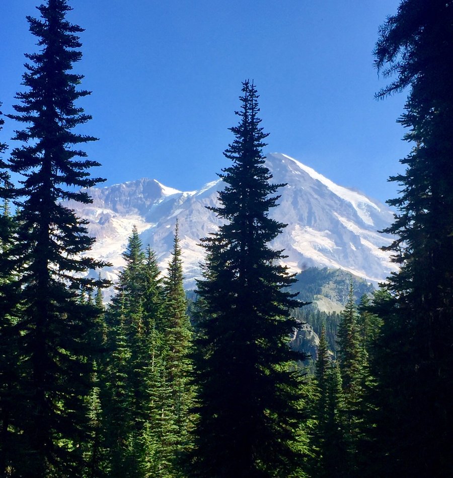
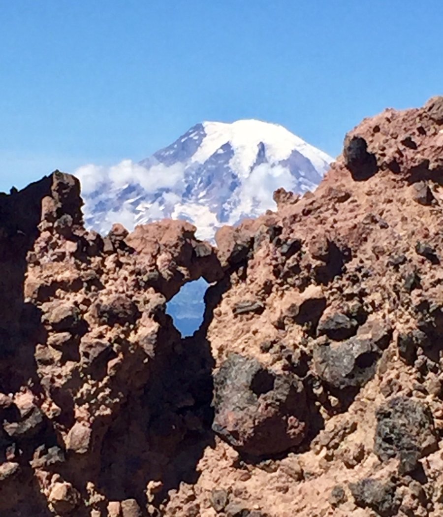
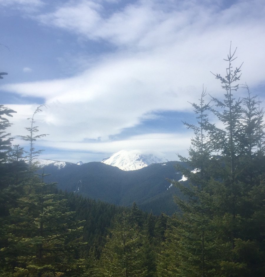
MRNP--Eagle Peak Saddle
7 miles of hiking • 3000' elevation gain •
The smoke cleared out pretty much in my neck of the woods Saturday afternoon so was looking for something relatively short and steep to clear out the lungs and this fit the bill nicely. This used to be a nice solitary trail in which one would rarely see anyone, but the masses appear to have discovered this trail as trail traffic has increased significantly since I hiked it last year. Foggy/cloudy at the top so only glimpsing views of Rainier
September 20, 2020

 1
1
Chain Lakes
8 miles of hiking • 2000' elevation gain • 2 nights
We did this trip as a loop starting and ending the trip at the Bagley Lakes TH. Camped next to Hayes Lake. It was hot so swimming & aimless meandering was pretty much par for the course.
September 9 – September 11, 2020


 2
2
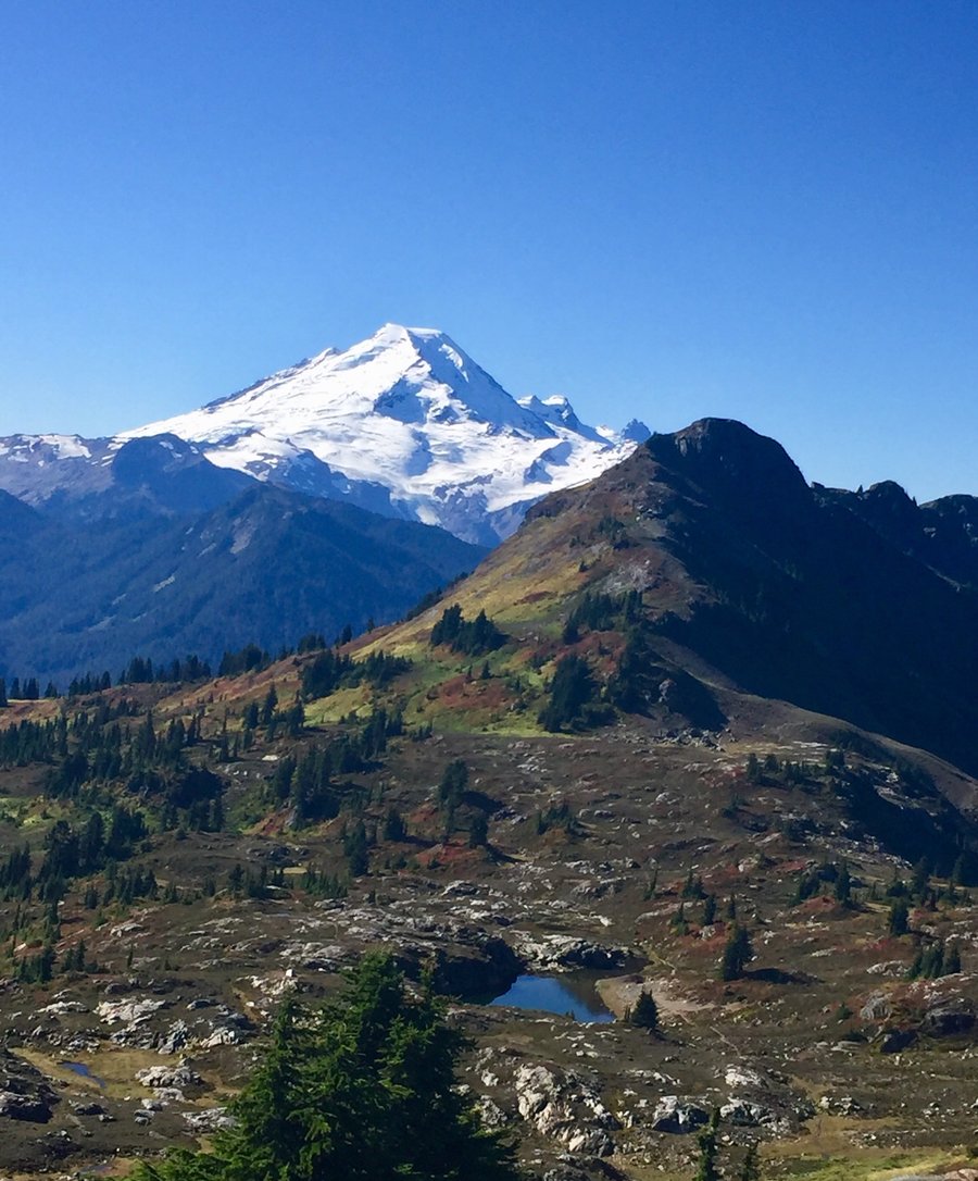
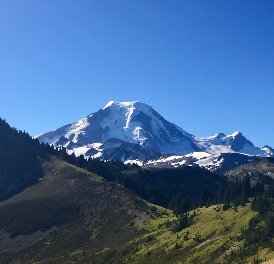
Skyline Divide
9.4 miles of hiking • 3000' elevation gain • 1 night
Sublime views of Mt. Baker, Shuksan and numerous U.S. and Canadian peaks. Nice camping spots along the Divide but water was scarce this time of year. Was going to hike Hadley Peak but got side tracked exploring so definitely a redo is in order.
September 8 – September 9, 2020


 2
2
MRNP--Mount Ararat
10.63 miles of hiking • 3750' elevation gain •
This was a nice lonely hike on a bustling Labor Day weekend at Mt. Rainier.
September 6, 2020

 1
1
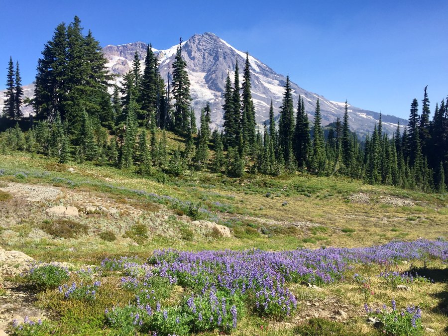
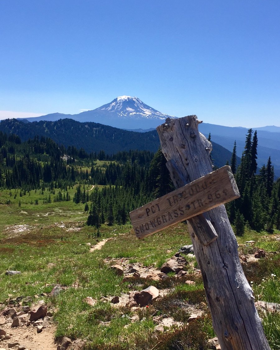
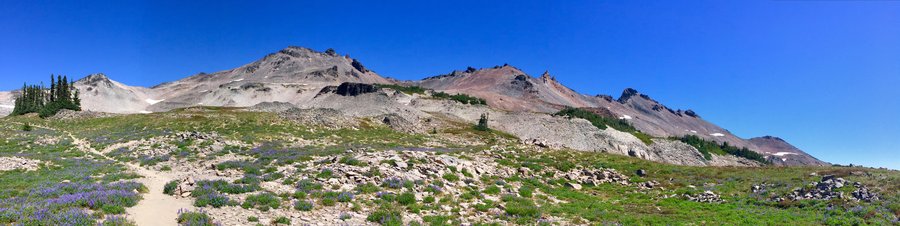
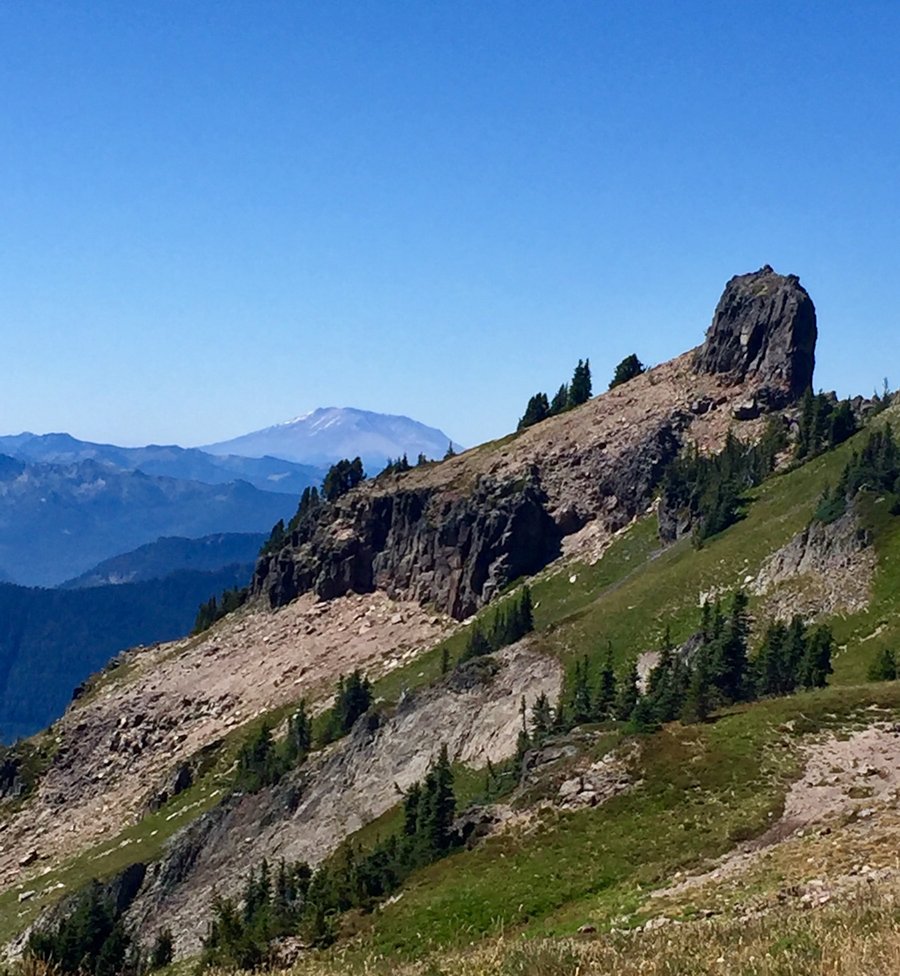
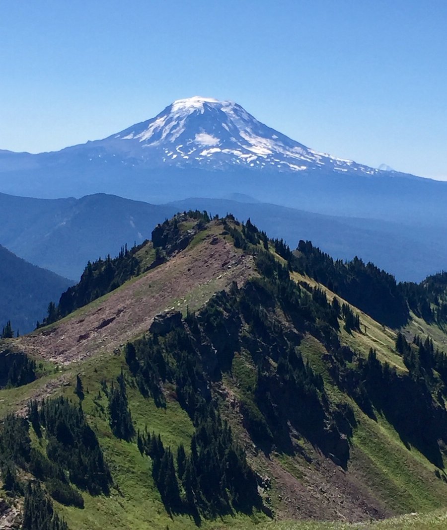
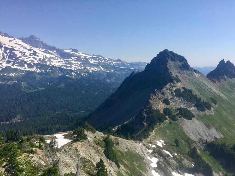
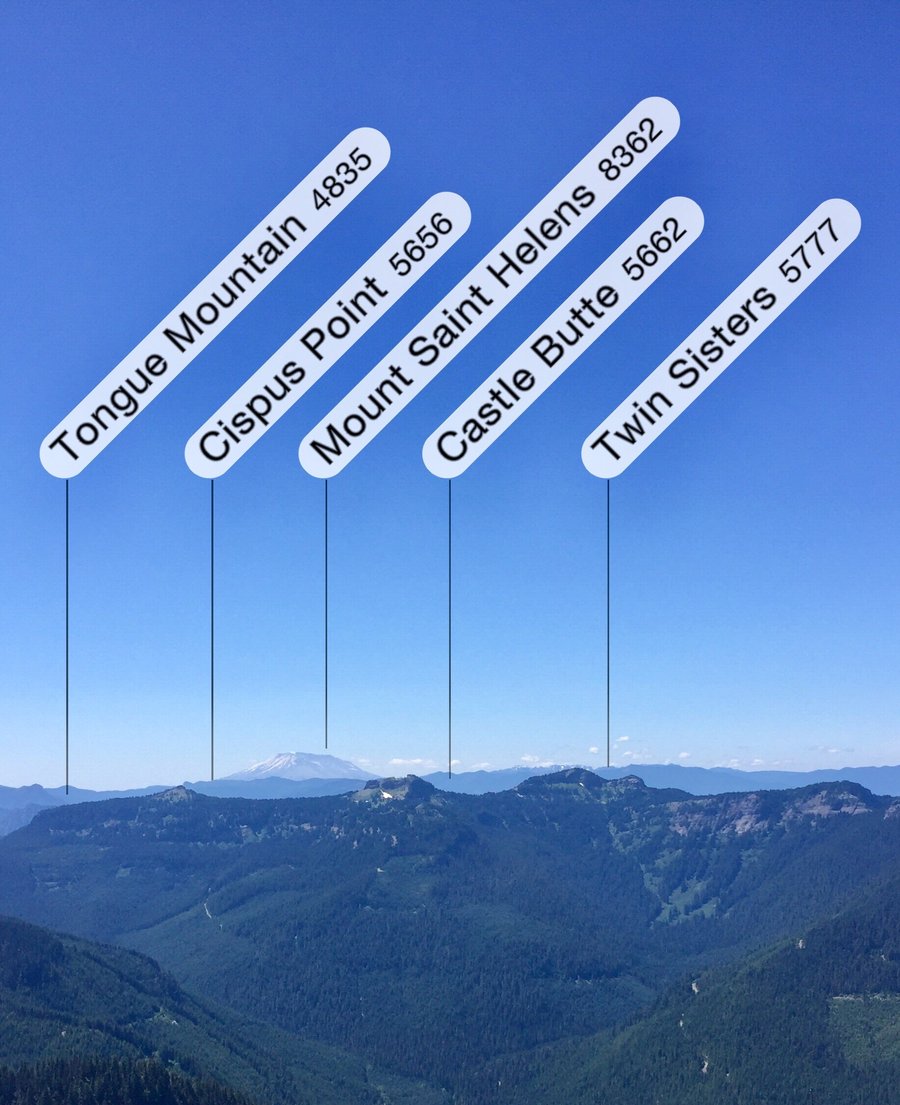
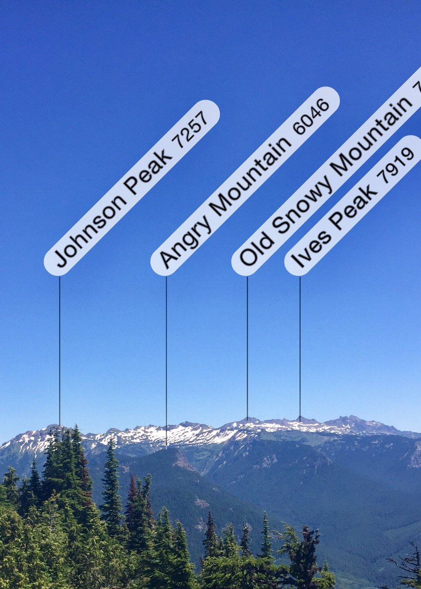
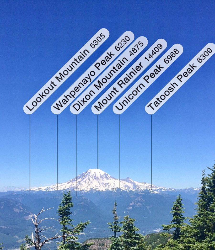
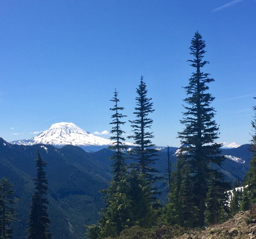
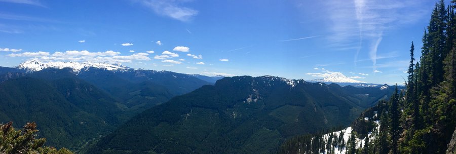
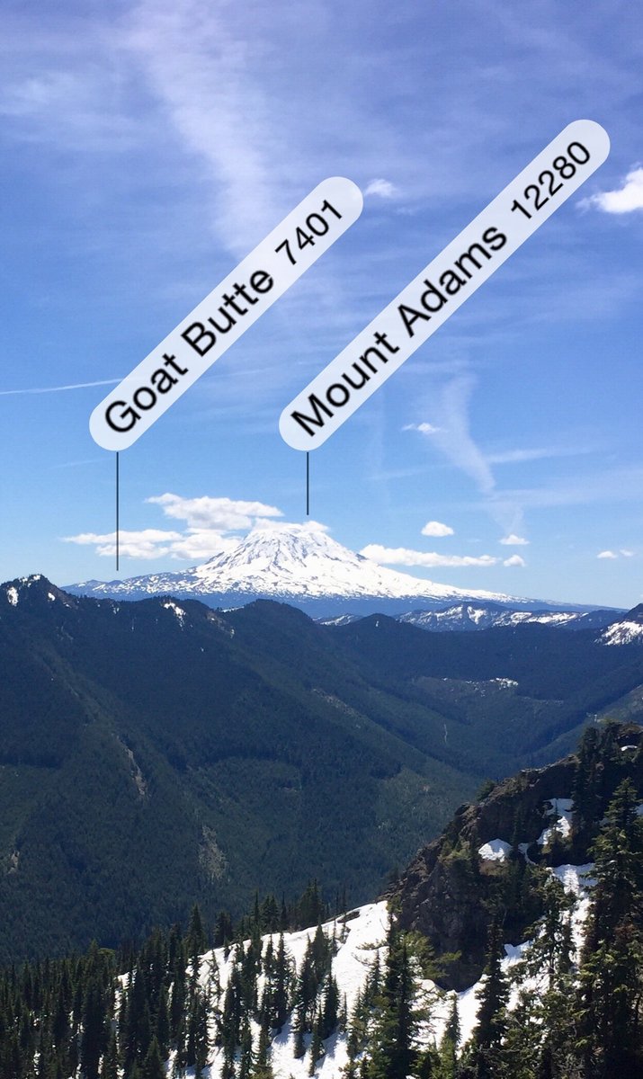
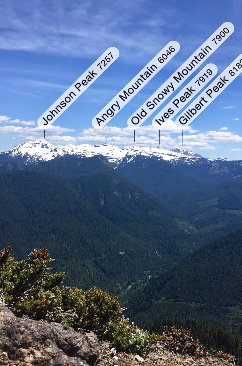
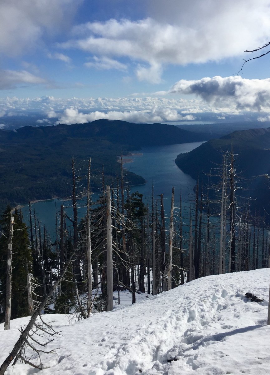
Goat Rocks Loop
23.5 miles of hiking • 5500' elevation gain • 2 nights
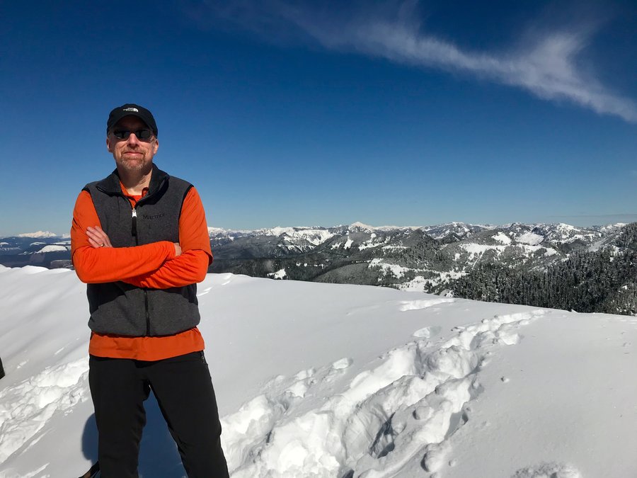
Started trip from the Snowgrass TH and made camp on the bypass trail above Snowgrass Flats. Had got an early start so my goal for the remaining afternoon was to head up the PCT and summit Old Snowy. The trail up Old Snowy was snow free and it's an easy scamble to the summit which has exceptional 360 degree views. The next day again got an early start and made camp at Goat Lake a bit before noon. That afternoon hiked up to the old fire lookout location on Hawkeye Peak. Again exceptional 360 degree views. The next day hiked out via the Goat Ridge Trail but not before bagging one further fire lookout location on Goat Ridge.
August 25 – August 27, 2020


 1
1
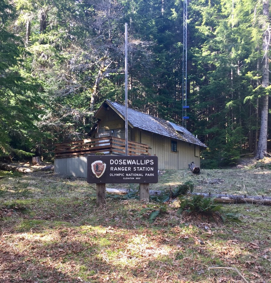
Up The Dosewallips
12.5 miles of hiking • 2250' elevation gain • 1 night
Just a quick overnight trip to the old ONP car campground.
August 22 – August 23, 2020
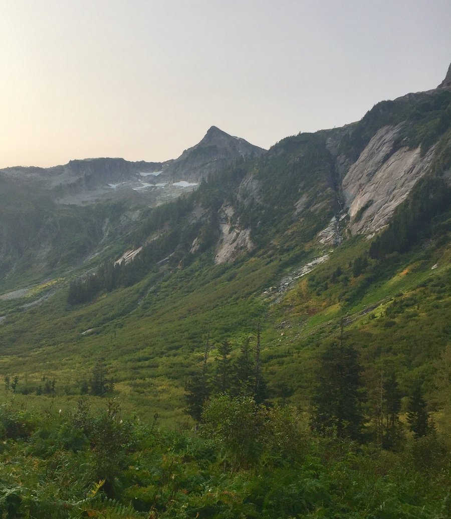
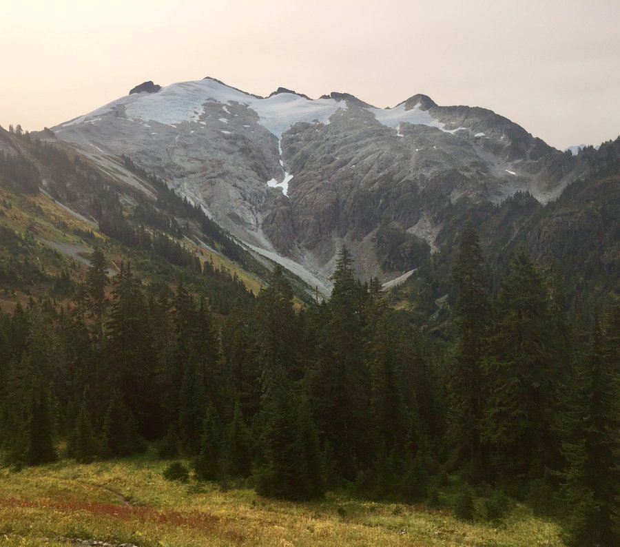
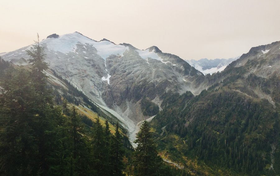
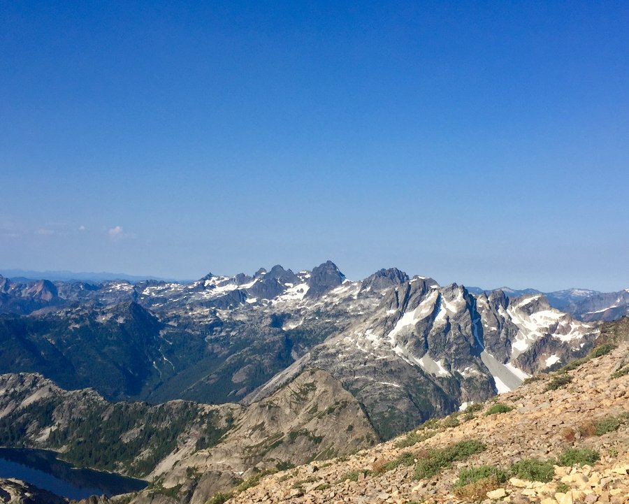
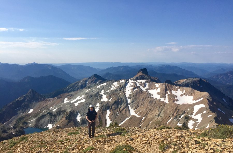
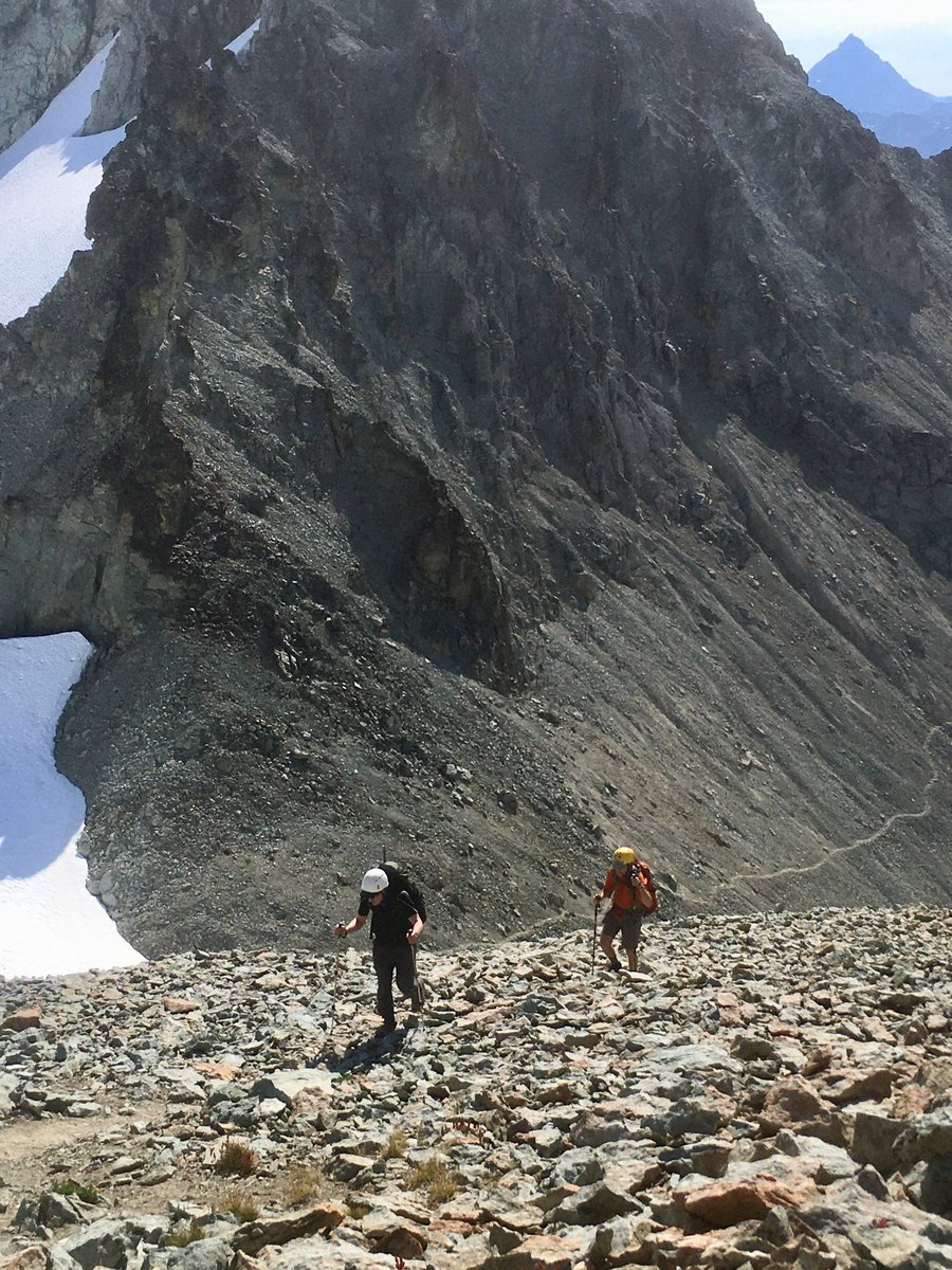
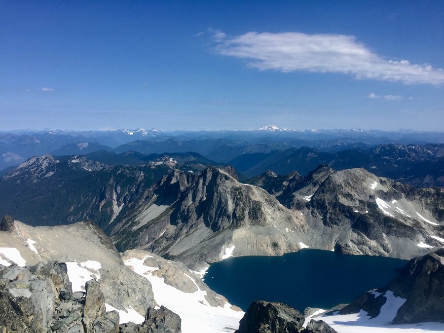
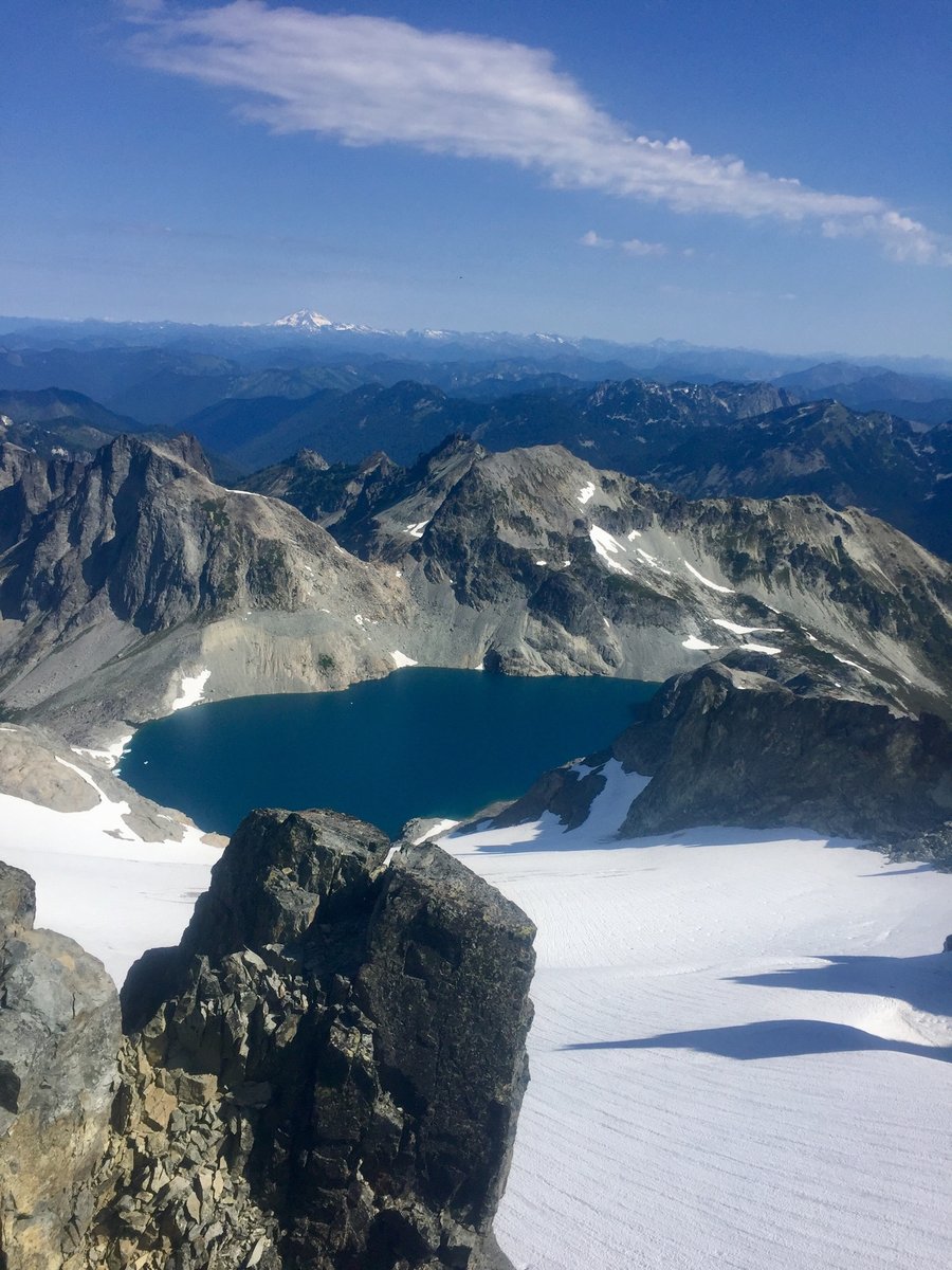
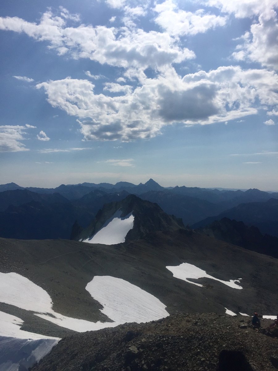
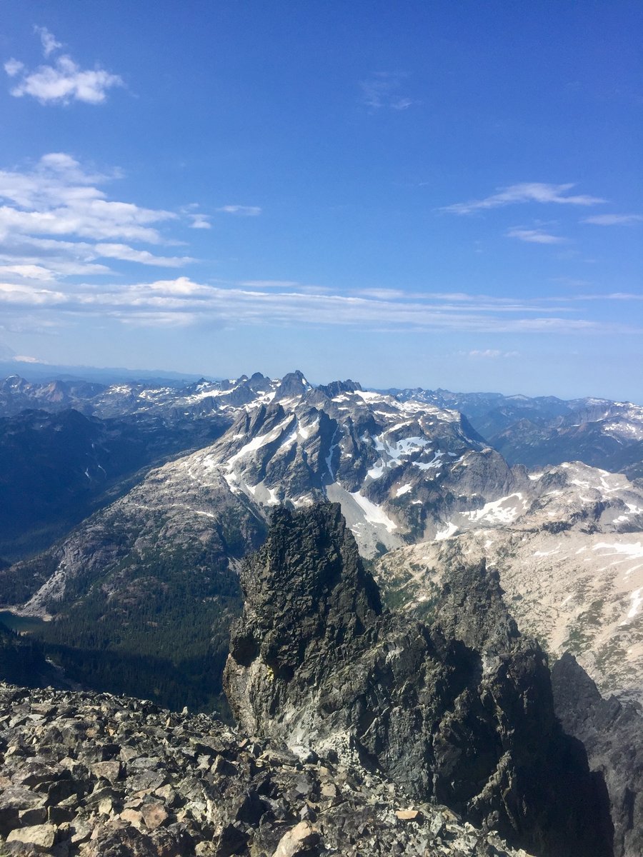
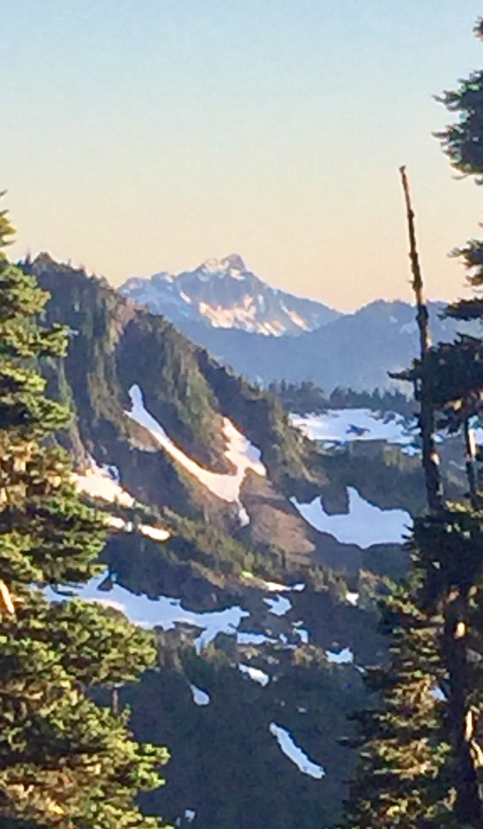
 3
3
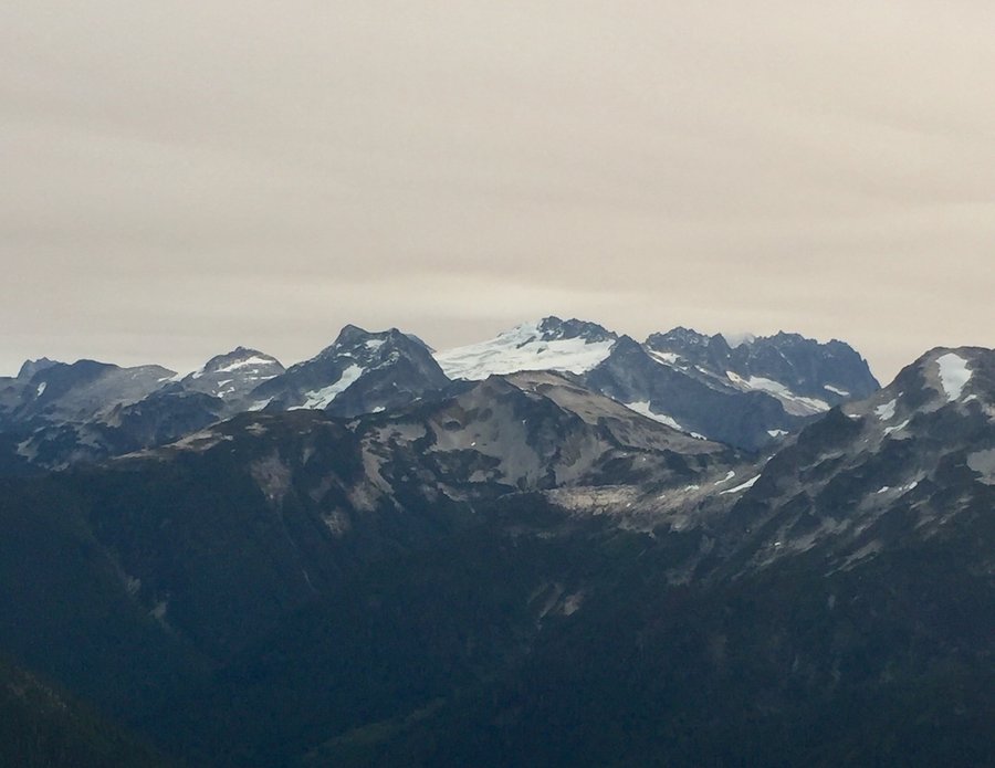
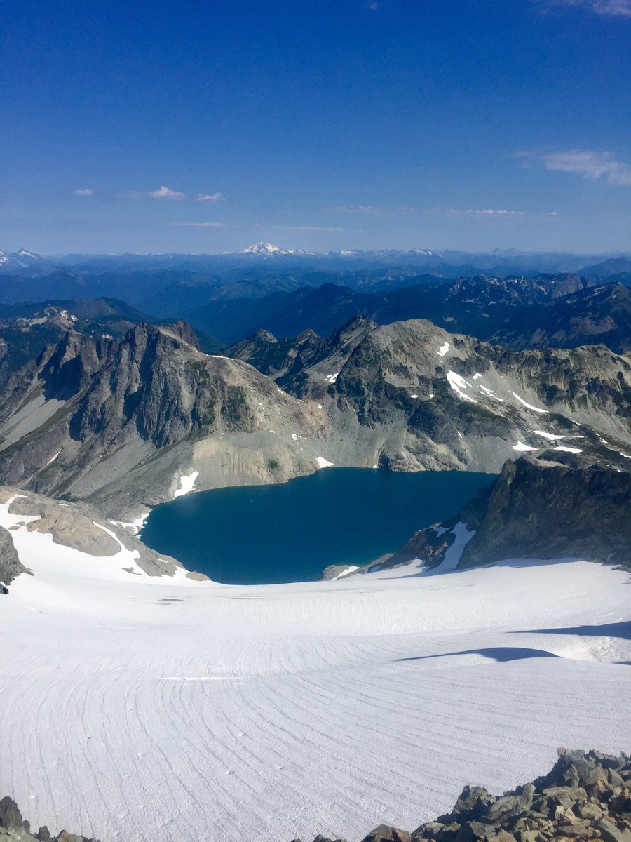
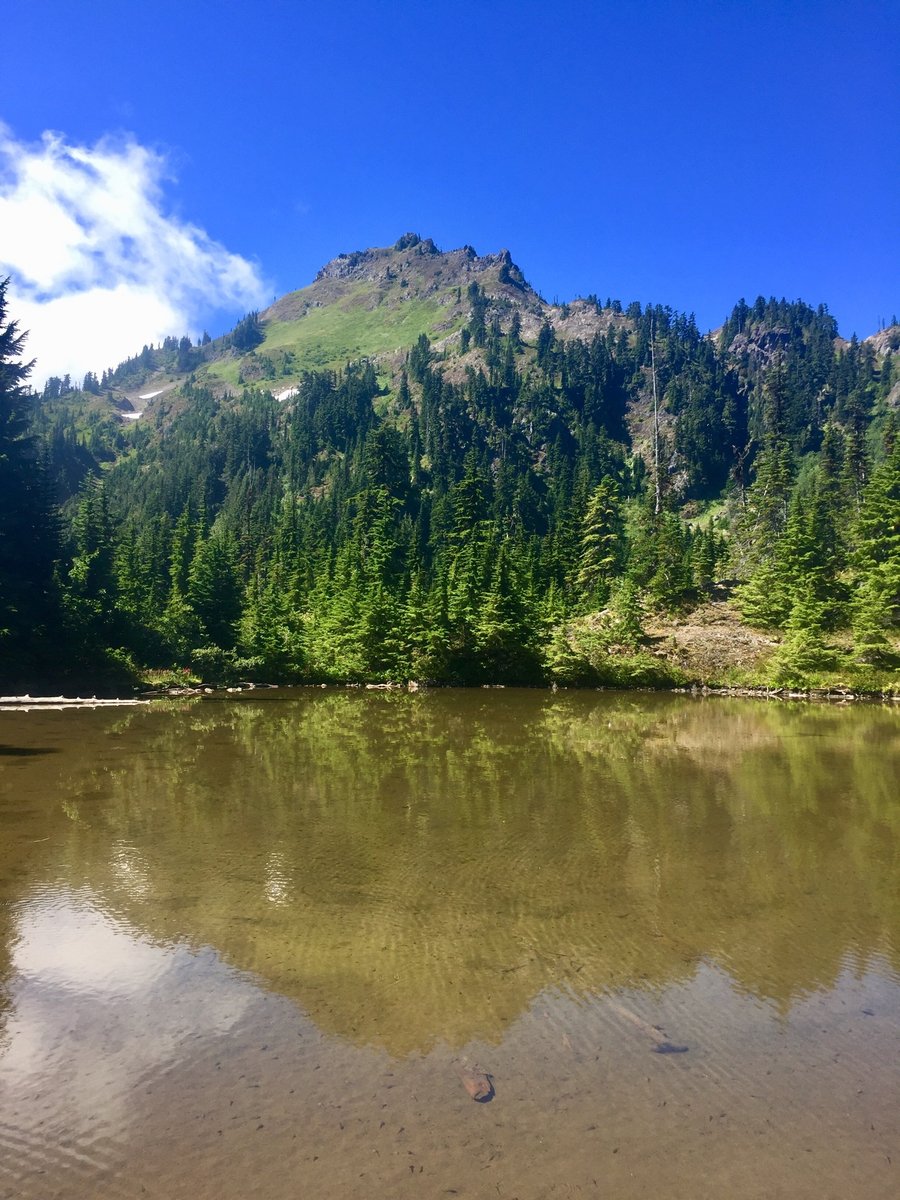
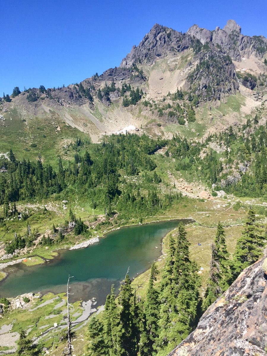
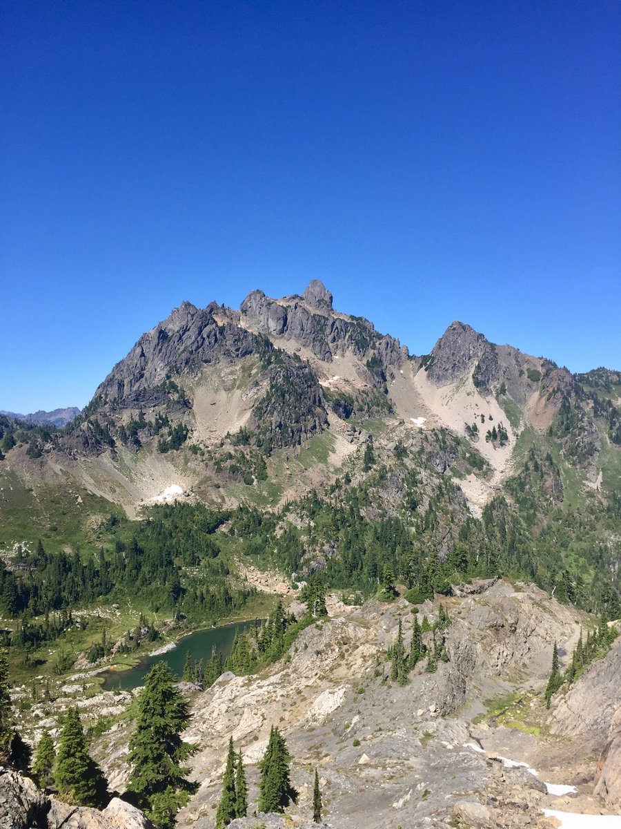
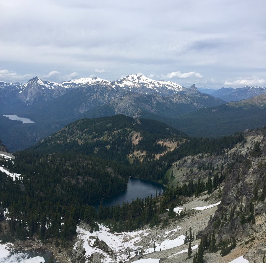
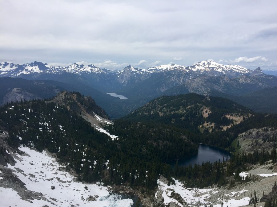
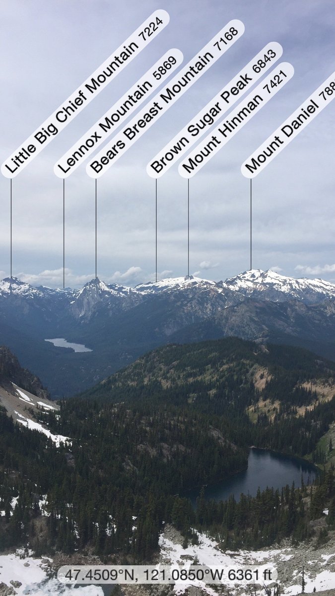
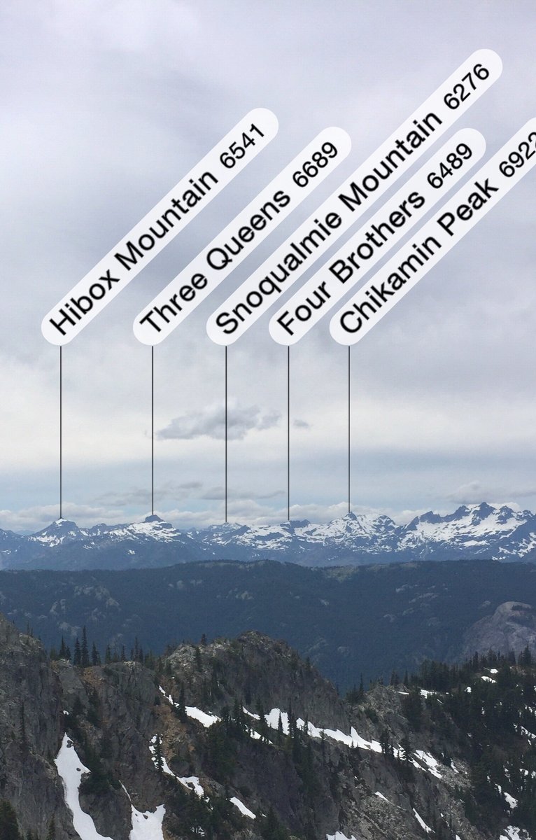
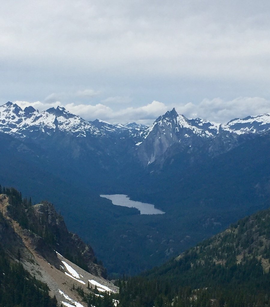
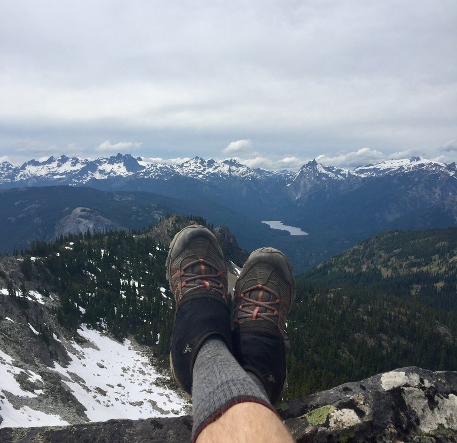
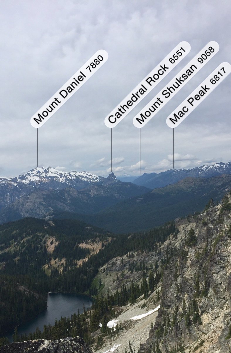
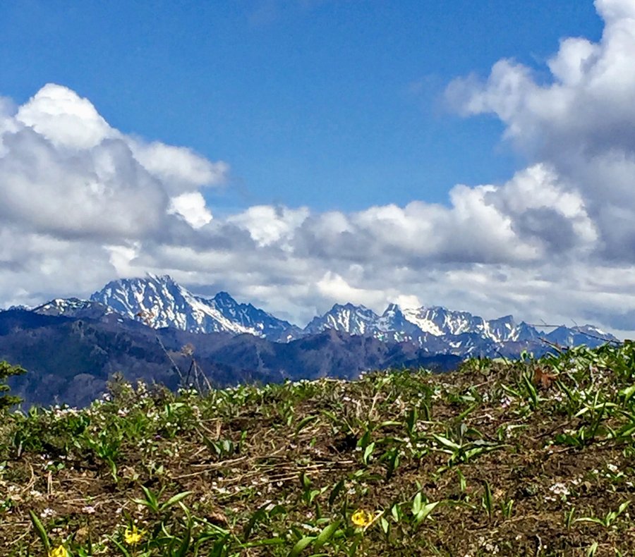
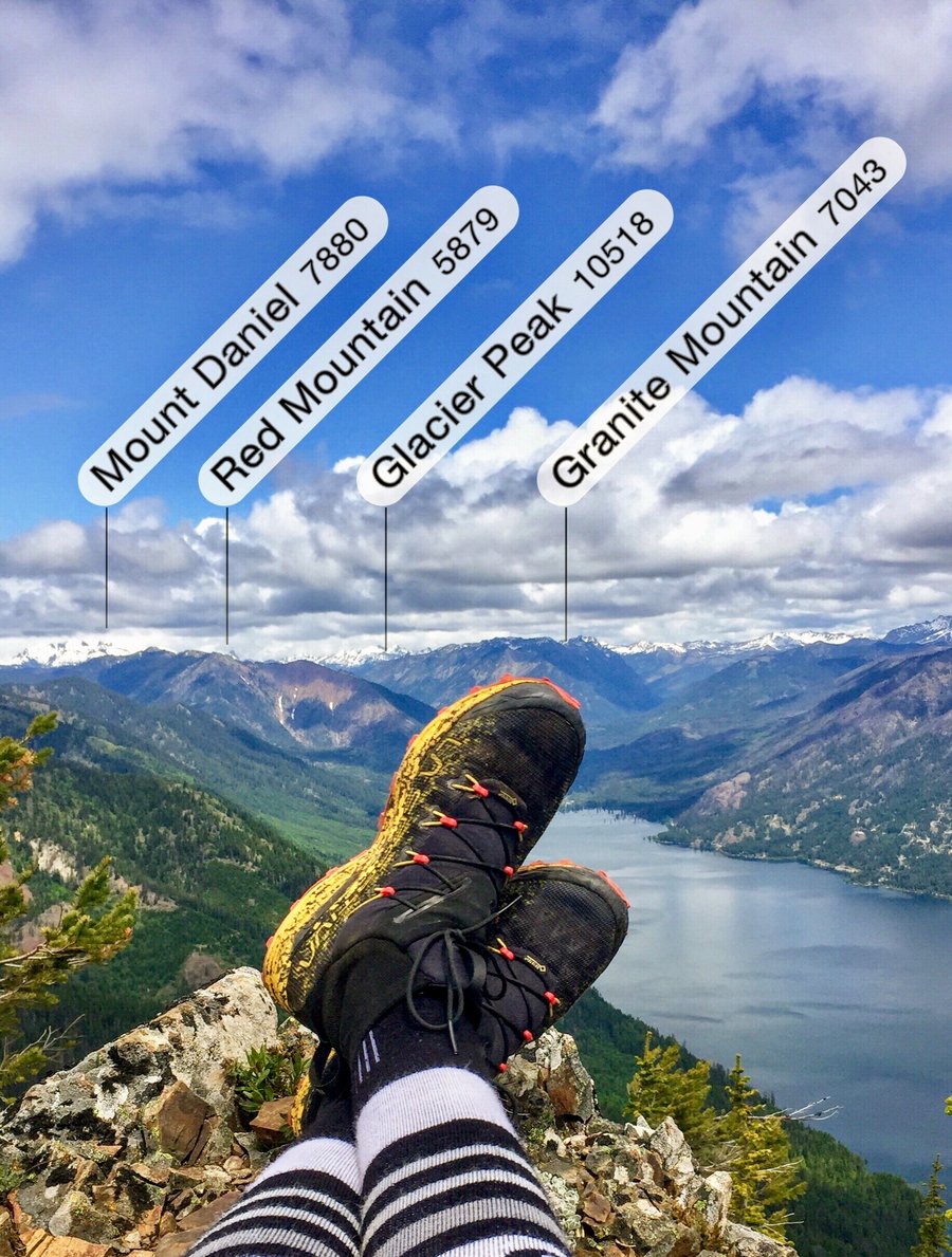
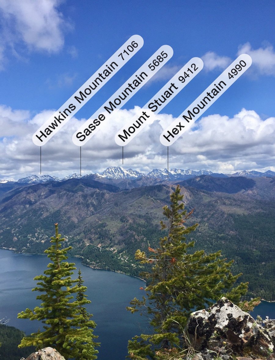
Mount Daniel--West Peak
15.84 miles of hiking • 5250' elevation gain • 1 night
Camped at Peggy's Pond which has Cathedral Rock as your backdrop which is pretty sweet. The mosquitoes, which are typically bad in this area, were as advertised. While we brought crampons, and ice axes the route we took was pretty much snow free so they stayed in the packs. There are Couple class 3 sections but nothing to technical, just a lot of climbing and descending loose, dirty rock. Very nice views of the Alpine Lakes Wilderness and surrounding peaks from its 7959' summit. A couple interesting facts....Mt. Daniel has 5 main summits with the west peak being the the highest. The West summit is also the highest point in both King and Kittitas Counties.
August 15 – August 16, 2020


 2
2
Lake of the Angels—ONP
14.5 miles of hiking • 4750' elevation gain • 1 night
Have day hiked to the lake several times but this was the first time I have overnighted there. It was great to have extra time to explore the ridges above the lake. There are 2 head walls you have to scale during the hike and and on our way up there were ropes at those sections to assist climbing that area. On our way down the next day the ropes had mysteriously disappeared. Not a real big deal in our case.....just kinda weird.
August 9 – August 10, 2020

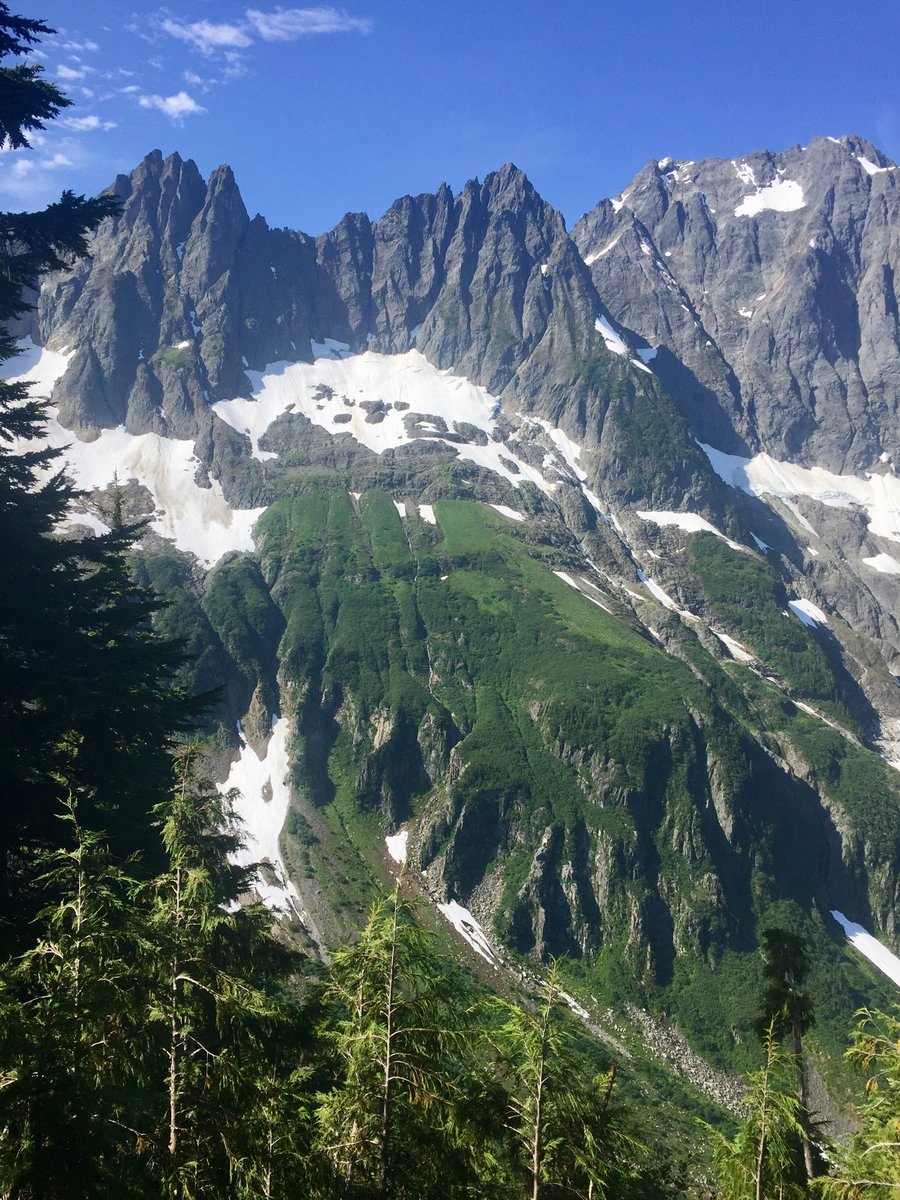
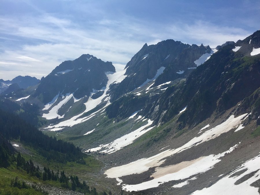
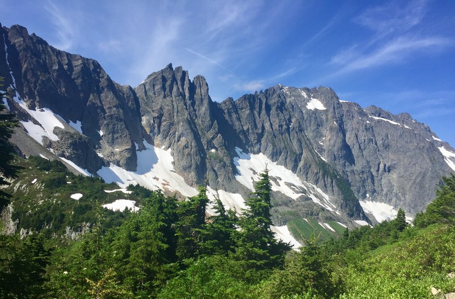
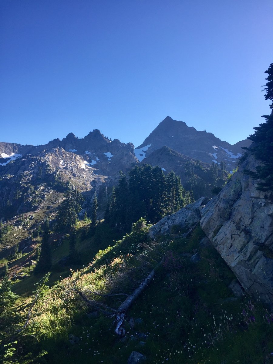 3
3
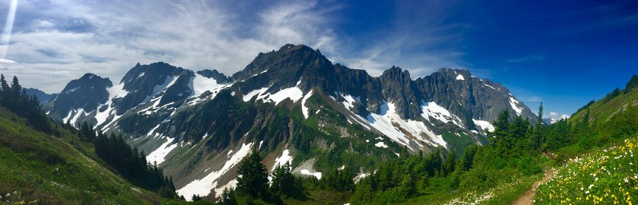
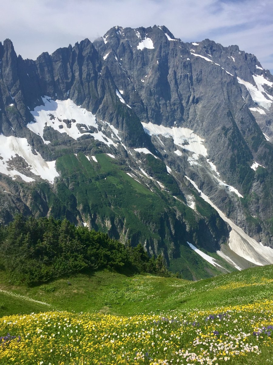
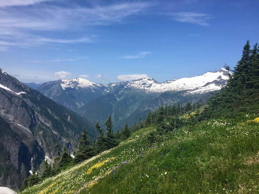
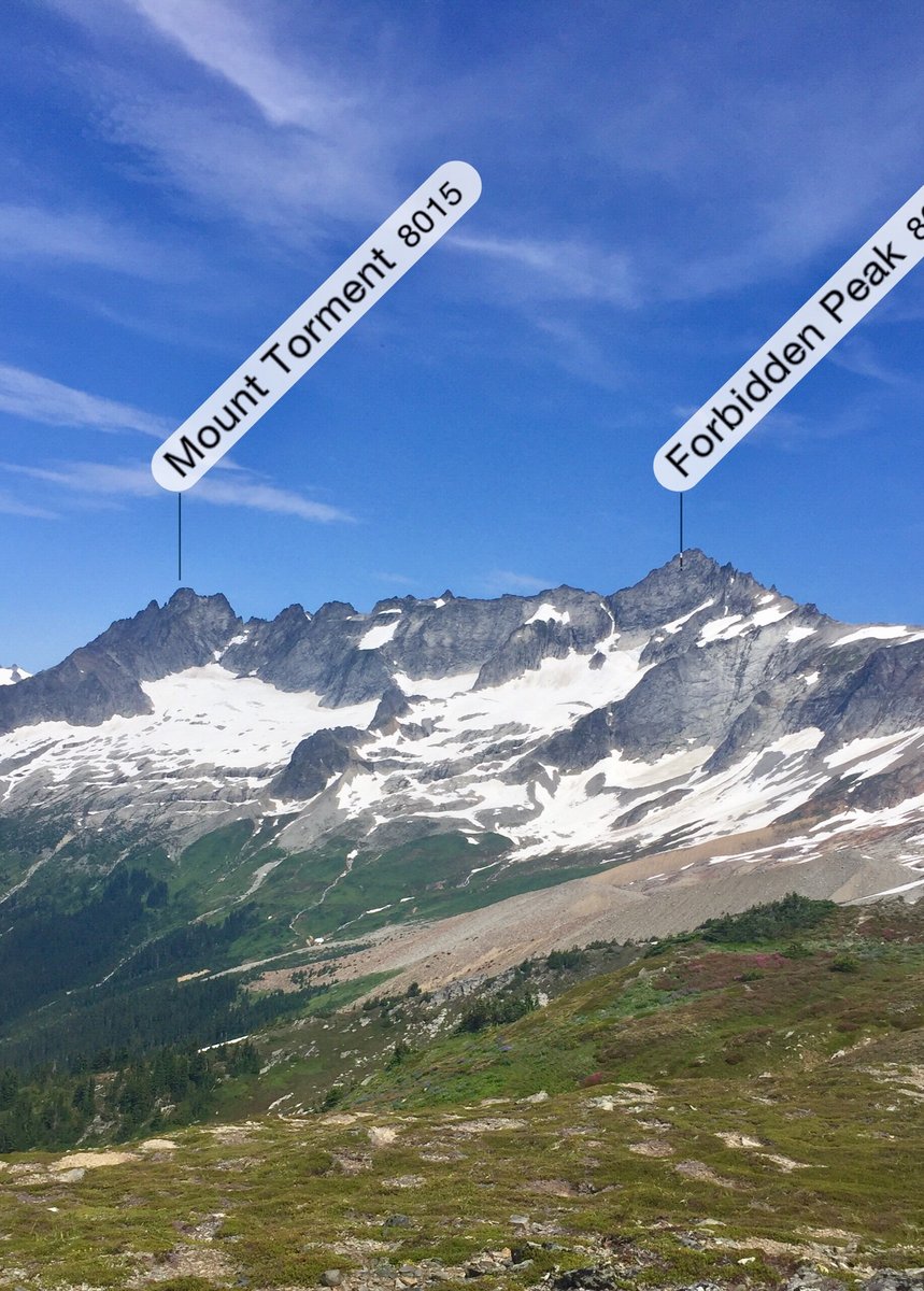
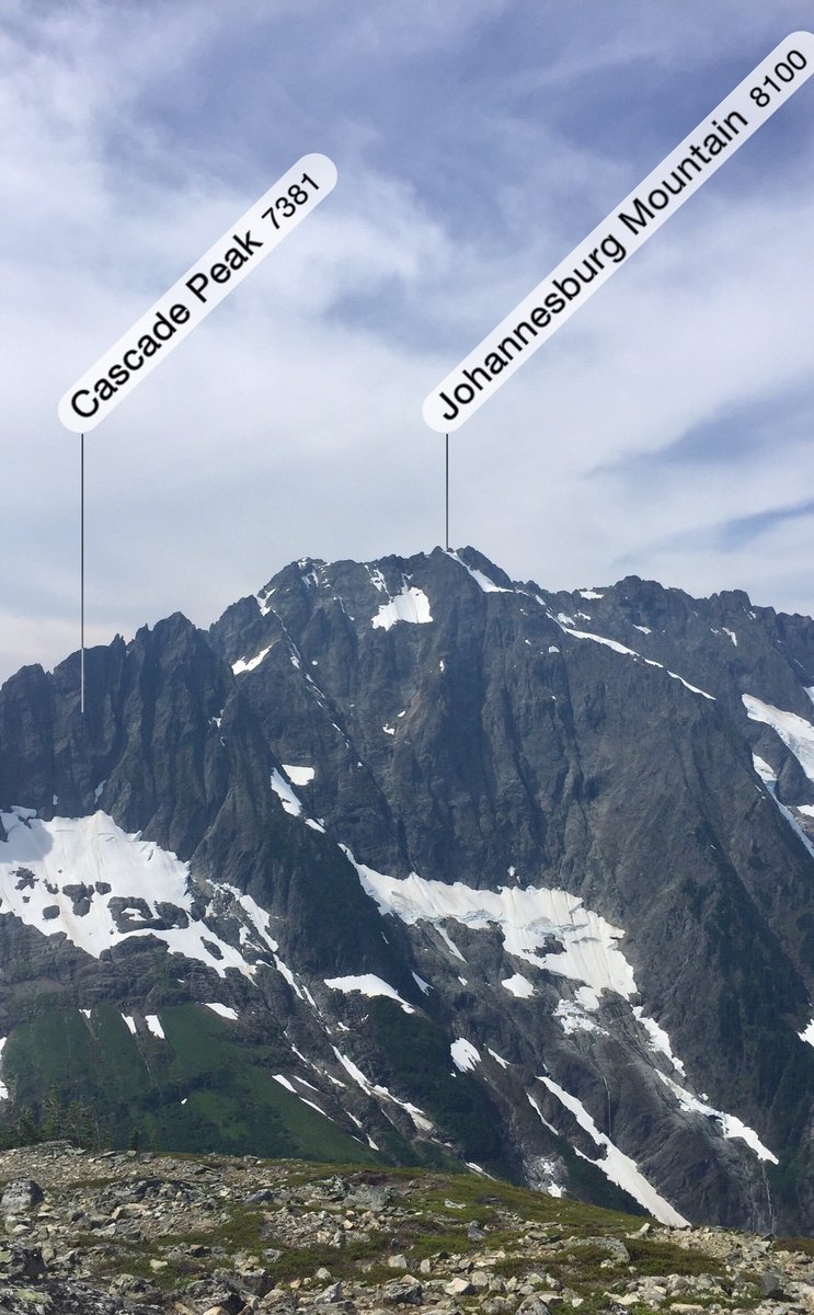
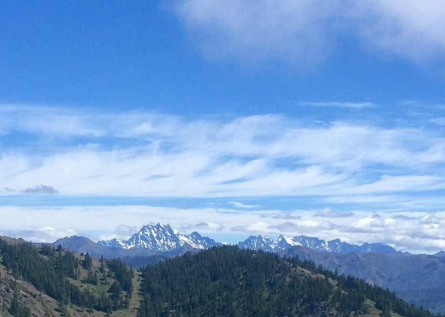
Cascade Pass to Sahale Arm
9.5 miles of hiking • 3250' elevation gain •
This hike never disappoints. The great views start at the parking lot....how can you beat that! People were doing a really good job social distancing and masking up. Now that's more like it people! Big sign at the TH indicates no pets but still some people with their dogs on the trail. What's with that? I'm a dog lover but you really give us responsible dog owners a bad name. Lots of marmots scurrying around once you got beyond Cascade Pass.
August 1, 2020


 2
2
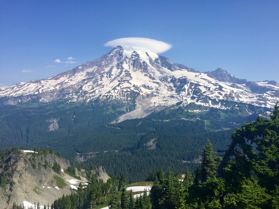
Pinnacle Saddle--Plummer Peak
3.2 miles of hiking • 1500' elevation gain •
Some traffic heading up to the saddle and I would rate the mask wearing and social distancing as poor. C'mon people....get with it! But had Plummer Peak all to myself.
July 31, 2020


 1
1
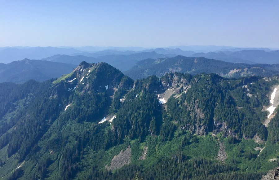
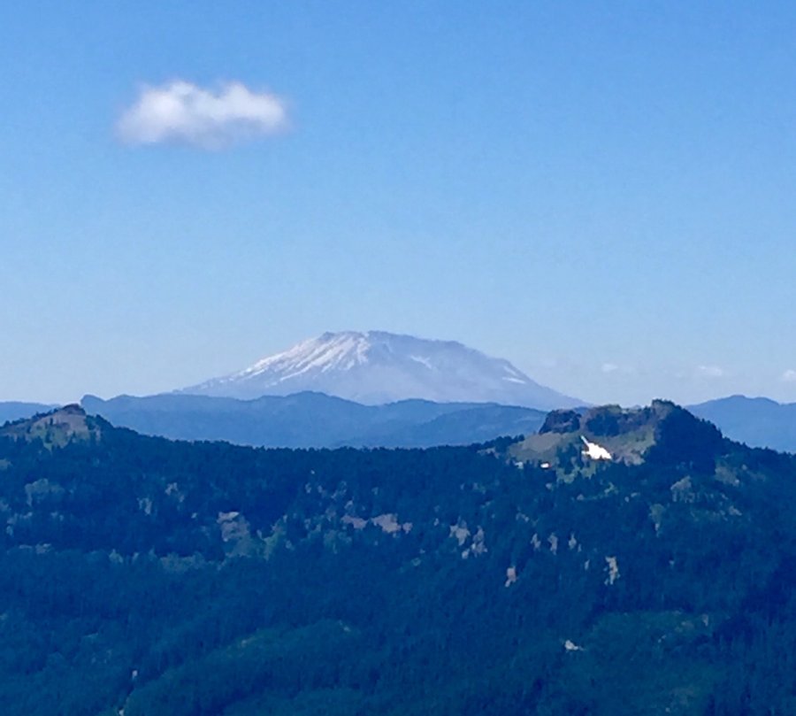
South Point Lookout Re-do
7.2 miles of hiking • 3250' elevation gain •
Trail is now snow free all the way to the summit. Very nice 360 degree views in which all the surrounding volcanoes could clearly be seen.
July 25, 2020

 2
2
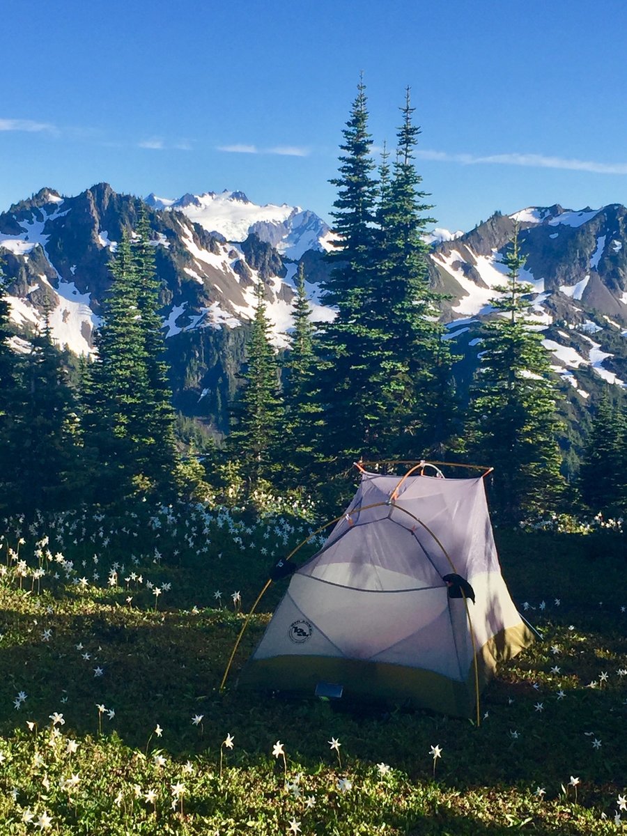
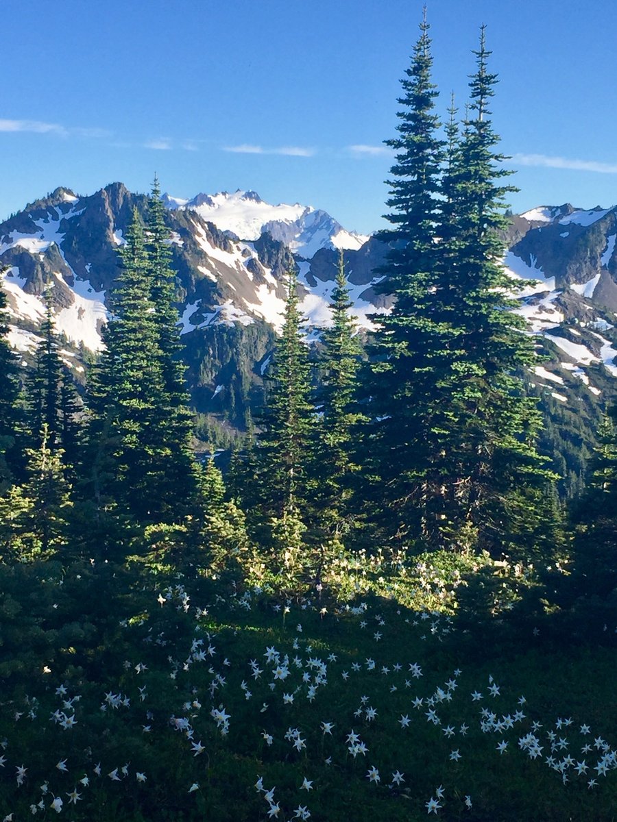
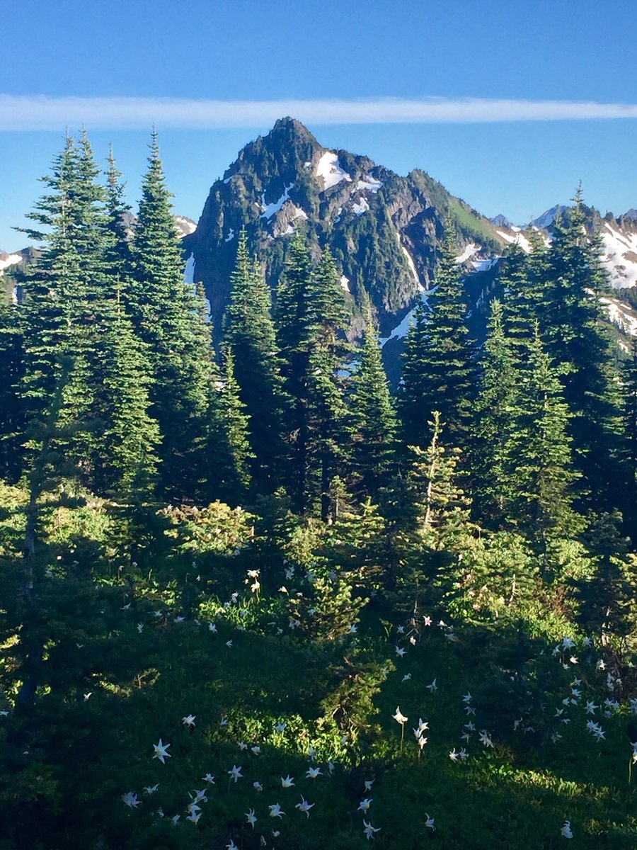
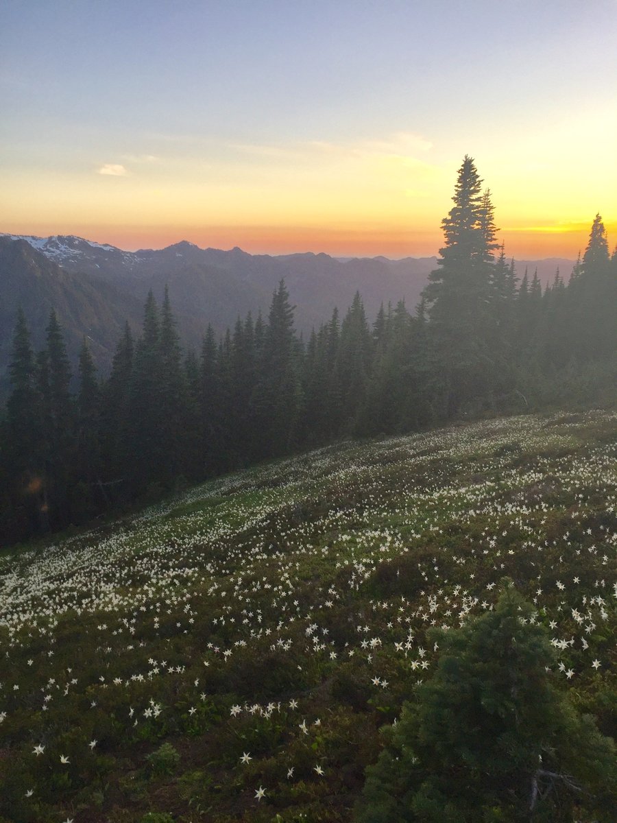
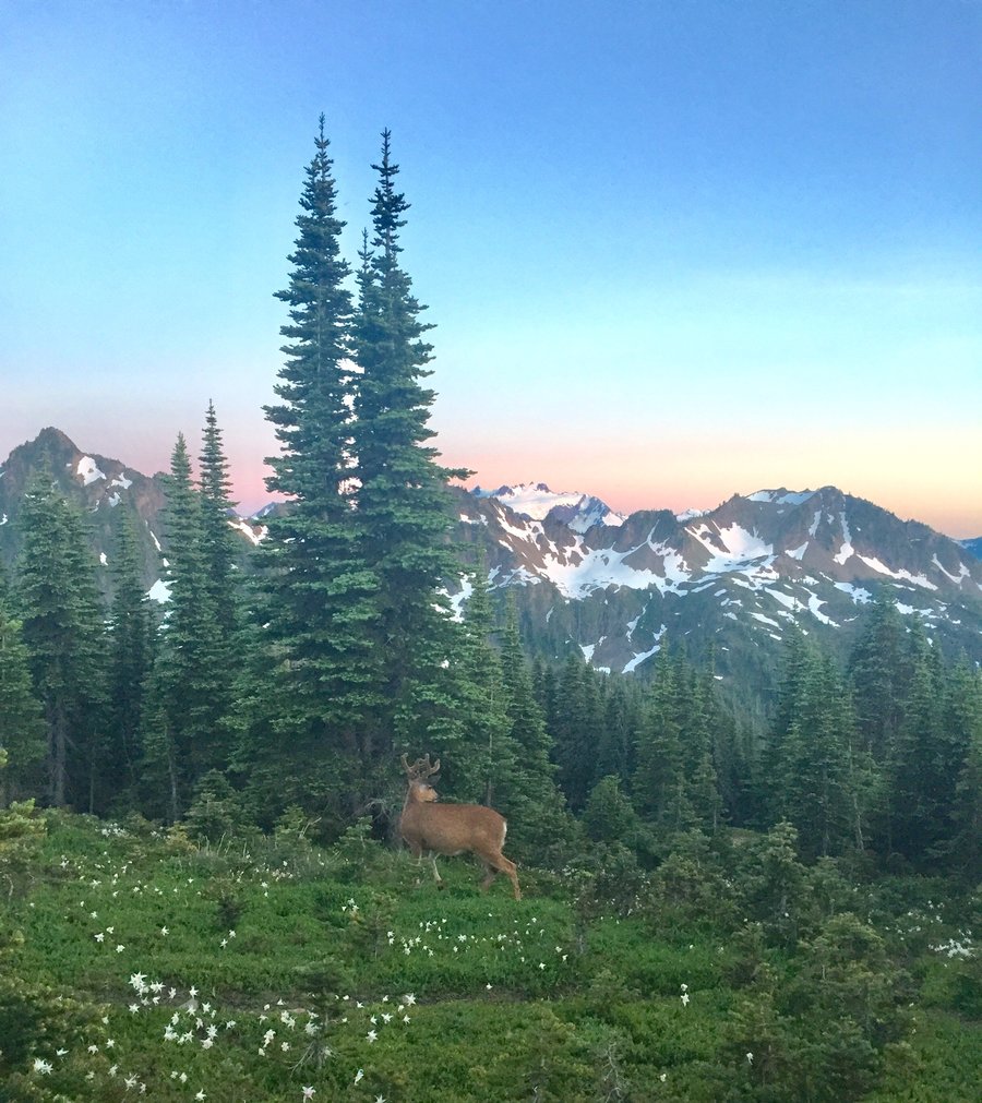
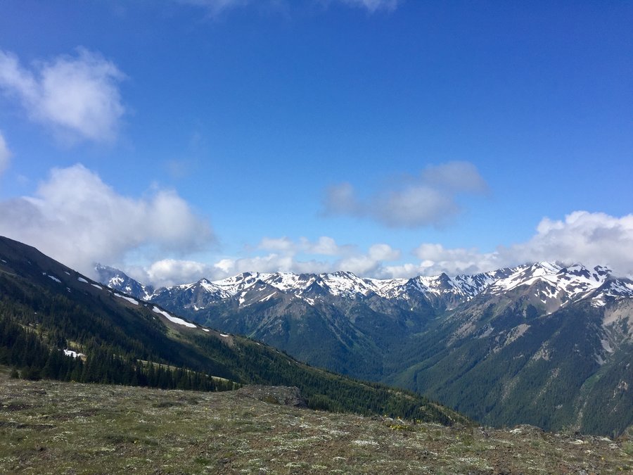
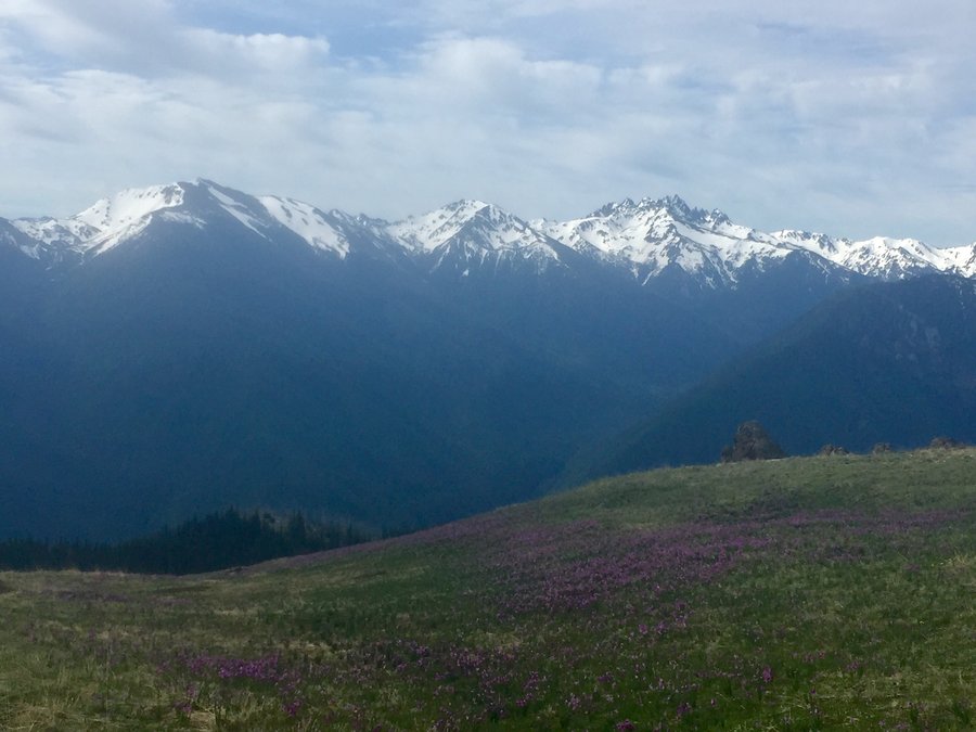
ONP--Appleton Pass
18.4 miles of hiking • 4000' elevation gain • 1 night
Timed it perfectly for this overnighter. Flowers blooming but the bugs not real bad yet. Both of the usual water sources were available. The skies were very clear with unobstructed views of Mt. Olympus & surrounding peaks. At sunset I could even catch a glimpse of the Pacific Ocean in the distance.
July 18 – July 19, 2020


 1
1
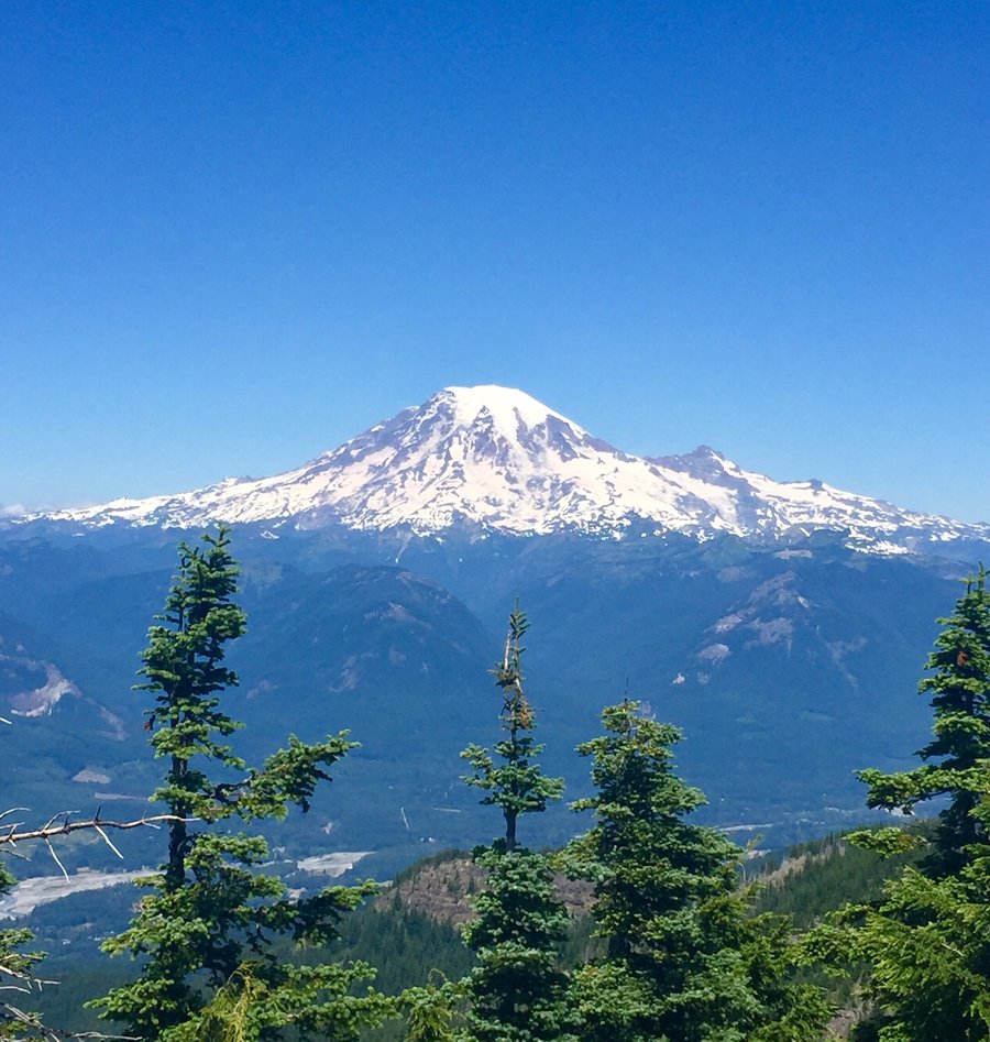
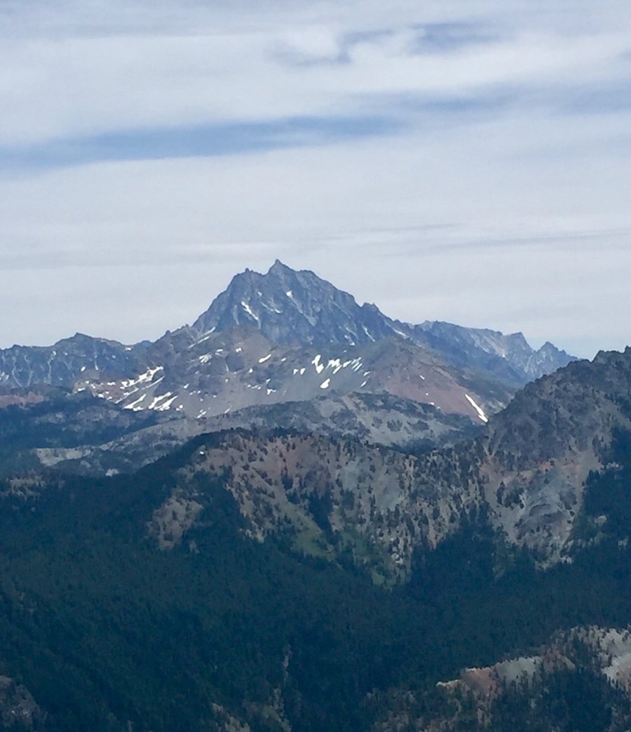
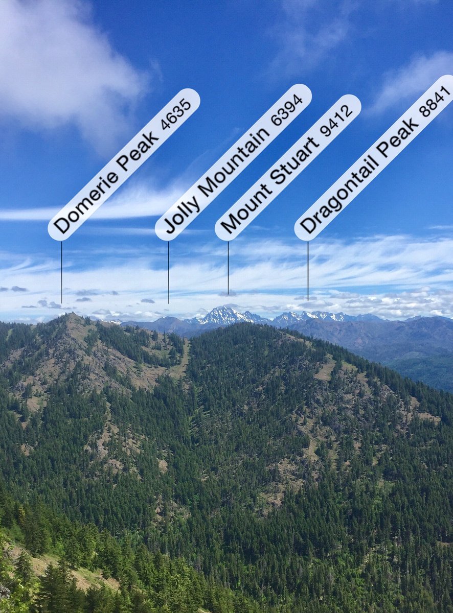
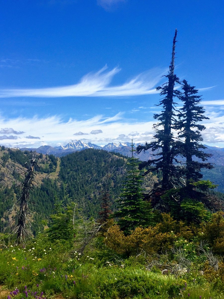
Davis Peak
10 miles of hiking • 4000' elevation gain •
Steep hike to a former lookout site. The lookout site is not the final destination as to reach Davis Peak one must hike the ridge for about a half a mile with a final scramble to the summit. Nice views of Mt. Stuart, Mt. Daniels and surrounding peaks.
July 11, 2020


 2
2
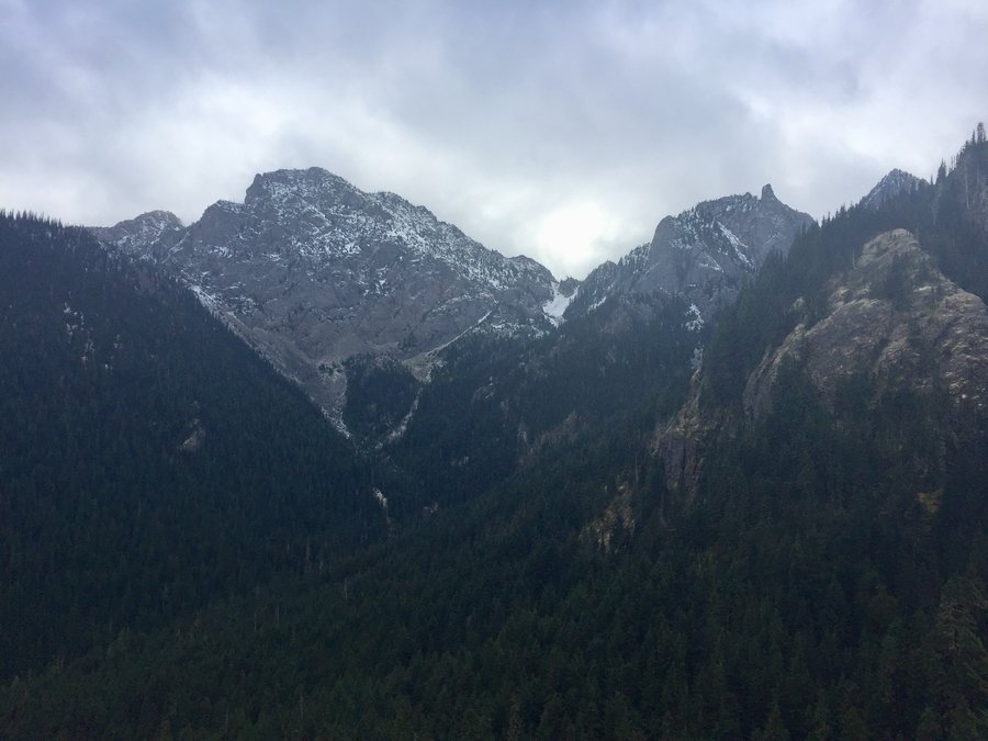
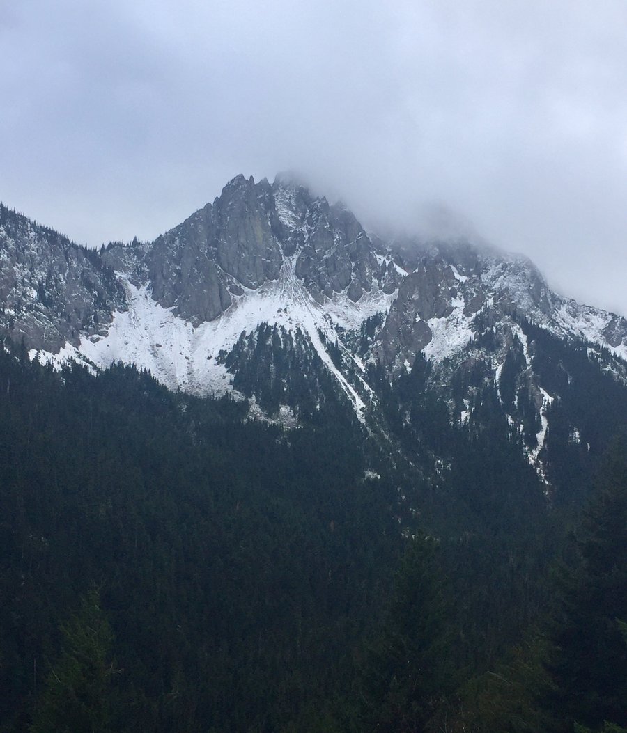
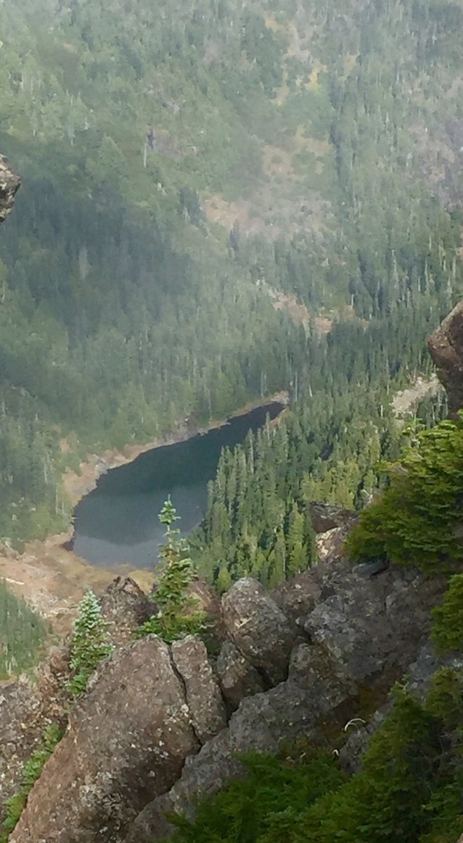
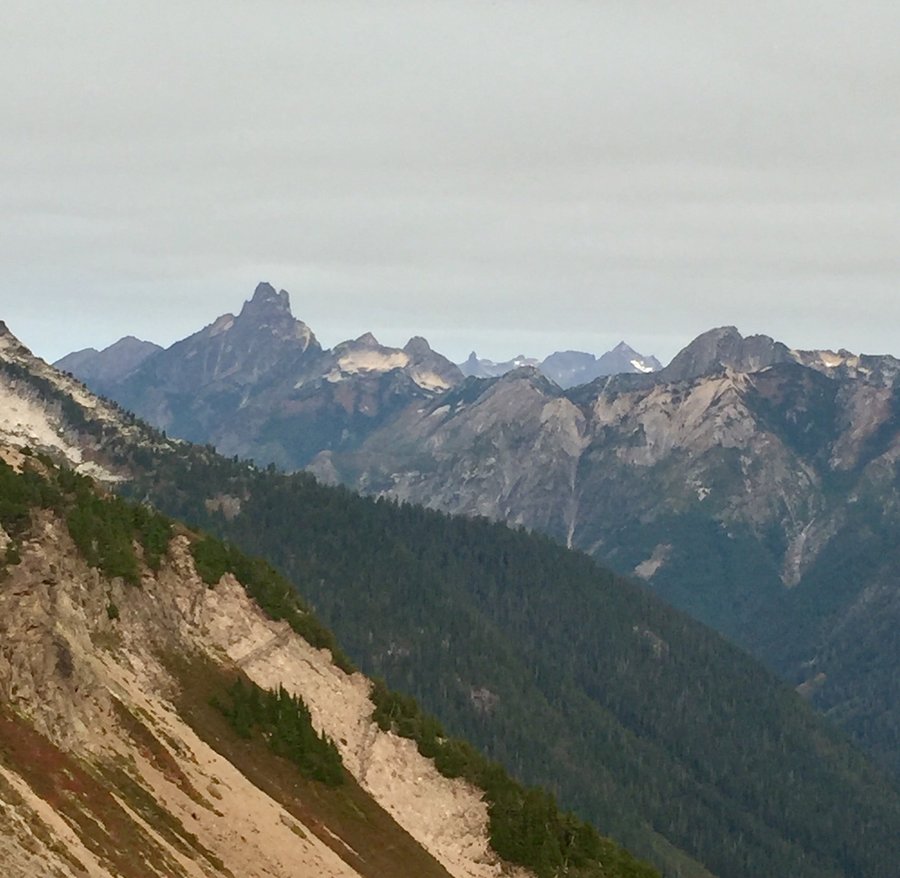
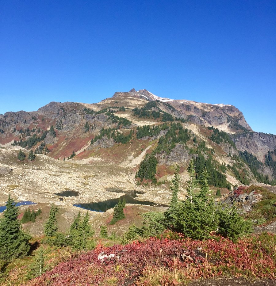
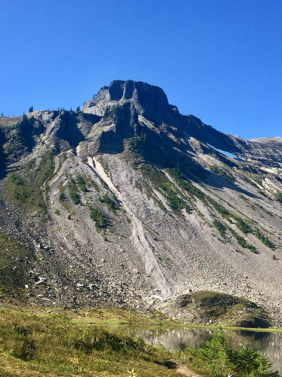
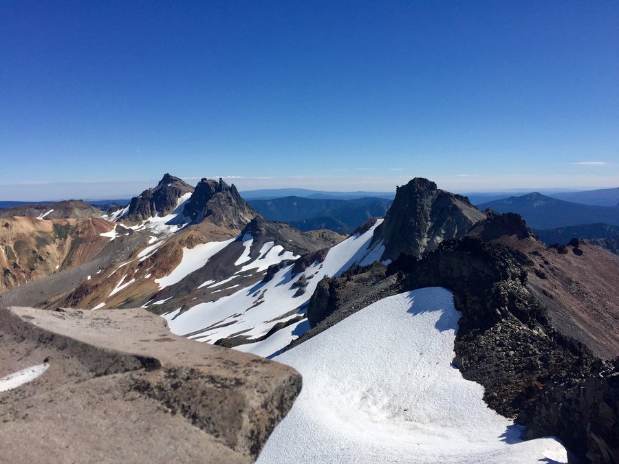
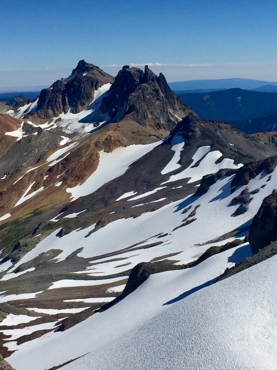
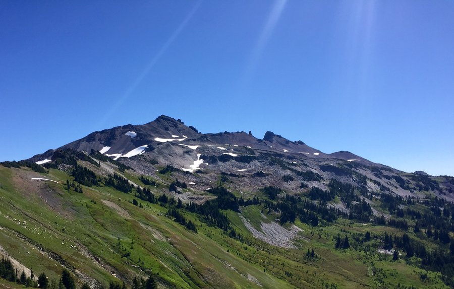
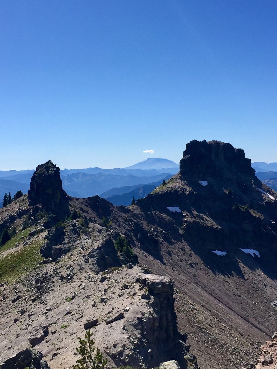
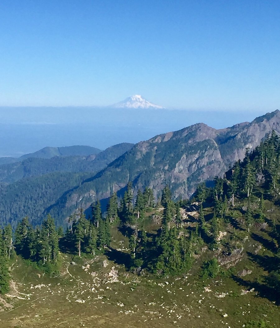
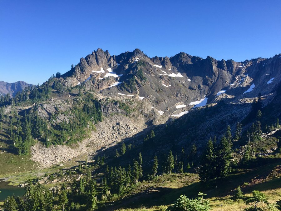
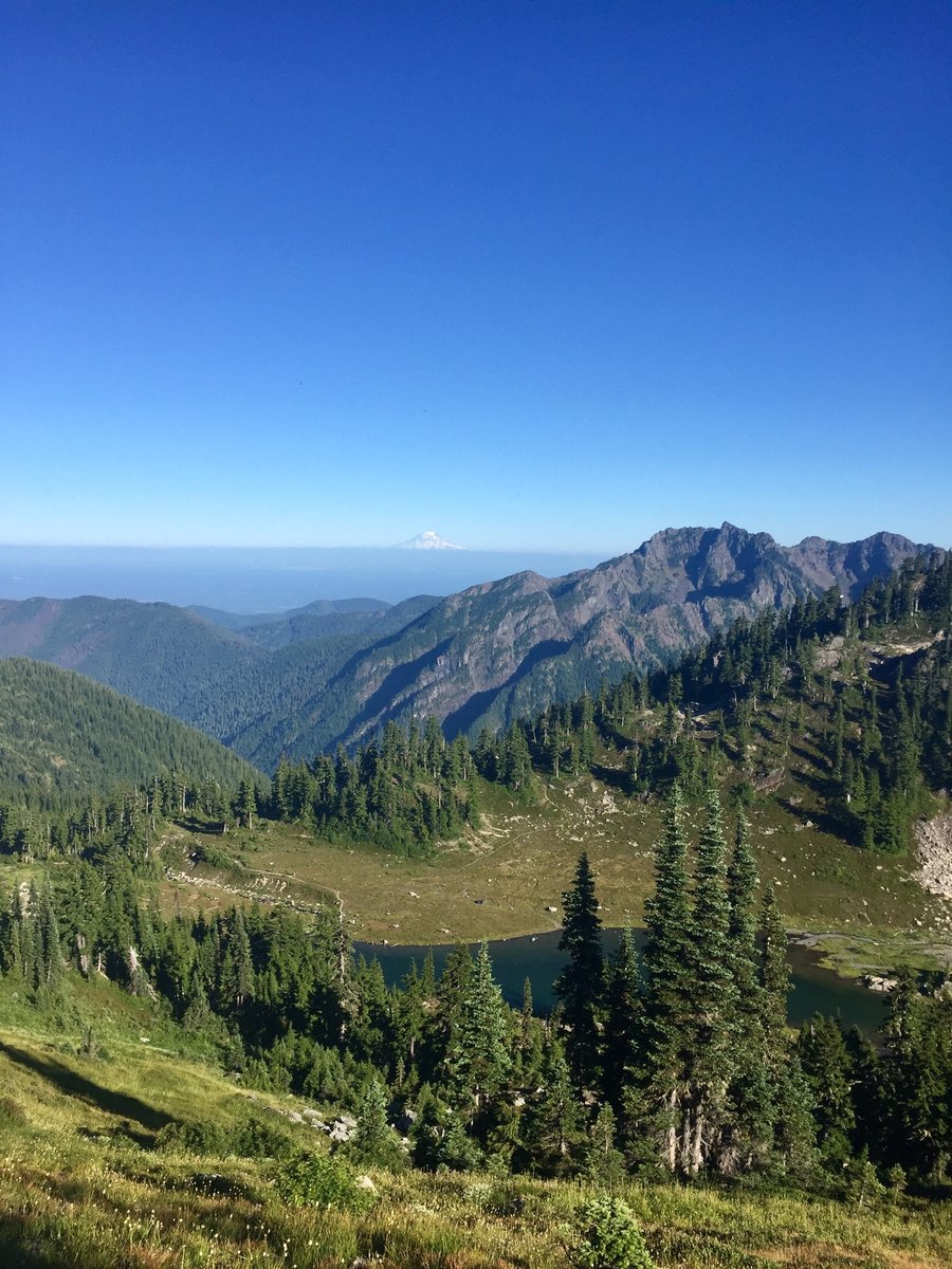
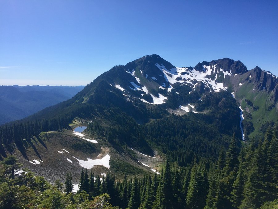
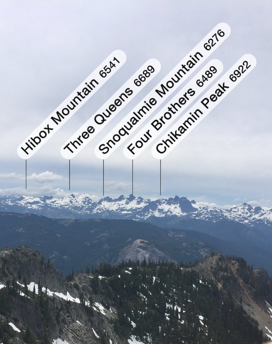
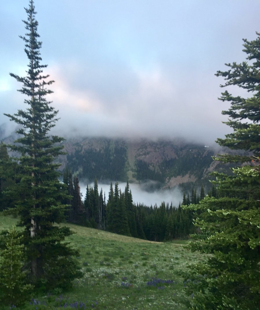
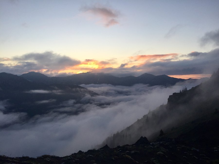
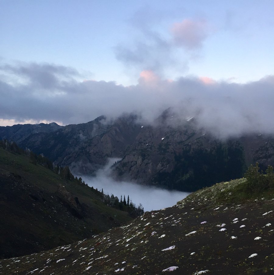
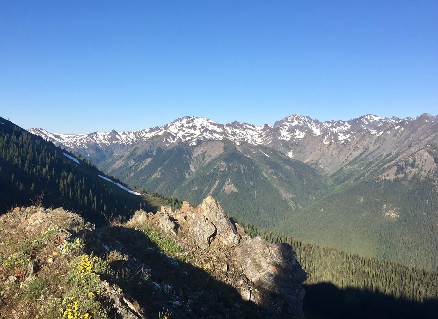
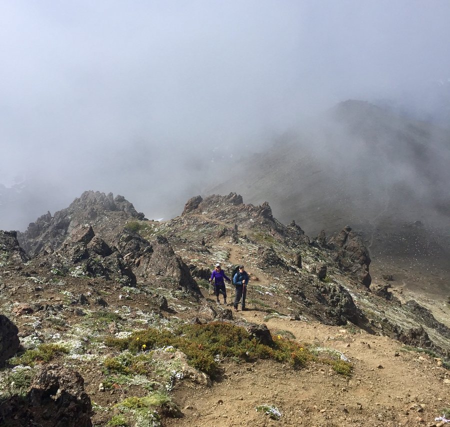
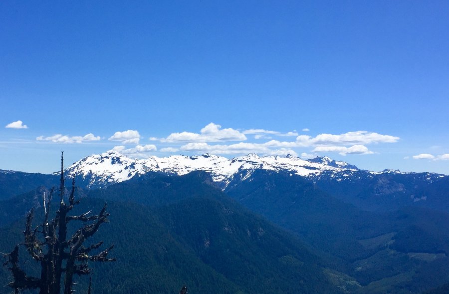
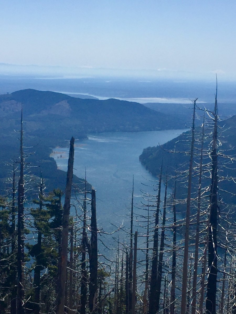
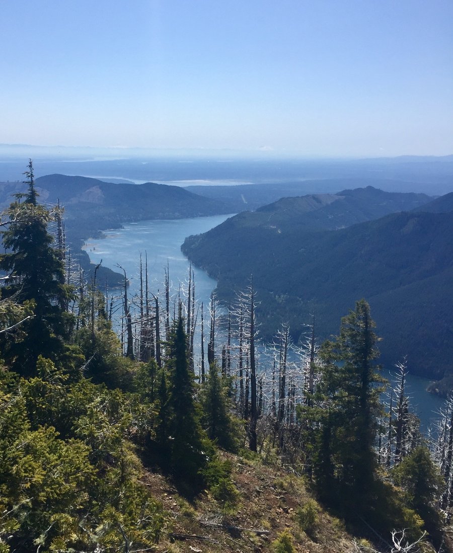
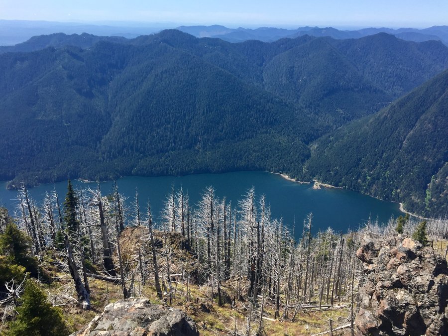
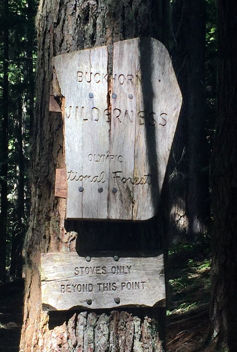
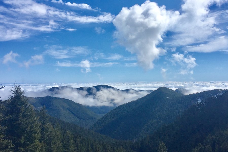
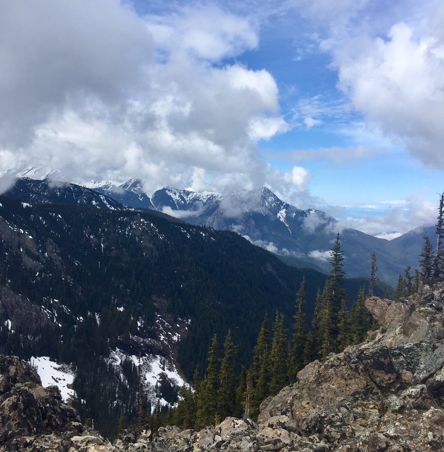
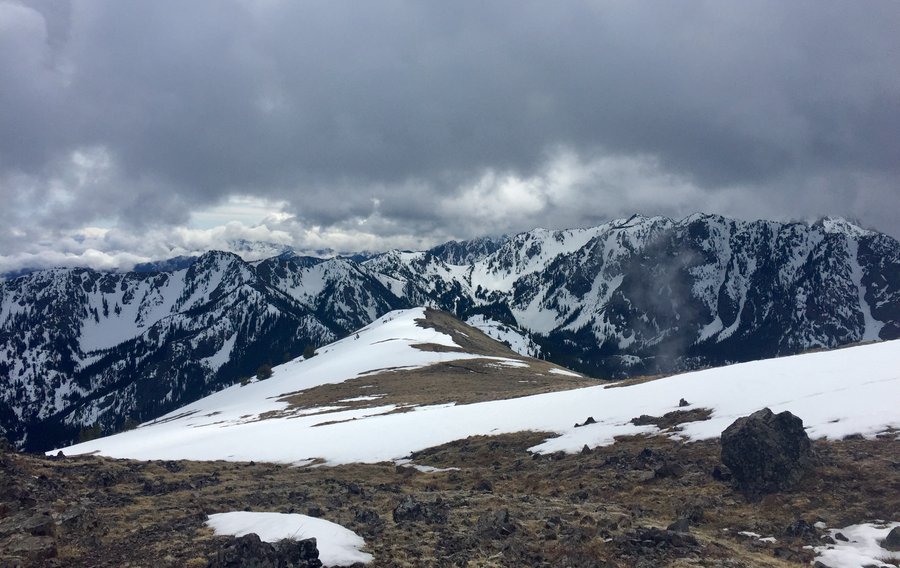
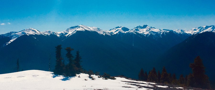
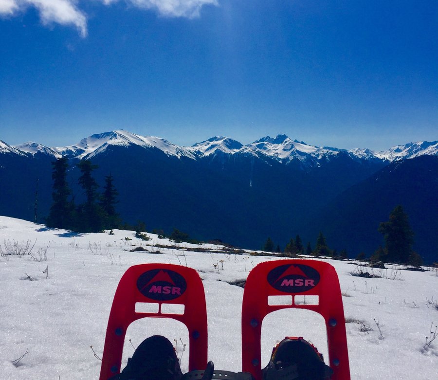
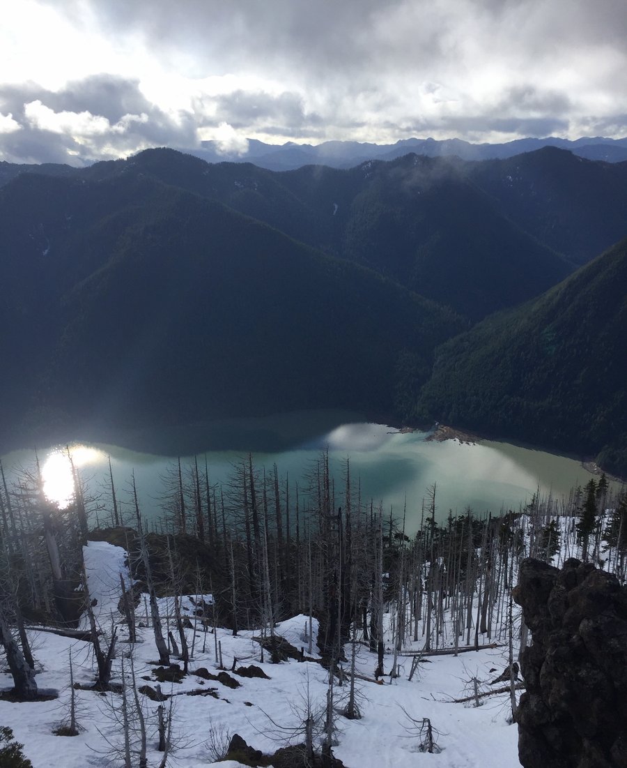
Olympics-- Buckhorn & Marmot Pass
22.2 miles of hiking • 7000' elevation gain • 2 nights
Entered via the Tubal Cain Mine TH and made base camp approximately a mile and a half past Buckhorn Lake. First day was a cloudy fog fest which limited any views. Woke up the next day to blue skies and summited Buckhorn but not before the fog began rolling in.....RATS! From there descended to Marmot Pass and then down to Camp Mystery to resupply our water... then back to base camp for a short nap and to see if the fog would lift after dinner. Which it did, HURRAY! For our dessert we then climbed the ridge to the Castle Rock Formation, watching the sunset while the fog swirled within the valley below.
July 4 – July 6, 2020


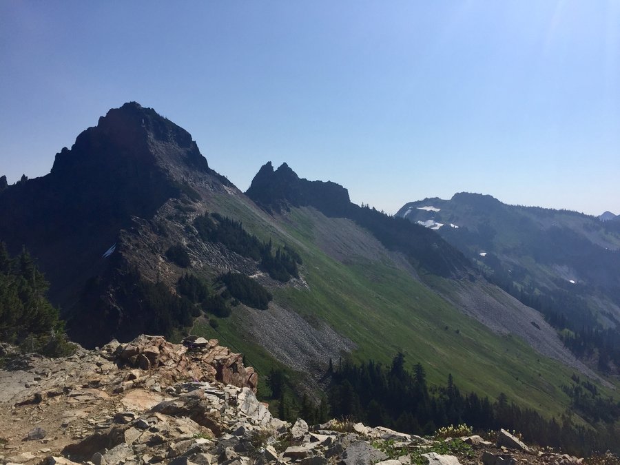
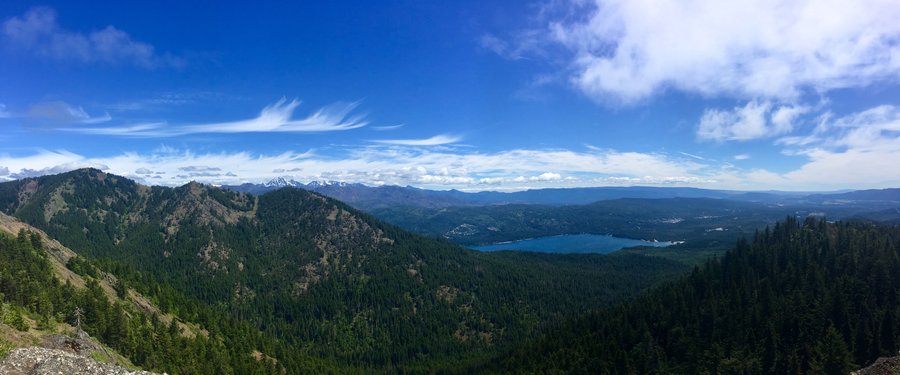
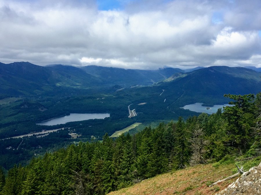
Easton Ridge
6.16 miles of hiking • 2250' elevation gain •
The majority of the elevation gain is within the first mile and a half. After that it's a nice up and down ridge hike until your reach the trails end. Nice views of the Stuart Range, Lake Kachess, Lake Easton and Cle Elum Lake from the ridge.
June 21, 2020


 2
2
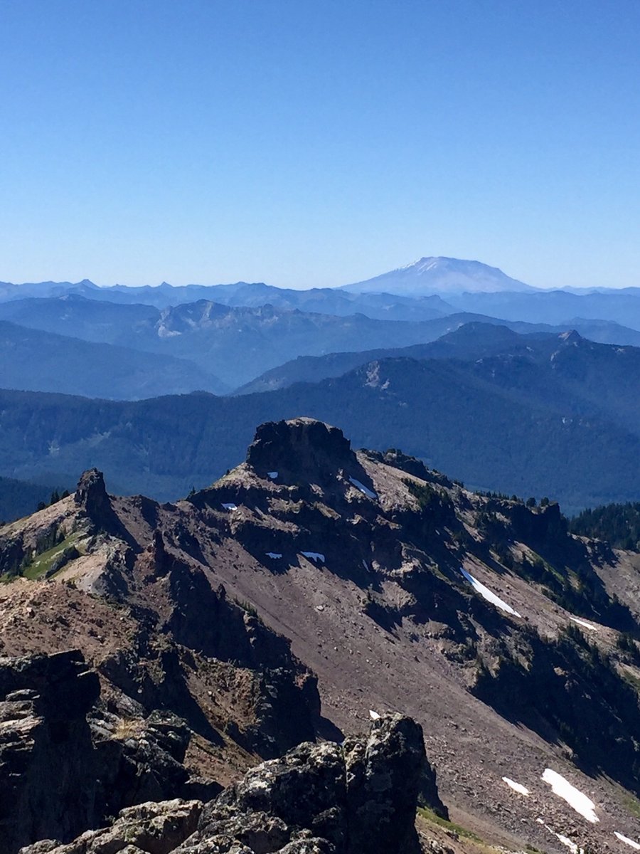
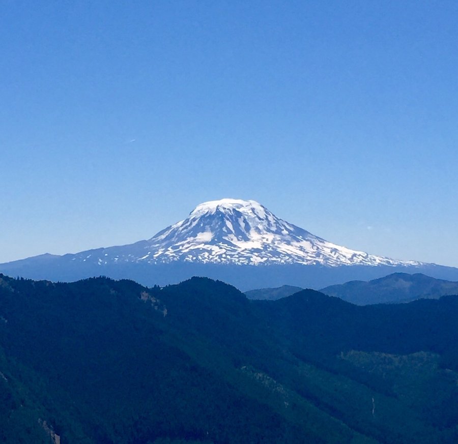
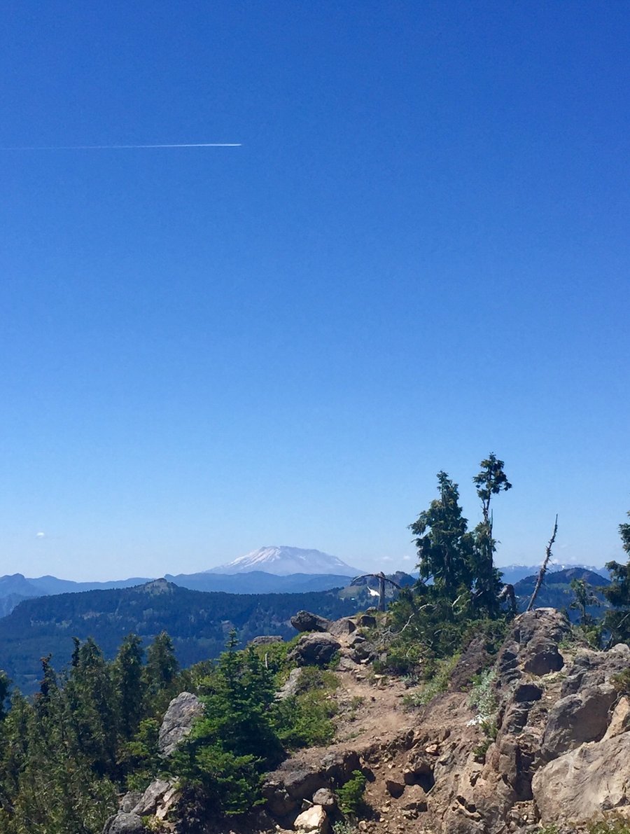
South Point Lookout
6.78 miles of hiking • 3000' elevation gain •
Trail became entirely snow covered at 5300' and that is where I donned the micro spikes. I got as far as 6000' before I had to bail a couple of 100' from the summit due to unstable snow conditions. Probably could have made it to the top if I had brought crampons and an ice axe. Oh well, live and learn. Nice views though of the Goat Rocks, Mt. Adams and Mt. Hood from the summit saddle.
June 18, 2020

 1
1
Mt. Baldy
8 miles of hiking • 3250' elevation gain •
Headed over to the east side of the pass off of I-90 to try to escape the Juneuary weather predicted for the weekend. Mostly were successful. I have never hiked this trail and it was fairly steep with a short section where you climb 1500' in one mile. Once to the top of the ridge you can see Baldy to the east and from there it is a nice up and down ridge hike to the summit. Very nice views of the Alpine Lakes Wilderness from the ridgeline and summit.
June 6, 2020


 1
1
Tiger Mountain
7.5 miles of hiking • 2750' elevation gain •
Up the High School Trail to the TMT. Then TMT to summit 3..... back to the car via Section Line.
June 4, 2020
 3
3
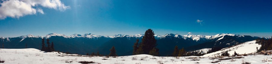
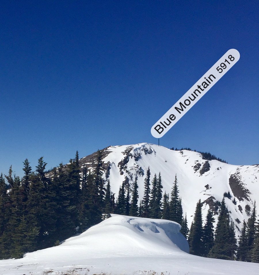
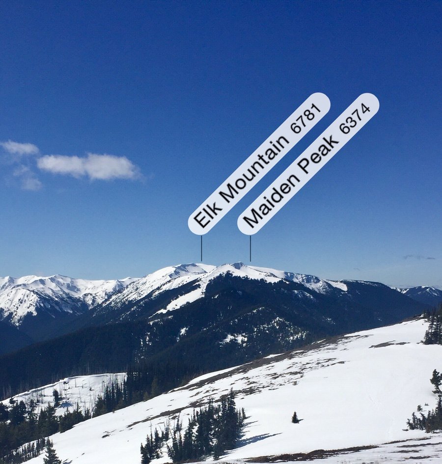
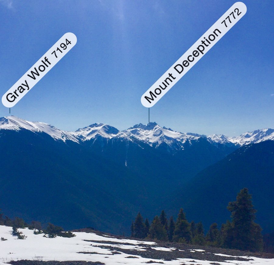
ONP--Deer Park & Blue Mtn.
12 miles of hiking • 3750' elevation gain • 1 night
This is one of my favorite spring time overnighters. The road to the Deer Park Campground remains closed so no car campers were present. It was quite nice having the campground to ourselves...….along with the 1/2 dozen curious deer.
May 29 – May 30, 2020


 2
2
Slab Camp Creek & Gray Wolf River
11.07 miles of hiking • 2500' elevation gain •
Hiked as far as the ONP boundary.
May 23, 2020

 1
1
Mt. Rainier--Carbon River
10.69 miles of hiking • 750' elevation gain •
Hiked from Mt. Rainier's Carbon River entrance as far as the Ipsut Creek Campground.
May 15, 2020
 1
1
Tiger Mountian Triple
8.12 miles of hiking • 3500' elevation gain •
Hiked to all 3 summits plus to the Hikers Hut. Nice clear views from the Hikers Hut location
May 10, 2020

 2
2
Mt. Rose
5.87 miles of hiking • 3750' elevation gain •
Was planning on climbing Mt. Ellinor but the road to the TH is gated approx. 5 miles from the lower TH so decided to hike Mt. Rose instead There is still a bit of snow approx. 1/4 past the horse camp but the final climb to the summit is snow free.
May 7, 2020


 1
1
Pt. Defiance
10 miles of hiking • 1000' elevation gain •
Decided to take a long hike at the Pt. The park will be reopening to the windshield tourists on 5/5.
May 3, 2020
 2
2
Palisades
8.96 miles of hiking • 2250' elevation gain •
I have not hiked this one in sometime and forgot how cool the first couple miles are. One hikes up a steep mossy valley with old growth Douglas Firs clinging to the rocky cliffs, with a roaring creek and a water fall thrown in for good measure. I frequently find it amazing the places where trees can grow. Hiked a bit past the 2nd view point.
April 26, 2020


 1
1
Tiger Mountain
7.5 miles of hiking • 2750' elevation gain •
Up the Section Line trail to West Summit 3, then traversed to the High School Trial using the TMT. Descended via the HS Trail.
April 24, 2020
 1
1
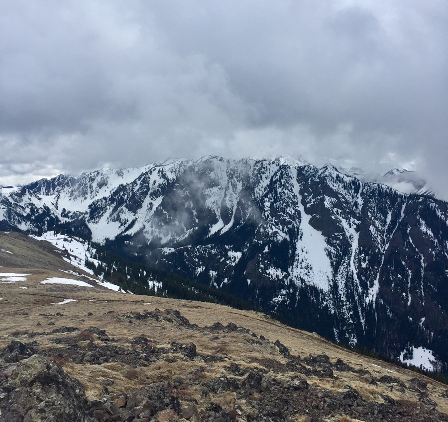
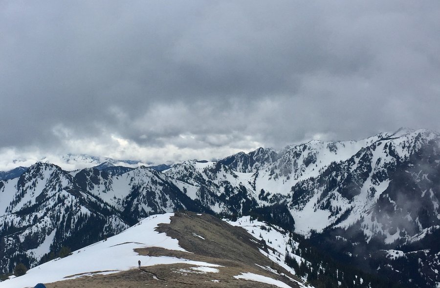
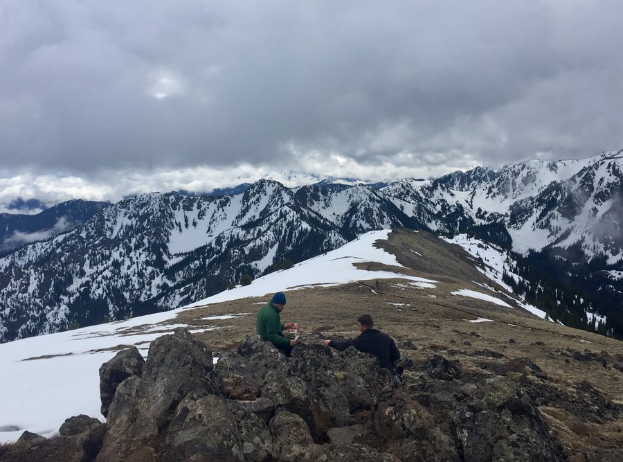
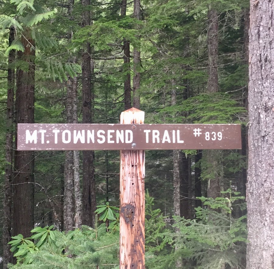
Mt. Townsend
9.2 miles of hiking • 3250' elevation gain •
Parked about a mile from the upper TH due to snow remaining on the roadway. There are varying routes and boot paths to the summit so this time of year its a good idea to have a GPS to refer to. Glissade a fair distance down the mountain on the descent.
April 19, 2020


 1
1
Up the Dosewallips
15.6 miles of hiking • 3000' elevation gain • 1 night
Hiked a couple miles past the decommissioned National Park Campground/Ranger Station and spent the night at Dose Forks Camp. There were a few people camping at the old campground but I had Dose Forks all to myself.
April 10 – April 11, 2020


 1
1
April 4, 2020

 1
1
Big Creek
8.39 miles of hiking • 2250' elevation gain •
Hiked from the Big Creek TH up to the Mt. Ellinor lower TH. Zero snow on the trail but the lower TH parking area still has snow. It is drivable if you have the right vehicle..... which was evident by the 3 high clearance SUV's parked there.
March 29, 2020

 1
1
Pt. Defiance
5.2 miles of hiking • 500' elevation gain •
With the park now closed to car traffic and one having to hike in to get to the trails it is eerily quite at PD.
March 28, 2020
 1
1
Tiger Mtn.
5.39 miles of hiking • 2500' elevation gain •
Section Line Trail to West Tiger Summit 3. More snow at the summit then expected.
March 25, 2020


 1
1
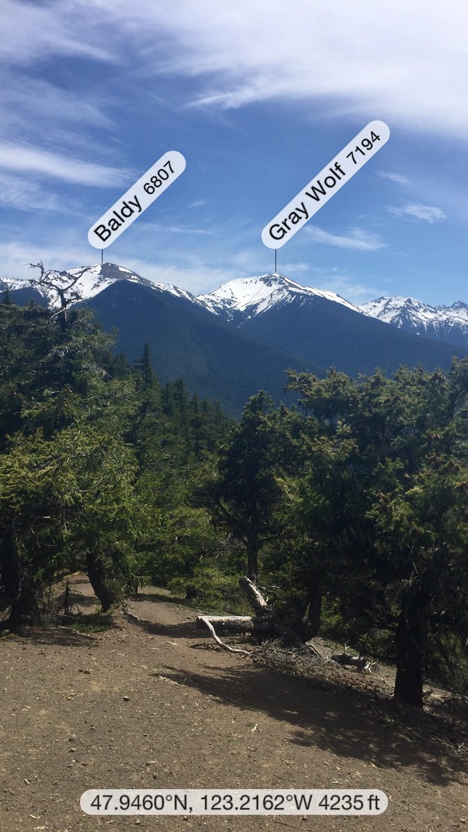
Deer Ridge--ONP
8.32 miles of hiking • 3250' elevation gain •
Bluebird day in the Olympics. Hiked the ridge to the viewpoint which is at 5600'.
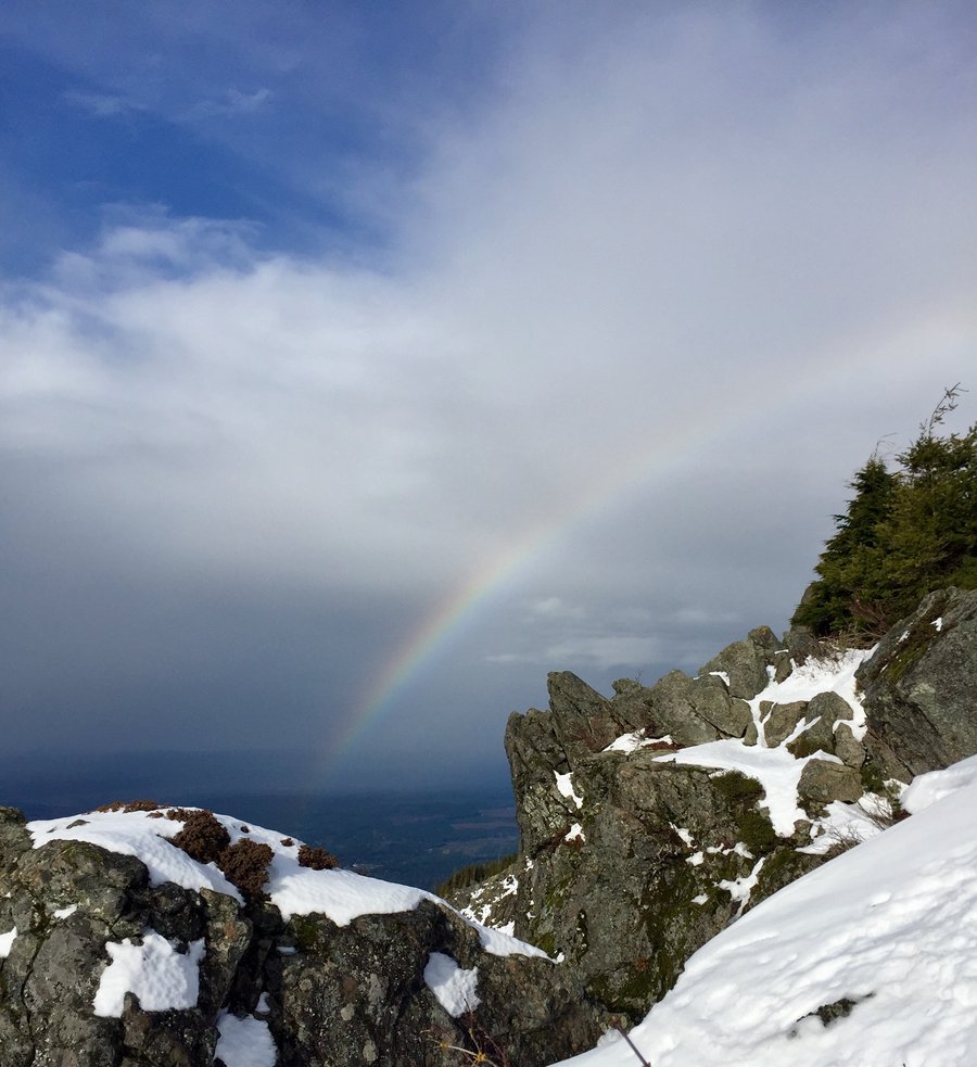
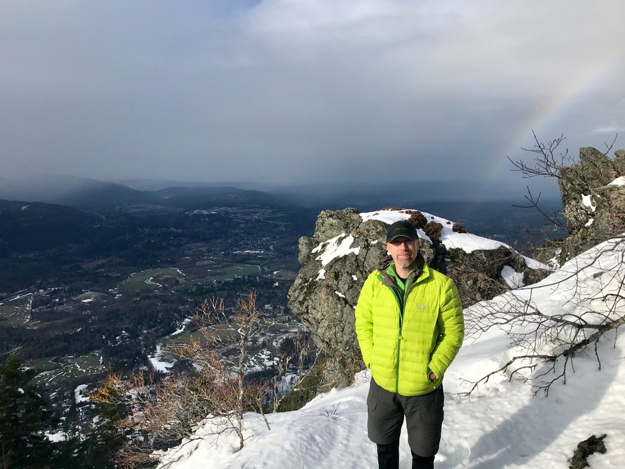
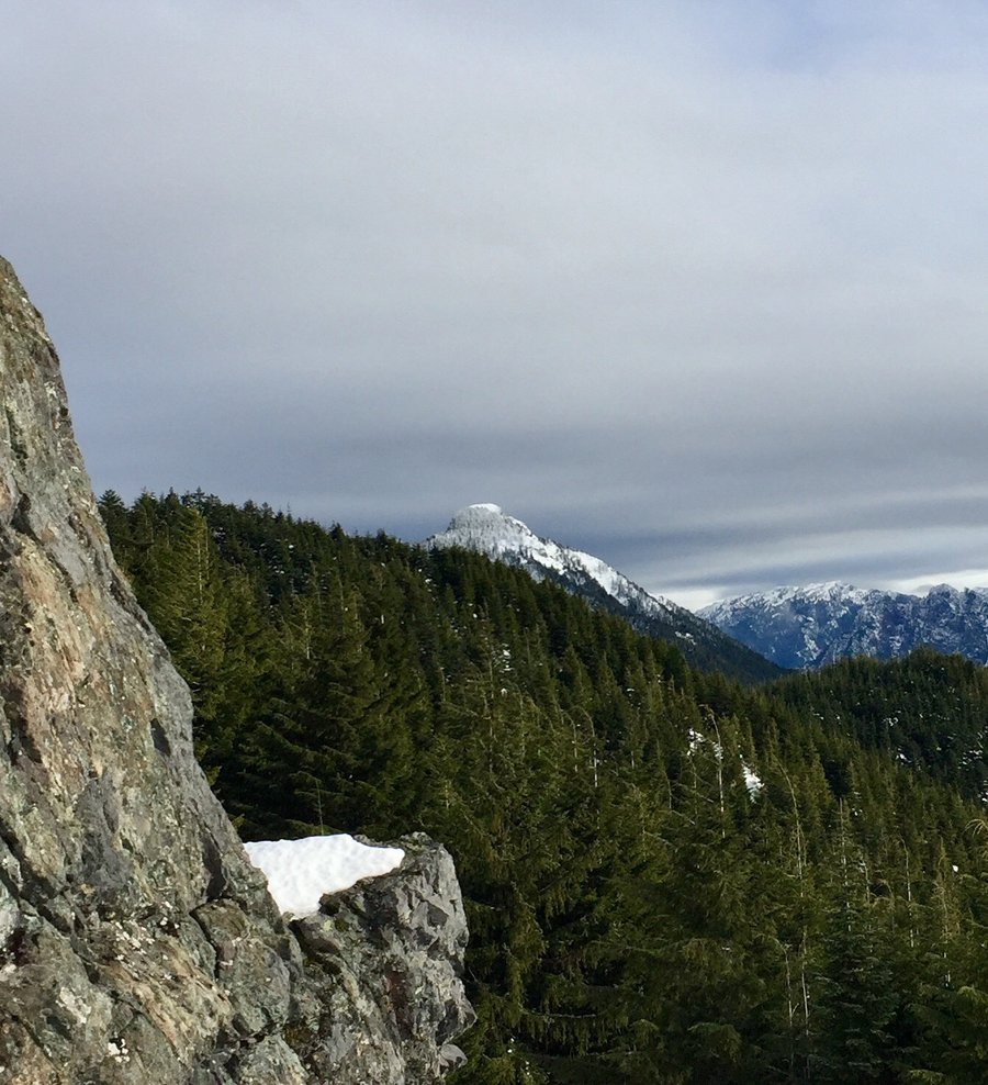
March 21, 2020


 1
1
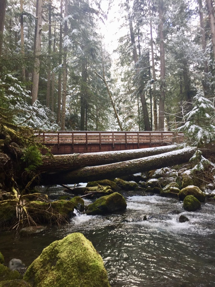
Pack Forest
6.18 miles of hiking • 1500' elevation gain •
Hiked the Hugo Peak Trail, Trail of the Giants and the Windy Ridge Trail.
March 19, 2020
 2
2
Mt. Teneriffe
8.52 miles of hiking • 4000' elevation gain •
Hiked to the falls and then took the Kamikaze trail up to Teneriffe's 4738' summit.
March 15, 2020


 1
1
Notch Pass to Big Quilcene River
10.26 miles of hiking • 3000' elevation gain •
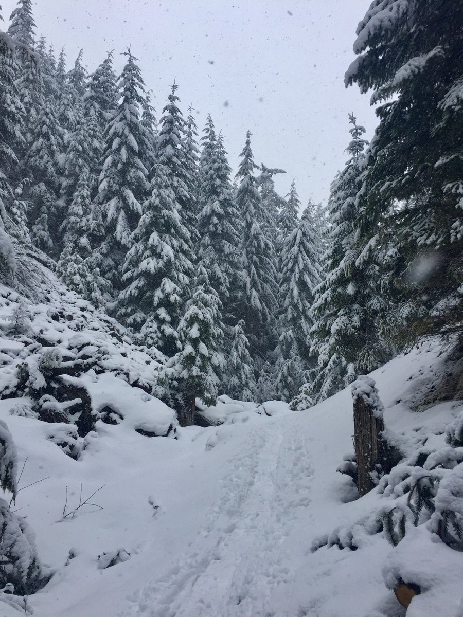
Quite a bit a snow at the top of the pass which is at around the 2500' mark.
March 8, 2020

 1
1
Elbo Creek Trail to Buck Mountain
9.21 miles of hiking • 3000' elevation gain •
Elbo Creek Trail is snow free all the way to the forest service road. Once you hit the road the snow was pretty much present most of the way to the 3700' summit of Buck Mtn. I used snow shoes but my partner just booted his way up to the top. No views from the summit....was cold, windy and foggy.
March 1, 2020


 1
1
Pinnacle Peak
5.89 miles of hiking • 2500' elevation gain •
Up and down several times for conditioning.
February 22, 2020

 1
1
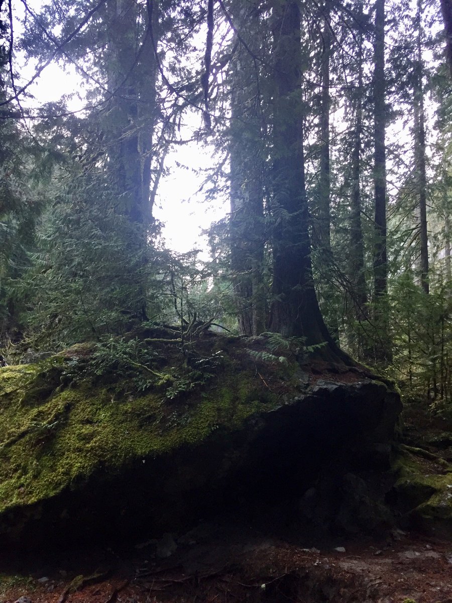
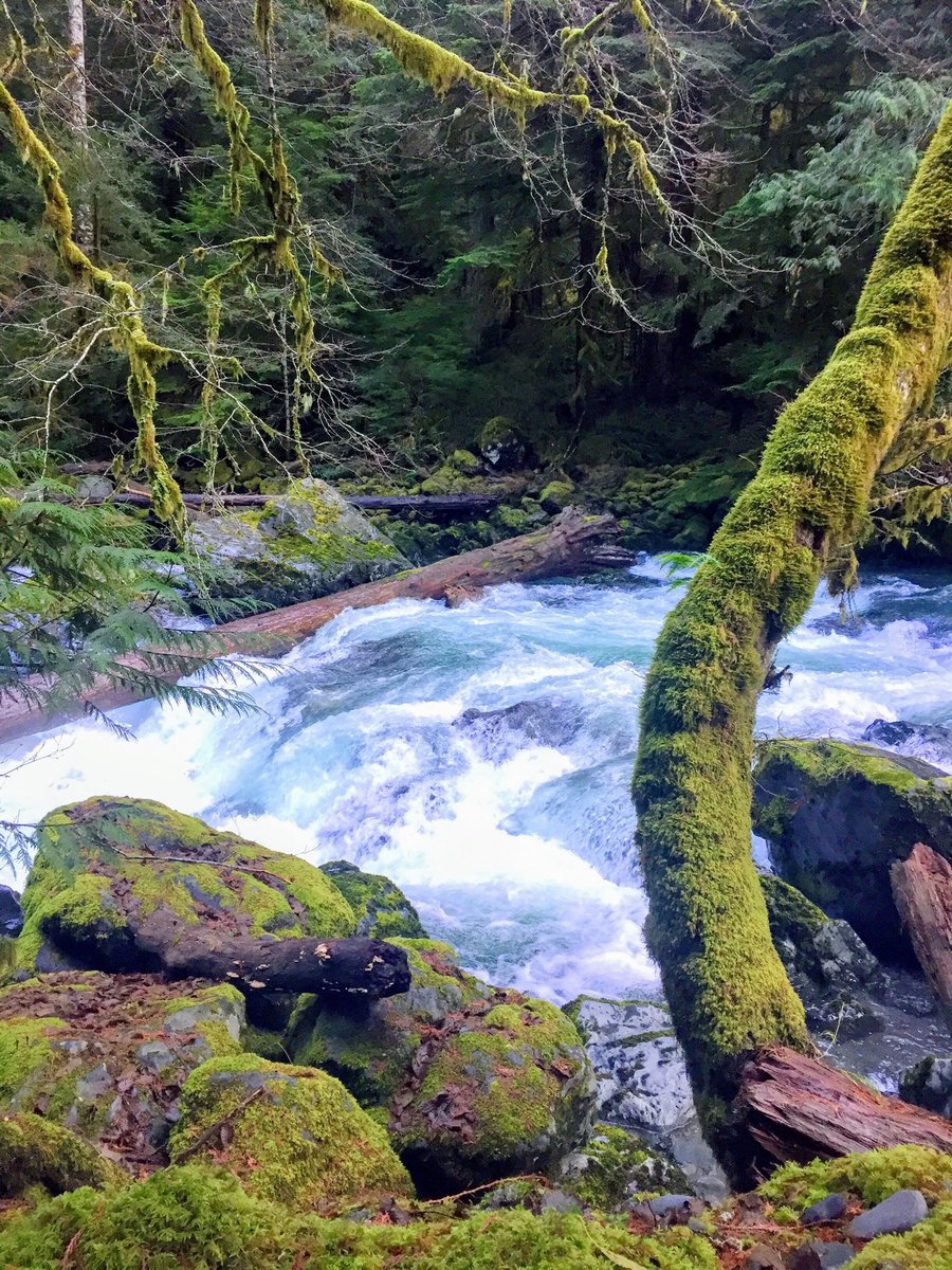
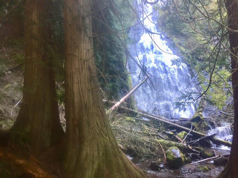
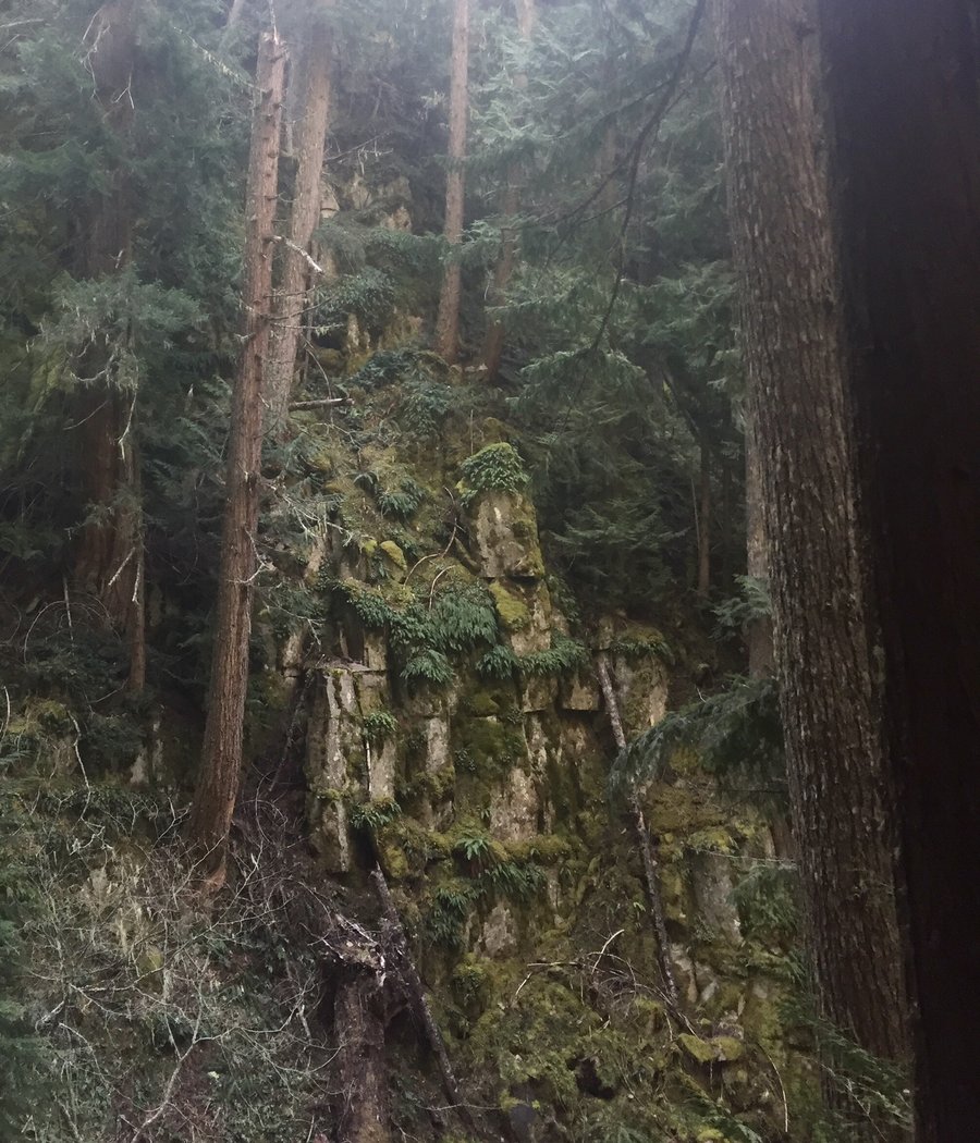
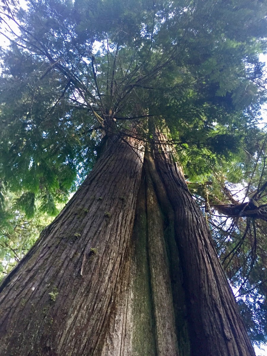
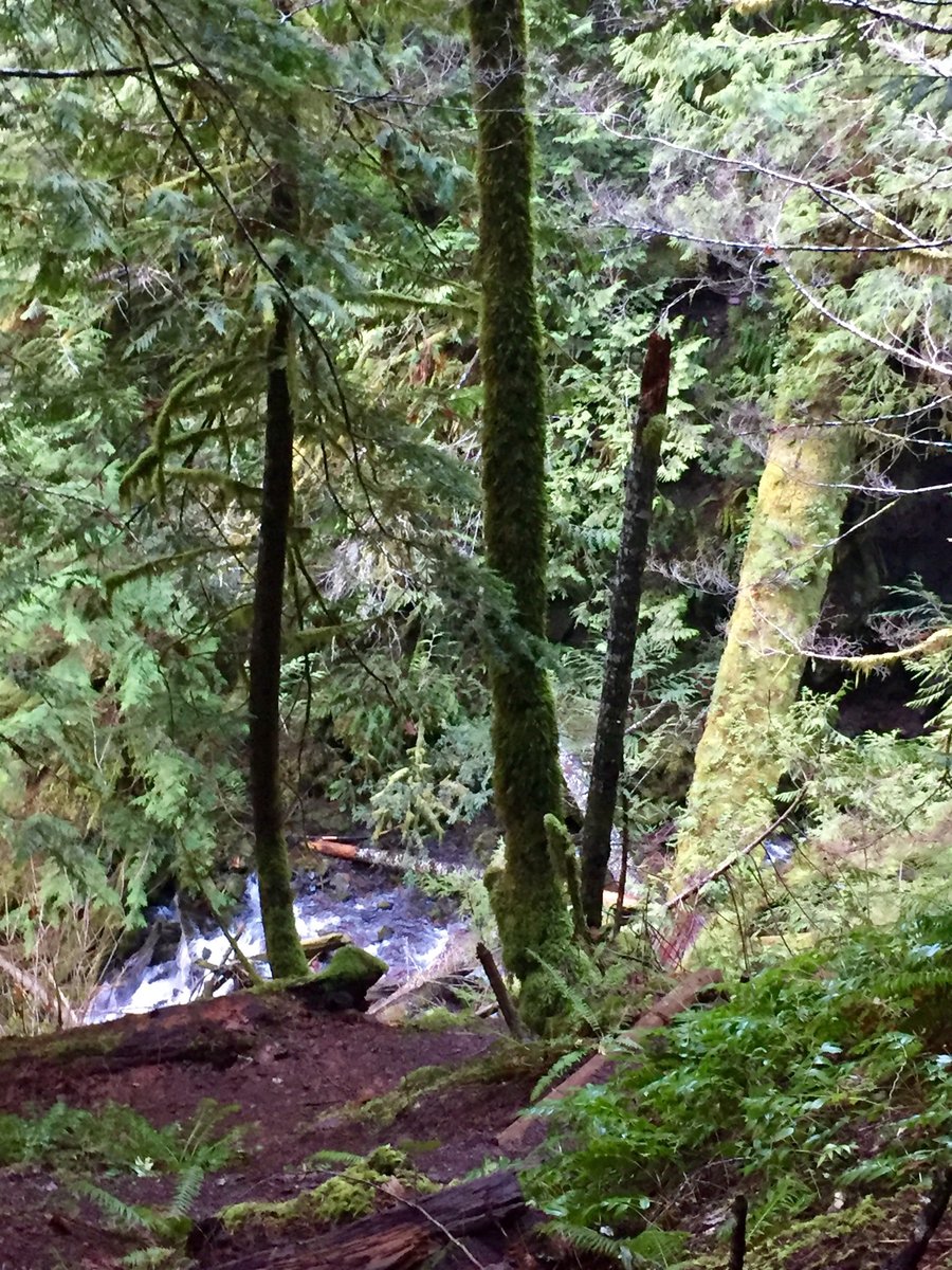
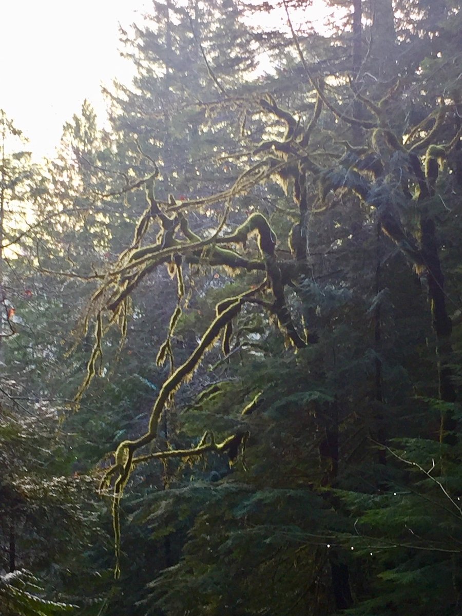
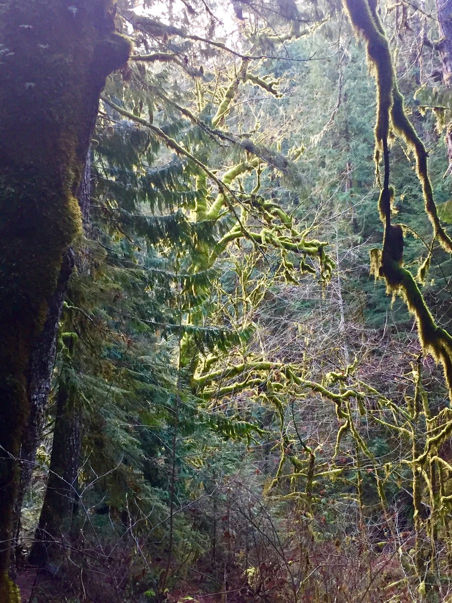
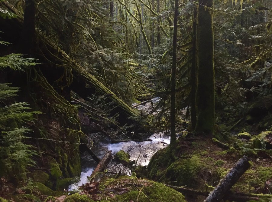
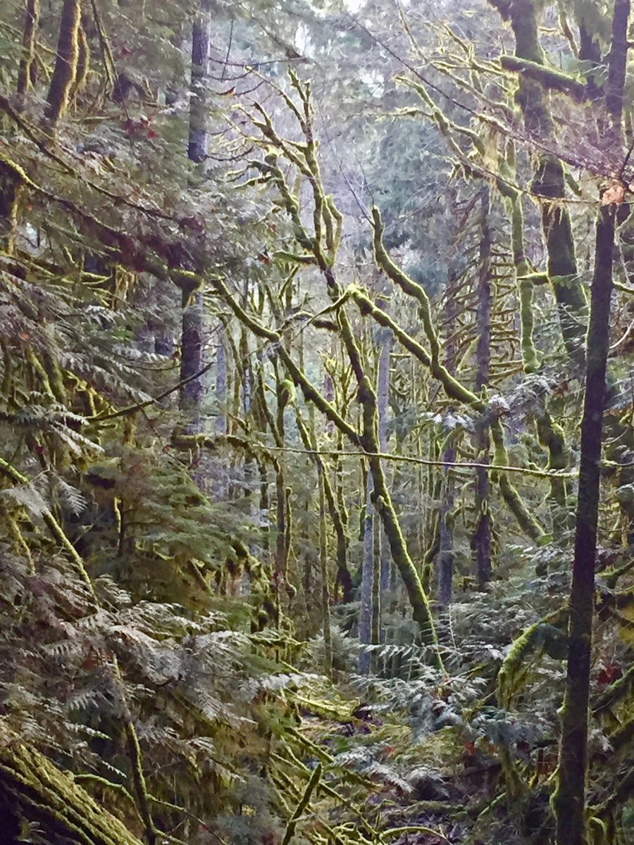
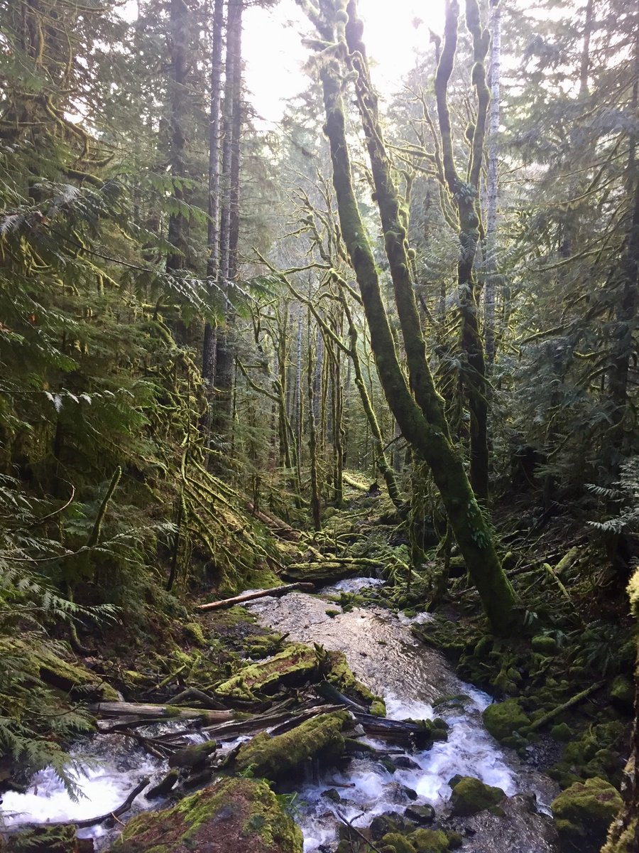
Copper Creek Canyon
5.56 miles of hiking • 2500' elevation gain •
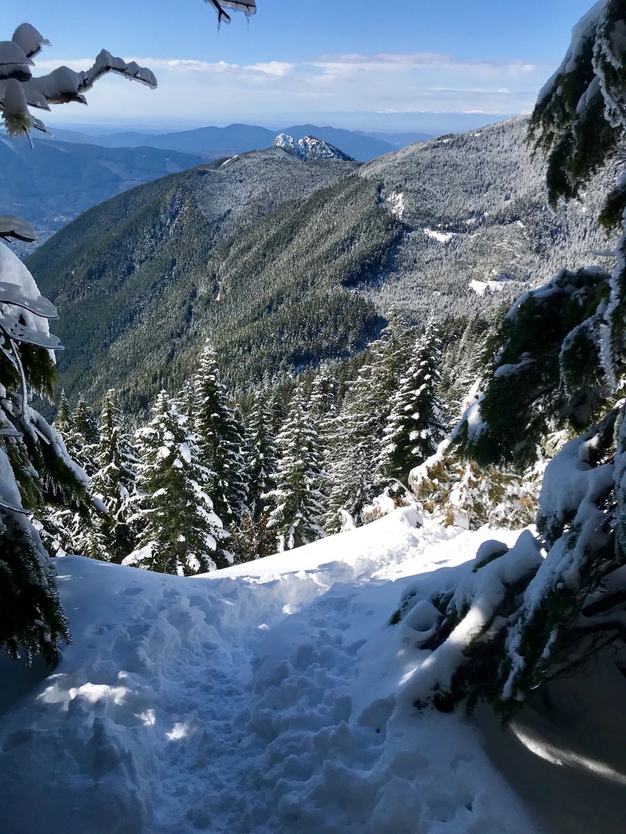
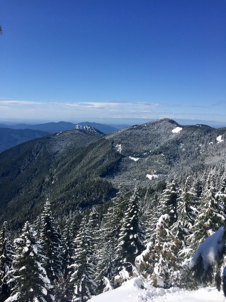
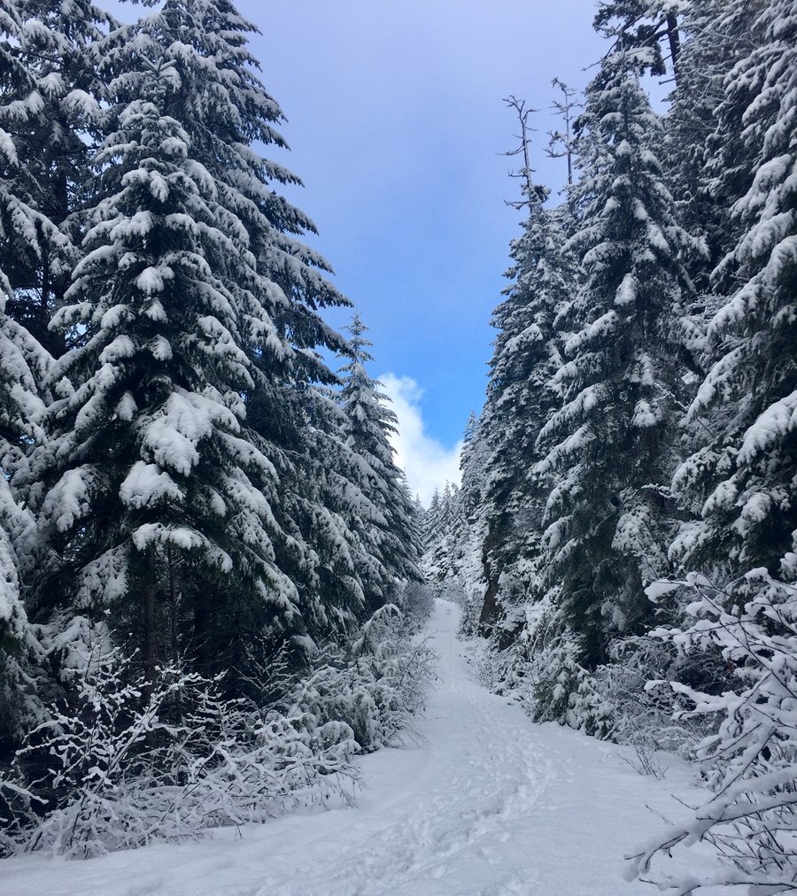
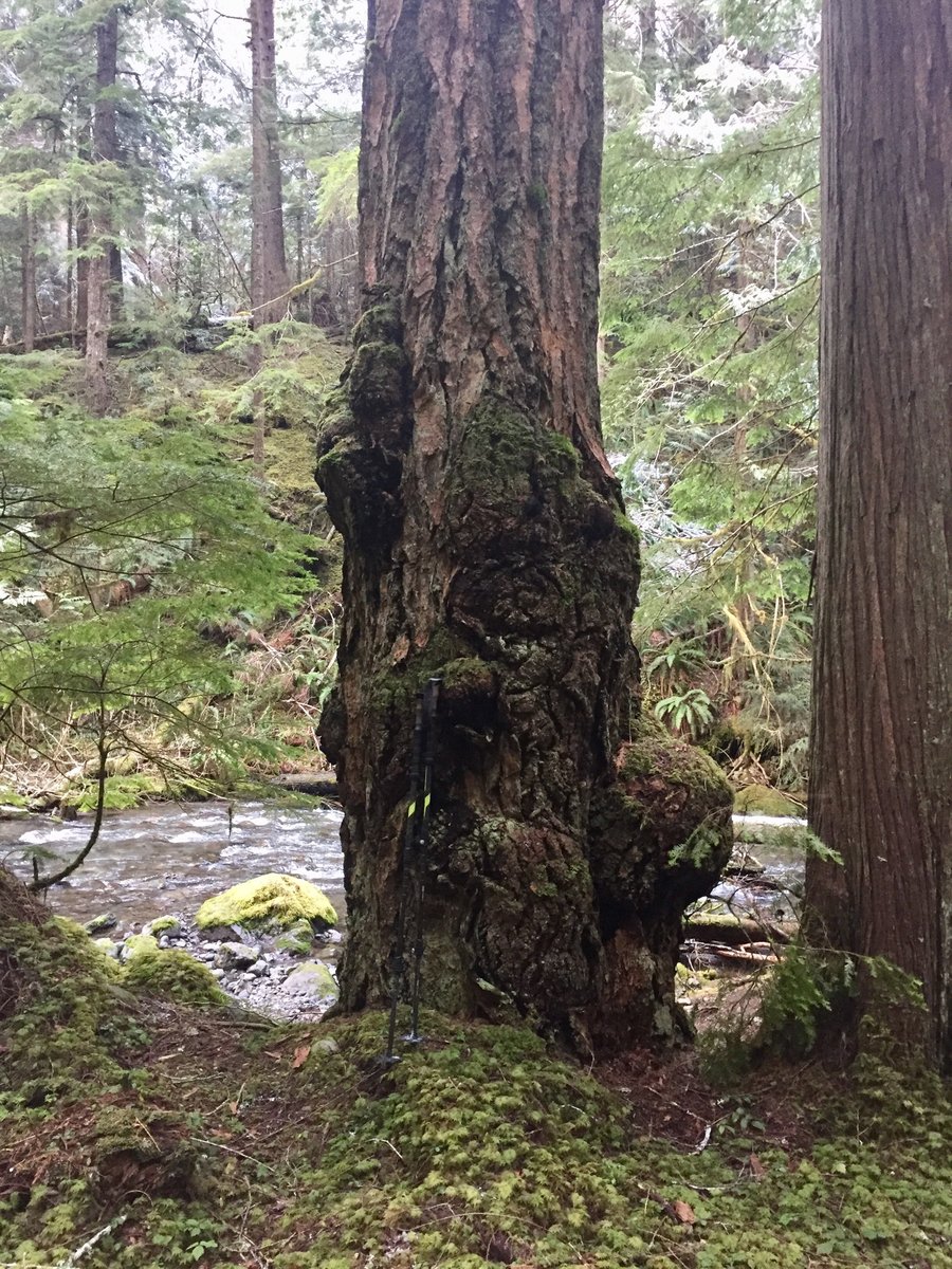
Compared to nearby Mt. Rose and Mt. Ellinor this is a less hiked trail, probably due to its steepness and limited views. The first mile, to mile and 1/2, is really pretty awesome if you like big trees, lotsa moss and a crashing, roaring creek. It feels like you are traveling within a forest from Lord of the Rings.... with towering moss covered rocks/trees and some of the largest old growth cedar and Douglas fir trees in the Skokomish Valley. Snow began at around the 1.5 mile mark and from there it took a bit of route finding & trail breaking to get to the ridge which is at 3200'.
February 8, 2020


 1
1
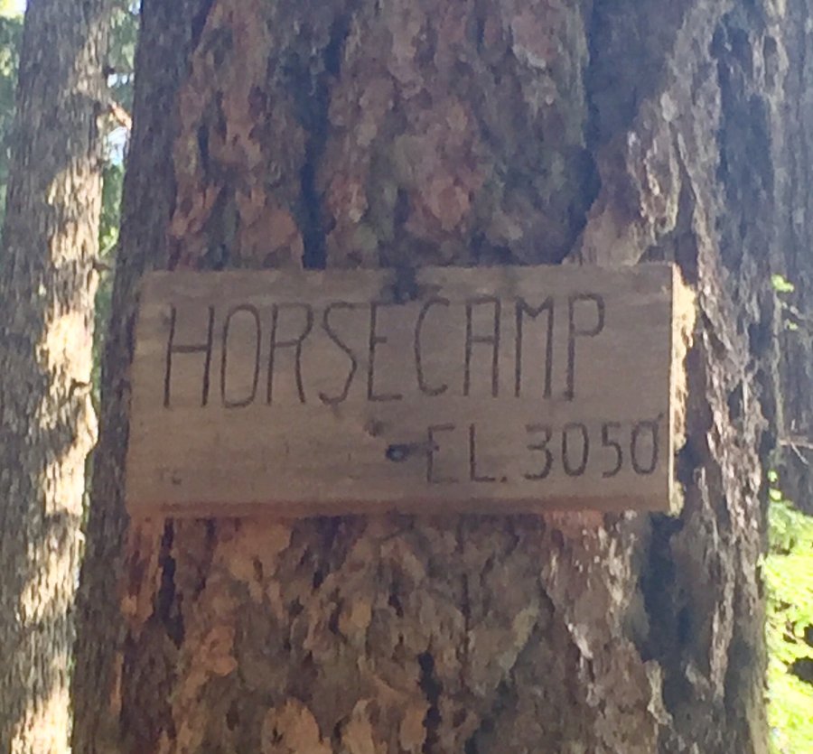
Mt. Rose
6.77 miles of hiking • 3500' elevation gain •
Snow began around the "Horse Camp" area and that's where I put on the microspikes. Fairly clear boot path to the summit.
February 2, 2020


 1
1
Pt. Defiance
4.91 miles of hiking • 500' elevation gain •
Trails extremely muddy. Dog loved it....me not so much.
January 26, 2020
 1
1
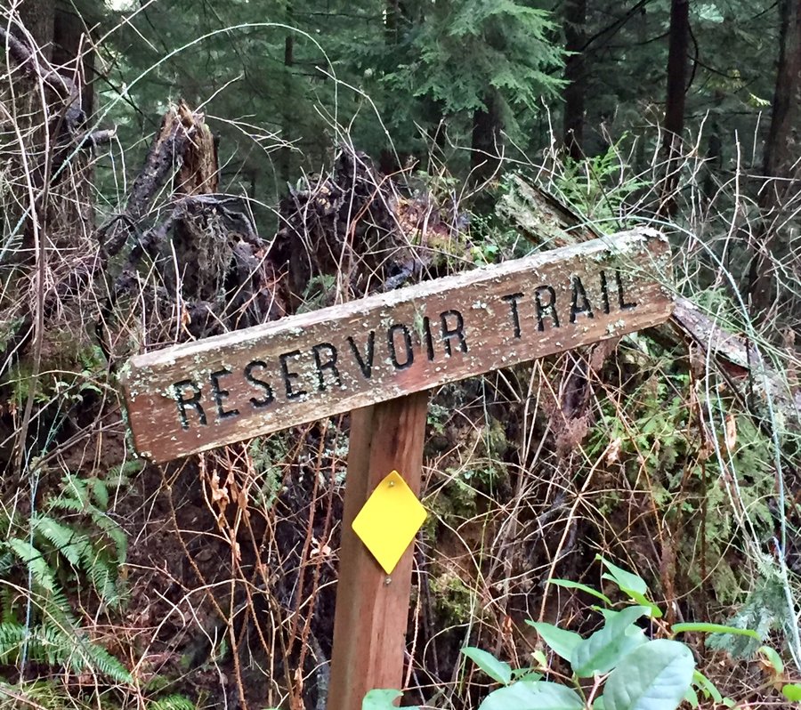
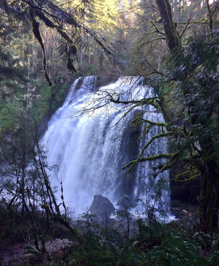
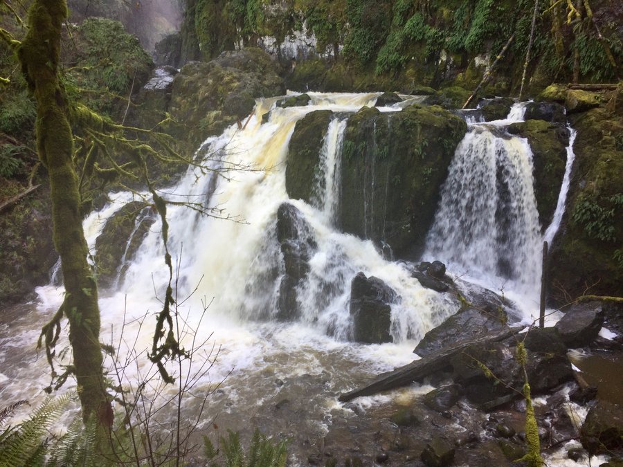
Pack Forest
10.95 miles of hiking • 2500' elevation gain •
Hiked Hugo Peak, Trail of the Giants and to Little Mashel Falls. With all the rainfall we have had the falls were really thundering.
January 25, 2020


 1
1
Mt. Si
6.64 miles of hiking • 3250' elevation gain •
Up and down the old trail. Slushy snow pretty much from Boulder Garden Loop onward.
January 19, 2020


January 12, 2020
 1
1
Tiger Mountain--Poo Poo Point
4.18 miles of hiking • 1750' elevation gain •
Stormy day on the mountain. Just a quick up and down conditioning hike.
January 5, 2020

Tiger Mtn.
5.39 miles of hiking • 2500' elevation gain •
Section Line Trail to West Tiger Summit #3.
January 1, 2020


View trips from: 2012 2013 2014 2015 2016 2017 2018 2019 2021 2022