

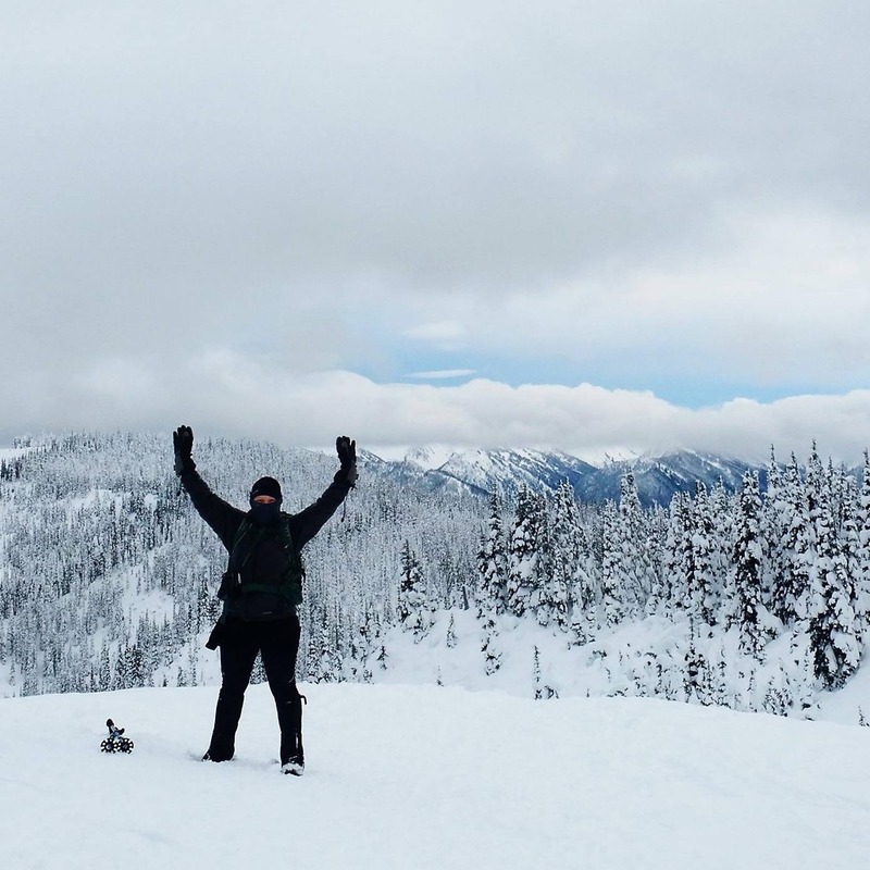
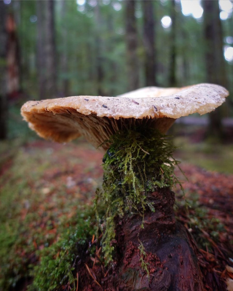
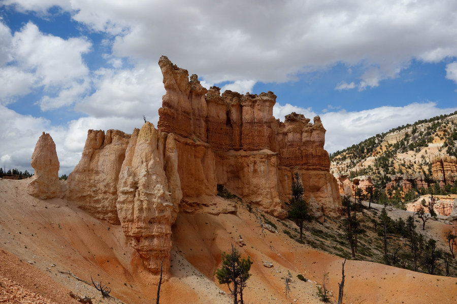
2018 Trips

 1
1
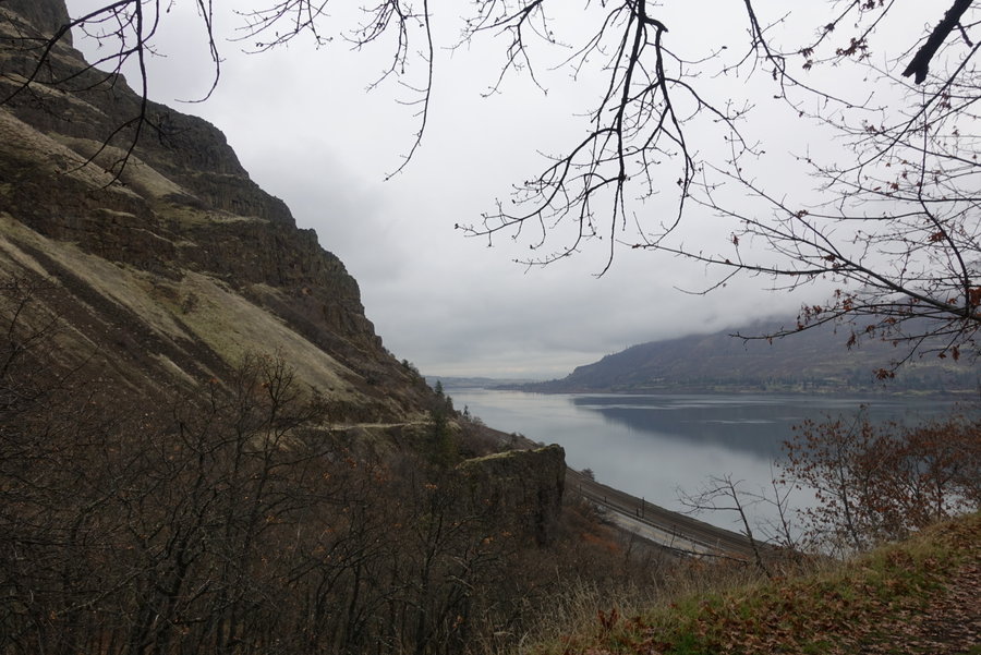
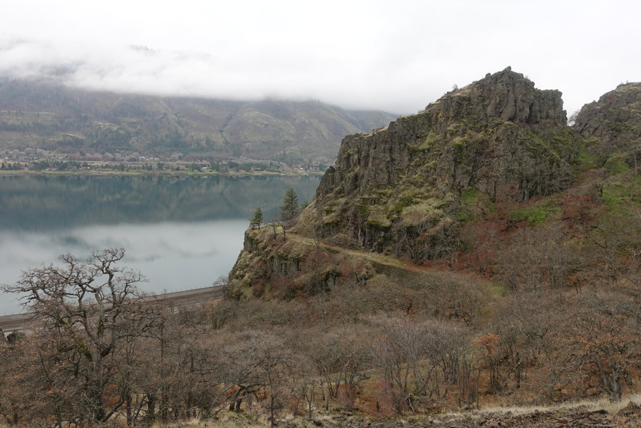
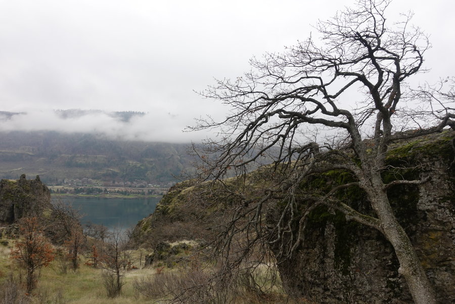
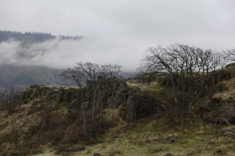
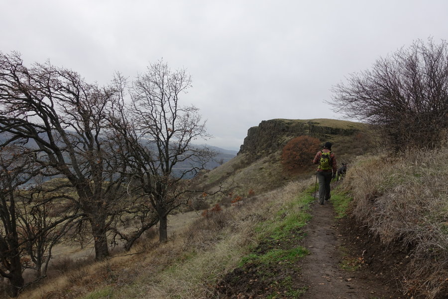
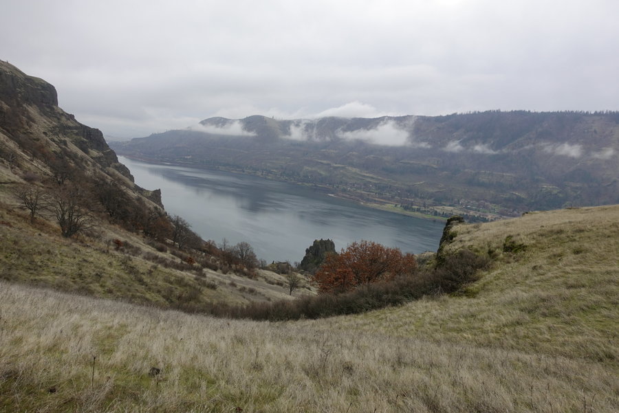
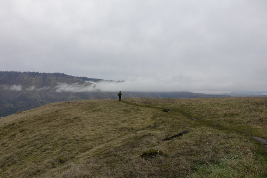
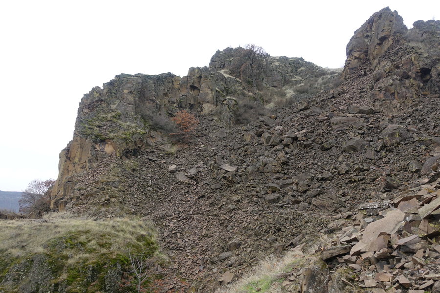
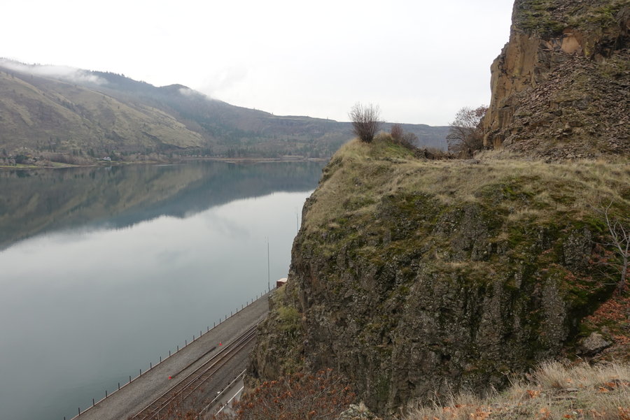
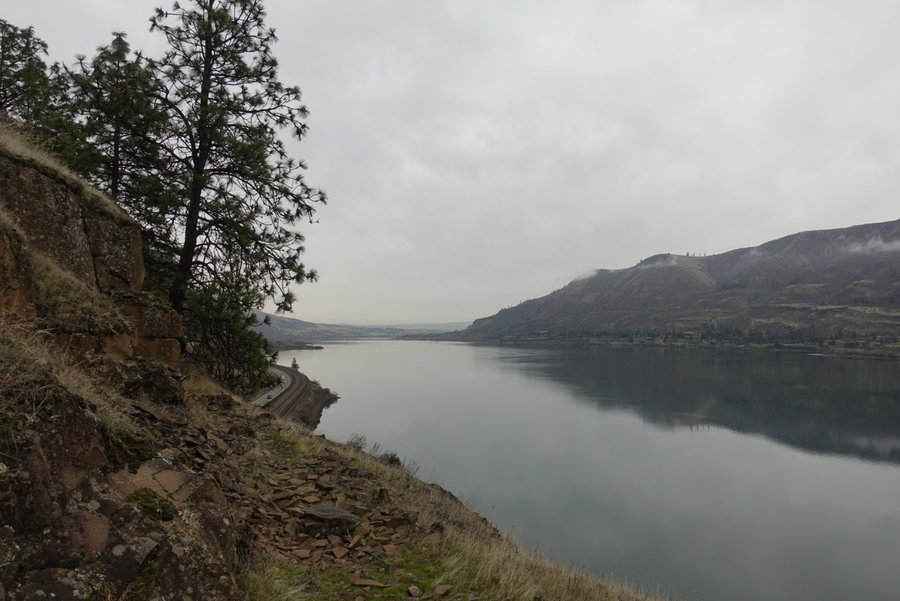
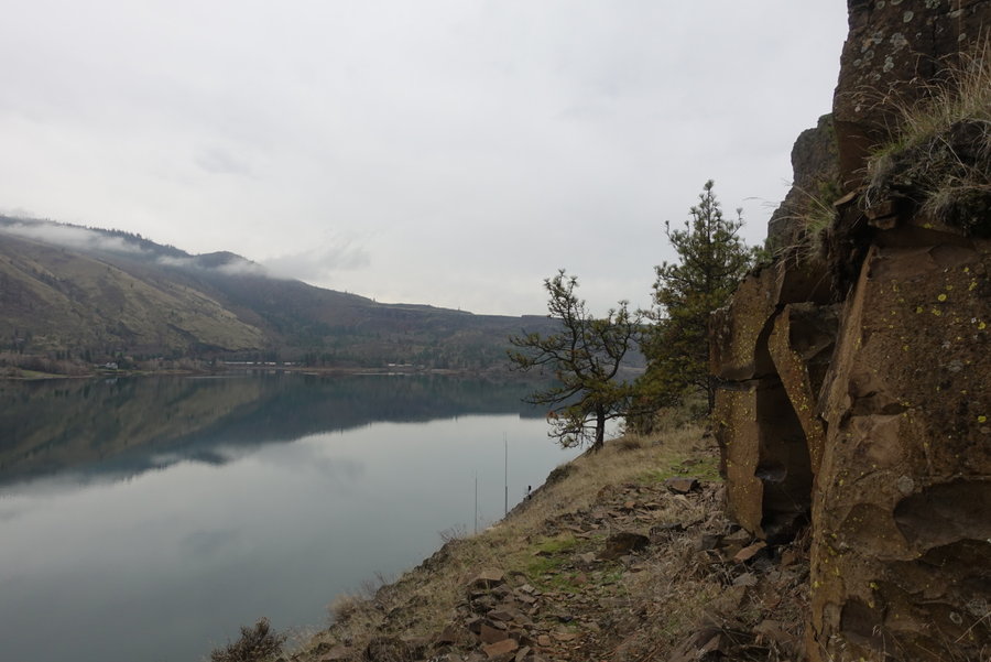
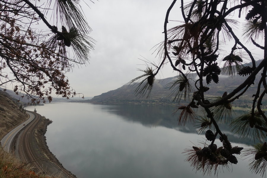
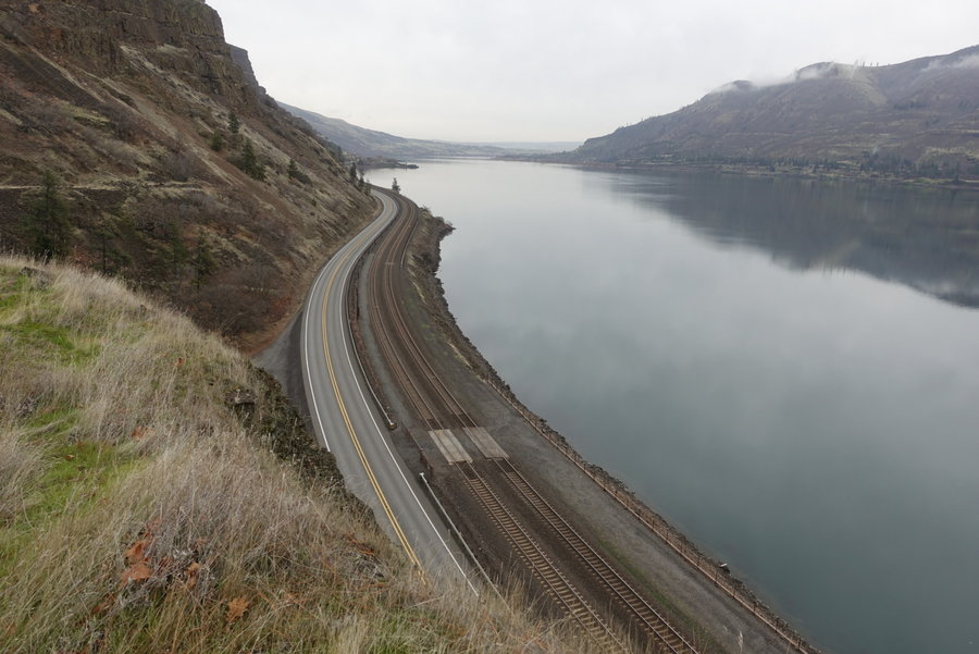
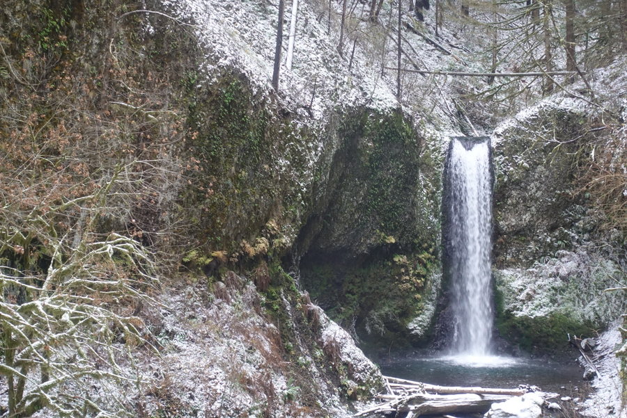
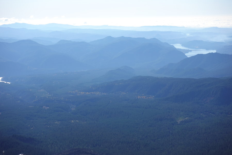
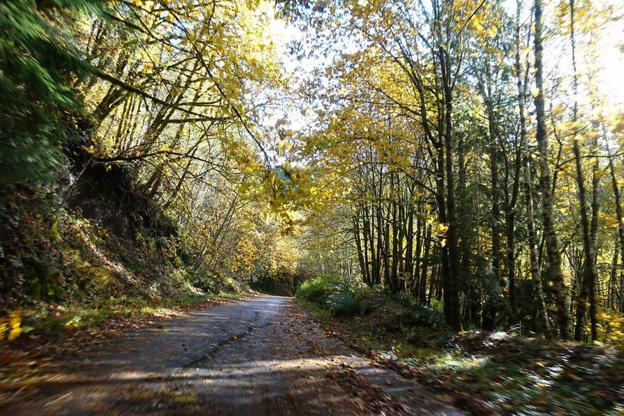
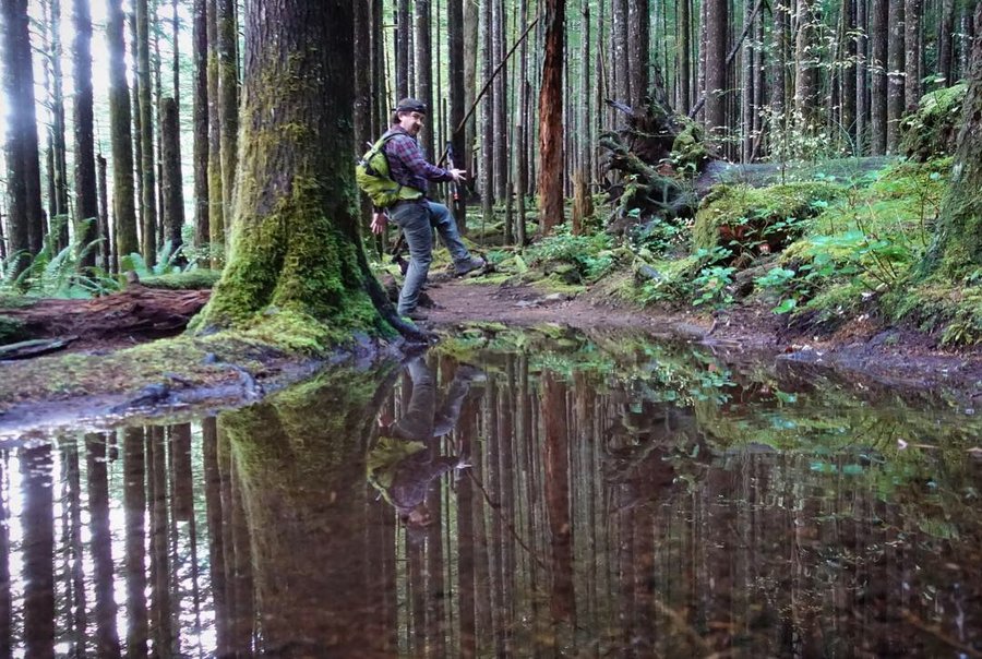
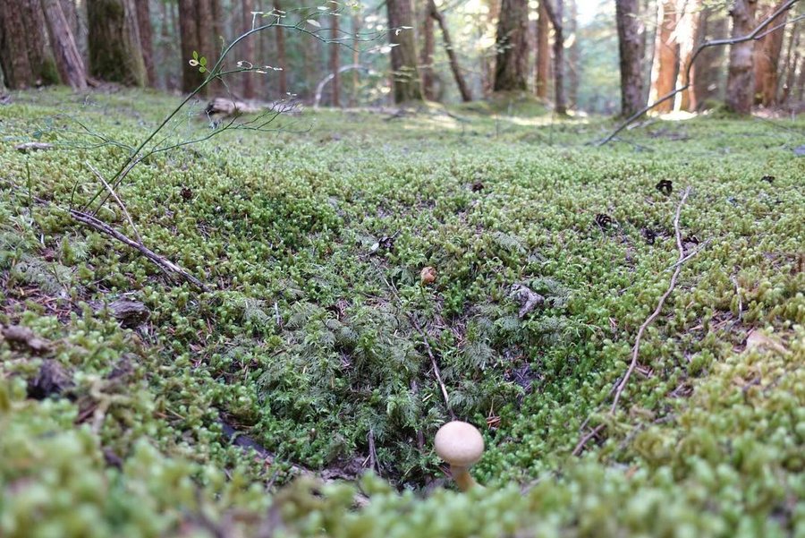
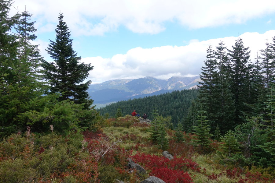
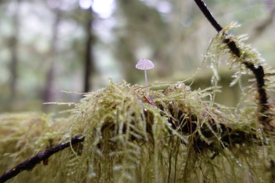
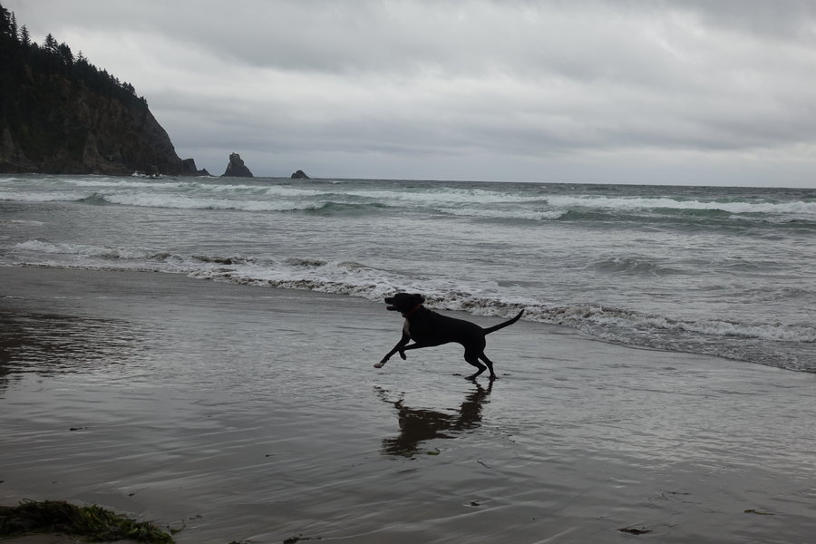
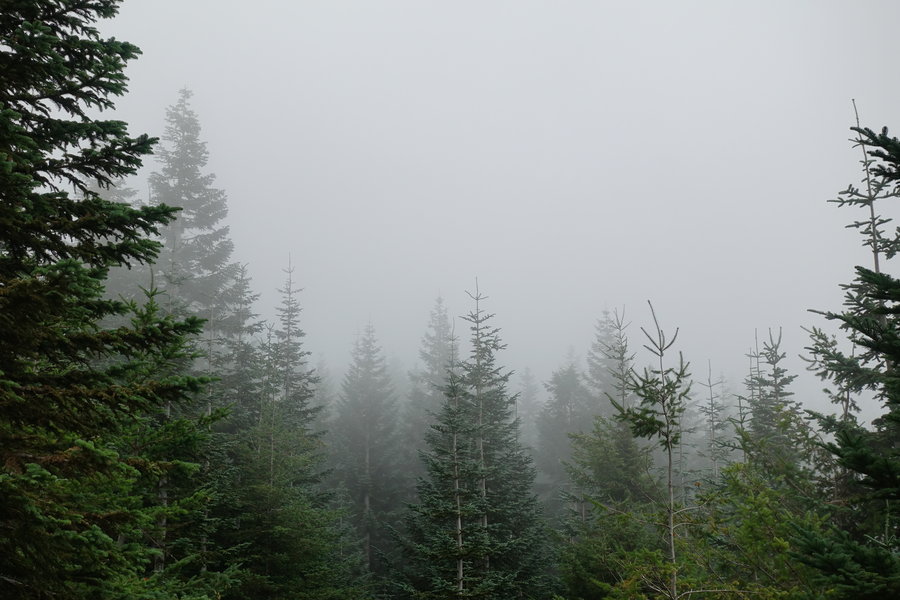
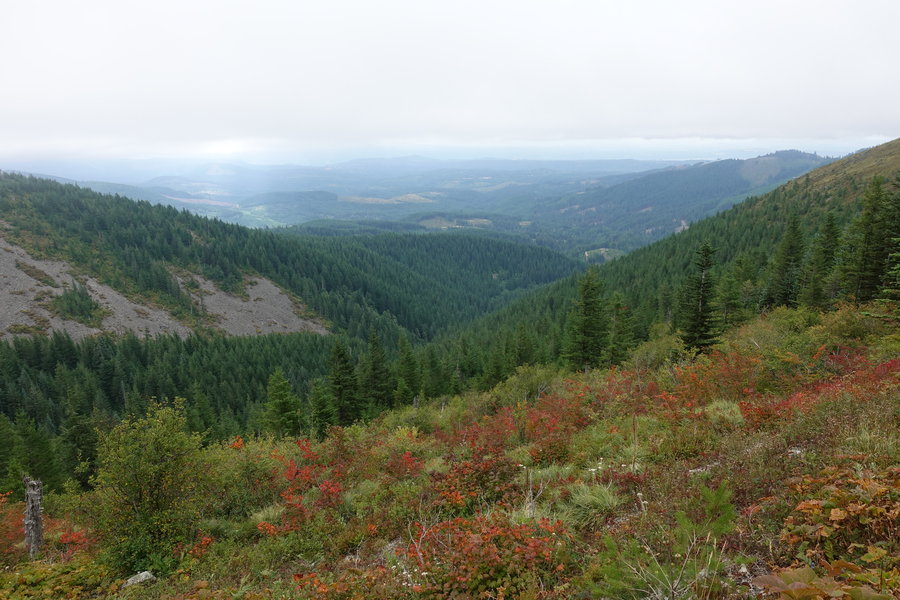
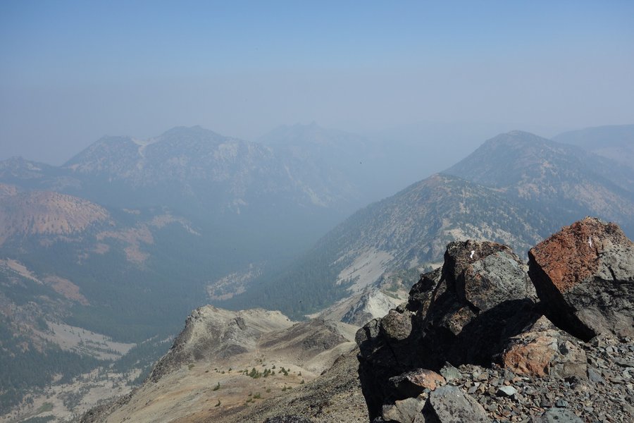
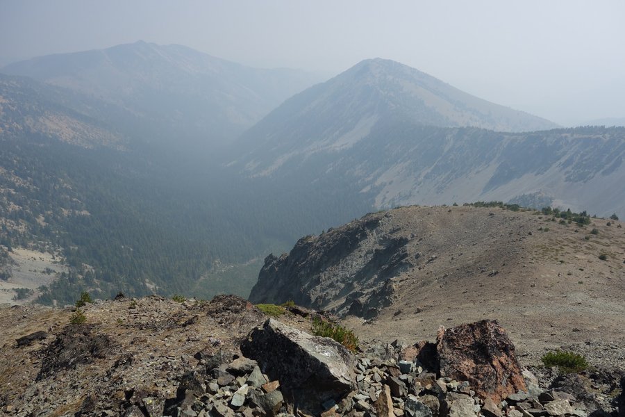
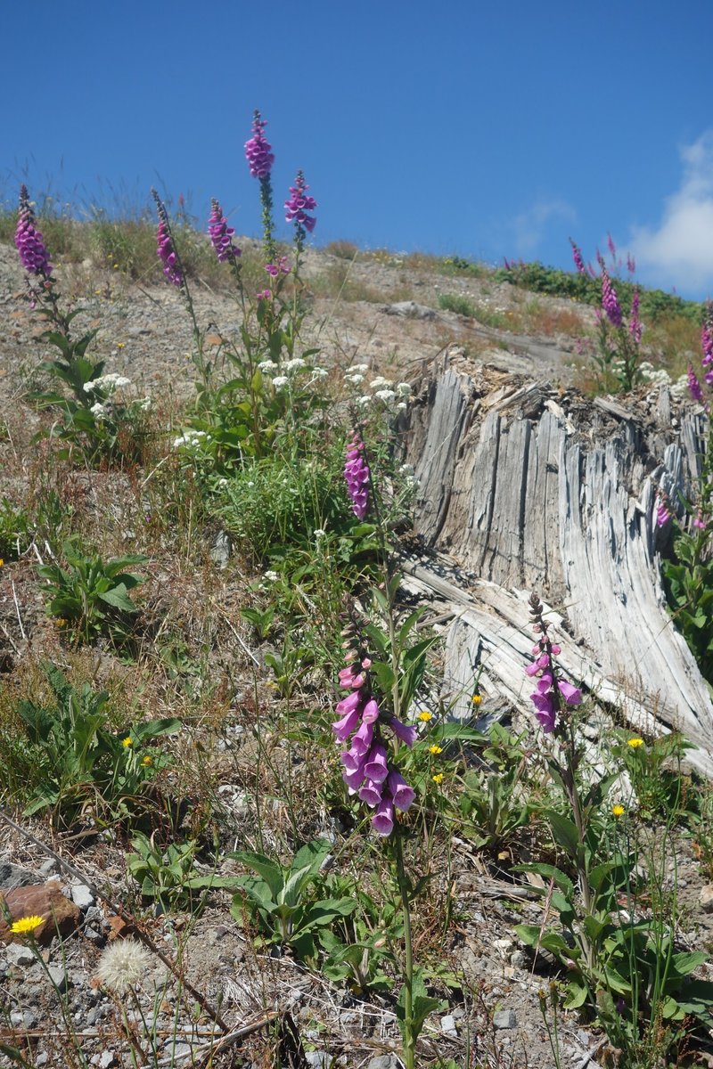
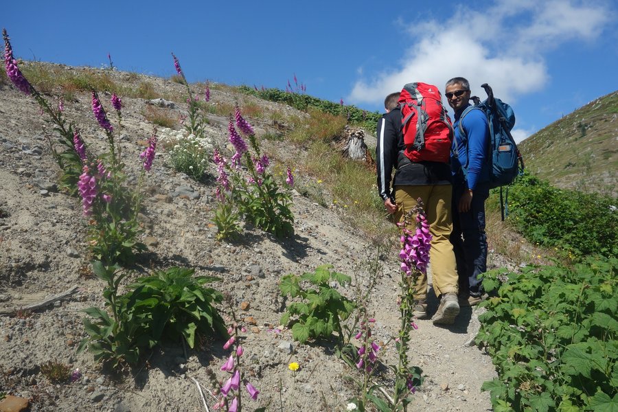
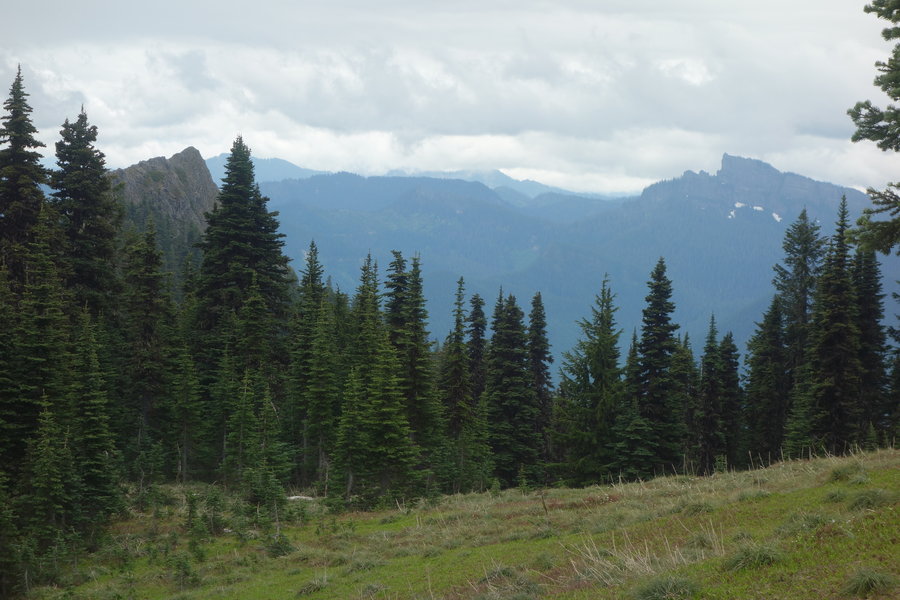
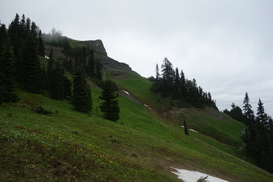
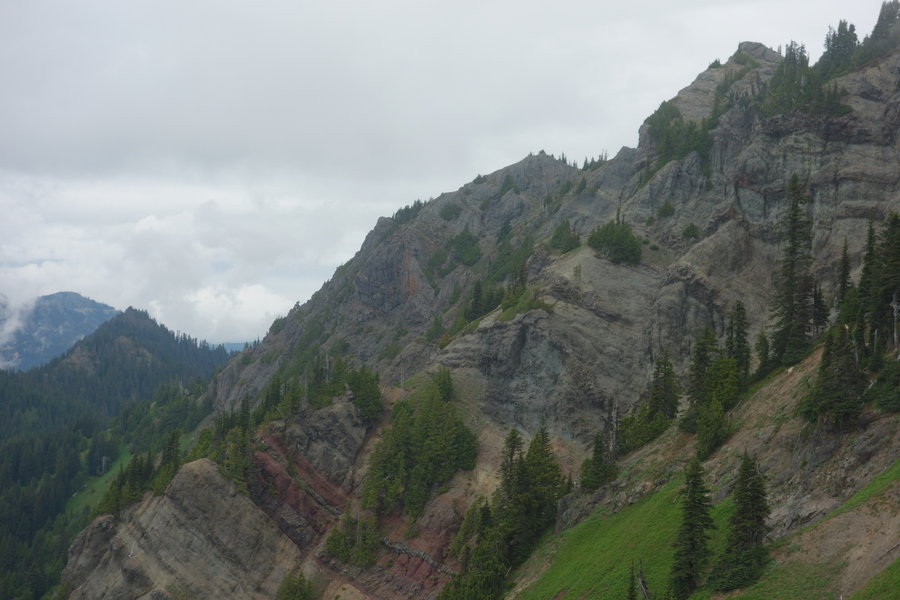
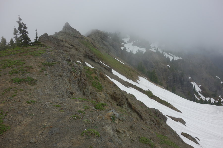
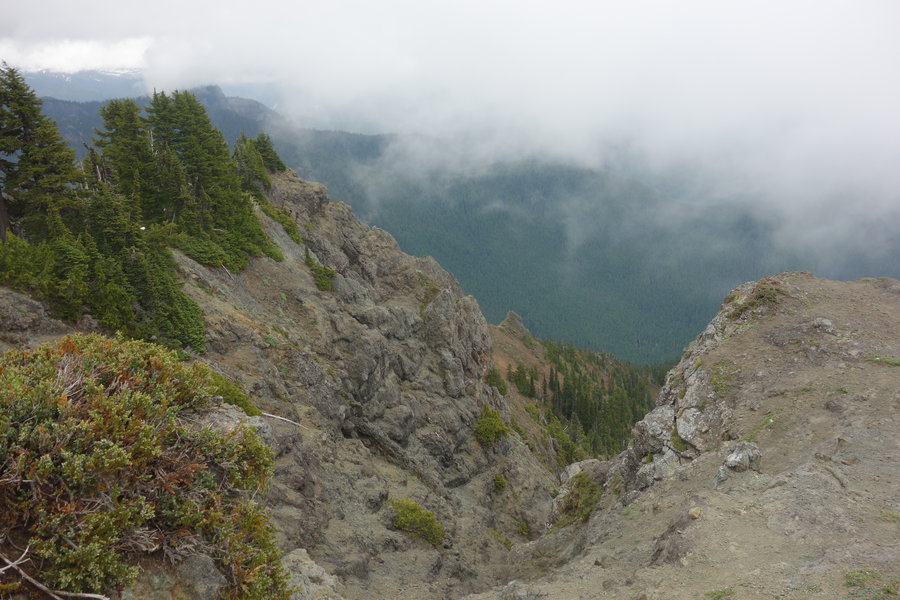
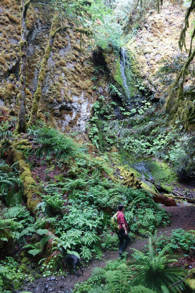
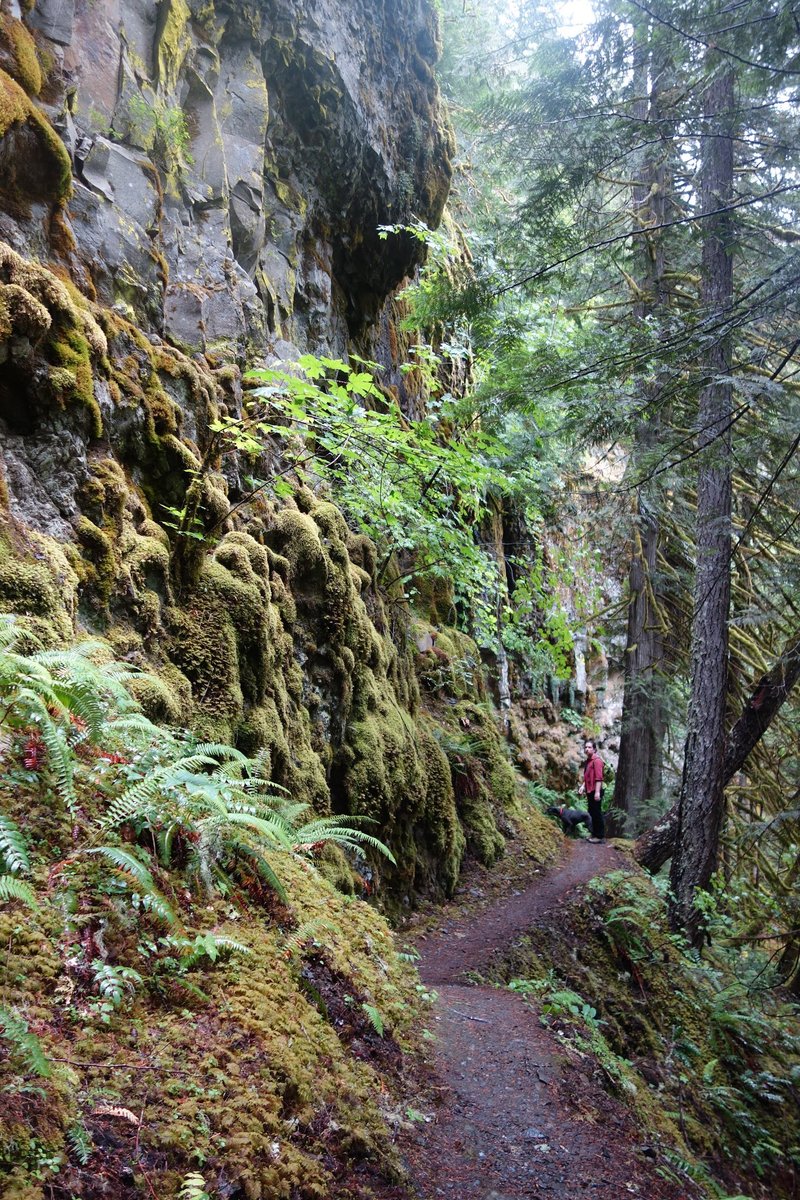
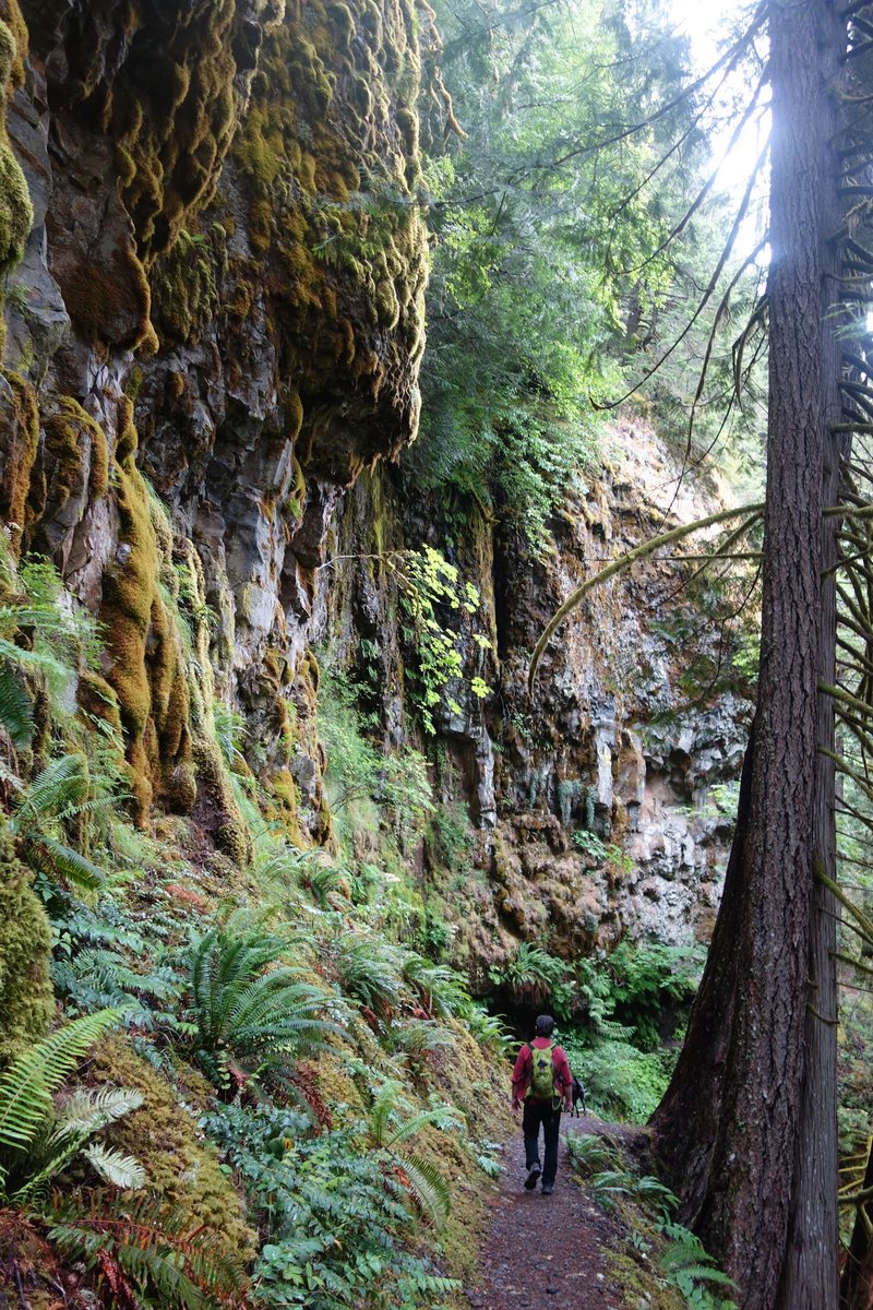
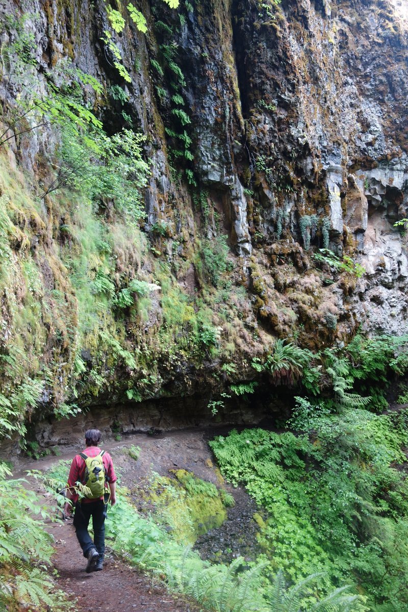
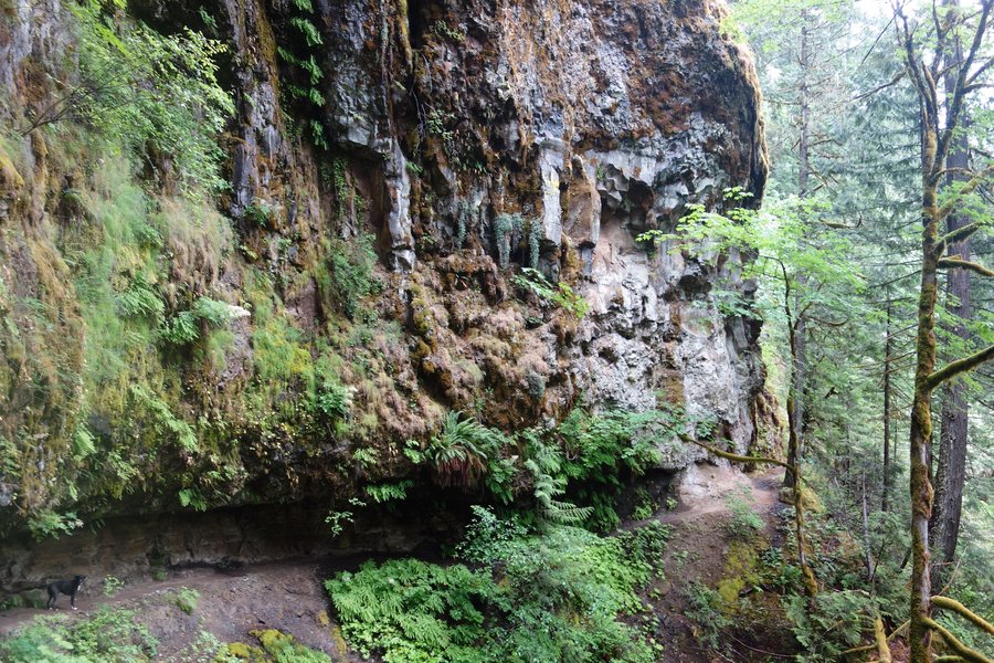
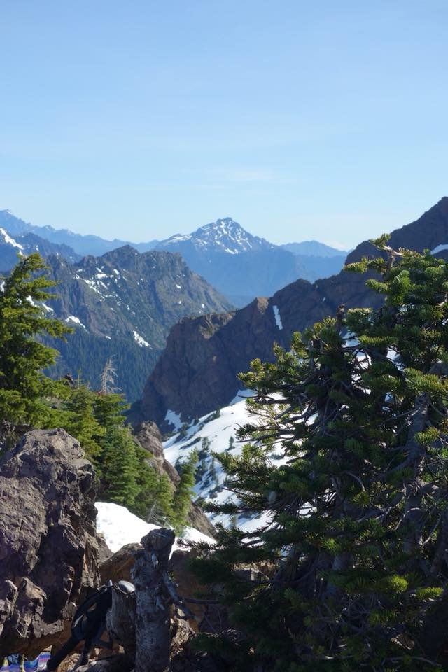
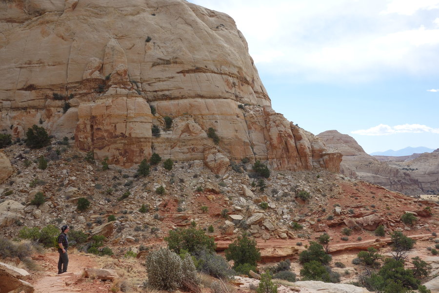
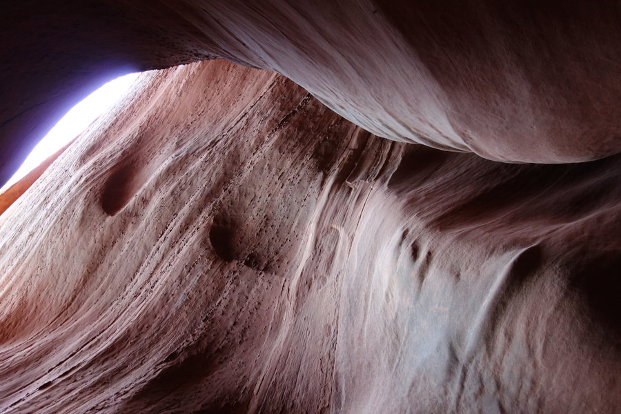
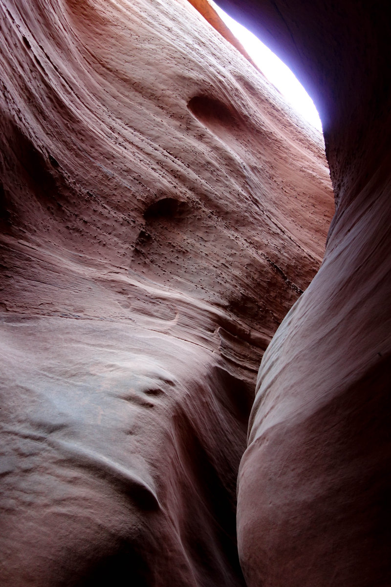
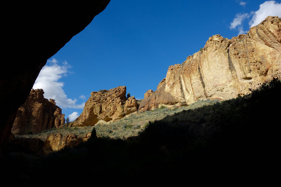
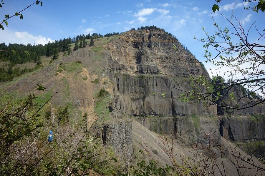
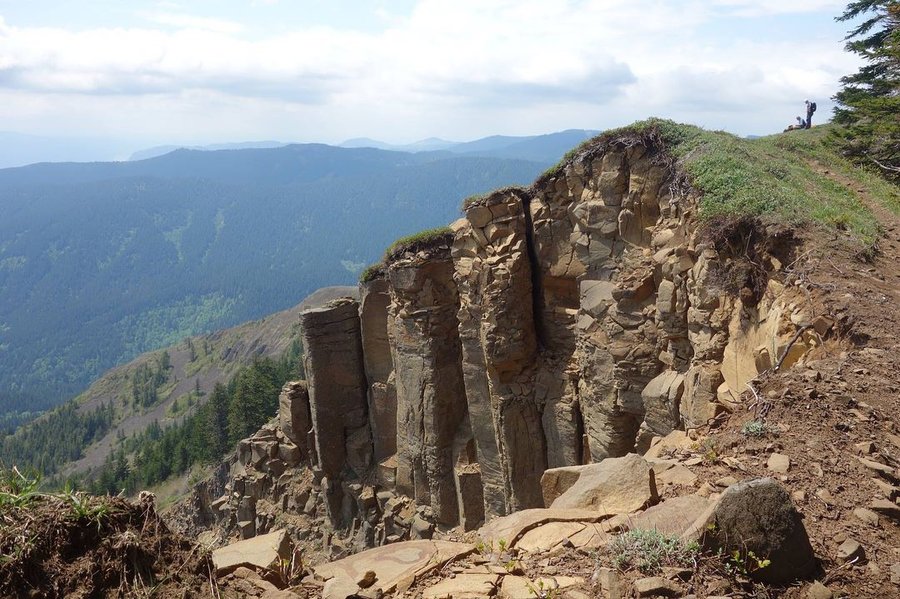
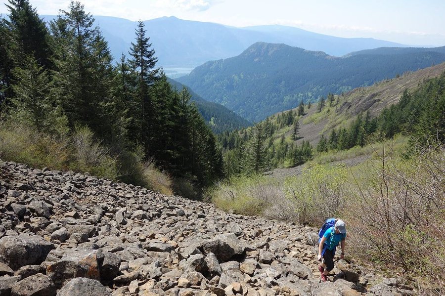
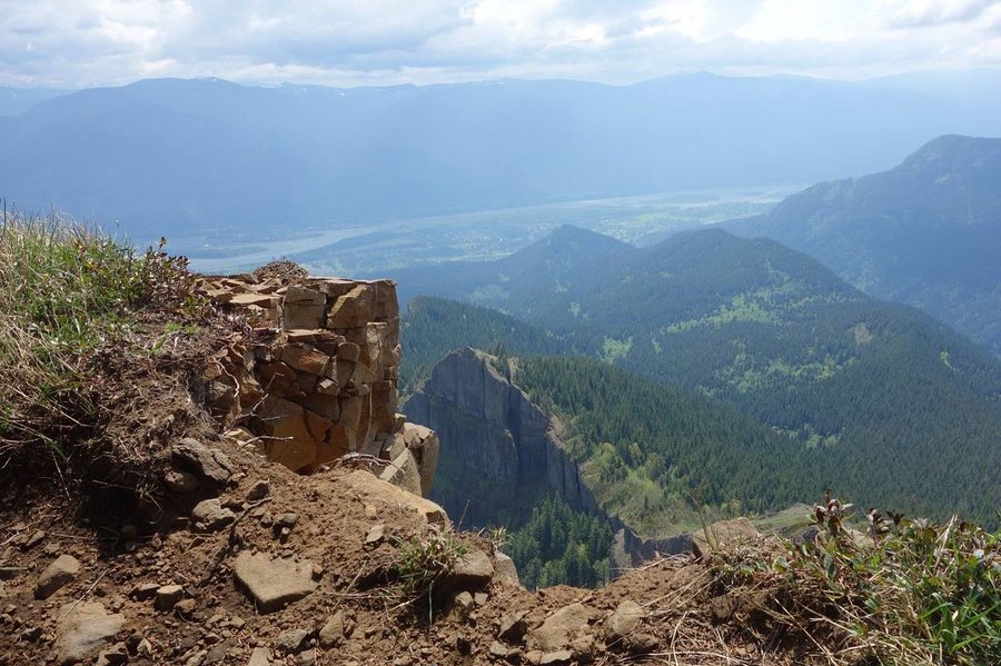
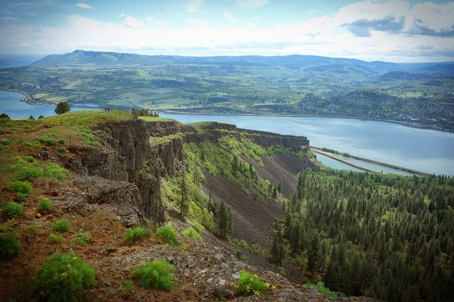
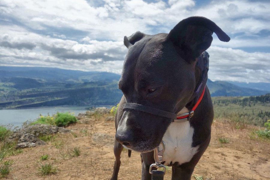
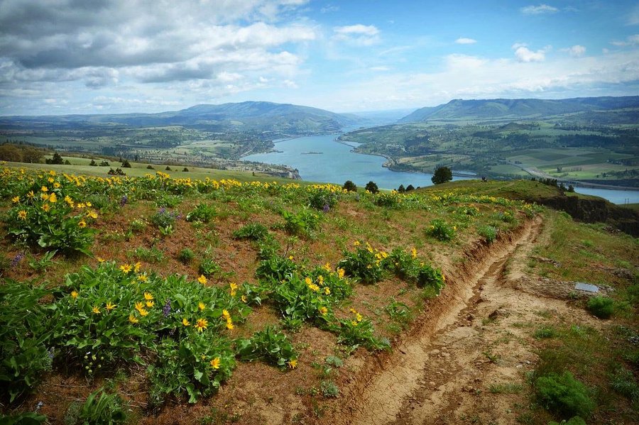
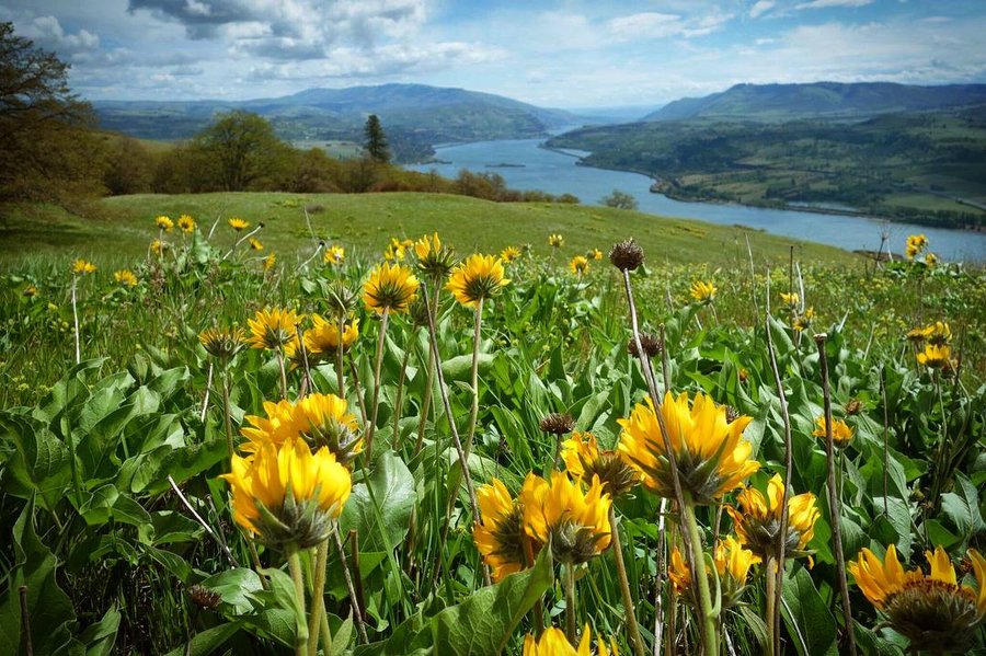
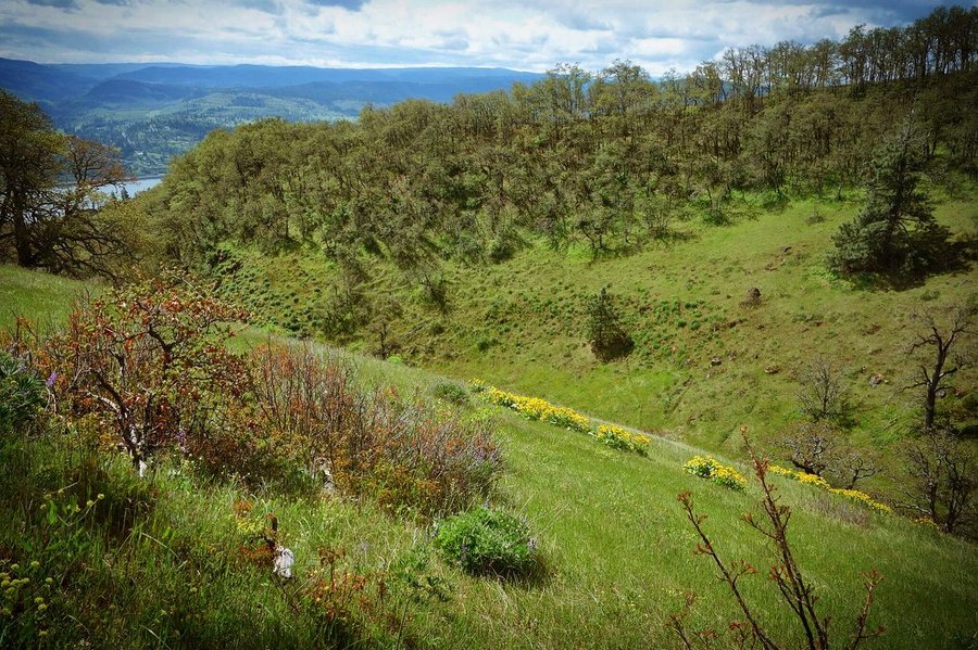
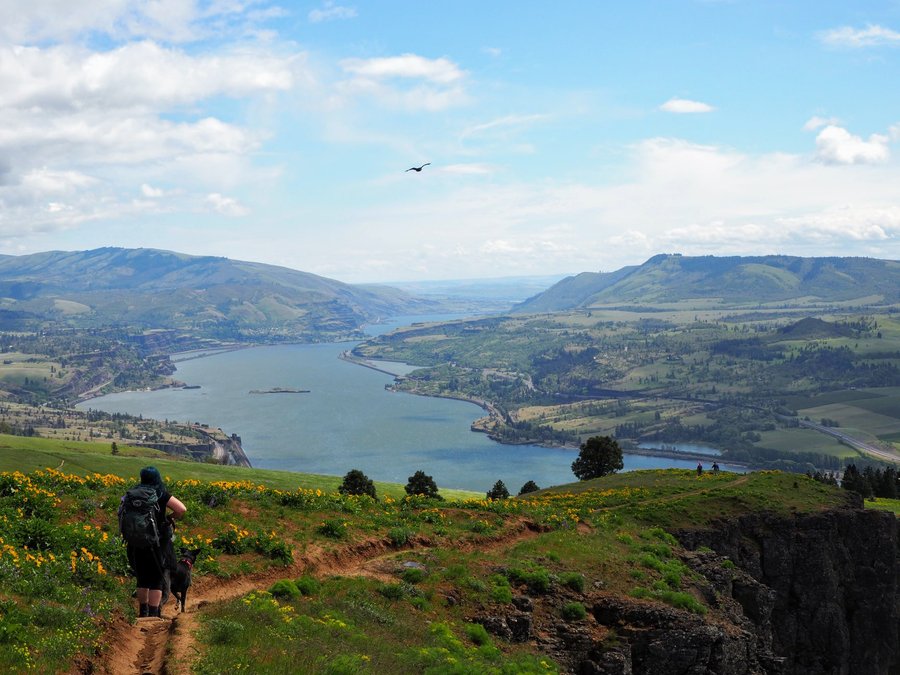
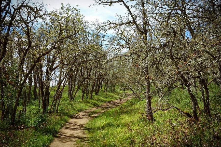
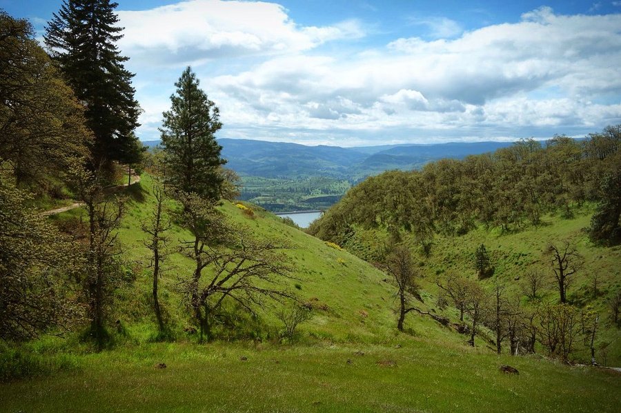
Lyle Cherry Orchard
5 miles of hiking • 1500' elevation gain •
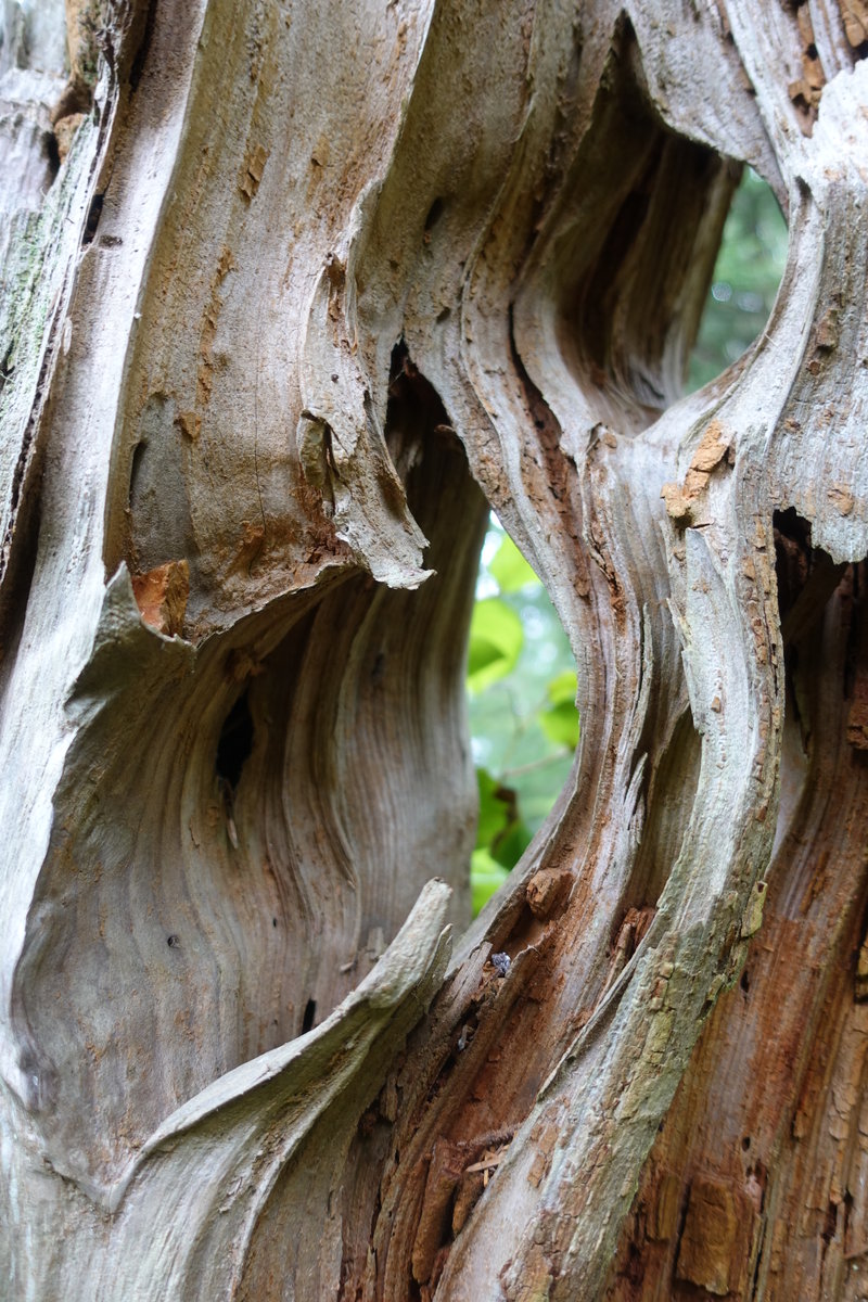
Short and sweet pretty little hike on the eastern Washington side of the gorge. I love this area, and seeing how the landscape changes as you drive out from Portland.
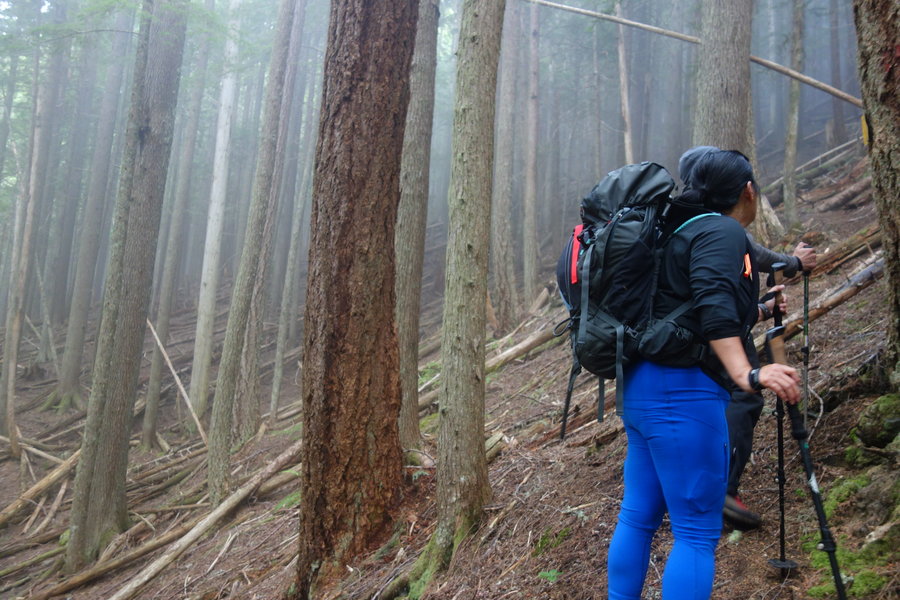
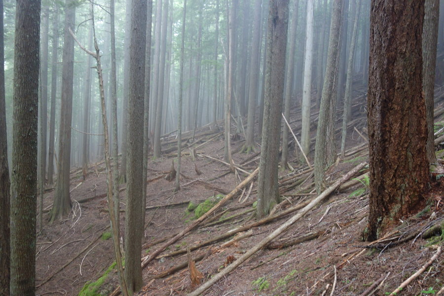
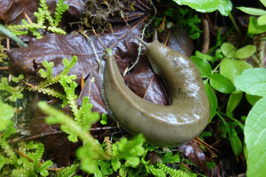
The trail starts with a somewhat steep climb, with an option to check out the abandoned convict road when you hit the sign for the orchard. We peaked around the bend but a significant landslide made us turn back. Perhaps I'll check it out in the summer on a dry day, without my dog. Onwards and up, we hit a trail split, and walked westward for some nice views. Even with cloudy dark skies it is still an excellent look at the geology of the gorge. We backtracked and continued our climb up. This is where the trail can get kind of thin, and a little scary for those afraid of heights as the drop offs are significant. The trail was fairly frozen on our way up, but turned to slippery mud on our way down. I highly recommend poles. Keep your eyes open for river rocks deposited from the Missoula floods as you ascend.
Once finished with the final ascent, we found ourselves in a delightfully spooky forest of trees, straight out of a Tim Burton scene. The final section of this hike is mostly gentle, with one final viewpoint Eastward of The Dalles before returning the way we came. There are options to extend the hike on a farm road/powerline corridor, but we turned back as we had discovered a few ticks on our dog Lily.
Wonderful gloomy hike in the gorge.

December 22, 2018

.jpg)


 1
1
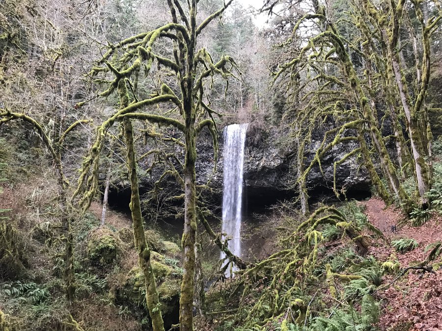
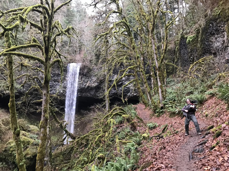
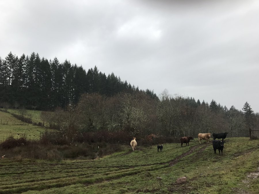
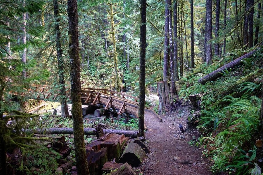
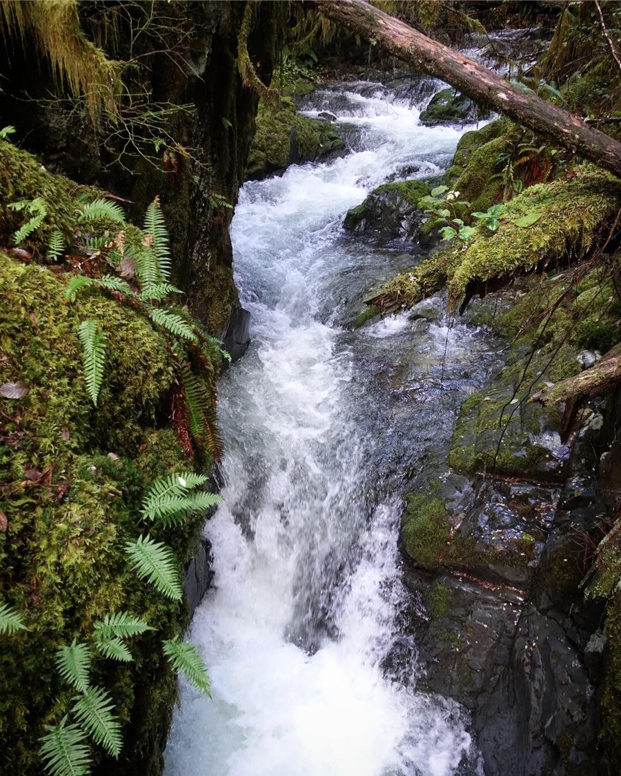
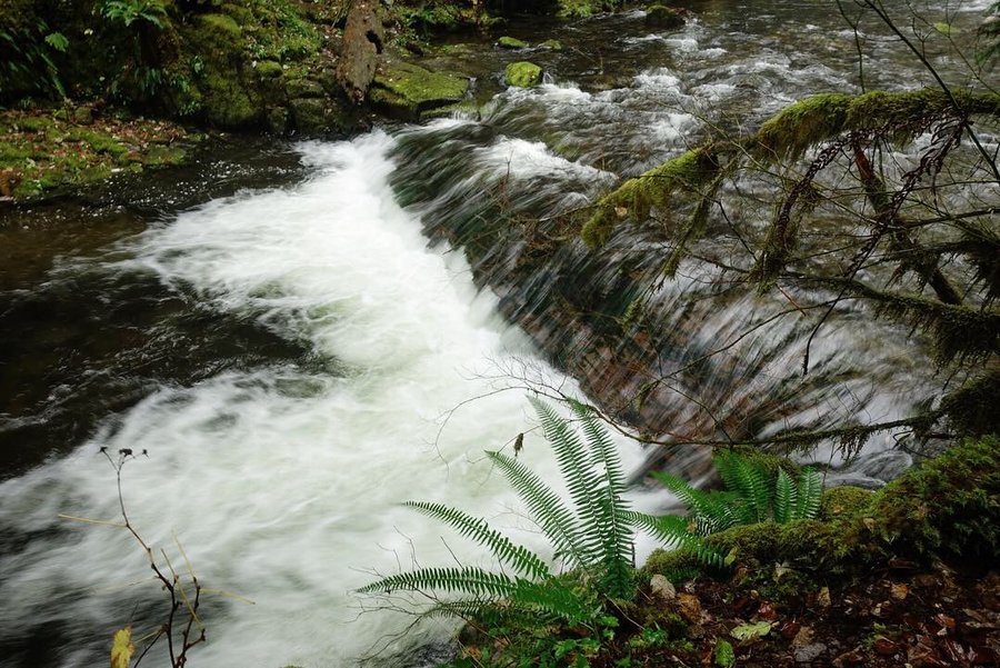
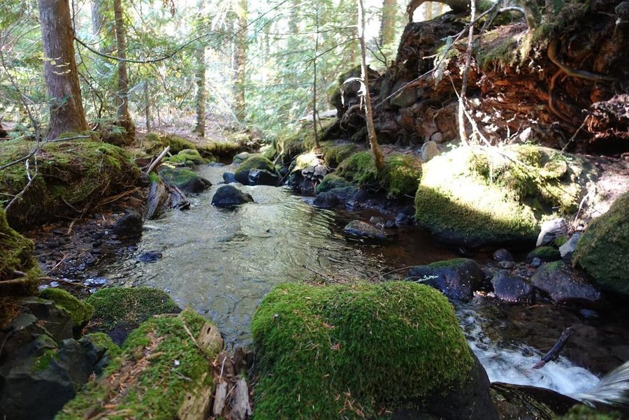
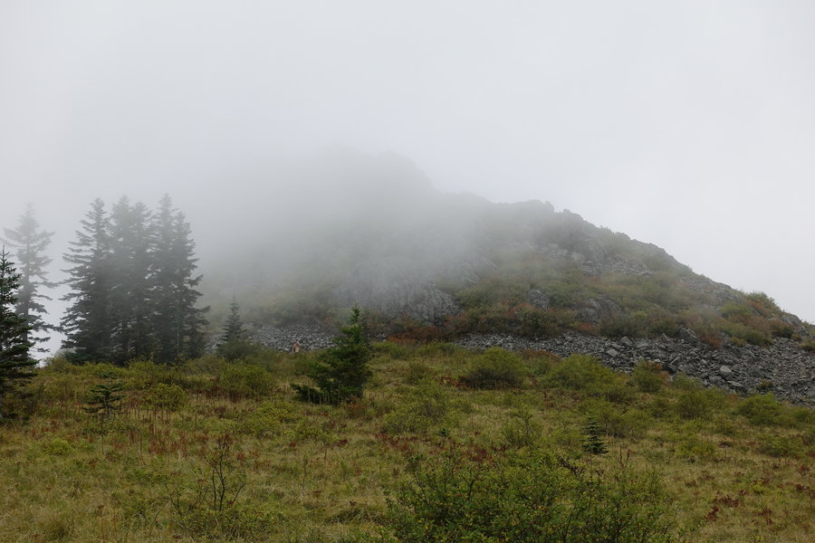
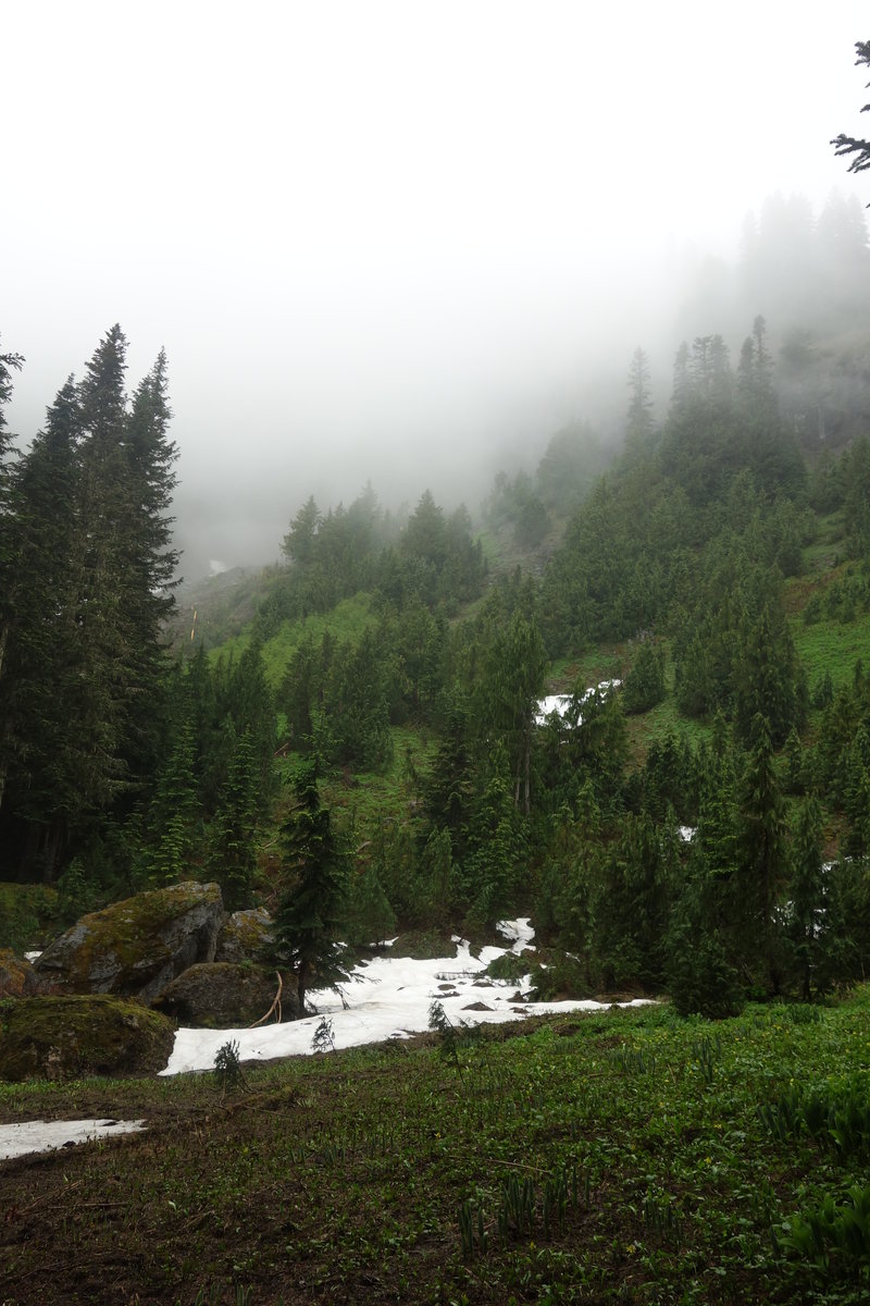
Shellburg Falls
5.7 miles of hiking • 750' elevation gain •
With rain in the forecast but still wanting to get out, we decided to go for something easy and not far from Portland. Odd little hike, as parts of it are on road and right through grazing cows. (They seemed pretty docile, unlike the cows on the Fort to Sea Trail by the coast.)
Shellburg Falls were easily accessible, while grand views of the other falls in the area would require some bushwacking, which we opted not to do since we had our dog with us. Much less traffic here than nearby Silver Falls. Pretty, but wet day.
December 16, 2018


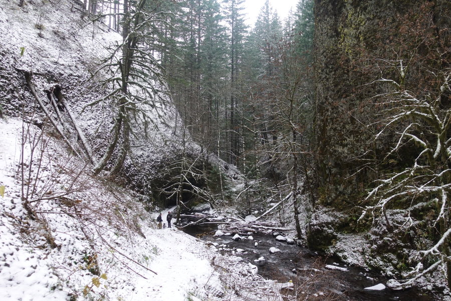
 2
2
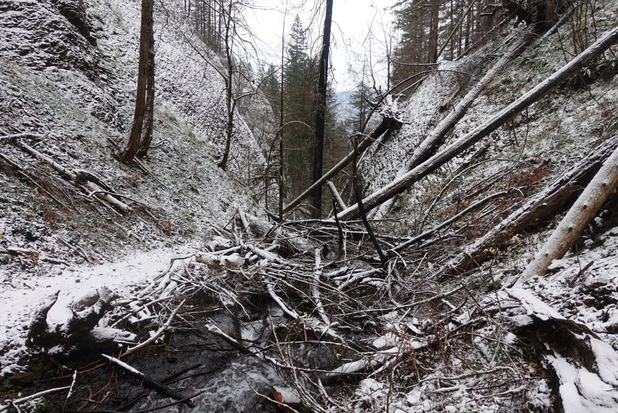
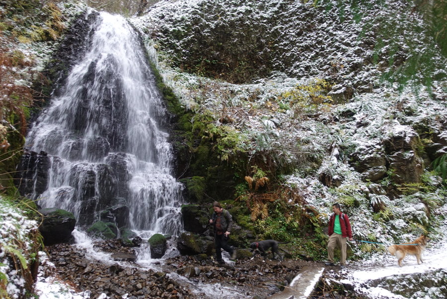
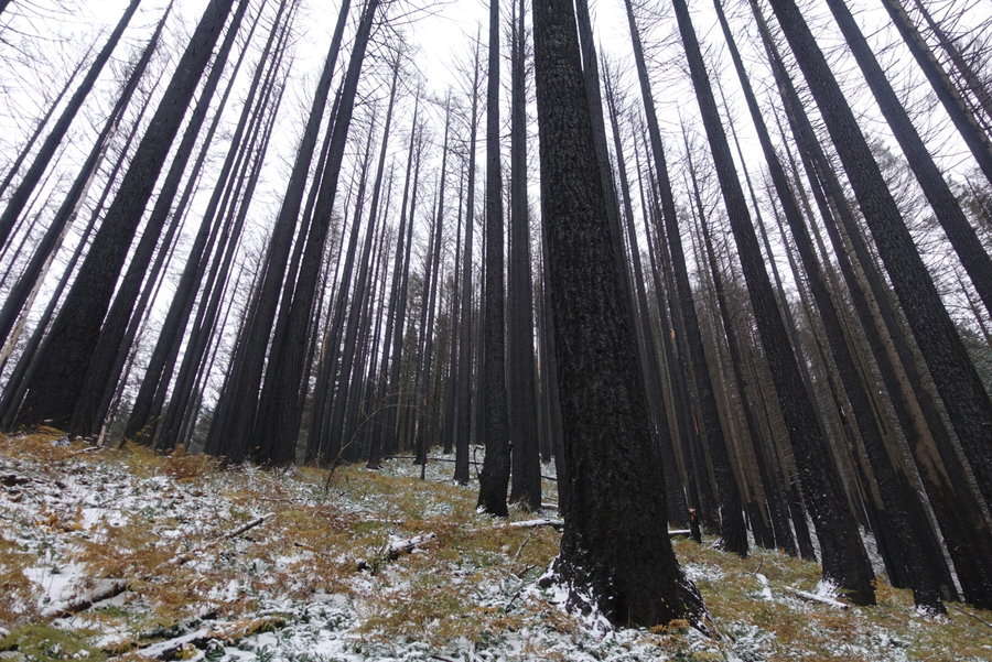
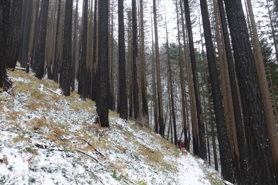
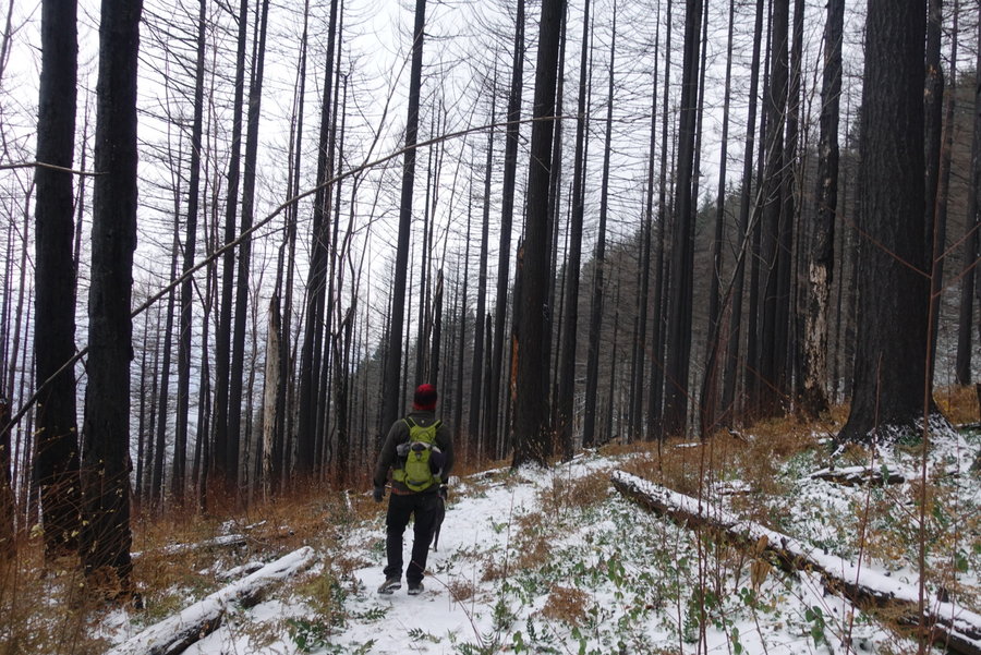
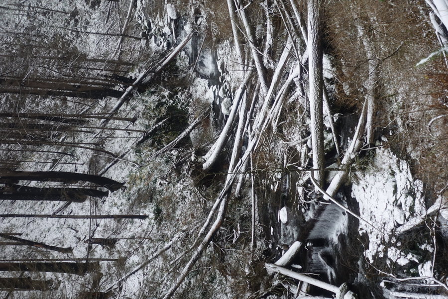
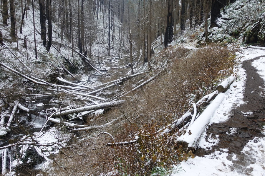
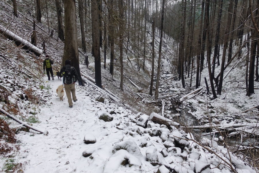
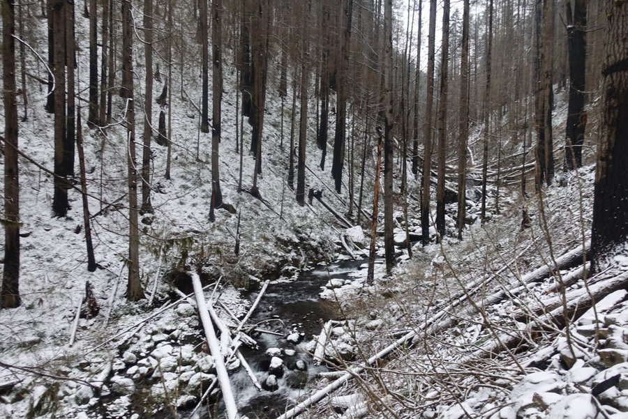
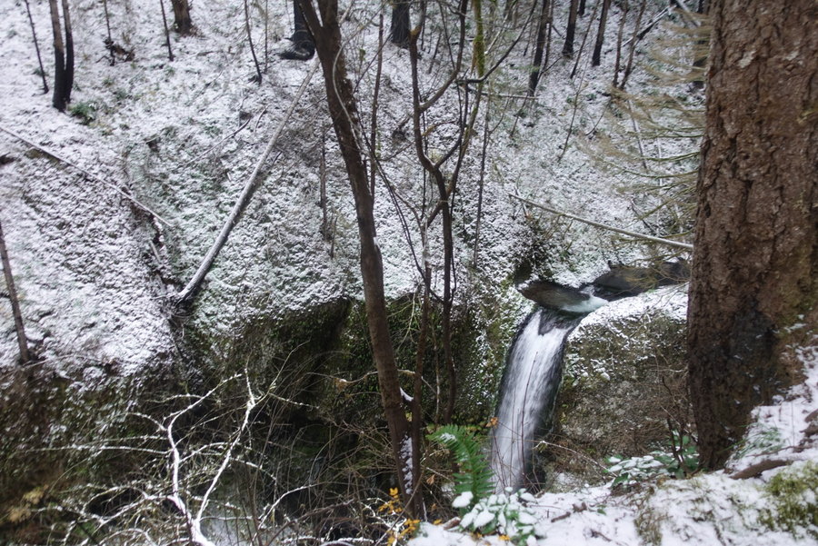
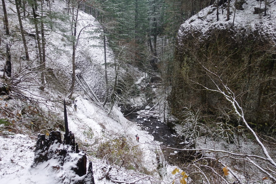
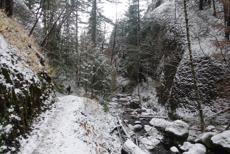
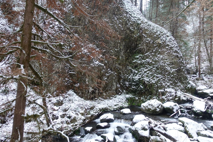
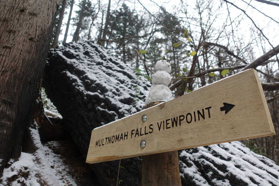
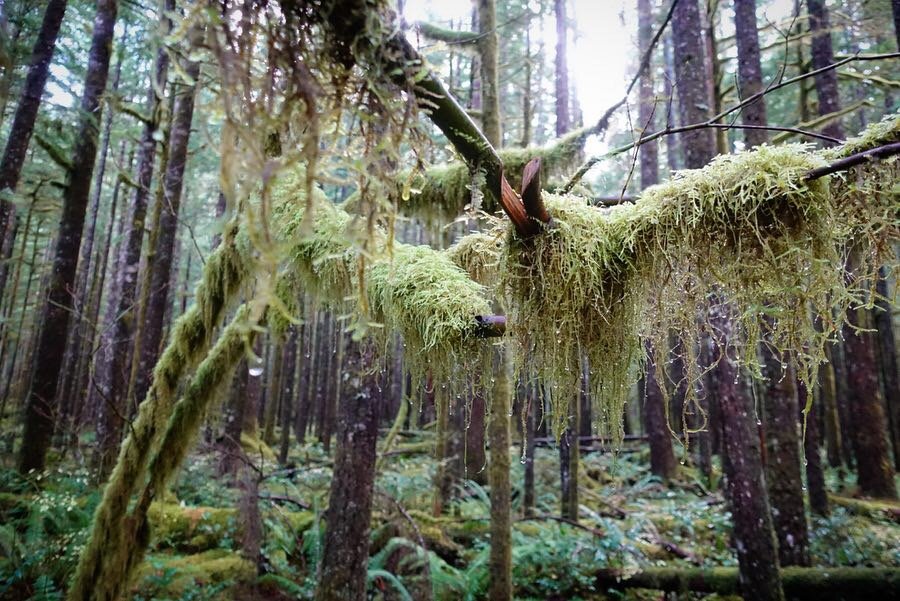
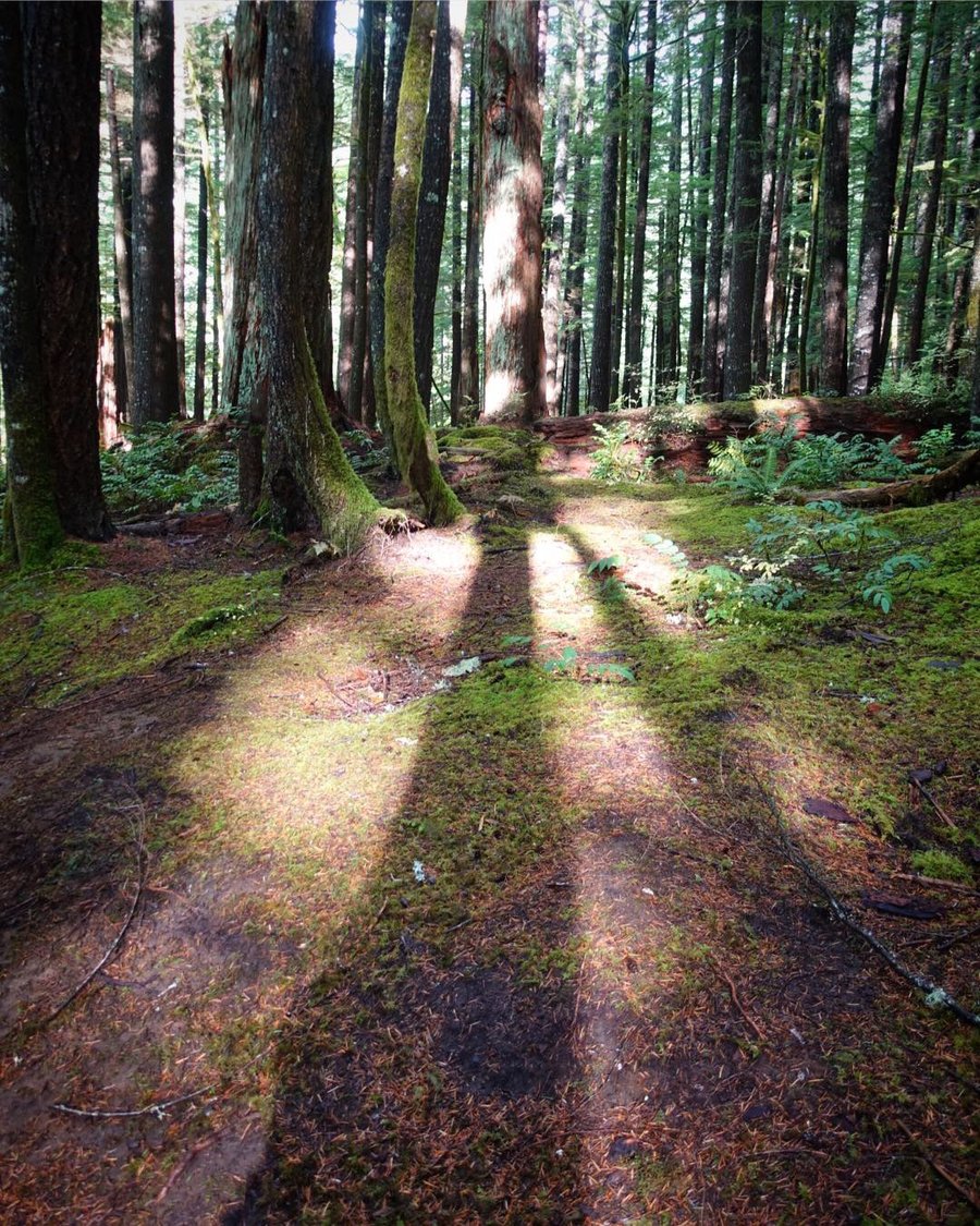
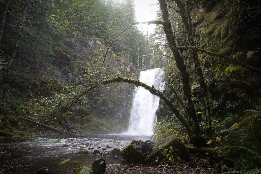
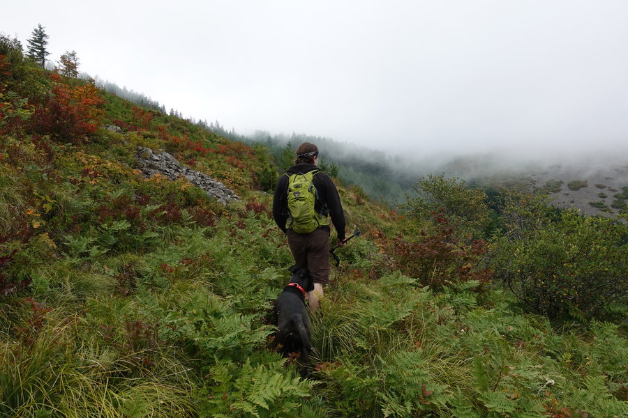
Wahkeena Multnomah Loop
6 miles of hiking • 1500' elevation gain •
It was a winter wonderland in the gorge today - our curiosity bringing us to check out the fire damage to the newly reopened trail. Trail was mostly empty when we arrived around 9 am - but was bustling with incoming poor footwear choices as we rounded our way down to the Multnomah end. Microspikes used on the descent and we were glad to have them on slick trail with steep drop offs. After witnessing a fall from one group of guys - I asked if they were doing the loop and if they had traction. Of course the answer was yes for loop, no for traction. Hope they stayed safe.
December 8, 2018


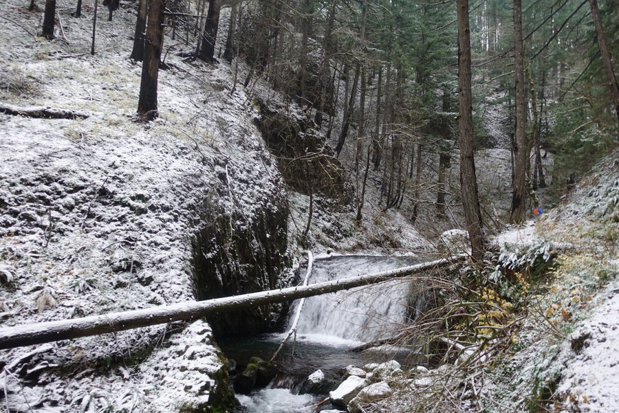
Hunchback Trail
3.5 miles of hiking • 1250' elevation gain •
Felt run down and was dealing with some pretty awful cramps on Saturday, but had promised to hike with my boyfriend and our friend Jason. Only made it part way up Hunchback Trail, when my dog broke her dewclaw and starting bleeding all over the place. I bandaged her up and made my way back down the trail, defeated. No views for me after climbing switchbacks and an added bonus of a $185 vet bill. My poor hiking companion. Hopefully she will be back on the trail with me soon. Really want to hit this trail again and see the basalt catwalk.
November 24, 2018

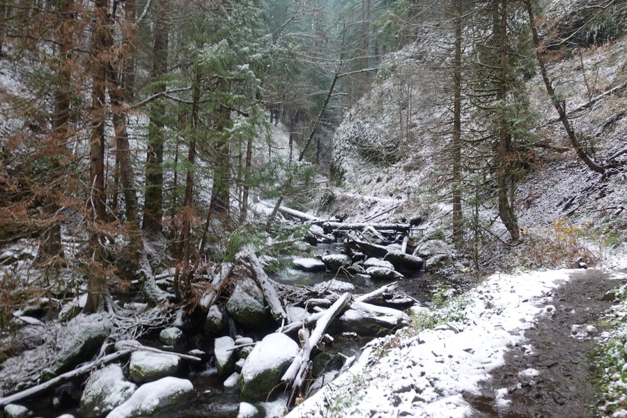
Dry Creek Falls
5 miles of hiking • 750' elevation gain •
Woke up late so scrapped our original idea and decided to be kind to ourselves and just do something simple - first time seeing the gorge burn up close and personal. Short trip to dry creek falls.
November 17, 2018


 2
2
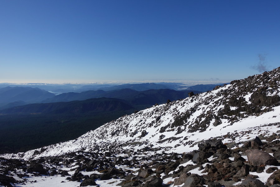
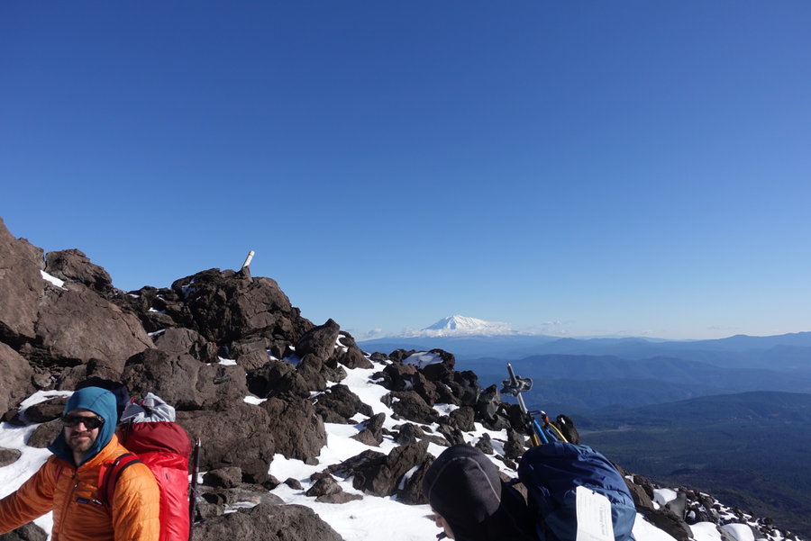
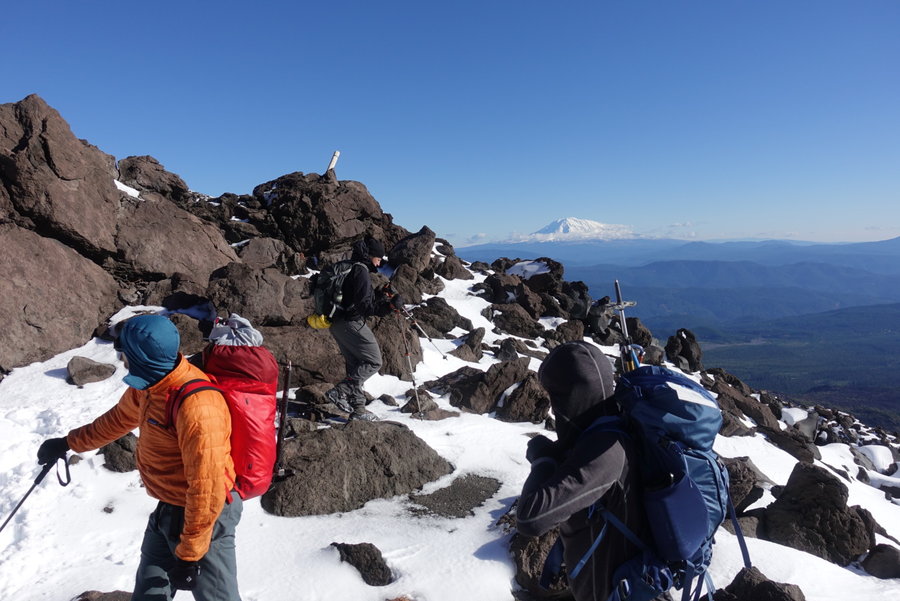
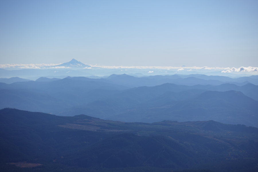
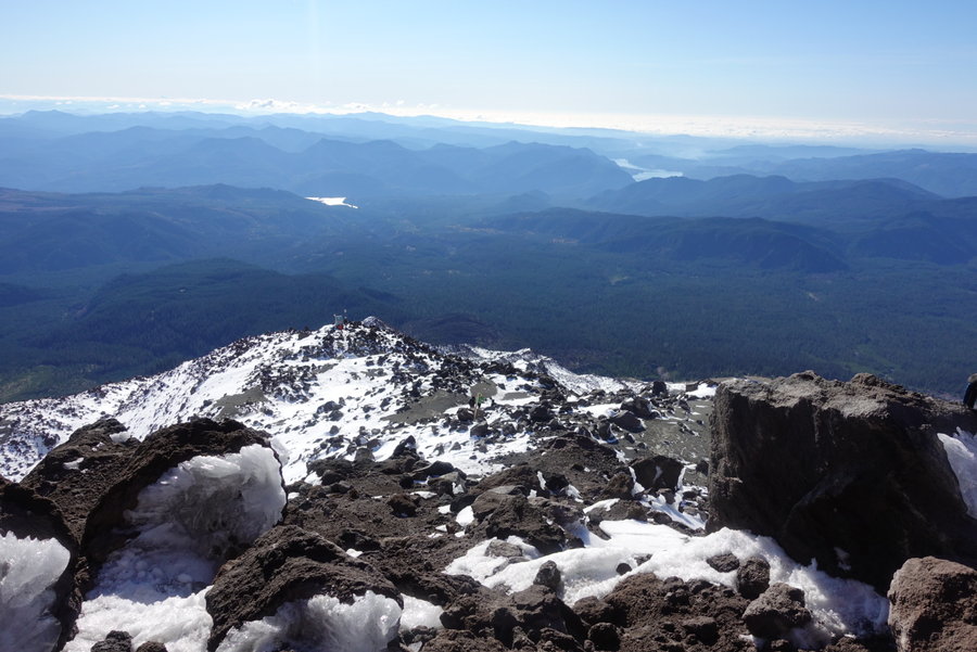
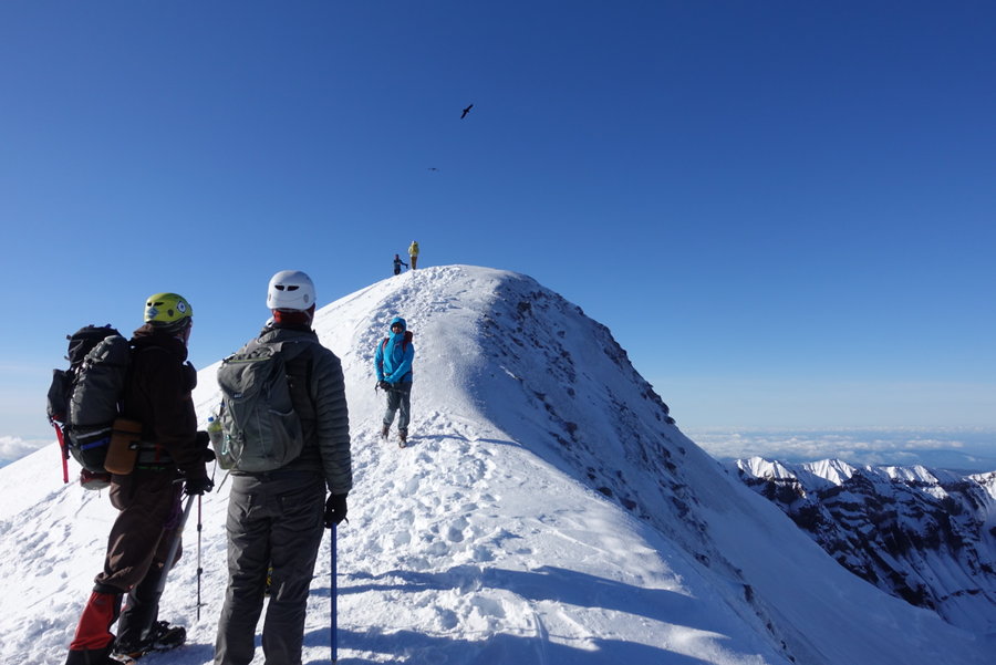
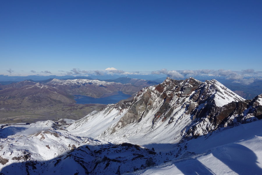
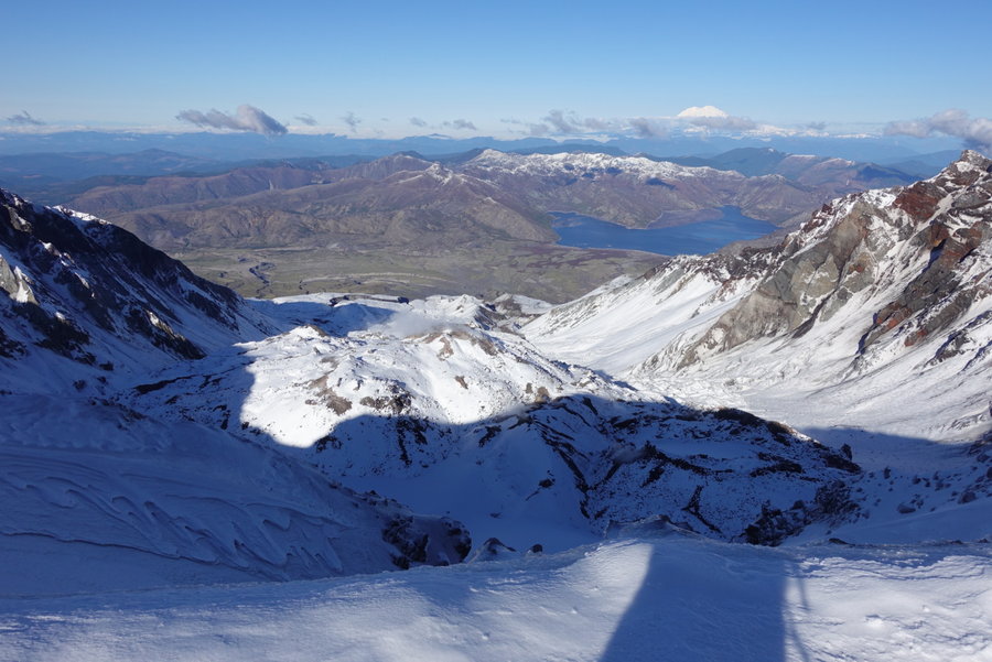
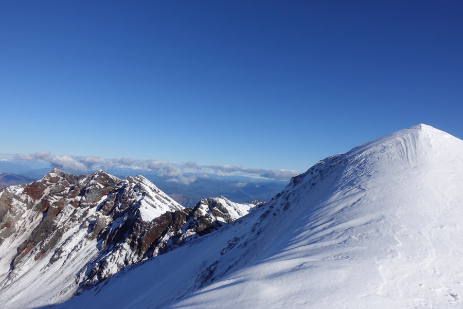
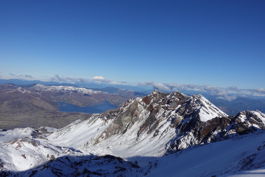
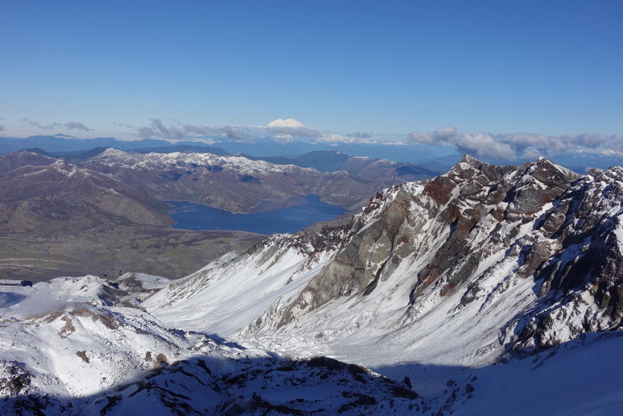
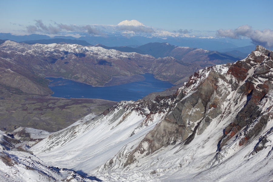
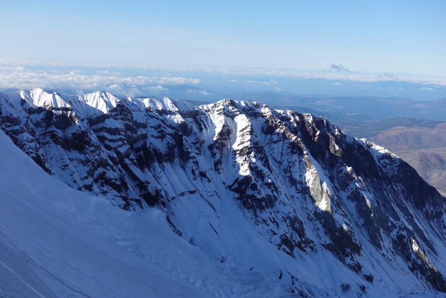
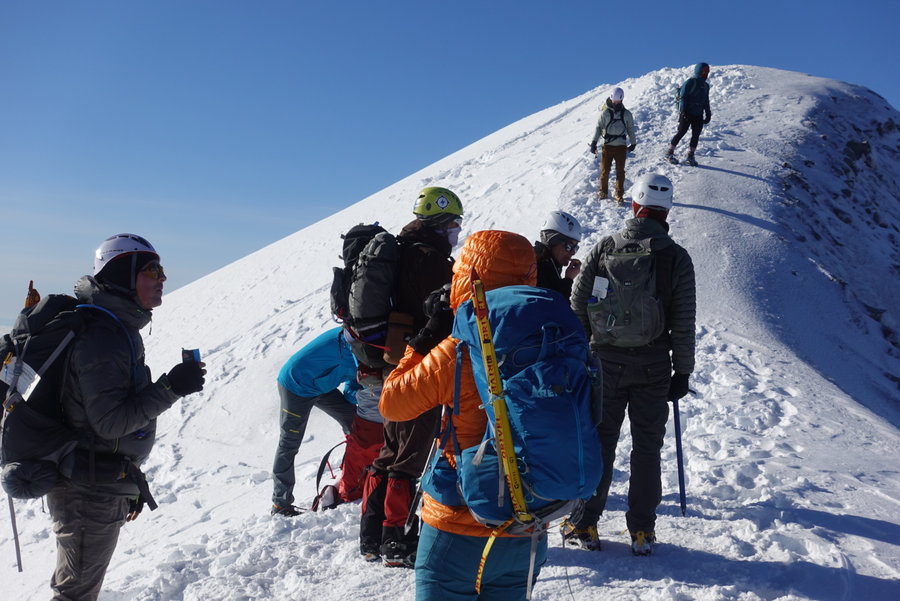
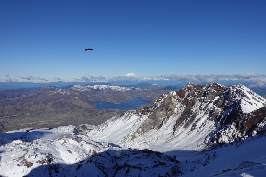
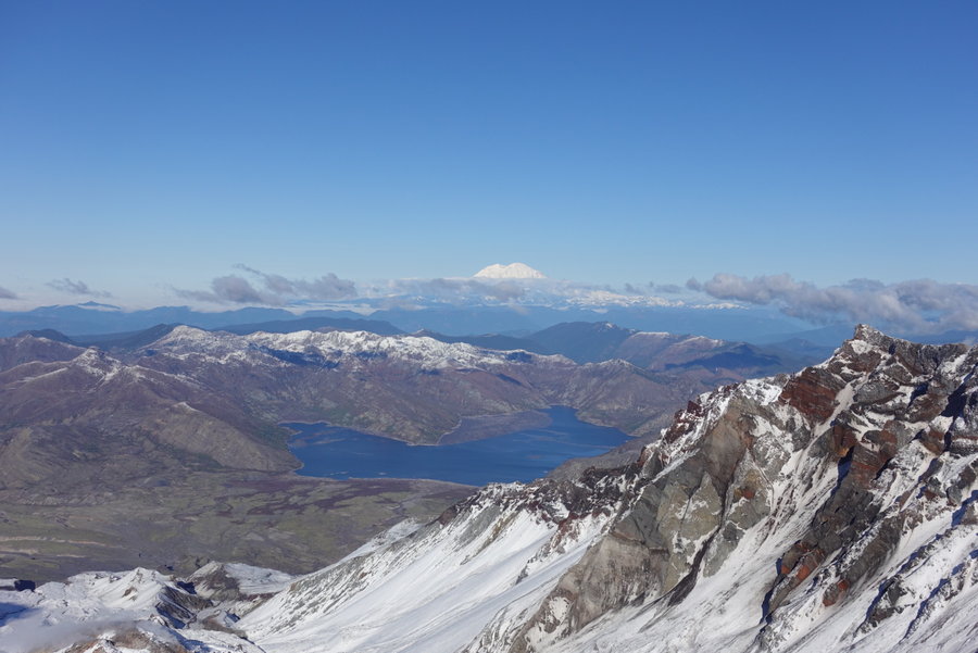
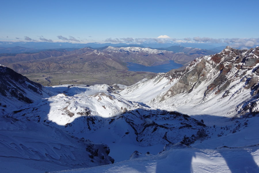
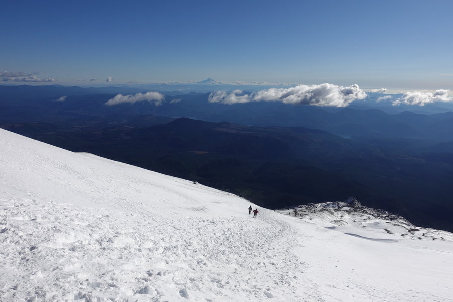
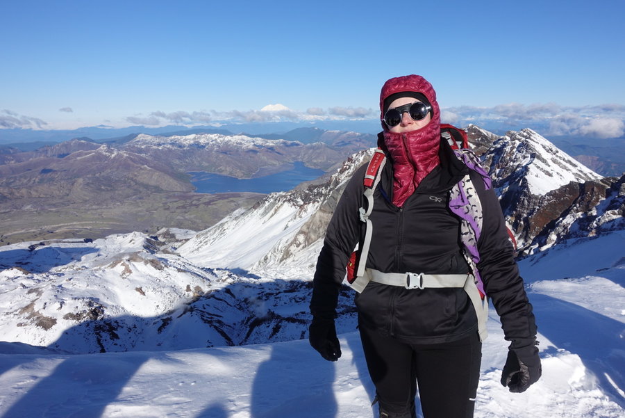
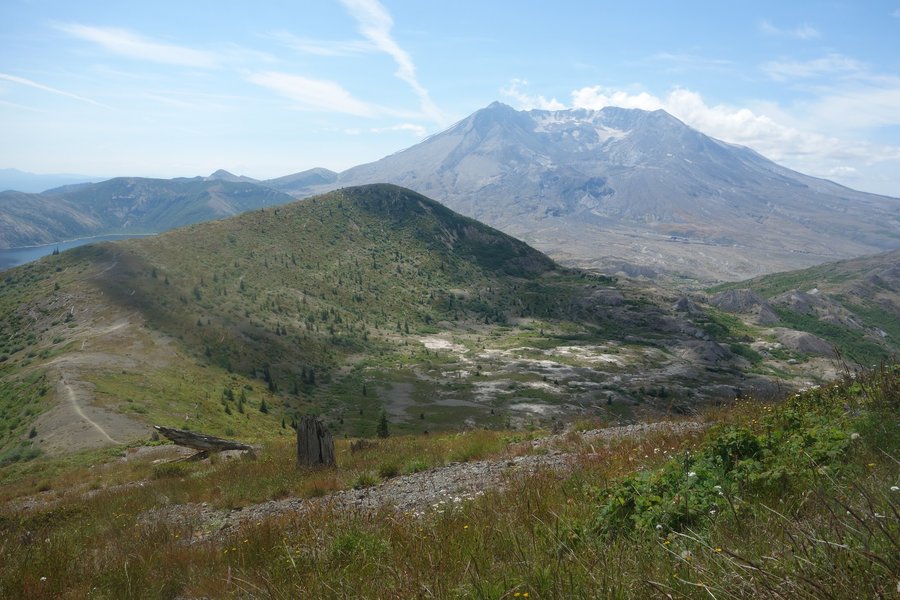
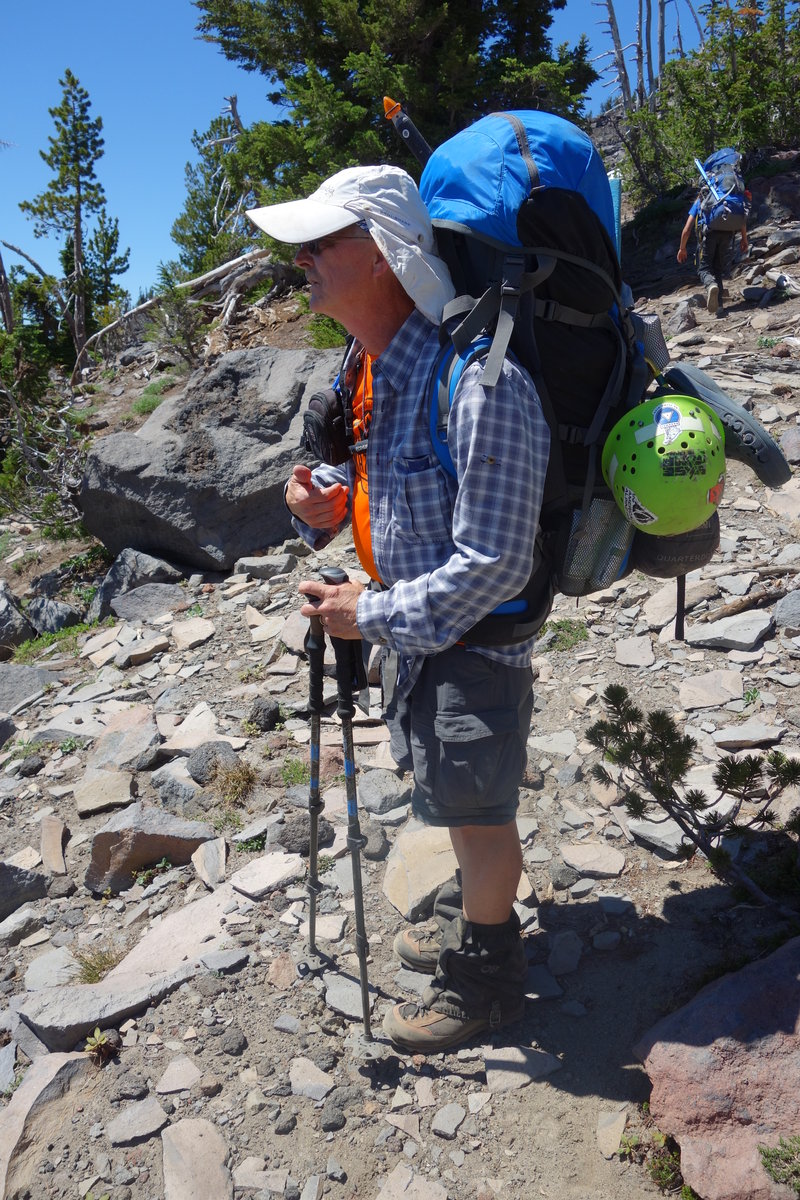
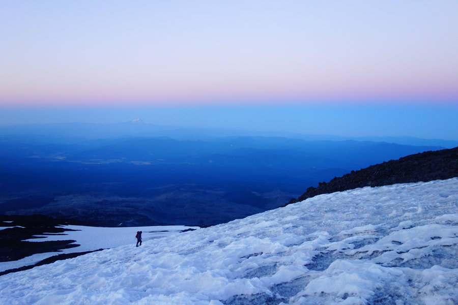
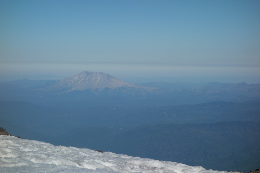
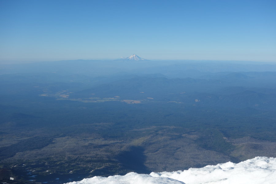
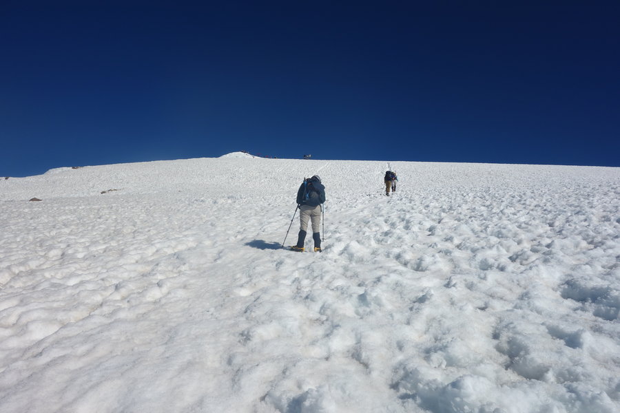
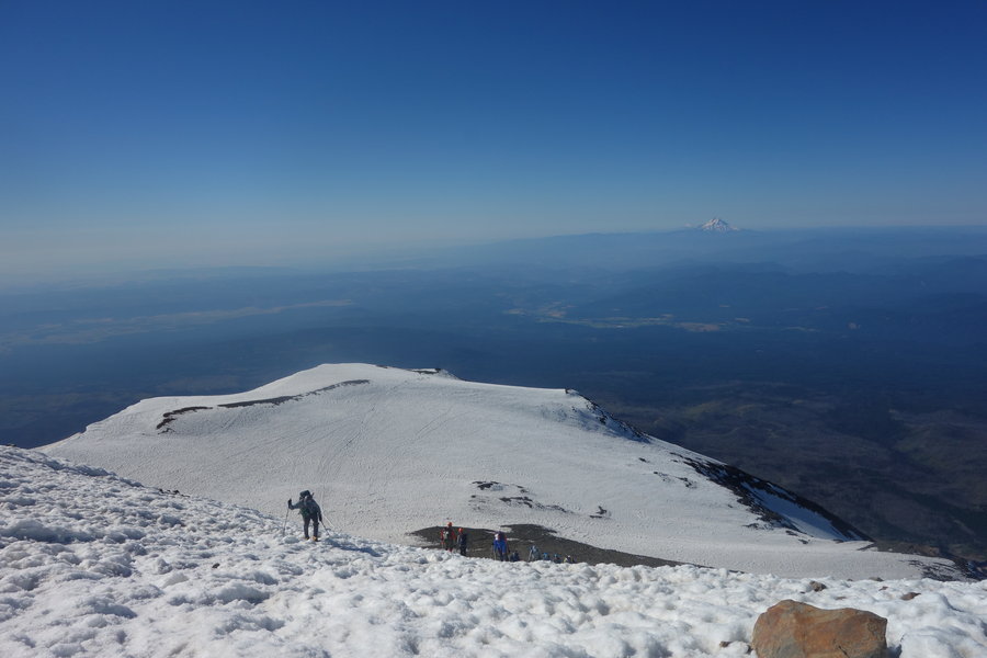
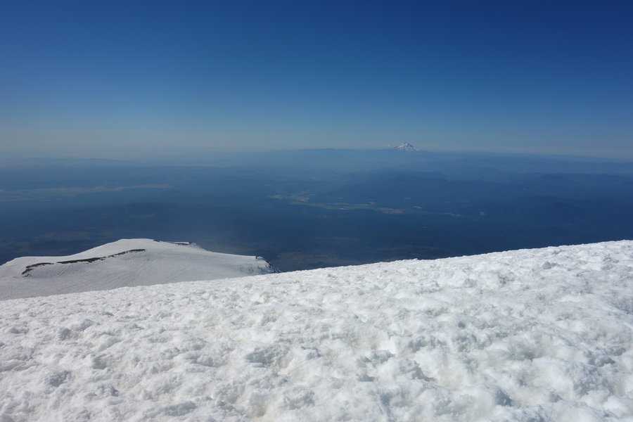
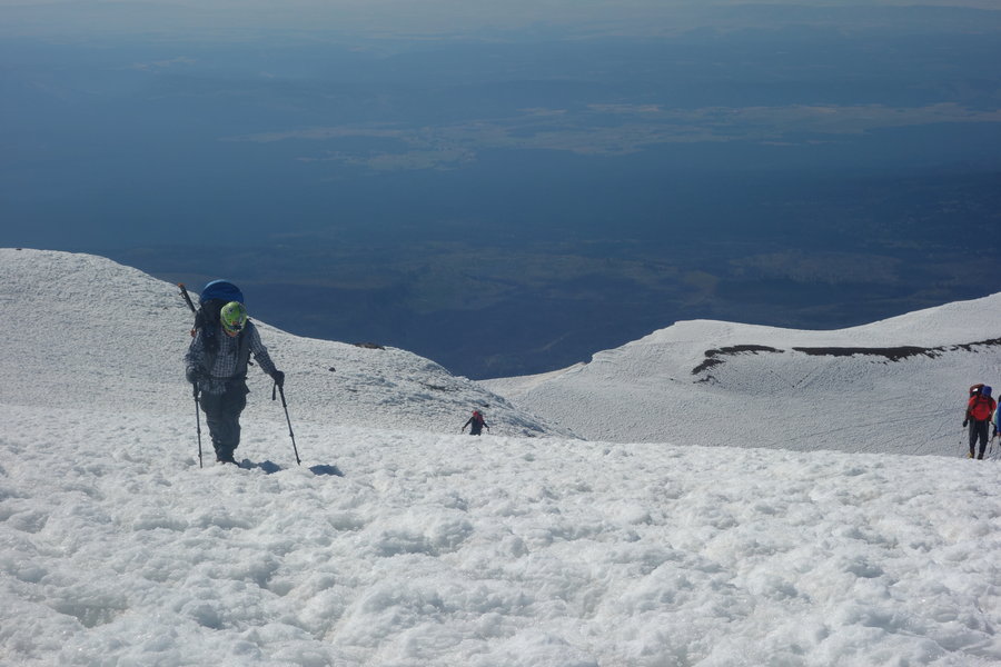
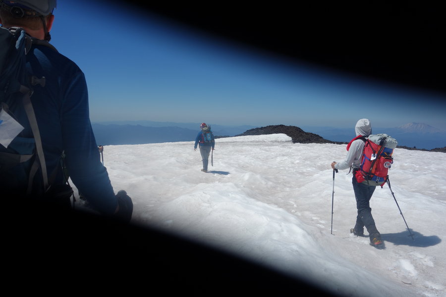
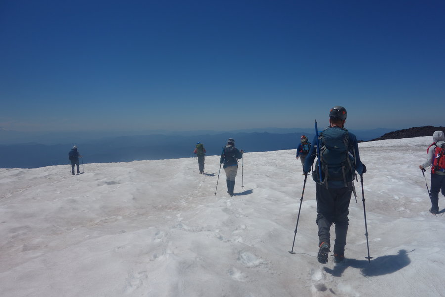
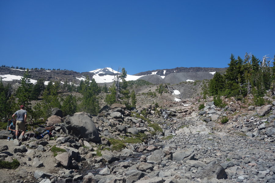
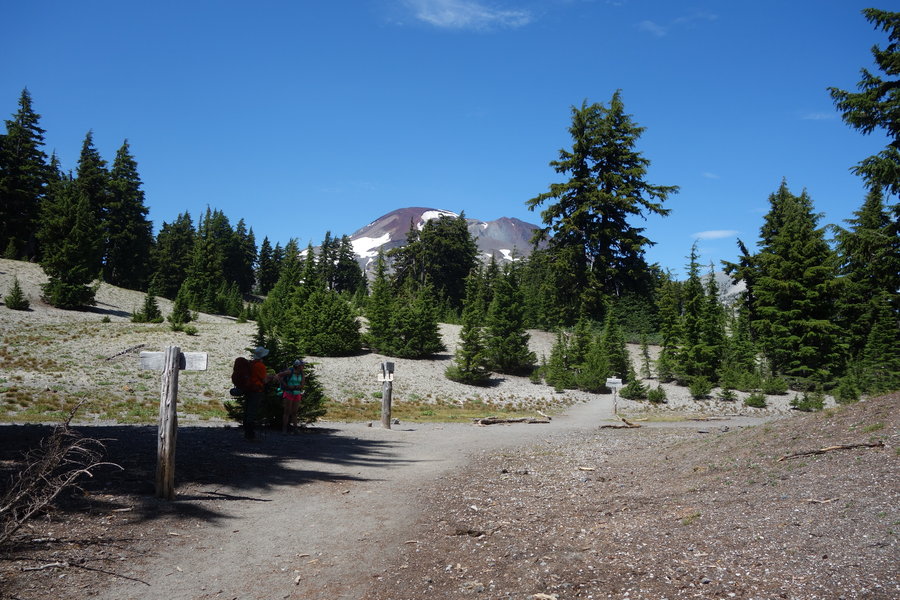
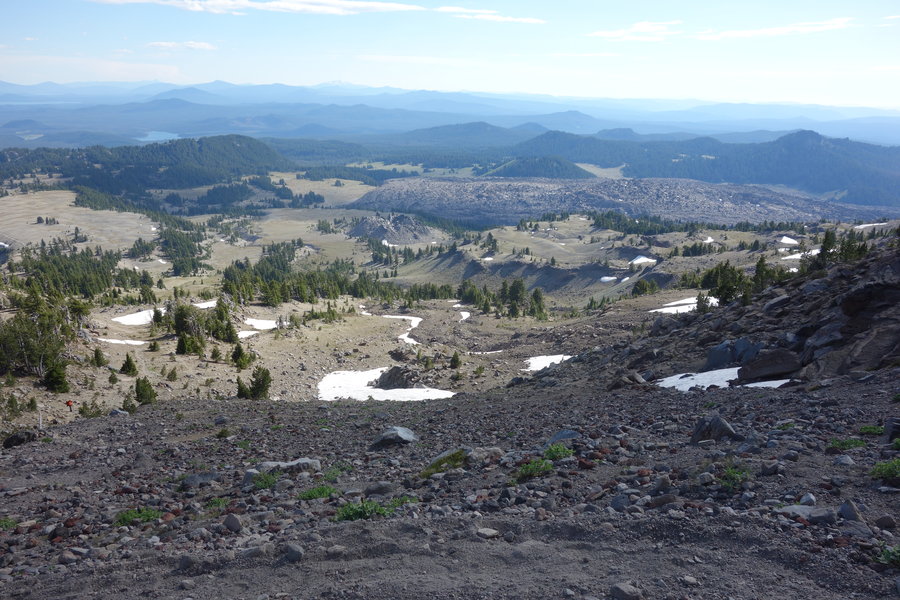
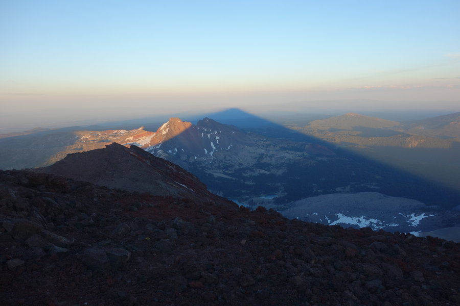
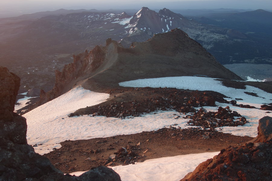
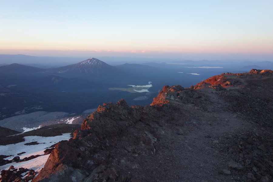
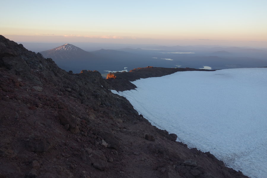
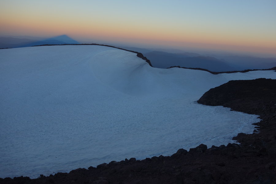
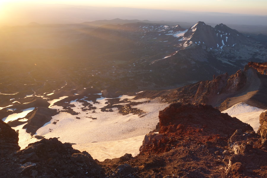
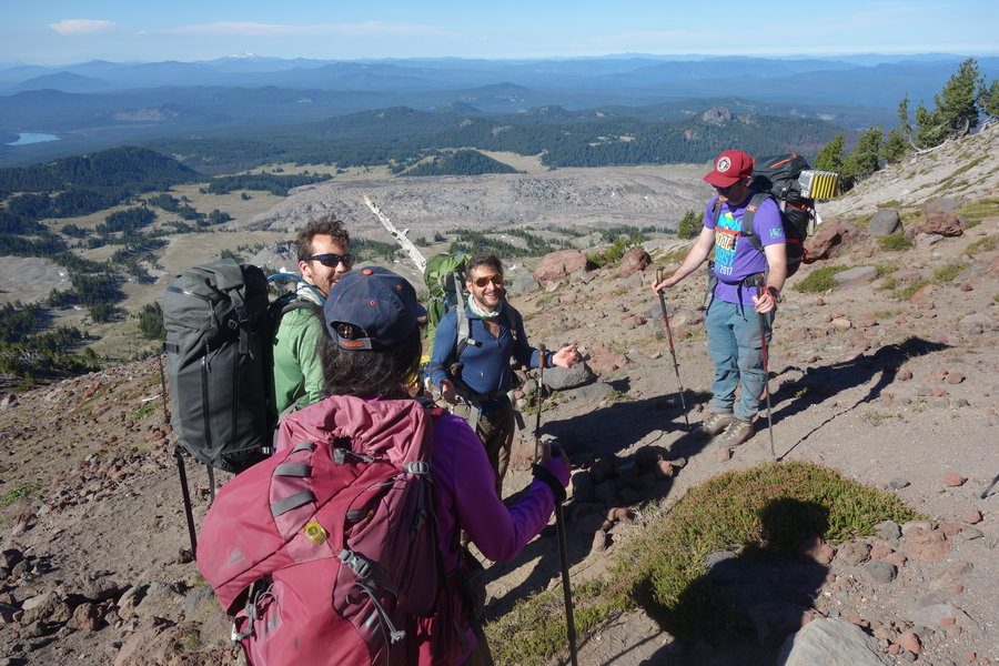
Mount St Helens
10 miles of hiking • 4500' elevation gain •
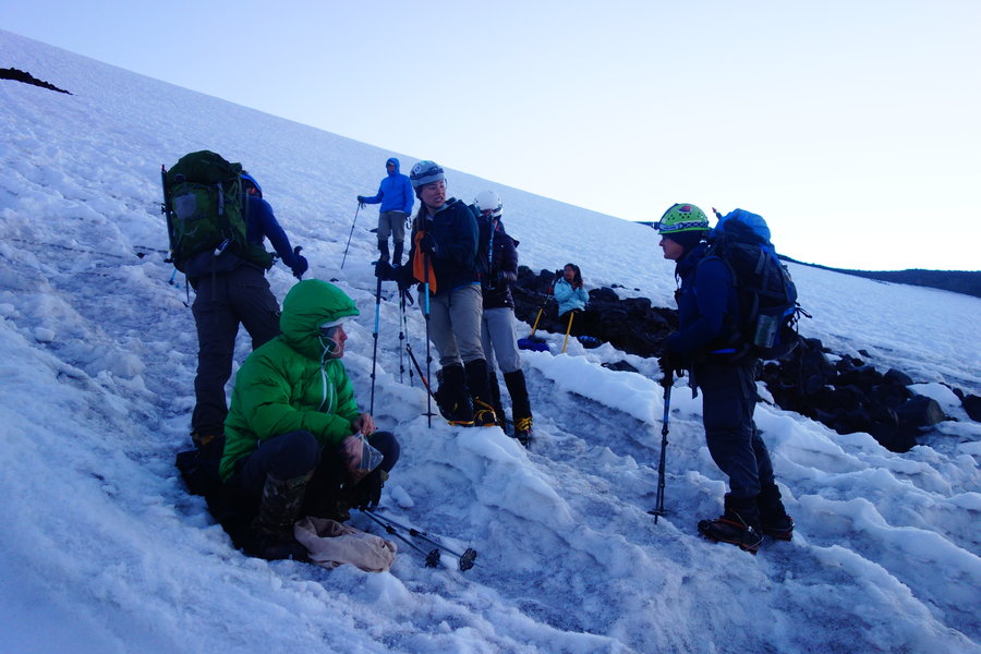
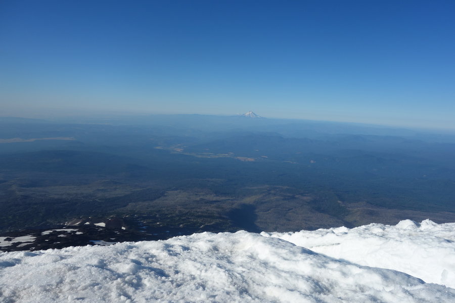
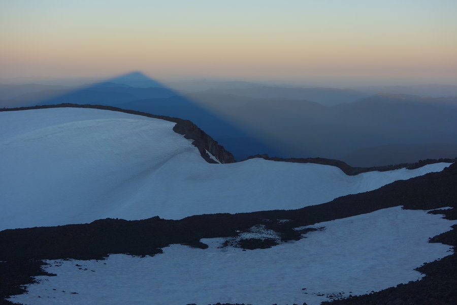
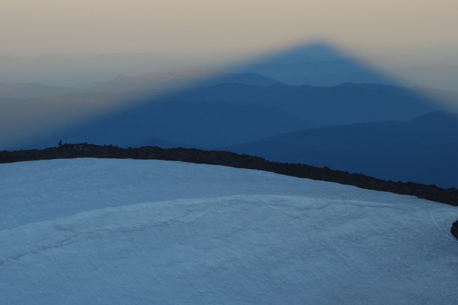
This Mazama climb was initially scheduled for last weekend, but with a less than ideal forecast it was rescheduled for this weekend. This proved to be an excellent decision, as we had completely clear skies and an excellent view of the crater. The climb was lead by Matthew Sundling, with Trey Schutrumpf assisting. This climb was intended for beginners, with plenty of tips and tricks thrown in. I still consider myself a beginner even though I have a few climbs under my belt - and it was nice to get advice I hadn't heard from other leaders before. (I never thought about putting hot hands on the top of my hands rather than holding them in my palm. Such simple advice and makes total sense.) My hands stayed toasty warm for most of the day. The wind whipped at our faces, at times very strong, and then at certain points on the mountain, disappearing altogether.
It seemed completely right to attempt this peak, two weeks shy of my 37th birthday and also, the very first mountain I climbed when I moved to Portland 3 years ago, via the winter route. (With no knowledge of climbing except for watching youtube videos on how to use an ice axe and how to glissade.)
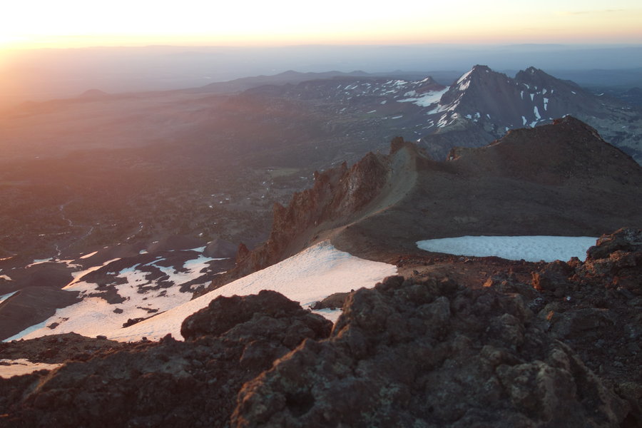
This time however, would be via the summer route, from Climbers Bivouac, up Monitor Ridge. We began at 8:00 am.
Snow was sporadic and somewhat light on the boulders, but still a little icy. We actually didn't put on crampons until we were at the end of the boulder field, for the final 500 ft ascent. In typical Mazama fashion, if you are wearing crampons, then you should be wearing a helmet and using an ice axe.
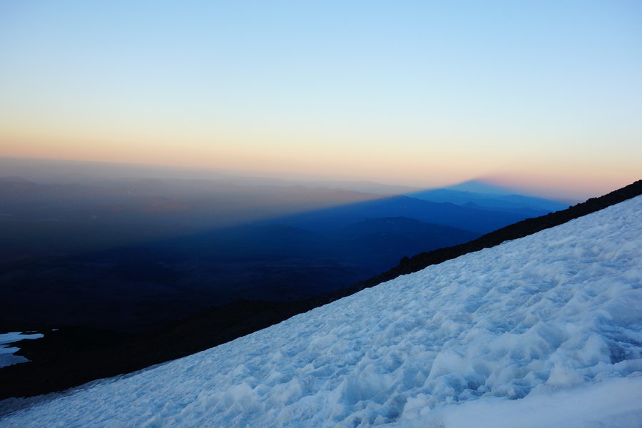
The crater was very much alive, with steam flowing out of the lava dome. One cool thing to note about Mount St Helens is the Crater Glacier - it is growing at a time when most glaciers around the world are retreating.
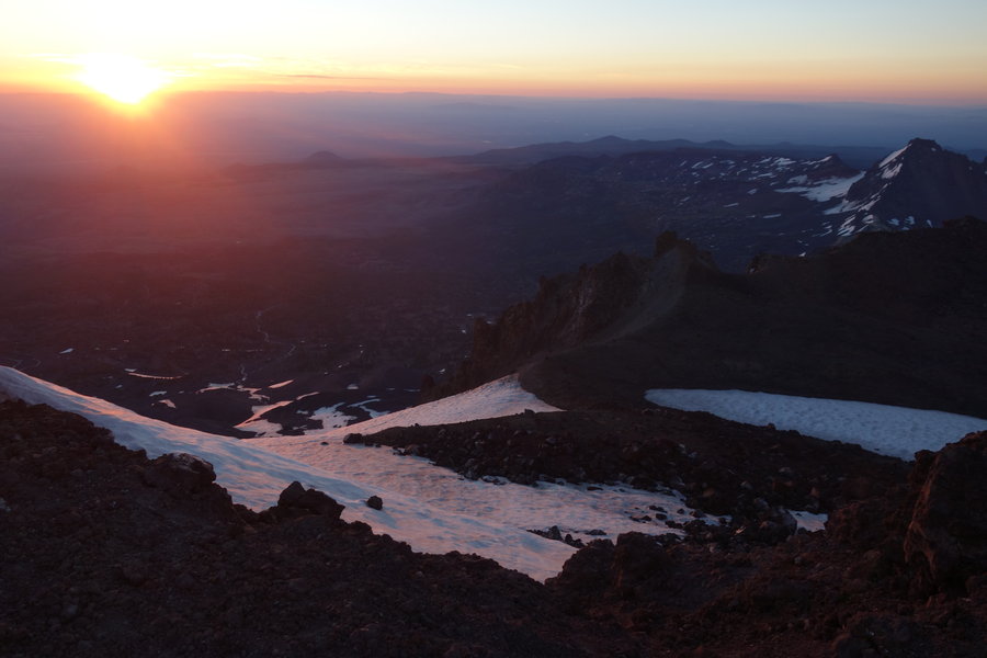
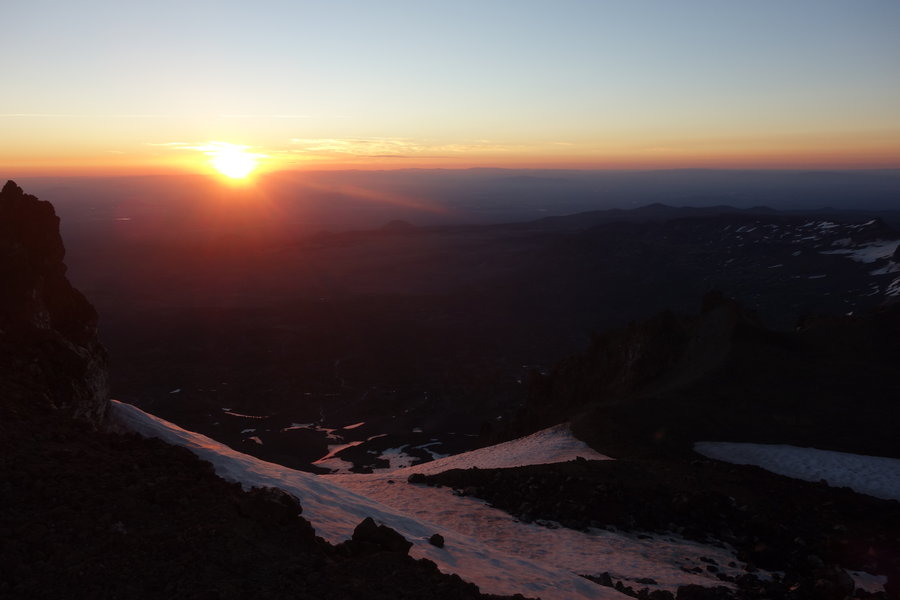
Our time at the top was short and sweet, as the wind picked up and we decided to begin our descent. Sadly, no glissading this time. My feet ached and moaned in new places as we made our way back through the boulder field. Part way down we took off our crampons, but there were sections where I would have felt more comfortable with some traction. With my short stubby legs, I used a variety of ways to get down and in between the giant boulders, and ended up with a few rips in my tights and a ding in my camera that I forgot to remove from my pocket. Note to all, don't wear your favorite clothes for this climb. You will put holes in something.
We made it through the boulders with the last bit of our light left, and the last mile out was in darkness. We arrived back at the trailhead around 5:00 pm.
A note on the climb leaders: I'm a slow and steady climber, I go at a speed that I can sustain without breaks/stopping. Although I wasn't as fast as the rest of the team, I was never far behind. I'm thankful for the encouragement and patience of the climb leaders in letting me go at my own pace. This short, stubby girl can still make it if you let me. The huge steps up the boulders were really hard on my hips with weight in my pack, and I'm certainly feeling it today. I'm hoping to improve my fitness this winter, and work on some of these aches and pains so that I can improve my speed in the future.
Great, but painful climb!
November 10, 2018


 1
1
Siouxon Creek Trail
9 miles of hiking • 1500' elevation gain •
Set out the day thinking the weather was going to be rainy and cold, but we were pleasantly surprised by a gorgeous day in the Gifford. Super pleasant hike, nothing to complain about other than the trash and toilet paper left behind. Mostly empty trail on a perfect fall day.
November 3, 2018


Ramona Falls
7.5 miles of hiking • 1000' elevation gain •
Depression hit hard recently, and my hiking/climbing derailed. I may not make my 52 hikes this year.
Finally hit up a hike I previously ignored due to popularity. Solo hike with my dog, and the trail was pretty empty. Gorgeous fall colors.
October 21, 2018


.jpg)
 2
2
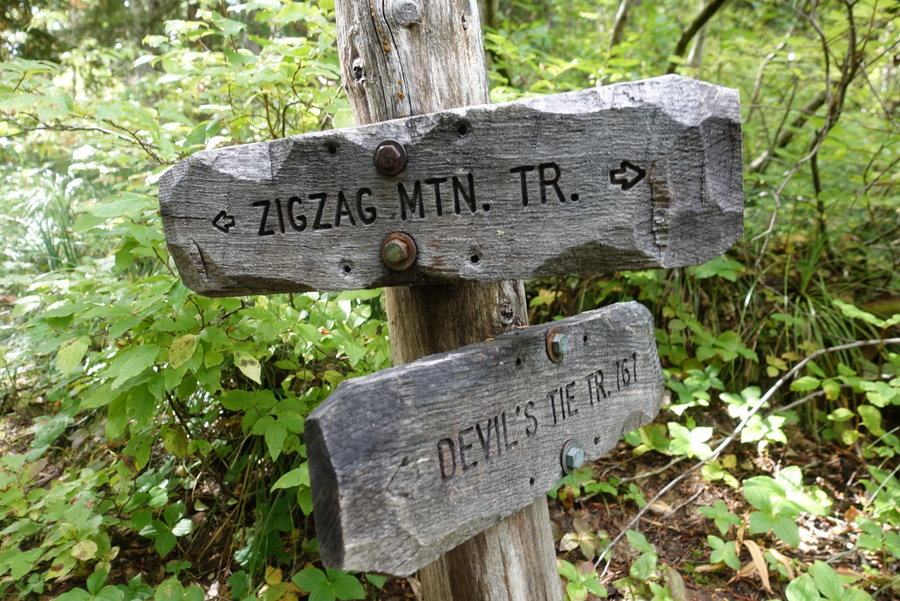
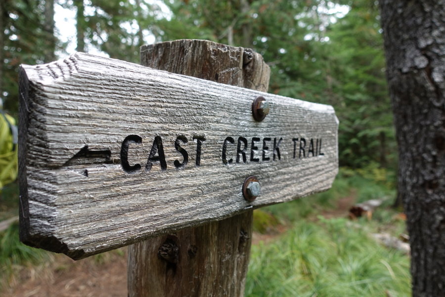
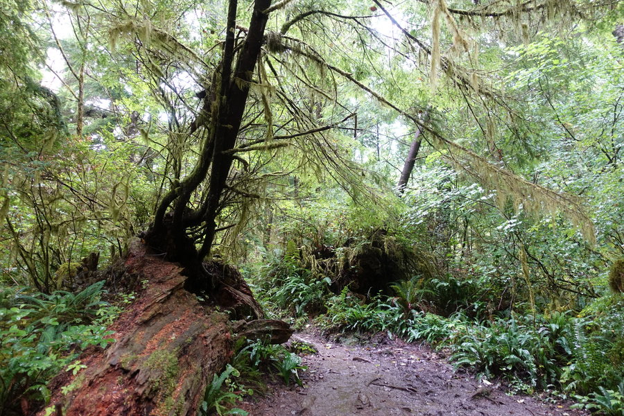
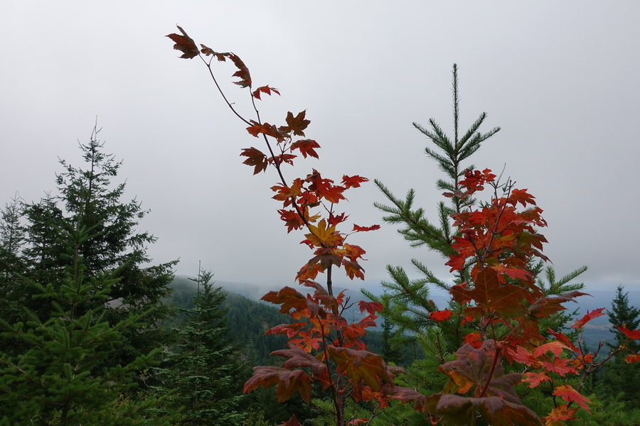
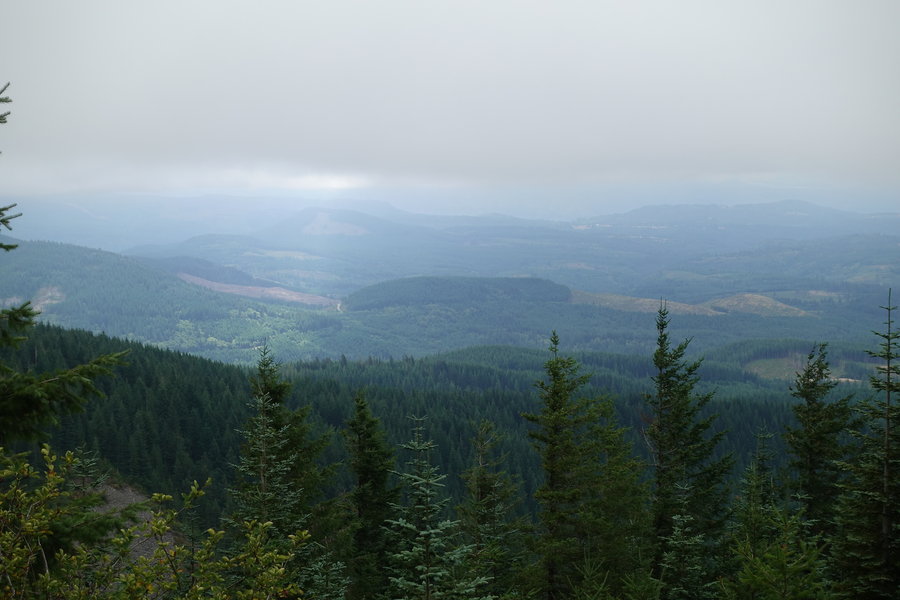
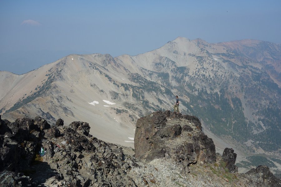
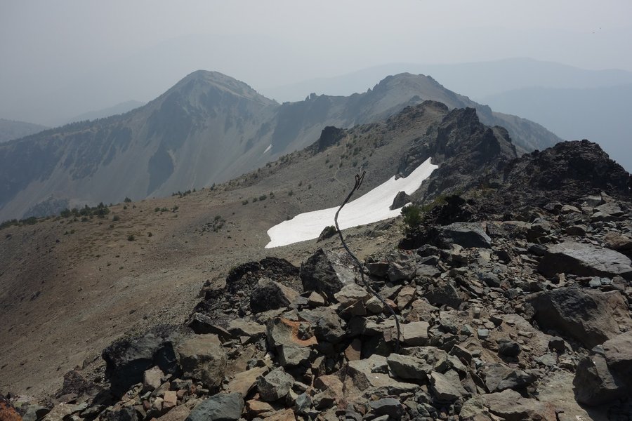
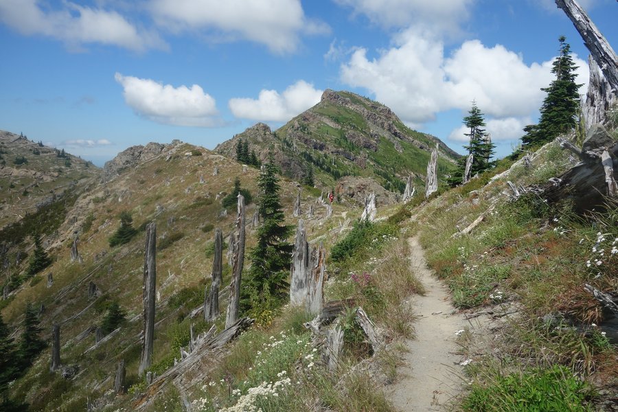
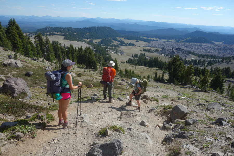
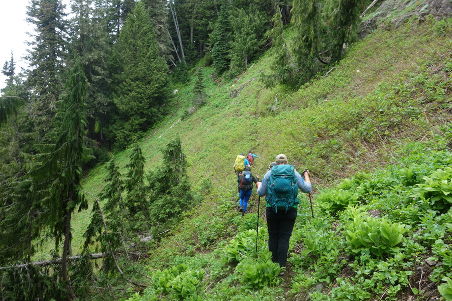
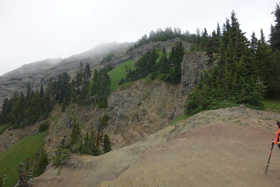
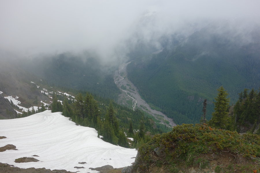
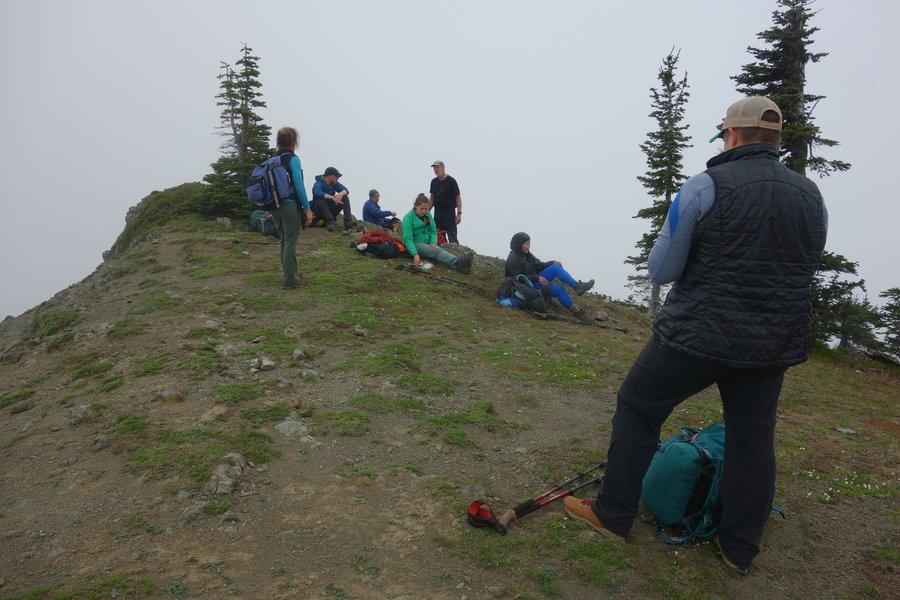
Horseshoe Ridge/Cast Lake Loop
14.5 miles of hiking • 3500' elevation gain •
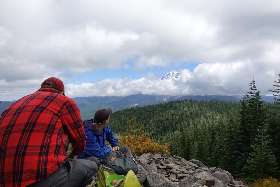
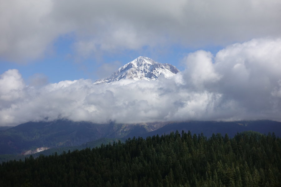
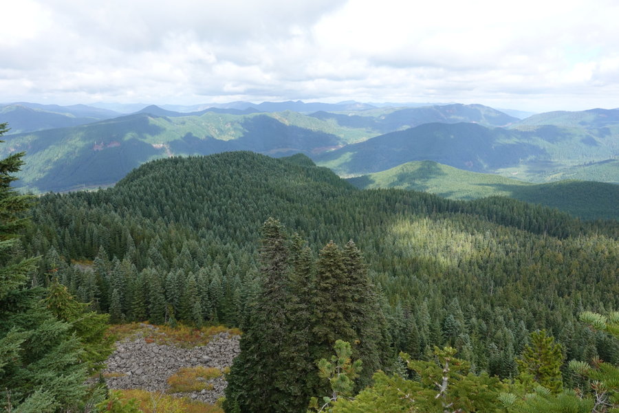
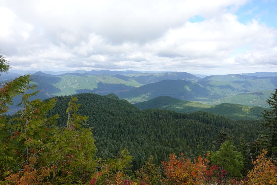
Met up with local hiking guide author, Matt Reeder (Off The Beaten Trail, PDX Hiking 365, Majestic Mount Jefferson) and his friend Mike, at Joe's Donuts in Sandy on Sunday for an exploratory hike of Horseshoe Ridge/Cast Lake Loop near Mount Hood. He was wanting to do the loop for research on his next guide, so I asked if my boyfriend, dog, and I could tag along. He thought the loop would be around 12 miles and 3500 gain.
I forgot to initially set my gps track until around a mile/mile and a 1/2 in, so my data isn't quite accurate. Matt's gps logged 14.5 miles, and 3700 gain. I tracked 13.1 miles and 3,323 ft with my iphone and gaia.
The trailhead is slightly hard to find unless you know where to look, park on the forest road 382, just before the Riley campground and you will find it. Alternatively, you could park in the campground and go the opposite way. The trail starts out flat until you get to the creek crossing at Lost Creek. We all debated on the best crossing - the creek was high, but two logs offered an option of crossing. One log, was very high up and wide, while the other was lower but full of short branches as obstacles. Zane and Matt and dog opted for the logs upright, while Mike slid across on his butt. Meanwhile I, alone in wearing gaiters, opted to cross the creek by foot. The water ended up just going over my gaiters in one spot, so I got a little wet, but not soaked. My choice was slightly made by 2 facts, I didn't feel comfortable crossing that high walking across a log, and I had a brand new pair of merino wool tights just purchased on. In hindsight, I would have worn my trekking tights and scooted across the log, but my choice felt much safer for me. Another option would be grabbing some water shoes and making a crossing without hiking boots. It wasn't particularly swift, just high.
After the crossing, the trail starts up in earnest. Gentle compared to some area hikes, but still a good workout. Matt and Mike slightly outpaced me, but I stayed right behind, and we took minimal breaks until we reached the ridge. Lunch was had atop the ridge, as the clouds stubbornly hid nearby peaks. All of a sudden, (and I screamed out in glee) the mountain made itself come into view as the clouds cleared. Just as quickly, they came back. The sun was in and out, we were were cold then warm then cold again. As the guys sat, I explored a bit on the rocks to see if I had any views in any other direction. We had a little bit of fall color. I have a feeling this may be a better hike during wildflower season, but the views of Mount Hood have to be incredible on a clear day. Grateful for our small glimpse, we pushed on towards the end of the loop. And on, and on... This loop ended up being atleast 2 miles longer than current hiking guides suggest. We think this might be due to the forest road being closed/overgrown and the loop taking a different route than it previously may have. Also, when we felt we should have been going down, the trail takes you back up in two different spots. Not terrible, but with the length we were over on up and ready to be done and down.
Overall, we hardly ran into anyone on the trail, maybe a total of 7 hikers total during our descent. Lily got to have an entire hike off leash, which made for a very tired dog after our long mileage. I'm still pretty sore today, and my commute by bike home today against the wind uphill was not very fun. Glad to know I can get the mileage in after the nasty cold I just got over, as I have an upcoming Mazama climb/scramble in 11 days.
September 23, 2018


 1
1
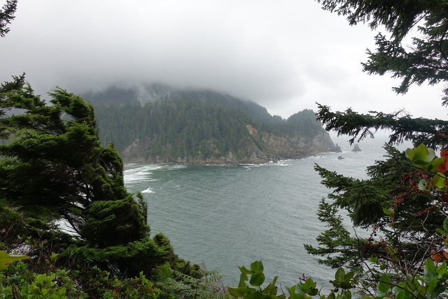
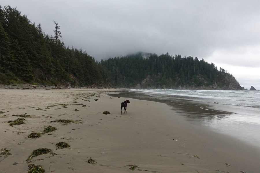
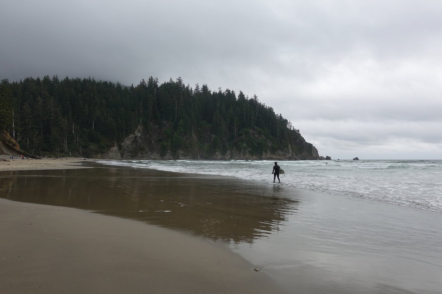
Cape Falcon
6.3 miles of hiking • 750' elevation gain •
Took a few weekends off from hiking, got hit with a nasty cold. Decided to go for a leisurely stroll on the coast, hoping for doom and gloom in the rain. Not quite enough fog for my tastes, but still a fun day. It still boggles my mind that my dog will run through the rain and jump around in crashing waves in the ocean, but when it rains when she is home she is a quivering mess.
September 15, 2018


.jpg)
.jpg)
 1
1
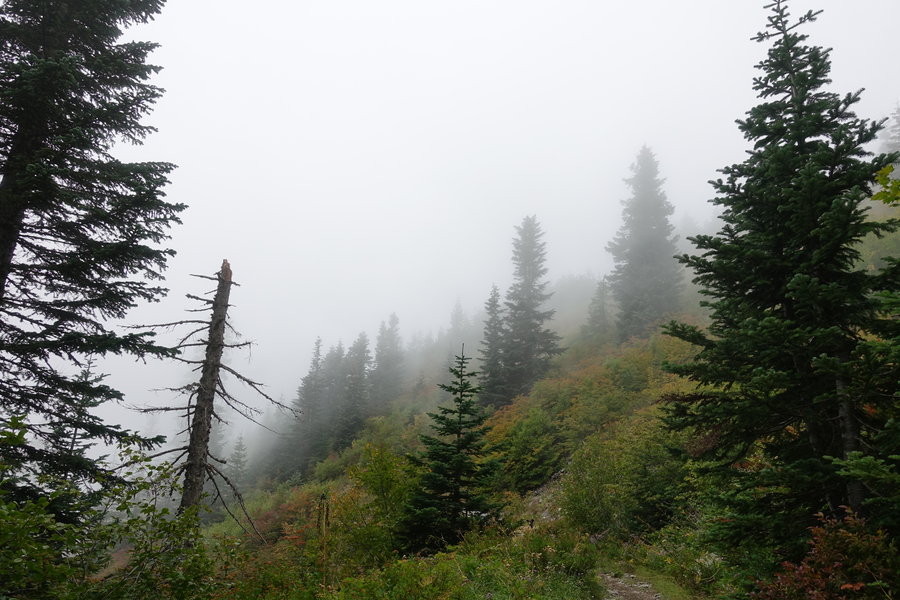
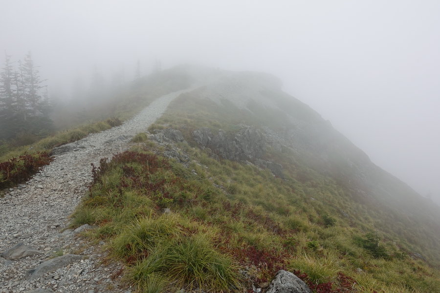
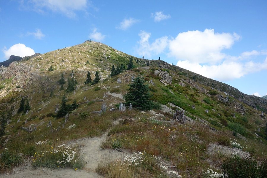
Silver Star via Grouse Vista
6.8 miles of hiking • 2000' elevation gain •
Do not make the mistake of trying for the North trailhead to Silver Star. Nothing will make it up that road unless you are a very high clearance vehicle. Passenger vehicles head to the Grouse Vista trailhead.
I was absolutely exhausted on Saturday. Friday night, the girls dragged me out to Rod Stewart and Cyndi Lauper in Ridgefield, WA. I ended up staying up with a couple of beers and reconnecting with an old friend visiting from Michigan, even though I promised to meet up to carpool at 8 am. I dragged myself out of bed at 7, and prepped myself to hike. My partner Zane, was starting to feel the first signs of a cold, but didn't want to miss out.
We opted for the right offshoot trail that allows passage by Pyramid Rock, which was very overgrown but still easy to follow. I can't imagine getting lost on it, but if it was the least bit wet it wouldn't be fun to bushwack through the trees if you didn't have rain gear on. Our return trip was on the maintained trail.
The day was supposed to start cloudy then eventually clear... We summited into a cloud, where it was windy, cold, and I was glad that I had my extra merino layers to grab out of my pack. My two friends, new to the PNW from Florida, said they were simultaneously cold and warm at the same time, and I instantly asked if they were wearing cotton. Of course, they were, so they got a lecture from me where I had to explain why you don't wear cotton to hike or you risk getting hypothermia even in mildly cool weather. Zane's fever had flared up and he felt pretty sick, so he made his way back to the car before the summit.
I'll have to return sometime when the views aren't obscured by clouds.
September 1, 2018


 1
1
Portland Rock City Ramble (Urban Hike)
5.5 miles of hiking • 250' elevation gain •
On Wednesday after work, I decided to head out for an Adventurous Young Mazamas urban hike starting at the downtown REI. Matt Reeder (local hiking guide author and all around nice guy) hosted an evening of music trivia and visits to former and existing music venues in Portland. While my legs were a little sore from my climb the day before, gain on this was minimal and it was fun to just hike in street clothes and geek out about music. My tastes are a little darker and more industrial and goth rather than rock, but it was still interesting to see the places where music history was made in the 90's in Portland. Sad that so many old establishments are gone, or are no longer music venues. Even in my couple of years here, I have seen a few venues come and go as the city focuses on building condos rather than building culture and supporting the arts. (A huge reason I was drawn to Portland in the first place, the music scene) The PNW seems to breed a certain type of bleak music that I have always gravitated towards. I hope what places we have can still thrive for years to come.
After walking by downtown venues, we headed across the Burnside Bridge to Doug Fir, which was to be our mid hike beer stop, but it was packed with people. We opted to walk and find a slower looking establishment for our large group, and ended up at Rontoms. A few beers later and we were back in the streets for one last stop at the Melody, which is still an existing venue, but now only for corporate events and parties.
It was nice to do something a little different and more relaxed than a typical Mazama outing.
August 15, 2018
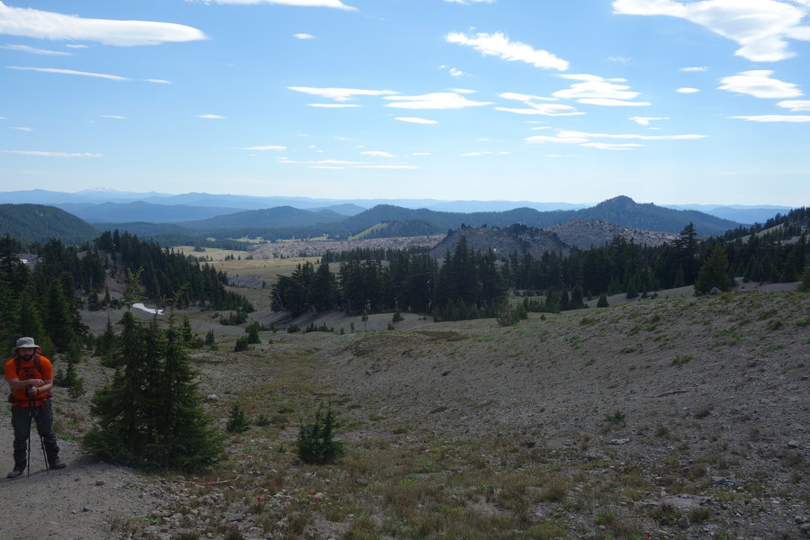
 2
2
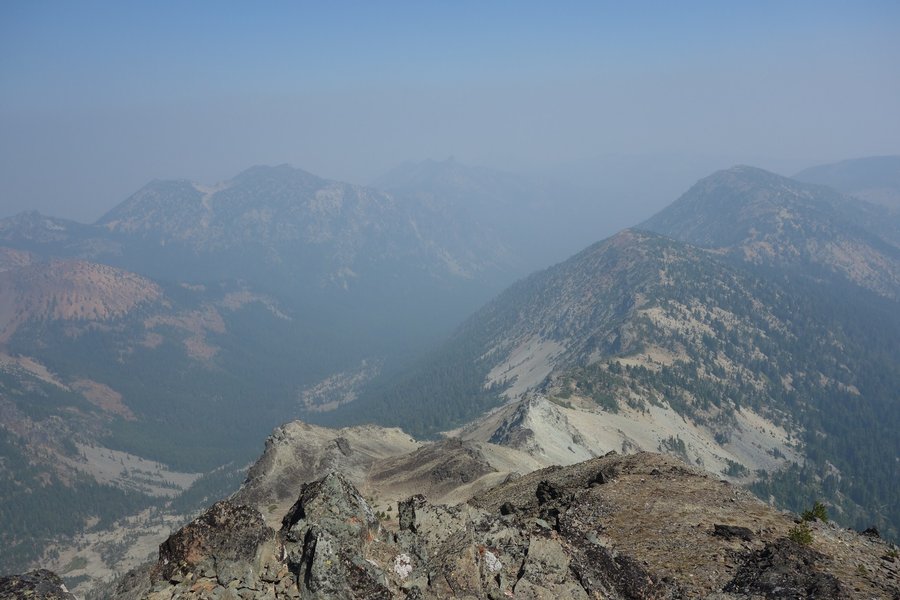
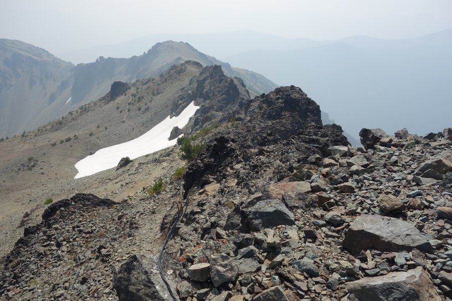
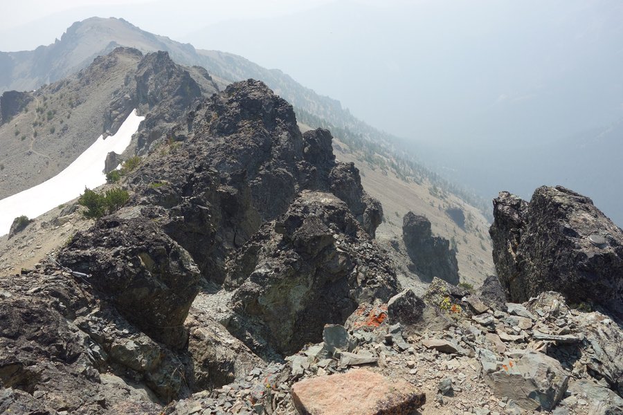
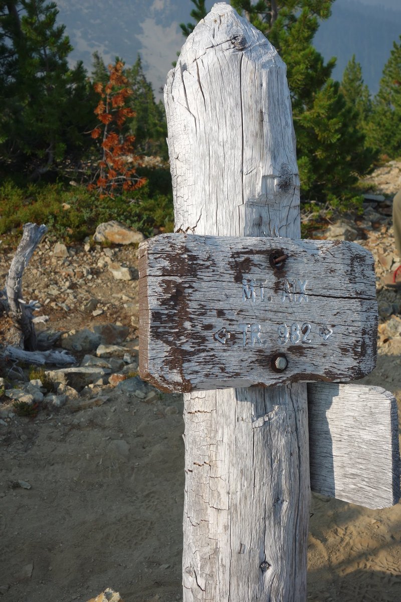
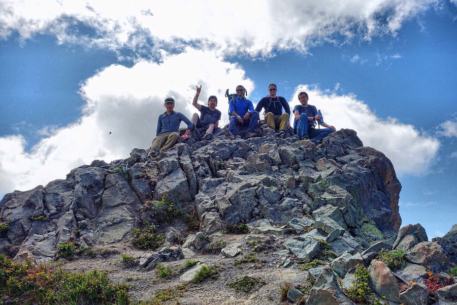
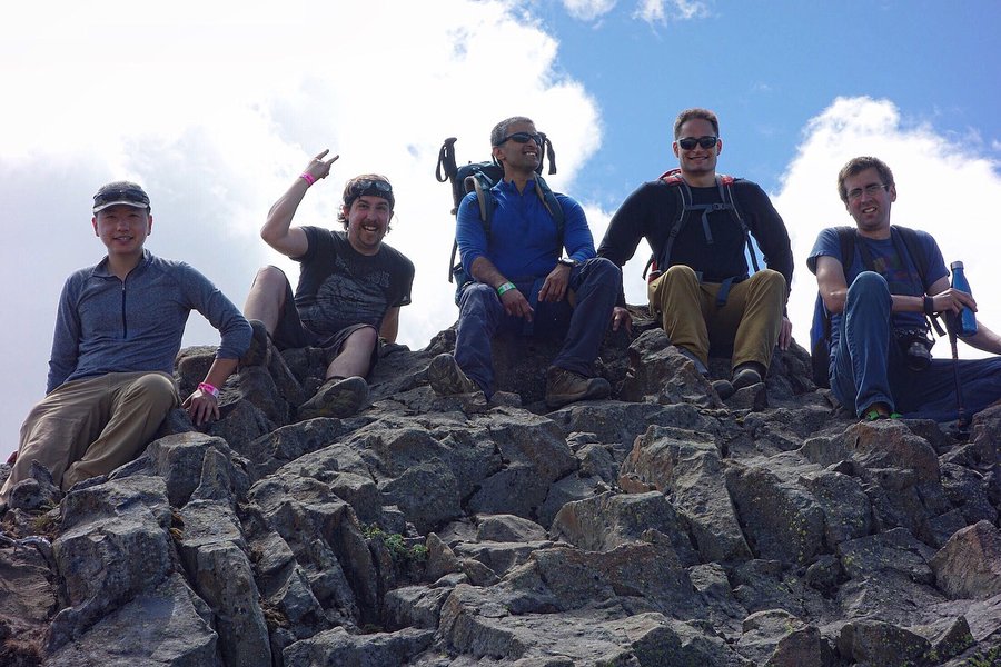
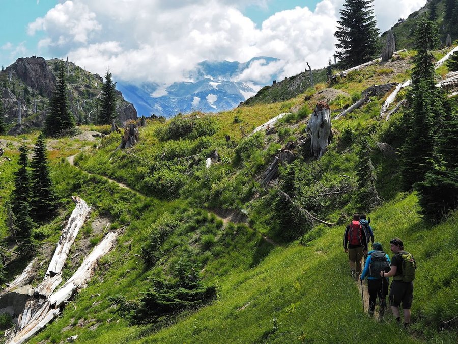
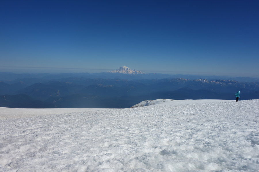
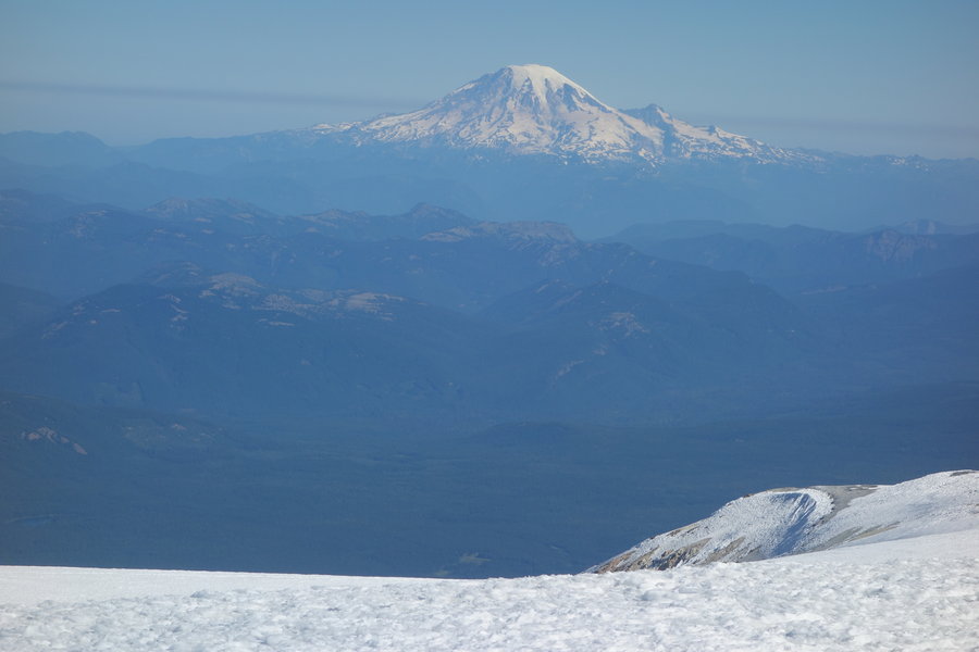
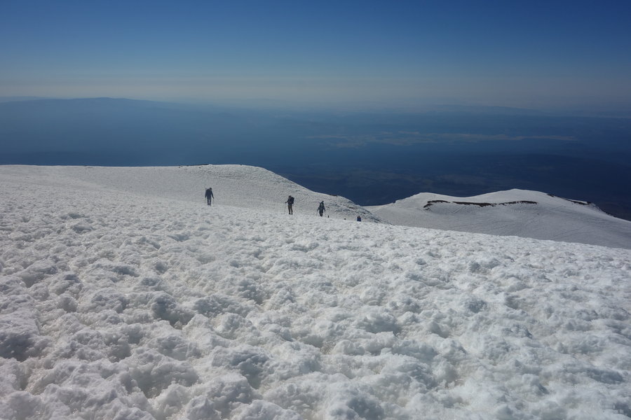
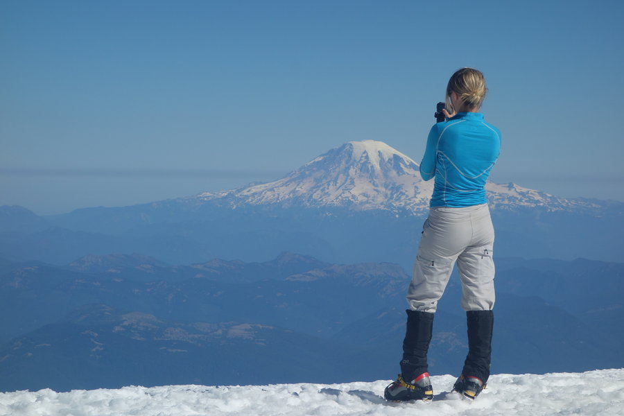
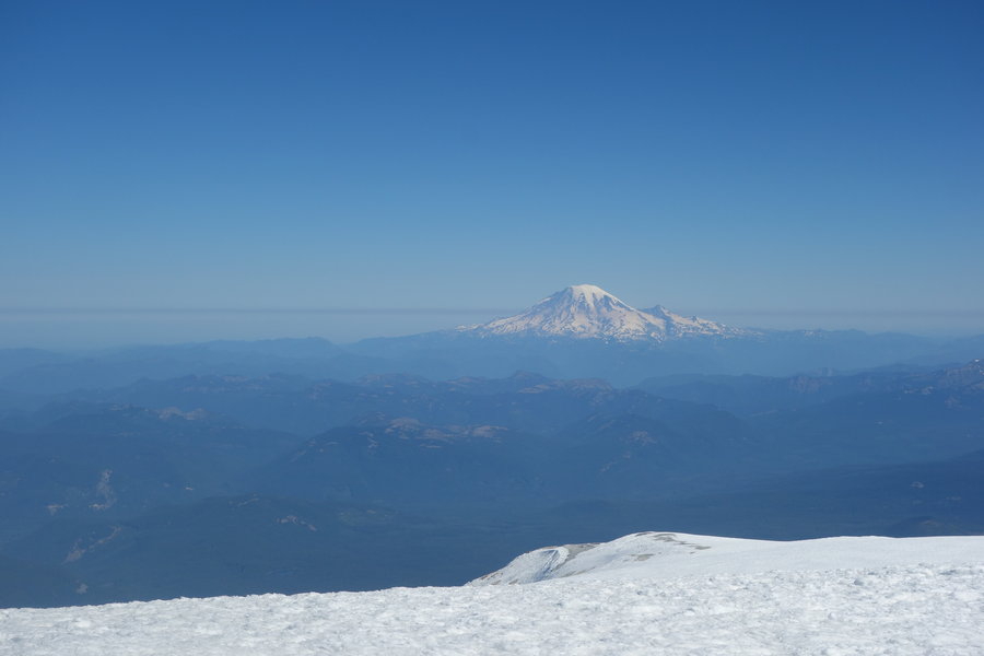
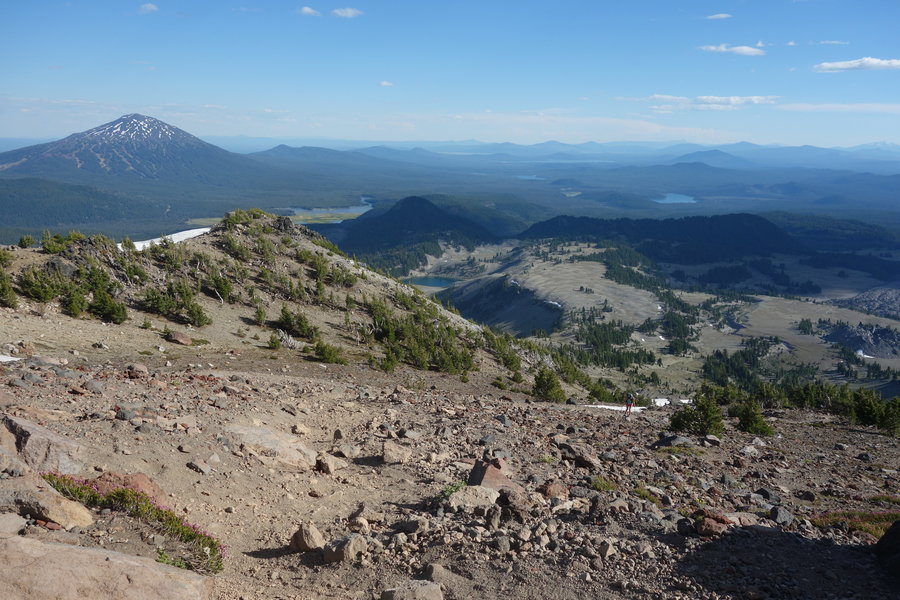
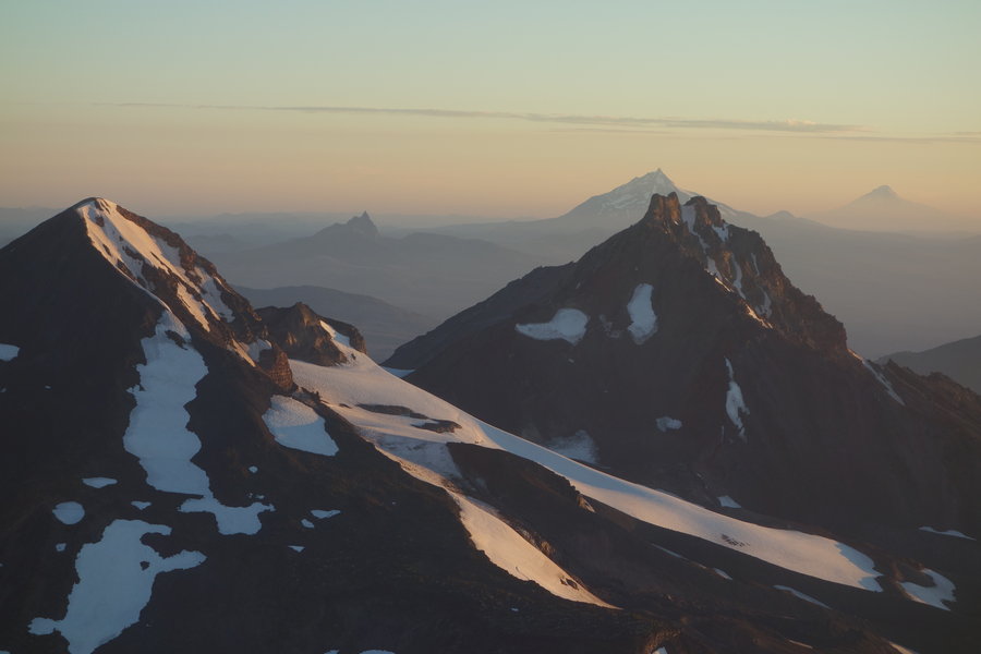
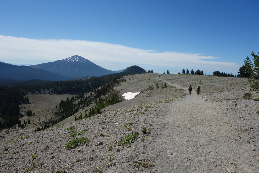
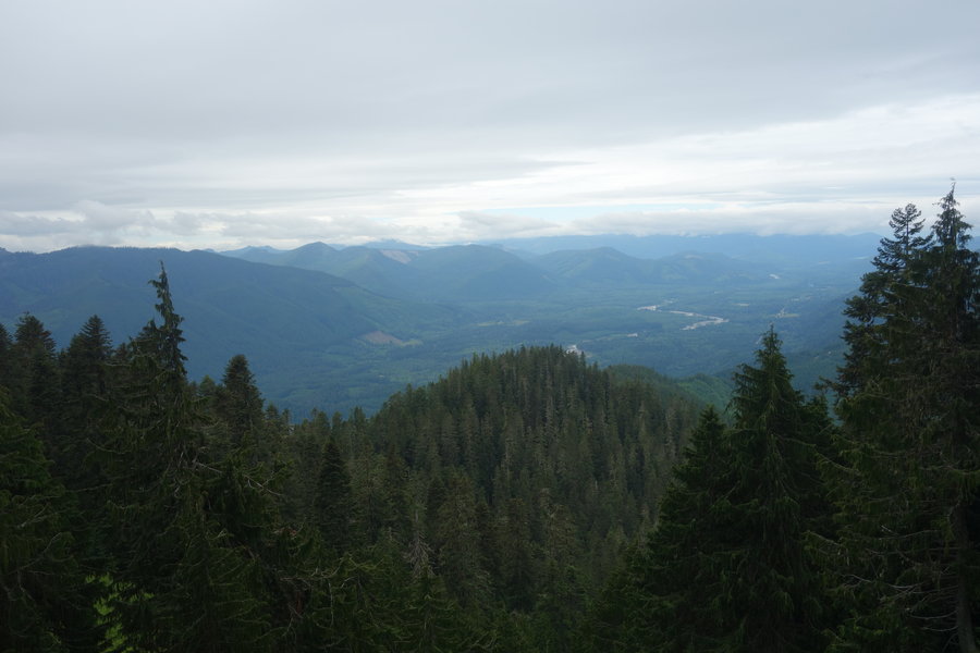
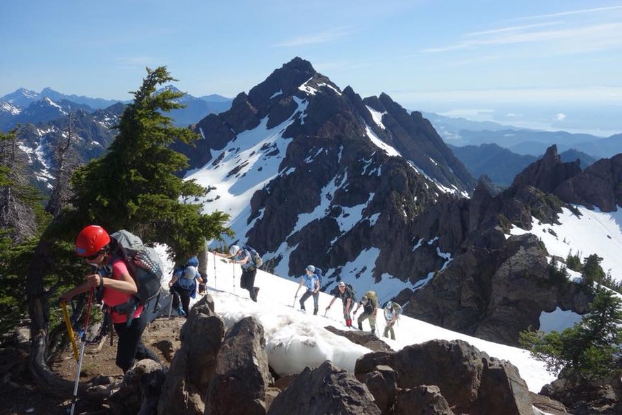
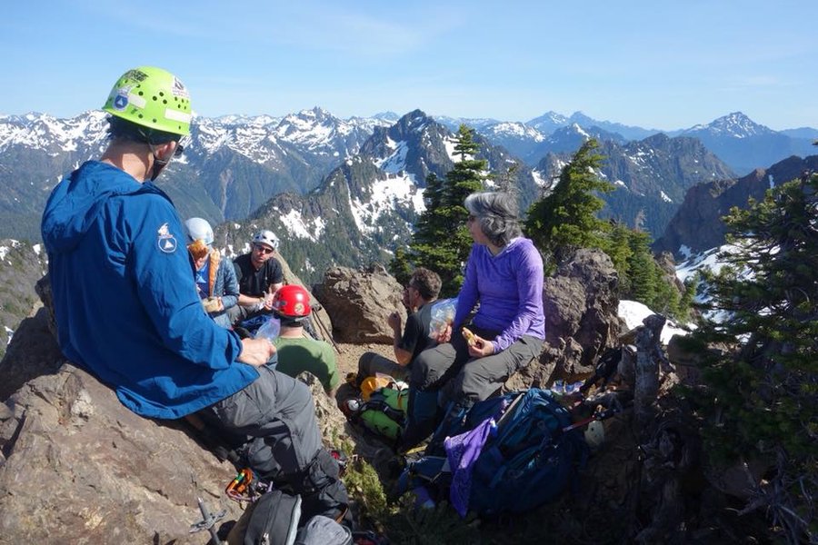
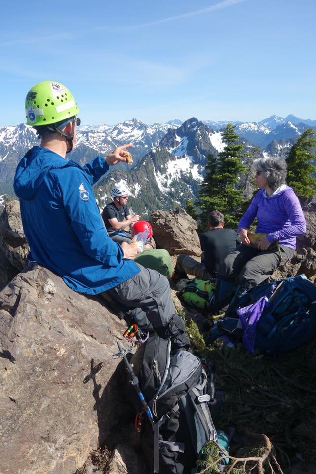
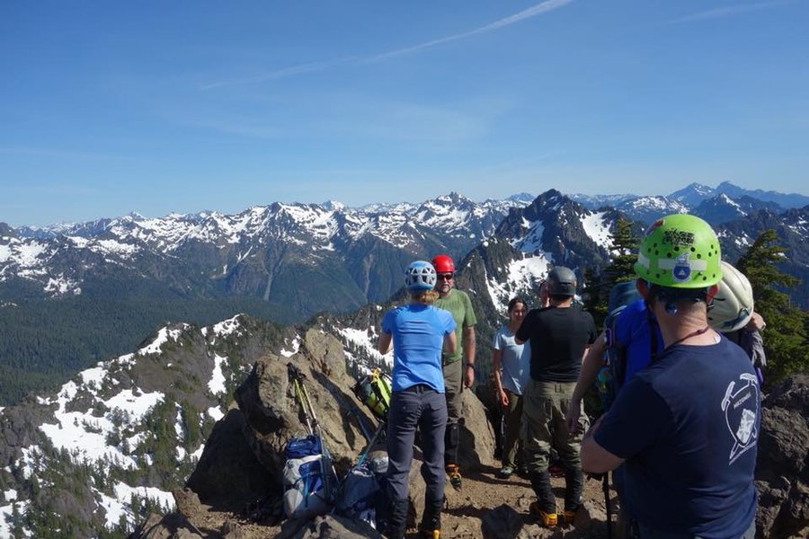
Mt. Aix
12 miles of hiking • 4250' elevation gain • 1 night
The pronunciation of this peak is questionable, I've read three different variations, "Aches", "Eye" and "Ikes." Mt. Aix is located in the William O. Douglas Wilderness, just outside of Mount Rainier National Park. I'm kind of partial to Aches, as it makes sense with the amount of elevation you gain right from the beginning. The drive out from Portland is stunning, even with the haze of wildfires. I recommend a stop to stretch your legs at the Tipsoo Lake parking area, take a stroll around the lake and gaze up at nearby Natches and Yakima Peaks, before heading to Chinook Pass on your way to Bumping River Road. Eugene, our assistant on the climb and my driver, decided we should take a quick dip into Bumping Lake, since we were camping and had all day to get to the trailhead. It was quite warm, though it was a bit odd for Michigander like me to swim in a tree graveyard.
The trail (#982) starts out gentle (very briefly), before you begin switchbacks in earnest.
Trail was mostly dry, just a couple of small trickling streams early on. Bring plenty of water. There are some great free camping spots right at the trailhead with parking - no signs that a Northwest Forest Pass was needed at this time. The sites were slightly littered with toilet paper in spots, but otherwise suitable. (Pack it out people!) We were advised not to filter water from Copper Creek, (which is a beautiful spot post climb to take a dip or soak your feet in some frigid water.) It was honestly one of those spots best kept in your head, and therefore I didn't take any pictures.
The climb itself was strenuous, and I quickly regretted the 20 mile bike ride I took on Saturday, the dancing at Lovecraft before that, and the Deafheaven/Drab Majesty show I attended Sunday evening. Eugene quickly made me into a teaching moment for Bill, (Eugene was evaluating Bill's provisional climb lead) and I was put on the spot to stay #2 behind Bill since I admitted I was feeling a little burned out. Honestly, I need time to "warm up" and so many climbs start fast paced from the get go, and that just isn't me, I need to work my way into a pace. Part of me knows I need to work on my fitness, but I'm confident while I may not be the fastest, I am strong. I have accomplished a lot this summer and I am grateful for the climb leaders who have allowed me to summit with them. Bill was great, and slowed his pace slightly with conversation, and I stayed right behind him for the remainder of the climb. (Sorry Bill, you were stuck talking to me all day!)
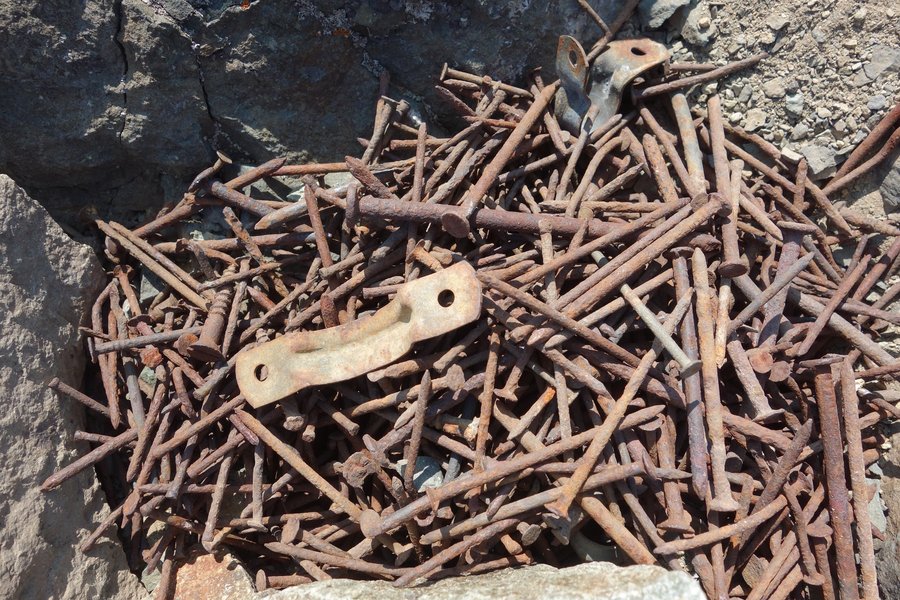
The real fun began at the scramble, and this is an area where I felt a little giddy and excited, something about finding my way with my hands and feet through a puzzle of rock makes sense to me, more so than actual vertical climbing. By this time we had our helmets on, and were very near our mission. (Yes, the summit, but #2, Bill's son had lost his cell phone in the rock getting to the summit on his scout the previous weekend.)
Bill, armed with some sort of grabber tool, was able to grab the cell phone wedged between some rocks, and amazingly, after a week in the elements, powered up when plugged in back at the trailhead.
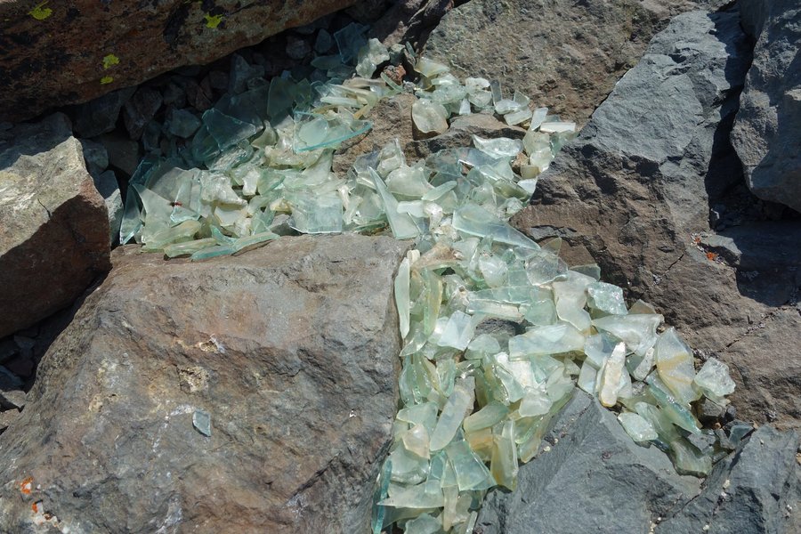
Our views of Mount Rainier were obscured by smoke, but just the top floated above, like a ghostly otherworldly friend, waving at us from beyond. Our summit had a frenzy of flies, they didn't bite us, but it seemed like an odd spot for them to gather. Remnants of an old lookout were found, a pile of nails, some glass, and wire. High fives and smiles were spread around, some political dissent from our Venezuelan climber, and then the descent. My knees barked a bit, and I ached for a post climb beer. We made our way back and I collected my 5th summit card for the summer. The beer would have to wait until 4+ hours later when I reached Portland, and I barely made it through it before my eyes closed for sleep.
August 14 – August 15, 2018


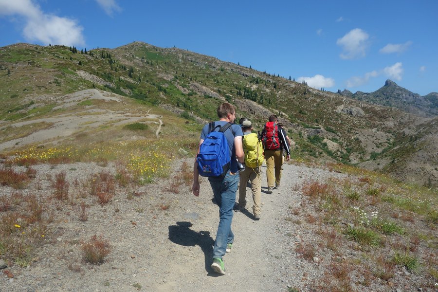
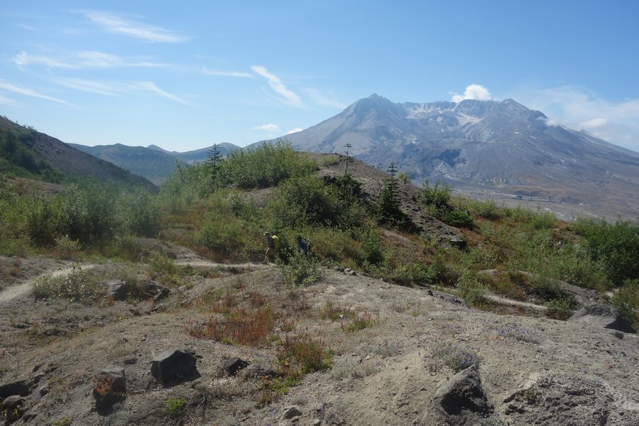
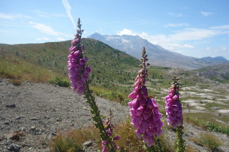
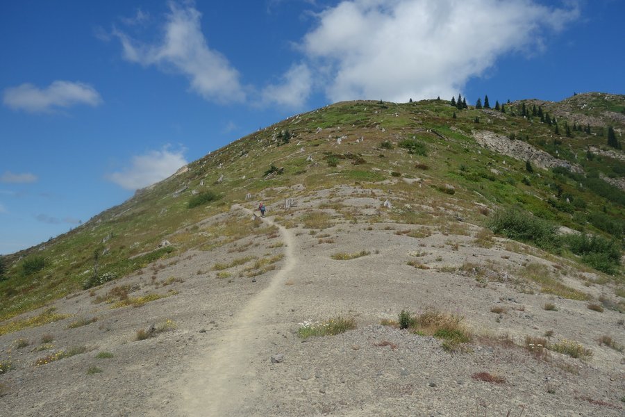
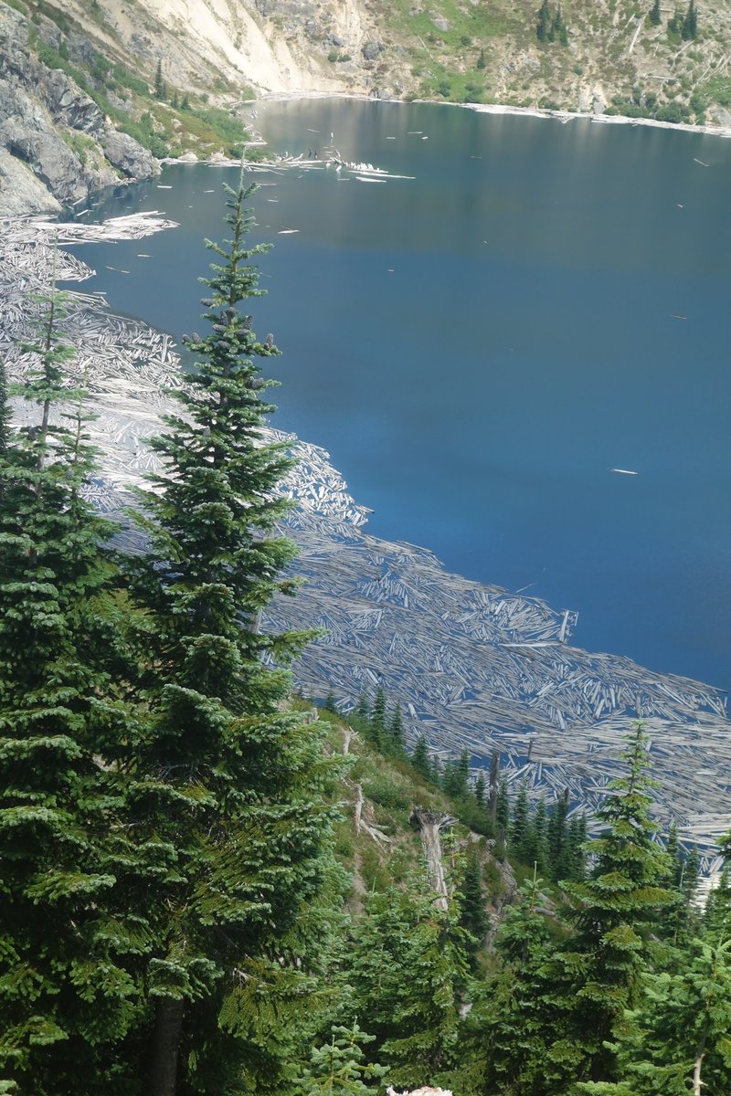
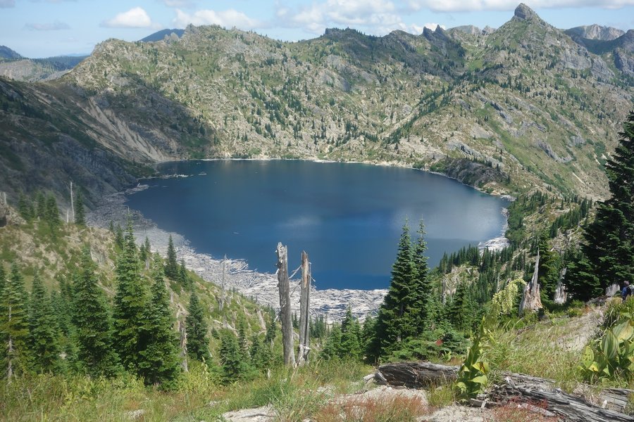
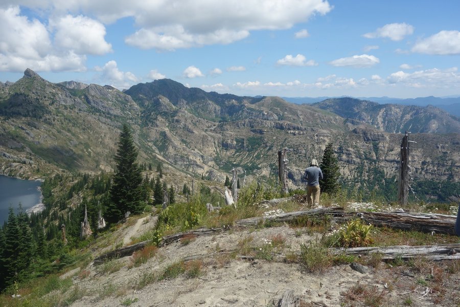
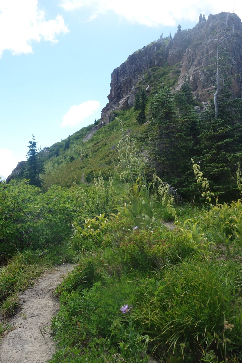
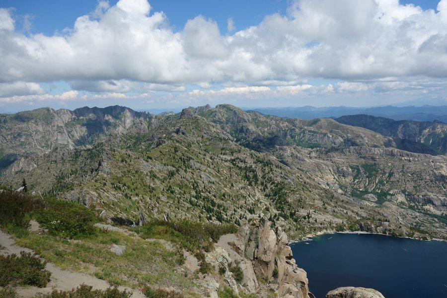
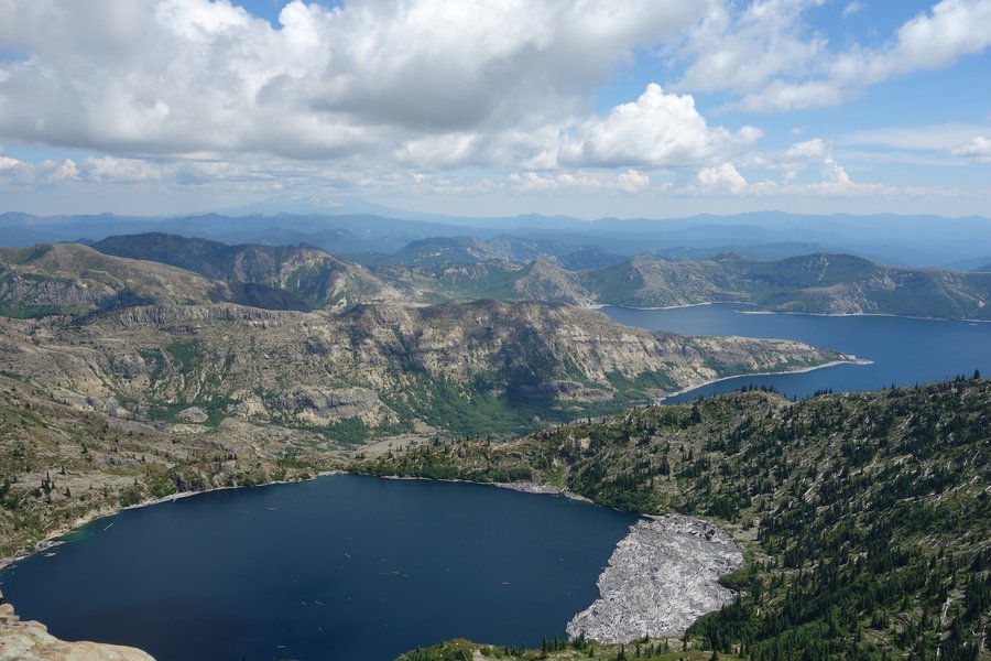
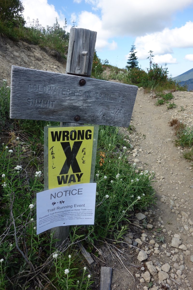
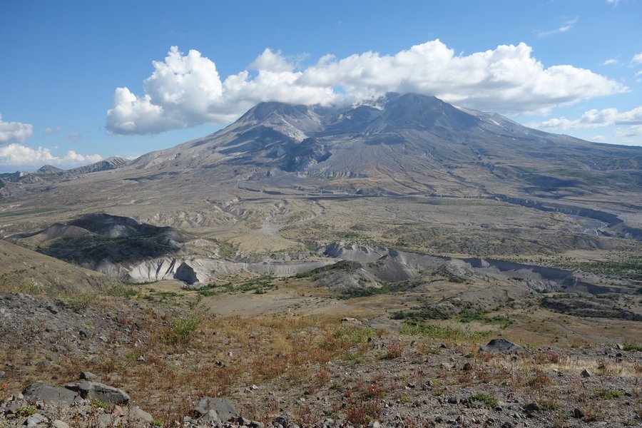
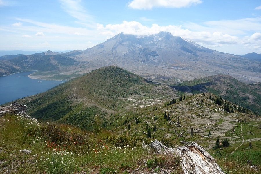
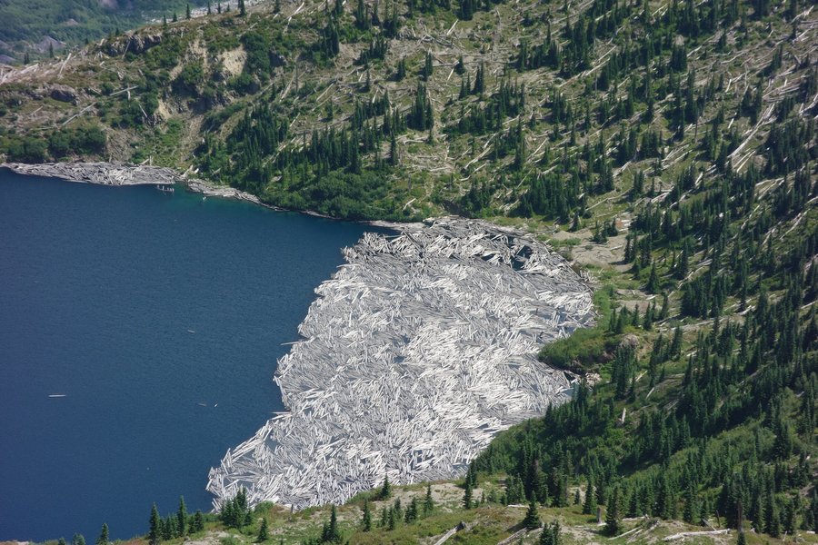
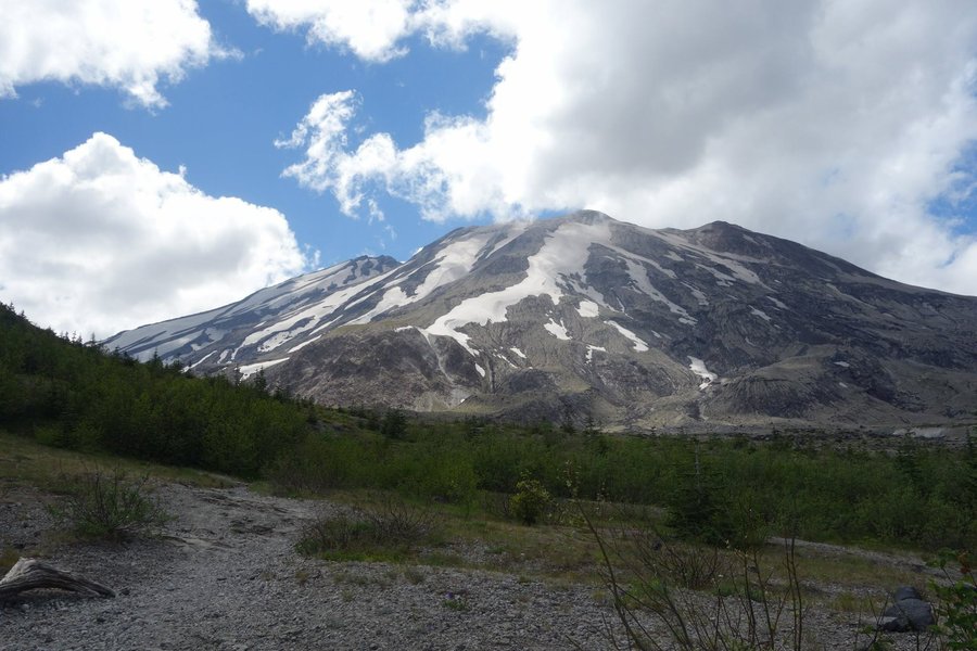
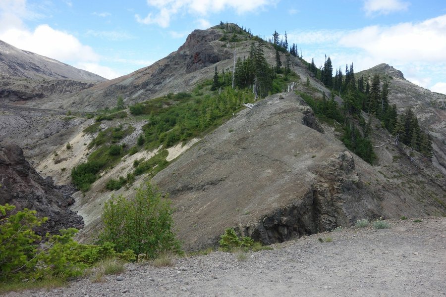
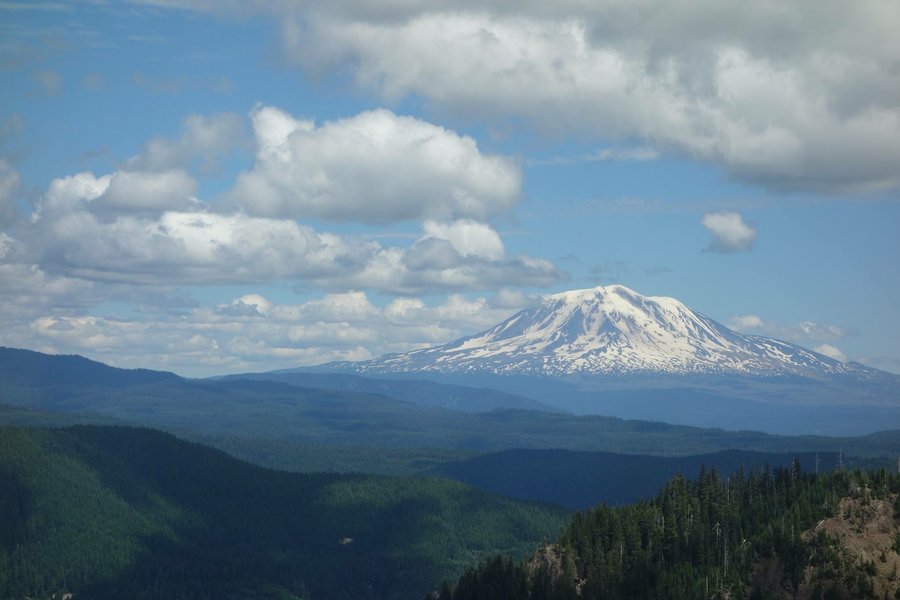
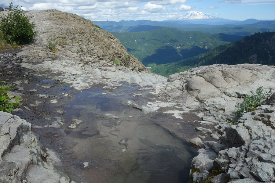
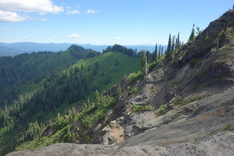
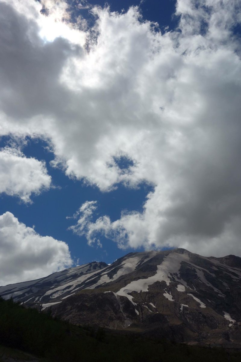
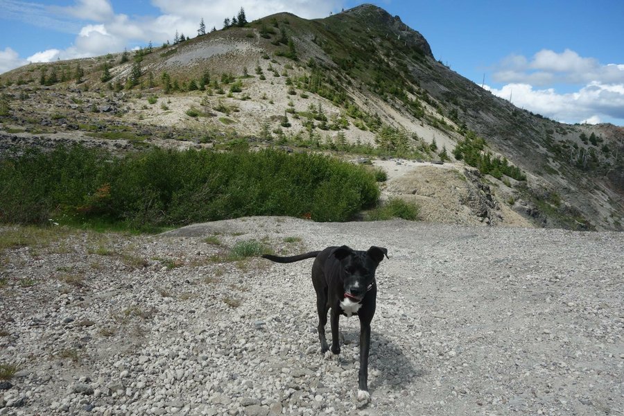
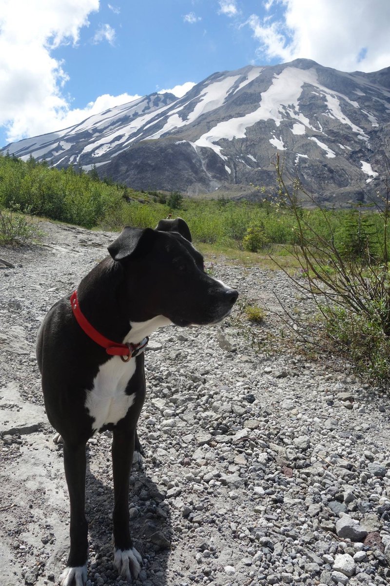
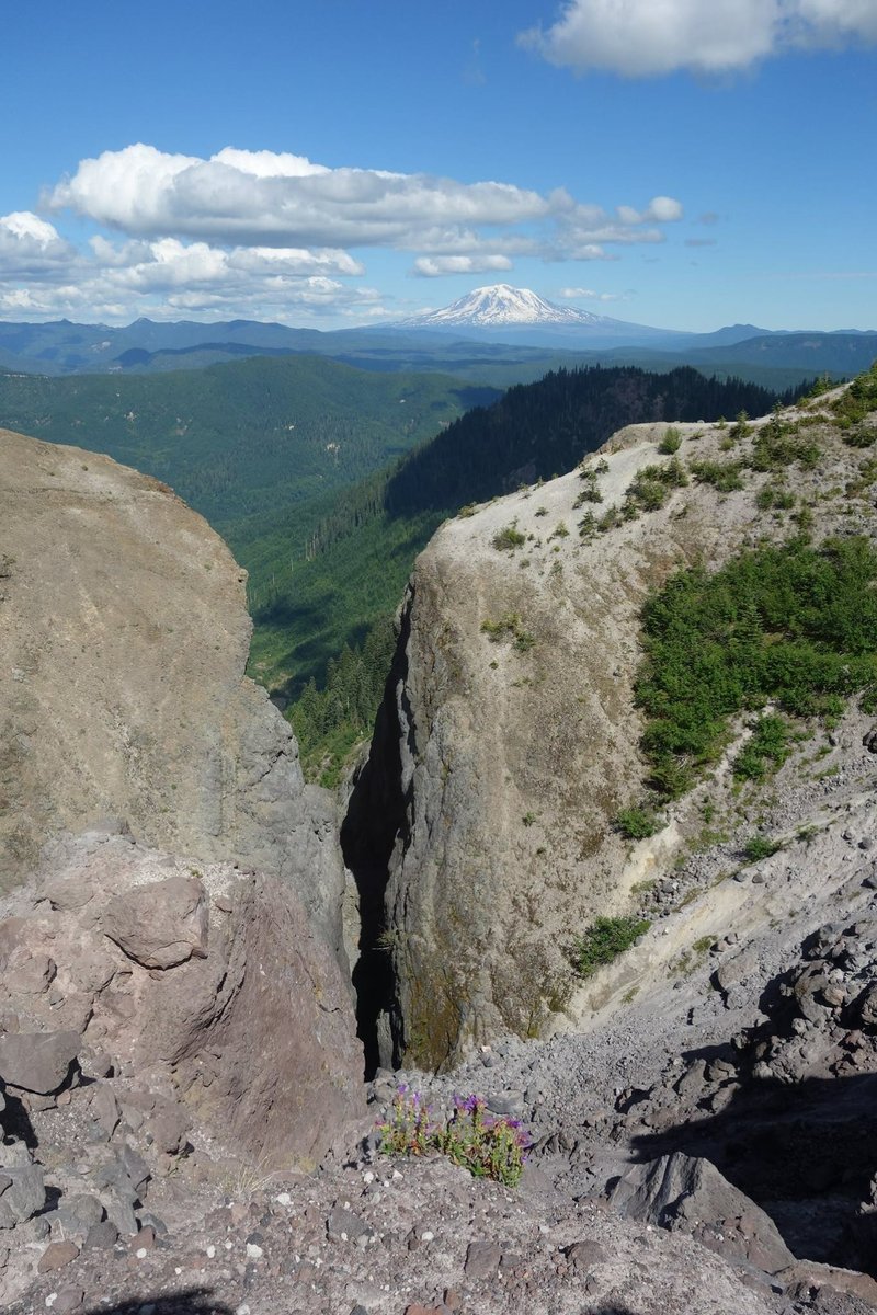
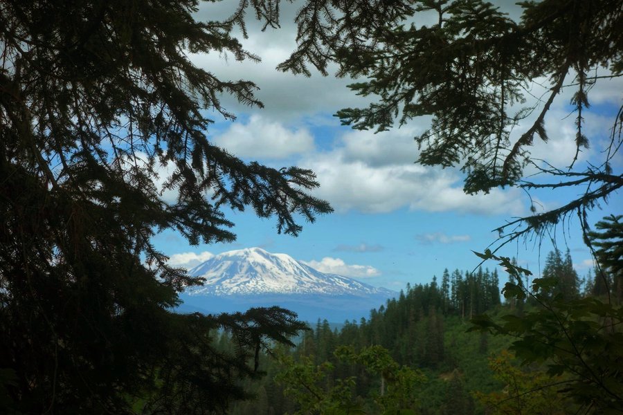
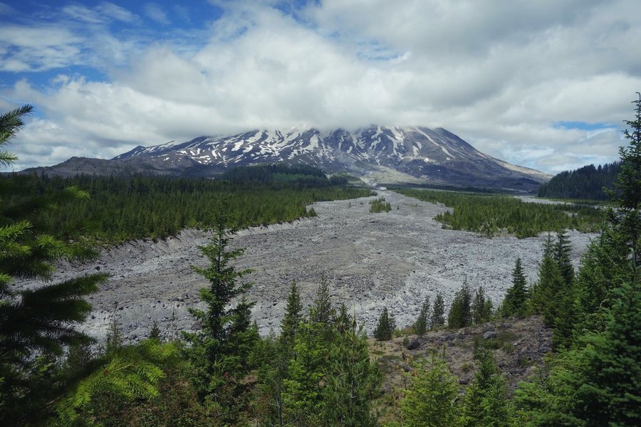
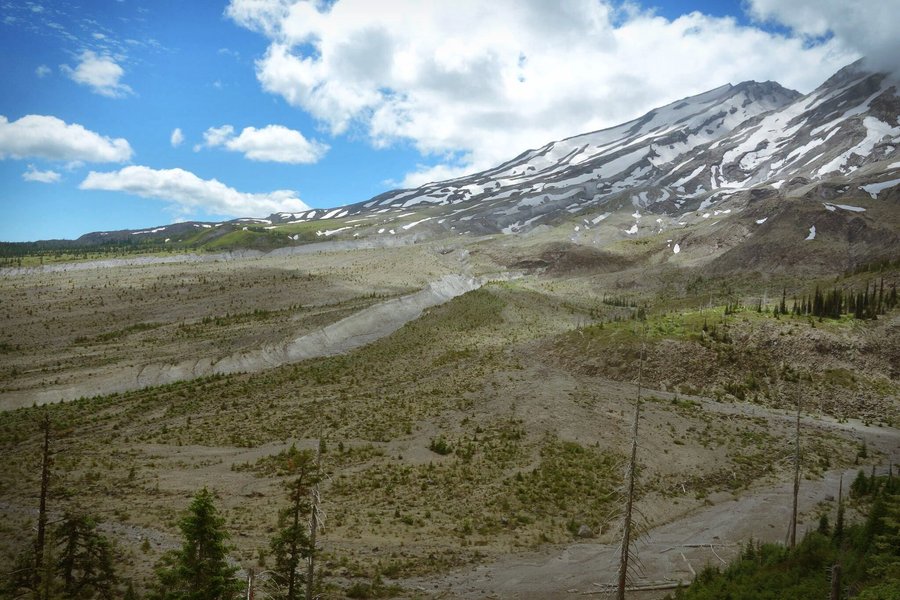
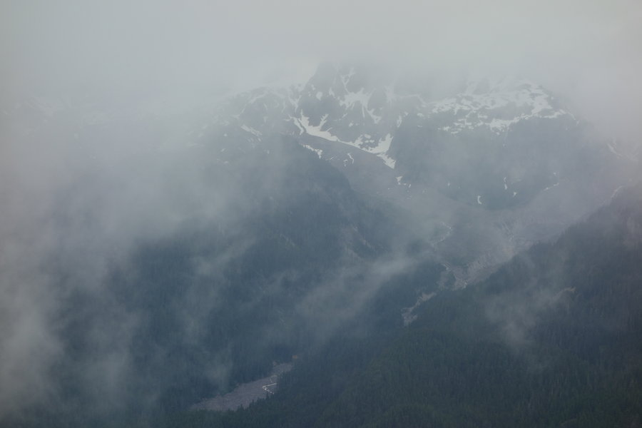
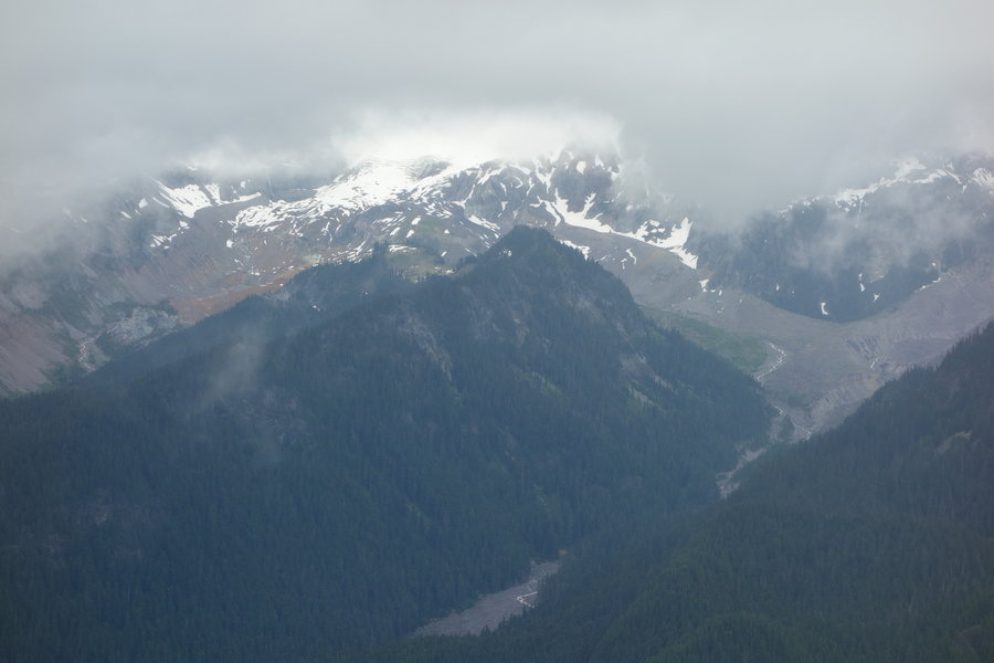
Coldwater Peak
13 miles of hiking • 3000' elevation gain •
After a weekend off from hard hiking, my friend Tom from BCEP called out on facebook to see if anyone would like to join him for a somewhat strenuous, 13 mile hike by Mount St Helens. I responded, as did fellow Mazama member Prajwal (whom I met when he was our assistant during BCEP), and his partner Dan. I added my partner Zane to the mix (first time he has actually joined me hiking with Mazama friends) and our friend Jason, who just moved here from Florida. I was happy to mix two worlds, as I feel like my time with the Mazamas is always separate from hiking with my partner.
I could tell Jason, who is a photographer/filmmaker, was absolutely geeked at the landscape of the blast zone, as we passed by graveyards of trees and fields of Foxglove, False Hellebore (which can only said as if you are speaking of a metal band), Lupine, Indian Paintbrush, and the silly muppet looking Old man of the Mountain. We all jokingly watched for the spirit of the 16 cats that were buried with Harry Truman, the man who would not leave his lodge at Spirit Lake.
While the gain was somewhat significant on this dry, exposed trail, I never felt like it was that strenuous. The switchbacks to the summit are pretty gradual. I kept myself pretty covered with a sun shirt, rather than caking on the sunscreen. Views were amazing at every step, between Mount St Helens, Spirit Lake, Mount Adams (whose summit was cloud covered, though various reports I saw say the summit had thunderstorms and hail yesterday.) Clouds obscured other peaks but it was a beautiful day.
On the summit Praj noted the clouds changing and the presence of a lightning rod, and the decision for a hasty descent was made. Probably for the best, as we started to hear thunder when we got to the observatory.
This is probably one of the most beautiful hikes in the blast zone of Mt St Helens. Minimal people, until you get back to the paved trail near the observatory.
August 4, 2018


.jpg) 1
1
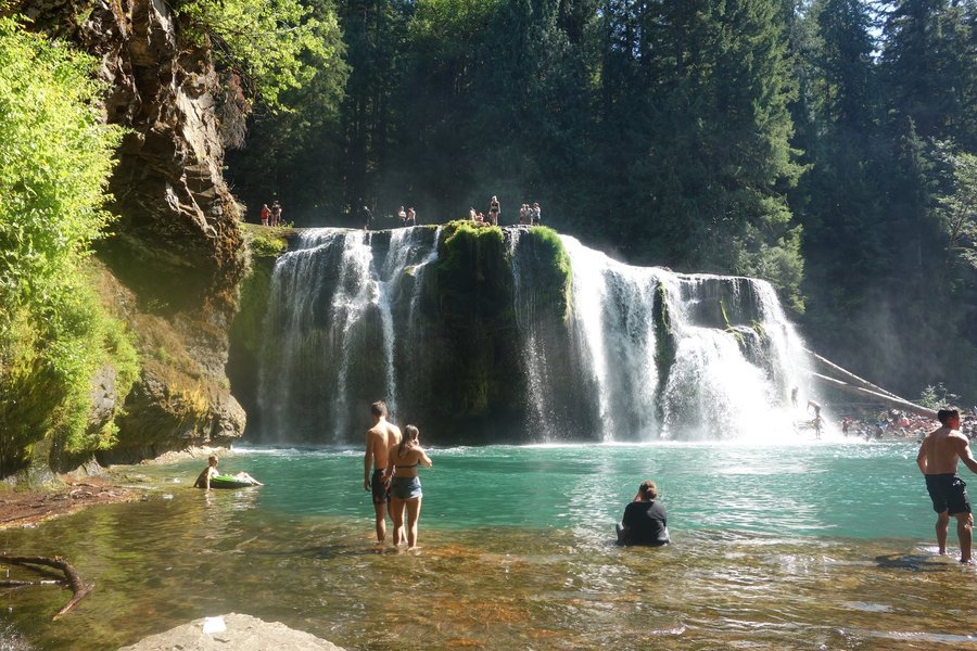
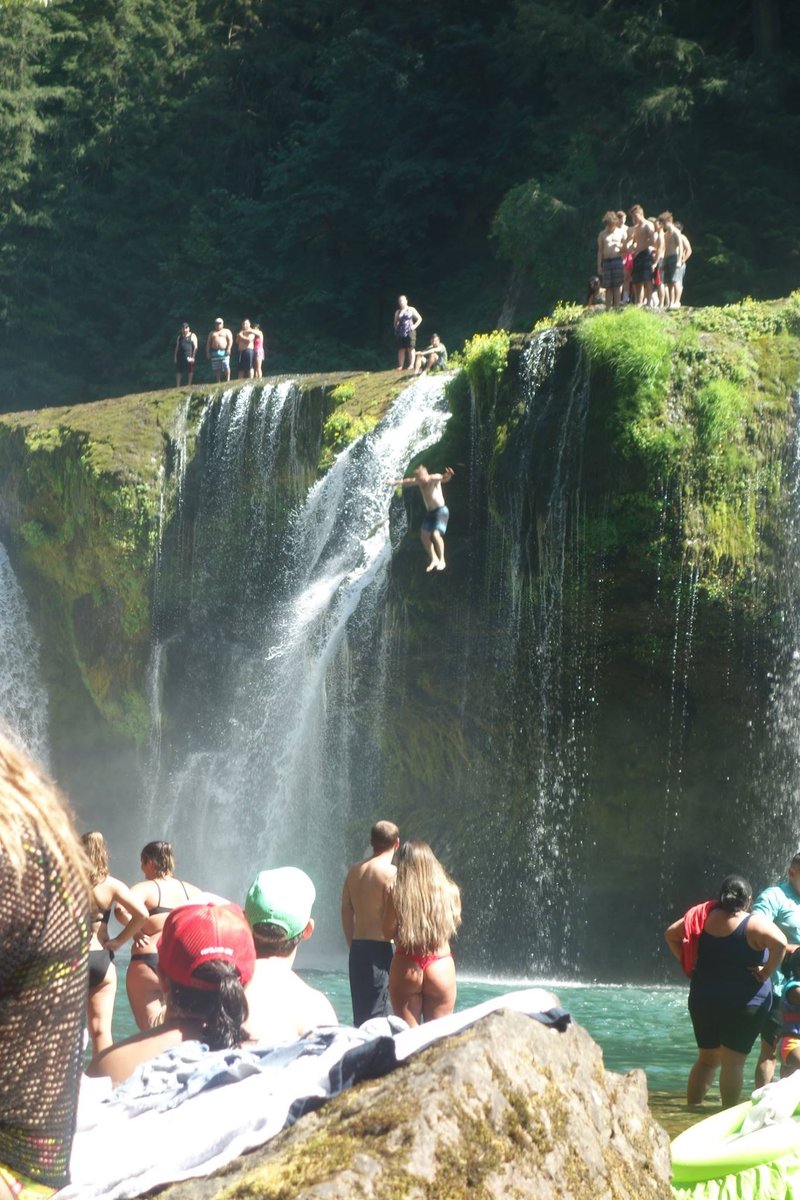
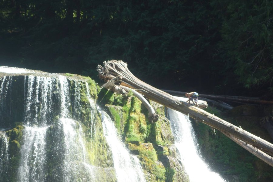
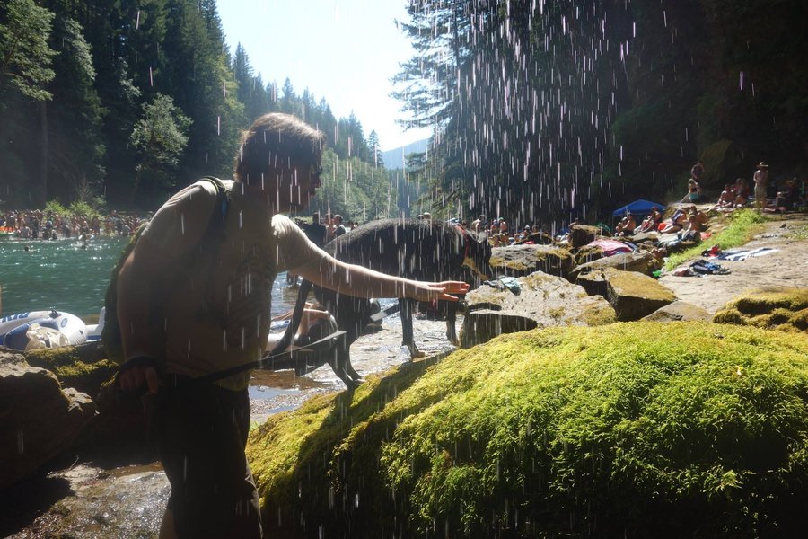
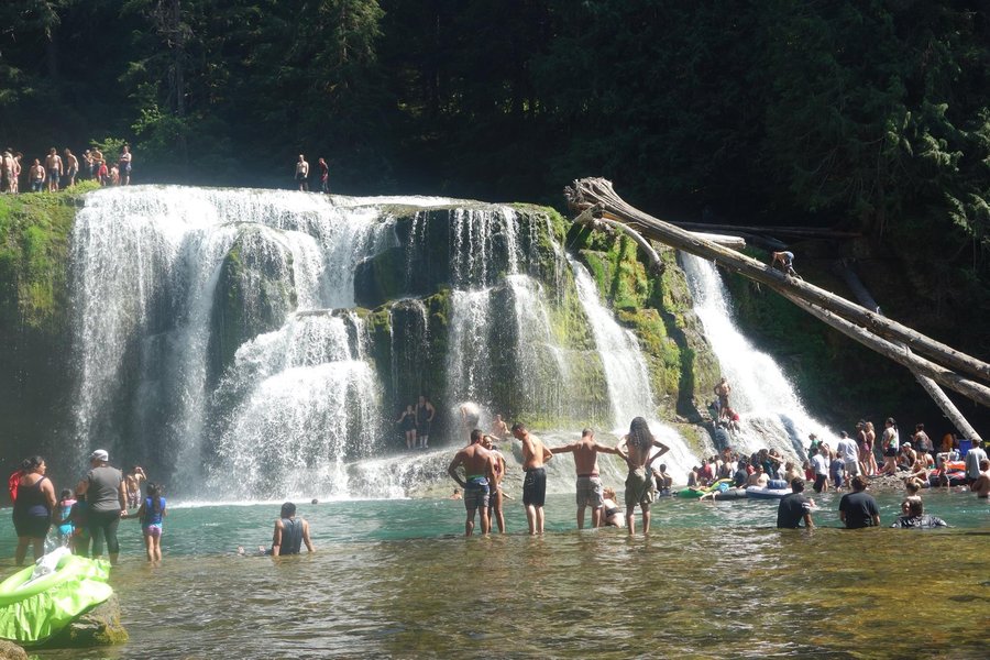
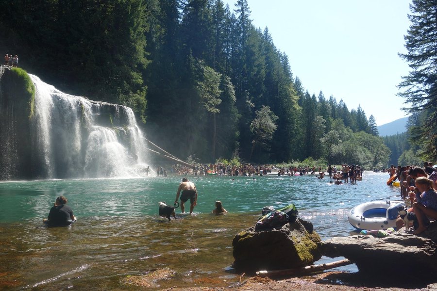
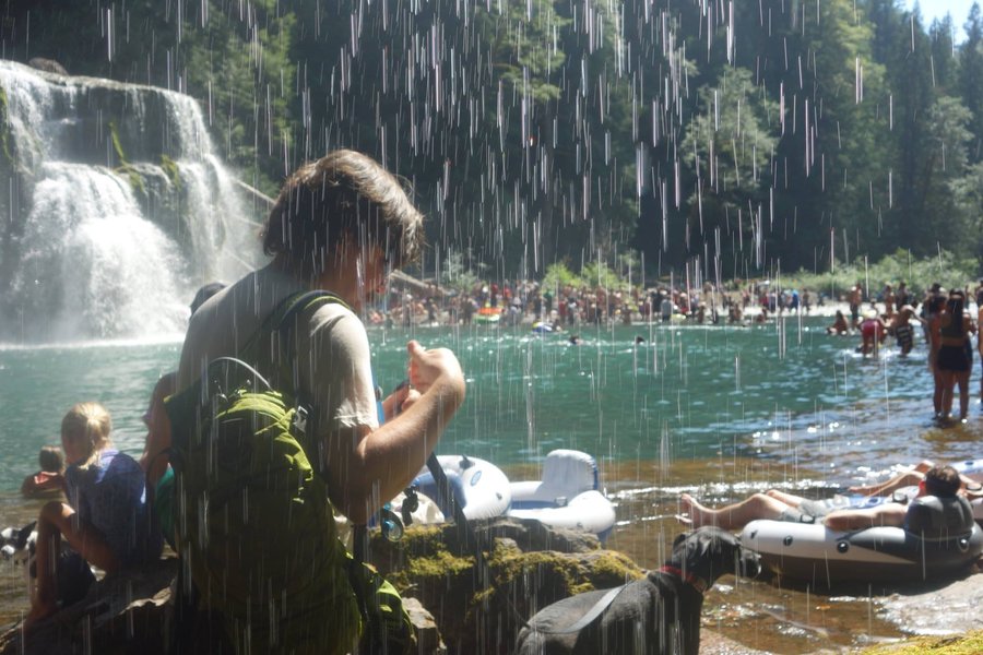
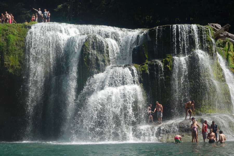
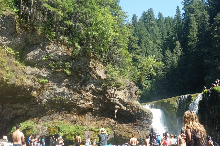
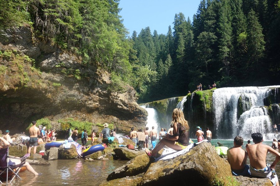
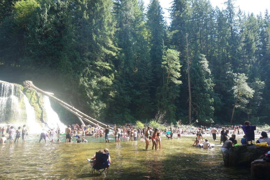
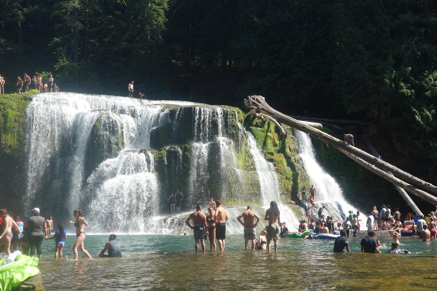
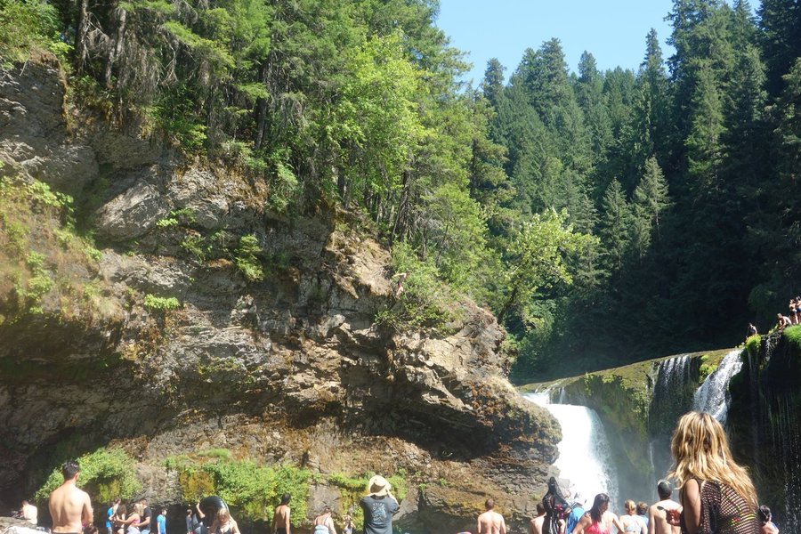
This is why we can't have nice things.
3.8 miles of hiking • 250' elevation gain •
Remember when I said I was going to do something easy and not do any climbing? Yeah, that backfired. Anyone who has followed social media this past two weeks knows how much of a overcrowded nightmare Lower Lewis River Falls was.
I didn’t set out on my day intending to be part of a problem. I knew it was going to be hot, and I wanted to swim. I didn’t want to do anything strenuous as my knees have been barking from my consecutive weekends of hard climbs. I just wanted to relax in some cold water. Apparently, so did hundreds of other people. Behaving in so many terrible ways. Saw a cliff jumper bite it, attempting to jump from a huge cliff edge he slipped as he started to jump and slid down, ending in a massively painful belly flop and giving himself a bloody nose. He was carried away by some friends but we saw an emergency vehicle heading in as we left. Saw someone else climbing up a tree that had gone over the falls. So much garbage and human waste everywhere. I am sickened and I’m sad. But I was there and also part of the overcrowding problem.
Either way, I learned my lesson. Don't go where people are. It will only make you angry no matter how pretty the setting.
July 28, 2018


 4
4
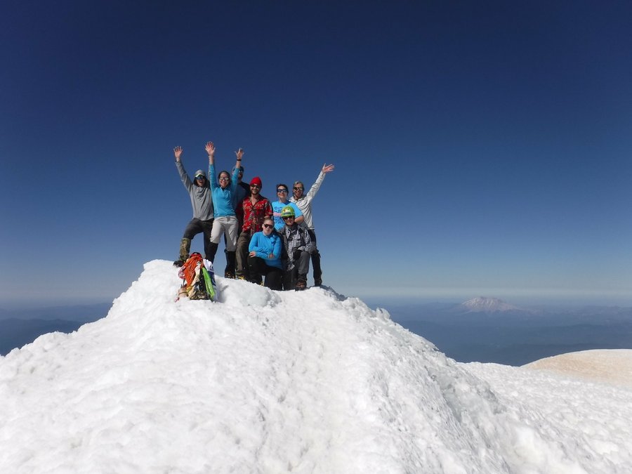
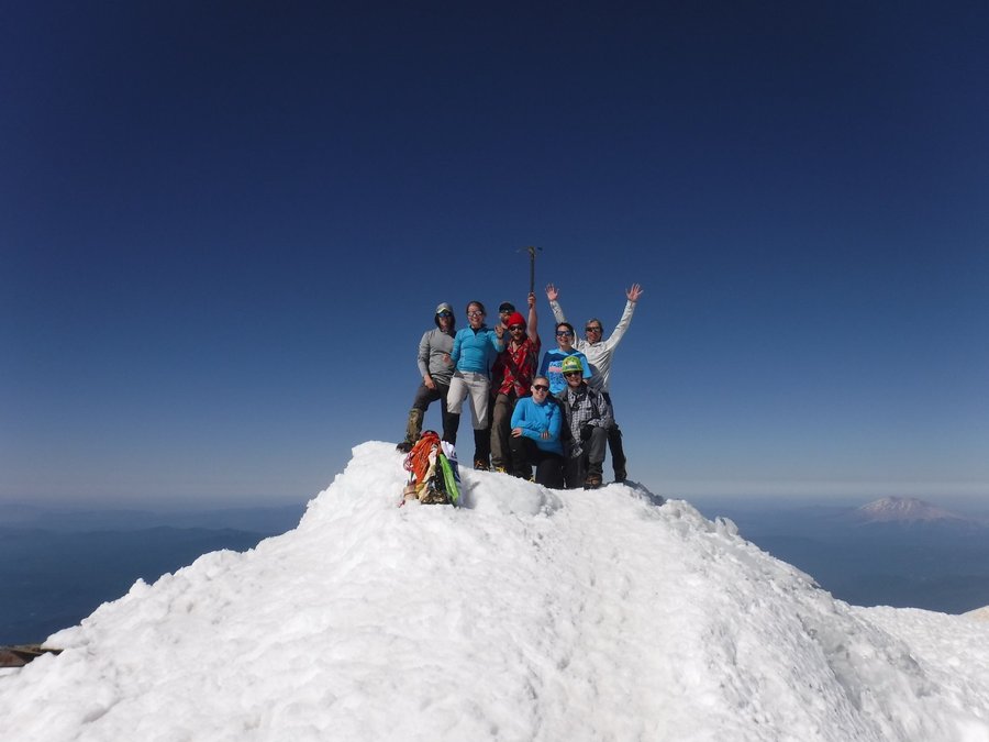
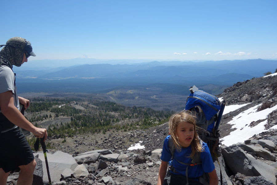
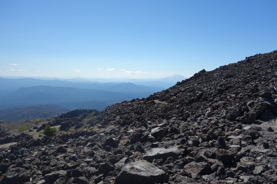
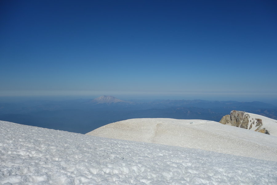
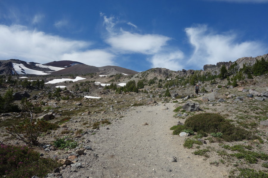
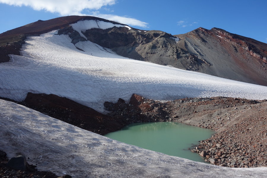
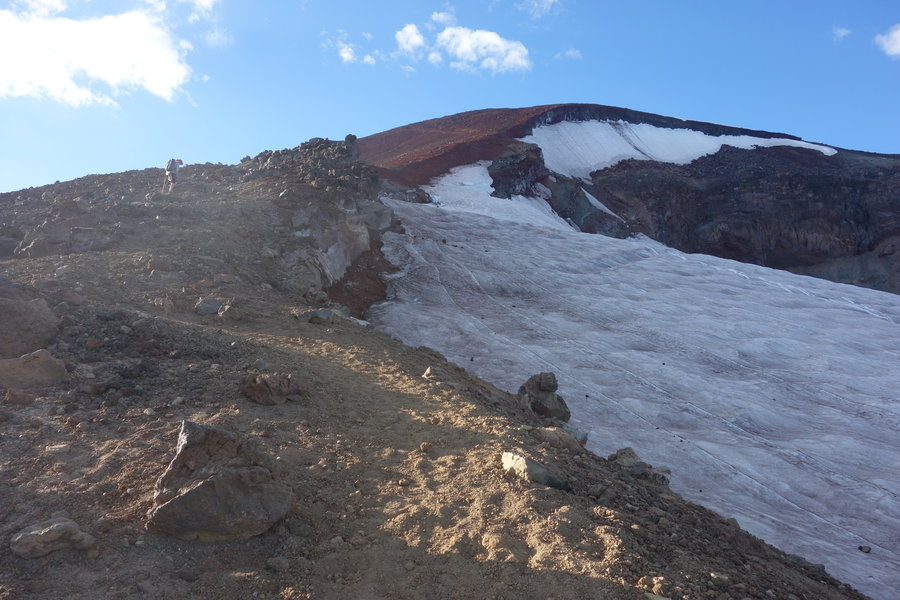
Mount Adams Summit
12.4 miles of hiking • 6750' elevation gain • 1 night
After last week, I was really doubting myself, and wondering whether I could do another summit just one week later.
So, naturally, I emailed my climb leader George, who was one of my BCEP instructors, asking him what pace he intended on taking. I was assured, "Don't worry Sarah, I take a slow pace on this one."
So I figured, worst case scenario, I make it to Lunch counter and hang out if I feel like I can't summit.
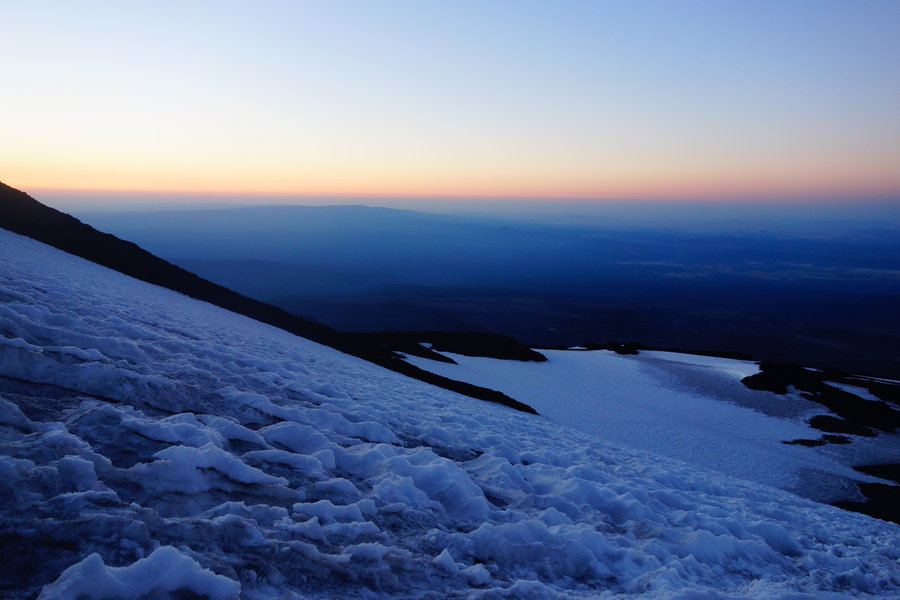
We met at the ranger station to pick up permits at 10 am Saturday, then off we went to meet at the trailhead. The ascent to lunch counter was pretty simple and slow paced (though rocky, watch your step), nothing crazy to wear us out for the next day. We arrived and camped fairly low, George assuring us that he gets more summit successes when he starts low rather than pushing it higher the first day. I was fine with actually arriving somewhere early enough to relax, make food, enjoy the view, and turn in early. A 3 am start time was decided so I set my alarm for 2 and 2:30, in case I wanted to snooze. I was a little sad I didn't get myself up to watch the sunset, but I knew I would need the sleep.
I ate some cold oatmeal for breakfast so I wouldn't have to start up a stove (boring) and we got on the snow and on our way around 3:15 am. We could already see the glimmer of distant headlamps, as other early risers were already on their way up the mountain. They actually reminded me a bit of lightning bugs from back in Michigan. I could tell right away my boots were going to be a problem on my heels, maybe wrong socks, perhaps my boots are still not quite broken in. My fingers and toes were a bit cold, but some hot hands kept me happy. Pretty early on, the 9 year old kid on our climb complained of a headache, and after pushing a bit further, it was decided the altitude was too much and he turned around with his dad. Either way, this kid is already kicking ass in climbing, I'm excited for Forest to see where he goes. I can't imagine being 9 and attempting to climb a mountain. From what I hear he is excelling at rock and has a bright future, even if he picked on his dad almost the entire hike in and out. I don't even like kids and I enjoyed his company.
Somewhere along the way during sunrise, I fell back from my group a bit and battled with my inner demons, even let out a bit of a pity cry for myself thinking, "Why the fuck are you doing this?" Honestly, it was probably a bit of the altitude getting to me and my breathing, the mountain making me think I suck, but I got over it when I found my group waiting for me. (I really wasn't that far behind) In the meantime, I nabbed some morning sunrise shots, which I think my focused team forgot to do.
Our sweep and assistant, Megan, was actually far behind me, and was given permission to take a slow pace behind all of us as she had huge issues with blisters on the way in, and had been up Adams a few times before.
After hours of climbing, we finally reached the false summit. Our leader George, was getting hit with some altitude sickness, so we took around an hour break hoping his nausea would break. We kept peering over the edge, looking to see if Megan was on her way, but no luck. Not sure if she was still on her way or had turned around, we continued on, George determined not to let a beautiful clear day summit of Adams get out of his reach. Still feeling sick he trudged on, and told us to go ahead of him and he would meet us at the summit.
I don't know where the power came from, but I actually made it to the top, with my team. This chubby girl made another summit! It was hard, and I'm pretty damn proud of myself. I felt like giving up so many times on the way, but my stubbornness won. We ran into some other Mazama folks on the top, who relayed a message from Megan that she was still truckin', and would either meet us at the summit or wherever we found her on the way down.
It was nasty and rocky below the summit until Pikers Peak,, so we down climbed from there. At the false summit, George determined the snow was soft enough to glissade. I have to say, the steepness made the glissading terrifying but exhilarating. What a rush! So amazing to spend hours ascending, to descend in 30 minutes almost back to camp.
I'm really happy I didn't let my self doubt get to me and I made this summit.
Afterwards, one of our climb team members, invited us to his mothers house in Trout Lake, where we enjoyed a bbq feast and some members took part in some horse riding. What an awesome weekend, but I think I'm done with climbing for a bit.
I think I need an easy weekend with some car camping and beer in my future.
July 21 – July 22, 2018


 4
4
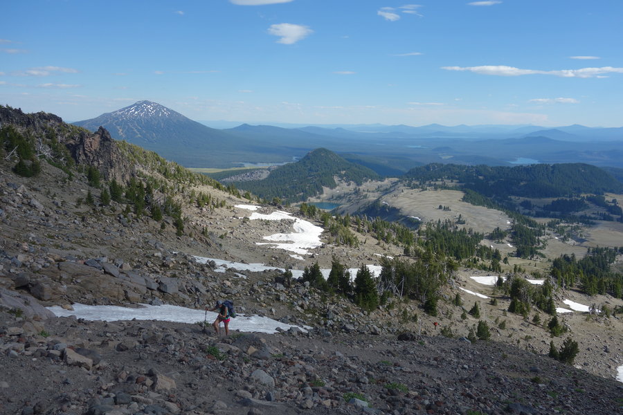
South Sister Summit + camp
13 miles of hiking • 5000' elevation gain • 1 night
This was a hard climb for me, I don't do well with hot weather and elevation gain. Add to that our climbing party had two different speeds, one of which started out with way too fast of a pace for me.
We left Portland Saturday morning around 7:30 am, stopping for breakfast near the Zigzag ranger station. I tried to fuel up but my stomach was in knots and I felt a bit nauseous. I thought it was just nerves and that I shouldn't worry about it. I saved half of my breakfast for the trail (trail bacon!) and off we went driving towards Bend.
It is never a good sign for me when the climb leader is tall and lean, since I'm short my steps can just never keep up. I feel like sometimes I have to run to keep up. Either way, I wasn't alone, and our group soon split in half into the speedy group, and I'll just call the rest of us, the "It's fucking hot guys this isn't a race" group. We were camping at the summit crater, so I knew we didn't have a strict curfew for summit. Starting at noon in the heat of the day with loaded packs on such a sun exposed climb really zapped me right away. It didn't help we made a mistake and went down the wrong trailhead at the start, adding around an extra mile in the end to our day. Luckily the mistake was quickly realized but the damage was done.
So off went the fast group, while I lead the way with the slower group. Our leader Terry kept us in view, and checked in on us from time to time. Our sweep was a strong and steady Kate, a long time Mazama member who has summited all of the major 16 peaks. We had one member who was having trouble breathing/feeling nauseous and sadly was eventually turned around.
We took an extended break in the shade after the initial forested section, hoping for some cooler weather. It helped to have a break before the hard stuff began in earnest.
Basically, I trudged miserably along swearing at the sun, with the remaining slow and steady group right behind. But slow and steady still gets there, and we all reached the summit in time to get some dinner in us and watch the sun set.
Absolutely exhausted I went to bed, though part of me wanted to do some night sky watch walking along the crater rim. Instead I opted to get up for sunrise and what a treat it was!
I felt much better and less nauseous after some rest, and the downhill today felt much easier. It felt great to be coming down and watching all the new climbers make their way up. (I saw so many people with hardly any water!) I felt strong coming down, but still couldn't keep up with the trail runner crew even though I was going at a pretty good pace.
Whatever, I'm fine hiking my own hike.
July 14 – July 15, 2018


Ape Canyon
11 miles of hiking • 2000' elevation gain •
Felt sluggish, fat, crampy, and my fingers felt like sausages today. Forced myself to get up and we headed out to Ape Canyon.
It was a fairly gentle climb, dodging mountain bikers through an old growth forest spared by the Helen's blast. Views were spectacular today as the clouds lifted. It always amazes me seeing the power of our planet in person. Great hike.
July 7, 2018

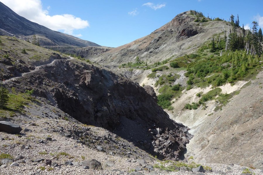


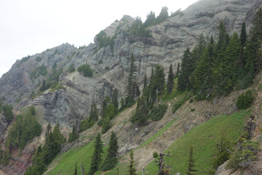
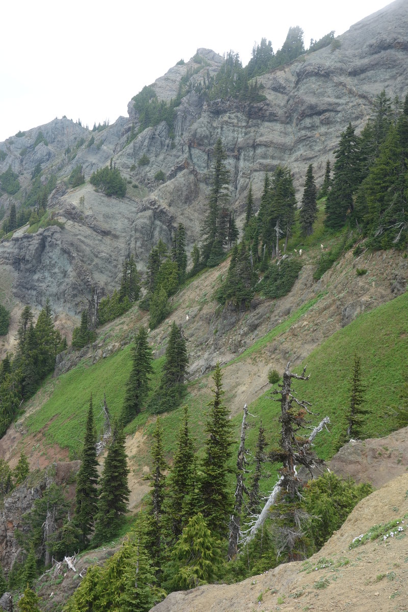
Mt Ow! I mean Mt Wow!
8.3 miles of hiking • 4000' elevation gain •
What a trip!
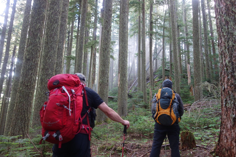
This exploratory Mazamas climb was lead by Mike Levis with assistant Walter Keutel.
First off, if you do this climb, make sure you start a beer pool for afterwards, based on whenever someone utters the words, "Is this a trail?", "This looks like a trail..." or "This might be a trail." Perhaps even every time someone falls down or utters, "Are we on track?"
The route seems straightforward enough on paper - with a car shuttle we started near the Nisqually entrance of Mt Rainier National Park, intending to go up the park boundary "trail" to the summit, and then back down via Lake Allen. Easier said than done.
Almost the entire route was bushwhacking/route finding through steep terrain, with some class 3 and 4 scrambling thrown in there to boot. I spent many hours on my butt, using the technique never taught to me in BCEP, called the "butt slide". Also widely used by all, the veggie belay, in which any and all vegetation became fair game to keep you from tumbling down the mountain side. The bear grass provided excellent handholds on our descent. Thank you bear grass, for saving my ass.
Sadly, in the end, we had no Wow!, only OW! as the clouds stubbornly stayed over top of the mountain, and it started lightly drizzling on our descent.
I cannot stress enough how difficult and steep this climb was, but even though I slightly feared for my life half of the day, I still thought it was a great experience and I got to collectively practice route finding skills using both gps and a paper map. We passed many piles of fresh bear scat, and saw many trees with telltale claw marks, but didn't actually see any of the beasts themselves. We saw a large family of goats, and happened upon what must be the goat barber shop near the summit, because the entire hillside was filled with discarded goat hair. My photos don't even begin to show the struggle, the fear, I was so often just trying not to fall down the mountain and didn't snap many photos of any of the hairy situations we got ourselves in and out of.
Would I do it again? Absolutely! Now, time to go ice my knee and relax with a beer.
June 30, 2018


Abandoned Railroad
8 miles of hiking • 500' elevation gain •
A few friends of mine who are non hikers asked if I would take them on a hike. Each suggestion I made was turned down for being "too hard", a "death hike", too many people, more elevation gain than they could handle... So, I opted for something mostly flat, with enough of a danger element to be exciting for us. I've been on the route a few times, and it is one of my favorite weird post apocalyptic hikes. The earth is slowly taking back the railroad, one landslide at a time. This route is technically trespassing, and it considered unsafe due to the conditions on the trail. Most guides now warn of its closure. Hence, me being very vague but a quick google search will find many sources of information about this "trail." One more thing - my friends should have told me that they had an intense fear of heights. This probably was not the best place to test their will crossing suspended tracks, but everyone did great and we all came back in one piece.
I forgot to put my card into my camera, so I just have a couple of phone pictures and a few photos my friends took.
June 23, 2018


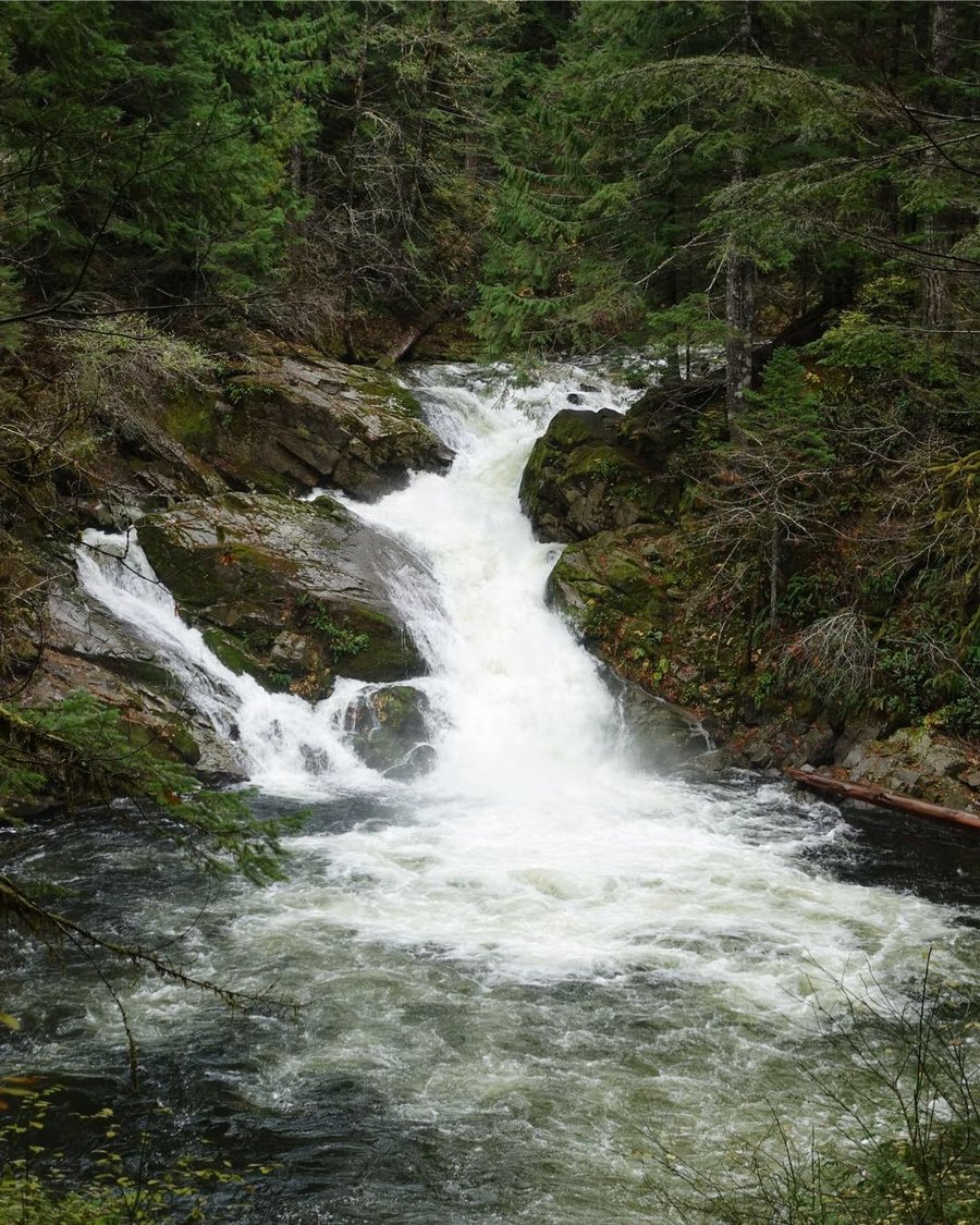
Clackamas River Trail
9 miles of hiking • 1500' elevation gain •
Rainy rainy day down the Clackamas. Felt guilty for not hiking last weekend so I thought I would head out and brave the rain for some solitude on the trail. Had originally planned on tackling Mount Defiance, but the thought of coming down something so steep in the rain just didn't sound safe. Especially not knowing how the gorge fire has affected the trail.
The nice thing about hiking on rainy days... you find out what gear is failing. I wore my summer mountaineering boots I'm still trying to break in, with gaiters and rain gear and still managed to come off the trail with soaking wet feet. My partner got quite grumpy and wet, and refused to hike further so we turned around just before reaching Pup Creek Falls. It truly was just one of those days where no matter the gear, wading through waist high foliage is going to soak through and get you wet no matter what.
My dog is happily snoozing away on the couch now that she is dry, so the effort of the day was not wasted. The Clackamas River is still a gorgeous hike, even with wet feet.
June 9, 2018


 2
2
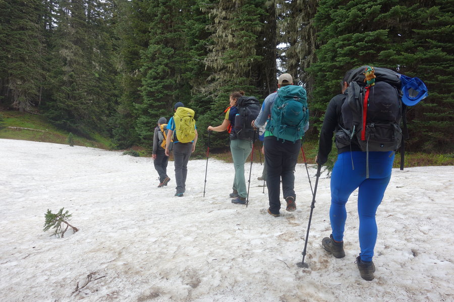
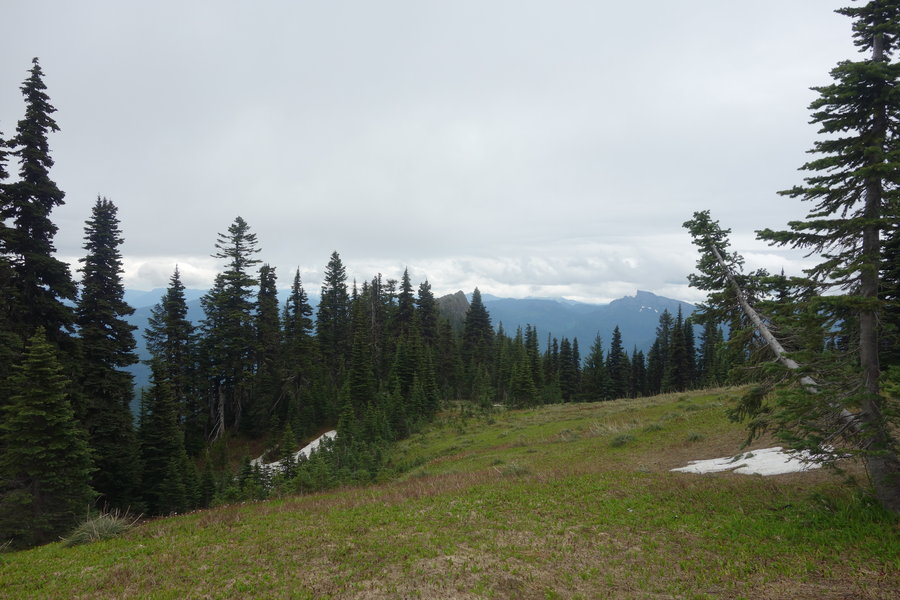
Mt Ellinor via upper trailhead and Winter Chute
3.5 miles of hiking • 2500' elevation gain •
This was a Mazama's climb led by my former BCEP instructor from last year, George Shay, with Dirk Lakeman assisting. I was happy to see another familiar face on the climb team, with one of my assistants from BCEP Guy also on the climb. The rest of the team was very friendly, and many recent BCEP grads themselves.
We took the heavily pot holed dirt road up to the upper trailhead in the afternoon on Saturday, setting up camp in the parking lot around 6 pm for an early am start. We watched as cars came and went, with some folks getting a late start up the trail. We grew concerned as it got dark and a few people still hadn't made it back to the parking lot. At one point, a sheriff came to the parking lot, concerned by a 911 call where someone reported they had heard a whistle call for help.
Eventually, two hikers came down by headlamp after I had turned in, but one car still remained that wasn't part of our group by morning. My sleep was a little uneasy, a few random trucks had pulled in the parking lot in the middle of the night and then pulled away, and I also heard someone making camp/talking loudly way down in the valley chopping wood into the night. I can only assume it was holiday campers, celebrating into the wee hours by campfire. Maybe I should start sleeping with ear plugs.
In the morning we quickly tore down camp, and we were off for our short but steep ascent. Crampons, ice axe, and trekking poles were all used. The snow conditions are deteriorating - many snow bridges collapsing with running water underneath. Some tricky spots that proved harder to come down than go up.
We arrived at the top to a beautiful view, 4 major peaks making an appearance. (Rainier, Helens, Adams, and even Baker). A couple of mountain goats were spotted, but thankfully they kept their distance. It was nice to have such a spectacular payoff for a relatively easy achievable climb.
As we descended the snow became very slushy, wish made one steep section a little sketchy for me, but George was very patient and let me take my time as I descended. I did have to dodge one fall from another climber - conditions got very slippery and crampons weren't really helpful in the conditions. Glissading was not a safe option - many hazards/boulders uncovered and holes to fall into and just wasn't worth the risk.
I did ungracefully fall through the snow once unexpectedly and left behind a big hole where my leg went through. Let's hope no one saw that. Just a bit of a scratch on my finger and a nice bruise on my arm, but otherwise it was a wonderful day.
I do want to note, while we never saw the car that was left in the parking lots occupants return, we did spot a tent set up near the summit. I assume this was the car we saw - and that no-one was ever in any trouble.
May 27, 2018


 1
1
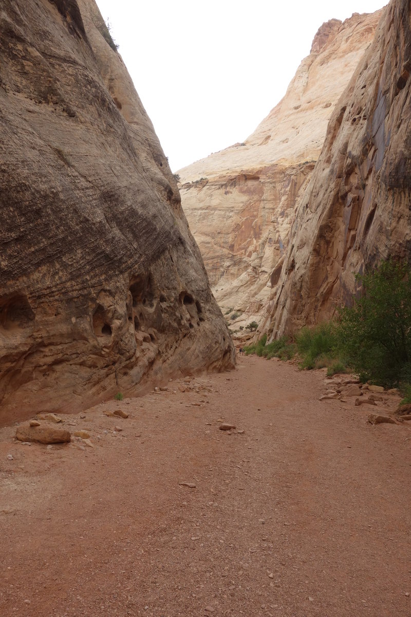
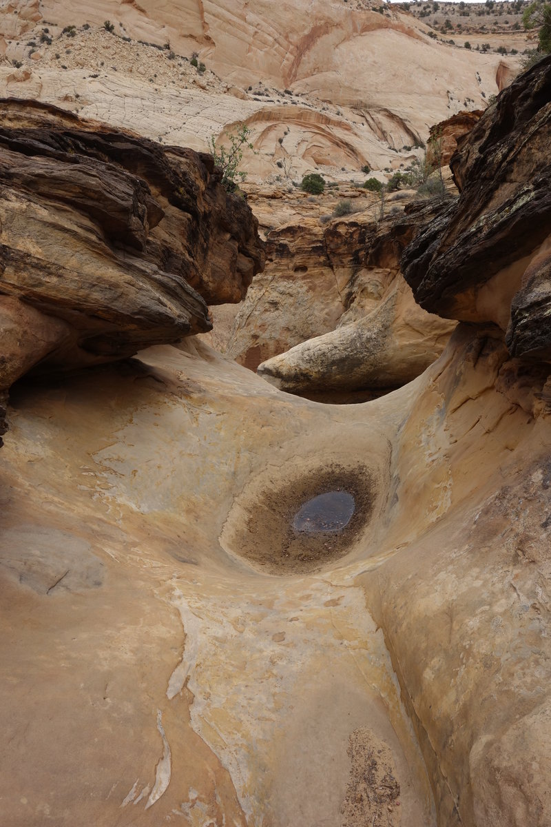
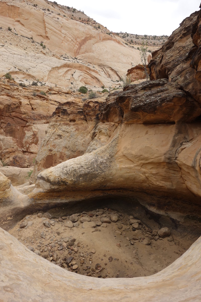
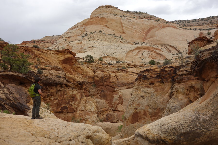
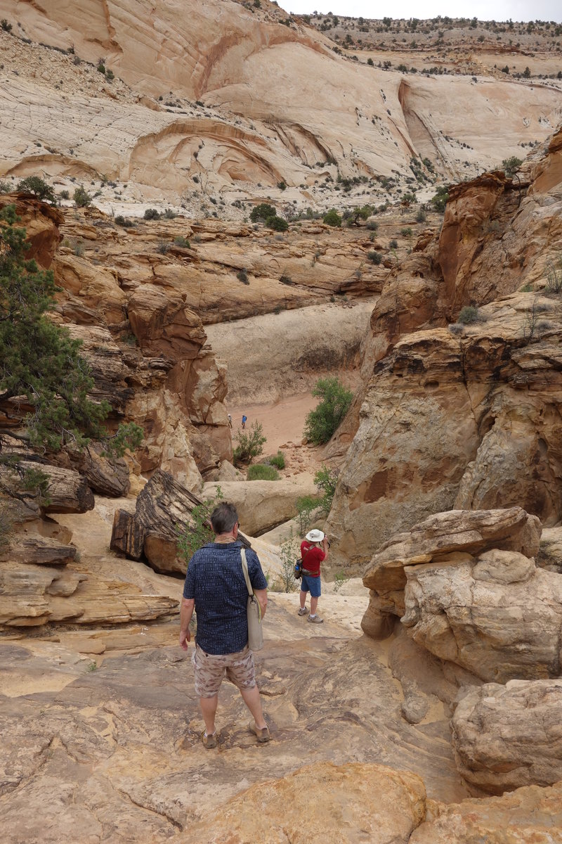
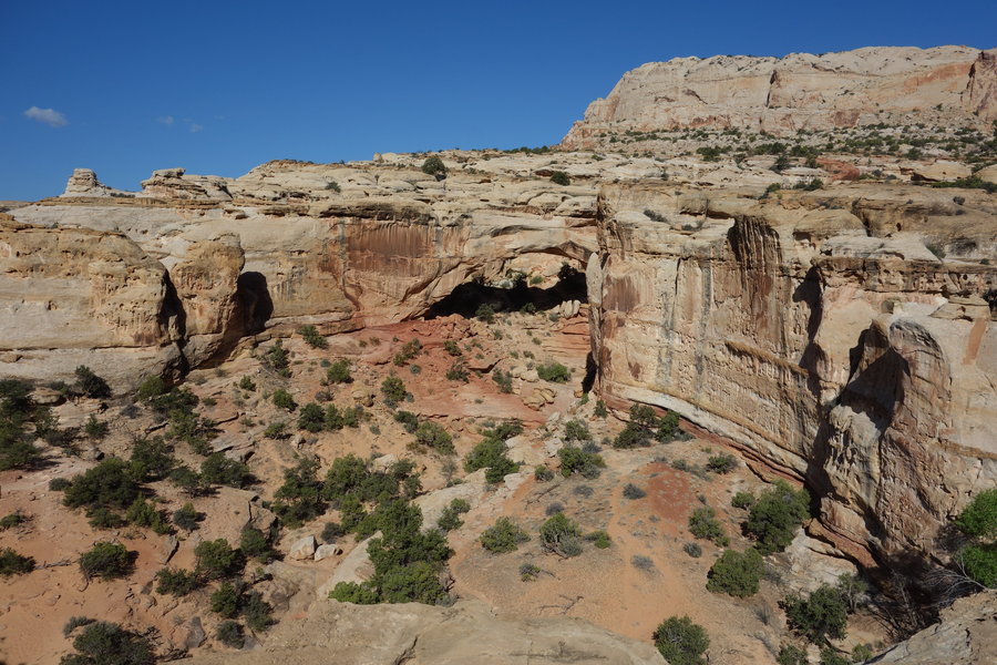
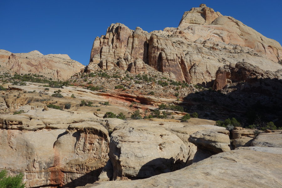
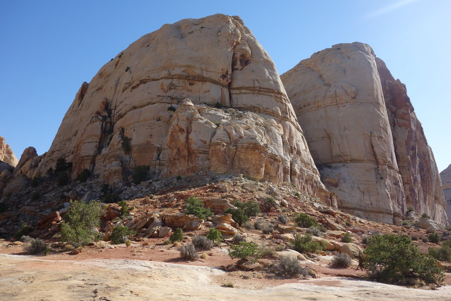
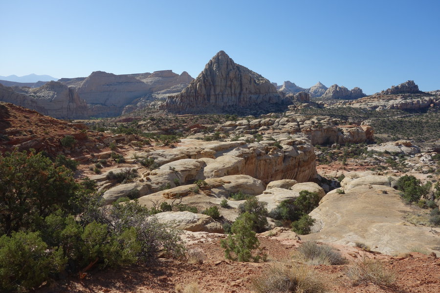
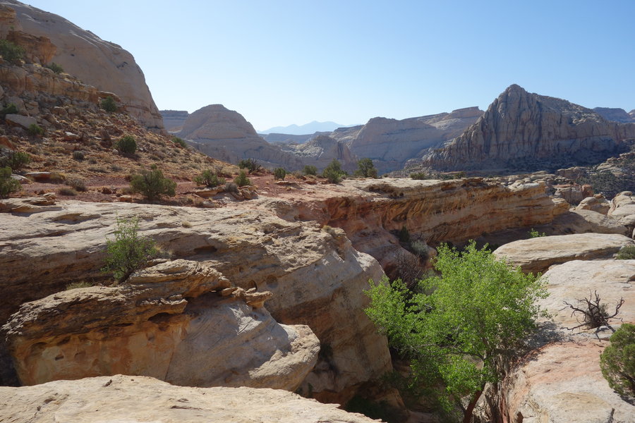
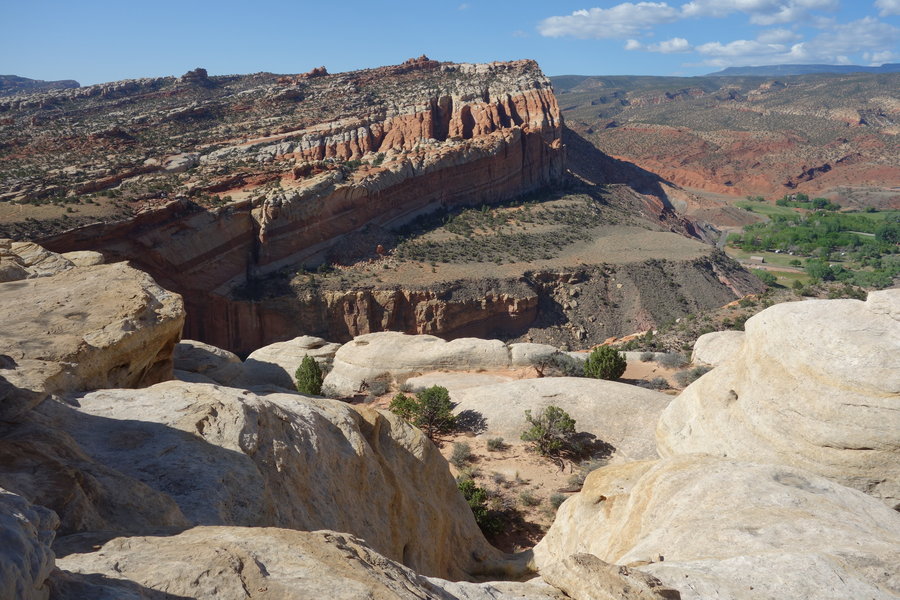
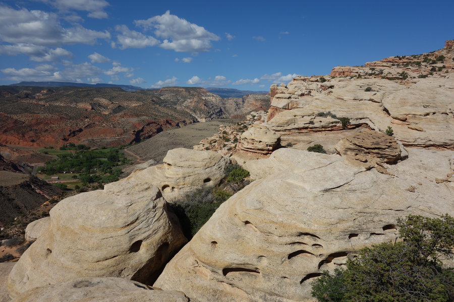
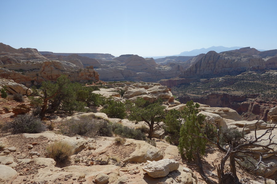
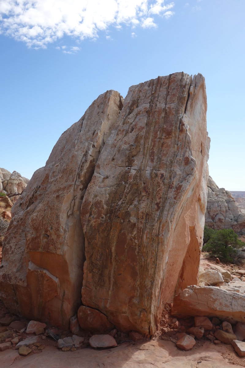
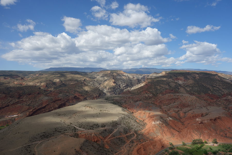
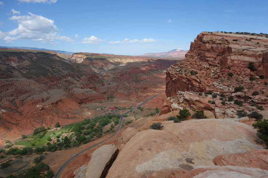
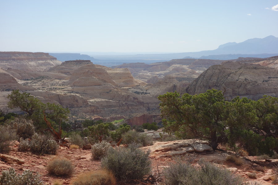
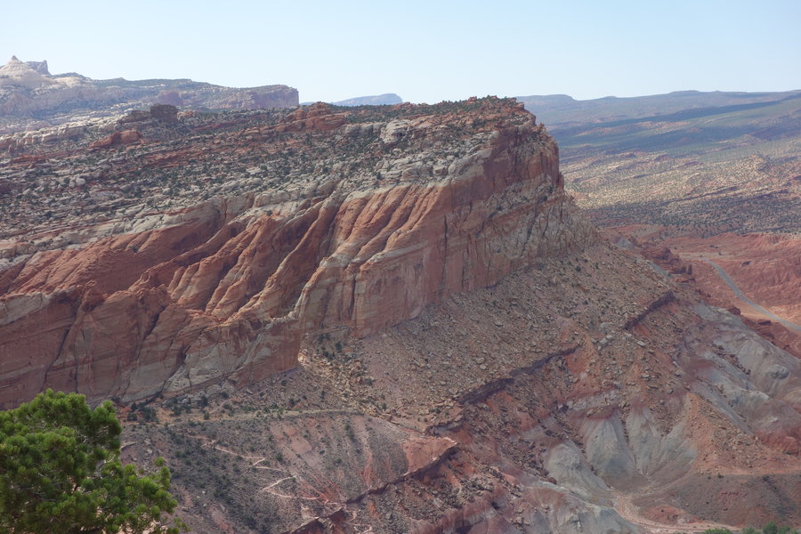
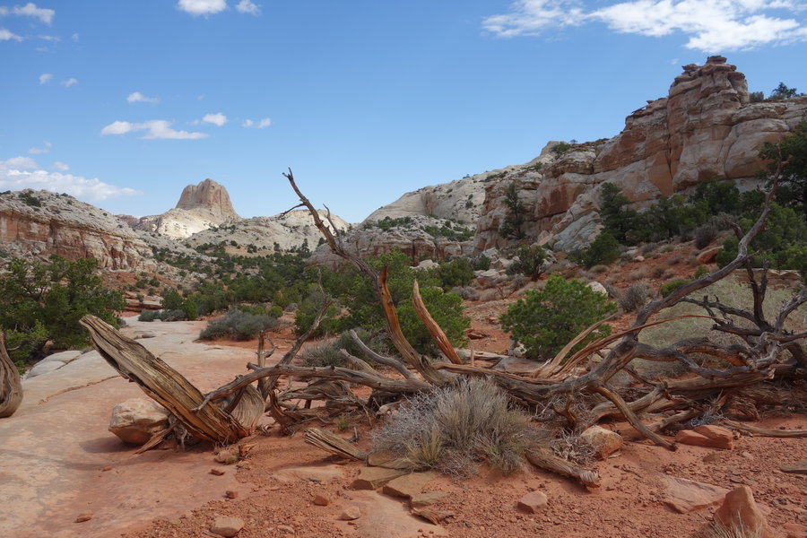
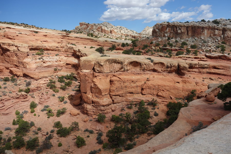
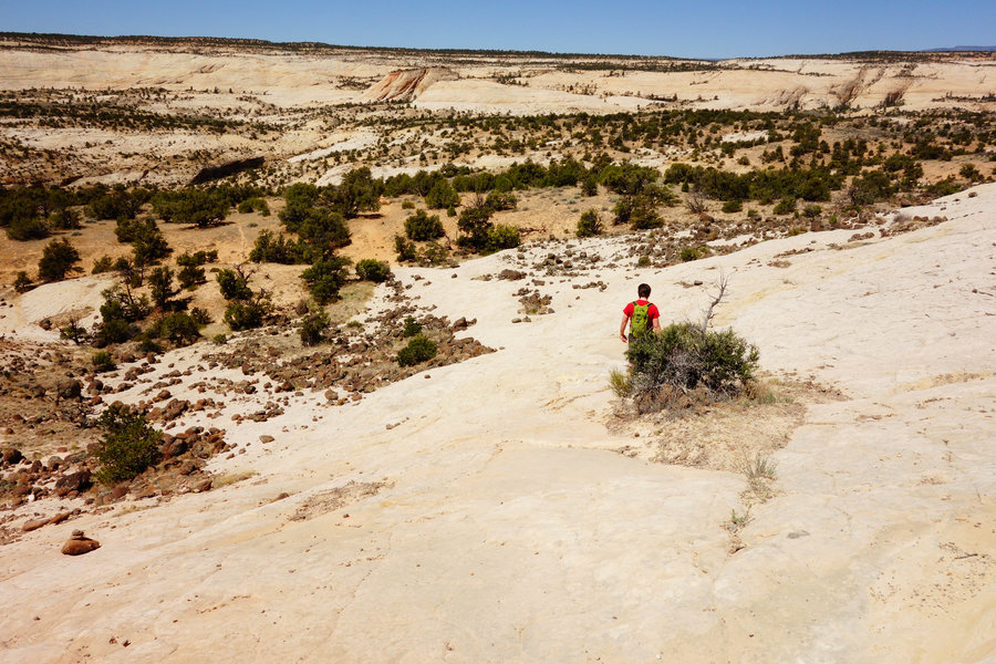
Capitol Wash + Tanks Trail, Capitol Reef National Park
2.4 miles of hiking • 250' elevation gain •
May 21, 2018


May 18, 2018


 1
1
May 17, 2018


 1
1
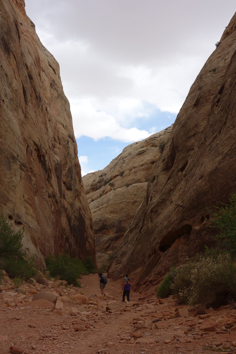
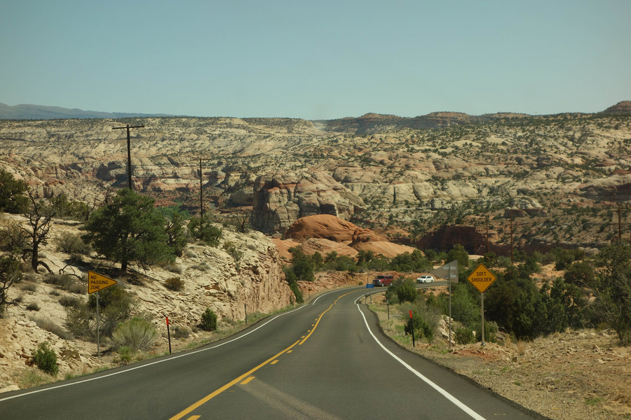
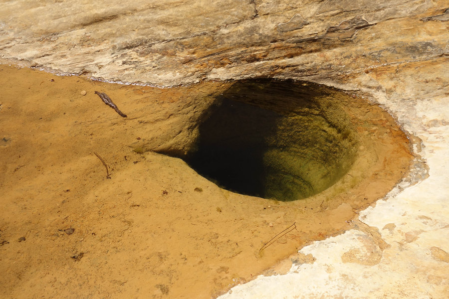
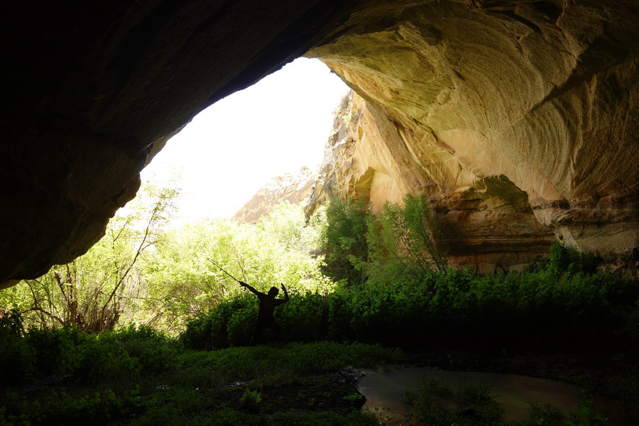
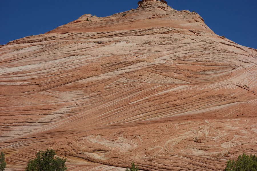
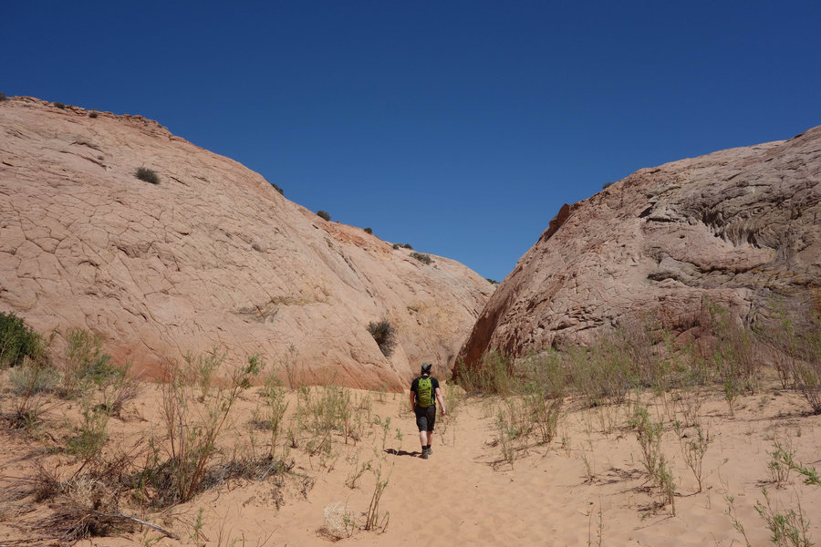
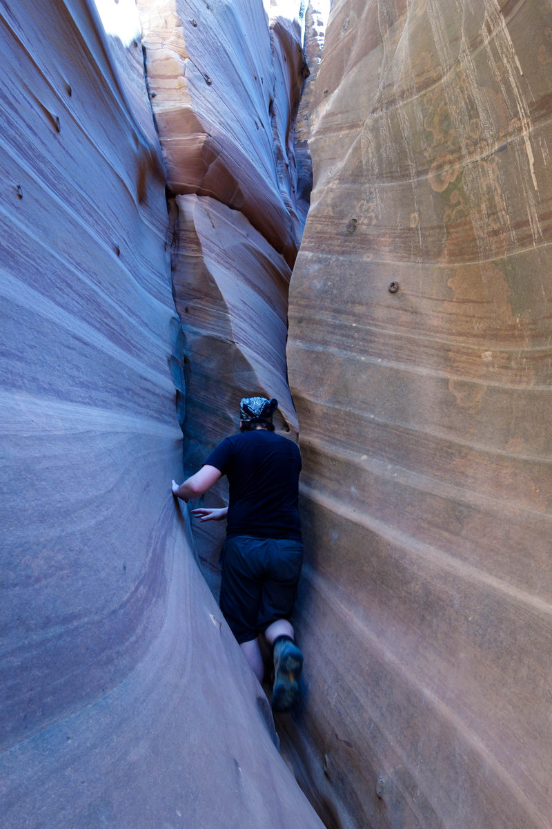
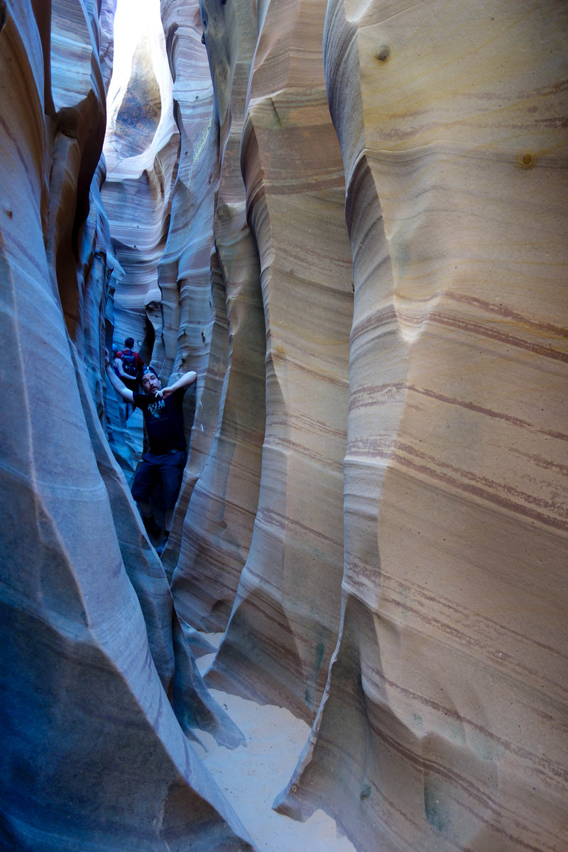
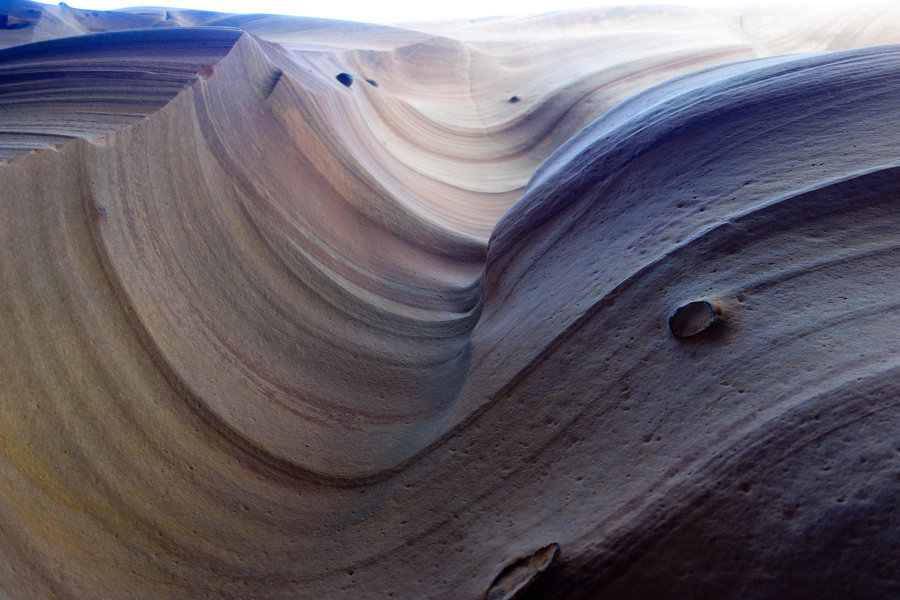
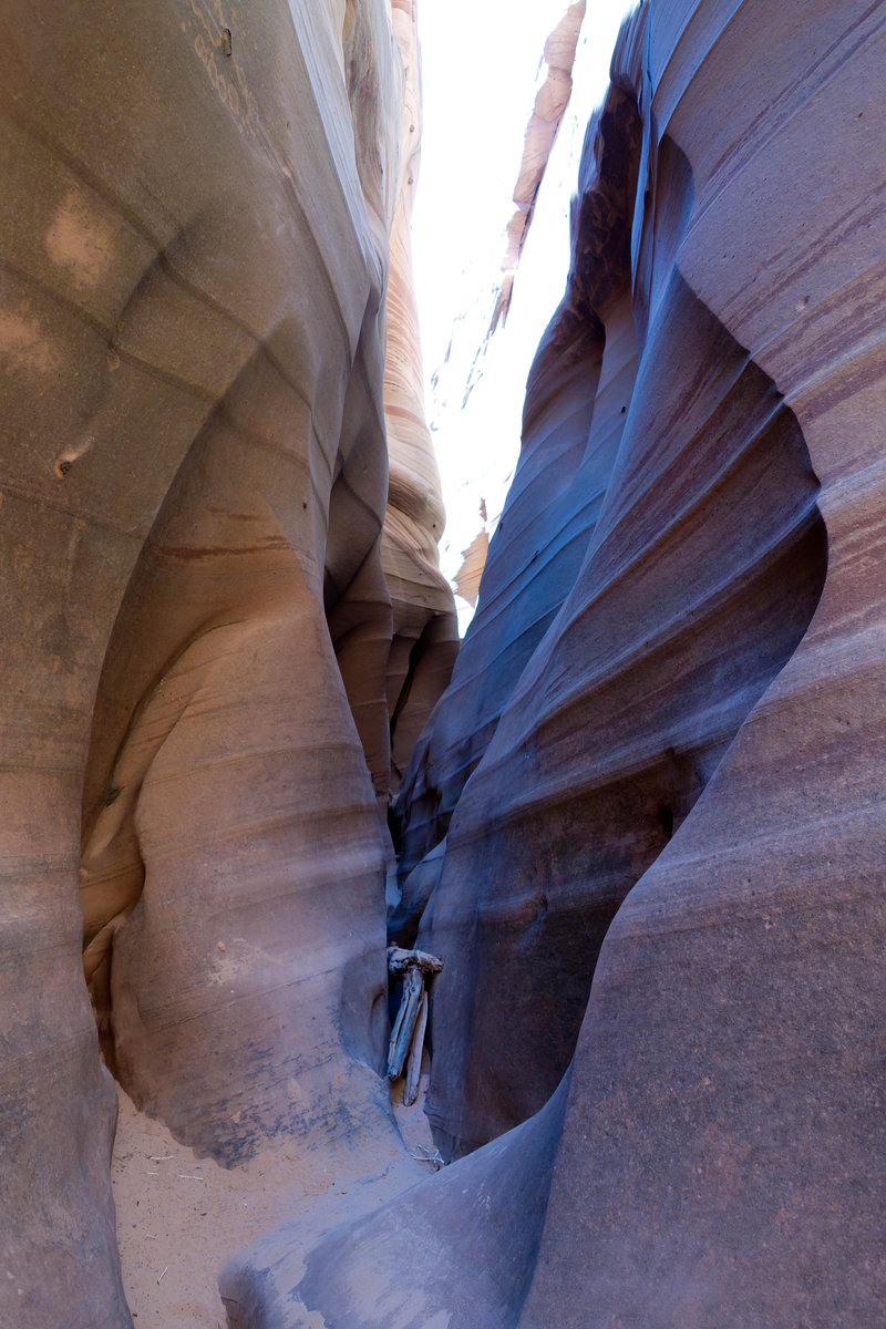
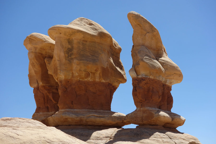
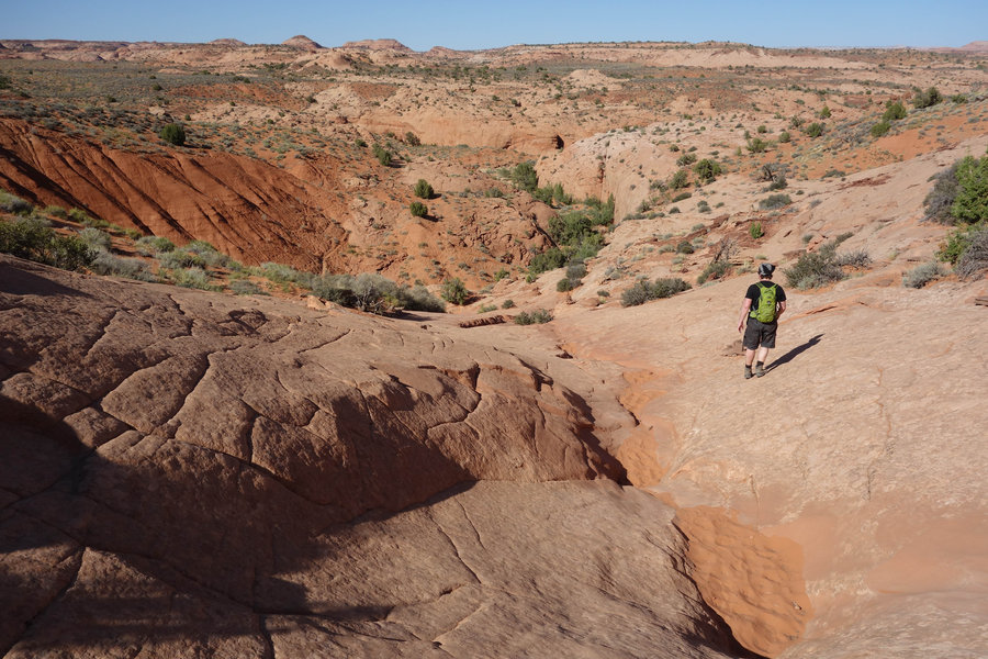
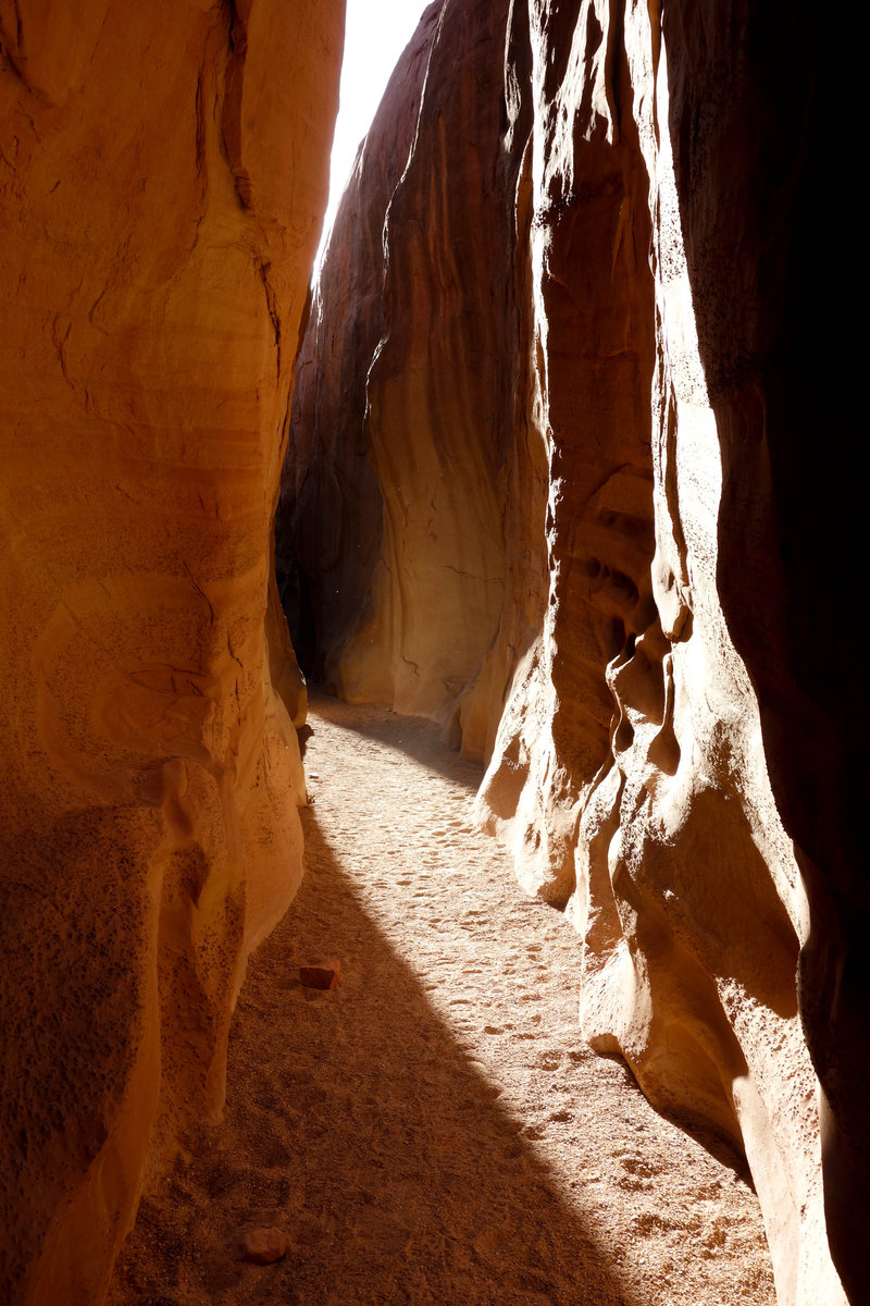
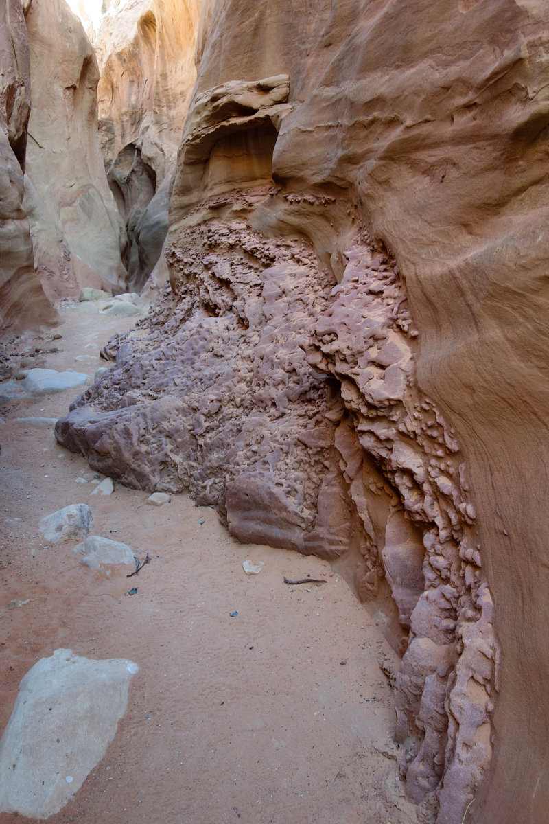
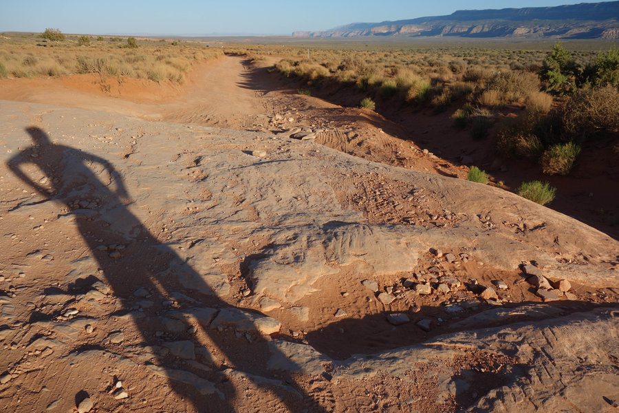
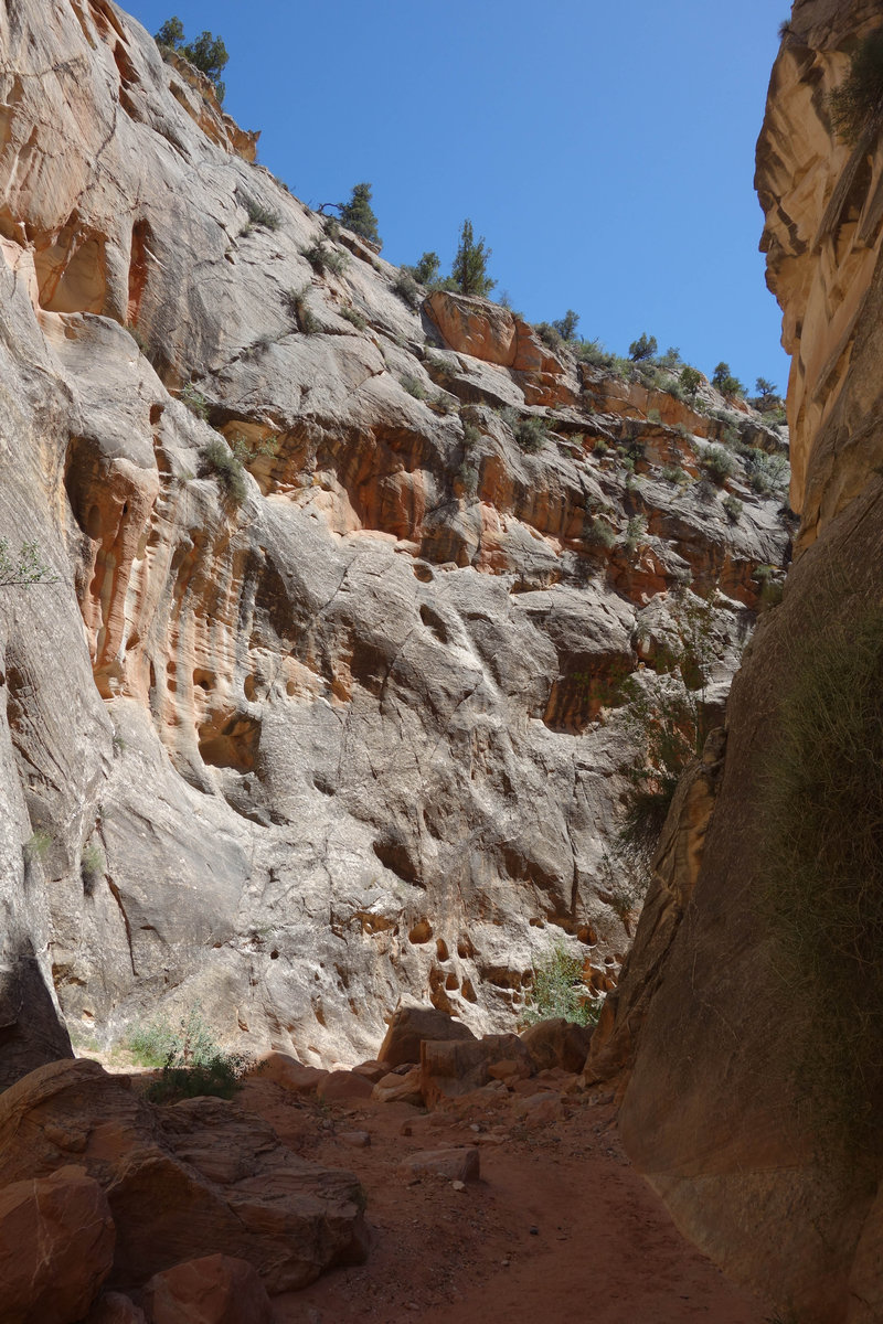
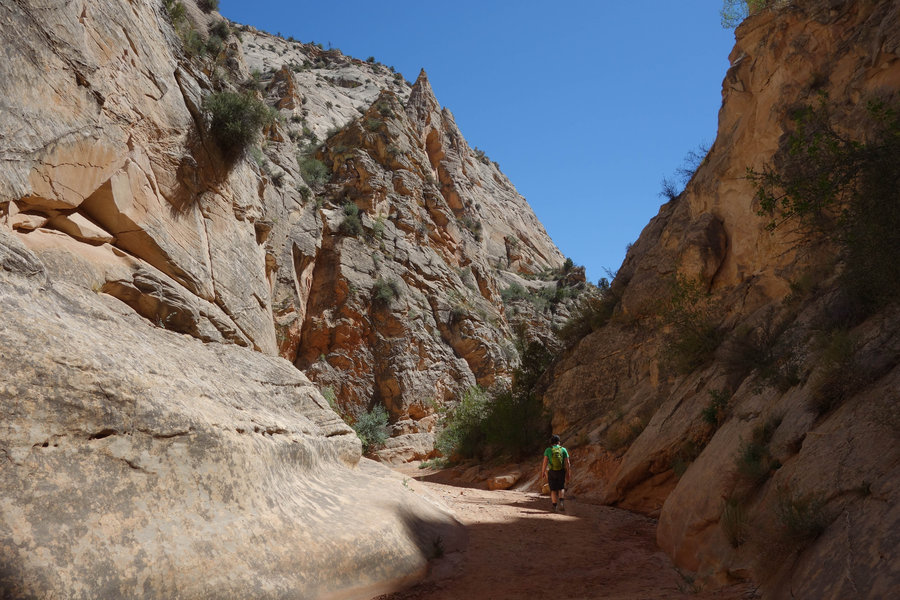
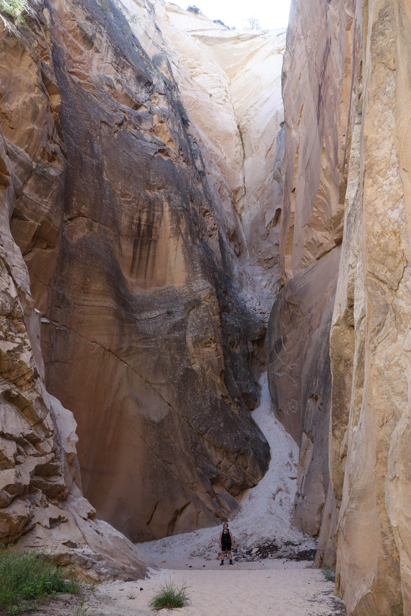
Zebra Canyon, Devil's Garden - Grand Staircase-Escalante
6 miles of hiking • 500' elevation gain •
Slot canyons, hoodoos, crazy rock formations, oh my!
May 16, 2018


 1
1
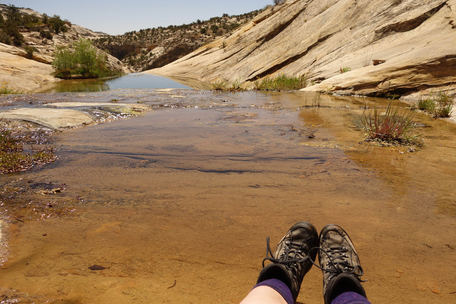
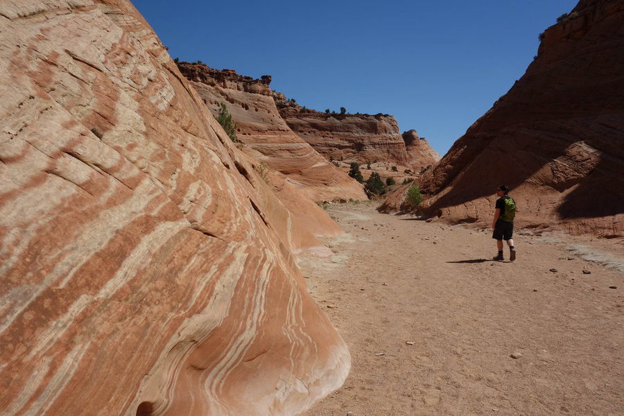
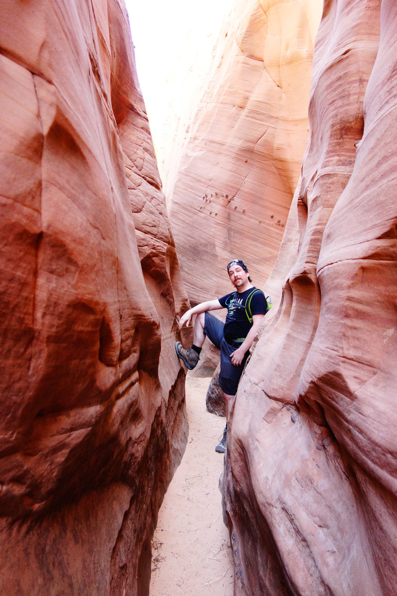
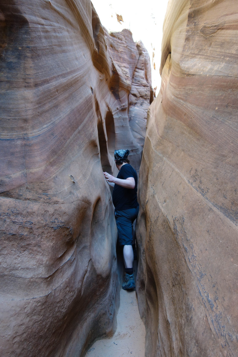
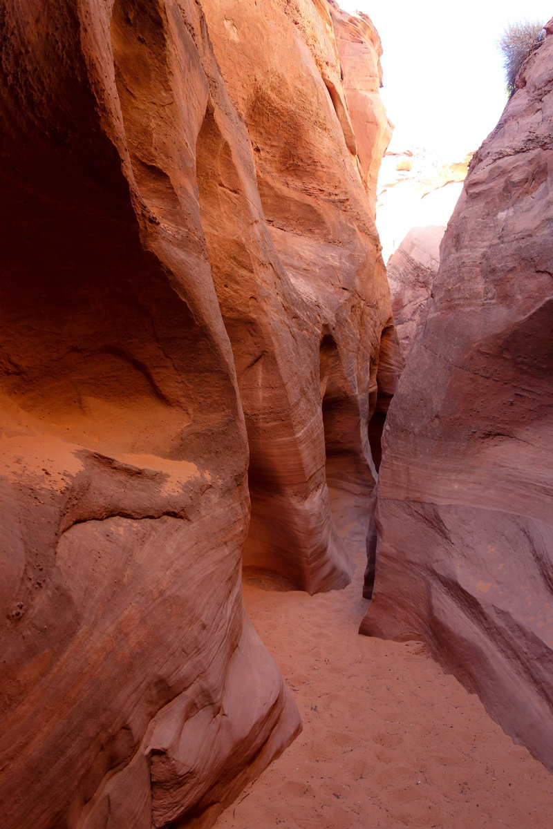
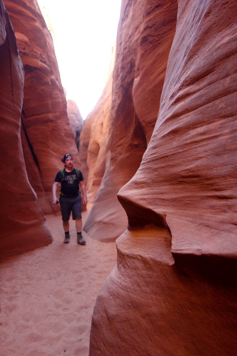
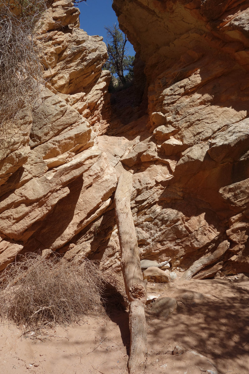
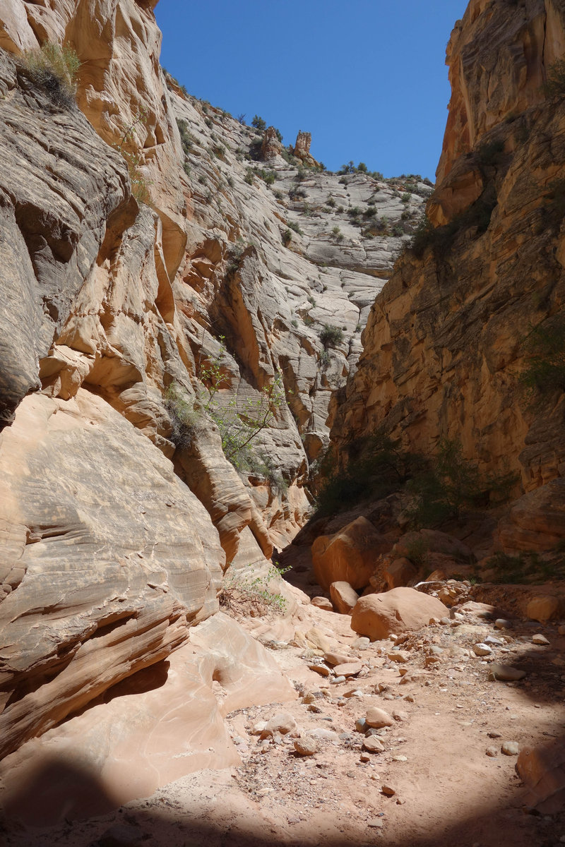
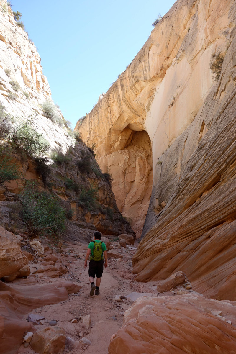
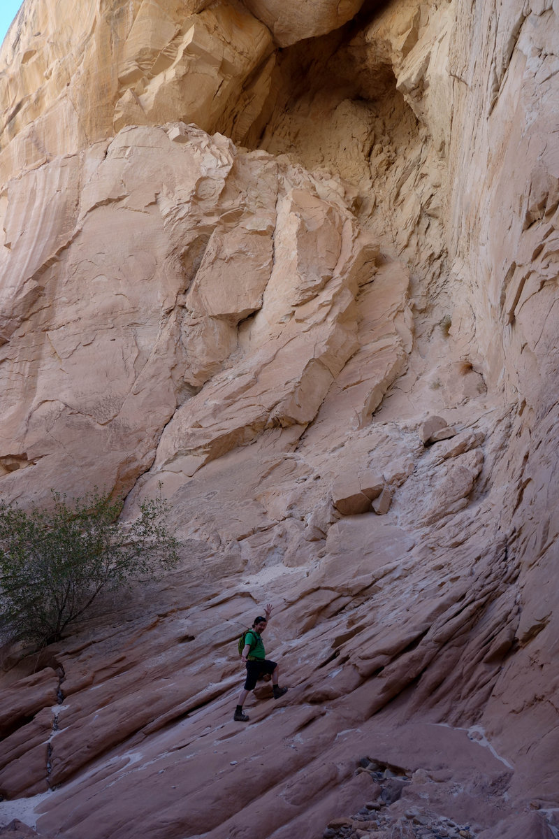
Dry Fork Narrows Slot Canyon, Spooky Canyon - Grand Staircase-Escalante
5.5 miles of hiking • 500' elevation gain •
The road to this trailhead is BAD, we added an extra two miles to our hike because we could not reach the trailhead. 4WD only for the last mile.
This trail was well marked with cairns, but the opportunity for exploring is awesome. Many different slot canyons in this area, being late in the day we opted for Spooky and Dry Creek Narrows. Peak a Boo looked a bit technical right from the get go, involving a scramble just to get up and in. We stopped when it became apparent that the rest of the canyon would require more scrambling/climbing, for fear of losing our remaining daylight.
Spooky lived up to its name, immediately becoming very narrow and dark. Remnants of debris from flash floods hung overhead giving me an eerie feeling, much respect to the power of water.
May 16, 2018


 1
1
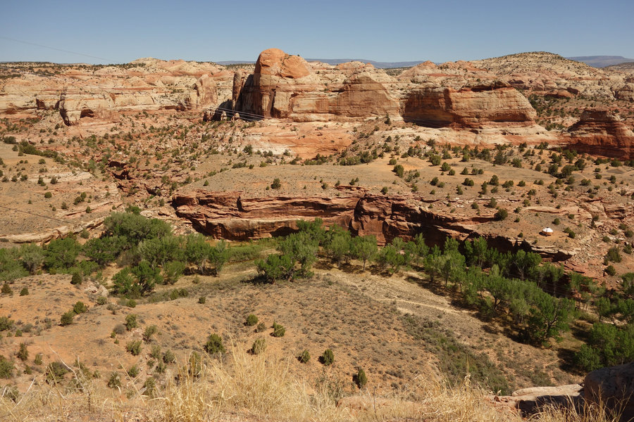
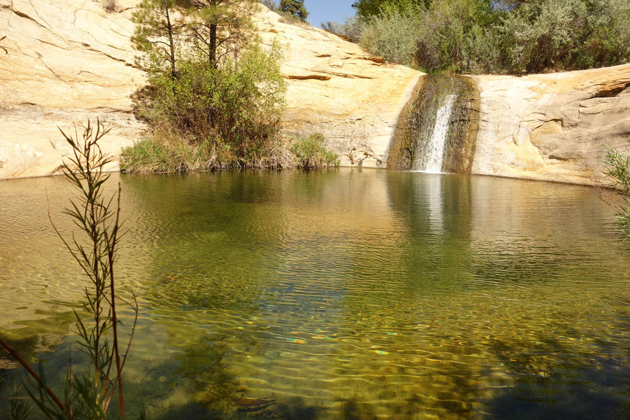
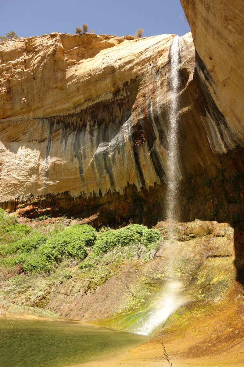
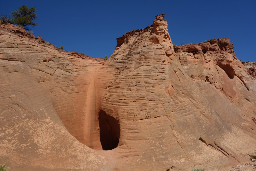
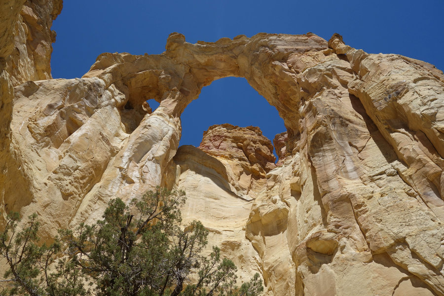
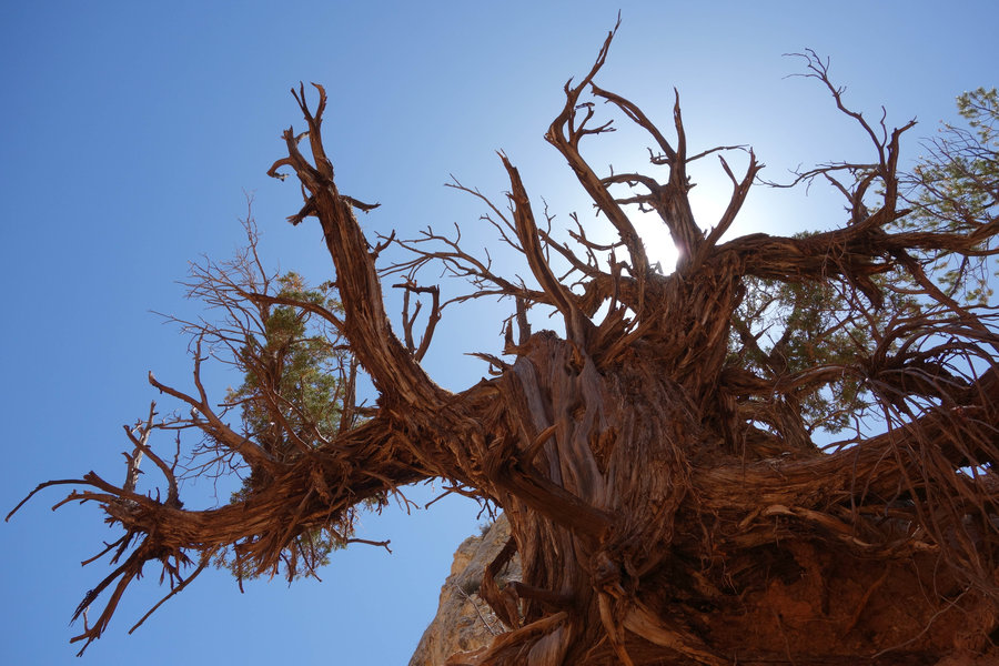
Cottonwood Canyon, Grosvenor Arch, and Twentymile Wash Tracksite - Grand Staircase-Escalante National Monument
4 miles of hiking • 250' elevation gain •
Let me be up front, driving a Prius in Grand Staircase-Escalante is not recommended. We ran into many roads we just could not travel down, many we shouldn't have but attempted anyway, and miles and miles of washboard roads. However, a careful driver can make it to many interesting places if you care not about the wear and tear on your vehicle. Prior to our trip we had made some costly repairs, and I'm pretty sure this trip is going to have an affect down the road. That being said, next time I hope to have a different vehicle.
It was hot, dusty, awful on our car, but an amazing place, even though I only saw such a tiny part of it.
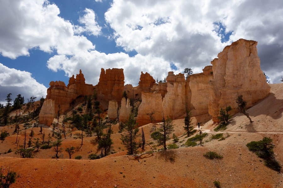
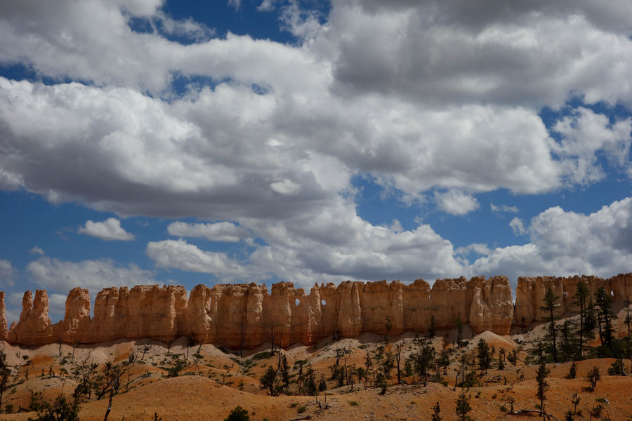
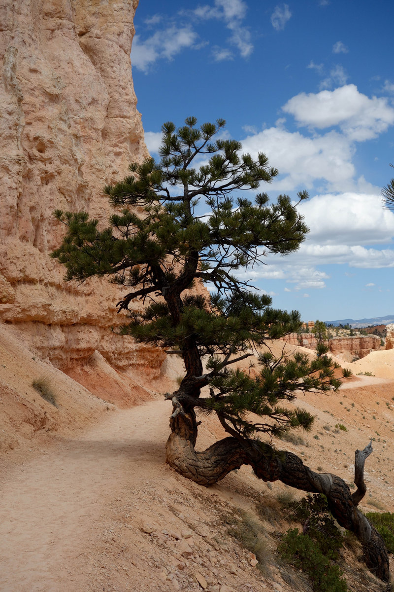
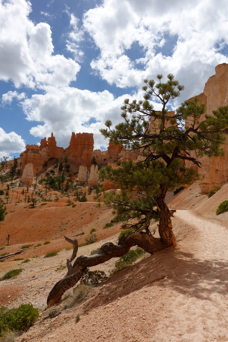
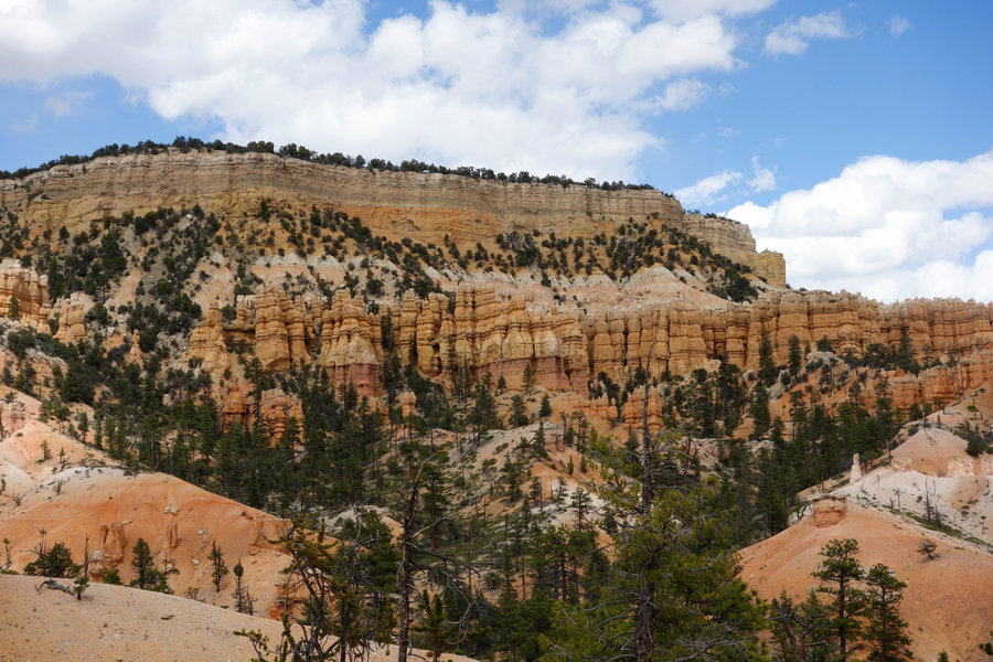
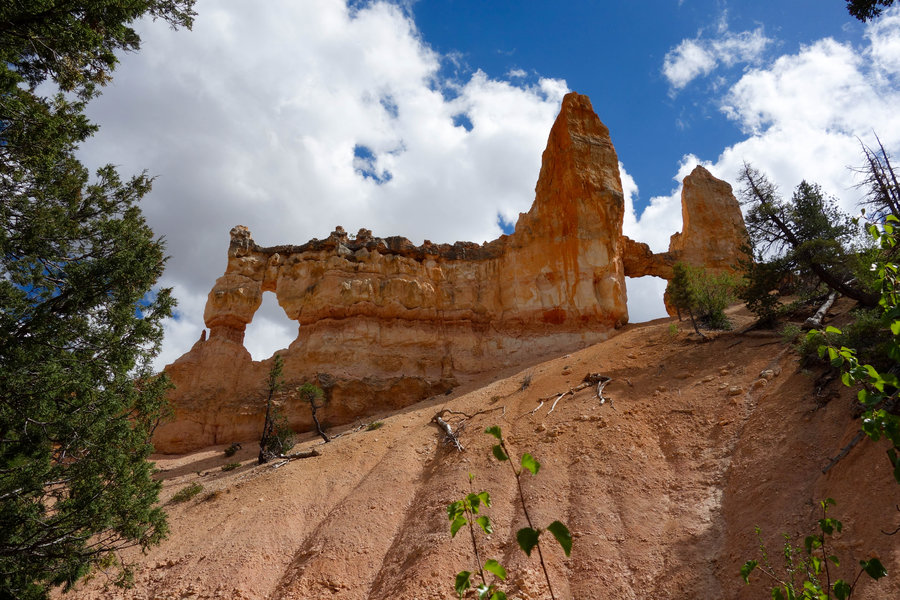
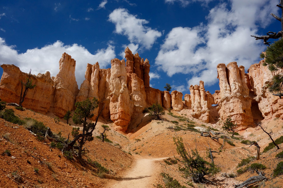
May 15, 2018


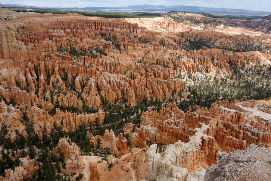
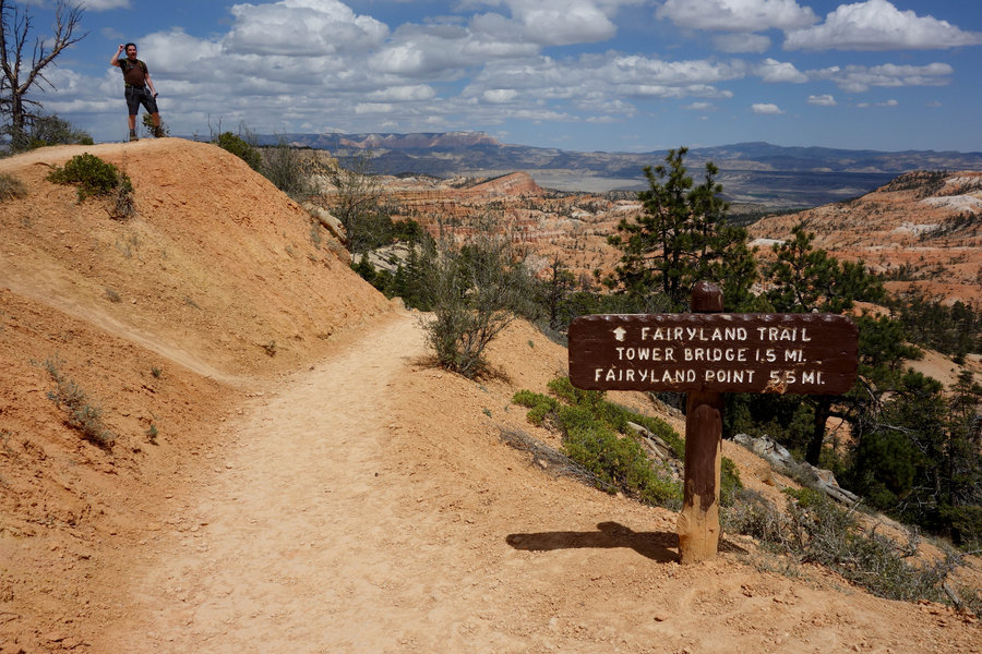
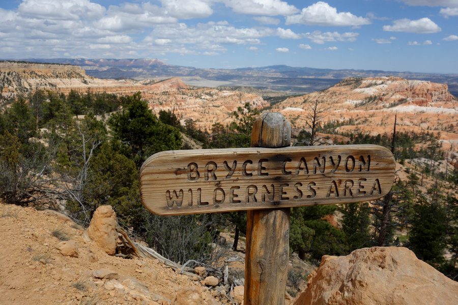
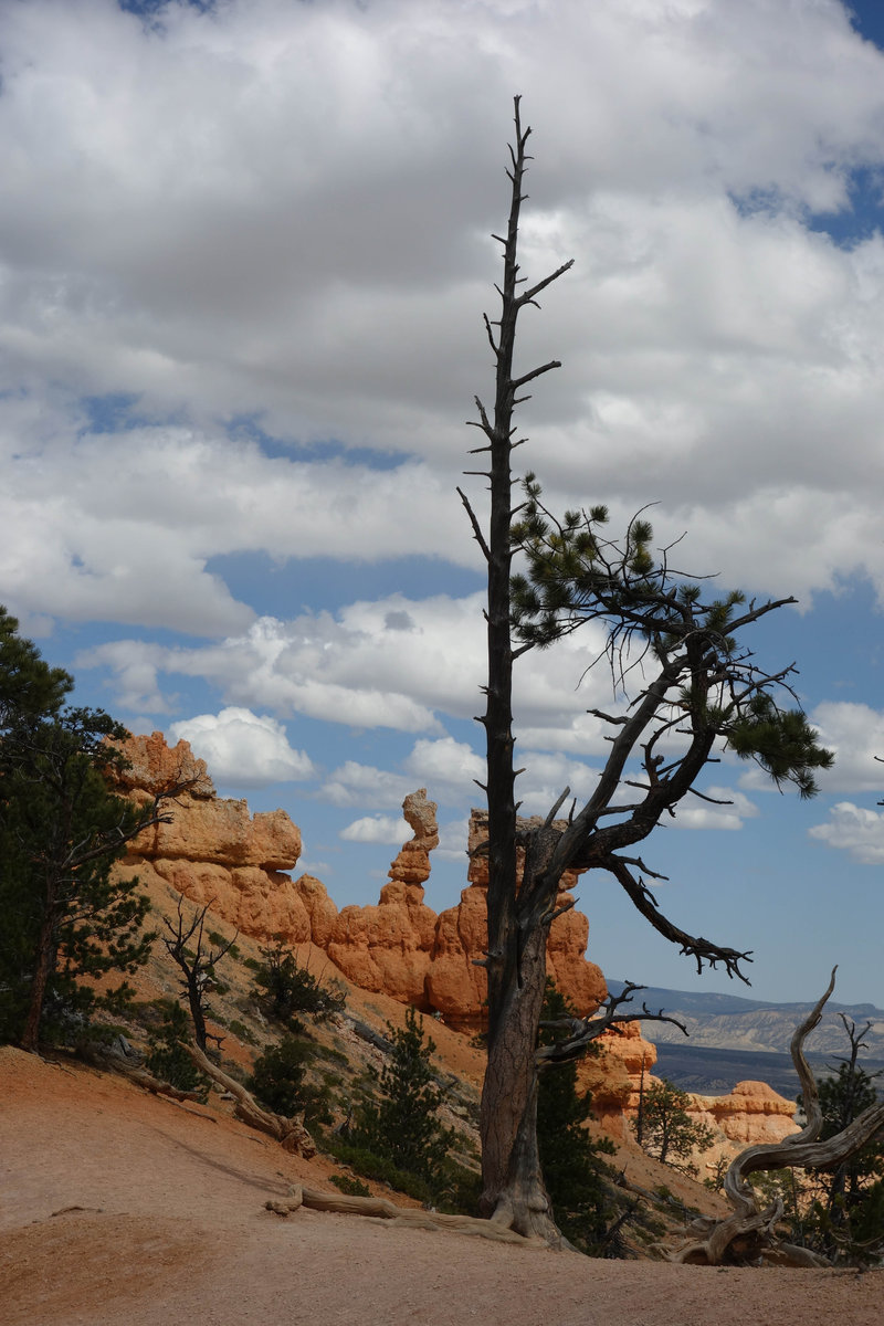
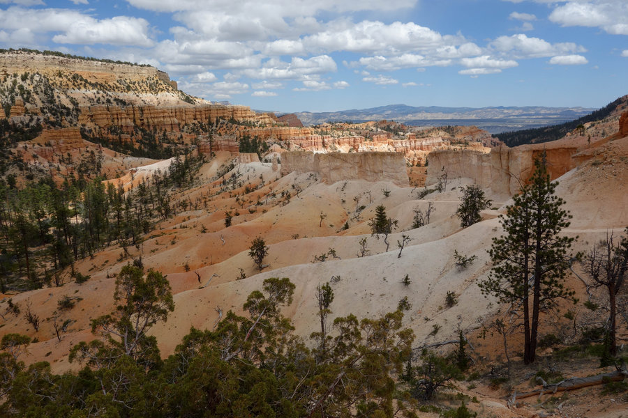
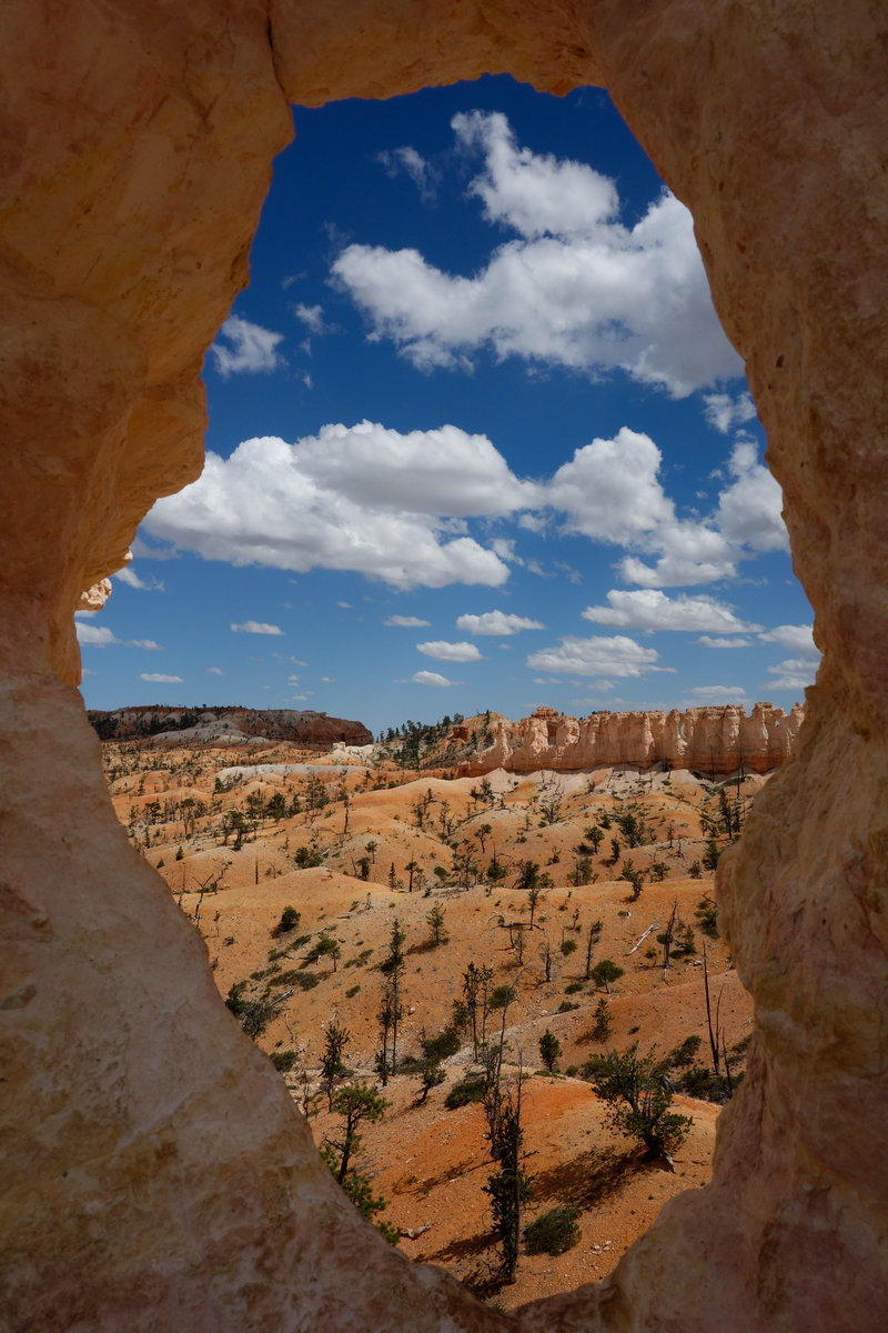
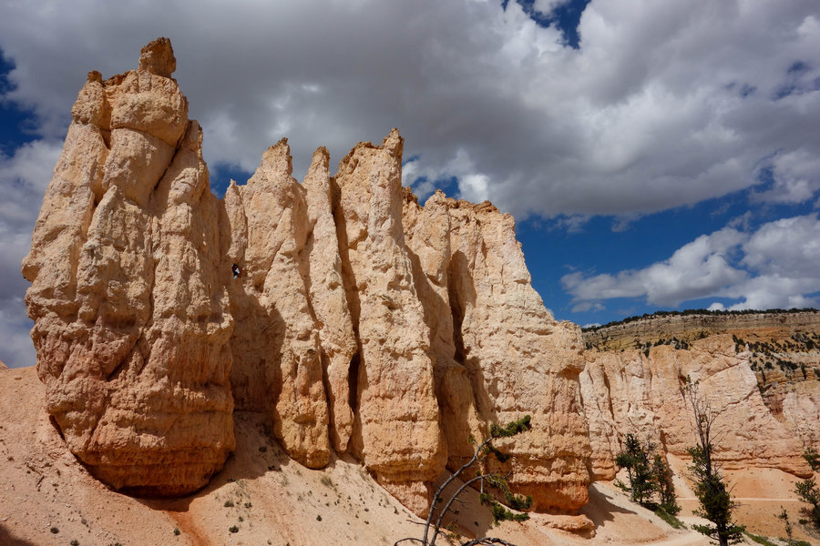
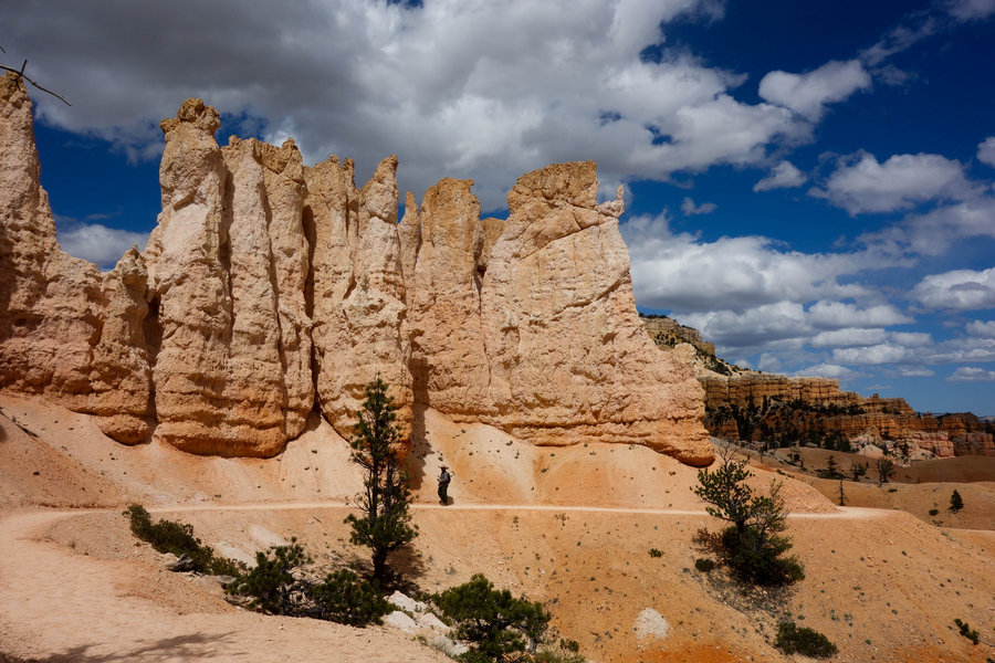
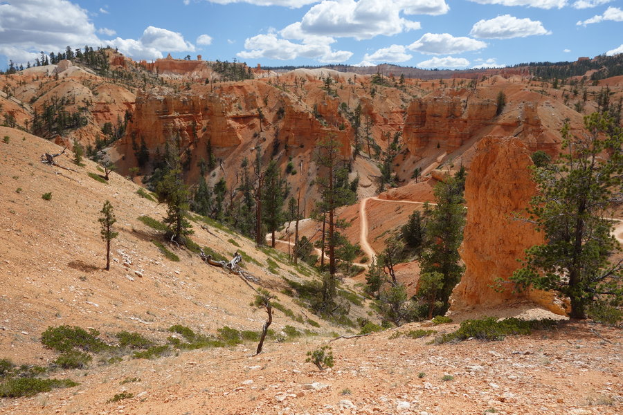
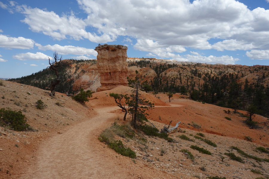
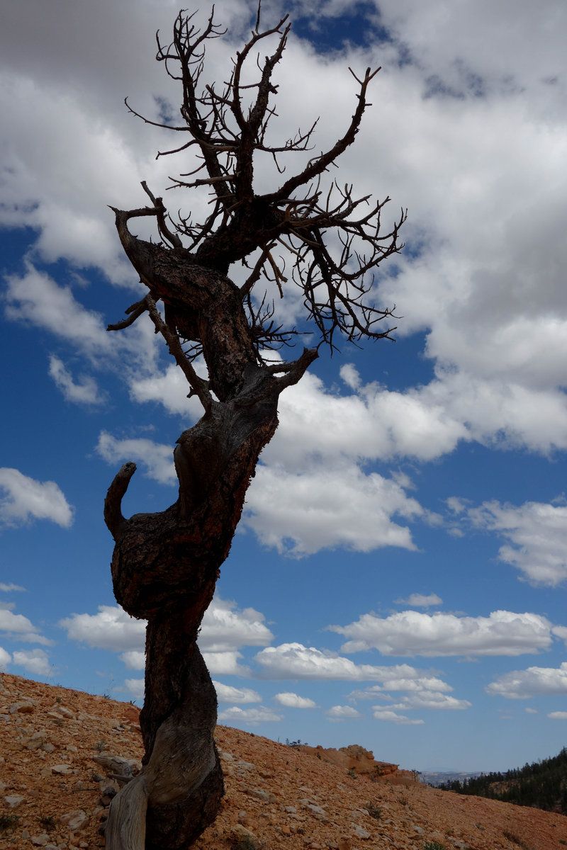
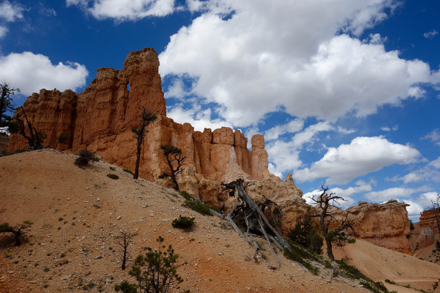
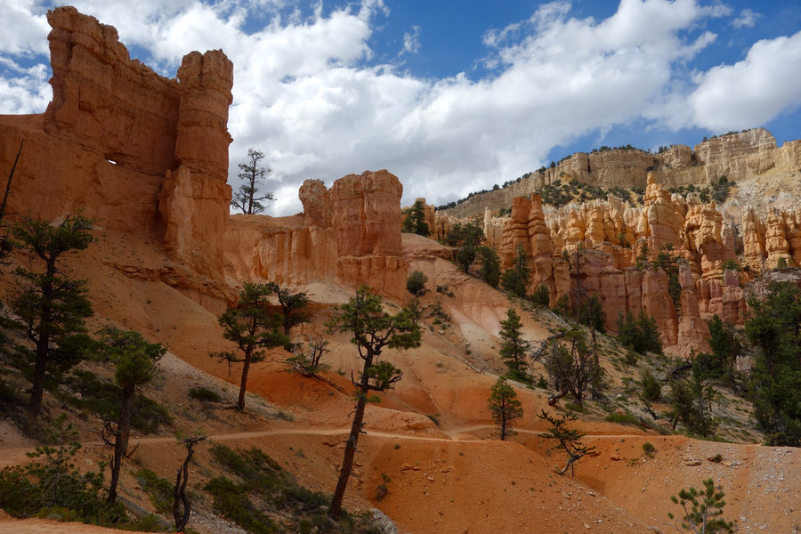
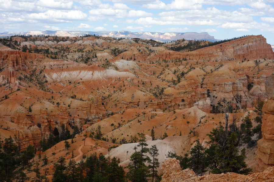
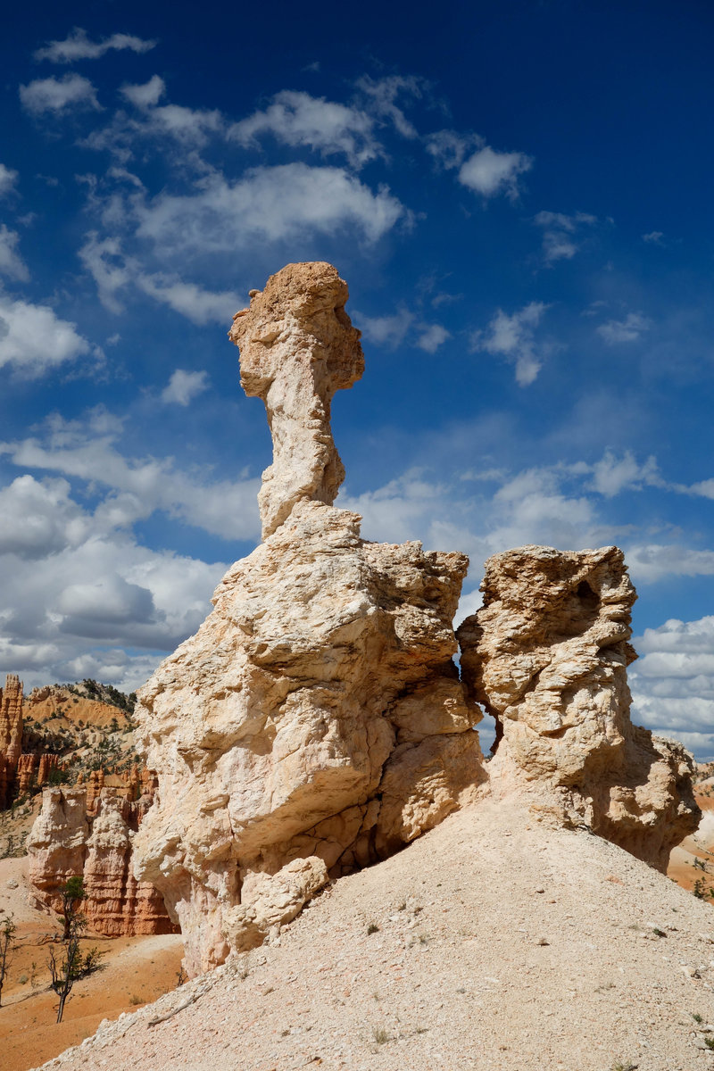
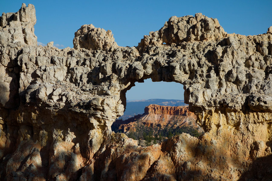
Fairyland Trail, Bryce Canyon National Park
8.2 miles of hiking • 1500' elevation gain •
This hike was pure fun, a magical descent into the Hoodoos of Bryce, complete with David Bowie Magic Dance stuck in my head as I looked around at all the goblin castles. Starting at the North Campground, we had a convenient entry point in which to start. We ran into a few people going the opposite way at the start of the hike, but otherwise pretty much had the trail to ourselves for the rest of the day. I can't even begin to explain how cool Bryce is, it is just one of those places you have to see at least once in your lifetime. It looks like another planet. Probably one of my favorite hikes I have ever done.
May 14, 2018


 1
1
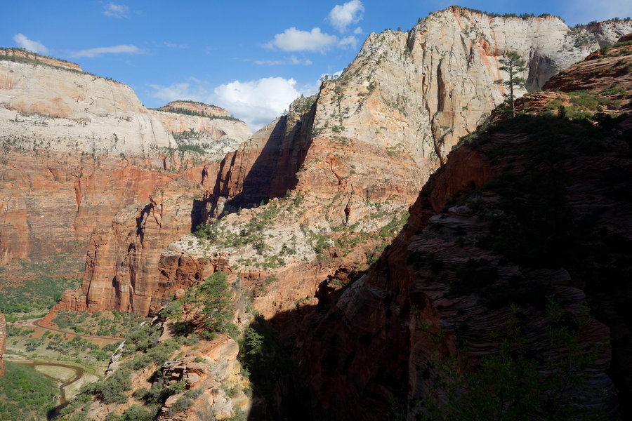
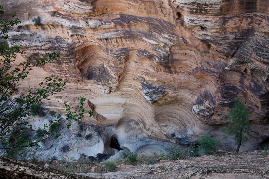
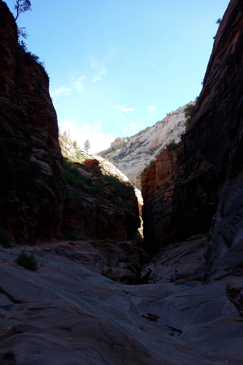
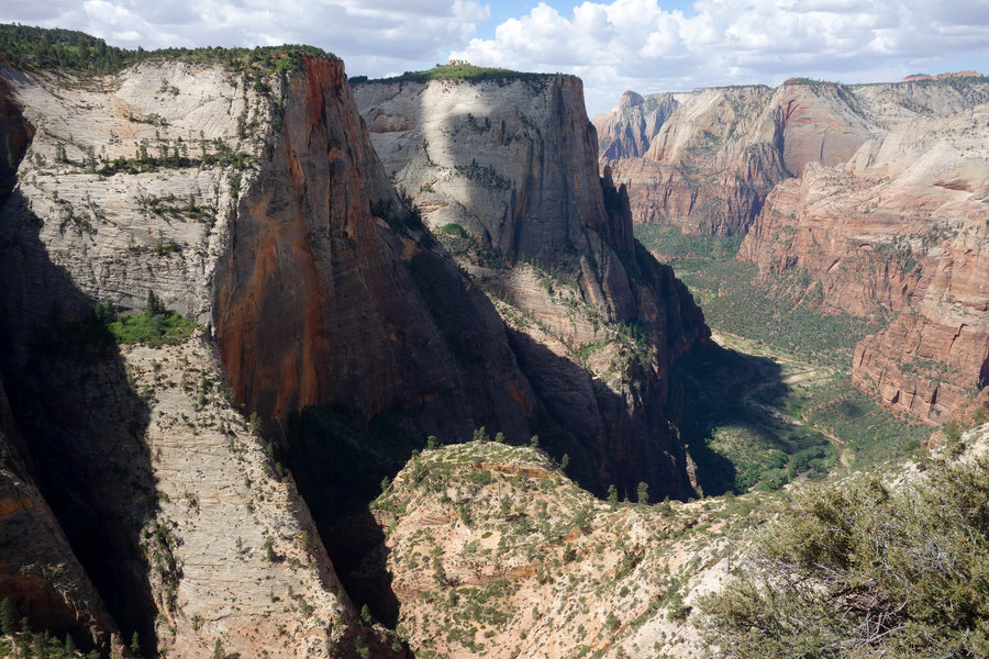
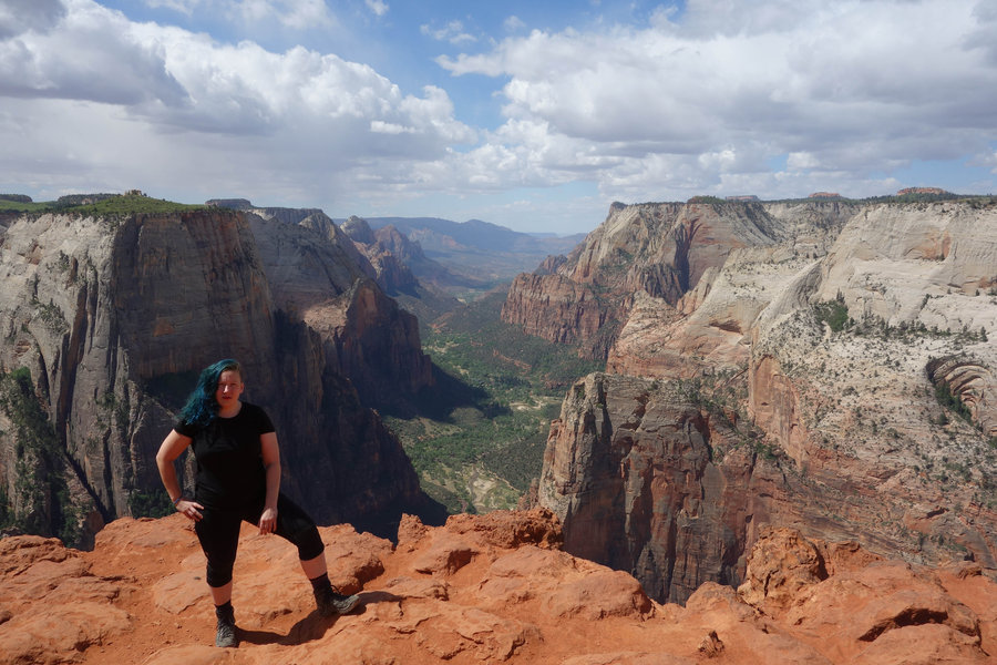
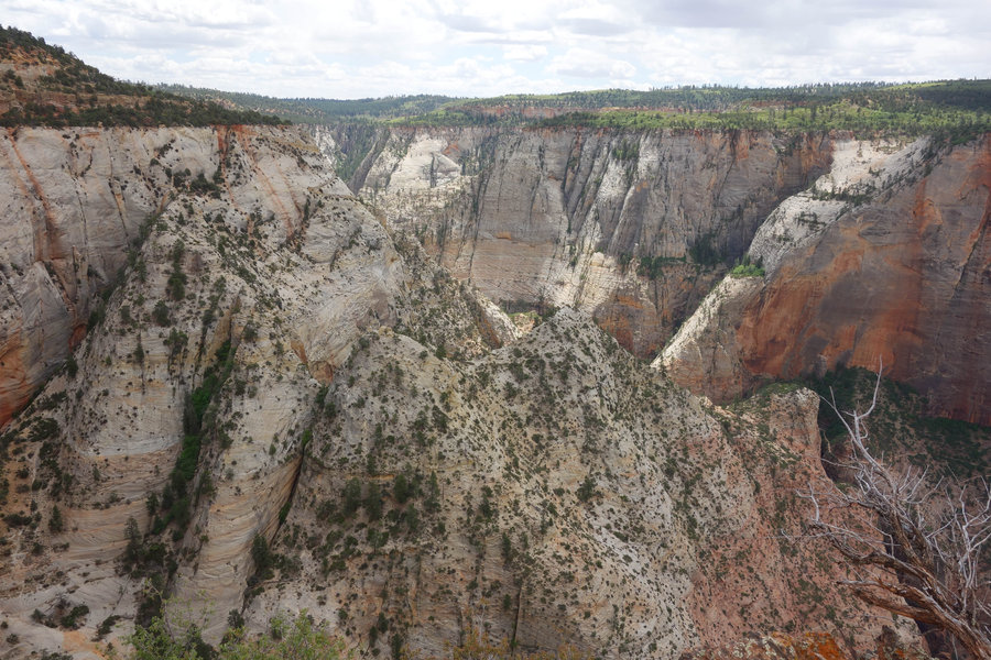
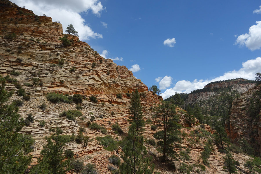
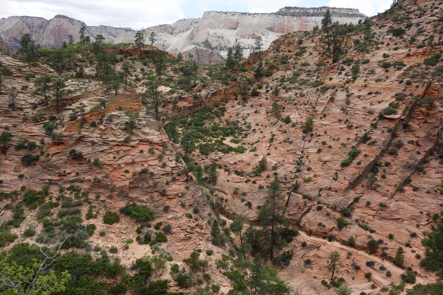
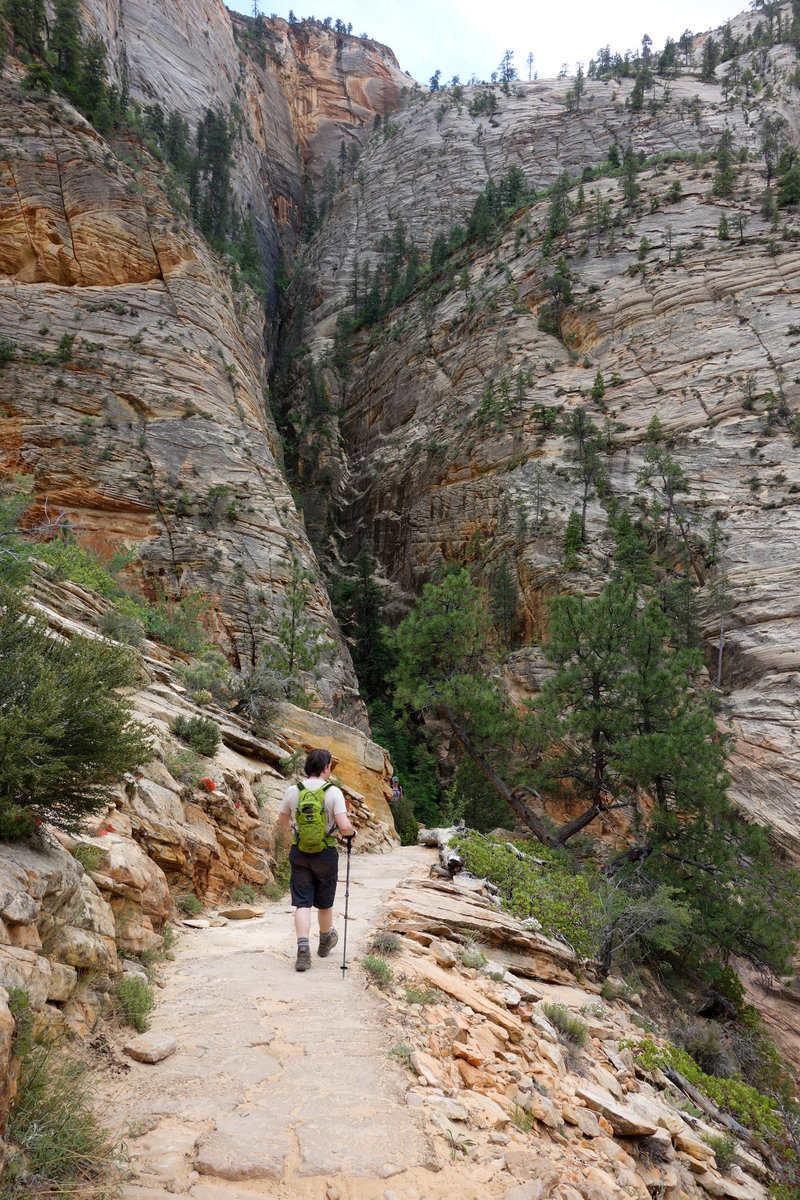
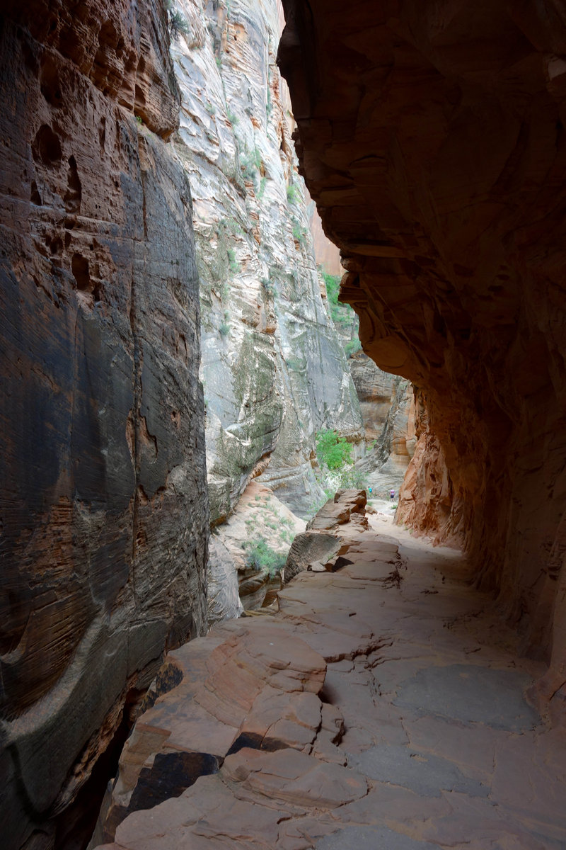
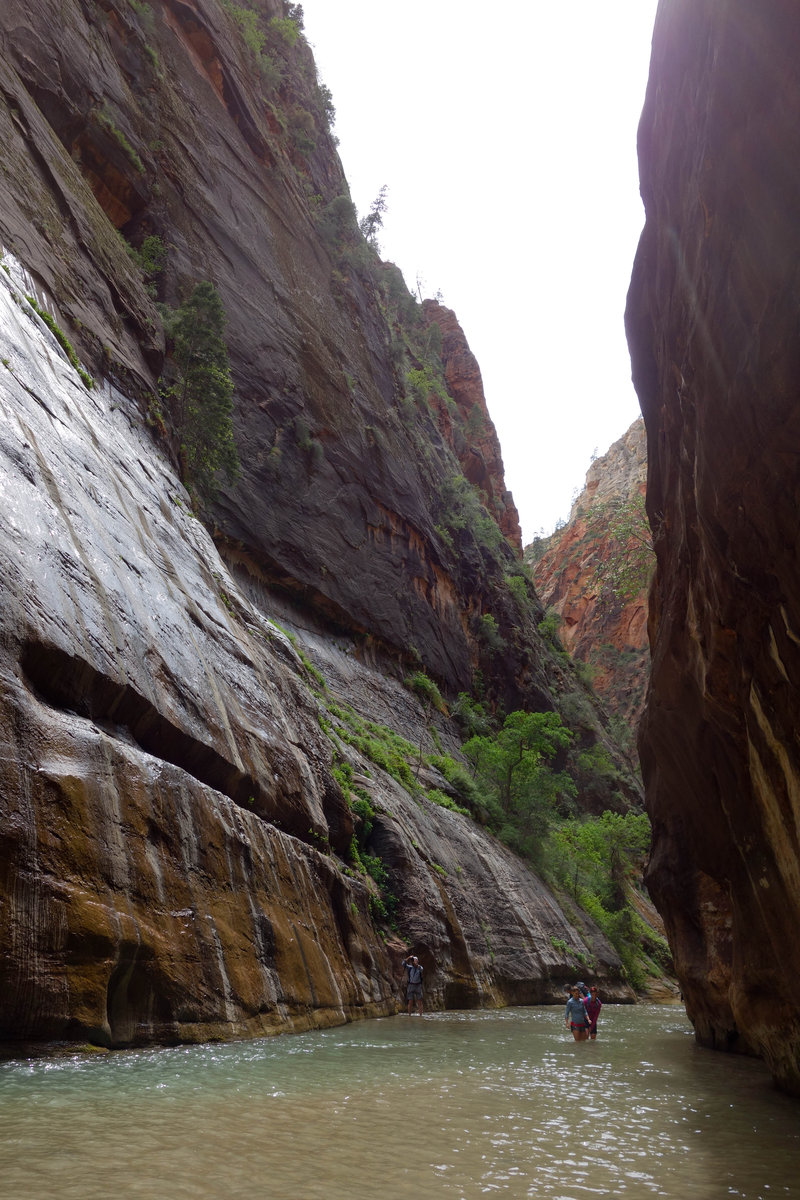
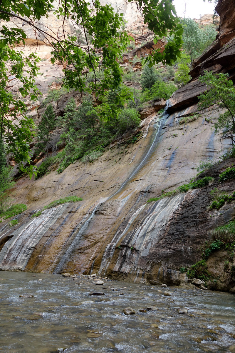
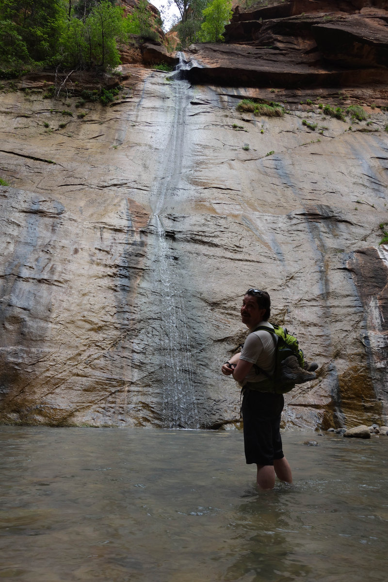
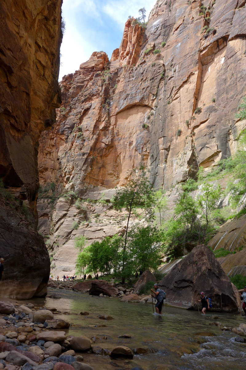
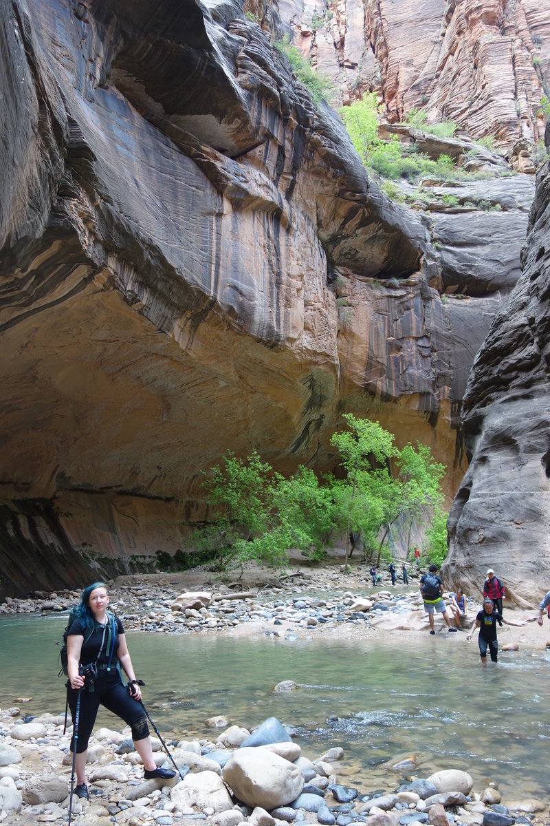
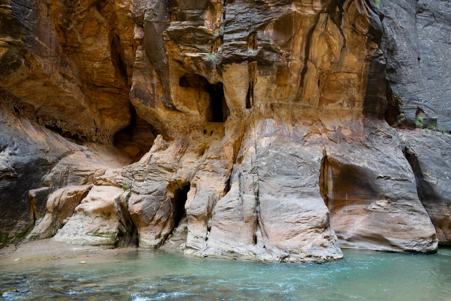
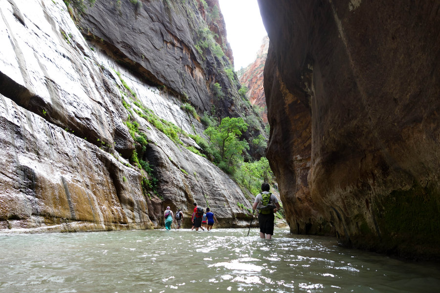
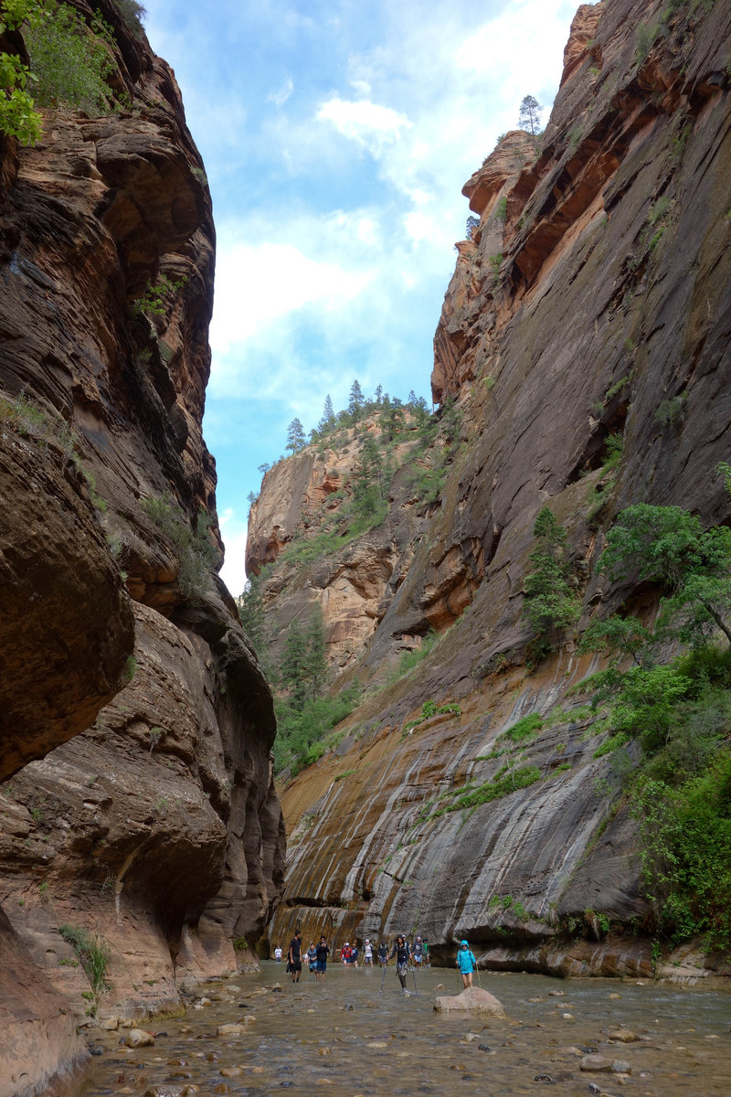
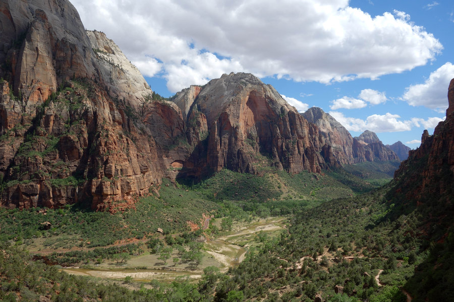
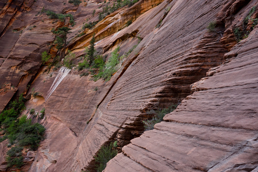
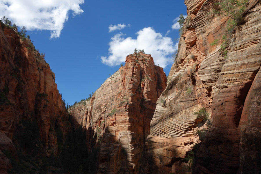
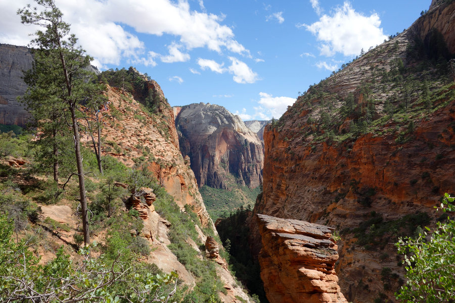
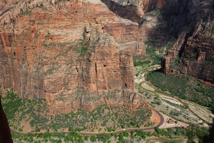
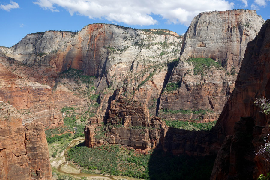
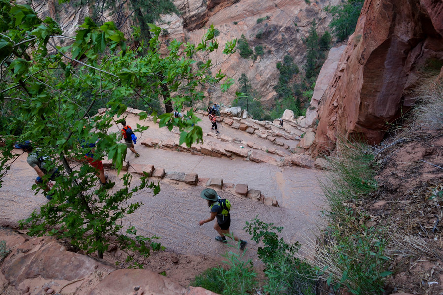
Observation Point and a little bit of The Narrows, Zion National Park
10.5 miles of hiking • 2250' elevation gain •
We rose early to try to beat the heat and the crowds into the park, and managed to find a parking spot at the Visitor Center to leave our car for the day. The parking area quickly filled up, and after a quick breakfast at a cafe, we got into line to wait for the shuttle. In the short time we were in line, the crowd grew, and we had our longest wait to board a shuttle. Once aboard, our stop was #7, Weeping Rock Trailhead. From there, it was an immediate up on well built switchbacks, each turn giving us even greater views. Finally after climbing for a long while, we got a bit of a break and shade though Echo Canyon, but it didn't last long and we were going up again. I thought I had packed shorts to change into in my pack, but I was wrong. So, up I went in tights, swearing at myself for not having packed an alternative now that the sun was on full blast. My Portland skin yelped and cringed but I managed not to burn. When I finally felt like the heat and elevation gain was really getting to me, we reached the top of the canyon, and the last mile out to Observation Point was relatively flat and easy. Views were big, and Angel's Landing looked tiny below. While I had skipped the famous hike, I felt like I had picked the better of the two. If I wouldn't have felt so zapped from the sun, I would have taken the side trip to Hidden Canyon on the way down. Instead, the idea of splashing around in some water sounded amazing, so we took our tired feet onto a shuttle to the last stop on the line.
The water was cold, but felt amazing on our tired feet. While most tourists had on rental water shoes from the outfitter in town, we got along fine with some simple water shoes. At times, the water was up to my waist, but mostly stayed around knee deep. At each bend we kept telling ourselves that it would be our turning around point, but the further I went I couldn't help but wonder what was around the next bend. Finally, we knew we really needed to turn around and get some food in us, so we reluctantly headed back into the crowds and back into Springdale for some much needed pizza.
May 13, 2018


 1
1
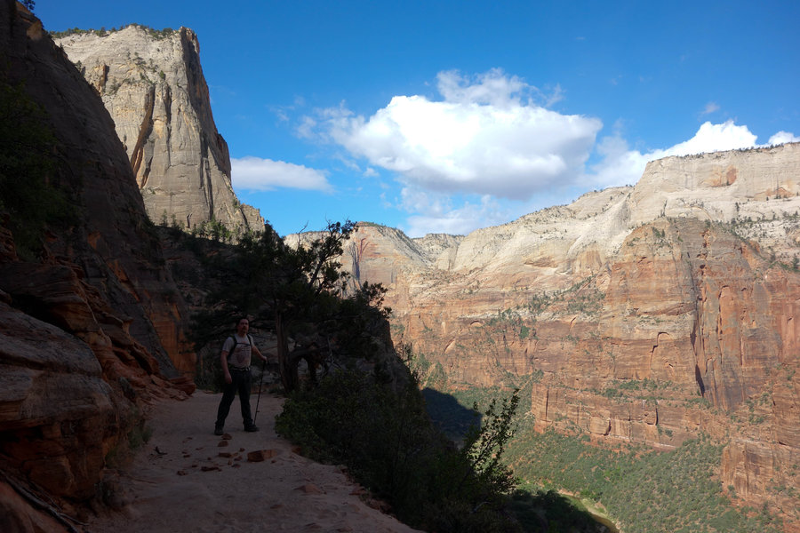
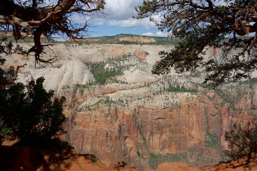
West Rim Trail to Angel's Landing, Zion National Park
4.3 miles of hiking • 1250' elevation gain •
At first, entering Zion in the afternoon was a little overwhelming. Crowds, cars, no parking. Once we figured out that we just needed to find a place to park anywhere in Springdale, and that the shuttle to the park and within the park was free, we were all set. We loaded up our daypacks and set out into the park. The shuttle system was efficient, we never had to wait more than a few minutes for one to show up. Many visitors opted to cycle to car free roads with the shuttles, and I felt a little sad I had not brought my bike along for this trip.
Being too late in the day for a long hike, we opted for a quick jaunt up the West Rim Trail to see the famous Angel's Landing hike. Pretty impressive seeing the engineering that went into Walter's Wiggles, the steep switchbacks that lead up up up into the park. The trail was fairly crowded, and upon eyeing the line of hikers going up Angel's Landing, we decided we would rather not dodge inexperienced tourist hikers on steep drop offs, so we ended our journey there and headed back down in search of dinner and a place to camp for the night. Camp spots in Zion are pretty hard to come by so we opted to head out of the park and camped for the night on BLM land.
May 12, 2018


 2
2
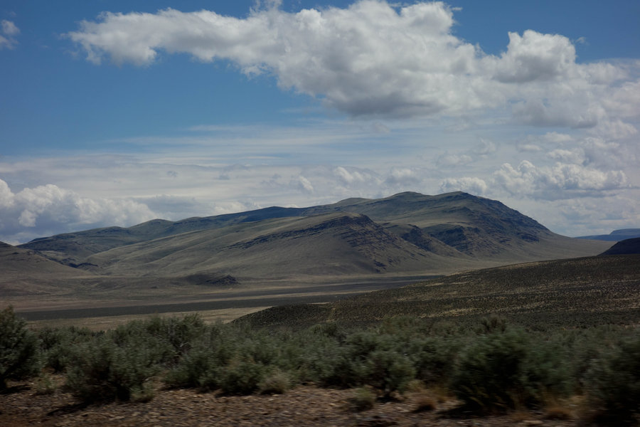
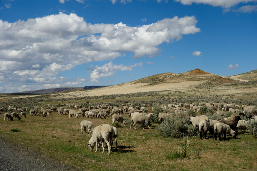
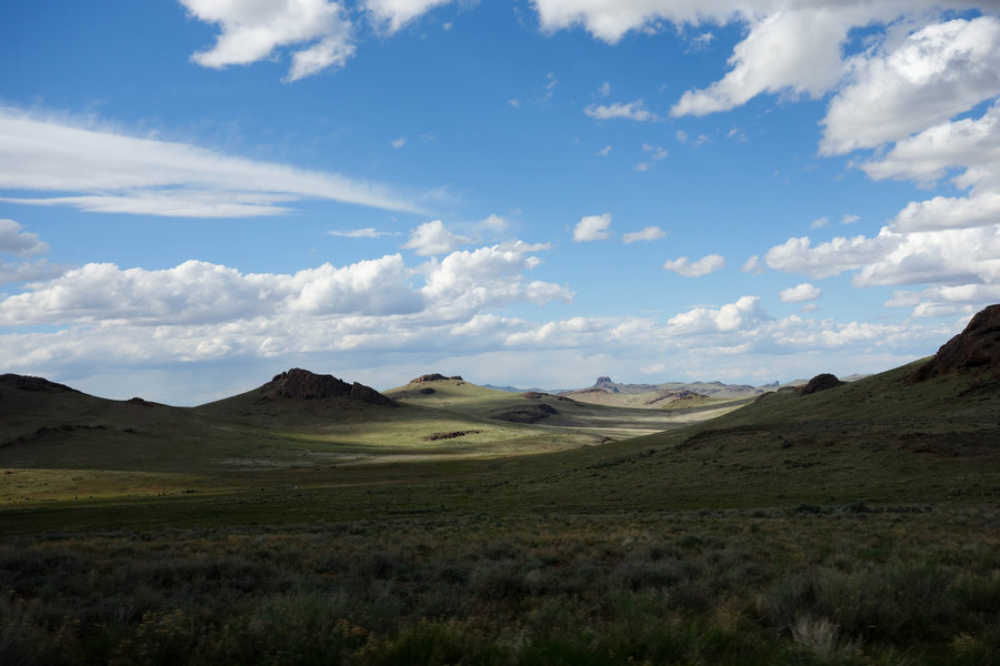
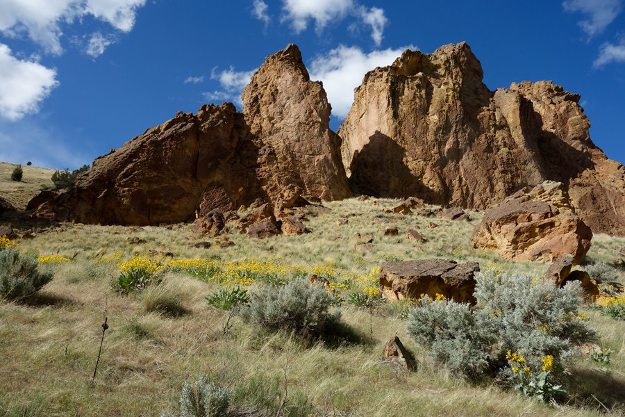
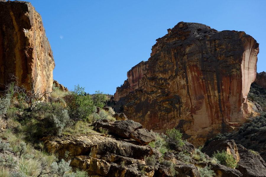
Juniper Gulch Trail, Owyhee
2.2 miles of hiking • 500' elevation gain •
Forgive me while I document all of the hikes from my vacation last week.
I had been wanting to visit Owyhee, the lure of its isolation and remoteness intrigued me from the first moment I heard about it. However, being cursed with a Prius as my only vehicle, I had doubts I could make it out there. After a bit of research I found that the Leslie Gulch area is accessible by passenger vehicle, and so our planning began. The gravel road was well graded and pothole free, but certain areas did have a fair amount of washboarding.
We left Portland in the am and headed on the road, getting to the trailhead in the late afternoon. Dodging various animal crossings through open range, we chose a short hike with our remaining daylight, and we weren't disappointed. The hiking was relatively easy, multiple routes were found through the gulch, many looking like they could lead to some exciting off trail adventuring. Gain on this was minimal, but it did bring us to a nice view of the surrounding area. We could have gone further - but needed to get camp set up for the night.
We headed for what was the only campground at the end of the road, but we were caught off guard finding that it was filled with RV's, ATV's, and what looked like a big party. No tent spots left, we turned back and found an established camp spot in Dago Gulch, and enjoyed a windy but clear sky with an amazing light show of stars. It was only on the way out that I read the sign that camping was only allowed in the campground. Unfortunately at the late hour we arrived, we would have had a hard time getting to another area where camping was allowed. Lesson learned, but the spot we camped was obviously frequently used.
Though our stay was just a quick jaunt on our way to National Parks in southern Utah, I can't wait to come back and explore again. Just not in a Prius.
May 10, 2018


 1
1
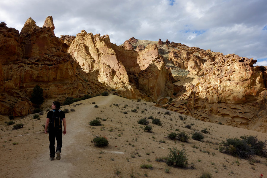
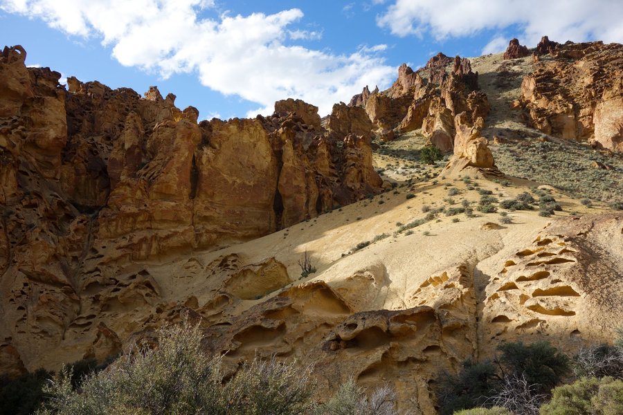
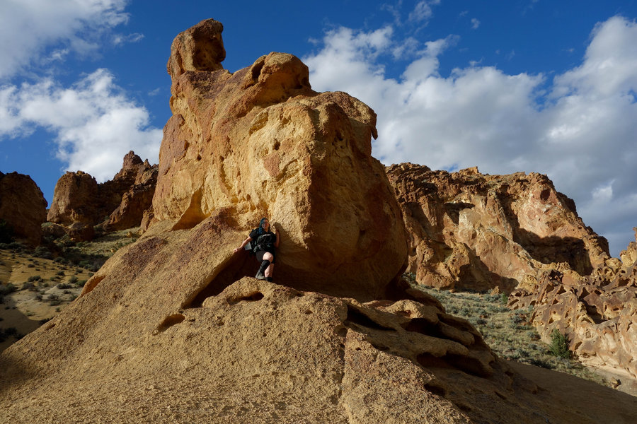
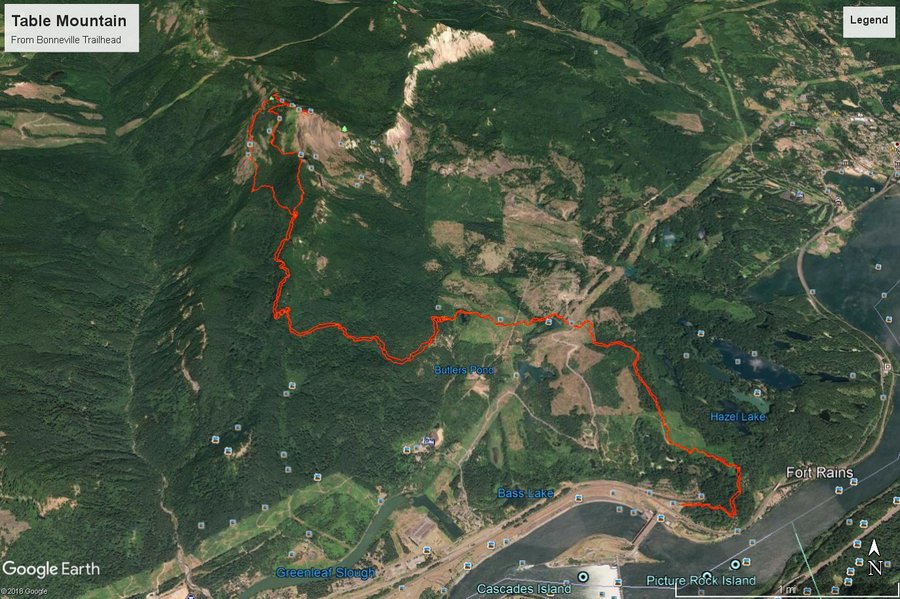
Table Mountain via Bonneville Trailhead
17 miles of hiking • 4250' elevation gain •
This was probably one of the most grueling hikes I have done in recent memory. The closure of the trailhead at the Hot Springs resort makes this a very long trek indeed. Being my first time up to Table, I wasn't sure what to expect.
Weather prediction from the night before called for showers all day, so we all dressed for what we thought would be a cooler experience. On the way out, I checked the weather and saw the forecast had changed to sunny and 70 degrees. Suddenly, I worried whether I had enough water for such a long trek under the sun with my dog, but multiple streams to cool down in on the way helped and gave the pup plenty of water to drink so I didn't actually run out until we were about a 1/2 mile from the trailhead.
The first part of the trail is pretty uneventful, meandering up and down through clearcut land and over private gravel roads. The way is fairly clear if you pay attention to PCT symbols. Eventually, we reached where the trail really begins, the choice between Difficult and More Difficult. We chose the steeper ascent of Heartbreak Ridge, which is very appropriately named. I cursed my way up, giving the stink eye to every heartbreak symbol I saw on the way up. Then came the grand view of where we were headed - the top of the cliffs of Table Mountain. A few switchbacks later and we were to the boulder field. This part I actually found kind of fun, scrambling up on all fours and encouraging my pup to follow. After that, it was a short ascent to the summit, where I was greeted to our first contact with other hikers all day. We saw another Mazamas group, this one an official hike, and I ran into another fellow hiker I had an outing with on Meetup. (Small world.) We watched as one weary hiker walked to the very edge of the cliffs where just a bit of grass was hanging on, and warned him to step back and that nothing was below him. Stay away from the edge folks. I did crawl on my belly to get a bit of a glimpse over the edge, but very warily. A fall here has and would be fatal.
Then came the descent, we looped around the top to get a view from the other side, and followed cairns to the very slippery/rocky trail down. This side had a little bit of a display of wildflowers, but by this time the sky all around us and the surrounding hills became a very brooding dark blue. We thought we might get a bit of rain, but it held off and we enjoyed the little bit of relief from the heat.
After the hard down, it was time for the long but easy way back to Bonneville. We hiked hard without breaks for what seemed like a long time, finally resting at a large bridge. I made the mistake of looking how far we had to go - 4 more miles!!! With feet feeling like we might be developing blisters, we continued on, trying to ignore the pain.
The last bit seemed to take forever, but after a final gps check, we saw we were within a half mile of the end. Beer and pulled pork was calling in Cascade Locks at Thunder Island. A beer rarely tastes as good as when you sip it along the Columbia, the mountain conquered looming in the distance. I'll never look at Table the same way again. Very satisfying to have made this trip, and I can't wait to see what the rest of this summer brings as I embark on my vacation to Utah later this week.
This hike is not recommended for anyone who isn't a very hardy hiker - the distance makes this quite the miserable experience if you aren't used to the mileage.
Pictures on my gps track below.
May 6, 2018


 1
1
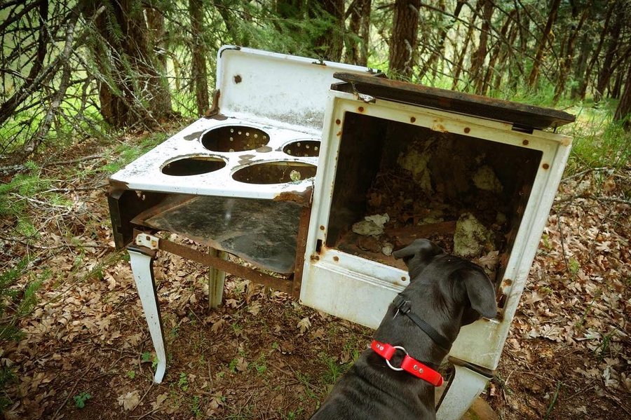
Catherine Creek, Coyote Wall Loop, Our version not official
10.5 miles of hiking • 2000' elevation gain •
Decided to try to Catherine Creek/Coyote Wall Loop. Initially started out exploring and looking for the natural arch on a side trail. Went a little further than we wanted but the trail was pretty so nothing lost. Backtracked and went up the way we needed and took a little side trail to check out the "old stove". Turned around and continued on the old road heading towards coyote wall. Looked for some relics along the way, an old homestead turned out to mostly be a pile of wood and no wildflowers yet.
Continued onwards on the old road till we hit the edge of coyote wall, and then the wildflower show started. Not quite Dalles Mountain ranch display, but a very nice show so far.
My hiking partner was a little tired from trail keeping on Wygant the day before and I was a little tired from a long week at work, so we opted for the road as a return, but quickly regretted it. Very little shoulder. In hindsight, we should have just sucked up the 1000 ft of gain and went back along the Labyrinth trail and met back up with the trail that would take us back down to the Catherine Creek.
Photos if you click on my gps track below.
April 28, 2018

.jpg)

.jpg)
.jpg)
Mailbox Peak
10.5 miles of hiking • 4000' elevation gain •
With a beautiful weather forecast and a planned trip to Seattle to see Front 242 Sunday evening, I decided to drive out early from Portland and find somewhere to hike. After a little research, I decided to knock off one of the more popular strenuous hikes near Seattle, Mailbox Peak. Since I was hiking solo, I opted for the "gentle" new way up, over the grueling old trail. Looking back at the time it took me with the longer switchbacks, I kind of wish I could have just gone for the more difficult up. I got a bit of a later start than I wanted, leaving the parking lot at 10:40 am.
I passed a few souls on my way up, but had mostly solitude until I hit the big talus slope that one must go up to get to the peak. Then it was trains of people slipping and sliding down, while I waiting patiently to be able to go up. Large amounts of people in tennis shoes and no traction devices or poles. I can see why this trail gets massive amounts of search and rescue calls every year. The trail was very icy once the snow started in the trees, and turned to slippery mush on the exposed slope. It went back and forth between rock and slush, so my microspikes went on and off, as I didn't want to damage the tips on the rocks. I chose to kick step in the snow next to the trail rather than follow the slush mess on the final push. Mountaineering boots would have helped here, but I did okay with my normal hiking boots, spikes, and poles.
The last push consists of 960 feet of elevation gain in half a mile - and boy did I feel it! Slow and steady at the end and I made it.
I didn't spend a heck of a lot of time on the summit, Front 242 was calling back in Seattle and I had to get off the mountain in time to get there. Once past the snow and back on clear trail, I really pushed myself to keep a quick pace and get back after all the time wasted waiting for others sliding on my way up.
Pics on my gps link below.
April 22, 2018
 1
1
Tickattack, Klickatick, Tickitat, Klickitat... aka Swale Canyon
9 miles of hiking • 250' elevation gain •
Gloomy rainy trip down Swale Canyon today.
I won't make the mistake of taking my dog down this trail again. I had heard reports of ticks, but I did not expect the onslaught of bloodthirsty beasts that I came across today. With the misty rain, we did not notice any ticks until we were around 4.5 miles down the trail, the rain had stopped and the dog was dry. The trail became grassy instead of rocky and we think this is where a large number lay in wait for us to come along. As we looked down our dog was attacked by at least 30 ticks, we swatted them all off and made the decision to turn back. Luckily, most had not bitten down, but the few that had we contended with back at the car after our hasty retreat. Dog was not happy, especially with the bath treatment she received once home.
Today was a rare day in which my partner had the same day off as me, and his first hiking trip since breaking his arm. (Driver in Portland drifted into the bike lane, he had to dodge and broke his arm in two places.) An umbrella worked well to protect it, but the act of hiking still amounted to some pain and swelling. Our turn around decision was made by ticks, but probably for the best.
Next time I'll conquer this trail via mountain bike and hopefully a shuttle car. Less chance for ticks to attack and a better chance to see the whole trail.
Photos on my gps track below.
April 15, 2018
 1
1
Wygant Trail
9.4 miles of hiking • 2250' elevation gain •
Newly "reopened" Wygant Trail, one of the few trails on the Oregon side of the Columbia River Gorge not affected by the Eagle Creek Fire. This trail has seen some improvements from Trail Crews since the last time I was here, but it is pretty obvious they have not gotten to the whole trail. There is one spot part way up where you have to climb over a very large downed tree, and a wrong move could cause injury or a tumble down the side of the cliff. Not for novice hikers. Once past the large tree the trail becomes much easier to pass. The creek crossing where the bridge washed out was not terrible, there is a suitable log that I easily scooted across on my bottom. Those who trust their balance could walk across it. Towards the summit the trail becomes more faint, but still easy to follow. The actually summit is not much to see, views are best taken on short spurs on the way up. I did not attempt the Chetwood Loop, as trip reports say that landslides have made much of it impassable.
For photos click on my GPS track below.
April 1, 2018

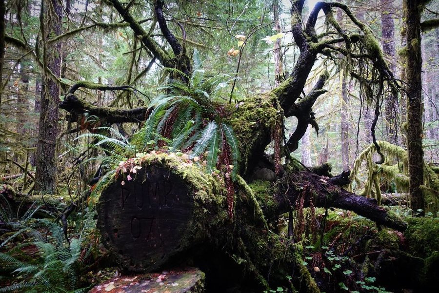
Cottonwood Canyon Gooseneck Loop
8.8 miles of hiking • 1500' elevation gain •
First time out to one of Oregon's newest state parks. This hike is mostly off trail, and starts immediately UP from the parking lot at the Murtha Ranch Trailhead. The hike was lead by Mazama's hike leader Bill Stein.
Going up we could see a faint trail where others had gone before us, but nothing that is an official trail. Once we reached the ridge crest, we followed around an outcropping of rock on the right side. At Peak 1443, we had expansive views of windmills and the John Day River below. (And the parking lot, which you can spot for much of this hike) We then followed a fence line which lead us down into a steep gully, and back up the other side. This area would be treacherous if the ground was wet, but despite some iffy clouds the weather stayed dry for us. Across the gully we spotted some Bighorn Sheep, but they never got very close to us. This second ascent seemed less brutal than the first, perhaps because I was warmed up or because it involved more scrambling which I find fun. We found a nice spot to stop for lunch out of the wind, and then continued on to the top of the ridge. Once on top of the ridge again, we were able to follow an old jeep path along the fence boundary, with some great views of the red canyon walls across the river.
The descent was very steep, and we took a different route than Bill had scouted the week before. The group divided into a faster scouting group, and a those of us taking it a little slower. (I'm always wary of my knees and like to the take descents slowly.) We all felt a bit like mountain goats as we each made our path down. Eventually, we were in some trees, and I had to guess where the rest of my party was but we all made it through. Once down, we took a long break admiring the scenery as we sat along the river towards the end of the Pinnacles trail. From there it was easy going back to the parking lot on a flat dirt road.
And because the world is so small, I ran into an old college friend from Michigan (who also now lives in Portland), hiking along the Pinnacles trail. A brief hug, and I was off to catch up with the rest of the now speedy hiking crew.
I loved this hike, but I would only recommend to those who don't mind going off trail, and aren't afraid of a steep descent. The way to take is pretty obvious, but a fall here would not be pleasant. Trekking poles are a necessity.
For photos click on my GPS track below.
March 25, 2018
 1
1
Criterion Ranch
11 miles of hiking • 1000' elevation gain •
This hike was recommended to me by local author of hiking guides, Matt Reeder, as being one of his favorite winter hikes. There was no lack of sunshine on the day I was there, and no lack of cows as the area is BLM land and an open range.
Lily (my dog) and my pal Brooklyn joined for an all girls day on the trail. Not a soul out there, which was a refreshing change from Portland area hikes. We did occasionally have to dodge cows who I felt were giving us the stink eye.
This area could be entirely hiked off trail with care taken to watching for rattlesnakes and ticks, but we opted to stay on the jeep path. The path was ruddy with hoof prints from a recent rain, but had dried which was somewhat challenging on our ankles with the unevenness of the ground.
The path is pretty clear, follow the jeep path until you run into a second path that goes through a gate and all the way on down to the Deschutes river. (Which would make for a very long day, we stopped at the viewpoint where the trail really started to go down.)
We were a little early for wildflowers, but I think I would like to come back when the flowers are in full swing. This hike had views of Hood, and the Sisters, and plenty of space for further exploration. Next time, with more energy, I will go a little further.
For photos click on my GPS track below.
March 10, 2018

An Attempt to find the Valley of the Giants
1 miles of hiking • 0' elevation gain •
This was an attempt to find the famed patch of old growth in the middle of logging country near the coast of Oregon. Huge Douglas-firs, with a few large western hemlocks, some trees up to 500 years old.
The hike was lead by Mazamas hike leader Bill Stein, with Matt Reeder (local author of PDX Hiking 365 and 101 Hikes in the Majestic Mount Jefferson Region.) It was an exploratory hike as no-one knew if we could actually make it out there.
Sadly, we did not make it. We got around a mile and a half from the trailhead when all hell broke loose and we came upon an active logging site of Weyerhaeuser that halted our way onwards. We attempted to climb over the downed trees but quickly deemed it too hazardous to go on. 3 hours of driving... and so close we could taste it. Just wanted to throw this out there in case anyone was interested in attempting this.... It is impossible with the logging activity currently going on.
Disappointing after all the buildup, but not a wasted day. We stopped at Baskett Slough on the way back to stretch our legs and at least get a short hike in. Still fun to get out and meet people, and nice to grab a new hiking guide from Matt (and get insider scoop on unknown hikes on the drive there and back.)
Photos if you click on my GPS track below.
March 4, 2018

Baskett Slough
2 miles of hiking • 250' elevation gain •
Just a quick stretch of the legs back when we had an unsuccessful attempt at reaching the Valley of the Giants. Pleasant place to visit, great for bird watchers.
March 4, 2018

Saddle Mountain
5.3 miles of hiking • 1500' elevation gain •
Past trip, still trying to catch up on my hikes so sorry for spamming the site as I knock these out.
I love Saddle Mountain, and simultaneously hate it. The grating on the steep parts of the hike always make my footing feel a bit unsure. Chain link fence material has been put on a large part of this trail due to the lack of topsoil, but is in bad shape in many places. On this particular day, parts of the mountain that remained in the shade had sheets of ice still on the trail making us have to watch our step in my places. Hikers with dogs beware - I imagine some dogs would be bothered by the feel of the fencing, but my dog didn't seem to care.
With me on this trip, two friends who hadn't hiked in a very long time, but they were both troopers as I lead them up the mountain. My friend Jim remarked how he had driven past the road to the trailhead so many times heading to the coast, and never imagined that this was up there. Oh, the joy of hiking. I'm hoping this trip will light his fire for more exploration.
As we headed back down the mountain, the weather turned on us and it hailed a bit, and we were grateful for our early start in good weather. Sometimes it works out to skip out on beer the night before for an early start before the crowds kick in.
Back in Portland, a victory beer was had by all with a delicious brisket enchilada devoured from La Taq.
Photos if you click on my GPS track below.
February 11, 2018

Tom Dick and Harry
7.8 miles of hiking • 1750' elevation gain •
Parked at ski bowl, which adds to the mileage of this hike.
This hike was lead by my friend Kat (who was an assistant when I took BCEP), who is a new Mazama's hike leader, through meetup. Cold, clear day and a steady pace. Trail was hard packed and snowshoes were not needed. Also along was my fellow BCEP friend and Mountain Dog, Prasanna. (Who is now becoming a hike leader - congrats to him.) The rest on the hike were strangers, which is always interesting. I go back and forth between solo hiking and joining meetups/Mazama trail trips since my boyfriend can no longer hike with me until his work schedule changes this summer. I do highly recommend meetup for those of you who seek company on the trail, and your friends are mostly non hikers. (I know...I know...who are these people? Why do we like them if they don't hike?)
February 10, 2018

Ape Caves, Upper and Lower via sno park
6 miles of hiking • 500' elevation gain •
Night hike through the ape caves. Worked a full day, and with a friend in town from Florida, we decided to take him out to Ape Caves because it was something we could do without daylight. Happened to be the night of a blood moon. Did both lower and upper, no other creatures or beings in site.
Icy descent into the caves, and pretty slippery hike back on the hard packed snow back to the snow park parking lot. No microspikes or snowshoes used, we just dealt with it. A few eerie things on this hike - an empty pair of cowboy boots left at the trailhead, and the night hike back in the dark with the blood moon. I always see/hear things while hiking by headlamp, but the thrill can't be beat.
Nothing reached out in the night and grabbed us, I survived to hike another day.
January 31, 2018

Rampart Ridge
5.7 miles of hiking • 1250' elevation gain •
This hike was originally planned to be a snowshoe hike... well, we carried our snowshoes but we never actually unloaded them from our packs.
An abnormally beautiful and clear day, we lucked out and had a completely unobstructed view of Rainier. While I was disappointed I didn't get to use my snowshoes due to an almost completely snow free trail, I can't complain about what I saw.
Great little hike, and the drive from Portland really wasn't that bad. I really need to get out to Rainier more.
Photos on my GPS track below.
January 14, 2018

Forest Park, Firelane 15
3.7 miles of hiking • 500' elevation gain •
Quick jaunt on a rainy day with my dog through the far end of Forest Park.
January 7, 2018
