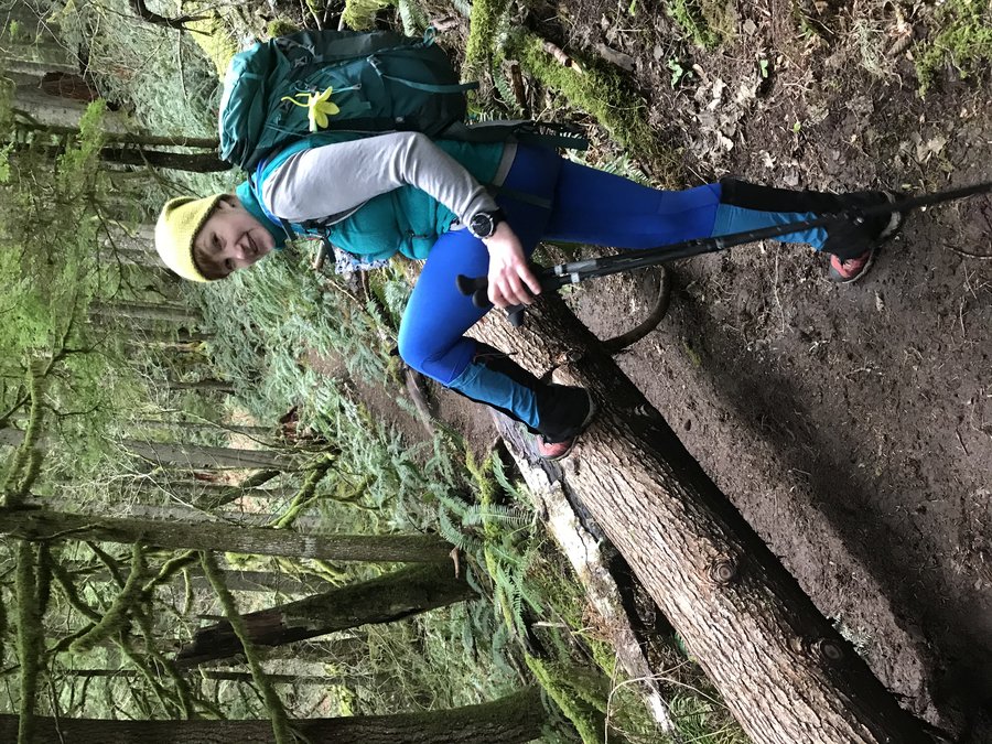
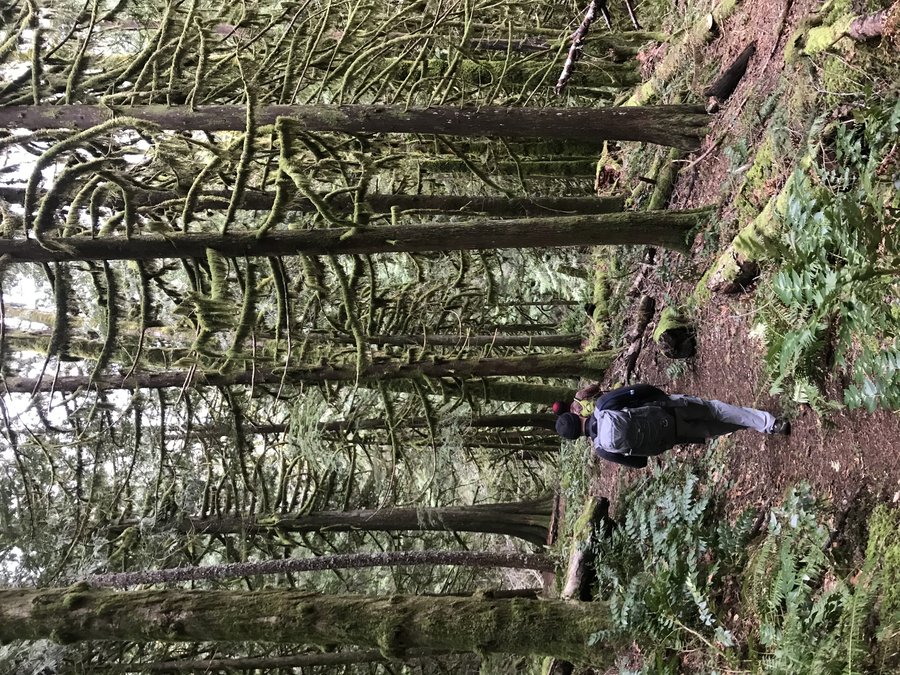
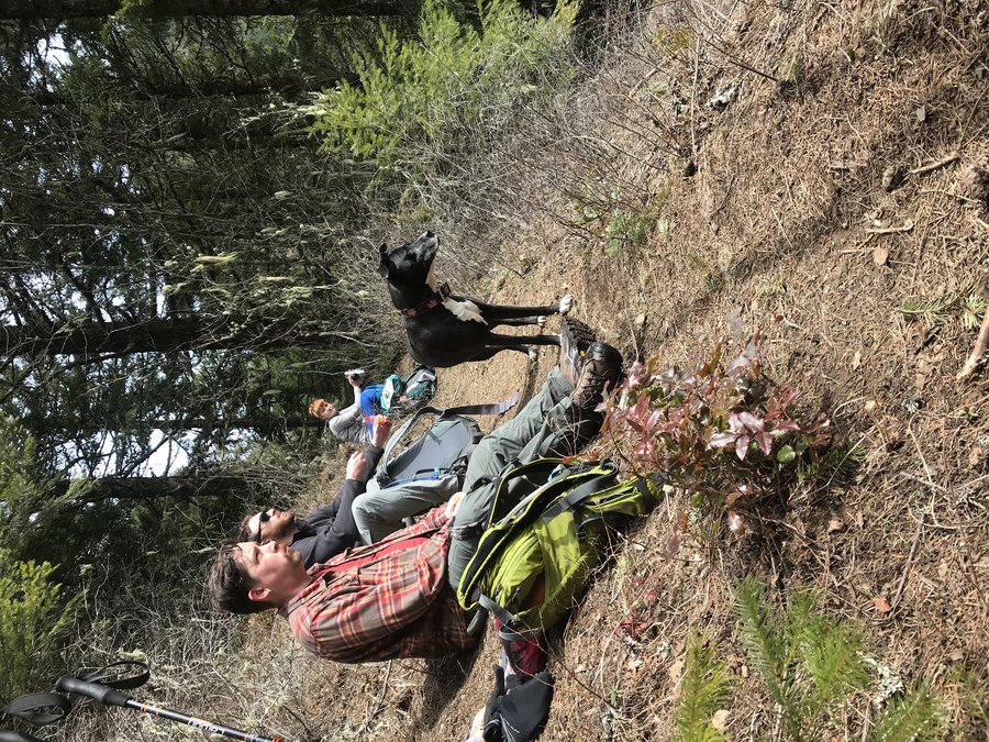
2021 Trips

 2
2
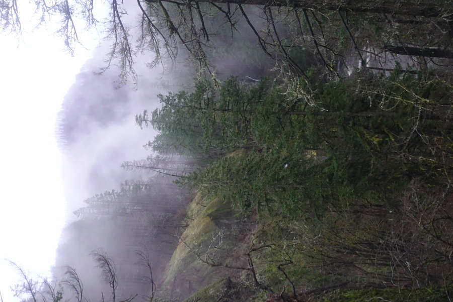
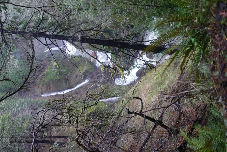
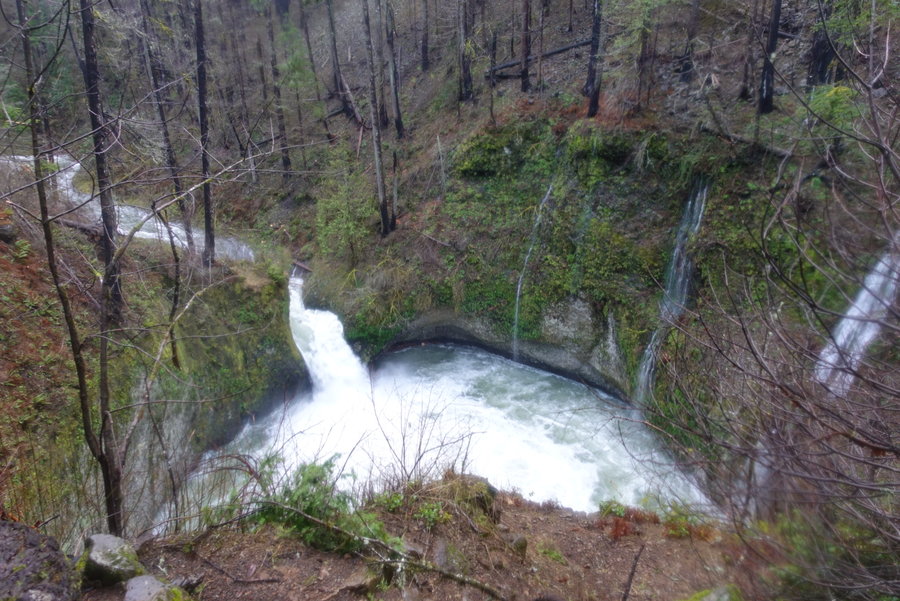
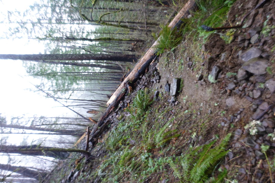
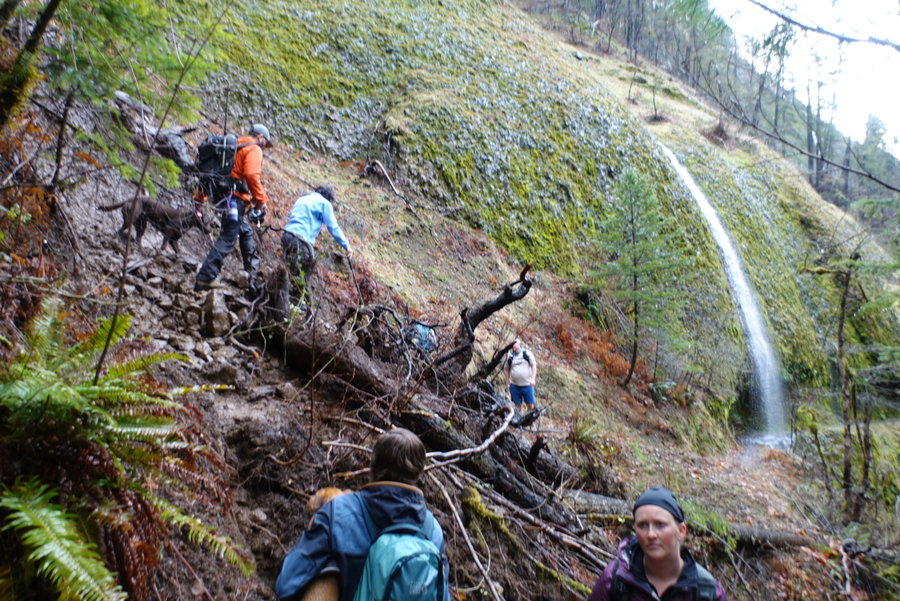
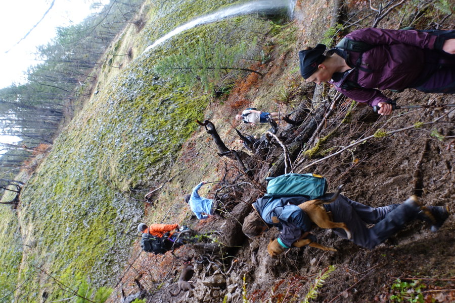
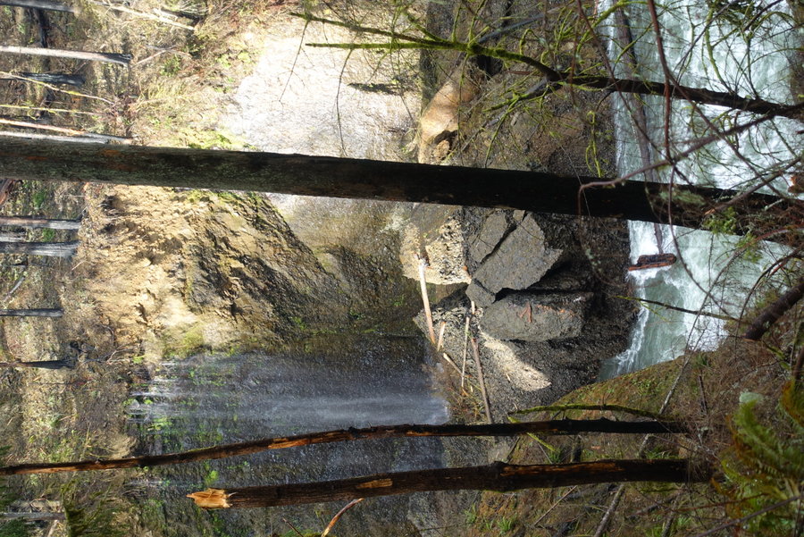
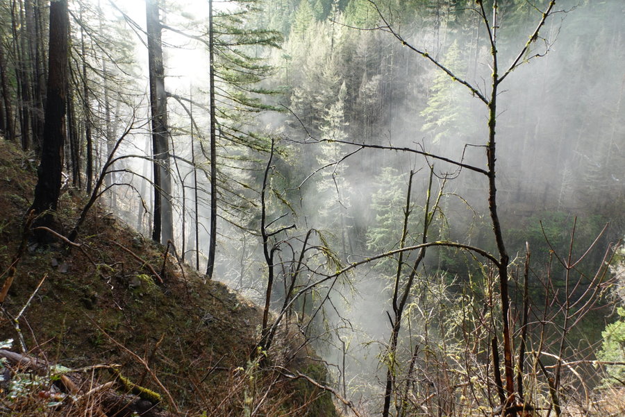
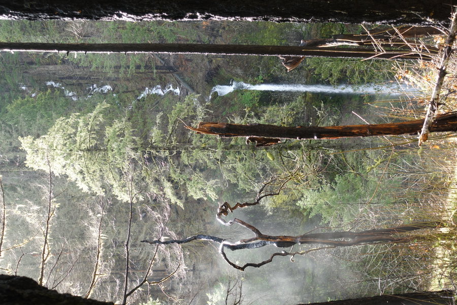
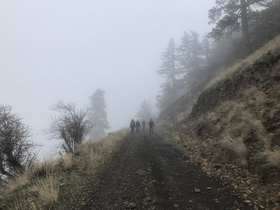
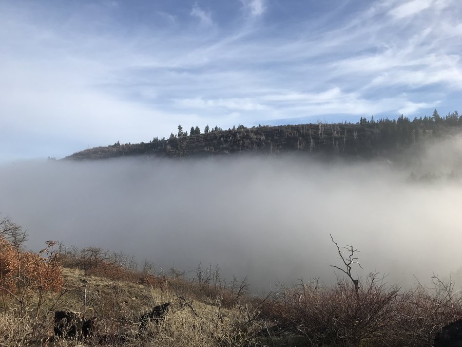
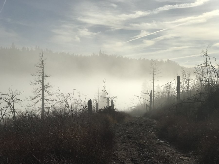
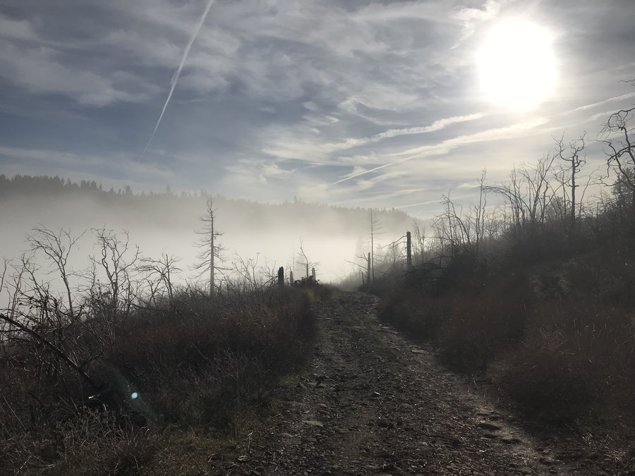
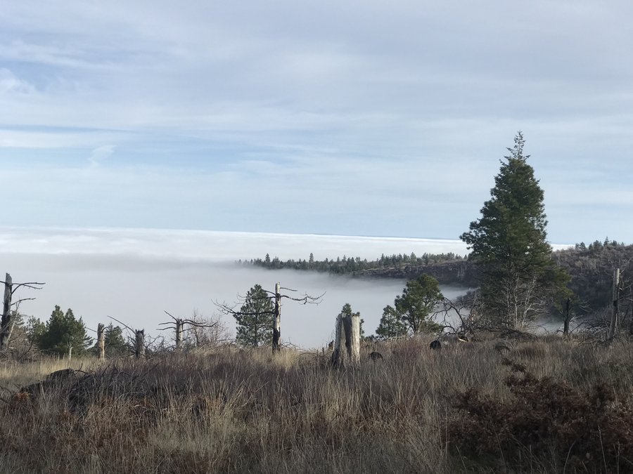
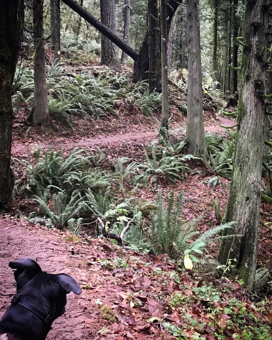
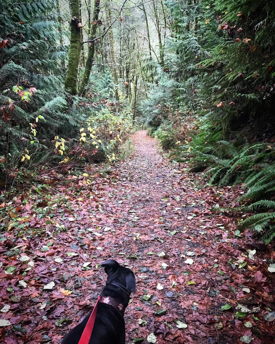
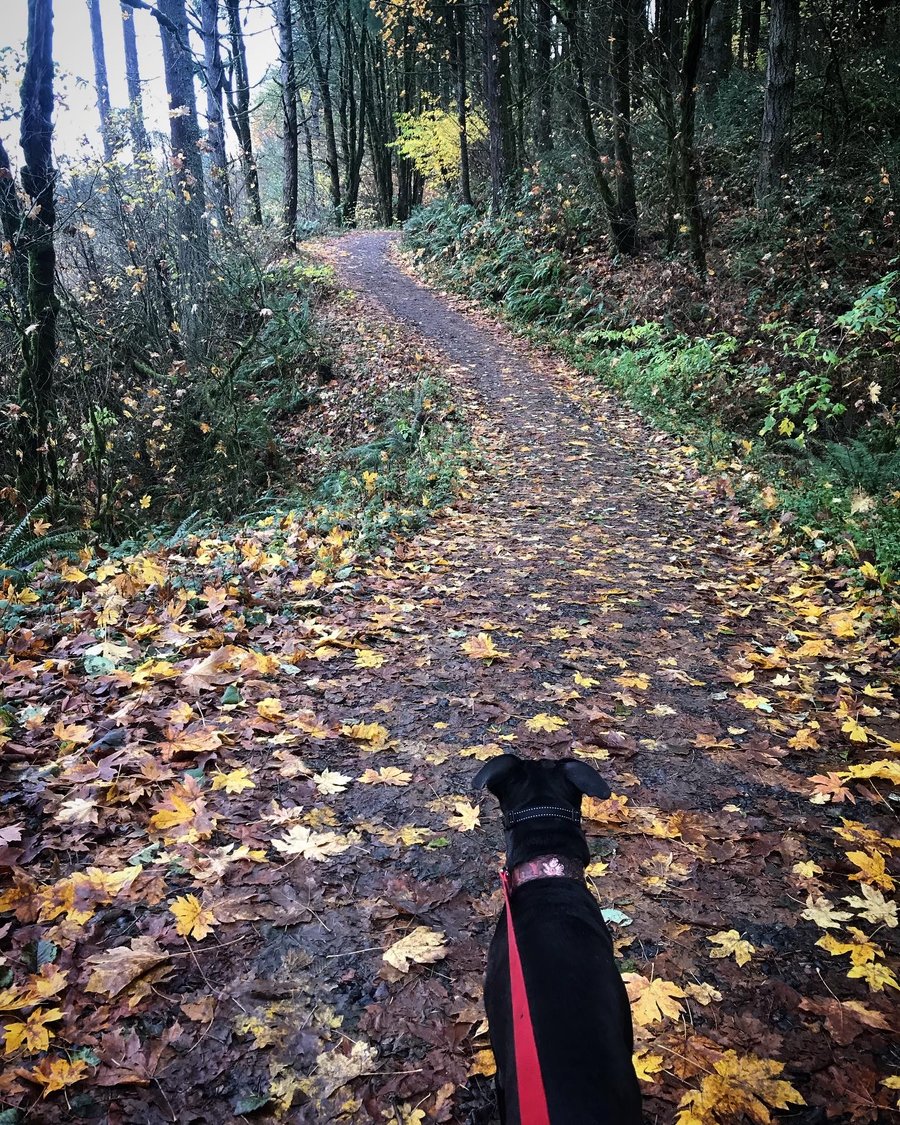
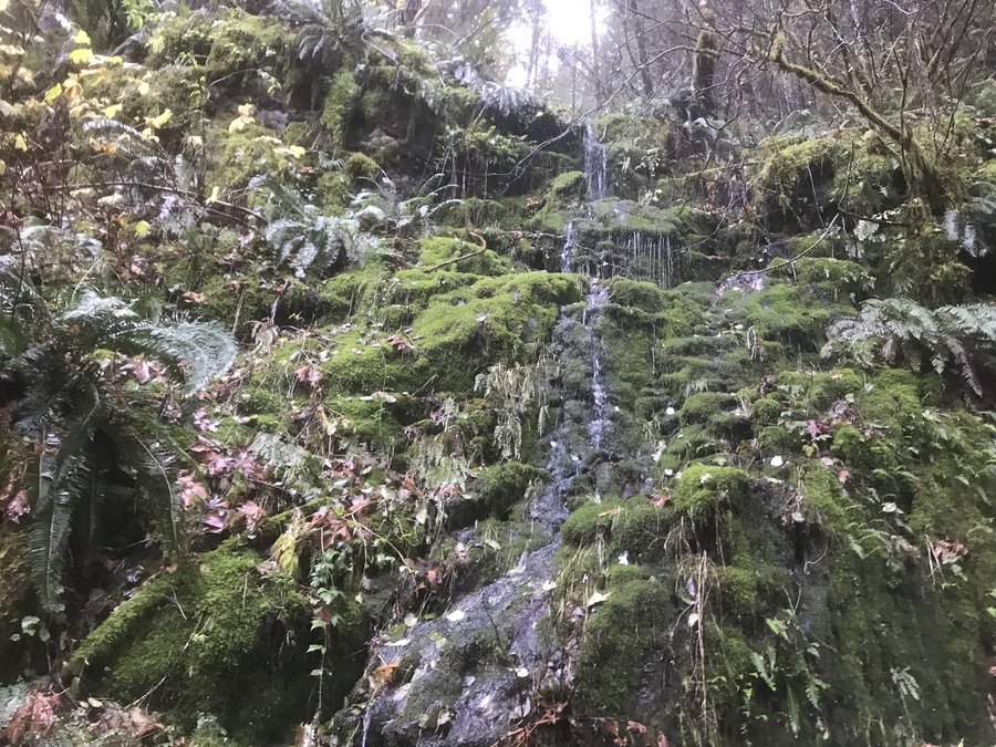
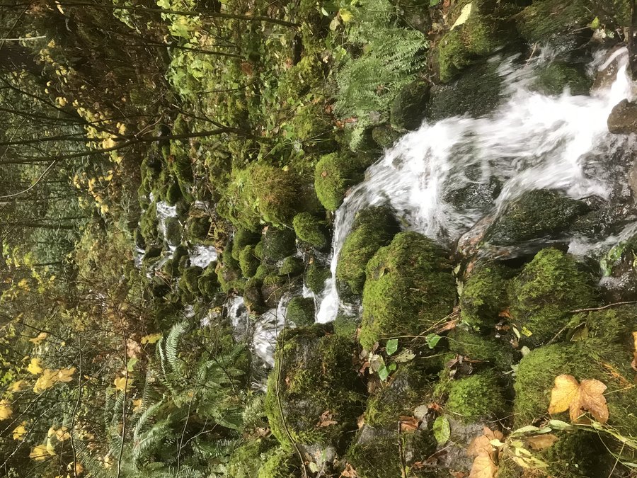
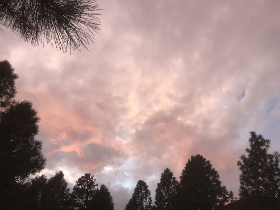
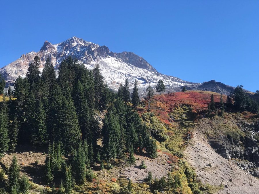
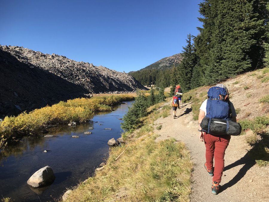
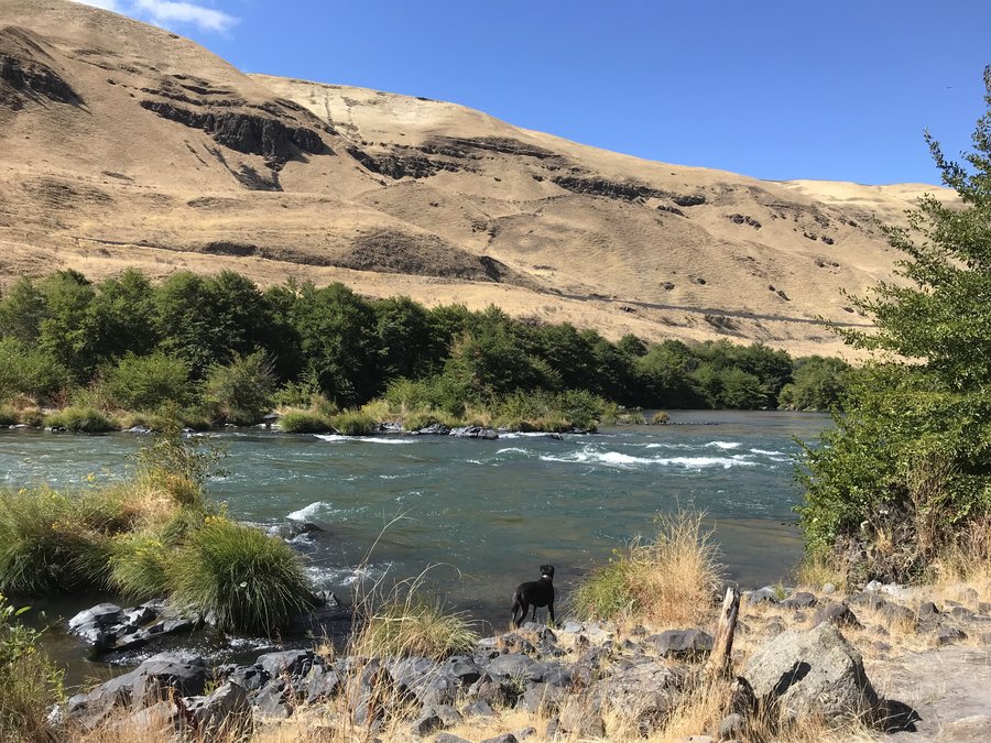
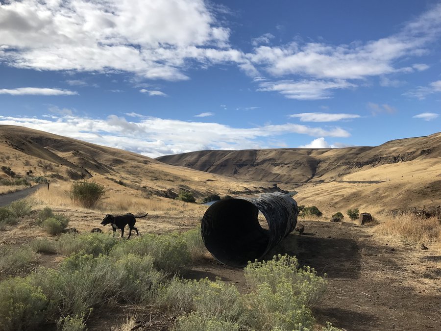
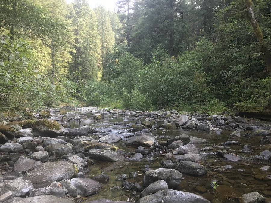
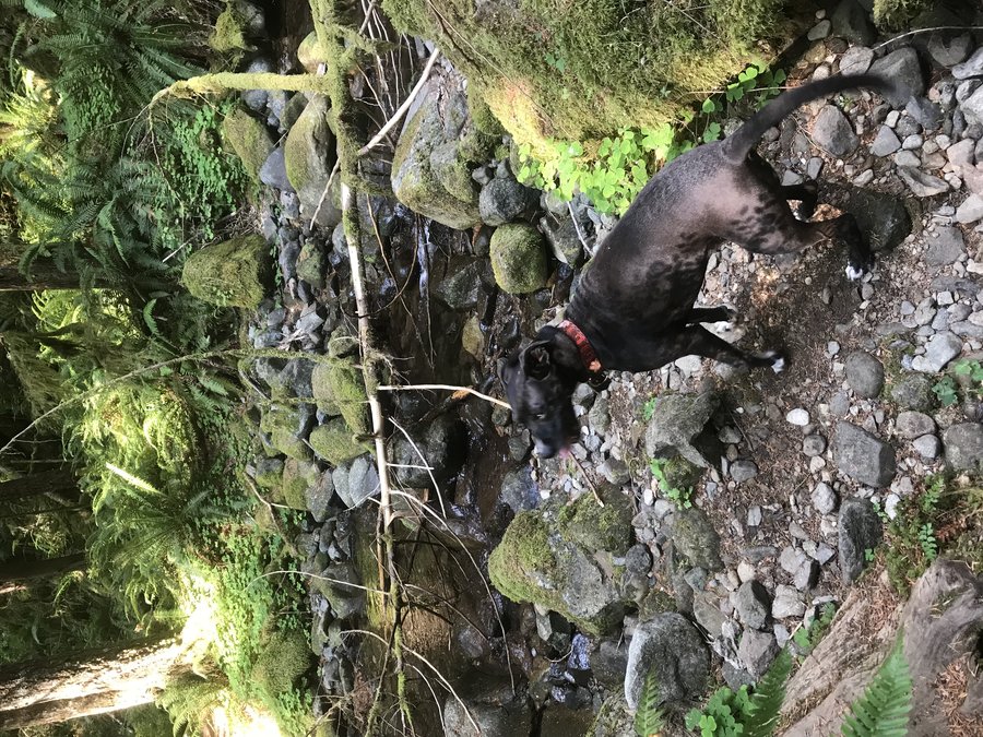
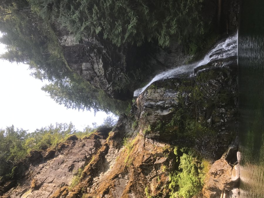
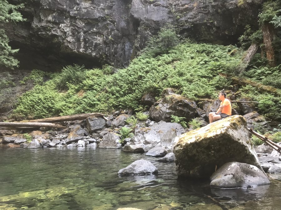
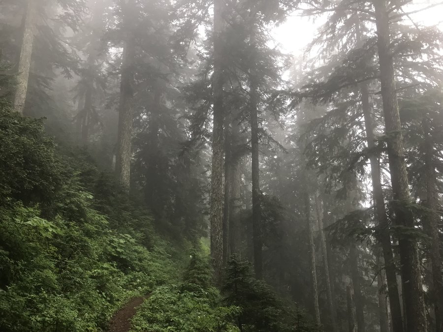
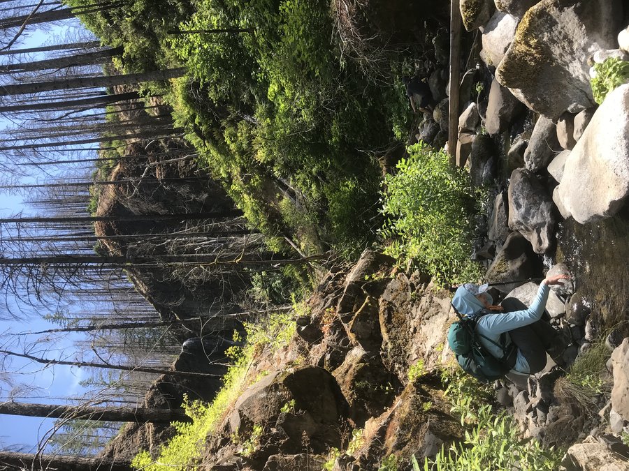
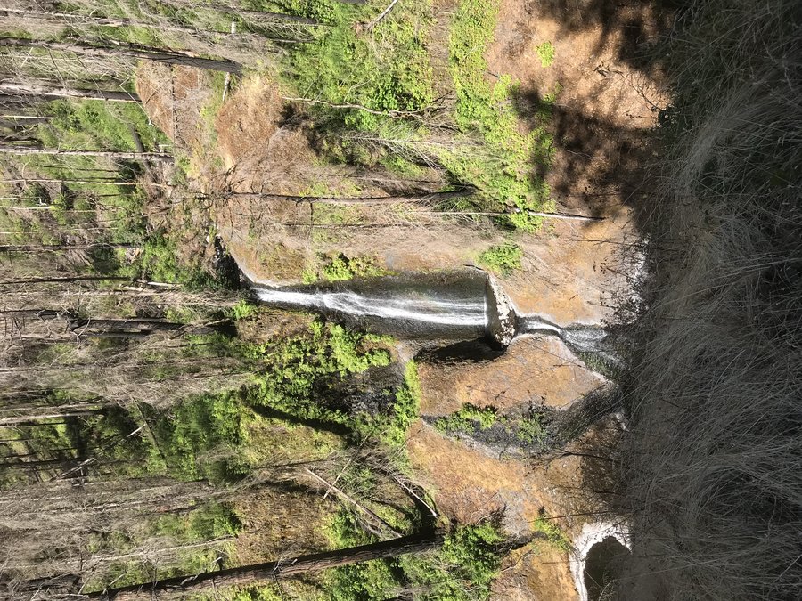
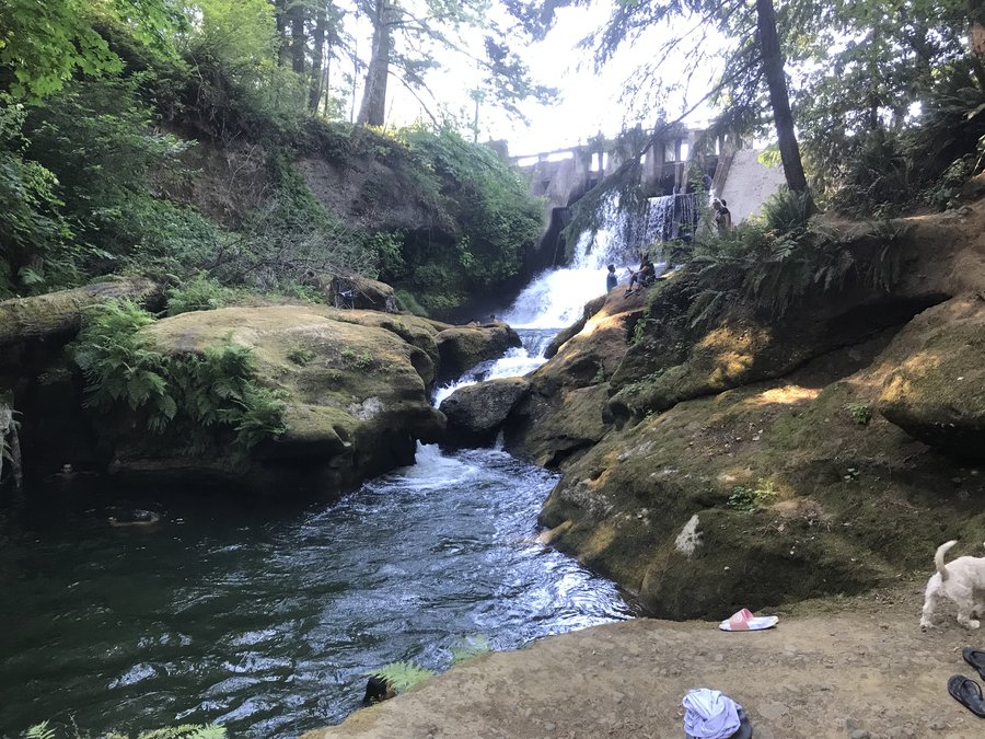
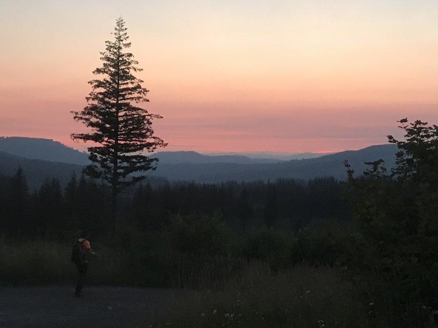
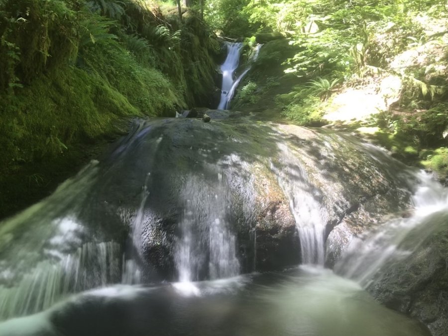
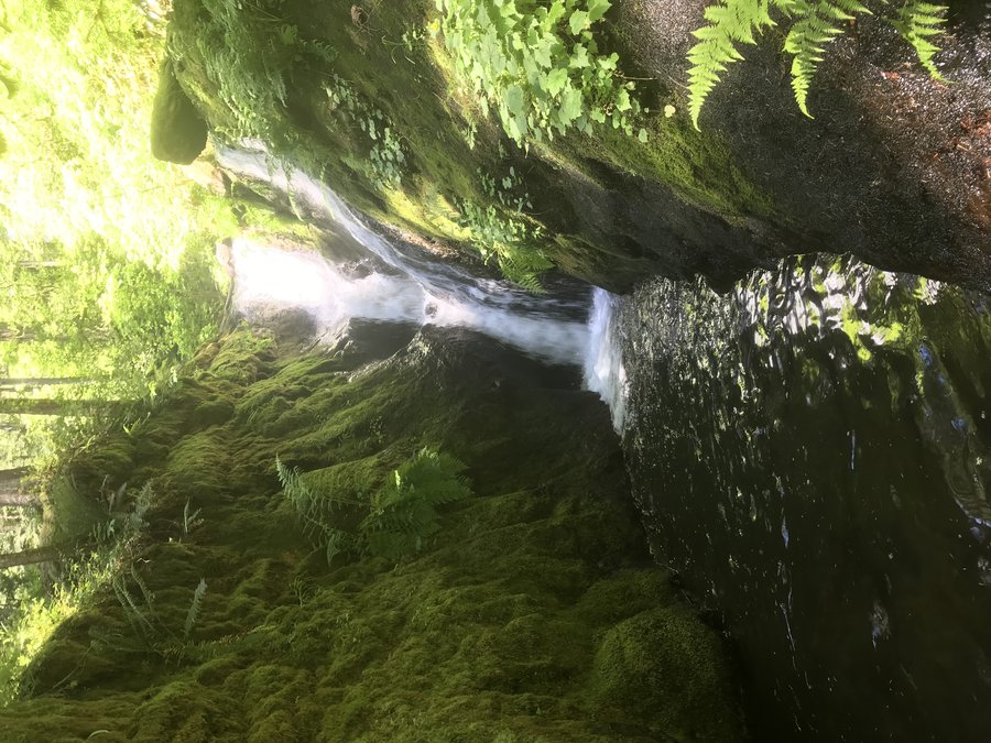
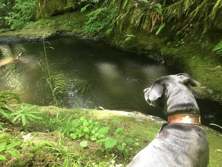
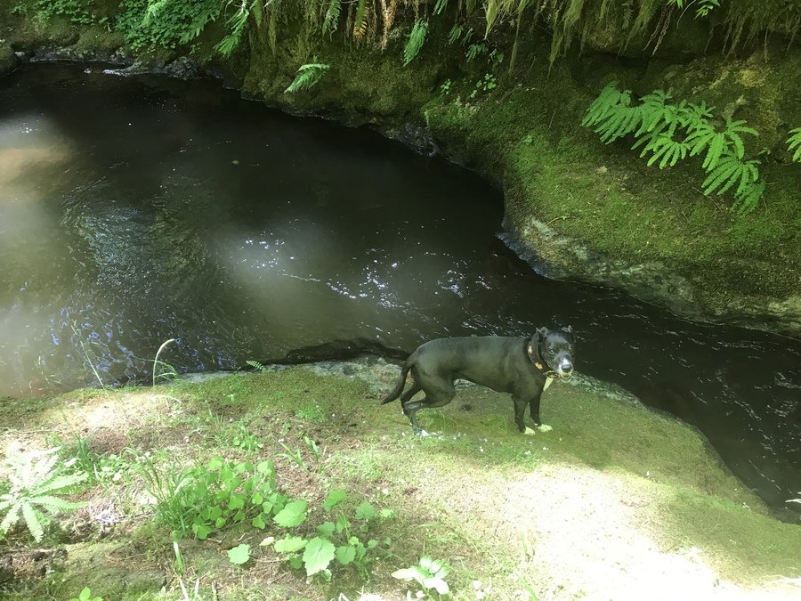
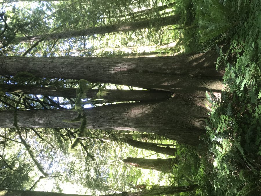
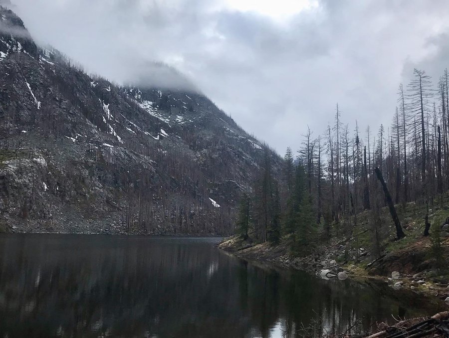
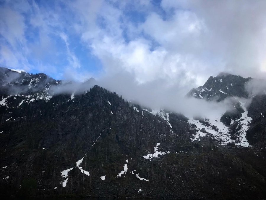
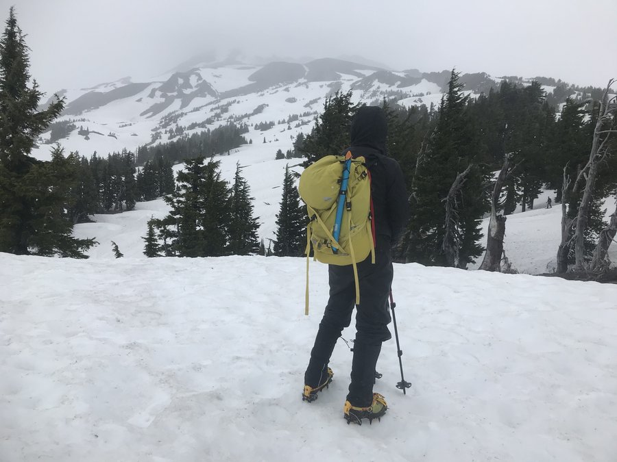
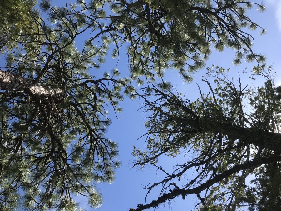
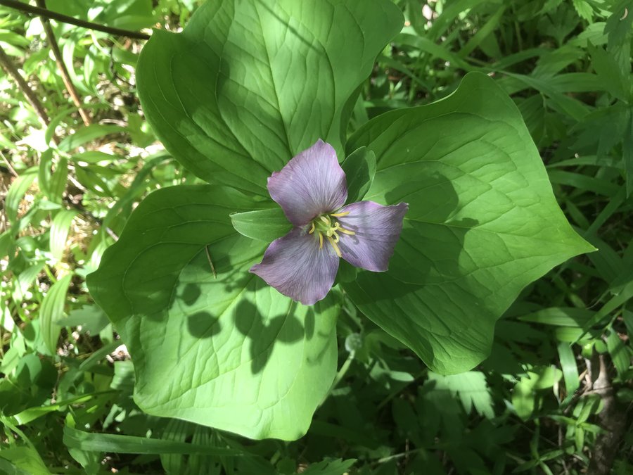
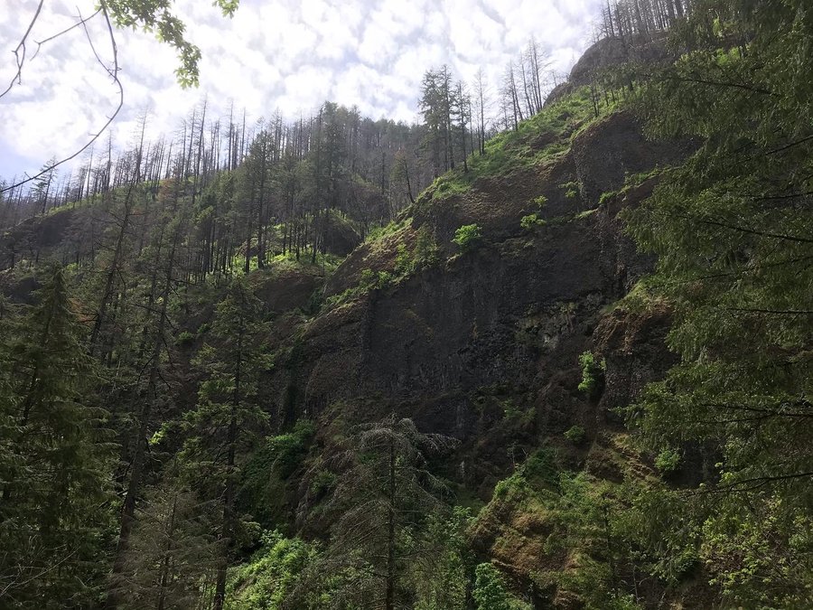
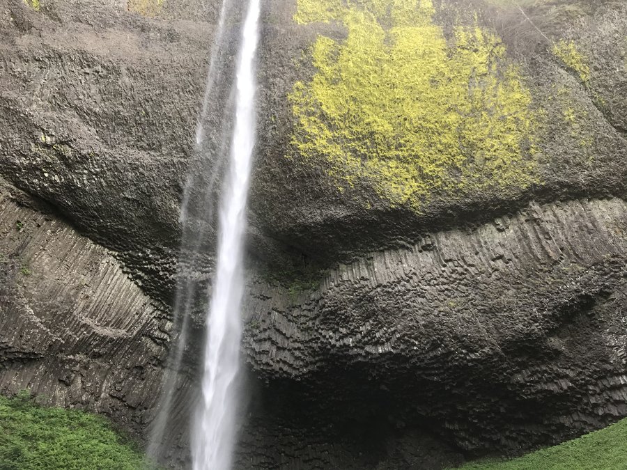
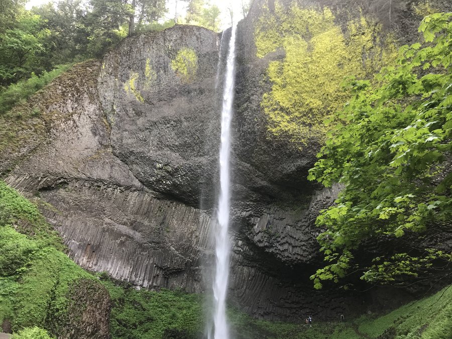
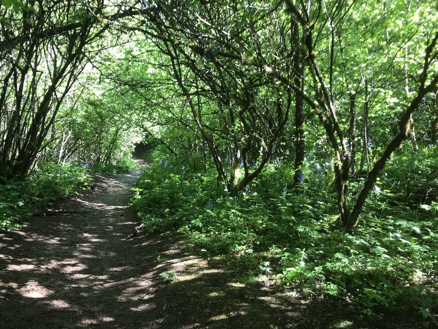
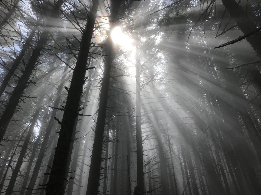
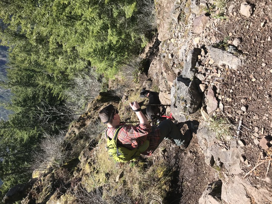
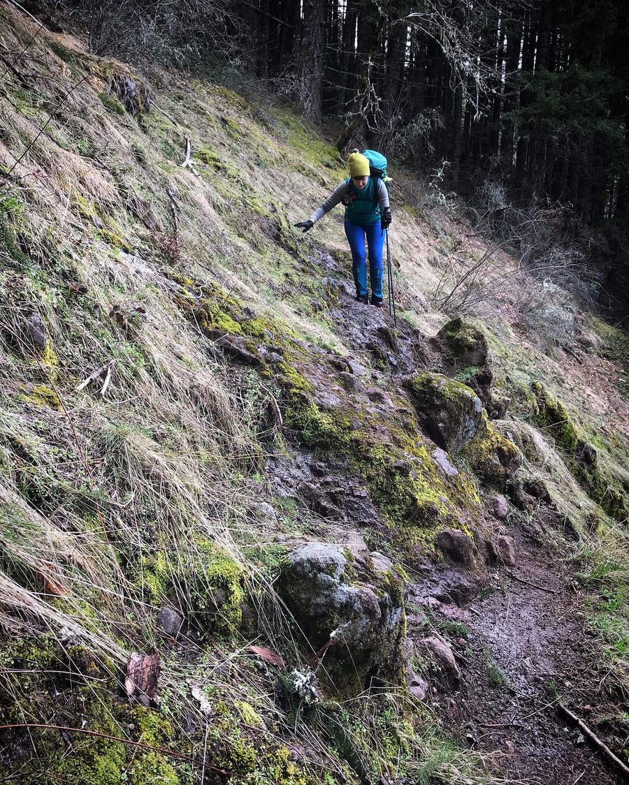
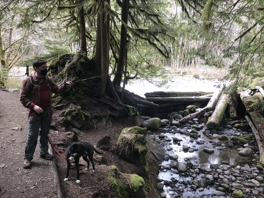
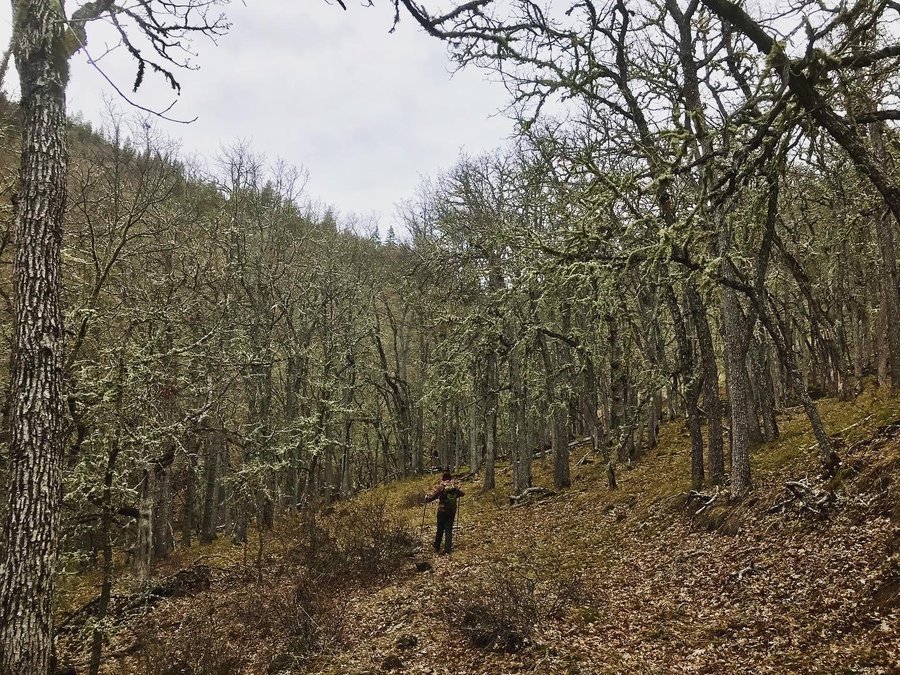
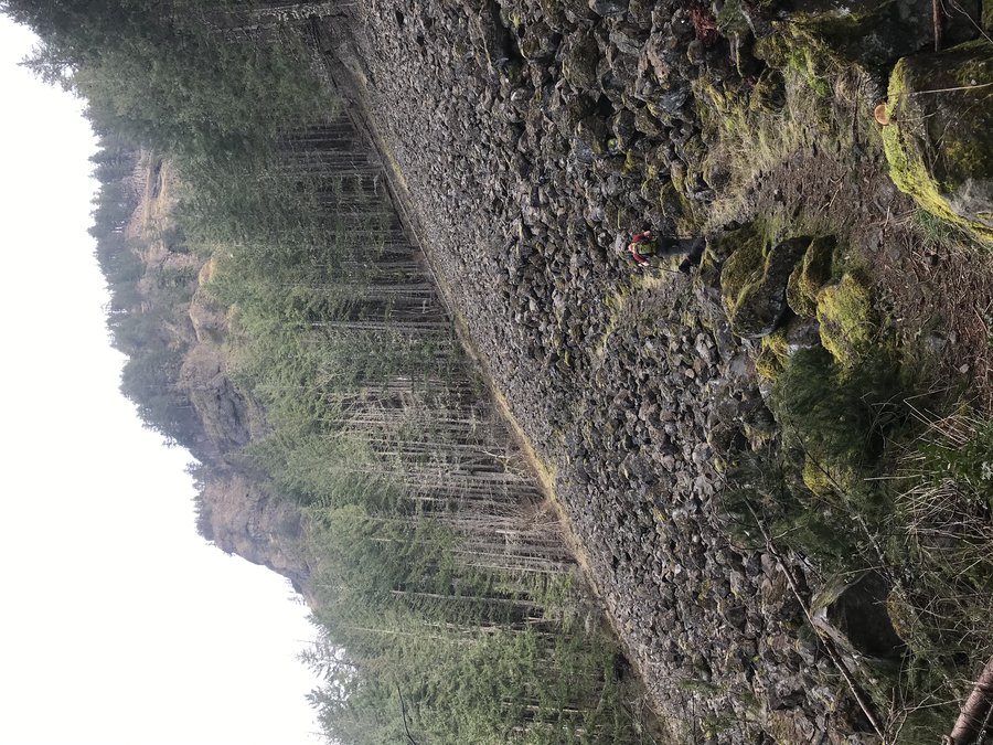
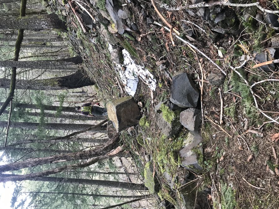
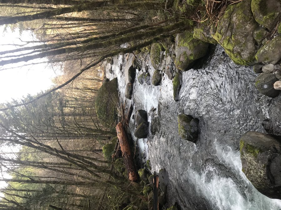
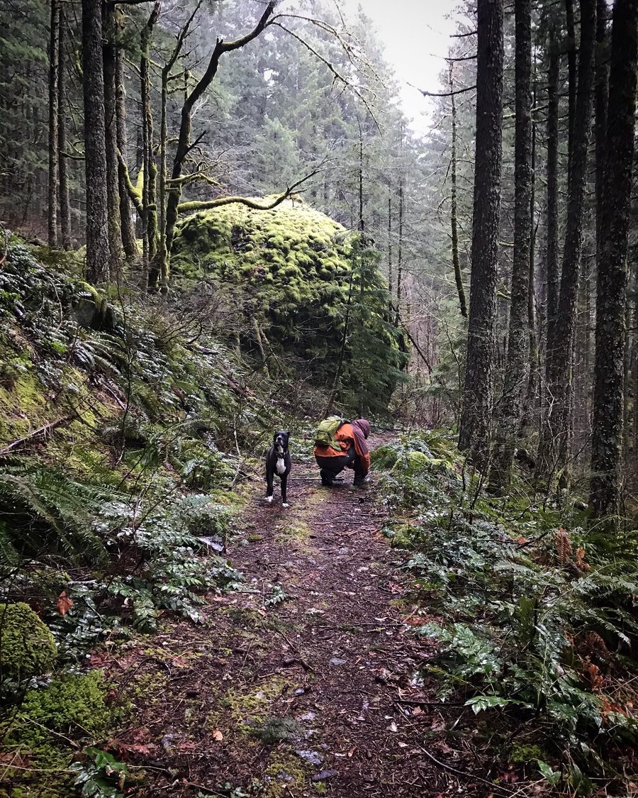
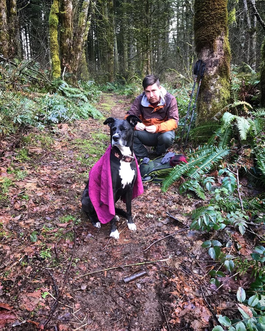
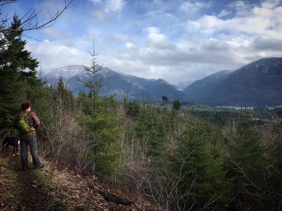
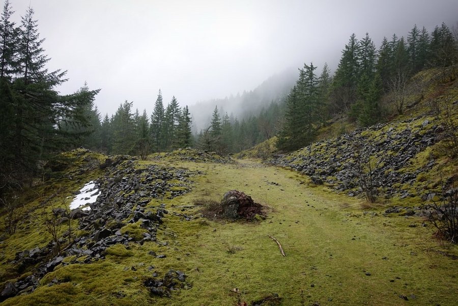
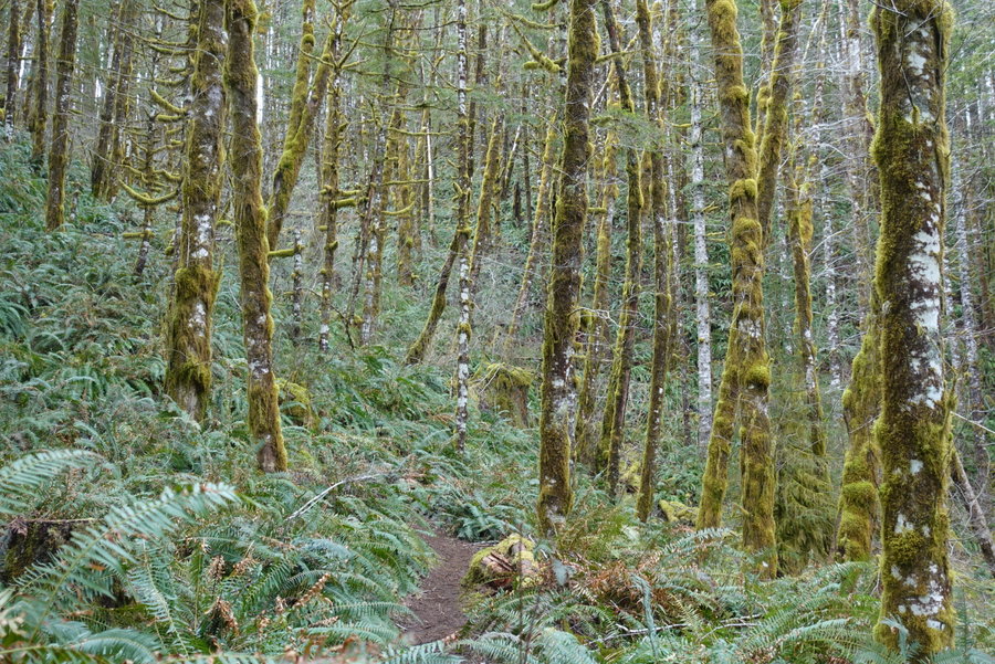
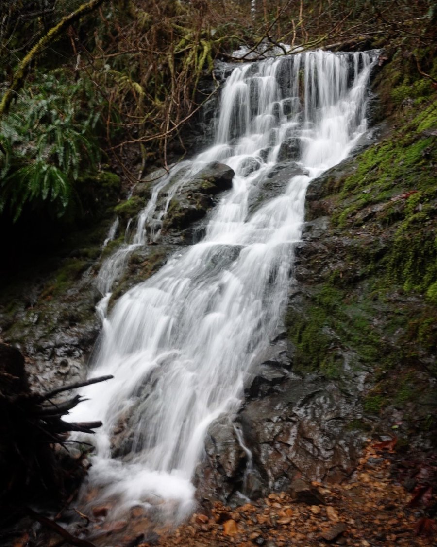
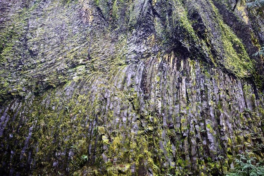
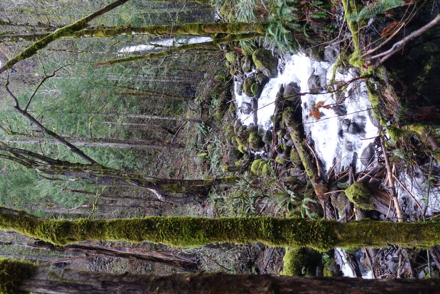
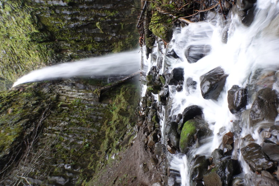
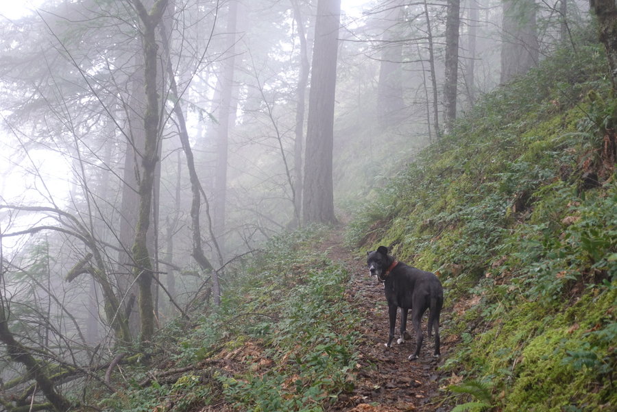
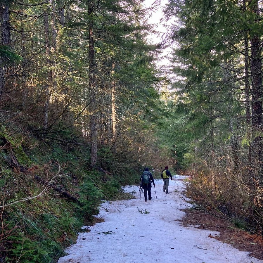
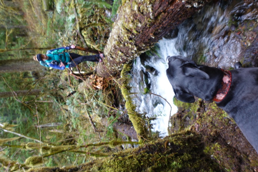
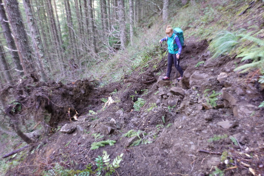
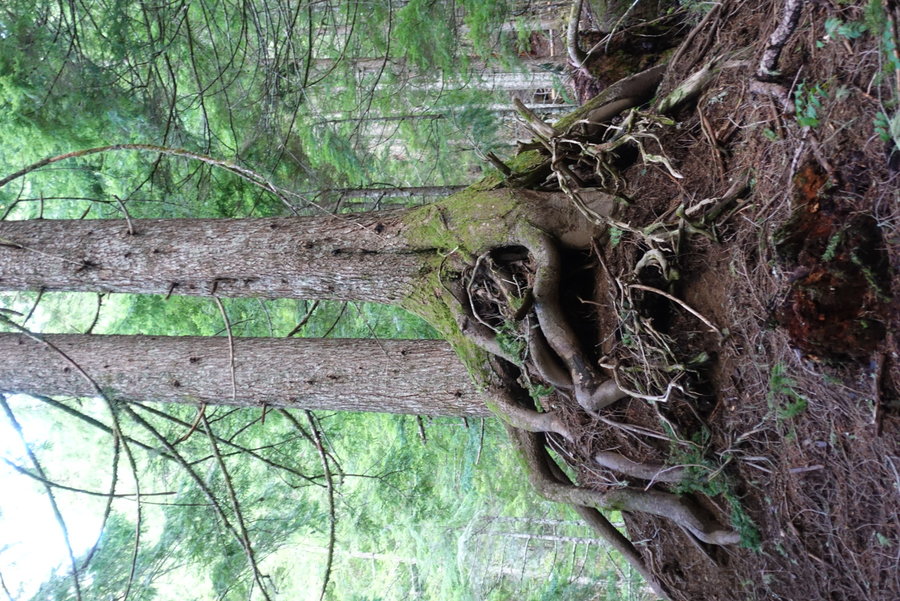
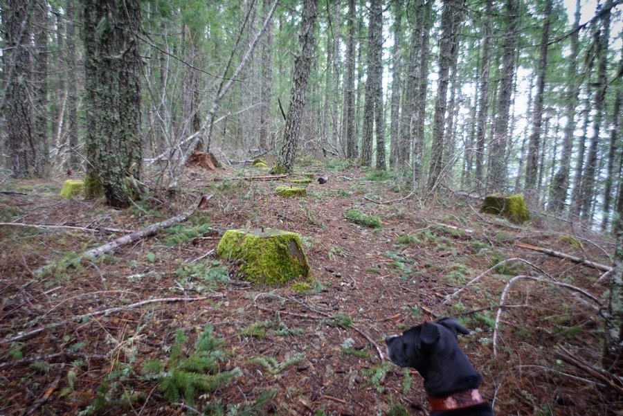
Partial Triple Falls
3 miles of hiking • 500' elevation gain •
Forgot to add this one in - partial trip. Had the dog with me and felt uncomfortable going over sllides/dealing with worsening cold weather as I went up in elevation. Listened to my gut and turned around to play it safe and will come back another day.

December 12, 2021
 2
2
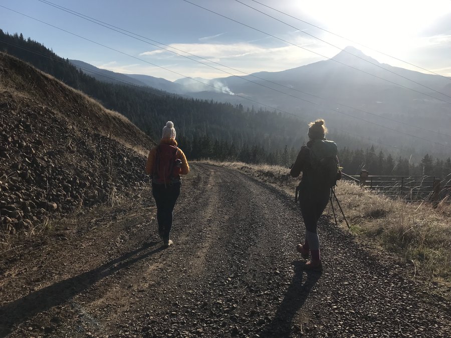
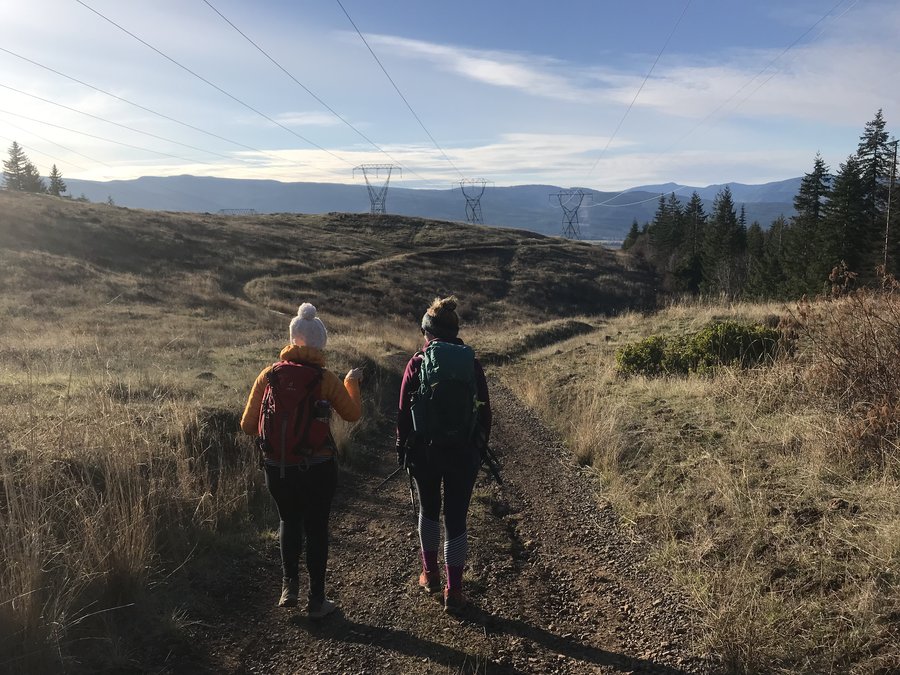
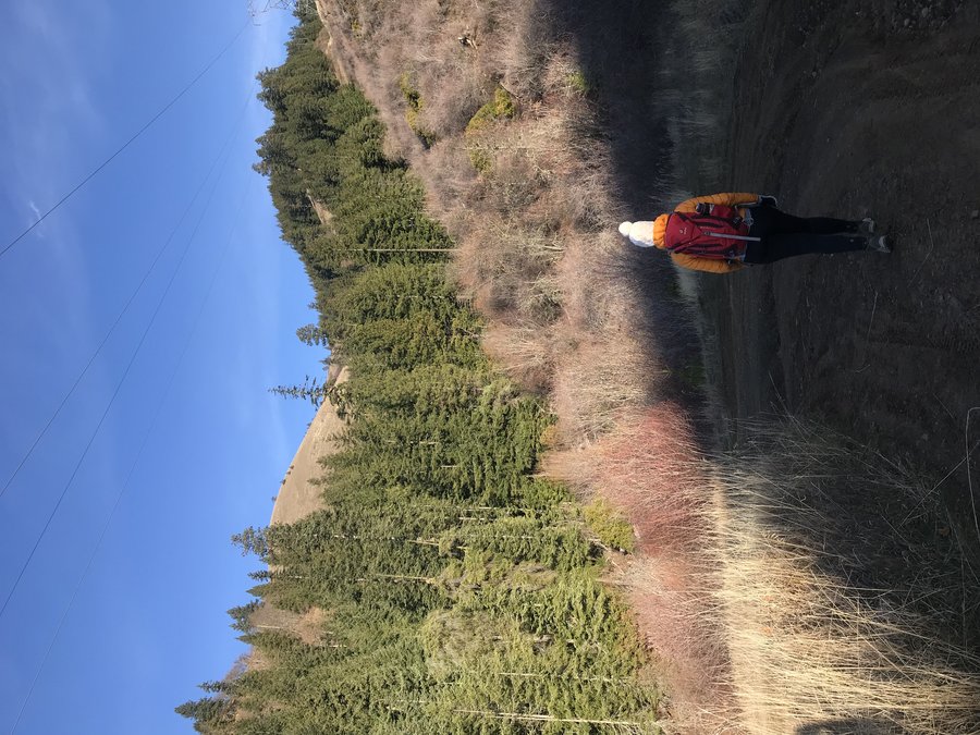
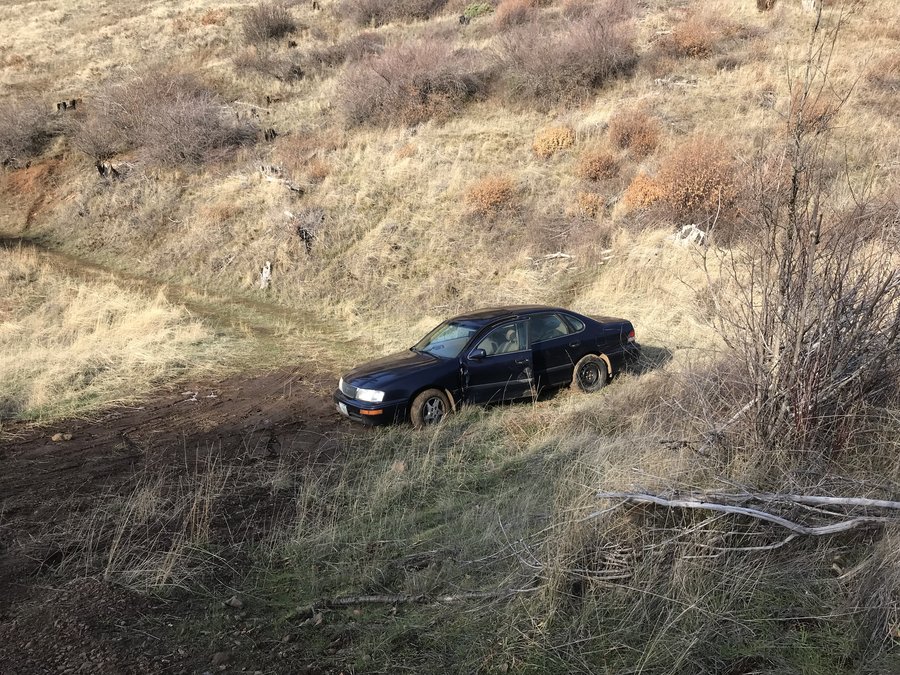
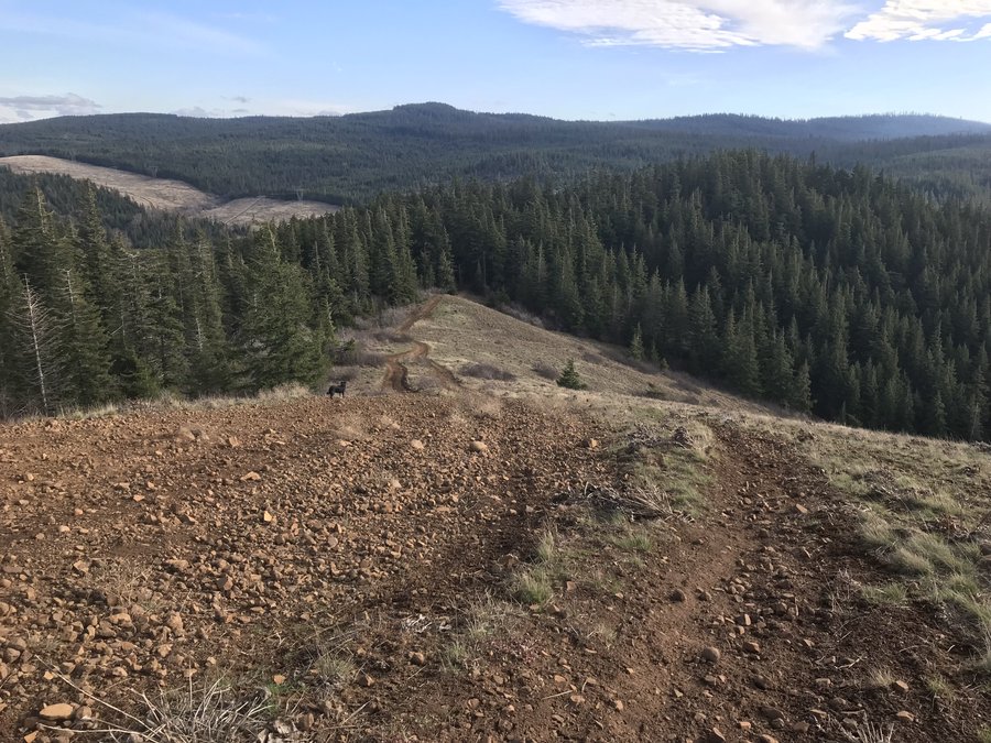
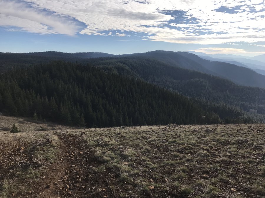
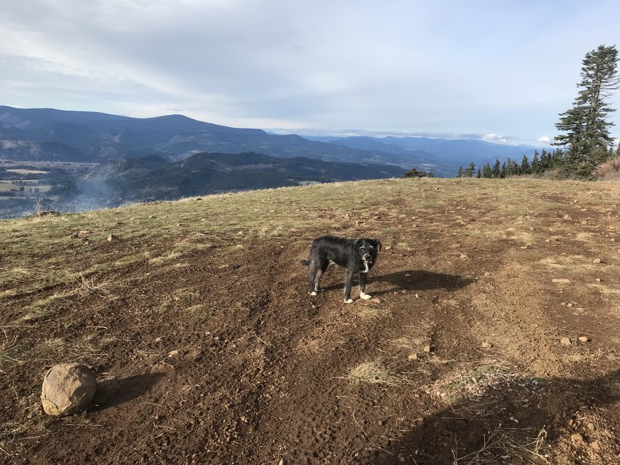
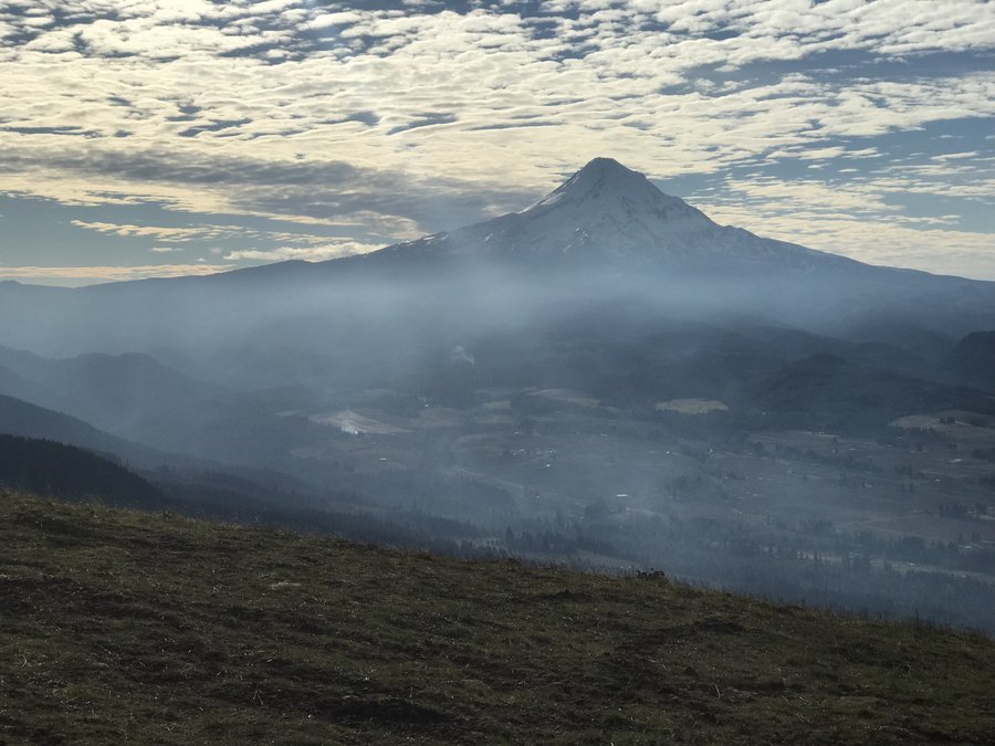
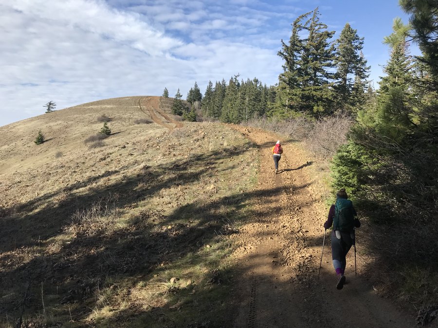
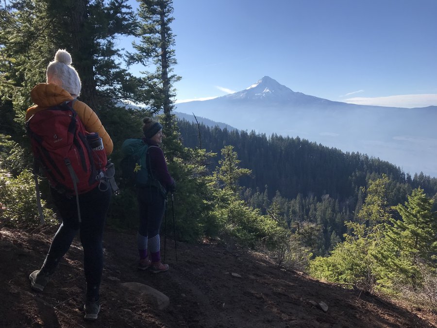
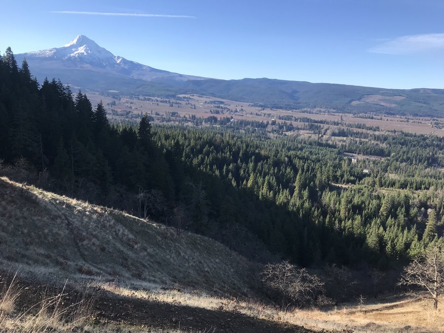
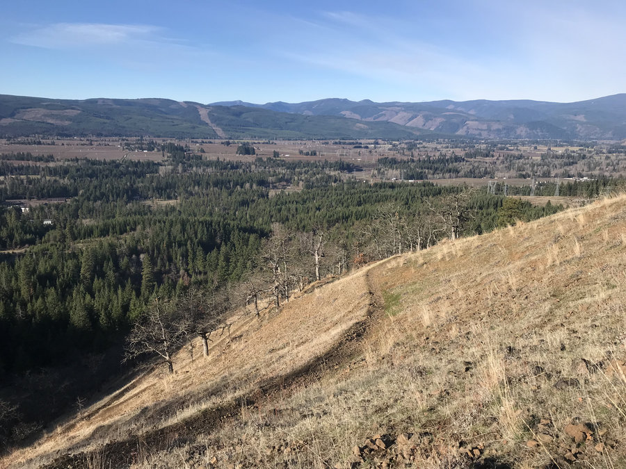
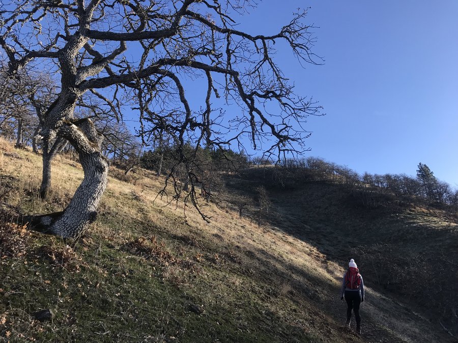
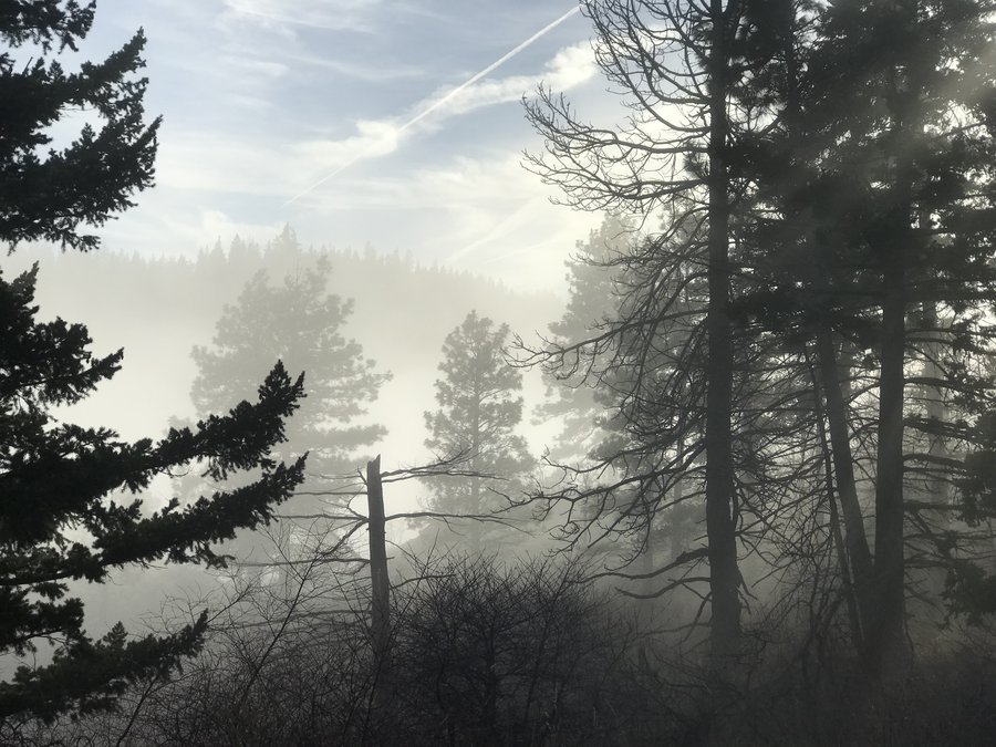
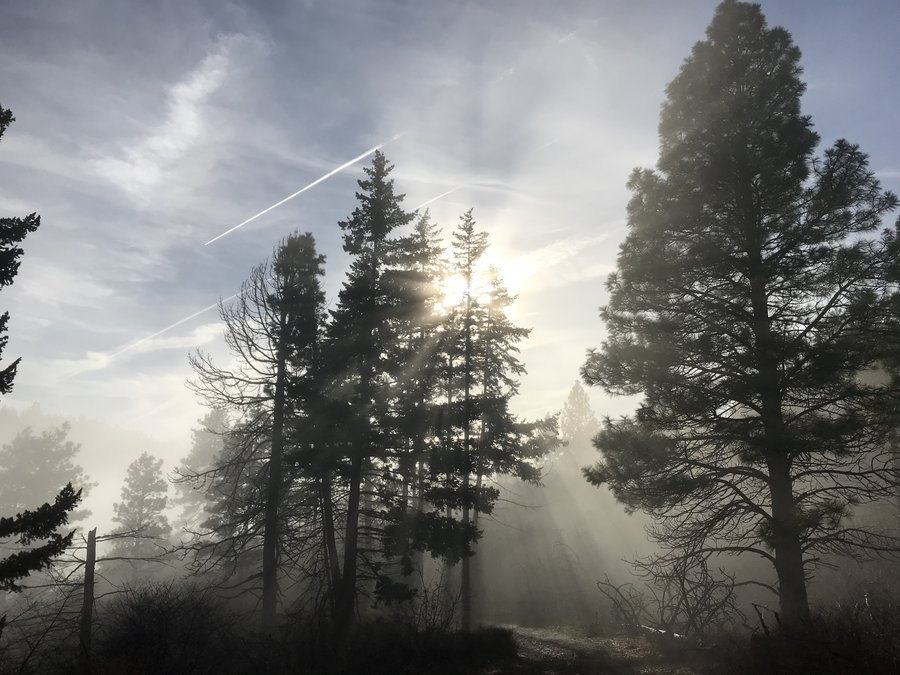
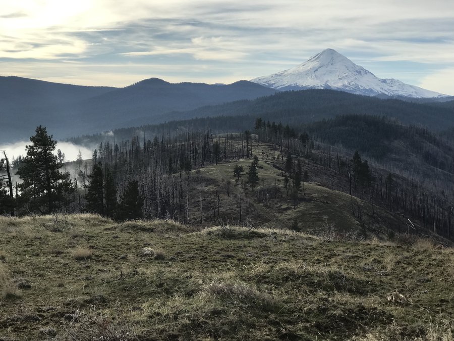
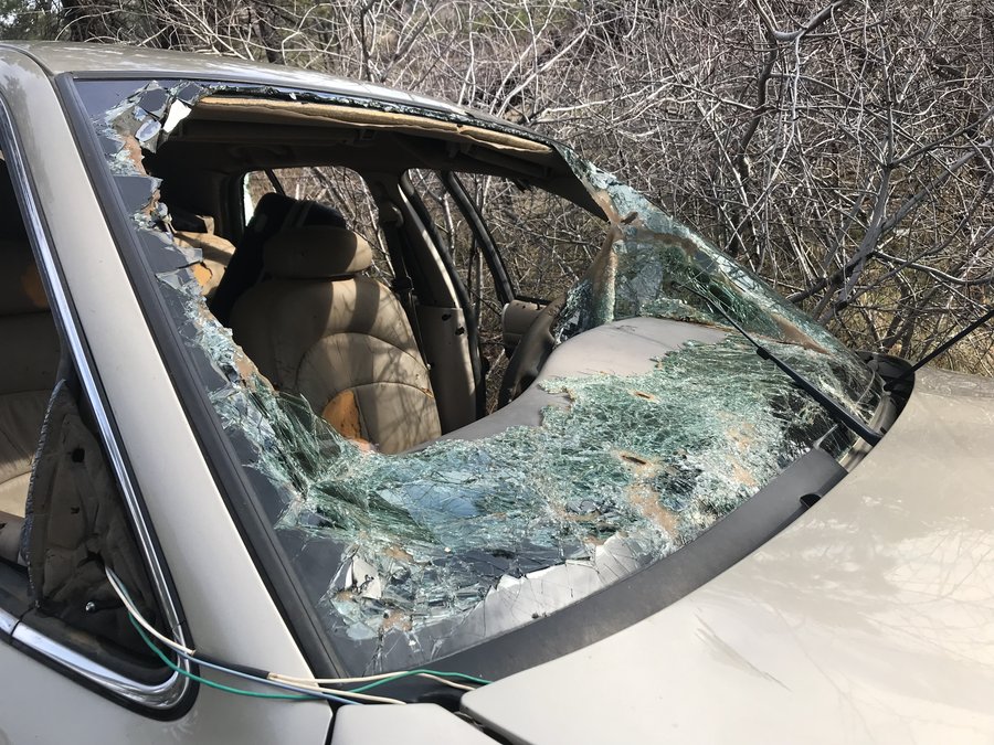
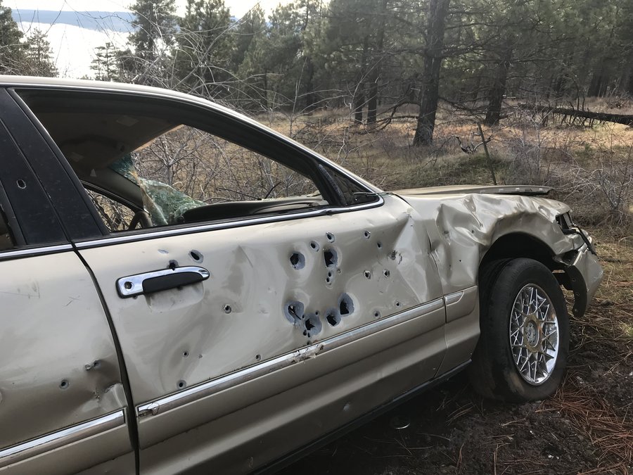
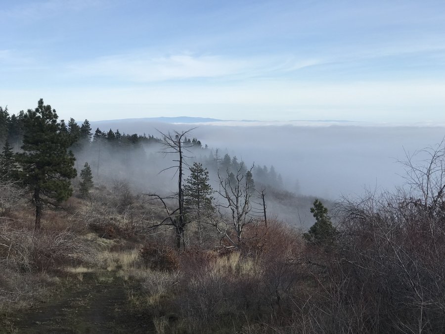
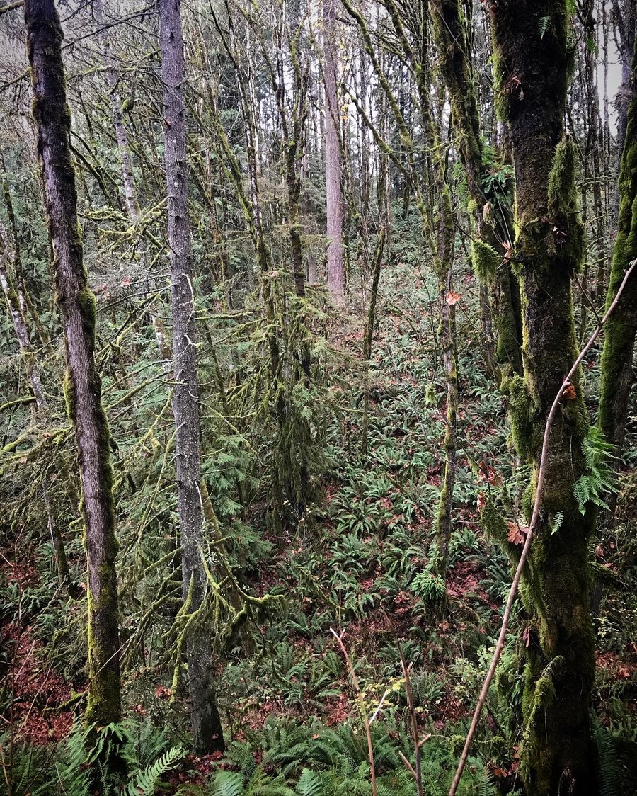
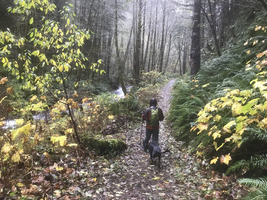
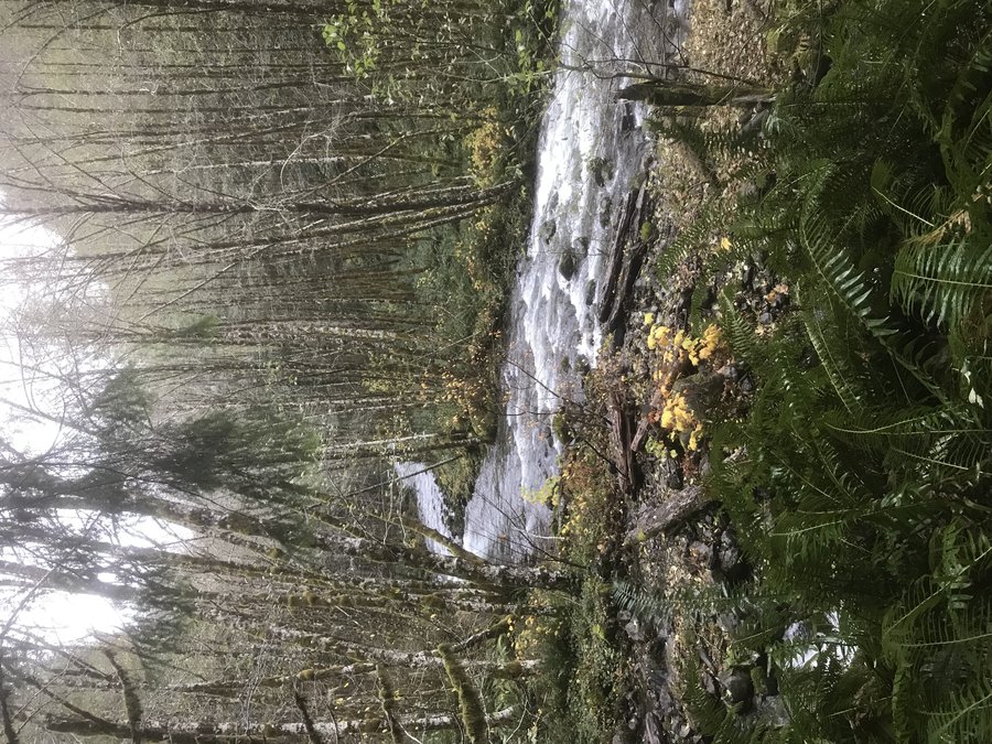
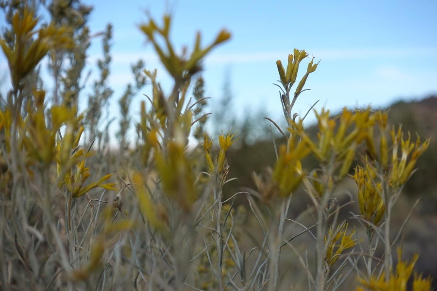
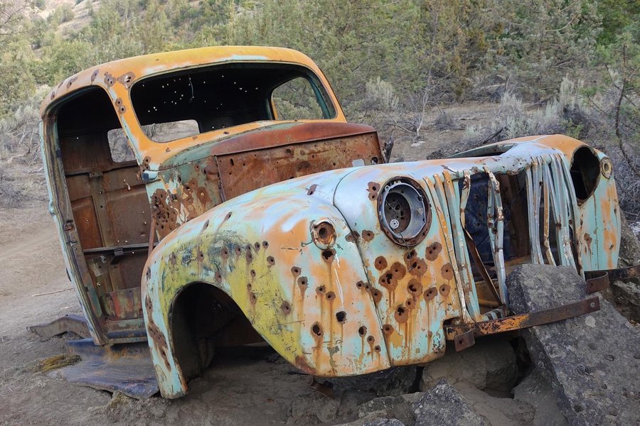
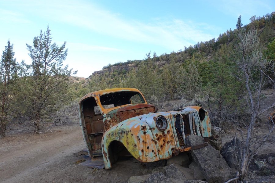
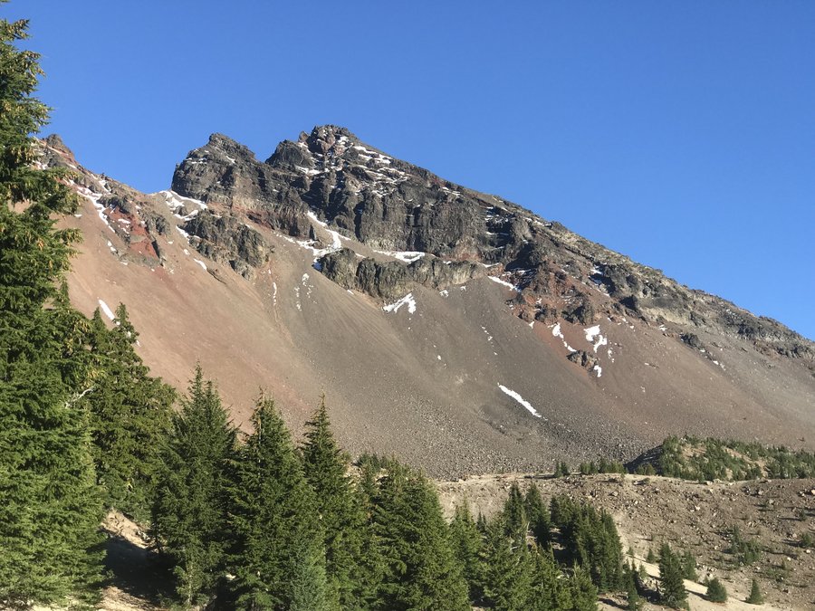
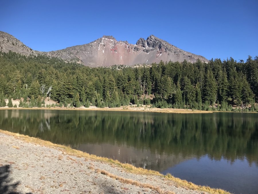
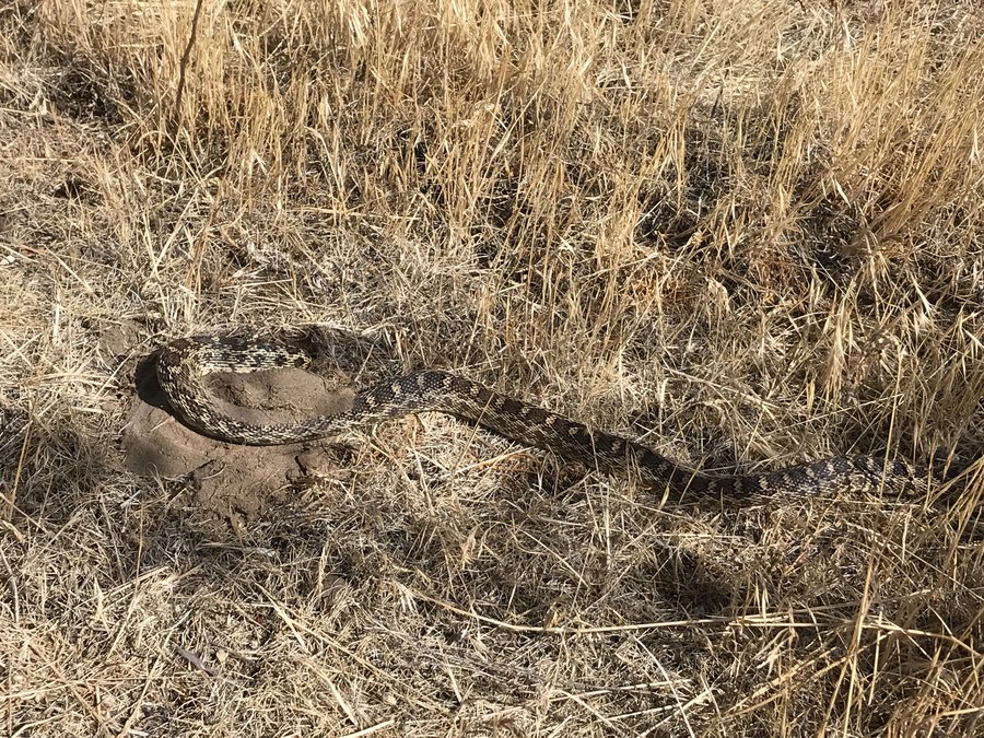
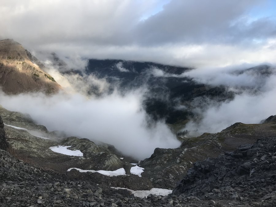
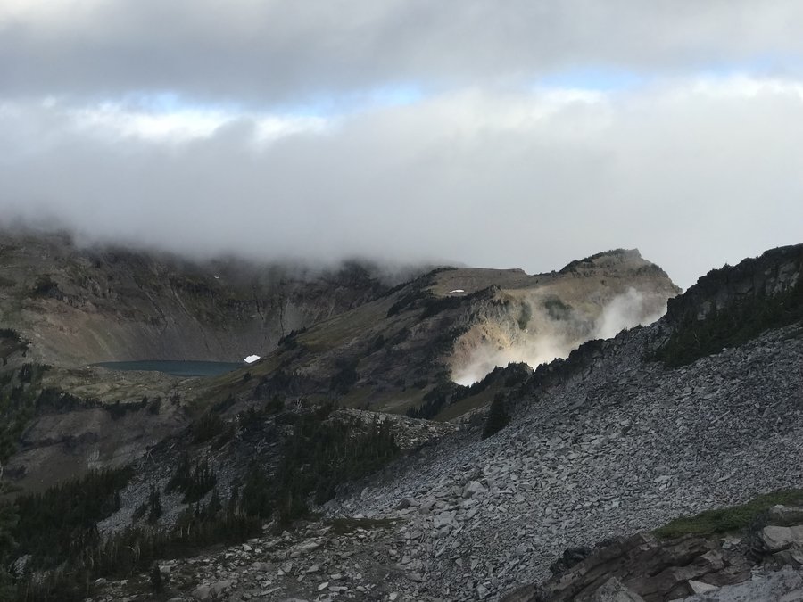
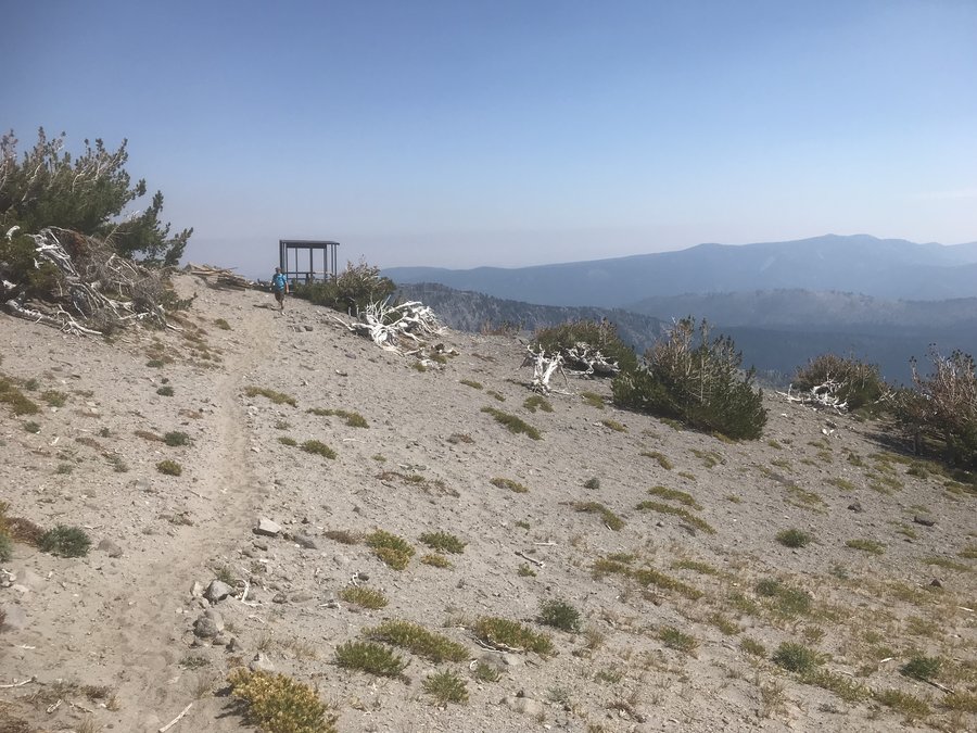
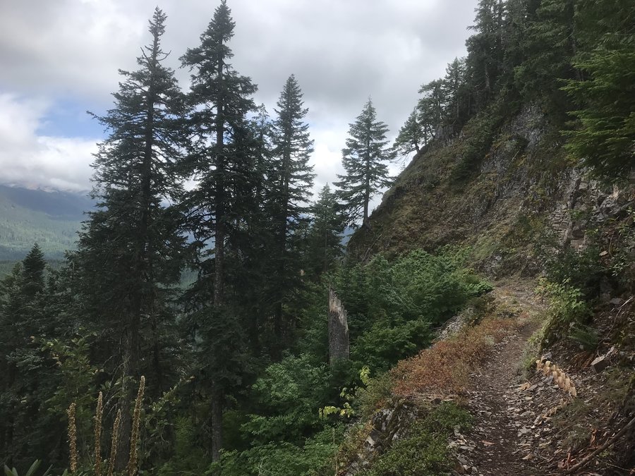
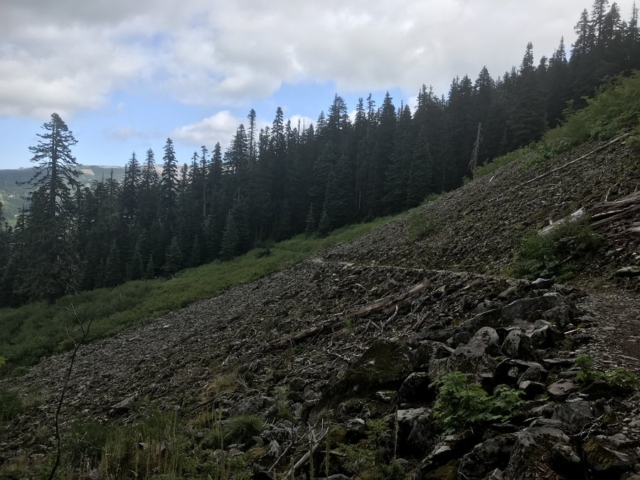
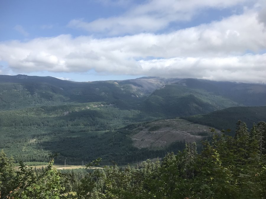
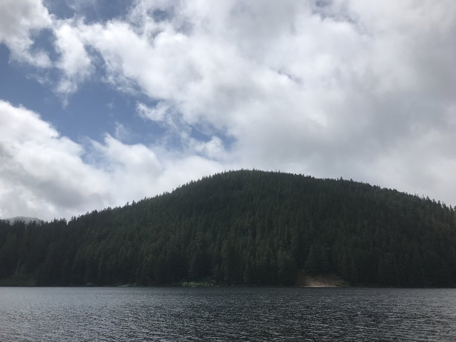
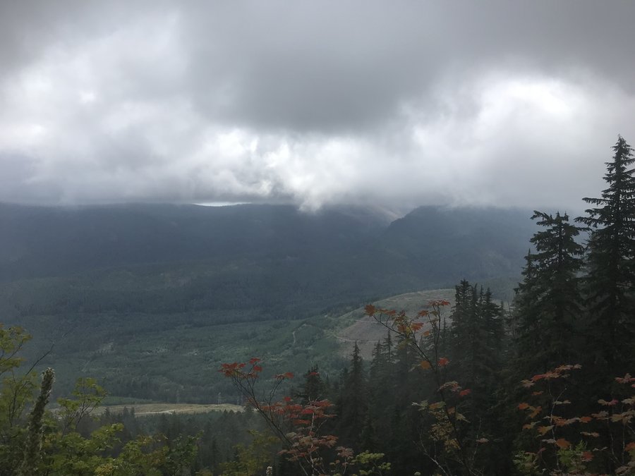
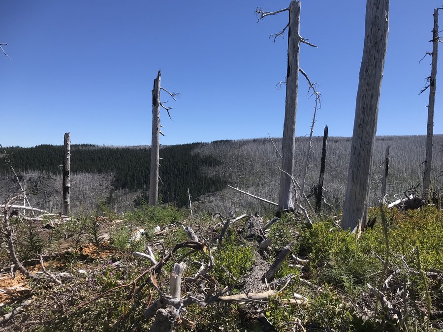
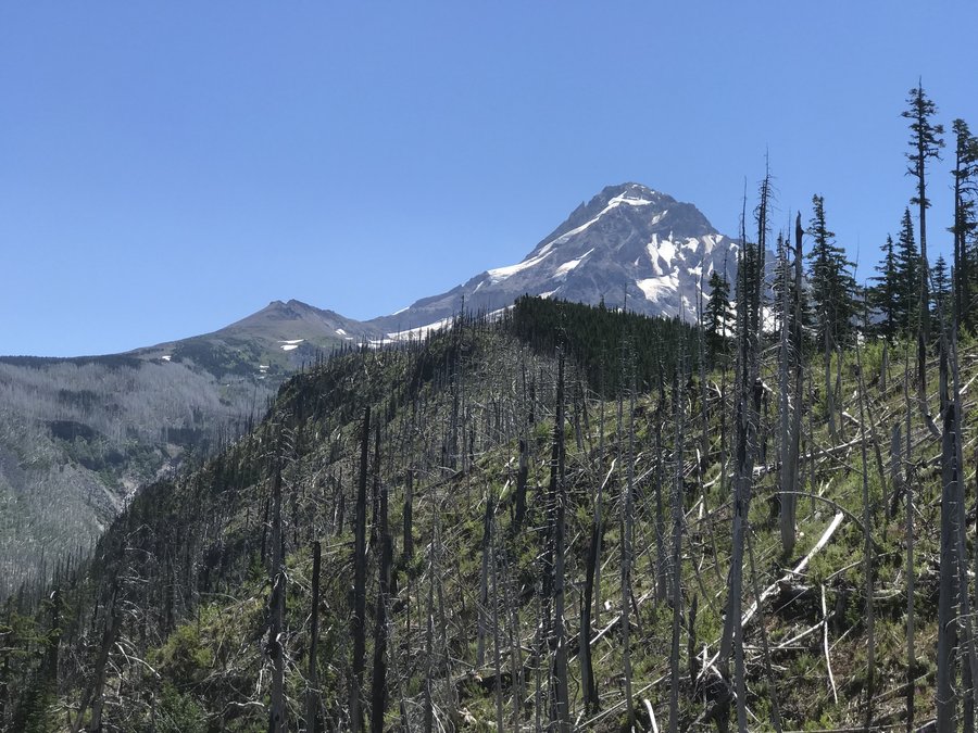
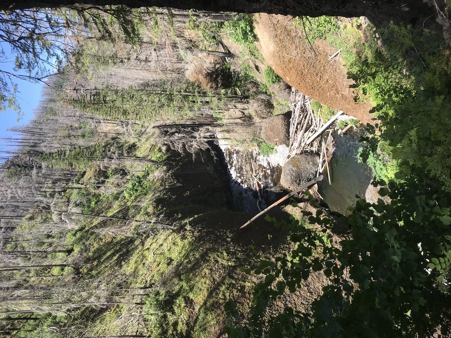
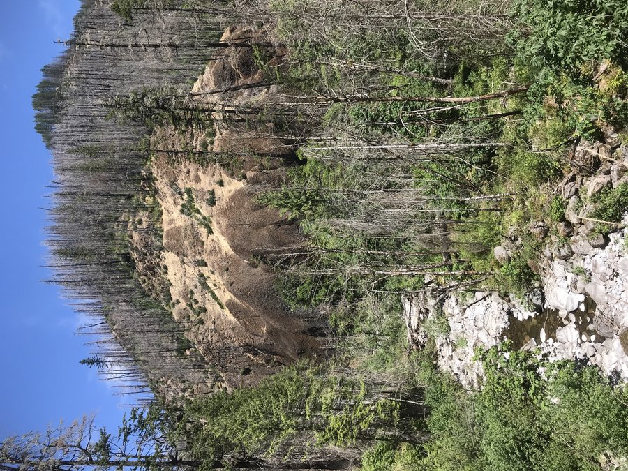
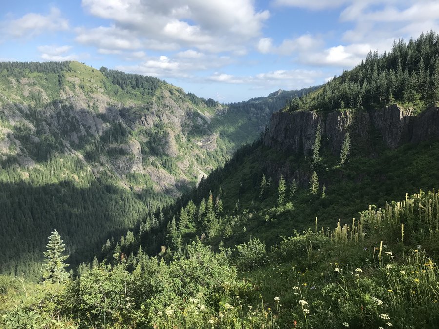
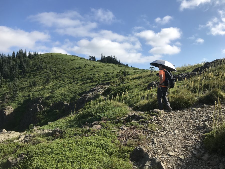
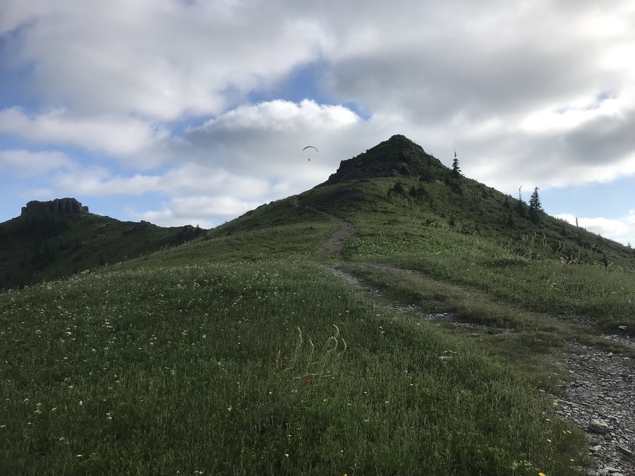
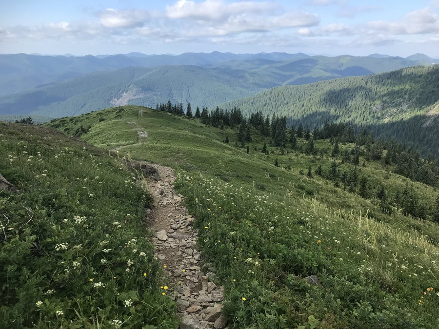
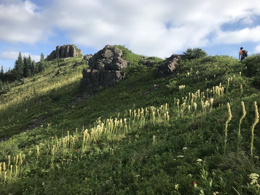
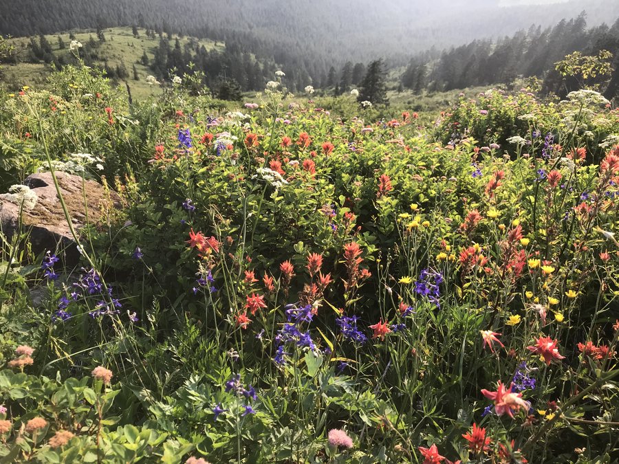
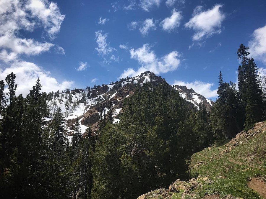
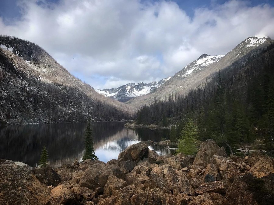
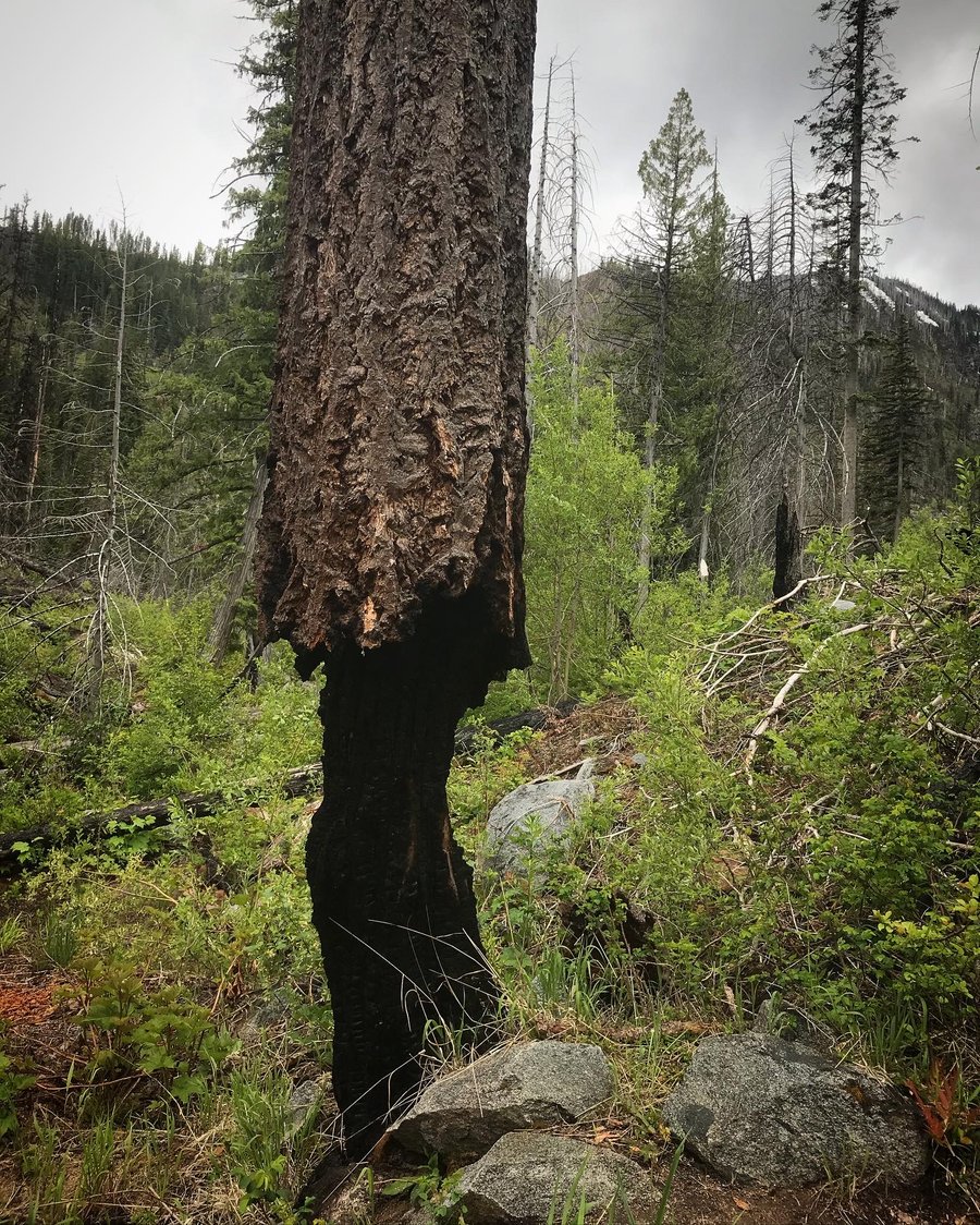
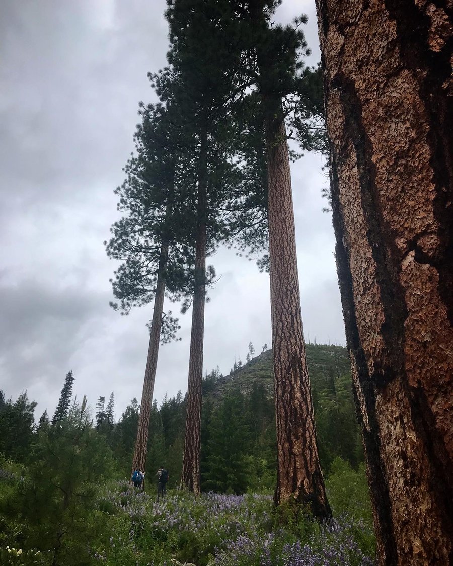
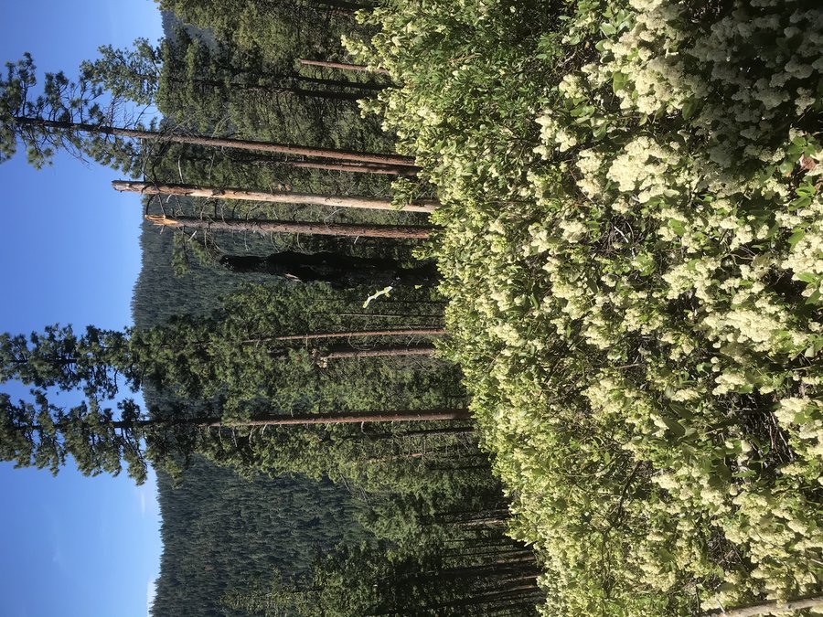
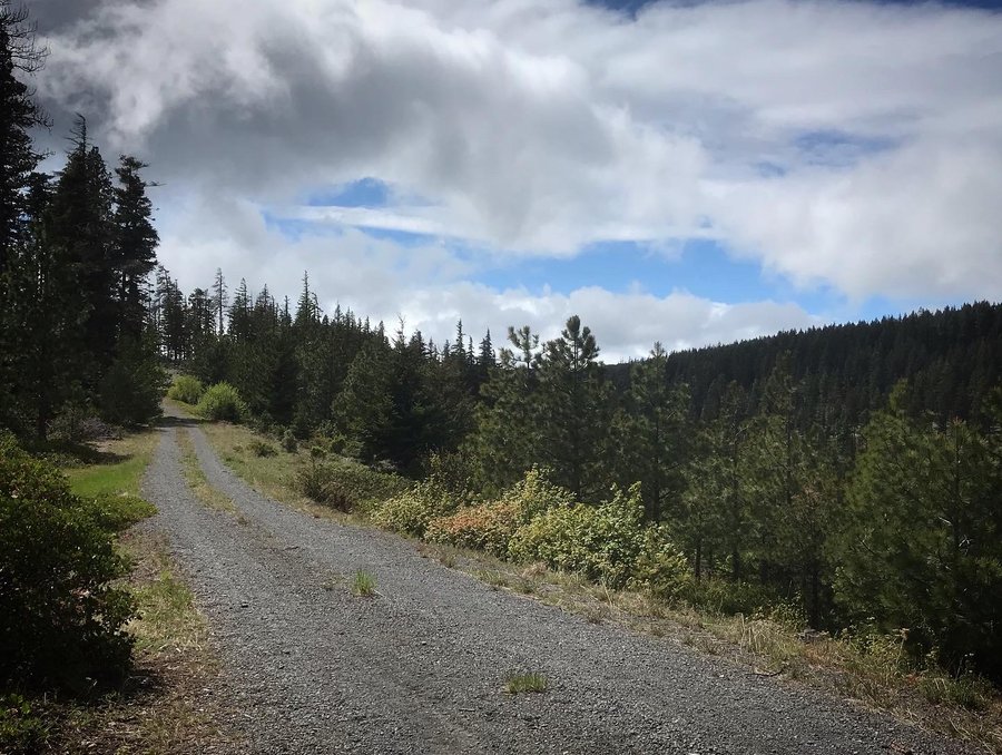
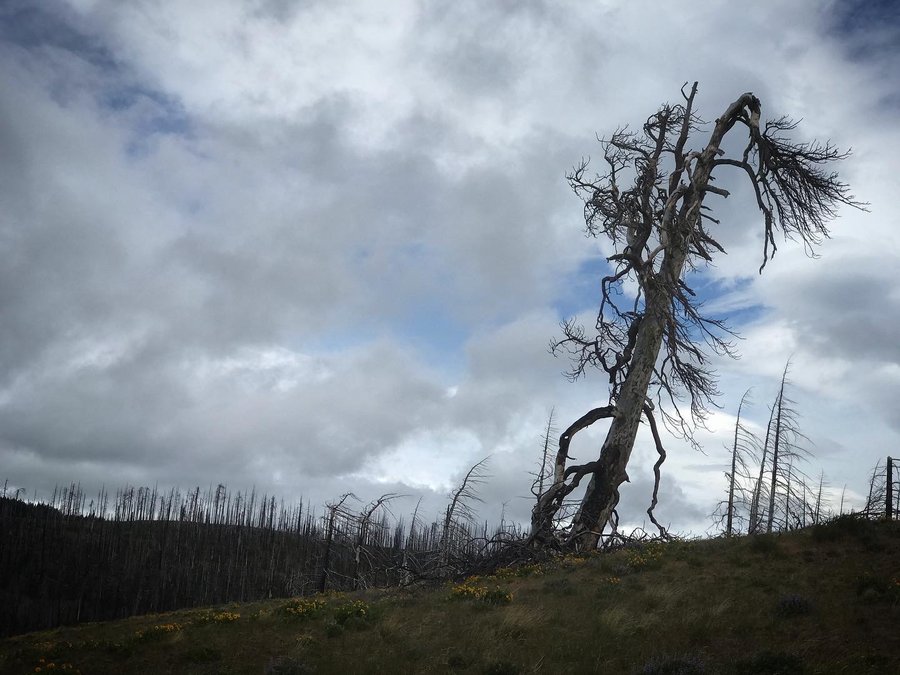
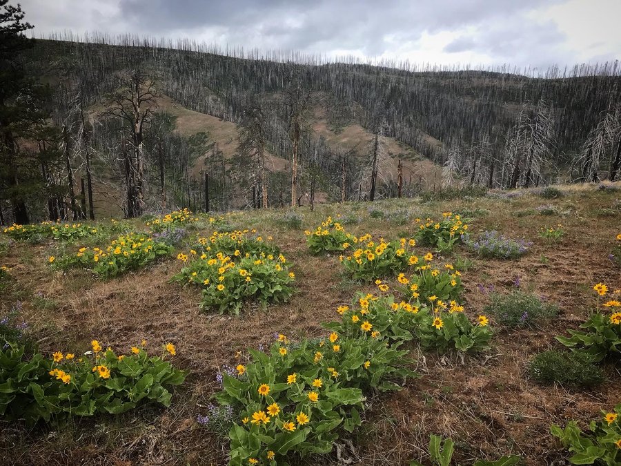
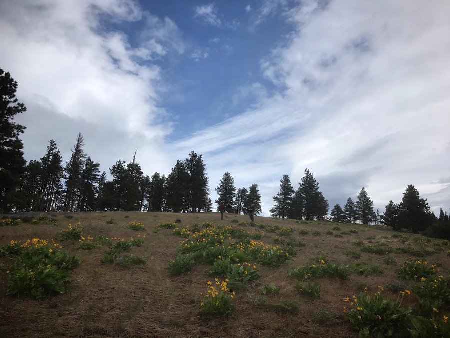
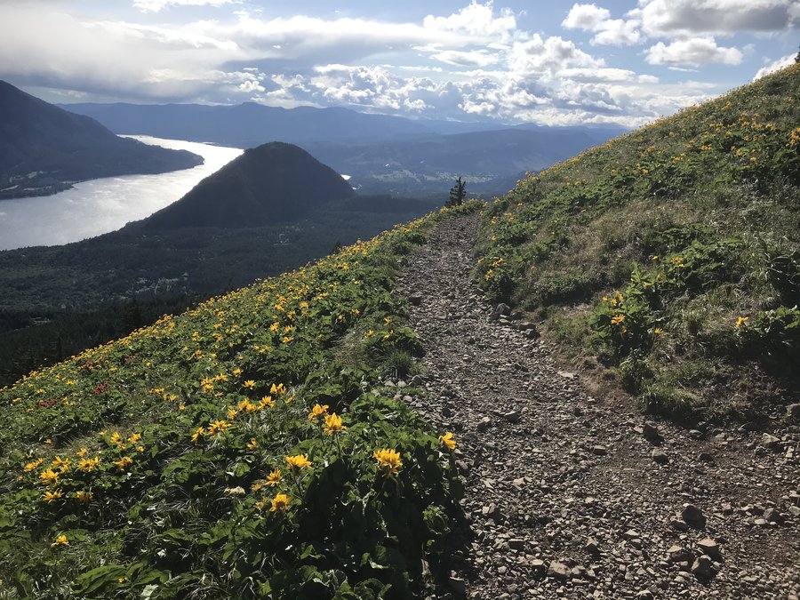
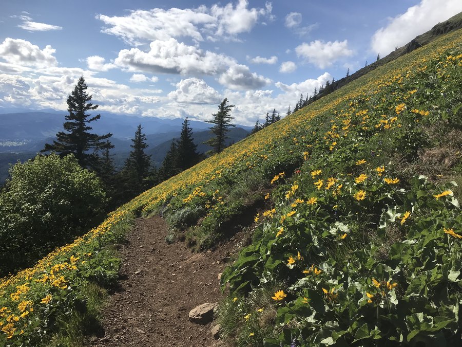
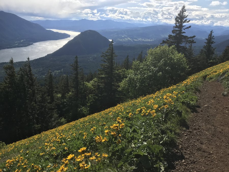
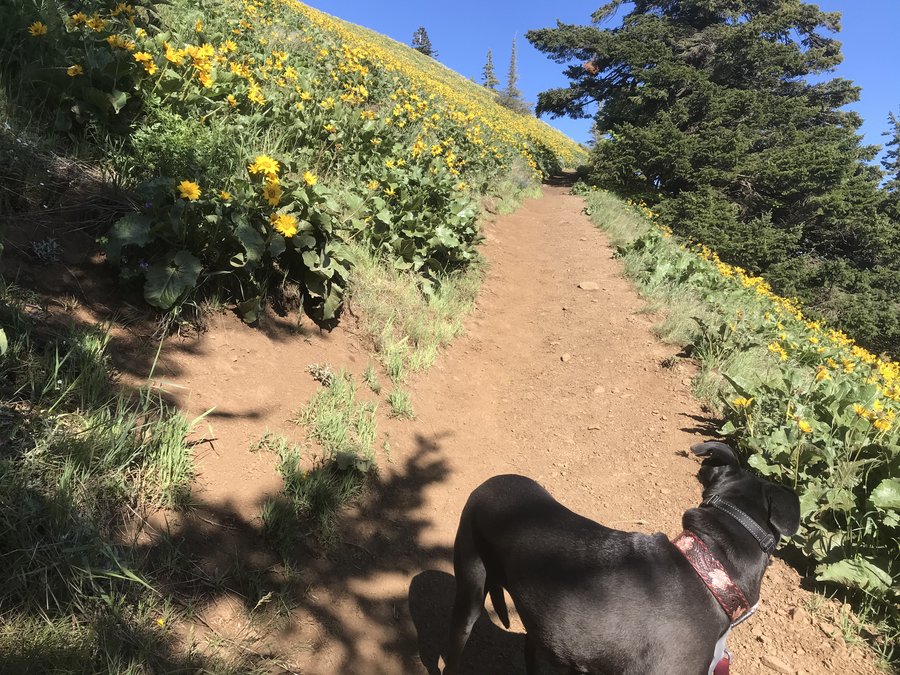
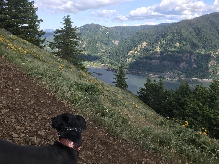
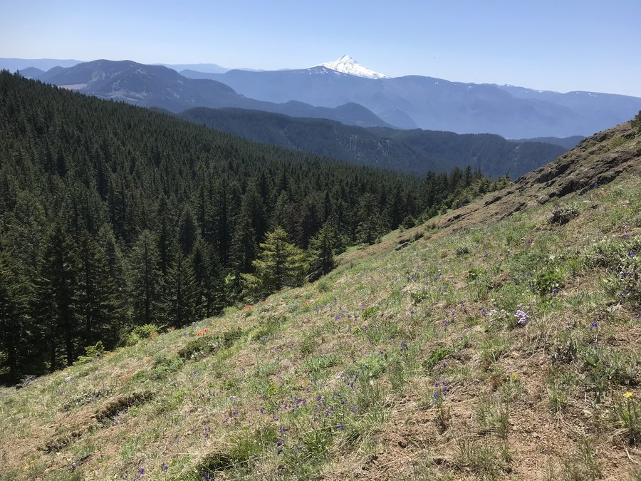
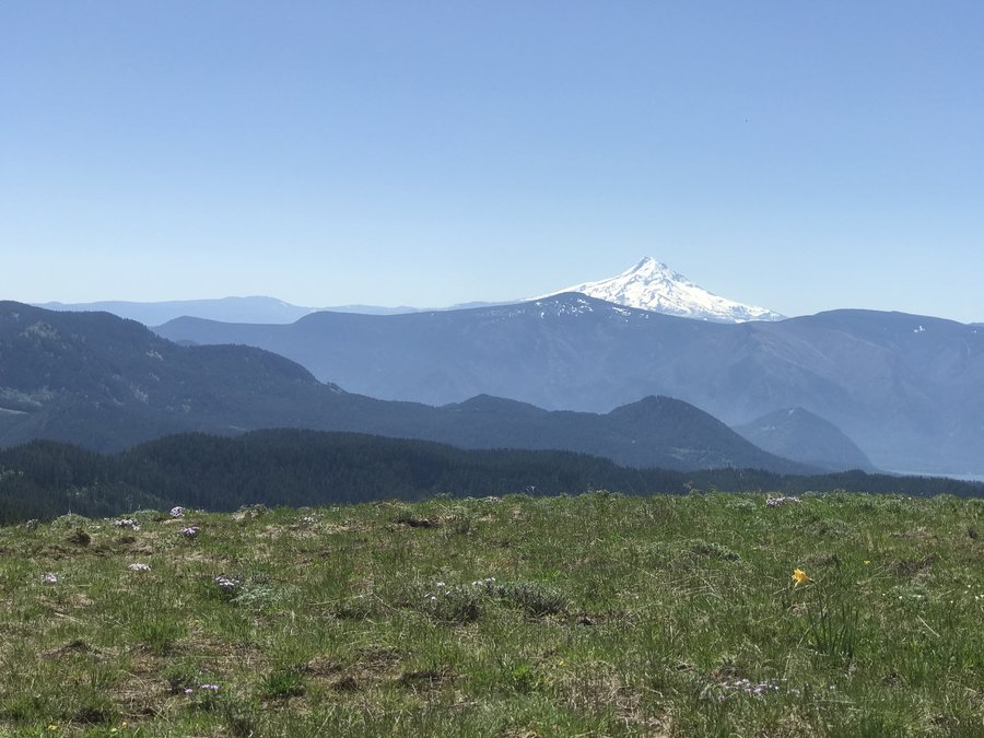
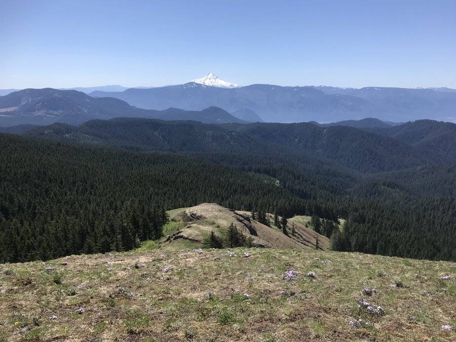
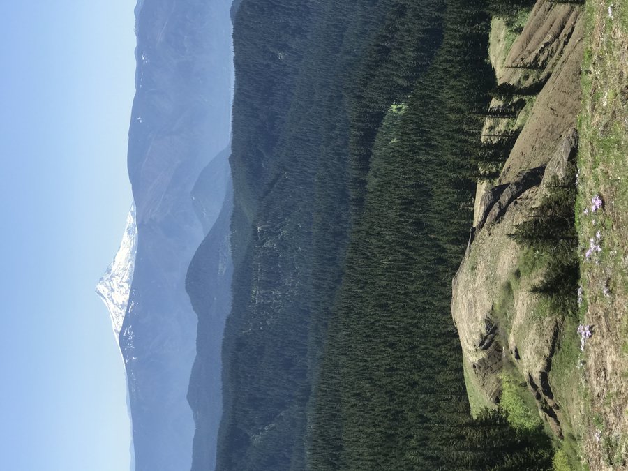
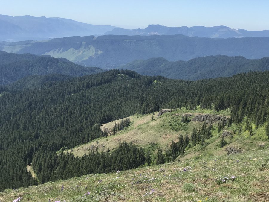
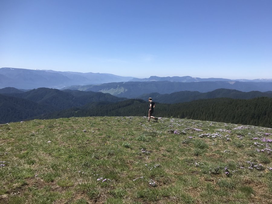
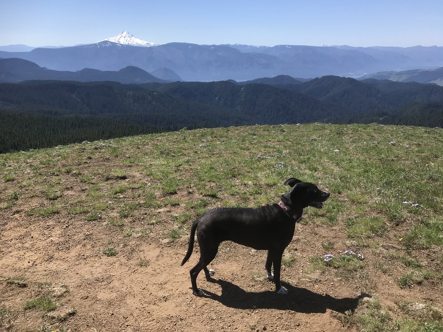
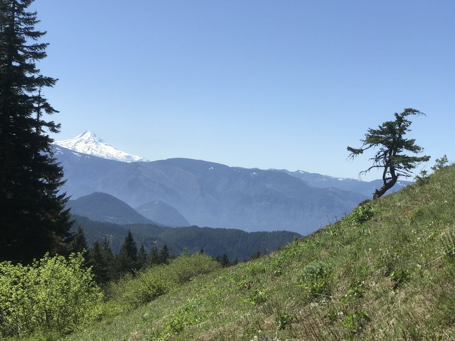
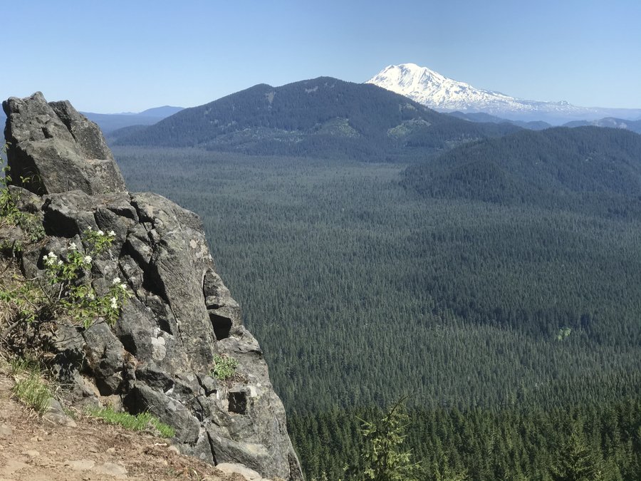
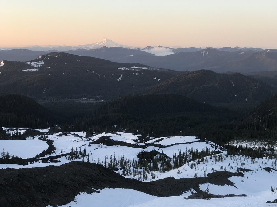
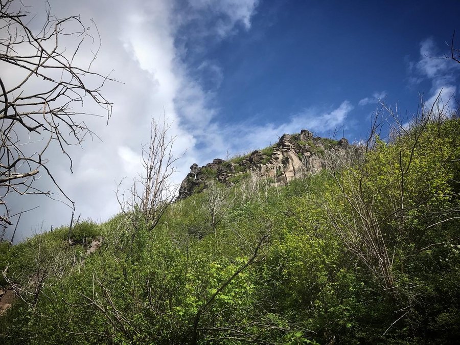
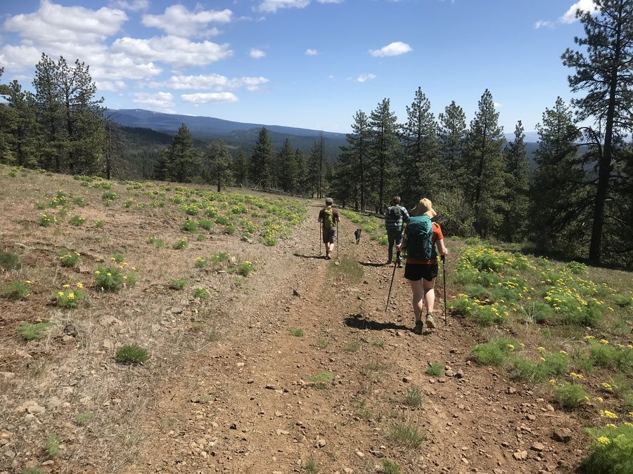
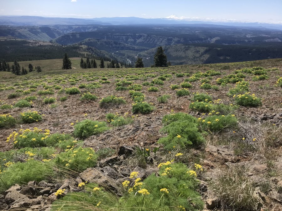
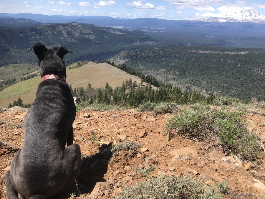
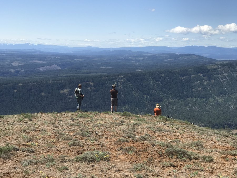
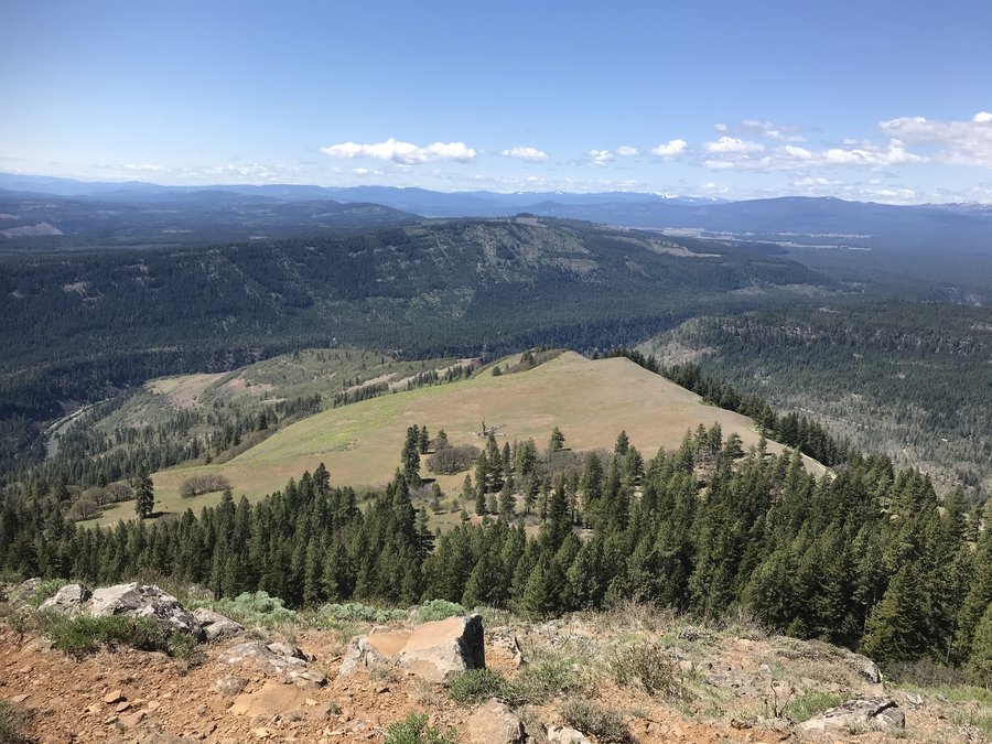
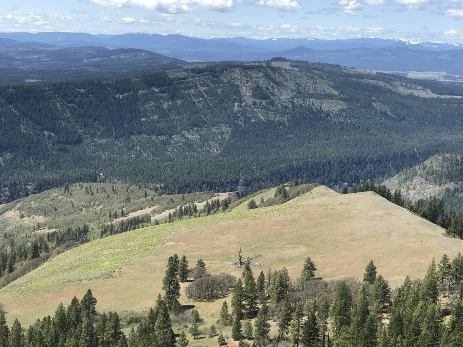
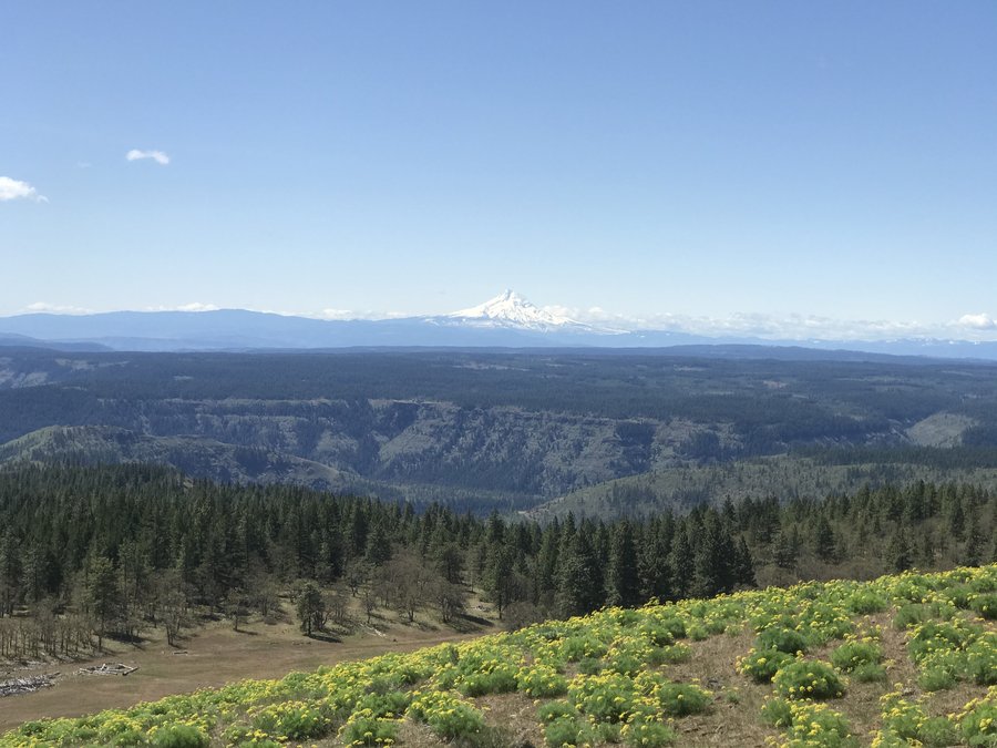
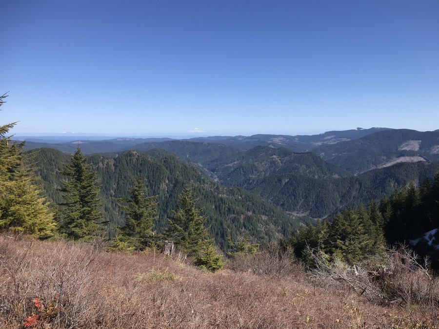
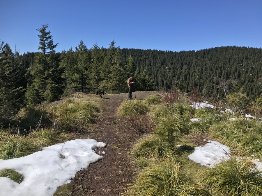
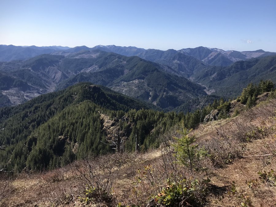
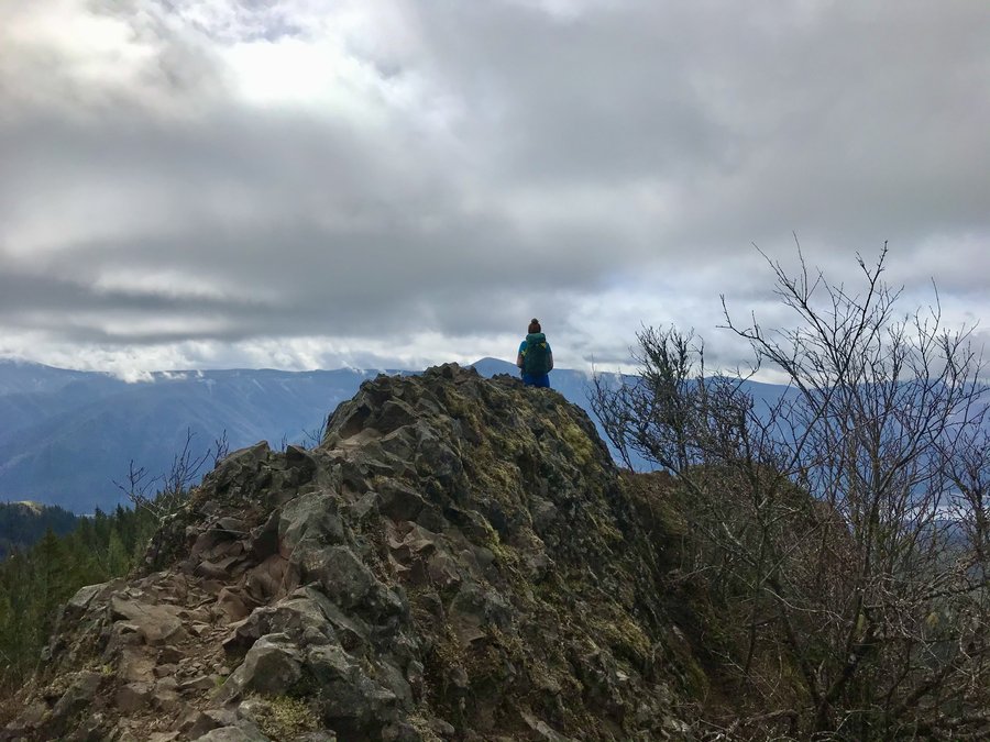
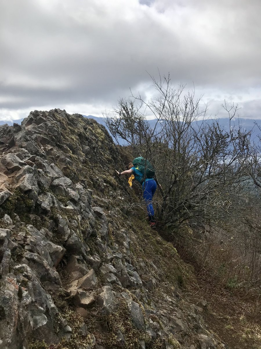
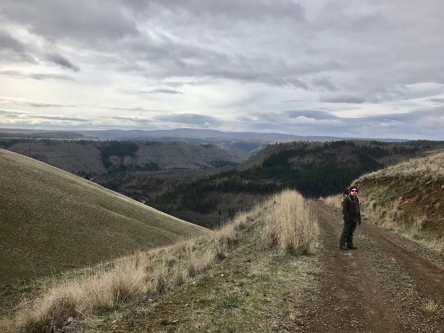
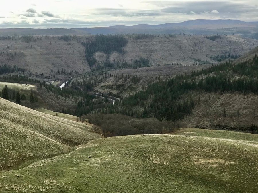
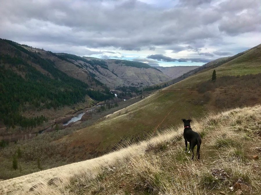
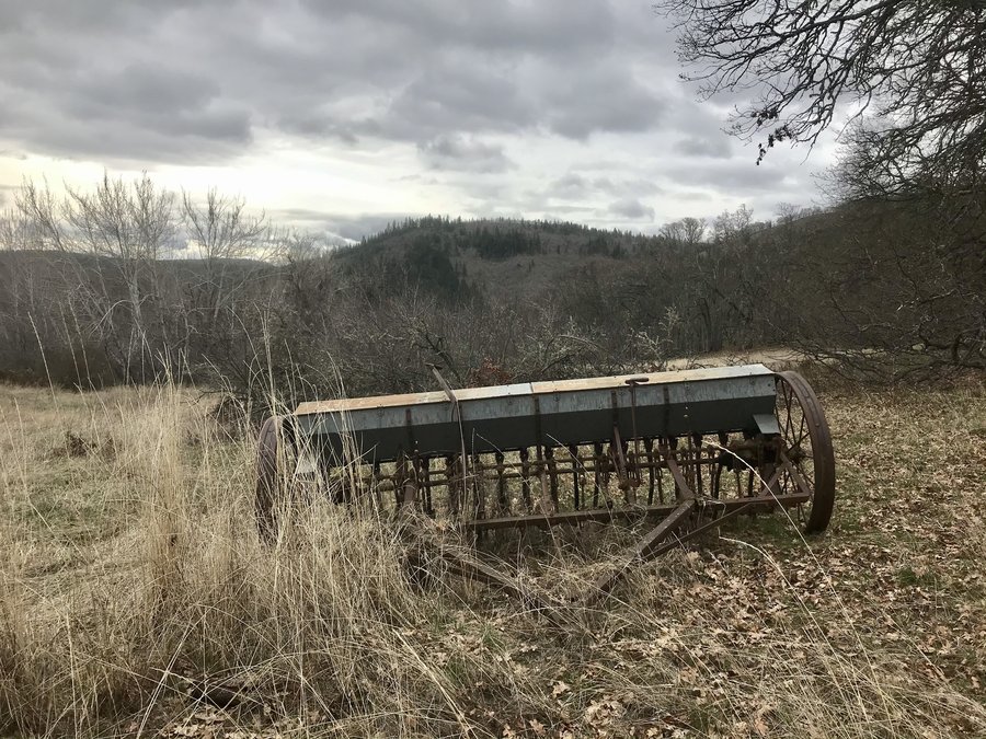
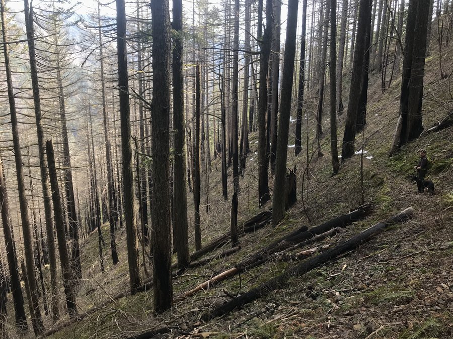
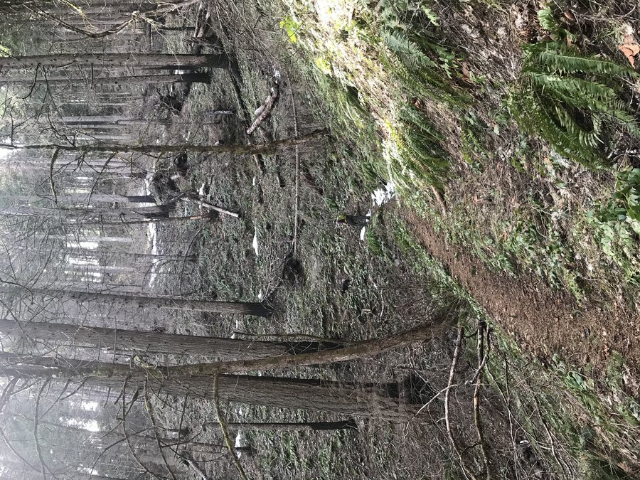
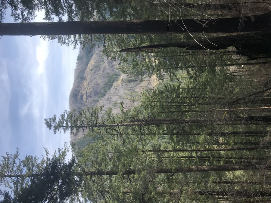
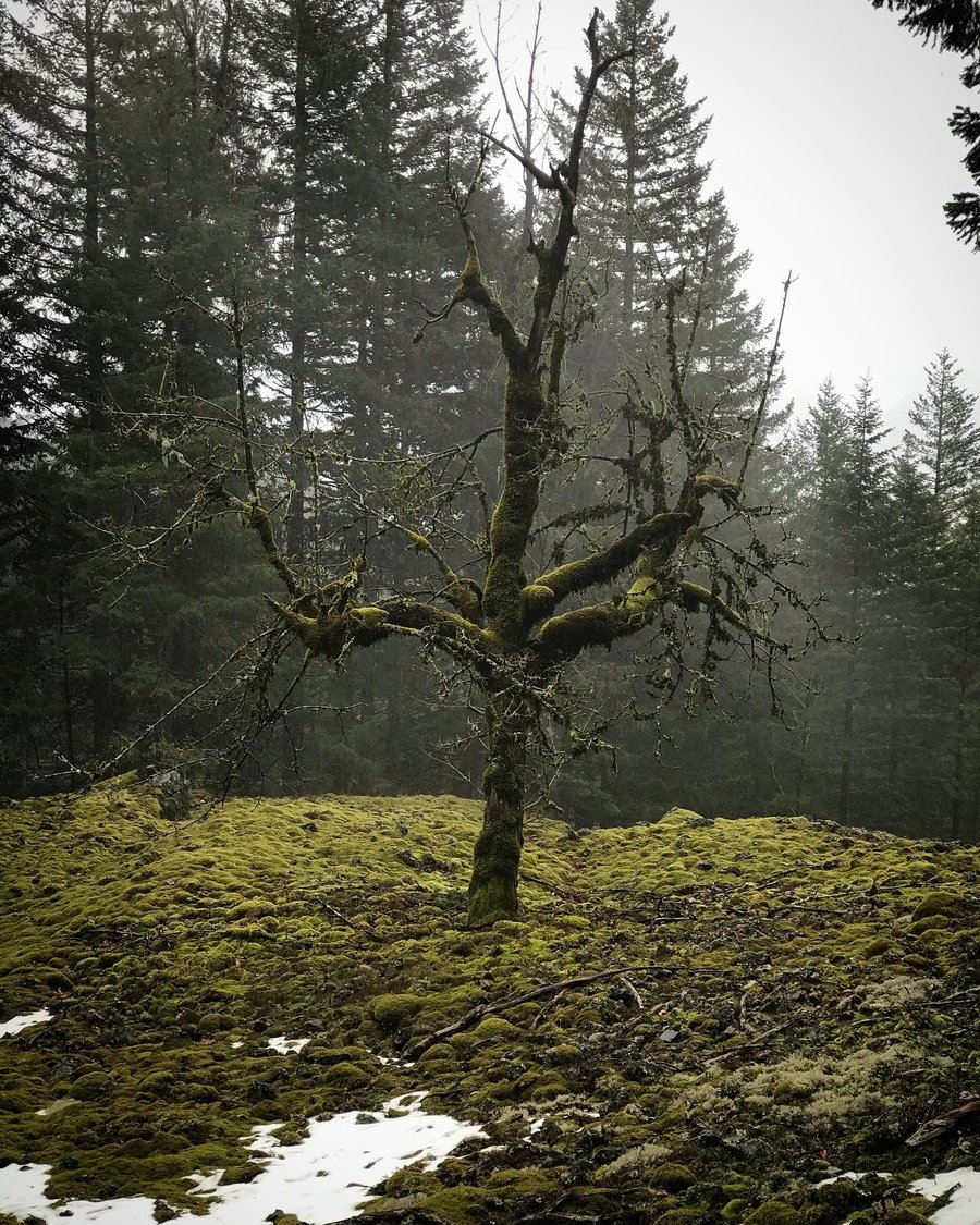
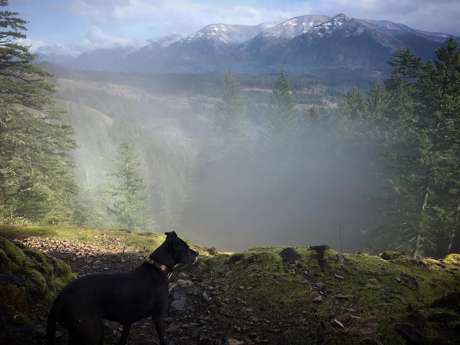
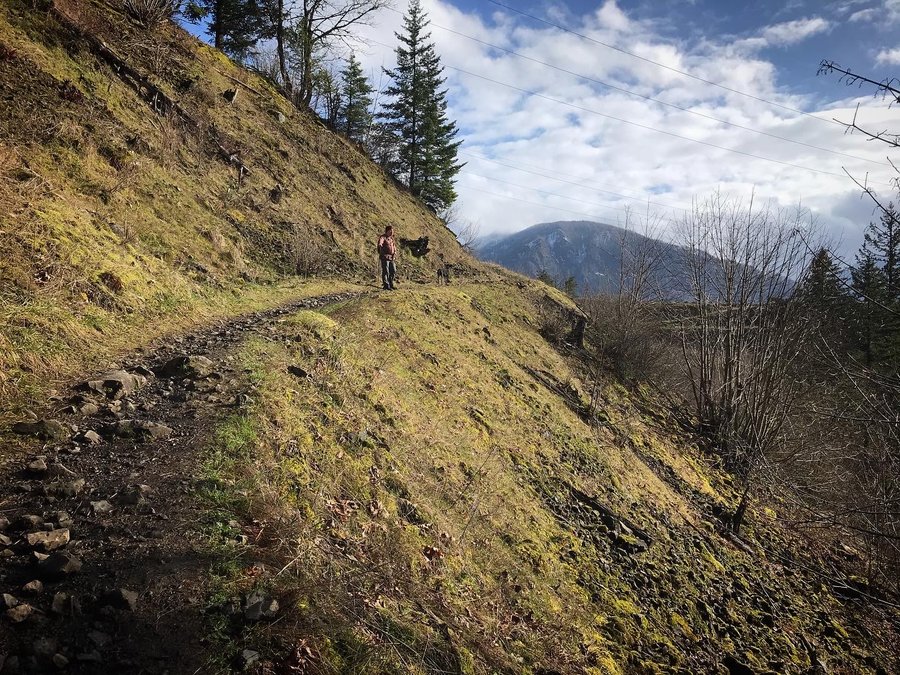
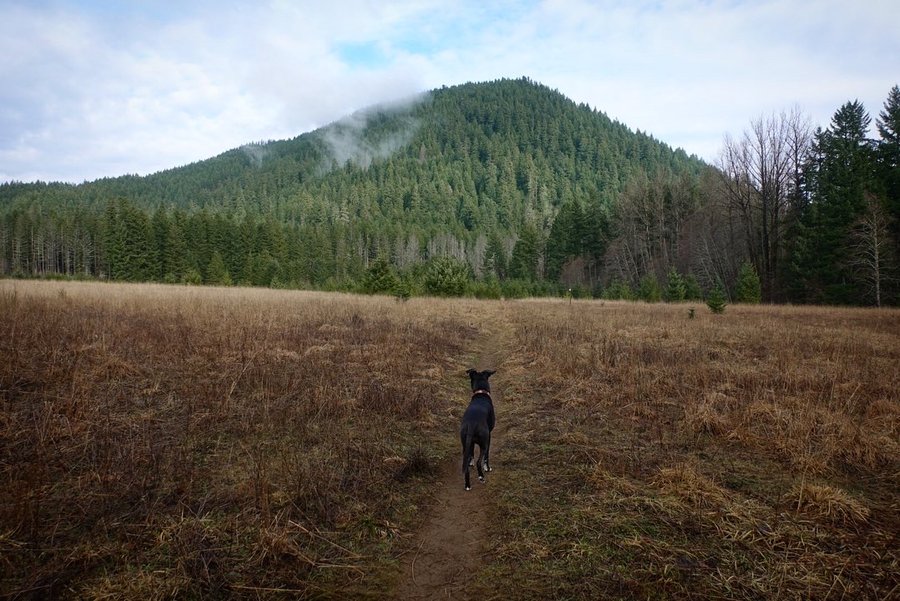
Bald Butte
8 miles of hiking • 2250' elevation gain •
A cold but pleasantly clear day. Found yet another abandoned vehicle when walking the road back to make our trip into a loop. Motorized users have completely trashed the top of Bald Butte and the trail heading to the top. Hillside is one huge road. Unfortunate that there is nothing done to stop illegal activity there.
December 5, 2021

 2
2
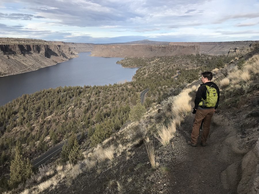
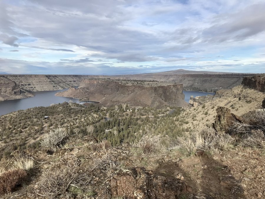
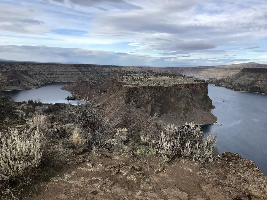
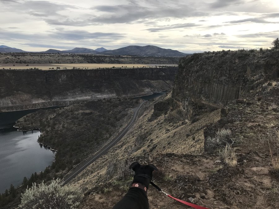
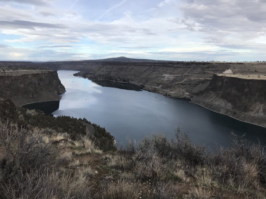
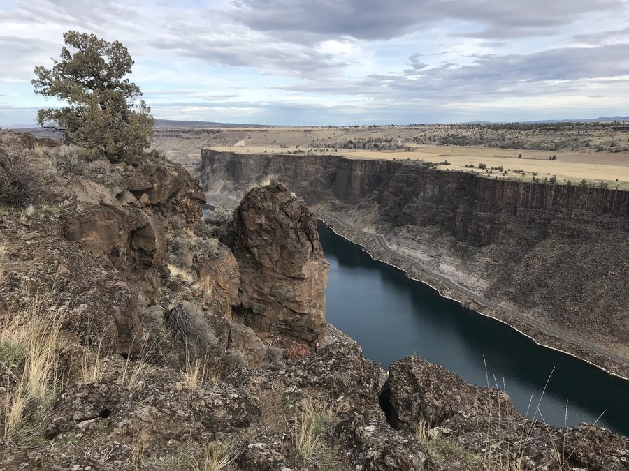
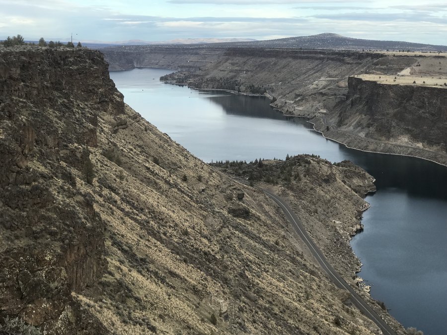
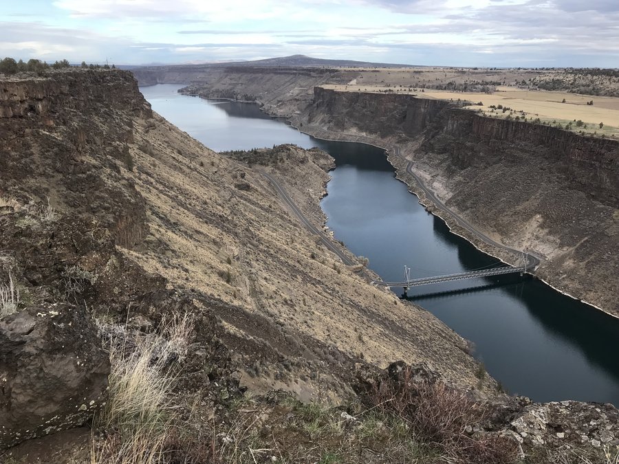
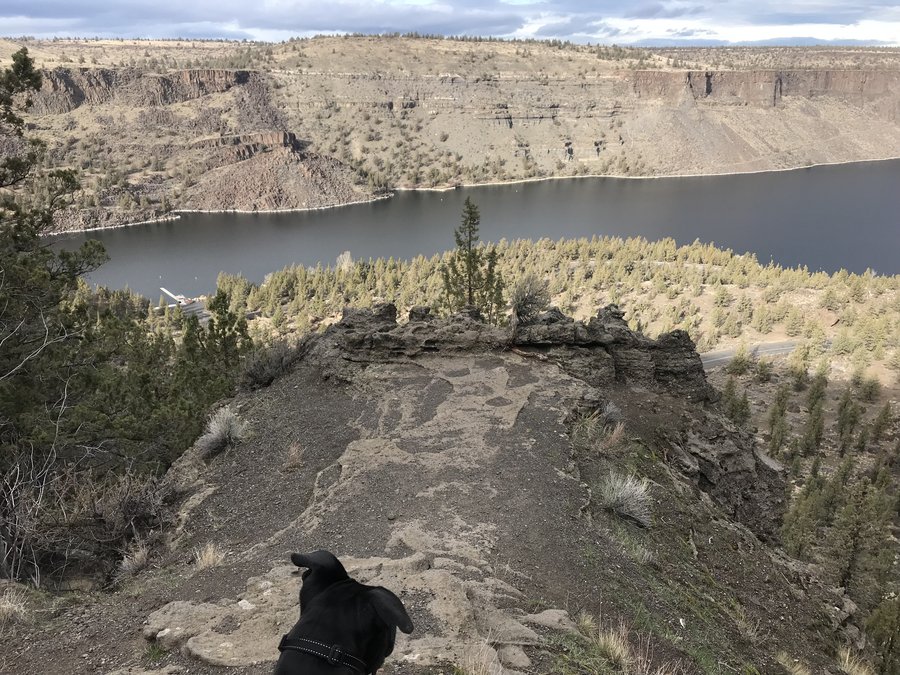
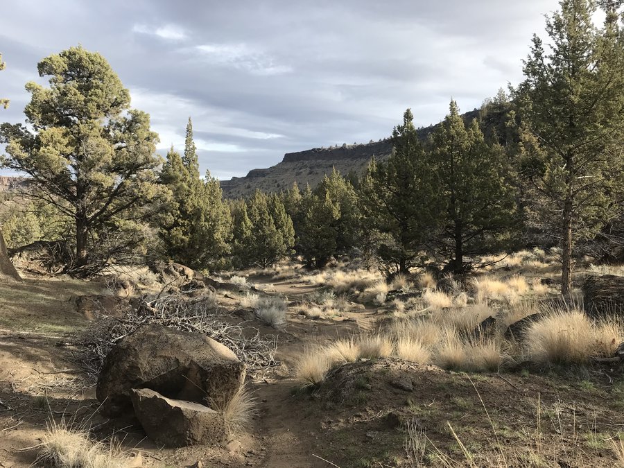
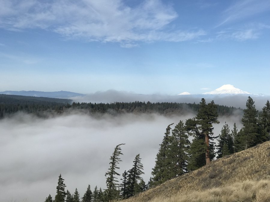
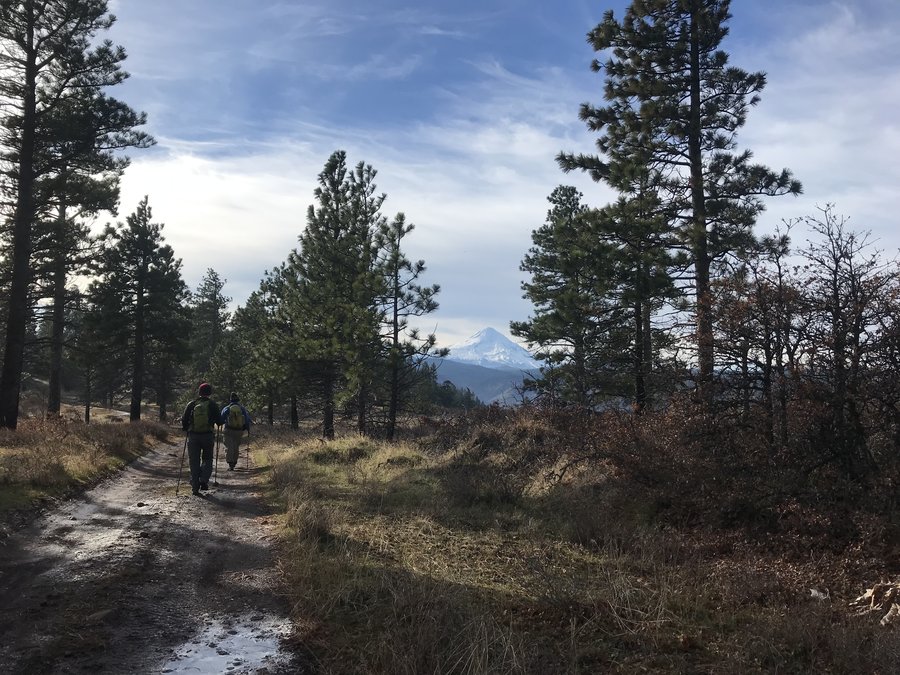
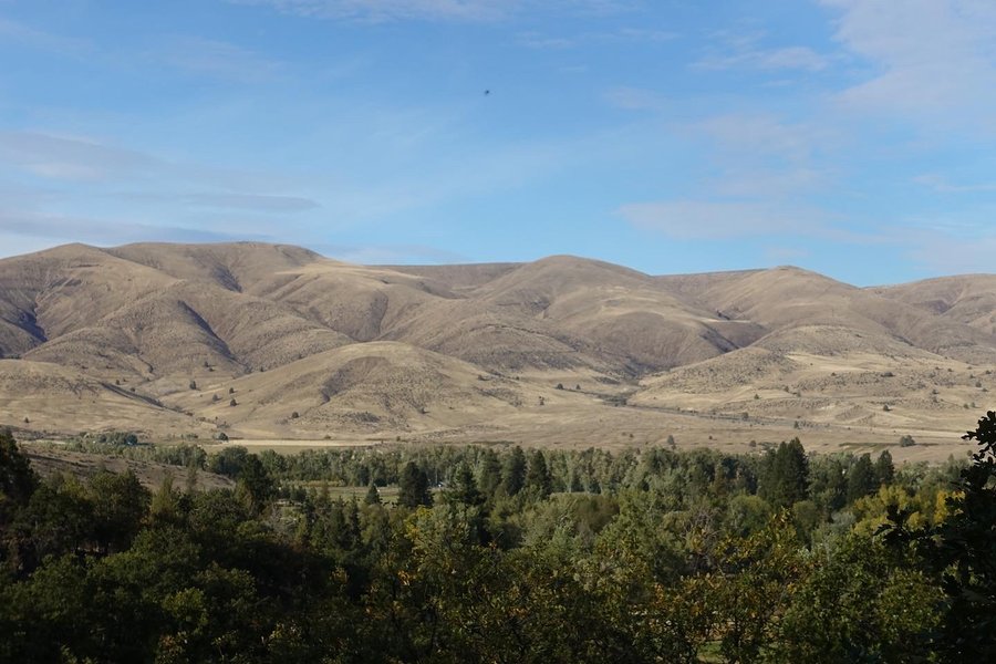
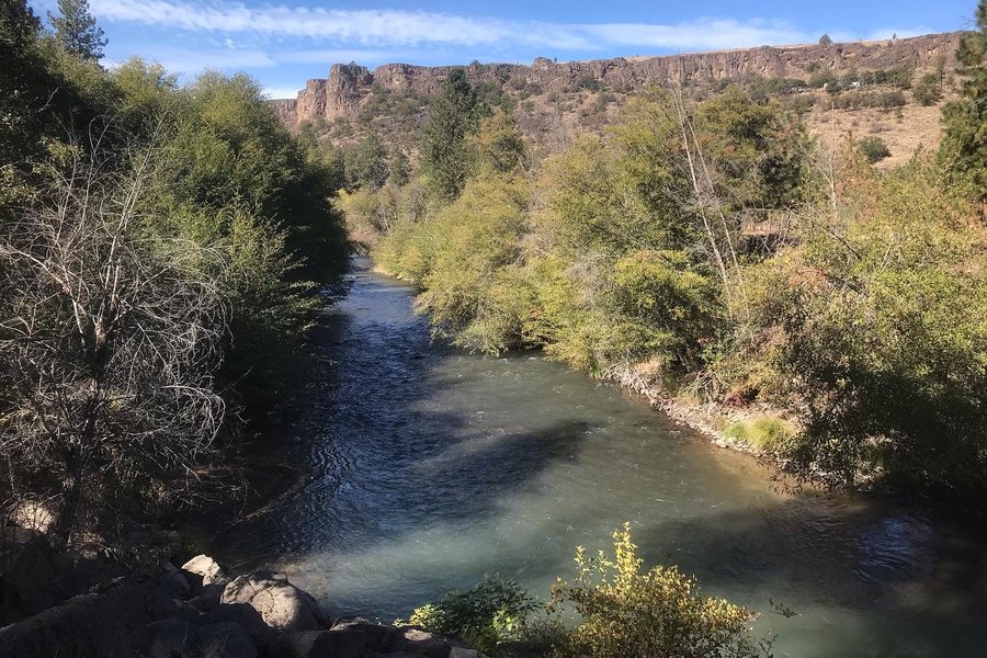
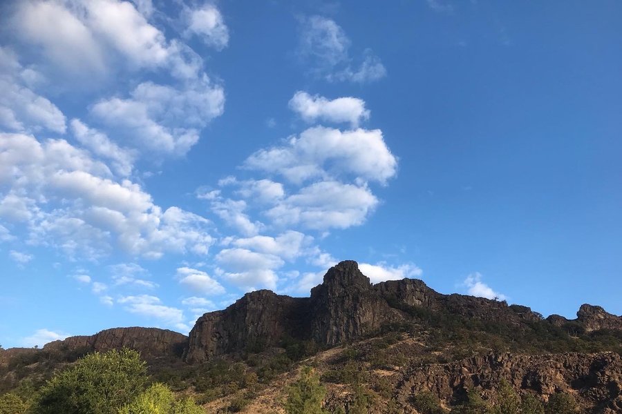
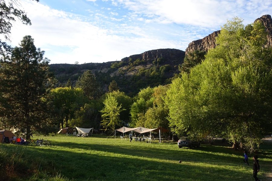
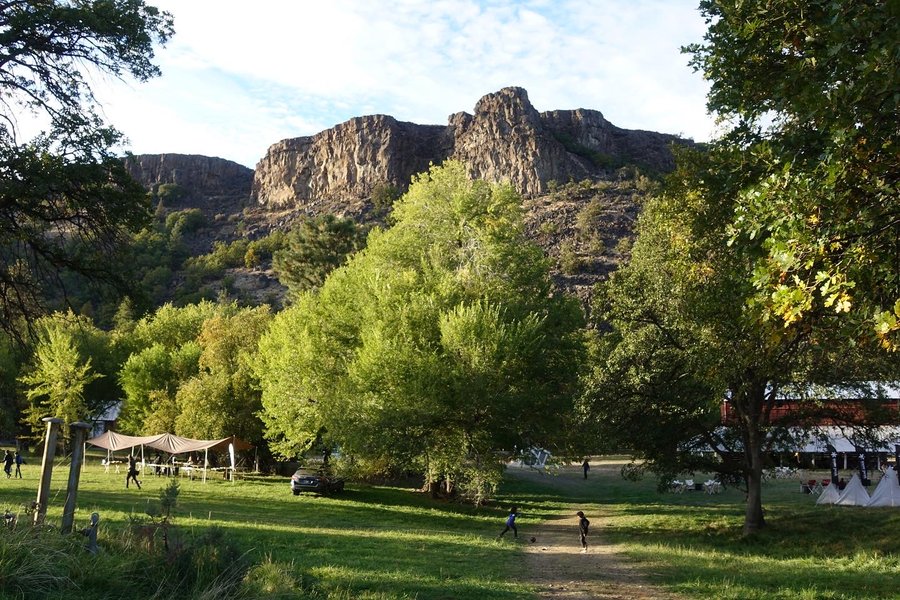
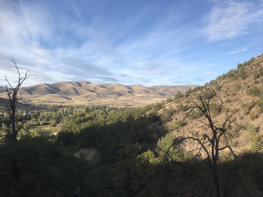
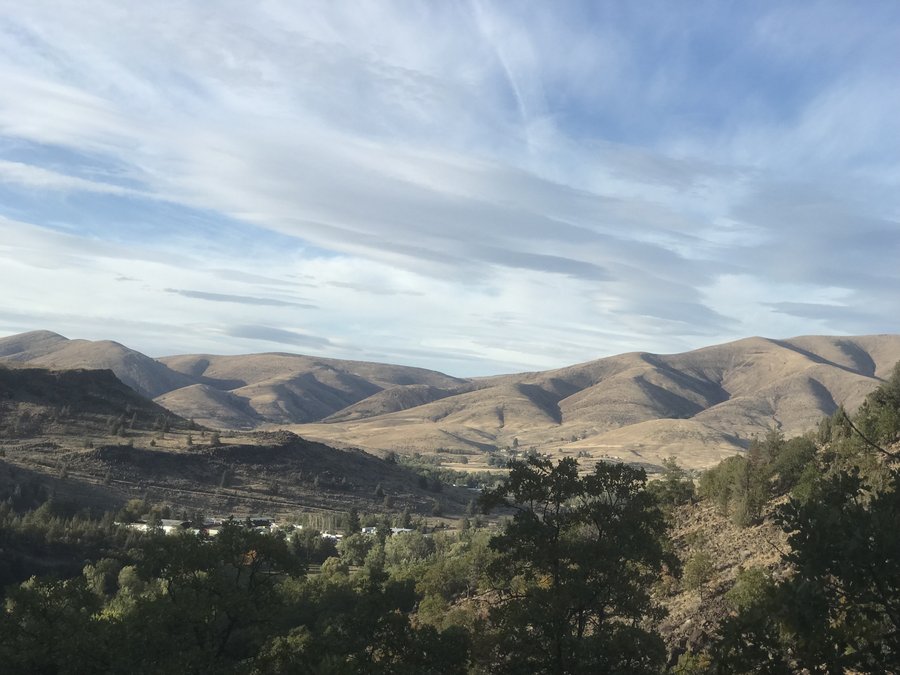
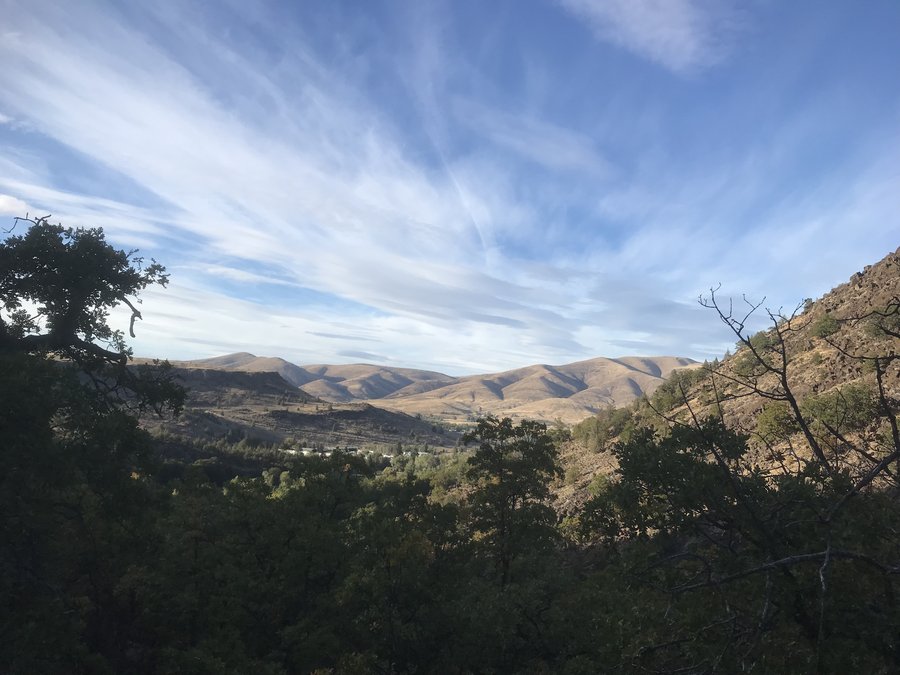
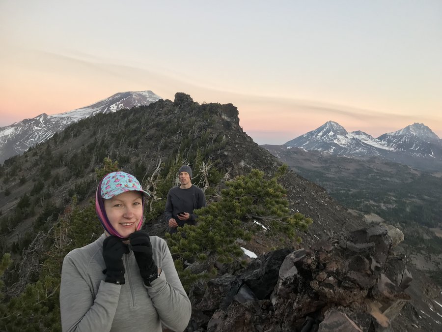
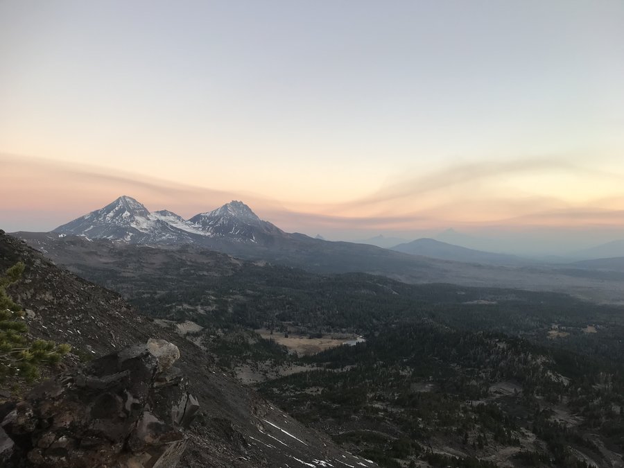
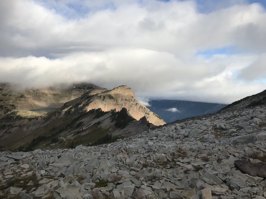
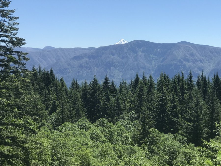
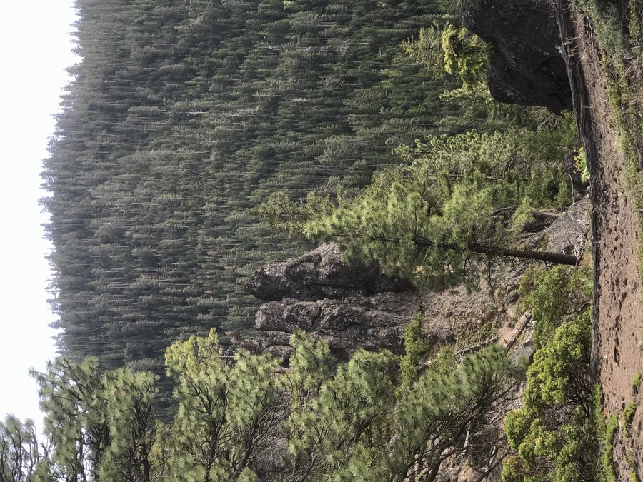
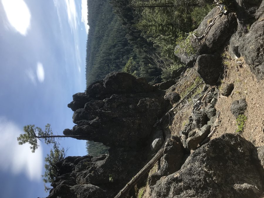
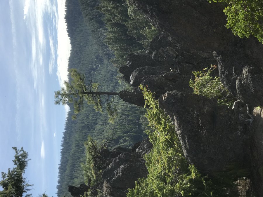
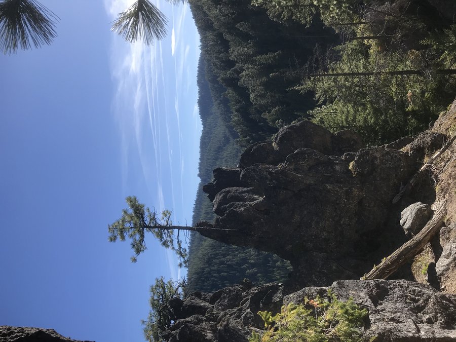
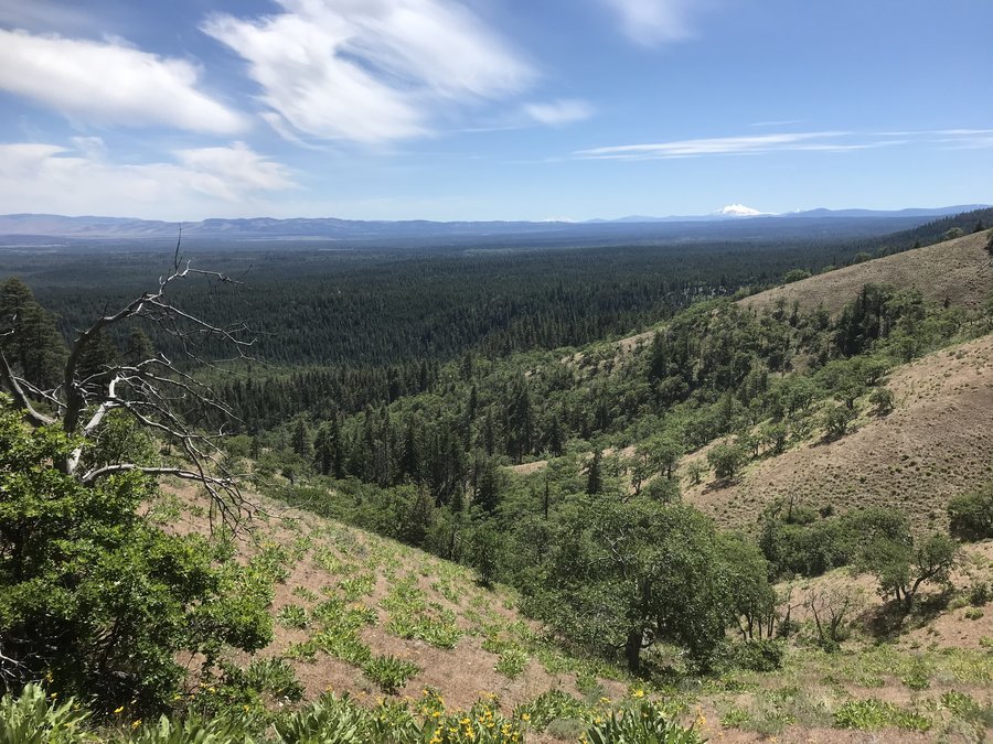
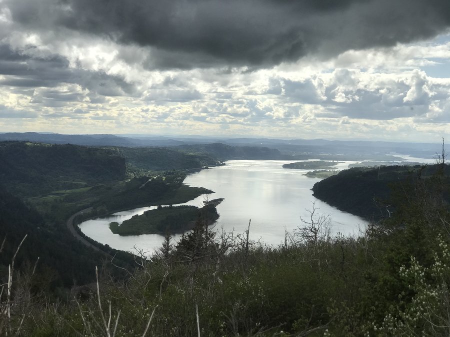
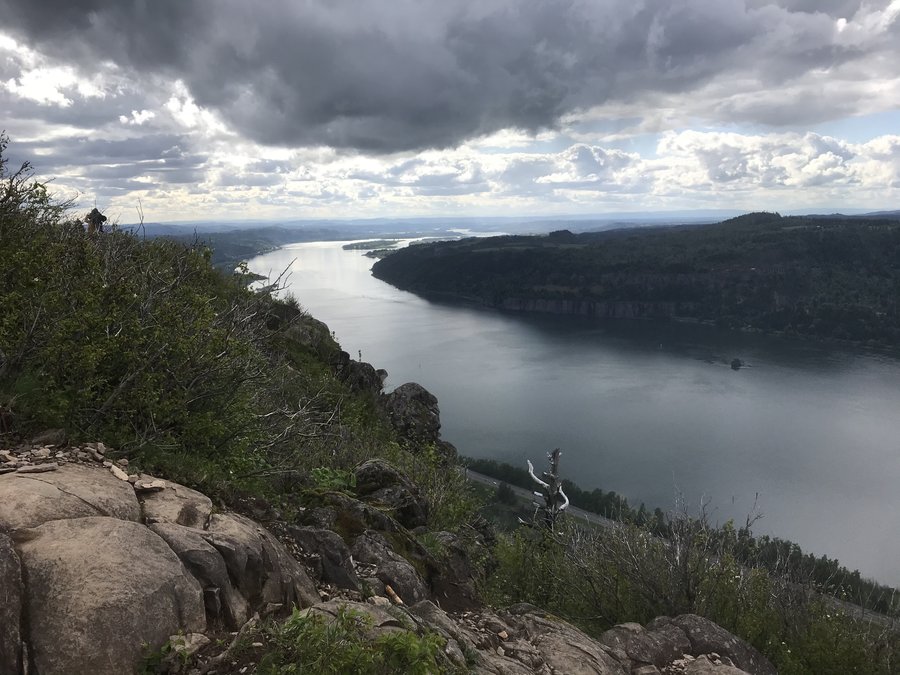
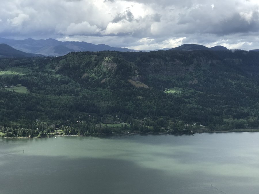
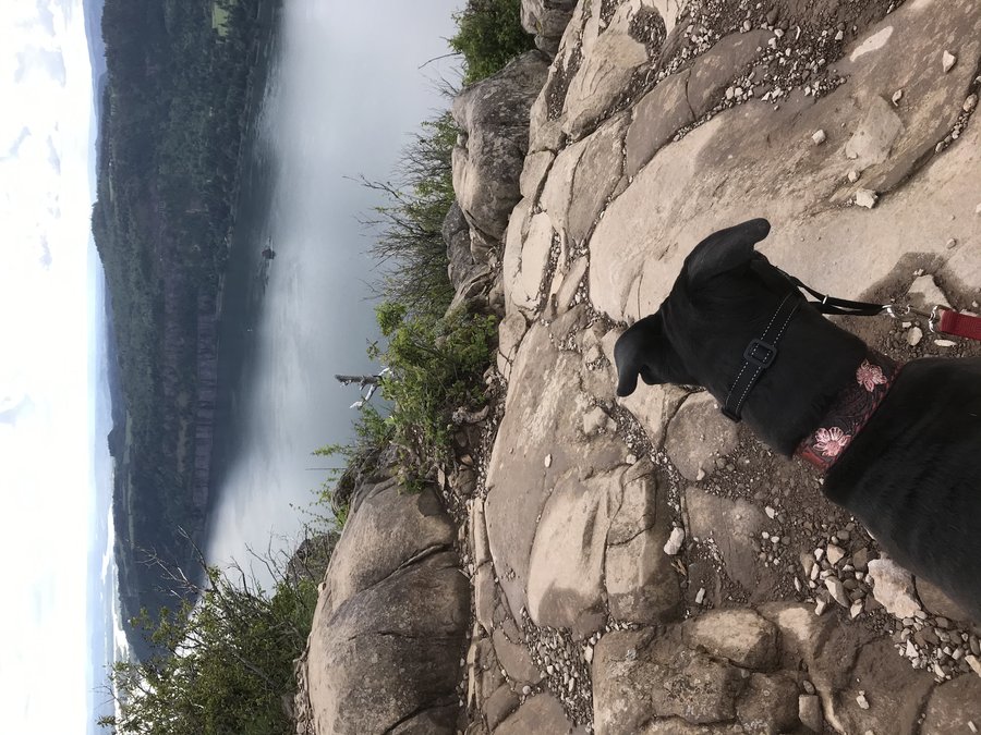
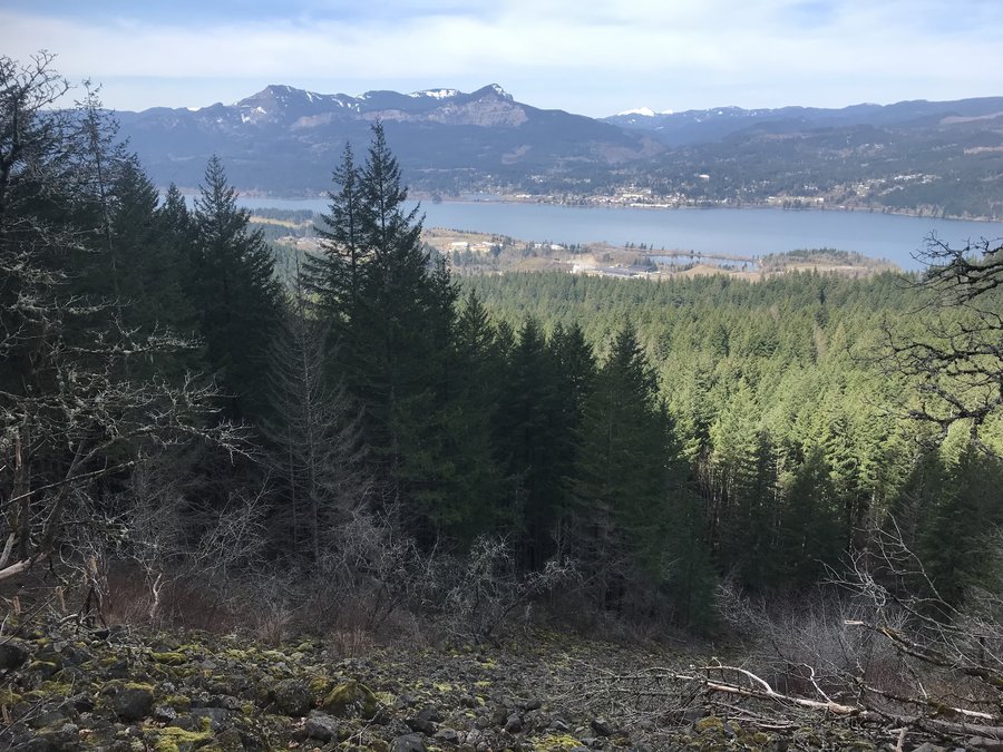
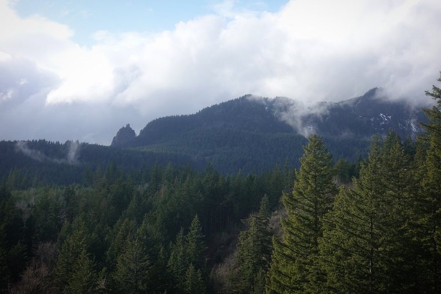
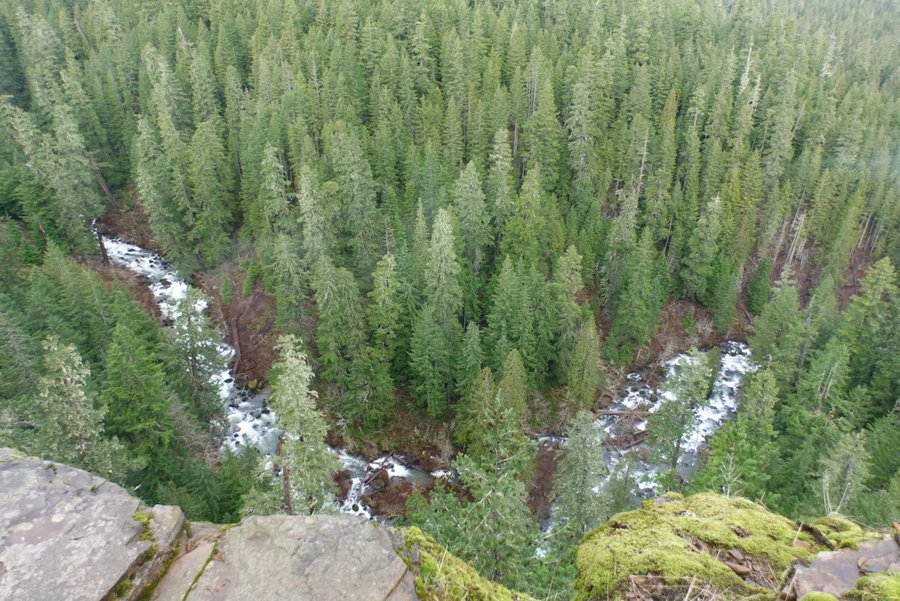
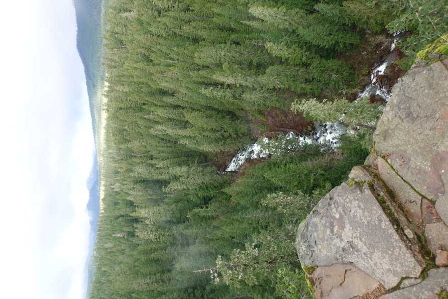
Tam-a-láu Trail
7 miles of hiking • 750' elevation gain •
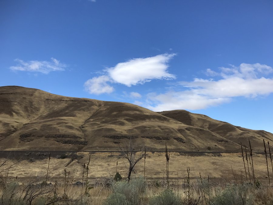
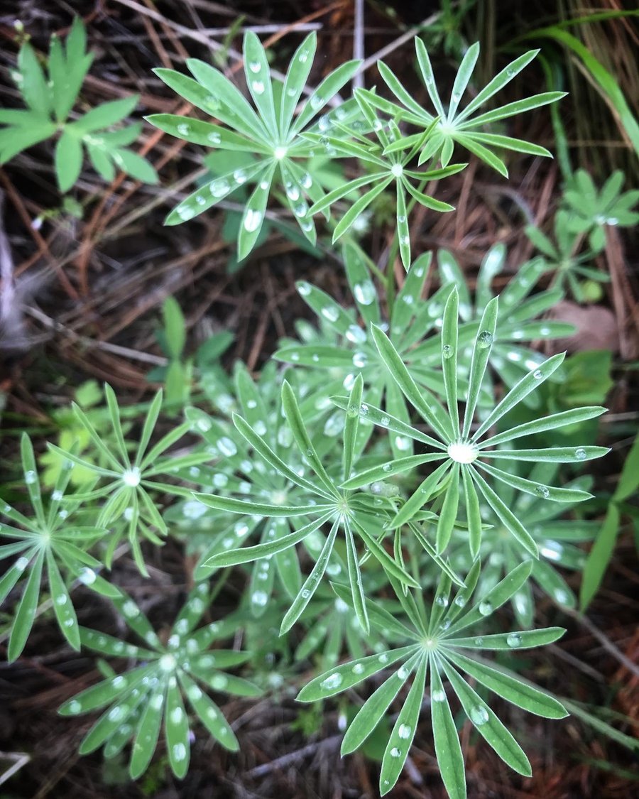
Went to "the place of big rocks on the ground". This was an excellent short ascent up a geological wonder, wandering a landscape with Junipers up to 250 years old and volcanic rock stacked as fences by ranchers from the past. Views to surrounding cascade volcanoes (on a clear day, I wasn't so lucky.) Along the rim, there was a view of "the island", a protected peninsula high in the sky, where the Crooked River and Deschutes River meet the man made reservoir Lake Billy Chinook.
November 27, 2021


 1
1
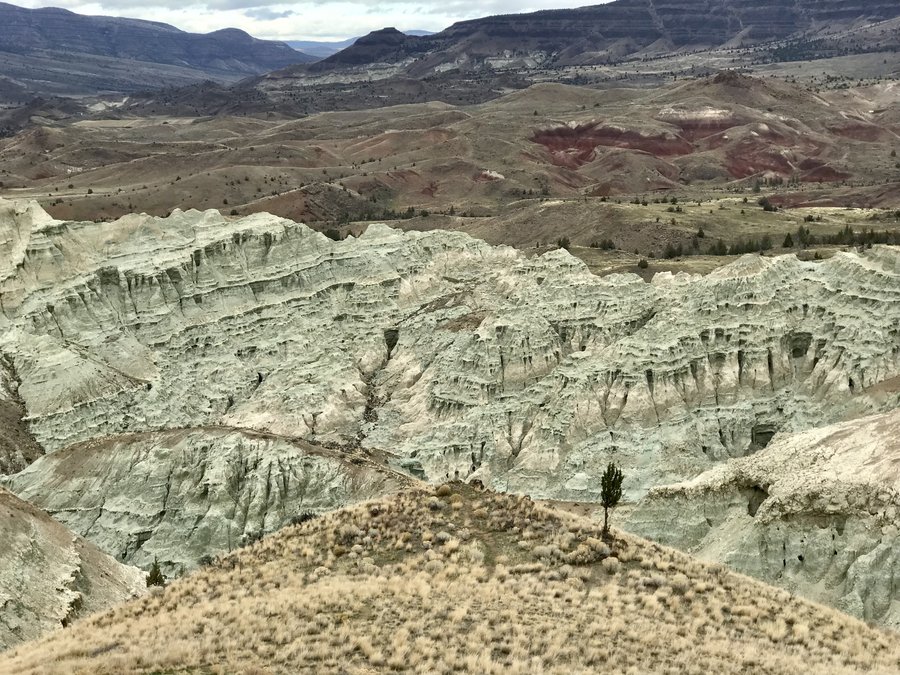
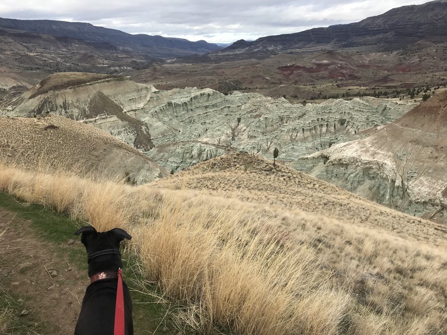
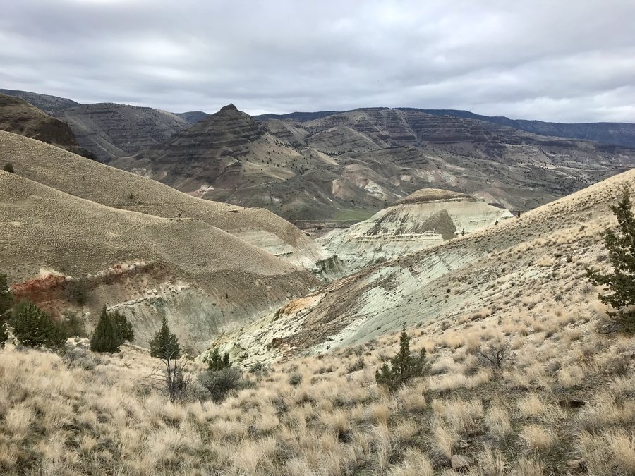
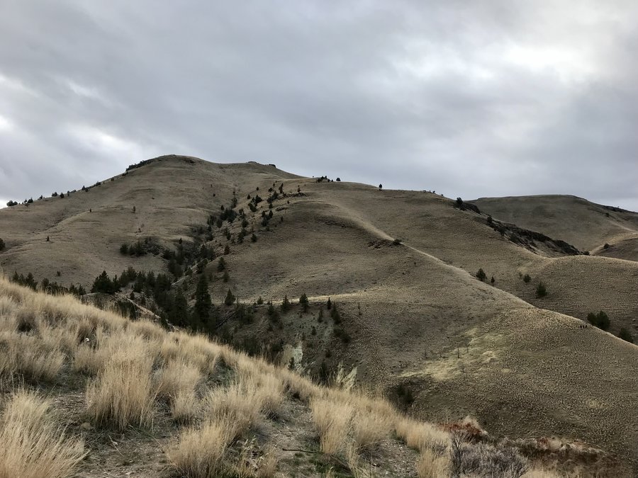
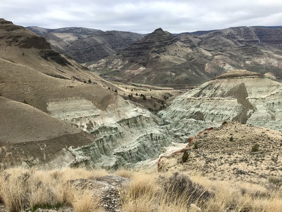
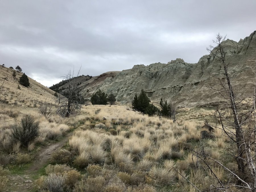
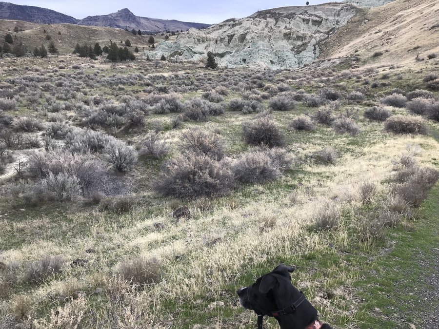
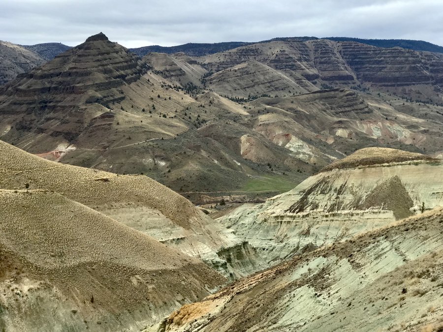
Blue Basin
3 miles of hiking • 750' elevation gain •
Went camping with gloomy skies over the long weekend.
November 26, 2021

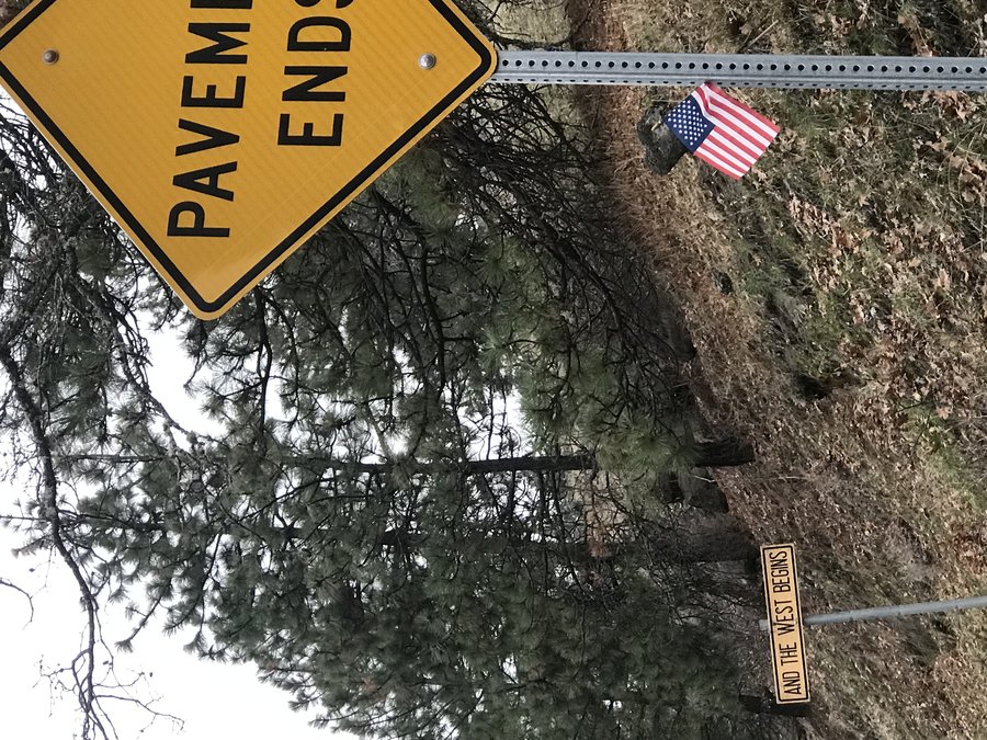
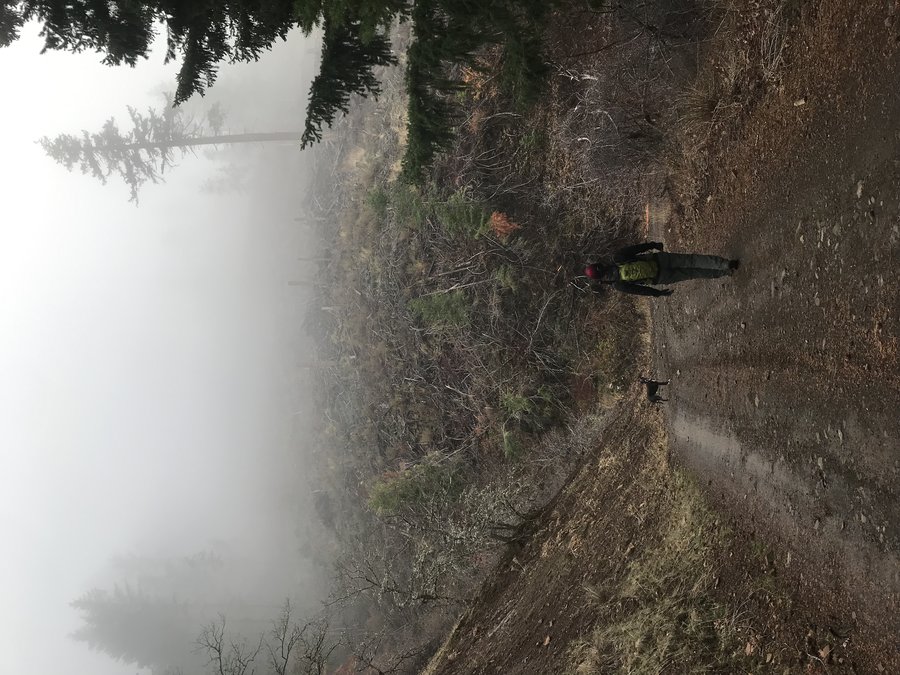
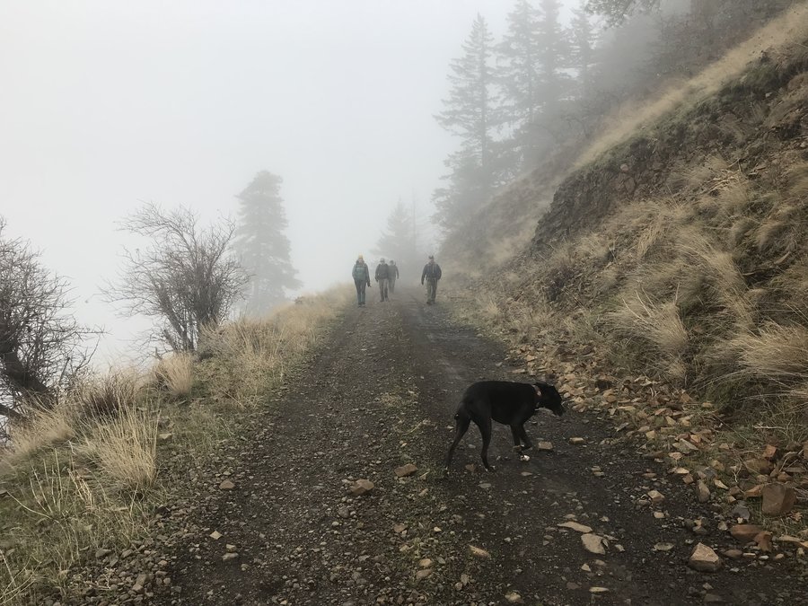
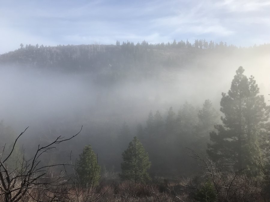
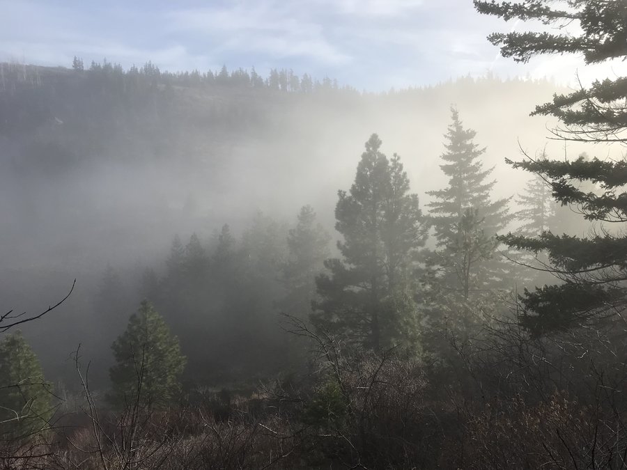
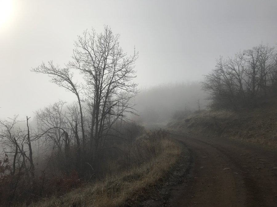
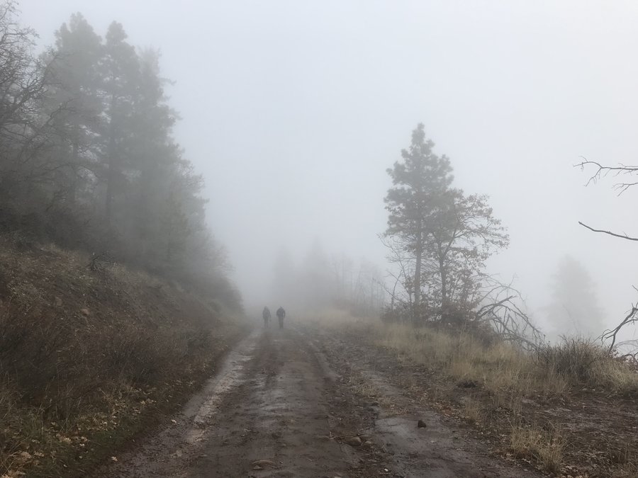
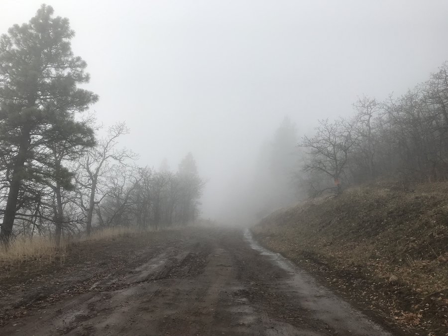
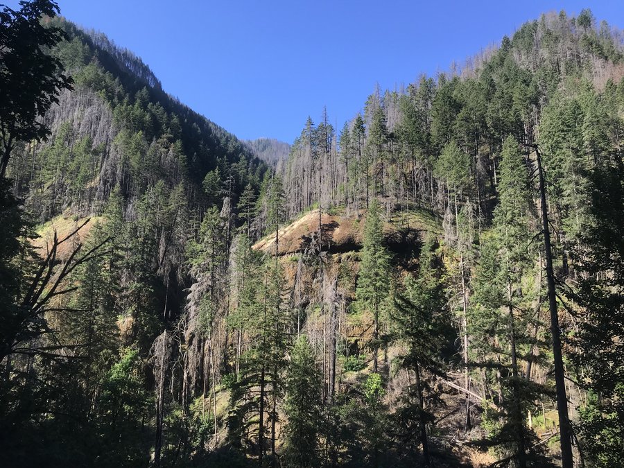
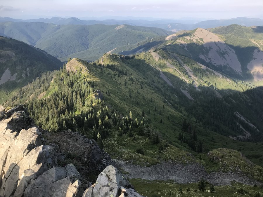
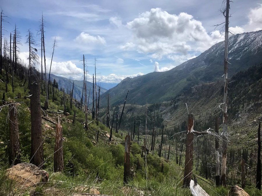
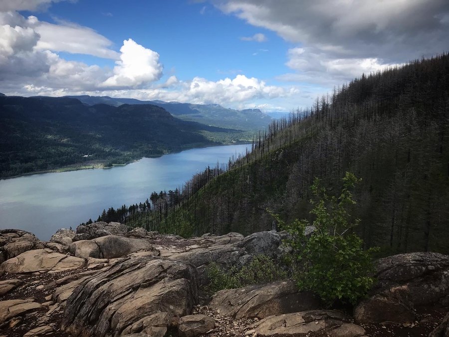
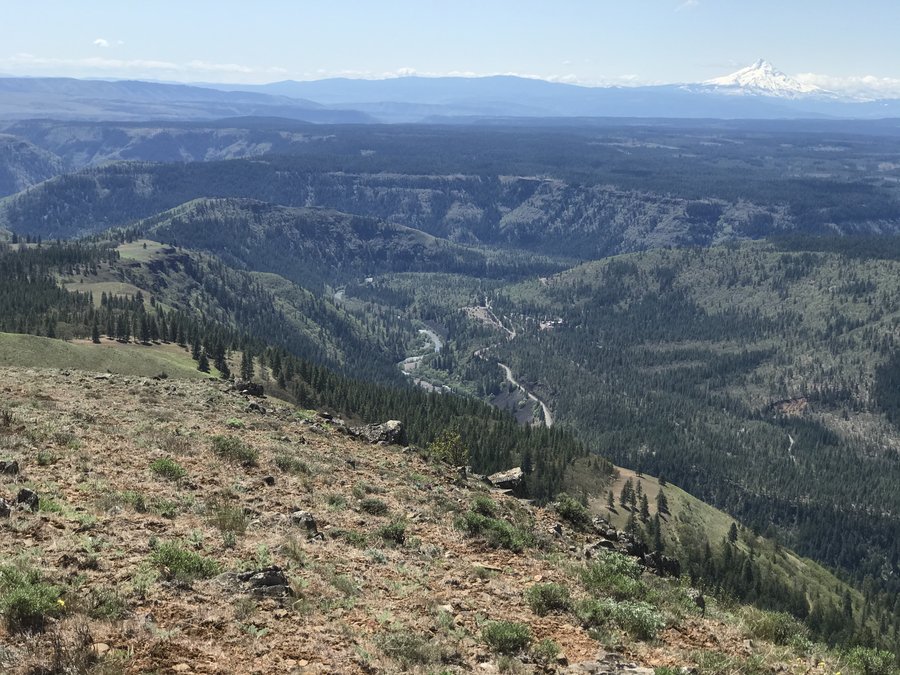
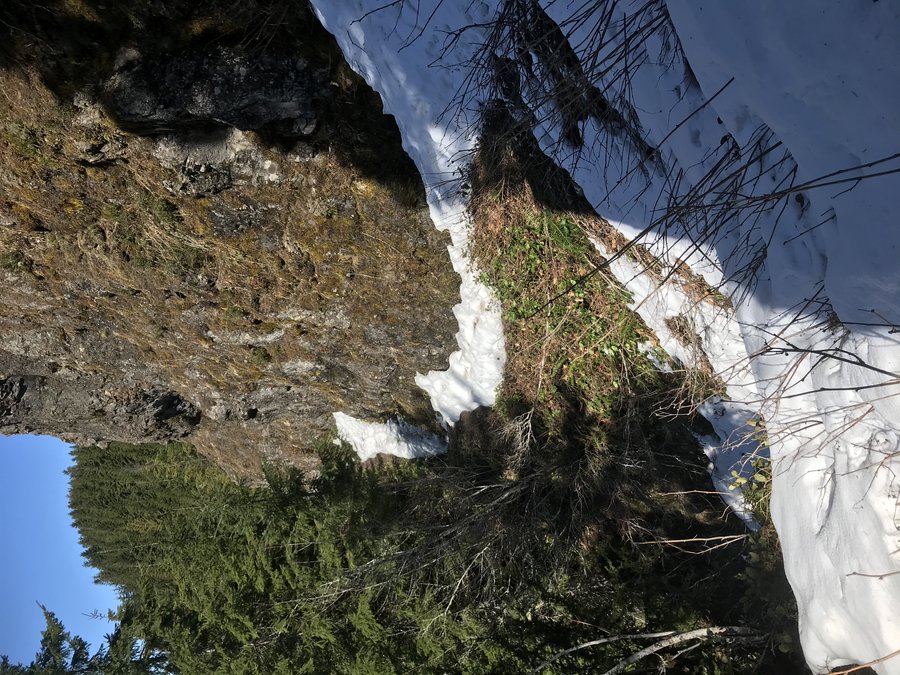
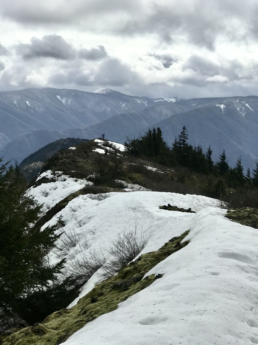
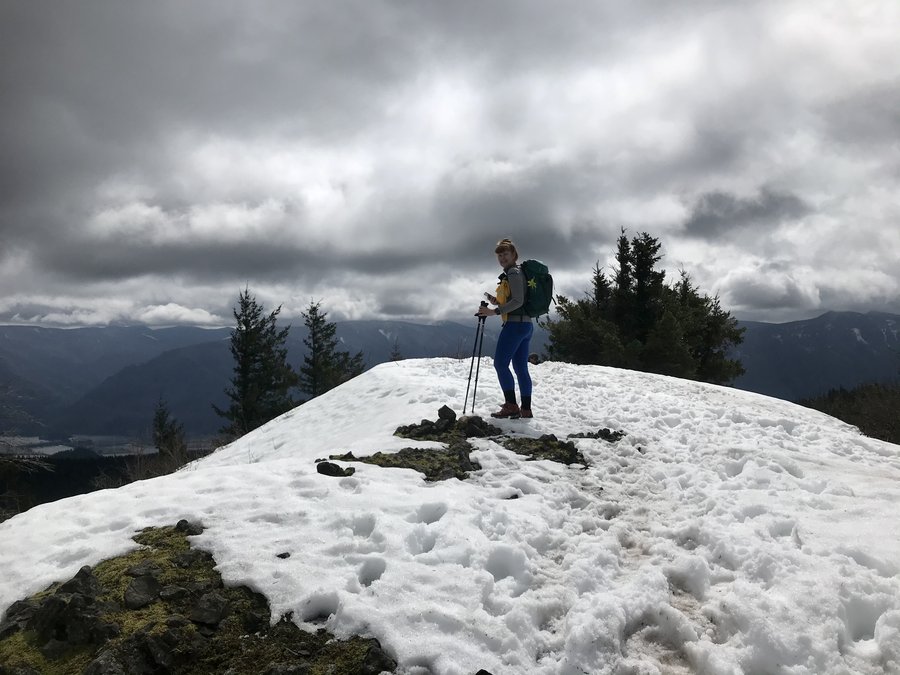
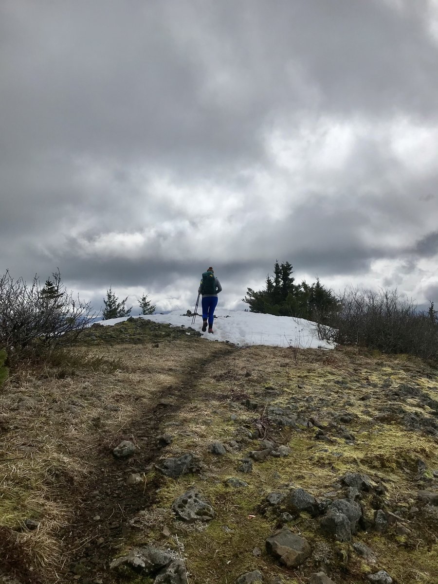
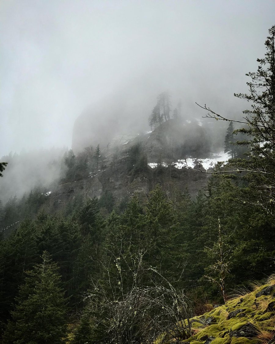
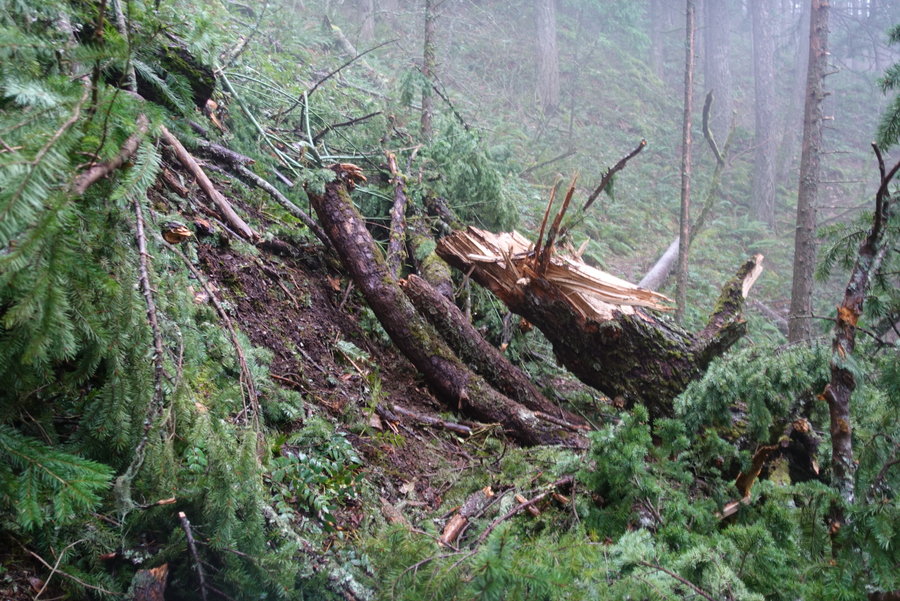
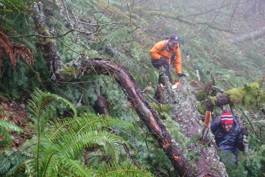
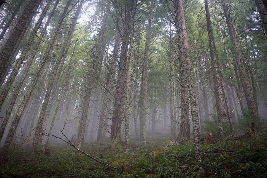
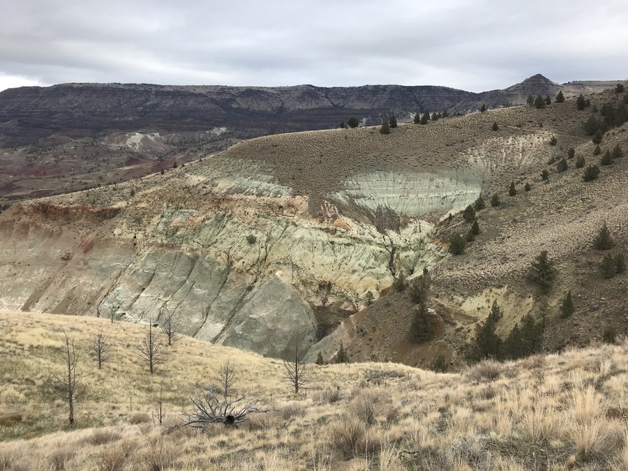 3
3
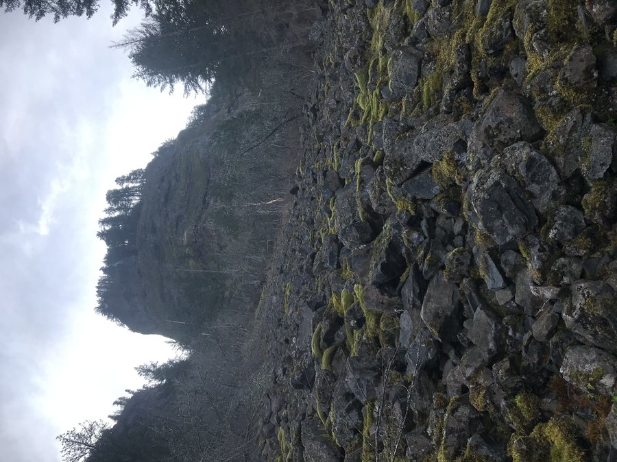
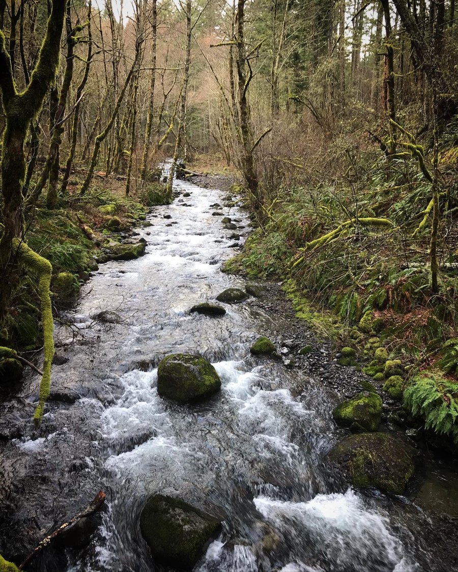
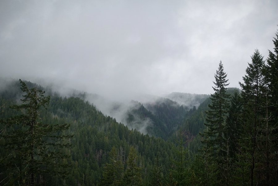
Mill Creek Ridge
11 miles of hiking • 1500' elevation gain •
Followed Mill Creek road until the pavement ended, 'and the West begins'. Drove until the road started to get rocky, then hiked to the site of a former lookout.
Hiked out of the fog and into blue skies, and then back into the gloom.
November 21, 2021


 1
1
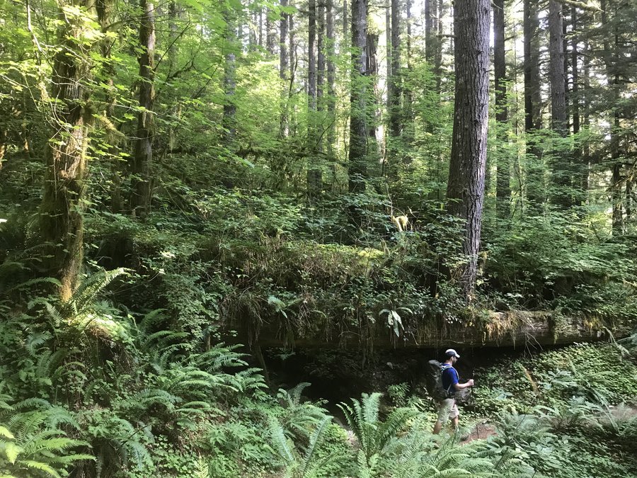
Forest Park Firelane 15 meandering
6 miles of hiking • 1000' elevation gain •
Car died during the rainstorm. A friend is letting me borrow a car, but I didn't want to risk driving someone else's vehicle far, so Forest park was my chosen destination today. Always nice to have the option of green therapy close by.
November 14, 2021

 1
1
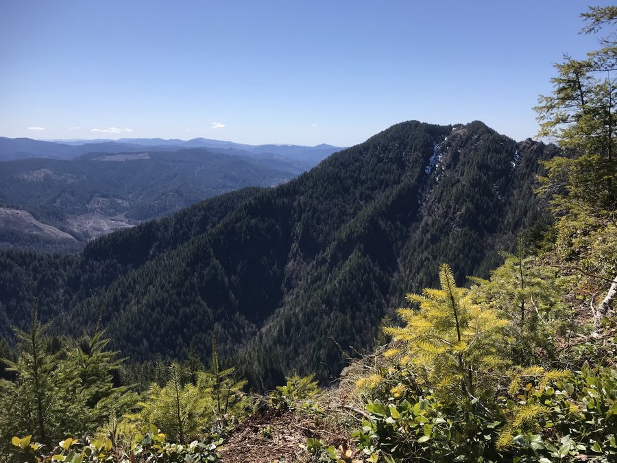
Elk Creek
5 miles of hiking • 500' elevation gain •
Rainy day hike. Originally planned on checking out Idiot Creek Road, but after eyeing the water crossing, we decided to just head up the gradual way up Elk Mountain. Rain was light at first, but then turned into sideways, unrelenting, gear soaking, cold rain and the decision to bail was made. More rain gear needed on a day like today.
November 7, 2021

 1
1
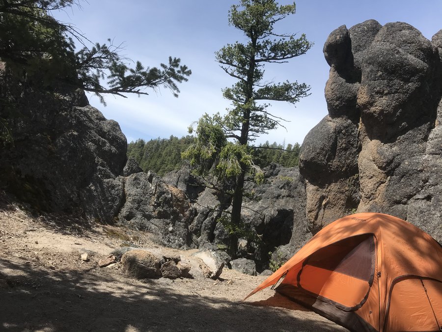
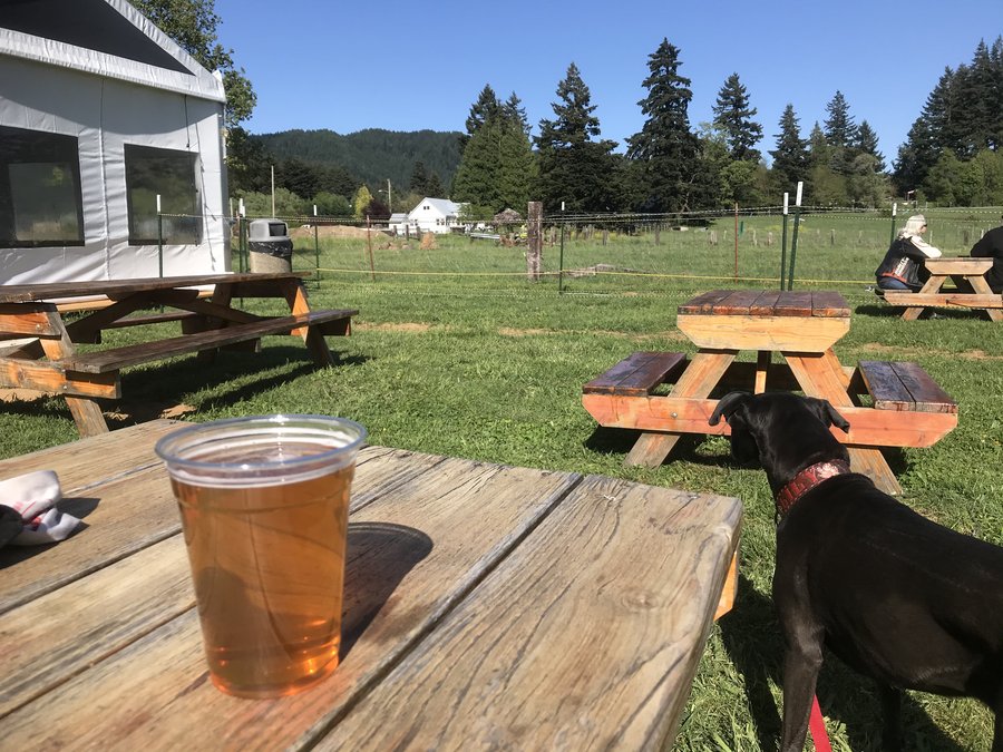
Tygh Valley private property (Justesen Ranch) Snow Peak Way
7 miles of hiking • 750' elevation gain • 3 nights
Been a little behind on reporting hikes, with an extremely busy October.
Volunteered to work and get paid to camp for Snow Peak Way, an annual gathering of snowpeakers and snow peak people.
Managed to get a few hikes in on the beautiful property in Tygh Valley, both during the day and even a night hike to do some stargazing, as we had a group of amateur astronomers out with their telescopes. As a new employee, it was fun to finally see the products I touch everyday actually out in the world being used. Fun but exhausting weekend.
October 7 – October 10, 2021


 1
1
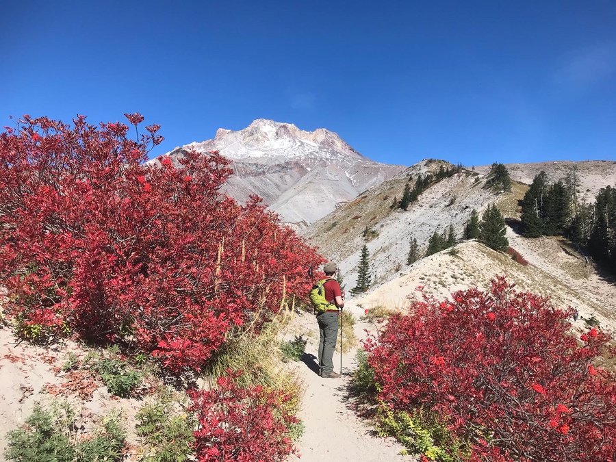
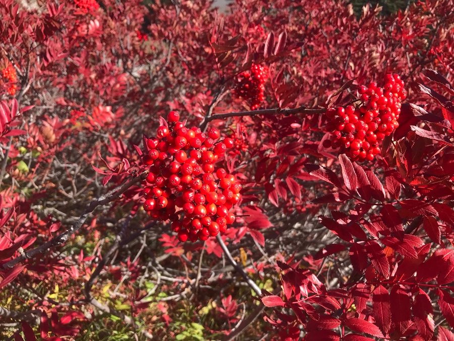
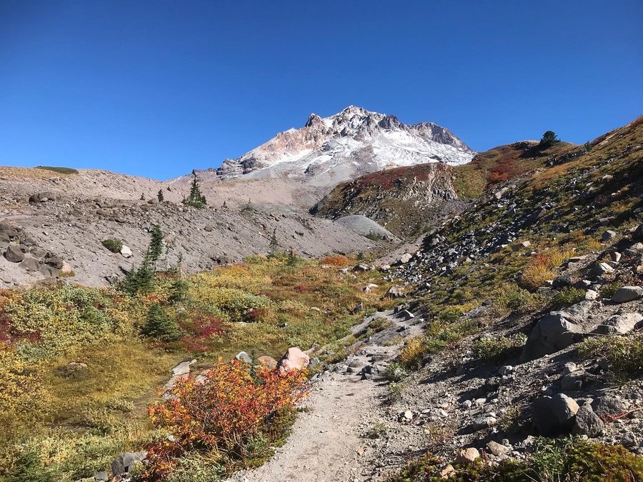
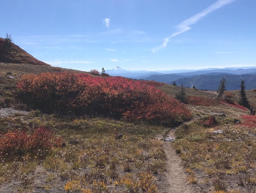
Paradise Park
13 miles of hiking • 2750' elevation gain •
Fall got away from me, but I did manage one long hike in before dwindling daylight. Excellent fall color.
October 3, 2021

 1
1
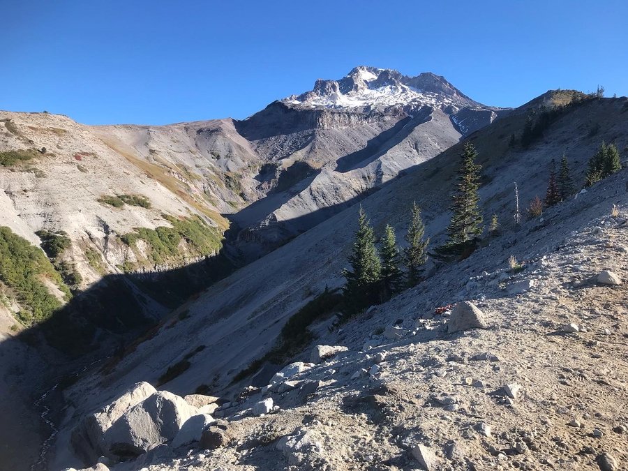
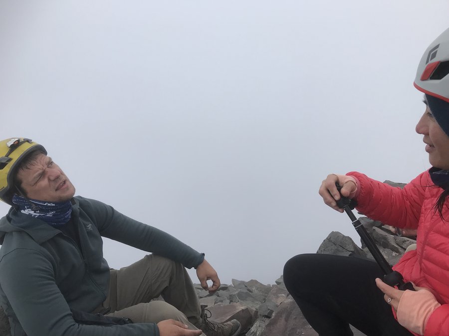
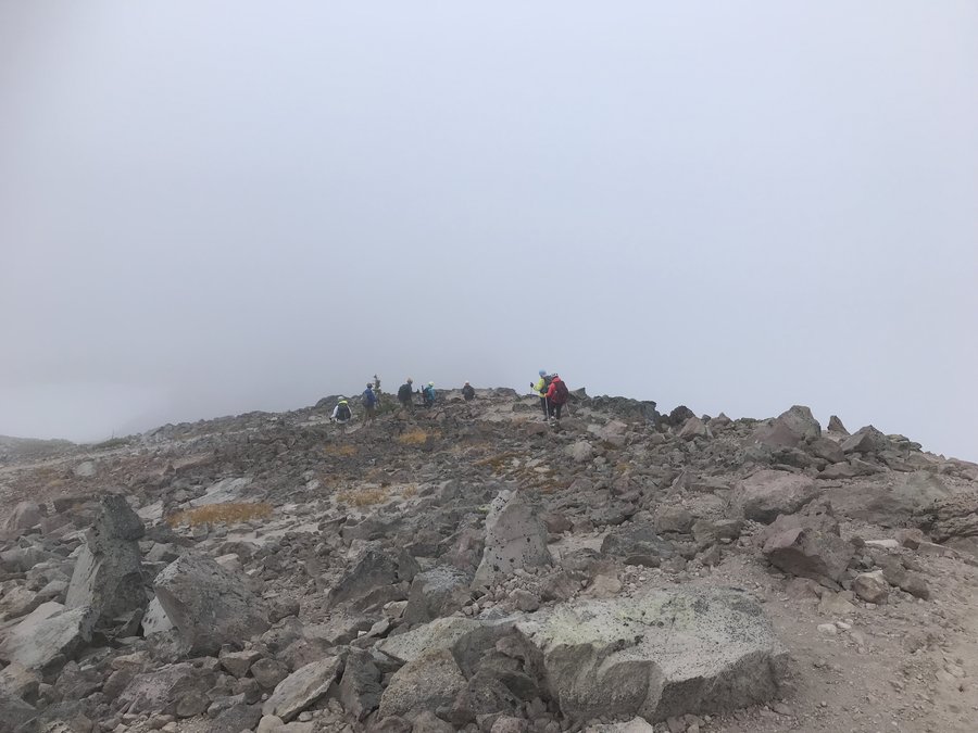
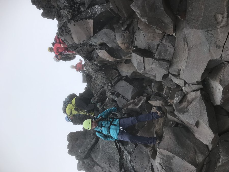
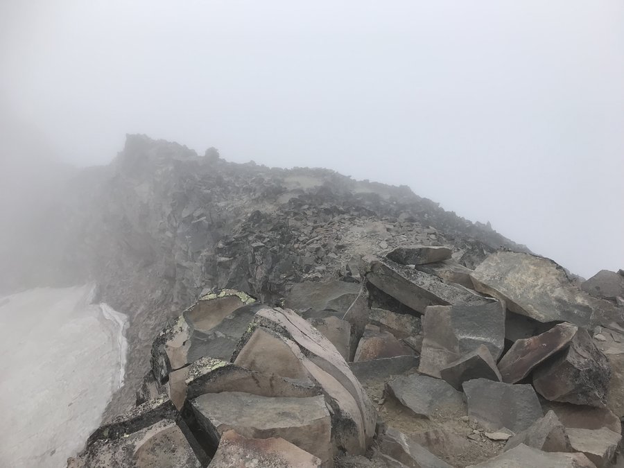
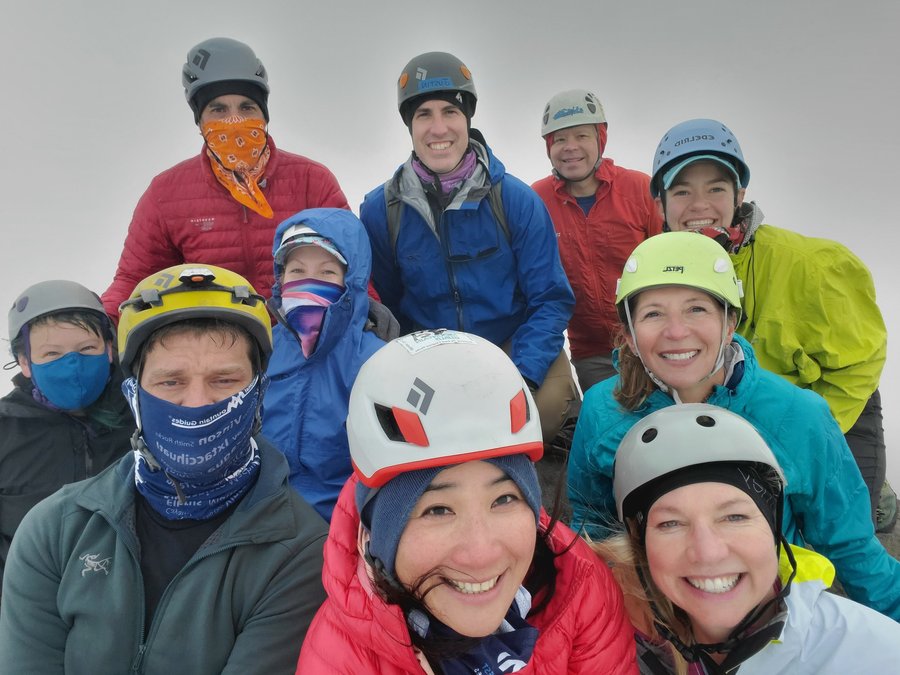
Broken Top (attempt)
12 miles of hiking • 2250' elevation gain • 1 night
I really wanted this summit. A year and a half of pandemic without climbing anything, and I wanted to get more rock experience under my belt before completely forgetting what I learned years prior in BCEP.
The week prior was spent practicing my prusik hitch and watching videos on rappelling and making sure I remembered an autoblock. I felt like I was ready.
But sometimes, the brain and the body have different ideas.
The hike in was tiring, it was hot, and it was nearing sunset by the time we got to camp and needed to filter water. We had a steep drop to the water, and my fingers froze while trying to squeeze with my sawyer mini. So, I didn't filter as much water as I wanted, and had a steep climb back up to camp. At camp, my chosen dehydrated meal failed to properly hydrate. It was crunchy, flavorless, not enough calories, and really wasn't a good meal despite me adding parmesan cheese to the mix. (Lesson to self, don't just grab what is left in the backpacking supplies, make sure you pick a flavor you know you like.) For those wondering, the offending meal was Good to Go’s Classic Marinara with Pasta. (If I had read the fine print- I would have seen it was brown rice pasta, which is why it didn’t rehydrate well) I had a backup meal of ramen, but I wanted to save it and my water for the next days summit.
Then came no sleep. My brain just would not shut off.
The morning alarm came and after two snoozes I willed myself to get up. From the lack of sleep, I decided to skip the oatmeal/coffee and opt for a bar breakfast instead. The sugary sweetness made me gag, and I knew I made a poor choice but it was nearing go time.
My pack was loaded with the rope, as I hadn’t taken a turn the day before.
I didn’t get far before I felt like my legs had zero go. I often feel like this for the first mile or so, but I voiced that I may have to turn around to our climb leader, Guy. I’m normally not one who gives up so easily. I passed the rope to a stronger team member. He convinced me to continue on, to the ridge, and he would let me make the decision there. The team was going nice and slow, I didn’t want to be a burden to the group, yet I continued on. At the ridge, with the summit very near by sight, I was overwhelmed by the sadness of the past year. I just lost it (inside) and my inner demons just held me there. I gave up, and was given permission to return to camp on my own. Instead of returning right away, I sat and watched my team continue up the ridge, and had a good cry as I took in the incredible views around me. My summit was not the top, but it was a worthy summit nonetheless.
Back at camp, I messaged Kat with my inReach that I was down safely. I started my day over. I had the oatmeal, the coffee, and I watched the morning sun and shadows change the landscape in front of me. I took a 2 hour nap and then listened to distant coyotes howling in conversation as I lay cozy in my bag.
Eventually, I rose, ate a ramen lunch, and decided to see if I could spot my teammates up on the mountain. I scrambled off trail, another cup of coffee in hand. Keeping camp in sight, until I could get the full scree field in my view. Sure enough, I spotted tiny ants, coming down one by one, skiing the sea of scree. I returned to camp and readied my pack for our descent, and greeted the exhausted team as they came back.
Prior to the pandemic, I think I would have pushed on. I think the trauma of the past year has taken a physical and mental toll on me. Either way, I know the true summit will be there another day. Am I kicking myself a bit for stopping? Sure. Talking with the team post climb, we all agreed that any day spent in the mountains with good company is a success. I need not be ashamed for making the decision to not go. As it turned out, I wasn’t the only one who didn’t summit.
September 24 – September 25, 2021


 1
1
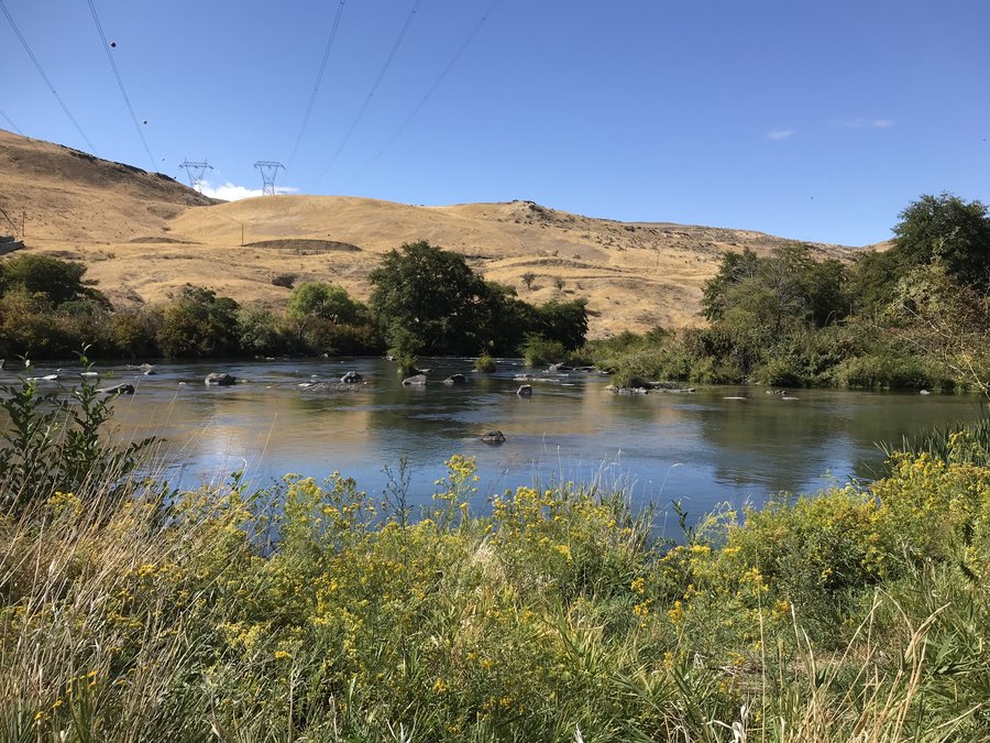
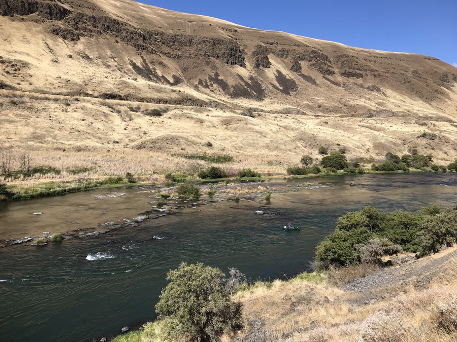
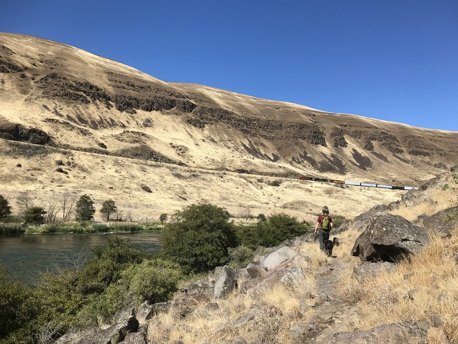
Deschutes River Trail
7 miles of hiking • 250' elevation gain •
Chased some sunshine last weekend on the Deschutes.
September 19, 2021


 2
2
September 11 – September 12, 2021


 1
1
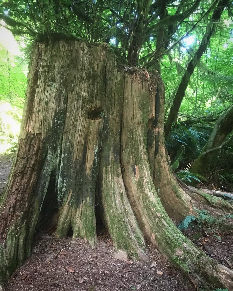
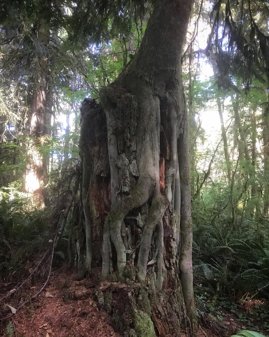
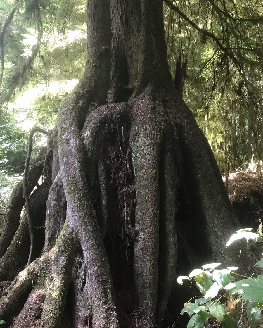
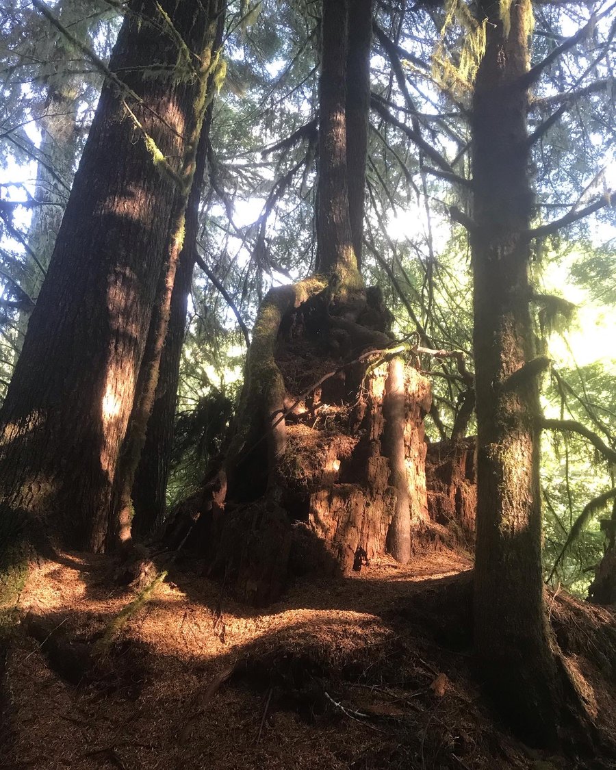
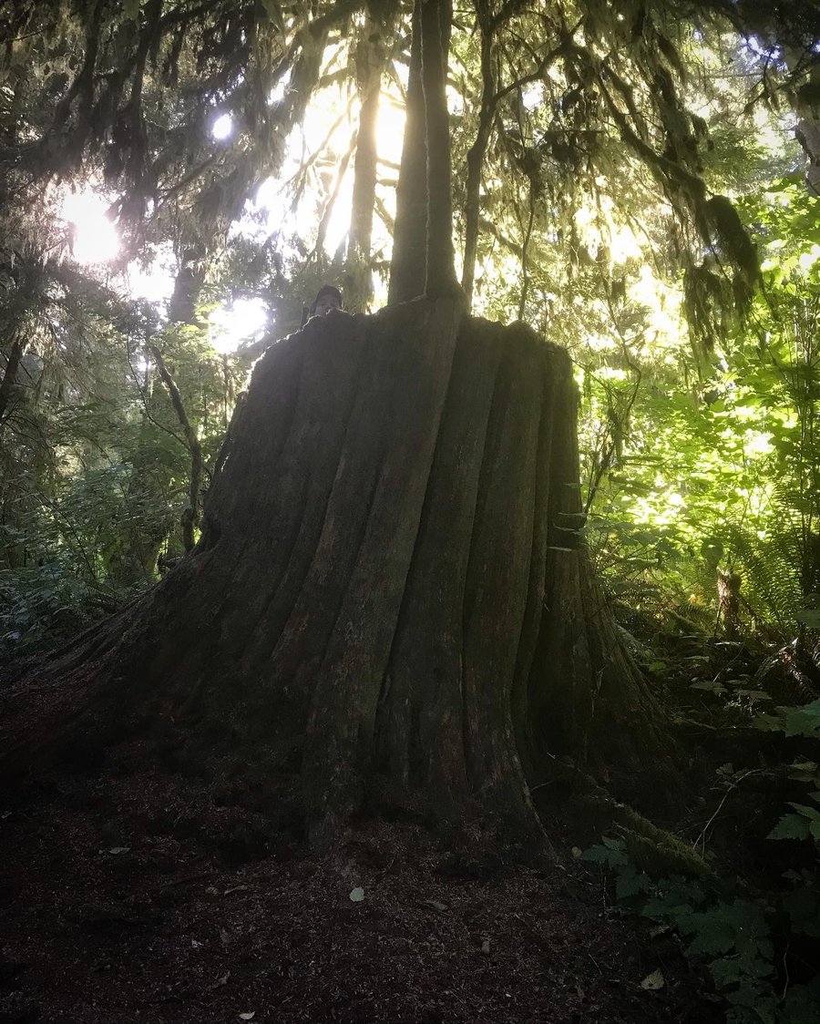
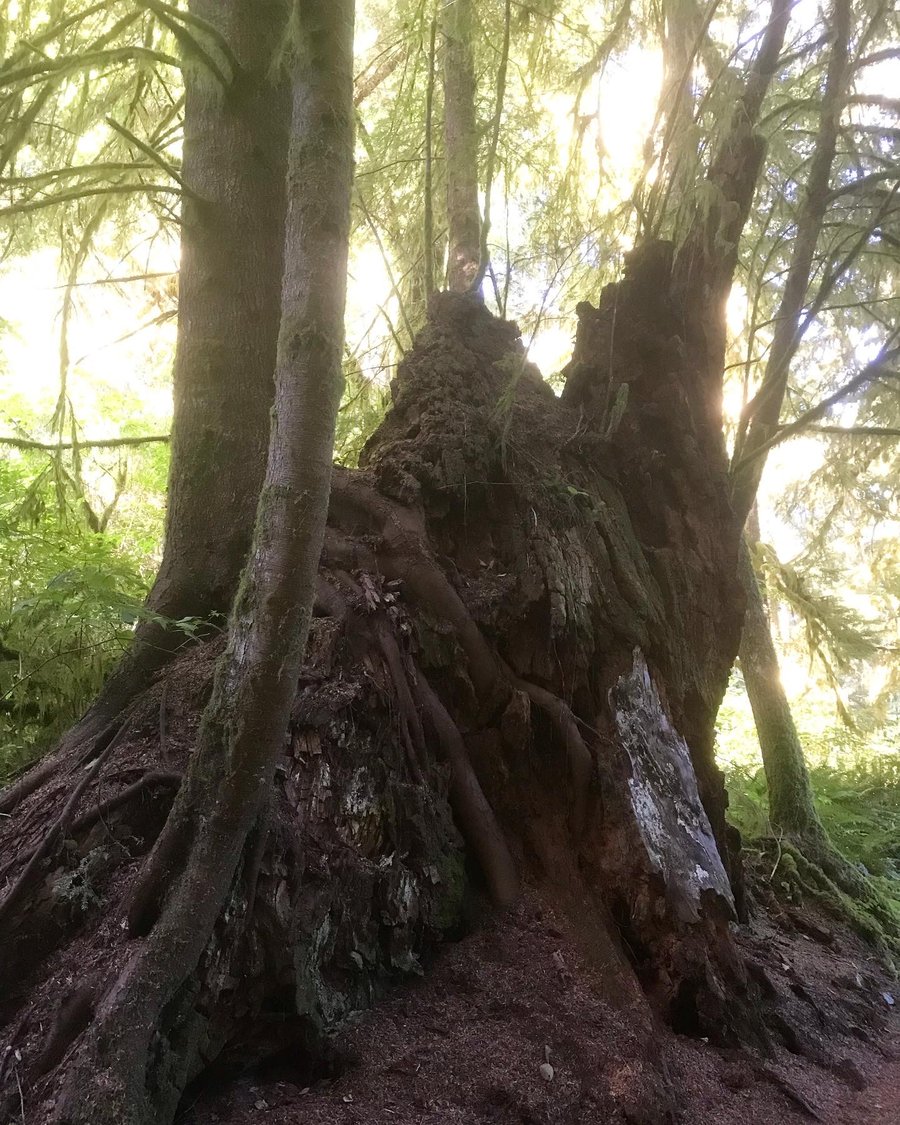
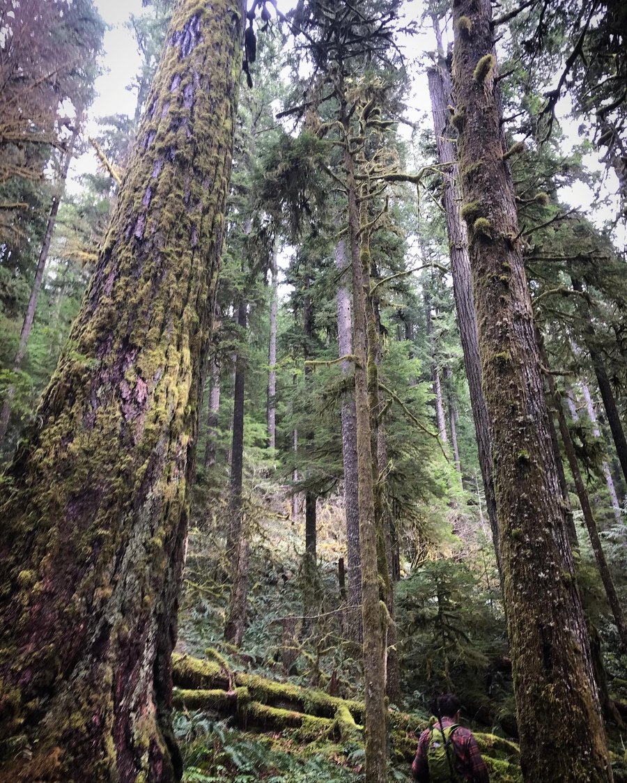
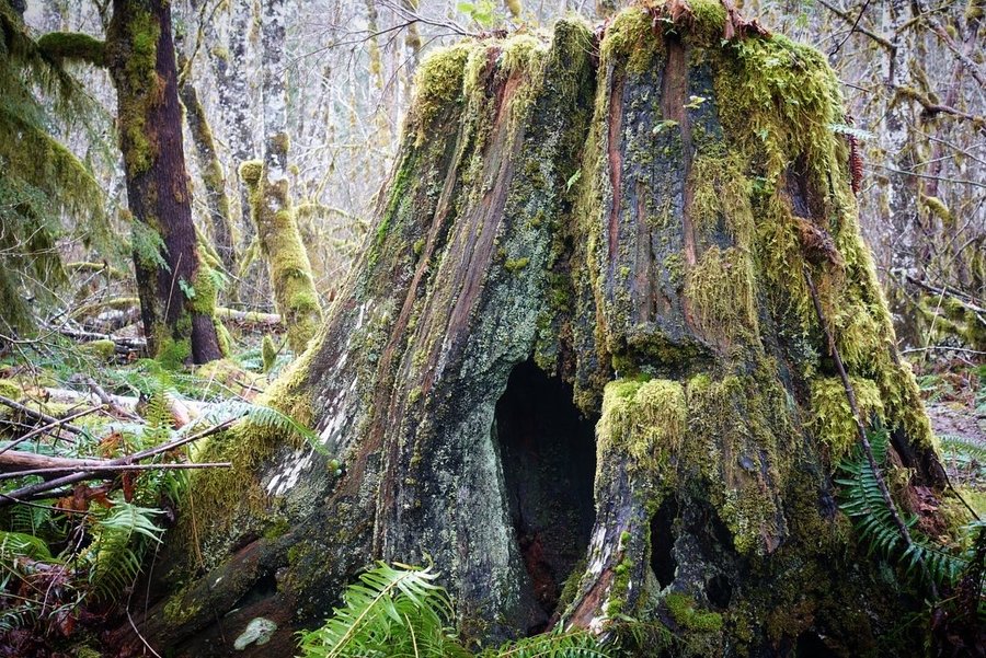
Gnat Creek
8 miles of hiking • 750' elevation gain •
A journey with remnants of giants. Spectacular display of nurse logs on enormous old growth stumps.
September 6, 2021


 3
3
Exploring new trails at Meadows, Lower and Middle Wizard
7 miles of hiking • 2000' elevation gain •
Decided to check out the new trail system at Meadows. Took a mixture of service roads and trail, ending up high on the mountain taking Lower and Middle Wizard. (I'm guessing they will be adding an Upper Wizard?)
Ran into one of the trail makers on the way down - he asked us a few questions about whether we made it all the way up, etc... He asked how we liked the section through the rock.
Trail was faint at times, and took scramble routes over rocks. Trail was marked by flags and cairns, and was easy to follow if you kept your attention on the markers. Might be a different story in low visibility.
The mountain was naked before us. A smokey haze was in the air, but the views were fantastic. Fun to see the mountain from yet another perspective.
August 29, 2021


 1
1
Burnt Lake
7.5 miles of hiking • 1500' elevation gain •
Plan A for today was canceled (a Mazama "climb" of Eliot Glacier) so we made a plan B (Paradise Park from Paradise trailhead). Met at Zigzag ranger station and the mountain was in a cloud... so plan C. Crossed off an easy hike I'd always skipped. Slowly crossing off more Hood hikes till we get all the way around the mountain.
August 22, 2021
 1
1
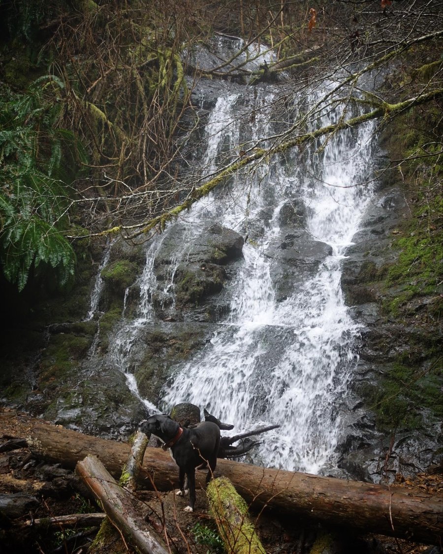
Black Hole Falls
10.8 miles of hiking • 2250' elevation gain •
Up down up down... trail and falls were pretty dry, but it was nice to take a dip in the cool water.
August 16, 2021


 1
1
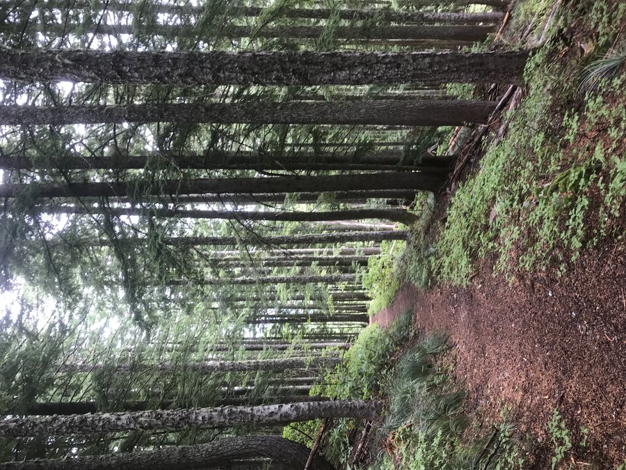
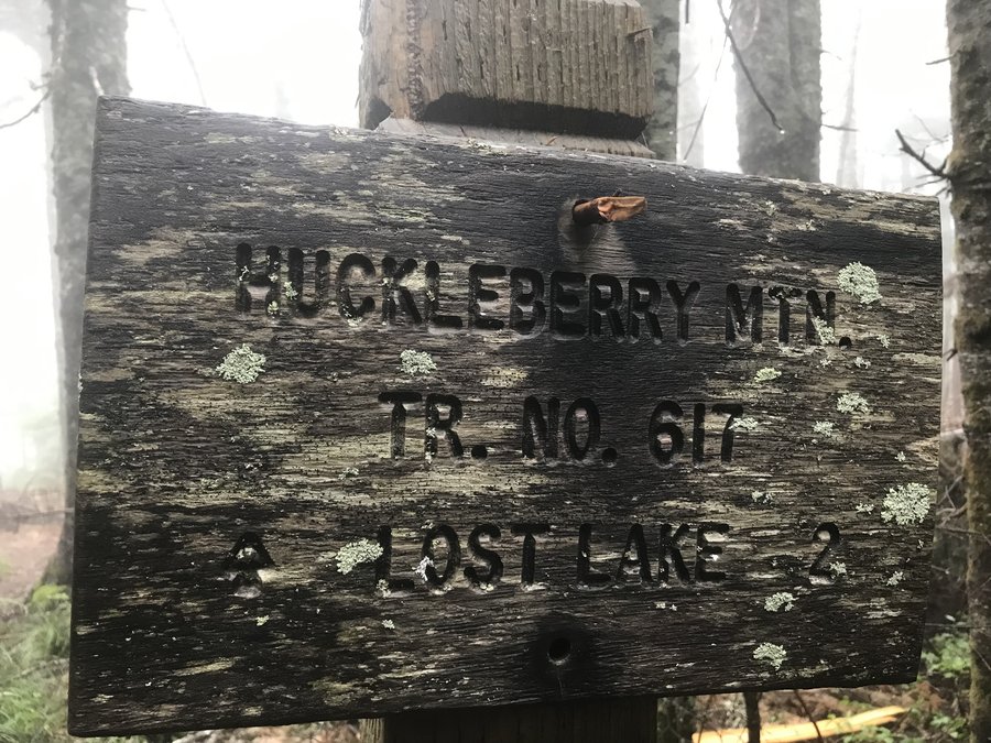
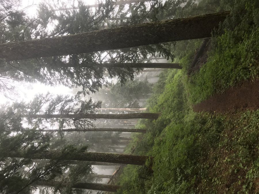
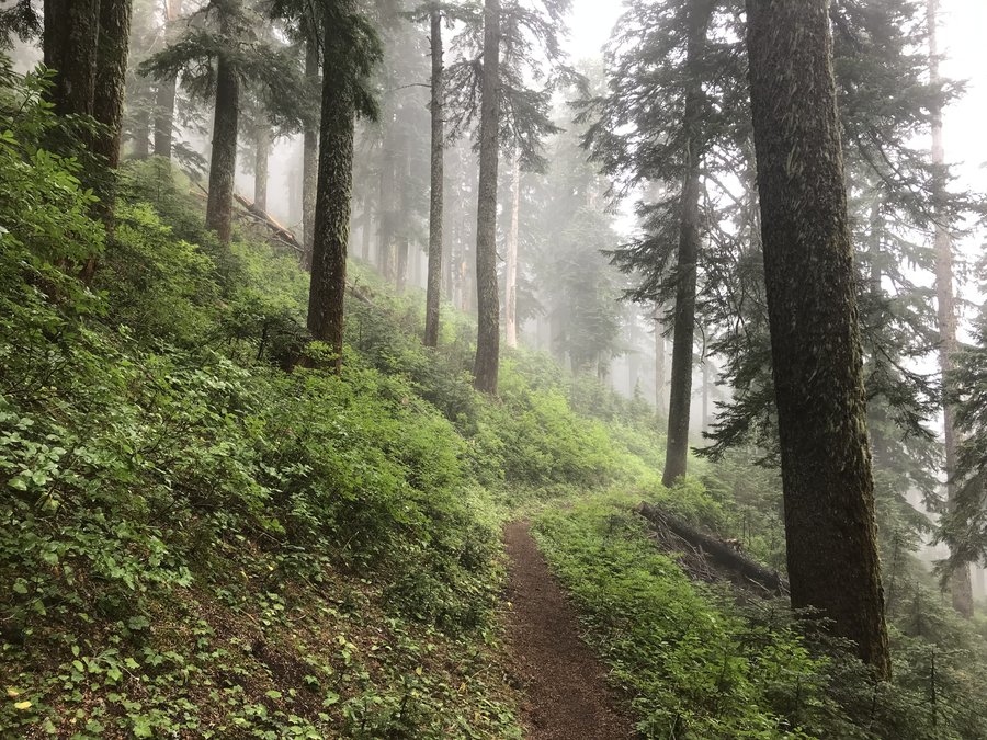
Lolo Pass Trailhead to Lost Lake
14 miles of hiking • 1750' elevation gain •
Originally intended to go for McNeil from Top Spur, but the trailhead was overflowing. Decided to head to the next closest trailhead and winged our day exploring the PCT, and then took a jaunt down to Lost Lake. Mostly solitude until Lost Lake. All blowdown on the trail looked to have been recently cleared by trail crews.
August 8, 2021

 1
1
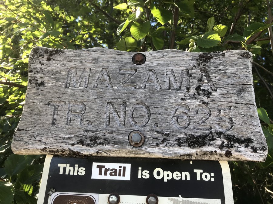
Mazama Trail #625 - partial. Turned around due to heat/dogs feet and biting flies.
5 miles of hiking • 1500' elevation gain •
Didn't get an early start, and the day ended up too hot for us to continue with the dog safely. Also, biting flies were vicious and we decided we had had enough of being on the menu. Will try again another (cooler) day.
July 25, 2021

 2
2
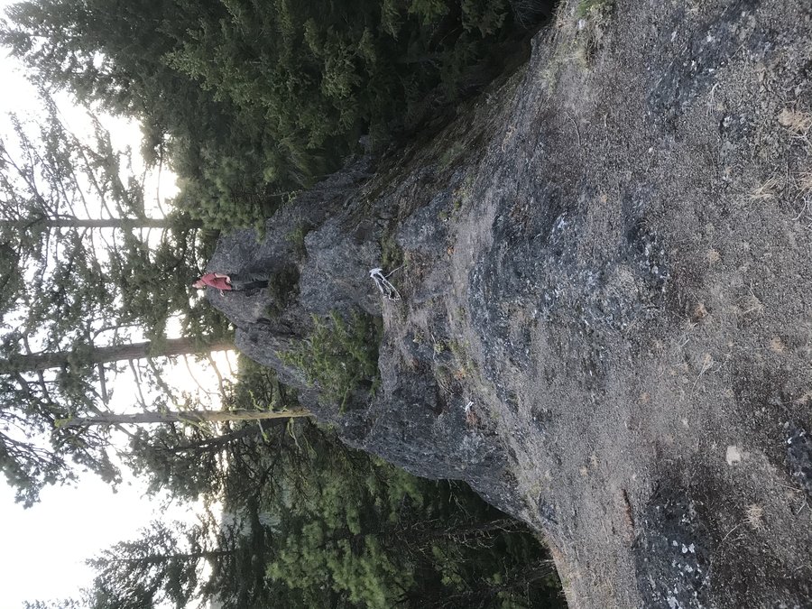
3 Corner Rock
4.5 miles of hiking • 1000' elevation gain •
Just a short hike to the top of a pile of rocks.
July 11, 2021
 2
2
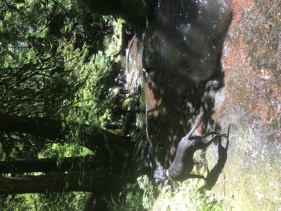
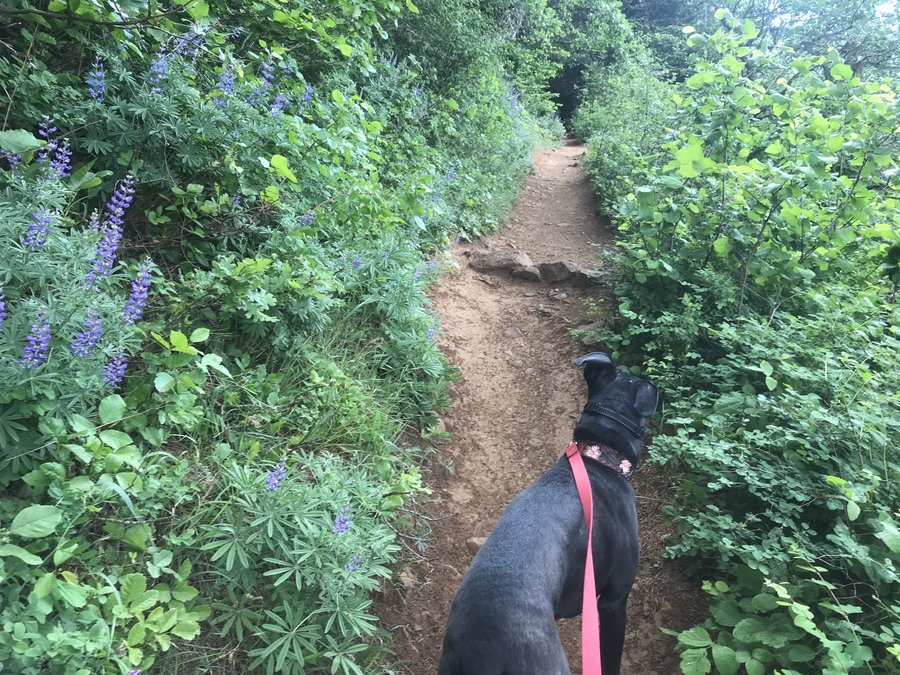
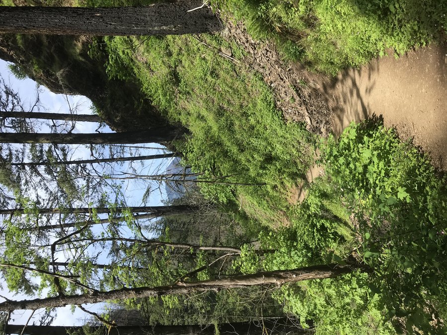
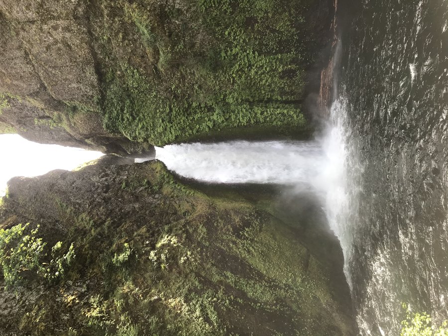
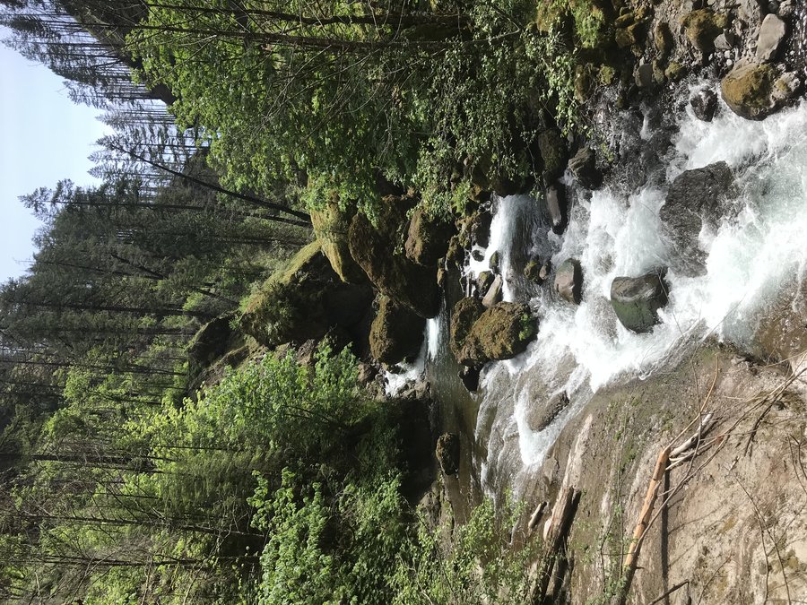
Eagle Creek, this time with less landslides
12 miles of hiking • 1500' elevation gain •
Eagle Creek quietly opened up at the beginning of the month. Team comfort optional decided to spend my last Friday of freedom exploring before I go back to a M-F grind.
We left Portland at 7:30, and ended up with the last parking spot close to the trailhead. The morning crisp air was nice, but it quickly warmed up in the canyon. Since there is way less canopy, I struggled a bit in the heat. We had a set turnaround time of 11 am, so we tried to keep up a good pace to make it to Tunnel falls. We had mostly solitude, until we reached those turning back who had gotten an earlier start.
We made it to Tunnel Falls, where one individual was blocking the trail trying to get the perfect selfie. We waited in the cool tunnel for her to move on, but ultimately had to accept that she was just going to end up being in our photos if we wanted a picture of the falls. We went around the bend, and took a break as much off trail as we could, but stayed aware to move out of the way to let others pass. My feet were really aching, and our turnaround time for Kat to get back to Portland had passed, so we didn't go on to Twister Falls. I think it may be time for new hiking boots. The heel pain turned into leg pain, and it was a struggle to keep a good pace the 6 miles back. I hate days like that where my body feels like it is betraying me.
The way back was a steady barrage of flip flops and hikers and dogs without water or daypacks. I had packed in 2 liters, but ended up filtering some water to top it back off, just in case. When we got back to the car, it said the temperature was 88, but it definitely felt hotter in the canyon. We spotted some canyoneers in the creek, and I had to wonder how they were going to get around some of the log jams I witnessed from above. Nearing the car, we heard a loud crash across the canyon. A tree had fallen. A good reminder to still remain aware of hazards when hiking through burn zones.
July 9, 2021


 1
1
Lacamas Park
4 miles of hiking • 250' elevation gain •
A short easy stroll on the 4th to get the dog away from neighborhood booms.
July 4, 2021


 1
1
Ed's Trail plus road walk
10.1 miles of hiking • 2500' elevation gain •
Was initially going to go early in the day, but I had a friend who offered to come with who couldn't leave Portland until 2:00 pm.
We knew we weren't going to be able to drive the road, as it is rumored to be one of the worst forest roads in existence. At a friends suggestion of where the road gets bad, we opted to just park at the junction in a turnout. We got on the "road" around 4 pm in the heat of the day and trudged up.
Eventually we hit the trailhead, and we were excited to finally be on trail instead of road walking.
Fantastic views all around! I never want to go up via grouse vista again. Ed's trail was so scenic, right from the start. We enjoyed the scrambly sections, but vowed to not take Ed's trail back to avoid going down them.
We didn't linger on top very long, as we didn't want to be headlamping it out. The return trip was super quick, and we watched the sun start to set from the parking lot. We hustled down following a subaru, tailing it almost the whole way down as our speed matched the speed in which it could drive the road. Almost total solitude on the trail.
July 1, 2021


 1
1
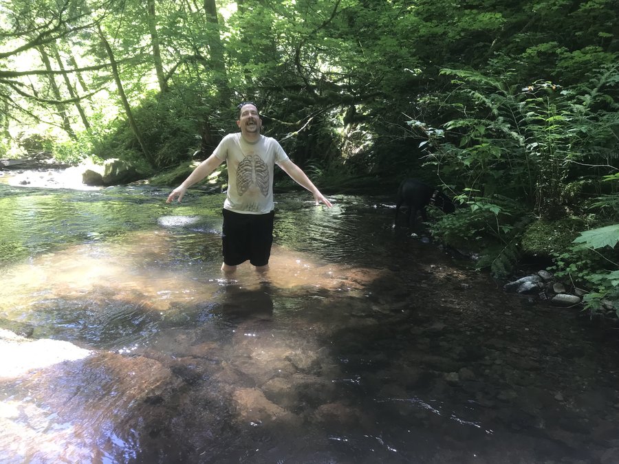
Cooling off in Duncan Creek
4.5 miles of hiking • 1250' elevation gain •
It was too hot to do much of anything but go play in water on Sunday. This week's heatwave is going to be brutal.
June 20, 2021

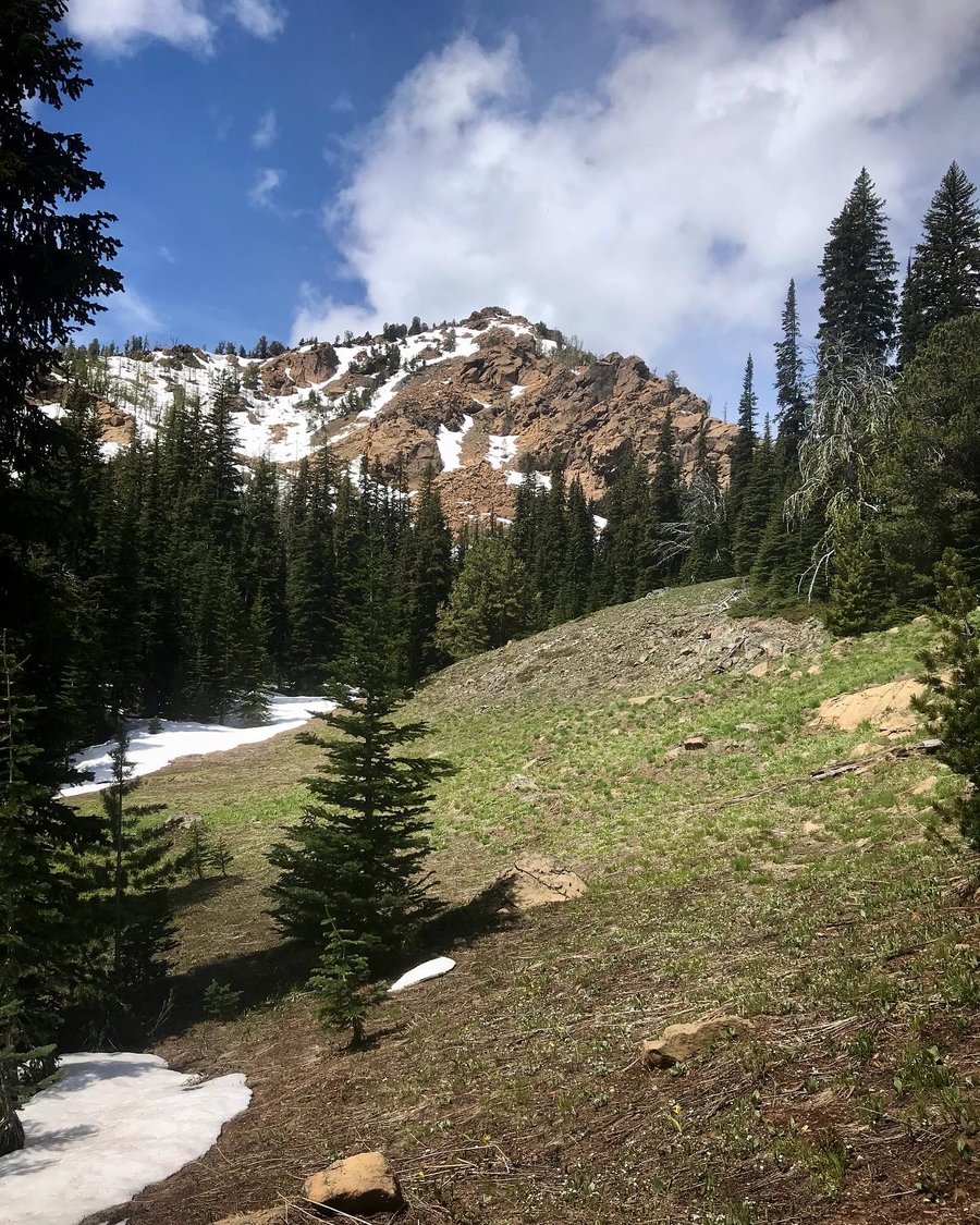
 3
3
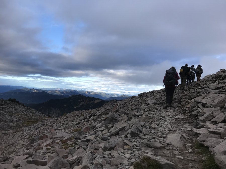
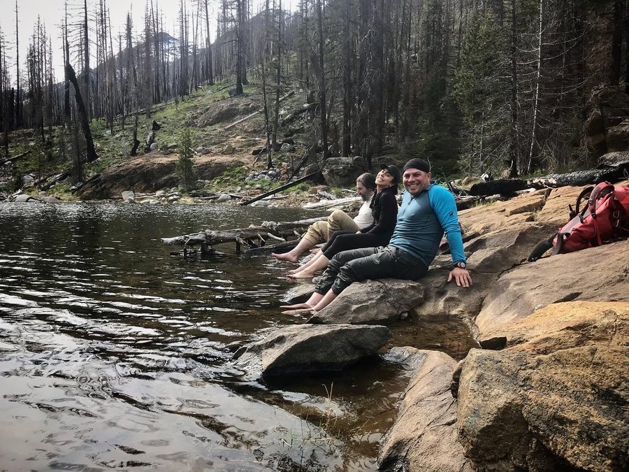
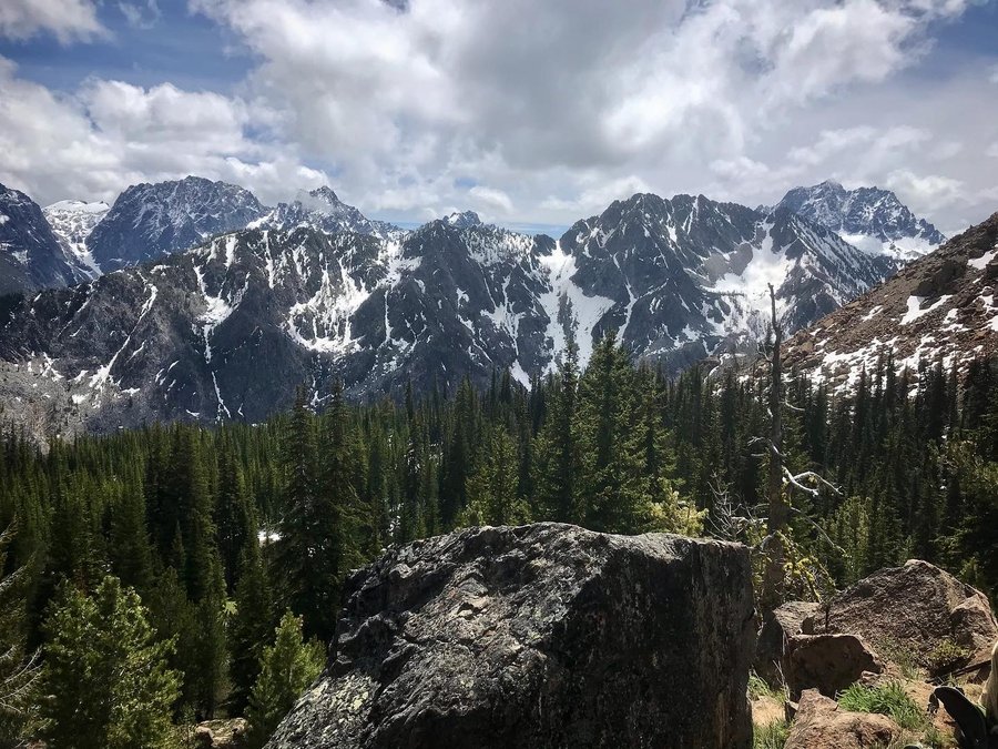
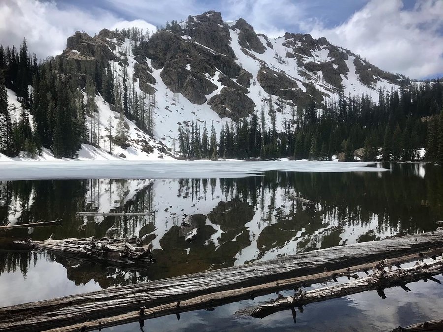
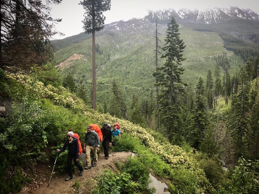
Enchantments, Eightmile Lake and Lake Caroline
15 miles of hiking • 3750' elevation gain • 2 nights
Due to a dropout, I was invited by my friend Anibal to join on a two day trip in the Enchantments. 5 Venezuelans, 1 Persian, and 2 Americans made for an interesting group.
The forecast wasn't great, so I made sure to pack extra clothing in case of steady showers. We all weighed our packs at the trailhead, and I won the prize of heaviest pack, at almost 40 lbs. (This may have been because I brought a bear canister.) Pendar was a close second, and the only other person who brought a bear canister.
The trail climbed up quickly, but then mellowed out to a pretty easy grade to Eightmile Lake. Though the area burned in 2017, it still offered plenty of views and a steady stream of wildflowers and new growth.
We quickly set up camp in the rain. Once my tent was up, I retreated inside and changed into dry layers. Thankfully, the rain stopped, and I spent the evening watching the clouds dance around the top of the peaks surrounding the lake.
The next day, our group of 8 set out towards Lake Caroline, hoping to get to Windy Pass. I felt good, for once, my conditioning put me at the head of the pack instead of towards the back. It was hot, completely different weather than our pack in. The clouds still continued flowing over the barrier between Eightmile zone and Stuart, constantly changing.
The higher up we went, the views kept improving. Eventually, we were in a forest, trudging over lingering snow. I went ahead and scouted the way to Lake Caroline, making sure it was okay for our group of mixed abilities. I decided on microspikes for the final descent, and soon we were to the lake.
For most, the destination was enough as many were pretty exhausted. It would have been nice to push on to Windy Pass, but we were all pretty satisfied with our views on the way. Next time.
We went back to camp, and soaked our feet in the cold lake as we enjoyed our dinners.
It rained in the night, and as we packed up. It was a warm rain though, and I didn't bother with raingear as it was a relatively short hike out. I had warm comfortable clothing in the car.
Leavenworth bound, we enjoyed post hike beers and food in a town that reminded me of one from my youth. Leavenworth was Frankenmuth on steroids.
June 11 – June 13, 2021


 2
2
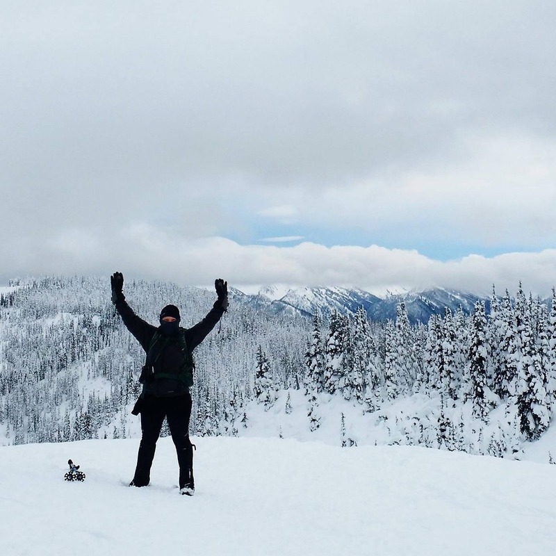
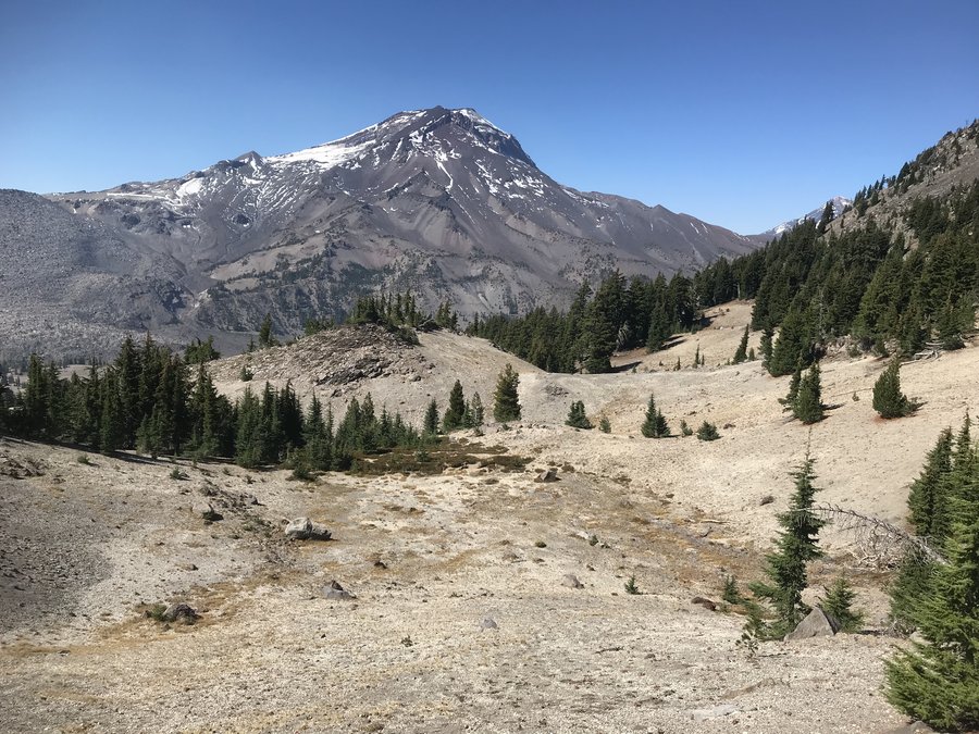
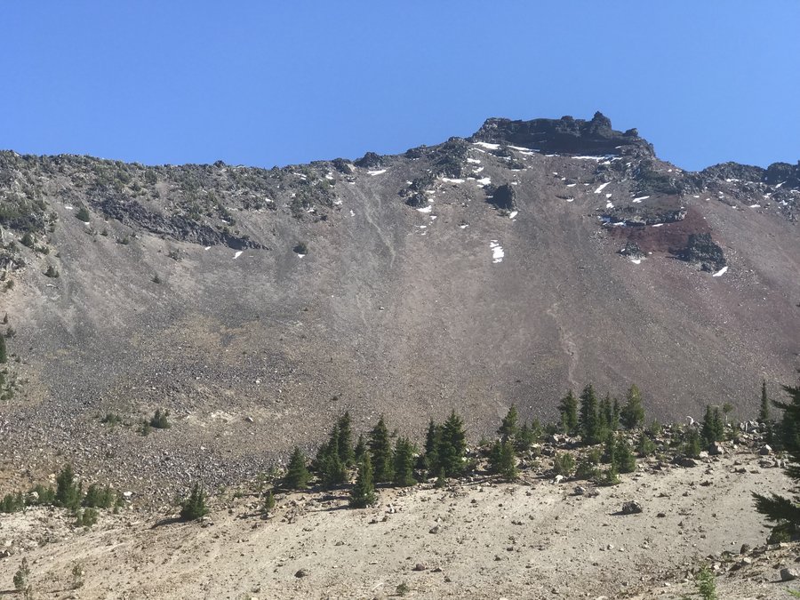
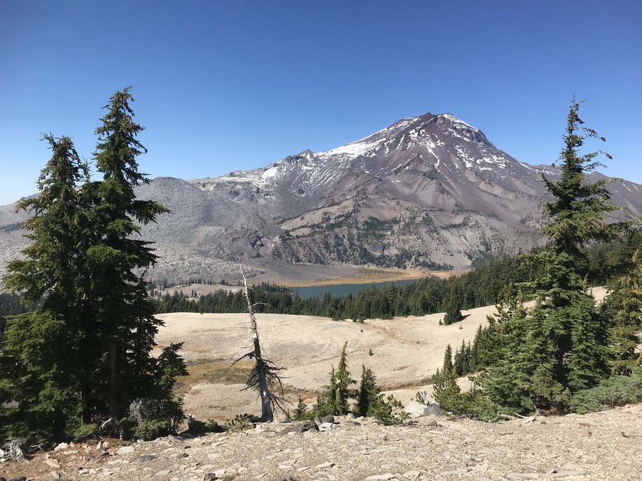
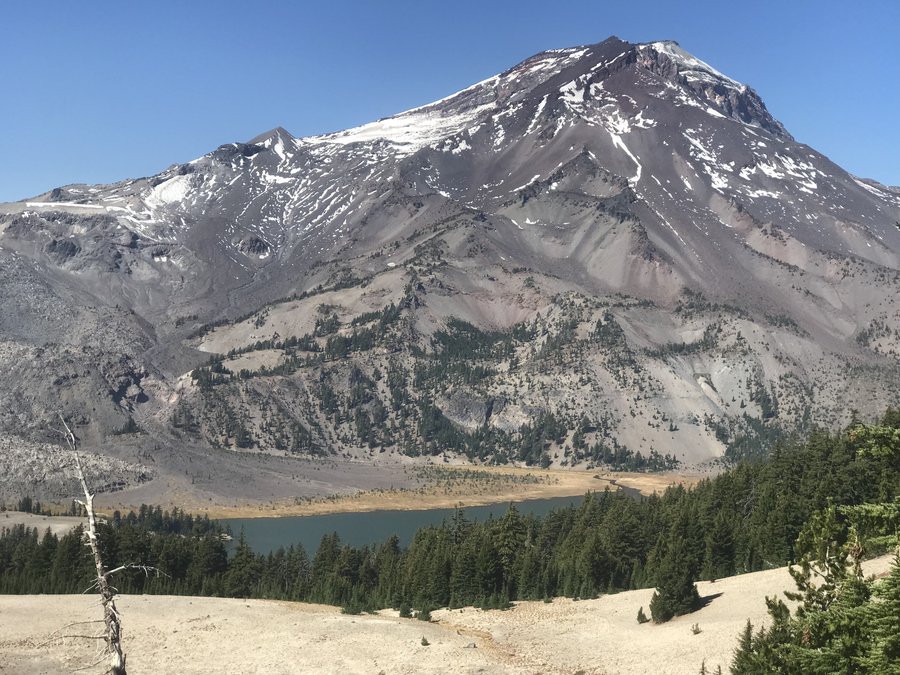
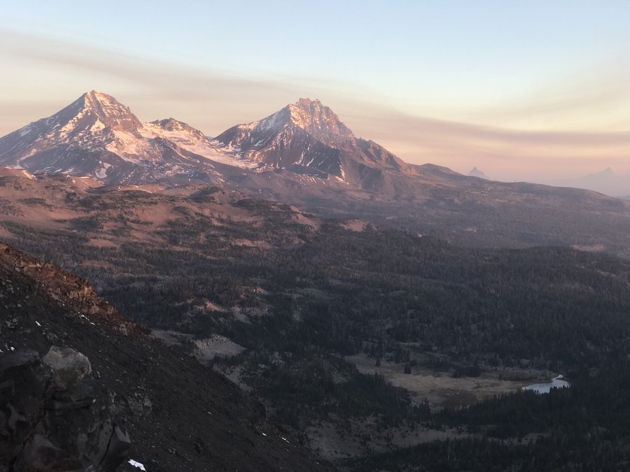
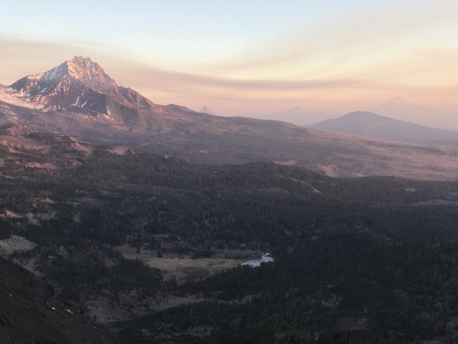
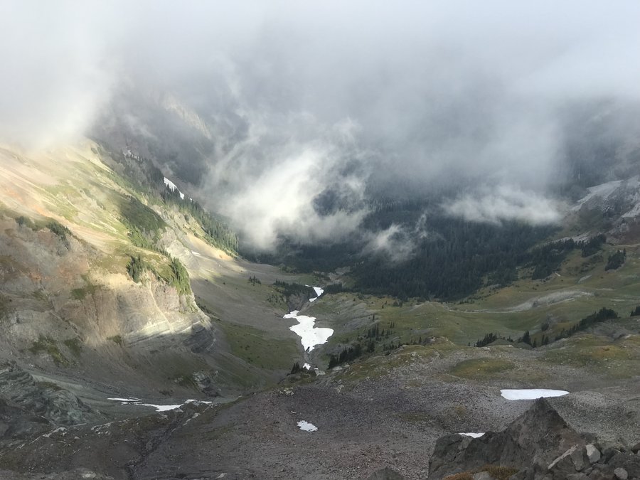
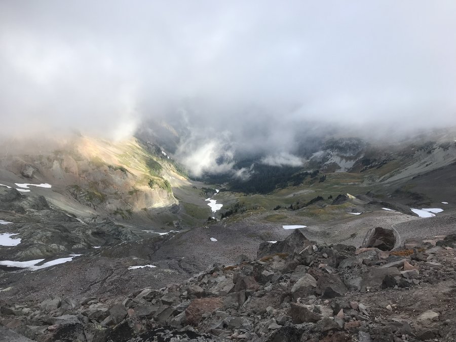
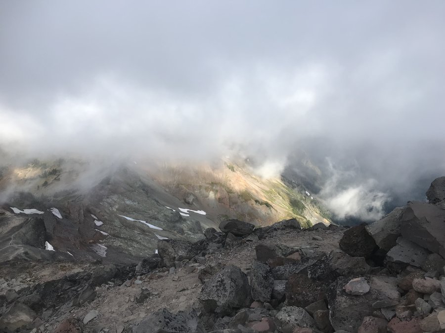
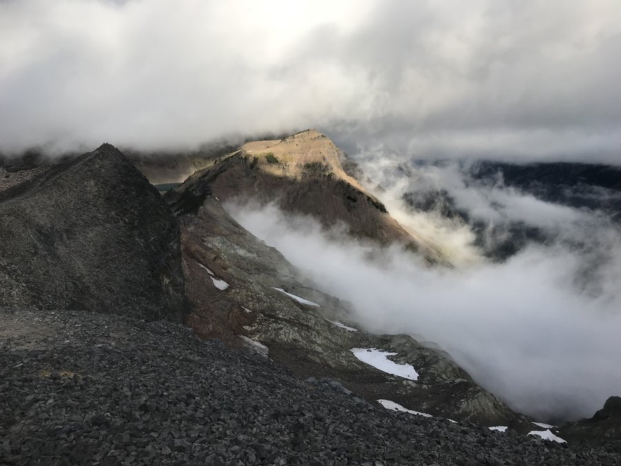
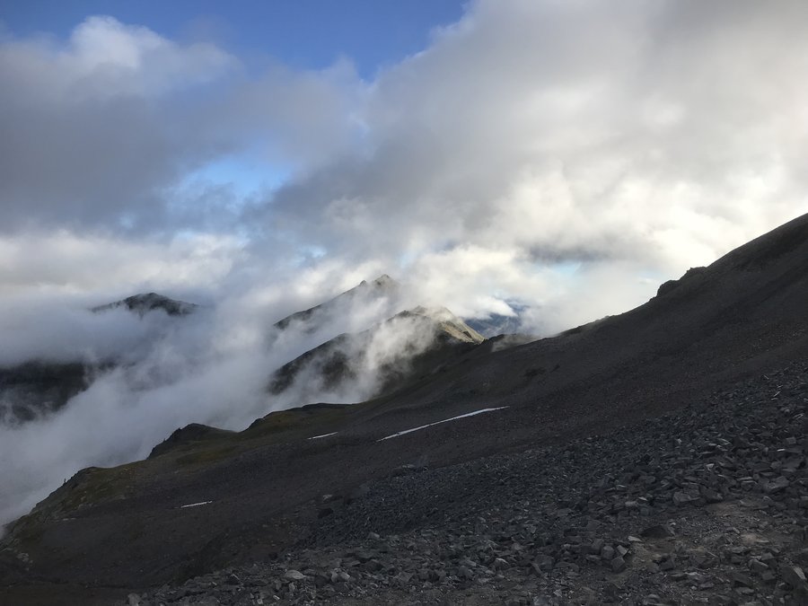
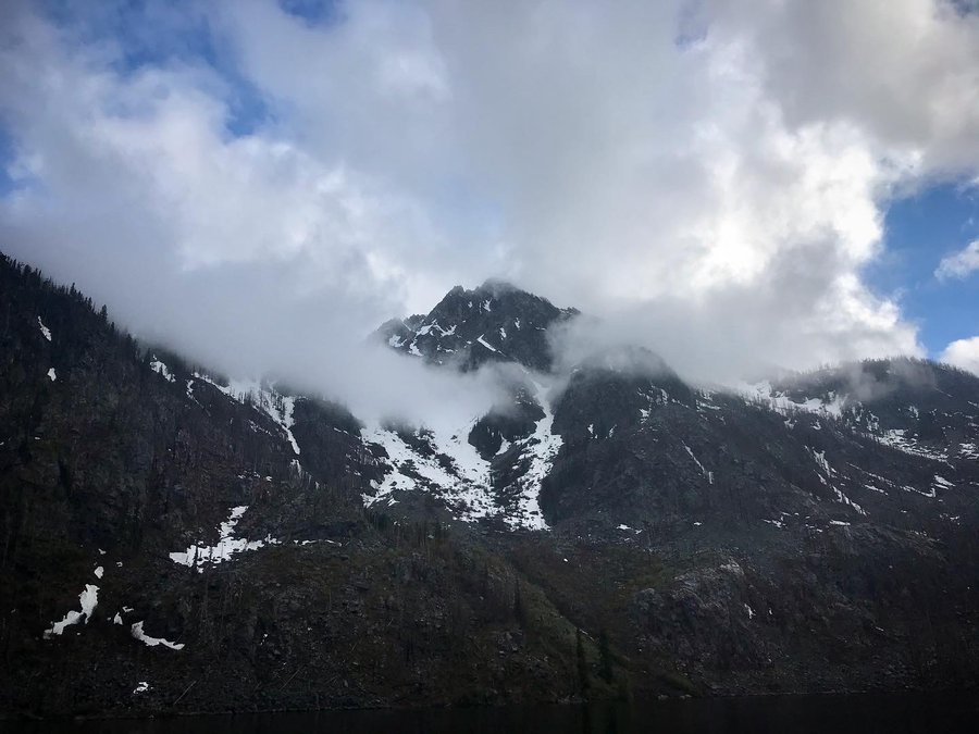
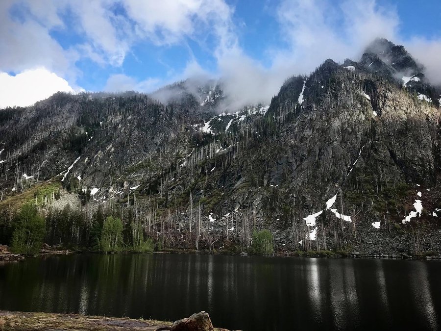
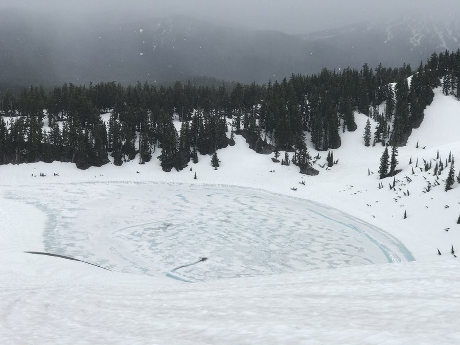
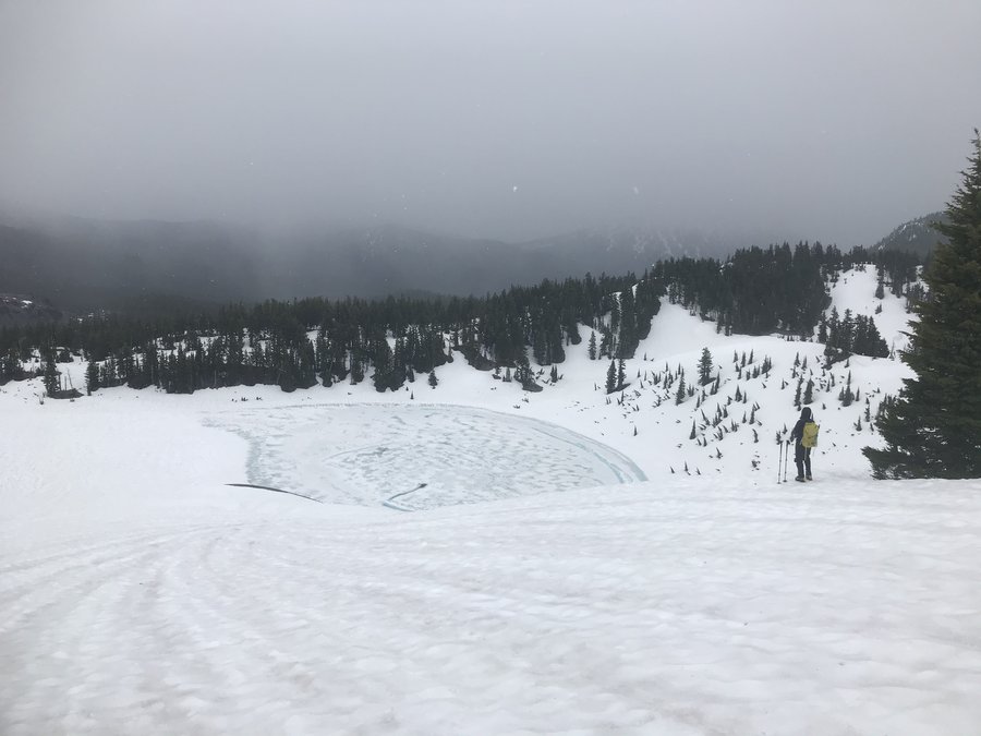
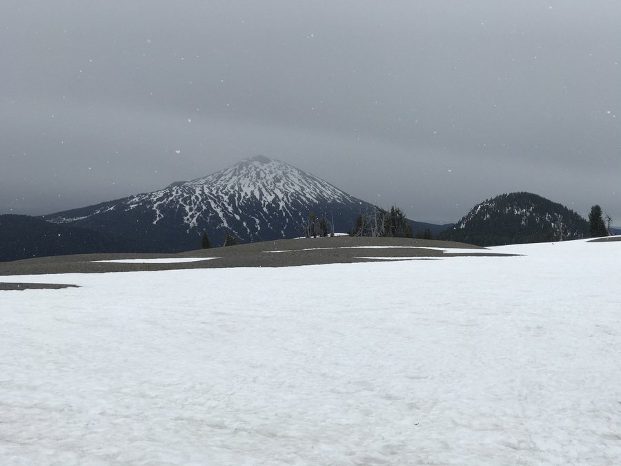
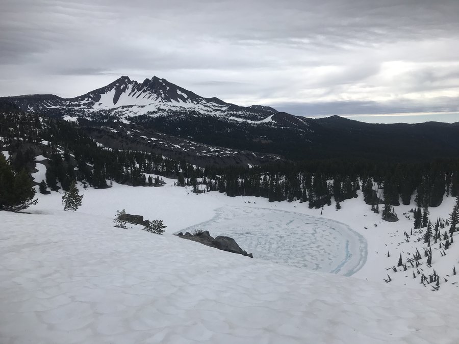
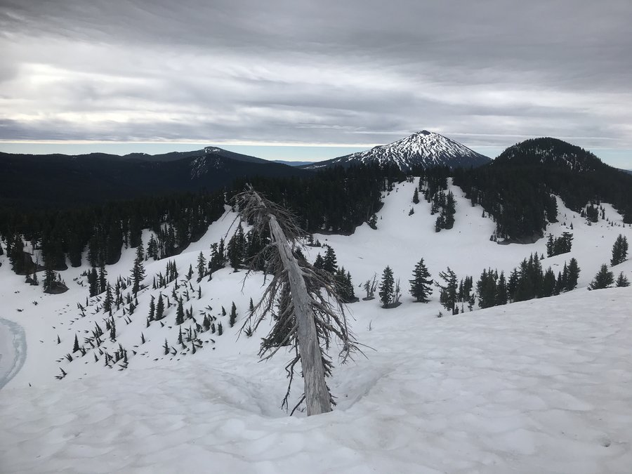
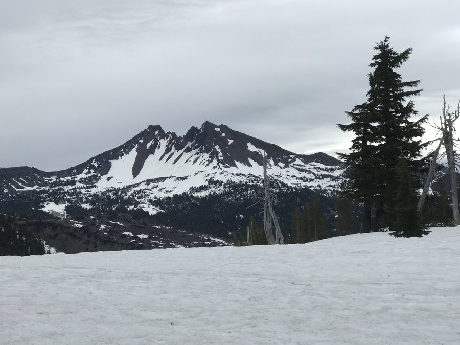
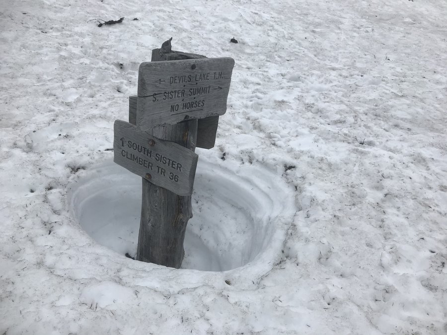
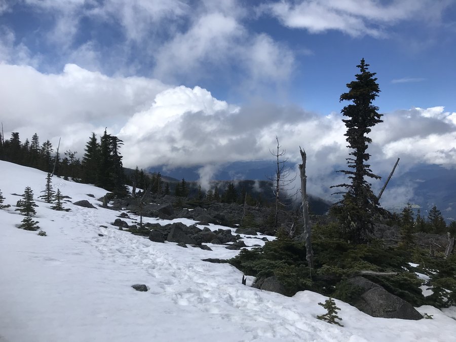
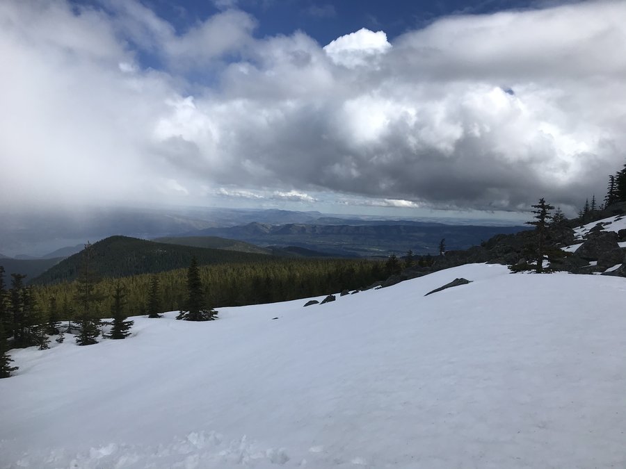
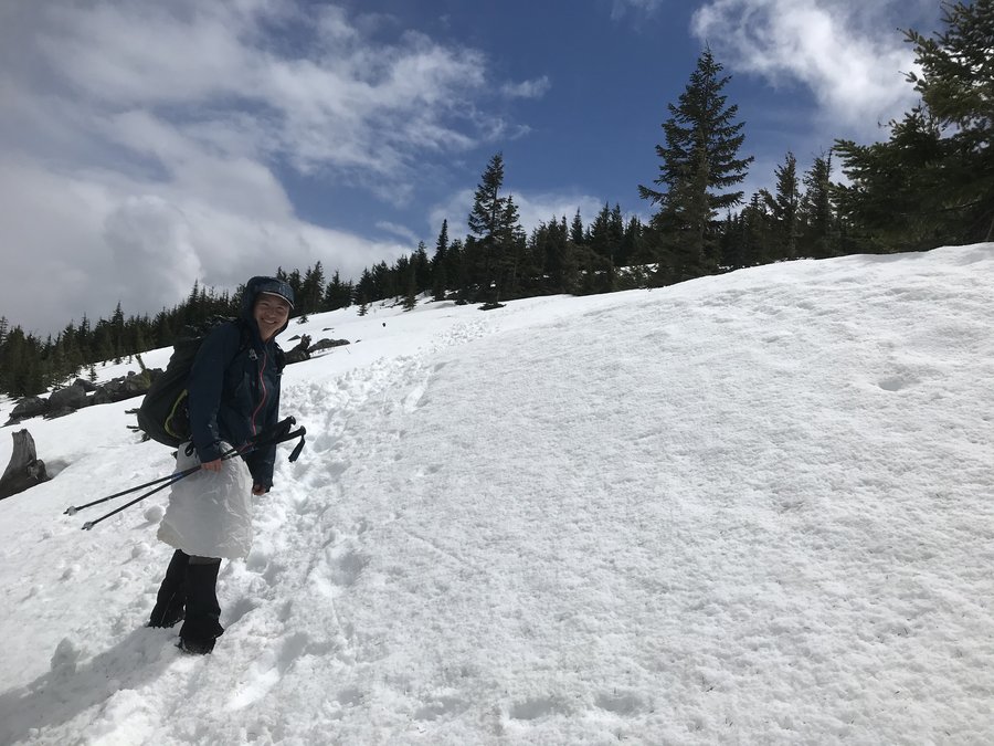
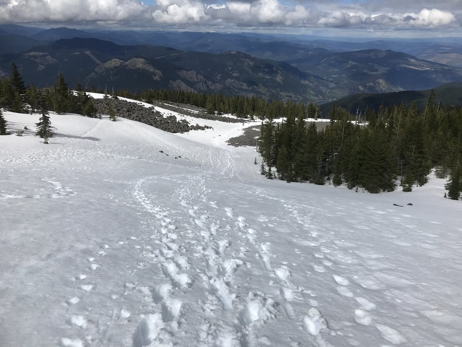
South Sister Summit Attempt
7 miles of hiking • 1500' elevation gain •
Both Mountain forecast and NOAA had high wind predictions, mostly clear skies turning into partly cloudy. We decided to stretch our legs anyway, with the idea we would turn around when conditions were no longer fun.
We stayed at nearby Elk Lake Campground, my friend Tom had booked because we weren't sure if the parking lot at Devil's Lake Trailhead was melted out. We arrived in the evening after making a quick stop at a Bend food cart pod. Was surreal to see people so much more relaxed/maskless than Portland, interactions looked pre-pandemic and it felt nice to feel a little bit of a sense of normalcy returning. We relaxed into the evening with a campfire to beat the cold, then retreated to our sleeping bags to try to get some good rest. Shortly after crawling into my tent, a camp nearby seemed to come alive with drunken abandon, kids screeching and adults bellowing into the night. I stopped looking at my alarm after midnight. Surely they wouldn't go all night.... I think I was finally able to sleep around 2 am, and had an alarm set for 5:15 am.
So, we started a little later than we wanted, and were on the trail around 6:30 am. We didn't see many others heading up, just a few skiers.
Trail through the forest was frozen and slick, I started out with just boots but eventually switched to my crampons so I could walk faster. One in our party of 3 wore micros. (Totally doable in either, I just didn't bring both.) Lots of route finding, as the bootpack didn't exactly match the trail, and would melt out and disappear completely. The way up through the forest always feels like hard work to me, immediate up when you aren't quite awake and warmed up. Steeper with the addition of snow obstacles as well.
Eventually we emerged from the forest and we were greeted with views of our objective. We were probably slightly too optimistic. As we trudged through the snow and up to the base of of the mountain, we watched the clouds change before our eyes and engulf the mountain in what looked like a whiteout. It happened in seconds and then we were in a shifted atmosphere ourselves. It was a pretty snowfall, but at 7000ft and in snow/increasingly low visibility, we made the decision to call it and turn around.
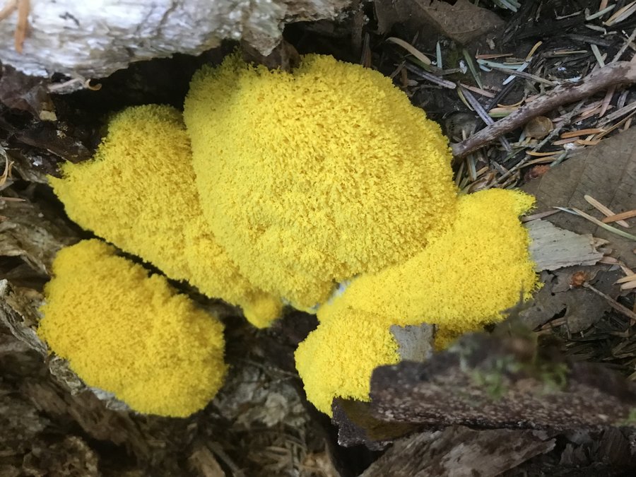
Our footprints were quickly covered in fresh snow, and we got a little off track and had to bushwhack through the forest to get back to the trail. I suppose it was good practice as we descended a steep slope, working our way to the ski trail. We ended up following next to the ski trail for the remainder of the way, as it was more defined than the bootpack trail. Once back on track, Tom found some interesting fungi sticking out of a log in the snow. In all, not a wasted day by any means, always fun to get out and see what nature has in store for us mere humans. The mountains will make their own weather, forecast be damned.
June 6, 2021

 2
2
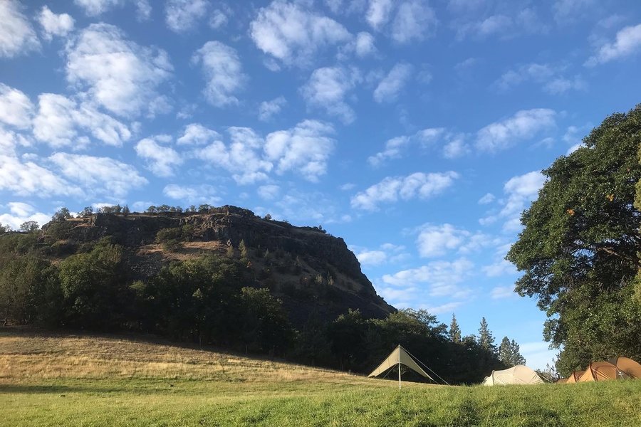
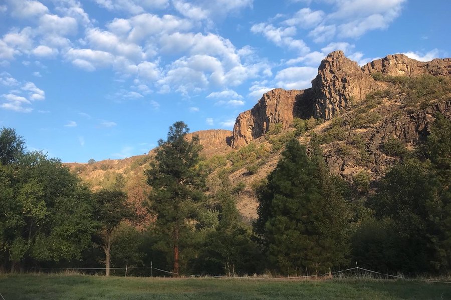
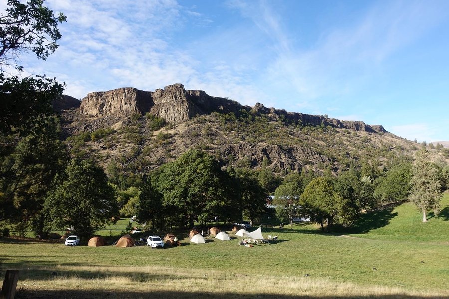
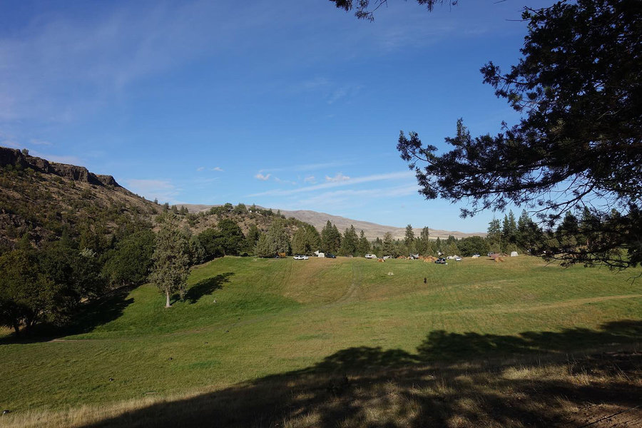
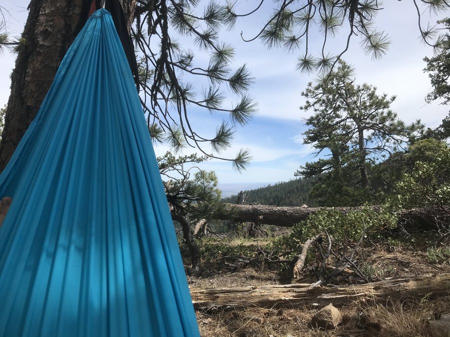
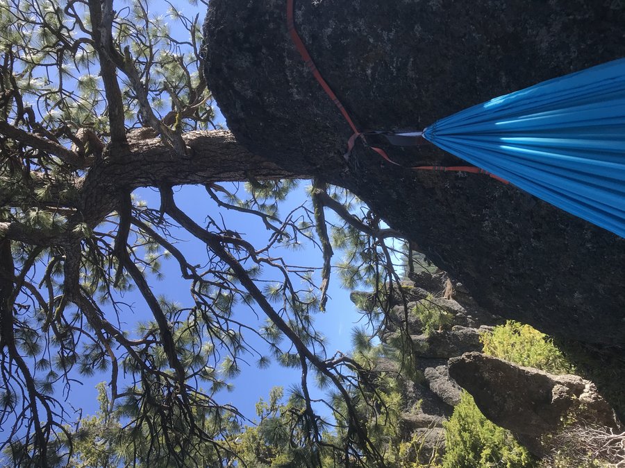
School Canyon Badger Creek Wilderness
9 miles of hiking • 1750' elevation gain • 2 nights
I hate going out on Holiday weekends, but my partner Zane wanted to get in a couple of days of fun before summer camps start.
We really liked exploring little badger creek on the 4th of July last year, so thought we would try for a campsite on the rock formations, but go in via School Canyon. We decided the heat would let us decide if we would explore the loop with Tygh Creek, or just be lazy and bum around camp and read for a day before heading back out. I packed my saw just in a case, since description of the loop described it as a lost hike with lots of blow down.
With a late start from Portland on Saturday am - we were disheartened when we saw around 8 cars at the trailhead. Figuring they can't be all overnighters, off we went.
Luckily, some were folks coming out, and some were dayhikers. In all, I would say there were 6 groups out there. We were able to find a quiet spot in the rocks. We decided to be lazy for once and just relax and read and sketch all day Sunday. It was a nice change of pace from our usual go go go vacation style. The next day, all campers moved on and we had the place to ourselves, other than one small family that came in and camped at the upper site near the spring. We moved camp to what we felt was the best spot in the rock formations and I finally got around to reading Anthony Bourdain's "Kitchen Confidential" and spent the day sketching Ponderosa's from my hammock. It was a quick pack out today and back in Portland by the afternoon. I'm a little sad I didn't explore more than my camp area, but sometimes it is nice just to be lazy and take it all in.
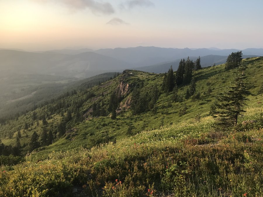
May 29 – May 31, 2021


 2
2
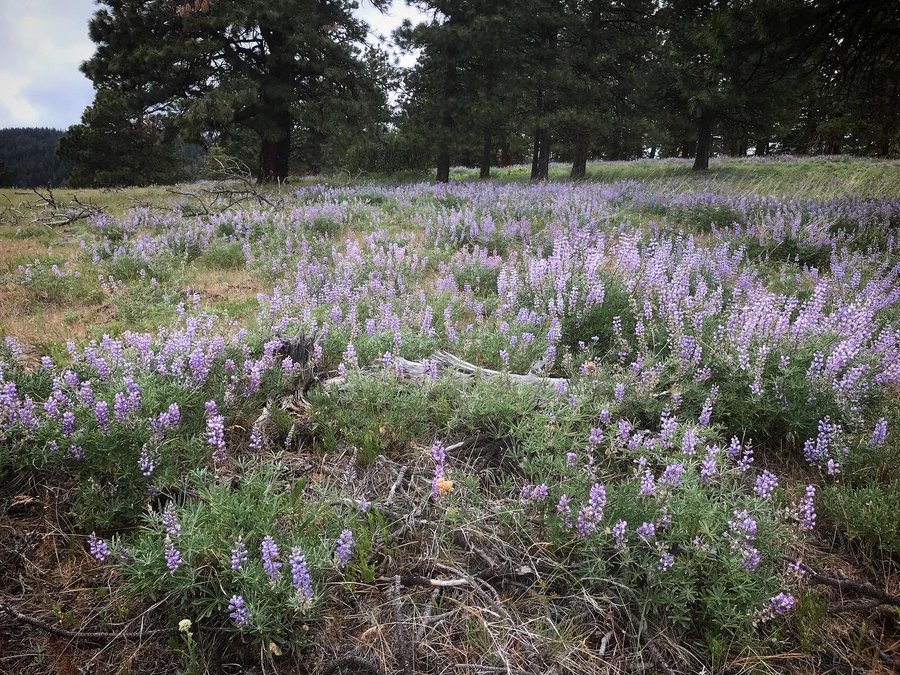
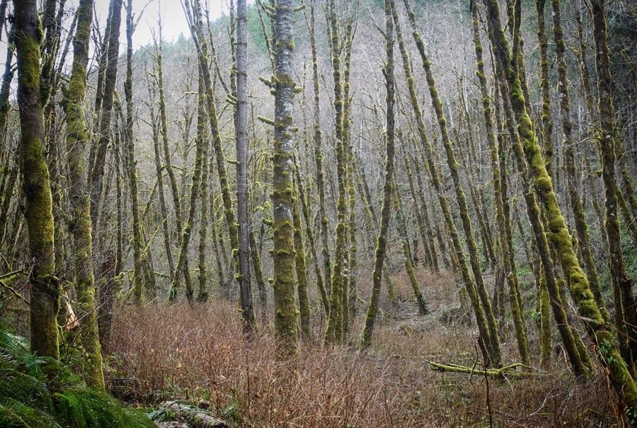
North Section Line
10 miles of hiking • 1250' elevation gain •
First group hike in a very long time. Got an invite from my pal Matt Reeder to check out a seldom used trail. We brought along tools and tried to clear sections of trail but it really needs a lot of work. We did a casual cleanup as we hiked. Really great flower display and interesting bones, but very windy as it looked like wet weather was moving in. Trails in this area are mostly used by mountain bikers. Another area to add to my, need to bring a bike and explore. "Trail" ran alongside the Dalles watershed, complete with many signs not to trespass.
May 23, 2021


 1
1
Springtime Dog on Dog Mountain
6 miles of hiking • 2750' elevation gain •
Obligatory dog on dog mountain. Took an evening stroll and had the top to ourselves. Ran into my pal Tom Shi on my way up fulfilling his springtime requirement with Fredo.
May 19, 2021


 2
2
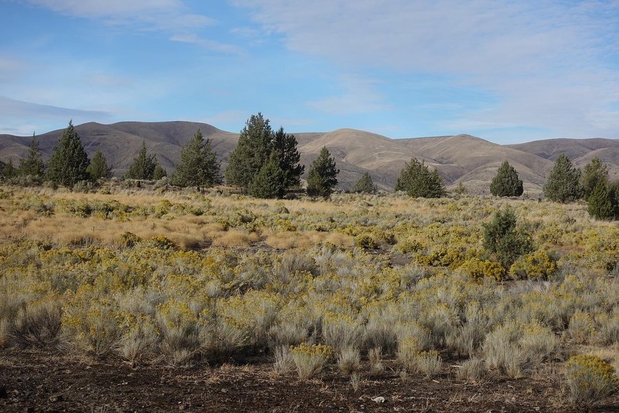
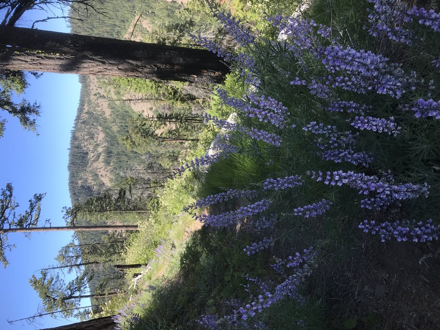
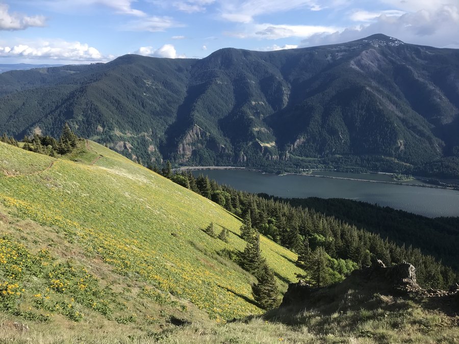
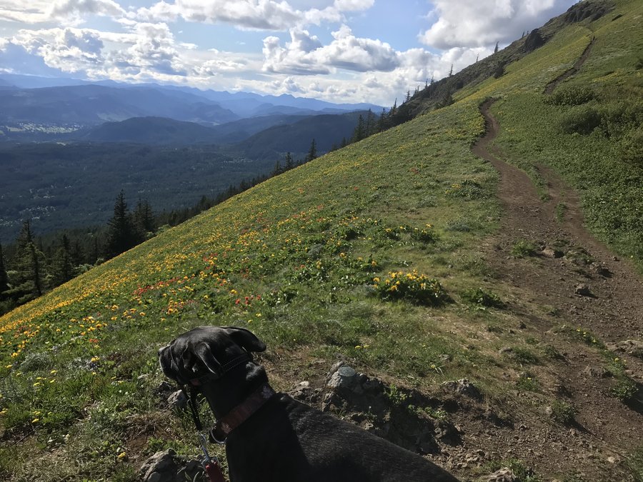
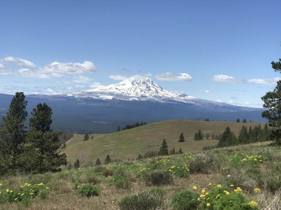
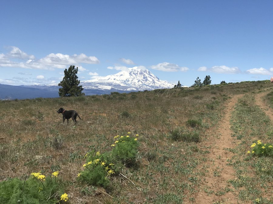
Grassy Knoll
4.5 miles of hiking • 1250' elevation gain •
I was not feeling great yesterday, and the sun was draining. Long (but beautiful) drive out on forest roads. I previously avoided this hike because I didn't think a Prius would make it, but the long gravel road was smooth sailing the whole way. I really want to get out on some of these Gifford backroads and bring my mountain bike. The boulders reported blocking the road are gone.
Trail was surprisingly busy - I thought with the long drive we would have solitude. Not overly crowded, but I'm thinking there must have been a social media post that boosted interest. One large group surprised me when they gave up right before the knoll, because there was one patch of snow to cross. Snow was soft and though the runout was steep, it was easy to follow steps across. Plenty of flowers out. Had some great views to Adams and to Hood, and a cool perspective of the gorge I hadn't seen before. I had originally planned to hike to Big Huckleberry Mountain, but I decided not to push myself and just let the day end as an easy hike. I was concerned with being a meadow stomper, but followed a faint trail towards Hood and saw some neat looking landscape below. It looked like you could keep walking and explore it, but I turned around. There were some optional side views with some scrambly rocks that were nice stops on the way up and down. Think I'll head back to this one later in the summer for more flower views, and bring my bike so I can explore some of the overgrown looking side roads I encountered on the way out.
May 16, 2021


 2
2
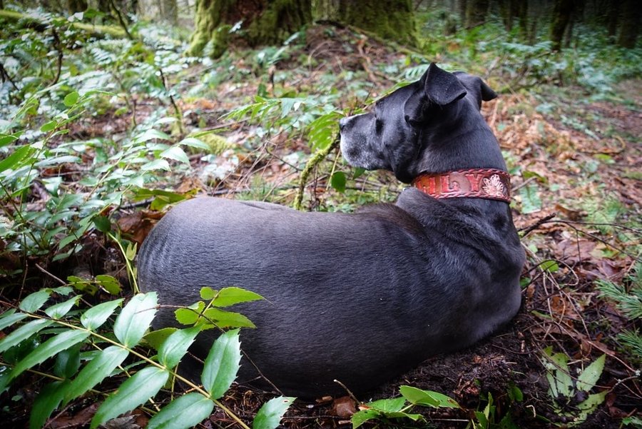
Wahclella Falls + Latourell Falls Loop
5 miles of hiking • 1000' elevation gain •
Visited a couple gorge trails that I normally avoid due to popularity. It was nice way to spend the afternoon with my dog Lily. Hardly saw anyone on the Latourell Falls loop.
May 13, 2021


 2
2
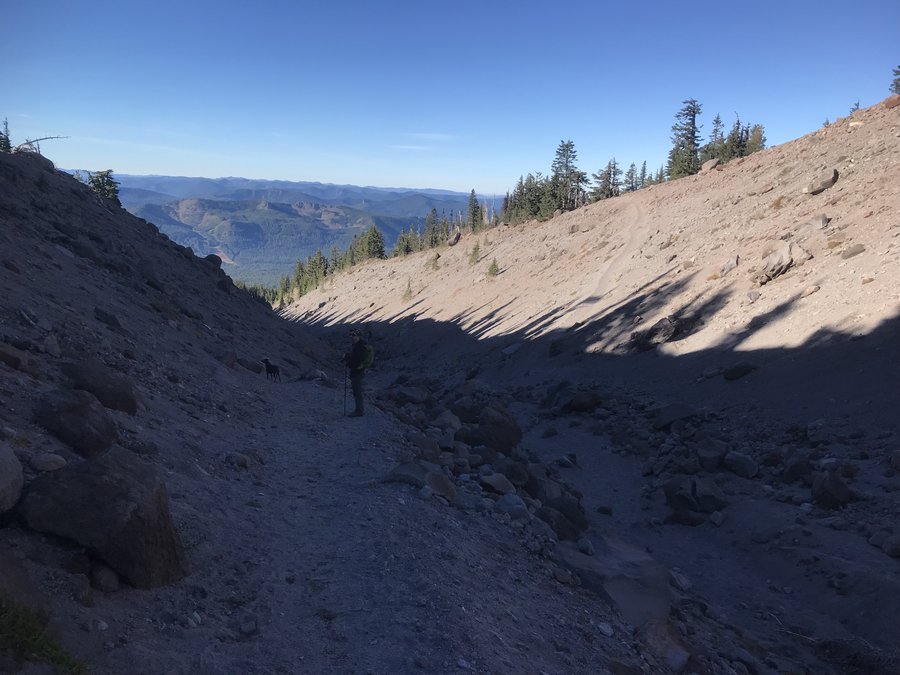
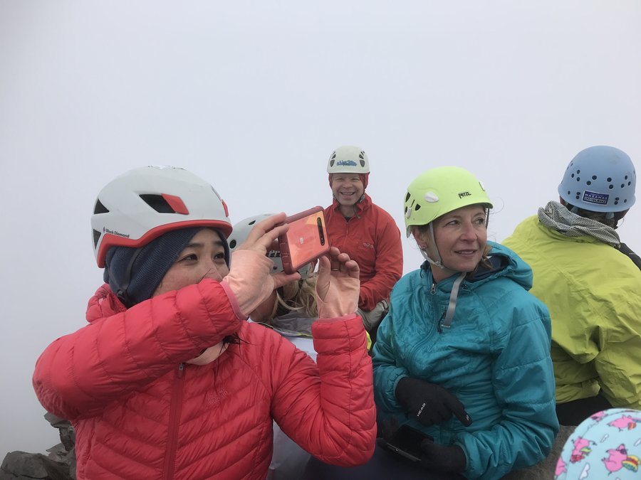
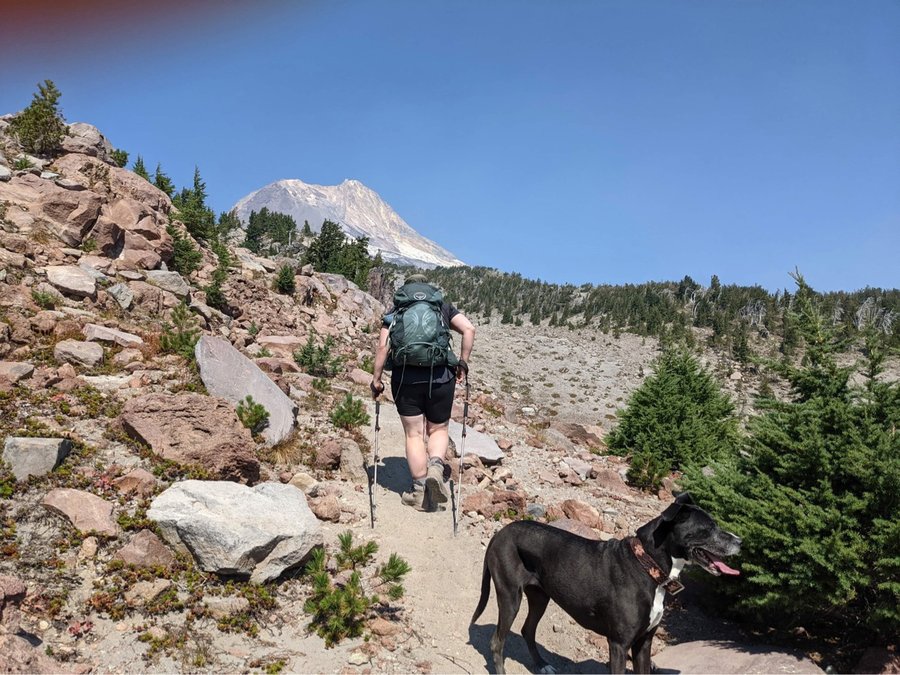
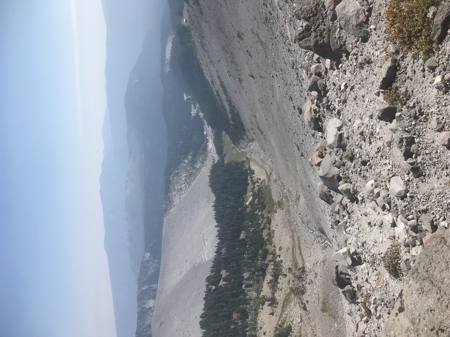
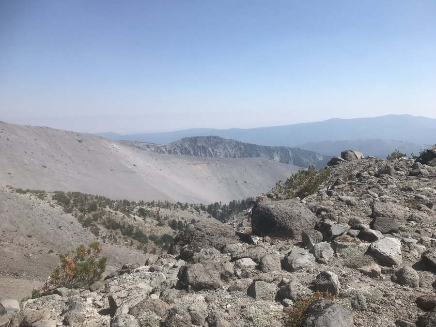
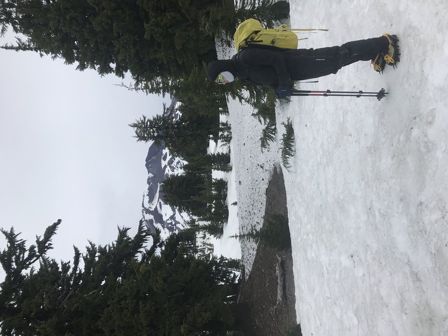
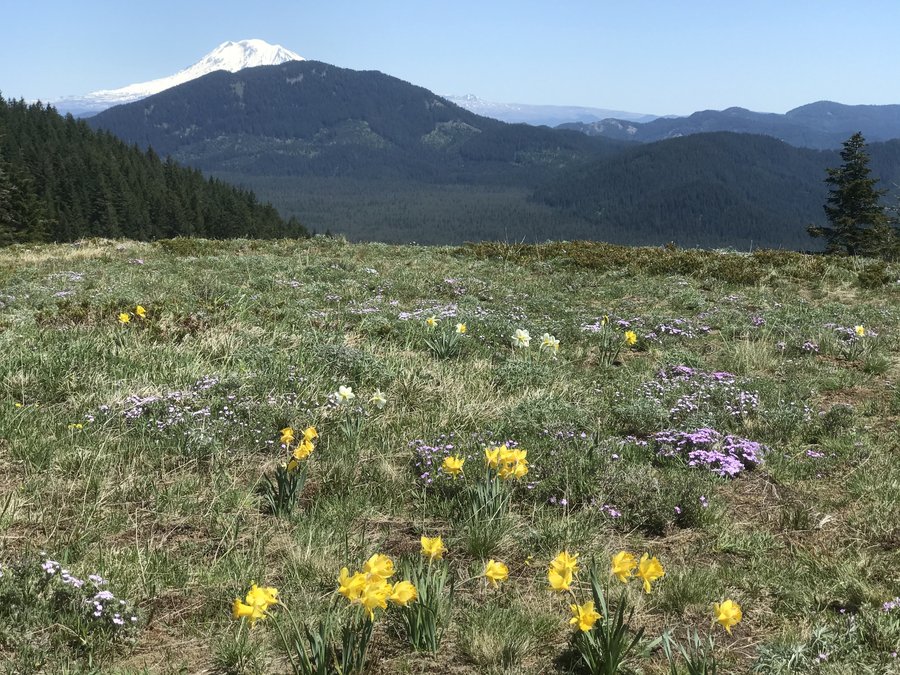
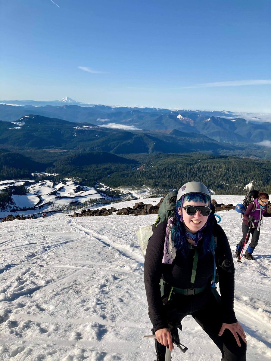
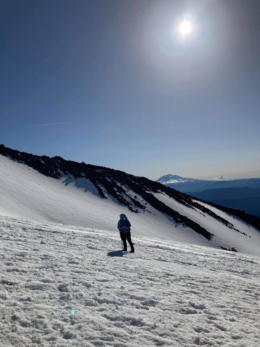
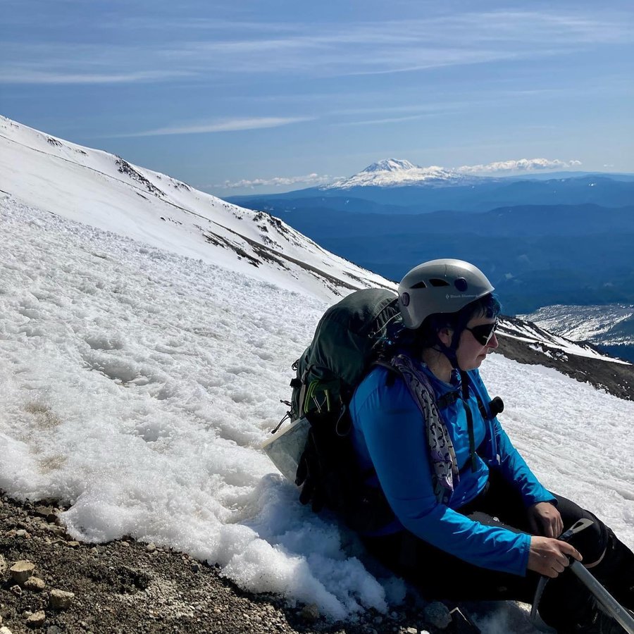
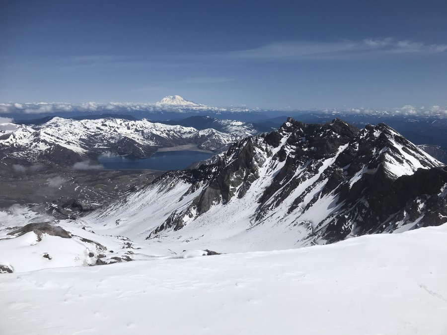
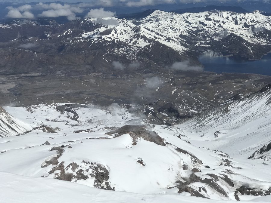
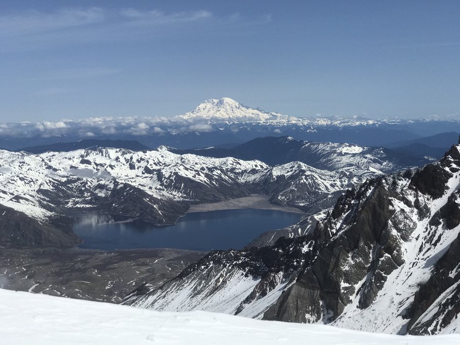
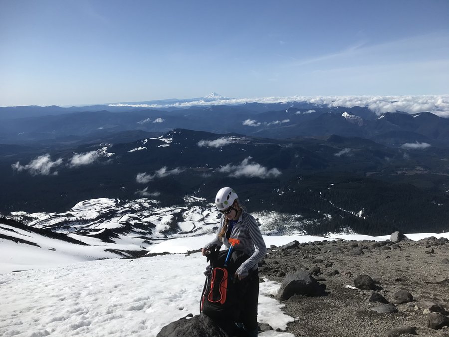
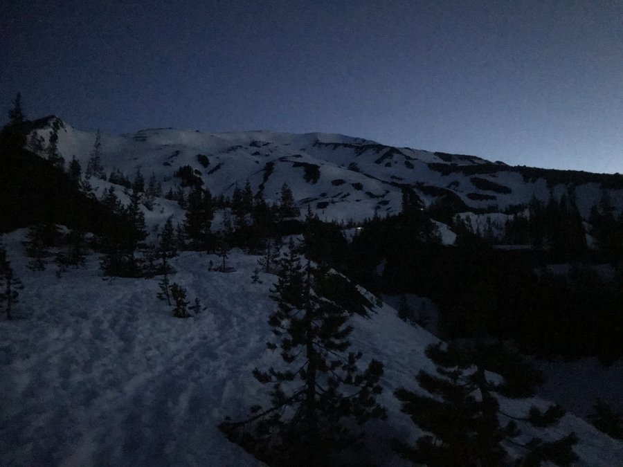
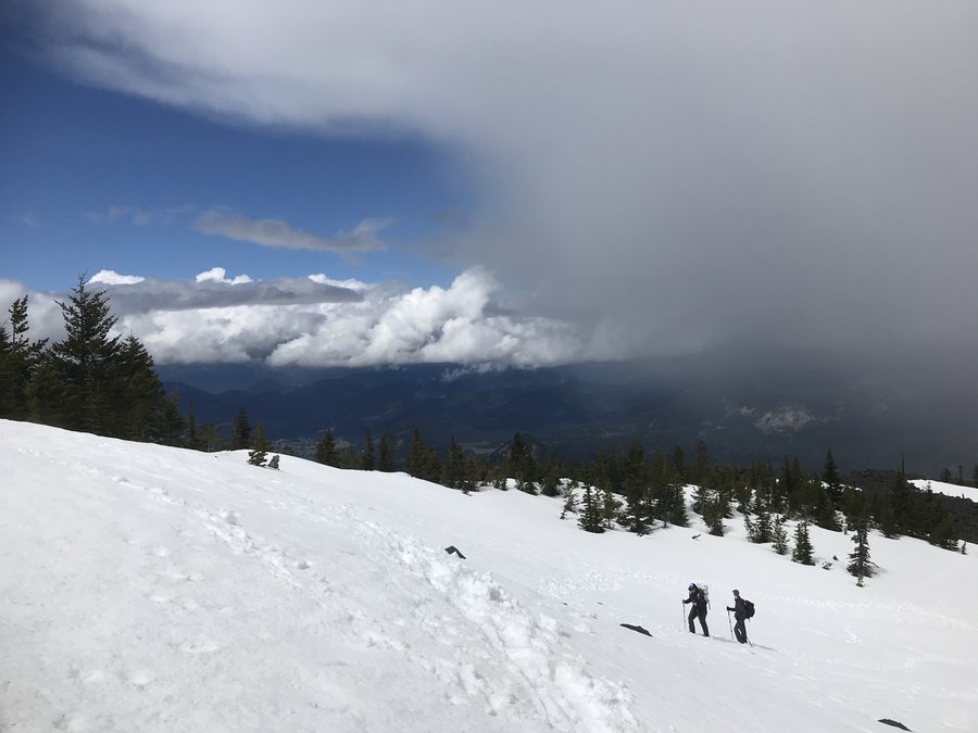
Mount St. Helens Summit
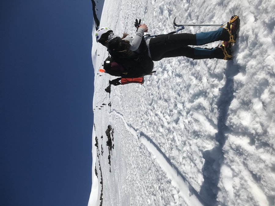
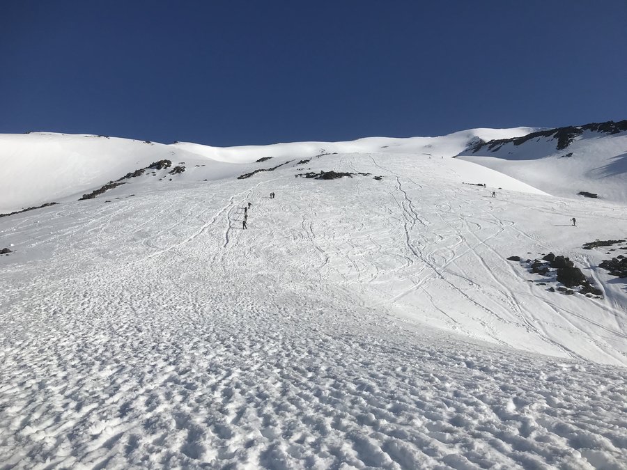
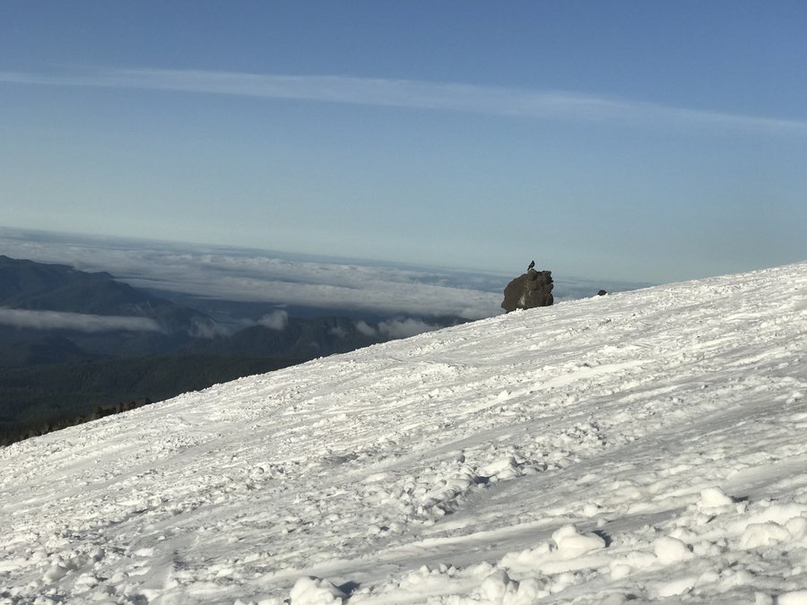
12 miles of hiking • 5500' elevation gain •
What better way to start a new week freshly unemployed but to stare into the gaping maw of a volcano to question your future? Today was a struggle with a 3 am start, every morsel of food I packed seemed completely unappetizing, and once the sun hit the snow our pale Portland skin was fried no matter how we covered up. My third summit of Mt St Helens but somehow the hardest.
I don’t know what I was thinking, but I way over packed for the day. I was concerned with being cold, as mountain forecast said the rim would be 35 degrees. I definitely needed those warm layers in the am, I just needed less of them. The skies were incredible, completely clear and so many stars. Right before sunrise we spotted the SpaceX Starlink Satellites, and it felt like a good omen for the day. The snow was hard and icy, so we put on our crampons under the light of the passing satellites.
Once the sun hit, I switched to my sun shirt, which I hate because it makes me look like Violet Beauregarde in Willy Wonka. My black tights which seemed like a good choice for the am cold suddenly became almost unbearable combined with my gaiters. However, I didn’t dare pull them up for fear of my legs becoming lobsterized like my face. The snow was still hard and icy, and without a good boot path. It seemed as if hundreds of people had stampeded down the mountain over the weekend, and then the snow froze leaving behind an uneven hellscape. It was slow going creating our own path.
Somehow, team comfort optional kept going, only taking brief breaks for snacks. I stuck to gummies because nothing else was appetizing. I actually gagged eating a gross 700 calorie bar that I thought was a good idea to buy days before. My turkey sandwich felt flavorless. The heat just made me not want to eat. I did however, go through a hefty amount of water. I don’t regret lugging up almost 4 liters as I went through most of it and still felt dehydrated when I got back to my car.
Something of note, almost every climber we saw in the am was female. I don’t know if it was just a fluke, being a Monday, but there was some serious feminine energy on the mountain that day. Very cool to see. My personal mission was to honor my friend Mo who passed from Cancer in 2020. Among my many possessions in my heavy pack was a guitar pic from Adam Ant of hers, and dog tags from a club in Chicago (Neo) that we used to dance at till 5 am when they would close. I didn’t want to deposit them on the mountain, but I did want the satisfaction of knowing that I was honoring her by struggling up there. I’m not a religious person, but I think I may bring those tags to all summits from now on. She was given 1 year when she was initially diagnosed, and she made it 5. Her punk rock attitude and tenacity will live on while I huff and puff and battle in her memory.
There was a moment taking a break between glissading on the way down, when we looked up at the climbers still heading up, and everyone seemed to be at a standstill. It was surreal. We were not alone in understanding what a serious undertaking getting to the top of that mountain was yesterday.
Once past the boulders and to Chocolate Falls, the snow was a sloppy annoying mess. We tried to go fast, and the mountain gods decided on one more insult, breaking my pole in half as I descended. I finished out the trek through the forest sliding around like a drunk person, but eventually we made it to our cars where pickles awaited us. I drank one celebratory beer and gave some beta to some ladies heading up in the am. I switched back to water for the drive back to Portland where a much deserved dinner awaited.
May 10, 2021


 1
1
Angels Rest
4.5 miles of hiking • 1500' elevation gain •
Just a short and sweet trek up on a weekday to get the blood moving.
May 7, 2021

 2
2
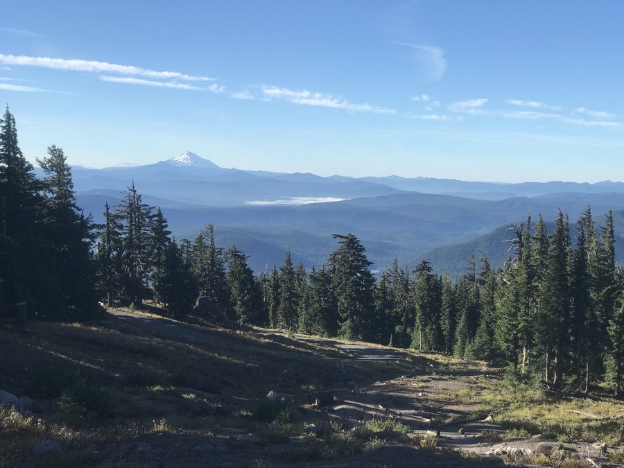
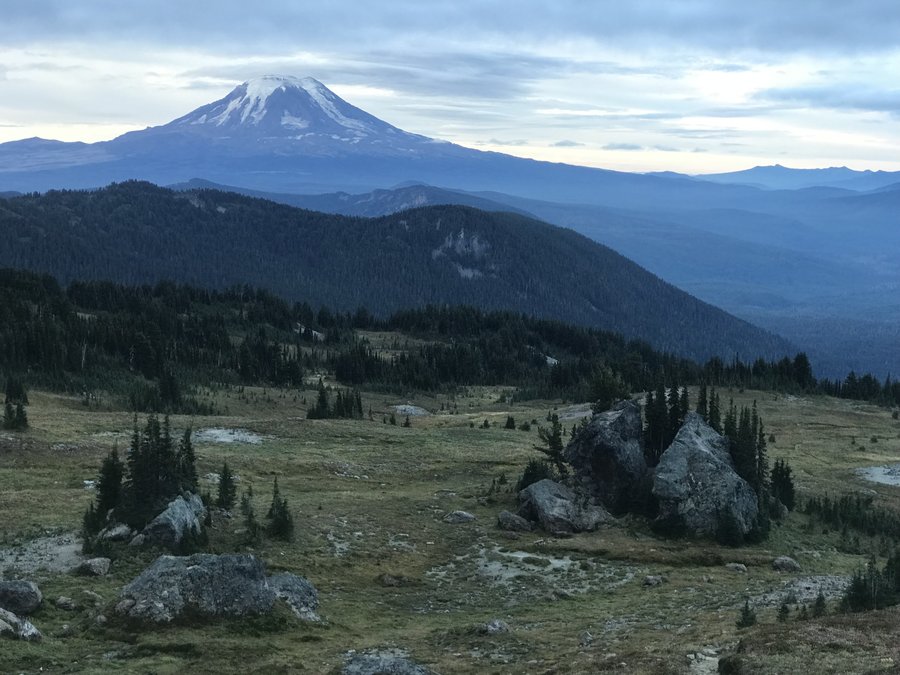
Grayback Mountain
11 miles of hiking • 1750' elevation gain •
Opted for an easy stroll up Grayback after the sufferfest up Defiance last weekend. One of my favorite hikes for solitude. Mount Adams was out and looking pretty majestic. Maybe I'll have to take a stroll up there soon....
May 2, 2021

 1
1
Mount Defiance
11 miles of hiking • 5000' elevation gain •
Had to spend last weekend (with it's beautiful weather) in self imposed quarantine, as many of my coworkers tested positive for Covid 19. Ended up doing a 20 mile bike ride once I got my negative results Sunday afternoon.
As a result of them testing positive, my skeleton crew of 3 did everything we could to keep our department going minus 5 people. Lot's of anger, as I had previously complained to my HR that the guys didn't take proper precautions. My personal crew and myself were almost to our second vaccination dose, and we were very lucky with our negative test results. Kind of amazed it took this long to have this happen.
Anyway, a week off of hiking (aka anger management), with lots of extra work and frustration leads to... the biggest sufferfest I can think of. Defiance. Kat suggested it, and at first I was like, "I'll let you know how I feel on Saturday..."
Then I said screw it, let's go.
Our friend Tom was added to the mix and a meetup time of 9 am was decided. I had the most fatigue and I'm the slowest, so I was chosen to lead. It was very slow going up. I've been up Defiance twice before but somehow I forget how relentless the up is. Somehow, it ended up being a completely magical day, despite the suffering.
We had so many different types of weather. Sunshine, fog, rain, snow, sleet. We were going up in t-shirts, then a snowstorm where we put on rain layers, and just as quickly, the sunshine overcame all and we were back to shedding layers. We originally had intended to do the entire loop, but with my slow lead, I decided we should just follow our footsteps back through the snow rather than spend more time finding the route the other way. I've been down Starvation and seen the views, but honestly, my knees hate either way. The worst part of going up Defiance is coming down Defiance.
April 25, 2021

 1
1
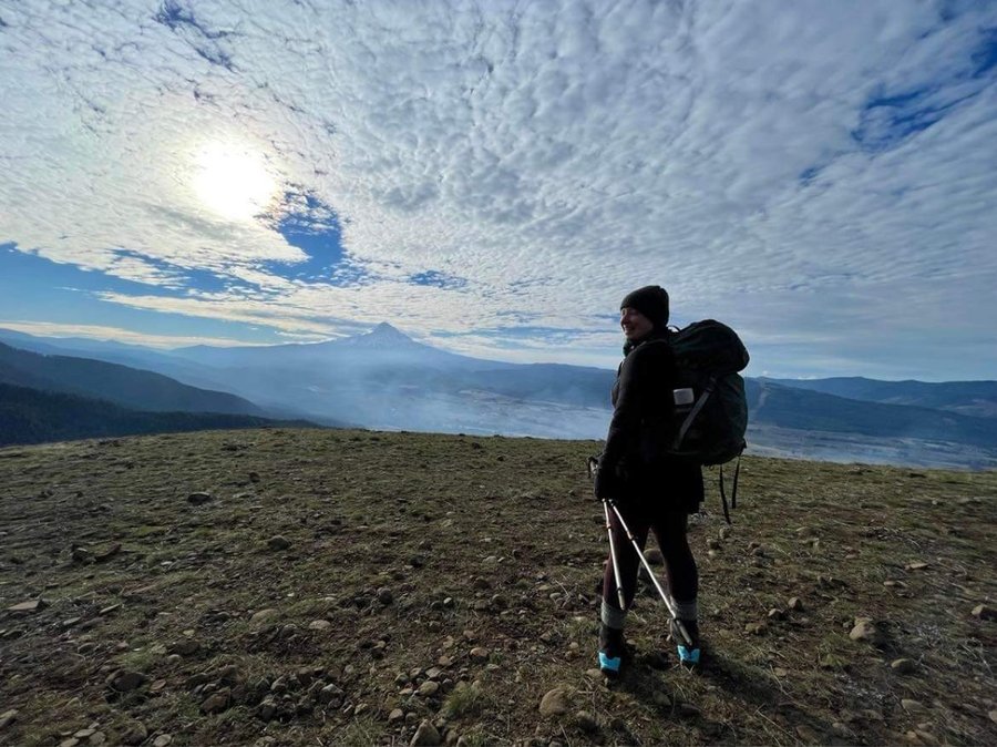
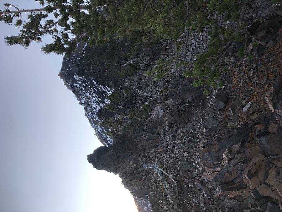
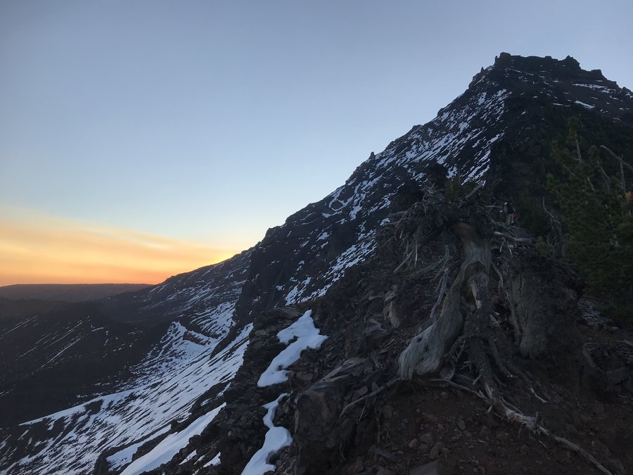
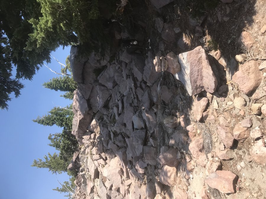
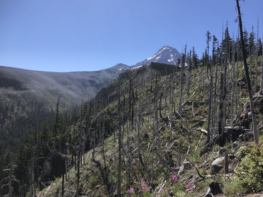
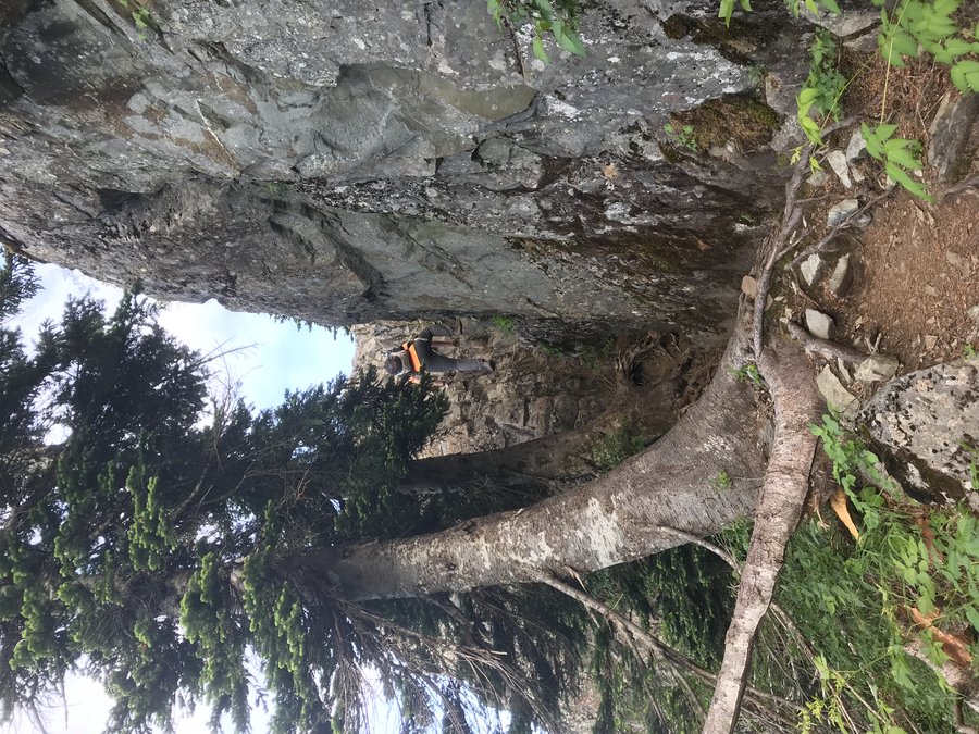
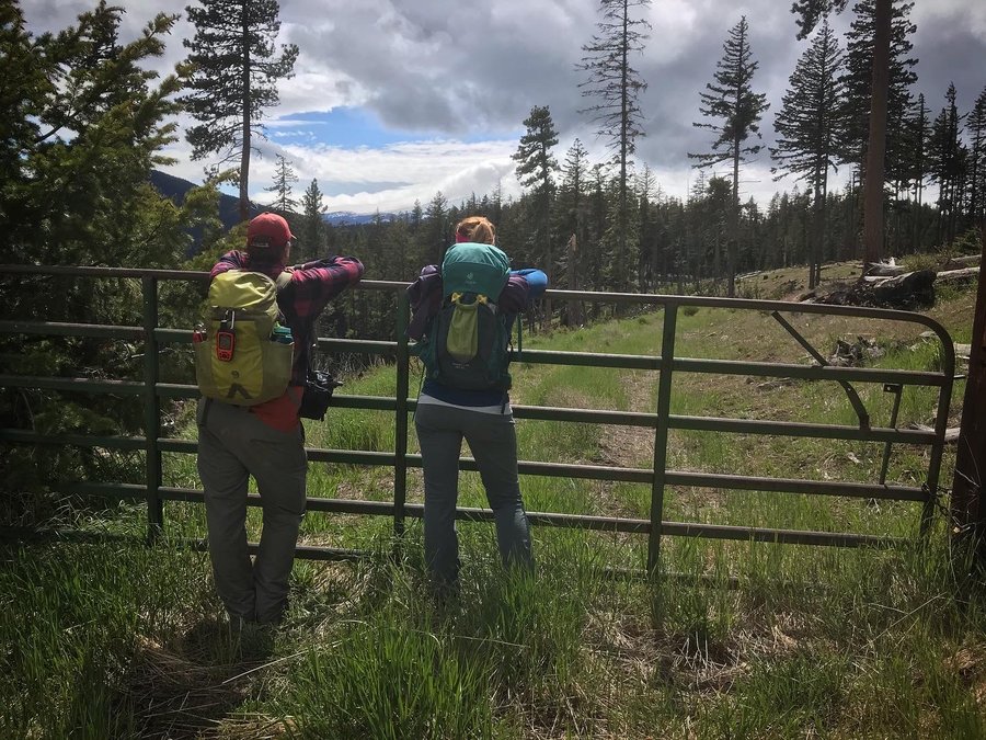
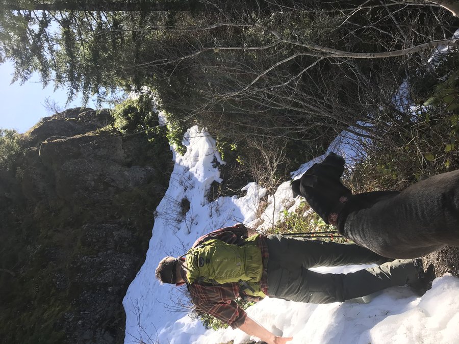
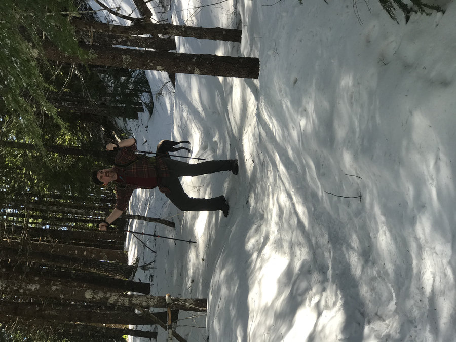
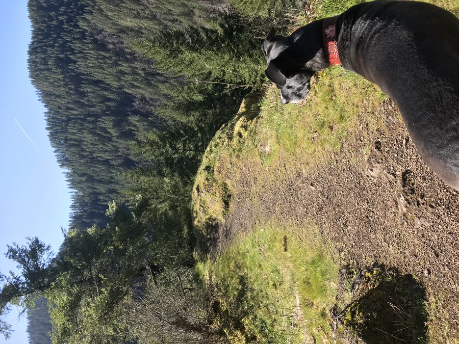
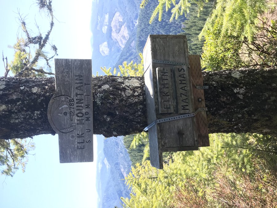
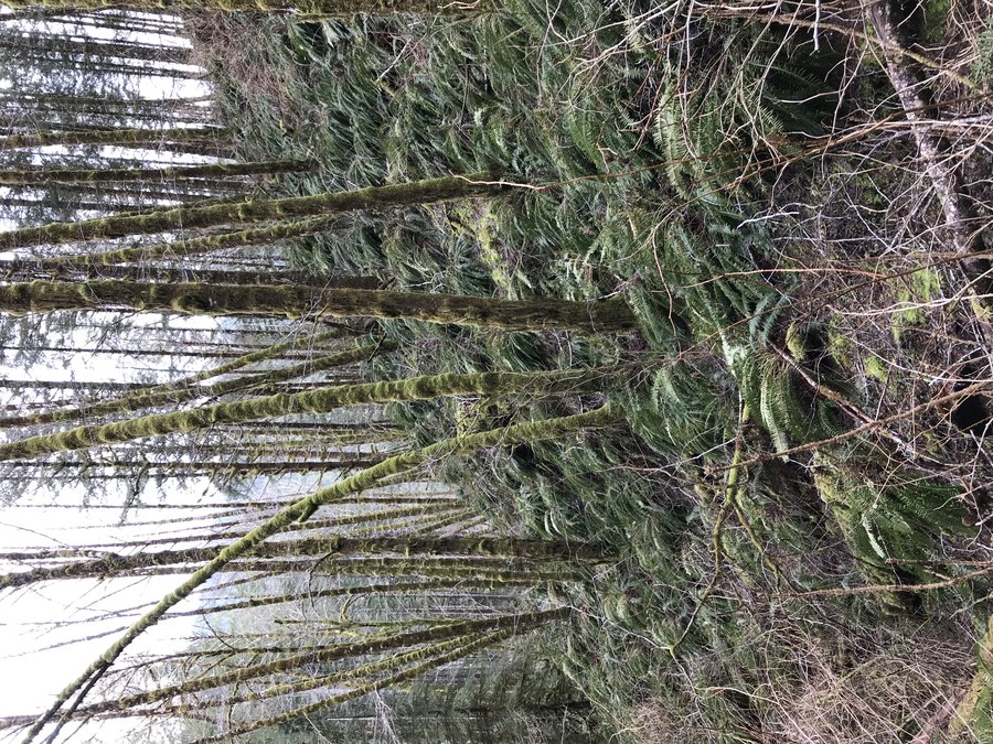
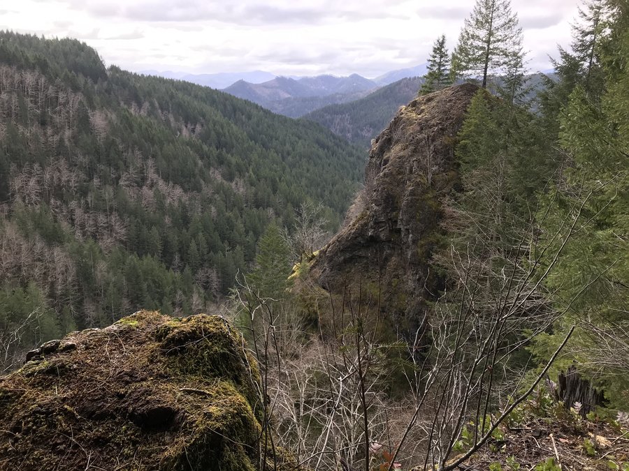
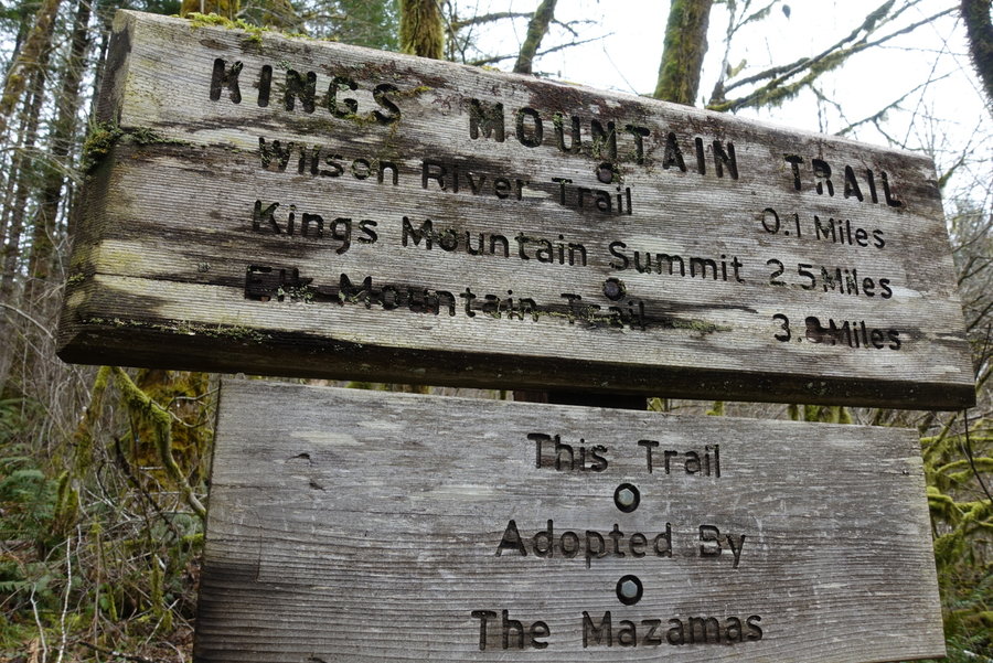
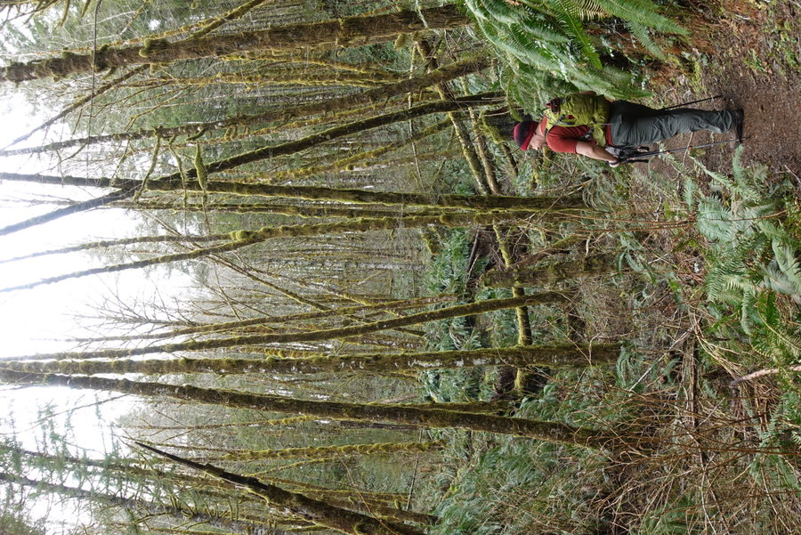
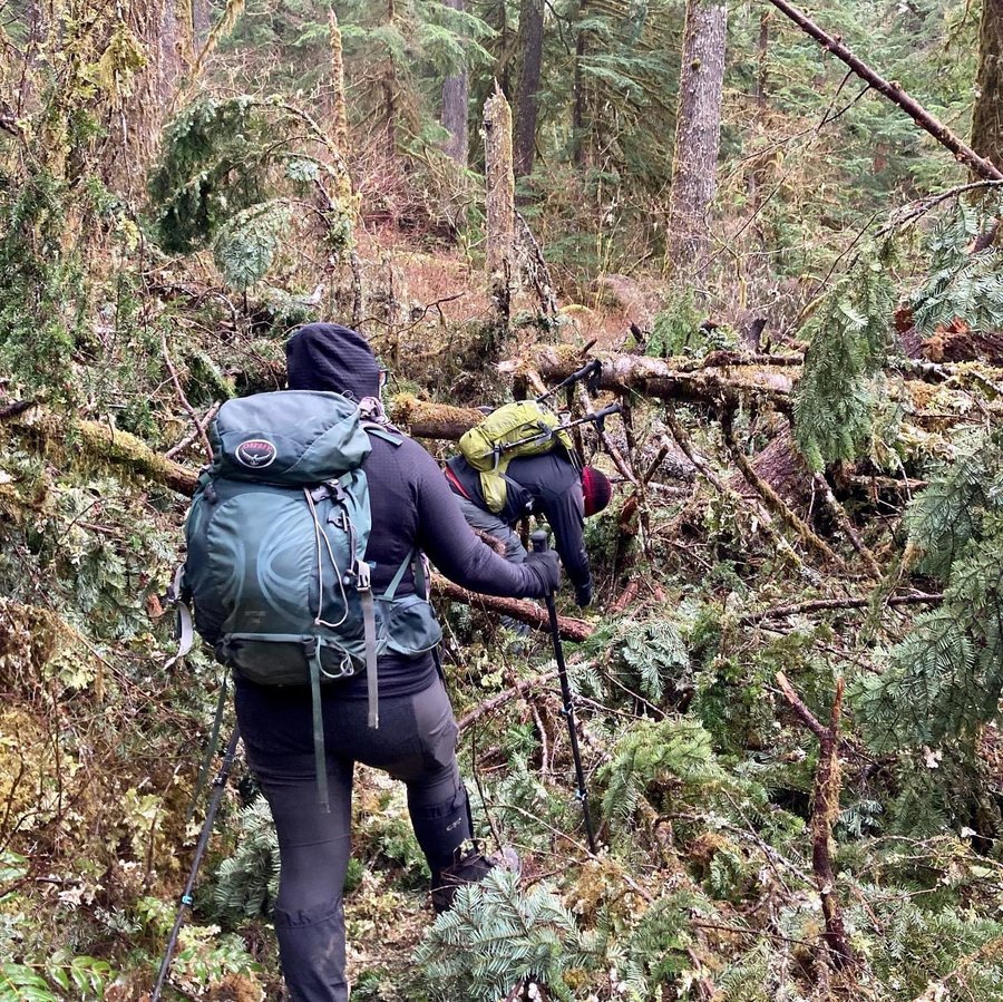
Elk King Traverse
10 miles of hiking • 3750' elevation gain •
This was long overdue. I'd been up King, been up Elk, and even had attempted the traverse years ago when I first moved to Portland. (It was winter without much daylight, and we had turned around at the rope and went down the gentler Elk Creek Trail instead of finishing)
In my head, I wanted to see if I had grown enough as a hiker to finally complete this mental and physically exhausting adventure.
I knew that I didn't want to have to complete another 3.5 miles on the Wilson river trail after all the work off the traverse, so we began at Kings trailhead and got that part out of the way first. We only ran into one other group, who were starting from Elk and doing it in reverse. That section of trail is not as flat as one would think, and started us gently upwards towards the beginning of Elk.
Anyone who has been up Elk knows that it is punishing. Not only does it climb something like 2000 ft in 1.5 miles, but a lot of it is scrambling. I put my poles away when going up Elk, they just get in the way. I did have my leashed dog in my hands, which proved to be doable, though somewhat annoying.
We took a much needed lunch break on top of Elk, only a couple of other hikers shared the summit. After the summit, is where you begin the much more serious section of the traverse. Coming down is a moderately intimidating steep downwards scramble. (You certainly wouldn't die if you fell, but it wouldn't be a pleasant tumble.) More scrambling along the ridge, more cliff edges, until you finally come to the only really pleasant and respectable section of trail. The trail becomes a nice stroll through the forest. It was full of snow, but all of it was hard packed and made for easy walking. The trail then opens up to a junction with the Elk Creek, and you come out of the woods to see your next summit (King) in view. This section would be absolutely stunning since it is treeless, if it wasn't for all the clear cuts that come with the view in the coastal range.
At this point I was really regretting not pushing my initial point to my partner, that it would be smarter to leave the dog behind on this one. Repeated rounds of, she is way better at being steady than both of us with her 4 legs, and I had agreed to let her come along. Sometimes I really need to just put my foot down.
We didn't run into anyone except for the other group doing the traverse the opposite way during the section between Elk and King. We reached the roped section, and made a plan that from now on, the dog would be unleashed and we would guide her between us until we reached the top of King. This section was the most technical part of our day.
Zane went down first, taking full advantage of the rope, then dog, and I stopped at the branch that serves as a mid point to the big drop. I handed the dog to Zane, and they continued down to wait for me. At that point I felt the rope was more in my way than a help, and I just used hand holds on the roots around me to get down. Once that was over I naively thought the worst was over. WRONG. Lingering snow still on the trail, hard packed and somewhat icy, and next to us a cliff edge with just enough vegetation to make me think I cold grab onto something if I started to fall.
Microspikes were an incredible help during this section. The snow had nice footprints in it, probably from a warmer day when the snow had started to melt out. The footprints were perfect for me to step into and I felt relatively okay though still concerned for the dog. Her toenails seemed to work in her favor, and she climbed up between us. We soon ran into at least 3 trail runners through this section, heading the opposite way. Not the best place to try to get around other people, both for covid but also it is damn narrow.
Zane and I have never felt so happy to reach a summit, we had the top of King all to ourselves and were thankful we had safely made the traverse. What a day! Coming down King is a kneebuster. We had initially talked about taking Coronary ridge down to avoid people, but I had had enough, and was ready for pizza and beer. Glad I did it, but I really wouldn't recommend doing the back section of King with snow.
April 11, 2021


 2
2
Phlox Point via Hardy Ridge
9 miles of hiking • 2000' elevation gain •
Cloudy day in the gorge, but beautiful views (minus volcanoes) and fun playing in the snow. Mostly solitude on Hardy, except for a group of bunny ear wearing BCEP'ers we nicknamed the Hardy Hares.
April 4, 2021


 2
2
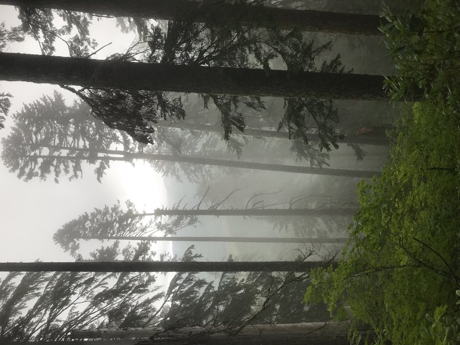
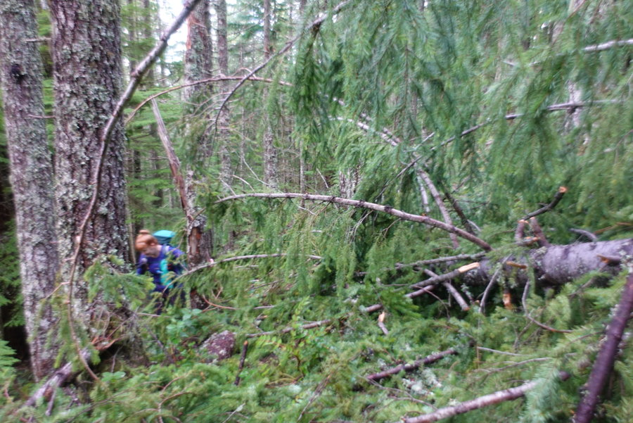
Green Canyon Way #793A until blowdown/snow, partial Salmon River Trail
7 miles of hiking • 2000' elevation gain •
It was Katrin's turn to pick our weekly comfort optional hike, so Green Canyon Way #793 was chosen. We made a plan to go up until we hit sketchy snow or blowdown. This trail rises up, and I mean UP, rapidly. One slightly sketchy section of trail that involves a scramble with a dropoff. Trail is narrow, but felt fine event with snow. We brought spikes, but I didn't end up using mine much. We finally hit a large tree across the trail, in a steep section, without a good way to go around in the snow. Down we went, and added a little bit of the Salmon River Trail till we had enough of seeing other humans. Always fun to just check out trail conditions even if the destination wasn't likely to be met.
March 28, 2021


 1
1
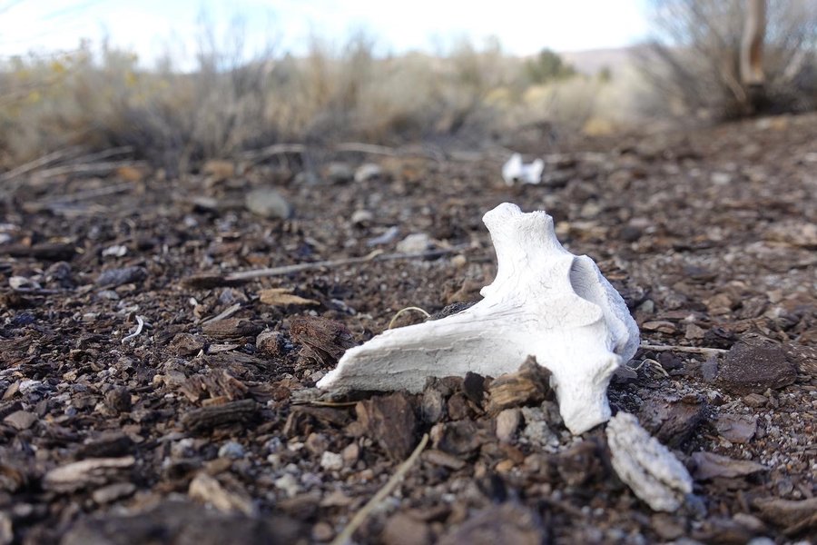
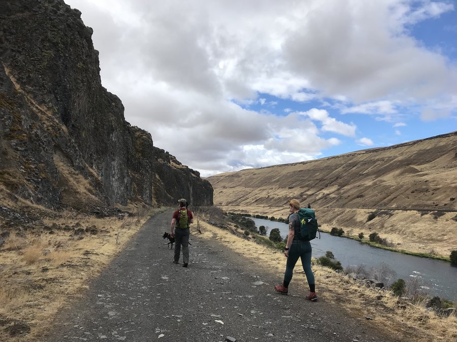
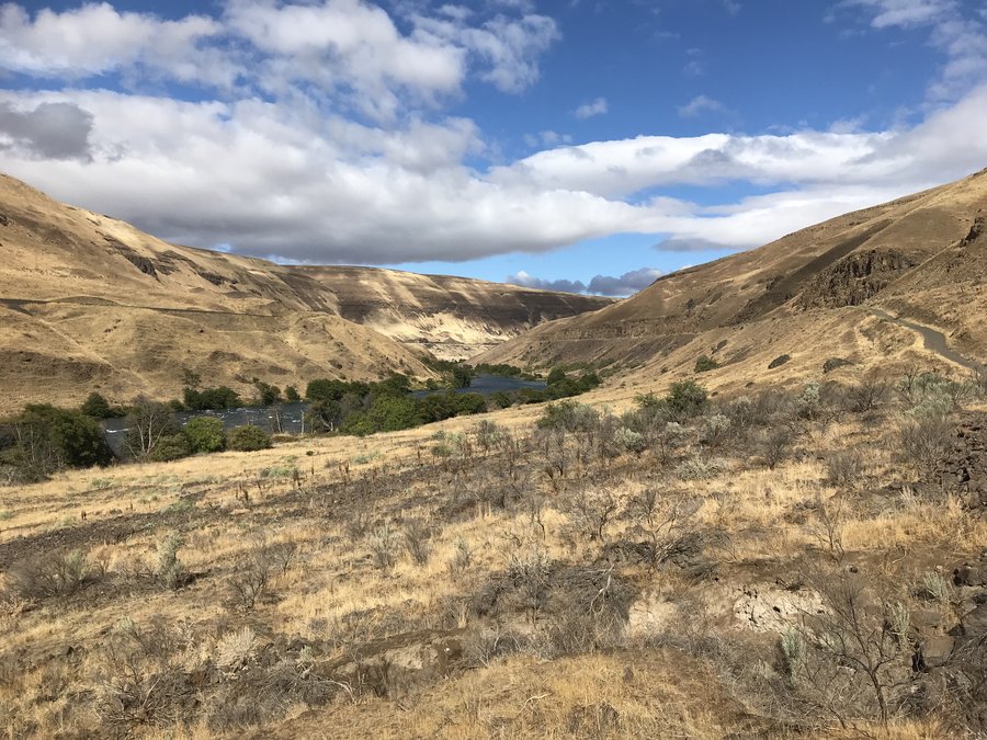
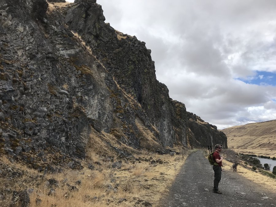
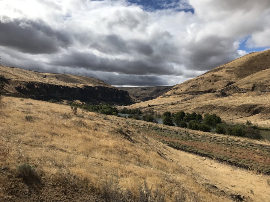
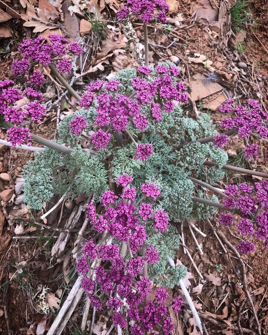
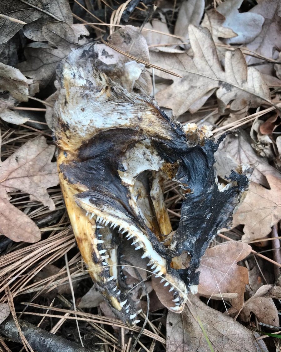
A walk through the Soda Springs Unit of the Klickitat State Wildlife Area
9.5 miles of hiking • 2000' elevation gain •
Fun day with team comfort optional exploring game trails, old farm tracks, and bushwhacking up steep slopes overlooking the Klickitat. No official trails so it was a choose your own adventure day. A bit grey, windy and cold, but it was a good adventure anyway. Mt. Adams tried to make an appearance. Founds lots of animal bones, and spotted a ton of deer. (Sadly, no turkeys.)
I would love to come back here for wildflowers and more exploration, but starting April 15th, the area is popular with turkey hunters.
March 21, 2021


 2
2
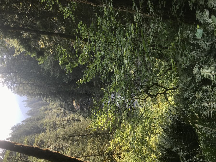
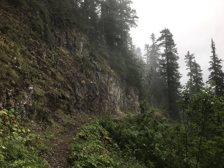
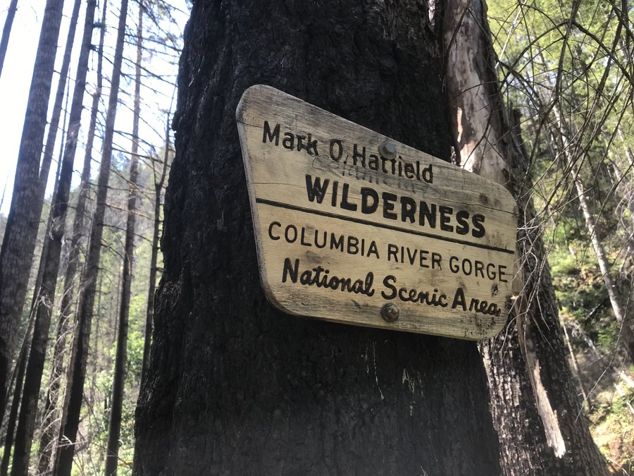
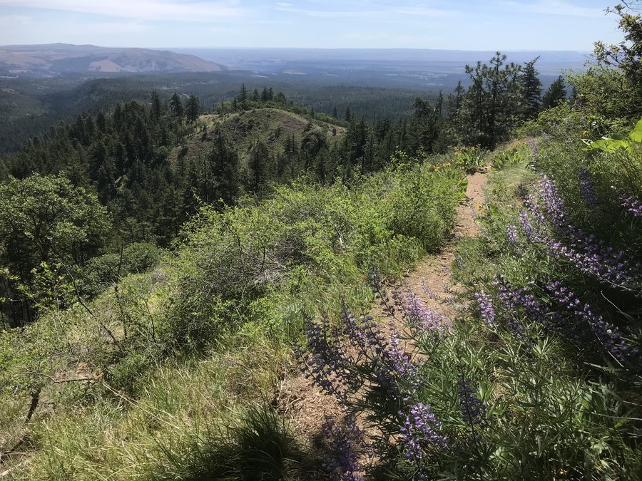
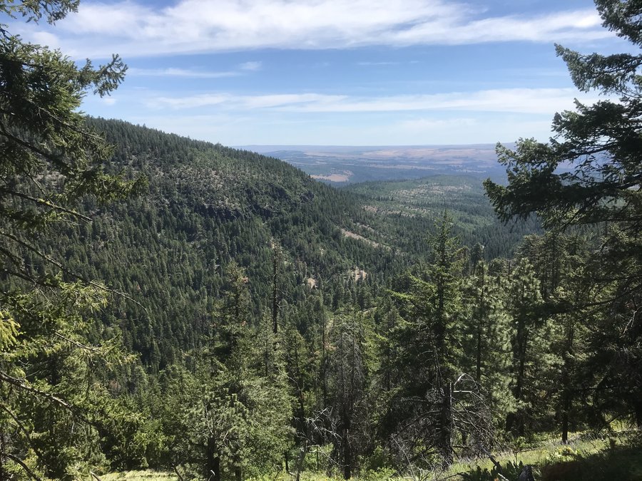
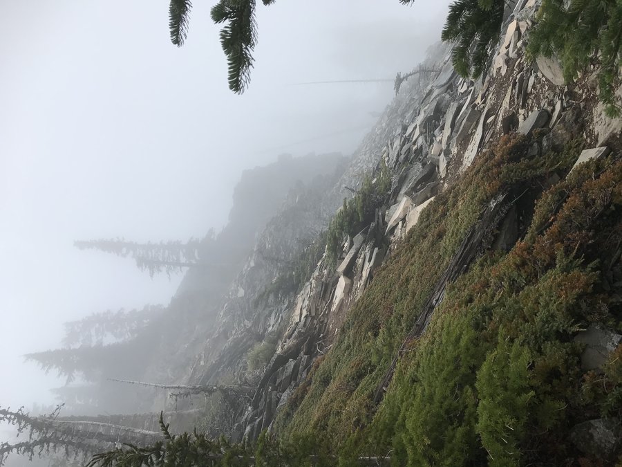
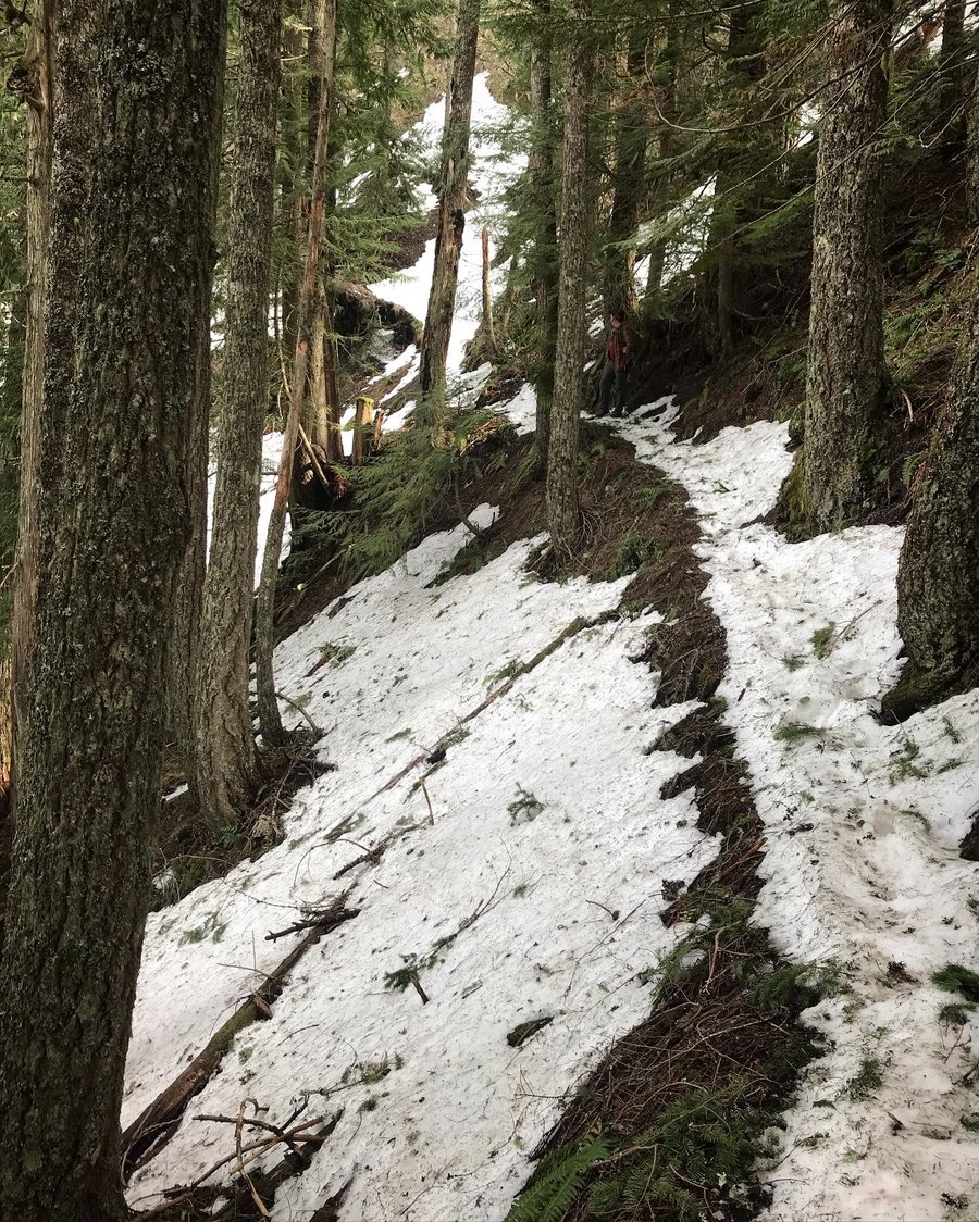
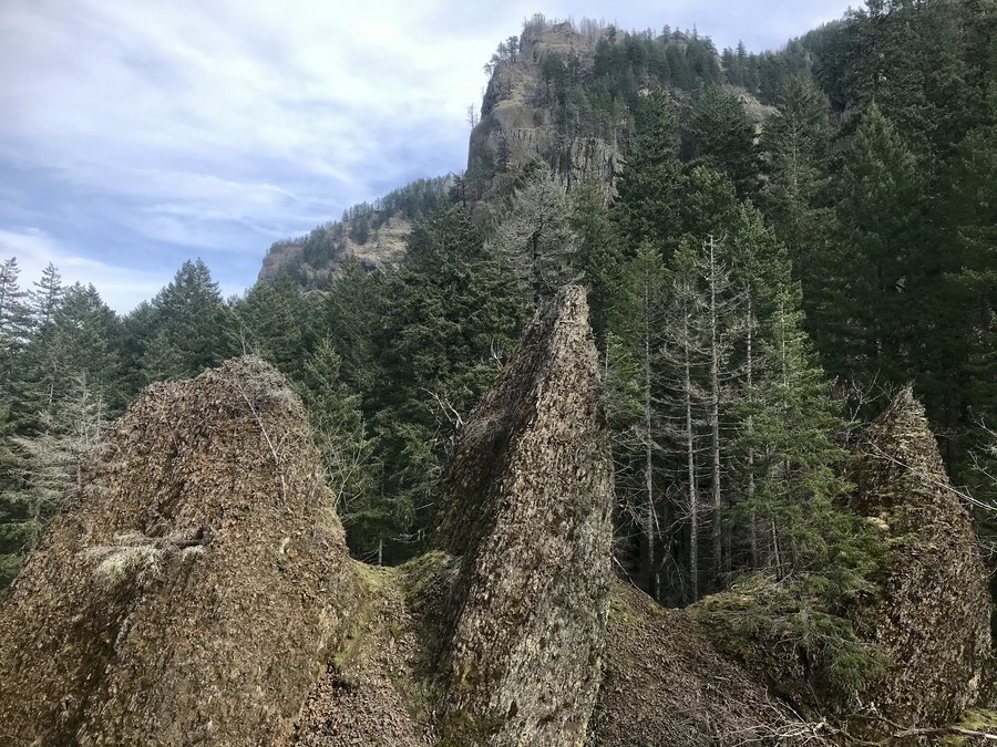
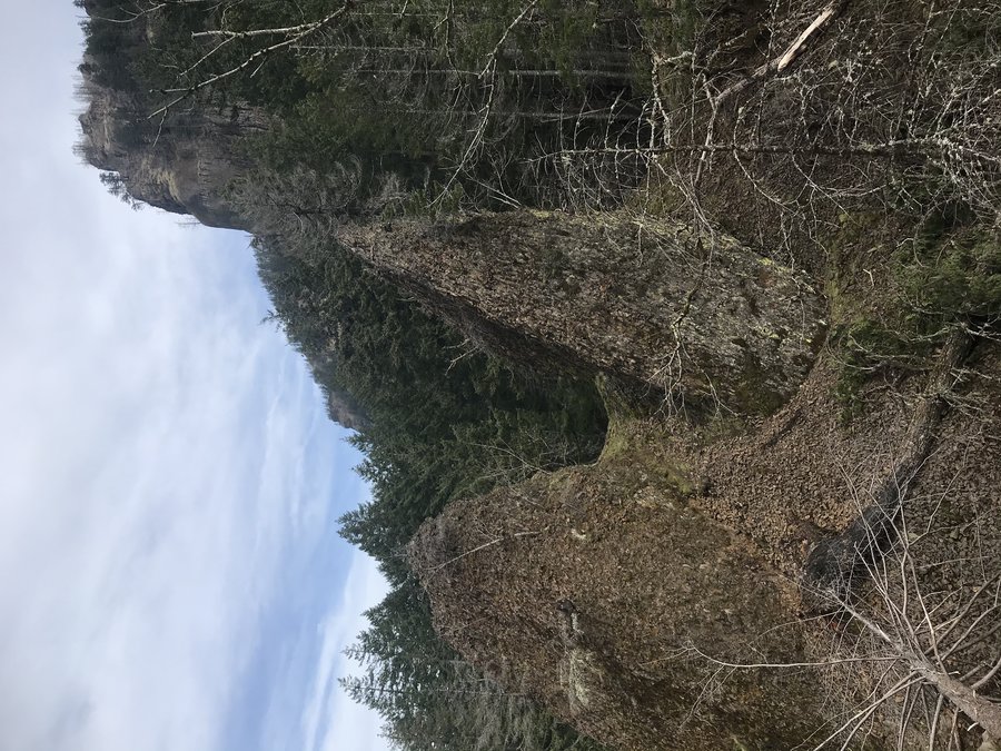
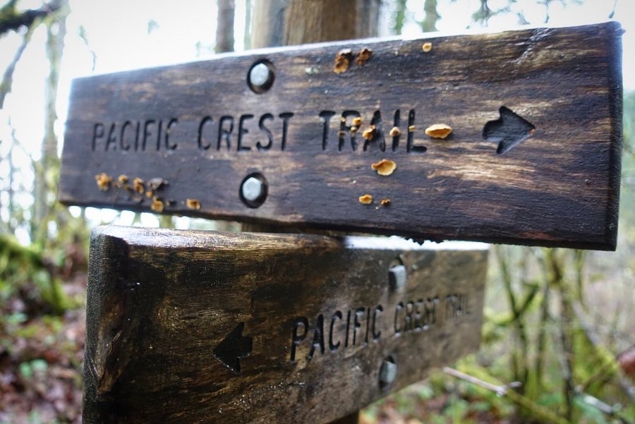
Herman Creek Trailhead - partial PCT up towards Benson, then side trip to Herman Creek Pinnacles
10 miles of hiking • 3000' elevation gain •
Still can't park at Herman Creek Trailhead, parked on the road and walked in.
I usually wait to hike on Sundays, (I work on cement and I've been having issues with my feet hurting lately) but I couldn't resist a good weather day. So instead of a day of rest, I opted to try for some conditioning. Last week I was inspired looking back across the gorge to the Oregon side.
I knew I wouldn't make it to the Benson Plateau, but told myself to go until I felt like turning around. I had never been on the PCT in this section. There were many cars in the road around 9 am, but I honestly hardly saw anyone, probably partly because there are so many different ways you can go from Herman Creek.
The trail itself was mostly clear, though one section was a little eery with how many boulders were in the middle of the trail. Yikes. A few large trees across the trail, but all were easily passable. I still find the forest floor in burn sections makes me a little queasy on cliff edges, I feel it is because I can see further now and with a fall there would be nothing to grab onto. I had to force myself not to look down as this trail is at cliff edge for a lot of it. We hit snow around 2400 feet, and stopped for lunch. My heels were hurting, but I wanted to see if we could make it up to a viewpoint. I had microspikes with me, but I decided I should listen to my feet and come back another day. Down we went, but I did make a side trip to the Herman Creek Pinnacles. I did a quick scramble up and and then headed back.
Not a bad day in the woods, despite my foot pain.
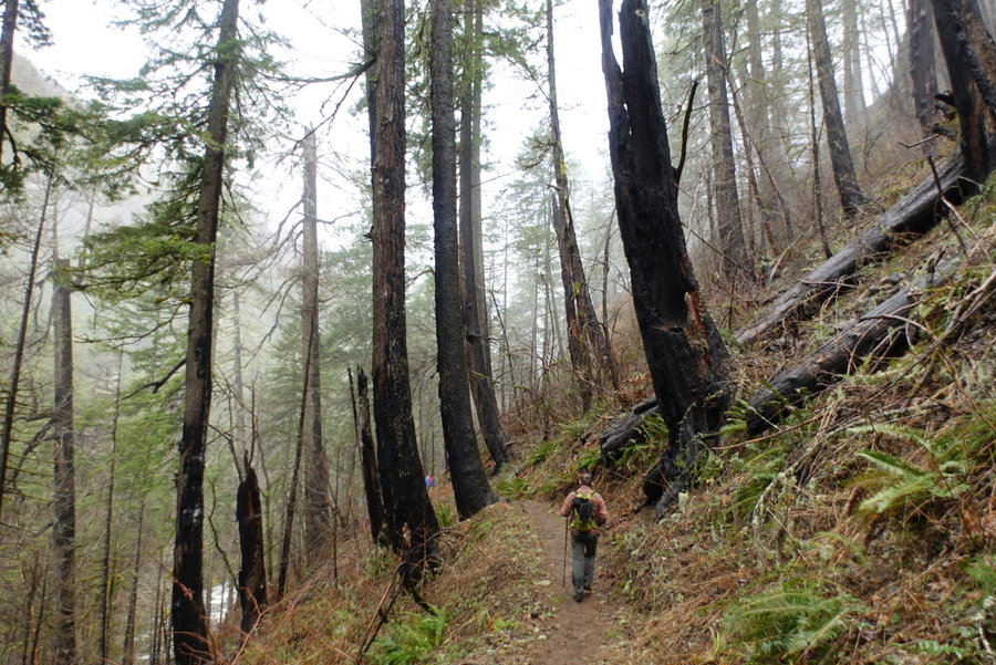
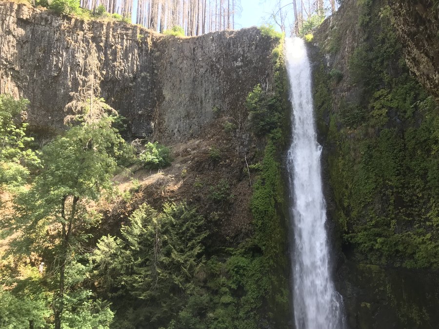
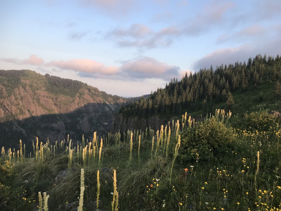
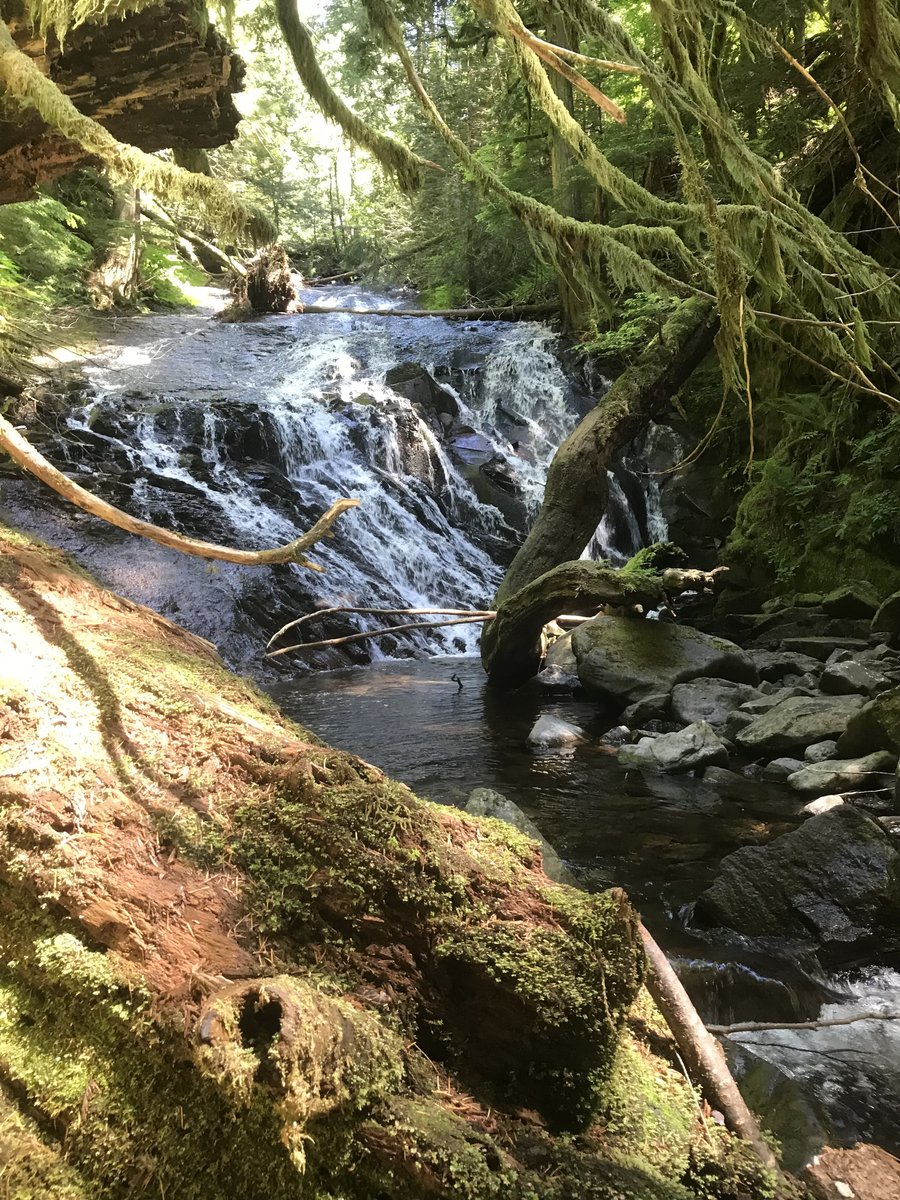
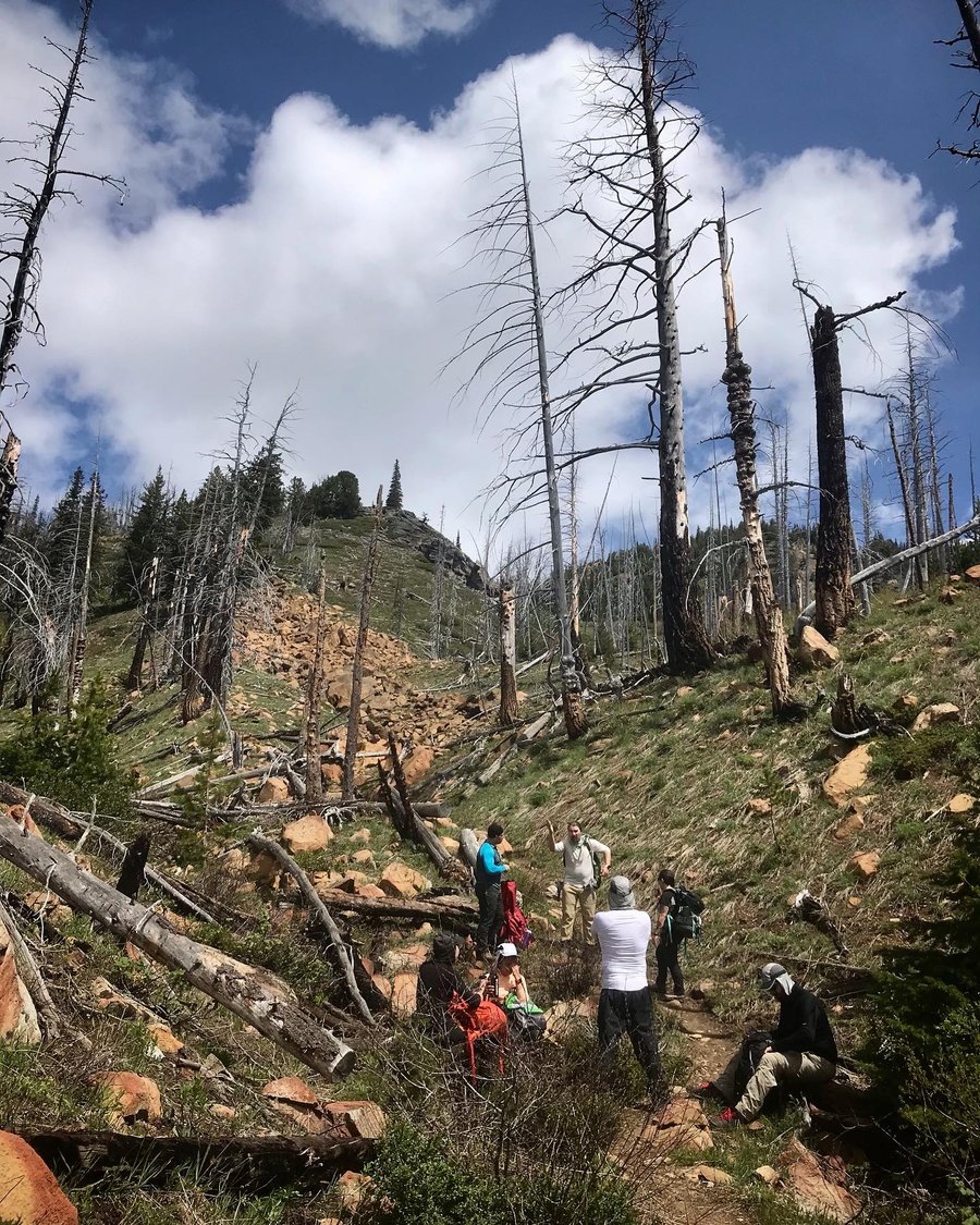
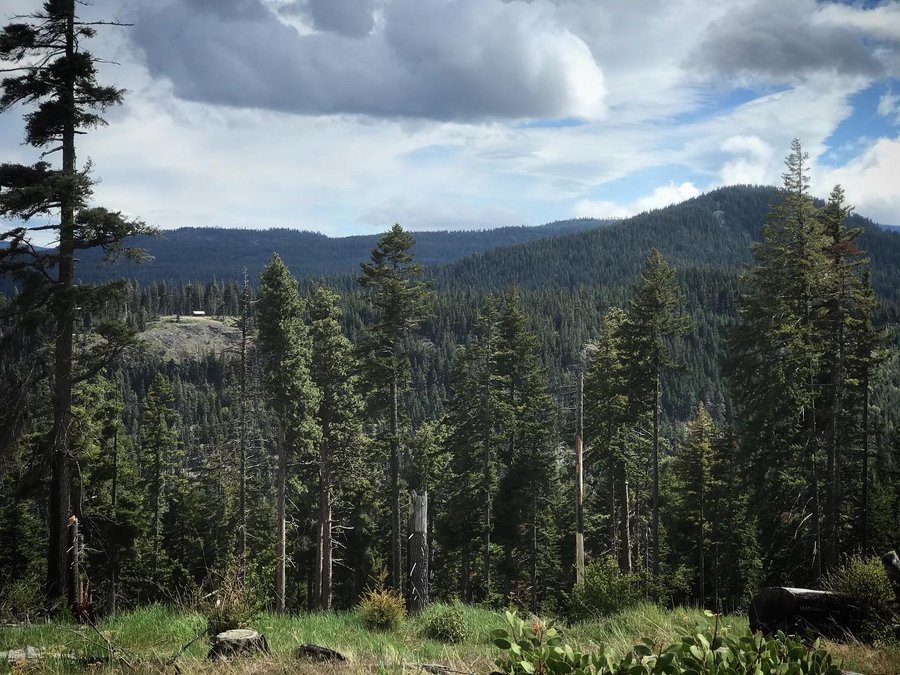
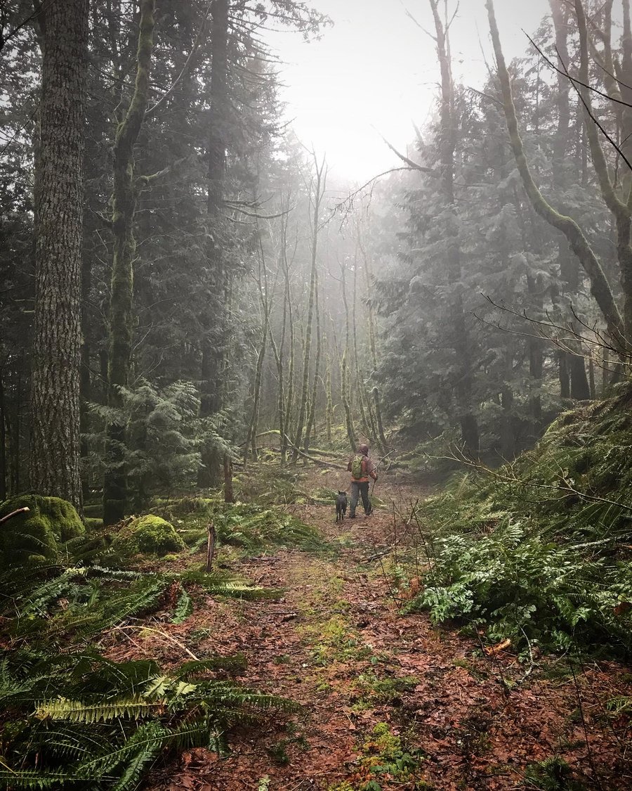
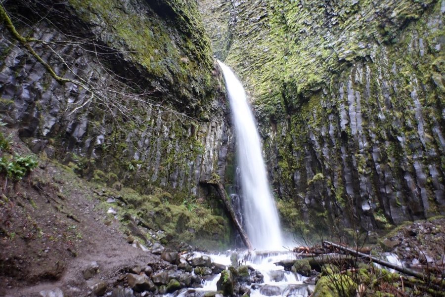
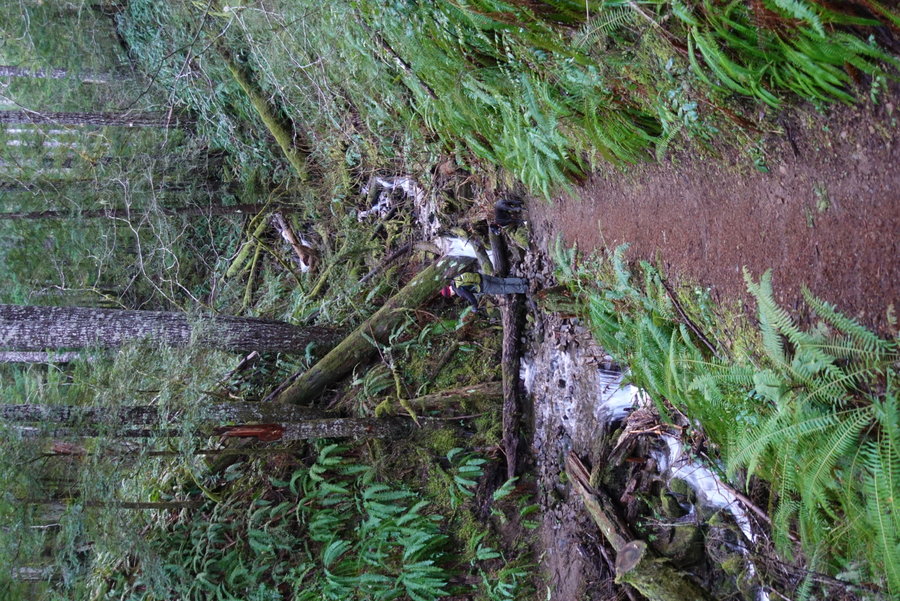
March 13, 2021


 3
3
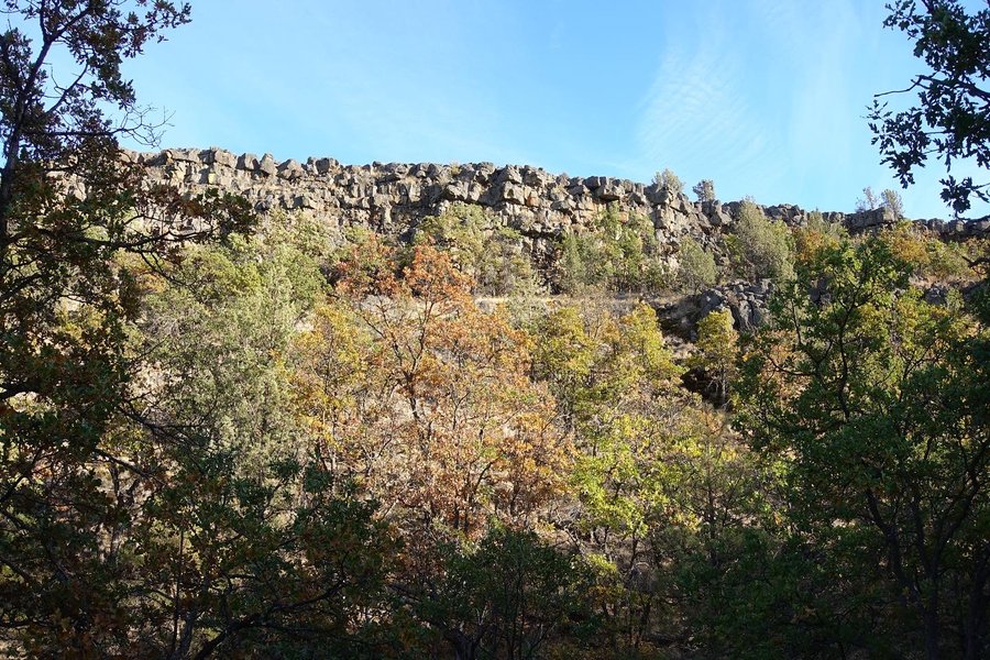
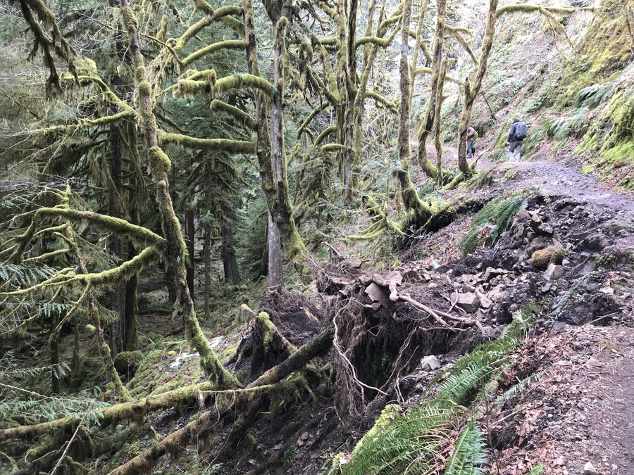
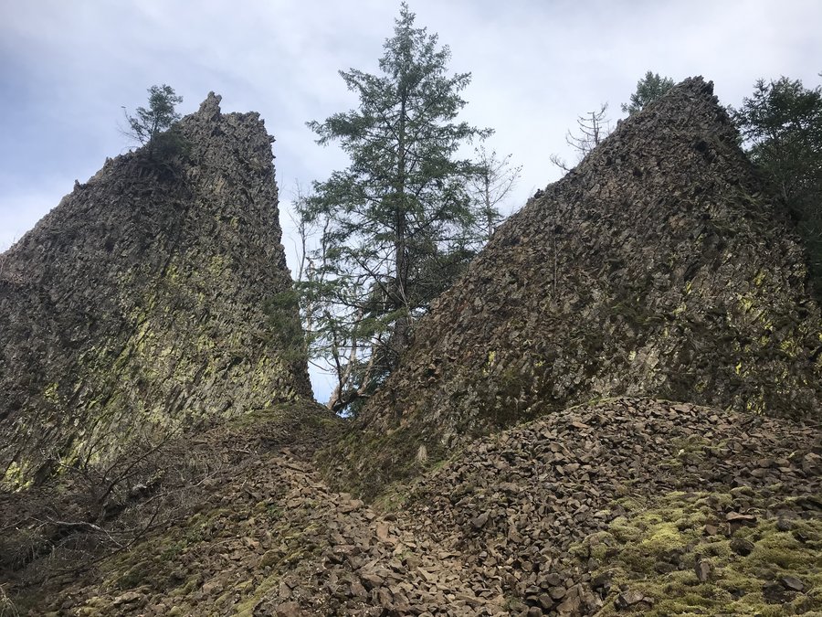
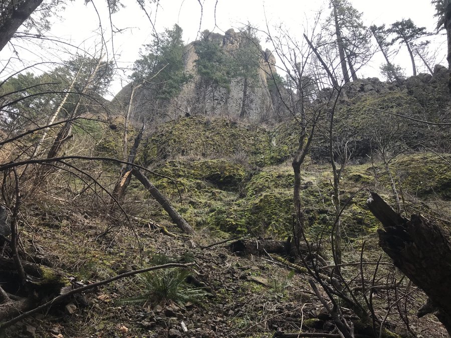
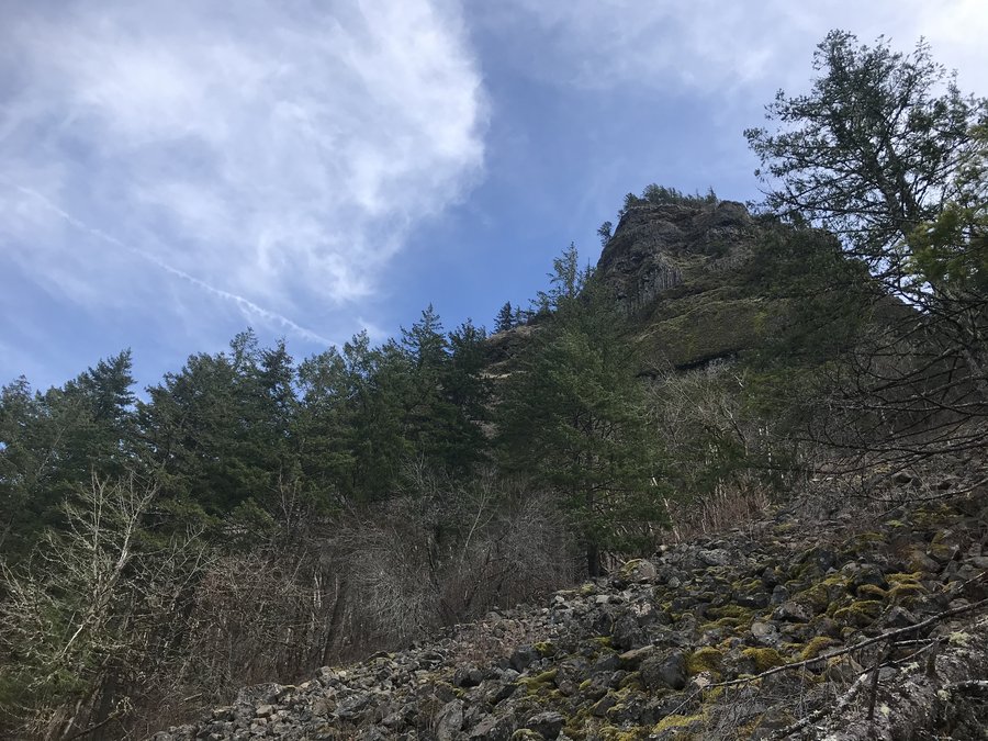
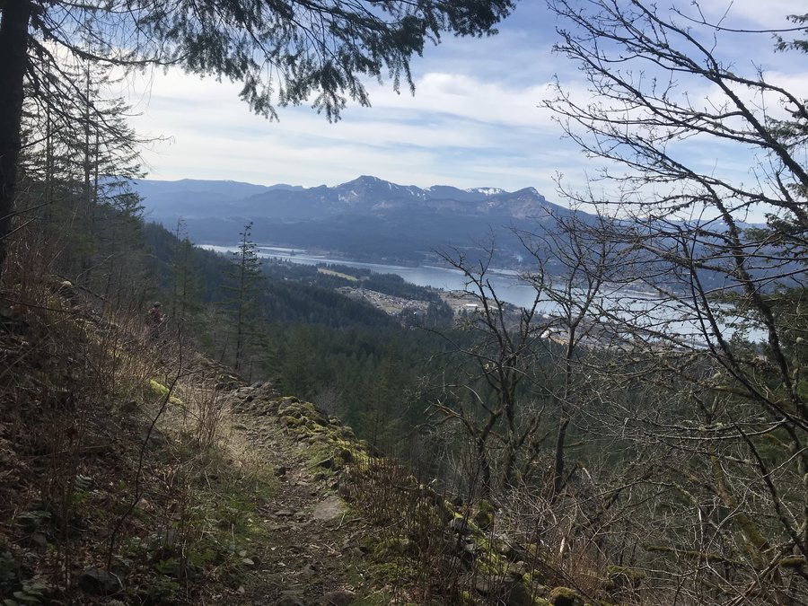
Two Chiefs Trail
15 miles of hiking • 2500' elevation gain •
I've had my eye on this hike for a while, but I was waiting for more hours in the day to make sure I wouldn't be hiking out in the dark. I knew weather was going to be rain on and off on Sunday, but decided to make a go of it even though I couldn't talk any of the usuals other than my partner Zane into joining.
Got up at 6 am, but couldn't quite get motivated to get out the door until a few cups of coffee in. At the Bonneville trailhead by 9. It was surprisingly empty. The early morning rain must have been scaring everyone away.
We started our journey on a very muddy trail, but by the time we were out in the clearcut it was starting to get sunny.
We enjoyed the emptiness despite the desolation, taking in the views across the gorge as we climbed up towards Table Mountain. That summit will be for another day.
The mountain was out, but not for long. We hit our junction - and turned onto the unmarked Two Chiefs trail. The old ATV road was in pretty good shape, nature taking over slightly but still a pretty clear trail with just a bit of blowdown.
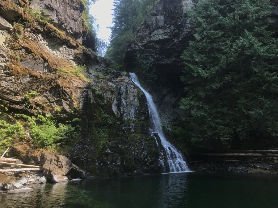
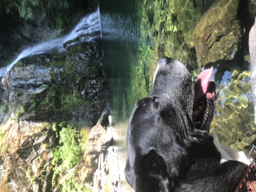
As we neared our destination - the base of the slide of Table Mountain, the weather turned on us. It hailed, it rained, the wind picked up and everything was socked in. No major views for us but I still enjoyed the mossy road. We reached the creek and enjoyed the waterfall. I've read that the upper drop is more dramatic but it was too cold for any off trail shenanigans. I was interested in seeing the 2007 slide past the falls, but the dog was shivering and I wanted to keep moving.
Instead of enjoying a lunch we turned around at a brisk pace to keep up our body heat.
Of course, as we reached our trail junction, the sky cleared and the sun came out again.
Going to have to give this one a go again on a warm day.
March 7, 2021


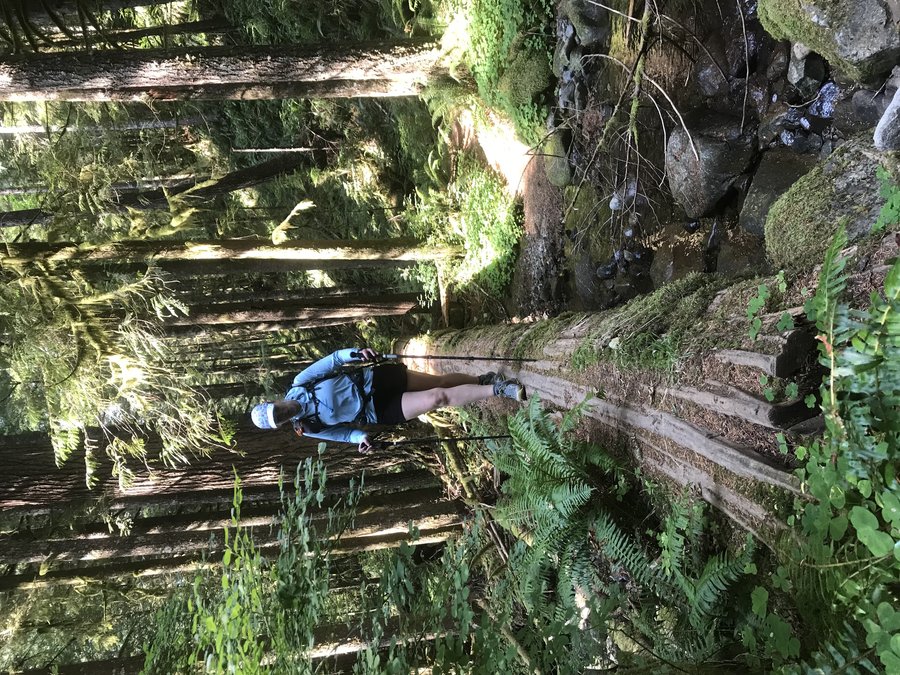
 2
2
Wilson River Trail - part of Lester Creek section
6 miles of hiking • 1500' elevation gain •
Went on a long bike ride Saturday, so I slept in a bit Sunday and got a late start. Went with a plan B and decided to head out from the King's Mountain trailhead. Lucked out at the busy parking lot and nabbed a spot just as someone else left.
Instead of going up to the summit of King, I set off on the Wilson River Trail towards Lester Creek, without a destination in mind. I just set a turnaround time of approximately 3 and trudged my tired legs up. It felt like spring, and as I sweated blue I was down to hiking in a t-shirt for the first time in months.
Trail was mostly clear, until we ran into a ton of blowdown as we neared the crossing of Lester Creek. (And the creek itself was full of fun debris to climb over.) We only ran into two other groups, lots of solitude on the trail. Around the bad blowdown a couple of mountain bikers abandoned their bikes and it looked like they were following an old roadbed on foot instead.
We stopped for lunch when we reached an overlook to the Lester Creek Pinnacles. With only one car we had to turn around come back the way we came. I would love to tackle the whole Wilson River Trail one of these days as a shuttle.
February 28, 2021


 1
1
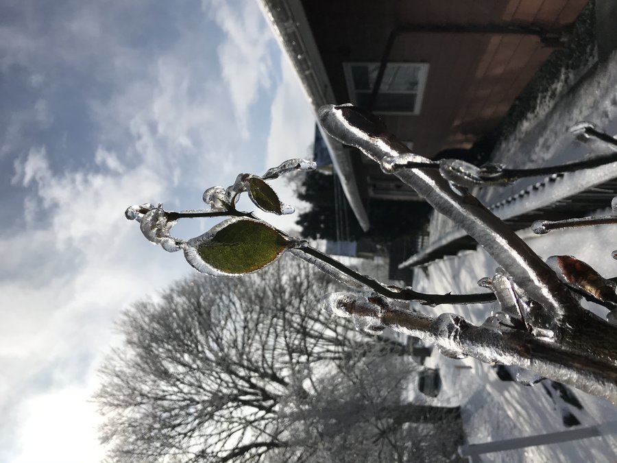
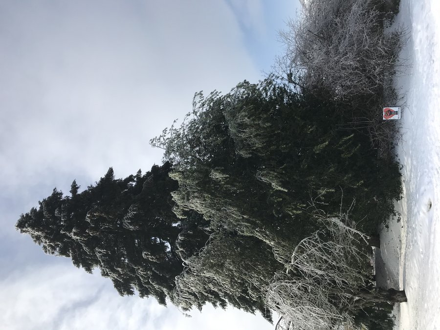
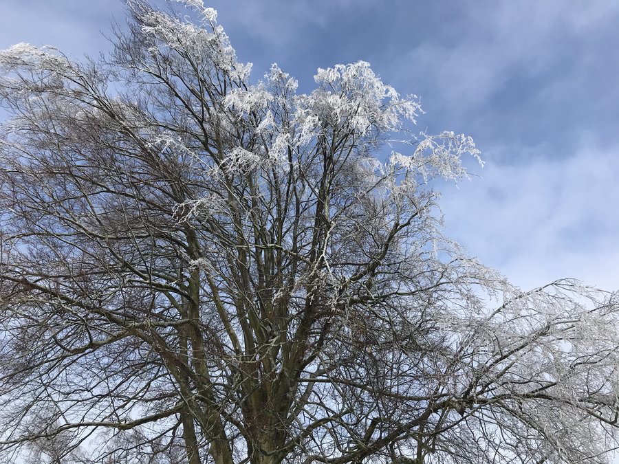
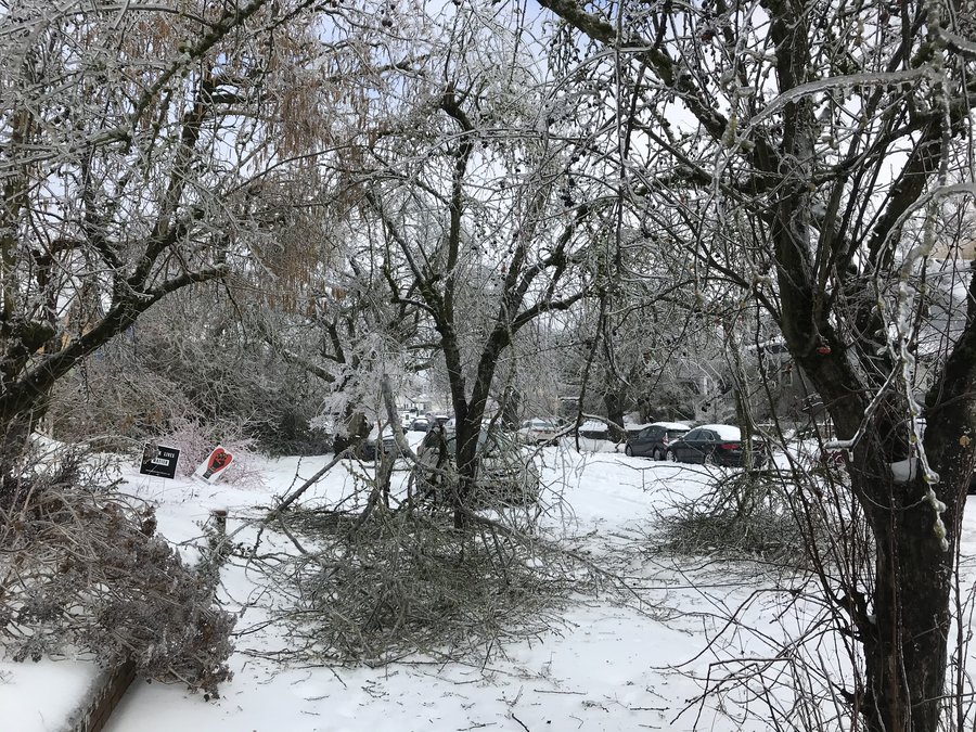
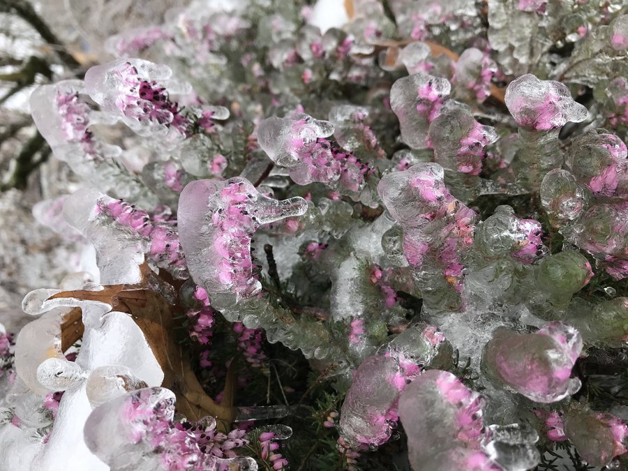
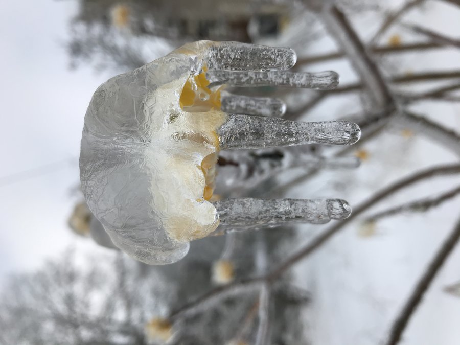
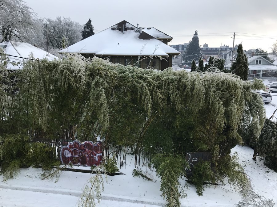
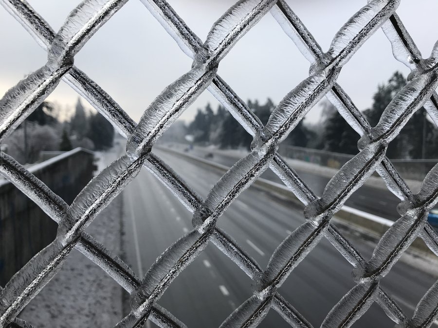
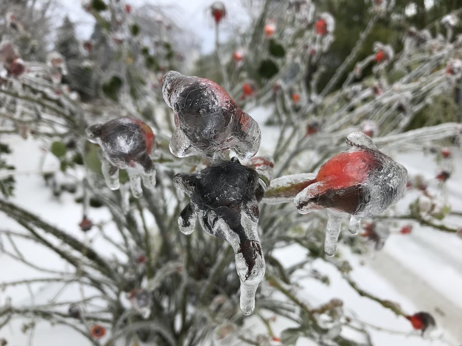
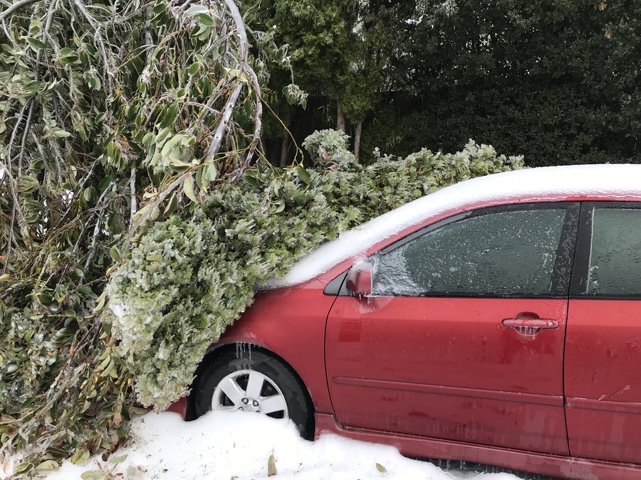
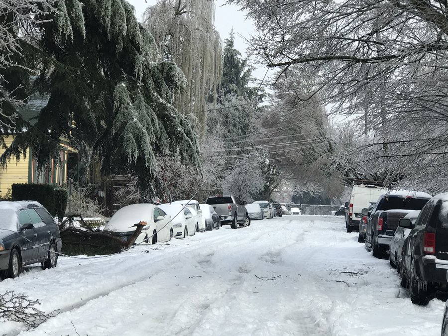
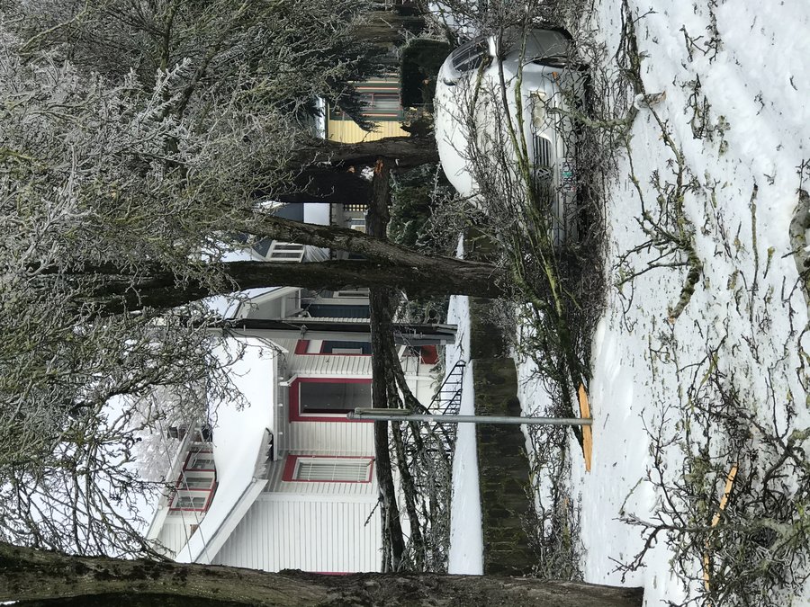
Mississippi Neighborhood before/after the storm
5 miles of hiking • 250' elevation gain •
A few trips over the weekend checking out the neighborhood, before and after the ice.
February 14, 2021


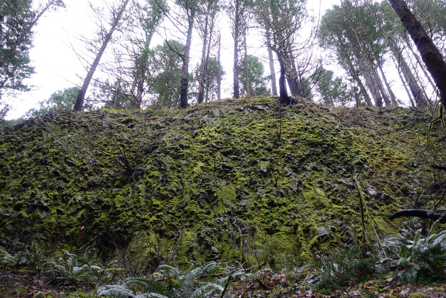
 2
2
Storey Burn Loop
8.5 miles of hiking • 1250' elevation gain •
A day filled with tree stumps with hair.
February 7, 2021


 1
1
Dry Creek Falls
4.5 miles of hiking • 750' elevation gain •
Slept in, felt guilty about not getting up and getting out.
Decided to try for a late start, breaking my rule of hiking popular trails on a weekend. Luckily the late start gave me some solitude as most hikers were on their way out as I was heading in. Managed to get one waterfall in before dark, and the rain didn't really start coming down until I was back to my car.
January 31, 2021


 1
1
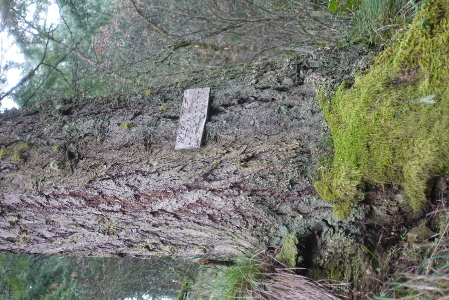
Wygant Peak
7 miles of hiking • 1500' elevation gain •
Wygant trail sadly in need of some clearing again. We stopped shy of the summit due to to some nasty blowdown.
January 24, 2021


 3
3
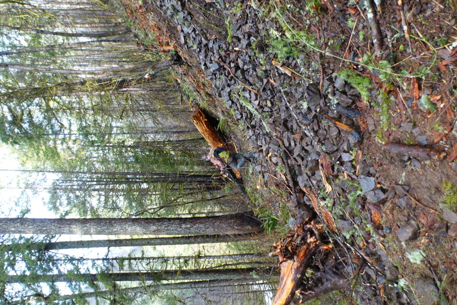
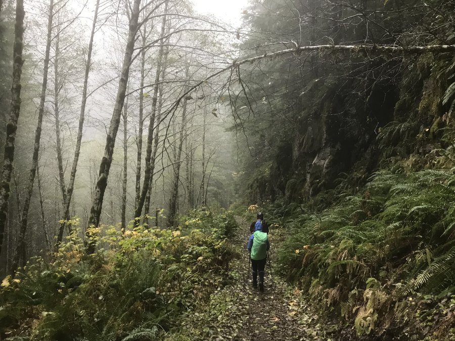
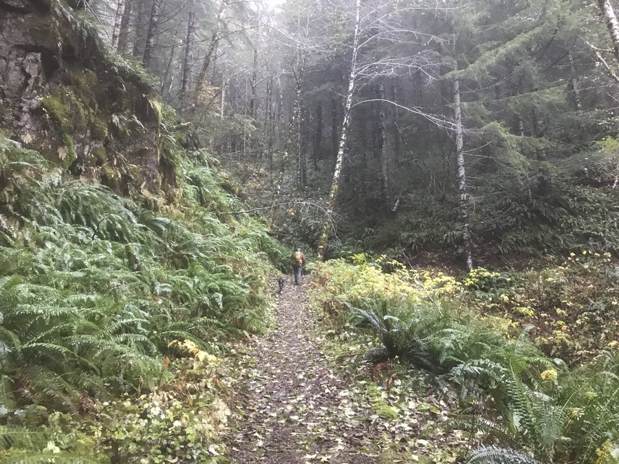
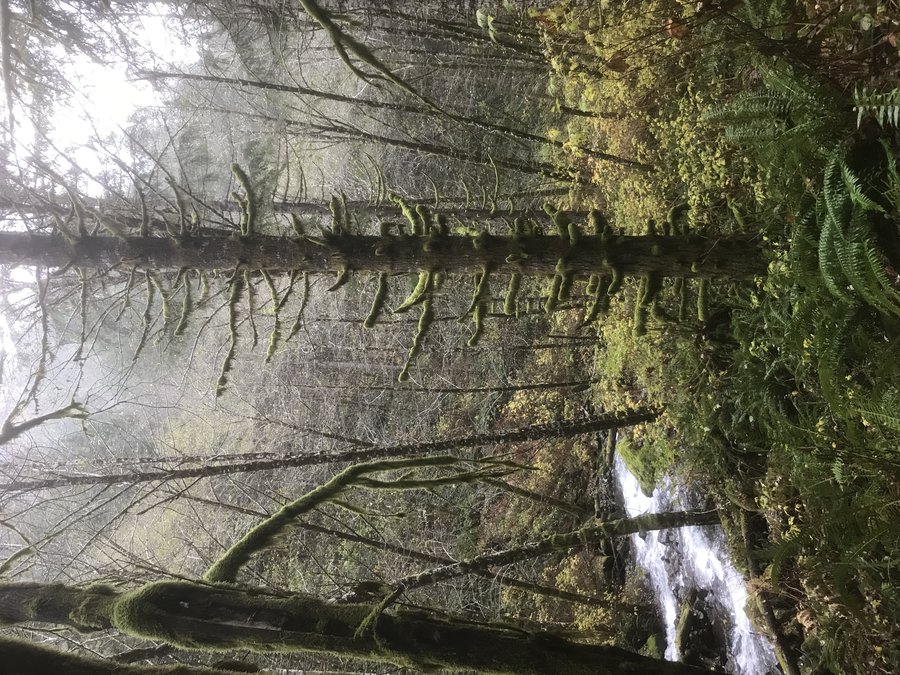
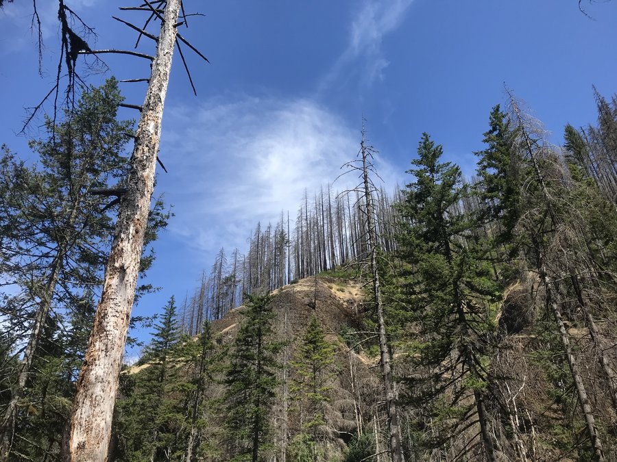
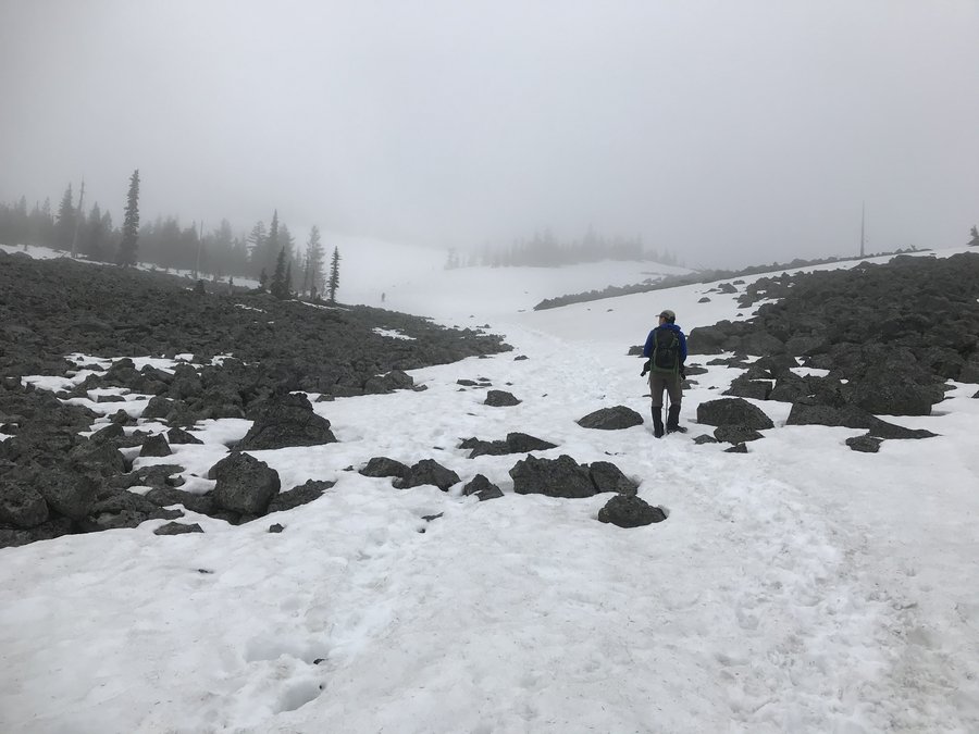
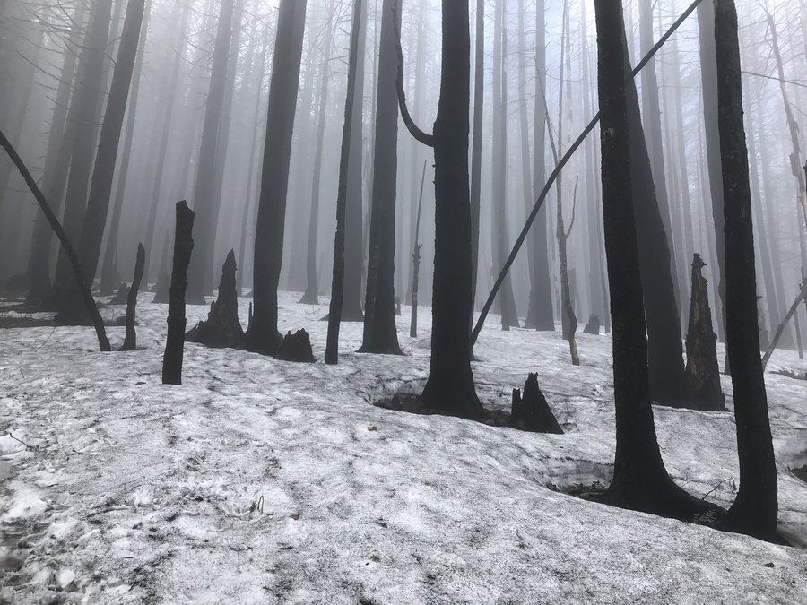
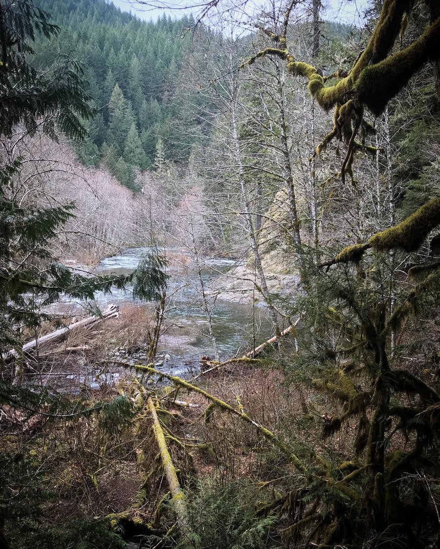
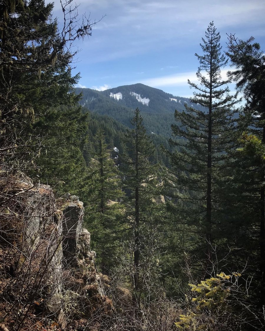
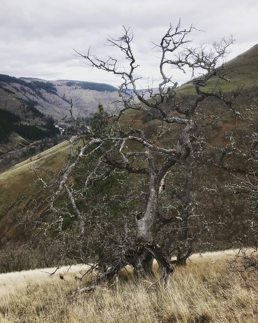
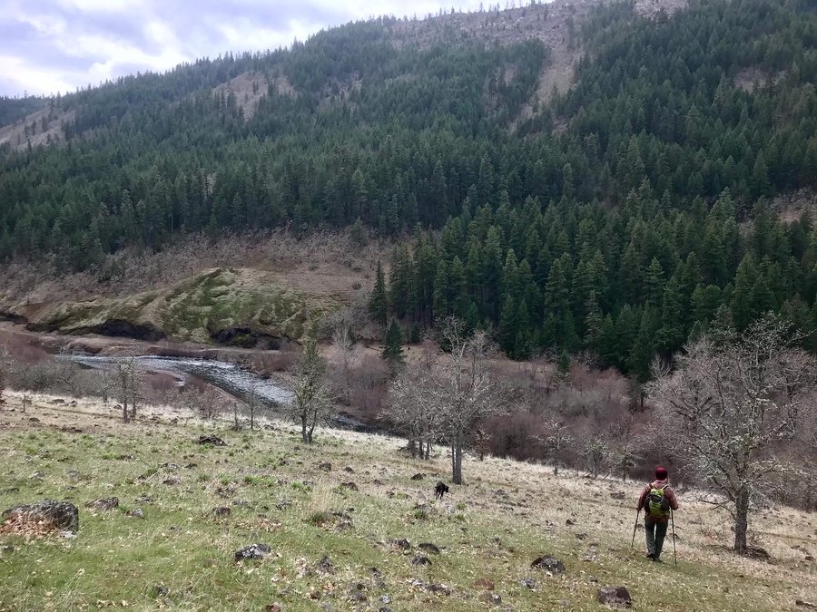
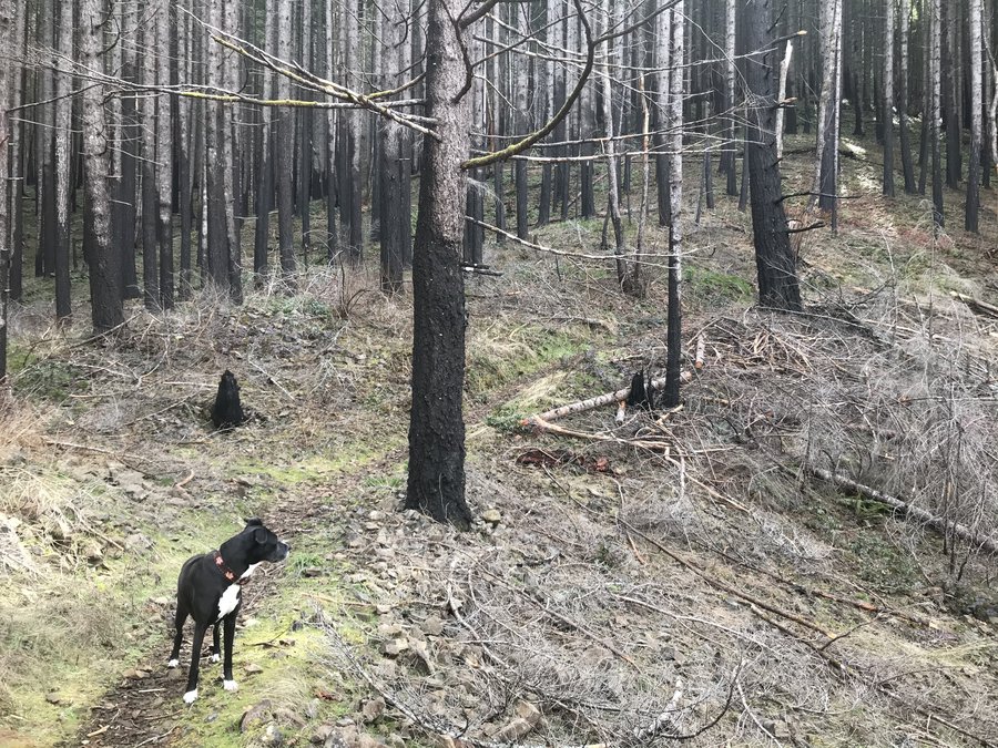
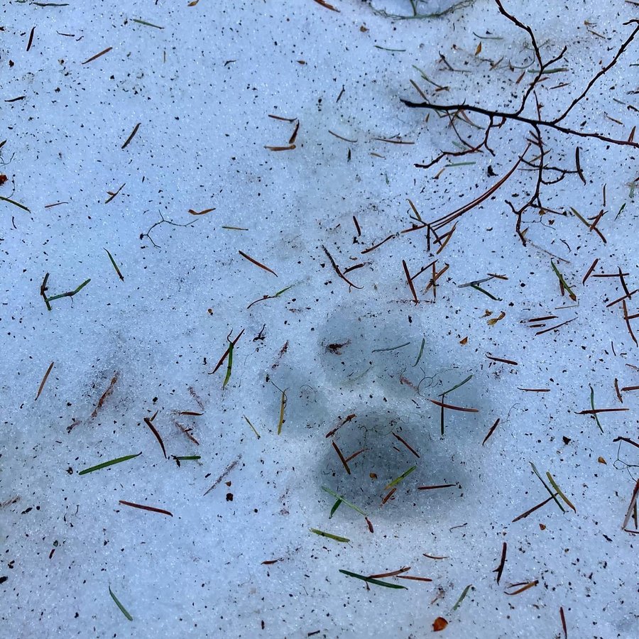
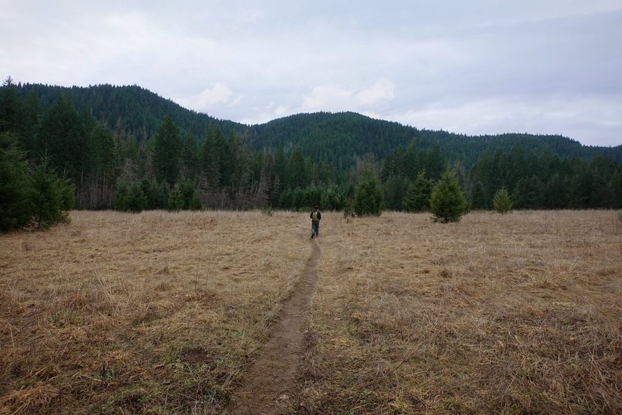
Mowich Butte from Trout Creek
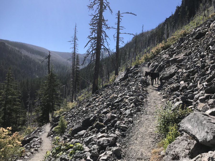
14 miles of hiking • 2500' elevation gain •
Set out to explore again away from crowds. Started at Trout Creek Trailhead, onto the PCT.
First creek crossing made a little difficult with a newly fallen huge tree. What looks like it used to be a rock hop is now a balanced log crossing unless you want to get wet. The tree was so large that it also blocked the trail prior to the crossing. We passed it and wondered what we were getting ourselves into for the day. We ran into one more large blowdown and one slide, annoying but both easily passed. Another obstacle was a huge pond that had taken over the trail, but we bushwhacked through the forest around it and were able to meet up with the trail and stay dry. Part way up, there is a wonderful viewpoint of Trout Creek at a cliff edge.
Going through the Yacolt burn it was interesting to compare old forest with new. There was still some old growth that hadn't burned, but most of the largest trees in the area were snags.
After a bit of gain, we finally reached a junction with an abandoned forest road, and opted to take it to get up to Mowich Butte. The road did have some snow, and we saw many cougar tracks. It was a super pleasant stroll after working hard to switchback up there.
We finally reached the viewless summit, (trees block any view) and sat for lunch. Looking at our gps, we were suprised at the additional mileage. It was further than the Oregon Hikers entry. It must have had quite the view before the trees grew tall. But now, it is just a high point to say I have reached.
Only ran into two backpackers on our way back out - otherwise total solitude. They must have had a saw with them because our tree crossings were slightly easier on our way back, as they had cut a partial path through.
Excellent day in the woods.
January 16, 2021


 1
1
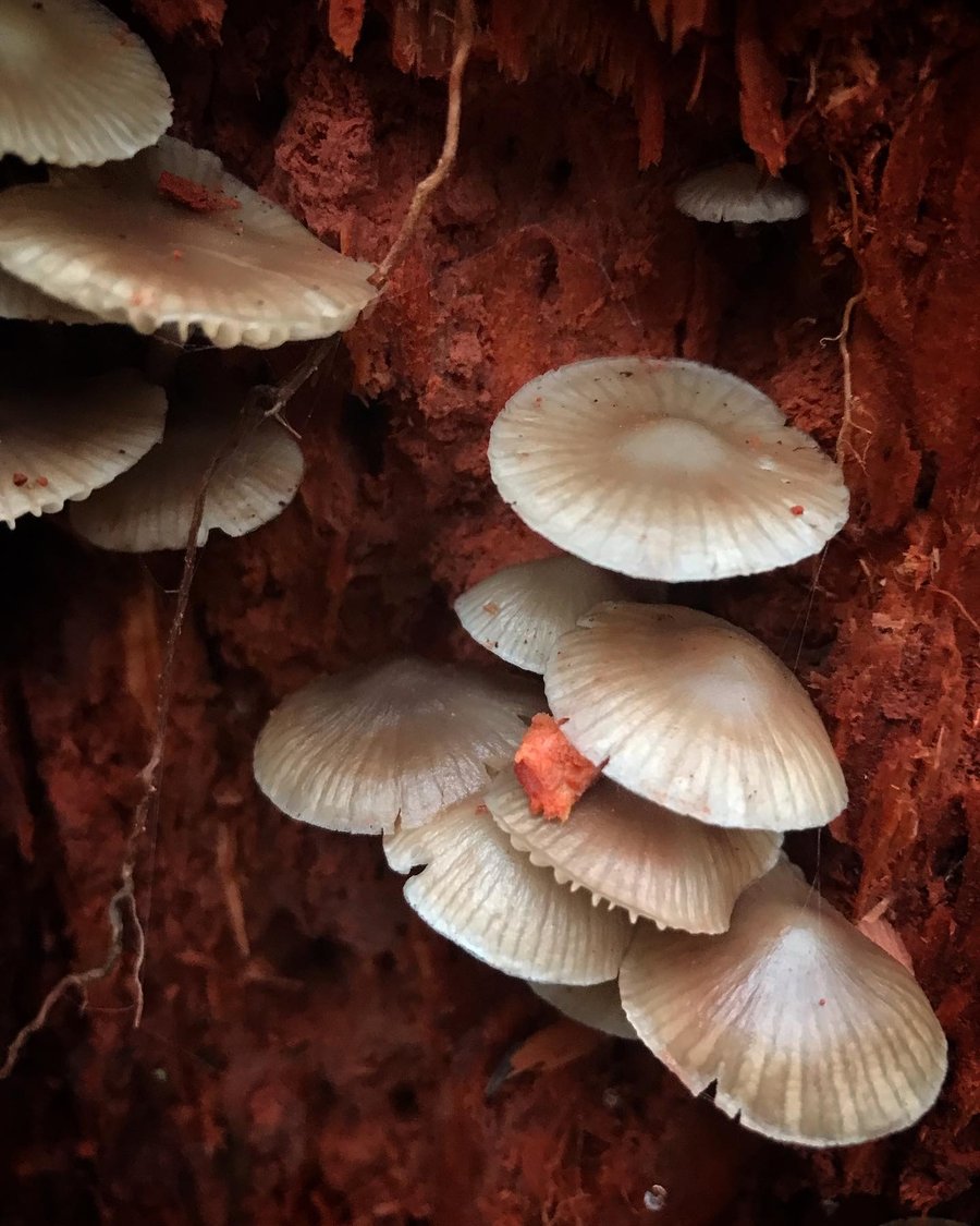
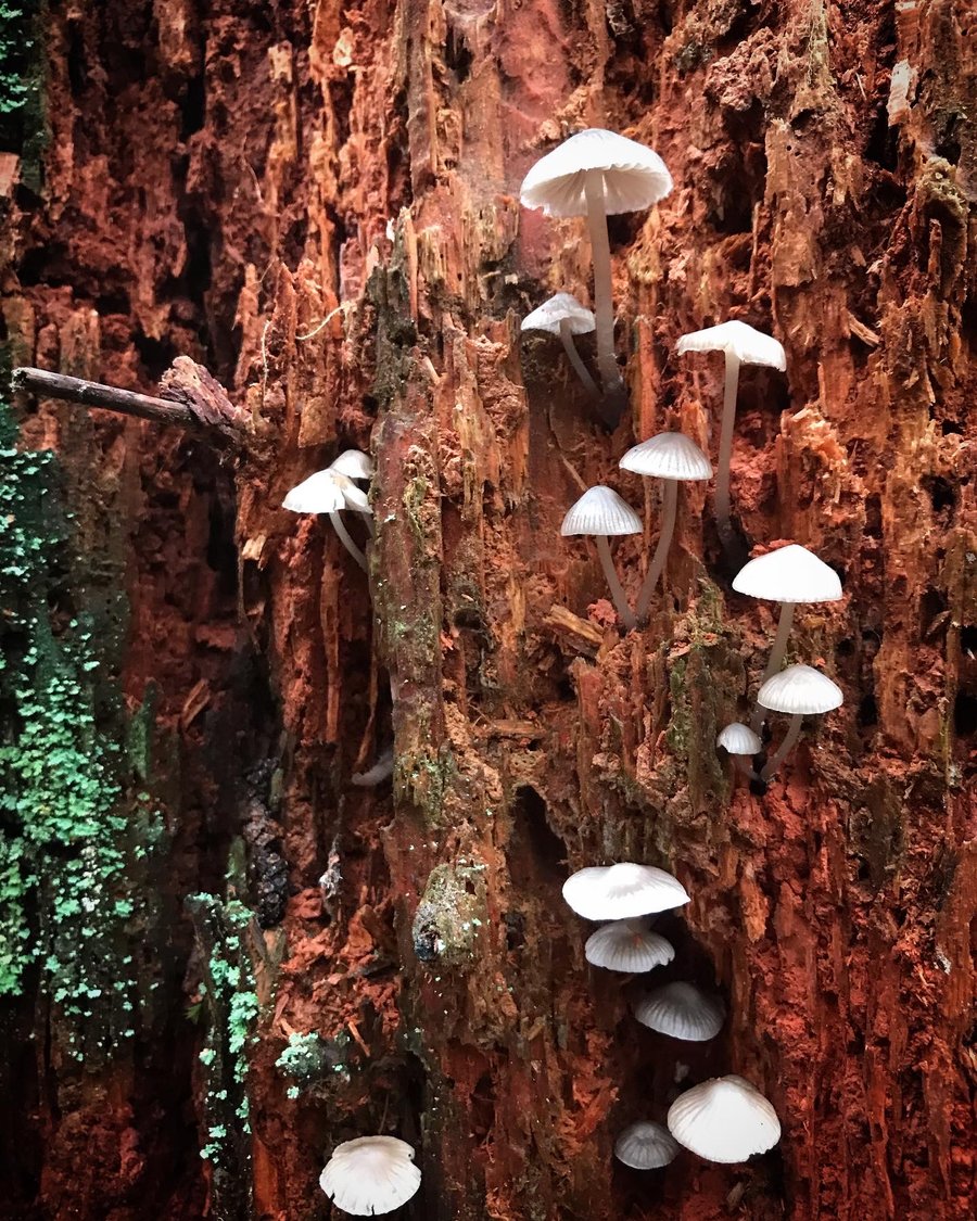
Bunker Hill and Whistle Punk
6 miles of hiking • 1250' elevation gain •
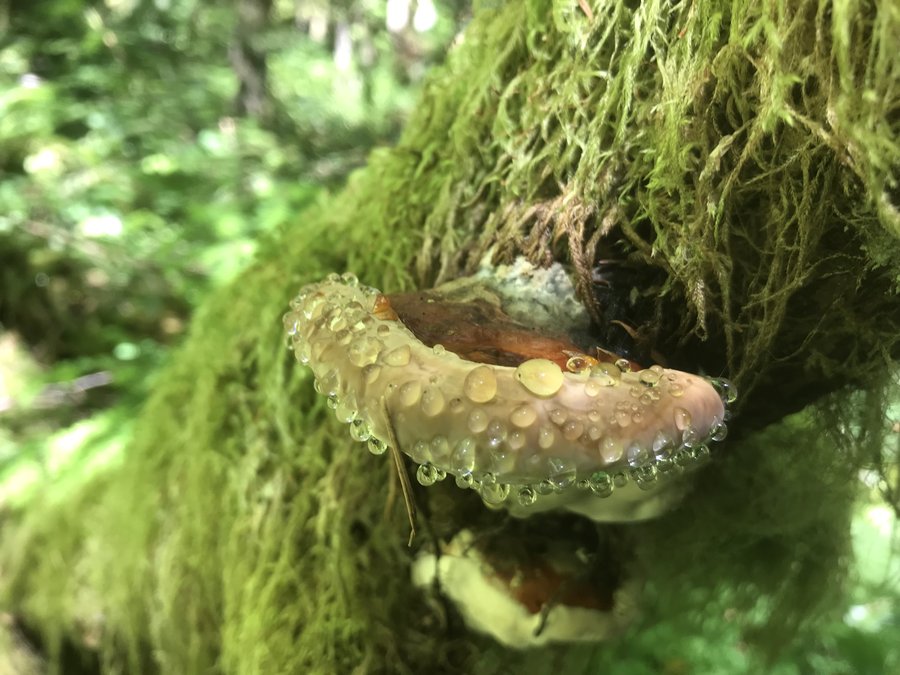
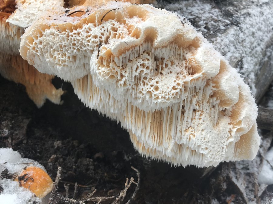
Bunker Hill was a fun little jaunt up a 20-25 million year old igneous volcanic plug. 1200 gain in 1.7 miles, a good training hike when I am feeling lazy (like yesterday) and want to sleep in and still get some exercise. While no wow views yesterday due to clouds, it had interesting rock formations to scramble on, old growth, and cool fungi to check out. Best part, I only saw 5 other humans. We ended with an additional trek on the interpretive Whistle Punk Trail to add some mileage. Trail was flooded on the PCT but otherwise in good shape. We cleared a bit of branches from the trail as we walked, but otherwise no major obstacles of any sort. Drop off on the spur trail with views was steep, but I didn't venture anywhere I didn't feel safe.
January 9, 2021


 1
1
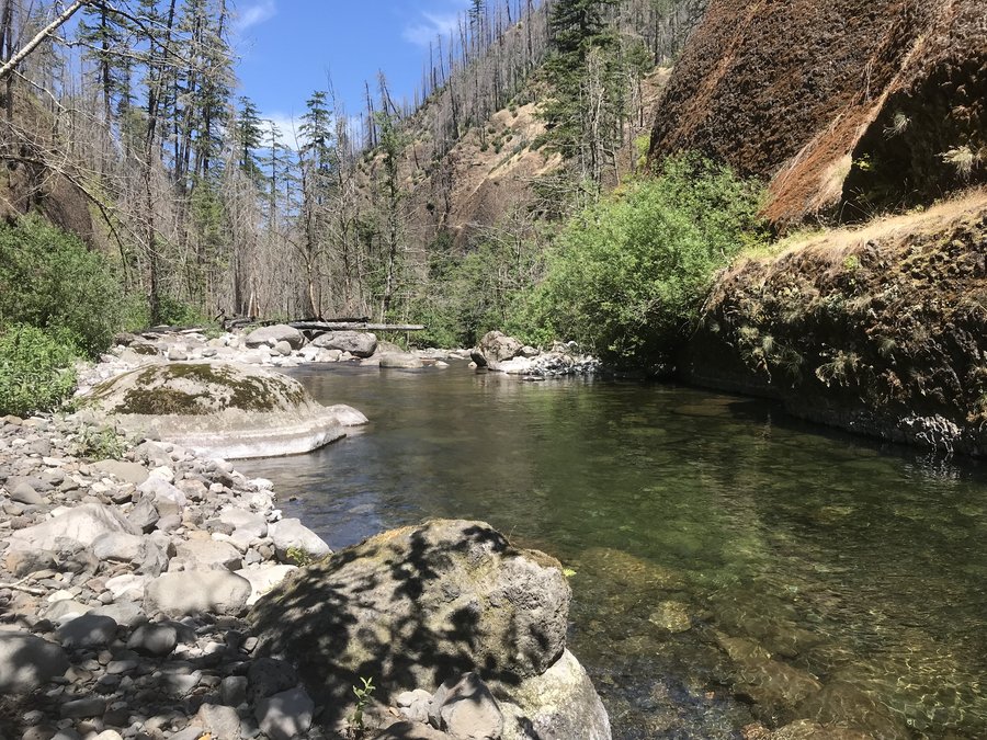
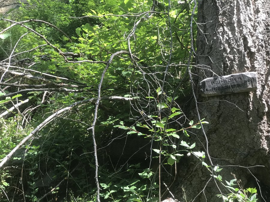
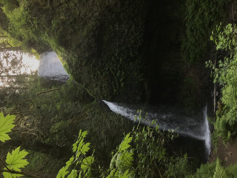
Eagle Creek
7 miles of hiking • 500' elevation gain •
I should have known better, but I got Eagle Creek Fever and totally forgot that I hate to be on crowded trails. I managed to spend most all of last year off the beaten trail, but curiosity got the best of me. I wanted to see how the trail had changed since the fire.
I arrived at the parking lot around 7:20 am, and was able to get a spot close to the trail head, but it quickly filled up around me as I waited for a few friends from my covid hiking crew to arrive.
We all masked up, and faced the fact that even with an early start we were going to be sharing the trail with a lot of people.
I found it hard to stop for photos, there was always someone either ahead or behind, or groups of trail runners swooping past.
Most wore masks while passing, but many did not. We did not go down to the punchbowl, the water was raging and with the wall slide we didn't think we would see much. However, we saw a good view of the damage from above.
With the missing undergrowth and loss of trees (and the huge amount of rain) I saw more waterfalls than I have ever seen on this hike.
Eventually, we ran into a what looked like a fresh slide, and I started to get the feeling I should have listened to my hunch that recent rains would wreak havoc on the already unstable slopes. We passed it, and continued on. Eventually we ran into another slide, this one worse - and decided to call it. The crowds just kept coming and I just didn't want to deal with it anymore.
Next time, I'll wait it out for more stable weather, and try for an earlier start time.
January 3, 2021