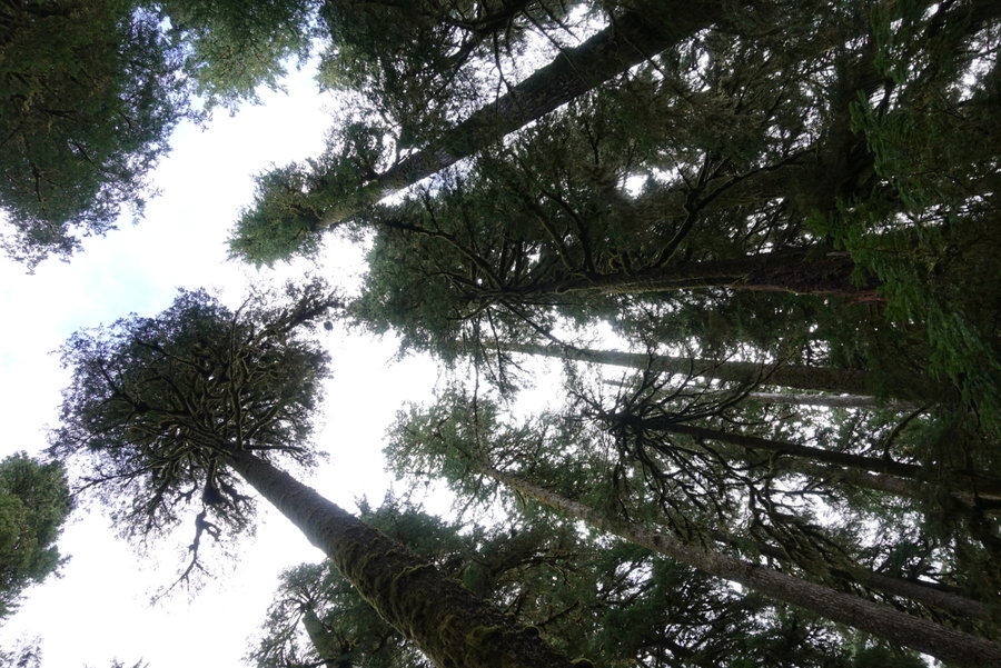
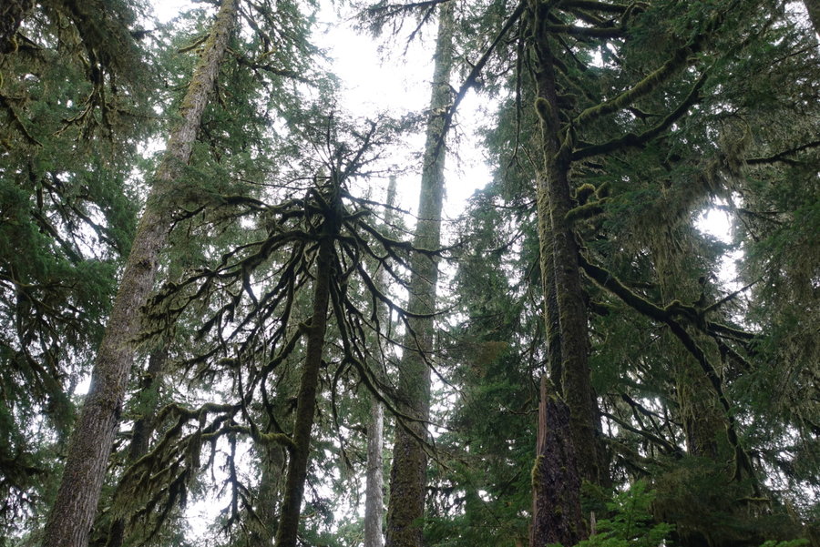
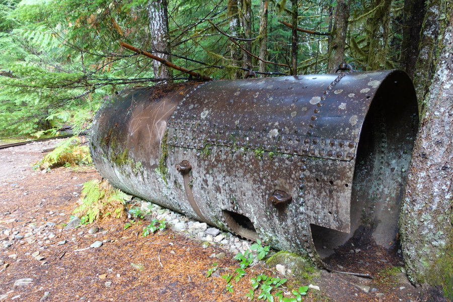
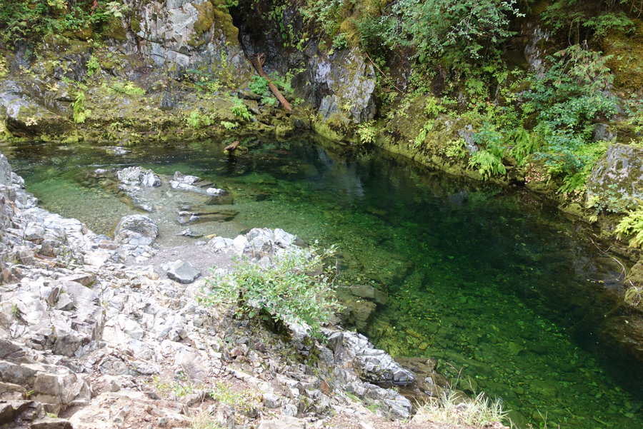
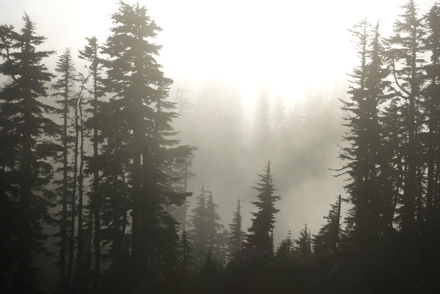
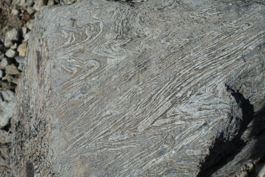
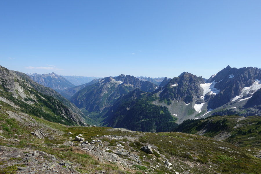
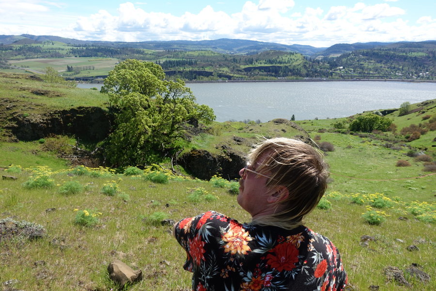
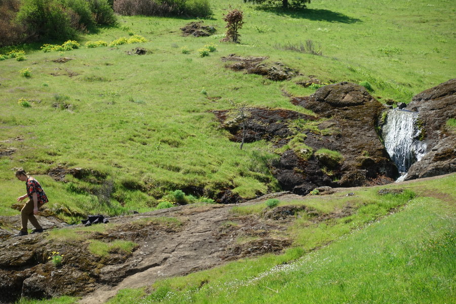
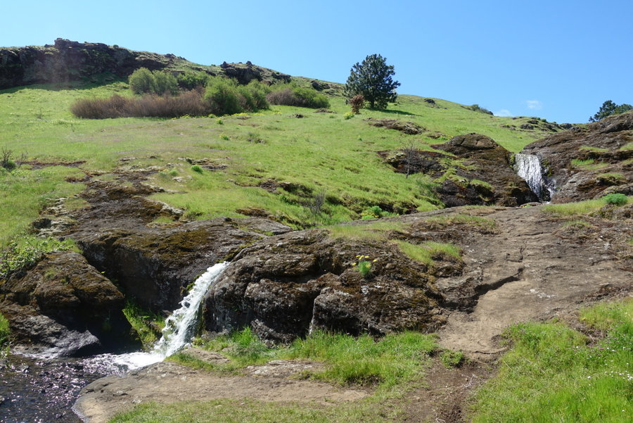
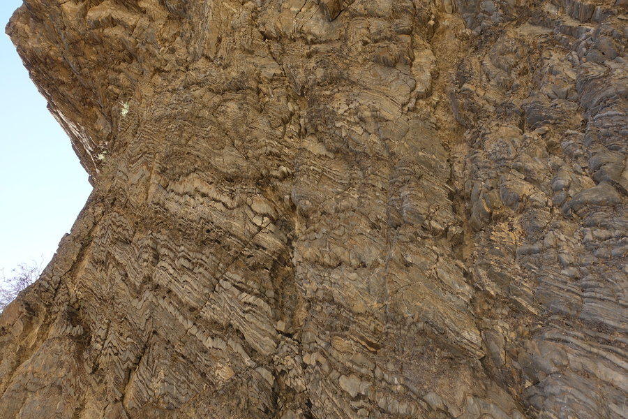
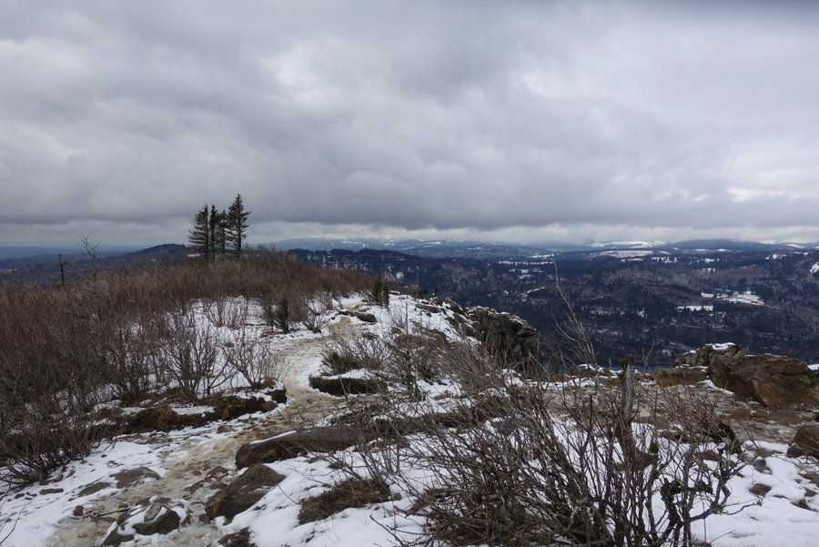
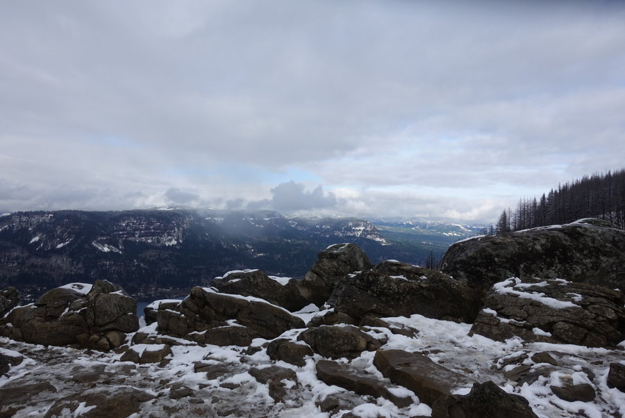
2019 Trips

 3
3
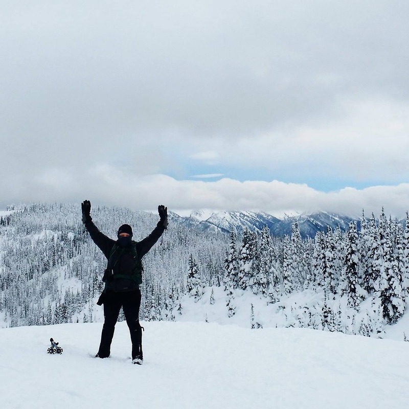
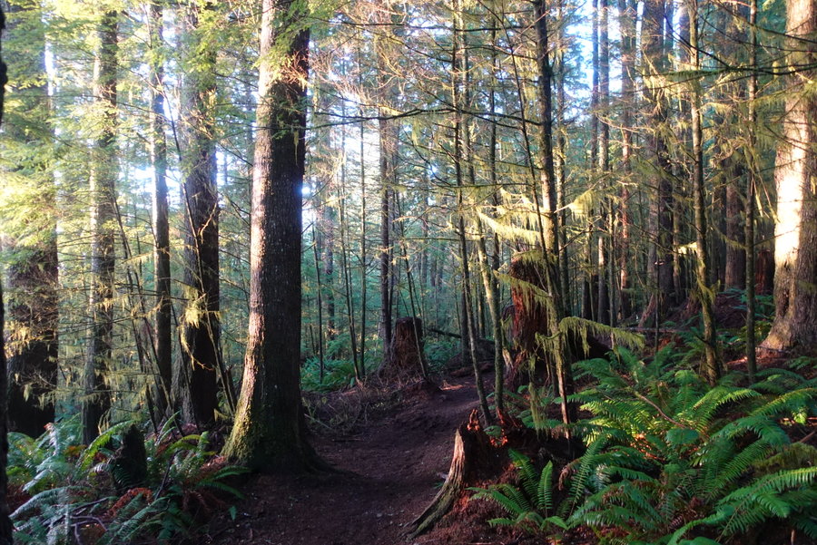
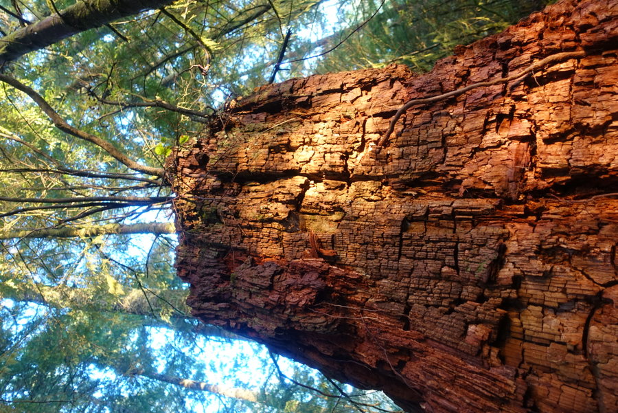
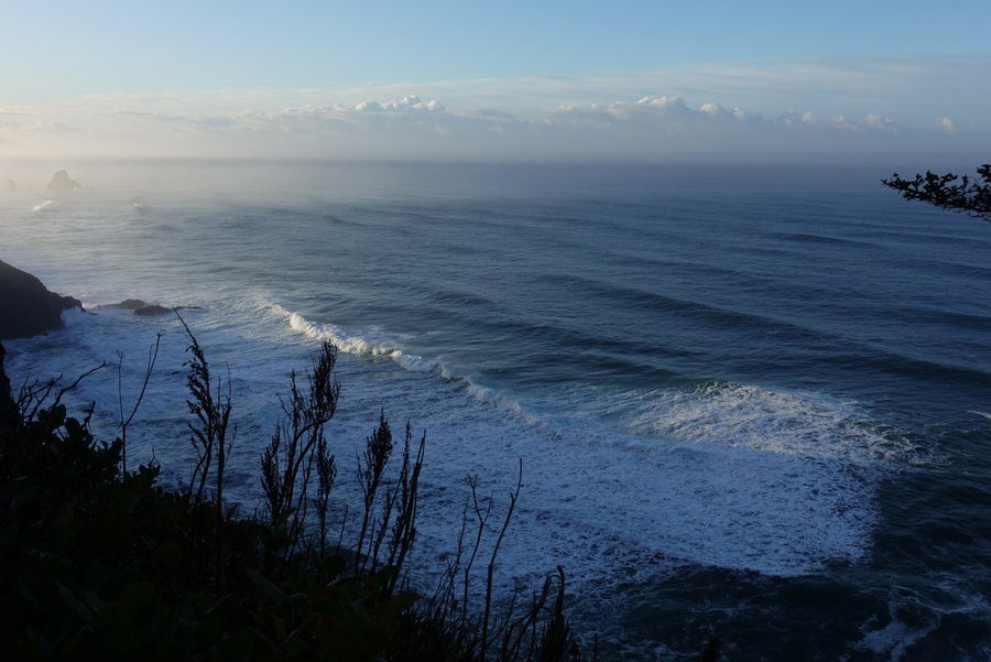
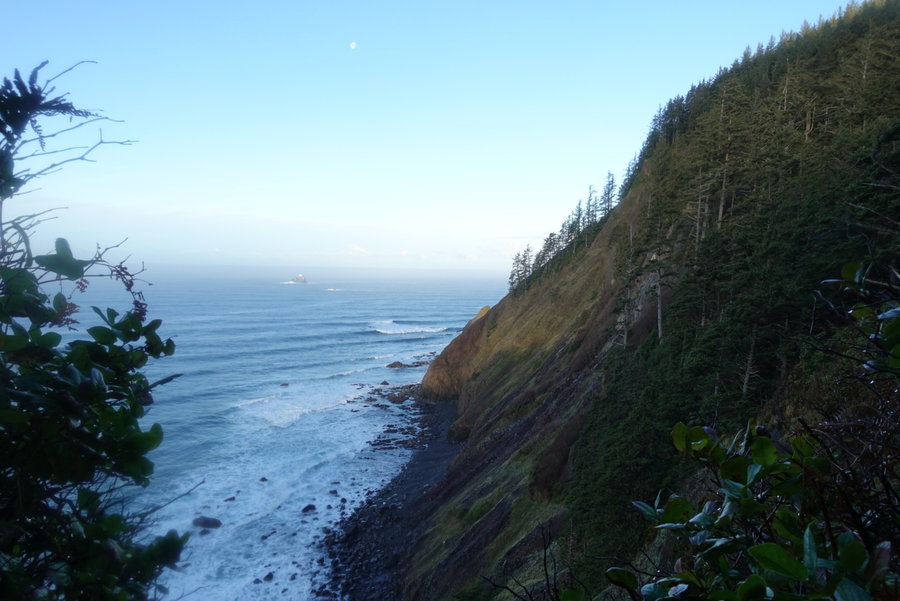
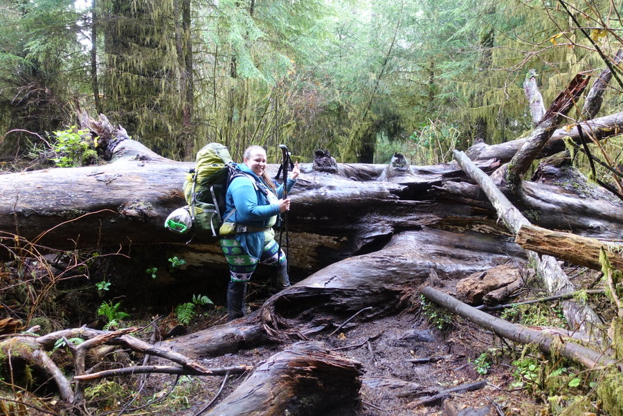
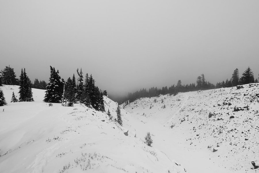
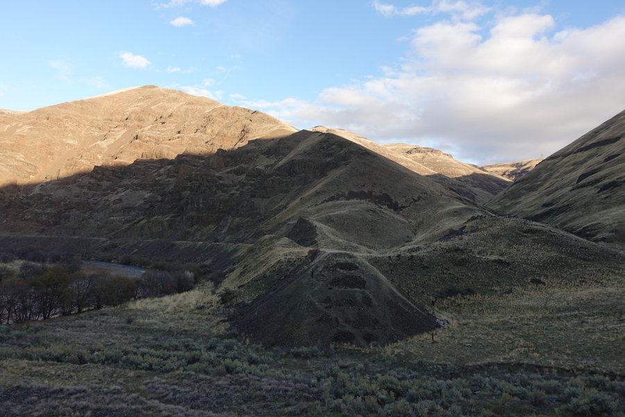
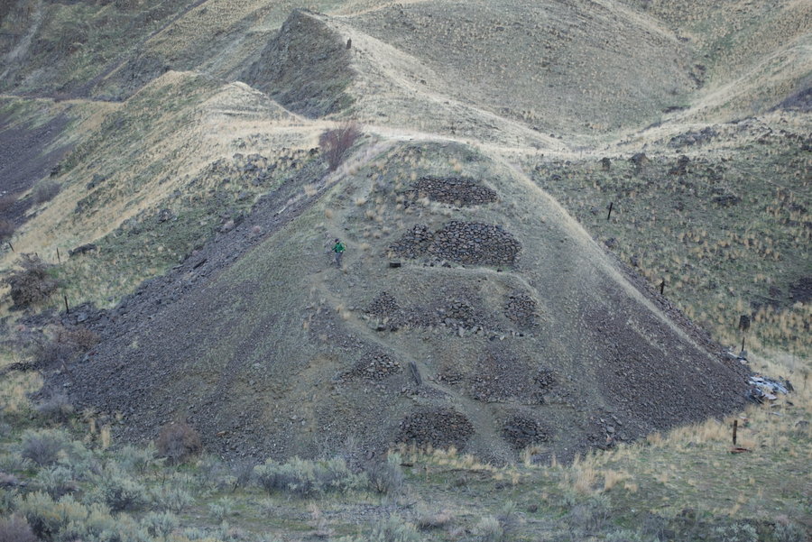
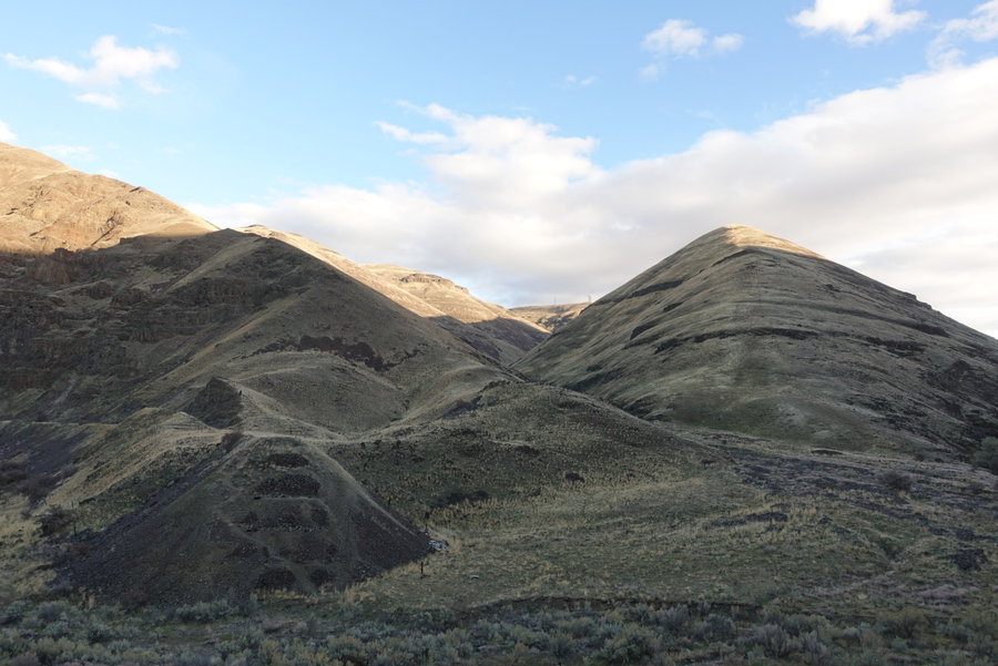
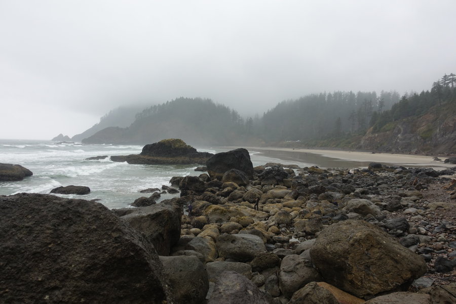
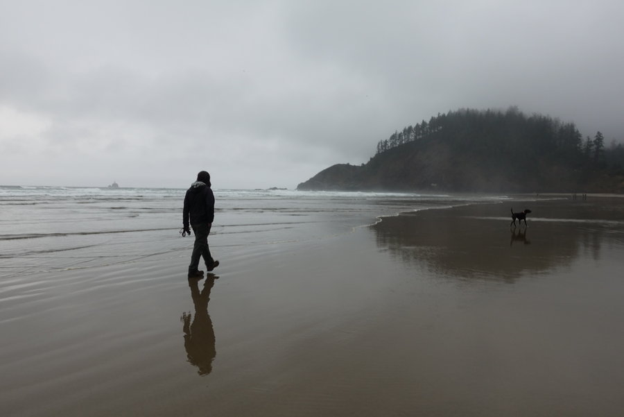
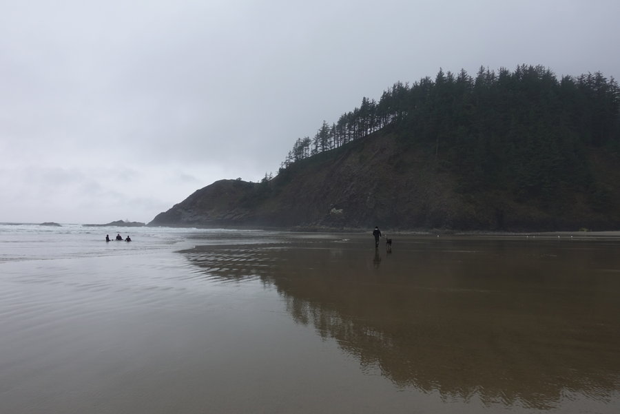
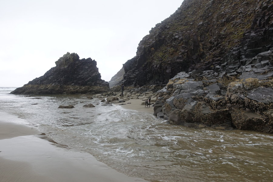
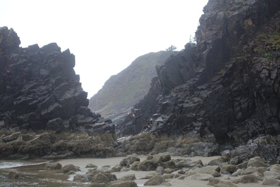
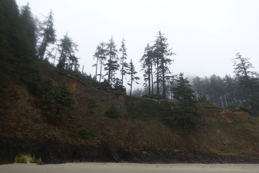
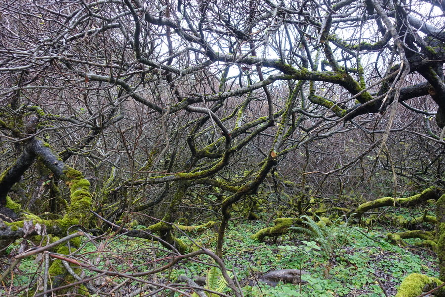
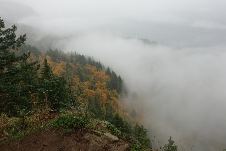
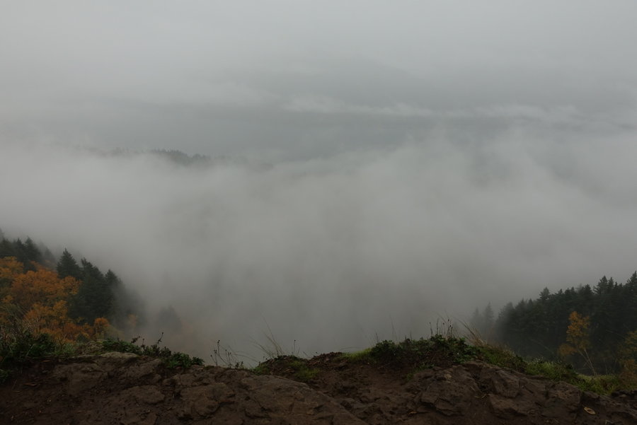
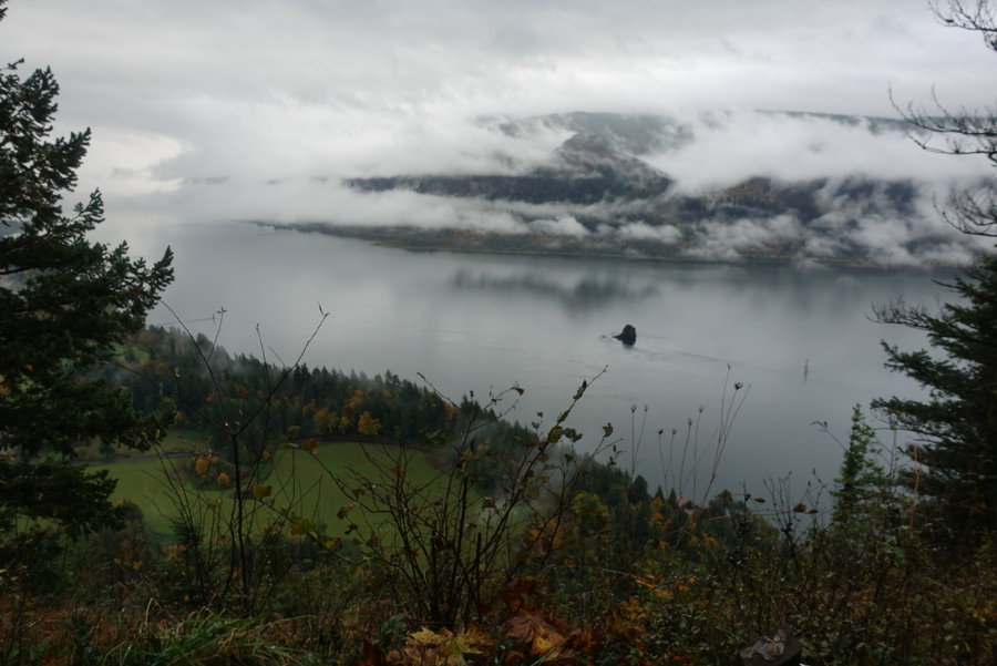
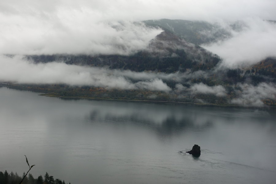
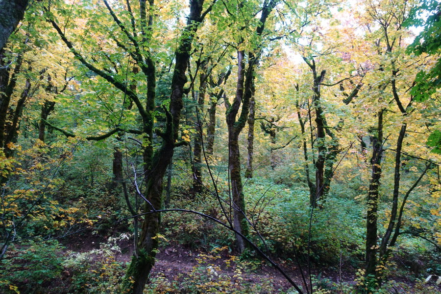
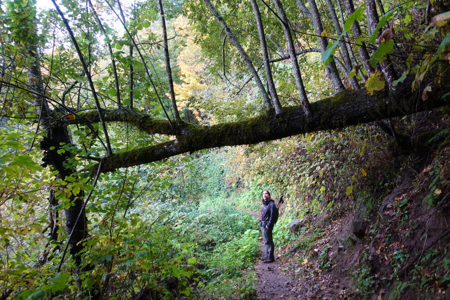
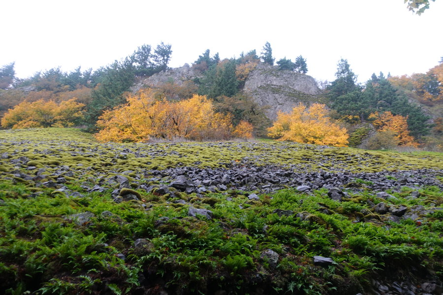
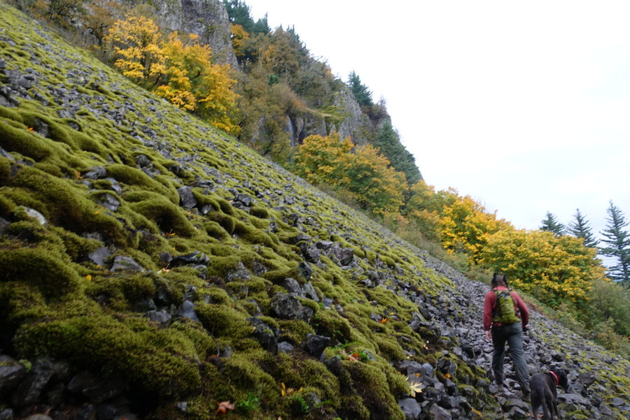
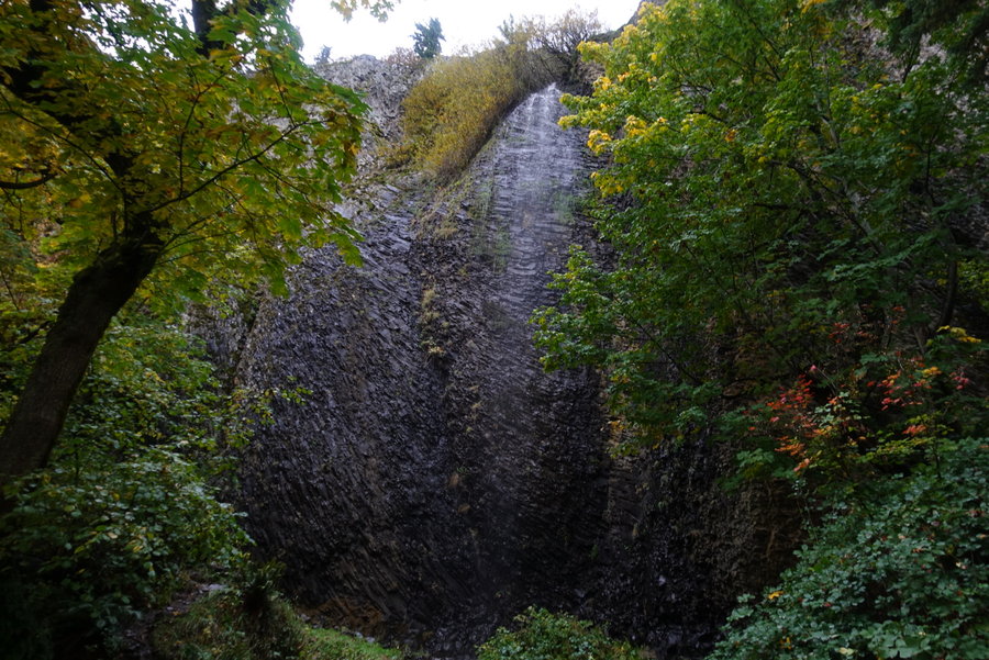
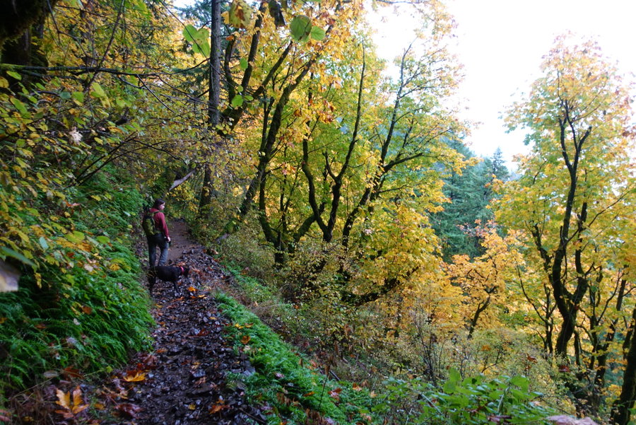
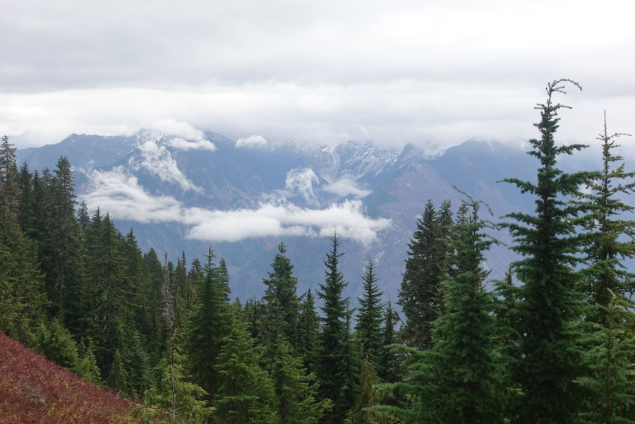
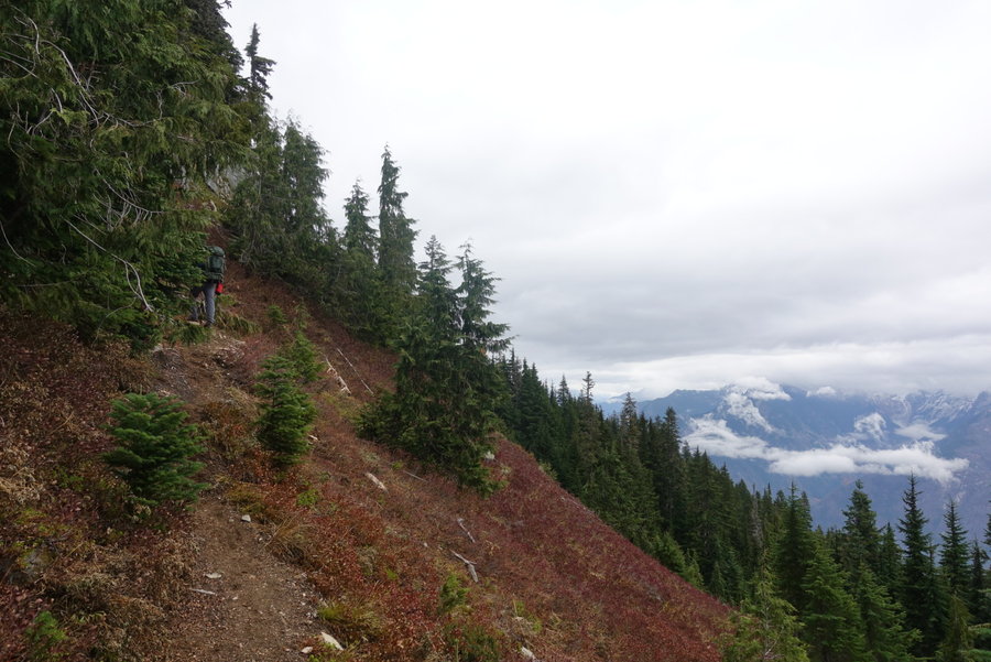
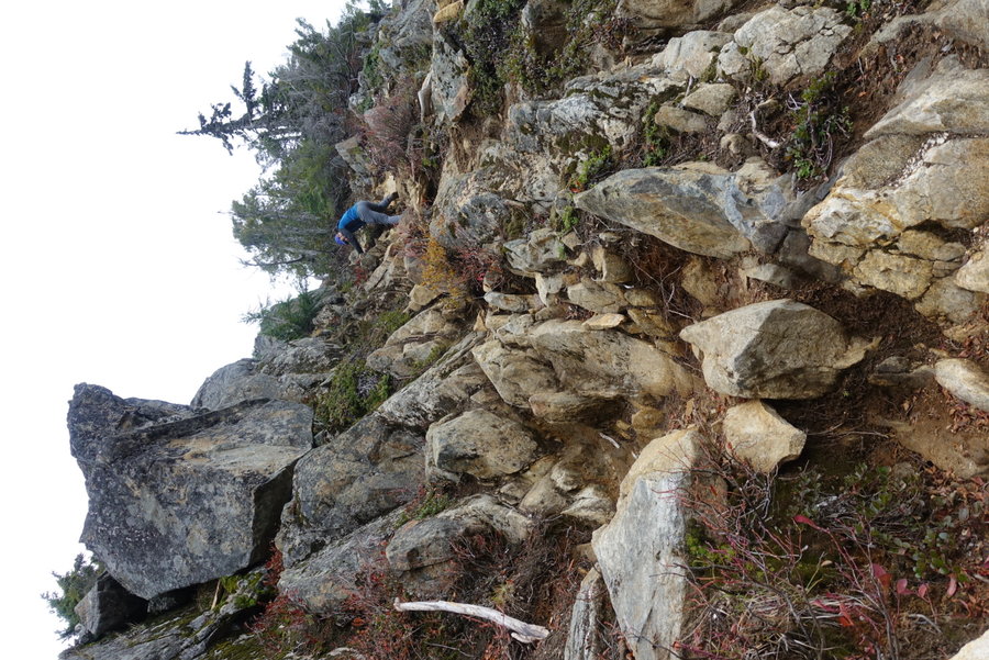
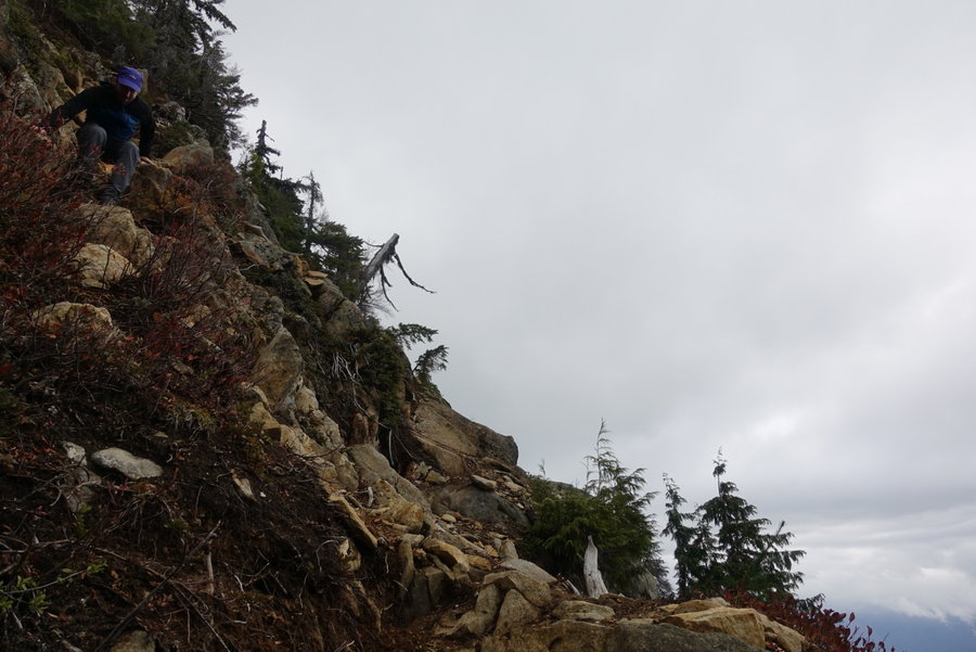
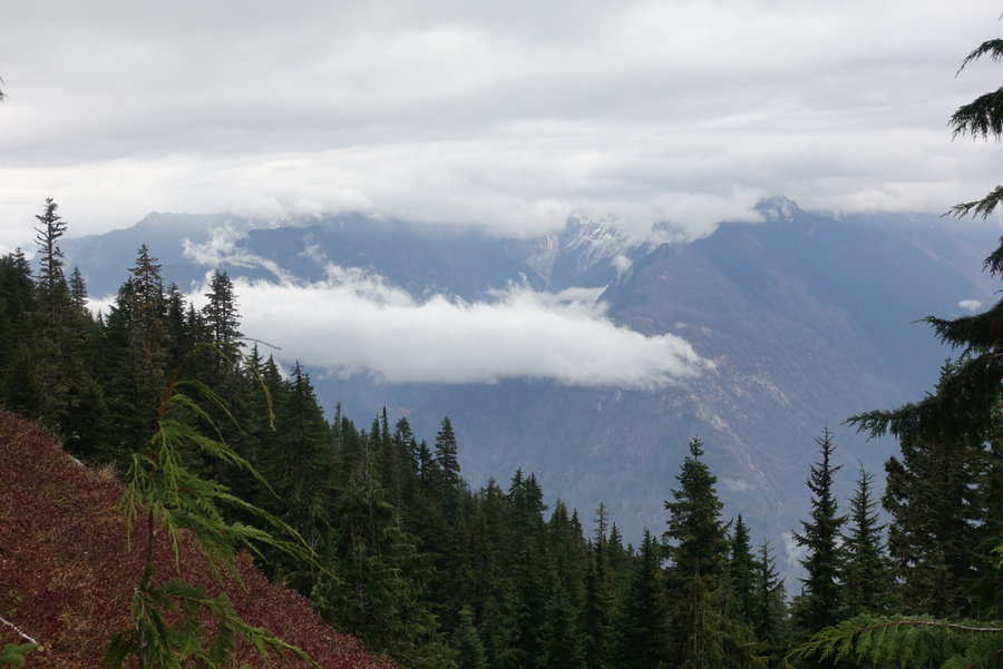
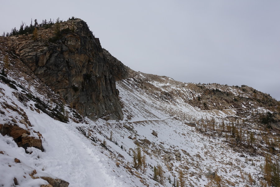
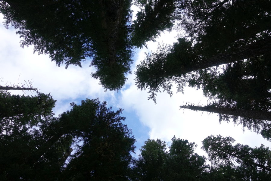
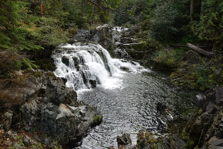
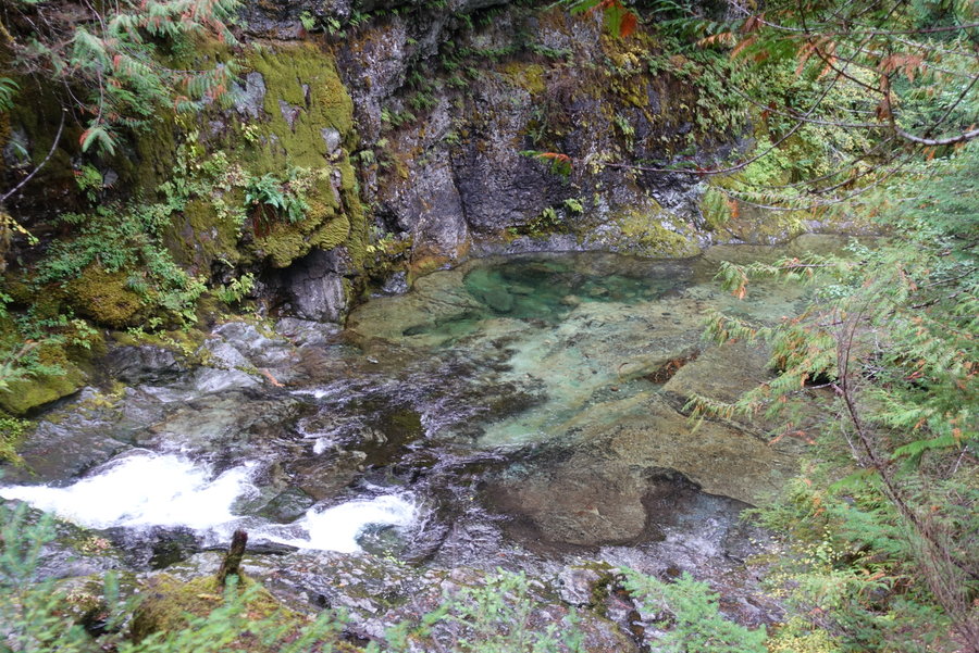
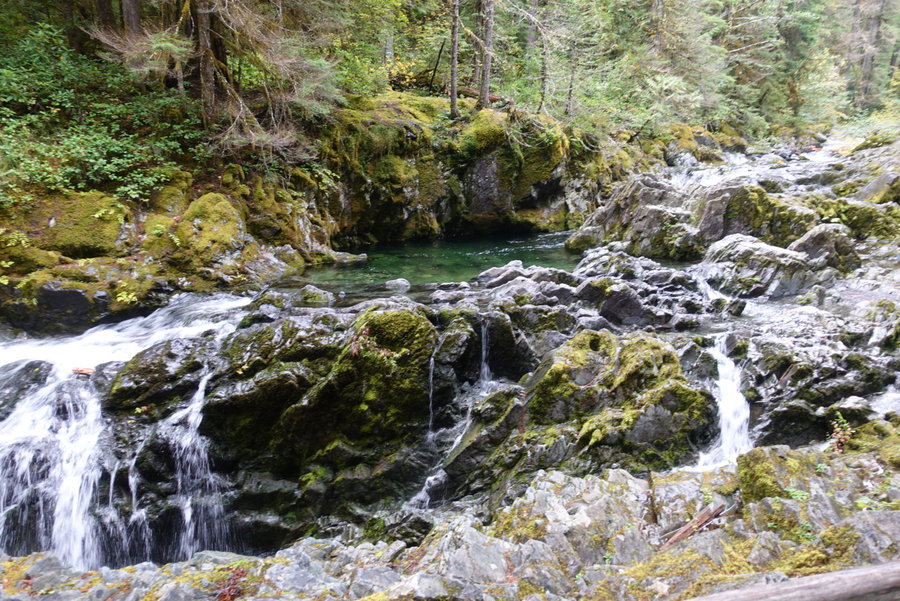
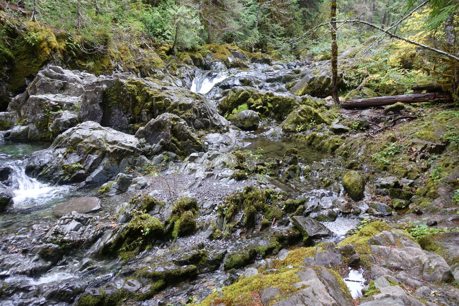
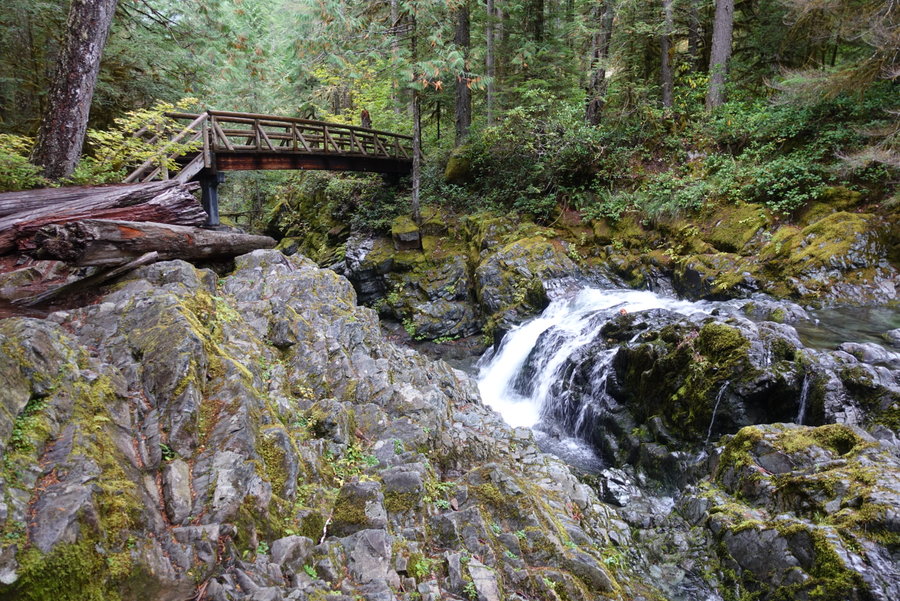
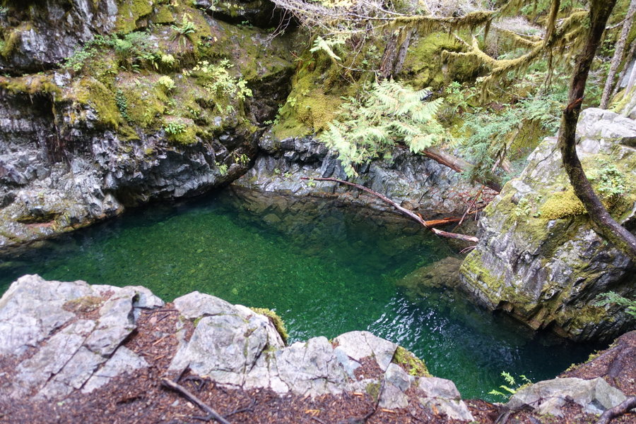
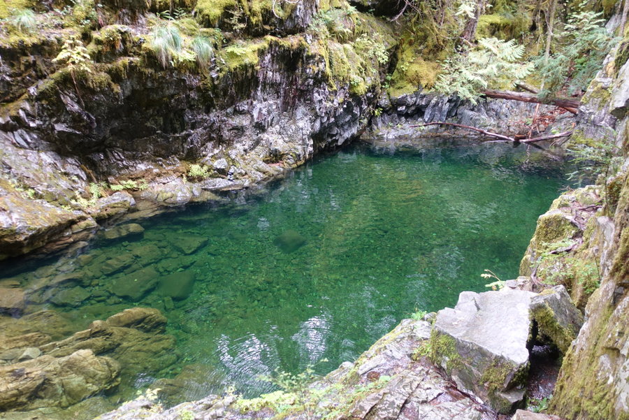
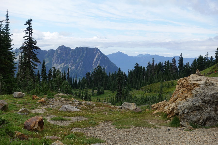
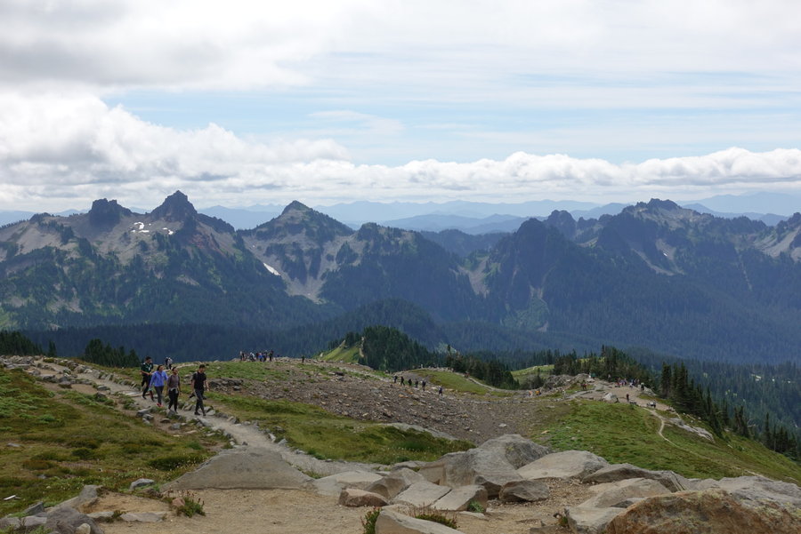
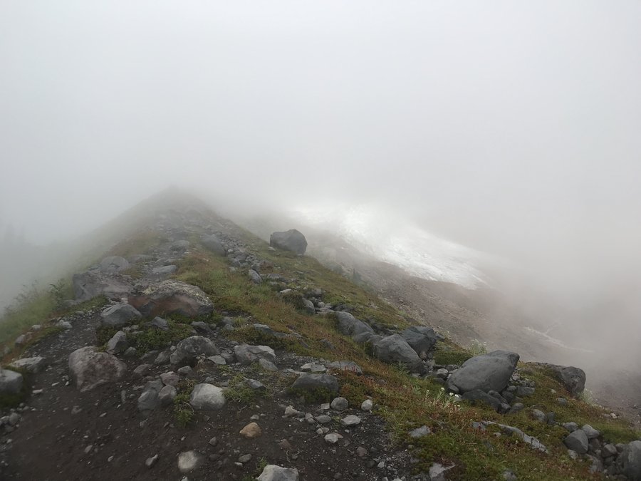
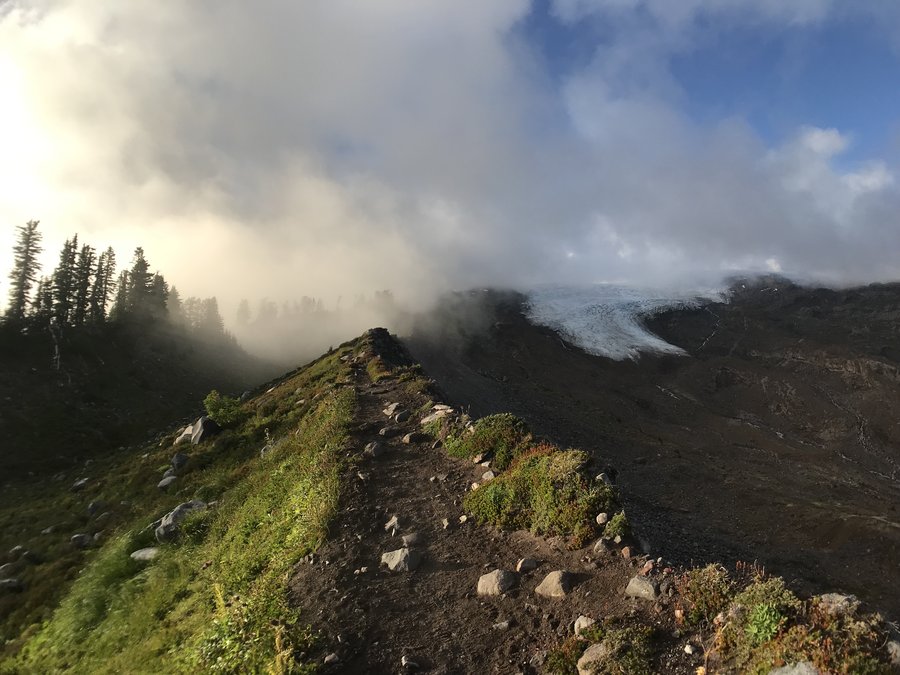
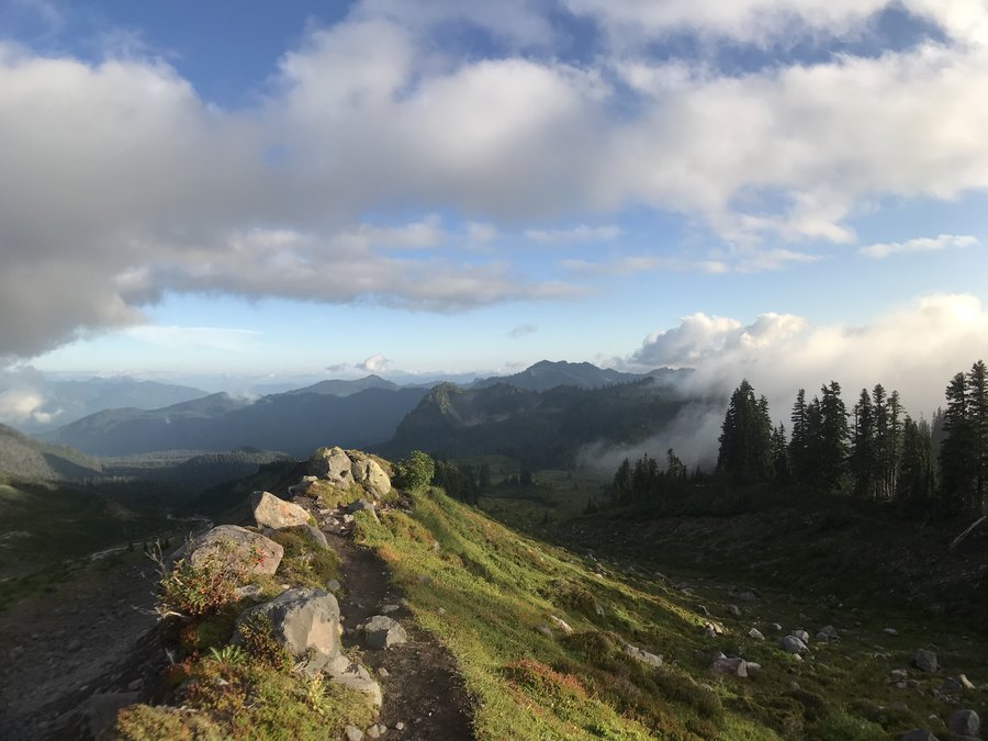
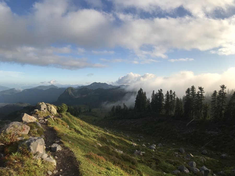
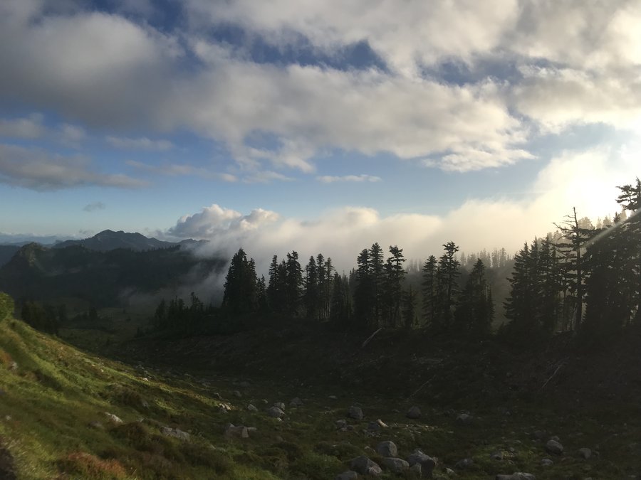
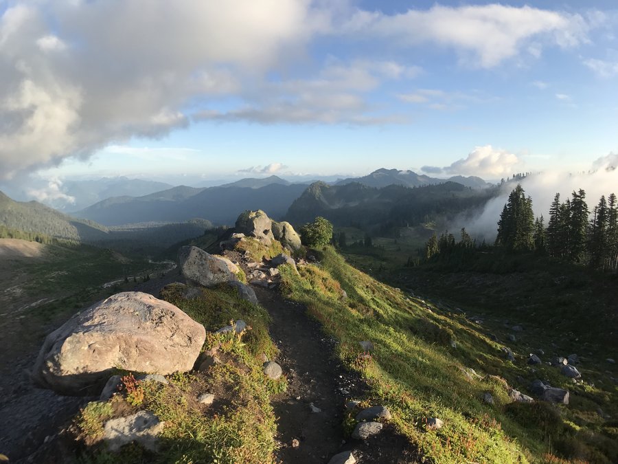
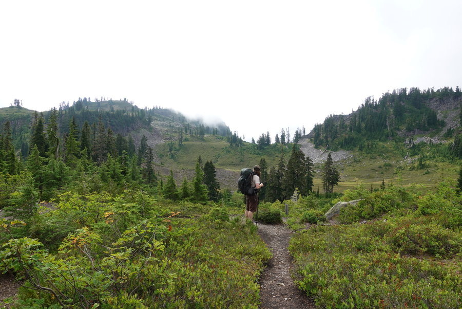
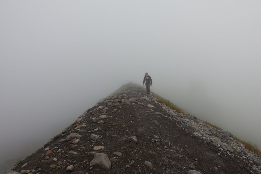
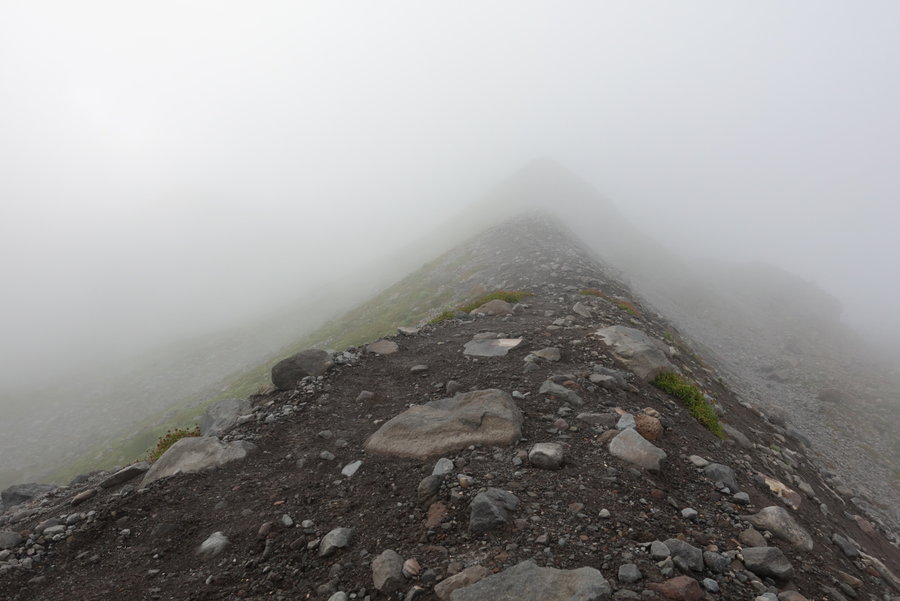
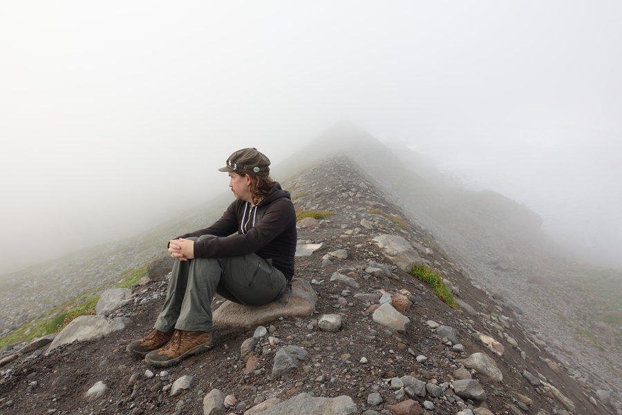
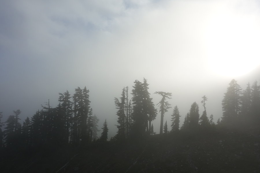
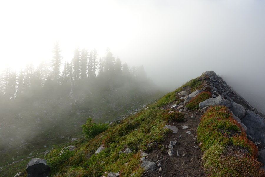
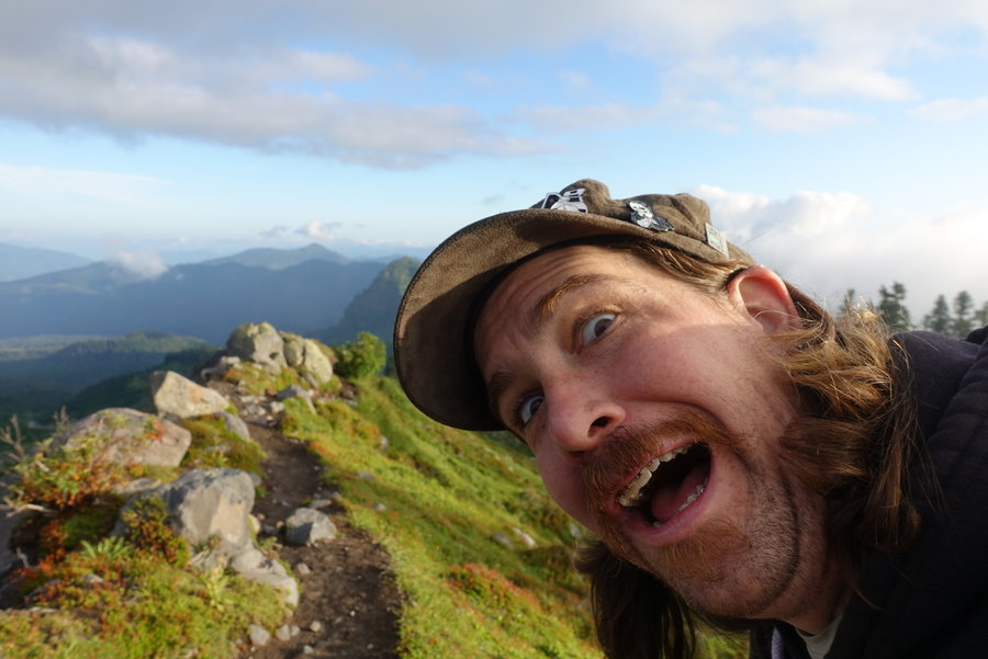
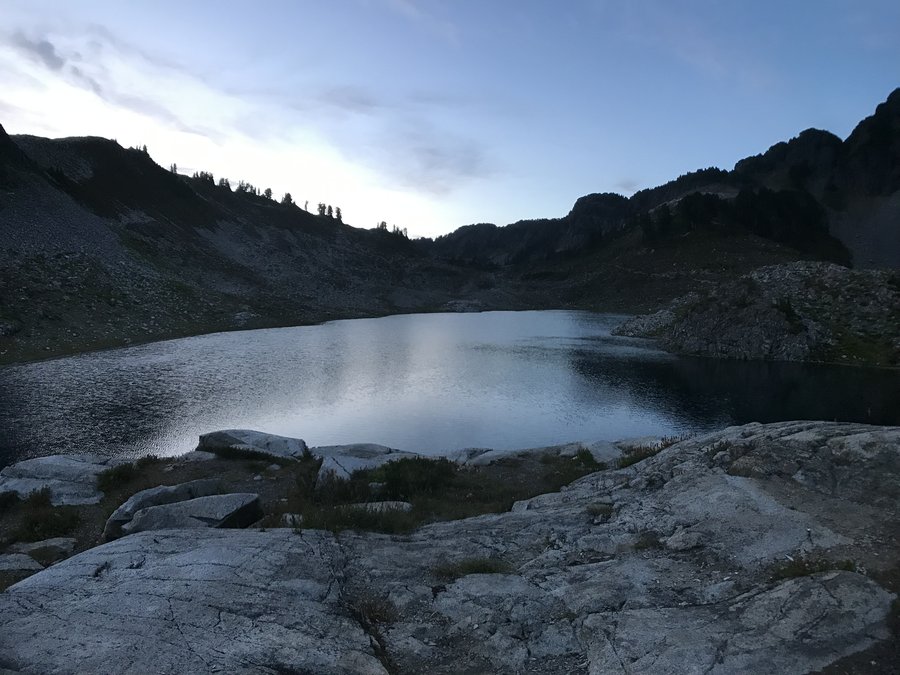
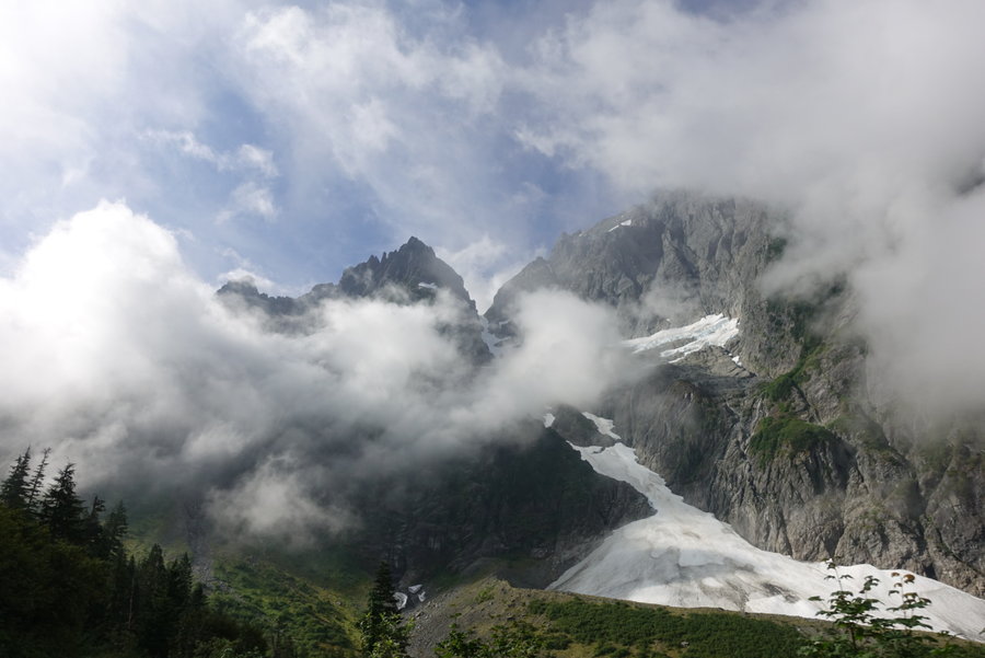
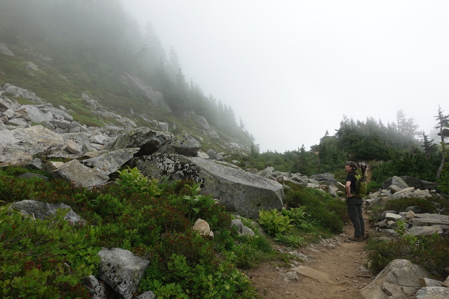
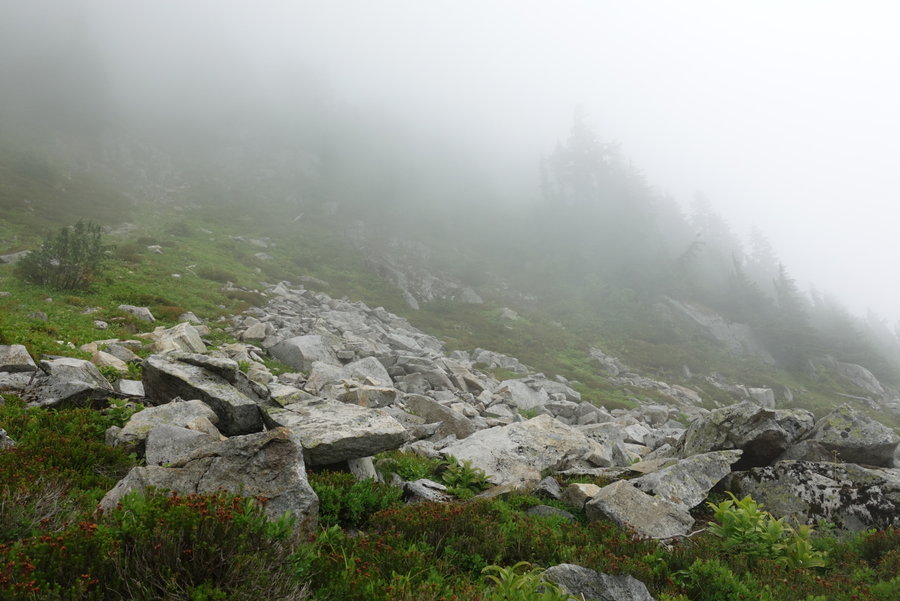
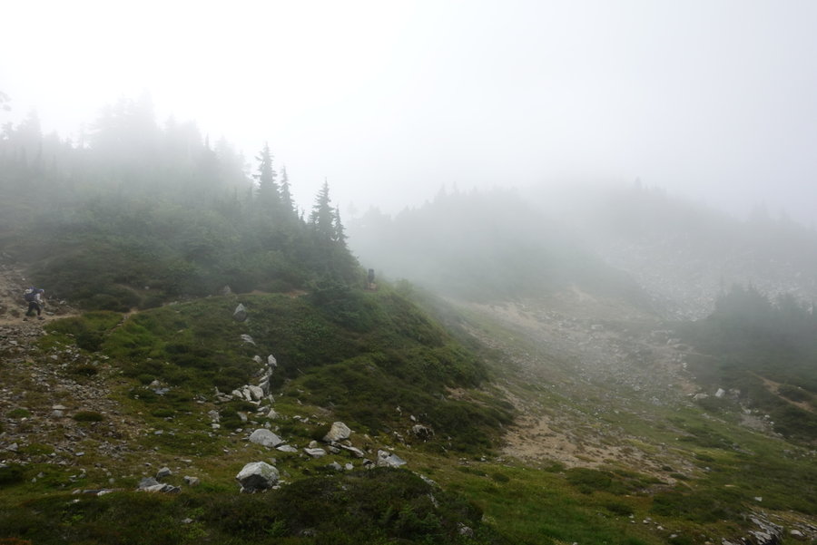
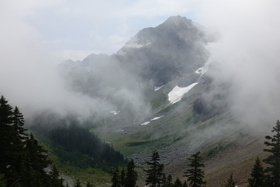
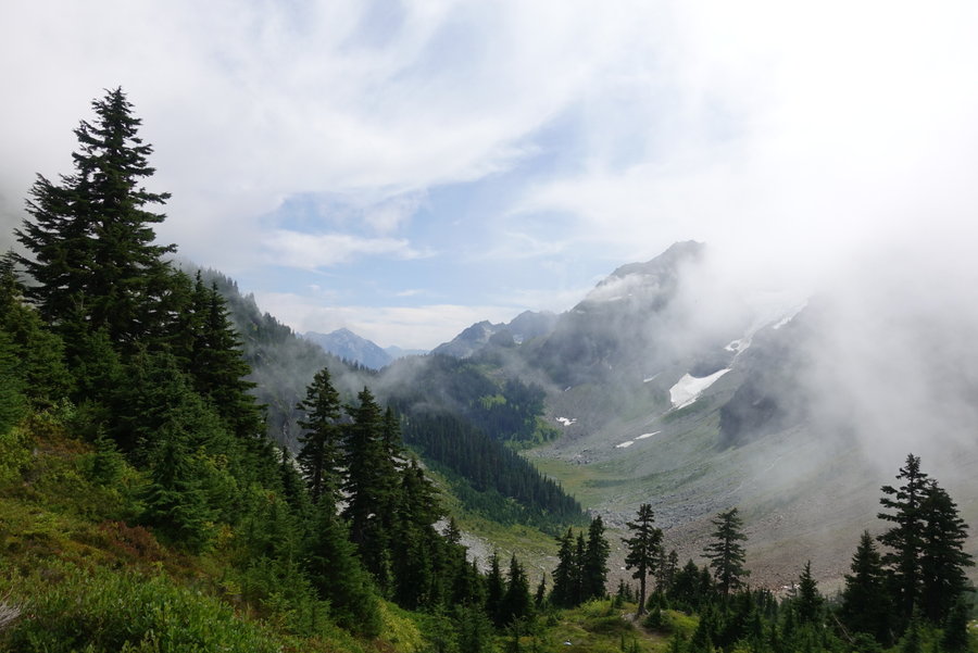
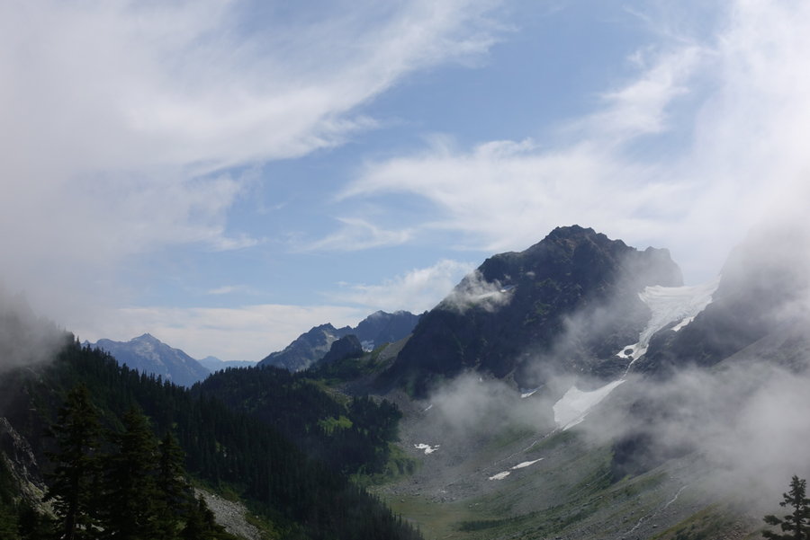
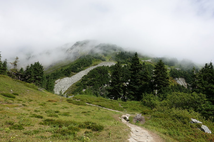
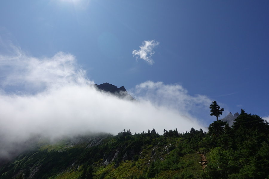
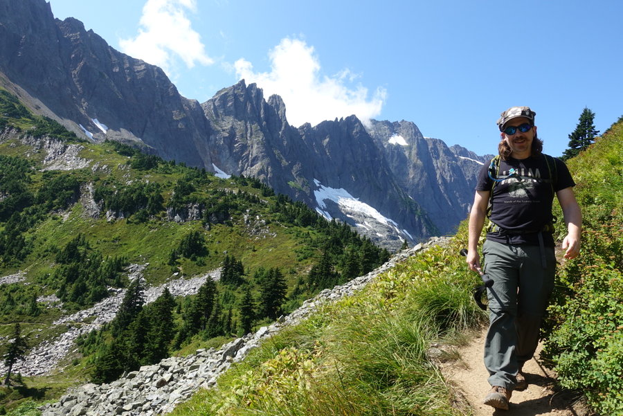
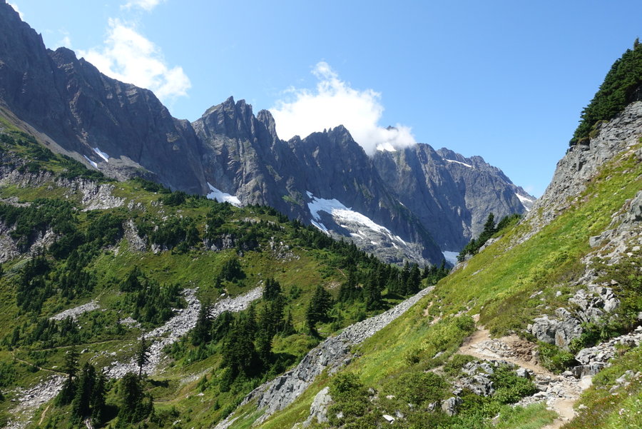
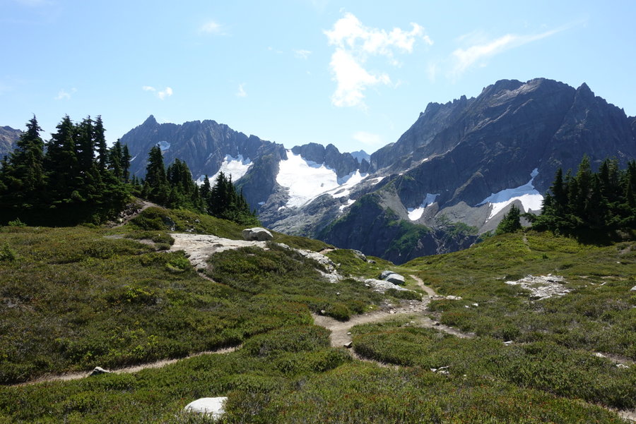
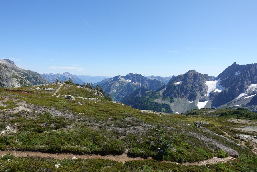
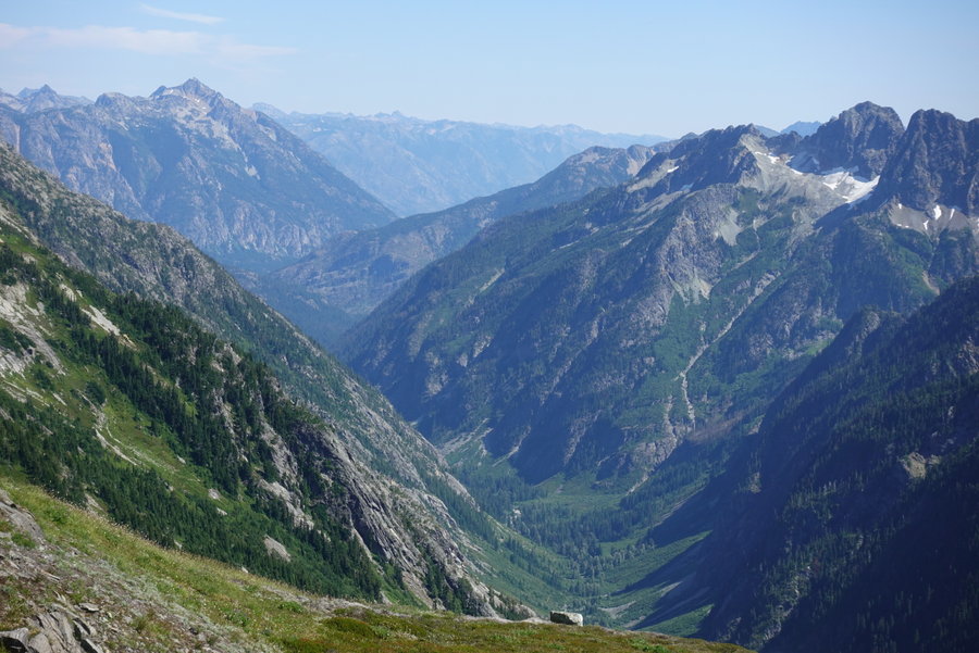
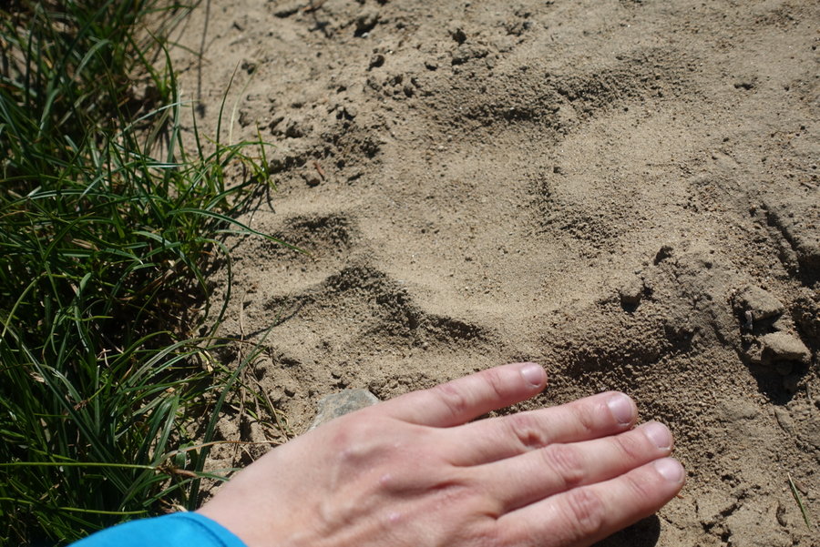
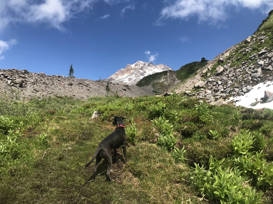
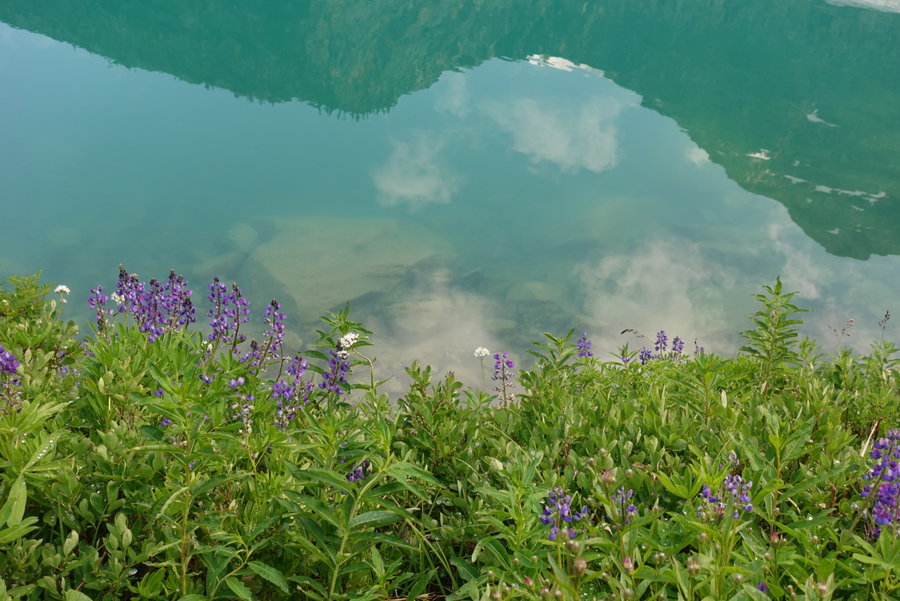
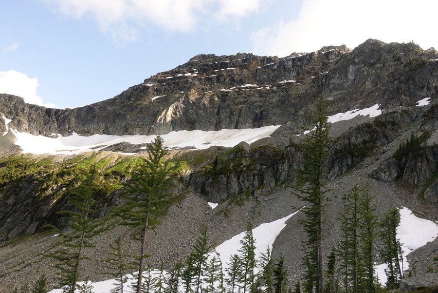
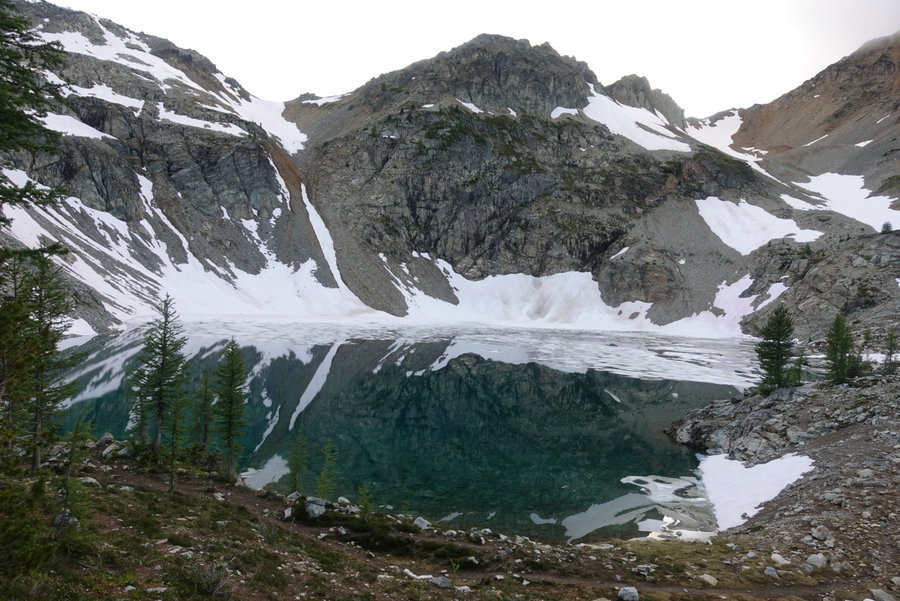
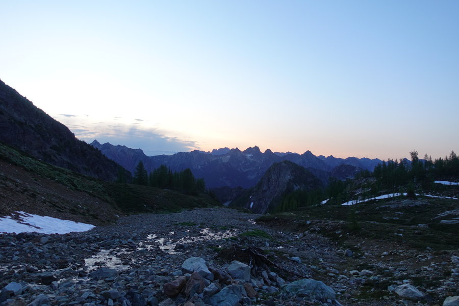
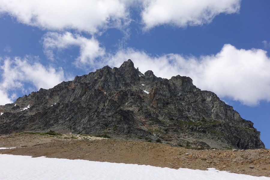
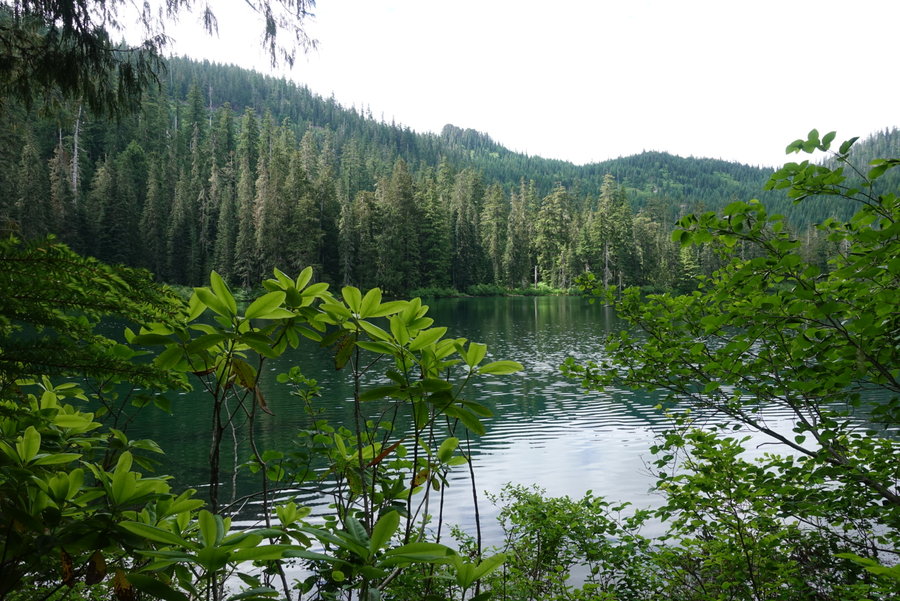
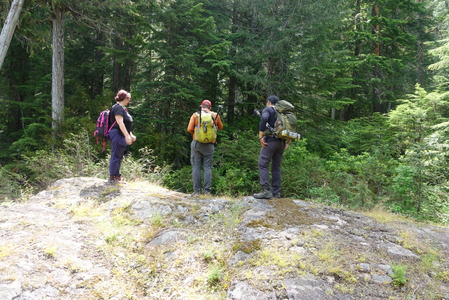
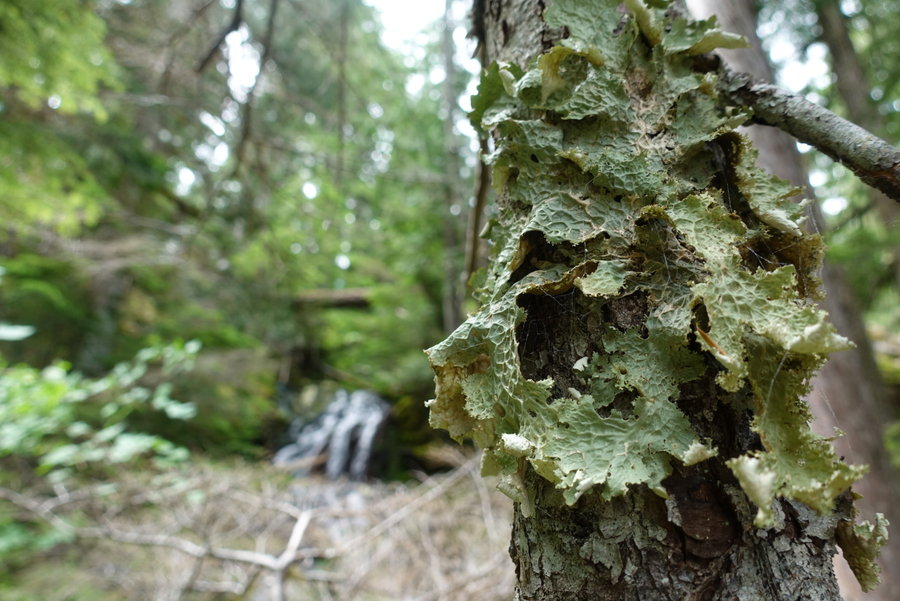
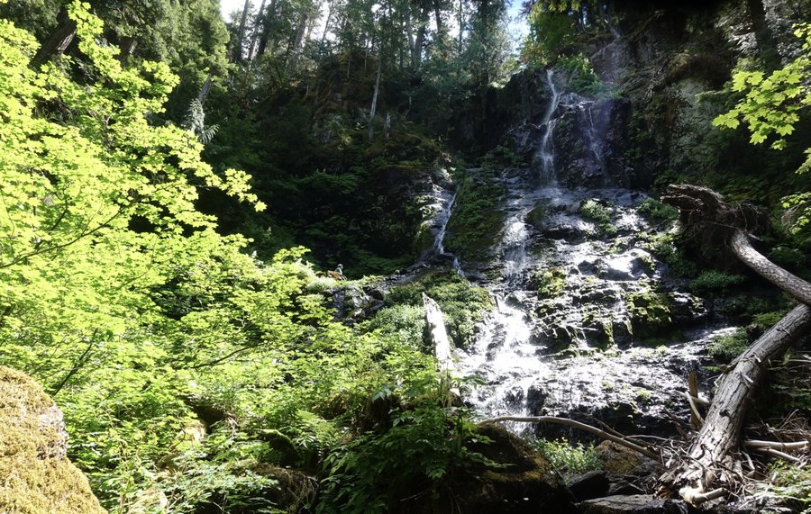
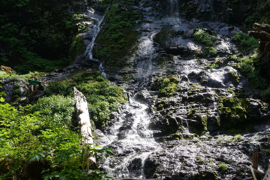
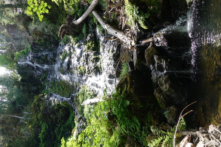
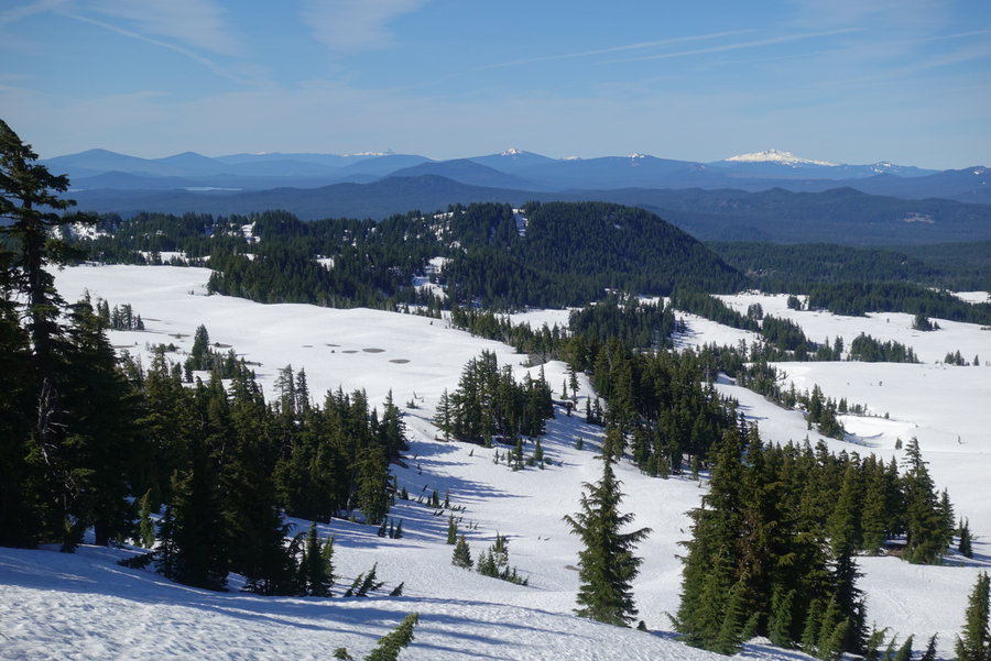
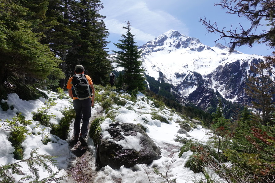
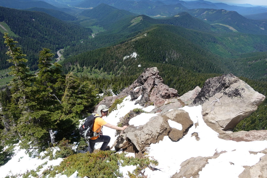
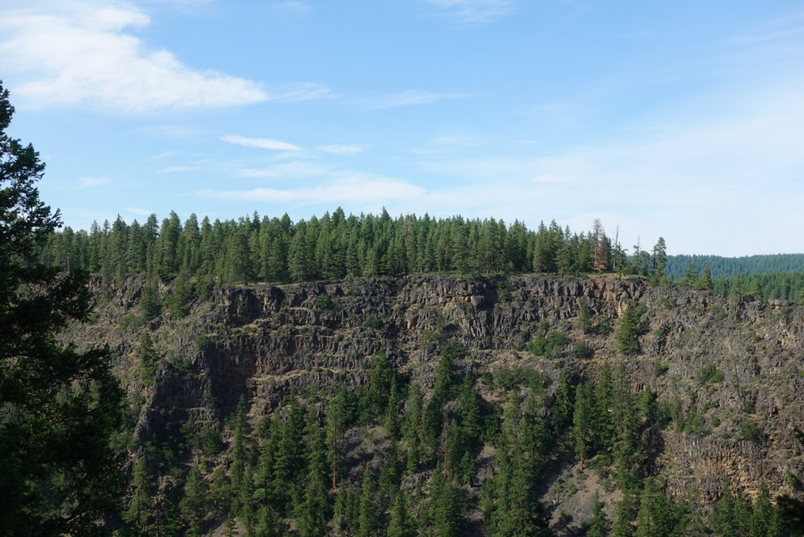
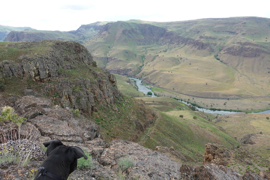
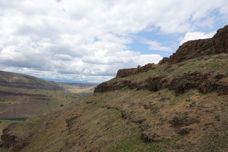
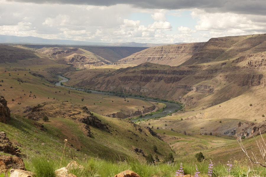
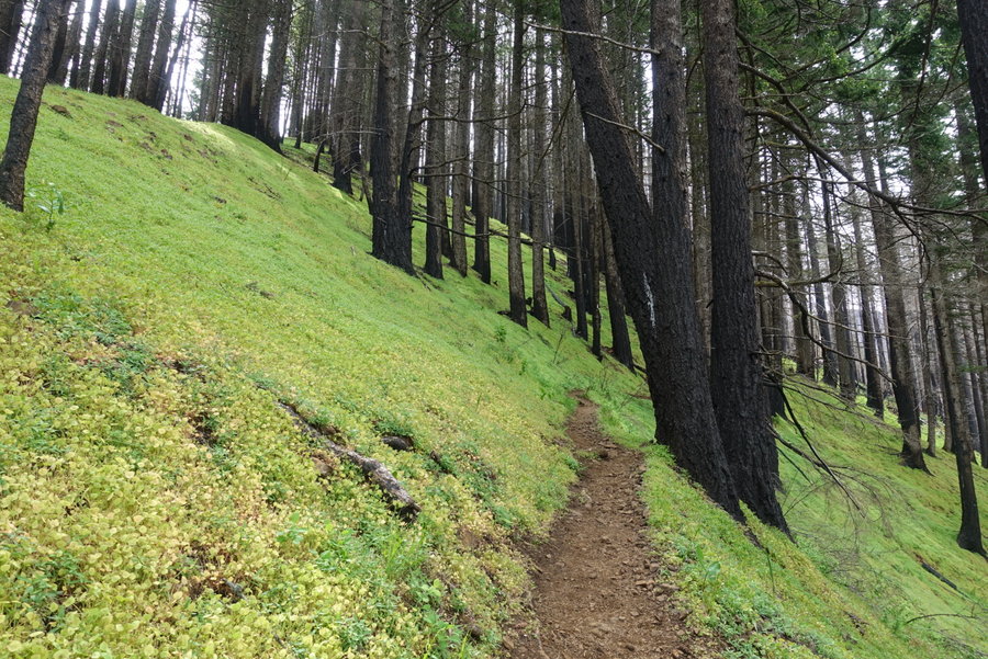
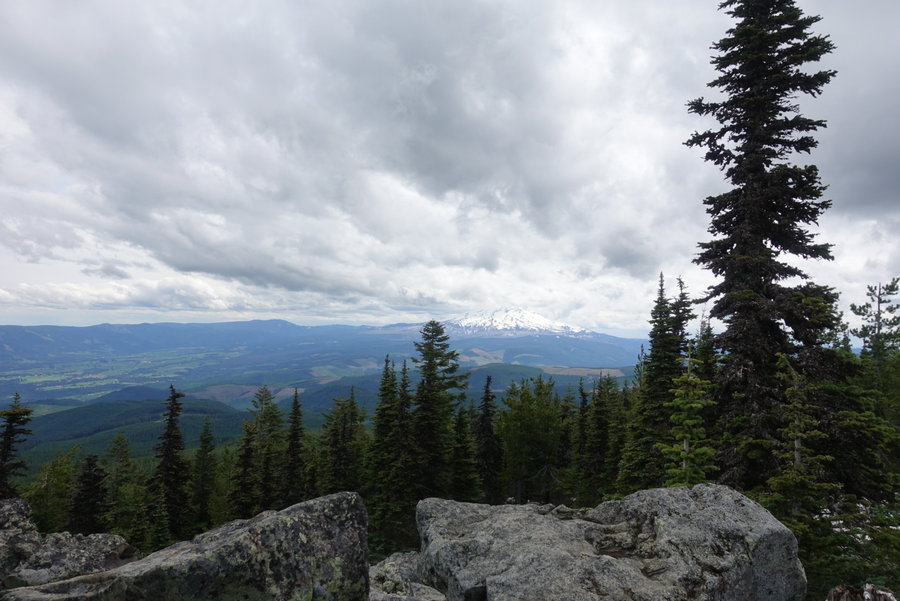
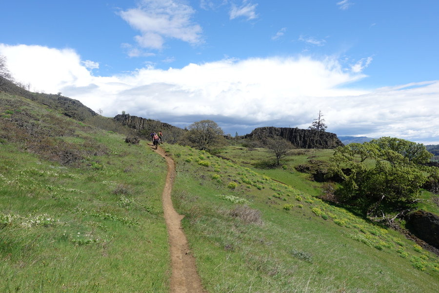
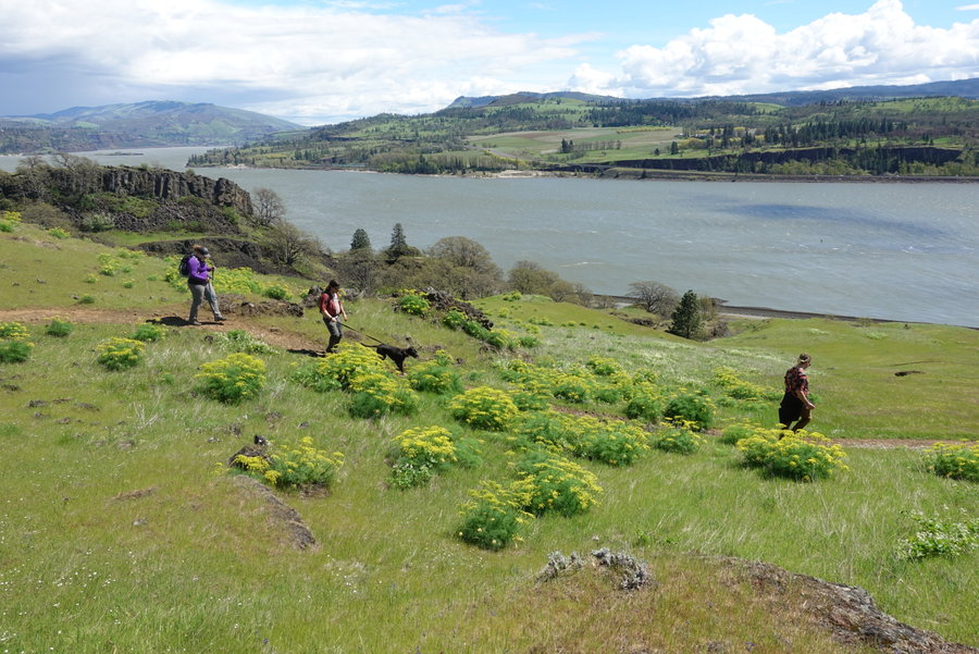
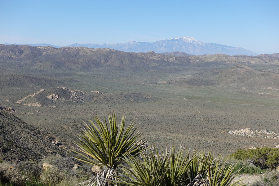
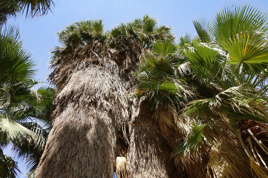
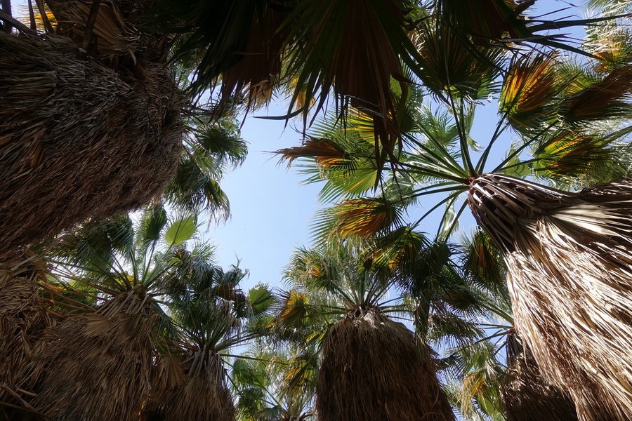
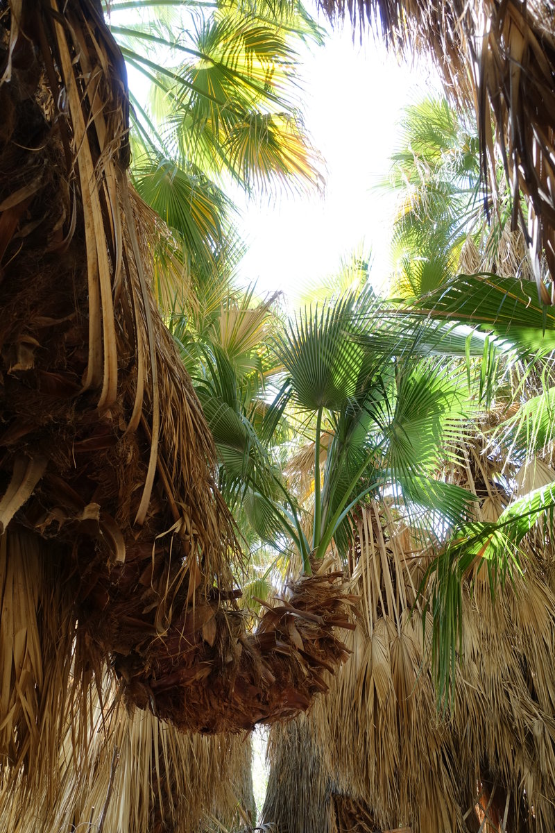
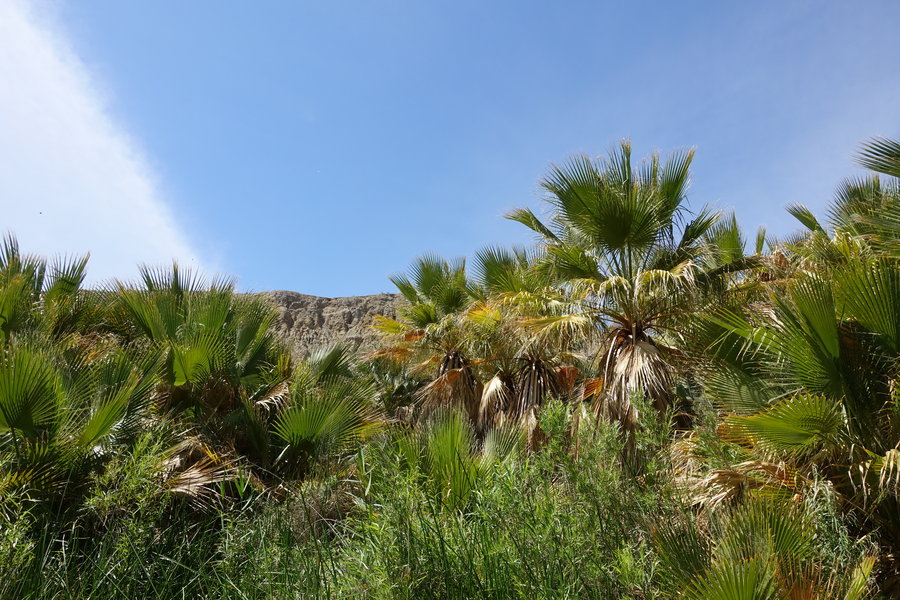
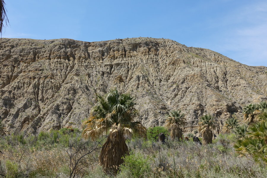
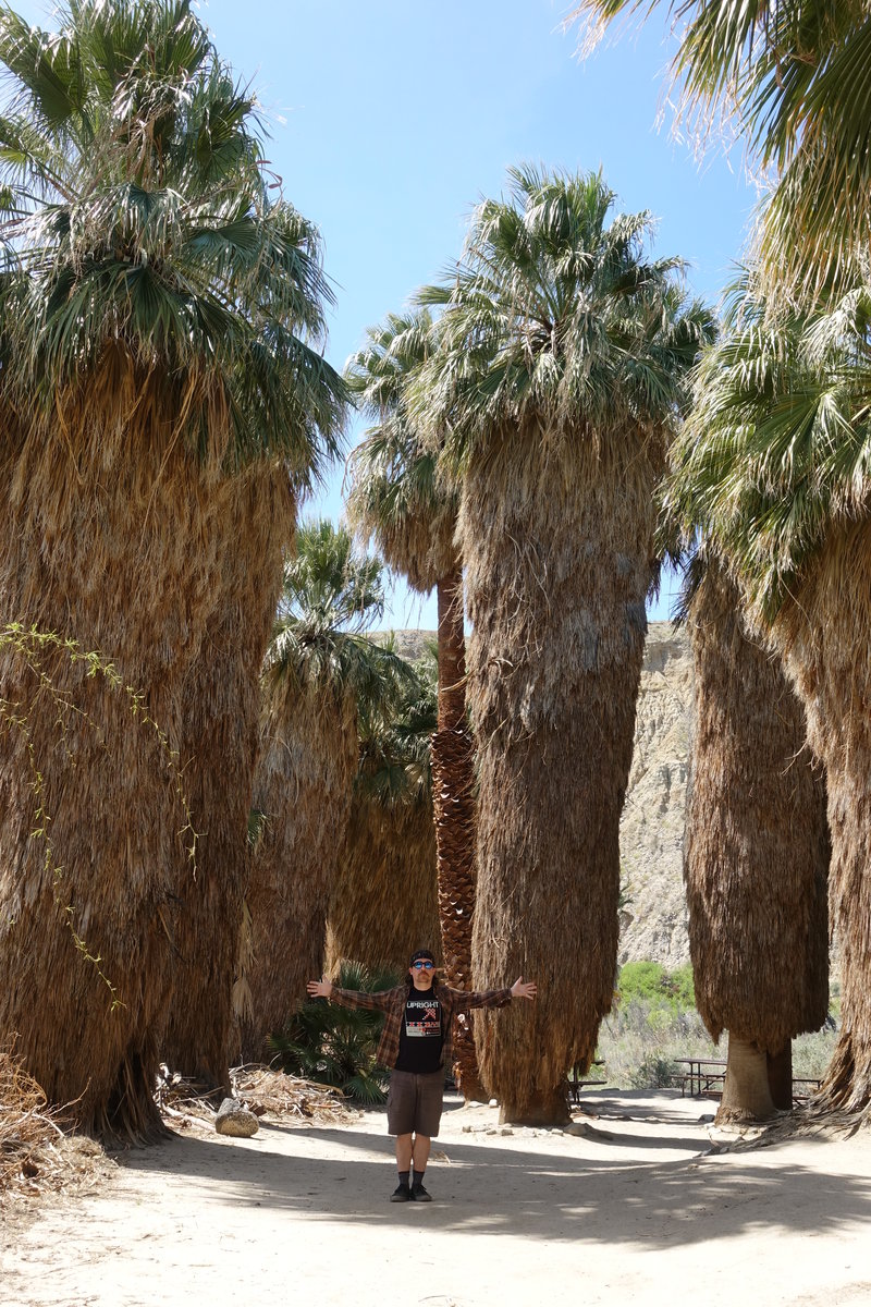
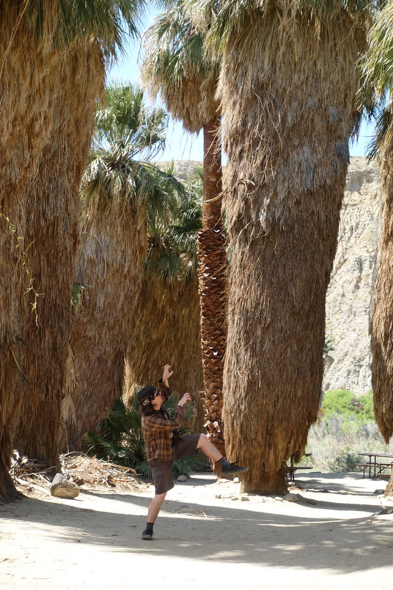
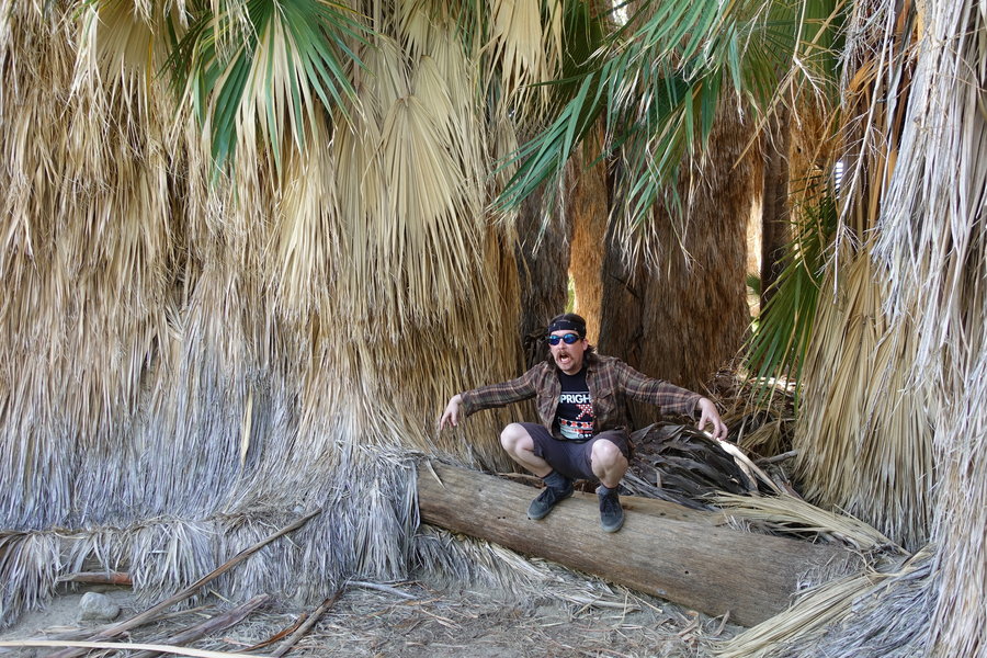
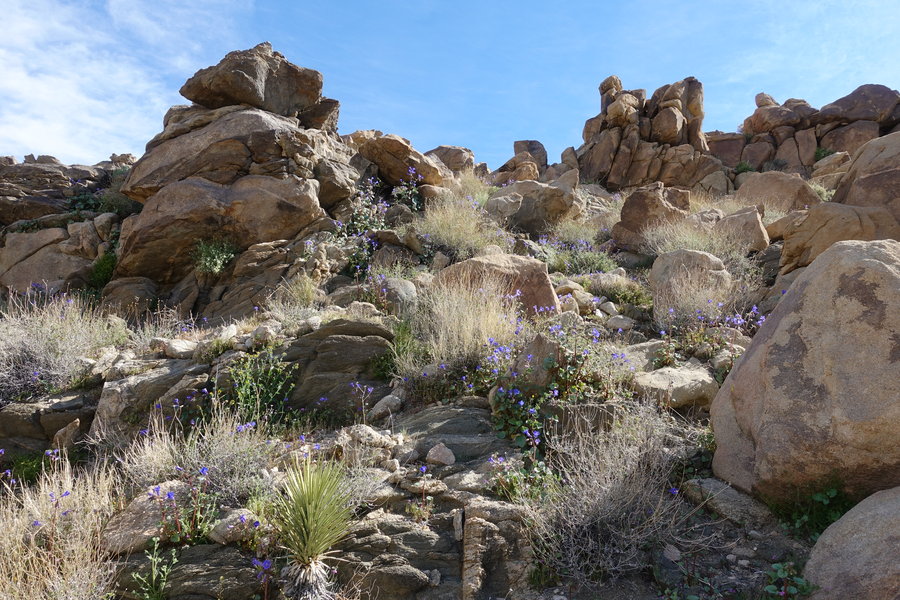
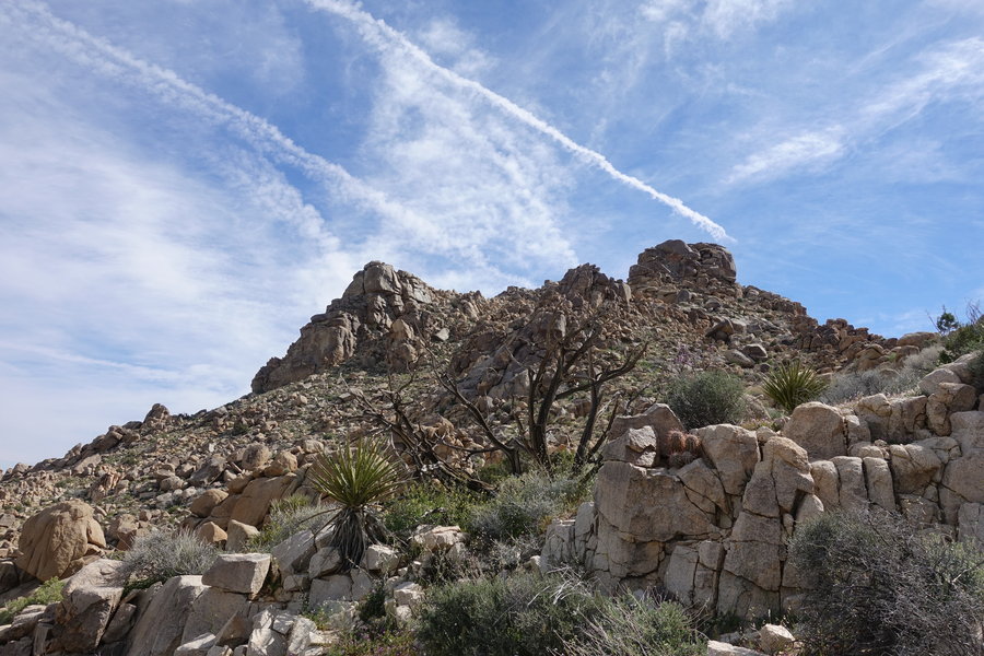
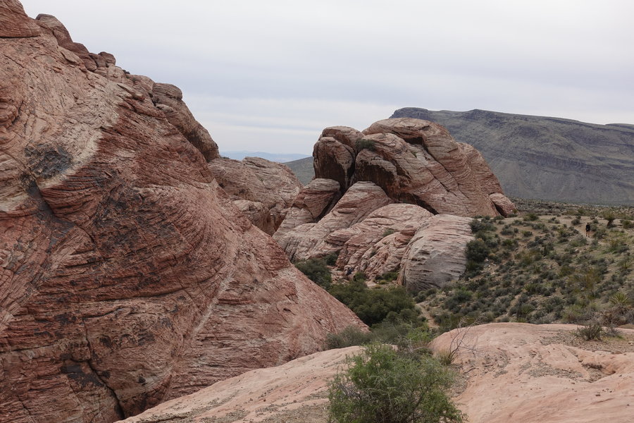
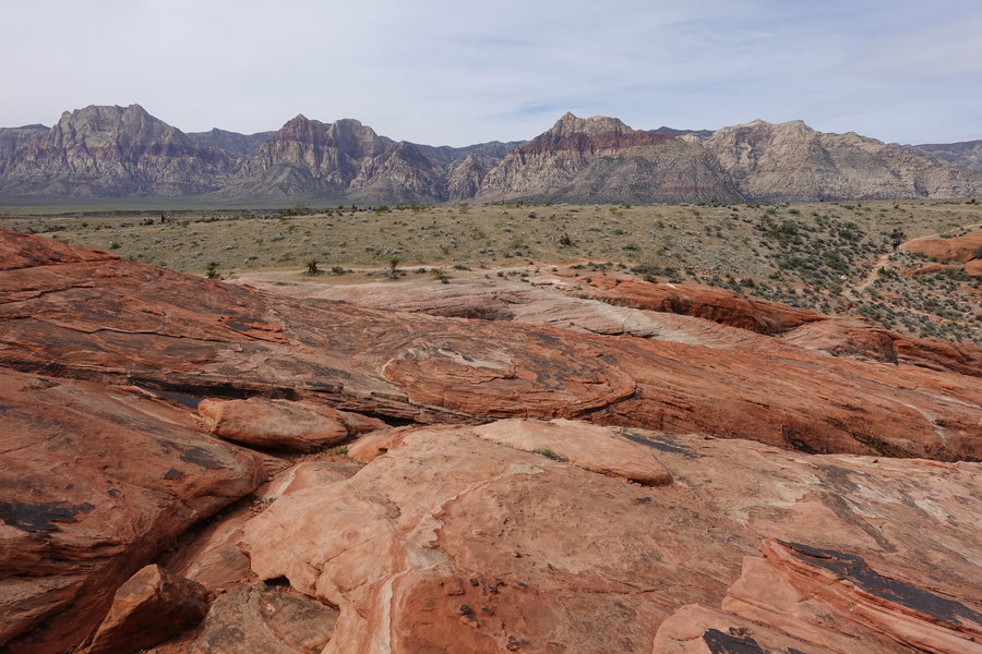
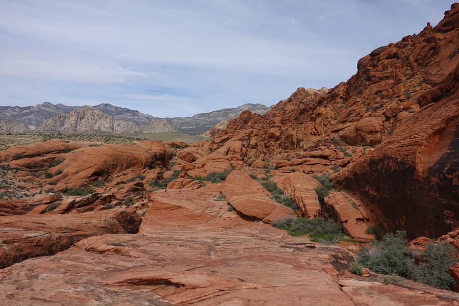
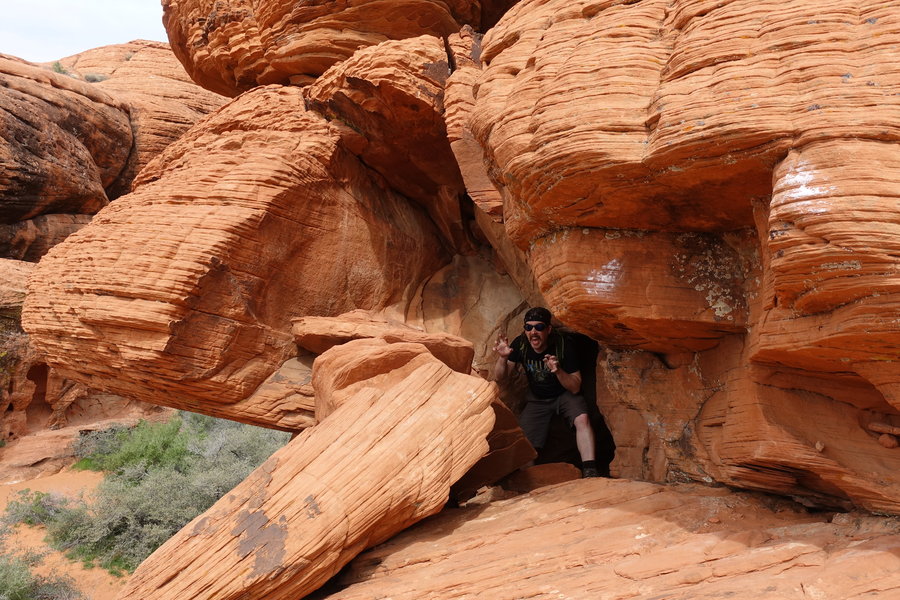
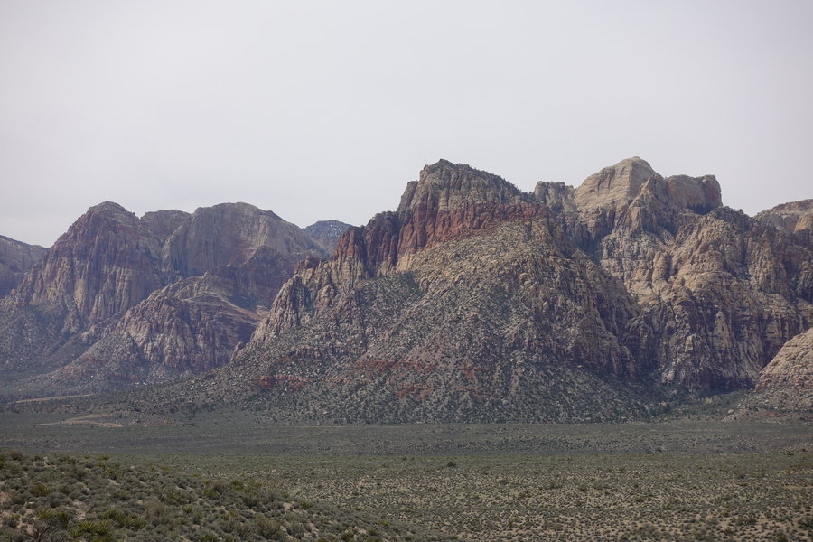
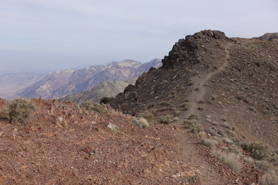
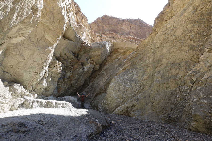
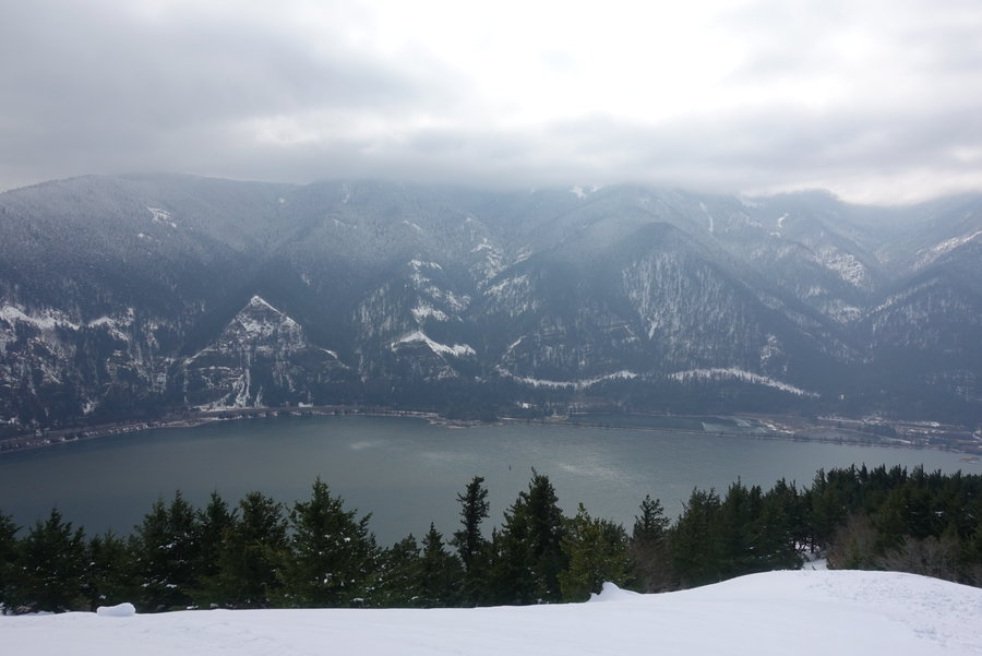
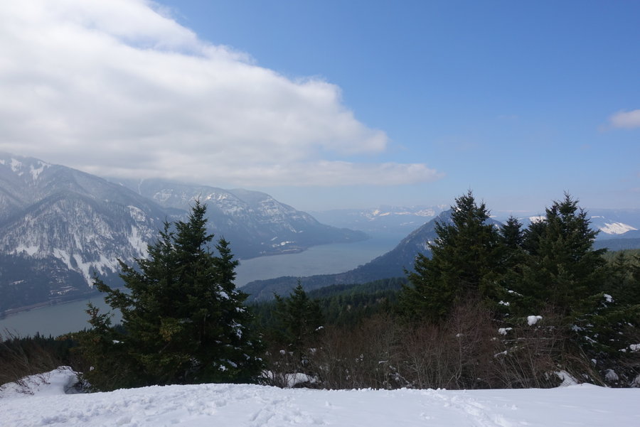
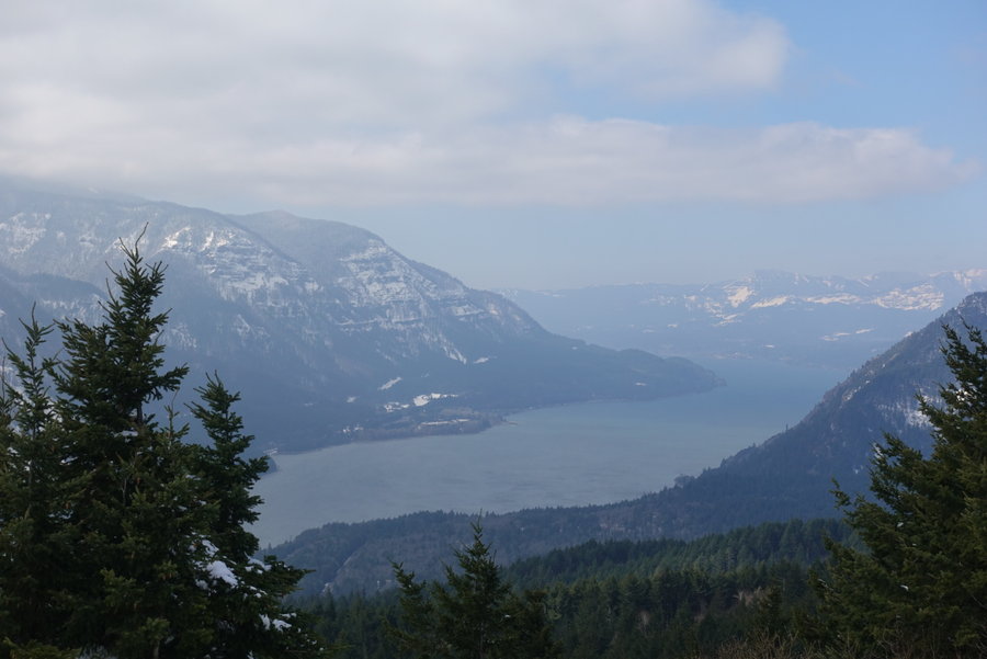
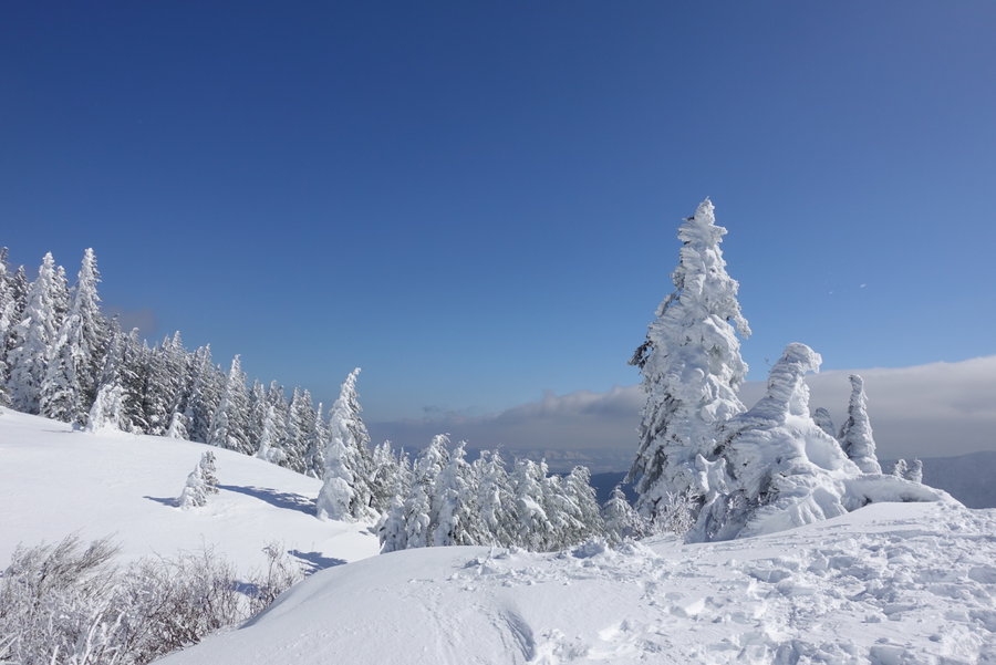
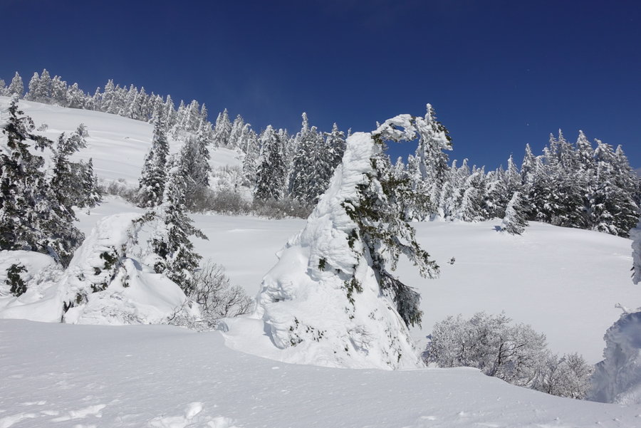
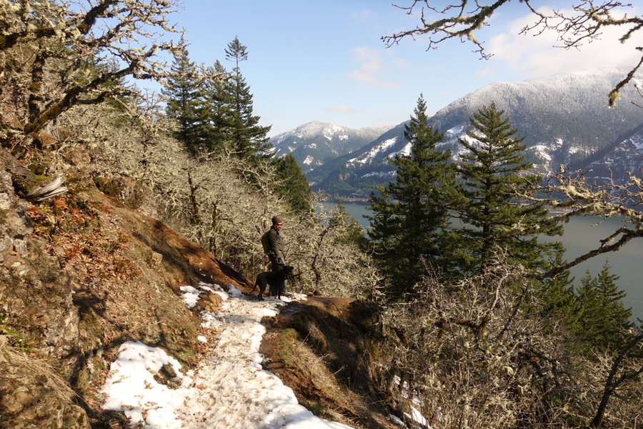
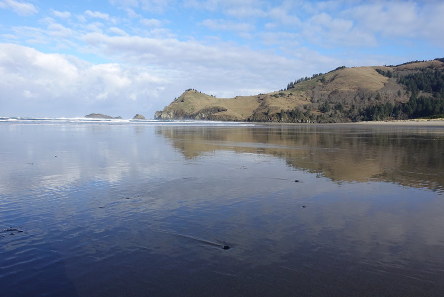
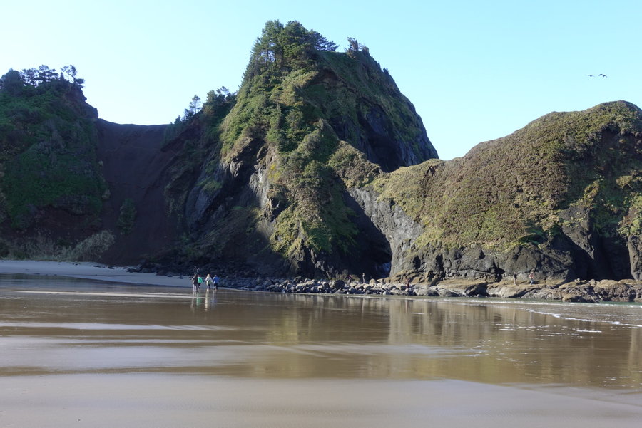
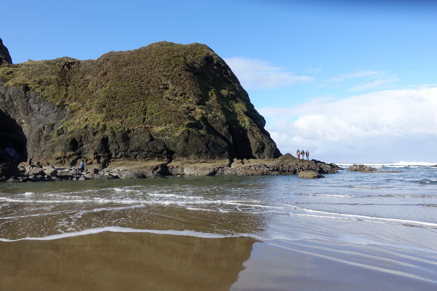
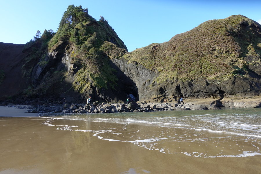
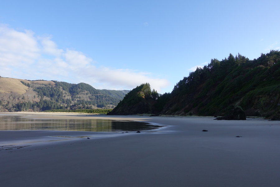
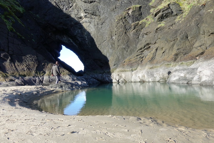
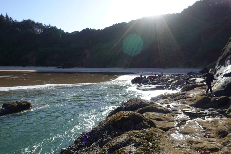
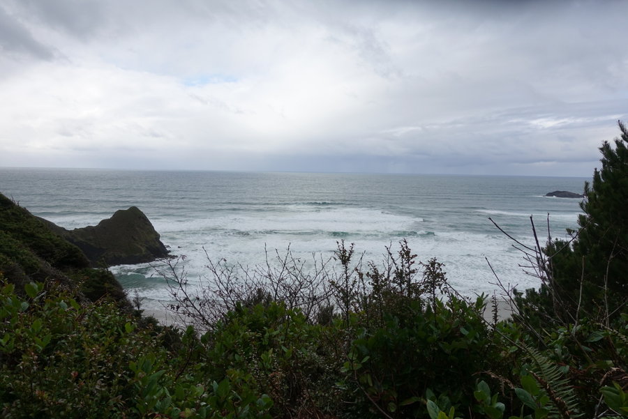
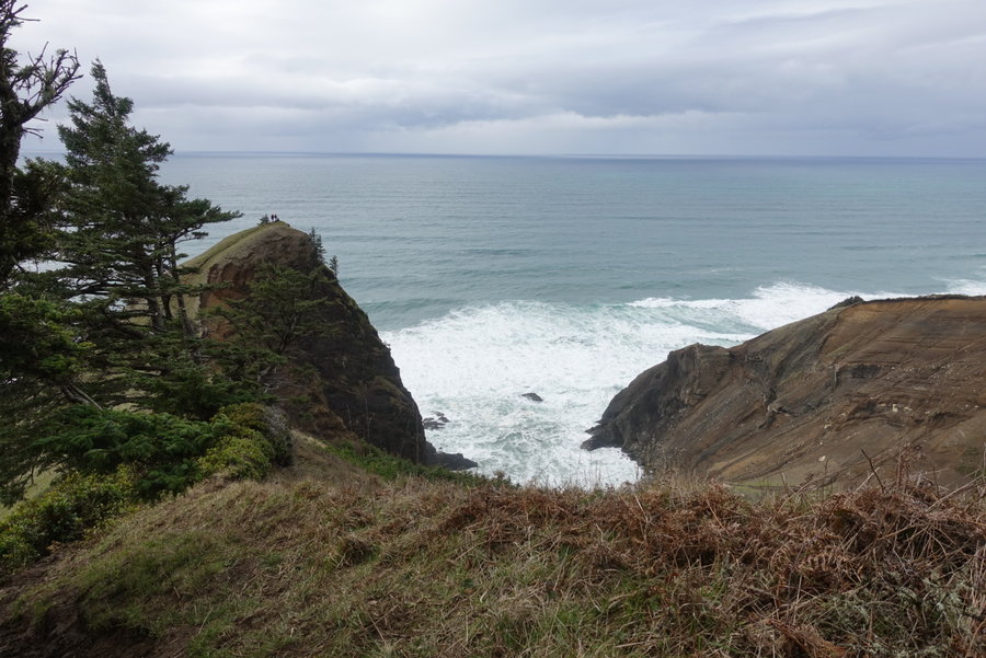
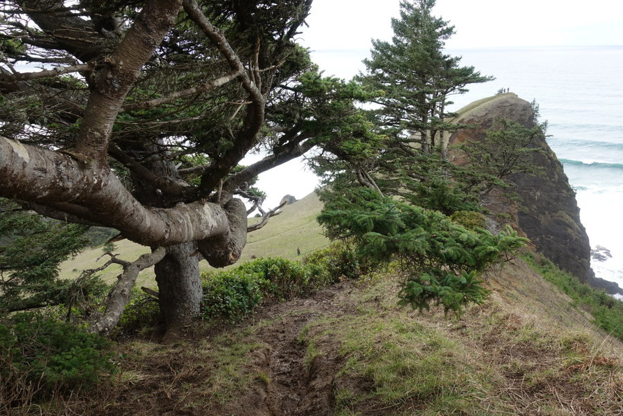
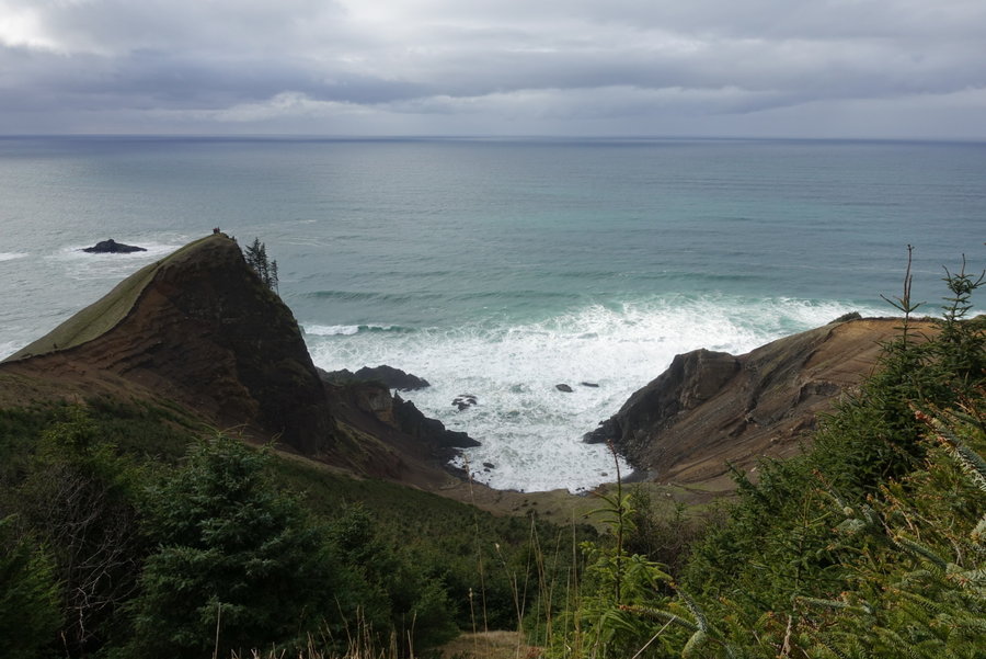
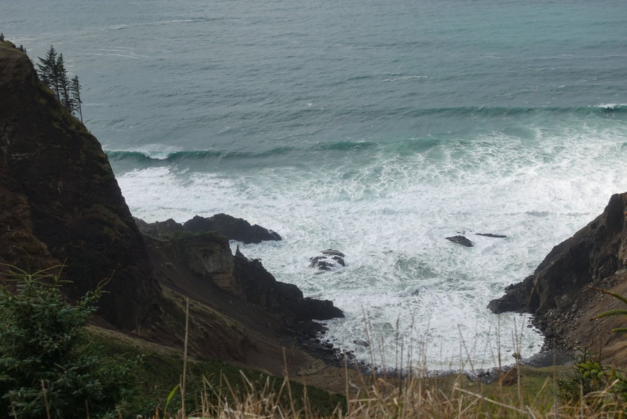
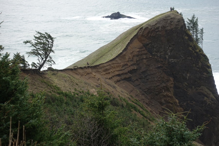
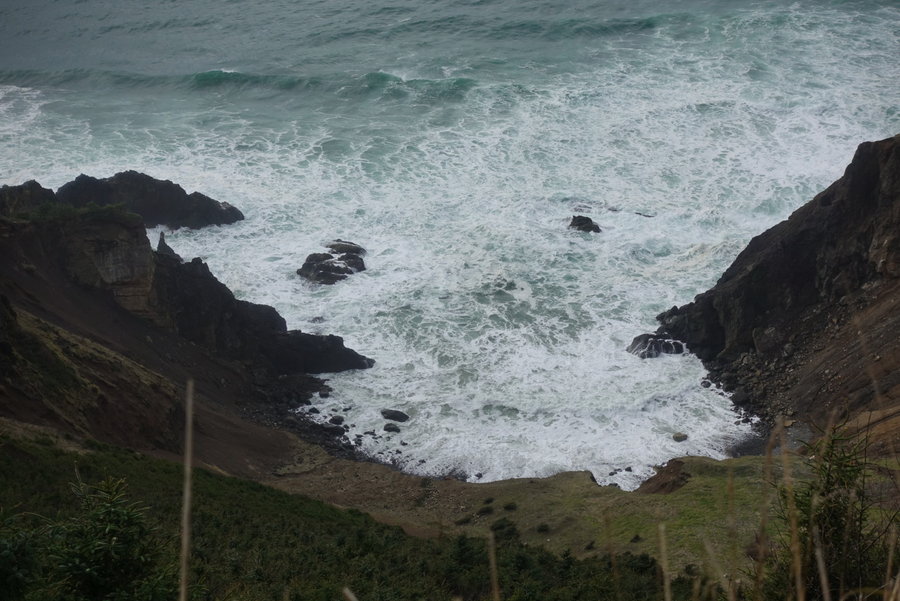
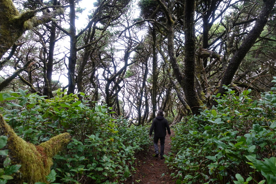
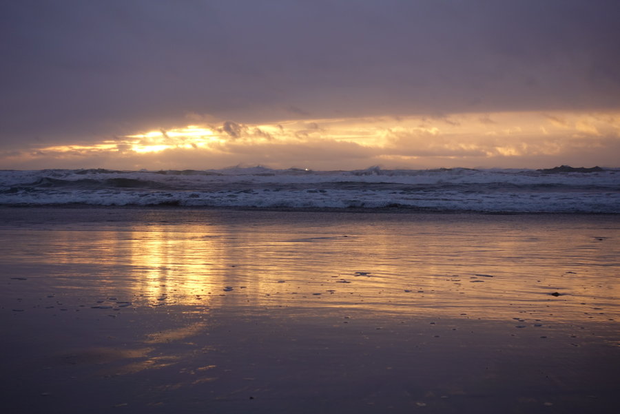
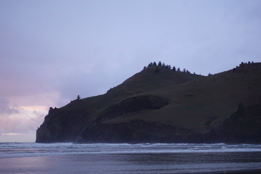
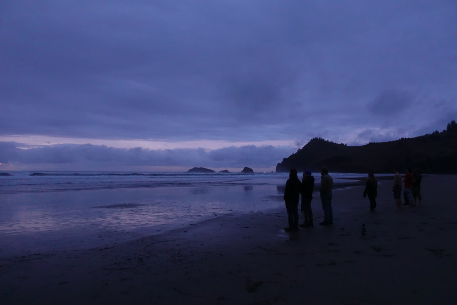
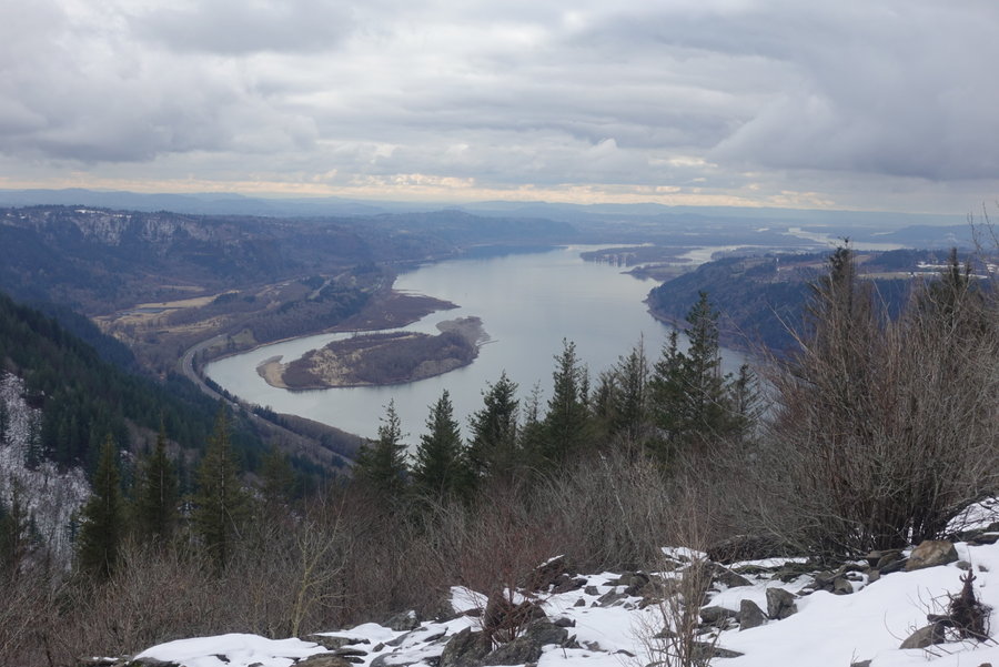
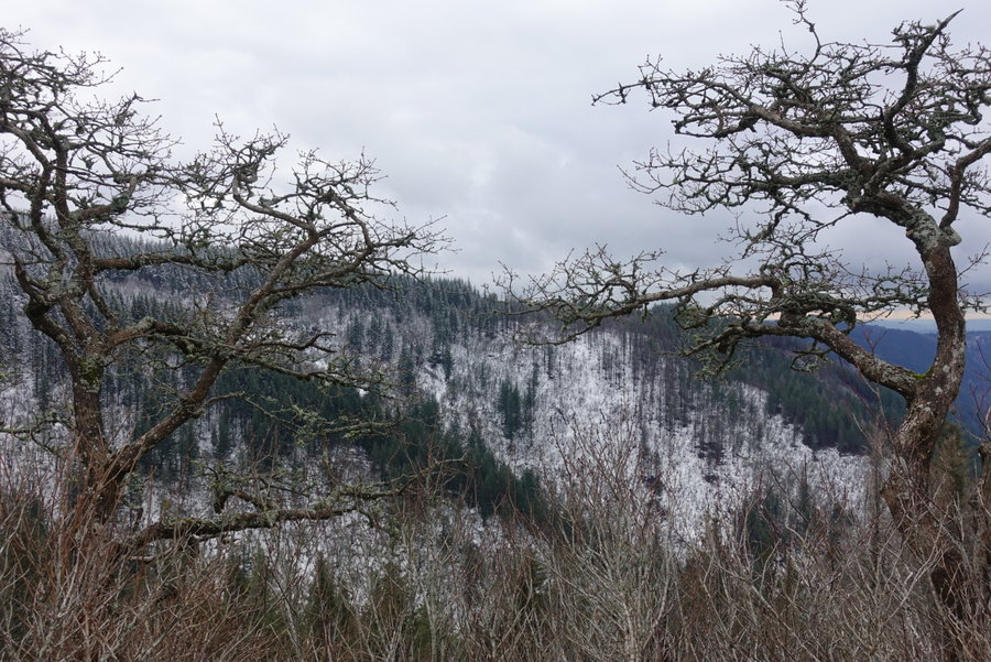
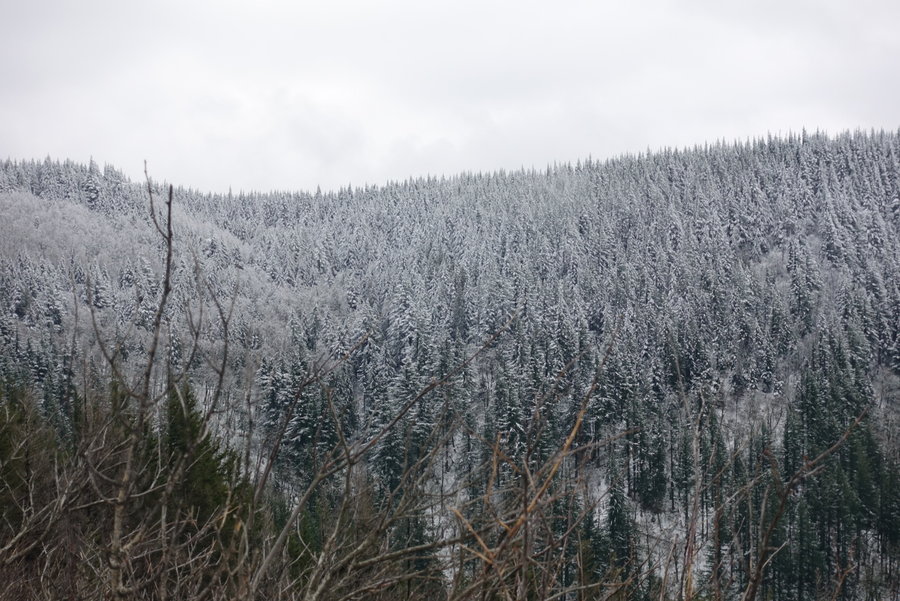
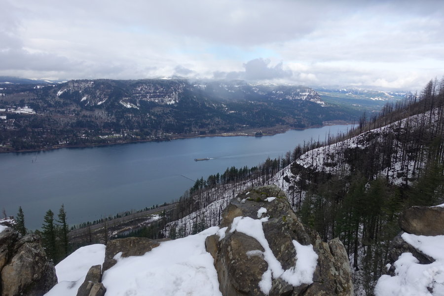
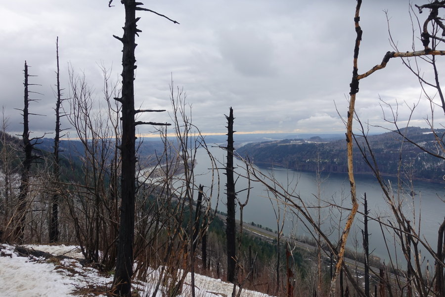
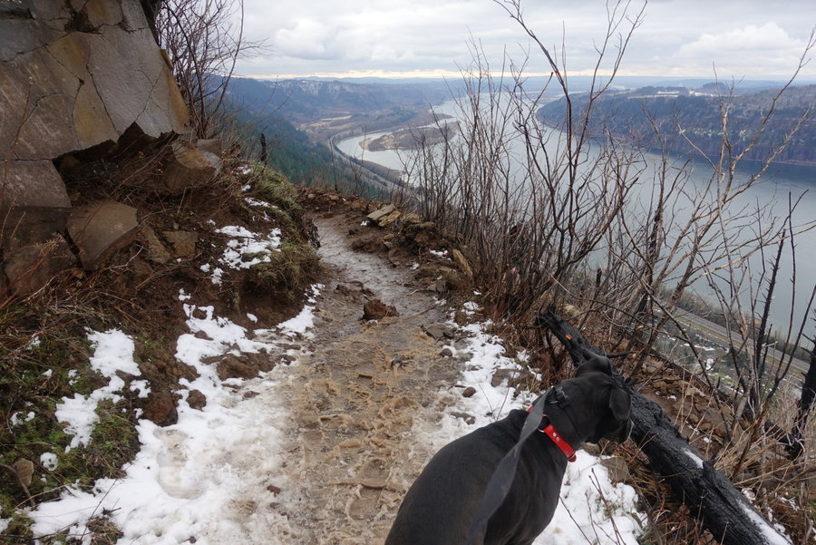
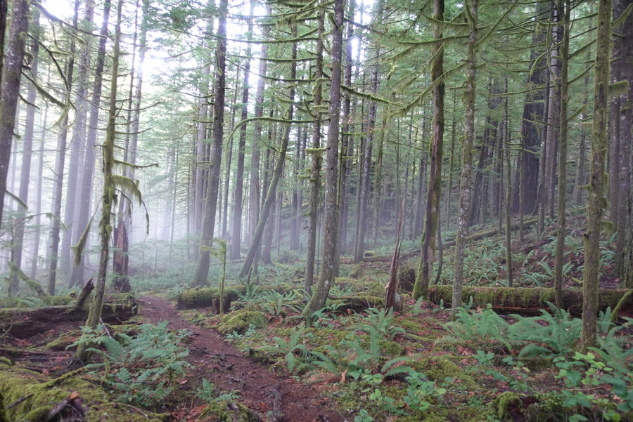
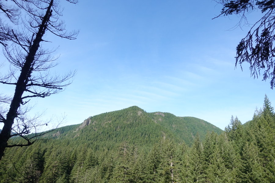
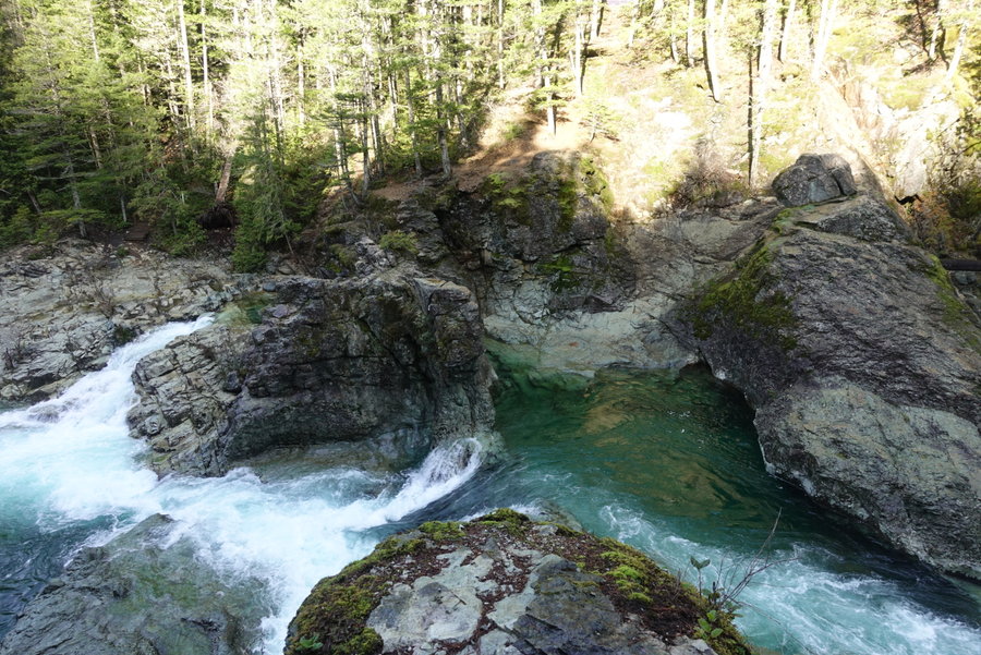
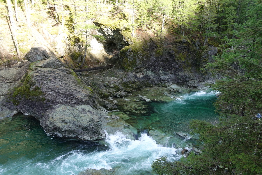
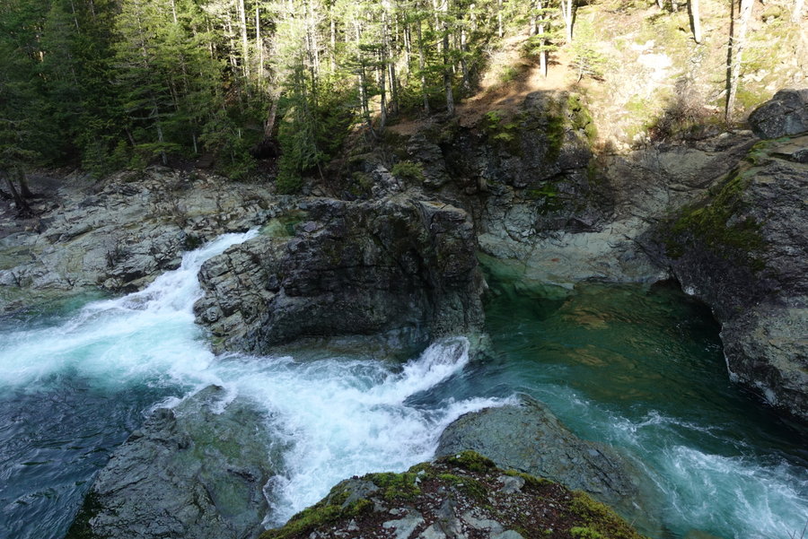
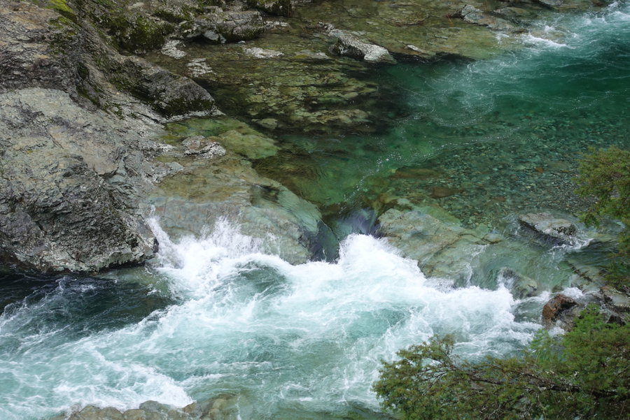
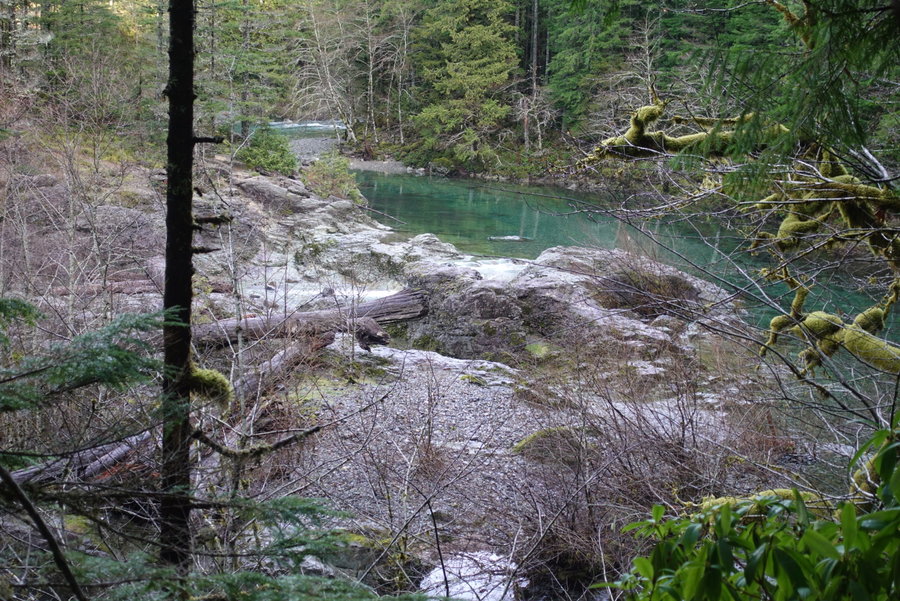
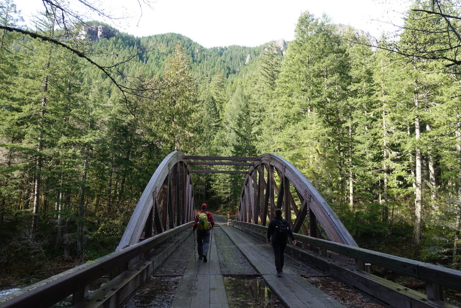
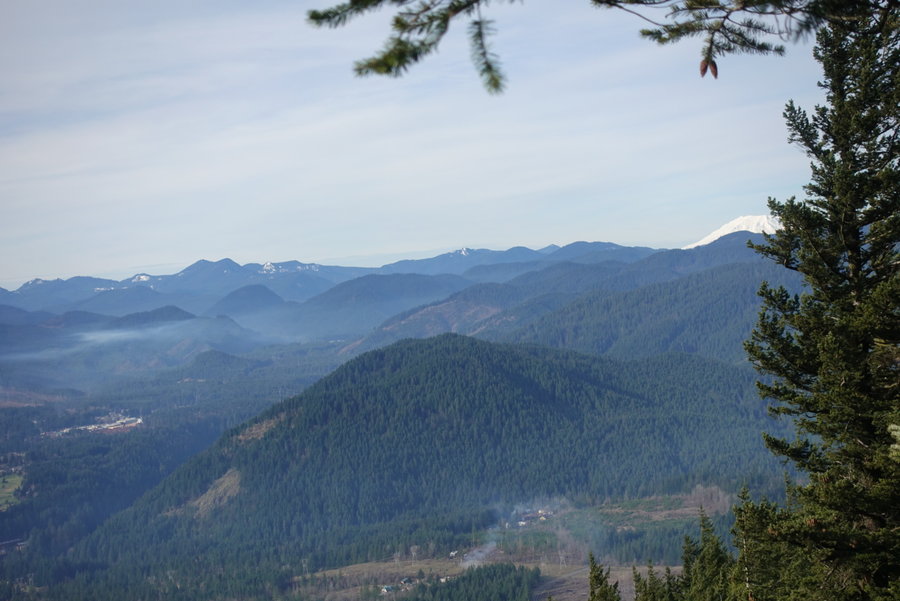
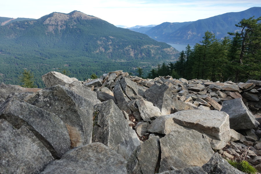
Tillamook Head to Ecola State Park HIker Camp + part of the Clatsop Loop
12 miles of hiking • 1250' elevation gain • 1 night
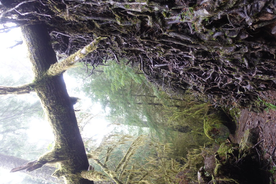
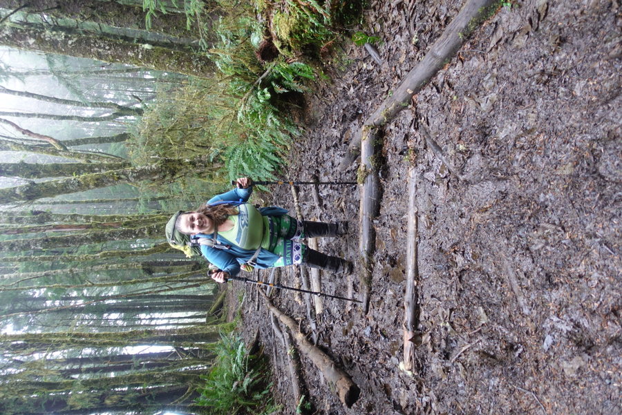
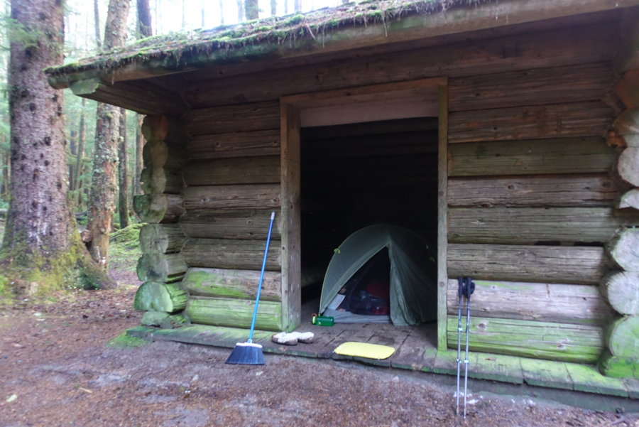
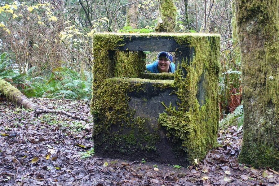
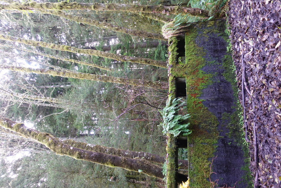
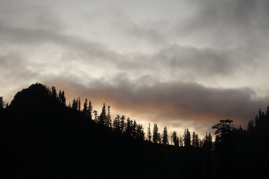
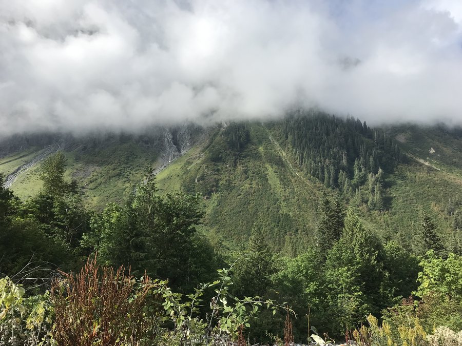
Did an overnight last weekend with my hiking friend Nicole, parking at a turnout near Tillamook Head Trailhead (No overnight parking allowed.) Stayed at the hikers camp, setting up my tent inside one of the hiker shelters with the mice. (I forgot my footprint and it was raining.) Stayed toasty and warm inside, and was surprisingly unbothered by mice.
In the evening the sky cleared long enough that we took a night hike to the cliffs edge, to see what stars we could see. Checked out the bunkers in the night, thoroughly soaking our shoes in the mud.
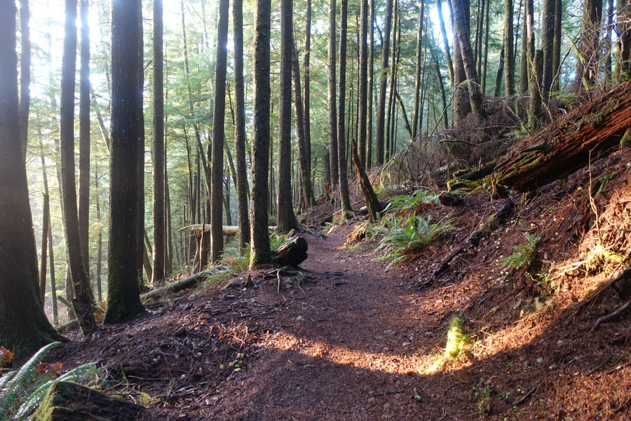
The sunshine came out in the morning as we stretched our legs on the Clatsop loop, though we turned around part way since we had left our food and water back in camp. We hiked back out the way we came.

December 14 – December 15, 2019


 1
1
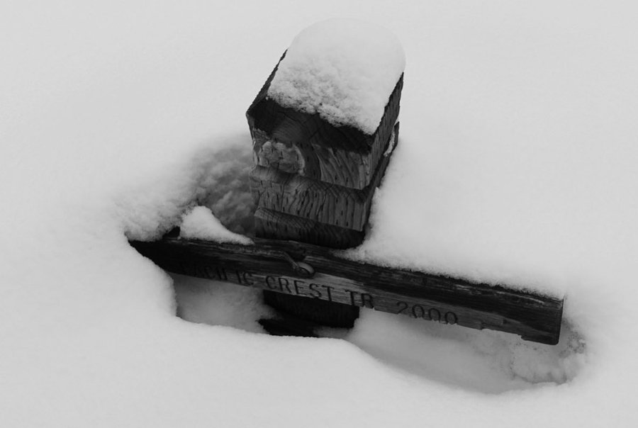
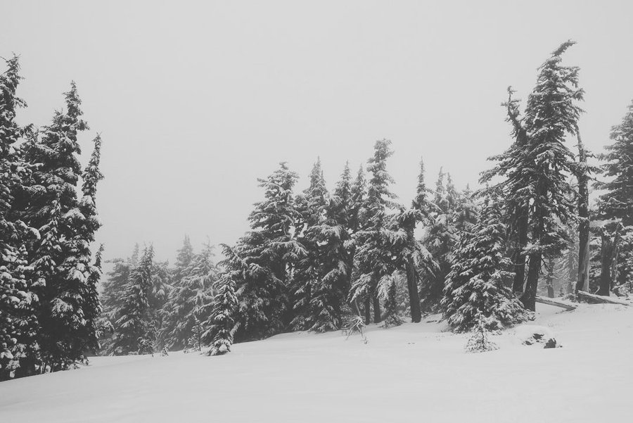
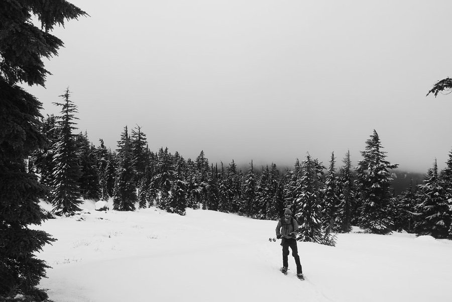
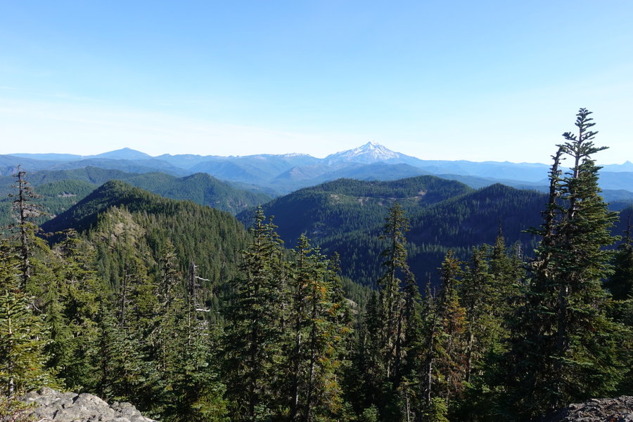
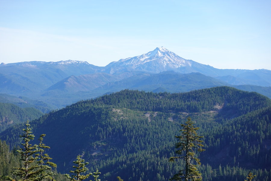
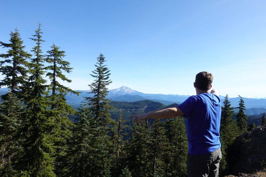
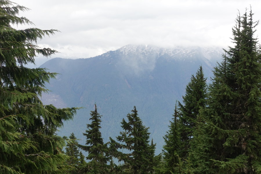
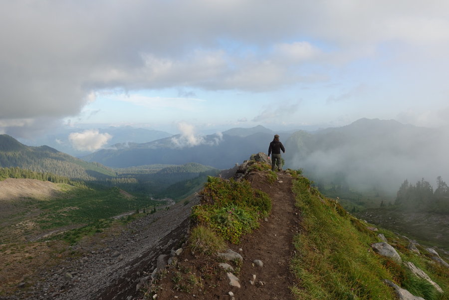
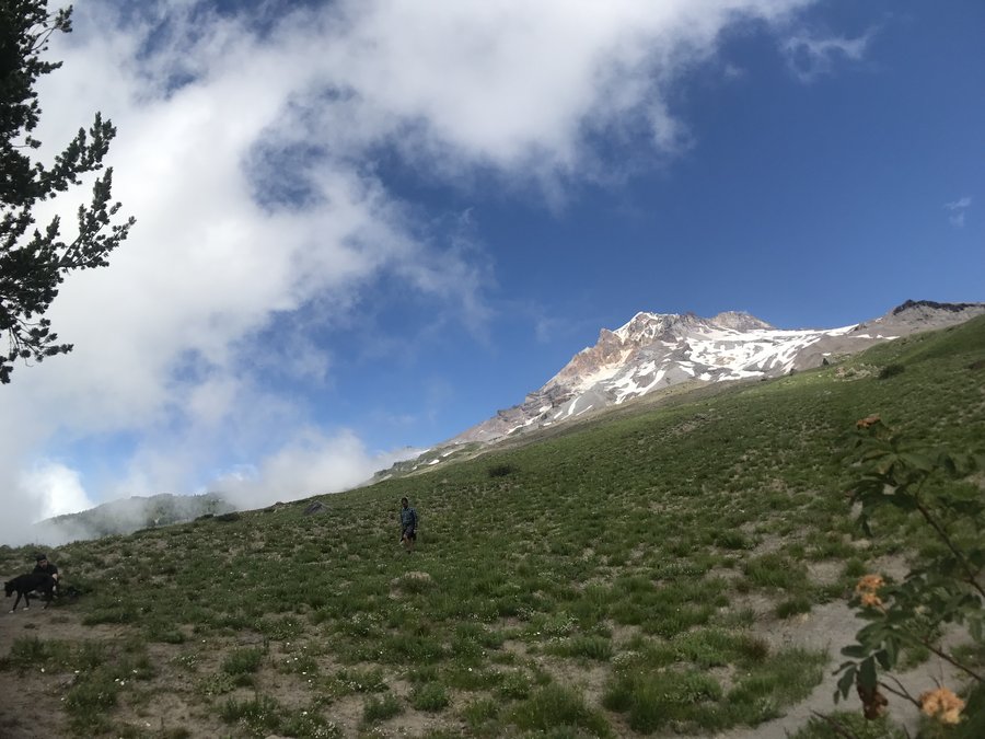
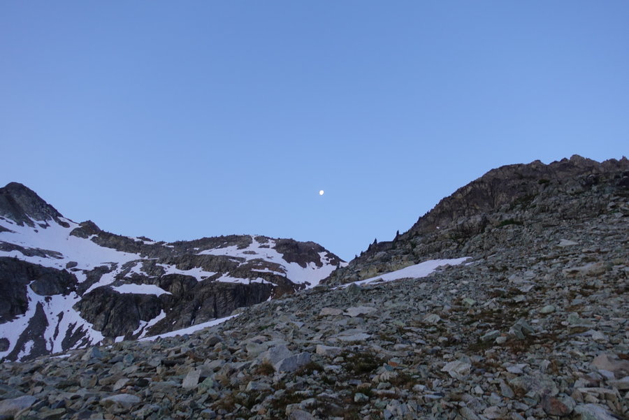
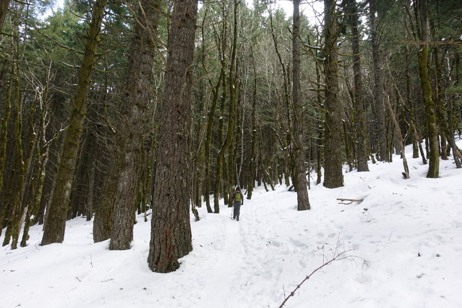
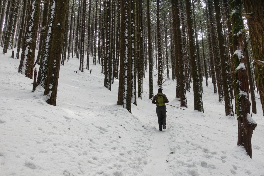
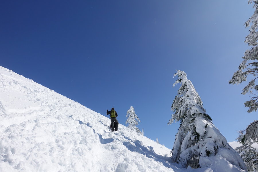
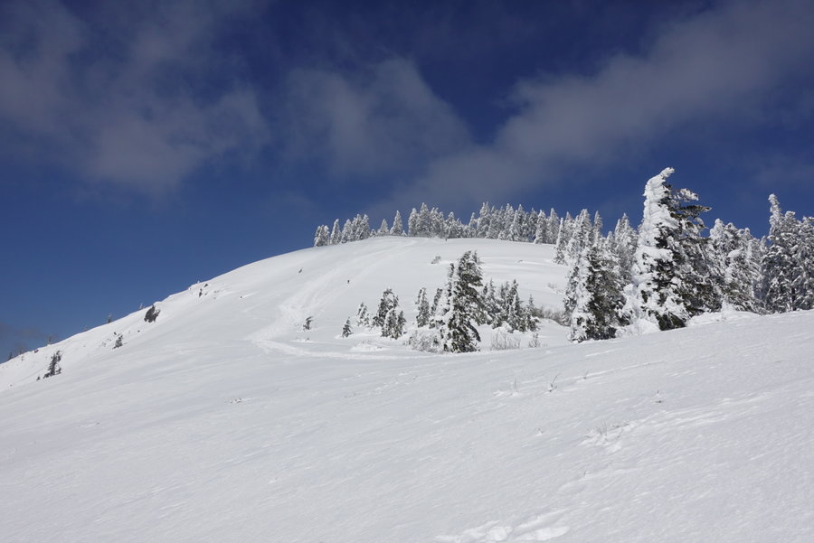
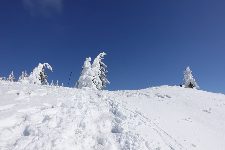
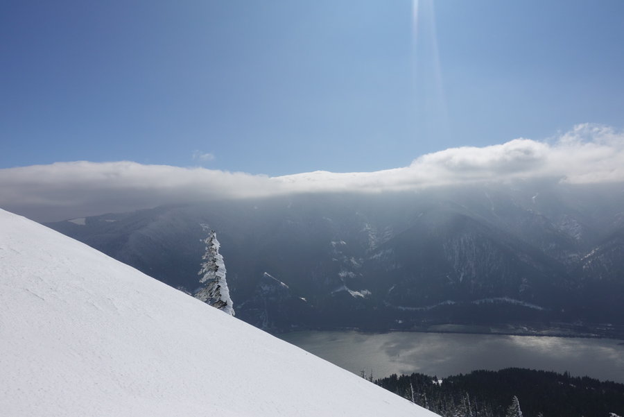
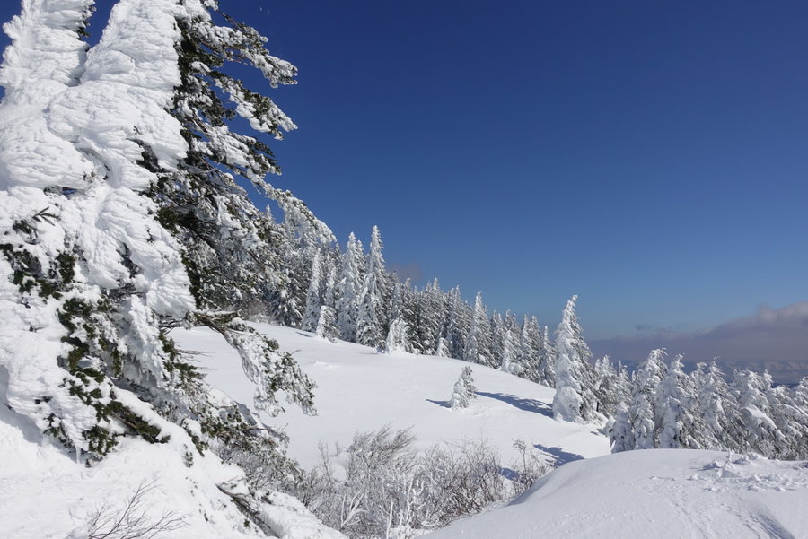
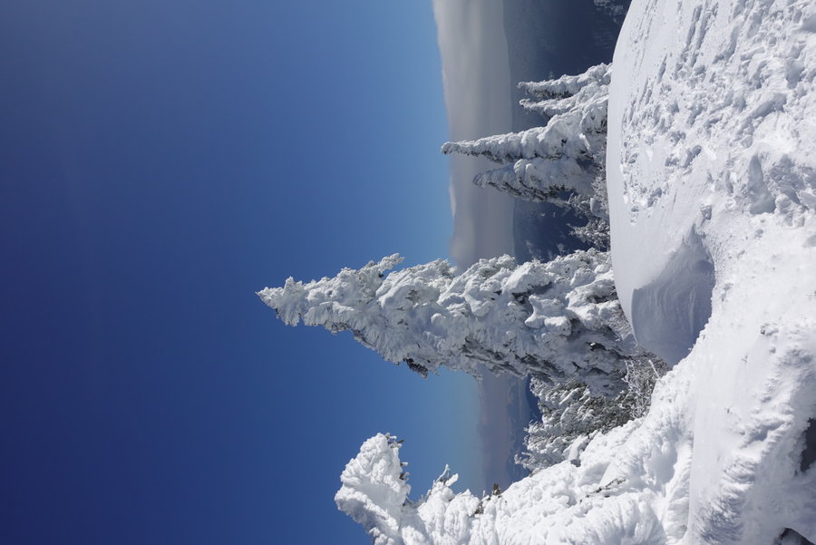
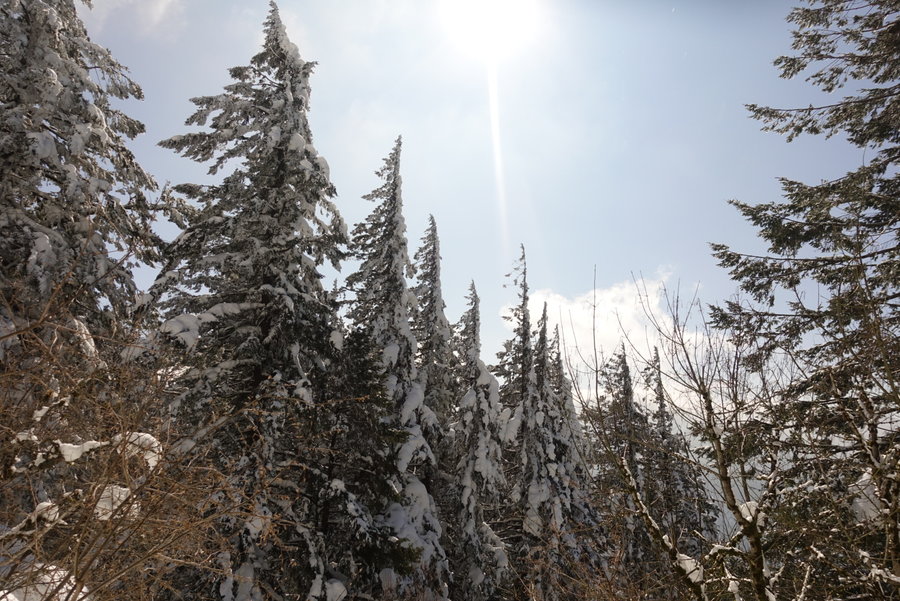
Timberline Trail starting from Timberline Lodge + Barlow Trail
6 miles of hiking • 750' elevation gain •
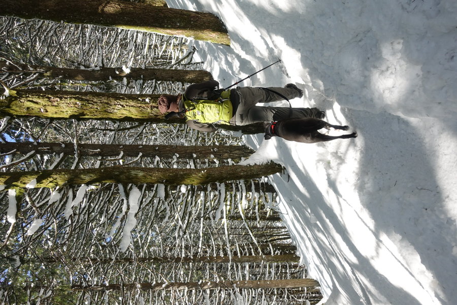
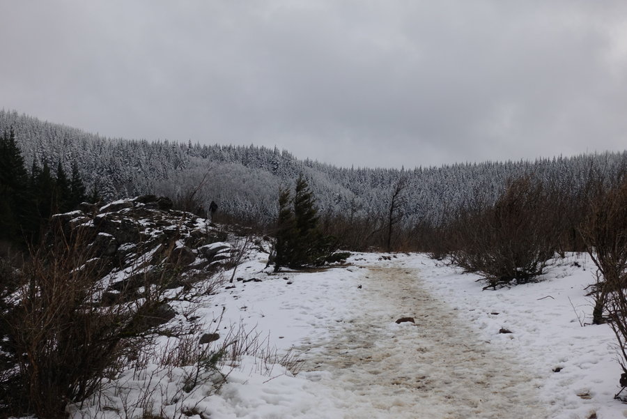
Just some fun on the mountain with my friend Eric testing out gear. (He had some new mountaineering boots to try out, and I wanted to try out my snowshoes.) Only one person ahead of us on the trail, who turned around and then it was our turn to break trail. Mileage wasn't our goal, but goofing around in the snow was. A nice day.
December 7, 2019


 1
1
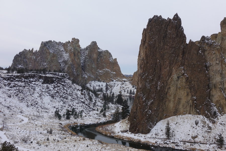
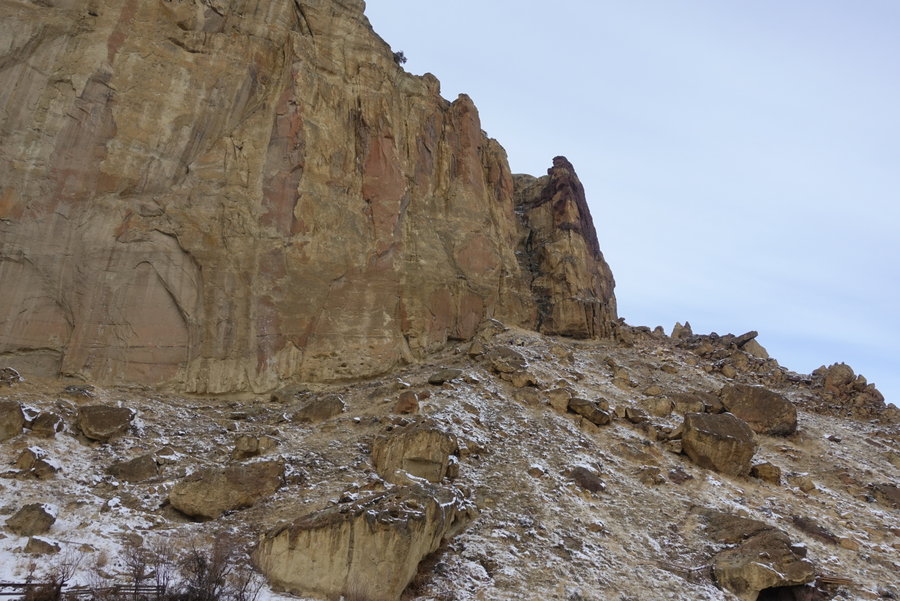
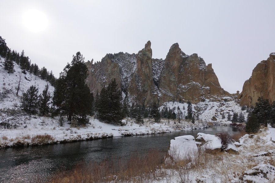
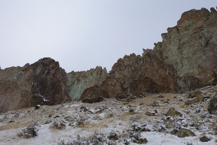
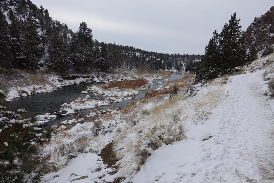
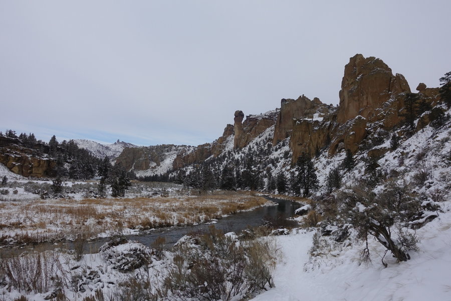
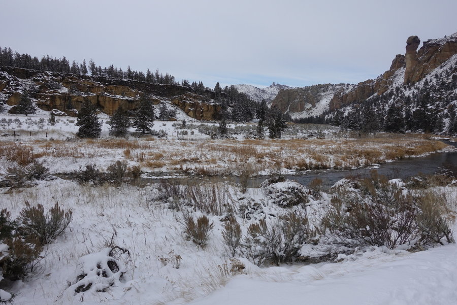
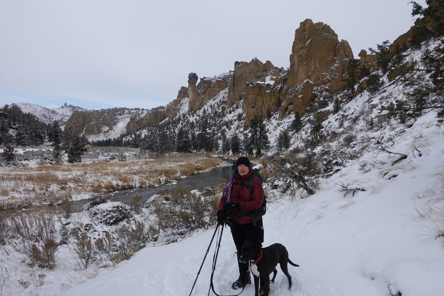
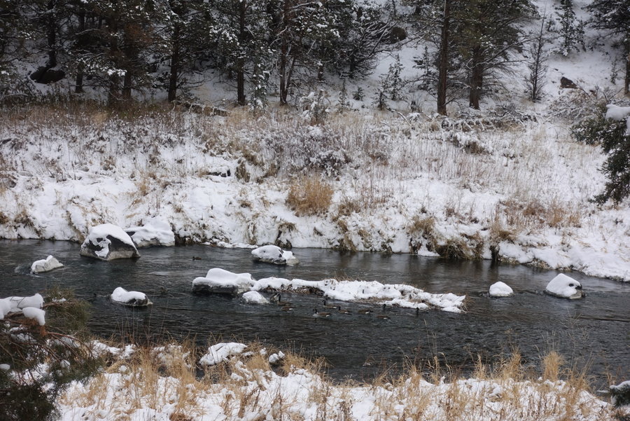
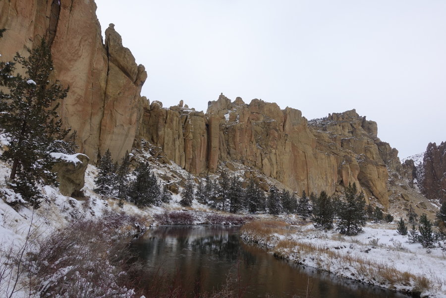
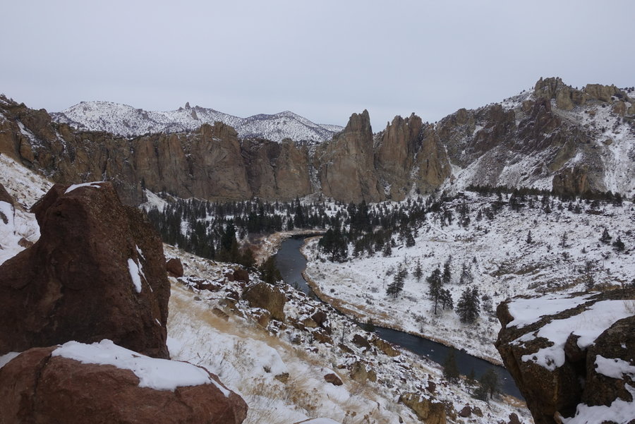
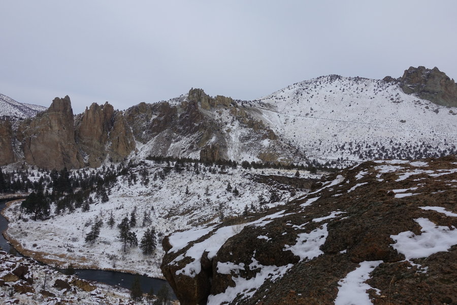
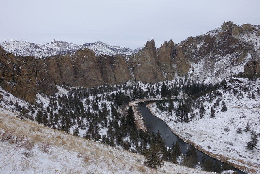
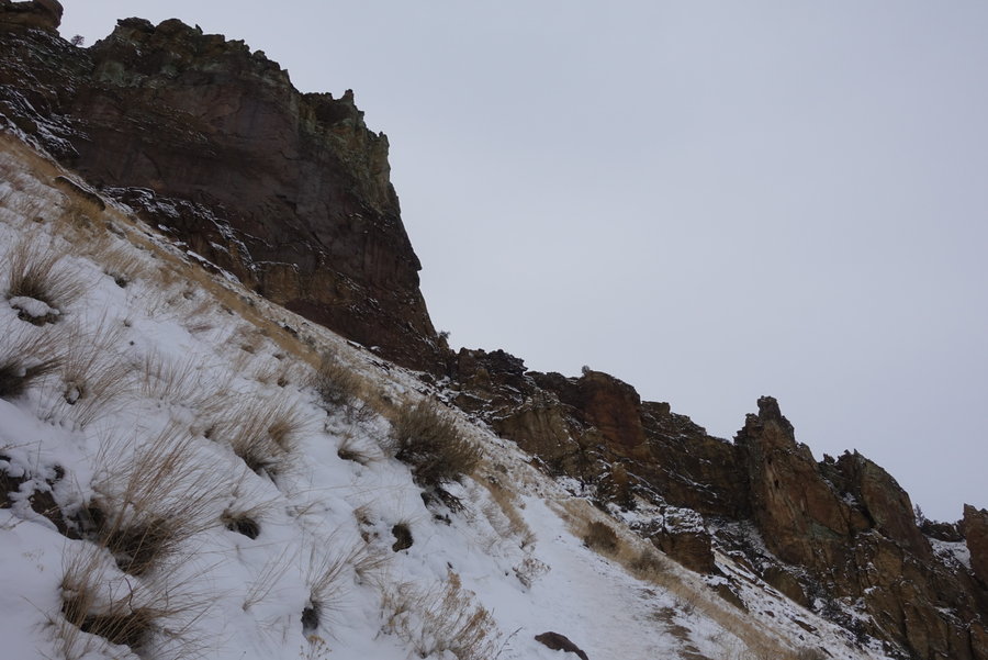
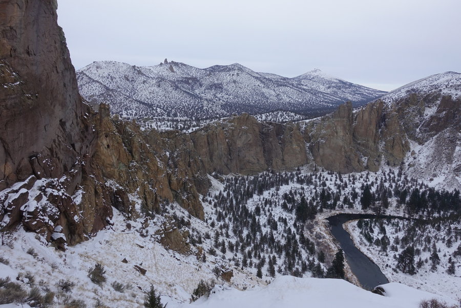
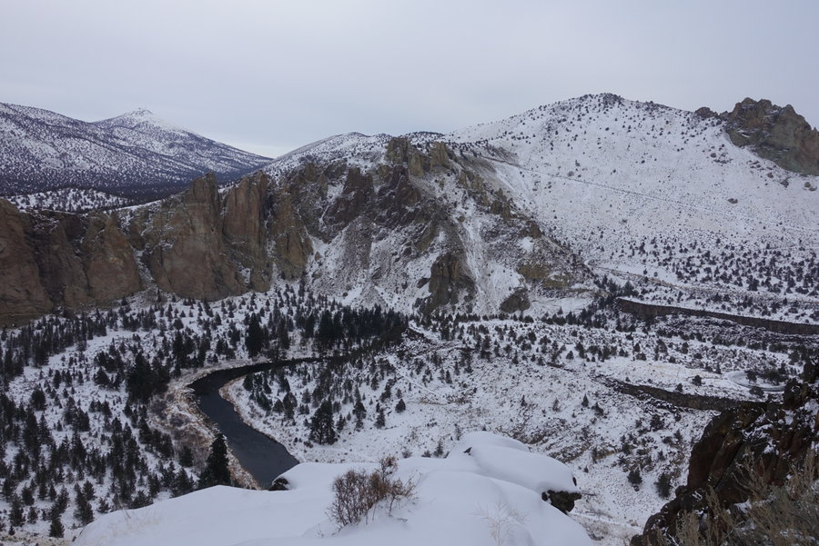
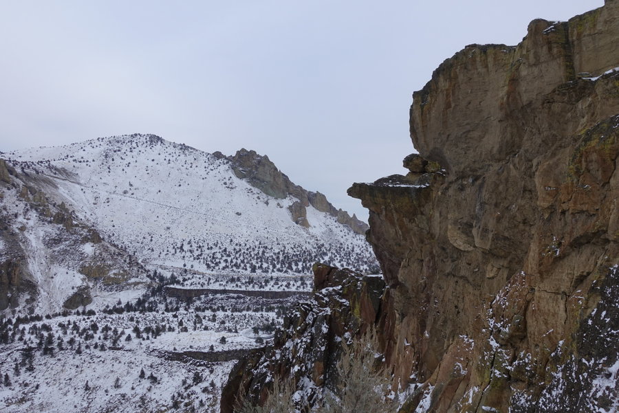
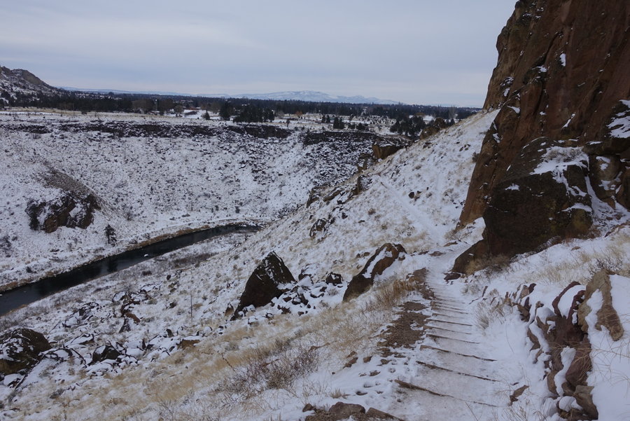
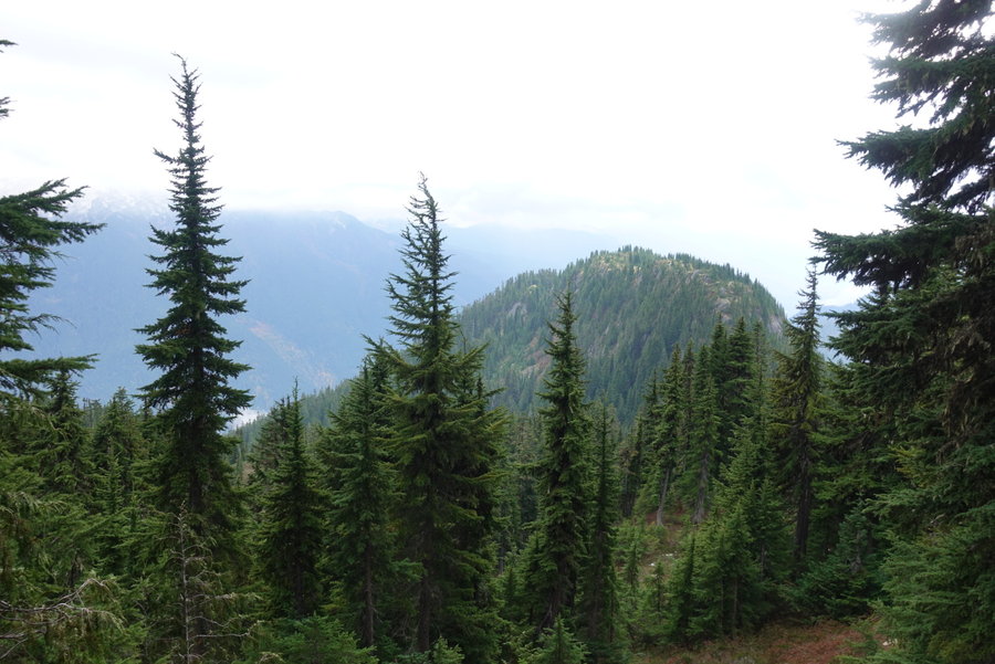
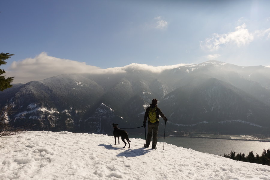
Smith Rock River Trail and MIsery Ridge
6 miles of hiking • 1000' elevation gain •
Birthday hike. First did the River Trail with Zane and the dog. It was pretty cold and we were worried Lily would get too cold. When we got back to the cutoff for Misery Ridge, Zane looked at me and knew I wanted to give it a go. Zane and dog went to the heat of the car, and I set a turnaround time of a half an hour, and up I went. Didn't quite make it to the top, but I had fun trying.
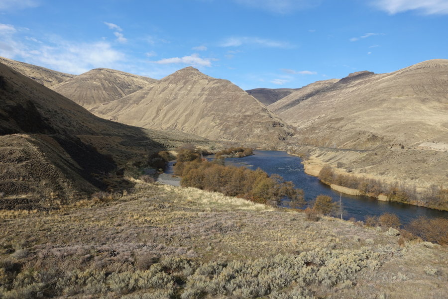
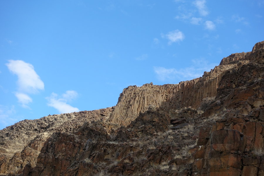
November 30, 2019


 1
1
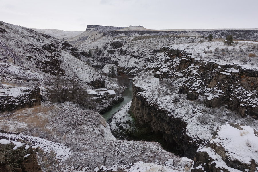
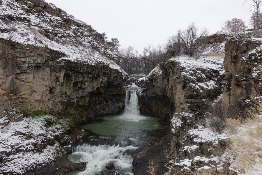
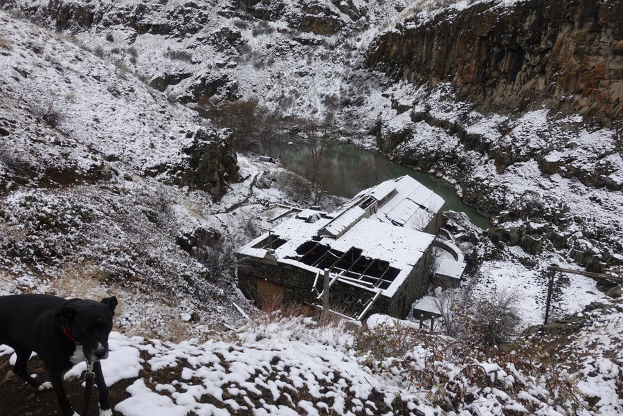
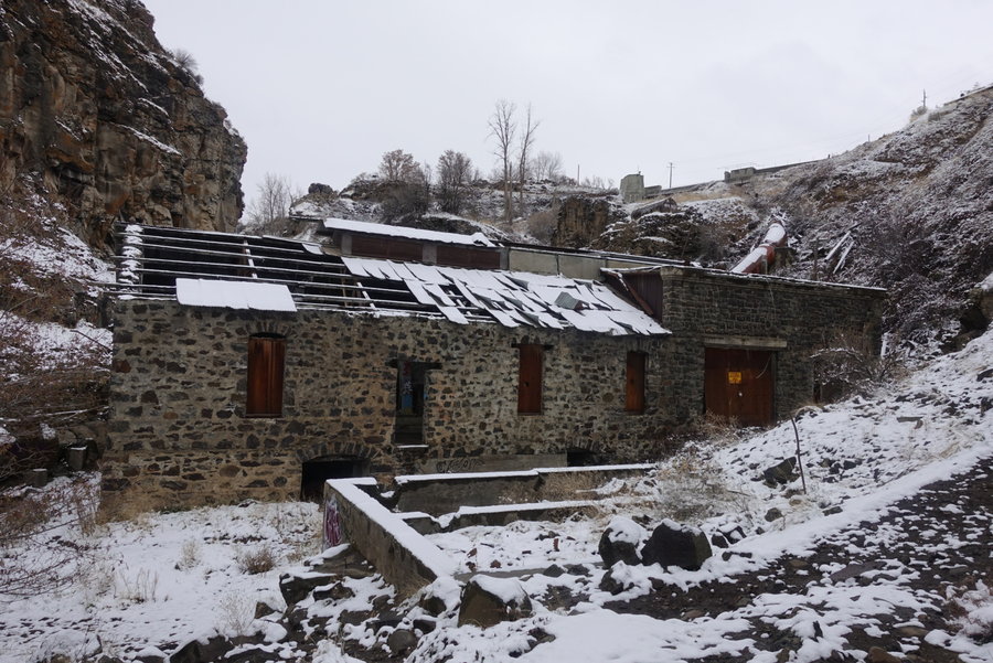
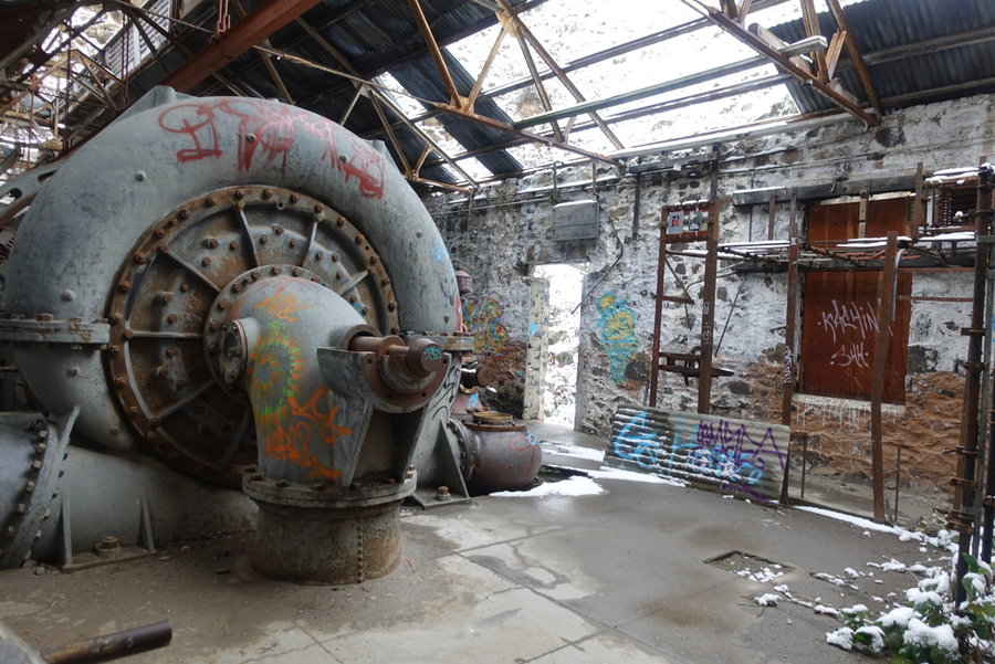
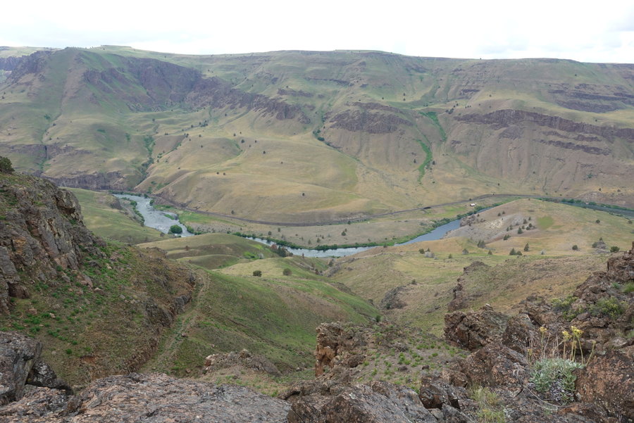
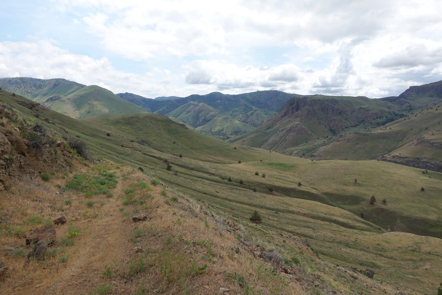
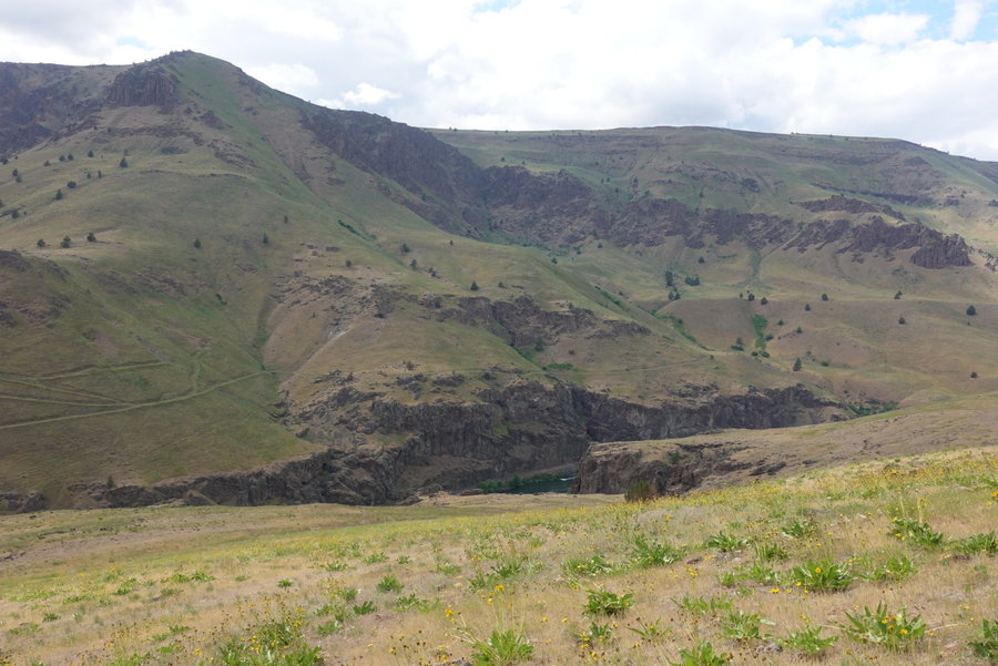
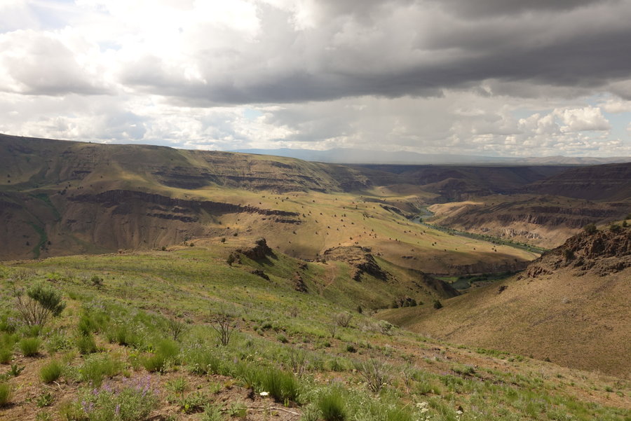
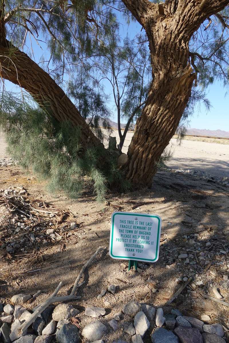
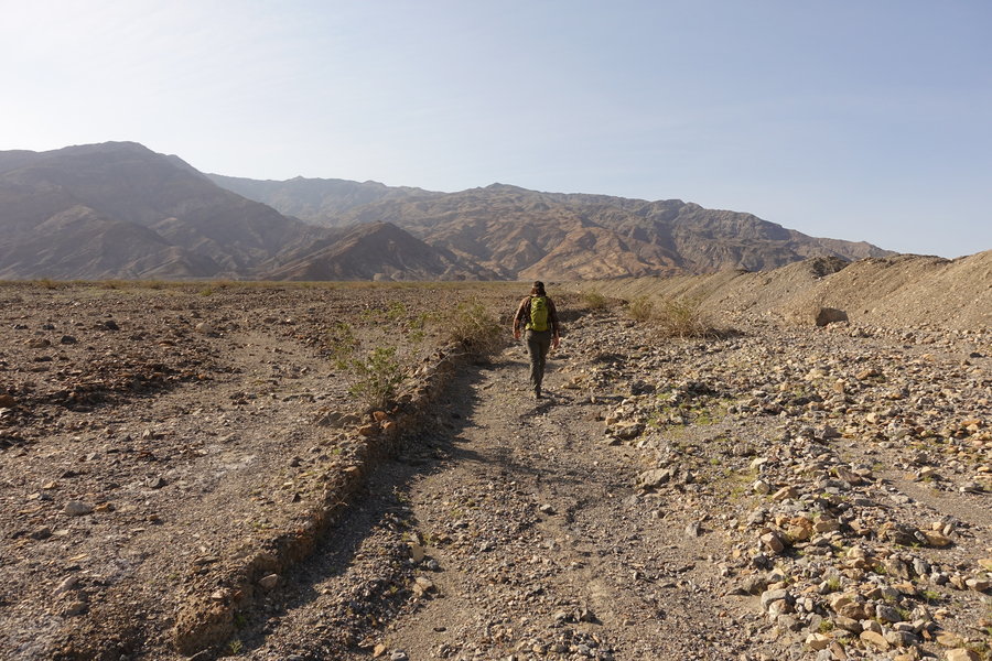
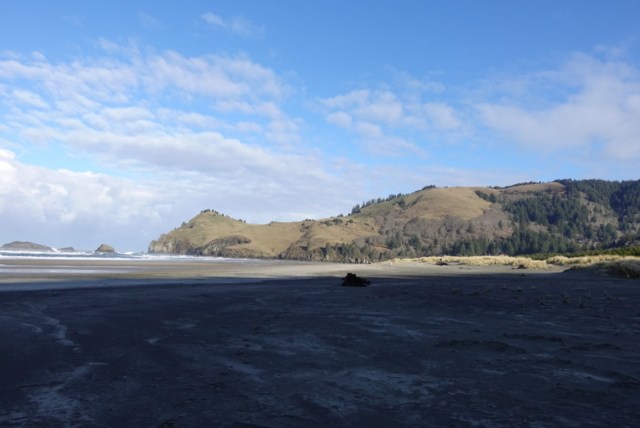
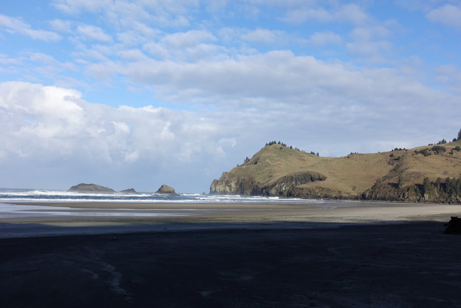
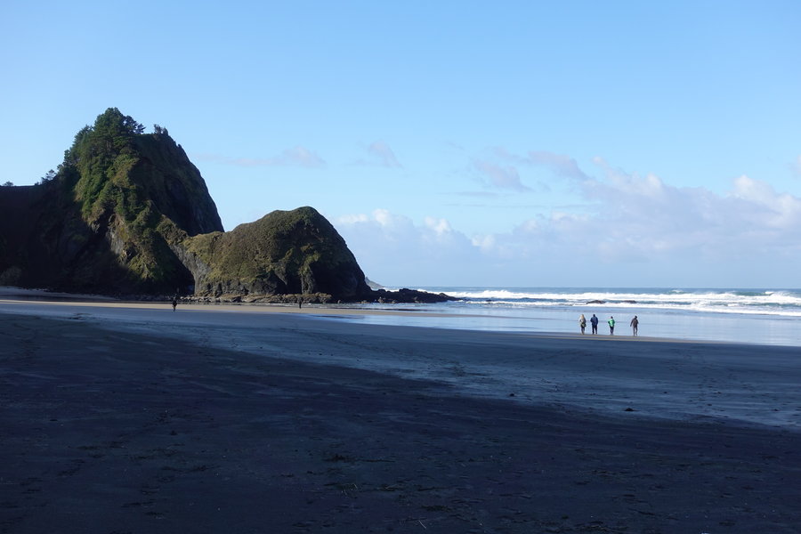
White River Falls and Mack's Canyon Round 2
6 miles of hiking • 500' elevation gain • 1 night
Thanksgiving Day. Decided to take my partner Zane out to Mack's Canyon, so he could see how awesome it was. Hit up White River Falls on the way. Had a simple Thanksgiving dinner between the two of us over an open fire at a campsite at the trailhead. Corn dogs and a can of beans, with a couple of beers. I never said we were fancy people.
For desert, a bag of cheetos. Zane kept trying to hand them to me, would you like desert? Perhaps pumpkin pie? No? (Takes bag away.) Oh, you prefer pecan? Here ya go.
It was goofy and cold way to spend the day and start the weekend.
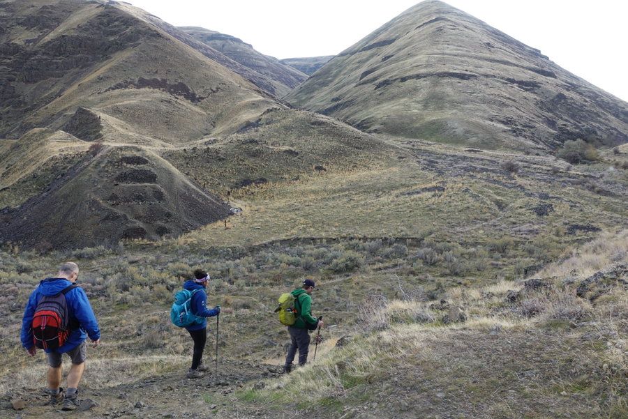
November 28 – November 29, 2019


 2
2
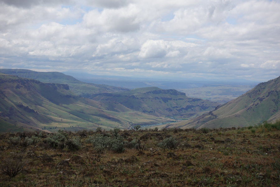
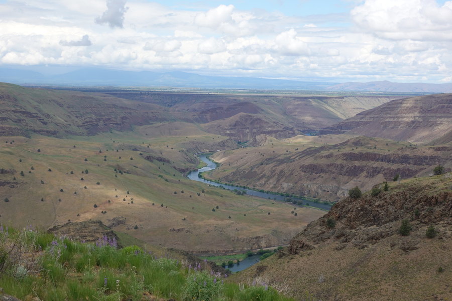
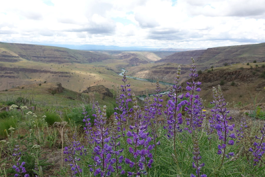
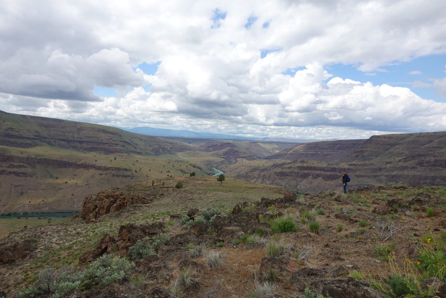
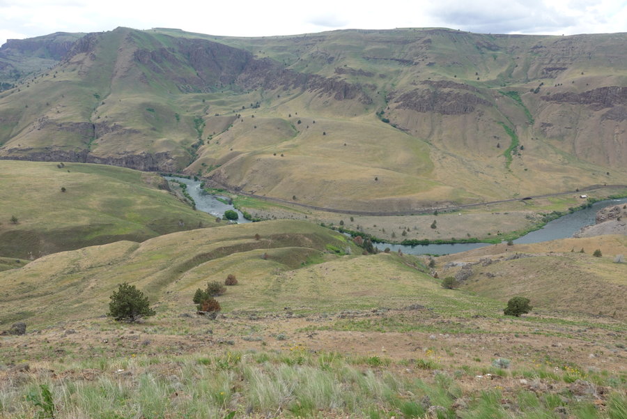
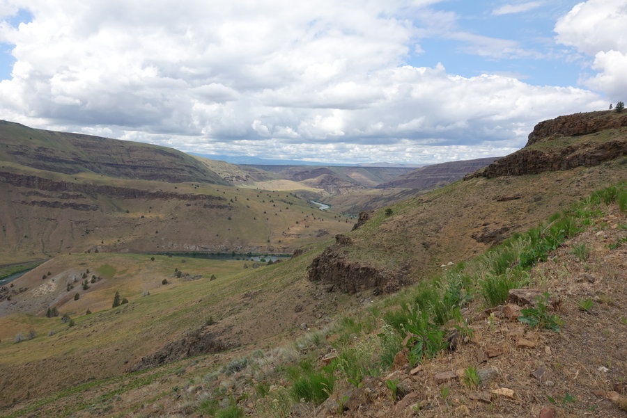
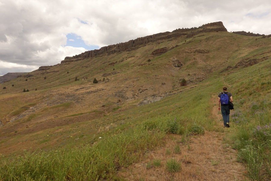
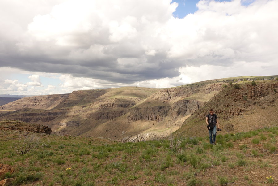
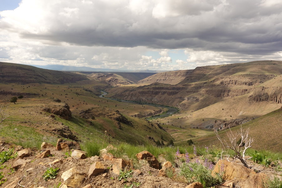
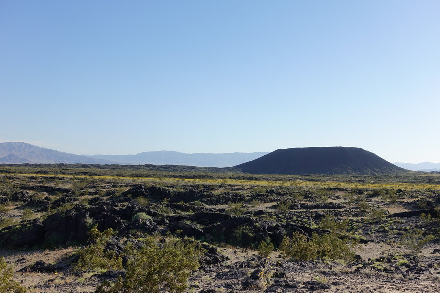
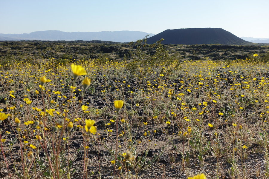
Mack's Canyon
9.6 miles of hiking • 500' elevation gain •
Sometimes, you need a little sunshine when Portland gets into the dreary wet season.
Went on a hike today lead by my friend Matt Reeder, who never disappoints when choosing an unknown destination. It was a long drive from Portland, but well worth it.
The days and my mood have been dark lately, so hiking in the high desert was a welcome change.
And as a bonus, I got to put a face to a name here on wenthiking, as Woodswalker also joined in on the fun. Small world.
I was fairly introspective and quiet and in my own head today, but it was nice to get out with a group.
November 17, 2019


 1
1
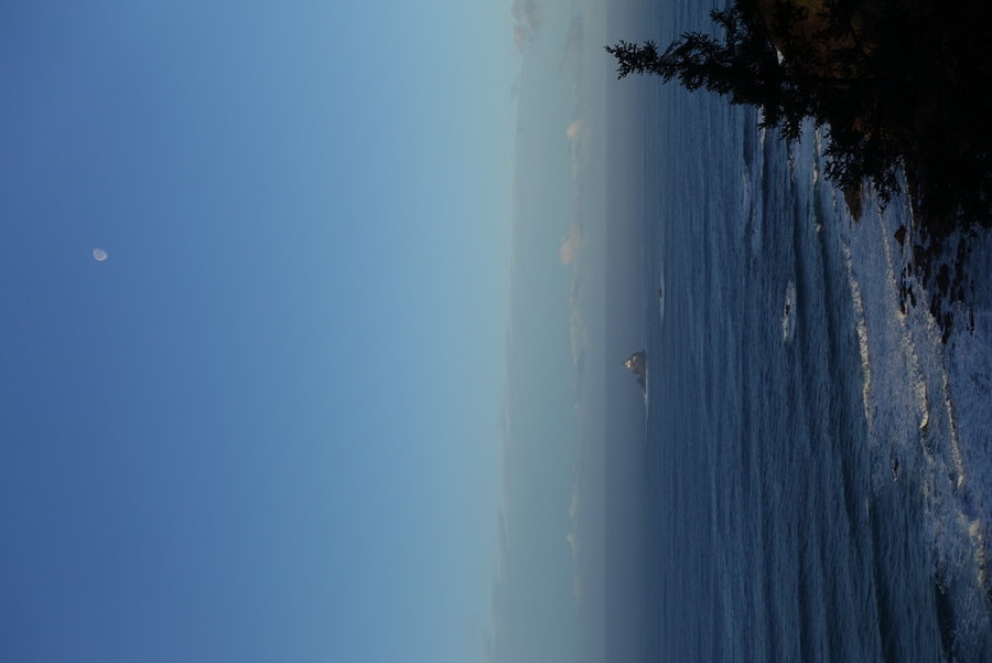
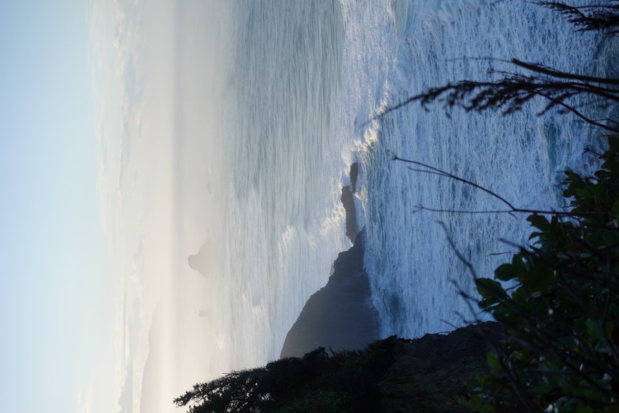
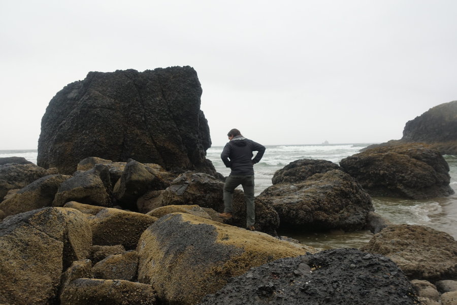
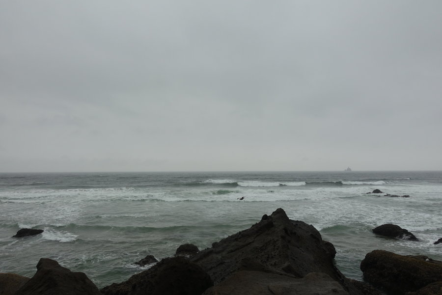
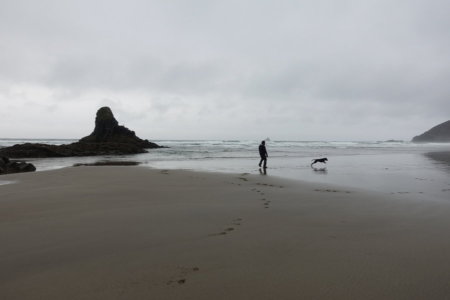
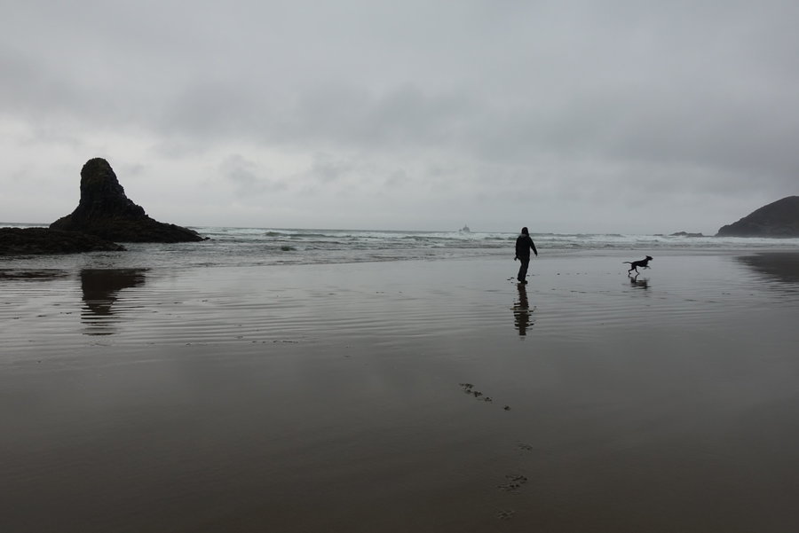
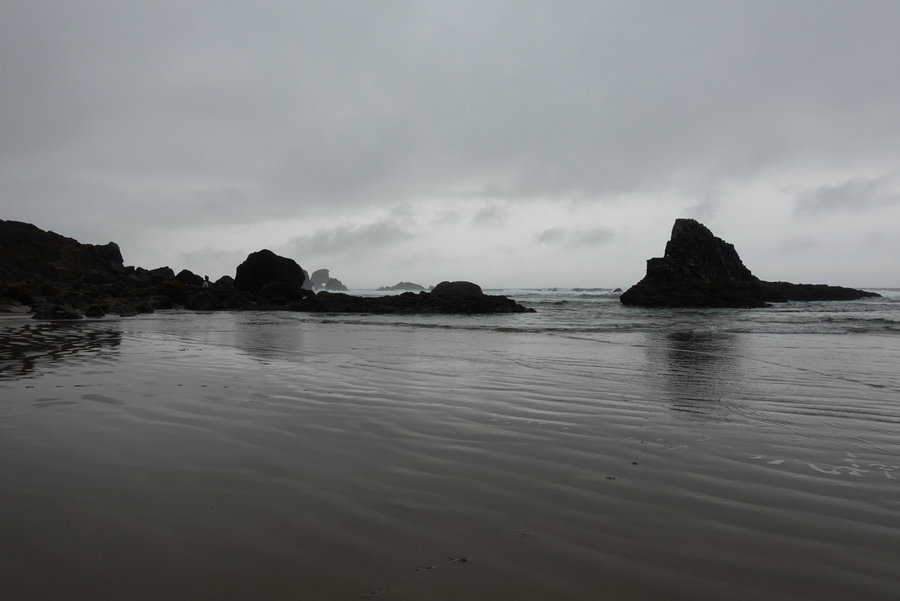
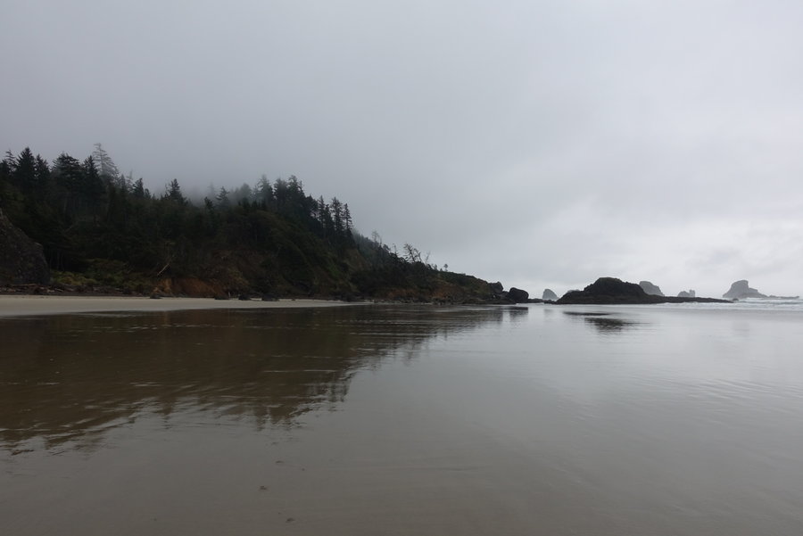
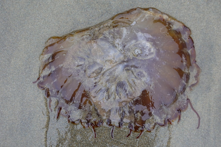
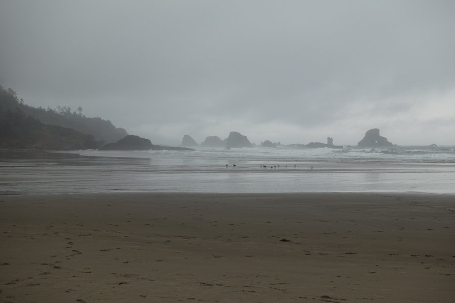
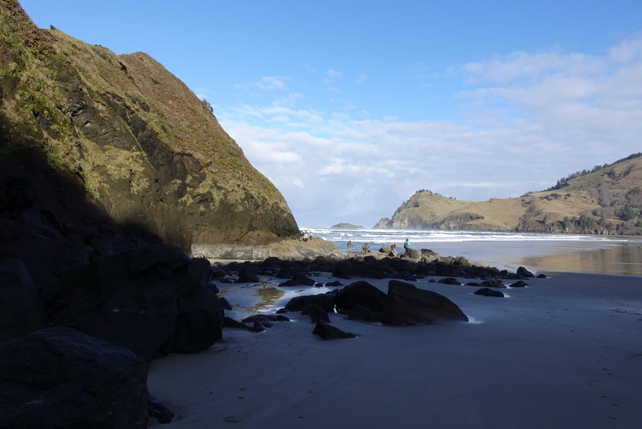
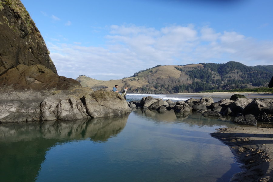
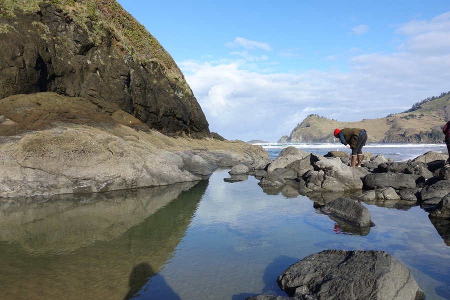
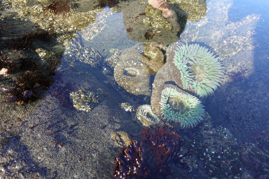
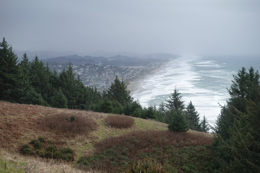
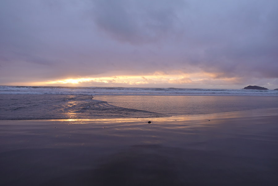
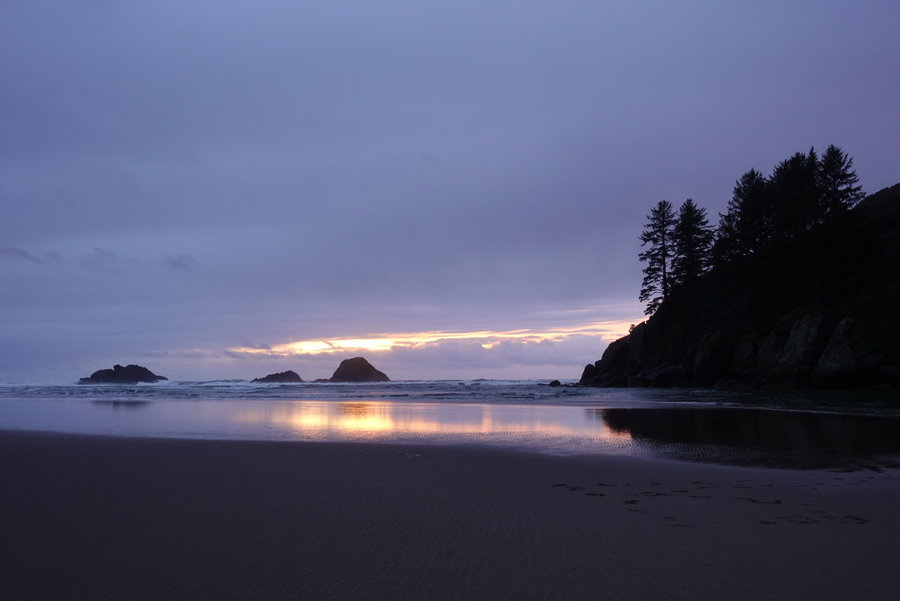
Ecola State Park Beach walking/tidepooling
2 miles of hiking • 250' elevation gain •
Hung out in Seaside at a friends airbnb last weekend, mostly relaxing in the hot tub and playing board games. Weather was dreary and rainy, my favorite way to enjoy the coasts doom and gloom.
November 9, 2019


 2
2
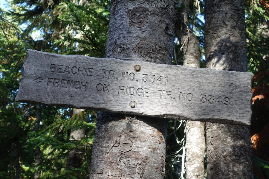
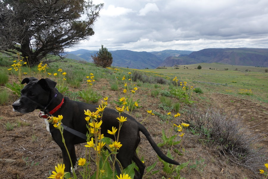
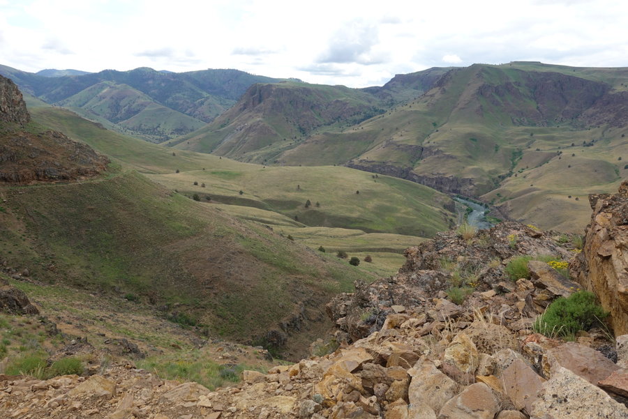
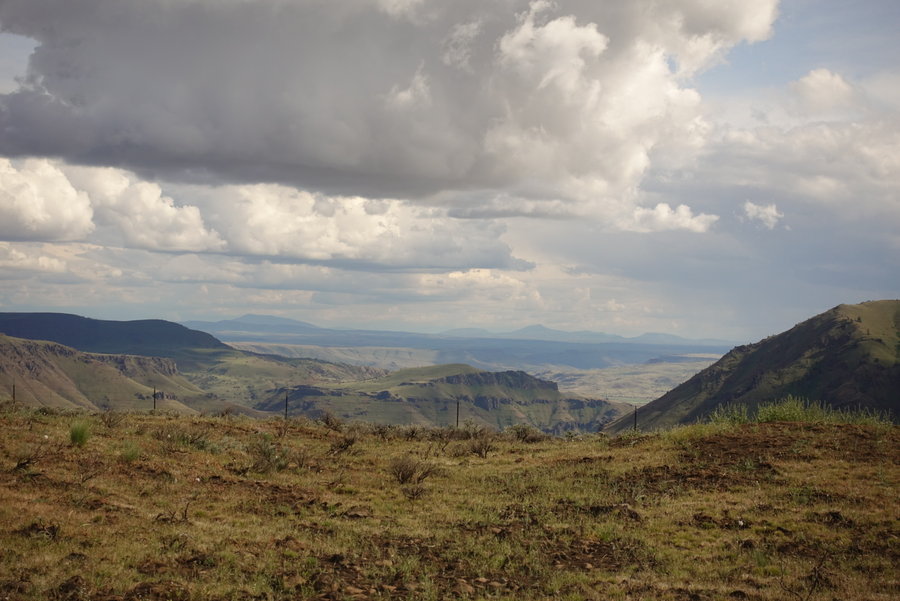
French Creek Ridge
8.5 miles of hiking • 2250' elevation gain •
Forgot to add this one from a few weekends ago. Lovely day spent in the mountains with friends.
The road to the trailhead is a bit scary, rocks, potential slides, and some gnarly dropoffs but we didn't have a problem getting there in a Subaru.
Trail was barely maintained, I recommend long pants. I did a bit of scrambling to get to the top of the ridge for fun.
After this trip, I was watching a documentary on the Andes on netflix, and a woman interviewed said- “You should live where your heart pounds.” Might have been more poetic in her native language, but the translation worked for me. Grateful to hike in Oregon and Washington. Thankful for every day I get out whether solo or with friends.
November 3, 2019


 1
1
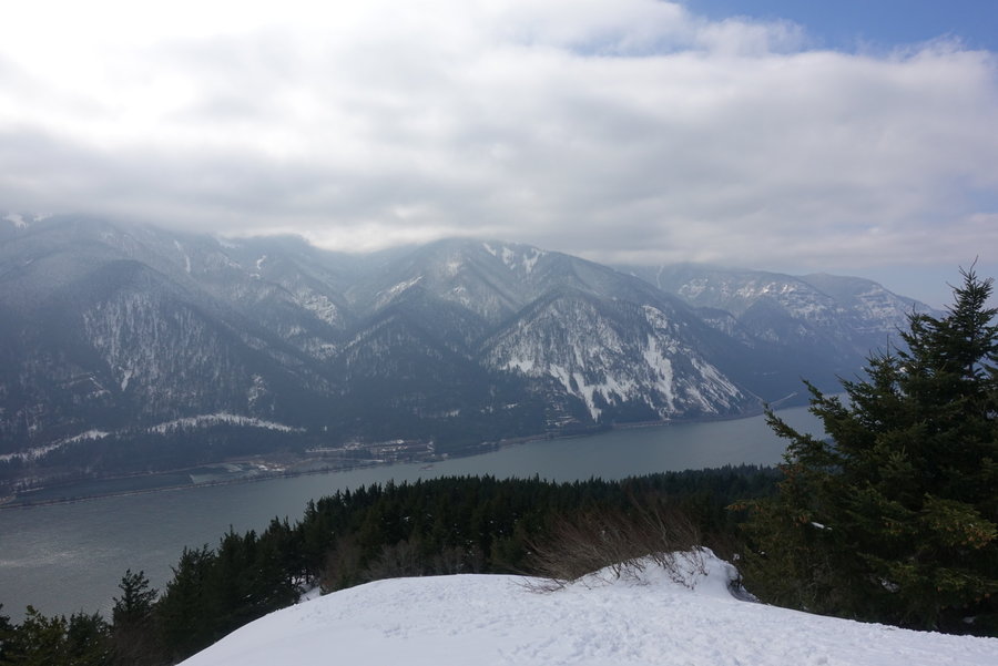
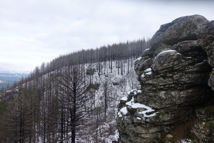
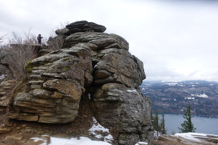
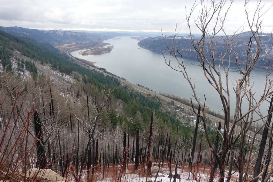
Cape Horn Loop, Columbia Gorge
7.5 miles of hiking • 1250' elevation gain •
Slept in last Sunday, but still felt like getting out. Decided to hit a close trail in the gorge with the remaining hours of daylight. Managed to fit in the loop before dark. Perfectly gloomy fall day. Others may hate the rainy season, but I love the lack of people on the trails and spooky forests.
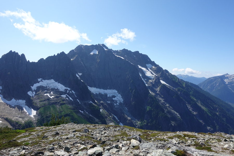
October 20, 2019


 2
2
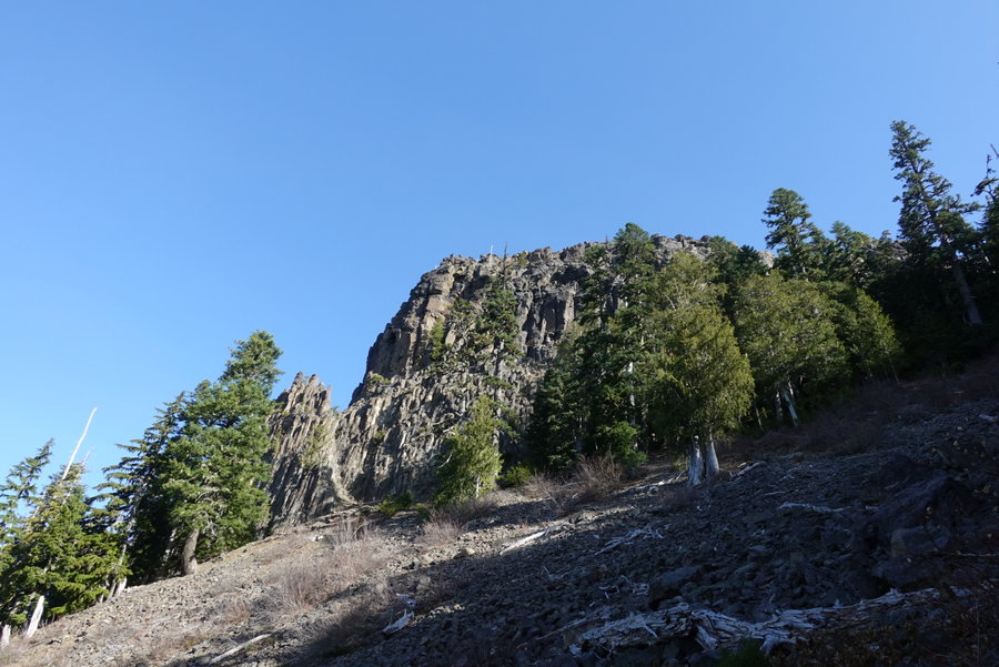
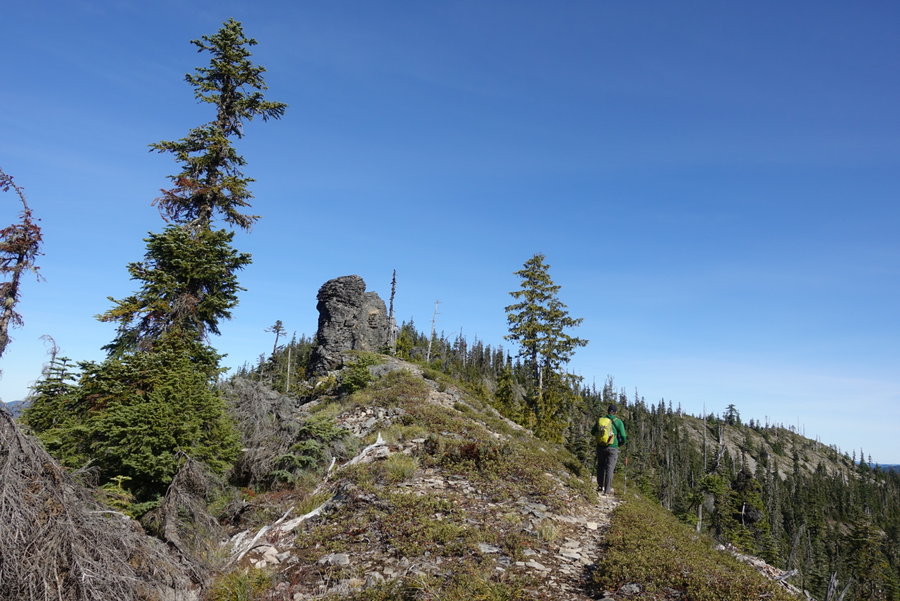
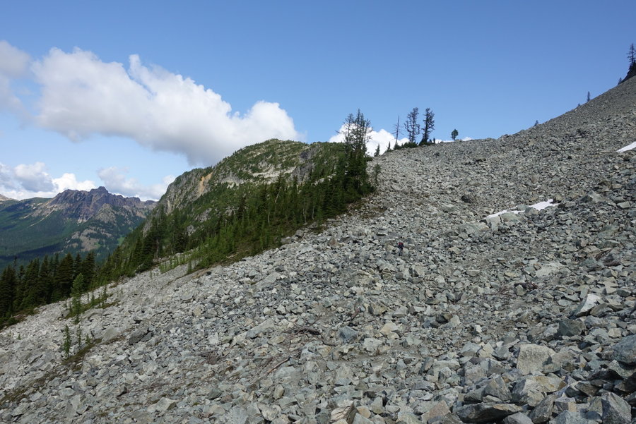
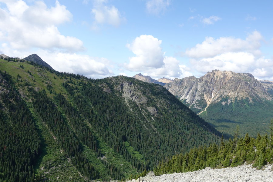
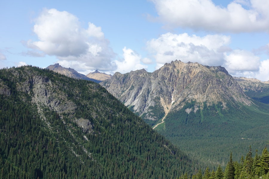
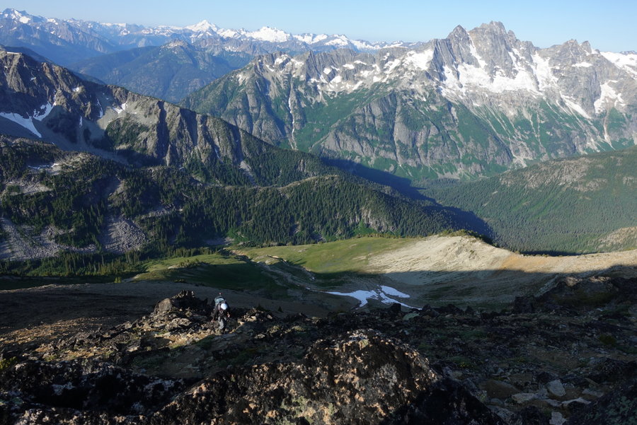
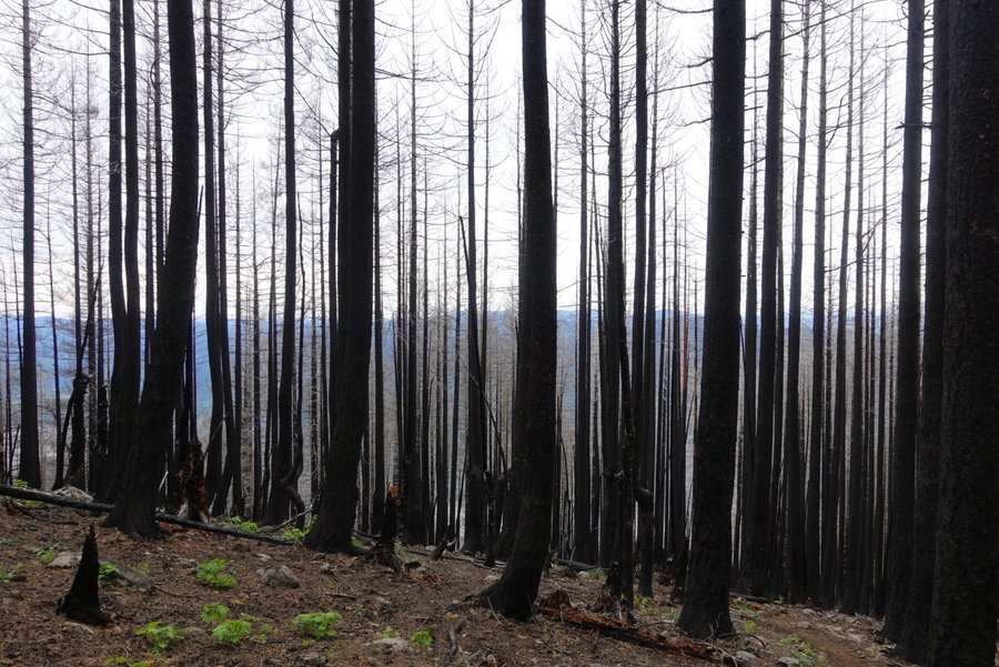
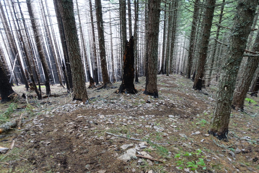
Trappers Peak
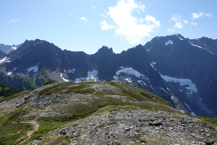
10.5 miles of hiking • 3000' elevation gain •
Armed with a few beers and a couple of North Cascades hiking guides on Saturday night, I told Eric it was his turn to pick the next hike. Weather was going to be iffy, and we knew full well we may end up having to turn around.
Eric decided that we couldn't opt for anything less than a 5 star rating in the guidebook, so Trapper Peak/Thornton Lakes was chosen.
The road to the trailhead was a bit rough, and I was grateful that Eric had offered to drive. My prius would not have made it.
At the trailhead, we encountered a group of Mountaineers, prepping for their "climb." We then realized we had signed ourselves up for not just a hike, but a scramble. We decided we would just go for it, and assess conditions as we met them.
The trail starts gentle for the first 2 miles, meandering along an old logging road. When it does start up, it is definitely up, rugged and rooty. Reminded me a bit of Elk.
Eventually, you reach the junction in which you must decide on a lakeside destination, or the well marked climbers trail. We opted for the climbers trail, and prepped ourselves for the final up. The last .5 miles is something like 1000 gain, scrambling. My legs were jelly, and when it became apparent we would have no views, I opted to stop shy of the summit. Eric attempted further, but also decided to turn back as it was starting to snow and the summit was socked in.
I really really want to attempt this again in the summer on a clear day. The view of the picket range is supposed to be amazing.
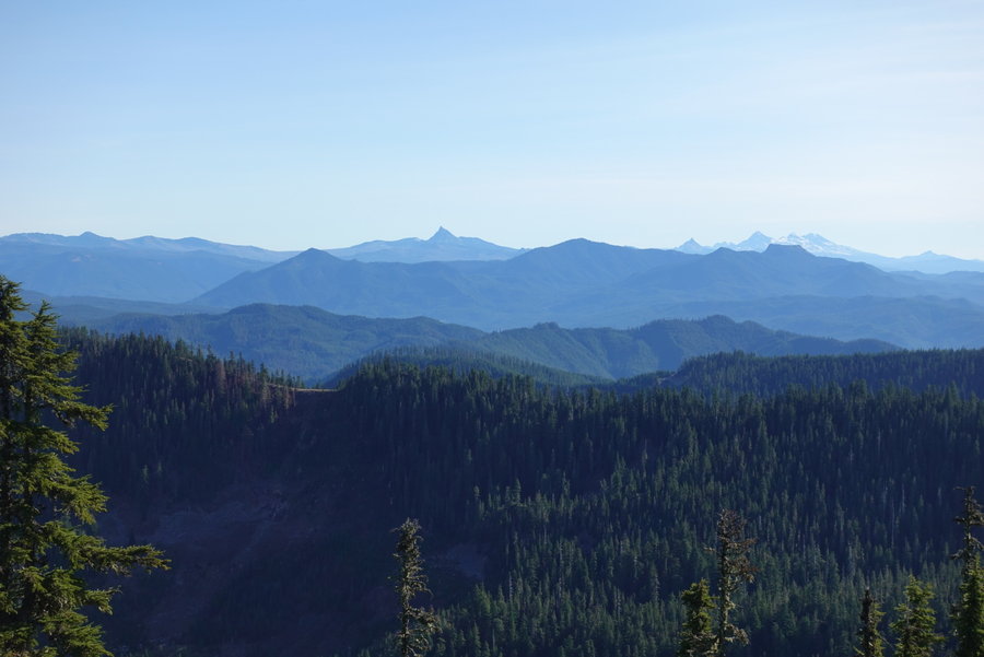
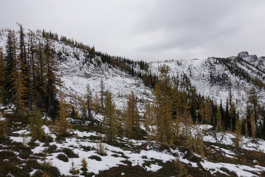
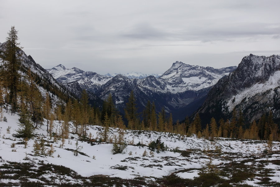
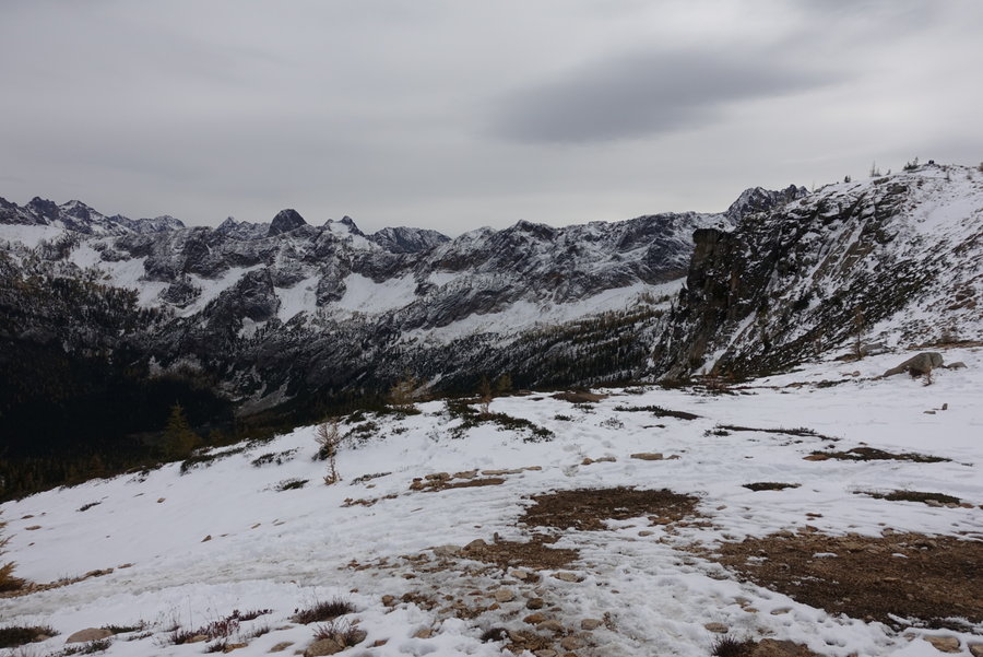
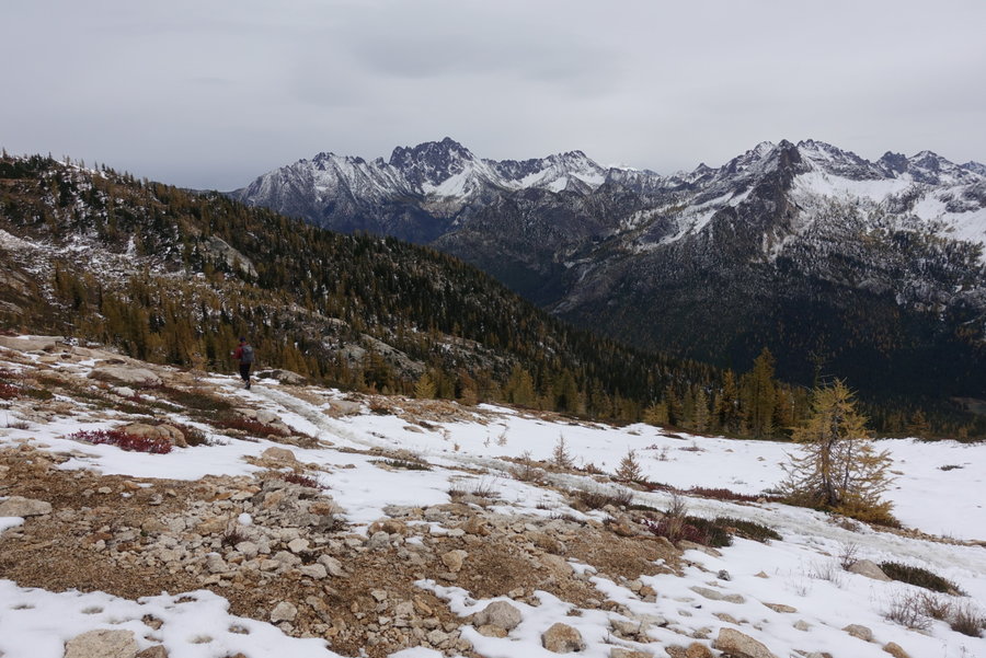
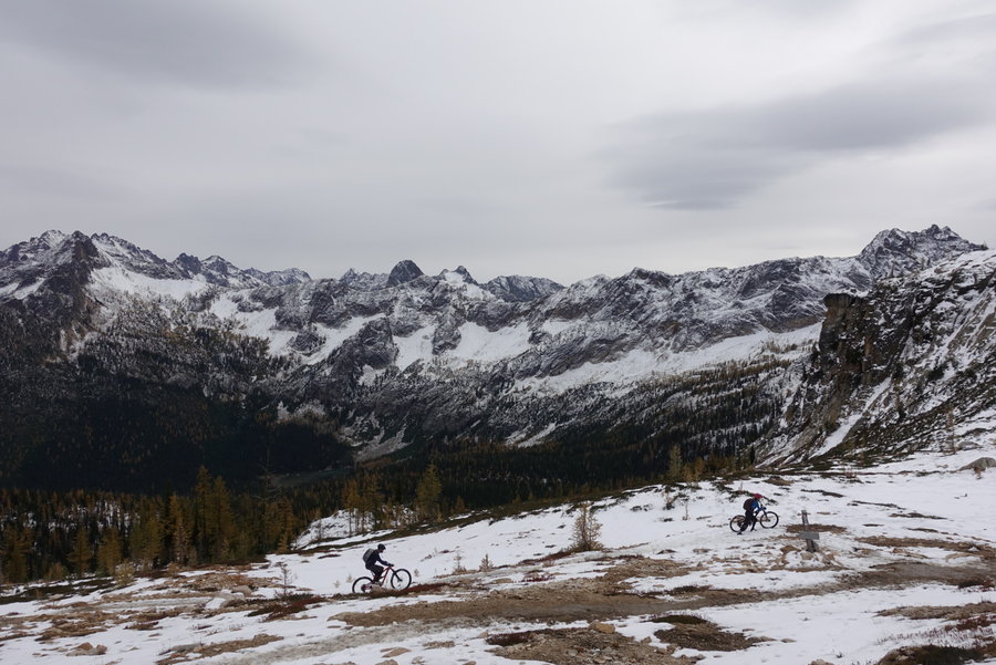
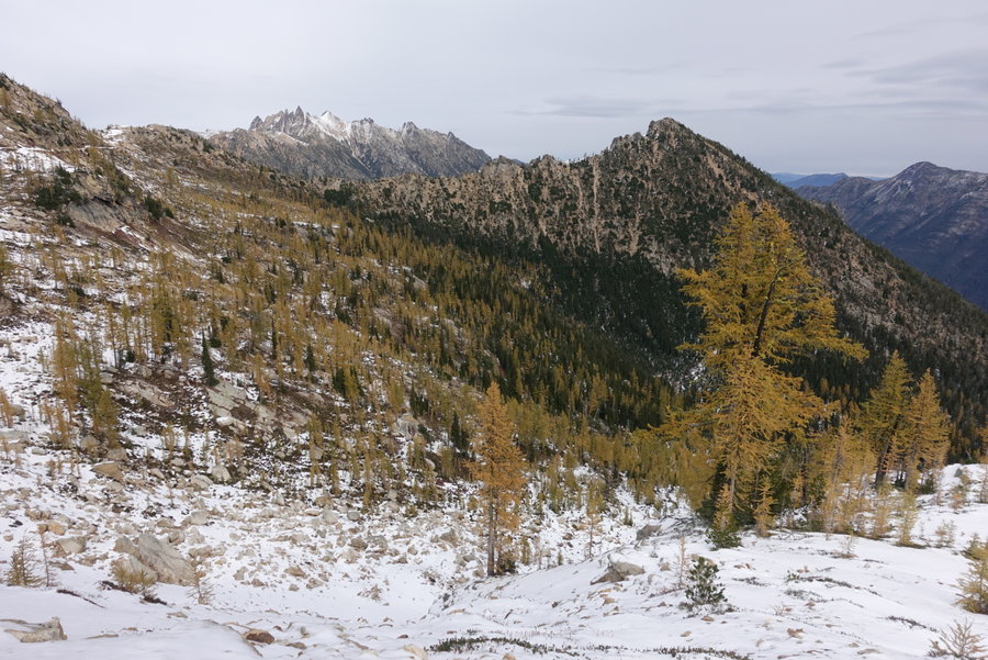
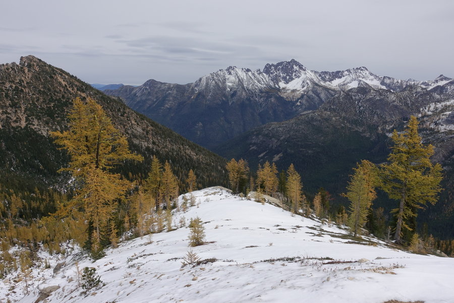
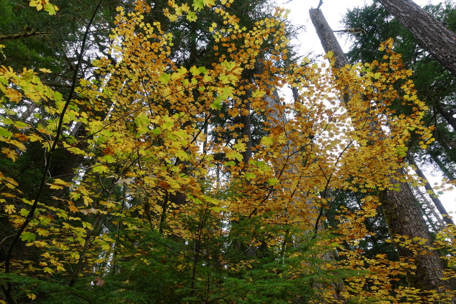
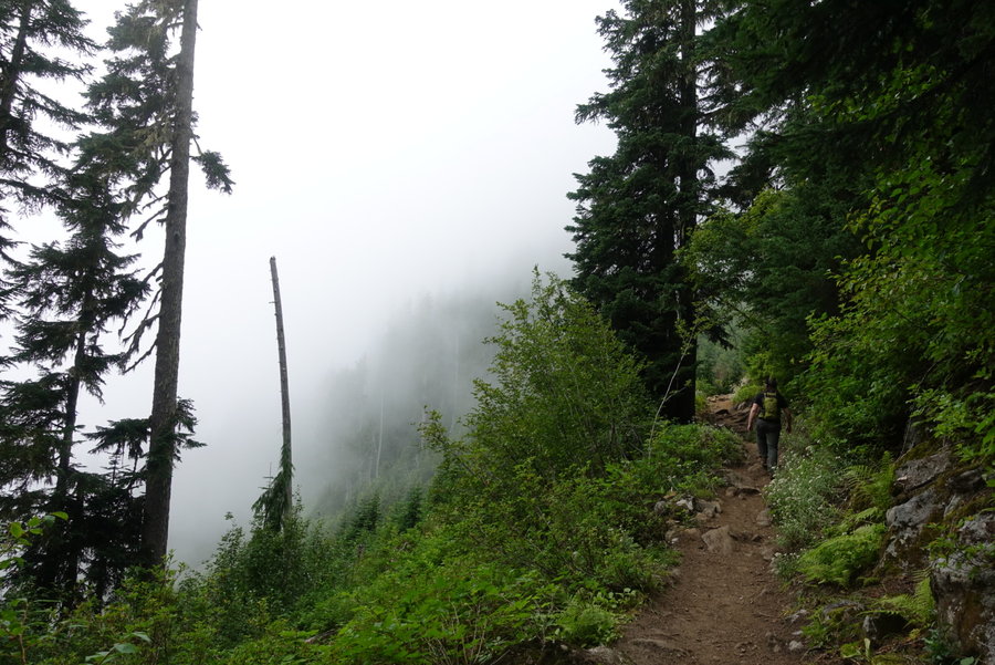
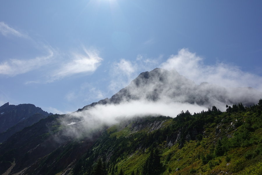
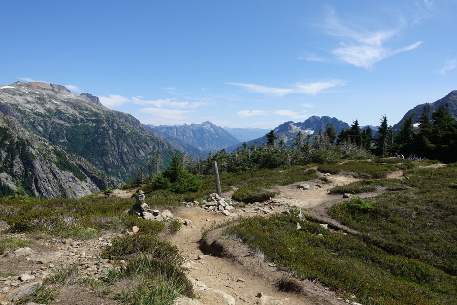
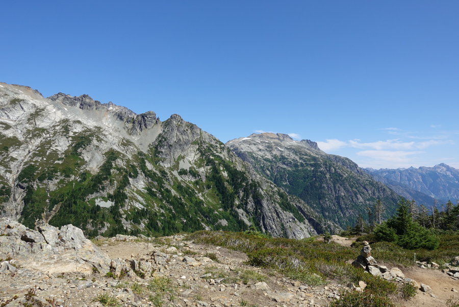
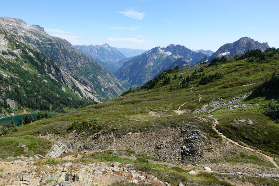
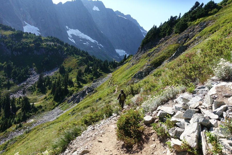
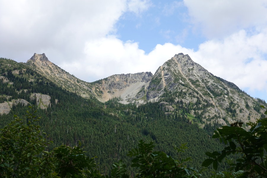
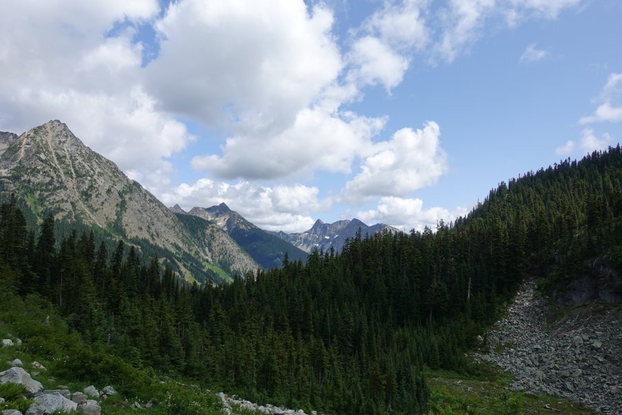
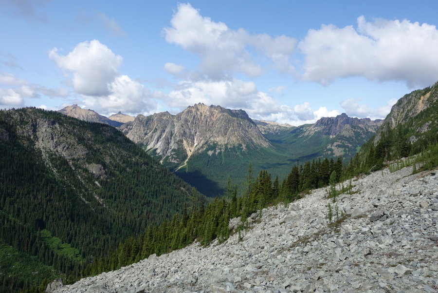
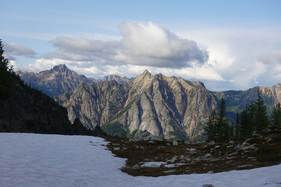
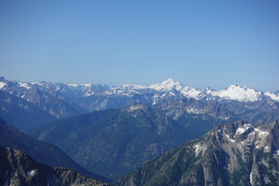
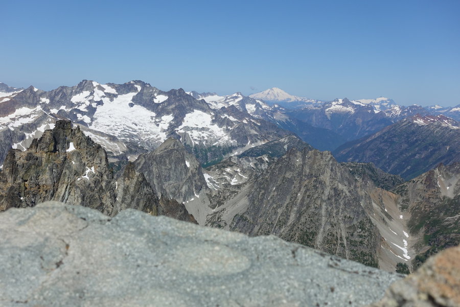
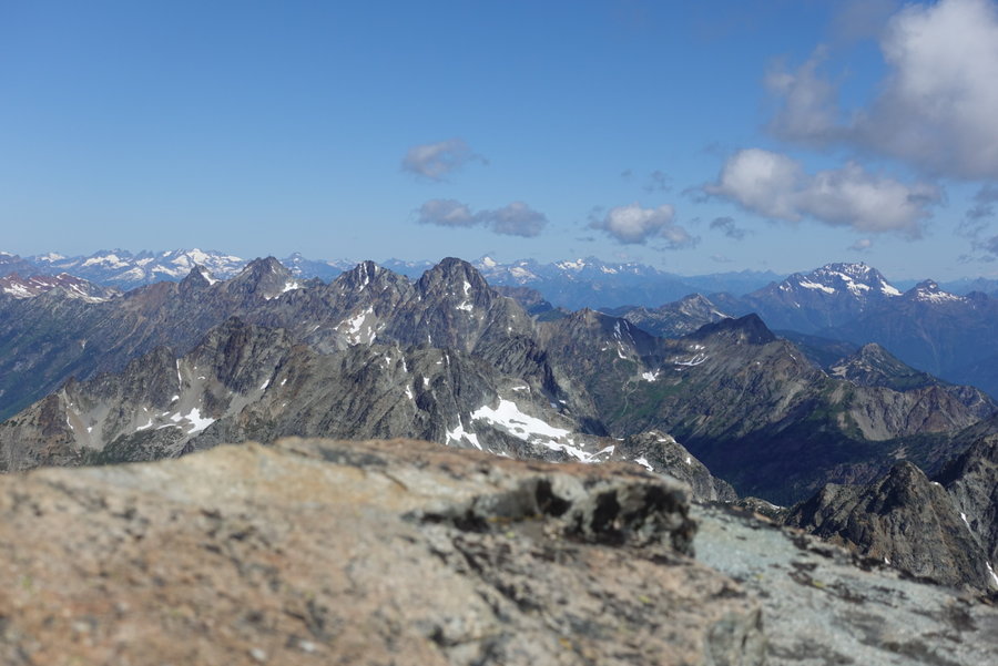
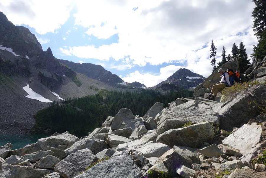
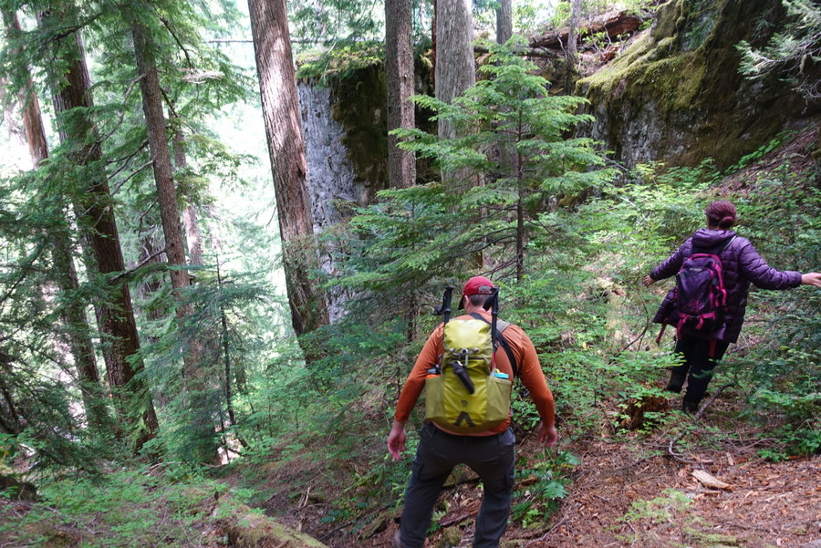
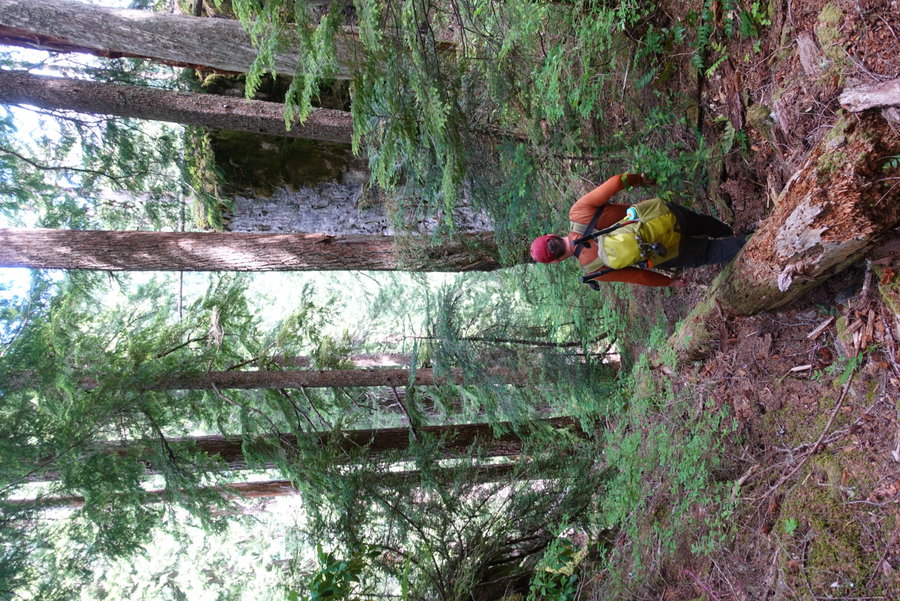
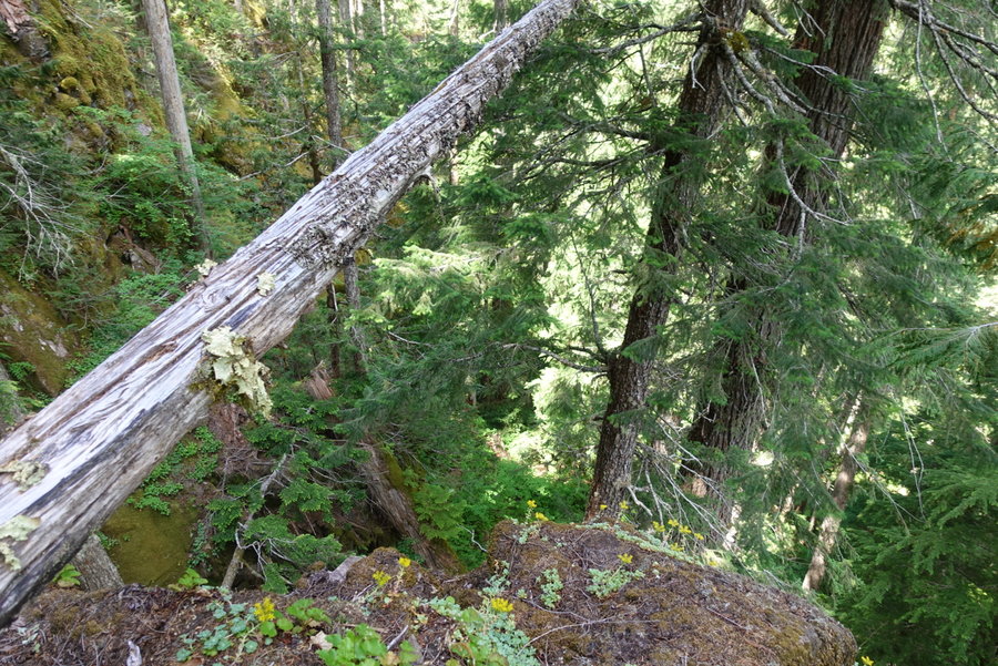
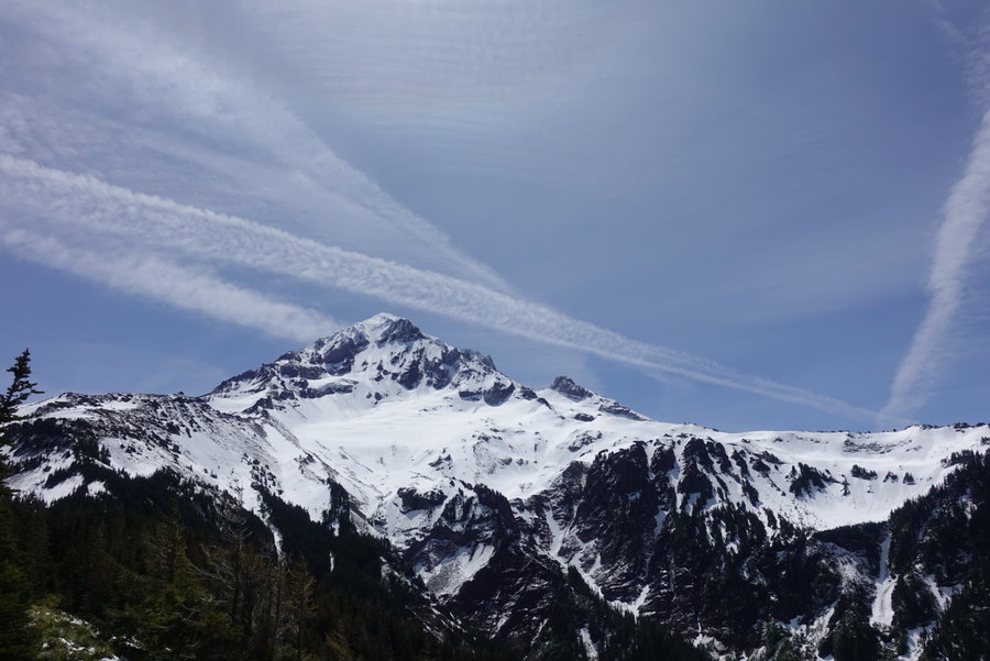
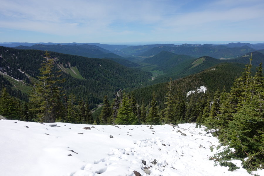
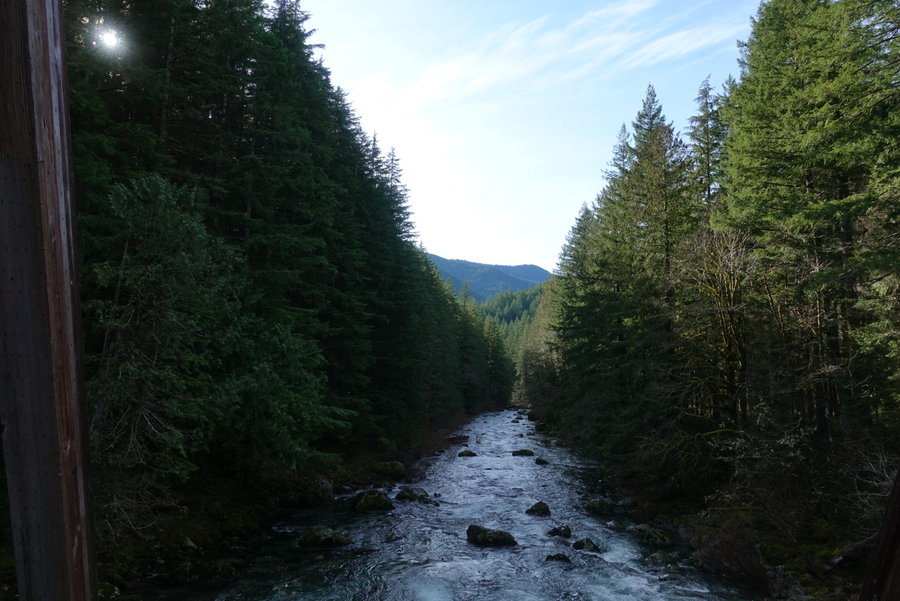
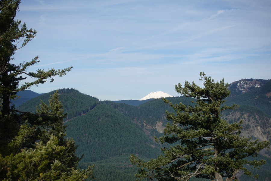
October 13, 2019


 2
2
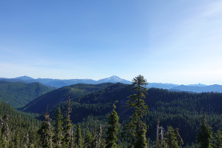
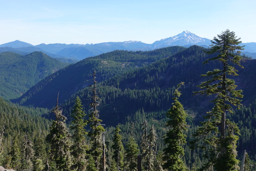
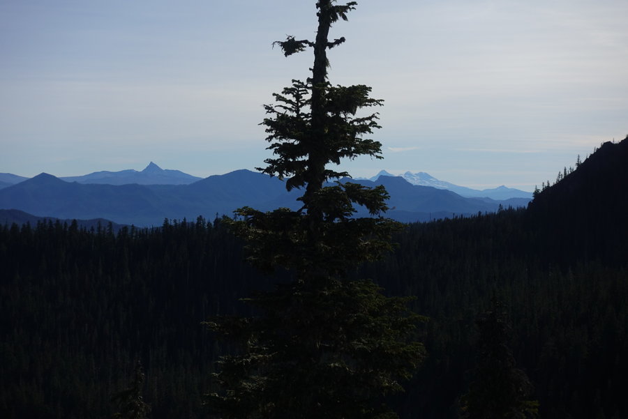
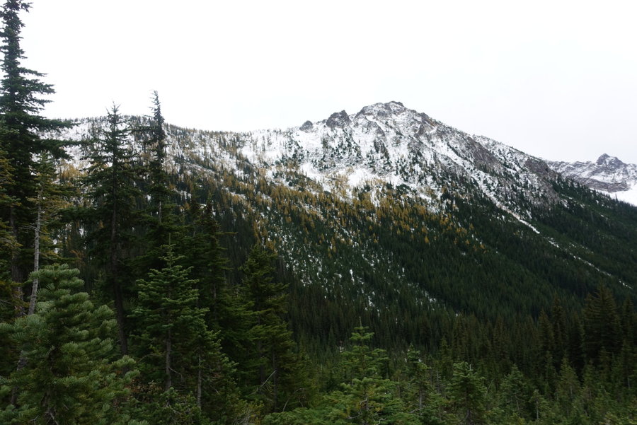
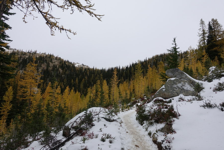
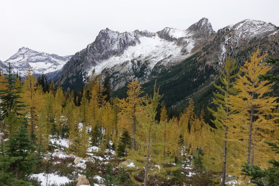
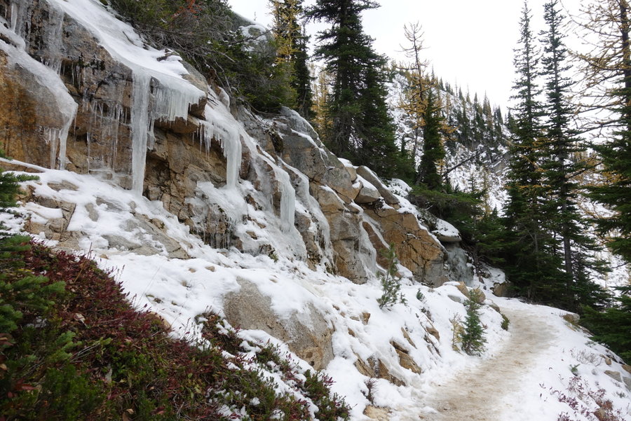
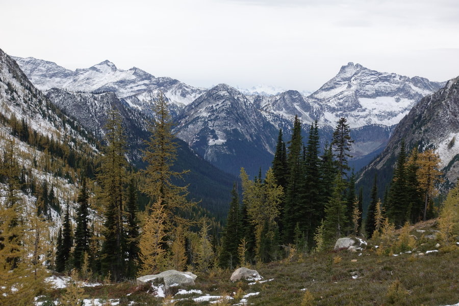
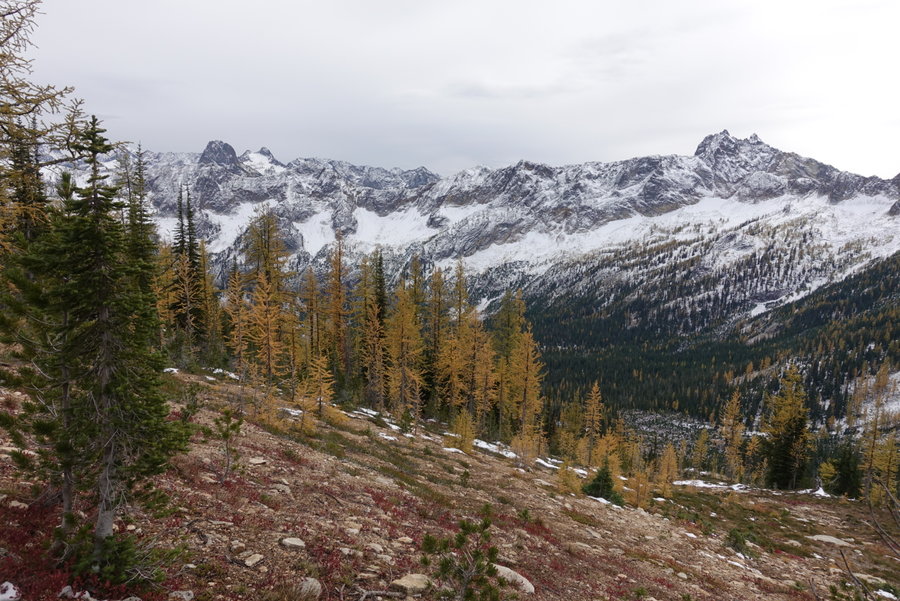
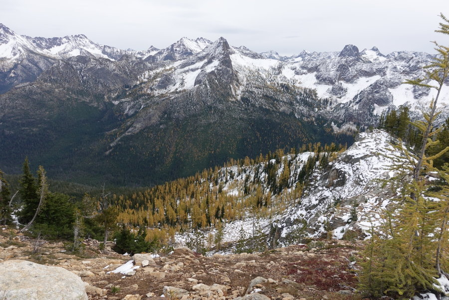
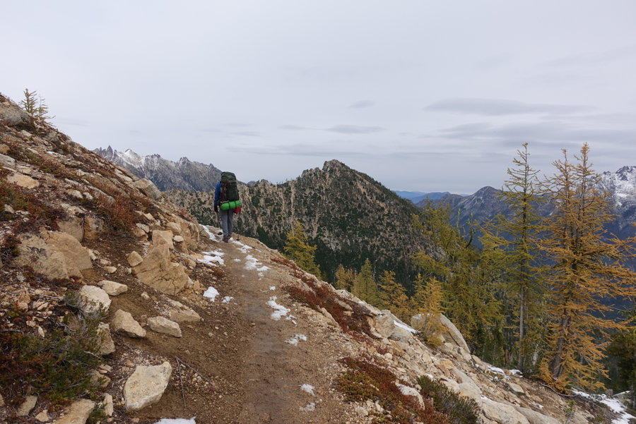
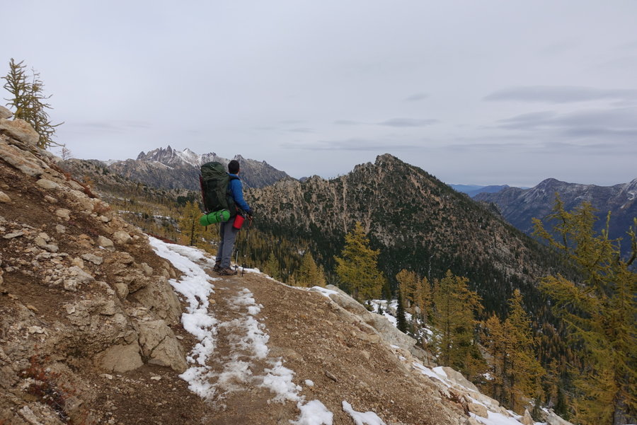
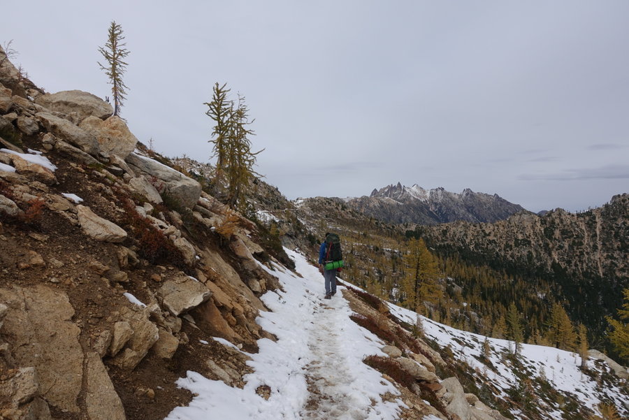
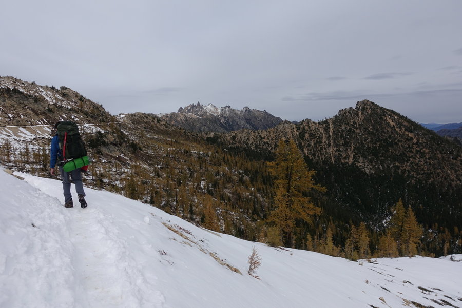
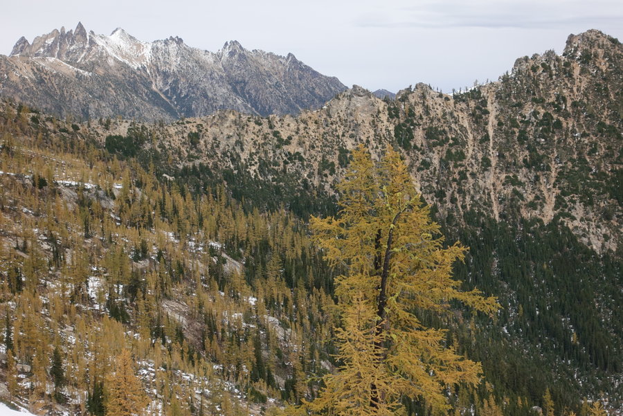
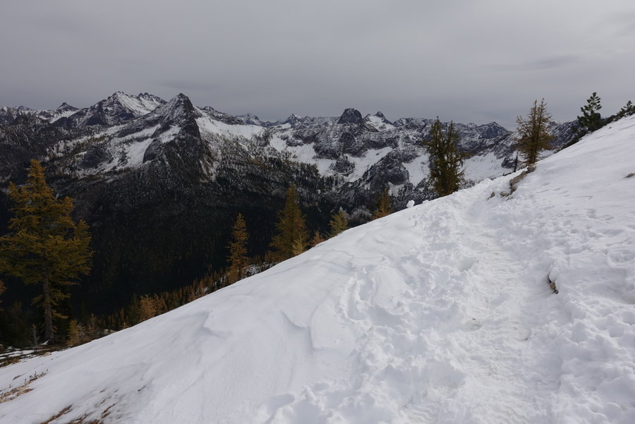
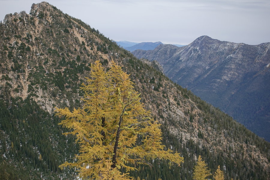
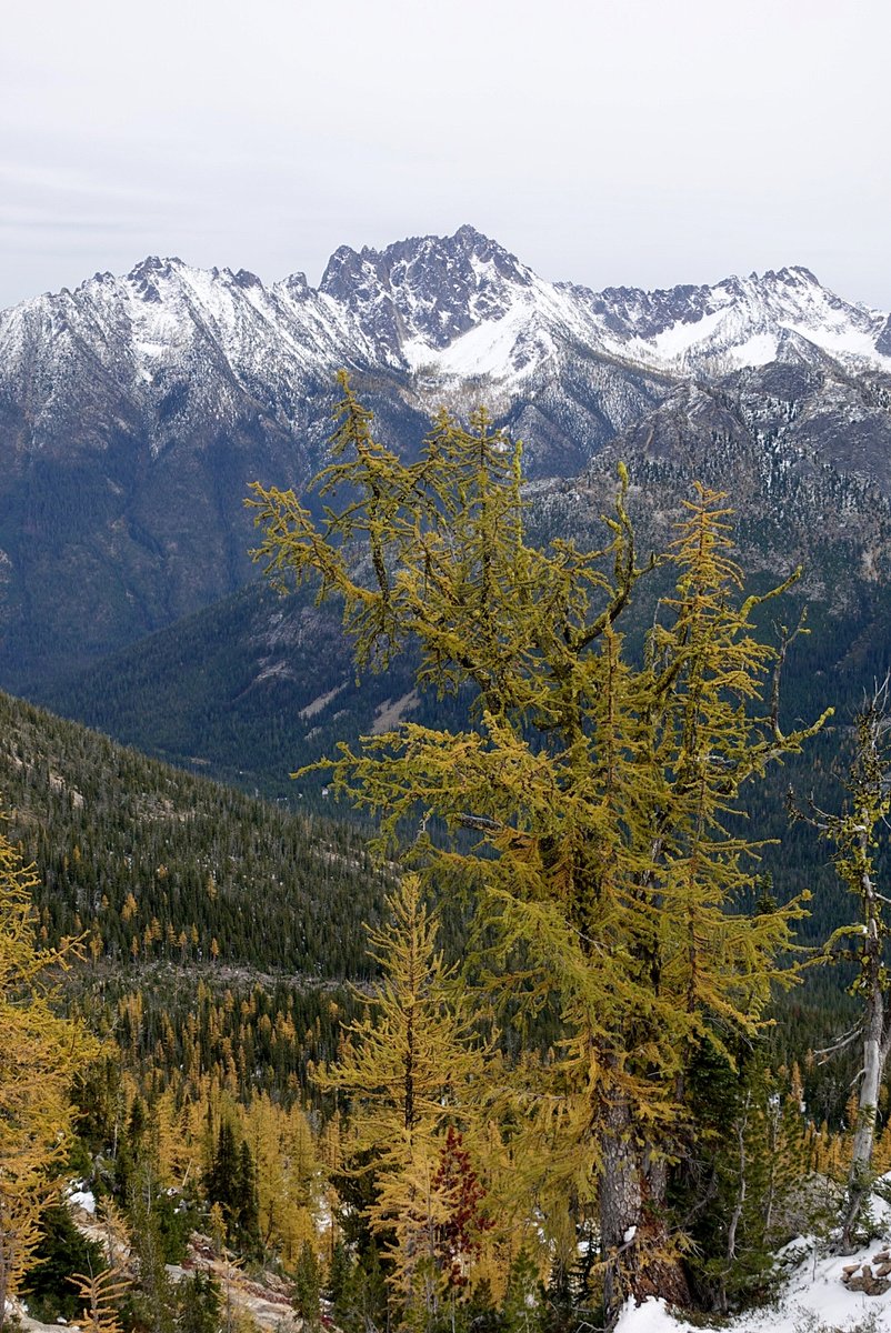
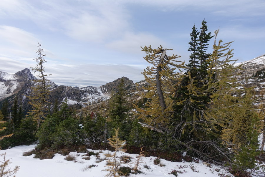
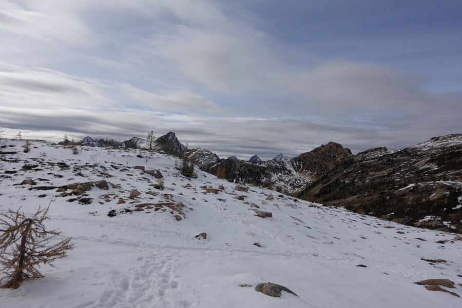
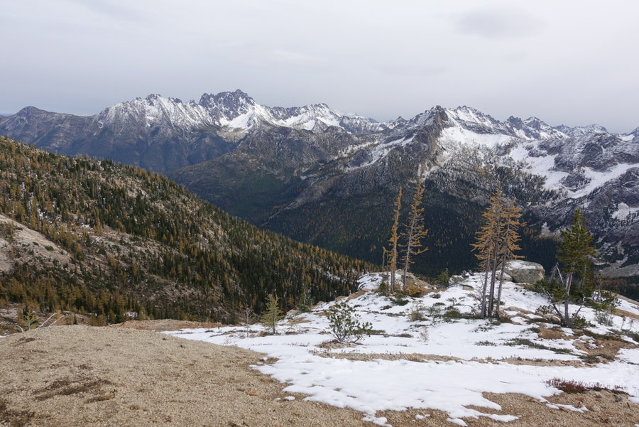
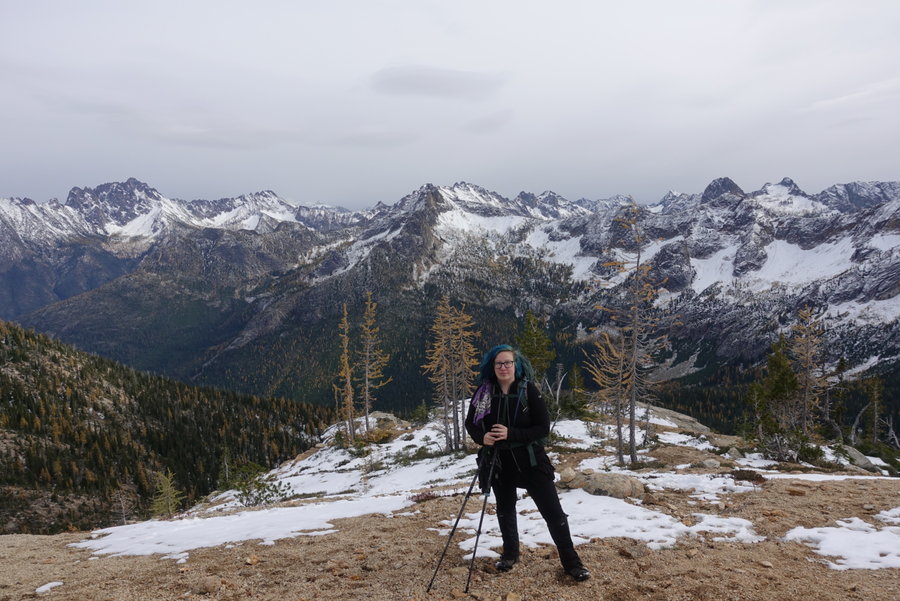
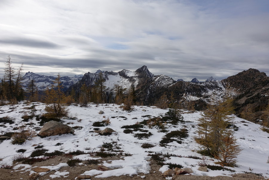
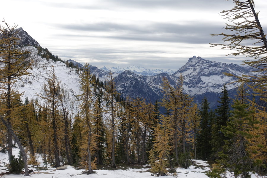
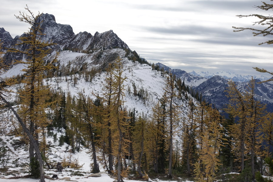
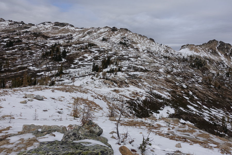
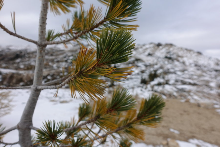
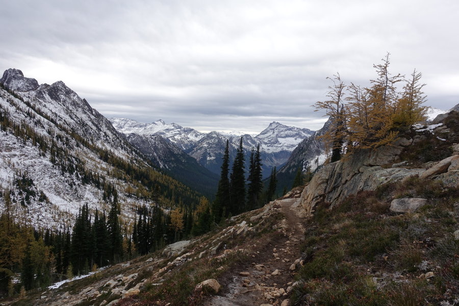
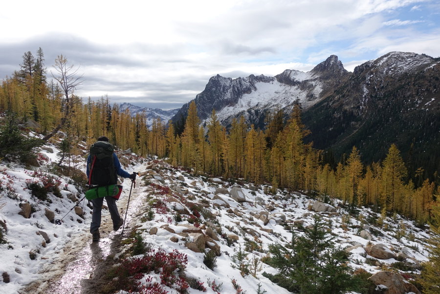
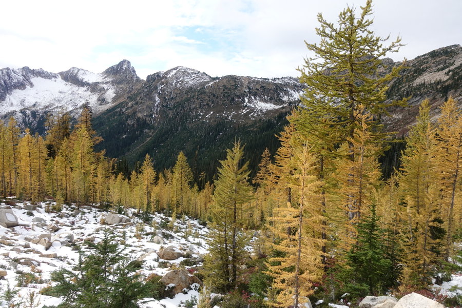
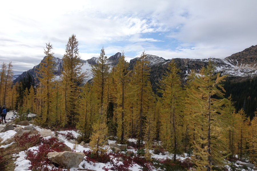
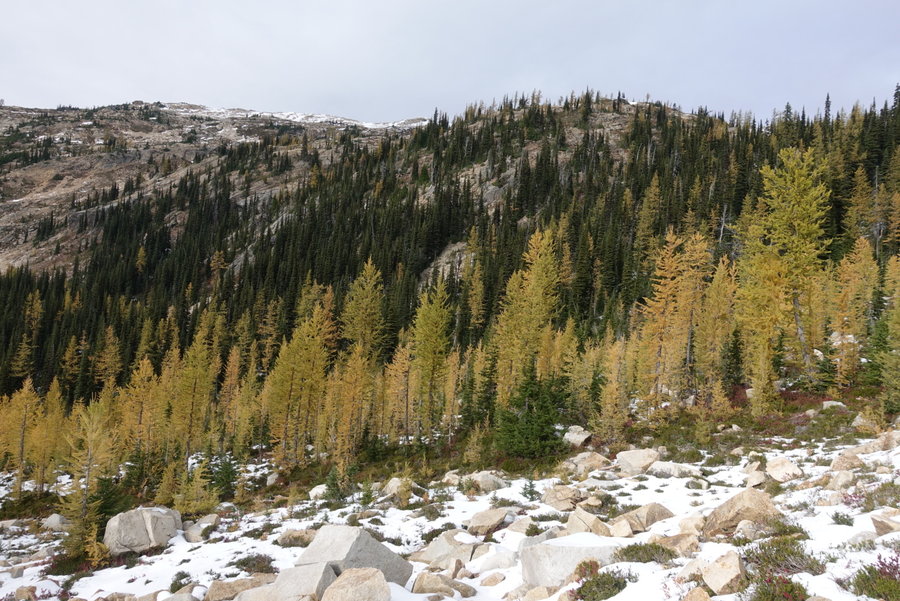
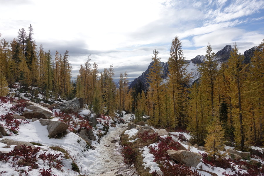
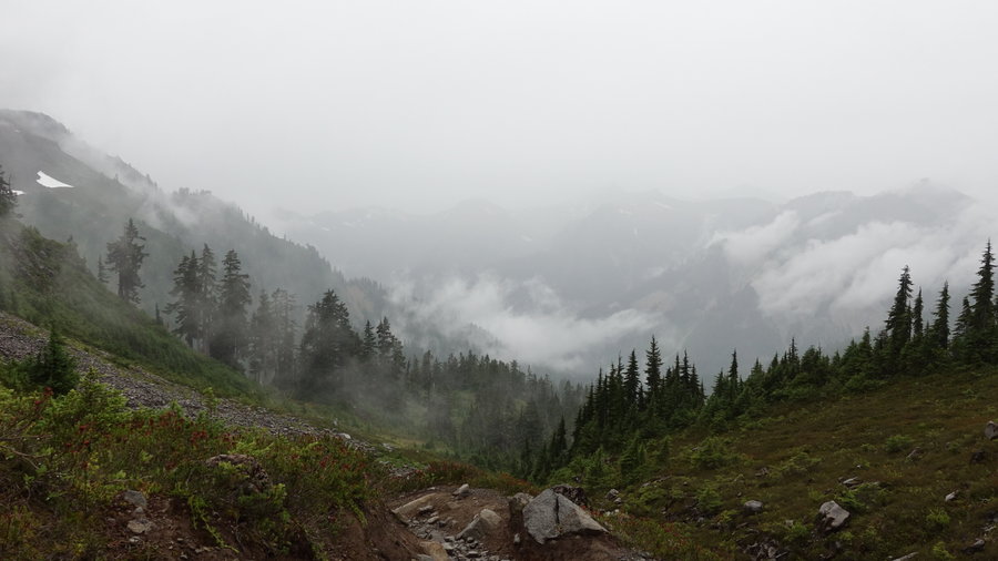
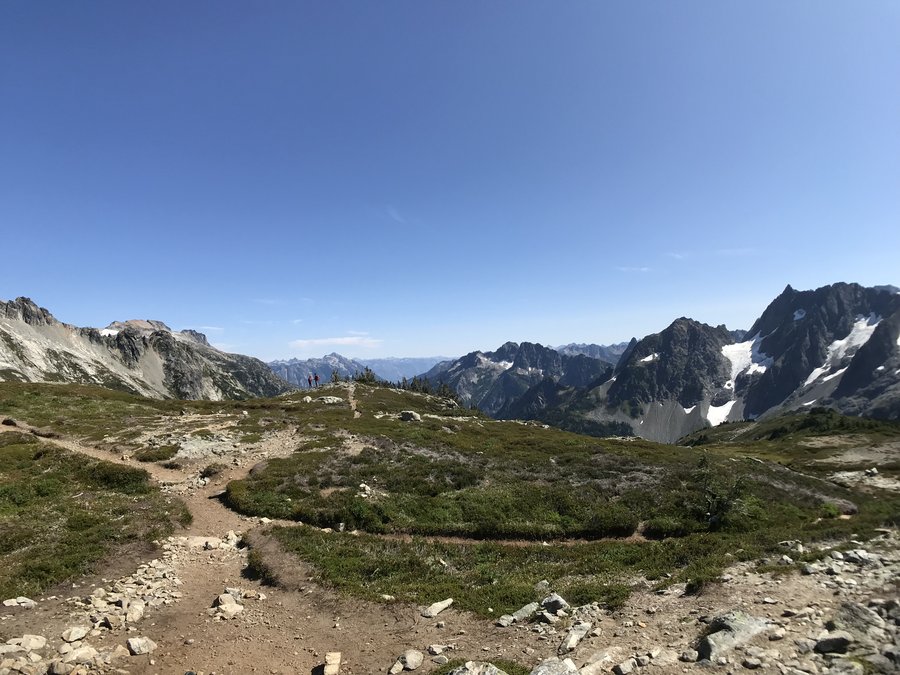
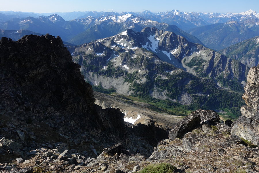
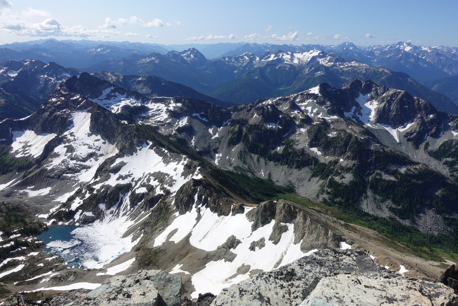
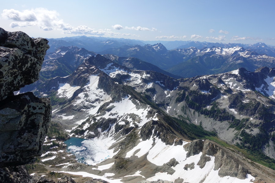
Cutthroat Pass via the PCT
12 miles of hiking • 2000' elevation gain •
Spontaneous trip to the North Cascades in search of Larches. Teamed up with my friend from the Mazamas, Eric, leaving Portland Friday night around 7 pm. I highly recommend this late start - we were able to miss Seattle traffic and probably saved ourselves a good 1.5 to 2 hrs in driving time.
We arrived in Marblemount around midnight, and quickly set up camp @ Cascade Wagon Road campground. It was a chilly night, but after warming up some water in my nalgene - I was able to stay toasty warm in my tent. Eric opted to sleep in his car. The camp was busy throughout the night with large trucks driving in and out. In the morning I saw many people fishing, and others in hunting clothes. I was surprised at how busy it was.
In the am we stopped at the ranger station, as we wanted to inquire about trail conditions and a possible overnight. We arrived and discovered it was closed for the season. We were able to read up on conditions on a board outside of the station. Weather was supposed to turn at some point, so we opted for a dayhike instead of an overnight.
In search of larches, we headed to Cutthroat Pass.
The trail starts out gentle and is somewhat boring, but as soon as it opens up and starts gaining elevation the views really start to shine.
Being from the midwest, I have been missing seeing fall colors out here in the PNW. I was not disappointed in the vibrant display of color.
We hit the pass, and were amazed when we saw a few mountain bikers who had made it up there in the snow. The trail was icy in spots, we carried our microspikes but never actually used them. We went beyond the junction to the lake, and continued along the PCT. We eventually hit heavy snow (about a foot deep) and turned around. We decided to hit the high ground, and spent quite a while just taking in the sea of mountains in view.
Beautiful trail, and we quickly regretted our decision to make it a dayhike, as we didn't want to leave. I know we would have ended up hiking out in the rain had we stayed, but it would have been worth it to soak up those views for a few more hours.
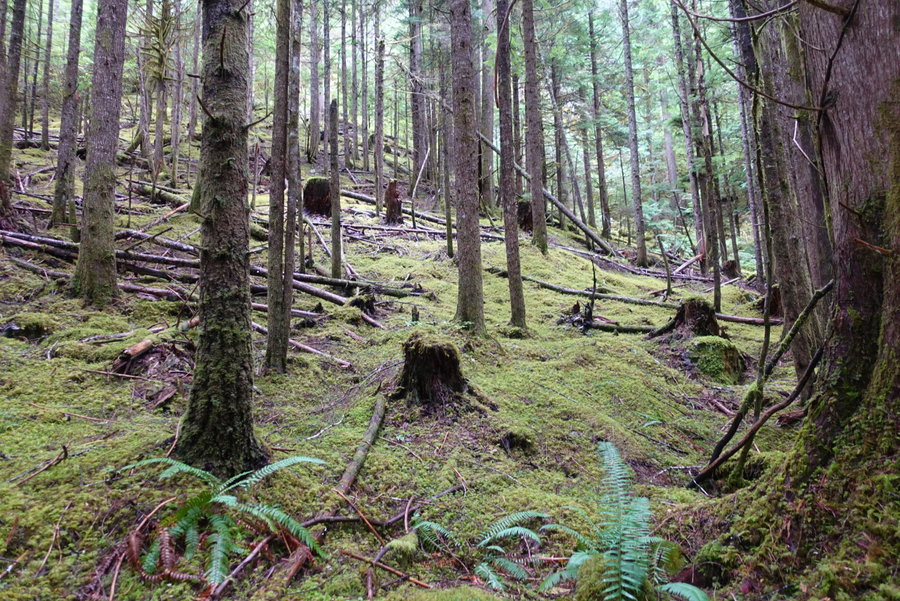
October 12, 2019


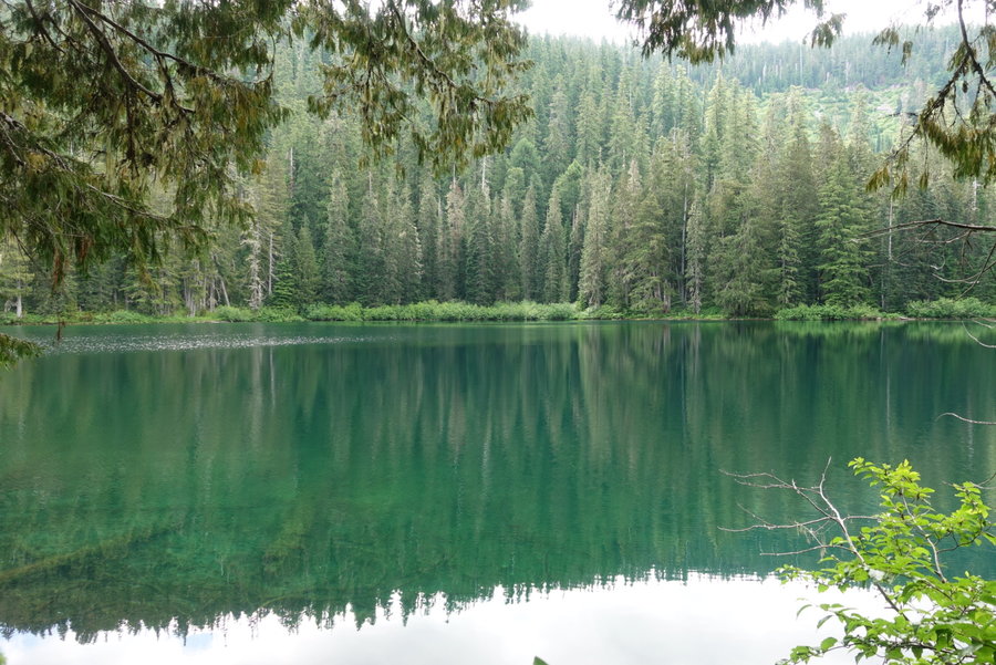
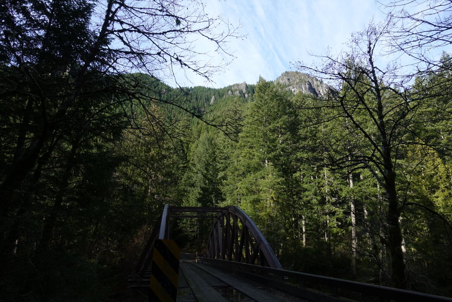
Opal Creek
13 miles of hiking • 1500' elevation gain •
Adventurous Young Mazamas hike I forgot to log from a few weeks ago, led by my friend Matt Reeder. The drive started out in a downpour, but it stopped by the time we reached the trailhead. Beautiful day on a trail I have avoided due to popularity. We were initially going to do Whetstone Mountain, but could see that it was not going to be a day for views and we were nervous it was going to snow.
September 29, 2019


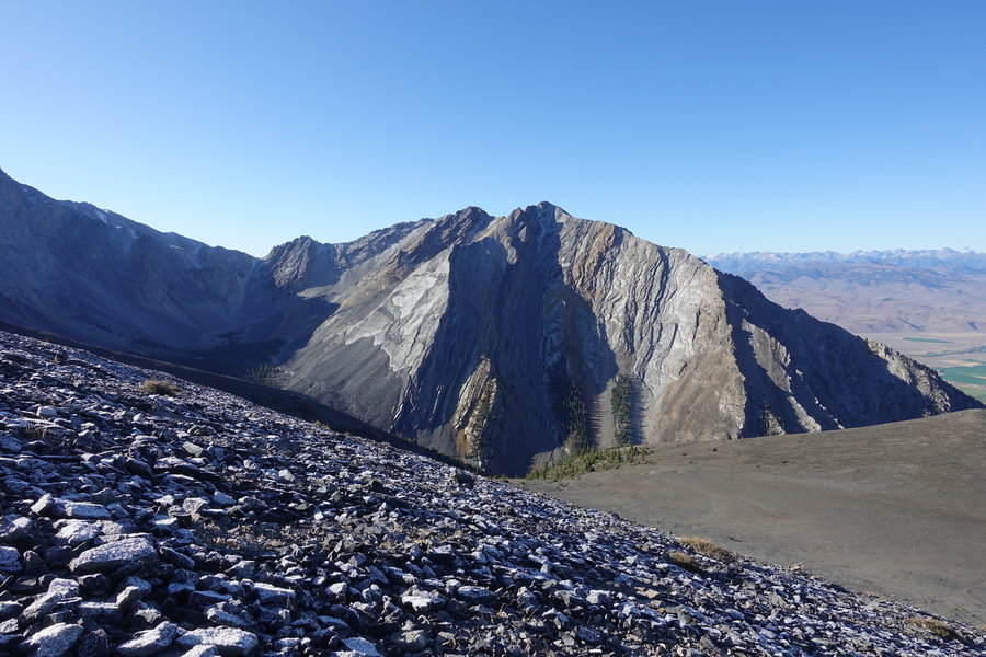
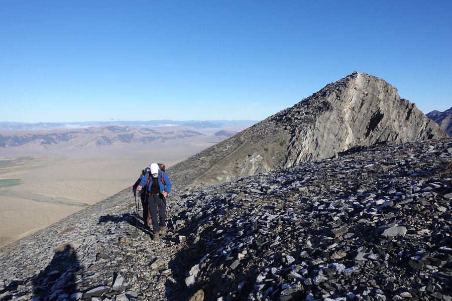
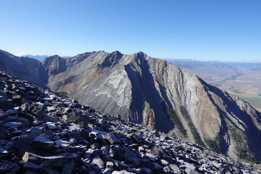
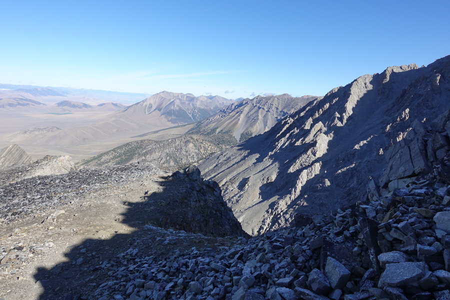
 2
2
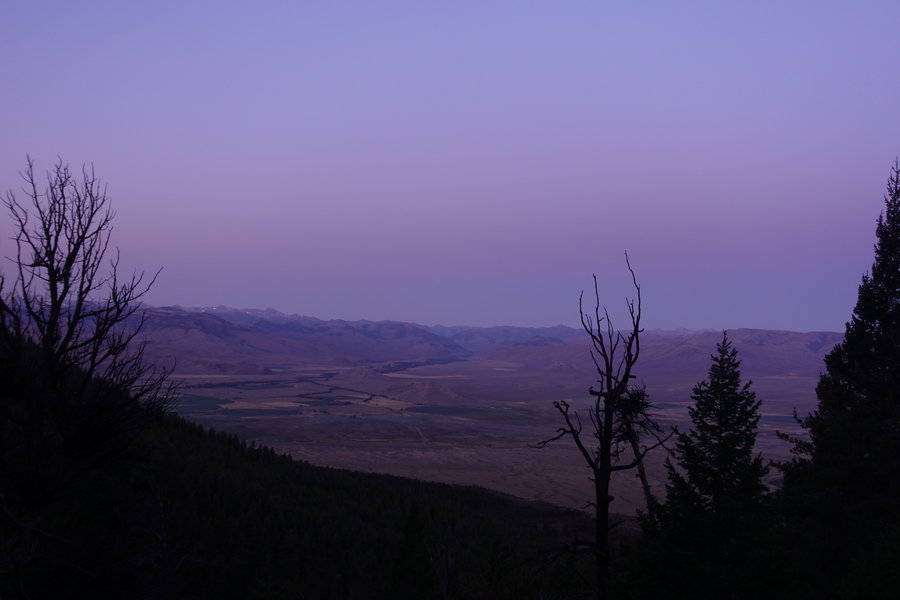
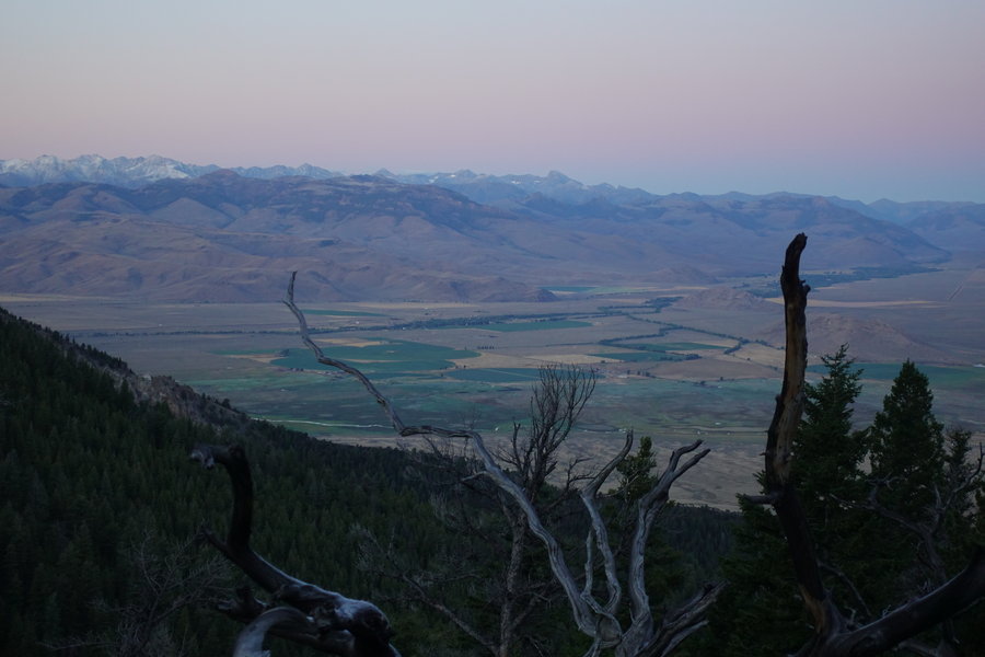
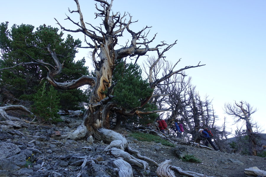
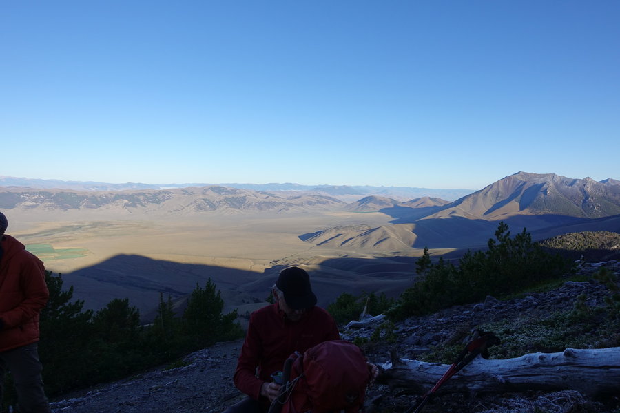
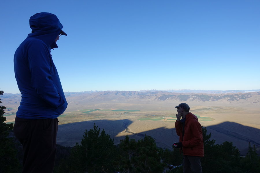
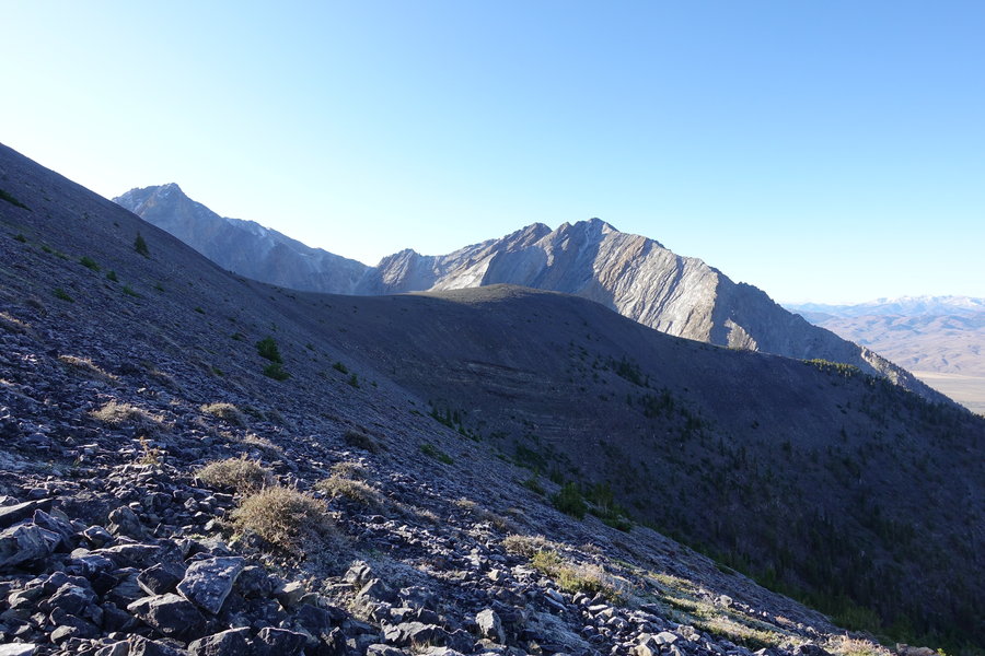
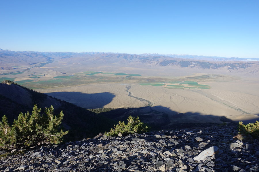
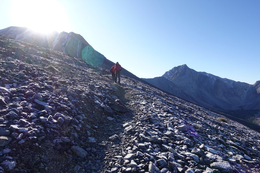
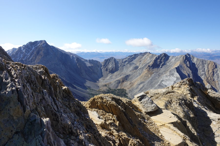
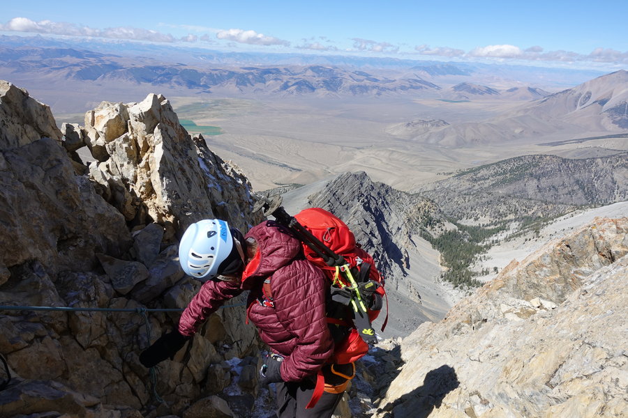
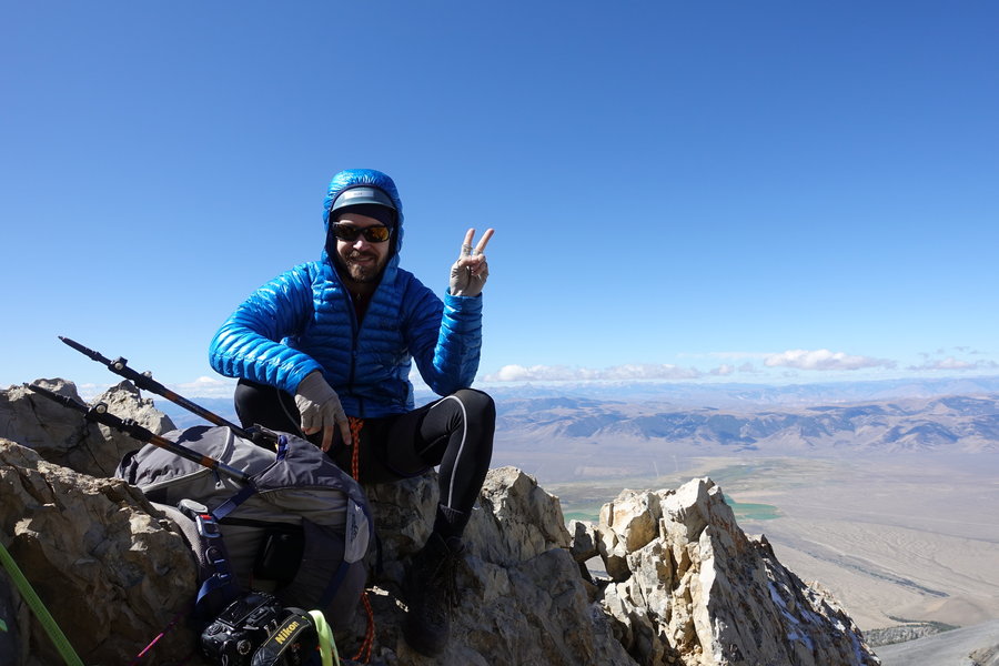
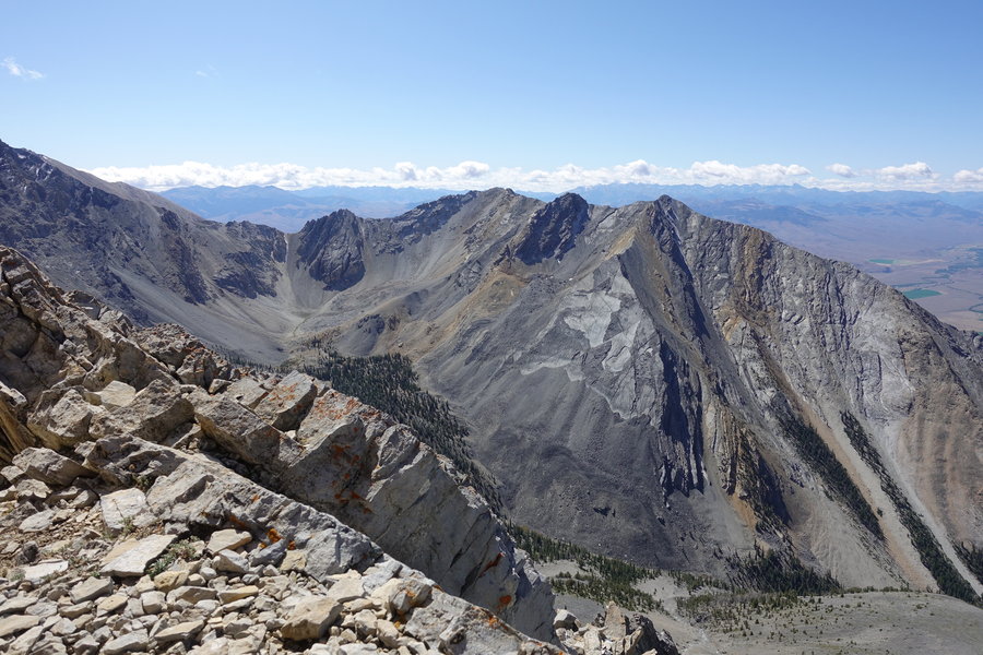
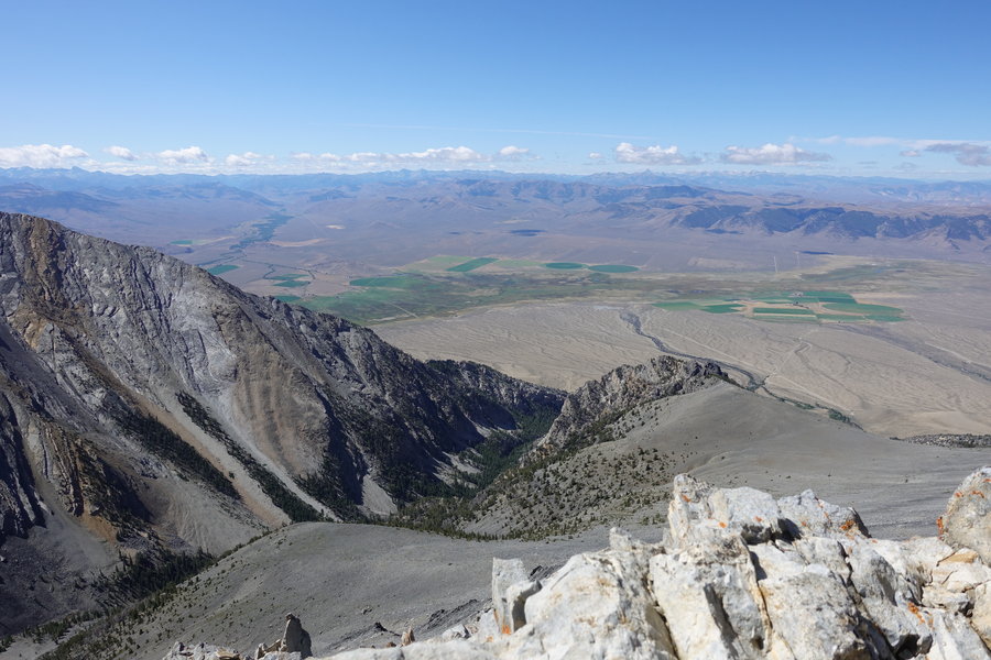
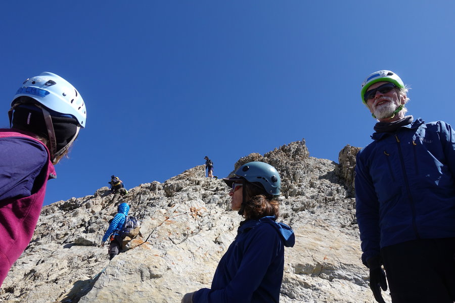
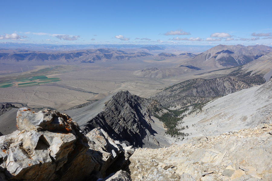
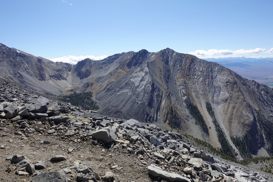
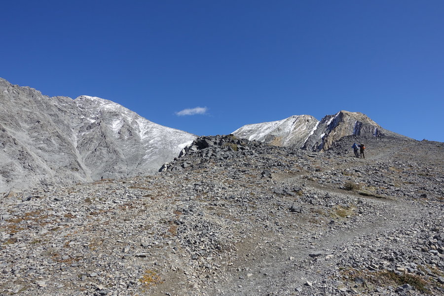
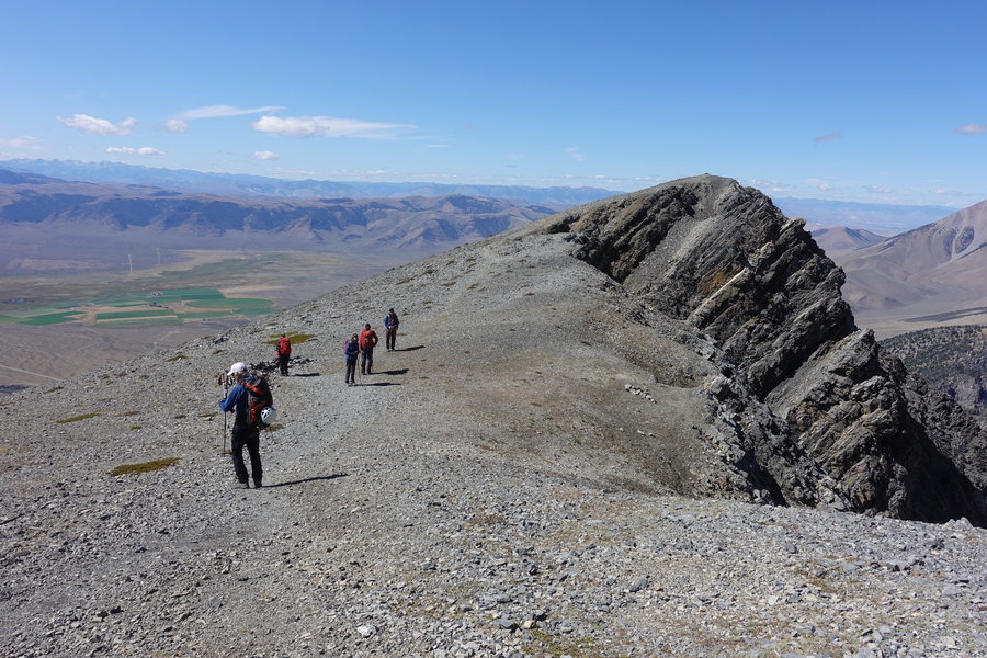
Borah Peak via Chicken Out Ridge
6 miles of hiking • 4000' elevation gain •
I have to say, I’m having a hard time doing a write up of this climb.
Failure is a hard thing to admit, especially when it takes you 10 hours to get there. Which is why I’m awake at 6 am with a mind that won’t shut off.
Write-ups of Borah make it sound straight forward, yes, the ridge is exposed, but – you are weak if you “chicken out”. I don’t agree at all.
Chickening out = not going up a ridge where a fall is fatal. Chickening out for me = I’m not comfortable with scrambling where error = death.
I thought I liked scrambling. I’ve done a fair amount, but I realize now, I haven’t been scrambling with significant exposure.
Other Mazamas probably look at this climb as easy, but I’m not one of them. I was scared. I wasn’t the only one that was. The leaders on this climb made the best decision for the group. We were all sensitive because of the recent death of one of our own at Smith.
It was a great experience, and I’m glad I was there. Perhaps someday, I’ll look back and get to the summit of Borah, and feel confident as I get up there. I’m not there yet, and that is okay.
September 12, 2019


 1
1
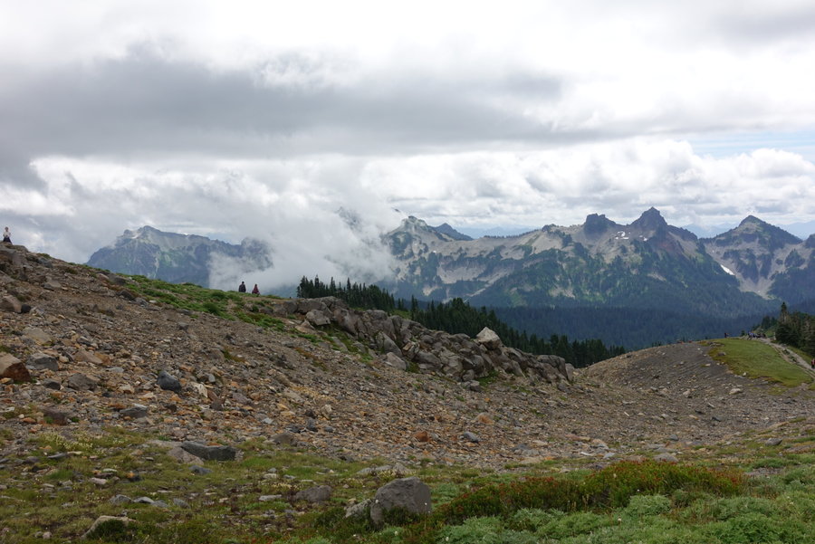
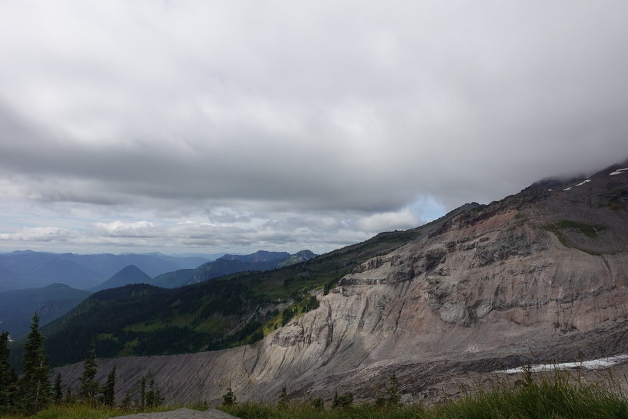
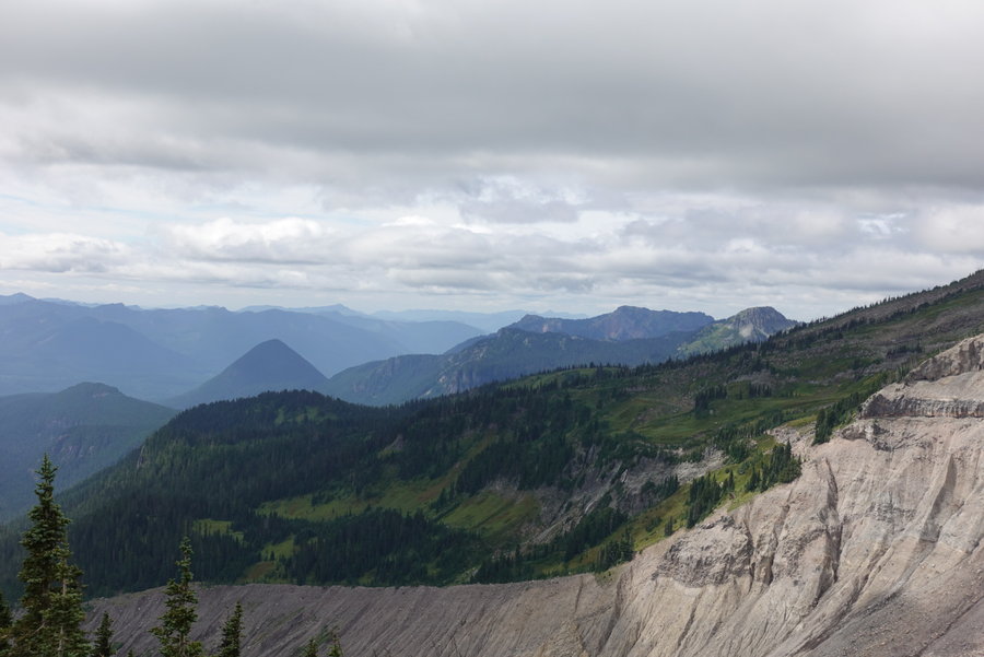
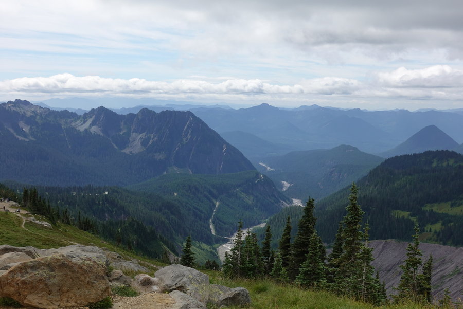
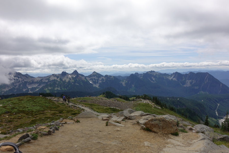
Skyline Trail (partial) Mt Rainier
3.5 miles of hiking • 1000' elevation gain •
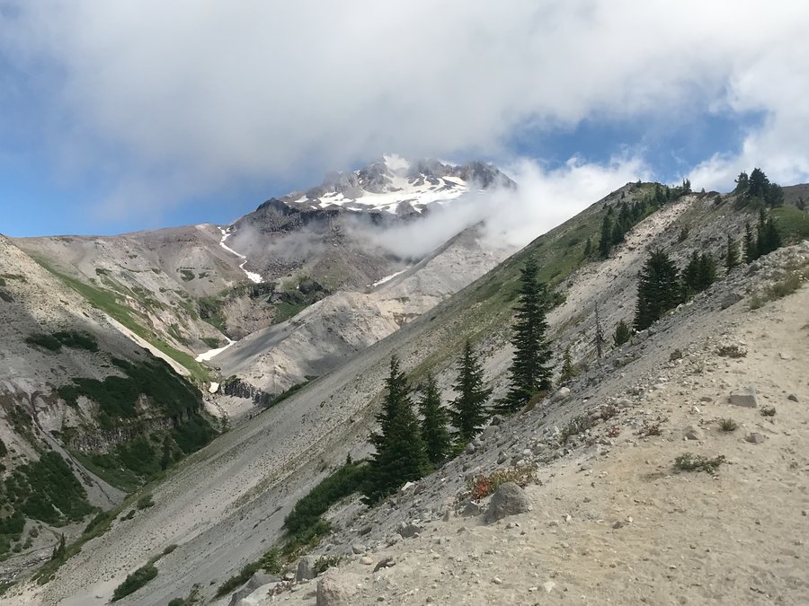
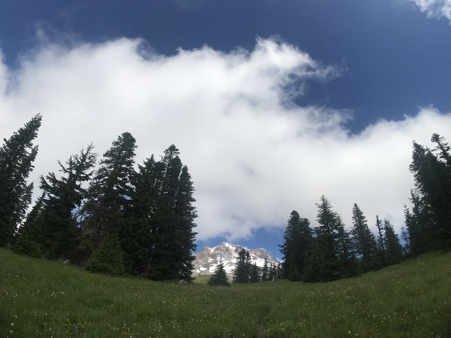
On our last day of vacation we decided to brave the crowds and hit up Paradise on our way home as Zane had never been. We stretched our legs and just did part of the skyline trail, then turned around. The mountain was in clouds but we had a few nice views of nearby peaks. Crowds were aggravating, as we witnessed multiple dogs on trail, people feeding wildlife, and standing in the meadows directly next to signs that say to stay on the path.
We missed our dog and cats so we finally headed home.
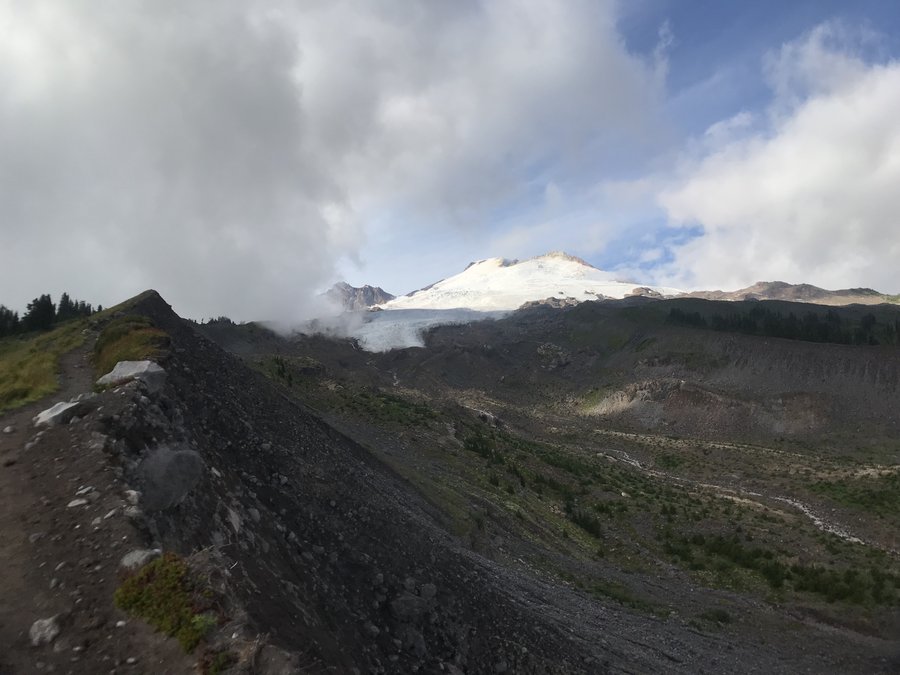
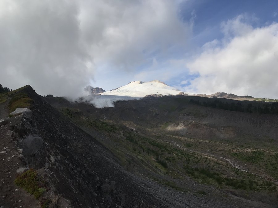
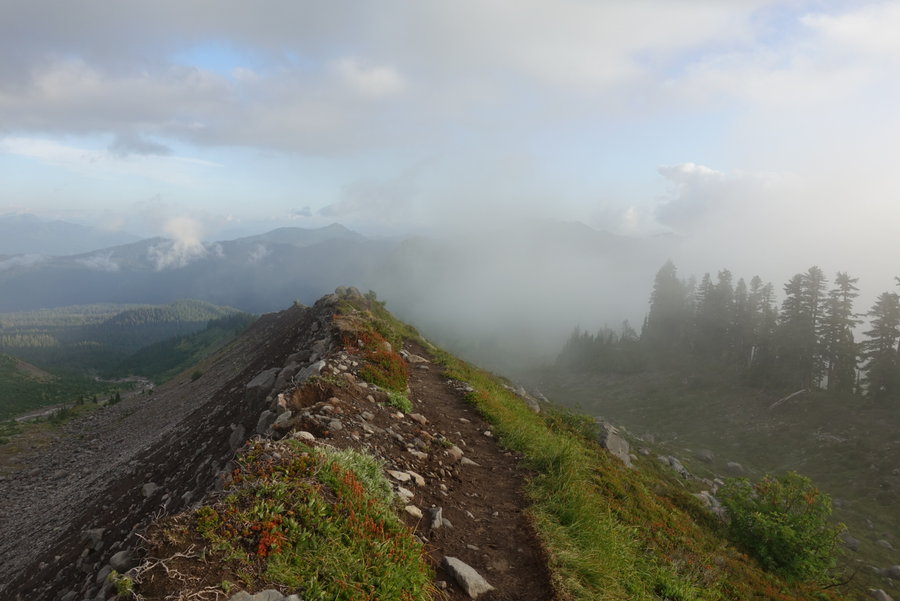
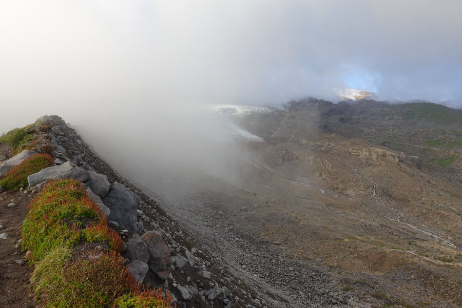
August 24, 2019


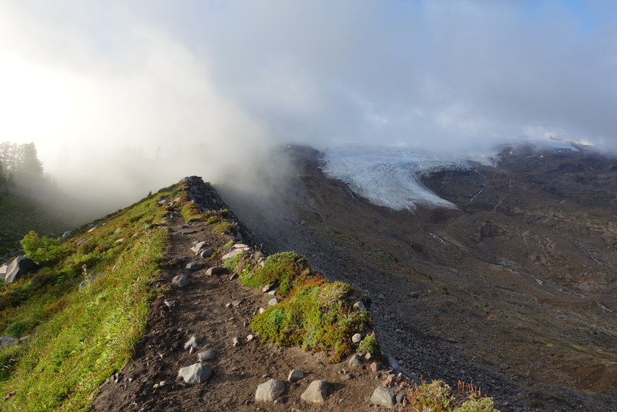
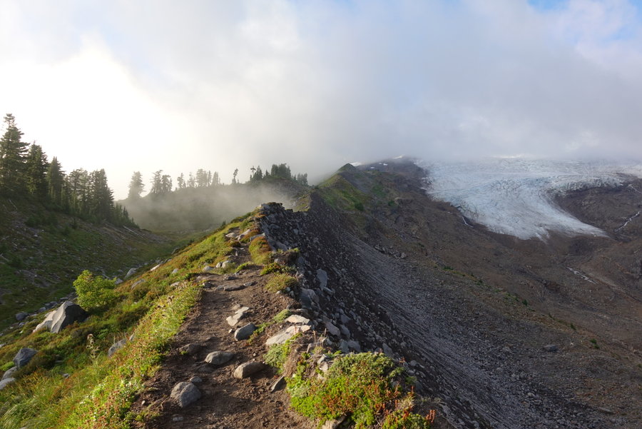
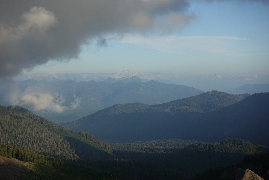
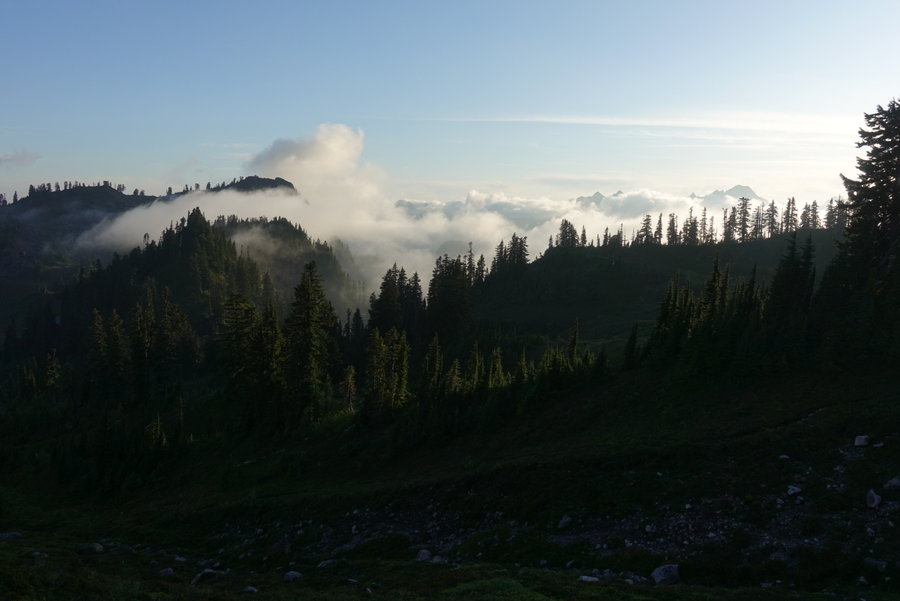
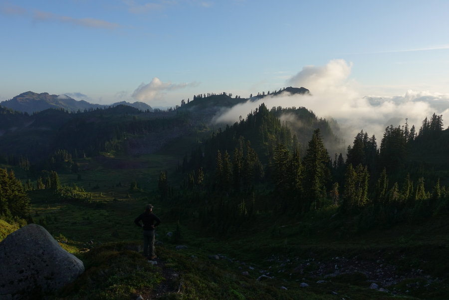
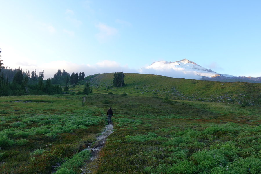
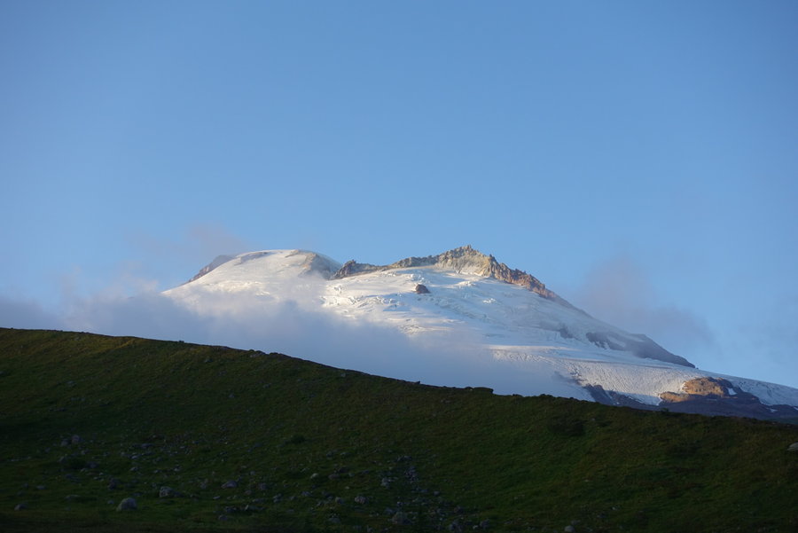
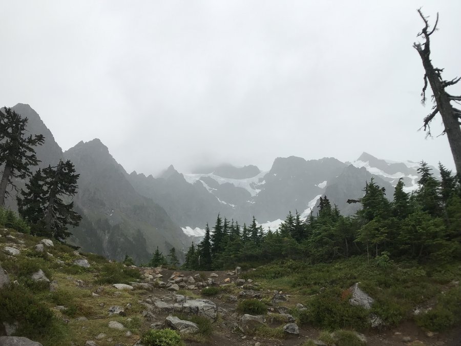
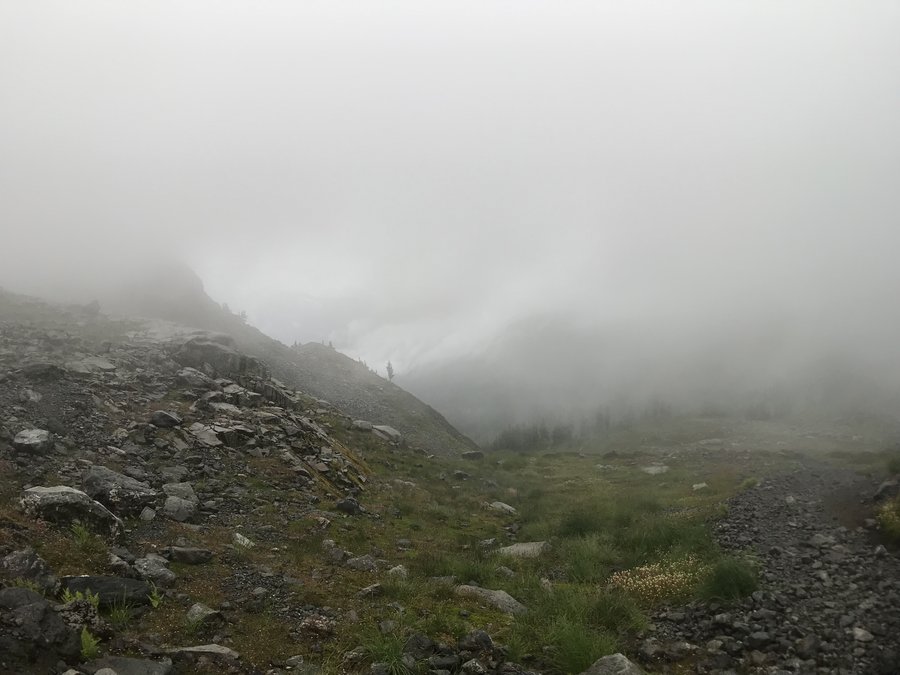
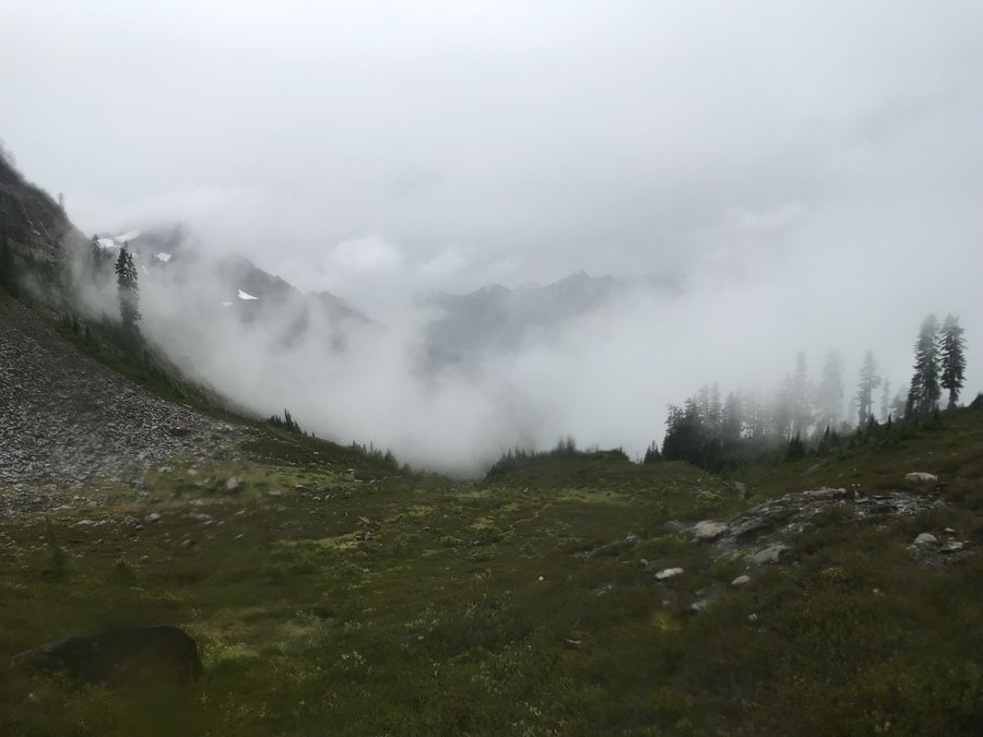
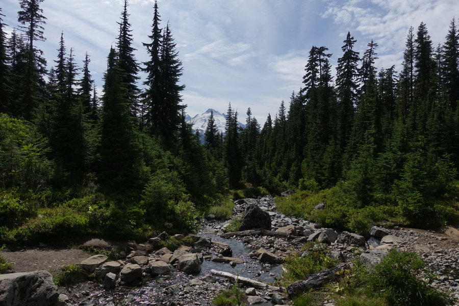
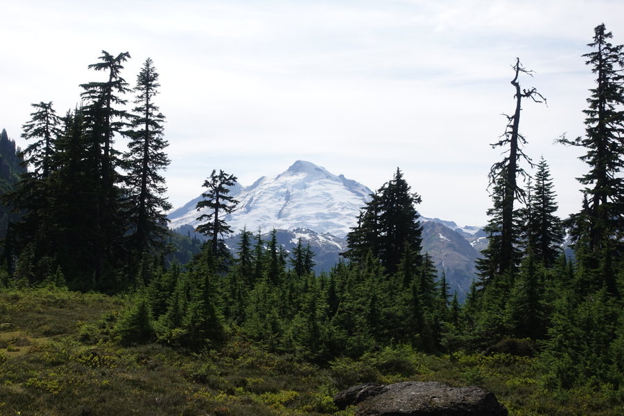
 1
1
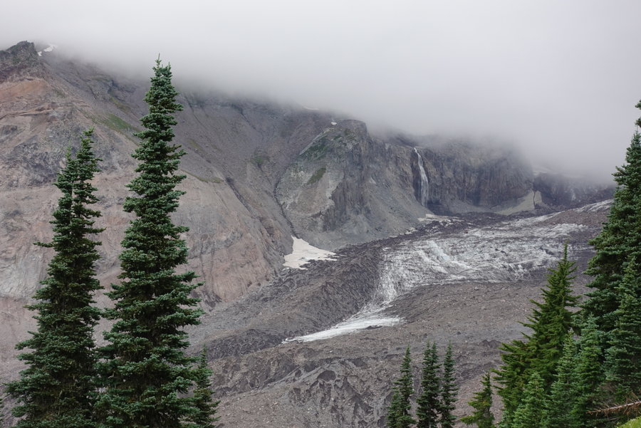
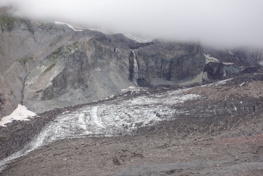
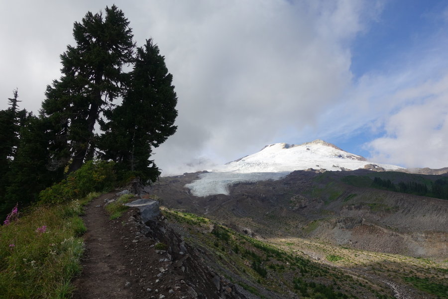
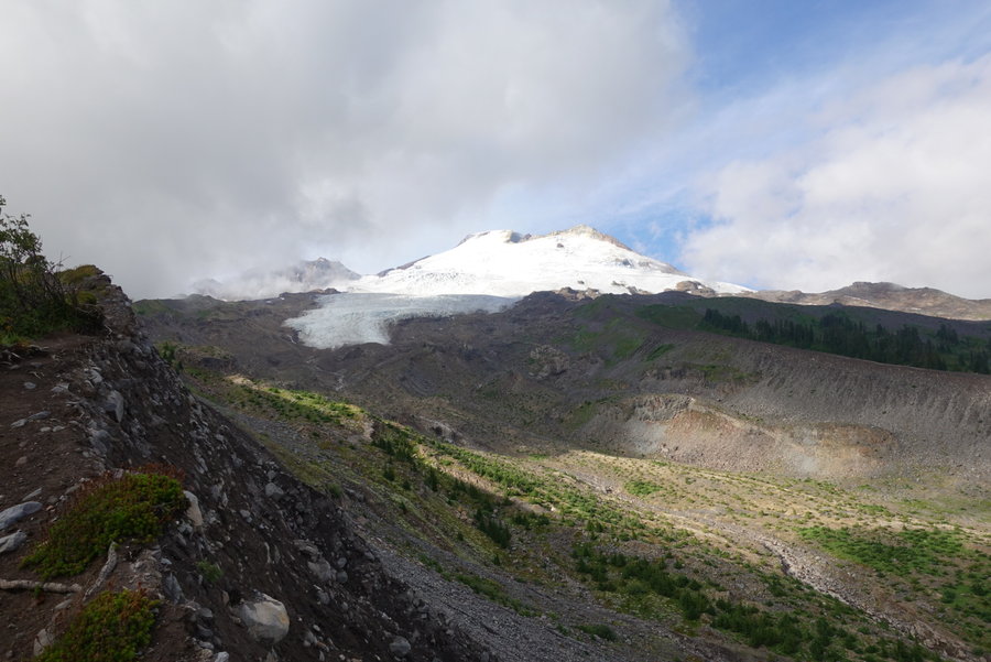
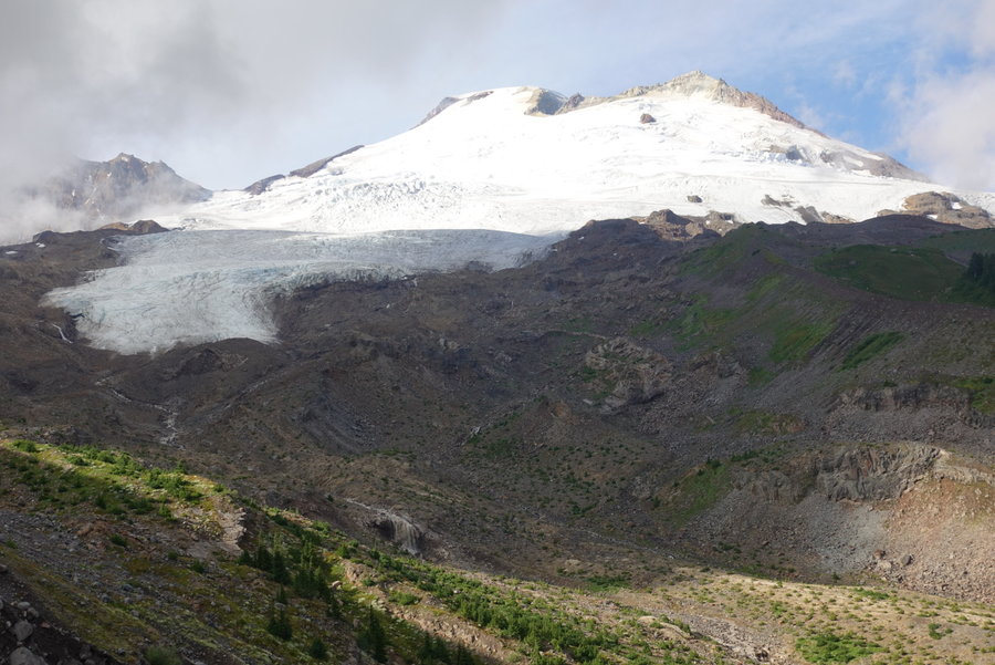
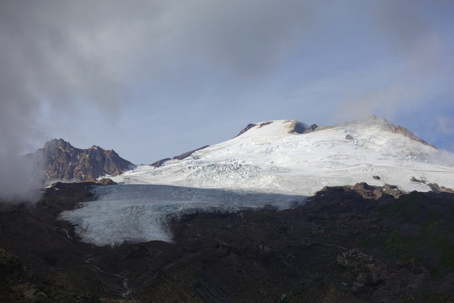
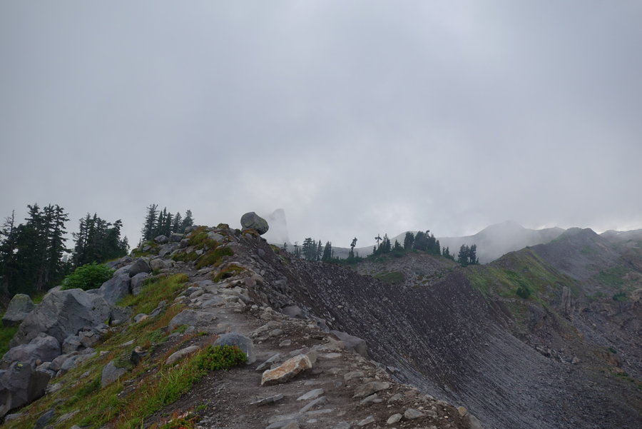
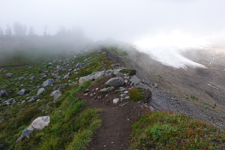
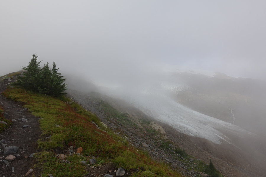
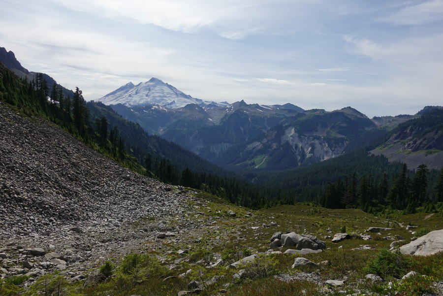
Park Butte Trail to Railroad Grade
9 miles of hiking • 2000' elevation gain • 1 night
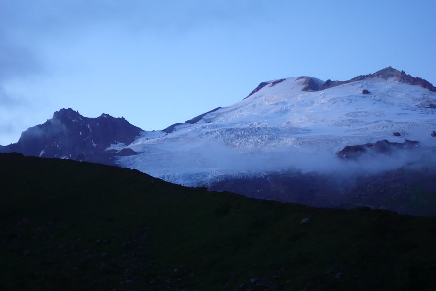
While in Bellingham, Zane and I opened our maps and decided to just pick somewhere that looked interesting. We decided for a somewhat short and sweet overnight, starting at the Park Butte Trailhead, and camping along the Railroad Grade trail. (A popular climbing route for Baker)
Weather was iffy, clouds blocked our views but with a little waiting Baker finally popped out for a short time. We explored up and down the railroad, stopping where the Easton glacier began. The mountain fully cleared as the sun went down. I woke up at 3 am to see if I could see any headlamps going up, but I only saw two groups moving up the mountain.
We had planned on going up to the Park Butte lookout the next day, but the rain came in and didn't let up. We had yet another wet hike out. I watched as weekend traffic headed in from our quiet overnight, the parking lot full of climbers gearing to go up in the heavy rain. For once, I didn't envy them.
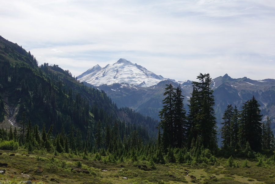
August 22 – August 23, 2019


 1
1
Lake Ann (Mt. Baker)
8.5 miles of hiking • 2000' elevation gain • 1 night
On our second day of vacation we decided to head out into Mt Baker wilderness to avoid having to get permits for an overnight. We decided on Lake Ann, as neither of us had been in the Mt Baker area before.
I heard this area was popular, but on a Tuesday night it was mostly empty. We only saw few solo backpackers, a woman and her two daughters, and group of climbers who packed up and headed out when they descended from Shuksan. There was however, one annoying group of gram seeking day hikers, who set up a tent, moved it around on top of rocks, looking for that perfect shot. I was happy when they packed up and left.
In the quiet of the night I stood in awe of Shuksan, hearing the glacier move periodically. I awoke in the middle of the night to what sounded like a chunk falling or rockfall. Shuksan is on my list to eventually climb when I get more skills, but it sure looks intimidating.
Beautiful weather until around 9 am as we were packing up to head out, then the downpour began and never let up. Wet and cold, we retreated for the night to Bellingham, and spent the rest of the day checking out breweries and drying out our gear.
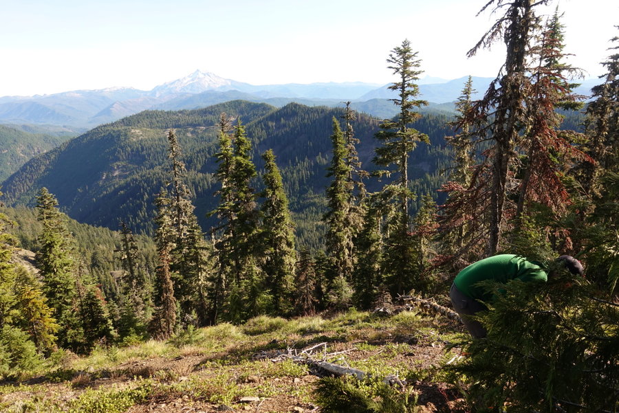
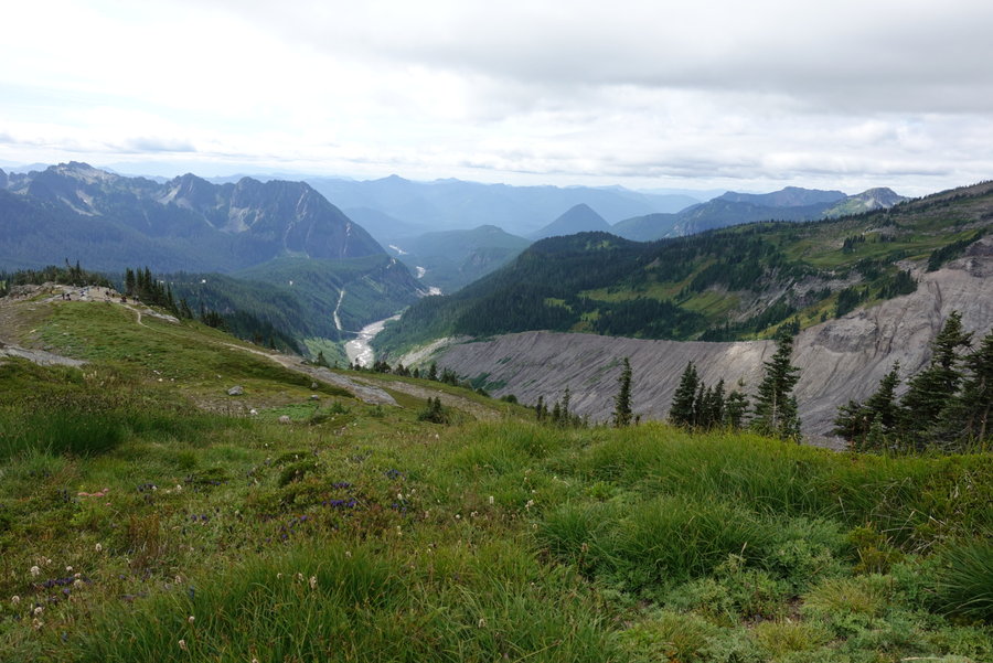
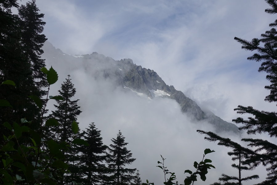
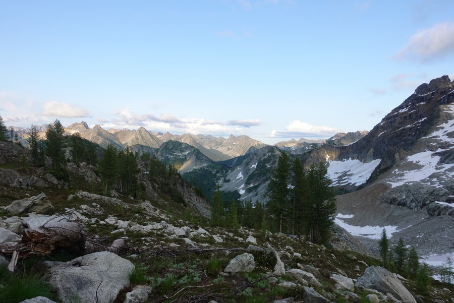
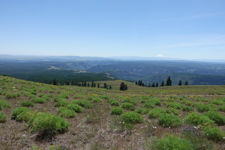
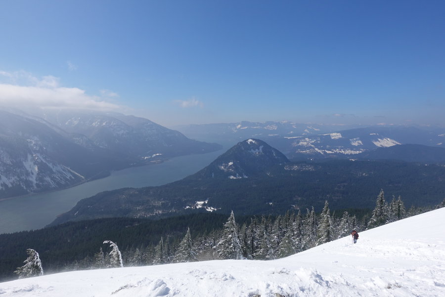
August 20 – August 21, 2019


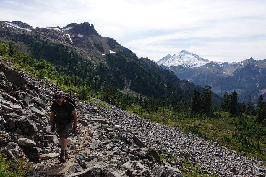


 4
4
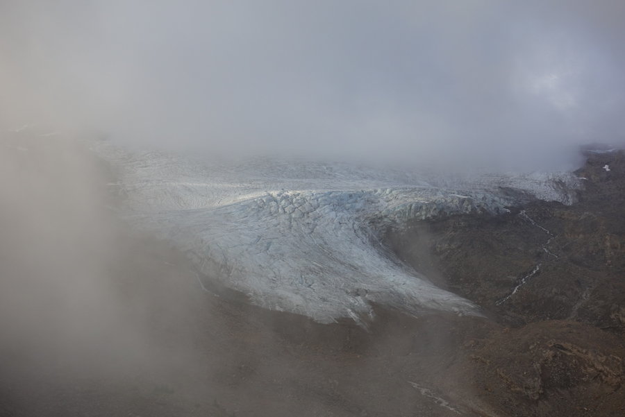
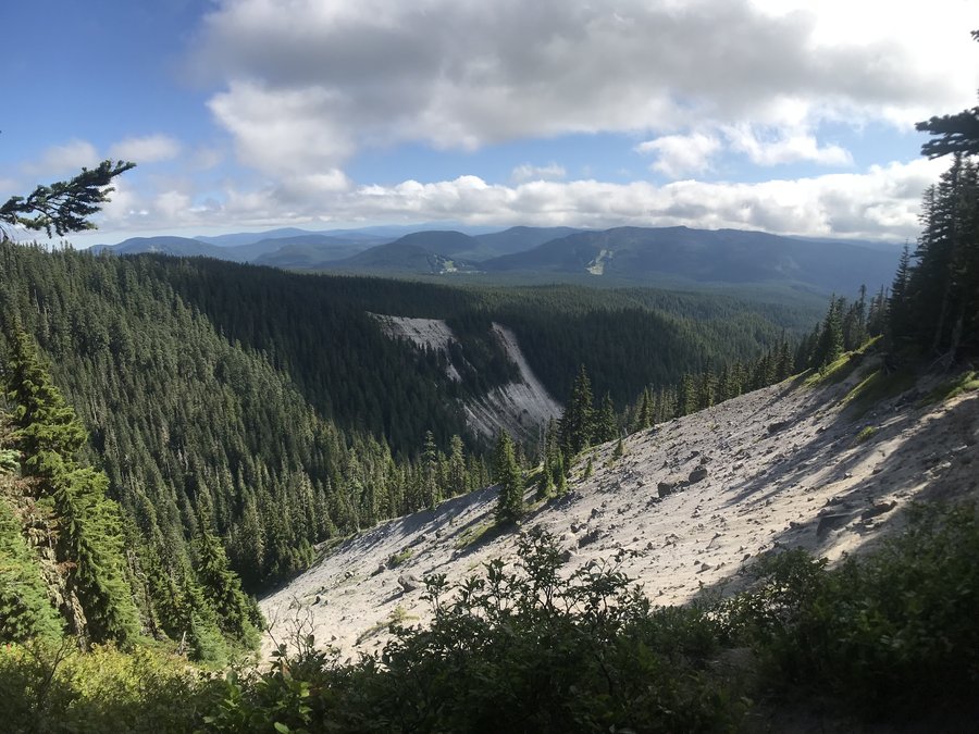
Cascade Pass and Sahale Arm
11 miles of hiking • 3500' elevation gain •
Had a week off to adventure north. Left on Sunday from Portland, setting up basecamp at Marble Creek campground in Marblemount. Being a Sunday night, we didn't have a problem finding a campsite.
We hit up the ranger station to ask about permits for multiple areas we wanted to backpack, and were mostly told they weren't available or weren't available until days later, but we would have to wait in line at 7 am to maybe get the last permit available that day. A little discouraged, we decided to just day hike Sahale Arm trail, as we were informed there was only one permit available in the area at Pelton Basin for Tuesday. (And the camp had been plagued with a nuisance bear who figured out how to break into the bear boxes.) Kind of curious how the whole, 40% of permits available for walk-up really works.
I thought I had picked a large number of options for backpacking, but ended up throwing them all out the window and mostly hung out in Mt Baker wilderness for the rest of the week.
Saw 3 bears, one on trail and two in the distance. We stopped short of the glacier as I didn't want to push my boyfriend (who doesn't climb) super hard on day one of vacation. Kinda kicking myself for not going further but I figure I'll eventually do the full climb so I'm okay with waiting for those views until then. It was still a beautiful (though loved to death) trail, with gentle switchbacks up most of the way. I hated those gentle switchbacks on the way down, when I just wanted to be done with my day. Practically ran down the last few.
Road was fine for our Prius. I eyed the road to Hidden Lake on the way and said no way for our car. Would love to head back out that way with a higher clearance vehicle.
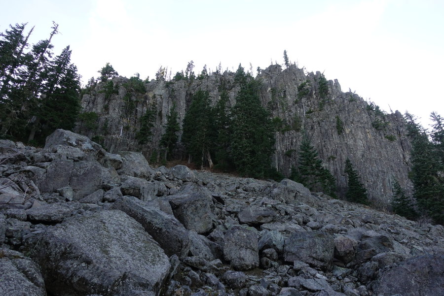
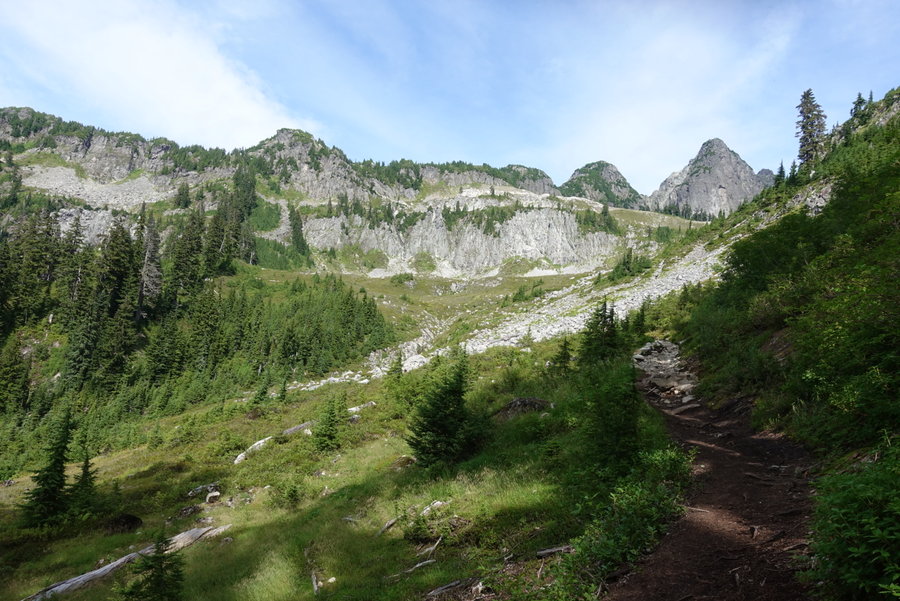
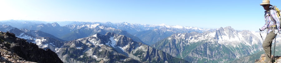
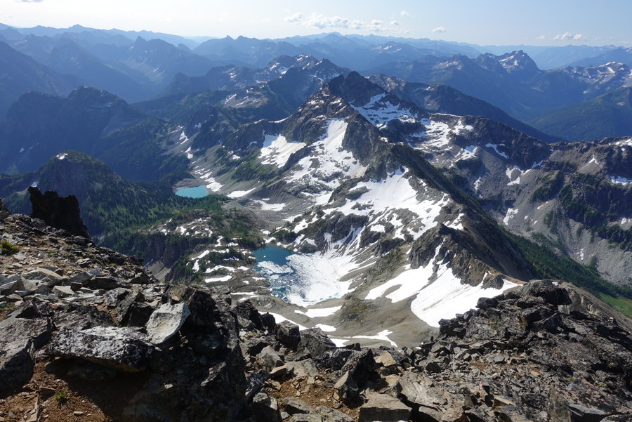
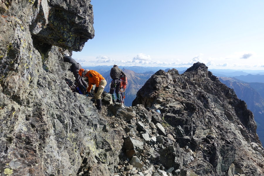
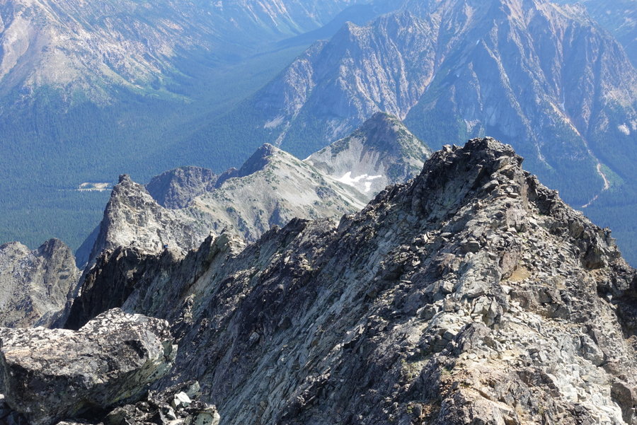
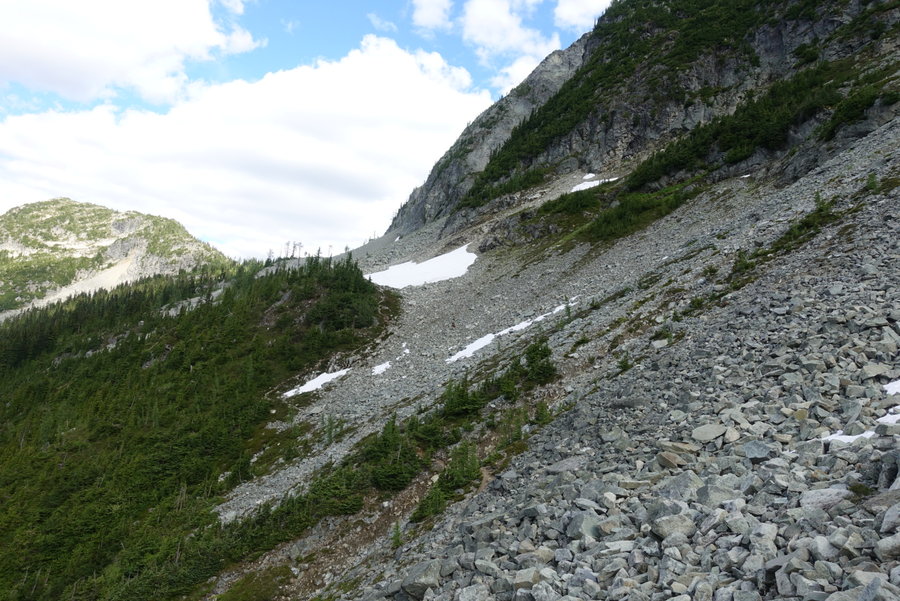
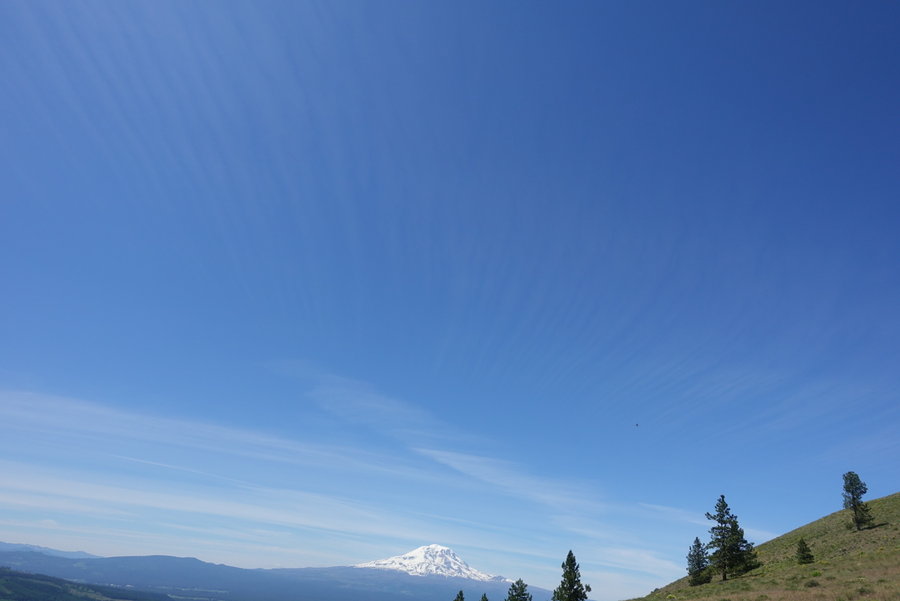
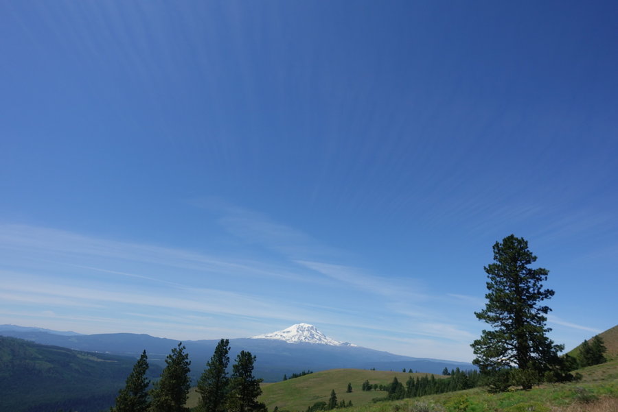
August 19, 2019


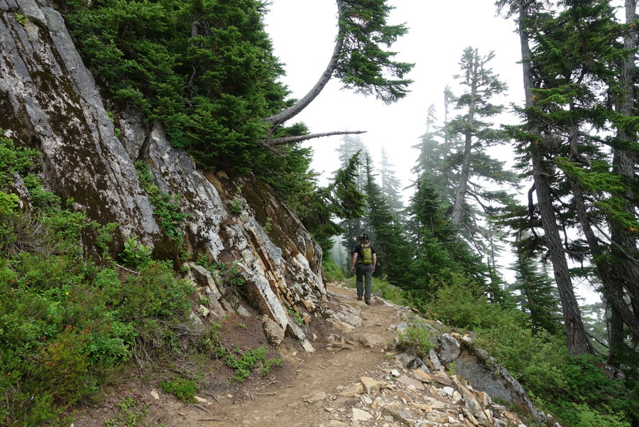


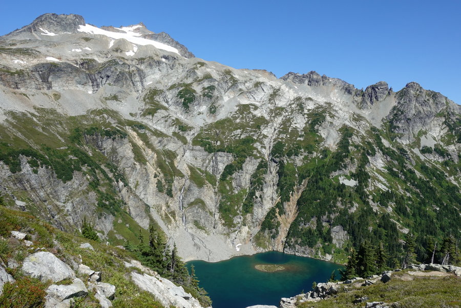
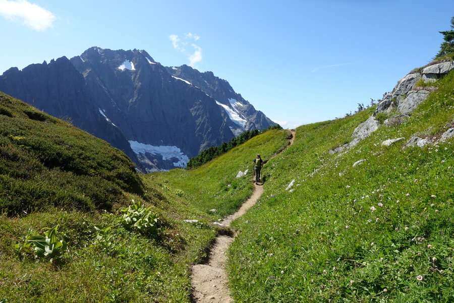


 4
4
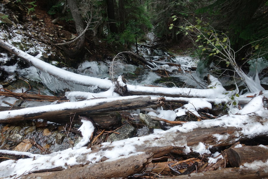
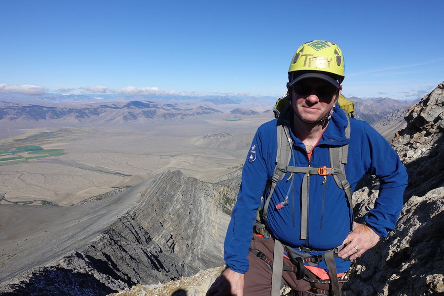
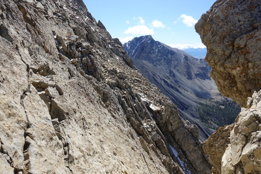
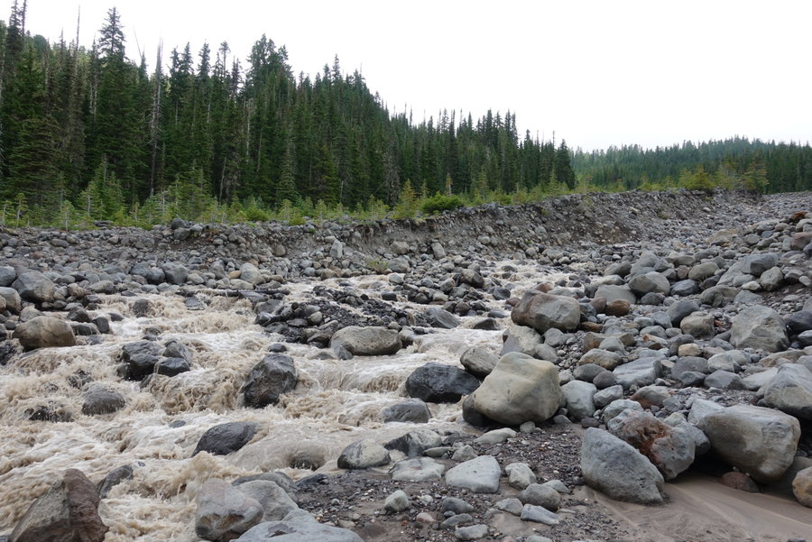
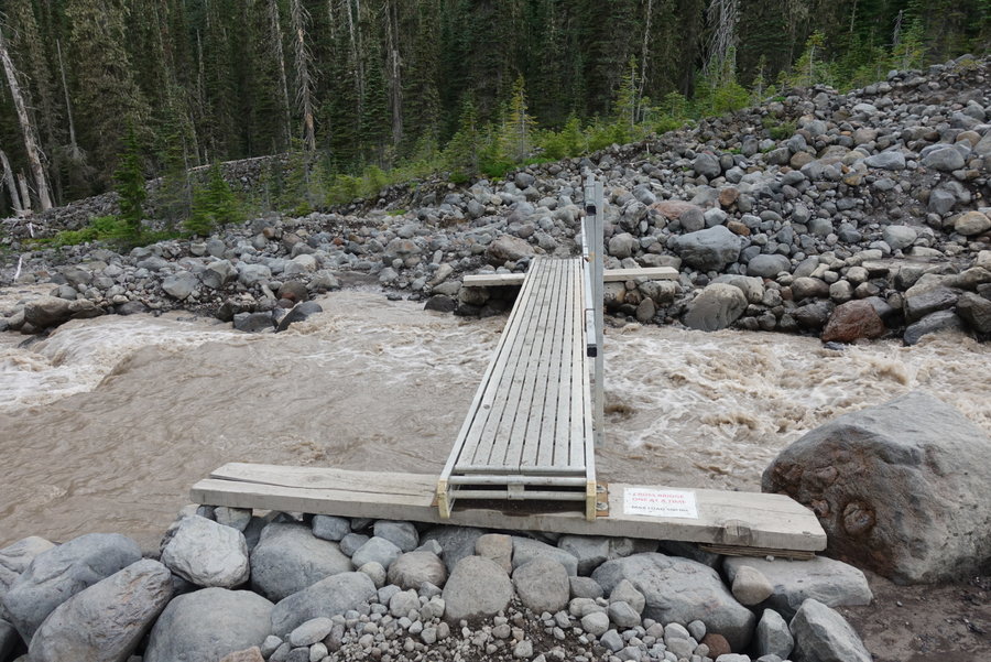
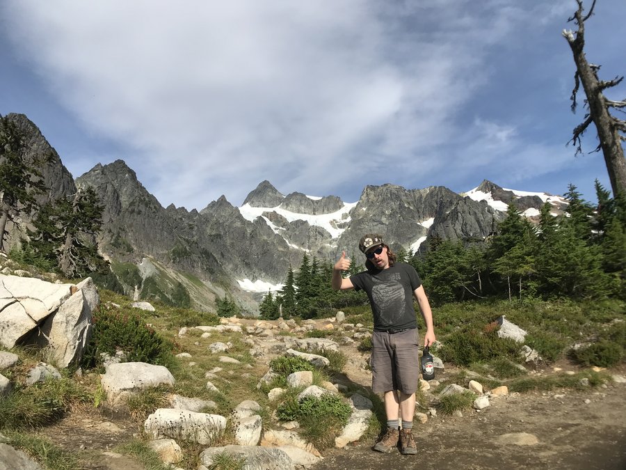
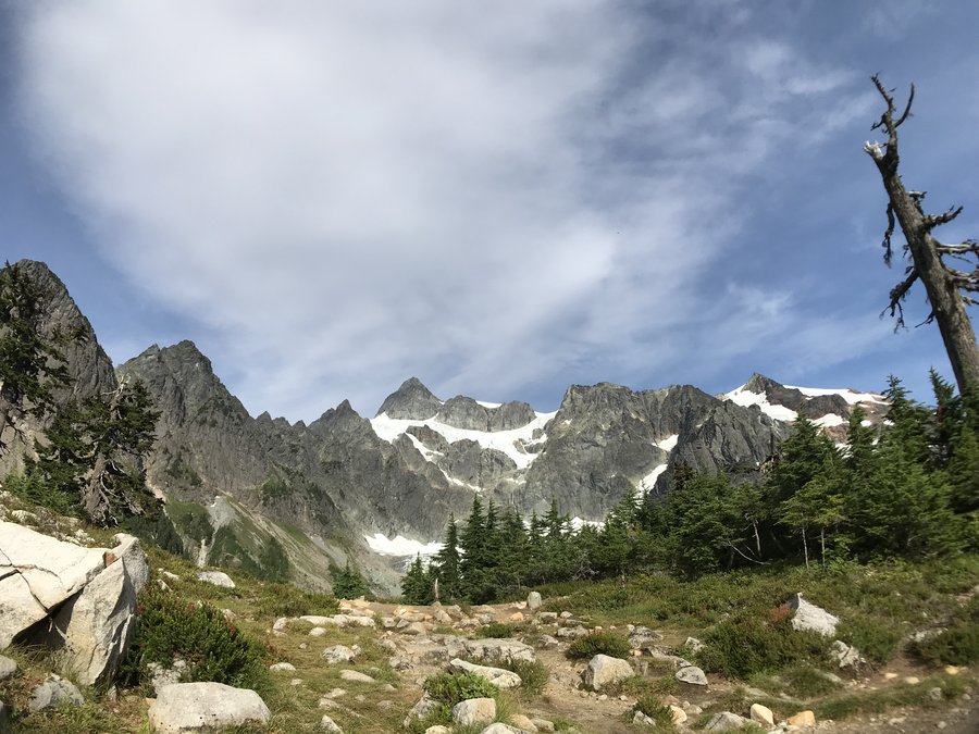
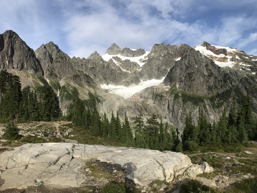
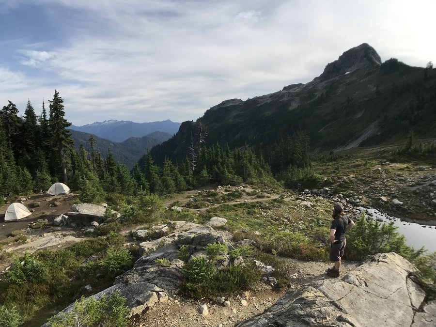
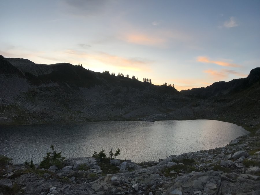
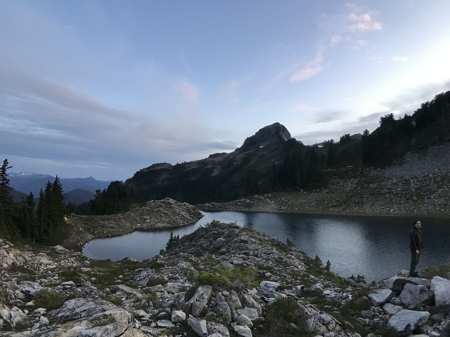
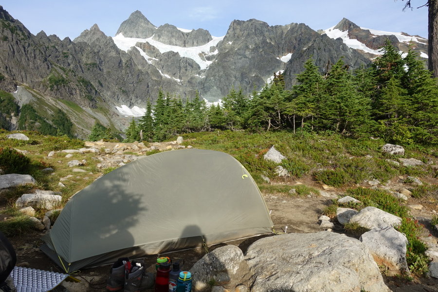
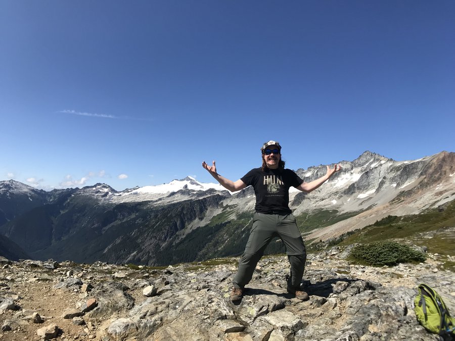
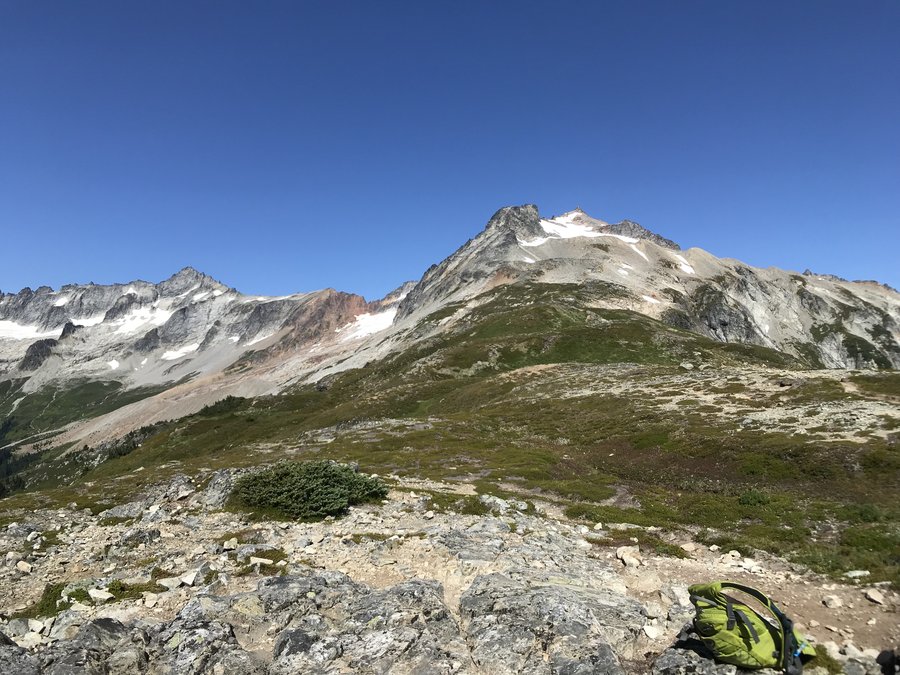
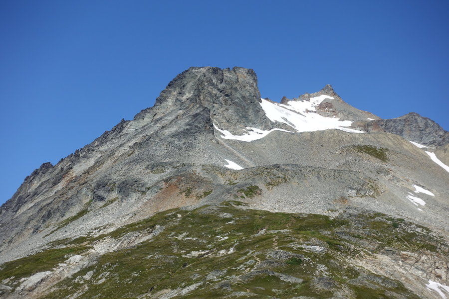
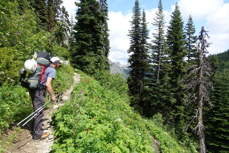
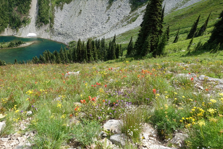
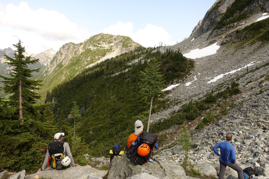
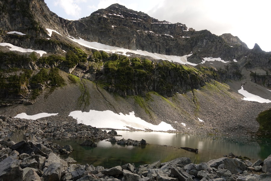
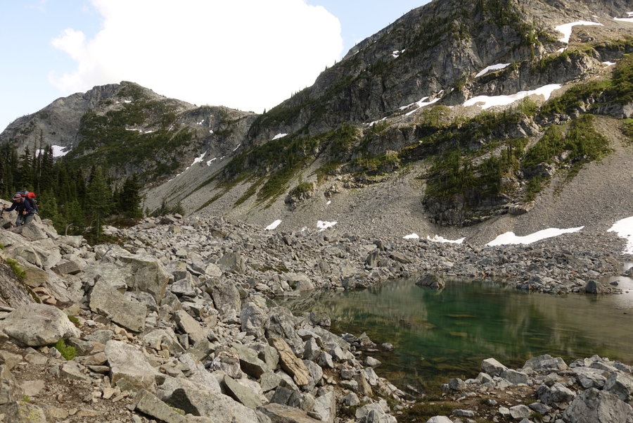
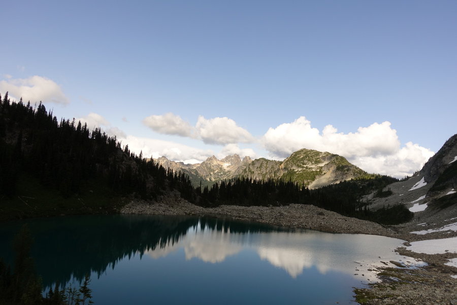
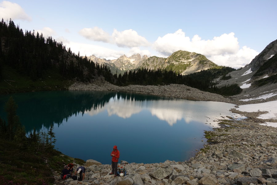
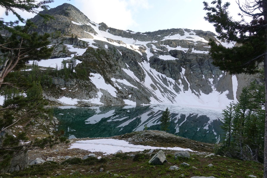
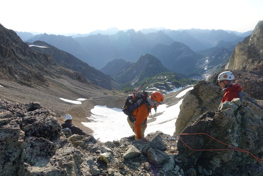
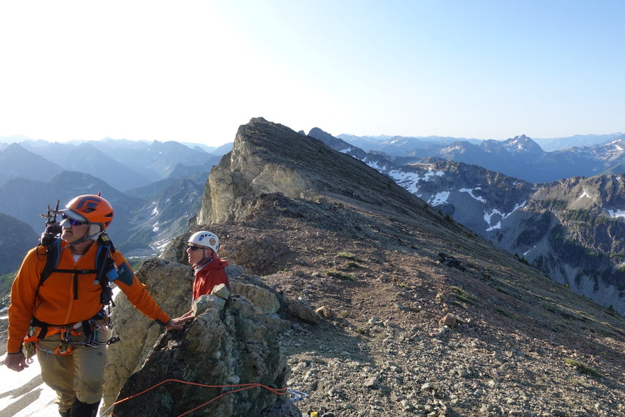
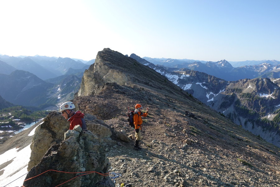
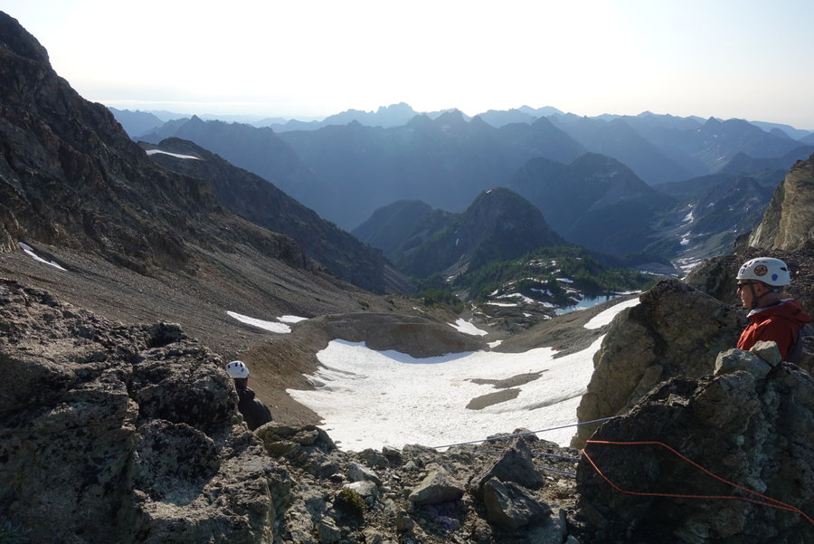
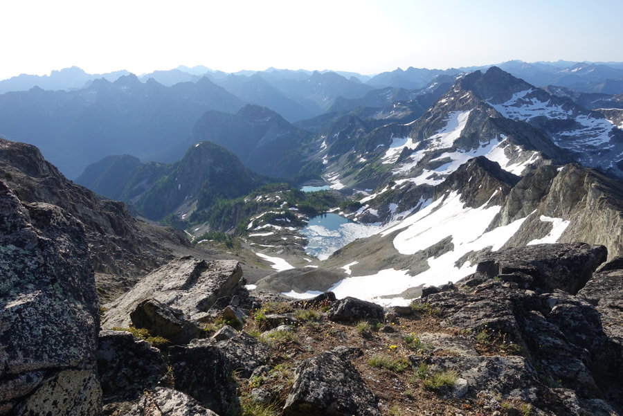
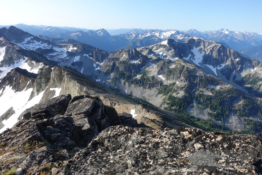
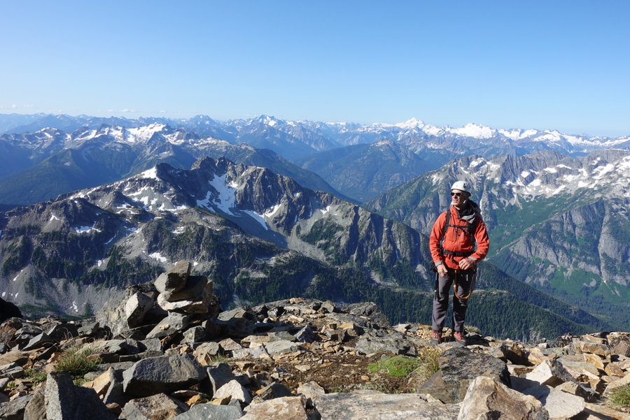
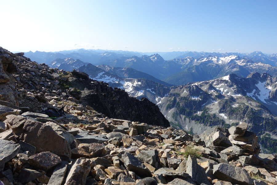
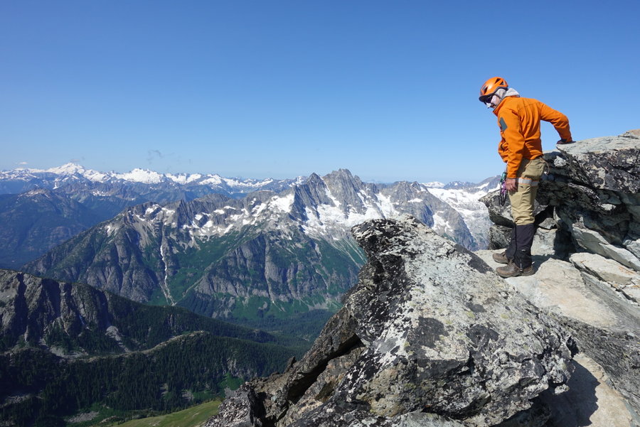
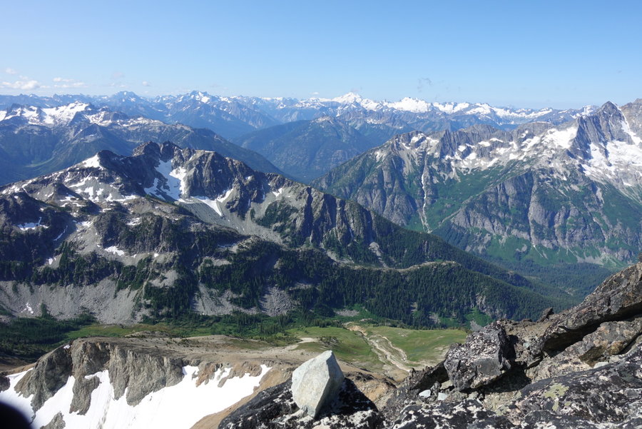
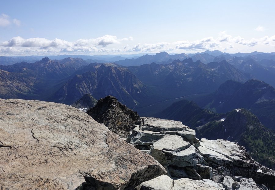
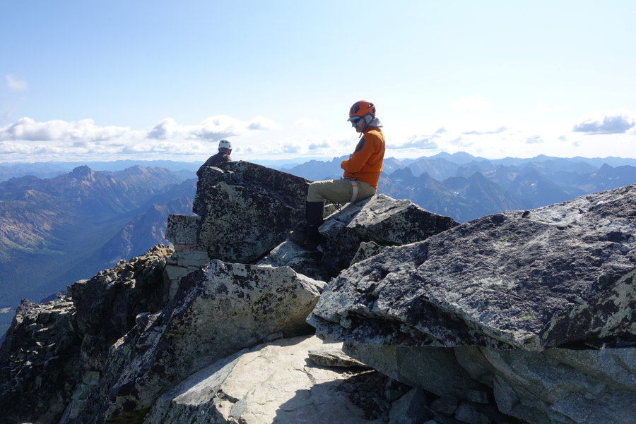
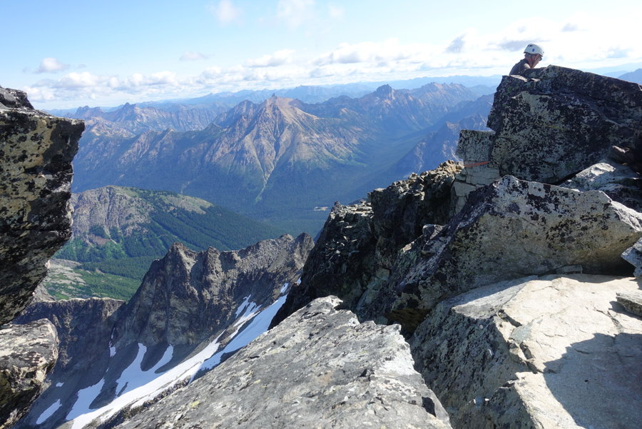
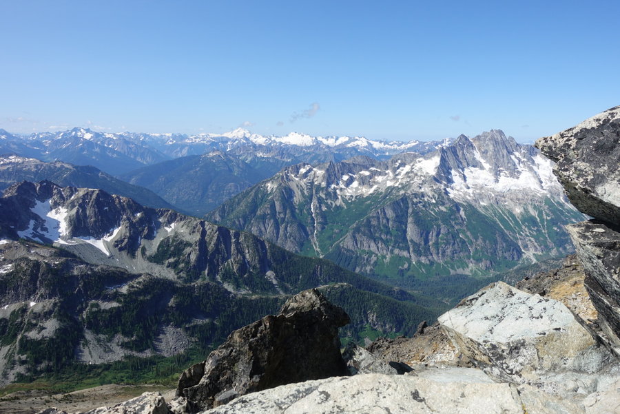
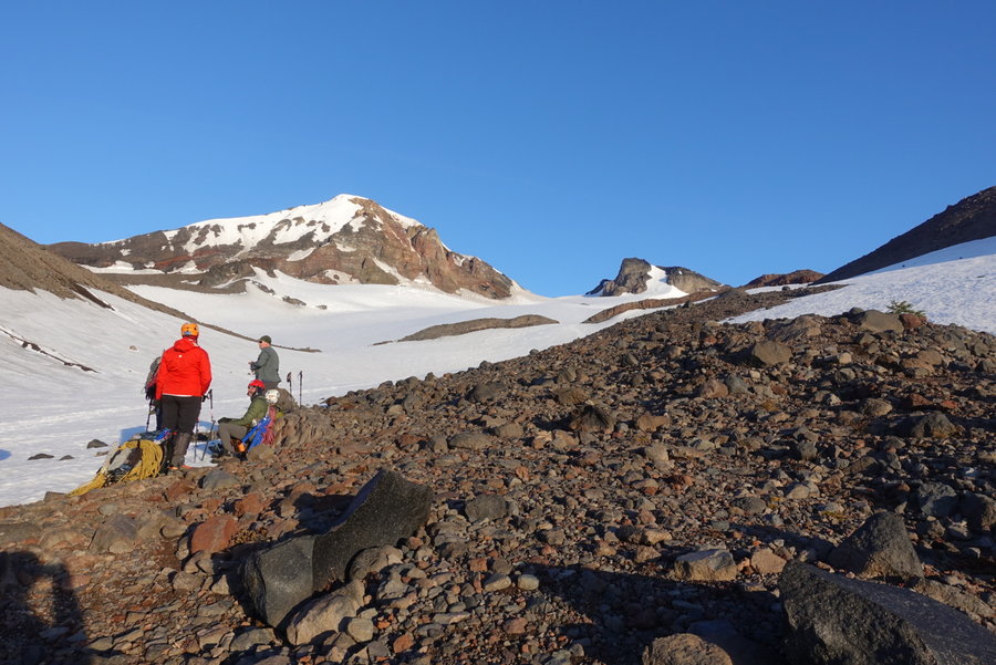
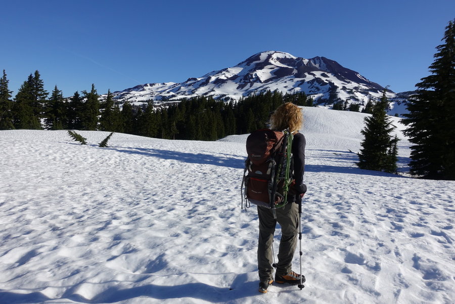
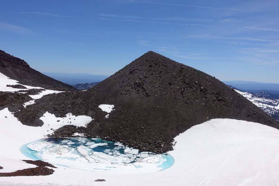
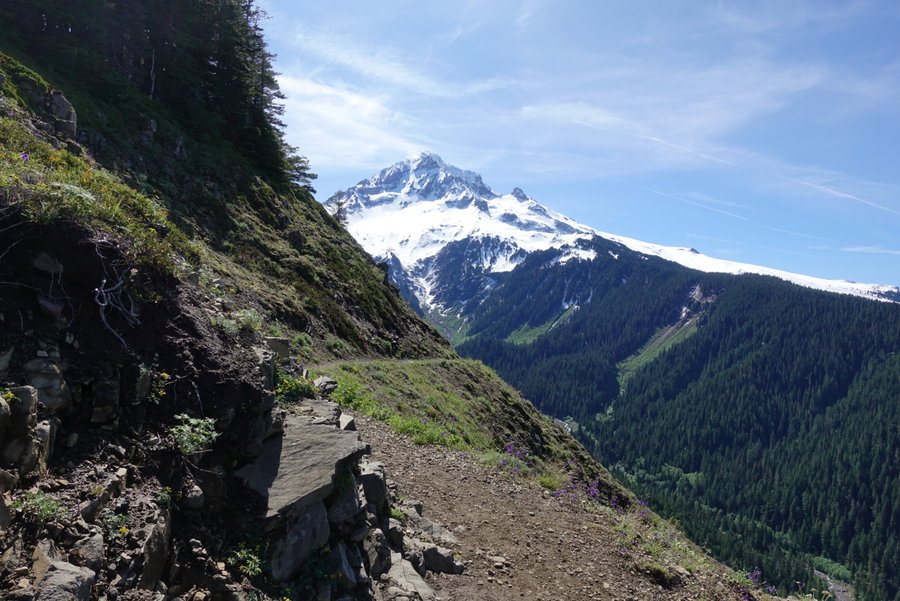
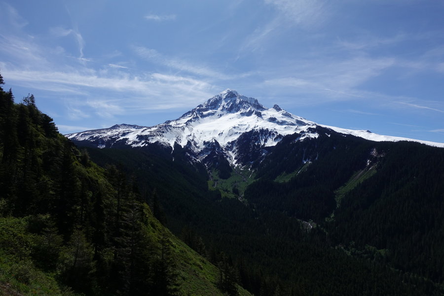
Black Peak South Route, North Cascades
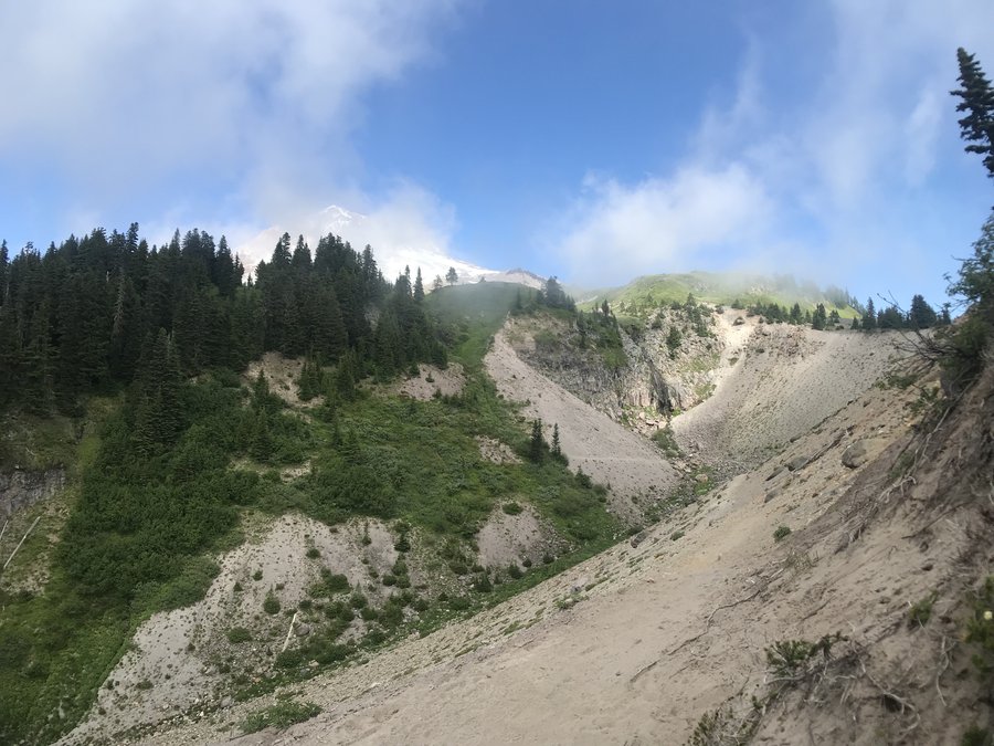
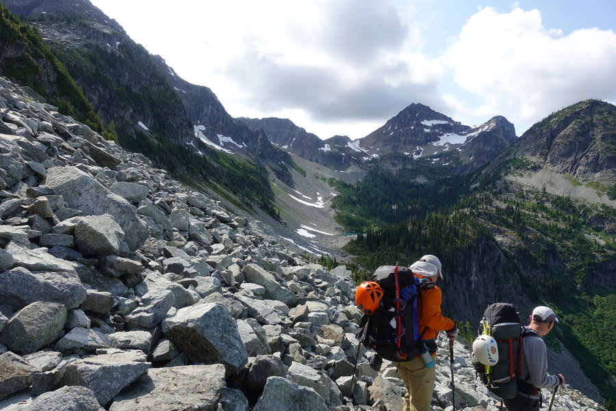
12 miles of hiking • 5000' elevation gain • 1 night
Another climb in the bag outside of my comfort zone. I was the only noob on a small and experienced Mazama climb team led by Larry Buzan with Jeffery Welter assisting.
Having never been to the North Cascades, I applied for the climb because I thought it would be a non technical scramble. Not so!
The initial 2 miles was relatively easy, a good trail with relatively gentle gain. Then we hit, what I call, the boulder field of doom! It seemed to go on forever, and made us lose a ton of the elevation we had just gained. Merciless, never ending sharp jagged rocks with marmots and pika poking out between. Cairns were placed throughout, but without much direction or direct route. After hours of ascending past beautiful but mosquito infested lakes, we finally reached our destination for the night, a mostly thawed Wing Lake. It was a cold night, and I quickly set up camp, ate, and turned in with a bottle full of hot water to keep me warm. In the end it was 4 miles, with 2100 gain. That doesn't really describe how hard the terrain was with a full backpack.
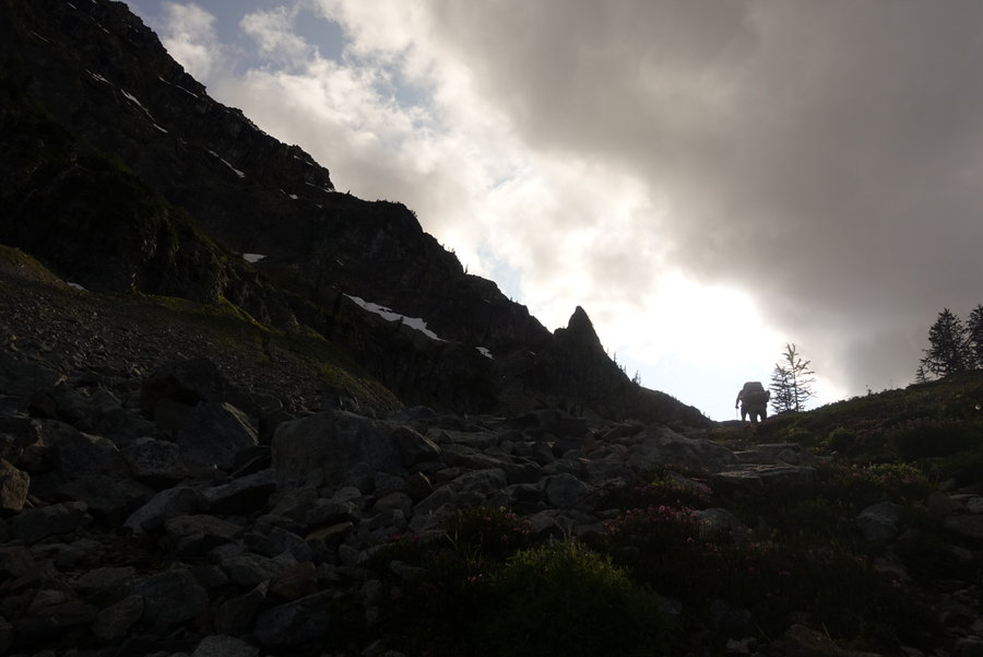
I barely slept a wink in anticipation for the 4 am wake up. At 5 am we we off.
I opted not to bring heavy climbing boots, and used my Scarpa approach/backpacking boots instead as we didn't expect much snow. This proved slightly problematic when we had to go up one steep snowfield. I had tried my crampons on, but never used them in the field. When it started to get steep I felt myself sliding. Jeffery noticed and tied me in to him, till Larry got on the ridge and threw down the rope and belayed me the rest of the way up the steep section. Very grateful, and learned a lesson that I need to invest in some lightweight mountaineering boots. He ended up belaying everyone up over the ridge anyway, as it ended with good size rock blocks to climb over to get to the top. I was thankful for it as I had never been on a slope that steep without protection before.
Once on the ridge, I got my first view of what was to come. Peak beyond peak. It was overwhelming.
The rest of the route was relatively easy scrambling, with a few airy spots thrown in. We came across many different routes, and tried to find the best way up. Eventually we reached the saddle between the NE route and the summit block, and Larry went up and prepared for us. Jeffery had us all try an invention of his that attached to a prusik, pushing it along so we could be hands free. I'm sure there is a much more technical way to explain it, but I'm not a rock climber. Neat to try something new, and I enjoyed having both hands free. I was second in line to go up, and I nervously made my way up the rock. A few deep breaths, and I made it up what is likely easy for those used to climbing. It was exciting and I was completely awed by the view at the top. I spotted three climbers coming up the NE ridge and watched in awe as they simul climbed and reached the saddle below.
Then came the downclimb. I had never downclimbed anything in my life. I told Larry to hold keep the rope tight, and down I went. Let's just say, it isn't easy for a short lady like me, but I did it! I'm pretty proud of myself for getting over my fear. And yet another learning point in this climb.
After that, down we went, opting for the scree field rather than the snow field for the descent. It was it's own sort of steep mess with a mix of falling rock. Eventually, we reached camp, ate a quick lunch, packed up and began our descent out.
It was grueling after a day of climbing to go back up the boulder field. We had visions of hamburgers and french fries at the top of the pass, but sadly when we were out and reached Marblemount, all restaurants were closed.
We retreated to camp with gas station food and beer, and enjoyed a couple beers while I got advice about climbing from wise Larry and Sue before finally winding down to sleep for the night.
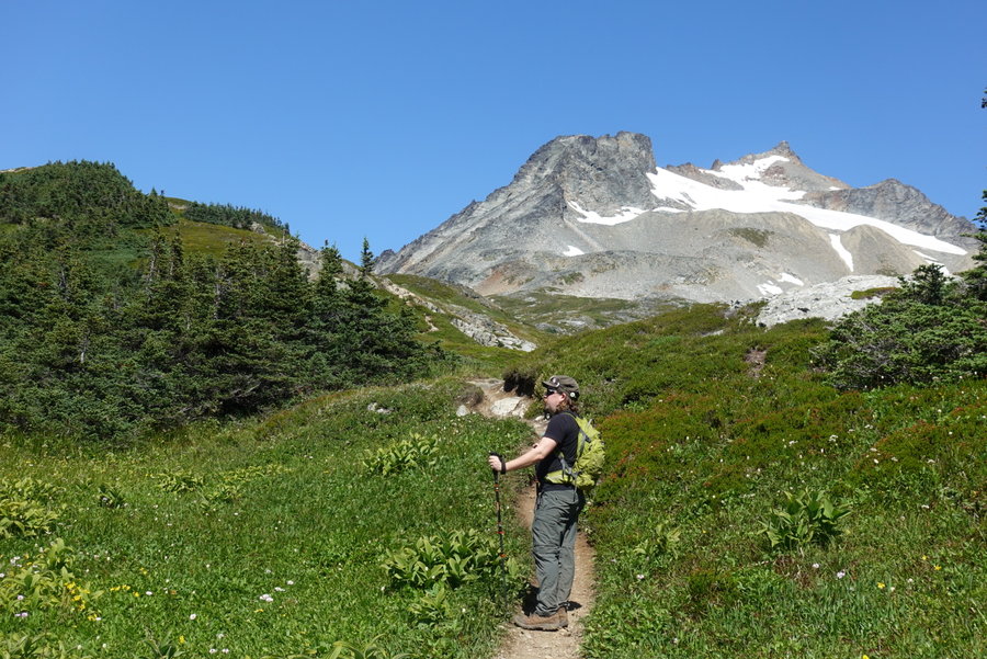
July 19 – July 20, 2019


 1
1
Oak Island Sauvie
3.3 miles of hiking • 0' elevation gain •
Just a short stroll on a hot day to take the dog for a swim.
July 14, 2019
 1
1
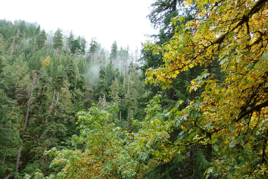
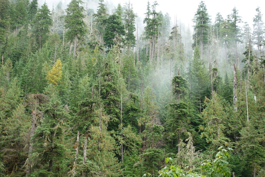
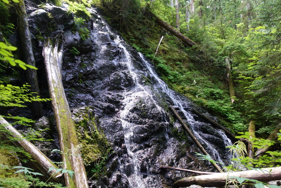
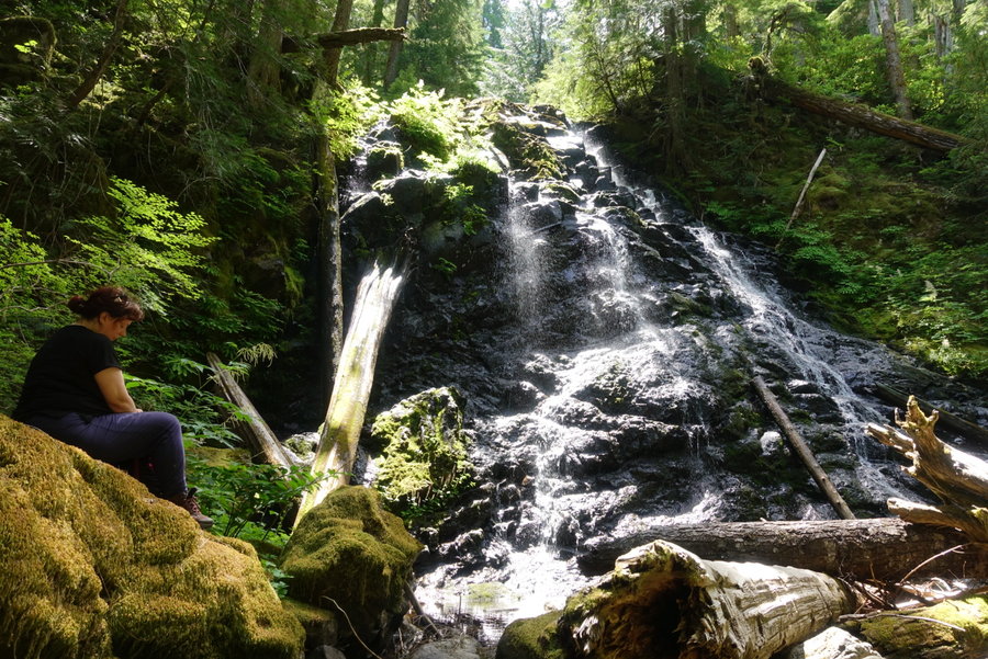
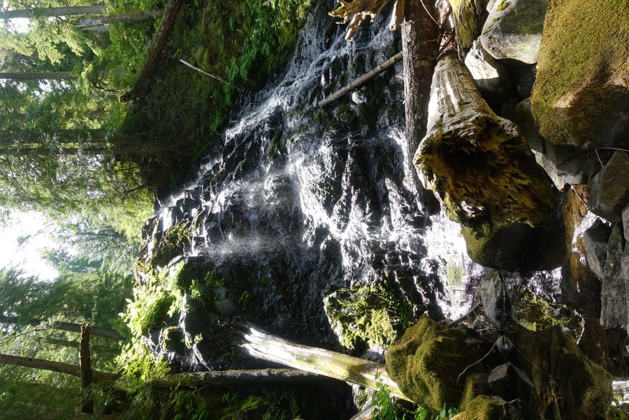
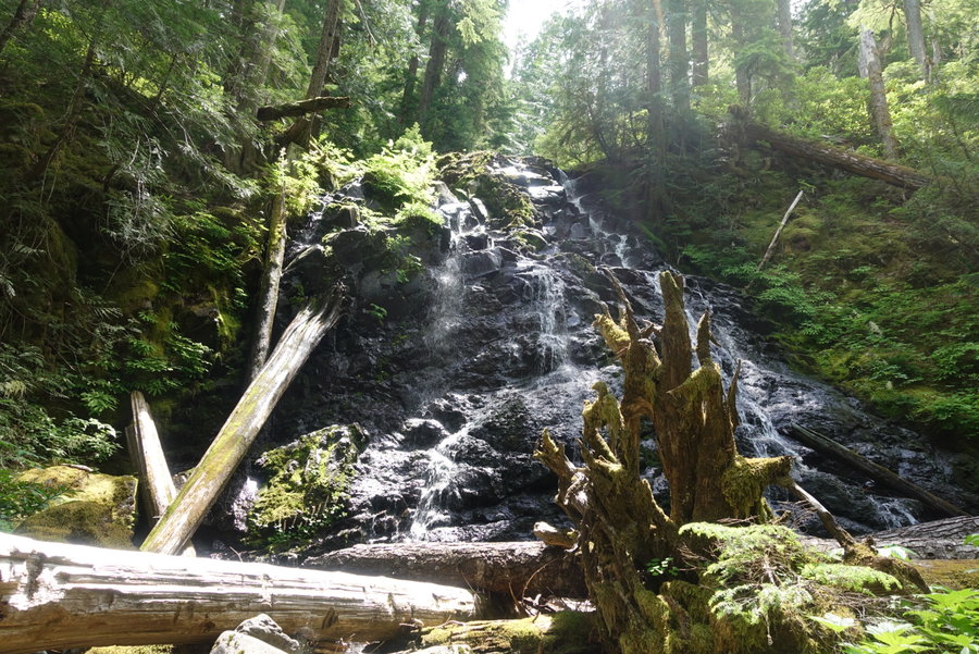
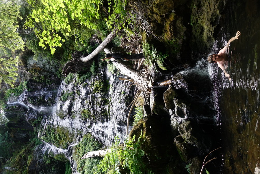
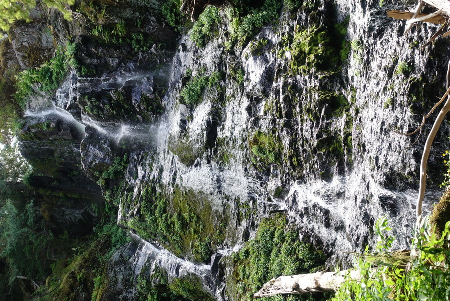
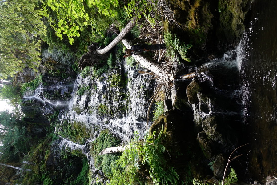
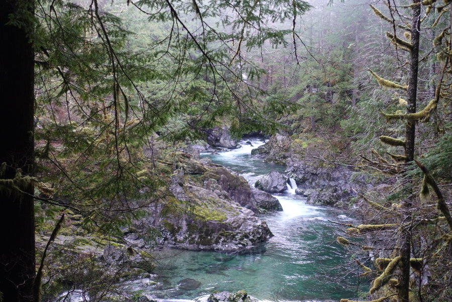
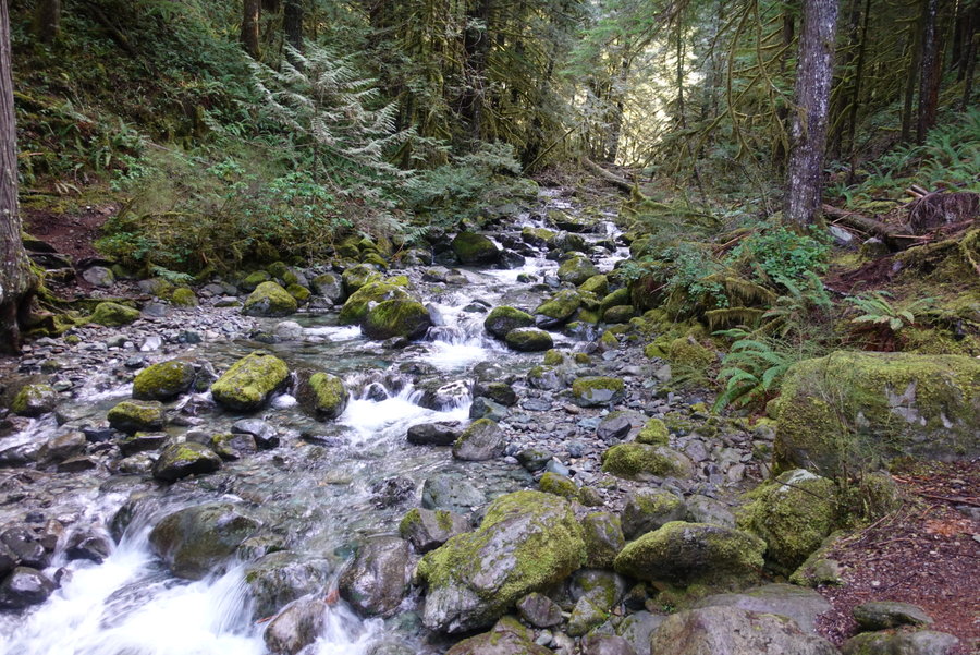
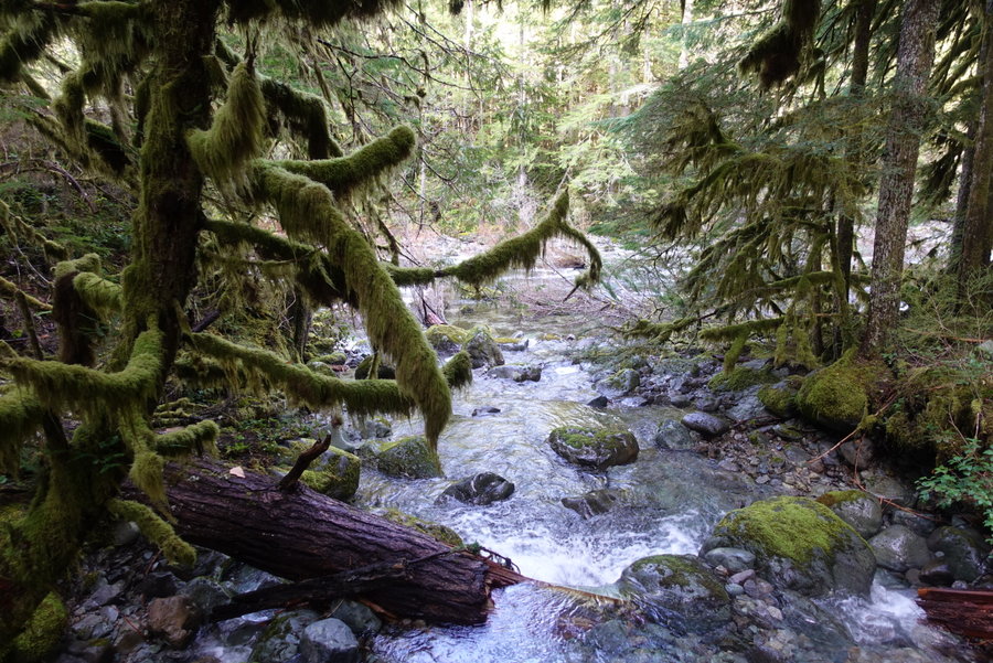
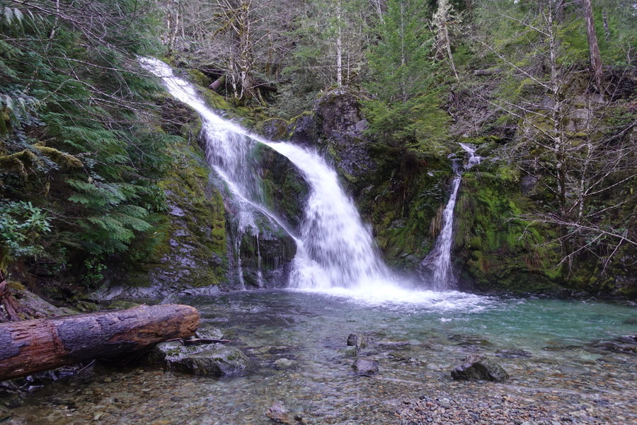
Opal Creek Falls (Bushwhack)
4 miles of hiking • 750' elevation gain •
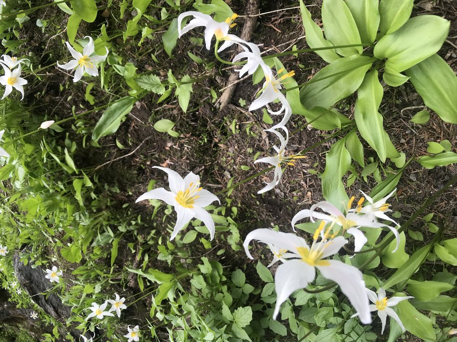
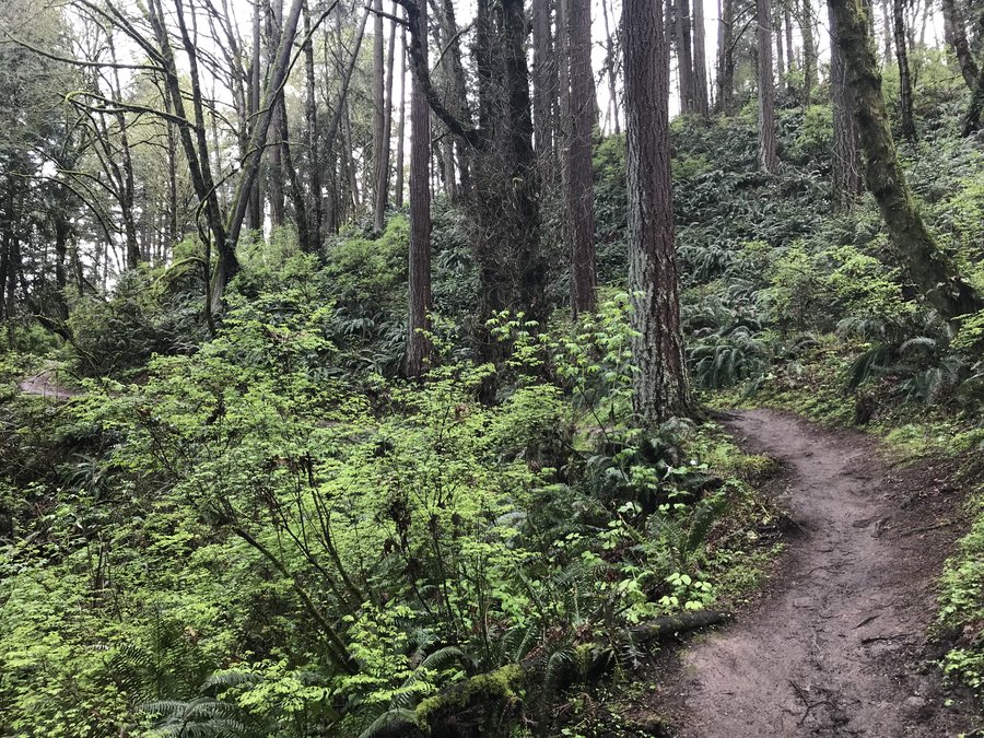
So many F words were uttered as we overtook the rhododendrons and scrambled down steep slopes with the help of veggie belay. Today was an off trail waterfall chase to remember. Multiple tiers were found- and multiple scratches were had. I love a good challenge and today delivered. I have to thank my friend Matt Reeder for leading his birthday hike to such an obscure location.
July 7, 2019


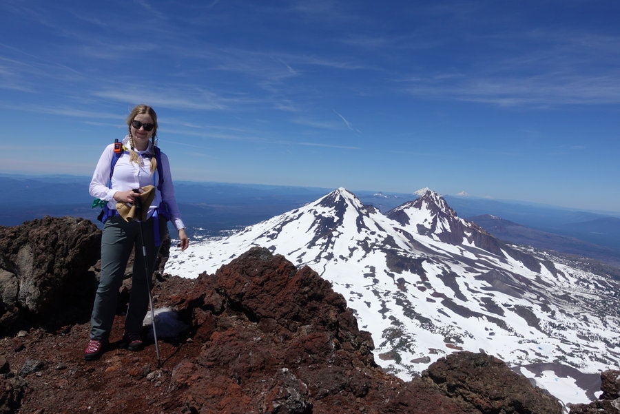
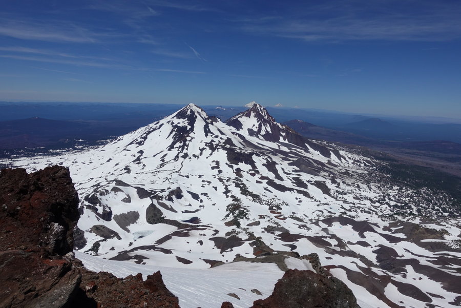
 3
3
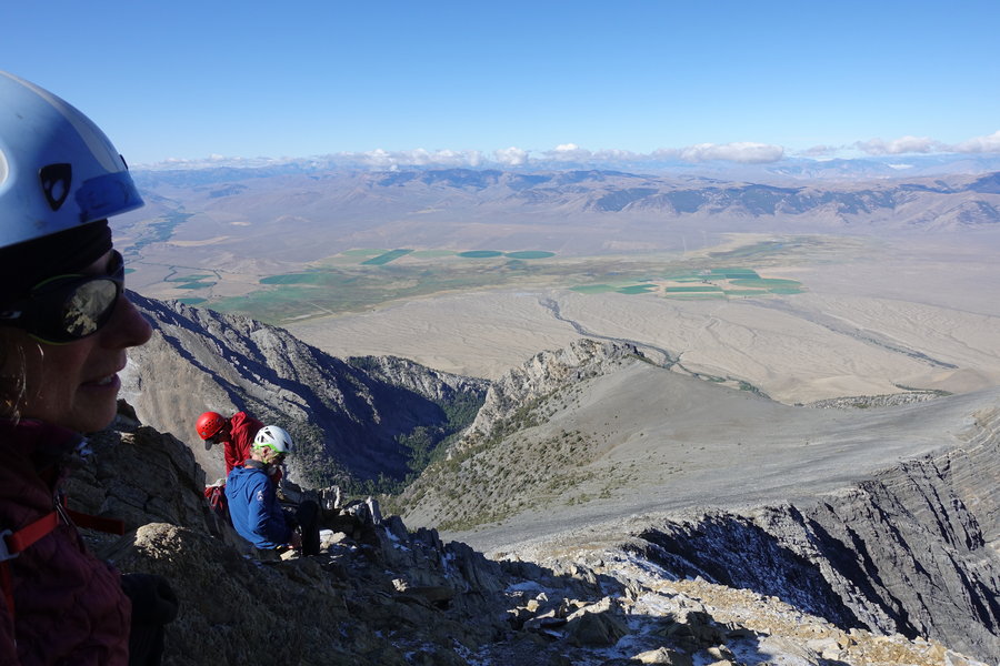
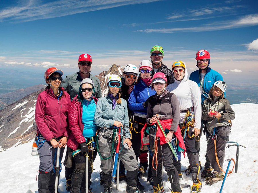
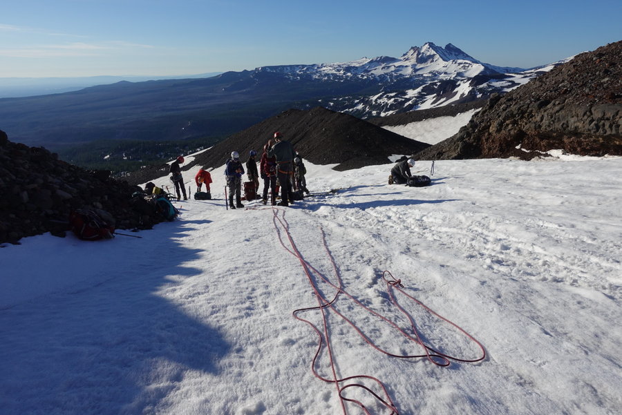
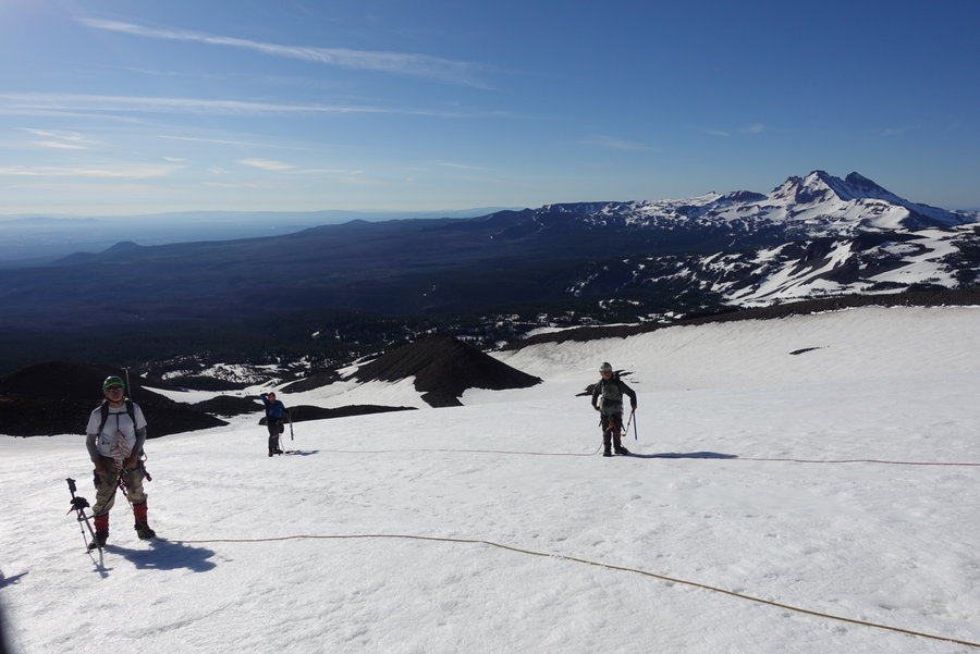
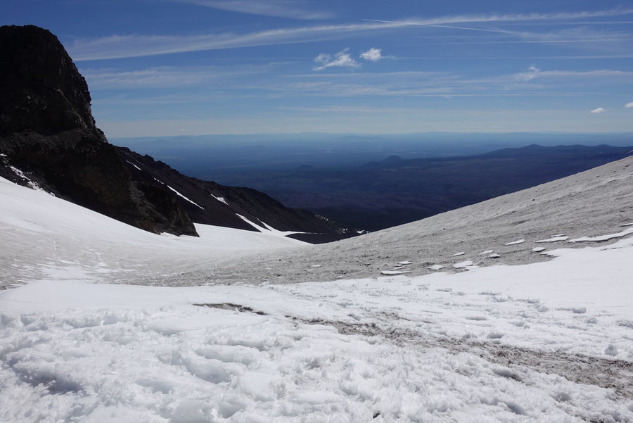
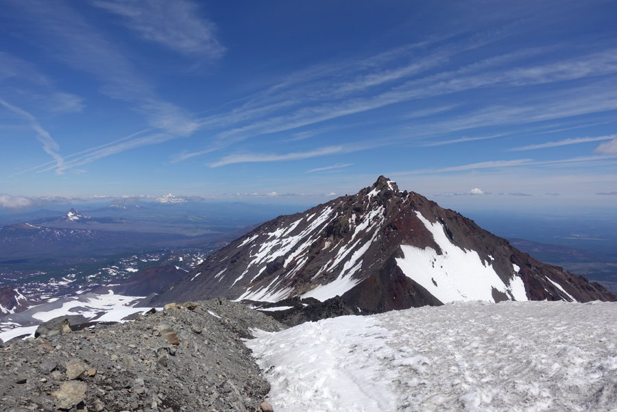
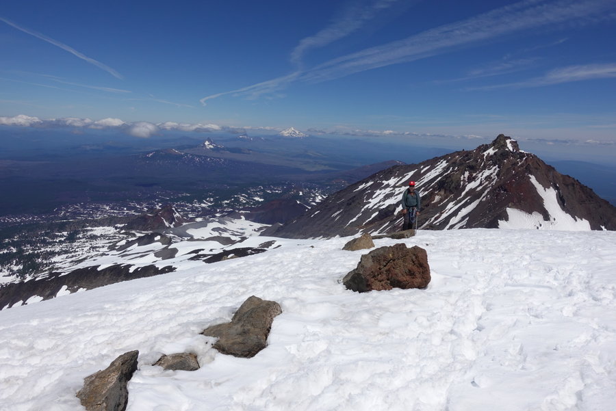
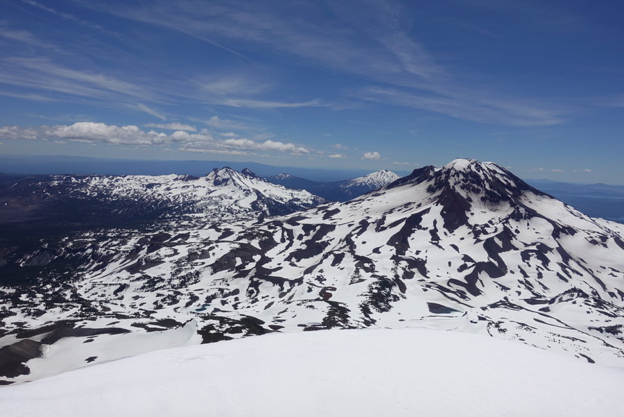
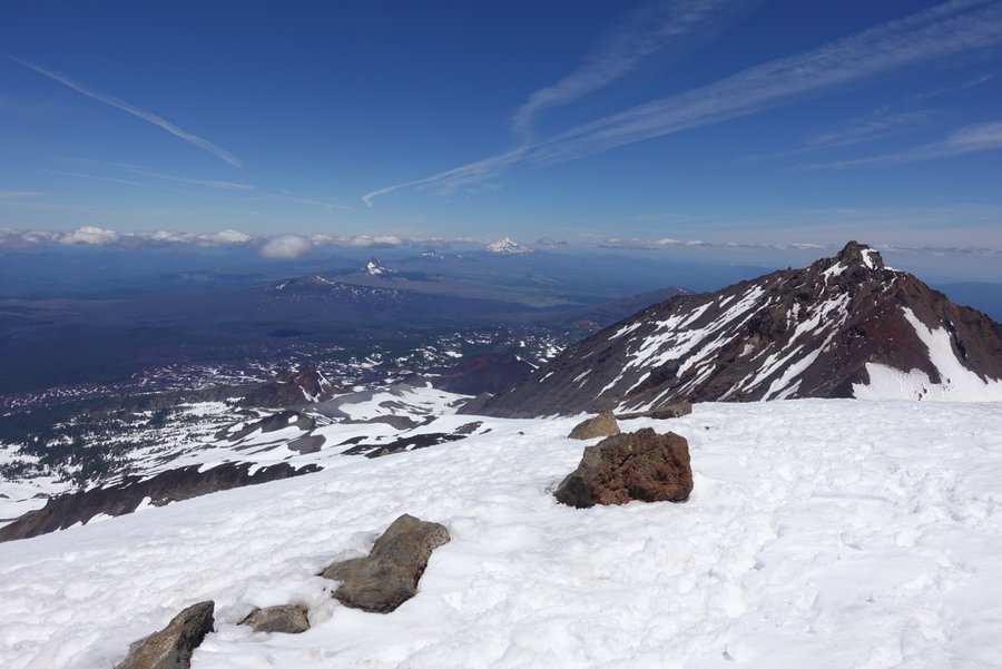
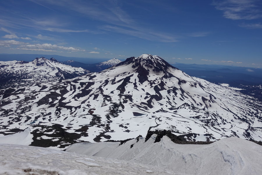
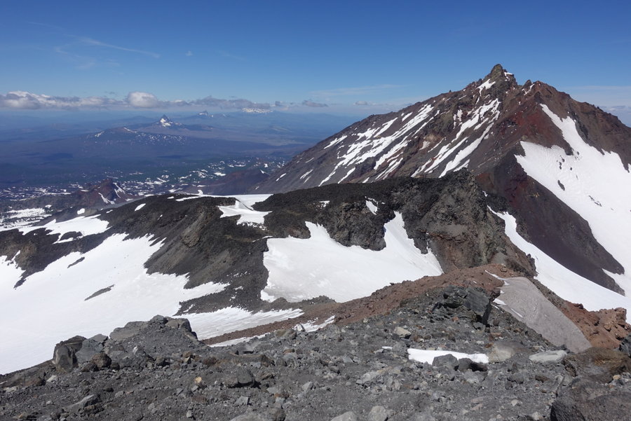
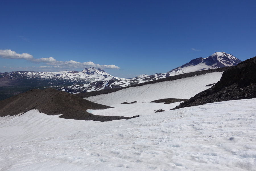
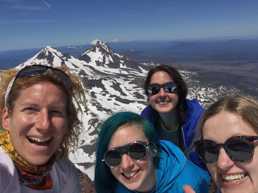
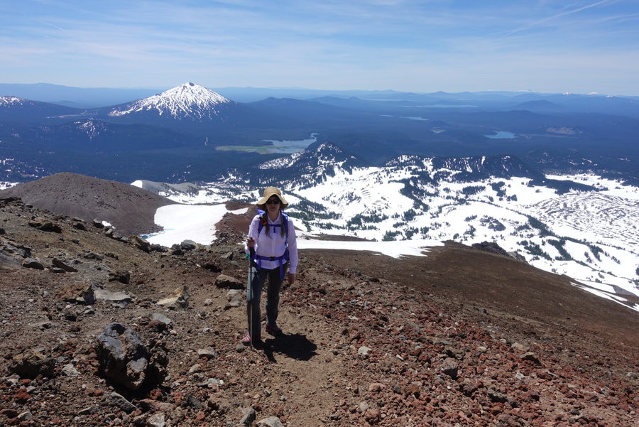
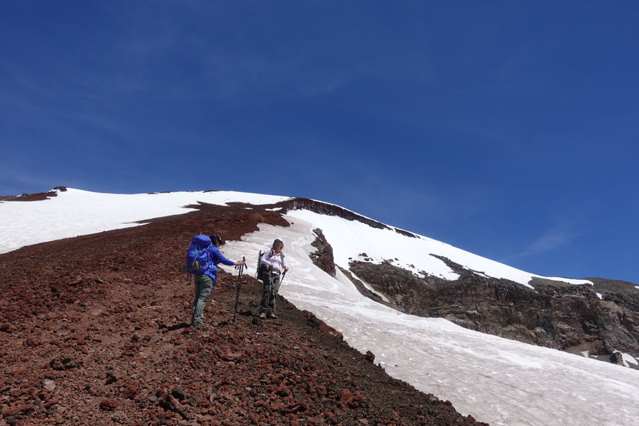
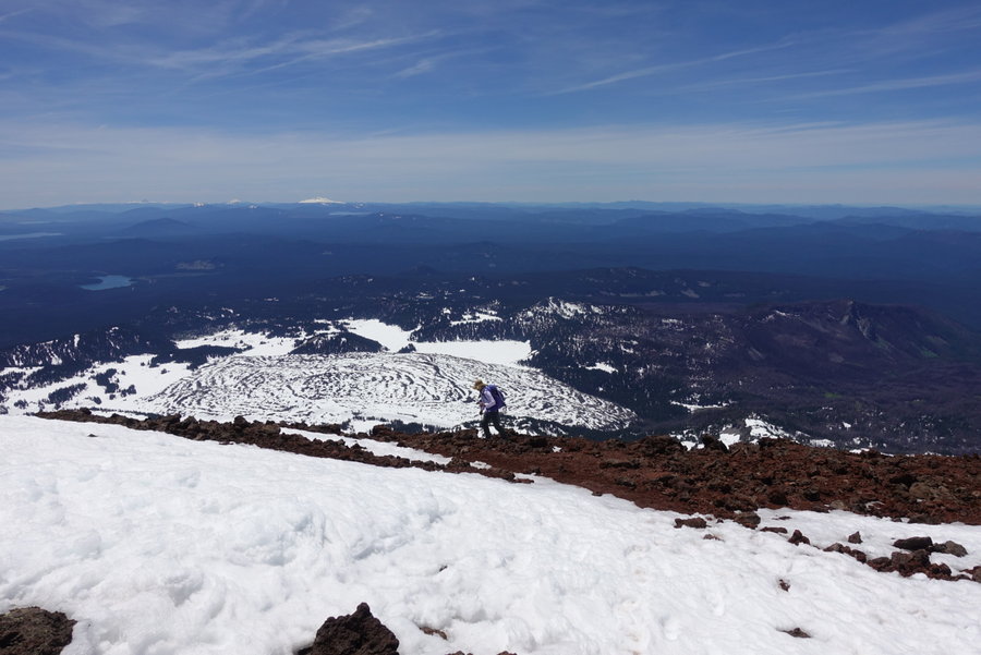
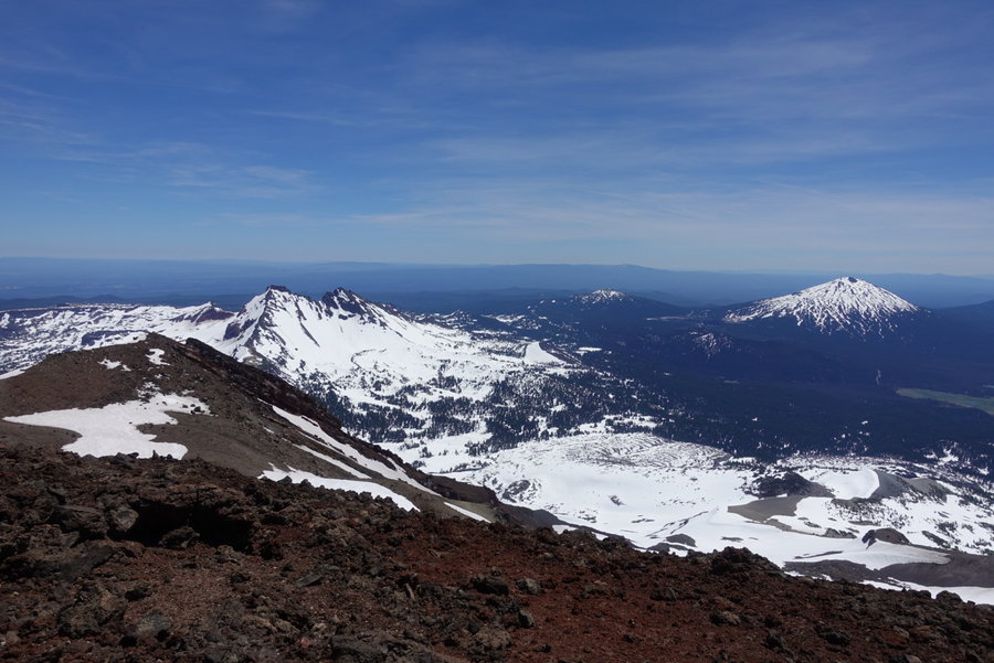
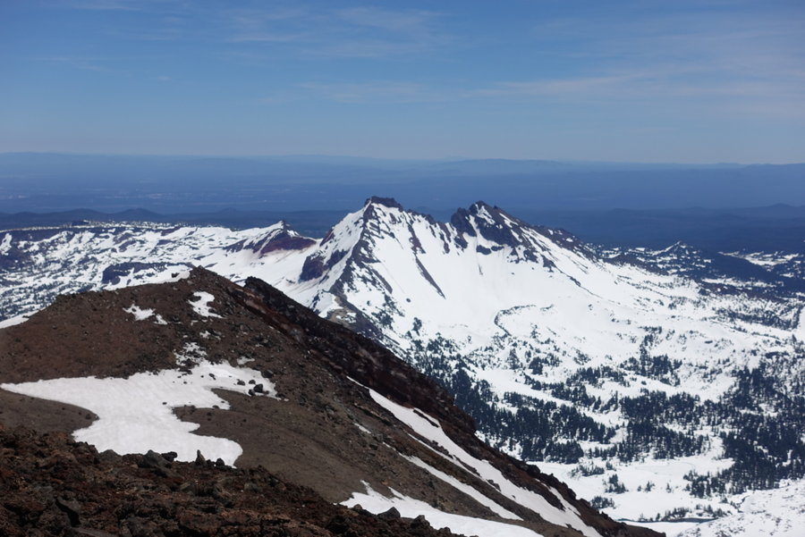
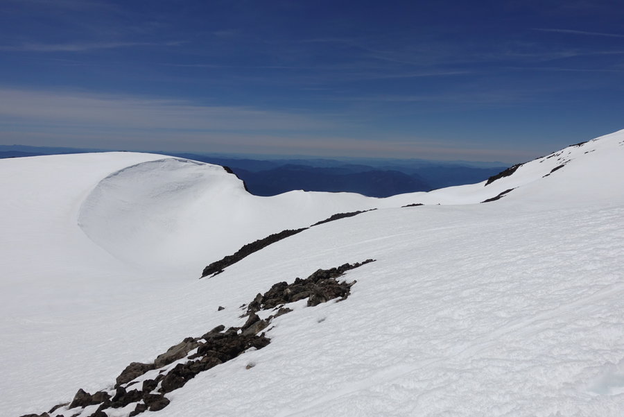
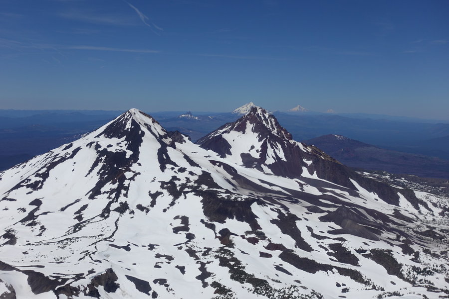
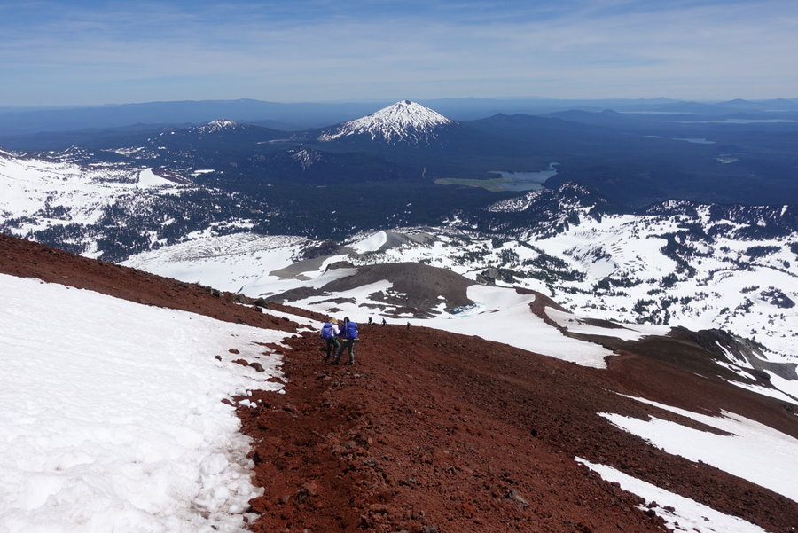
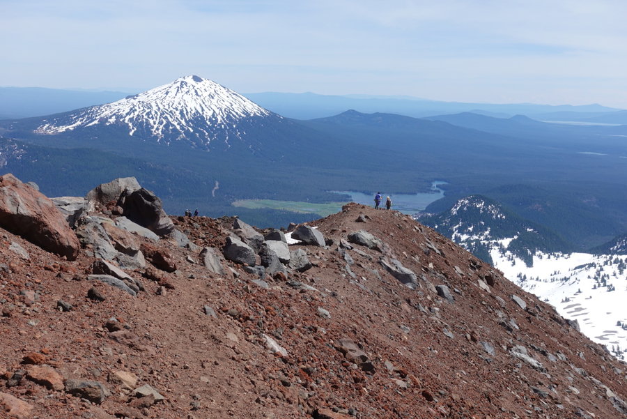
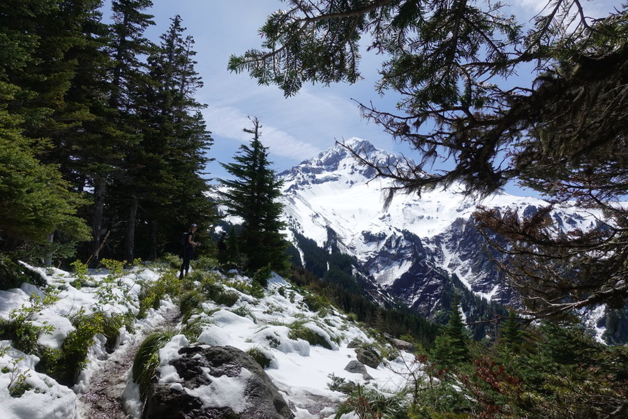
Middle Sister North Ridge via Hayden Glacier
14.7 miles of hiking • 5000' elevation gain • 2 nights
I have to thank my climb team who fed me after I abandoned my pack for the last steep pitch to the summit. When I went to retrieve, I found that ravens had stolen ALL of my food. Zippers were undone, my headlamp was discarded, my bug spray chewed. They actually unclipped my bag to get into the inner contents. Amazing. Luckily my climb leader had an extra mountain house for our final night, and all my teammates asked if I needed a snack at every break upon descent. Such a fun experience, and my first rope team!
June 22 – June 24, 2019


 2
2
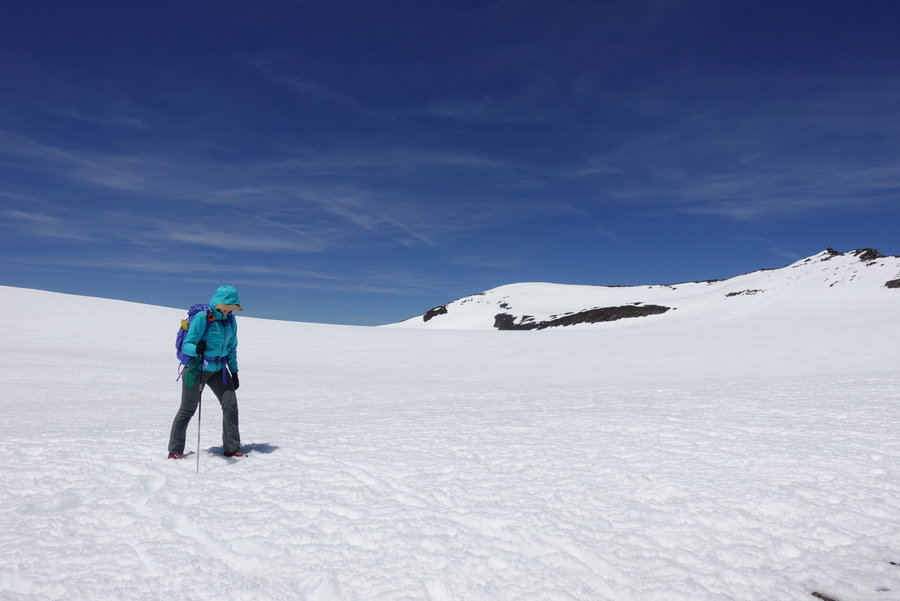
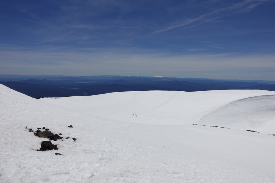
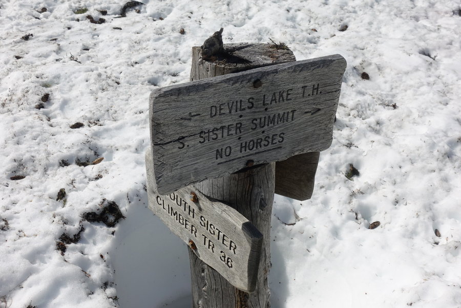
South Sister
12.5 miles of hiking • 5000' elevation gain •
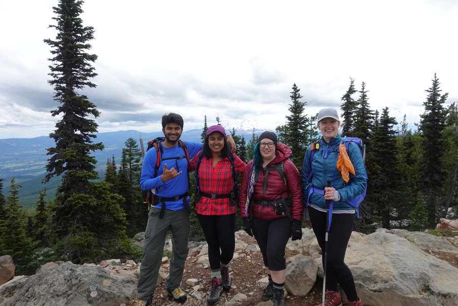
Friday began with a hellish day at work. I wanted to leave early, so decided to skip lunch so I could try to exit and get an early start heading towards the mountain. The freight gods had other plans, and as truck after truck came in, I was stuck. I ordered myself a sub from grubhub, and ate half it while trying to get us caught up. I work for a very busy safety supplier in Portland, and our staff was minimal on Friday. I left at 4:45 pm, biked home, and quickly packed up my gear. I was feeling a lot of self doubt that I would have the energy for the task at hand. I pre-set up my bed in the back of my car, so that I would have zero set-up at the trailhead. My friend from BCEP, Belinda, met me at my apartment at 6:30, and off we went towards Bend. I ate on the way, and she took over driving duties in Madras as I was exhausted from my very physical job.
We arrived at the Devil's Lake Trailhead around 11:00 pm, and I set my alarm for 4:30 am, our plan being to start at 5:30 am.
Belinda and I met up with Katrin and Zsuzssana, on what would be a girl's only day on the mountain. All of us Mazama Mountain Dog grads from 2016 and 2017.
There was snow right from the start, and we had to do a bit of route finding to make our way out of the forest. The trail starts heading up right away, though in the shade. The snow was a little slippery from being smoothed out by skiers, but we didn't feel the need for traction. We came out of the forest, and to the only section of South Sister that is relatively gentle. The snow was still hard enough that we could walk across it with ease.
The rest of South Sister is up, up and more up. The way is pretty straight forward, and we kicked steps in the snow as we watched the skiers head up. We were in the minority as we were on foot, and the mountain was not crowded. We took our time as it was heating up, and enjoyed the freedom of not being on a tight schedule for anyone else. We knew the snow would eventually soften, but we had reached scree/pumice hell by that point.
While patches of snow remained, the rest of our objective would be on my least favorite mountain ground. We sweated, we cursed, and blue ran down my face. Slow and steady, we made it to the rim. First summit of South Sister for all but myself, and we enjoyed what truly is one of the best 360° views in the Cascades.
The way down was slushy, with very little glissading opportunities. We mostly trudged along, plunge stepping our way down. I got out my ice axe and helmet just in case I slipped, but otherwise it was a relatively easy but extremely exhausting descent.
After what seemed like forever, we ended up back in the forest. It ended up being the most slippery part of our day due to skiers smoothing out the snow on the trail. I actually slid on my butt with my ice axe for many sections, trying to outrun the mosquitoes.
Another summit, and a truly fun day with a bunch of badass ladies.
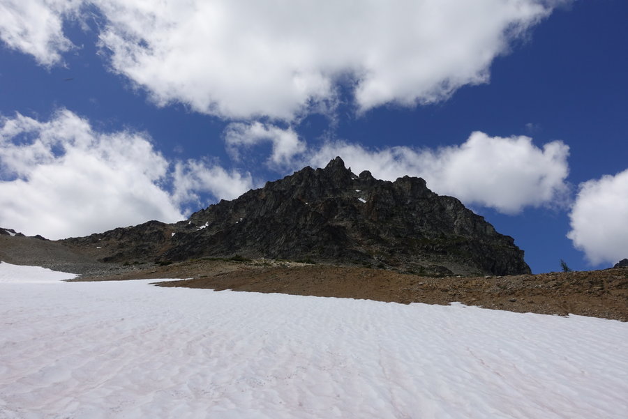
June 15, 2019


 2
2
McNeil Point
7.5 miles of hiking • 2000' elevation gain •
Beautiful day on the mountain attempting to reach McNeil Point. Turned around when we felt like we should have brought helmet/traction/ice axe. Views were incredible even if we didn’t make it to our intended destination.
June 9, 2019


 1
1
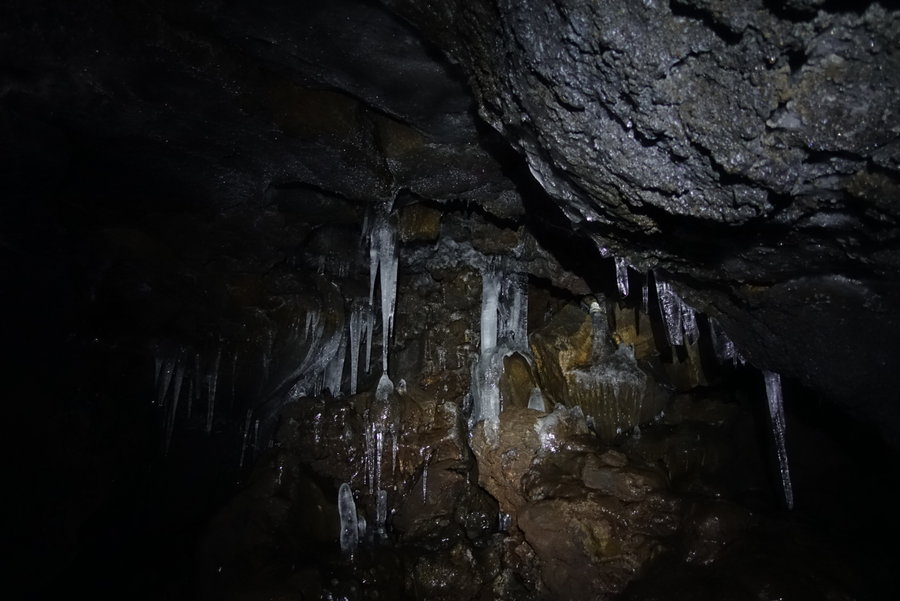
Grayback Mountain plus Ice Caves
11.2 miles of hiking • 1750' elevation gain •
Posted a plea for a hiking partner last weekend, and my friend Keith Dechant offered to join. Armed with Matt Reeder’s Off the Beaten Trail, we decided to tackle Grayback Mountain. After a very hot hike on Grayback we decided to drive and explore more of the region around The Klickitat. A random unmarked viewpoint and scenic drive through a canyon on the Klickitat- ending with a stop at the Ice Caves. Great day!
June 2, 2019


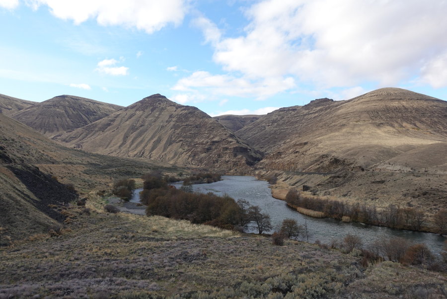
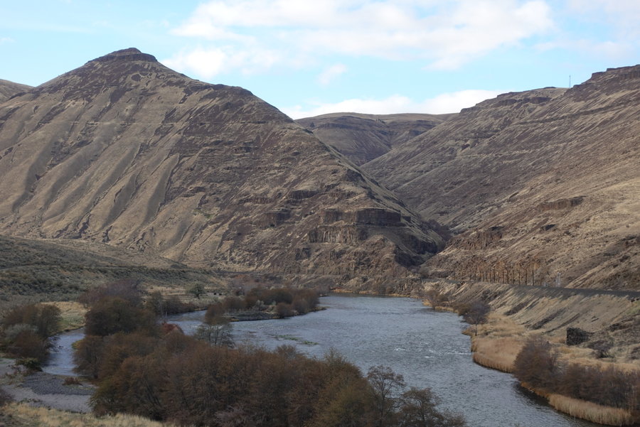
Criterion Ranch
14 miles of hiking • 1750' elevation gain •
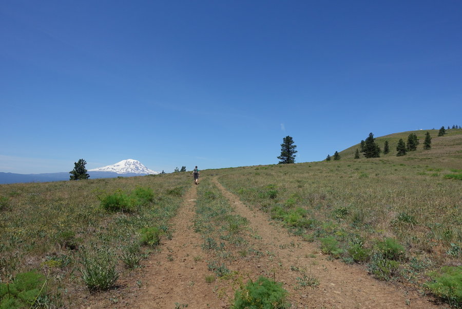
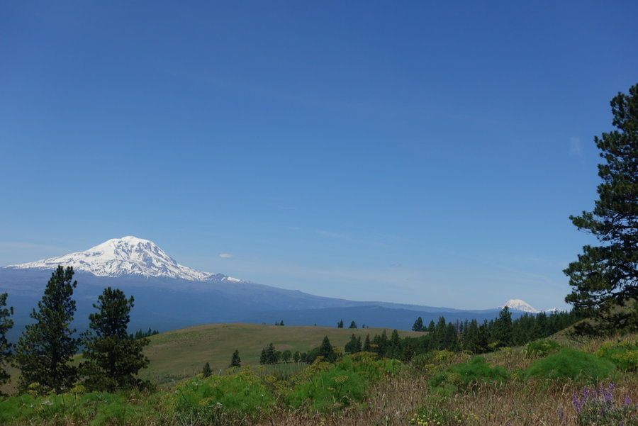
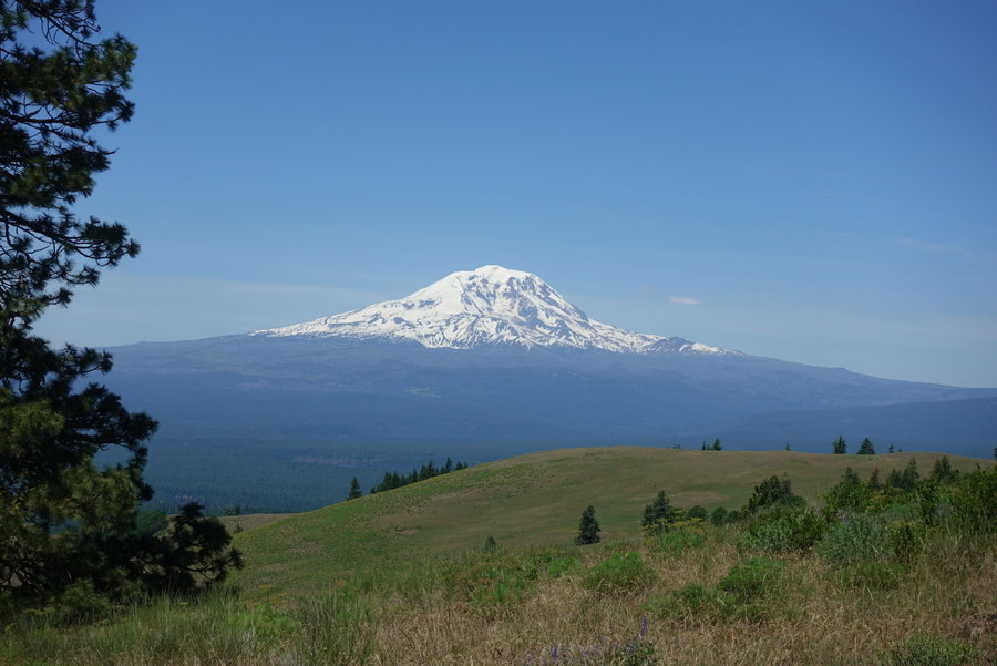
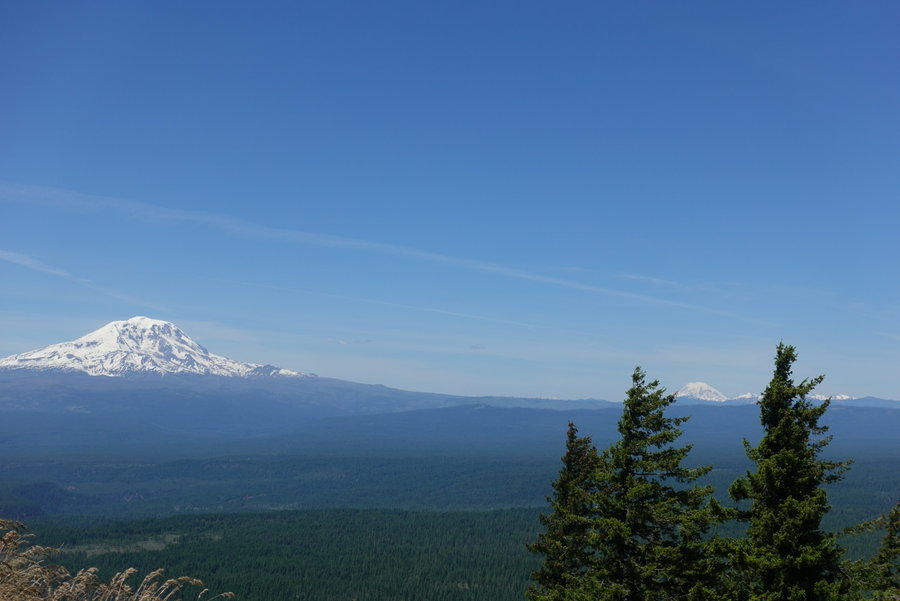
Pretty awesome day with my friend Jason at Criterion Ranch, cows = 0, bears = 1. First time spotting a bear in Oregon. (I've seen plenty in Washington.)
Went about halfway down to the Deschutes, then a long trip back up. Last four miles were killer as the radio tower at the trail head loomed far in the distance. This trail is deceiving - the hard uneven ground makes for a much harder hike than it should be.
May 26, 2019


 2
2
Mount Defiance
12 miles of hiking • 5000' elevation gain •
My friend asked if I wanted to take a “leisurely stroll” up Mt Defiance Saturday morning. And I thought, what better way to torture myself after a couple of weeks of missing out on hiking. Ran into a few Mazamas who were keeping the same pace as us on the way up. Turns out they were Mountain Dogs from a different year of BCEP. Took a summit photo and sent it to the big dog Steve Warner. Ran into a couple other Mazamas at the summit. Turns out nobody really hikes Defiance unless they are training. I thought the trail was sketchy coming down before the burn and it is worse now. We luckily beat the rain and avoided a slick trail till the last mile out. By then the rain felt fantastic.
May 18, 2019


 1
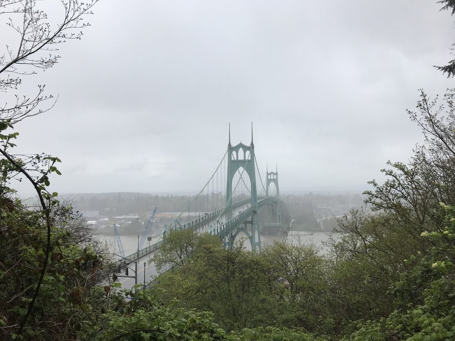
1
Ridge Trail - Forest Park
4 miles of hiking • 1000' elevation gain •
Just a quick solo hike with my dog Sunday afternoon in the rain.
April 14, 2019


 1
1
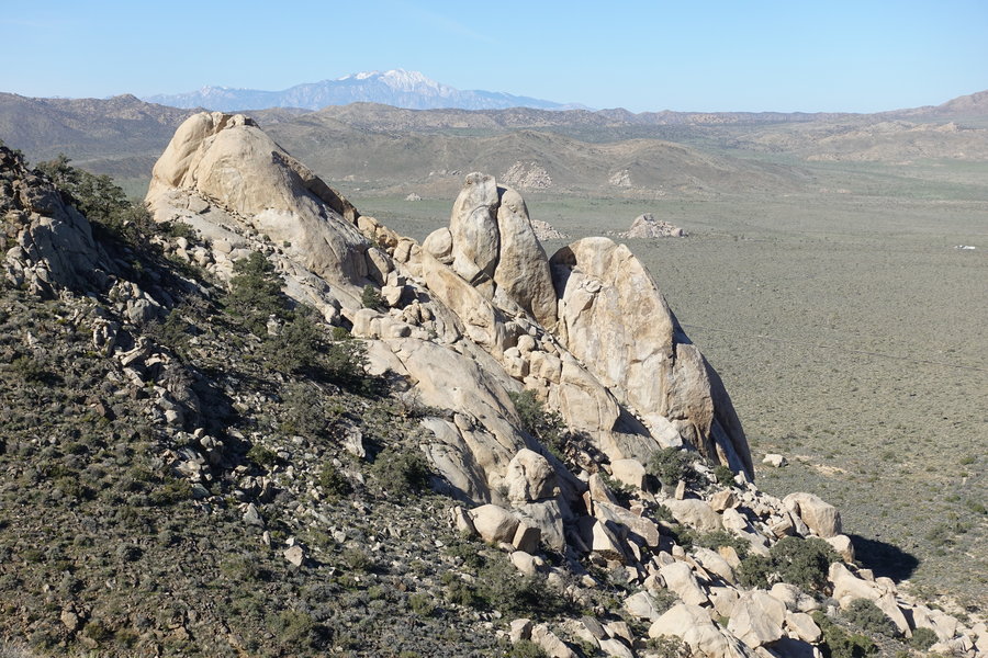
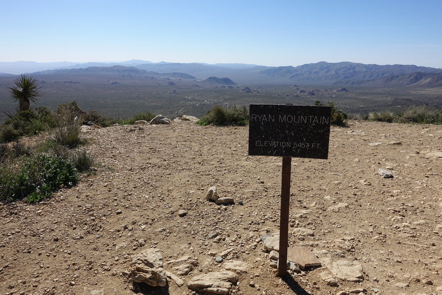
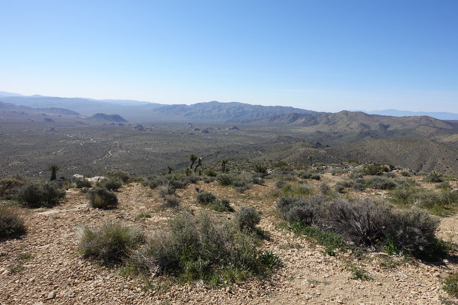
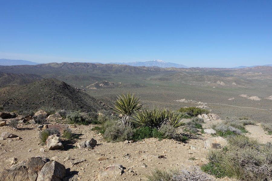
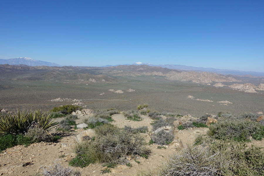
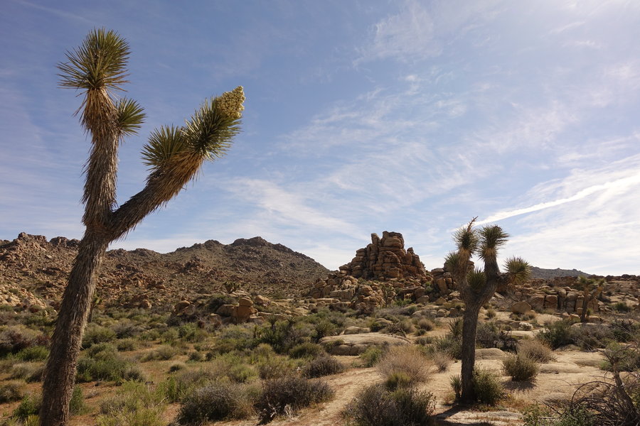
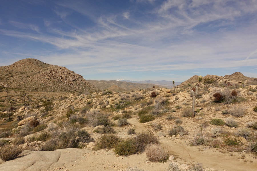
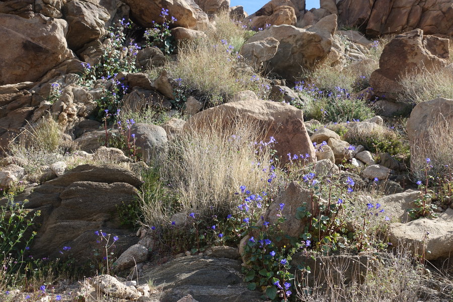
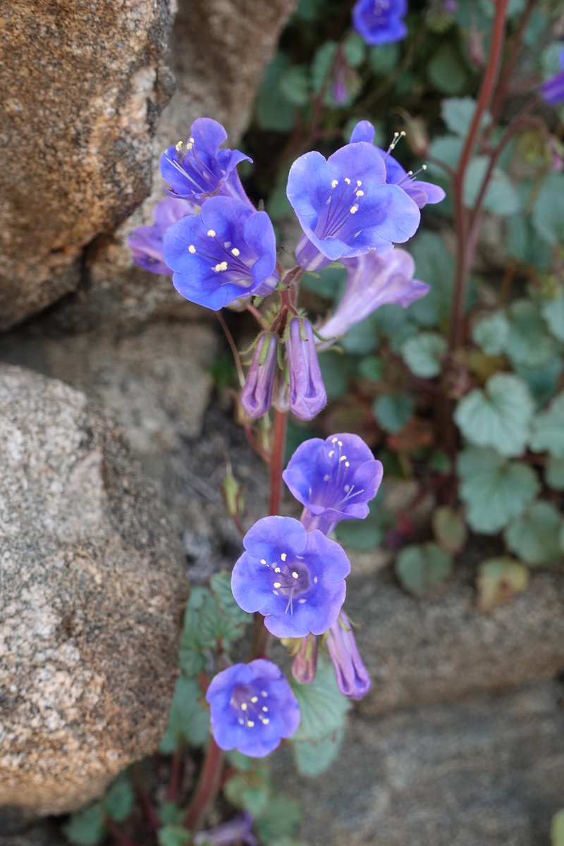
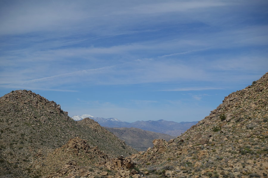
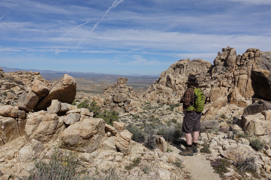
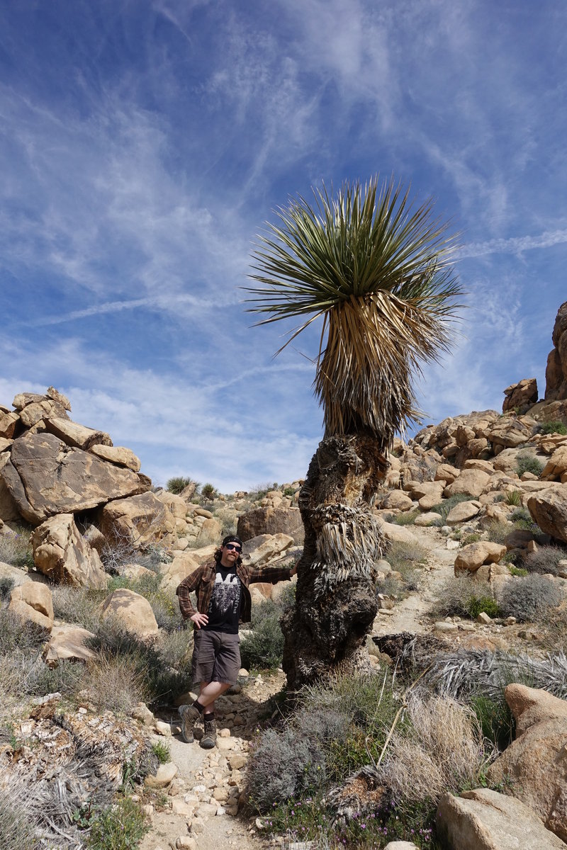
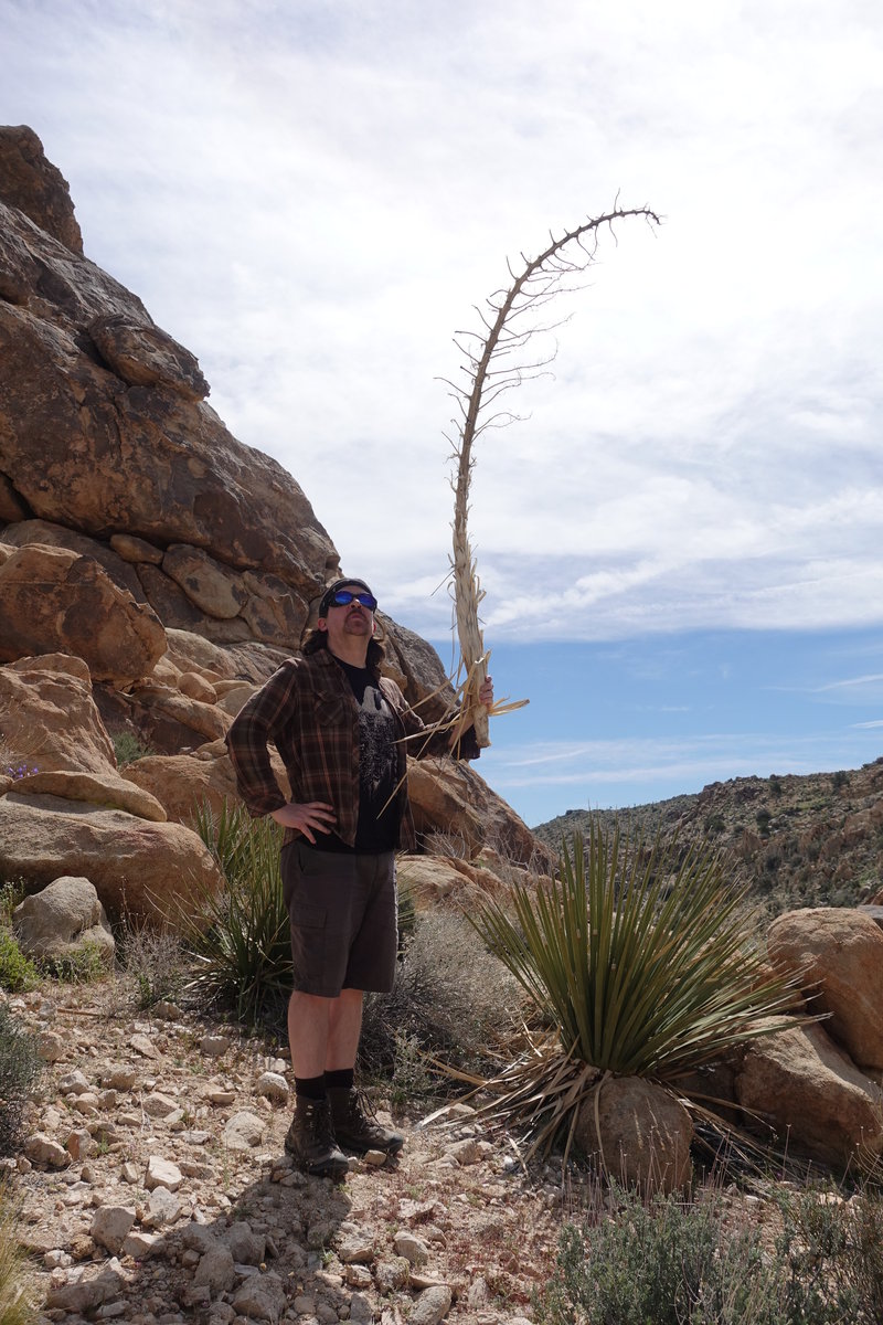
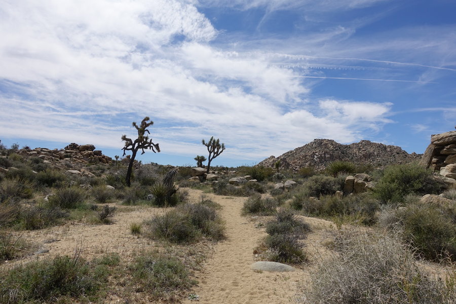
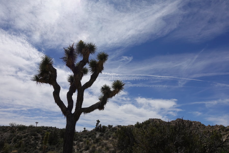
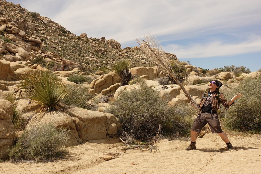
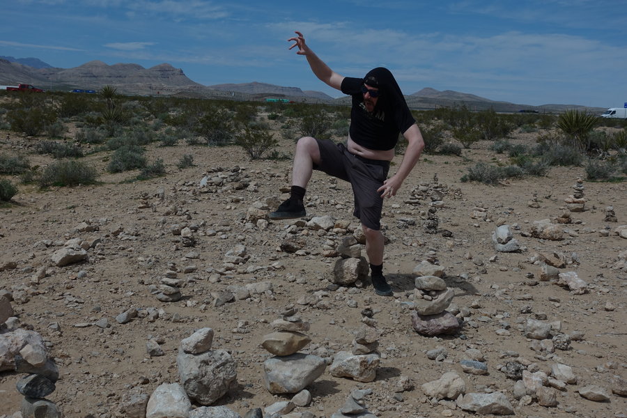
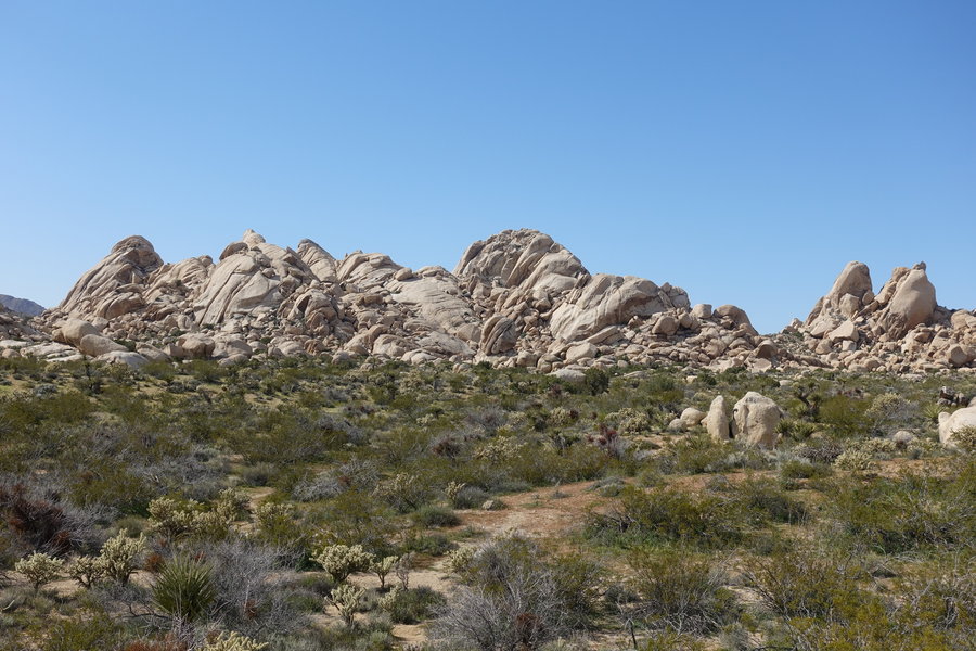
Ryan Mountain - Joshua Tree National Park
3 miles of hiking • 1000' elevation gain •
Hungover morning tromp up Ryan Mountain in Joshua Tree after spending the evening at Landers Brew, a bar/venue hiding out in the desert. Of course, the band playing the evening we were there was from Portland.
March 29, 2019

 1
1
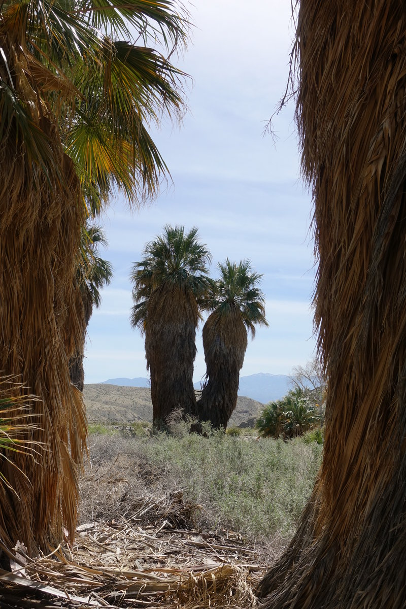
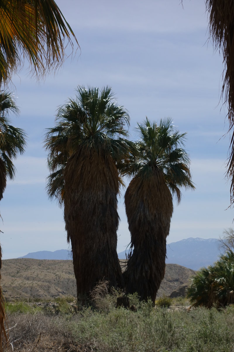
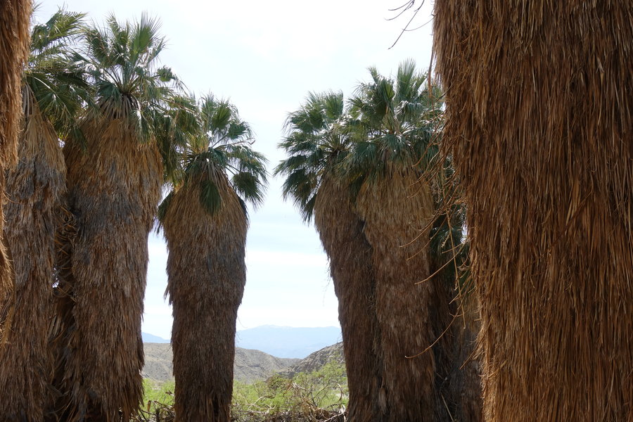
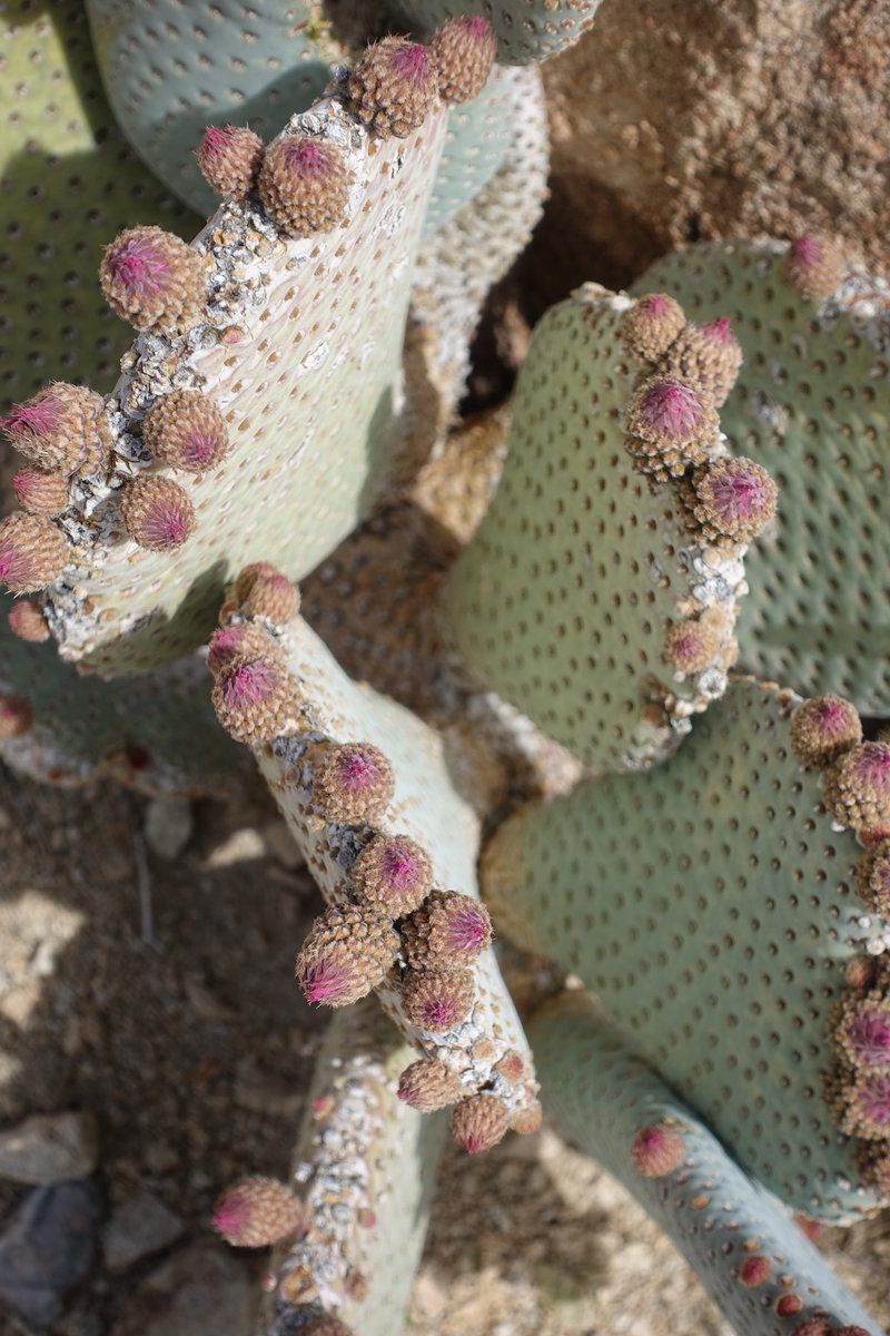
Coachella Valley Preserve
2 miles of hiking • 0' elevation gain •
Decided we wanted to see the San Andreas Fault line, ended up picking a random desert oasis hotspring to check it out.
March 29, 2019


 1
1
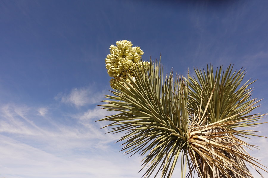
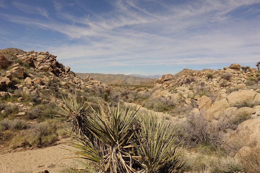
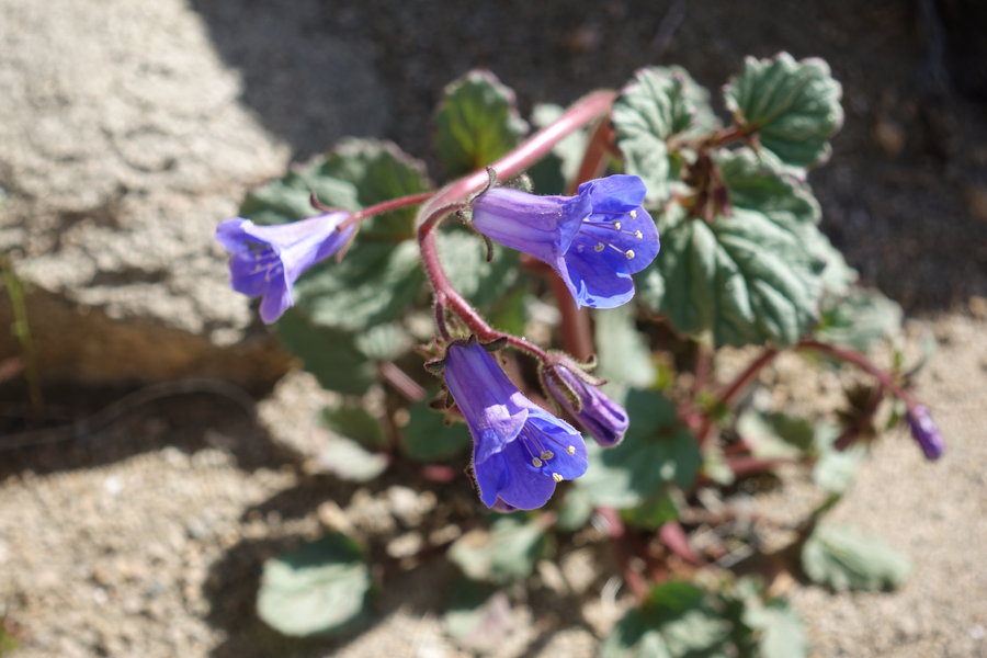
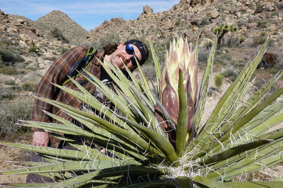
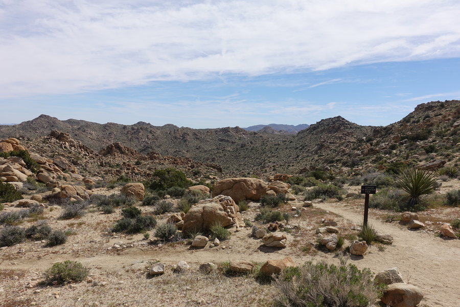
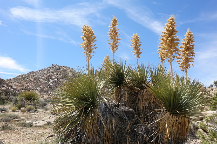
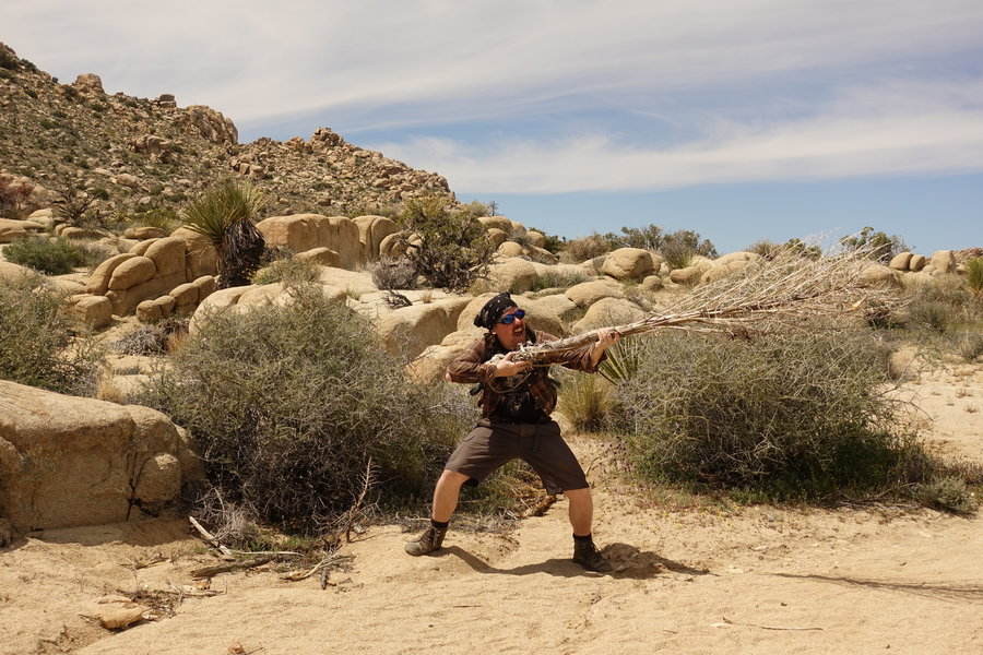
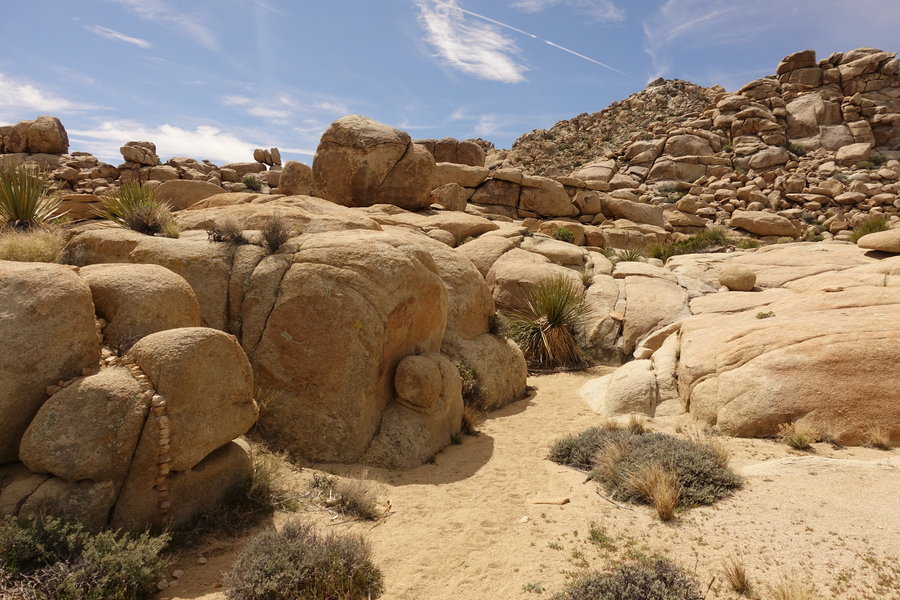
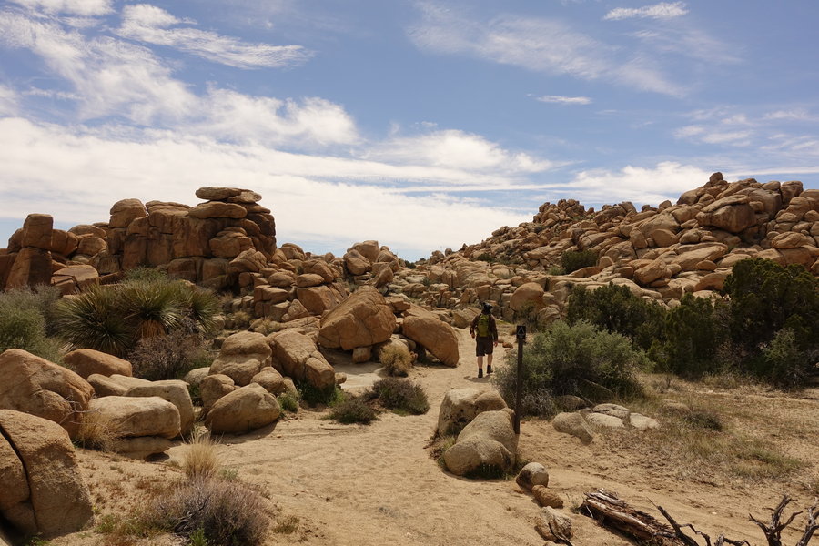
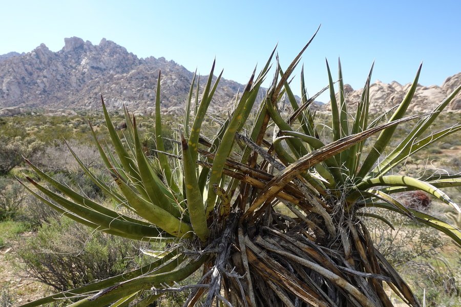
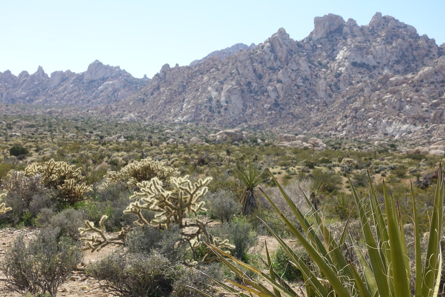
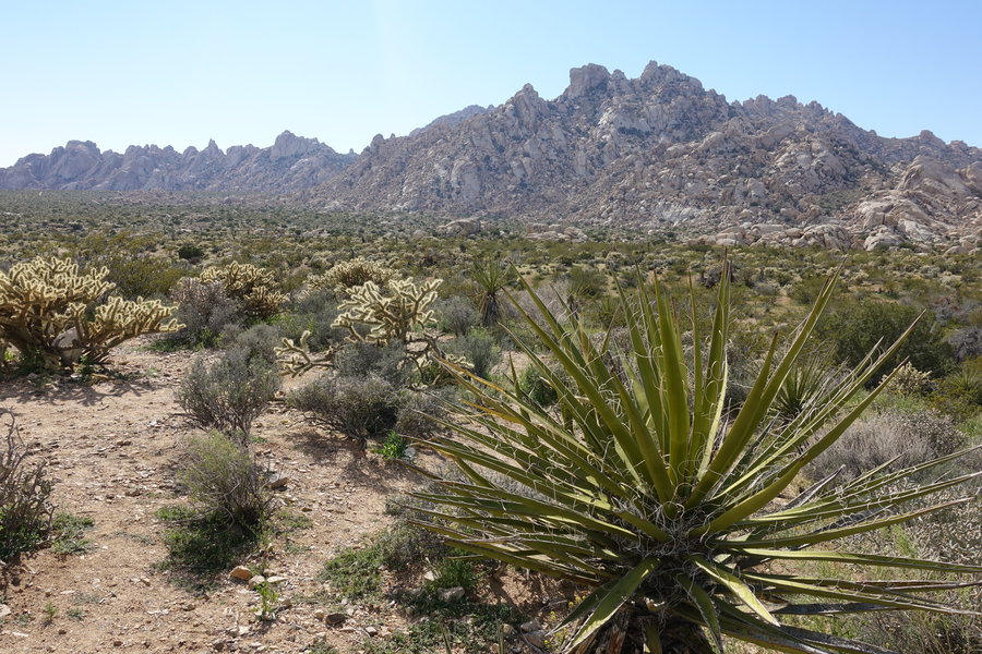
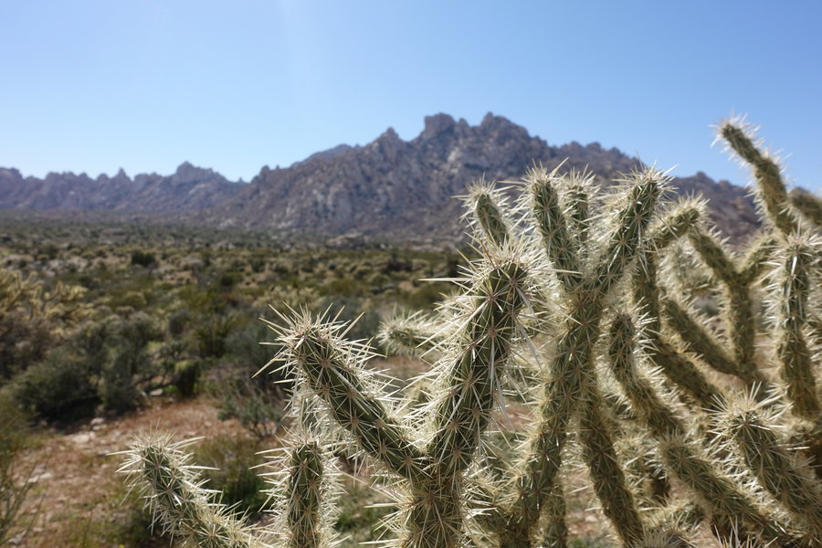
Maze Loop - Joshua Tree National Park
6.7 miles of hiking • 750' elevation gain •
Entered a busy Joshua Tree entrance, our trailhead not far away. Parked next to 3 other cars, didn't see another soul the entire hike. Felt very lucky considering how many spring break folks were in the park.
March 28, 2019


 1
1
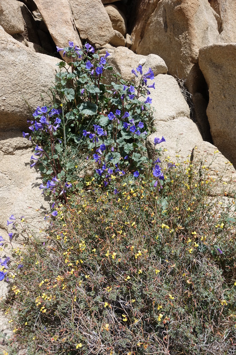
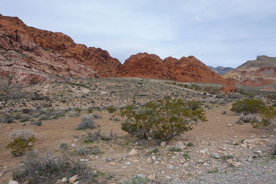
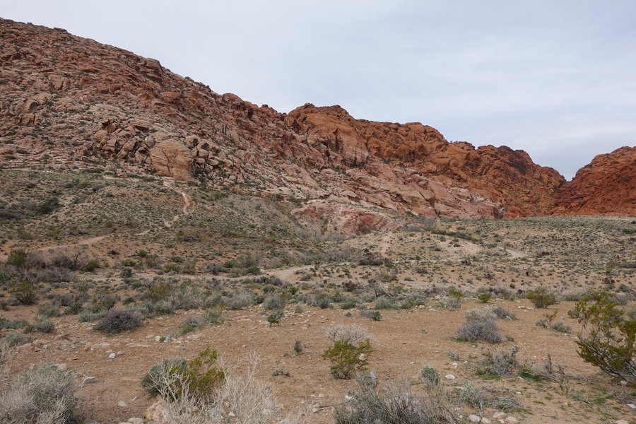
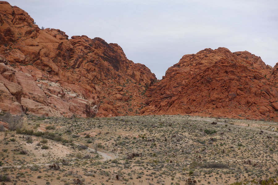
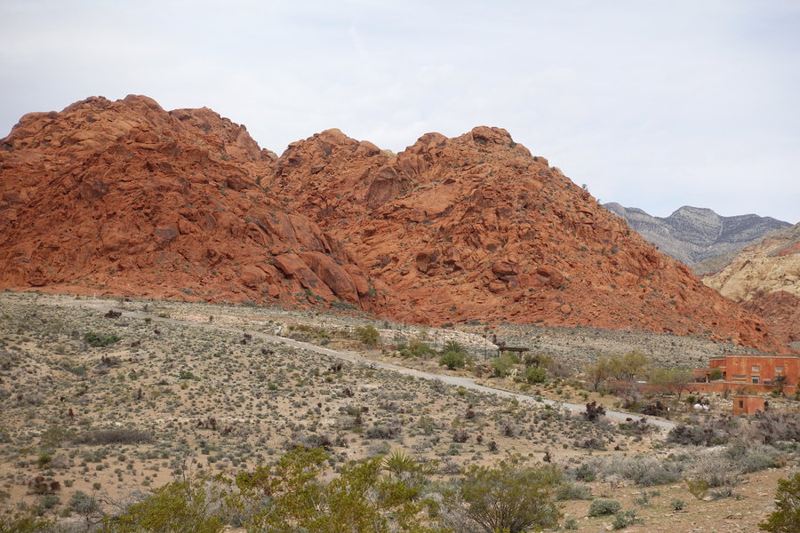
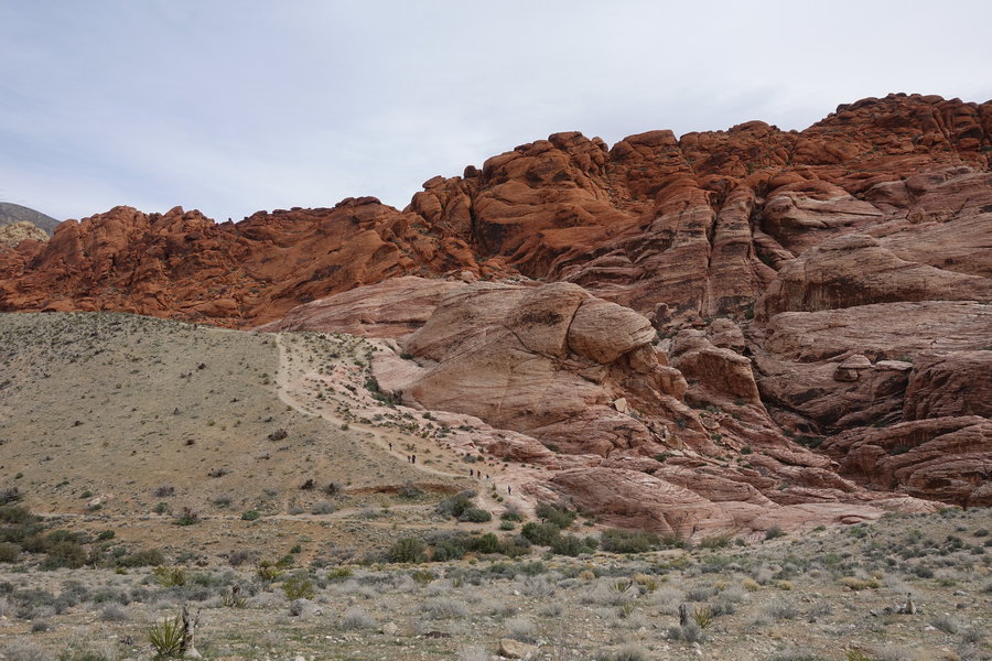
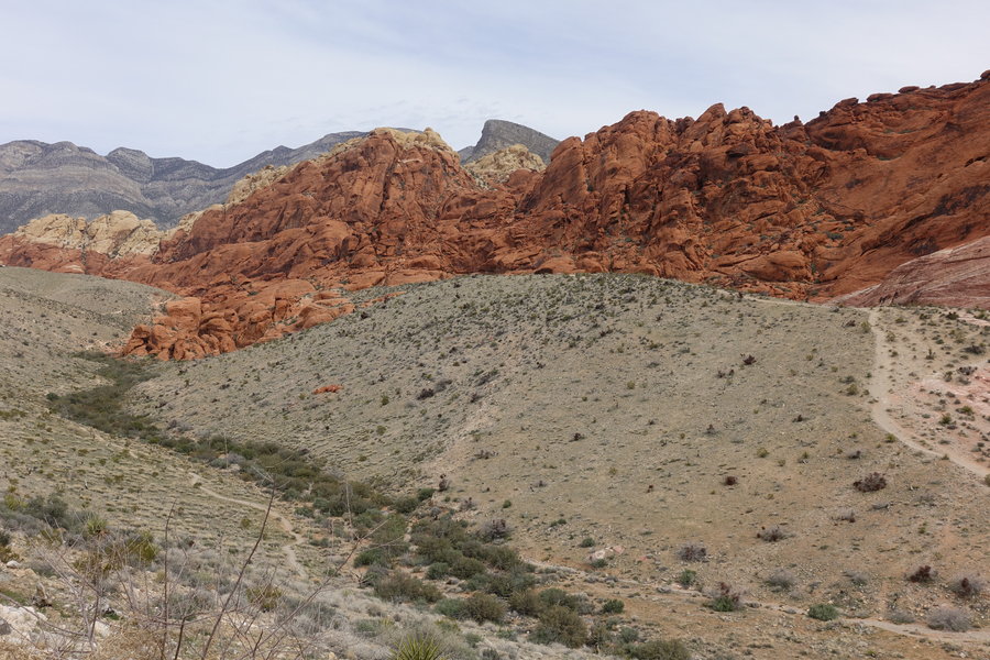
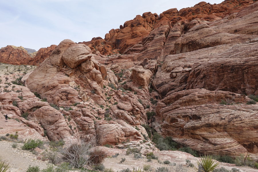
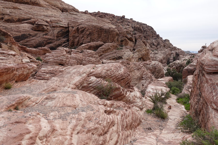
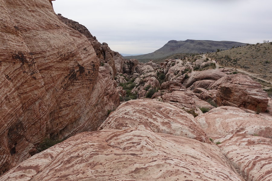
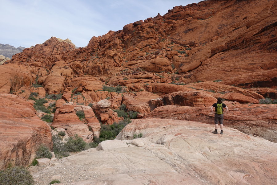
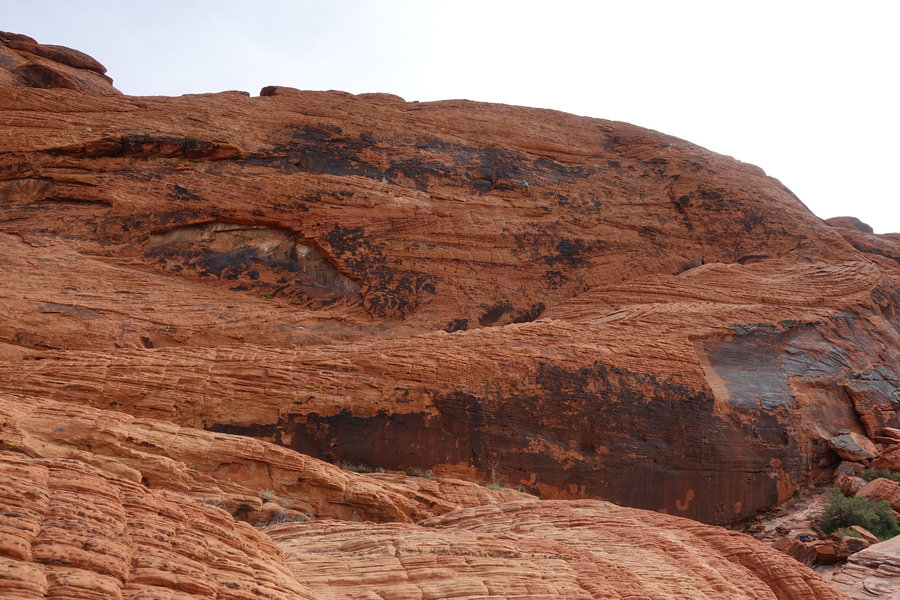
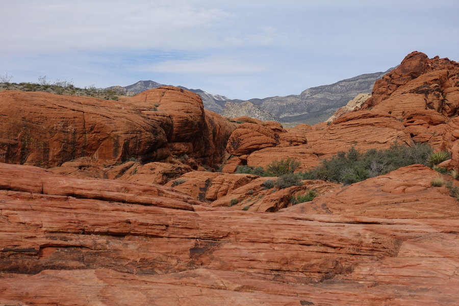
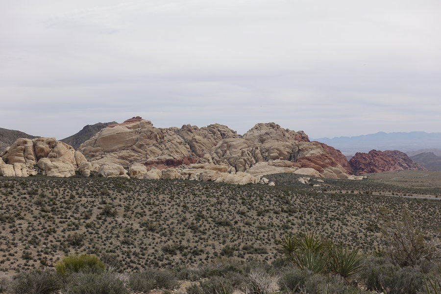
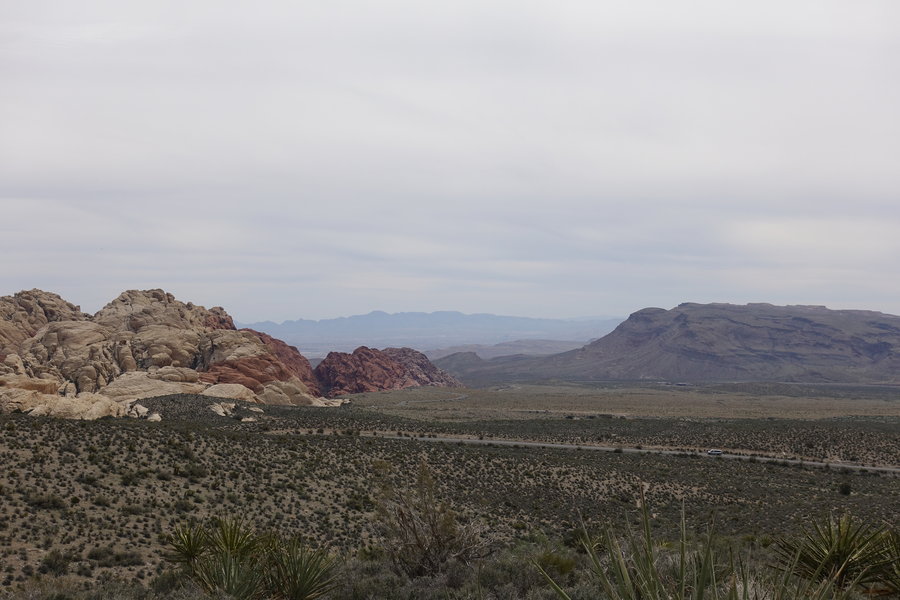
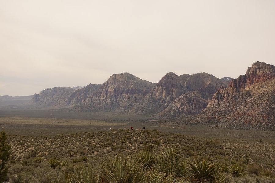
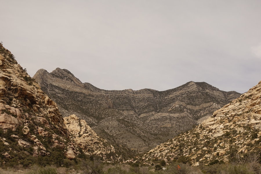
Calico Hills, Red Rock Canyon National Conservation Area
2.5 miles of hiking • 250' elevation gain •
Gorgeous drive around Red Rocks. we stopped in at the Calico Hills to play around a bit and watch the climbers before heading out into the Mojave desert towards Joshua Tree. Super fun landscape, would love to come back with more time to explore.
March 27, 2019

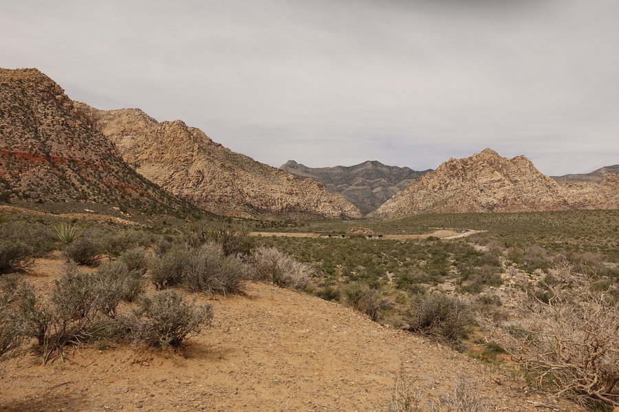
 1
1
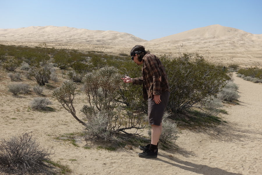
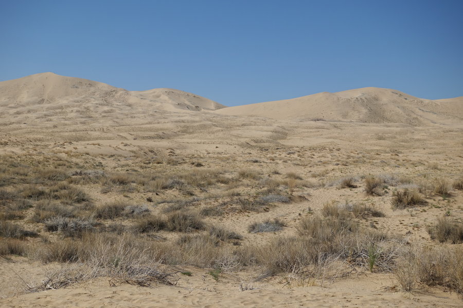
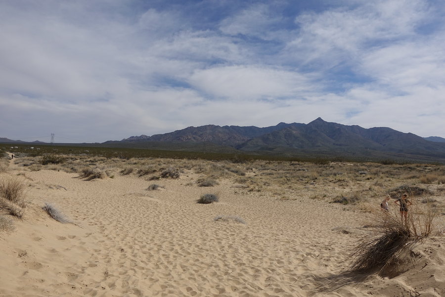
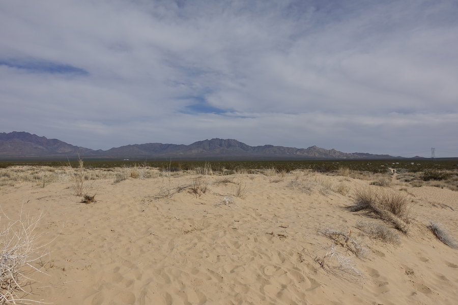
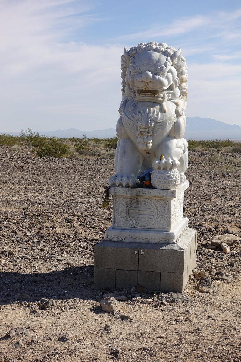
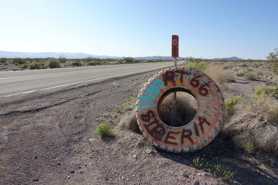
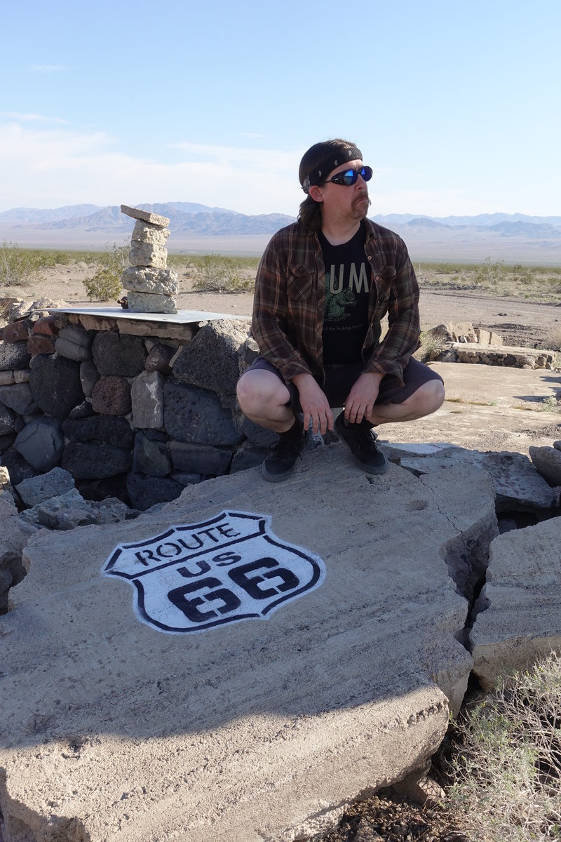
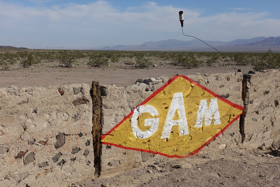
Mojave Desert Preserve, random stops on our way to Joshua Tree (Kelso Dunes, Route 66 ghost towns, Cinder Cones etc...)
2 miles of hiking • 0' elevation gain •
March 27, 2019


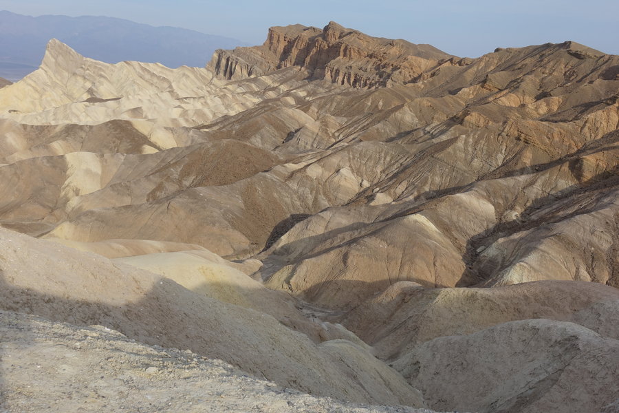
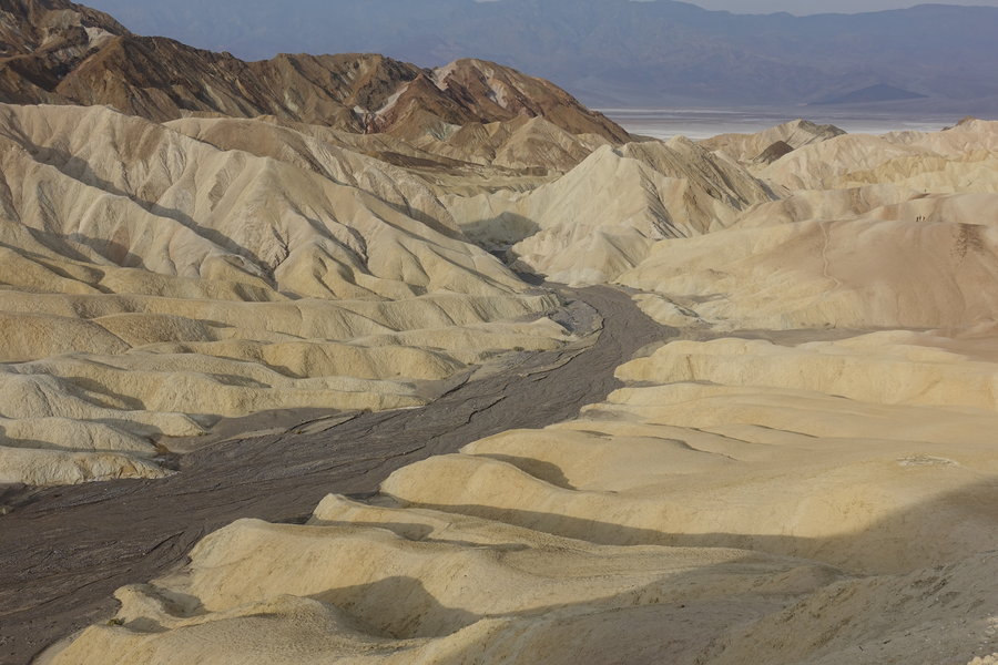
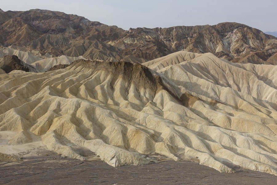
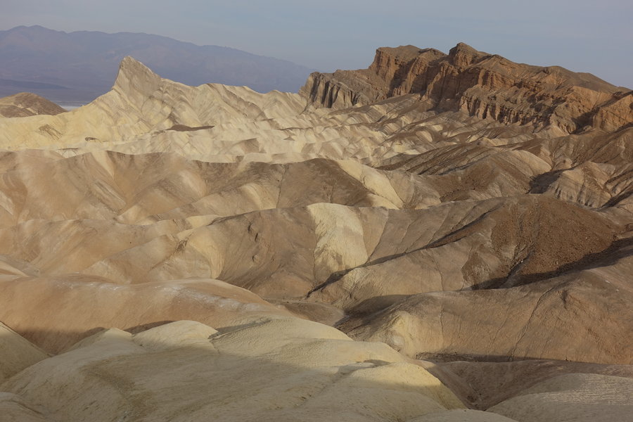
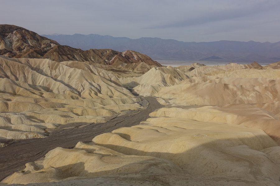
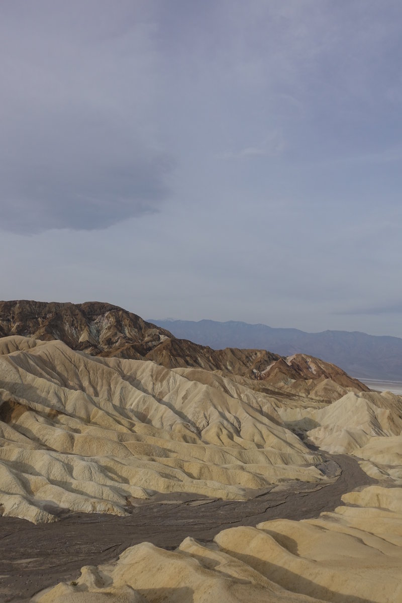
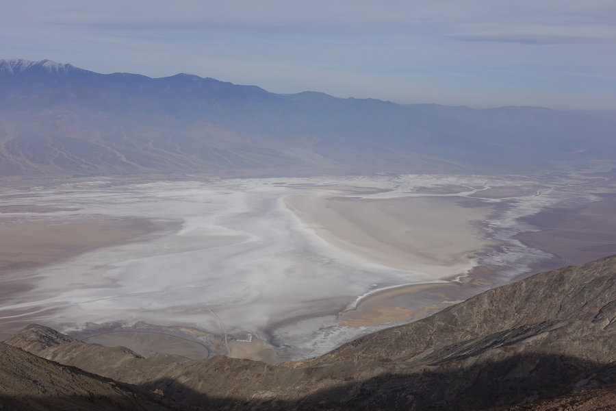
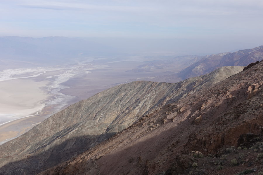
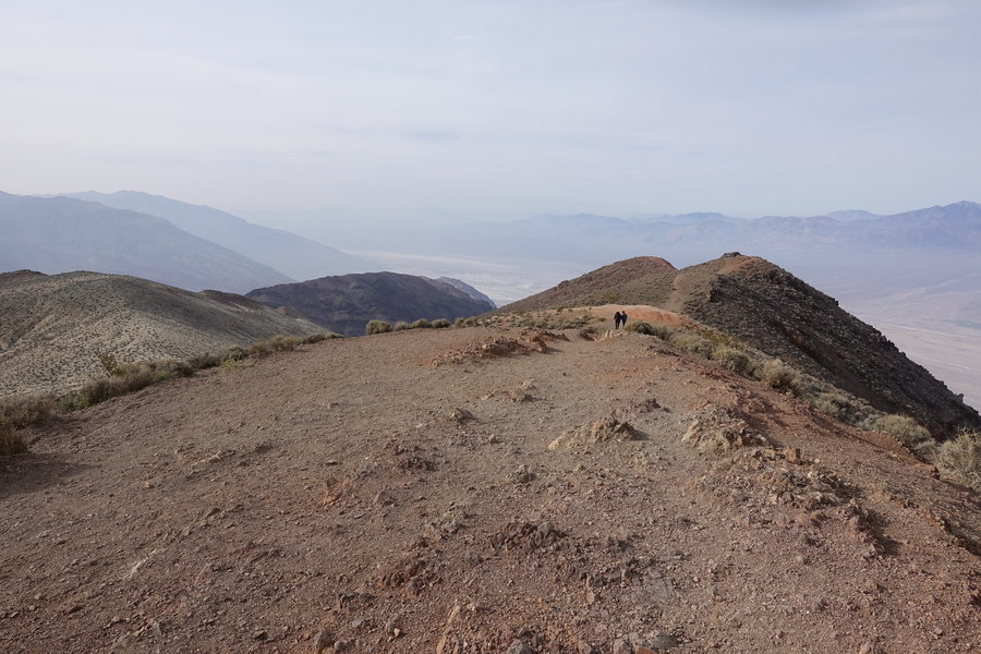
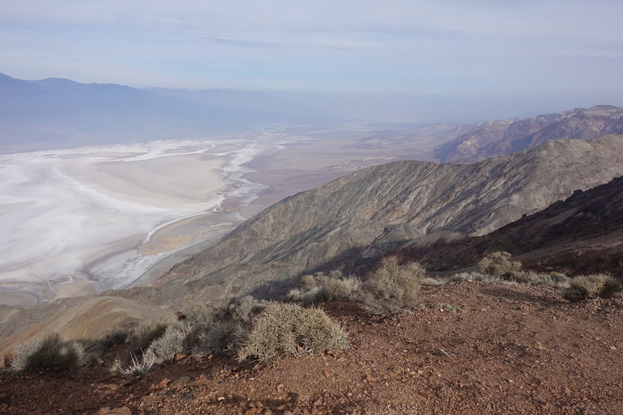
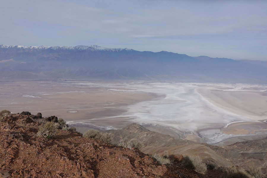
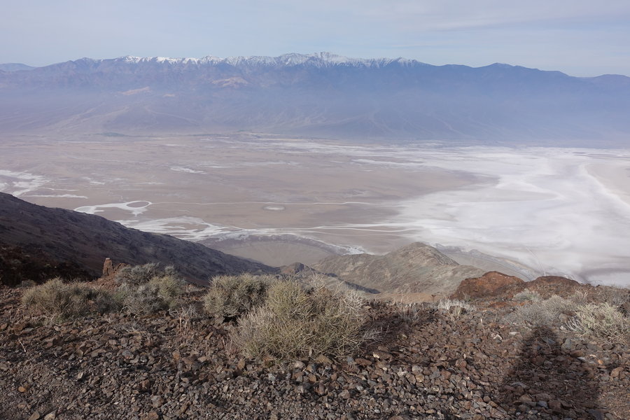
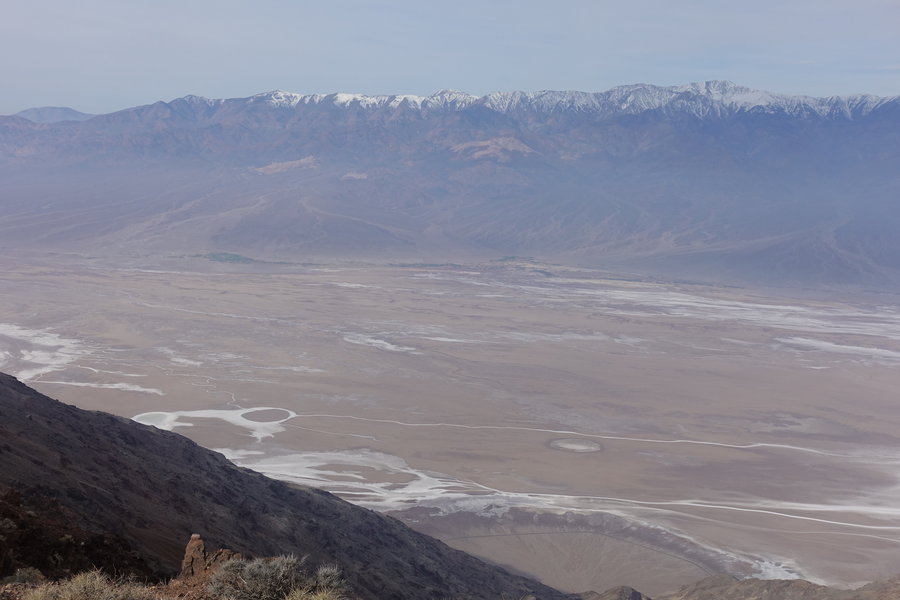
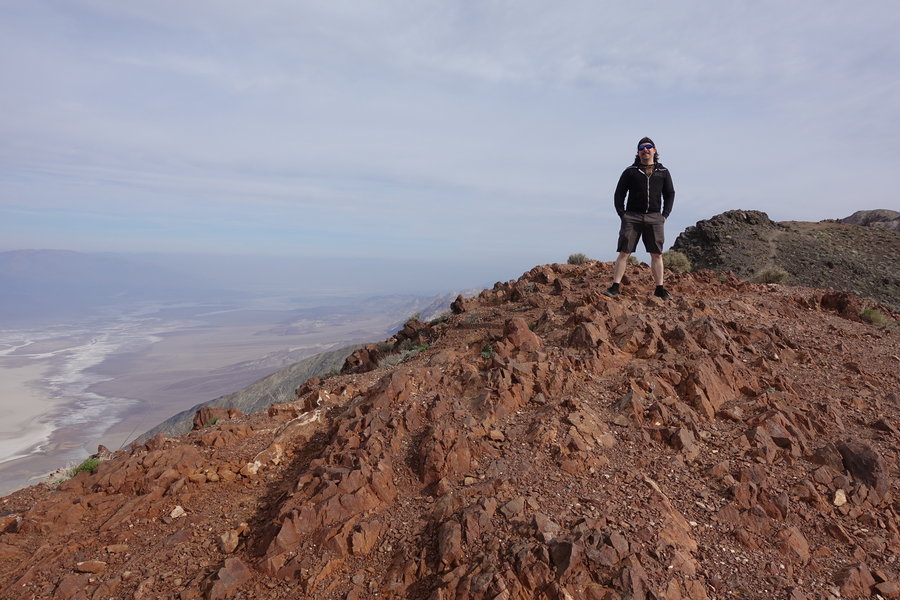
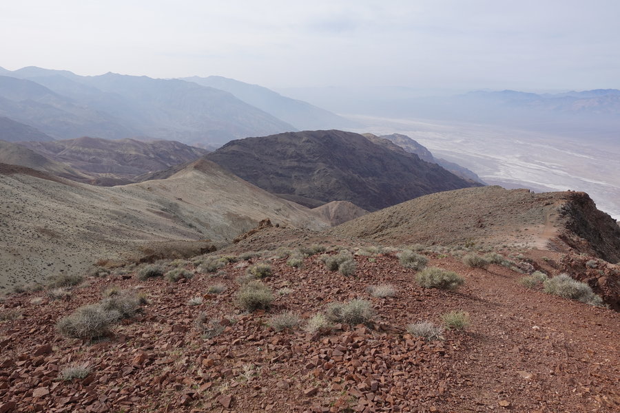
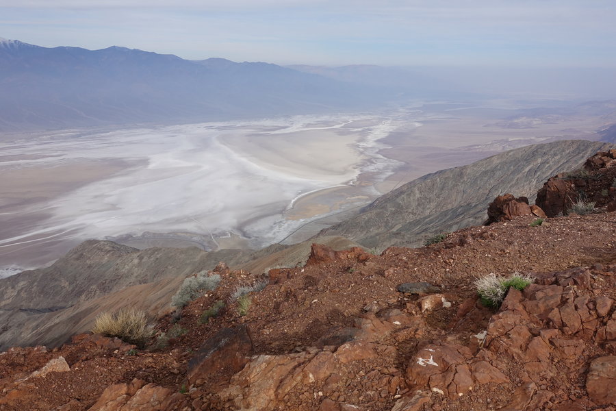
 2
2
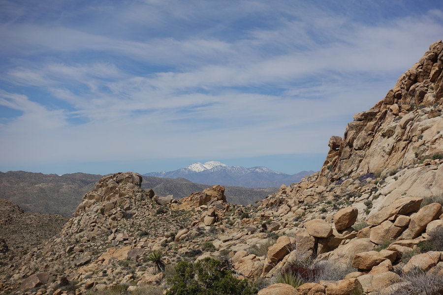
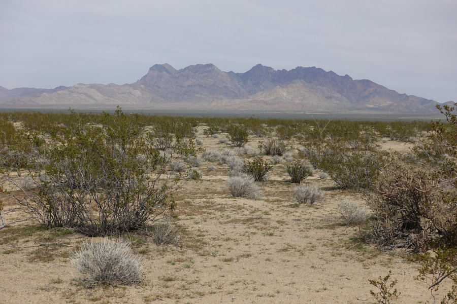
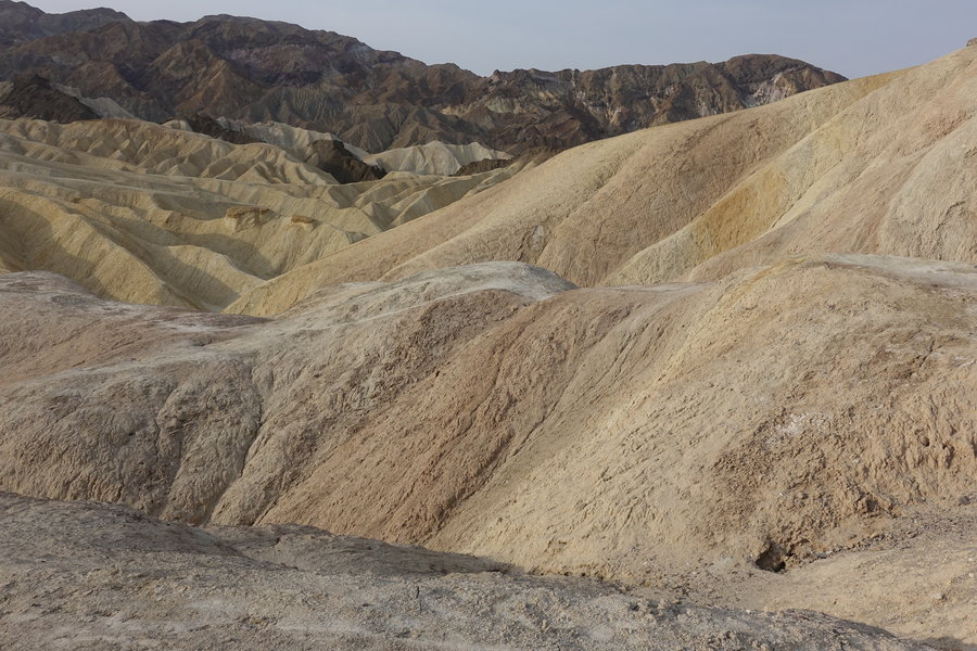
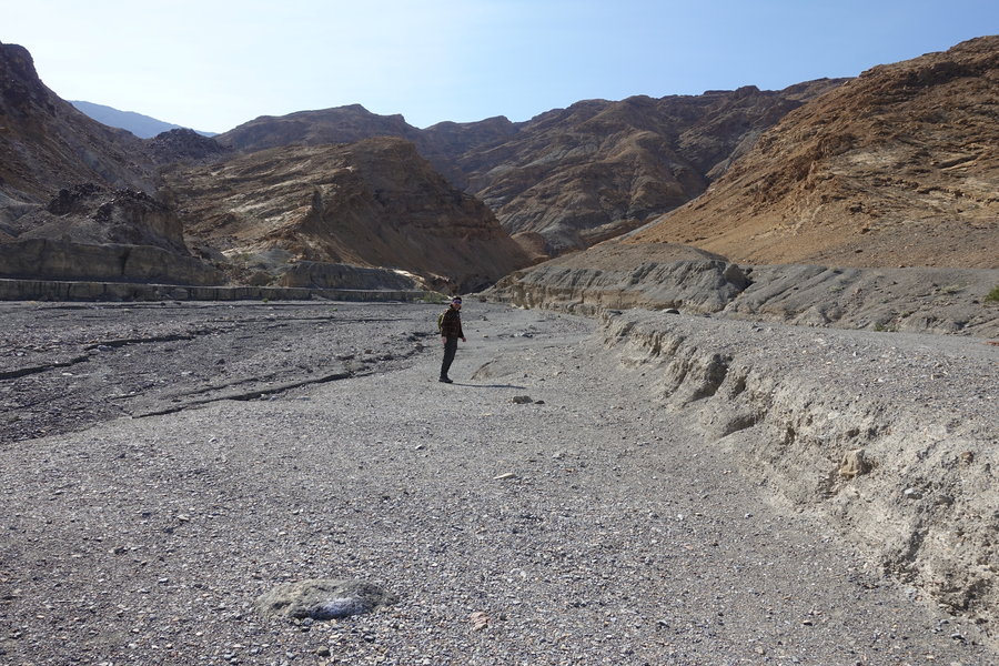
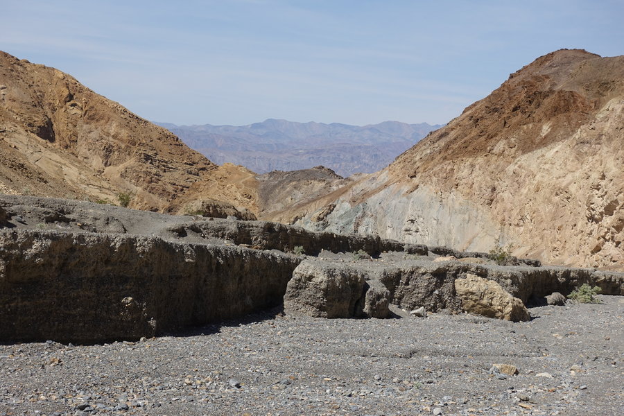
Zabriskie Point and Dante's View Trail, Death Valley National Park
3.5 miles of hiking • 500' elevation gain •
Just a couple of shorty hikes in Death Valley before we took off to Vegas.
March 26, 2019


 1
1
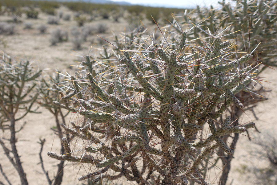
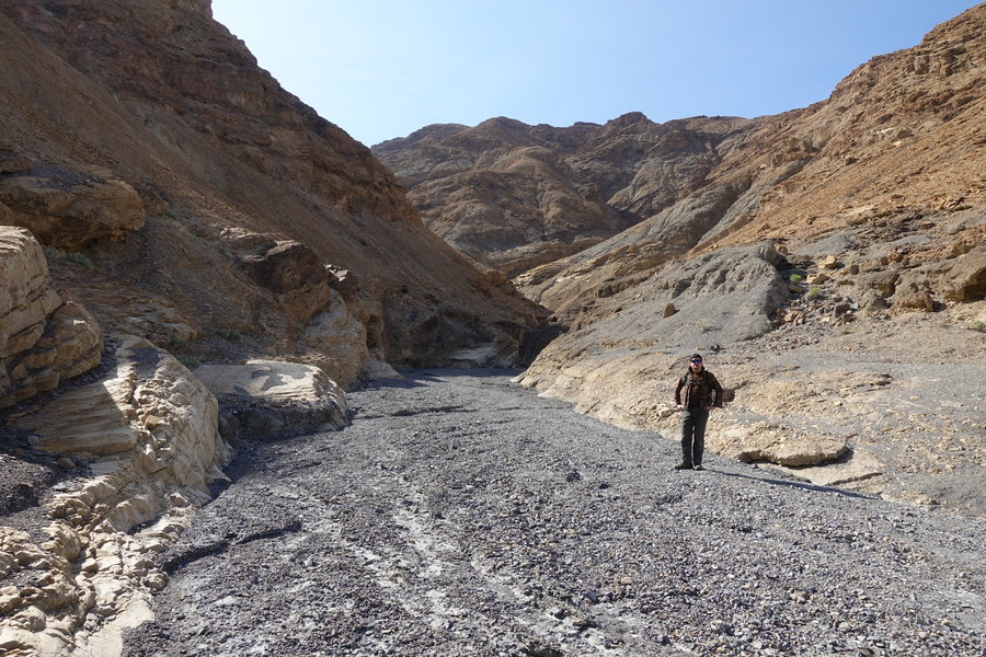
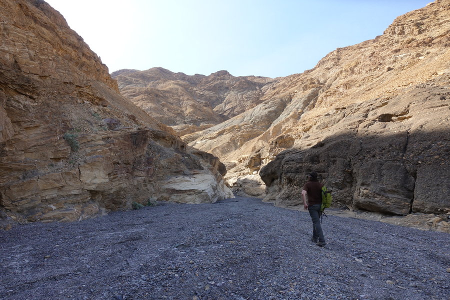
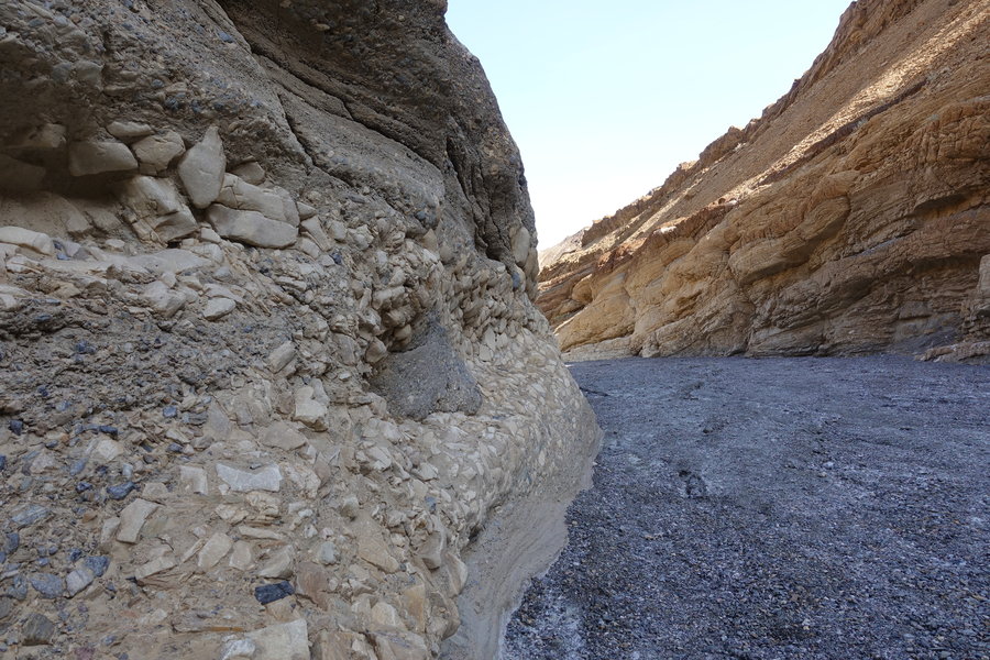
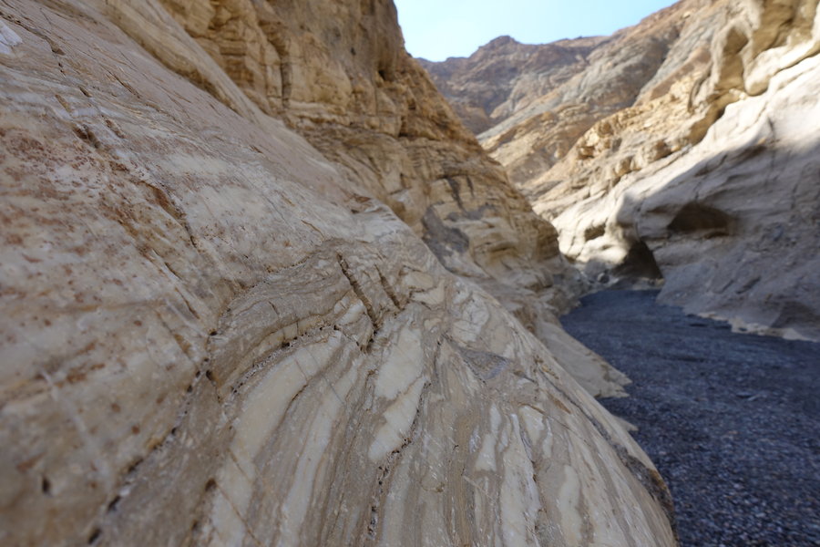
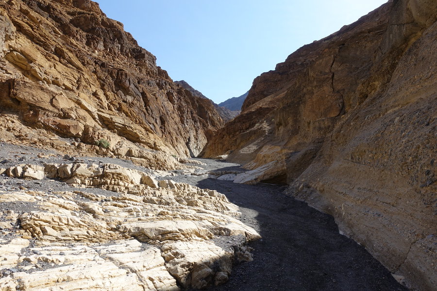
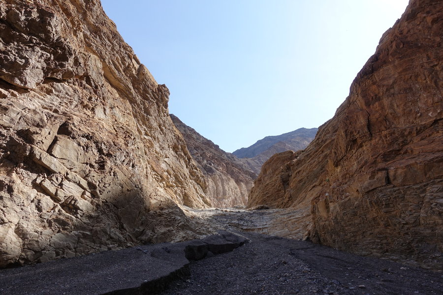
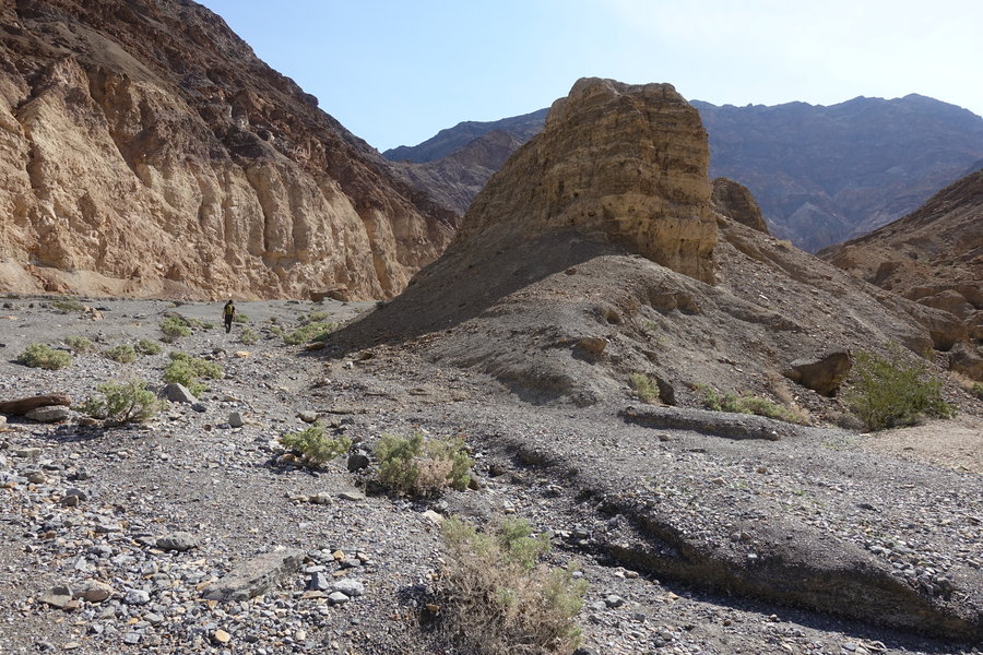
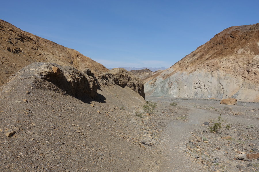
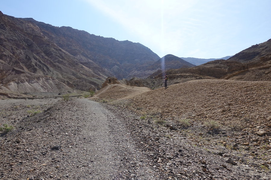
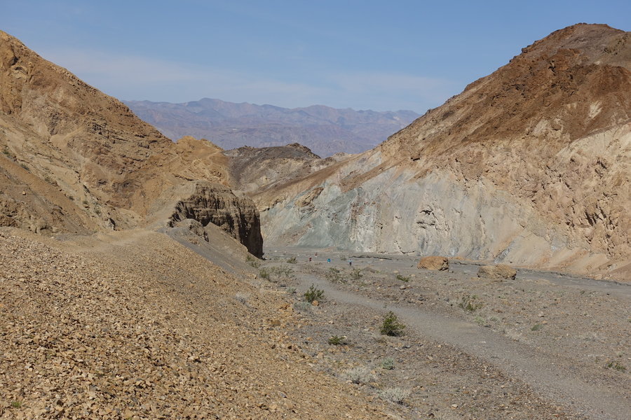
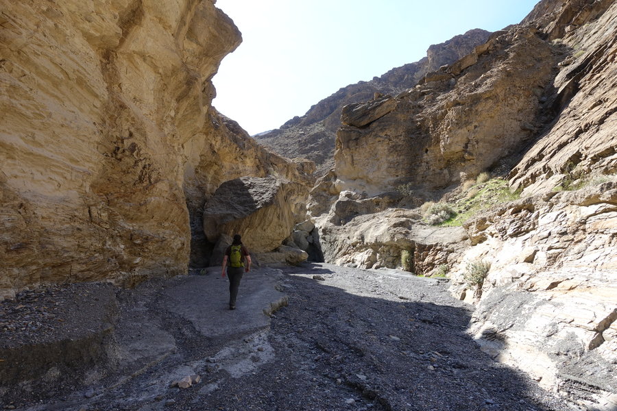
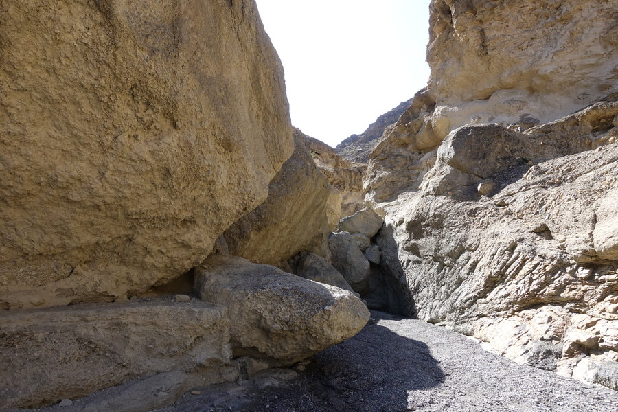
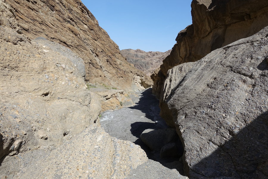
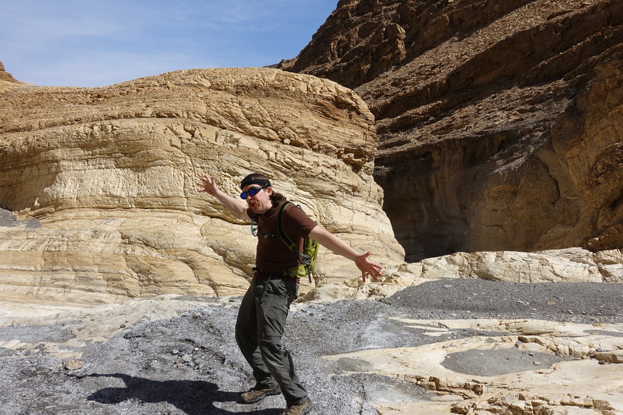
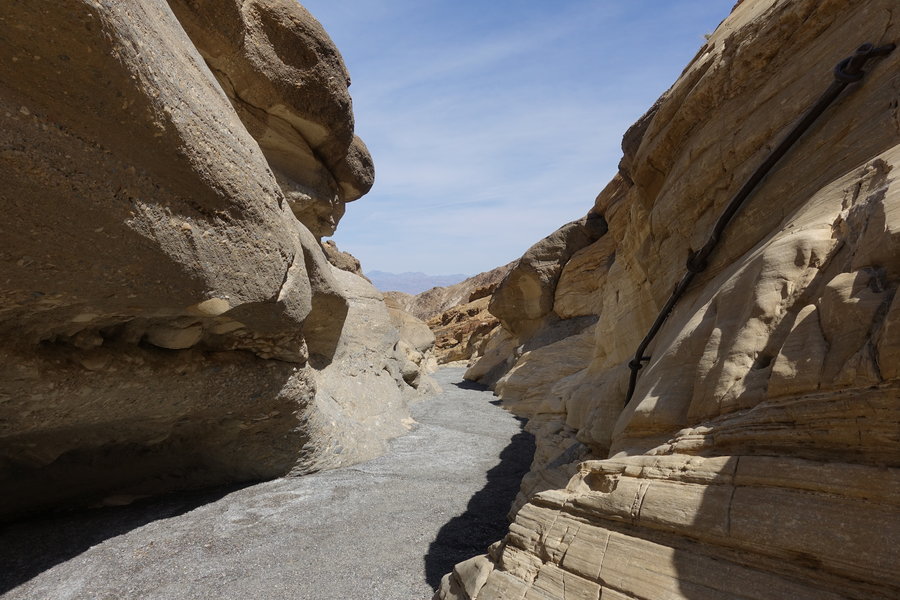
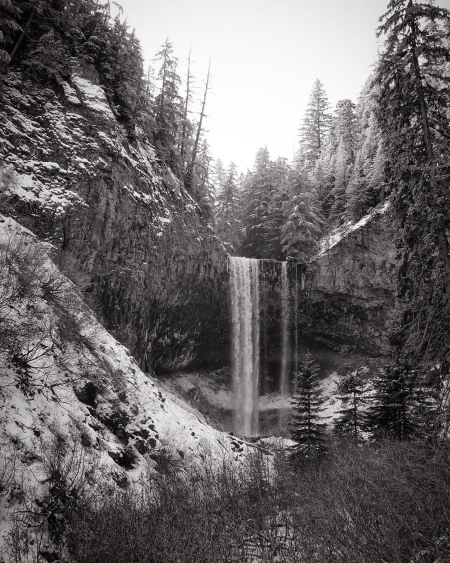
Mosaic Canyon - Death Valley National Park
8 miles of hiking • 1500' elevation gain •
Please excuse me as I add hikes from my spring break vacation.
Decided on a weirdo tour of Southern California deserts for spring break. Sadly, a large part of Death Valley National Park was shut down due to flash flooding from rains the week prior. We made the best of what we could see.
Our first night into town we camped in Stovepipe Wells, and as I had marked Mosaic Canyon as a point of interest, off we headed. The road to the trailhead was closed for construction, so we embarked cross country to skip the road, adding an extra 1000 ft of gain and 5 miles to the trip.
With warning signs at the trailhead to not hike past 10:00 am we considered the heat, and decided it safe to continue on since we had spring temps. It was still hot and exposed, but not the deadly summer temps that hit Death Valley. The canyon ended up being pretty fun, we hit dryfall #1 and easily passed it. Dryfall #2 we started to climb the overland path marked by cairns, but decided we were getting too hot and wanted retreat into shade and food. If we would have continued to #3, we would have needed climbing gear. We ended up having fun scrambling the route we did, and retreated back to the trailhead.
March 25, 2019


 1
1
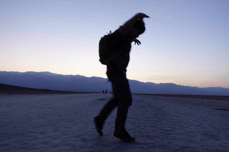
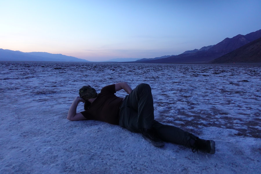
Badwater Basin Salt Flats, Death Valley National Park
2 miles of hiking • 0' elevation gain •
Did a hike in the evening out on the salt flats, to watch the stars. Super cool to be below sea level.
March 25, 2019


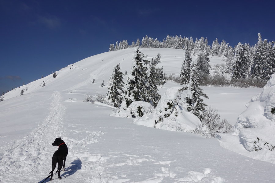
Dog Mountain
6 miles of hiking • 2500' elevation gain •
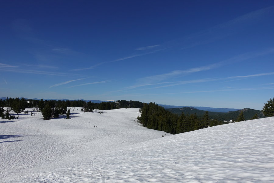
Did not manage to get a hike in last weekend, as I was busy at the Mazama lodge playing rescuer and patient in the snow finishing up my Mountaineering First Aid. I was happy I didn't die in the mass casualty scenario, but post holing in the snow up to my waist searching for rock fall victims made for a very sore hip. Which lead to a sore and slow hike up Dog Mountain today. (And I still haven't managed to get my new boots broken in, ouch.) Felt like a mini climb with the current conditions, and I almost felt as if I should have had my ice axe and crampons. Snowshoes not needed, I think the Mountain Dog's BCEP team broke trail pretty well on Saturday am. We just used poles and microspikes, as it was icy up, but slushy on the way down.
Always fun to see a trail I frequent in a completely different light. We stopped just shy of the summit as the wind was roaring and I was afraid of my dog getting too cold.
March 10, 2019


 1
1
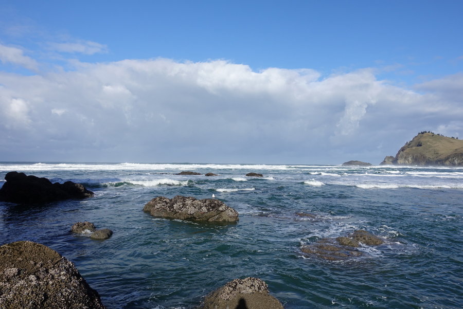
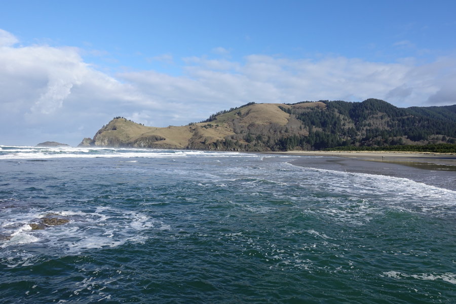
Camp Westwind Weekend
5 miles of hiking • 500' elevation gain • 2 nights
Spent the weekend camping at Westwind, as part of a Trackers Earth employee getaway. (My partner works as a 7th grade teacher for the Forest School, as well as a summer camp educator.)
The majority of the weekend was spent walking the beach, drinking, playing board games, eating, drinking more, and checking out God's Thumb. Lots of walking, just took a guess on mileage. I did not go all the way out on the thumb, the view (and my queasiness because of beverages consumed the night before) was making me nervous. I'll have to go back and force myself to make it all the way to the end.
Fun weekend, but restless sleep as I came down with some sort of cough/cold.
February 23 – February 25, 2019


Angels Rest
5 miles of hiking • 1500' elevation gain •
I always try to do the popular gorge hikes when the weather is bad, so I expected with the snow/slush that it would deter the typical crowd. Not so. I encountered every type of hiker I dislike today. As a dog owner, I'm really sad at how many inconsiderate dog owners are on the trails giving the rest of us a bad name. All of my bad experiences today came from bad dog owners. One dog, tried to lunge at my dog as if it wanted to kill her, luckily this one was on a leash and the owner held on for dear life. Forgivable since they kept it back, but I hate to think what would have happened if they had not pulled their dog far enough away from the trail. Multiple other dog owners had their beasts off leash, on a slippery trail. Not cool for anyone. Then, some lady with a giant off leash dog, had the nerve to touch my dog multiple times with her trekking poles as we went to pass her. My dog was completely ignoring her off leash dog she was holding, but she kept saying "Leave it" as we passed and she hit my dog. Of course, I told her, "Don't fucking touch my dog."
Why do I even bother with the popular trails anymore? I'm such a grump.
Even with the bad, it was still a beautiful solo hike with my favorite hiking partner, Lily.
February 18, 2019


 1
1
Firelane 15, Forest Park.
4.2 miles of hiking • 750' elevation gain •
Forgot to add this romp through the far end of Forest Park from last weekend. Secluded, muddy, dog had fun despite the occasional hail.
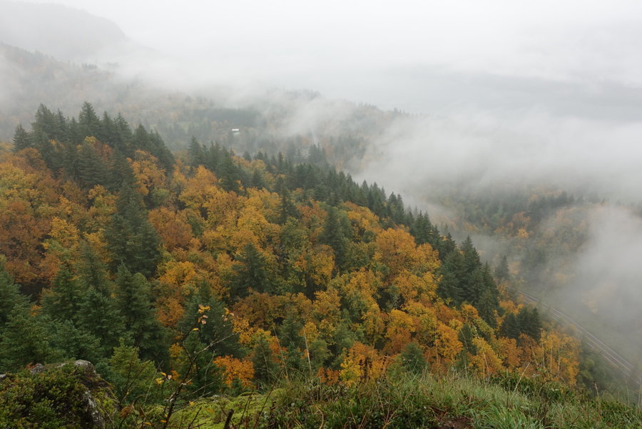
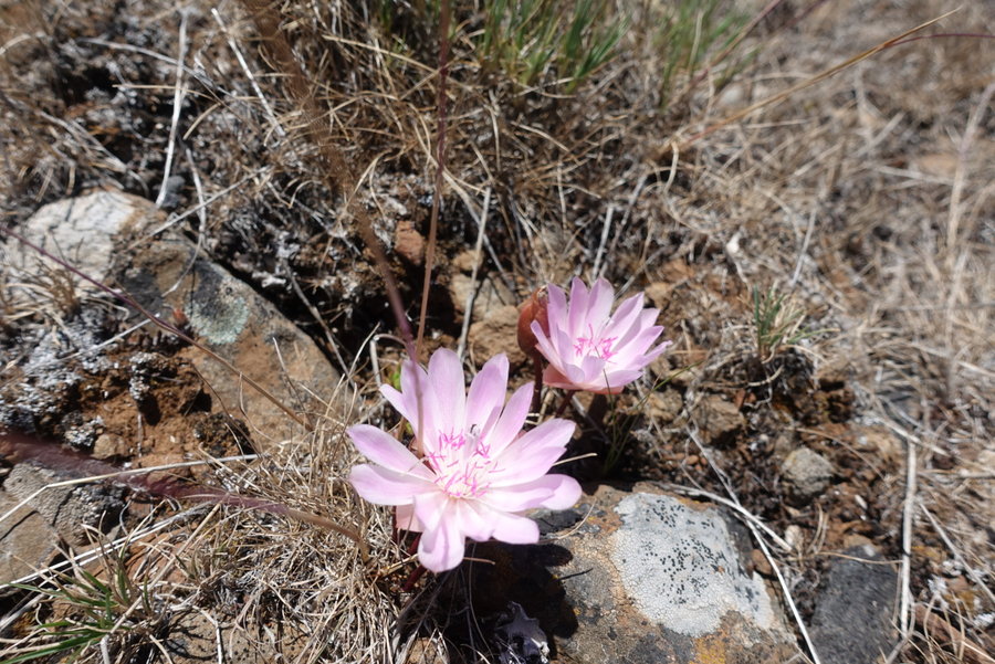
February 3, 2019
 3
3
Little North Santiam River
4.5 miles of hiking • 750' elevation gain •
Today was an odd day.
Set out from Portland at 8:00 with an AYM group, celebrating Matt Reeder leading 10 years of hikes with AYM. Lots of last minute cancellations, bringing our group down to 8 from 12. (Don't be a dick, canceling the night before a hike is just rude unless you have an emergency.) So is not showing up when you are still signed up. Anyway...
Today was supposed to be a longer trek, but a knee injury close to the halfway point changed our plans. It was a really beautiful pleasant hike until one member took a nasty fall. During the time of the fall, some assholes decided it was time to start shooting right next to the trail. There is one thing that always ruins my time on a trail, and that is gunfire, especially when I don't know what they are shooting at and where the bullets are going.
Anyway, we picked two of our fastest hikers to backtrack and bring two cars to the further trailhead so we wouldn't have to do the whole return trip with an injured hiker. None of us really minded much, it was still a beautiful trip despite the gunfire.
Ended the day with one more roadside waterfall, and a trip back to Salem for cake. (I'm not a big sweets person.) Everyone enjoyed giant pieces of cake while I had half a piece of cheesecake. (Honestly, just give me salt after a hike.)
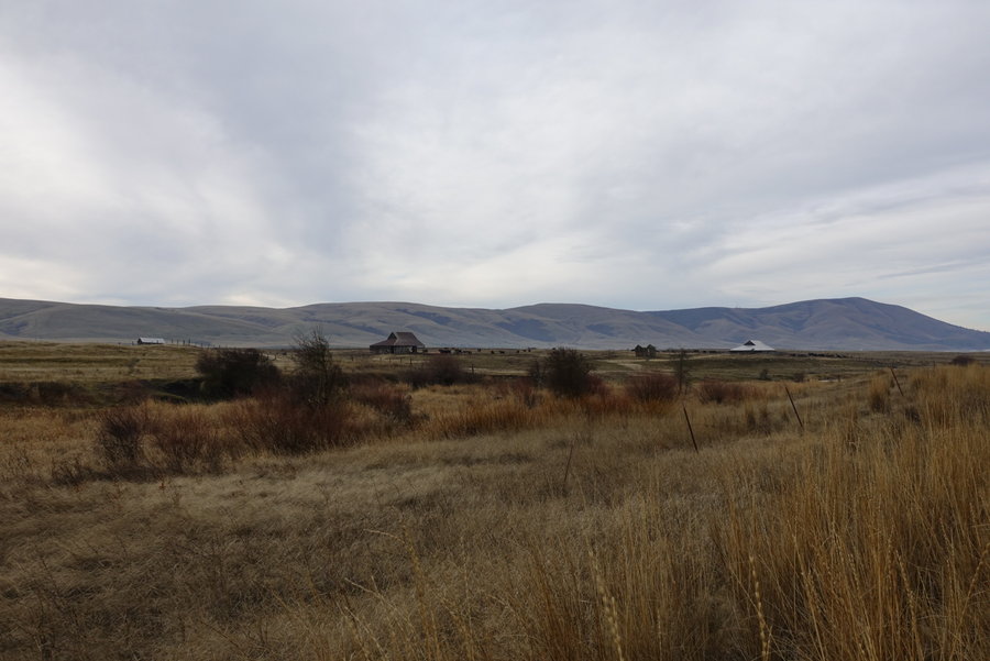
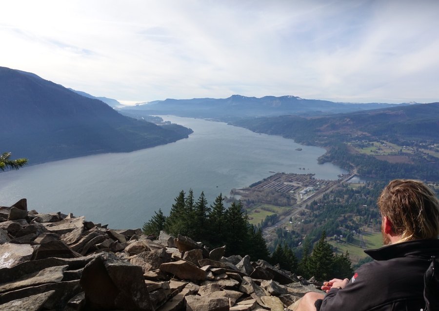
January 27, 2019


Wind Mountain
2.5 miles of hiking • 1000' elevation gain •
Just a quickie up wind mountain today. Slept in and didn't leave Portland until around noon. The gorge was like night and day on our trip out. Near Portland, a cloud hovered and kept the beginning of the gorge looking like you were driving in the movie "The Mist". But we came out of it and into sunshine. Nice way to stretch the legs on an otherwise lazy day.
January 26, 2019


 2
2
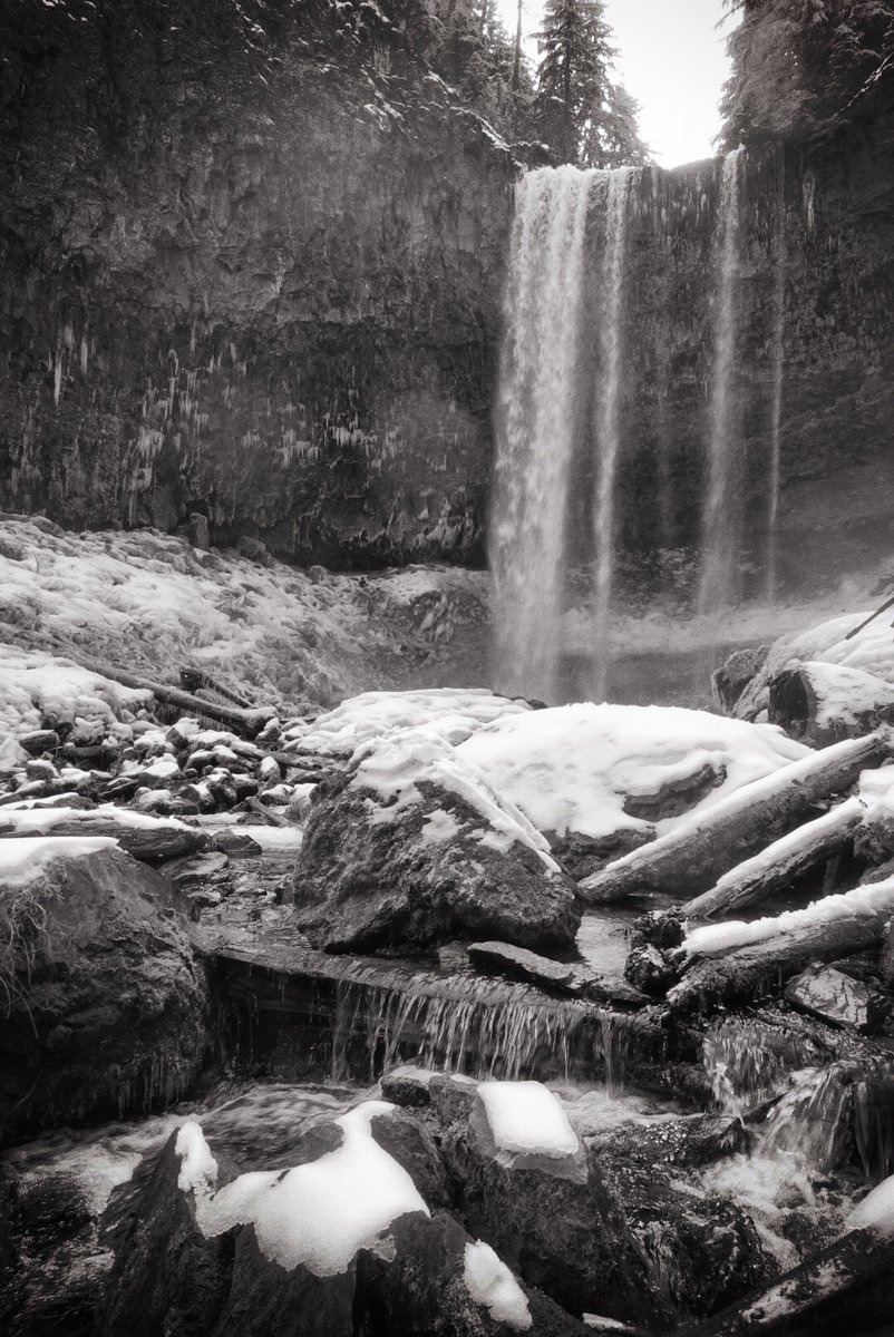
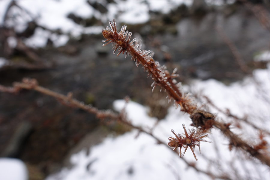
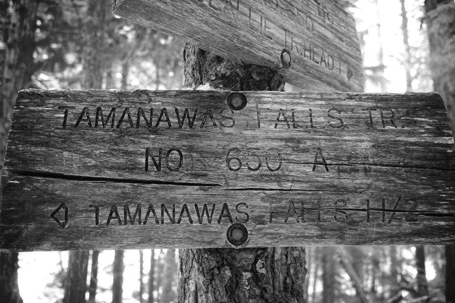
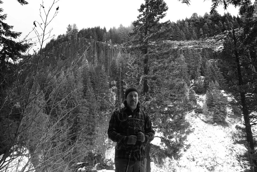
Tamanawas Falls
3.8 miles of hiking • 500' elevation gain •
Originally had plans to hike on Saturday with a friend, but she canceled on me last minute so I ended up sleeping in on Saturday and wasting a beautiful day.
To make up for it on Sunday, Zane and I got an early start from Portland to try to beat the crowds that would surely be heading to Mt. Hood on a bluebird day. Our objective was an easy stroll to Tamanawas Falls, with a plan to maybe try to hit one more trail afterwards. Parking was easy when we arrived, but we quickly realized it was going to be a huge struggle to park and hit anywhere else for the day. After our easy achievement with microspikes, we hit up Bunsenbrewer in Sandy for one beer, then headed home. The rare sun of the day zapped us of all energy, and a long nap was had when we arrived home even though we barely felt we got in a hike with such a short approach. Hence, me being up late now writing about it. Spent the evening pouring over posts of Hood and Helen's climbs, and kind of sad I only did a short hike this weekend with the beautiful weather.
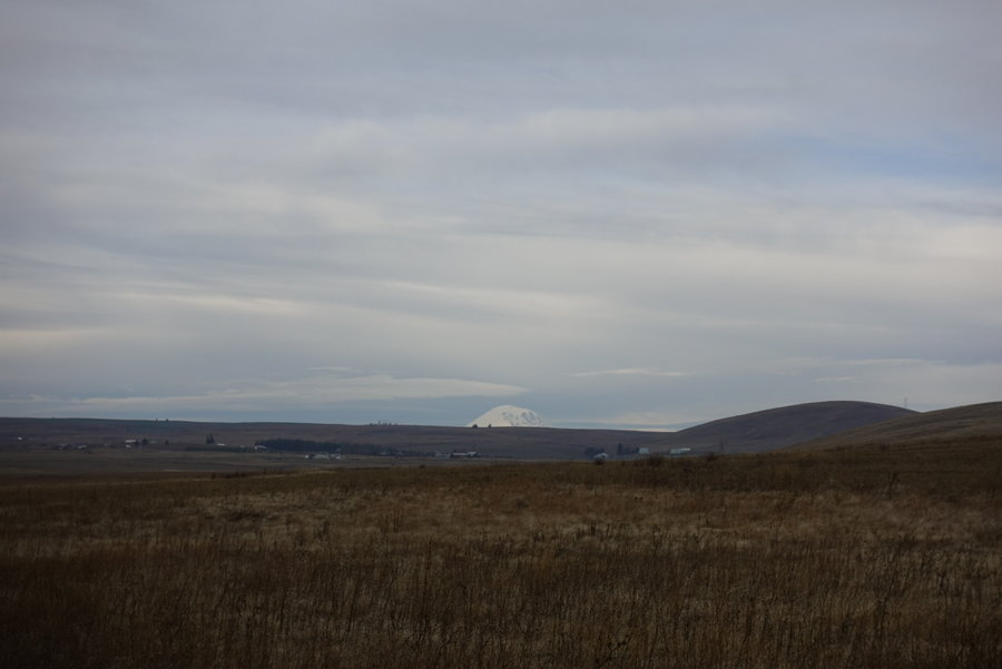
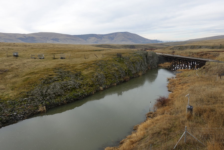
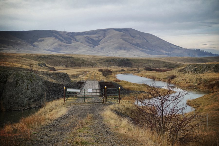
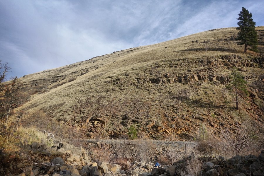
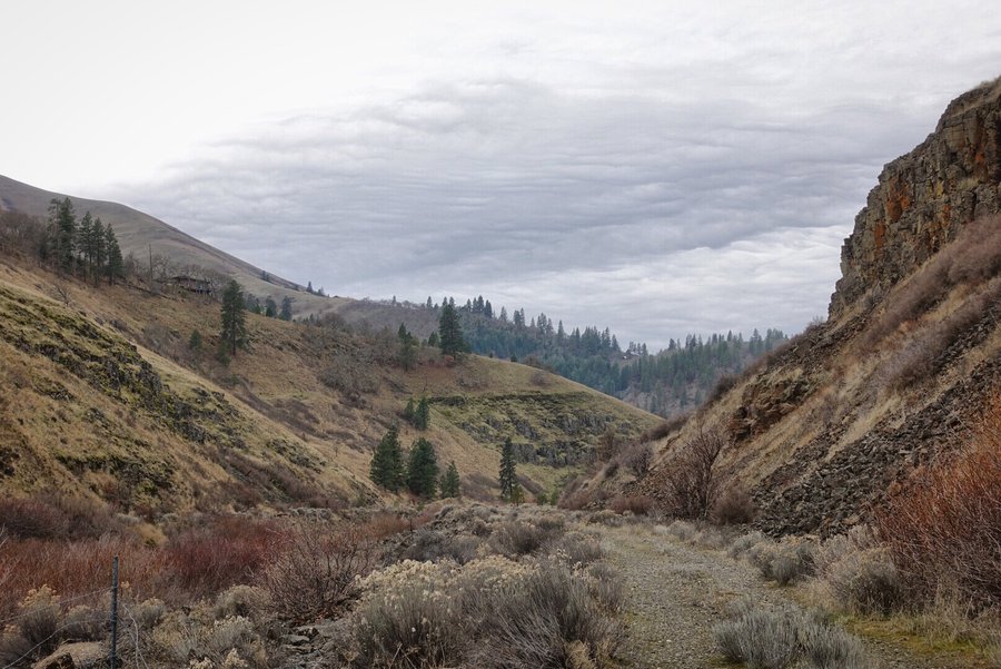
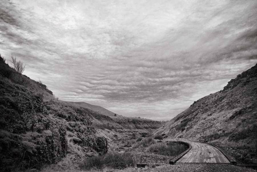
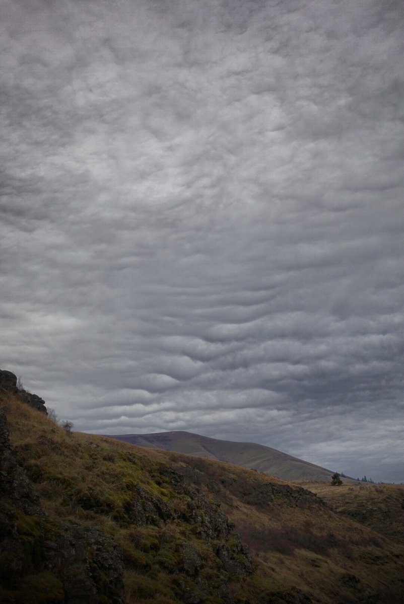
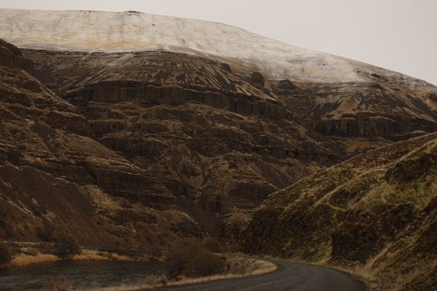
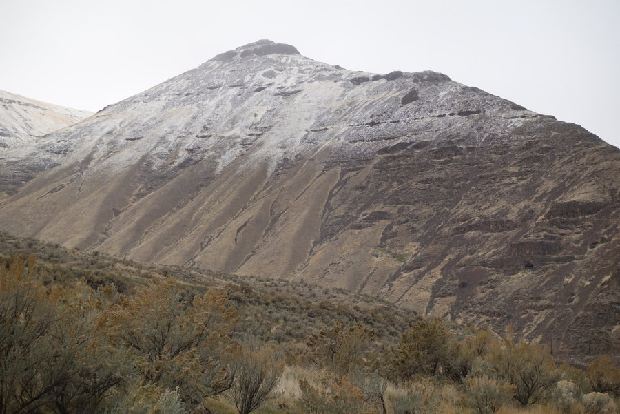
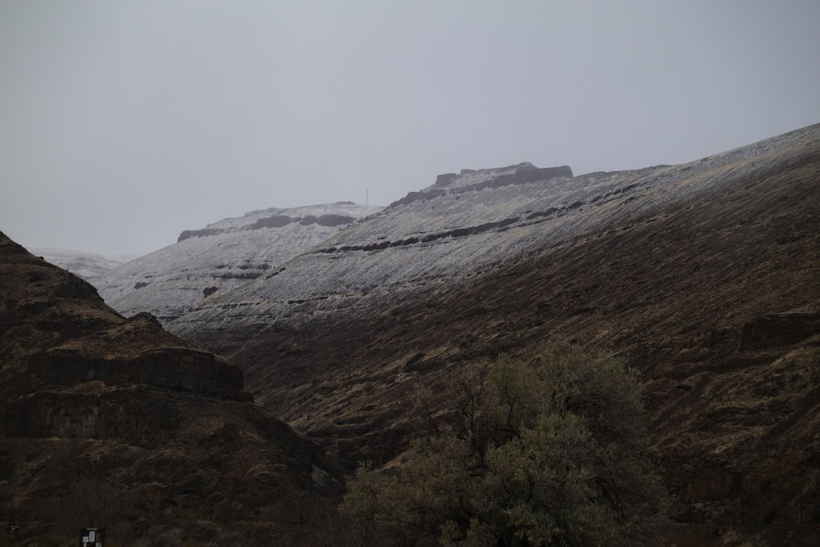
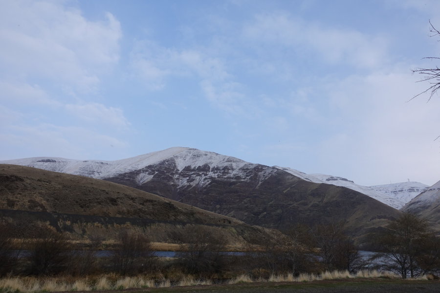
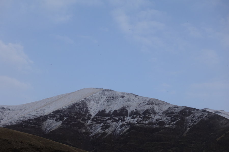
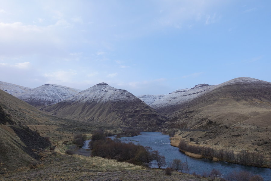
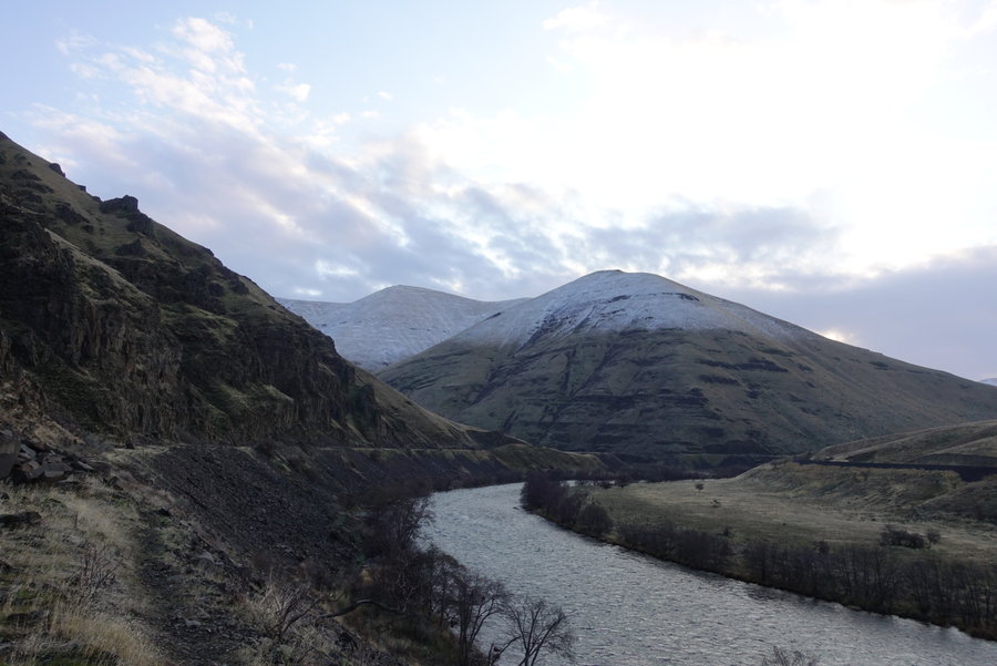
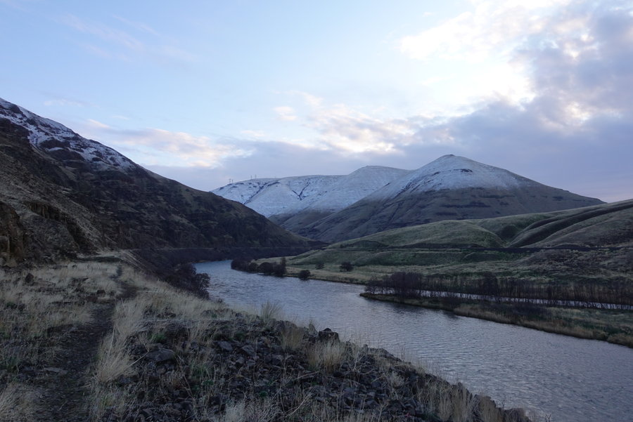
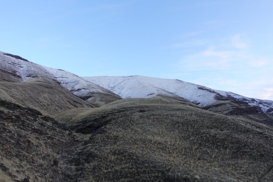
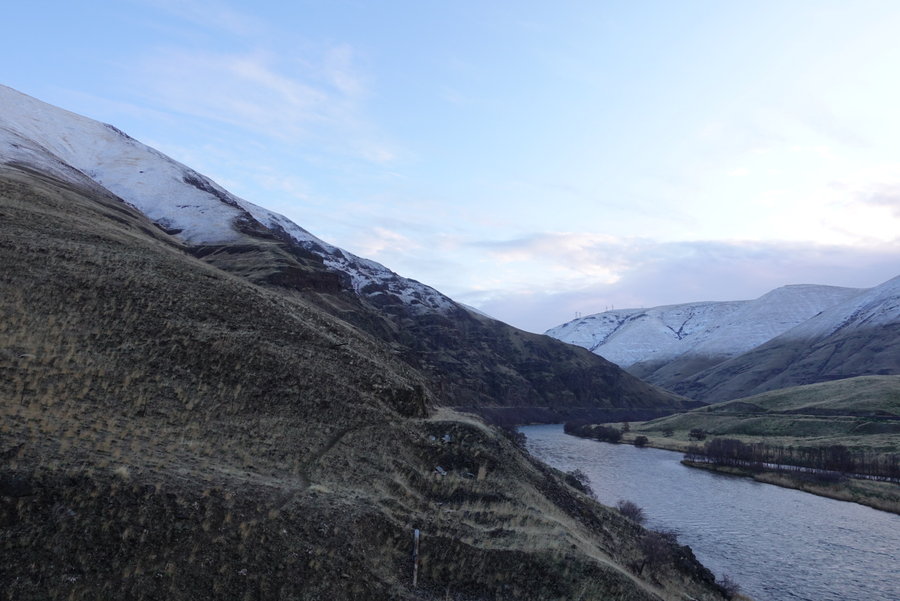
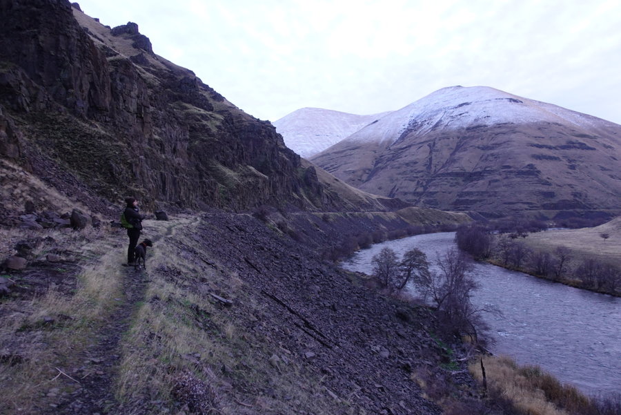
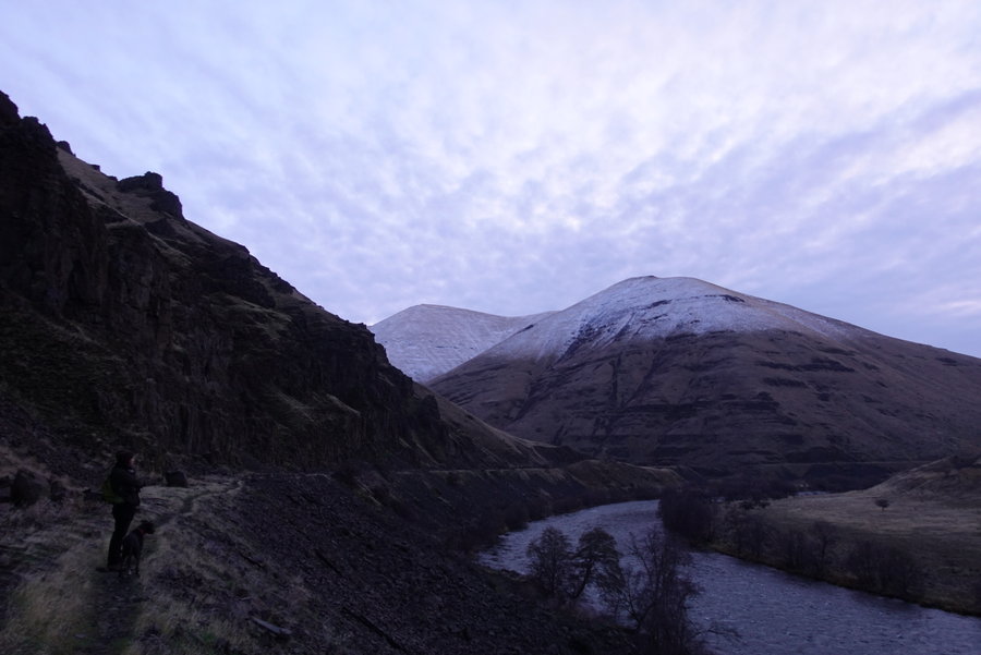
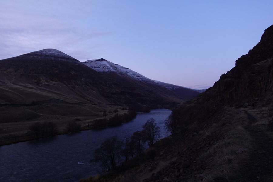
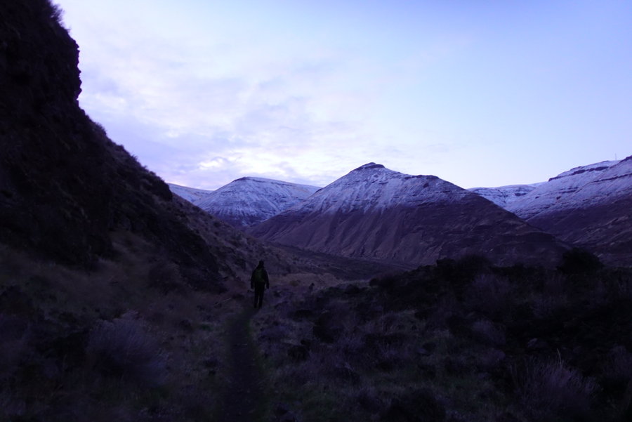
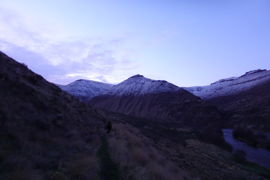
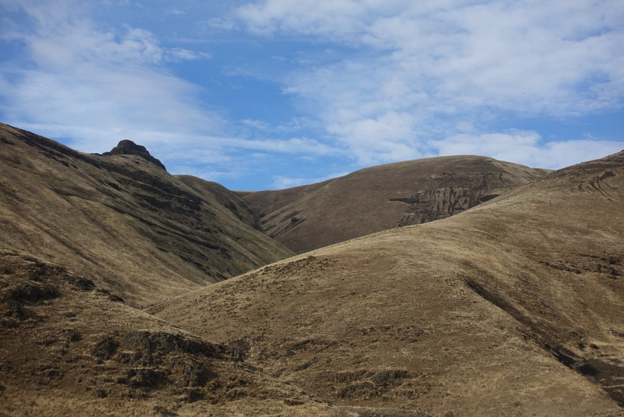
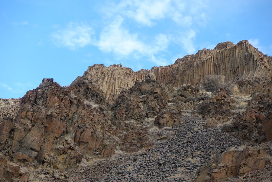
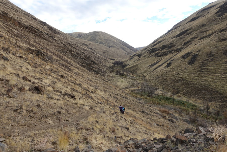
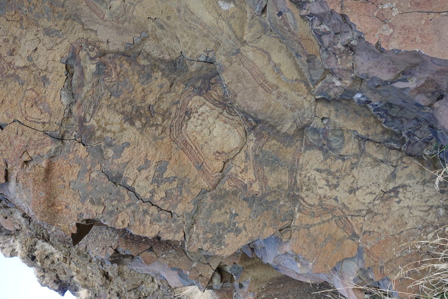
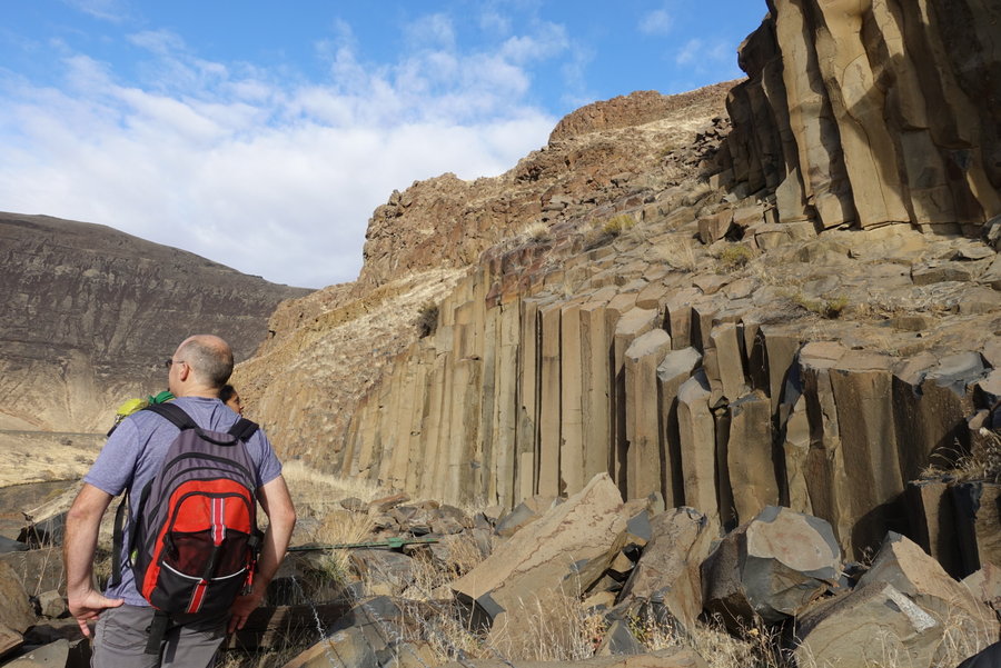
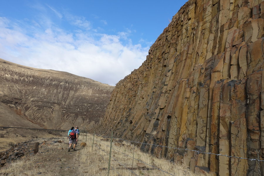
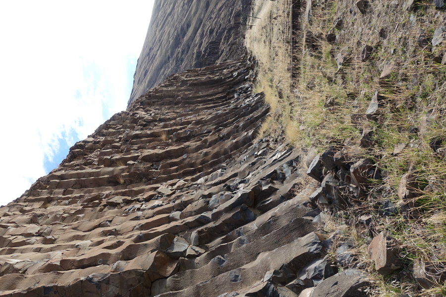
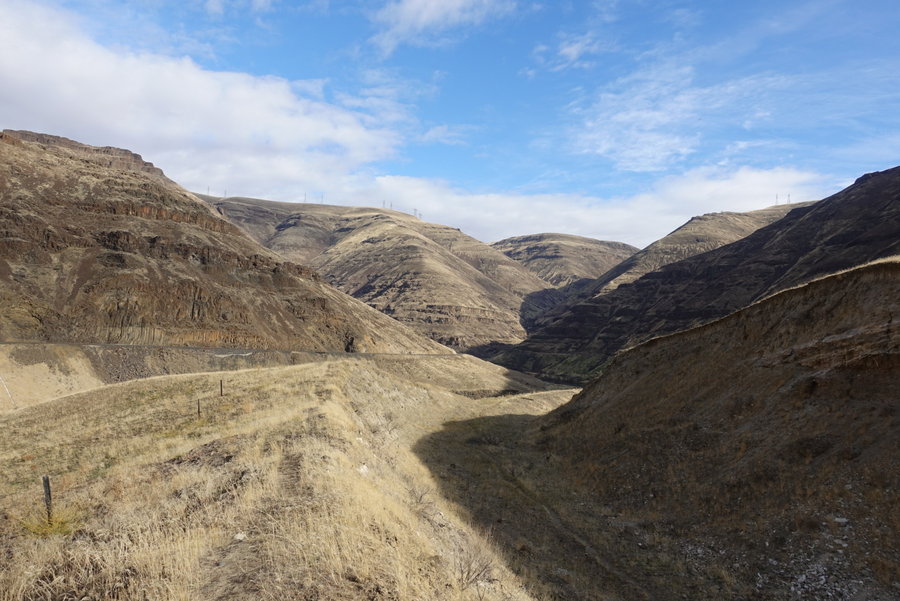
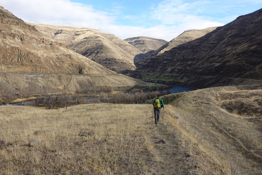
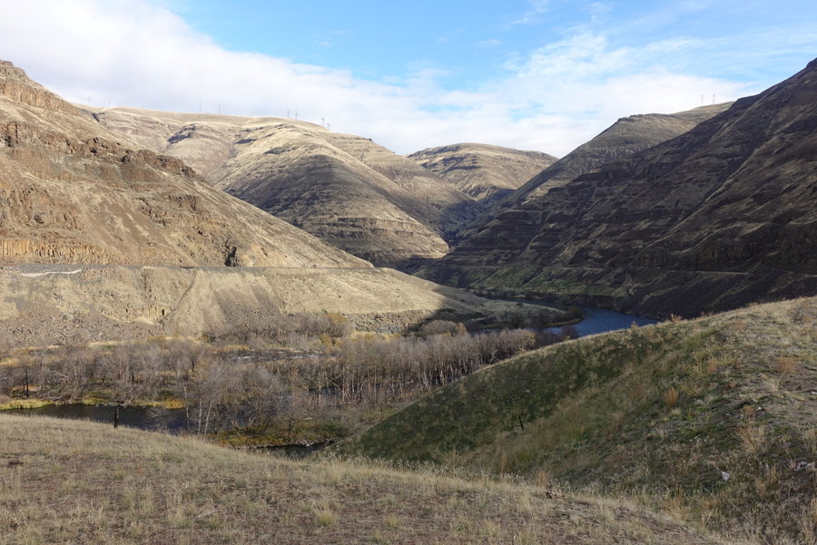
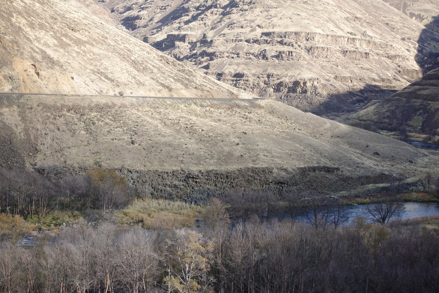
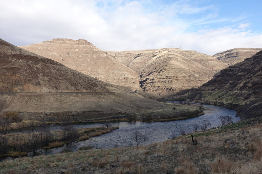
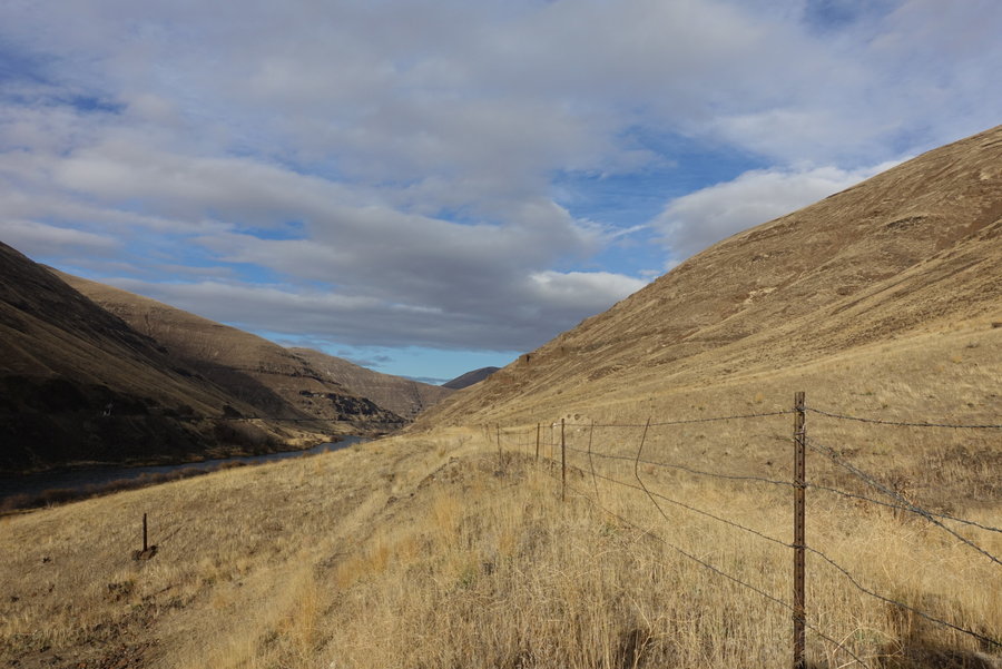
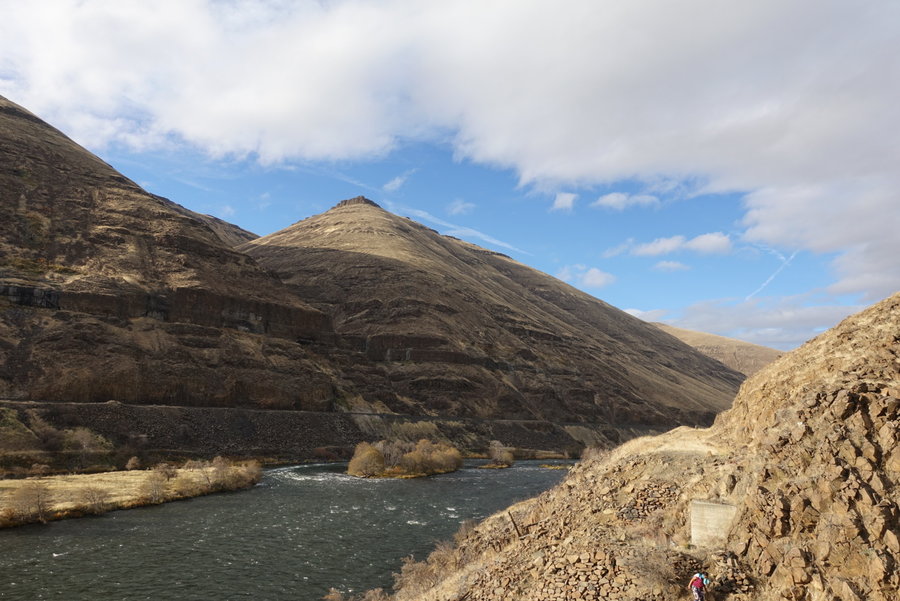
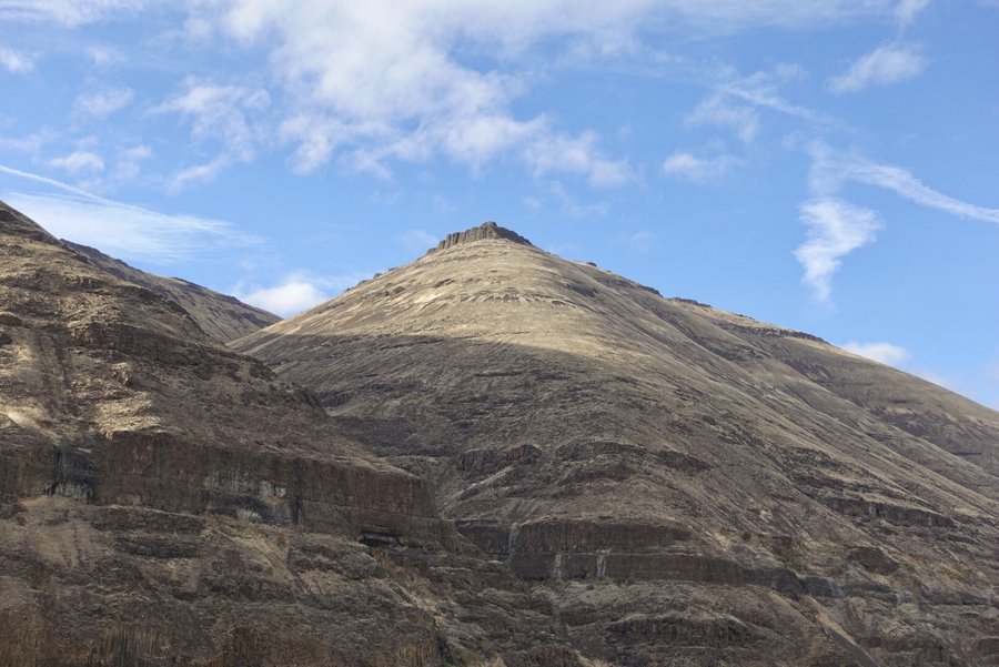
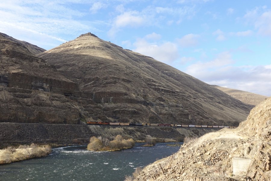
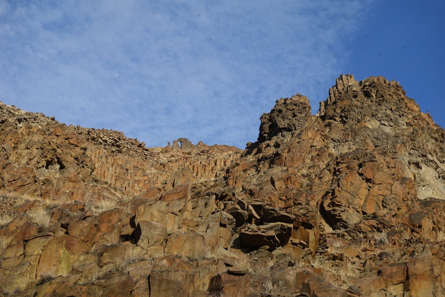
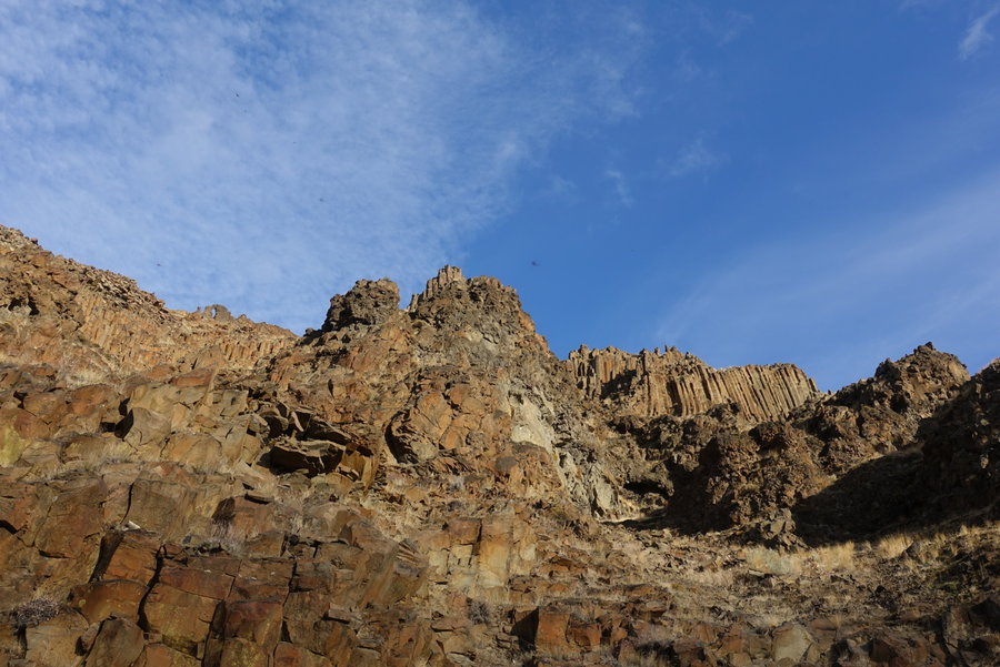
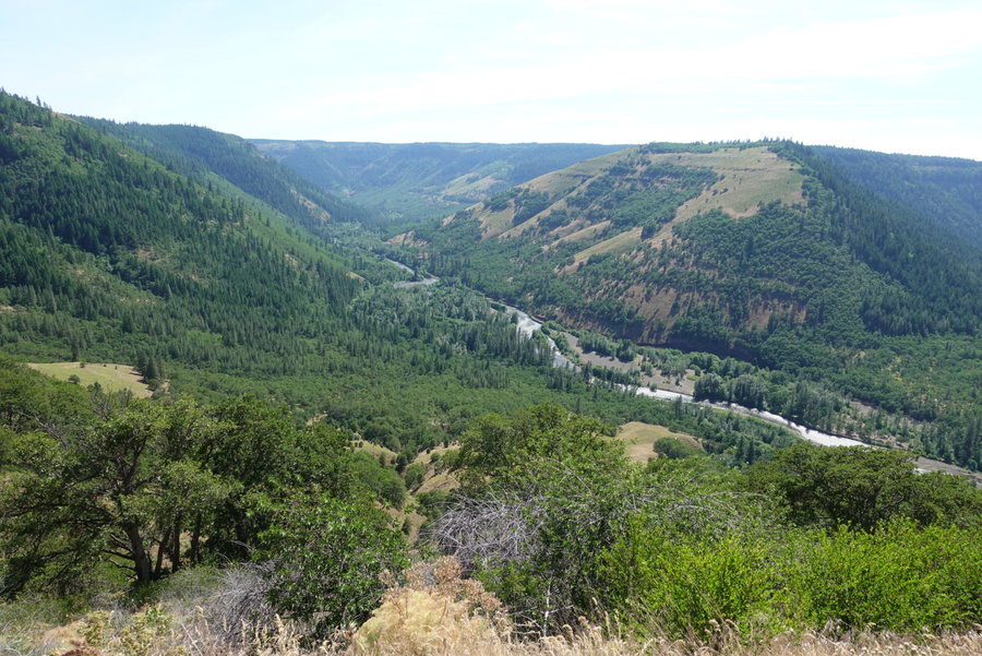
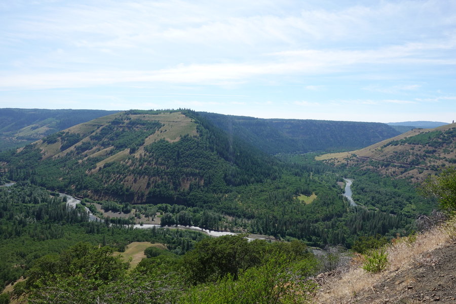
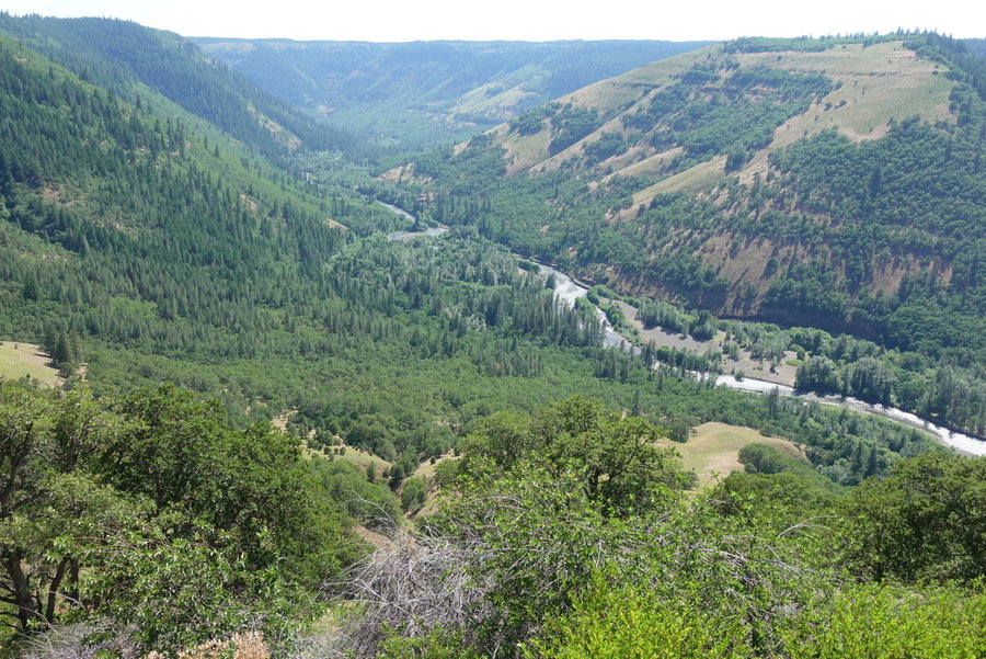
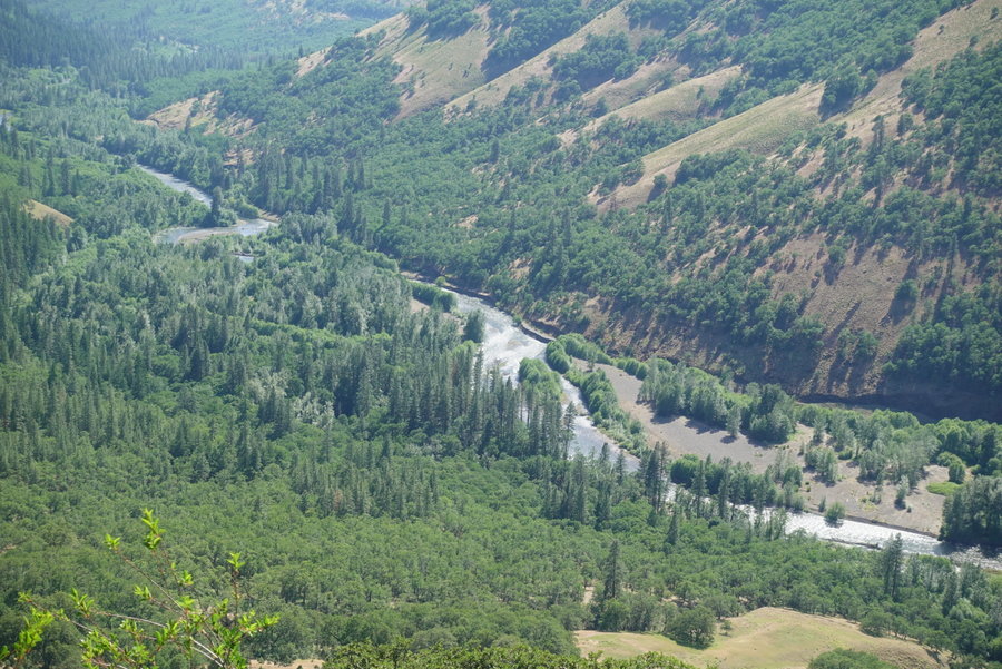
January 13, 2019


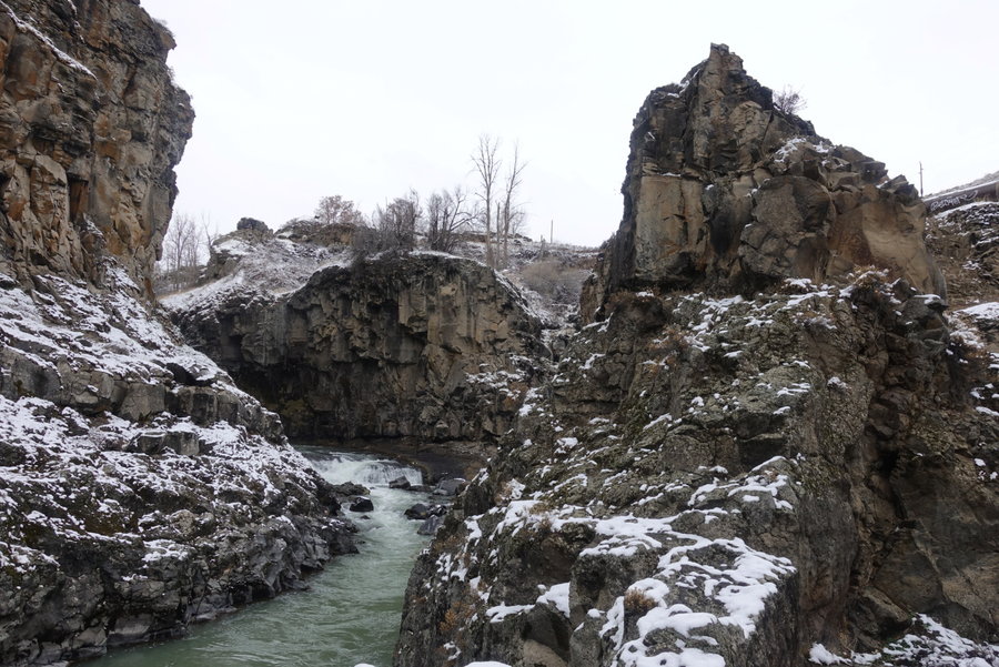
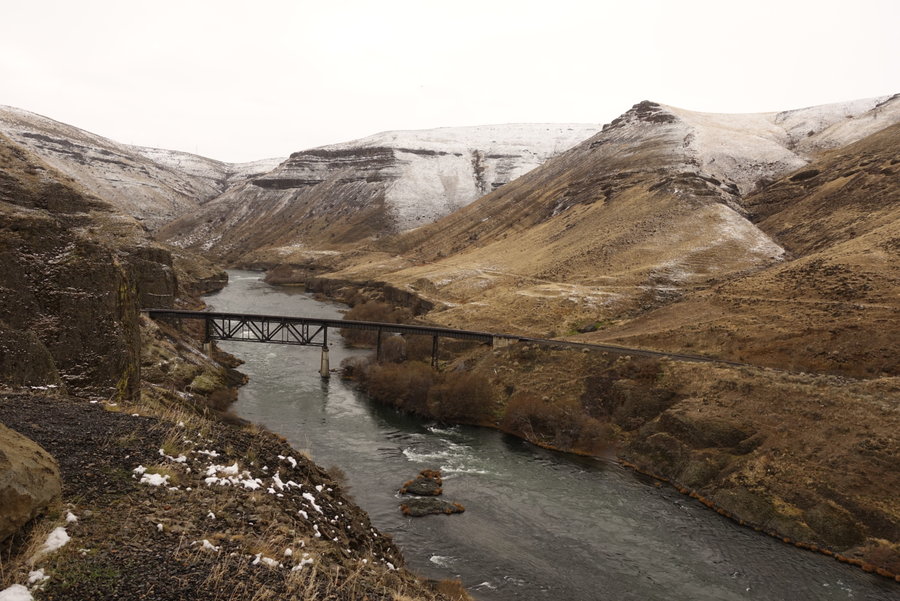
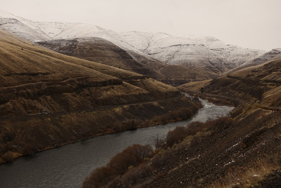
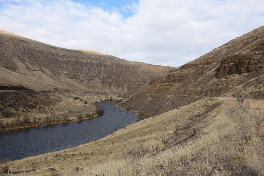
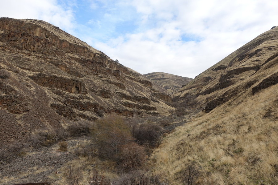
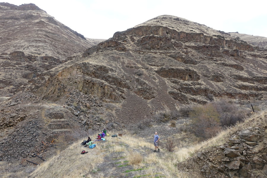
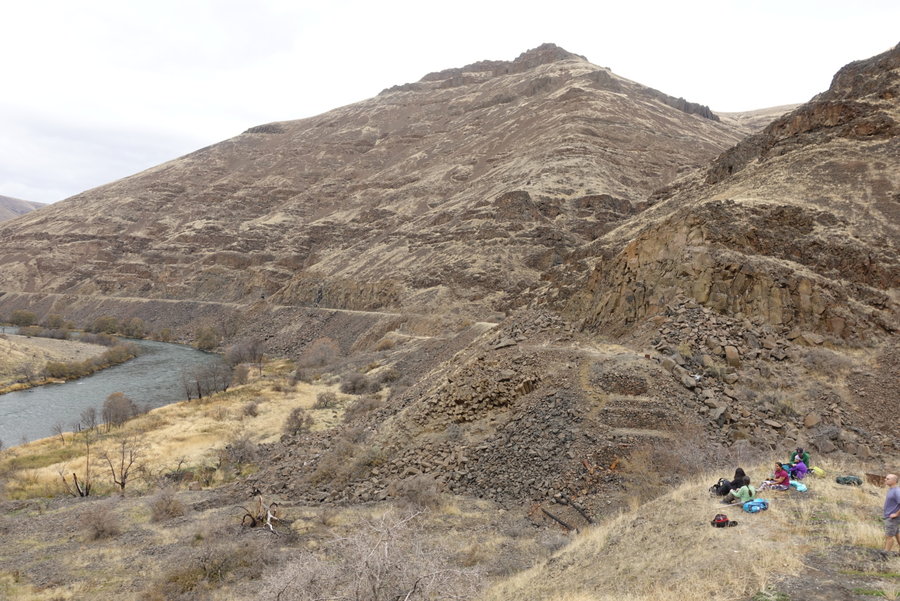
Swale Canyon
10 miles of hiking • 250' elevation gain •
A good friend of mine who is getting over some health problems that have prevented her from strenuous activity has decided to make 2019 the year she starts hiking with me.
She insisted it would be a girls only day on the trail, so we headed out alone at 8 am from Portland. I decided to pick a trail that I knew would have no gain, so as not to scare her off from hiking with me again.
However, as I tend to do, I may have overdid it with the mileage, as I find on straight trails the miles come easily. As I heard my gps say mile 5, I decided we had better take lunch and turn around. She did great until around mile 9, when she told me her feet officially hated me.
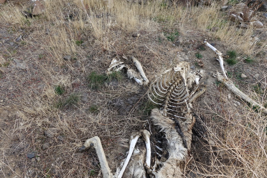
It was an oddly cloudy day in the canyon, the only bit of sunshine that hit us was at our lunch stopping point at a small waterfall in a side canyon, which was rather fortunate and beautiful. We didn't see another soul the entire day, until we were at the Harms Road trailhead (which we SHOULD have started at to cut out 1.5 miles of farmland.) A local farmer was riding an ATV and looking for missing cows, and was actually very friendly to us. We joked if he was there to bring us the rest of the way to our car up ahead at the Centerville Hwy trailhead. I don't regret the extra mileage, I thought the farmland around us and the snowcapped peaks visible from Centerville Hwy were quite beautiful. However, next time (which will honestly probably be by bicycle) I'll skip it and start at Harms Road.
January 5, 2019