

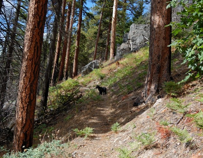
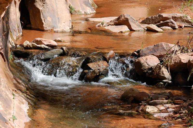
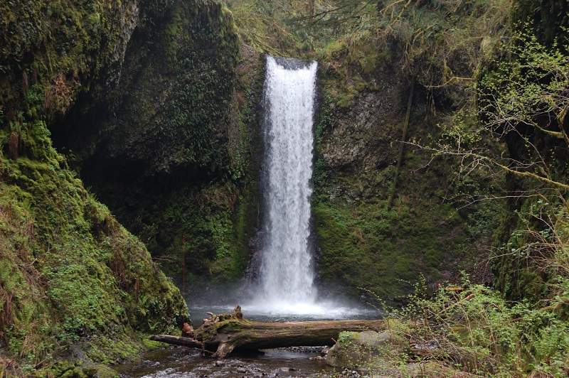
2011 Trips


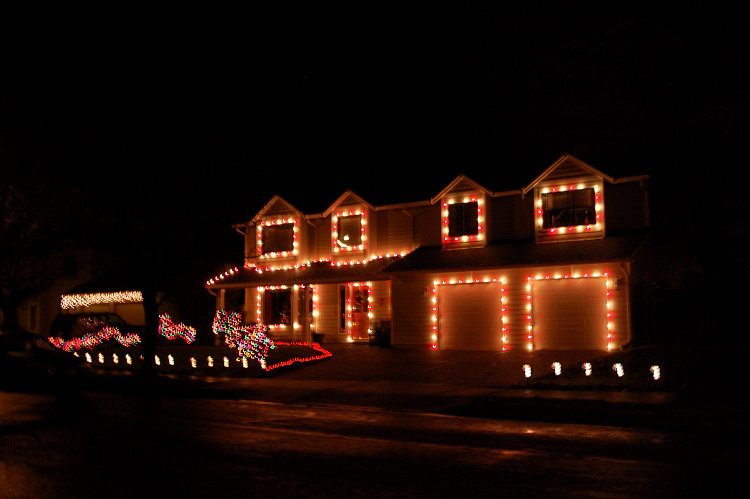
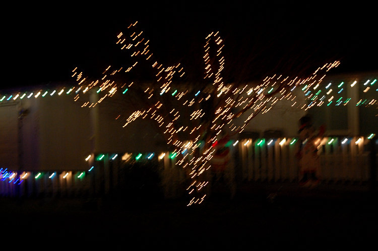
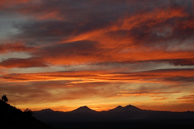
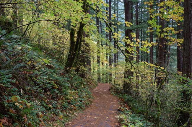
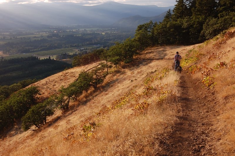
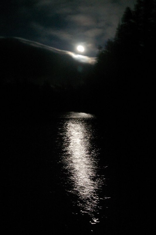
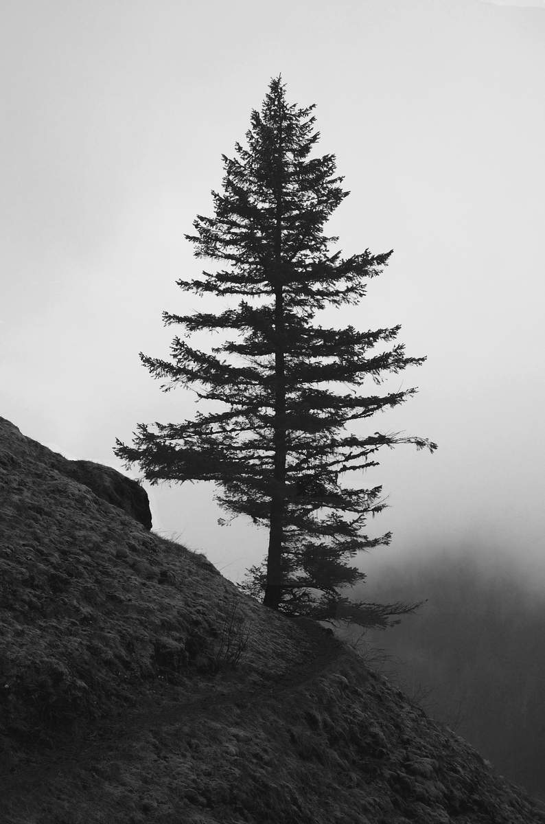
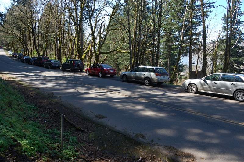
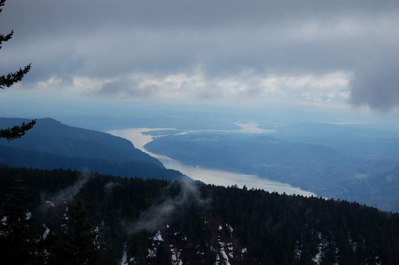
Vancouver city walk
3 miles of hiking • 250' elevation gain •
Likely I'll have no other time to hike this year, so night city walk was needed to reach my goal...

December 28, 2011


 3
3
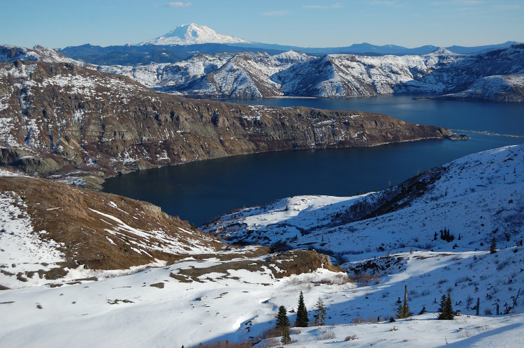
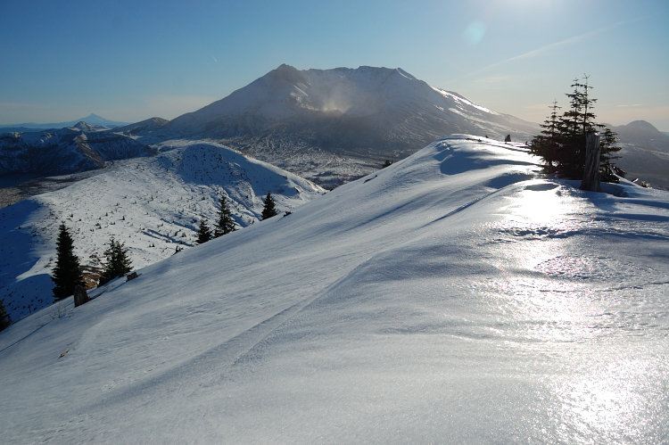
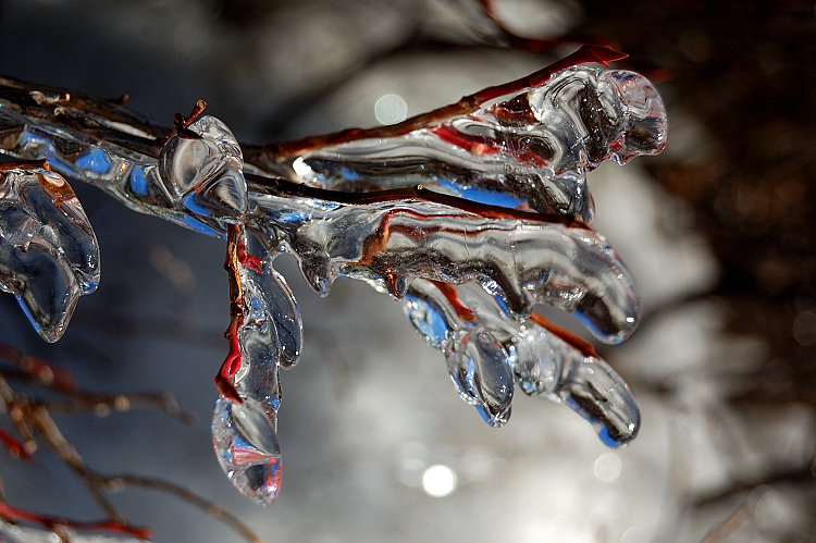
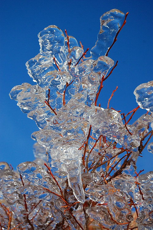
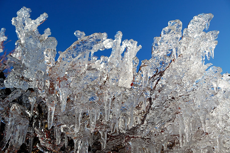
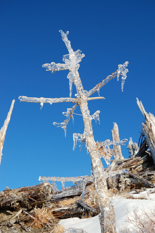
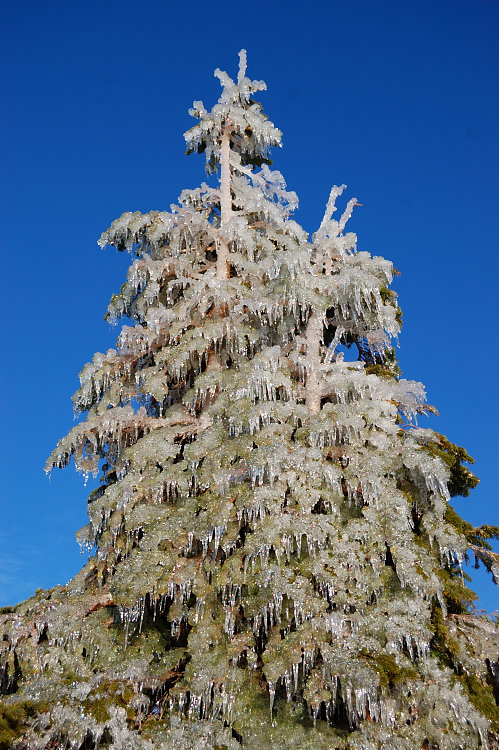
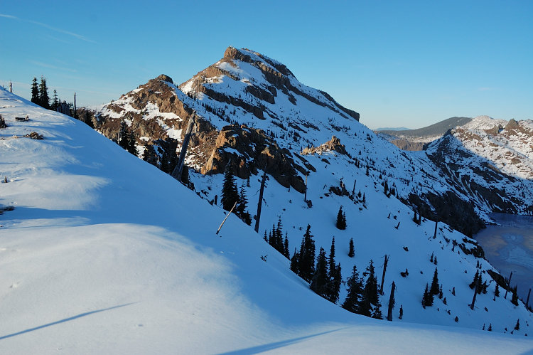
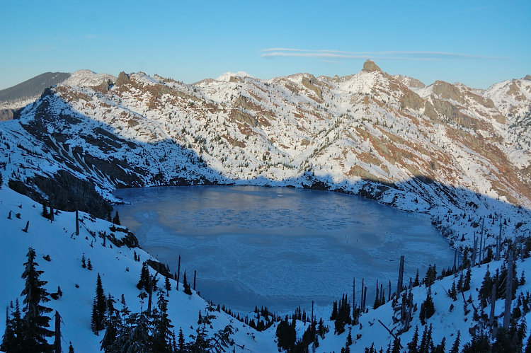
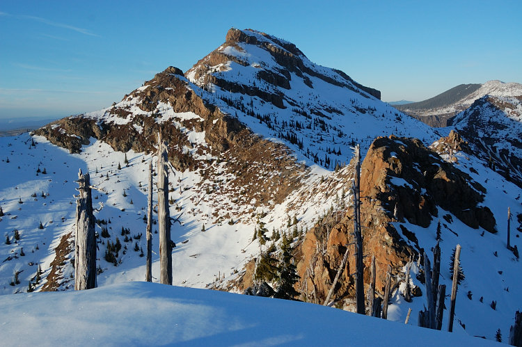
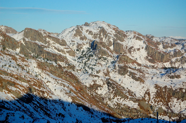
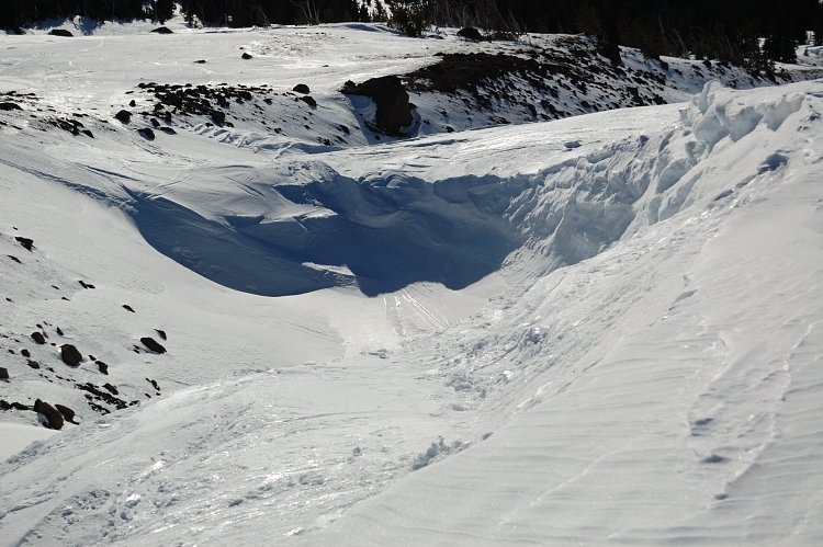
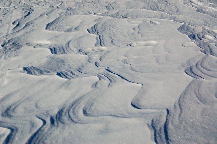
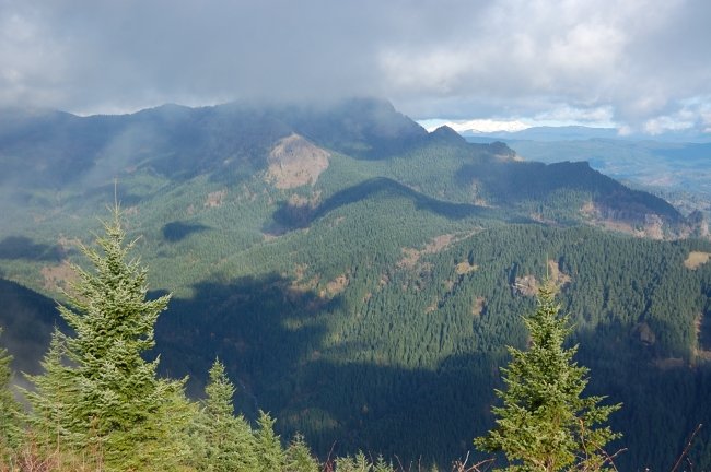
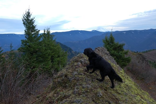
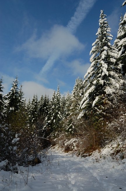
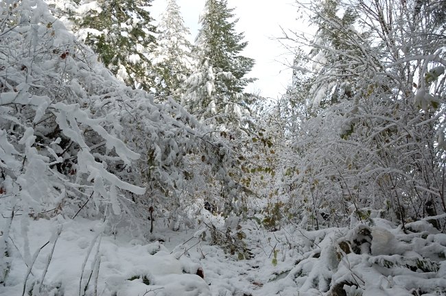
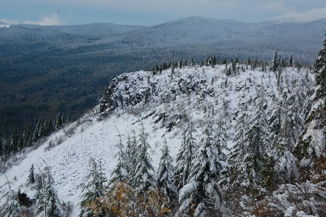
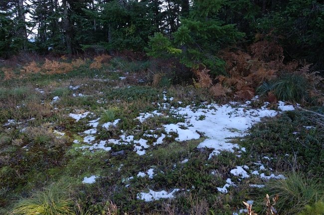
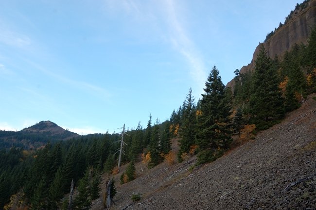
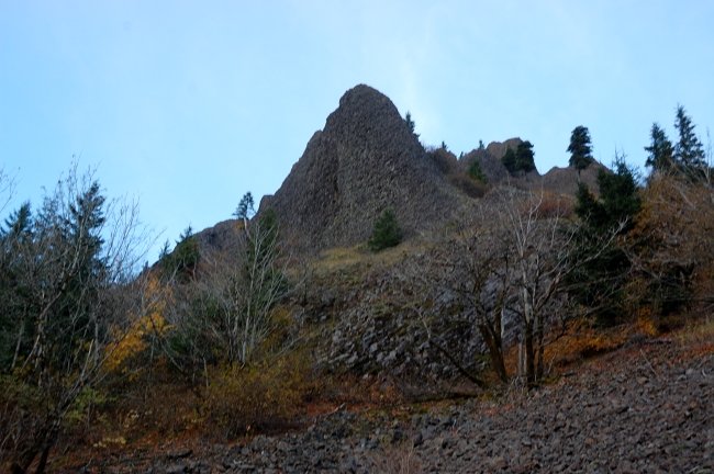
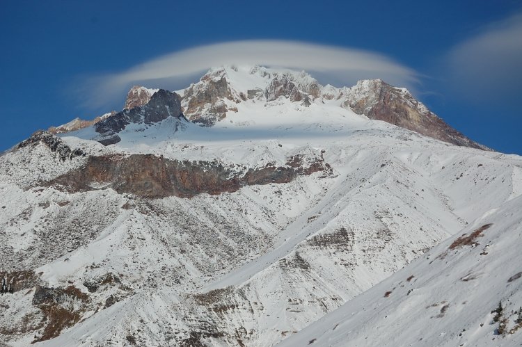
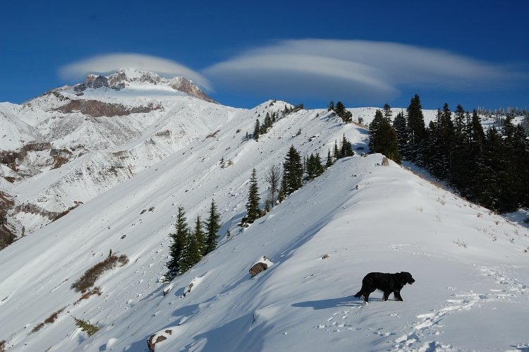
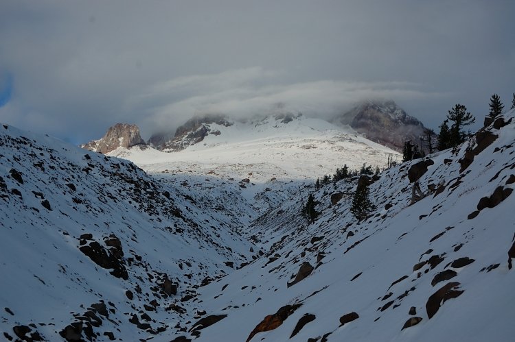
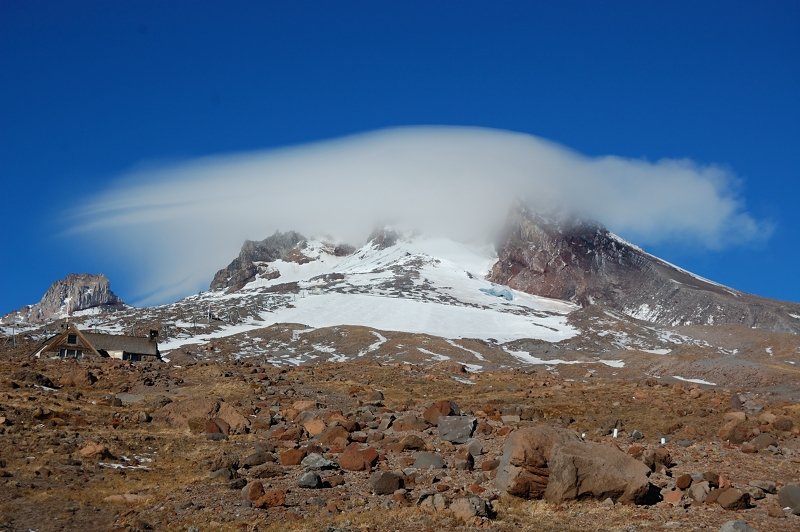
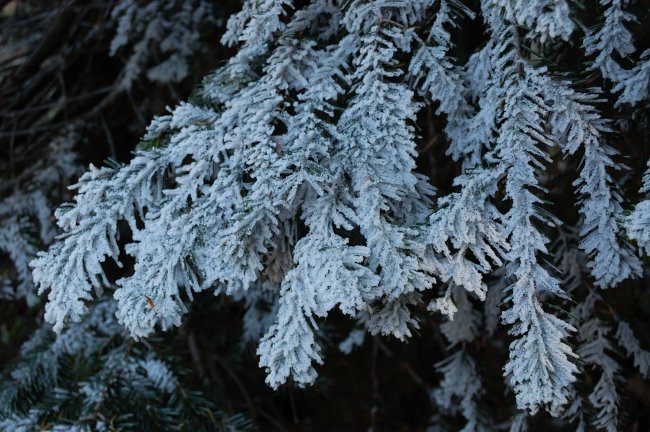
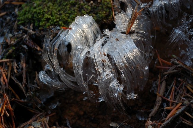
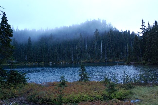
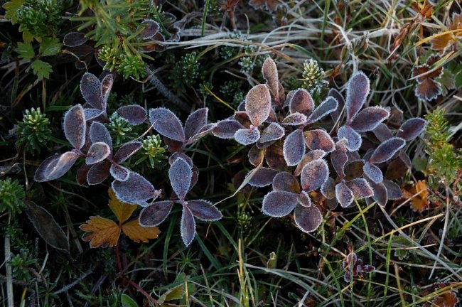
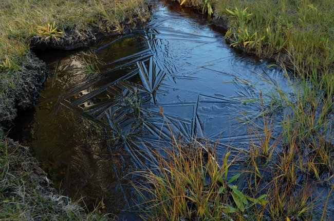
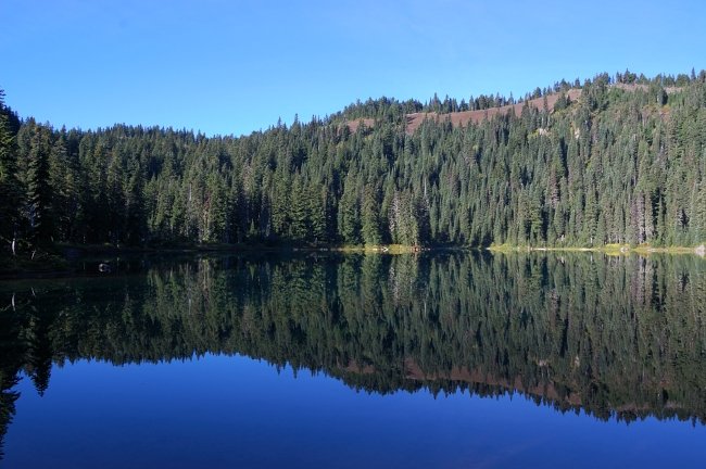
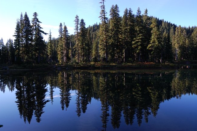
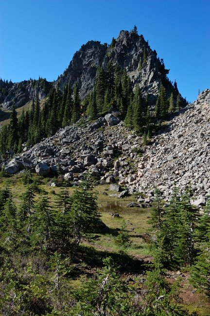
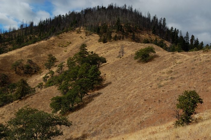
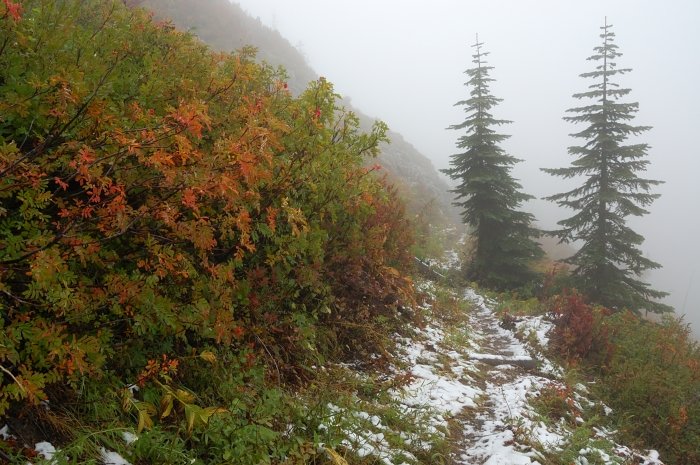
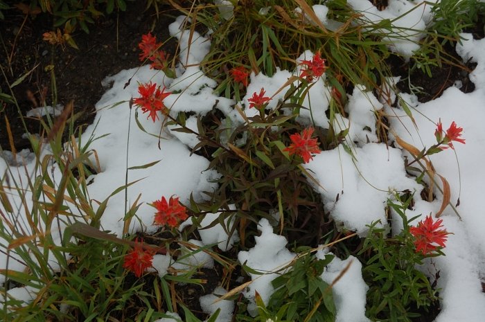
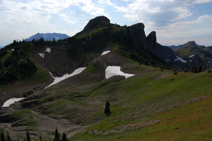
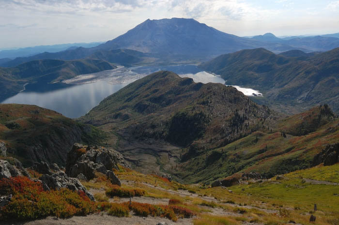
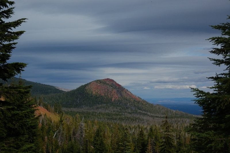
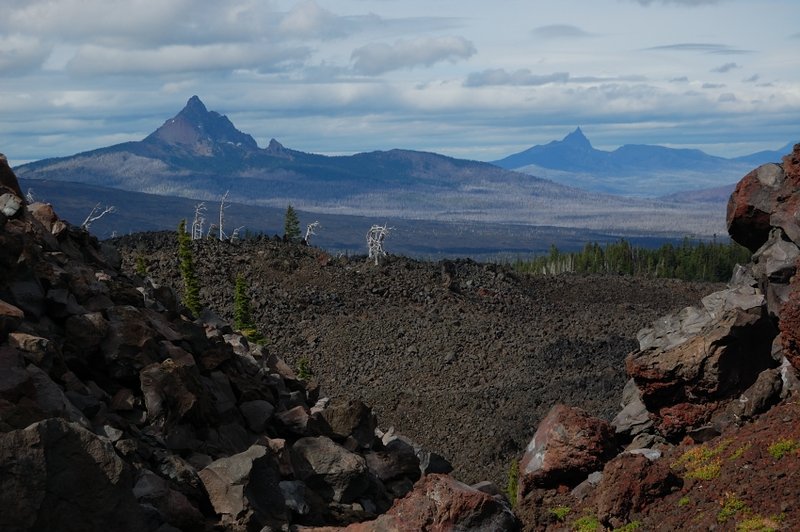
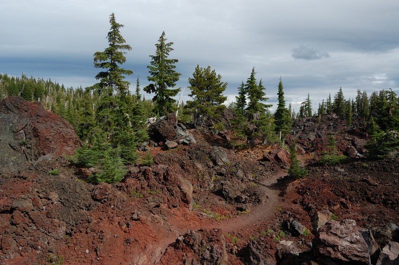
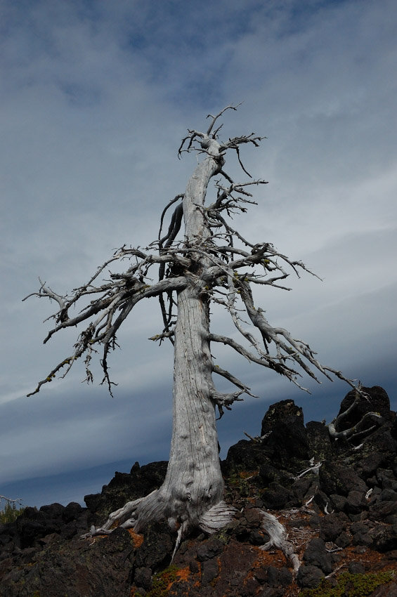
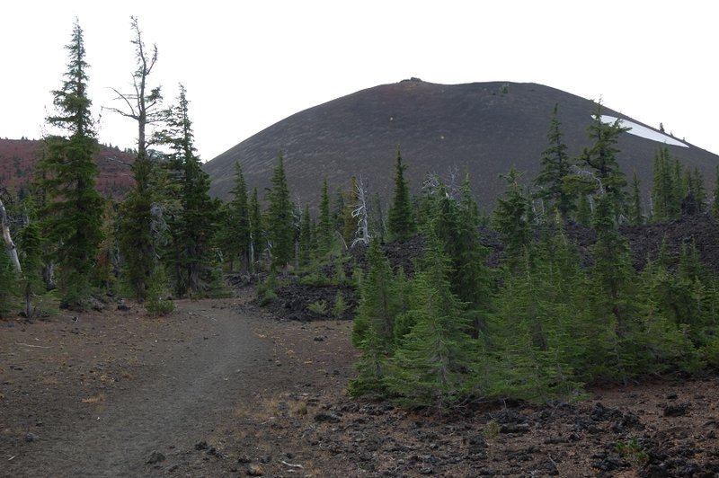
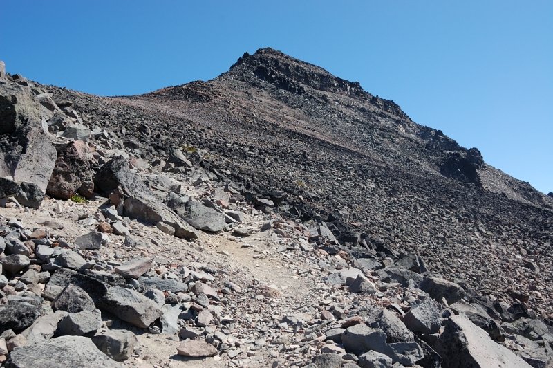
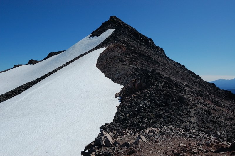
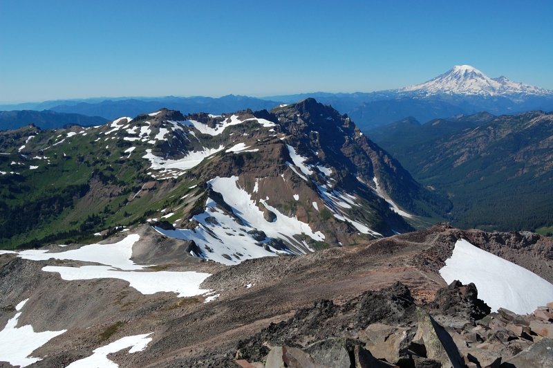
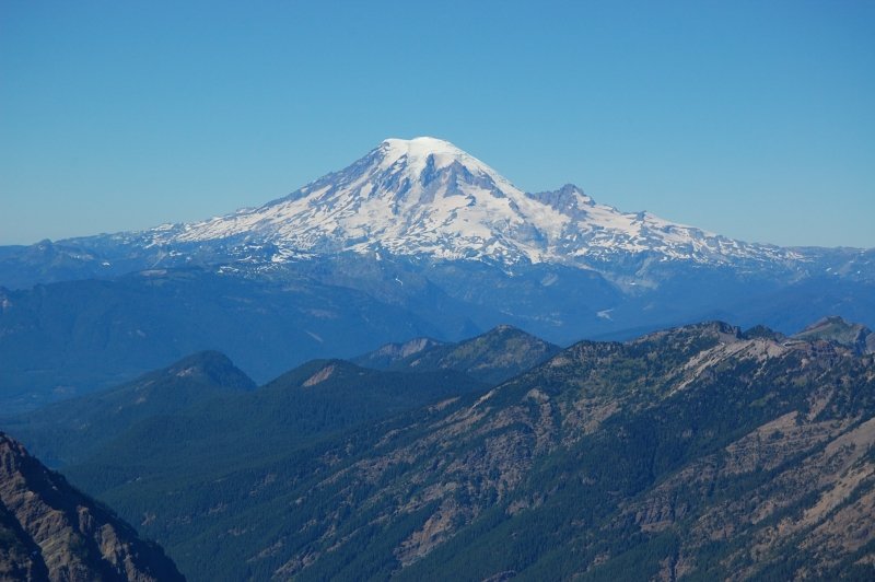
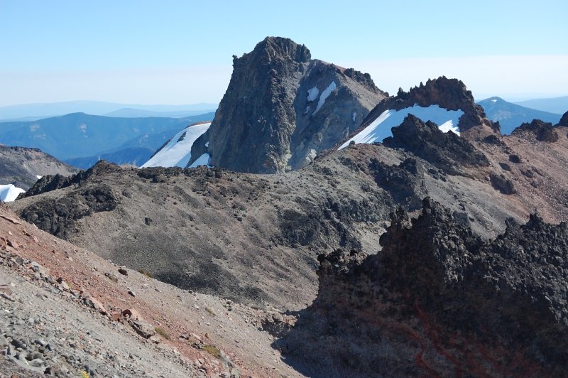
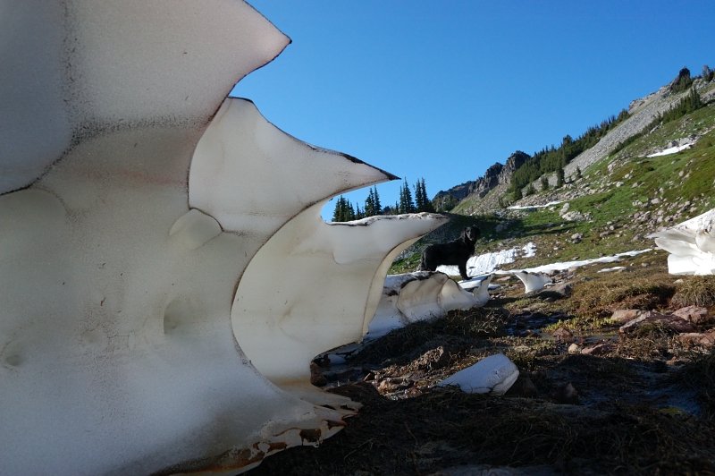
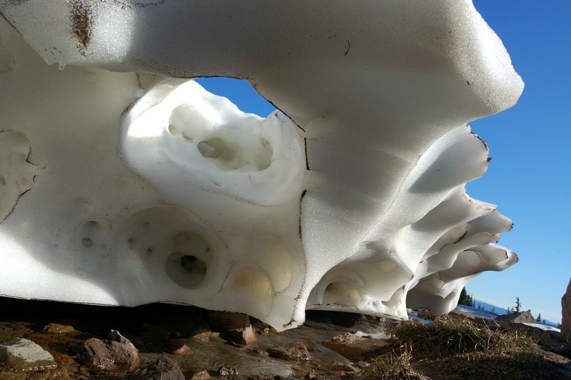
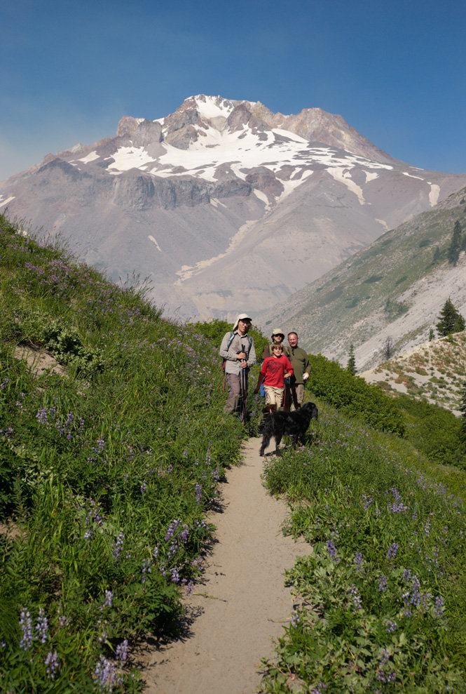
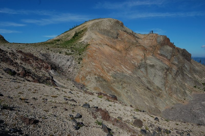
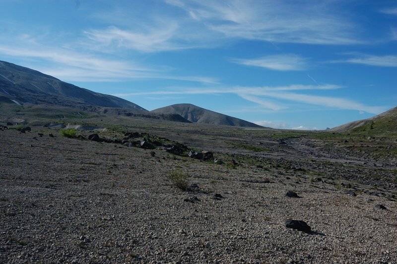
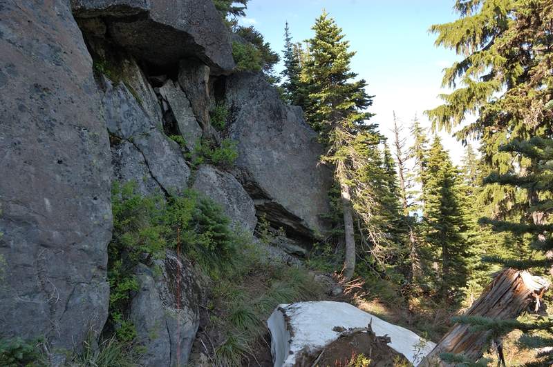
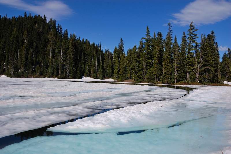
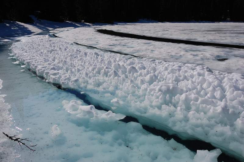
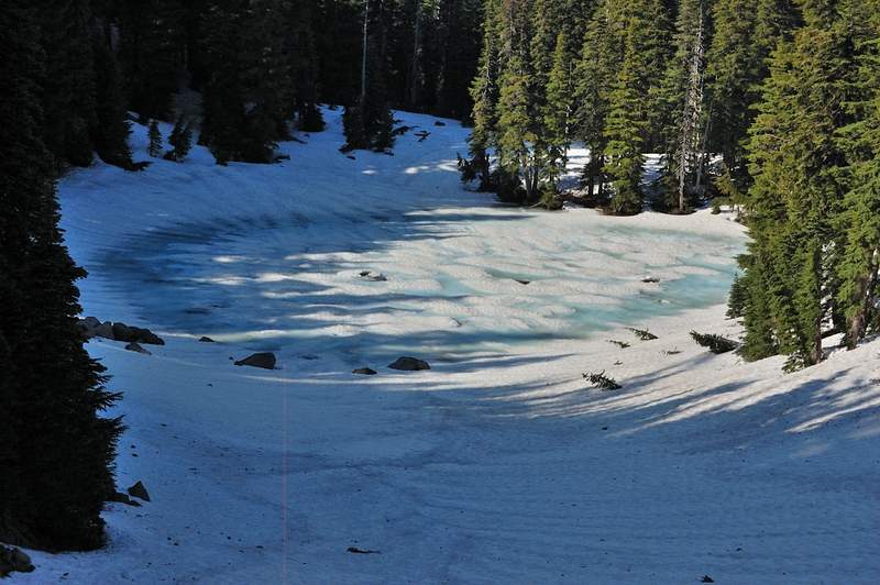
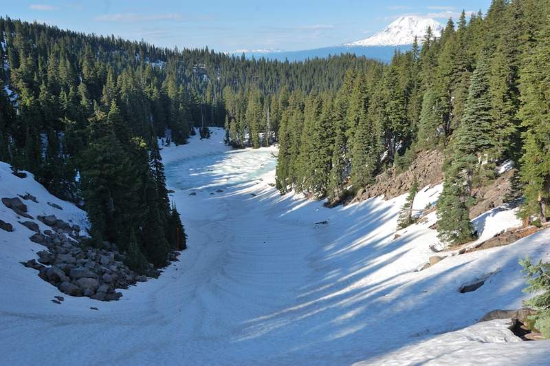
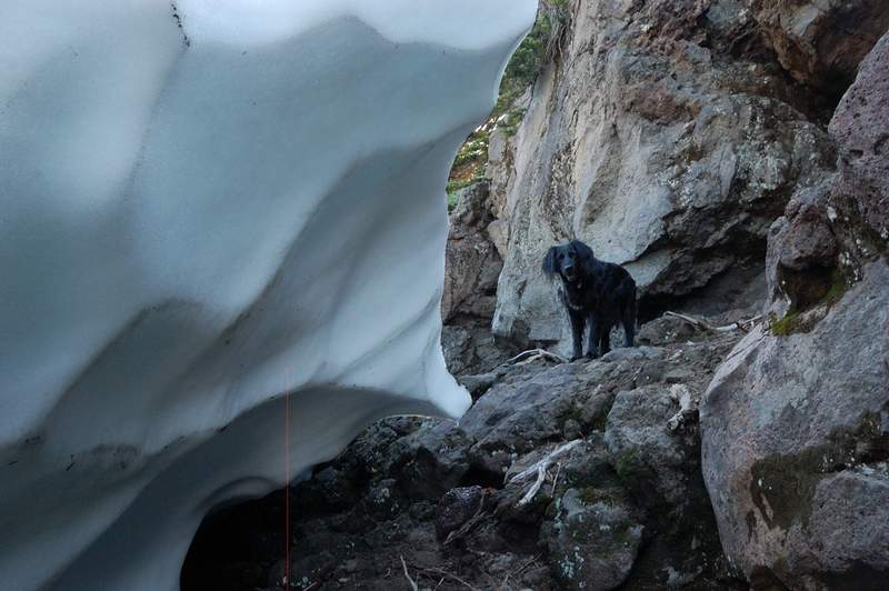
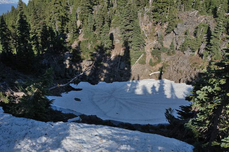
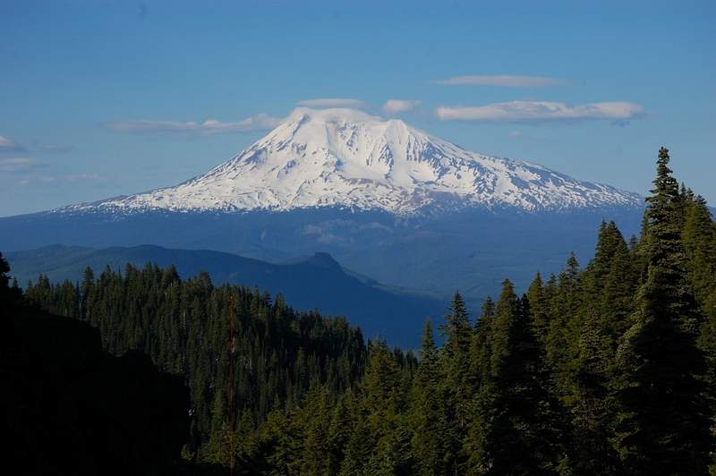
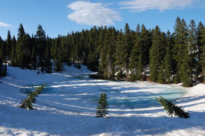
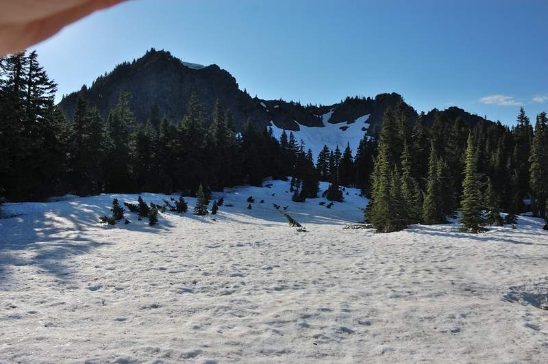
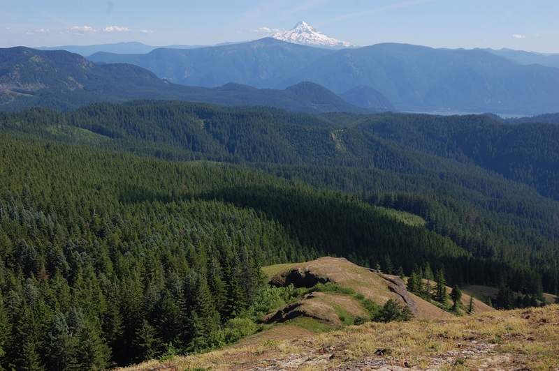
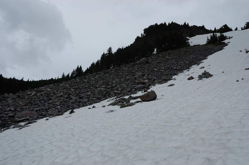
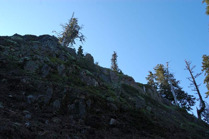
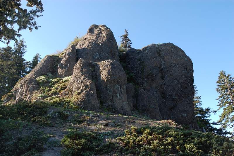
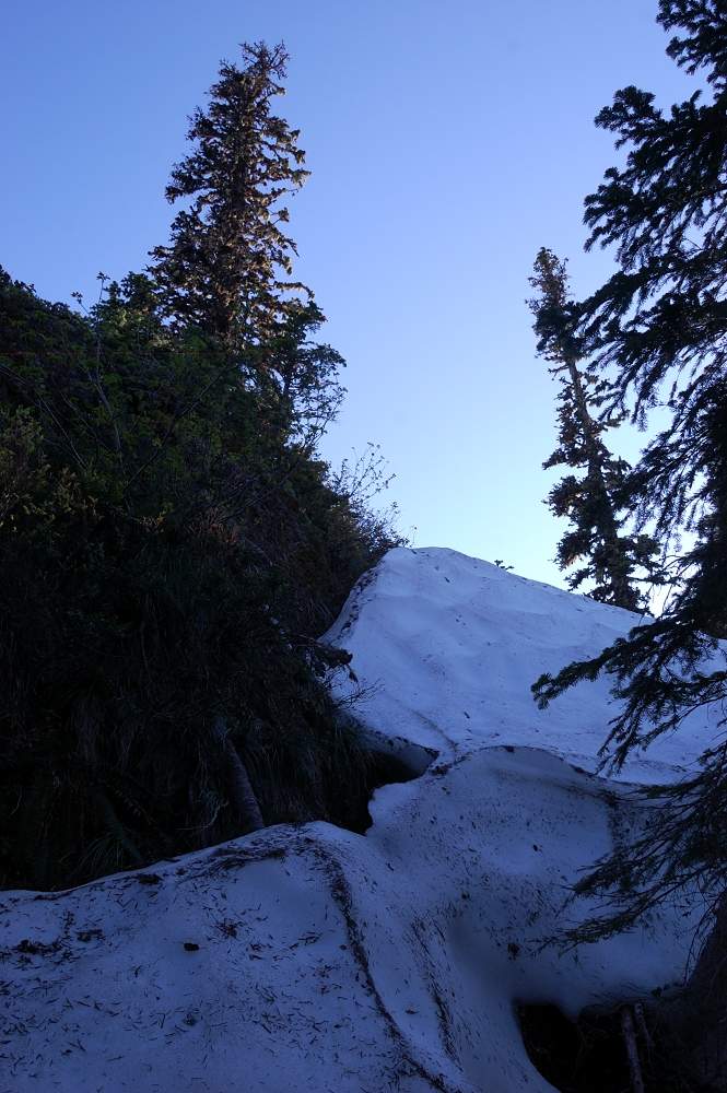
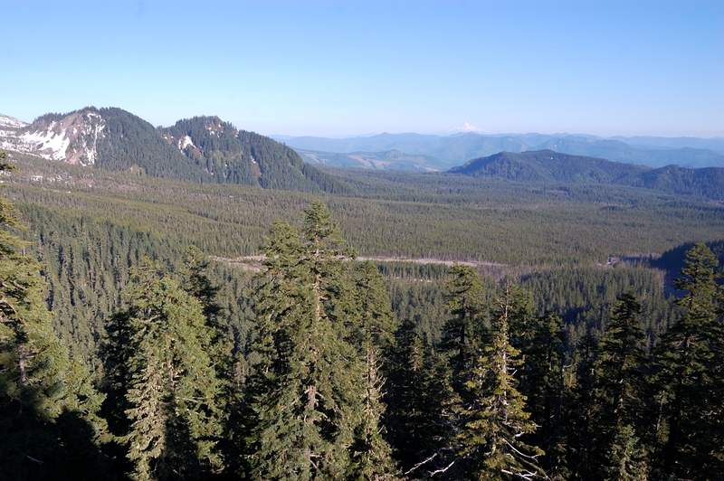
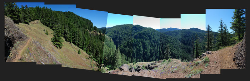
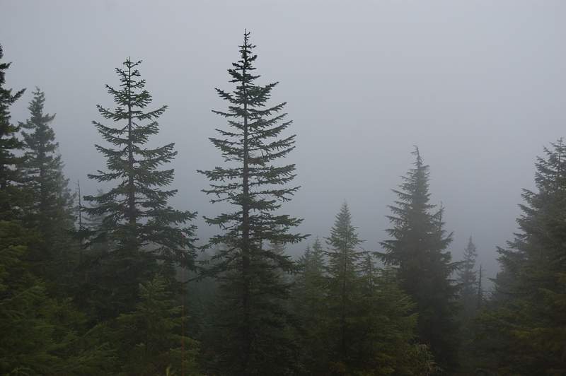
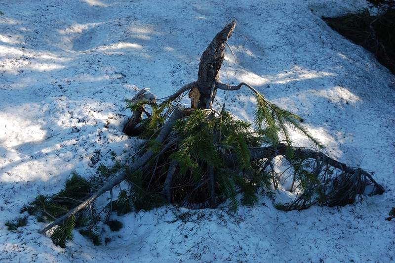
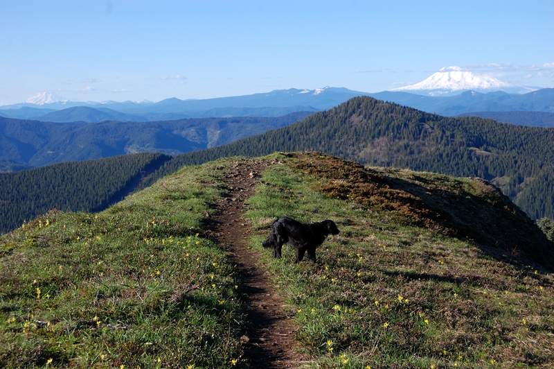
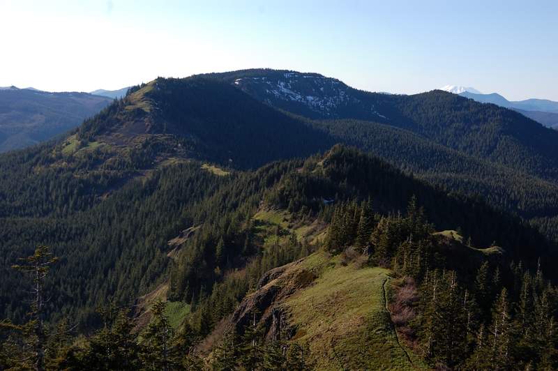
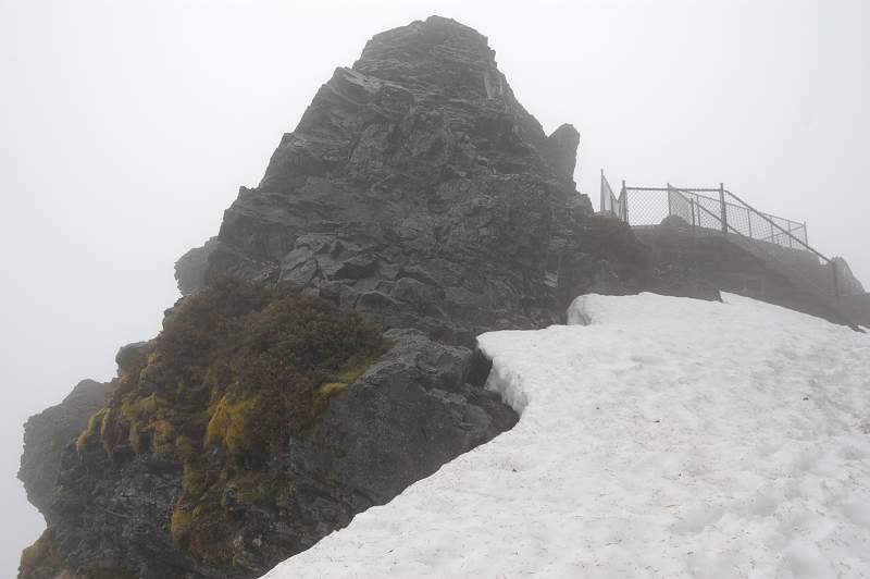
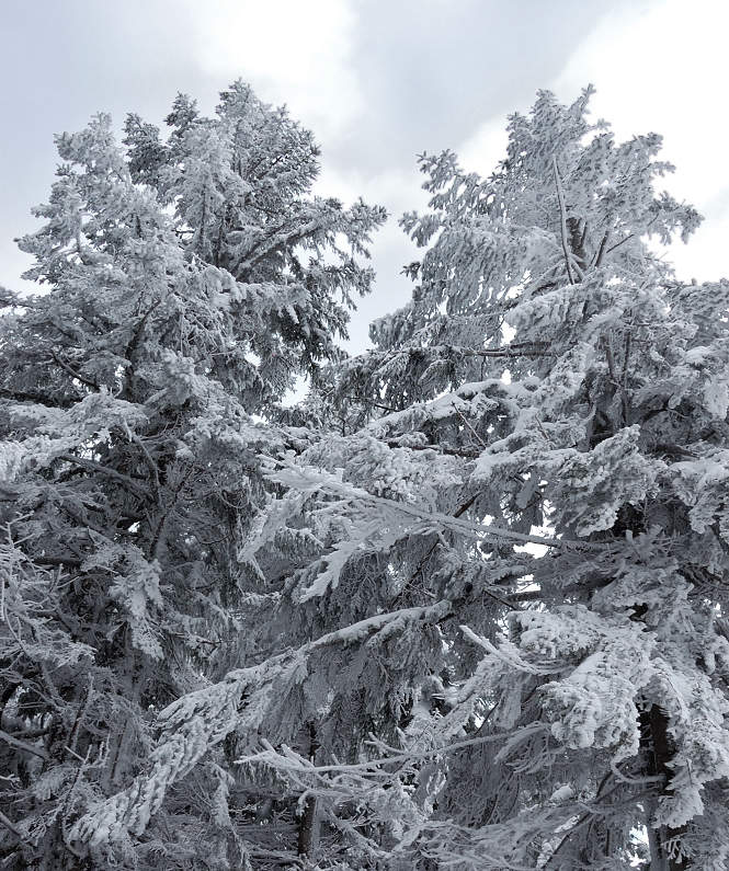
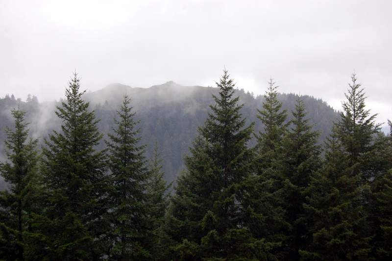
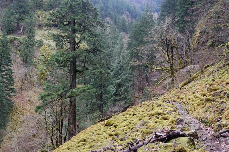
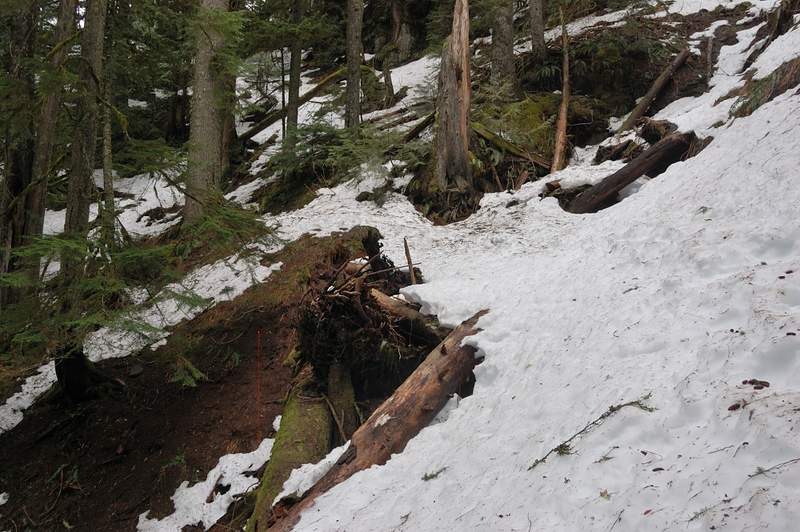
Coldwater Peak attempt - 3 (or 4)
8 miles of hiking • 1500' elevation gain •
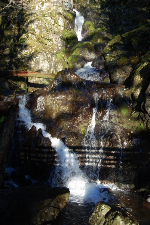
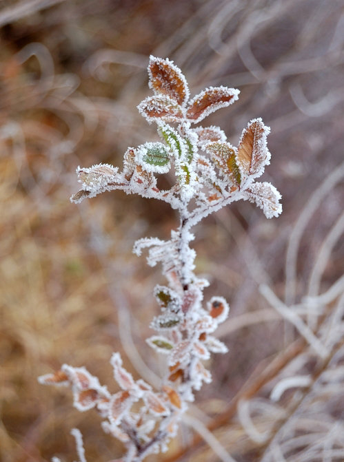
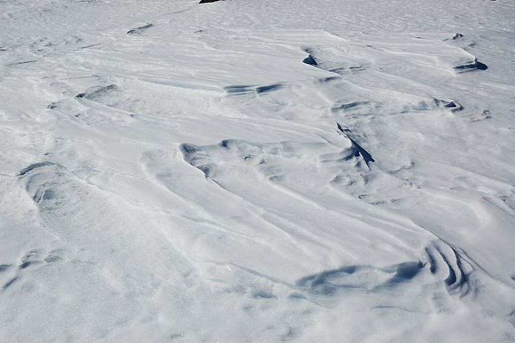
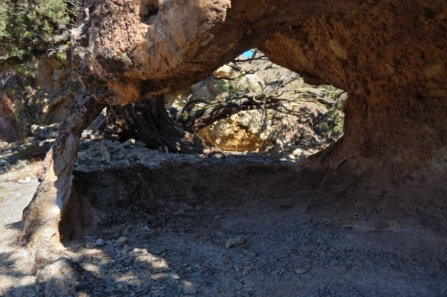
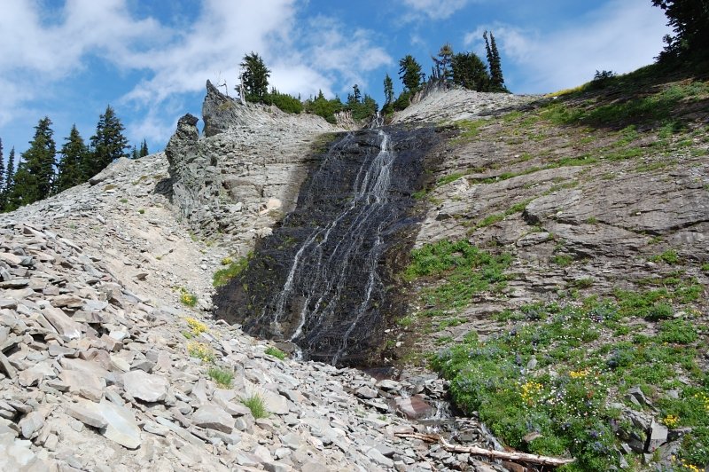
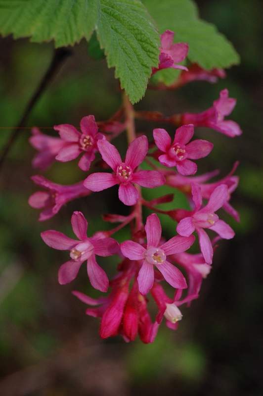
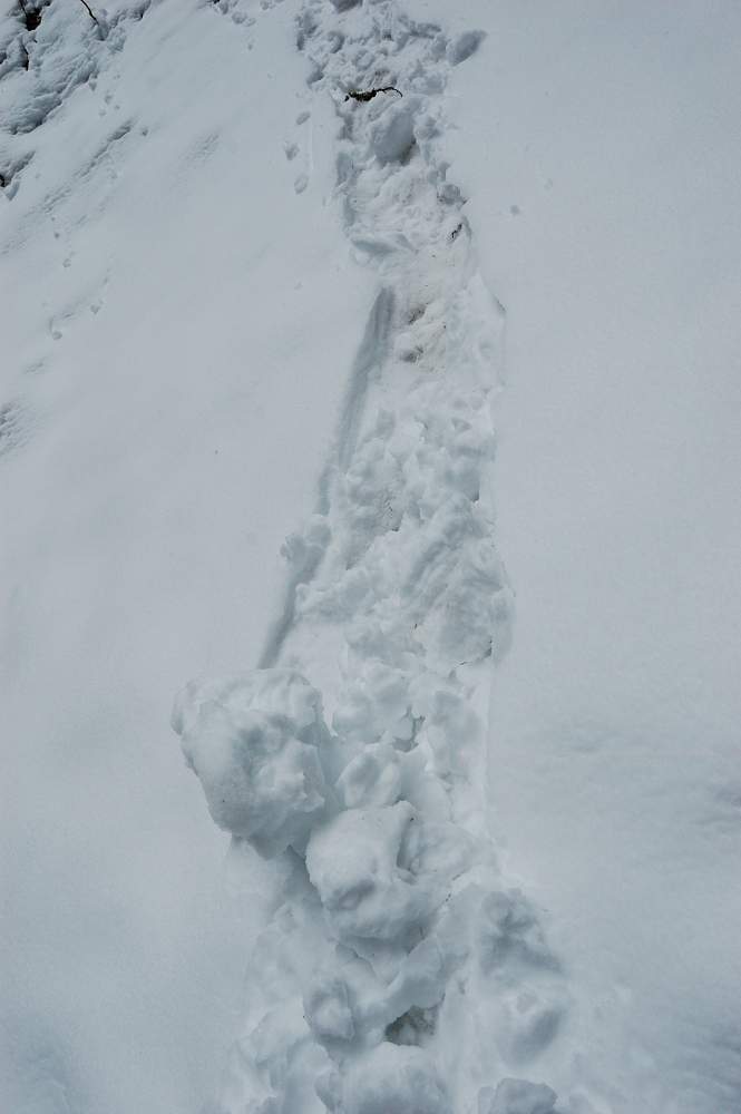
I don't know why but this summit always evades me, for different reasons. This time it was ice. It started at about 5000' and by 5300' an ice sheet was so strong my poles couldn't punch through it. Snowshoes did a great job on traction, but once I got to the steep part decided to play it safe. The ice made for wonderful sculptures though.
December 21, 2011


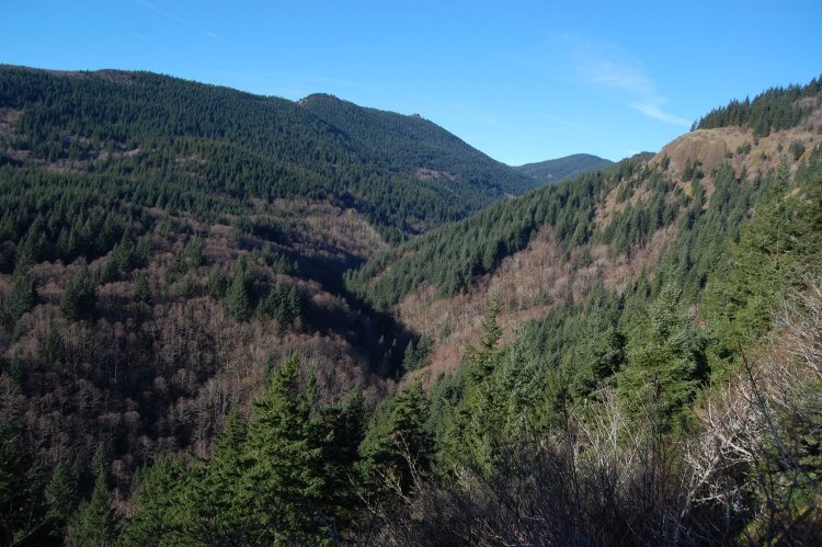
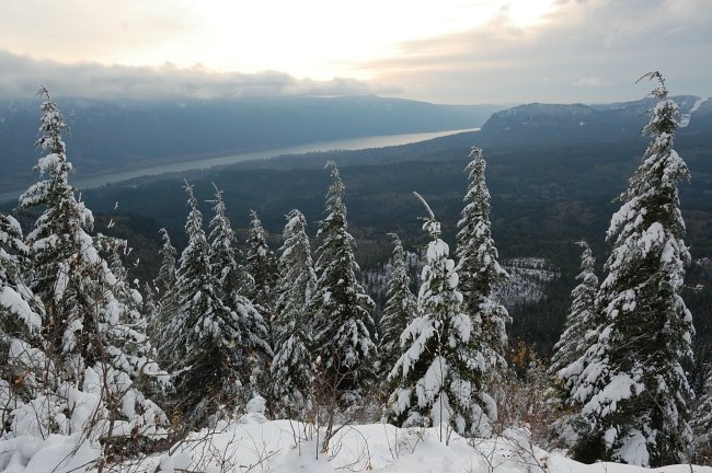
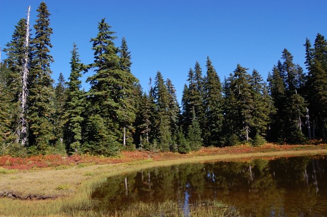
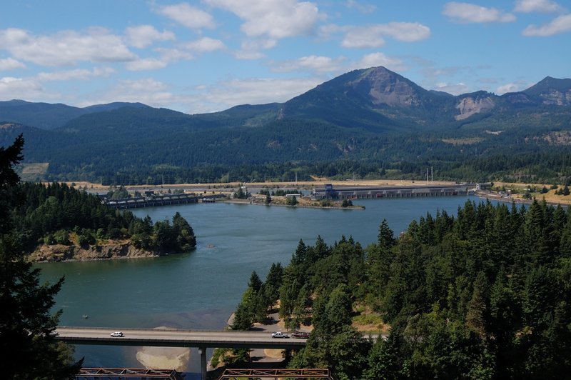
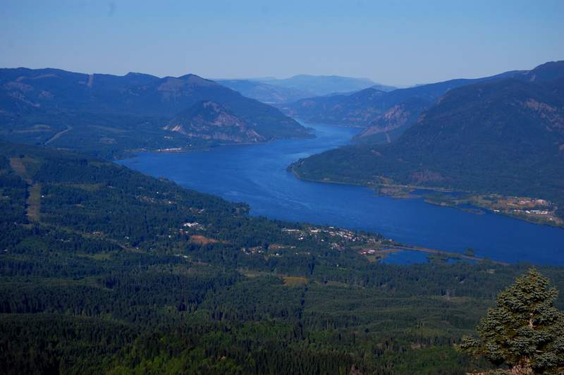
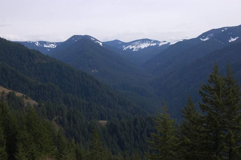
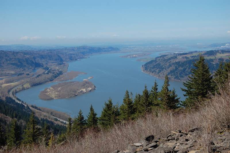
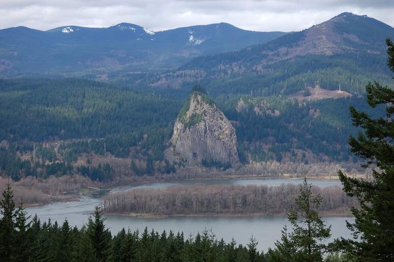
Hamilton
7.5 miles of hiking • 2000' elevation gain •
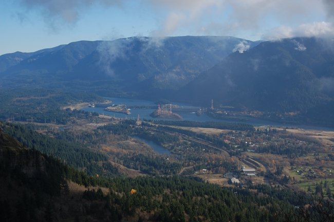
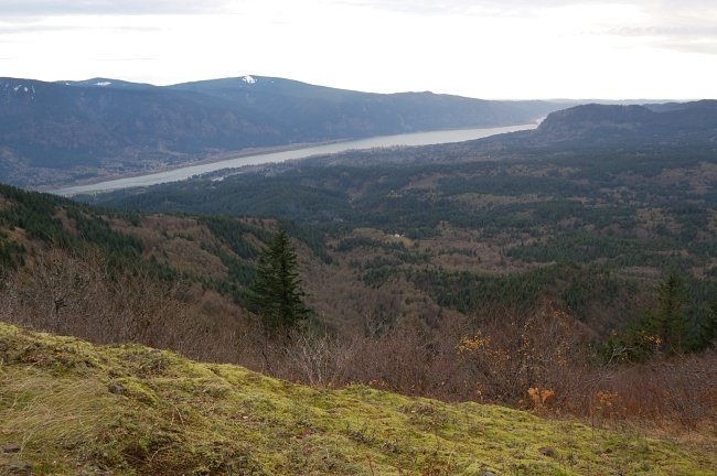
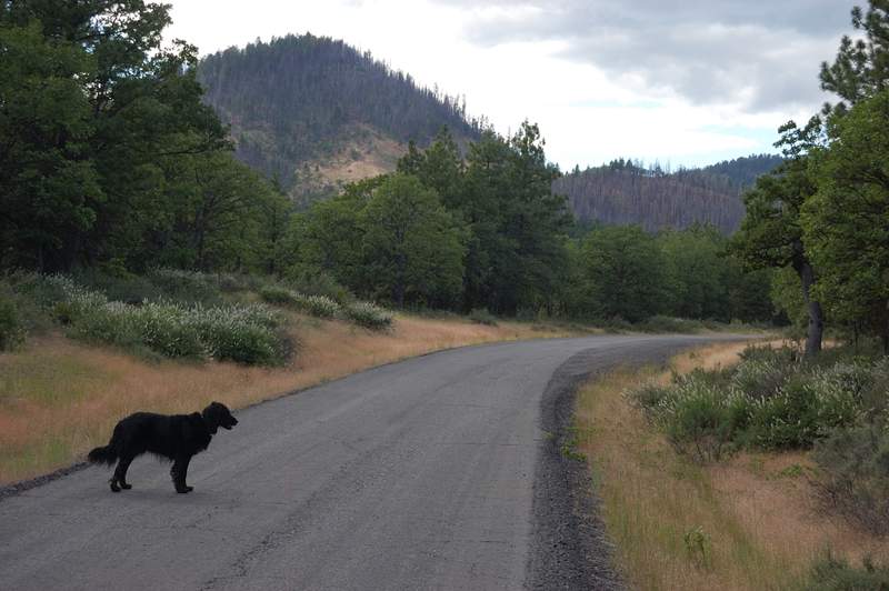
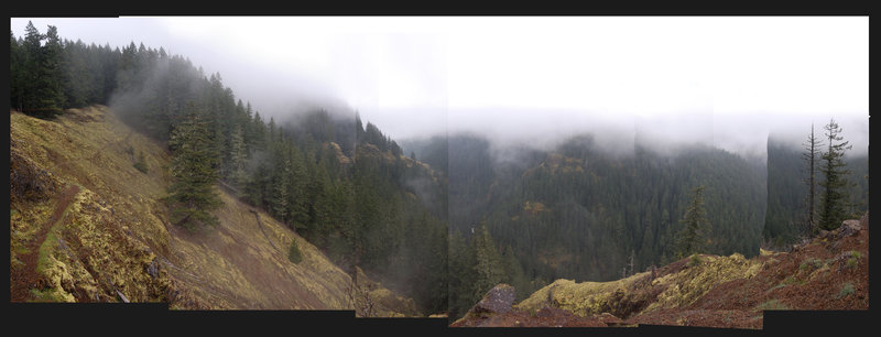
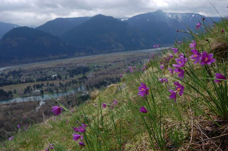
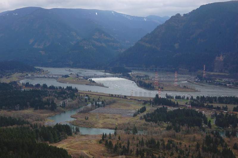
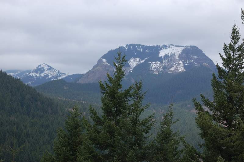
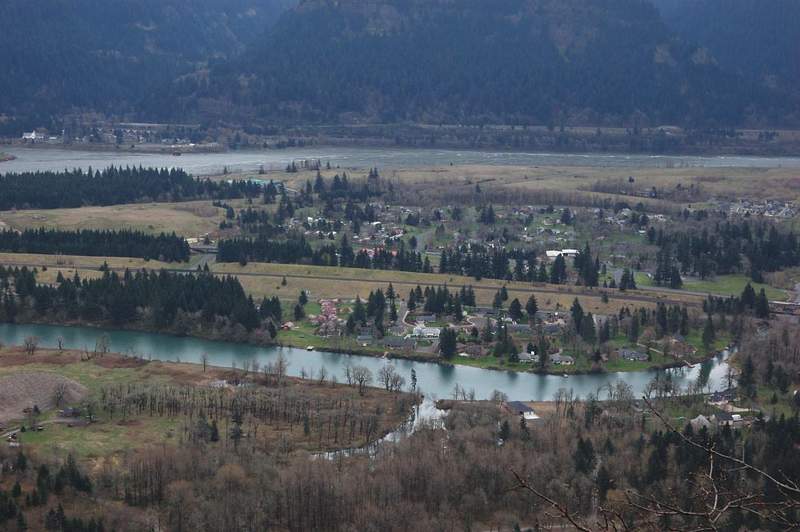
The original plan was to visit Johnston Ridge again, but my Subaru's alternator decided to die, and our Buick is only able to go to the Gorge. Oh well, Hamilton Mtn. hike is a good one - especially in a weather like this. 8.5 miles to go for my years' target...
December 17, 2011

 3
3
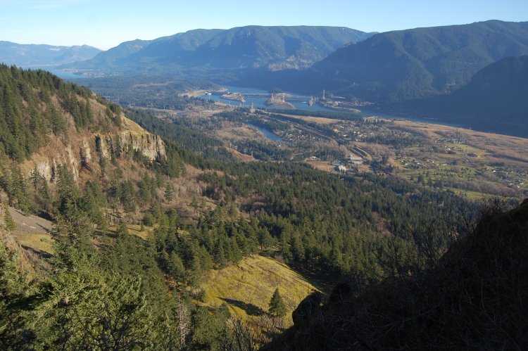
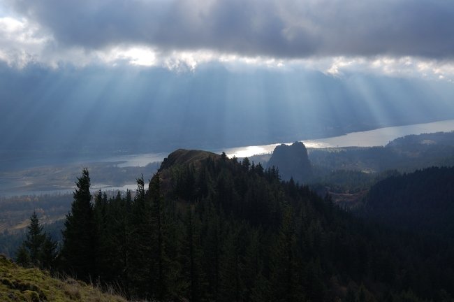
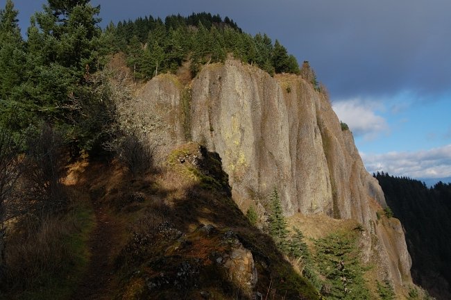
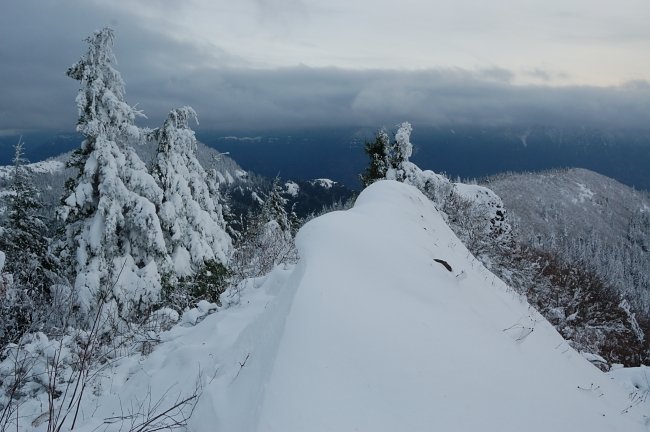
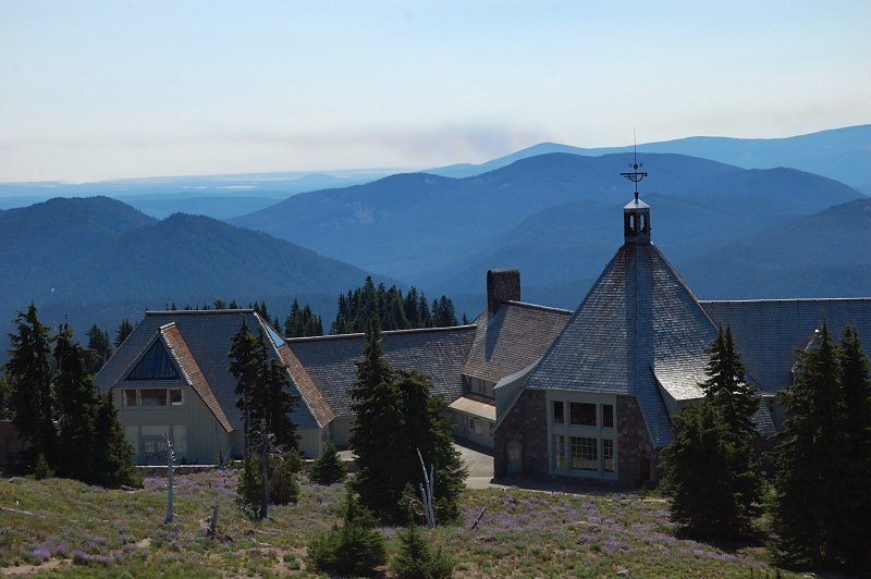
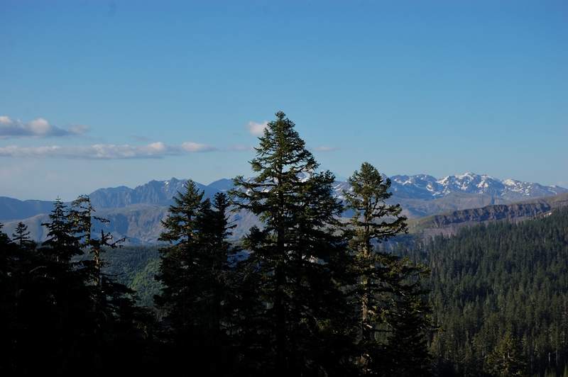
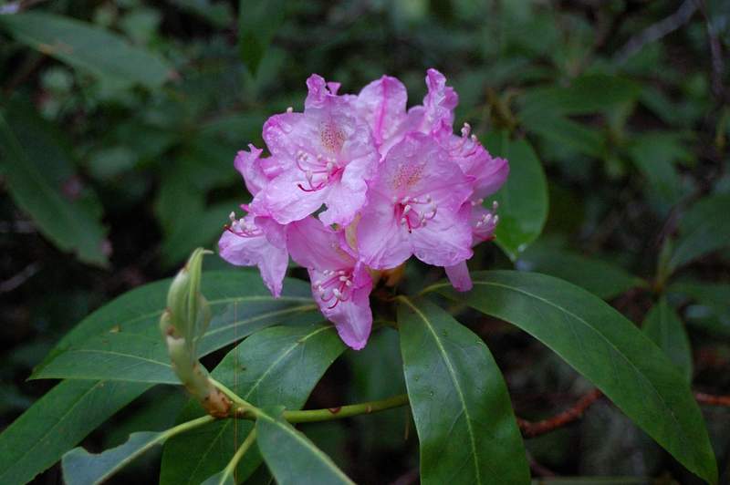
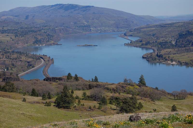
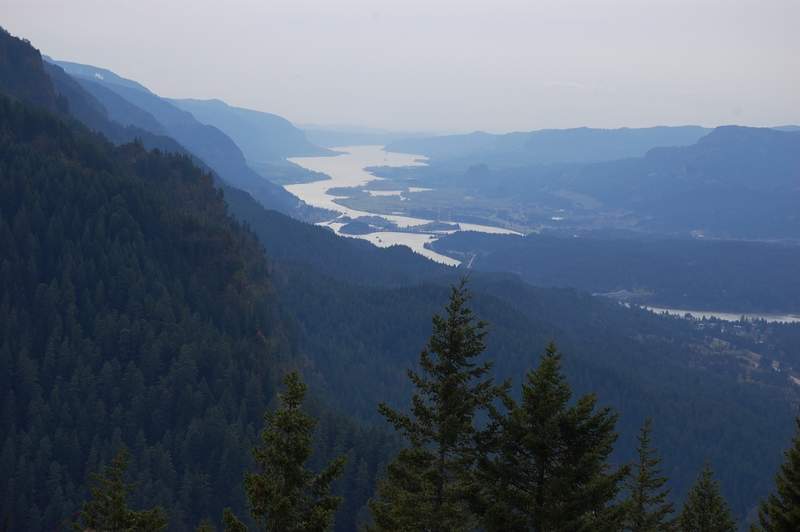
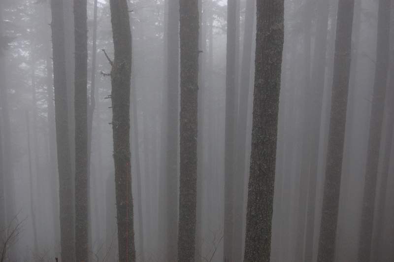
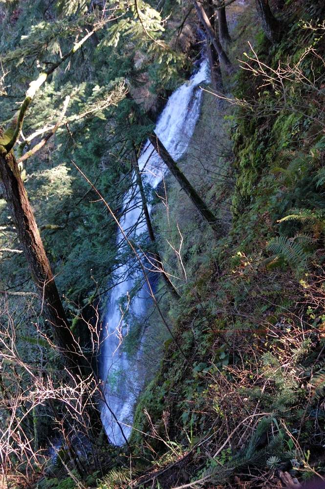
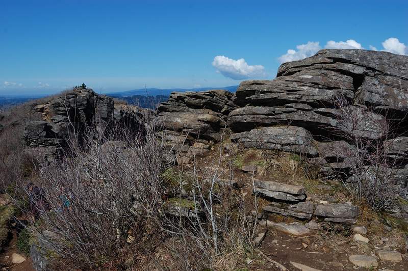
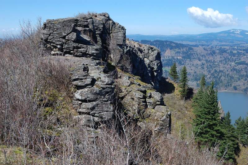
Johnston Ridge
3.5 miles of hiking • 750' elevation gain •
Went with my dad to take a photo sunset from one of the points (my dad is professional photographer); if we knew the road is open all the way to Observatory if could be quite a snowshoe trip! It snowed lightly but it won't be much this time.
December 11, 2011


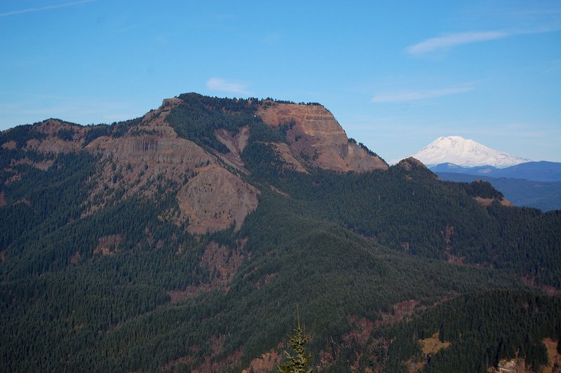
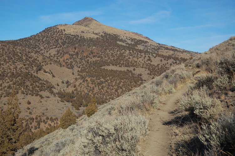
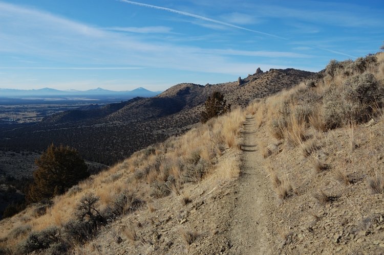
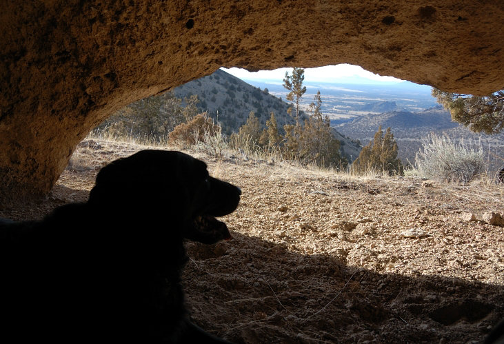
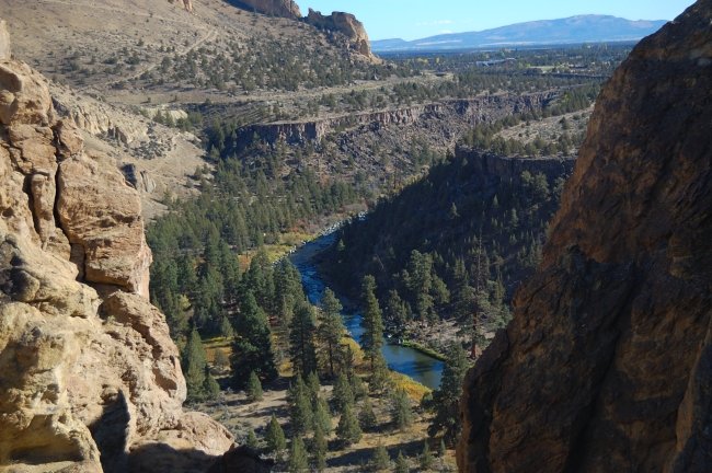
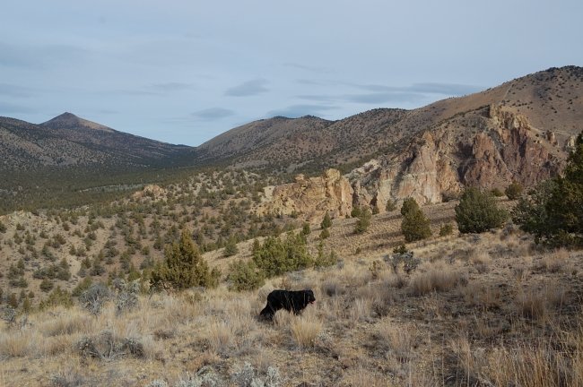
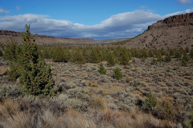
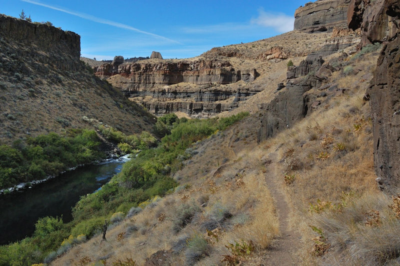
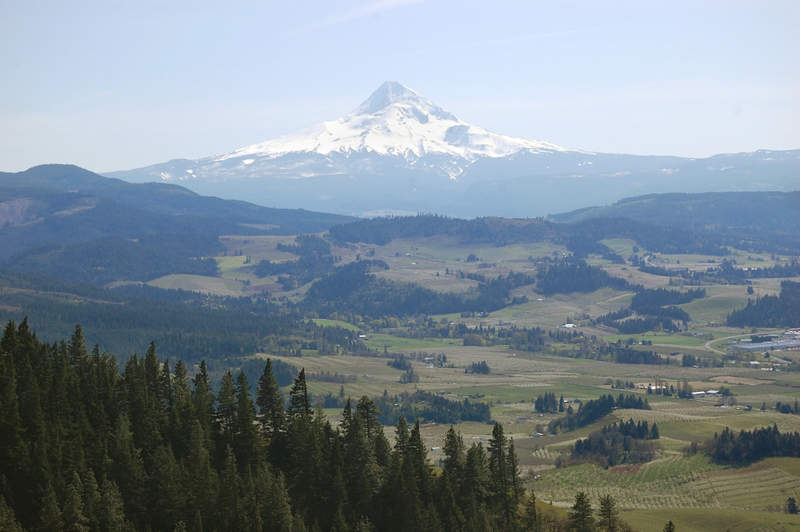
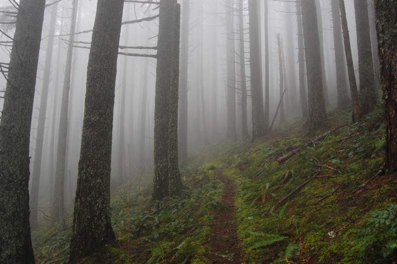
Grey Butte Trail to Point 4230
7.5 miles of hiking • 1250' elevation gain •
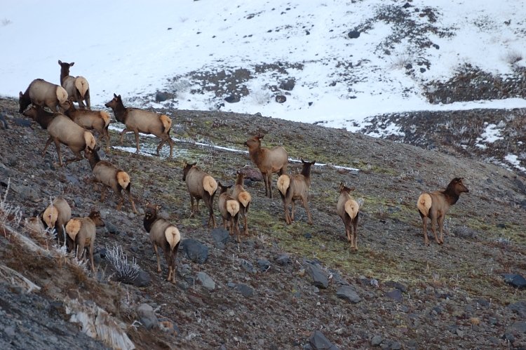
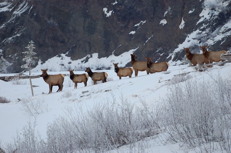
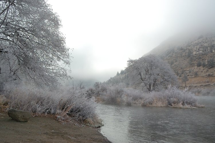
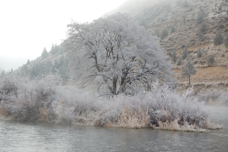
Hiked with my dad on Gray Butte trail from seasonally closed Rd 5720 to a small summit overlooking Smith Rocks state park. Initially planned to include Smith Rocks in the loop but ended out taking more photos and slowing down the pace, and we didn't want to hike 1.5 hours in the dark. The weather was gorgeous, almost no wind. We took some freezing fog pictures on the Deschutes River rest area early on.
It started to snow on Mt. Hood when we drove back.
December 10, 2011


 1
1
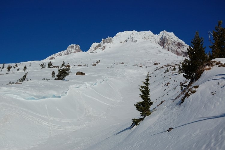
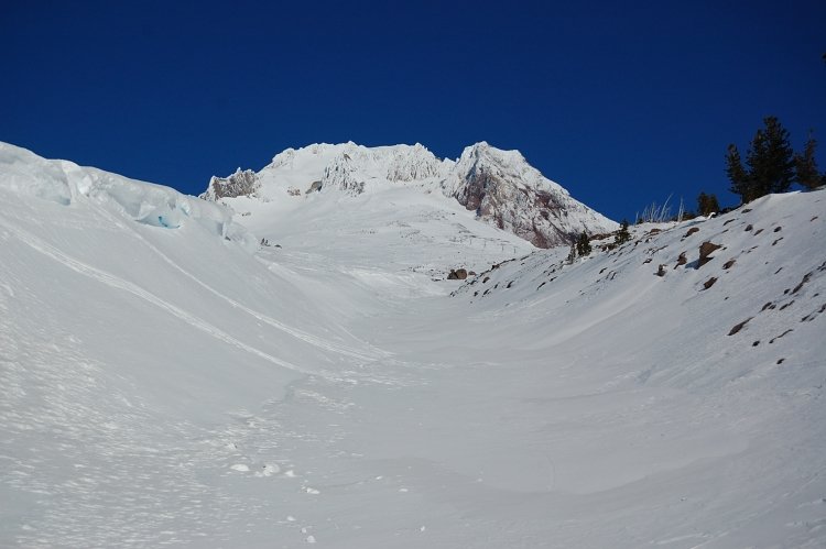
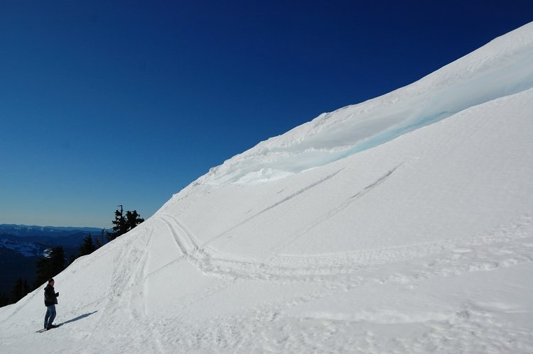
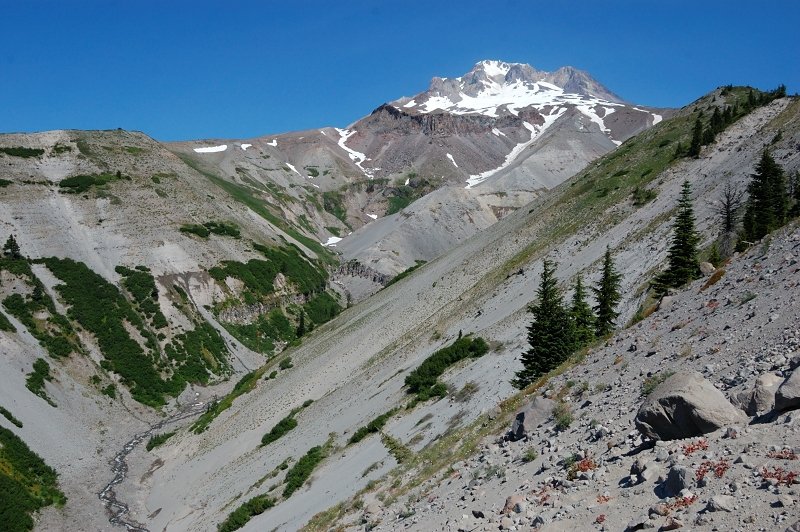
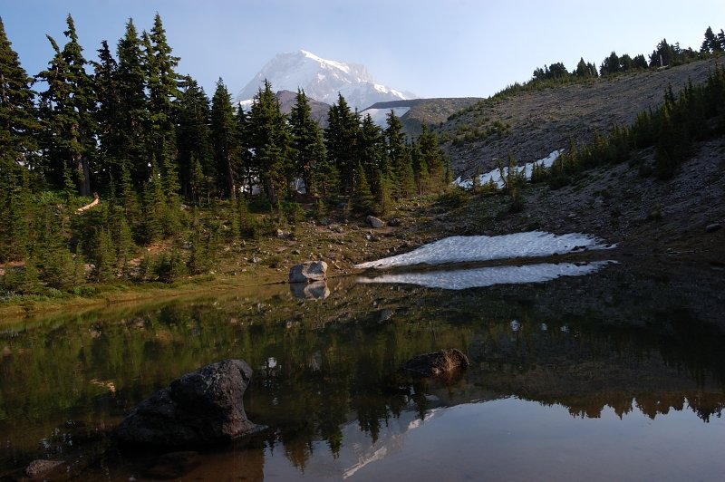
Hiking near Timberline Lodge
3 miles of hiking • 1250' elevation gain •
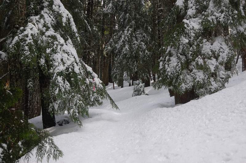
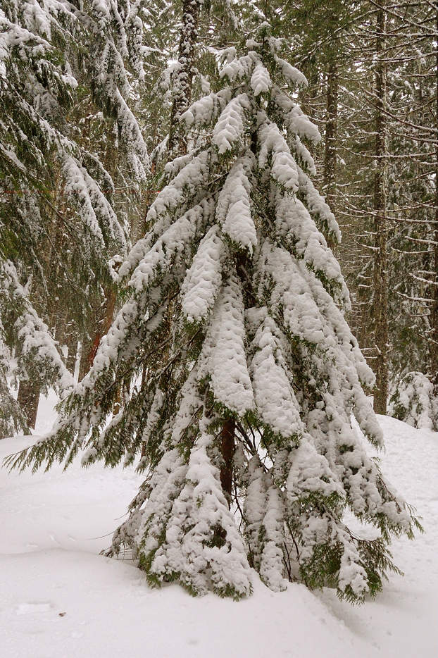
I joined my dad on his day off; we took our snowshoes and got to Timberline Lodge without a pre-determined hike plan. We thought to get to Big Zigzag Canyon viewpoint and see if we wanted to continue from there. Located PCT sign quickly but with about 3 feet of snow on the ground we couldn't follow the trail. Instead of going in the vicinity of PCT slightly downhill in the forest (and over tree wells) we hiked slightly uphill and stayed in the open. I only expected Little Zigzag to a minor obstacle, but what came to a surprise is that we had to cross 2 steep-sided canyons even before we got to Lil Zigzag - I didn't even notice those canyons back in summer but not they presented an obstacle. West side of Sand Canyon even had cornices about 1.5 feet thick and several feet wide. We chose not to cross Little Zigzag because of imposing cornices on its west side (between 5-8 feet thick?), also it would be next to impossible to descend and ascend on steep, hard-packed snow without any climbing equipment. We decided to hike above Little Zigzag but when we got to the head of the canyon the wind increased so much we had to turn back.
Despite being windy, it was a nice, sunny, and warm day on the mountain (it felt 45-50F, much warmer than down below). The snow made familiar terrain quite different and interesting.
December 6, 2011


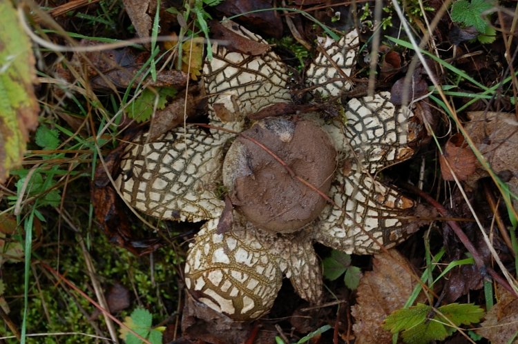
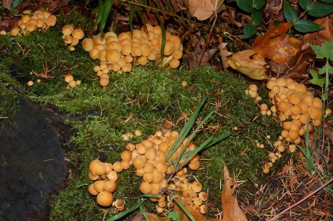
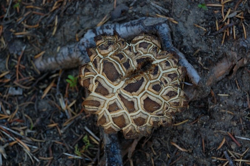
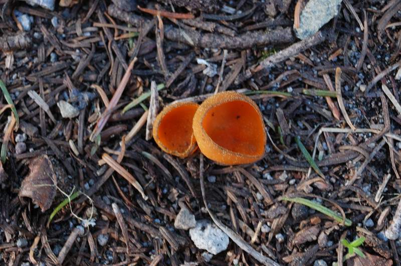
Truffle hunting in Lobster Valley
1.5 miles of hiking • 250' elevation gain •
My mom wanted to try truffling for a long time, so we joined an organized group (`20 people) with North American Truffling Society. Truffles are underground mushrooms and worth their weight in gold (well, almost). You have to rake big area to find a few. We found 3 truffles, our guide determined only 1 of them as edible, and when we got home I realized I lost it. Well, still good experience though not my cup of tea. We also picked a fair amount of other mushrooms while being there.
December 3, 2011


 1
1
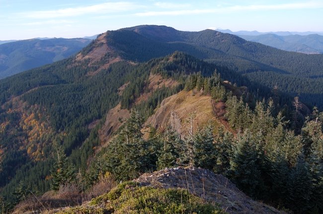
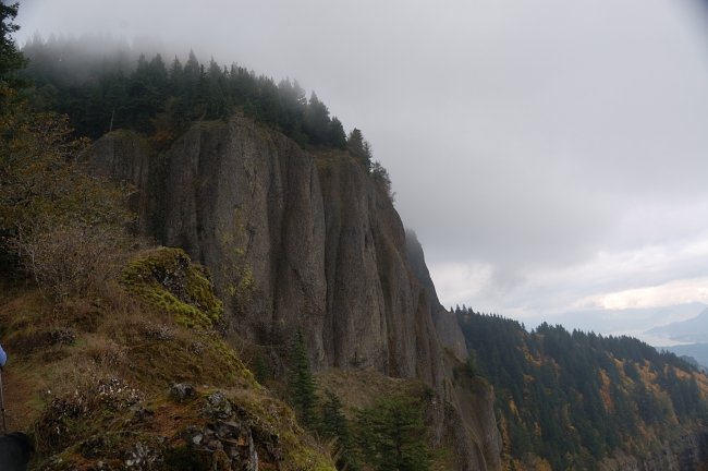
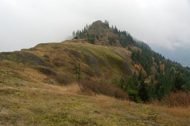
Mary's Peak
1.5 miles of hiking • 250' elevation gain •
Since we were close, we decided to see what's Mary's Peak is about. It's the highest peak in Oregon's Coast Range. The road goes most of the way to its summit (actually, all the way but the last section is gated). Beautiful area, BIG views, open summit meadows - it's not like one would expect in the Coast Range. There's a whole system of trails in the area, with maps posted. The signs said "pass area" (no details @ the trailheads) but the locals whom I asked were surprised and all said it's free to park there.
December 3, 2011

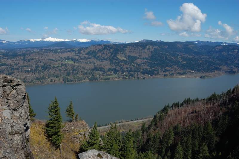
Hamilton Mtn
7.5 miles of hiking • 2000' elevation gain •
Family hike on Hamilton Mtn. The gate before the trailhead is now closed (for the winter?) so one has to start at Beacon Rock.
December 2, 2011

Devil's Rest and Angel's Rest
8 miles of hiking • 2250' elevation gain •
I forgot the camera for this one, so no pictures. Angels Rest was in the fog on the way up, but when I went back the cloud deck briefly lowered just enough to allow the "airplane view" from AR of being above the clouds - with Archer Mtn., Silver Star and the surrounding hills being islands in white sea. Of course, if I took the camera it wouldn't happen )
On a funny note, I talked with a gal near AR and then she asked "do you live here?" - at the moment I thought well, do I look like a Sasquath already 8(. Well probably she only meant my accent.
BTW the trail is clear of snow all the way to Devils Rest. Not much dirt either, less than I expected there.
November 28, 2011

November 26, 2011


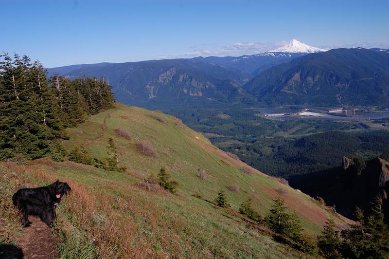
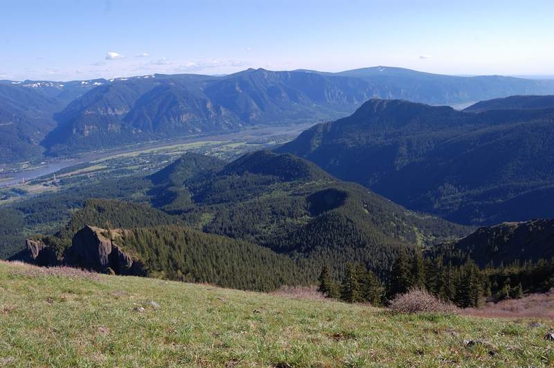
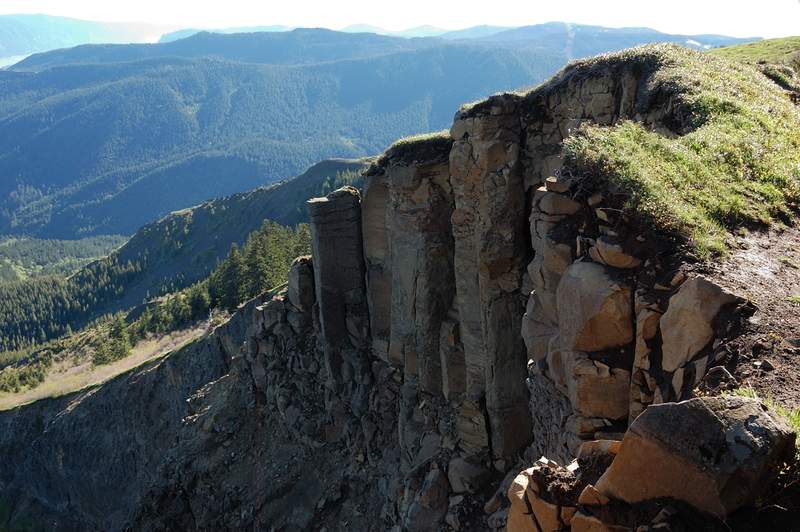
Hardy Ridge loop
8 miles of hiking • 2000' elevation gain •
Up to a foot of snow on the ground, but trail is well tracked. Great views, fun times.
November 20, 2011


 1
1
Deschutes River
10.5 miles of hiking • 250' elevation gain •
Easy, long hike. Want to bike it someday.
November 12, 2011


 1
1
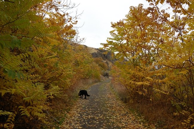
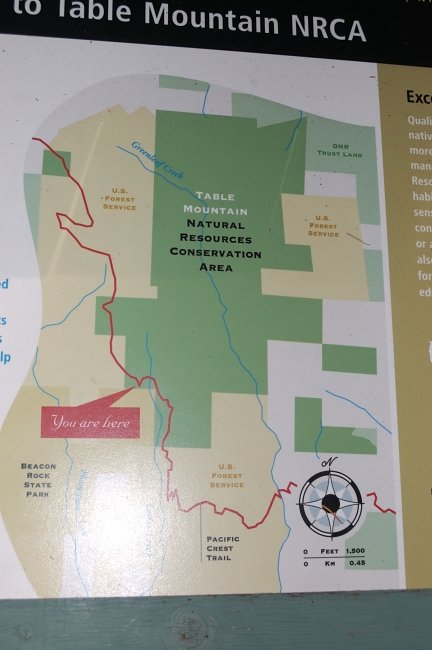
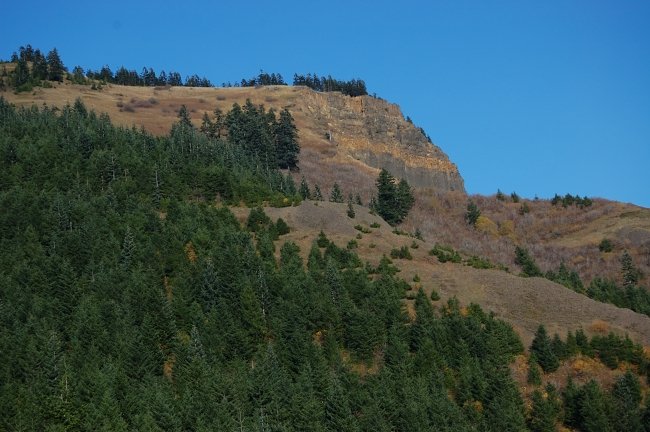
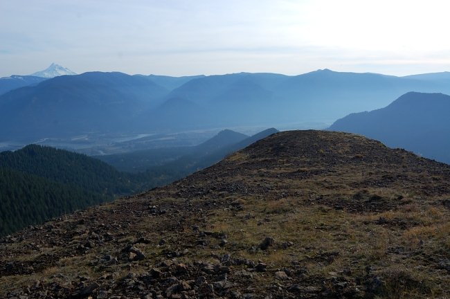
Table Mountain - NW ridge loop
11.5 miles of hiking • 3500' elevation gain •
Finally found where this trail begins off N corner of table. NW ridge trail has great views, but really brushed and rugged for a mile... after which it turns into easy-to-walk (but viewless) forest road. Took a turn left @ powerline and then reconnected with PCT (more good views from talus fields). Nice day to be out.
November 10, 2011


Timberline trail to Zigzag Canyon
4.5 miles of hiking • 500' elevation gain •
Snow's not too deep on Timberline yet... Get there if you can, great scenery package included (lenticular clouds at additional charge).
November 7, 2011


 1
1
Defiance-Starvation Loop
11.5 miles of hiking • 5000' elevation gain •
Took Mt. Defiance trail up, then Starvation Ridge trail down. After reading so much about this hike, it turned much better than expected. Vine maples put on a show on a lower half of the trail. I liked Warren Lake, it's not jammed deep in dark gorge but still feels like mountain lake. There are a couple of nice campsites on the lake. It's right that you don't get much views from the summit of Defiance, but the views from the rock field just west and SW of summit are superb. There is nice viewpoint above Warren Lake, and a couple more on Starvation Ridge trail.
The weather held great all day; the downpour began not 25 miles from the trailhead as I was driving home. Not sure I'd enjoy this hike in a sunny 80 degrees day, but when it's lower 40's, sunny and breezy, the elevation feels good.
November 2, 2011


 1
1
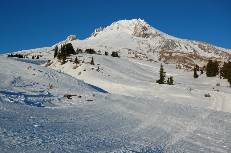
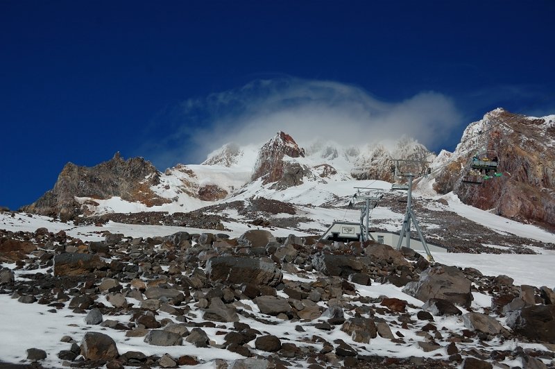
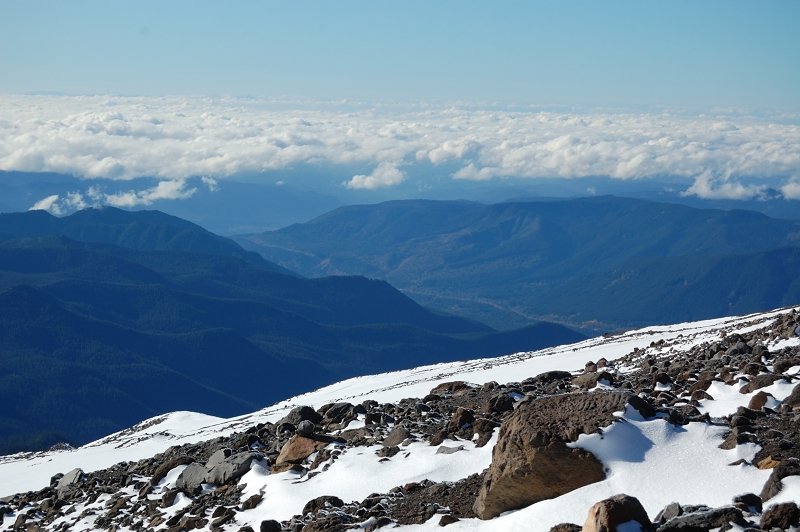
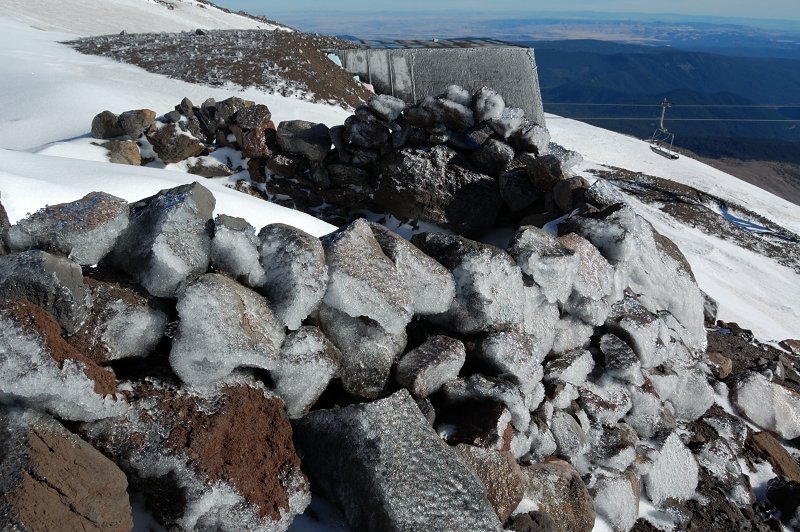
Following Palmer Lift on Mt. Hood
5 miles of hiking • 2750' elevation gain •
After several plan changes on the way, my dad and I hiked up on Silcox Hut trail (that branches up from Timberline Trail) and then followed ski lift uphill to about 8600' when the trail ended. I was surprised how easy it was - it seems I could physically do the other half way to the summit (not sure if I can do it technically, since I never used crampons, ax and such). It was windy and pretty cold, but the weather was beautiful; a lenticular cloud even tried to form over the mountain. We hiked just above the upper ski lift building, and then decided to hike-glissade our way down ski area rather than hiking on scree (the lifts were stopped by then and nobody skiing already). It worth to note it became icy around 8,500'.
October 29, 2011


 1
1
North Indian Heaven loop
8.5 miles of hiking • 2000' elevation gain •
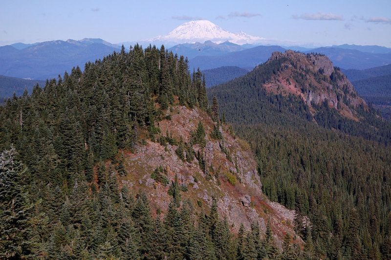
My dad and I did a loop from Cultus Creek campground, up on trail 108 to PCT (with a side trip to one of Bird Mtn simmits), south on PCT to Bear Lake, a side trip to Elk Lake, back track to Clear Lake, then we went down Indian Heaven trail #33 and visited Cultus and Deep lakes. It was barely above freezing all day, with the trails icy and rime on the trees on Bird Mtn. Huckleberry colors are still good, esp. at Clear and around Cultus Lake. Gorgeous place, and a perfect day to be there!
October 25, 2011


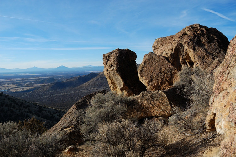
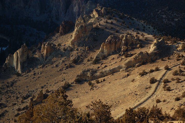
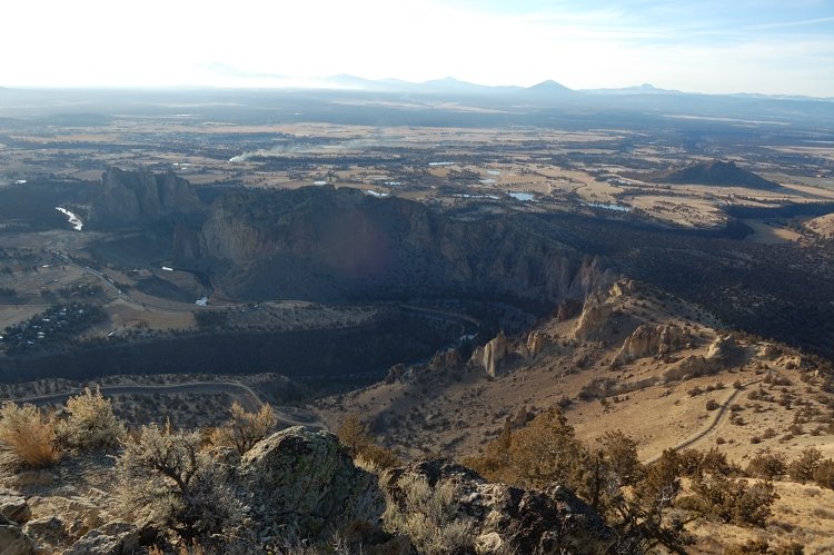
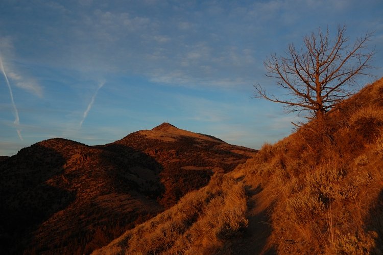
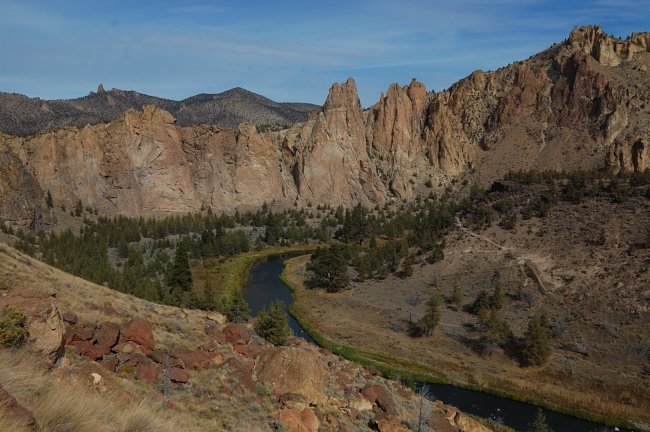
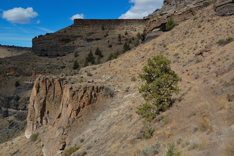
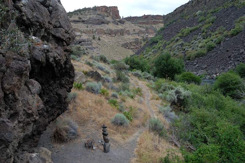
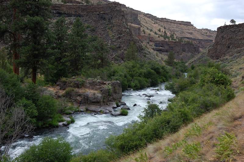
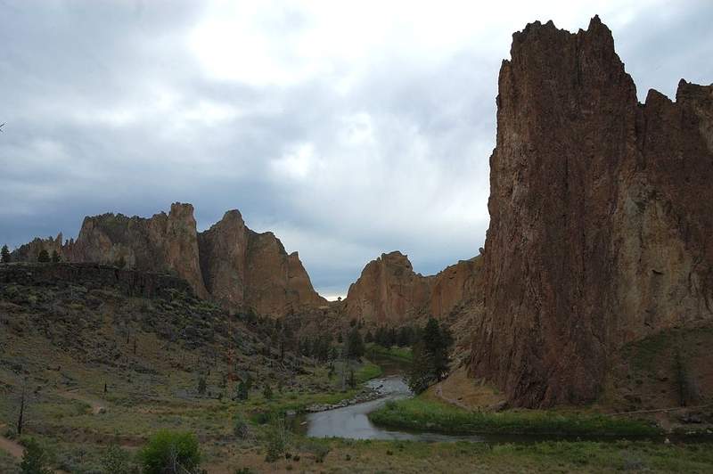
Grey Butte Trail to Smith Rocks
13 miles of hiking • 2250' elevation gain •
Showed my mother the same area we hiked with my dad a few days earlier, this time made a longer loop. Everything but the first 1.5 miles is really interesting.
October 22, 2011


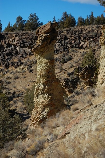
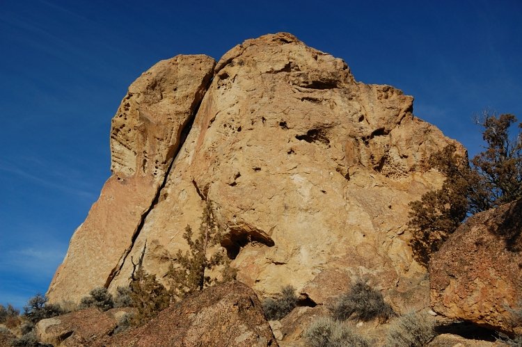
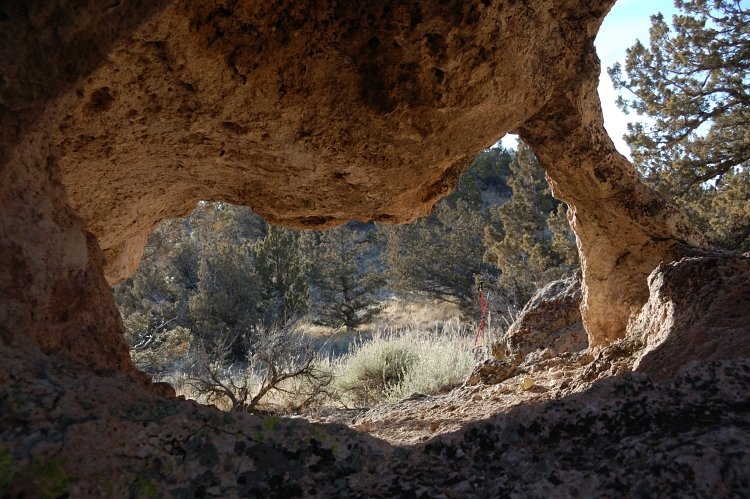
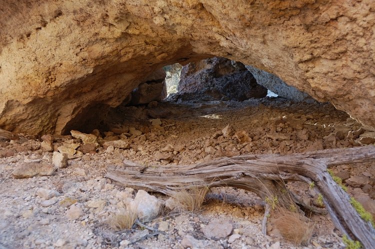
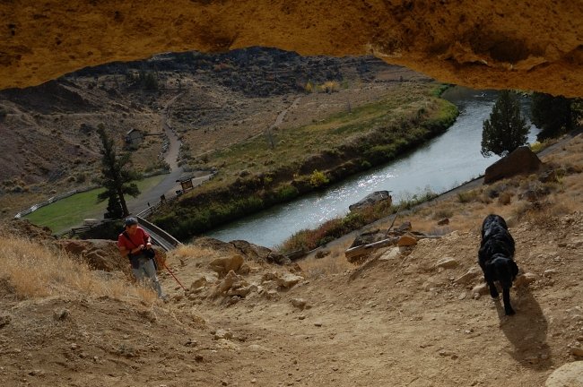
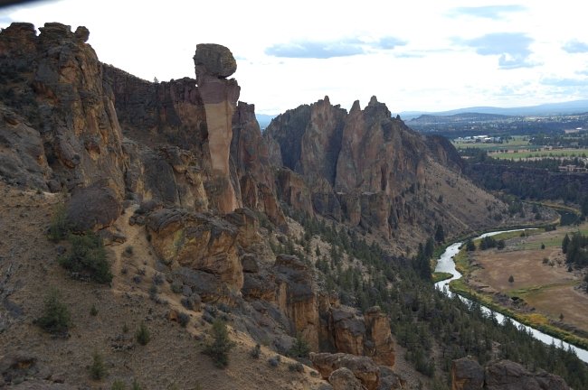
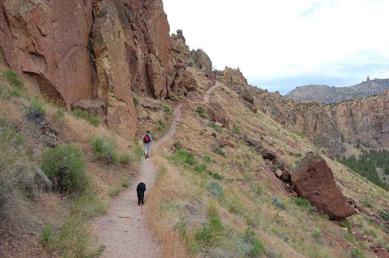
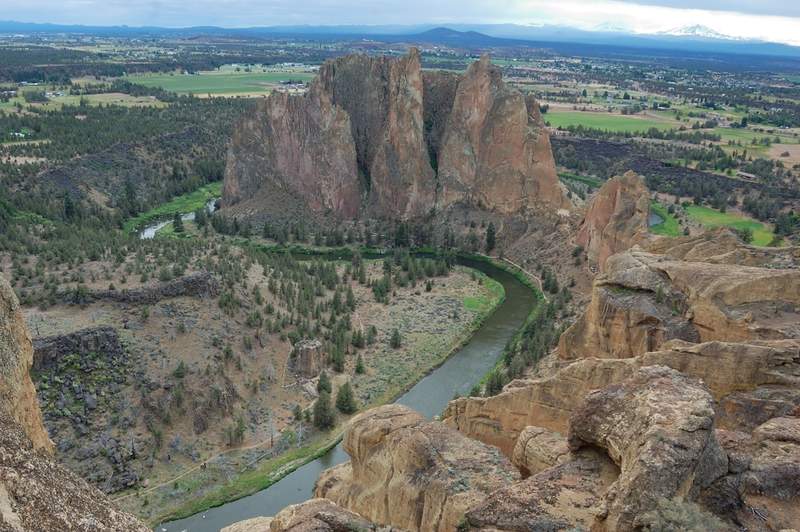
Smith Rocks and "Point 4230"
5.5 miles of hiking • 2500' elevation gain •
Nice little known loop with a different perspective of Smith Rocks.
October 20, 2011


 3
3
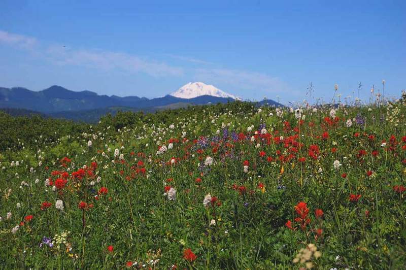
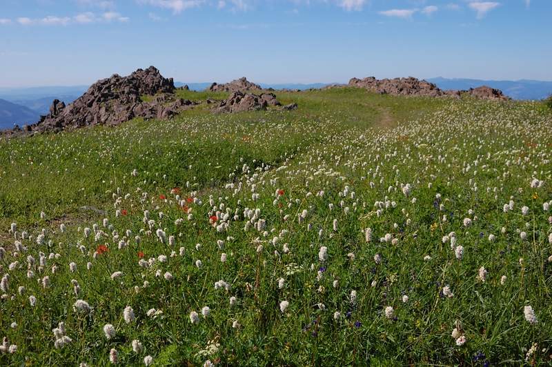
Indian Summer in Indian Heaven
12 miles of hiking • 2750' elevation gain • 1 night
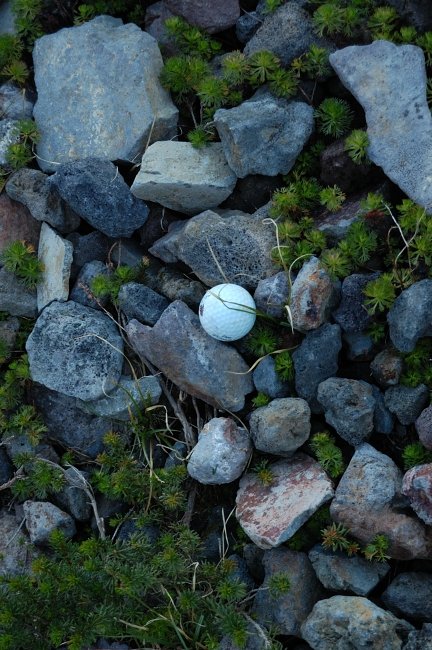
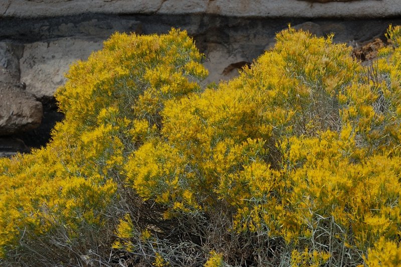
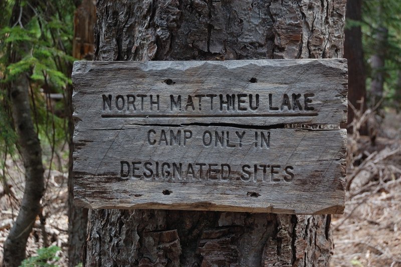
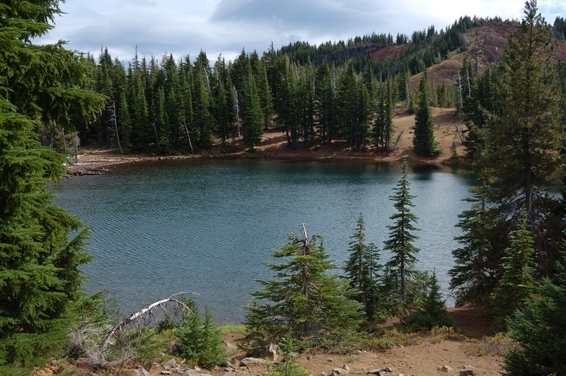
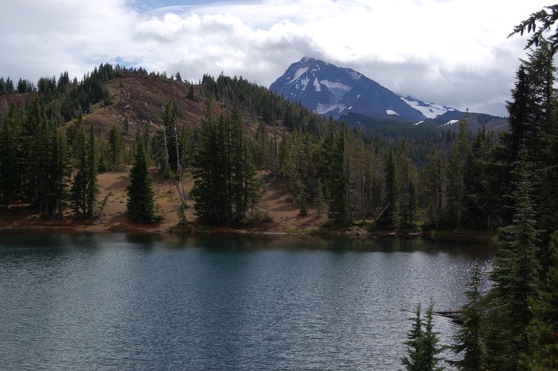
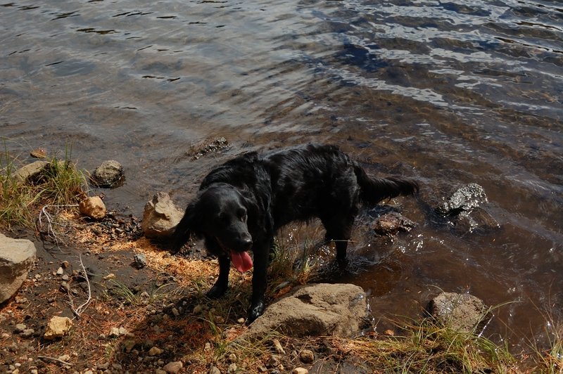
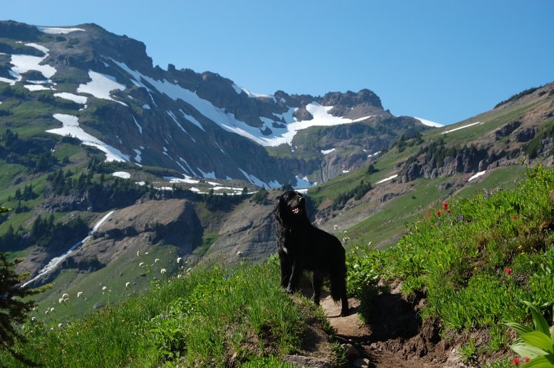
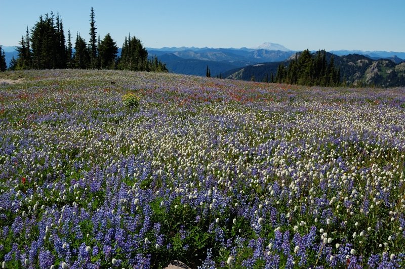
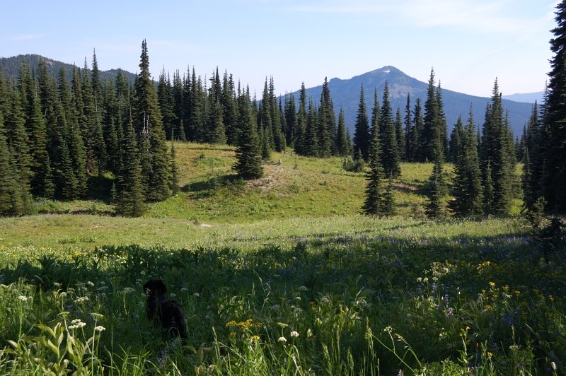
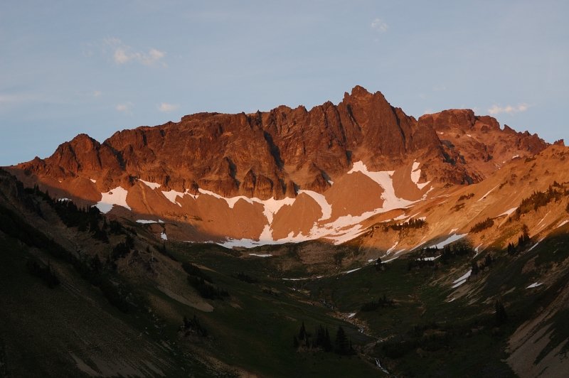
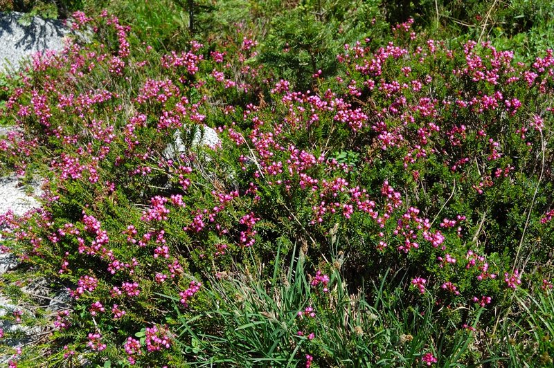
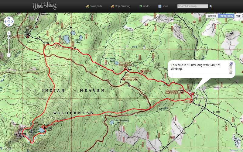
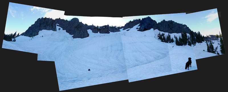
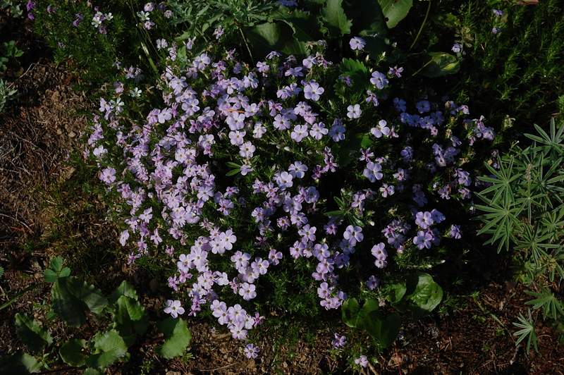
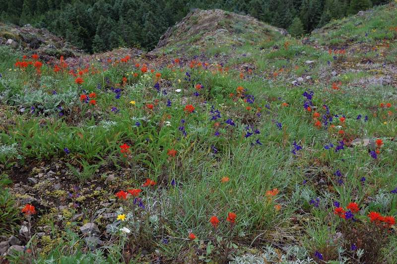
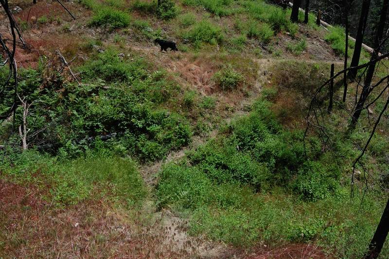
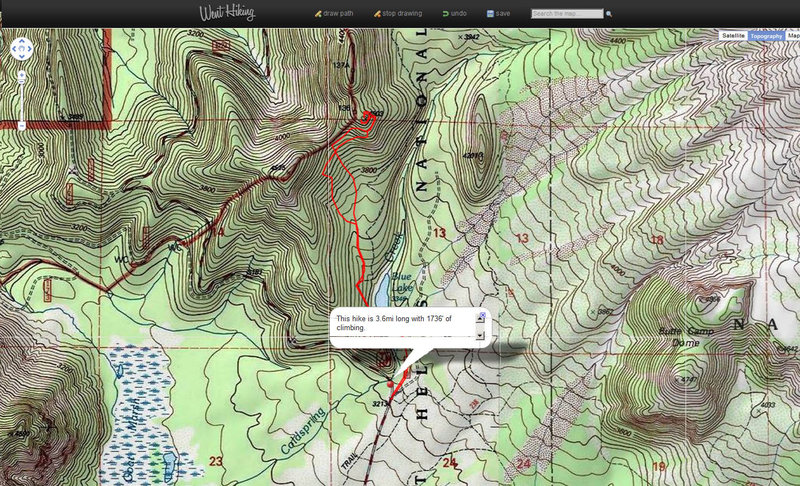
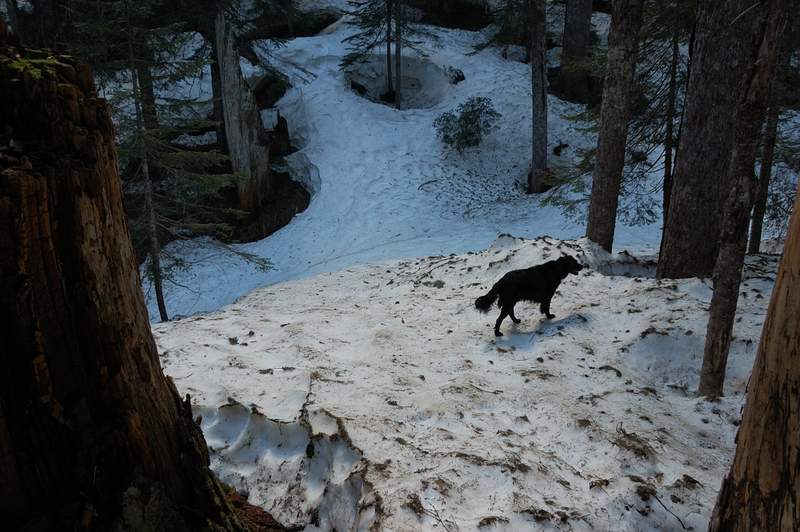
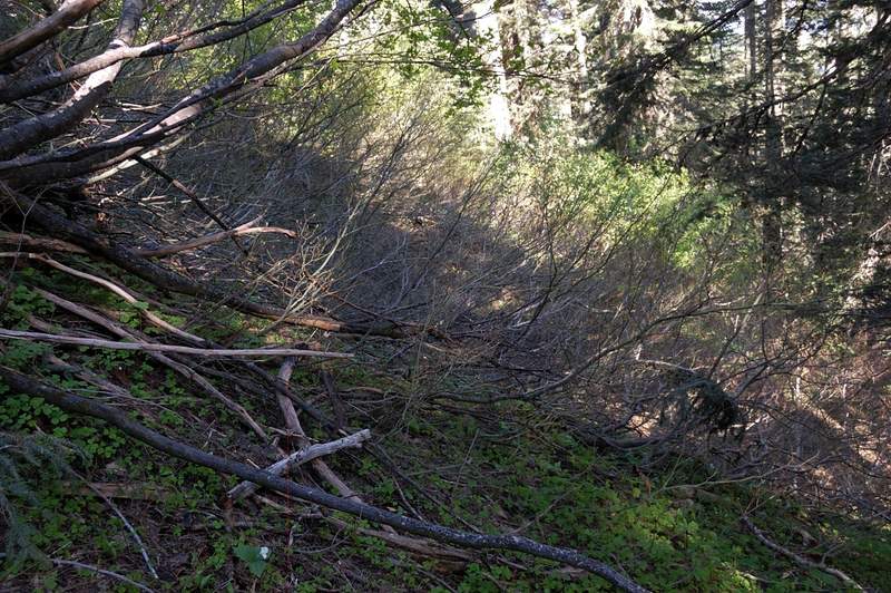
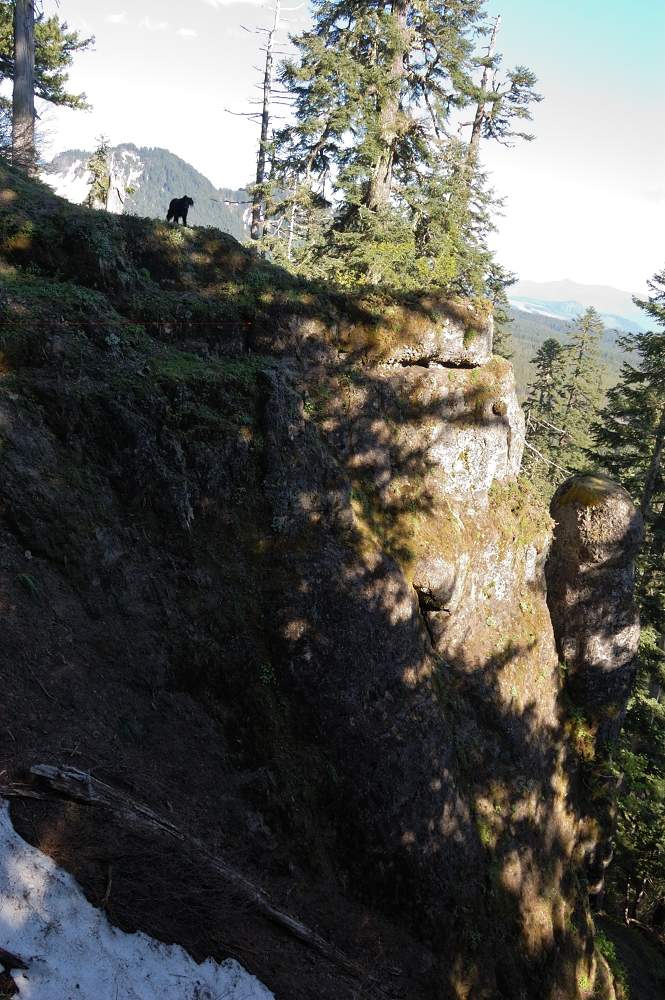
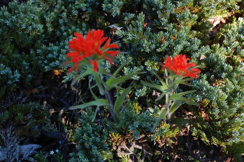
With this weather I just had to go somewhere. Since the high mountains were already snowed in, and I didn't feel ready for winter, Indian Heaven looked like the best choice. Plus, I left Lemei Rock for a solo trip and now it looked like I can finally check it off my list. Decided to make it 2-night trip with Rock and exploration around Wapiki Lake on one day and a big loop on the second day. However, I didn't take my stove and the fire would not burn - the wood was soaking wet (I was only successful to make fire once, by burning all paper I brought to read during a long night in the tent). This left me with insufficient amount of energy bars for the 2.5 days... oh well. After setting camp at Wapiki Lake late on Sunday, me and Pepper the dog went up Lemei Rock the next day. We ascended via the right-hand (wrong) gully which made us bushwhack through fir thicket on the back side of the ridge. There's an obvious trail which made me believe it's the way to follow. On the return, we descended on much more straightforward left-hand gully (right hand if looking from the top) - one has to go towards a small arch on the ascent in order to find this gully, and once there it's fast and easy. I found a golf ball on the lower slope and recalled VanMarmot's story on PH about people playing golf on the top of Lemei Rock. Also had some time to explore the terrain towards Lemei Lake - the trail goes through nice heather and huckleberry meadows. There's not much color overall, but some kind of dwarf huckleberry was quite showy in places.
October 16 – October 17, 2011


Little Badger Creek Loop
9 miles of hiking • 2750' elevation gain •
Did this loop again, this time clockwise. The weather was not as good as last time, but at least it didn't rain. Fall colors really start showing up, not much on this trail but the road 48 through MHNF was on fire with vine maples!
October 14, 2011


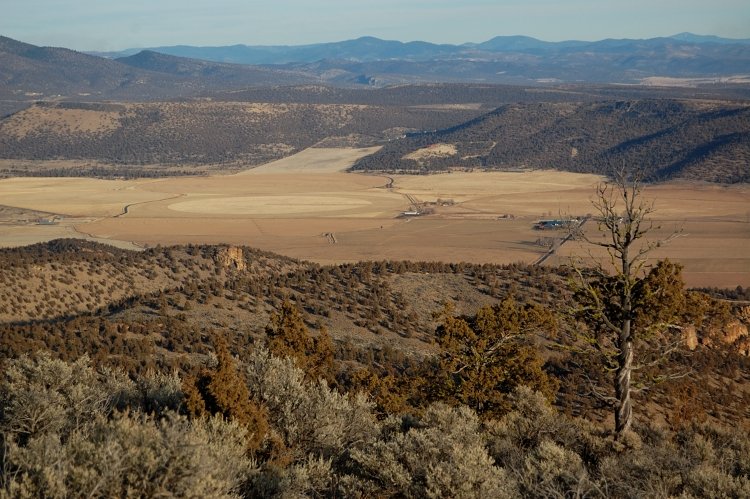
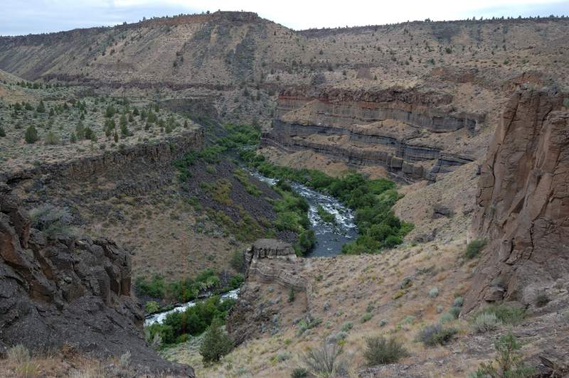
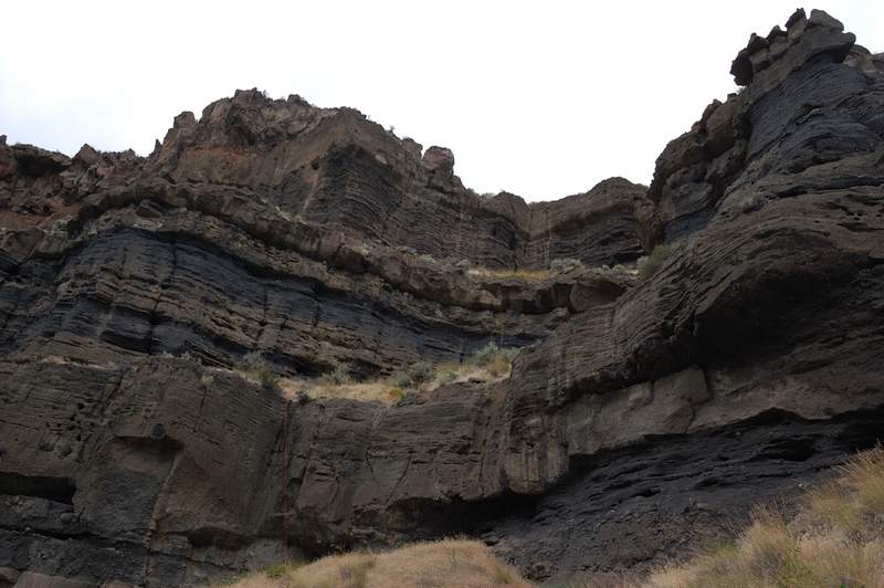
Otter Bench (Crooked River Nat'l Grassland)
9 miles of hiking • 1750' elevation gain •
Pretty sure about the miles (went all Otter Bench trails but the lower 1/4 mile of "Pink Trail" - the wind in that narrow canyon was horrendous!), but the elevation is wild guess. The trails mostly flat with few viewpoints but 2 short ones are going steeply into the canyon and quite interesting.
For some reason, I cannot seem to upload photos that are without ICC profile (or whatever it called).
October 11, 2011


Little Badger Creek Loop
9 miles of hiking • 2750' elevation gain •
Did a loop counter-clockwise. Will post report in PH in a bit...
October 7, 2011


Margaret Backcountry - 2
8.5 miles of hiking • 1750' elevation gain •
The forecast called for a balmy 47F and partly cloudy skies. So why not visit this area again - I took a break from craigslist.jobs and my dad had a day off anyway. Long story short, when we got there it was gray drizzle, clouds laying on the ground and 39F. We did get a sunbreak or two near Bear Pass - a good bonus as it's very scenic point. When we continued up into the clouds the wind really picked up, it was all blowing fog, snow and what seemed like bear track prints (I also counted 6 or 7 bear poo on trail today) and it became very cold. We decided it was no point going to the top, and just took our time picking huckleberries on the way down.
October 6, 2011


 1
1
Steins Pillar and Mill Creek
7.5 miles of hiking • 750' elevation gain •
Easy family hike and a LOONG drive to get out of rain. Ochocos are a beautiful place though.
October 2, 2011


Mount Margaret
11.5 miles of hiking • 2500' elevation gain •
What to say - lots of wonderful scenery, lots of berries, lots of flowers (kind of weird), lots of fresh elk tracks but no elk sighting, not many people, some guys commercial berry picking and wearing helmets (??). The weather mostly held with a couple of showers in the very beginning. I like how deserted this area feels.
September 30, 2011


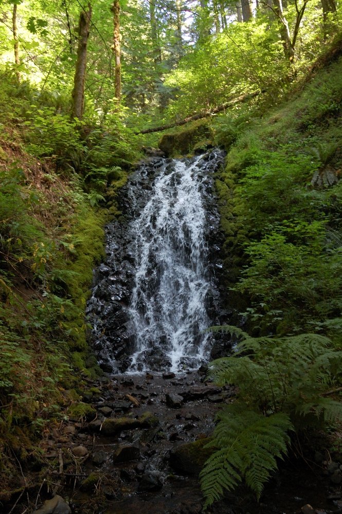
Cedar Falls
5.5 miles of hiking • 2500' elevation gain •
A quick afternoon hike to Cedar Falls. Part of it follows unofficial trails, the other part was a bushwhack where I could not locate a trail at all. At first, I went straight through forest because I didn't find a trail from Bonneville Hot Springs (I used to park @ Aldrich Butte TH, but didn't take a Discover Pass today), then I missed an overgrown trail to Cedar Falls and 'shwacked straight up Cedar Creek. Located both trails on the way back. LOL, and I thougth I know that area :)
Also went to Aldrich Butte (the original plan was Cedar Mtn, but falls took much longer than planned) and tried to find a view of Table Mtn. from the middle of Carpenters Lake (which is presently not a lake at all).
September 29, 2011


Jeff Park
12 miles of hiking • 1750' elevation gain •
Crowds - we had to park well away from the trail because parking lot and road shoulder was packed. Surprisingly, it never felt crowded in Jeff Park.
Weather - the forecast was hit-or-miss on Saturday, but we gambled and decided to visit Jeff Park anyway. By 2pm I thought weatherman got it all wrong, it was as clear and sunny as it can be. Then the clouds just started to grow out of nowhere over Mt. Jefferson, and by 3:30 it tried to rain! The rain never got strong though, just a few sprinkles.
Bugs - very few mosquitoes in the trees, none at the lakes (but it was windy).
Fall colors - still beginning. In a week or two it will get much better.
Berries - lots and lot of! The best part is that they taste very differently in different places.
September 24, 2011


 1
1
Bird Creek Meadows loop
7 miles of hiking • 1000' elevation gain •
Nothing ambitious, just a great day on the mountain. It felt like a summer.
September 23, 2011


Scout Camp Trail
2 miles of hiking • 750' elevation gain •
A little family hike. The initial plan was to hit this short trail first and then hike a much longer Otter Bench Trail system, but it was hot (nice change from the previous 2 days!) and not everyone of us likes hiking in 90 degrees. So, after climbing out of a canyon we called it a day and did some sightseeing in nearby area. It's a nice hike, despite being short it's pretty rugged. We also saw fishers' camp near the trail.
September 18, 2011


PCT south from McKenzie Pass
9 miles of hiking • 0' elevation gain •
Another family hike. We hiked south from near McKenzie Pass, connected to PCT and followed it for about 4.5 miles. Initially, the trail goes through forest with a few glimpses of a lava field (jumble of boulders several dozen feet high), then it goes by the two lakes, and after a little while climbs on the lava. Very nice trail from the lakes and above, more interesting than Obsidian trail imho (the only other place I've been on Sisters).
September 17, 2011

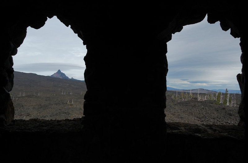


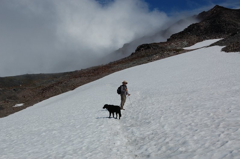
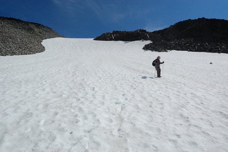
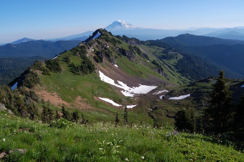
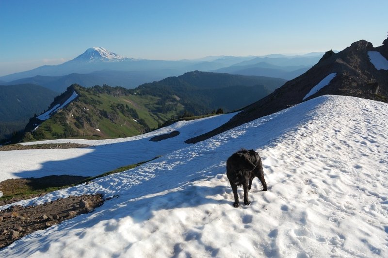
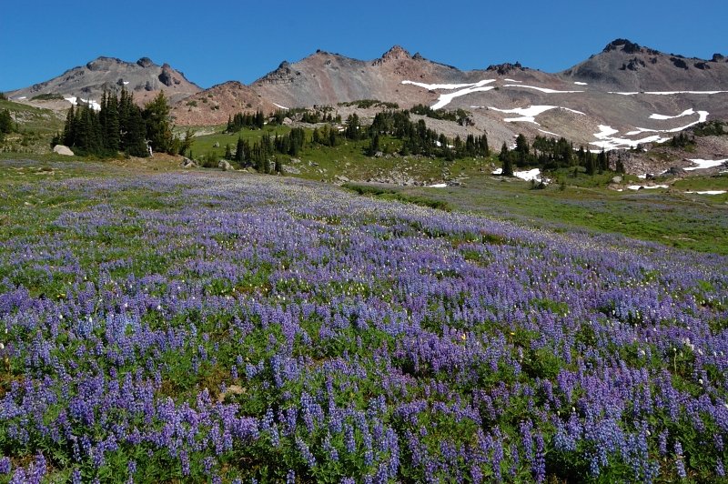
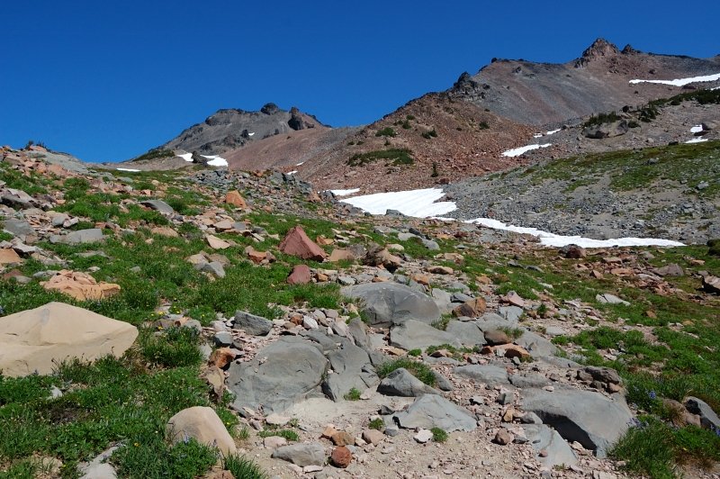
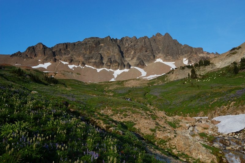
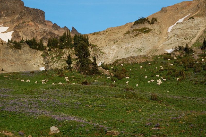
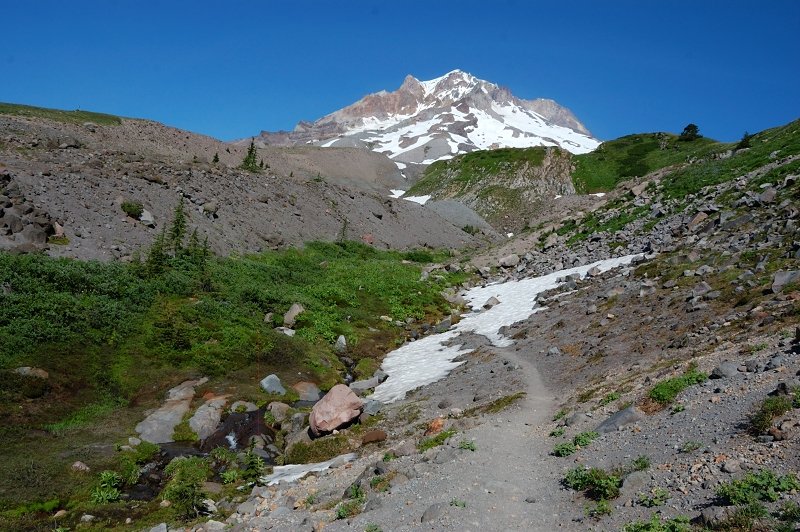
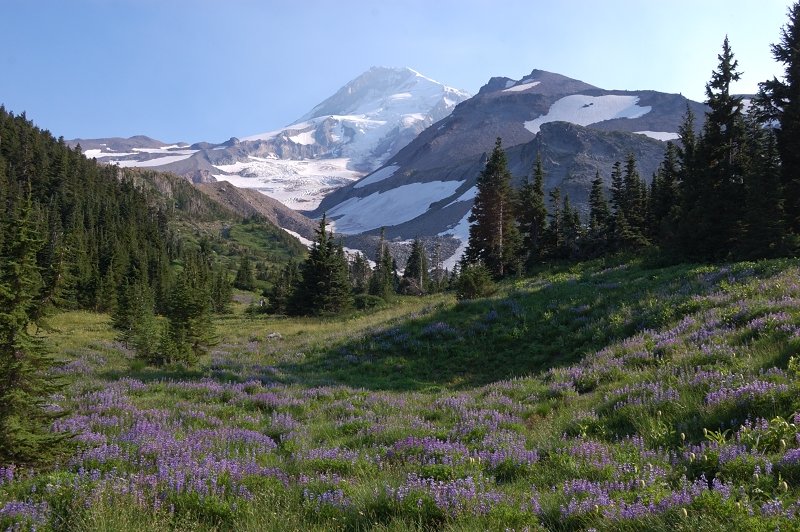
Goat Rocks
13 miles of hiking • 2750' elevation gain •
Same hike as 3 days before, this time I took my mom for her second time in Goat Rocks (1st time this year). Met some frozen backpackers with everything on (as we headed with t-shirts) and they said it was outright miserable a day before - rain, wind and cold! Once we got to Snowgrass Flats, we could see flowers really got a beating from the weather. It also became pretty cold, esp. towards 7,100' on PCT, so gloves and winter coats been in order. It's been no more than upper 30's up there, and I wondered if it will snow that night. In fact, when I checked a forecast that night, it said snow/rain mix for the next day. We've been lucky to see the last of flower show this year. We did skip Packwood glacier viewpoint (socked in clouds) and a detour to Goat Lake.
September 16, 2011


Goat Rocks in a day
14 miles of hiking • 3000' elevation gain •
Went with my dad to show him Goat Rocks while the summer weather is still here. I heard it was a cloudy day back in Vancouver, but at GR it was 100% sunny despite the forecast. Since my dad doesn't consider camping his hobby, the only option was to hike it in a day. We started at Snowgrass TH, went up trail #96 to the PCT, then on PCT to Packwood "glacier" overlook, down off-trail to trail #86 (pretty much the same way I did it a week before), up 1/3 mile to Goat Lake, then down on #86 and #96 to the trailhead. Flowers got better above 6,500', but below 5800 they're now mostly gone. These gorgeous meadows at Snowgrass Flats at 6400' are now past peak, will last a week at most. Saw some alpine huckleberries turning black - everything goes amazingly fast at these elevations. The snowmelt at Goat Lake was impressive too - down about 3-4 FEET of snow in the past week! The lake is now about 40% ice free, and I spoke with a hiker who was going to swim it.
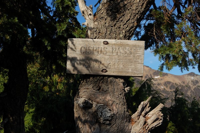
September 13, 2011

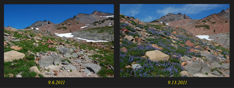
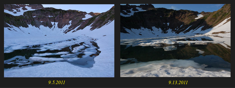
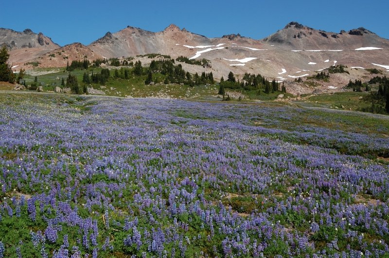
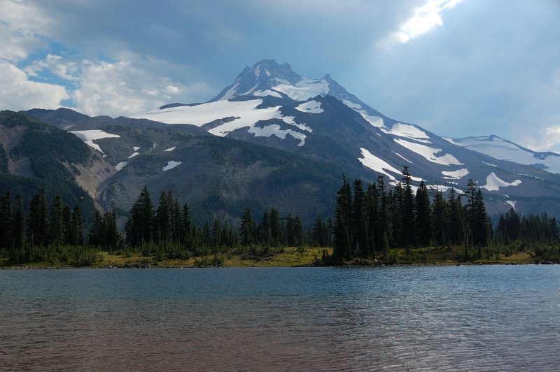
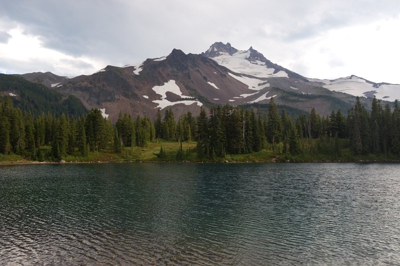
 3
3
Goat Rocks
36 miles of hiking • 6750' elevation gain • 4 nights
Now to my favorite place in the world :)
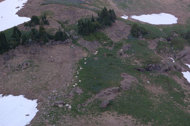
DAY 1
After spending a night 3.5 miles from Snowgrass trailhead, I got an early-ish start. Met droves of backpackers heading back. After arriving to Lily Basin/Snowgrass trail junction, it was "select your own camp" thing I set a "base camp" at the largest campground close to the junction. Hiked to Goat Lake without a backpack, then wanted to continue to Hawkeye Point but it was pretty late at this point so I only made it to a pass above Upper Jordan Basin (still 50% snowed in) where you see the first view of Rainier. Goat Lake is still mostly frozen over, and 1/4 mile of trail above the lake snow covered, which made for a great glissade on the way back. Glissading on my feet didn't quite work, so I was sitting on my rear and using poles for speed :) Only one tent at the lake. Saw a herd of goats on the way back.
DAY 2
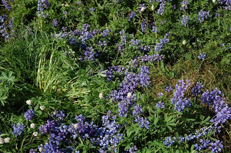
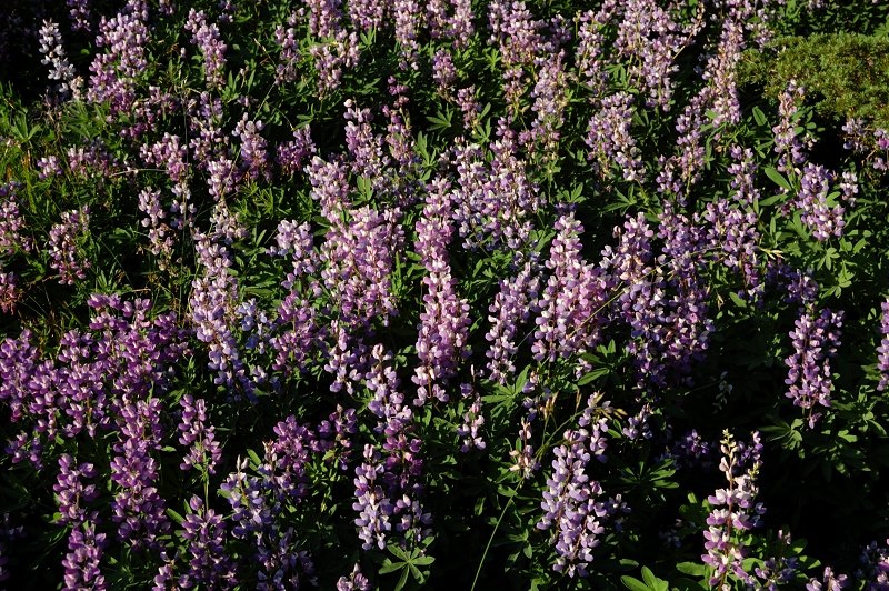
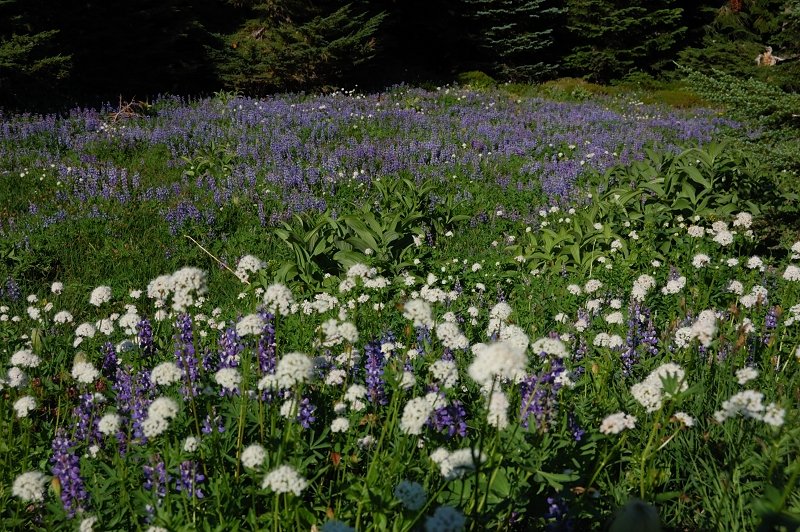
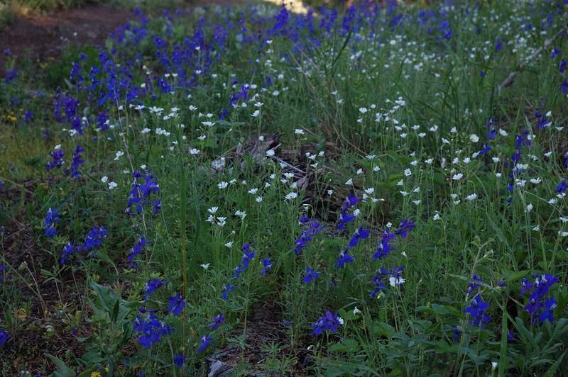
Hiked to PCT junction (the flowers are unbelievable right now, imagine 0.5 mile uninterrupted carpet of lupine), to PCT High Point, and then to the summit of Old Snowy.
From there, I made an attempt to follow the ridge south to Ives Peak. In hindsight, it was a foolish idea, I read someone did it that way and wanted to try. There are steep rock spires on the ridge one must go around, and the scree slope is extremely unstable. It really scared the hell out of me when I was in the middle of scree slope and the 2-4 foot rocks started to move down under my weight. It could easily cause the rocks above me to fall down too. It looks like neither people nor the goats use this route to Ives Peak, this slope is just waiting to slide. Maybe the report I saw was about hiking the ridge when it was still covered in snow? After crossing one scree field and coming to yet larger one, I decided to turn back, SLOWLY, trying NOT TO TOUCH ANYTHING! Even rock spires above me were literally falling apart, threatening to calf off 5-foot rocks onto scree field below. I was relieved to reach the summit of Old Snowy again, and a stable ground on the north side of the summit.
I hiked off-trail to Goat Lake (there was a trail the first and last 1/4 mile, but in the middle I lost it under snow), and had a couple of snow fields to glissade. Photographed some snow sculptures on the way. At Goat Lake, photographed more goats - they hide somewhere during the day but come out an hour or so before sunset, and glissaded for fun - that slope west of the lake is really good. I had a lake to myself. Reaturned to the camp on Lily Basin (lower) trail.
DAY 3
Hiked up to PCT junction, then followed PCT over Cispus Basin, Klickitat Basin, and to Sheep Lake, then back the same way. Sheep Lake looks like taken from Indian Heaven - with huckleberry meadows, flat country - it's shallow and pretty warm. Too bad I didn't have a time to swim - it was already past my turnaround time. Also, one backpacker warned me about a close bear encounter (like 10 yards) and I didn't want to hang out until late evening. Interesting enough, there were 2 groups of two just before him who obviously didn't meet the bear (otherwise they would mention it to me when we chatted), and this lone hiker had such a close encounter. I used my poles to make a noise from time to time.
Saw more goats at sunset in Cispus Basin, it's one of my favorite places in Goat Rocks.
DAY 4
Hiked out to the car.
September 4 – September 8, 2011


Paradise Park - again
11.5 miles of hiking • 2250' elevation gain •
Took our friends from S. Cal. to Paradise Park. It was nice today for the most part, but the Park was really filled with smoke. I saw only 2 or 3 groups camping, lots of dayhikers, and many backpackers heading in and out of Paradise (or heading in and turning out because of smoke?). Still, we saw most of the views and the flowers are near peak, better than on Monday.
September 3, 2011

Bald Butte hike
8 miles of hiking • 2000' elevation gain •
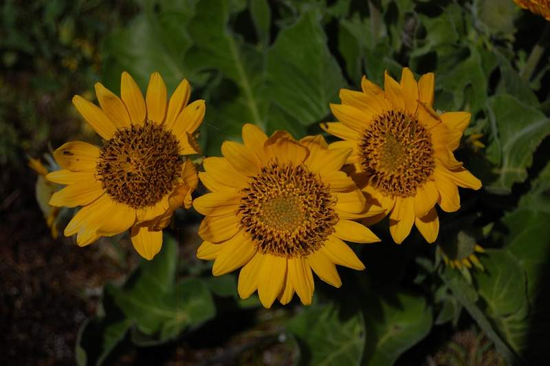
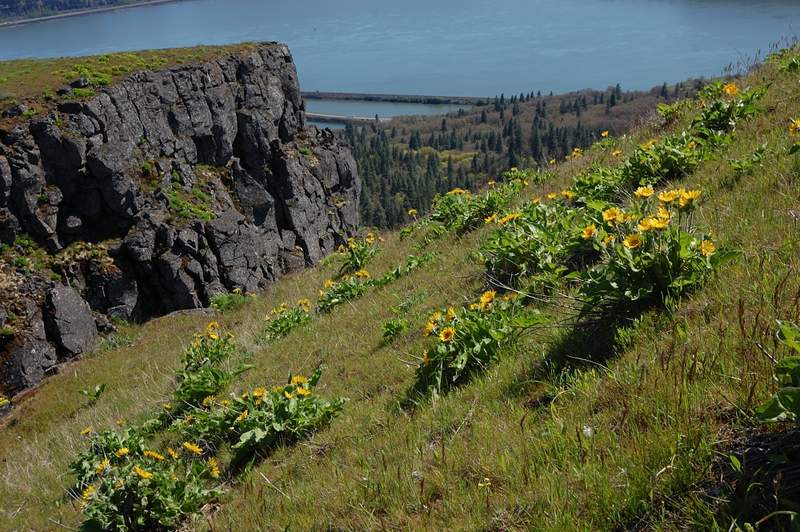
Hiked with my dad and with our dog to Bald Butte after changing our Mt. Hood plan (too much smoke). Nice hike through a variety of terrain - oak savanna, evergreen forests, and a couple overgrowing clearcuts. Had good views of Hood River and Mt. Hood (mostly hidden in smoke at the moment). Looks like there's a lot of balsamroot in spring, now it was all dry of course. Lots of wild cherries on the top (some berries, but not ripe yet). It was windy and pretty cold at 3,700' - it's probably good we didn't make all the way to Mt. Hood that day.
August 30, 2011

Paradise Park from Timberline Lodge
12 miles of hiking • 2250' elevation gain •
Hiked from Timberline Lodge to Split Rock in Paradise Park. Besides a couple of snow patches, the trail has melted out. No mosquitoes and almost no biting flies, warm but breezy weather - a perfect day for a hike. Very few people after Zigzag Canyon overlook.
It's surprising how much easier this hike became since I hiked it a year ago.
August 29, 2011


Elk Cove via Vista Ridge
9 miles of hiking • 2000' elevation gain •
Nice hike, good road (looks like recently repaired), terrible overflow parking (cars park on the shoulder of 1-line road with sheer drop-off on the other side), a lot of flowers, fire closure posted half way in as we headed out (posted this on PH). We also went to see a tiny Dollar Lake.
The fire is small and nothing to worry about; given the size of fire crew @ 20+ people I hope they will put it out quickly.
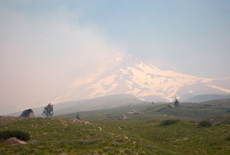
August 28, 2011

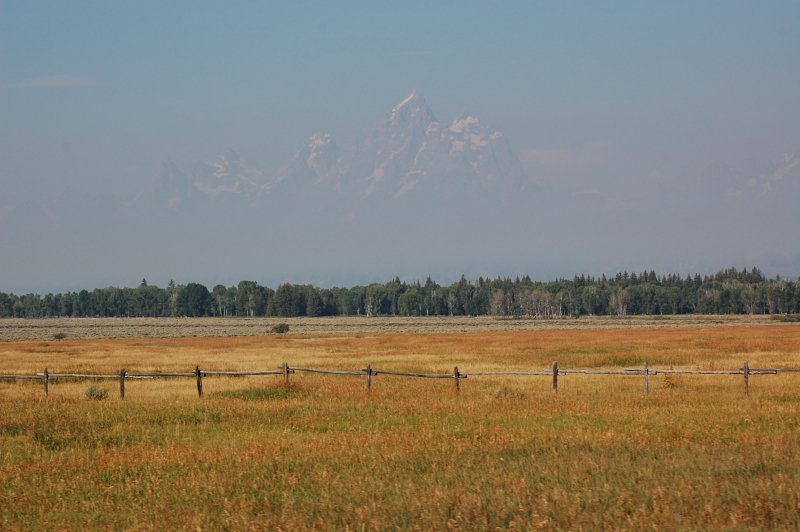
Grand Teton bail / one more day in Yellowstone
5 miles of hiking • 250' elevation gain •
The last full day of the trip was reserved for hiking in Grand Teton but over night the park became choked in smoke from the two nearby wildfires. After we determined the air almost unbreathable, we drove over to Yellowstone and spent another day there.
August 24, 2011

More of Yellowstone
4.5 miles of hiking • 1500' elevation gain •
Explored South side of Grand Canyon of the Yellowstone, hiked down to Lower Falls and along Rim Trail. Also visited a small geyser basin west of Yellowstone Lake.
August 23, 2011


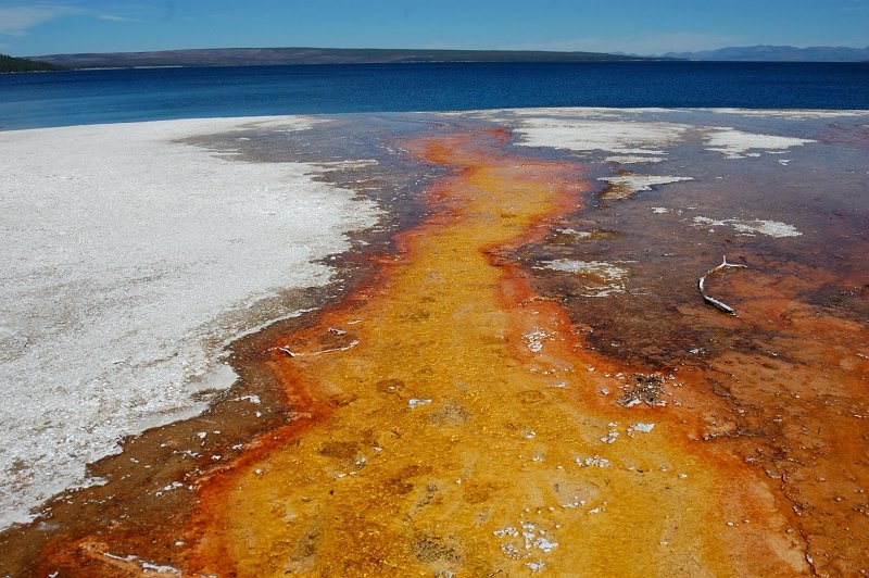

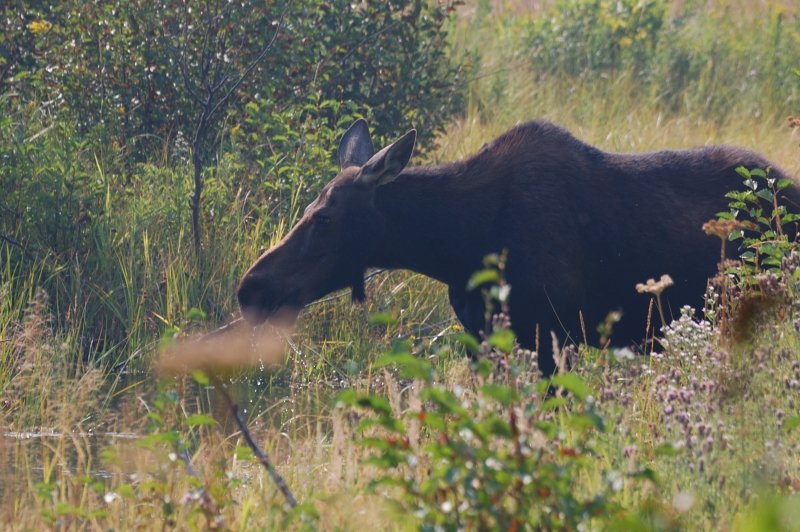
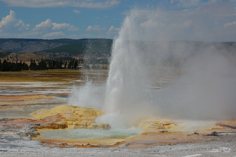
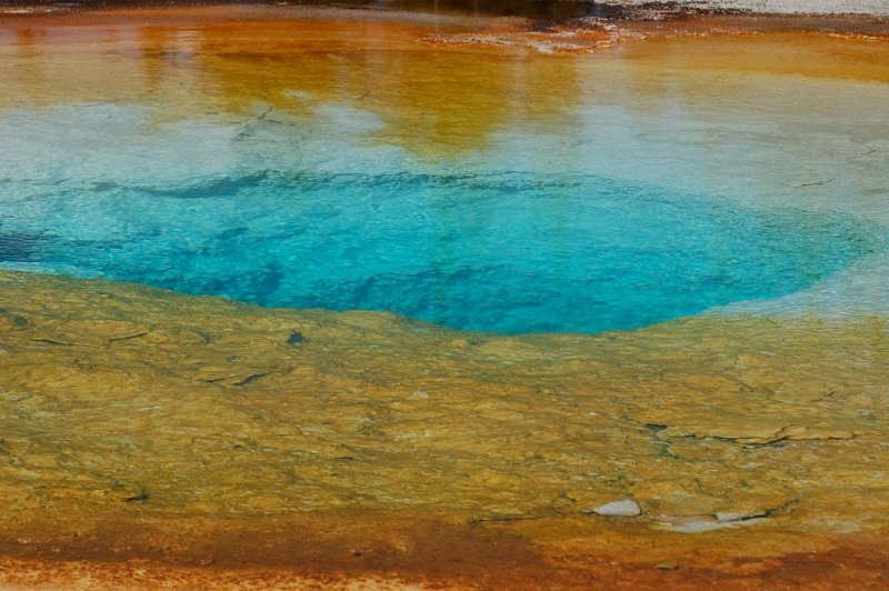
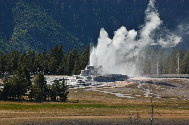
Small hikes in Yellowstone
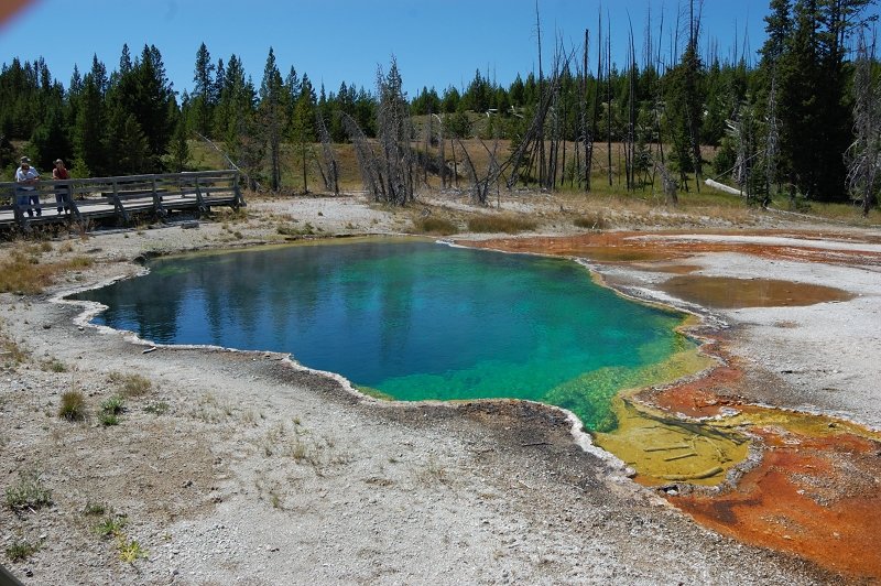
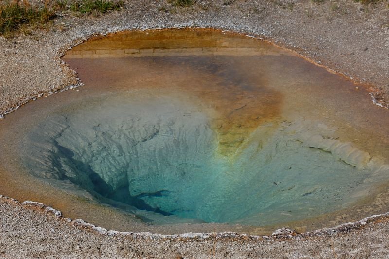
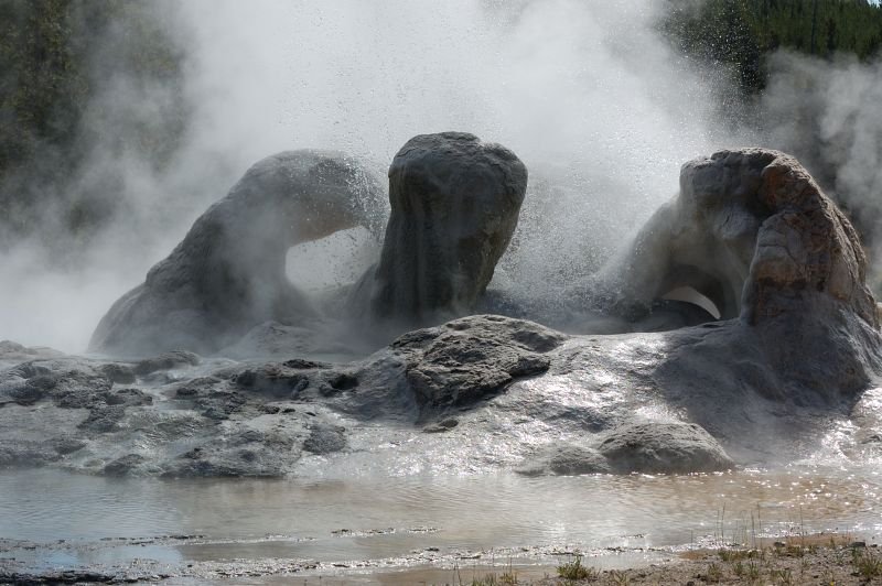
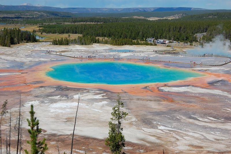
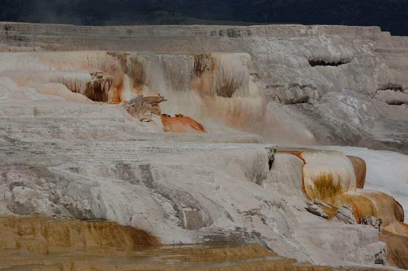
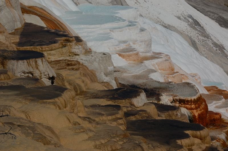
5 miles of hiking • 750' elevation gain •
Small hikes around Yellowstone - Upper, Middle, Bisquit, Black Sand Basins, Great Canyon north rim hike, and just stopped on all viewpoints photographing thermal features and wildlife. We also hiked the back side of Grand Prismatic Spring to get an elevated view of this colorful lake. Great to spend time with the whole family together.
August 22, 2011

Small hikes in Yellowstone
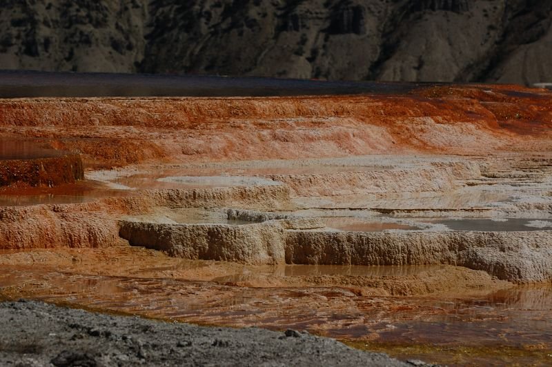
4 miles of hiking • 1000' elevation gain •
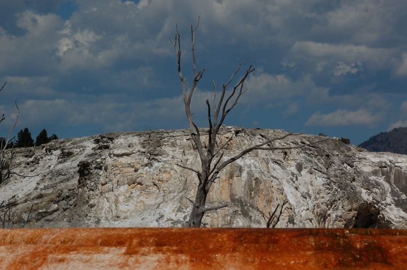
A few short hike on the first day in Yellowstone - Mammoth Hot Springs (the springs are drying out comparing with 3 years ago and lost most of the color), Norris Geyser Basin, a couple of other points.
August 21, 2011


Coeur D'Alene Lakeshore hike
3 miles of hiking • 250' elevation gain •
Short hike on the way to Yellowstone NP with my family. The swim in the lake was great (water 72F, air 85F), the trail is beautiful too - the lake is lined with pine forests and there are some large granite rocks near the water. It was quite crowded and hard to find a good spot to swim. Also took a walk around town. Sorry no pics.
August 19, 2011

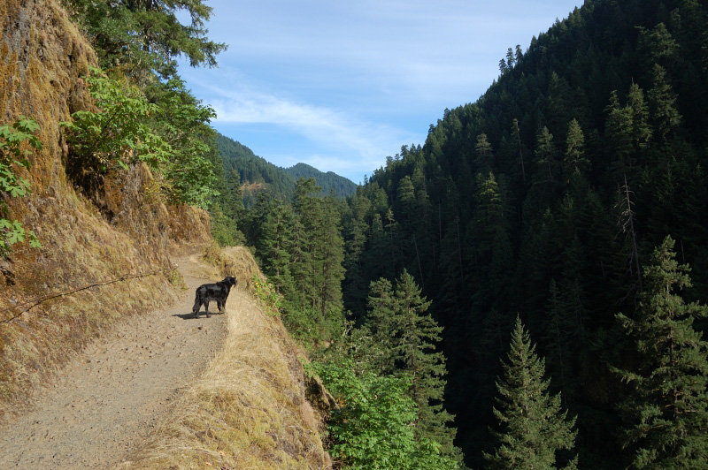
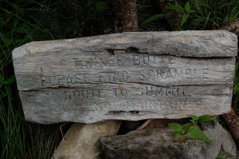
Eagle-Tanner loop
26 miles of hiking • 4500' elevation gain • 2 nights
My second backpacking trip ever in the Gorge. Spent the first night just after 7.5-mile camp, then the second night at Dublin Lake. Skipped Tanner summit because it was very foggy and no views anyway. There were red and black huckleberries, thimbleberries, and salmonberries at various places. Almost no views since got fogged in on the second day of the trip. Flowers on Tanner Ridge are nice, but well past peak. Also of note is the trail #433 (Eagle-Tanner Cutoff); I worried after previous reports that it would be hard to follow, but while it's thin and has a little blowdown, it's fairly traveled and mostly in good shape. The only brushed section is between Big Cedar Springs and Tanner trail #401, for maybe a mile. It looks like it got some brushing work recently, and also well flagged. Trail #401 is a little brushed between Tanner Spring junction and a little beyond Tanner Butte summit trail jct, then it goes through beargrass meadows kind of narrow but better. Once it re-enters the forest it's in great shape. Dublin Lake was nice and water not cold, but the air temps were in the 50's and windy so I didn't want to swim. Still, nice place to camp and also a lot of black huckleberries just getting ripe near water's edge. Many people camped at both 7.5 mile camp and the lake, but backcountry camps (at Eagle Creek crossing and Big Cedar Sp) were unoccupied.
I got a mileage from Douglas Lorain's book; his trip skips the summit and Dublin Lake and gets 4,300' in 25 miles.
August 12 – August 14, 2011


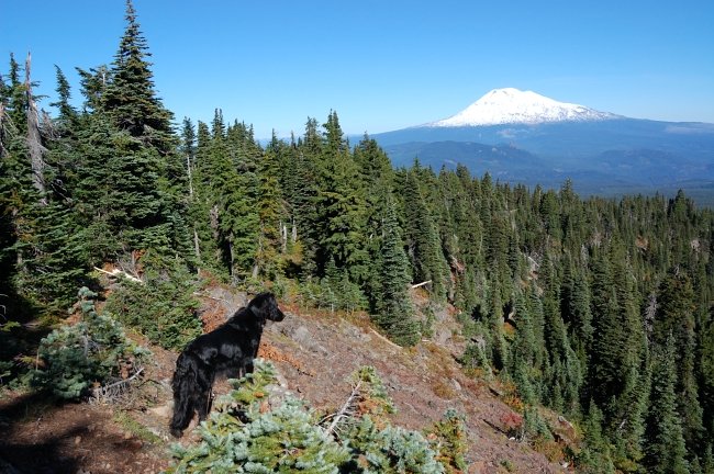
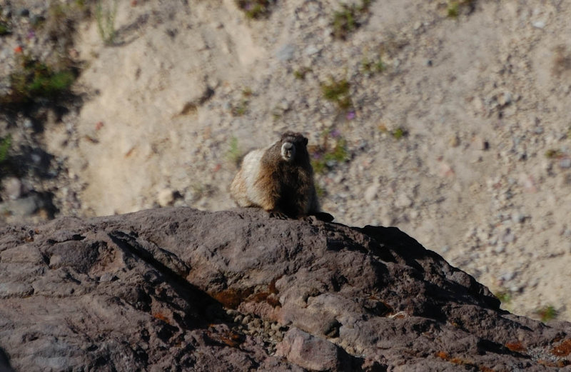
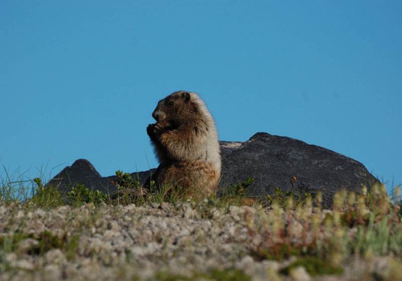
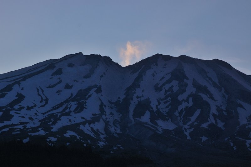
Ape Canyon
10.5 miles of hiking • 1250' elevation gain •
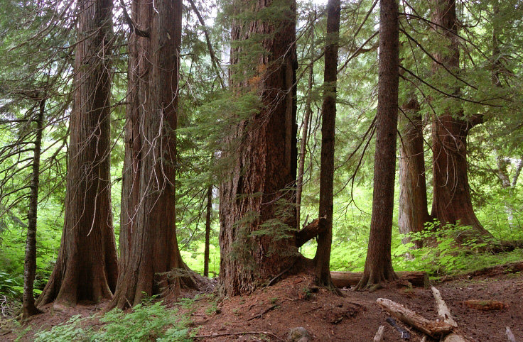
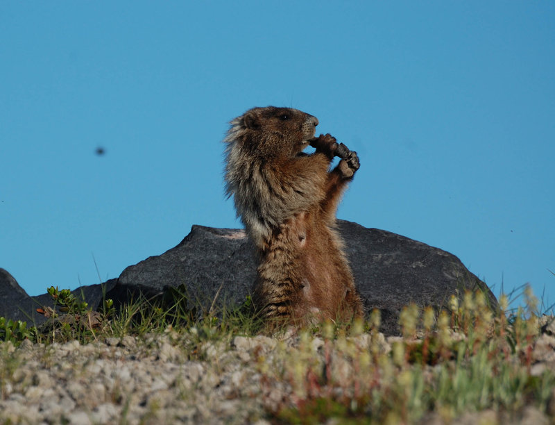
Today was Ape Canyon and Plains of Abraham. There's a large marmot colony just after you pass a narrow spot in the headwaters of Ape canyon. Plains of Abraham still look deserted, but there are some good "islands" of flowers. I guess in 10-15 years the Plains will be a lush alpine meadow. Below the Plains, the trail goes on a ridge through sections of huge old-growth firs. Beautiful place...
August 7, 2011


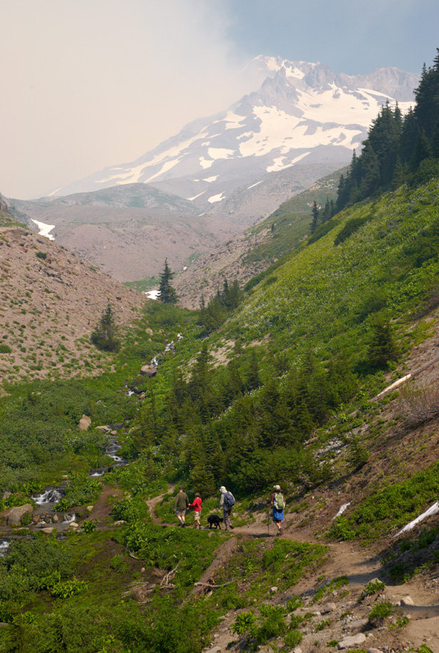
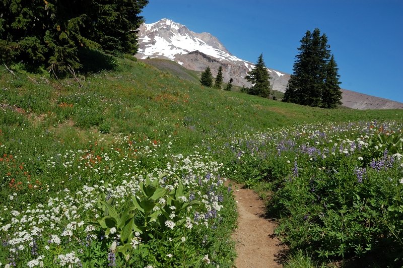
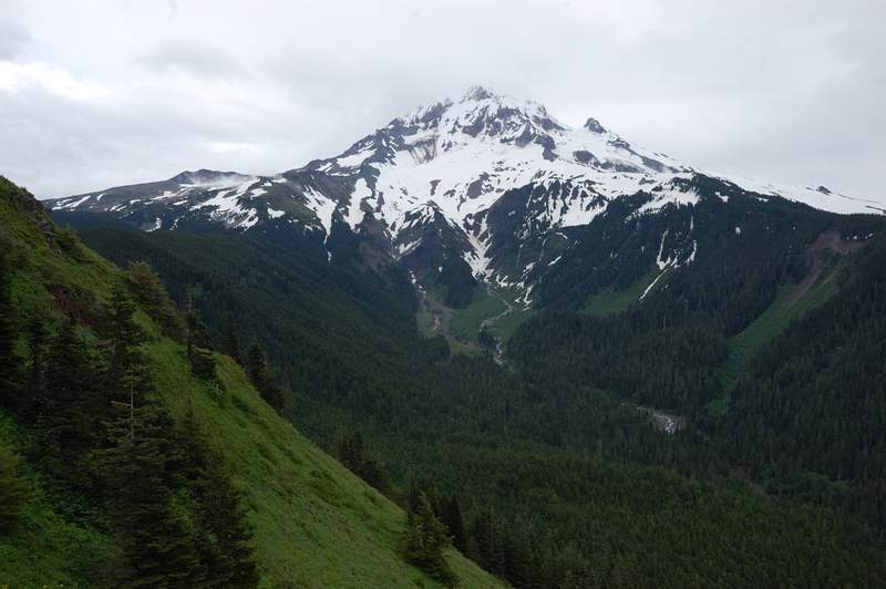
McNeil Point
9.5 miles of hiking • 2750' elevation gain •
Hiked to McNeil Point via official trail and a little above (got too little time before dark to summit McNeil Spur), then down the short&steep shortcut trail. Still snow in the trees but most is gone from a couple of weeks ago. Flowers at McNeil are amazing.
August 6, 2011


Hamilton Mtn
5.5 miles of hiking • 2000' elevation gain •
Was going to boycott this Discover (pass) thing, but Hamilton Mtn is my family's favorite so it was not an option. Anyways, after driving to Stevenson and getting the pass for about $36, we hiked an almost deserted but beautiful trail to the summit. There were 4 cars besides ours in the beginning, and one car besides ours (featuring a ticket) in the end. The pass is supposed to be non-tranferrable between the cars, but the good thing they sell the pass without writing a license plate # in it, so we used eraseable pen... you got an idea. Oh and the hike was beautiful, even though most flowers are gone by now.
August 5, 2011


 1
1
Wildwood trail
2 miles of hiking • 500' elevation gain •
Were late to concerto @ Rose Garden, and had to park a mile away, but the hike on Wildwood trail (and a couple of adjacent trails) was nice.
August 5, 2011
 1
1
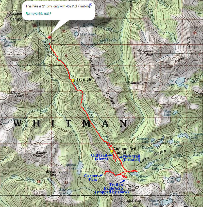
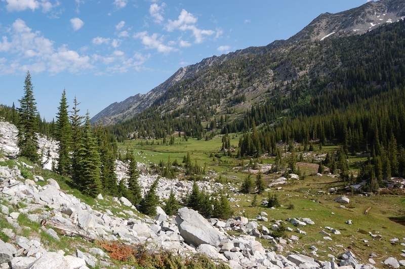
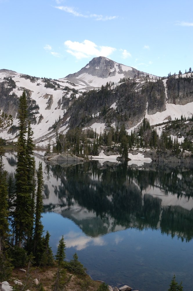
Wallowas (Two Pan trailhead to Mirror Lake)
21.5 miles of hiking • 4500' elevation gain • 3 nights
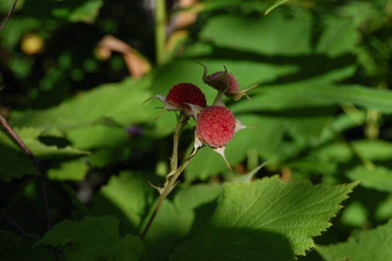
Did a 3-night backpack with my mom in the Wallowas, a completely new area to both of us. Started kind of late on Friday and camped above the first series of the switchbacks and somewhat difficult river crossing. Then we went along scenic Lostine River meadows and stopped about 1.5 miles before the Lakes Basin, remembering reports that this area is famous for mosquitoes (as we found out, a good choice). We visited a BEAUTIFUL Mirror Lake and stayed there to capture the sunset. Glad we packed an insect repellant though, because you literally breathe the skeeters in! There were a few at the camp as well - they are barely noticeable when you move, but swarm in numbers as we stopped (still 5-10 times less in numbers than near Mirror Lake). Early on Sunday we went on to climb Eagle Cap, but were stopped by snow (next week probably should be OK, as the snow melts by the hours). Instead, we went on still 40% snow covered Carper Pass, which is shown as Minam Pass on Sullivan maps. Then we explored the lower old rutted-but-scenic trail along Lostine River just below our camp. On Monday, we hiked out the way we came. Beautiful area, I want to visit it again later this summer or fall.
July 29 – August 1, 2011

 1
1
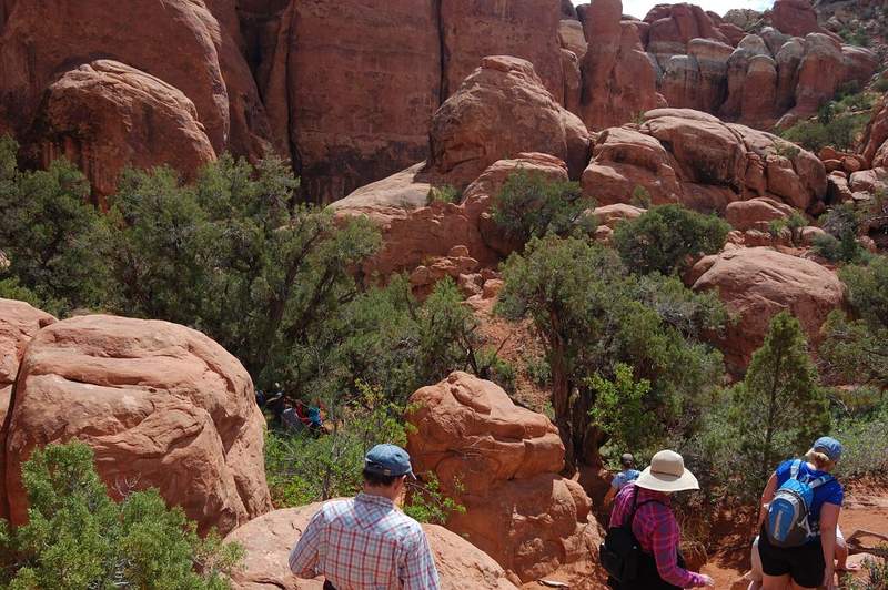
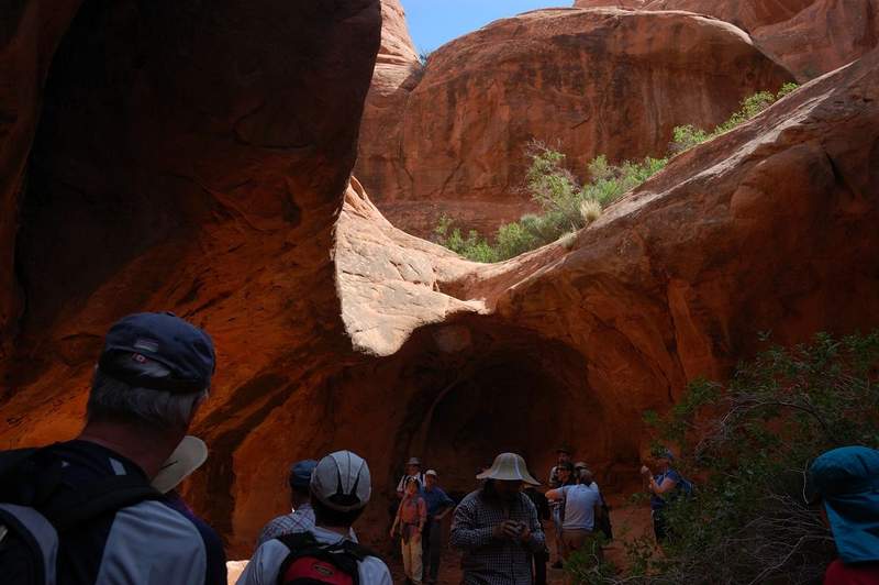
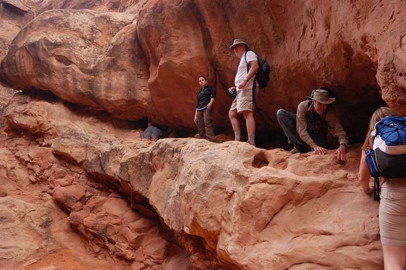
Indian Heaven - Lemei Rock trail
10 miles of hiking • 2500' elevation gain •
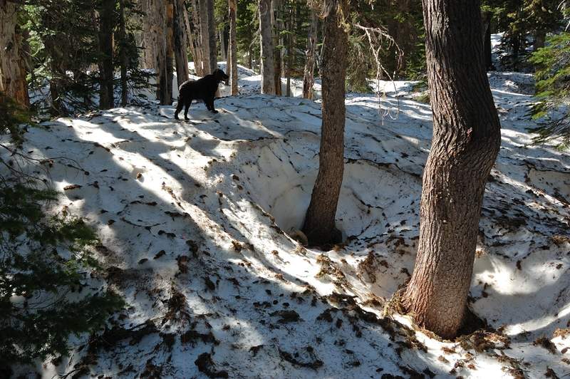
Full trip report is at http://www.portlandhikers.org/forum/viewtopic.php?f=8&t=8760. My guess it will take until late August to melt all the snow in that area. The trail still mostly covered above 4,800', and first patches start at 4,000'. I managed to get lost on the way in (went to Lemei Rock but found myself at Wapiki Lake), and then on the way out (went straight north and found the road near Hidden Lakes trail, instead of going east). My route finding skills are terrible in the snow and trees... Wapiki just begins to thaw, and in a couple of flat spots the bare ground opened just enough to put a small tent. NO MOSQUITOES at the lake (saw a few but they're not hungry yet). They'e bad only down near Road 24. The area around the lake and Lemei Rock is beautiful in snow.
July 24, 2011


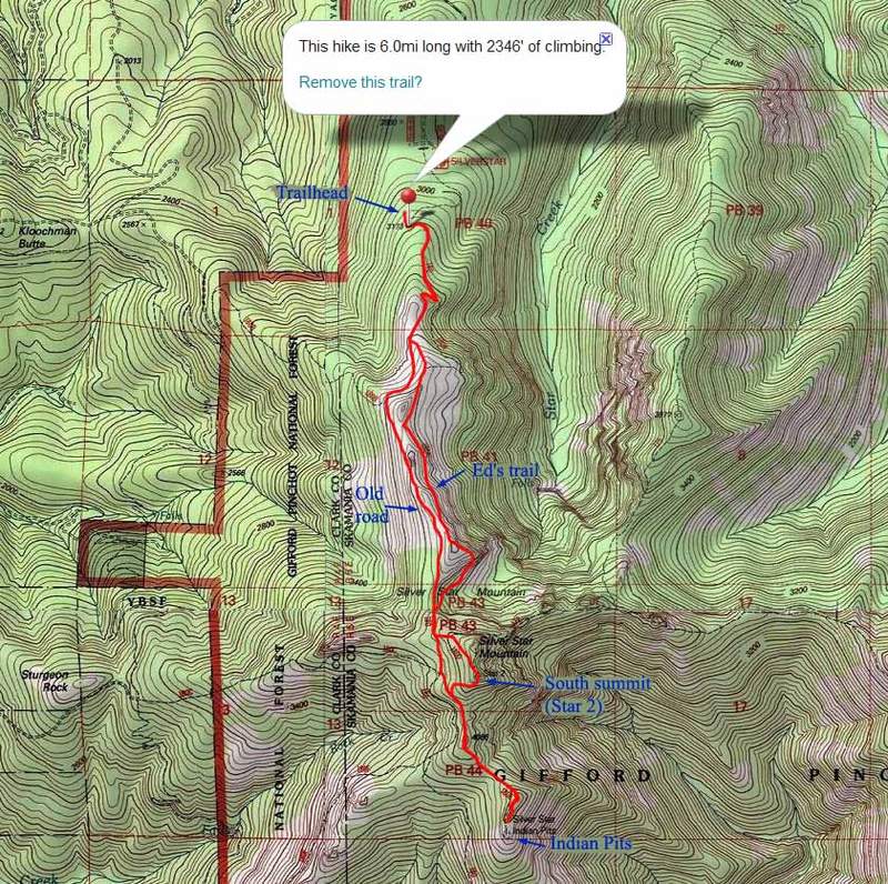
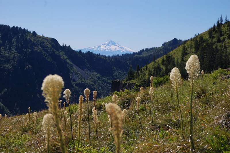
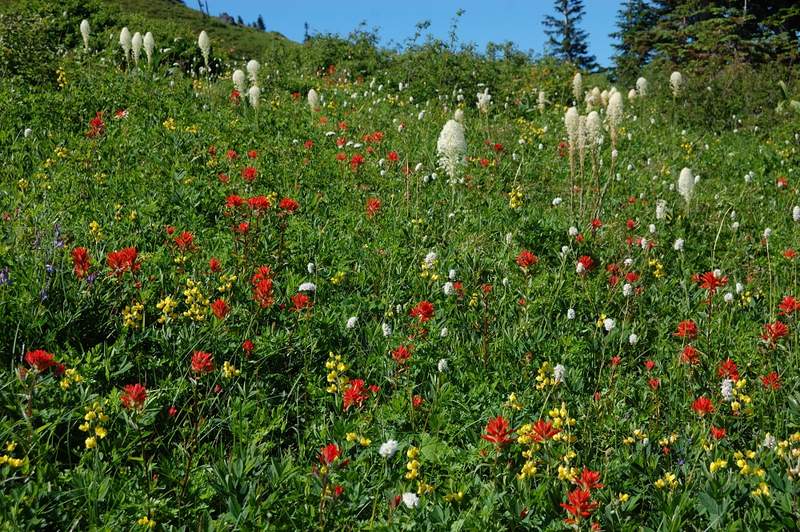
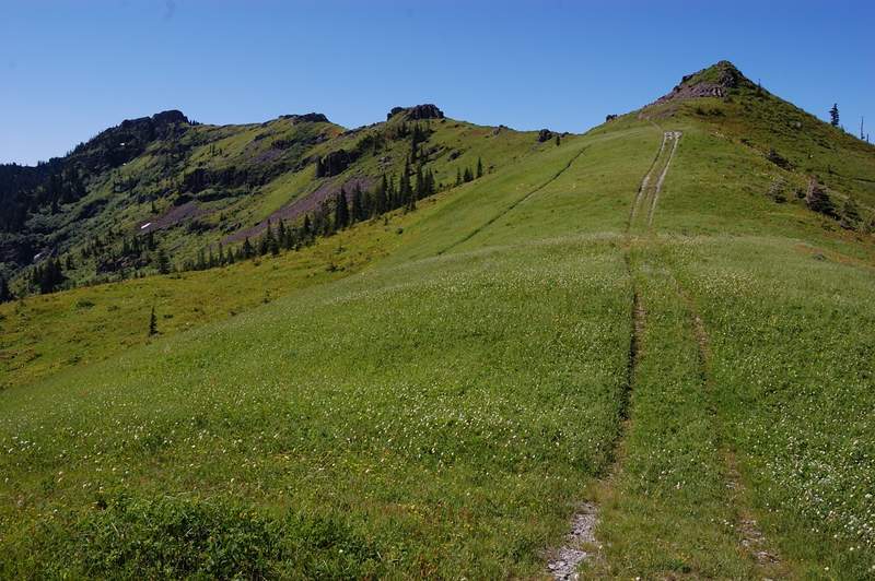
Silver Star
6 miles of hiking • 2250' elevation gain •
Hiked with my parents from North trailhead, via Ed's trail to Star 2 (Star 1, the summit a few feet higher, was too crowded and Star 2 has a better view). Continued south from Star 2 on an faint trail to reconnect with trail 180E, then to the lower summit overlooking a scree field with Indian Pits (kind of saw them). Up on trail 180E bypassing the summit, then abandoned road on the W side of the ridge back to the car.
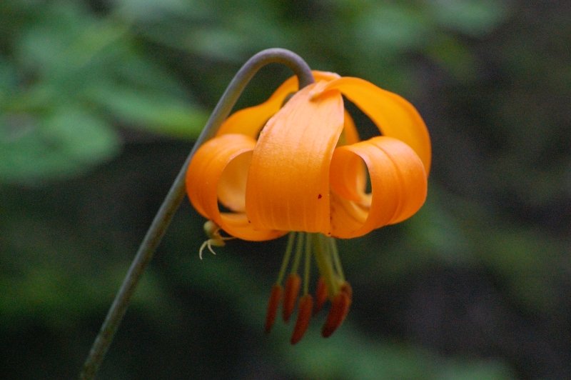
The flowers are fantastic right now, the terrain looks alpine despite the elevation; I just tend to forget how beautiful Silver Star is. The snow is almost gone - just a couple of patches on Ed's trail and the road, many small patches on upper 180E but it's 99% clear.
BTW we almost turned around in the first 1/4 mile because of close-by shooting (despite so many people around!). As it turned out later, it was a group of teenagers that got just ahead of us (10-17 y.o. maybe and no adults in sight). As we met them again on the way back near the summit, one was carrying a rifle, and we overhead the younger saying the one with a riffle that my dog would be a good target... little bastards. My dad "informed" them that we already called about the shooting, and it did take an effect on them.
We heard other shots during a day, but they were too far away to worry much. Overall, it was a fantastic day on the mountain.
July 23, 2011


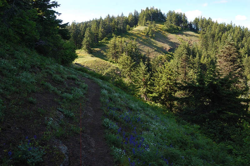
Grassy Knoll
6.5 miles of hiking • 1500' elevation gain •
This hike was recently covered in PH.org so I won't go into trail details. We went a bit beyond Grassy Knoll (to Grassy Pass) - the trail follows the ridge up and down, and there are some great wildflower meadows from GK to GP. Flowers are still great, especially higher up. Also saw a lot of recent signs of bear activity - bear poop on the trail, and several destroyed ant mounds (bears like ant larvae).
July 23, 2011

 1
1
McNeil First Try
6 miles of hiking • 2000' elevation gain •
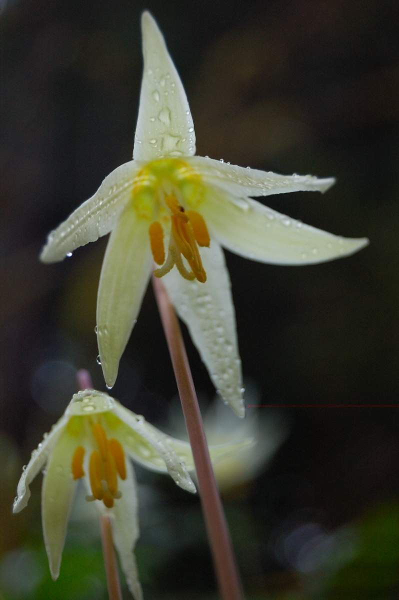
Yesterday it looked rainy in the forecast, but when I checked it today morning weather service said 82F and partly cloudy. Well, let's hike someplace cooler today. I wanted to do McNeil for quite a while (only did Cairn Basin last year) and even though it was a family hike today I hoped everyone will forgive me for snow if I show some great views. To make a long story short, it was 55F and raining at the trailhead, and we didn't find McNeil because of fog, more rain, and 5-10 foot snowdrifts, but 5 minutes after we got back to the car it was all sunshine. Luckily, the view from Bald Mtn and from the upper viewpoint was great as always, and everyone liked the trail. The thread is now clear to about 5200 feet, but then the snow gets up to 10 feet deep in the trees... Not so deep higher in the open, more like 3 feet. There was a well-beaten path, but now looking at the topo it seems it followed just above Timberline trail rather than heading to McNeil(?). I'll have to hike it alone before bringing everyone there, hopefully in a better weather.
P.S. There are lots of flowers along the trail - beargrass, glacier lilies in the forest; the meadow at Baldy Mtn viewpoint is ablaze with flowers of all colors.
P.P.S. Lolo Pass Road is open despite the damage. There are a couple of gravel spots, and one short 1-line spot (well marked). No need to take a detour.
July 18, 2011


Scout Camp Trail
2.5 miles of hiking • 750' elevation gain •
Short, steep, and fun loop trail down to Deschutes River. Overcast weather was much appreciated - I can guess how hot it becomes during a sunny summer afternoon.
July 17, 2011

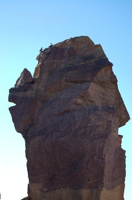
Smith Rocks
3 miles of hiking • 1000' elevation gain •
We also went to Smith Rocks - not the whole loop (too crowded), just up and down the steep side of Misery Ridge.
July 17, 2011


 2
2
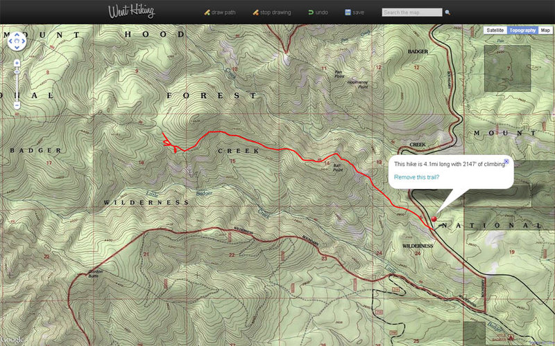
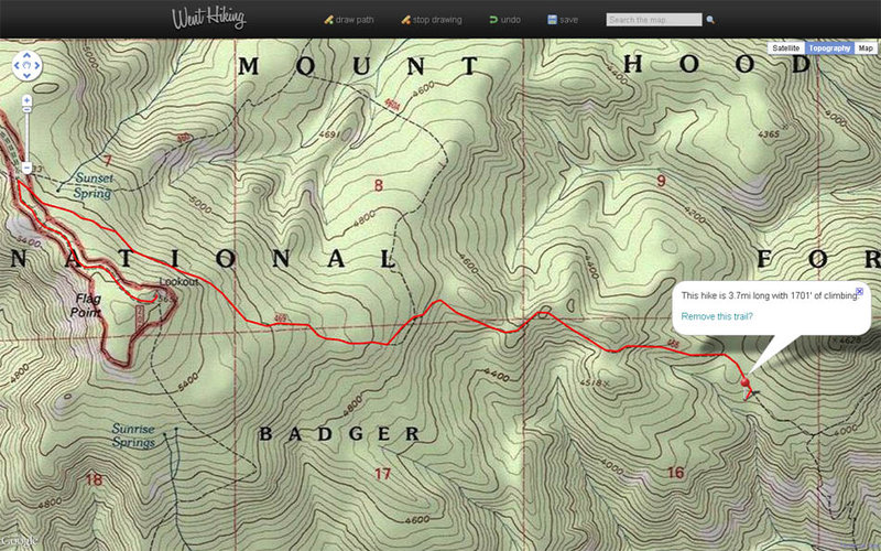
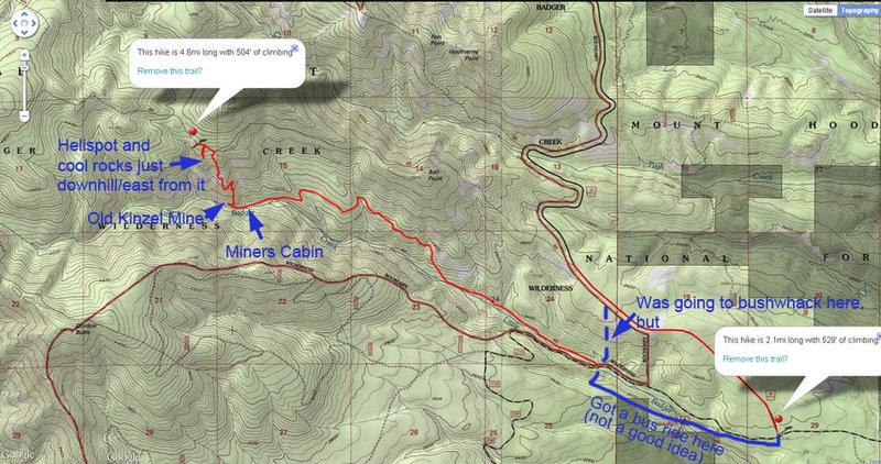
East Badger Creek Wildernes
18 miles of hiking • 4750' elevation gain • 2 nights
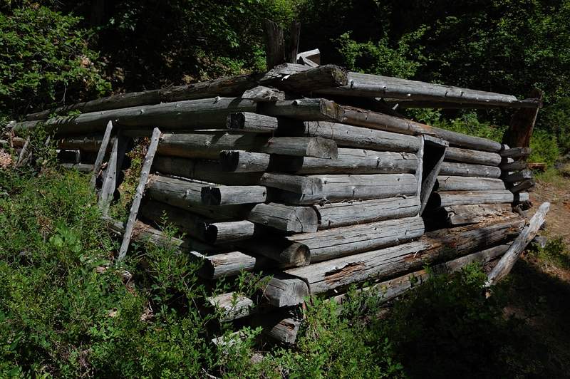
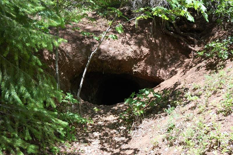
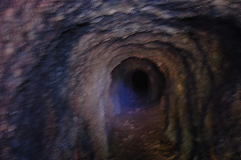
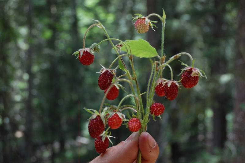
Just off a nice little loop in Badger Creek Wilderness. Day 1: got 7pm start and went up School Canyon trail (despite the name, it's all near ridge top and a lot of views - great trail) and camped near the only spring between the trailhead and Flag Point).The marker on the map shows my camp site. Day 2: up and down Flag Point. This section of trail has some heavy blowdown! Lookout is now staffed, but I climbed up to the cabin; the view slightly disappointed - Mt. Hood is partly obscured by a higher summit, Jefferson and Sisters - by the trees. In the evening visited the cliffs just below and to the east of Helispot viewpoint, just below my campsite - cool place and one group camped there the prior night. Day 3: Down Little Badger trail, very nice but a little hot, since it's just over 2,000' elevation. Lots of ripe strawberries in places. Checked out an abandoned mine. Got a free ride on the bus 1.5 miles uphill (with Mazamas) from the lower trailhead to Rd. 27, the last 2 miles went on the road. Next time, I'll bushwhack from the lower to the upper TH, was going to do it this time but was kind of beat up.
I definitely recommend the ridge trail (#468) and the lower (#469 below my campsite) trail, but NOT the trail from my campsite up to Flag Point.
18.2 miles, 4,880 feet
July 8 – July 10, 2011


Hunchback Mountain
4 miles of hiking • 1750' elevation gain •
Took my Mom to Hunchback Mountain. This trail is steep in places, but very nice once you gain the ridge. Rhododendrons are nice right now.
July 4, 2011

Sheep Canyon fail (and unnamed summit)
3.5 miles of hiking • 1750' elevation gain •
In short - too much snow starting at 3,400 feet (!). There were patches of snow along the road to the trailhead (around 3,000'), and once you cross the creek near Blue Lake, the trail is mostly covered with up to 2-3 feet of snow. I lost others' boot tracks 1/4 mile after the creek crossing (tracks are hard to see on dirty snow), and since I don't know that trail well, gave up on Sheep Canyon and decided just to scramble to a good viewpoint of St. Helens.
The rest of the story - in pictures.
July 2, 2011


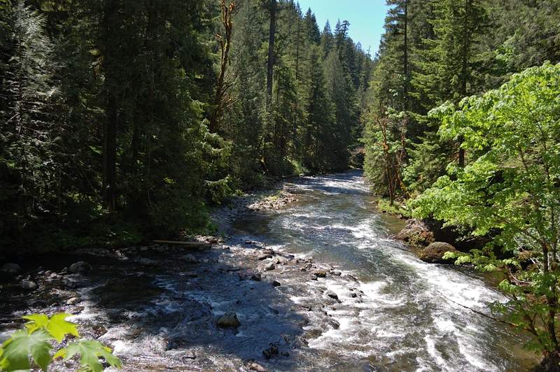
Middle Salmon River
7 miles of hiking • 1000' elevation gain •
Did this hike a third time this year, but the first time in a gorgeous weather like this. We hiked to the first canyon viewpoint. Lots of flowers on the viewpoint. The trees now hide the view of one of the falls (Final Falls?) that was visible from the viewpoint in winter. The trail was surprisingly uncrowded for the beginning of 4th of July weekend.
July 1, 2011


 1
1
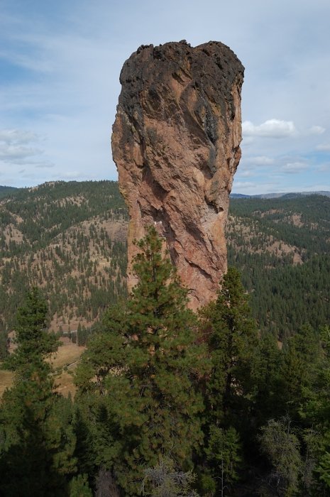
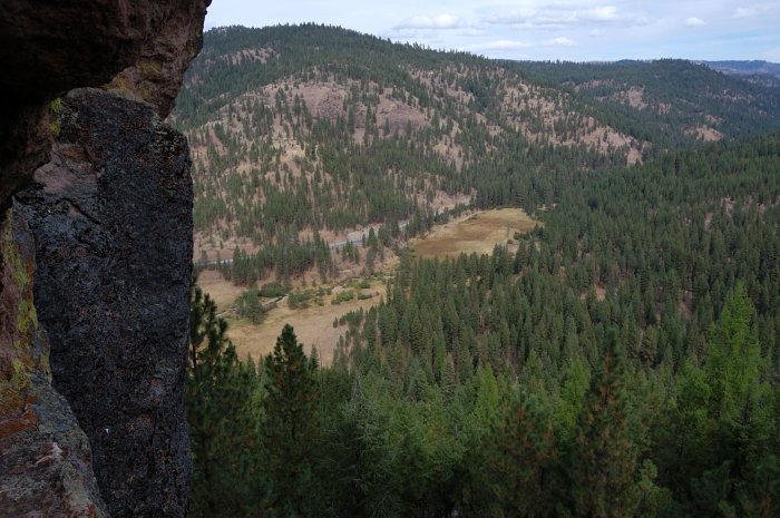
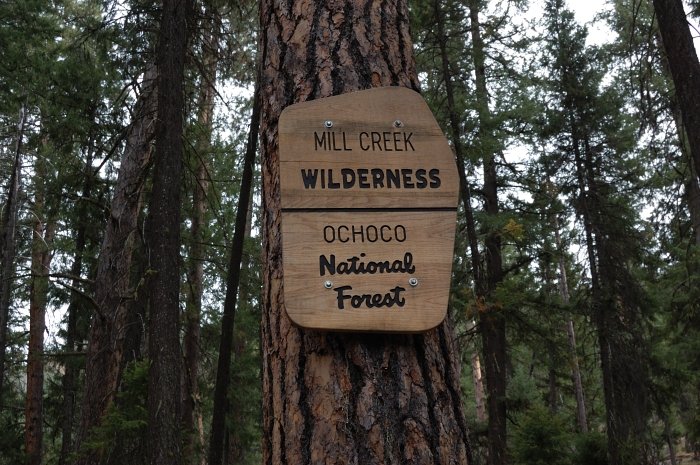
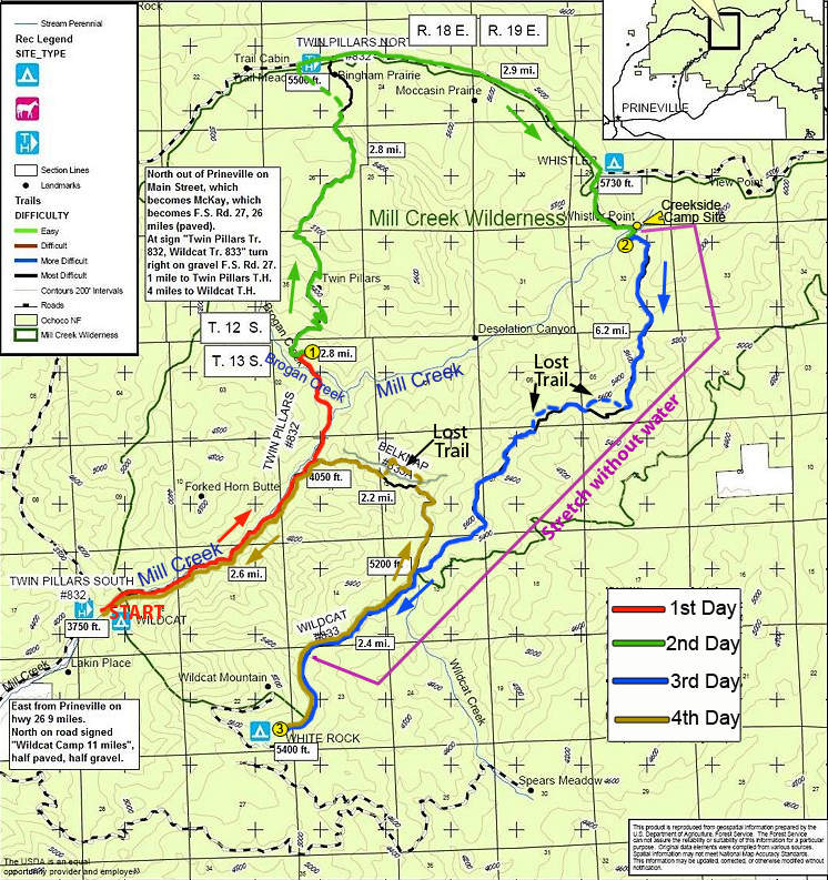
Mill Creek Wilderness Loop
27 miles of hiking • 3500' elevation gain • 3 nights
Last May I did a hike to Twin Pillars, and since then wanted to do a whole 27-mile loop which covers all trails in this small wilderness. I planned the trip in May, but the combination of late snow and finals held the trip until now. The conditions were uncertain - on one hand the trail to Twin Pillars was overgrown with brush last year (and it's the most popular trail, so I had to expect the rest of the loop to be quite obscure), on the other hand Forest Service site said last summer that all trails are currently undergoing repairs. As it turned out, so far they only repaired the trail along lower Mill Creek (the first 3 miles) and the lower third of Belknap Trail #833A; the rest of the trails didn't see maintenance at least in the last decade. I am glad I planned 4 days on this trip! Unlike the description in FieldGuide, I did the loop clockwise.
DAY 1
Upon arriving at South Twin Pillars trailhead on Friday at 7:40 pm, I started up the trail to my stealth camp 4 miles in, where I camped last spring. In fact, there are many places to camp along Mill Creek in the first 3 miles or so, but I wanted to get a little more uphill on the first day. The stretch along Mill Creek is one of the most beautiful in the wilderness; it was mostly spared by fire (which burned most of the wilderness in 2000). The creek valley is lined with sparse ponderosa and fir forest, and there are many flowers along the trail (some small variety of balsamroot, larkspur, red columbine, blue lupine, to name a few). After several creek crossings (there are 8 crossings in total; you may easily skip 3 in the beginning, and there is a good log just above the upper crossing, so you have to wade about knee-deep 4 times across Mill Creek) and after a short uphill climb I crossed Brogan Creek and headed east off-trail over a small ridge to my campsite. The forest is all burned down at this point, but behind that ridge there is a piece of forest that survived the fire, with ponderosa pines and a nice meadow with a tiny stream to get water from (I expected it to dry out so I brought the water from Brogan Creek). I just like this secluded campsite even though it required getting over blowdown.
I set a camp in the dark using my LED headlamp, let my dog into the tent, built a fire and went to hang a bear rope when I noted we are not alone. In the light of the headlamp I saw two pairs of eyes watching us from just 100-150 yards away, in the direction I was heading. It was impossible to see who it was, but I knew those were not deer or cattle because I could see both eyes even if they turned head. I took a large stick and headed towards them to my "bear tree", making as much noise as I could, but the animals didn't run away as I expected. One of them kind of looked at the other and then they both watched me again. They were still too far to see, but at the same time too close for comfort; it was a little creepy. I remembered seeing cougar scat just 50 yards from my tent there last spring, and it looked as I set a camp right in their "living room". I hung my bear rope without putting a stick too far aside. When I was done with the dinner and hung my bear bag the eyes still watched me from the same spot.
It was a cold night (the forecast said 34F and it felt like this) but I took a plenty of extra clothes and it was OK.
DAY 2.
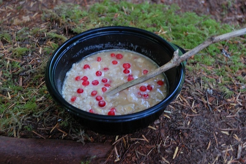
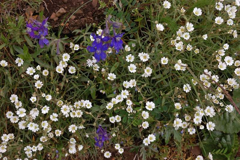
In the morning, my campsite looked just beautiful and peaceful - red ponderosa pines, green carpet of short grass dotted with flowers, birds chirping, not a single mosquito or biting fly. I would probably camp there again, but will make sure I'm done with everything by the dark. It warmed up really quickly - at 6 am it was as cold as it gets, but by 9:30 I was without a shirt already. It's fun to set a fire - there is a ton of perfectly dry wood on the ground that starts burning in a few seconds (I checked that there was no fire restrictions before heading out, but still it's better to be careful). I took tea bags with me, but ended up making wild strawberry tea - the strawberry plants are everywhere. The next day, I added fireweed to strawberry leaves, and after the tea was ready I put in oatmeal and raisins - it turned out to be a great recipe.
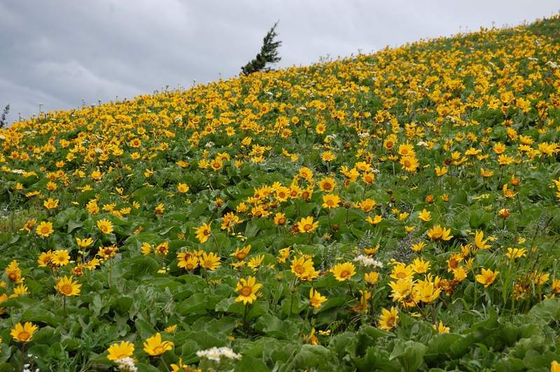
As we climbed towards Twin Pillars (two large rock spires raising above the forest of snags), the trail became very overgrown - only about 200 yards at the bottom have been cleared. There were markings from Forest Service contractor, which probably means they are going to do this section this year. The climb through brush and blowdowns was very slow and in just 1.5 miles I really felt tired. Above Twin Pillars the brush ends, but heavy blowdown (every 20-50 yards or so) continues for about a mile more - it was like Steeplechase barrier running with a 25lb backpack. After this, it was mostly easy blowdown (step-over) and I enjoyed the easy trail, periodically slapping mosquitoes. The trail becomes almost flat as it goes over the highest point of the loop - 5,800 feet. There is a lot of wild onion in bloom, but I don't know which part of the plant is edible. Soon there were views of a nice rocky canyon on the right, dozens of chipmunks among fallen logs kept my dog entertained (no she didn't catch any, they're too fast). At the north end on Twin Pillars trail, per Field Guide, there's a "nice view of Bingham Prairie, where you might see wildlife". And man - those swampy meadows had so much "wildlife" I almost forgot about the views (sure it wasn't meant moskitoes in Field Guide but that what I got)! Any time I slowed my pace I was engulfed in a cloud of HUNDREDS of buzzing pests; they were so hungry that tried to bite before they could properly 'land' on me. There was a moment when I had to cross a 5-steps wide stream on a log using both poles for balance - during those 5 steps I got more than a couple dozen bites. As I didn't take any kind of insect protection, the only choice was to increase the pace and hope the rest of the loop isn't like this. The trail description said there was a nice outhouse at the north trailhead, and all my dreams were to get into the outhouse, as soon as possible, slap the door closed and stay there for 20 minutes or more.
However, the trail got to the road about 1/4 mile west of the trailhead, and once I saw a turn-out to picnic area I decided to continue east on the road. The skeeters ended soon after I passed the meadow area, and a 3-mile walk on a little used road was pretty good. There were a couple of "views" through trees in the direction of Painted Hills, but otherwise it's just a nice forest walk. About 1/10th of a mile before North Wildcat TH, there is a road sign pointing right to Wildcat trail, and it was in fact looking like an overgrown trail there. Skip this (if you head there) - the trail starts at the end of road 500 (? not sure about the number) where you turn right from the main road, soon after that sign. I continued an easy mile downhill to the headwaters of Mill Creek. With all the small streams running I had no worry that headwaters of Mill Creek will dry out, and in fact it had so much water that I skipped the creekside camp site (quite good) because I thought it would be hard to sleep with so much water noise. Strangely, Mill Creek has absolutely no mosquitoes - it is either too fast, or too cold at that location. I camped just off-trail on a ridge overlooking (through a few snags) Desolation Canyon and Three Sisters, Broken Top, and Bachelor - it made for quite nice sunset and sunrise watching.
DAY 3
It's so good to wake up every day to sunny skies! Also, it felt great as I kicked off half of the distance in the last 2 days (despite the late start on Friday) and half the elevation in the last day alone. I quickly packed up, made a run for water at Mill Creek, and headed south along Wildcat trail. The trail indeed looks "less used" and is overgrown with grass (it seems there was no one in many days or even weeks), but it's easy to follow and has comparably little blowdown. For the next mile I had great views of Desolation Canyon - the forest mostly burned down there but the canyon looks green with brush (same kind I was bushwhacking in the previous day). The brush tries to reclaim the trail in a few spots but it's not bad yet. The trail makes a way along the ridge and has no water for about 6.5 miles. In about a mile the trail got pretty bad, completely covered with blowdown and brush, but then it goes to through the gate in wire fence to the east side of the ridge (not burned in 2000 fire) and alternates between the mixed pine-juniper forests and small meadows with balsamroot (already starting to fade), larkspur, and lupine (just starting). There were great views to green Ochoco Mts to the east. One of the nearby higher peaks (Lookout Mountain?) still has a fair amount of snow near the top. I lost a trail couple of times because it gets really faint, but since it follows the ridge I was never "lost". About 1,5 miles before Belknap junction the trail gets in a postcard-perfect ponderosa pine forest with a mix of firs in places. There were a few spring morels (I only write this because no one in my family likes them) and a lot of strawberries in bloom. The upper junction of Belknap Trail is well signed (BTW, there were new signs on all trails). The White Rock campground has only 2 spots, but being Sunday evening it was empty. It's quite nice place to camp - huge ponderosas, a lot of firewood, outhouse, and running water (though it has iron after-taste - it's better to get water from a stream 1 mile before the campground). Despite numerous warning signs about cougars in the campground, I didn't see any glowing eyes this evening.
DAY 4
It was supposed to be an easy day, 7.2 miles, mostly downhill. I backtracked on Wildcat trail to Belknap junction and headed down on Belknap trail.
It has a fair amount of blowdown for the first mile, but is easy to follow. However, I took an animal trail at one spot (without realizing it) and got honestly lost, for the first time in the hike. Now you see a good trail, then it just vanishes without a trace! After failing to locate the trail I just went down a wide-open ridge, but after losing 200-300 feet of elevation I ran into thick brush between the two canyons. I saw an easier terrain on the north side of the canyon and head there through brush and heavy blowdown, which forced me to gain the top of the ridge - it took quite a while. I stopped to take a breath, and then saw my trail on the other side of the canyon, exactly at my elevation! Well, maybe it's just another animal trail? To find this out, I'd have to head across the canyon - about 150 feet down then up, through a very dense brush. I decided just to head down on my ridge, but in a few minutes I run into impenetrable blowdown and made a call. Once I reached the trail on the other side, it was Belknap trail I lost almost an hour earlier - wide, easy to see, and blowdown-free. I still don't know how I could lose it.
It was a hot day (the kind of hot&humid you get before a thunderstorm), but down at Mill Creek, it became really hot! (my car thermometer at the trailhead showed 80 degrees). I didn't care to take the boots off, just waded the cold creek - it was really refreshing, and I took all 7 creek crossings instead of the required 4.
Down at Prineville, I bought an ice-cream, ice-cold MacCoffee, and 2 ice-cold juice servings.
June 24 – June 27, 2011

Dog Mountain
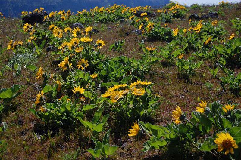
7 miles of hiking • 2750' elevation gain •
Made another hike up Dog Mtn this morning (BTW I've officially graduated so Monday will be my hiking day!). Balsamroot is very good, but beginning to fade. The meadows are yellow all the way to the summit now.
June 20, 2011


 1
1
Salmon Butte (almost)
9 miles of hiking • 3000' elevation gain •
Was going to hike Middle Salmon River trail, but when I got there decided to do something less crowded and continued 1/3 mile to a new Salmon Butte trailhead.
I've never done this hike before but read on Portland Hikers that the road to an old trailhead had been decommissioned and blocked just after Salmon River crossing. Making calculation on Kyle's map, this added 1.1 mile one way, and 580' of elevation to Salmon Butte hike. However, I didn't have the map with me, and turned around when I hit snow at 4,400' (exactly where my marker is), just after the narrow ridge with "views" to the east. If I knew I was so close, I'd probably make it to the top.
The hike begins on a closed gravel road, but 1/2 mile later they ripped the old road and turned it into trail, and even planted grass and young trees along it, so it wasn't boring road walk. The trail is pretty good; it's almost never steep but never lets up. Good training hike for being so uncrowded (I only saw 2 hikers) and so close to Portland. Saw a couple of rhodies in bloom on the lower trail (but they are few there), but the upper part of the trail has the most rhodies I've ever seen; once (if) they bloom in 2-3 weeks it should be quite nice. Once I was past 6 switchbacks and a narrow ridge, the snow started and became at least 3 feet deep in less than 100 yards. There were tracks (hardly visible), but I didn't know I was so close; in addition my phone refused to show time and it was already 6-ish in the evening so I turned back. I'll have to try it again, hopefully without snow.
June 19, 2011


 3
3
Dog Mountain
7 miles of hiking • 2750' elevation gain •
Balsamroot is at the peak right now. Many other flowers as well. Even though the cars were parked in 4 rows at trailhead (we parked at the shoulder just east because parking was completely crammed) it didn't feel too crowded on the mountain, probably because it's not one trail but three.
June 11, 2011
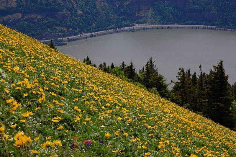
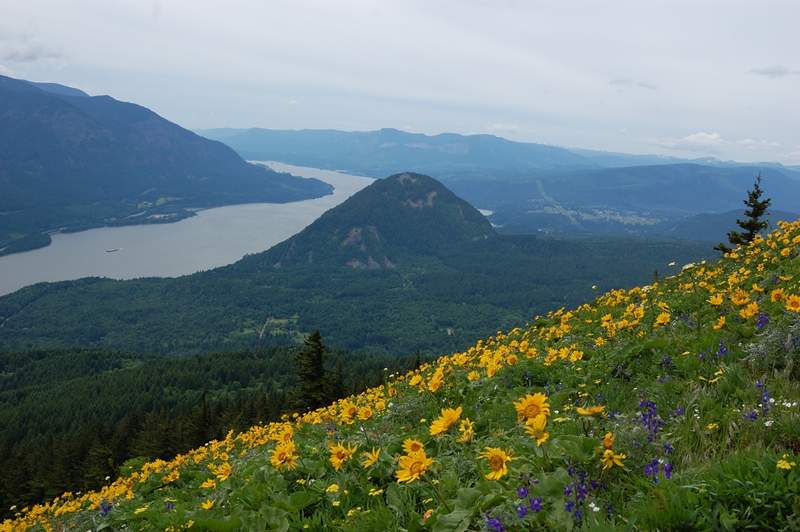
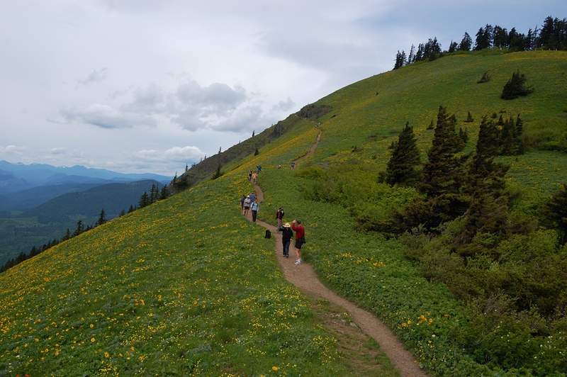
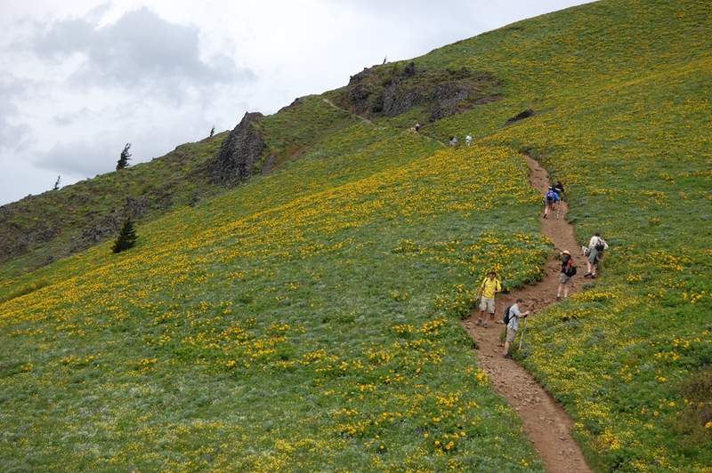
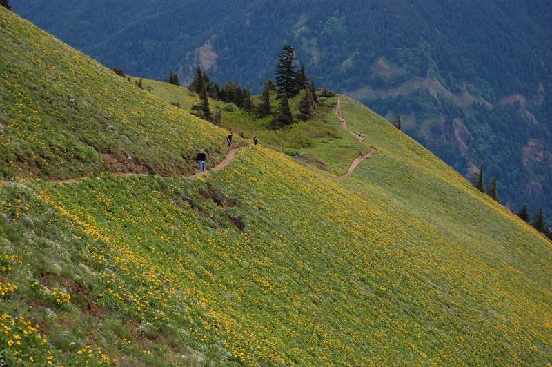
Table Mountain
8 miles of hiking • 3250' elevation gain •
Hiked East (Heartbreak Ridge) trail up, then West trail down (some people call it Windbreak Ridge). East trail has little views and LOTS of small biting flies (gnats?). West trail was in the open most of the time and almost bug-free; I'll use it up and down from now on. Only a few snow patches under the trees on the summit. Many flowers, especially glacier lilies. I only met 2 groups on the way there and 2 groups on the way to the trailhead, but nobody on the mountain itself. No bugs on the top (and for that matter no bugs anywhere except Heartbreak trail and the very bottom of Windbreak trail). Best views were at north tip of summit plateau, where I saw Rainier, Adams, and St. Helens, and a good view of the river. Gorge Overlook (east point) has a good view of Hood and Bonneville Dam but the view East from there is getting obscured with trees.
June 2, 2011


 1
1
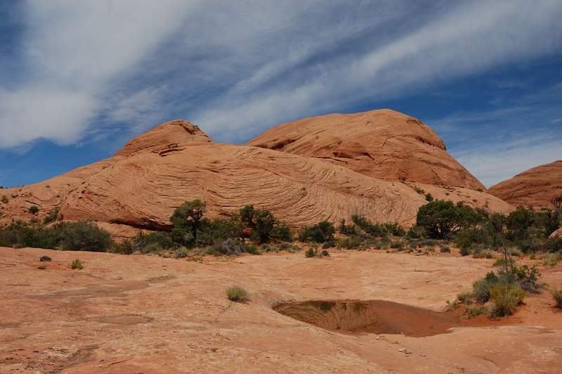
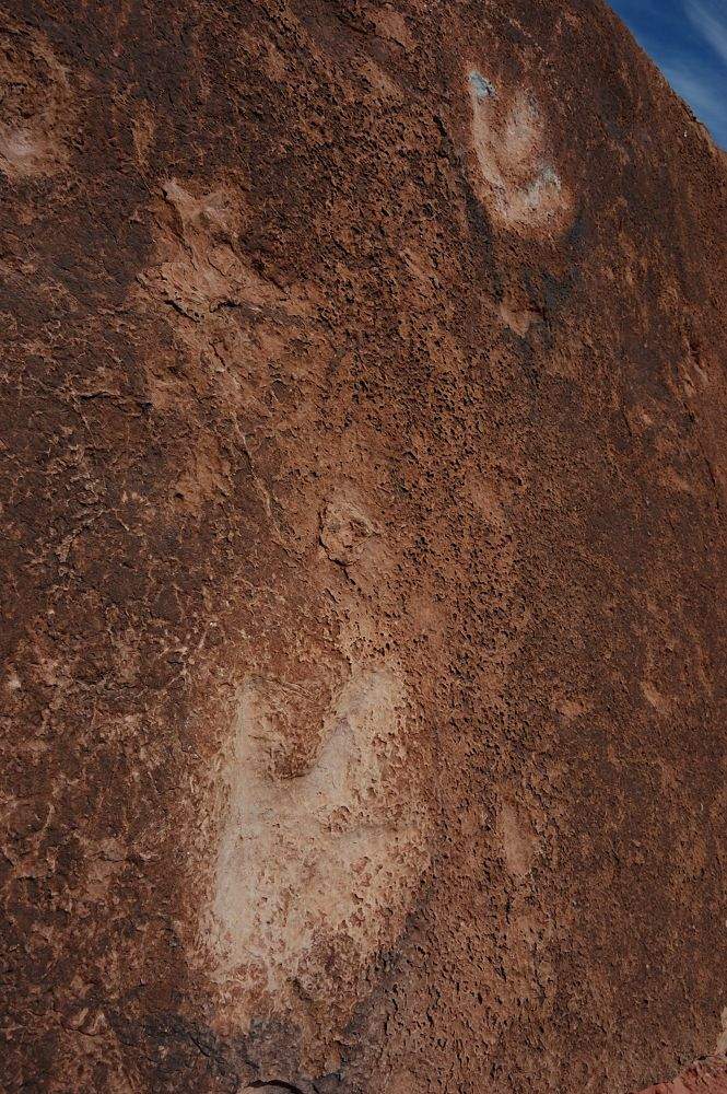
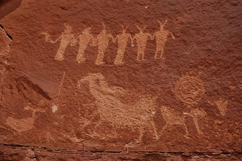
Poison Spider trail
5.5 miles of hiking • 750' elevation gain •
It was not a trail I intended to hike, and not a trail at all.
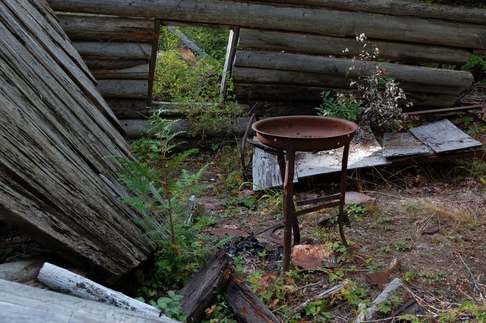
Since my parents didn't plan to hike that day I asked to drop me off at a trailhead and let me hike for 3 hours. The trailhead was supposed to be 4 miles from UT 191 but when we got there it was a vertical wall... We found a trailhead at 6.5 miles and I was on the way on what turned out to be 4WD road. But it still was a good hike, just different from previous ones.
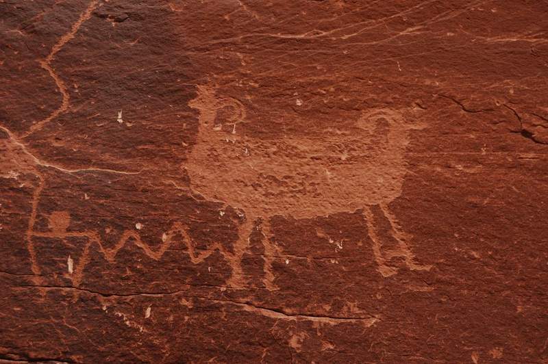
It was actually fun to watch jeeps climb up this rough road so slowly I could catch up with them on the next steep spot. On the way back I saw my road down the canyon so I cut off-trail from where my waypoint is, straight down a canyon and re-connected with the road near the trailhead (Williams Bottom on the topo). Since I had 10 more minutes, I climbed to Indian petroglyphs (barely visible fro the trailhead) and dinosaur tracks.
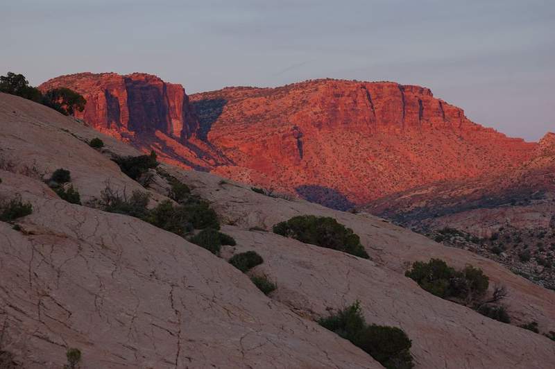
May 27, 2011


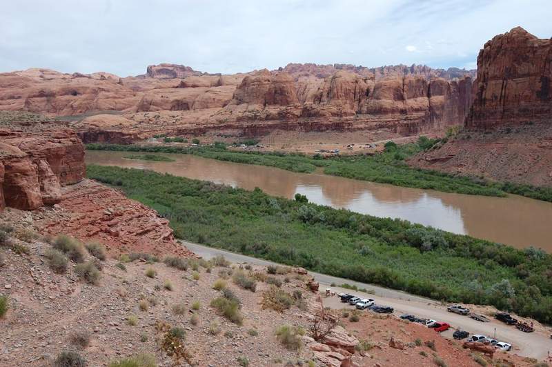

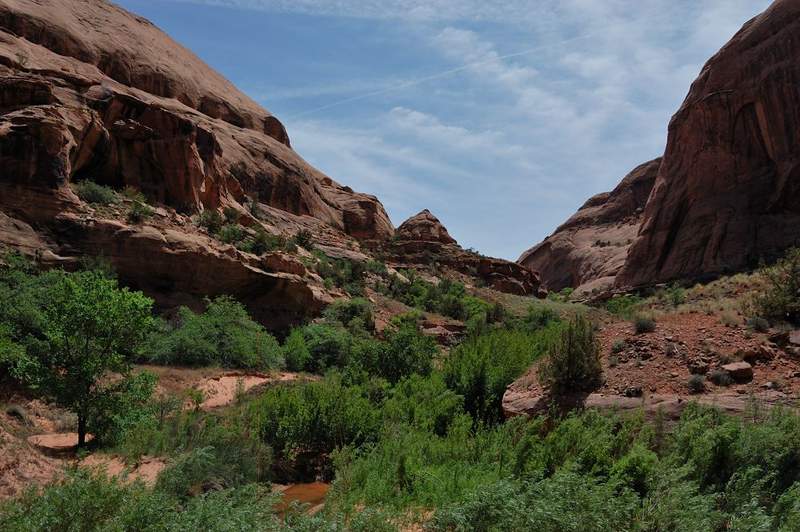
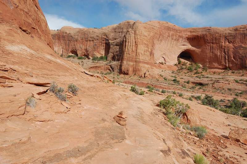
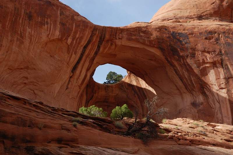
Negro Bill Canyon
5 miles of hiking • 250' elevation gain •
Lush green canyon (even by Northwest standards) just East of Moab. We got our feet wet during creek crossings (I counted nine). We got to Morning Glory arch in the afternoon so it was already in the shade, but the place is quite beautiful, with cool shade and a creek flowing out of rock. On the way back we explored another side canyon a bit.
May 25, 2011


 1
1
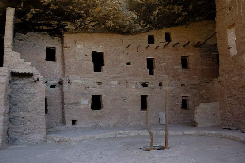
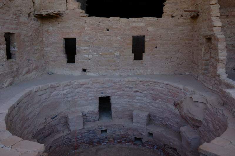
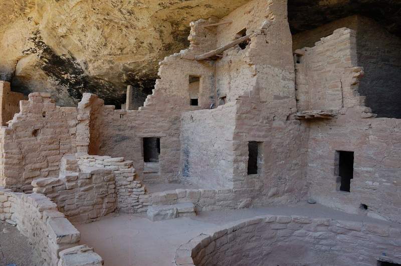
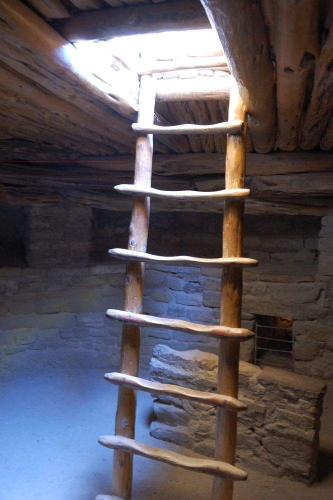
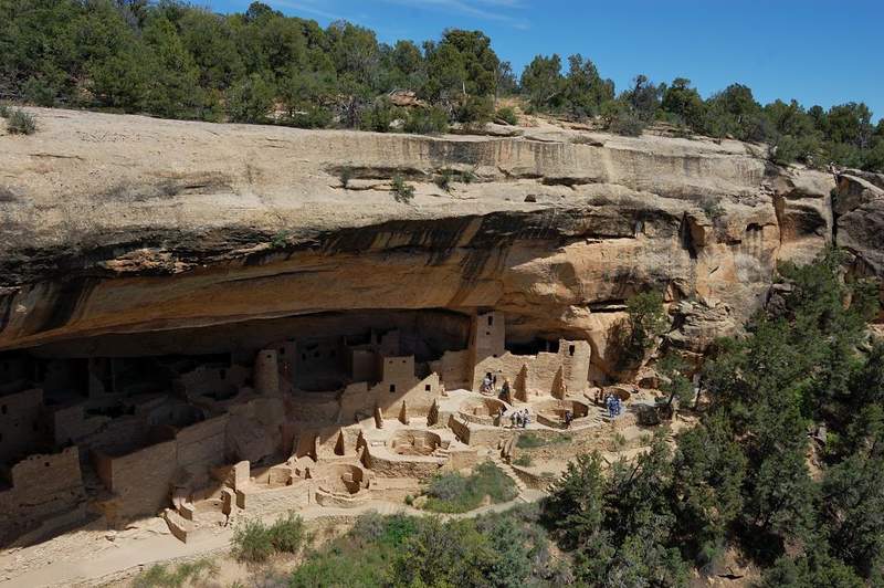
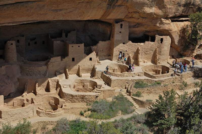
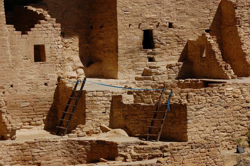
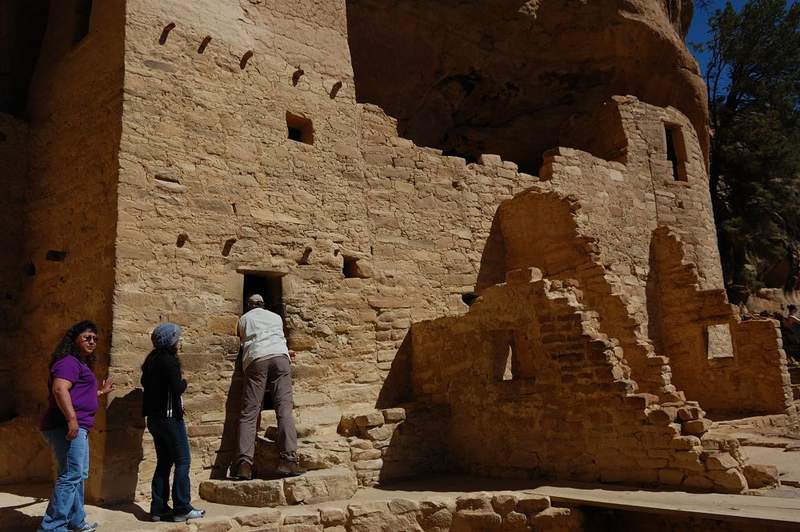
Short hikes in Mesa Verde
2.5 miles of hiking • 500' elevation gain •
Since we weren't too far from Mesa Verde NP, we decided to give it one day. This is small park & not a lot of trails there, but it is famous for a large concentration of Indian ruins, most are well-preserved. Pueblo Indians built small "towns" in huge caverns on the sides of the canyons. What came to a surprise is that once you pay the entrance fee, you have to pay for a ticket at visitor center to actually see the ruins (some are free but most famous are not). Out of 3 recommended ruins, we were lucky to get tickets for one - Cliff Palace - the largest preserved in the park. We also explored Spruce Tree House town (no tickets were required) and possibly every viewpoint on the way. Fun day.
May 24, 2011

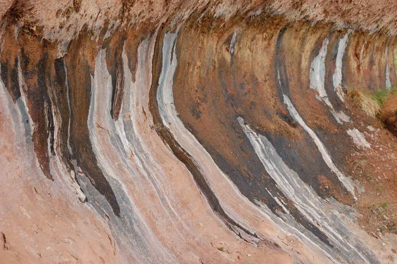
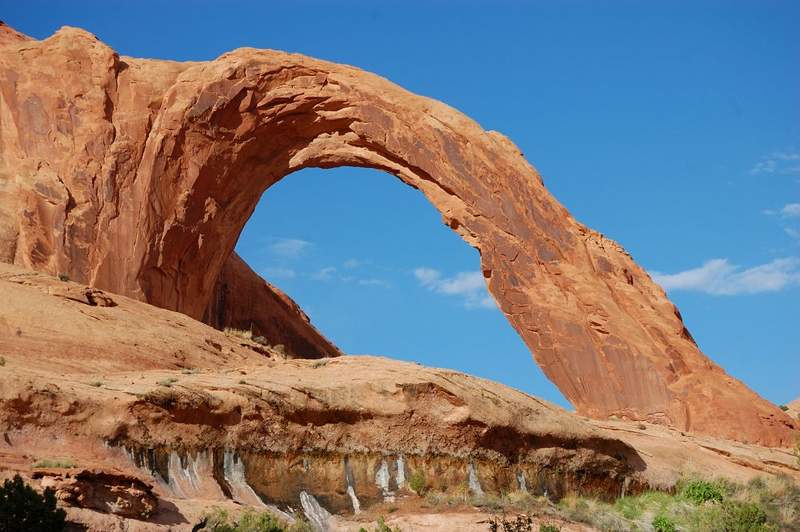
Corona Arch
3 miles of hiking • 500' elevation gain •
Short evening hike after a trip to Fiery Furnace (will post that later). The hike is not in national park; it starts near Colorado River just SW of Moab. The weather started very windy and rain at times at times so I did this hike solo. Of course, by the end of the day the weather turned gorgeous. The desert is nice right now, lots of flowers and not hot. Good thing the trail was marked with cairns - those cairns is often the only difference between "on trail" and "off-trail". There was one more arch (forgot its name) but the destination was a huge Corona Arch (marked as Rainbow Bridge on the map) - the local said it's 90 feet high and I believe it.
P.S. Stuck today at the hotel doing class project but hope to be on trail tomorrow.
May 22, 2011


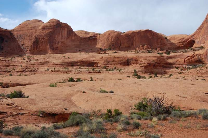


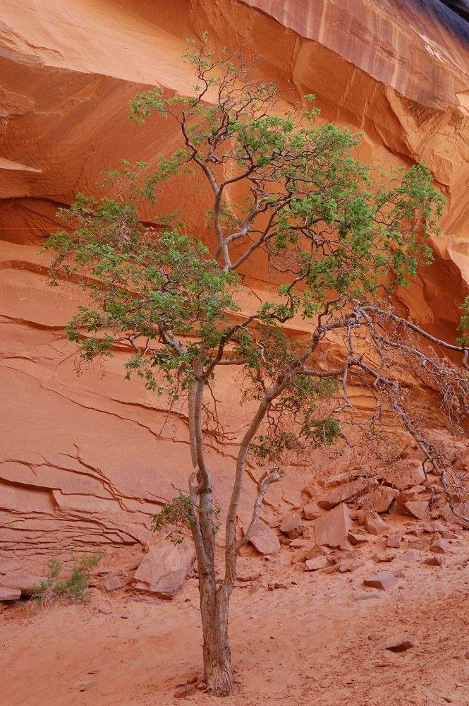
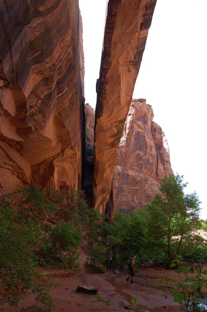
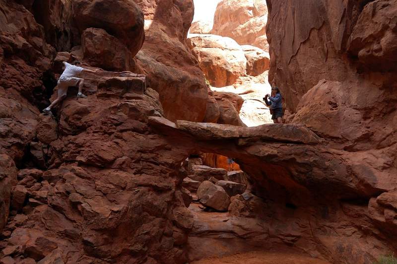
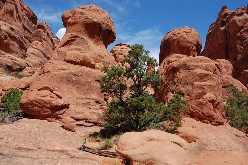
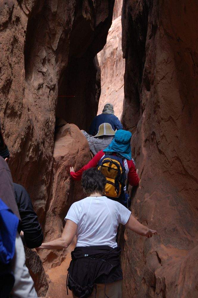
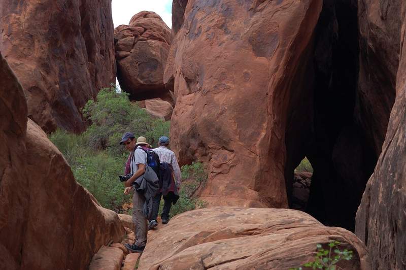
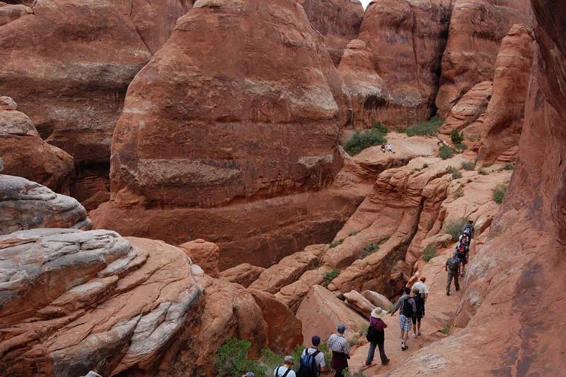
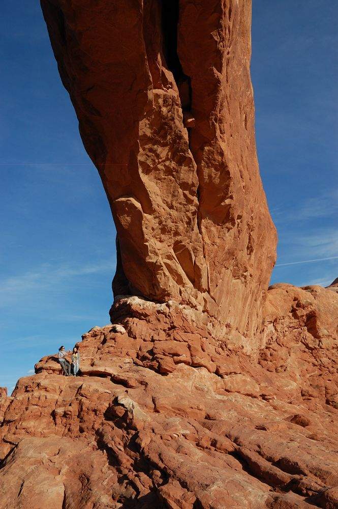
Fiery Furnace (Arches NP)
2 miles of hiking • 250' elevation gain •
Went there with my family on the same day I did Corona Arch. Even though Fiery Furnace is very easy as a hike, it was one of the most entertaining hikes I ever did. They advise to do it for the first time in a ranger-led tour, and now it makes sense. First-time hikers doing it alone would wander aimlessly and miss most of interesting features. Most of the time our group went off-trail, in deep and narrow slot canyons; we crawled under/through small arches and over cracks you wouldn't guess it's even doable by a human being, jumped over deep slots, went over ledges - it was fun from the beginning to the end. The rumblings of thunder (we only got rained upon in the last 5 minutes on the hike) echoed off the walls from time to time, adding to the feeling of being at Fiery Furnace. This trip makes me want to go there again and see all the side canyons we went by.
May 22, 2011


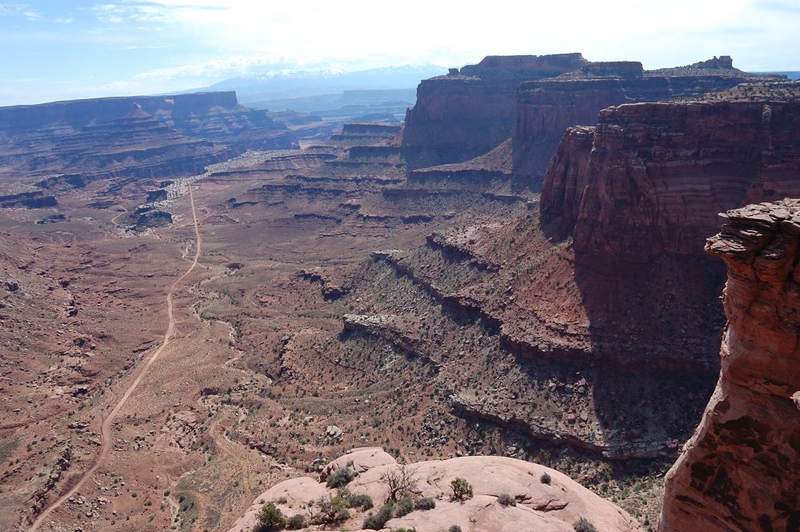
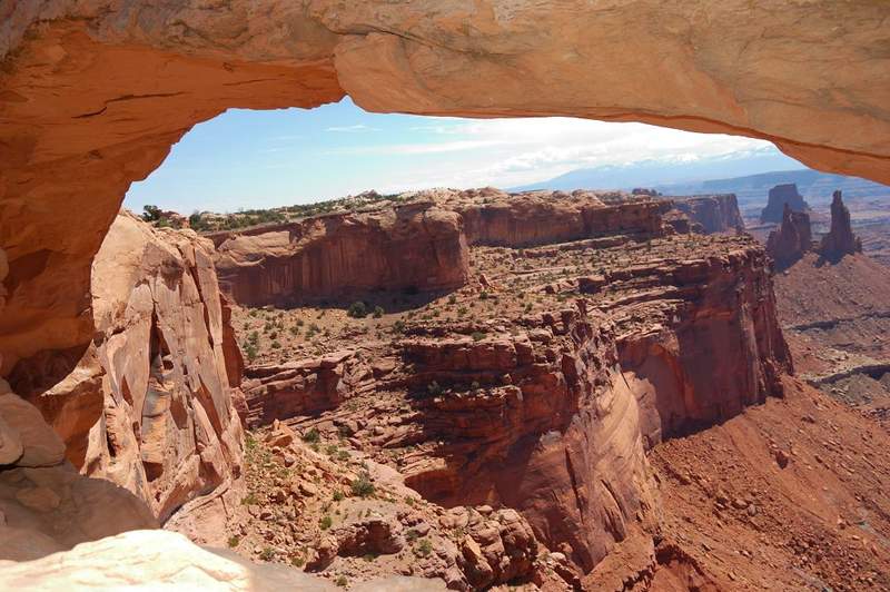
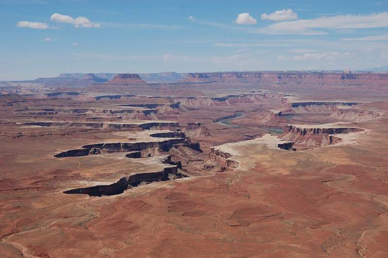
Short hikes in Canyonlands
3.5 miles of hiking • 500' elevation gain •
Made a series of short hikes in Canyonlands yesterday, This place is beautiful!
May 21, 2011

 1
1
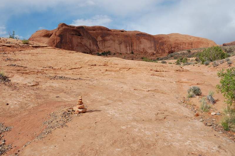
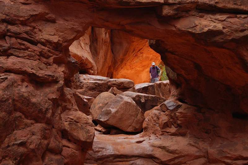
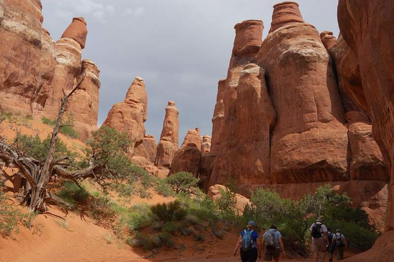
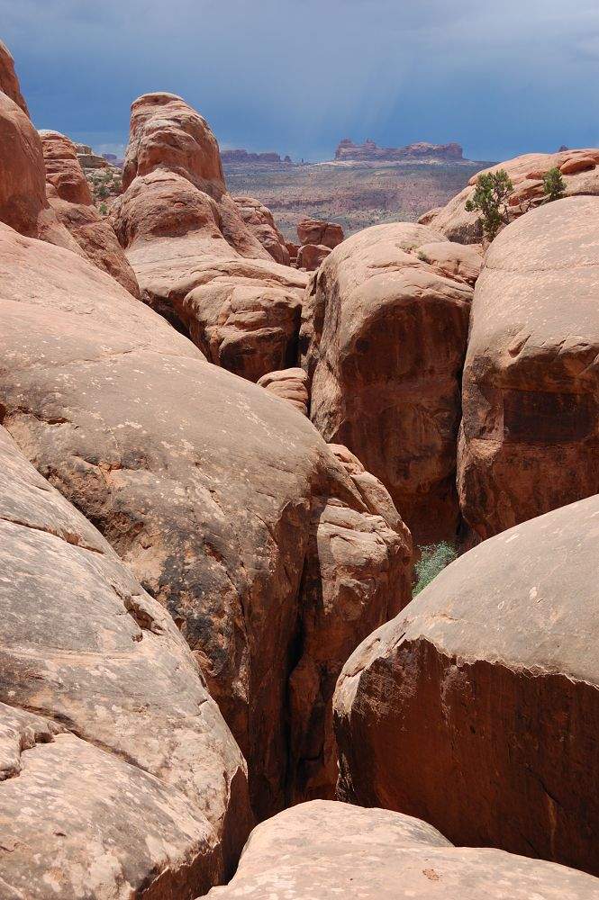
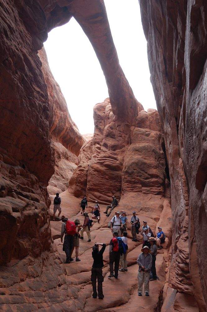
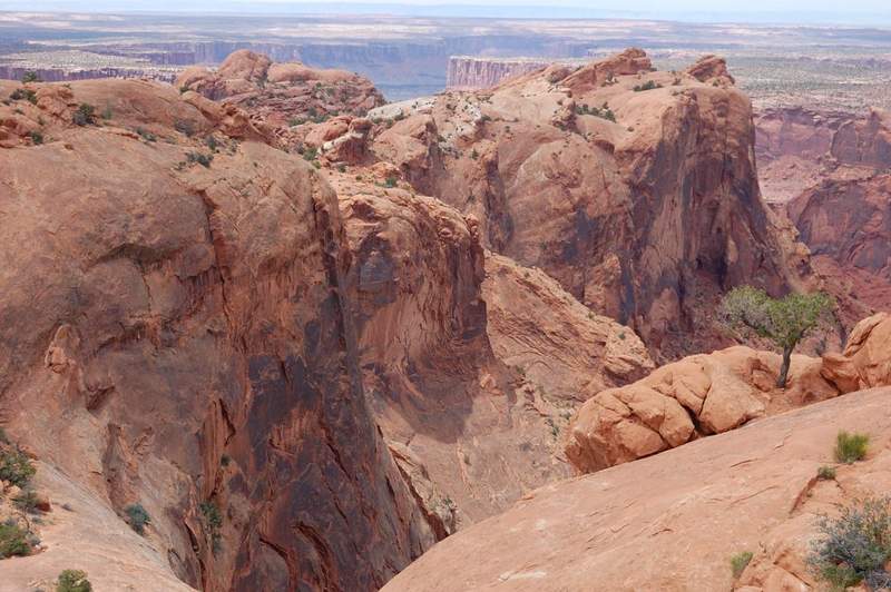
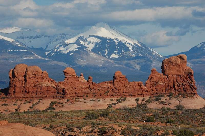
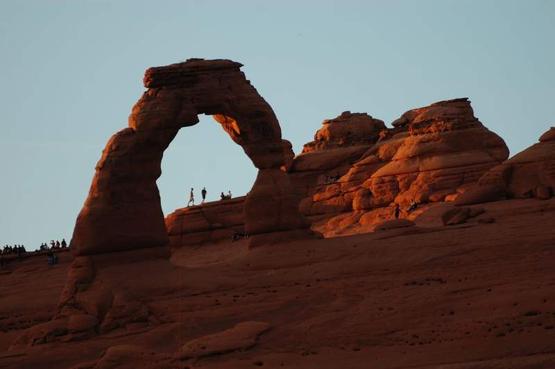
Short hikes in the Arches Nat'l Park
3.5 miles of hiking • 750' elevation gain •
Went with my family to Arches/Canyonlands for a week. We managed 3 short hikes today: 1. around N and S Window arches (they are huge - i got people under onr of them for a scale), 2. We got "lost" for half an hour trying to make a short cut to the trail to Delicate Arch(had to park 1/4 mile down the road due to overfilled parking and didn't want to go along the road) but it never connected to the main trail, and 3. because we hadn't enough time before sunset to give that longer trail another try we hiked a short trail which goes to a viewpoint of Delicate Arch on the other side of a narrow canyon. Good first day, Canyonlands tomorrow!
May 20, 2011


 2
2
Larch Mountain
14 miles of hiking • 4000' elevation gain •
Hiked from Multnomah Falls to Larch Mountain. Almost 8 hours - what a day! I only did the bottom and the top of this hike before, so it was good to finally do it all.
The hike started with the usual mob scene at Multnomah Lodge, and the crowds didn't thin out much until the junction with a trail to Wahkeena. While I made a brief stop to take Ecola Falls picture, I was passed by at least 3 groups hiking in flip-flops. Once past the junction, the percentage of "real" hikers increased dramatically.
First patches of snow started at 2,800' and the trail was pretty much covered by 3,000', less than 2 miles to the summit. There were fresh tracks all the way to the summit and the snow was firm. I brought the snowshoes but didn't have to use them today (snowshoes slow me down considerably so I only use them when necessary). Skiing poles were very helpful. That last 2 miles in snow, rain, and fog seemed to last forever. The "winter trail" follows blue-and-orange signs on the trees; at first it was clear that it was following "summer" trail (which has melted out in spots), but then the tracks began descending steeply on top of the ridge where trail hasn't been in the summer, then ascending again. I expected to go through parking area before the summit and was surprised to find myself right below Sherrard Point. The summit was enveloped in clouds but I've seen the view several times anyway. I packed an empty beer bottle and headed back - it was 5:20 pm ('cause I got a 12:45pm start) and it was still a long way down. Going back, had all trail to myself (saw only a couple of hikers near Multnomah). Got to the parking lot at 8:40 pm and almost dark.
Highlights of the hike:
1) The last hiker I met on the way up, at the beginning of "snow zone" (hiking in shorts and obviously cold) tried to talk me out of getting further: "Don't go there! Two feet of snow!" I promised to turn back a little further.
2) I lost my driver's license there, pretty sure about it. It's probably at the last 2 miles of the hike; I found an energy bar wrapping on the way back, which I dropped on the way up. It was in the same pocket with my license but nothing crossed my mind. So it you're there and find Roman's Washington license there please let me know...
May 13, 2011


Angels Rest
4.5 miles of hiking • 1500' elevation gain •
Quick evening hike - there was nice weather, nice views, profusion of larkspur...
May 12, 2011


Whipple Creek park
3 miles of hiking • 250' elevation gain •
Usual stuff - lots of dirt on trail, complete solitude. I can't say why but studying there is much easier than studying at home.
May 9, 2011

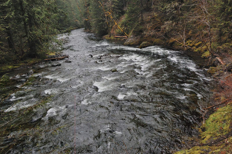
MIDDLE SALMON RIVER
7.5 miles of hiking • 1000' elevation gain •
Another hike with my dad (I hope he takes on hiking). We went to the canyon overlook. Beautiful trail, I want to camp there when I'm finally done with my classes.
May 5, 2011


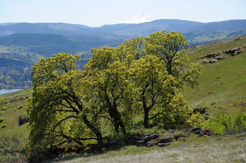
Hood River Mountain hike
4 miles of hiking • 750' elevation gain •
My dad had a day off (and I have short Wednesdays) so we headed to Hood River to take some pictures of blooming gardens. However, we were at least a week early; the trees just begin to bloom. We headed to nearby Hood River Mountain and it was a treat - I never seen so little people there. There were just 3 cars at trailhead when we started. Instead of making a loop on the road as described in Field Guide, we found another trail heading South through some more meadows. The views of Hood River valley and Mount Hood were great, but balsamroot is barely starting yet. I did make time studying Corporate Taxation a couple of hours with a nice view...
May 4, 2011

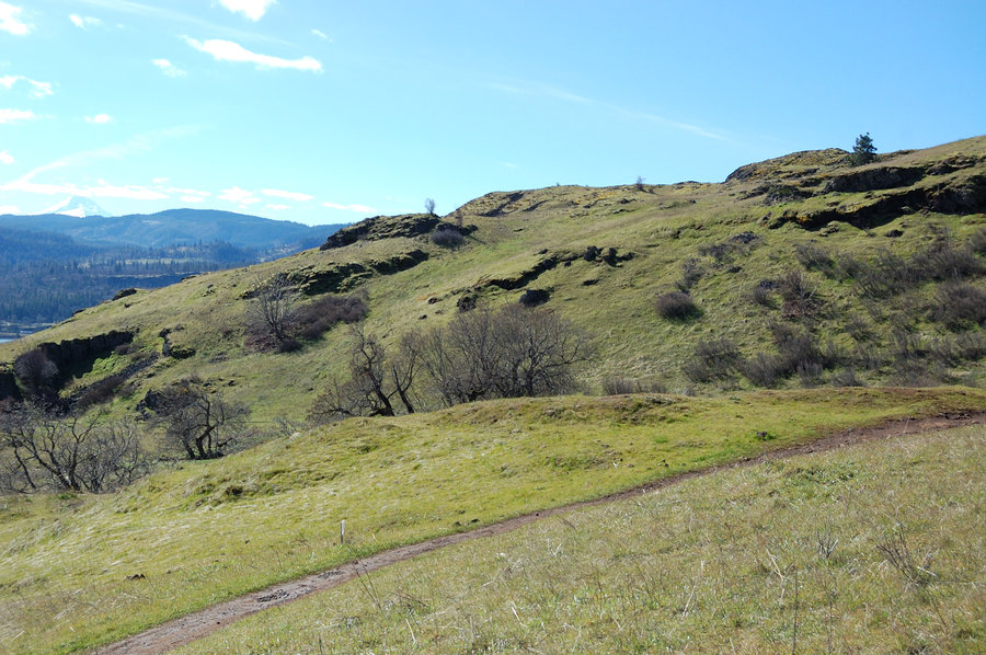
Coyote Wall/Labyrinth Loop
7.5 miles of hiking • 1500' elevation gain •
Did a loop through Labyrinth first, then down Coyote Wall on Wizard and return via Coyote Canyon trail. The way I planned didn't work out (it's Labyrinth after all) but still a great hike, it definitely felt like summer today! There was a lot of desert parsley in bloom, many others, including balsamroot.
May 1, 2011


Nesmith Point
10.5 miles of hiking • 3750' elevation gain •
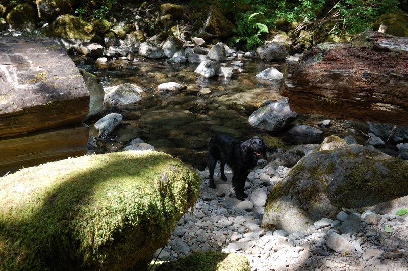
On the way to Nesmith Point, it started fairly warm near the trailhead but became quite wintry higher up. Fresh snow (it probably fell in the last 2 days) started above 2400', it varied from none under big trees to 4-6 inches in the open. It will melt pretty quickly though. I mostly missed rain, except that it was "raining" and "snowing" from the trees. Somewhere around 3400' old snow pack became too soft to hold me; I put on snowshoes and it was smooth sailing. Up on the summit it was snowing, windy and COLD - I didn't even look for a summit sign, just snapped a few photos and headed down. It was a good hike and me with Pepper had the trail completely to ourselves.
April 29, 2011


Whipple Creek park
3 miles of hiking • 250' elevation gain •
Needed to study for finals away from distractions, so I chose a hike with no crowds and a picnic table in nice meadow. This is a horse park so there were tons of mud. I managed to read a textbook under rainjacket cover, but rain finally drove me off earlier than I planned for.
April 24, 2011

Indian Point loop
8 miles of hiking • 3000' elevation gain •
Quick hike to Indian Point after work. When I arrived about a dozen cars were parked, but all people were already coming back so I had it to myself after 1.5 miles. Did the loop counter-clockwise. The lower part of the trail is ho-hum, but the upper part is interesting (and steep). I only downloaded a map from NWhiker.com and didn't read description, so the map made me to believe I'll see Indian Point from the trail. I overshoot it by about 10 minutes before I realized it, so had to walk back up and located a good viewpoint to Indian Point just off-trail where NWhiker map says 2,600'. A few patches of snow on the trail at 2,900' high point. The flowers were good on "hanging meadows" along trail 447.
April 20, 2011


Tanner Ridge
9.5 miles of hiking • 3000' elevation gain •
Hiked today from Tooth Rock trailhead to Tanner Ridge to about 3,200 elevation. It rained first 4 out of 5 hours of the hike, but this means having all trail to myself so it was good :)
I took snowshoes but didn't use then at all - the snow started at about 2,900 feet (just above the junction with a small trail to Wauna Point). Snow wasn't more than 1 foot deep and was pretty firm.
Saw 1 really large group (like 30 people) a mile into the hike. Maybe Friends-of-the-Gorge-led hike? After that saw nobody except one deer.
Ended up hiking up and down on different trails. When I went up, I started on a paved road along I-84 east, then took a small trail uphill which begins where you see a sign "Exit 41 - 1 mile" on a freeway. Took the next trail right which brought me to a closed forest road, which led to Tanner Butte old trailhead in just over a mile. This is a better way (Sullivan book has a good map). From there, it was another hour and half of a good uphill, first along and across two streams, then across a powerline and up in dense forest in fog which allowed for interesting pictures.
On the way down, I left the road a bit earlier and took another road west (which is Gorge Trail 400). It soon began looking like a trail, but man - who planned this trail? It went in 1/2 mile long switchbacks without losing elevation much at all. I wanted to do off-trail because it took so long to lose mere 400 feet. Also, it was a muddy trail. From now on, I will either use the approach trail I took on the way uphill, or park at Eagle Creek trailhead.
It was good to finally get outside and have some fun.
April 15, 2011


MISERY RIDGE LOOP (SMITH ROCK SP)
4 miles of hiking • 1000' elevation gain •
Did Smith Rock loop counter-clockwise. Cloudy, cool, but no rain. The parking was full when we got there, but most of people probably were climbers - we didn't see too many hikers.
April 9, 2011


Aldrich Butte Loop Hike
3.5 miles of hiking • 1000' elevation gain •
Just was showing somebody an easier hike. We went up the road on the ascent, then back down the trail (and another road) around the other side of Aldrich. There were ALOT of grass widows on a small meadow just below the summit. Not nearly as many people as on Angels Rest yesterday - we only met 3 groups of 2, all on the way up.
The link to the hike actually shows a hike up Table Mtn but you can see where we went around Aldrich.
April 8, 2011


Angels Rest trail to 'Foxglove Creek Camp'
6.5 miles of hiking • 1500' elevation gain •
Couldn't miss a rare weather anomaly today, but had only 1/2 day before work. Hiked to Angels Rest and then about 1 more mile to a campsite near Foxglove Creek. It was sunny 63F and finally felt like spring. Trees finally turning green. Couldn't find Quadrillium Chris was writing about, but there was so many trilliums that it was hard to spot one. It was crowded like in a city park today - I had to park on the shoulder because it was no place left on the parking, and when I returned the cars lined the shoulder for maybe 1/4 mile. No snow to speak of at this elevation, just couple of spots near Foxglove Camp.
BTW if you plan to use Palmer Mill Rd it is closed by slides (as the sign says) and blocked above upper Angels Rest parking.
April 7, 2011


Nesmith Point
10.5 miles of hiking • 3750' elevation gain •
Hiked Nesmith Point again today - it was significantly more difficult than in January because of more snow, but it's for exercise after all. Took me 6 hours instead of usual 5, and 2 1/2 hours were through snow, which started at about 2,500 feet and almost immediately became 1-2 feet deep. I didn't take snowshoes (still have to figure out how to attach them to a backpack) so did a fair amount of postholing. Soon after the 2nd boulder field the tracks just went straight up instead of following a trail - if was steep with 2-3 feet of snow, quite a workout. It was pretty warm and dry day (windy on the top), and I didn't see anybody at all except a couple of hikers 1/10th mile up the trail. Also saw first flowers on the lower trail - the sign of spring.
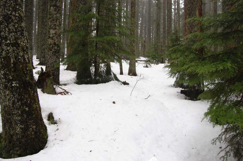
March 31, 2011


Twin Lakes
8 miles of hiking • 1000' elevation gain •
Planned to hike Hunchback Mountain but it rained so hard that I decided to drive further east. Started at Frog Lake Snowpark. I didn't take snowshoes because didn't plan for snow hiking, but the trail was tracked very well and the snow was firm, so I almost never postholed - it was as easy as regular hiking. Lots of snow, some signs were just a few inches above it, and some were almost buried. It snowed lightly most of the day, with a few sun breaks. From PCT I went right to Lower Twin Lake, then the Upper Lake, but then snowshoe tracks ended so I followed somebody's ski tracks around the Upper Lake. Then it's hard to say by the map (which I didn't take as well; I snapped a photo of simplified map at the trailhead) but I probably missed the "short" shortcut trail and hiked the long one. It took more time than expected to re-join the PCT, and at some point I almost turned around. I finally hit the PCT 1.5 miles from Barlow Pass, and turned left. The trail was poorly tracked from this point, with lots of small ups and downs, and some steep side-hilling. In about 40 minutes I hit the lower junction where I left the PCT on the way there; from this point it was easy going back to the car. Not a lot of views on this hike besides the lakes (Sullivan map also shows Palmateer Point which I missed), but the trail was mostly good and the snowed-in forest is nice to hike in.
March 24, 2011

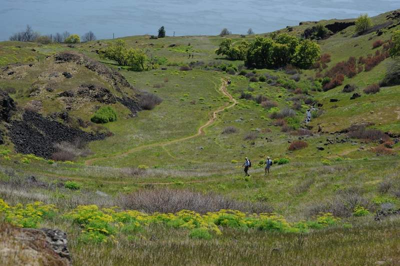
Coyote Wall Short Loop Hike
6 miles of hiking • 1500' elevation gain •
[pics hosted for another hike for a TR]
We went to Coyote Wall today and did a loop counter-clockwise, connecting the upper and lower Wall trail via Wizard Trail. It would be harder doing it (the first time at least) clockwise because the lower junction of Wizard Trail would be impossible to find - it's very faint trail @ lower junction. It rained heavily when we drove through the Gorge and then it was partly sunny with just a few drops of rain at the Syncline... And by the evening it was sunny - we were lucky that we didn't believe the forecast! Fair number of flowers, some very good patches of grass widows (I think they're at peak - don't see more of them coming) but noticeably less than last year (probably due to recent frost). Good day to be outside and to have a good weather we didn't expect!
March 11, 2011

Angels Rest trail to 'Foxglove Creek Camp'
6.5 miles of hiking • 1500' elevation gain •
Hiked about a mile past Angels Rest to a primitive camp near Foxglove Creek. No snow on the trail until the Camp, which is 70% snow covered. Warm day and not too many people.
March 6, 2011

March 4, 2011


February 19, 2011


February 8, 2011


February 4, 2011


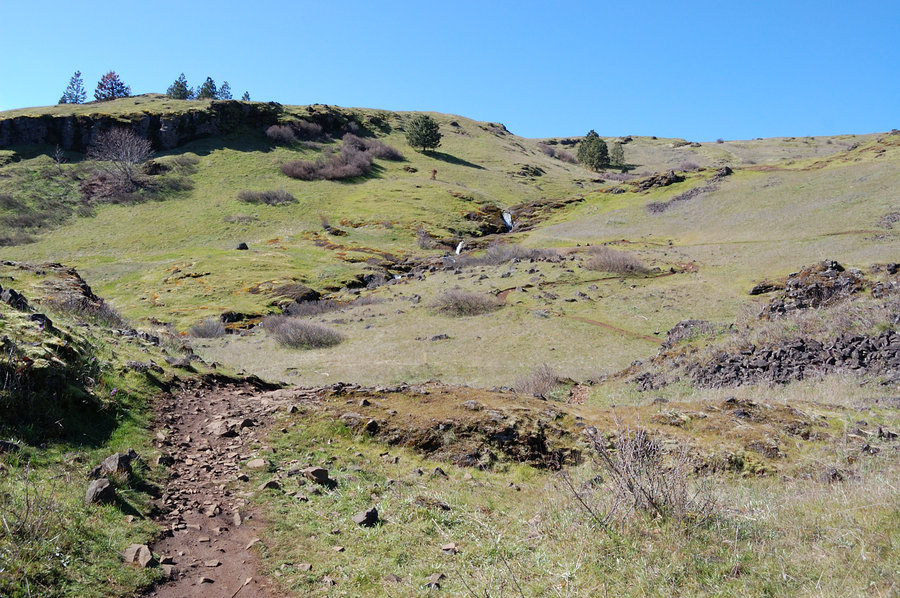
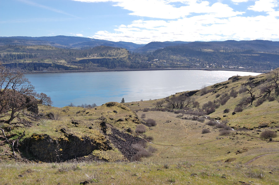
Moser Twin Tunnels (west to east traihead & back)
10 miles of hiking • 250' elevation gain •
January 27, 2011


January 14, 2011


January 3, 2011
