

36 miles of hiking • 6750' elevation gain • 4 nights
Now to my favorite place in the world :)
DAY 1
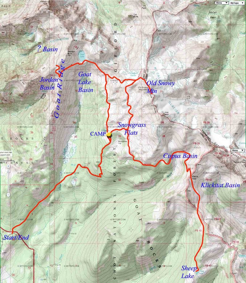
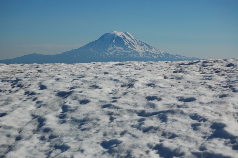
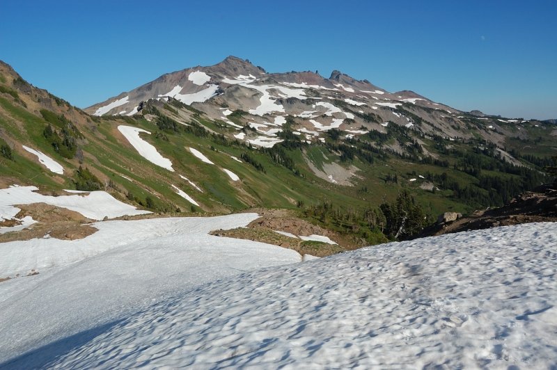
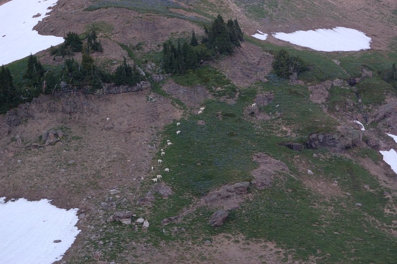
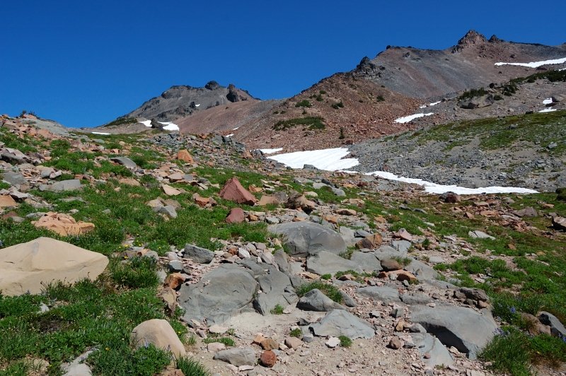
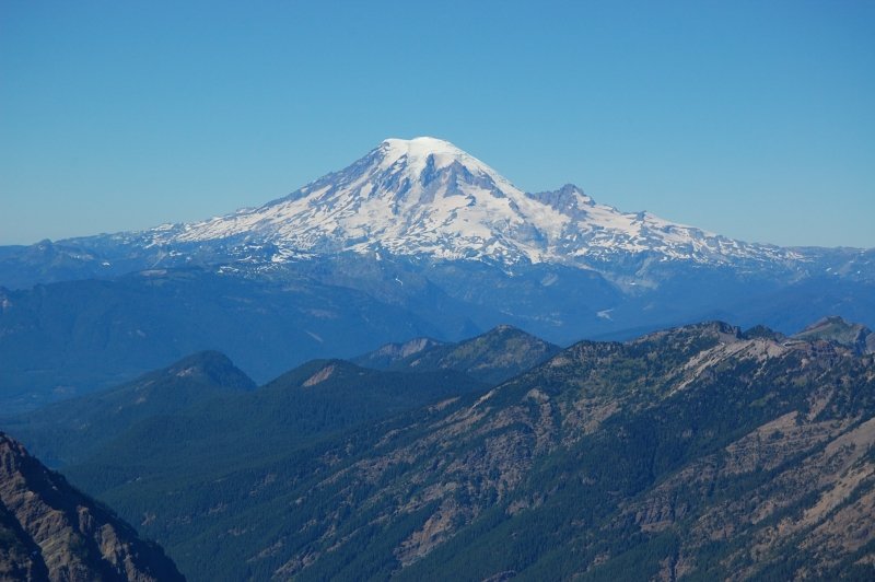
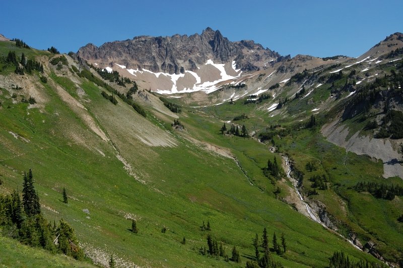
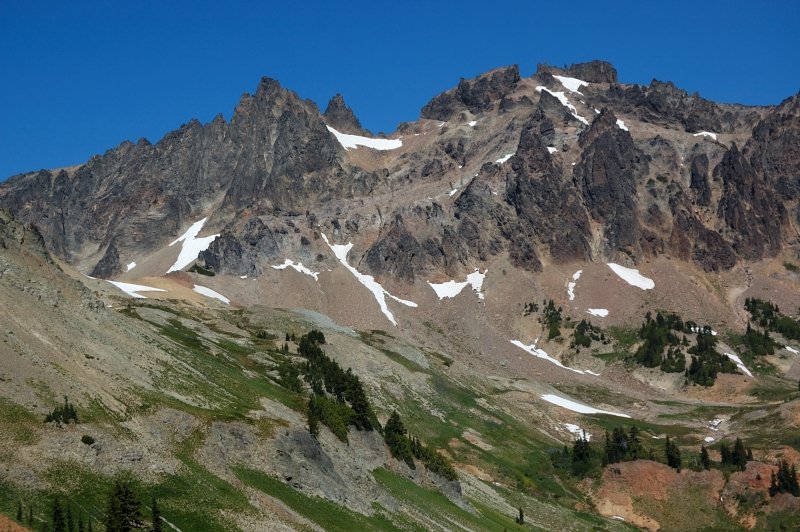
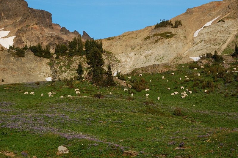
After spending a night 3.5 miles from Snowgrass trailhead, I got an early-ish start. Met droves of backpackers heading back. After arriving to Lily Basin/Snowgrass trail junction, it was "select your own camp" thing I set a "base camp" at the largest campground close to the junction. Hiked to Goat Lake without a backpack, then wanted to continue to Hawkeye Point but it was pretty late at this point so I only made it to a pass above Upper Jordan Basin (still 50% snowed in) where you see the first view of Rainier. Goat Lake is still mostly frozen over, and 1/4 mile of trail above the lake snow covered, which made for a great glissade on the way back. Glissading on my feet didn't quite work, so I was sitting on my rear and using poles for speed :) Only one tent at the lake. Saw a herd of goats on the way back.
DAY 2
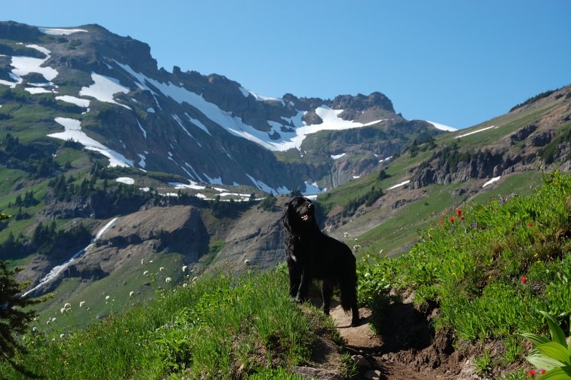
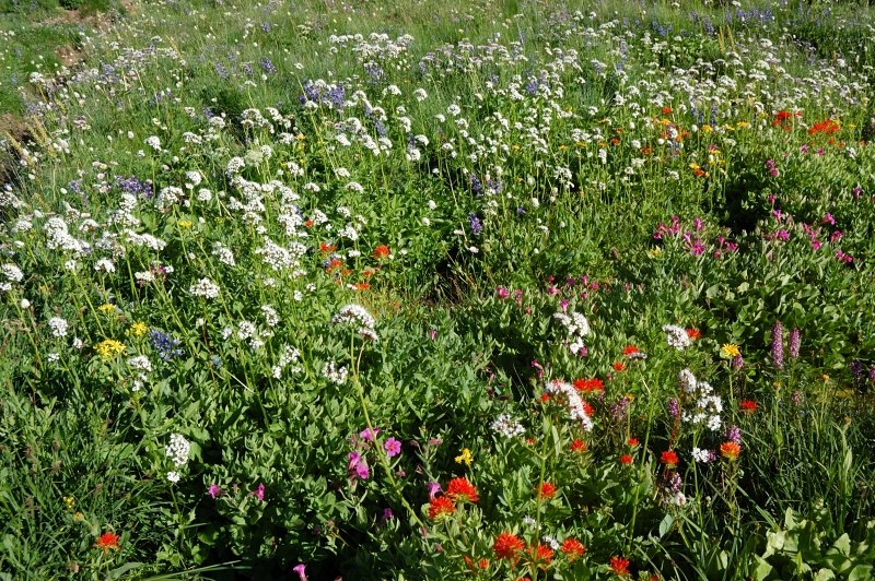
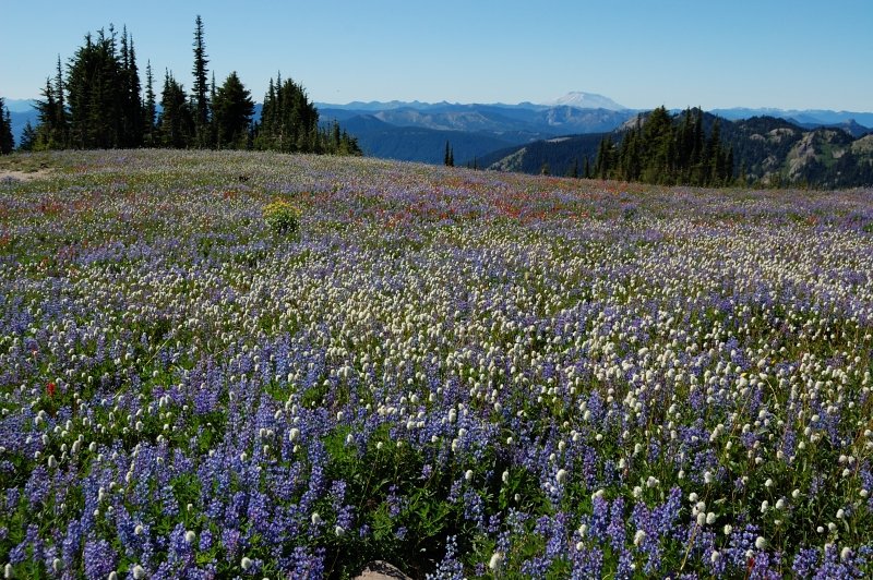
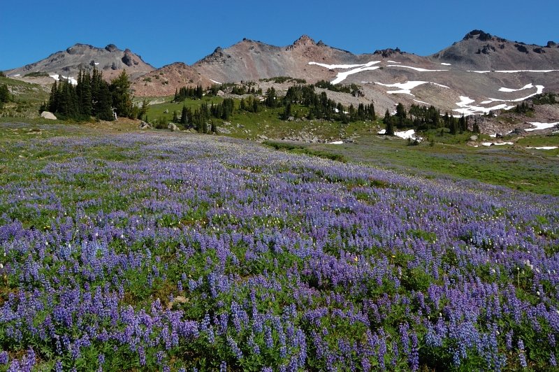
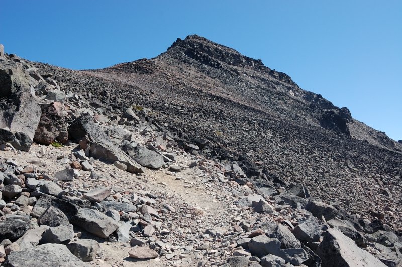
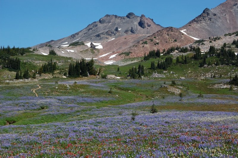
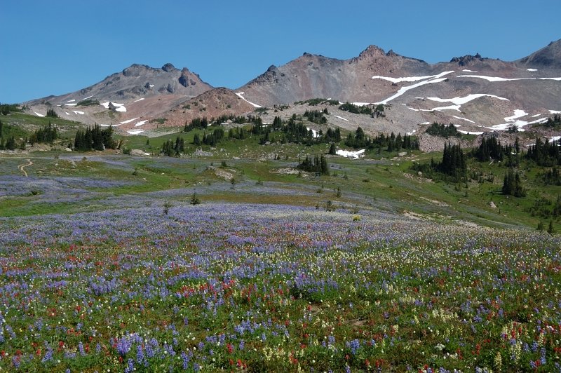
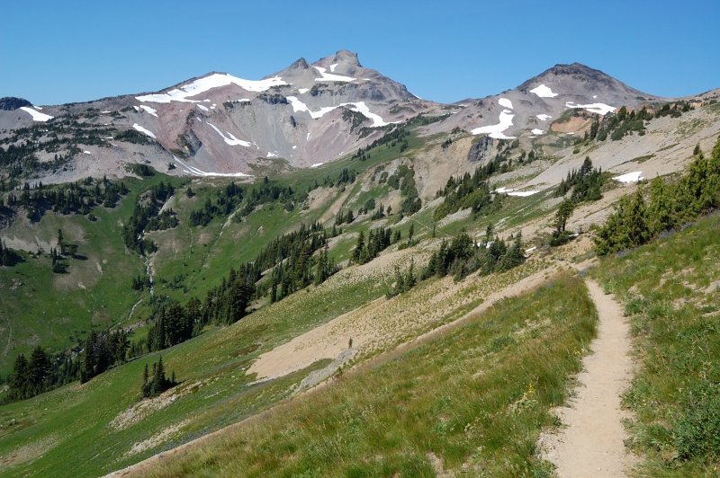
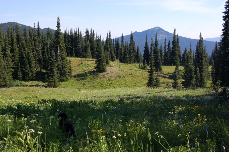
Hiked to PCT junction (the flowers are unbelievable right now, imagine 0.5 mile uninterrupted carpet of lupine), to PCT High Point, and then to the summit of Old Snowy.
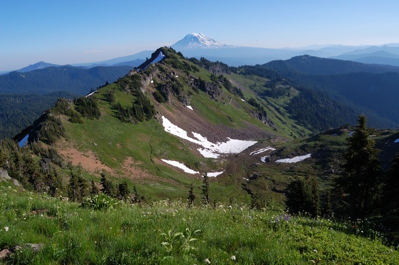
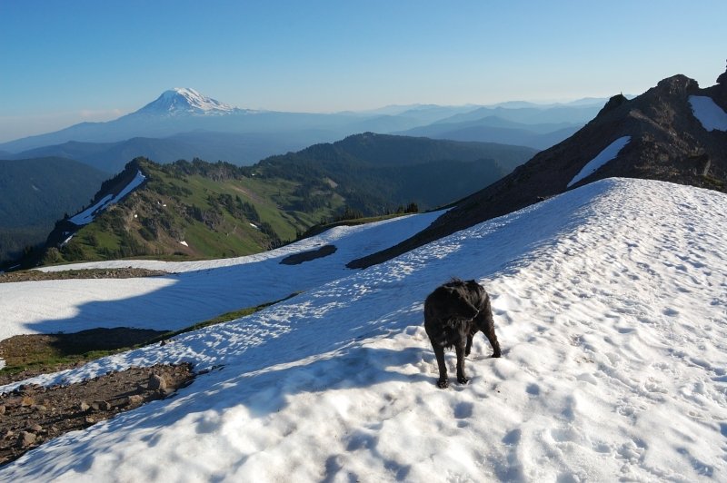
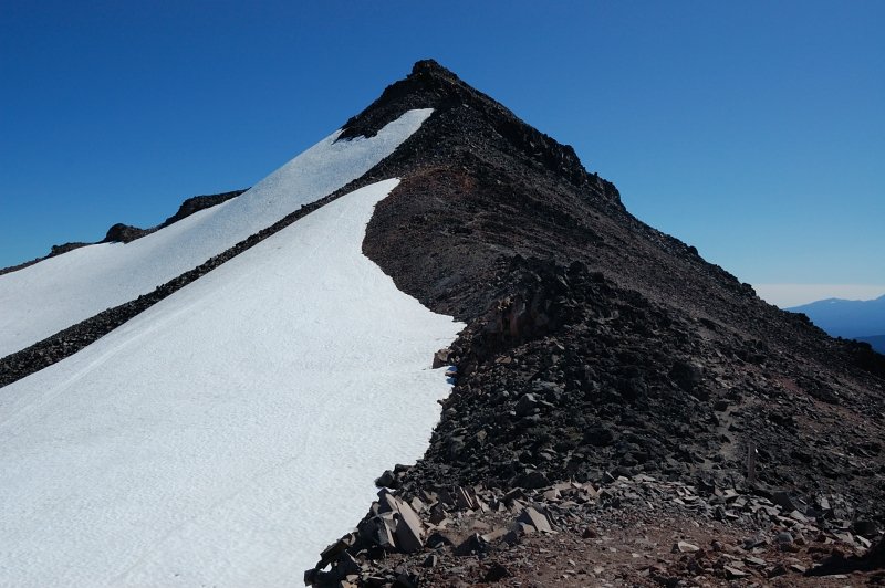
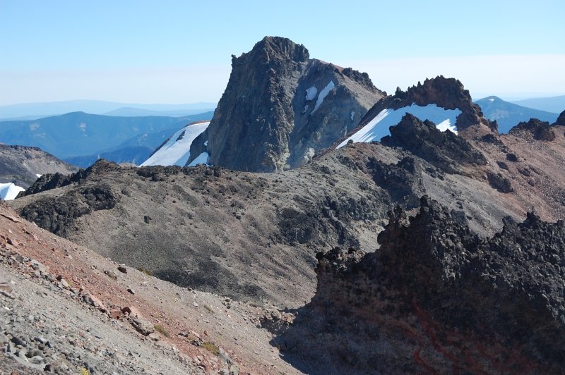
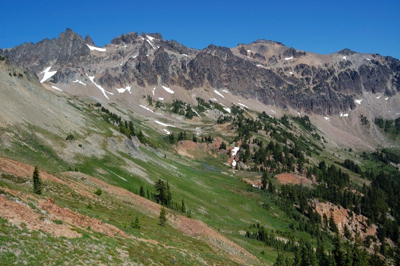
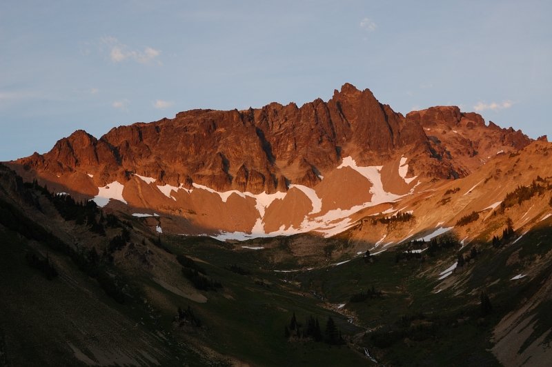
From there, I made an attempt to follow the ridge south to Ives Peak. In hindsight, it was a foolish idea, I read someone did it that way and wanted to try. There are steep rock spires on the ridge one must go around, and the scree slope is extremely unstable. It really scared the hell out of me when I was in the middle of scree slope and the 2-4 foot rocks started to move down under my weight. It could easily cause the rocks above me to fall down too. It looks like neither people nor the goats use this route to Ives Peak, this slope is just waiting to slide. Maybe the report I saw was about hiking the ridge when it was still covered in snow? After crossing one scree field and coming to yet larger one, I decided to turn back, SLOWLY, trying NOT TO TOUCH ANYTHING! Even rock spires above me were literally falling apart, threatening to calf off 5-foot rocks onto scree field below. I was relieved to reach the summit of Old Snowy again, and a stable ground on the north side of the summit.
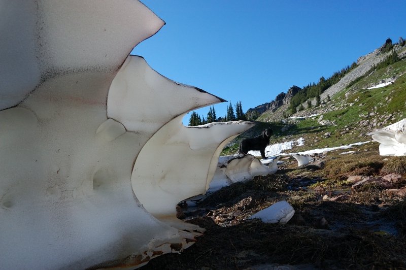
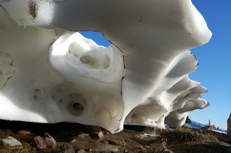
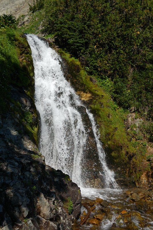
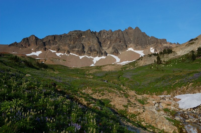
I hiked off-trail to Goat Lake (there was a trail the first and last 1/4 mile, but in the middle I lost it under snow), and had a couple of snow fields to glissade. Photographed some snow sculptures on the way. At Goat Lake, photographed more goats - they hide somewhere during the day but come out an hour or so before sunset, and glissaded for fun - that slope west of the lake is really good. I had a lake to myself. Reaturned to the camp on Lily Basin (lower) trail.
DAY 3
Hiked up to PCT junction, then followed PCT over Cispus Basin, Klickitat Basin, and to Sheep Lake, then back the same way. Sheep Lake looks like taken from Indian Heaven - with huckleberry meadows, flat country - it's shallow and pretty warm. Too bad I didn't have a time to swim - it was already past my turnaround time. Also, one backpacker warned me about a close bear encounter (like 10 yards) and I didn't want to hang out until late evening. Interesting enough, there were 2 groups of two just before him who obviously didn't meet the bear (otherwise they would mention it to me when we chatted), and this lone hiker had such a close encounter. I used my poles to make a noise from time to time.
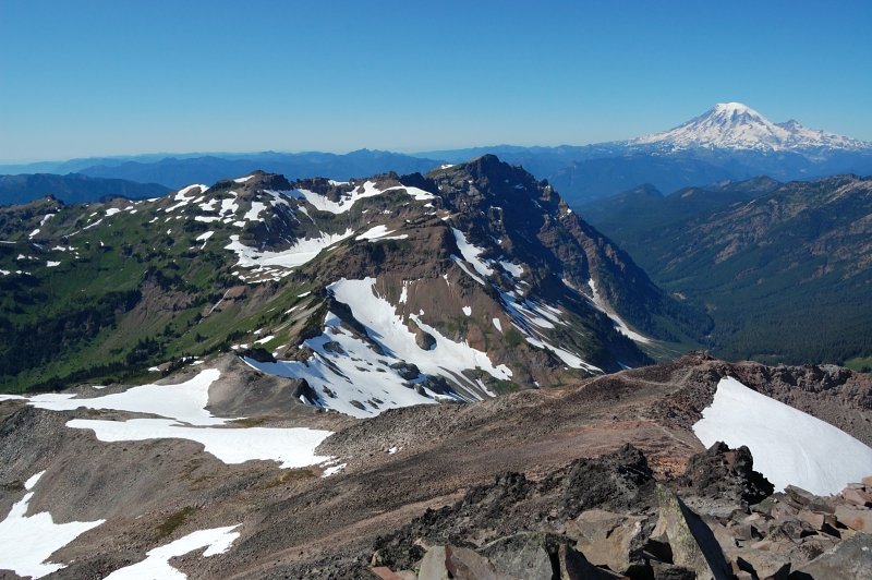
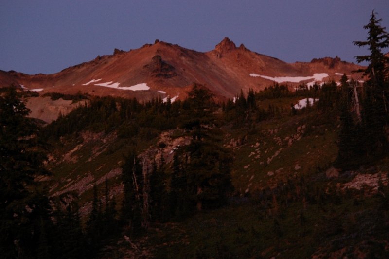
Saw more goats at sunset in Cispus Basin, it's one of my favorite places in Goat Rocks.
DAY 4
Hiked out to the car.


Comments
Roman
September 9, 2011
Thanks! GR area never disappoints, I already miss it.
EDIT - forgot to add a pre-hike night to TR, since I spent it in the tent I think that counts...
Chris
September 9, 2011
Great goats, those are great pictures!