2011 Trips

 2
2
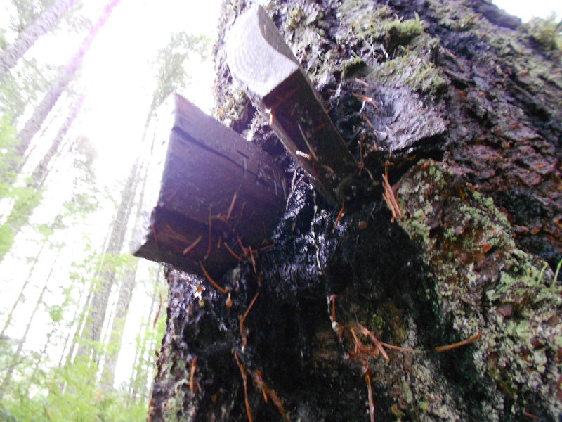
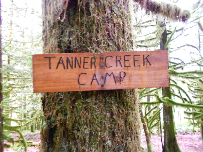
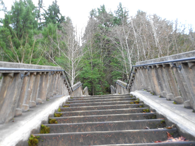
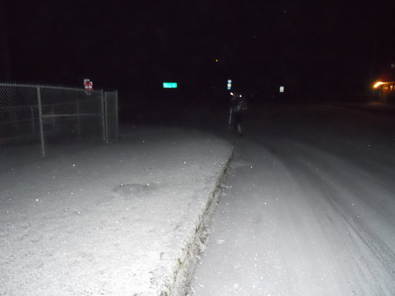
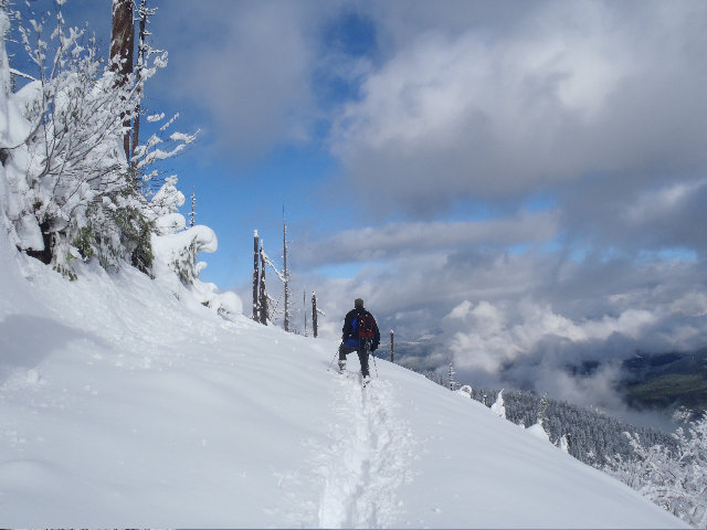
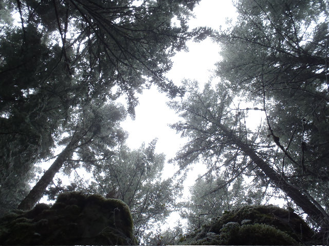
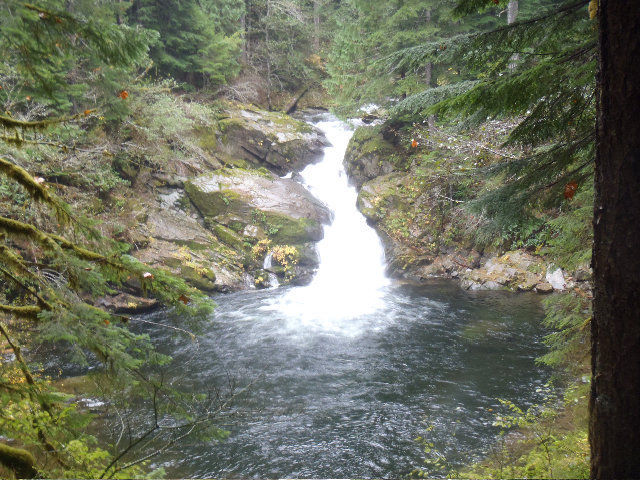
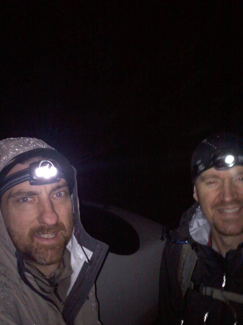
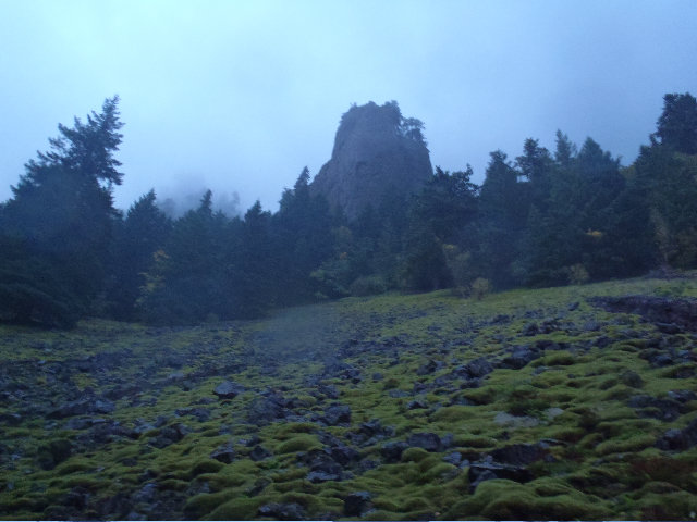
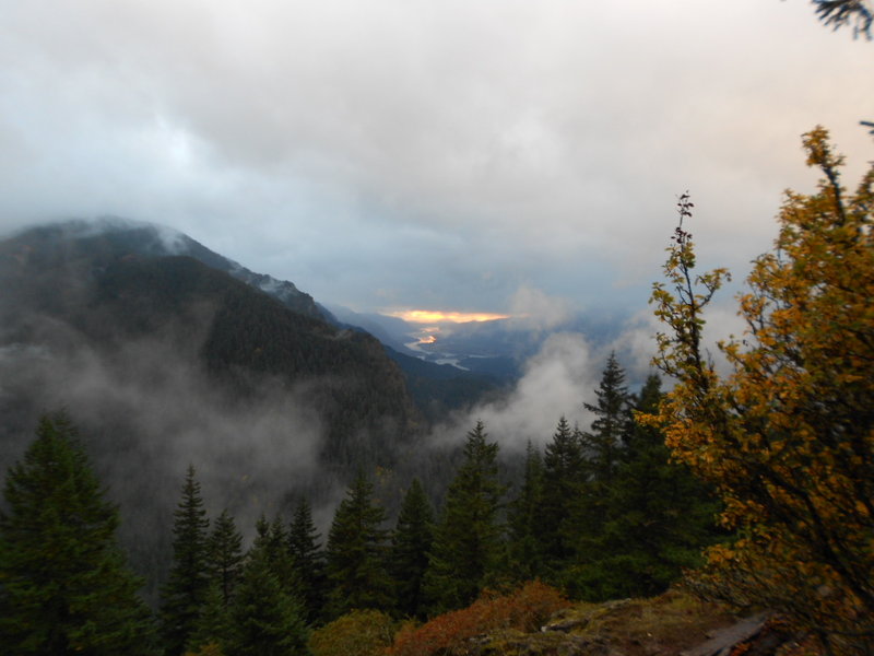
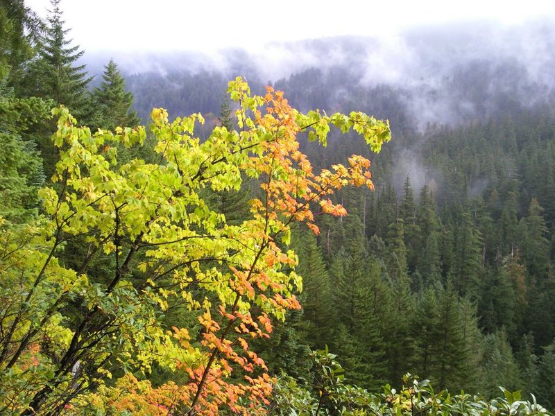
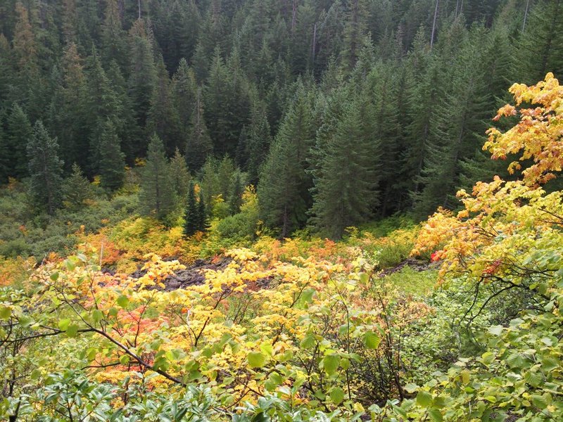
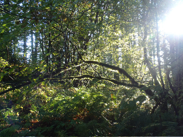
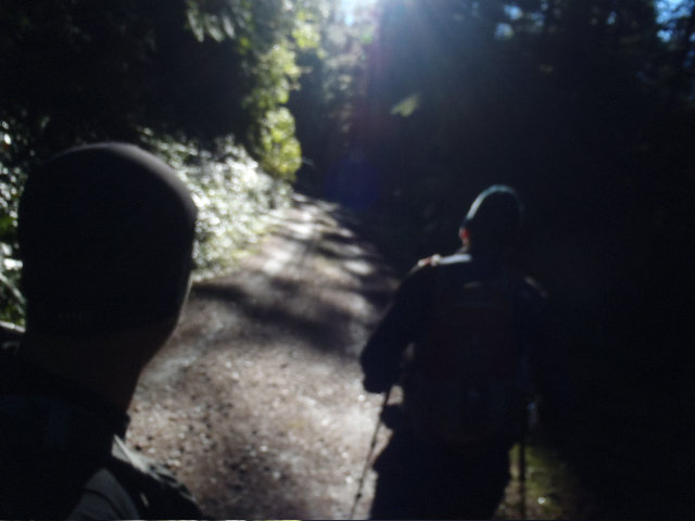
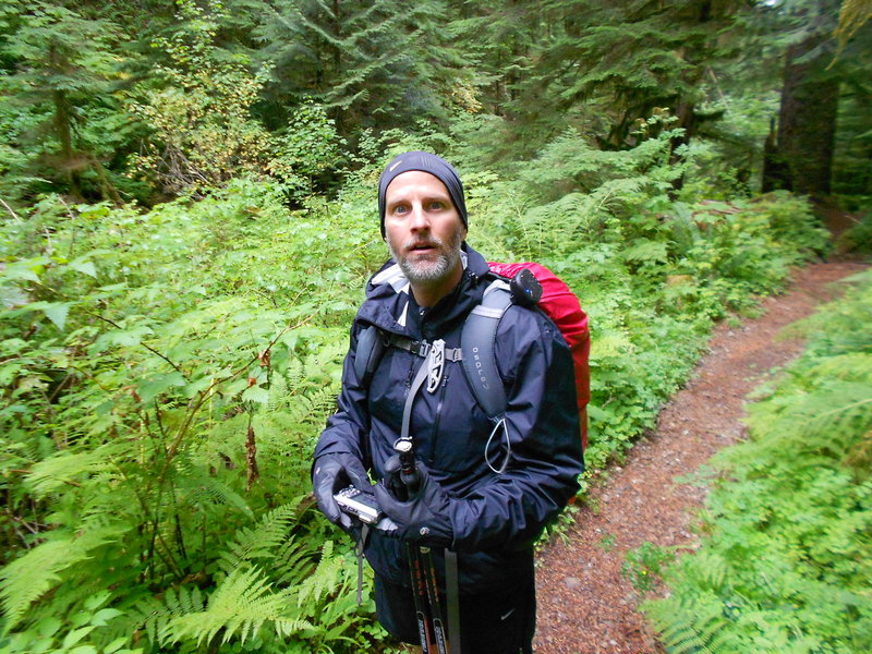
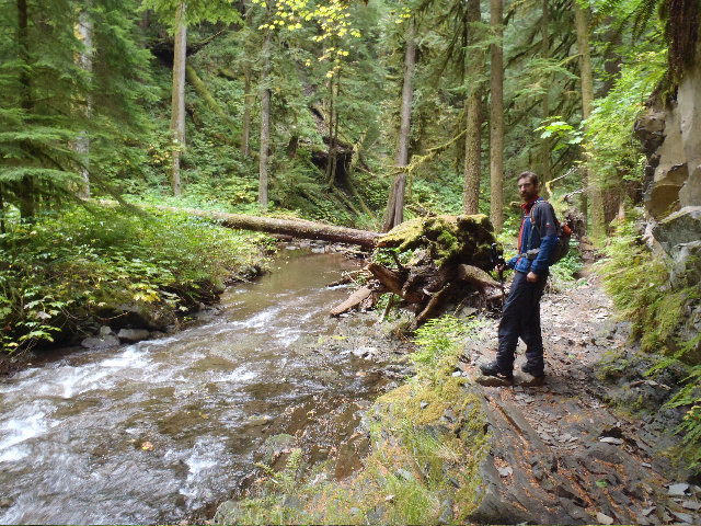
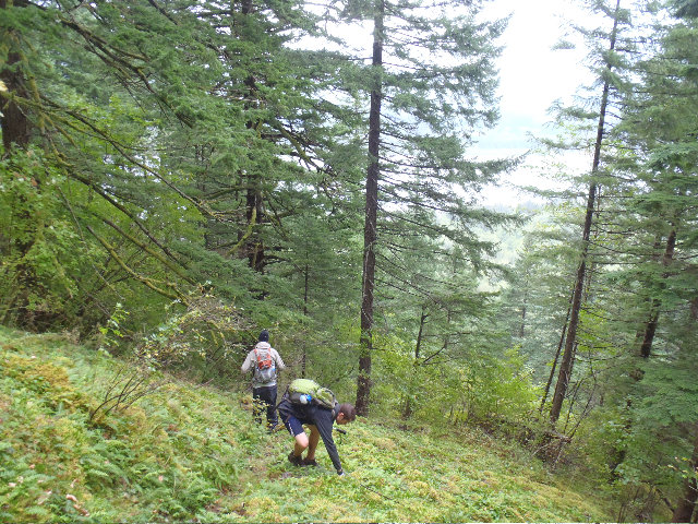
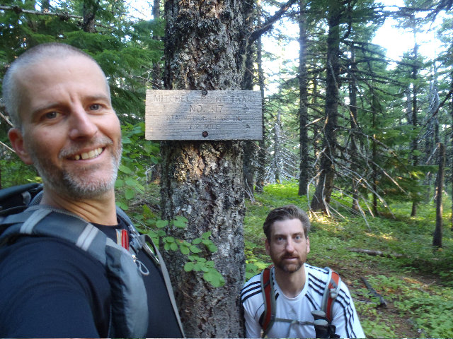
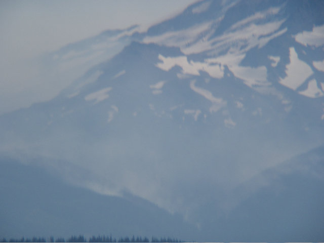
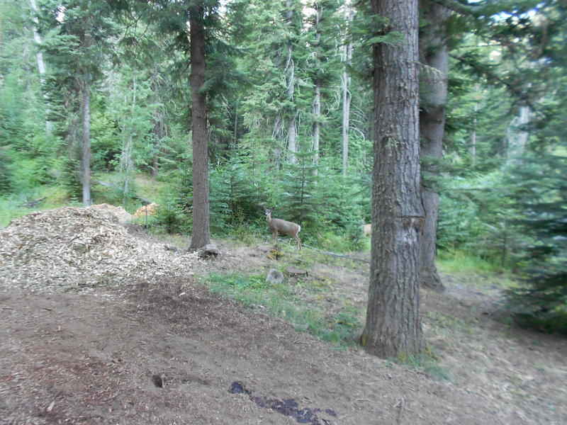
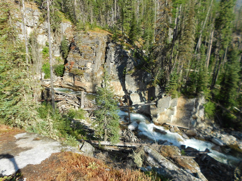
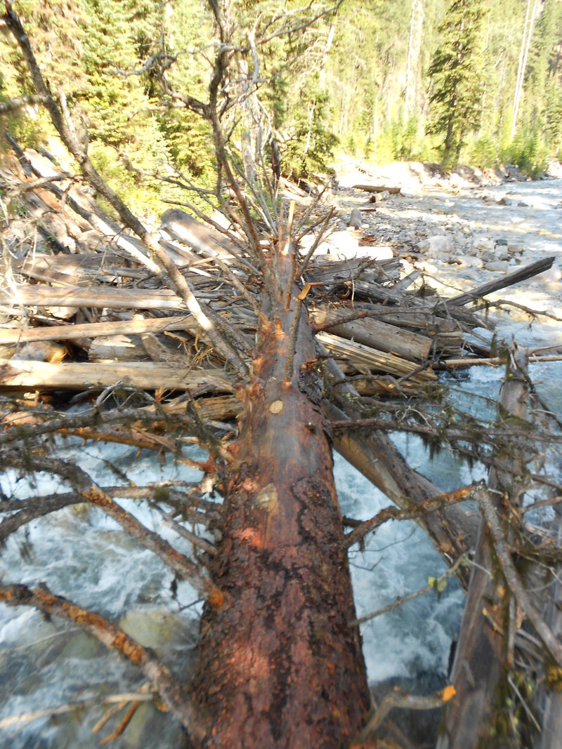
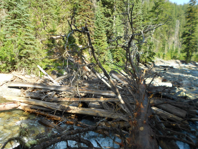
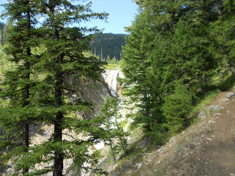
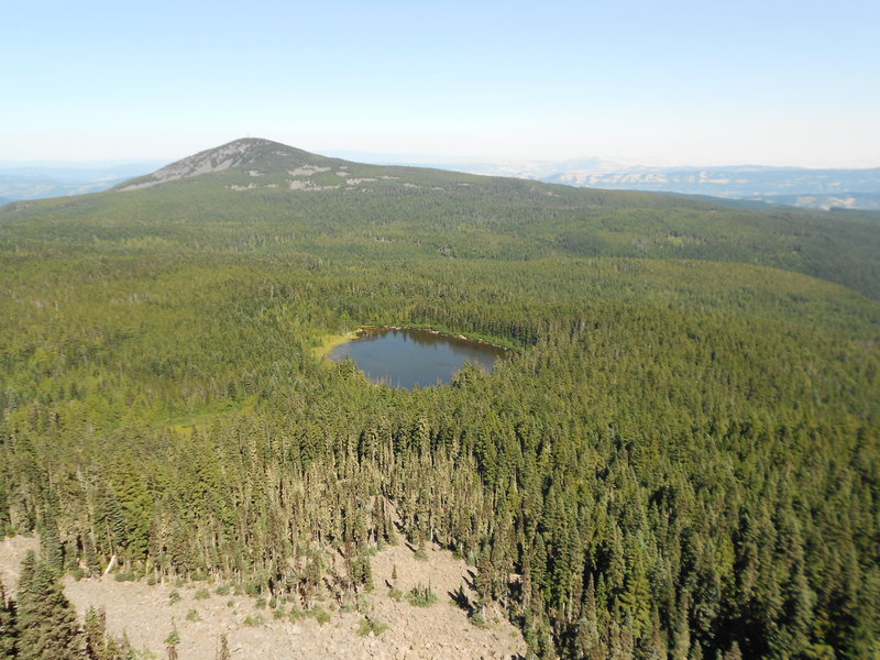
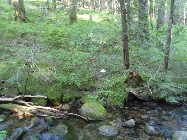
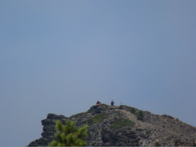
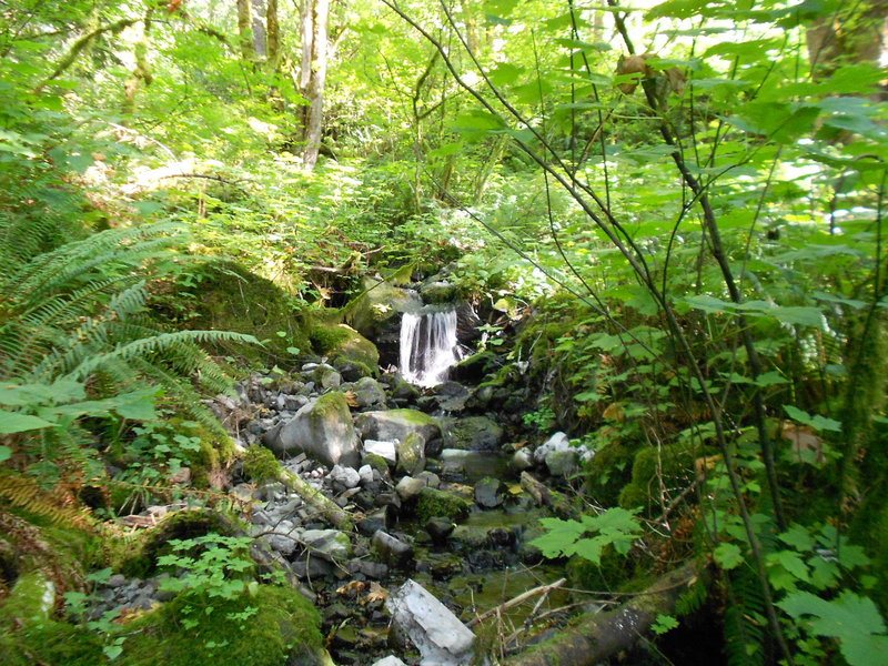
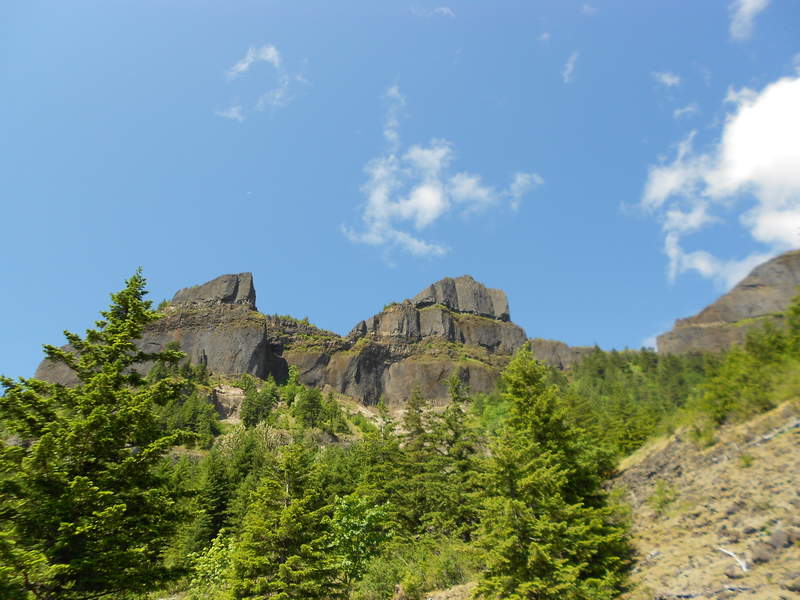
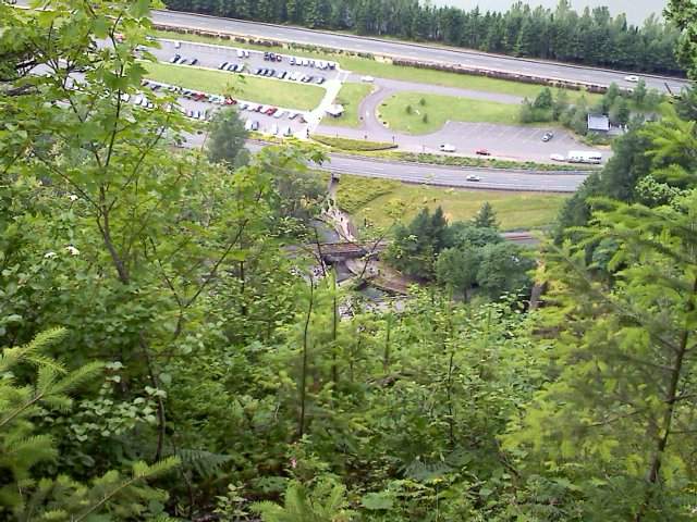
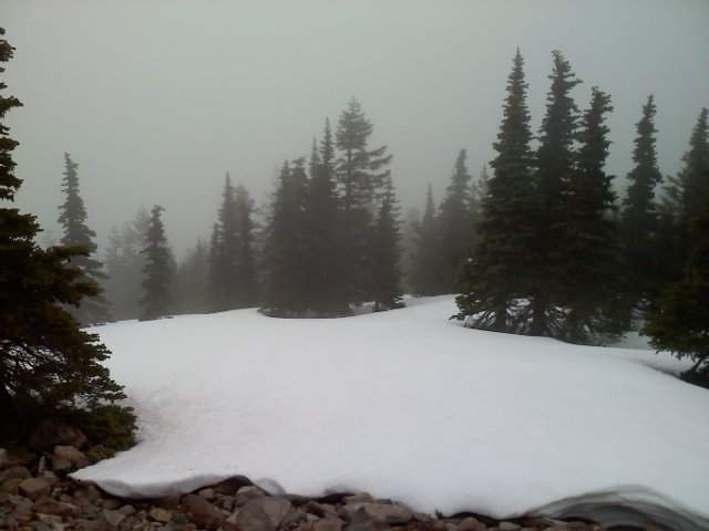
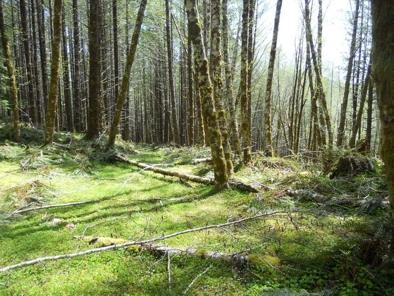
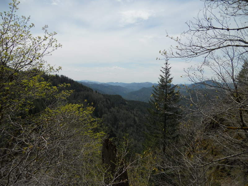
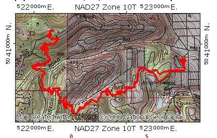
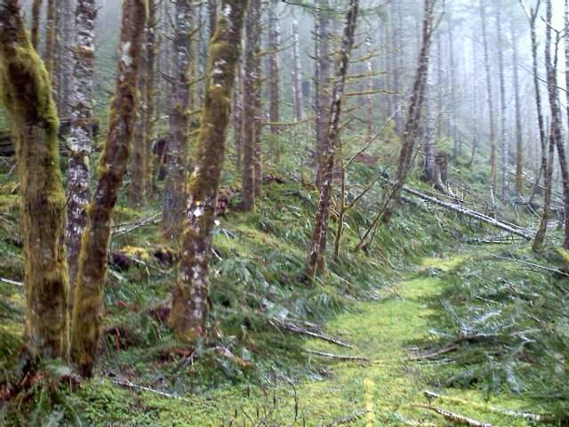
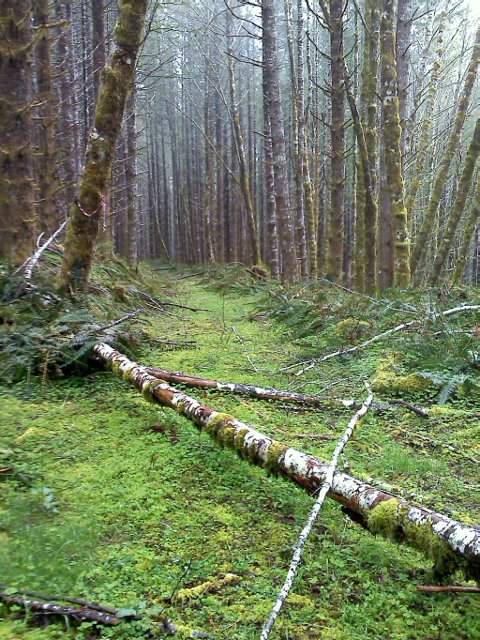
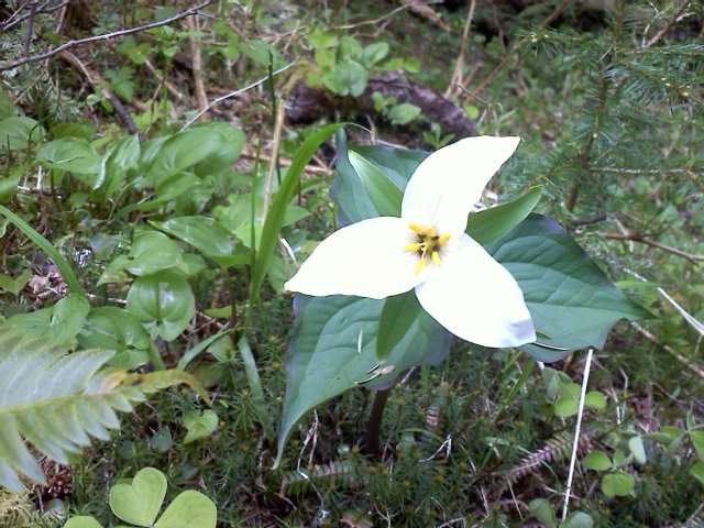
Tanner Creek Exploration
15.5 miles of hiking • 3000' elevation gain •
Always wanted to go as far as I could up old Tanner Creek Trail 431, it used to actually go all the way up into the Bull Run but of course the sillies closed that all off and now poor old 431 is barely even there anymore... :(
Was fun anyway! :)
Happy New Year!!

December 30, 2011


 1
1
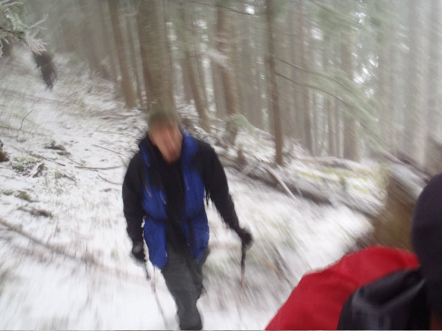
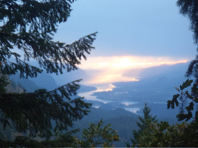
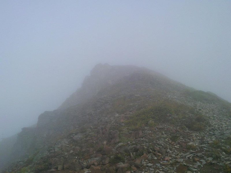
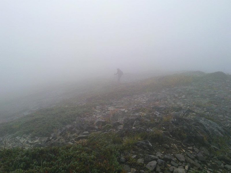
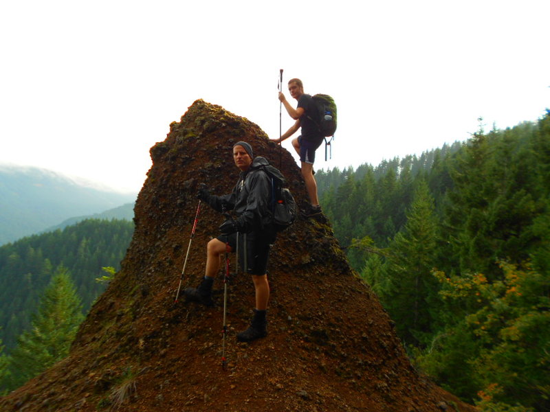
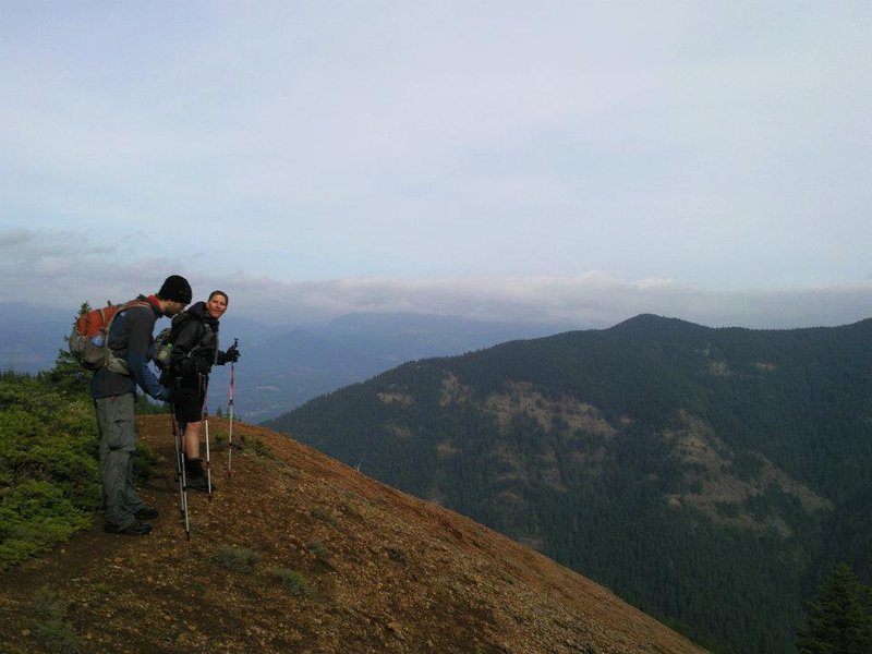
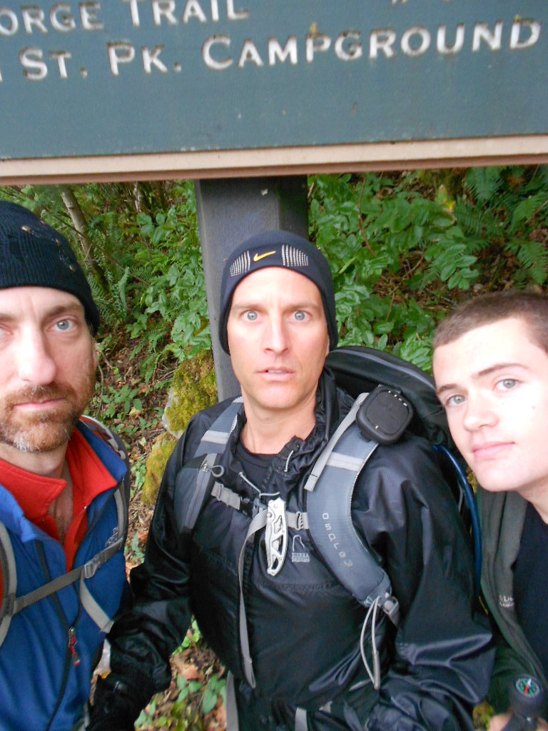
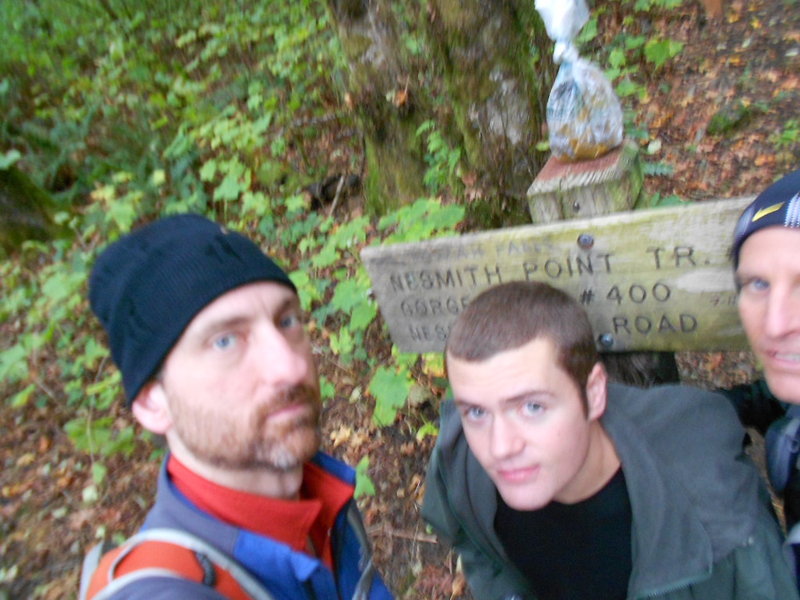
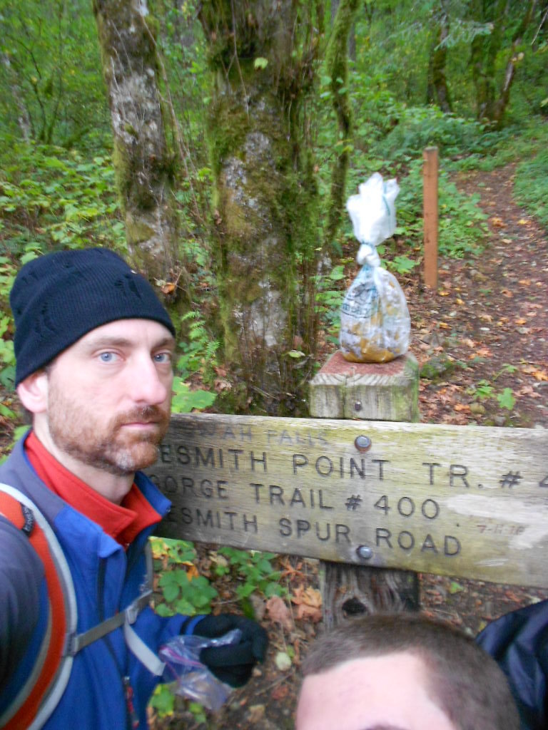
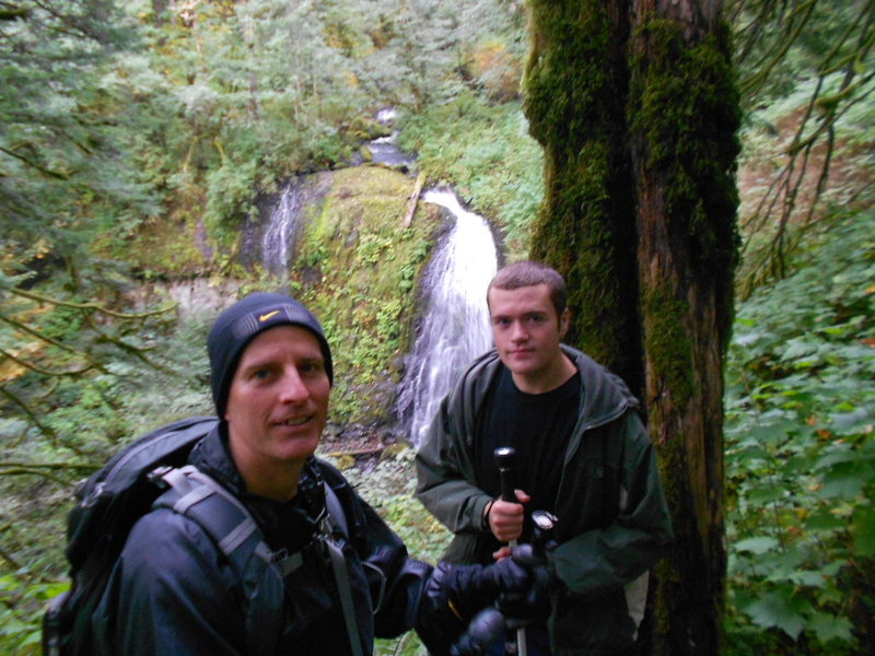
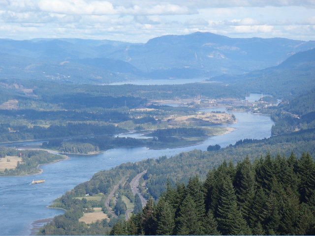
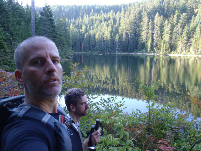
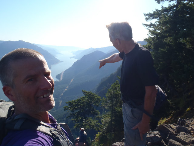
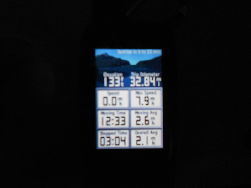
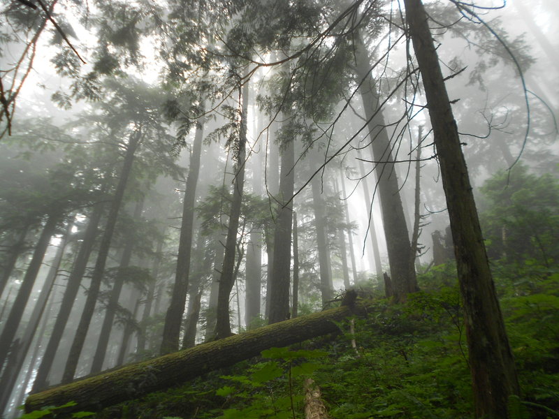
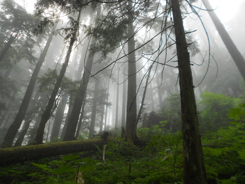
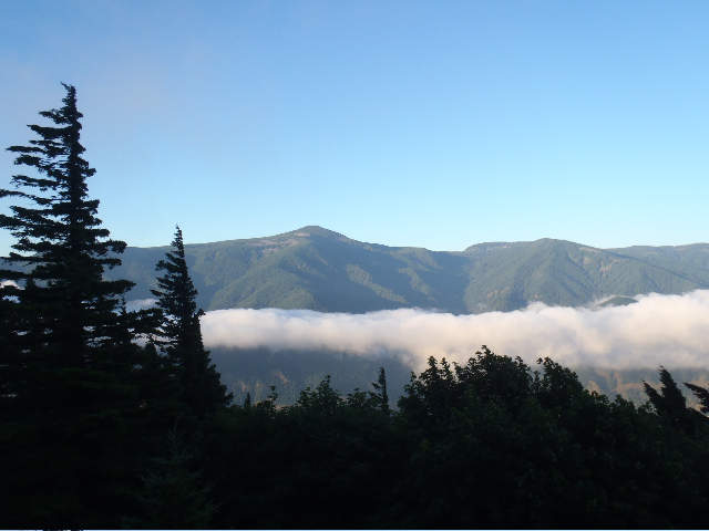
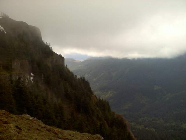
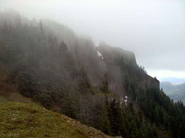
Munra Pt to Nesmith Pt
16 miles of hiking • 5500' elevation gain •
Woooooo!! One of the best hikes this year for me!! Major thanks to Bosterson for going on this one with me :))
December 24, 2011

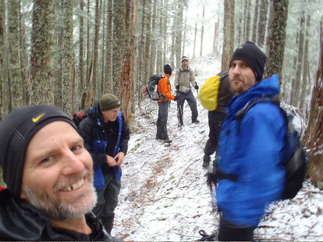
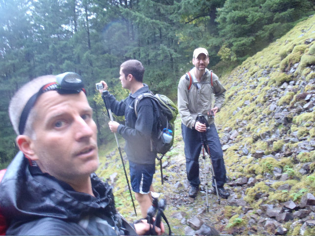
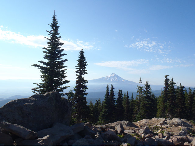
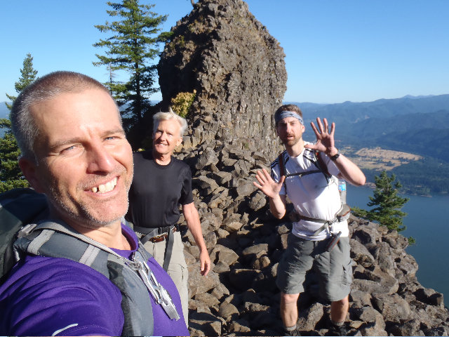
Silver Star Loony Loop with Chris, Don Nelsen and Brad
22 miles of hiking • 5250' elevation gain •
Great hike with some pretty funny and loony guys! :)
December 17, 2011


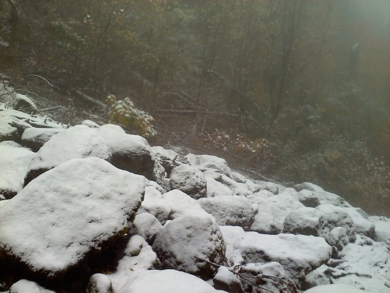
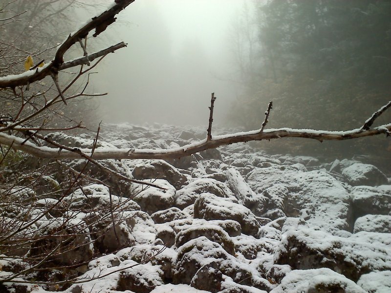
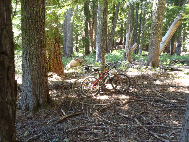
Tanner Butte to Eagle Creek 12-10-11
24 miles of hiking • 5500' elevation gain •
Awesome big wintry hike with 4 PH legends!
December 10, 2011

 1
1
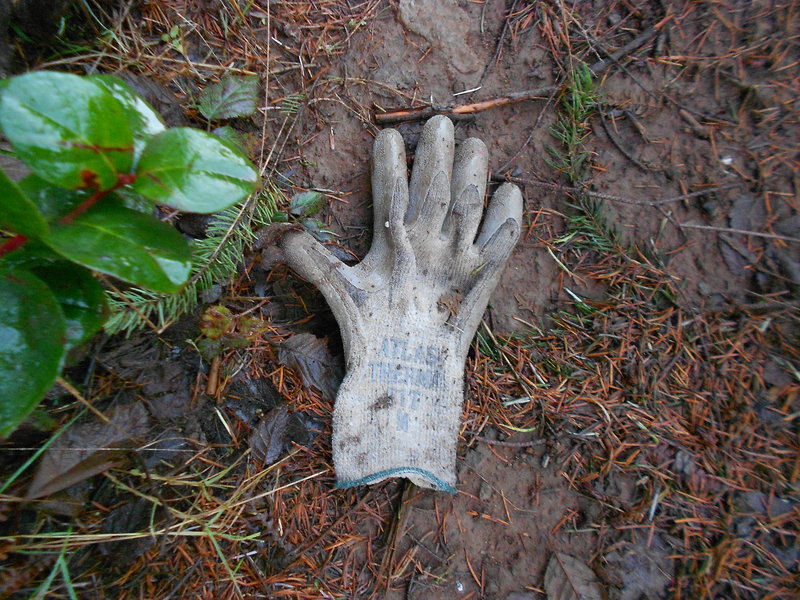
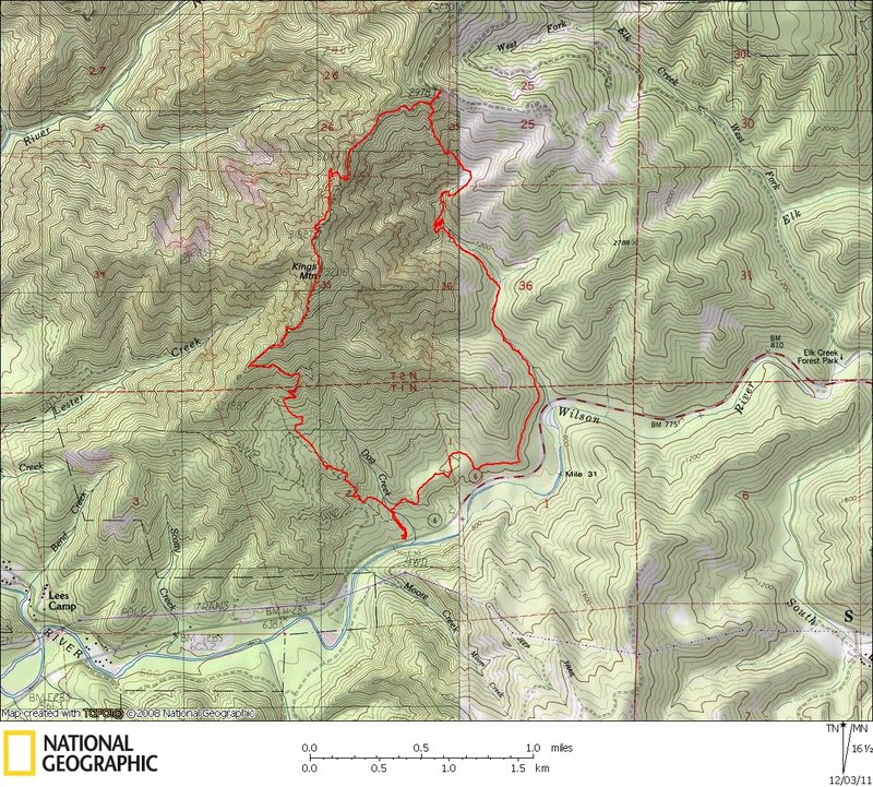
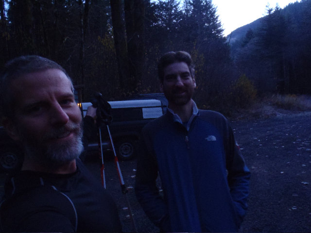
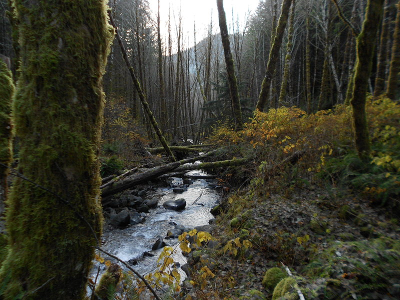
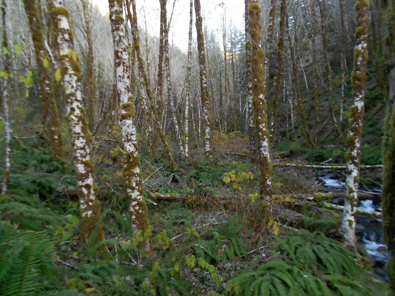
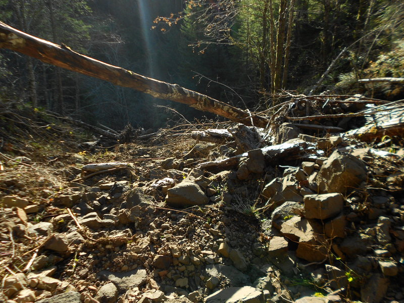
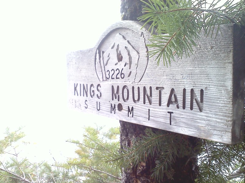
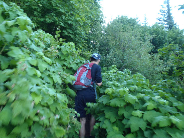
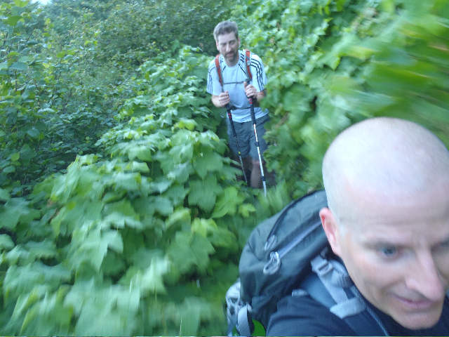
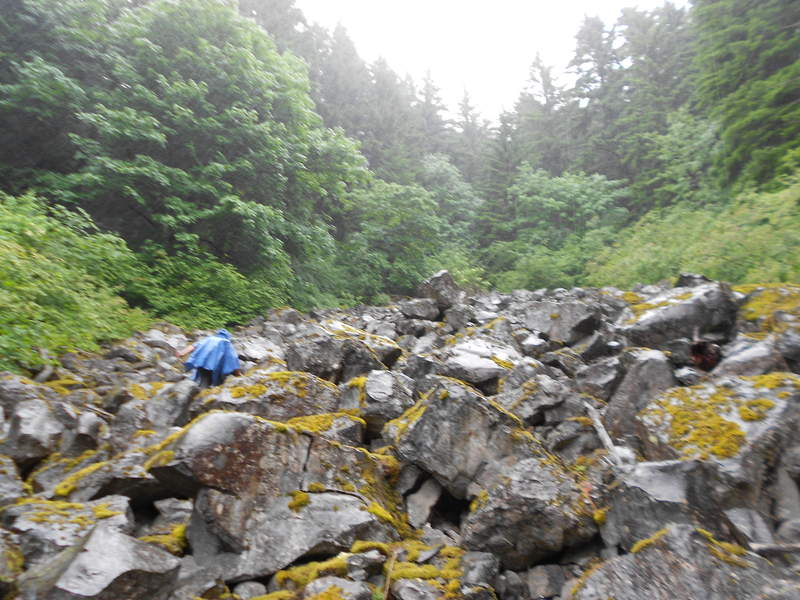
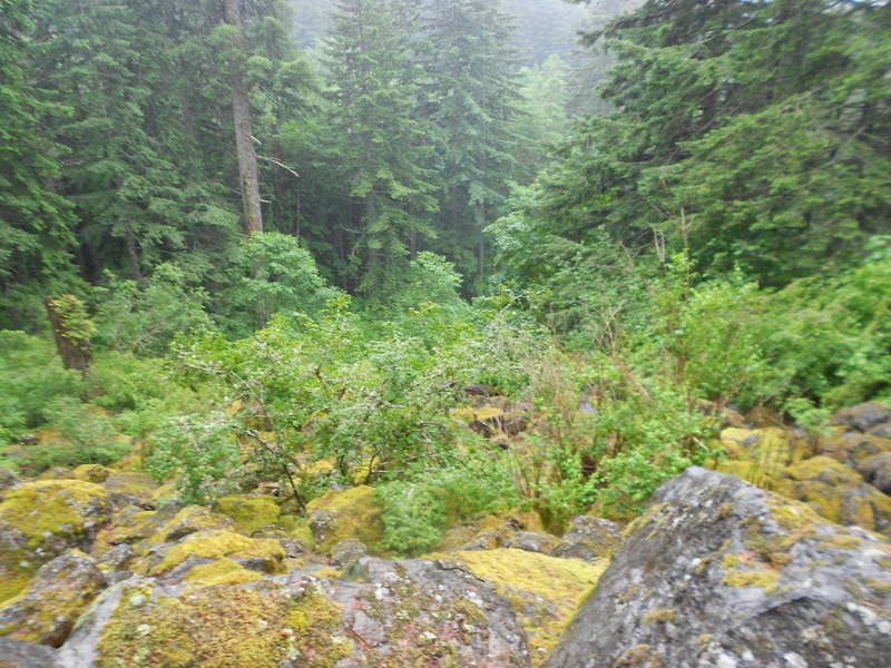
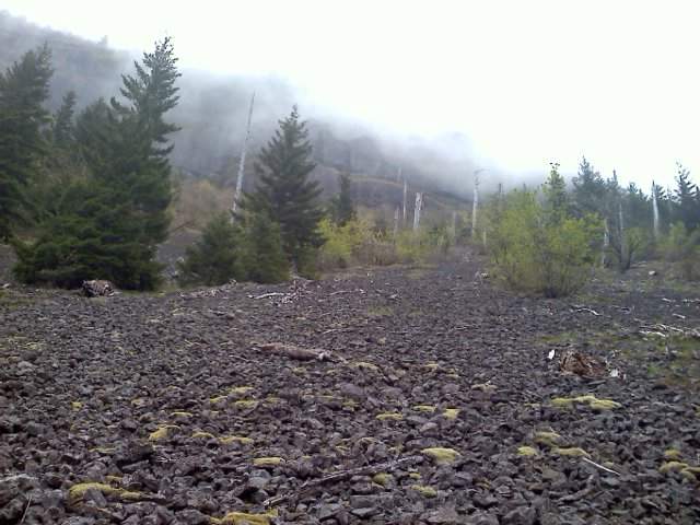
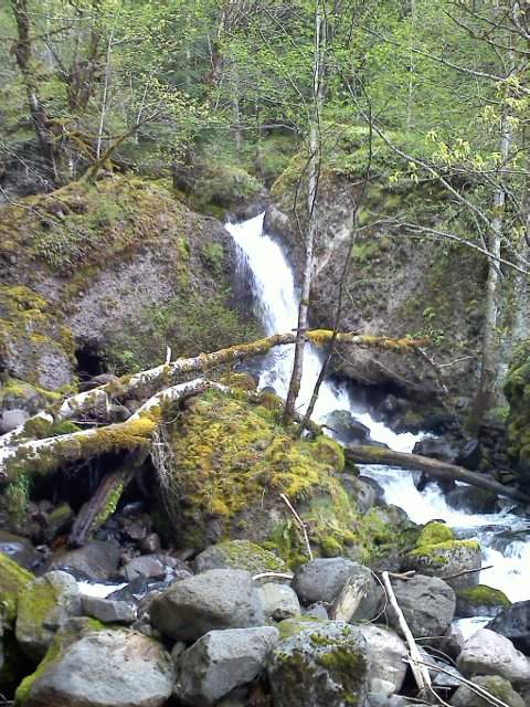
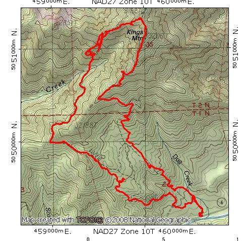
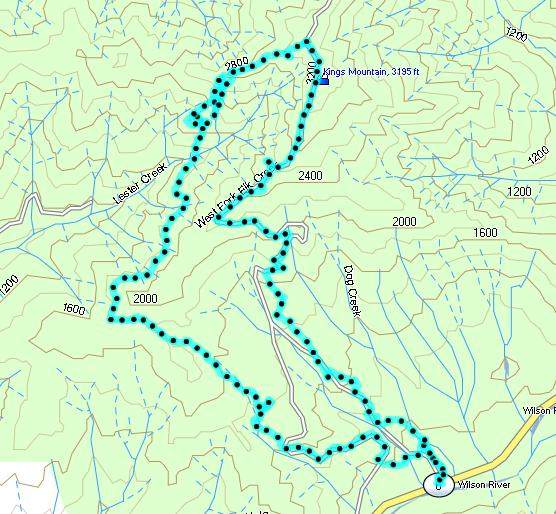
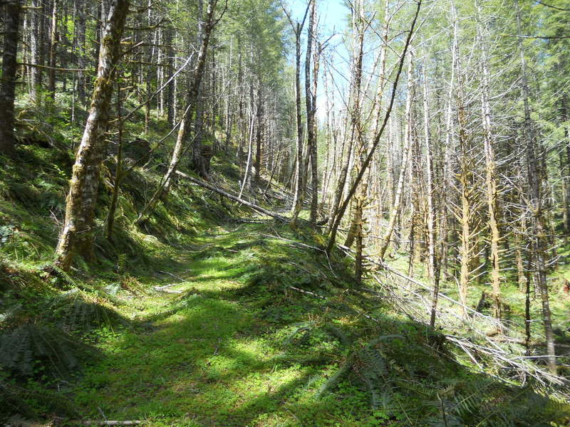
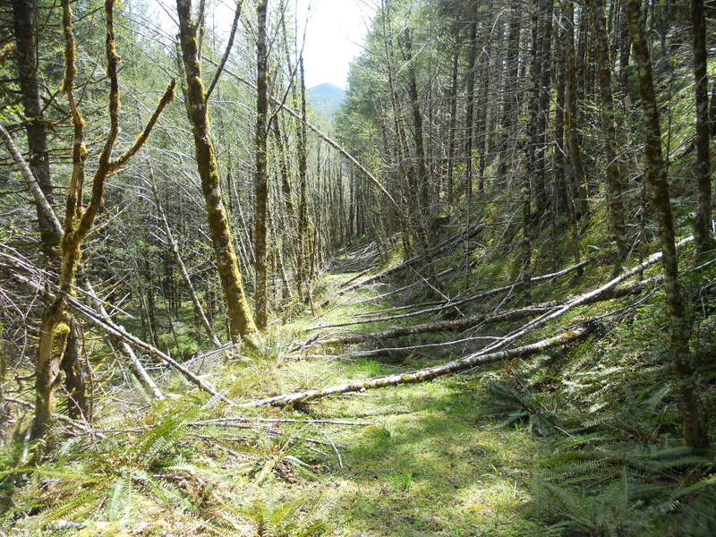
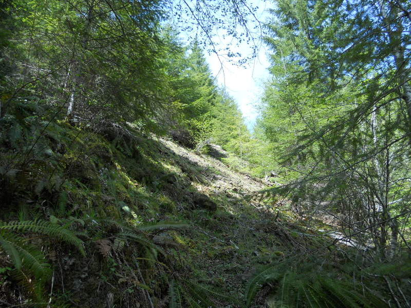
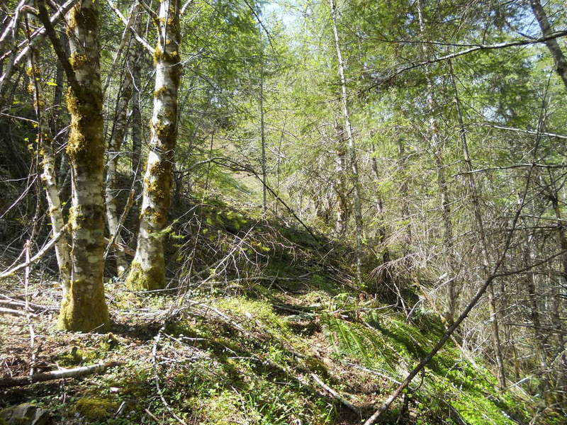
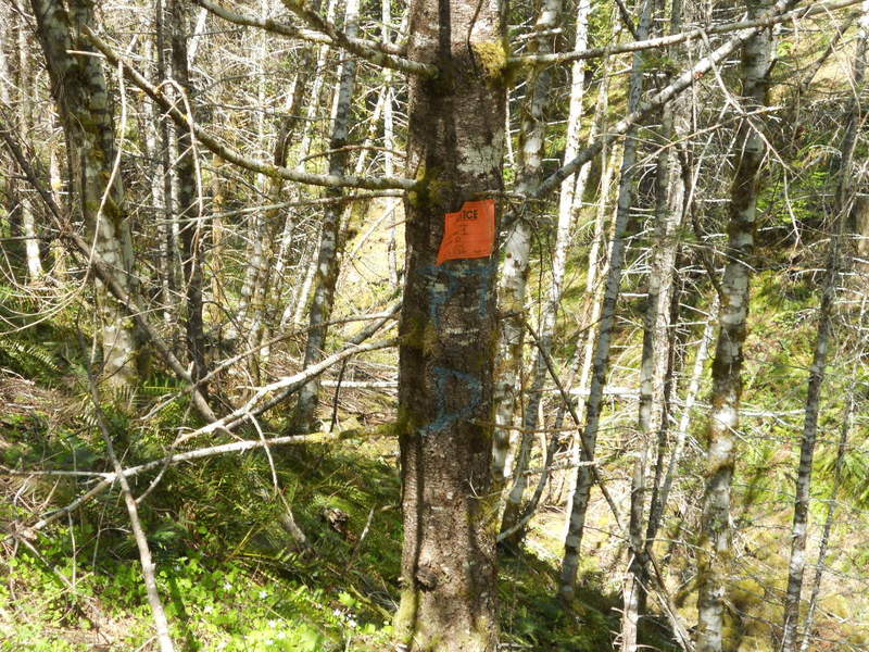
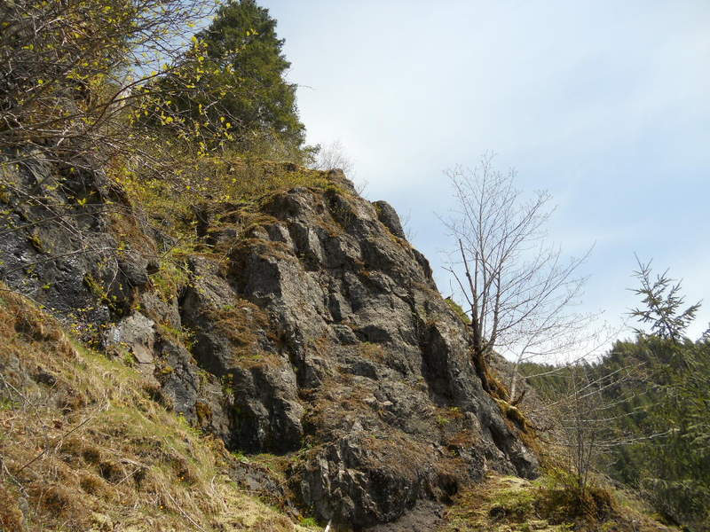
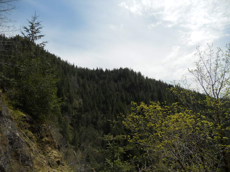
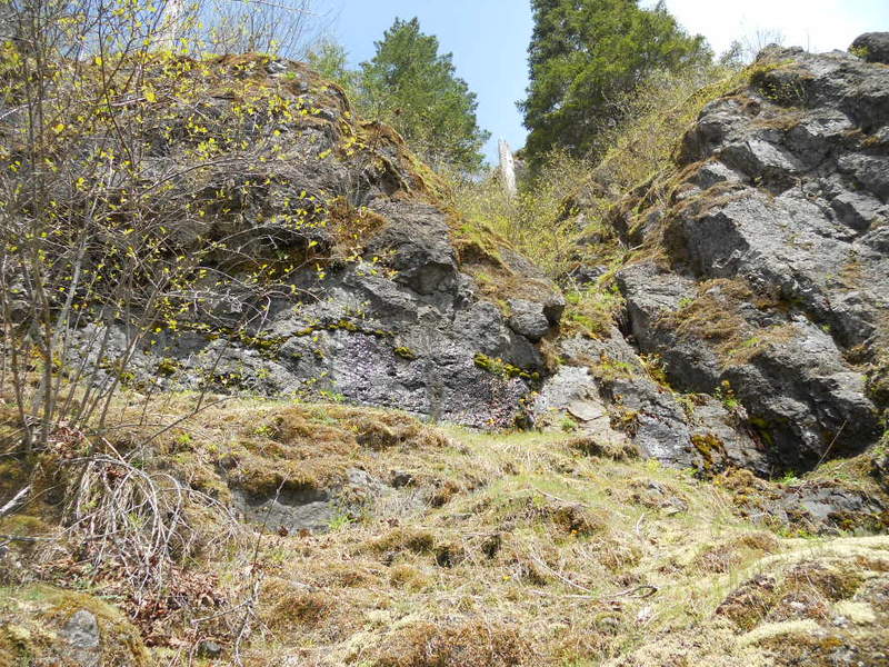
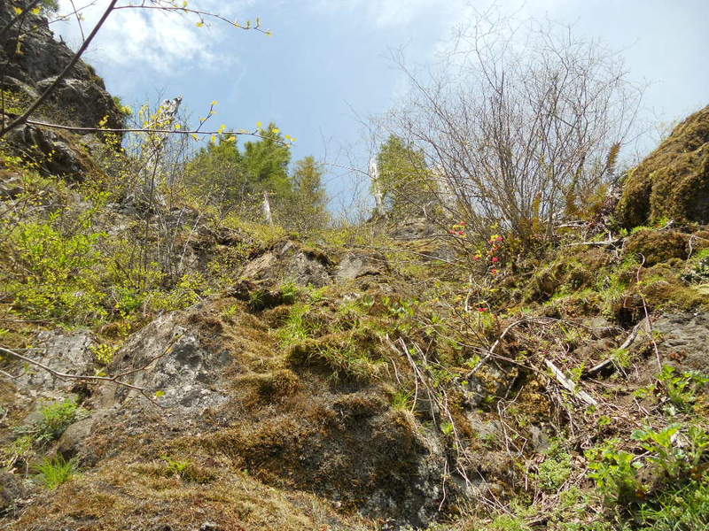
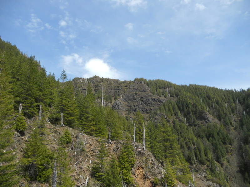
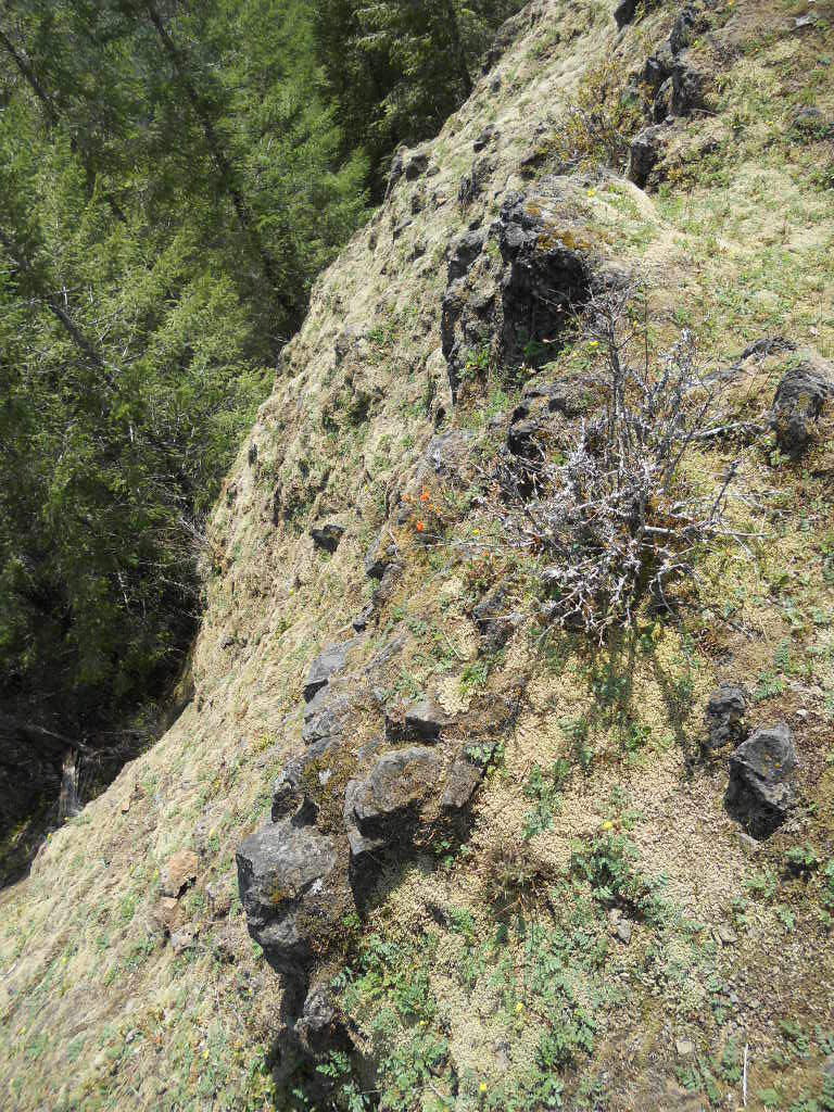
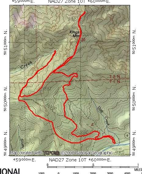
Off Trail Kings Mt Area bush whack up to 3 way junction Elk Creek Rd
8.5 miles of hiking • 3250' elevation gain •
I guess if I want better looking pictures I should buy a better camera. Stupid thing seems to just constantly take out of focus images on the right side even after trying everything.
Fun little 'schwack loop. Took me about 4 hours just to go from the Kings TH up to the 3 way junction. I did doddle quite a bit though and only cliffed out once. Not very many killer views like on most of the other ridge hikes in the area...
December 3, 2011


 1
1
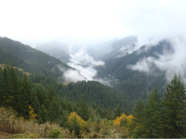
Larch MT. from Franklin Ridge then up the middle trail 444, Crater Trail
19 miles of hiking • 4250' elevation gain •
Broke 200k' of EG and Mayhem took some pictures, heheh :)
November 25, 2011


 2
2
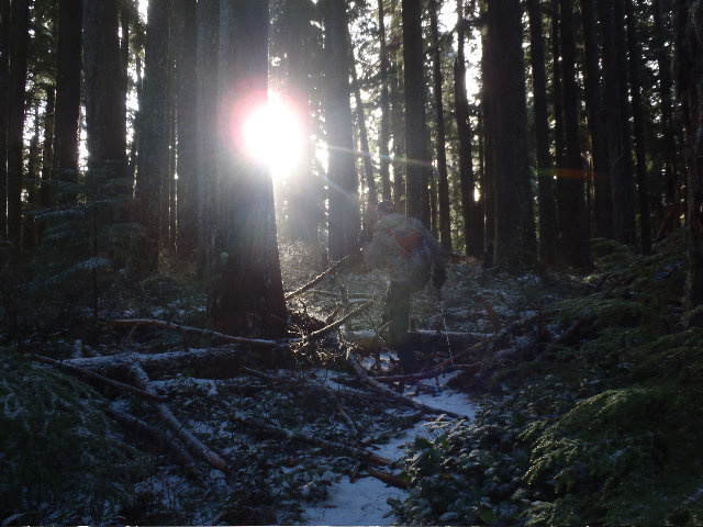
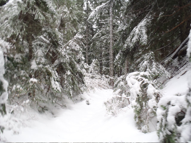
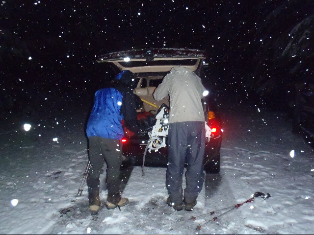
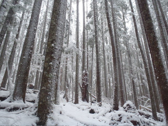
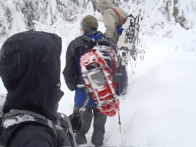
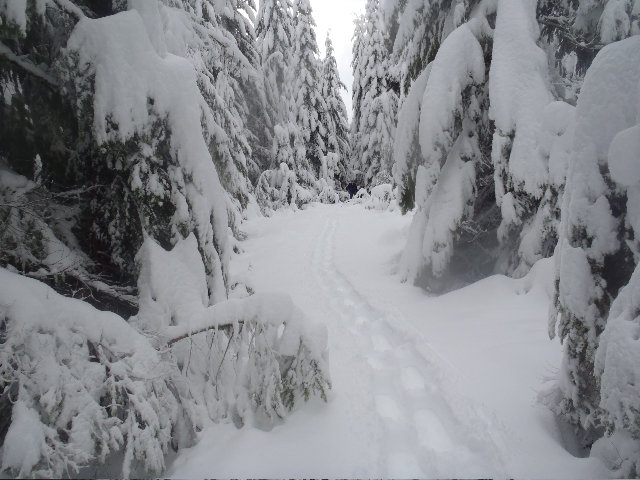
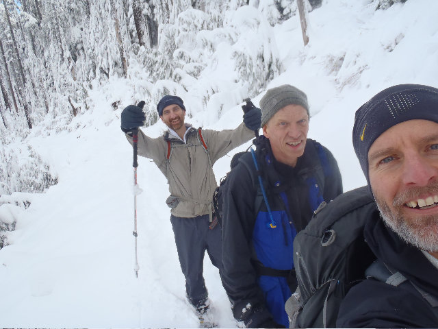
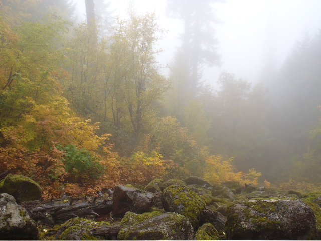
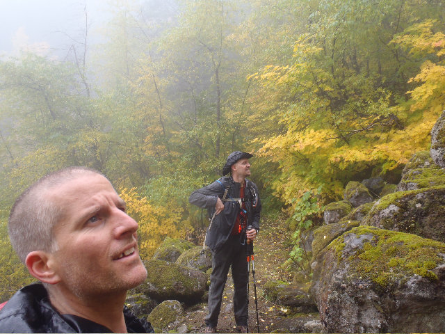
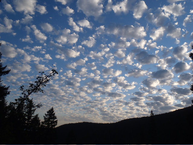
Siouxon Peak Loony Snow Shoe Death March
20 miles of hiking • 3500' elevation gain •
Oh my...
Meet Magnus and Mayhem in Amboy right before 5:00 and Magnus shuttled us up to the Siouxon Creek TH in his AWD.
Was snowing right down to 1200' but there was only a few inches of accumulation at the TH parking area.
Headed on Siouxon Creek trail to Chinook Falls and forded again using the decent log that is there.
Stayed out of snow shoes all the way up to about 2700 or 2800', I should have checked that better but we decided once it was about 18'' or so deep we put on the snow shoes.
Breaking trail wasn't too bad when under some tree cover but once we got out onto a totally open road section it got very slow going and very difficult. We shared the breaking trail duty but Mayhem ended up breaking a lot more trail than Magnus or me!
Bypassed Siouxon Peak this time and just kept going. Seemed like it was very close up a little spur trail.
Highlight of the day was seeing Wildcat Falls and getting back out of the snow line.
Forded Wildcat Creek with no problem but had to dip my boots into Chinook Creek since we were only 3 miles or so from the car I didn't care if I had wet feet.
November 19, 2011


 1
1
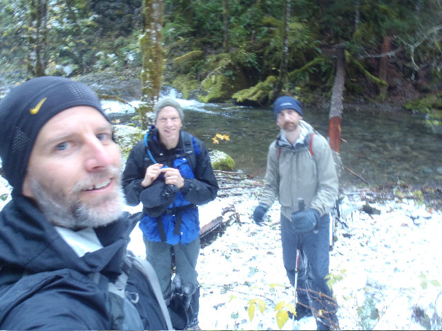
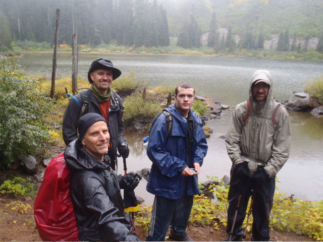
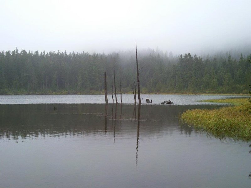
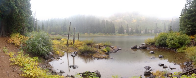
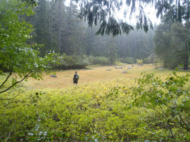
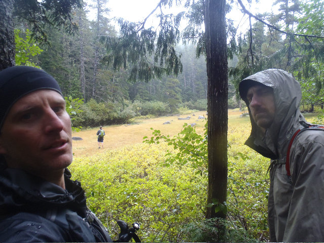
Siouxon Creek loops
20 miles of hiking • 5250' elevation gain •
15th hike with Captain Defiance!
Wow!
11 Saturday's in a row too hiking with him.
Amazing that we have not killed each other!! :))
Siouxon Creek area is first rate even when you have no view and are rained in!
Hiked with 3 new fellers too - Brad, Magnus and Dave.
Thought maybe we would see Chris since he suggested the hike and the open invite was just that, open for anyone to join up as long as the group didn't go over 12.
After several dumb false starts by me we finally got on our way.
Headed up Horseshoe Ridge for the first loop and everyone did just fine.
Had some fun down around Chinook Falls then I led the group up the wrong trail, I guess it's either Siouxon Creek trail that heads to Sister Rocks or it was a unlisted ridge trail that also may have led to Sister Rocks. Only way to really know is to visit the Eastern Siouxon bridge again and see if the Siouxon Trail continues on there on the south side of Siouxon Creek as all the maps show, but the trail we headed up is not on any maps or everyone has the Siouxon Trail mismarked!!
Turned around and forded Chinook Creek to get back on track, but turned around on this loop since we didn't want to ford Chinook or Siouxon with headlamps.
Didn't have to log shimmy on the return ford, was able to rock hop Chinook and not go over my boots.
Left LCL started acting up half way on this trip as well so turning around was the best thing.
Dave from Meetup really saved our butts 3 or 4 times since my GPS and me being a Siouxon n00b took us on a lot of wrong turns.
Will head back up this way soon as long as the snow doesn't accumulate at the 1400' level TH.
Friggn' awesome area and glad I finally got there after a year ago when I first attempted! :D
November 12, 2011


 2
2
November 6, 2011


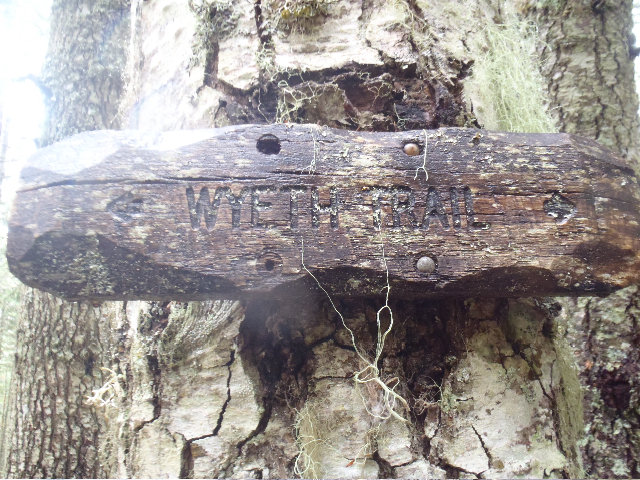
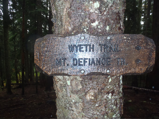
Wyeth up to Defiance
20 miles of hiking • 5500' elevation gain •
Fun day hike from Wyeth up to Defiance.
Snow started around 2800' and there is 4" on top of Defiance.
November 4, 2011

 2
2
Don Nelsen led Russ Jolley Cabins and another cabin on Larch and a '31 Buick around Nesika Lodge
20 miles of hiking • 5000' elevation gain •
7:00 am meetup at Horsetail Falls TH.
Peder, Thum, Don Nelsen, Mayhem and myself.
Took the RJ up to both cabins but this time DN took us up the correct way to the 2nd cabin. :)
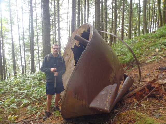
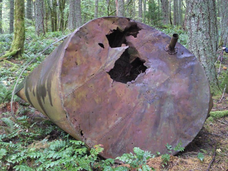
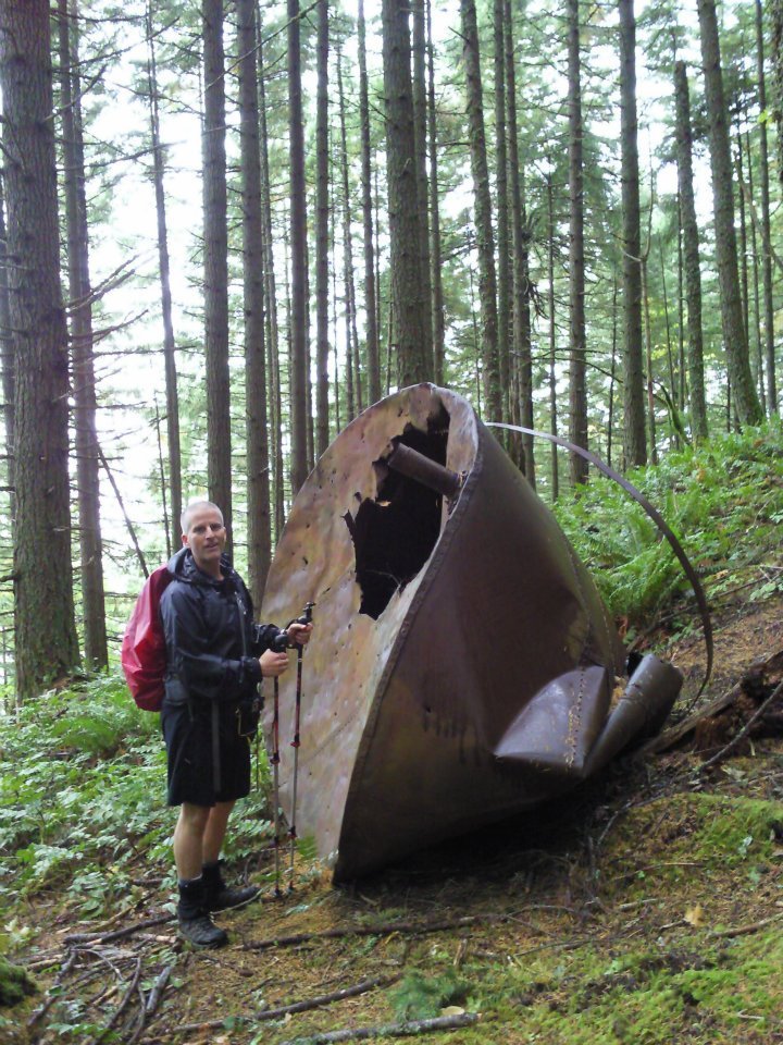
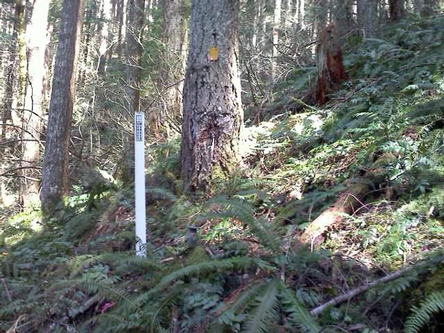
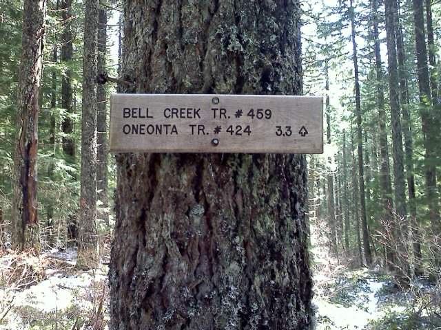
Bushwhacked from the 2nd cabin up to Horsetail Creek trail to head over to Bell Creek Way that got us up to 424. Crossed Larch Mt. area using 446 to get over to 441 for the 3rd cabin hunt and other old lumber rail road grade stuff.
Met a Meetup group that was doing a Larch Crater loop hike and got a few pictures.
Headed back down 441 to hit up Multnomah Basin RD to hunt for the '31 Buick carcass. Then hunted for it's engine block which someone tried to salvage but didn't get it to far from the rest of the car.
Hiked back down using 441 and past the skimpy rained out crowd where Thum scared some people with his Devil mask. Got to Peders car and he shuttled us back to the rest of our cars parked at Horsetail Falls TH...
October 30, 2011


 1
1
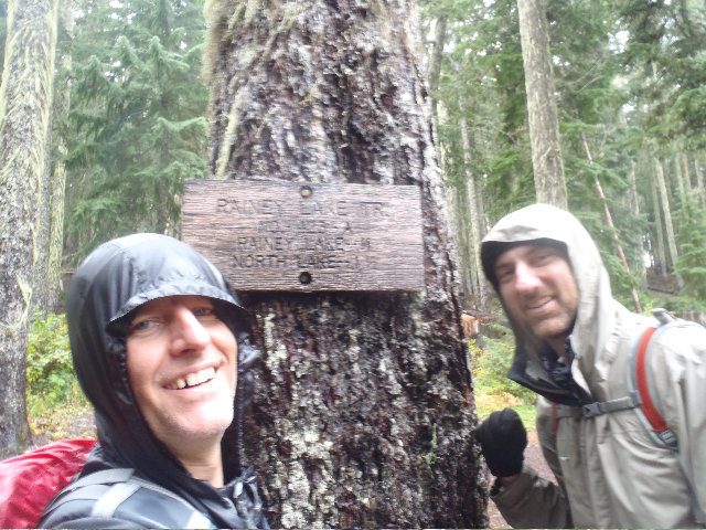
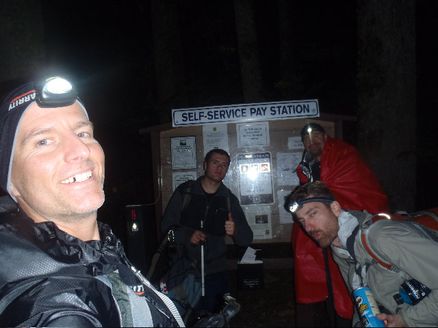
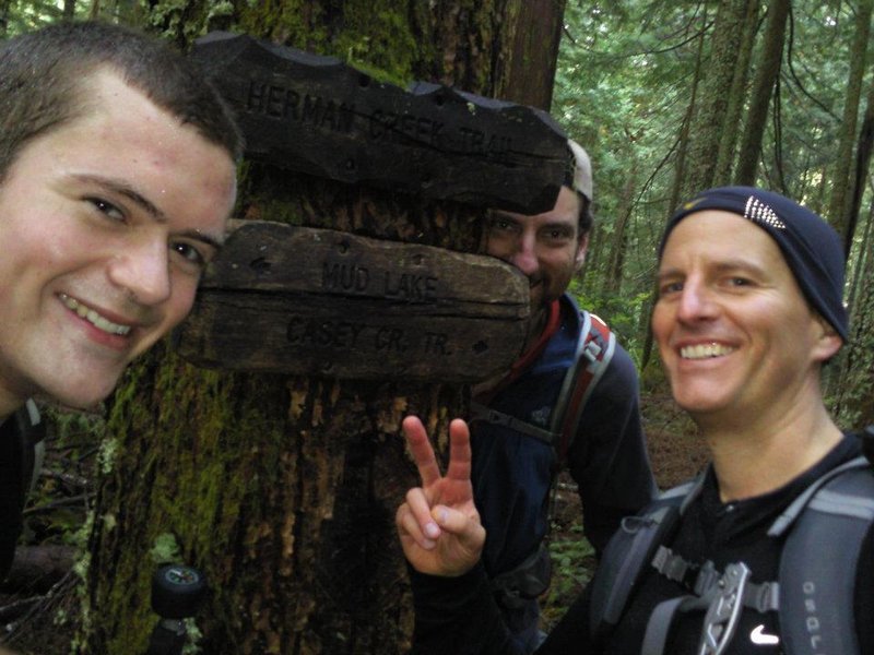
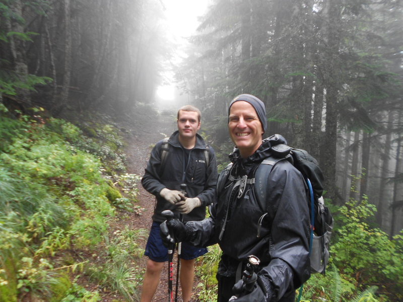
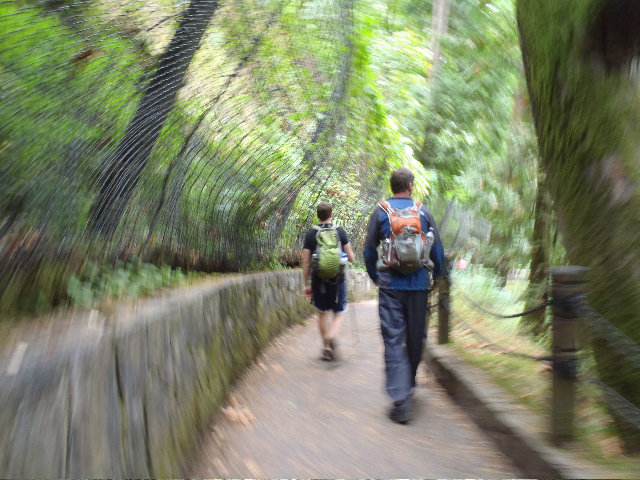
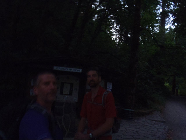
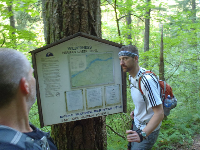
Herman Creek to 400 to Wyeth to Defiance to Rainy Lake to Nick Eaton Rdge back to Herman Creek
26.5 miles of hiking • 7500' elevation gain •
Had a fun trip bringing Crusak back to health!
October 22, 2011


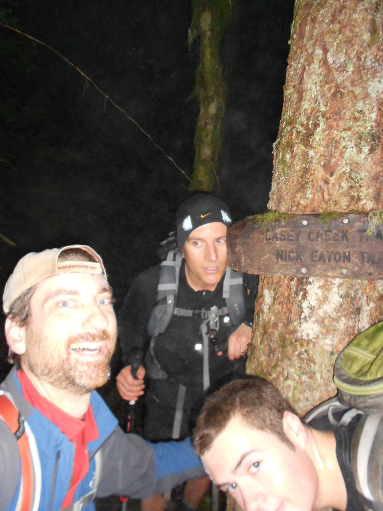
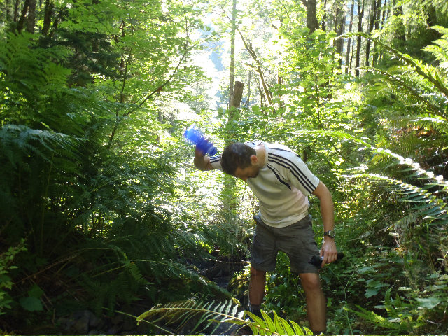
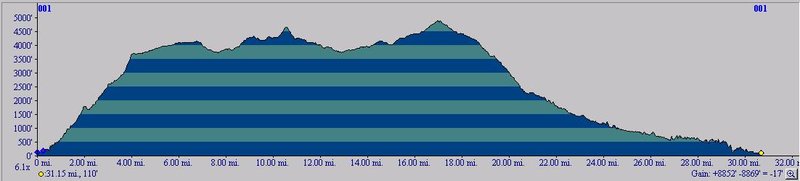
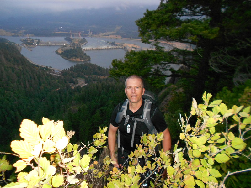
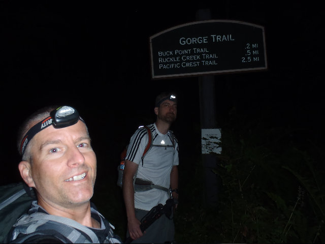
THUM - Tomlike, Herman Creek Pinnacles, Upper McCord Falls
31.5 miles of hiking • 6250' elevation gain •
Woo hoo! Great hike guys! Thanks again for the great day! :)
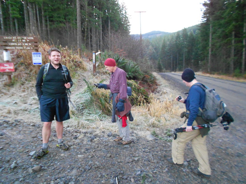
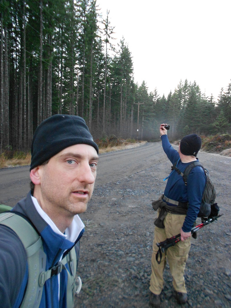
Meet Mayhem and Thum at around 6:00 am at the Herman Creek campground trail head.
The gate is still open to park up above Forest Lane but the campground is closed for the winter.
Thum engineered this one, about 32 miles for the day and 6300 EG.
Herman Creek, 406, up to Tomlike spur trail for a awesome Tomlike out and back.
First time for me, so I was totally up for this one! Also had never been up 406 past the dreaded Casey Creek junction.
From Tomlike we hiked over to the PCT to get up into the Benson Plateau so we could make a loop and divert a bit to see the Herman Creek Pinnacles, also a first for me.
October 15, 2011


 2
2
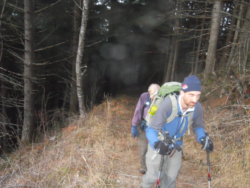
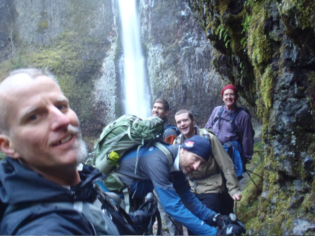
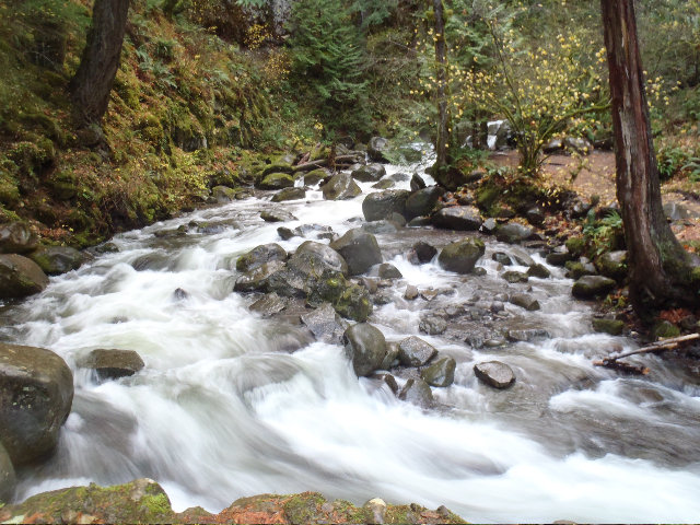
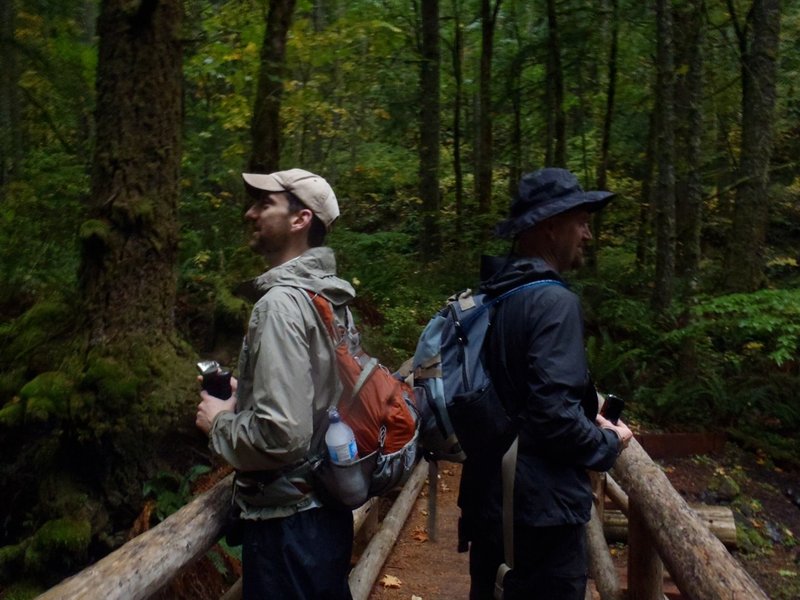
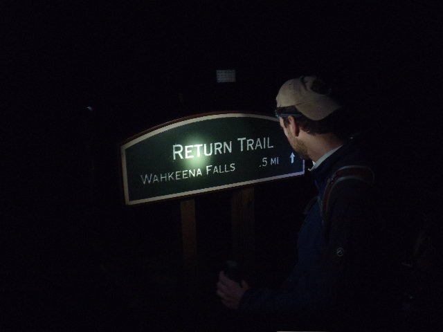
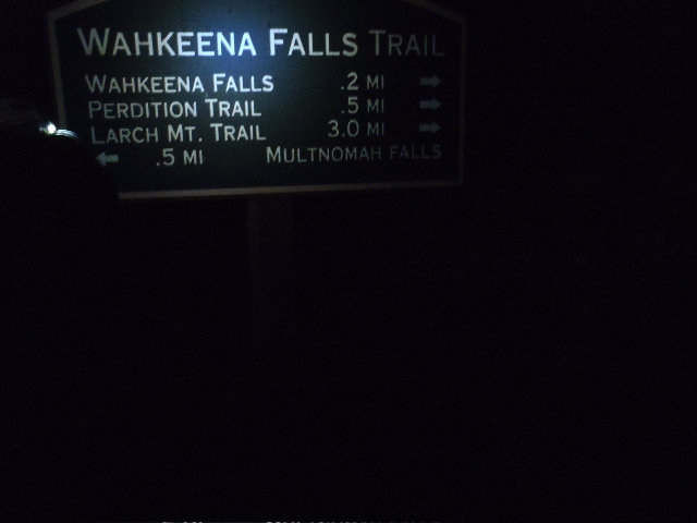
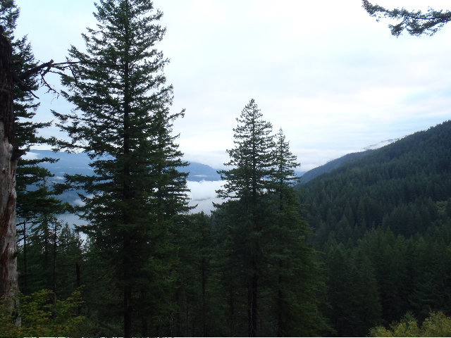
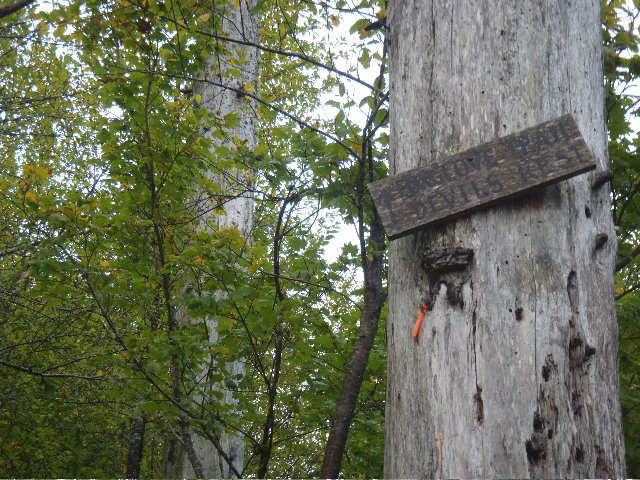
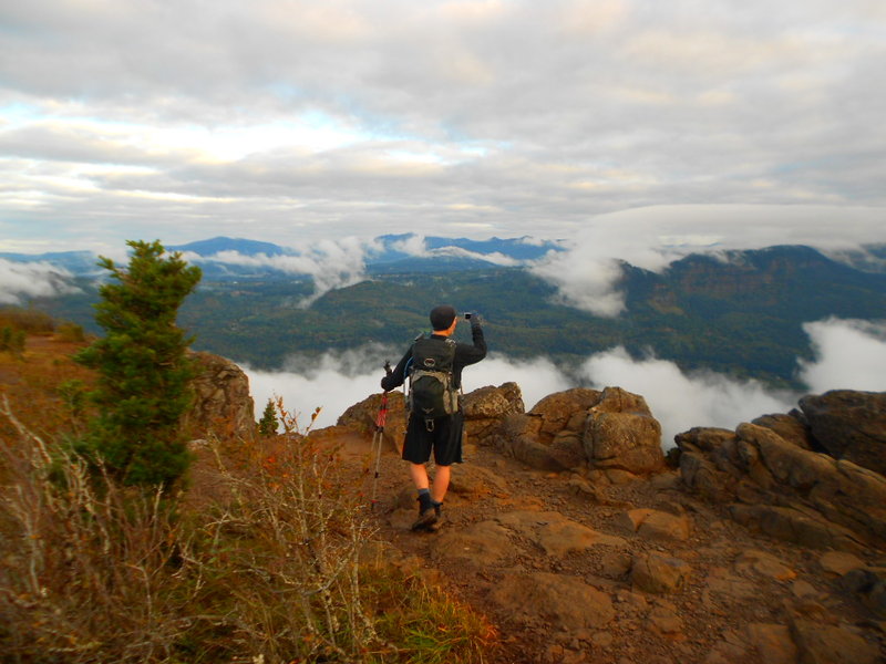
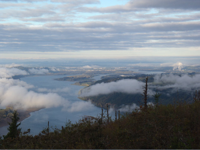
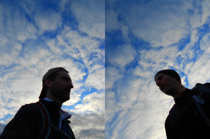
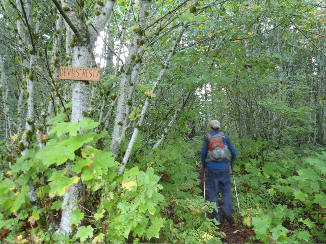
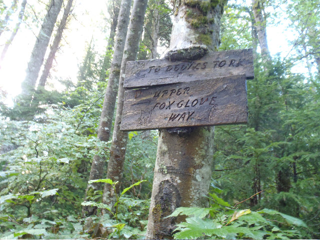
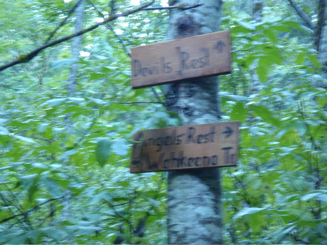
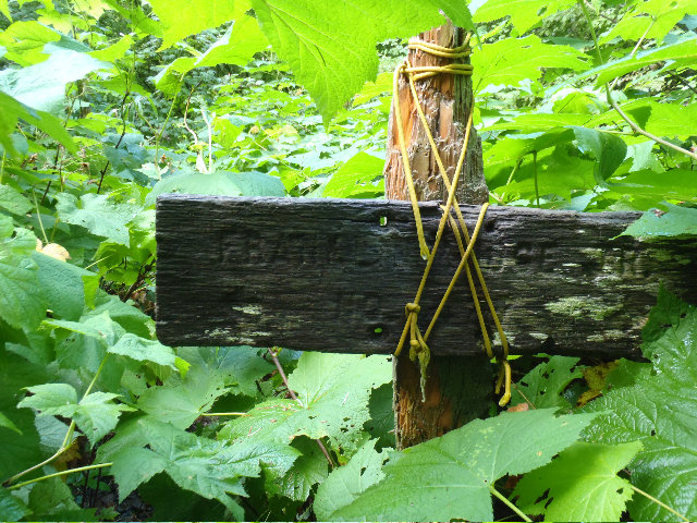
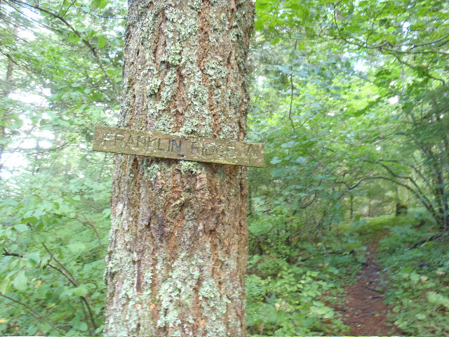
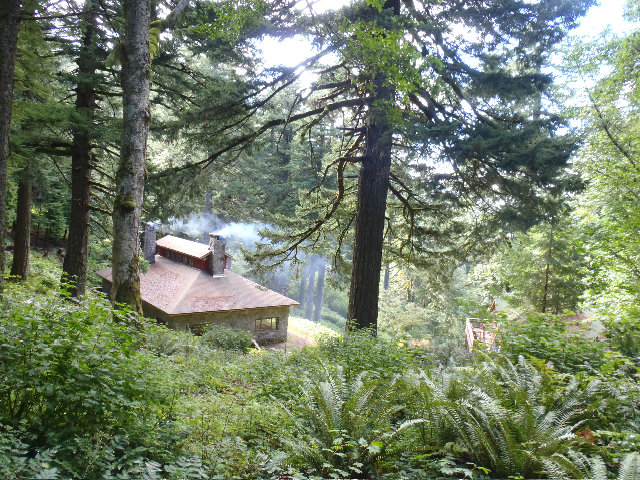
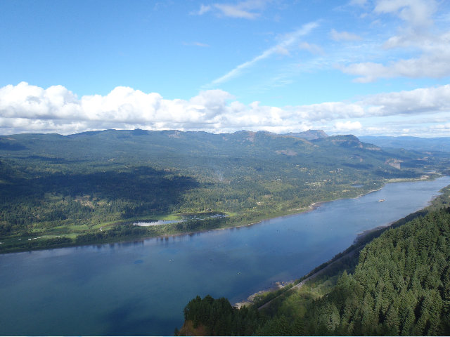
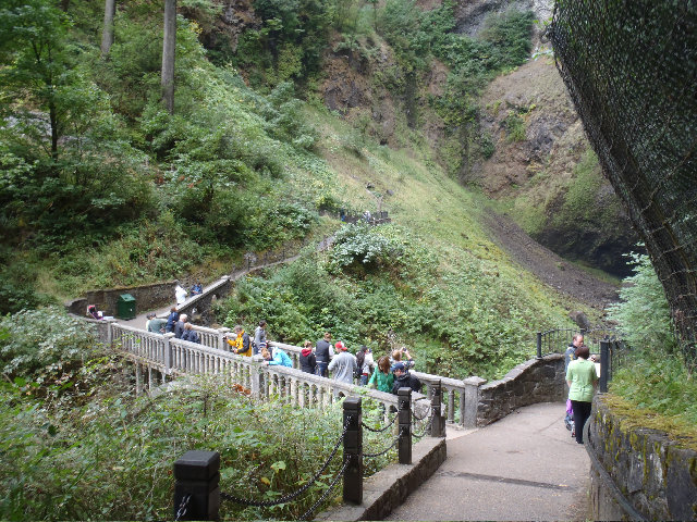
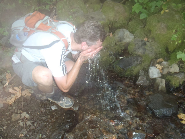
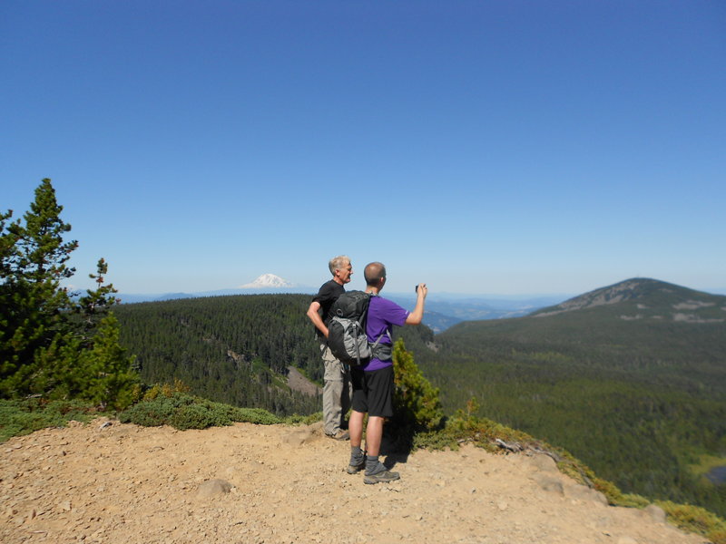
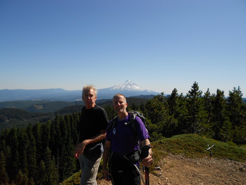
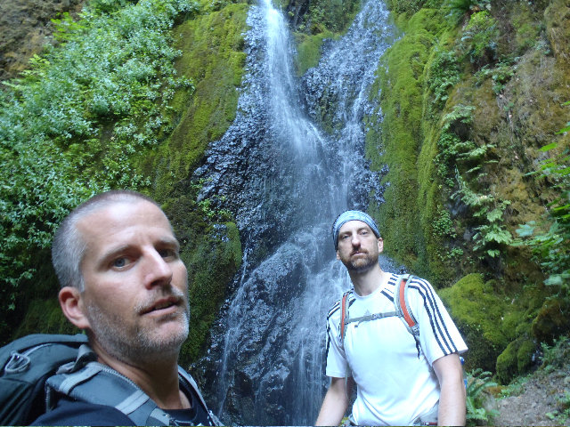
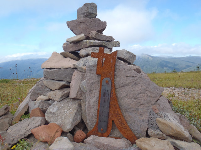
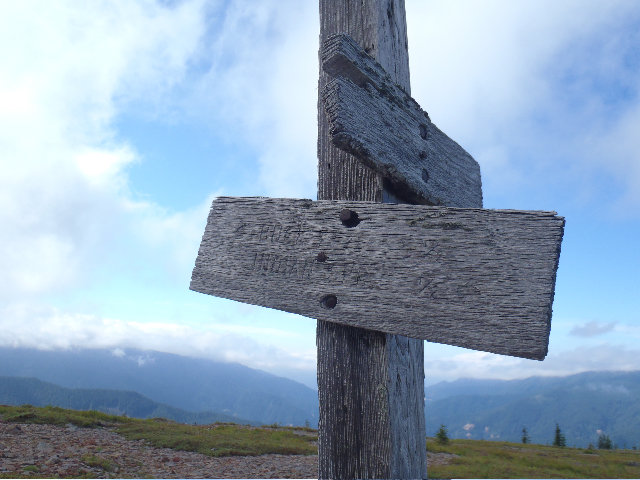
Larch Mt. Area Tour - Wahkeena, Angels Rest, Devils Rest, Sherrard PT. , Nesika Lodge
25 miles of hiking • 5000' elevation gain •
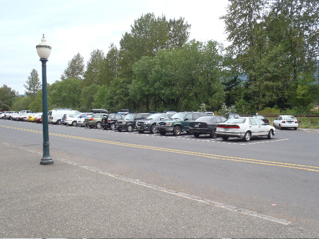
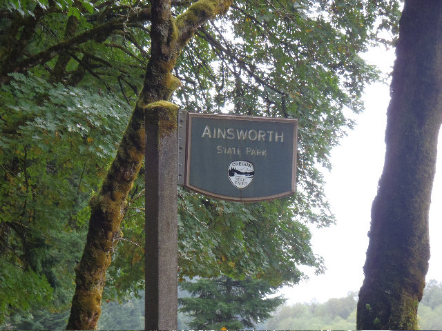
Met Mayhem, again, sigh, at the Multnomah Falls Lodge HWY 30 parking lot at about 6:12 am. He had to go potty really bad, #2, so he was a bit late meeting up with me as he was busy trying to find a open toidy. I guess he found one down at the Ainsworth CG.
Hit up the Wakkeena return trail from the lodge area to get started.
Filled up a water bottle at the Wahkeena Spring, yummy good water only flows from this spring.
Hoofed it up/over to Angels Rest and got some pretty nice scenic shots.
Used a Devils Rest feeder trail to hit a junction of the Foxglove to head up to Devils Rest. Glad I had a track, there's a lot of Foxglove related junctions to use! Met some other hikers using this trail that recognized Mayhem and me from Portland Hikers 'blog' posts they said. Nice seeing you guys! :)
For the Larch MT. section we used a bit of the official 420C trail to hit that super short section of trail that leads to Multnomah Basin Rd.. Continued up this way past below Devils Rest to make the junction with road 1520, which I think is Palmer Mill road? Hiked on this nice road for almost 2 miles and cut across to save a bit of time to hit up with Larch MT. Road. Using a track from Don to cut across and we found a steel cable in the ground, thanks again for the track Don! :)
Walked almost another 2 miles up Larch MT. Road to hit FR 315 that connects into trail 441 for the final Larch MT. ascent.
Way more peeps up there on this hike, last weekend 0! Mayhem helped out a lot of folks with group picture taking and we met some nice recently transplanted DC'ers who can't wait to get into all the awesome hiking and outdoor activities the Pac NW has to offer!
Continuing on we used 424, Oneonta Trail to get down to the Franklin Ridge trail to get to the best part of the day - Nesika Lodge work party day! Also met more PDX Hikers that recognized us, Mr. Peabody and his wife.
First we took in the awesome views from Waespe Point then headed over down into the wonderful Nesika Lodge area and met some nice folks working on the grounds. Others were working on residing the Women's 'dorm', finally getting the 4th side done! Had noticed the last few times during the years of being up there they have been slowly residing it and the gentleman explained they got a side done each year during the work parties.
We were invited inside for jelly donuts, cakes and candies and a tour. Sadly, they were joking about all the goodies but we got the tour and a few chocolates! Thanks TCO! :)
Filled up another water bottle from their spring water fountain and hit the trails for the final descent down to MFL and the hordes.
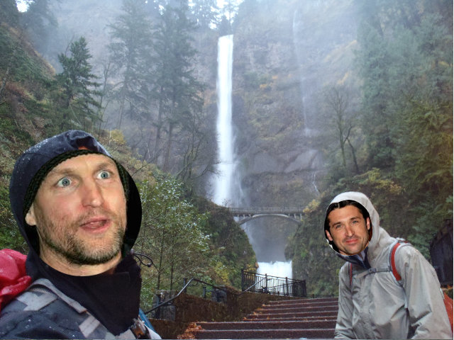
October 8, 2011


LARJ
23 miles of hiking • 6000' elevation gain •
Larch MT. out and back then over to Ainsworth loop area to catch the 400 up to Russ Jolley out and back. Rained. Pictures at the end are out of order again even though I tried to make everyone's different camera dates and times the same :))
OMG, I finally figured out how to make everyone's different date and time stamps all the same in Winblows so the pictures will stay in the order I upload them into WH!!! WOO HOO!!! ❤❤❤❤❤ @ Kyle! :))
October 1, 2011


Defiance w/ the Captain
12.5 miles of hiking • 5000' elevation gain •
Made last minute hiking plans that was going to be also a Nesmith after Defiance for a DN hike but had to settle on just a single Defiance today :) Fun time hiking with my TFF Mayhem... ❤ ❤ ❤
September 24, 2011


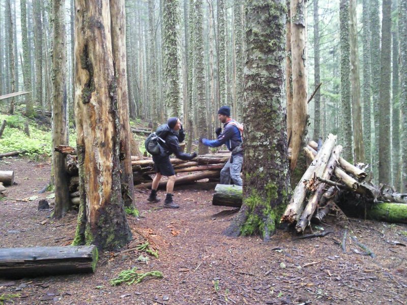
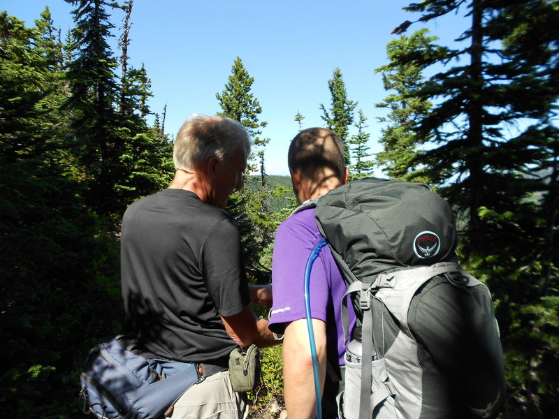
Elk/Kings traverse loop with Mayhem and Thum
10.5 miles of hiking • 4000' elevation gain •
http://www.portlandhikers.org/forum/viewtopic.php?f=8&t=9516
September 17, 2011

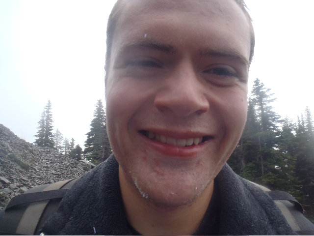
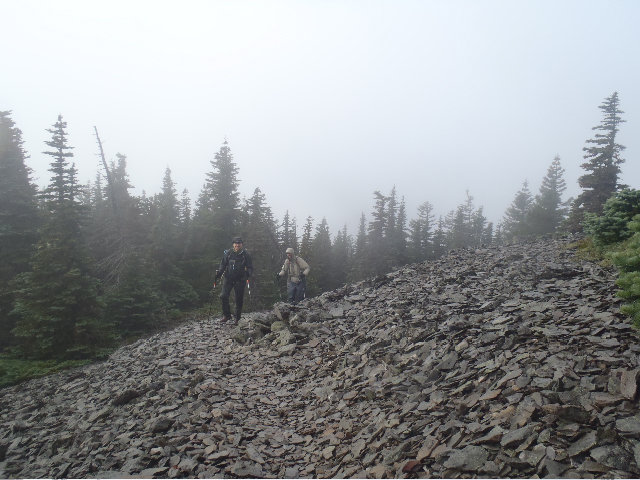
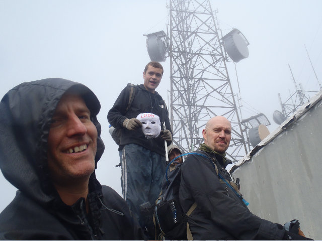
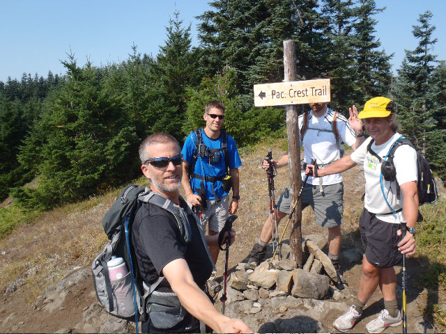
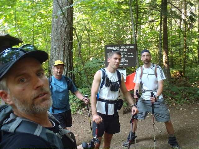
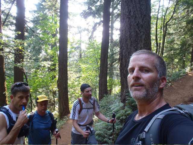
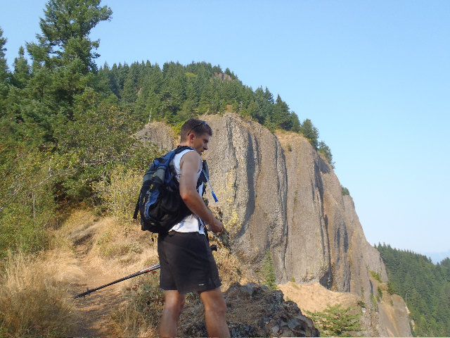
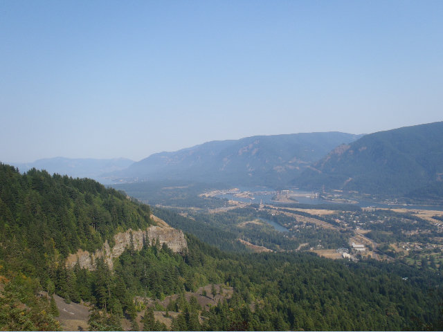
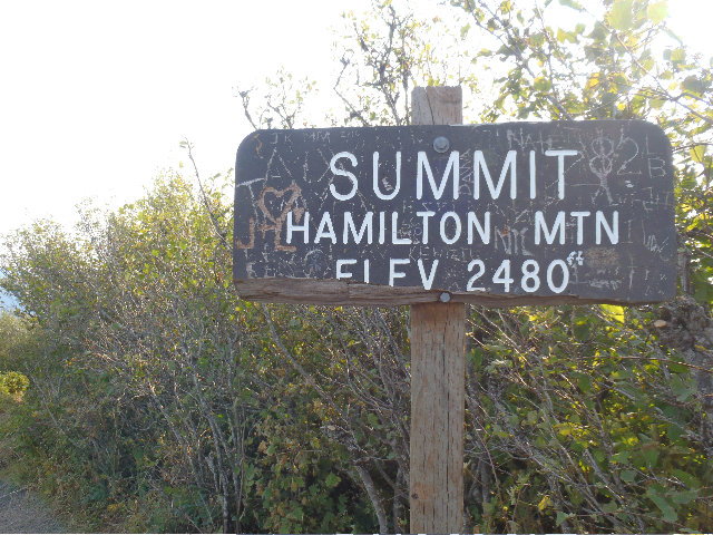
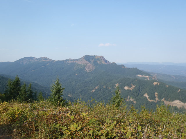
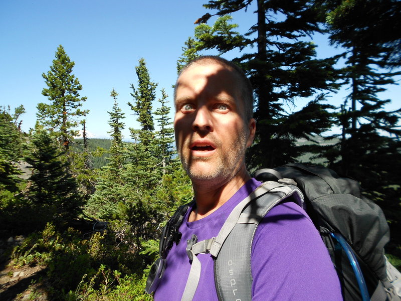
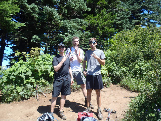
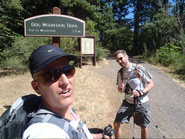
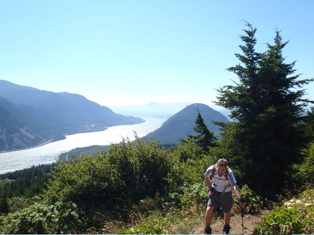
Dog Wind Table Hamilton Beacon Loony Hike
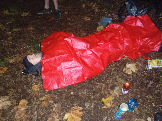
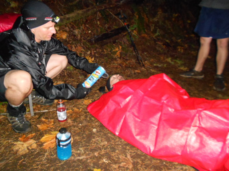
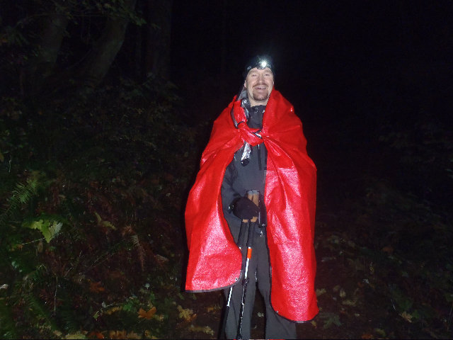
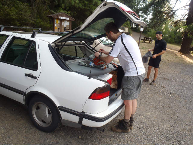
25 miles of hiking • 10250' elevation gain •
This was supposed to be a Mt. Hood 1 day around hood hike, but what with the fires and all we had to change it up and do something different.
Behold! I give you the DWTHB all in one day loony hike!
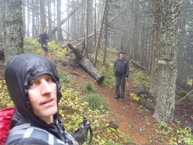
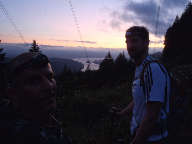
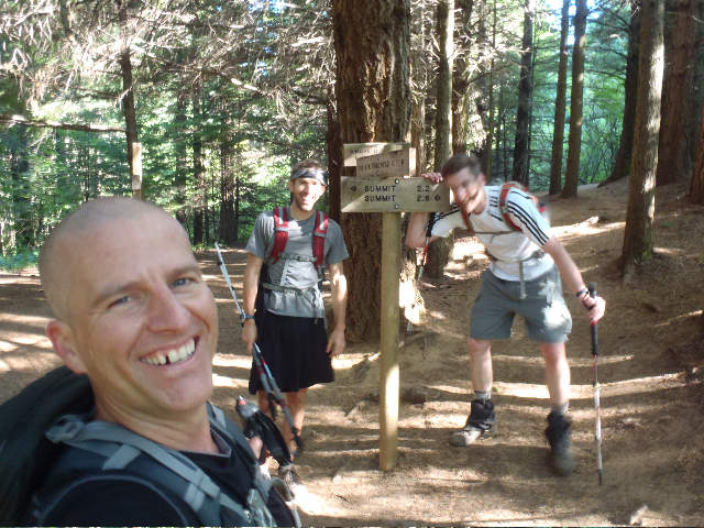
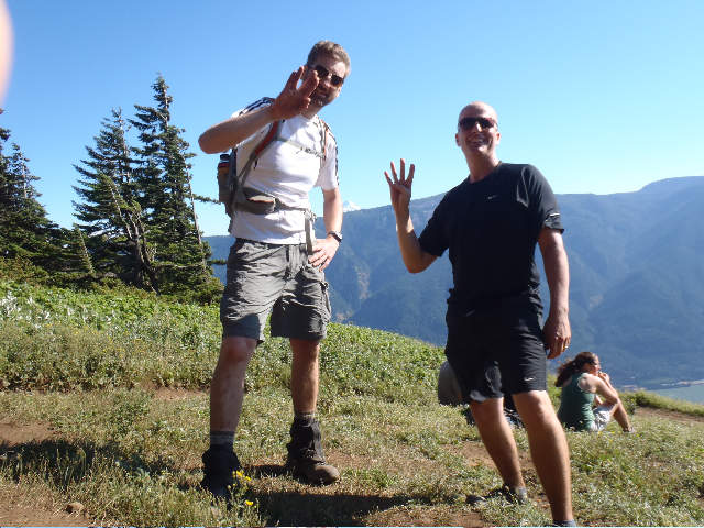
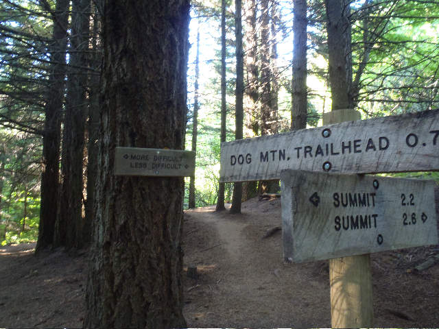
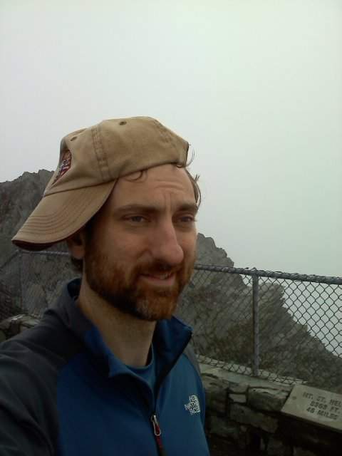
Met up with Guy, Cascadehiker and Mayhem right around 5:00 am @ Dog MT. to start the pentuplet.
[attachment=14]Start.jpg[/attachment]
Made pretty good time being fresh from getting up at 3:15 and not eating anything yet.
Since we had our headlamps on and it was still pretty dark I was able to spot a cougar to left of us as we headed up. First I heard some rustling then I saw the glow of the cats eyes, close together and NOT running off. CH was just ahead of me and notified him so he could also witness it. Mayhem and Guy were far enough ahead that they missed the glow of it's eyes.
Here we are at the junction that has a nice viewpoint -
[attachment=13]P9090013.jpg[/attachment]
And here we are at the top of Dog, 1 hour and 15 I think -
[attachment=12]P9090015.jpg[/attachment]
I jetted down not realizing the sun hadn't come up yet and missed viewing it with my other trail friends.
[attachment=11]P9090017.jpg[/attachment]
So I was pretty much jogging down trying to do a DN, I had my trail running shoes for this loony hike today, and was far enough ahead of the other guys since they stopped to take pix of the sunrise that I thought it would be funny to make cat sounds as if I were being eaten. I don't think the guys heard me but the cougar from earlier sure did! The cat was still in the same area and I saw it this time jaunting off a bit to get more under cover. I stopped got the camera out and waited for my trail friends. Sorry, no pictures unfortunately.
Round trip for Dog was 2 hours.
Headed over to Wind MT.
I parked right at the TH but the others parked up a above, they got a little more EG for the day than I did.
[attachment=10]P9090029.jpg[/attachment]
[attachment=9]P9090030.jpg[/attachment]
[attachment=8]P9090033.jpg[/attachment]
[attachment=7]P9090039.jpg[/attachment]
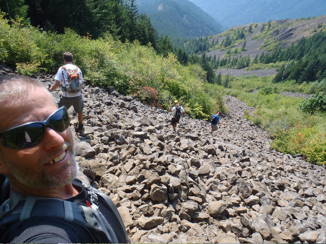
Now on to Table.
Parked at the Hot Springs Resort and refueled at our coolers. I think we headed out at around 9:30 and took the Dick Thomas 'home made trail'.
[attachment=6]P9090045.jpg[/attachment]
[attachment=5]P9090049.jpg[/attachment]
At the kiosk taking a breather and I'm dreading the steep section of the HBR trail -
[attachment=4]P9090055.jpg[/attachment]
[attachment=3]P9090058.jpg[/attachment]
[attachment=2]P9090060.jpg[/attachment]
[attachment=1]P9090063.jpg[/attachment]
Got a few pictures of the area where Don had scrambled up a steep chimney and almost climbed over, on a hike a few months ago with him and his son Paul.
[url=http://wenthiking.com/system/images/3412/original/DSCN0600.JPG?1315763996][img]http://wenthiking.com/system/images/3412/large/DSCN0600.jpg?1315763996[/img][/url] Don's chimney 1
I believe the chute terminates in the brush up towards the right, Don can fill us in to be more precise since he was the one right at the top almost ready to go up and into this brush -
[url=http://wenthiking.com/system/images/3413/original/DSCN0601.JPG?1315764019][img]http://wenthiking.com/system/images/3413/large/DSCN0601.jpg?1315764019[/img][/url] Don's chimney chute 2
Heading up the silly talus slope -
[attachment=0]P9090073.jpg[/attachment]
Newer signage on Table -
[url=http://wenthiking.com/system/images/3385/original/P9090078.jpg?1315762243][img]http://wenthiking.com/system/images/3385/large/P9090078.jpg?1315762243[/img][/url] Signage
Some views from the top of Table -
[url=http://wenthiking.com/system/images/3386/original/P9090085.jpg?1315762296][img]http://wenthiking.com/system/images/3386/large/P9090085.jpg?1315762296[/img][/url] Fire still going strong over there...
[url=http://wenthiking.com/system/images/3387/original/P9090086.jpg?1315762386][img]http://wenthiking.com/system/images/3387/large/P9090086.jpg?1315762386[/img][/url] Steep 1
[url=http://wenthiking.com/system/images/3388/original/P9090091.jpg?1315762414][img]http://wenthiking.com/system/images/3388/large/P9090091.jpg?1315762414[/img][/url] Steep 2
[url=http://wenthiking.com/system/images/3389/original/P9090095.jpg?1315762435][img]http://wenthiking.com/system/images/3389/large/P9090095.jpg?1315762435[/img][/url] Group shot on Table
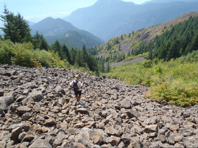
[url=http://wenthiking.com/system/images/3390/original/P9090097.jpg?1315762459][img]http://wenthiking.com/system/images/3390/large/P9090097.jpg?1315762459[/img][/url] Heading down the boulder field...
Headed back down Table using the same route up, this boulder field sucks eggs going down. Meet a HUGE church group as we headed down. I think 2 out of 20 had water bottles but one kid had a .22 that he said he was going to use for target practice. Super nice group of kids that couldn't believe a group of old guys was in the middle of a loony mega hike.
[url=http://wenthiking.com/system/images/3391/original/P9090098.jpg?1315762495][img]http://wenthiking.com/system/images/3391/large/P9090098.jpg?1315762495[/img][/url] Down BF 2 and church group heading up...
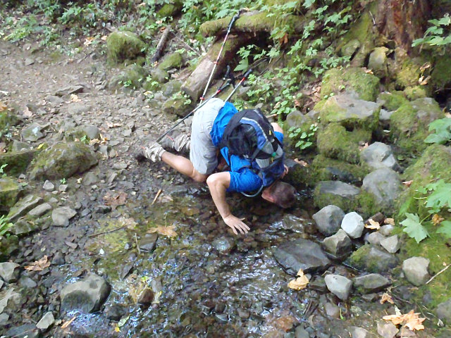
This part was awesome, cooling off on a branch of Cedar Creek, still flowing nicely!
[url=http://wenthiking.com/system/images/3392/original/P9100117.jpg?1315762548][img]http://wenthiking.com/system/images/3392/large/P9100117.jpg?1315762548[/img][/url] CH cooling off
[url=http://wenthiking.com/system/images/3393/original/P9100132.jpg?1315762569][img]http://wenthiking.com/system/images/3393/large/P9100132.jpg?1315762569[/img][/url] CH cooling off 2
[url=http://wenthiking.com/system/images/3394/original/P9100134.jpg?1315762588][img]http://wenthiking.com/system/images/3394/large/P9100134.jpg?1315762588[/img][/url] Guy cooling off
[url=http://wenthiking.com/system/images/3395/original/P9100144.jpg?1315762607][img]http://wenthiking.com/system/images/3395/large/P9100144.jpg?1315762607[/img][/url] Mayhem cooling off
[url=http://wenthiking.com/system/images/3396/original/P9100145.jpg?1315762634][img]http://wenthiking.com/system/images/3396/large/P9100145.jpg?1315762634[/img][/url] Mayhem cooling off 2
[url=http://wenthiking.com/system/images/3397/original/P9100148.jpg?1315762658][img]http://wenthiking.com/system/images/3397/large/P9100148.jpg?1315762658[/img][/url] Eric cooling off
Movie made by Mayhem with us cooling off -
[flash=420,345]http://www.youtube.com/v/8G93PK2Fze8?version=3&hl=en_US&rel=0[/flash]
Next up Hamilton!
Man, this 5 hike thing was getting VERY hard for me now at this point and I really kinda wanted to take the bail out easier way up. Guy said no way dude and almost beat me up for even mentioning the 'wussier' way.
[url=http://wenthiking.com/system/images/3398/original/P9100172.jpg?1315762686][img]http://wenthiking.com/system/images/3398/large/P9100172.jpg?1315762686[/img][/url] Hamilton group shot...
[url=http://wenthiking.com/system/images/3399/original/P9100174.jpg?1315762713][img]http://wenthiking.com/system/images/3399/large/P9100174.jpg?1315762713[/img][/url] CH killing it up Hamilton
[url=http://wenthiking.com/system/images/3400/original/P9100180.jpg?1315762736][img]http://wenthiking.com/system/images/3400/large/P9100180.jpg?1315762736[/img][/url] Pool of winds, almost jumped in!
[url=http://wenthiking.com/system/images/3401/original/P9100191.jpg?1315762765][img]http://wenthiking.com/system/images/3401/large/P9100191.jpg?1315762765[/img][/url] I wanted to use the easier trail but...
[url=http://wenthiking.com/system/images/3402/original/P9100193.jpg?1315762801][img]http://wenthiking.com/system/images/3402/large/P9100193.jpg?1315762801[/img][/url] Guy said no way and beat me up again...
[url=http://wenthiking.com/system/images/3403/original/P9100195.jpg?1315762835][img]http://wenthiking.com/system/images/3403/large/P9100195.jpg?1315762835[/img][/url] Cascade taking a piss break...
I forgot that Hamilton had more EG when I saw this part, but luckily doesn't have a dreaded section like over on Table.
[url=http://wenthiking.com/system/images/3404/original/P9100197.jpg?1315762863][img]http://wenthiking.com/system/images/3404/large/P9100197.jpg?1315762863[/img][/url] View from Ham area
[url=http://wenthiking.com/system/images/3405/original/P9100202.jpg?1315762879][img]http://wenthiking.com/system/images/3405/large/P9100202.jpg?1315762879[/img][/url] Ham summit
[url=http://wenthiking.com/system/images/3406/original/P9100209.jpg?1315762903][img]http://wenthiking.com/system/images/3406/large/P9100209.jpg?1315762903[/img][/url] There's Table from Hamilton...
I finally made it up just in time for the group shot and to turn around and head back down...
[url=http://wenthiking.com/system/images/3407/original/P9100213.jpg?1315762926][img]http://wenthiking.com/system/images/3407/large/P9100213.jpg?1315762926[/img][/url] Hammy group shot...
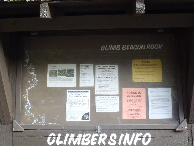
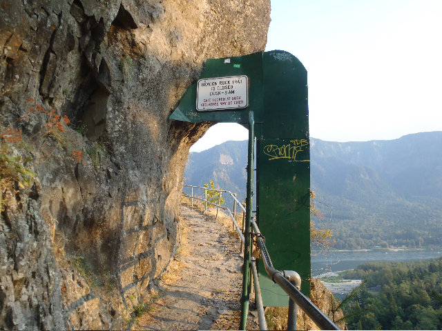
Last hike for the day, Beacon Rock -
[url=http://wenthiking.com/system/images/3408/original/P9100226.jpg?1315762949][img]http://wenthiking.com/system/images/3408/large/P9100226.jpg?1315762949[/img][/url] On to the last stop of the day, Beacon...
[url=http://wenthiking.com/system/images/3409/original/P9100228.jpg?1315762973][img]http://wenthiking.com/system/images/3409/large/P9100228.jpg?1315762973[/img][/url] Beacon ice gate...
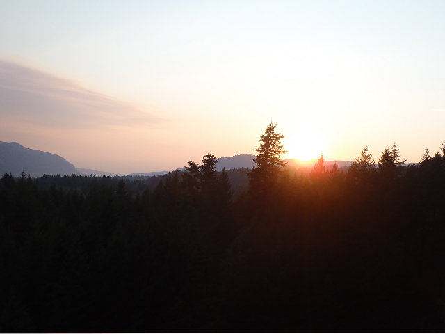
[url=http://wenthiking.com/system/images/3410/original/P9100232.jpg?1315762996][img]http://wenthiking.com/system/images/3410/large/P9100232.jpg?1315762996[/img][/url] Beacon sunset
[url=http://wenthiking.com/system/images/3411/original/P9100233.jpg?1315763046][img]http://wenthiking.com/system/images/3411/large/P9100233.jpg?1315763046[/img][/url] Mayhem failed to take a Beacon group shot on the top, waiting for Guy's picture of the group shot...
I believe this mega hike was 25 miles and 10,200' for me and another 100 or so for the other 3 guys as they had a little more over on Wind from parking further from the official TH parking area.
Fun day guys 8-)
September 9, 2011


 2
2
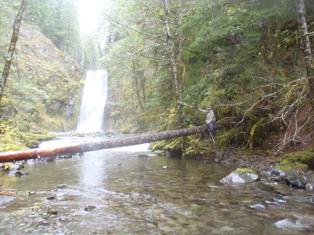
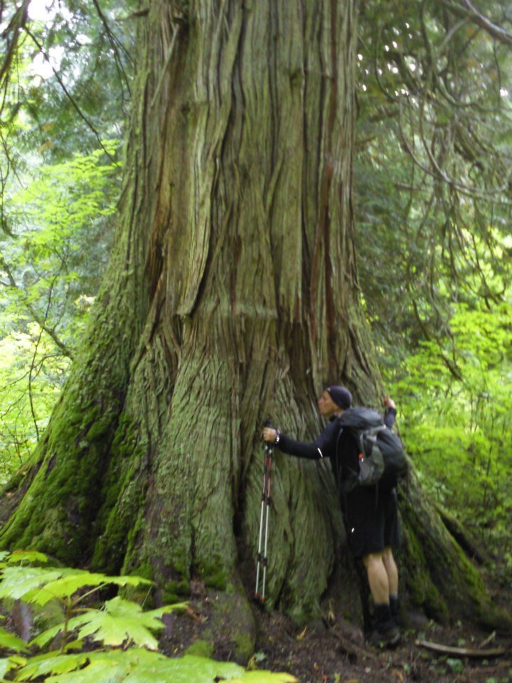
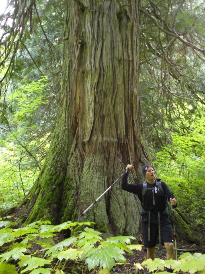
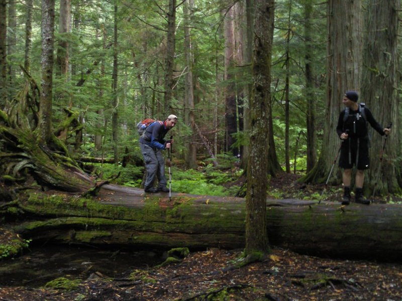
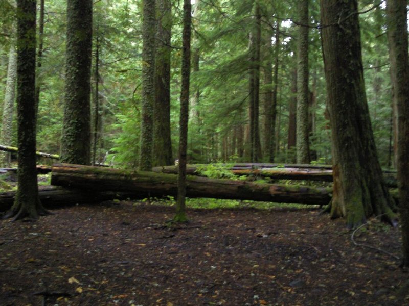
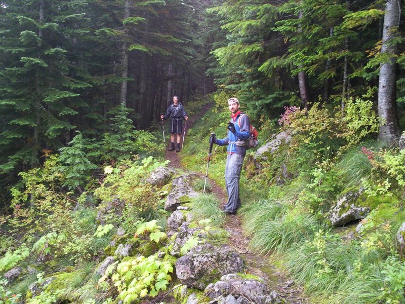
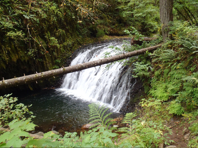
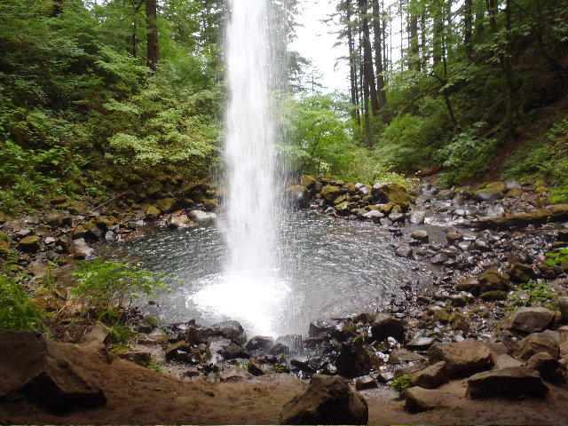
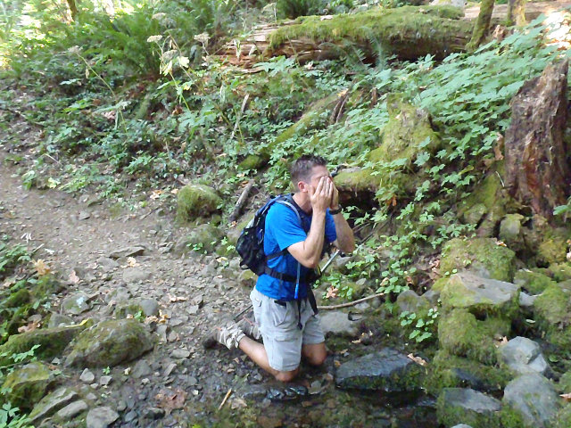
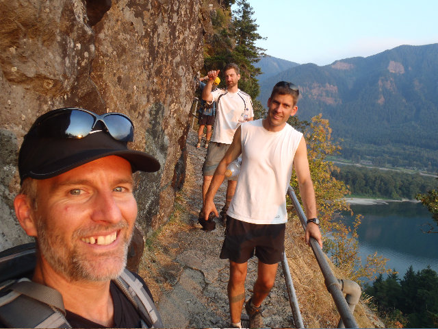
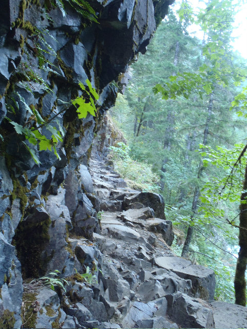
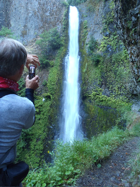
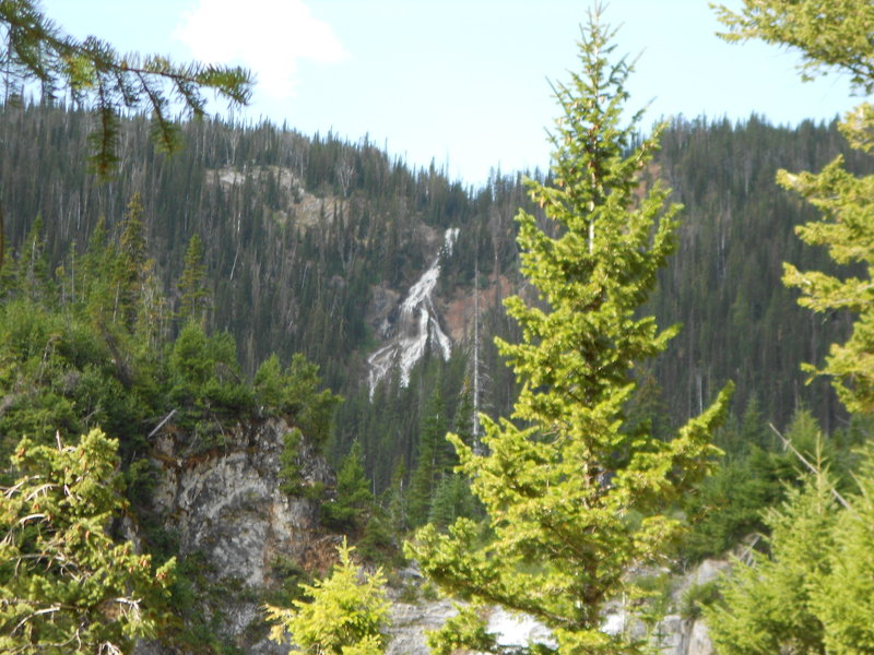
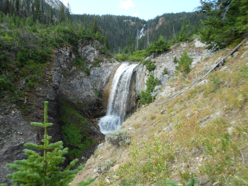
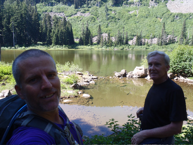
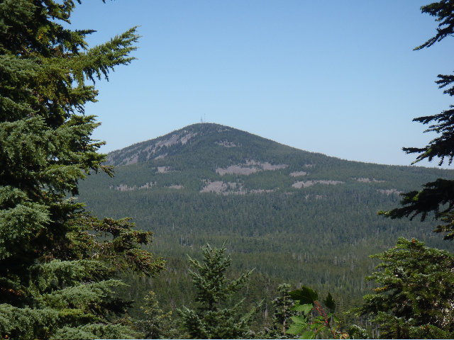
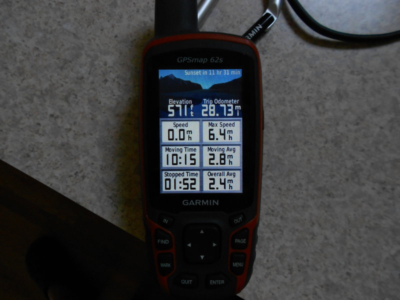
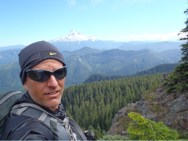
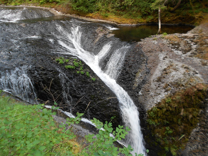
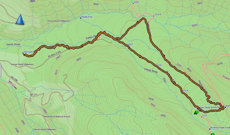
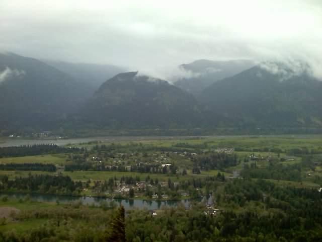
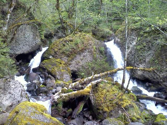
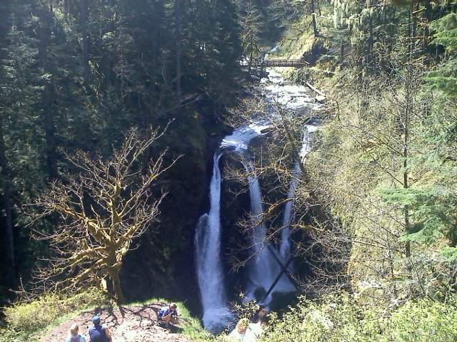
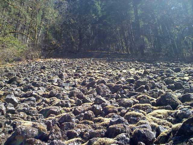
Eagle Creek to Tanner Butte Loop
26 miles of hiking • 4500' elevation gain •
Laggy and Draggy went for a day hike.
September 5, 2011


Chief Joseph recon hike
6 miles of hiking • 2500' elevation gain •
'Recliner Hike' after the Ice Lake trip to 'recon' Chief Joseph trail/MT ascent.
Somewhat of a precursor for the hike that follows this one.
I needed a quick little recliner hike to keep my knee from totally whacking out on me after the longish 19 mile Ice Lake hike. Went up to the Chief Joseph trail from the South Wallowa Sate Park TH and found their nice foot bridge out at BC Creek and 'scwacked up a bit for a little recon to find a better crossing and got another picture of some waterfalls. Finally made it across BC Creek without getting washed away and continued on the hike. Met a guy while I was crossing BC Creek that said there was another way up to Chief Joseph trail from the Lake area so intended to find that junction to head down to the lake to meet my family for amid afternoon lake swim. Got to the junction in about 1.5 miles and saw where there was a bush whackers climbers trail up the ridge that bypassed miles of easy graded Chief Joseph switchbacks. I thought I saw a T Pee on the top of some point and for some really stupid reason also thought that it was the top of Chief Joseph without really checking elevations very well on my GPS, so I decided I would go to this point on my next hike thus this hike was somewhat of a recon for the next days super crazy loony bin scramble/schwack...
August 30, 2011

 1
1
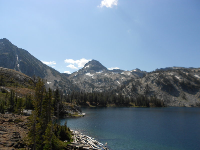
Wallowa State Park to Ice Lake
19 miles of hiking • 3500' elevation gain •
Took the family over to Wallowa State Park for some camping fun!
Did a few hikes while we were there.
Cruised up to Ice Lake and had the track from Water's climbing mate for the Matterhorn thinking I could tackle this whole thing in one shot. Hhehe. Luckily some thunder and lightning activity while I was breaking at Ice Lake changed my mind, another day for the Matterhorn and me.
GPS says 19 miles but I really think it was 20 so there. :)
August 29, 2011


 1
1
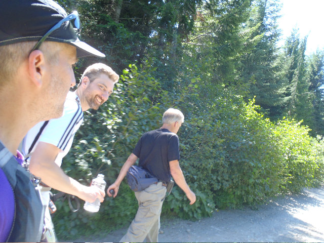
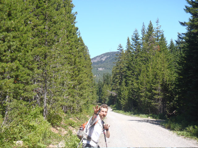
Hiking with Legends Don Nelsen and Mayhem
29 miles of hiking • 7000' elevation gain •
Started from Herman Creek TH with Don and Mayhem at about 7:00 am.
Don promptly took Mayhem and I up a short cut to go around something and get up to Gorton Creek Trail a little faster. Headed up Gorton Creek to hit Indian Point. Got some good pictures and movie of Don scrambling up there.
Cruised up Gorton past Deadwood and Ridge camps and met a nice trail runner on the way and had a funny on Mayhem when we all exchanged names, he thought Mayhem introduced himself as Maam. Nice trail runner gentleman had ear buds in so it was all good. When trail runner guy took our picture he told the lady, Maam, to get in front of the men so she would show up in the photo :D
Got around North Lake which I didn't really see, I was lagging behind already and it was only 10:30 or so. Watered up Maam and Don with my Katadyn Stream XR filter, was pretty funny I was operating it like a dunce squeezing just tiny amounts out for Don and Mayhem when I should have just let them get what they wanted, lol. Oops, hope you guys weren't too dehydrated or nothin'. :)
Got to the junction with the backside? of Defiance Trail 413, too cool. Saw a neat wooden T-Pee structure and did the photo ops as usual. Really slowing the day down you guys.
Finally got up to Defiance at around 12:30? Met the coolest dude ever up there. LUKE you rock man!! Thanks for carrying up 4 gallons of water in your backpack for your Adams training! Don and Maam really needed the water, well, so did I and should have grabbed more! Also saw a guy both Don and I knew from different scenarios, Larry from Woodcrafters. I met Larry once last year when filling in on drums with the Michael Curtis Project big band, nice seeing you again Larry, he's a trip.
Backtracked a bit and Don led us down/up old Wahtum Lake Road. Hotter than heck, dusty and rocky. Thanks Don! :D It shaved 4 minutes off the day I think, jk Don.
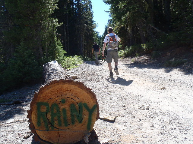
I thought we went past Rainy Lake but the Topo is showing something different. There is a picture of the Rainy sign/log though.
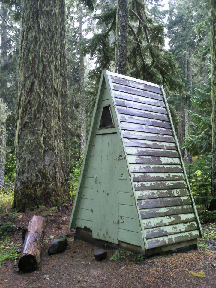
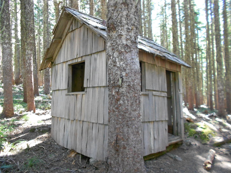
Headed up to Green Point MT on some trail? Really getting delirious at this point. But the old structure we have pictures of me in is around here somewhere. :D Thum probably knows exactly where since he was also recently on his killer backpack through here and got shots I think. It's a 3 way junction is all I remember now not sure I even marked it with my GPS...
So now we are heading up to Green Point MT. another place I have never been and the views today really rocked!
Somewhere along the way down Don took us off trail just a wee bit to check some cool rock structure, I did mark that one on the GPS but too lazy right now to provide the mark. Awesome structure, there's a picture Don took of me and Maam on top. Kind of giving Maam and pretend air man hug for Thum, and anyone else who cares :D
Don led us down Casey Creek trail. Ok, someone needs to blow that thing up and hide it. Killer 2 miles of almost killing yourself on the steepest downgrade I have ever done. Sweet stuff Don :)
At this point since I was really slagging behind on Casey Creek, Don split and it looks like he made it back to his ride around 6:15.
Mayhem stayed behind to help me get back to the cars, thanks dude!!
Ridge Camp campers wouldn't share any water and told us to keep moving or push on because there was a nice stagnant stream ahead. They said there was also a dried up stream too.
Found some water and Mayhem and I chilled for about 15 minutes at least watering up with my filter, ahhhhhh.
I took a half shower in the waterfall later on after watering up. Got nice and wet just in case I had to sleep over night in the woods, good move Eric! :D
Got back to our rides where Mayhem had a bladder of Sessions Red Top Ale on ice waiting, OMG, you really rule now dude, no more Maam for you!!!
Don kicked but arriving a hour before we did to the cars too!
Saw some other hiker name Justin while driving home on I-84. Nice seeing you Justin, I wasn't yelling anything from my car dude! Tell your GF I was just jokin' though man. :D
Too much fun hiking with the legends Don Nelsen and Mayem.
August 20, 2011


 2
2
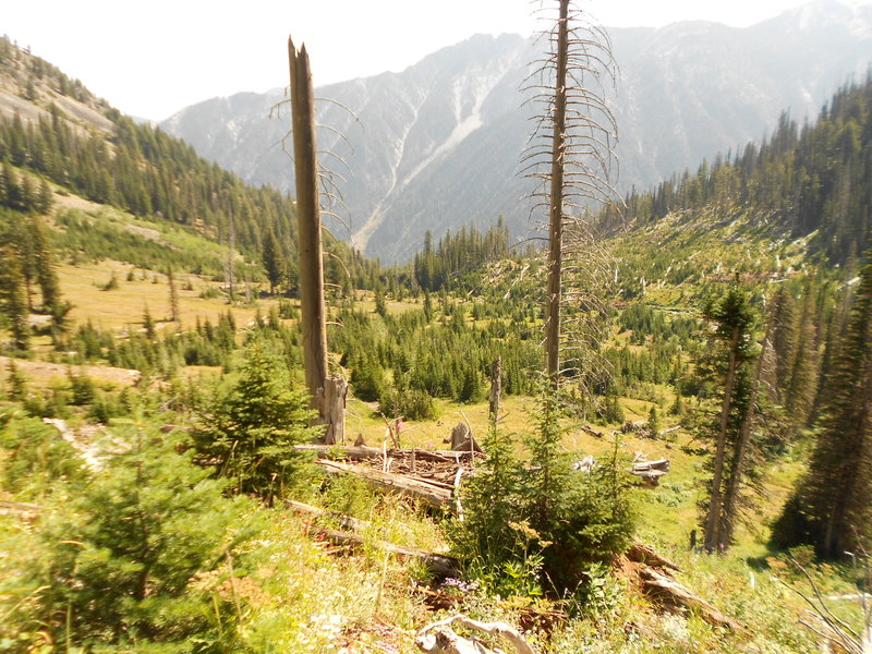
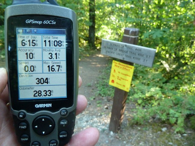
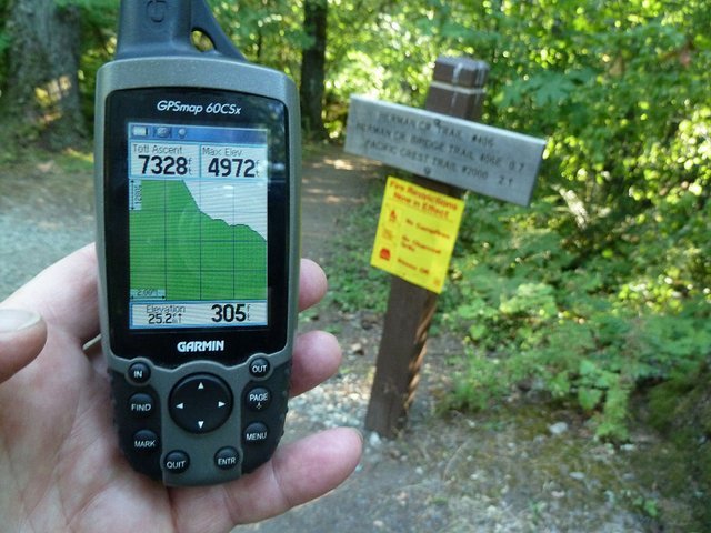
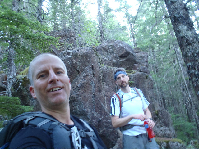
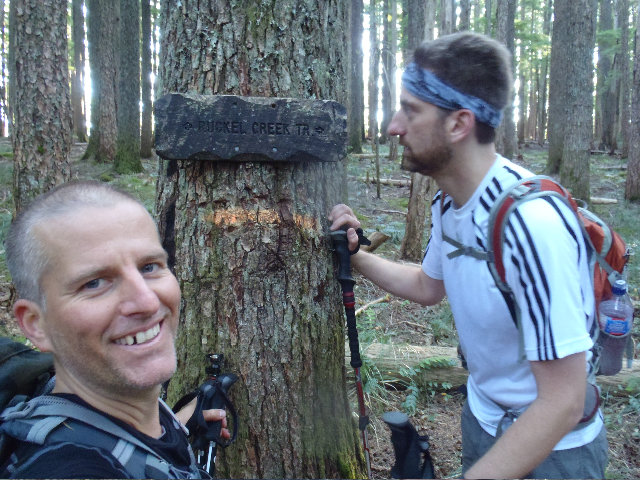
Ruckel Ridge To PCT To Chinidere To Wahtum Lake To Indian MT To Eagle Creek Canyon Loop
32 miles of hiking • 6500' elevation gain •
I was 10 minutes early arriving at 4:50 am, extra day hike bonus points for me. I think we started hiking at about 5:25 or so through the Eagle Creek Campground with headlamps waking up dogs and tent campers, although with the trains and freeway I don't know how anything could sleep there anyway.
Mayhem and I went up Ruckel Ridge in 2 hours 45 minutes, slow but still faster than a group hike :). Used the Benson Plateau which was quickly renamed Deuce Plateau, tons of human waste and TP scattered at most of the campsites we found. Cut across one of the Ruckel side trails to get to the PCT. Popped out and got a view of Adams, I made a video of Mayhem saying "there's Hood, yup". Saw some campers at Camp Smokey, they were nice.
Cruised along the PCP to Skinadear MT, all clouded in and no views but we meet a couple swell gals up there and talked about the weather while Mayham was checking local towns for current weather on his phone or something.
Sun was coming in again once we got down to Wahtum Lake area. Used the PVC again to hike around it and up a bit to hit our last peak destination, Indian MT. Saw the gals again from Chinidere when we got around Wahtum, they used the short cut that crosses the log jam where as we went the long way around using the PCT.
Hit up Indian and got some decent views in but the weather system was being pissy and kept blowing clouds in and out, but it was great up there with a superb view of Hood. Had fun figuring out how to hit Indian Springs Trail to get back to Eagle Creek Trail. I also watered up at Indian Springs for the long trek back.
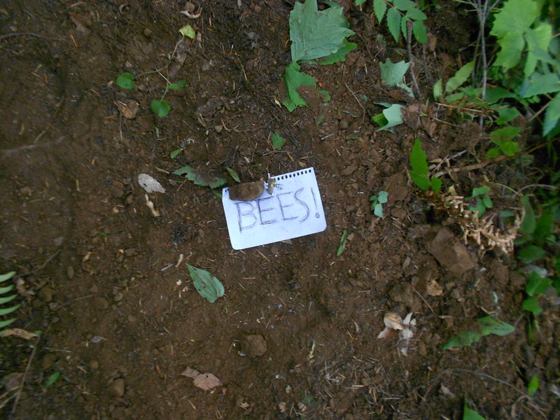
Got down to Eagle Creek Trail after the 2 mile Indian Springs cut off trail and came up on a bee warning note. I poo pooed it and got a nice yellow jacket sting but managed to get off some pictures of the nice warning notes. Mayhem was going to run through the area but I said don't worry there's no bees in here, lol. I was kind of blocking him like a big dumb ape as he was trying to get past too, glad he didn't get stung and it was just me. Was greatest part of the whole day really as I was jumping up and cussing and laughing afterwords and wondering if I was allergic to bee stings.
Pretty much straight forward from here using the nicely graded Eagle Creek Trail. I never been to Twister, Tunnel or Punch Bowl falls so it was very nice to finally see them.
Most of the photos were taken by Mayhem.
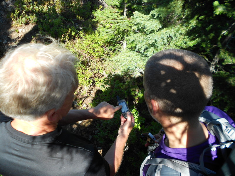
My Garmin GPSMap62s told me at the end of the day the EG was 6558'. I put the track into Garmin Basecamp and that utility told me the days gain was around 9k'. Put the track into NG Topo and it said over 8k' gain. Uploaded the track into GPSfly.org and that also said way too much gain, which one do I believe, the actual hand held GPS or one of the utilities?
August 13, 2011


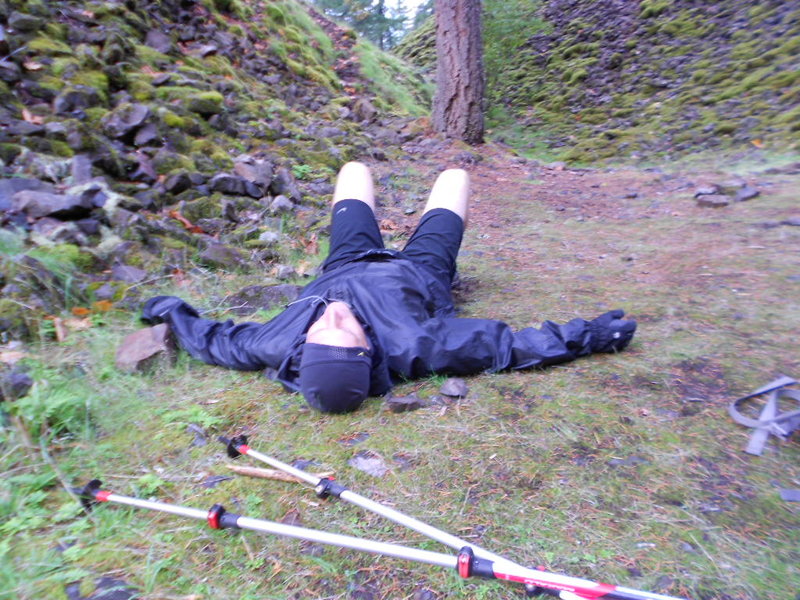
Nesmith Point Semi Hill Repeat plus some 'schwackery and explorations!
14 miles of hiking • 5250' elevation gain •
Got to the Yeon State Park TH around 9 am.
Hiked up a mile and half and realized I left my cell phone plugged into the car charger in plain site so I had to hoof it back down and get it out.
Guess I was trying to do a epic hill repeat hike! Glad it was only about 1200' of gain to redo.
Just did a normal hiker hike today and kept the gain under 10k'.
Was getting wet up there too, the dewy cloud drip broke up around the 2800' level.
Did a little bush whacking too in the general area. :)
Knee - did nothing for it, no Aleve, creme or Pain RX and seemed ok, just a tad tingey towards the very end. Iced at home
August 5, 2011


 2
2
Quad Dog with Captain Defiance, aka Mayhem and Justin Wright
24 miles of hiking • 11000' elevation gain •
Quad Dog Challenge 2011 -
Arundodonax aka Chris, double dog dared Justin to do a 4 Dog Mt hike. Mayhem must have seen them having the convo over on WH.com and wanted in and texted me Thurs. night for a invite. I said yes. :) I'm crazy.
Got up around 3:10 am to meet Justin and Mayhem at Dog MT.
Was suppose to be a 5 am meet up. I made it there about 5 after 5, Justin was already there and looked just about ready to launch but someone was a little tardy. You know who you are! Tardyhem! Was all good though, we had a lot of daylight to get a 4 dog in, so you're in the clear Mayhem :D
Justin and I were pretty much ready by 5:30 while Mayhem was still gearing up, he said "go ahead guys and I'll catch up". Justin and I busted it up past the first junction where there is a split for steep and less steep. We took steep for the first lap up. Soon after, Mayhem was right on our tails and took over the lead spot and started booking, whoa, it was on! Made it up the first lap in 1 hour and 25 minutes. Was so nice that early up there, nice and chilly and windy, stayed just a little while and started back down.
Took the less steep and longer route down to save ourselves for the next 3 laps. The less steep way adds about 4 tenths of a mile over the steeper side leg.
The story is pretty much in the pictures with the captions. Total round trip on lap 1 was 2.5 hours, the times listed are the times for my GPS, so they are my times which are slower than Justin's and Mayhem's.
First lap break time at the cars was about 20 minutes, since I was a little slower my break was just a tad shorter. My slowness on lap 1 to the cars was nominal though, just a few minutes behind.
Looks like lap 2 started at about 8:20 am. We deiced to take the less steep up for lap 2 so it added that 4 tenths of a mile on us. My GPS says getting to the top of lap 2 took us 1 hour and 30, just about the same as the first lap, again I was slower and a few minutes behind them again. Break on top was about 5 or 6 minutes but seemed longer thinking back on it now. Getting down this lap took about an hour. The break for lap 2 took about 20 minutes, according to my GPS we started for lap 3 around 11:20 or 11:25.
Lap 3, things started to slow down a bit for me, heh. We went back to using the steep route for lap 3 also. Took me 1 hour and 40 to get to the top of lap 3. I managed to turn on some weird inside turbo jets to even get up there that quick, was actually in the lead on the very last half mile until I pooped out sort of and Mayhem got a shot me sitting on that soft boulder stuff with all the nice pretty flowers around me. I had the idea of picking bouquets out for us but it was just an idea, didn't want anyone to get the wrong idea. :D Break time for the top of lap 3 was about 7 or 8 minutes? These breaks seem really short dudes!?! Weren't they longer? Took the least steep way down again for the last time to use it on the downgrade. Got back down for the final break before lap 4 in about 1 hour and 35 minutes. Having those bathrooms right there near the TH is awesome too!
At this point, during break # 3 down at the cars, Justin had to leave. So it was up to Mayhem and I to finish the Chris Quad Dog challenge!
Thanks again guys for sharing your great food and beverages, I only packed gross stuff like Powermax bars and Powerade. I had about 3 liters of water but way to much Powerade and it was making me kind of queasy during the downgrade of lap 3. Mayhem's Orange and dill pickle saved the day for me! I will pack a much better and diverse cooler for the next crazy hike! Justin had a killer assortment of goodies too and I got some nice cool carrot's from him! :)
Break # 3 lasted about 15 minutes, said goodbye to Justin and then we were off!
Took the less steep way to make the whole day more even, using 2 steeps and 2 less steeps. Ok, I was SUPER slow at this point and not sure how I made it except for Mayhem's constant yappin' and great sense of humour, again he saved my day and kicked my sorry but up the hill. I even mixed in a fun little 'schwack for him which he caught on video. Boy, just running up 50' or so into the ferns pooped me out though :) Something else that really lifted our spirits was when we would run into other normal hikers along the way who noticed us doing the hike again and again. People were so friendly and amazed, all the cool positive waves really boosted us up for the 4th lap. Time up for the final lap was about 2 hours and 10 minutes for me, again, Mayhem was already up at there for several minutes before I got to the top. Some nice folks took our pictures and we breaked for 2 minutes or less and headed back down. For the final descent Mayhem wanted to avoid the less steep longer way to save time so we used the steeper side. I wasn't moving too good, just trying to make it down but did hike faster when I could, almost jogging at times. It was super killer going down the steep and I was fading fast by the time we made it to the open rocky switch backs, barely walking really. Time down for the final crazy lap was about 1 hour and 25 minutes, it seemed like 2 hours but after going up Dog MT. 4x in one day hike everything seemed out of whack to say the least.
Started moving at about 5:30 am and stopped my GPS at 6:15.
Fun day guys, let the good times roll and hope to do something crazy again with y'all! :D
I'll get the videos up as well sometime this evening...
Knee - preemptive analgesic cream at 3:30 am, took 1 Aleve after lap 1 and another about half way, took 1 Pain RX, iced after lap 3, No problems during hike and felt totally perfect the next day
July 30, 2011


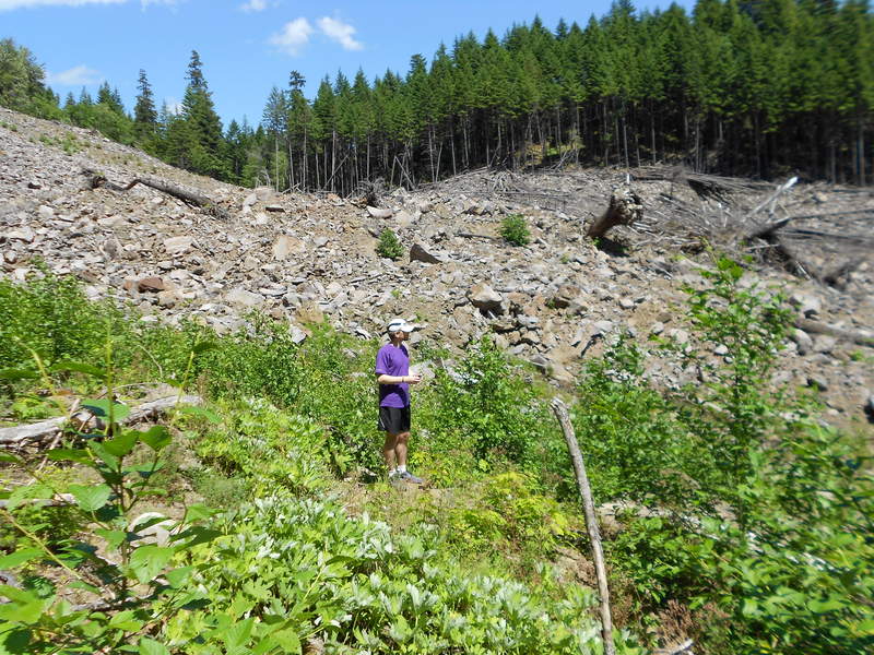
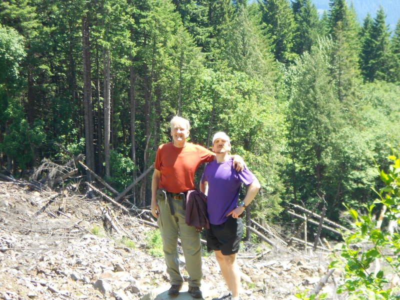
Elk/Kings traverse loop with Mayhem, Crusak and Roy
10.5 miles of hiking • 4000' elevation gain •
Snuck up on Mayhem and Crusak since I was a tad late. Mayhem's dog caught me though!
I parked at about the half way point along the Wilson River HWY, had to 'schwack a bit through some stickery stuff to finally meet up with those guys. Roy was meeting us at the junction that shoots up to Elk but he left a note saying 'Roy up Elk', so we met Roy on top of Elk and finished the traverse loop as a group.
Knee - was great, no ace and no brace, took 2 Aleve's and 2 Pain RX during the first 4 hours of the 8 hour outing iced knee afterwards, helped a lot!
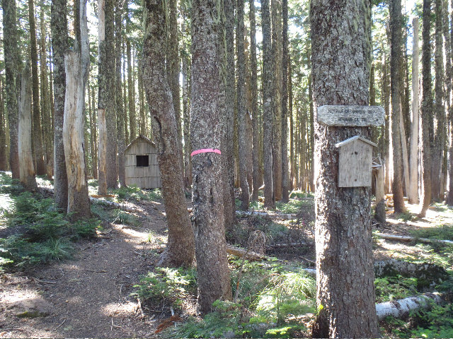
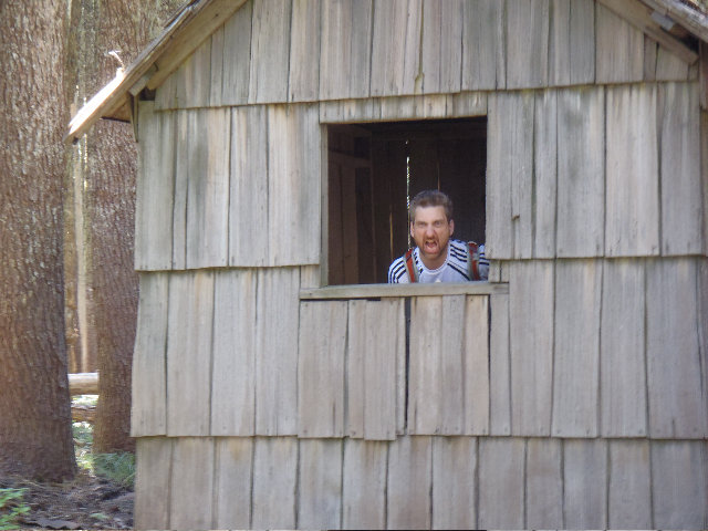
July 23, 2011


 1
1
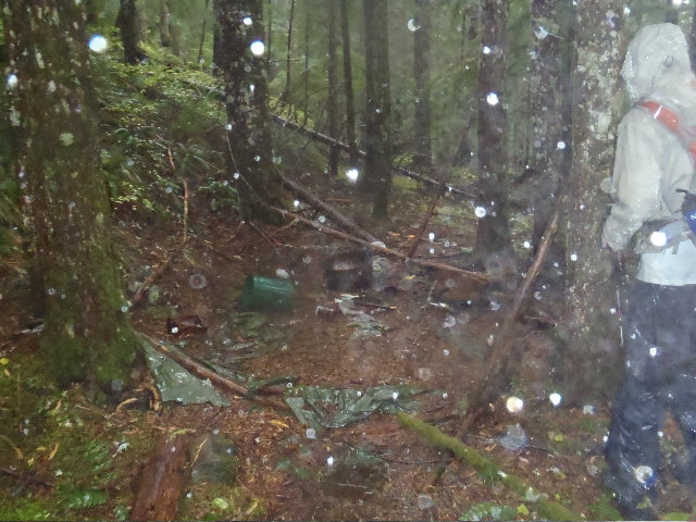
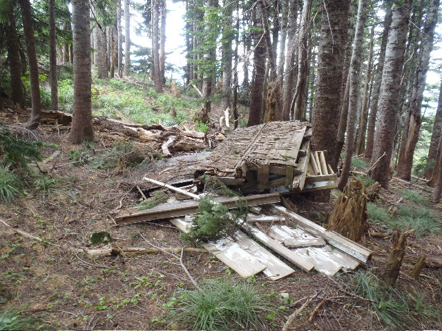
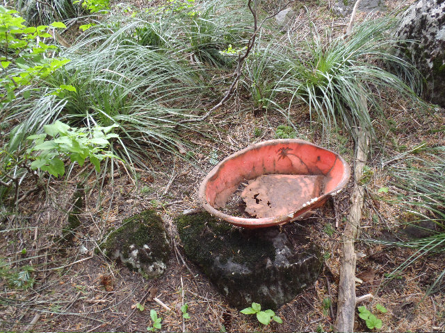
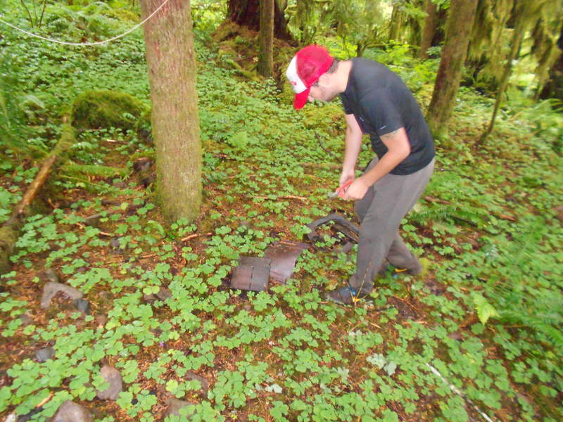
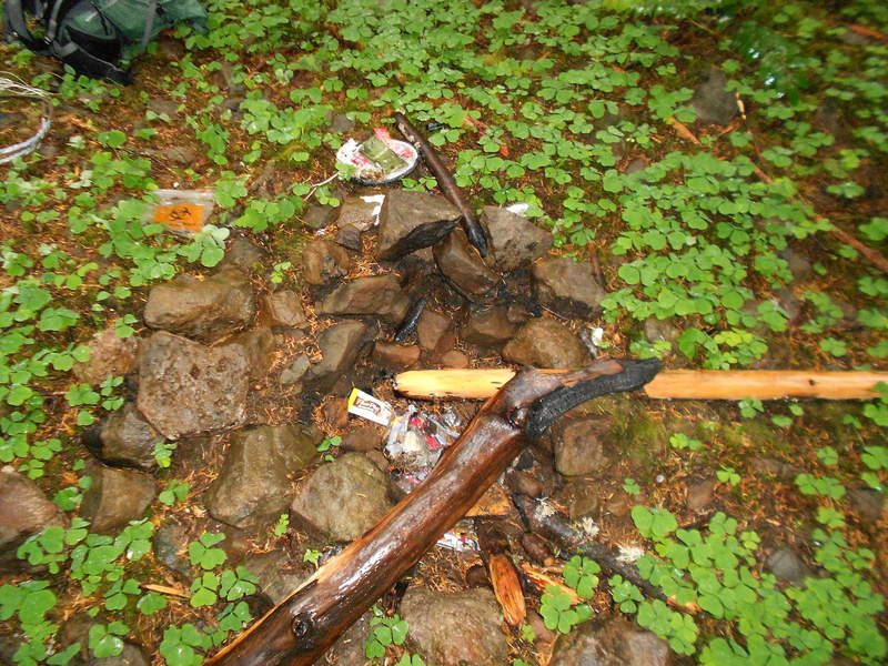
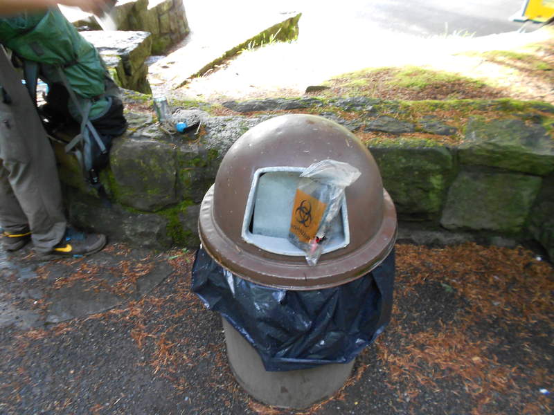
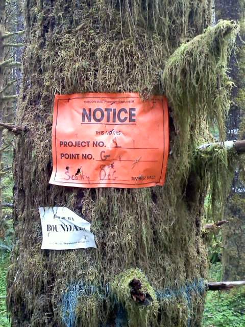
Cabin/Shelters + off trail ascent to meet ROA + Horsetail Creek to Oneonta *ford area* EAST SIDE bushwack to avoid Fording Oneonta Creek + Clean up junk camp site
14.5 miles of hiking • 3500' elevation gain •
Eric aka er0ck and I did a big off trail hike today.
Found both 3 walled slant to RJ cabins. Off trailed it a lot to get a connection to ROA.
Went up a bit to almost Yeon MT. area looking for the Mystery Trail, never saw it. Turned around and went towards the Horsetail Creek/Oneonta Creek ford area.
Broke out my machete and Eric used his mini trimmers and went to work on carving out a primitive EAST side 'schwack to avoid the cold Oneonta Creek ford.
Saw the 2nd bridge pretty fast but it took over an hour of hacking to go about .12 miles through tons of devils club and berry bushes not to mention all the blow down and huge logs.
Final part in todays mission was to find a junk camp I saw on a May 1st hike. Eric got to cleaning it up and dismantling right away and we packed out all the garbage except for some super old cast iron stove parts.
Awesome trip today Eric! :)
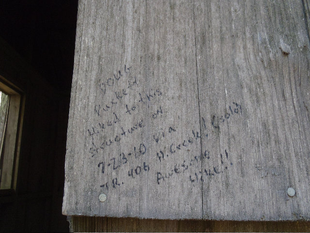
Special thanks to anonymous whose help was excellent in getting to these cabins. Don, was the lantern it? GPX and .tpo will be sent automatically to several guys, still reeling from and assessing today's adventure...
Knee - used ace bandage and hinged knee brace and knee was pretty good. Took 2 Aleve and 4 Pain RX during the course of the day as well.
July 17, 2011

 1
1
Hiking in Cpt. Defiance's Back Yard - Kings MT.
5 miles of hiking • 2500' elevation gain •
Even saw Captain Defiance, aka Mayhem, on my way up for a super quick little knee testing hike I was conducting.
Nice chatting with you sir!
Also met 2 nice gals both on the way up and way down, but on the way down they were taking a short break so I told them the legend about Captain Defiance and to check both PDX Hikers and WH for further details. Love meeting other nice trail friends when out and about! :)
Jogged down to get a little more cardio, total trip time was 1 hour and 45 minutes. Sure is nice NOT to do Defiance for a fourth time in 6 weeks or whatever..
Knee - Had hinged knee brace and jogged down, knee started bugging me after I got home and continued to bug me Monday, might have to take 1 weekend off from hiking to let it heal up...
July 10, 2011
 3
3
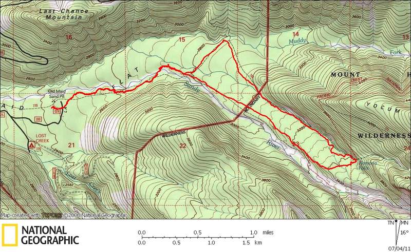
Ramona Falls w/ the kids
7.5 miles of hiking • 1000' elevation gain •
Couldn't stay indoors today, no way!
Took the 8 year old twins on a easy hike to Ramona Falls. Yah! Man, they are finally getting good on some harder hikes! :)
Was new to all of us, can't believe I've never been here before, well I can, but you know what I mean.
I think this was the hike that my wife and I tried with our oldest daughter back in '98 or '99, we were really out of shape back then and I had my young daughter strapped onto me with one of those carry things. We only made it about 1 mile, heh. Always bugged me that I couldn't remember what hike that was for all these years but once I saw the parking lot it all came back to me, had to be this. Where else would hiking n00bs go anyway?
Took tons of pictures of the kids and some video too, finally got a decent camera, but it's not a DSLR or anything...
July 4, 2011

Mt. Defiance via Starvation Ridge again
11 miles of hiking • 5000' elevation gain •
Almost made it in time to join Mayhem, CascadeHiker and Justin for at least a single Defiance attempt for me while they were going for the DDD, triple D. I wanted to do double Defiance at least but my knee just wasn't up for it. Those 3 guys were already gone walking along the freeway part of the 'trail' that gets you to Defiance as I was pulling in, flashed my brights but I took another 15 minutes or so before my boots were on and all set, so they were too far ahead. Good thing really, as I was really slowing down by the time I got up to Defiance to eat something. Did get to meet them and say hello around the 4k' level past Warren Lake. Turns out I went Starvation Ridge first as I think it might be the harder of the 2 so I wanted to knock it off first and they and they went Defiance way. This was the earliest hike for me, woke up around 2:30, left the house about 3:15 and was on the trail around 4:30...
Edit, they also went Starvation Ridge way, but were too far ahead of me.
Knee - had ACE wrap with knee sleeve but I was done for at any rate, bit tingy towards the end and the wrap was cutting into my tendons something fierce as well...
July 2, 2011
 3
3
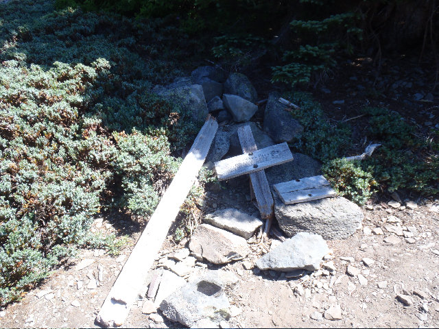
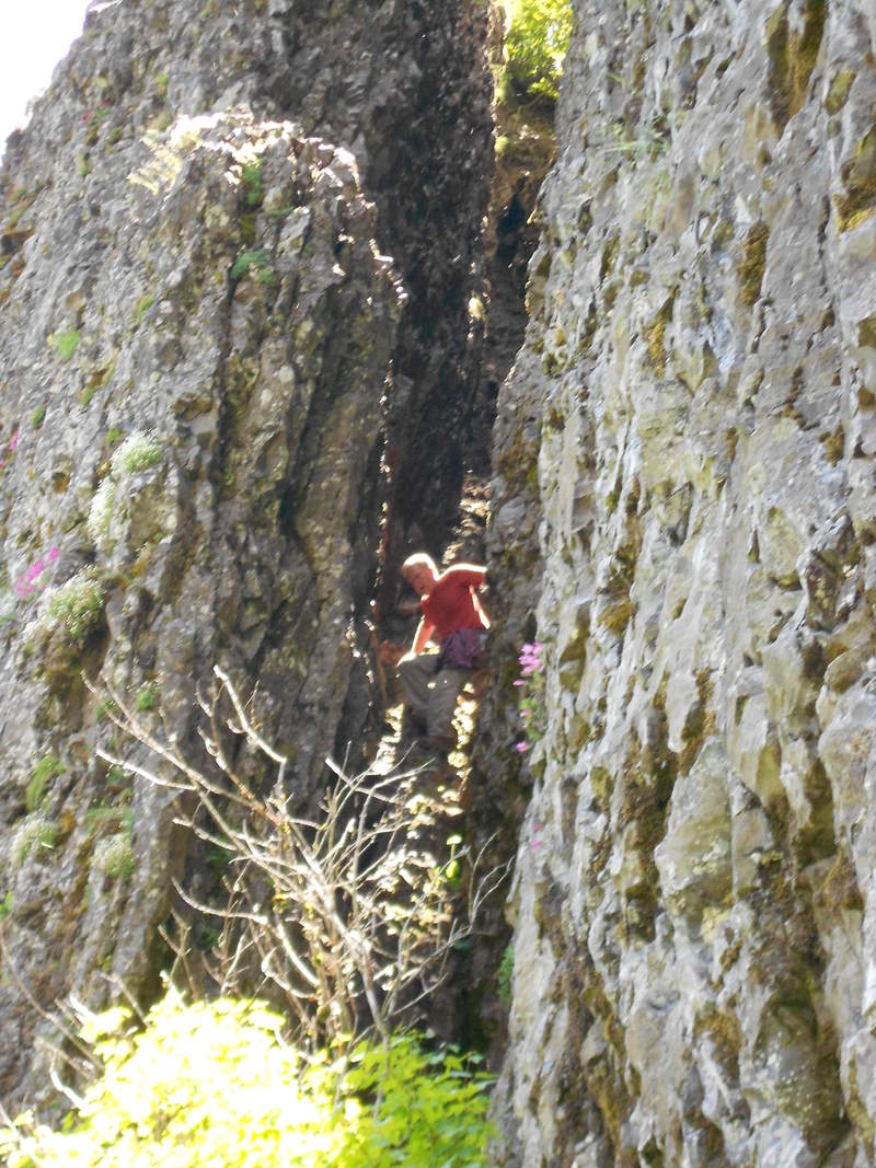
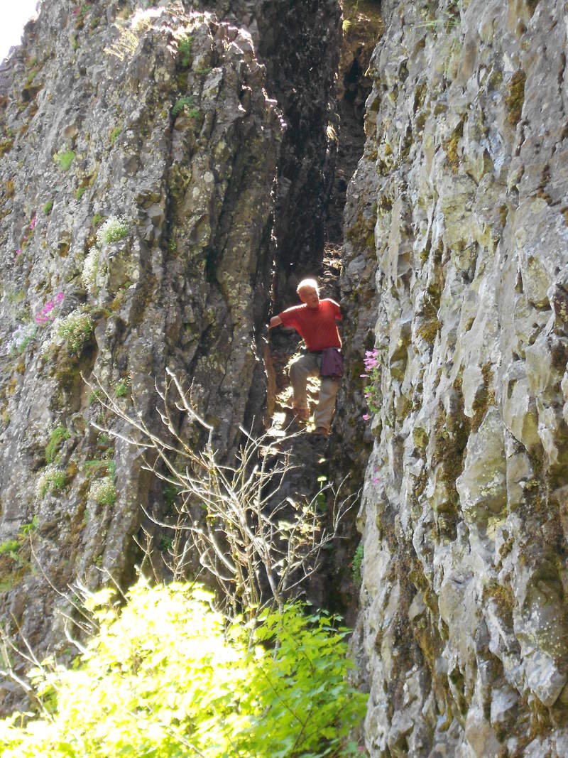
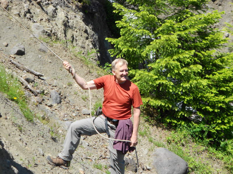
Base of Table Mountain Cliffs w/ Don Nelsen and his son Paul...
10 miles of hiking • 2750' elevation gain •
Exciting day spent with Don Nelsen and his son Paul exploring the cliffs of Table MT. Don also took us over to the Greenleaf slide, wow! Also Went up Greenleaf falls to his rope and got the GPS mark for it now, cool stuff. Don and Paul were a ton of fun! :)
Met at the Aldrich Butte TH at 9, also was supposed to meet up with Pablo but that didn't connect for some reason.
Hiked up Aldrich Butte access road until the Carpenter Lake split which turns into Two Chiefs some mile or so to where it intersects the PCT.
PCT work crew was out in force doing some nice trail maintenance, thanks Tim and Bus Driver John! :)
Cruised up a ways on Two Chiefs and Don showed us a neat short cut and he trimmed some tree branches off too, tons of poison oak which got me but I'm still showing no signs of anything and it's been at least 8 hours ago.
From Two Chiefs Don took us up one of the scree/talus slopes to get up into the North Western most area of the Table Cliffs. I should mention the main reason for this trip in the first place was to possibly locate the Kate Heuther memorial that may have been tossed over, but we did not find it so it's looking like either DNR removed it or someone else removed it entirely. Don took us up to a point right under where she fell off from above and he scrambled up to recon while Paul and I waited below on some steep edges. Paul shot some video and I tried to take some pictures of Don coming down. He got all the way up the chimney but he said it was dicey so he came back down, didn't want to separate him from us. Worst case scenario would be he would have had to hike down the rest of Heartbreak Ridge trail and Paul and I would have to hike back down the way we came and meet back at our cars. Don says he might put a rope at this chimney area from the top at some point so we can go back and get up this easier in the future, sounds good!! :))
Hiked over to his Greenleaf creek/falls rope just so I could see it and checked out the Greenlead slide that Jen discovered back in '08.
Super fun trip guys, and nice meeting you two! :)
Wanted to add that DN really, really knows his stuff! Was like outdoor school hiking, filled me up with way so much information that I probably half forgot already, super smart and informative. But most of you probably already knew this, just sayn'.
Another weird tid bit is towards the end of the hike we were all talking about Broadway musicals, and it turns out that Paul Nelsen and I played in the same orchestra pit back in '93 for a Grant High School production of The Music Man but I had to check my Pa's program to make sure, as we both didn't really totally remember each other from the thing, was nearly 20 years ago after all. Totally weird!
Knee- tried a new idea for my knee, wrapped ACE bandage with a knee sleeve over it and really had no problems, but this was a easy hike, well under 3000k' gain
June 25, 2011


 2
2
Fathers Day Misty Larch MT. + a wee bit of a 'schwack + 1 illegal trail
16 miles of hiking • 4250' elevation gain •
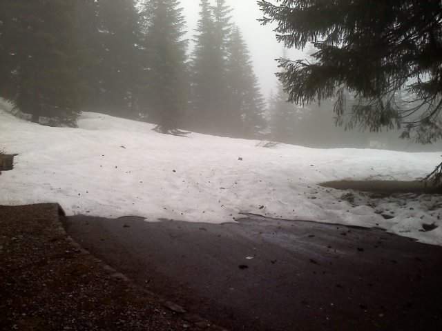
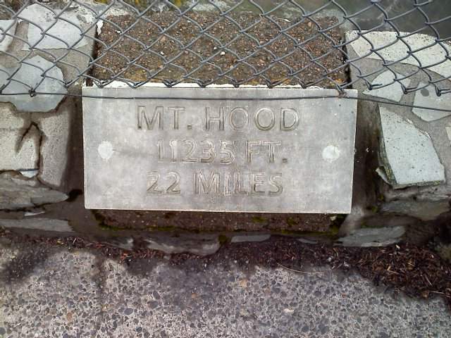
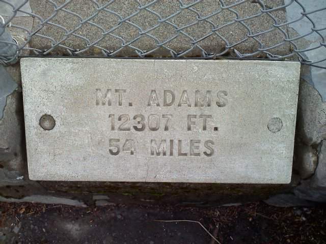
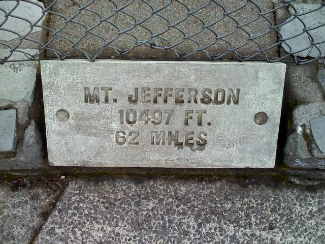
Started down at Wahkeena around 11 am. Made good time up to a point under Devils Rest to cut across some old logging roads to get up to Larch Mountain road. Ran into one of my daughters class mates on the remote logging road, they were doing a 3 sons and a dad Fathers Day hike of some sort. Figured out later that they parked at the yet closed Larch Mountain gate and were hiking the wrong way if they wanted to get to Larch. Ended up 'schwacking up about 3/10ths of a mile up what used to be a viable logging road to hit Larch Mountain road. Cruised up the desolate LM rd., just saw 1 couple coming down telling me there was snow on top of Larch. Again cut across a trail access road off of LM rd. and hit the regular old LM Trail, 441. Not long after, maybe less than a mile and half I was on top of Sherrard PT. taking in the lovely views of all the mountains! See side bar pictures of the mountains I saw. Um, ok... they were the embedded plaques of 5 mountains! Totally misty for most of this hike and tons of fog drip but no rain, got totally wet bush wacking up the first abandoned logging road. BTW, that abandoned logging road looked to have some of Don Nelsons artifacts on it, well, just some old tires and car tail pipes and other assorted crap. Wasn't too hard to stay on track following all the junk but I had my GPS too. Went all the way down 441, Larch MT. trail to the old Perdition trail, did I mention I had my awesome dog with me? Wow, I can understand now why this trail is closed. Greatest 1 mile 'schwack I have ever done and even got to lift my 75 # dog up a big boulder at the end of those fallen down cement stairs. Also saw at least 1 of the old classic view points as described on PDX Hikers, hit it by accident but marked it on my GPS.
Mostly avoided the dumb Multnomah 'flip floppers' by taking the illegal trail, and it mostly has tread so I know there's more than just a few people using this thing. All it needs is a good machete and most stout hikers can just deal with the huge blow down and those Planet of the Apes looking cement stairs. Did I mention the hike was mostly a fog dripped misty kinda day. The weather liars said partly cloudy and 68 today!
Forgot to add that there is barely any snow up on top of Larch area, just a few feet in the parking lot and some 3' of drifts on the paved section that goes up to Sherrard PT. I think they can open the gate and just plow the snow away, but they probably don't have a plow around? The bathrooms up there are unlocked so someone has been up there with a truck or something, seems silly that the gate is still closed...
Knee - knee was pretty much ok, not to much problems and I think I had knee brace on the entire trip, tinged a bit on the scree field going down Larch MT Trail...
June 19, 2011


 2
2
Mt Hamilton then over to Mt Defiance
18.5 miles of hiking • 7250' elevation gain •
Started with a warm up on Hamilton on the WA side. No sweat, quickie hike while it's still free.
Cruised over to Defiance to hike that trail, did Starvation 2 weeks and I still think Defiance is steeper going up. But I was not fresh as I just did Hamilton.
My biggest 1 day gain ever, S Sister was close, but today topped it I think...
Knee - started Hamilton with hinged knee brace on knowing I was going to tack on something else on the Oregon side of the gorge. Defiance on the way up was slow going. also think Pablo was running down as I was going up. Hobbled down Starvation, so knee was really wigging at this point.
June 10, 2011

 2
2
Wauna Viewpoint up to Wauna Point
6.5 miles of hiking • 2250' elevation gain •
Pablo from PDX HIkers turned me onto this one. I also had been wondering about a way to get from Wauna Viewpoint to Wauna Point. Well there is a way, a very steep, slow and brushy way. Took me about 2 hours to gain about 1000', but the views were great the entire time! Had the audacity to show up at Eagle Creek at around 3 pm, but did find a spot to park. Made it back to the car just after sunset...
June 3, 2011


 3
3
Mt Defiance via Starvation Creek trail
11.5 miles of hiking • 5000' elevation gain •
Messed up and went the easier way via Starvation Creek trail up to the Mt. Defiance microwave installation. I went down Mt. Defiance trail thinking it was the easier on the knees route, guess I better read my trail descriptions first before leaving the house again. Fun hike in deep snow after the 4k' level and put snow shoes on soon thereafter, no views though, thought today was suppose to be the best day of the 3 day weekend! HAHAHAH, pfff . . . .
Barely took any pictures, but had fun with my GPS cross cutting trails in the snow and got a decent workout with the snow shoes strapped on for most of the hiking.
Knee pretty much ok, put knee brace on towards the end of this hike, this could be where my knee started wigging out on a regular basis as I wasn't using my hinged knee brace on any other hikes in 2011 up to this point.
May 28, 2011

 1
1
NW Route Table MT, Aldrich Butte and Cave Falls, close to Greenleaf
18 miles of hiking • 5000' elevation gain •
Over 5000' and almost 18 mile hike around Table Mountain area.
Not sure I made it to Greenleaf Falls, there was sign for Cave Falls where I turned around and thought that was the alternate name for Greenleaf, but it looks like there is a trail on the other side of the raging falls/stream, no way I was going to cross that after doing everything else today.
Yup, didn't get to Greenleaf falls but Cave Falls is also on Greenleaf Creek I think...
Didn't take any pictures from the top of Table since it was socked in, drizzly and windy and cold and... bailed off of Table as fast as I could and went down the old Mazama Winter route which is partly closed. Don't worry DNR guys, I didn't step on anything pretty on the way down. Met a Mazama named Jack, he's the one who said I went down the winter route. Barely saw anyone, super sparse from hikers today.
Did see some loud motorcycle dudes, about 6 of them going up to Greenleaf Falls area. Had their work cut out for them, they had to stop and lift their bikes over some downed trees :))
Edit is for my knee - knee ok and started to tinge towards the very end of this hike.
May 21, 2011


 3
3
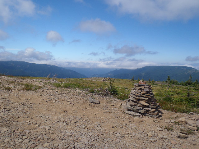
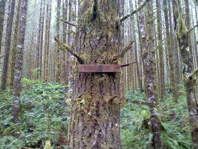
West Ridge Kings Mt and completed Kings Jr Loop finally as well on the way up....
6 miles of hiking • 3000' elevation gain •
Did West Ridge of Kings MT. Scramble harder than any of the areas other off trail scrambles, but has the most views. Also tracked Kings JR, but still was off a bit, but have a really good idea now of how to do Kings JR loop correctly. Will make a more in depth trip report on PDX Hikers, but added captions to all the pictures that I uploaded here. :)
May 19, 2011


 1
1
New GPS test hike to Pittock Mansion via Wildwood from Vista Ave.
5.5 miles of hiking • 1000' elevation gain •
Testing my new Garmin GPSmap 62s. Worked great and was able to load FREE custom NW Topos and NW Trails maps. Started on Vista Ave. and hiked up to Japanese Gardens to catch Wildwood and up to Pittock Mansion.
5.7 miles with just over 1000 ft gain, nice to finally have more solid stats! Can't wait to get out onto some trails this weekend :)
May 17, 2011

 2
2
Kings Mountain via part of Old Kings JR, back down part of traverse and back to Old Kings
8 miles of hiking • 3000' elevation gain •
Well, I have a pretty good idea of where the Kings JR trail goes through all the blow down to hit the Wilson River Trail intersection, had to check this out again today and will probably make one more trip to follow the correct path this time. Tried it twice today and the first time I dumped out further away then the return trip try but took some pictures of areas and tricky intersections of old ATV/lumber roads and see where I should have gone this time. Also went down about 1/4 mile down the back side of Kings/Elk traverse to check snow levels, I see where the traverse could still be tricky without some more snow melt. About 3000' today but less mileage than last week at around 8...
May 14, 2011


Weekday Workout #4 Pittock Mansion HIKE
5.5 miles of hiking • 1000' elevation gain •
Started at the Japanese Garden and hiked up through the Hoyt Arboretum down to Burnside using the Wildwood trail that runs through Forest Park. Crossing Burnside after work at rush hour was a thrill all in itself! Hiked up to Pittock and down the back to Cornell and made a small balloon out of this by coming back up Upper MaCleay trail that meets Wildwood and back to the Japanese Gardens where I parked. About 5.5 miles round trip and 1000', I know I made at least 4 trips of 250' UP on this urban hike...
May 10, 2011


Wilson River trail to Lester Creek back to Kings JR up to Kings MT back down Little Kings
8 miles of hiking • 3000' elevation gain •
Started at Kings Mountain trail head, went west on the Wilson River trail to check out Lester Creek and look for those C and CASS blue markers Mayhem mentioned on PDX Hikers. Went back to get up Kings JR that intersects with Kings MT trail at the 2200' level, cruised up to Kings and met a nice young couple warning me not to make the Kings to Elk traverse. Had no intentions of doing that traverse right now without my snow shoes. Met some other folks on top of Kings who also mentioned the young couple. Diverted off Kings proper again on the way down to check out Little Kings that really just follows a old ATV route and is ribboned with all sorts of pink and pink/black tape and timber sale boundary markers.
May 8, 2011


May Day May Day Perfect Day for Bell Creek Way
11 miles of hiking • 3500' elevation gain •
Started at the Oneonta TH parking area headed up to Triple Falls to cross the bridge.
Then about 3/10ths of a mile headed up the rock debris field to hit Horsetail Creek Trail.
Hit that trail to get to the Bell Creek Way trail to make a balloon loop back over to Oneonta trail to get back to the car.
A lot of up and down on this, probably even more than the 3500' I logged.
Took me 7.5 hours to this since I was off trail for about 2 miles or more to get up to Horsetail Creek trail. Also the snow, man the snow!, was piled up on Bell Creek Way and almost all the way to where Oneonta meets Franklin Ridge intersection. Post holed a few times and got off Bell Creek Way at least once and had to regroup. Snow is still about 3' deep at 3000' and above if anyone wants to know, but it seems to be melting fast and all the creeks were raging!!
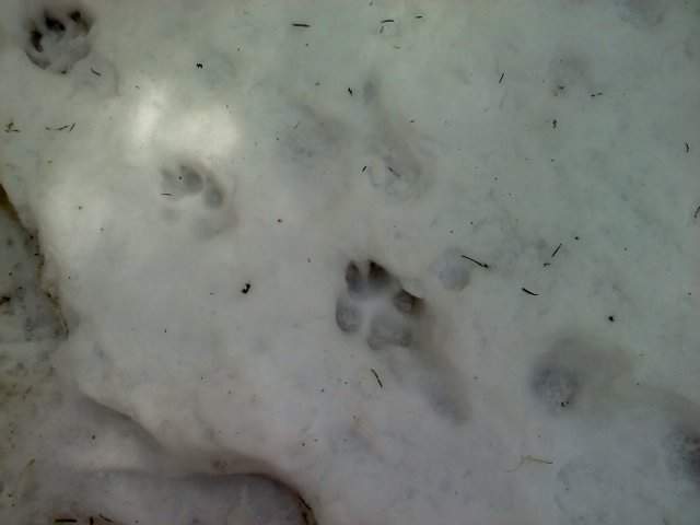
Saw some cat prints I think, someone let me know if those are cat prints, but it made me try to be faster. They were on the boot path during all of the snow and saw a piece of deer leg later on during the descent of Oneonta Trail.
I guess this wasn't as epic as I thought it would be. Might make the trip report more epic on PDX Hikers...
[url]http://www.portlandhikers.org/forum/viewtopic.php?f=8&t=7704[/url]
May 1, 2011


Mixing pleasure with pleasure Tillamook Head
9 miles of hiking • 1250' elevation gain •
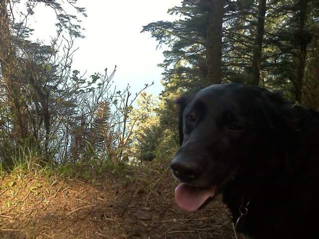
Family dropped me off right before the fee station at Ecola State park and I tromped with my dog over to Seaside Shilo Inn, 9 miles but not terrible elevation. Family had good time playing around in Seaside and I met them for dinner at Doogers, yum. Awesome clear weather and the trail was pretty empty once I got past Indian Point areas. My dog Buddy and I had a fun hike!
April 22, 2011


Nesmith Point Finally
10 miles of hiking • 3750' elevation gain •
Finally made it to the top of Nesmith Point. Still needed snow shoes starting after the second saddle at 2800', but the snow is finally receeding. Micro spikes would have been ok as well. Saw 9 other people on the way down and chatted with a few. I think one of the couples I talked to are also on Went Hiking since he mentioned he tried NP on this past Wednesday...
April 16, 2011

Forest Park Jog/Hike #3
5 miles of hiking • 500' elevation gain •
Using the site to also document my after work Forest Park hike conditioning jogs.
April 13, 2011

Forest Park Jog/Hike
5 miles of hiking • 500' elevation gain •
Using the site to also document my after work Forest Park hike conditioning jogs, sorry. :)
April 11, 2011

Forest Park
5 miles of hiking • 750' elevation gain •
Hike/Run through parts of Forest Park, up and down a few times totaling at least 750', missed the last 2 weekends for hiking, trying to make up with some Forest Park hikes/runs after work this week...
April 10, 2011

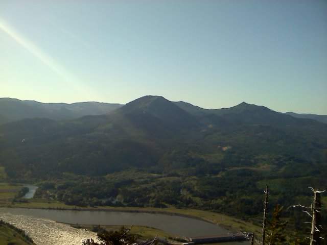
Herman Creek to Gorton Creek to Ridge Cut off to Nick Eaton semi loop
8.5 miles of hiking • 2750' elevation gain •
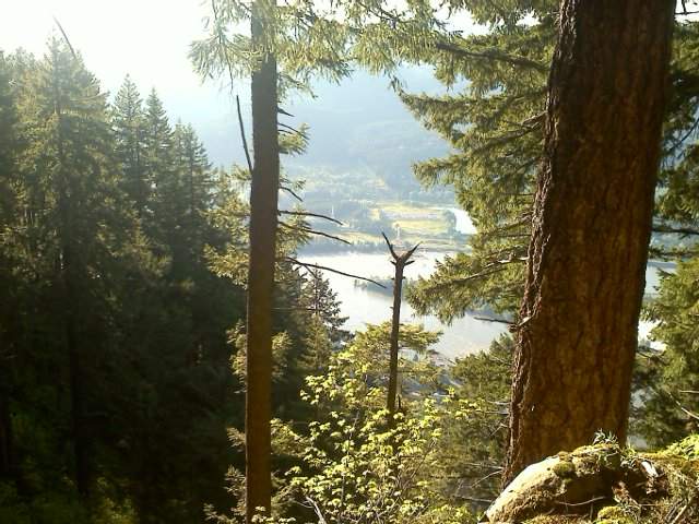
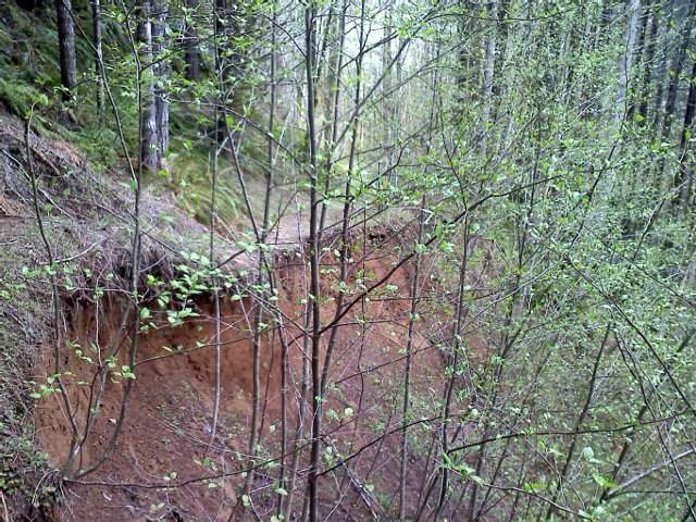
Nice little warm up semi loop starting at the gated Herman Creek work center taking Herman Creek, 406, up to Gorton Creek trail. Hiked up about 2.5 miles to the Ridge Cut off trail to connect over to Nick Eaton trail to head back down to 406 and the gated TH. Lots of snow starting at 2500'. The actual elevation gain for this hike is about 2900 but logged 2750 as there is still no option for inputting actuals yet. The picture are from my crappy droid cell camera in the Ridge Cut off area...
March 26, 2011

Kings Mt.
5.5 miles of hiking • 2500' elevation gain •
Nice conditioning hike with my Dog, some 20'' of snow after the picnic table up to the sign in notebook...
March 19, 2011

Nesmith Point, second try 2011
9.5 miles of hiking • 3500' elevation gain •
Second attempt in 2011, almost got to Nesmith Point Road from looking at my phones GPS tracks but it felt like I was already way down Horsetail Creek Trail so I turned arounda dn headed back. Up to 4' of snow, with fresh snow falling as I tromped around, nice good snow shoe today!
March 11, 2011

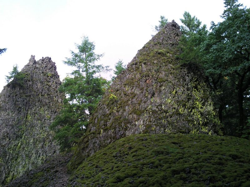
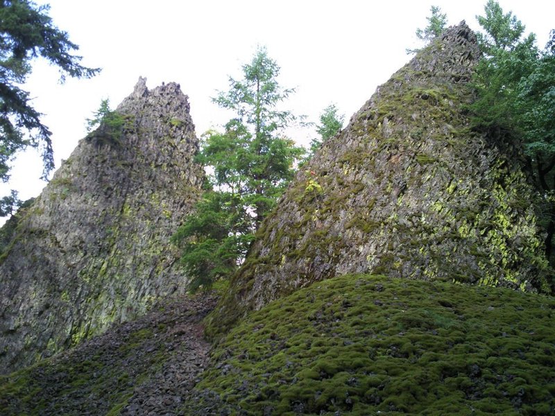
Nesmith Point & Upper McCord Creek Falls
7 miles of hiking • 2500' elevation gain •
3' of snow starting about where I turned around today at the 2800' level.
For some reason I decided not to at least attach my snow shoes to my day pack, I think it was because I read something about Civrot in his 5 fingers and didn't realize his report was almost a week old, so last weeks winter blast really piled it up on the Nesmith Point trail! Learned my lesson today, attach snow shoes to day pack. Met a few other guys that were heading up when I was going down and one guy said he thought I made it to the 3k' level at the really open area,maybe the saddle, haven't done Nesmith Point yet, but looking at MyTopo I think the super deep snow starts around 2600'. Also saw a couple of ladies and they had their snow shoes strapped on their packs!
Anyway there is still a nice snow depth going up that way in case anyone wanted to know... :)
EDIT - Oops, Civrots report was from Jan 29, over a month ago, silly me for not bringing snow shoes today knowing how much snow we have had these last few weeks...
March 5, 2011


February 11, 2011