

2020 Trips

 1
1
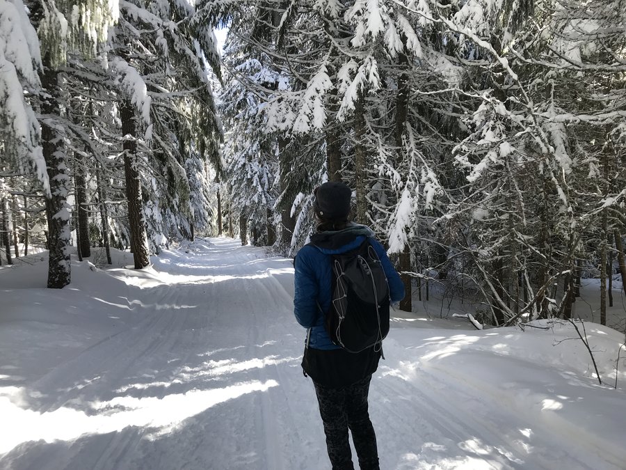
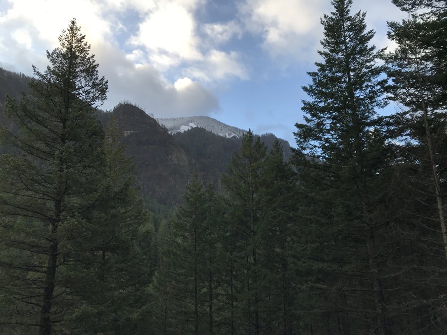
Larch Mountain via snow gate
8.6 miles of hiking • 1500' elevation gain •
We had a great day up on Larch. The road was a bit icy the last mile. We parked at the snow gate and went up the road to the connector trail that hooks up with the Multnomah Creek trail to the top. Quiet, not much snow, just enough to be pretty. We also ran into Nat who used to post here. Always fun to put a face with the name. Nice and warm and sunny on top. Great day.

December 24, 2020
 1
1
Multnomah basin
9.6 miles of hiking • 2000' elevation gain •
I did my annual hike up to the Multnomah Basin via Wahkeena this year. Hardly anyone the whole day except at the very end, coming back down. Great day.
December 17, 2020
 1
1
Salmon River trail
9 miles of hiking • 1500' elevation gain •
Great day doing a stroll along the Salmon. A bit crowded late in the day, but fortunately there are good places to step off the trail.
November 26, 2020
 1
1
Fall Creek Falls Washington
7 miles of hiking • 1000' elevation gain •
The road in has apparently become much worse lately. Like everyone else I was surprised at how much larger and more magnificent the falls were in person. Pictures always made it seem like a regular sized waterfall. We are so spoiled here. We headed up to the top, had a nice view of the falls from above and saw some larches that were at the perfect phase of gold. great day.
November 25, 2020
 1
1
Dry Creek Falls Stroll
5.6 miles of hiking • 750' elevation gain •
Took a short Halloween costume hike with friends. We went early to avoid crowds and came back down the old road along the creek into Cascade Locks. We only saw two groups on that section and they were both lost. The fall colors were pretty nice for this area and it was beautiful.
October 30, 2020
 3
3
Newton Clark Ridgeline above the TT
9 miles of hiking • 2250' elevation gain •
Revisited a short offtrail I had previously done. I took the Newton Creek trail up to Timberline and then went up the ridge crest between Newton and Clark Creeks. Fabulous views and lots of waterfalls in the canyons below. Wonderful day!!
October 29, 2020


 1
1
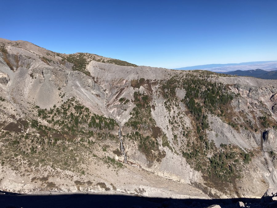
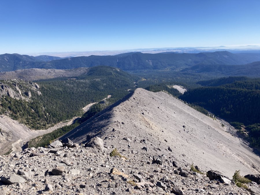
JRO to the Dome
12.3 miles of hiking • 2000' elevation gain •
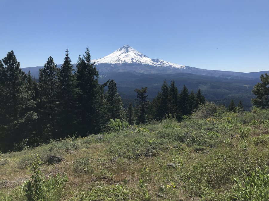
Great day up at Mt St Helens. A perfect dusting of snow as we approached Helens Lake and it wasn't yet icy on any steep pitches. I even saw a very distant snow capped peak to the north and east of Adams, that I had never seen before. Amazing day!
October 25, 2020
 1
1
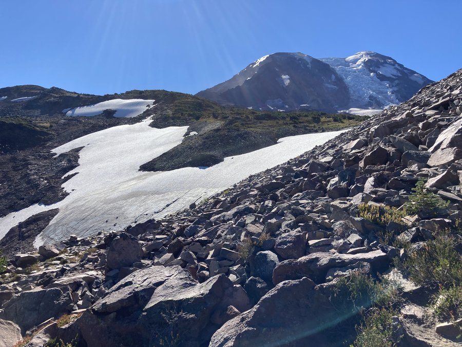
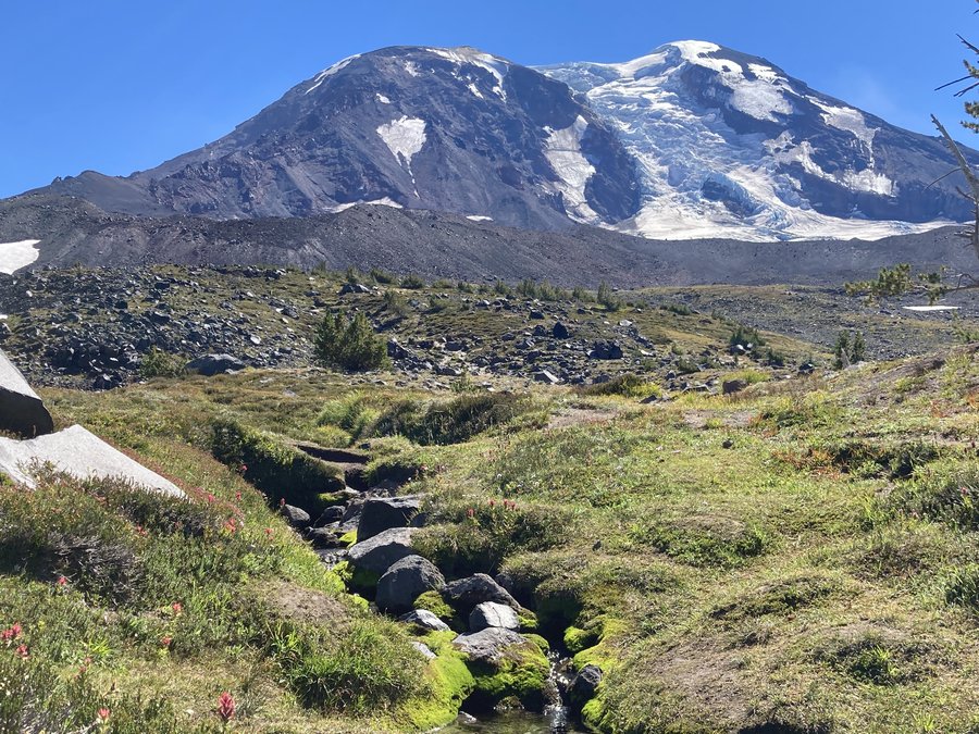
White River to Timberline
7.2 miles of hiking • 2000' elevation gain •
It's been a month since I could hike so I decided on a shorter route to the Timberline area that I had never explored. The White River winter snowshoe trail was great, offering fairly continuous views of the mountain and views of the river. In a very short time I reached the junction with the Timberline trail and headed up to familiar ground. Up here the storm damage was evident with deciduous plants bare of leaves, live blown down pines, and scoured ground. Continuing up I made my way up to where Salmon Creek crosses the TT and headed upstream to a favorite area with small waterfalls and an old spring pool. The storm and subsequent rains had shifted the area a bit and it was slightly more scrambly than it usually is, but still fine. Excellent day.
October 6, 2020
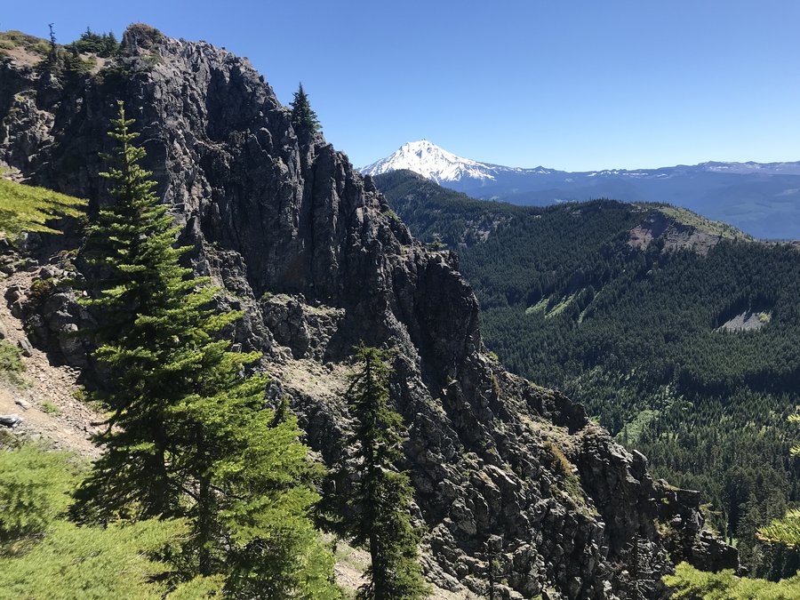
 2
2
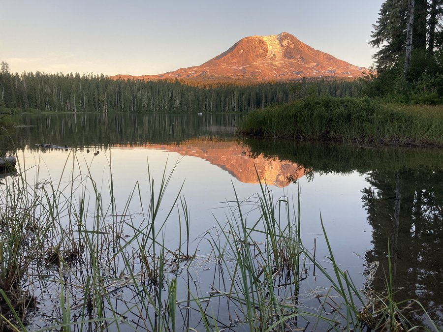
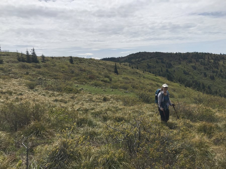
Takhlakh Lake and Killen Creek
14.5 miles of hiking • 3000' elevation gain •
When you think of high mountain hiking it evokes a certain picture that you We camped at Takhlakh Lakethink of as "it". This part of Mt Adams is definitely "it". We camped at Takhlakh Lake and did a stroll around the surrounding lake and meadows which was actually really nice. At one point we went over a lava flow and got a great north view of the mountains. In the morning we set out up Killen Creek Trail into the beauty. Adams is so much bigger than my local mountain. We hiked to High Camp and then explored the meadows and ridges above there. Tons of views. We could see Rainier, Helens, Goat Rocks, the Dark Divide and lots more. Wonderful couple of days.
September 2, 2020

 1
1
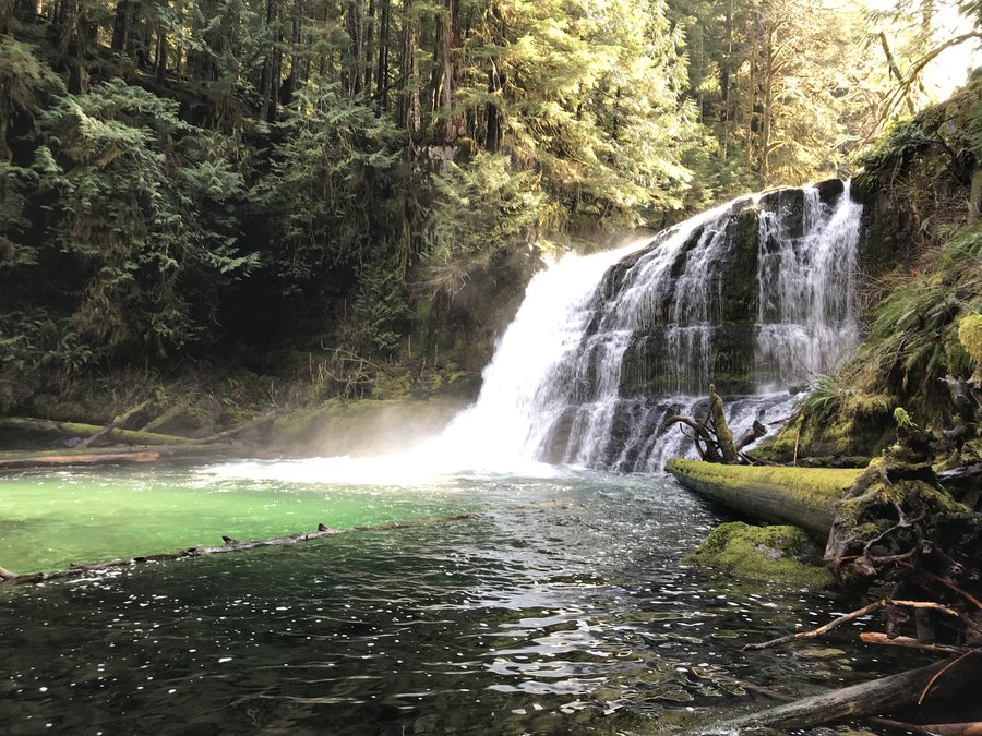
Falls Creek Horse Camp to Blue Lake
14 miles of hiking • 2250' elevation gain •
Marvelous plan B. We were going to hike into the lakes via Thomas Lake TH but one of our vehicles vetoed that idea due to the washout. Instead Susan quickly came up with the idea of starting at the Falls Creek Horse Camp TH which was close by. There are some nice offtrail and abandoned trail options in that area, but we stuck to the main trail to Indian Racetrack then took the cutoff to the PCT and made Blue Lake our turnaround. The PCT ridge walk over Berry Mountain was especially nice. Lots of sporadic views of all the volcanoes and lovely subalpine forest. No bugs during the day and a wonderful adventure.
August 26, 2020
 1
1
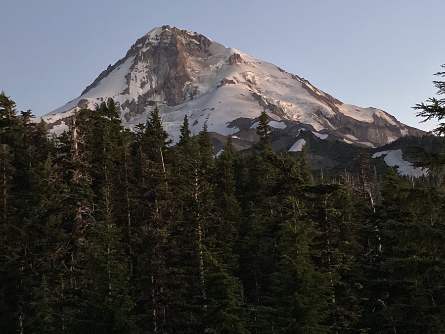
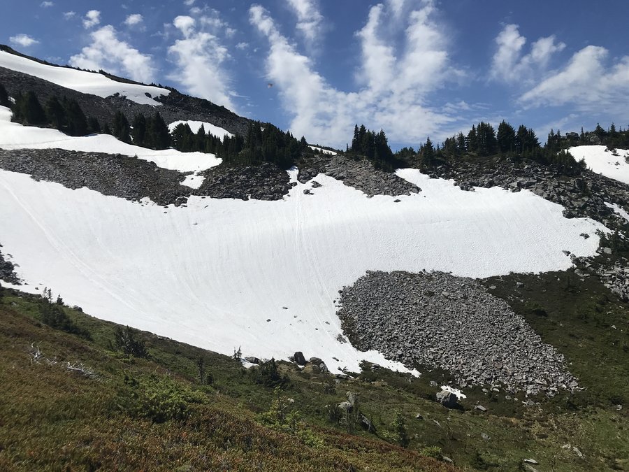
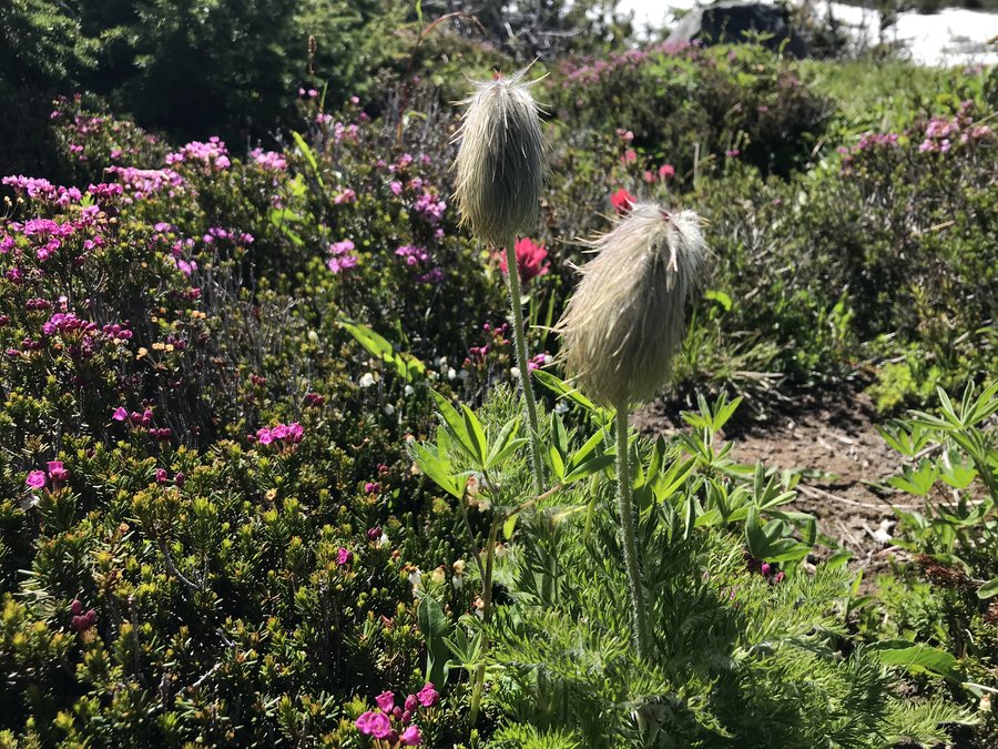
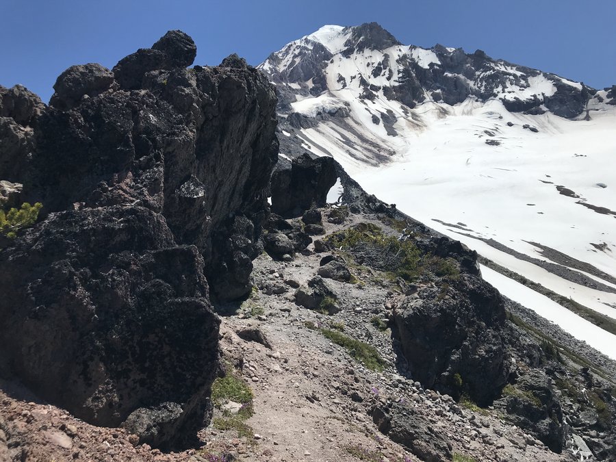
Paradise Park and Above
13.8 miles of hiking • 3750' elevation gain •
A fantastic day up on the mountain! I had thought about redoing my Mississippi Head traverse over to the lodge. But heat and scree got the better of us. So instead we spent some more time in the meadows around Paradise Park and got to spend more time with the alpine blooms. After scrambling around all day we were so dusty and grimy that people kept asking us if we were through hikers on the PCT. Perfect adventure.
August 17, 2020
 1
1
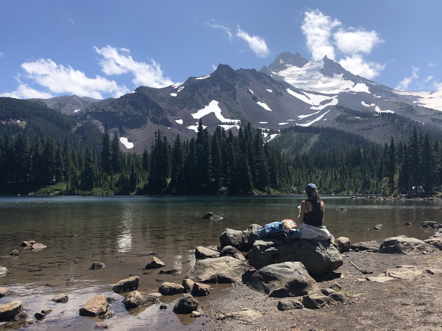
Obsidian Trail Backpack with Hand Lake add on.
17 miles of hiking • 2250' elevation gain • 2 nights
A friend got a permit for the Obsidian Trail for Sunday Monday. We headed down Saturday to camp in the area and explore the local lakes. Benson Lake was way to crowded, but Hand Lake was just right. So we looped the lake using the old wagon trail through the Lava bed to loop. The next morning headed up the Obsidian. The flowers were amazing and the bugs were fine during the day. Above Obsidian Falls there was shiny obsidian everywhere. The camping sites directly above the falls are now closed for restoration, so the camping is all up on the ridges overlooking the meadow and with volcano views. Which was great. Not too many people. Really wonderful trip.
August 8 – August 10, 2020

 1
1
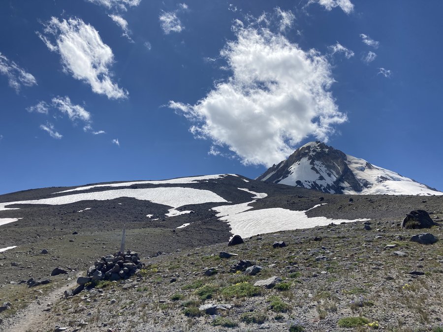
Whitewater to Jefferson Park
12 miles of hiking • 1750' elevation gain •
Wonderful day in Jefferson Park via the Whitewater Trail. No too many bugs and the Lupines were in full perfume mode.
August 3, 2020

 1
1
Cooper Spur and Side Trip
6.2 miles of hiking • 1500' elevation gain • 1 night
Did some front country camping with friends at Cloud Cap Saddle campground. Beautiful trip. Both of my friends had recent injuries so we kept it pretty short. The penstemon is prolific but is starting to dry up with the hot spell. Dwarf lupine and sulpher flower are both looking good.We stayed up late to watch the comet and star show. The next day we took a quick side trip to Umbrella Falls. The lupine and valerian are amazing right now with lots of other flowers and as other people have reported it's definitely a good blooming year for beargrass. Especially in the ski lift areas.
July 19 – July 20, 2020

 1
1
McNeil Point Lunch Counter HO rock
11.5 miles of hiking • 3250' elevation gain •
Fantastic day up to the ridge top above McNeil Point. I got an early start to avoid people. The heather is full on. The dwarf alpine pants are blooming. No significant bug action, great beargrasss bloom and the flowers are still peak around Bald Mountain.
July 13, 2020

 2
2
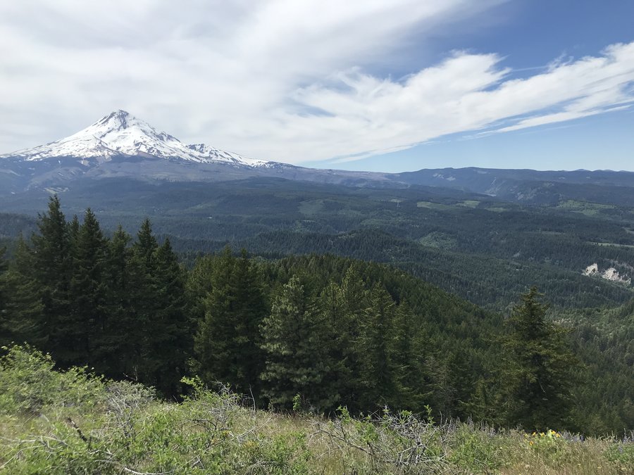
Barlow Pass to Alpine Meadows
11.4 miles of hiking • 3000' elevation gain •
I hiked the PCT from Barlow Pass up towards Timberline and the wandered uphill to about 7200'. The bloom above Timberline is amazing right now. The Beargrass is great and everything else is just getting going. Wonderful day.
July 6, 2020

.jpg)

 1
1
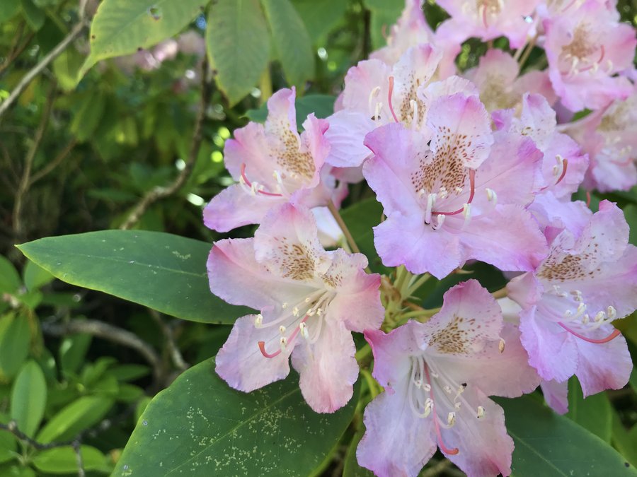
Whetstone Mountain
10.5 miles of hiking • 3000' elevation gain •
Great day, great company, peak rhodie bloom, magical green forest and eleven snowcapped peaks visible from the top. The trail is getting overgrown and there was a good bit of blowdown, but totally worth it.
June 25, 2020


 3
3
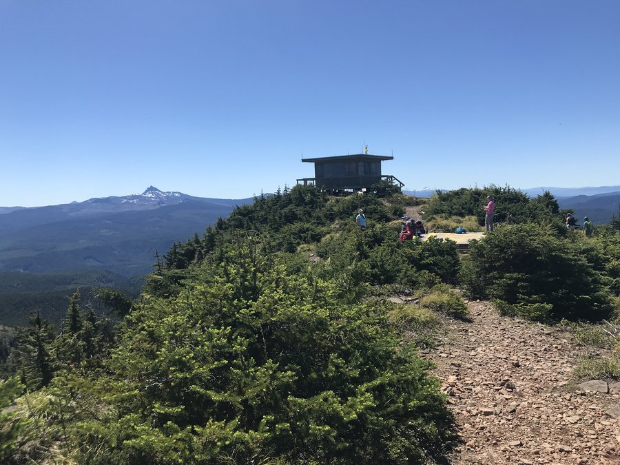
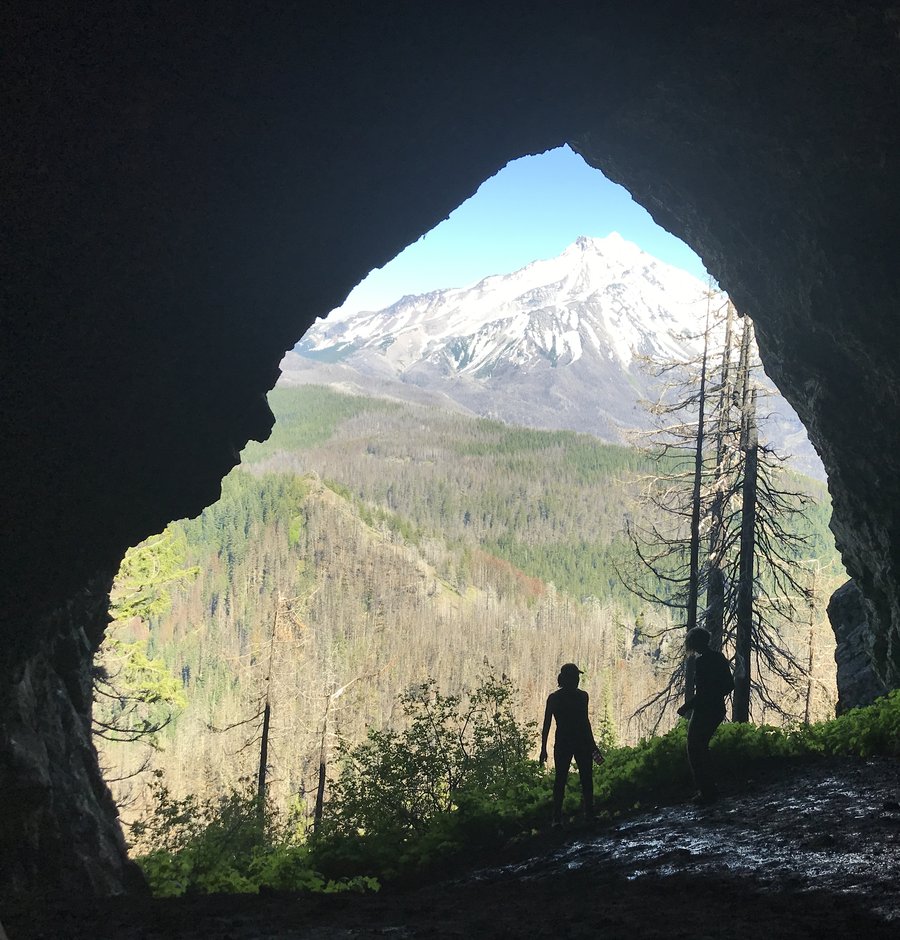
Coffin Mountain and Triangulation Peak
7.8 miles of hiking • 1750' elevation gain •
Great day out with a fun group. We headed up to Coffin Mountain. It doesn't look like a peak beargrass year, but I saw lots of other amazing flowers in the meadows and the view was amazing. The tower wasn't staffed yet, but probably will be soon. Then we headed over to Triangulation Peak and down to Boca Cave which frames Jefferson perfectly. The snowy peaks out there are really calling me.
June 22, 2020


 1
1
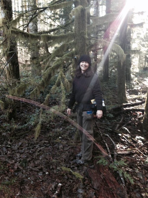
Larch mountain meanderings
3.5 miles of hiking • 250' elevation gain •
Just a fun day exploring the creeklets that feed into Bridal Veil Creek.
June 21, 2020

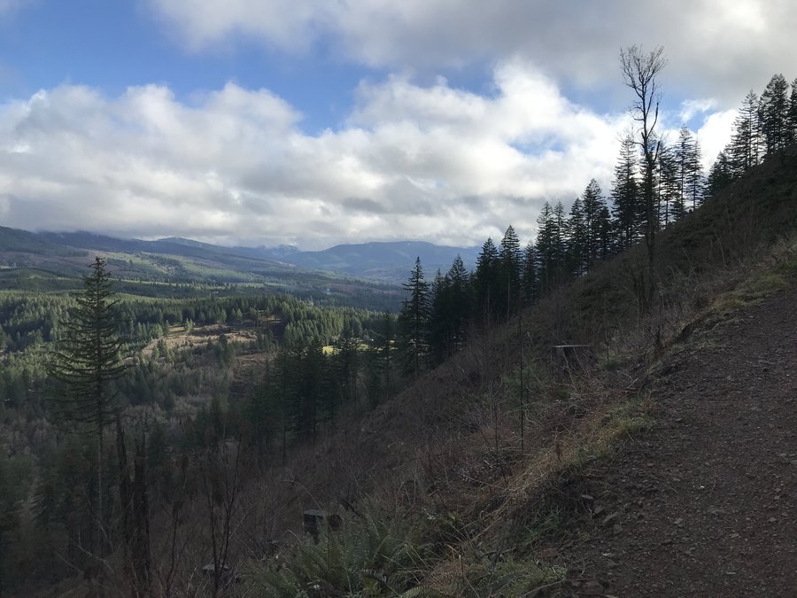
Gorge Road Meander
7.2 miles of hiking • 750' elevation gain •
I was scouting a fieldtrip and took a short jaunt down the road from Rooster Rock and then drove up to the closed winter gate on Larch Mountain road and hiked a ways down Palmer Mill road which is the road that heads Northish toward the river and eventually eastish to Multnomah Basin. It was amazingly lovely. 100's of shades of green and 5 or 6 springs and creeks that feed Bridal Veil Creek. I loved it.
June 18, 2020
 1
1
Benson Plateau
11.4 miles of hiking • 3750' elevation gain •
Went up the Benson Plateau from Herman Creek TH up to the junction with Benson Way. The beargrass on the way up was at full bloom.
June 17, 2020
 1
1
South Surveyors Ridge to Shellrock
15 miles of hiking • 1500' elevation gain •
We started at Clinger Camprgound and had a great day walking along the ridgeline and climbing a few buttes. The 44 Trails Association has done some great maintenance work up there as well as having added some options and done some rerouting.There are new signs, but it's still confusing in a few places. Caltopo has most but not all of the new updates if you view it in MapBuilder Topo Mode. The flowers were awesome in the hanging meadows as were the various viewpoints.
June 3, 2020


 1
1
Mt Tabor
4.7 miles of hiking • 500' elevation gain •
Nice wanderings all over the park exploring it's nooks and crannies.
May 29, 2020
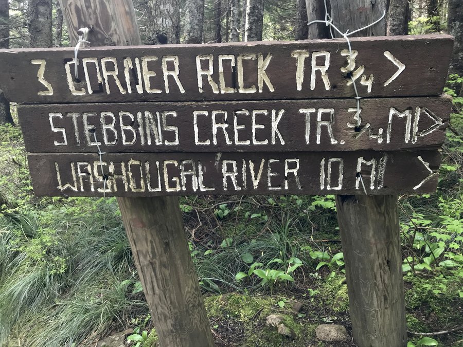
 1
1
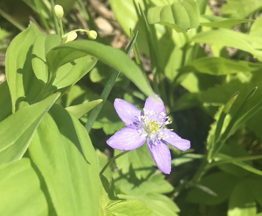
Three Corner Rock and South
10.3 miles of hiking • 2000' elevation gain •
This one had been on my list for far to long. Beautiful day in wonderful late spring forest. Anemones, trillium and glacier lillies, even a little paintbrush and the biggest log of petrified wood I've ever seen. We started from the north and headed south to Three Corner Rock, then back to the PCT and headed south until our turnaround time. Considering it was Memorial Day Weekend, there weren't many people. But I didn't head up to the top of the rock, since there were too many people up there as well as dogs. It was a wonderful day
May 24, 2020


 2
2
Washougal wanderings
9.5 miles of hiking • 2500' elevation gain •
Did some creative wandering using old abandoned roads and powerlines for a wonderful day.
May 10, 2020

 2
2
Forest Park
1 miles of hiking • 250' elevation gain •
Glorious day. With a nice east wind everything was green hued flickering light and shadows. I saw an owl right next to the trail and a very large tree up hill snap off in the wind.
May 8, 2020
 1
1
Forest Park
11.3 miles of hiking • 1000' elevation gain •
I picked a local hike in a quieter section of Forest Park, masked up and went for it early in the day.
April 13, 2020
 1
1
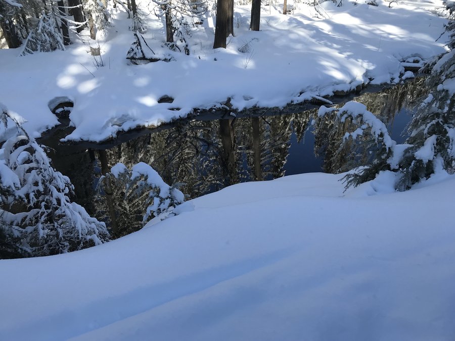
Herman Creek to East Fork Crossing
15.4 miles of hiking • 2750' elevation gain •
Great day out on Herman Creek Trail to the river crossing beyond Cedar Swamp. There was still a bit of slushy snow up at Cedar swamp, but it was beautiful as always.
March 20, 2020
 2
2
Coyote Wall
11 miles of hiking • 2000' elevation gain •
Practiced a little social distancing out near Catherine Creek. Lovely day with snow, flowers and even one of those snow pinwheels, that usually show up on mountains during avalanche season.
March 16, 2020
 1
1
Horsethief Butte to Dalles Mountain Ranch
10 miles of hiking • 1500' elevation gain •
Amazing day out exploring Horsethief Butte and the over to the Crawford Oaks TH and up to the ranch. The flowers are just barely starting, but the quiet and the views were magnificent.
March 9, 2020


 1
1
Upper Siouxon Creek
13.5 miles of hiking • 1750' elevation gain •
Waterfalls everywhere! Heading up Siouxon creek we took a side trip to Chinook Falls, scrambling down to the base of lots of falls. Then we headed back up Siouxon for views of Middle and Upper Siouxon Falls. Lots of weeping walls and even a rainbow in the spray. Turned around at the crossing near Calamity Creek. Totally amazing day.
March 1, 2020

 1
1
Angels Devils loop
11 miles of hiking • 3000' elevation gain •
Great day in the gorge. The trilliums are blooming near the trailhead. Looks like there is still a lot of snow over in the Silver Star area. Snow was visible near the top of Table area.
February 27, 2020
 1
1
February 23, 2020
 2
2
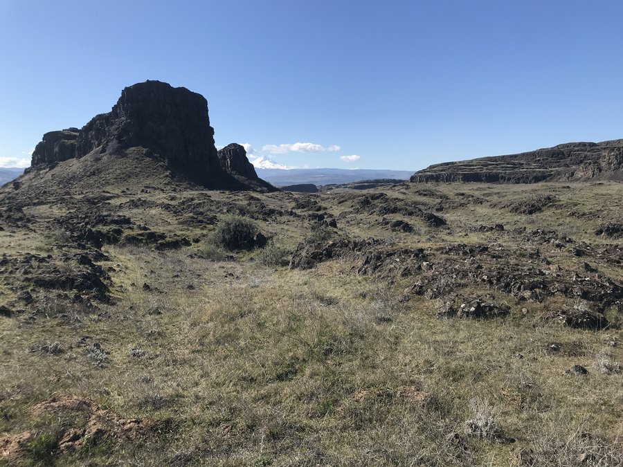
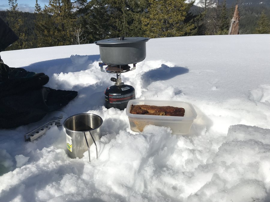
Clear Lake Lookout
9 miles of hiking • 1250' elevation gain •
Beautiful clear day walking up to the Clear Lake Lookout. The road in was well consolidated by ATV's and the couple staying in the tower let us up for a quick look at the view. Afterwards we did a short add on down to Clear Lake which was drained and fairly empty. Astonishing! Awesome day.
February 18, 2020

.jpg)
 1
1
Palmateer Point
10 miles of hiking • 1500' elevation gain •
Glorious day in the snow. We started at the Frog Lake side and went up past the lakes. Trail # 482 from Upper Twin was untracked so we went up trail #495 from the north of the lake and took a short connector over to a more heavily traveled section of the #482 and from there up to Palmateer. Had lunch and birthday cake up at the top and basked in the warmth and views. Great day.
February 12, 2020

 1
1
Tracy Hill Meanderings
8.3 miles of hiking • 1750' elevation gain •
Grass widows are sparsely blooming down low and south of the road I saw one Columbia Desert Parsley blooming. Such a great area.
February 10, 2020
 1
1
Multnomah Wahkeena loop
5.6 miles of hiking • 1500' elevation gain •
Great day just doing the Multnomah Wahkeena Loop. Super quiet up there today.
February 3, 2020
 1
1
Bells Mountain Trail
10.6 miles of hiking • 2000' elevation gain •
Lots of clearcuts, but beautiful creeks and moss. There are some super nice sections of the trail with creeks and mossy trees. No rain and a nice view of distant snowy peaks.
January 25, 2020

 2
2
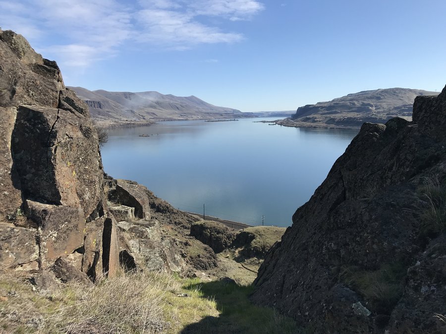
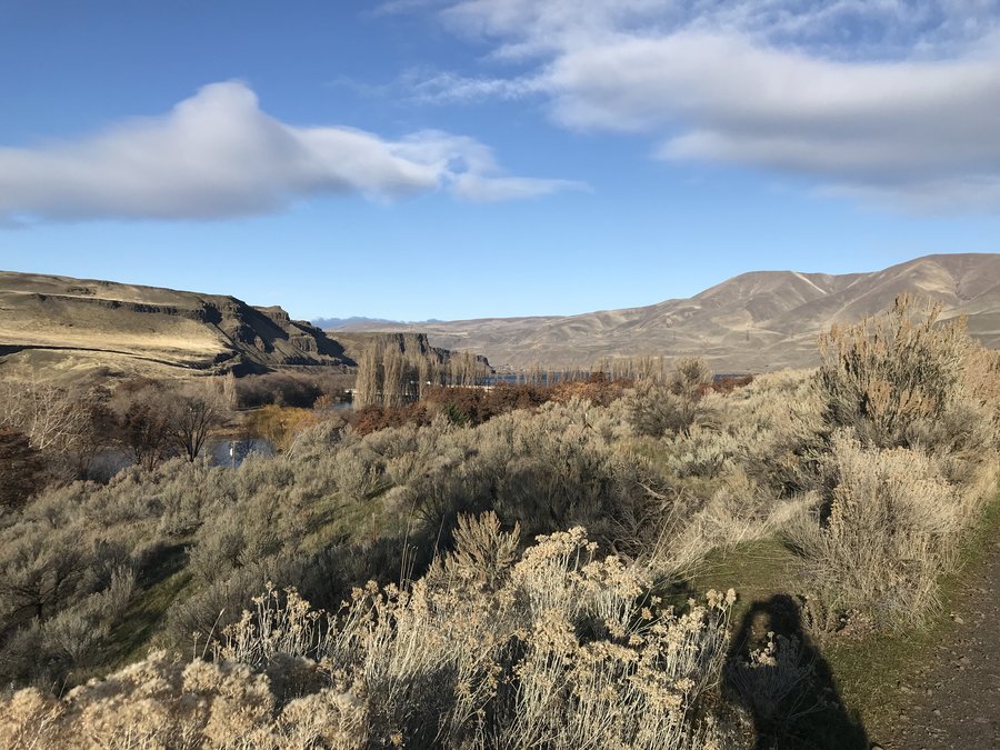
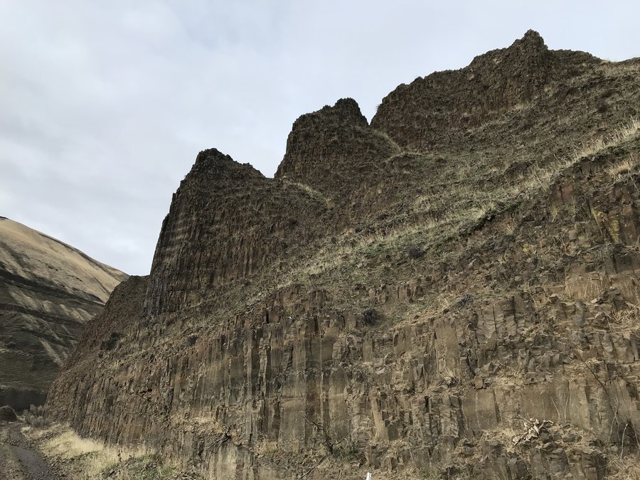
Lower Deschutes
14.2 miles of hiking • 250' elevation gain •
Sunshine to the east and great rock formations!
January 9, 2020

Herman Creek to B.O.G
1 miles of hiking • 1500' elevation gain •
Did a one way from the Herman Creek TH to Bridge of the Gods with a friend. I've been trying to do easier hikes to rebuild my strength after a couple months of being sick. This was perfect! Water flow is good in the falls right now and you could see snow up on the Benson Plateau. Looked like it started at maybe 2500 -3000'. Great day.
January 4, 2020

Herman to BOG 2
6.1 miles of hiking • 0' elevation gain •
Just a double report because the last one goofed up my mileage and wouldn't let me edit or delete
January 4, 2020
 1
1
Salmon River to Goat Creek
10.4 miles of hiking • 1250' elevation gain •
The forest was pretending to be a summer day today. Except for the very full stream crossings as I got further up. Water, moss, blue sky, warm breeze. Just what I needed to start the year.
January 3, 2020

View trips from: 2014 2015 2016 2017 2018 2019 2021 2022 2023