

2021 Trips

 1
1
Multnomah Wahkeena Loop
6.1 miles of hiking • 1750' elevation gain •
Great day in the snow and ice. I used spikes, but others didn't. Yay

December 29, 2021
 1
1
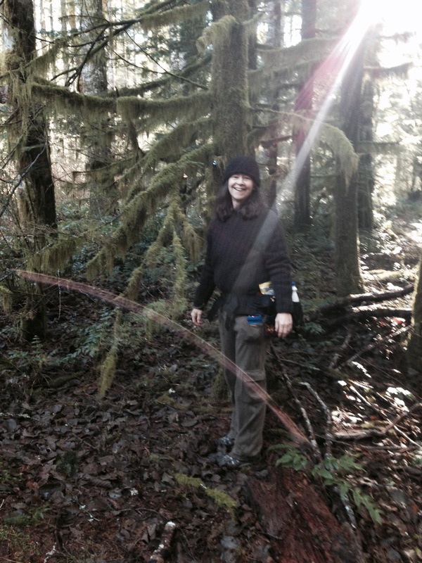
Cape Horn snow walk
8.7 miles of hiking • 2000' elevation gain •
I generally don't make Cape Horn a priority for hiking, but today in the snow it was gorge-ous Haha
December 28, 2021
 1
1
Enid Lake Little Zigzag Falls snowshoe
4 miles of hiking • 500' elevation gain •
Just a short nice Christmas Eve snowshoe with good friends and nice treats.
December 24, 2021
 1
1
Ornament trail and Nesika Lodge Wanderings
9 miles of hiking • 2000' elevation gain •
Great day in very wet snow, Beautiful ornaments and snow-flocked trees. We needed spikes on the way down even though there wasn't much snow.
December 16, 2021
 1
1
Forest Park
7.3 miles of hiking • 500' elevation gain •
Had a great morning with a friend hiking north from Germantown RD on the Wildwood.
December 10, 2021
 1
1
Glade Trail to Timberline
8.5 miles of hiking • 2000' elevation gain •
I don't know why this one always feels like the hardest hike ever. But it was still a wonderful day. A few patches of snow, sitting by the fire at the lodge, visiting with Bruno, and stopping by the closed Phlox Point Cabin Taco Chalet and yes I used taco and chalet in the same sentence. Great day
December 1, 2021
 1
1
Devils Peak Lookout via Cool Creek
7.5 miles of hiking • 3250' elevation gain •
I'd tried this trail before in the spring but the snow was too icy and sketchy even with spikes. This time we made it up to the lookout before the clouds rolled in and had great views. No spikes needed.4-6 inches of snow up top dusting of snow starts after about a mile and increases from there. Beautiful day
November 24, 2021
 1
1
Larch Mountain Road to Waespe Point
12 miles of hiking • 1250' elevation gain •
The snow gate is still open, but we decided to do a back route into Nesika and Waespe Point. Starting at the snow gate we took Road 1520 northish down to Multnomah Basin Road and from there followed it down to the bridge over Multnomah Creek and into Multnomah Basin. The ornament trail is slowly coming back and one of the dormitories and outhouses has been re-built at Nesika Lodge. Great day.
November 23, 2021
 1
1
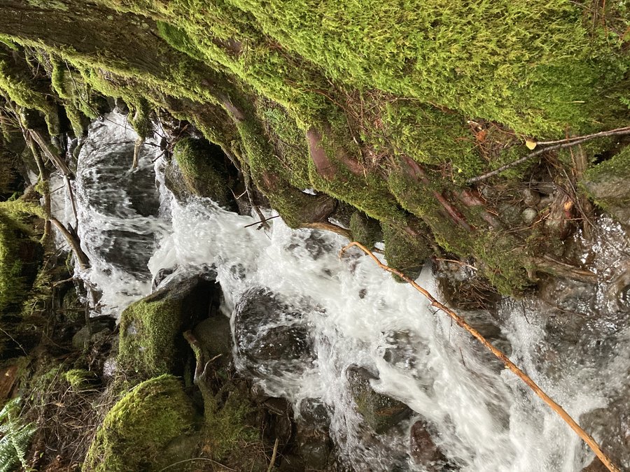
Herman to Whiskey Creek
12.3 miles of hiking • 2500' elevation gain •
The waterfalls are looking great. There's some gnarly blowdown past Casey Creek, but nothing we couldn't deal with. People are chipping away at it, for which I am grateful.
November 22, 2021
 1
1
November 19, 2021
 1
1
Short Herman Creek
6 miles of hiking • 1250' elevation gain •
I just had a few hours but it was a great trip. The fall color is mostly gone and snow is topping the mountains in the distance.
November 17, 2021
 1
1
Eight Mile Loop
8 miles of hiking • 1250' elevation gain •
Great day in the Badger Wilderness. The larches were still great and we added on Perry Point and Five Mile Butte. Fantastic day
October 31, 2021
 1
1
autumn Colors in Forest Park
6.2 miles of hiking • 250' elevation gain •
The colors are looking good!
October 29, 2021
 1
1
Wahkeena Devils Rest Loop
9.8 miles of hiking • 2750' elevation gain •
The undergrowth in the burned areas of the gorge is brilliant right now. Great day.
October 18, 2021
 1
1
October 8, 2021
 1
1
October 1, 2021
 1
1
Forest Park stroll
9 miles of hiking • 1000' elevation gain •
I just had a few hours so I took a quiet walk in Forest Park
September 24, 2021
 1
1
Wizard Trail Mt Hood
9.1 miles of hiking • 2000' elevation gain •
I got a night a Five Mile Butte Lookout and then hiked up one of the new trails above the Timberline Trail that Mt Hood Meadows built. The was a bit of light route finding and easy scrambling. I went up to about 7000' but I hear you can continue on.
September 14, 2021
 1
1
Mt Rainier Paradise Park
8 miles of hiking • 2000' elevation gain •
I'd never been to Mt Rainier so I woke up early and drove to Paradise Park. It was crowded until about 1 and then it cleared out. I also found some short spurs up there that hardly anyone was on. I spent a lot of time in quiet places just sitting and staring at the mountain and views. Completely amazing.
September 6, 2021
 3
3
Mooney Tarn
6.5 miles of hiking • 2000' elevation gain •
I went a with a great group to visit Mooney Tarn. #willhikefortarns is my motto. Really fun route finding and a bit of easy scrambling. It did involve crossing the Elliot twice. Let's just say when it comes to narrow log crossings I'm not to proud to scoot. Great day.
September 5, 2021
 1
1
Goat Rocks
27.8 miles of hiking • 5000' elevation gain • 2 nights
I had a great trip up in Goat Rock. It was super quiet up there. The bloom only remains in small sheltered creeks. We did the Nannie Ridge PCT Walupt Lake loop and the Berry Patch Snow Grass trails loop up to Goat Lake. Water was much more abundant on the Snowgrass side of the loop.
August 31 – September 2, 2021
 1
1
Eagle Creek to Twister Fall
13.2 miles of hiking • 1500' elevation gain •
I wanted an easy hike today with some mileage so I went out to the gorge. Amazing trail work has been done, but lots of spots that look like they will continue to be washouts. People are making there way down to Punchbowl even though there isn't a beach anymore. Not too crowded.
August 27, 2021
 1
1
Paradise Park from Timberline
12 miles of hiking • 2500' elevation gain •
Beautiful smoke free day on the mountain so I went for it. The flowers are still blooming but faded a bit. The gentians are at peak if you love those.
August 19, 2021

 1
1
Short Mt Hood Meadows Stroll
3.2 miles of hiking • 500' elevation gain •
Had a great social hike looking at tons of wildflowers. Lupine, beargrass and valerian is all looking nice in the meadows above MT Meadows along the TT.
July 21, 2021
 1
1
Short Mt Hood Meadows Stroll
3.2 miles of hiking • 500' elevation gain •
Had a great social hike looking at tons of wildflowers. Lupine, beargrass and valerian is all looking nice in the meadows above MT Meadows along the TT.
July 21, 2021
1
Vista Ridge to above Dollar Lake
8.3 miles of hiking • 1750' elevation gain •
The beargrass is great about 2 miles in and the other flowers are starting. We took Vista Ridge Trail up to the TT and had lunch a bit above Dollar Lake. There are the remains of a pretty big avalanche down in Elk Cove. Minimal bugs. The trail is mostly clear except for big snow drifts near the junction with the TT. Lots of down logs.
July 14, 2021
 1
1
Strawberry Wilderness
30 miles of hiking • 5750' elevation gain • 4 nights
Fantastic trip out to the Strawberries. We did Strawberry Mountain, Strawberry and Little Strawberry Lakes, Slide Lake and an off trail to Slide Falls. Very buggy right now except for Strawberry Lake. The exposed meadows along the trails are full of wildflowers, but the wildflowers in the lake basins have a few blooms but aren't going strong yet. The section of trail between the two junctions with the horse route to Slide Lake are super sketchy in places plus one completely washout with and active soft dirt slide. Everyone we saw was taking the horse route back even though it adds about 700' of eg. A fantastic trip.
June 30 – July 4, 2021
 1
1
Mt Hood Meadows
4 miles of hiking • 750' elevation gain •
Went up with some friends who work at Meadows to explore the new short connector trails up there. We eventually made it up to Timberline and tried to make it to Heather Canyon but without spikes it was to slow and slippery to make our way across the snow fields on steep terrain. Took the ski lift back down. Great day!
June 25, 2021
 1
1
Lassen National Park with add on
20.5 miles of hiking • 15250' elevation gain •
Had a fantastic trip in Lassen National Park after it was clear that Yosemite would be too hot. Hiked up high early in the day and sat in lakes all afternoon. We explored King Creek Falls area. Stunning alpine meadows feet from the trail head. Summited Brokeoff Mountain. Of course the view is great, but the approach through the meadows and tarns was amazing. And of course we had to climb Mt. Lassen. Short trail, lots of eg. The trailhead starts at above 8500!!! On the way home we stopped off at Heart Lake and Castle Lake. Both warm enough to swim in.
June 16, 2021
 2
2
Metolius River Backpack
18.5 miles of hiking • 1250' elevation gain •
We searched for something that would be quiet and snow free over Labor day weekend and were super happy with this hike. We started at the Lower Bridge campground TH on the Metolius river. It's just past all the car camping. We hiked for about 3 mile along the river on fisherman's trail's and then scrambled up to the closed dirt road. Which was actually mostly soft and had great river views alternating with shade. Several campgrounds, but we liked the one at 4.5 miles along the road best. Of course it was a bit further in with wandering. At 7 miles there is a small private property patch with a super cute lemonade stand unfortunately closed. A wonderful trip
May 29, 2021
 1
1
Tunnel Ridge Sterling Ditch
9.1 miles of hiking • 1500' elevation gain •
I had a wonderful trip to southern Oregon visiting old friends. We did a short hike that went around the edges of a piece of land we both lived on years ago. We started at the Tunnel Ridge TH and hiked west over near the headwaters of Muddy Gulch and Birch Creek. The trail is flat once you get up to the Ditch and goes for miles in either direction. Tons of Poison Oak and some ticks, but beautiful open woodlands and views of the surrounding area. We did a bit of of trail to get some more elevation in.
May 22, 2021
 1
1
Phlox Point
10.3 miles of hiking • 2250' elevation gain •
The phlox is at peak at the top. We added a few extra miles on just because. The forest is such a lovely shade of green right now! The clouds briefly rolled aside just as we hit the top.
May 17, 2021
 2
2
Archer Rim Loop
7.5 miles of hiking • 2250' elevation gain •
Beautiful day hiking the rim loop clockwise. The flowers are going strong in many of the hanging meadows. I heard from another hike that bees were swarming on Archer Mountain and we saw them swarming around a tree at the edge of a lookout point as well. The falls even had some water still flowing. Great day.
May 16, 2021
 1
1
Larch Mt from Multnomah Falls
15.3 miles of hiking • 4000' elevation gain •
Glorious day in the gorge. The water flow is low but the wildflowers are popping. Relatively uncrowded near the falls and just a few people further up the trail. I had the summit to myself. There's still solid snow starting about half a mile from the parking lot but it was shallow and well consolidated. The main bootpath actually heads up a few hundred feet north of the trail that leads to the parking lot. Great day.
May 11, 2021
 1
1
Nick Eaton Ridge to Peak 3152
9.8 miles of hiking • 3000' elevation gain •
Great day out at Herman Creek. I went up the ridge via Gorton Trail to one of my favorite lunch spots. Peak 3152.
May 5, 2021
 1
1
Almost Devils Peak via Cool Creek Trail
8.9 miles of hiking • 3000' elevation gain •
We made it to about a half mile from the top. Solid ice alternating with steep sloped sliding slush defeated us even with micro spikes, Still it was wonderful.
April 29, 2021
 1
1
Cottonwood Canyon
13 miles of hiking • 1000' elevation gain •
I had never been to Cottonwood canyon and I wanted to go before it got too hot. Great day with some easy off trail climbing up high for amazing overlooks of the John Day River. The Balsam Root is starting to fade, but the phlox and Bicolor lilies were blooming. Wonderful day!
April 27, 2021
 1
1
Hardy Ridge
10.1 miles of hiking • 2250' elevation gain •
I started out at the Equestrian TH and made it to Phlox Point despite some pretty fierce winds up top. Nice Glacier Lilly bloom stating about 2400 and continuing to the top. Lots of yellow violets lower down and a smattering of Trilliums. I went down the east side and wandered north a bit along Hardy Creek. I had thought about hitting the saddle on Hamilton since I was so close but I decided to call it good and quit before the clouds rolled in. A wonderful day.
April 19, 2021
 2
2
Angels Rest Wahkeena Spring to Devils Rest Loop
10.8 miles of hiking • 3000' elevation gain •
Despite starting up via Angels Rest it was a day filled mostly with solitude. No snow on the trail. Just a few patches here and there in the woods. The Trilliums were full on, but every thing else is still not blooming. There are still a few old Russ Jolly engraved signs up there, but mostly trail helpers are posting new ones. Lovely jaunt in the mostly green forest.
April 15, 2021
 3
3
Bonneville TH to Aldrich Butte
12.3 miles of hiking • 1750' elevation gain •
I wanted to have a day that was somewhat leisurely with a lunch that was in a warm spot with a view. And I found it. The cutoff trail from the PCT to Carpenter Lake was still in great shape. I was hoping to hear the frog orchestra at the lake but no luck. It appears to have dried up even more since the last time I was there. The top of Aldrich was so windy I could barely stand so I walked down the trail a few feet and got out of the wind and still had a great view. Super great day!
April 12, 2021
 1
1
Catherine Creek
7.8 miles of hiking • 1500' elevation gain •
A wonderful leisurely stroll to see flowers at Catherine Creek. Bloom is full on down low. I saw all my favorites.
April 7, 2021
 1
1
Dog Mountain Loop
7 miles of hiking • 2750' elevation gain •
My friend Susan took a day off from work and suggested Dog Mountain. Completely beautiful views of course and a wonderful day. No snow. But the trail through the top meadows is pretty muddy and a bit slippery. Wonderful day!
March 31, 2021
 1
1
Frenchmans Bar
10.5 miles of hiking • 0' elevation gain •
I just wanted to get some miles in and still have time later in the day. So I went to Frenchmans Bar in N Vancouver and got a lot of views of cranes, egrets, eagles, herons, tundra swans, geese and ducks. I was especially pleased by a description on a sign of what the birds needed the area for. Along with feeding, staging and migrating they included loafing as a designated activity for the birds. I'm for it!
March 21, 2021
 1
1
Bridge of the Gods to Herman Creek
11.4 miles of hiking • 1500' elevation gain •
It's so great to have the daylength to go slow and have a leisurely lunch
March 16, 2021
 1
1
Hamilton Mountain
9.6 miles of hiking • 2000' elevation gain •
Great day but we didn't get as far as we wanted because the snow between the summit and the saddle was super soft and slidey and it really slowed us down. The roads up from the saddle and the road by the creek past the saddle were covered in soft melting snow. We ended up just adding a bit onto the usual saddle loop and enjoying the beauty.
March 13, 2021
 1
1
Twin Lake Snowshoe
8.3 miles of hiking • 1000' elevation gain •
Beautiful last day of some sun. The trail from Frog Lake up to Lower Twin was the perfect for snowshoeing. Not iced but well packed. Once we got past Lower Twin Lake even though the trail was broken it was super soft and slidy. It felt much harder than it should have. It was great to hit the well packed section on the way down again. Right now it's not spikable at all. Snowshoes or skis are the way to go. Beautiful day.
March 4, 2021
 1
1
North Vancouver Lake
5 miles of hiking • 0' elevation gain •
I wanted to have a gentle stroll with some friends I don't get to see all that often. So we went to North Vancouver Lake. It's basically a wetland with many paved paths and some not paved with options to connect up to other bike paths and trail. We saw a ton of Sandhill Cranes, Geese, an Egret and the usual birding regulars. No real views of the lake from the main path. Wonderful day
February 21, 2021
 1
1
Labyrinth Coyote Little Maui
9 miles of hiking • 1750' elevation gain •
Surprisingly quiet day out there. Some grass widows and the umbels are just starting. 4-8 inches of snow in the shade. At about 1000'. I heard there was a foot of snow up higher. We stopped at about 1700 feel.
February 20, 2021
 1
1
Lower Deschutes
14.6 miles of hiking • 500' elevation gain •
Quiet day getting some nice flat mileage in.
February 10, 2021
 1
1
Forest Park
10.5 miles of hiking • 1000' elevation gain •
I hadn't planned to hike but there were some sunbreaks so I dashed out to Forest Park and got some fun miles in. Not too crowded.
February 6, 2021
 1
1
Old Maid Flats to Burnt Lake TH
9.8 miles of hiking • 750' elevation gain •
We wanted to go somewhere quiet, so we parked at the closed Sandy River Bridge and wandered all over, eventually ending up just beyond the Burnt Lake TH. Almost no snow lower down, 3-4 inches at the top near the TH. Wonderful day.
January 29, 2021

 1
1
Herman Creek to Whiskey Creek
12.2 miles of hiking • 2250' elevation gain •
The parking lot at Herman Creek is closed but you can park at the entrance to the road up to the trailhead and walk in. The creeks were pretty full so I only made it as far as Whiskey Creek. Between Slide Creek and Whiskey Creek. There's a lot of downfall that really slowed my down. Great sunny day!
January 19, 2021
 1
1
Yale Reservoir Road
7.7 miles of hiking • 0' elevation gain •
I wanted to get out with a couple of good friends. An easy day was called for so we went to just outside of Couger and walked an abandoned road along the river. Lots of nice side creeks on a misty day.
January 10, 2021
 1
1
Hamilton Mountain Meander
10.6 miles of hiking • 2000' elevation gain •
We wanted to find a close in less crowded hike. So we parked at the Equestrian TH to Hardy Ridge and took the lower route up to a brief stop at the Hamilton Saddle and then decided to explore on of the options north from the saddle that I had not been on yet. Wonderful day.
January 9, 2021
 1
1
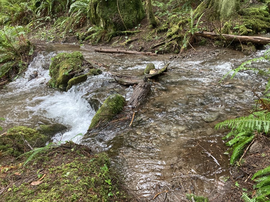
The Other Eagle Creek
13 miles of hiking • 1750' elevation gain •
No big waterfalls, but tons of beautiful cascades and mossy cedars. The road in is a bit rough but fine. With all the water right now the side creeks were running strong. The further in we went we needed to spend a bit of time searching for the best way to cross, which was fun. About a mile the ford of Eagle Creek we hit one that was doable but didn't have anything that both of us felt comfortable with given the amount of daylight left. So we called it good and headed back.
January 5, 2021


View trips from: 2014 2015 2016 2017 2018 2019 2020 2022 2023