

2019 Trips


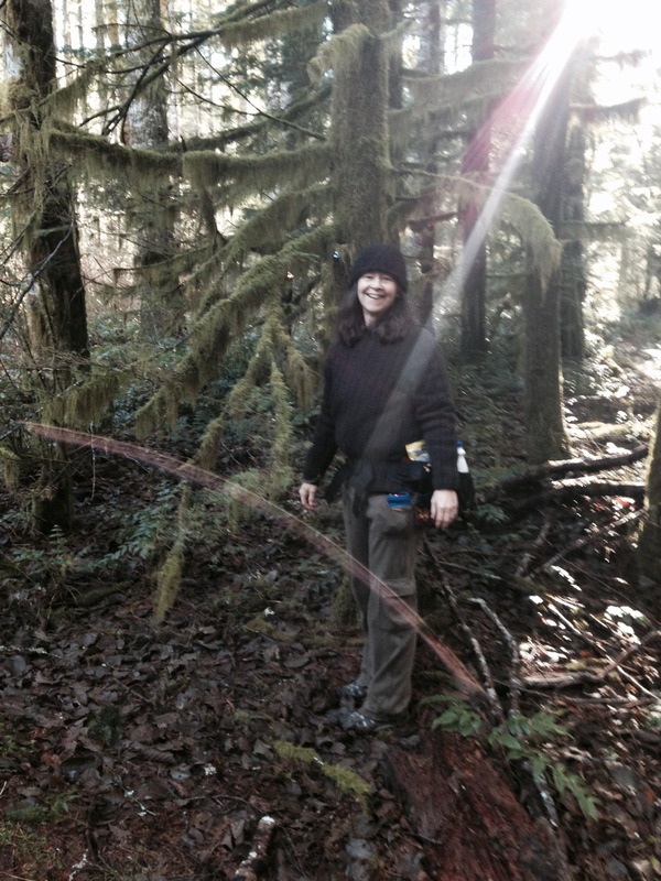
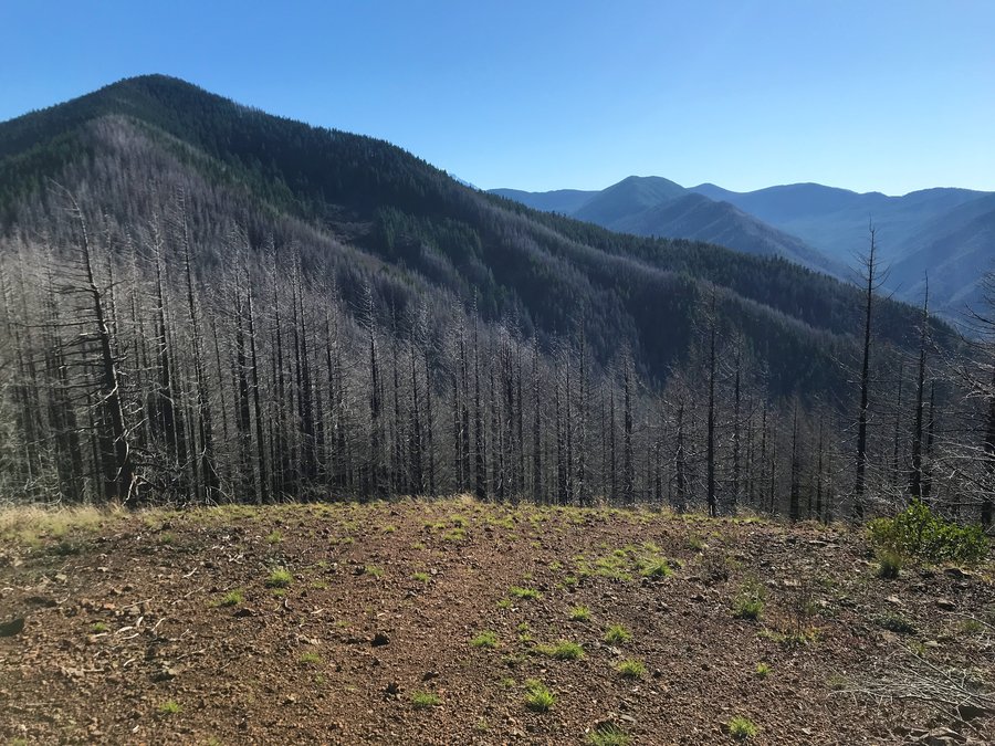
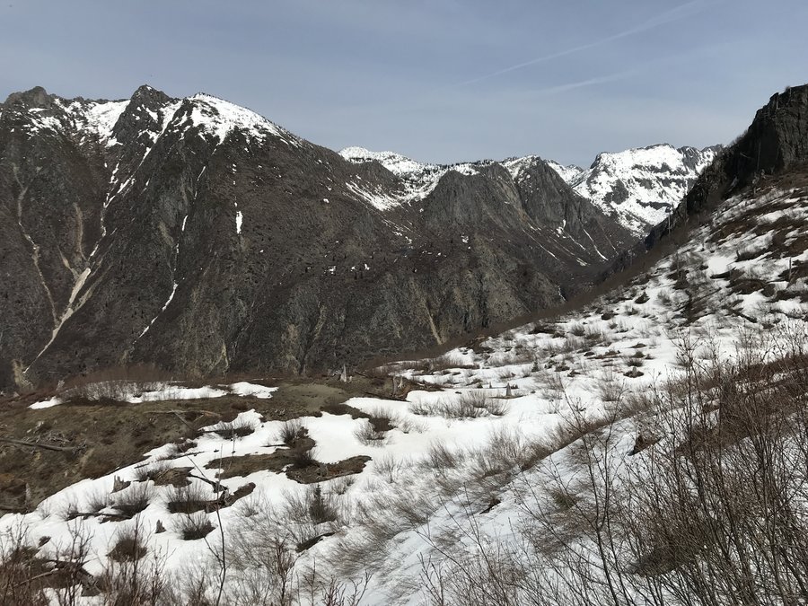
Nesika Lodge
9.6 miles of hiking • 2000' elevation gain •
Great day hiking from Multnomah Falls up to Nesika Lodge. The lodge's members were staying up there for New Years and were welcoming hikers with a hot cup of tea and a tour of the lodge. So glad this didn't burn in the fire.

December 29, 2019
 1
1
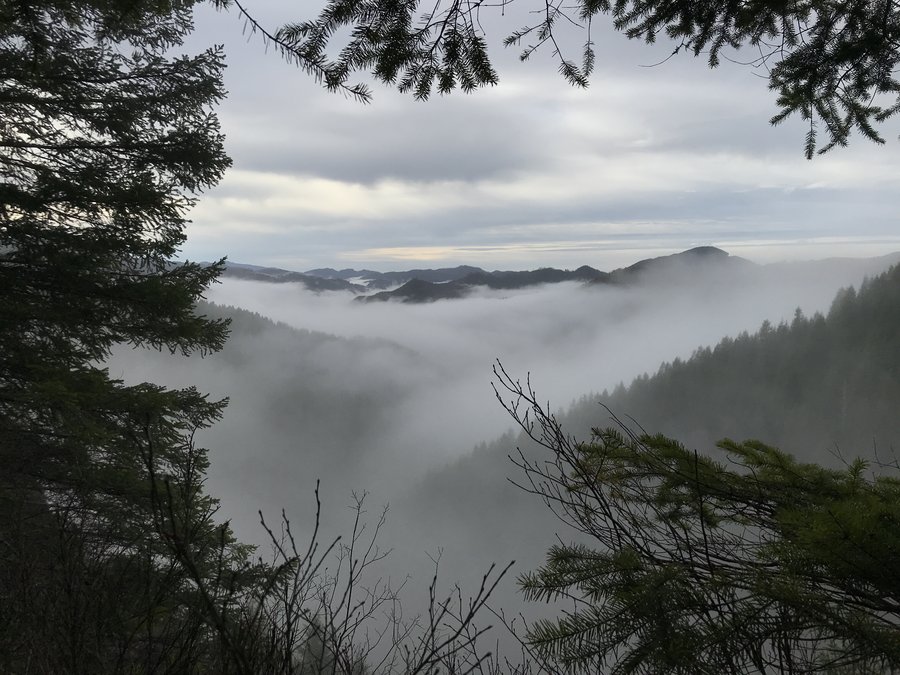
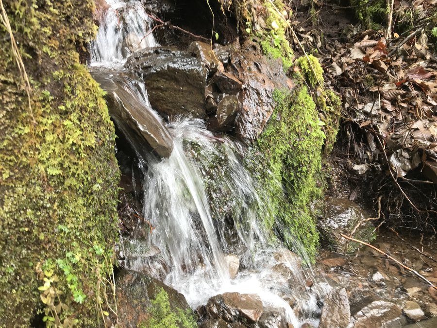
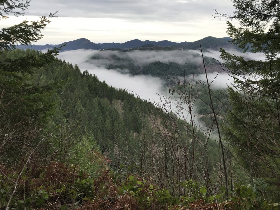
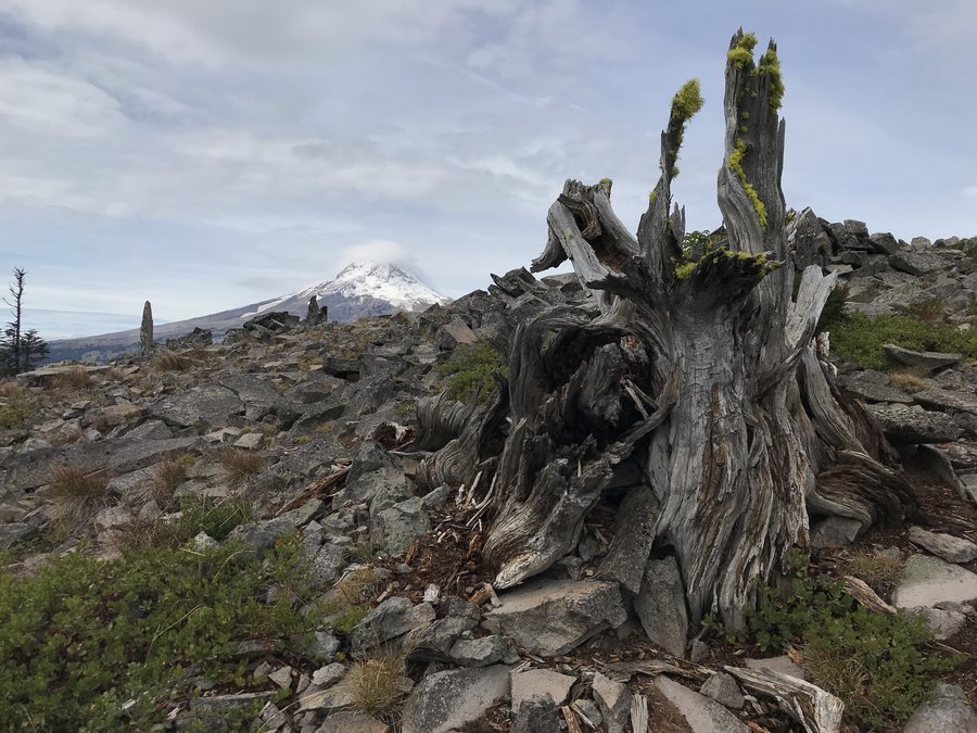
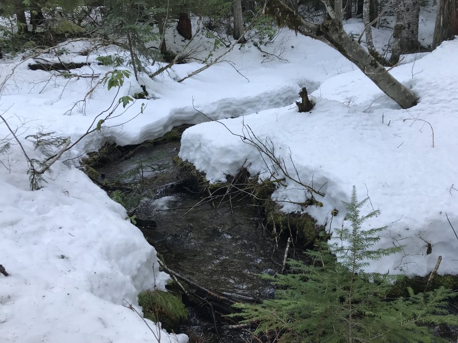
Wilson River Lester Creek Section
8 miles of hiking • 1250' elevation gain •
Great day and great company checking a section of the Wilson River Trail. We started from the Diamond Mill OHV area and hiked east through the Lester Creek Section, which was surprisingly beautiful. Lots of lush moss and ferns and great sneak peaks towards the Coastal Mountains. Awesome day,
December 28, 2019


 1
1
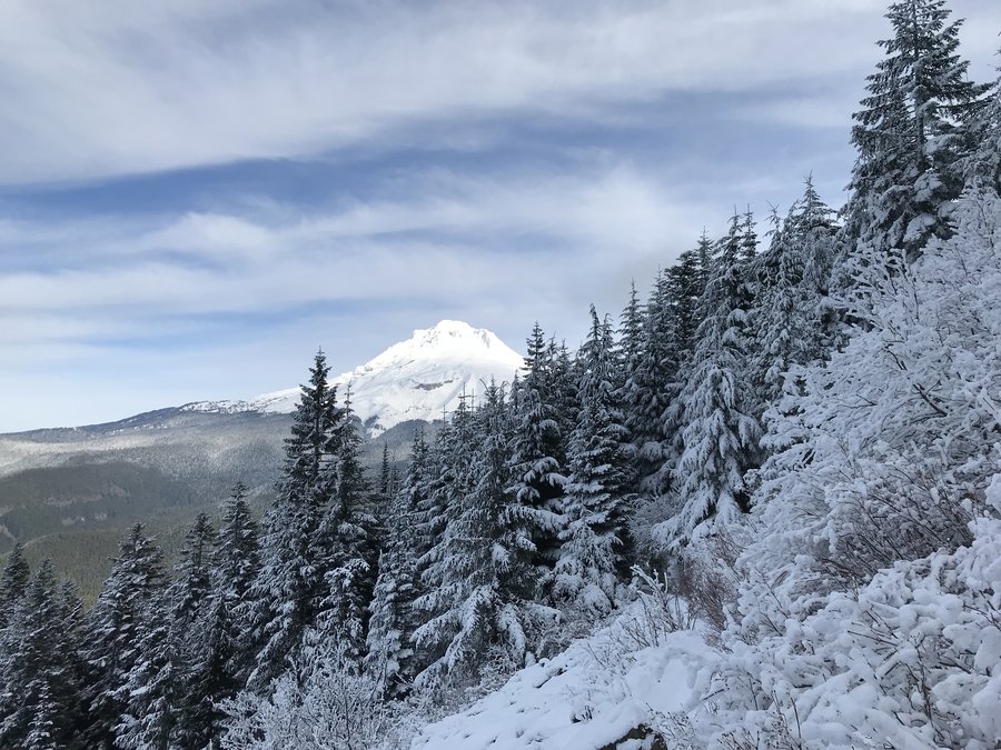
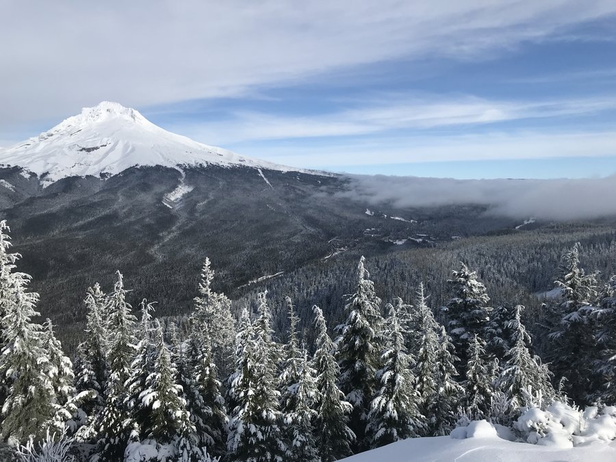
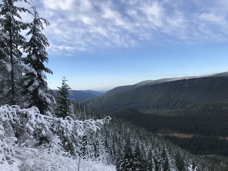
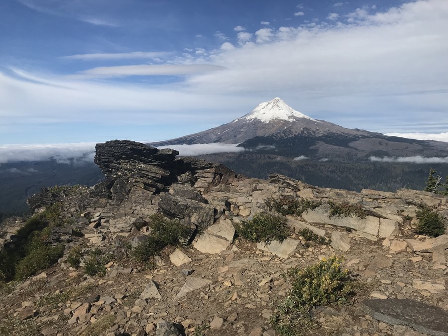
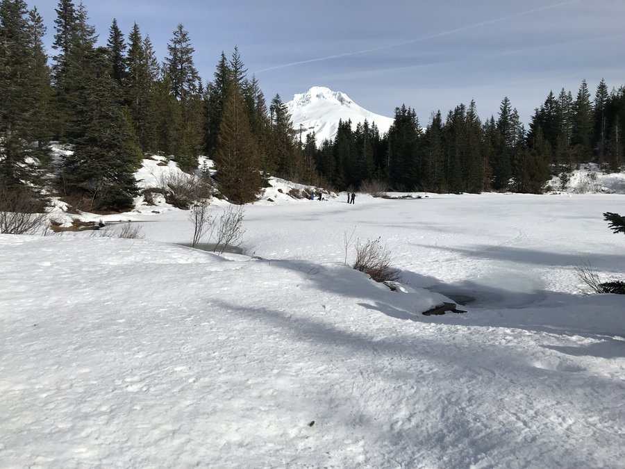
Tom Dick and Harry Boxing Day Excursion
7.6 miles of hiking • 1250' elevation gain •
Great day with just enough clouds for some interesting skies at the top. There was packed ice for about a quarter mile form the trailhead. Then frozen dirt up to Mirror Lake and well packed snow to TDH Ridge. Wonderful day.
December 26, 2019

 1
1
Twin lake snowshoe
6.7 miles of hiking • 1000' elevation gain •
Did my first recovery hike, post a long bout with the flu. I did great. almost 7 miles in snowshoes and no big coughing episodes! We came in from the Frog Lake side and there was really only a dusting of snow over bare dirt in most places. More depth around the lakes. Microspikes would have been fine. Even the snow didn't melt on us. It was cold enough that it turned into tiny ice and snow crystals as it dropped off the tree. Back out there again!
December 24, 2019
 1
1
Angels Rest Meander
7 miles of hiking • 1750' elevation gain •
Glorious day. Very quiet up there until about noon. Perfect amount of snow for beauty and easy walking.
November 29, 2019


 1
1
Wahclella Falls.
5 miles of hiking • 250' elevation gain •
Wahclella is still beautiful. I added a bit extra by walking along the paved bike path towards the east, checking out the burn up in the Tanner area. Looks pretty toasted up there, but the power company is still clearly driving the road that goes to the Tanner Butte Trailhead.
November 29, 2019
 1
1
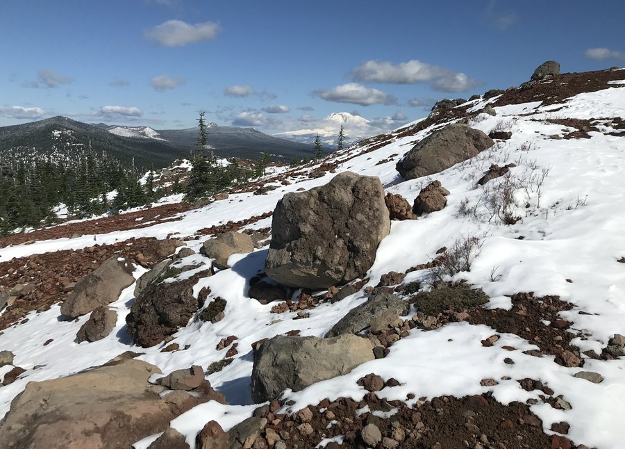
Sherrad Point Loop
11 miles of hiking • 2000' elevation gain •
We parked just past the gate at the 10.5 mile marker and took the connector trail over to the Larch Mountain trail. 4-5 inches at the parking lot. No views, so we headed down Oneonta a ways into the Bell Creek area, then headed back up through the crater and back to the car. So beautiful with just a dusting of snow right now, although more is coming in.
November 25, 2019
 1
1
Powell Butte
3.7 miles of hiking • 250' elevation gain •
Just a short hike to see the mountains since I only had a few hours available. Beautiful views of the mountains. I notice the Doug Firs are starting to get taller near the top viewpoint and will be blocking some of the views to Adams soon. Great day.
November 21, 2019
 1
1
Dry Creek Falls
4.9 miles of hiking • 750' elevation gain •
Had a nice stroll before the rain this morning, I got to catch up with a friend and have a great day in the green.
November 18, 2019
 2
2
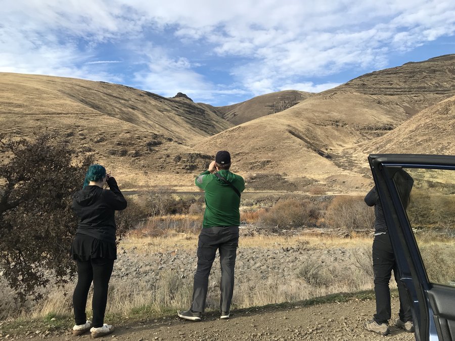
Macks Canyon
9.6 miles of hiking • 500' elevation gain •
I got to meet Sarah from this site and a lot of other awesome folks out on a group hike, to a part of the Deschutes I had visited but not hiked in before. What an awesome day.
November 17, 2019

Forest Park
7 miles of hiking • 1000' elevation gain •
Lovely autumn day in Forest Park. I'm still recovering from a stomach bug so the main goal was, to get out and see the leaves and the new Burnside crossover bridge. Lots of happy people and a Pileated woodpecker, doing his tree sculpting work a foot of the trail seemingly unconcerned with all the dogs, runners and the mini traffic jam of us snapping pics. Wonderful day.
November 10, 2019
 2
2
Silver Star Tarbell
10 miles of hiking • 2250' elevation gain •
Great five volcano day. Tarbell is a mess from logging currently. The ground was frozen for the most part, but no snow. Wonderful day.
October 28, 2019


 2
2
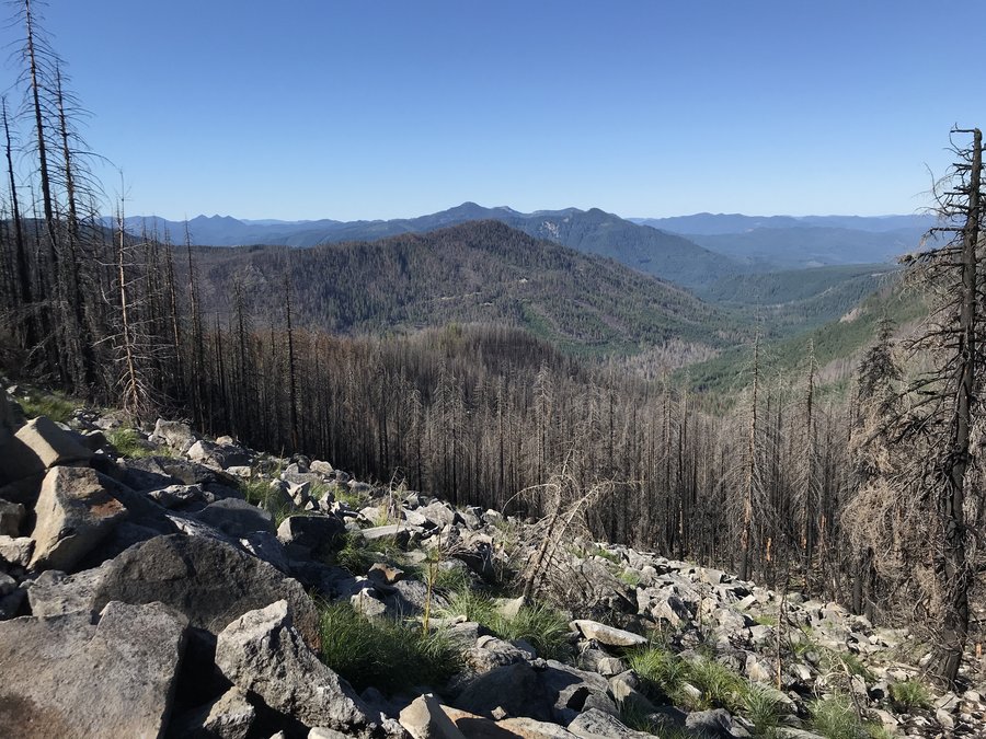
Nick Eaton Ridge
10.5 miles of hiking • 3000' elevation gain •
Great day up visiting one my favorite lunch spots in the gorge. Peak 3152. Not epic, but good views and such a pleasant place to lay around and have lunch.
October 24, 2019

 1
1
Silver Falls State Park
8.7 miles of hiking • 750' elevation gain •
Great day for an easy waterfall adventure. The fall color is still good.
October 21, 2019

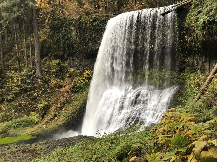 1
1
Herman Creek to East Fork Crossing
16 miles of hiking • 3250' elevation gain •
Great day out in the Gorge. The old mossy Cedars at cedar Swamp are still doing good and I like when the days are long enough to continue on a little bit through the mossy glens and creeklets.
October 14, 2019
 1
1
Red Mountain Lookout
11 miles of hiking • 1500' elevation gain •
Great sunshiney day with just enough snow to make it look beautiful
October 1, 2019

 1
1
Lookout Mountain to South of Gunsight Butte
12.9 miles of hiking • 2000' elevation gain •
Went out with a friend on their birthday hike. We had wanted to get up above Mississippi Head on Hood, but the weather was not conducive. So instead we did a hike in the Badger Wilderness which promised more sunshine. Fall colors were only to be found in a few spots. But it was a great way to celebrate a birthday and the Equinox.
September 23, 2019

 1
1
Tilly Jane to Lamberson Basin
7.2 miles of hiking • 2000' elevation gain •
Great day to be out on the mountain. Walked up to about 7600' then ambled east cross country to the Timberline Trail. I like to cutoff the TT before it heads down to Lamberson and walk over to the one of the major forks that feeds Newton just below the glacier. It was super muddy and raging. Glad I wasn't trying to cross today! The flowers of course are mostly done, except in the head waters that feed into N. Fork Cold Springs. Great lazy day
September 12, 2019

 1
1
Old Maid Flats
3 miles of hiking • 250' elevation gain •
Did a little wandering in the mossy glen while scouting for a filed trip. Great place for a private picnic or stroll even though it's short and flat.
September 3, 2019
 1
1
Jefferson Park via Whitewater Trail
13.2 miles of hiking • 2000' elevation gain •
Had a great meander through the meadows and lakes at Jefferson Park.The flowers are mostly gone except in the wet areas. There was a really nice bloom at the South Breitenbush Meadows just past Park Lake. No bugs, not many people, and glorious views.
August 26, 2019


 1
1
Government Camp Meander
4 miles of hiking • 250' elevation gain •
I had a fun day helping a friend restock game survey cameras for Cascadia Wild. Fun day meandering offtrail near the ski trails. I t was fun to look at the pics from the camera. There were photos of deer and a coyote or possibly a wolf. Hard to tell from the thumbnail pic we could see. Super fun day.
August 24, 2019

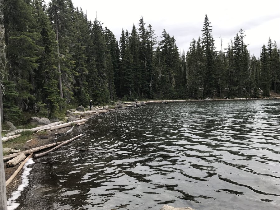
Doris Lake
4.8 miles of hiking • 250' elevation gain •
We needed a quick and easy hike after summiting South Sister before the car ride home. The rain caught us on the way back, but still a lovely hike.
August 21, 2019

 2
2
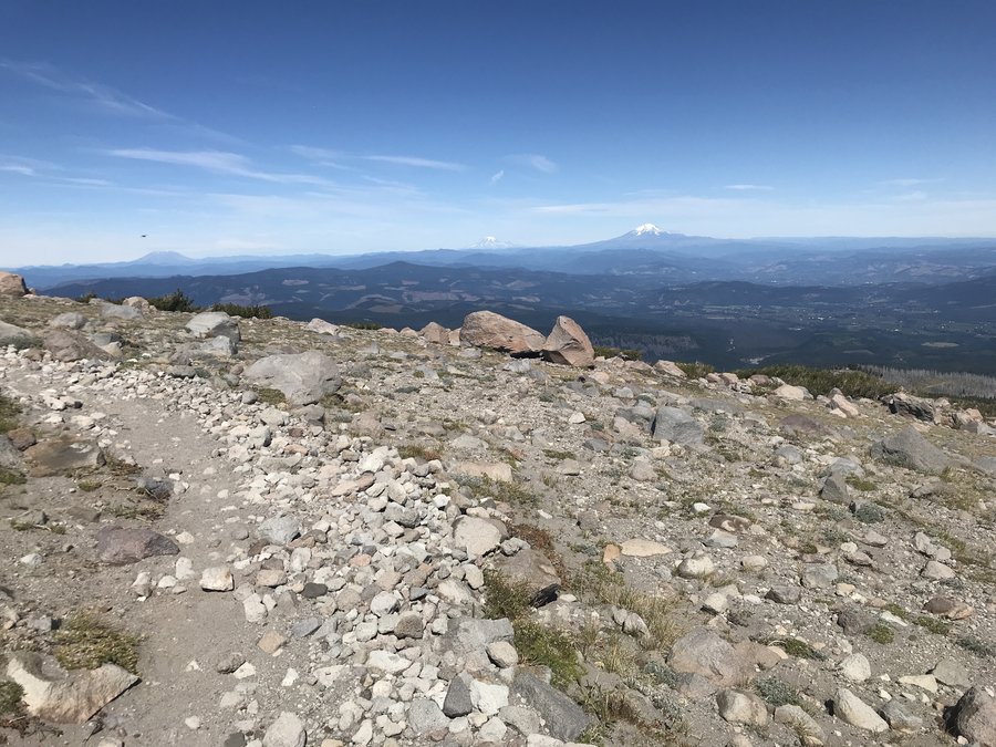
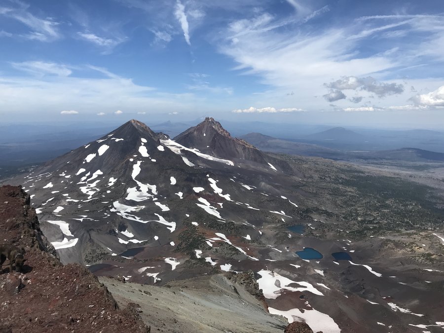
South Sister Summit
12.2 miles of hiking • 4750' elevation gain •
The highest I've ever been. Amazing day up the mountain. Views galore. So glad I could do this one.
August 20, 2019

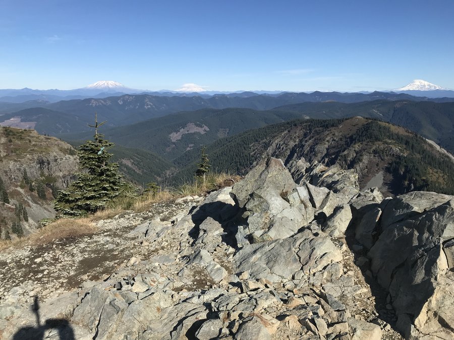
Barrett Saddle
10 miles of hiking • 2750' elevation gain •
We ran out of time to make it to the top of Barrett Spur, but managed to make it up to about 7300 feet and a beautiful view. Amazing day.
August 14, 2019


Blue Box Trail
3 miles of hiking • 250' elevation gain •
Just a short leg stretcher post work from Clear Lake a few miles up the Blue Box trail.
August 6, 2019
 1
1
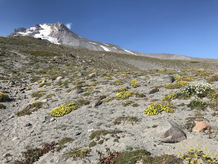
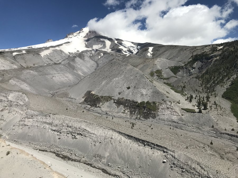
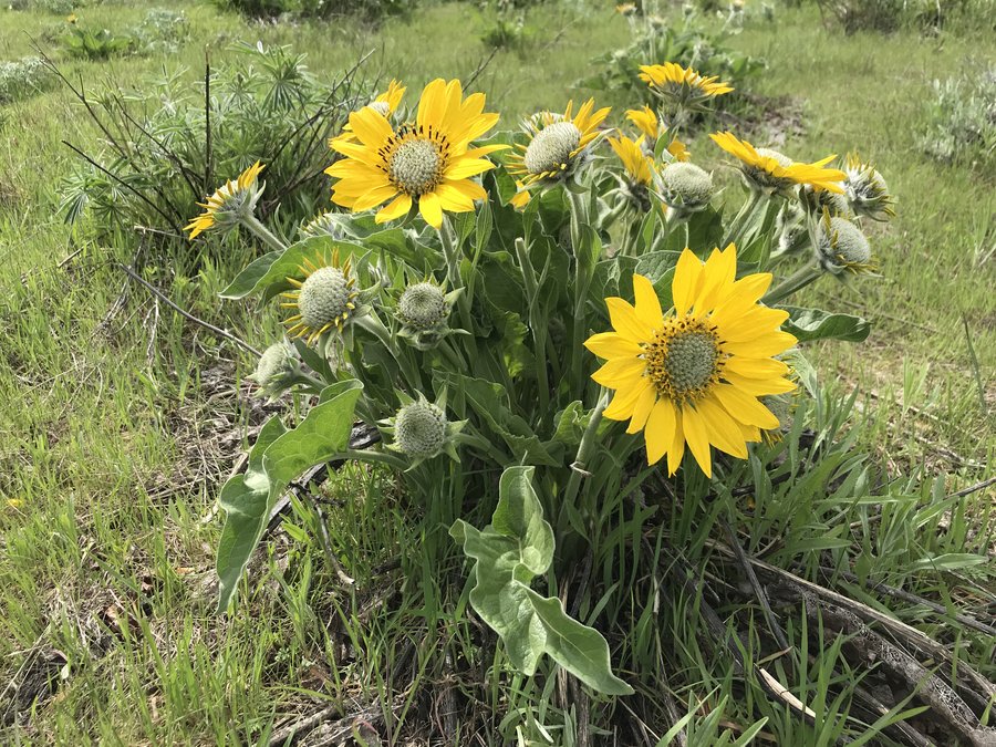
Meadows to Heather Canyon and up
8.1 miles of hiking • 1250' elevation gain •
Wandered the Timberline Trail over to Heather Canyon and then off trailed it for about a half mile up stream to check out all the waterfalls up that canyon. The flowers were fading a bit on the main trail but around water and up the canyon it was still glorious.
August 5, 2019
 2
2
Timberline Lodge Area
3.3 miles of hiking • 750' elevation gain •
I had to scout a field trip, so I made a quick jaunt up above the Timberline Lodge to check on the bloom. It's looking good, mostly buckwheats. and some penstemons. Sadly, I ran out of time to go further.
July 31, 2019

 1
1
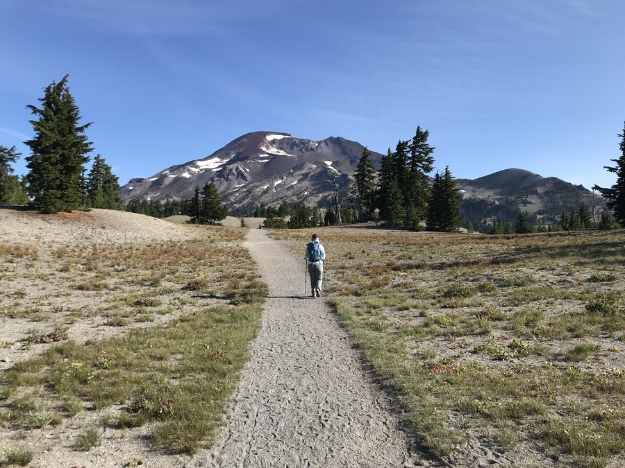
Snipes Mountain TH to Crooked Creek Falls Mt Adams
12.6 miles of hiking • 3000' elevation gain •
Besides being lovely the bonus on this one is that it get's you up on Adams south side in two hours from Portland. It also has minimal gravel road driving and the gravel part is actually in fairly good shape. The the first 3ish miles of the trail are faint and I definitely wandered off a few times, but basically you just follow the Aiken Lava beds up. There is flagging that was helpful in most spots but bewildering in others. Most of the lower part is burned, bit the bloom is coming back in nicely and it allows better views. At just under 5 miles you hit the Gotchen Creek meadows which are beautiful, which lead you into the stunning meadows, creeks and waterfalls near the Round the Mountain Trail. My turnaround spot was Crooked Creek Falls which is just east of the junction, between Snipes Mountain Trail #11 and the RTM. Amazing day!
July 25, 2019
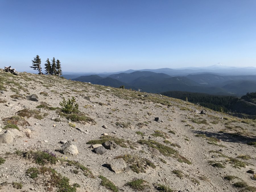
 3
3
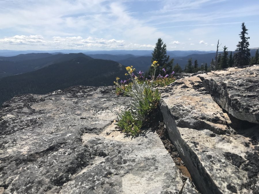
JRO to Coldwater Peak
12 miles of hiking • 2500' elevation gain •
The flowers are drying out a bit but it's still amazing. I always feel like I am visiting a new world, where life is just starting when I'm at Mt St Helens. Beautiful day in the Monument.
July 22, 2019

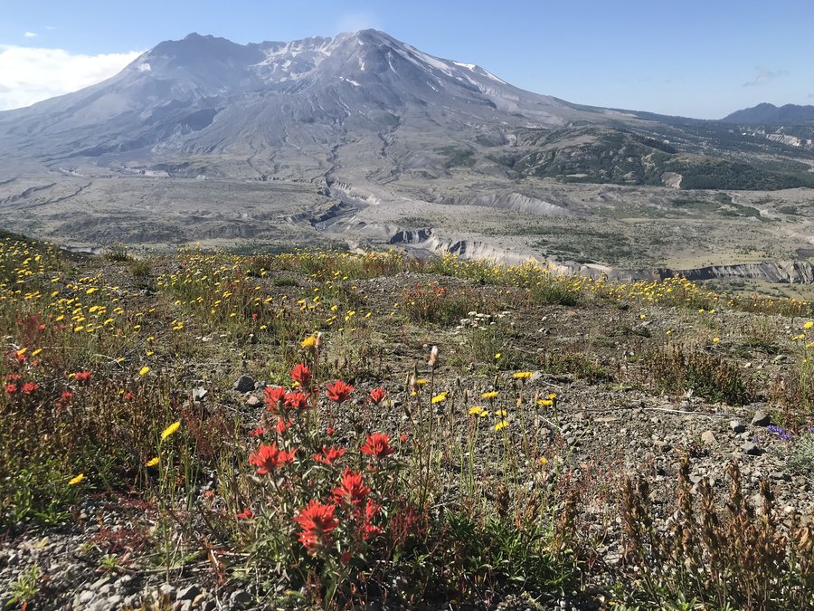

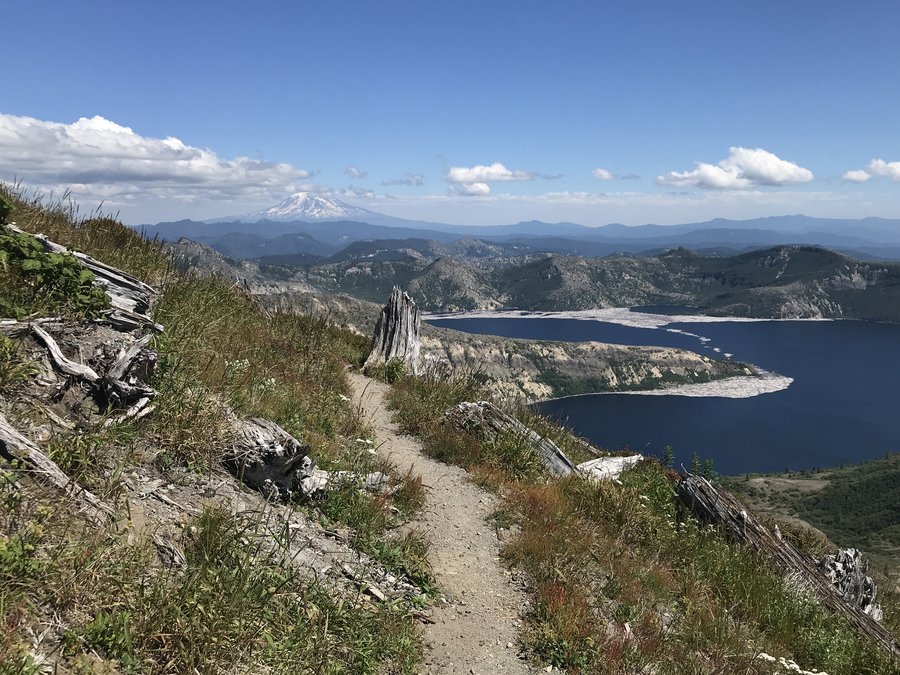 1
1
Lookout Mountain via Hwy 35
10 miles of hiking • 3000' elevation gain •
Amazing blooms and views and a quiet summit for a Sunday. Wonderful day in the Badger Wilderness.
July 14, 2019

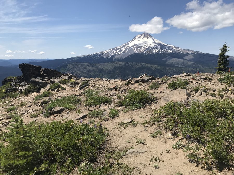
 1
1
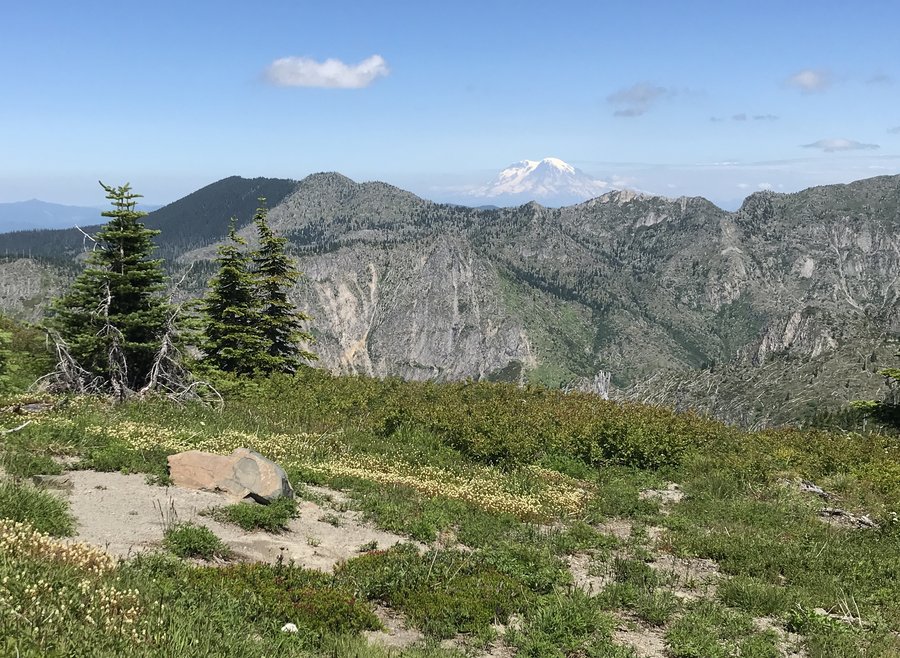
surveyors Ridge to Shellrock Mountain
12 miles of hiking • 1750' elevation gain •
Fantastic day, fantastic company, views and flowers. What more could anyone want.
July 4, 2019
 1
1
Larch Mountain Touristy Stroll
4 miles of hiking • 500' elevation gain •
Just a little evening stroll to the top and a mile or short walk down the Oneonta trail.
June 25, 2019
 1
1
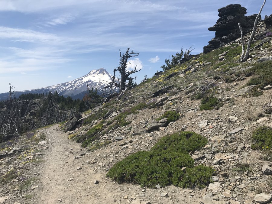
Boyscout Ridge and a bit more
13 miles of hiking • 2000' elevation gain •
The bloom is slowly starting up near Timberline. A few snow patches and no bugs. We started at Barlow Pass and wandered awhile around the lodge. Wonderful day.
June 24, 2019

 1
1
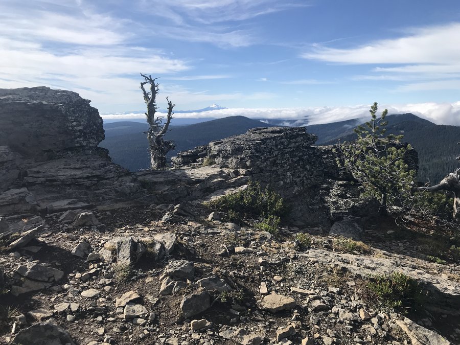
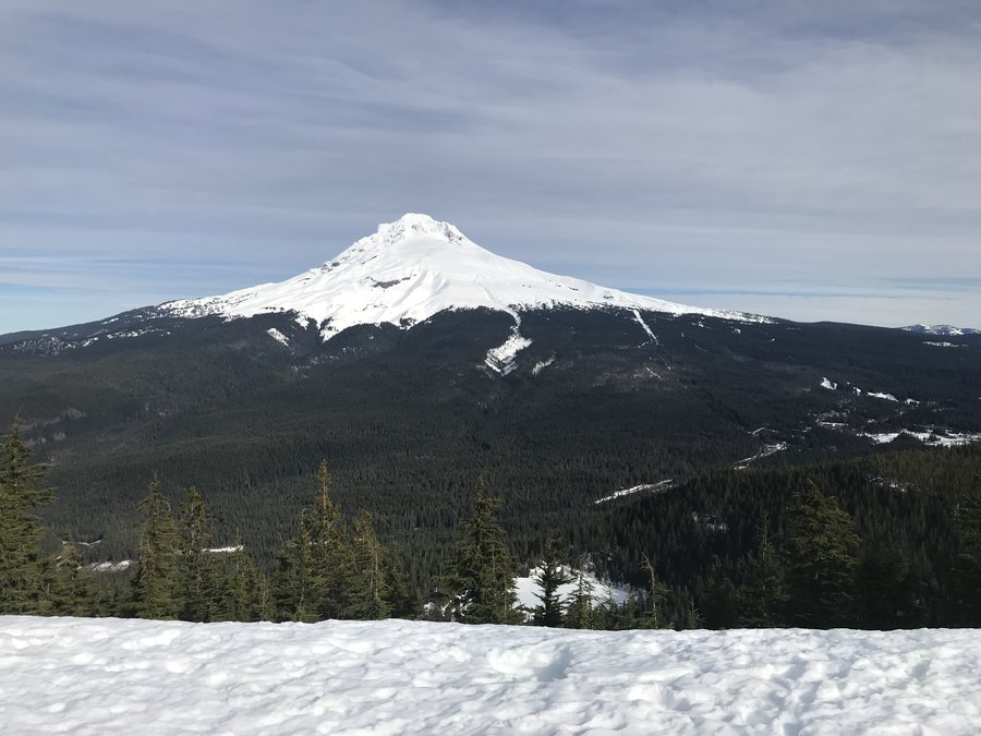
Tom Dick and Harry Ridge
7.7 miles of hiking • 1500' elevation gain •
Great day! Not too crowded. The snow is completely gone. The Rhodies and beargrass is looking great around the lake. Definitely some bugs from the lake up
June 17, 2019
 1
1
Lewis River Hantwick to Moulton meanderings
7.7 miles of hiking • 250' elevation gain •
Beautiful easy stroll along the Lewis with a few side trips. The swimming holes were remarkably uncrowded for a Saturday. Beautiful day.
June 15, 2019
 1
1
Multnomah to Larch
14.5 miles of hiking • 4000' elevation gain •
I was just planning on doing the Mult/Wahkeena loop, but the mountain beckoned and so up I went. The montia and dicentra blooms are going crazy in the burn right now. Beargrass and Rhodies blooming near the top. Looks like there might be a good fireweed bloom in a few weeks in the burned areas. Beautiful day.
June 13, 2019

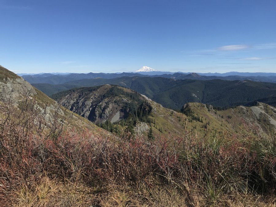
Salmon Butte
11.8 miles of hiking • 3000' elevation gain •
Even though the views were completely absent, it was a lovely, misty green day out in the woods. The flowers are starting lower down, the Rhodies are a few weeks away from bloom and there were actually a few flowers blooming valiantly at the summit. Amazing day.
May 19, 2019
 2
2
Wygant Mitchell loop
10.5 miles of hiking • 2750' elevation gain •
So great to get out in a green unburned section of the gorge. Lots of small viewpoints along the Wygant trail mostly looking west. We went to the small hanging meadows past Wygant Peak and through use trails, old roads and a bit of bushwhacking made a loop from the top over to Mitchell Point. The poison oak is mostly avoidable on the trails, but there are a couple of tight spots. Perfect day.
May 12, 2019

 1
1
May 10, 2019
 2
2
Hamilton Mt Loop and exploration
10 miles of hiking • 2000' elevation gain •
Great day on Hamilton! After hitting the summit then the saddle, I took Don's Cutoff down to Upper Hardy Creek trail to check out the woodland bloom. Tons of yellow violets, some trillium, and bleeding hearts in the woods. Larkspur blooming in the exposed areas.
May 6, 2019
 1
1
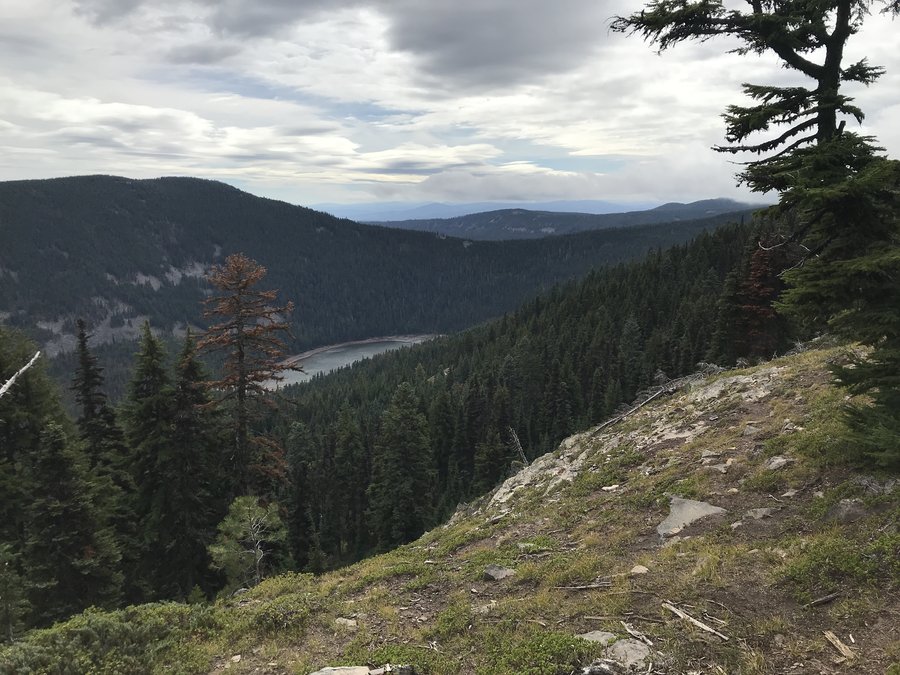
Coldwater Lake Loop
13.3 miles of hiking • 2750' elevation gain •
Great day in the monument. We started at the south Coldwater Ridge trail. Mostly snow free except for a few patches. One of them was too slippery, with a very steep run out, to navigate without a brief detour up and around. At the trail junction that heads down to the lake we kept going on the Ridge trail, for almost a mile east to check out the snow situation. It was sporadic back in there but the patches that were there, were postholey, or were on steeply angled slopes. It's melting fast though. Not impassable just a bit of work, given that we still wanted to do the lake on the north side. The creeks on the north side of the lake were all flowing well. The main waterfall crossing was easy but not entirely dry footed. Still a bit of snow on all the nearby peaks.
April 25, 2019


 1
1
Angels Rest to Devils Rest loop
11 miles of hiking • 3000' elevation gain •
For all the many times I had been in the area, I had never returned from Devils Rest via Foxglove. The early bloom of Trilliums, oxalis and yellow violets is on to about 2200 feet and the Larkspur is almost ready lower down. The connector trail between Wahkeena and Multnomah is closed just beyond the junction with the Devils Rest Trail. Loved this first hot day.
April 18, 2019
 2
2
Twin Tunnels
8.6 miles of hiking • 500' elevation gain •
Had a great day seeing the bloom start on an easy level trail, along the old highway to Twin Tunnels.
April 14, 2019


 1
1
Gales Creek
16.5 miles of hiking • 3250' elevation gain •
Great rainy day hike. Lots of streams and small to medium waterfalls. We saw no one else out there. The trail is open to non motorized mountain bikes. The bloom is just starting. Great day.
April 10, 2019

Post Canyon Recreation Area
8 miles of hiking • 1000' elevation gain •
Great day, cruising around in a big loop in this area. Sunny skies, minimal snow just in patches, a few mountain bikes up at the north end of the loop. Some clearcuts and great views up to Adams and down to Hood.
March 31, 2019
 1
1
Herman Creek to Whiskey Creek
12.1 miles of hiking • 2250' elevation gain •
I wanted to see how the melt off was progressing, so I headed up to Herman Creek. The lot was full, but 90% of the folks were doing the Indian Point Loop. I just headed south, up the creek trail. I went about 6 miles in. The creek crossings were wet and a bit slippery but fine. Fairly continuous snow started at about the 5 mile mark, but was easy to navigate. The snow got softer and deeper past Whisky Creek, but was still only 6-8 ". A few blooms but not many yet.
March 24, 2019
 2
2
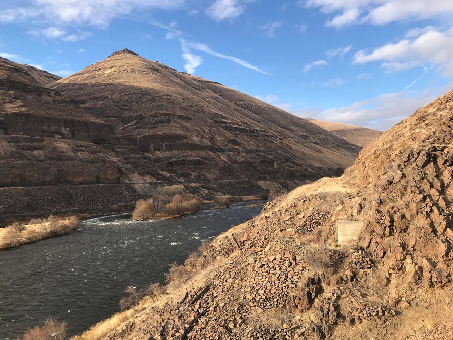
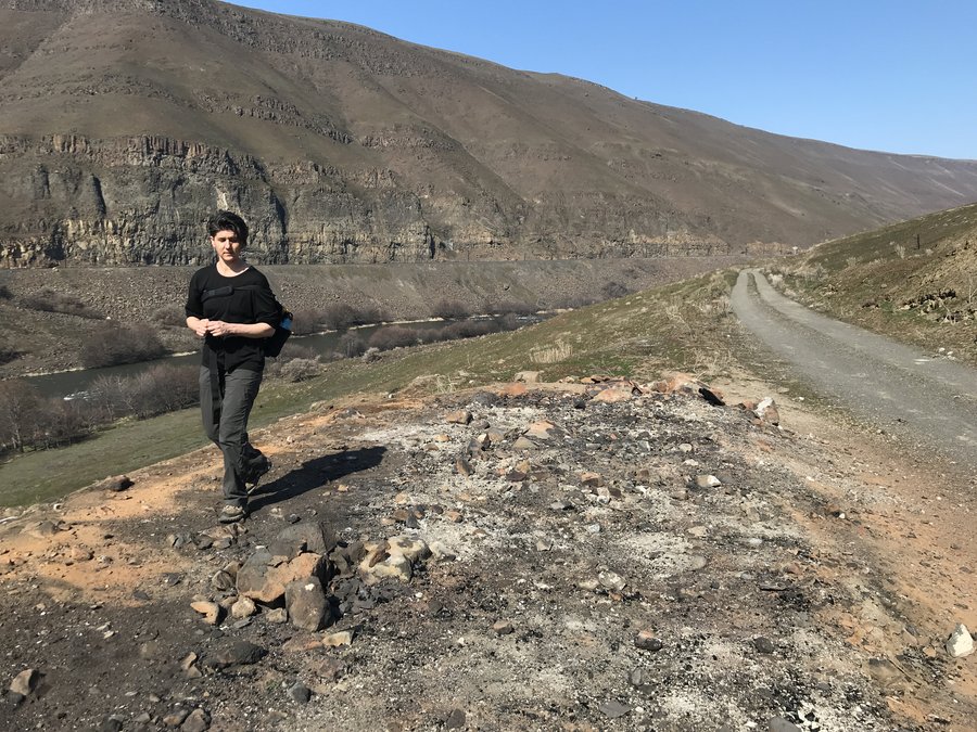
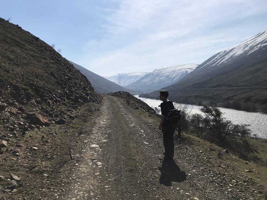
Lower Deschutes Trail
12.8 miles of hiking • 250' elevation gain •
Desperate for some non snowy trail we headed east and had a lovely day checking out the already faint traces of last summers burn. The boxcar is gone, but lot's of lovely rocks remain.
March 20, 2019

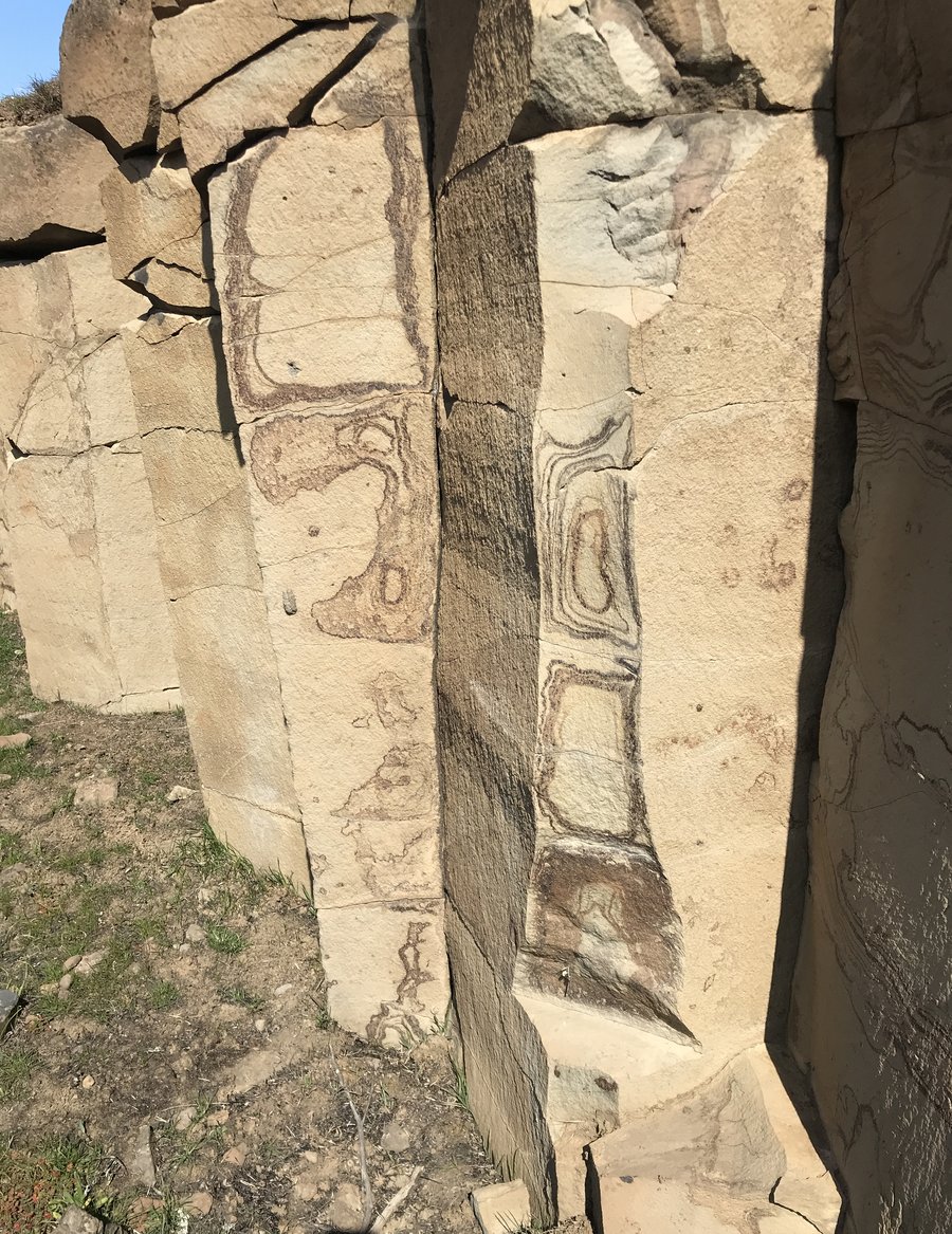 1
1
Minto Brown Island Park
6.3 miles of hiking • 0' elevation gain •
Getting out to hike, has been difficult the last month, so I was happy to get out with friends who were doing a rehab hike. They had invited a couple of hikers, I had been wanting to meet for awhile. It's a really nice park, the trails are mostly paved, with lots of wetland views. It seems like a great birdwatcher area. Great day with great people.
March 3, 2019
 1
1
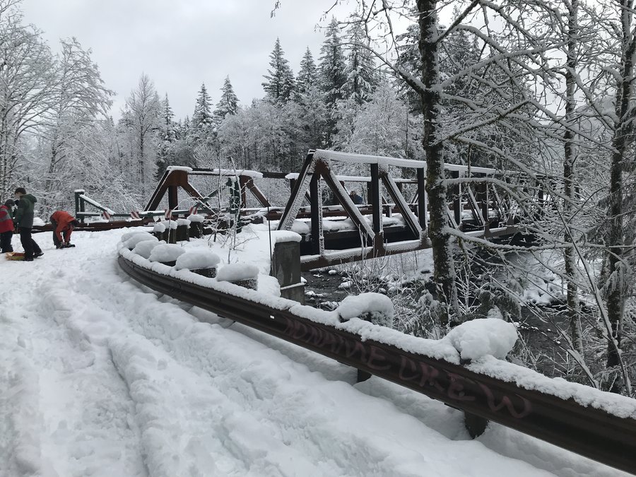
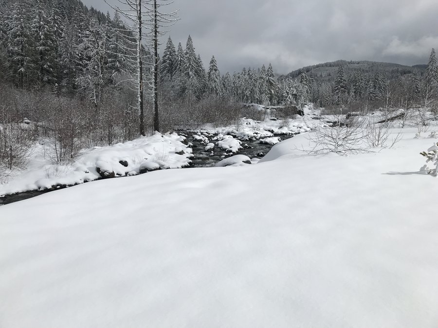
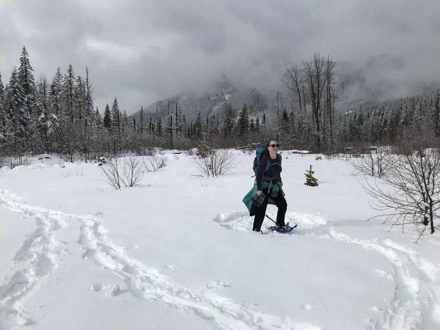
Old Maid Flats Snowshoe
6.8 miles of hiking • 500' elevation gain •
Ducked off 26 on Lolo Pass Road just before the traffic slowdown this morning and drove up to the end of the plowed section of road and then snowshoed in to the Ramona Falls TH. Quite a few folks. Lolo Pass was packed snow in the morning and mostly bare pavement mid afternoon. Great snow and a wonderful day.
February 17, 2019

TDH Ridge
7.8 miles of hiking • 1500' elevation gain •
Great day with hundreds of other folks on the way to Tom Dick and Harry Ridge. The trail below Mirror lake is a complete ice rink, with melted water on top. Clear skies above and warm. Fantastic day.
January 27, 2019


 1
1
University Falls Loop
8 miles of hiking • 1250' elevation gain •
Did a nice loop out to University Falls. Not many people on the trail, but a lot of gunfire and atv noise in the near proximity. There are some really pretty stretches of creek.
January 26, 2019
 1
1
Wahkeena Springs
4.2 miles of hiking • 1500' elevation gain •
Just a wonderful short stroll to take a friend to see Wahkeena Springs.
January 21, 2019

 1
1
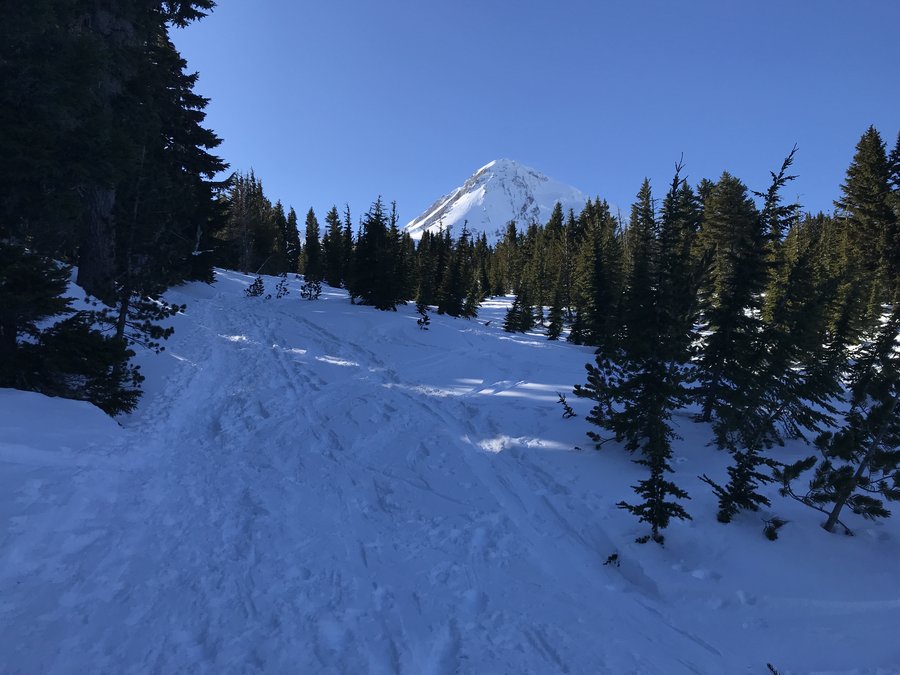
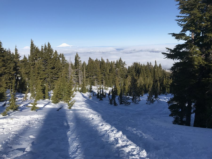
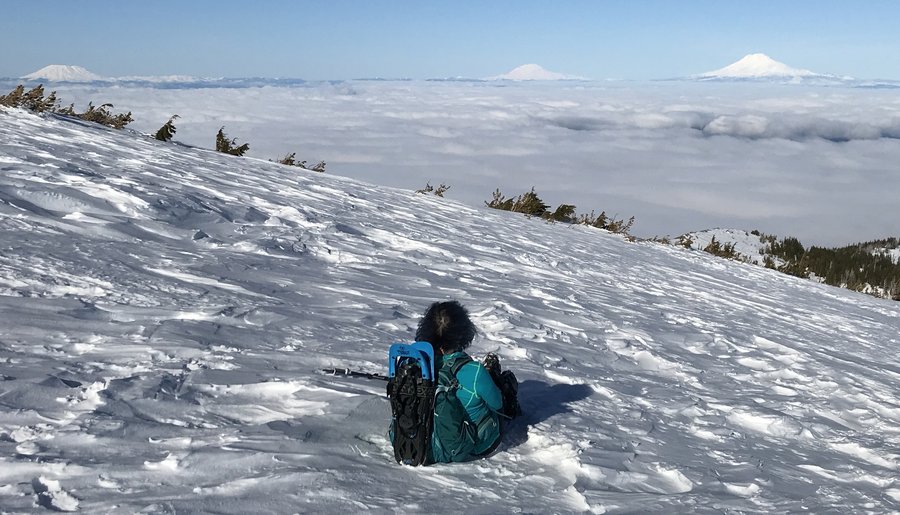
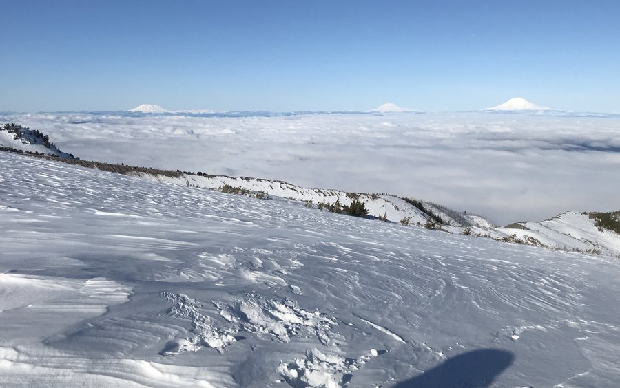
Tilly Jane sno-park to Cooper Spur Shelter
7.6 miles of hiking • 3000' elevation gain •
A wonderful blustery day on the mountain. Right now the snow is packed and fine with just spikes. Once you get close to Timberline, the route is less obvious, because of wind blown snow, but if you have been before it would be fine. We saw no one above the A-frame. Stunning.
January 13, 2019


 2
2
Larch Mountain Loop
16 miles of hiking • 4250' elevation gain •
Wonderful day back in the gorge. Hoping for sun we headed up to the top of Larch Mountain from Multnomah falls. It was pretty breezy at the top. Very limited snow on the way up. A bit icy on the steps up to the top. Spikes would be useful, but we didn't need them. On the way back, we decided to head down Oneonta trail and loop up through the crater back to the main trail. There was a bit more snow on this part and there were no boot prints on the trail. Maybe 6ish inches of snow total. Really nice variation on the out and back and so wonderful to get up there.
January 11, 2019
 1
1
Angels Rest to Wahkeena Springs
10.4 miles of hiking • 2500' elevation gain •
Tons of cars, but not as crowded as I expected. Beautiful day, great companionship and lots of beautiful moments big and small. Happy New Year all!
January 1, 2019

View trips from: 2014 2015 2016 2017 2018 2020 2021 2022 2023