

2017 Trips

 2
2
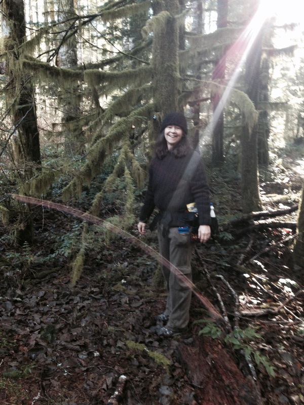
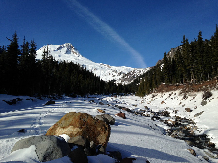
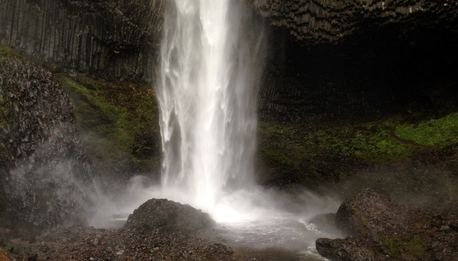
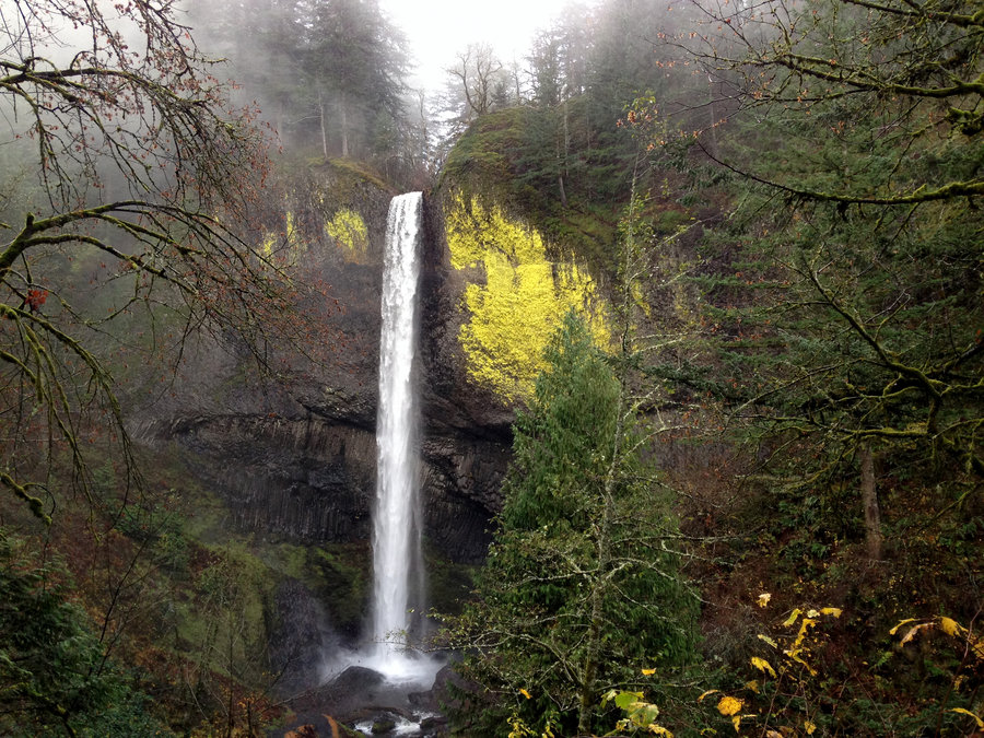
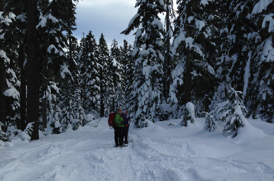
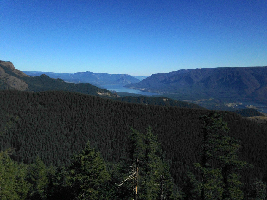
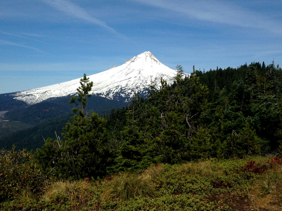
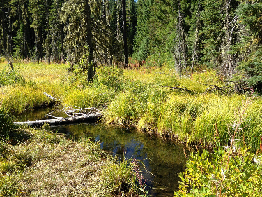
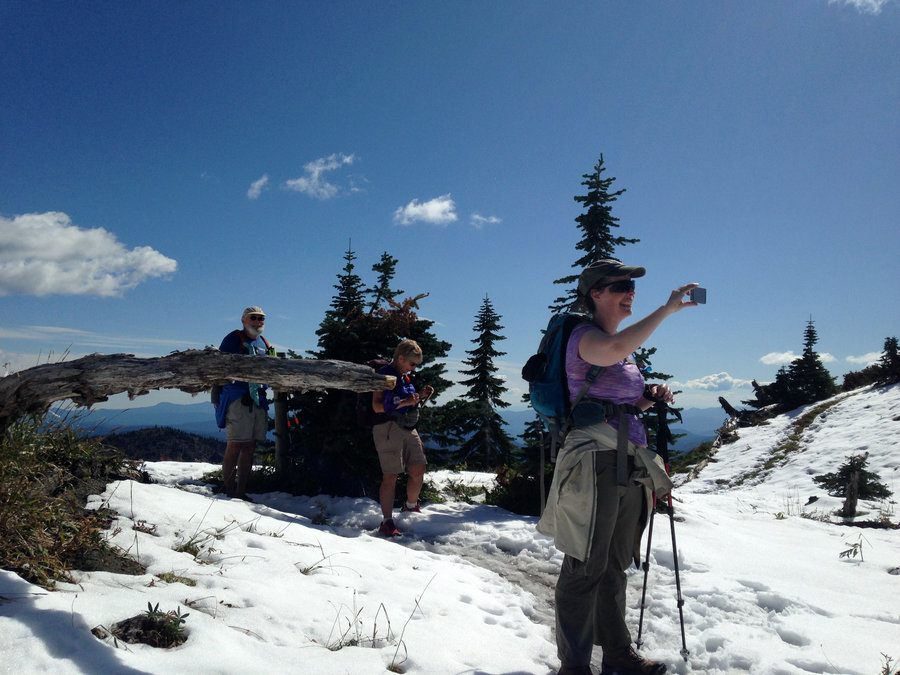
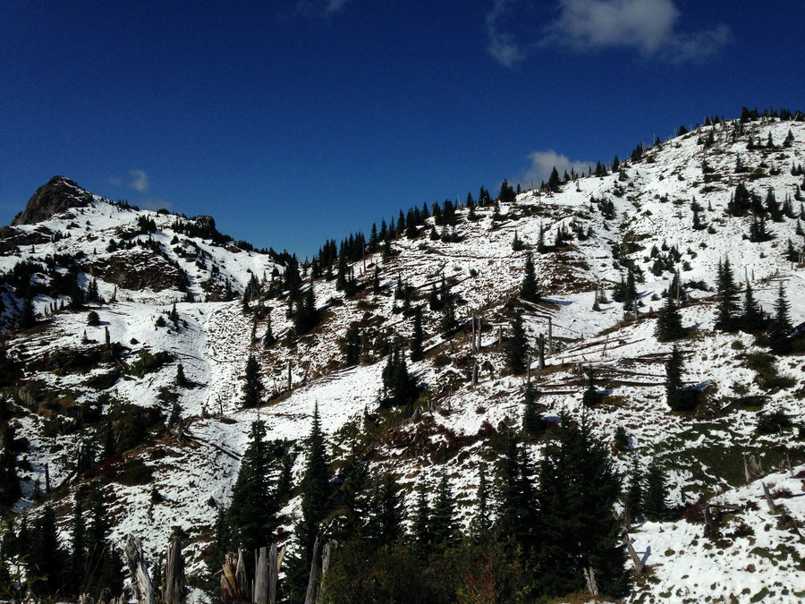
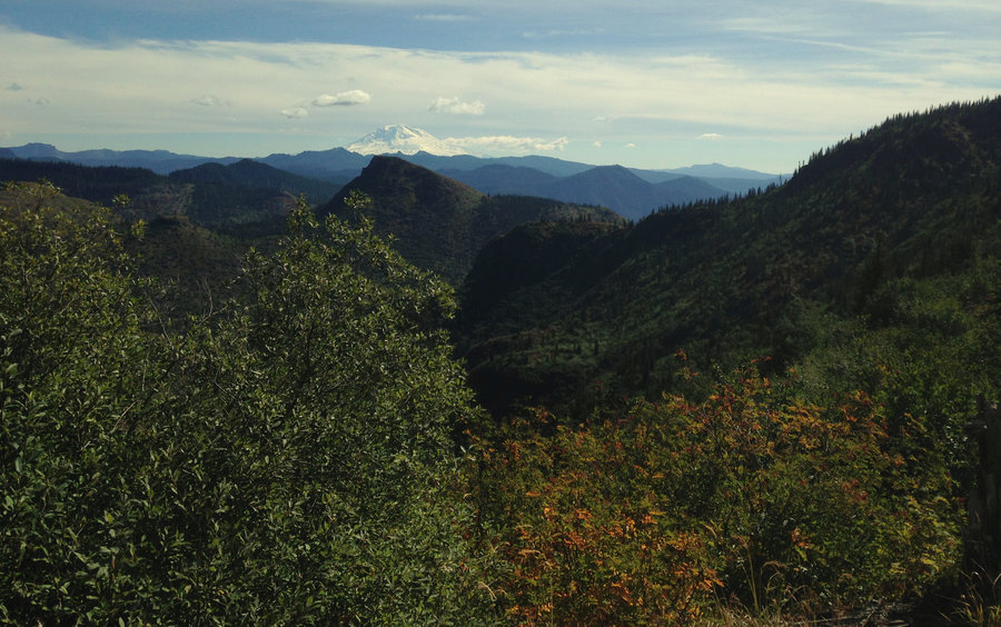
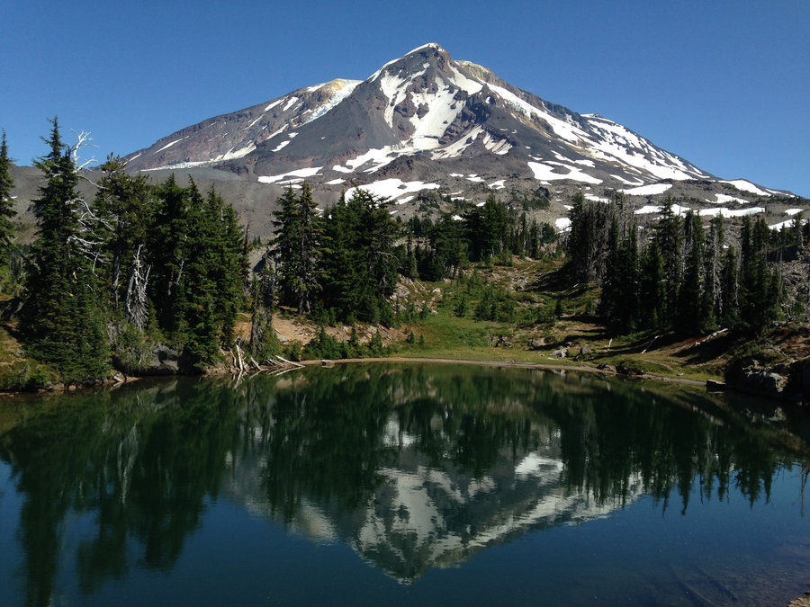
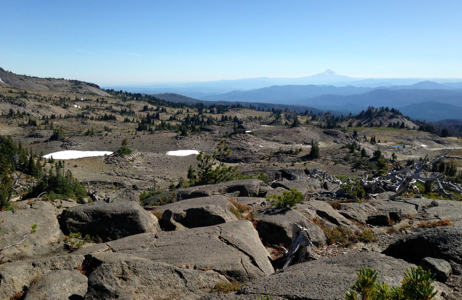
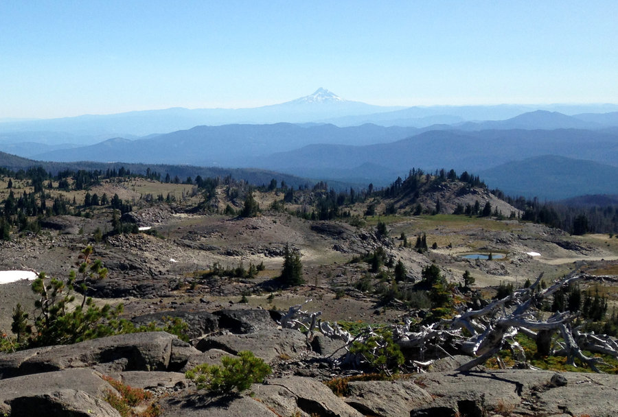
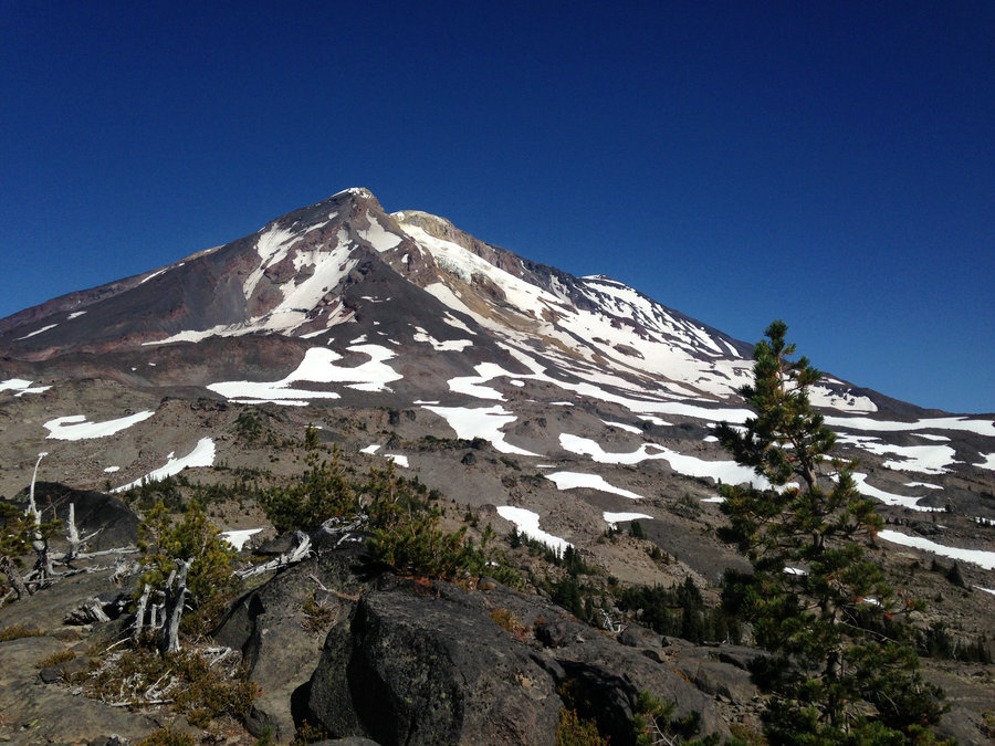
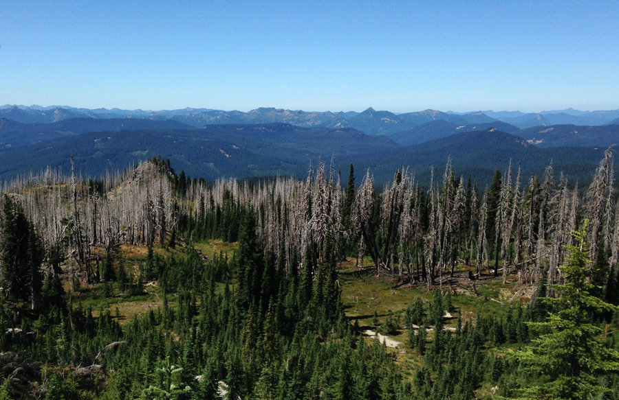
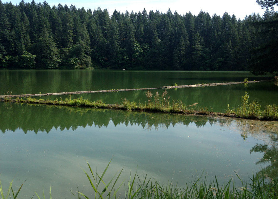
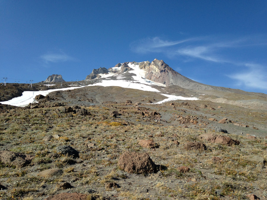
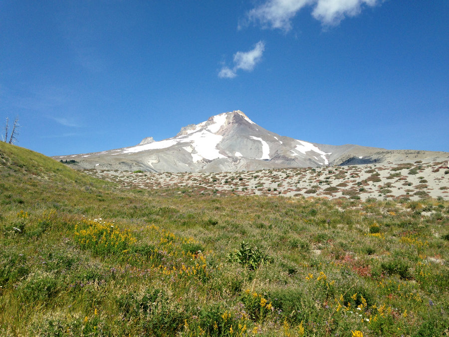
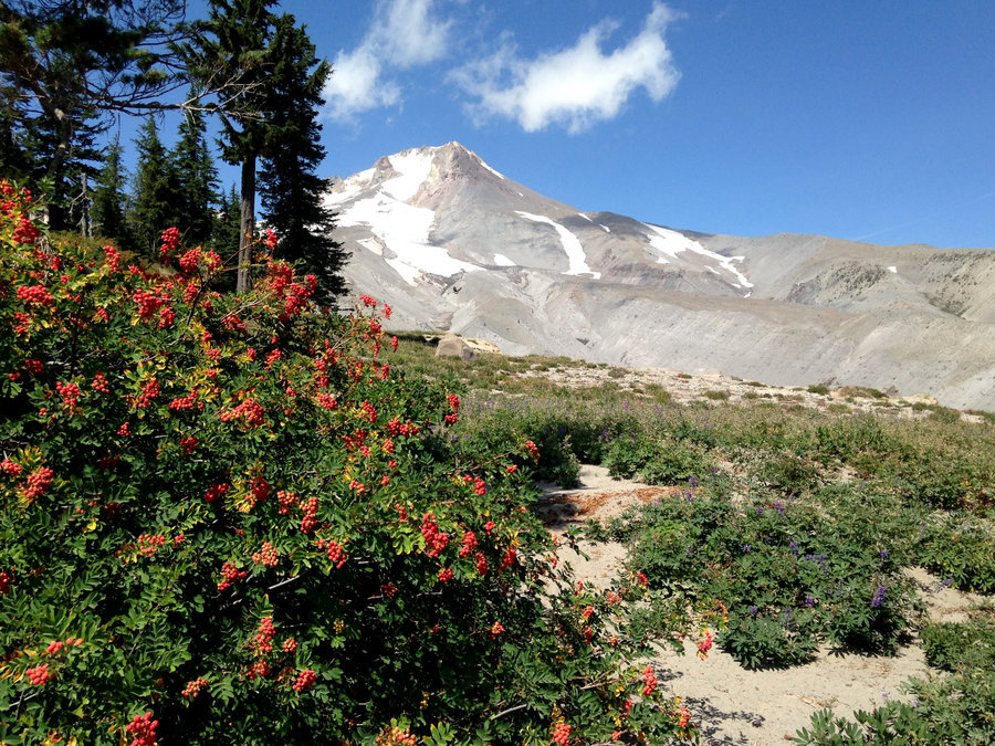
Phlox Hardy Creek Loop
12.7 miles of hiking • 3250' elevation gain •
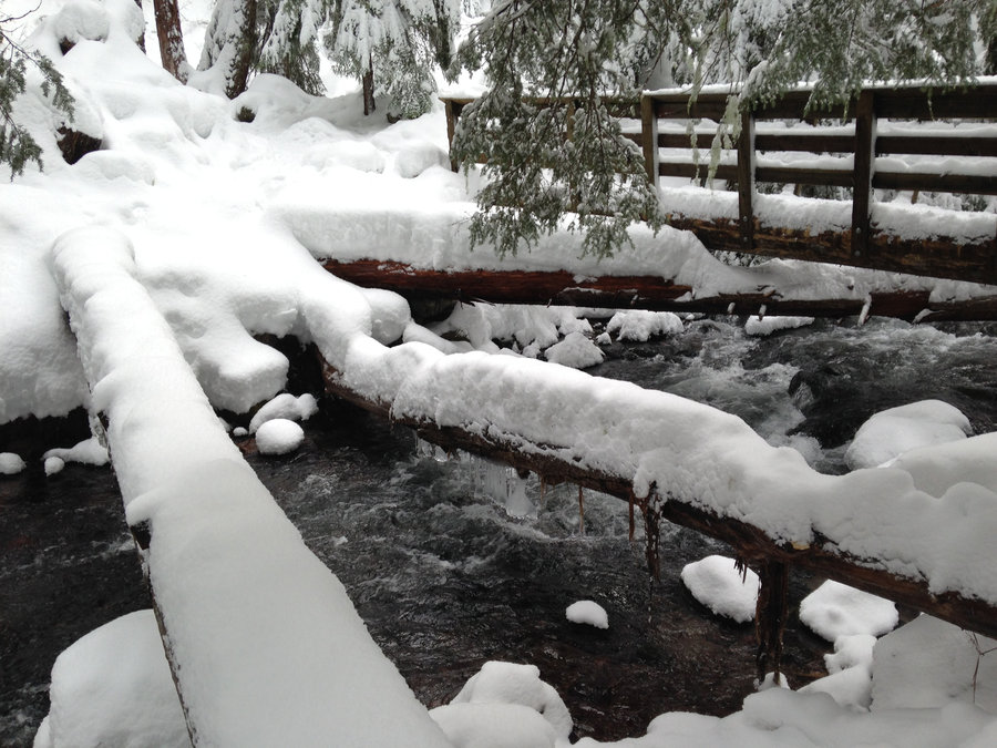
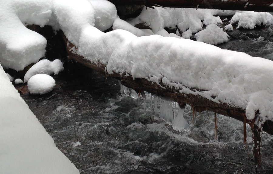
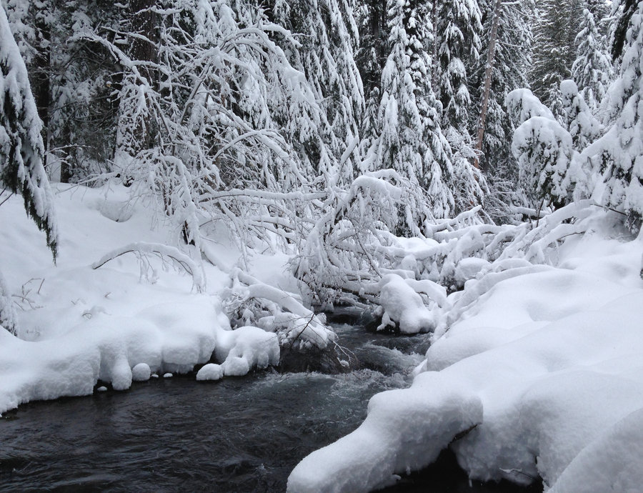
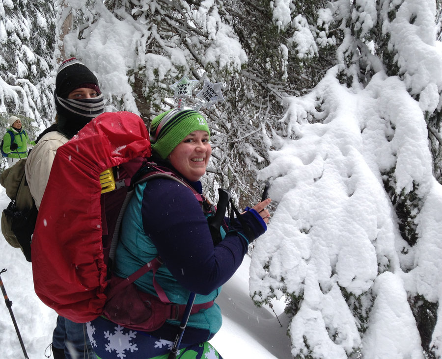
Wonderful day out exploring new terrain in the Hamilton Hardy area. We parked at the Hamilton trailhead, and went up past Little Beacon Rock back to the conjunction with the main trail. Shortly after we, headed west offtrail to see the old cabin and continued on northwestish until we hit the equestrian trail in the Hardy Ridge area. We headed up Hardy Ridge on the west side and on up to the summit at Phlox Point. There were sections of deep snow alternating with mostly bare ground for the last mile or so. After lunch, a miraculous fog clearing and a great Brocken Spectre viewing, we headed down through the snow on the east side and up to the northern most bridge, back down along Hardy Creek and hooked back up with the main Hamilton trail tagging the falls just before sunset. Amazing day!!

December 30, 2017


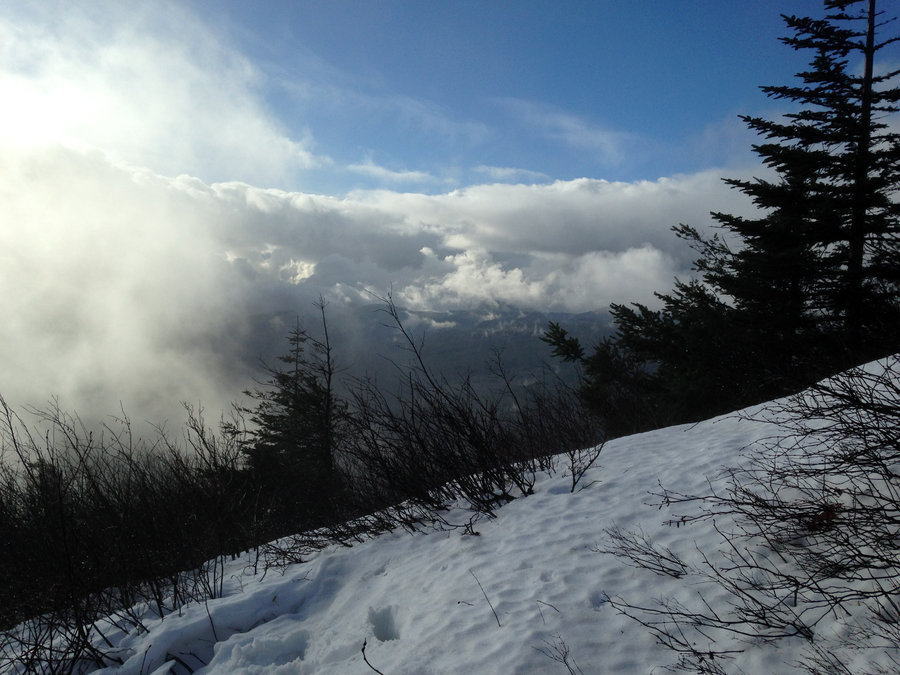

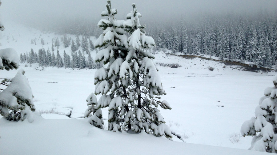
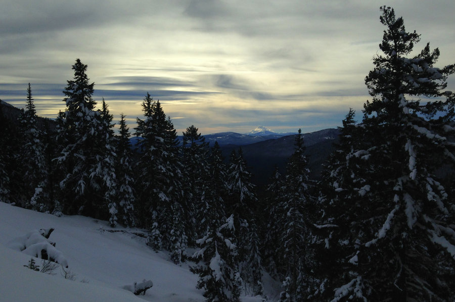
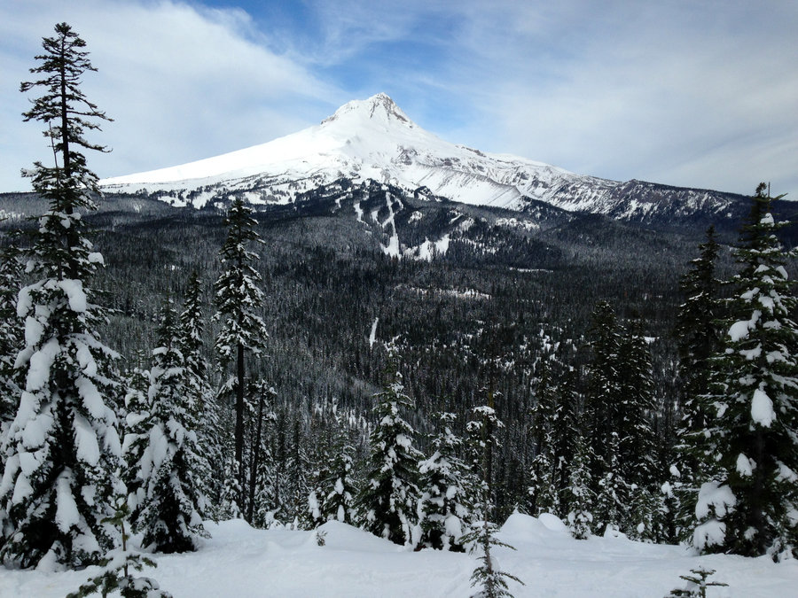
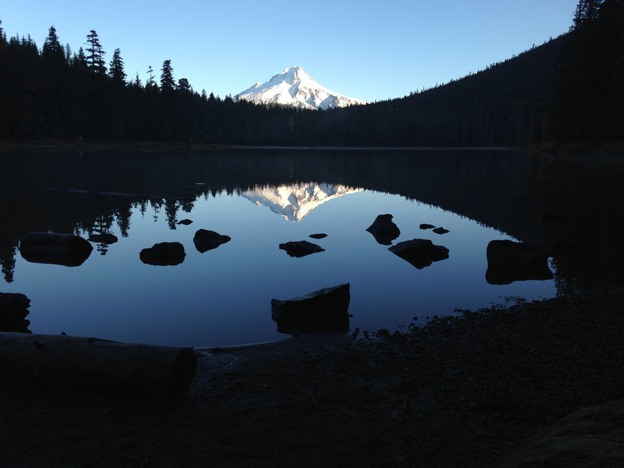
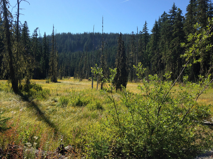
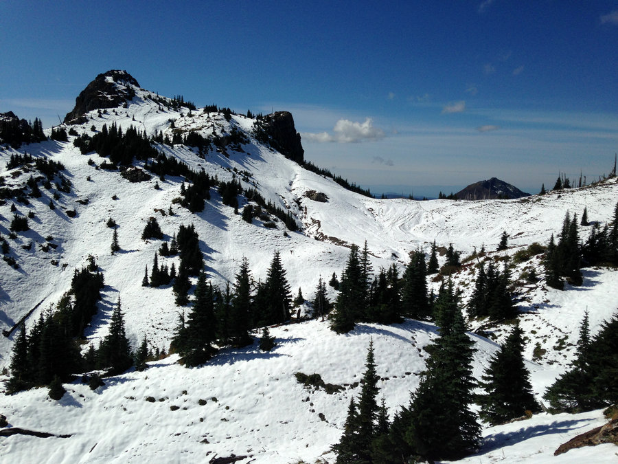
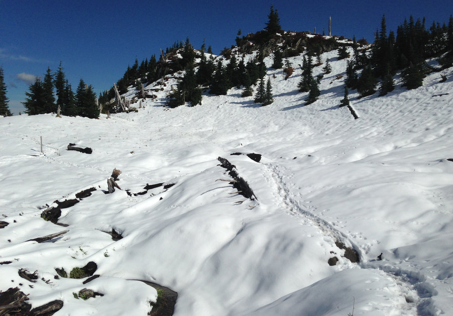
Newton Creek Snowshoe
4.7 miles of hiking • 500' elevation gain •
After trying to snowshoe at Bennett Pass, only to find a full parking lot, we found ourselves at the Nordic Center near the Elk Meadows trailhead. Tons of skiers but Elk Meadows and the Newton Creek trail were super quiet and probably the prettiest snowshoe I've ever done. The trail was well broken and easy to follow until about 5100'. A nice lunch spot near the river with a Mt Hood view was the perfect ending to the day.
December 30, 2017


 1
1
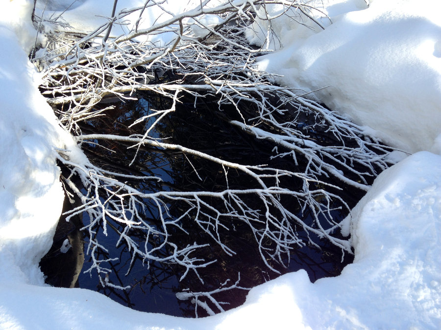
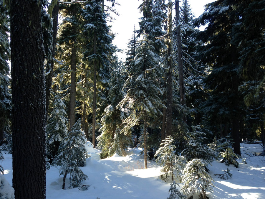
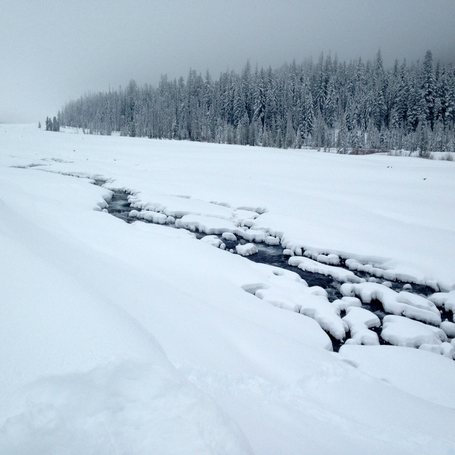
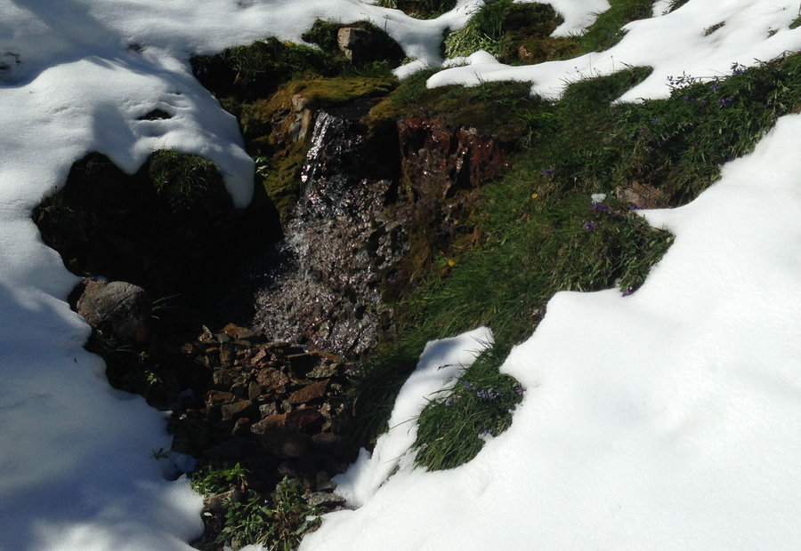
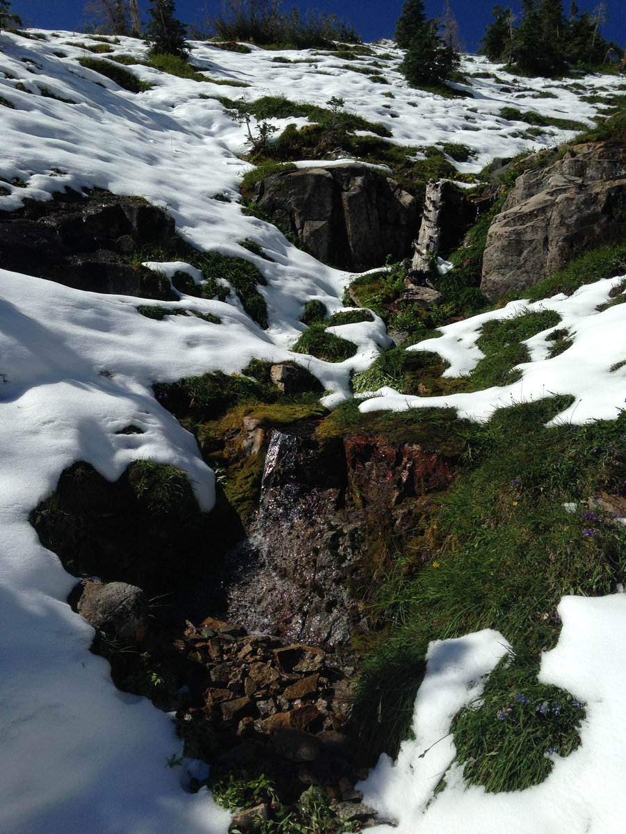
White River Snowshoe
3.2 miles of hiking • 750' elevation gain •
No views, but beautifully flocked trees and the snow was pure powder. Even on snowshoes, it was a bit like skiing. We tried to take the snowshoe path through the trees rather than the regular cattle trail up, but we were breaking trail in 2-3 feet of powder. Great company and it ended up being super fun watching everyone sled down the hills.
December 23, 2017

 1
1
Siouxon Creek to Chinook Falls
8.5 miles of hiking • 1500' elevation gain •
Wonderful day with a bunch of folks out celebrating a friend's birthday. The falls are all raging nicely right now and there is no snow on the trail. Not muddy and the creek crossings are good. The only caveat is a very large boulder is plunked down in the middle of the road a mile or two west of the trail head.
December 16, 2017
 2
2
Hummocks TH to JRO
11 miles of hiking • 2000' elevation gain •
Amazing day. Minimal snow until we hit JRO. About a foot after that. Great company and wonderful views.
December 13, 2017
 1
1
Hamilton Loop plus a little extra
9.2 miles of hiking • 2000' elevation gain •
Some dramatic clouds, snow on the hilltops in Oregon, prismed water drops and even some sunshine. The trail is super mucked out from the rain and extra hiking it's receiving. After lunch at the saddle I headed a bit further north to explore some more of the area, Fantastic day.
December 4, 2017

November 24, 2017

 1
1
Bennett Pass Snow Shoe
4.6 miles of hiking • 750' elevation gain •
Wonderful day easing into the snow shoe season. Great company and good conditions. There's about 30 inches of snow in good shape up there. Bonus points cause it was Sunday and a bit quieter.
November 19, 2017

 2
2
Frog Lake Buttes to Barlow Pass Loop
17.5 miles of hiking • 3250' elevation gain •
Wonderful day, even some great fall color in a few spots up near Palmateer Point and on the trail section down to Devils Half Acre. Frog Lake Buttes was super fun, but you have to hunt for the views these days. There is a nice east view and a nice but partially obscured view of Hood to the north of the summit. One small patch of snow on the trail and the remnants of a snowman were all that remained of the recent snow fall. Good company and a good hike. Totally awesome day!!
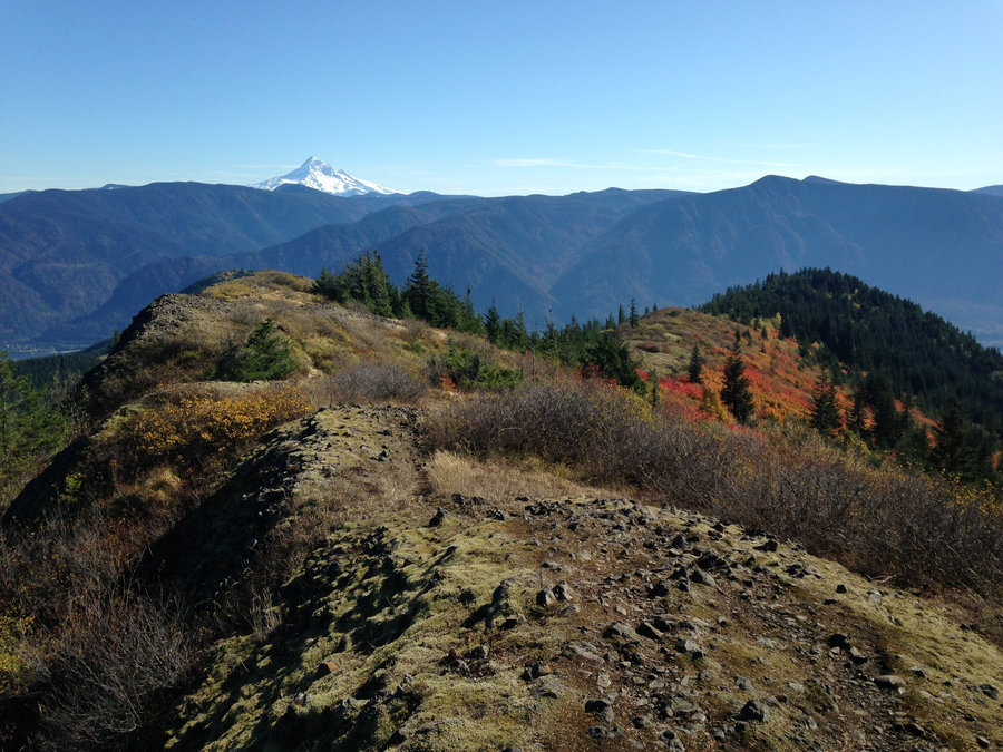
October 24, 2017


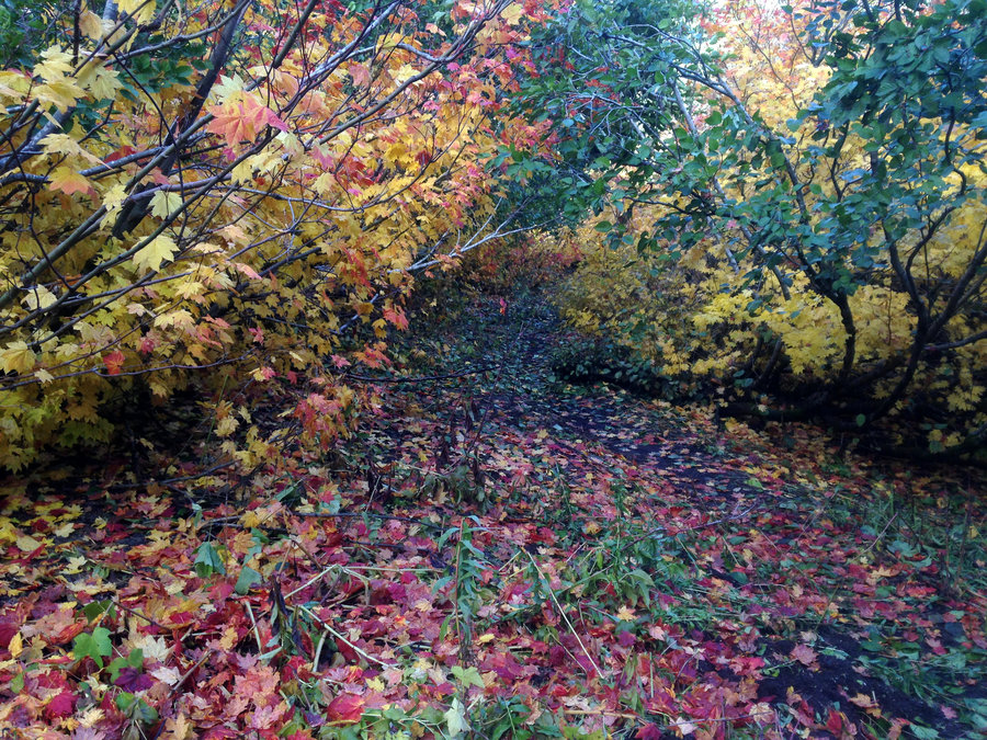

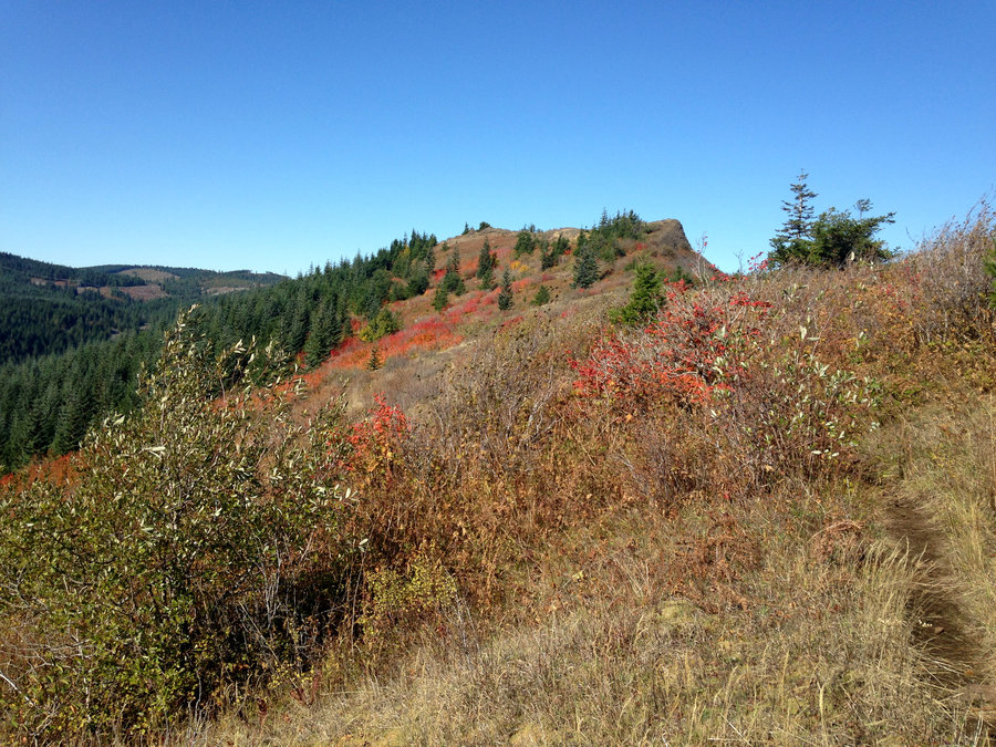
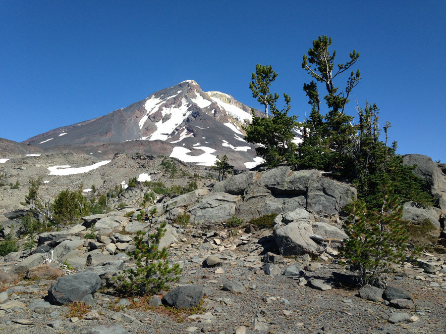
Phlox Point Loop
8.6 miles of hiking • 2250' elevation gain •
I managed to get out in the sun on Monday. Super quiet out on the trail. I only saw one person up there all day. Fall color is good on the open ridge tops but still green lower down. I got my first views of the burn in the gorge, but it was to hazy for pics. It was a wonderful day.
October 16, 2017

 2
2
Bonney Butte and Boulder Lake
10.1 miles of hiking • 2250' elevation gain •
I decided to get out while the weather was good. So I parked my car just off RD 48 and hiked up to the top of Bonney Butte. The annual Hawkwatch was happening, so I hung out for awhile with the bird counters. I saw 2 Goshawks and a Redtail. There are very tiny patches of snow up above 5000' or so, but nothing monumental. I did a nice circuit of the meadows and then headed down to Boulder Lake. The huckleberry bushes were beautiful on the edges of the meadow, but I was hoping for some larger patches of fall color and found them on the trail to Boulder lake. Wonderful day.
October 9, 2017


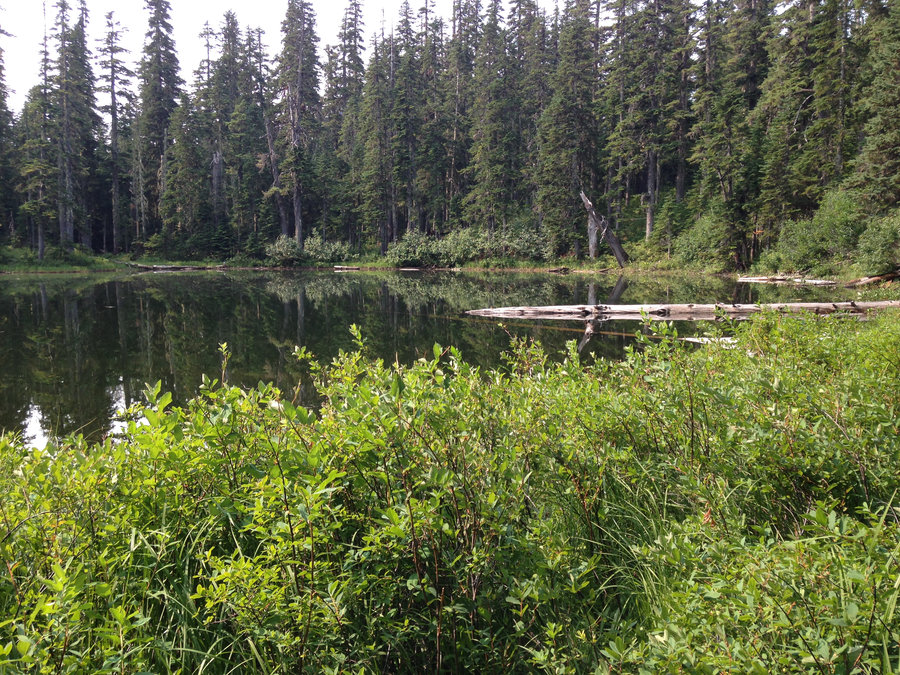
Burnt Lake
7 miles of hiking • 1500' elevation gain •
Misty moistey morning.We were hoping for an earlier clearing to the rain today, for a view from East Zigzag. But by the time we got to the lake it was evident that Blue Sky was a long ways away. So we just strolled around at the lake and headed home. The clouds on the water were beautiful.
October 2, 2017

September 30, 2017
 1
1
Hideaway and Shellrock Lake Browse
3.6 miles of hiking • 250' elevation gain •
I went with a friend to check on a wildlife camera out in the High Rock area and decided to take a quick stroll up to Hideaway and Shellrock Lakes. The vine maples in the open areas are beautiful and the area is pretty quiet. There was a logging operation loading up on the way in on Rd 58 that we had to wait for. But not too long. Wonderful day wading and staring at Newts in the shallows.
September 27, 2017

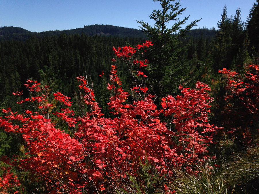

 2
2
Norway Pass to Mt Tomroy
10.4 miles of hiking • 2500' elevation gain •
Fall Colors are on!! Views in every direction. Slippery snow discourage us from doing the final ascent up to Mt. Tomroy. But we couldn't have been happier. Great day with trail friends old and new.
September 24, 2017

 1
1
Fret Creek to Flag Point
9.1 miles of hiking • 1250' elevation gain •
Took a good friend up to Flag Point Lookout. The Fret Creek Trail was still mossy near the creek, but everything else is dry, dry dry. Super smokey in terms of views, but still lovely. Amazing day.
September 14, 2017
 1
1
Cannon Beach Off-trail Big trees
4 miles of hiking • 0' elevation gain •
Just wandered around on old roads and off trail looking for big old growth trees with a few lovely friends. Ended the day with a nice beach walk. Amazing day. it's been way to long since I've been to the coast.
September 10, 2017
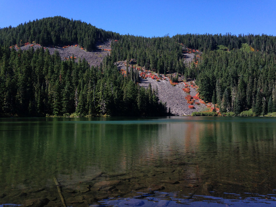
 2
2
Indian Heaven Basin Lakes
7 miles of hiking • 1000' elevation gain •
Wonderful day on an abandoned trail up to Basin Lakes in Indian Heaven, huckleberries and lots of hidden ponds. Perfect until we sat down for lunch and Karl noticed a huge smoke plume not so very far from us. it was the East Crater Fire starting. We quickly abandoned plans, let some campers in the area know and got out. Glad I saw those lakes mere hours before they likely burned. Still a great day with Two TFF's
September 3, 2017


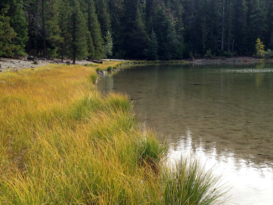
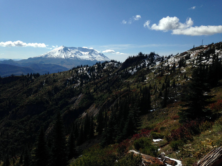
 3
3
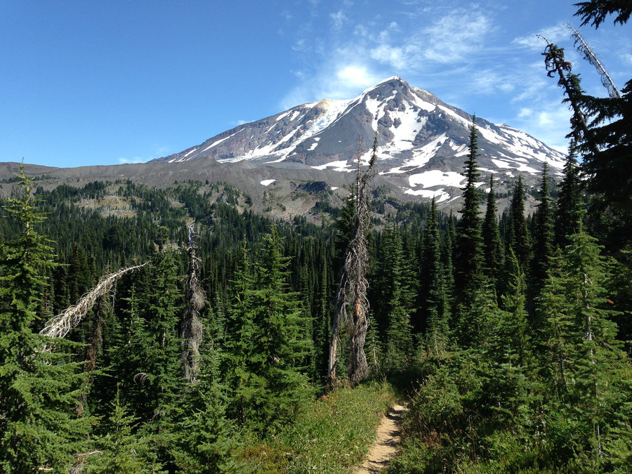
Mt Adams Crystal lake to Horseshoe Meadow
19 miles of hiking • 4000' elevation gain •
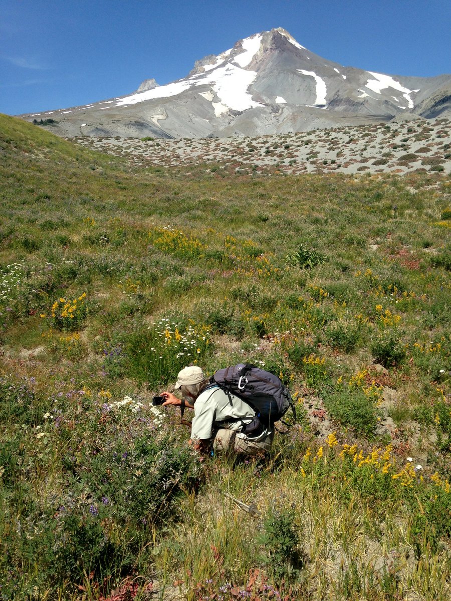
The area up above timberline is so amazing and just made for strolling. The flowers in the meadows below were still going, but they are finishing up. The dwarf lupines etc up above were perfect. We took the Riley Camp Trail up and the off trailed it to Crystal Lake and then just cruised across at about the 6500 line over to Horseshoe Meadows and then down the PCT south and took the 64A connector trail from the PCT back over to the Riley camp Trail. Completely one of the high points of my summer.
August 25, 2017


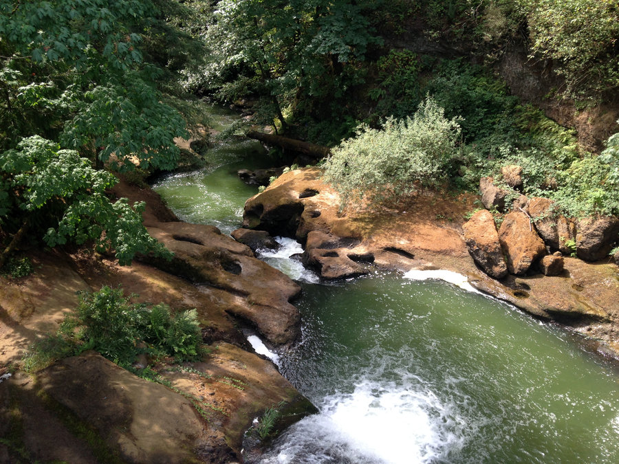
Lacamas Park
5 miles of hiking • 500' elevation gain •
Wonderful easy day in the green with good friends.
August 20, 2017


 2
2
Boy Scout Ridge Also
15 miles of hiking • 3250' elevation gain •
What Karl said :) I loved seeing waterfalls that I hadn't even heard of before.
August 19, 2017


Paradise Park Again.
11.6 miles of hiking • 2250' elevation gain •
I went a few weeks ago, but I had to go back to see the bloom :)
August 14, 2017

Tam Mcarthur Rim
7.6 miles of hiking • 1500' elevation gain •
Managed to find a little bubble of blue sky in a sea of brown air. Wonderful day. Definitely going back. I really recommend going further than the rim along the use path. Totally incredible.
August 12, 2017
 2
2
Newton Creek Trail and Above
9 miles of hiking • 2500' elevation gain •
Despite the heat and smoke it was a wonderful quiet day on the mountain. Just saw one person on the trail. Flowers are mostly cooked out. We went up Newton Creek Trail til it hit the Timberline Trail, Then headed over towards the Clark drainage. Instead of going down into the drainage we headed up the ridge between the Clark and Newton drainages, above the Timberline trail. Wonderful view of the Heather Canyon waterfalls, several tiers of waterfalls on Clark Creek, as well as multiple small waterfalls flowing off the glaciers into the drainages. Wonderful day.
August 9, 2017

Towards Cooper Spur
6 miles of hiking • 2250' elevation gain •
Wonderful day with Lupines and the glaciers.
July 27, 2017
 1
1
Paradise Park Loop from Timberline
13.4 miles of hiking • 3000' elevation gain •
Nice long meander. Some of the flowers are completely prime right now. Other patches are not even out from under the snow yet. Some bugs mid hike. Some really gnarly blowdown near the jct between the Timberline trail and the south part of the loop.I strolled up above Split Rock. It was awesome, but a bit smokey.
July 25, 2017
 1
1
Barrett Spur
16.2 miles of hiking • 5000' elevation gain •
Fantastic day, with a great trail friend, getting up to Barrett Spur and sitting with the glaciers. The bugs weren't to bad, the flowers at Elk Cove are just getting started, but the dwarf blooms on the ridge tops are great!!
July 19, 2017
 2
2
A Little Above McNeil Point
10.6 miles of hiking • 2750' elevation gain •
What can I say? It's one of my summer classics. Flowers are gorgeous and the views sublime. Did a short add on to about 6600' feet for better views and just because. No sign of the ice caves, that I could see.
July 13, 2017

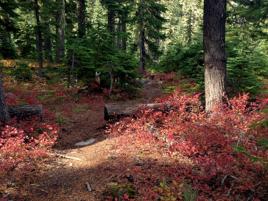
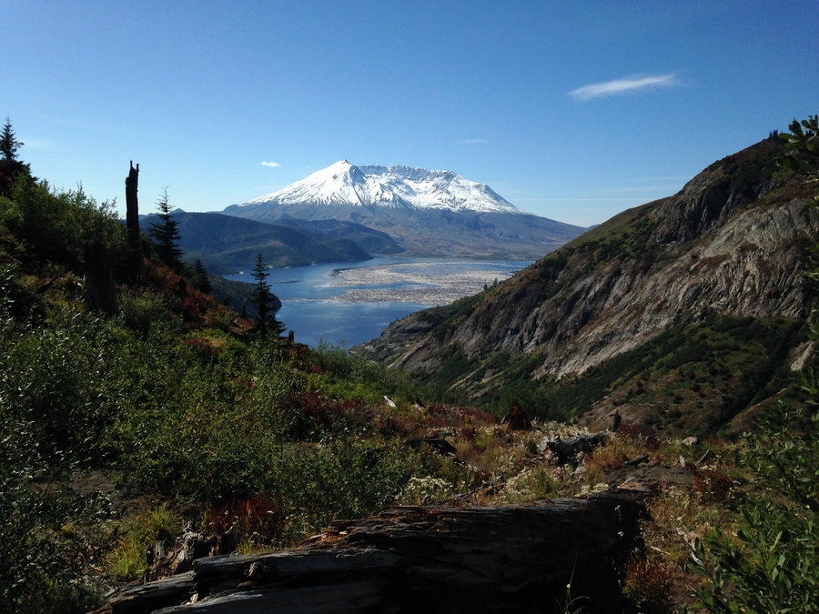
St Helens Area Rambling
11.2 miles of hiking • 2000' elevation gain •
Amazing post 4th quiet hike. Left from JRO and wandered over to one of my favorite lakes, went a bit further to the Rock Arch. I decided to skip Coldwater Peak. Then I joined the afternoon crowds at Harry's Ridge. Flowers are still going strong. Still a few snow patches once you get near the Arch. Great day.
July 5, 2017

Big Huckleberry Mountain
11.8 miles of hiking • 3000' elevation gain •
Wonderful flowers everywhere!! I'd say it can't get any better up there. Full range of flowers, all at peak bloom and lots of meadows with views. The road in, is full of potholes, but not really a problem if you go slow. We saw a bear on the road out. A young one. Met two new lovely trail friends and had wonderful company old and new.
July 2, 2017

Tomlike Mt
6.6 miles of hiking • 1250' elevation gain •
Started from Wahtum lake and had a short hike before it go hot. The flowers are going mostly full tilt up there. Views of course were beautiful. The bugs were crazy intense everywhere except the ridge top were there was a breeze and the snow is really just a few patches in the saddle between Chinidere and Tomlike. Great day!!
June 30, 2017

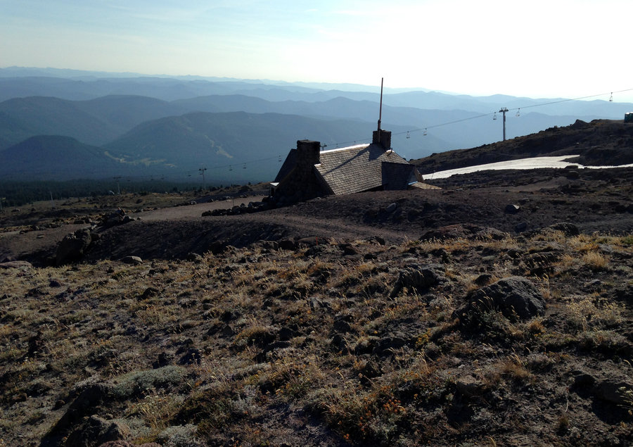
Timberline and up
3 miles of hiking • 1000' elevation gain •
Took a stroll up from the lodge to see how the bloom was going. Great views, lot's of miniscule and dwarf blooms in the green parts. To the west of the Lodge on the Timberline Trail, it was too snowy to be fun or flower filled, but the ridgelines east, above White River Canyon were wonderful. the gullies and ravines are still filled with snow though. Fantastic day and great views.
June 28, 2017

Tom Dick and Harry Mountain
6.4 miles of hiking • 1500' elevation gain •
Fantastic day with a good friend to get a bit of restoration. Lots of flowers and the trail was in great shape. Lots of people. We could have sold our parking spot to the highest bidder though :) Several cars lined up waiting for a spot. Just perfect.
June 27, 2017
 2
2
Beyond Ball Point Badger Wilderness
9.2 miles of hiking • 2000' elevation gain •
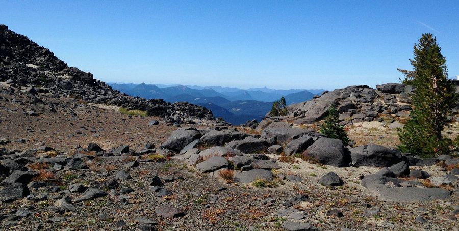
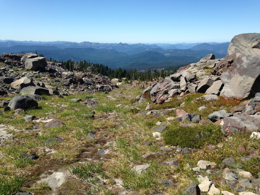
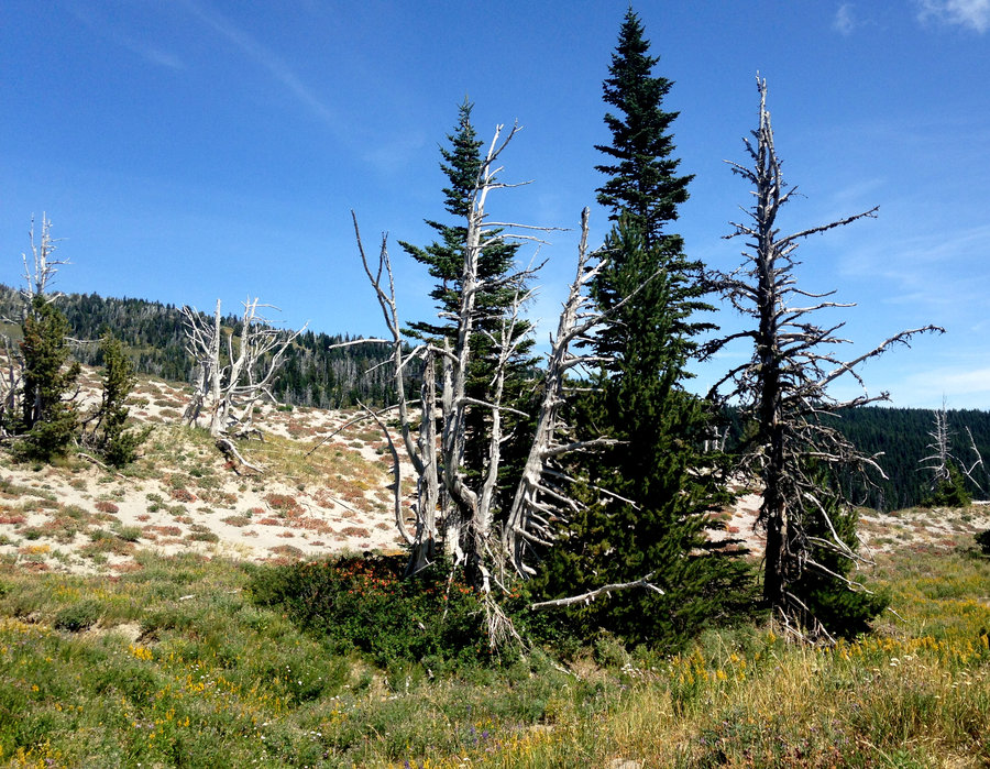
I decided to reject Sundays cloud forecast and head East into the Badger with a good friend. Views were great. The lower oak savannah, that is the first mile of the trail is pretty much done blooming except for yarrow and blue ceanothus. Once you are on the north slopes of Ball Point the bloom really picks up with a bumper crop of white ceanothus, and even a few Balsams still in bloom. Instead of doing a loop down Little Badger we kept going up. Helispot 122 and the Rock garden were amazing. We went about another mile and headed home. We ran into a couple folks who had gone all the way up to Lookout Mountain along the Divide trail. They reported no major blowdown, quite a bit of snow on the back of Lookout, but none on the top. Wonderful day!
June 18, 2017

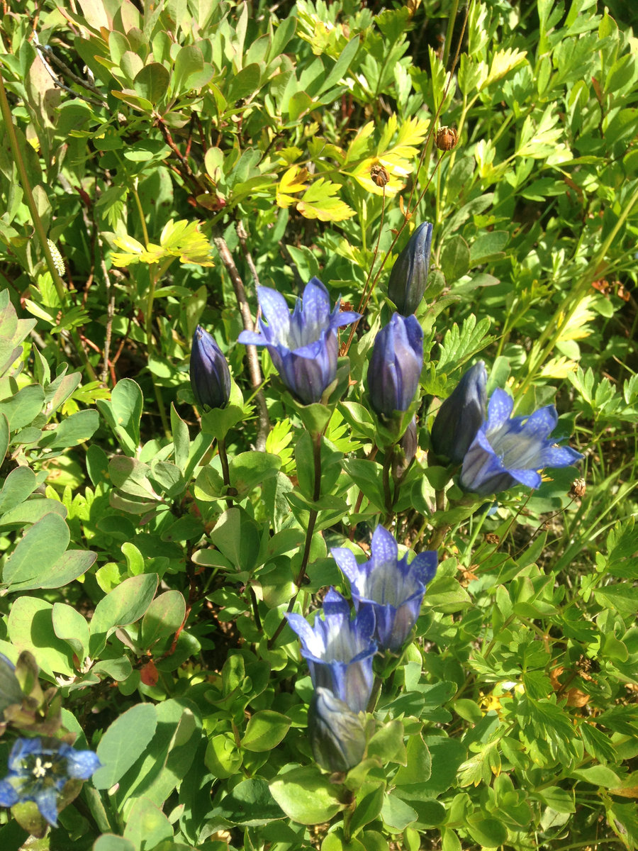
Phlox Point
8.2 miles of hiking • 2250' elevation gain •
Beautiful day doing the Hardy Ridge loop and up to Phlox Point. Beargrass, Phlox and a plethora of Penstamens were blooming up at the top. Some pretty extensive trail retreading work has been done. Awesome day!!!
June 4, 2017

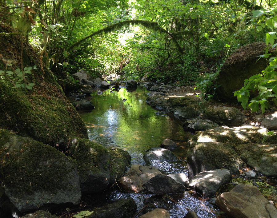
Herman Creek to Slide Creek
10 miles of hiking • 1750' elevation gain •
Herman Creek is a great rainy day hike, but I really always love it in the sun as well. Big news is some trail work has been done. Much appreciation. The two big down logs that were requiring a bit of a go around, are gone. They weren't difficult, but scrambling over them in the mud for those of us with shorter legs was always interesting. The water in Camp Creek has gone down substantially. But people were reporting that Whisky and Mullinix Creek were doable, but not necessarily dry footed, with a good bit of water coming through. Wonderful day with a friend.
May 29, 2017
 2
2
Sevenmile Hill and Tamanawas Falls
5.5 miles of hiking • 1000' elevation gain •
Since it was hot we decided to do two shorty hikes and explore back roads for future options. In the morning we hit Sevenmile Hill. It got hot too fast, and was a bit past peak until you get near the top. Nonetheless it was lovely. Then we took back roads as far as we could and then buzzed down Hwy 35 and parked at the pullout for Tamanawas fall TH. Crowded, but super pretty and refreshing after the heat. Not much blooming there yet. Snow has only recently melted. But the creek was flowing strong and beautiful. Great day.
May 21, 2017

Hamilton Mountain Loop
7.5 miles of hiking • 2000' elevation gain •
Just had to get out there today. Hoping to get a few more hikes in during this stretch of good weather. Marvelous out there. Still very green and the second wave of woodland flowers are starting to pop. False Solomon Seals, Larkspur and even a few phlox at the saddle. Super crowded today, but everyone was in good spirits.
May 19, 2017
Small Dalles Ranch Loop
3 miles of hiking • 500' elevation gain •
Just a lovely day and a small walk on my friends birthday. Lupine and phlox are peaking, The Balsam root is slightly past, but still beautiful. On the way home we did a quick stop at Catherine Creek to see if the Lewisia is blooming and it was full on near the trailhead.
May 9, 2017

Ramona Falls
8.2 miles of hiking • 1000' elevation gain •
Great day and not too crowded. We crossed the Sandy a bit further up on a log I could scoot across rather than the typical crossing. The mountain is still full of snow and we took the cut off near the falls, from the trail down to the Sandy and walked a ways along the bank to get a better look at the mountain. Some nice looking waterfalls up there, in the distance, right now and still snow on the tops of the cliffs along the river. On the trail, there just a few patches of snow, that were no problem at all and are melting fast. Beautiful mossy creeklets on the back half along Ramona Creek. A few Trilliums, some calypsos and a few blooming willows, were mostly it for flowers.
May 7, 2017

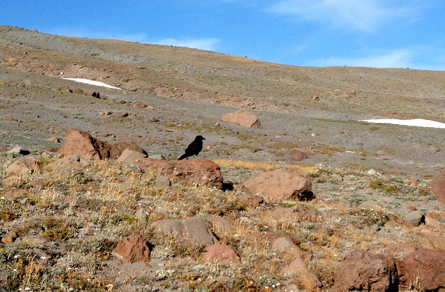
Eagle Creek to past Twister
12.6 miles of hiking • 1250' elevation gain •
Beautiful 80 degree day! I strolled up a ways past Twister falls and ate lunch with a nice Crow friend, The hanging meadows are starting to pop and the second wave of shade lovers like Solomon Seal are just starting. Being short legged and not as sure of my balance anymore, the Wy'east creek crossing just before the potholes is a bit harder this year. But I waded on the way out, and crossed at a log jam below the ford on the way back. Great day!!!
May 3, 2017

Crawford Oaks Loop
8.1 miles of hiking • 1250' elevation gain •
In honor of International workday and that ancient flower day currently celebrated as May Day, I went out with a friend to do the Crawford Oaks loop. Flowers are looking amazing below the ranch. Eight Mile creek is back to being a dry footed crossing. Cloudy, but comfortable. Really great day
May 1, 2017

Cape Horn Upper Loop
5 miles of hiking • 1000' elevation gain •
Beautiful day. Lots of sun. Many sneak peaks into the gorge in addition to the viewpoints, since the trees aren't leafed out yet. South side of Silver Star was looking snow free, but plenty of snow on the other sides as far as I could tell. The second wave of flowers is starting!!
April 21, 2017

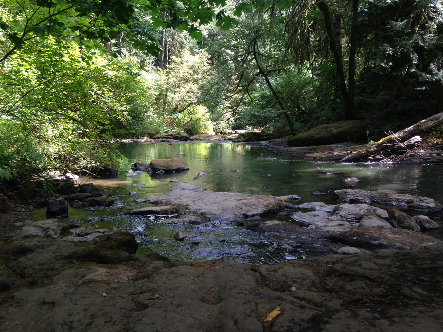
Herman Creek in the Sun!!
10 miles of hiking • 1750' elevation gain •
Lovely day!! Although I'm still not used to the parking lot at Herman Creek filling up. Made it to Mullinex Creek which looked to be a wet footed crossing(although an easy one). Camp Creek was getting a lot of peoples feet wet. The waterfalls were beautiful. Saw a few folks heading up to snow camp and lots of folks headed up to Indian Point and Nick Eaton. So the snow track should be pretty defined. Still really appreciating dirt under my feet.
April 15, 2017

Eagle Creek
15 miles of hiking • 1750' elevation gain •
Lovely day out with Karl. Wy'East was the only creek crossing where I had to think about my options, but no real problem crossing.
April 9, 2017

Horsetail Oneonota
8.2 miles of hiking • 1750' elevation gain •
Beautiful sunny day in the gorge. From Horse tail I went up past Triple falls to check out the washout and see how far I could go before I hit snow. The washout just before the 3rd bridge was fine. I ran out of time before any snow was apparent except small patches at 1600'. None visible as far as I could see above me. Trilliums started to bloom above and some Corydalis down below. Wonderful day.
April 3, 2017
 1
1
Eagle Creek Gazillion Waterfall Tour
7.2 miles of hiking • 500' elevation gain •
Really truly a gazillion waterfalls! Beautiful day, the trail is fine flowers are starting and the water is amazing. The landslide at 3.1 miles looked pretty doable, but I turned around. Perfect!
March 31, 2017

Little North Santiam
6.4 miles of hiking • 1000' elevation gain •
Dripping wet but beautiful day, The river wasn't silty at all. Still full of that beautiful celadon green color. There's a but more eg than maps show, perhaps an older trail version stayed level with the river. The trail right now is one big creek. A fair amount of down trees, all of them fine, but it definitely slowed my progress, as well as allowing more opportunities for water to get inside my rain gear. An unnamed creek approximately across from Henline was a bit questionable today due to the rain and a good drop off just below the ford. We made it, but not a dry footed crossing right now. Awesome day and good company.
March 26, 2017

Eastern Catherine Creek
7.6 miles of hiking • 1250' elevation gain •
Went east hoping for a bit more sun and to check the bloom. Grass widows are booming and the lomatiums are coming along and the poison oak has not leafed out yet. Wandered east along Atwood road until I hit Burns Farm and made it back to the car before the clouds rolled in.
March 23, 2017
 1
1
Catherine creek Tracy Hill
7.6 miles of hiking • 1750' elevation gain •
Wow a second day of sun in the last week. I spent the day wandering around the old service roads and meadows at the top of Tracy Hill. Lots of water everywhere. Ran into another hiker that I just know from online with his amazing dog Rigby. Had lunch at a secret meadow with a view of Mt Hood. The flowers are just starting. A fantastic day.
March 16, 2017

Lower Deschutes Hike
11.6 miles of hiking • 250' elevation gain •
Flowers starting to bloom sporadically, river running strong and a sunny clearing in the afternoon. No ticks!! We strolled down to the boxcar and wandered down to the river a few times. Wonderful day.
March 12, 2017

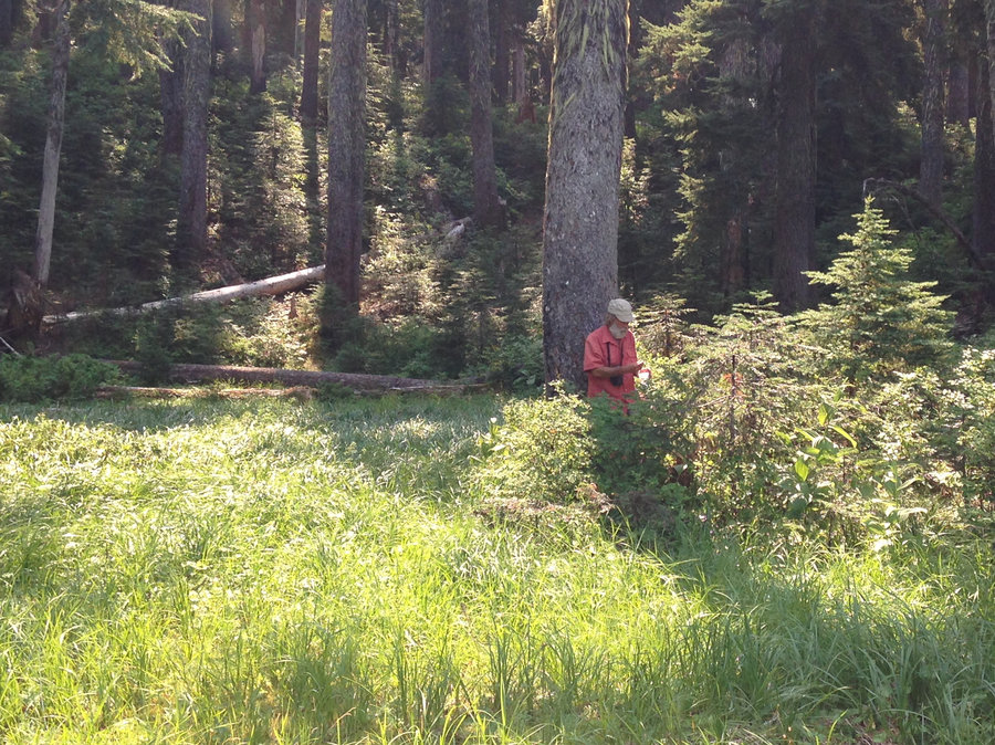
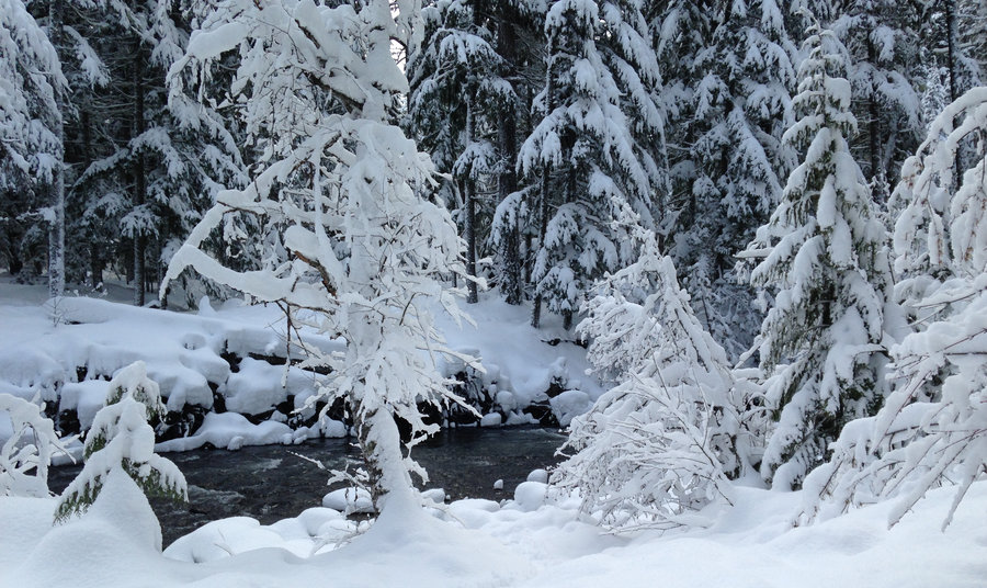
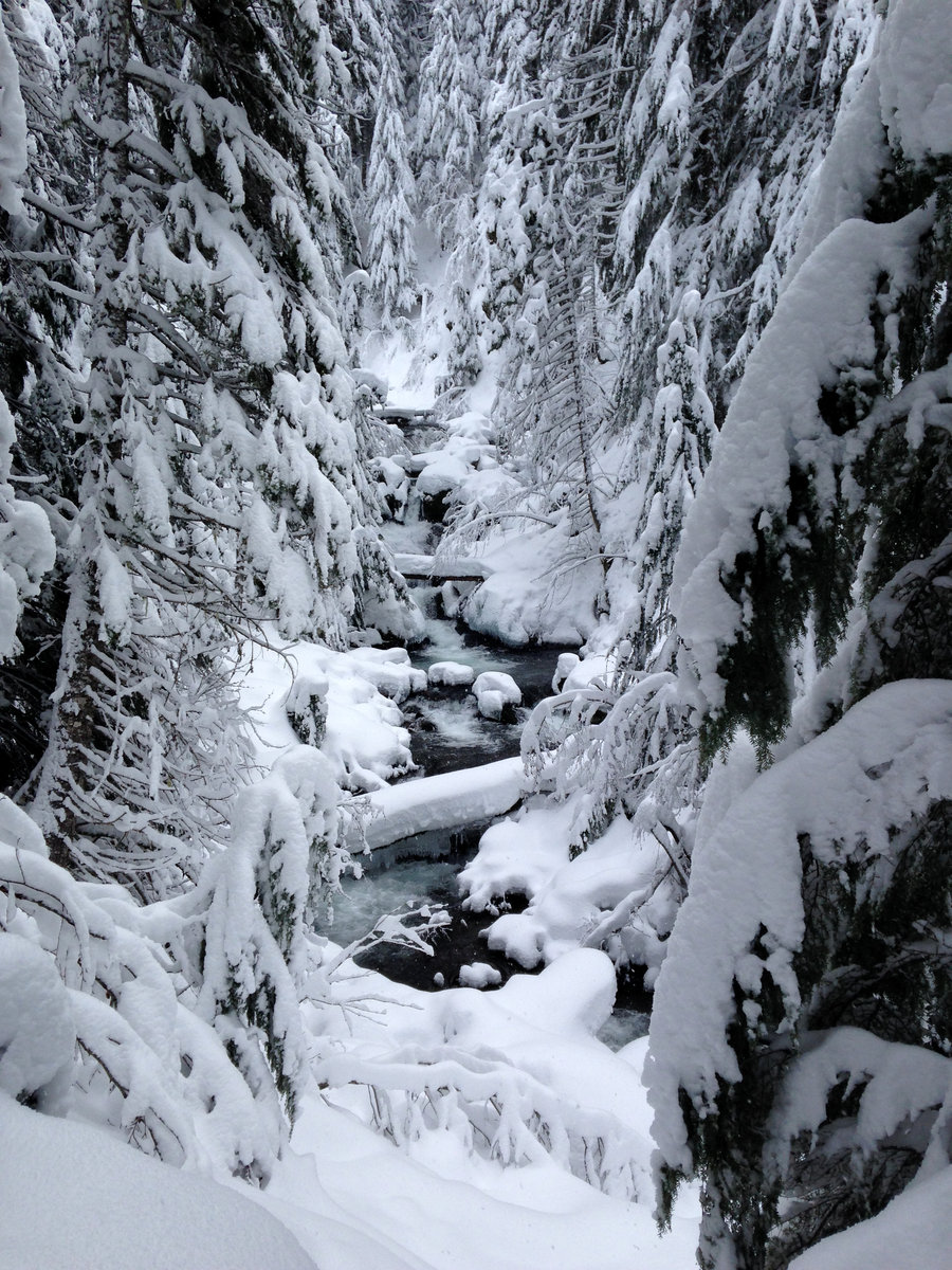
Pocket Creek snowshoe
3 miles of hiking • 250' elevation gain •
The roads were finally clear and I did a short and lovely stroll with friends to check on a wildlife camera and look at tracks. We snowshoed, but they weren't really needed except for offtrail and a few random sinkholes. Wonderful day!
January 30, 2017
 1
1
Upper Twin lake Snowshoe
6.7 miles of hiking • 1000' elevation gain •
Went with some friends on a lovely meetup group hike. The roads were definitely bad in places. An accident had closed the westbound lanes of 26 completely and Hwy 35 was closed both directions from a car accident. We decided to just pull over at Barlow Pass Sno park and snowshoe down the PCT, and then take the cutoff down to Upper Twin Lake. There were no recent tracks on the cutoff trail to Palmatier Point, but there was a very obvious track heading up to Tri-County Ridge. The cutoff to Upper Twin lake was well tracked and the sunshine and blue skies broke out, just in time for the lunch at the lake. Great day!!
January 22, 2017

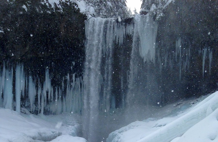
Icicle Tour
8.2 miles of hiking • 1500' elevation gain •
Great day exploring the ice!! Three short hikes that were truly wonderful.
January 6, 2017

Short Wildwood Hike
5.5 miles of hiking • 500' elevation gain •
Beautiful day with a good friend on the Wildwood!!
January 2, 2017

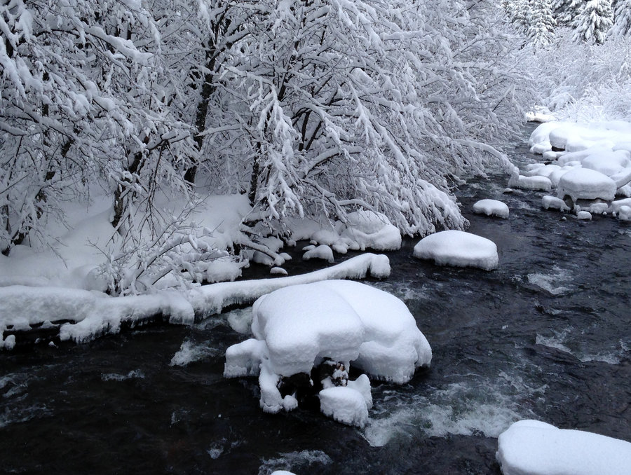
Tamanawas Falls
3.8 miles of hiking • 500' elevation gain •
Beautiful way to bring in the New Year! Almost a foot of fresh powder on the trees and no wind. There is a rock slide almost all the ways to the falls, which is tricky in snow shoes, with occasional deep wells in the rocks. Fine going up. A little more interesting coming down. Good company and a perfect day.
January 1, 2017


View trips from: 2014 2015 2016 2018 2019 2020 2021 2022 2023