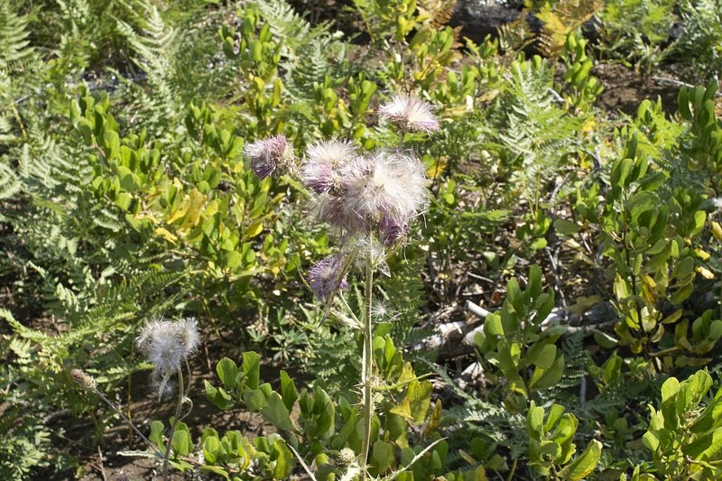
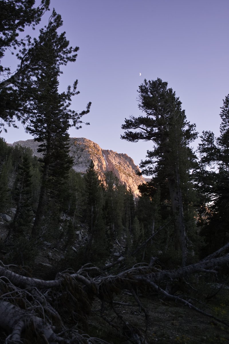
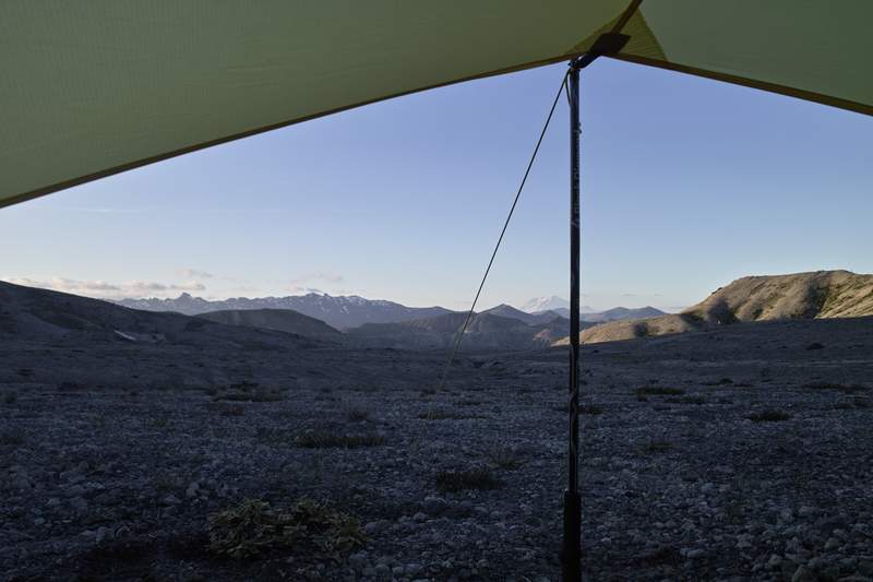
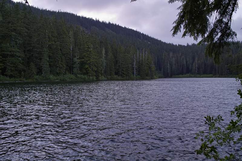
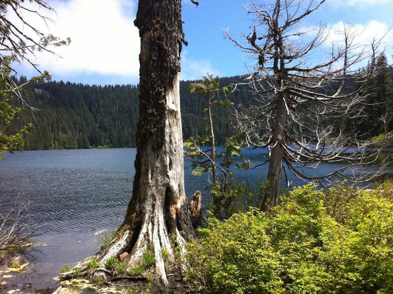
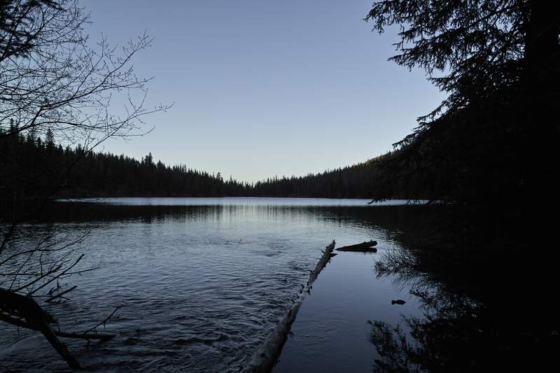
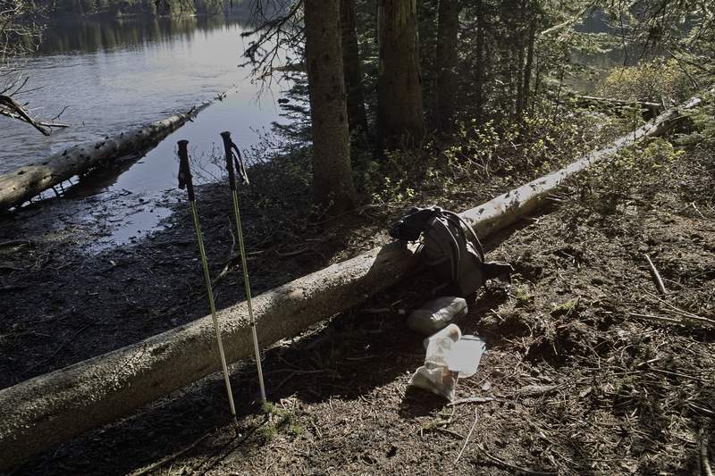
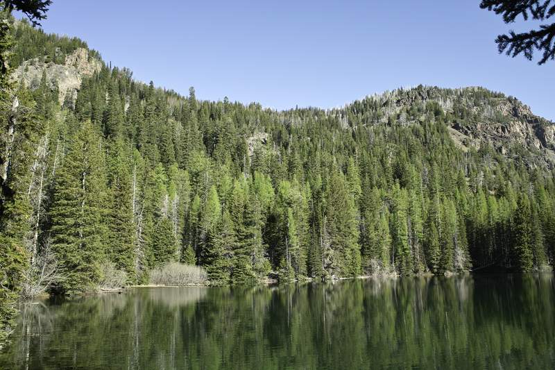
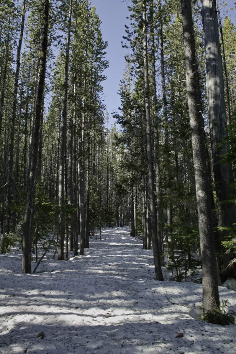
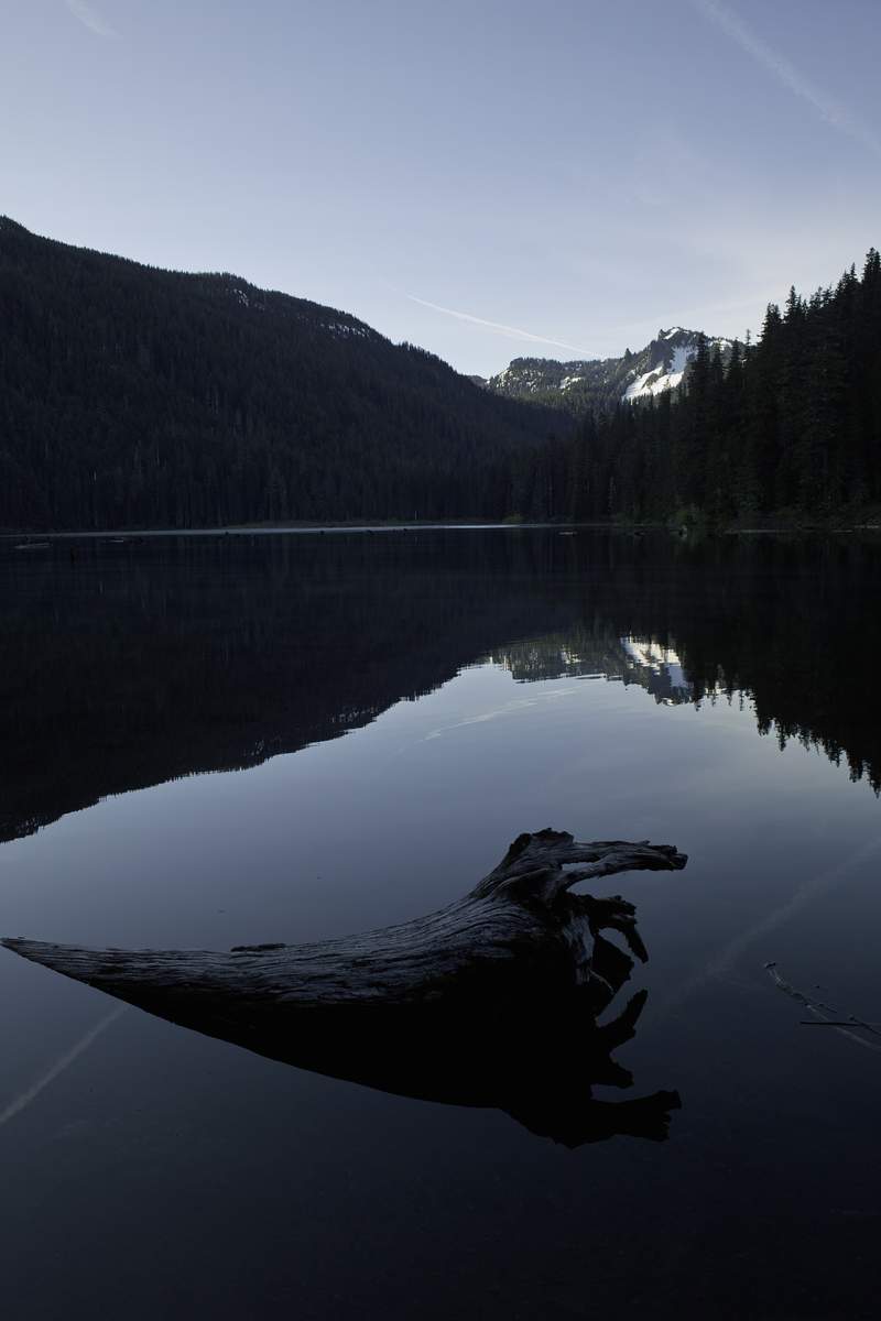
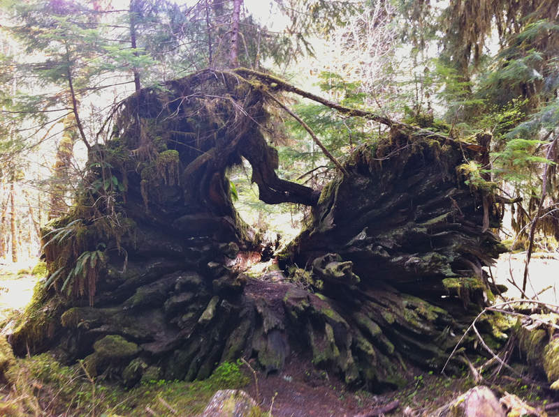
2011 Trips


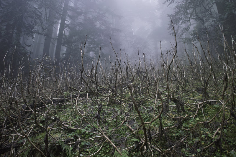
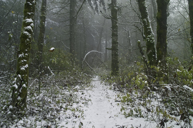
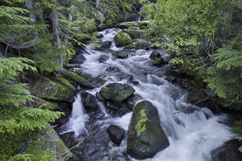
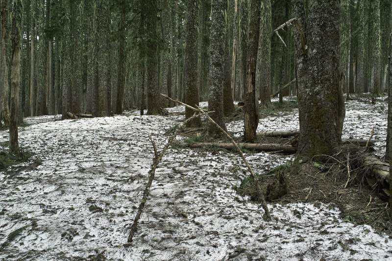
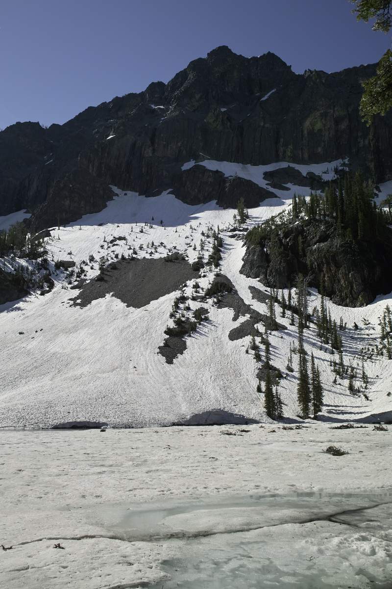
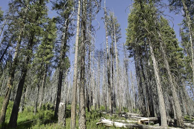
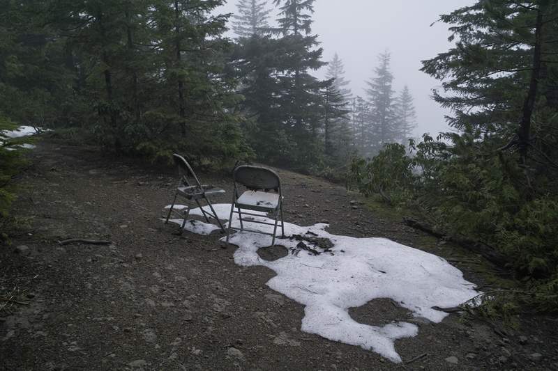
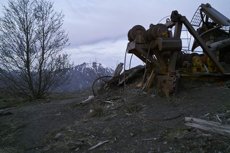
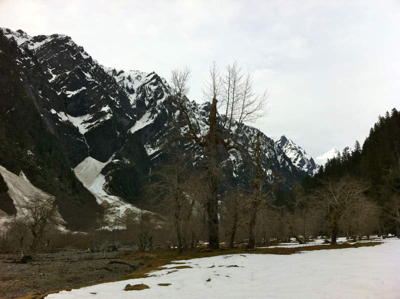
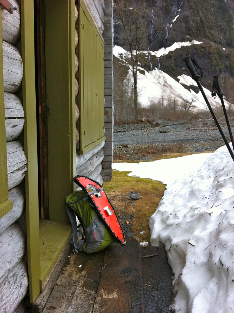
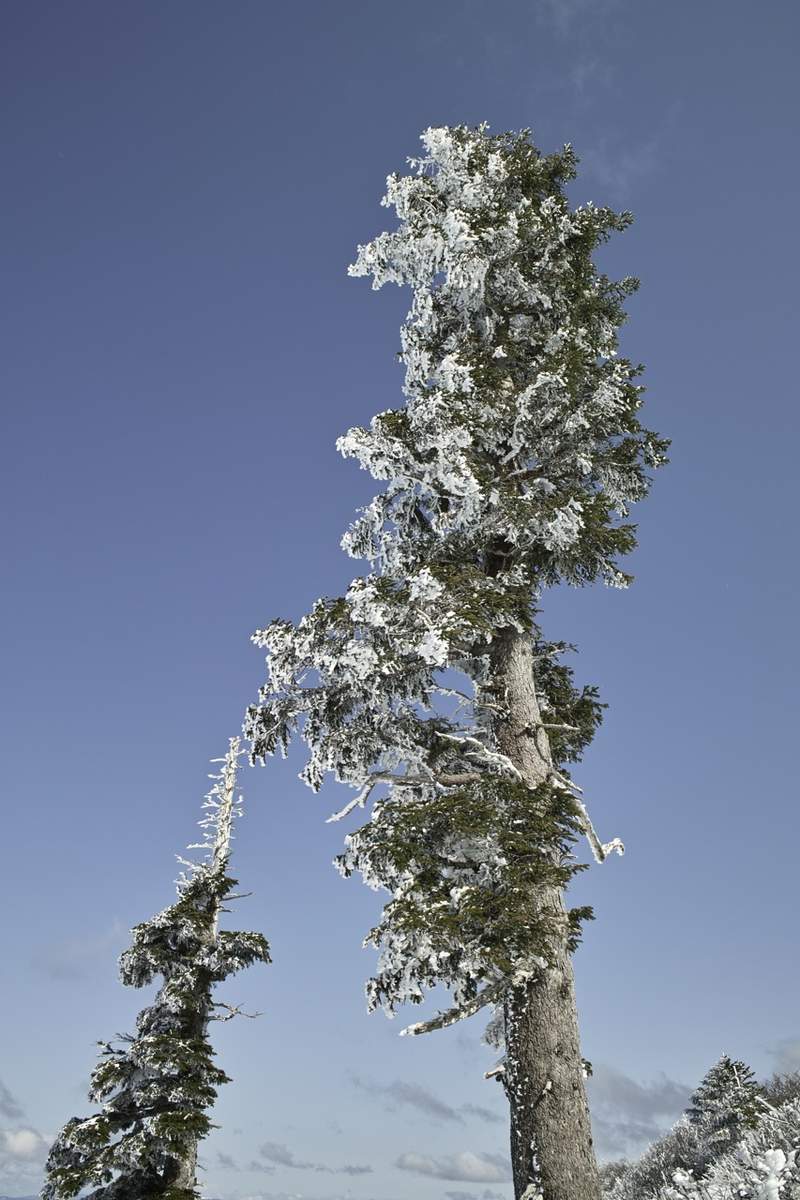
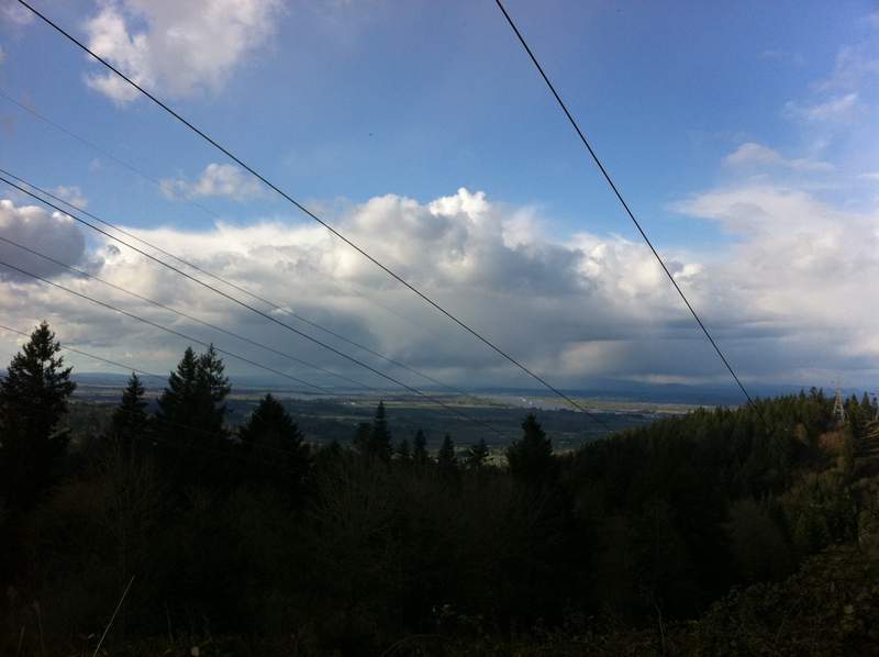
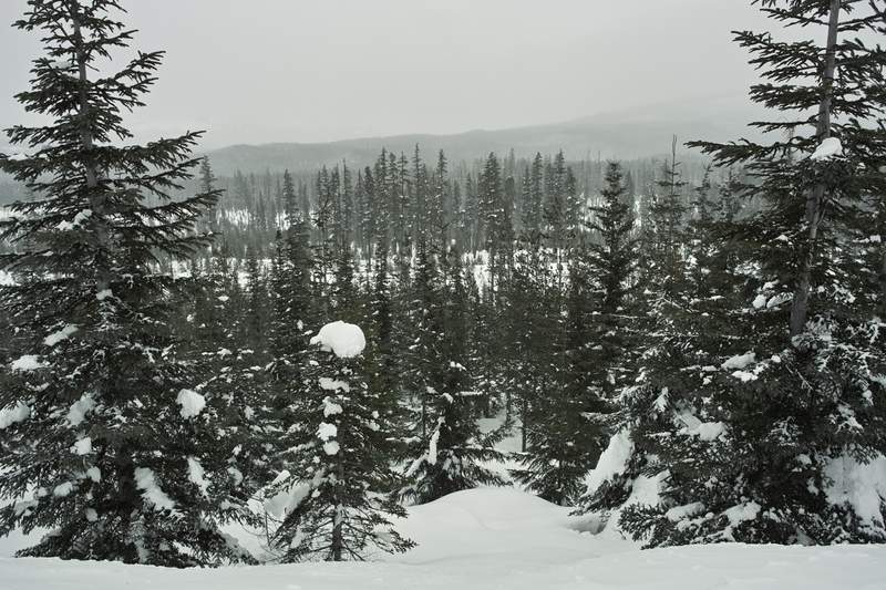
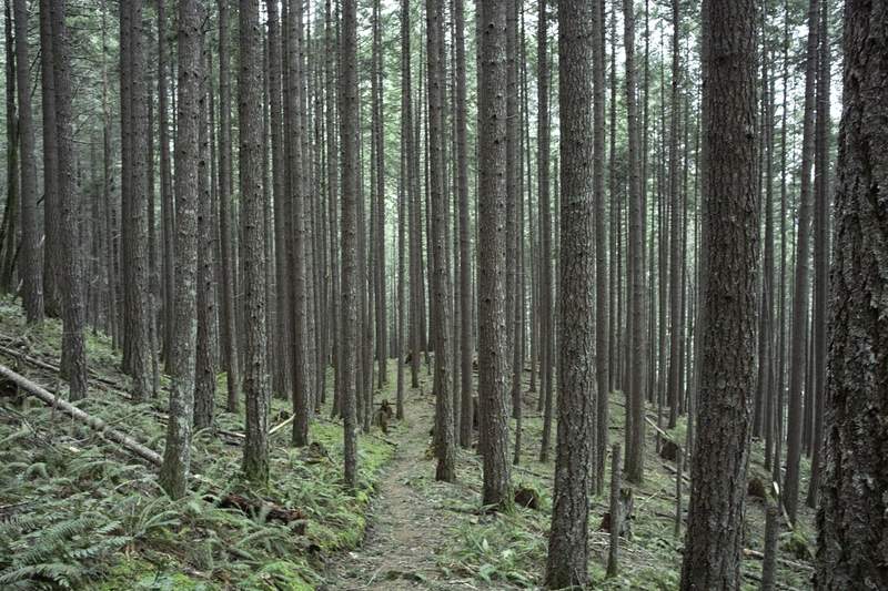
Trail to McKenzie Mountain
6 miles of hiking • 1000' elevation gain •
We only made it a few miles before we had to turn around because of ice—no microspikes.

December 30, 2011

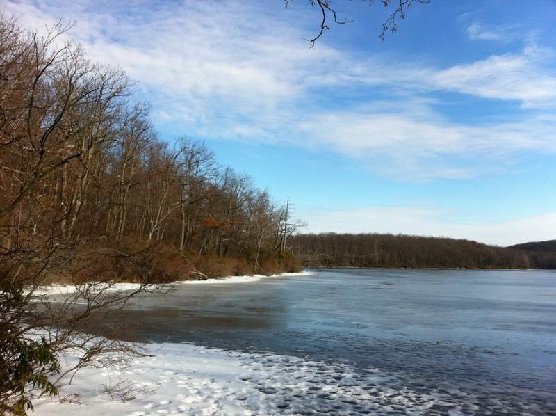
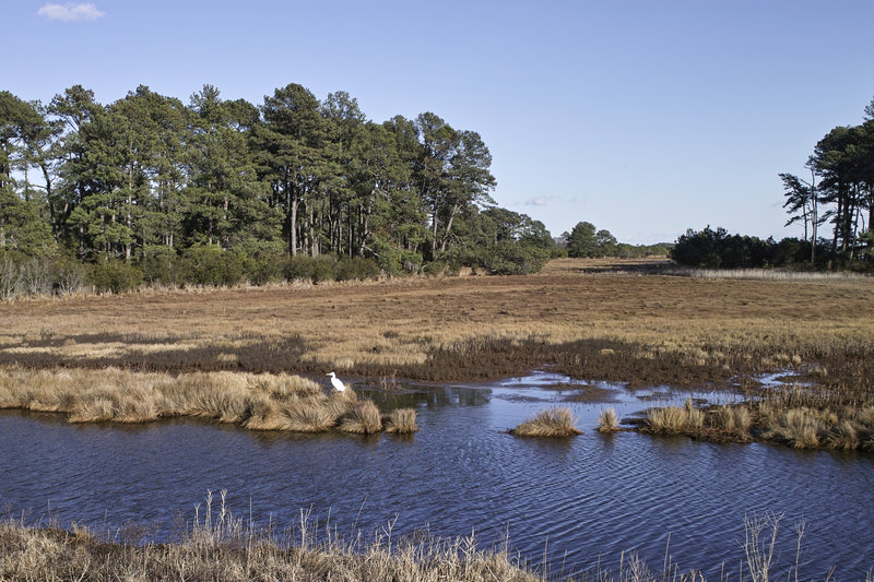
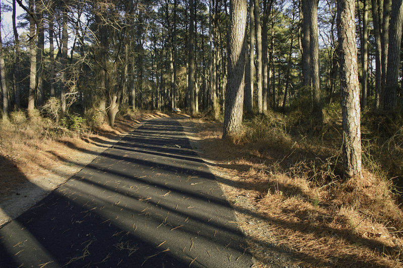
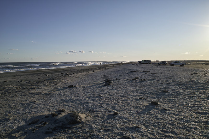
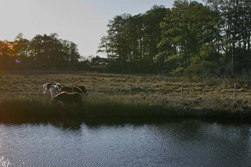
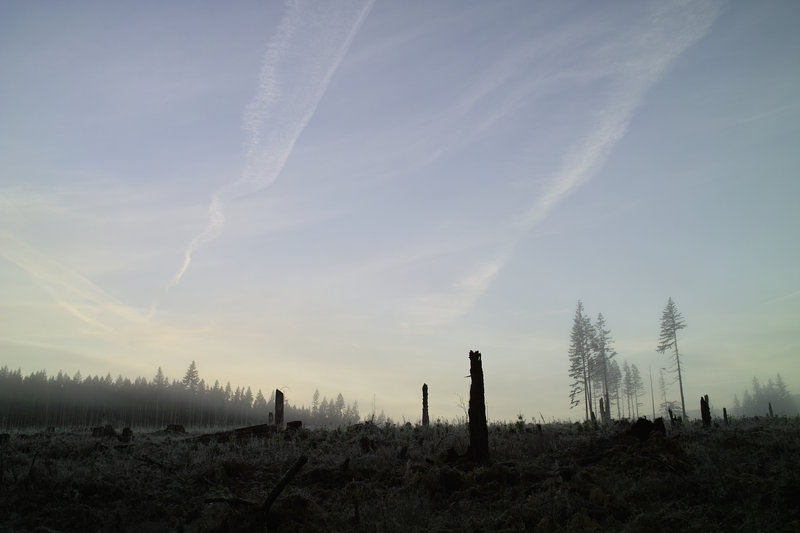
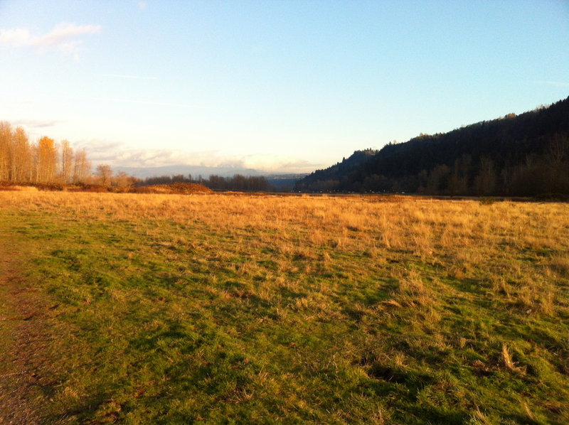
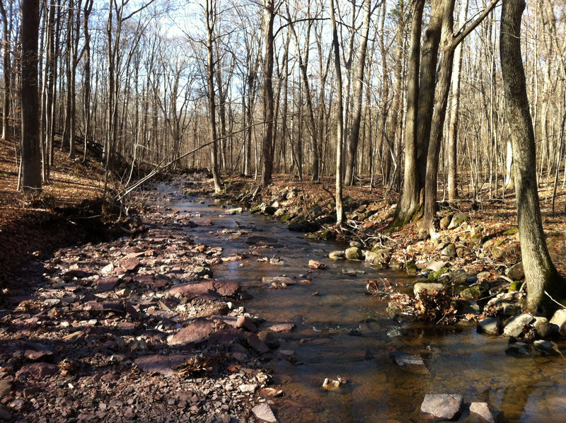
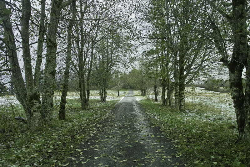
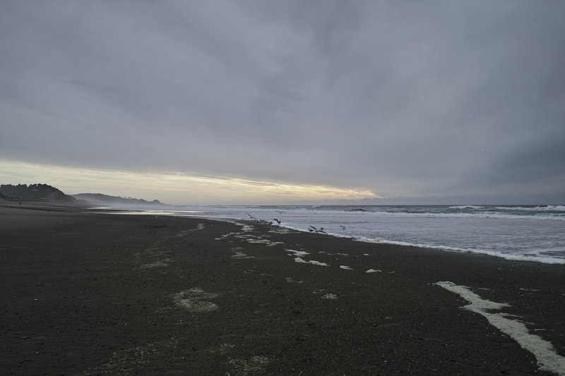
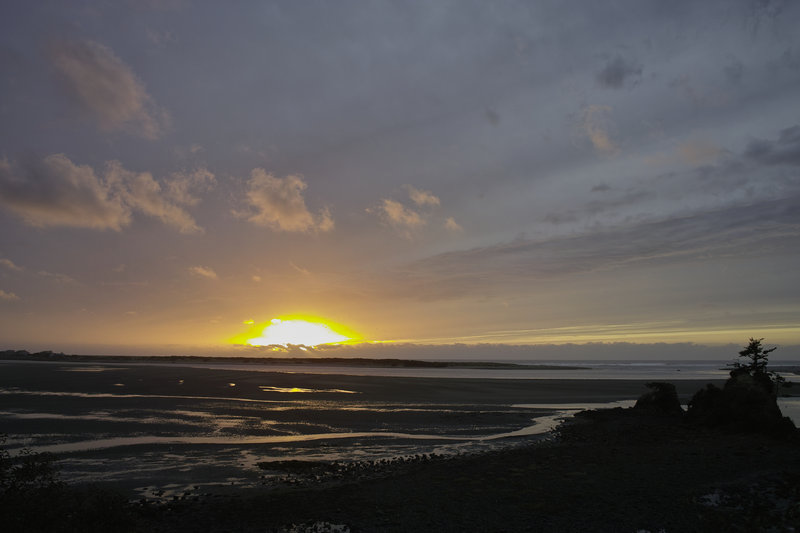
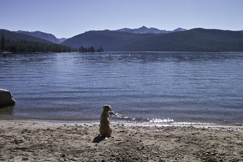
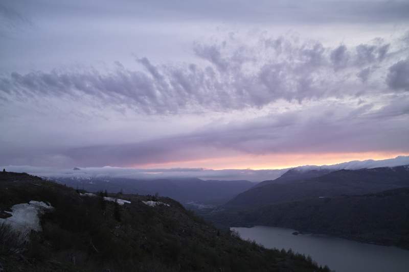
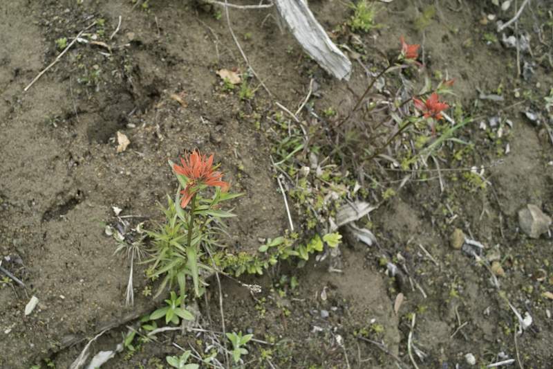
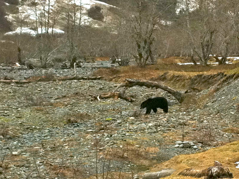
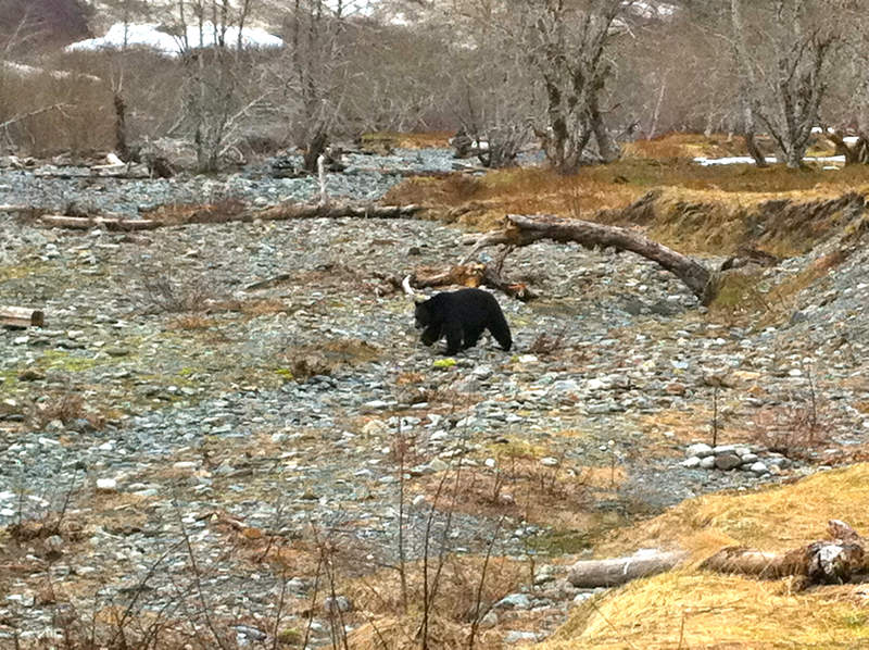
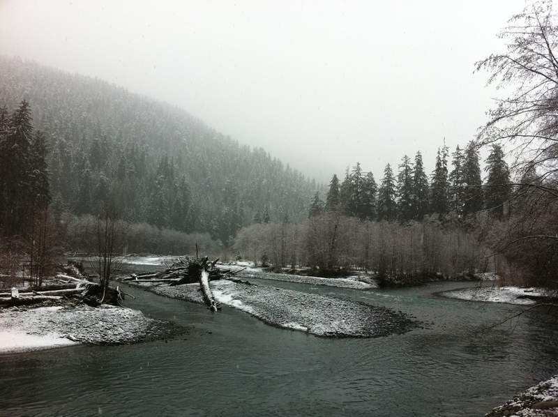
Assateague Island
2 miles of hiking • 250' elevation gain •
Finishing off the year with some wild horsies, and reaching my 1000 mile goal.
December 28, 2011

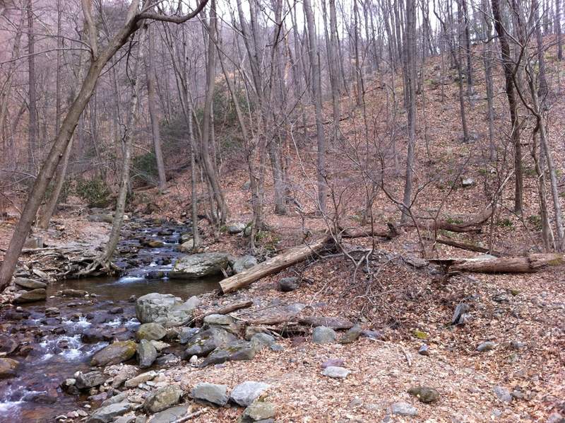
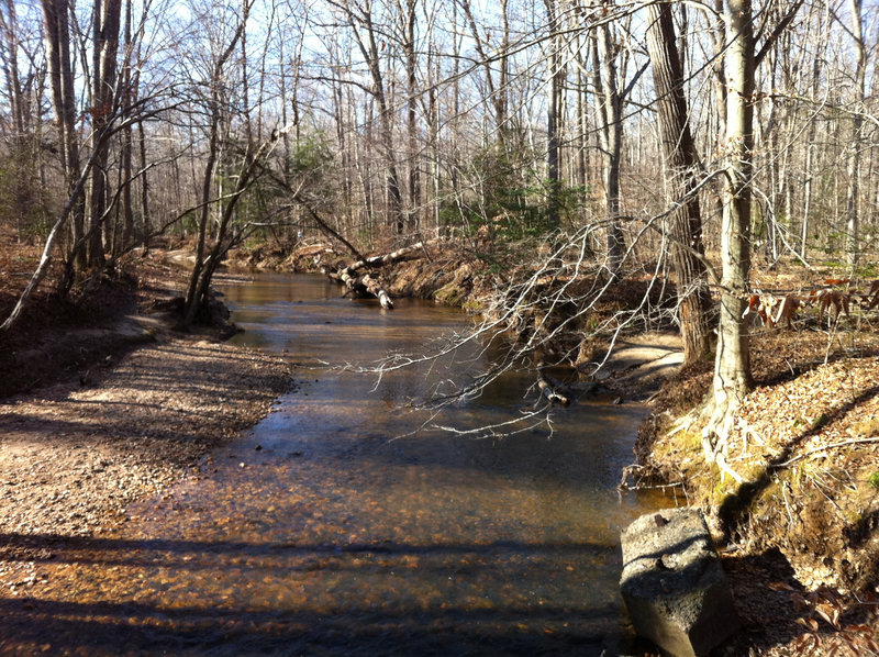
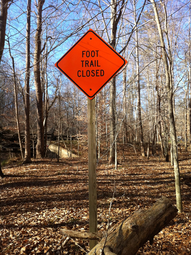
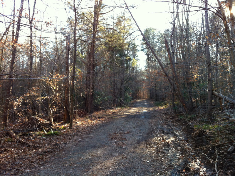
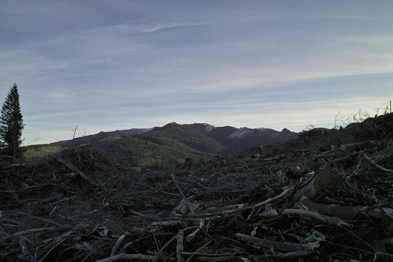
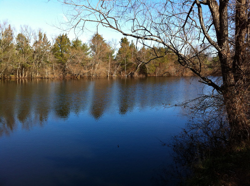
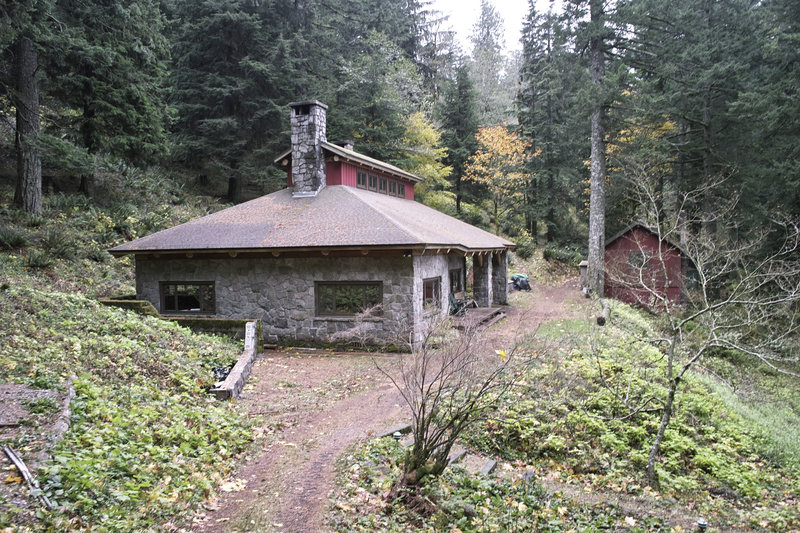
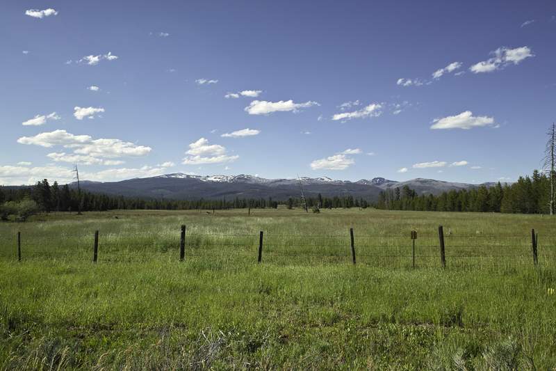
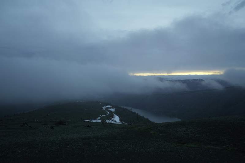
Prince William Forest Park
11.5 miles of hiking • 1000' elevation gain •
Almost there!
Doing some hiking while in Virginia over the holidays. Looked at the GPS after I was done, and I have a half mile to go.
Was going to do some AT hiking but I only had time to do a little hiking in this park south of DC, managed by NPS, next to Quantico. A busy day on the trails.
December 26, 2011

 1
1
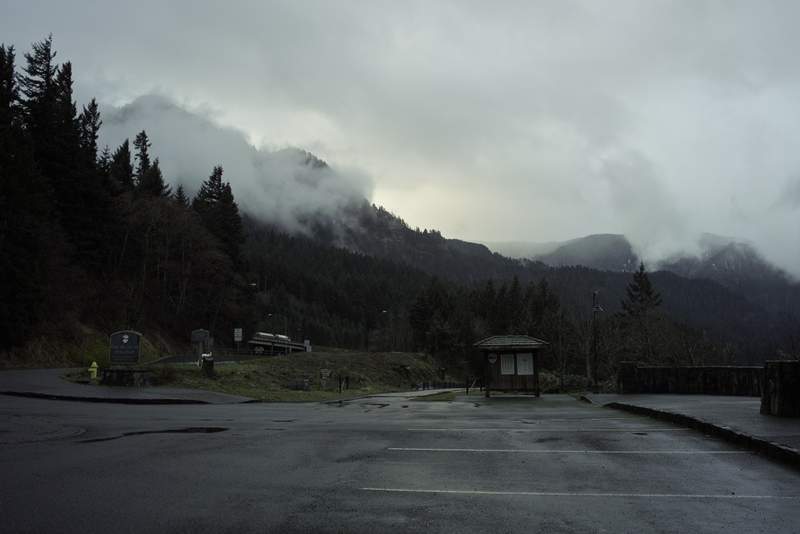
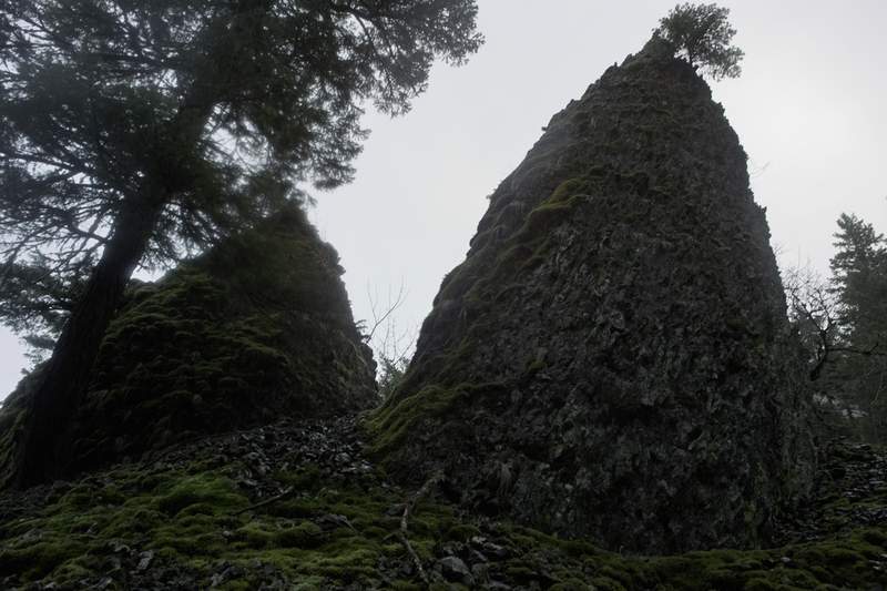
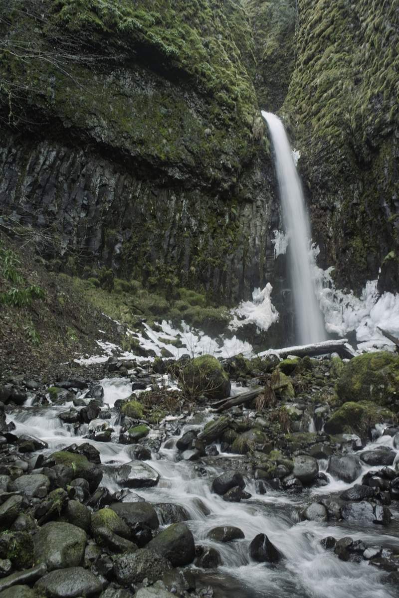
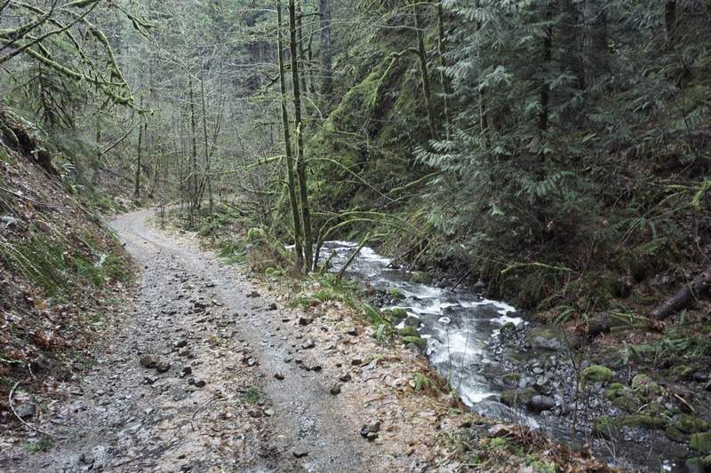
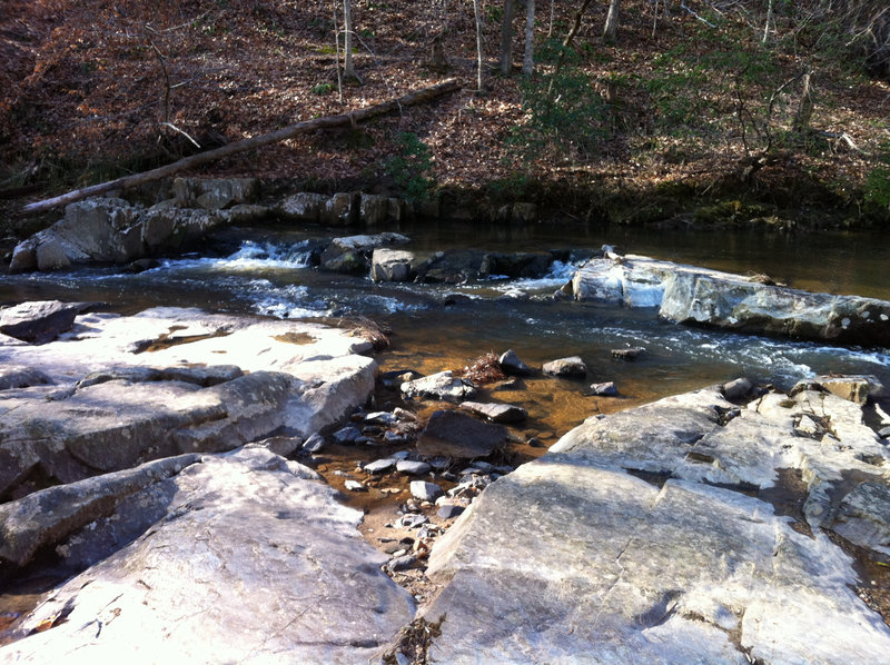
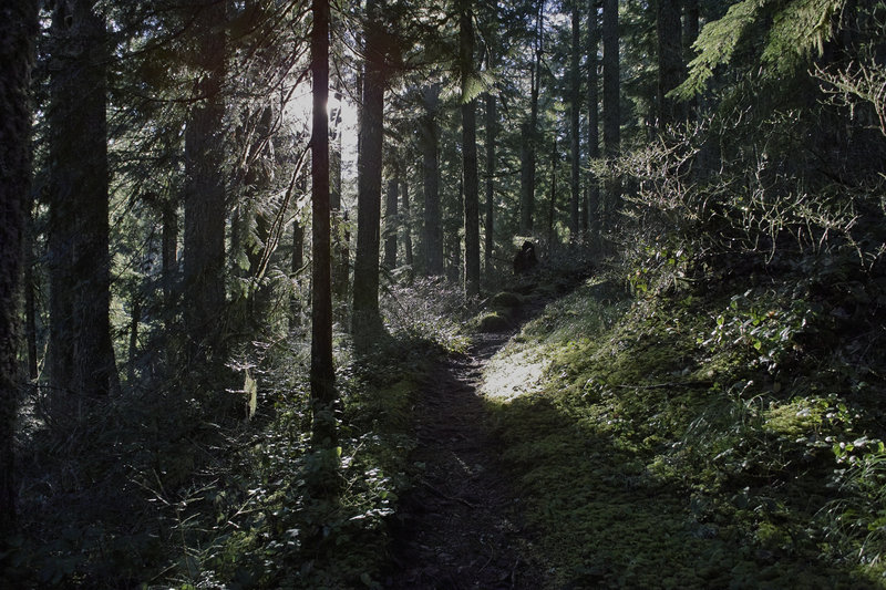
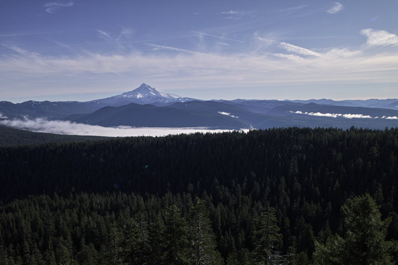
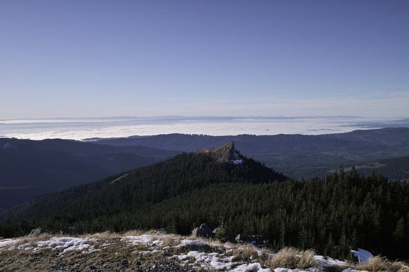
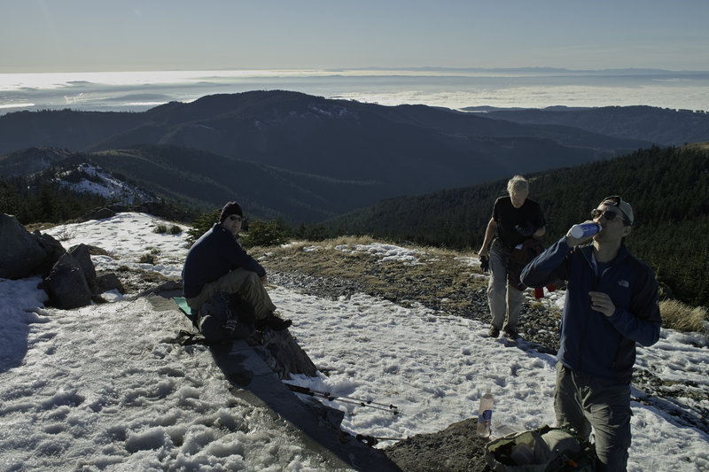
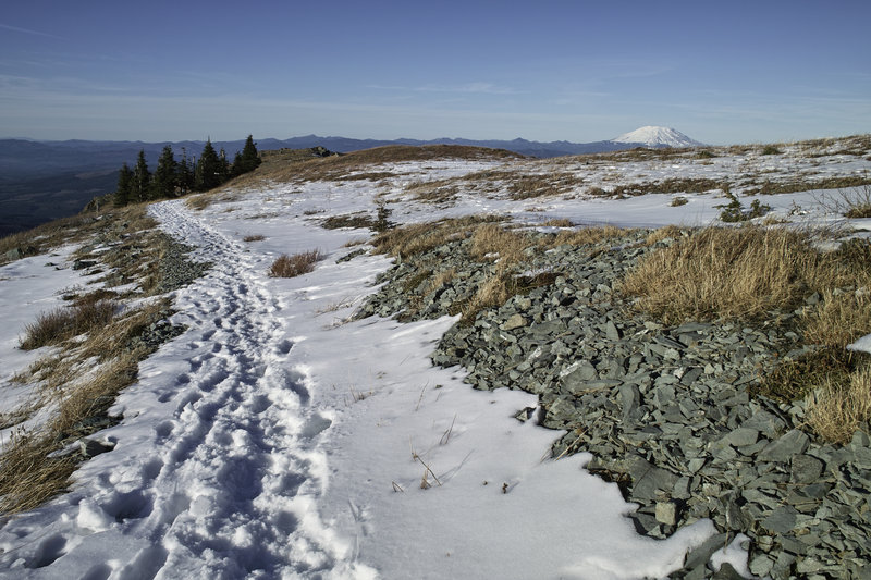
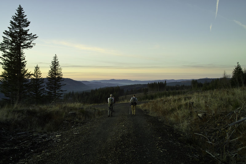
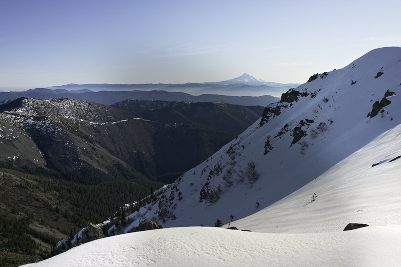
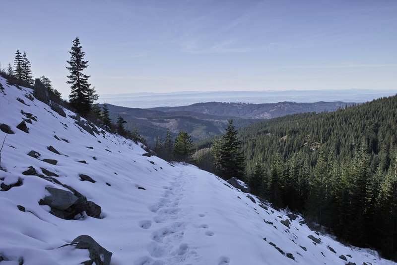
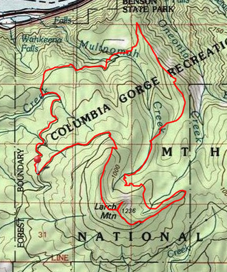
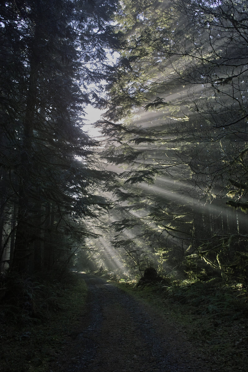
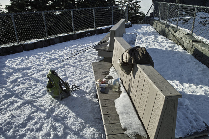
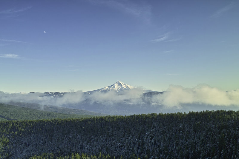
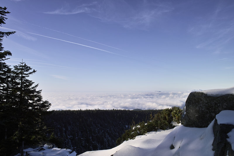
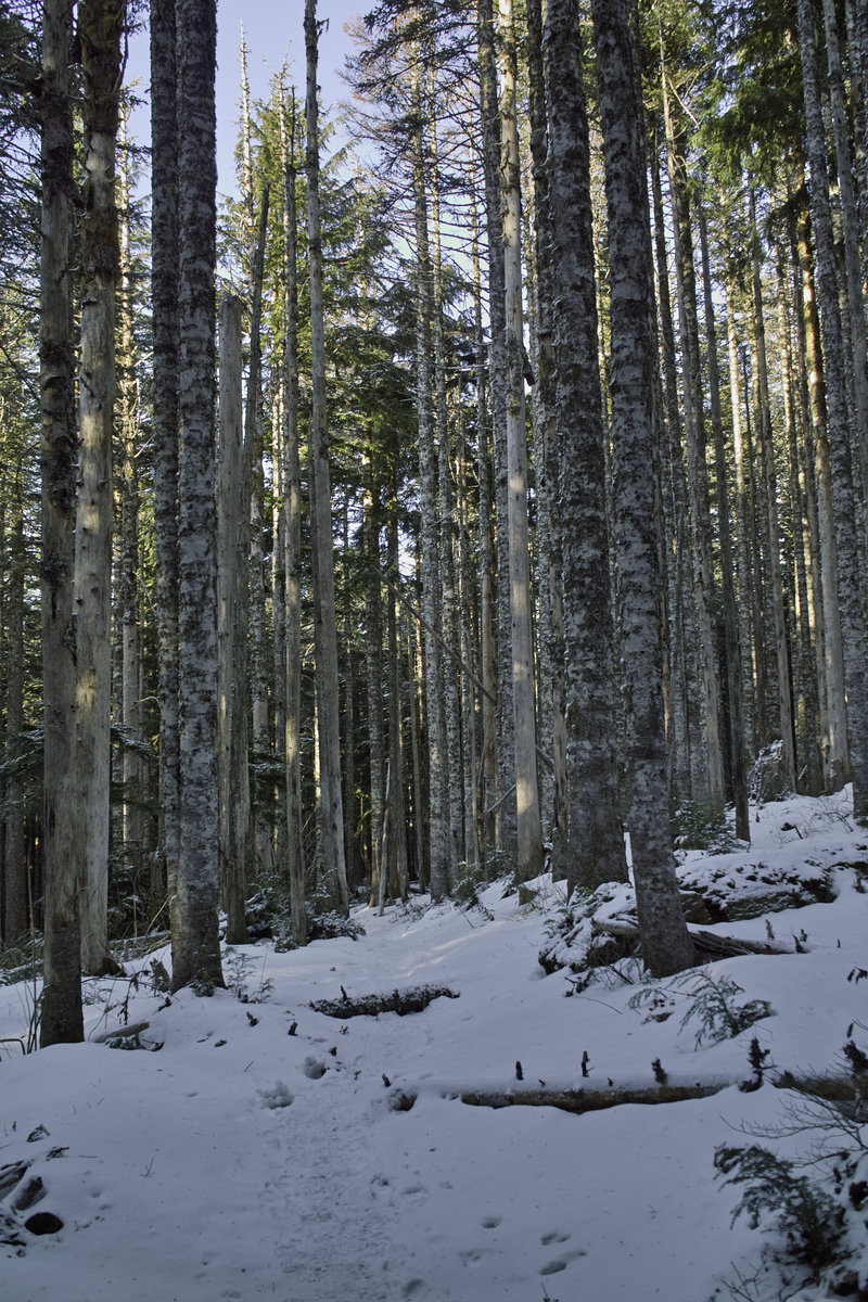
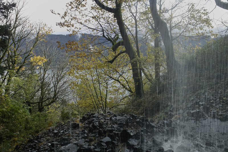
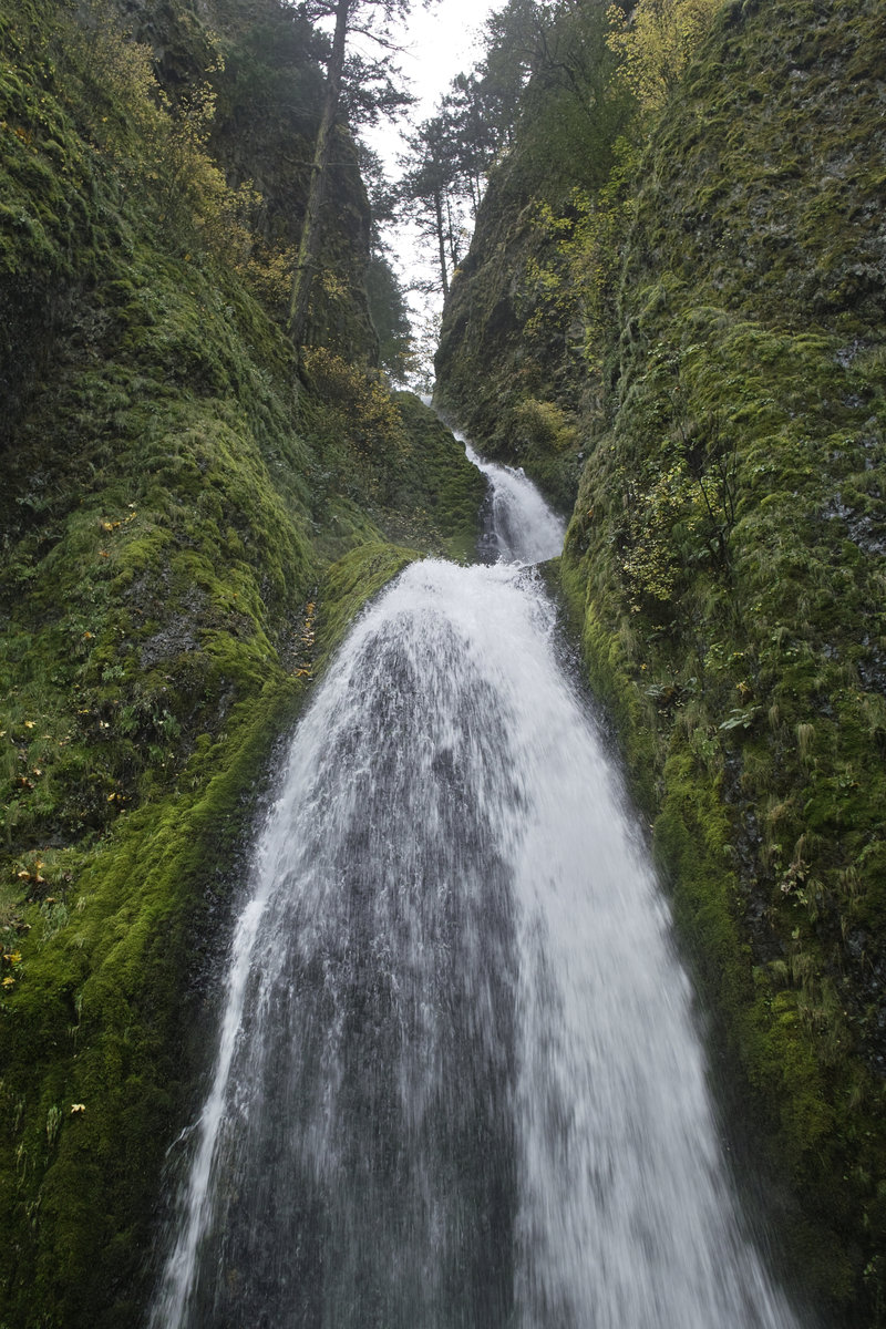
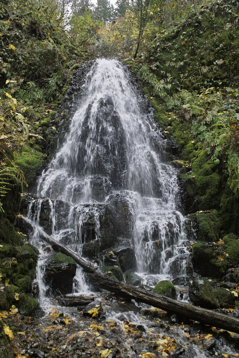
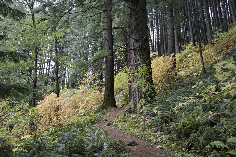
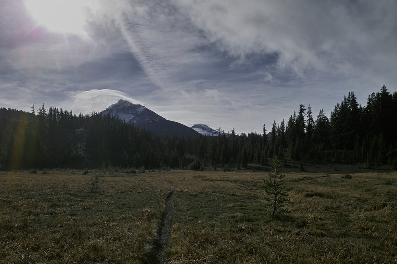
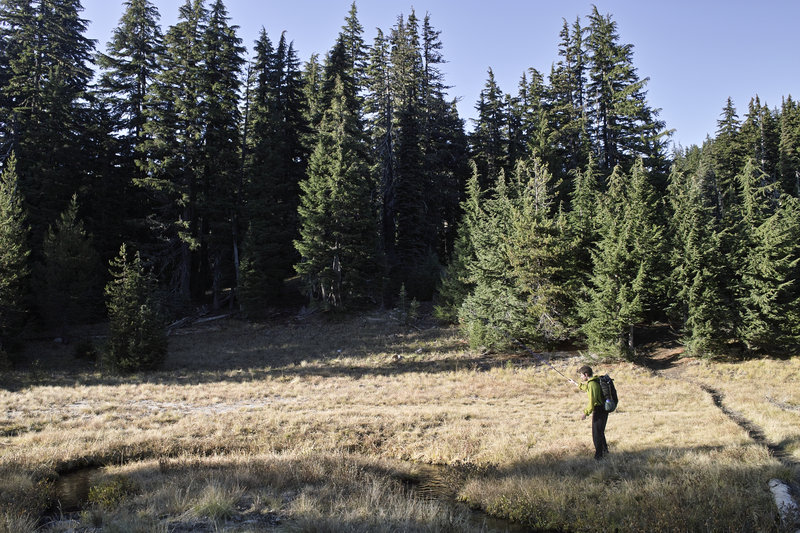
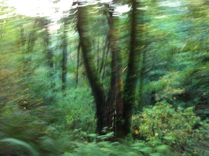
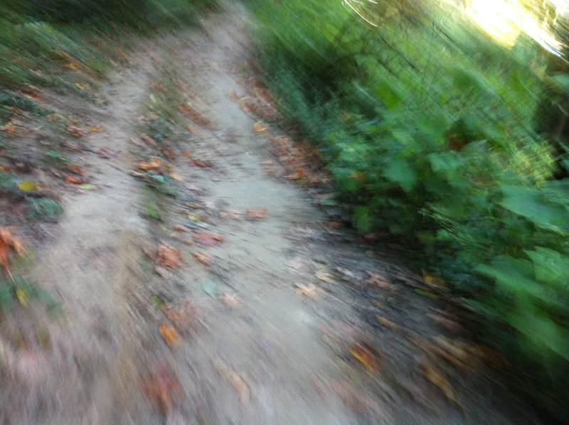
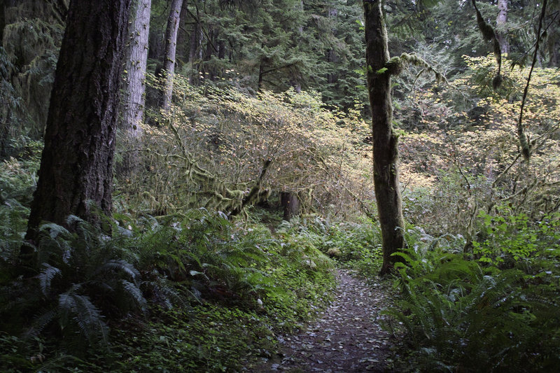
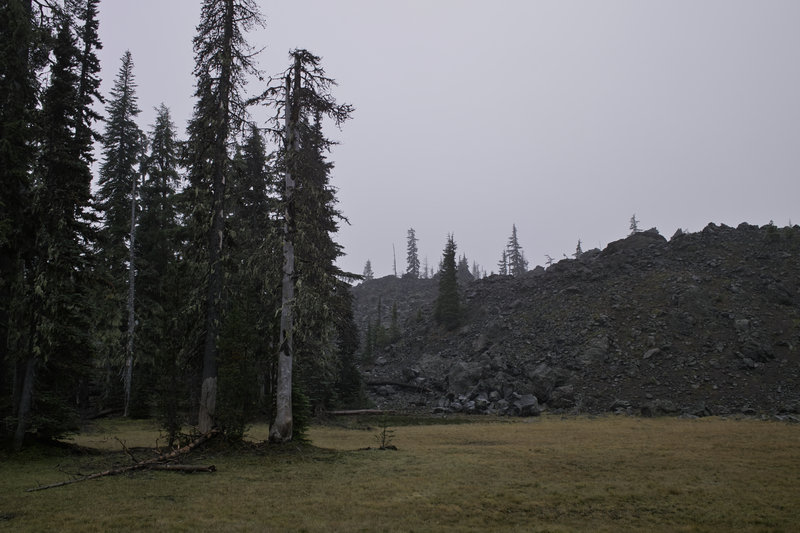
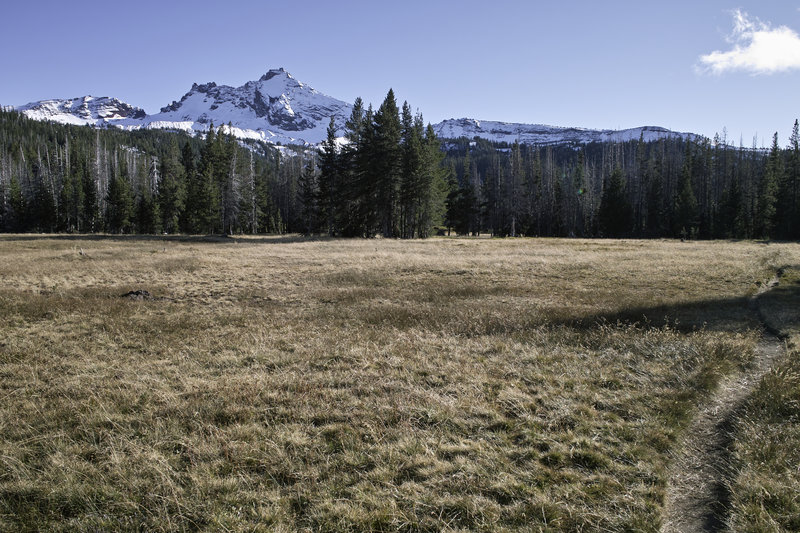
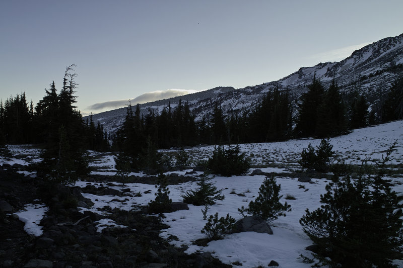
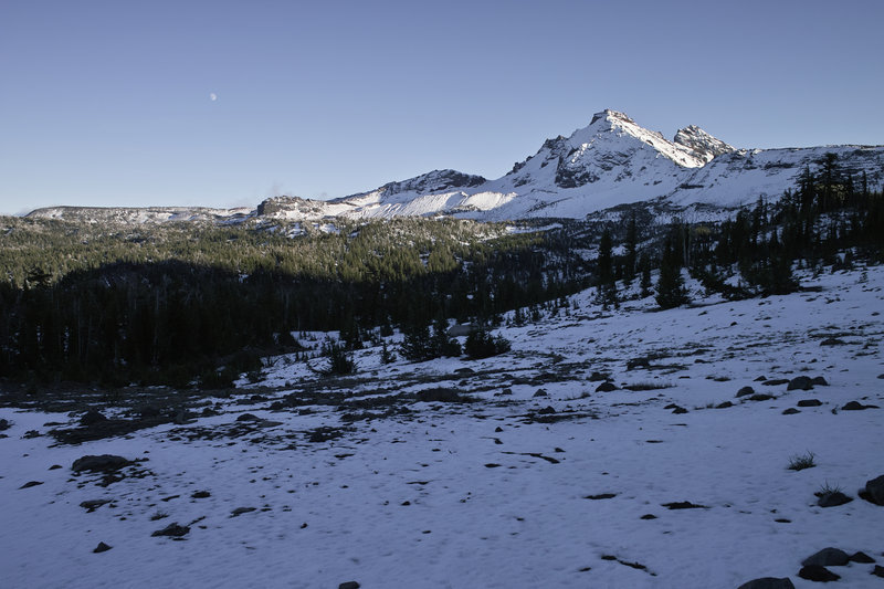
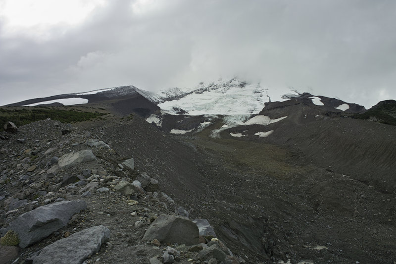
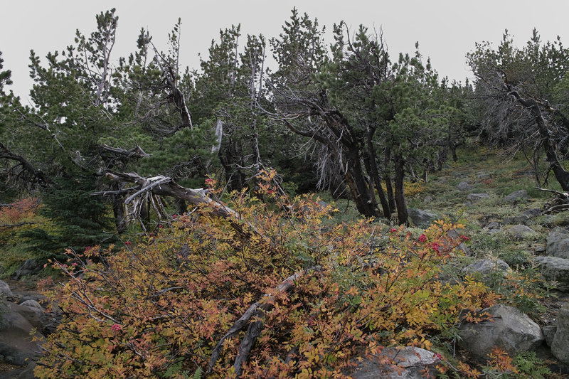
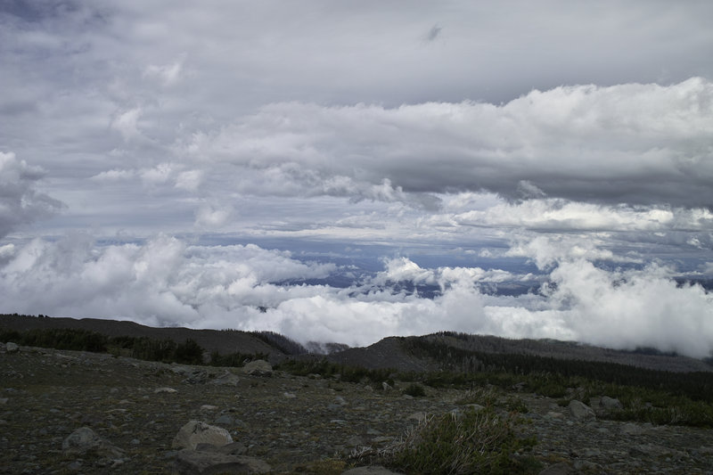
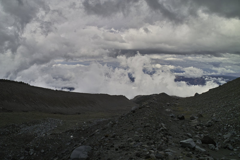
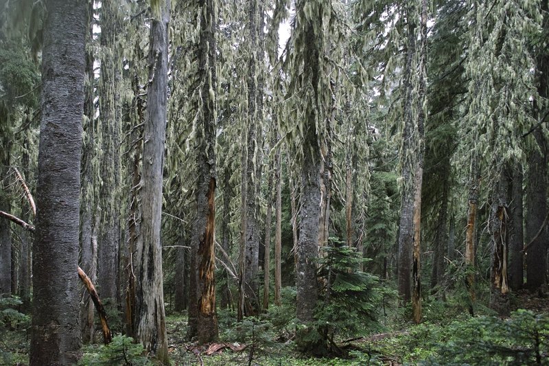
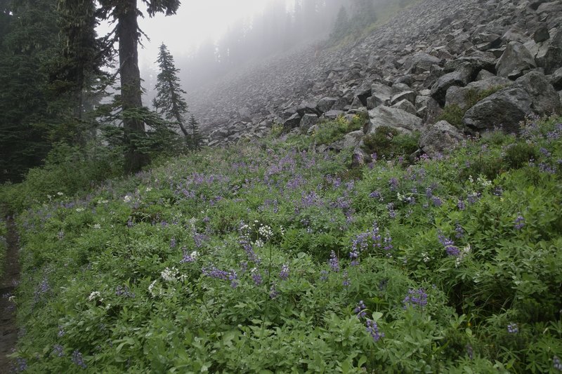
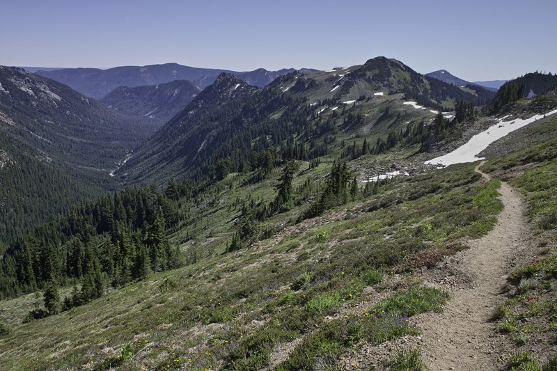
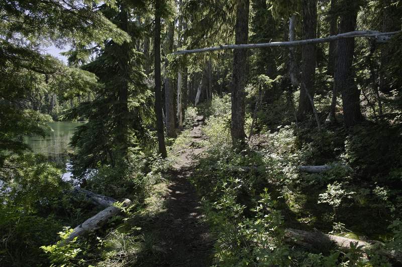
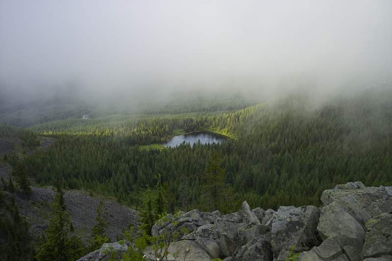
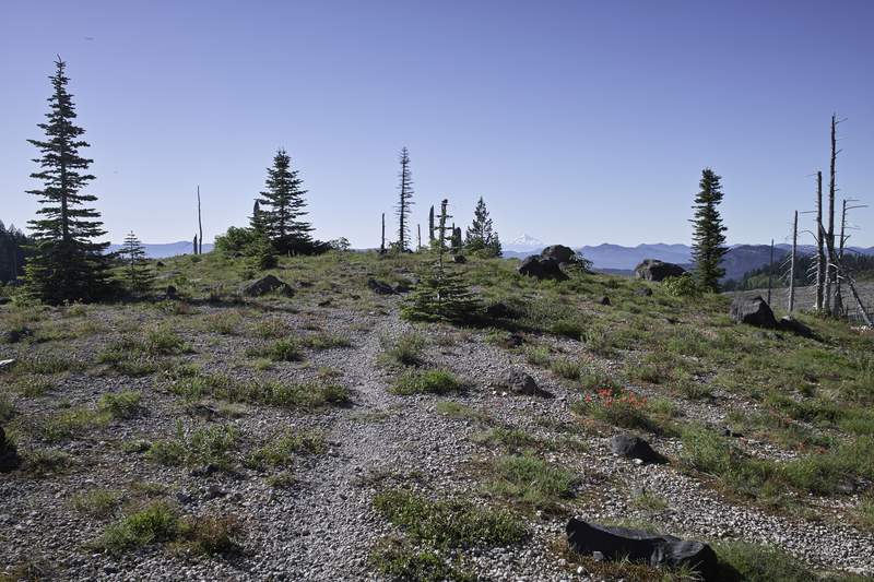
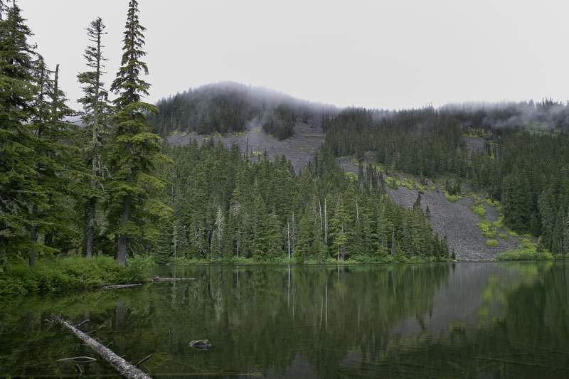
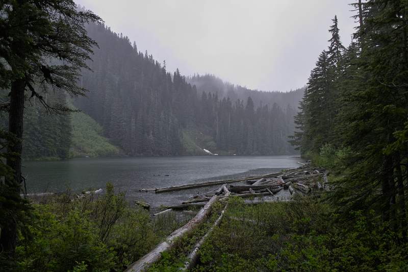
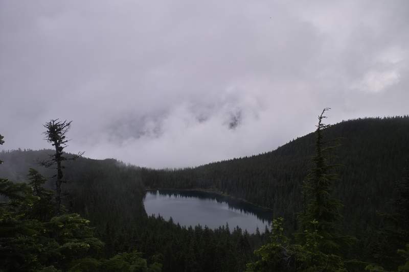
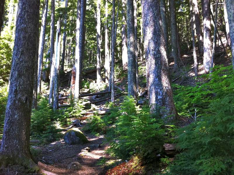
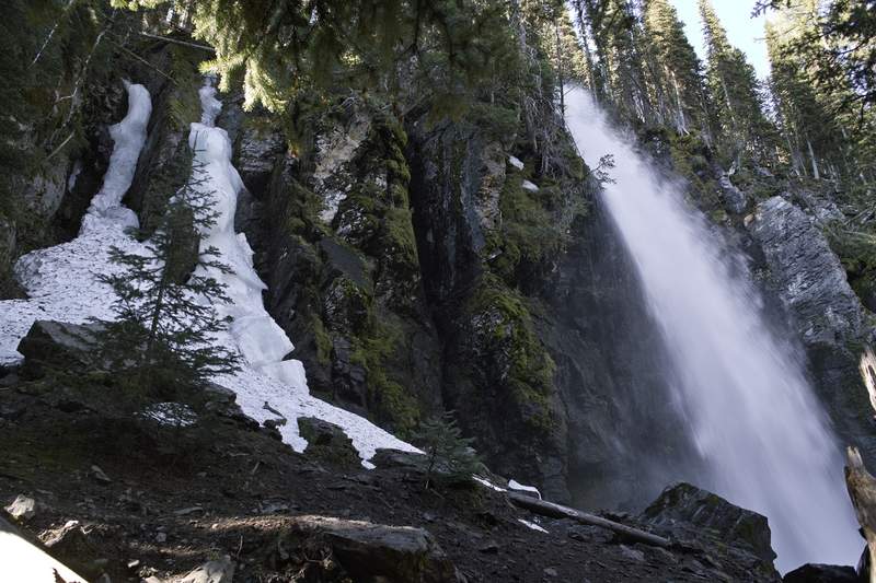
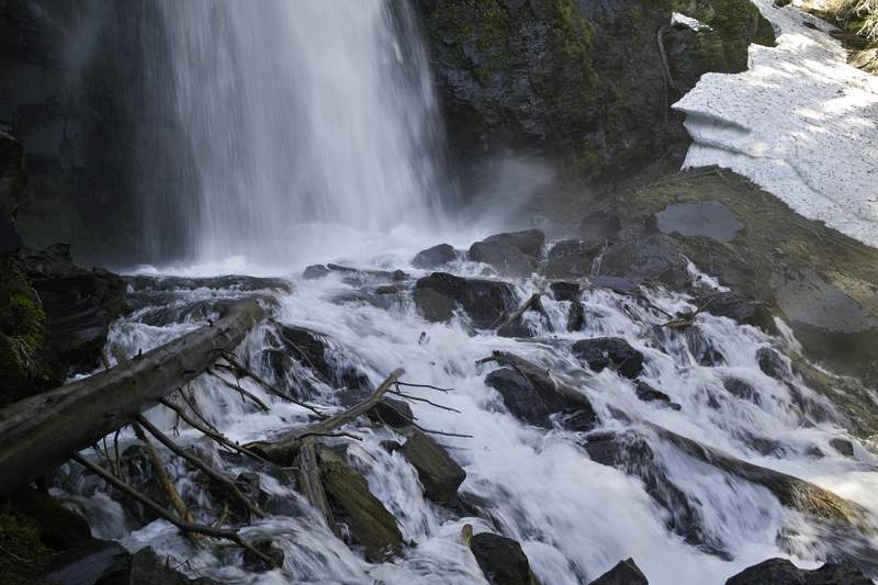
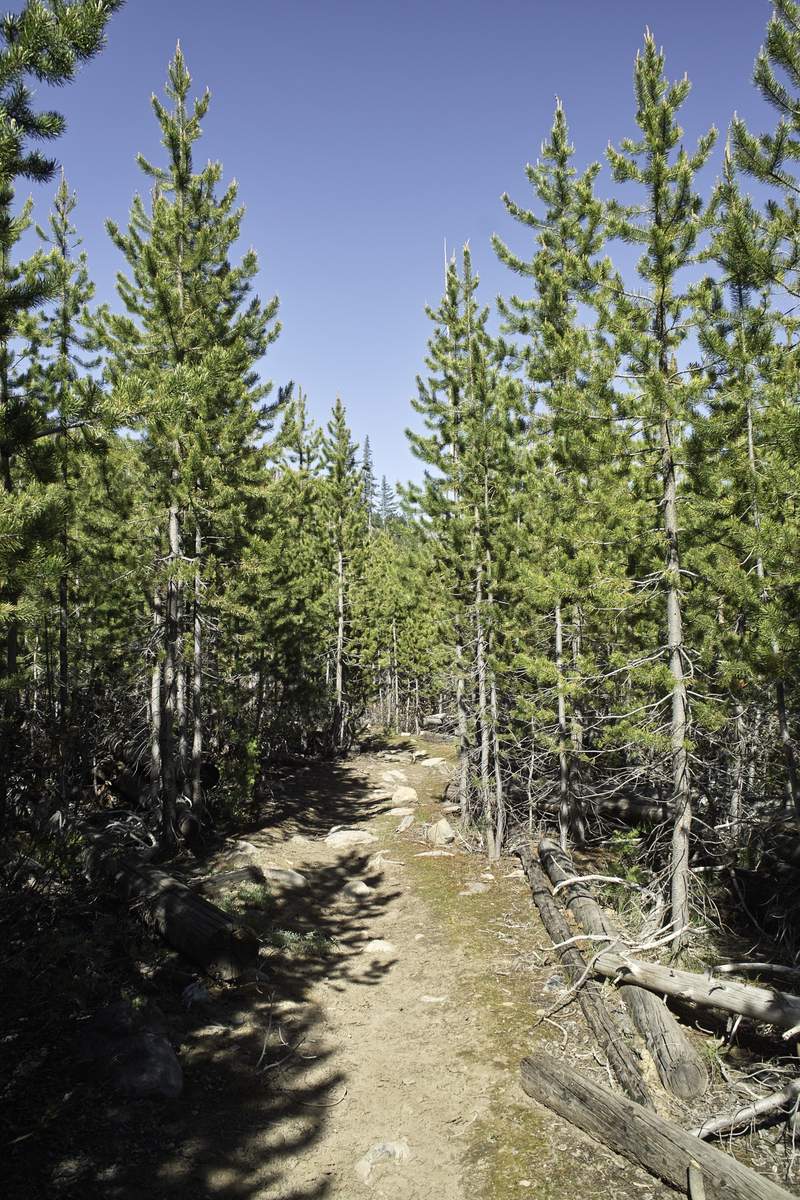
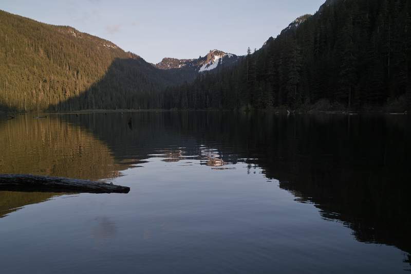
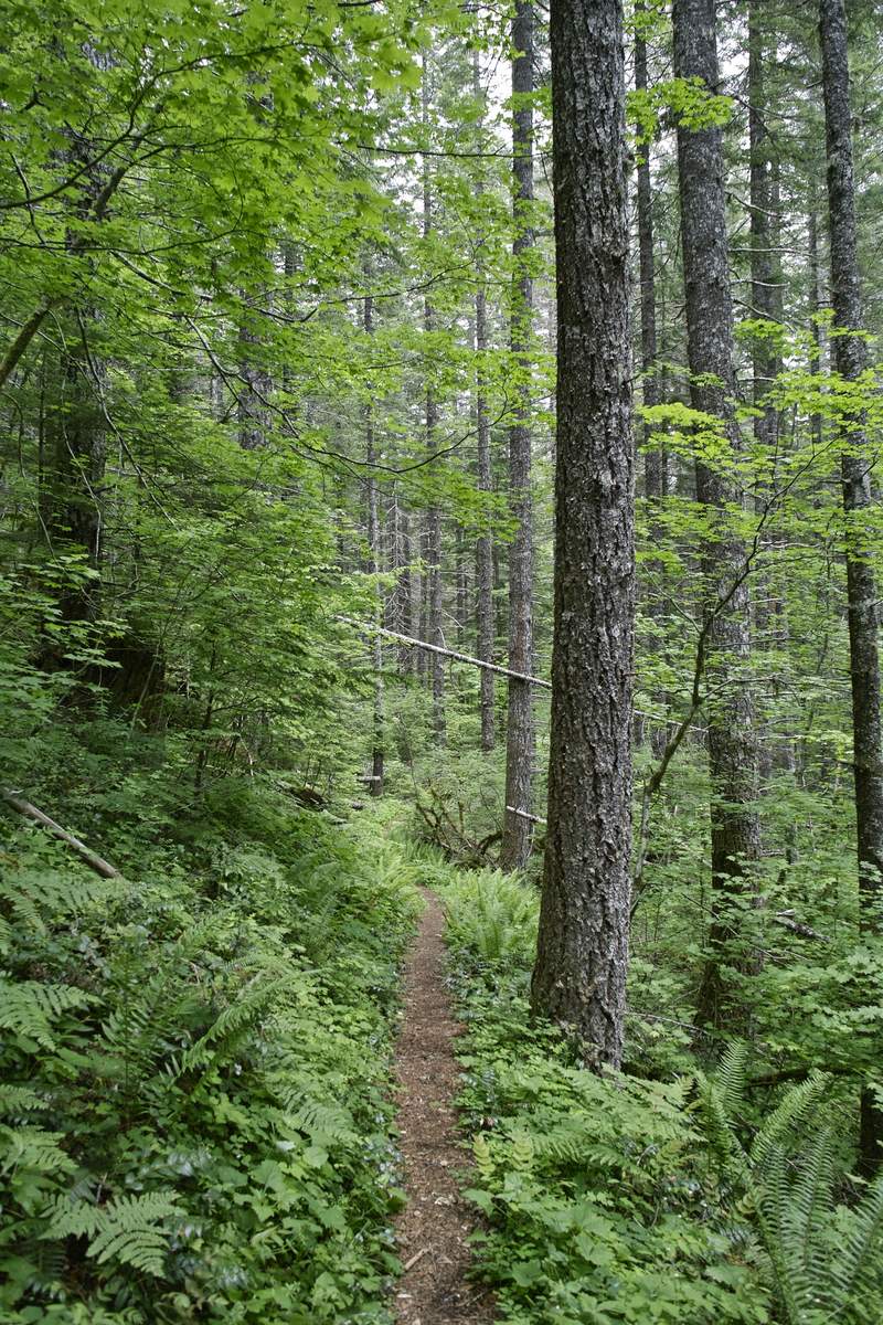
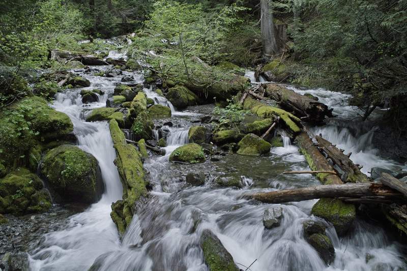
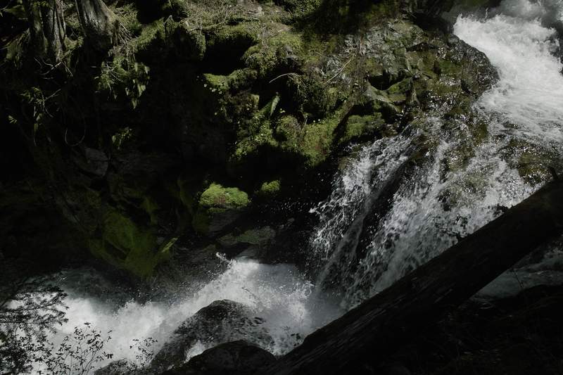
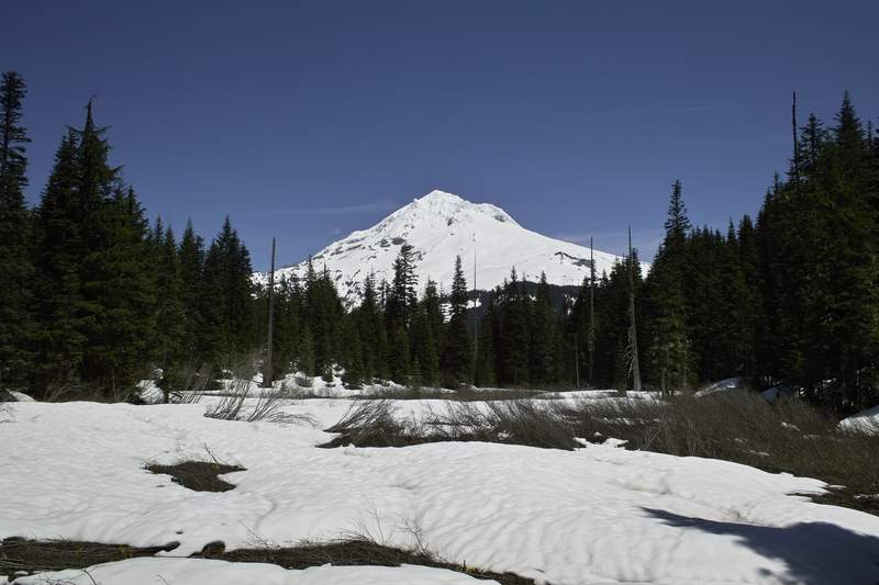
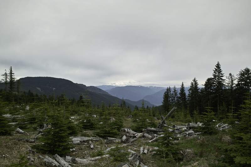
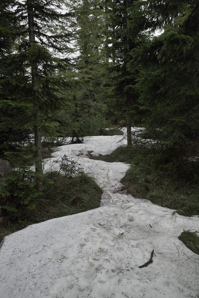
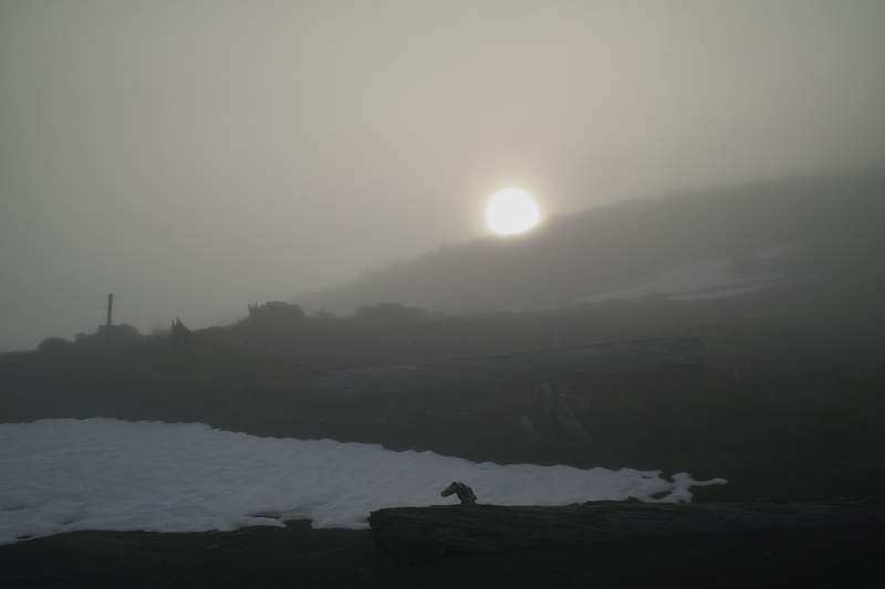
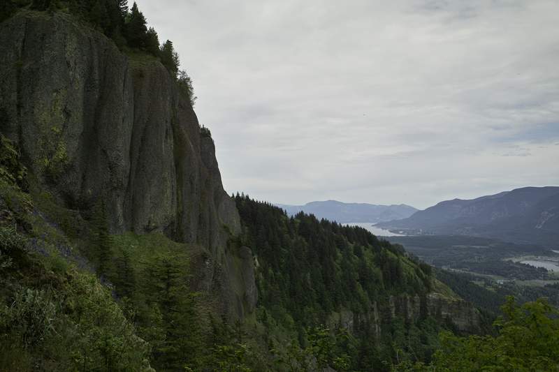
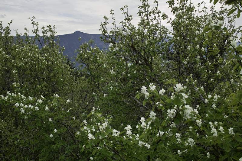
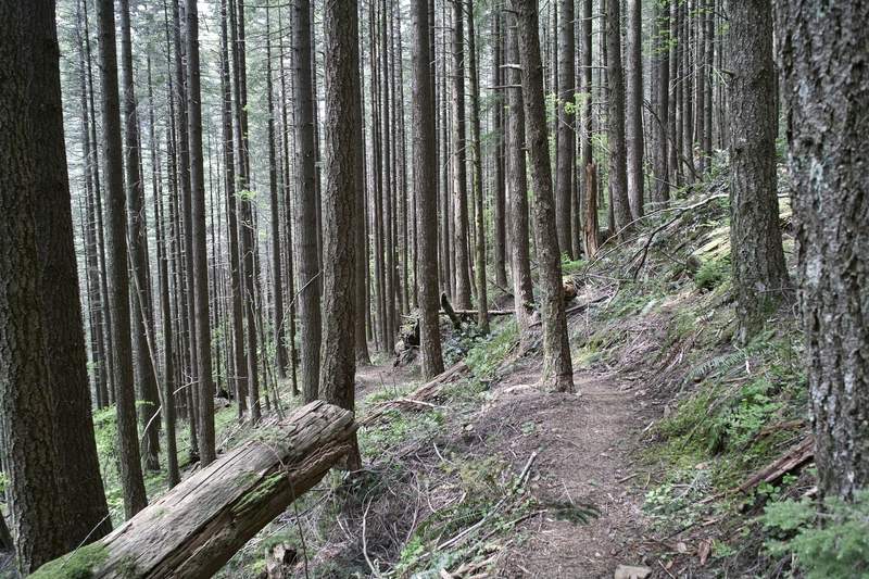
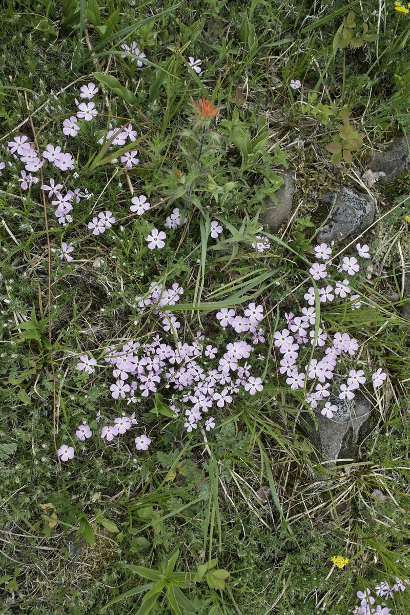
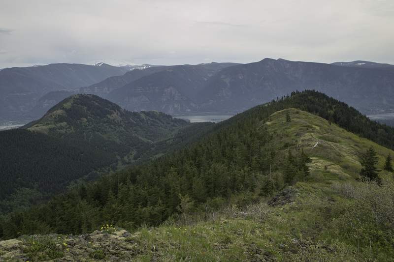
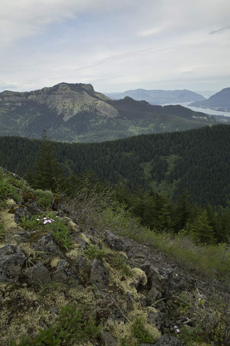
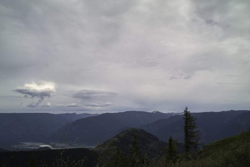
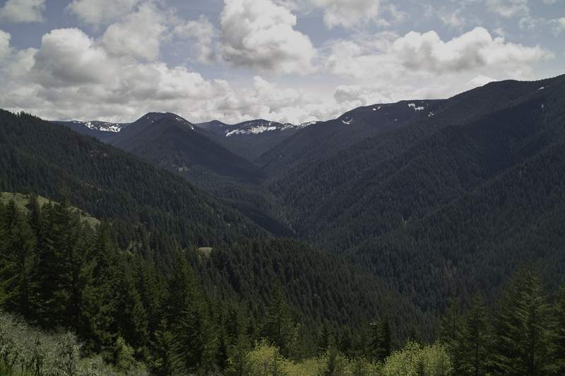
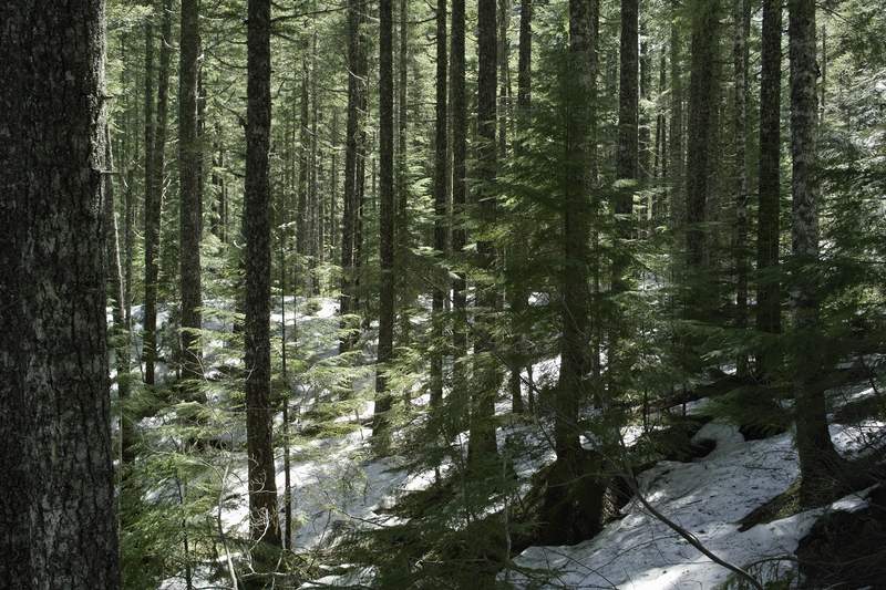
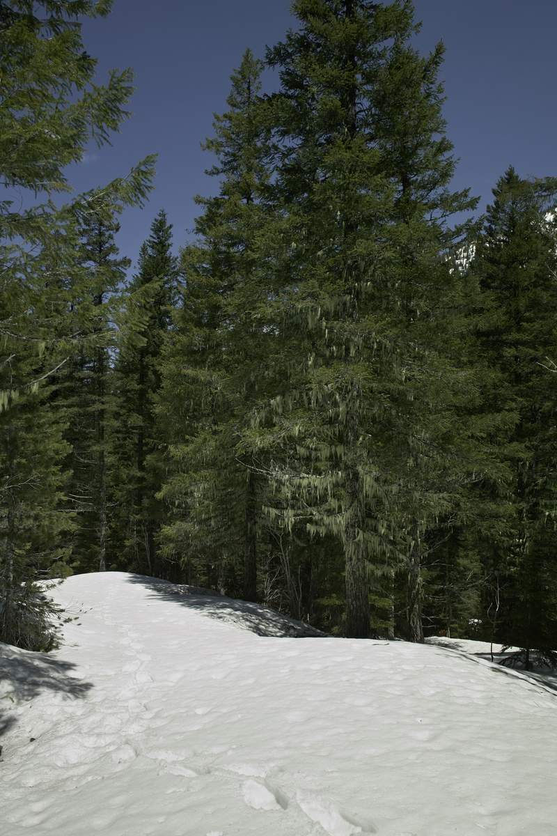
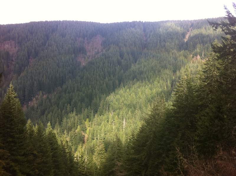
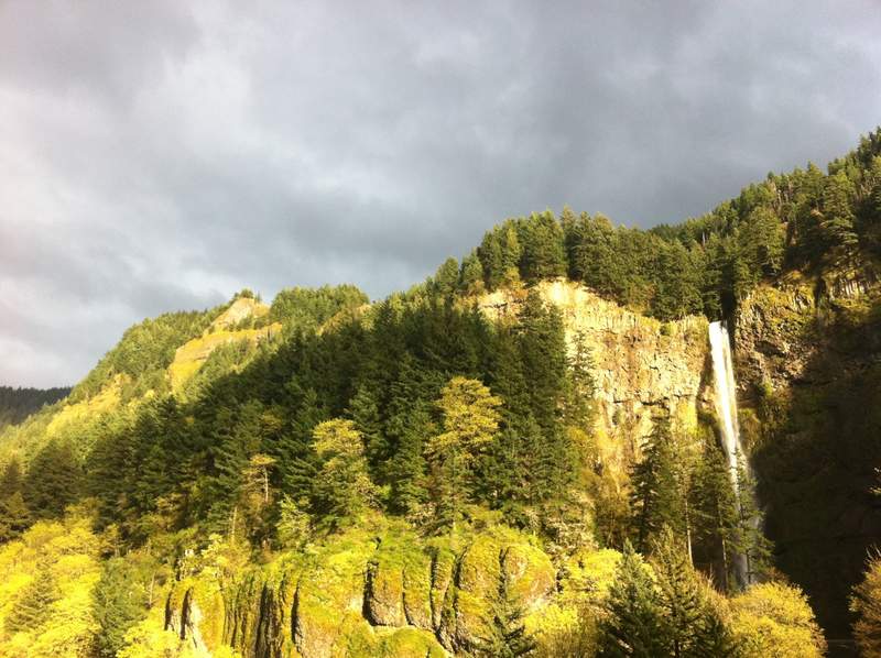
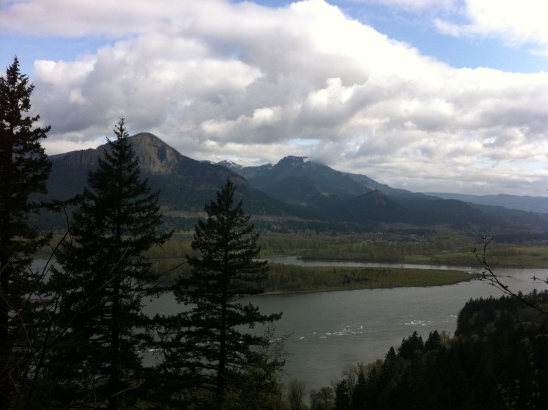
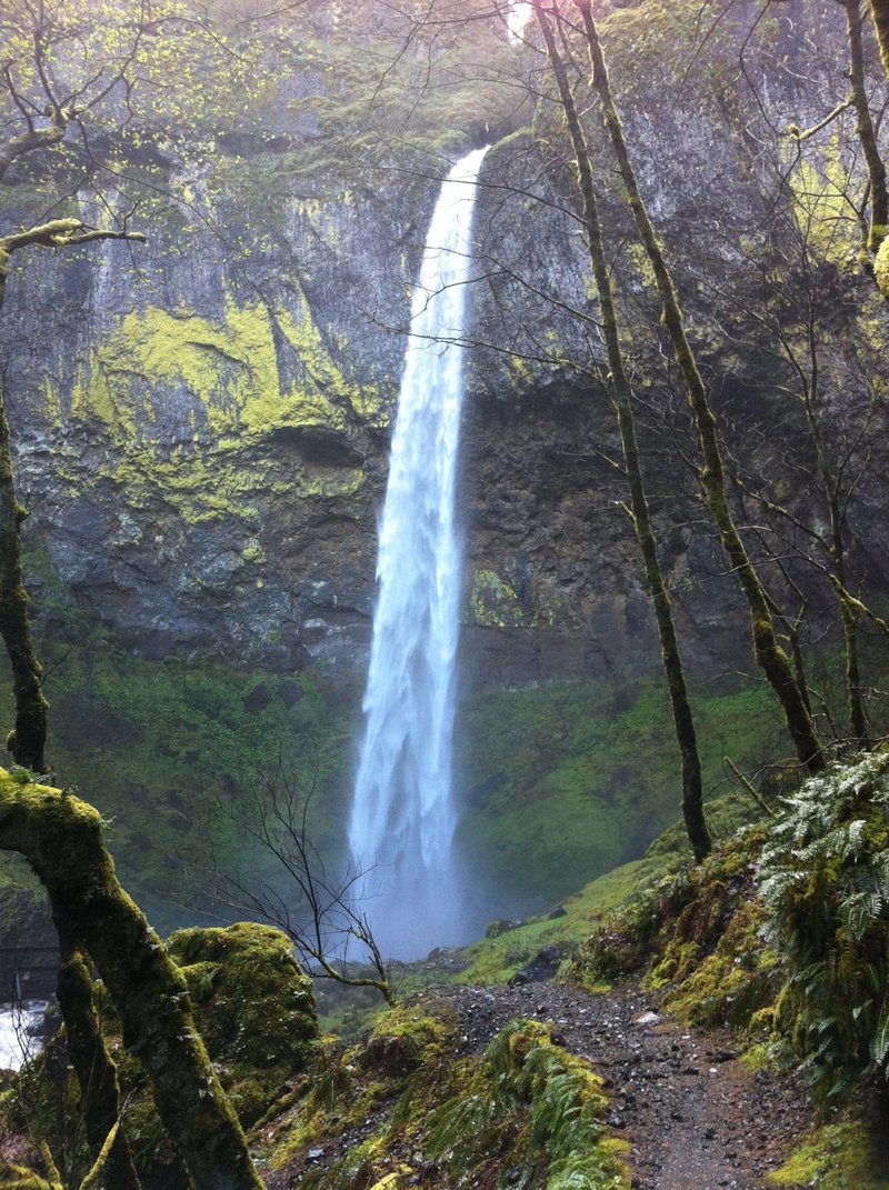
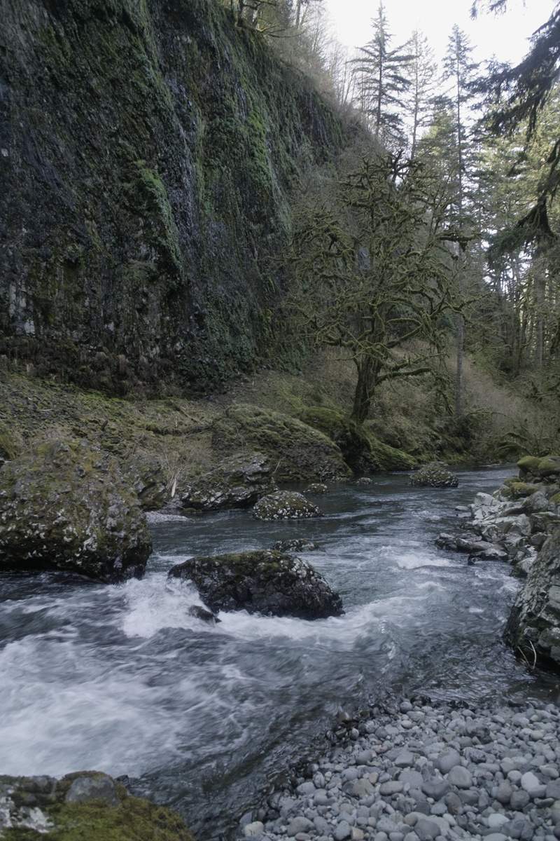
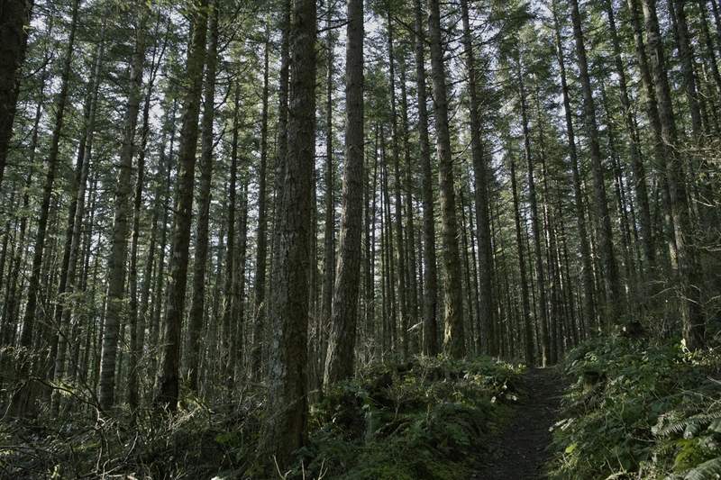
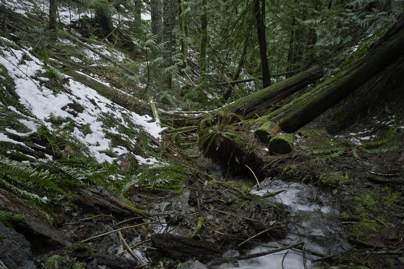
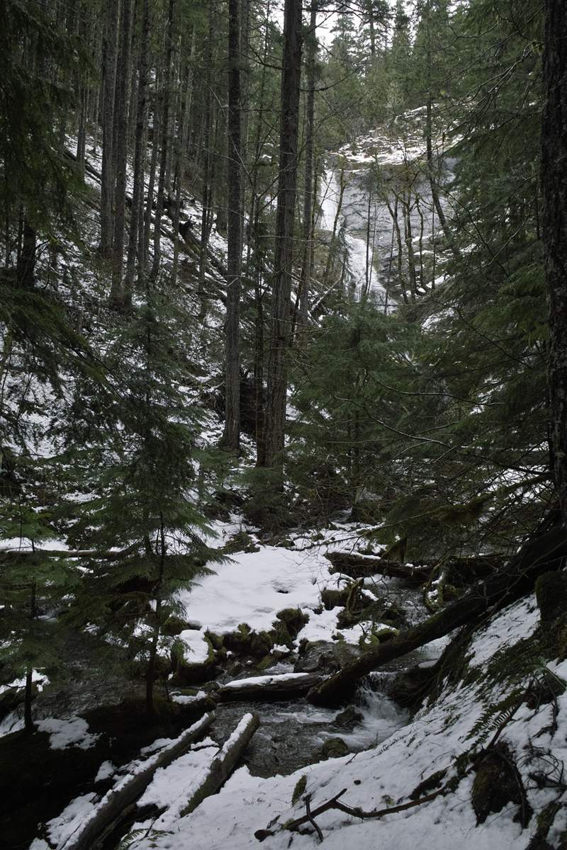
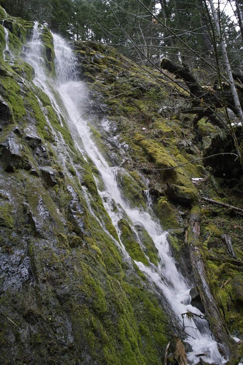
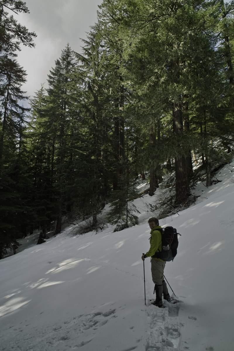
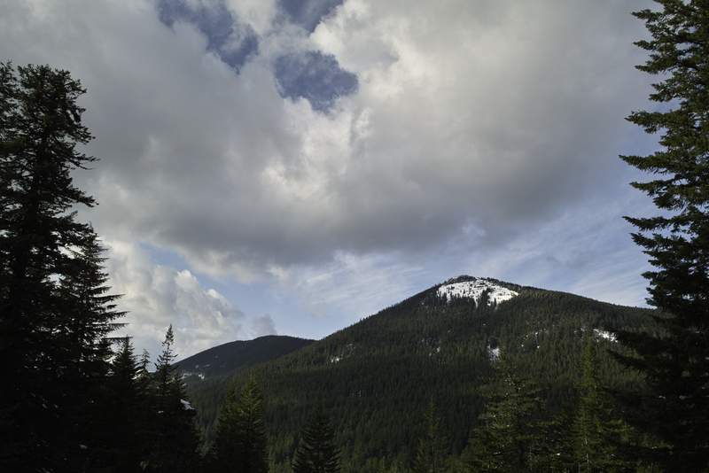
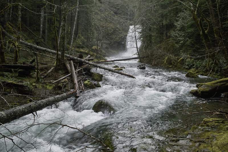
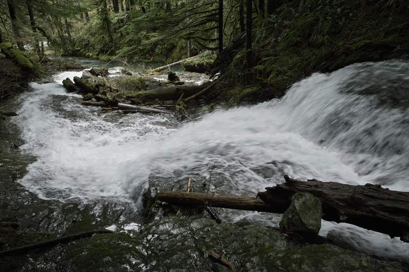
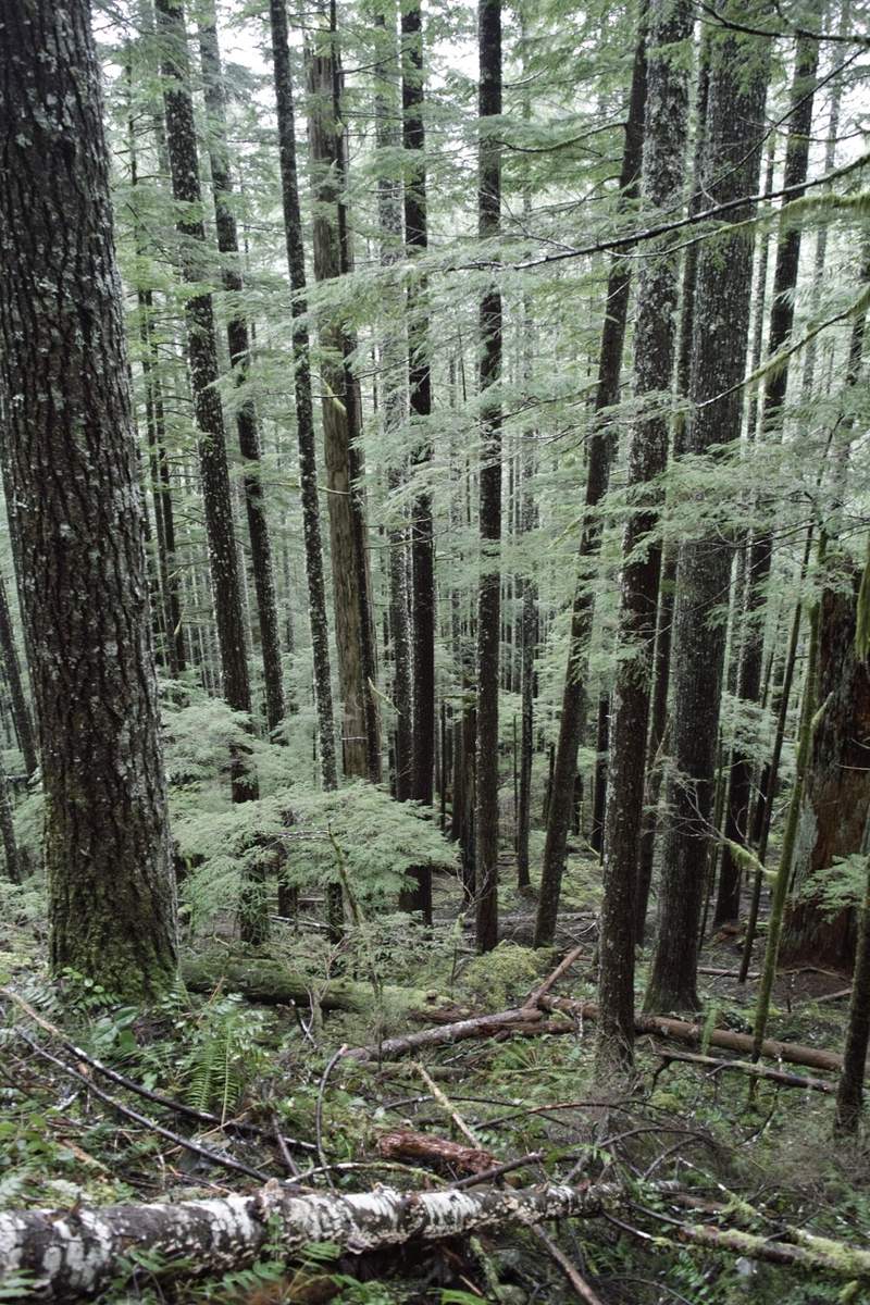
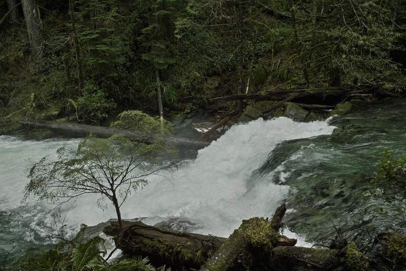
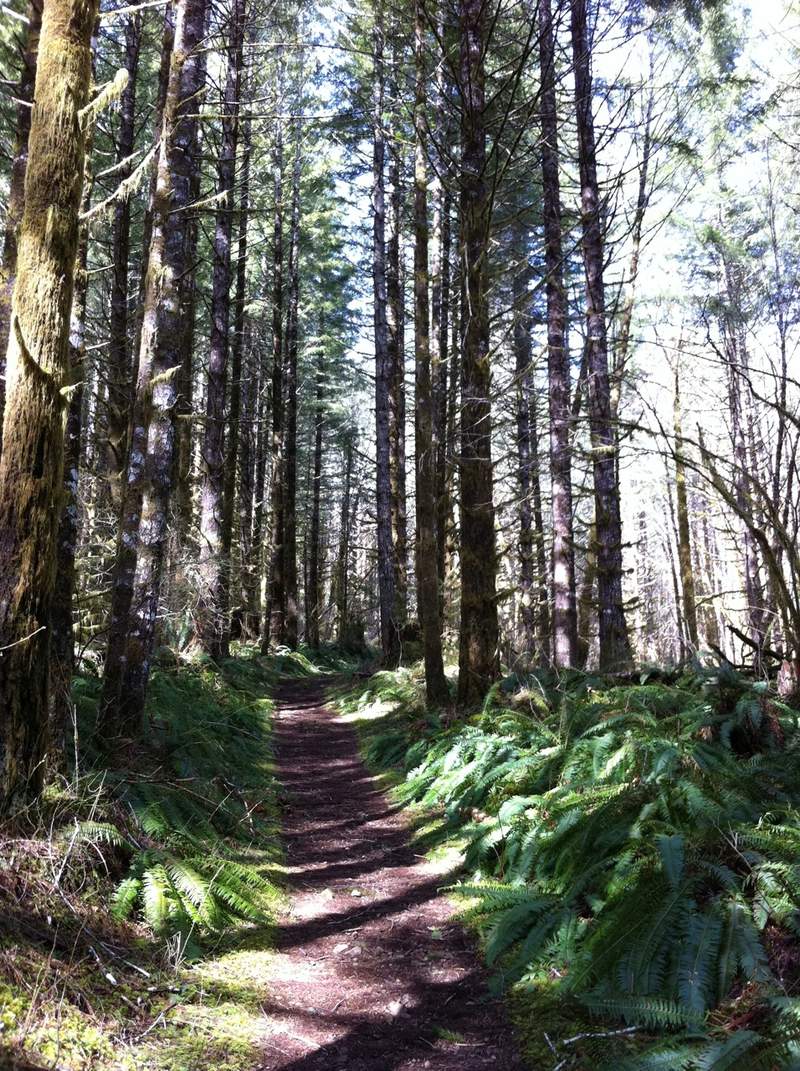
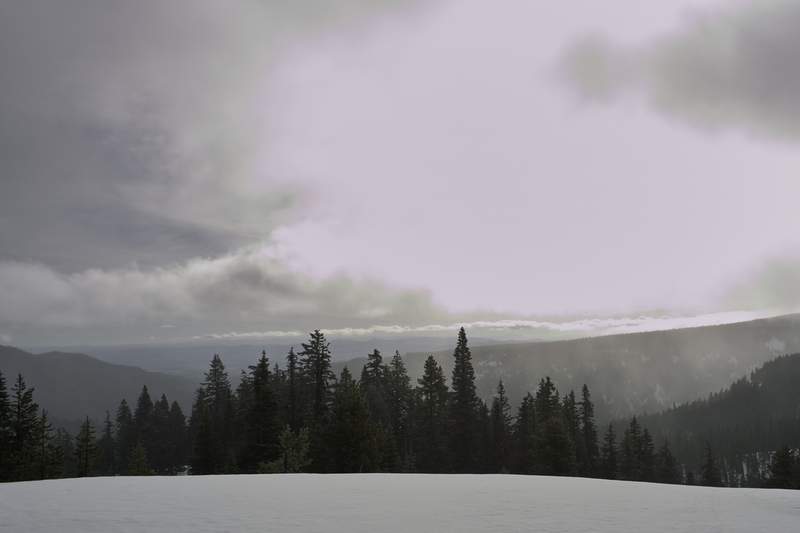
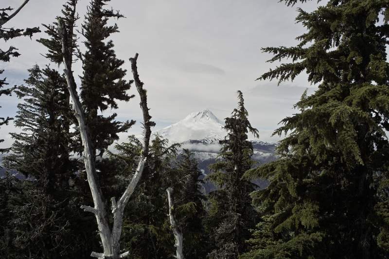
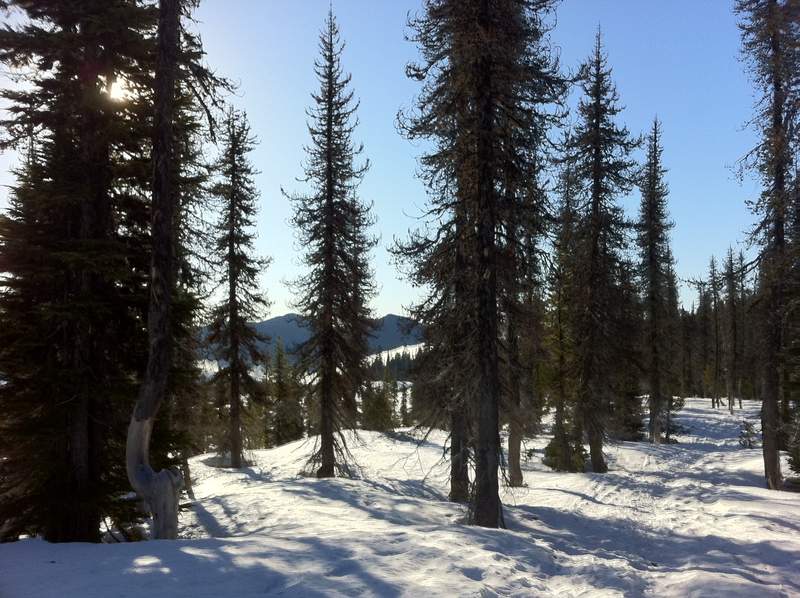
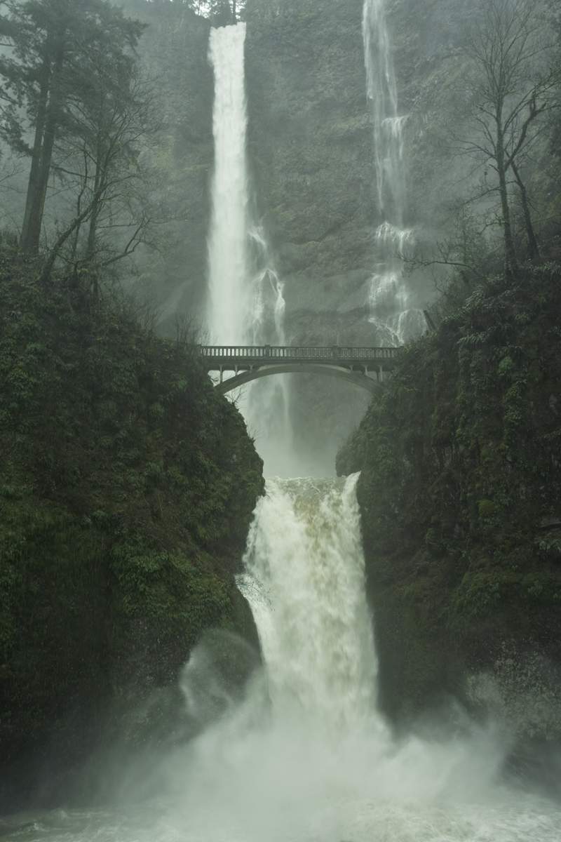
Larch Mountain Loop
12.5 miles of hiking • 2750' elevation gain •
We chose to do another Larch loop because of its flexibility and guarantee of good views above the inversion. I love how well graded the Multnomah trail is up there. The rocky section was nice and slipp'ry.
Nice views again!
December 19, 2011

 2
2
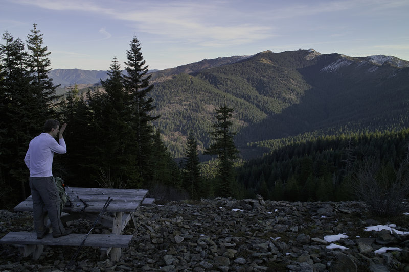
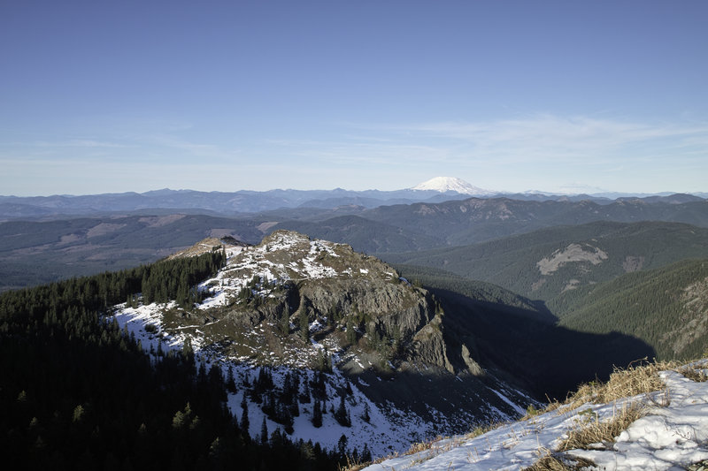
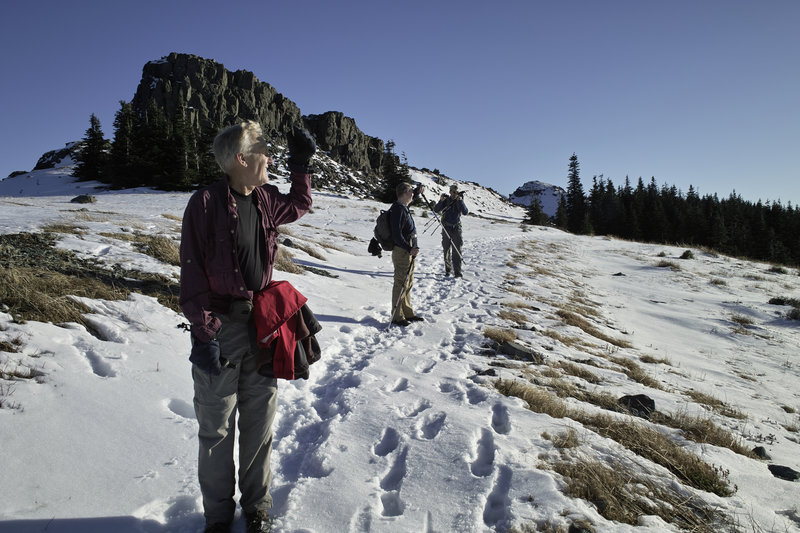
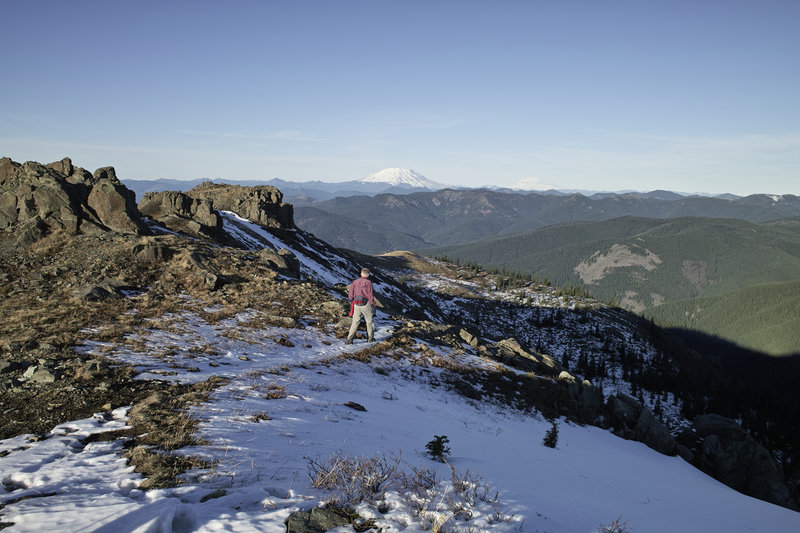
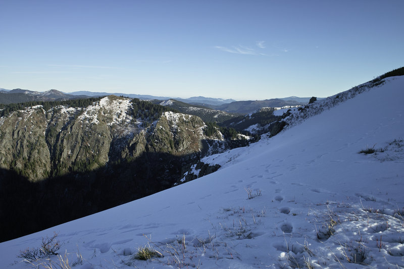
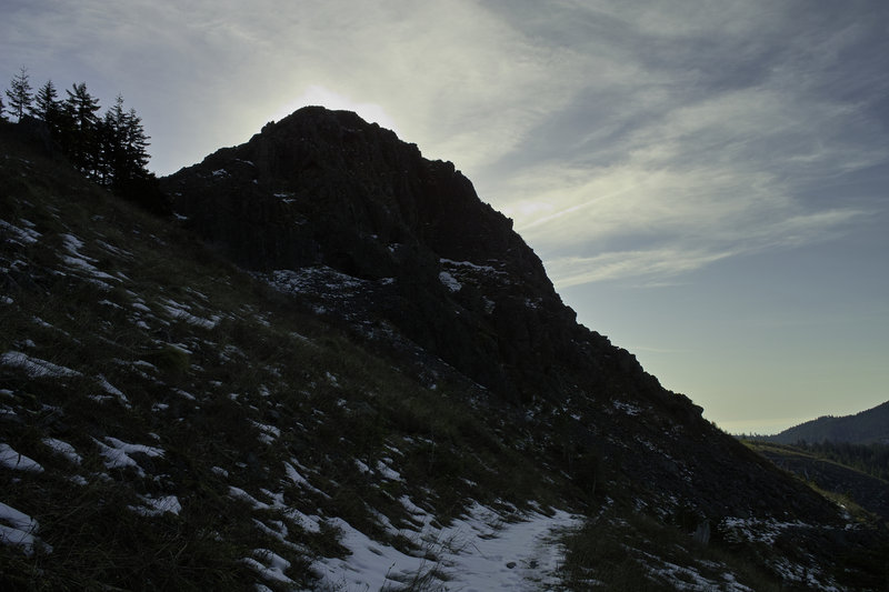
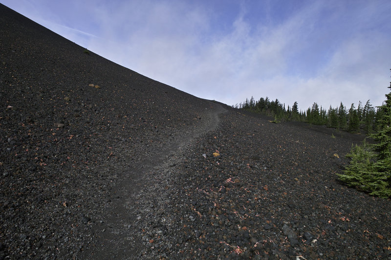
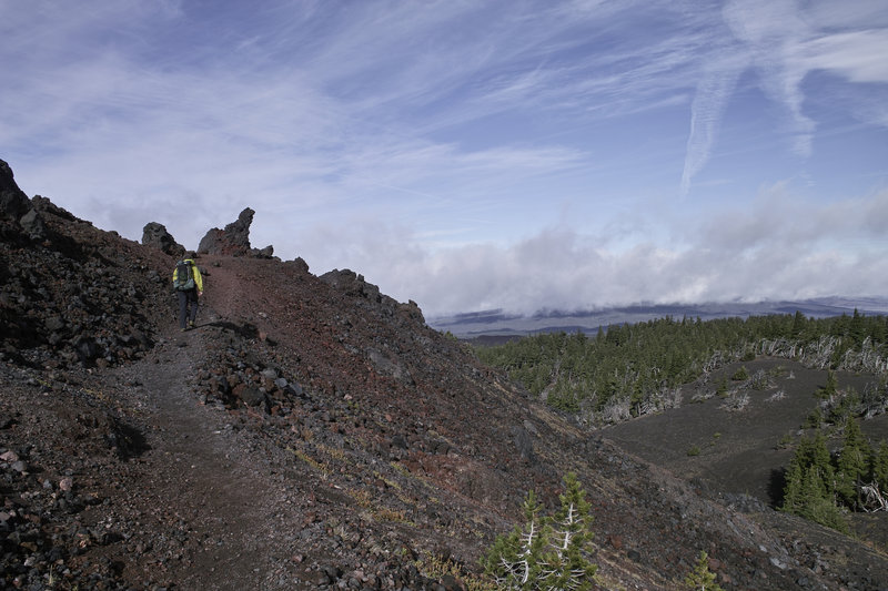
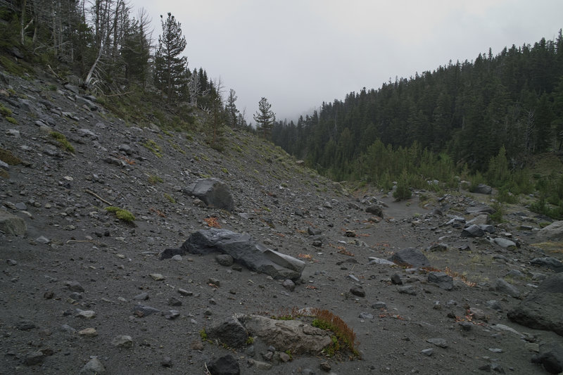
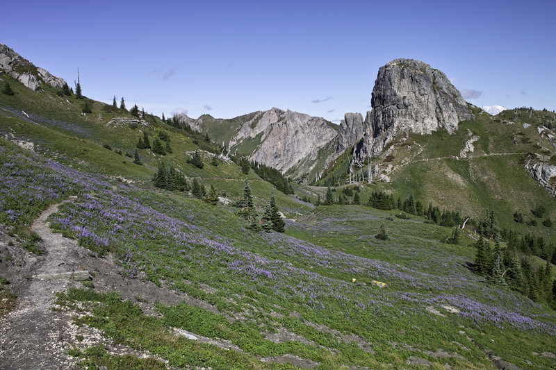
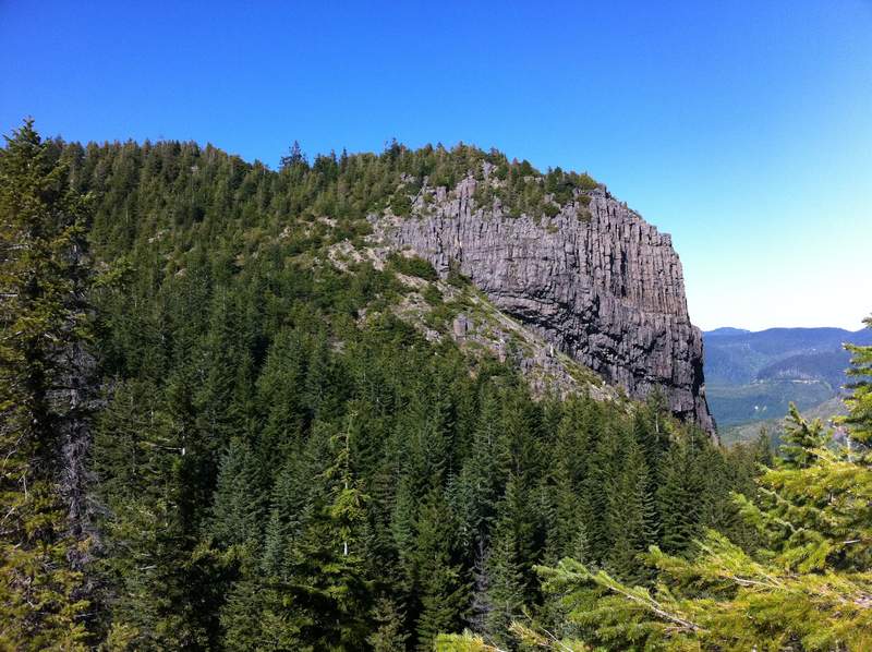
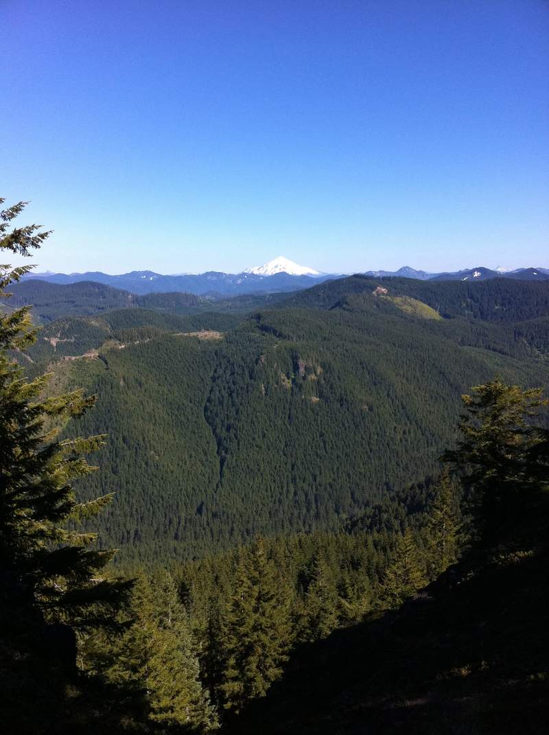
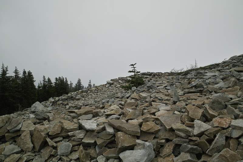
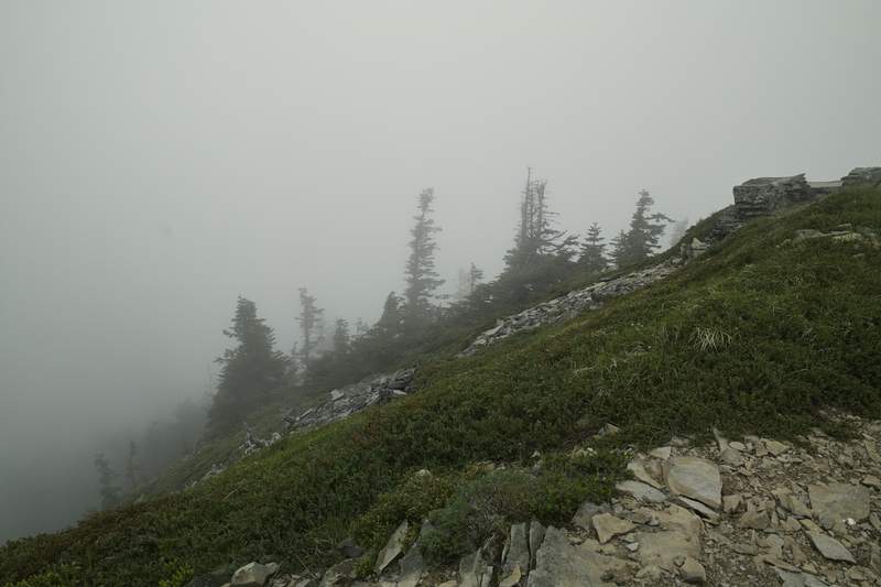
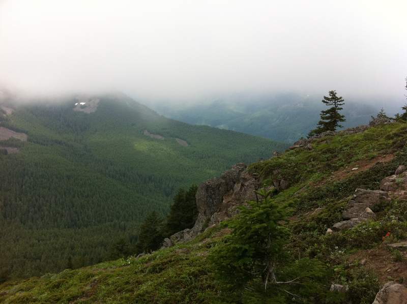
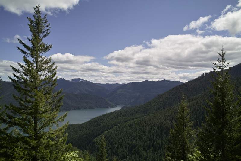
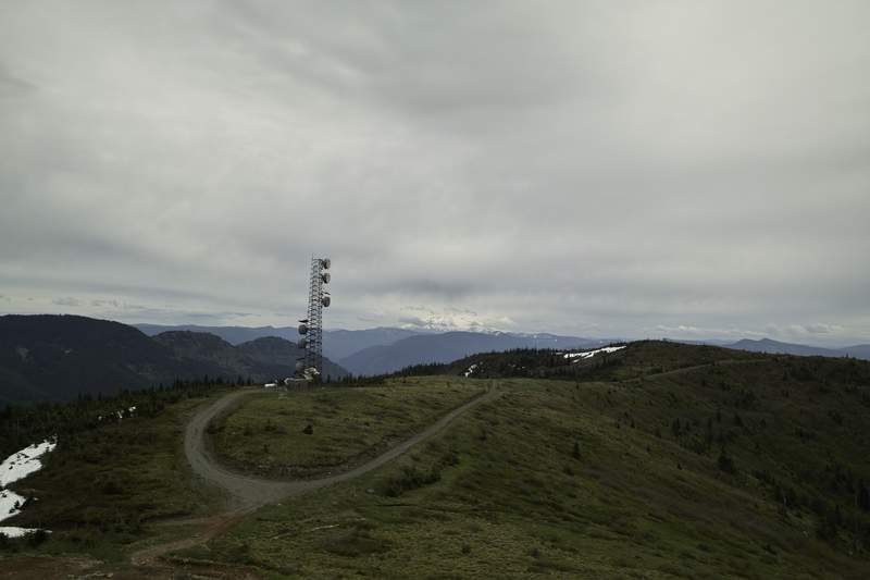
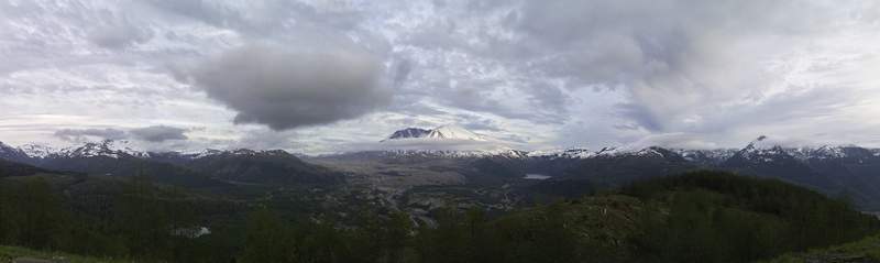
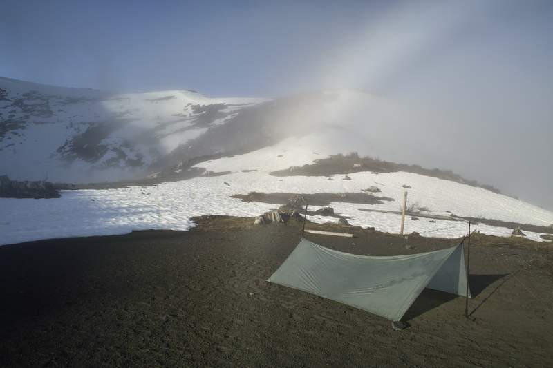
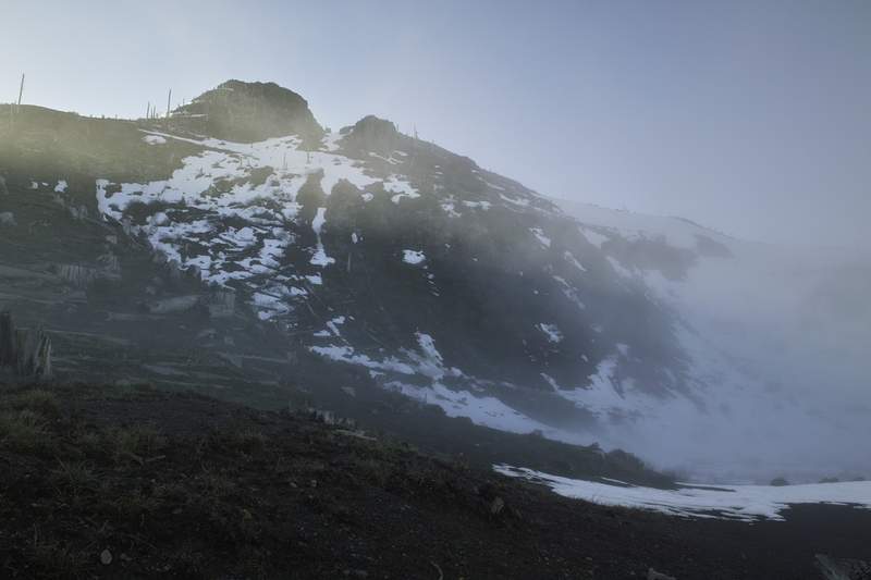
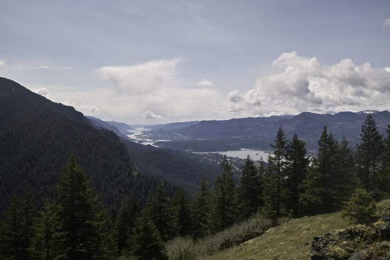
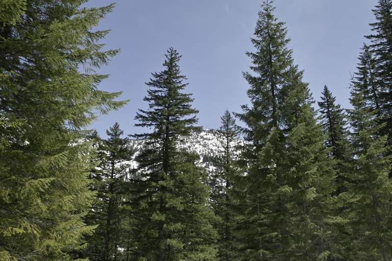
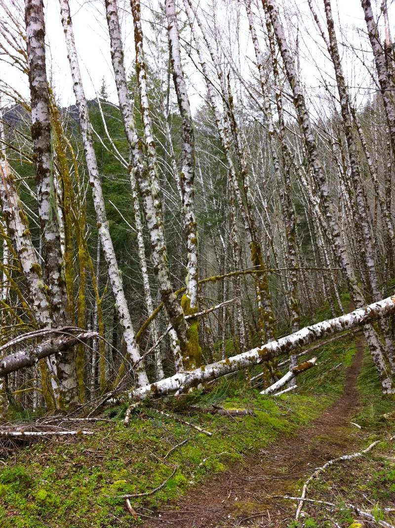
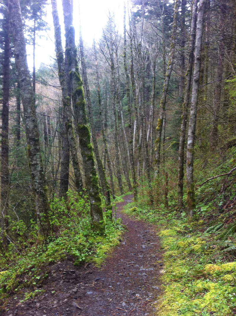
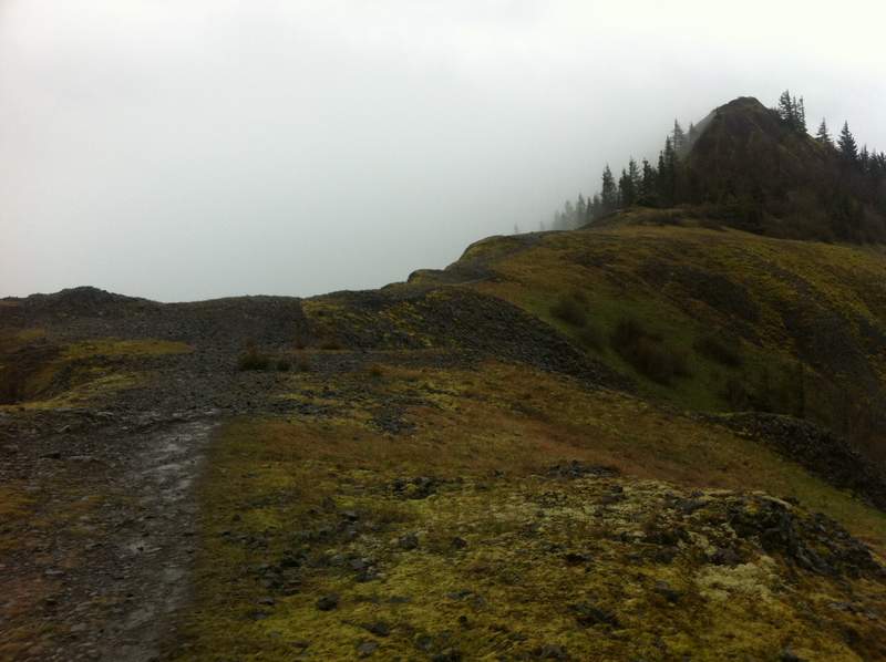
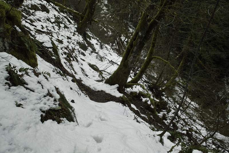
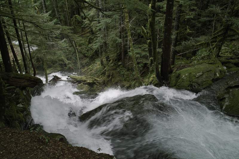
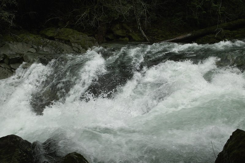
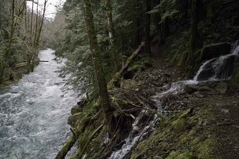
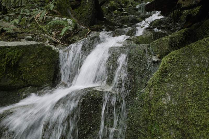
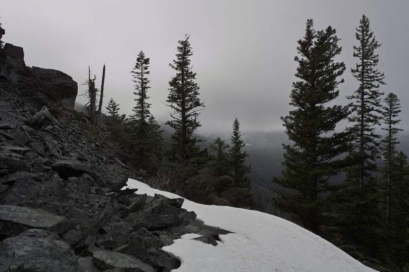
Silver Star Loop
22 miles of hiking • 5250' elevation gain •
A great hike with the loonies!
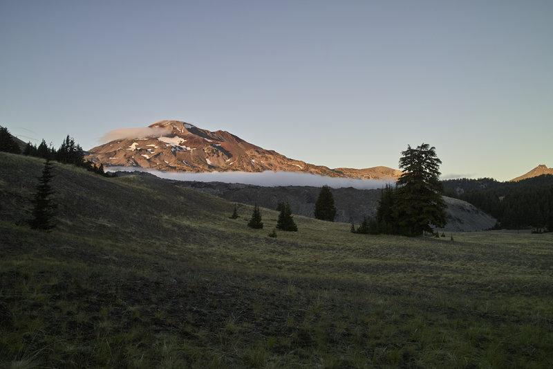
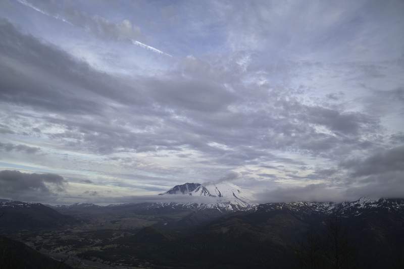
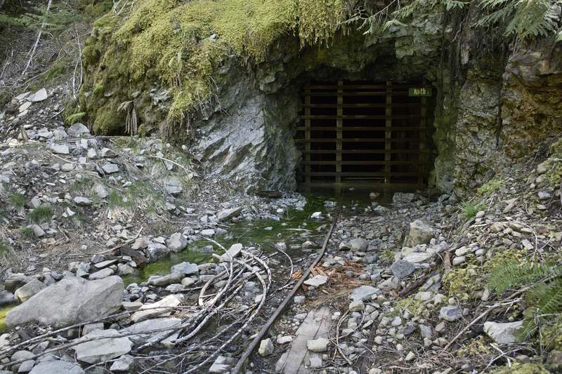
We started at Don's house, where he showed us some neat ideas for a trip based off of the LIDAR maps in an area that looks like it could be the remainders of the Bonneville Slide.
The drive to Silver Star pretty quick from Vancouver—we went a new route I hadn't gone before, past the Larch Corrections Center, and the road started to ice up a bit. The car's thermometer started to oscillate between 30 and 48—a sign of things to come for the day.
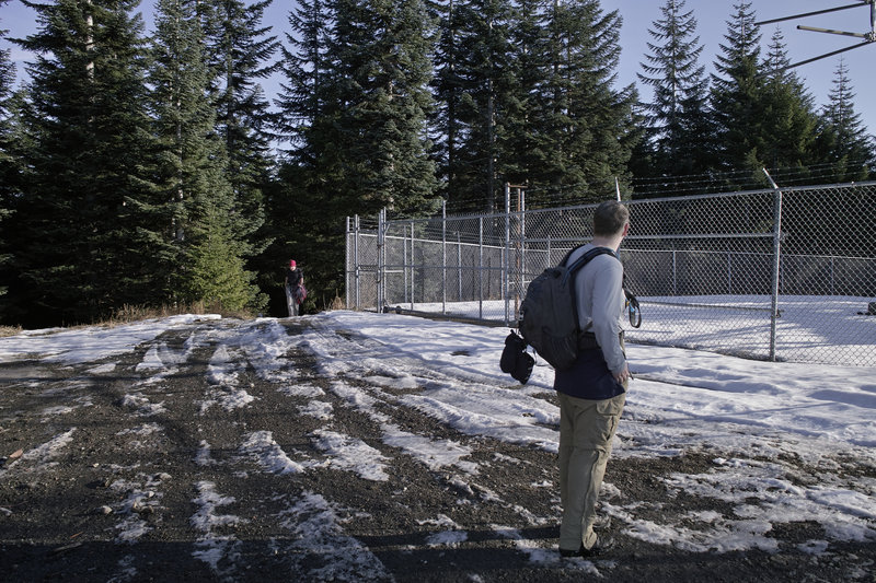
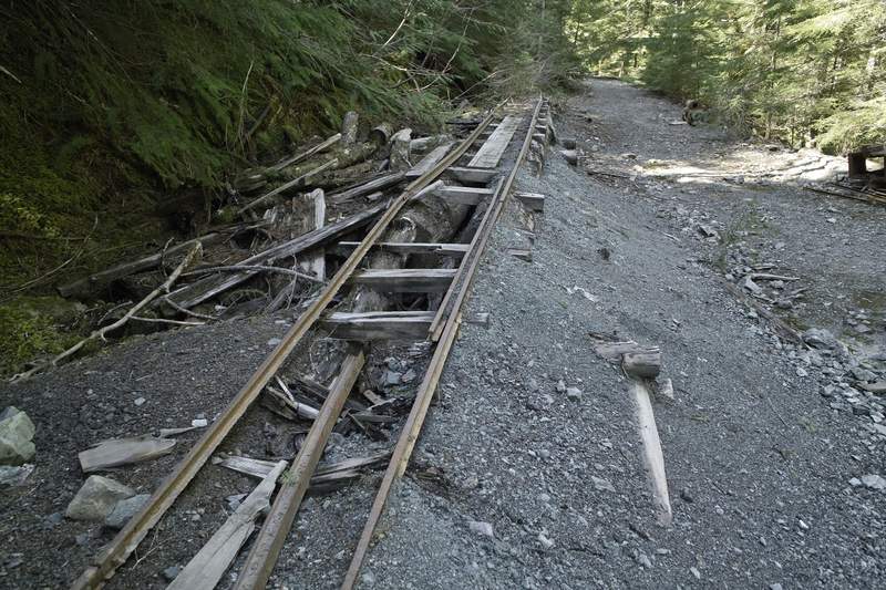
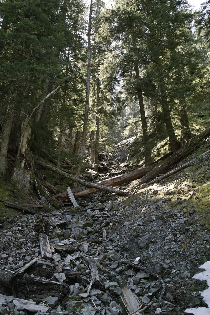
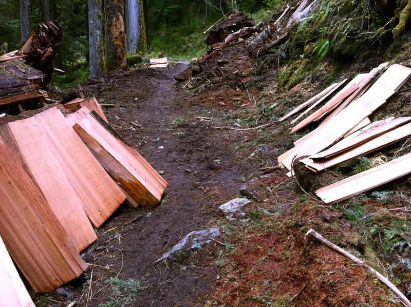
After some discover pass antics, we parked at the Rock Creek campground area, just off the road, and headed up the Tarbell trail towards Larch Mountain. There was one reroute on the way that looks rather recent, but otherwise the route is on trail, or old railroad grade.
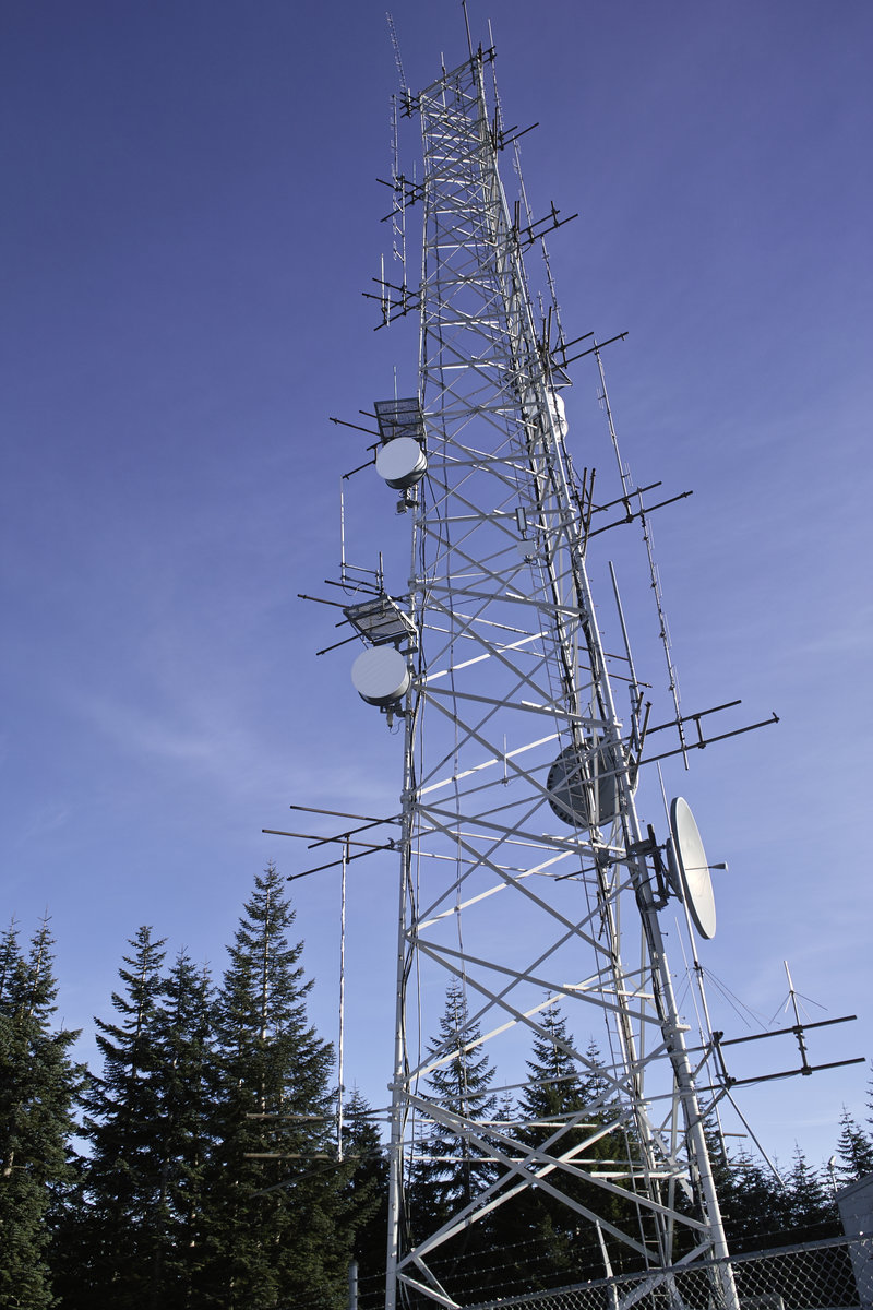
Larch mountain pales in comparison with it's Oregon counterpart. It's really just a bunch of microwave towers, with little to no views. We stopped for a quick break, and contemplated taking the sleds—which someone had stuck in a tree—out for a spin.
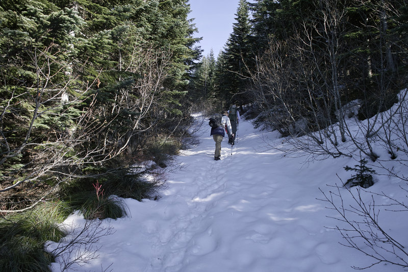
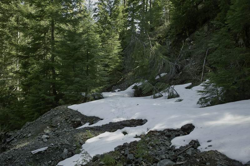
Tarbell descends pretty quickly to Grouse Vista trailhead. Then, of course, it's back up that steep hill towards silver star. EP bolted up towards the top, but we soon caught up (only because he stopped for us, of course). The snow started around 3000' and was a little squishy, but not too bad. We took a quick break for water at the dog washing barrels, and then made it on over to Sturgeon Rock. Brad, Don and EP went to the top, and then we headed back over towards Silver Star.
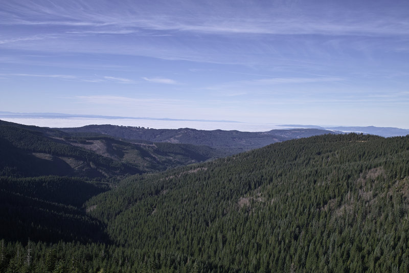
We were met with a busload of kids running down the final trail section. Since the 20+ kids had left the top, there were only two other people up there, and the views were great. At the top it was practically balmy—it felt like 60º, at least. We took a quick break and then headed back down the hill, towards Chinook, and then on an old jeep road.
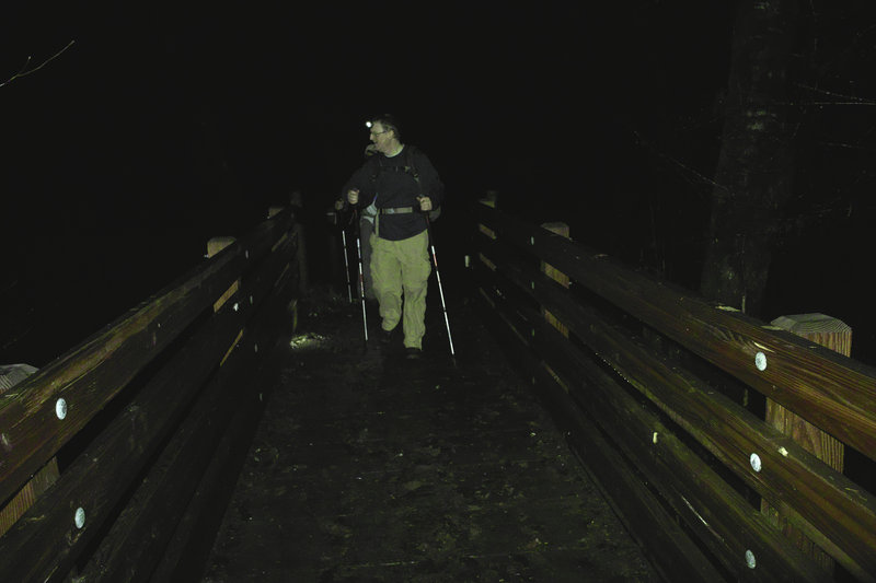
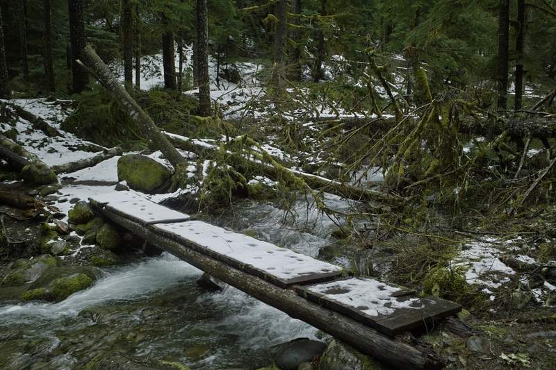
Since the road didn't meet up with the trail (or so we thought), DN took us on a quick bushwhack through a clear cut, back down to Tarbell. Tarbell winds up and down a ridge for a while (Klochmann Butte?) and then heads down to Tarbell Trailhead, but we opted to take an old road, down to some other logging roads to save a mile or so.
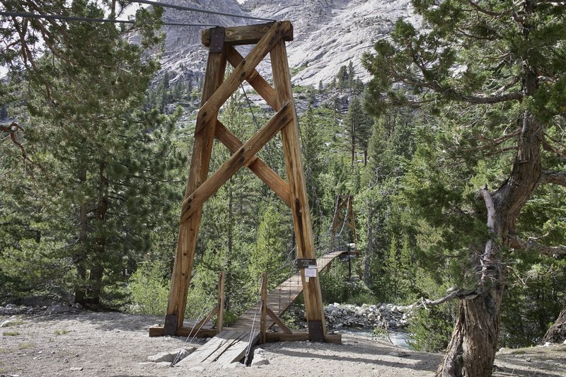
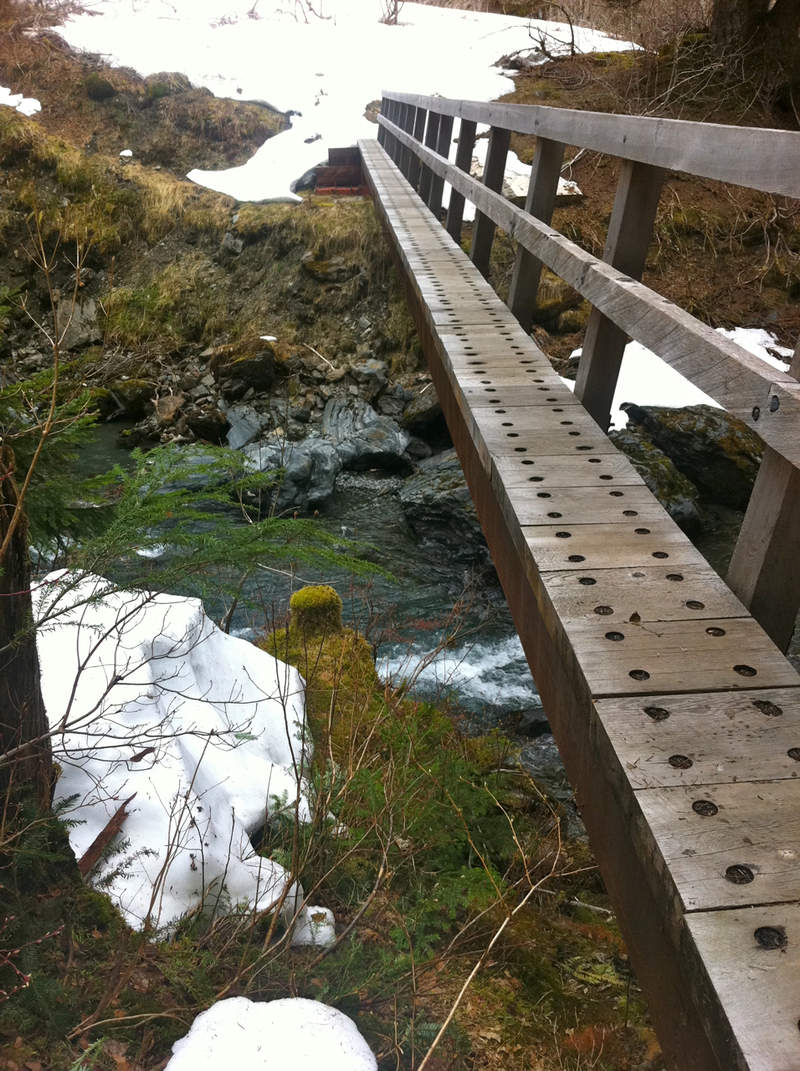
The final mile or two was in the dark, and we were eagerly anticipating the crossing of Rock Creek, but someone had decided to build a bridge over it, so we missed out on all the fun.
The car was still there at the end—no bullet holes or flat tires!
December 17, 2011

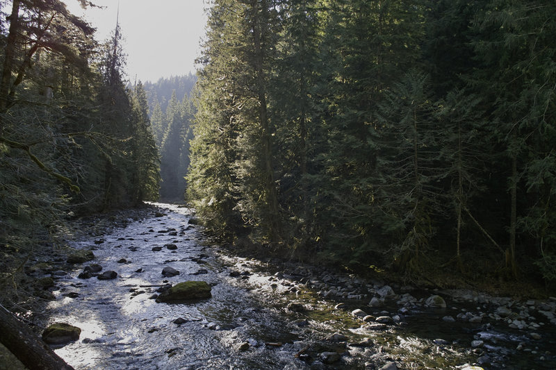
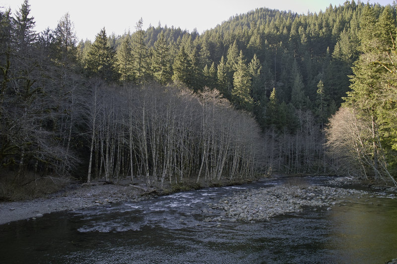
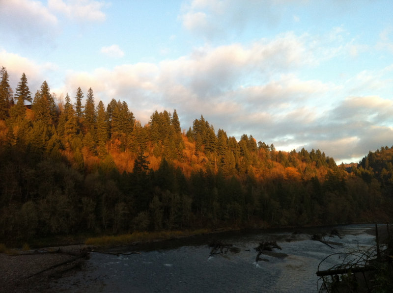
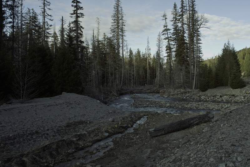
Upper Salmon River
5 miles of hiking • 500' elevation gain •
I was going to do a quick trip to Wildcat Mountain, but the road was continuous ice, several miles from the trailhead.
Option B was to do Salmon River. Just hiked up a few miles and back—always nice.
December 13, 2011

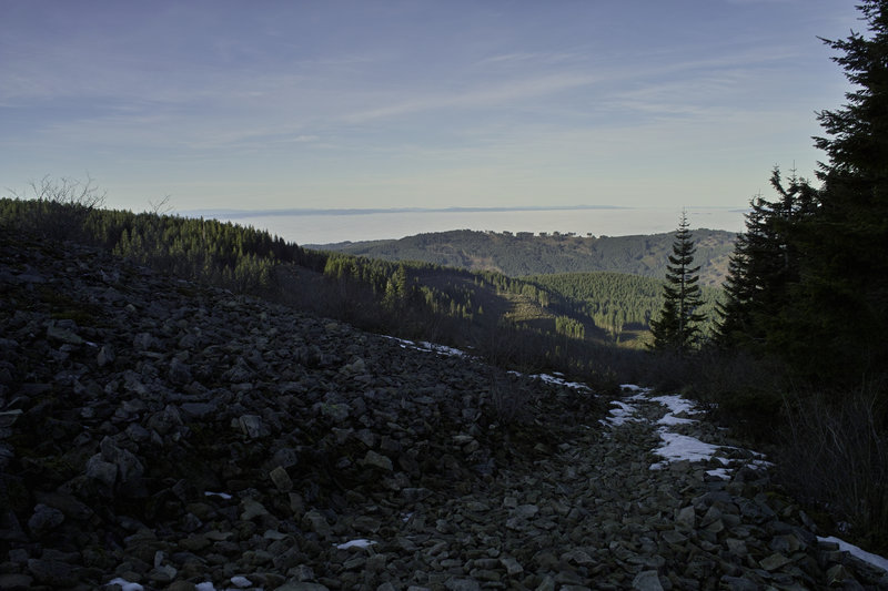
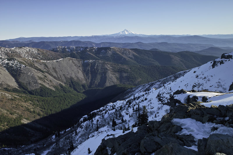
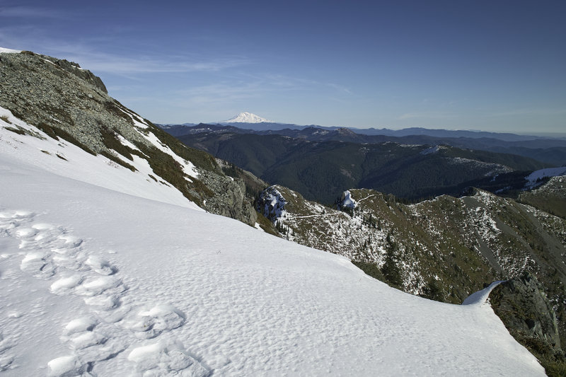
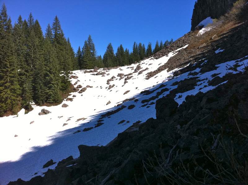
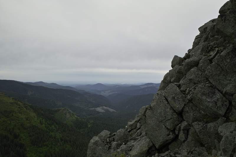
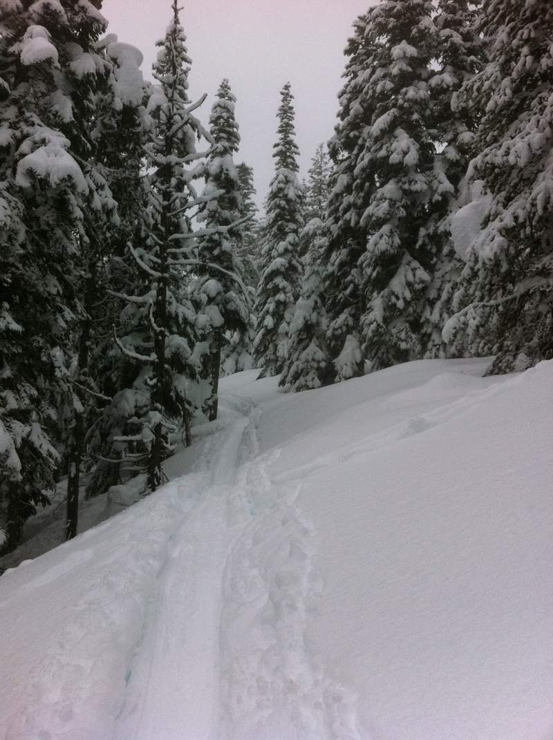
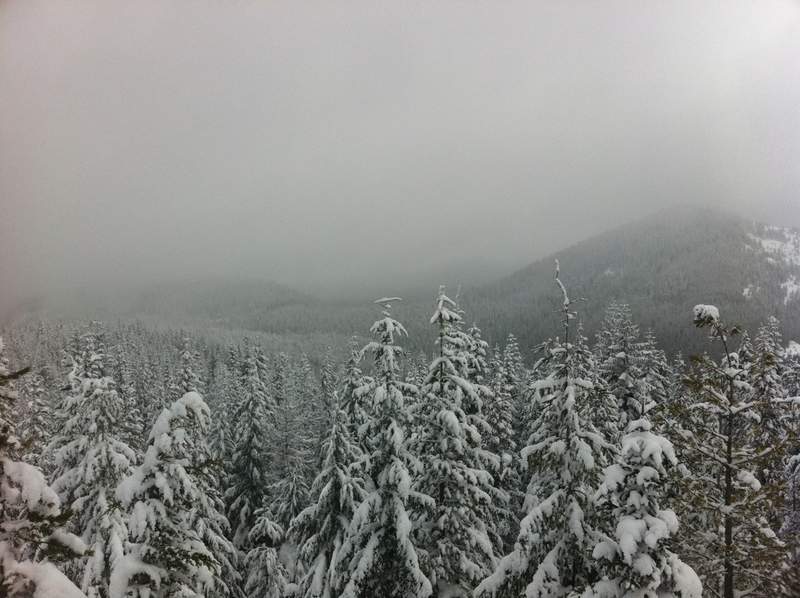
Silver Star
7.5 miles of hiking • 2500' elevation gain •
I had just a few hours so I though I'd do Silver Star from Grouse Vista.
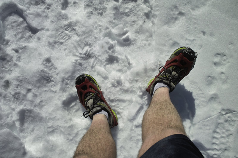
The Discover Pass sign has in fact been ripped down, and there are no indicators that a fee is required (so go now!). The trail has hard packed snow for the last mile or so, and microspikes are not necessary, but are supremely helpful for coming downhill faster. I saw no one else the whole morning.
The inversion seems to be burning off, but it was still clear as glass out today! No wind on top of Silver Star made it feel practically balmy! The bee that was living inside the rock on top seemed to agree.
December 8, 2011

 2
2
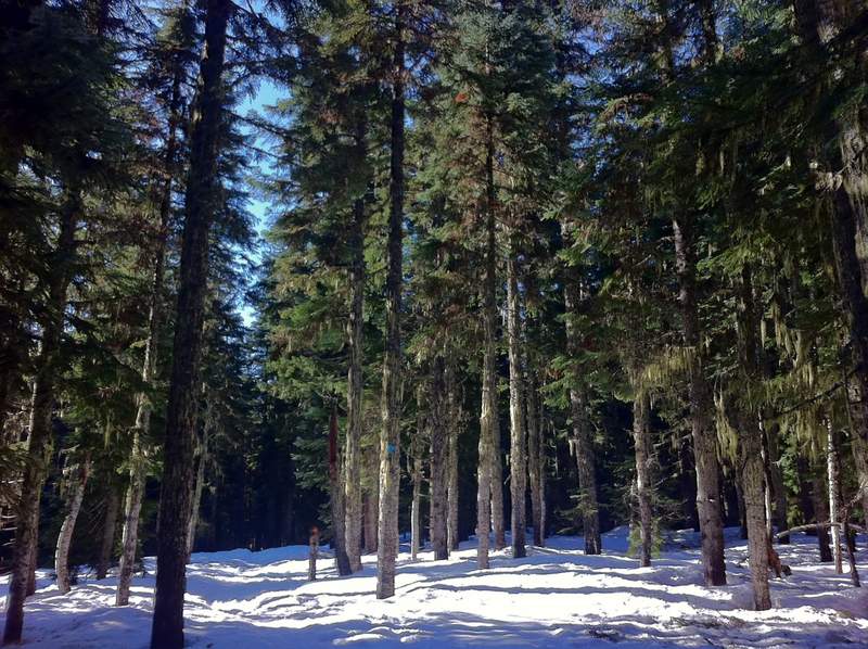
Larch Mountain Loop
17 miles of hiking • 3000' elevation gain •
Did a big ol' loop starting at the Larch gate. Started down the hill on a closed forest road (nice little streams along the way!), cut over to Multnomah Creek and headed up Franklin Ridge. Snow started around 3000ft, but was pleasantly solid because of the freeze, with nice "traction snow" on top.
I ran into a few people that were coming up to Larch from the gate, and some trying to open the gate, thinking they were going to get their cars up there.
Took me a bit longer than I planned because of the snow, but a really nice day!
December 3, 2011
Sandy River Delta Run
4 miles of hiking • 250' elevation gain •
Running with the dogs. Not my dogs, but every other dog in Portland.
December 2, 2011

Oxbow Park
5.5 miles of hiking • 500' elevation gain •
A run at dusk—the park (or at least the gate, but I saw a Metro pickup doing a sweep) closes right now at 4:30. The best trails are next to the river.
There's parking just outside the entrance as of Dec 1, so you don't have to pay Metro's $5 fee.
November 30, 2011


Mount Talbért
3 miles of hiking • 750' elevation gain •
The big push to mile 1000. Every little bit helps.
November 20, 2011

Cape Horn Loop
7.5 miles of hiking • 1750' elevation gain •
Had just a short while, so I thought I'd do something close. First time doing the loop. Go now—before the falcon closure at the end of December, though one must be careful on some of those cliffy sections with slick leaves and wet rocks.
Really a nice hike, given how close it is to Portland.
November 18, 2011


 1
1
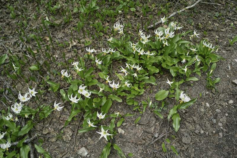
Multnomah Wahkeena Loop and Nesika Lodge
10.5 miles of hiking • 2500' elevation gain •
Did the Multnomah Wahkeena loop with a side trip up to Nesika Lodge.
Perfume Bomb Count: 5 (a record!)
November 13, 2011

 1
1
Tanner Creek
12 miles of hiking • 2250' elevation gain •
Kind of just a road walk. Given what else is in the area, probably only worth visiting if you're looking for an easy trail run or are looking to make a bigger loop.
November 11, 2011


Clackamas River
4.5 miles of hiking • 750' elevation gain • 1 night
Another easy hike. Just getting outside.
No rain!
November 5 – November 6, 2011

Old Salmon River
6 miles of hiking • 250' elevation gain •
Probably the easiest and one of the most relaxing hikes of the year.
November 4, 2011

 2
2
October 29 – October 30, 2011


October 23, 2011


 1
1
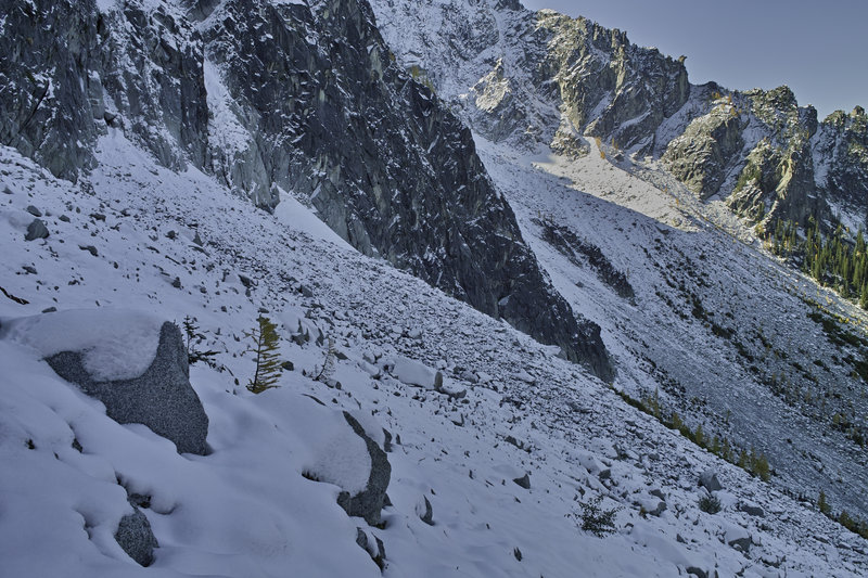
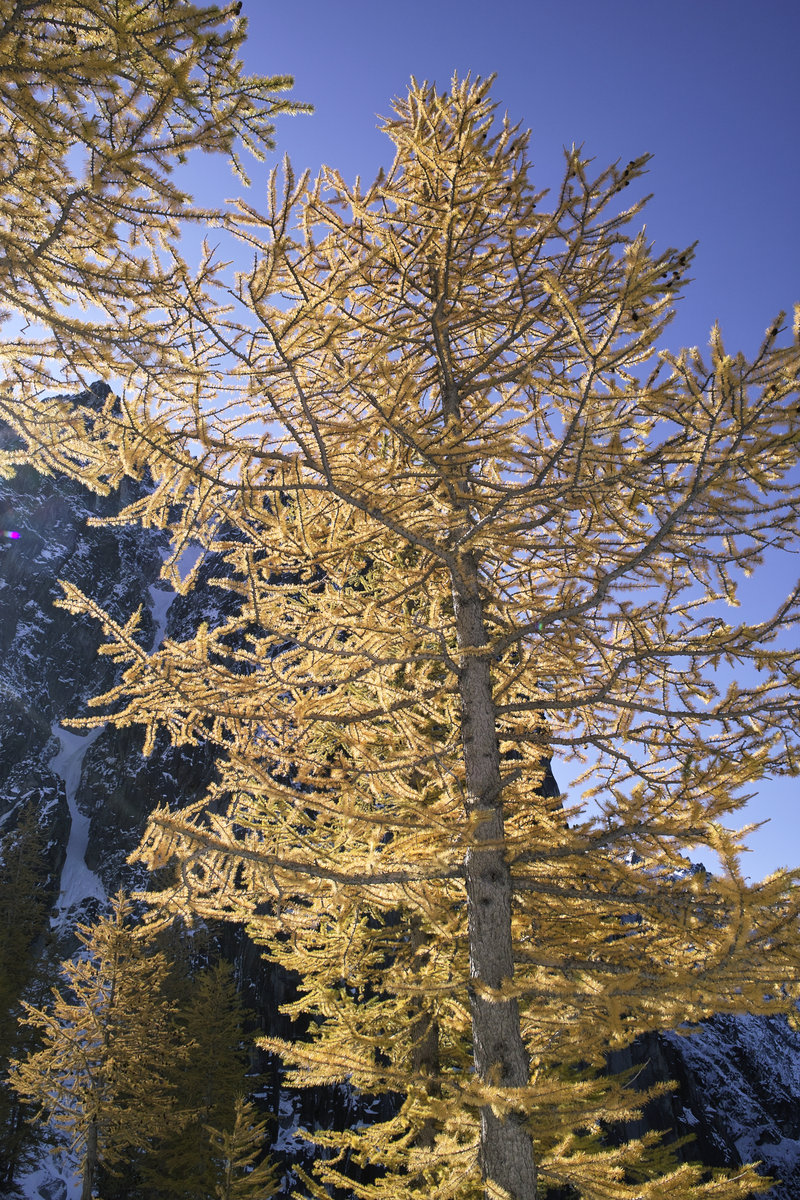
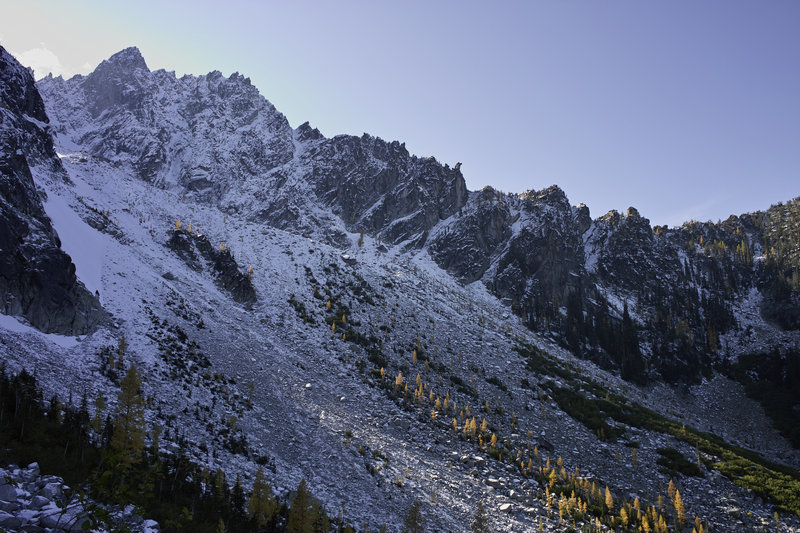
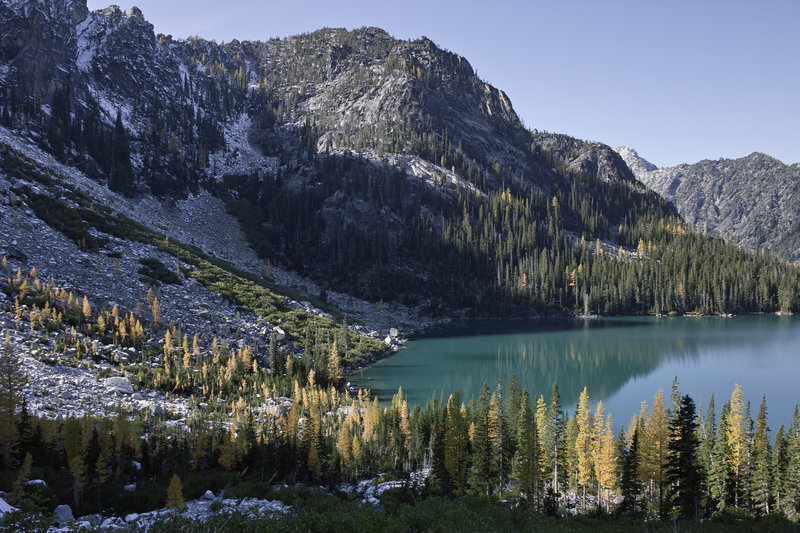
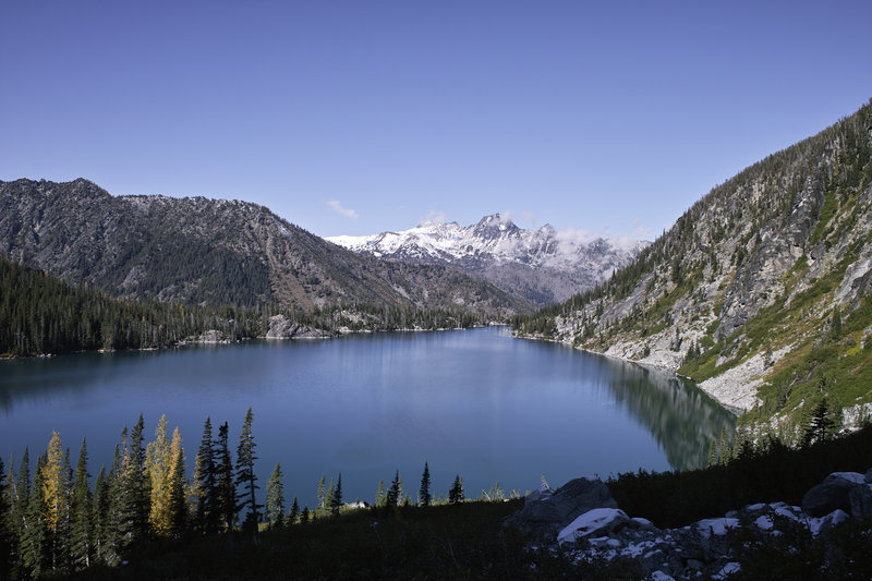
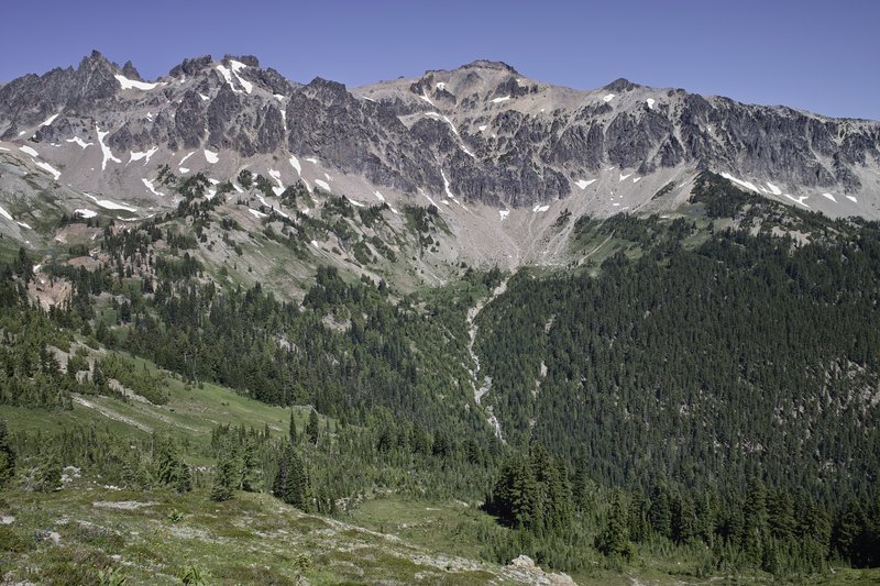
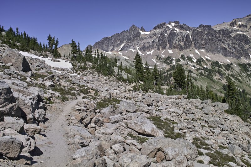
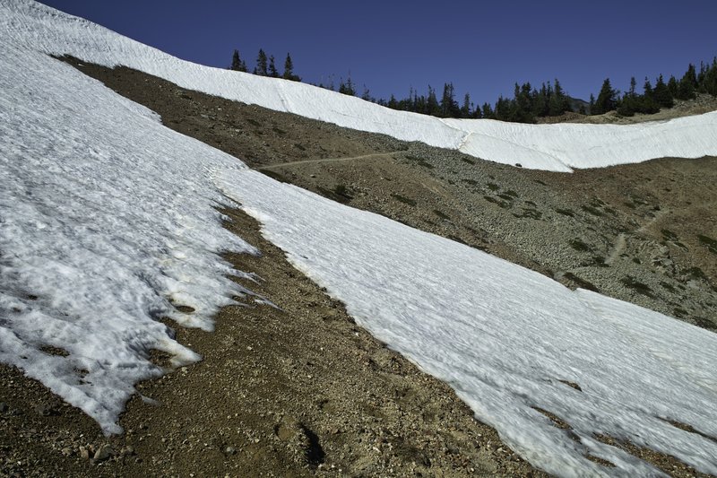
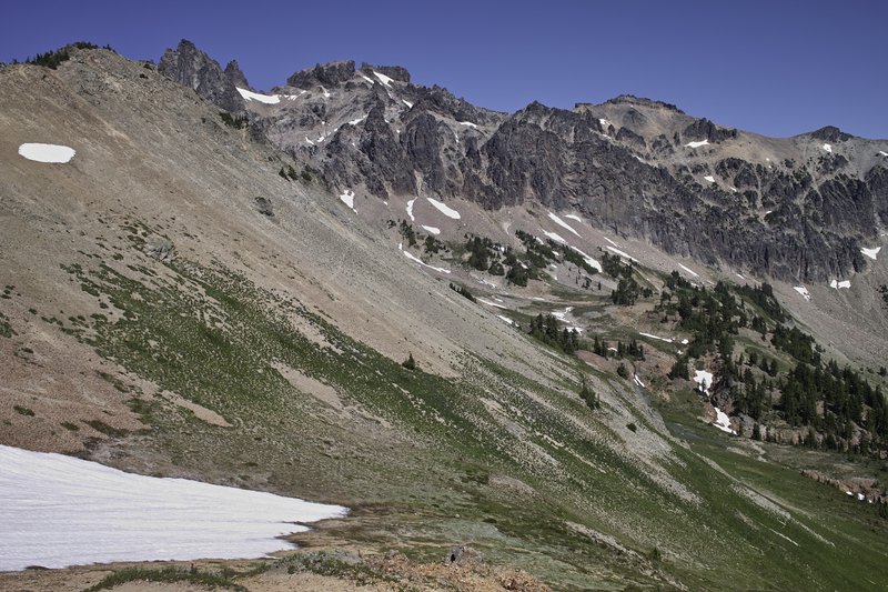
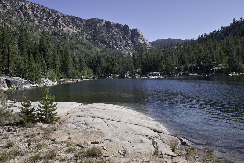
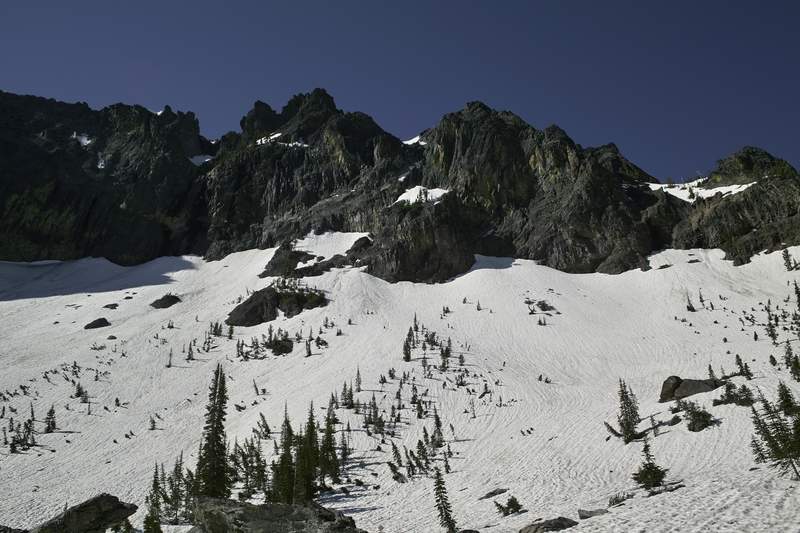
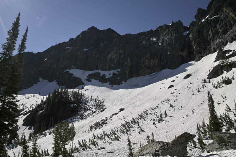
Colchuck Lake/Aasgard Pass
11.5 miles of hiking • 4000' elevation gain •
Another scrapped hike this year. I had a pass for the Enchantments, so that was the plan. Got three quarters of the way up Aasgard and decided to turn around because of what could become dicey snow on the way down, given all the melting that was going on. It probably was fine, and now I'm kicking myself, but with all the stories of deaths on Aasgard, I decided to play it safe.
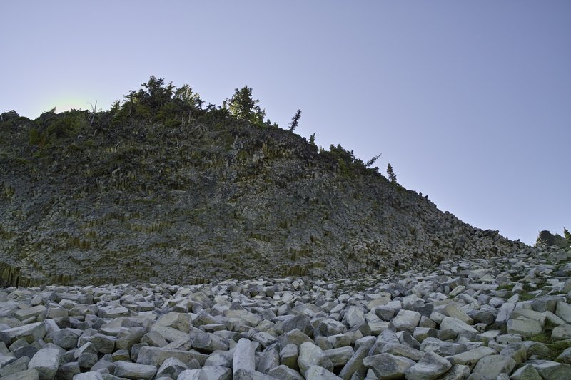
The boulderfield was icy. Also, the larch was lookin' pretty.
October 15, 2011

 2
2
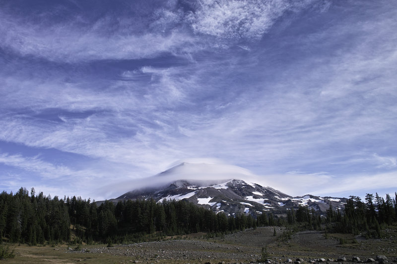
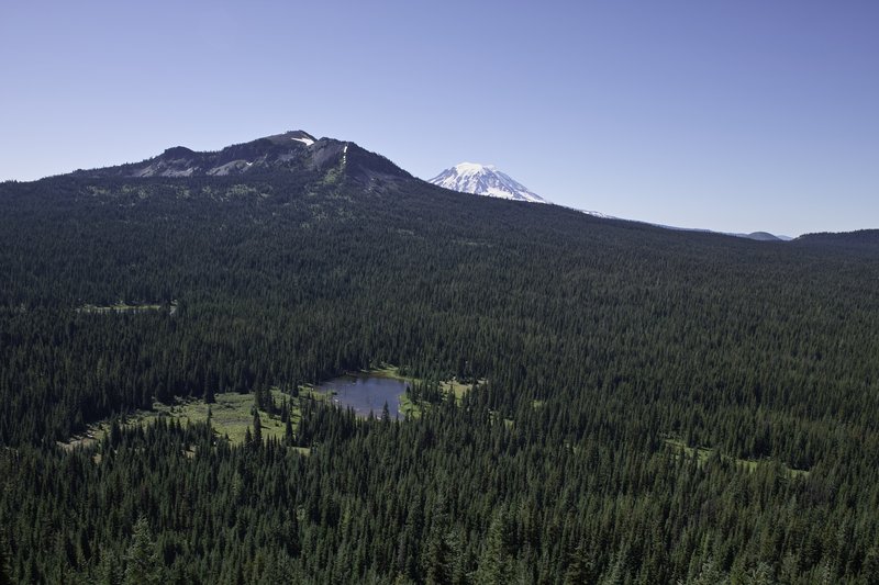
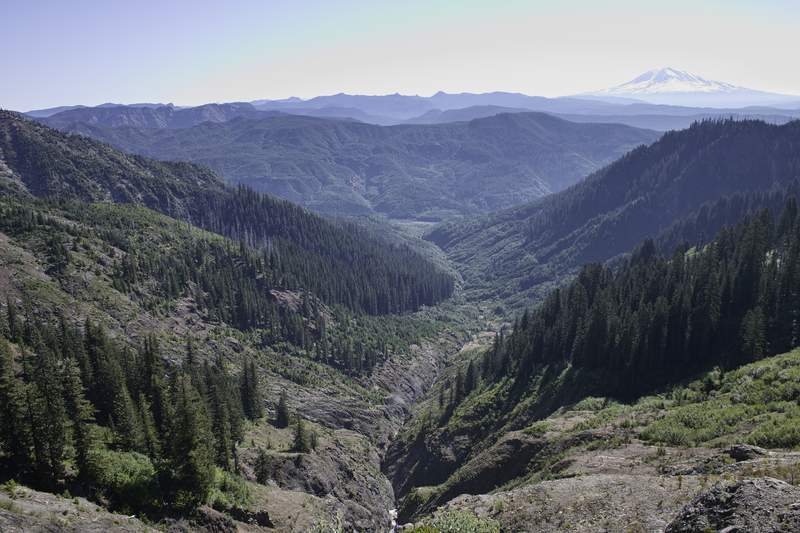
Three Sisters
42 miles of hiking • 4000' elevation gain • 1 night
Friday morning, I headed down over Santiam Pass, into Sisters, and then up into a raincloud known as Lava Canyon Trailhead.
I knew the rain wouldn't last though—you could see the weather was just lingering over the Cascades from the Sisters. My plan was to do the Three Sisters Loop in 2 days. At just over 50 miles, this was totally doable, but as I would later find out, the snow was a little more voluminous than expected.
The trailhead is in a large lava flow area with huge piles of lava rock which look as if they were dumped there by a giant dump truck. Very cool. The trail quickly meets the PCT, and, as I decided to go clockwise, quickly leaves the PCT for the east side. There were several areas of snow, an inch or so thick around 5800', however nothing that worried me at the time. Also, it was raining so I was hopeful things would quickly melt off.
The trail descends into a burnt area, and then meanders along with the occasional view of the Sisters. After a few stream crossings, one wrong turn, and a few quick stops, I made it to Park Meadow. This place must be really nice earlier in the season, but everything had dried up by now.
From Park Meadow, the trail heads up toward a plateau before reaching Green Lakes. However, around 6500' the trail began to experience frequent soft snow, and by the plateau at 7000', the snow was 3-4" deep. This wasn't a big problem hiking in, but to make my 26 miles each day, and seeing over the hill that the snow was present at even lower elevations, my mileage wouldn't be doable. Because most of the west side hovers around 6600' and as 26 miles in 3" of snow would have been a really big chore, I decided to head back down below the snow line, and camp for the night. Even if doable, walking in mushy snow, for hours on end, is really morale busting. On my way, I ran into two rangers who were following some hunters that they were concerned about. Apparently, the hunters were "night hunting." I'm not sure that this is an uncommon practice, but I whistled down the last mile of trail as it got darker, just to make sure. Also, forgetting to wear blaze orange, I pulled a corner of my yellow tent out and fashioned it to the back of my backpack.
I found a nice lake to camp at, and turned in around 8. I was pretty tired after 25 miles.
Knowing I only had to cover 17 miles this morning, I woke up around 9:30 and headed back towards Lava Canyon. The weather today was fantastic, and the views from Scotts Pass were great! I opted to take the PCT back instead of the Lower Mathieu Lake route, which offered nice views of the lava piles and the mountains to the north. There were also several day hikers who had come up to the smaller Mathieu lake.
I can't wait to do the whole loop.
October 7 – October 8, 2011

 2
2
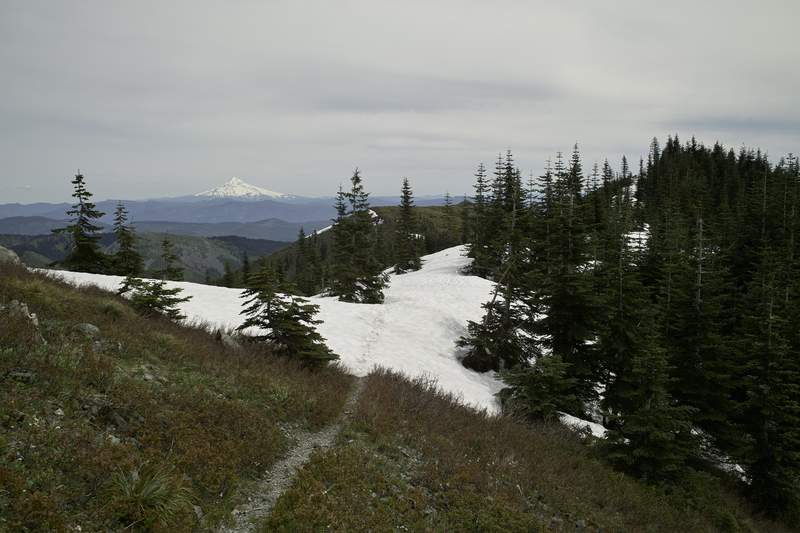
Cooper Spur
8.5 miles of hiking • 2750' elevation gain •
I took the ridge line up towards Cooper Spur, and then eventually headed back down to the trail before the shelter. I made another wrong turn and started up the lower ridge, when I realized that I would have to hoof it over up the hill. Snow started at 8000', and I turned around just before the "top"—around 8300'—because the sleet and wind were really picking up, and everything was turning into a giant cloud anyway.
Nice hike!
October 2, 2011

 2
2
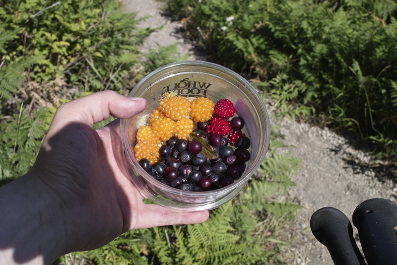
Mt. Marge
12 miles of hiking • 2750' elevation gain •
Mt. Marge.
Salmonberries. Huckleberries. Thimbleberries.
Nice clouds.
A relaxing hike.
September 23, 2011

 1
1
Indian Heaven
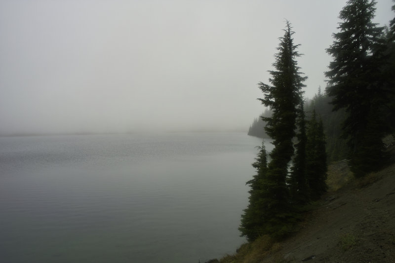
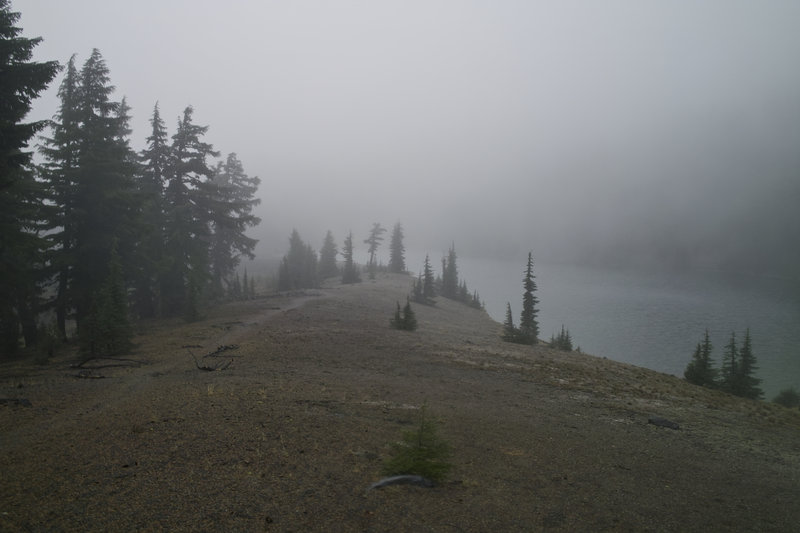
20.5 miles of hiking • 1750' elevation gain •
For some reason, I really like Indian Heaven. But for some reason, I can only seem to get there when it's in a big raincloud. Today, I think it was a combination of our weather, plus what seems to be the perennial fog that just doesn't leave that place. That being said, it was still great.
I got to the Sawtooth Trailhead around 10:30—things were pretty crowded for a rainy day. I saw at least 5 groups (but no PCT hikers) on the trail. I decided to do a loop down to Junction Lake, back up to Clear Lake, with a detour to Deep Lake, and then back up to the trailhead, via Sawtooth Mountain.
Of note were several bow hunters seen on the way in, and an incessant shotgun being fired at Clear Lake. I couldn't see who it was because of the thick fog, but it seems like they were probably target shooting. Kinda makes me wish I was wearing orange.
The trail up to Sawtooth Mountain is in okay shape, but there are several blowdowns. Also the USGS maps are inaccurate for that section.
The huckleberries are coming in great right around Sawtooth trailhead. Still too early for the rest of IH, though.
September 17, 2011

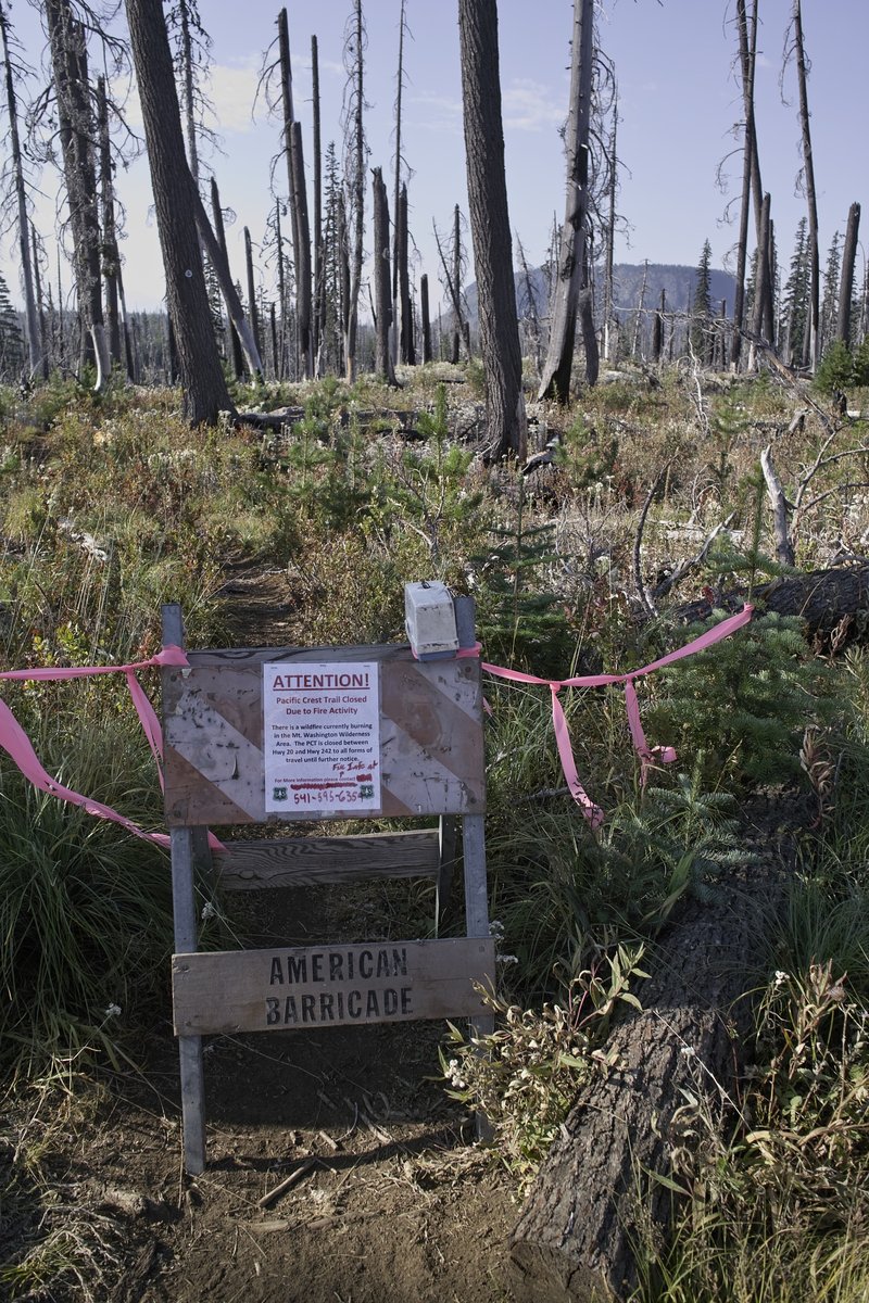
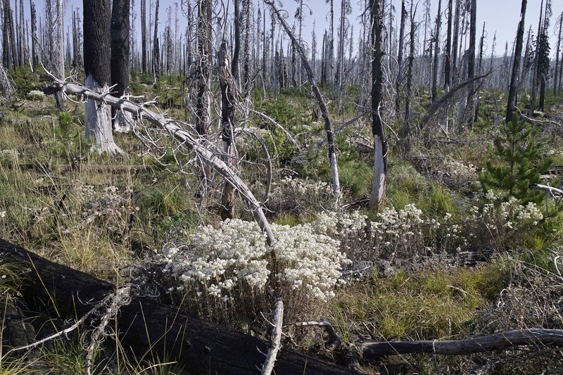
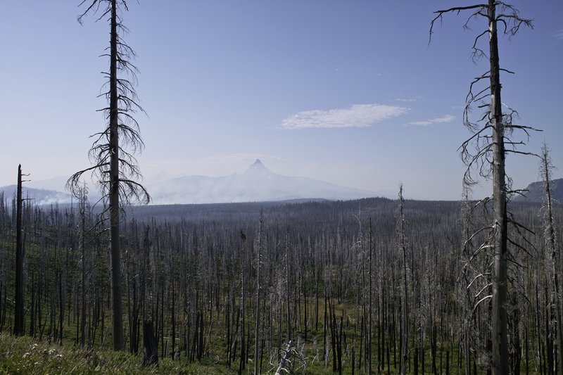
Santiam Pass
6.5 miles of hiking • 750' elevation gain •
This trip was supposed to be a Three Finger Jack loop, but it ended up being an out-and-back to Square Lake.
The big problem was the bumble bees. The trail was covered in a white flower which was at the peak of its pollination so the bees were going nuts. Usually they don't bother me, but I had several swarm me, and since I had shorts on and was walking right through them, it wasn't turning out to be a very good situation. Seeing as how I was stung three times last year (albeit by wasps, I think), I wasn't in the mood to find out how friendly the little buggers would be.
The Mother Lode fire was blazing away down by Mt. Washington.
I picked Whitewater -> Jeffy Park as a plan B, but the wasps were really bad at Whitewater. Maybe I'm chicken, but I wasn't in the mood to find out how friendly they were going to be that day, so I did some more bailing, and went home.
September 9, 2011

 2
2
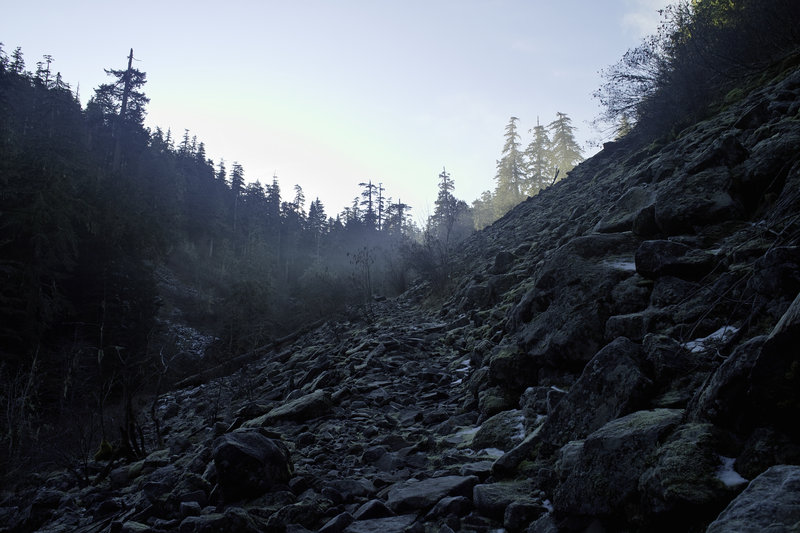
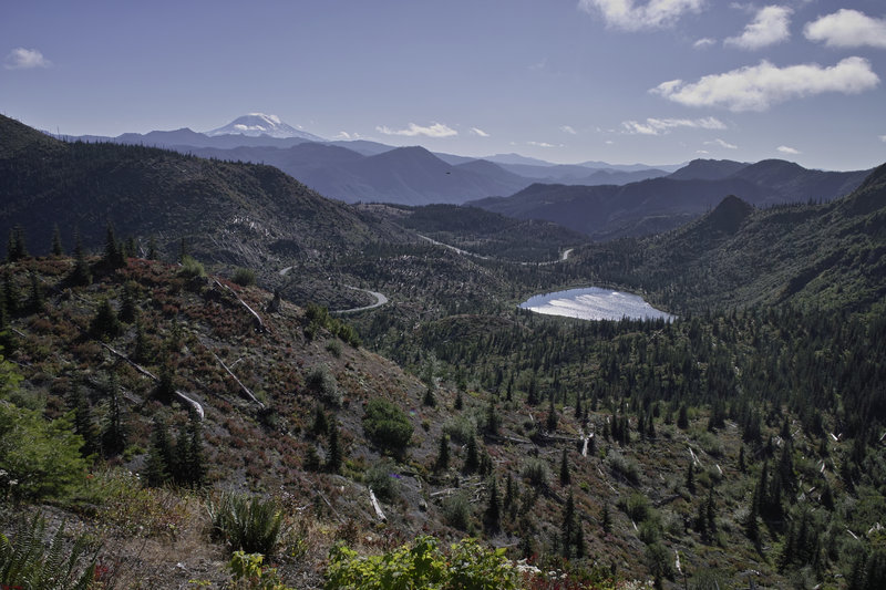
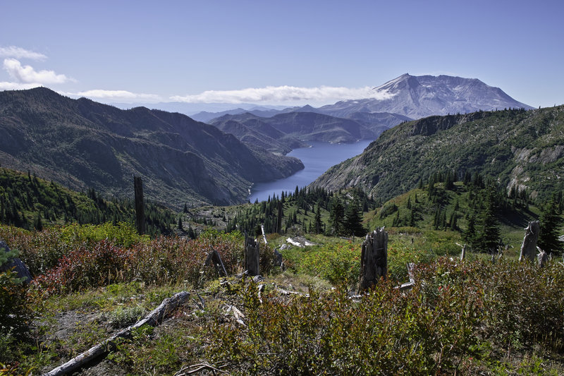
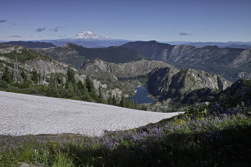
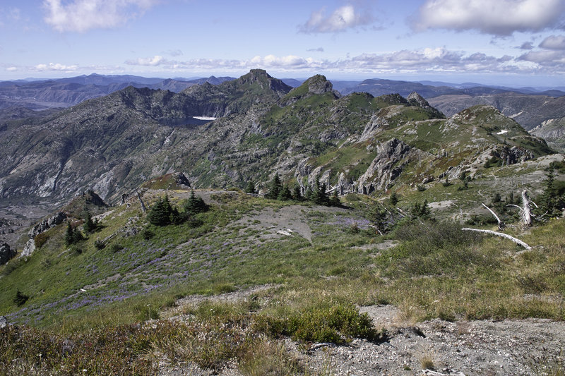
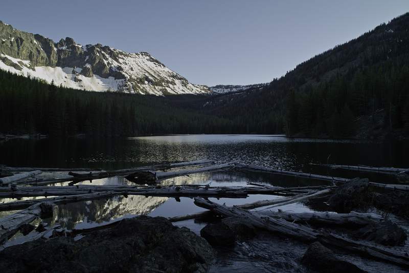
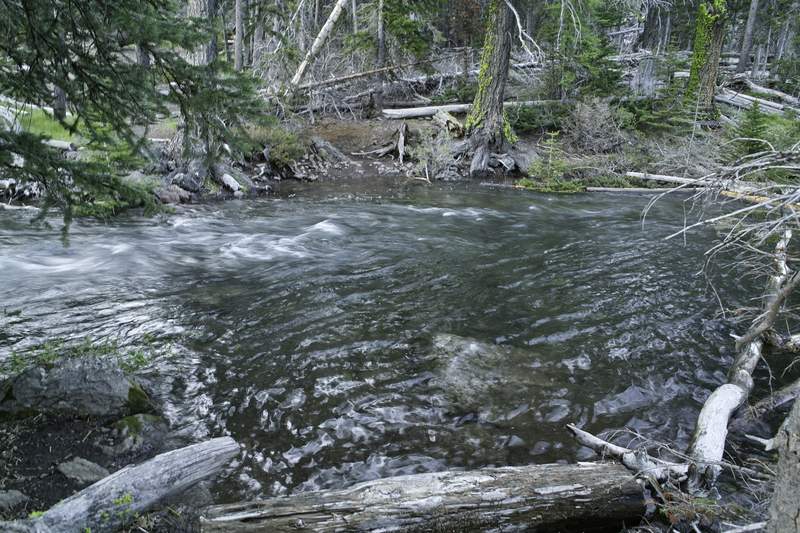
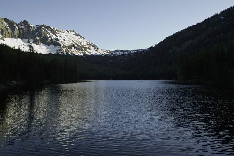
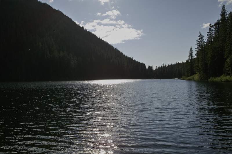
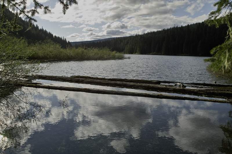
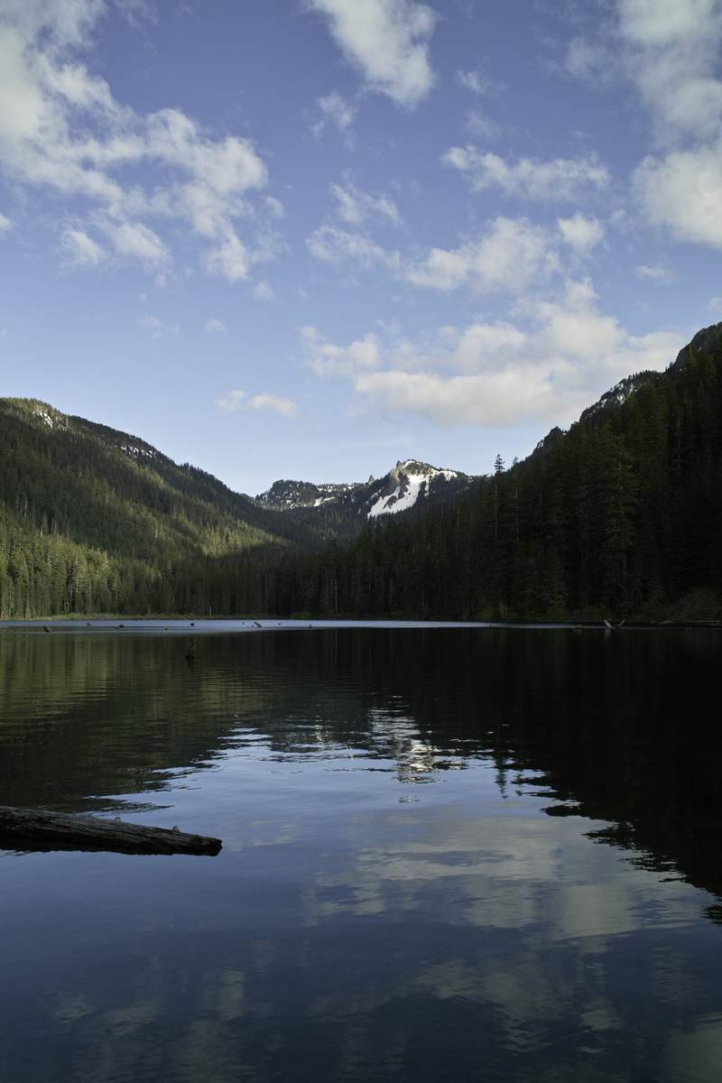
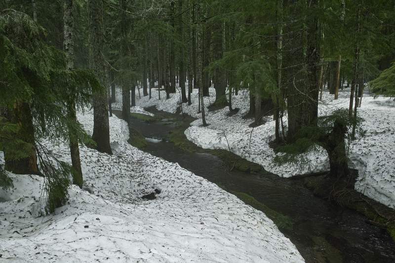
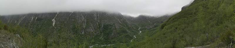
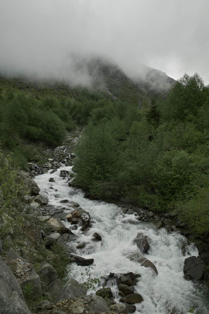
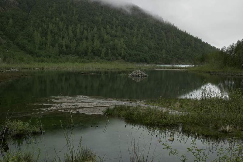
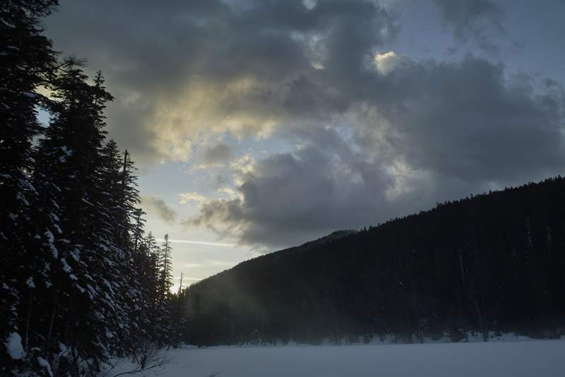
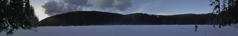
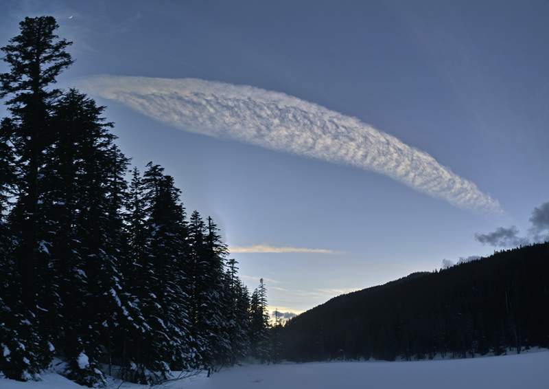
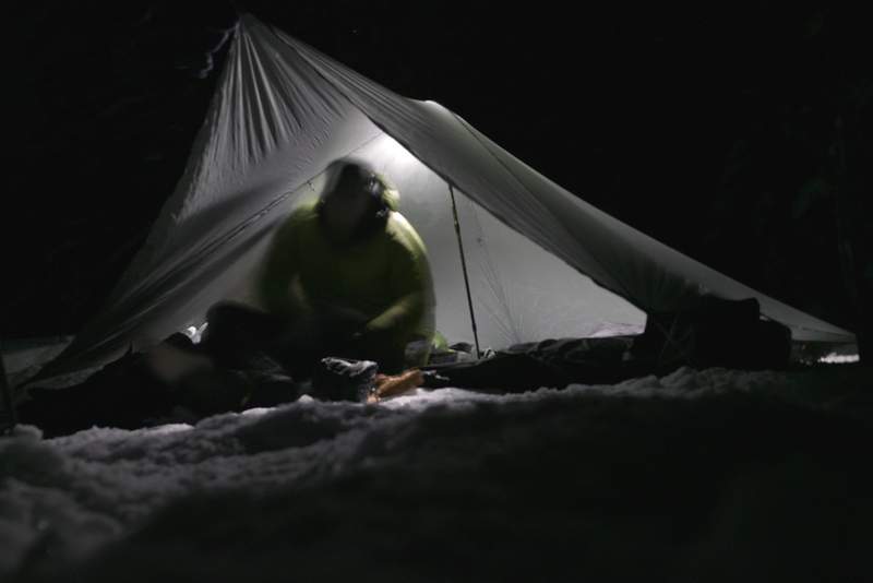
Goat Rocks - Walupt Loop to Cispus Pass
18.5 miles of hiking • 3000' elevation gain •
A planned 2-nighter turned into a day trip. I'm not entirely sure why, but I think I'm just getting hiked out for the year. I still want to make 1,000 miles, though.
Drove up Friday night and did some "car camping" (in the car). I did the Walupt lake loop, adding on Cispus Pass and a little wandering. The basin below Cispus is pretty cool, with several cascading waterfalls that would be a great bushwhack, and what I think is the beginning of the Klickitat River.
Since it was labor day weekend, there were a lot of people out, but all backpackers. Met several PCT thru hikers - I think the beginning of the bunch for the year. Backpackers always seem to be more friendly - I suppose because they are usually more seasoned hikers and/or more interested in hiking, and therefore are really happy to be out there - I don't know.
Not much else to add here. I'm looking forward to going back and doing the northern side of the area.
September 3, 2011


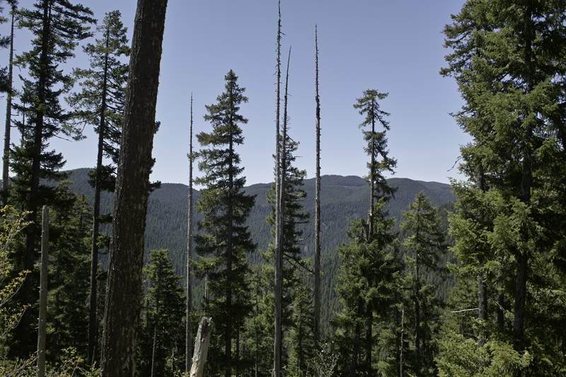
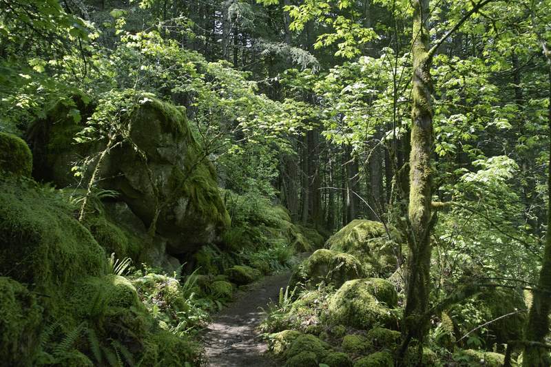
Paradise Park
12.5 miles of hiking • 2250' elevation gain •
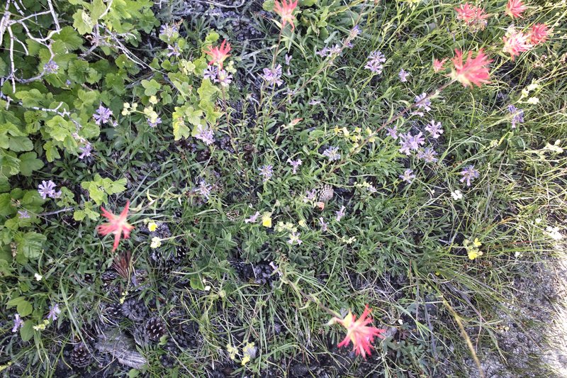
Lupine. People. A few other flowers. A little bit of snow. Far less crowded early in the morning.
August 21, 2011

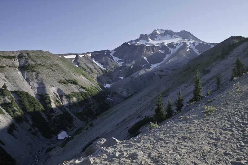
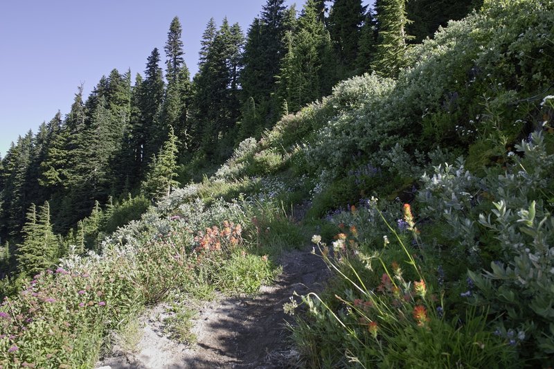
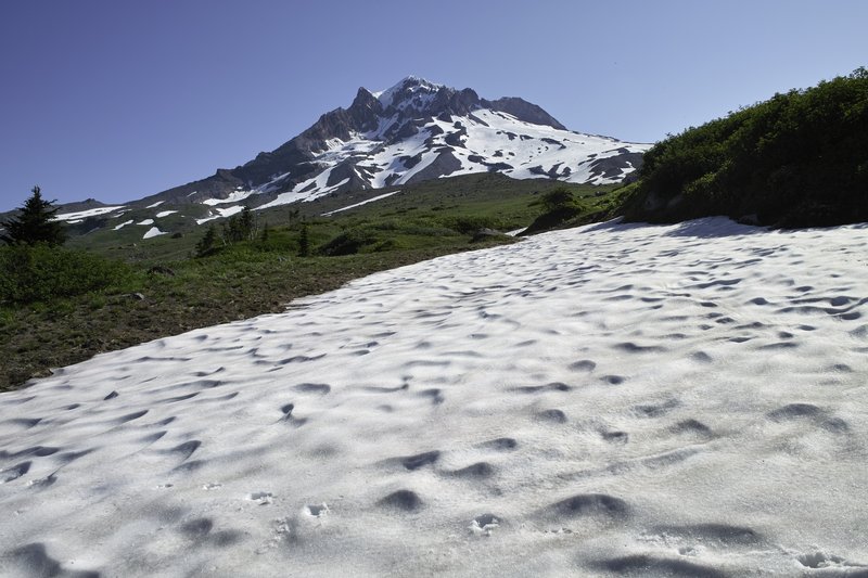
 3
3
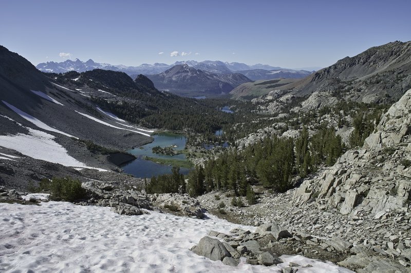
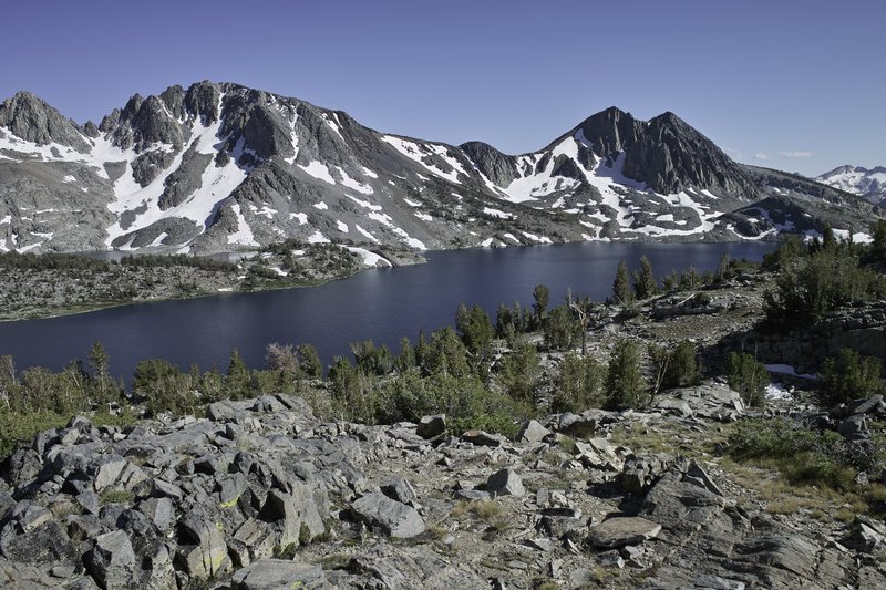
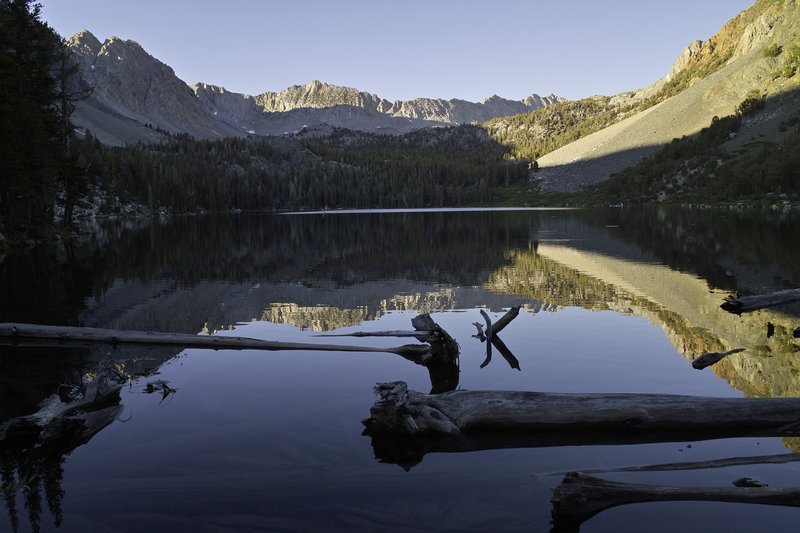
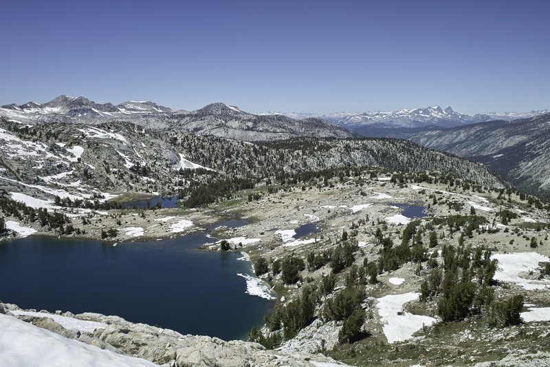
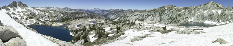
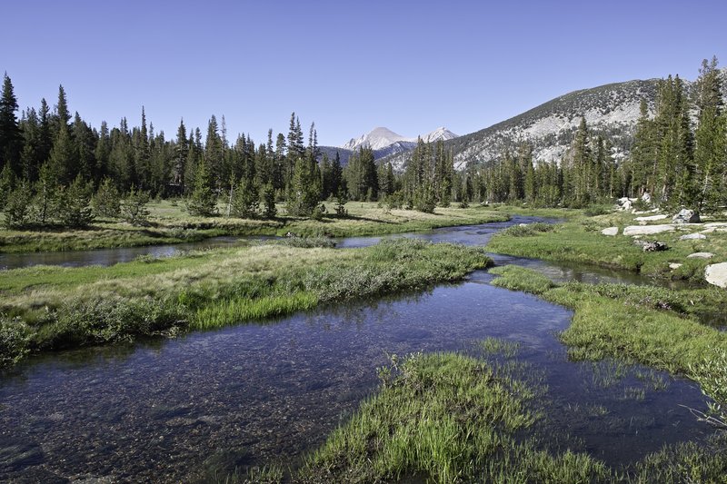
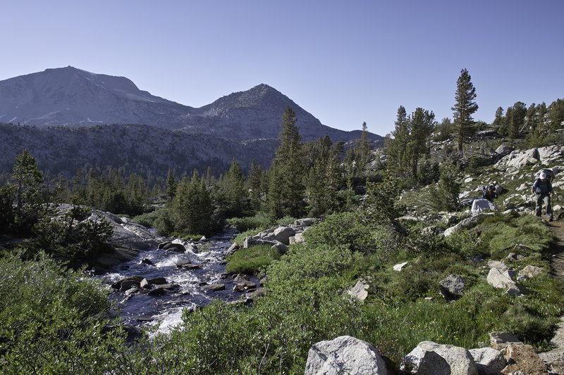
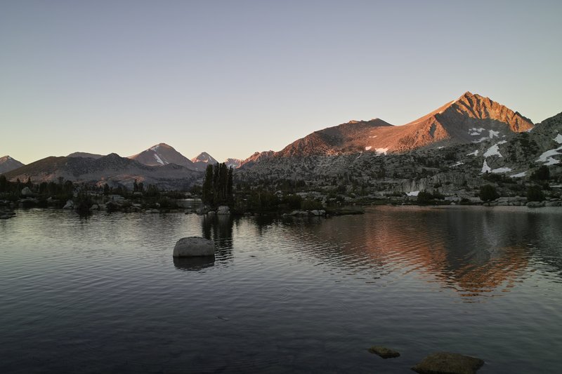
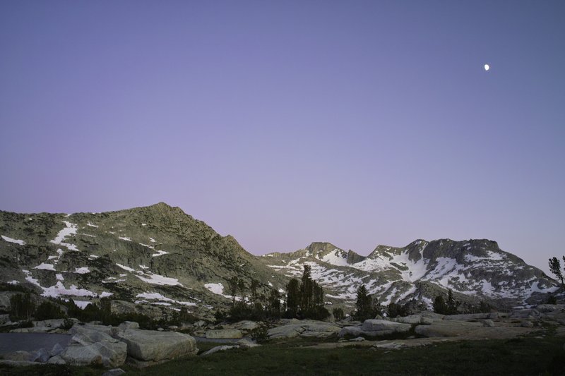
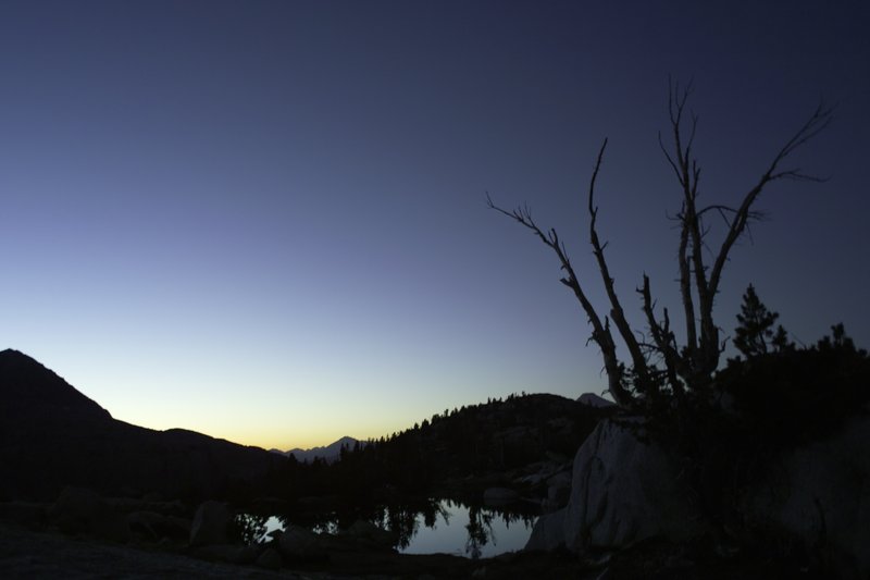
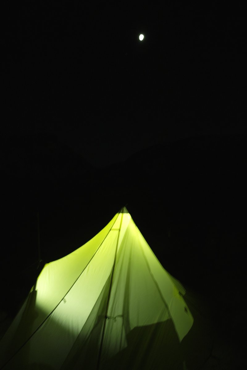
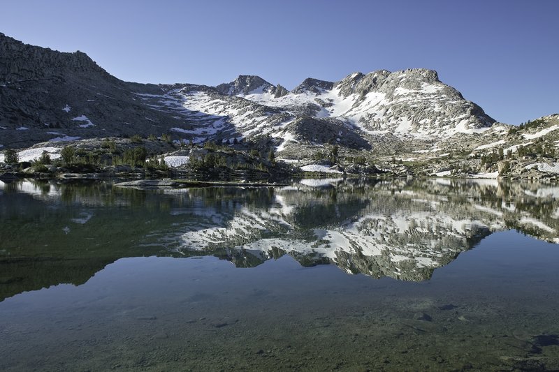
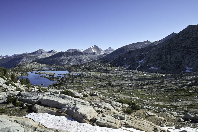
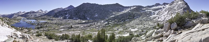
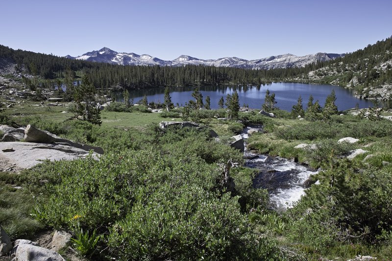
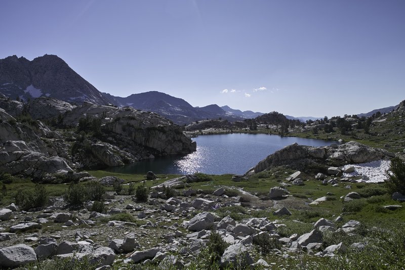
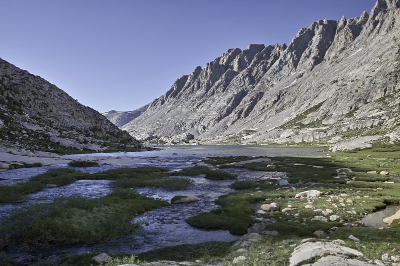
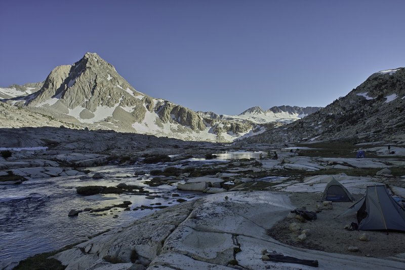
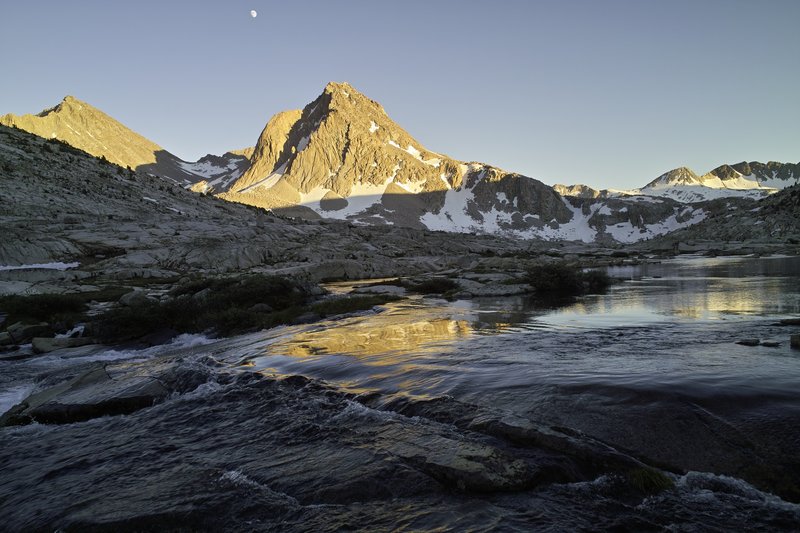
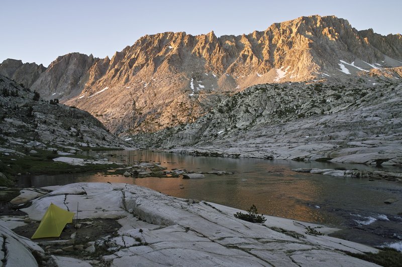
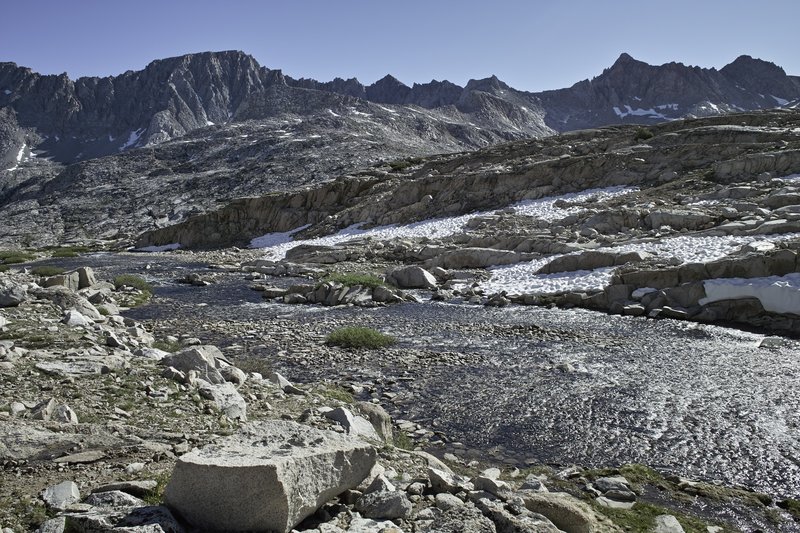
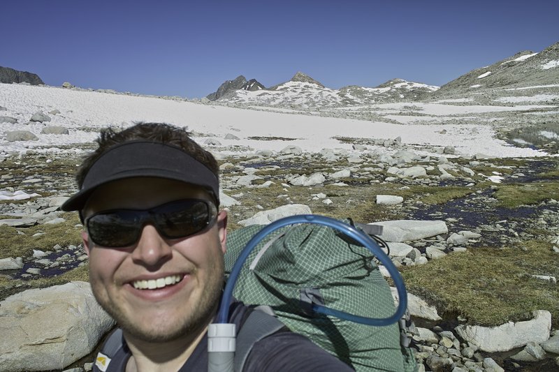
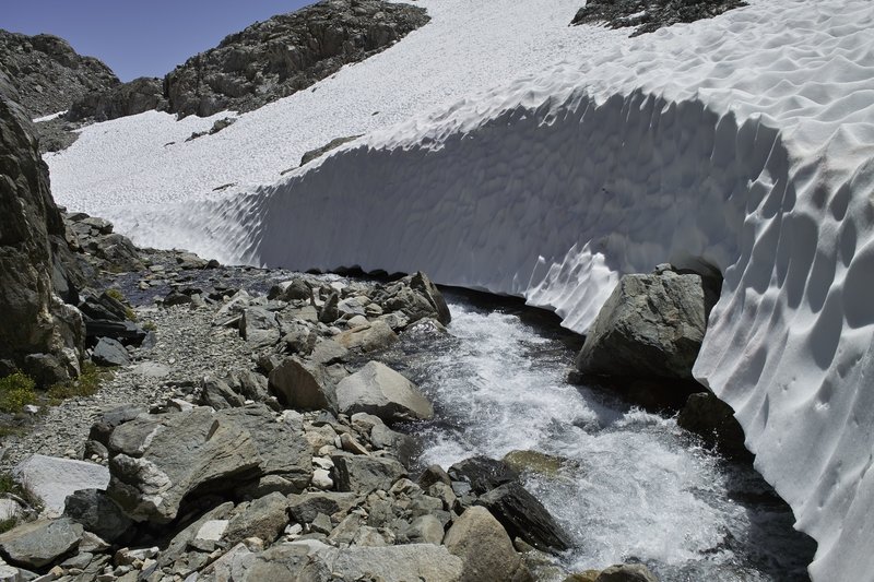
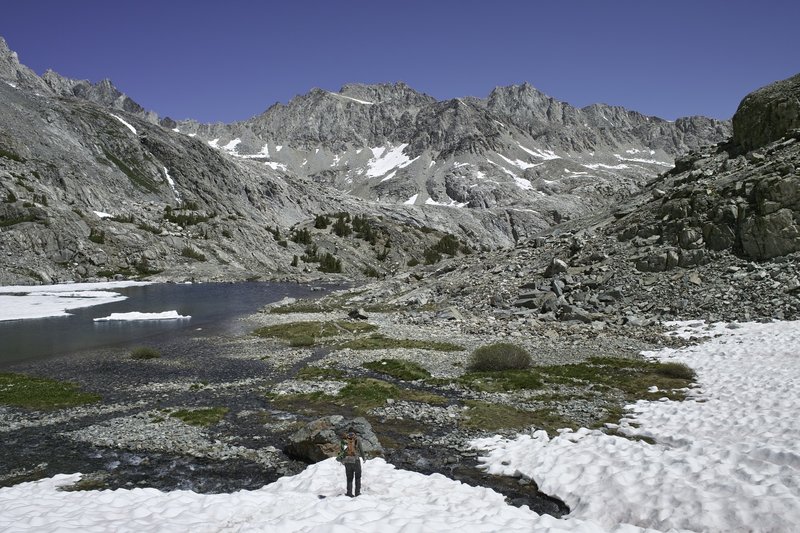
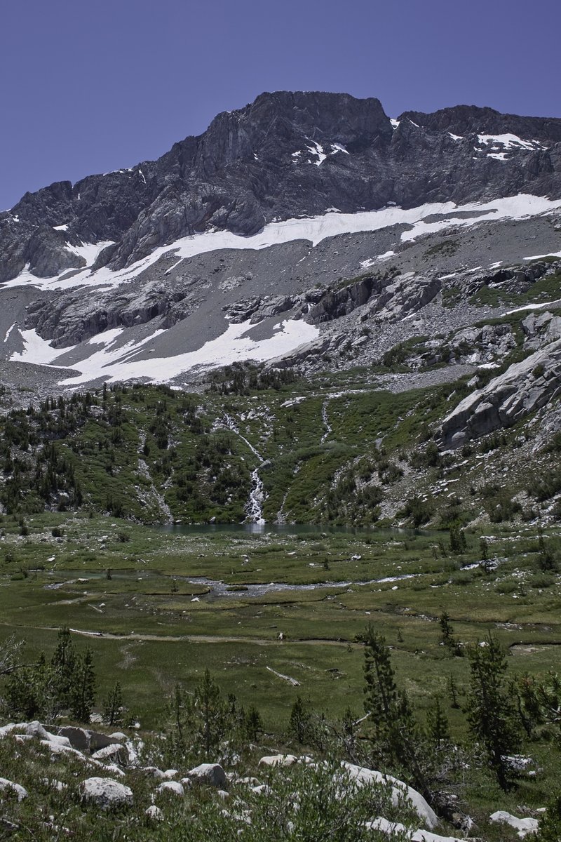
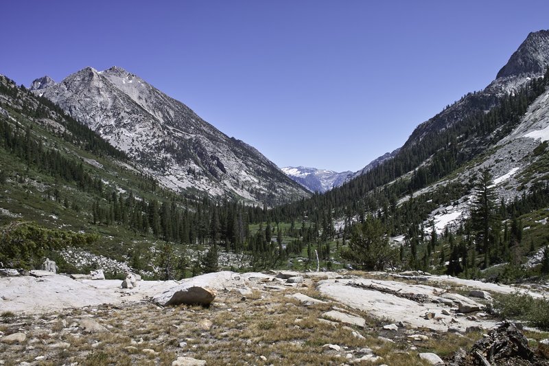
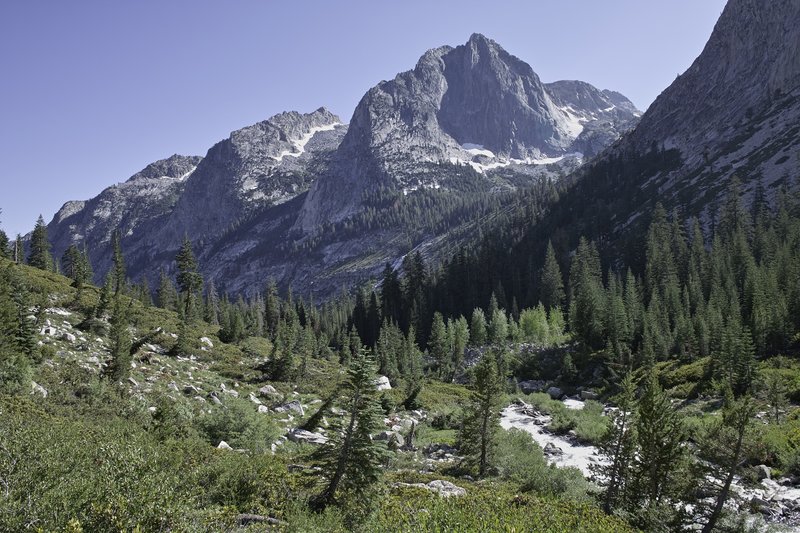
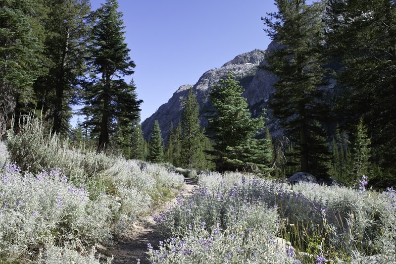
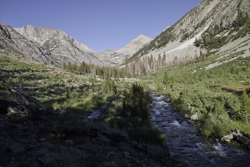
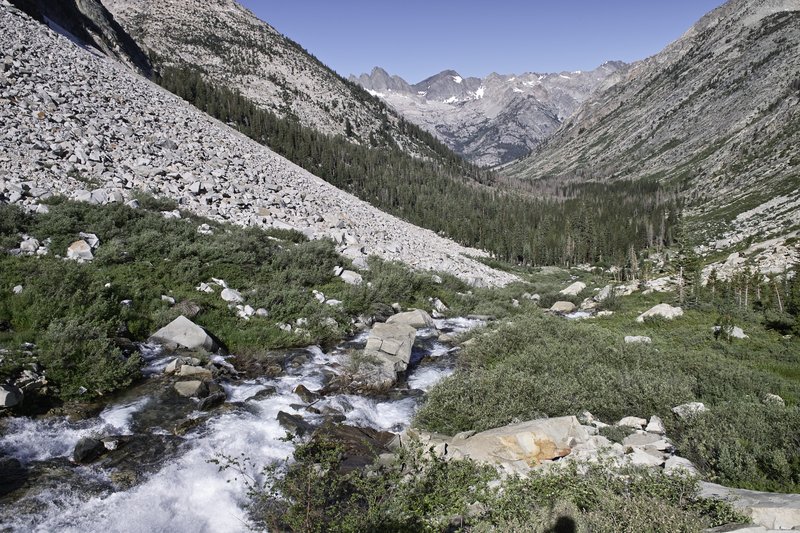
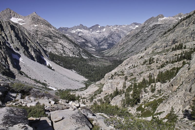
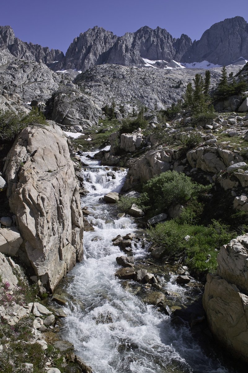
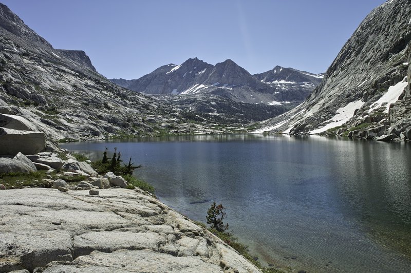
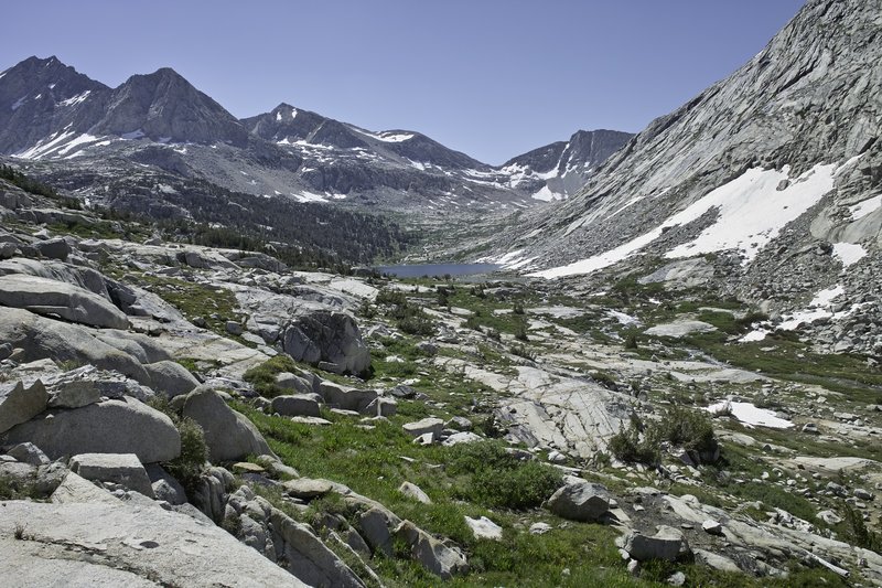
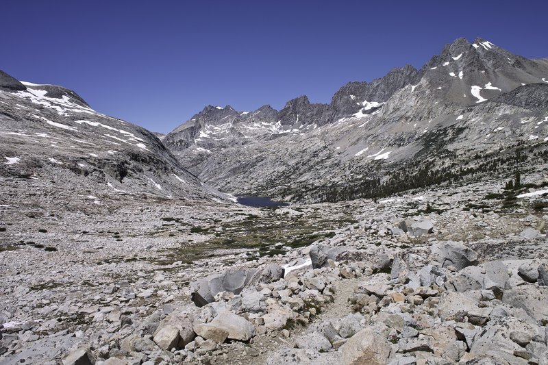
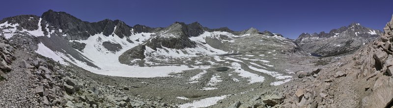
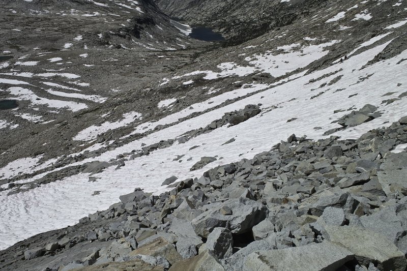
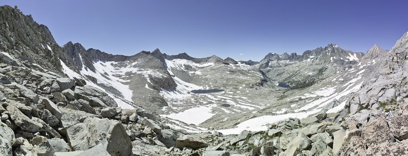
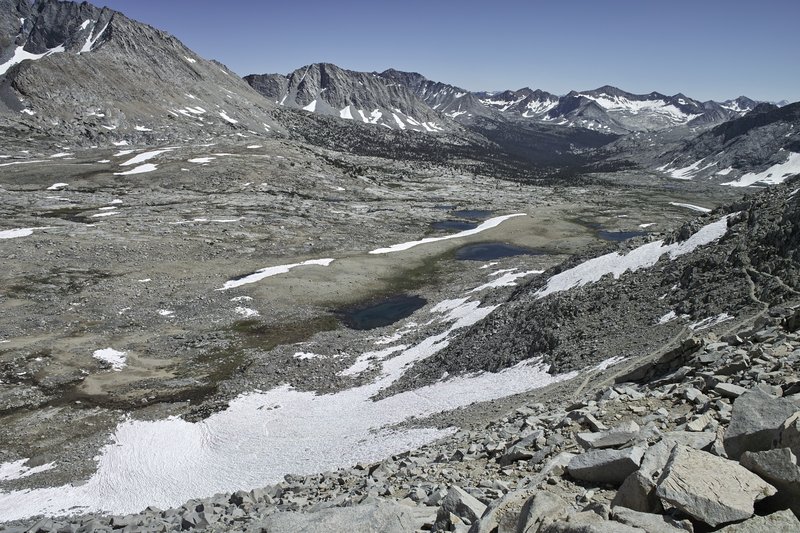
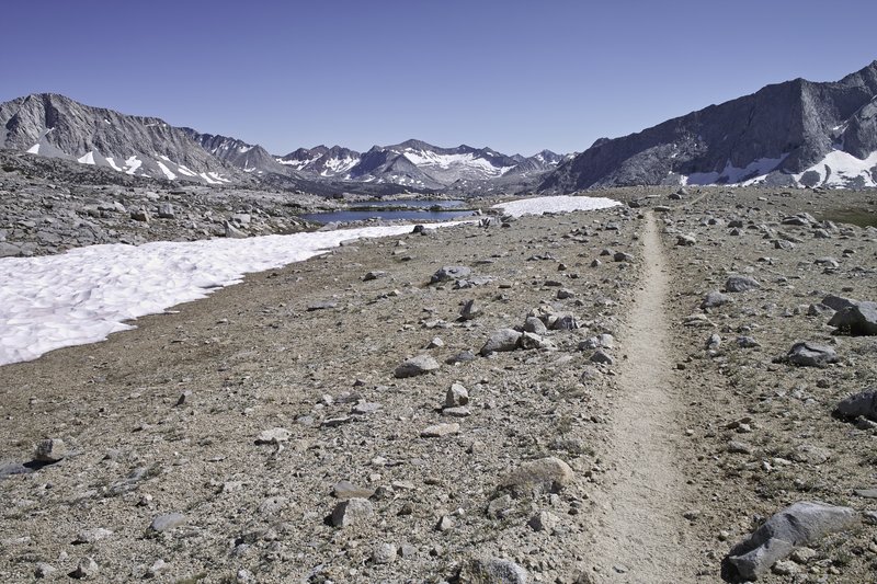
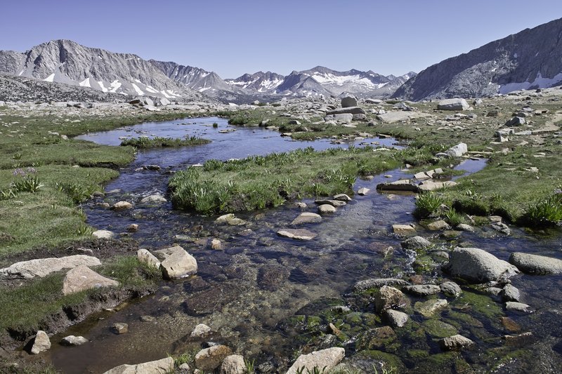
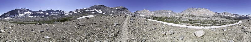
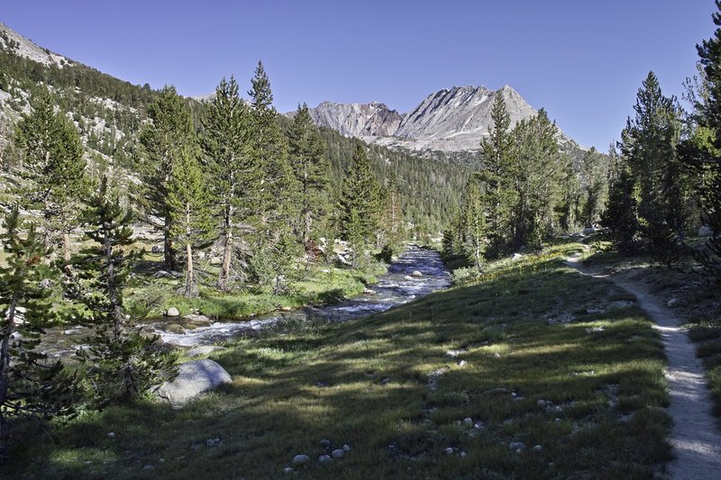
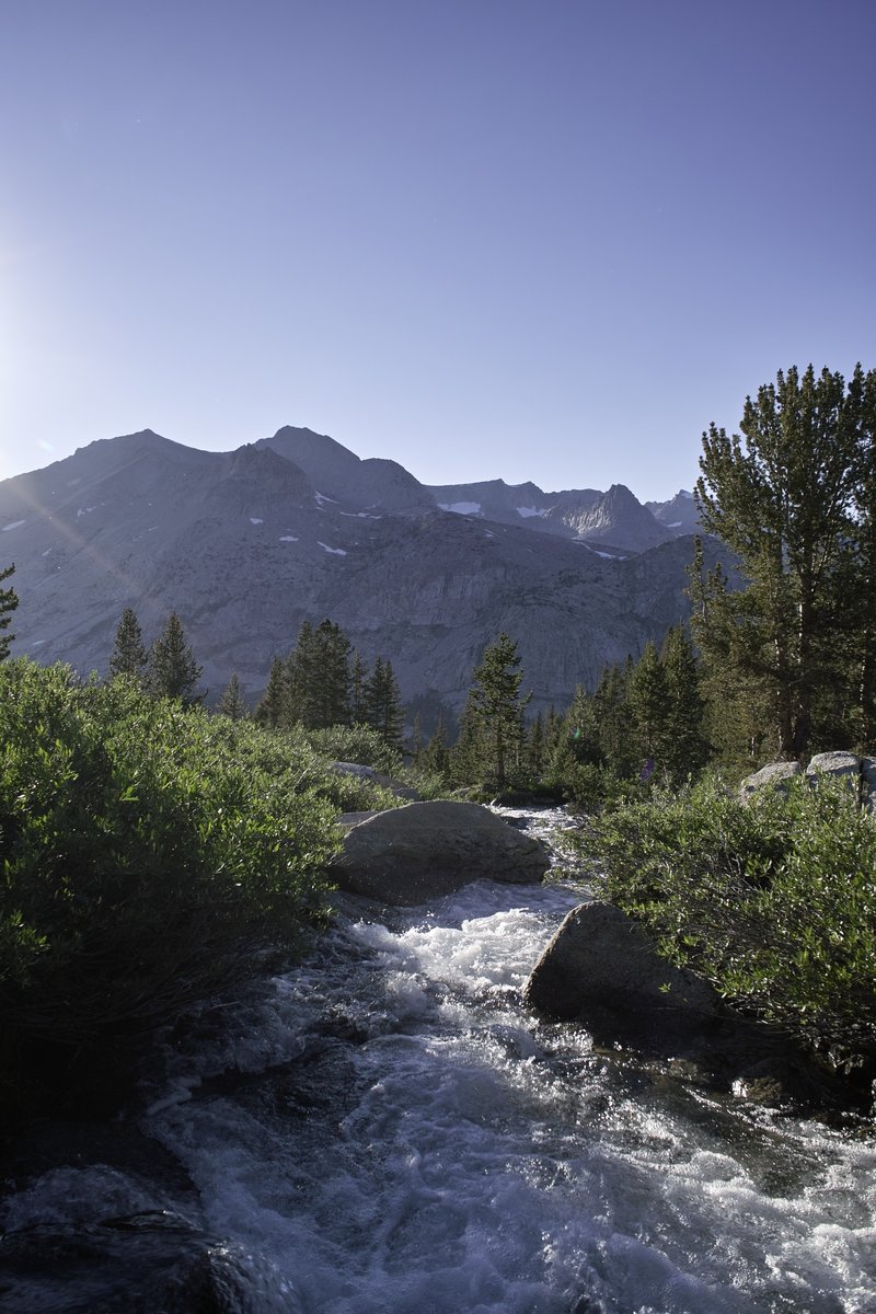
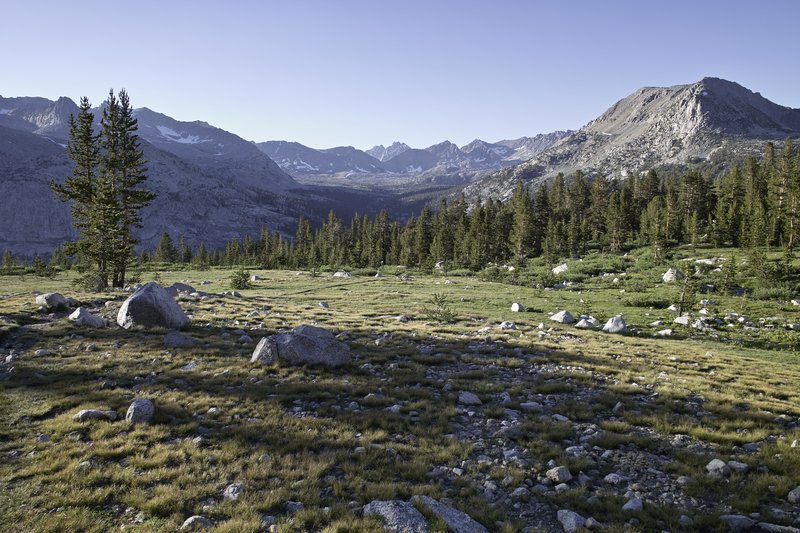
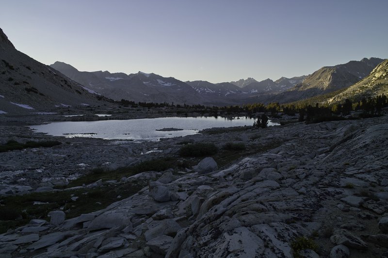
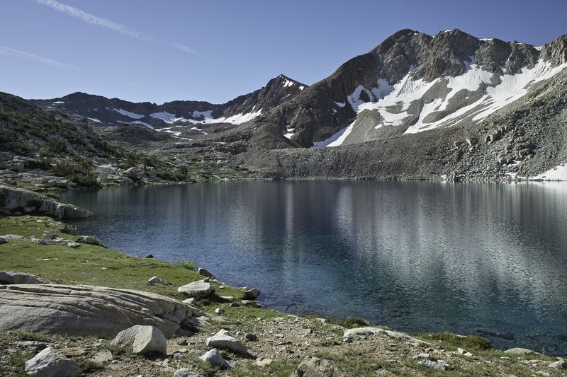
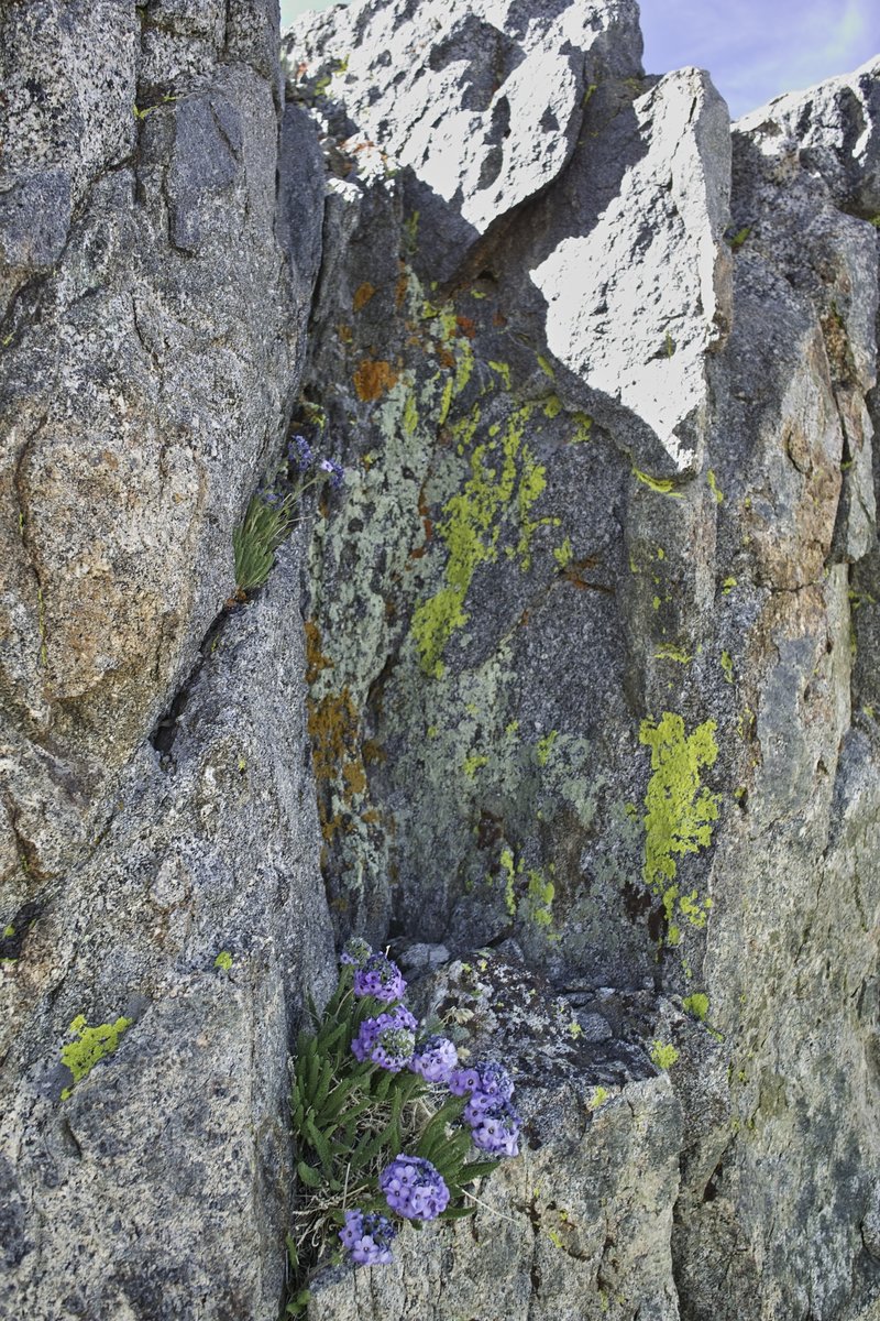
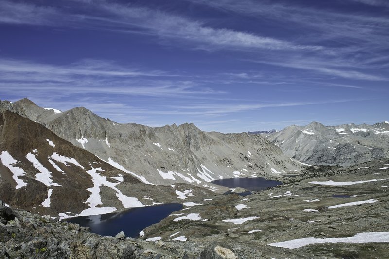
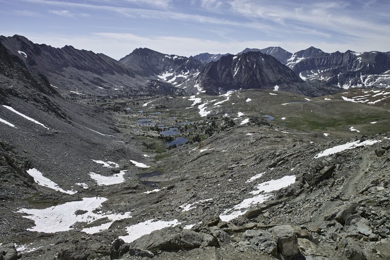
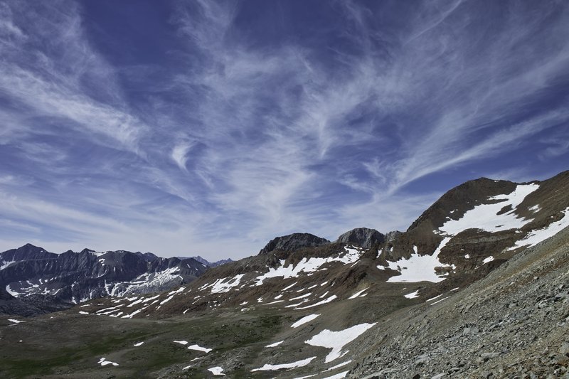
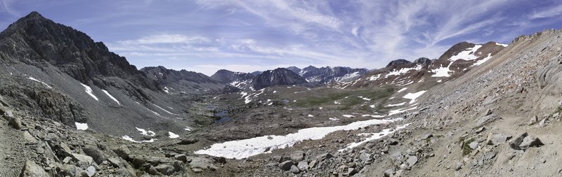
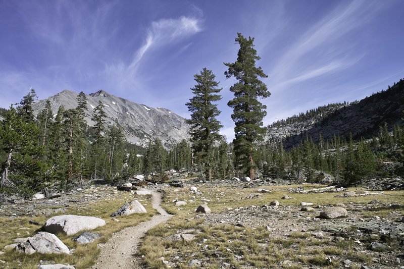
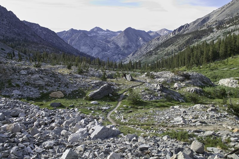
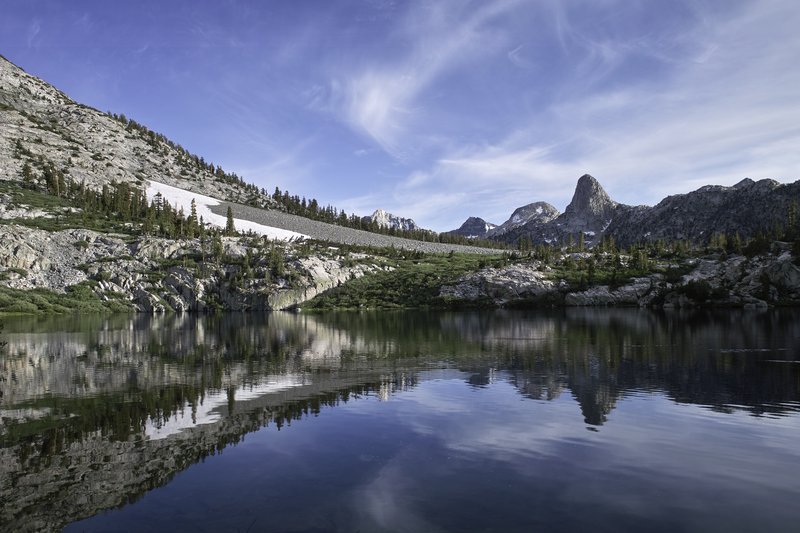
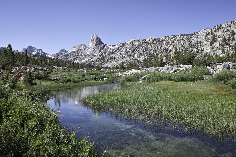
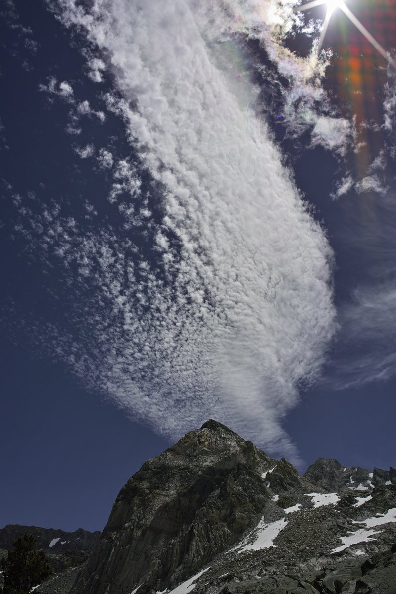
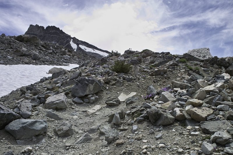
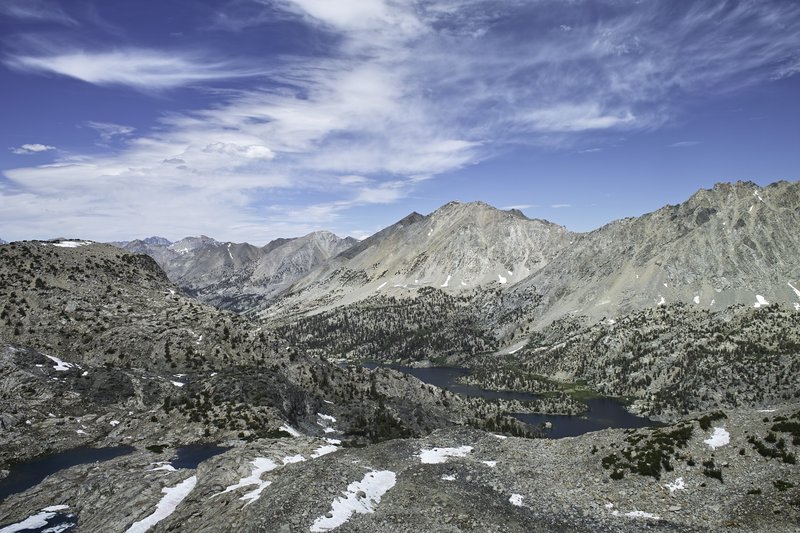
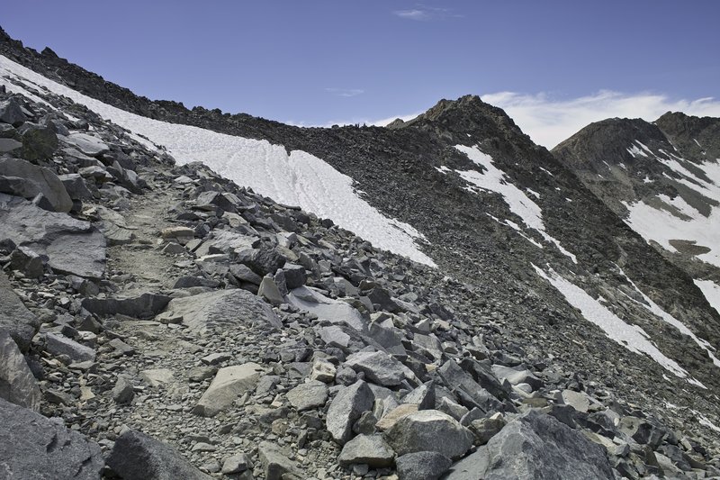
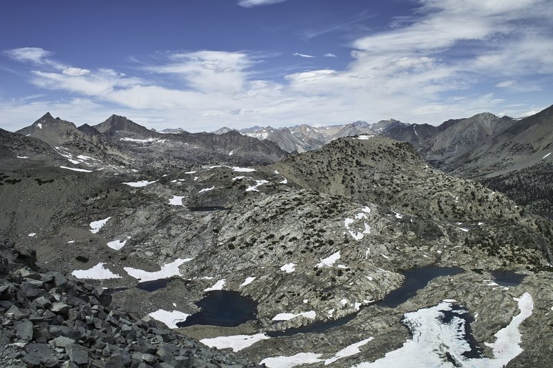
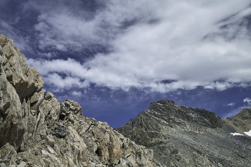
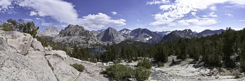
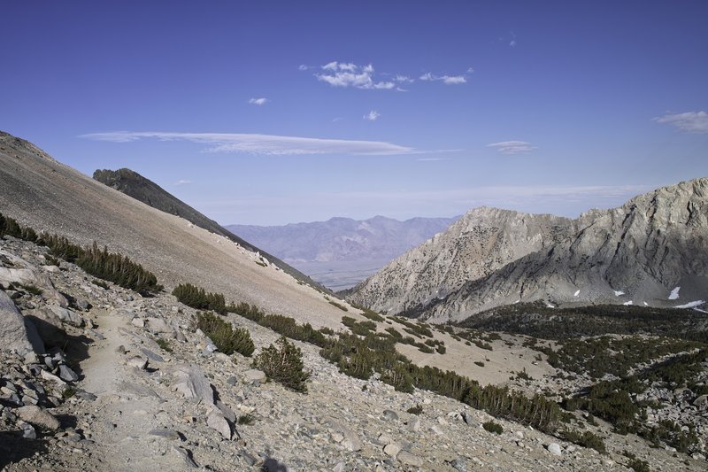
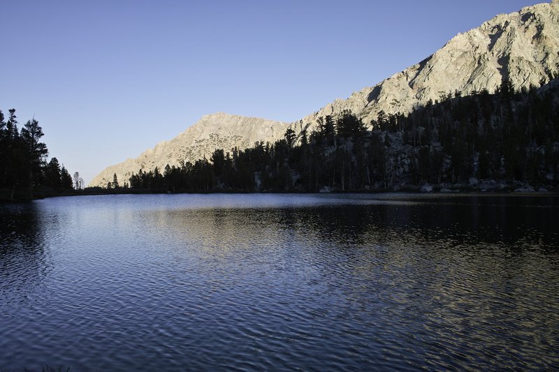
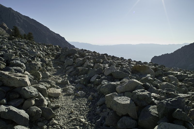
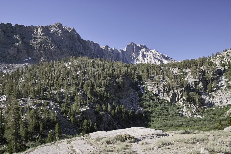
Ten Days in the High Sierras
132 miles of hiking • 27500' elevation gain • 9 nights
The High Sierras, especially the southeastern Sierras, are really something special. Maybe I'm overselling, but mile-for-mile, I know of no more interesting and beautiful terrain in the lower 48. The pictures do not capture the magnitude of the landscape. You must go for yourself.
Day 0 - 6 hours driving
I had been planning this trip for months, and finally, work was done for the summer at 3:30. I got home as fast as possible, packed the car, and began my trek down I-5. The fastest way to get to the eastern Sierra is crossing over the Cascades on Rt. 58 in Eugene, and then heading down towards Crater Lake. After passing by O'Neil lake (I want to come back there and hike!), driving through Klamath Falls, stopping for the Fruit Police and winding down desolate California Rt. 139, I made my stop for the night at a remote campsite in northeast California's Modoc National Forest. Of course, I couldn't get much sleep, but also partially due to my sleeping pad having bit the dust.
Day 1 - 6 more hours driving, 10.0 miles
Since I couldn't do much sleeping, I did more driving. I awoke around 4:30 in the morning and continued through Northern California, skirted through Reno and Carson City, and made my way down route 395 to Mammoth Lakes. The resort town was perfect for finding a new sleeping pad, and it's trolley system made it easy to get from the bus stop to the trailhead.
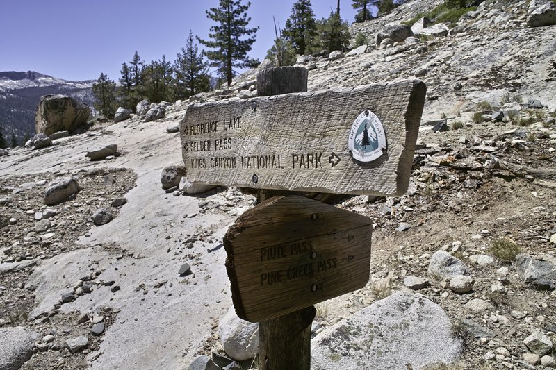
The plan was to hike a portion of the John Muir Trail, a trail I had hiked in total back in 2009. This time I would hike from Mammoth down to Whitney or so, taking advantage of some of the many off trail opportunities that were on the way. However, the snow and feeling a little under the weather would require some changes to my plans.
I parked my car at Duck Pass trailhead in the late afternoon, did some final checks and anti-car-bear countermeasures, and set off up the trail. The plan for the night was to make it as far as possible, but I took my time exploring several nice lakes on this trail that is overrun with tourists day hiking from town. It's a much nicer entry than Red's Meadow, which is rather dusty and viewless. The pass is a nice one, and Duck Lake itself isn't bad, but the real exciting parts were to follow.
I took things easy, knowing that at 10,000 feet, I would probably experience a little bit of altitude sickness if I pushed it too hard. With 11 days of food, the pack was at a heavy 27 pounds, so I didn't want to stress myself out in the beginning. I made my way over the pass, and into the Sierras. The trail continued on to Purple Lake, my campsite for the night. En route, I saw my first marten, (no picture, but a fox-like face and ferret-like body, right?), as well as one of many grouse that I would see on my trip. Since Purple lake was crowded, I opted to head a bit up the hill to knock off some mileage for the next day.
Day 2 - 17.5 miles
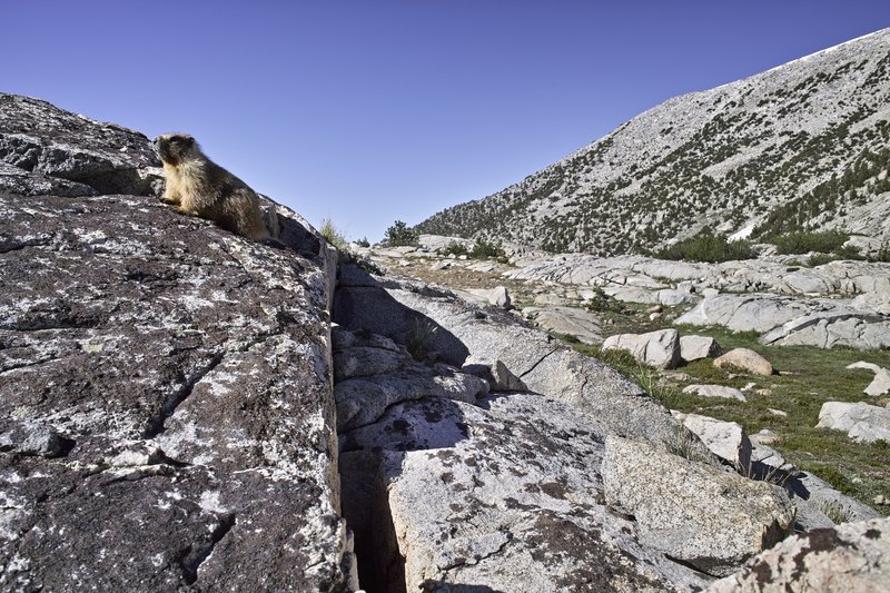
I awoke quickly and decided that a few annoying mosquitos were enough make me want to pack things up, head down to Lake Virginia, and have breakfast there. I passed a marmot chilling on a rock (far from the last, of course), and Pika colony where at least four of the little buggers were popping in and out of the rocks.
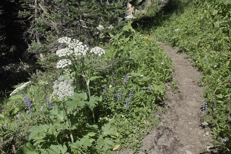
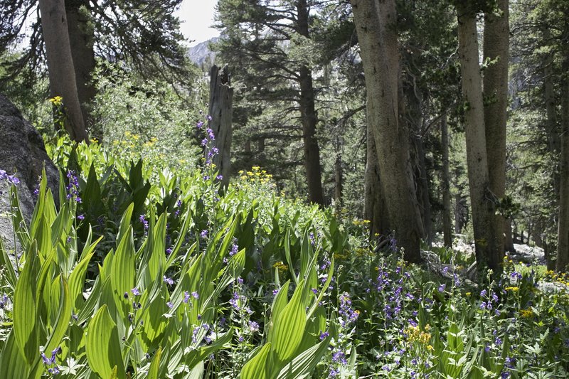
At Lake Virginia, some Via, oatmeal, and map studying were accompanied by general gawking at flowers and chipmunks. The trail was particularly flowery this year. I suspect that the late snowmelt allowed for more watering.
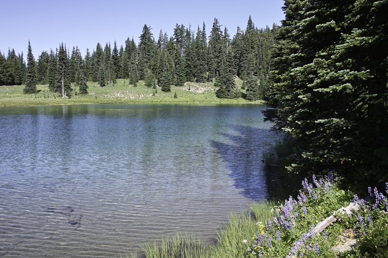
The trail then heads down into a meadowed valley, and then back up toward Silver Pass. A gradual climb let to great views at Squaw lake, where I met the first of many JMT thru-hikers. The pass is a gentle one, and, like most of the major passes this year, it had some residual snow, but was very easily traversable. About 50 feet of well-trodden kicksteps up the hill led to the summit with panoramic views, followed by occasional snowfields on the back side, leading down to a beached lake, where I would take a quick nap. The trout are really plentiful, and could even be seen in the little inlets that let to the lake, dodging around whenever they saw your shadow.
I had no plans of resupplying, but when I ran into a group of day hikers racing down the hill, quickly mentioning they were trying to catch the Vermillion Valley Resort ferry, I thought I would try to make it as well. I had enough food for the whole trip, but since the timing was right on, I'd make the quick ferry trip for the fun of it. I quickly bolted down the hill, only to find that I would be on the second ferry, but chatted up a PCT thru-hiker, Phil, while waiting for the second boat. I would later meet Connor, a JMT thru-hiker, as well as Ellen, Shannon and Sarah; some of the many JMT hikers I would leapfrog with over the upcoming days.
I opted not to do dinner to save a little bit of money, but stayed in the backpacker's camp (really the area next to the backpacker's tent, as to avoid boy scouts), where we talked logistics and nerded out over maps for the next day.
Day 3 - 14.0 miles
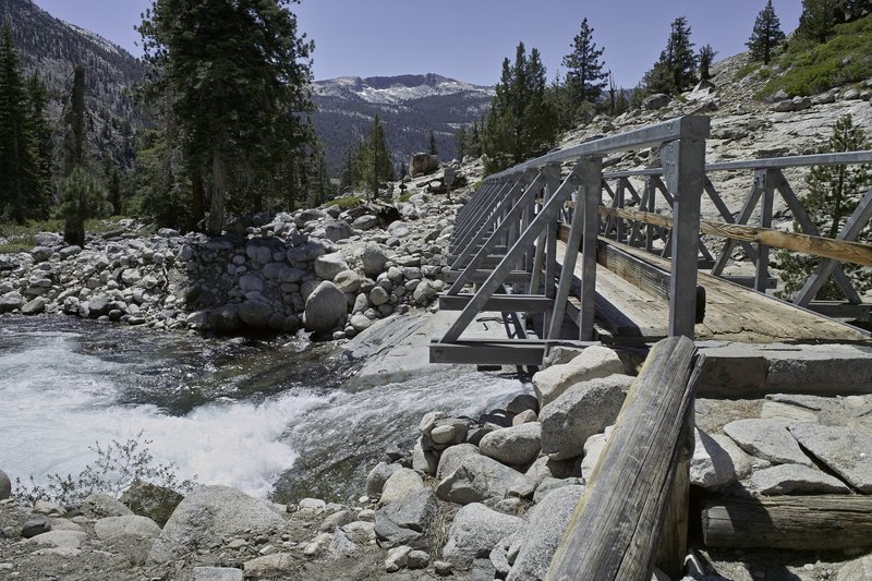
I ate breakfast at VVR (omelets sure beat dried food, even if it's day 3!), mused over the day's plans, and headed back to the ferry stop. A quick half-hour ride back to the other side of the lake left us at the bottom of Bear Ridge: a thankless hike uphill that is best done slow and steady. I would run into another hiker who went by "Time," whom I would also run into several times, bolting up the trail. The rest of us decided to continue on to Marie Lake. The trip to Marie involved a riverside walk and a stream crossing which, a few weeks earlier, was apparently very swift and high, but by now had returned to normal levels.
The trail climbed towards Marie, and ended up in a rather Idyllic meadow, before making the final push up to the lake. The lake itself was quite crowded: generally the trail was a bit busier this year, and it appears that many people had delayed their trip due to the snow levels.
I ended up camping next to Joan from Seattle. I had planned an alternate and a little off-trail for the following day, but with almost all my alternates, my plans would be scrapped because of the large amounts of snow that would slow things down, and because of the beginning of lingering cold-like symptoms that would slow me down enough to make added mileage undesirable.
Day 4 - 14.5 miles
I awoke early the next day and made the quick trip up to Selden Pass, just a few hundred feet above Marie Lake. I made a wrong turn due to a snowfield, and ended up a little to the left of the pass, but quickly found my way back. I would later hear through hiker "telephone" that another hiker would make the same mistake just an hour or so later, hit a patch of ice, and break her ankle. Fortunately, Connor is an EMT, and was able to hit the Spot, and await the helicopter. Apparently the (Inyo?) country sheriff's copter did not see them even after several circles, so it took Connor going down the hill and a trail crew radioing CHP to get a response.
I was far down the hill by this time. The trail passes through beautiful Heart Lake, Sallie Keyes Lakes, and then down a hot, hot hill, eventually reaching Piute Creek. I didn't take enough water and was a bit dehydrated by the time I reached the bottom. So at the creek, I cracked open a dinner, fired up the stove, ate, and then took a short nap. I would then continue on with Time, following the San Joaquin river for several Juniper-lined miles, to a campsite down below Evolution Valley.
Day 5 - 11.5 miles
This day was uphill. The trail climbs steeply into Evolution Valley, follows a creek, and then crosses one of two spots: the very easy, sandy beach-like official alternate, or the sometimes difficult original trail, depending on the water levels. Even though things had settled down, I opted to take the easy meadowed route, and then continued to McClure meadow. I took a nice long break since I didn't plan on going much further than Evolution basin that day anyway, so I found a nice place to eat, dig a cathole, and generally laze about.
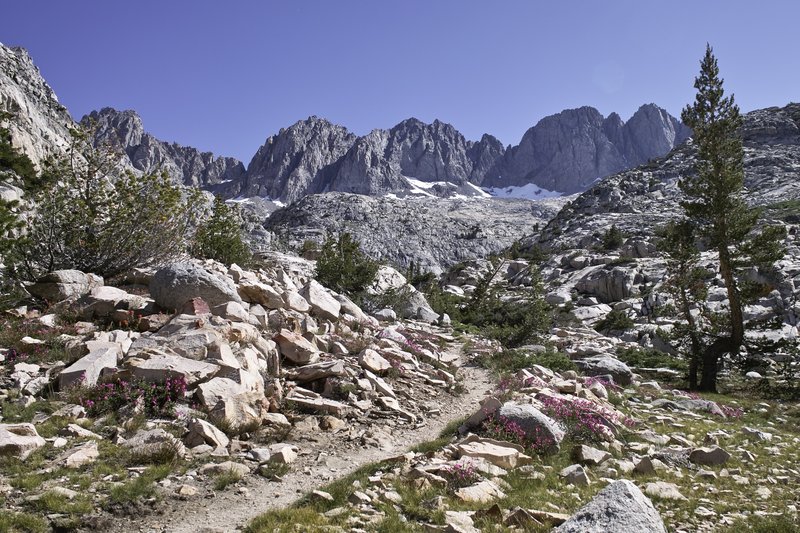
In the late afternoon, I made the climb into the granite-swept Evolution Basin. The UV's were scorching at such a high altitude, and the mosquitos had just hatched at Evolution Lake. I continued on to the mouth of Sapphire Lake, where the views were phenomenal, albeit there was an abundance of campers. The alpenglow was fantastic.
Day 6 - 19.5 miles
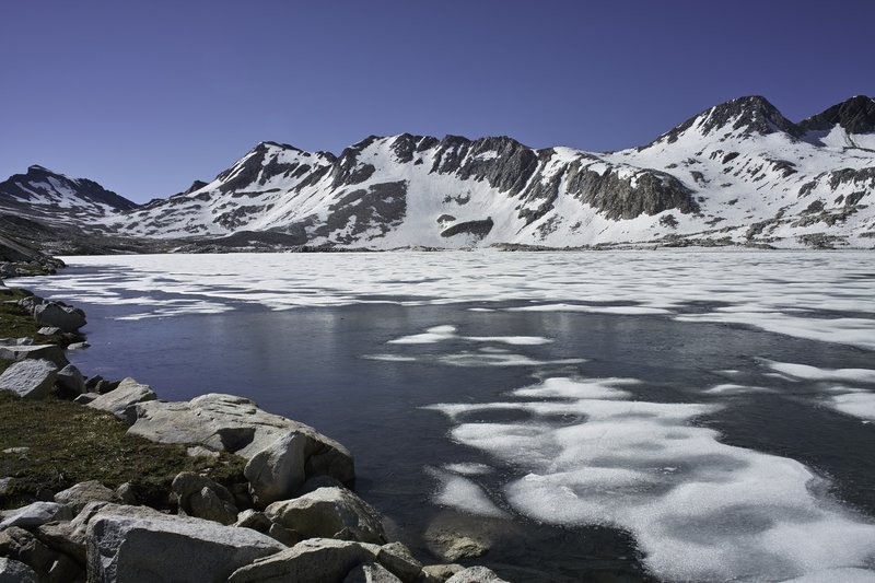
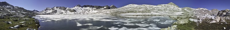
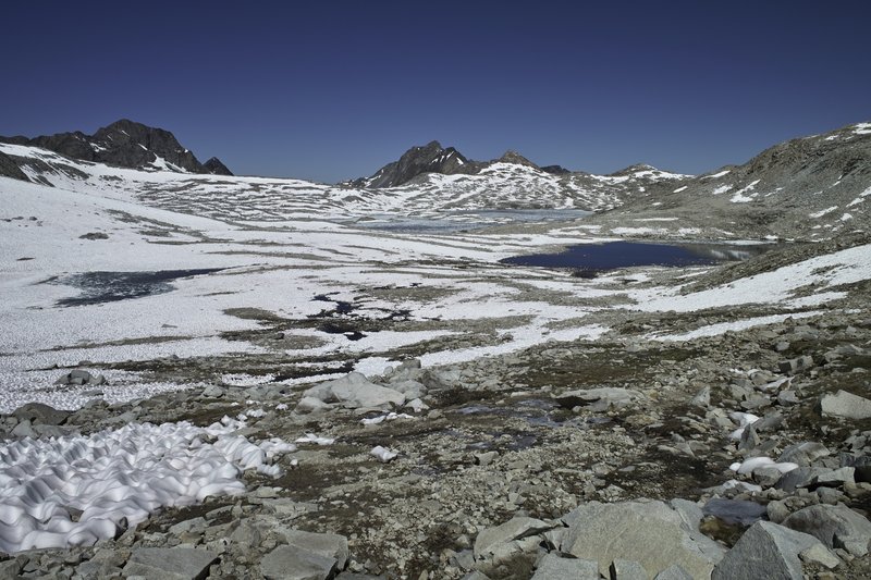
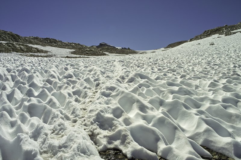
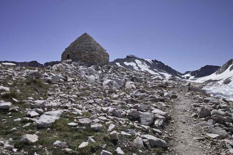
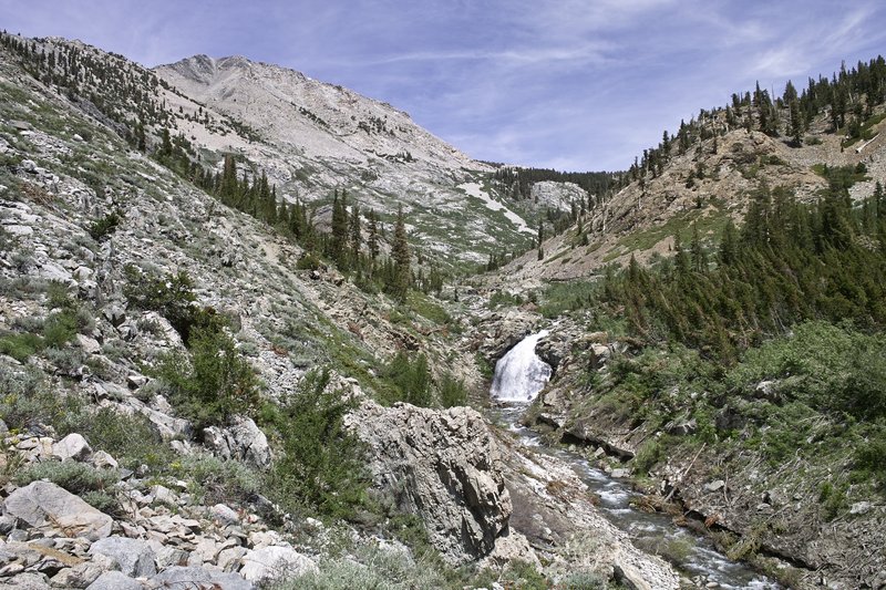
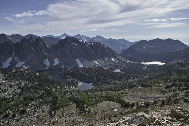
Today was Muir Pass. This is probably the most dramatic section of the JMT, and the snow made for a fantastic, expeditionary feel. I ascended Muir Pass with about a mile of patchy sun-cupped snowfields on the ascent. Wanda Lake, at 11,500', was still frozen over, but a waterfalled creek flowed from the lake, making for a beautiful landscape.
When I arrived at Muir Hut, three hikers who I met the night before were there, eating their snack, so I joined them for several minutes and then headed downhill over several more snowfields and across a section of sharp, variegated rock, mixed with streams and snow bridges, which served as the trail. The trail then drops down into LeConte Canyon, with tall mountainous granite, dramatic waterfalls, and meadows. The section from Evolution Lake through LeConte Canyon is probably my favorite.
I was hiking with Connor, ran into Joan and other Chris. Eventually we stopped for lunch, I took a nap, but then continued down the canyon. I decided to catch Connor and continue on to Deer Meadow for the night. We warded off more mosquitos with a small fire and I spent awhile diagnosing my filter.
Day 7 - 16.0 miles
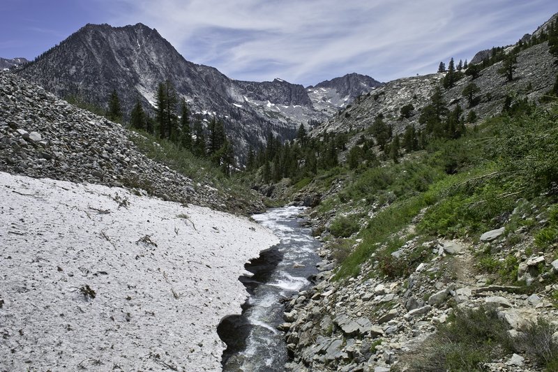
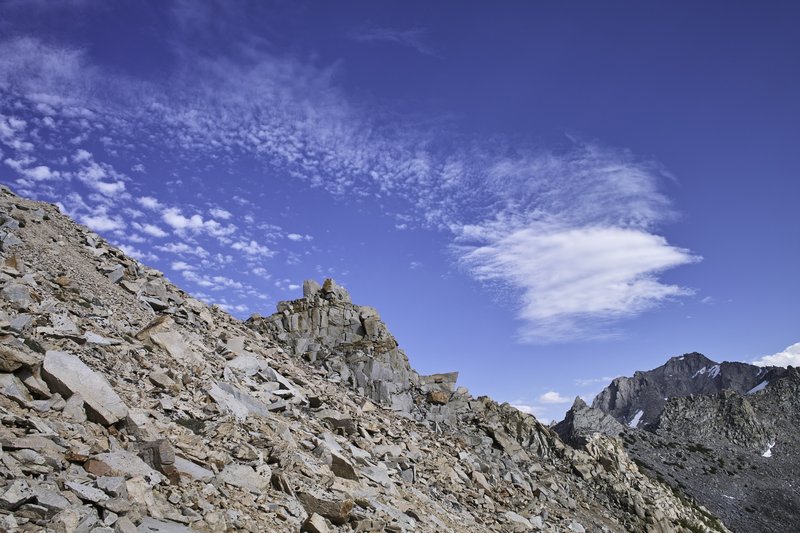
Mather Pass. The trail continues to follow Palisade Creek, eventually following a series of switchbacks up the hill, which, because of all the water this year, became a switchback garden: hundreds of flowers lined the well-built stairs up to Palisade Lakes. The lower lake, which I was hoping to swim in because of it's beachy-like qualities was mosquito-ridden, so I continued up around the slabs above the lake to a small stream where I was able to do some laundry, eat some lunch, and take my daily nap.
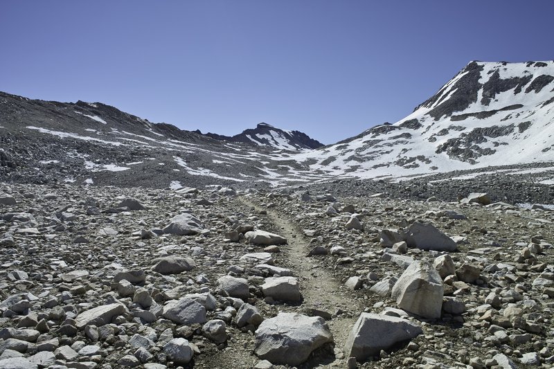
The climb to Mather is nicknamed the golden staircase. The switchbacks are rather dramatic ascending the south side, and this year there were several snowfields to contend with to get to the top. The first major snowfield was just fine, but it was getting late in the day, and the upper major snowfield was on a rather steep incline, and was a bit more than I wanted to tackle. I descended across a talus field, crossed a flat suncupped snowfield, and then climbed several hundred feet of talus back on to the trail. The views at the top, of course, were amazing. More snowfields, steep and slushy, awaited on the other side.
Upper basin, on the south side of Mather, has what can only be described as a lunar quality. If it weren't for several green oasises and the carpet of green trees in the distance, you would almost think you were on the moon. Really amazing. It was one of those moments where your jaw just hangs open.
More marmots, a really rocky trail, and a few thousand feet of descending, then ascending led to Lake Marjorie. The lake was cold, but the sunset leading from the meadows to the lake was phenomenal.
Day 8 - 14.0 miles
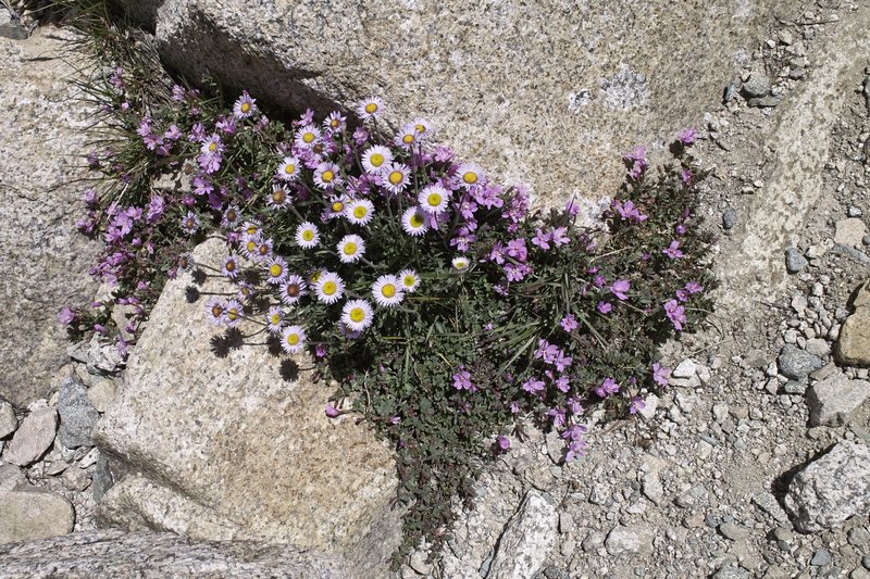
Pinchot Pass. This one was relatively easy from Marjorie Lake. Pinchot has more of a rocky feel, and surprisingly had mosquitos at the top! How mosquitos hatch at the top of the pass are beyond me. The pass also had some amazing flowers and bits of bright moss.
During my travels down the rocky trail downhill, I reassessed my plans. Cold-like symptoms were persisting, which were keeping my mileage down and leaving me more tired than I would have liked. I decided I would modify my trip to either take a 0 day or come out Kearsarge pass, depending on how things were in a day. So I continued down the super-hot Woods Creek Canyon, passed what looked like a cross between a giant pika and furry rabbit, and made my way to the Rae Lakes Loop intersection. At the intersection, I took my lunch, nap, and then made my way uphill towards Dollar Lake. I was really feeling it, so I decided to turn in at Dollar, camping next to a Sierra Club group.
Day 9 - 12.5 miles
The symptoms were persisting, so Kearsarge it was. I headed up towards Rae Lakes only to find the Cirrocumulus (I think?) clouds building. I checked with several people coming over Glen Pass to assure thunderheads weren't waiting on the other side, and then headed up the pass.
Glen held more snowfields, but super easy ones. I descended the pass, and then headed over Kearsarge Pass. It was a little sad to end my trip a day early, but probably the right move. I descended towards Onion Valley and made my final camp at a lake, only to be interrupted in the middle of the night several times by a mule deer who was intent on eating the grass right next to my tent. Lots of yelling and flashlight waving would not deter her from her meal.
Day 10 - 2.5 miles
The final day, I headed down towards the trailhead, making a quick stop on a prominent rock that had cell service, so that I could book a motel room. It took about an hour to get a hitch down into Independence, CA. The town is one of several similar unique but sparse towns on 395. Two restaurants and a Subway. After a long shower, some sink laundry, and a good nights sleep, I was feelin' good.
Day +1 - lotsa driving
The next day I woke up early and caught the CREST bus to Mammoth, and then took the trolley back to my intact, functioning car at the trailhead. It would take a little over 12 hours plus stops to get back to Portland, including endurance of the In-and-Out lunch line and several stops to stretch. It's a good long drive, but worth it in every way.
I can't wait to get back next year.
August 5 – August 14, 2011


Olallie Area/Lakes below Potato Butte
11 miles of hiking • 2000' elevation gain •
I wanted to do a long mileage hike with only moderate elevation gain to break in some shoes and do a little training for an upcoming trip down in the Sierras. Unfortunately, I failed to heed the warning that the Olallie mosquitos were ravenous. Surely, I thought, the warm weather and daytimeyness would keep them at bay. Nope. The little buggers just got worse the closer you got to Ollalie lake.
I started from the Red Lake trailhead and made it as far as Top Lake before deciding to turn around.
Between my new shoes that aren't broken in yet (blisters) and the mosquitos, it was a blood bath. Nice lakes though.
July 30, 2011


Thomas, Richard & Harold
6.5 miles of hiking • 1750' elevation gain •
After work. The mountain only came out occasionally, and not very much when I got to the top. No one else past the lake, but 2 separate camping groups at the lake on a Tuesday night.
July 26, 2011


 2
2
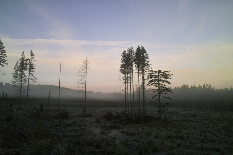
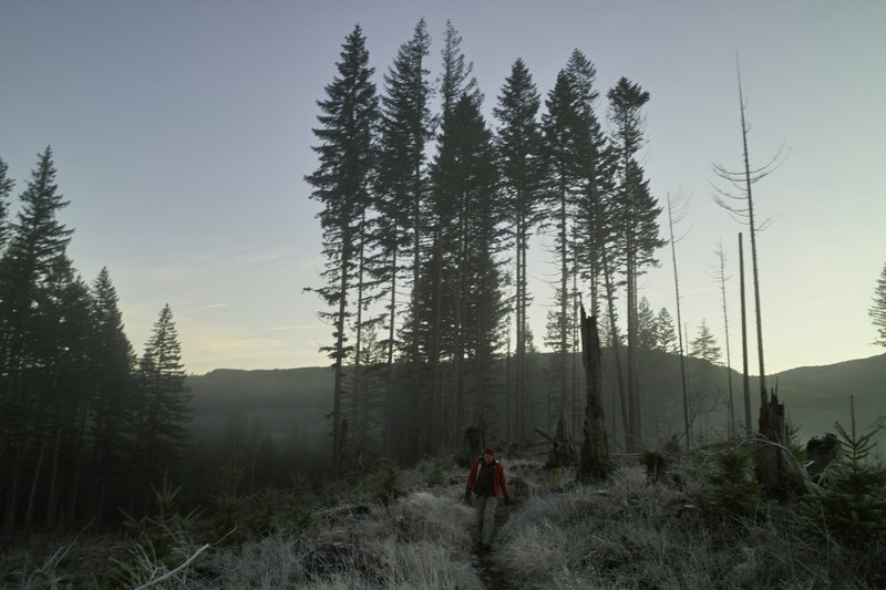
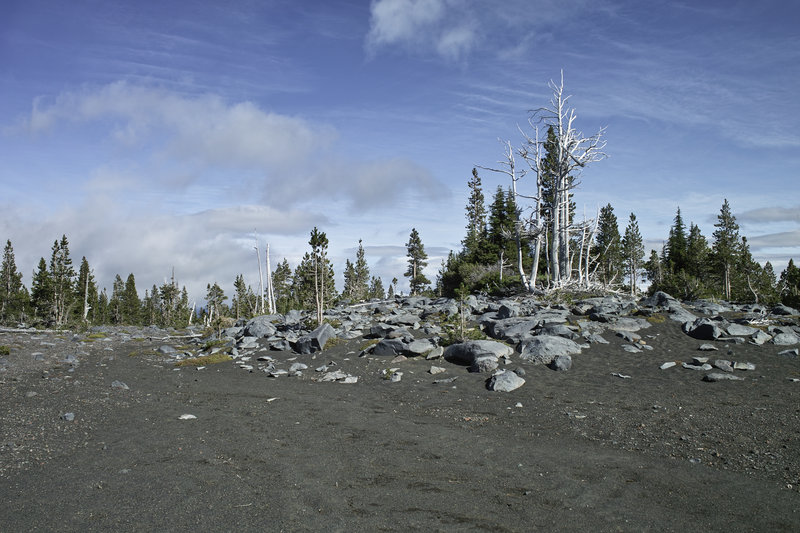
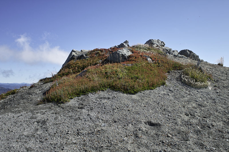
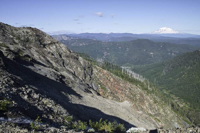
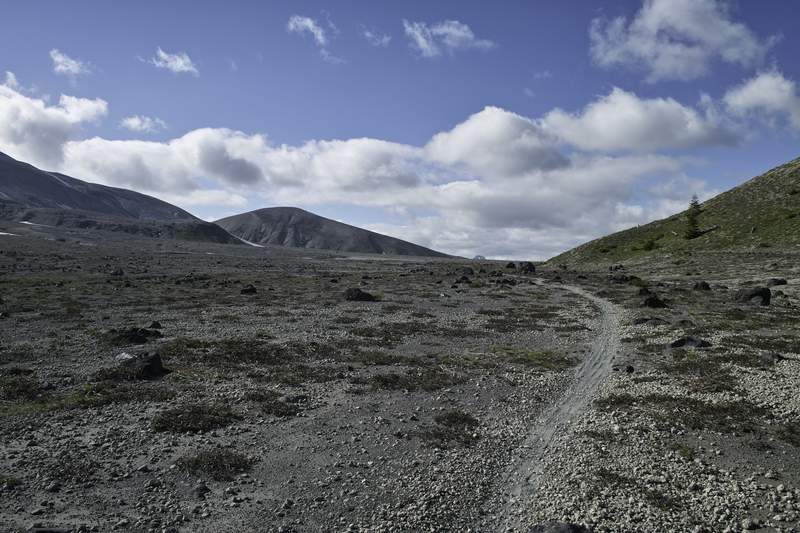
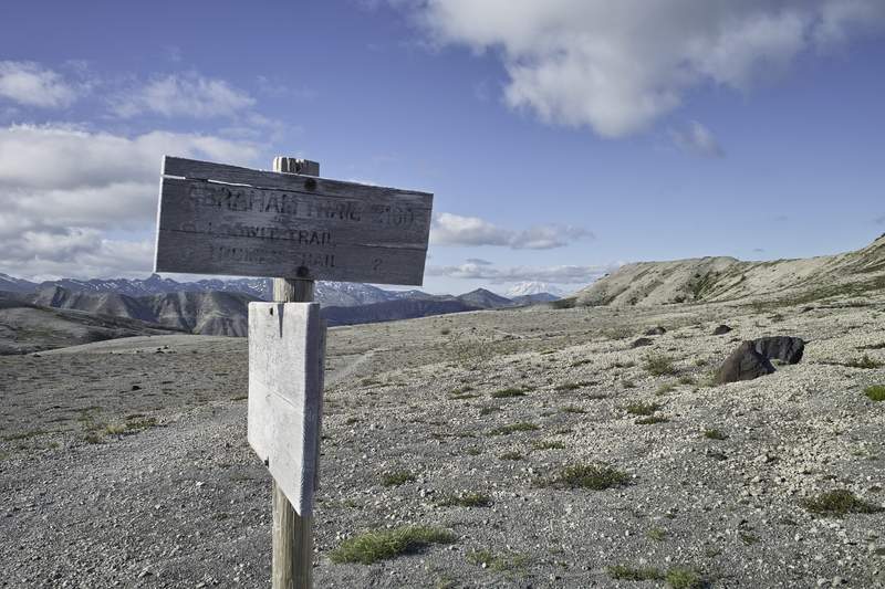
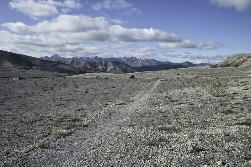
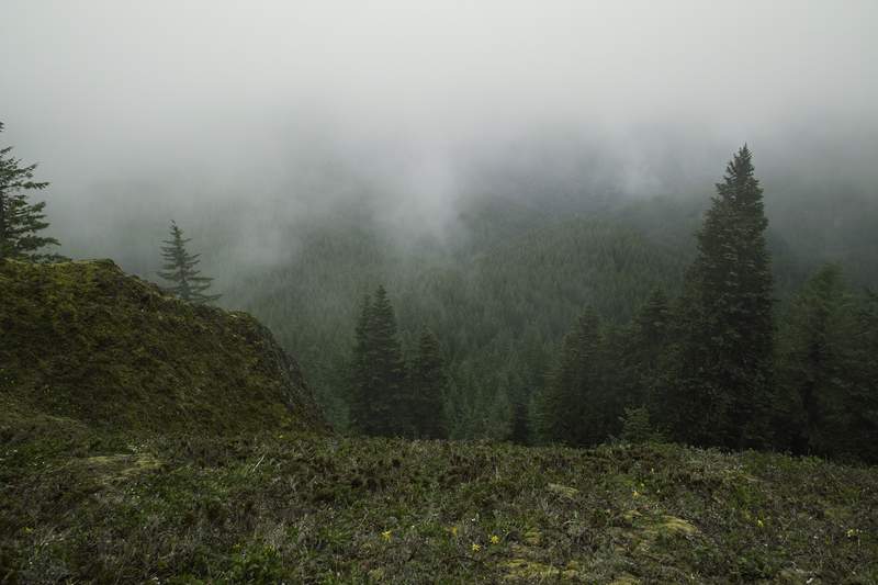
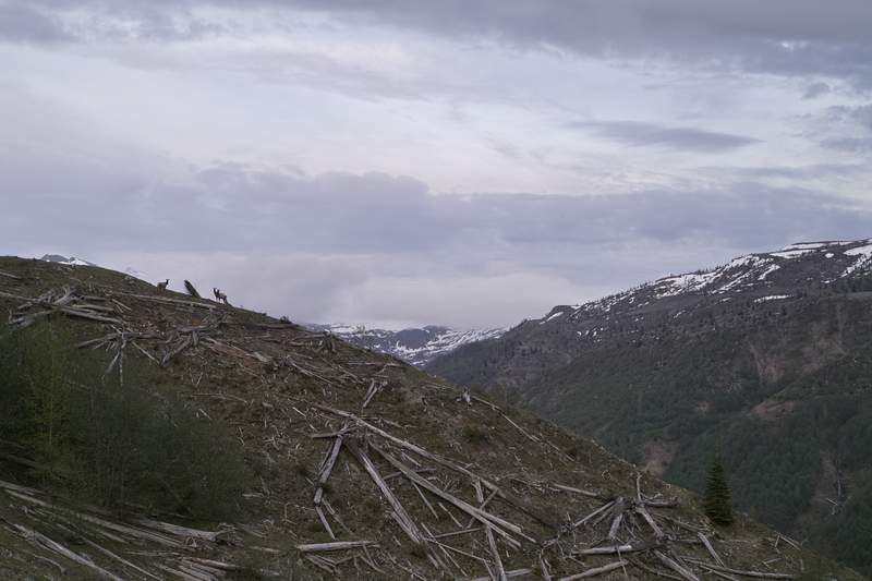
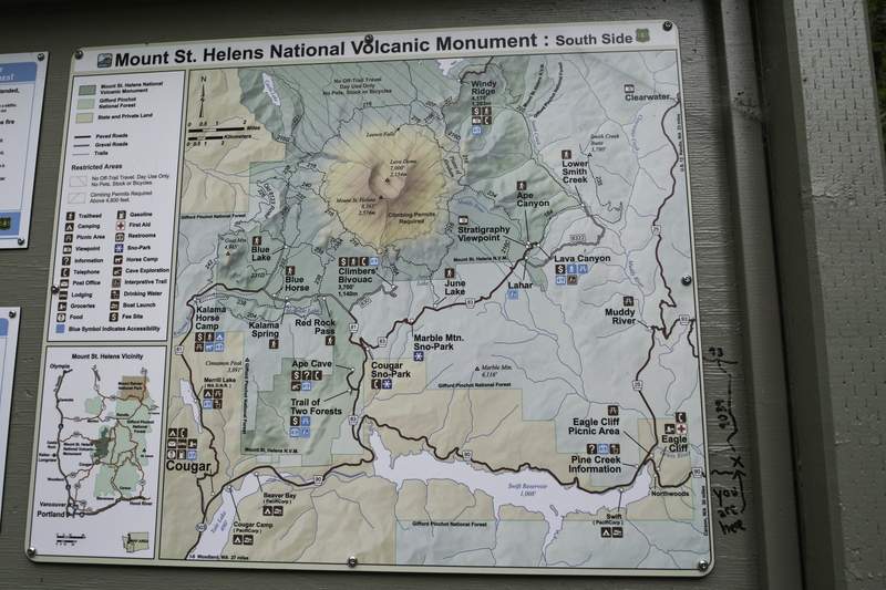
Plains of Abraham
17 miles of hiking • 2250' elevation gain • 1 night
Father Abraham, had many sons. Many sons had father Abraham...
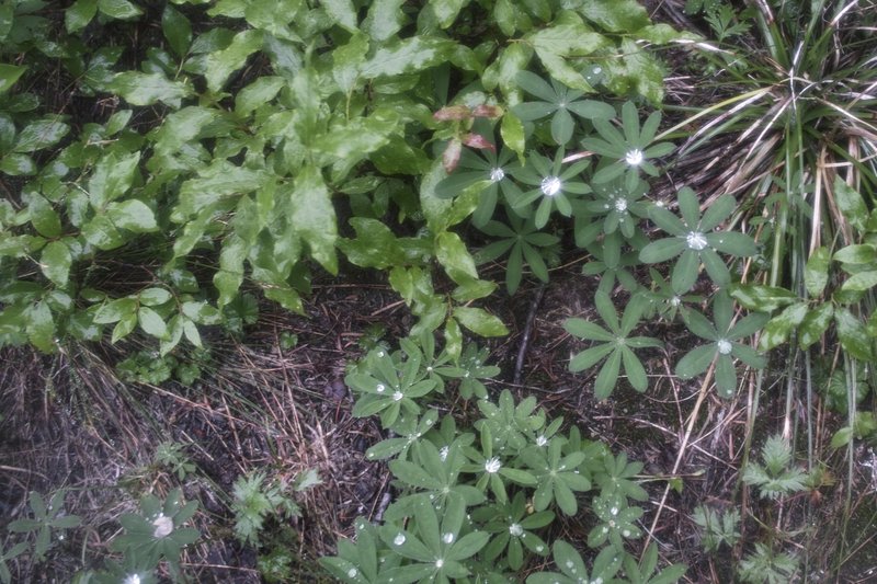
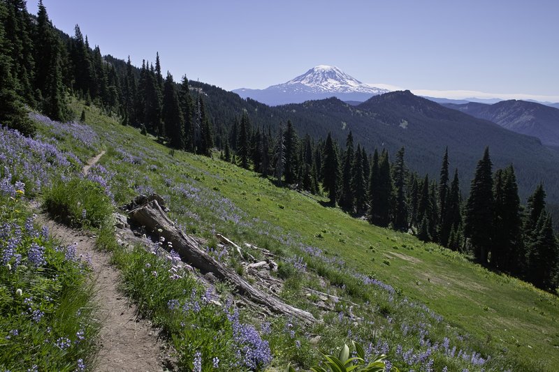
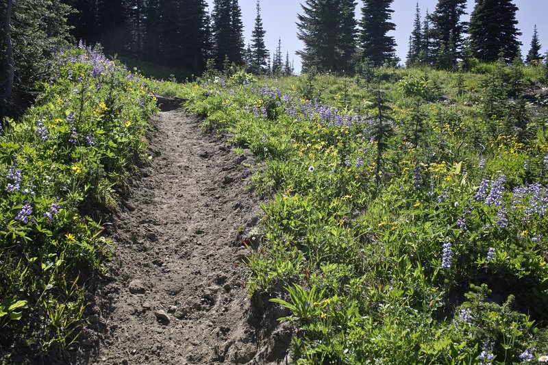
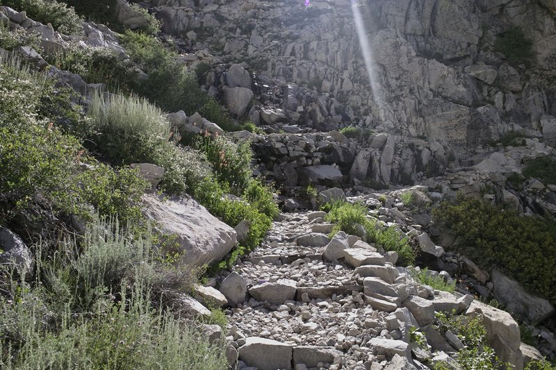
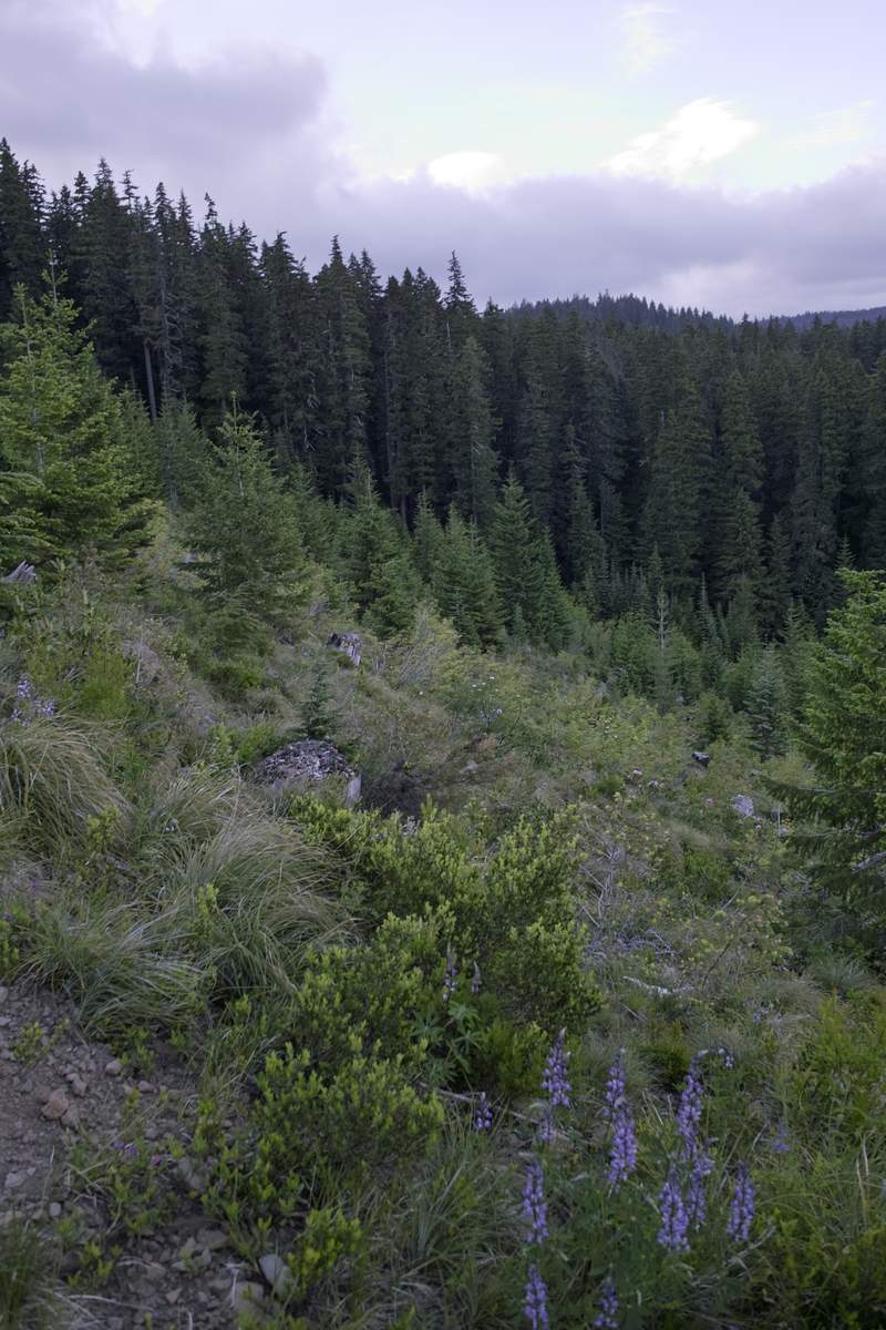
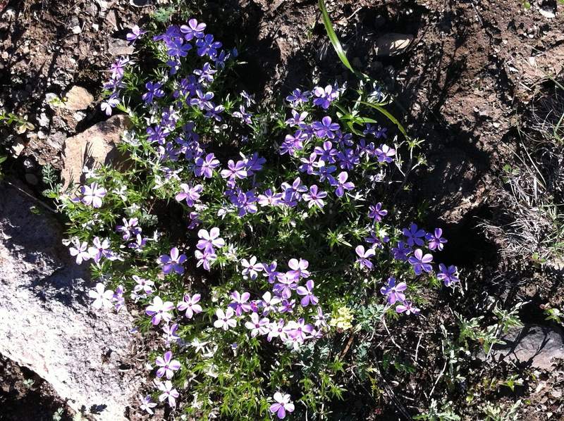
Did Plains of Abraham from Ape Canyon. I saw a few bikers coming down on Friday night, and a few hikers and bikers on their way up Saturday morning, but otherwise saw no one once I got to the plains. The first few miles are a bit of a snooze-fest, but once you get up to the ridge this is a great hike. Once I got up to the plains I started toward windy pass, but I didn't go all the way to the top since it was getting dark. It looks as if there is still a lot of snow lodged in that little canyon. Otherwise, the trail is basically snow free.
The lupine has started on the ridge, but right now only the purple crepe-paper-ish flower is around up top. Be careful when camping on the plains - the sharp pumice popped my sleeping pad through my groundsheet, which made for a fun night of waking up every two hours to re-inflate, as to not be daggered to death by pumice. (Time to get the seam-sealer out and float the sleeping pad in the bathtub) :)
Great views, not too hot, and a very unique kind of area.
July 22 – July 23, 2011

Rock Lakes Loop/Shellrock Lake
13 miles of hiking • 2500' elevation gain • 1 night
I drove in late, camped at Shellrock. The skeeters aren't too bad right now, but they just hatched, so they should be bad in a week or so.
It rained all night.
In the morning I did the loop. The snow was tolerable, but there were still large 1/2 mile stretches of full coverage. Since it rained, everything was very wet (duh), and since the trail is often rocky in this area, it made for slow going. Going too fast got the best of me, as I slipped on the rock crossing at the Middle Rock Lake outlet, tore my fingernail, lost a Pemmican bar down the creek, and had to chase after my trekking pole as it floated away.
Serene Lake is probably the best of the bunch for camping. Saw a total of 3 groups in the area on Saturday.
A nice little area.
July 15 – July 16, 2011

Bull of the Woods/Pansy Lake
4.5 miles of hiking • 1250' elevation gain • 1 night
A quick trip to Bull of the Woods. Left work, hit traffic, but made good time - those last few miles look like they have a lot of new gravel - I had fun messing with my traction control :)
I was going to do a loop, but snow started at 4800ft, and, well, I've had enough for this year. The mosquitoes are out in force - I ended up hiking 2 miles in up past Dickey Lake since all the Pansy spots had been taken, zipping up my mosquito mesh and reading while I watched hundreds of the 'lil buggers swarm around. I'd give this one at least two weeks to let the snow finish off and the mosquitoes to die down.
July 8 – July 9, 2011

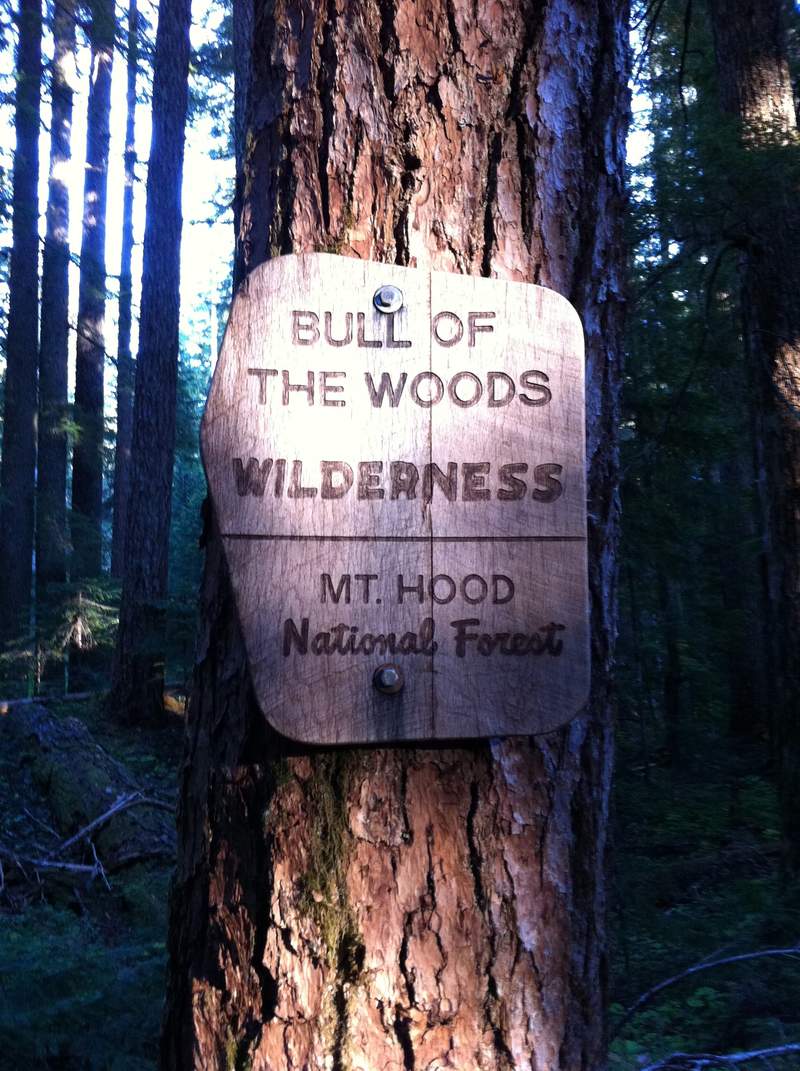
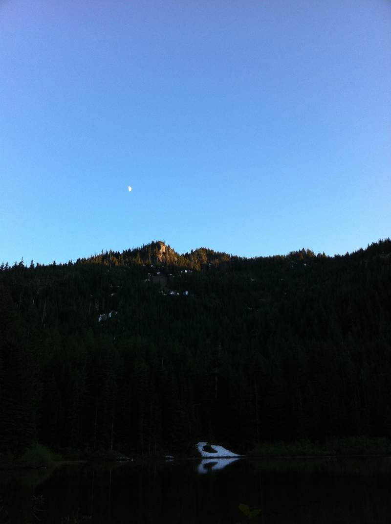
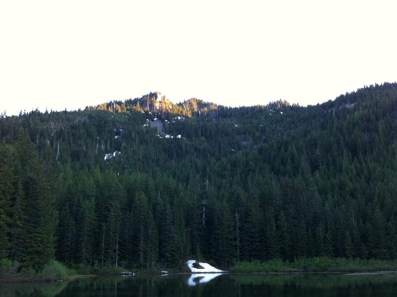
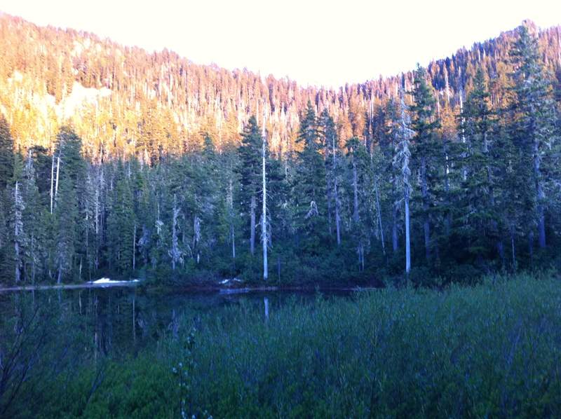
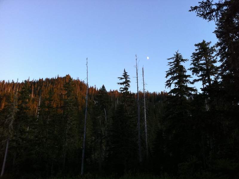
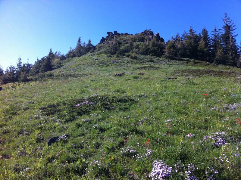
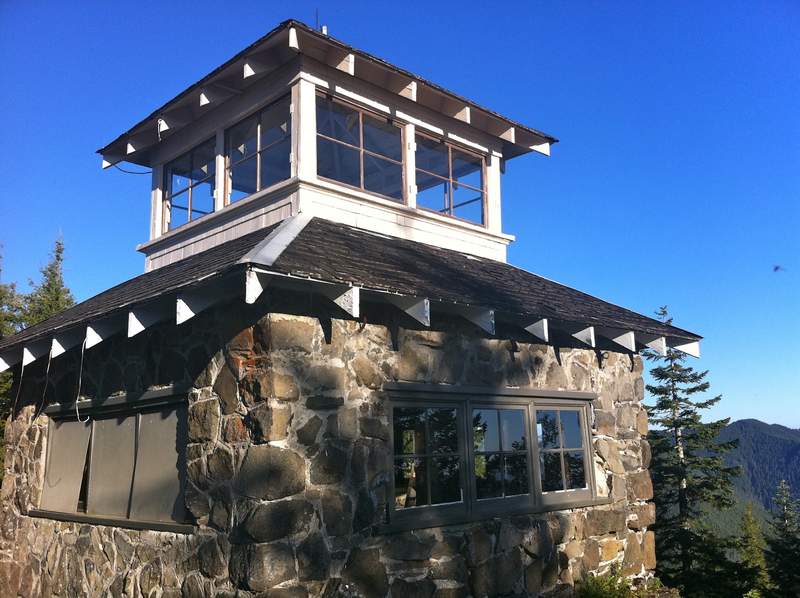
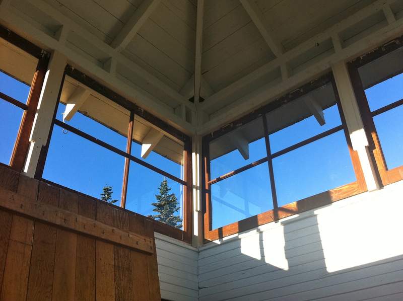
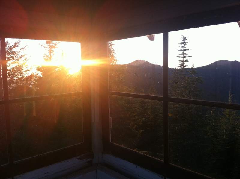
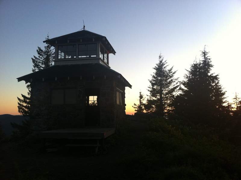
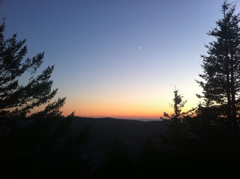
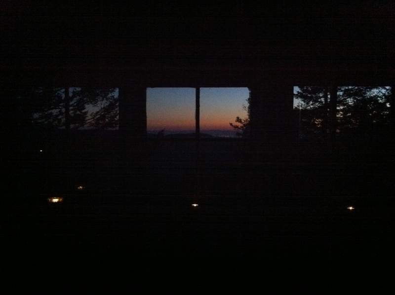
Table Rock/Rooster Rock/Pechuck Lookout
16.5 miles of hiking • 3750' elevation gain • 1 night
Last night I decided to do one more quick backpacking trip for the week.
The drive to Table Rock is pretty quick - about 42 miles, 7 on gravel. For the first several miles to Table Rock I must have seen 35 people (including one guy crossing the snowfield with a baby carrier! hmmmm...), but then not a soul past the intersection towards Rooster. The trail between Table and Rooster gets very little travel. A few snow drifts were still lingering right before the intersection with Rooster, but everything was quite manageable.
Rooster had some nice flowers in bloom and something that smelled strongly of sage, but not quite. Both the trails from Table to Rooster and Rooster to Peachuck were very nice - they almost have an Appalachian Trail ridgewalk vibe to them.
Before heading to Pechuck, I headed down the hill about a mile to look for water, but had no success. Fortunately, there is a little spring on the backside of the lookout. I ran into one guy who was just leaving as I arrived, but saw no one else until the last mile back to the car the next morning, when I ran into the Tryon Creek Day Trippers - a friendly group with Mazama-like proportions.
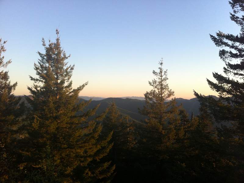
The lookout is a nice little spot, save all the flies and wasps. There seems to be a group of maintainers that take good care of the place. You could see the fireworks in the valley, but they were quite small from that distance, and silent. For some time, these white-tipped-winged birds were flying around, chasing each other, making this funny noise, and then later, barking up a storm:
This morning, on the way back, there were several birds making a fantastic call that I've heard a few times before - I think they may be Meadowlark, but I didn't have a chance to record them. The trip back to the car was a breeze, except one short straight up section halfway between Rooster and Table.
A highly recommended hike!
July 4 – July 5, 2011


Hunchback Mountain
2 miles of hiking • 500' elevation gain •
By this point, I had done too much, and I was pretty bummed after breaking my camera, so I quit after mile 1.0 or so. Kind of a neat trail, though. I'll be back to this one.
July 3, 2011

Chinidere
5 miles of hiking • 1250' elevation gain •
Socked in. Broke my camera (again). More snow. :/
Actually, the snow isn't bad, so long as you take the Chinidere cutoff trail (406M) from the lake. The plateau is a snowy swamp right now.
July 3, 2011

Wyeth Stealth Camp
2 miles of hiking • 250' elevation gain • 1 night
After my evening drive-a-thon, it was 1a, I needed somewhere quick to camp, and of course, all the campgrounds were full (not that I wanted to pay the fee anyway...) I thought I remembered there being spots along the Wyeth trail - well turns out, they really aren't spots when all the summer foliage grows in, so I ended up backtracking and stealth camping not too far from the car.
July 2 – July 3, 2011

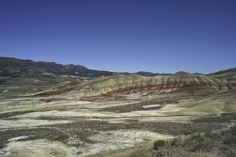
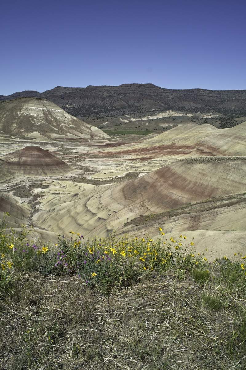
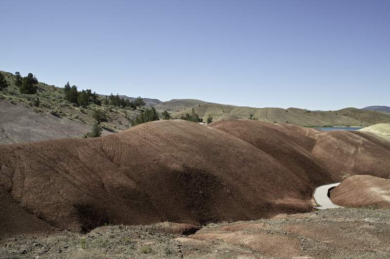
Strawberry Mountain Wilderness
12 miles of hiking • 2500' elevation gain • 1 night
Saturday it was 90 degrees in John Day. Even with elevation, it was still blazing hot, but a good time. I felt out of place without a cowboy hat.
I headed out Friday morning, taking 26 and stopping at Painted Hills - what a cool spot! I ended up at the Strawberry Lake trailhead by mid-afternoon. There were a few other parties, but it was still pretty quiet.
The next day I went up to Strawberry Falls (hitting snow right after the lake), and then snow-whacked my way up to Little Strawberry Lake, which was still half frozen over. I high-tailed it up the other side of the ridge towards Slide lake, but ended up stopping at the viewpoint at 7000ft, as there was a lot of snow on the other side of the ridge.
After reading Aimless' report, I decided to head to the south side of the wilderness, as there was little more I could do in the Strawberry Lake area that didn't involve lots of snow. I stopped in and hiked a little bit of both the Big Creek and Lake Creek trails, but found both a bit "eh." Lake Creek had oodles of blowdowns, and Big Creek was a green tunnel of short pines, which sounds more interesting than it was. Throw in 85 degree temps and baking sun, and I was hankering for something else.
I headed over to the Joaquin Miller trailhead, and things were looking better - cooler temps, a breeze and a nice grassy section. Unfortunately, I noticed my car making a weird sloshing sound in the gas tank, and my car has had some other weird things going on lately - turns out I think the sloshing was settling from all the uphill driving, but at the time, I didn't want to be stranded in John Day, so I headed home early. It was probably for the better, as the temps were pretty unpleasant, and the bugs didn't help. This area would be a great late September hike (as with all Oregon hikes right?).
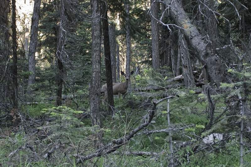
Also - tons and tons of mule deer. All over the place!
I hope to get back once things melt out and do the ridge trails. A nice area, with a different sort of feel. Oh, and be sure to drive Rt. 19 back to 84 during sunset - the section between 26 and Spray - absolutely phenomenal!
July 1 – July 2, 2011

June 26, 2011
 3
3
Pamelia Lake/Tumble Creek/Devils Ridge
19 miles of hiking • 5750' elevation gain • 1 night
My original plan was to do a long ridge hike in Middle Santiam, approached from Rt. 22 to avoid the long drive in, but because the access road was closed for repair, and the alternate was snowed in, my plan was stymied.
Thanks to my friend Bill Sullivan, I had other options. I called over to Detroit Ranger Station and got a Pamelia permit.
Right down the road from the ranger station is Tumble Creek Trail, which is the "lower" trail that goes all the way up to Dome Rock and Tumble Lake. Since Dome Rock is at over 5000' I assumed the top would be a snow project, so I hiked to the first good viewpoint of Detroit Lake, about 2.5 mi in. Not a bad hike, well graded, and worth doing on your way somewhere since it's right off of 22 going to Detroit Lake.
I picked up my permit, hiked the 2ish miles in to Pamelia, and chilled for the rest of the day. I did end up wandering past the lake to see how far up I could get without hitting snow - there was lots about 1 mile down at the inlet, but the lake itself is snow free. The crowds were reasonable - maybe 6 parties total? One guy thought to show me that he was packing heat, just in case a cougar came by. He also thought my tarp wasn't sufficient protection against the big cats.
The next morning I hiked up to the PCT at Milk Creek to get a view of Jefferson (Grizzly is likely still snowed in, even to the viewpoint, and I didn't feel like crossing the outlet to find out, because right now it's about a 30ft wide stream crossing). Lots of icy snow down the creek valley.
I got back to the trailhead around 8a, only to find a trail crew checking for permits against a list - I'm not sure if they were handing out tickets, but I wouldn't want to find out.
Lastly, I did the "other" Devils Peak - well actually just the ridge. This one is just north of Breitenbush Hot Springs, and I believe is on their property, though there are several trailheads for the creek off of 4685. I parked at the second, crossed the log and headed up, but stopped where the trail got exposed and steep with loose gravely stuff - probably fine, but not my cup of tea for today. Elk Mountain lovers would heart this trail. On my way down I ran into a mountain unicyclist planing to unicycle down the trail. And here I was worried about the exposure hiking - crazy! Anyway - I plan to go back - a really worthwhile hike.
Took the nice way home, up 46. One of these days I'm going to kayak the Clackamas - looks like so much fun.
June 24 – June 25, 2011

 2
2
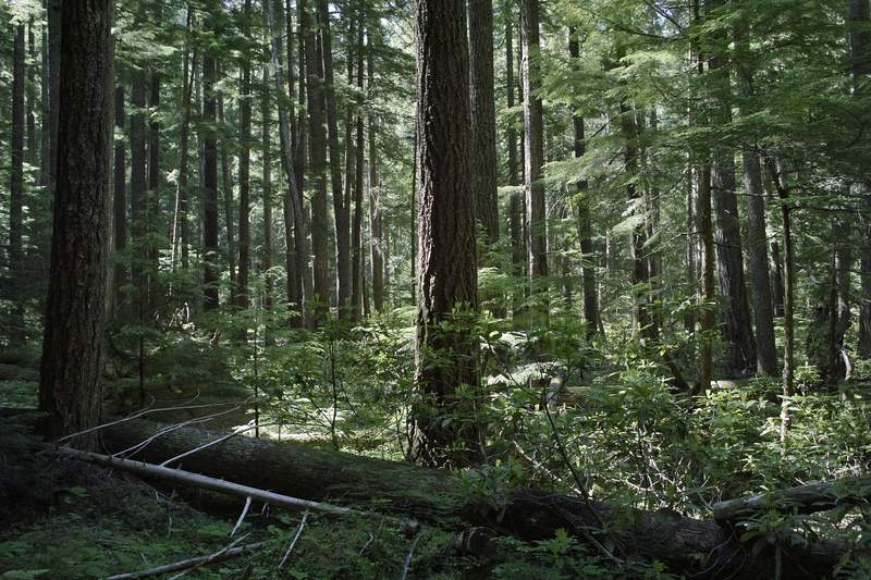
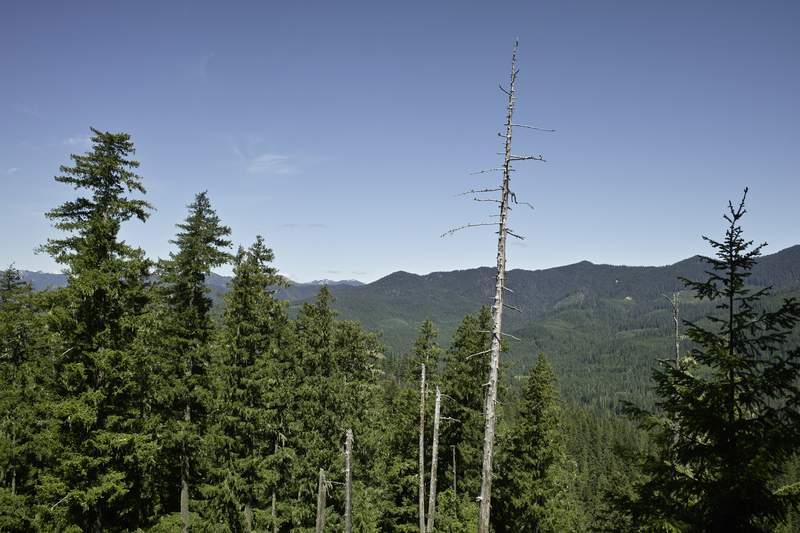
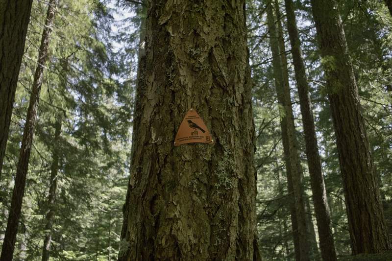
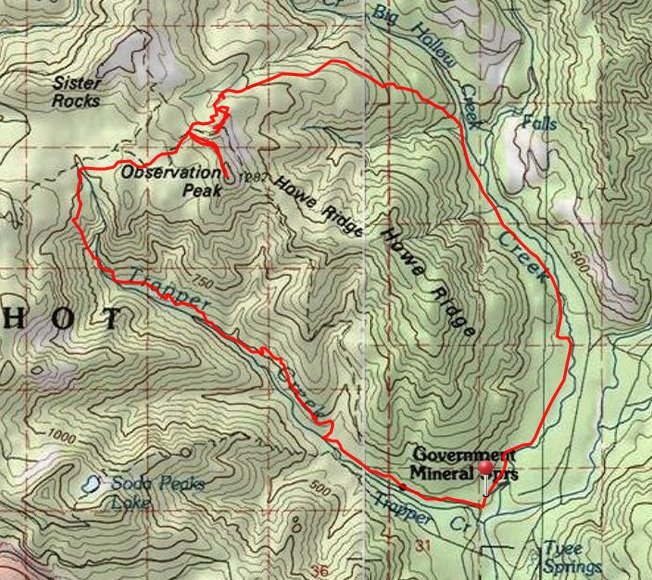
Trapper/Observation Peak Loop
17 miles of hiking • 4000' elevation gain •
So glad to be done with this one.
Took the 194 trail north to 158. 158 had several blow downs and the snow started at 3400. Well packed but icy. From the basin around 3400, I ventured off trail to avoid the sidehilling - I wouldn't do this hike for the next several weeks without a good GPS or excellent navigation skills. Routefinding in the several miles of snow was exhausting. I finally made it up to Observation, where the snow had petered out, but the partly cloudy forecast did not materialize.
I took the path of least resistance down to the Trapper Creek trail, occasionally following footprints, but finding that they were often way off track.
The Trapper Creek trail (192) is interesting. The switchbacks coming down the side of the hill are extremely narrow and are eroding, at points, which made for tedious travel (but Eric, I think you'd like this trail). Because there was also brush to contend with, and the focus required to stay on the narrow ledge, it was really draining after all that snow routefinding.
I eventually made it down to the creek, but tripped on a wet stick, and fell pretty hard, right on my jaw. I guess you could call it jawbone flats. (bad Opal Creek humor) I also snapped my carbon fiber trekking pole in two - but I was really lucky - it could have been a lot worse, considering I didn't break my fall. I'm still counting my teeth...
June 19, 2011

Burnt Lake
9 miles of hiking • 2000' elevation gain •
Hike up to Burnt lake. Super nice day. Snow at 3800ft and deep beyond that. The original plan was to go up to east Zigzag, but the consensus was to turn around shortly after the lake.
June 17, 2011

McIntyre Ridge
6 miles of hiking • 750' elevation gain •
Went up late tonight to get a quick hike in. The plan was to do Wildcat, but I ran into drifts on the road 2 miles before the trailhead. A high clearance vehicle would do fine. Outbacks and smaller, if going this week, bring a shovel in case you get high-centered. I didn't have either, so I ended up road walking a good ways.
It was supposed to be clear out tonight, but remained one giant cloud. Kind of reminded me of November/December weather up there (maybe because that was when those kinds of forests were both accessible and rainy?). Hit 3-4ft drifts once I got to the east/north side, no snow on the west/south side (like everywhere). You probably could bushwhack up the westward side all the way to Wildcat and it would be faster.
It was nice to get out in the alpiney forests, even if it was in a big cloud.
Also saw some odd activity - as I was leaving around 9p (the end of dusk), I saw about 4 cars pass me towards the trailhead. It seems as if there is either a lot of partying or illegal activity that goes on up that way - so be cautious when going up there near dusk.
Also, Douglas TH is closed for logging.
June 15, 2011

 2
2
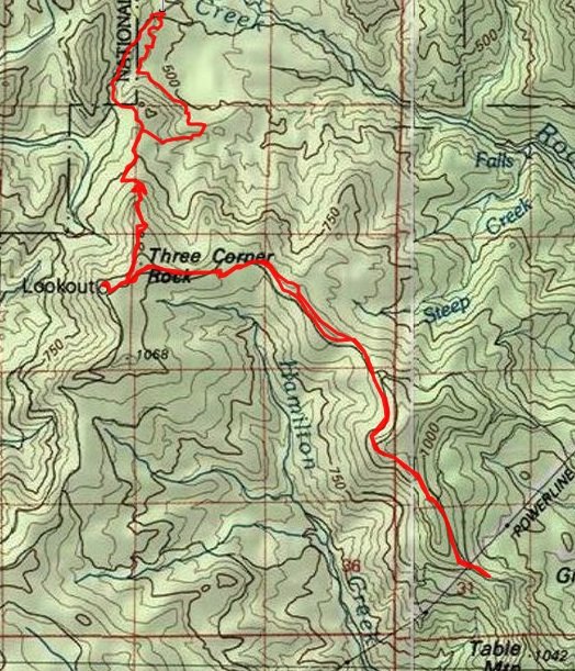
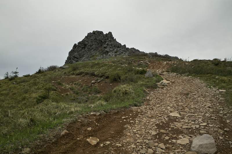
Not Table Mountain/Three Corner Rock/PCT
18 miles of hiking • 4250' elevation gain •
They say the third time's the charm.
Apparently not.
Yet again, Table evades me. I started at one of the CG-2000 trailheads around 1p and made my way up the PCT towards Three Corner Rock. Hit snow patches around 3200', which continued on the east side of the ridge all the way to table. Often it was easier to bushwhack up higher on the ridge, or take 4x4 roads.
Three Corner Rock is pretty neat, and probably worth checking out. Because of all the snow, I got to the powerlines right below table mountain around 4:30p, which put me back at the car around 8:30p, and gave me very little daylight to get back if I were to make it all the way to the top. So I made the "smart" decision and turned around right after the powerlines. Also, storm clouds looked like they were brewing, so that made for another good excuse. I sat in the middle of the trail, ate my salmon salad sandwich, and had a short pout before turning back. Of course, I made it back to the car by 7p after all. Oh well :)
One of these days, I'll get to the top of Table.
June 11, 2011

 3
3
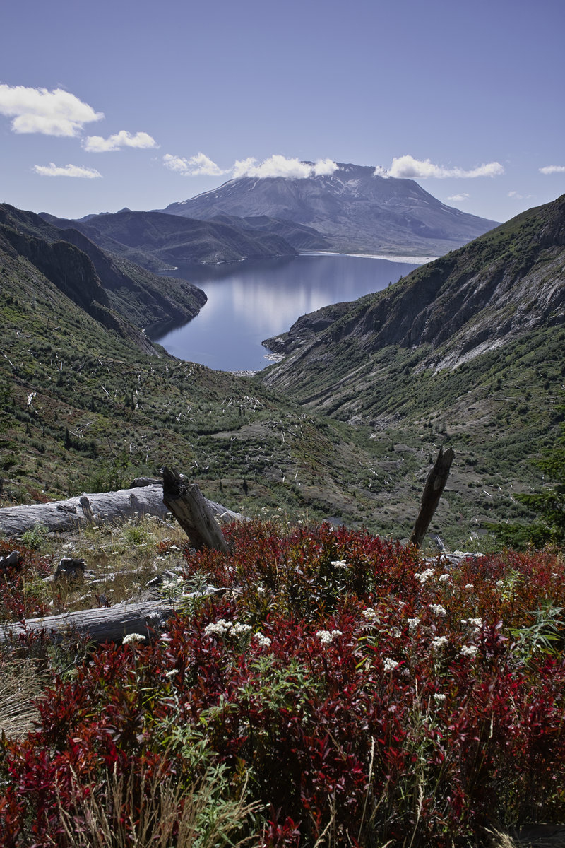
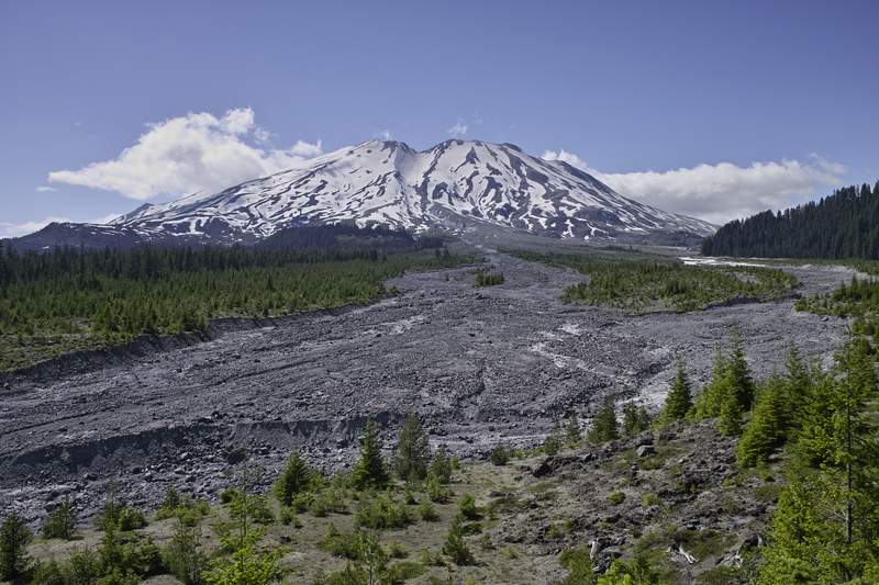
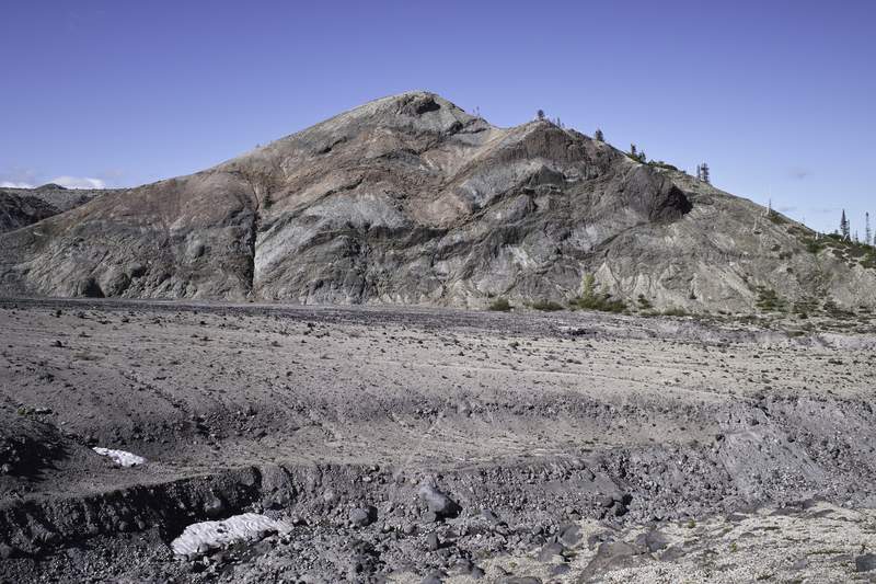
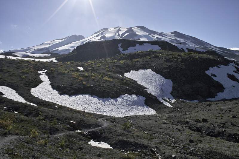
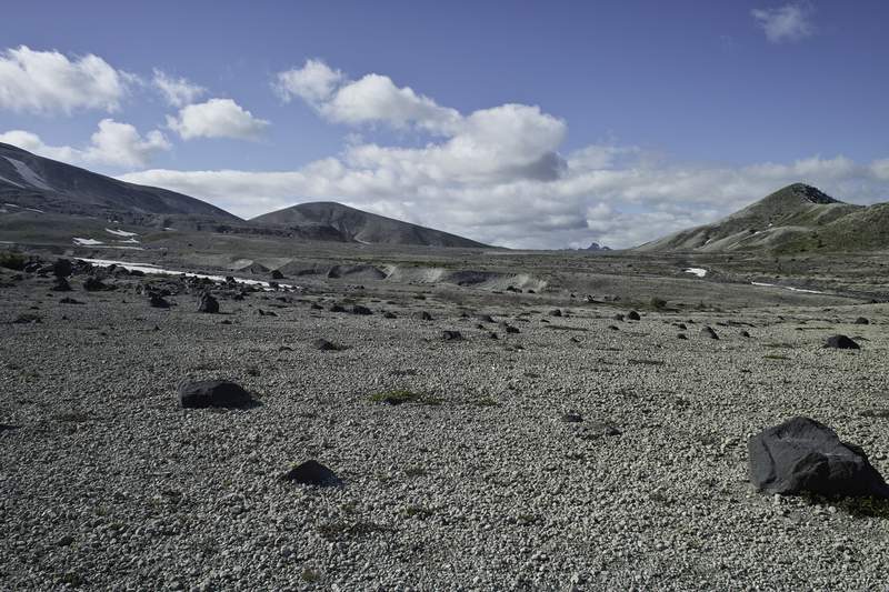
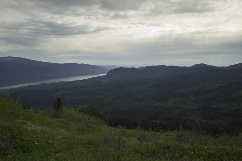
Coldwater/Goat Creek
16.5 miles of hiking • 2750' elevation gain • 1 night
I headed up north again this week, this time to scout out some options for an upcoming trip.
I didn't get out of Portland until 5:30, and then got stuck at the bridge for about a half hour while I waited for the drawbridge to come back down. 504 was covered with yellow flowers, and the drive to MSH was super quiet: the last 20 miles I saw no cars. I couldn't help but stop at most of the turn offs, as the views of St. Helens were fantastic.
I didn't get to the trailhead until about 8p, and I had 3.5 miles and one hour of sunlight ahead of me. I took off up the South Coldwater trail, trying to beat the sun, but realized I'd likely run into snow, which I didn't want to tackle in the dark. It was a real tough choice between stopping to take pictures and forging on to avoid a dark and snowy problem. The sunset was phenomenal.
I hit infrequent snow at about 3500ft, but only in patches. Because it was so dark and the snow had deposited in the etched-in-the-hill trail sections, I decided to follow my topo and take the high route. Technically, it's illegal to travel off-trail in the MSH monument, but safety first, right? The ground was soft and sandy, and the whole way up, an enormous cloud was right on my tail.
Speaking of illegality, I arrived at ridge camp without the required permit. Of course, I would see no one until the next morning down at the trailhead, so it wasn't a problem. By the time I got there it was dark, and someone was making quite a ruckus. I'm not sure if this was elk bugling (which I think is more high pitched and sustained), or a member of the dog family, but the sound bouncing off the mountain walls was super erie:
(sorry - it's pretty quiet on this vid)
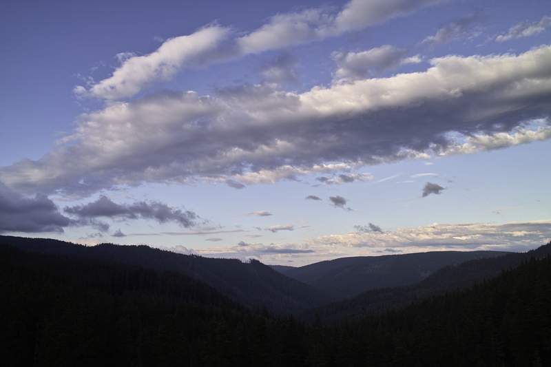
Later that night, it started to rain. I soon realized I was in a cloud, and would likely remain there for most of the night.
The next morning, my tarp was soaked. Everything was fogged in, and a mini 40ft wide rainbow had formed over the camp. I made some oatmeal and Via, and then headed up towards Coldwater Peak. The peak is at about 5500ft, so I knew I wouldn't make it to the top with all this snow. I made it as far as a steep snowfield, but then turned around because I was still in a giant cloud and had no idea how steep or exposed the spot was. I headed down the overgrown trail towards the lake, where there were many elk hiding in the bushes. The whole area is packed with elk.
The final stretch was a short roadwalk back to the car.
I then headed up to Goat Creek. This trail tries so hard to be Eagle Creek, but doesn't do so well. I walked in a few miles, intending to hoof it up towards Vanson Peak, but then ran into a group who told me that a decomposing elk was ahead. Thinking little of it, I continued on, but the smell was unbearable, and Vanson, at 5000ft, was going to be a lost cause, so I packed it up and headed back.
MSH has to be one of my favorite areas around here. Unique and extraordinary.
June 8 – June 9, 2011

 1
1
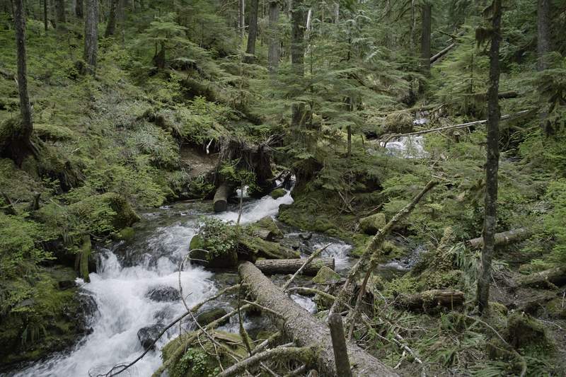
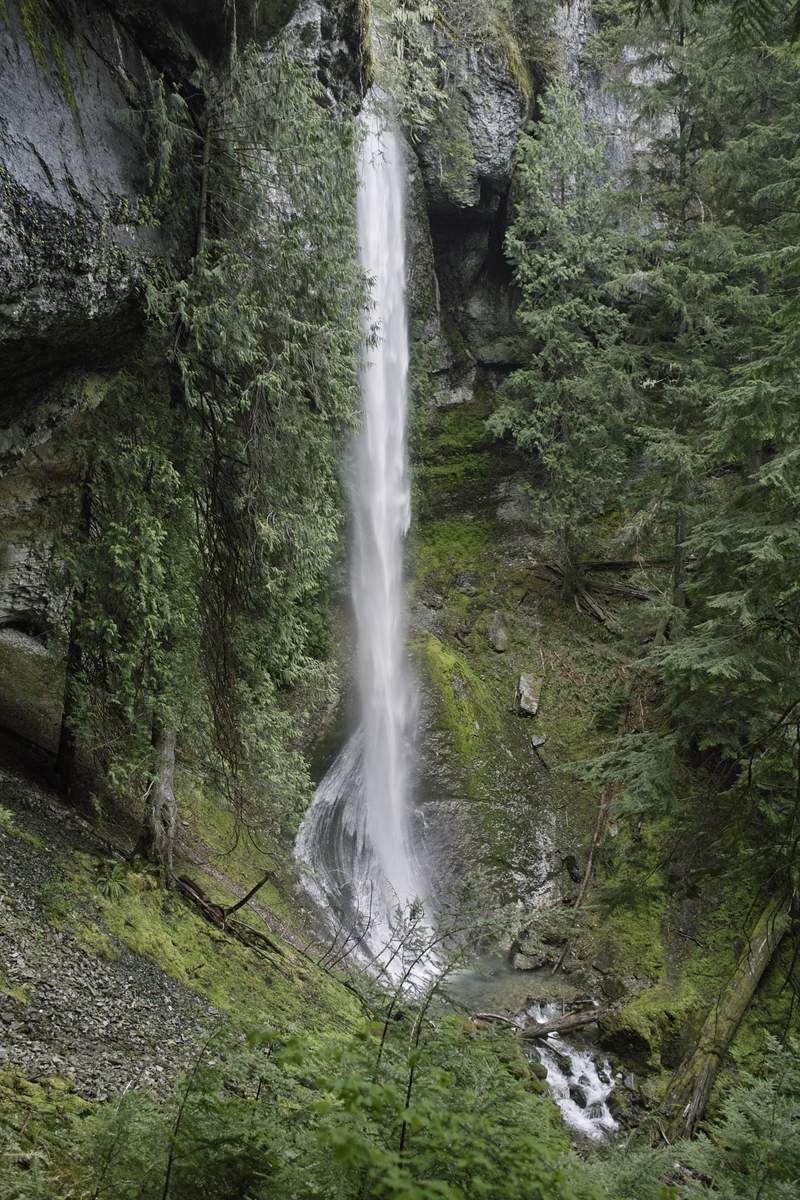
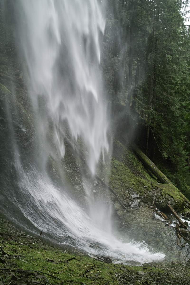
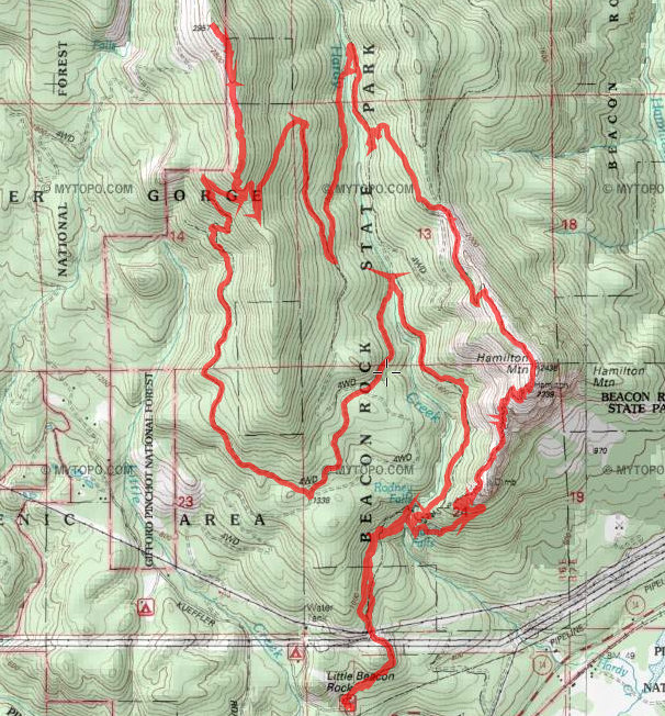
Hamiphlox
14 miles of hiking • 4000' elevation gain •
(Follow dosage instructions carefully. Ask your doctor for more information.)
Decided to do the Hamilton-phlox point loop before the discover pass kicks in (though I'm still scheming to find a place to park outside of the state park - tried to be all buddy-buddy with a ranger directing parking (it was busy today), and see if she knew of any secret spots, but she wouldn't play along). Hat tip to awildman - phlox is a great spot.
The hoards were on their way down Hamilton as I was on my way up. Went down Don's trail (Don Nelsen's trail?) and back to some trail that has had some real recent and elaborate maintenance. I saw only one person between the intersection with the old road and Hamilton loop. Took the old decommissioned trail back down at the "more difficult/most difficult" intersection - I'm going to call this one "Pool of the Winds Jr." (in honor of our other favorite).
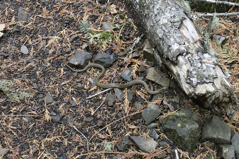
Also saw the first snakes of summer (like the first snowflakes of winter?). 4 garters - it seems there is a large garter colony in the park - I always see so many snakes around Hardy.
June 4, 2011

 1
1
Lewis River/Lava Butte
13.5 miles of hiking • 1500' elevation gain • 1 night
Friday night after work, I left Portland right at the beginning of rush hour, and once clearing the bridge, made my way up 503 towards Lewis River. Plan A-1 was to scope out Mt. Mitchell and see if the snow mentioned in a trip report two weeks ago was still sticking around. I took my chances and drove up to the trailhead, but just through the trees you could see deep snow at the top, and I didn't feel like taking my chances on making my way up, only to not reach the summit, as it was already 7p. To make matters worse, when I got out of the car to relieve two hours of driving, the mosquitoes were out in force. This was not going to happen.
So Plan A-2 (knowing that Mitchell would likely be a bust), was to get a head start on the next day's plan to do the Lewis River Trail, up and back from Curly TH. I parked the car at Curly at 7:30p, and made my way down the relatively flat trail as far as I could before daylight ran out. A few miles down I startled some deer, whose reaction was to dash off into the river. Unfortunately for them, the current was swift and the river was deep, so once they could no longer touch the bottom, they began floating downstream, bobbing up and down, trying to escape the water. I've never seen floating deer before.
I picked a camp about 3.5 miles in (about a mile from the ex-shelter), and got to hanging the bear bag. Bear bags are my absolutely least favorite thing about backpacking. Seriously. About 20 minutes after chucking the rope over the branch, only to have it break or miss, I finally gave up and found a nice branch 10 feet off the ground. If a bear wanted my food, he could have it.
I set up the spinntwinn and bivy, and studied the map, Plan A-2 involved hiking 26 miles the next day - to Upper Lewis Falls and back to the car. While doable (this trail is pretty flat) I wasn't really feeling it, so I started milling over Plan B. After an hour or so more, I had my plan, and went to bed.
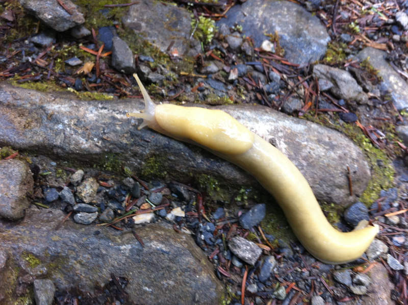
I woke up around 7:30a, and started back for the car. Never have I seen so many slugs - I counted about 10 in 2 miles. I passed the trailhead and went down to Curly Creek Falls right below. Sure, there is a neat rock formation in the middle of Curly, but otherwise it's pretty plain, and the viewpoint is far from the falls.
My next stop would be Lower Lewis. I beat two SUVs full of women who screamed Lake Oswego down to the falls, grabbed a few pictures, and then ran back to the car.
Then up to Upper Lewis. This one you have to hike in about a mile from Quartz Creek TH, and while the photos aren't stellar from the viewpoint, it's pretty great being so close to such a monster of a waterfall.
Next, I decided to take the other way back to Portland, and hit a few other spots. As is necessary when you take this route, I stopped at the viewpoint and took a few photos of MSH. There were SAR jeeps out, and there were several signs for doggie SAR training, so I drove extra slow, as to not hit any people playing dead in the middle of the road.
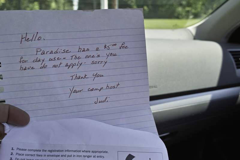
At this point, I was just looking for short, interesting hikes I wouldn't do otherwise. Lava Butte looked like it had potential, as it was just a mile or so up to the top, and could have decent views. I drove into the Paradise Campground (nice spot, by the way) and made my way up what was clearly a little used trail, to the partially obscured views at the top. On my way back down, I startled a black bear, who looked at me once, and then shot off into the woods before I could get a picture.
When I got back to the car, I had a lovely note from Judi, Paradise's camp host, telling me there was a $5 day use fee. There was no sign at the trailhead, mind you, nor was there any formal parking area. She conveniently provided me a fee envelope, but unfortunately, I had already paid for a NW forest pass, and I would not be paying another fee just because Hoodoo's contract allowed them to charge one.
Last stop was going to be Grassy Knoll, but it was 84 degrees out and the road up to the top was going to take too much time and focus, so it was time to get going so I could make chit-chat with the ladies in the BOTG booth.
Great weekend to be hiking!
June 2 – June 3, 2011

 1
1
Gorton Creek/Nick Eaton Ridge
12.5 miles of hiking • 4250' elevation gain •
Didn't have a lot of time today, so I picked something close and quick. Got to Herman TH at about 11a with about 35 cars in the lot. I think everyone thought - It's Memorial Day Weekend, Eagle's gonna be packed, lets do Herman. Went past Indian Point and Deadwood Camp to about 3500 where the snow started, so I turned around, went back down to Deadwood and up Deadwood trail, which cuts over to Nick Eaton, and then down.
When I was walking up, I thought about hoofing it up to North Lake, going down Wyeth and back on 400, but decided against it. The snow is getting old!
May 27, 2011


 2
2
Ramona Falls
7 miles of hiking • 1000' elevation gain • 1 night
Super quick overnighter. Got to the trailhead at about 7:30p and to the falls at 8:45p or so. Having not been here before and remembering all the damage done earlier this year, I immediately thought the first sighting of the river meant crossing, forded and wandered around for about 5 minutes or so before realizing my mistake.
The trail was mostly clear from snow except a patch or two here and there. Camped right in front of the waterfall. Not a bad view!
May 22 – May 23, 2011


PCT Table Mountain Area
7 miles of hiking • 2500' elevation gain •
I wanted to take advantage of all the great weather before the forecast turned ugly again. I started at Dick Thomas trailhead with intentions of doing Table, but my legs decided against it after all the hiking in the past few days, and since I started too late, it was going to be pushing daylight by the time I would get back to the car. So I quit around where it becomes rocky on the west side - still good views up in that area...
You know that hike whose finish always evades you? This one is becoming mine.
May 19, 2011

 1
1
Opal/Battle Ax Hike/Snowshoe
18.5 miles of hiking • 2500' elevation gain •
I had my eyes on Beachie Saddle. I've never been up that way before, but it looked interesting on the map, so I thought I'd give it a try. Started at the Opal lot around 9:30, did the road side of the creek into town, then did Battle Ax trail past the old abandoned mines and up towards the saddle. I was thinking this hike was going to be possible, because even with snow, Battle Ax trail is essentially an old 4x4 trail all the way up, but my arch nemesis won: deep drifts on jeep roads etched into the sides of hills plus slippery snow.
I knew I might run into this, especially with these roads and how they get all drifty and all. Patchy snow started around 2800 ft, snowshoes went on at 3200ft, and I was able to get to about 3800, just about a mile before the saddle before the drifts got ultra-sidehilly and the afternoon-melty snow got slippery enough that it became unworkable. I followed Battle Ax Trail back down to where some jeep roads met, and took old abandoned roads towards Opal Pool and then Opal trail back. Battle Ax Mountain was looking awfully pretty, and is on my summer list for when all this snow melts out.
May 18, 2011


 2
2
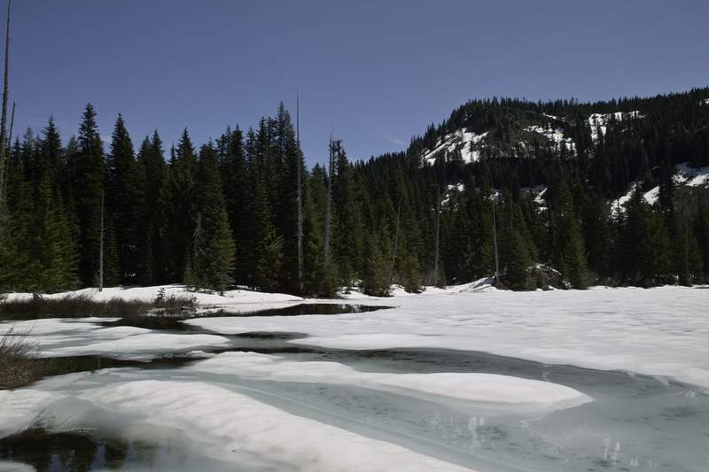
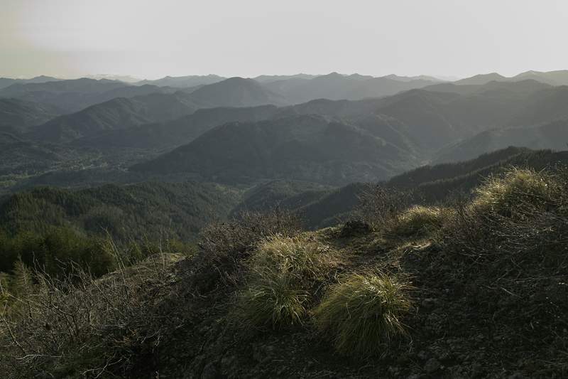
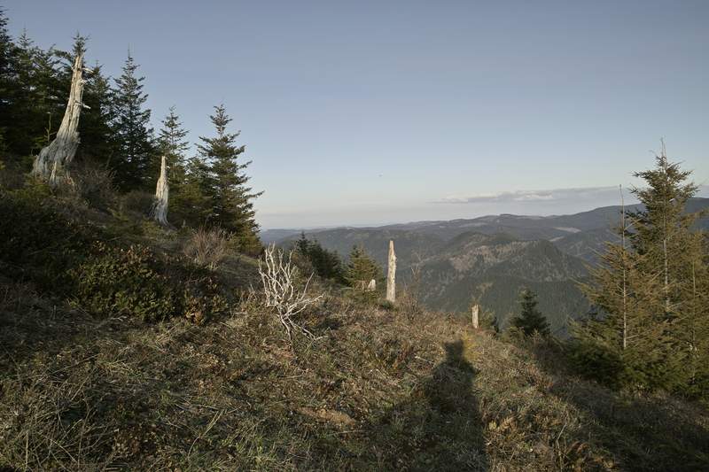
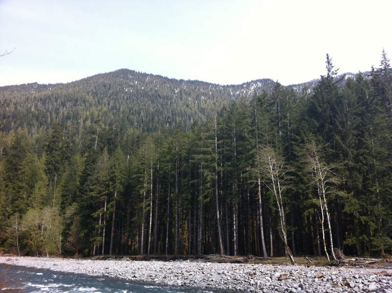
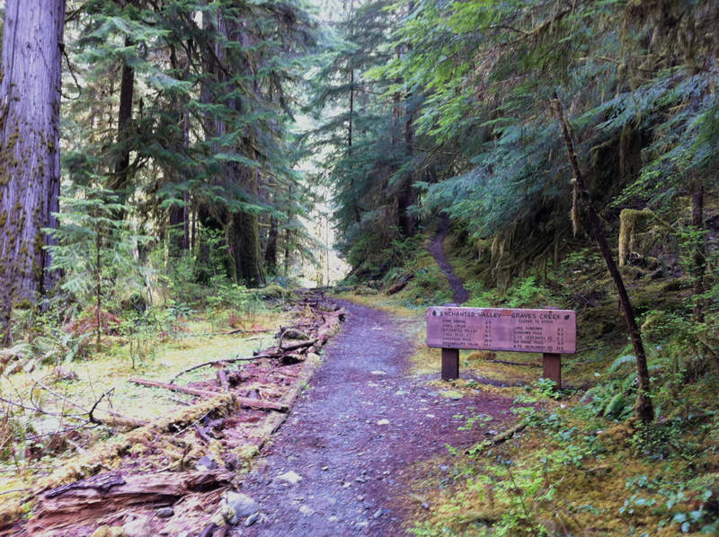
East Fork of the Quinault to Enchanted Valley
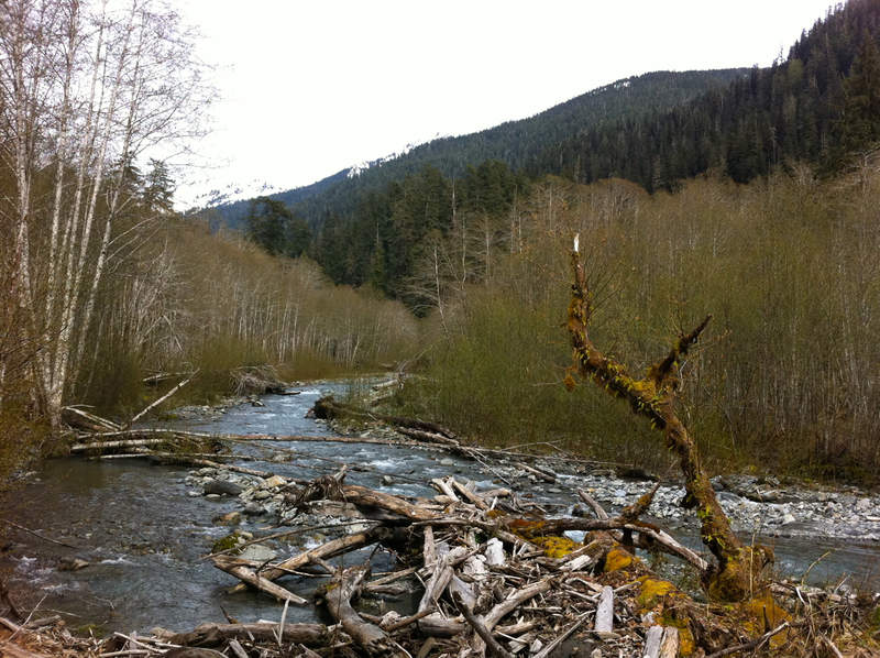
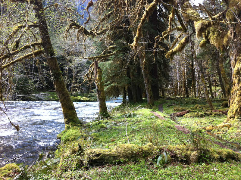
26.5 miles of hiking • 3500' elevation gain • 1 night
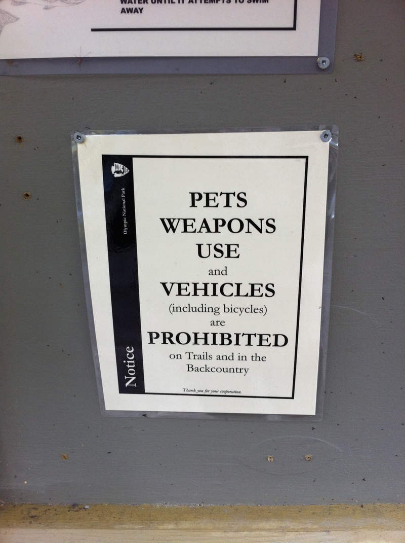
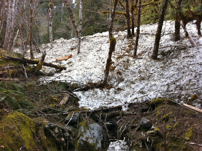
I just finished the last of my law school finals on Thursday, and thought I would make for a quick overnight before I had to get back to work. This trip was something that I had planned on doing earlier this March, but when I drove up to the trailhead, despite the NWS forecast calling for lows of 40 at elevation, it was already snowing. It would have been an unwise choice to stay and have my car get stuck in the snow, as the Graves Creek trailhead is about 15 miles from civilization, and is without cell service.
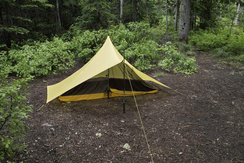
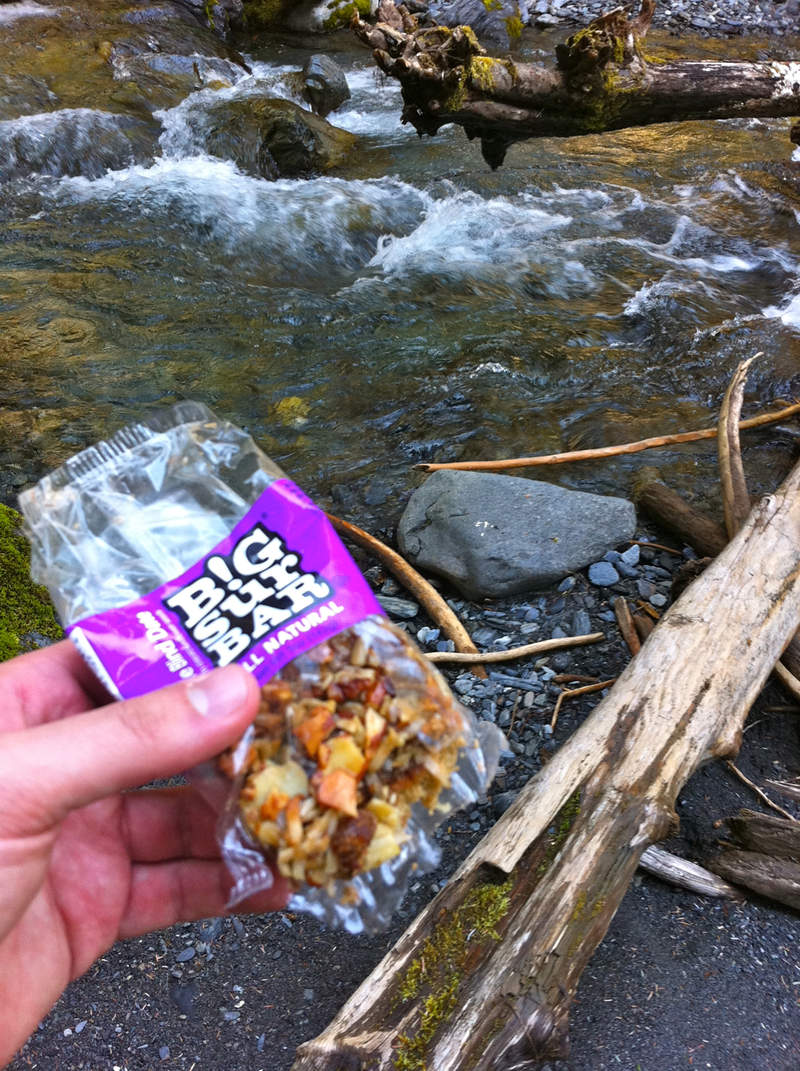
This time around, things were looking up. The forecast called for highs of 68 and partly sunny skies, which was great for Olympic NP in May. So Thursday around 4, I loaded up my super comfy Osprey Stratos daypack (long story - all my backpack backpacks are tied up in the mail or on Ron's computer), and made my way up I-5 towards Olympic NP, through Aberdeen and Hoquiam, and best-town-name-of-the-trip-winner: Humptulips (Google it. It's real.) I arrived at the South Shore ranger station around 8p, filled out my permit, and then booked it down the 15 mile pothole-ridden gravel road (and now I'm awaiting my mechanic telling me I need new struts) to Graves Creek campground, trying to beat the 8:30 sunset. Beat it I did. I pitched the Spinntwin(n) and enjoyed my free we-don't-collect-fees-in-winter campsite next to the river.
The next morning, I woke up around 9:30 (yup, 9:30 - long day the day before) to the sound of cackling stellar jays, packed up the car, and ate my Subway veggie patty sandwich (what does one buy when they made last minute trip plans, didn't bring enough food, passed the last grocery store, and needs something non-perishable?). I drove over to the trailhead, with 3 cars already in the lot, and got things ready. Since I was using my daypack and didn't think to see if I had a way of attaching my snowshoes, I fashioned a quick makeshift solution using the existing compression straps and some tire chain tightener links, which worked pretty well.
At 10:30a, I set off. My pace was pretty slow going, about 2 1/4 mph most of the day, as the day before had been so taxing. The first people I ran into were two FS or NPS guys doing some trail maintenance; dicing up one of several massive blowdowns into large rectangular chunks.
Just after Pony Bridge, I would run into another day hiker who must have come in from one of the nearby resort areas. We talked about how he decided to turn around just up at the first creek crossing, as there was no log in. After reading several trip reports about this area, I'm amazed at how apprehensive hikers are with these crossings. My first foray into the water at Fire Creek, which was what caused his apprehension, was no deeper than 8 inches, and was moving very slow (Portlanders, imagine crossing the stream that follows the trail going up to Pittock). Wet feet are good for the soul.
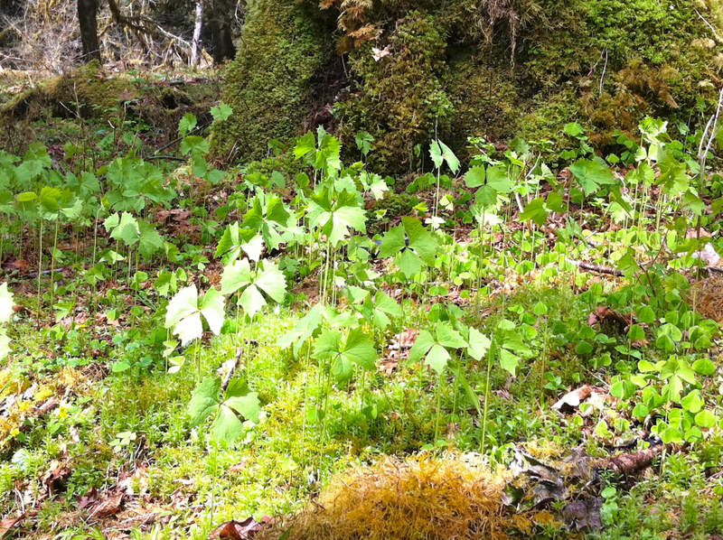
The lower elevations were seeing much of the usual PNW spring foliage - wood sorrel, trillium and those funny plants that look like Batman's cape. There were robins all over the place (no pun intended), a few woodpeckers, several hummingbirds, and of course, gobs of noisy stellar jays.
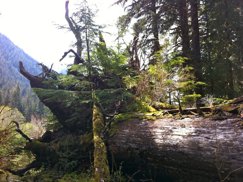
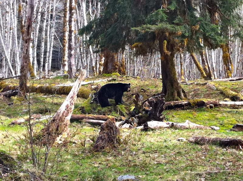
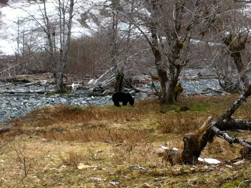
I came to a small crossing (O'Neil creek?) where I spotted my first bear. He had just finished drinking from the creek and started off back up the hill. This is the first bear I've ever seen that hasn't run like the dickens when seeing someone. He took a few looks, and sauntered off. I took a quick break, crossed the stream, and made off looking for him.
A few hundred yards down the trail I came upon a bear sitting out in the field and another lying nearby. She must have been 100 yards away, so I got a few feet closer. She sat up, took a long look at me, then got on all fours. Apparently I didn't take the hint, so she started to rock her rear hips side to side, as if to say "I see people all the time, and really I'm too lazy to bluff charge you, but this usually works." It sure was funny behavior, but I took the signal and kept on going. A few miles and several blowdowns and a logjam later, I stumbled up on two more bear, startling the first as much as he startled me. Once he saw me and figured out what was going on, he stepped to the side and continued on foraging, giving the occasional furtive glance just to let me know he still was there.
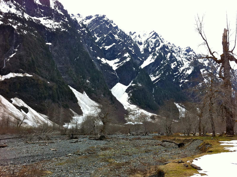
At mile 11.5 or so, I encountered what I was expecting from the ONP trail conditions report: an avalanche. Mind you, the trail was clear from snow up to this point, so walking up to a 15 foot wall of snow that ran from the hill into the river was quite the sight. I quickly scrambled to the top of the 20 foot wide mass and found some good foot holds to get down the other side. Seeing as it looked somewhat melted, it must have fallen several weeks earlier. The top was littered with pine needles, loose rocks, and whole tree limbs.
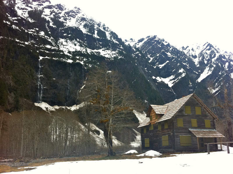
A mile or so later I would encounter my first snow. This continued up to the Enchanted Valley, where apparently the trail had been obliterated by the changing river. Seeing the chalet in the distance, I made my way across several stream branches up to the large boarded up building.
The chalet, once used for hikers, is now primarily used as a ranger station, save one room with a door marked "emergency use only," and a sign that says: "for emergencies: illness, injury and hypothermia." Seeing as I was sick of hiking, I had broken a toenail earlier this month, and my feet were feeling a bit cold, I set up my bivy inside.
I fired up the Caldera Keg and got to making dinner when another bear walked on by. He was a good 50 yards or so away, so I continued to make dinner and watch him dig in the dirt. It's a pretty sweet day when you can sit and eat dinner in the doorway of a chalet in the mountains while you watch a bear nose around.
The bear stuck around for a good hour and a half, but by that time it was 7p and I was spent - bedtime. I closed the shelter door, and didn't wake up again until 4a.
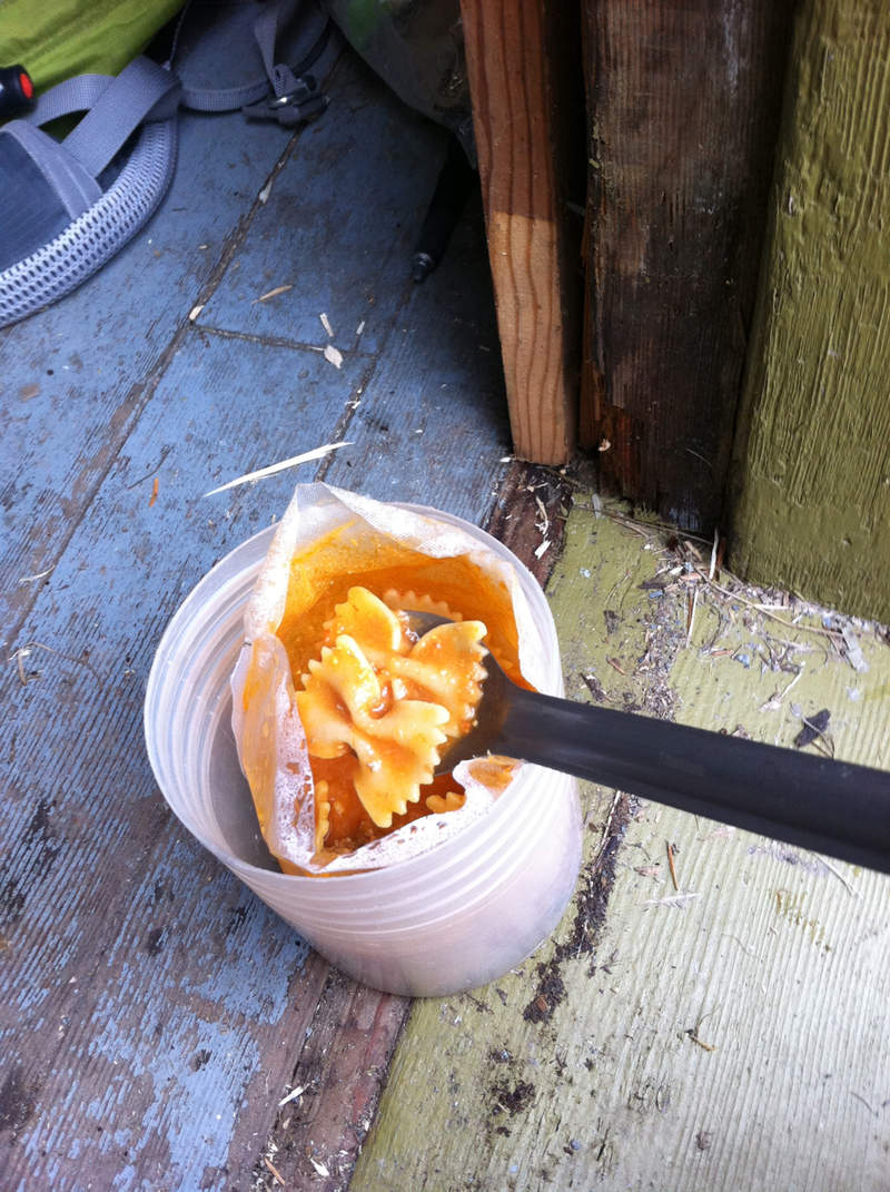
At 7a, I packed up my things, made two quick packets of in-the-pouch oatmeal (I've always balked at this practice, but now find it very convenient) and some Starbucks Via.
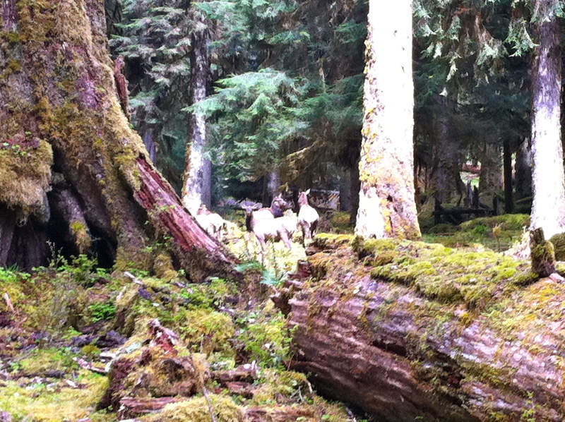
I took one last look at the mountains and made off down the trail. Today I made much better time - about 3mph, stopping only for a quick water and snack break, and to take a few pictures of the all-cow elk herds that were beside the trail. 26 hours later (the whole 24 motif is more catchy), I was back at the trailhead. As with my perennial post-backpacking tradition, I cranked up the bluegrass music and headed back down the gravel road and through rainstorms back to Portland.
A day with 6 bears, a chalet, and the mountains is a pretty good good day.
May 12 – May 13, 2011

Wilson River Trail
6 miles of hiking • 2000' elevation gain •
This is what happens when you skim trip reports for instructions but don't read carefully because "eh, you'll just figure it out when you get there"
Originally intended to do Kings via Kings Jr. Started up the old jeep road and I guess I was on the right track but turned back too soon because things were looking untrodden so I thought I went too far. After finding several side trails that led to nowhere, I went back down to Wilson.
Then headed up Wilson, went up the ridge towards the regular kings trail a ways but decided to turn around. So then I found where I think Kings Jr used to end but that trail was also pretty dead end, so I turned around yet again.
Moral of the story: don't be dumb.
May 9, 2011

Hamilton Ridge
8 miles of hiking • 2000' elevation gain •
Parked at the recently renamed Alexander Hamilton Trailhead.
Pretty windy and rainy so I went up and back the back side just to the ridge - a good call as it was cold, wet and gale-r-ific at the top.
May 6, 2011

Franklin Ridge Loop
12 miles of hiking • 2750' elevation gain •
Wish I had a real camera with me - the gorge was looking super awesome today with the sun breaks.
May 2, 2011

Elowah/Upper McCord
3.5 miles of hiking • 500' elevation gain •
If you had 1 hr...
(and another 15 min of procrastination time to upload photos and make a wenthiking entry...)
April 30, 2011

Abiqua Falls
4 miles of hiking • 750' elevation gain •
Four wheeling and target shooting country today.
Met an old guy on the gravel road, drinking a bud, propped up against his truck tire, who though my trekking poles were a shotgun, then was passed by another truck full of hooligans who thought they were fishing poles.
"Any trout down there?"
April 23, 2011

Tarbell/Chinook/Hidden Falls Hike/Snowshoe
17.5 miles of hiking • 3000' elevation gain •
The plan was to go start at the Tarbell picnic area and head up to Silver Star, but I had to leave by 2p to get some work done. Started in at around 8a and much of the ground was frozen at Tarbell TH (1800ft). Saw two horses, two deer and heard an owl that just wouldn't quit. Snow starts around 2800 ft. When I got to the Silver Star trail from Chinook the snow was super crusty and blown over the trail/road (awkward sidehilling, but better in the afternoon, I'm sure), so I knew it was time to bail. So I headed down to Hidden Falls (nice, but not worth its own trip) real quick and then headed back, just making my 2p goal.
Looking very summery out there today (minus the snow, of course).
April 22, 2011

April 17, 2011

Trapper Creek/Panther Creek Falls
10.5 miles of hiking • 2000' elevation gain •
A quick Saturday morning hike turned into an out-and-back-and-out-and-back-and-out-and-back. (Lost the map! - wasn't lost, just didn't want to spend another $12.95)
The Trapper trailhead lot has about a foot of snow sitting in it, at 1200 ft. Most of the trail has about 2-5 inches here and there, and it got super postholey around 2600ft.
Panther creek falls is looking super nice.
April 15, 2011

Wild Cherry/Leif/Alder/Wildwood/Dogwood
4.5 miles of hiking • 750' elevation gain •
ATC meets baby hailstorm.
April 12, 2011

April 7 – April 8, 2011

Cannon/Wildwood/Firelane 7/Gas Line/Leif Erikson
8 miles of hiking • 1000' elevation gain •
Knocking off more of the ATC.
April 5, 2011

Angel's/Devil's/419/Foxglove Loop
11.5 miles of hiking • 3500' elevation gain •
Saw: A quadrillium! And, of course, hoards of people (I'm gonna bring a hotdog cart up there and sell for $5 a dog)
Heard: 2 grouse thump sessions
Hat tip to Vanmarmot for the idea.
April 2, 2011

Siouxon Creek/Horseshoe/Chinook Falls
20.5 miles of hiking • 2500' elevation gain •
Saw: Owl (Spotted?), Elk, Rough Skinned Newt
After seeing the report last week, I had to make it up there. I highly recommend going tomorrow or Sunday if you can, as the recent temps and melt have made the waterfalls super great!
Just be careful of the trail/creek/waterfall just before the Chinook bridge, should you go in the next two days - it's best to cross using the green protruding log about 50 ft up the waterfall, or you can cross higher and bushwhack it. Both Chinook and Wildcat creeks, and of course Siouxon, are unsafe to pass (again, assuming current water levels)
The roads are free from snow, as is the trail for the first several miles. ATS (annoying trail snow) starts at 1800ft on Siouxon and 2300ft on Horseshoe Ridge.
Given the current water levels, I'd recommend trail runners - you're gonna get your feet wet, boots or not, as there are several places where the trail becomes a creek (or waterfall) - may as well have the quicker drying option.
Also a recommendation to start with the first 3 miles, parking at the hairpin - a really nice forest walk.
March 31, 2011


Fletcher Creek Canyon, Kalaloch Beach
3 miles of hiking • 500' elevation gain •
I knew, after looking at current conditions in the Olympics, that I may not get too far on my goal of the Enchanted Valley on the East Quinault River. Hat tip to Kyle for the recommendation. On paper everything looked good. Sure, there were 40 blowdowns between the trailhead and mi 13. Sure, there was snow at higher elevations. But what I didn't know is how soon I'd be bailing. Probably the first time to ever bail before even making it to the trailhead.
I arrived at the Quinault winter ranger station, aka the forest service office that has to deal with the crazy brand of hiker that wants to hike in the rainy season. When I announced my intentions that I hoped to head up the East Quinault as far as possible and stay for the night, the ranger paused for several seconds and gave me quite the look. Who in their right mind backpacks in pouring rain? (Mind you this was a forest service ranger) She confirmed that there were indeed several difficult blowdowns on the trail, but I put my best "experienced hiker" face on, and got a permit, only after several comments about "how rainy it was," "how wet I'll get" and "you can always just stay at the campground to get your adventure in the rain."
I headed down the half-decent gravel road towards the Graves Creek Trailhead at 600ft. The NWS forecast, with the nifty elevation feature set to 2000ft, called for highs of 46 and lows of 38 for the next few days, so I thought surely I'll be able to get to the trailhead, as it's much lower. Needless to say, it started to sleet at about 400 ft and 1/4 mi from the trailhead, my car temp read 31 degrees, and there was high water on the road that looked ominous for my little car. The NWS elevation-temperature estimates have been fairly accurate in other places, so I can only imagine that those canyons act as giant cold sinks. Knowing that I wouldn't stay the night as snow began accumulating on the ground, and I didn't want to get my car stuck 7 miles from people and no cell, I decided to turn around there. Not an easy choice when you drive up that far, but I made the best of it.
March 24, 2011


March 4, 2011


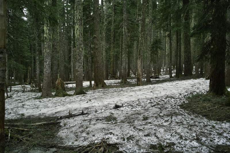
Santiam Pass Snowshoe
5 miles of hiking • 750' elevation gain •
Perfect snow for snowshoeing down at Santiam Pass yesterday. The squeaky kind. Seeing clear skies in the forecast, I thought I'd head down and enjoy the weather. Needless to say, no clear skies, but some great new snow. My nerves were rattled when, after missing the turn and passing the 20/22 intersection, amidst strong winds and blowing snow, a Ford Explorer spun out into the oncoming traffic lane right in front of me. Scary stuff! I'd guess there were 2-4 inches of ice, and no kitty litter on that section.
The Maxwell sno-park had about 12 cars when I arrived and 30 when I left - so much for avoiding the crowds at Hood! Even then, while the shelter was crowded, I still ended up breaking new trail for about half the trip. A great place to go after new snow.
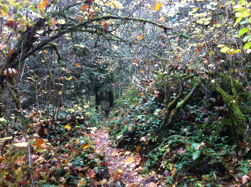
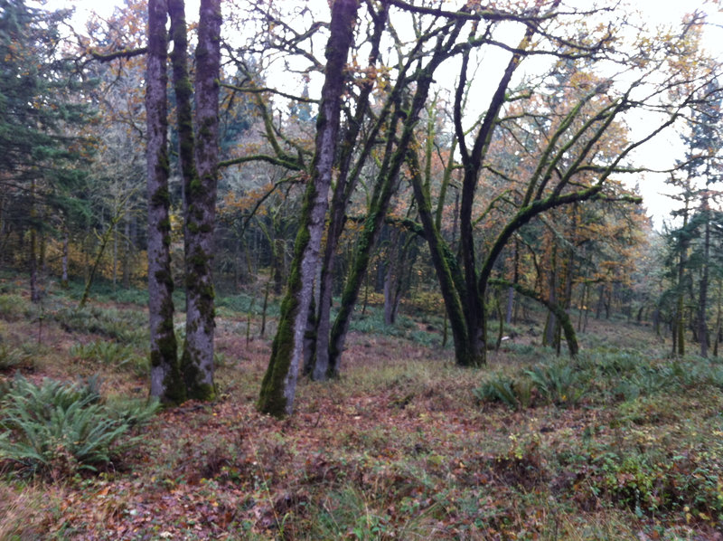
February 18, 2011


PCT/Herman Pinnacles/Pacific Crest Falls/Dry Creek Falls
10 miles of hiking • 1250' elevation gain •
January 7, 2011