2012 Trips

 1
1
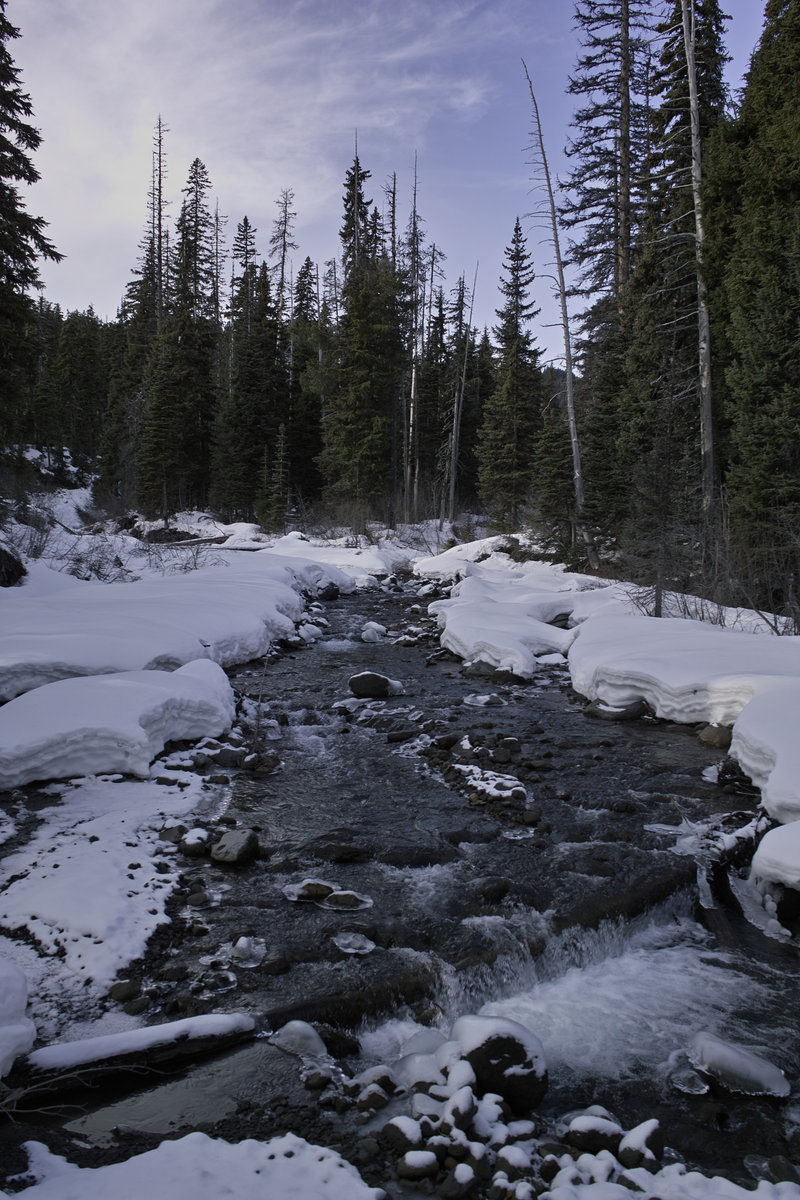
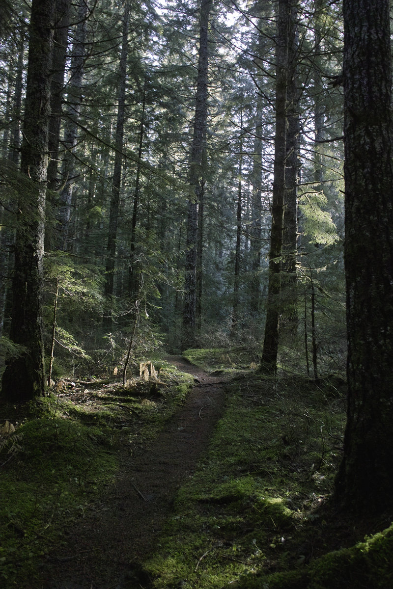
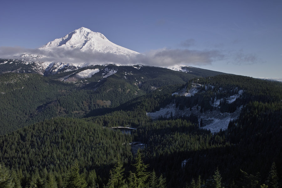
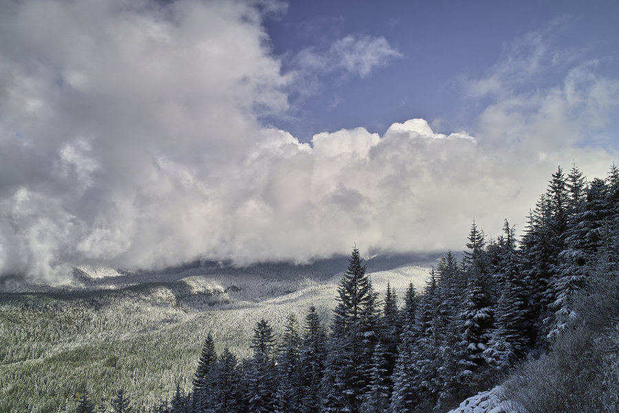
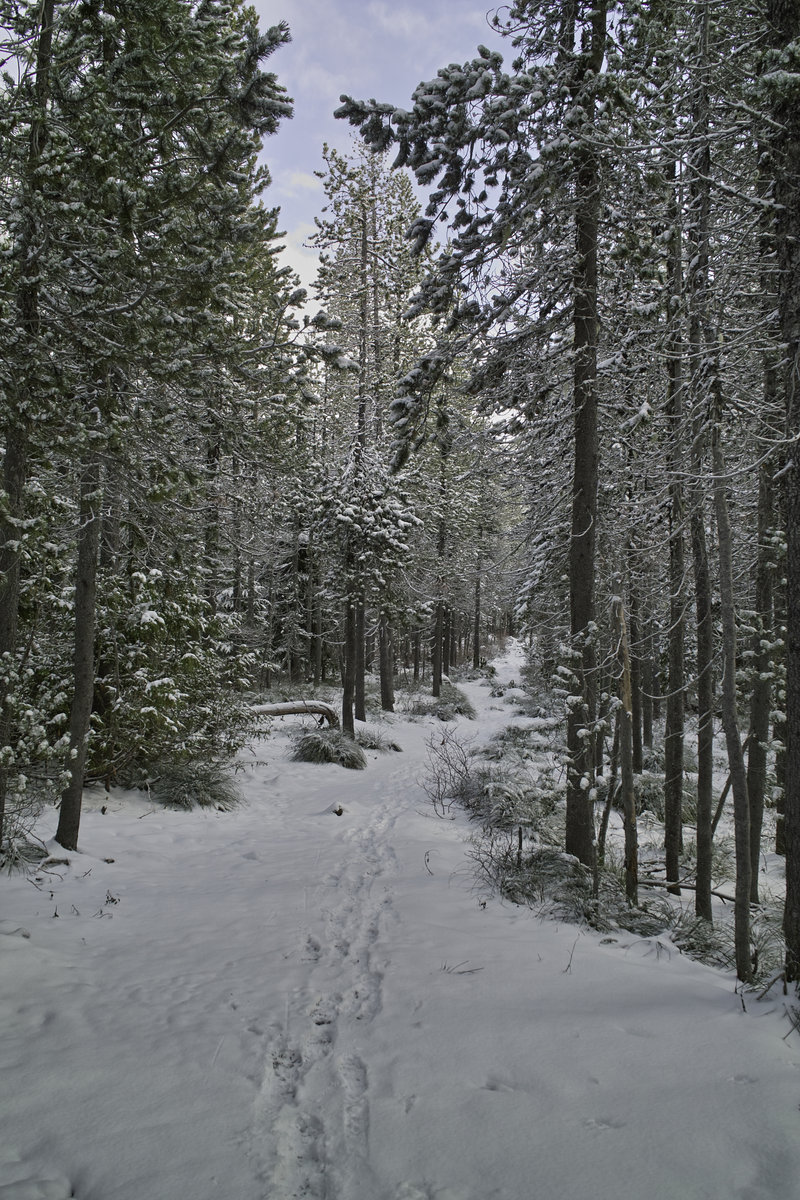
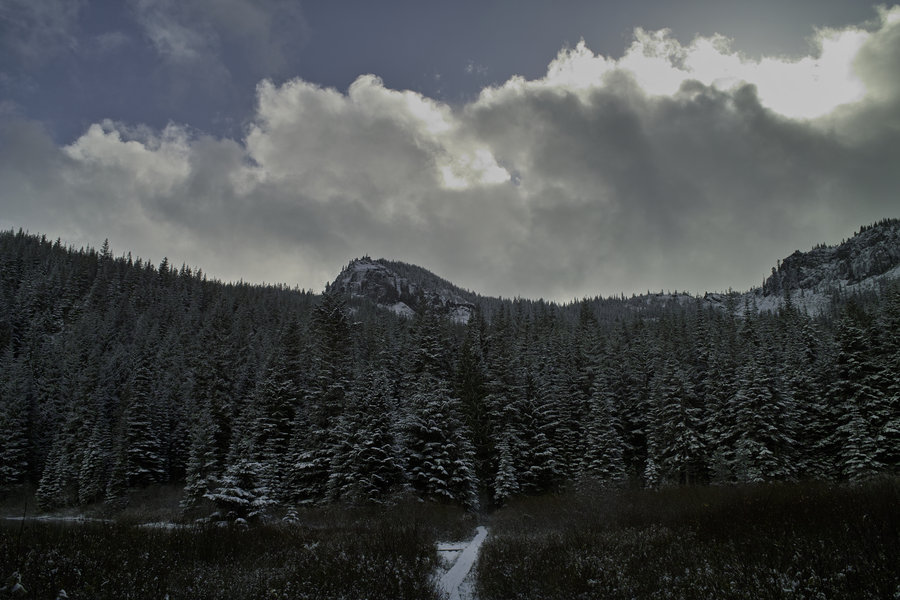
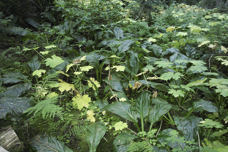
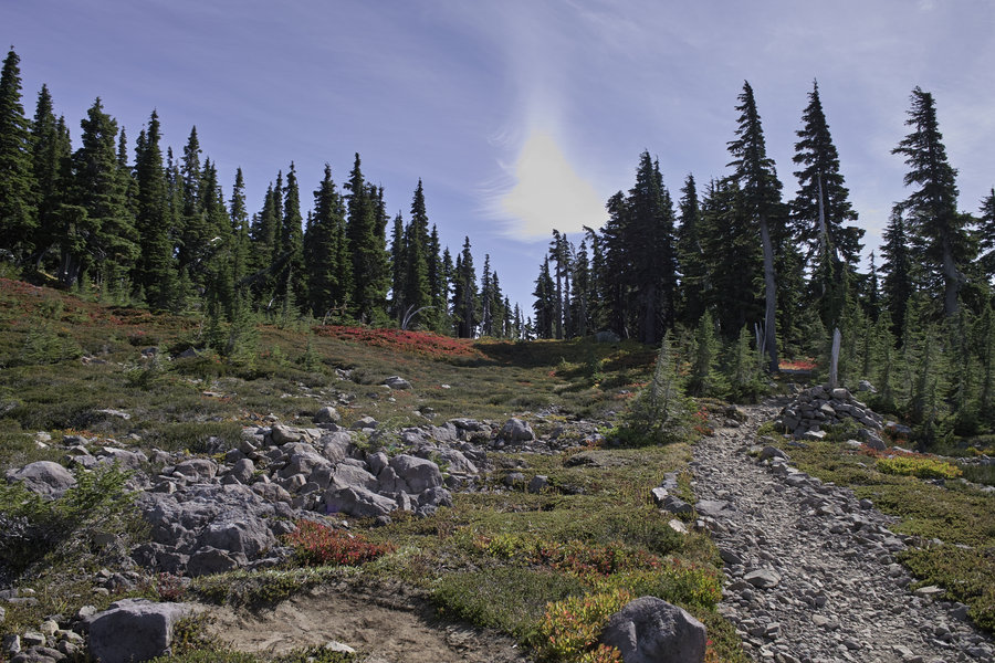
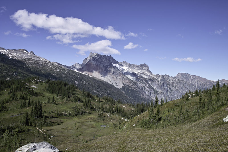
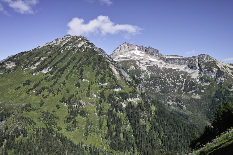
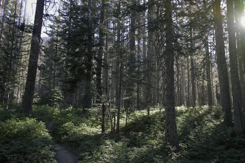
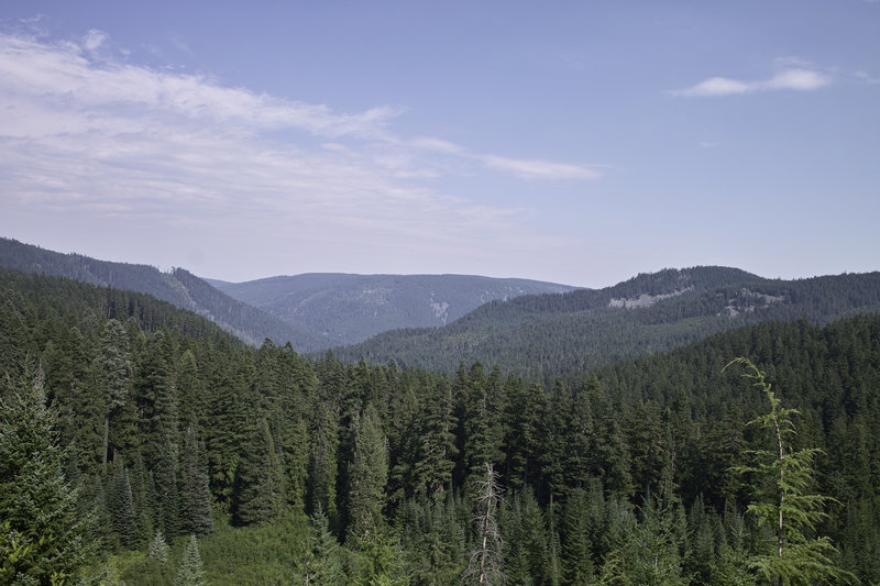
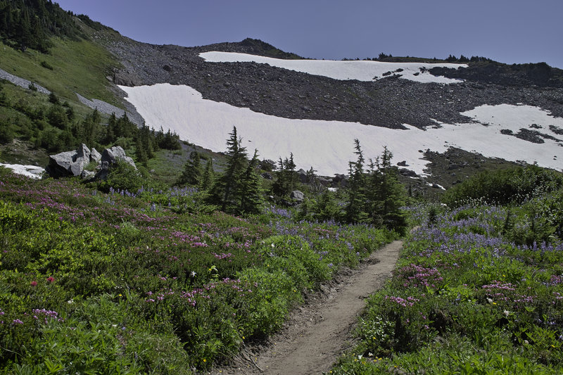
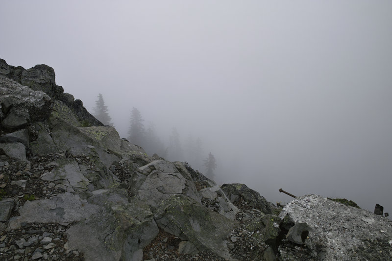
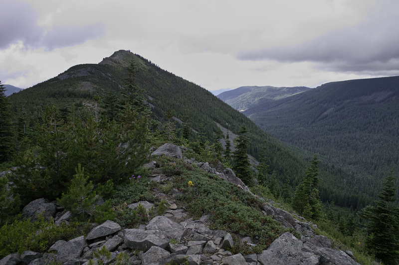
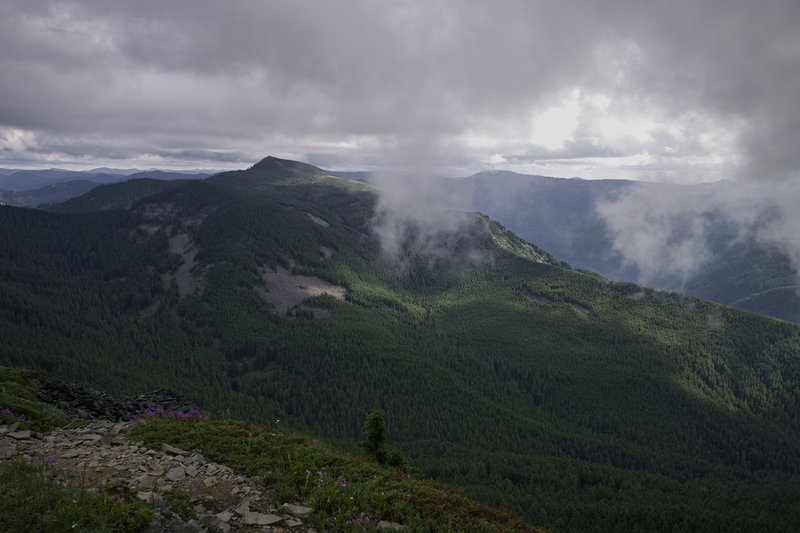
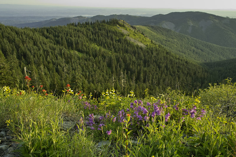
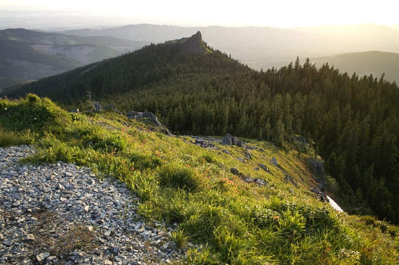
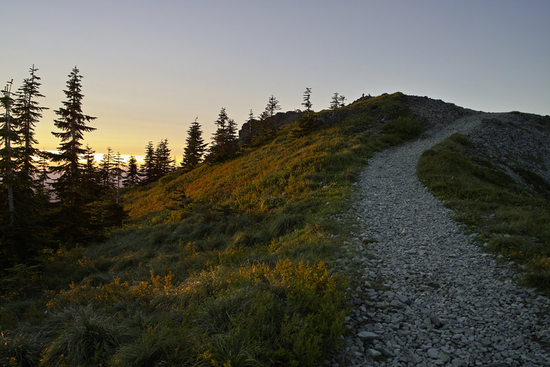
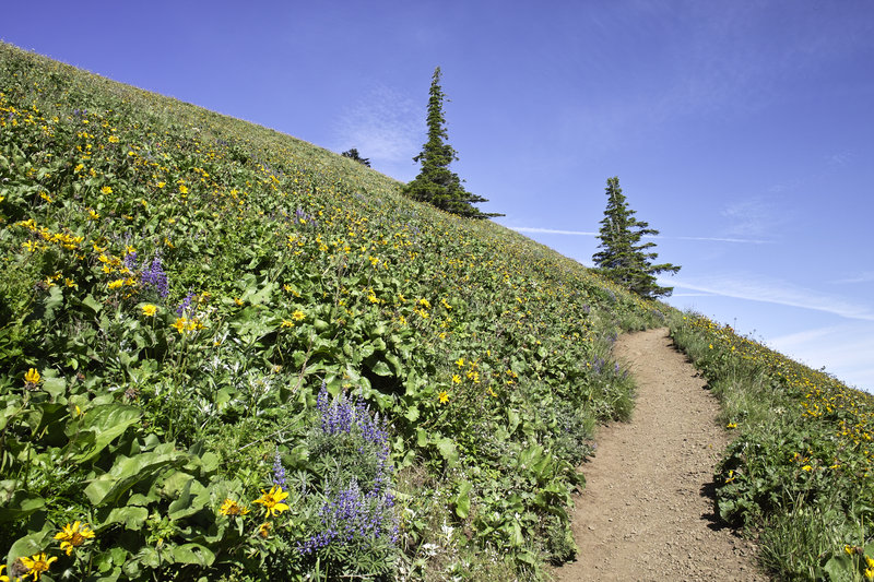
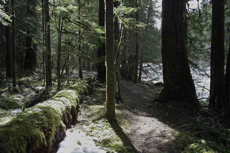
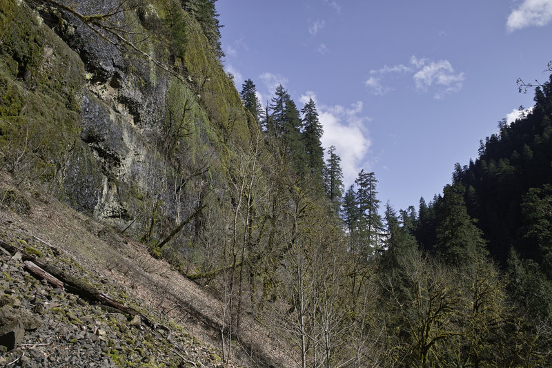
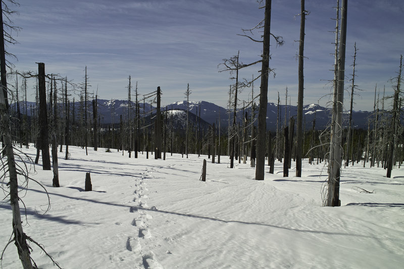
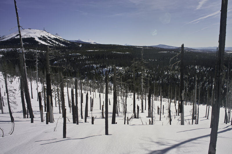
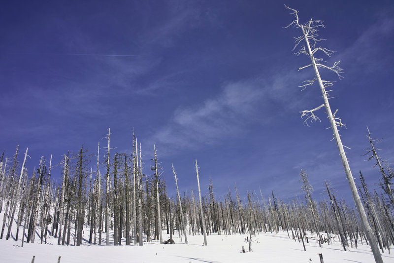
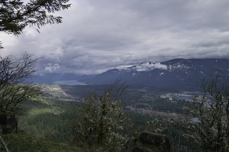
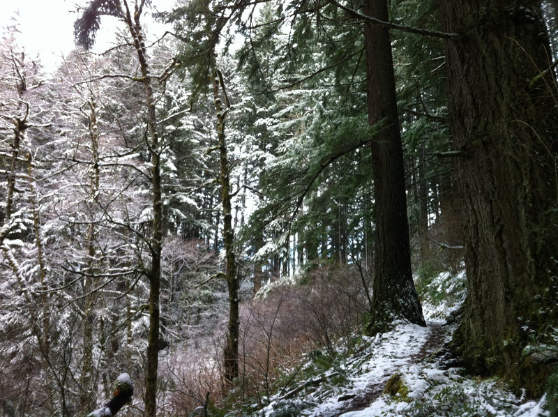
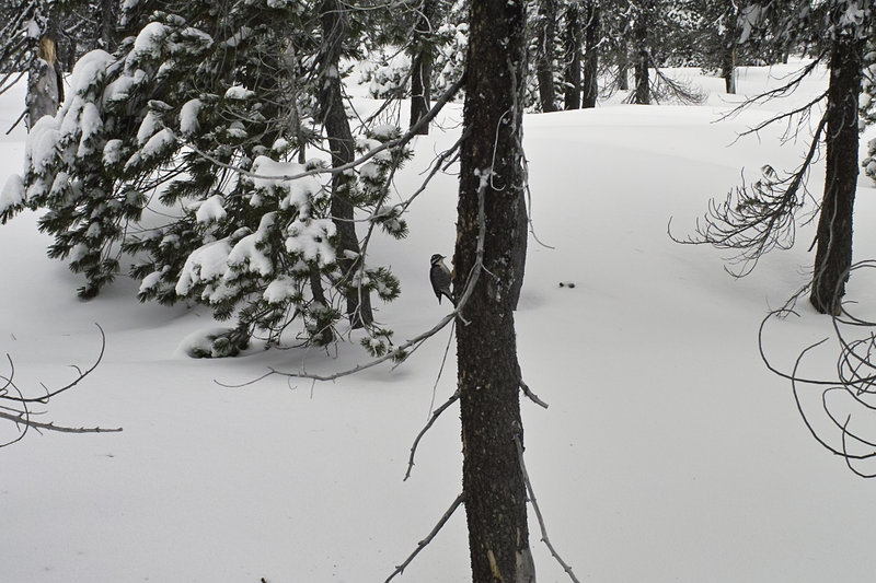
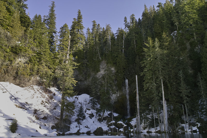
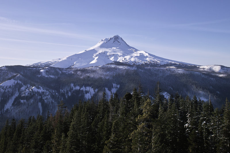
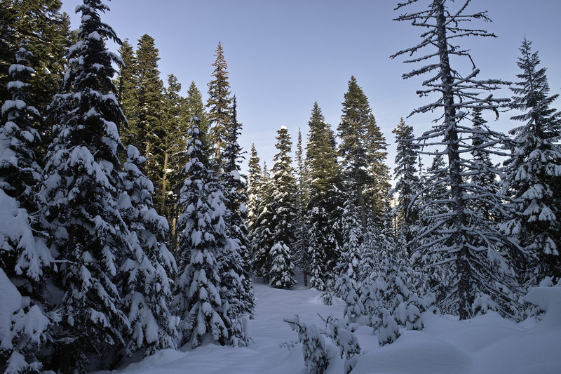
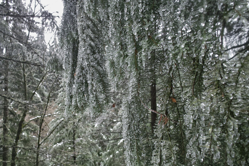
Burnt Lake to East Zigzag
9.5 miles of hiking • 2500' elevation gain •
A great little hike. A little bit of snow made for a little work and nice views up top.

November 25, 2012

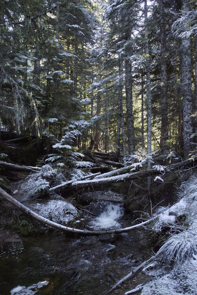
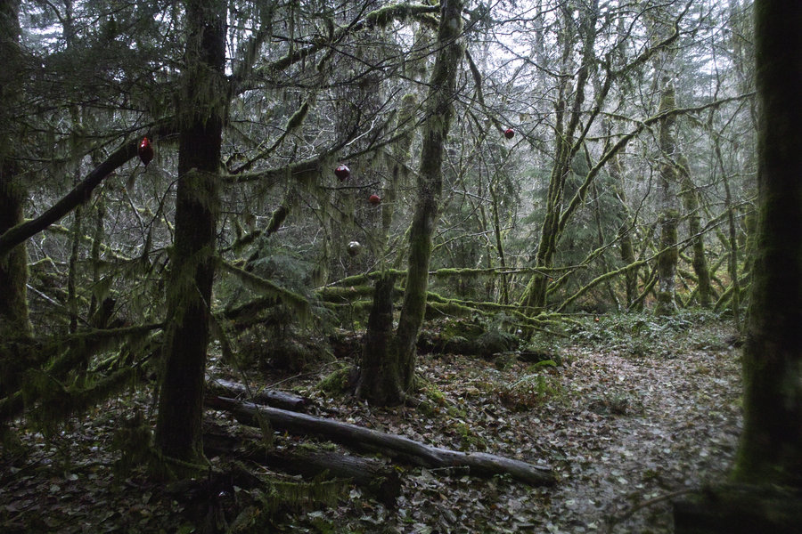
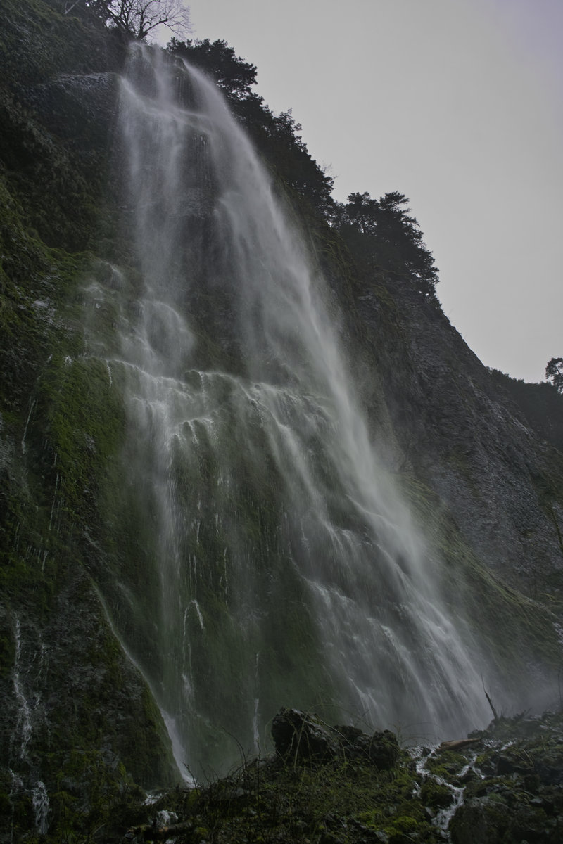
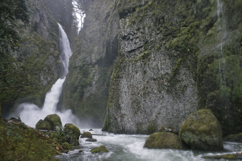
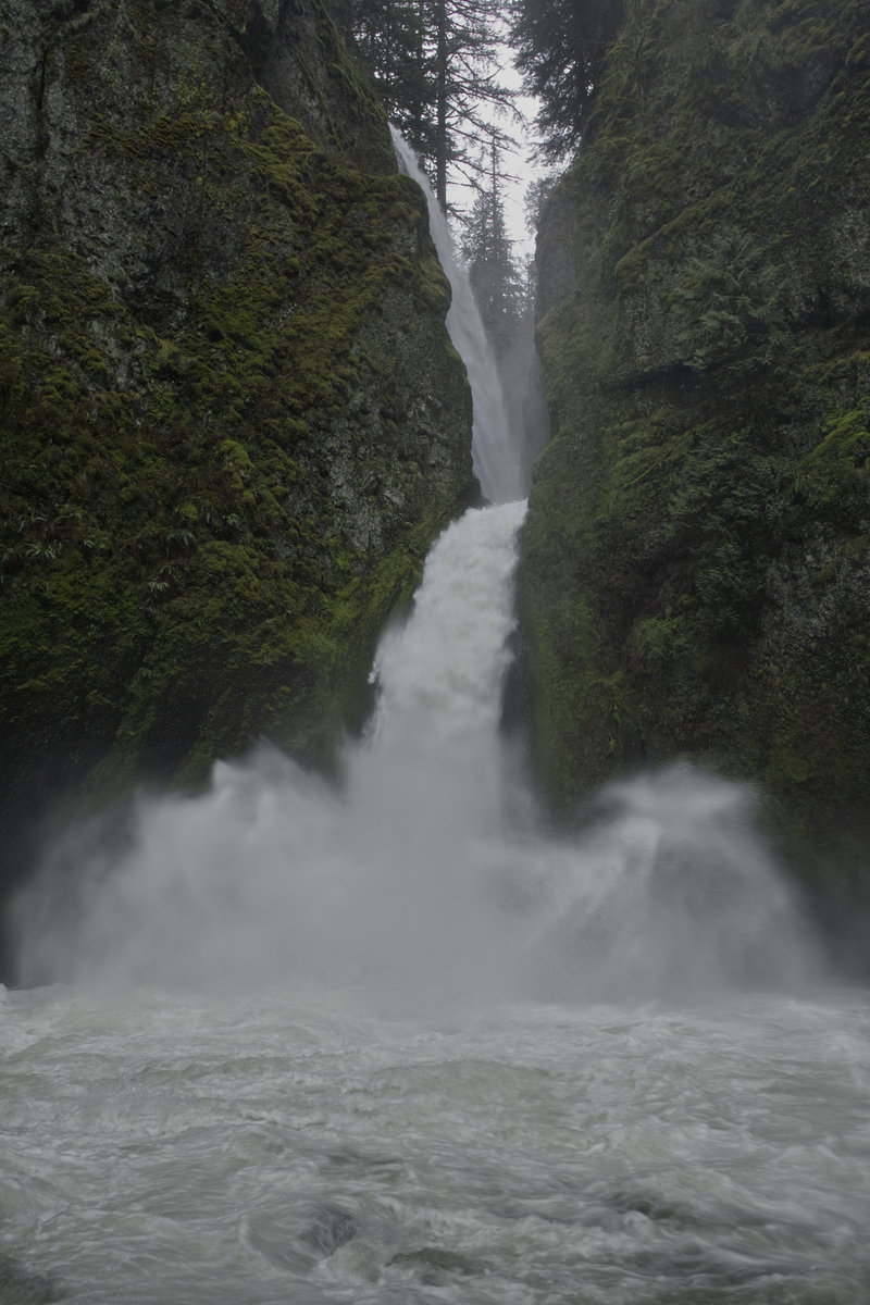
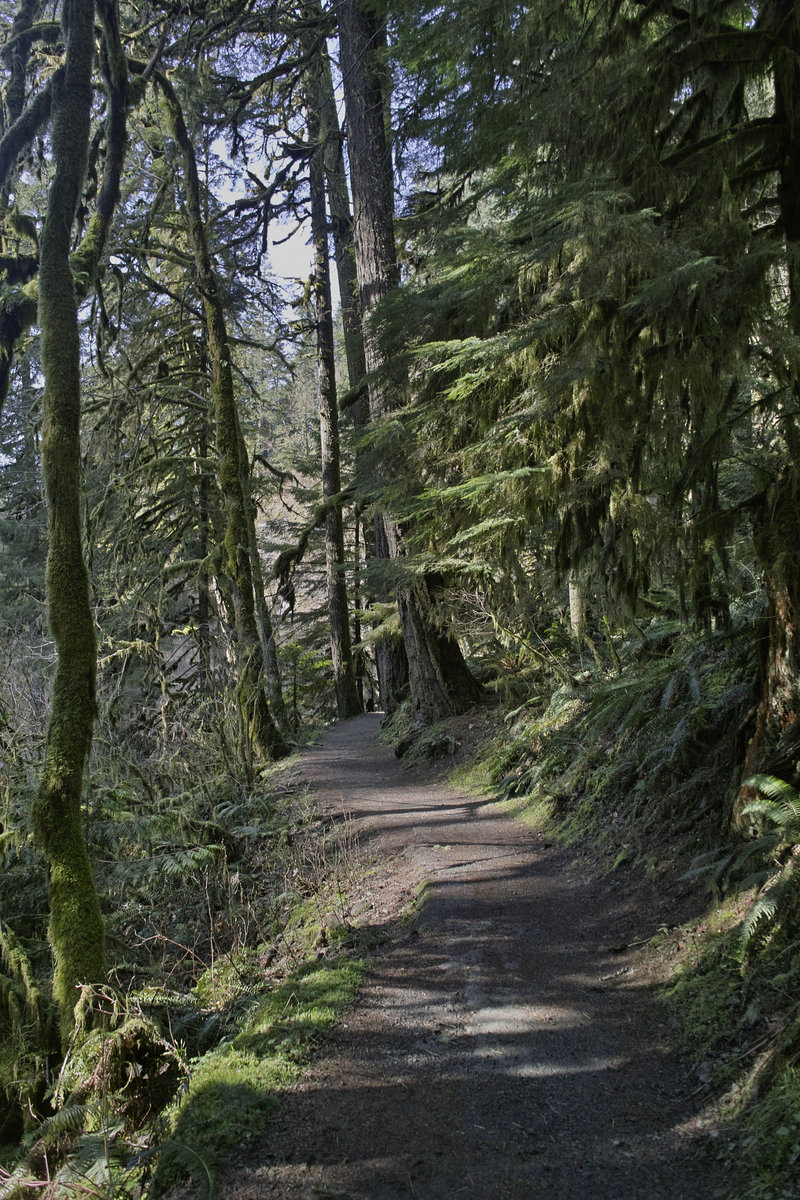
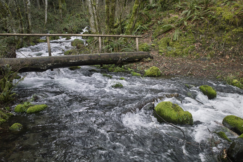
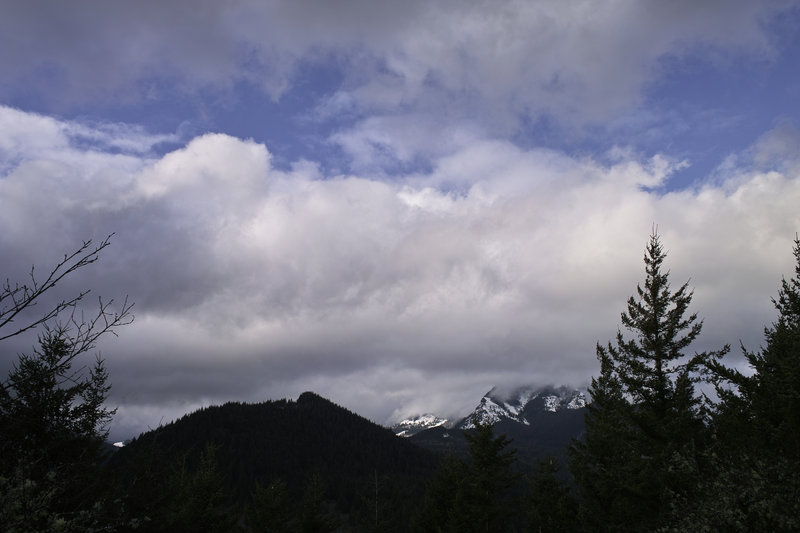
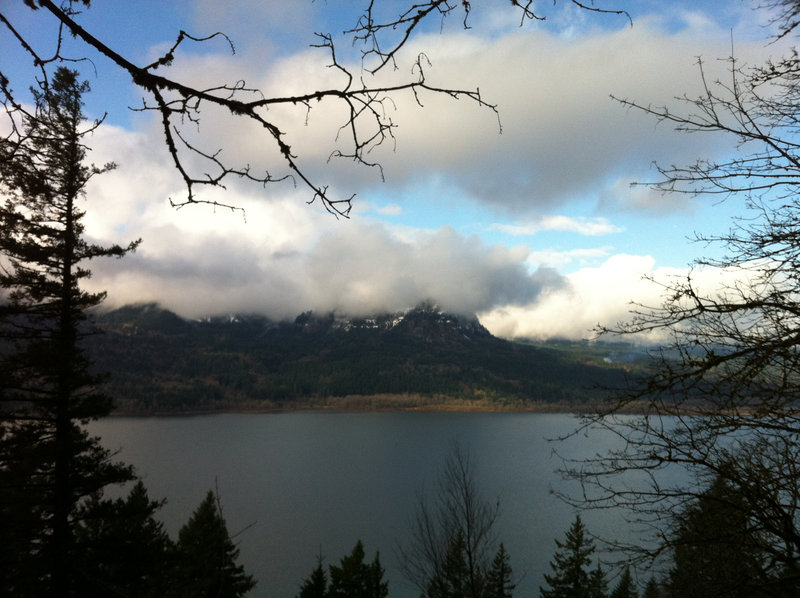
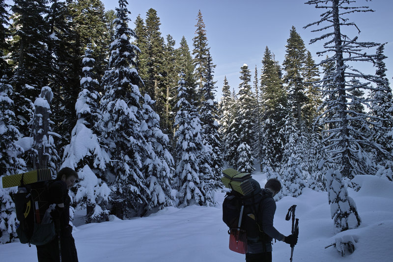
Wahkeena/Multnomah and up to Nesika Lodge
8.5 miles of hiking • 2750' elevation gain •
The usual loop plus a side trip up to Nesika Lodge to check out Christmas ornaments.
November 17, 2012

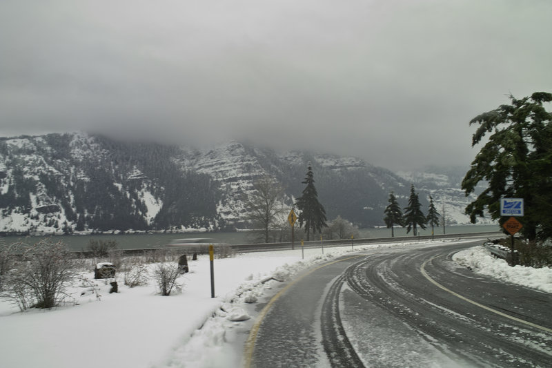
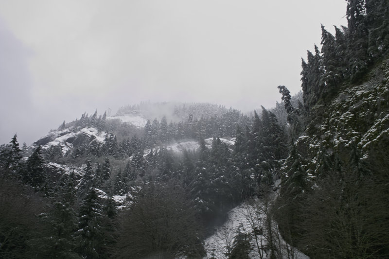
 3
3
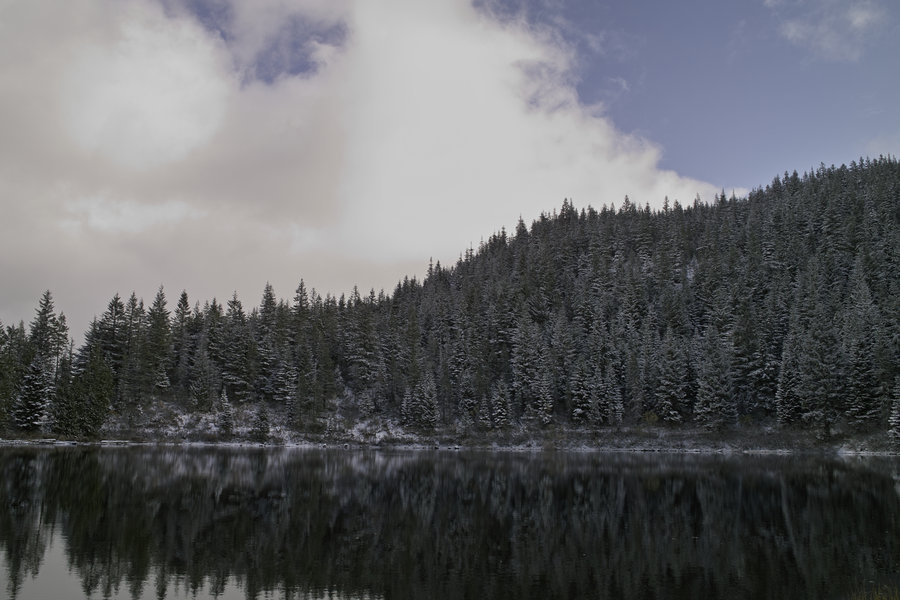
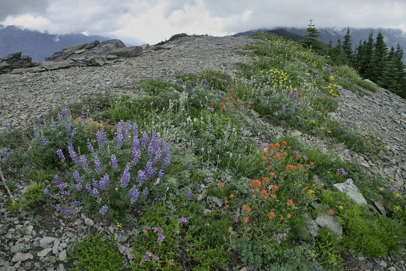
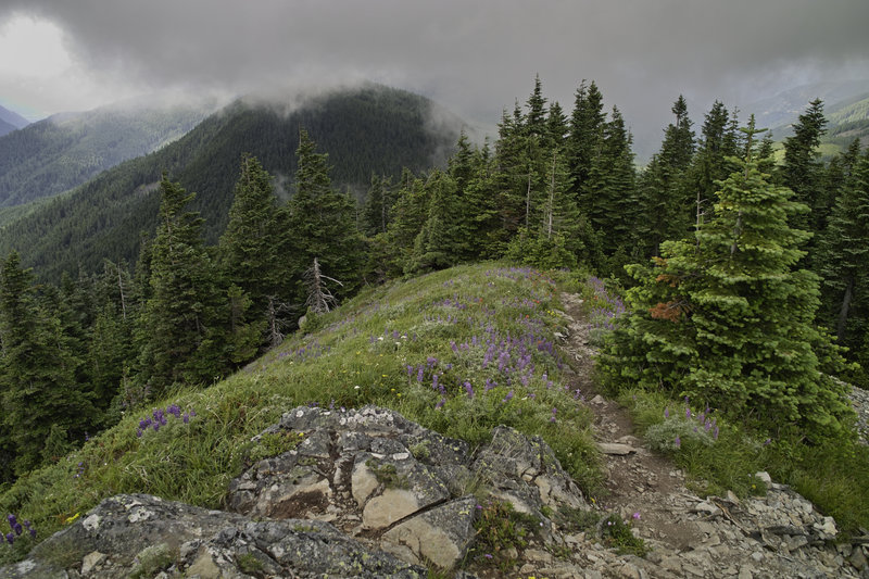
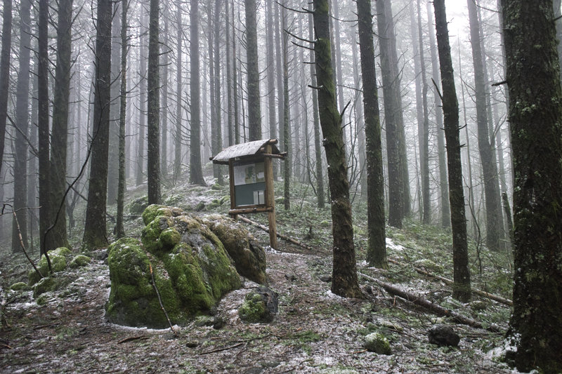
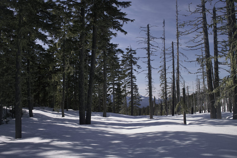
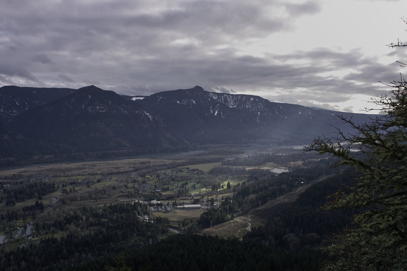
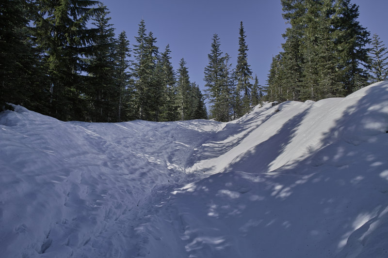
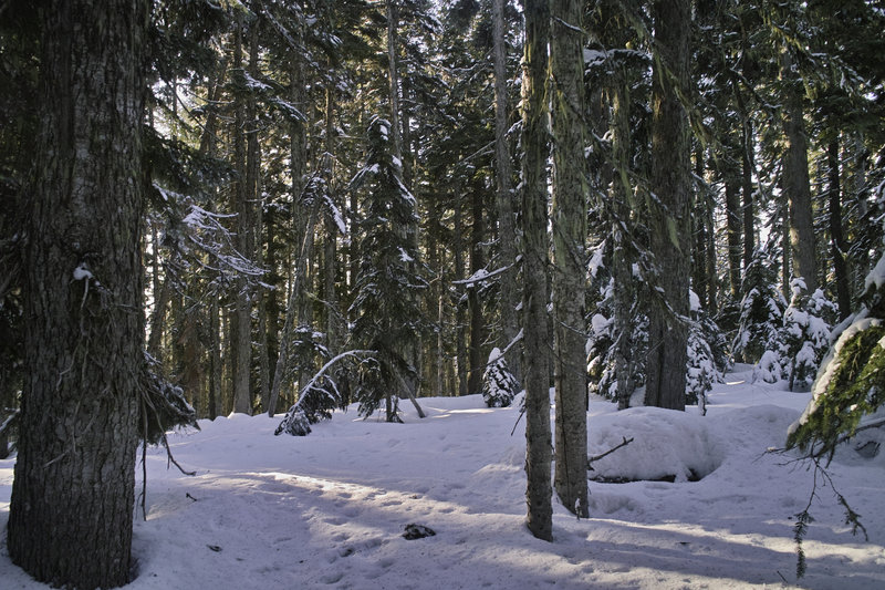
Tom, Dick & Harry
6.5 miles of hiking • 1750' elevation gain •
Mt. Hood never came out despite the nice weather. About 1-2" of snow on the ground made for a nice hike.
November 10, 2012

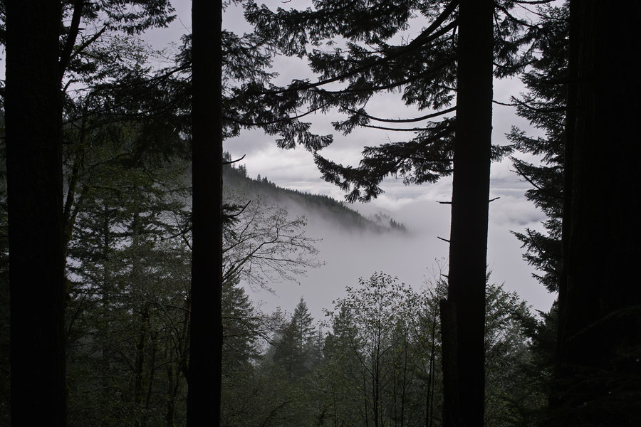
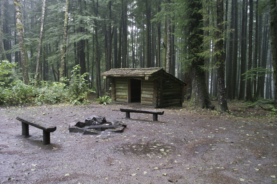
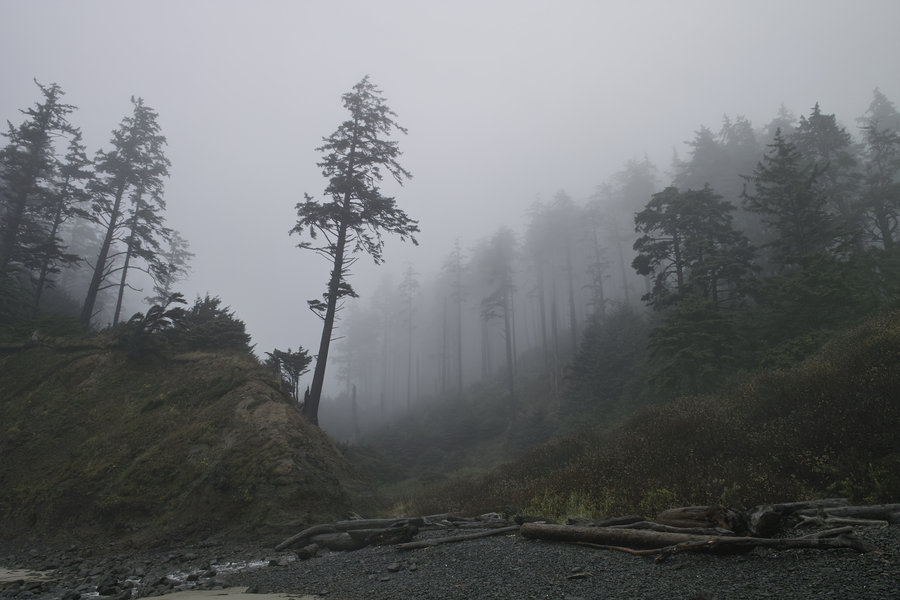
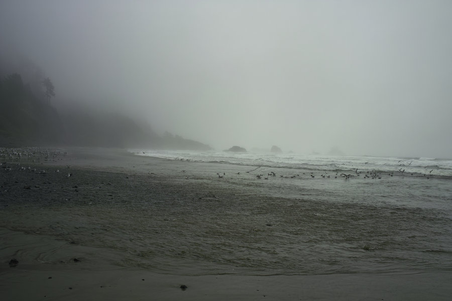
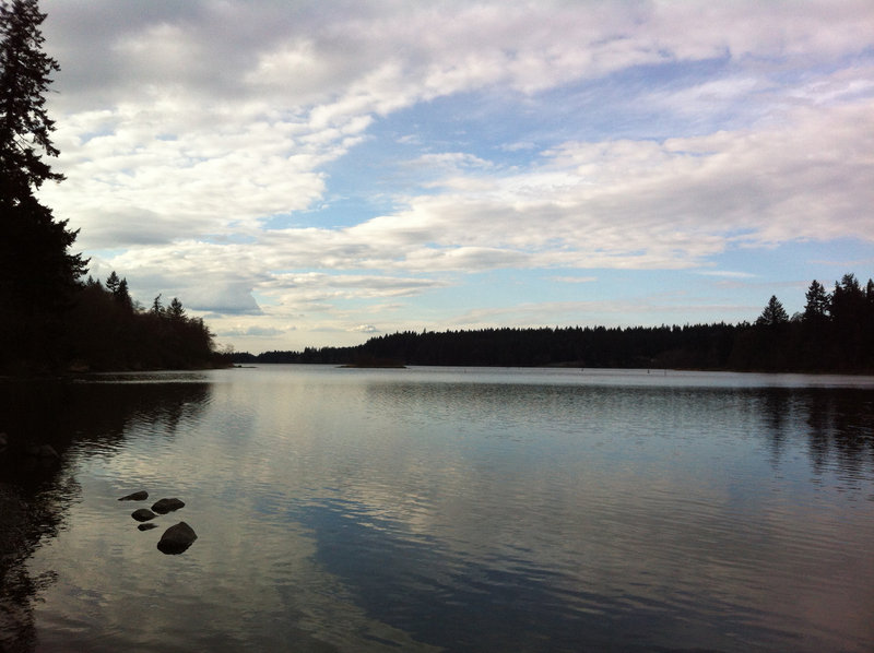
Ecola State Park
3.5 miles of hiking • 750' elevation gain • 1 night
A quick trip to the adirondack shelters in Ecola. It rained like crazy, and the shelters were a nice respite given the extreme wetness. Woke up to a slug on my sleeping bag.
October 28 – October 29, 2012


 2
2
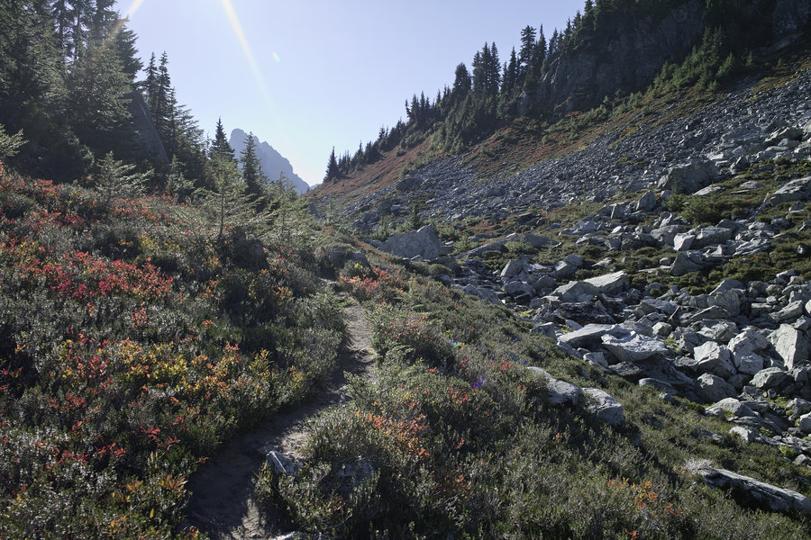
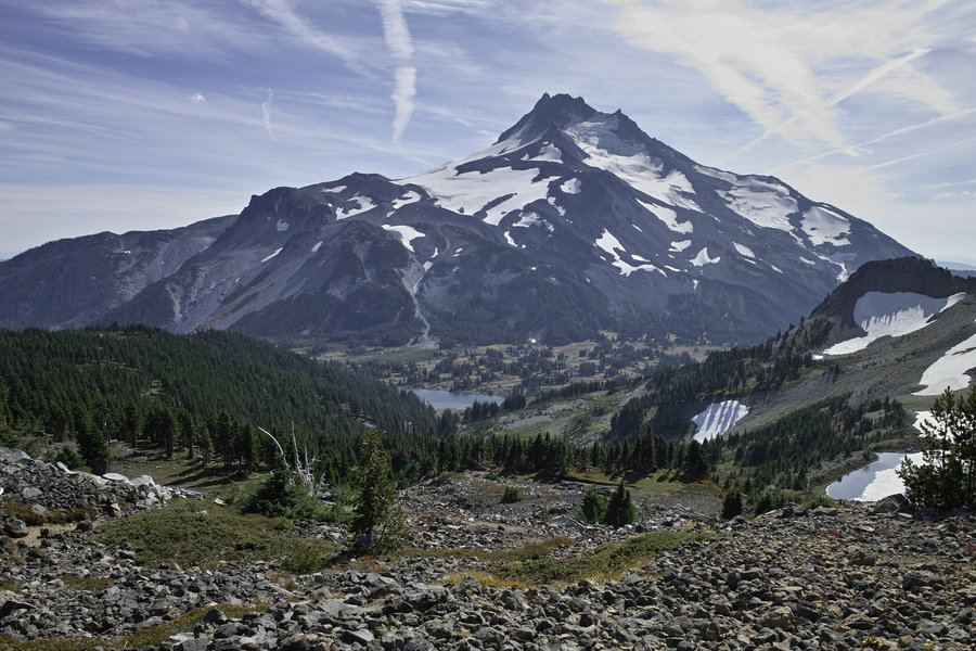
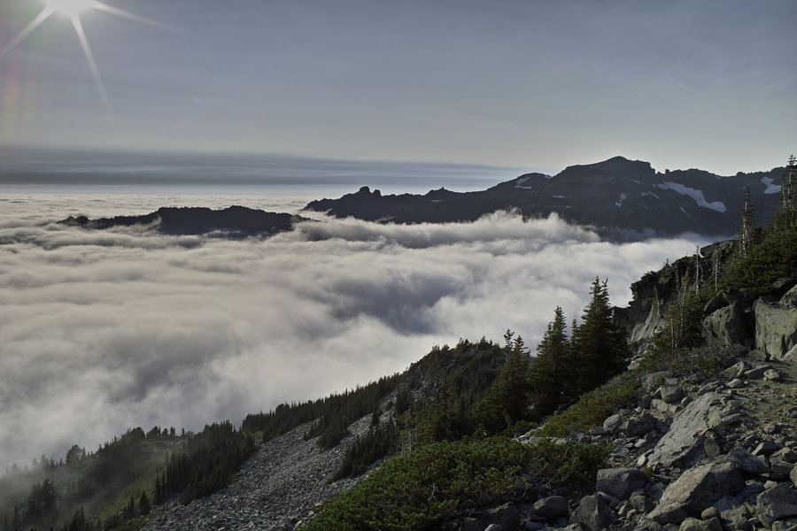
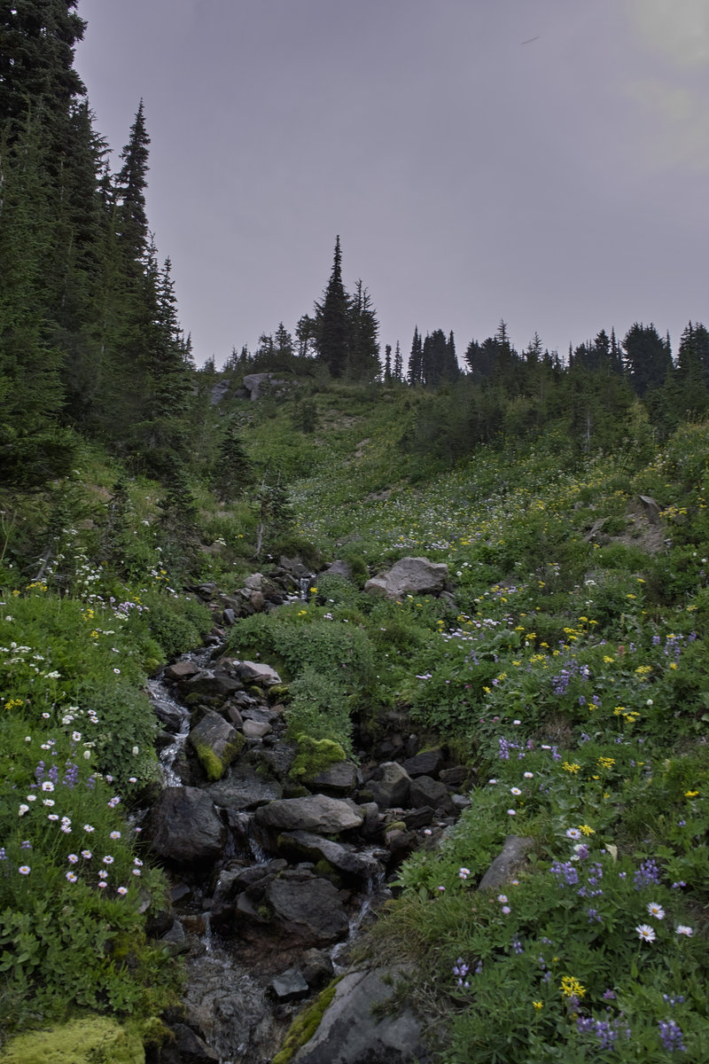
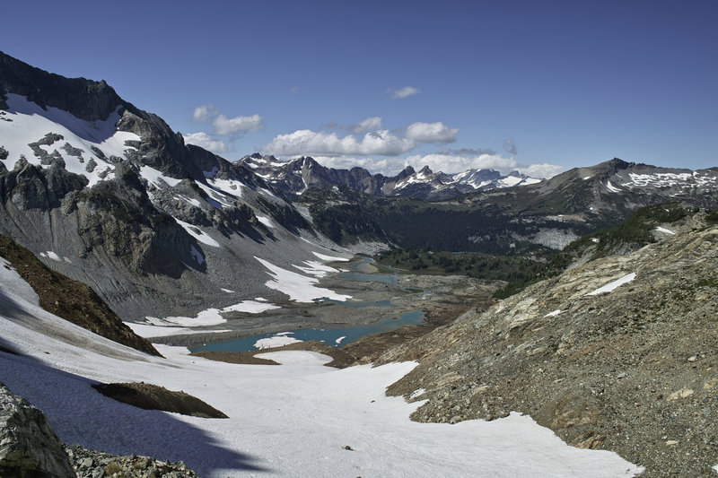
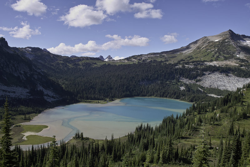
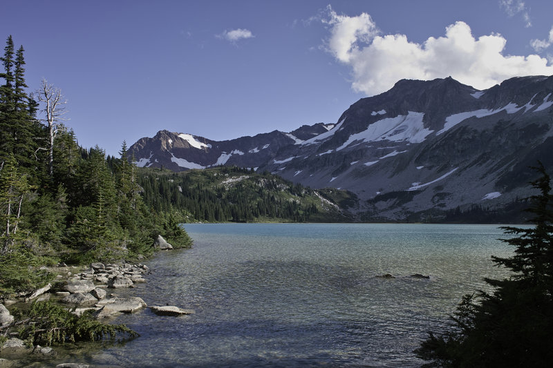
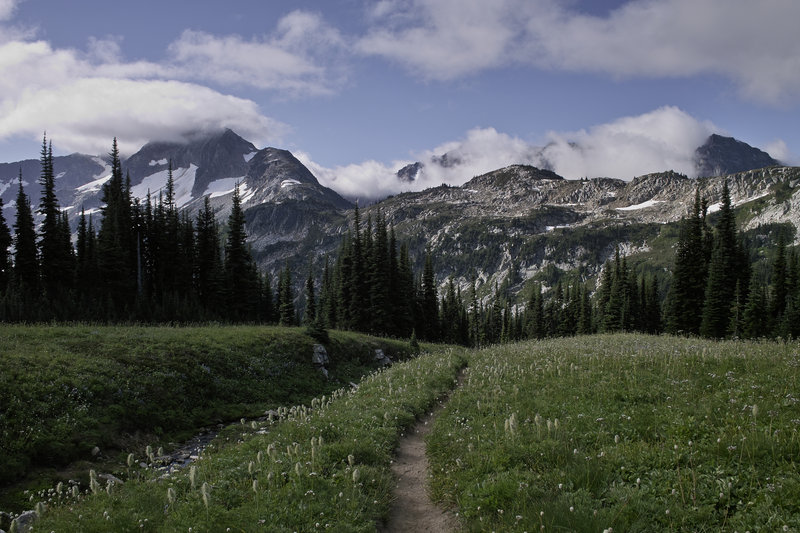
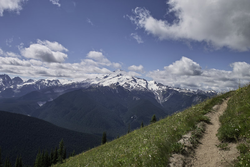
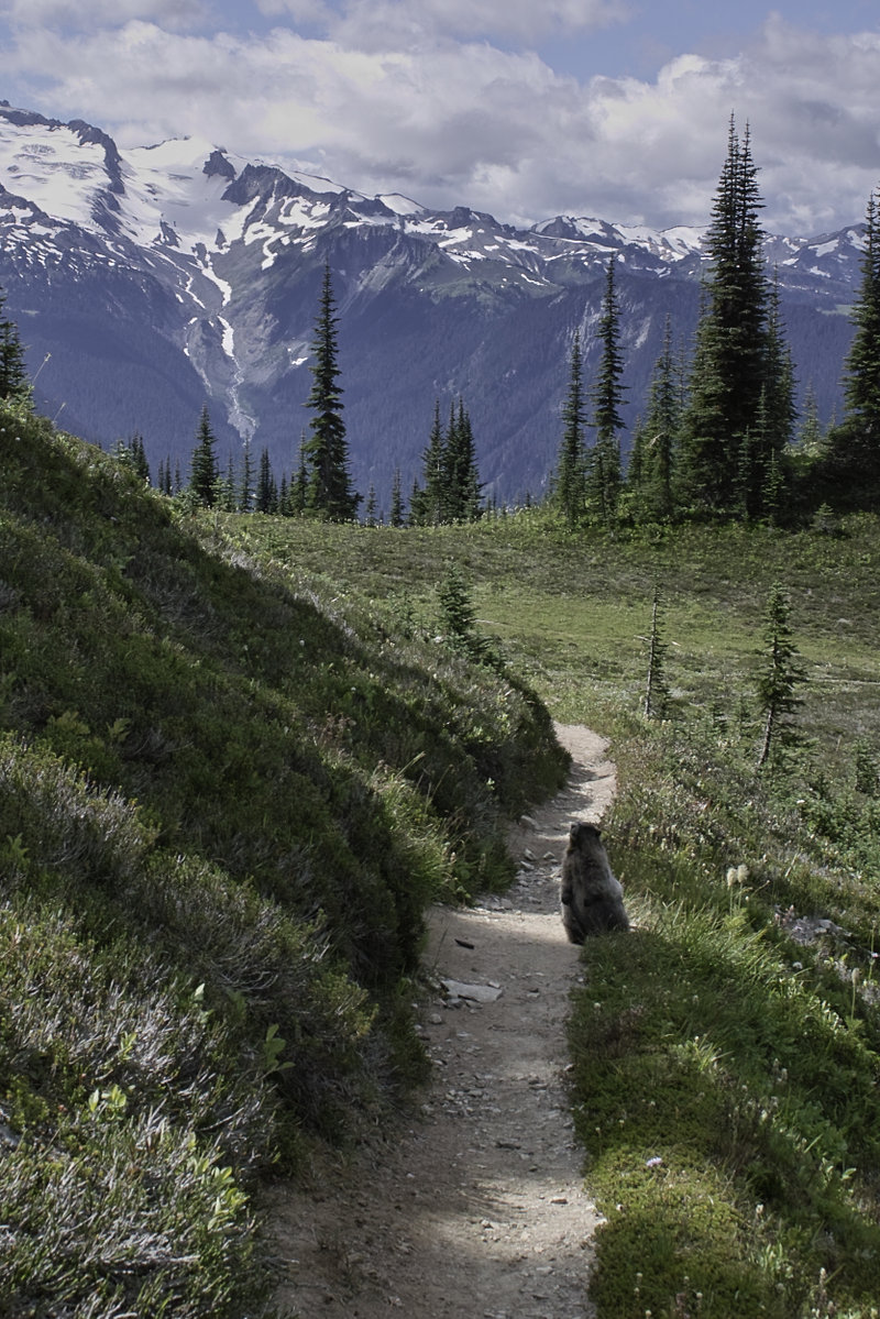
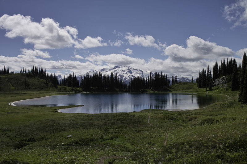
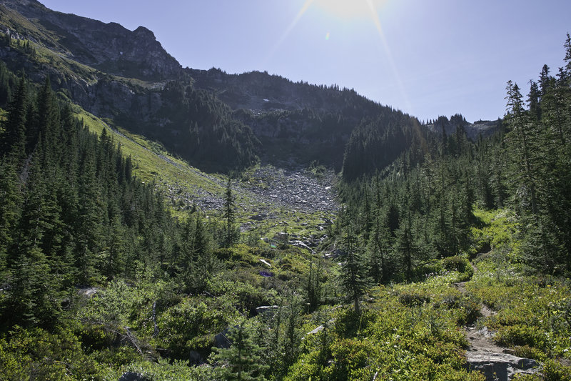
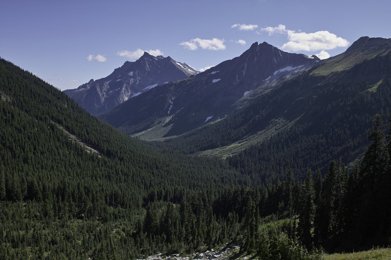
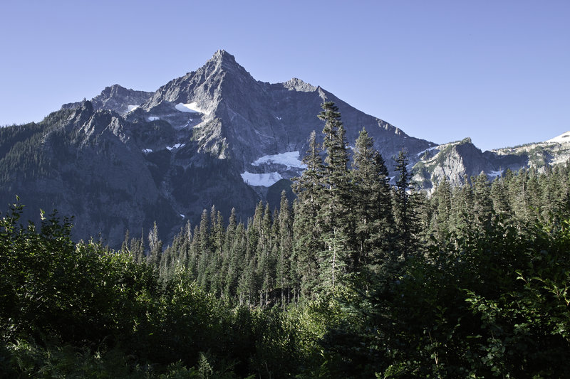
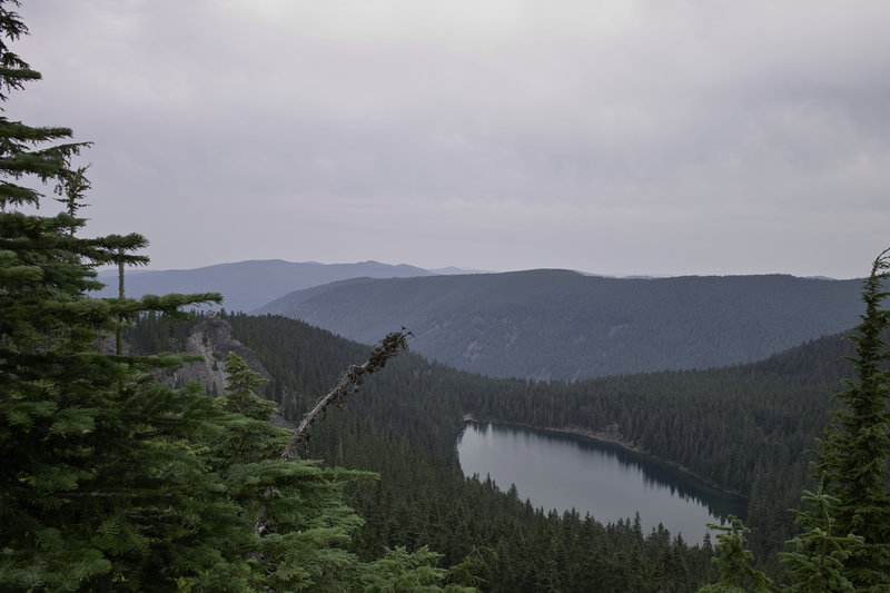
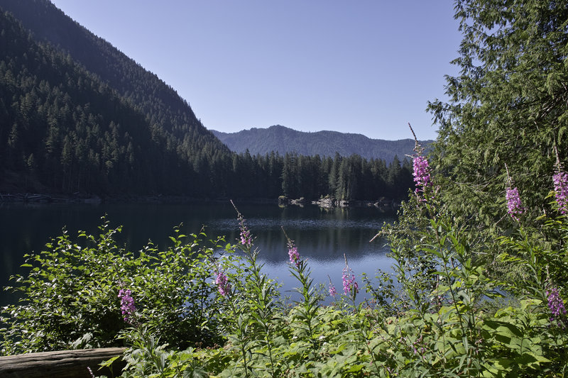
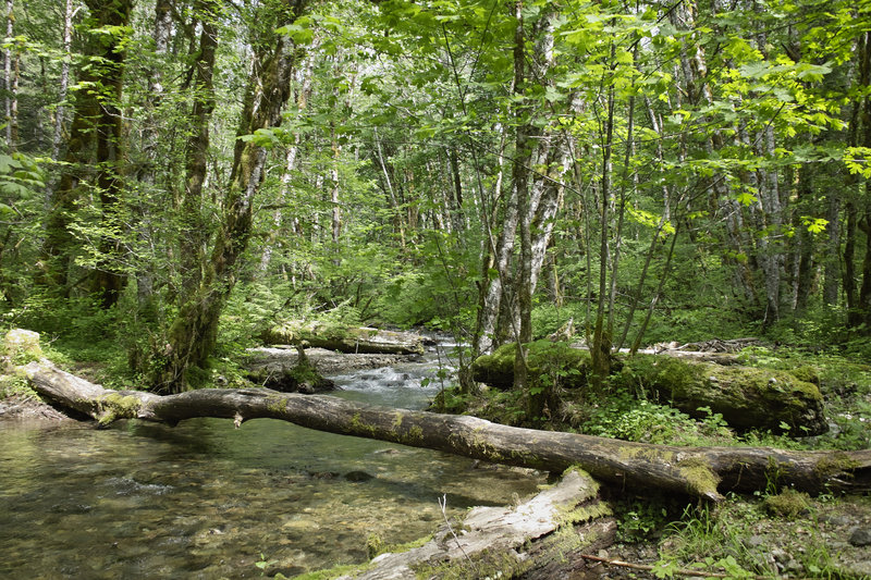
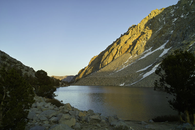
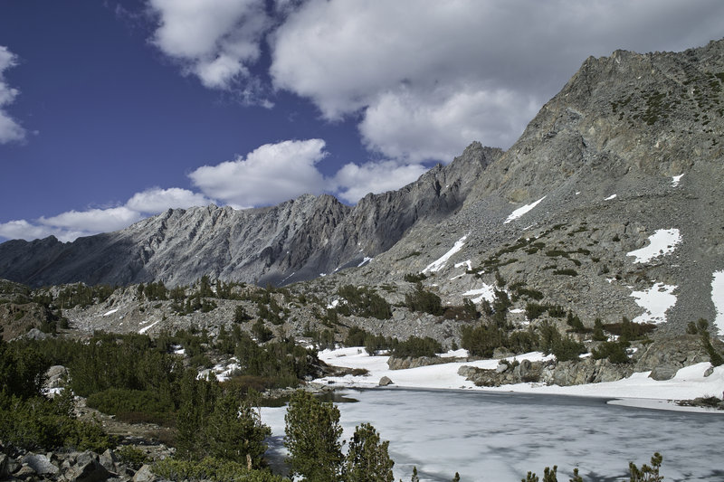
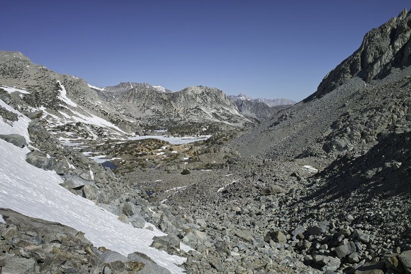
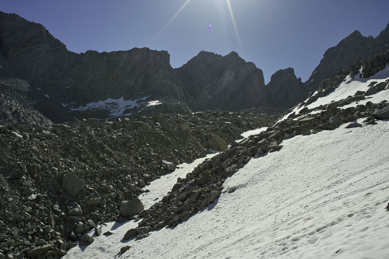
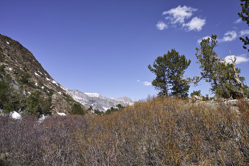
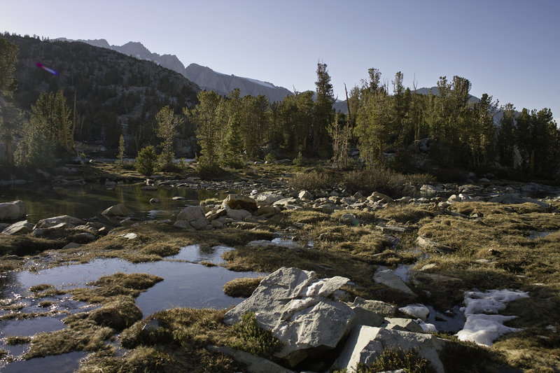
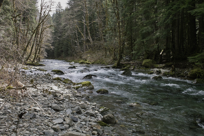
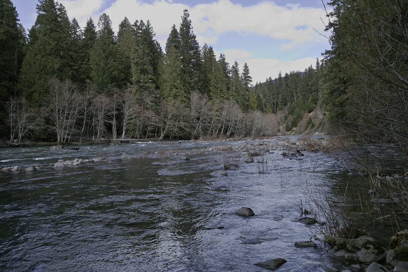
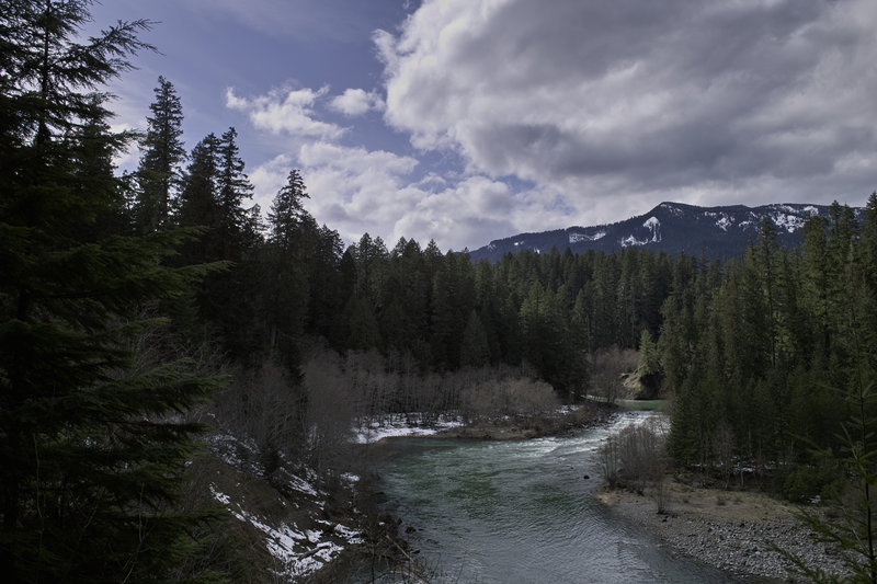
Jade Lake & Marmot Lake
31.5 miles of hiking • 8750' elevation gain • 1 night
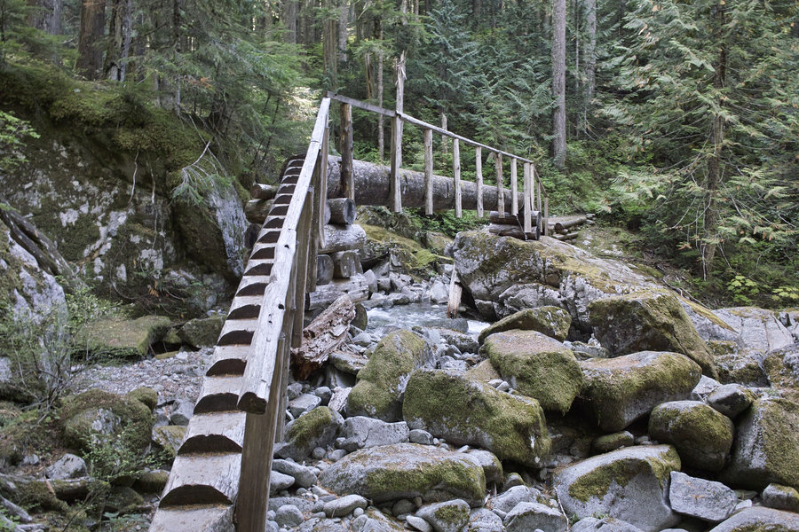
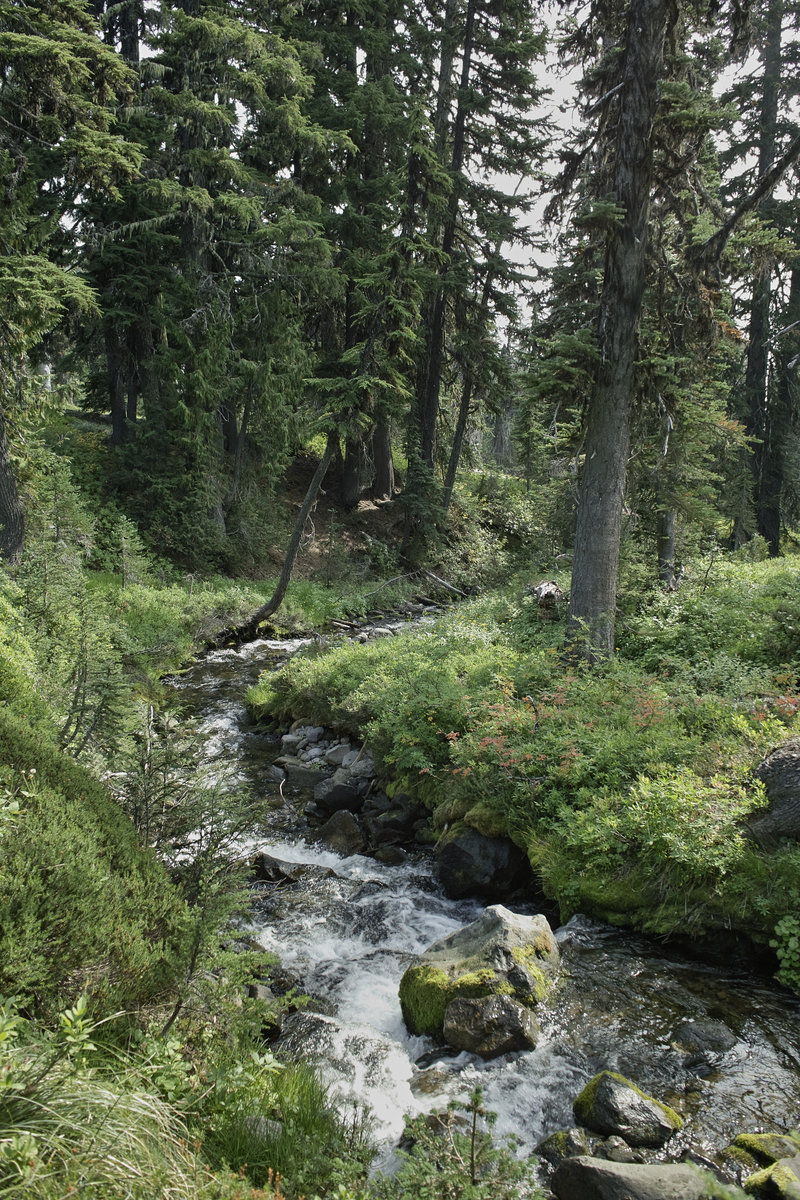
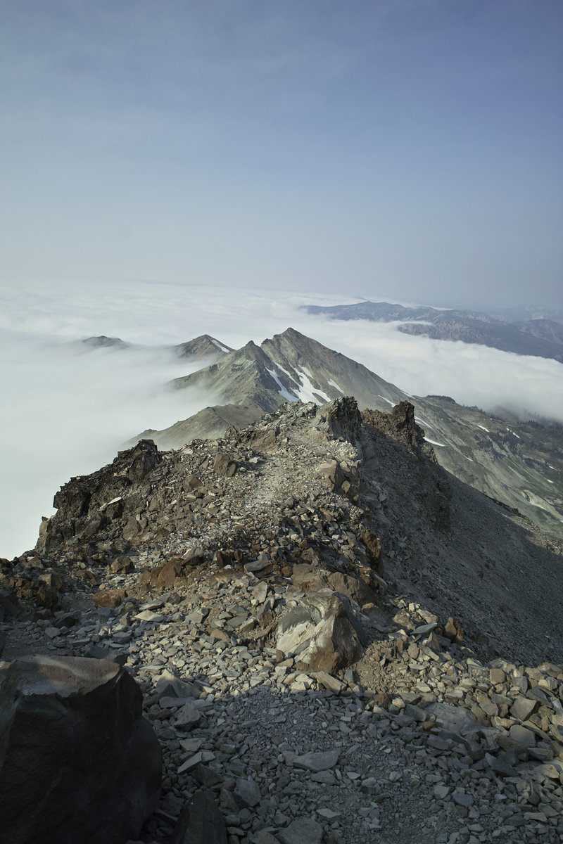
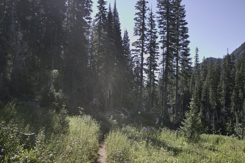
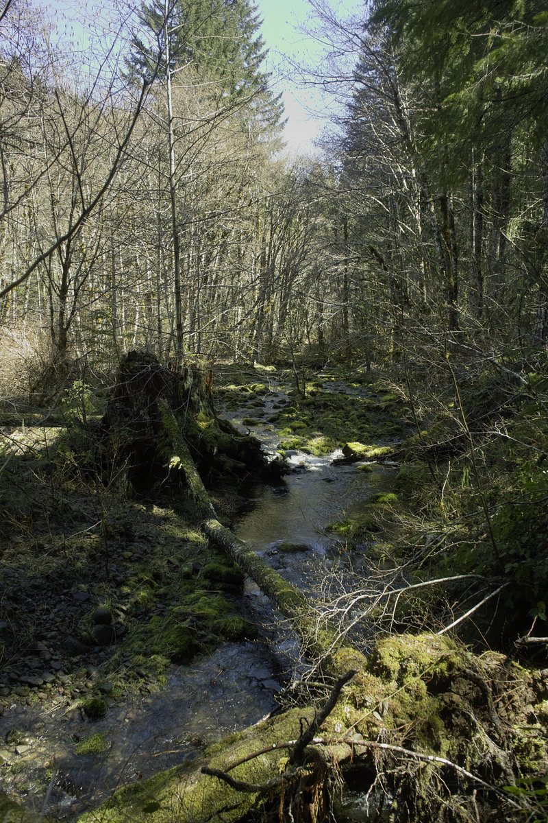
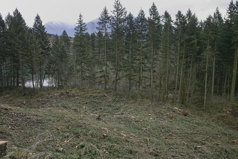
I found this hike by accident while browsing the internet for a different Marmot Lake (in ONP). A little bit longer of a drive than I wanted (about an hour outside of Seattle)—but it looked interesting, so I thought I'd check it out. It seems that many discount the hikes around the Stevens Pass/Snoqualmie Pass area, but this turned out to be a great one.
I started from the trailhead across from Deception Falls on Stevens Pass, about 2 miles outside of Snokomish. The trail climbs through the forest for about 10 miles, and strikes me of a cross between Siouxon Creek and the hike up to Larch Mountain. After hitting about the 3500' mark, the terrain becomes more sub-alpiney.
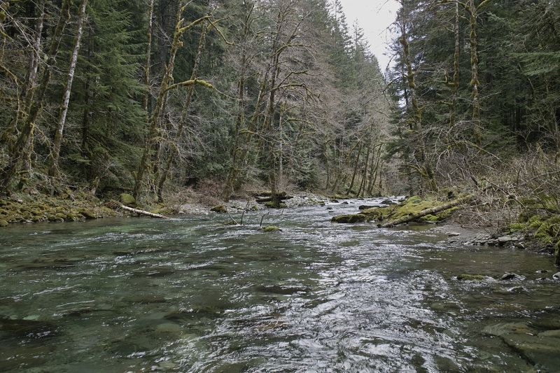
Once you pass the trail that breaks off to Deception Lakes and the PCT, the trail enters a shaded meadowy section, eventually reaching Deception pass. At Deception Pass there are nice open meadows and views of the mountains in the distance. There were several Stellar Jays and Grey Jays around.
I started this hike super late (1:30p), and with Jade Lake as my destination about 15 miles away, I soon realized I was going to run out of daylight. On the map, the elevation gain looks steady, but I'd estimate there is almost 1000' of extra undulation just to get to Deception Pass.
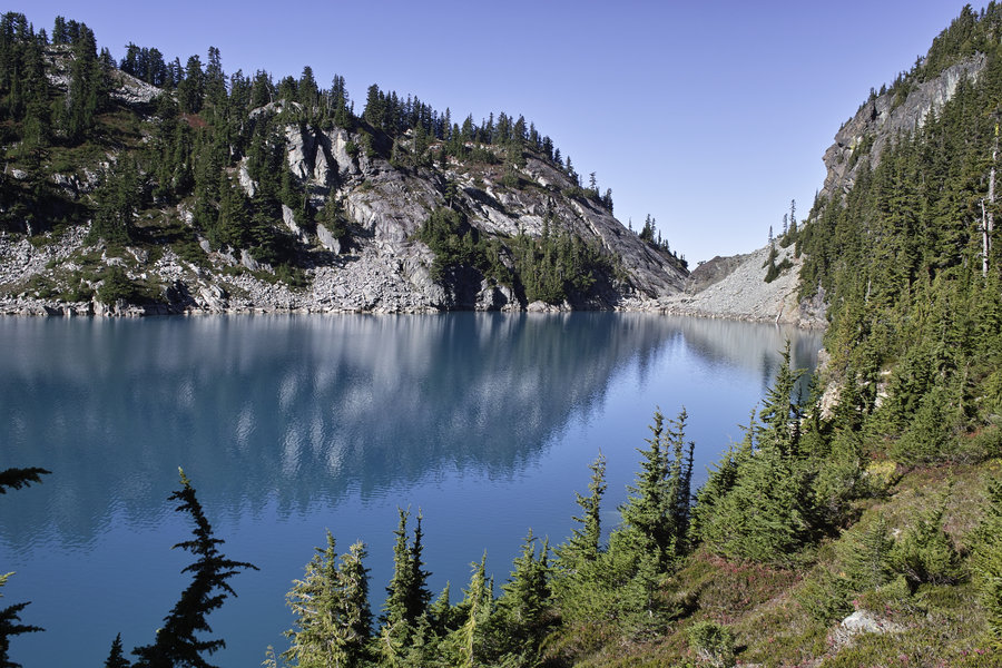
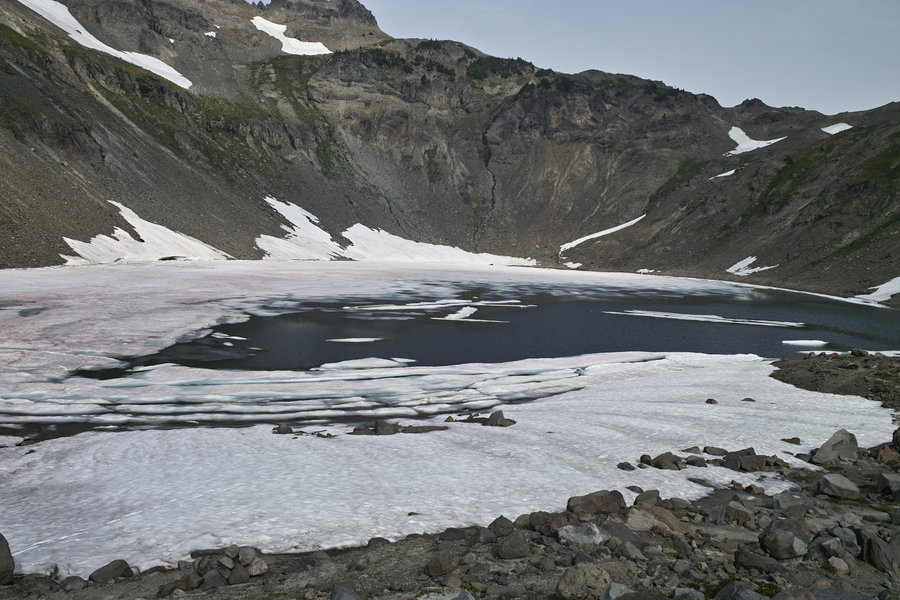
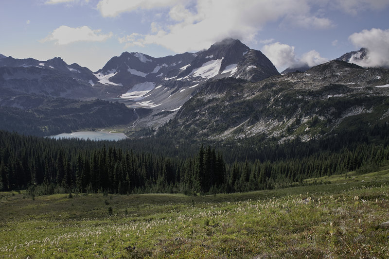
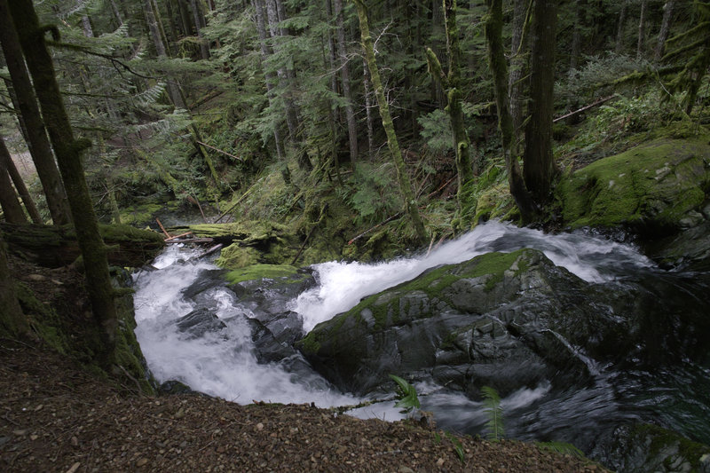
Once reaching the pass, the trail continued through bright-red brush and past a small lake in a large cirque. As I hit this lake at dusk, I thought about camping there, but there were no established spots, and it was rock city, so I decided to continue on.
The trail then loses 800' and climbs 1000' to Marmot Lake. By the time I reached Marmot Lake it was 7:15 and dark. I donned the headlamp, set up the tent, and made dinner. By 9:00, it was bedtime.
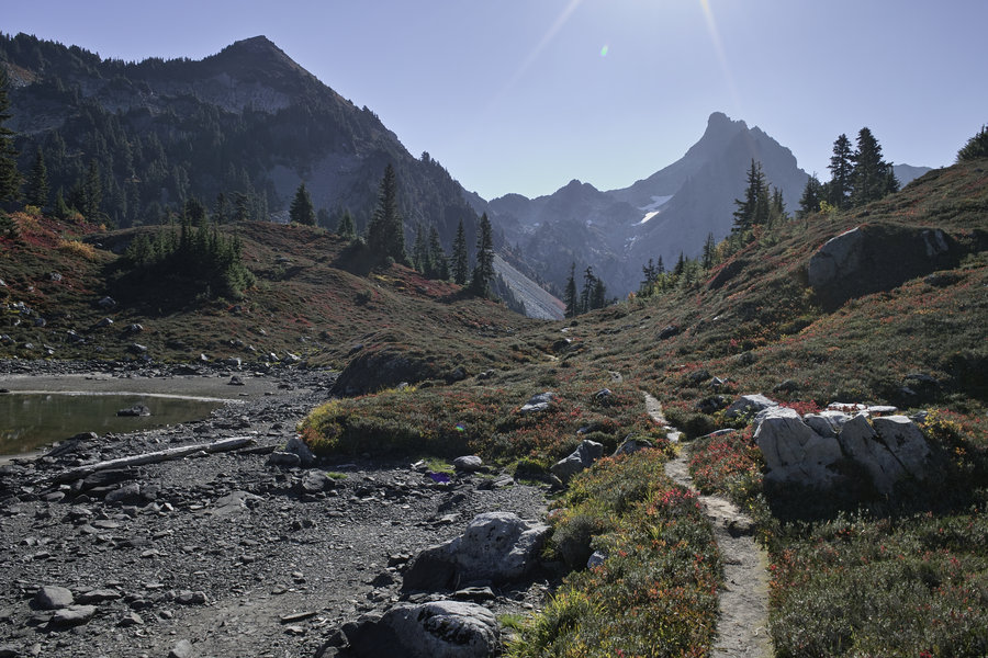
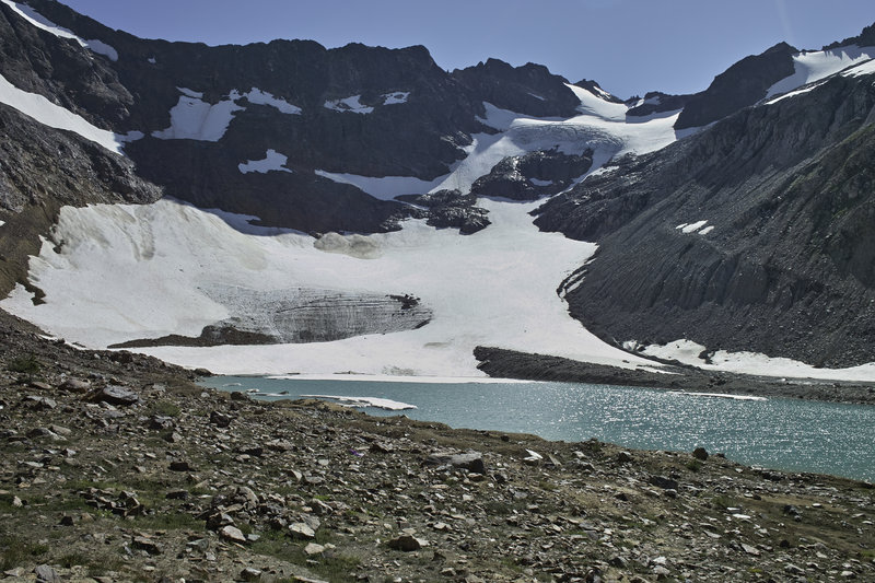
The next morning, after some Via and granola bars, I got moving around 9:30. To reach Jade lake, there is a well-worn use path along the side of Marmot Lake, which crosses several smaller boulder fields and eventually leads to a larger boulder field that takes you halfway up to the lake. Once halfway, there is a dirt path, which is a nice relief from the scrambling. The path led through more fire-red brush, up to No Name lake. I pulled out the Tenkara rod and did some quick fishing at No Name—the little guys were pretty stunted with the shallow water.
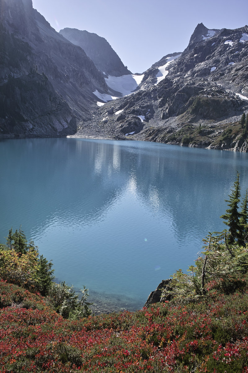
The path then leads over the hill to Jade lake. Wow—this lake is something else. Truly blue colored, and bigger than I expected. Across the lake is a glacier which leads to Diptop Gap, which I've read is a great view in its own right—but time and no ice ax ruled it out—it probably would have been another 3+ hours to get around the boulders on the lake and to get up the pass.
Short on time, I headed back down to Marmot Lake, and then back down to the car. All in all, this was a great little 28 hour trip. I'd recommend starting from a closer trail head—either from FS 6830 or from the south (I read the road is bad)—to shave off a little of the climbing. A nice fall destination.
October 6 – October 7, 2012


 1
1
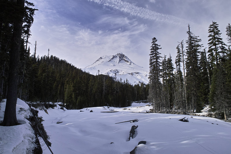
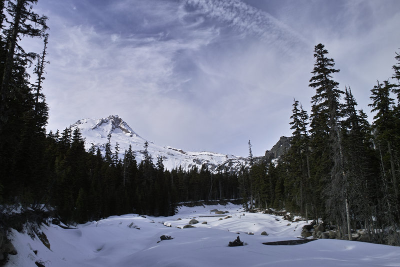
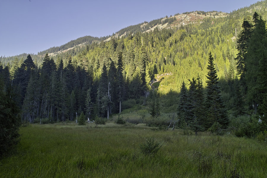
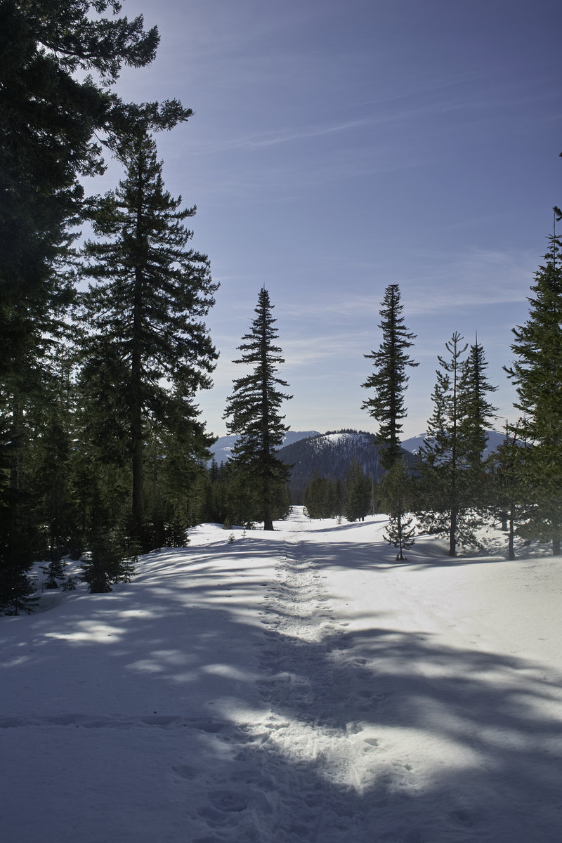
Olallie Lake to Jefferson Park Ridge
14 miles of hiking • 3000' elevation gain •
After hearing all the reports about the Breitenbush Trailhead, I decided to do a trip from Olallie Lake area down toward Jefferson Park. I parked between Monon and Horseshoe lake and then cut over to the PCT and then down. The weather this time of year is my favorite—just cool enough and no bugs. Went up to the ridge above Jeffy Park, ate my lunch, and then went back down towards Breitenbush Lake.
I tried some fishing at Breitenbush and Horseshoe lakes, as well as a few of the little unnamed lakes, but everything was super small or not biting. These lakes are very shallow, it seems. I'd come back to Breitenbush lake to car camp—very nice and relatively quiet!
September 29, 2012

 3
3
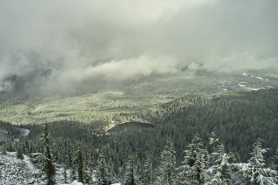
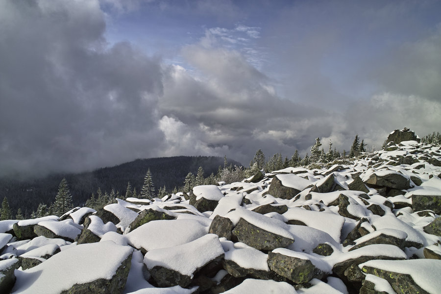
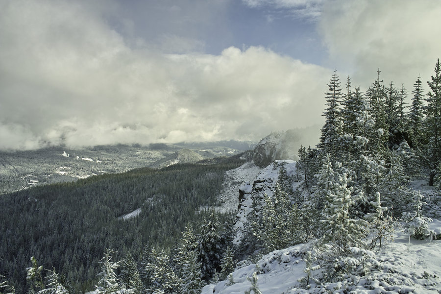
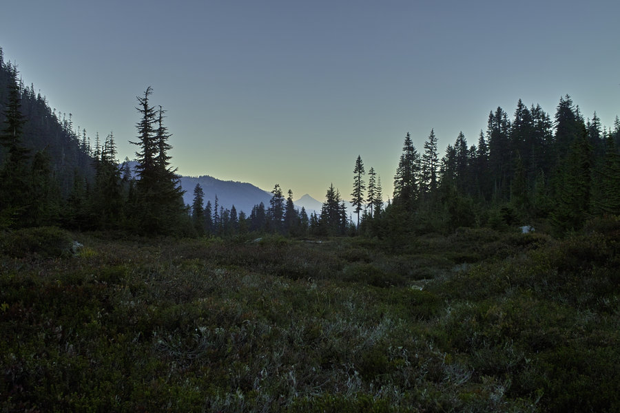
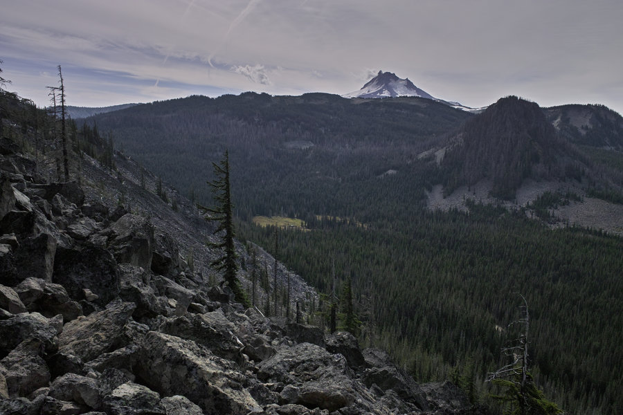
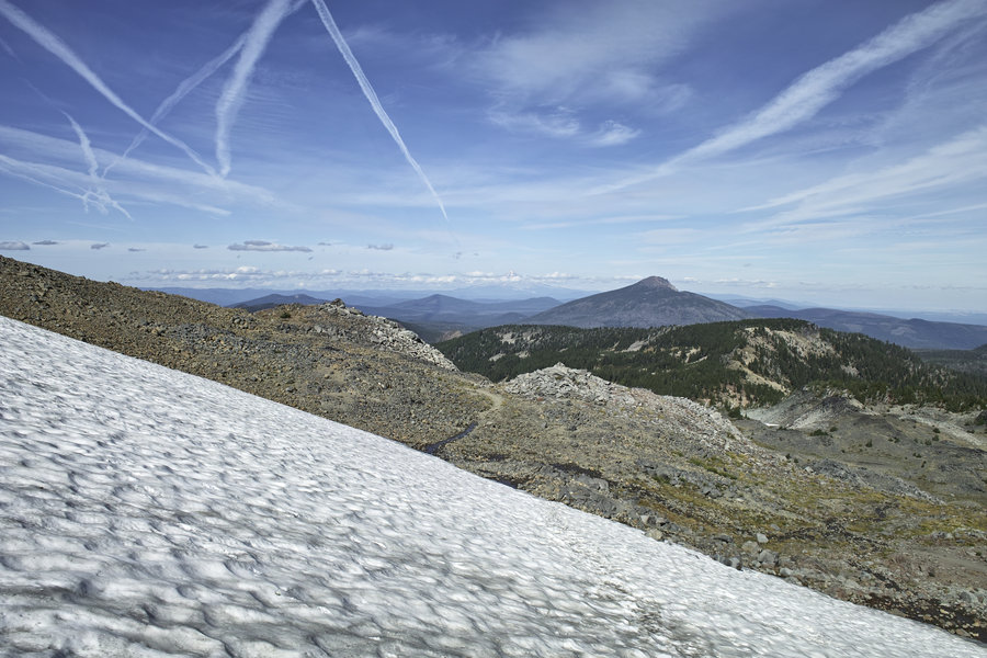
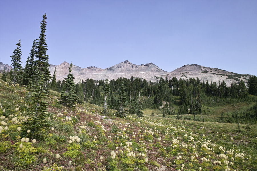
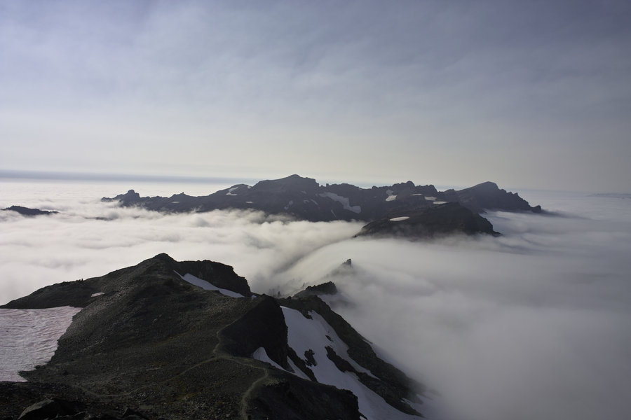
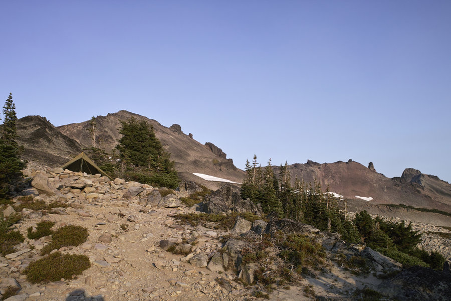
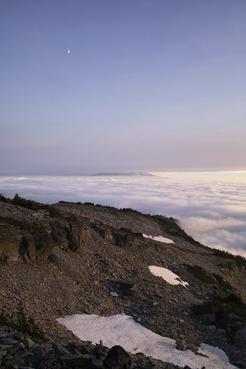
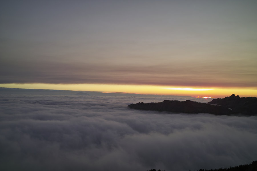
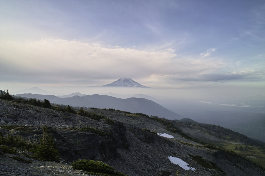
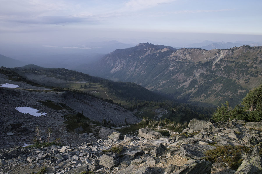
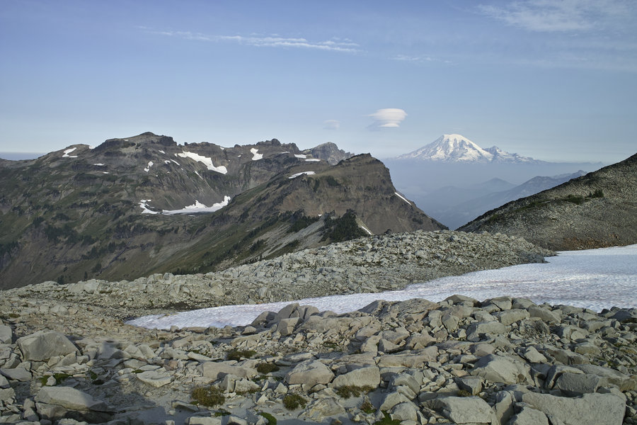
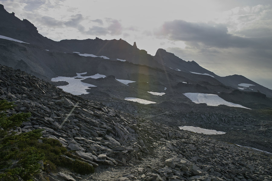
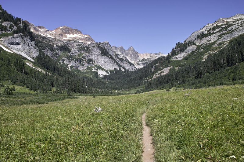
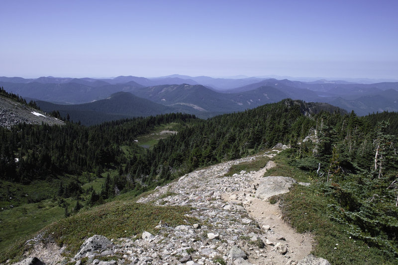
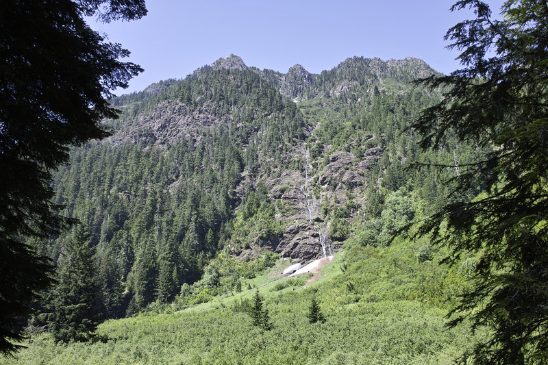
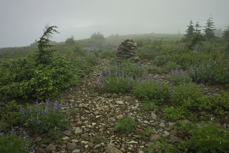
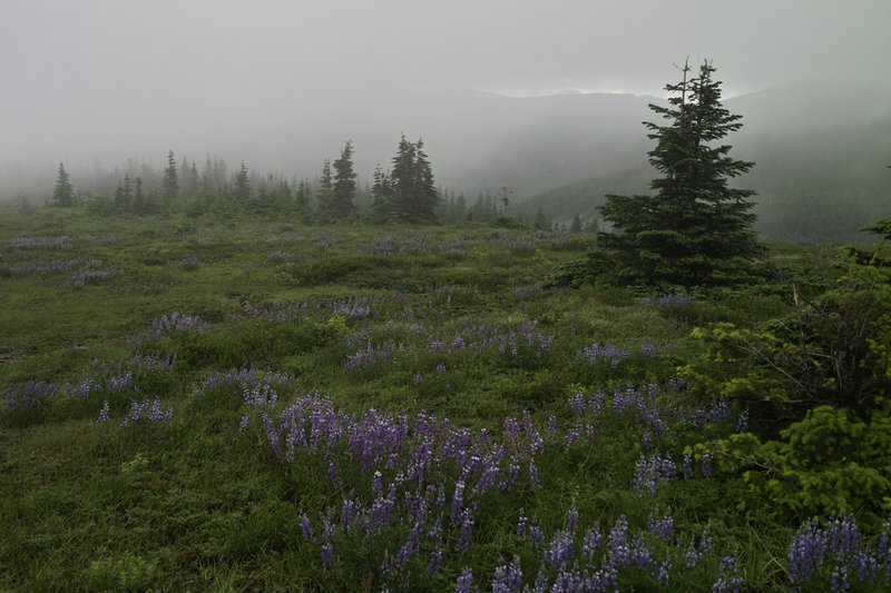
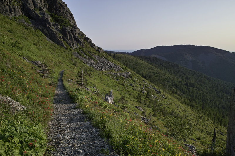
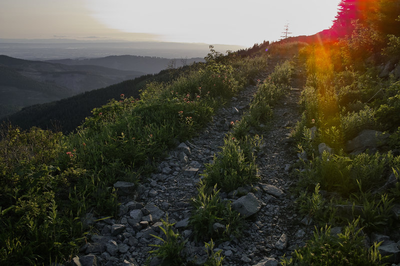
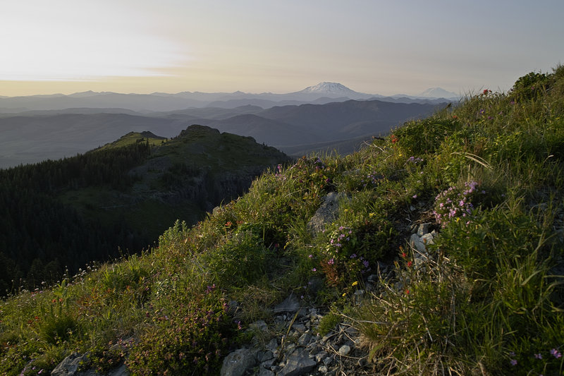
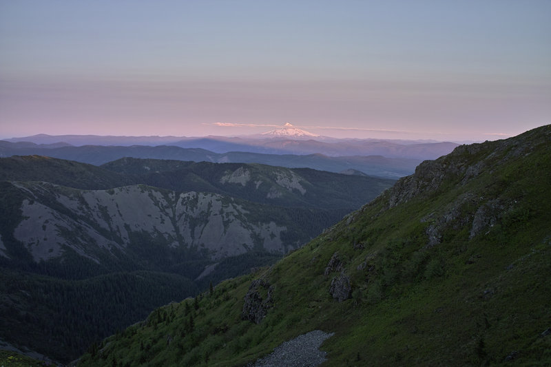
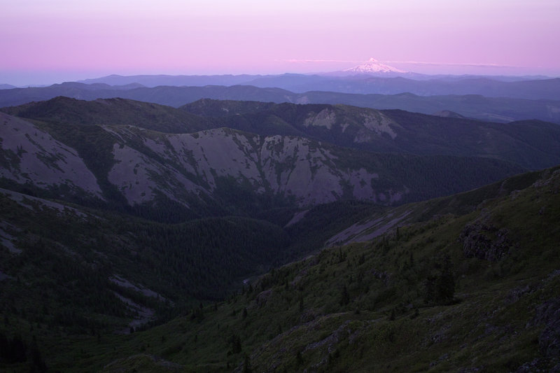
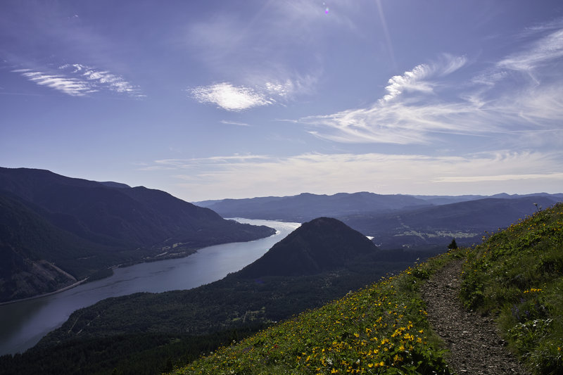
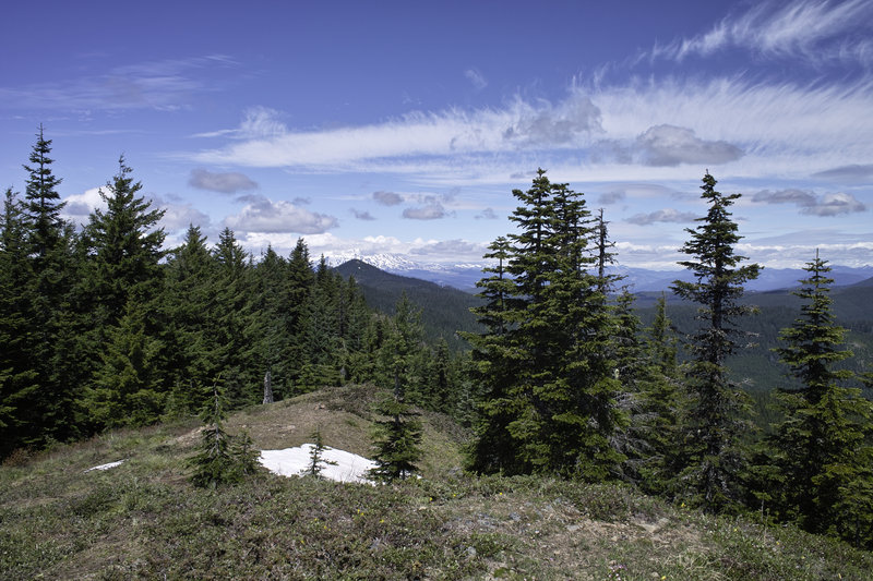
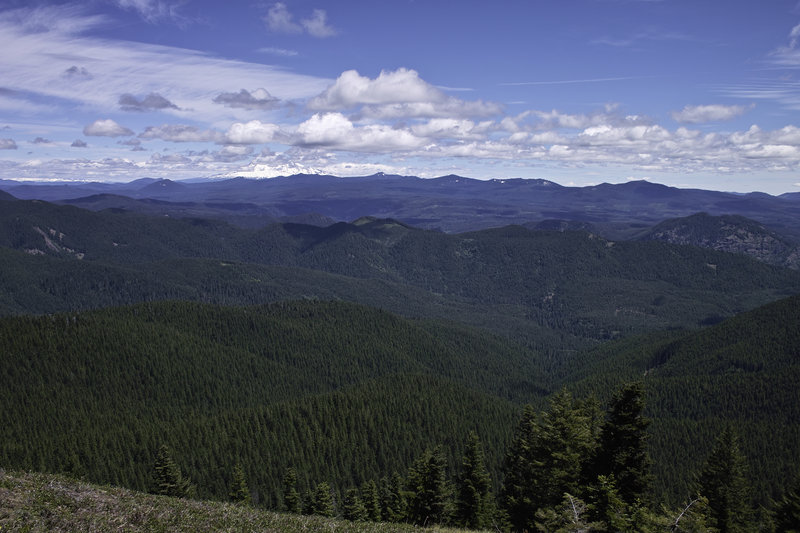
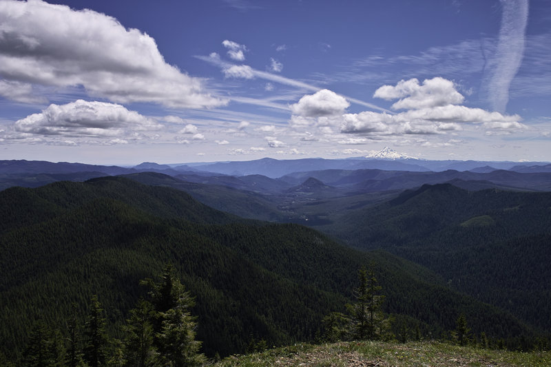
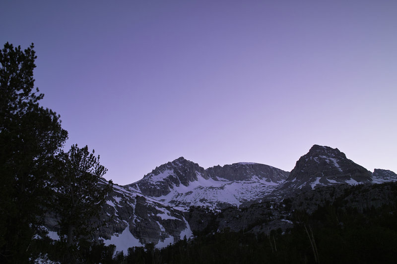
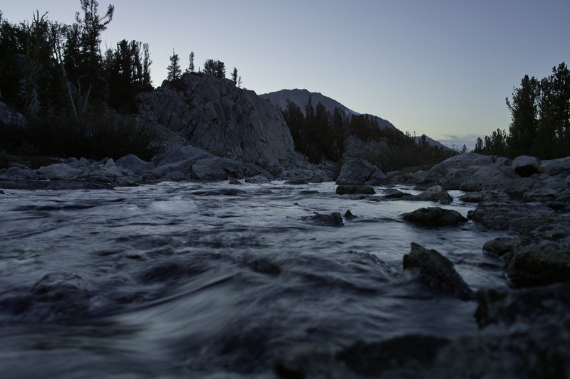
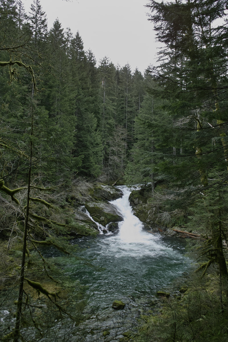
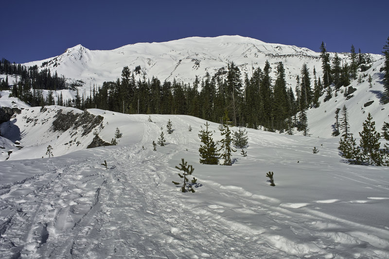
Goat Lake Loop and the PCT to Old Snowy
21 miles of hiking • 5250' elevation gain • 1 night
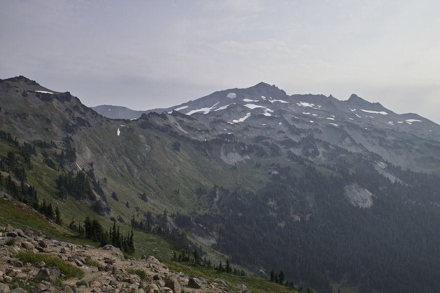
Did this classic loop this weekend. Now I see why it's so popular. Far more interesting than the southern half of Goat Rocks, with some really beautiful views. And wow, the crowds. I thought surely this late in the season the backpackers would be out in fewer numbers, but I still must have seen over 100 people out there—I can't imagine what it's like during the summer.
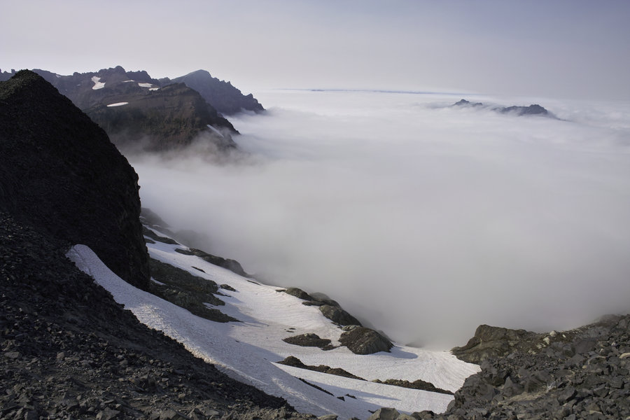
I did the loop counter-clockwise, taking the bypass trail up to the PCT. There was a strong inversion all of Saturday, so everything below 5500' or so was cloud covered. Mt. Adams was obscured for most of the time due to the fire.
I took the PCT up to Mt. Snowy and then followed the ridge line for awhile. A very cool spot. The inversion made for some very cool above-cloud hiking. There were several great campsites in the vicinity, which made for great sunset viewing. Dinner was one part ramen packet, one part alfredo sauce packet, one part foil salmon packet and some spices from home. The wind picked up right after the sun went down, but it cleared out the inversion for the morning.
Where I saw the most people was around the Snowgrass Flats area and then up through Goat Lake. This is definitely a mid-week kind of place. The weather Sunday was pleasantly cool and occasionally cloudy.
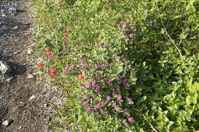
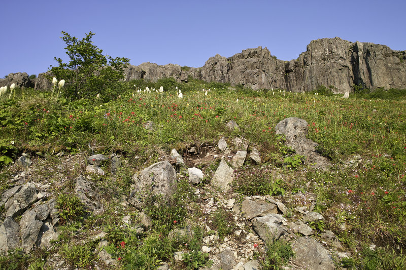
Each stream had great floral displays. And the path up and over past Goat Lake had quite the views. Looks like the secret is out on this place.
September 22 – September 23, 2012

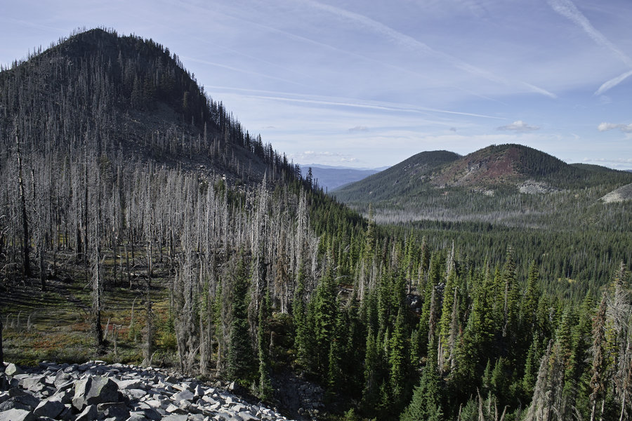
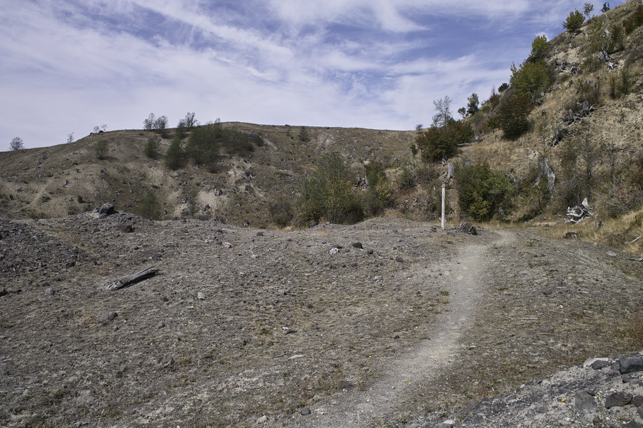
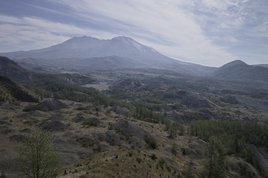
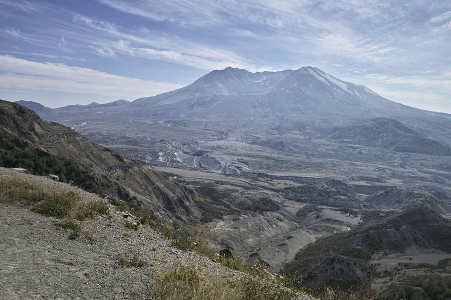
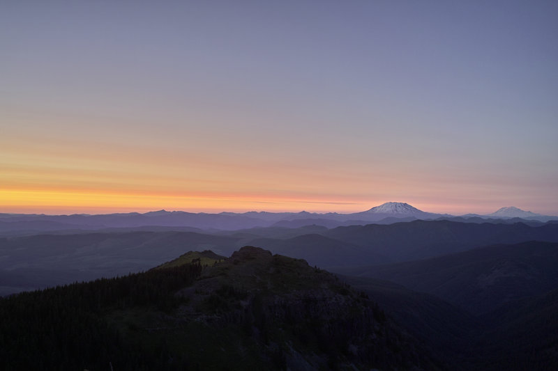
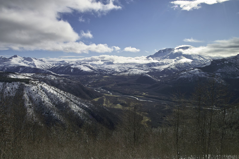
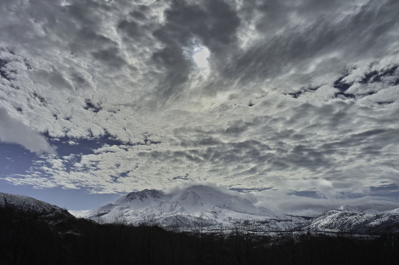
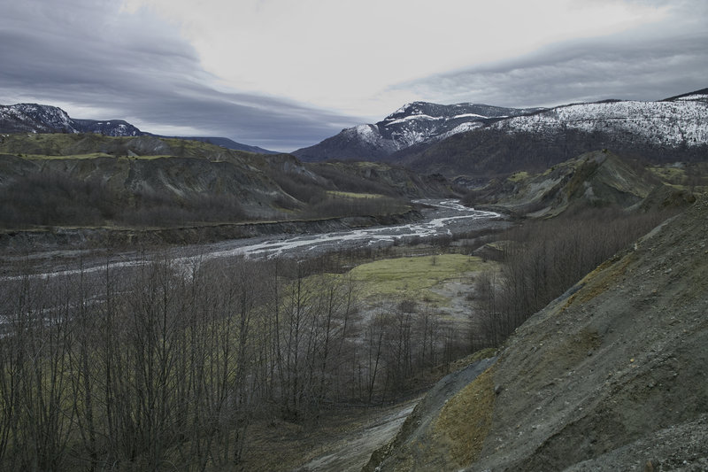
St. Helens: Hummocks to Johnston Ridge
14.5 miles of hiking • 3000' elevation gain •
Started at the Hummocks trailhead, went up to Johnston Ridge and back down. Was going to make a big loop around to Coldwater Peak, but I just started too late in the day, didn't do the mileage calculations beforehand, and was going to end up hiking in the dark. Johnston Ridge Observatory still had tons of people, even this late in the year.
September 15, 2012

 1
1
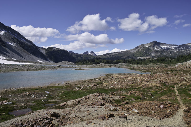
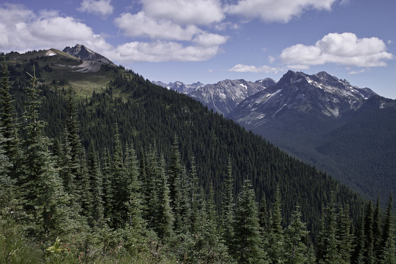
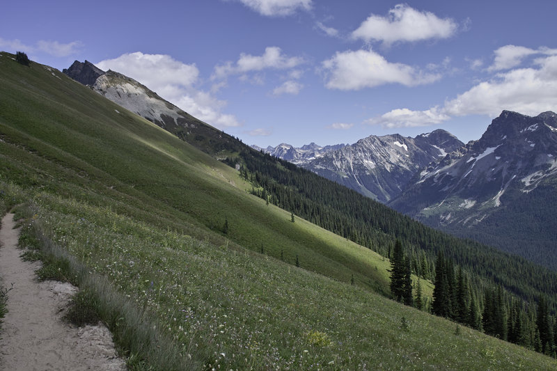
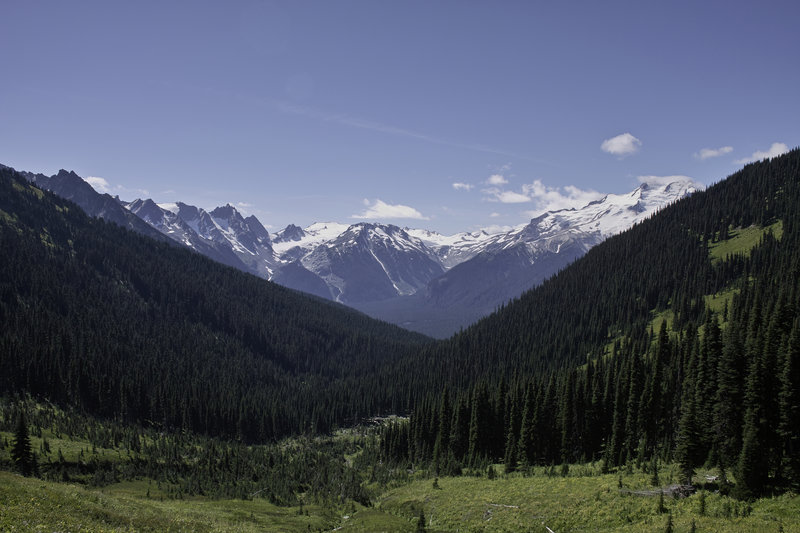
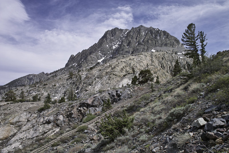
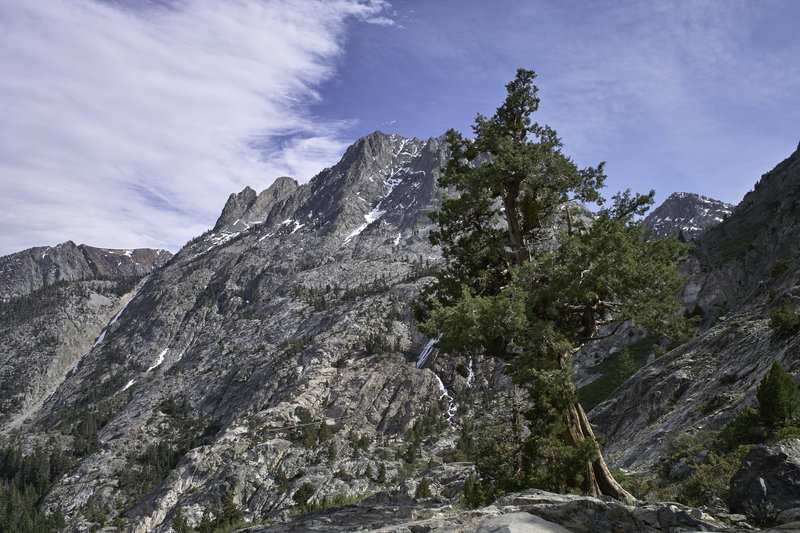
Spider Gap - Buck Creek Pass Loop
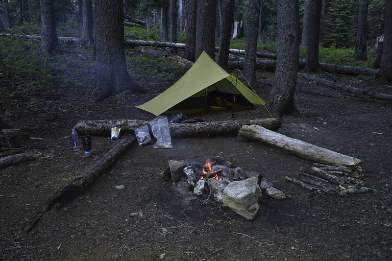
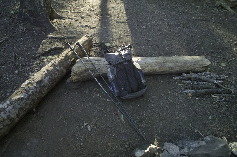
50.5 miles of hiking • 14500' elevation gain • 3 nights
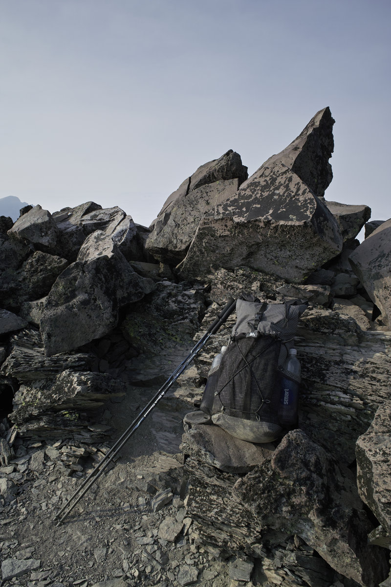
What a great little trip this is. The Spider Gap - Buck Creek Pass Loop is in the eastern half of Glacier Peak Wilderness, east of Seattle. Thursday evening, I took the 5ish hour drive up to the Trinity trail head. Beware - the last 13 or so miles are gravel, but they are fine so long as you have a decent truck or take them slow.
Day 1 - 15.0 mi., 5000'
I got started early in the morning, when it still was 40 degrees or so. A good sign for the bugs to come. Previous weeks reports were saying lots of flies and mosquitos so I was crossing my fingers. Fortunately, this trip turned out to have great weather and few bugs.
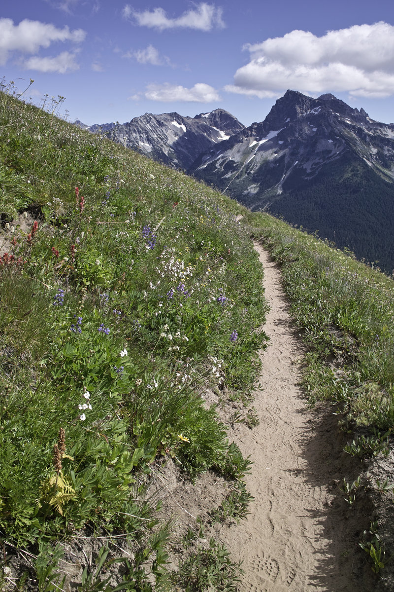
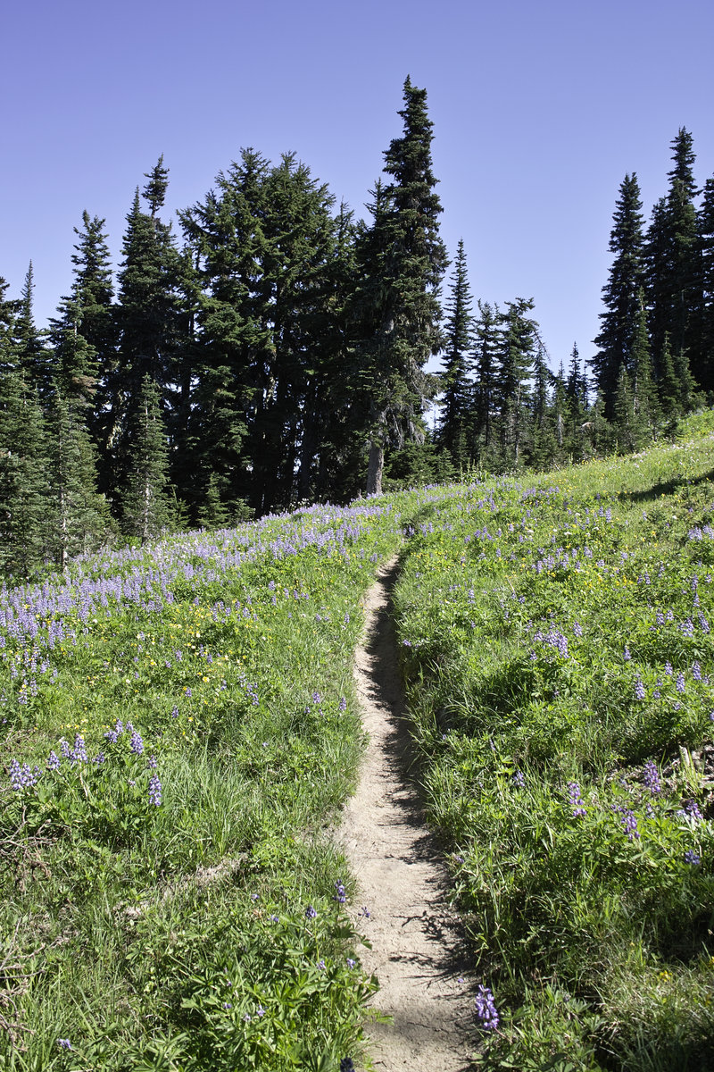
The loop, without a hitch, requires about 3 miles of road walking, uphill, so I decided to get it out of the way in the beginning. Plus, the road walk isn't so bad because of the great views. The trail begins in a wooded valley and climbs for several miles until it breaks out into Spider Meadows. The flowers were a bit past their prime, but were still nice nonetheless.
Because of the holiday weekend, many folks were out exploring these meadows for the day, but once I got past day-hike mileage, the crowds thinned out very nicely. In fact, that evening, I would only run into two other groups, and I would see no one after 4pm. Amazing!
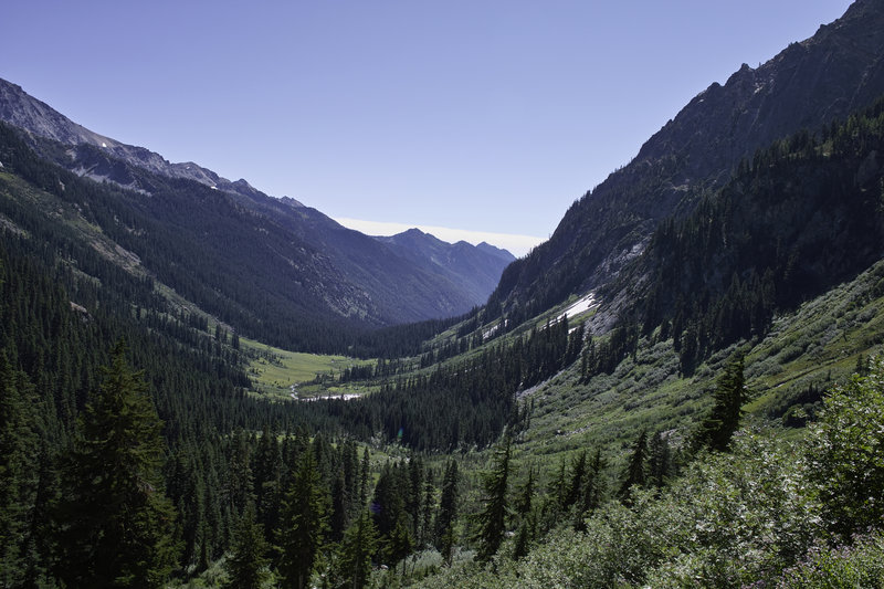
The trail climbs quickly out of the meadows and up a steep side of a hill, on a somewhat loose and exposed trail up to a ledge that evens out before the glacier starts. There are several campsites that overlook the meadows. From there, one climbs the glacier for about a quarter mile and several hundred feet to the pass. At the pass, Lyman Lakes come into view. This area reminded me a lot of Kings Canyon—a beautiful sparse landscape, and here turquoise glacial lakes.
Several faint trails descend down into the first lakes—an easy routefinding challenge—and then eventually make their way down to Lyman lake. After a short nap, I wandered around the lower lake to find one of the many campsites. There had to be over 10 large campsites around the upper side of the lake, each unoccupied.
After some quick fishing and a small catch, I hit the hay. Unfortunately, a deer found my campsite appealing (she was licking the salt), and visited every hour or so until 4 in the morning. I yelled and banged on things, but she wouldn't go away.
Day 2 - 17.0 mi., 4500'
The trail climbs out from the lake and up toward Cloudy Pass, which had beautiful views of the mountains and back towards the lakes. From Cloudy Pass, one can take a fun narrow shortcut to Suiattle Pass, which has its own beautiful views.
From there, I opted to take a side trip to Image Lake. The trail climbs Miner's Ridge and follows a Dog-mountain-like hillside to a small lake. On a calm day, you're supposed to be able to see Glacier Peak in its reflection, but it was pretty windy that day. Image lake had no fish, or at least no biting fish. From the lake, I headed up towards the lookout, but a narrow, precipitous bit of trail was a bit more than my exposure tolerance allowed, so I called it.
Wanting to see what Suiattle pass was really like, I headed back up toward the true pass and down the PCT for a bit. Realizing there wasn't water up there, and not having anything to cook with, I continued back down the loop and camped near a small creek.
Day 3 - 12.5 mi., 4500'
A late morning start was nice because the following few hours would involve several thousand feet of ups and downs. The trail climbs through forests and then meadows (full of happy pollenating bumble bees). After awhile, the trail finally reaches Buck Creek Pass. From there, I took the side trail up towards high pass. The trail snakes up Liberty Cap, and has great views towards Glacier Peak.
Wanting to get out quickly the next morning, I decided to cut my side trip short and start down the pass. From Buck Creek Pass, the trail becomes very dusty, filling my shoes! A few miles later, I would find a campsite, build a fire (that started extremely quick due to the dryness), and relax.
Day 4 - 6 mi., 500'
The final day was just a few miles back to the trailhead. The remaining miles were mostly wooded, but with great views of Buck Peak.
This is a great little trip and is definitely one worth considering for the 5-6 hour away trips range. Beautiful views, a fair amount of variety, and some nice hiking. I recommend it!
August 31 – September 3, 2012

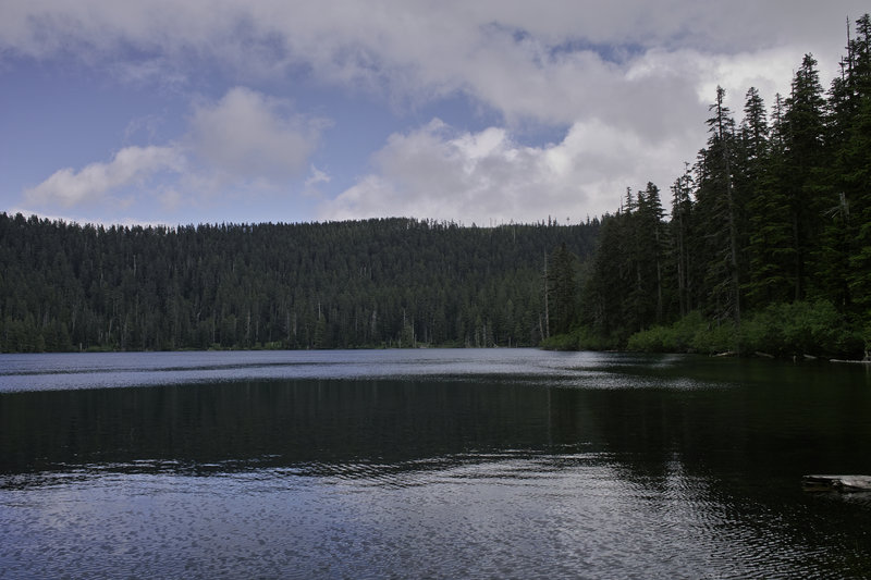
Rock Lakes Loop
13 miles of hiking • 2750' elevation gain •
Did the loop. Lots of flies out there, but decent fishing. It was nice to have some cooler weather for a change.
August 18, 2012

 3
3
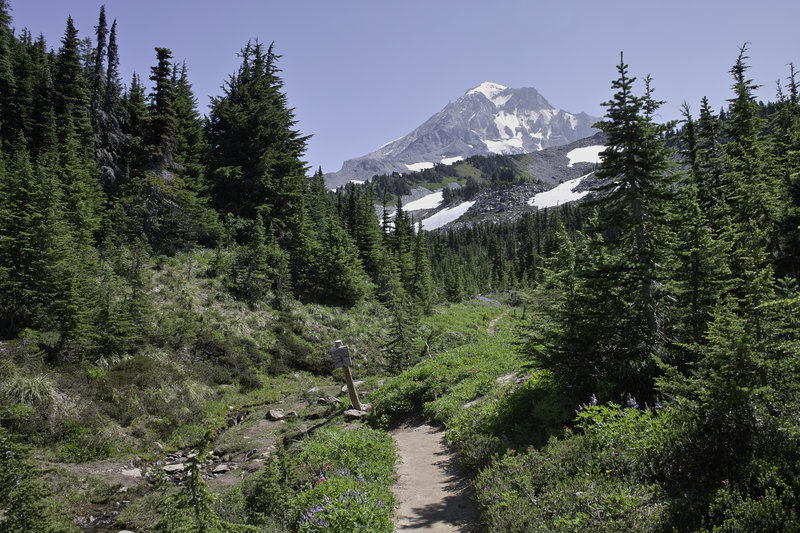
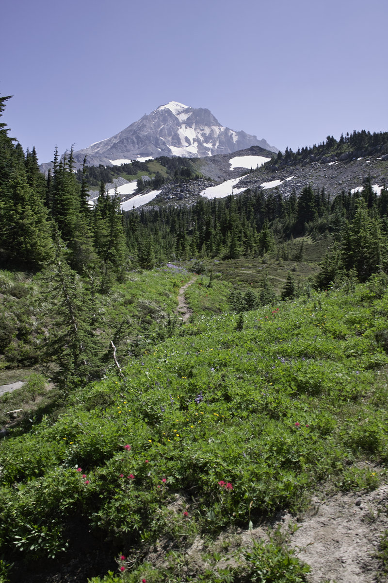
McNeil Point
11.5 miles of hiking • 2750' elevation gain •
Nice day. Bugs weren't too bad, and the crowds were manageable. The flowers are just about at their peak. Started up the spur a little for a better view.
August 11, 2012

Lower Lena Lake - ONP
13 miles of hiking • 4250' elevation gain •
A nice trip to Lower Lena Lake. Was planning on staying the night, but it ended up being very buggy, so I made it a day hike. Did a little bit up towards Upper Lena as well. The trout fishing was pretty decent—no state fishing license required in ONP!
August 4, 2012


 1
1
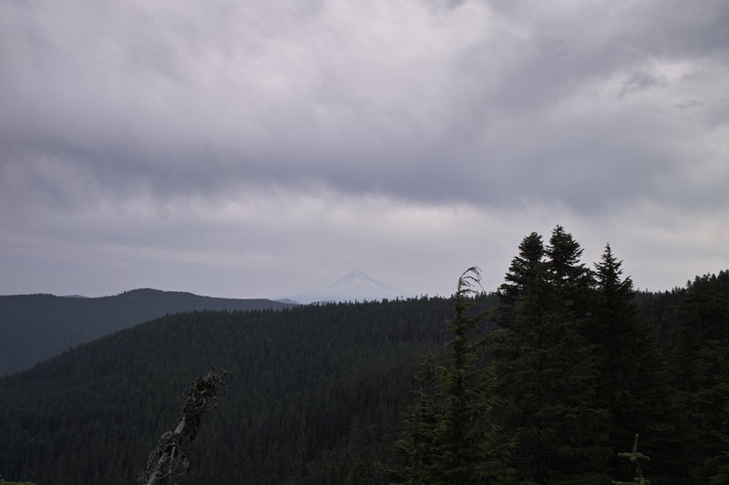
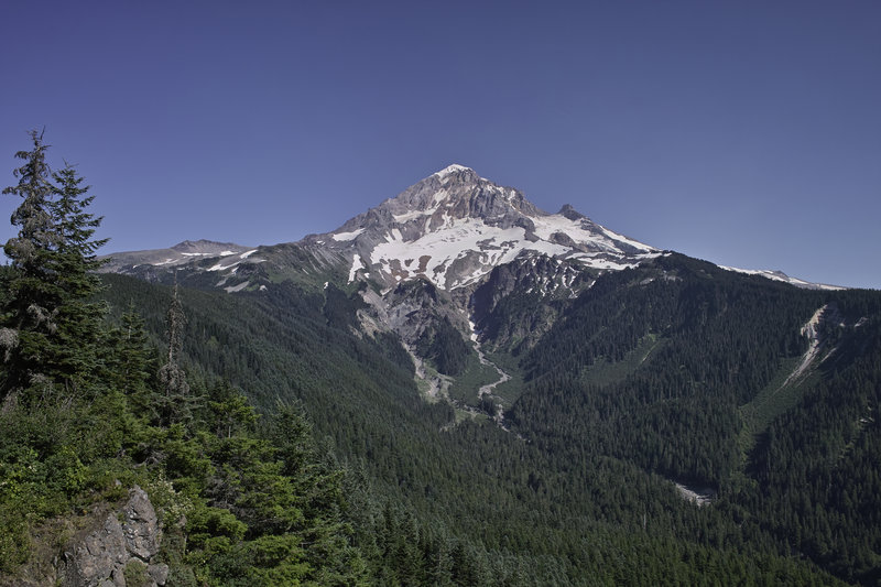
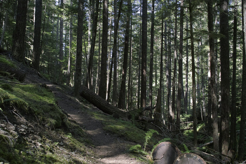
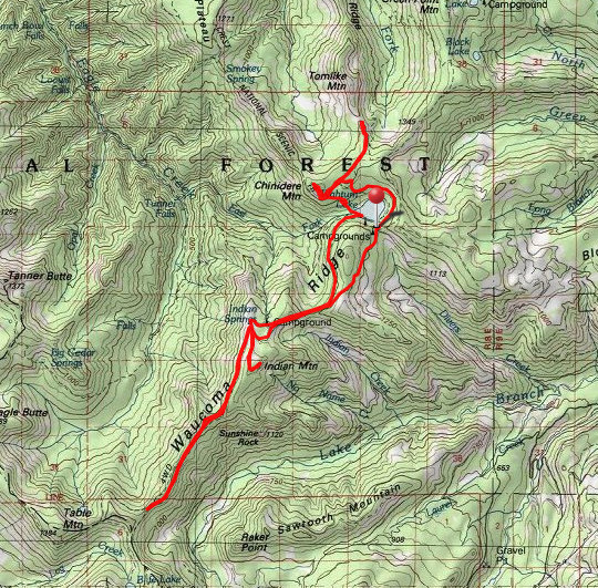
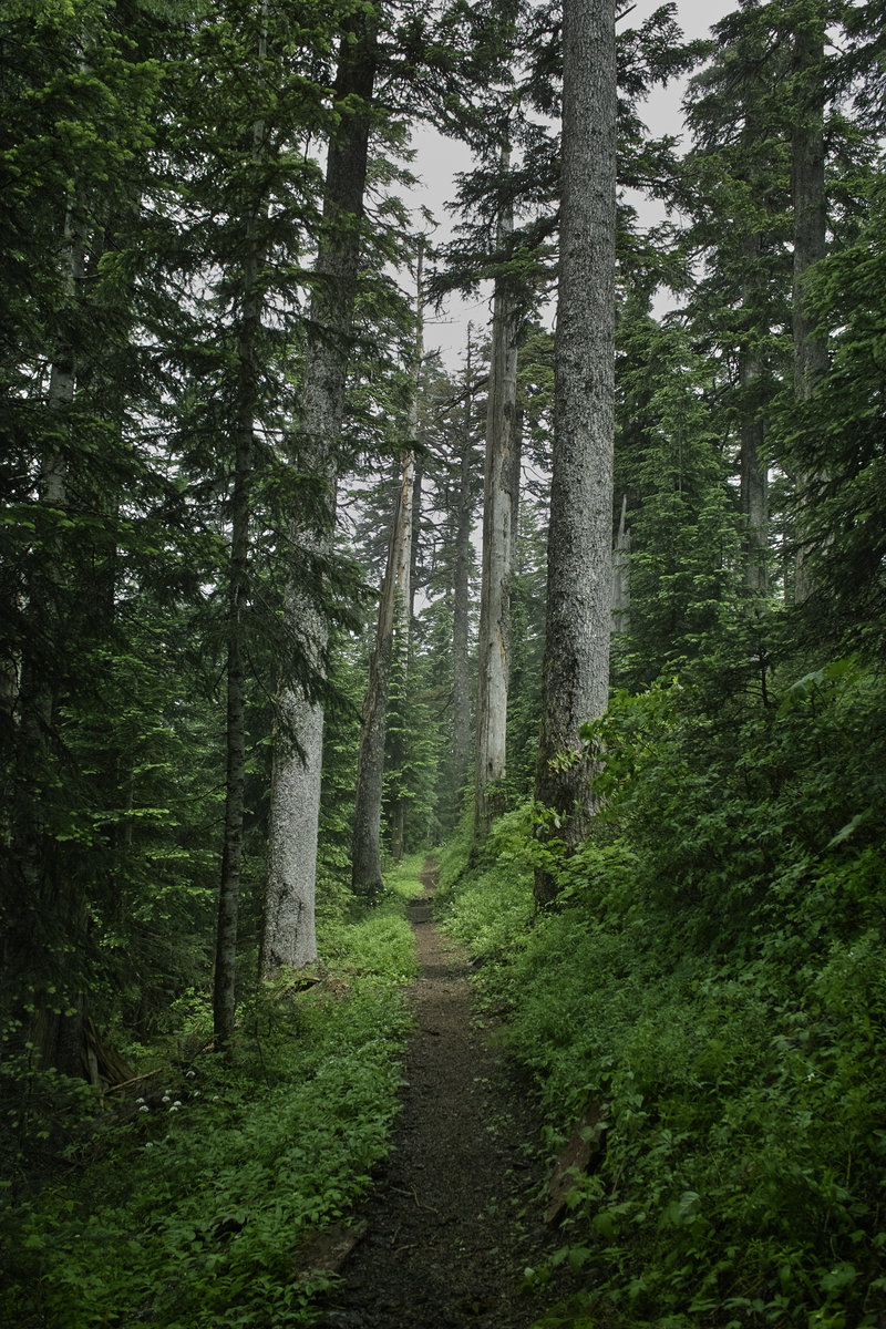
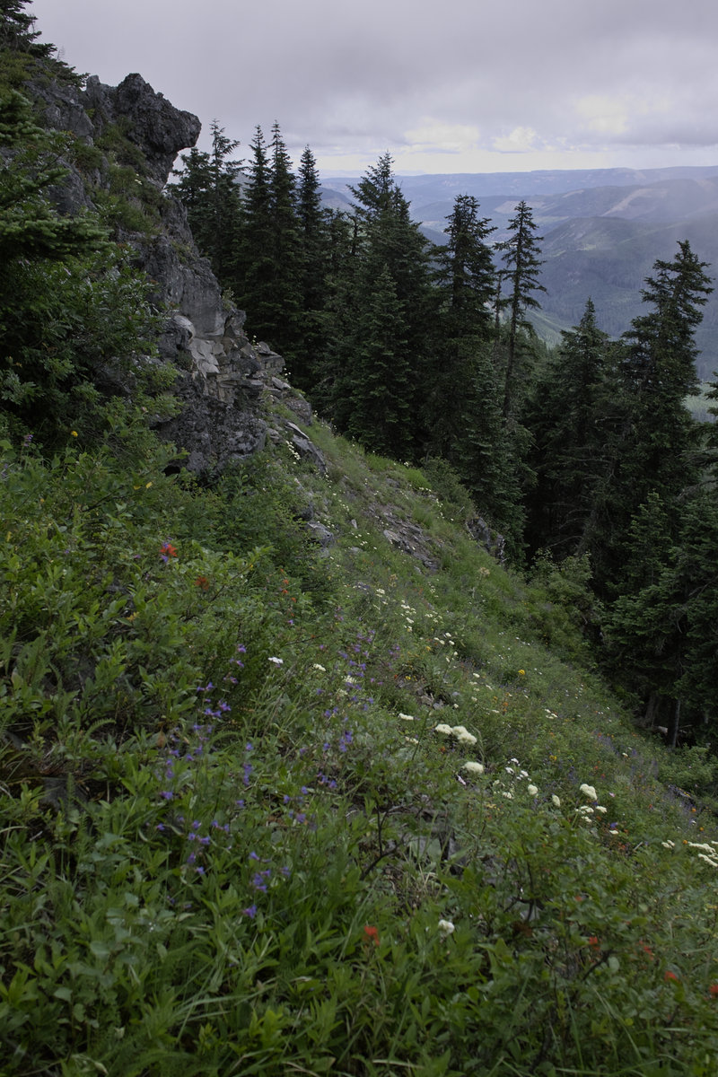
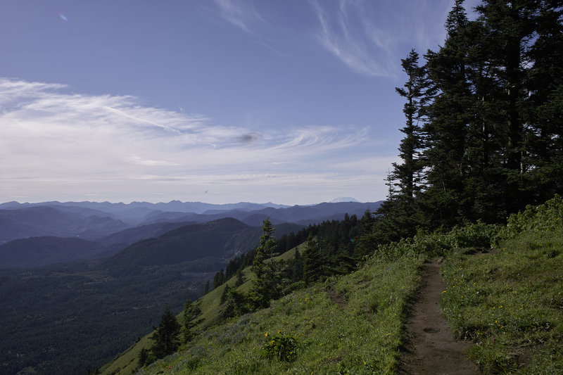
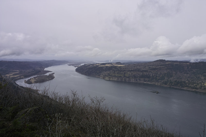
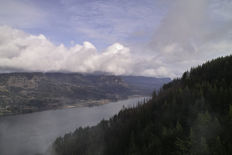
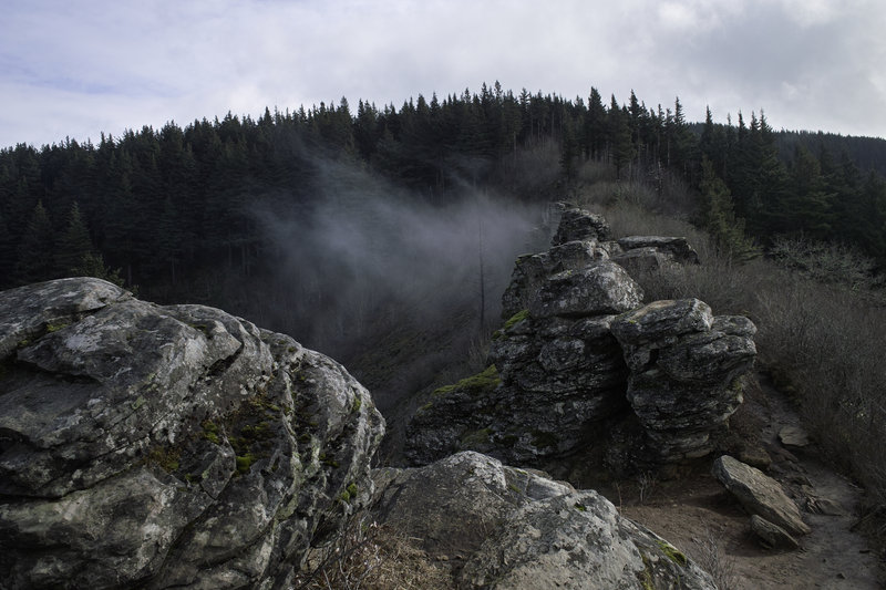
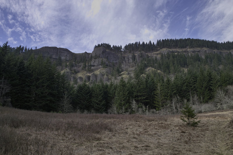
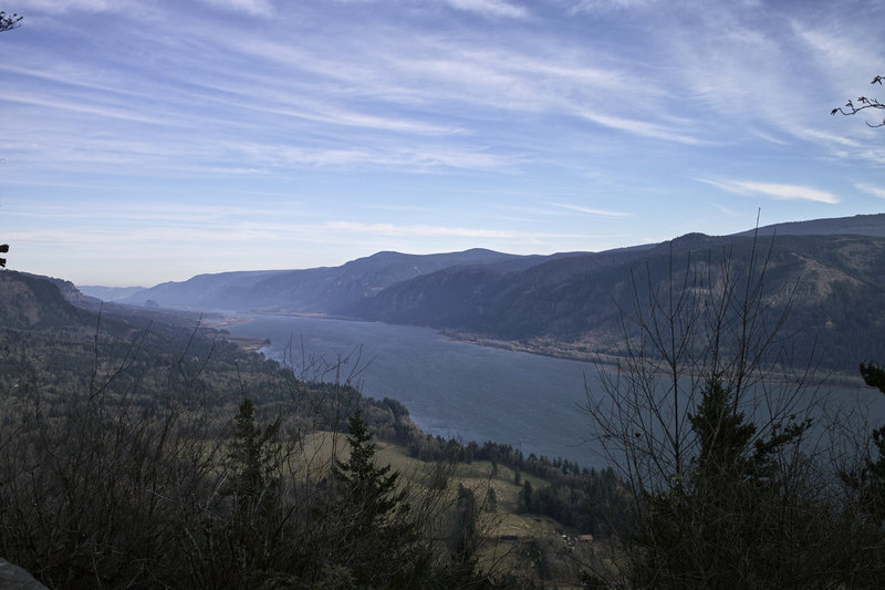
Waucoma Ridge/Indian Mountain/Tomlike Mountain/Chinidere Mountain
22.5 miles of hiking • 3250' elevation gain •
Even with so-so weather, this ended up being a nice day hike.
I took the longish ride up to Wahtum Lake to see how many small peaks I could cover in a day. Not getting there until 10:30 or so, I had my work cut out for me. First was Indian Mountain. I decided to walk the back road over to the PCT and then head up the short cut toward the little peak, but heavy clouds made me think to keep looking for other options while things cleared out. Buck Peak looked interesting, so I headed further down Waucoma Ridge.
The clouds started to clear, so I did some quick math and decided that my time would be better spent hitting the peaks up toward Wahtum. I turned around and hit Indian Mountain next. Unfortunately, it was one of those let's-clear-all-the-clouds-below-4400' kind of clearing, so things were socked in and freezing at the top.
Next was Tomlike. I made my way back down the PCT, across the cut-off, and then up the top end of the Herman Creek trail. Looking at the clock, it was already 3:30 or so, and things were still clouded in. And it was really, really windy. Not wanting to deal with the freezing wind, I decided to just go to the first large outcropping and then head back towards Chinidere.
Chinidere had better views, but Mt. Hood was completely obscured. All in all, not a bad day—even with all the cloud cover, it was nice to get out in some real Oregon weather again.
July 15, 2012


Silver Star Sunset and Fireworks
8 miles of hiking • 2500' elevation gain •
Went up to Silver Star to watch the fireworks. They're pretty tiny from up there, but it was pretty great being able to see just about every firework in the Portland area. The sunset was fantastic.
Trekked back to the car around 10:30 in the dark, with many deer eyes glowing in the light of my headlamp.
July 4, 2012

Dog Mountain
6 miles of hiking • 3000' elevation gain •
A nice late day hike up Dog. We stopped at a nice riverfront spot in Stevenson on the way back, but it wasn't Walking Man.
June 20, 2012

Trapper Creek: Observation Peak from Big Hollow
9 miles of hiking • 3250' elevation gain •
A quick trip up Observation peak on a nice day. Great views of the Wind River valley. Took the lesser used trail from Big Hollow.
June 16, 2012

 4
4
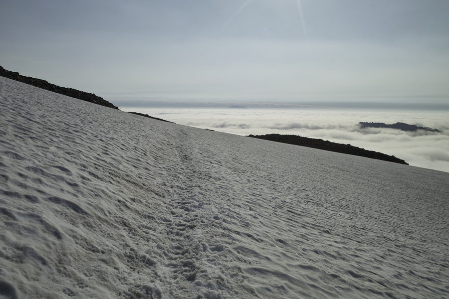
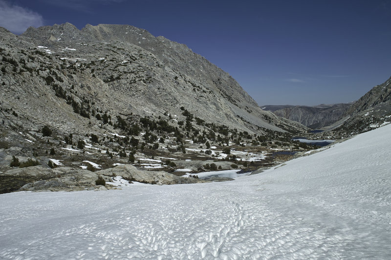
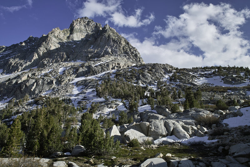
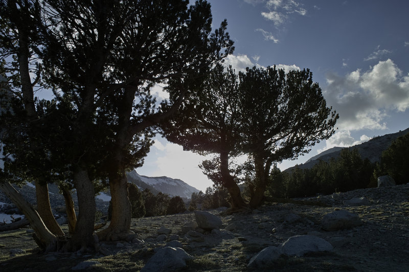
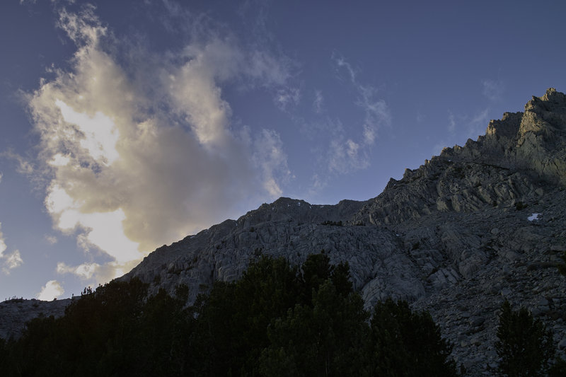
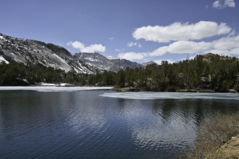
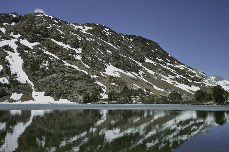
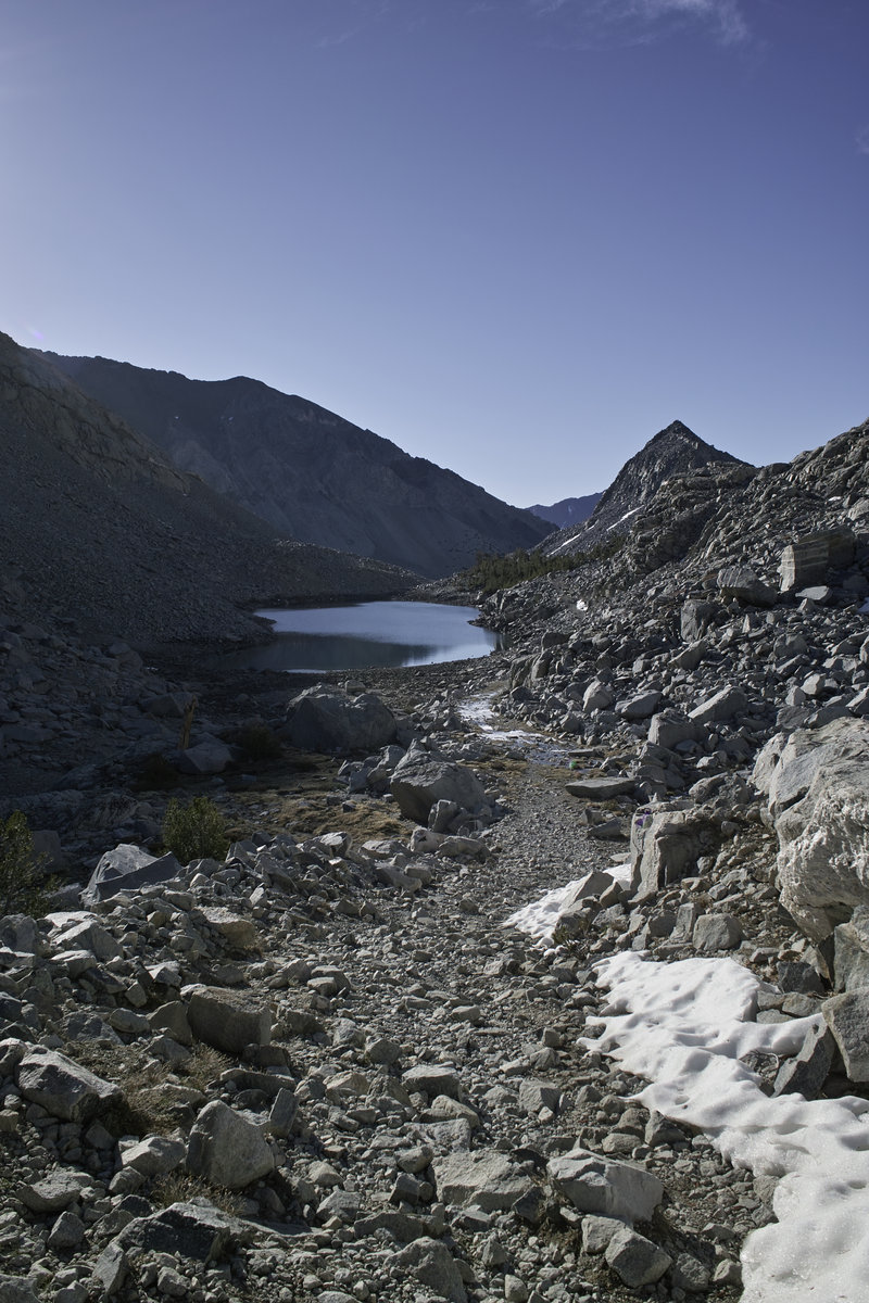
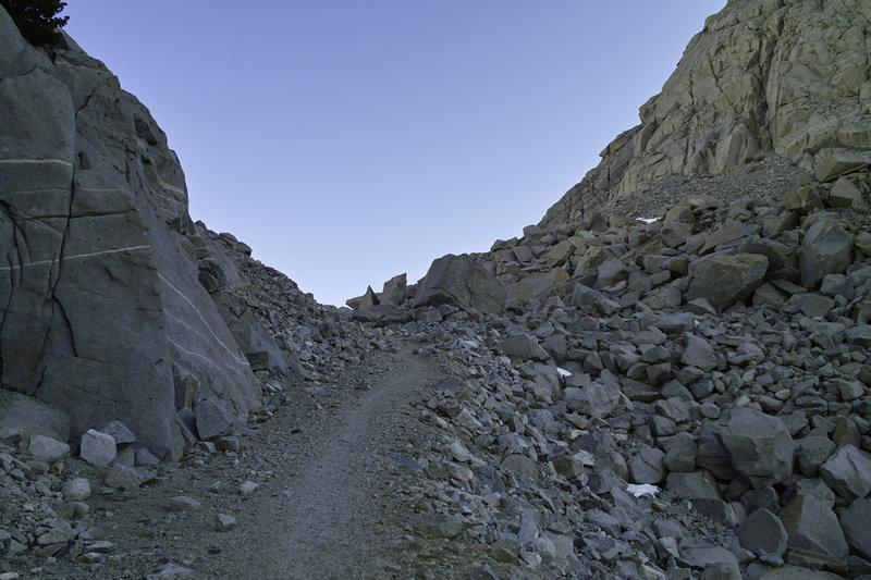
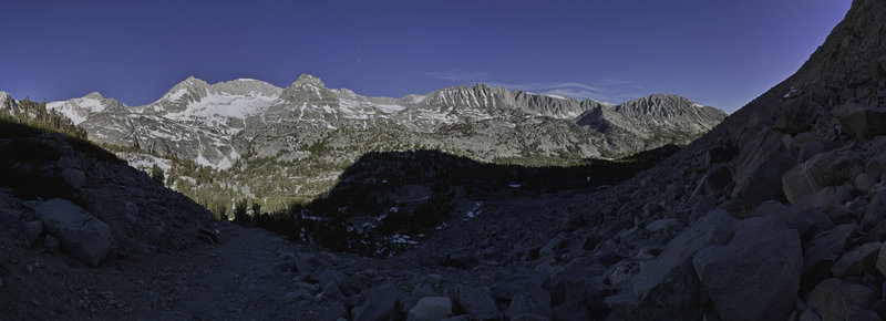
Sierras 2012
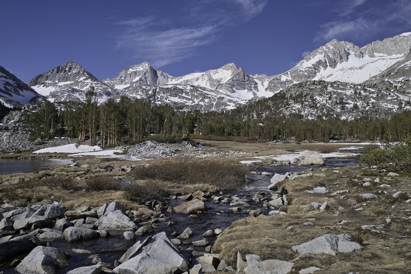
41.5 miles of hiking • 10750' elevation gain • 4 nights
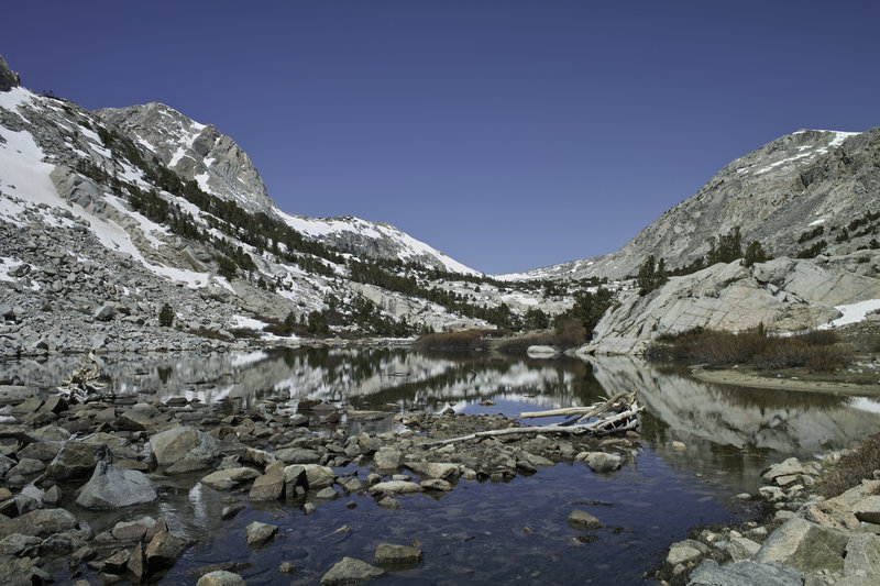
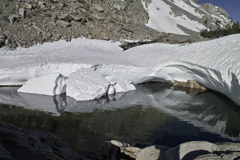
I had a few days to get away in May, and the Sierra was having a record low snow year, so it was an easy choice for where to go. I packed up the car and made the trip down to Mammoth Lakes for a quick sleep in the campground. (hint: if you arrive real late, camp in a campground where the host collects the fee, and then leave super early…) The next morning, I drove a few more miles down to Bishop, got my permit from the Inyo Ranger Station, picked up some delicious German baked goods and a turkey salad sandwich from the famous Erick Schat's Bakery (if you are ever in Bishop, you have to stop here) and set off towards Piute Pass.
Day 1 - 9.5 miles, 3000 ft
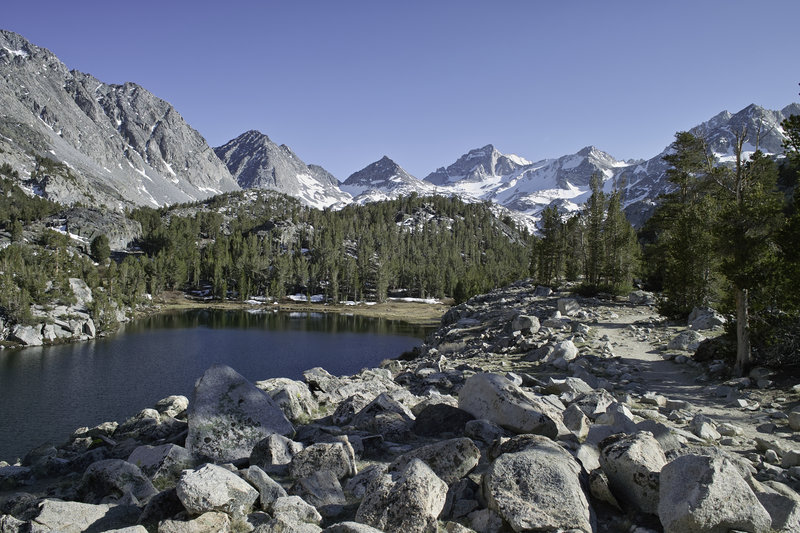
Since the snow courses were reading very low levels, I thought I'd make an attempt at North Lake–South Lake loop, but I realized that this was a likely impractical goal given how early it still was in the season.
The North Lake trailhead starts at a pack station, and follows the road towards a campground for about a mile, then heads up through the pines towards treeline. The trail follows a narrow basin with lakes and waterfalls all the way up toward the pass. Among the granite, I found the usual noisy Pikas and Marmots, though they were always to dodge my camera.
My goal was Piute pass—I would get to the top, assess the situation, and then decide whether to proceed. The snow began around Piute Lake–about 10900'—and continued up to the pass on and off. There was a very easy snowfield leading to the top of the pass, but once I passed a pair of day hikers and some rangers doing trail maintenance, I realized I was the only one out there.
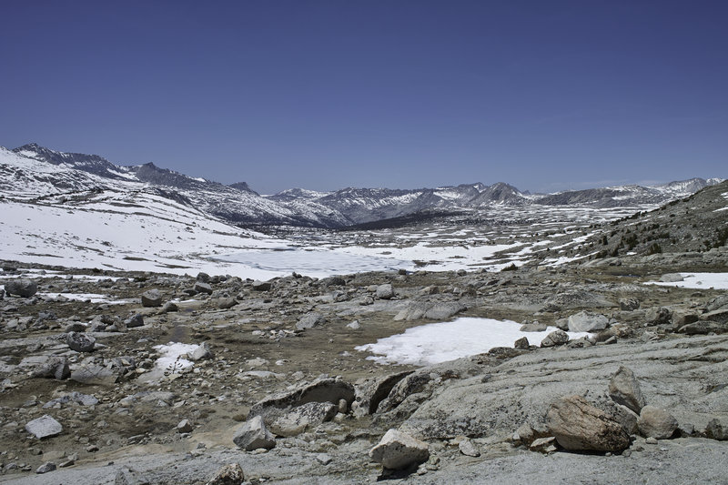
At the crest of the pass, you could see Humphries Basin for miles and miles. This vast expanse of flat granite and snow was something else, especially knowing that I was the only person around for miles. I ventured down past the first lake and thought through my options. Continuing on from here meant that I would have to cover what would certainly be miles of snow over Muir Pass, and that I could potentially not see anyone for dozens of miles—even on the PCT/JMT. Given the snow melt situation, potential for high crossings and snow bridges, I felt that it was not wise to continue forward. The first PCTers were still 1-2 weeks away, and my tracks were the first up this frequently used pass. This was especially difficult, given that you could see down into Piute Canyon, and it was basically snow free, but I let common sense prevail.
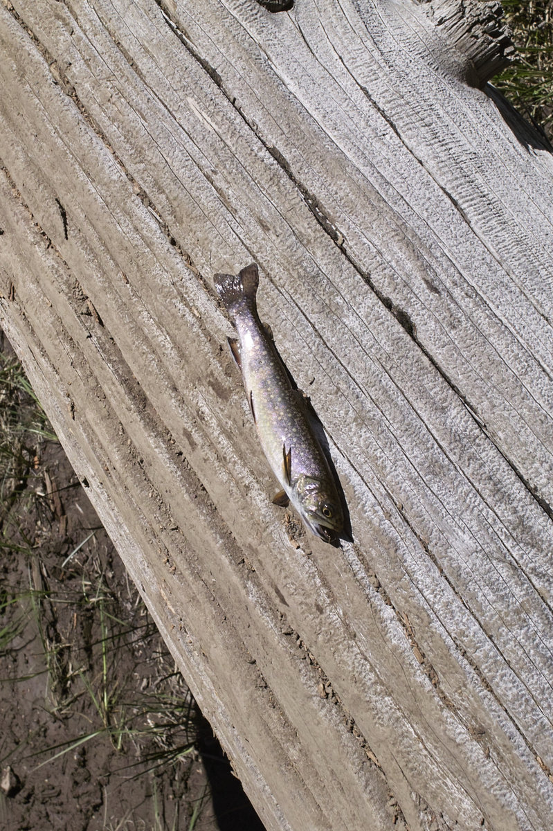
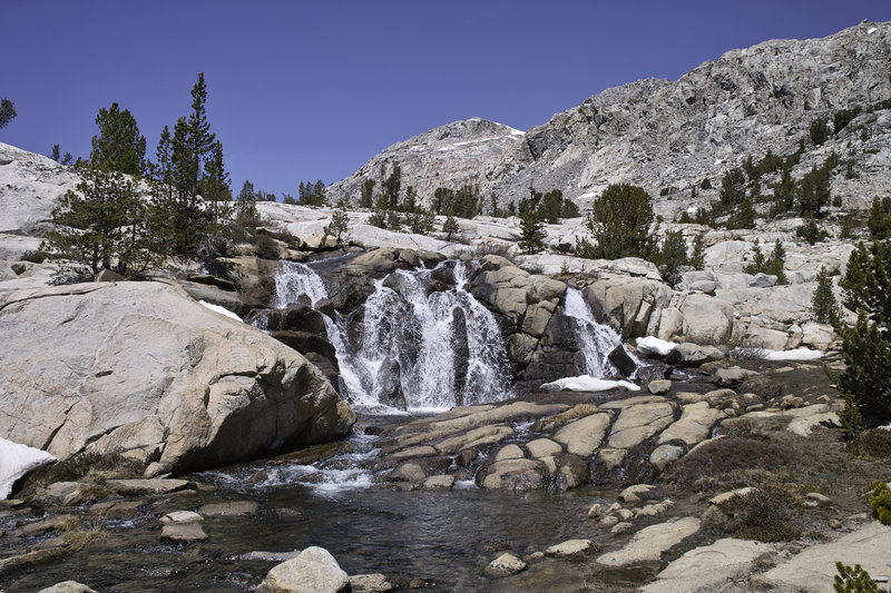
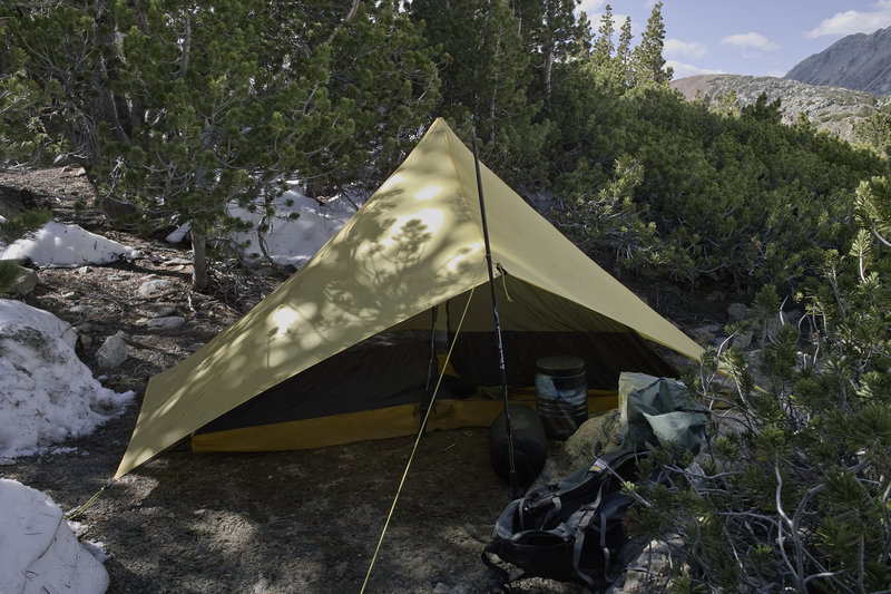
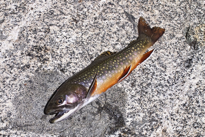
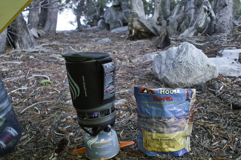
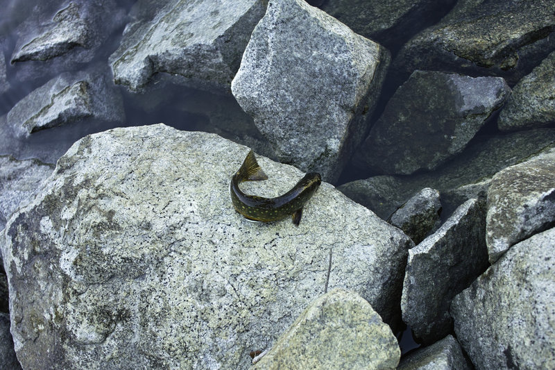
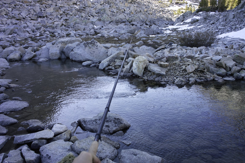
I decided to head back down the pass, to take it easy, and make the trip a series of overnighters—exploring some of the unique areas on the eastern side of the Crest and do some more fishing. I brought a Tenkara rod for the first time, and the fishing was fantastic. I caught several trout in the first day. After passing Piute Lake I camped down at Loch Laven for the night.
Day 2 - 7 miles, 2000 ft
I headed down from the basin and back down to the ranger station in Bishop to pick up permits for the next two nights. After a sunscreen refill at the Bishop K-Mart, I would head up toward Bishop pass, the other side of my originally planned trip.
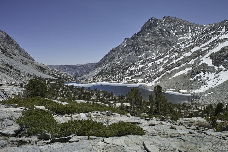
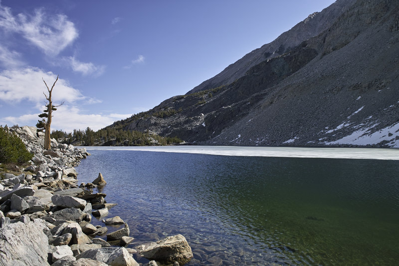
The trail to Bishop Pass held similar snow. I caught more rainbows in the ponds below Long Lake, made my way toward Saddlerock Lake, but got stopped by late-afternoon snow that was so melty that further travel would involve precarious postholing over talus. Deciding this was another good place to stop, I set up camp by the lake and did some more fishing for the night.
Day 3 - 12 miles, 2750 ft
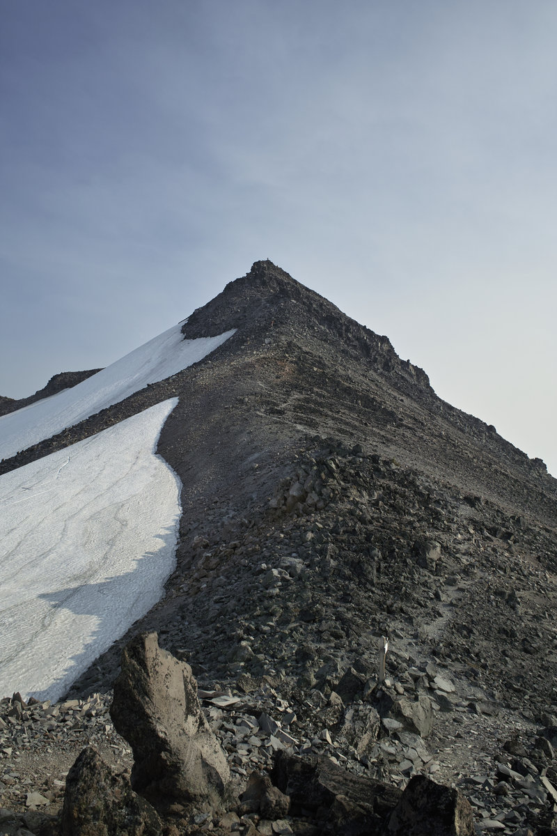
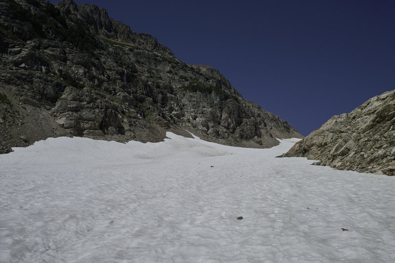
It was time to see what Bishop pass held. I woke up early when the snow was still crusty, and headed up toward the small basin below Bishop Pass. The area was again mostly snow free, but the pass was holding a large snowfield at a steep angle. While most of the snow was crusty, the sun had gotten to the pass early in the day, and I was already making iffy postholes in the Talus Field. The allure of making it into Dusy Basin was tempting, but the angle of the snowfield, my lack of ice axe, and the post holing made me admire the view from just below the top.
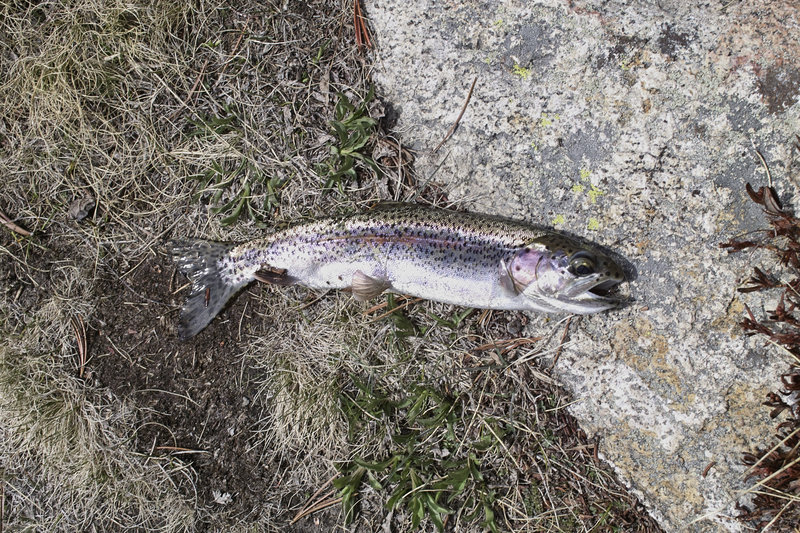
I descended past Ruwau lake via a lesser used trail which became extremely difficult route finding when I ran into snowfields above Chocolate Lakes. Again, it seemed that my tracks were the first in the area. Once I figured out how to get down the steep sides above Upper Chocolate Lake, the hiking became a bit easier, but still a little brushy. Lots of scrambling fun. Middle Chocolate Lake held my best catch—dozens of rainbows over the course of about two hours. Most of the fish in this area were about 8", with a few 10-inchers, here and there. By far, my most productive flies were a Brown Hackle Peacock (which looked a lot like the flies that were around the lake), and a copper wired Sekasa Kebari when it got dark out. Someone had recommended caddis flies for the area, but the fish did not like them. It's amazing to follow these lakes and see hundreds of fish just hanging out on the banks—at times there's almost no challenge to it.
After making it back to the trailhead, I drove past the leafing Aspens and headed north to the Basin above Rock Creek. This area came on the recommendation of the ranger down in Bishop for an area that was a worthwhile overnight trip. While a little crowded during the day, again, I was the only one out there for the night. Given that this was the third weekend in May, I was amazed at how no one else was backpacking in these areas. The trail follows Rock Creek into a beautiful snow-covered Cirque, with lakes all along the way.
Long Lake was extremely productive, with my Brown Hackled Peacock bringing in several rainbows and a few browns (or brookies?). As it approached dark, I made it up towards Gem Lakes and found a nice place to camp off a small creek.
Day 4 - 13 miles, 3000 ft
I made the short trek up Morgan Pass, went down to upper Morgan Lake, and returned back via a trail which appeared to be a converted tungsten mine road. I contemplated going over Mono Pass to explore that area, but the pass wasn't visible behind a small mountain, and it would have been a long hike up with a high potential of more impassible snowfields, so I decided to find something else.
It was super windy, and pretty cloudy, so the fishing was less productive. I got my first few little trout out of Rock Creek (more challenging and fun than lake fishing), but the fish weren't biting in the lakes. I gave it my best shot at Box and Heart Lakes but there were few fish that were interested. I can only figure this was due to clouds, water temperature or the wind ripples in the water. Not wanting to leave without catching more than a few fish that day, I did a little fishing at the trailhead and caught a few more trout. Very addictive.
I drove the car north toward Mammoth and stopped by the Mammoth ranger station for a permit. Agnew Meadows has seen really bad blow down this year, so the only entry point into Ansel Adams Wilderness was via Gem Lakes. I drove north into June Lakes Loop and started up the trail above Silver Lake. I had been to Gem Lake before, but the lake is really not the most spectacular place, and upon viewing the very low snow levels at Agnew Lake, I decided to head back down and make the most of it by heading toward Yosemite.
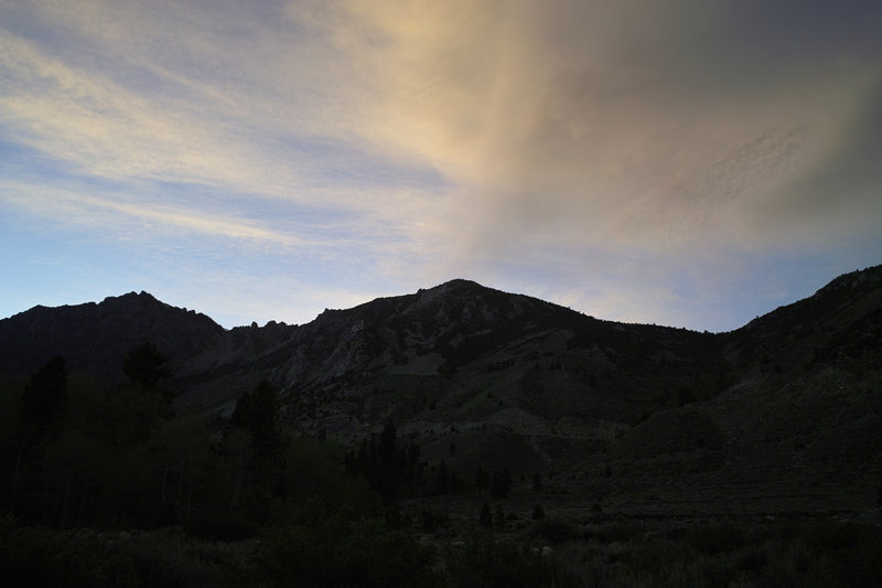
My plan was to do something in the Cathedral Range, but the Tuolumne Meadows ranger was already closed for the day. Not wanting to get dinged with a NPS ticket for camping without a permit, I drove back down Tioga pass into Inyo and found a great little campground that was much cheaper than most. The sunset was fantastic.
My hope was to get back up to Tuolumne for one more overnighter, but my check engine light was on the next morning. The rest of the story is a little tragic—after a break down on the highway and a few days in Mammoth Lakes trying to get it fixed, my car is being towed back to Portland where its fate will be determined. But the time I had was pretty great and relaxing. I caught tons of fish, and was able to check out some new and amazing parts of the Sierras. It's worth the trip!
May 18 – May 22, 2012

 1
1
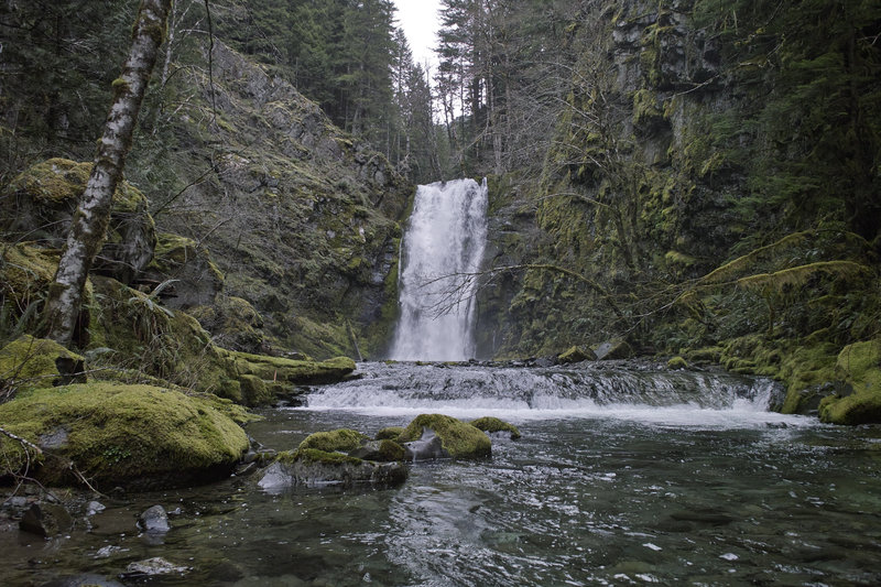
Falls Creek Falls
8 miles of hiking • 1500' elevation gain •
Went out to Falls Creek Falls and did a little exploring up by Paradise Campground.
April 21, 2012

 1
1
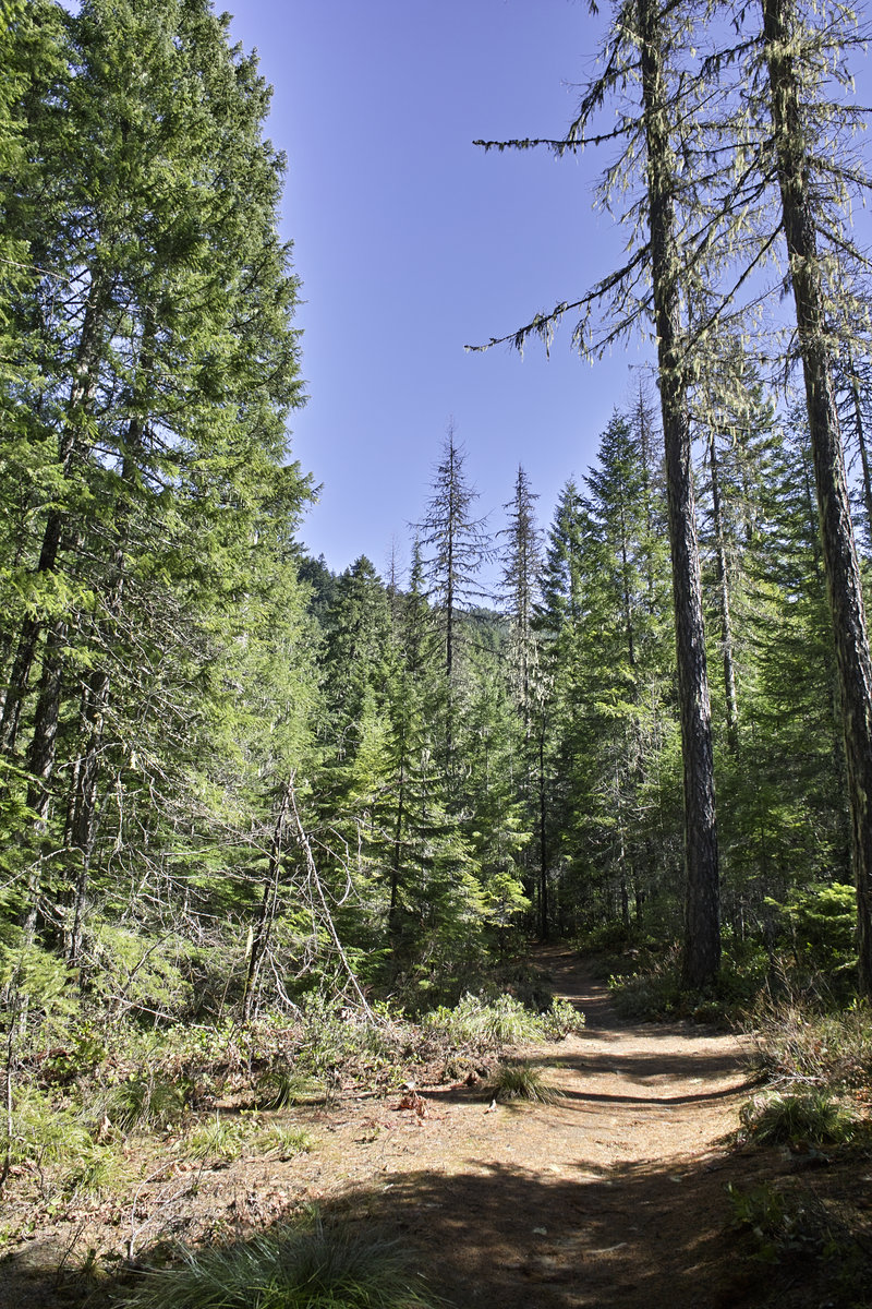
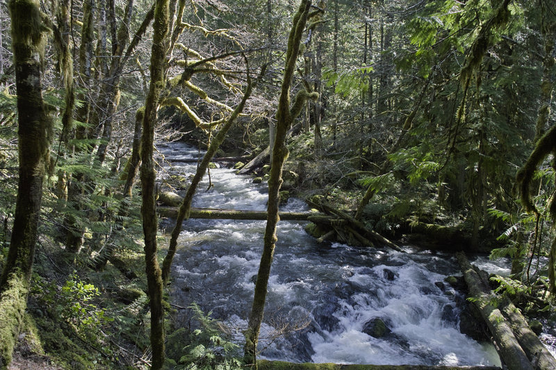
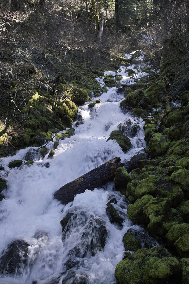
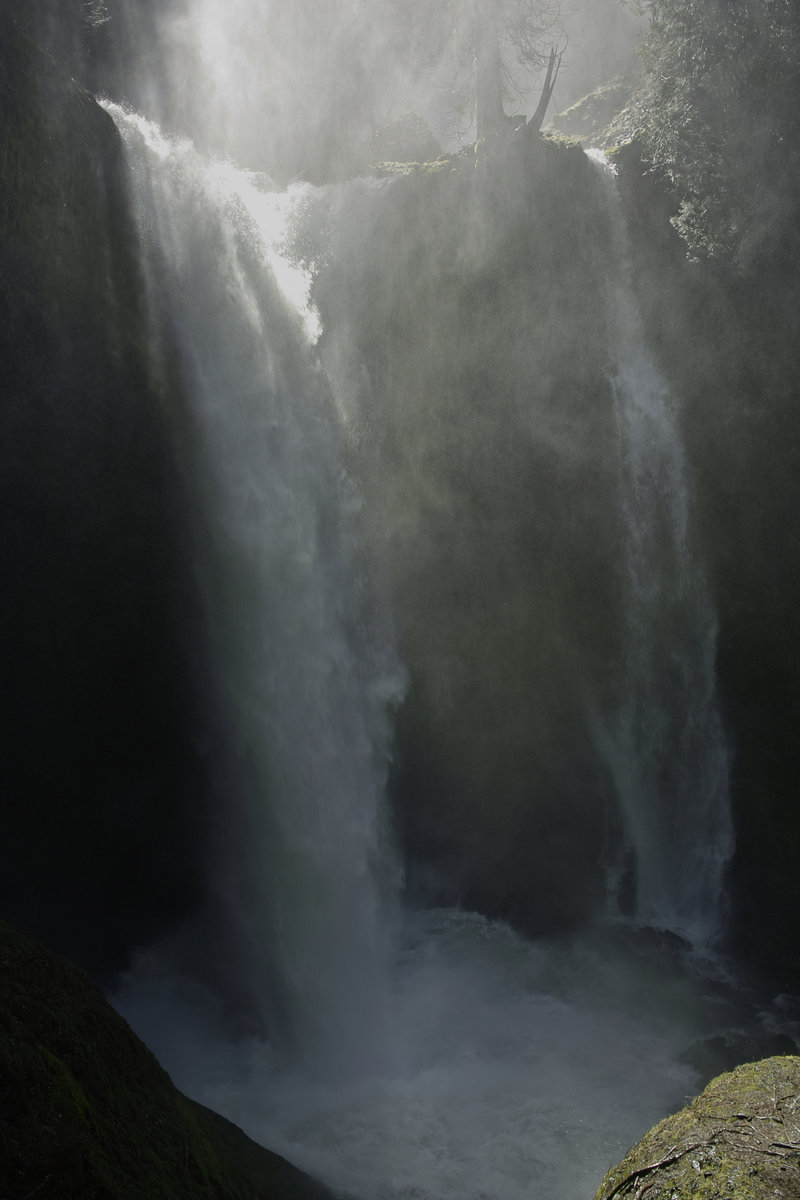
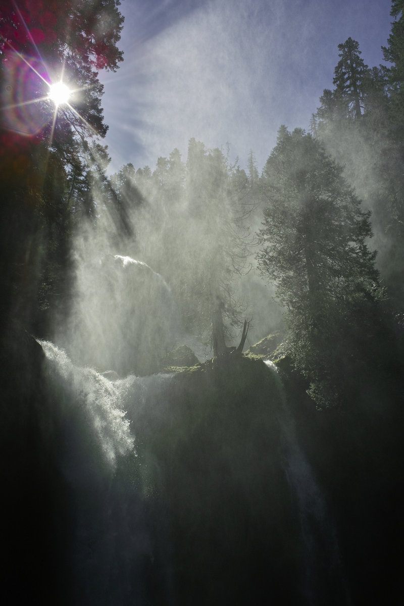
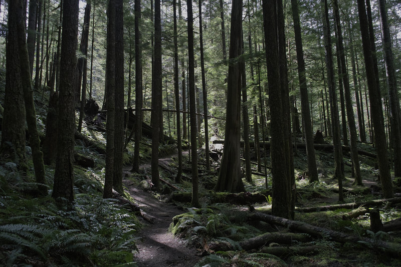
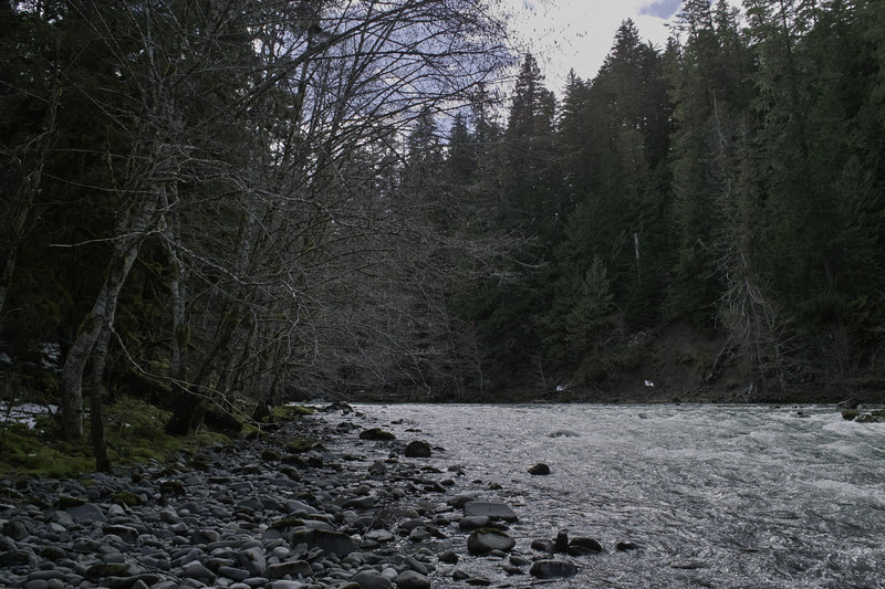
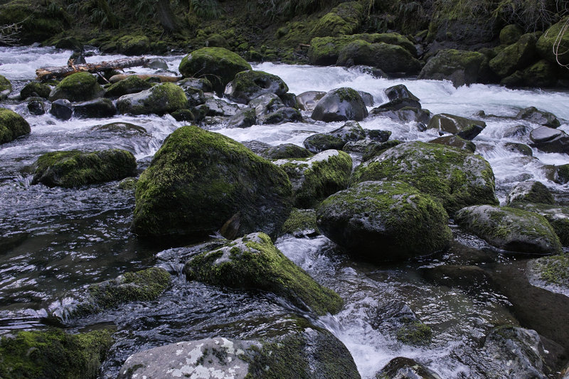
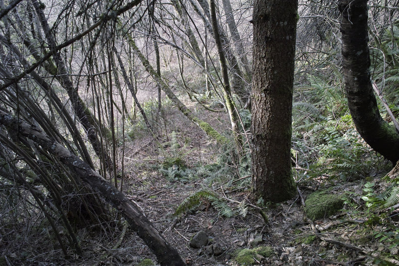
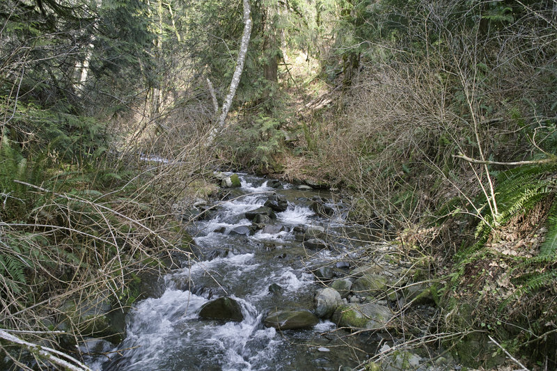
Siouxon Creek
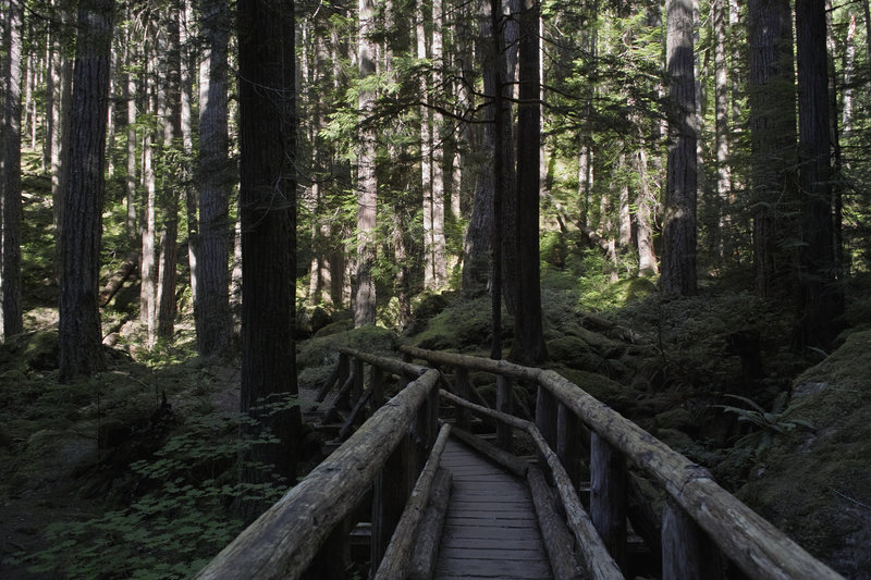
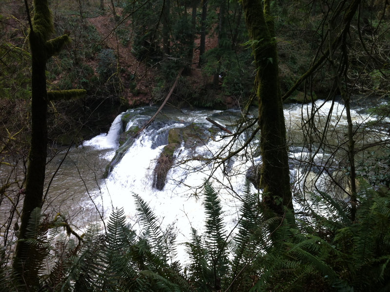
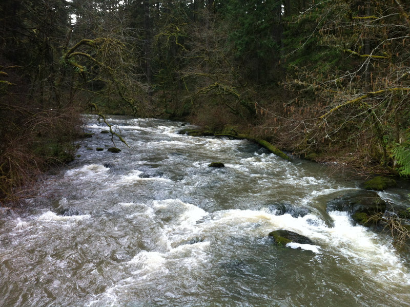
10.5 miles of hiking • 1750' elevation gain •
A quick trip up Siouxon Creek Saturday morning. This still is one of my favorite places in the area. The river crossing to Wildcat Falls was chest-deep, and I almost got carried away with the current on my first attempt, but I was able to find a crossing a little farther down that was only waist-deep which was a little safer—kind of exhilarating.
April 14, 2012

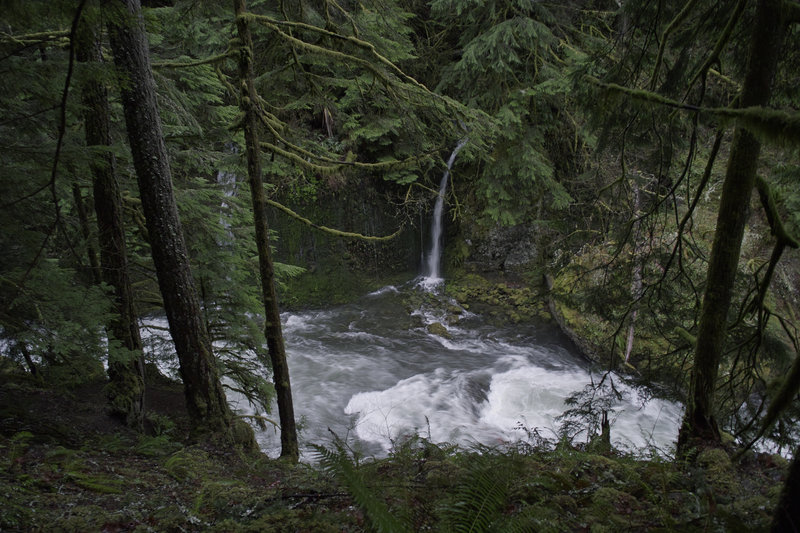
Wahclella Falls/Herman Creek
4.5 miles of hiking • 750' elevation gain •
A quick late afternoon trip up to Wahclella and Herman Creek, looking for something, during the high water day.
March 30, 2012

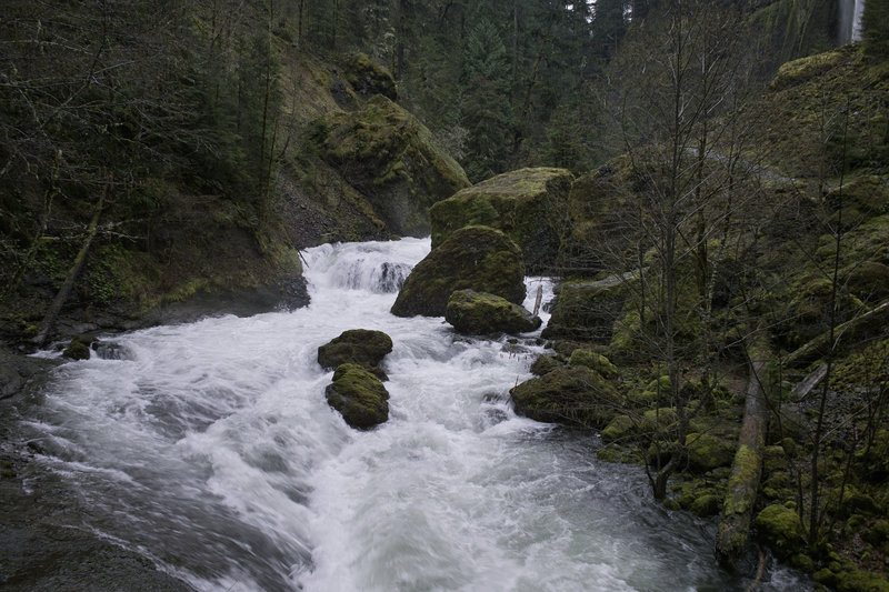
 1
1
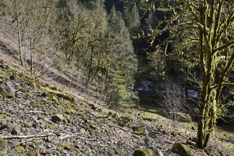
Riverside Trail
5.5 miles of hiking • 750' elevation gain •
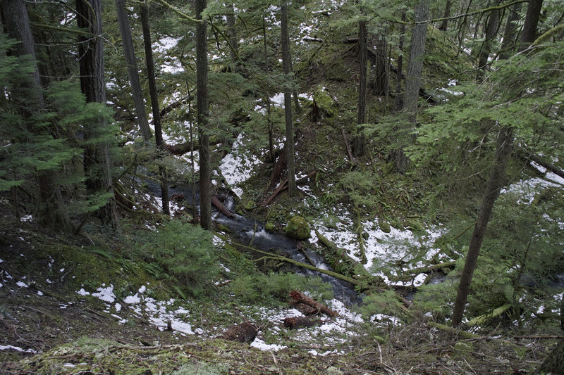
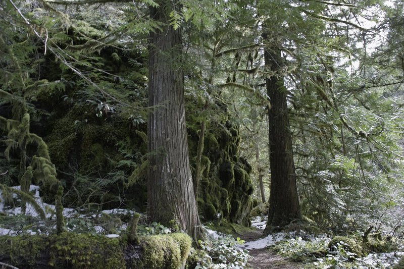
Did a little exploring along the Riverside Trail, on a fork of the Clackamas north of the Ripplebrook ranger station. This is a nice little-trodden section which gets some of the pre-alpine forest.The snow was just about gone around 2000ft.
March 28, 2012

Lacamas Park
5 miles of hiking • 750' elevation gain •
I was looking for a nice trail run and this area was recommended. About 8 miles of trails in the park, and then the trail that follows Lacamas Lake goes on for a few miles. Great for being so close to home—a nice alternative to Forest Park.
March 24, 2012

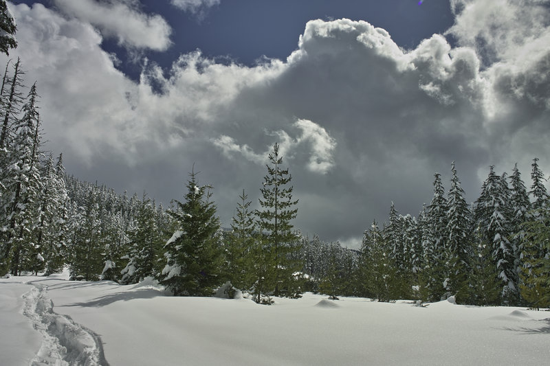
Twin Lakes Attempt
2 miles of hiking • 500' elevation gain •
Tried to snowshoe toward Twin Lakes from Frog Lake Snopark but the snow was too deep—each step with snowshoes postholed 1.5 ft into the concrete. Decided to drive towards the Gorge instead.
March 23, 2012

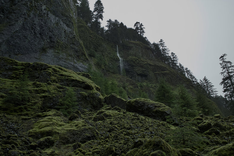
Eagle Creek
2 miles of hiking • 500' elevation gain •
Wandered around the Eagle Creek canyon for a while. Explored the use trails down to the creek, rather than hitting the falls.
March 23, 2012

PCT North
10 miles of hiking • 2500' elevation gain •
The plan was to do Table Mountain from BHS. Like all my plans, it didn't happen. The weather got absolutely miserable the farther you got back from the Columbia—fifty and sunny at the river, in the low thirties, sleeting and a mud slick at the "Table trailheads." Given that there would be no views at the top, I decided to make a loop out of it and swing by Gilette Lake.
March 17, 2012

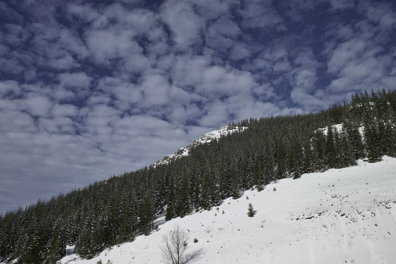
Potato Hill
6 miles of hiking • 2000' elevation gain •
You say Maxwell Butte, I say Potato Hill.
I was planning on doing Maxwell Butte Friday, but the snow just wasn't going to cooperate. Started at Maxwell sno-park, but the snow was borderline concrete—super melty—and there were no tracks to make it any easier; I bailed after about a mile.
Instead, I booked it on up Potato Hill. This little hike starts at the Potato Hill sno-park, right at the prominent curve in the road over the pass. A sweet little hike, with nice views because of all the burn. This would make a nice beginner snowshoe—while there is about 1500 ft of gain, the grade is very gradual.
The weather could't have been better—60 degree temps on Santiam Pass! The only downside, of course, was soupy snowshoe postholing. The back side of the hill had some nice wooded areas to explore, allowing for an interesting loop.
Also, if you've never taken Rt. 20 down back through Albany, it adds about 10 miles, but is a very nice drive for a change.
March 9, 2012

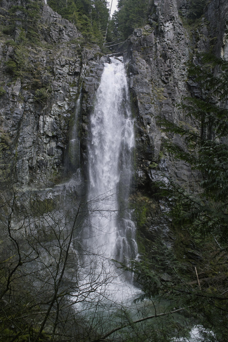
Aldrich Butte/Falls Creek Falls Attempt
5.5 miles of hiking • 1250' elevation gain •
Plan A was to try and snowshoe in to Falls Creek Falls. The snow was complete concrete, and after 1/2 mile in, I decided it wasn't worth my while.
Then I thought I'd try and get up to the Old Man Pass sno park to do a little exploring, but it seems the road hadn't been plowed since the weekend before, so the snow got thicker than I trusted my car to get out of.
Plan C was Aldrich Butte. A nice quick hike, since I didn't have too much daylight left. The trails on the west side are far nicer than the east road. I want to get back to explore the Cedar Falls area.
March 3, 2012

Multnomah-Wahkeena Loop
5.5 miles of hiking • 1750' elevation gain •
At 30 minutes away and just 1/8th tank of gas, I don't know why I don't do this hike more often. A great option when you have just two hours, even with all the people.
The usual crowds, thinned a little from the rain and snow. Also, ran into EP.
February 26, 2012

 3
3
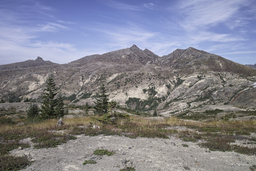
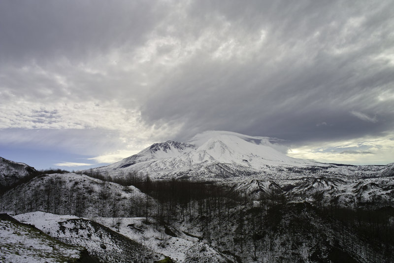
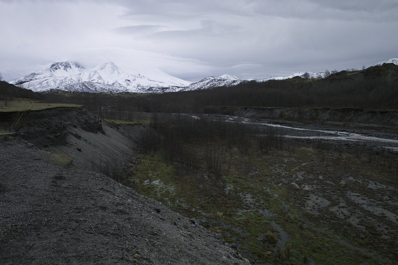
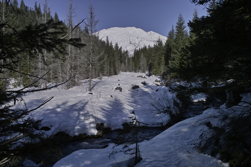
Hummocks and Boundary Trails
5 miles of hiking • 1000' elevation gain •
Decided to go up to St. Helens to check out the north side in the winter. The road wasn't too bad—maybe a little slushy, but the winds were picking up and a storm was coming in. I did the Hummocks loop and went up a little ways on the Boundary Trail, but packed it up when it started to rain. I didn't see a soul.
Lots of ducks, a herd of elk, and some beautiful bugling.
February 24, 2012

 1
1
Boy Scout Ridge
5.5 miles of hiking • 1750' elevation gain •
A quick trip up Boy Scout Ridge. Once you get past the first 1/2 mile of madness, things were very quiet—no snowshoe tracks past the bowl you climb up to get to the ridge. Went down the ridge on the way back, which was really nice after the new snow. The ski traffic was insane, so I turned around and went back the Hood River way.
February 19, 2012


Angel's Rest
5 miles of hiking • 1500' elevation gain •
Maybe I'm becoming a softie.
Did Angel's Rest because only had 2 hours to hike, I didn't have the wherewithal to find something new, and frankly, it just sounded nice. Aside from the usual crowds coming down, not bad.
February 11, 2012


Archer Mountain Complex/Cape Horn Viewpoint
5.5 miles of hiking • 1500' elevation gain •
Having just a few hours (sorry again Eric!), we decided to do a little exploring in the Archer Mountain complex. Did a little getting lost, found a lot of blowdown—especially starting at where the base of Archer converges (where I tagged the pin)—which slowed things way down. With 1000 ft of gain + a blowdown every 20 ft ahead of us, we decided to pack it in.
I want to come back here when things get cleaned up a bit. Any idea if we can just take a bow saw and go at it, or is this really a super special protected area?
Not getting any decent views, we stopped at the western Cape Horn tunnel and did the quick trip up to the viewpoint. Super windy.
February 5, 2012

 3
3
June Lake Loop
7 miles of hiking • 1500' elevation gain •
I had just a few hours today, and I wanted to take a quick walk, so I picked June Lake. Marble Mountain is 1 hour 15 minutes from my house, just about the same as the Hood sno parks, but I always forget it's so close. As long as you can live with the snowmobile noise for the first 1/2 mile or so, the area is far less crowded.
The snow was so packed in on the trails, snowshoes weren't necessary. I did the loop up to June Lake, then across to the Worm Flows route, and just up enough to get some pretty sweet views of St. Helens.
The weather was great—right around 45 up on the mountain.
February 3, 2012

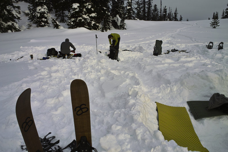
 2
2
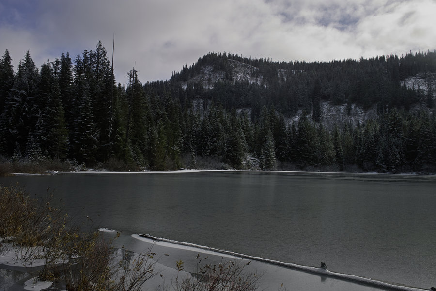
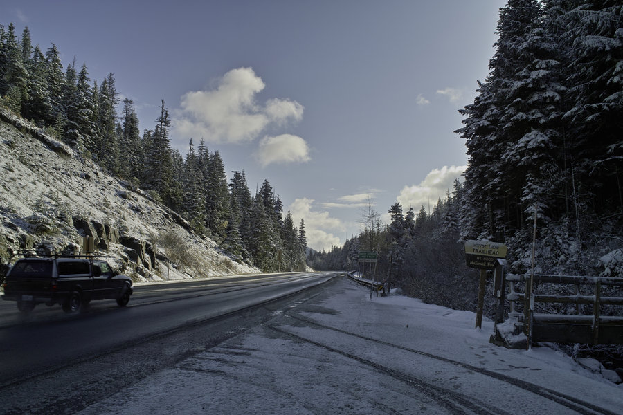
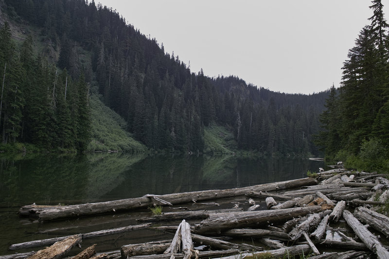
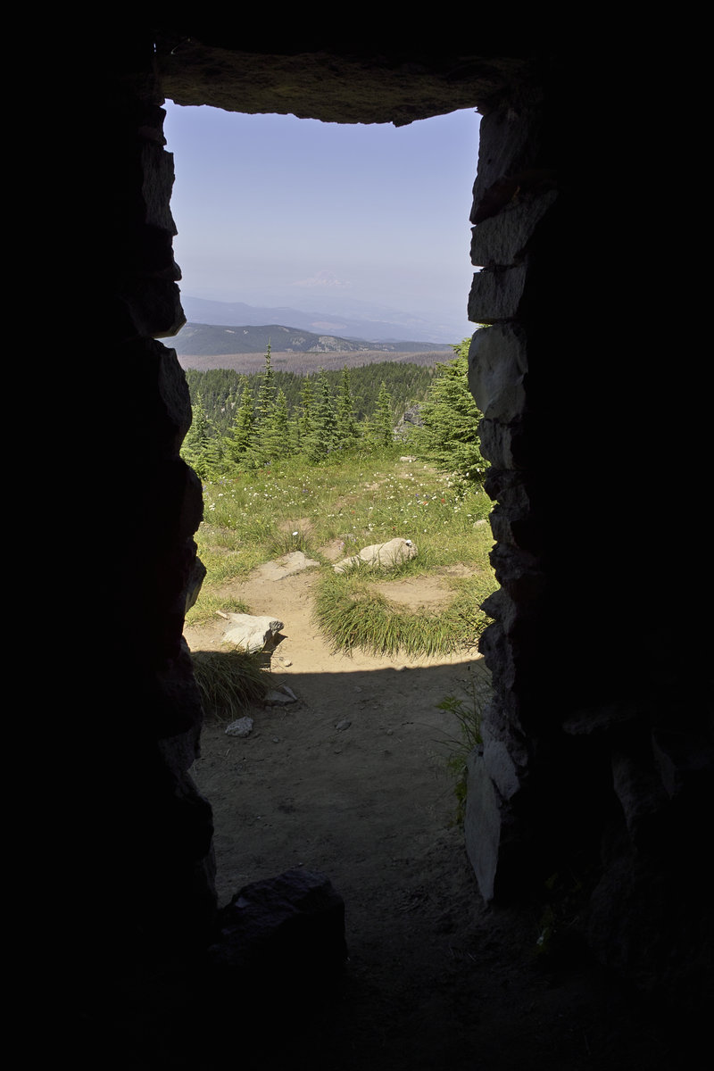
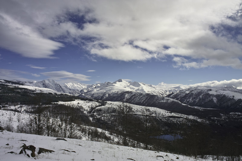
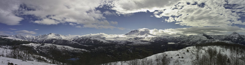
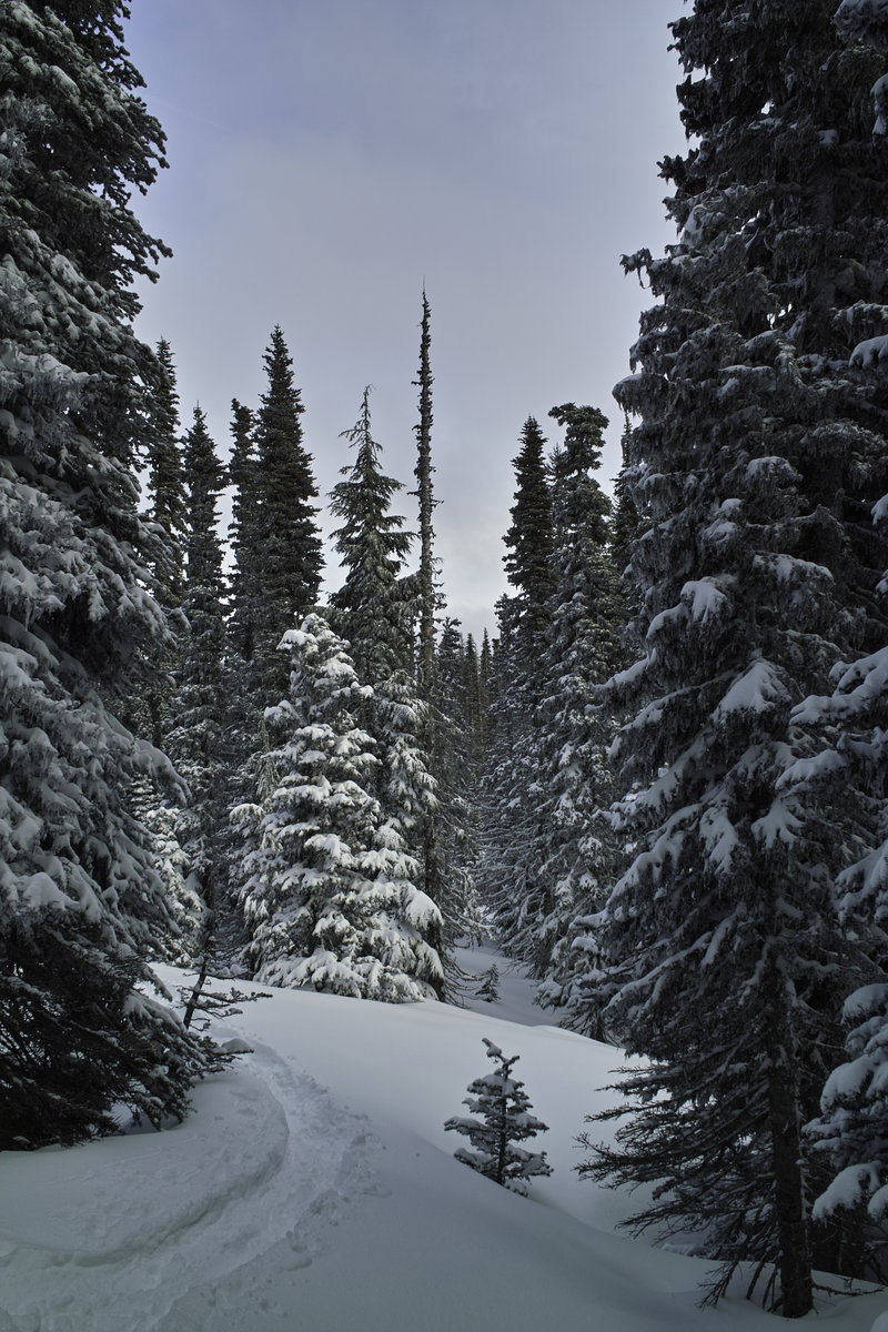
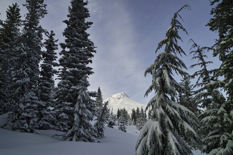
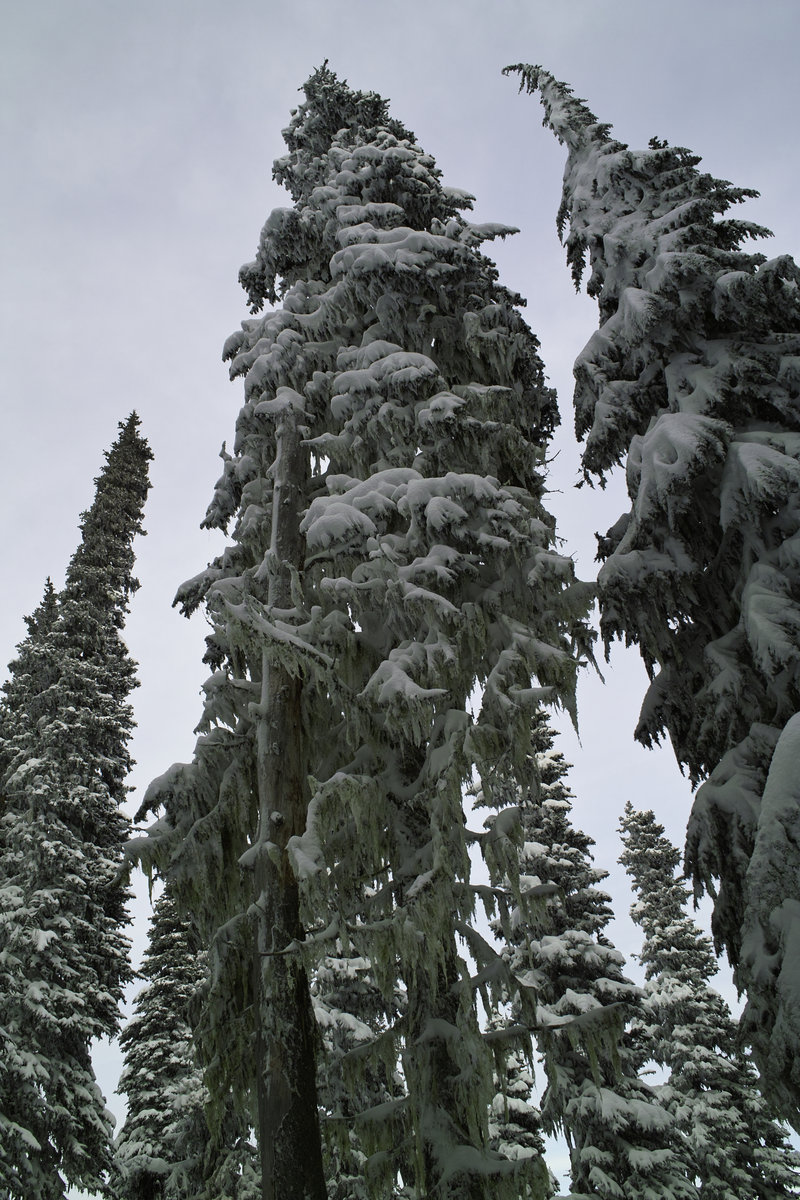
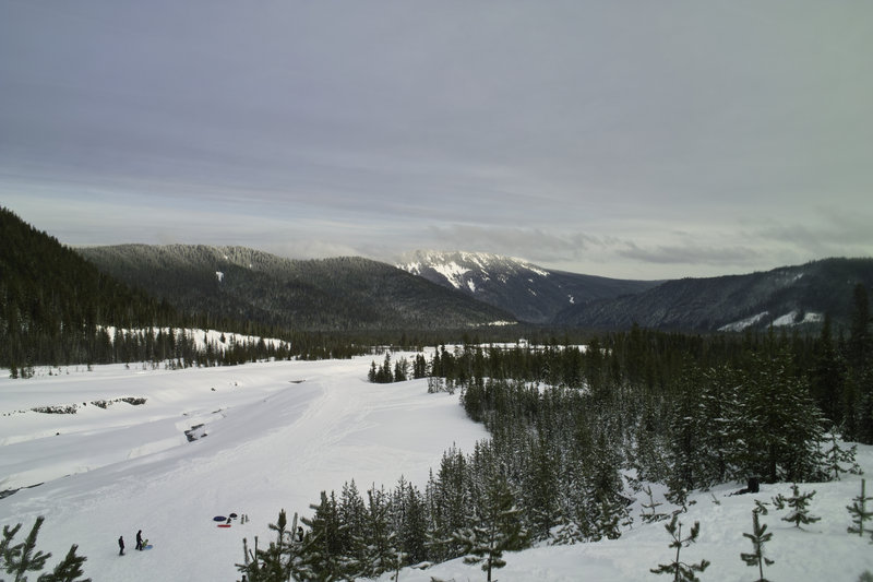
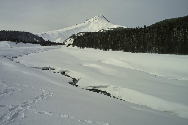
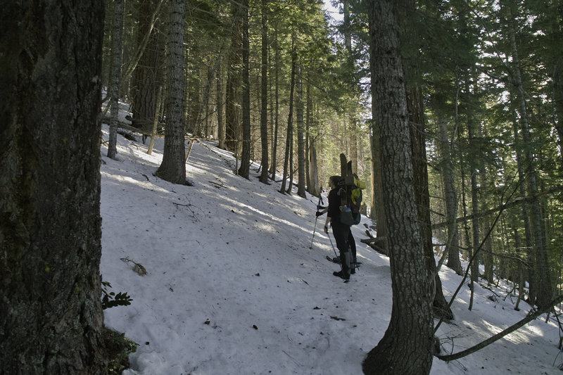
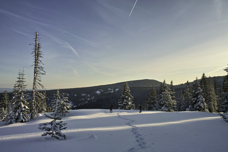
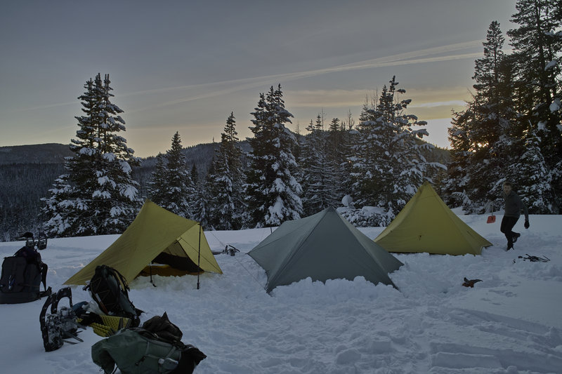
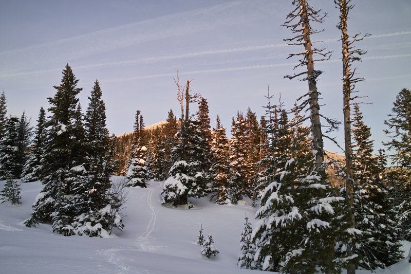
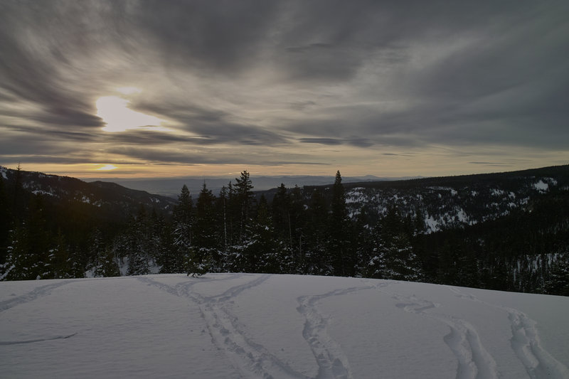
Gumjuwac Saddle
6 miles of hiking • 2000' elevation gain • 1 night
This. (More photos to the right.)
January 27 – January 28, 2012

 1
1
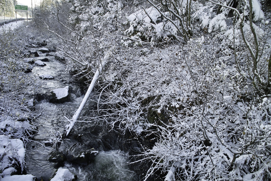
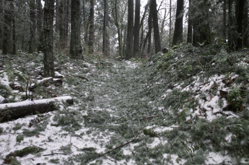
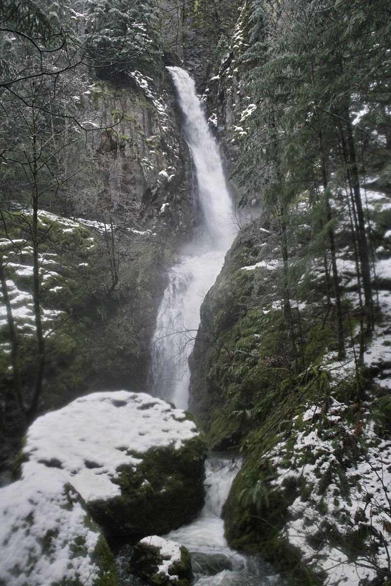
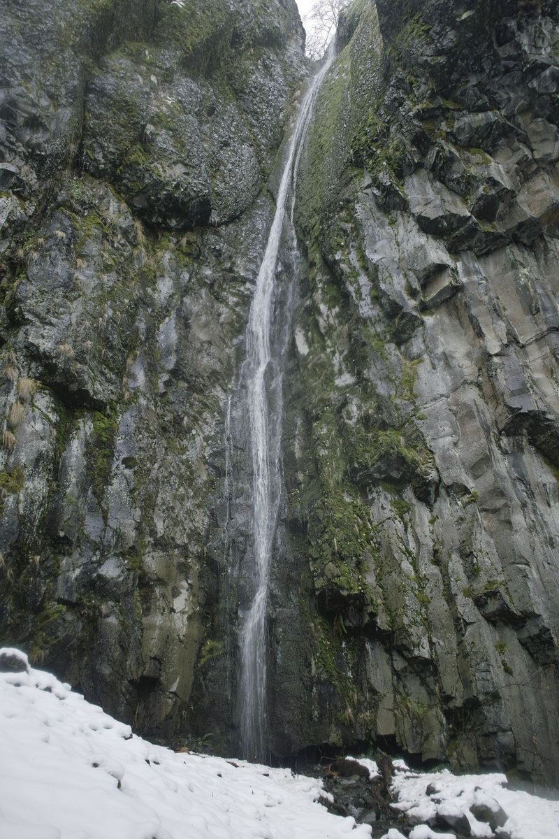
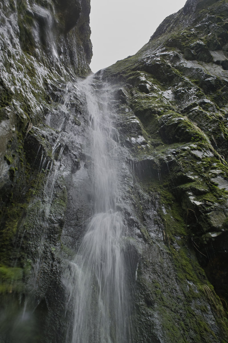
Elowah/Cabin Creek/Warren Creek Falls
4 miles of hiking • 500' elevation gain •
More takin' it easy, trying to get the knee back to normal.
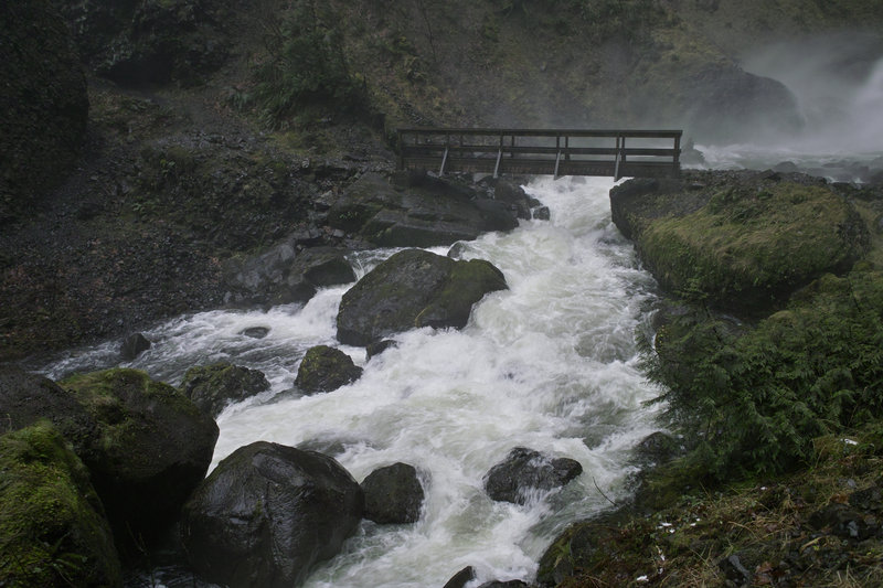
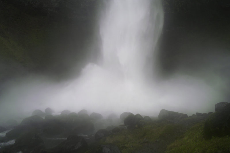
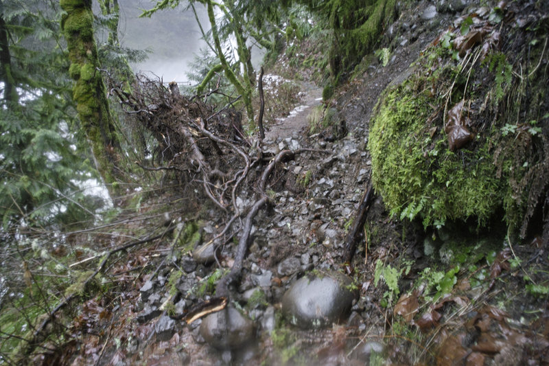
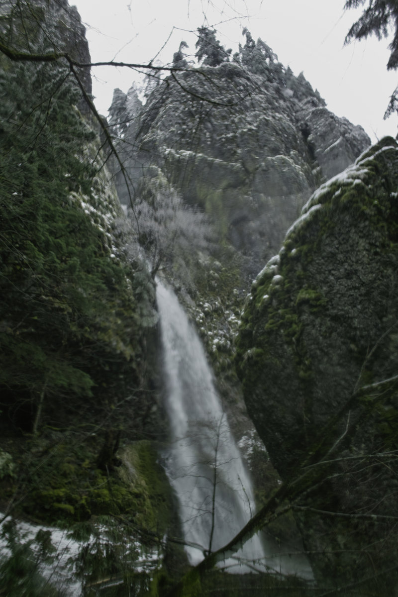
Since the creek levels were supposed to be super high, I decided to visit some of the local waterfalls. Elowah and Multnomah were roaring. I also thought to go down to Starvation to see if Warren Creek falls was doing anything. Just a little sprinkling, but Cabin Creek and Hole in the Wall falls were moving quite nicely. I ran into Tom K. and Oregon Field Guide doing a story on Warren Falls—pretty cool!
January 20, 2012

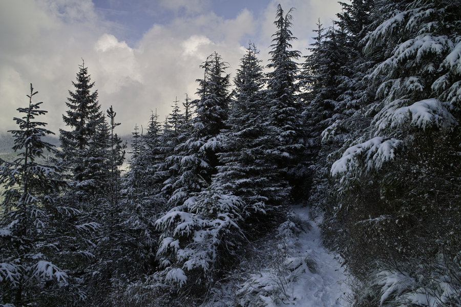
 1
1
Newton Creek
4.5 miles of hiking • 750' elevation gain •
A quick trip to Newton Creek to start off the year and try out some new snowshoes to make sure they worked right.
What a nice spot! I'm never going to White River ever—ever again.
The car thermometer was reading 44 at the Teacup Sno-Park and things were nice and sunny. Everything was pretty consolidated, so snowshoes really weren't necessary, but this weekend's snow should change all that, I'd think.
January 13, 2012