


2012 Trips

 2
2
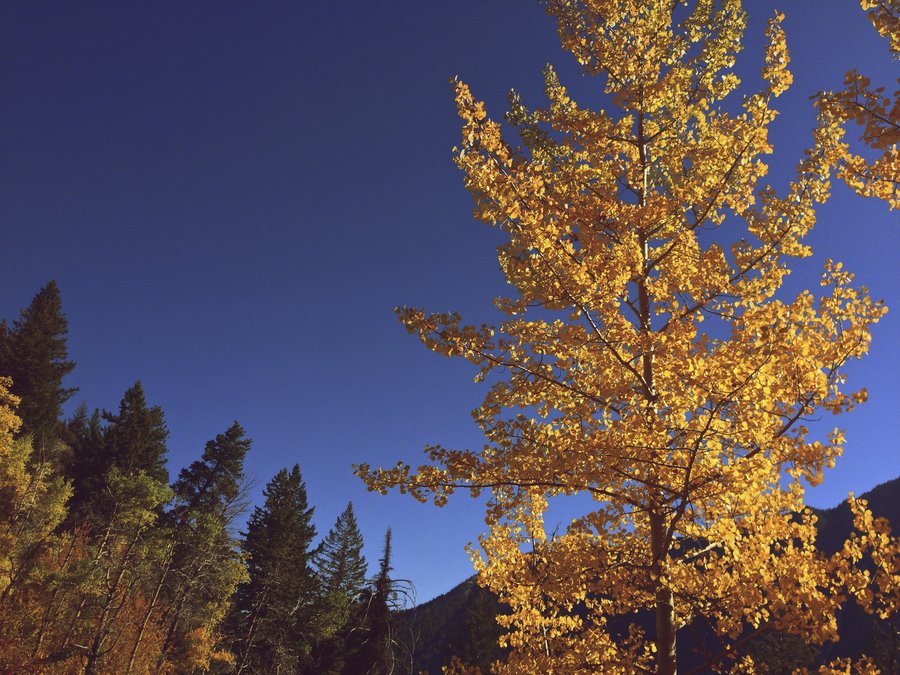
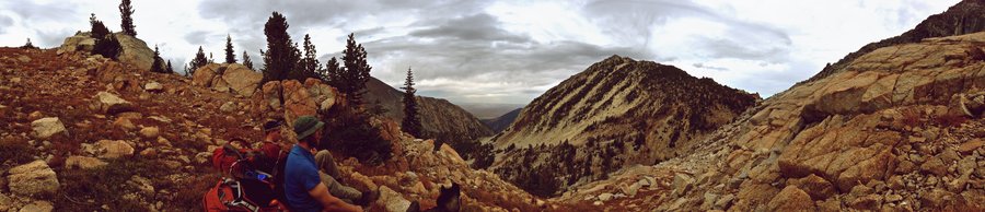
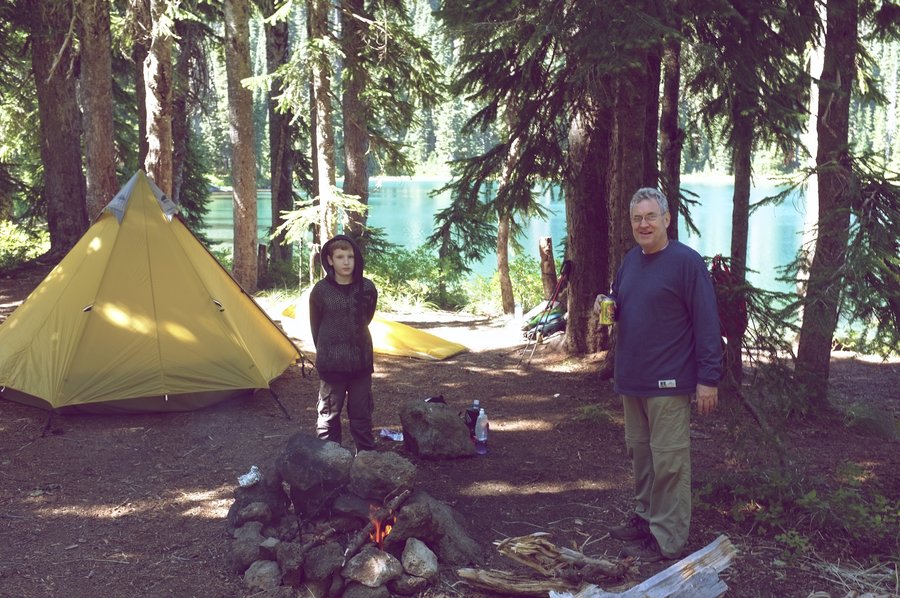
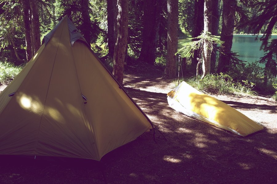
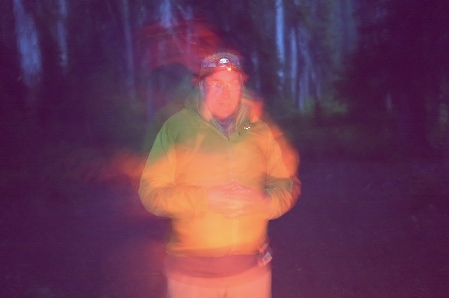
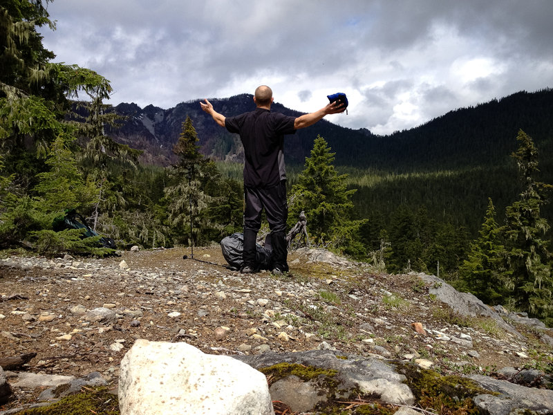
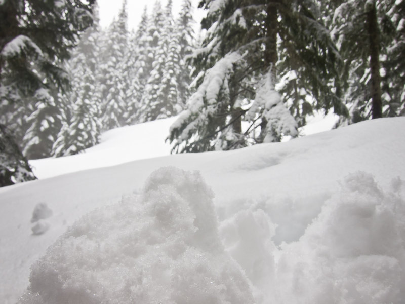
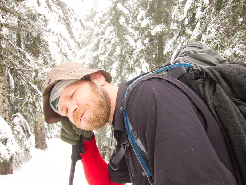
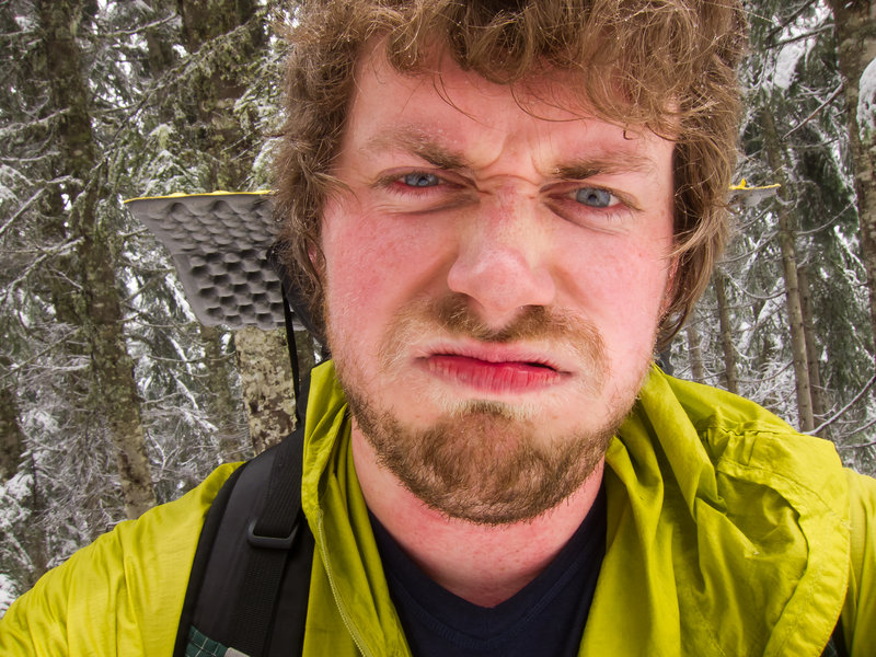
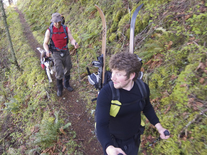
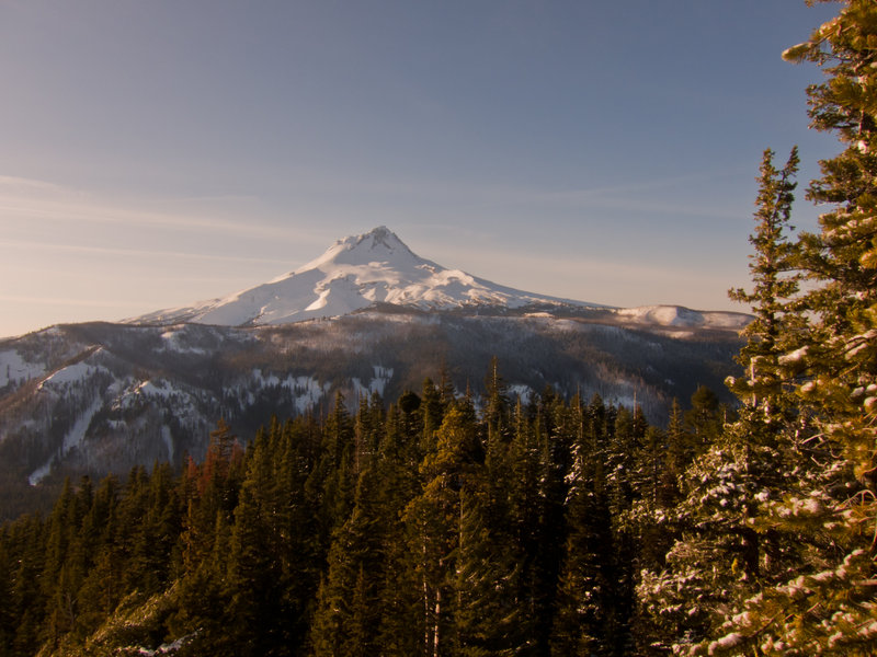
Cooper Spur Igloo Building
4 miles of hiking • 1500' elevation gain • 1 night
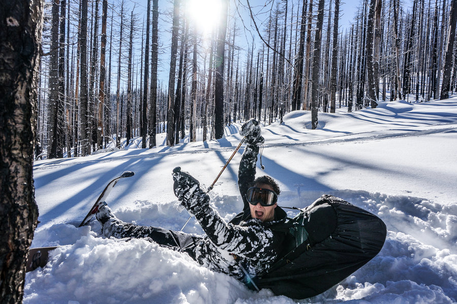
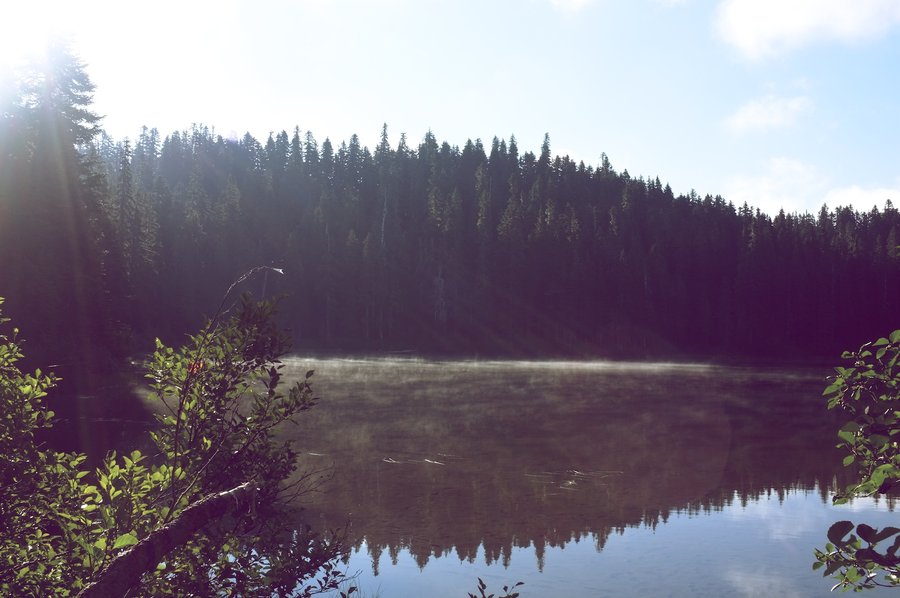
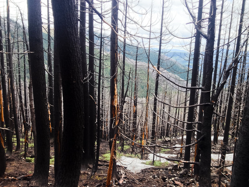
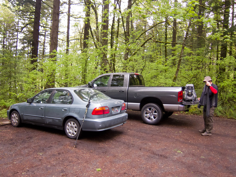
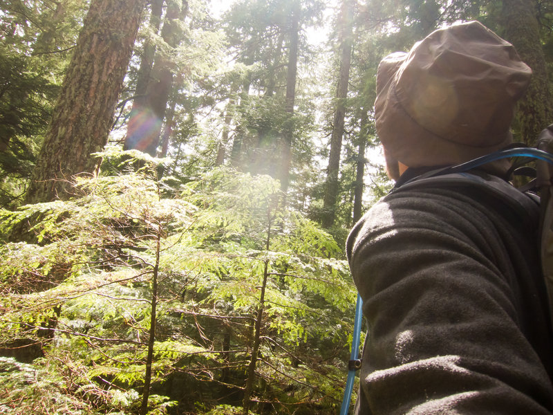
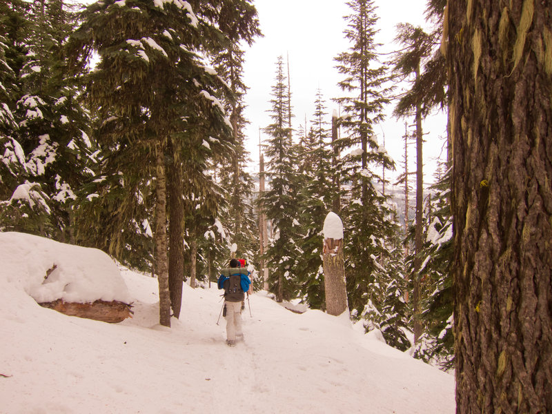
A buddy and I headed up early Wednesday to climb up to the treeline at Cooper Spur and build an igloo. Unfortunately, there were a couple set backs. The first was careening out of control into a snow bank. We were just a few miles from the turnoff to Cooper Spur from Highway 35. There was about a quarter or half inch of snow on the ground, freshly plowed with gravel. We were being passed by similar cars without chains on. On a straight stretch of road with nobody around us, I mashed the brakes a bit to see how much traction I had. You know, to be safe.
Turns out, I had none.
The back end of my Civic slid out quickly and my attempt to steer into the slide was overdone. We spun 180º and ended up slamming backwards into 3' of snow piled up from the plows. The car was stuck really good on top of compacted snow which took about an hour to dig away. There was some body damage and the driver's side door wouldn't open because of a dented in front quarter panel, but the car was in fine working condition. Cosmetic issues with one non-essential functional issue—a door.
So we continued on. This time, with chains.
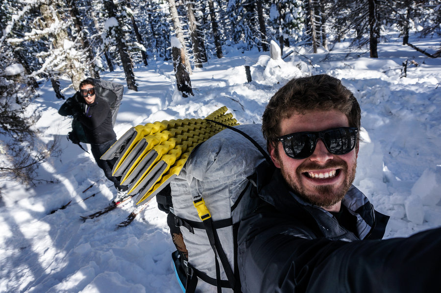
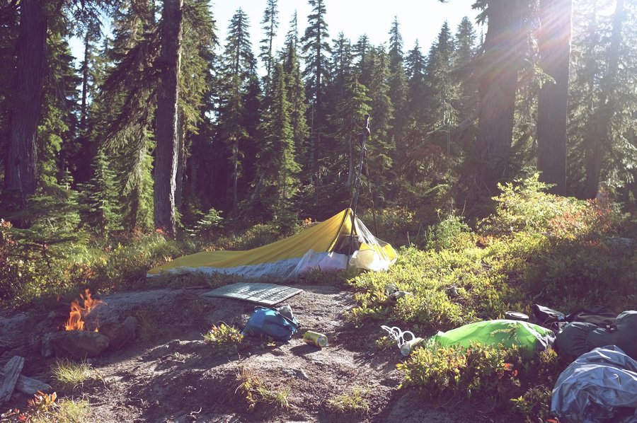
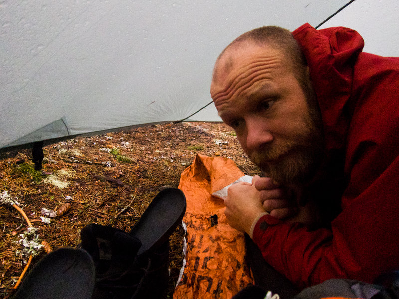
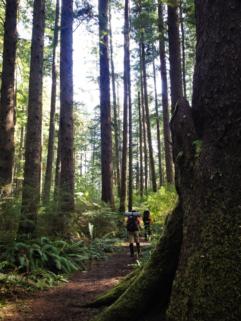
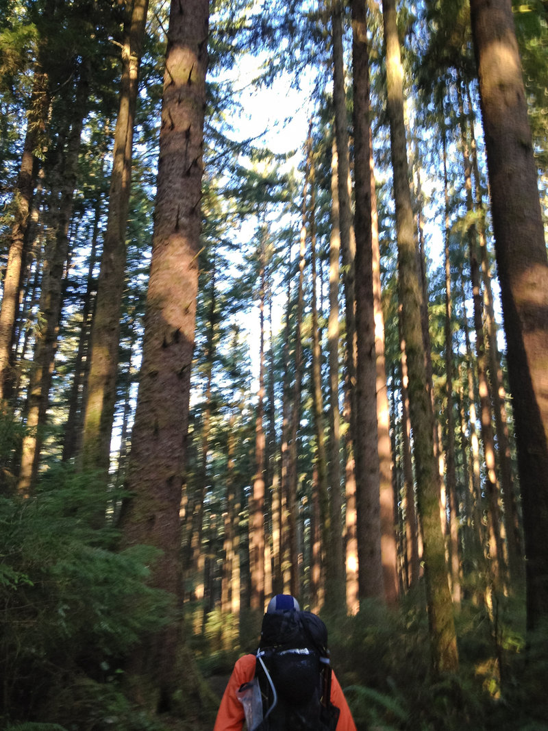
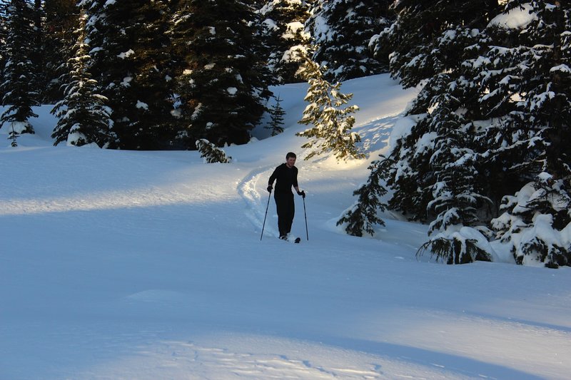
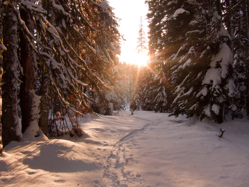
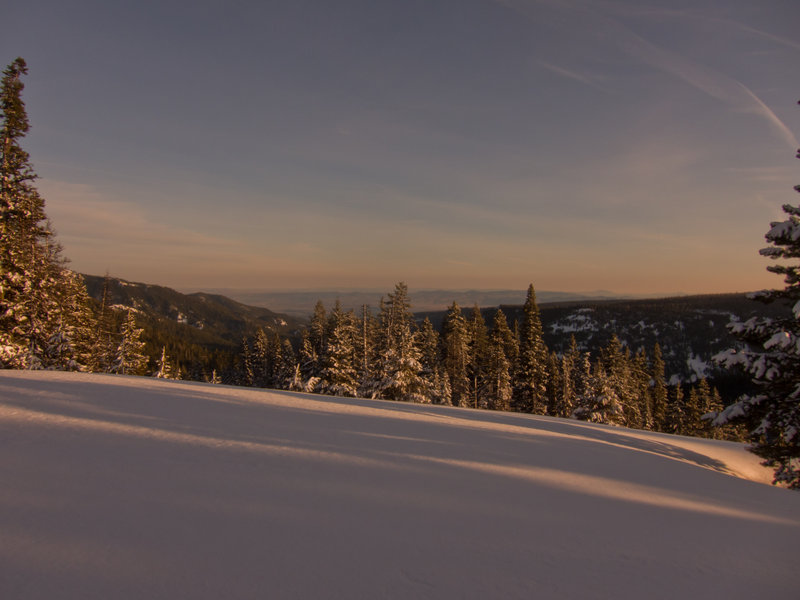
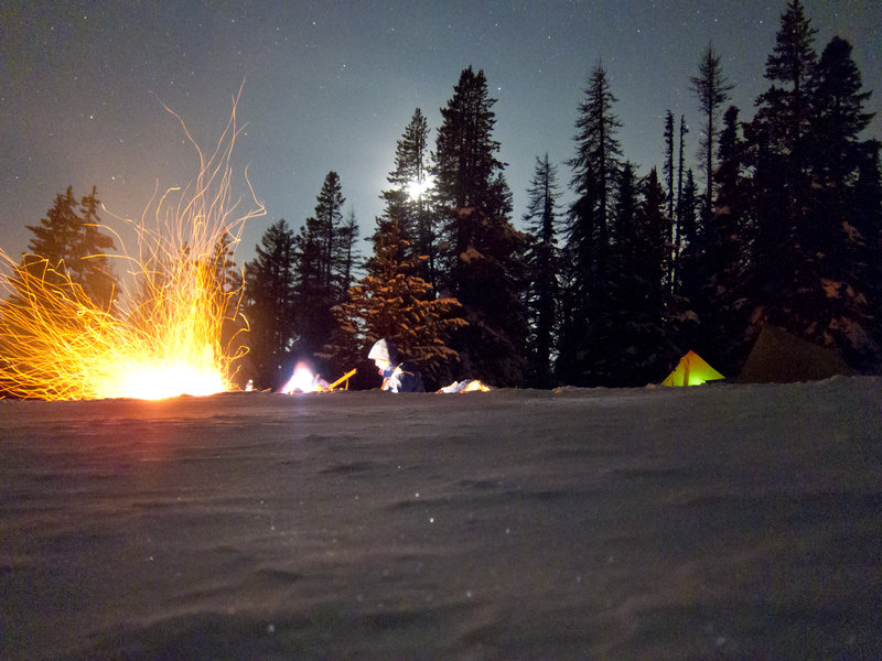
We were running an hour behind, and igloos take a long time to build. We left the trailhead on skis by about 10:30. The forecasted blizzard was nowhere in sight, high clouds giving way to blue skies throughout the day. The second set back was that nobody had broken trail past the first mile. Both Ollie and myself were on 125cm "skishoes" called Altai Hoks. They are a short, wide ski with inlaid climbing skins meant to combine the best of a snowshoe with the best of a backcountry ski. They have lots of surface area compared to a typical snowshoe, but the snow was knee deep fresh powder. The hill was steep. And, worst of all, we each had 30 pounds on our back.
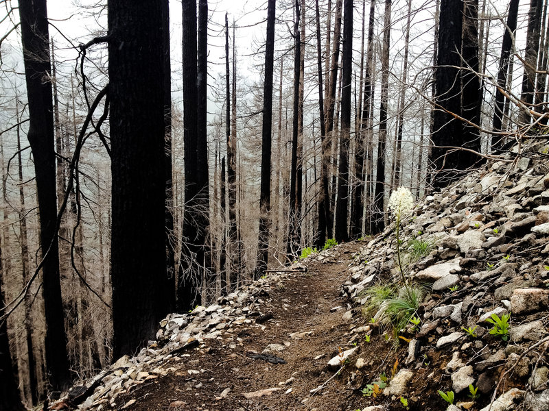
We made it another mile before we were spent. Besides, daylight was burning and we had 6 hours of igloo construction ahead of us. We backtracked down the hill below the burn to build our igloo. With the bad luck we already had, camping among a forest full of widow-makers did not seem like a great idea.
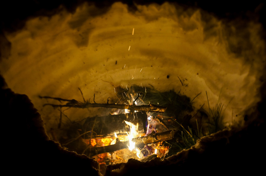
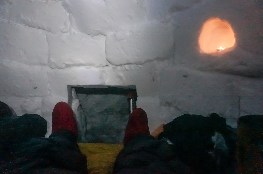
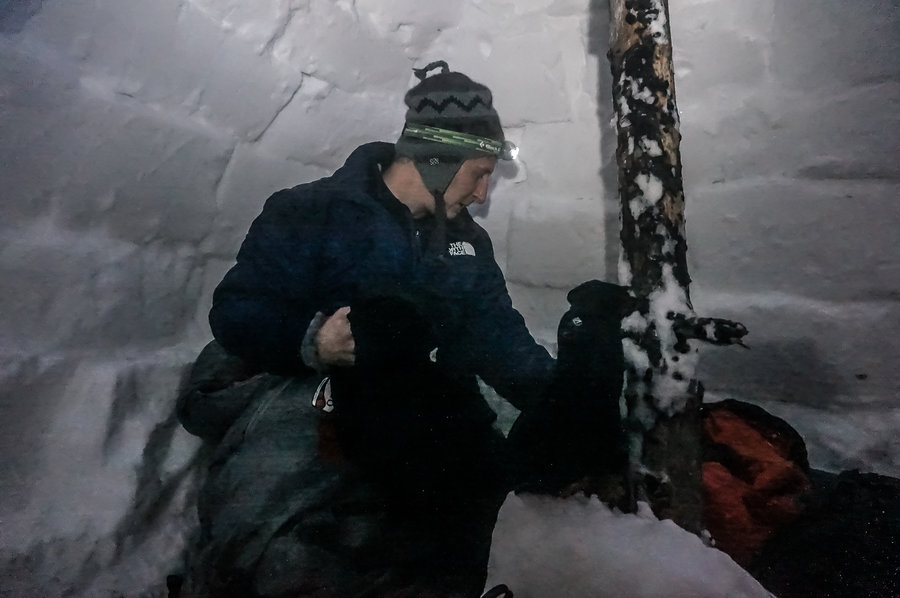
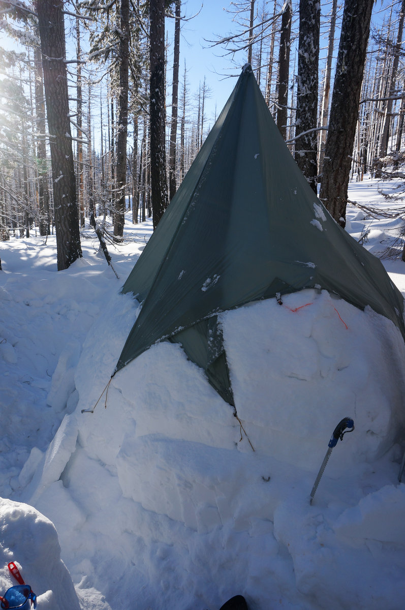
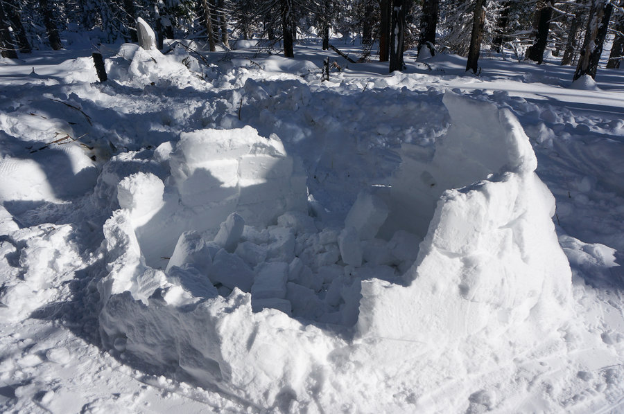
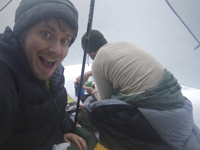
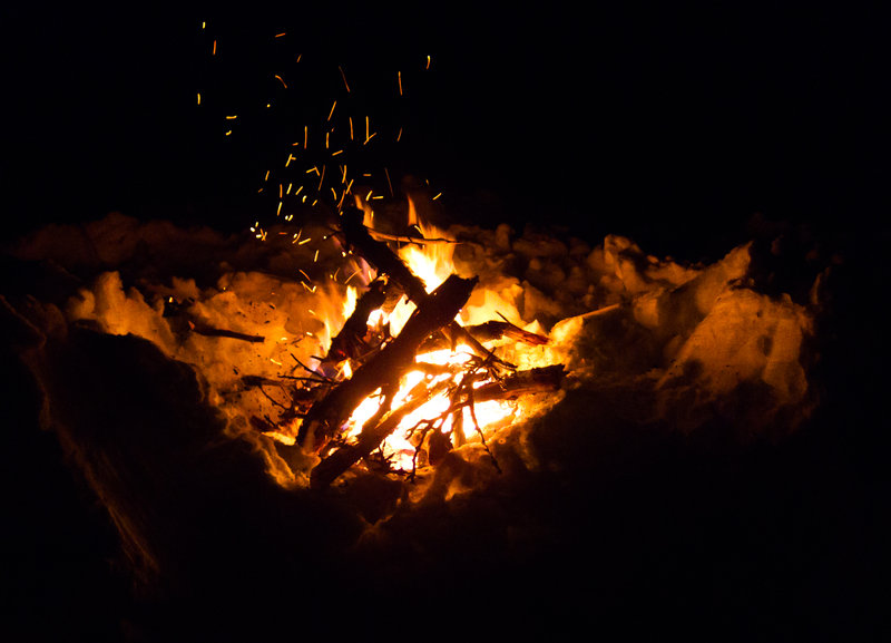
Building an igloo is hard.
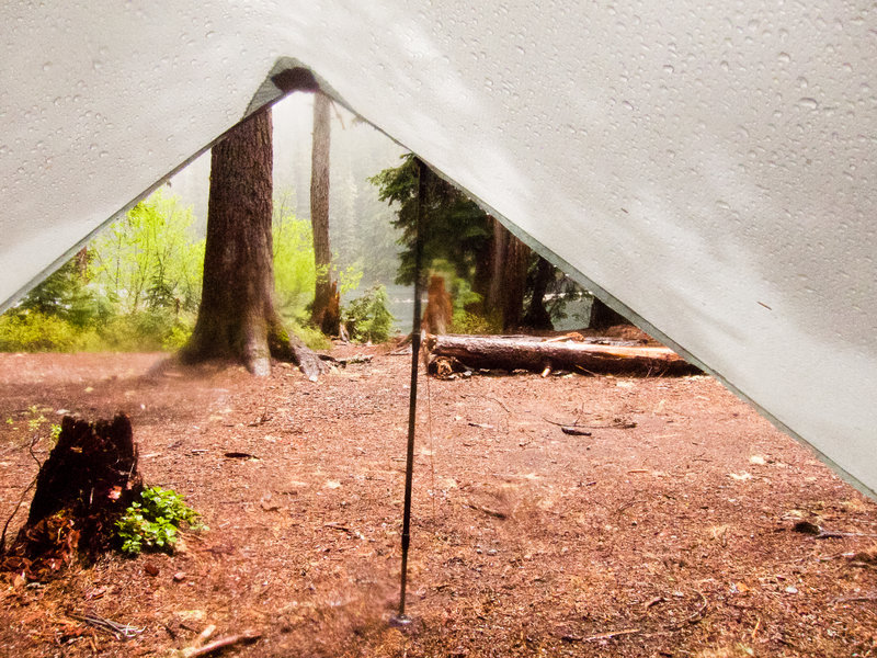
We spent an hour compacting the overly powdery snow, waited 45 minutes for it to sinter, and began cutting blocks. We cut 50 or 60 blocks. 4 hours was spent hard at work building up the walls, but we didn't start with an extreme enough angle. The igloo kept going up but the roof wasn't close to being completed in by night fall. So, I found a small snag, cut it to size, and used it as a center pole to hold up my tarp over the igloo's opening. The result was an 8' tall hybrid igloo structure, which was still fairly impressive.
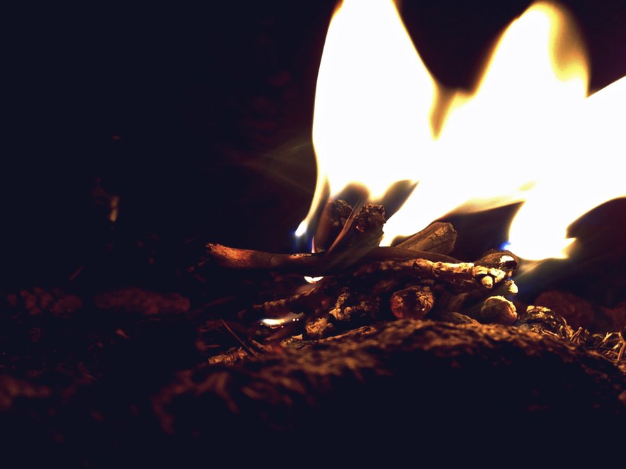
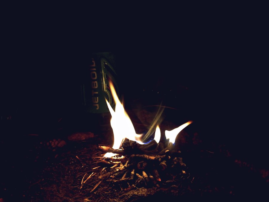
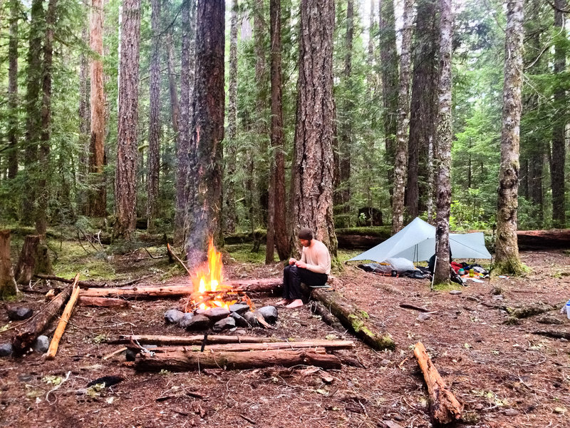
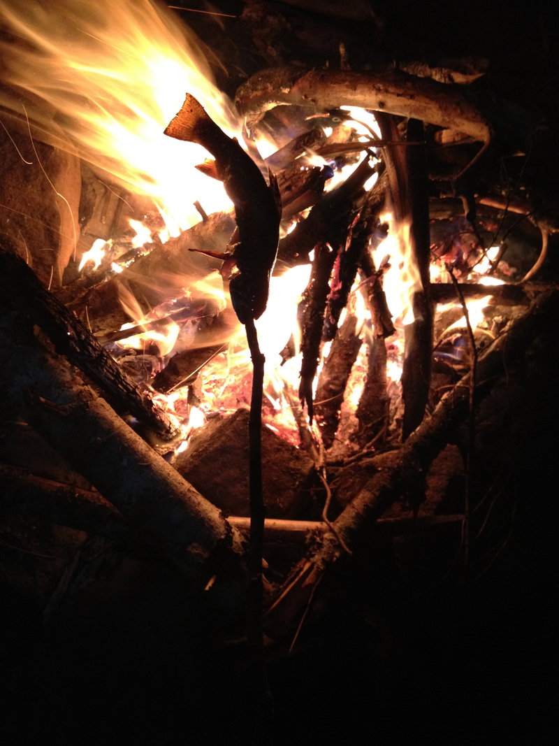
We also had a grand fire.
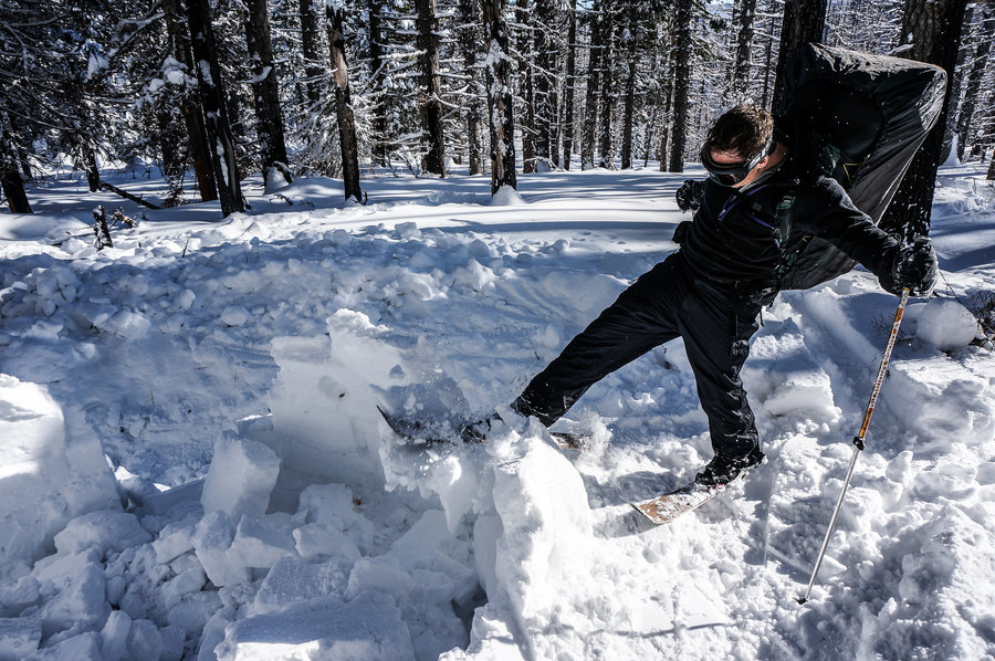
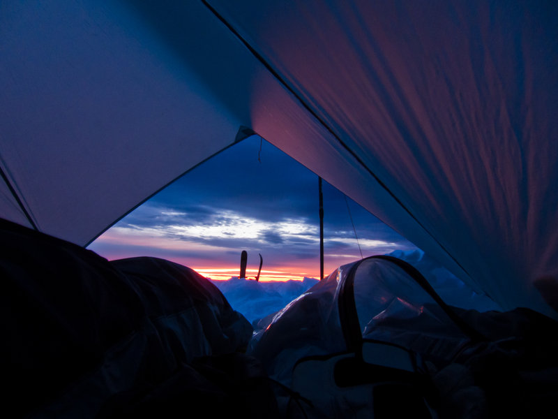
The next morning was glorious with blue skies and no wind. We hike another mile up the burn, made some delightful turns in too-deep snow, reunited with our backpacks at our camp, and skiied back to the car.

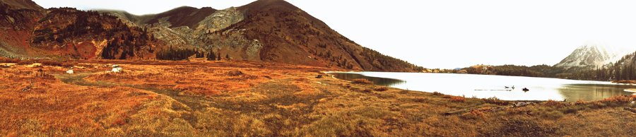
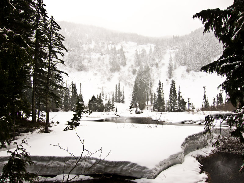
December 26 – December 27, 2012


Cast Lake
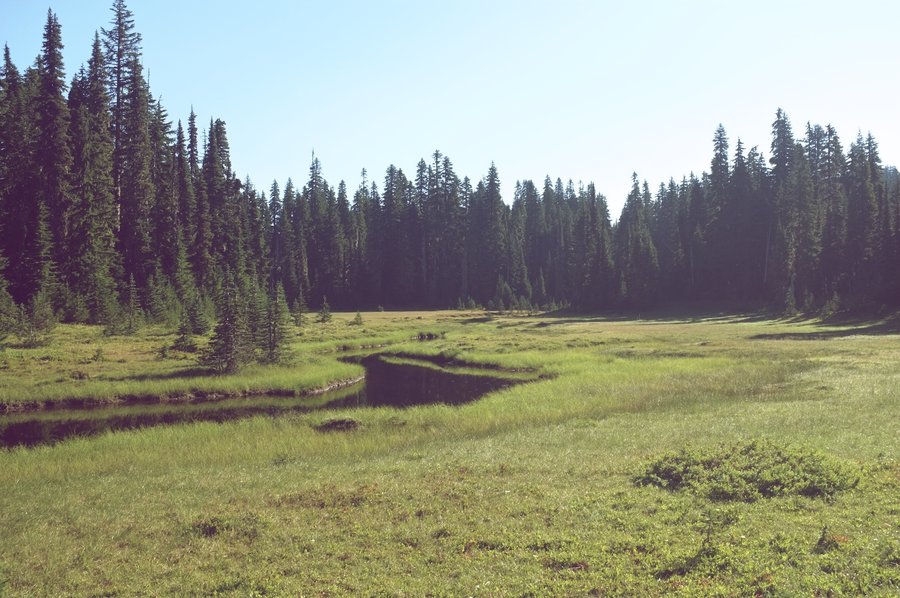
9 miles of hiking • 2000' elevation gain • 1 night
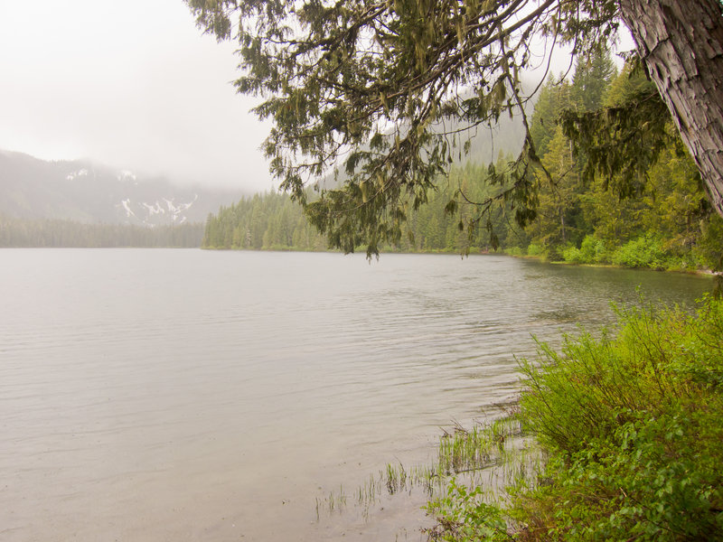
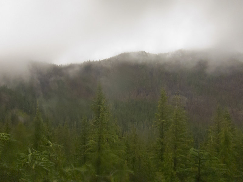
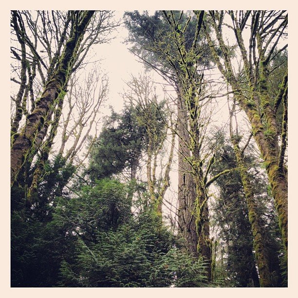
This turned out to be much more snowy than I expected. We hiked to Cast Lake from the south Burnt Lake trailhead up road 2701. That road sucks. Once we got on the trail, snow started in earnest and we ended up sleeping on about six inches. It was beautiful to see the forest just before it gets buried for the winter.
November 10 – November 11, 2012
 2
2
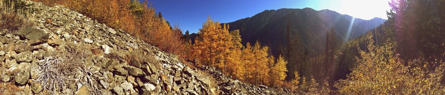
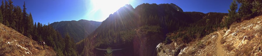
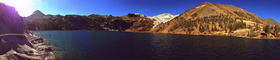
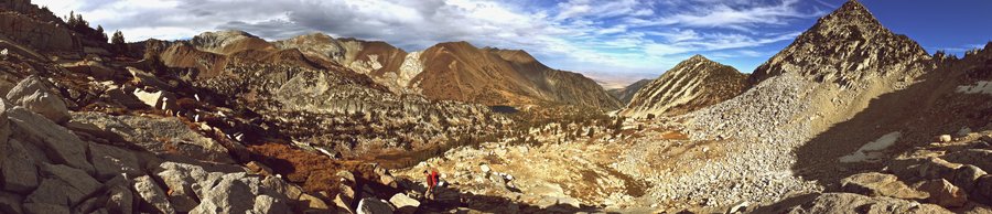
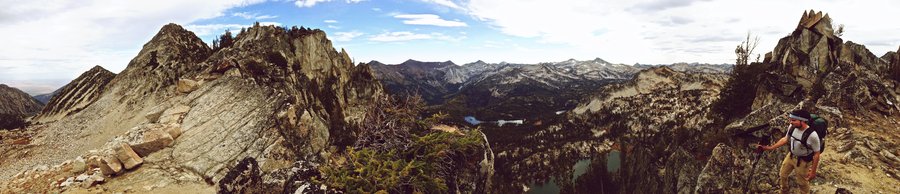
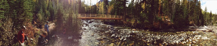
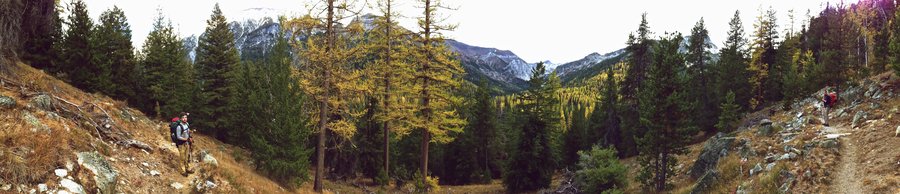
Wallowas
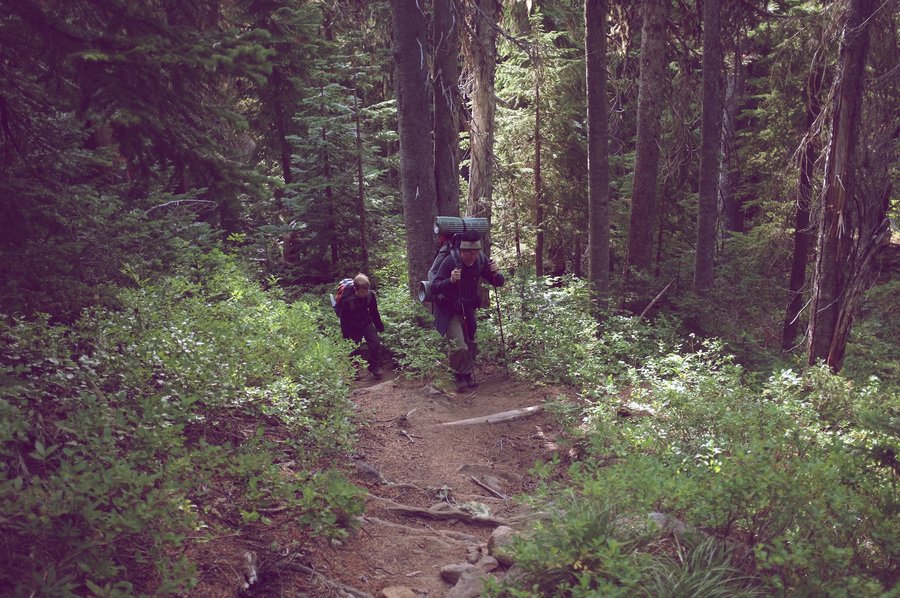
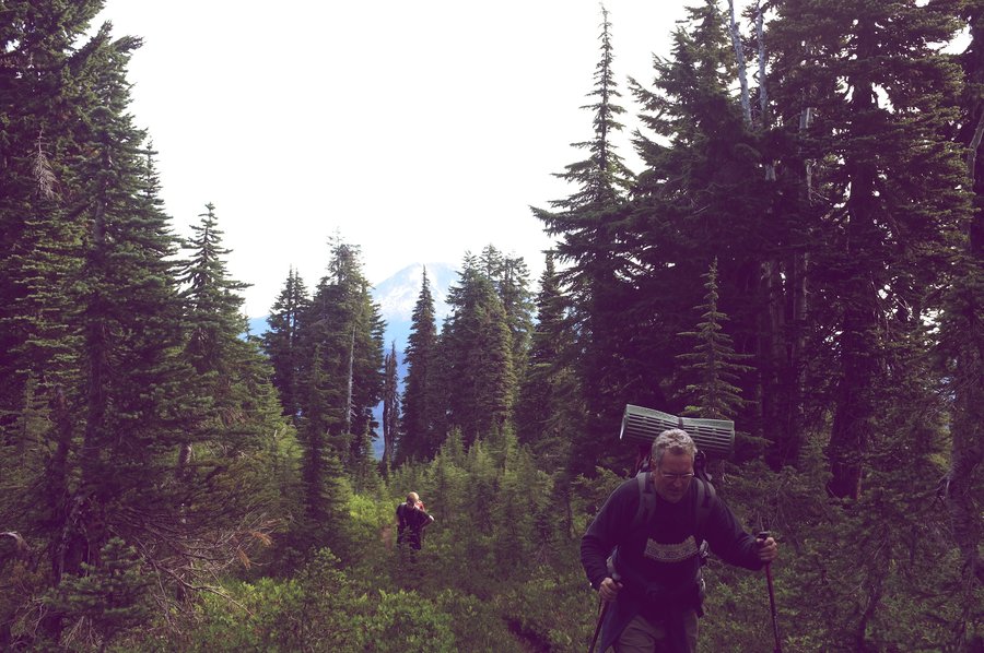
33 miles of hiking • 8000' elevation gain • 3 nights
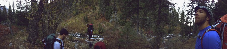
Day One (320 miles of driving)
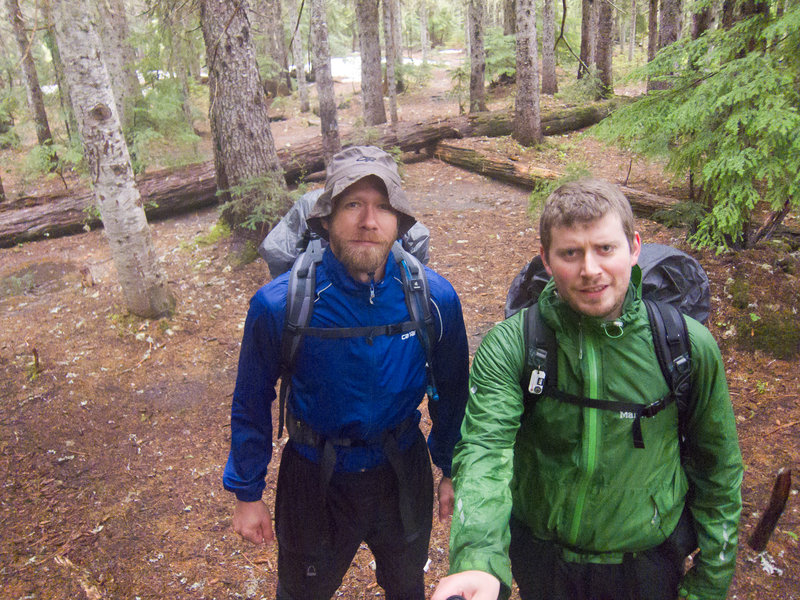
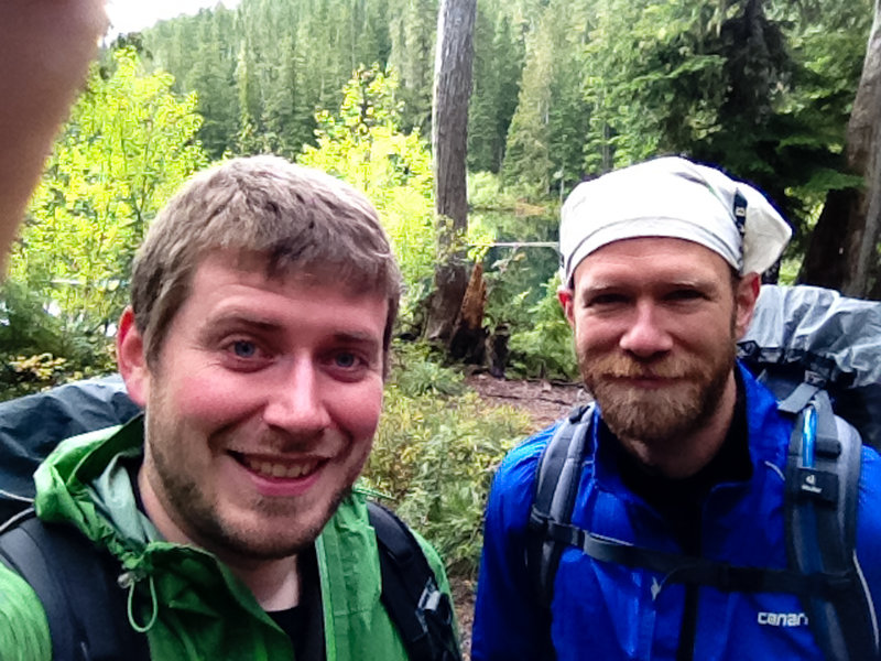
Five of us left Portland Thursday after work for the long drive out to Joseph, our two cars arriving within minutes of each other at the Wallowa Lake trailhead a little past 1am. We donned our insulation quickly and commenced with the drinking, standing in a small headlamp-lit circle in a dark, empty parking lot. It took a bit to realize we were right next to a closed campground, after which we made our way there to lay our sleeping bags out under the stars, build a small fire to warm up, and head to bed.
Day Two (13 miles, 6000')
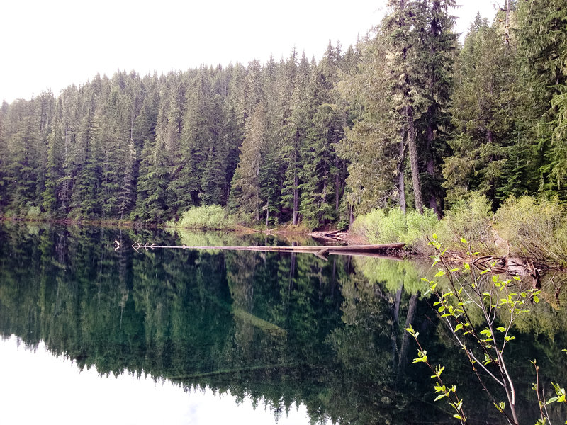
A couple hours later, it was time to go. The weather forecast deteriorated every day leading up to the trip, and our backpacks bulged with precautions from rain, snow, and cold. Friday, however, was supposed to be glorious. We left the trailhead at 8:30am and made it up to Ice Lake around 1pm under blue skies. Ice Lake wasn't our goal though. Having read trip reports of folks making the scramble over the ridge between Ice Lake and the Lakes Basin, our sights were set on Razz Lake for night one.
The scramble up to the ridge line is straight forward—follow a prominent drainage up to the scree fields, then zig zag up to a cliff band, following the grass and goat poop. From there, things get much worse. A small funnel of loose rock above a multiple hundred foot cliff to certain death was the first indicator of trouble. The GPS track we were following ultimately went over a tiny saddle scrambling across more loose rock over sheer cliffs into a chute on the other side. While obviously possible, the five of us and the siberian husky with us opted to head back down to Ice Lake for the night instead of risking life and limb.
Around 5pm, we settled into a camp on the southeast corner of Ice Lake. With the great weather, I pitched my tarp high and in a meadow in order to soak in the splendor of Sacajawea overnight. After fishing a bit, we were all sitting around enjoying some whiskey when a wall of cold air ripped across the lake and through the trees. Low grey clouds were pouring down the face of Sacajawea right at us. A minute later, it was 10º colder and raining. My bunkmate and I quickly realized that a high pitched tarp faced into the wind would not suffice, and we scrambled to relocate our bivies and tarp into the shelter of a small grove of trees. Crisis averted and the rain dying down, everyone piled under the tarp to make dinner and enjoy a tiny twig fire.
It rained all night.
Day Three (9 miles, 2000')
Saturday, we packed up slowly under a high grey ceiling and a steady mist. Randomly, just as we're leaving camp, the rain abated and a break in the clouds appeared. Despite the forecast of "likely rain" for the next two days, this would be the last rain we'd see for the entire trip. Awesome.
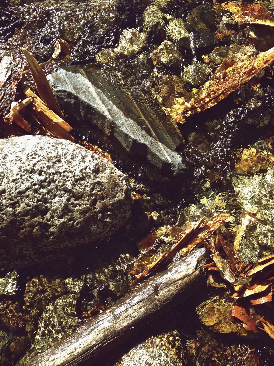
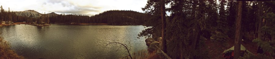
The hike back down from Ice Lake was uneventful, as was the trip up to Six Mile Meadow and ultimately to Horseshoe Lake. None of us knew that there were Larch in the Wallowas, but we were there on the perfect weekend to see the full display of yellow conifers intermingled in the vast landscapes in every direction. We found a lovely camp on the far end of Horseshoe Lake, built a small fire, and went to bed.
Day Four (11 miles, 320 miles of driving)
With the tarp open to the west looking out over the lake to Pete's Point, I woke up just before sunrise to catch the show. It was still, somehow, mostly clear out and surprisingly warm. Before too long, all of us were sitting out on a granite slab having breakfast over the lake. We left camp at 9am for the long walk back.
By 1pm, we were at Terminal Gravity eating hamburgers and enjoying their fresh hop seasonals, by 6:30pm, we were at Double Mountain in Hood River eating pizza and enjoying their fresh hop seasonals, and by 10pm I was home and in bed.
I want to go again.
October 11 – October 14, 2012


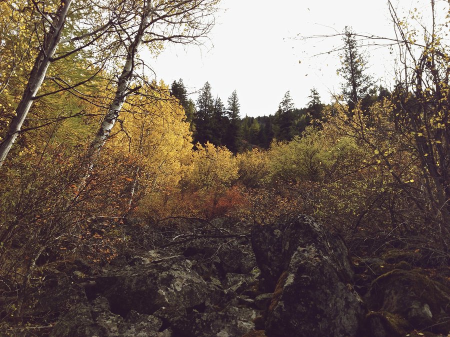

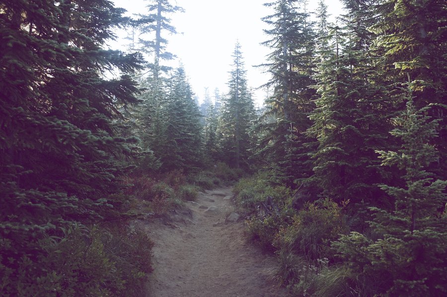
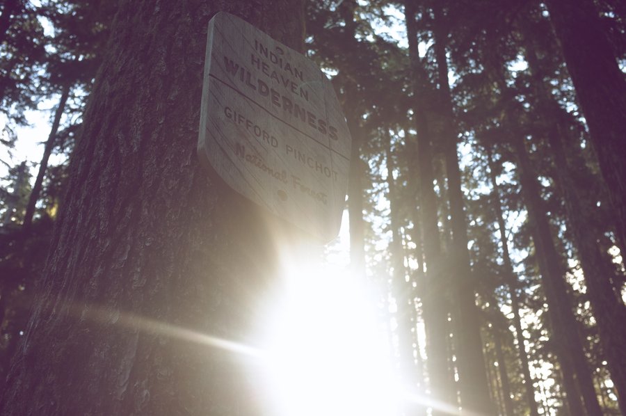
Indian Heaven Wilderness – Take 2
12 miles of hiking • 500' elevation gain • 1 night
Went for another weekend in the world's greatest place (for two months a year). This time, my wife Christy and I and five other friends met up at Blue Lake for a campout. Christy's never been to Indian Heaven before, so we made a loop from our camp at Blue Lake north on the PCT to Bear Lake and then south on the CCT back to the Rock Lakes.
We picked a quart of huckleberries and the weather was magic.
September 15 – September 16, 2012
 3
3
Indian Heaven Wilderness
21 miles of hiking • 1000' elevation gain • 1 night
Wonderful tour of Indian Heaven. Met up with my dad at Lake Wapiki for the night and otherwise roamed aimlessly and explored lakes. No mosquitoes.
September 1 – September 2, 2012

.jpg)
.jpg)
.jpg)


.jpg)
.jpg)
.jpg)
.jpg)
.jpg)


.jpg)
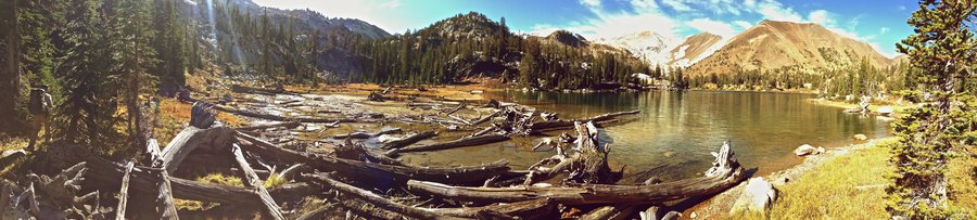
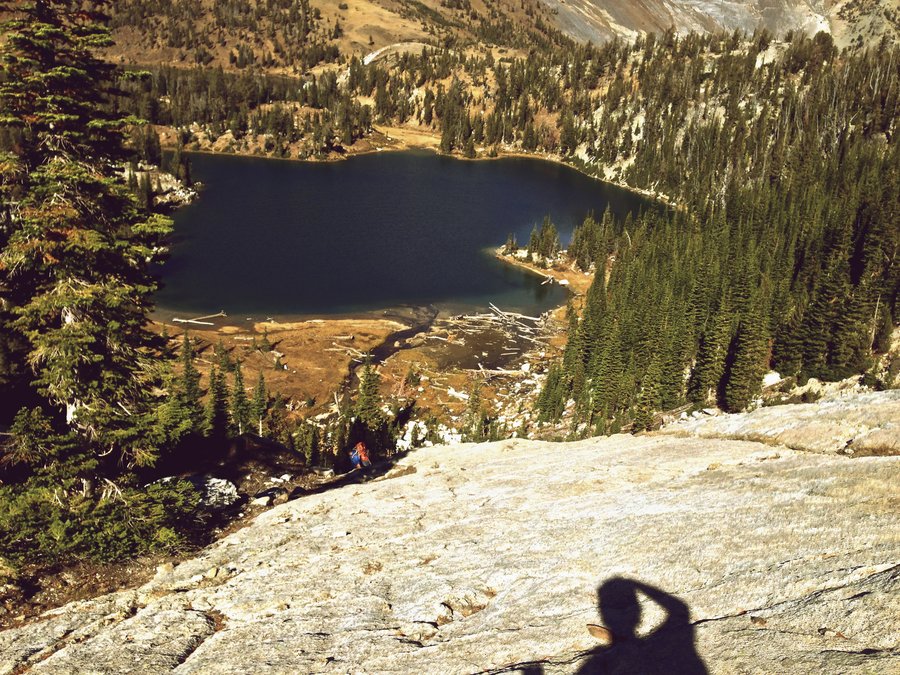
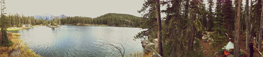
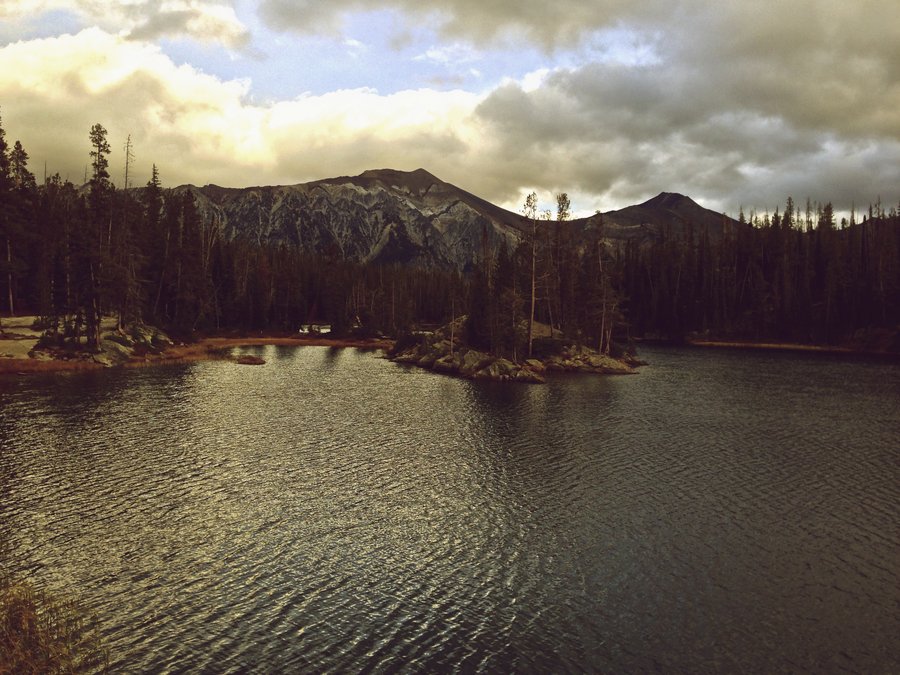
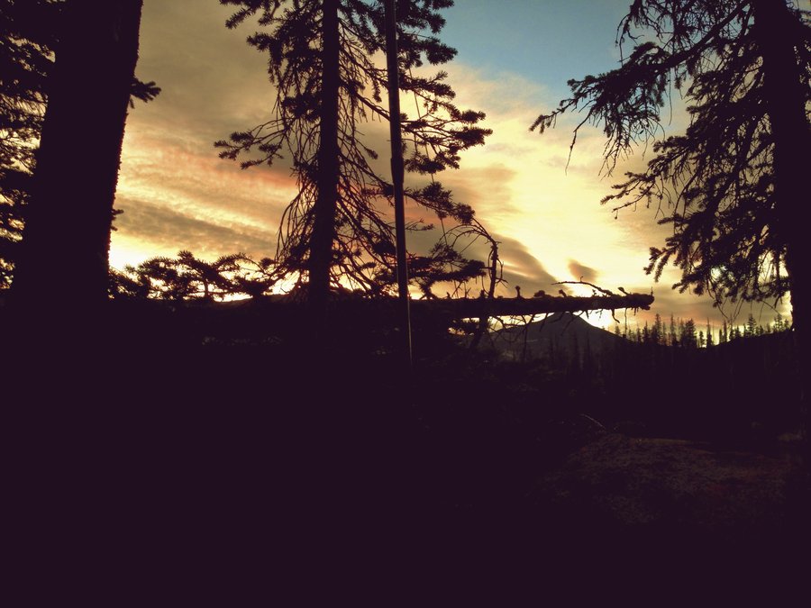
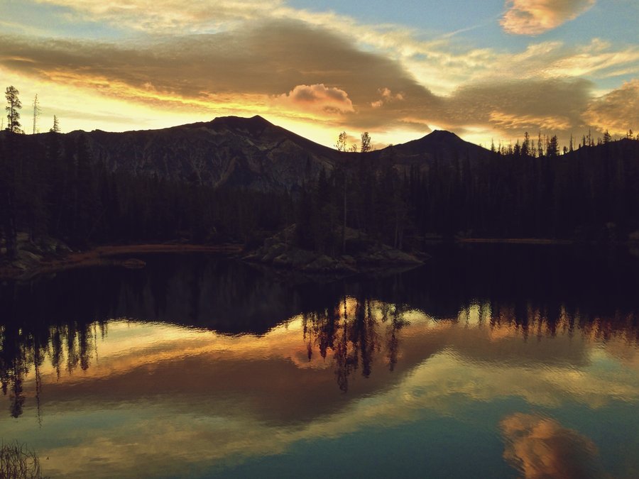
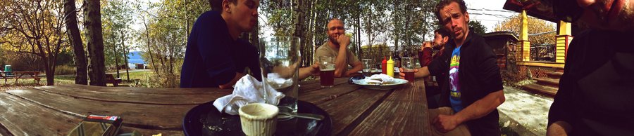
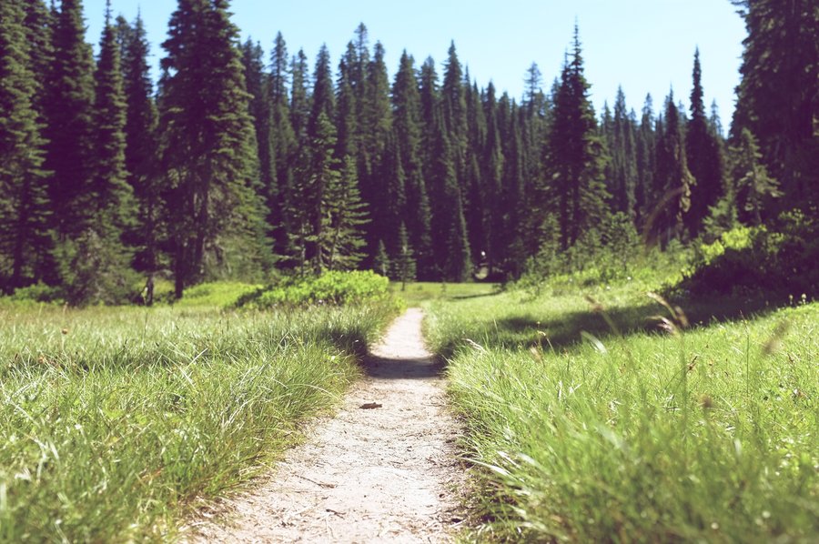
Soda Peaks Lake
5 miles of hiking • 1250' elevation gain • 1 night
Another delightful adventure out to Soda Peaks Lake for swimming. This time I carried out a raft and swam for hours and hours. This lake gets surprisingly warm and it's position at the edge of a ridge gives a consistent wind which eliminates mosquitoes.
August 18 – August 19, 2012

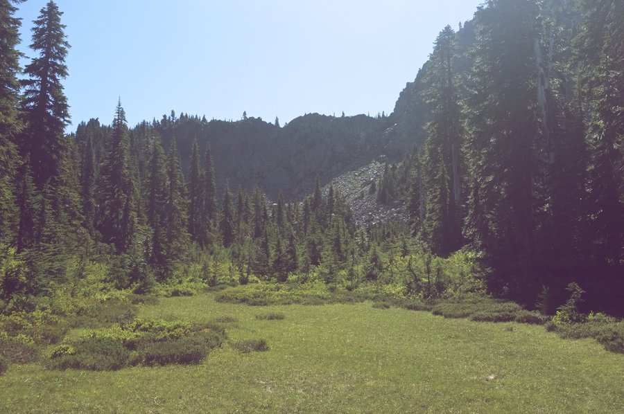
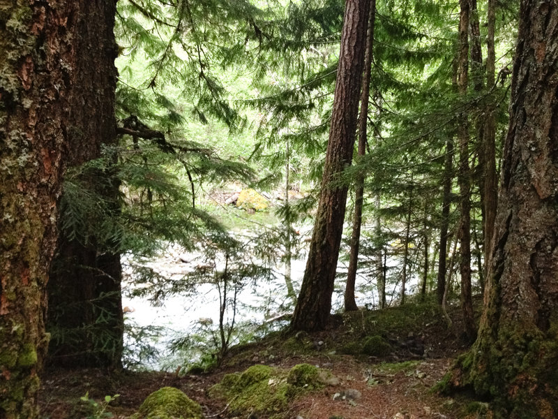
Siouxon Creek
7 miles of hiking • 250' elevation gain • 1 night
Beautiful, restorative trip into Siouxon Creek. This place in August is magic. Go to 3 miles up the trail at 3pm for a perfect swimming hole and rocks to jump from. The pool below Siouxon Falls has all the fishes.
August 11 – August 12, 2012

Soda Peaks Lake
5 miles of hiking • 1250' elevation gain • 1 night
After a wedding at Edgefield, we awoke in Edgefield, enjoyed brunch, and headed out on a hot Saturday to go find some swimming. I managed to fit all of Christy and I's backpacking gear into just my ULA Ohm, so we had a quick (but strenuous) hike into Soda Peaks Lake.
Our campsite had a precut pile of wood next to the fire pit (thanks strangers!) so we drank, swam, and fished into the evening, woke up and did more swimming and fishing, and then drove back to Portland.
In the summer, I don't want to hike; I just want to swim.
August 4 – August 5, 2012
 1
1
Opal Creek to Cedar Flats
11 miles of hiking • 500' elevation gain • 1 night
This was predominantly a fly fishing mission. My friend Nick just acquired a fly rod and wanted to learn how to flail his arms about, recite some incantations and reel a fish in with it. It was so warm and beautiful that we swam quite a bit too! The fishing was nonexistent where we camped at the confluence of Opal Creek and a side creek at the end of the trail, but the next day we had some luck back toward the trailhead.
Awesome adventure. The water is really high right now which limits the swimming and fishing. The waterslide was a bit scary.
July 5 – July 6, 2012
 4
4
Bull of the Woods Wilderness
30 miles of hiking • 5500' elevation gain • 3 nights
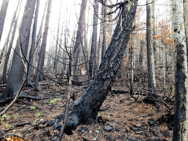
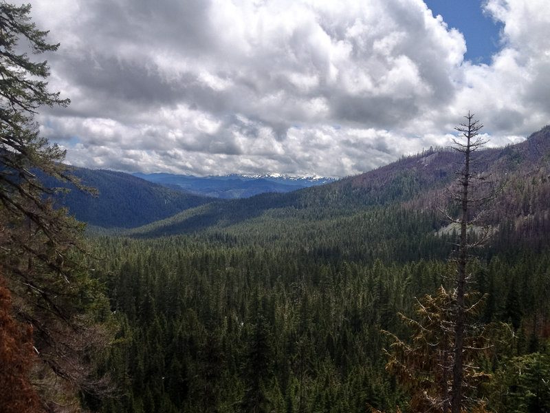
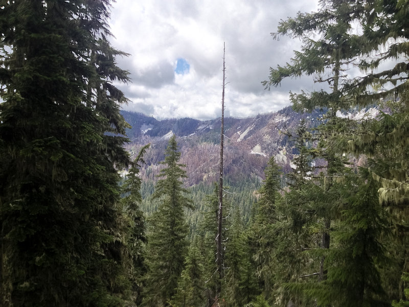
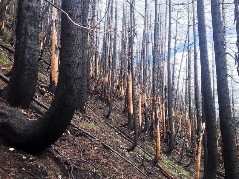
Awesome restorative trip into Bull of the Woods. It poured rain halfway into the first day until the morning of day three. My feet may have never dried out, but we saw some beautiful wilderness, witnessed the recent fire's destruction first hand, and finally had a dry night with a fire on night three.
Go now and see the bear grass and rhododendrons—they are seriously in bloom now. More bear grass than I've ever seen.
June 22 – June 25, 2012


Dublin Lake
14 miles of hiking • 4000' elevation gain • 1 night
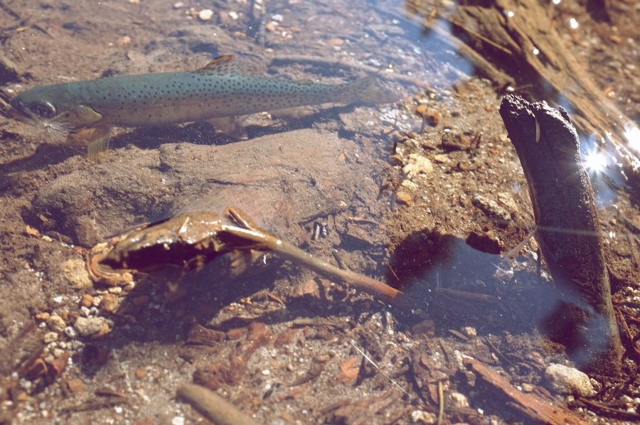
The lake was melted out this time! Didn't see any snow the entire boring hike. Had a wonderful fire and good company. Caught four eastern brook trout on a #16 tan caddis fly—try the northern shore near the underwater logs at sunset.
We had the lake all to ourselves on a dry June Saturday. Maybe the big climb keeps people away!
June 2 – June 3, 2012

Dublin Lake
14 miles of hiking • 4000' elevation gain • 1 night
I think I've finally hit summer backpacking shape. We hiked up to Dublin Lake in 2.5 hours after work on Friday without nary a stop. We had time to collect wood for a big fire, I caught a healthy looking brook trout from a thin strip of melted lake on a dry fly, and we enjoyed the solitude.
The lake was predominately frozen over, but the hike was 99% snow free. The lake should be melted out by this coming weekend.
May 11 – May 12, 2012

 1
1
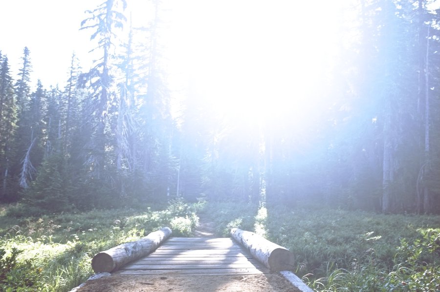
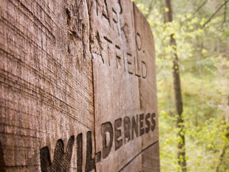
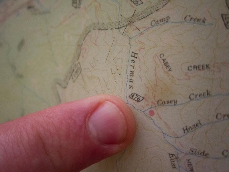
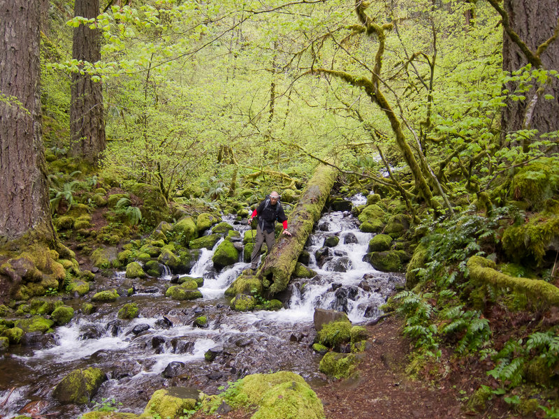
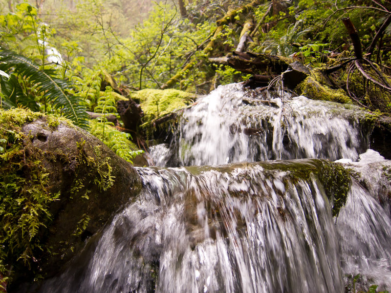
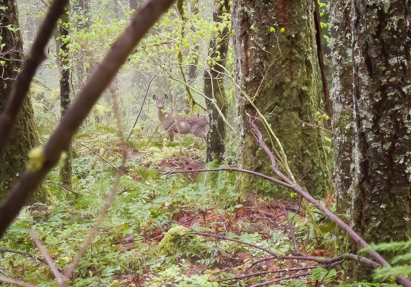
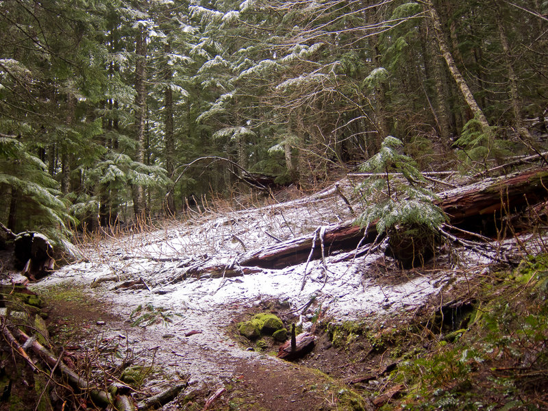
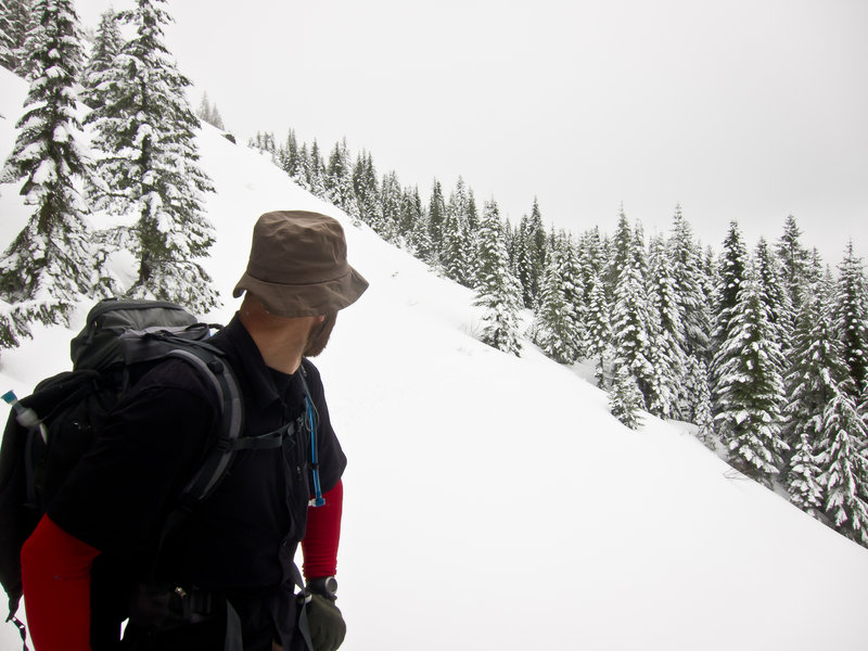
Yet Another Failed Chinidere Attempt
20 miles of hiking • 5000' elevation gain •
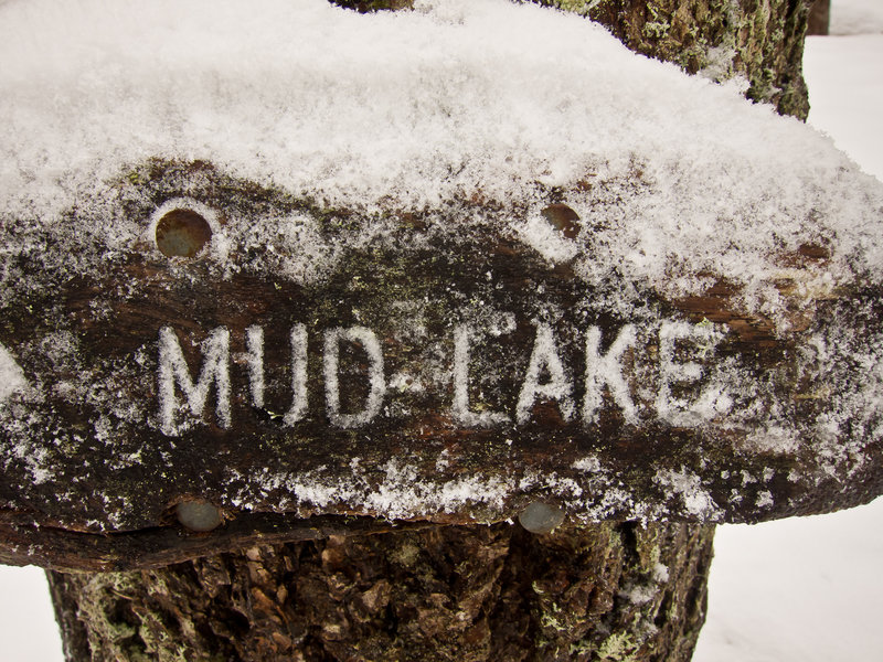
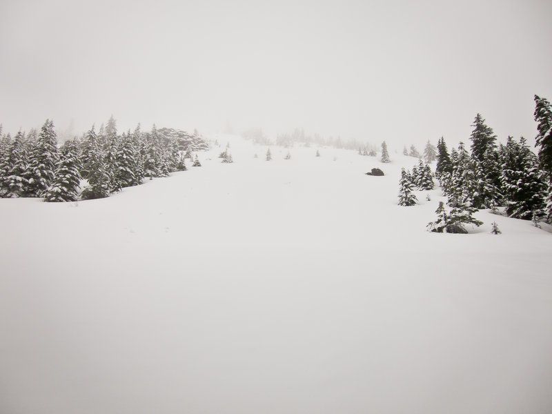
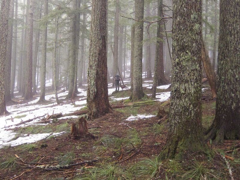
My friend Kevin and I intended to do the Herman / Benson loop as a one night backpack, bagging Chinidere Mountain on day one. I've been out that way five times now and have always been turned back due to snow or weather conditions. On this trip, it was both. The hike up to and a bit past the Herman Creek crossing was snow free, but then the snow started. Once we were on the steep climb up onto the Tomlike Mountain ridge, we were postholing waist deep and it was snowing and gray.
With no possibility of a view from the top, and miles upon miles of postholing ahead of us on the Benson, we turned back less than a mile from Chinidere. We plunge stepped down the hill to Mud Lake where we ate lunch while it snowed, the wind gusted, and the trees left piles of slush on our heads.
Once we were out of the snow, the sun came out and we had a wonderfully casual hike back to the car. We opted not to camp, but getting turned back made for one hell of a dayhike with full packs.
May 5, 2012


Benson Plateau Snowcamp via the PCT
16 miles of hiking • 5000' elevation gain • 1 night
My good friend Kevin and I carried snowshoes and skis respectively up to the Benson Plateau, hoping we might be able to make it out near Chinidere mountain. The weather Friday was pretty awful—temperate with high humidity—making the hiking extremely moist. I expected there'd be less snow up there, expecting to find at least a snow-free patch to sleep. Instead, we slept on an 8 foot snowbank at the headwaters of Ruckel Creek.
April 20 – April 21, 2012


Siouxon Creek
6 miles of hiking • 250' elevation gain • 1 night
Easy trip out to our typical campsite on Siouxon Creek. My wife Christy came out for the first time this year and we introduced another friend to backpacking for the first time. The road is in good shape after last year's repairs, making the drive more pleasurable as well!
Beautiful weather, beautiful raging creek, and beautiful night sleeping in a bivy under the stars. Hurray spring.
April 14 – April 15, 2012
 6
6
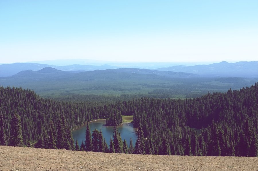
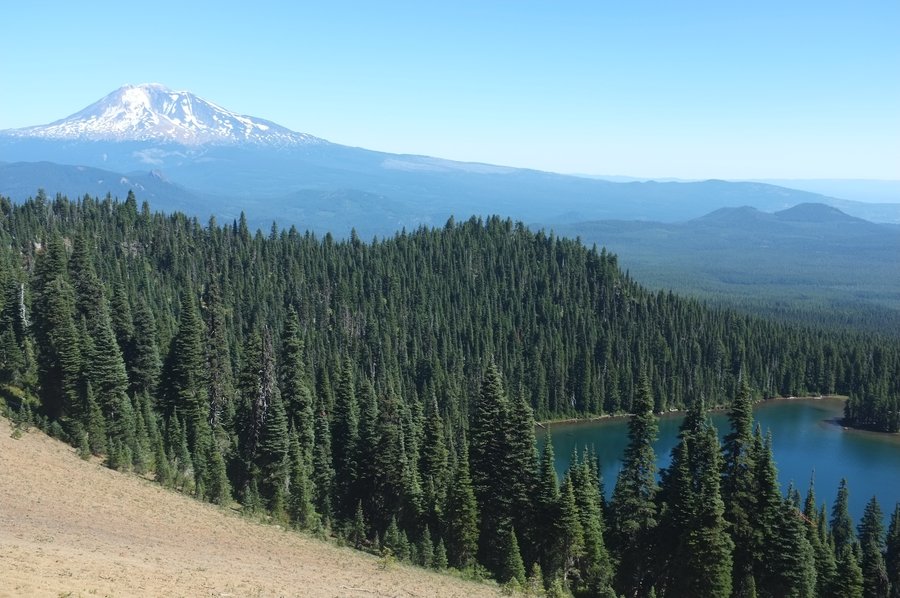
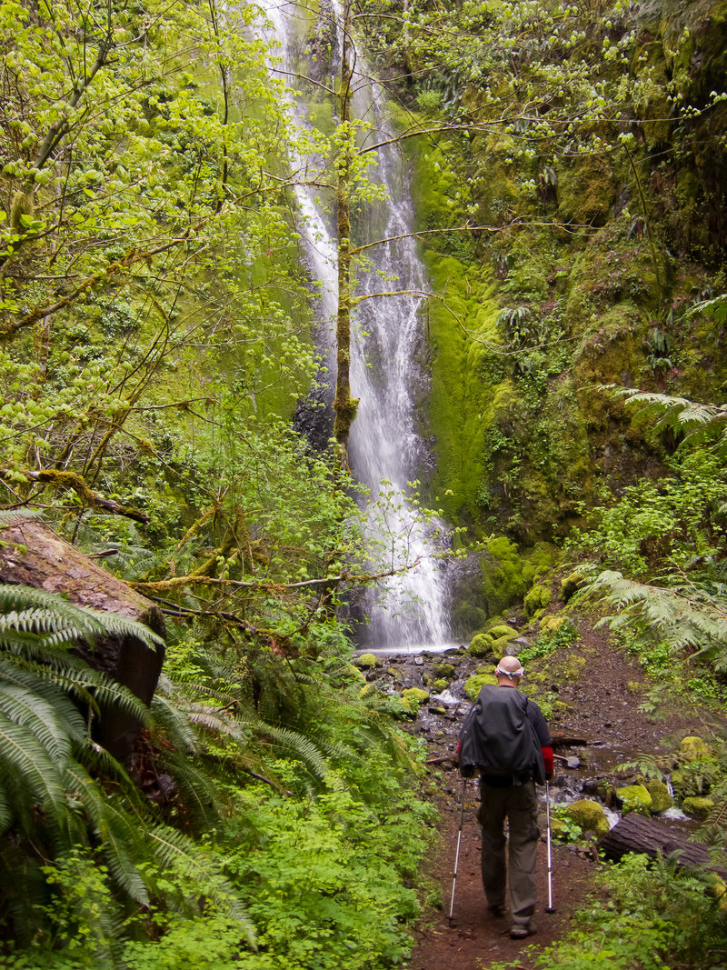
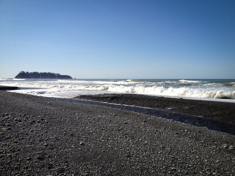
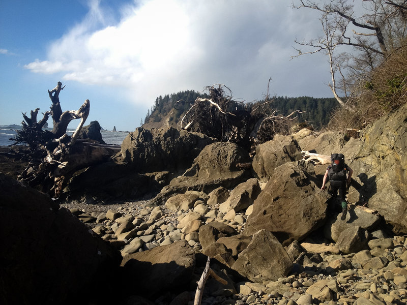
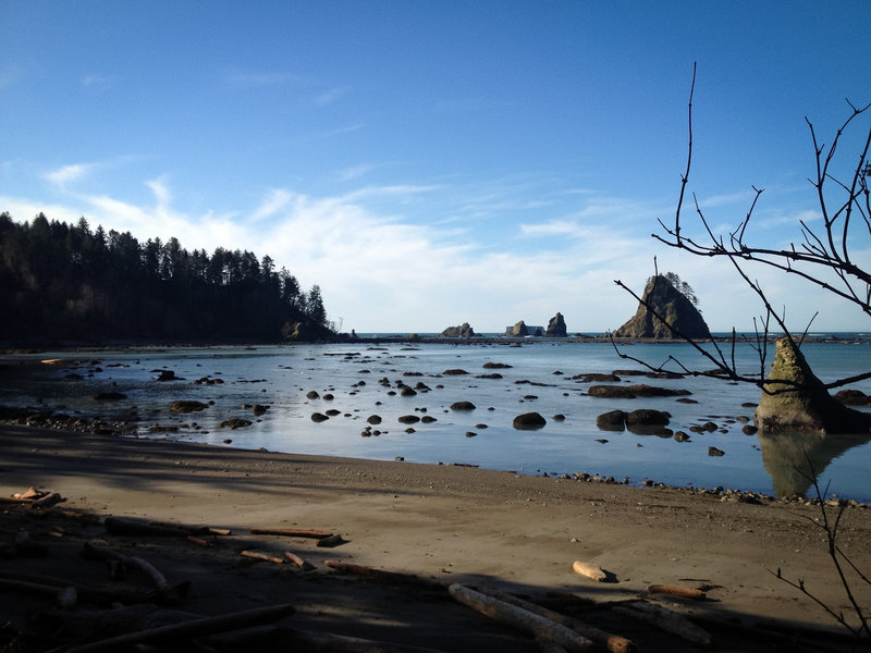
Chilean Memorial and Second Beach in Olympic National Park
10 miles of hiking • 250' elevation gain • 2 nights
Two friends and I made the long drive up to Olympic National Park's beaches to take advantage of the weather window over this weekend. It's a long drive, but worth it for the epic nature of the beaches there.
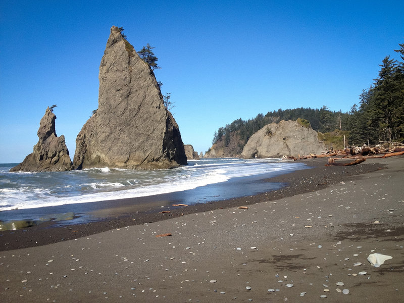
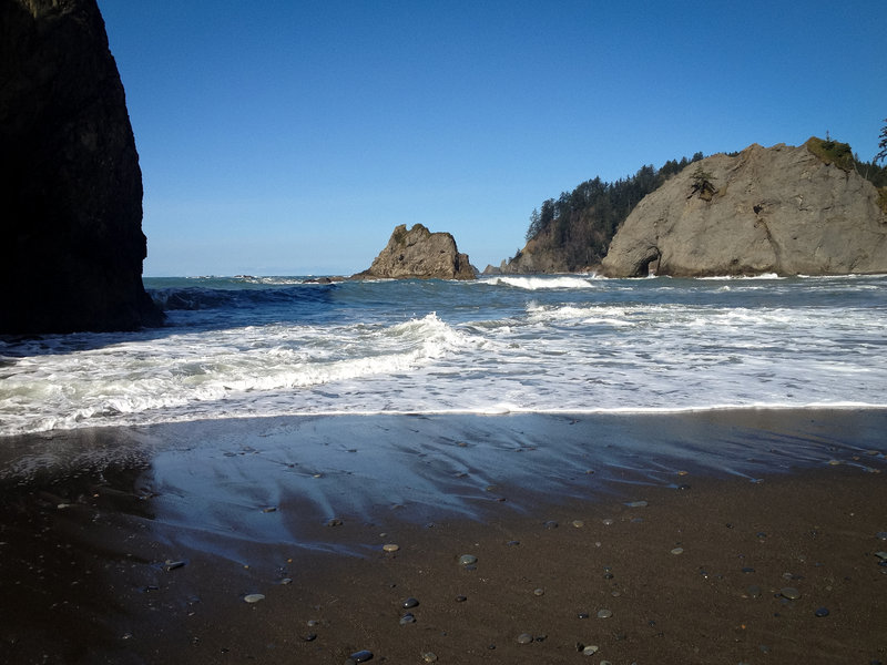
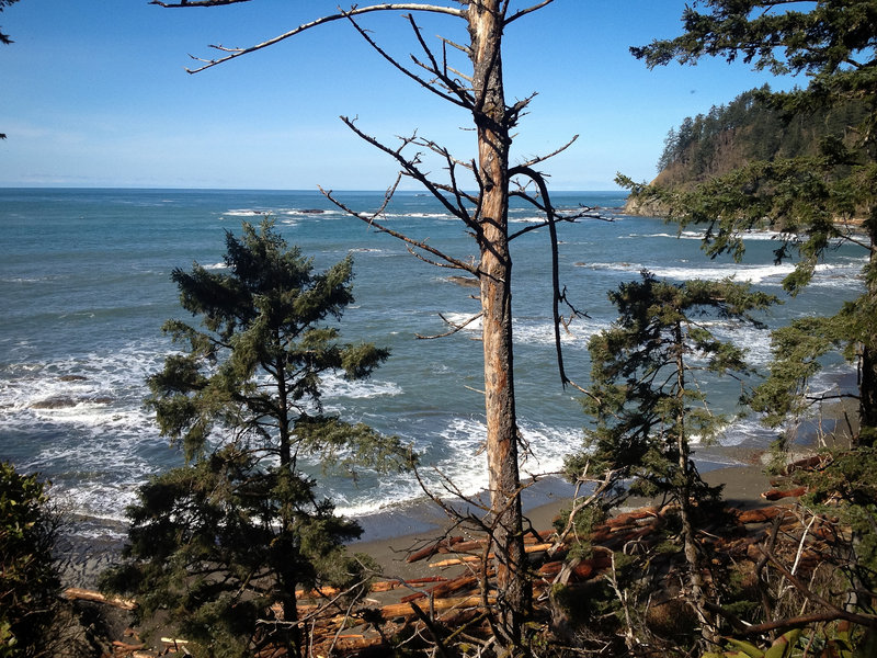
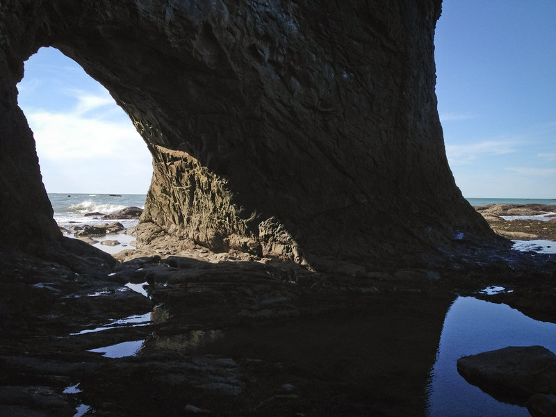
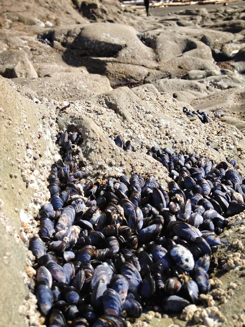
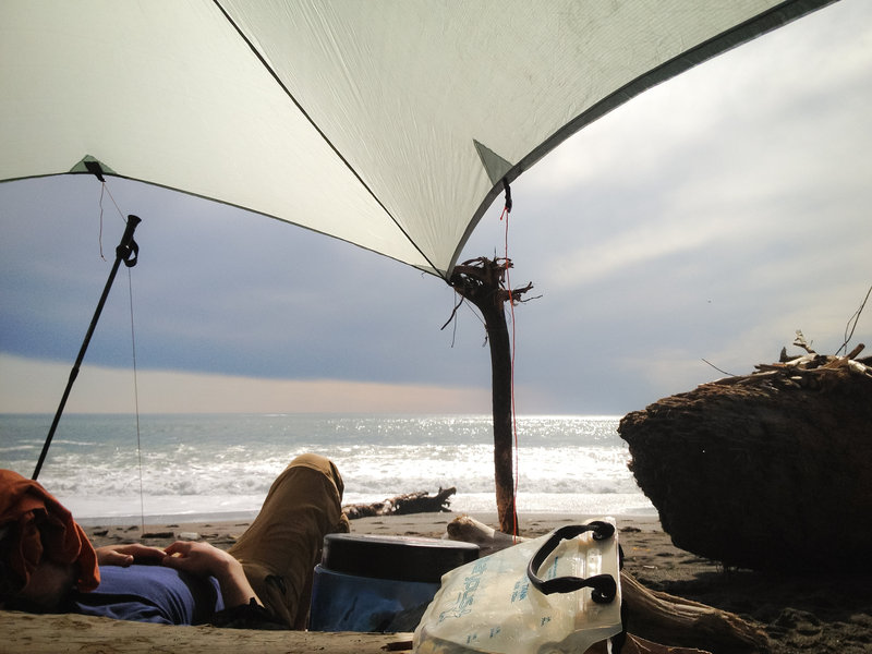
We got to the Rialto Beach parking before noon and started hiking. The coast is not what I expected—steep stony beaches devoid of footprints drop steeply below huge, rough waves break close to shore and seemingly go nowhere. Above the beach, thick old growth forest, reminiscent of the Redwoods coastal forests, begin immediately past the sand. Having grown up on the Oregon coast, this felt like a whole new world.
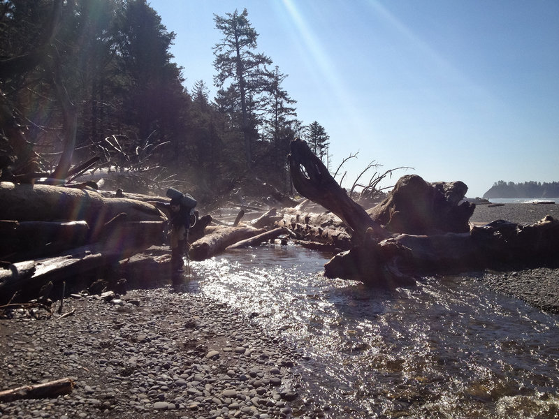
Having left Portland at 5am to hope to beat high tide past some of the choke points on our way north to the Chilean memorial, I was a bit disappointed to find our path blocked by rising tide just north of Hole-in-the-Wall at only 12:30. We backtracked to a grassy patch of earth sitting just above the beach and waited 3½ hours for the tide to rise and fall again to allow us by. Even then, passing was difficult at nearly high tide, each of us taking turns climbing down and across wet, slick rocks. The area around the Chilean memorial was beautiful. The campsites are set back in a rocky, shallow cove on small patches of grass. We built a small fire and ultimately went to bed.
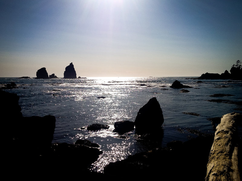
One of our group had been down to Toleak Point last year though, and while the beginnings of north beach had been beautiful, the ranger had instructed us that north of the Chilean memorial was yet more rocky, slick beach. Eager to do some easy-beach-chillin' and not rugged-beach-hikin', we headed back to the car to shuttle around the mouth of the Hoh River to the Second beach trailhead. A 3¾ mile hike out, a 15 minute car ride, and an easy mile hike through beautiful coastal forest down to second beach was worth it; Second beach is a larger, sandier beach for easy beach hiking and relaxing. Not set back in a cove, the waves were much larger as well. The rest of the day involved setting up camp, gathering the night's fires, and relaxing.
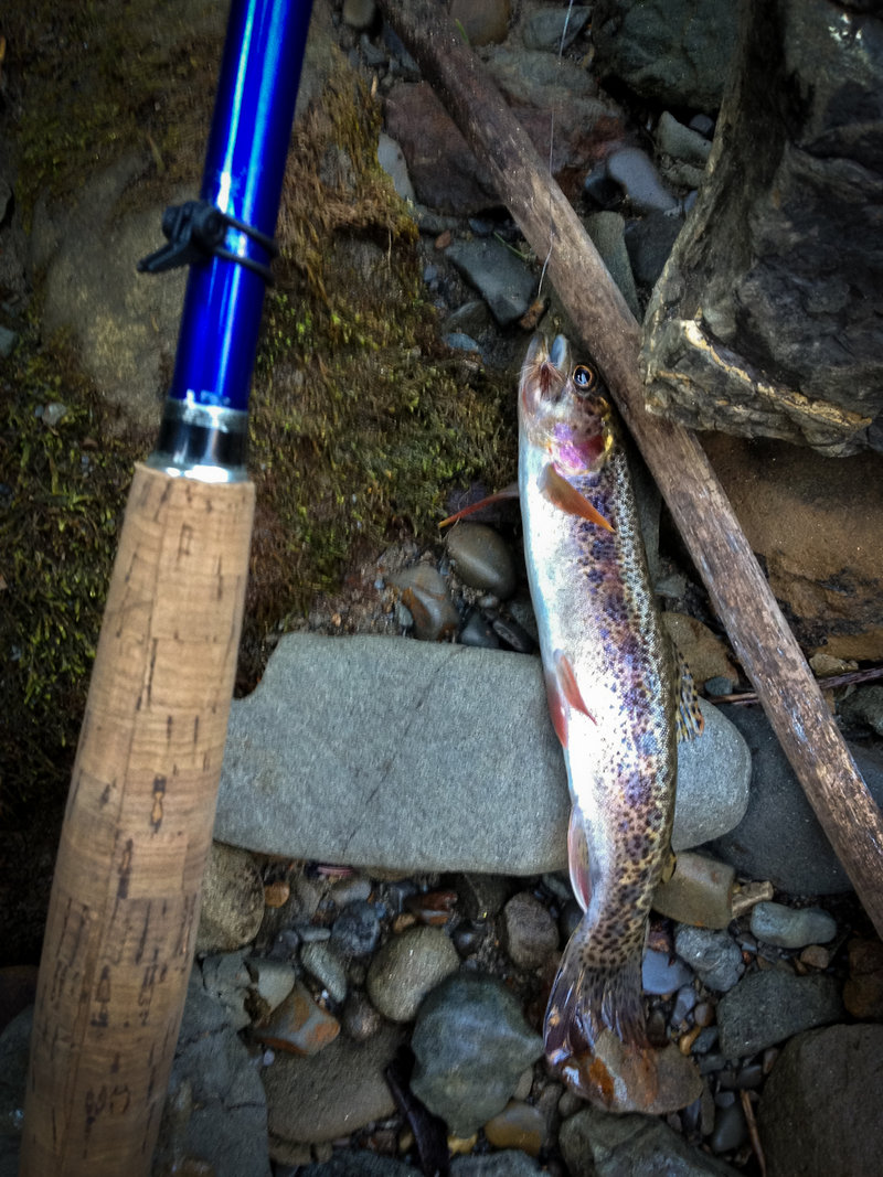
I took my tenkara rod as well (because I always do), and managed to say hello to two small coastal cutthroat trout on the hike out. The first rose to a small elk hair caddis on my first cast. It's spectacular that these fish can live within sight of the ocean, only a hundred yards at most to the edge of the continent in a tiny stream running out of the coastal forests. They were incredibly vibrant fish—a testament to the pristine quality of their habitat.
March 23 – March 25, 2012


.jpg)
.jpg)

.jpg)
 3
3
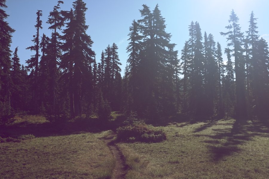
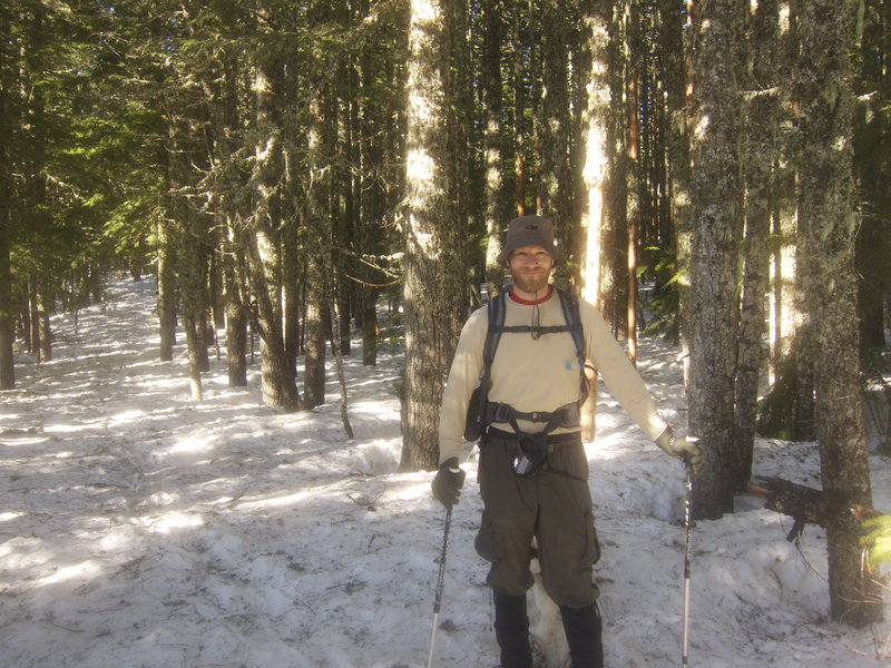
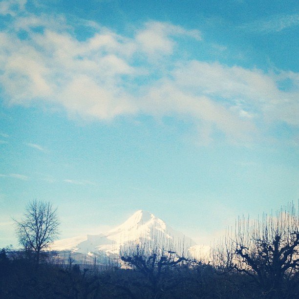
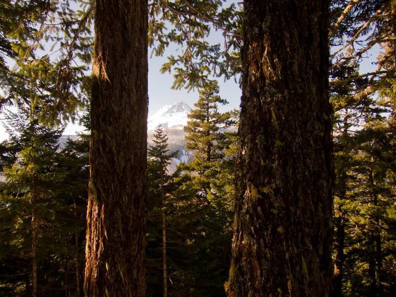
Tilly Jane to Cooper Spur Shelter
8 miles of hiking • 3000' elevation gain •
Beautiful day on the mountain. I've never been on the North side of Mt Hood, and I was surprised at how much more rugged it seemed and how much better the views were. Rime ice above treeline, but big pockets of powder in the trees made skiing with the Altai Hok skis enjoyable.
I got two huge blisters on my heels though :[
February 23, 2012


Clear Lake Butte Lookout
7 miles of hiking • 1000' elevation gain •
Took the Altai Hok skis and a new backpack out for an easy ski in this weekend's "blizzard" on Mt. Hood. Turns out that the weather was a mixed bag of wet snow and cloud breaks, making for an extremely beautiful ski trip. Despite the huge mess of trailers and RVs and other signs there were lots of snow mobilers out, we actually saw them very infrequently and they were all extremely respectful.
February 18, 2012

Forest Park — Loop from Germantown Rd
4.5 miles of hiking • 500' elevation gain •
My first time in Forest Park ever! I went on a 4.6 mile trail run with a friend Saturday morning. I love a sloppy run through the mud in the woods.
February 11, 2012

 2
2
Ruckel Ridge
10 miles of hiking • 4500' elevation gain •
Great day for a hike up Ruckel Ridge! The catwalk section gets your blood pumping as you have to down-climb little fiddly rock bits with 50 foot drops on either side of the ridge line. Went up Ruckel Ridge without really ever stopping, took a rest creekside, and slogged back down the Ruckel Creek trail.
February 5, 2012

 4
4
Gumjuwac Saddle Campout
6 miles of hiking • 2000' elevation gain • 1 night
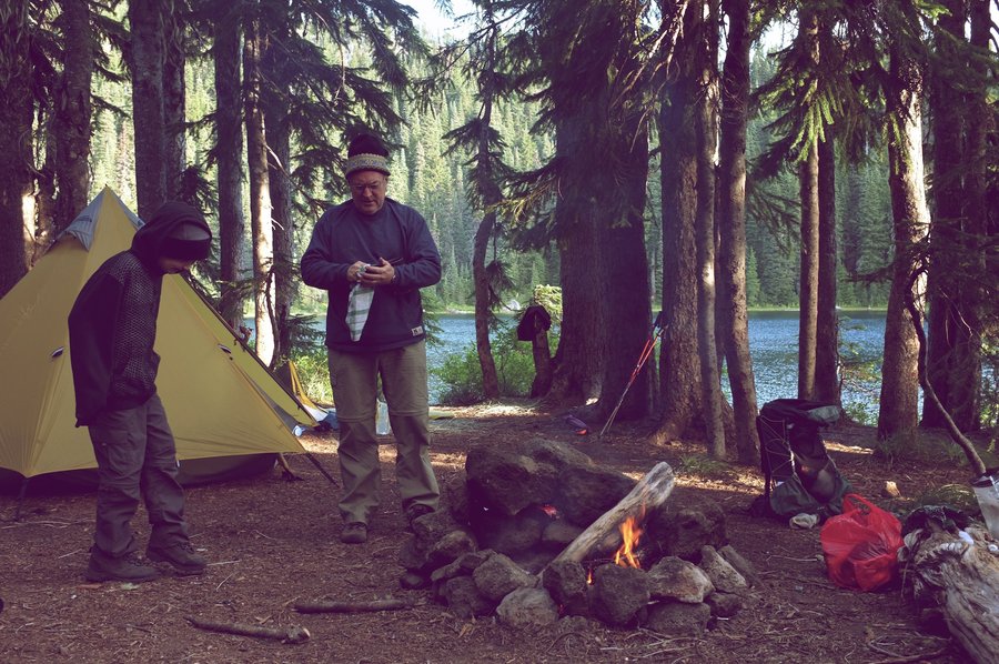
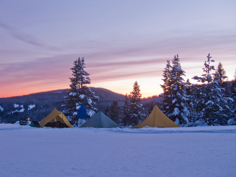
Went with friends Nick, Chris, and new friend Tommy up the switchbacks to Gumjuwac Saddle Friday for some snow camping. The weather was perfect—blue, crisp, and calm. The snow was unexpectedly crunchy underfoot for the first 1500 vertical feet, but gave way to powder once we reached the crest of the hill. The camp spot (thanks to Water for the idea) was a clearing along Bennett Pass Road at the base of Lookout Mountain with big views east toward Maupin and the Tygh valley.
We set up camp which consisted of three MLD shelters and a kitchen area, ate, drank some whiskey, built a rather delightful fire, and went to bed. In the middle of the night, the wind started picking up in short gusts. The air would be dead calm for minutes at a time and would give way to a few seconds of 30mph gusts. Needless to say, there was a restless hour or two.
Everyone woke up again around sunrise to a pink horizon, broke camp, and had an uneventful hike out.
In regard to equipment, this was my first time out with a new quilt and some down pants made by Ben at GooseFeet Gear. They performed admirably as I woke up almost too warm in the morning after the 24ºF windy night. This was also my first deep winter test of the new Altai Hok skis, a "fast-shoe" hybrid of snowshoes and backcountry skis with built in climbing skins. While not as versatile as snowshoes for crusty side hilling, they made up for their awkwardness on the ascent by providing a good amount of entertainment at camp as Tommy and I took laps skiing down the nearby hills. It was fairly easy to link turns even with universal free-heel bindings on a ski with a permanent skin attached. A little whiskey and a little skiing by headlamp under the stars—awesome.
January 27 – January 28, 2012


 1
1
Tanner Creek from Wahclella Falls trailhead
13.5 miles of hiking • 2500' elevation gain •
Took the Altai Hok skis out for a test ride with the sudden low elevation snow. Had a lot of fun learning to cross country ski with these "skishoes". I'd guess 8 of the miles were spent hiking on skis.
After Road 777 ends, the trail is an asshole. All the branches are weighed down with snow making the 1.25 mile trail down to Tanner Creek a real pain. Once I got to the end, I brewed some mint tea and relaxed a bit before schlepping back.
January 15, 2012
 1
1
Trillium Lake Cabin Adventure + Multorpor Mountain bushwhack
5.5 miles of hiking • 1500' elevation gain •
Rented the "Barlow Cabin" near Trillium Lake for two nights with my beautiful wife and another couple. We snowshoed out to the cabin with a pulk loaded with delicious New Seasons goodness, relaxed by the warmth of a fire, climbed Multorpor Mountain, and otherwise enjoyed the woods.
January 8, 2012
 1
1
Mt. Saint Helens (didn't summit)
10 miles of hiking • 5000' elevation gain • 1 night
Spent the night near the parking lot in wait for an early morning assault on Mt. Saint Helens. Unfortunately, the summit was not in the cards for the climb, with a thick layer of rime ice making the climb extremely treacherous. We turned back a half mile and 1000 vertical feet from the summit.
I'm going to wait until some real snow gets laid down before attempting this again.
January 6 – January 7, 2012
