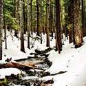
10 miles of hiking • 4500' elevation gain •
Great day for a hike up Ruckel Ridge! The catwalk section gets your blood pumping as you have to down-climb little fiddly rock bits with 50 foot drops on either side of the ridge line. Went up Ruckel Ridge without really ever stopping, took a rest creekside, and slogged back down the Ruckel Creek trail.
Comments
Wow, this is a 3800' EG hike Kyle, did you use a GPS?
Someone else mentioned someone sticking up 4500' for RR last year too . . .
Yeah, we used a GPS. 4200' on the climb up, 370' of gain on the climb down. That was me last year. Your GPS has said differently? You tracked the entire hike from the trail at Eagle Creek?
I think the GPS is inflated, mine would inflate as well. So I usually stick my track through GE over on GPSfly.org to verify.
On Defiance a few weeks ago my Garmin 62s said over 5300' of EG but we all know it's only about 5000' from I-84.
Lorain's Afoot & Afield also has this loop listed as 3700' of EG, so I could see how there might be 3800 to 3900' of EG. The Platter junction to head down Ruckel Creek Trail is at about 3700'.
There is lots of elevation loss on the trail up, and some gain on the way down. "Elevation gain" is not a measure of the change in elevation from trailhead to highest point, but the sum of all climbing throughout the hike.
I've now GPSed this trail twice with two different devices and arrived at the same totals. Additionally, 4500'EG is a better indicator of difficulty for this trail than 3800'. Google Earth does not have a totally accurate topographic model of the world.
And personally, I'm annoyed by this conversation. This is not CompeteOnElevationAndCallShitOnOthersHikes.com. I'm not recording my gains and losses for your approval, but for my own record keeping. These numbers are from my hike. Whether or not you agree with what my GPS says, I think it's accurate.
This is now twice in three hikes that someone here has tried to tell me the numbers I'm posting are wrong, or don't match up with a hike partners. Perhaps the statistics on the homepage are fostering the wrong type of community around trip reports and need to be rethought.
The last thing I want is this petty competitiveness on numbers.
I can see how this might seem annoying but my intention was to simply find out if Ruckel Ridge to Ruckel Creek loop is 4500' of EG or the conventionaly accepted EG of around 3700-3800'.
I do think you're right about the stats leaderboard might be fostering the wrong kind of community of nice people, I'm cleary not one of the nice guys myself when I jokingly e-mailed you after a few beers asking you to ban a member for repeatedly posting the same little in city walk. Man, I admit that was bad on me! And the scrape I got into over the stats with Chris over in PH, which I did publicly apologize to him :)
I'm was seriously trying to figure out how in the heck RR and down RC is 4500' of EG, nothing more. Did it last year with another bad guy so I will check my .gpx file later tonight when I get to a laptop, on phone keys now so please excuse any typo's etc. Please don't ban me Kyle! Thanks dude... :)
No banning happening here :]
I'm just reporting the recorded numbers from my iPhone 4S as it went along for the ride. Jon got similar numbers last year when we did this hike with a dedicated GPS. It's easy for books and PH to record 3700'EG when the trailhead is at 100' and the Benson is 3700', but that doesn't reflect the reality of the many elevation losses on the trail. Shit, there's a 150' loss right near the top before the last push to the plateau, after the catwalk section. That single down hill invalidates the numbers you're quoting.
Here's a totally independent GPS track from Backpacker Magazine in 2007 showing 4594' gain, and the mileage reflects the very tight path they took while on the Benson back to Ruckel Creek.
This is Maybe my all time favorite day hike in the Gorge! What was the snow level leading up to the Benson? It was last weekend of April 2011 I think when we did it, can't wait for this years lap.
Was like, holy crap, is that a full moon as I was driving home! Tomorrow is FM though . . .
There was no snow until the last quarter mile. Once you crested the top, there was about 2-3 feet everywhere but it was hard and easy to walk on. G'luck!
[http://gpsfly.org/a/1349]
Kyle, sorry if it seemed like I was calling you out but I wasn't accusing anyone of inflating their stats.
Man, I'm so dumb, I can't even make a link work in markdown right now!
Oops, sorry again, but there is only about 266' of elevation loss on the way up.
I'm seriously not trying to be antagonistic on this thing and I love using WH! :)
At the very least, that doesn't include the nearly 400' of climbing on the descent of Ruckel Creek. That puts your estimate ~250 feet below mine, well within a reasonable margin of error, either in your track or mine.
I don't think you're being antagonistic, but perhaps a bit pedantic : ]
I'm regretting making that bad joke at the top. :)
I was kinda wondering about that joke, but yeah, now your inbox is stuffed?
Eww . . .


Chris
February 5, 2012
You remember Fiddly Rock Bits. They opened for the Decemberists last month.