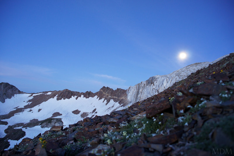
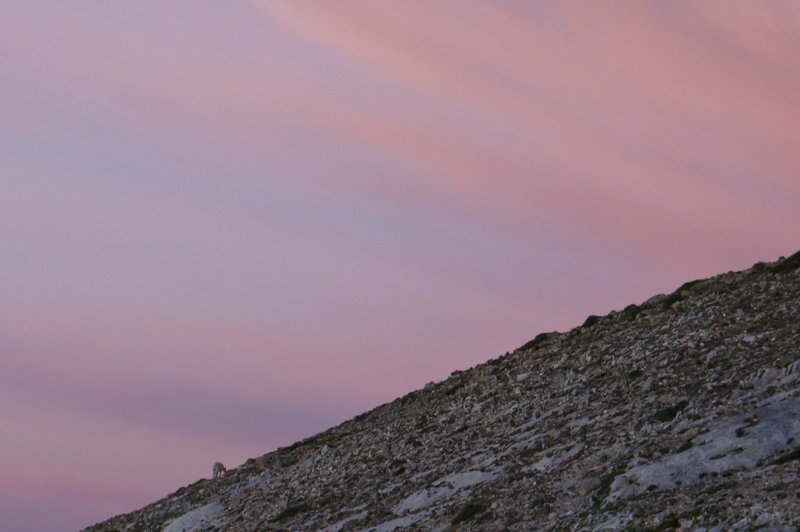
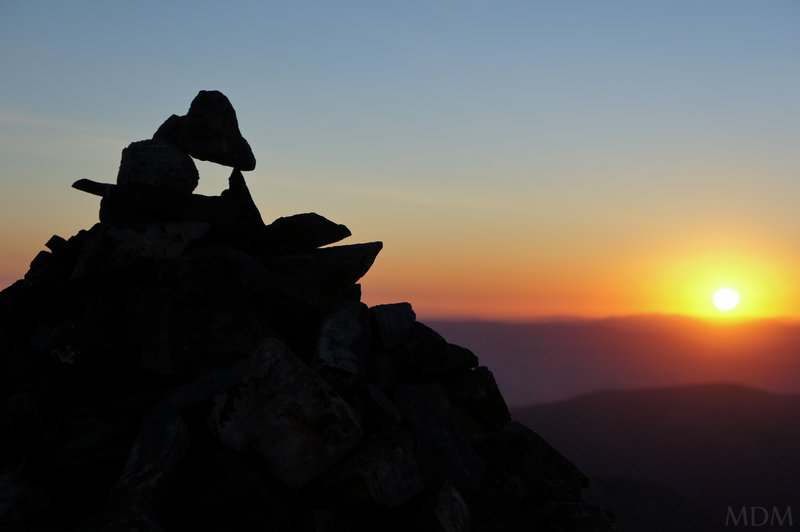
2011 Trips

 1
1
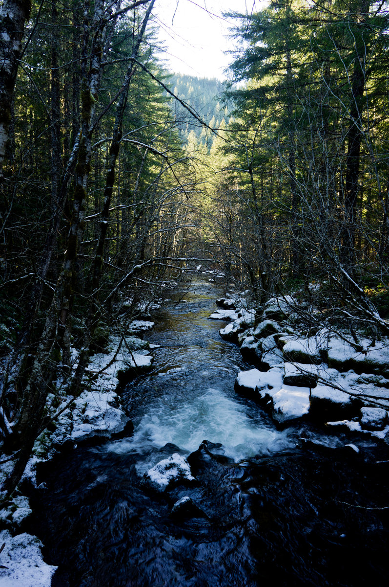
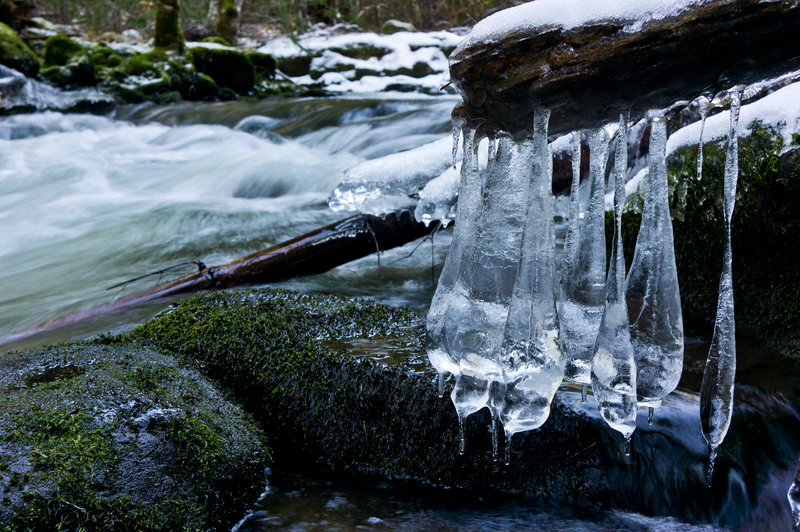
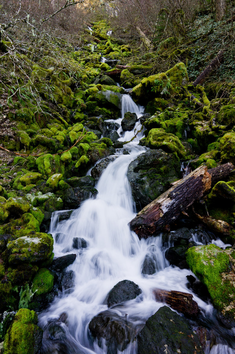
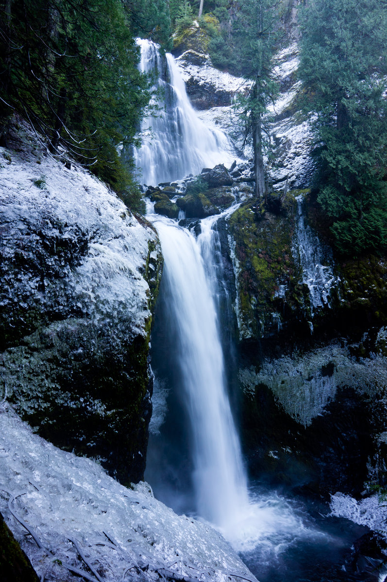
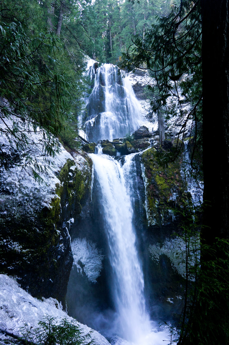
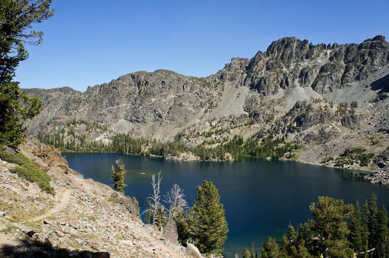
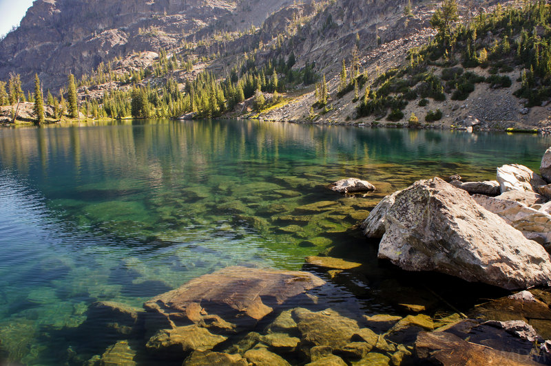
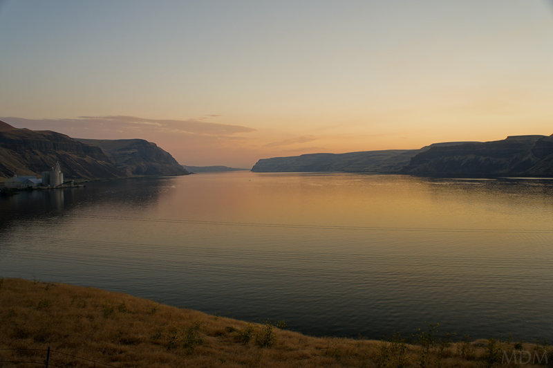
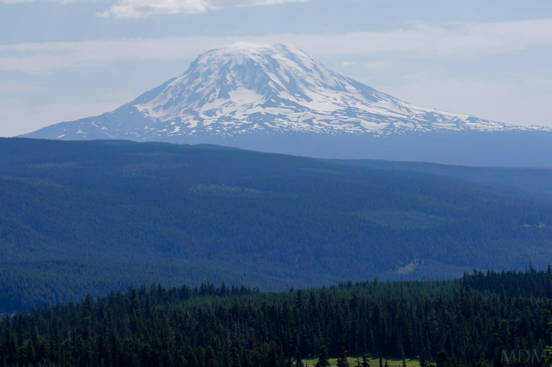
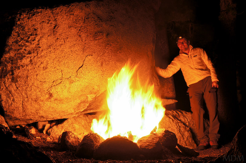
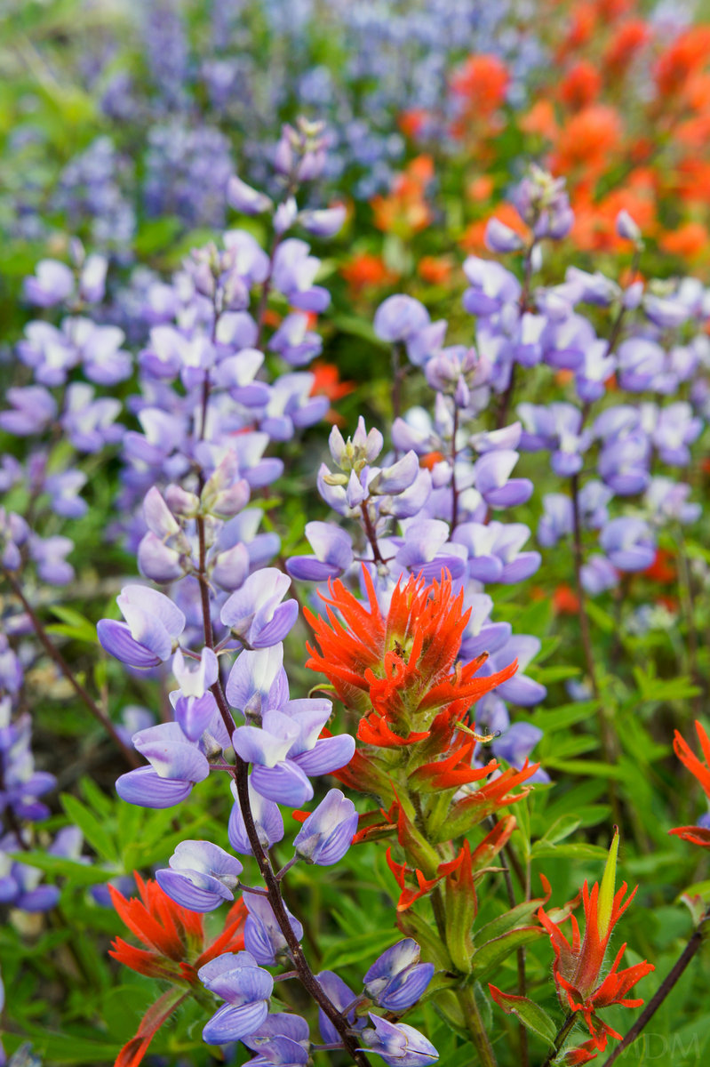
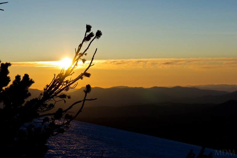
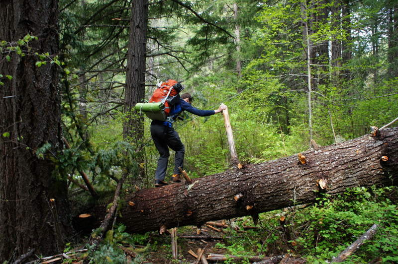
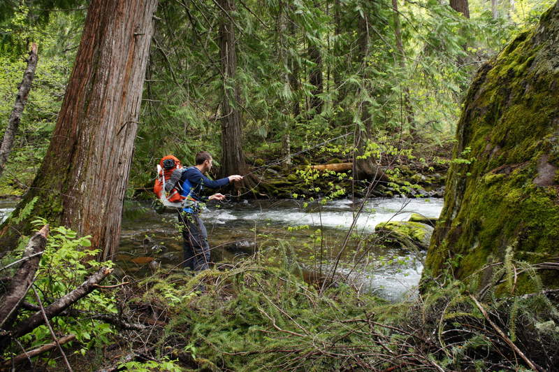
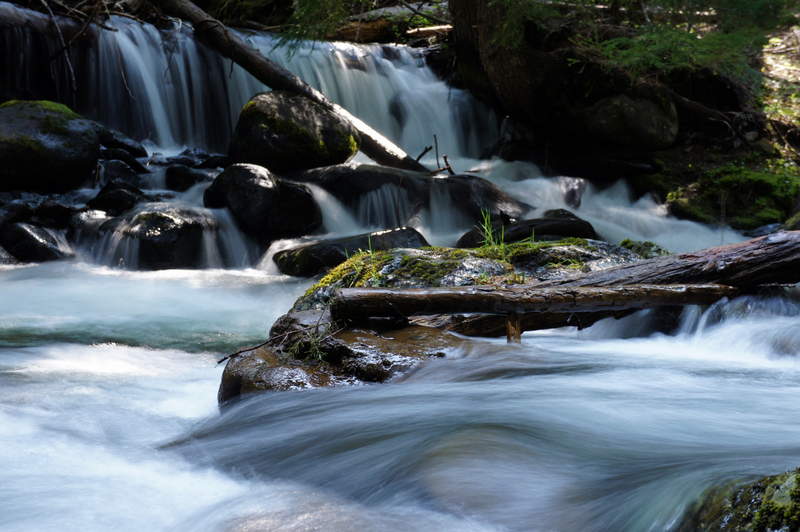
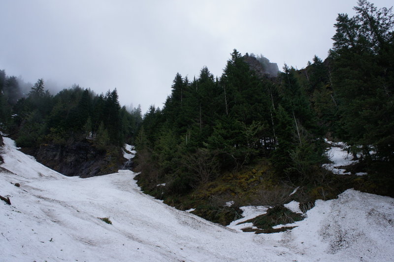
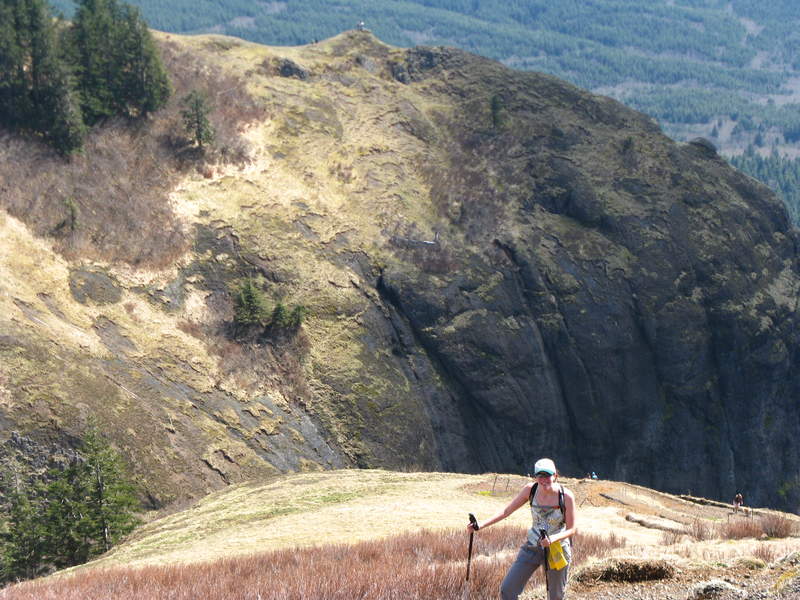
falls creek
8 miles of hiking • 1250' elevation gain •
Never heard of or did this hike before but found it this weekend when my pops was visiting us. Great little jaunt and actually had a ball. Saw 1 other group out. Low amounts of snow helped make it very accessible. Still had to start from a gated road about 2 miles shy of the normal trailhead. I'll be coming back here for sure! Beautiful trees/water.

December 17, 2011


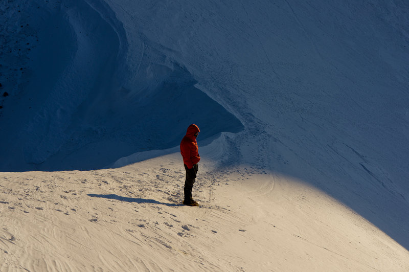
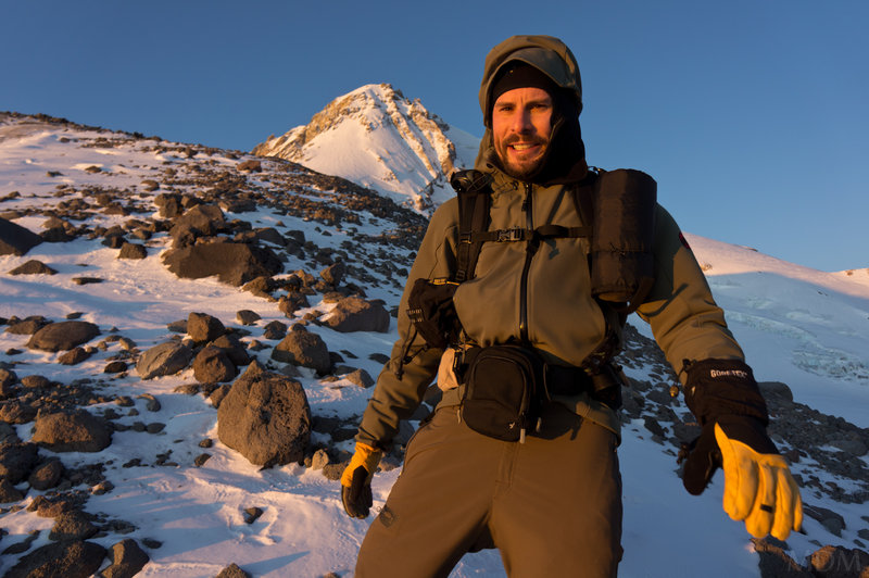
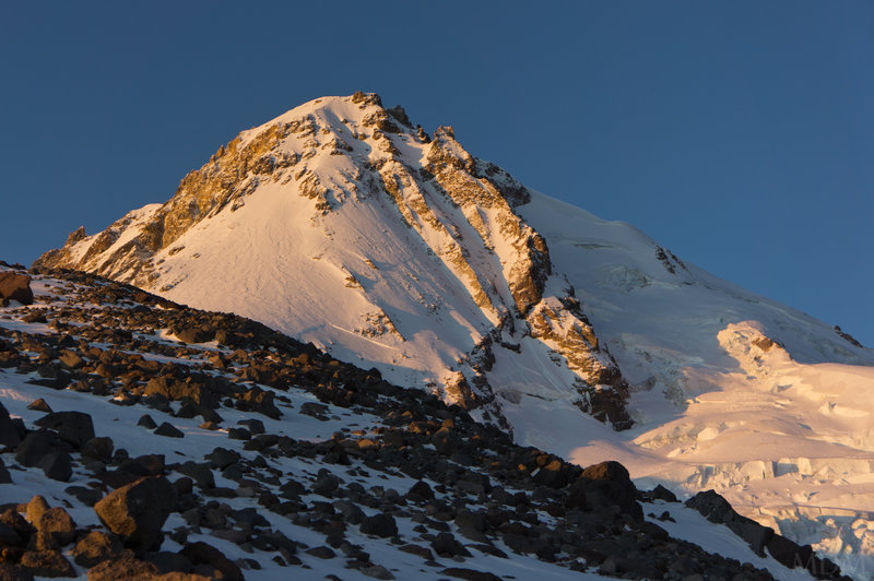
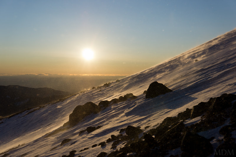
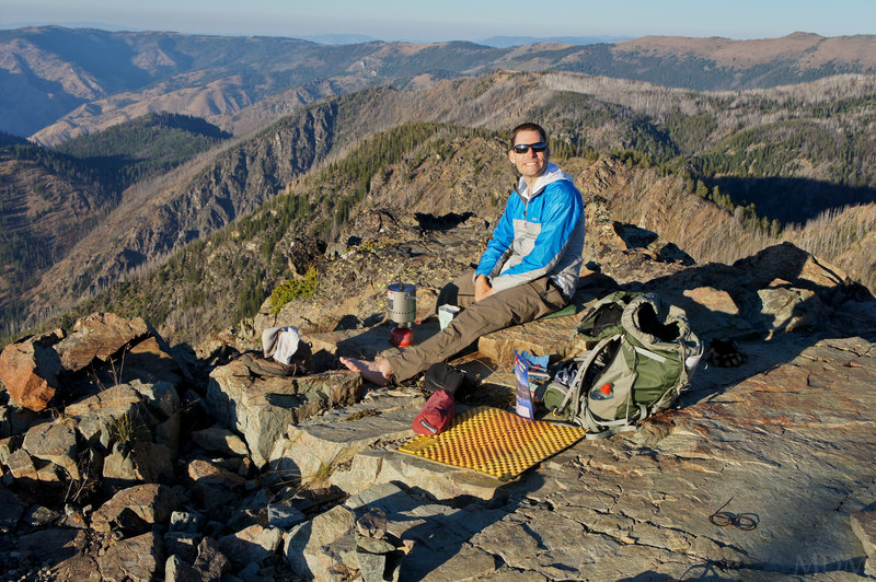
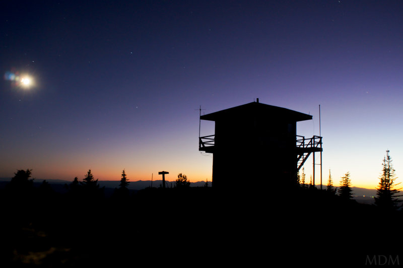
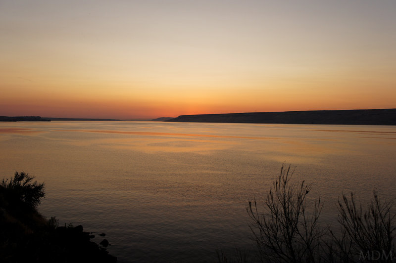
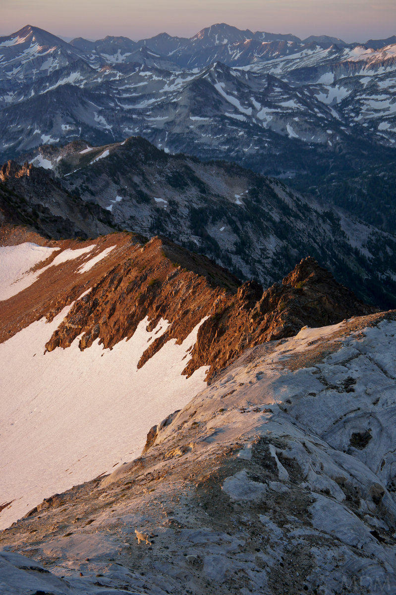
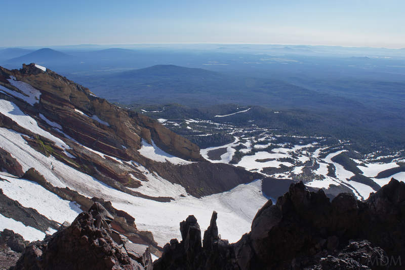
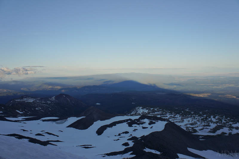
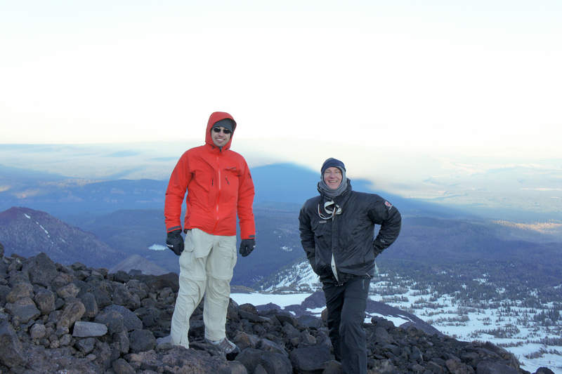
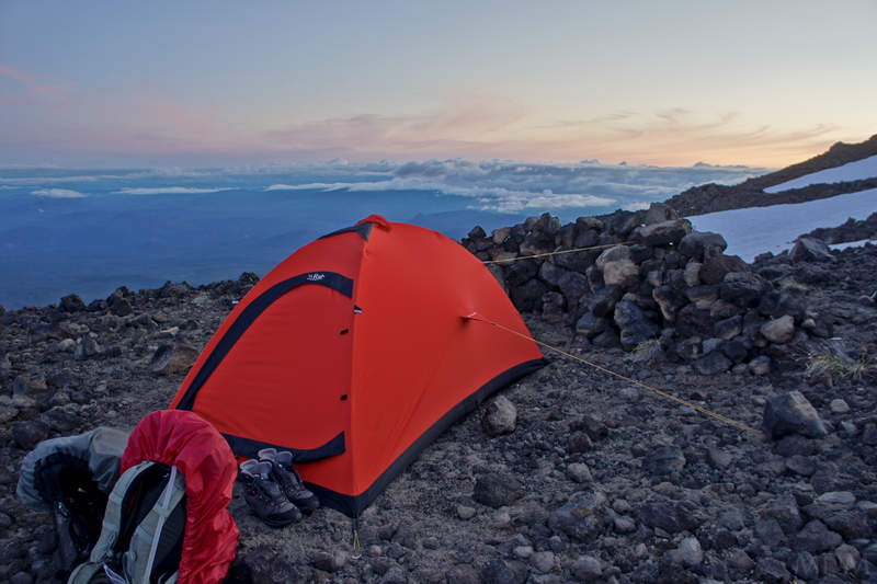
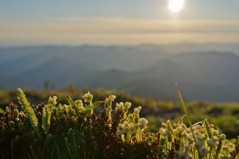
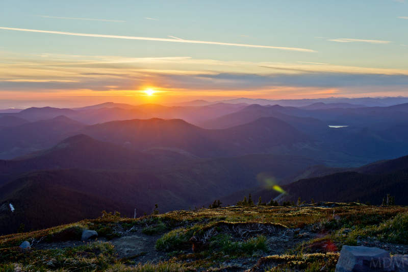
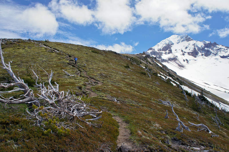
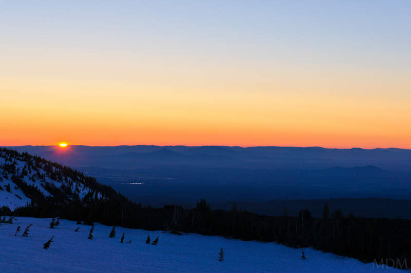
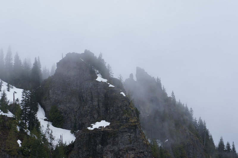
top of palmer
2.5 miles of hiking • 2500' elevation gain •
Went for a southside jaunt with a friend. We should have just slept more and done a later-day summit. We hung out about at the top of palmer for an hour in a snow cave I made but it just seemed like we were in a cloud and didn't know if it would clear. By the time we got back to Portland it was clear and was so sunny for the rest of the day. Kind of a major bummer!
December 16, 2011
 2
2
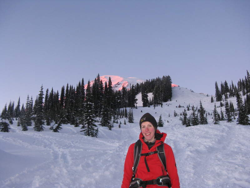
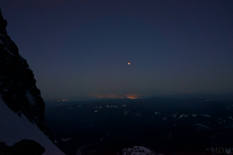
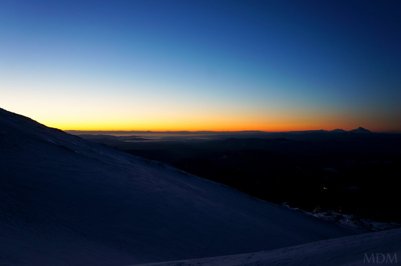
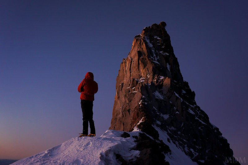
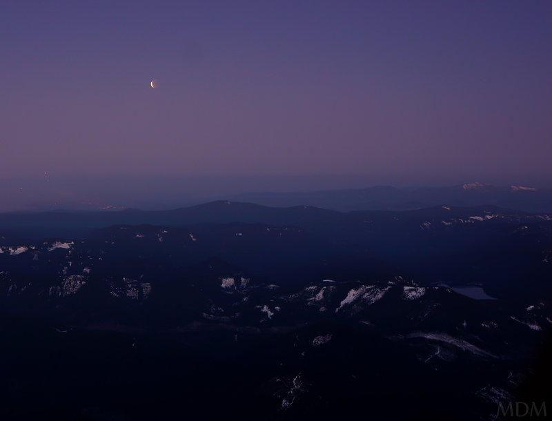
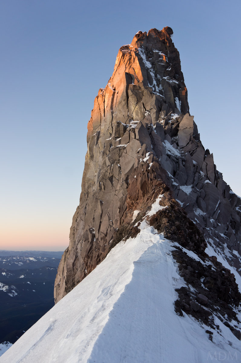
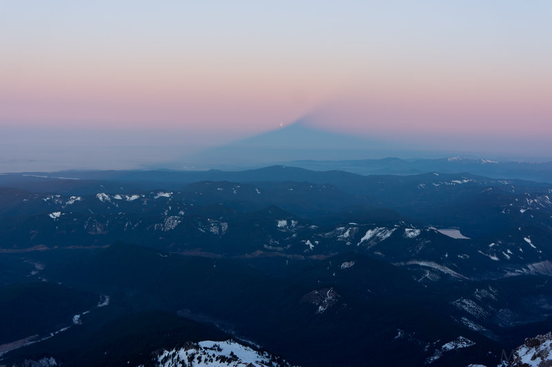
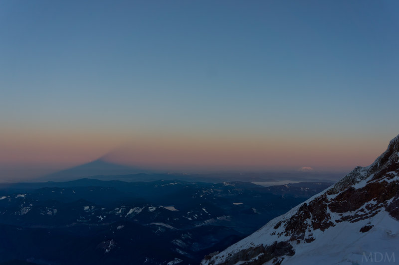
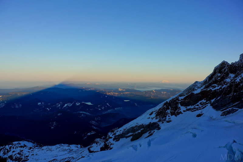
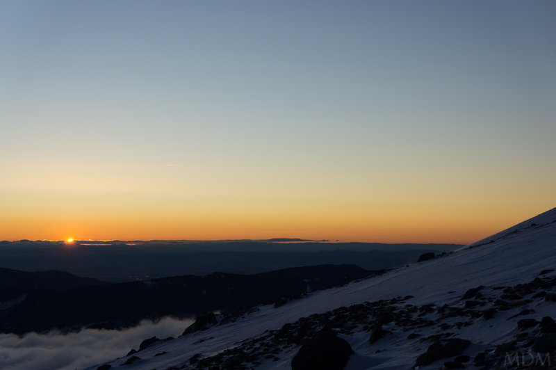
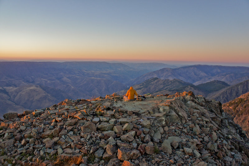
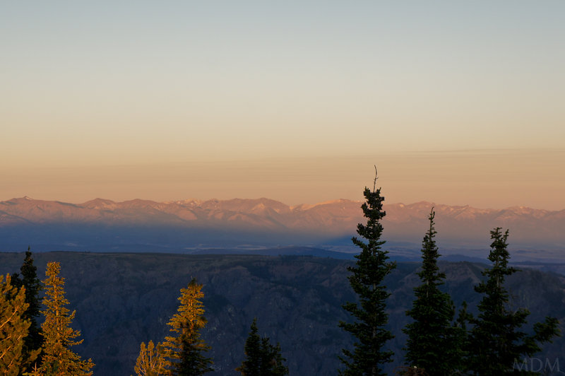
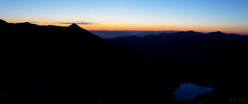
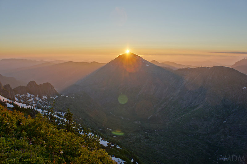
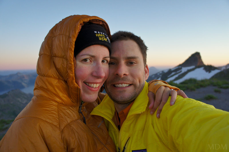
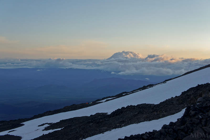
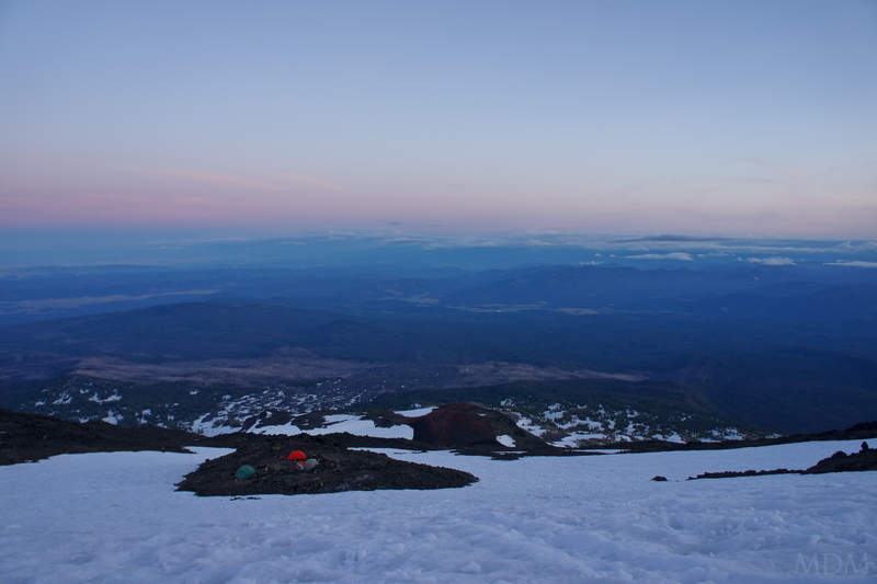
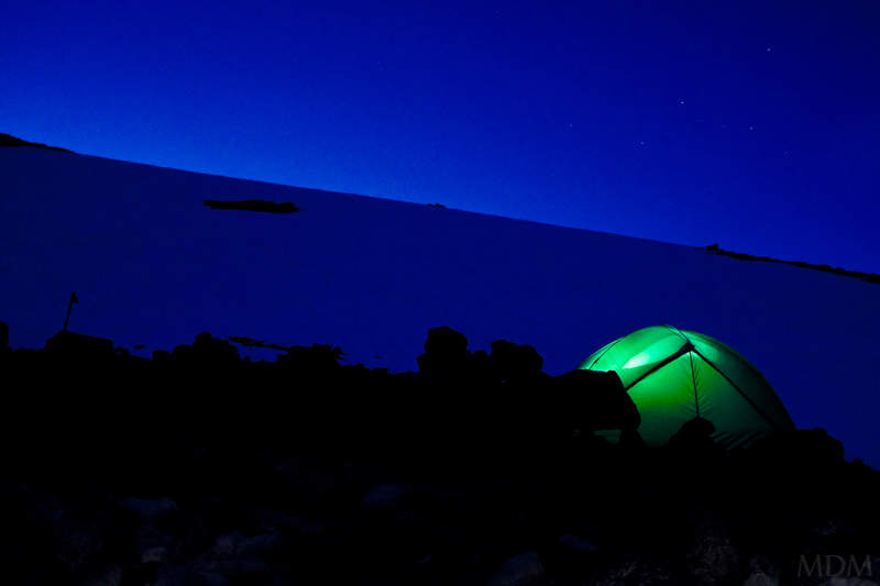
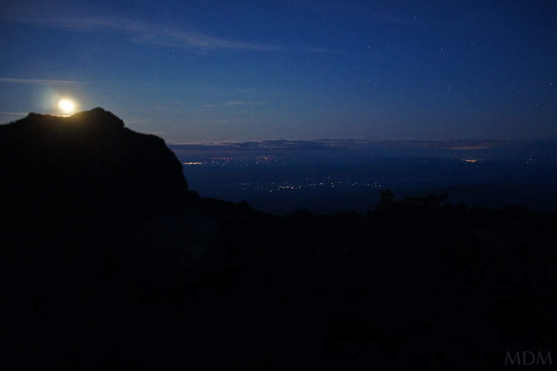
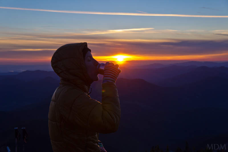
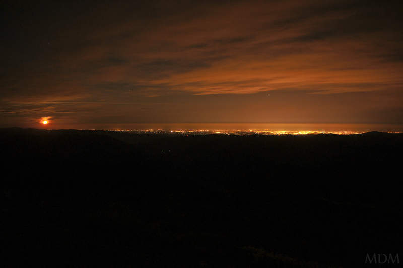
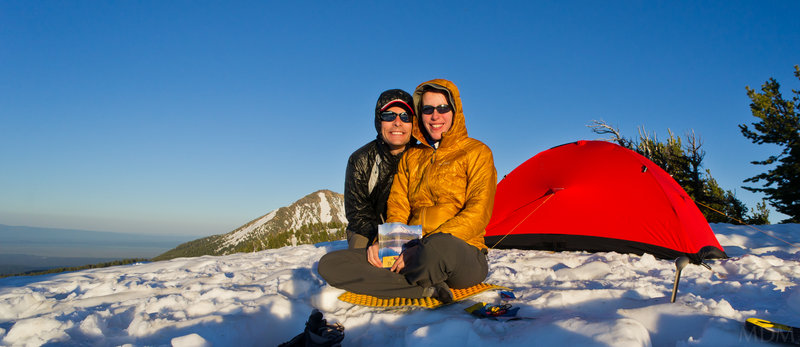
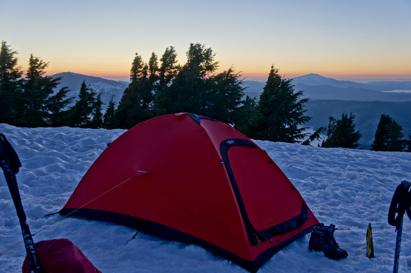
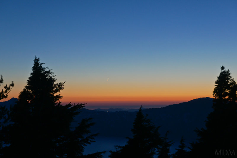
Illumination Saddle Lunar Eclipse
4 miles of hiking • 3500' elevation gain •
Partner was definitely not at 100%. decided to bag going for Leuthold's Coulior and just enjoy sunrise at Illumination Saddle. Partner's feet looked like hamburger back at the truck (new boots), plus his appetite and energy were not normal, so, probably made the best choice. disappointing with the mountain in utterly perfect shape..next time.
Lunar Eclipse did make it worth it.
December 10, 2011

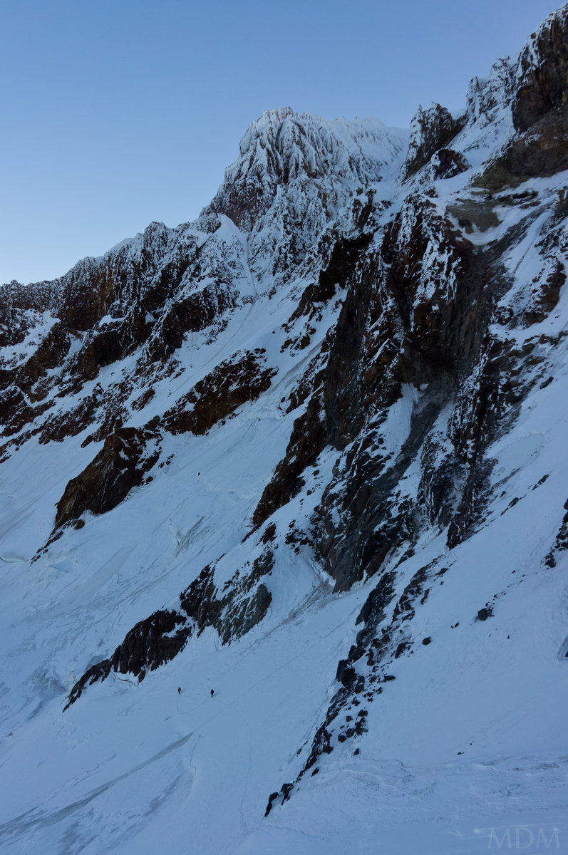

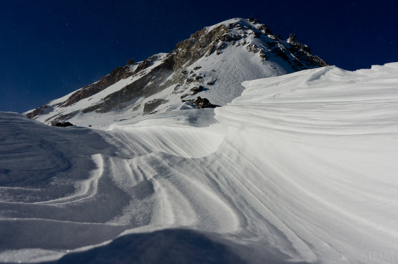
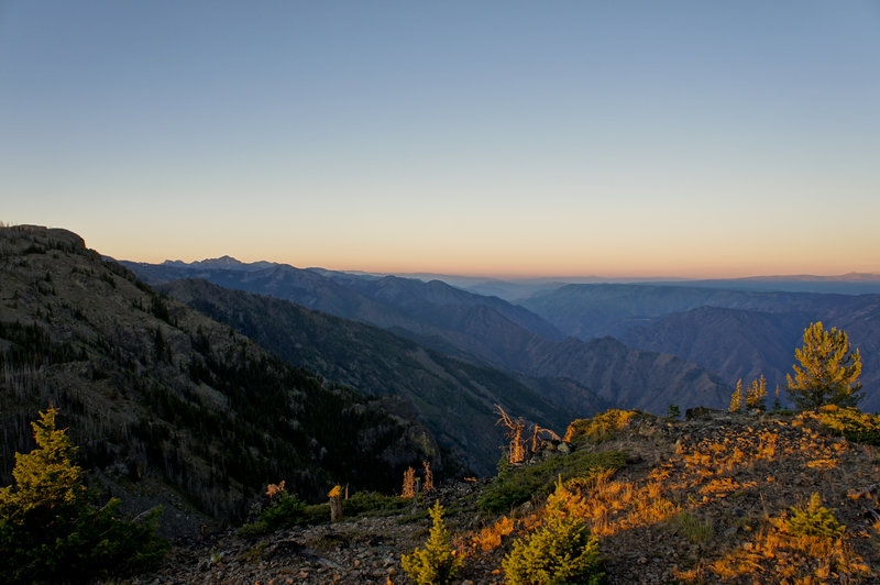
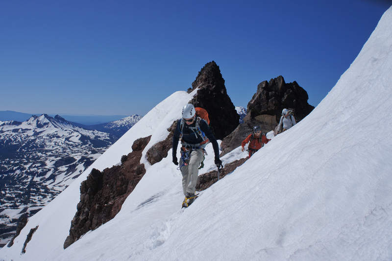
Cooper Spur climb attempt
8 miles of hiking • 5250' elevation gain •
Turned around unfortunately. a bit later than we desired a bit less energy than I would have liked avy cast good but specifically called out steep, N through E high elevation gullies (ie: the chimneys on the route)
Another time.. happy to be out
December 2, 2011

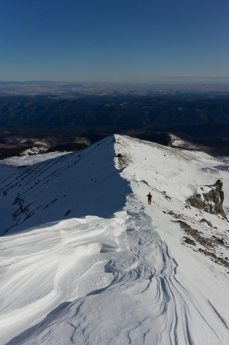
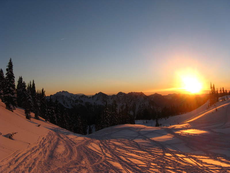
Tline evening jaunt
3.5 miles of hiking • 2250' elevation gain •
just went up for some afternoon sun on the snow. Nice vitamin D replenishment. lee slopes well loaded, windward sides hard packed, crusty, icy, just an inch or two of well compacted snow. Camera (or memory card) decided to hiccup mid-way through out trip, so, only have second half pics (going up later..)
November 20, 2011

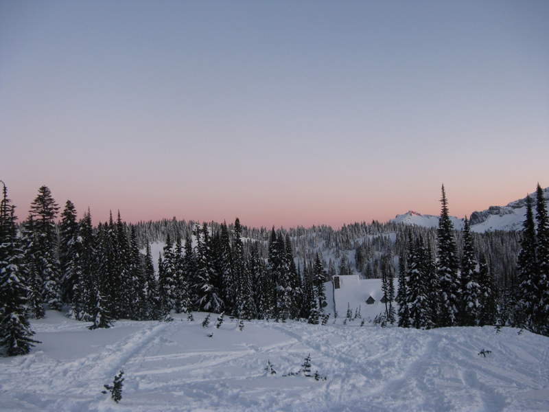
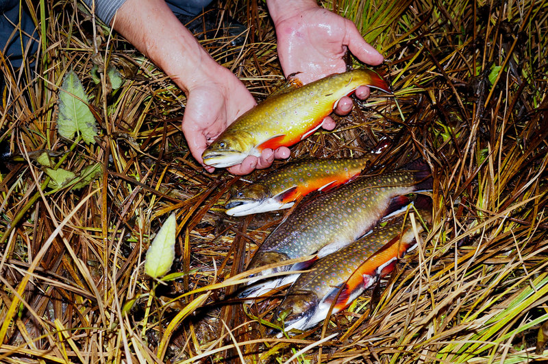
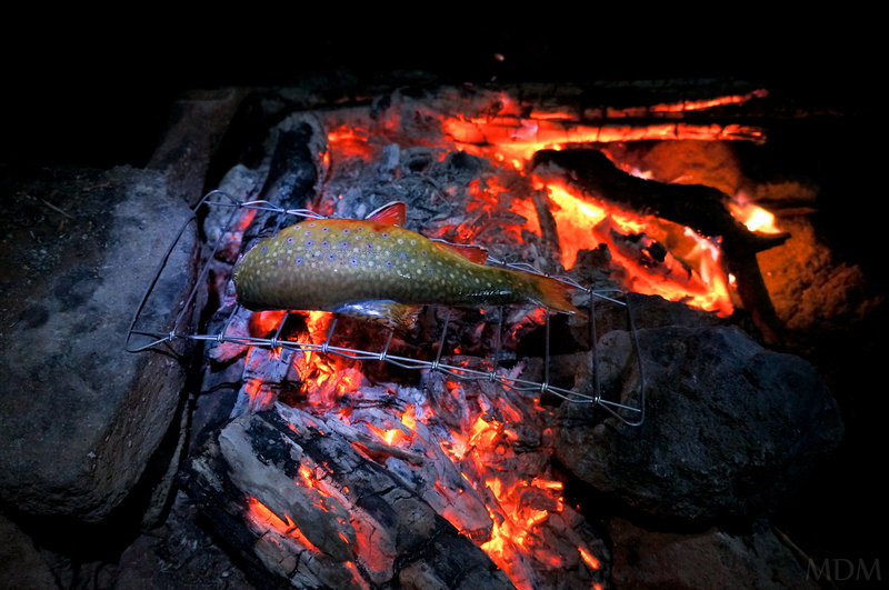
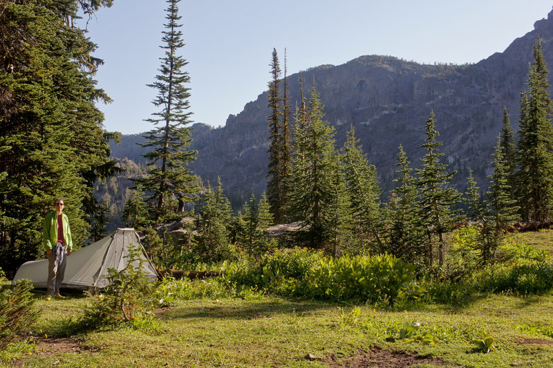
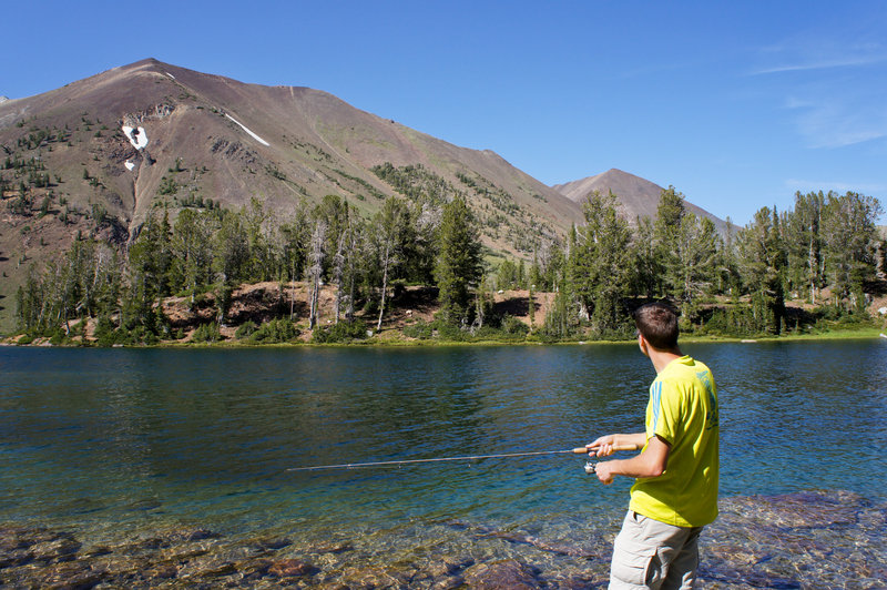
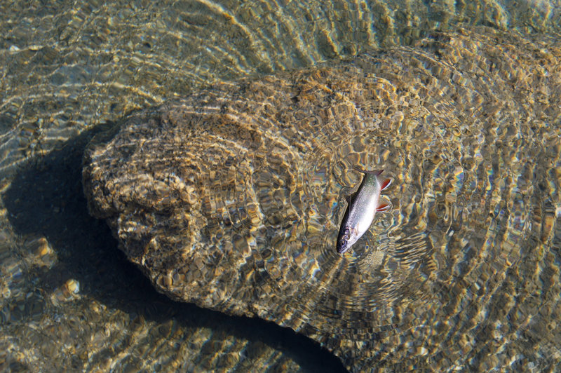
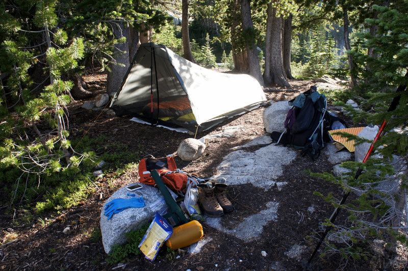
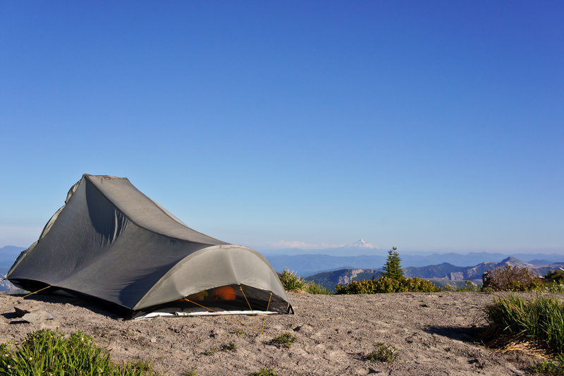
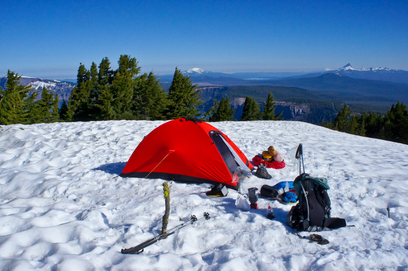
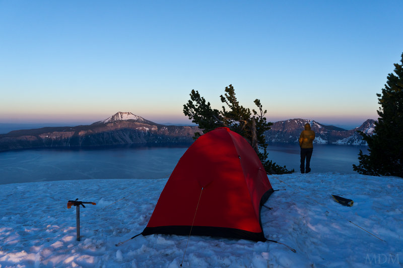
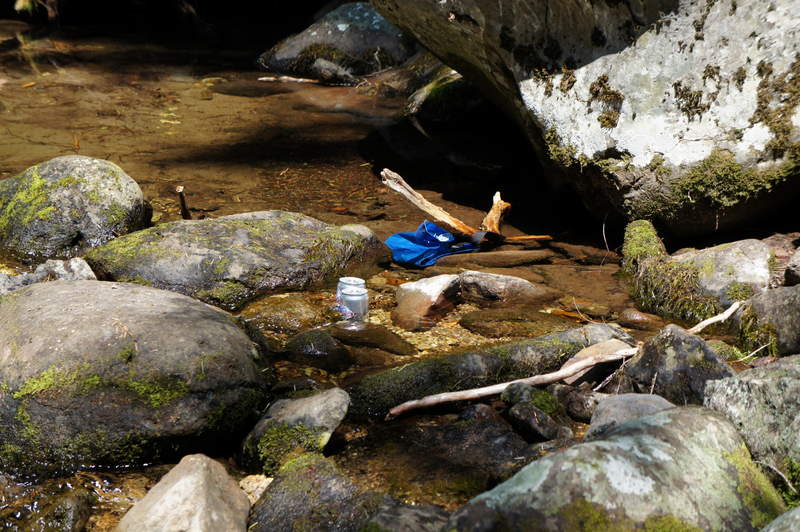
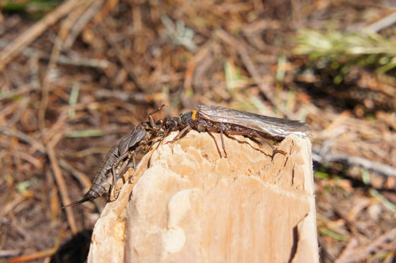
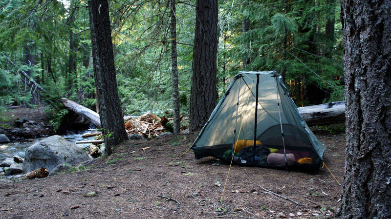
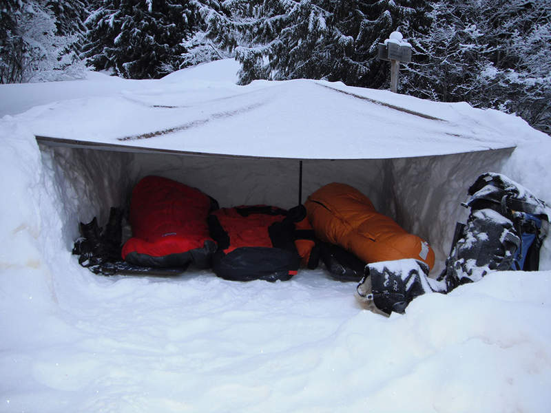
Last High Camp Without Snow
9.5 miles of hiking • 500' elevation gain • 1 night
Nice little trip to a place in Mt. Hood National Forest
Probably our favorite little nook of the woods. Incredibly saw trout of a size I did not believe existed in such a tiny bit of water. Cooked 1, threw the rest back.
Actually left in the middle of the night. I'd forgotten the tent pole so the bottom of the tent was sagging. When we woke up in a misty cloud I knew it was only going to get thicker and actual heavy rain would be coming, so, we packed up in the dark and made it home around sunrise.
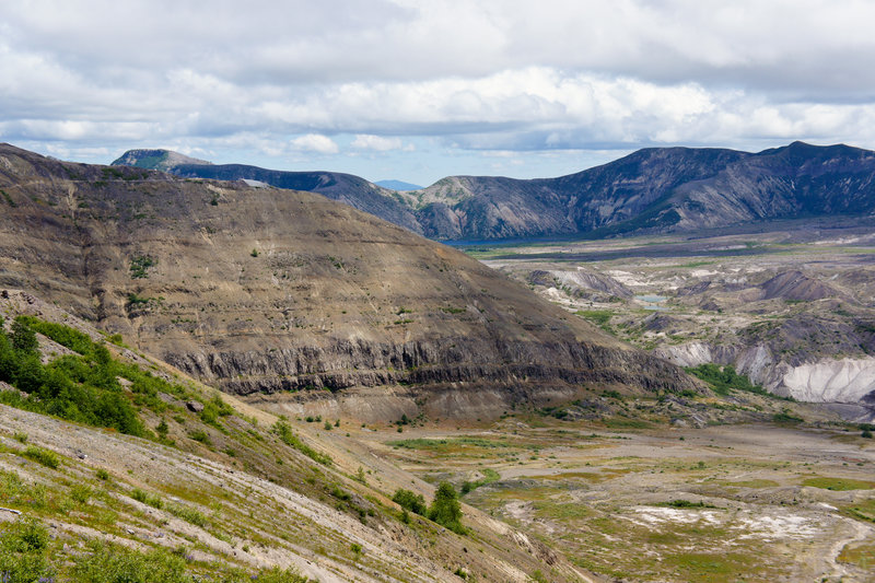
October 26 – October 27, 2011

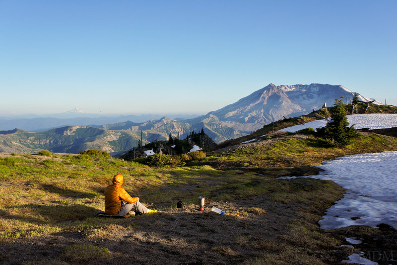
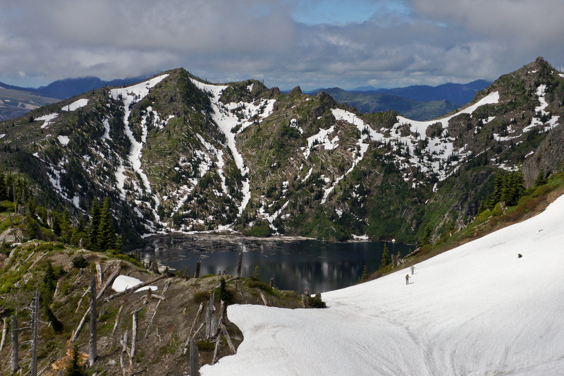
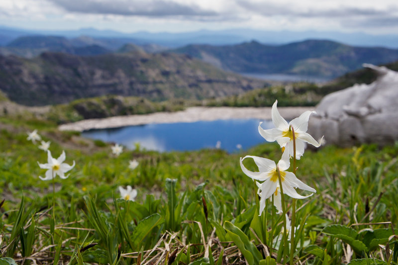
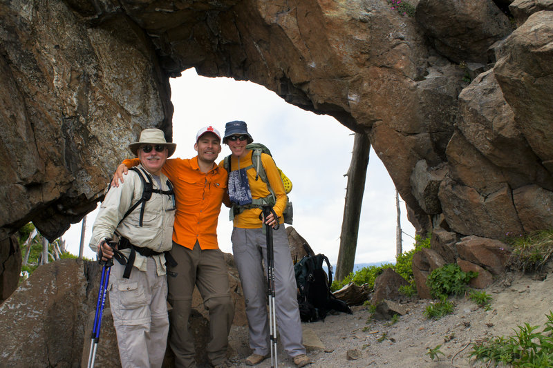
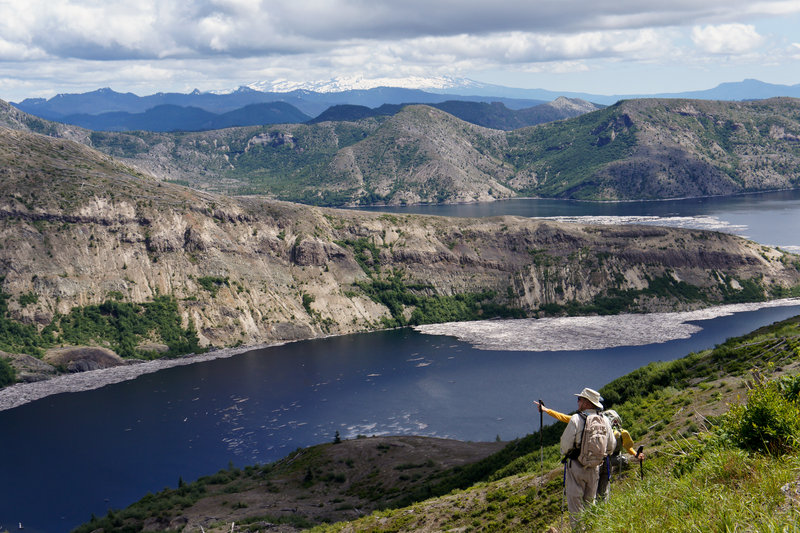
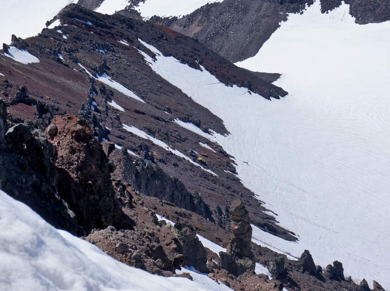
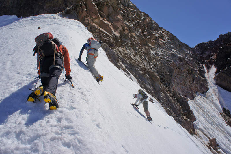
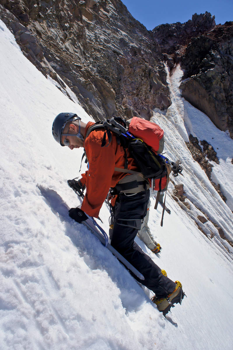
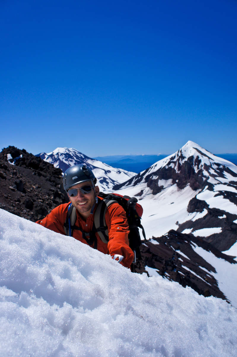
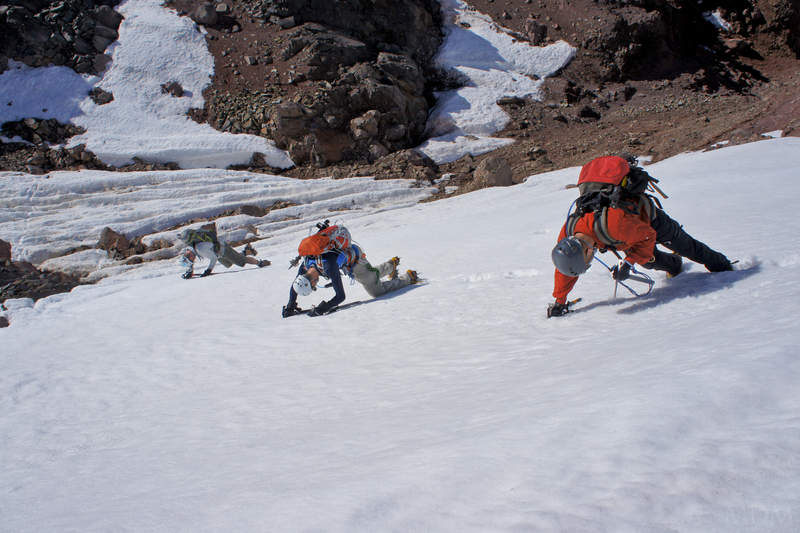
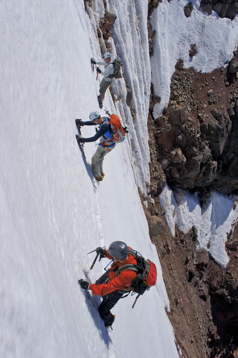
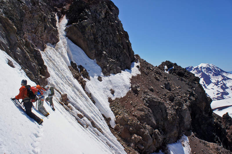
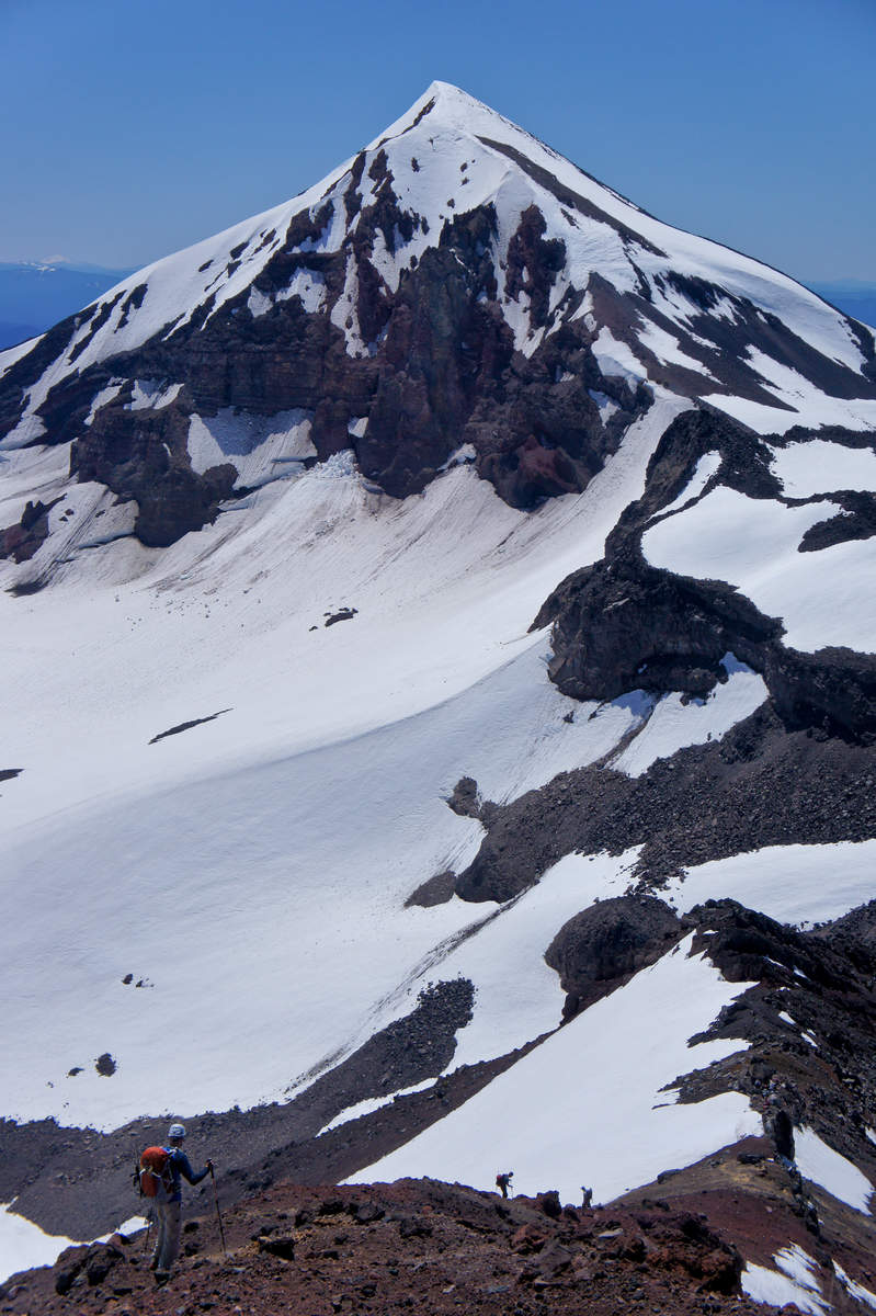
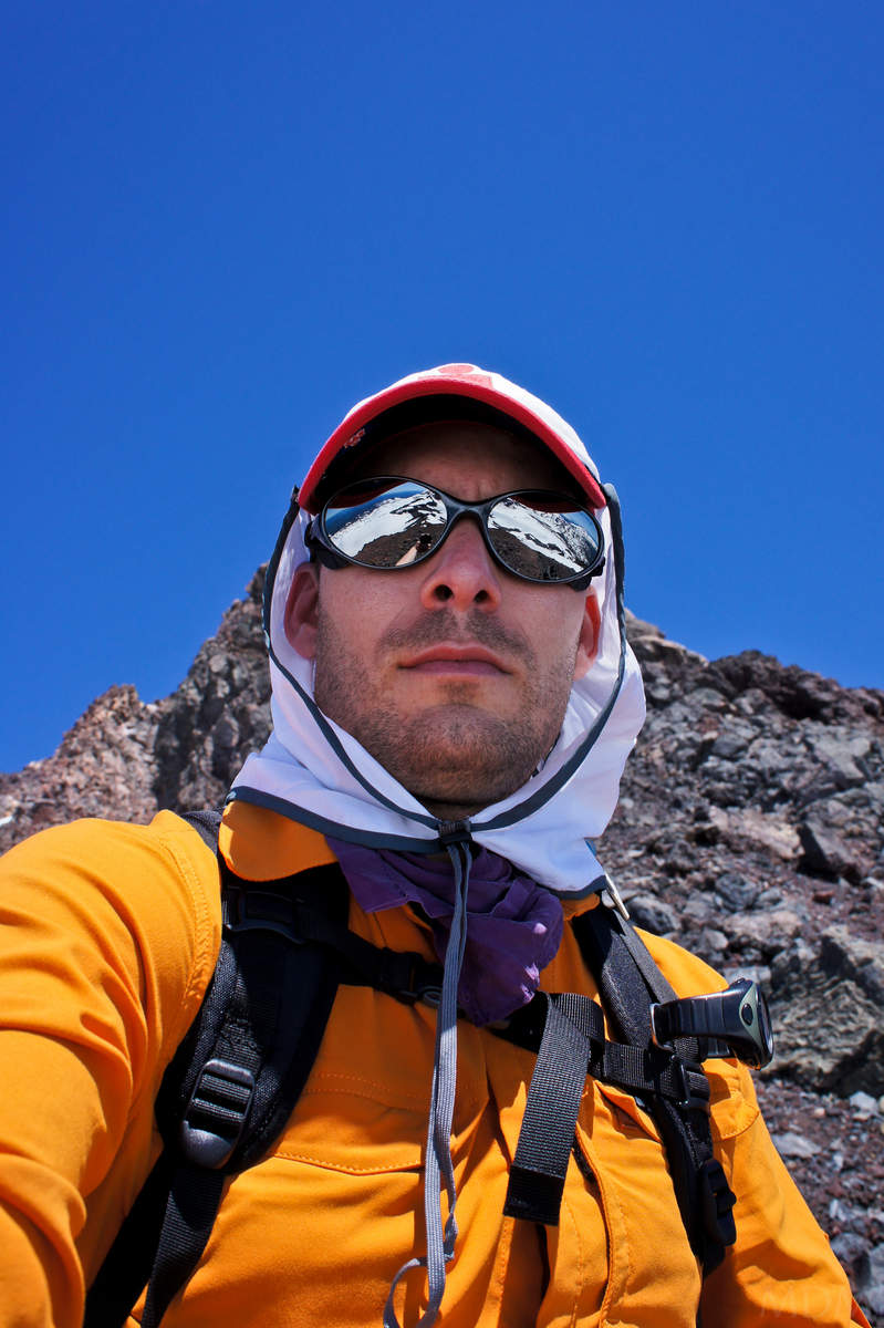
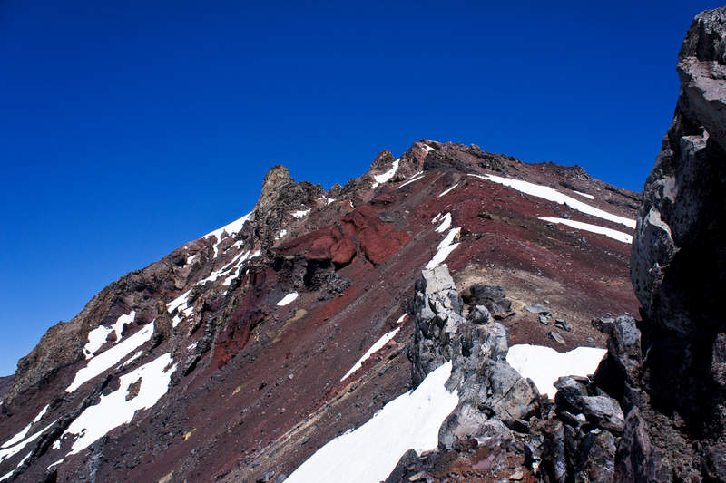
North Sister Volcano Stomping
12 miles of hiking • 5000' elevation gain • 1 night
WARNING, THIS IS NOT A HIKE.... just to clarify that for those considering. Recall that two weeks later on September 24 a man fell to his death while 'scrambling'. His body has not been recovered and it is hoped that the winter snow and ice will migrate it down to a less hazardous area for recovery next year.
re-Posted from CC.com...
Why I keep coming back to this damn pile, I don't know. But I do. Well, I do know, its ragged decrepit rock has a beauty to it. I'm convinced this mountain could be dropped by 2k ft if someone detonated just a bit of explosives midway up the east or west face.. maybe the plug would remain as a spire.
Anyways, L & K have been on a volcano stomping binge whilst nursing an injury keeping them from rock climbing. knocking off the oregon ones they've never visited, they happily enlisted my company as I'd been up a few times before.
headed down on a friday, crashed at TH and got going around 3am or so?, I think.
Not much new to report, heavy snow year as ya'll know and there will be banks of it from 6k up that will make it into 2012. Found things to be melted very well up high on the west side, of course way more than in July when I was last there. Met a guy just before the junction with the south ridge. He was going solo on his 3rd attempt after being skunked before. He had come directly up one of the dikes on the south face, which he said he would not recommend at all... He stuck with us since I knew the route and that had been an issue previously for him.
Still snow at the traverse, which gets steeper and steeper as it melts, but praise jebus the top had a beautiful moat along the summit block rock that made for speedy protected passage.
After that was all pretty easy.
K & L's expectations for horrible rock were surpassed. As we hiked out they asked if I'd come back and climb it again. I groaned, hesitating and said "well...probably yes, I'll be back". I asked if they would, and they both said "no".
Drove home, watched a football game rebroadcast on espn3 online, and then up very early the next day to Indian Heaven Wilderness to do trail magic for PCT thru hikers! What a weekend!
Gear Notes: brought the kitchen sink to cover the bases (crampons, ax, rope, pickets, few pieces of rock pro)
trail runners and camelbak would have done the job
Approach Notes: climbers trail from just before soap creek, cut S/SE sooner than later, or you give yourself a bit of extra work crossing a small ridge just north of where SE ridge of north begins.
exited via S ridge and hayden glacier moraines and back the middle sister climbers trail to soap ck.
September 10 – September 11, 2011


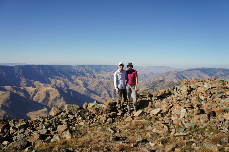
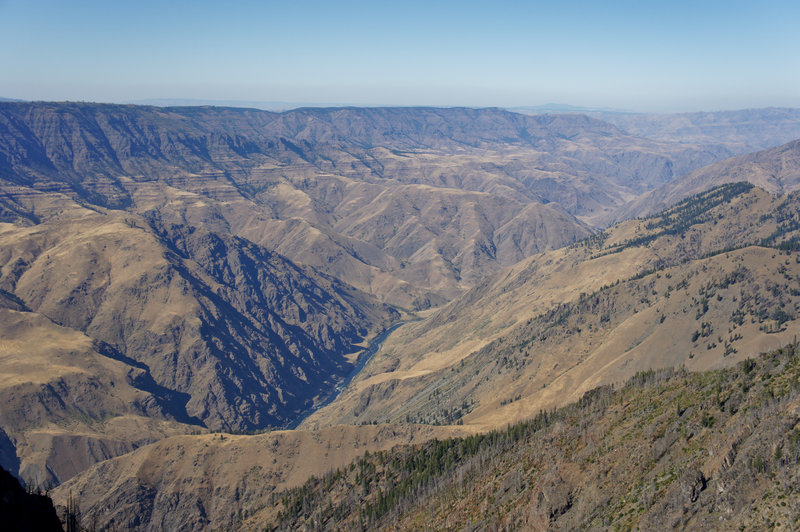
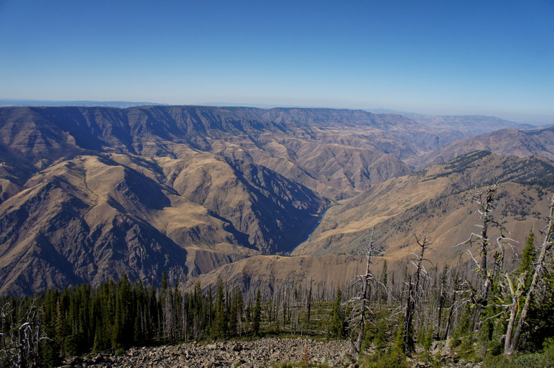
Se7en Devils Labor Day Loop
17.5 miles of hiking • 2250' elevation gain • 2 nights
Have wanted to check out the Seven Devils for a while. Seen them three times now from the top of Wallowa Peaks, jutting out over there in Idaho. For the record had never visited or seen Hells Canyon but heard aplenty bout it.
Friday: Left PDX late afternoon. Arrive in Riggins at Salmon River Inn ($50?) around midnight? Got to drive through a recently started forest fire, very smoky (smelled good!) and seeing patches of fire and glowing all around us.
Sat AM: leisurely, but not too leisurely, made our way up to Windy Saddle. Nice spot. You could get up here in the night and definitely car camp, just make sure you don't set camp in a cow patty or in horse manure!
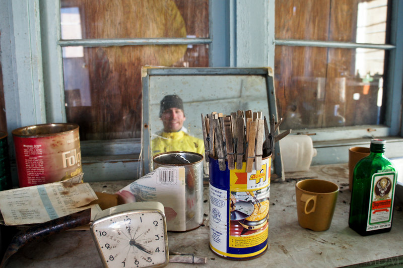
Enjoyably lead our way over towards Bernard Lake. There was a primo spot at upper Bernard but someone was at it. We continued on to the lookout, curious if we could snag a spot somewhere around there.
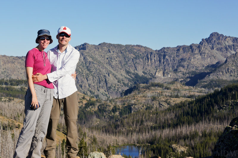
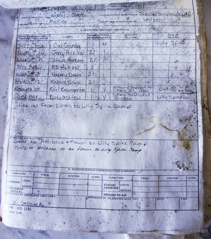
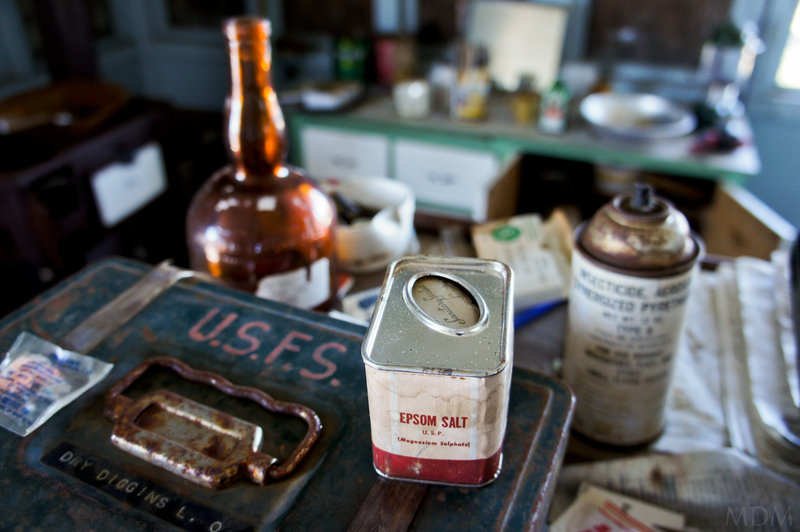
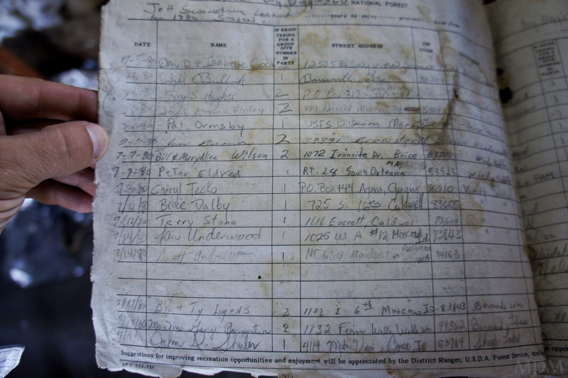
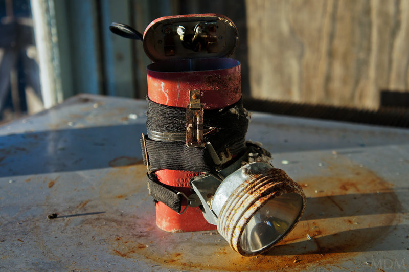
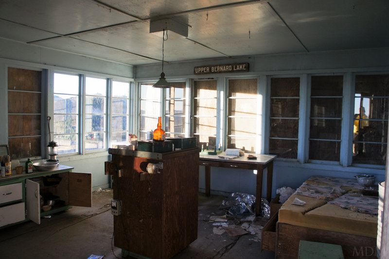
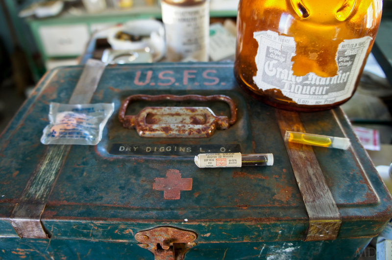
Lookout views were incredible. Lookout itself is in shambles and semi-condemned. If you need antihistamine that expired in 1980, it's there for you. The old clipboards with fire fighting logs and guest logs from the early 80's are also in there. Hells Canyon looks utterly incredible from here. Can see the Wallowas across the way. We spend an hour or so here eating and enjoying ourselves before pitching a spot in the burnout ghost forest about 100ft below the lookout. As sun sets, I can see the lights of Joseph and imagine a terminal gravity brew... if only this darn hells canyon wasn't in front of me!
Sunday: Great weather, kinda dusty. Hang out at the lookout a bit more in the AM, then make our way in a round-a-bout loop fashion down to the trail that goes to Sheep Lake. Run into some more people. The lakes on the way to Sheep look cool, and I'm sure you could find some very private secluded, plenty of wood, near the lake spots at some of these if you're willing to go off trail for 20 minutes.
Camp at SW corner of Sheep Lake. Nobody around us but other people are at the lake. Around evening while I'm fishing and swimming a group of 12+ adults and lots of kids come through making tons of noise and having barking dogs. I love people getting out but at least keep your kids from screaming constantly--perhaps adhere to the 12 person wilderness limits? I forgot, we're in Idaho. Though I found a band-aid from one of them... gross!
Fished but caught none. These are some wise trout--the only way they could grow to be so large--looked like 16-20 inchers the lot of them!
Could see fires across the lake once it was dark. Great stars out.
Monday: Up early and get moving to make it over the 'scramble' from Sheep Lake back to Windy Saddle via Mirror Lake. Guess this use to be an old trail but the FS didn't want to deal with it's sketch nature so it is no more official. It is an awesome shortcut into the heart of Sheep Lake and all the Devil peaks for a climbing/scrambling trip. The scramble itself is not particularly sketchy, Bucket, who has a chronic and irrational fear of heights actually didn't really blink an eye at this--maybe she was in the zone but that is an accurate barometer in my eyes.
Great burgers down in Riggins. It is very obvious that there is a conservative bent to this part of Idaho at least from the billboards and general attitudes. Moreso than around the Wallowas, it seemed to me. Beautiful drive back home.
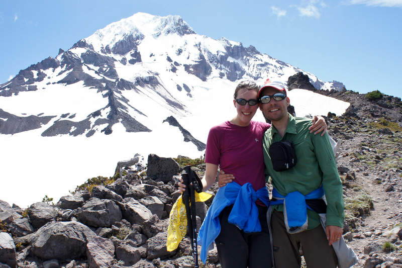
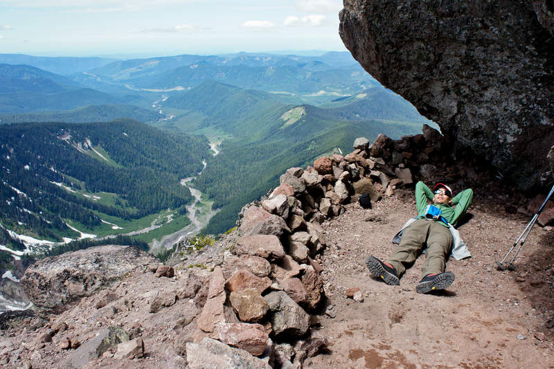
September 3 – September 5, 2011

 1
1
Goat Rocks (Nannie Ridge->Cispus Basin->Snowgrass->Walupt Loop)
21 miles of hiking • 3750' elevation gain • 1 night
First time in Goat Rocks having been here for 4 years. We've been to the Redwoods, Crater Lake twice, Wallowas 3 times, Hells Canyon, Olympics 3 times, up to BC, Okanagon Valley, and all over the Oregon Cascades, St. Helens, Adams, and Rainier... but never Goat Rocks, for all the wonder I've heard of it. Finally!
Had some fun on this one. Sheep Lake wasn't exactly as expected (not really a spot to fish). We made it up to the pass just before Cispus and were really debating if we just wanted to backtrack back down to Walupt Lake or if we could make a loop out of it. My map shows 7A horse trail, or much of it, seemingly connecting through a serious of convoluted roads from Snowgrass TH back to the road that went to Walupt.
We decided to go for it because while Bucket loves to go according to plan and schedule, and hates possibly being in sketchy situations, her loathing of out-and-back hikes and love of a good loop outweighs her normal response.
Thus it was a super time, got to soak up the Cispus basin, see the hoard of tents at snowgrass, and have fun navigating the entirely passable backroad route along the old logging roads and lowlands, back to the walupt lake road.
August 27 – August 28, 2011

 2
2
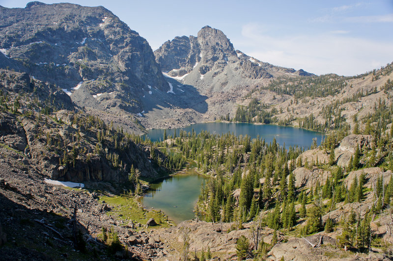
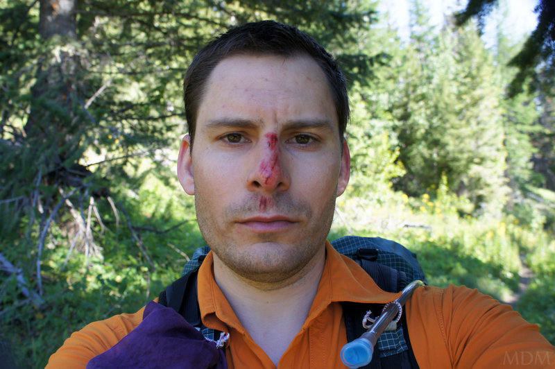
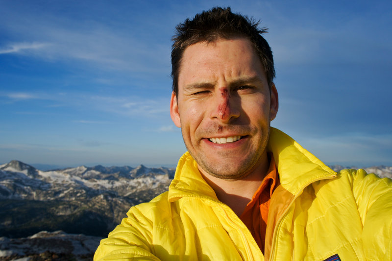
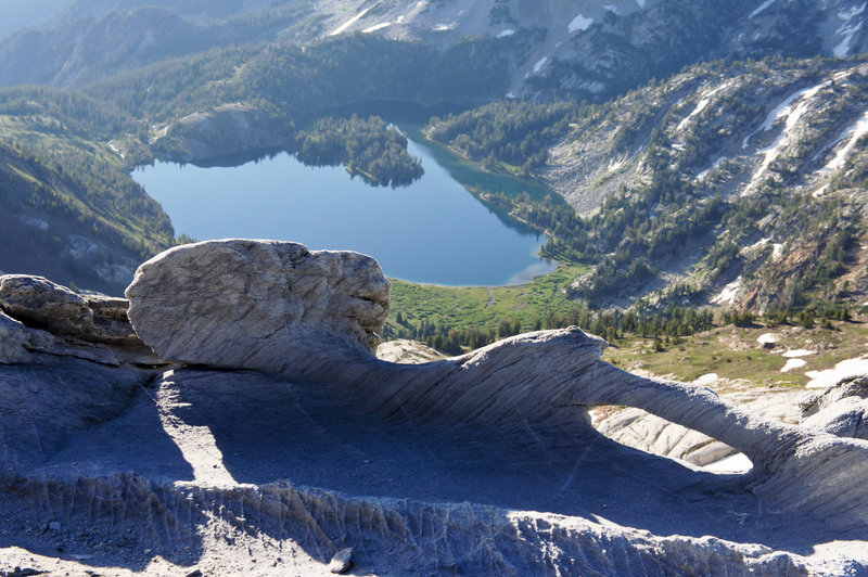
Ice Lake and Matterhorn-Sacajawea Traverse
21 miles of hiking • 5250' elevation gain • 2 nights
hopefully some pictures soon...
i fell and biffed myself by the car when i woke up on Sat AM before we left. then I was sitting there trying to get an embedded rock out of my palm but couldnt, and I passed out and landed on my nose and make that look like hell. Friend Jason had to pull rock out with some mini pliers.
We cared for the wound then went on our way. caught a bunch of nice brookies and the traverse from matterhorn to sacajawea was awesome--some top notch scrambling. Want to go back so bad. Headed up the matterhorn around 4am under a full moon which was lovely. Jason helped out with my busted hand and bitching about my injury. I made up for it by landing the majority of the fish (12 or 13 I think? maybe 14?)
cheers
August 13 – August 15, 2011


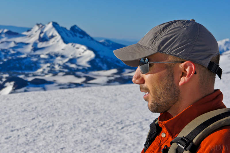
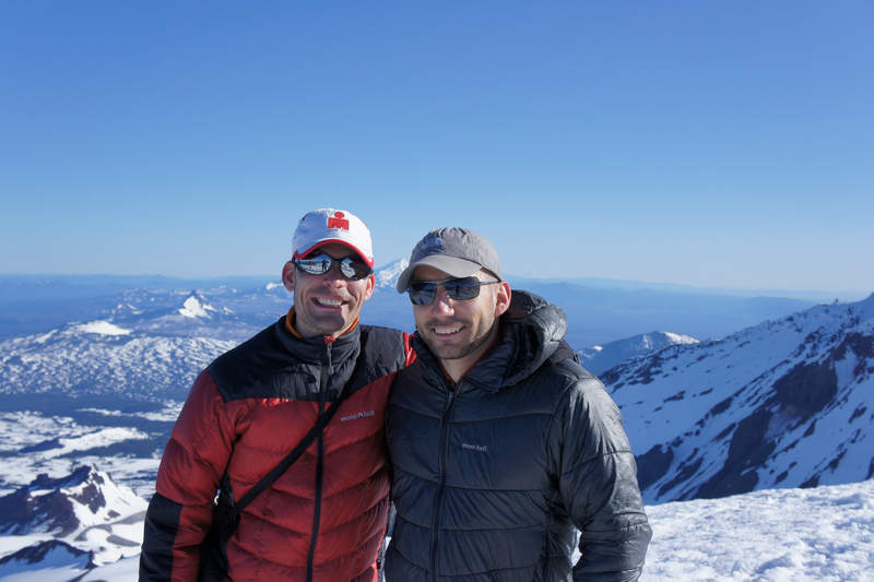
Mt. Adams
12 miles of hiking • 6750' elevation gain •
Went for Adams with good weather this time, single day deal. Bucket was pretty enthusiastic having felt great carrying up to a sub-LC camp a few weeks ago in lousy weather.
We left the TH around 6am and were towards the tail end of the conga line. Glissaded from summit to plateau, and from pikers down to LC. Did a nice standing ski/glissade off the crescent glacier, including cutting and sending up the corn snow in a nice wave from my boots. Good time for sure.
Pictures and some vids later.
August 6, 2011
 2
2
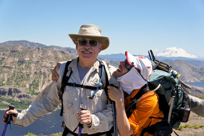
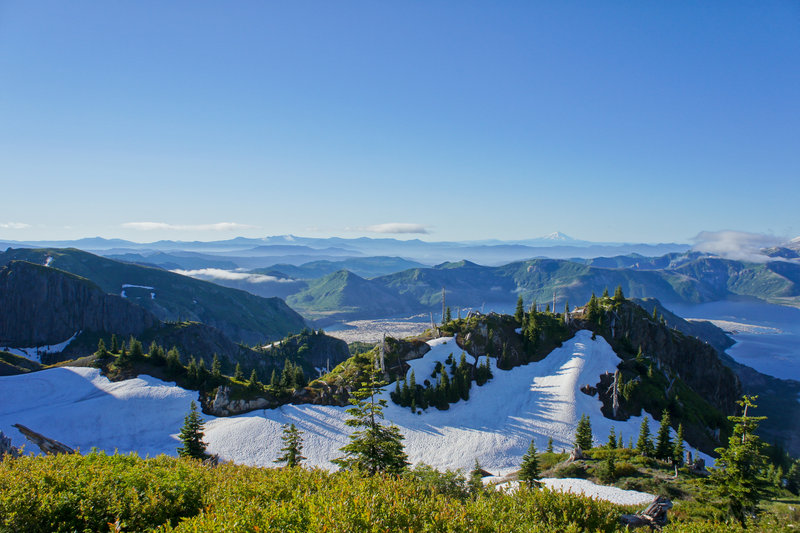
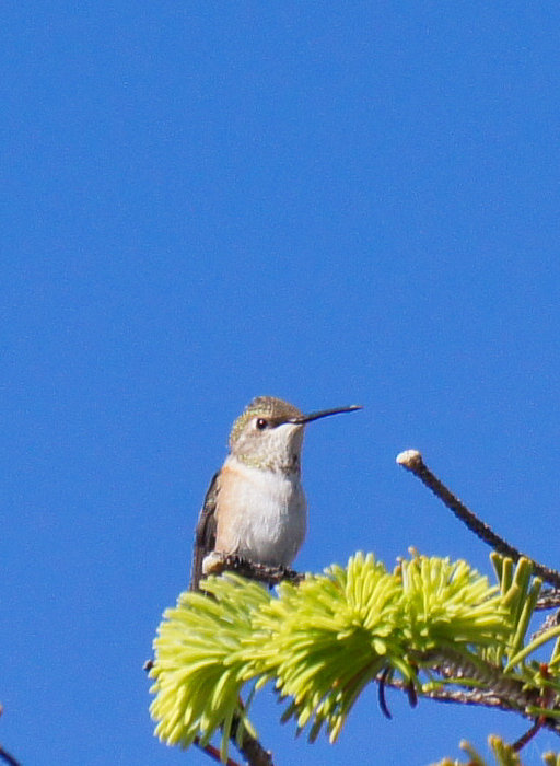
Large Marge Backcountry (Mount Margaret)
15.5 miles of hiking • 2500' elevation gain • 1 night
My pops is able to tack on a weekend or so in Portland every few months when he has to fly to Oakland, CA for business. He knows we're (or me at least) are hiking addicts, especially at this point in the year, so, we take him out for the best we know of, when the weather is right for adventure. Large Marge BC captivated us to no end last year. Even on a foggy October day with my bud Al along the lakes and a retreat from Whittier Ridge, it was still spectacular. So, we knew we had to get my pops up there at some point. We do it right for a Michigan flat-land desk-jockey, saddling him up with some water, a few snacks, his toiletries and clothes, a headlamp, and a 2.5lb sleeping bag. And on the hike out we took the sleeping bag from him, hehe.
Just an incredible time. Flowers galore, flock-like amounts of hummingbirds, constant expansive views-just can't say enough. Little hairy on a few snow crossings but the snow was exceedingly soft so I was able to make many wide, short steps, that were deep and slanted inward. It was a fairly warm night so things never even iced back up really for the morning trek back across.
July 30 – July 31, 2011

 1
1
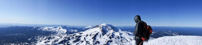
North Sister
12 miles of hiking • 4750' elevation gain • 1 night
Fun time on North Sister. Team RamRod/Pickett didn't summit due to being too late in the day / softening snow.
Left PDX in two vehicles on Friday evening. Dindin in Sisters, then camped just off the road about 3 miles from the TH. Paul found us an absolutely fantastic spot to cowboy under the Ponderosas. For only 4 hours of sleep, the night was memorable: Clear-sky stars above and endless sublimity distilled from the breeze, steadily exhaled from The Void of darkness on a silent summer night.
Started 40 minutes later (@3:20am) than planned due to percolating coffee pot (was sort-of worth it - I was buzzing for the first 2hrs!), and general slowness of packing up. Went perhaps an hour slower to the top of SE Ridge, then got a bit slowed behind a Mazamas group of 10, too. Though, they let us prussic along a fixed line they set and get in front of them, so, appreciated that. I am sure Mazamas have successfully brought 10 folks to the summit of North before, but, it strikes me as self-deceitfully or stupidly naive to bring 10 people, 7 of which appeared to be shaky even on a fixed line, like they've only done 1 other climb, to try to climb one of the more difficult volcanoes in the Cascades. I mean, for real? We had 5 and that seemed huge--it was! 2-3 is probably ideal. /end Mazama Rant
Turned back at start of normal traverse, after having done one snow traverse. Way more snow for nearing end of July than when I successfully climbed it July 10th of 2009.
Key would have been to leave Pole Creek TH at 1am and move a bit faster on SE ridge, and, possibly, have less people so doing running pro would be quicker.
But an absolutely wonderful time with a bunch of great friends, thrilled to get out. Lots of wonderful farting. Lots of jokes. But, more than anything else, lots of choss and a mountain held together by dikes of slightly more solid andesite. Great to drink up from one of the snow-field tributaries once we got lower.
Side note, I migrated to compression shorts to mitigate swamp ass chafe sometime this winter. Seemed to do the job very well then. Now that it is summer, seems the chafe returns with a vengeance. Anyone confirm or give feedback--I feel like the compression shorts are keeping sweat congregated and the low humidity summer warmth is leading to many dry/wet cycles = Chafe. Maybe in winter = stays wet = okay/better? I have what basically is an 'extra large' thing of chapstick for the cheeks, butt (haha), it can be a bit messy and I'm not sure it really solves it that much, just a treatment, not a solution. Next summer trip I will go back to patagucci boxers and see what comes of it. If you read this last paragraph and didn't wish to read it, don't re-read it again, its got TMI.
Additional note: I ate a McDonalds Sausage Biscuit that I purchased 7 days prior, in Portland, and took up Mt. Adams last weekend but did not eat. It was refrigerated during the week, of course. Of all topics that day, which spanned the gamut of testosterone's fecundity for baseness, this action garnered the most disgust. But, no ill effects. Them biscuits are still a mountain food winner in my book!
July 22 – July 23, 2011

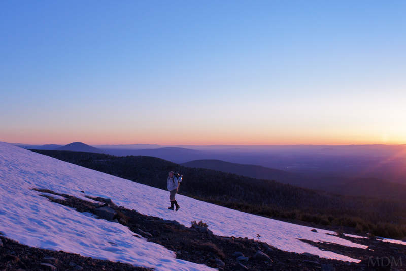
Adams Attempt
7 miles of hiking • 3250' elevation gain • 1 night
Meh. Stupid NW weather. I'll juxtapose this one as a big wallop of balance to the prior Quintessential NW. Rain is also quintessential NW. Mnt. Conditions of Spring and Fall. Plopped down just shy of LC. Cleared Sat evening. Came back in Sunday AM.. then paused, and we retreated back down.
Everyone was skunked around the NW in their own way this weekend. So, the highlight of the trip was specifically being with friends and not getting wet at all, even though it rained a lot. No rain hiking. No packing up the tent in the rain. Those are the silver linings. And the exercise.
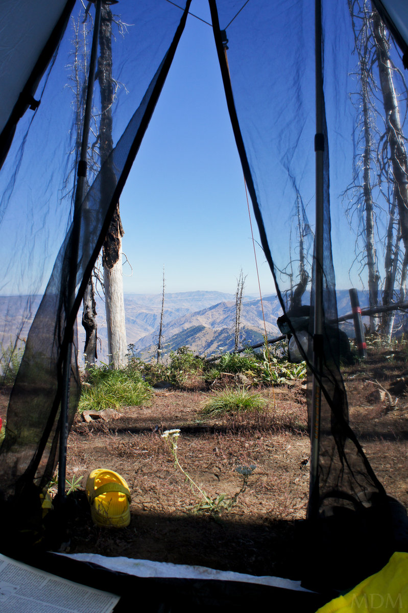
July 16 – July 17, 2011

 2
2
Top Spur to McNeil Point
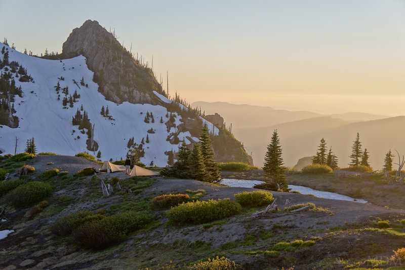
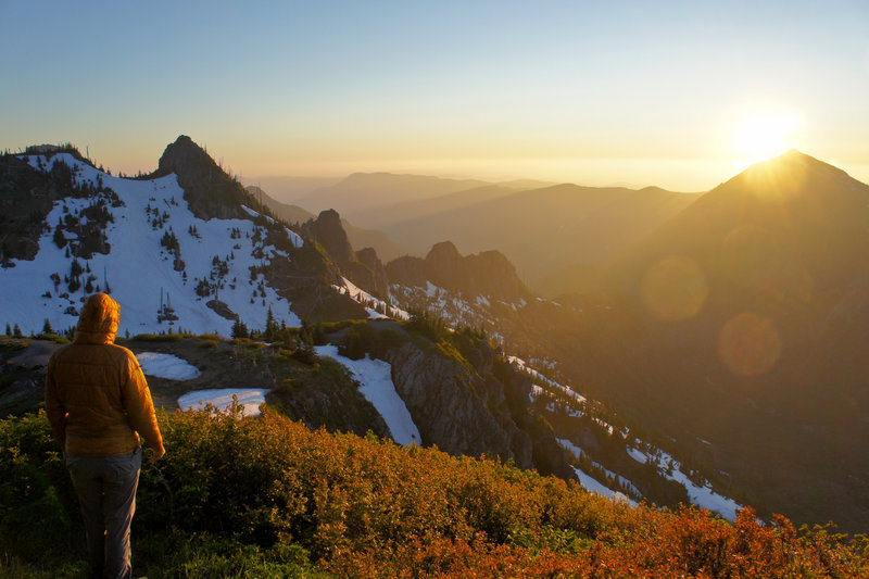
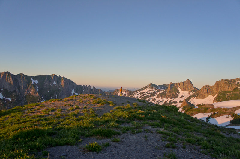
10.5 miles of hiking • 3000' elevation gain • 1 night
Quintessential brilliance of living in the NW: Sleep in Saturday and enjoy a sunny, relaxing awakening in bed. Pack bags. Go to farmers market to get fresh product, breakfast/lunch. Buy fresh kettle-corn and vacuum seal it to send to family in Michigan. Finish packing bags, including brews and fresh strawberries. Arrive at trailhead 4pm.
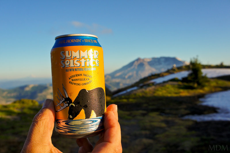
At wonderful camp among heather, bleached white limbs, waterfalls, glaciers, valleys, streams, volcanoes, and layer upon layer of hued mountain ridges. Enjoy a stoveless dinner and strawberries picked within 24hrs. And an Anderson Valley Summer Solstice beer. And the sunset, and Mt. Hood. Watch the moon rise over Illumination Rock. Watch the sun shimmer off the Columbia river flowing towards the Ocean. Roil in the beauty and awe of the darkening skies and the thousands of illuminated points brightening in the metro region below.
A restful sleep, a warm awakening. Not a bother in the world. A nice hike up higher. Photography, back to the car by 4pm with a relaxing, leisurely adventure. A well made salad with glazed cashews and a wonderfully seasoned mojito-lime piece of Ahi for dinner. And a movie with my wife.
typical summer weekend --- No humidity. Great temperatures. Snow, Flowers, Beer, Food, Friends, and World Class Landscapes. What a gift!!
July 9 – July 10, 2011

 1
1
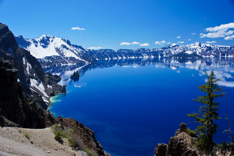
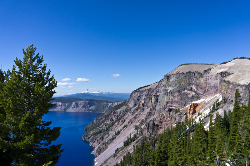
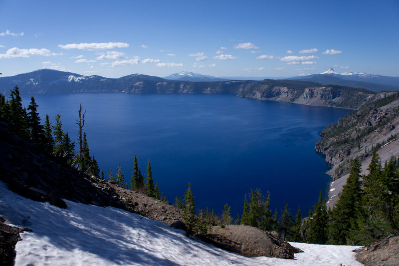
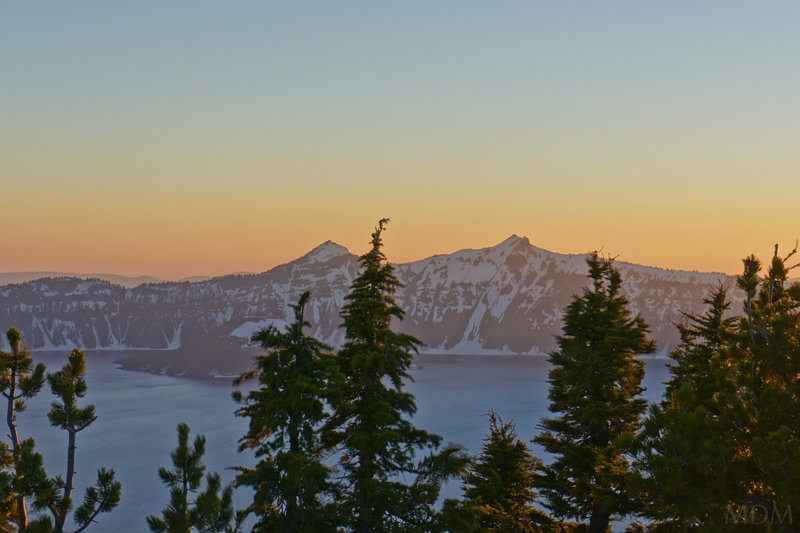
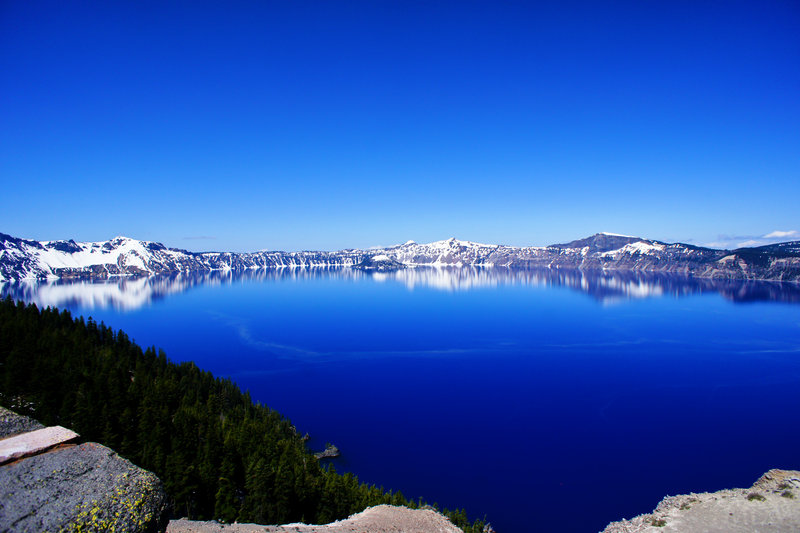
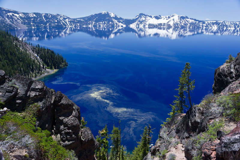
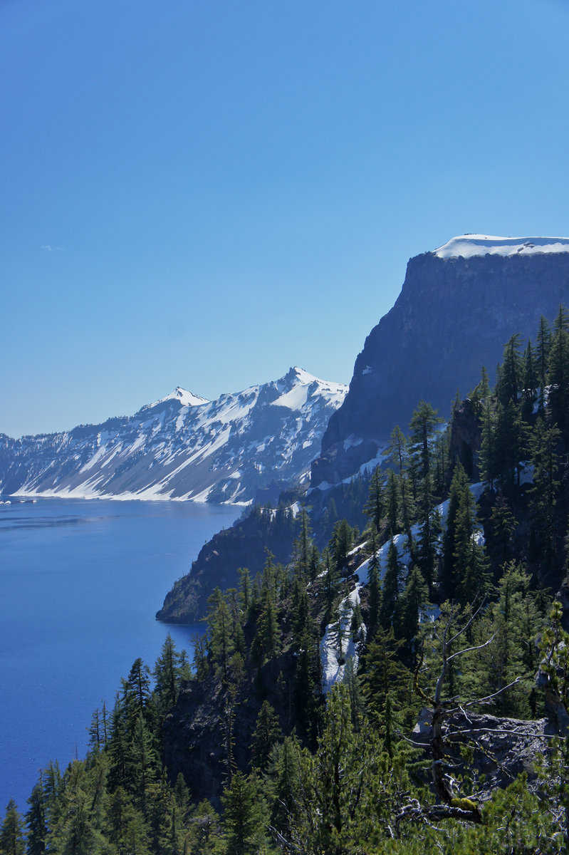
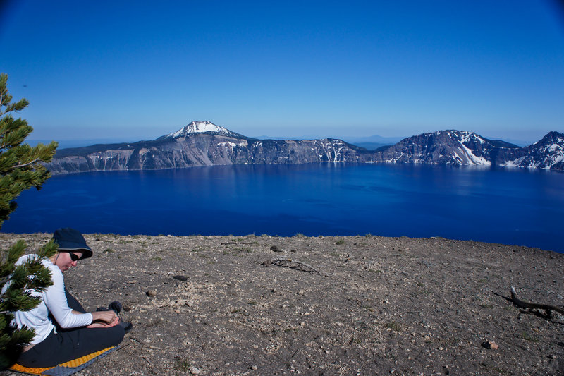
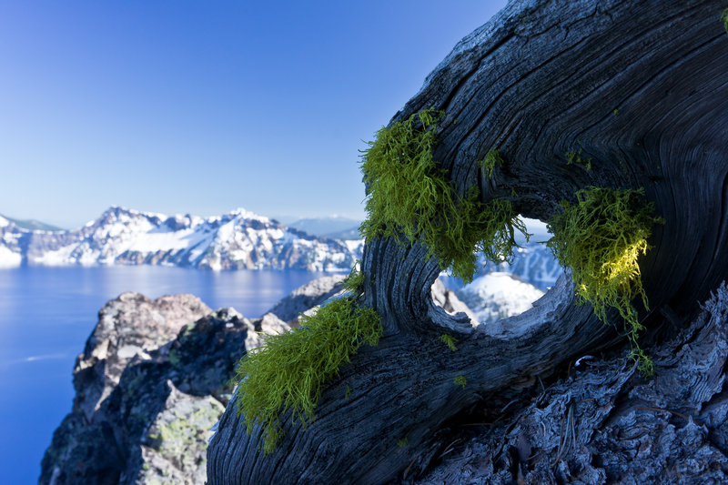
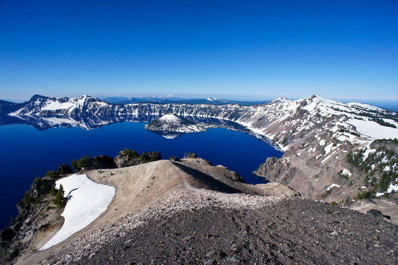
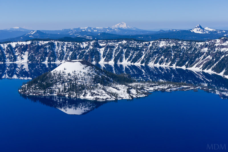
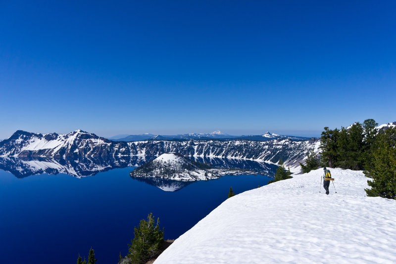
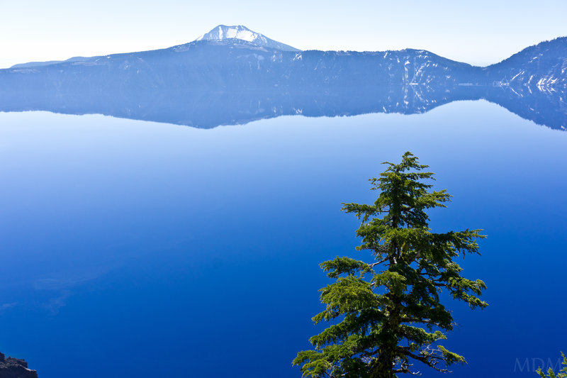
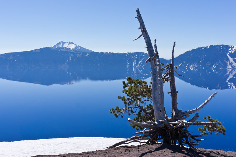
Crater Lake Circumnavigation
36.5 miles of hiking • 4000' elevation gain • 3 nights
4th of July Circumnavigation of Crater Lake The road for the Eastern half of the park is closed. However, it is plowed to Sun Notch on the SE and to Skell Head in the NE..maybe more, so, perhaps 80% road is accessible. Regulations a tad murky about backcountry camping in the shoulder season (pure winter and summer are clear).. We decide to go counter-clockwise in order to get the snow section done quick, knowing we can put out nearly unlimited road walking miles if we have to.
Friday: car camp off of 138 at 8pm. Got pulled over in Oakridge. 48 in 35. Nice Mr. Cop gave me a warning. Whew.. 1998 was my last speeding ticket
Saturday: Drive in via North Entrance at 7am to preview part of our route. Also to see parts of park not previously seen. Beautiful morning. Mosquitos out in force. See baby fawns near Steel center. Get permits. Start off. Snow free until massive snow machine at Sun Notch. Snow the majority from then until just beyond Cloud Cap. Lots of monster boulders on road--lots of work left it seems. Unlimited incredible, majestic views. Mosquitos really seem like they are at their peak, utterly swarming. They would indeed taper as the trip continued. Camped atop Cloud Cap. Enjoyed the fruits of our labor and the views that wouldn't quit, from Shasta to the Three Sisters.
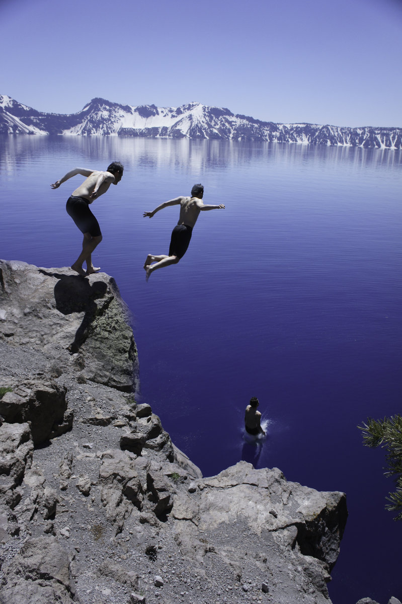
Sunday: Cut down from Cloud Cap to road--plowed! No people until a worker near Skell Head around 11am then some people on bicycle just beyond. Lake is glassy still, and captivating to no end. Views from each direction as one goes around are worthy in their own right. Arrive at Cleetwood Clove at the moment the trail has opened to go down. Temporarily open by orders of Park Superintendent (I suppose so they could tell tourons there is something to do). Left our packs with a ranger up top directing traffic (who we had seen when getting our permits) then ran down with a mini assortment of camera, lunch, and a tshirt for me (Water). Rangers at bottom recommending doing the 18ft jump into the water as the best swimming undertaking. You could see a bit of a shelf about 35ft down, and beyond that it goes to 300ft!! Incredibly refreshing swim, jumped in twice. Inundated with foreigner/immigrant tourists (Indian, Chinese/Japanese..kind of odd, no 'mericans!'). 1300ft back up to the road, then dealing with cars until--
one of the best camp times/spots ever on Llao Rock.. no words do it justice. Finished off the rest of the Patron Coffee Liqueur I brought along.. plenty of photography
Monday: Decent quickly to North Rim junction. Hightail it beyond throngs of tourons to Rim Village. Attempt to hit up folks there for a hitch down 3 miles to Steel center. No luck after 4 tries, so, road walk it is. To the car by 1pm. Hangout back at rim village having some snacks and decompressing. Fish on Rogue River a bit on way home. Eat at Steelhead Brewery in Eugene.
Trip for the ages. Highly recommend everyone attempt to go around Crater Lake on foot/skis/snowshoes/etc.. Not a car.
Definitely a new favorite, and, thrilled that the gem of a park is in our state.
July 1 – July 4, 2011


Middle Sister part deux
10.5 miles of hiking • 5000' elevation gain • 1 night
Damn. Lost this the first time 'round. Anyways. Repeat of Middle Sister. This time with compatriot Al and wife of 1 week, Kara!! Left PDX at 5:00am after dropping friend off at airport (so really, left PDX). Sisters Coffee rocks me! McDonalds cancer biscuit breakfast also primo for the mountains.
Snow melted fast. Approach even quicker, but more blowdown to deal with (someone get on that--horse packers??) Of note, the 'hogsback' dealy going up to Prouty Point/Pinnacle (whichever..) and the saddle seemed to have steepened over the course of 3 weeks. I guess the snowpack was subsiding--it is a glacier (hayden) after all.. so perhaps it scooted 100 ft or something, as it sure felt steeper.
Second summit of a volcano for Mr. Al. Cuddie whut up!
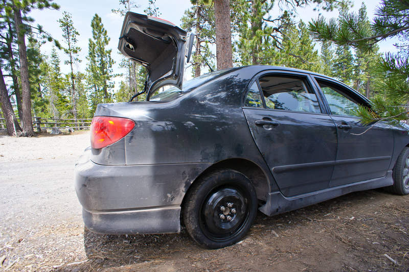
Of note was the noticeable hissing we heard as we got to the TH. we immediately took the tire off and put the donut on. Why we didn't drive out and get the tire patched at Les, I have no idea. The next day we wasted 30 minutes driving around sister finding all options closed and unavailable to help out, so, we had a ginger drive back to portland on the spare.
cheers
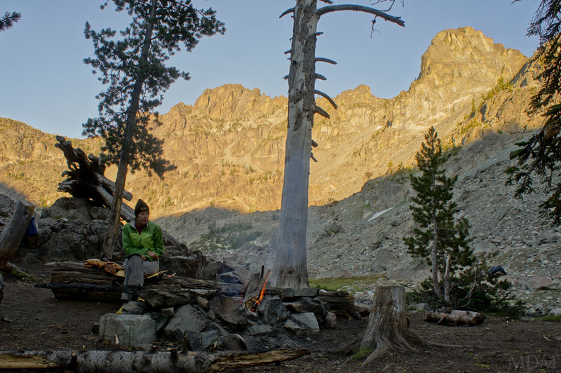
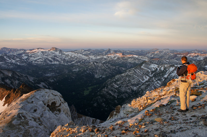
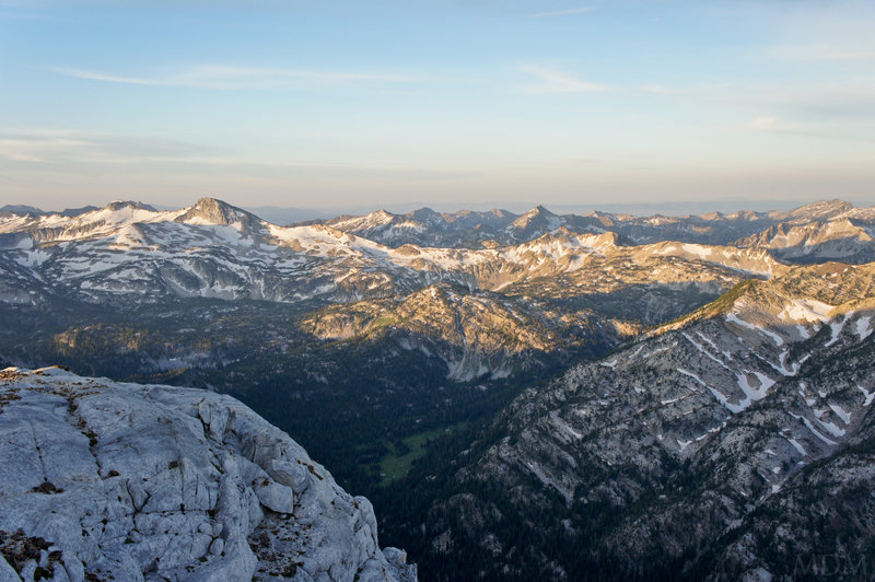
June 23 – June 24, 2011


 3
3
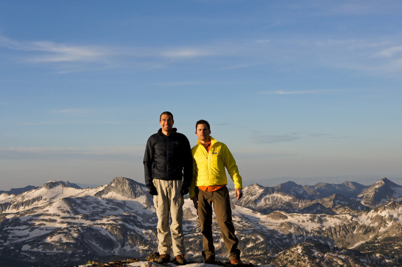
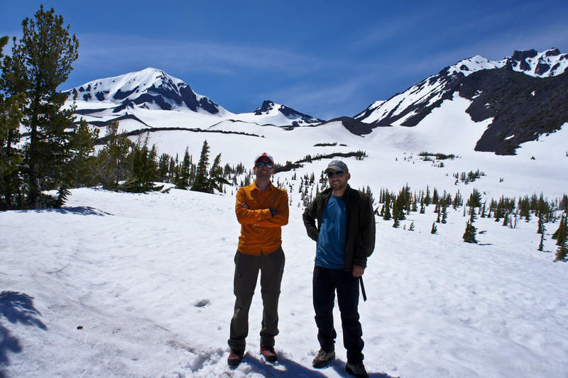
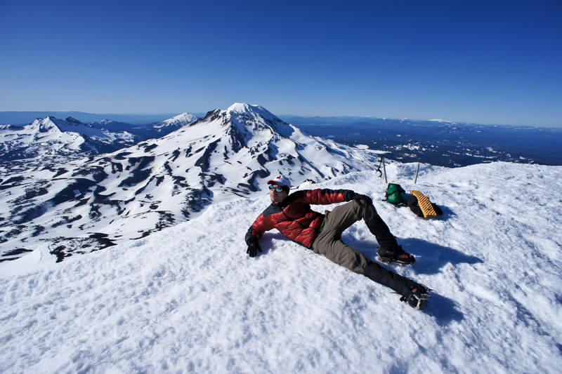
Middle Sister
10.5 miles of hiking • 5000' elevation gain • 1 night
Whilst I've mounted the young easy sister to the south, and the difficult old one to the north, the moderate middle has managed to elude me. A brilliant weather forecast? Check. A mountain to climb? Check. A partner to Climb with? Check... but not so fast. Al and I were suppose to tick this one off. I've never really see a crevasse on the climbing route on the Hayden glacier, but, just to double-check, I posted a quick query on cascadeclimbers. From there, a fellow on Portlandhikers.org (Where I also post) sent me a message there with some more information, and notice that they would be going for the same objective. Mind you, this was Friday morning.
Friday afternoon, Al lets me know that suddenly his work will not let him off. I'm trying to figure out now if Kara, my fiance, take his place and we just do a high camp for fun, or if we do something different together, or if this fellow who has messaged me would want to link up, and would I want to link up with him, sight unseen and untested in the field?
Well.. alls well that ends well. I met Paul for the first time at 6800ft on a nice melted out spot with a grand view of the entire upland sisters area. Very sunny. Then, patchy high overcast. Very warm.
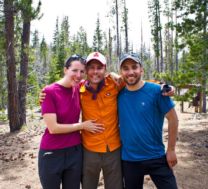
Didn't freeze in the night. Used snowshoes up to Prouty pinnacle. Cramps, ax, and single pole after that. Still was fairly slushy. Left camp at 5:00. Up top 8:45. Camp 11:00. Depart 12:00. Arrive car 14:02 (beating a monster group of 12 lamezama skiers by 30 minutes, after they passed us early on). Depart Pole Ck TH 14:45. Arrive home 17:30. Watch playoffs. Bummer Dallas left. New friend. Check! Paul and I go about the same speed, similar dispositions towards climbing, likeable fellow. And hes of Polish ancestry, which, you can't beat!
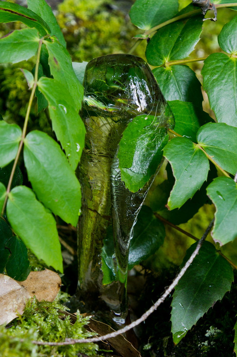
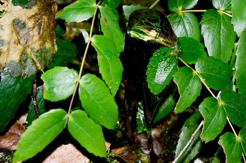
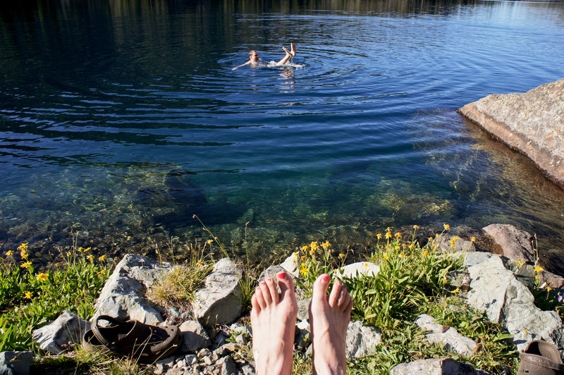
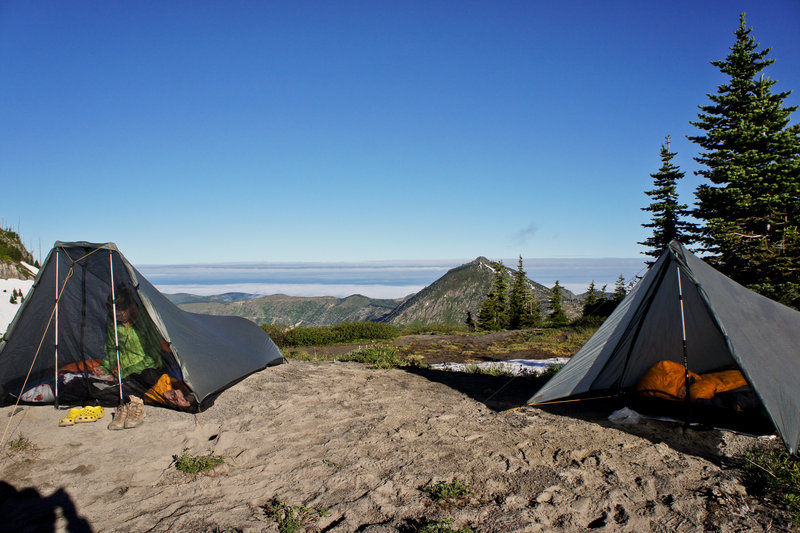
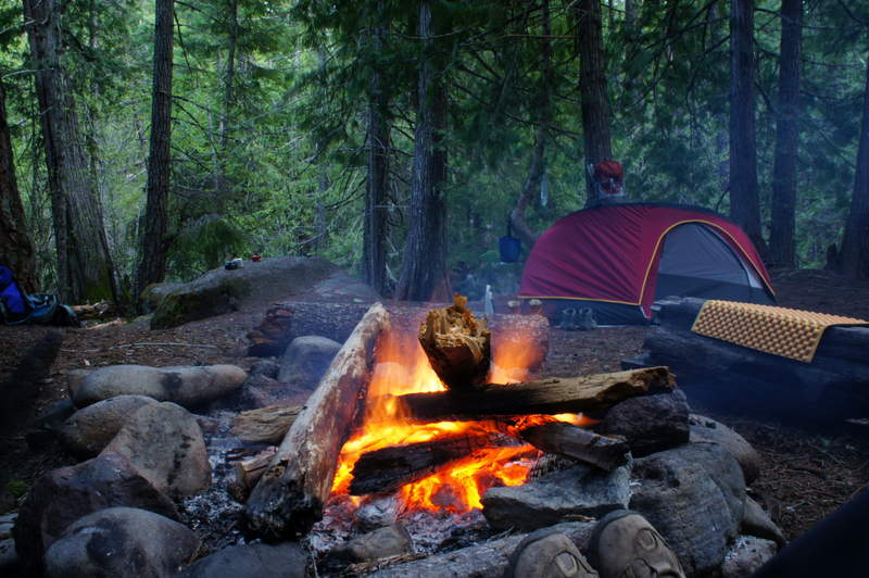
June 3 – June 4, 2011

.jpg)
.jpg)
.jpg)
.jpg)
.jpg)
.jpg)
.jpg)
 2
2
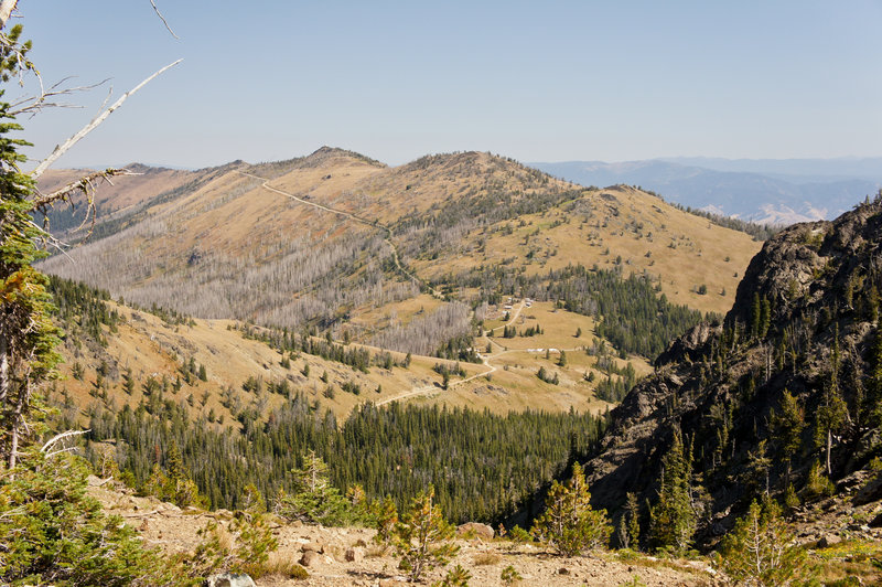
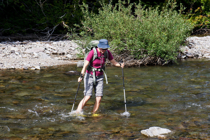
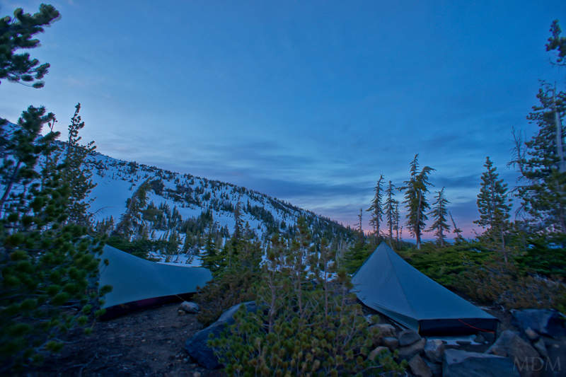
Badger Creek Backpack
14 miles of hiking • 1250' elevation gain • 1 night
Myself, fiance, friend, and his wife, along with their dog went for an easy, fun, relaxing hike up badger creek. I've spent good time up on Lookout Mnt, Gumjuwac Saddle, Gunsite Butte, etc.. but never been all the way over to the full East side of it.
Loved seeing some environ that reminds me of the pondy forests over by Bend. Water color was incredible. I like to climb and get high on the land, but, sometimes an easy, fun, fishing, food, fire, and friends filled river backpacking trip is just perfect--and unbeatable.
Great time!
May 28 – May 29, 2011

.jpg)
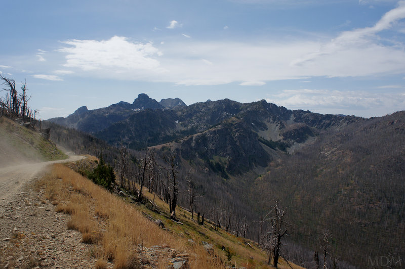
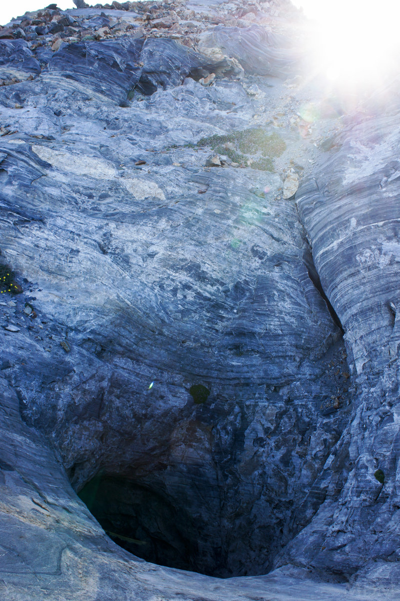
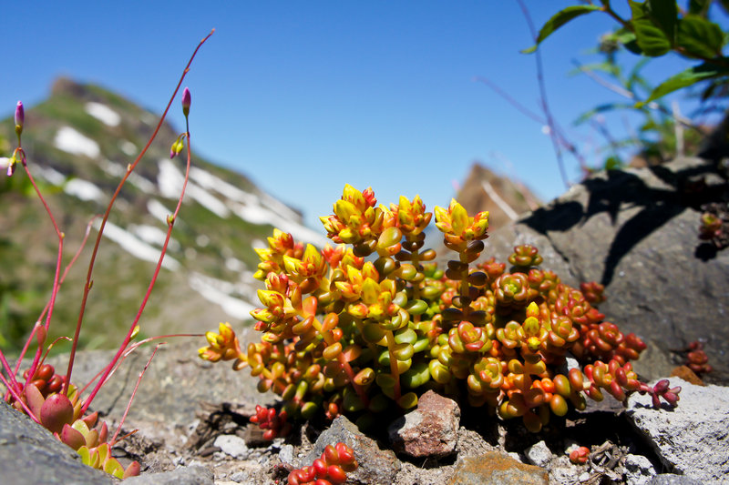
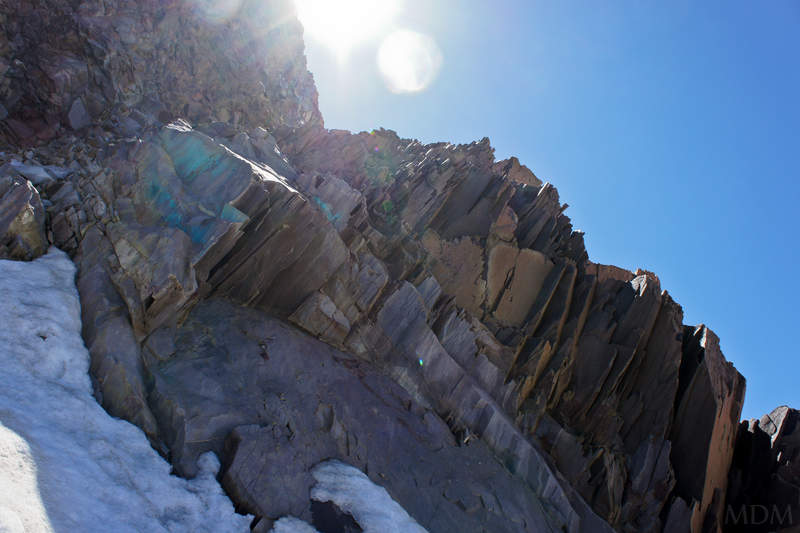
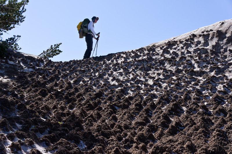
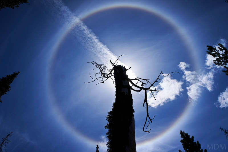
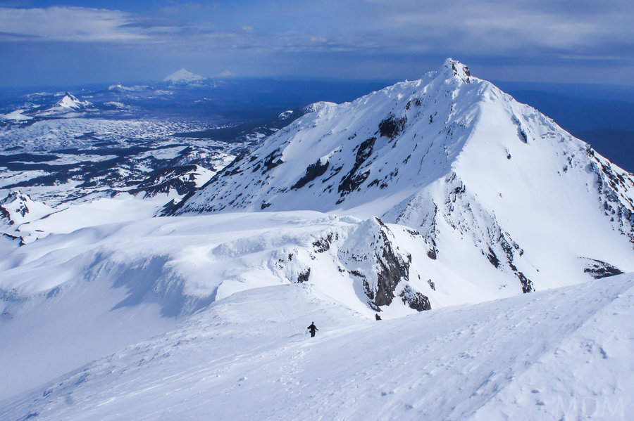
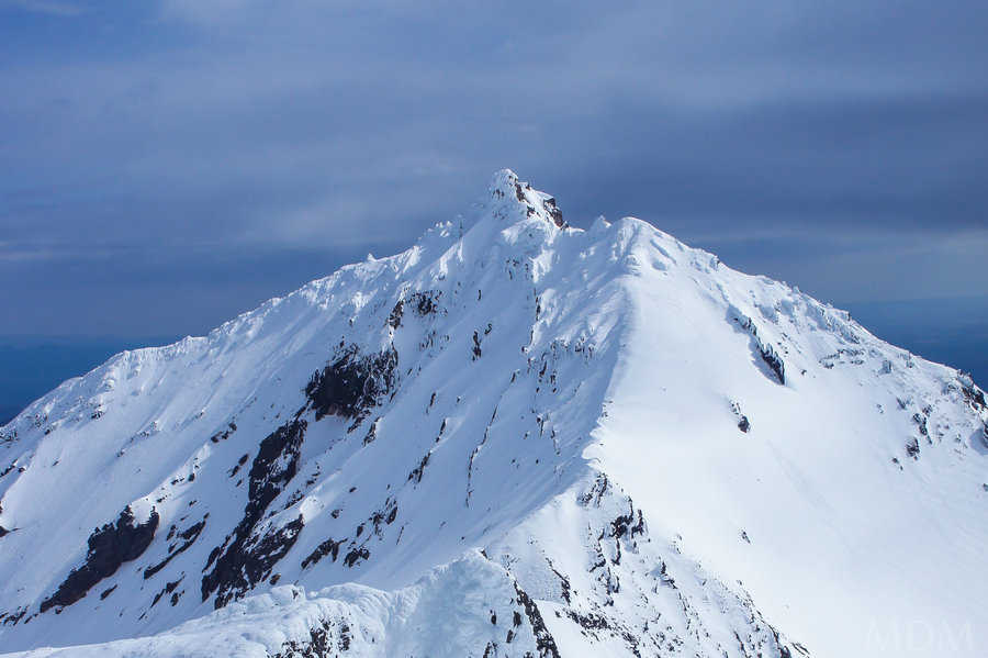
Mt. Mitchell couloir(s)
3.5 miles of hiking • 2000' elevation gain •
Mt. Mitchell is one of the first hikes we did around Portland, after we'd moved out here, and winter had passed, and we were on our feet, so to speak. I've always been impressed with the views for the amount of effort required (definitely one of the best bangs-for-your-buck).
That said, I've oft noticed when viewing from Mt. St. Helens, or driving back along 503 above Swift reservoir in the winter, the snowy gullies that rise up Mt. Mitchell's North face. Well, I like to climb and couloir climbs are fun, so, I've always wanted to investigate this. I have a friend who has often gone to Tom Dick and Harry sack mountain to mess in the rocky snowy gullies there but that mountain never inspires me much. That said, I'm always wary about if I'd be able to get to the TH in the winter, thus our late season attempt.
I wish I knew what I was thinking, as, what could I have really expected for a late june climb below 4,000ft. Sure I knew there would be snow. My hope was it was consolidated and firm. Well.. it was consolidated but it was not a particularly cold night nor was it clear, so it didn't get too firm. Additionally, as I stared at maps, I guess I ignorantly ignored that while the creek generally is shown to start lower, obviously these gullies must feed it!
TH fine. Bushwack (with some old flagging?? want to explore that more...) to the gully, fine. up a bit, fine. But long story short, "Donny you're out of your element!". The couloir is a serious, serious avalanche chute. We saw tons and tons of debris, destroyed trees, and fallen rock in the snow. Thus I'd be exceedingly skeptical and cautious to climb in frozen winter conditions unless there was a fantastic weather pattern (which would probably send me to larger mountains). Eventually the fact that we were walking on a continual snowbridge got to be too much of an objective hazard, as the slope steepened and we were aware that there was in excess of a 20-60ft gap with the fin of snow below a waterfall/ledge in front of us.. (I'm having trouble explaining). We traversed off the snow and onto some 4th class mossy, dirty, wet ledges with occasional devil's club (one of the worst hand shakers I've met.. terrible grip!). We kept traversing to the east, over snow and rock until we made the north ridge. From there we were within 10 ft of the summit, maybe less, but the snow had pulled away from the rock, leaving yet another under-cut situation, except this time sans running water (big whoop). So we called it a day at that.
Even if ideal conditions, frozen, no running water, I worry about how the top-out would be if I followed the gully to the top.. a vertical wall of snow for 5 foot is bad enough, what if it is 20, 30 ft... retreat is only option.
To read a more extensive written by my climbing bud Jason, who accompanied me, visit: http://loomisadventures.com/blog/climbing-mount-mitchell-washington-nw-couloirs
May 20, 2011

 1
1
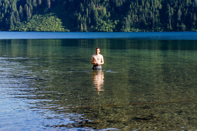
Lewis River Trail
13 miles of hiking • 1000' elevation gain • 1 night
Kara ran errands and I changed the car's oil in the driveway before leaving town at a liesurely 12:30, onto the road with lunch by 1pm.
A nice night out camping under the stars with a nice cedar-wood fire. I forgot the camera's memory card and so am sans beautiful pictures of the azure Lewis river and verdant and lucious moss carpet that blankets the forest here.
Slept in late the next morning in the sun. found out my sleeping pad has a leak in it. I scrambled down to the river off trail to climb to the top of a monolith. I didn't scope it out too hard as I came down as when I got to the top I scared off a mother-goose from her nest of 5 large eggs. So sorry Mommer goose!
she scared me too though--and I am quite, quite lucky she didn't attempt to go after me because being on the rock above a deep area of the river, just above more rapids.. wouldn't have been a fun place to deal with such a situation.
I really love the old growth and river here.. one of my more favored easy hikes for sure.
April 30 – May 1, 2011

Saddle Mnt
5.5 miles of hiking • 1500' elevation gain •
after sleeping in, some AM errands, and needing to be back in town for an evening party, we headed out to Saddle Mnt and went up in an hour and down in a bit less. Spent about 40 minutes eating on top. perfect use of good weather and limited time.
April 23, 2011

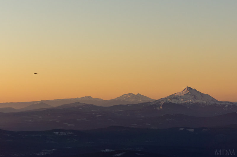
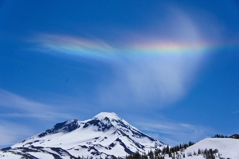
Mt Hood
6 miles of hiking • 5250' elevation gain •
Finally got up Hood in 2011. Weather windows + lower avalanche danger have not coincided in months, I swear. Occasionally one or the other would come around for 24hr or less, and never on a weekend.
Took up two friends who have expressed interest in climbing and prepped as best they can as far as gear and conditioning. Quite a beautiful day with not too many folks. We were the first to summit for the day, and I lead the group up the old chute, kicking steps than later parties used. Having not lead the entire chute before, esp. without steps in place, I definitely am doing some ego-stroking as it was hard work and I felt pride to have done so.
One unfortunate note J ended up with some frostbite on two toes on either foot, and numb tips on all the rest. Waiting right now to see how it unfolds. J has pre-existing circulation issue in toes sometimes and had instance of sock/liner sock bunching up which he believes contributed. His attitude is very positive but I am fairly disappointed--my goal of course is coming back in one piece--and that accomplished is numero uno, but still anything less than injury free, I'm not so happy celebrate the accomplishment (personally). this marks the 7th time up uncle hoodsle.
need to get on cooper spur and leuths again, when the weather and conditions coincide again... when is that? probably next year!
April 22, 2011

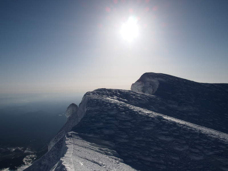
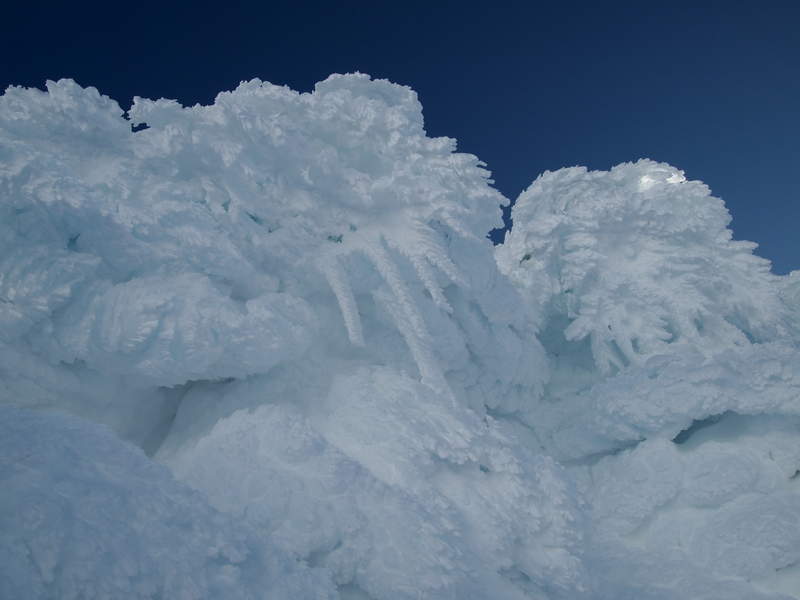
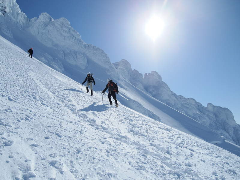
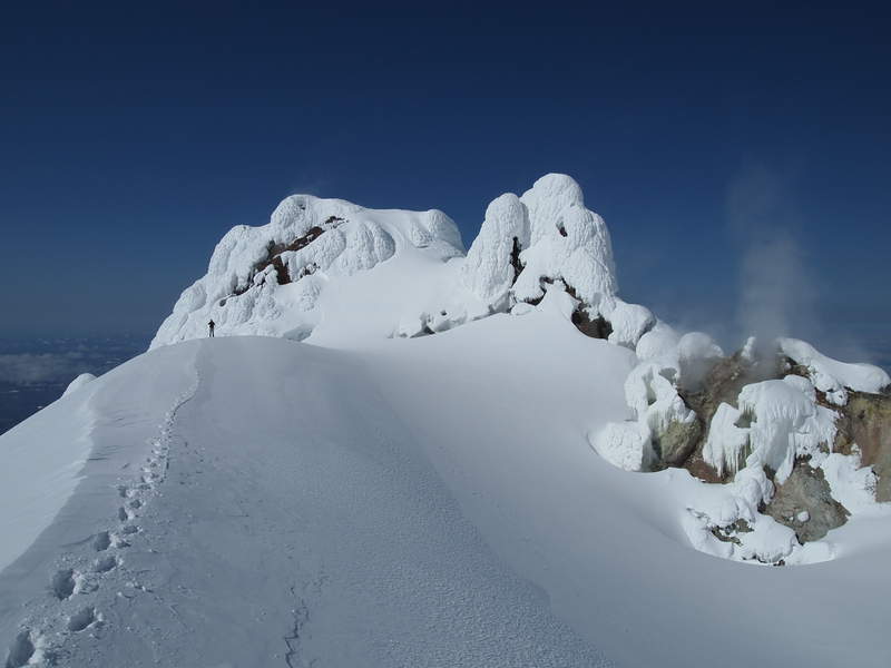
Table Mnt.
8 miles of hiking • 3250' elevation gain •
Great weather. Decent bit of snow on top. Started at Aldrich Butte TH.
April 17, 2011

Lookout Mnt Via. Gumjuwac Saddle
7.5 miles of hiking • 3000' elevation gain •
Up the Gumjuwac Trail. On the road until the SW ridge of Lookout Mnt, then right up the ridge. Lousy conditions.
April 16, 2011

Coyote Wall
6.5 miles of hiking • 2000' elevation gain •
Old favorite with new friends. Coyote wall is reliably dry, and most of the time, Sunny, even when it is rainy or cloudy anywhere to the West. Love the open feel and views, as they make up for the non-wilderness setting and semi-short loop. Tried to continue on at top of the road but the pasture gate sign said no canines so we returned back to the car.
April 3, 2011
 1
1
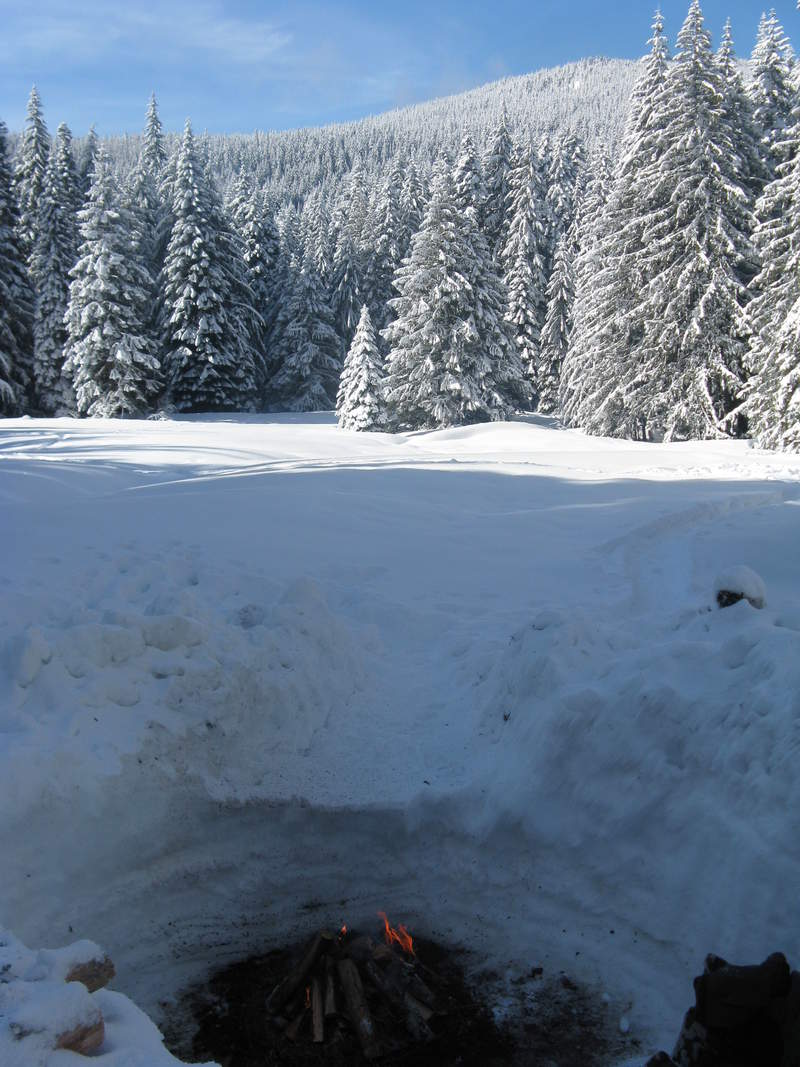
Devil's Half Acre / Barlow Butte
4 miles of hiking • 1750' elevation gain • 1 night
got off work a bit early. Made it to Barlow Pass just before sunset. Headed down to Devil's Half Acre to meetup with J and J. They had dug an awesome fire pit.. so I went to work on our snow-lodging. Fun night drinking beer, enjoying the snow, and being out under one of the largest full moons in my lifetime. Slept in a snowtrench with a tarp across it. The next morning we went up Barlow Butte in the sun before it got mostly cloudy.
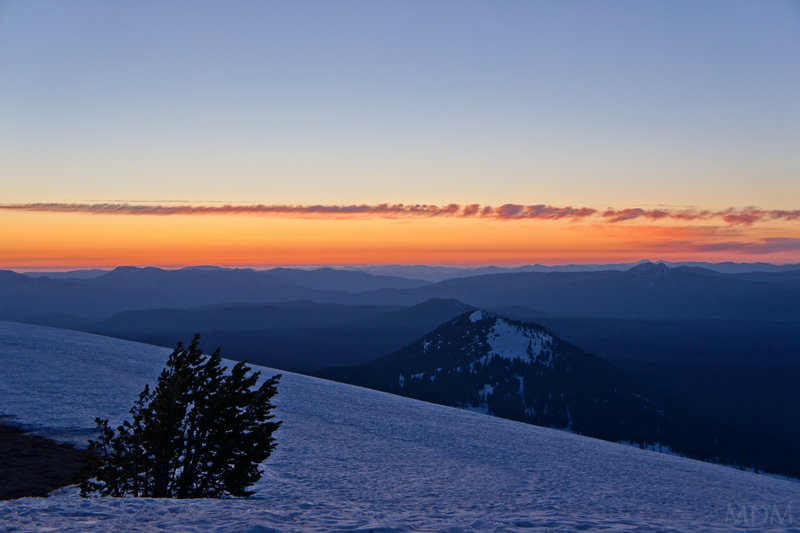
March 19 – March 20, 2011

Bennet Pass Snowshoe
4.5 miles of hiking • 1250' elevation gain •
Went with Al to Bennet Pass. Snowshoed to top of peak and drank a beer. Got some good shots of a rabbit. Had been very cold the previous week.
March 12, 2011

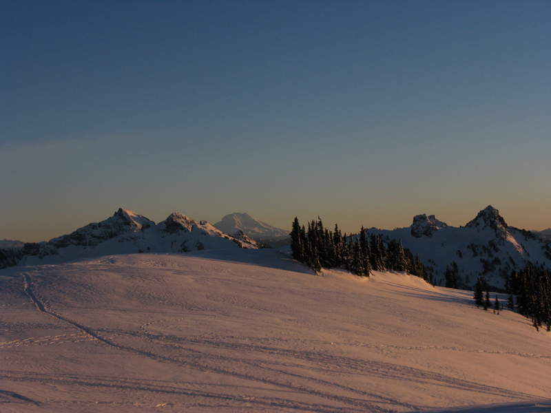
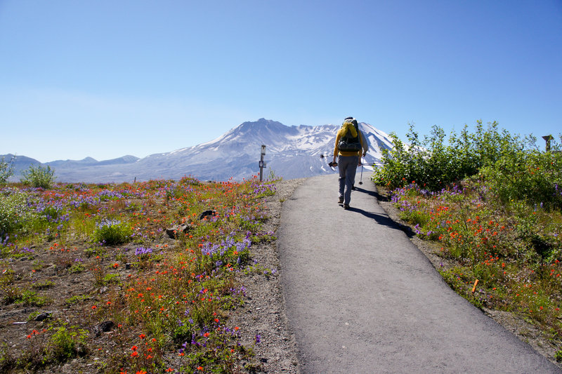
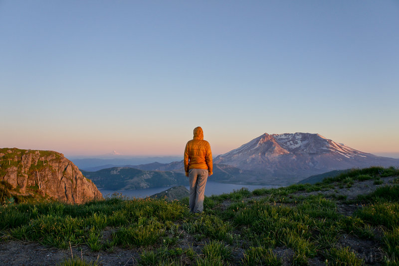
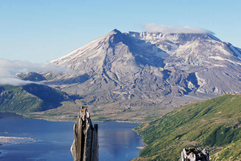
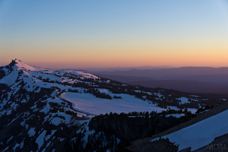
Mt. St. Helens
12 miles of hiking • 5500' elevation gain •
beautiful day. hood had a nasty looking lenticular over it all day long while St. Helens was in the sun. Glad I got to chill in the warming hut one last time at Marble Mnt. SnoPark before it burned down.
February 19, 2011

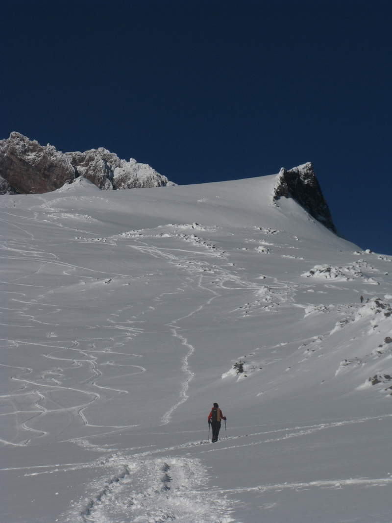
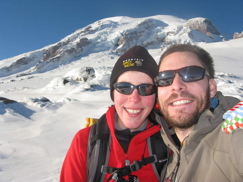
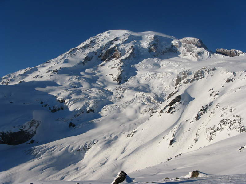
Snowshoe to Muir
8.5 miles of hiking • 4500' elevation gain •
headed up to Muir on a sunny day in the New Year. Long drive for a day-snowshoe from PDX, but worth it--Rainier is something else for sure. Decided to head back just shy of Muir on account of the gate at longmire closing at 6pm. Lovely day to get out. Ended the night with leaving 100% tip for nice lady at red lobster--kind of a feel good moment (an anonymous diner comped our fancy dinner, drinks, desert, coffee, and tip at Santa Cafe in Santa Fe, NM this past fall..had to be pushing $150, so we've felt compelled to pass on that goodness)
January 2, 2011