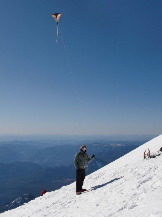
2014 Trips


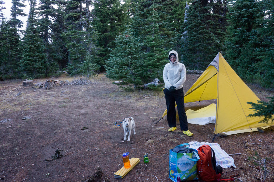
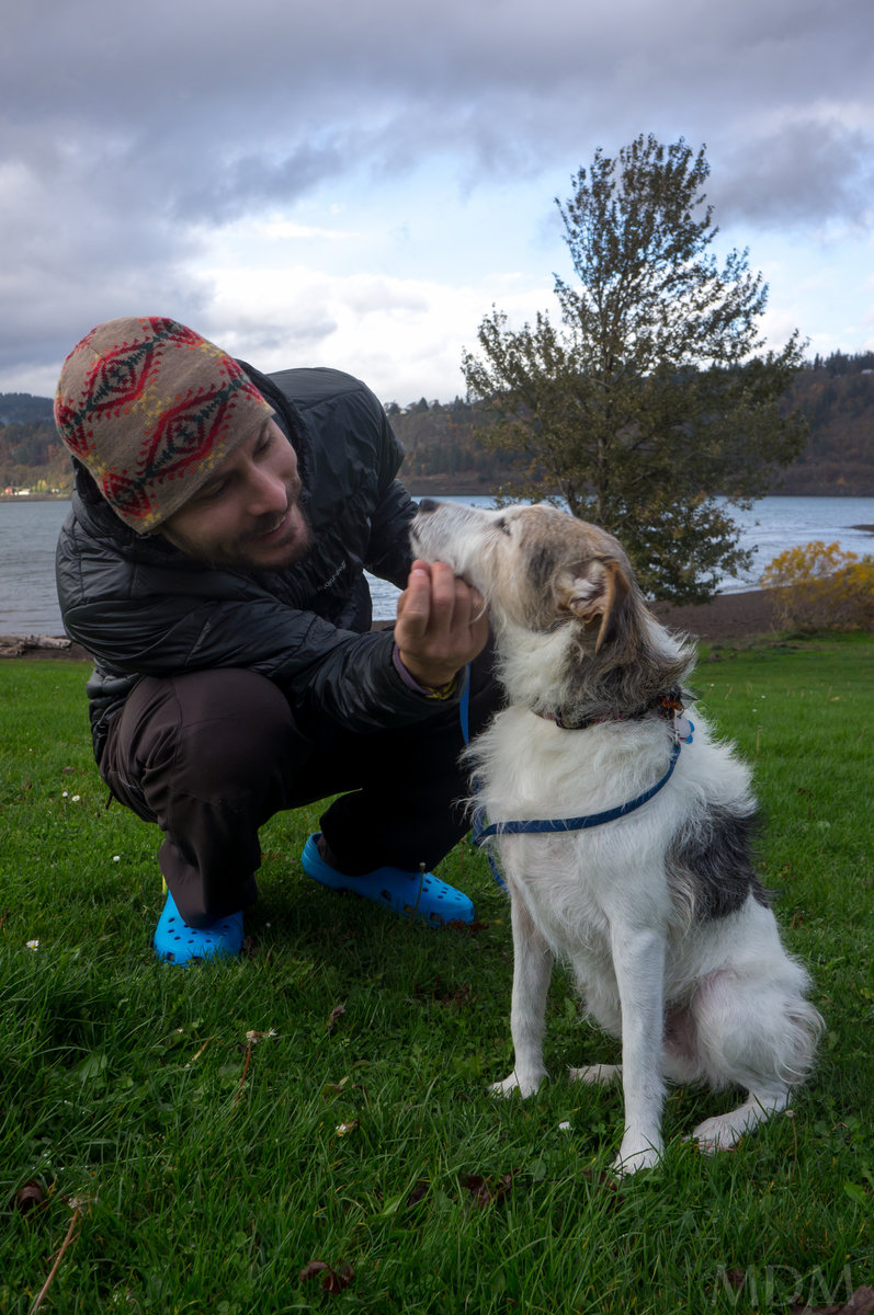
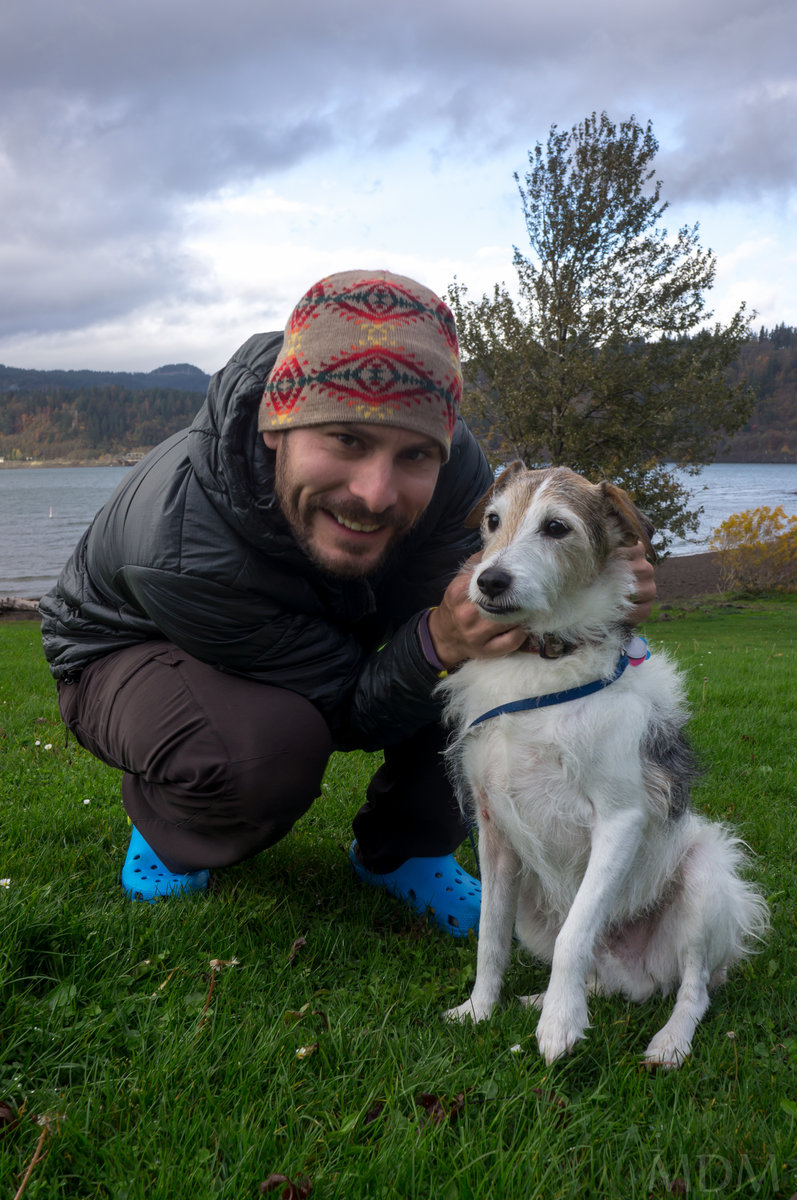
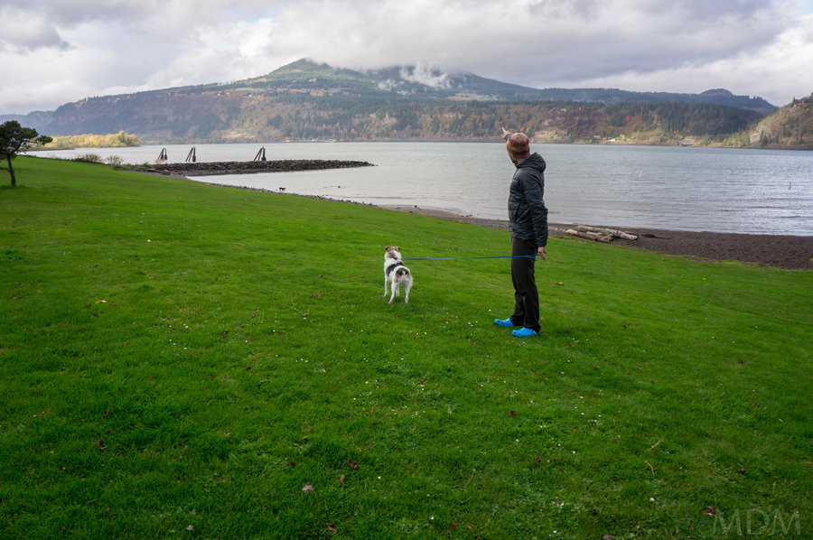
Favorite Place in Cascades--perhaps
13 miles of hiking • 750' elevation gain • 1 night
Lil day hike with a dog named Oscar and my lovely better half! :) Camped near the car.

November 8 – November 9, 2014


 3
3
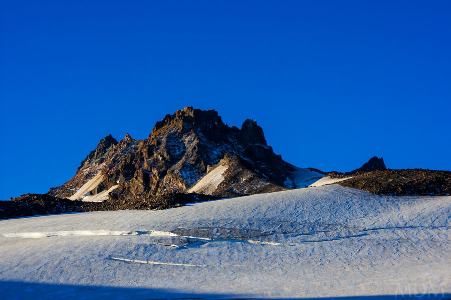
Jefferson Park - Whitewater Glacier Climber Trail
15 miles of hiking • 4750' elevation gain • 1 night
I've been to Jefferson Park a few times and I've climbed Mt. Jefferson from the South one time many years ago, along with an attempt of the West Rib. But the North side of the mountain via Whitewater Glacier or Jefferson Park Glacier are probably the two most common routes.
More than once I've eyed the various trails that seem to head off up the North Side of the mountain. I've walked the perimeter of Jefferson Park with the North edge of the mountain and found numerous wonderful camping spots and streams, and even some flooded/boggy areas. One time a few years ago I followed flagging at the edge of a meadow that went up a very steep climbers trail. I assumed this was the Whitewater Glacier climbers trail. I went up it only a small amount and then enjoyed a view from the small 'bump' above JP. As I was solo I didn't wish to go up more because I had told my wife I would not be doing any OT during that trip.
This year I returned--after having foot surgery this winter, this was by far my most exciting backpacking/hiking trip of the year. I'm thrilled I can still do this activity without any discernible handicap, pain, or weakness!
Starting at Jeff Park just below 6000ft. I followed the trail where I had the last time. The flagging is consistent, the path is very steep and narrow. It goes up through trees, skirting open areas at times. At one point I passed through an area perhaps 40x60 that had suffered a fire (guessing lightning strike). A few trees in the center were burnt to a crisp and those around it had burned and suffered but were otherwise surrounded by green and healthy thick/old alpine growth.
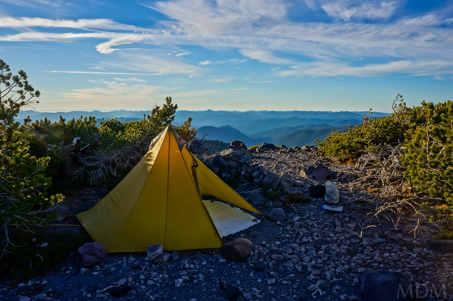
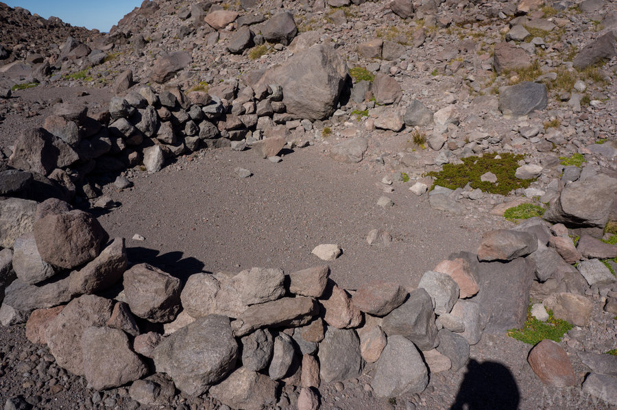
At 6800ft. the trail mellows and flattens. The alpine growth is thick and short, perhaps reaching 15-25ft tall at most. The undergrowth is minimal. There are numerous good camp spots here that would be fairly protected from the elements due to the substantial tree cover. I found signs of multiple old camps here. I found fire rings and flattened camping spots. In one fire ring there was the neck of broken wine bottle and a baby food jar. Very odd. Also of note is that almost every fire ring I found from this area on up appeared to have had rocks put into it to discourage/indicate a no fires practice. Whether this was done by a ranger, someone on the bordering Warm Springs Reservation, or a dedicated climber or backpacking I am unsure.
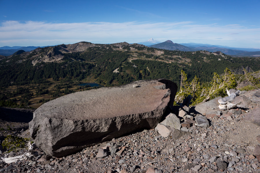
I was still curious to continue up based upon my research so after another section of about 400ft in the open on sandy volcanic terrain I crested to a place where all vegetation dwindled out. Instead of a ridge with a flat section like it was lower in the trees, this was more of a flat bench into the side of the mountain--it extended perhaps for a half mile in total--with some valleys in the middle--but overall there were numerous camp possibilities. Most of them unprotected. There were some of only the most hardy alpine trees, kumholtzed into the wind-blown shapes they take. Around one of these I found a stellar camp spot where the trees had been crafted into a fantastic windbreak.
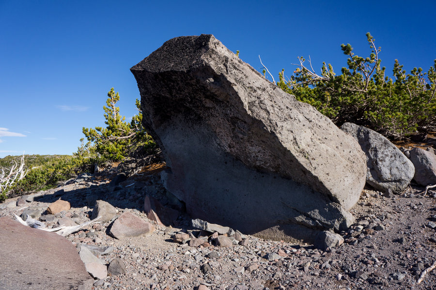
I also found an interesting boulder overhang with a fire pit below and a huge table-rock in front of it. I am not sure there was space to lie down under the overhang but it would make a spectacular place to hang out during rain that wasn't coming horizontally. The table was big enough two adults could be on it. It was about hip high--you don't find lots of surfaces like that up in the alpine.
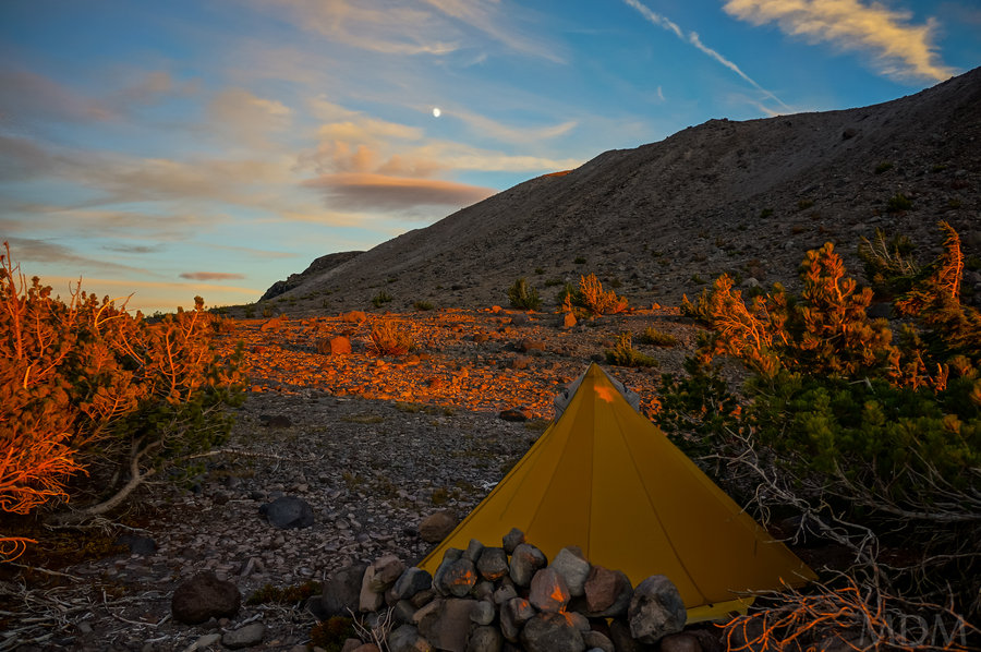
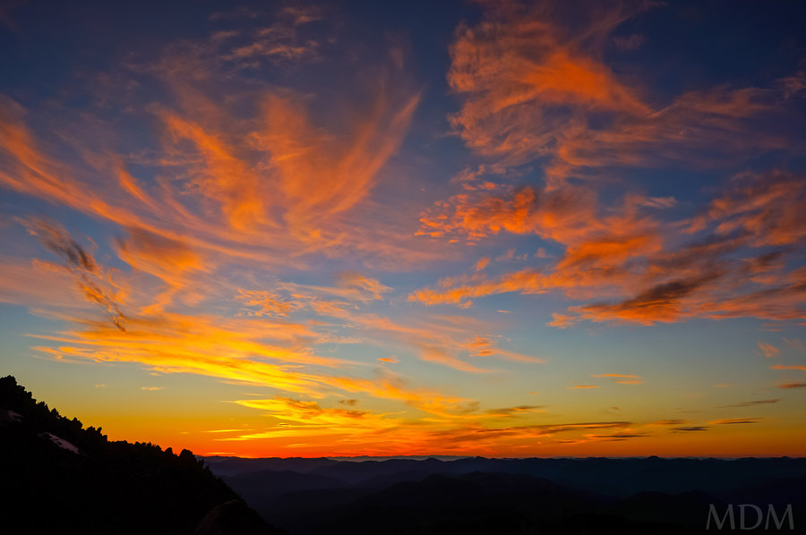
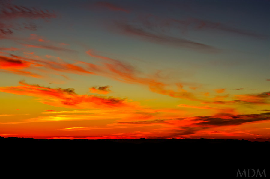
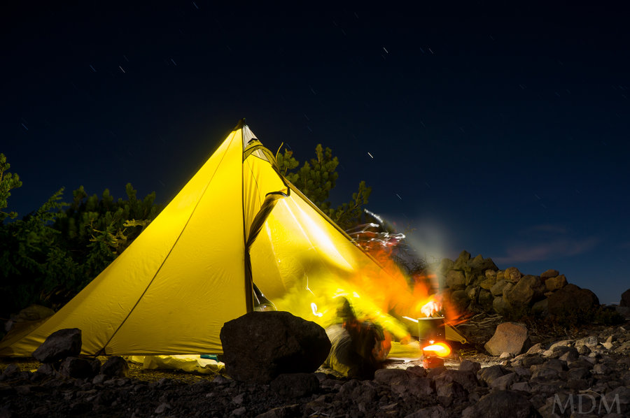
I enjoyed a great sunset and evening, including some beer and night photography. On a few occasions I turned my extremely bright headlamp onto the brightest setting and scanned around. When I did this I noticed that lights in Jefferson Park would get brighter as people were looking up directly towards my light. Hah! There was an odd thing happening that I later concluded was a trick of the light. High on the mountain it appeared as if there was a light. I tried extended camera exposures to determine if it was some clmibers bivying but I could not tell anything more than that it appeared to be a point-source of light like a dim headlamp. The next day I looked at the spot and took more pictures. When I came home and compared I determined that a small crest of snow at the head end of a snowfield happens to stick up above a ridge and was catching the moon light. Even with the sun rise that little glib of snow was significantly brighter than all other areas, from my perspective--must be some type of focusing effect at the place I was camped.
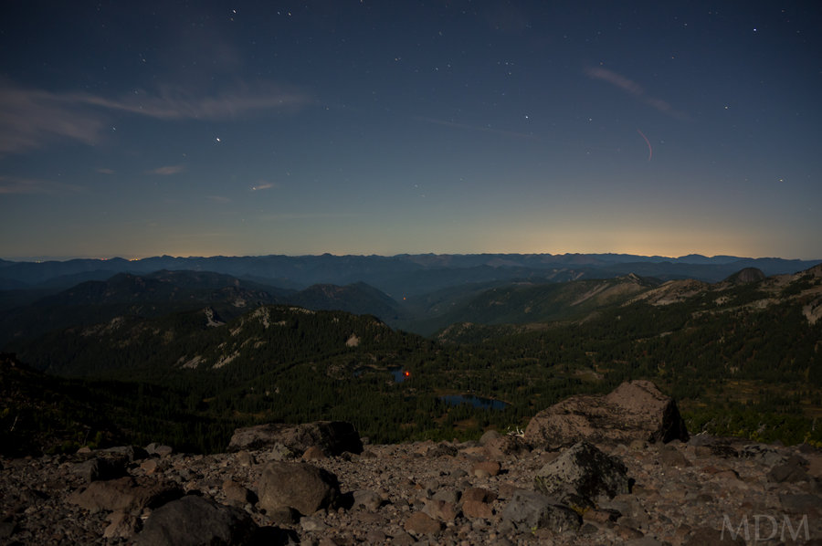
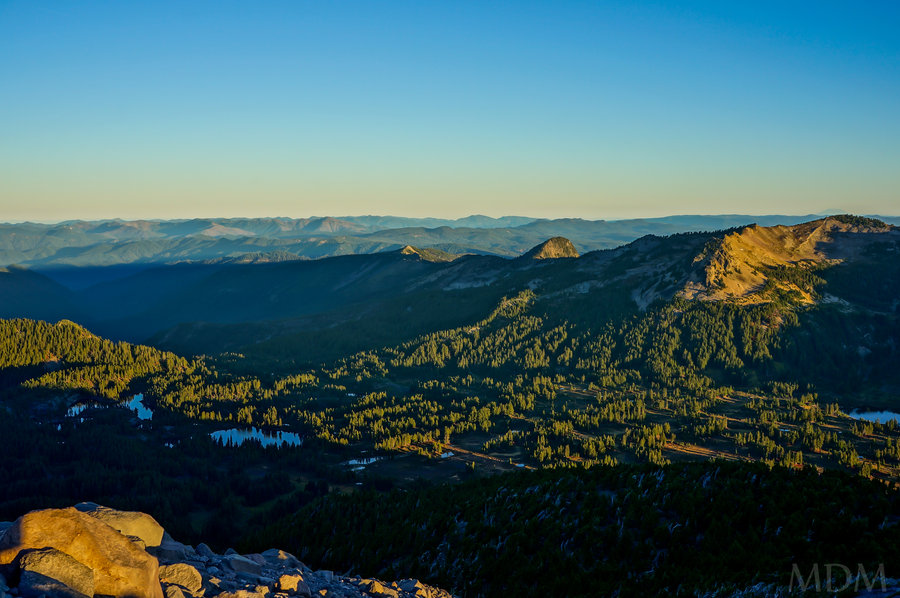
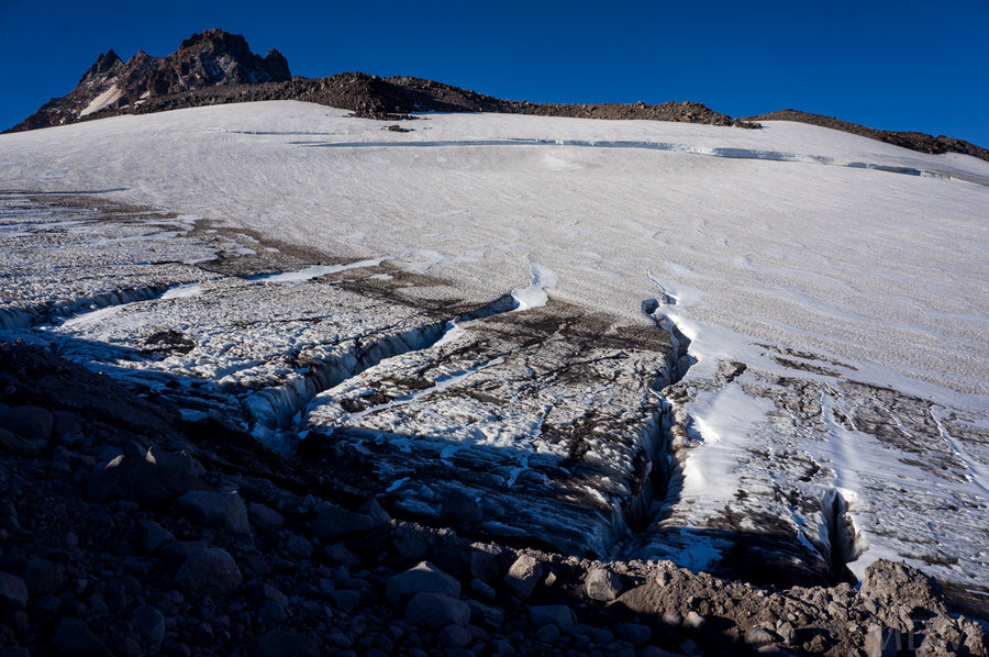
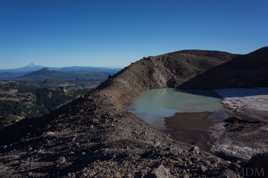
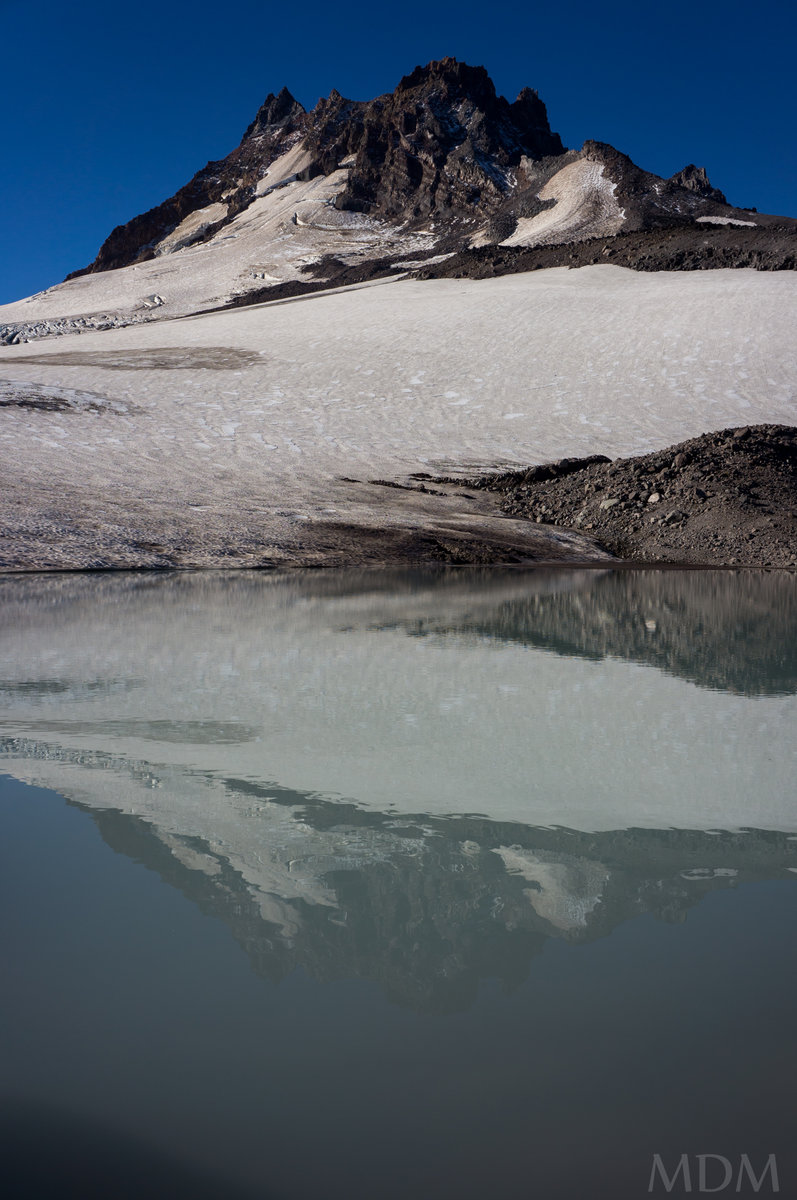
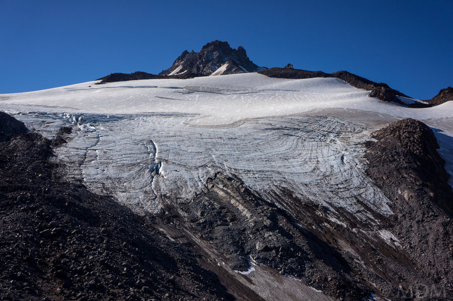
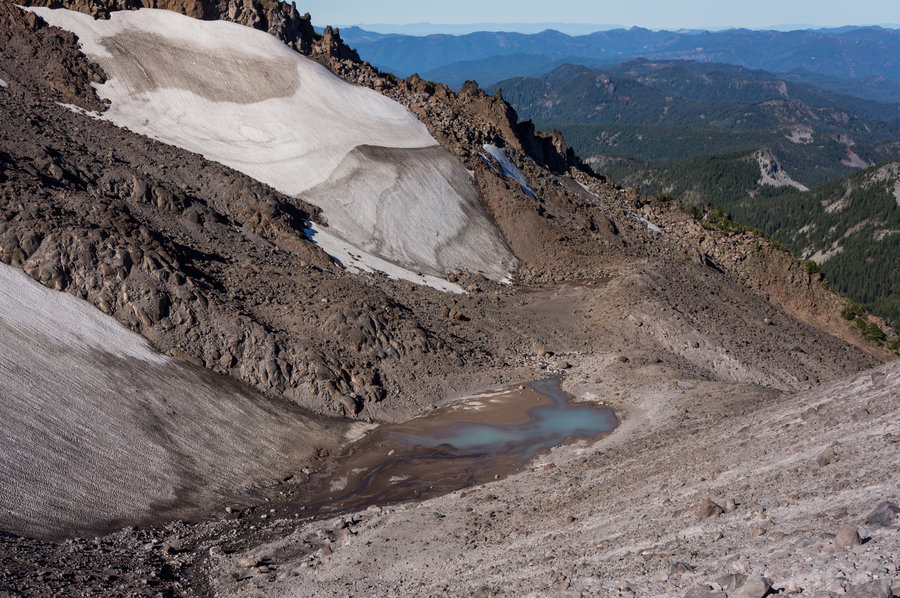
The next morning I woke up for pictures and hadn't planned to explore further up until after breakfast and taking down camp. Wearing warmer clothes and not having any snacks or a small pack with me, only my phone and camera. Well, a 'quick' picture above my camp turned into a 3-4hr excursion to my high point. Above the first moraine immediately behind camp I noticed there was a fantastic glacial tarn/water source just down the other side. But I continued up for now. Along the way I found a handful of additional bivy spots, including a very nice one quite high up. Almost exclusively I followed the Whitewater glacier moraine. I stopped at a high point of 7800 at a beautiful tarn.
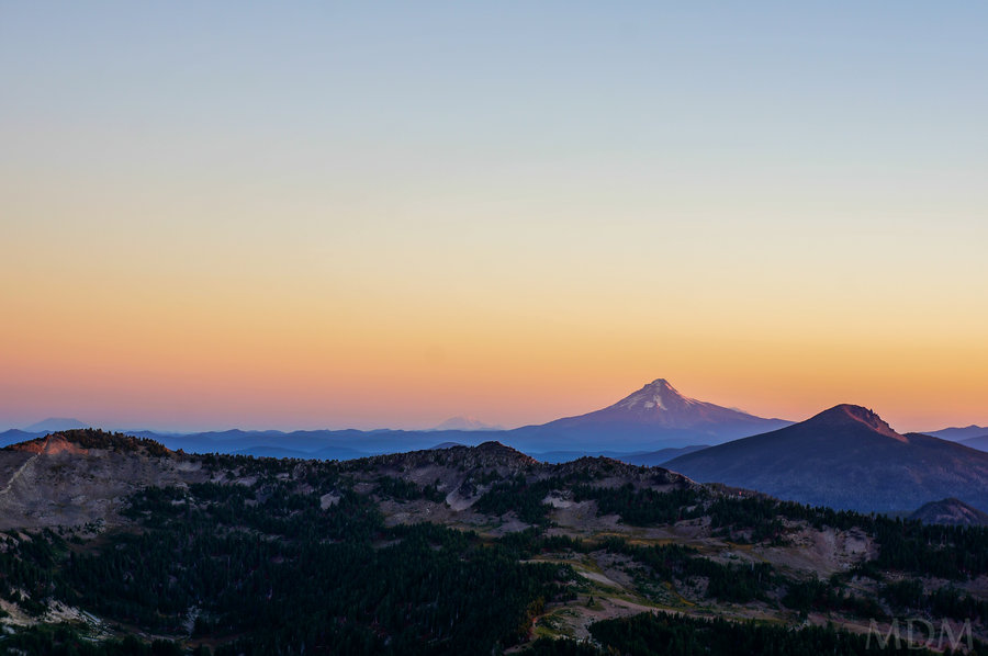
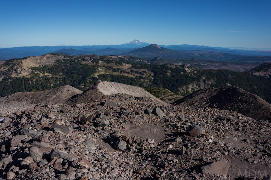
Along the way I had spectacular views of the glacier and crevasses, along with views North to Mounts, St. Helens, Rainier, Hood, and Adams.
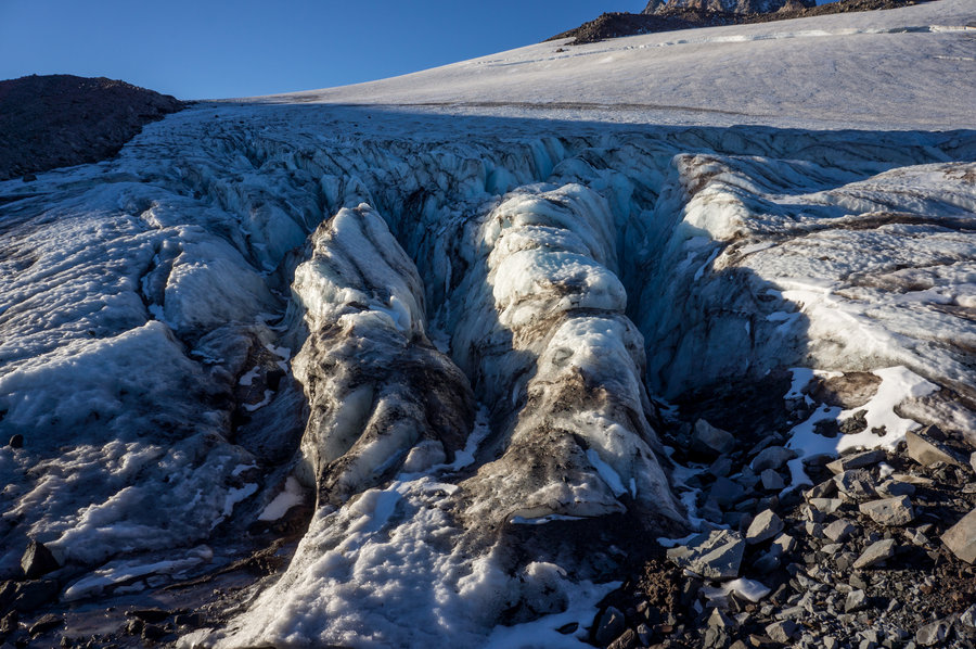
around 7400ft there was a juncture where crevasses were parallel to the moraine I was on, and the moraine petered out and leveled off with the foot level of the crevasses. As most of you know the water coming off glaciers is filled with silt, or more properly, rock flour--such extremely small particle sized sediment. Within the first few feet of the toe of the glacier there was clear melt water. As it was a hot day and I hadn't eaten breakfast or brought anything with me I drank copiously from this clear sediment free water, bringing my lips directly to the melt-stream. It was divine.
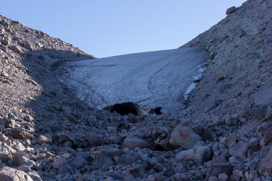
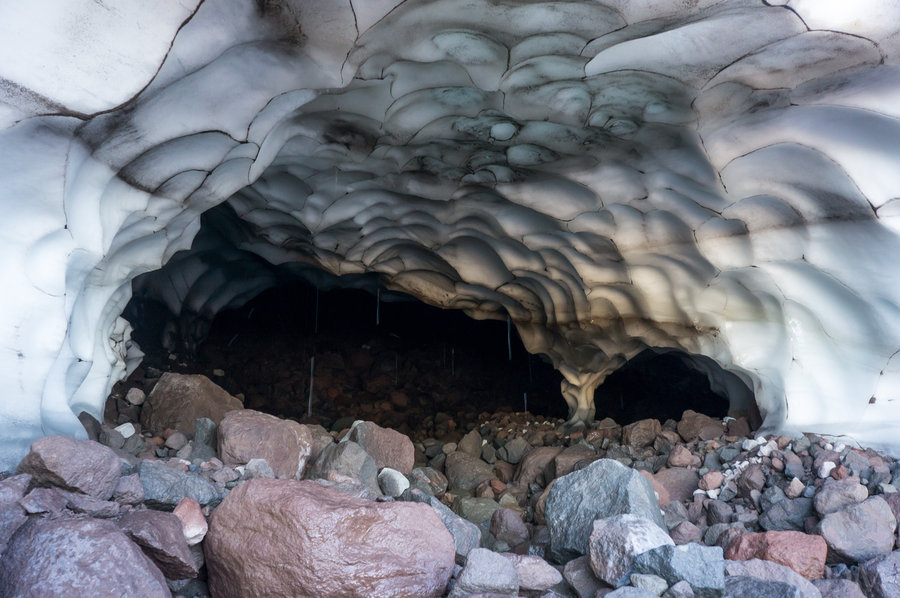
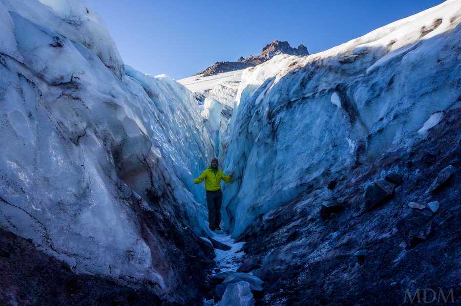
The crevasses allowed one to go into them. As seen in the pictures, with appropriate gear and partners, one could explore into these quite a bit. They were almost a 1:1 rise in the ice wall height with the distance ventured horizontally into the crevasses. As far back as I could see one could probably be '35-40' deep in them!!!
Coming down I went into camp, took care of taking the tent down and stuffing the sleeping bag, then went over to the tarn that was over the moraine by my camp. There were some excellent bivy spots with nice rock walls and very very flat ground. I found 'fresh' water coming off a snow field that was clear so I didn't have to try to deal with any rock flour glacial water. I did not treat any water on this trip.
Other notes: the ground immediately around a number of the tarns is peculiar. Like quicksand almost. I think due to the nature of the melt and the suspended sediment/rock flour, it builds up very gently upon itself. When I stepped in some areas of 'ground' they had a jello like consistency, and my foot's impact seemed to cause a super-liquification, with plumes of rock-flour laden water gushing out after I removed my foot. I also dug my hand into the edge of some of these tarns and discovered they had an almost clay-like coating of this fine rock flour, overtop much coarser sediment. I wonder how long it took to build up the inch or so layer of fine particles and how often they get washed down, etc. I'd also be curious to know the depths of any of those tarns. perhaps another time with some fishing line and a rock..
October 4 – October 5, 2014