

36.5 miles of hiking • 4000' elevation gain • 3 nights
4th of July Circumnavigation of Crater Lake The road for the Eastern half of the park is closed. However, it is plowed to Sun Notch on the SE and to Skell Head in the NE..maybe more, so, perhaps 80% road is accessible. Regulations a tad murky about backcountry camping in the shoulder season (pure winter and summer are clear).. We decide to go counter-clockwise in order to get the snow section done quick, knowing we can put out nearly unlimited road walking miles if we have to.
Friday: car camp off of 138 at 8pm. Got pulled over in Oakridge. 48 in 35. Nice Mr. Cop gave me a warning. Whew.. 1998 was my last speeding ticket
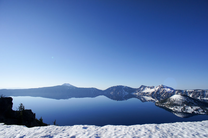
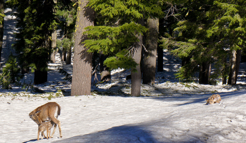
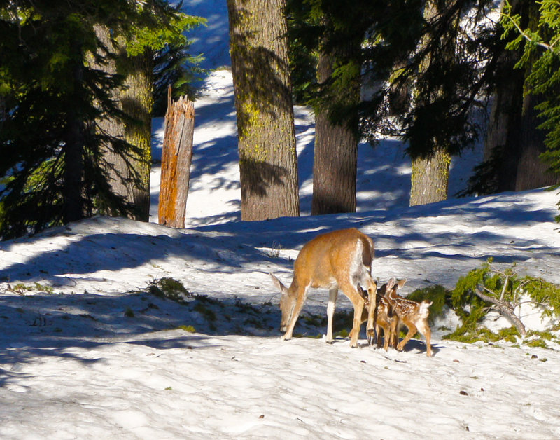
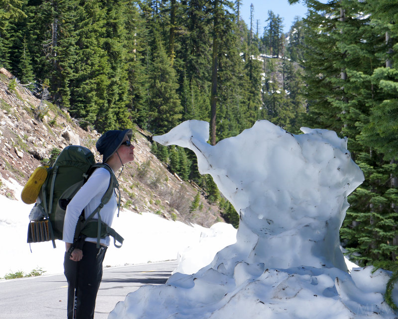
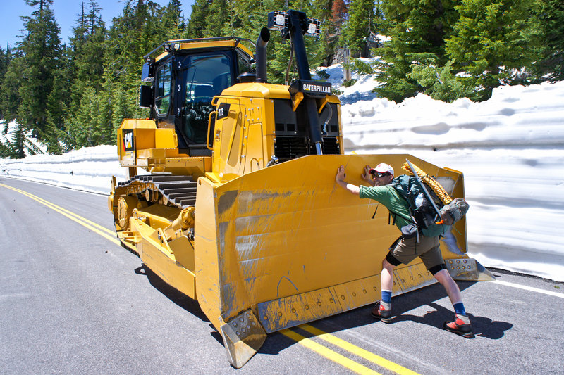
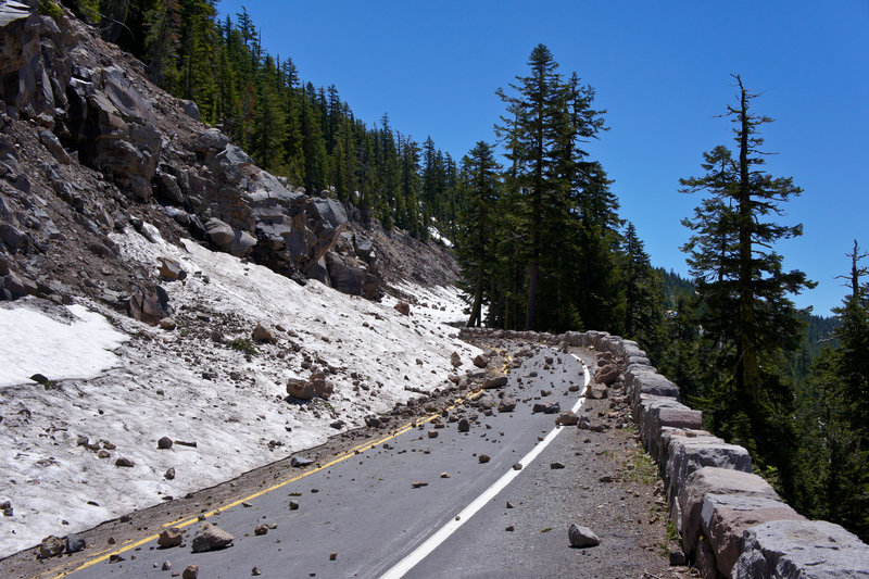
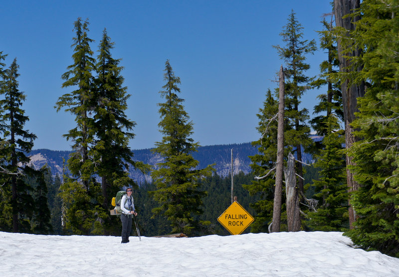
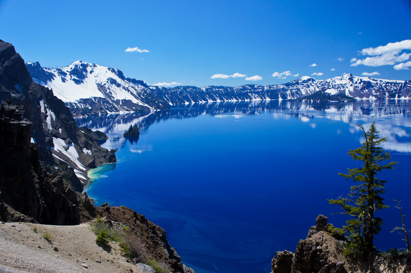
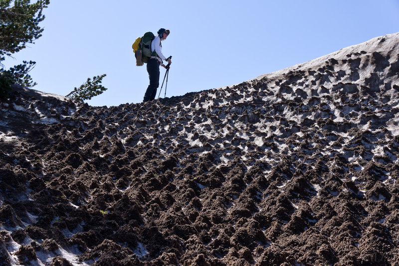
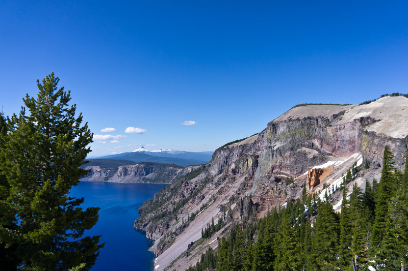
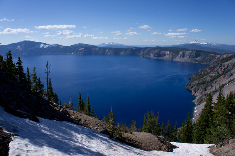
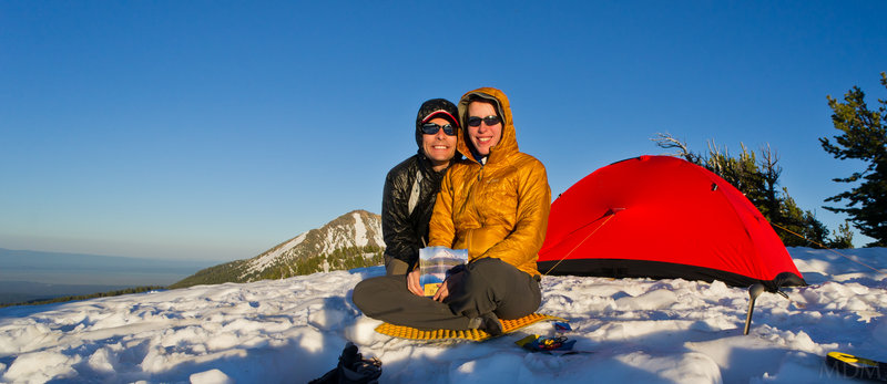
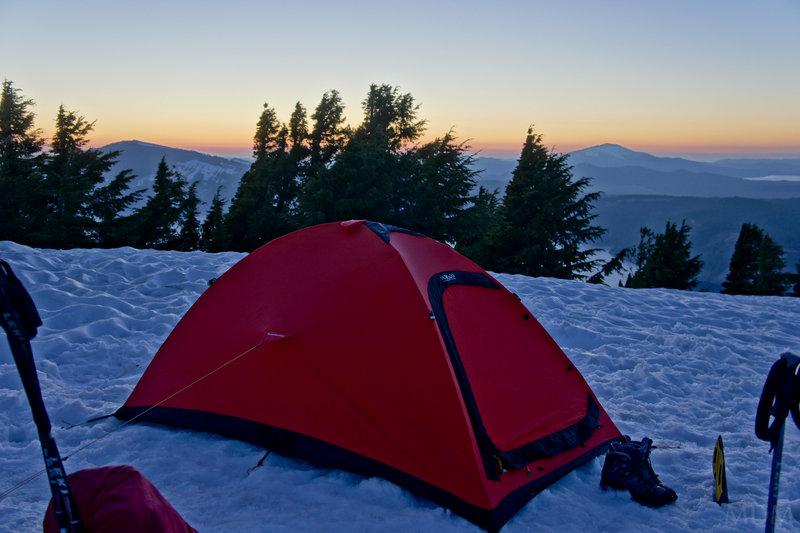
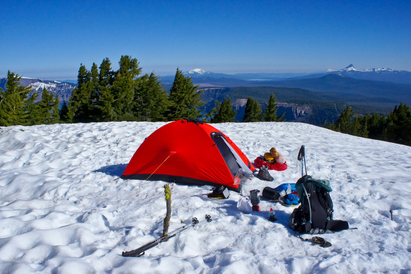
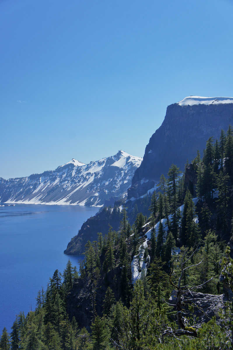
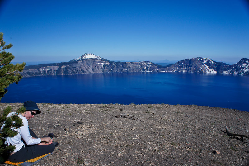
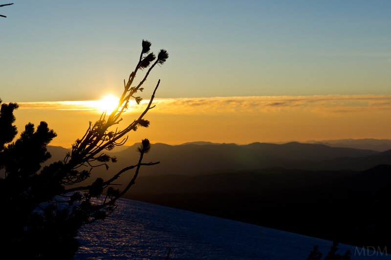
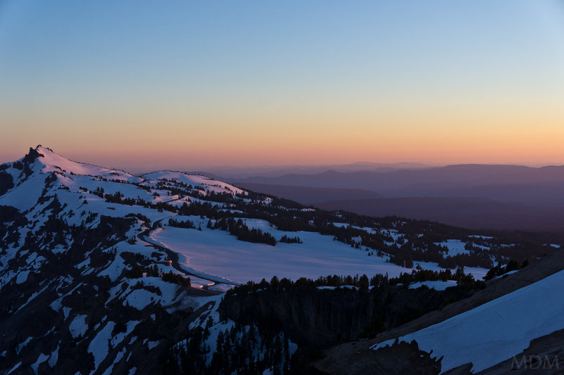
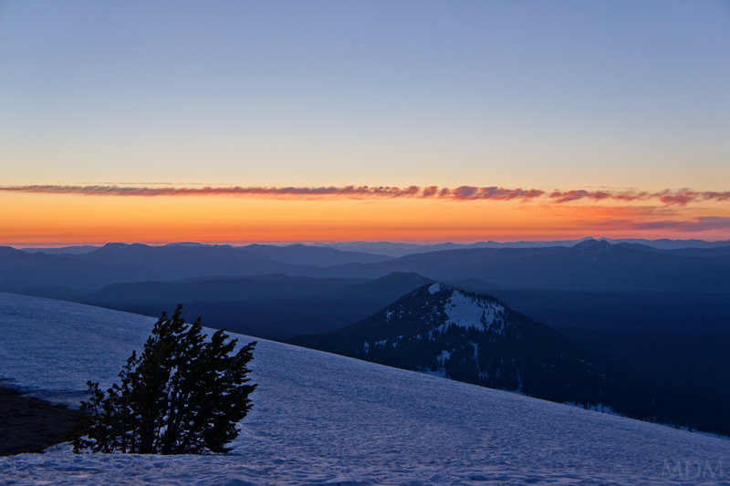
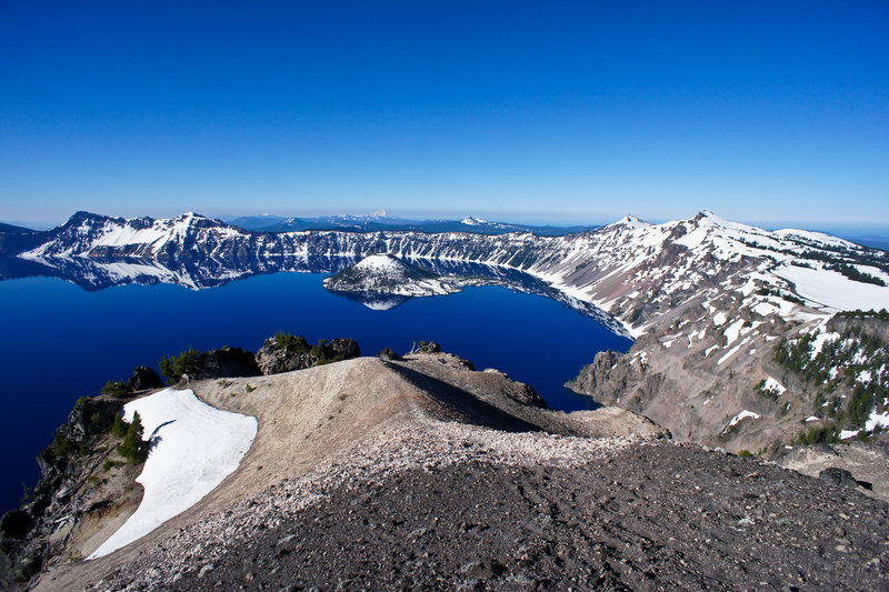
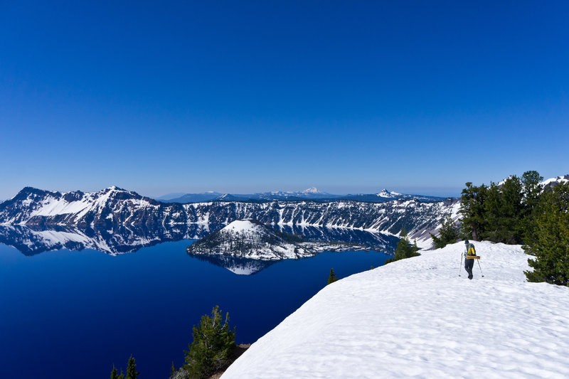
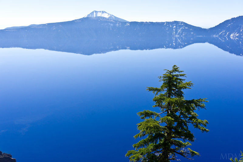
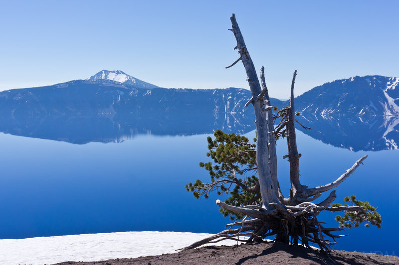
Saturday: Drive in via North Entrance at 7am to preview part of our route. Also to see parts of park not previously seen. Beautiful morning. Mosquitos out in force. See baby fawns near Steel center. Get permits. Start off. Snow free until massive snow machine at Sun Notch. Snow the majority from then until just beyond Cloud Cap. Lots of monster boulders on road--lots of work left it seems. Unlimited incredible, majestic views. Mosquitos really seem like they are at their peak, utterly swarming. They would indeed taper as the trip continued. Camped atop Cloud Cap. Enjoyed the fruits of our labor and the views that wouldn't quit, from Shasta to the Three Sisters.
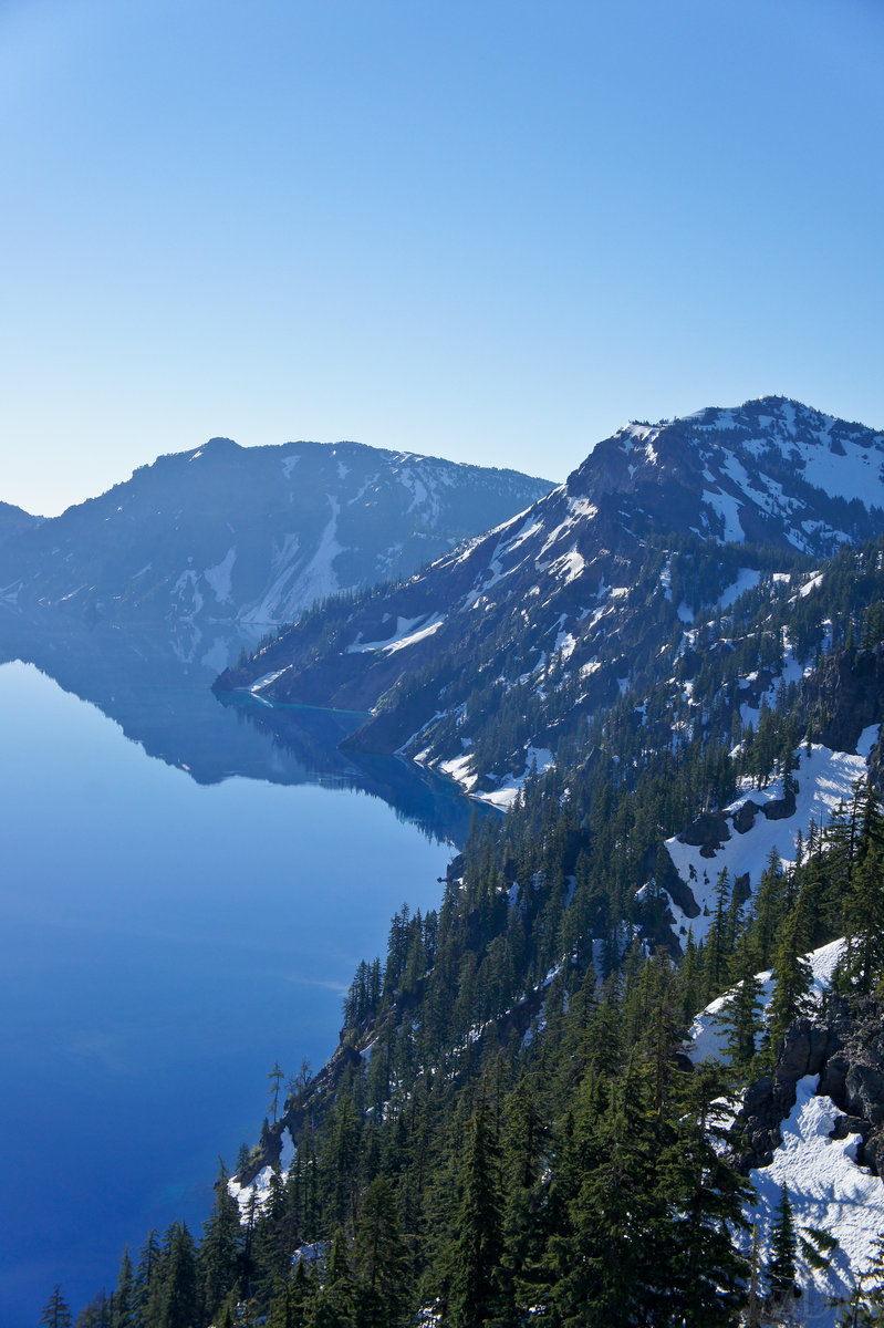
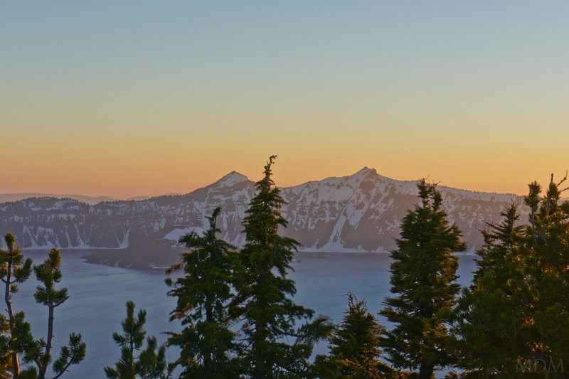
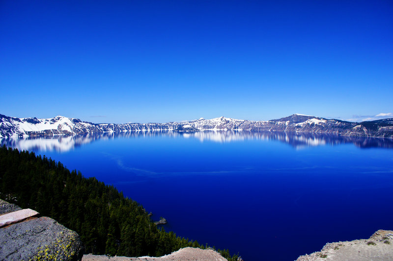
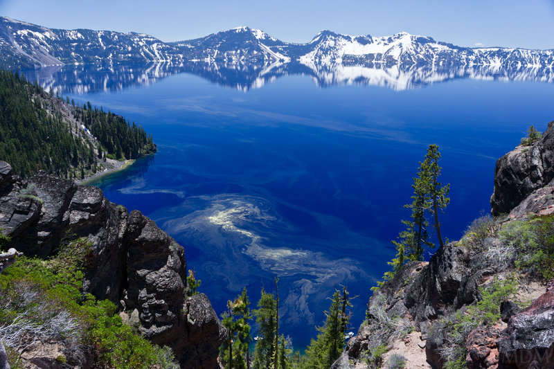
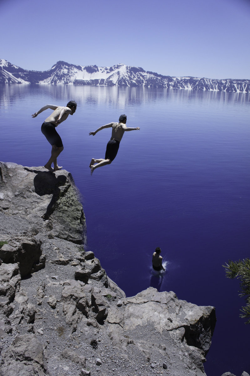
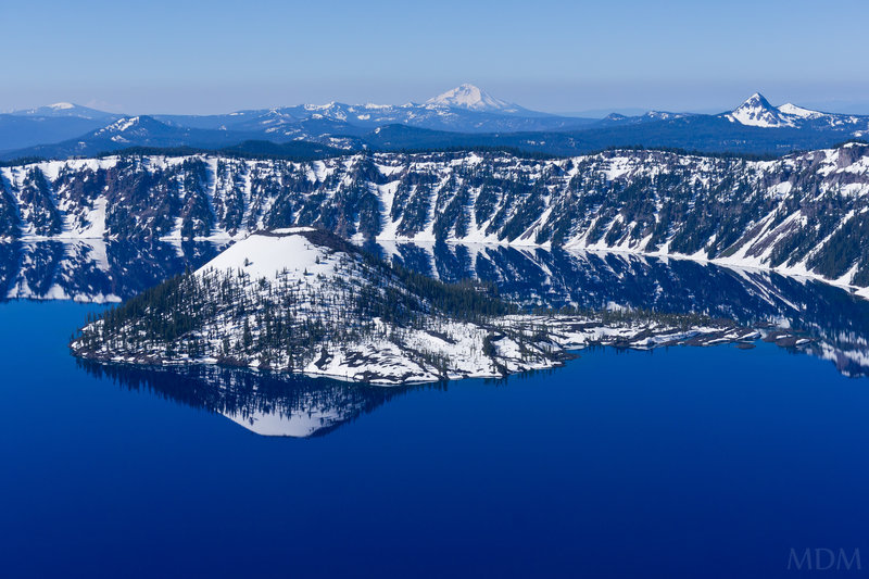
Sunday: Cut down from Cloud Cap to road--plowed! No people until a worker near Skell Head around 11am then some people on bicycle just beyond. Lake is glassy still, and captivating to no end. Views from each direction as one goes around are worthy in their own right. Arrive at Cleetwood Clove at the moment the trail has opened to go down. Temporarily open by orders of Park Superintendent (I suppose so they could tell tourons there is something to do). Left our packs with a ranger up top directing traffic (who we had seen when getting our permits) then ran down with a mini assortment of camera, lunch, and a tshirt for me (Water). Rangers at bottom recommending doing the 18ft jump into the water as the best swimming undertaking. You could see a bit of a shelf about 35ft down, and beyond that it goes to 300ft!! Incredibly refreshing swim, jumped in twice. Inundated with foreigner/immigrant tourists (Indian, Chinese/Japanese..kind of odd, no 'mericans!'). 1300ft back up to the road, then dealing with cars until--
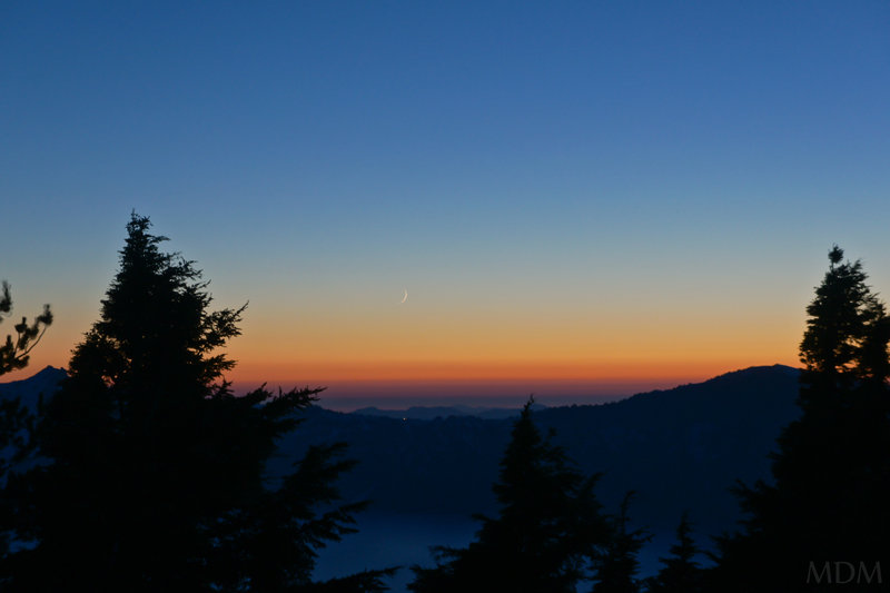
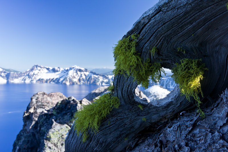
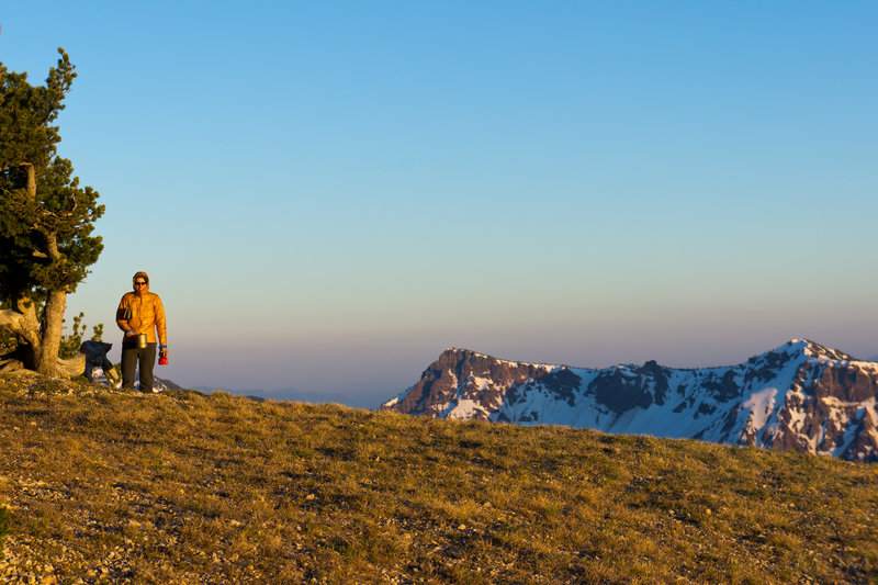
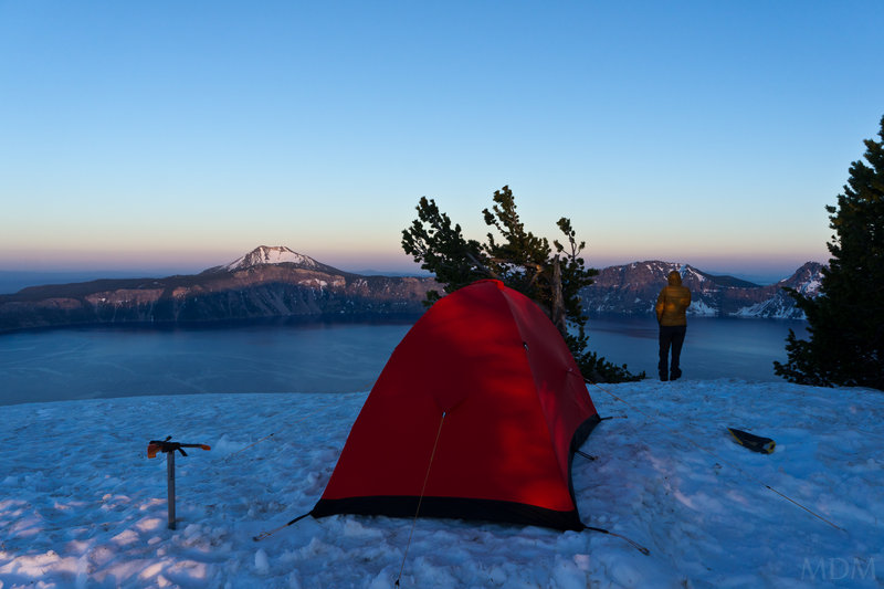
one of the best camp times/spots ever on Llao Rock.. no words do it justice. Finished off the rest of the Patron Coffee Liqueur I brought along.. plenty of photography
Monday: Decent quickly to North Rim junction. Hightail it beyond throngs of tourons to Rim Village. Attempt to hit up folks there for a hitch down 3 miles to Steel center. No luck after 4 tries, so, road walk it is. To the car by 1pm. Hangout back at rim village having some snacks and decompressing. Fish on Rogue River a bit on way home. Eat at Steelhead Brewery in Eugene.
Trip for the ages. Highly recommend everyone attempt to go around Crater Lake on foot/skis/snowshoes/etc.. Not a car.
Definitely a new favorite, and, thrilled that the gem of a park is in our state.


Comments

Water (Matt)
July 12, 2011
Thanks! it wasn't that cold-around 51-52 at the surface I think, and below the top foot maybe 48degrees? I forget the exact stats the ranger told me. If it wasn't so crowded and we didn't have more miles in front of us (after all going down to cleedwood cove wasn't on our itinerary in the first place since it had been closed when we started our trek) I would certainly have swam a lot more.
Glacier Lake in the wallowas in August was colder in my experience. As was a lake I've been in, in Alaska, that is glacier fed. Water is truly cold when I lose and cannot catch my breath, upon immediate entry. Its a bit freaky when that happens :P
Kyle Meyer
July 12, 2011
You jumped into Crater Lake?! Sweet baby jesus, that must have been freezing.
Beautiful photos, great writeup. Thanks so much for sharing.