2012 Trips

 3
3
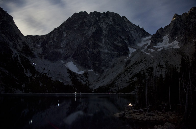
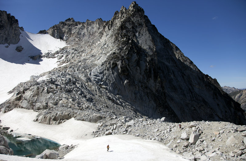
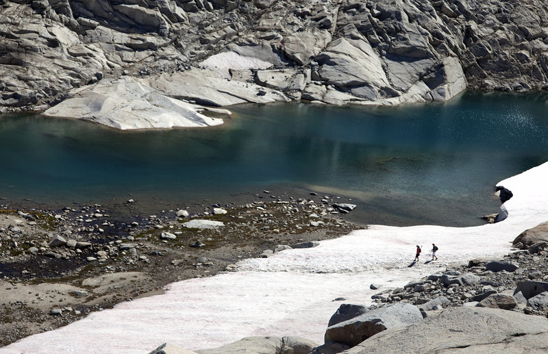
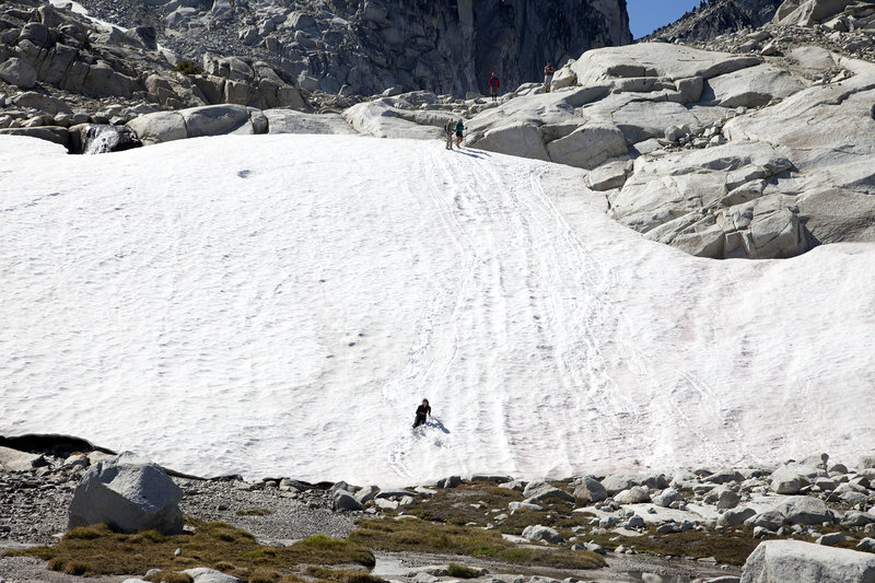
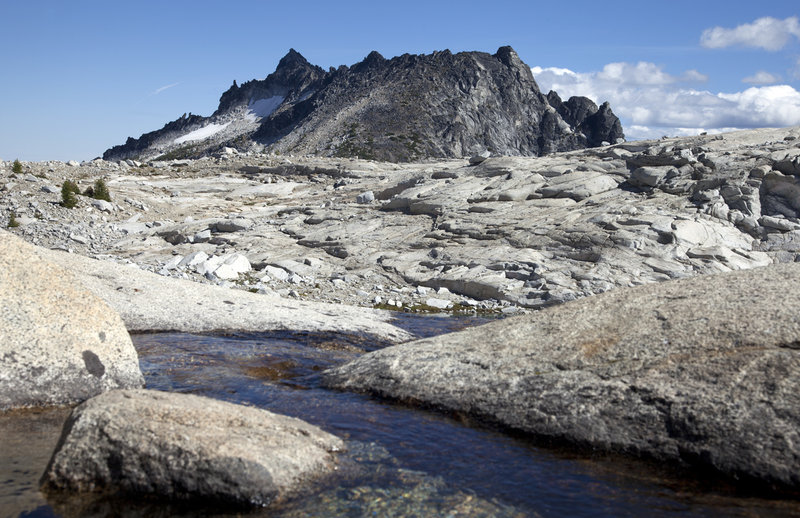
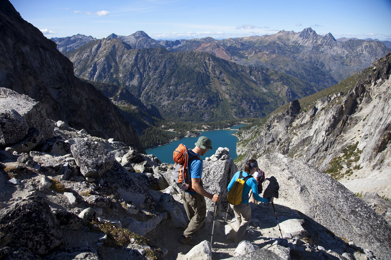
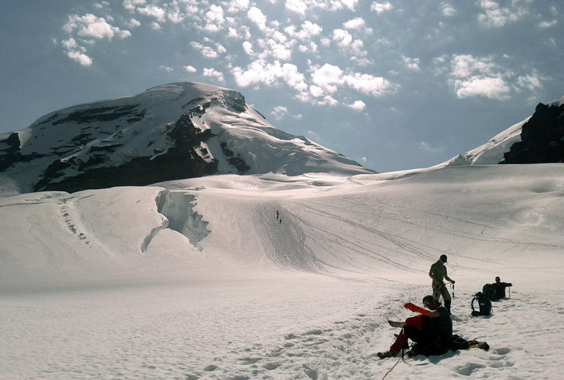
Enchantments/Colchuck Lake
15 miles of hiking • 5750' elevation gain • 3 nights
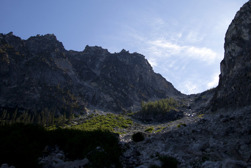
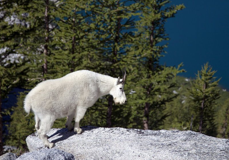
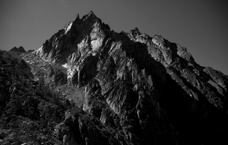
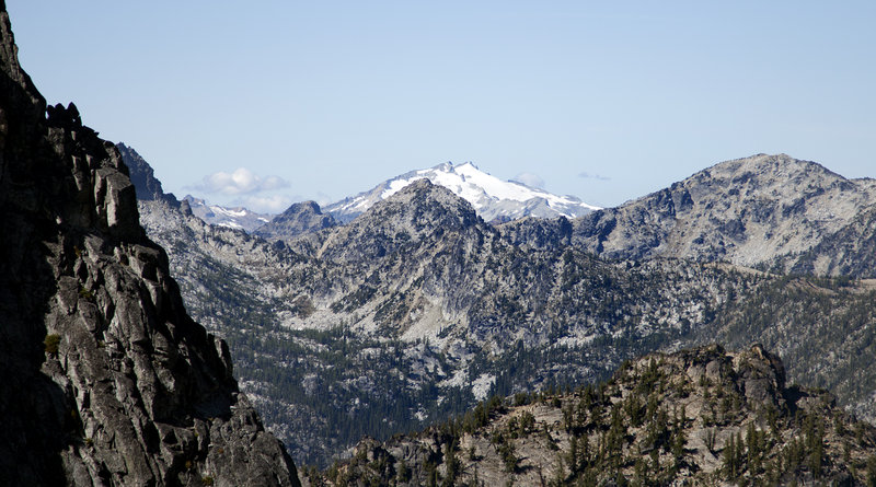
Visited the Enchantments for the second year in a row after staying at Stuart Lake the previous year. I wasn't sure if I wanted to spend another Labor Day weekend here, but decided at the beginning of the year that I'd at least attempt a Colchuck Lake permit through the lottery. Once it turned out that I actually won one, I couldn't say no.
Staying at Colchuck made the journey up to the alpine lake basin more enjoyable, as it's only a quarter of a mile to the base of Asgaard Pass. There were a fair amount of people day hiking/camping up there, but not as many as I assumed. The highlight of the trip was saturday night, when we got to watch the headlamps of climbers on Aasgard Pass and Dragontail Peak moving about.
I'm pretty much done with backpacking up there for now, but would like to return next year to car camp and day hike the 19 mile circuit.

August 31 – September 3, 2012


 1
1
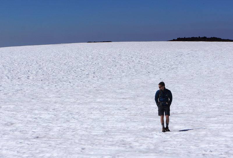
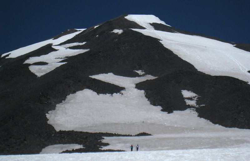
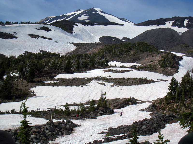
South Sister
12 miles of hiking • 5000' elevation gain •
A little hazy from the fires to the north, but otherwise great weather and not-so-great scree.
August 19, 2012

August 14, 2012
 3
3
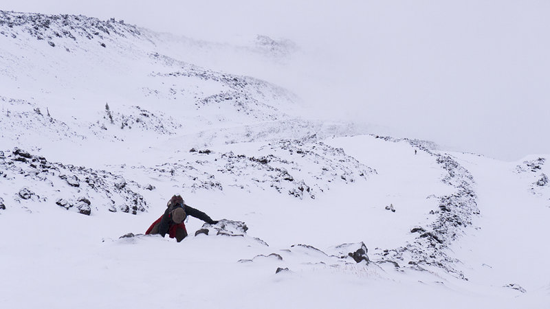
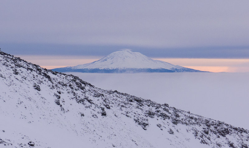
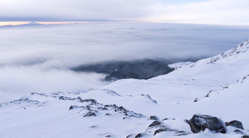
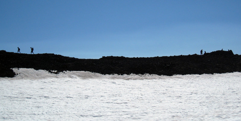
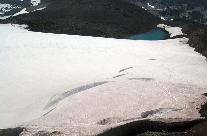
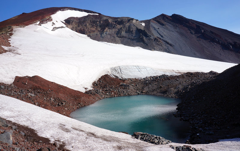
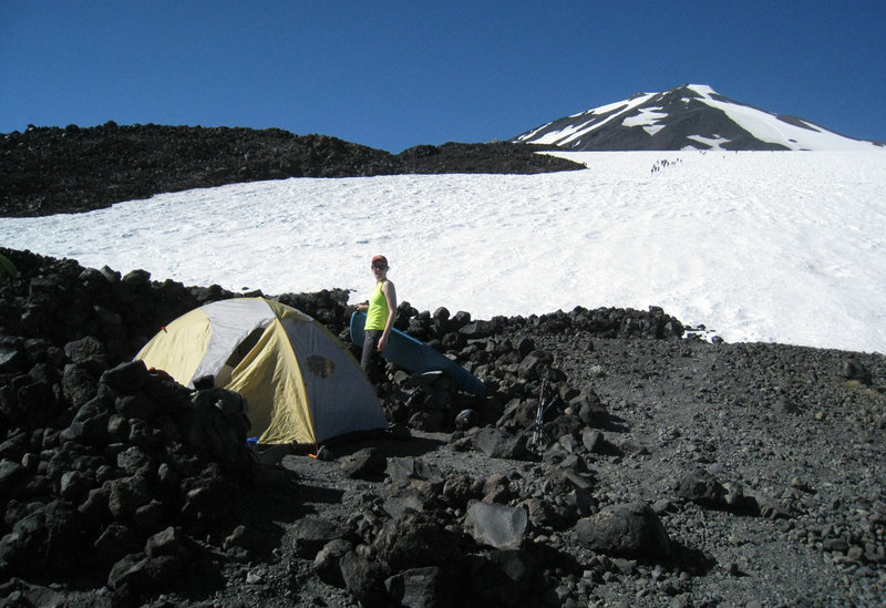
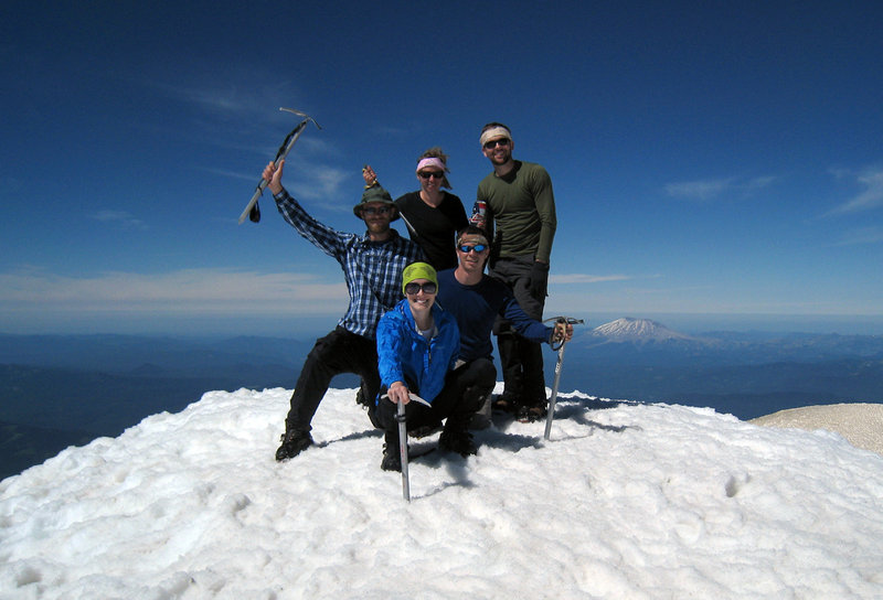
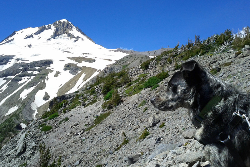
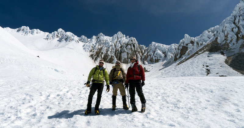
Mount Adams
12 miles of hiking • 6500' elevation gain • 1 night
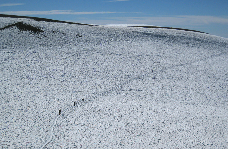
Went with friends this weekend for a saturday overnight on the mountain. Talking with folks at the trailhead the first morning, it sounded like half of the Northwest was up there.
One guy said that a ranger told him that there were hundreds of permits taken for the weekend. Not knowing how much of the various ridges were melted out (and lacking a snow shovel), my heart sank a little at the thought of being crammed in like sardines for saturday night.
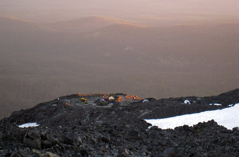
We headed off and didn't hit continuous snow until the Morrison Creek crossing. After that the switchbacks that take you up onto the ridge overlooking the Crescent Glacier were buried; instead a steep, yet firm bootpack was there to follow. Most of the lower sites around 7800' were already taken as we moved up. Crossing the snowfield, we stopped at the toe of Suksdorf Ridge in the 8300' range, where we found a great campsite that was empty. After debating whether to keep on moving to lunch counter or staying put, we chose to camp lower and keep the weight off.
The night was beautiful with barely a breeze. A complete 180 degrees from our last time up here, where it was too loud to sleep. In fact, talking to another climber at the parking lot, evidently the previous evening had been nightmarish with winds so powerful, his tent was pushing into his face. Maybe he was embellishing, I don't know, but it felt really windy in Portland on friday at least.
Sunday morning, we headed out around 5am and took it easy. Once we got above lunch counter, I got curious as to how many people were actually there, and over the course of the day maybe 40 overall. Certainly not the 800 or whatever that I heard through the game of trailhead telephone.
We arrived at the summit later that morning and enjoyed the views, then returned down the well-defined glissade chutes. Overall, an amazing weekend with my only real complaint being that we were asked "where to go" at least six or seven times by other groups (I don't mind helping if I can, but please bring some navigational things with you next time!!).
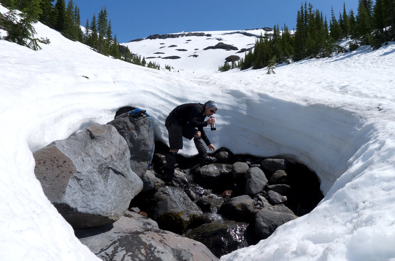
Lastly, we found running water at Morrison Creek, 8150', 8200', 8350' (small flow at our campsite), ~9100' (the base of Pikers at the end of the last glissade chute), ~12000' and ~12200' near the west summit.
August 4 – August 5, 2012


July 30, 2012


July 24, 2012


 2
2
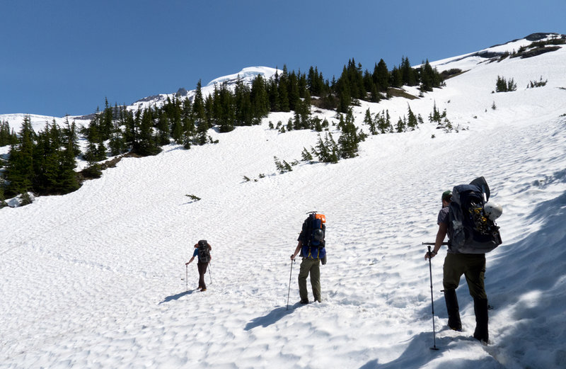
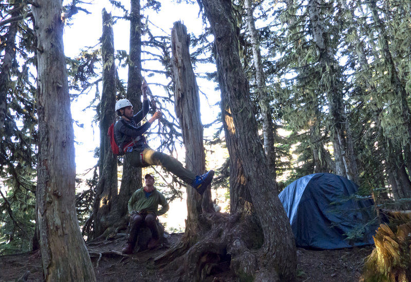
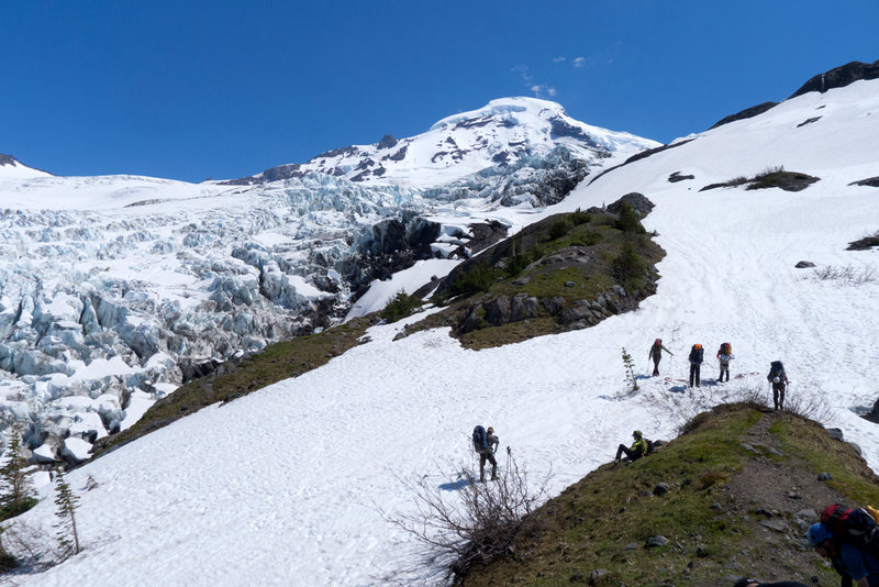
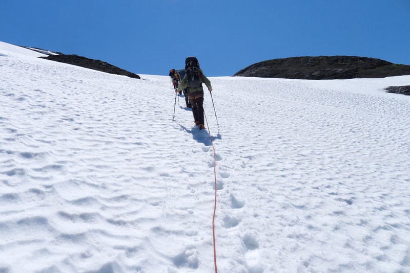
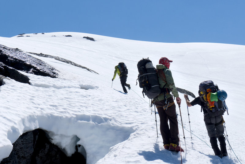
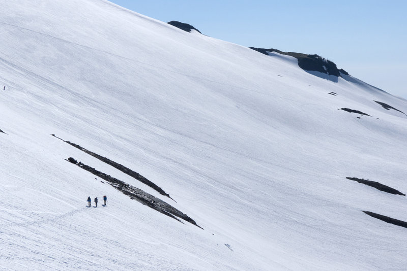
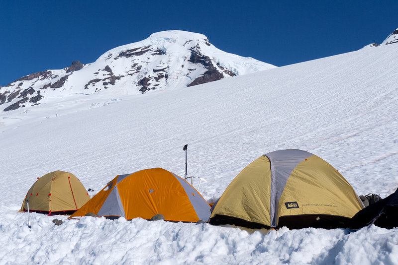
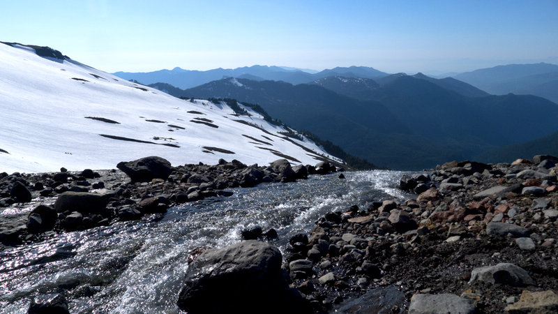
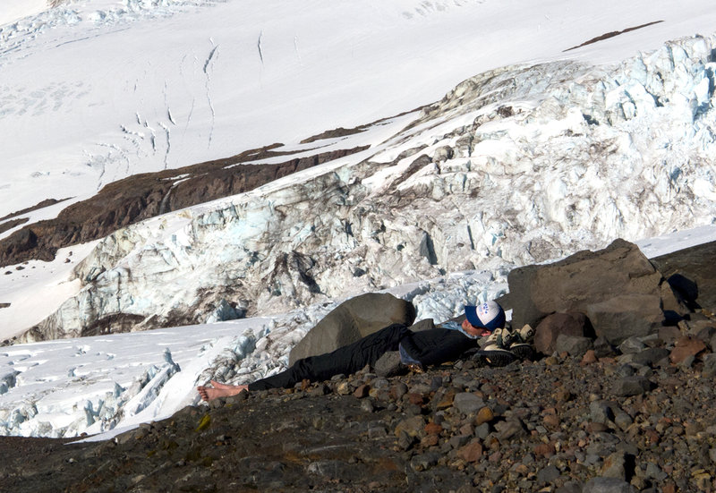
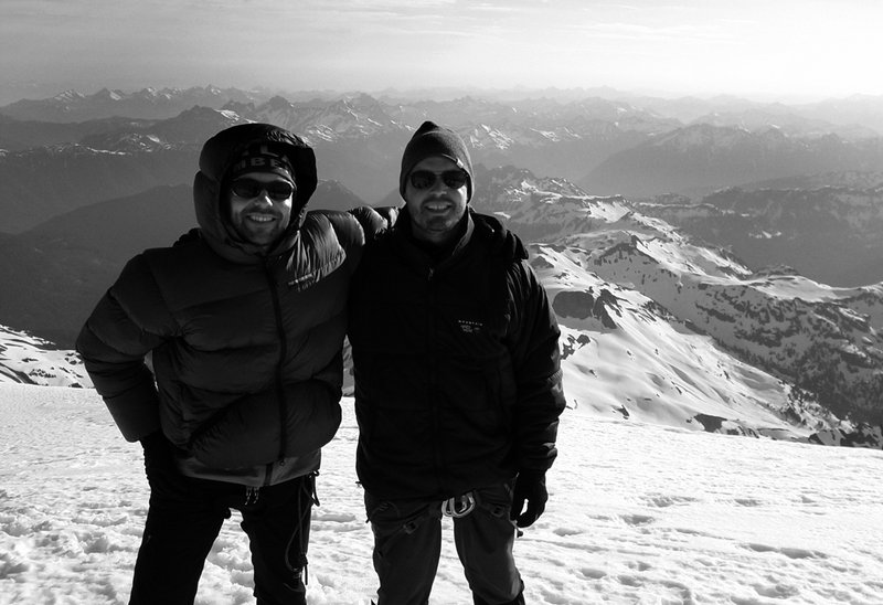
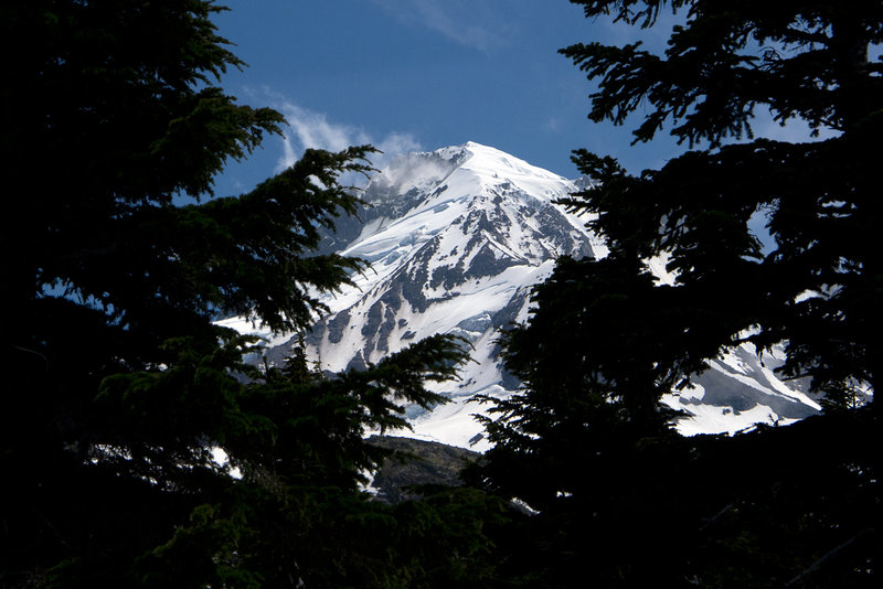
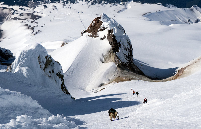
Mount Baker
14 miles of hiking • 8000' elevation gain • 2 nights
I took a three day skills course with a buddy on Mount Baker, on what turned out to be a great weather weekend. Our group made two camps, the first under the trees at around 4500', which was nice because it had a vault toilet and we could get out of the sun. The second night was at 6000' on the Coleman glacier.
All three days were quite busy with little downtime, as we were constantly traversing, climbing, practicing our steps, knot tying, belaying, shoveling snow, making meals, setting something up, or tearing something down. This was the most condensed course of knowledge that has ever knocked me aside the head.
The morning of the third day was our summit attempt. The forecast had been showing all week that there was a chance of lightning storms in the area Monday morning, so I was a bit nervous that this wasn't going to happen. On a few hours of sleep, we woke at 1 and got going by 2am, where almost immediately we had a front row seat to a rather large lightning show to the north. Our guide was convinced that the weather was going to stay up there and away from the mountain, so we continued on.
By our second break (two hours later) the lightning storm was still hanging around to the north, but it seemed to be sweeping east. I asked one of the guides if he thought that it might drift south as it swept across and he felt that we were fine. During the break I overheard the two guides chatting, and while I didn't hear everything, I gleaned choice quotes like, "all weather forecasters are fools," and "Plan B is we'll ditch the equipment and run down the mountain."
This certainly didn't help my nerves, as there's no quick way to escape lightning when you're already above 8500', and "running" down a crevassed glacier seemed just as foolhardy as climbing a mountain in a lightning storm in the first place. Anyway, fortune smiled upon us and Plan B wasn't necessary. By the time we hit the 9000' col ("The Football Field"), it started to get light and of course my camera broke. I resorted to cellphone photos, but it was terribly disappointing. We hung a left (east) up the ridge, moved quickly across some sketchy spots of ice, and continued to the Roman Wall.
This last section is comparable to Piker's Peak on Mount Adams but maybe a bit shorter and steeper; 1600' high with a 40° slope and nice, firm snow. We topped out, traversed across to the east summit, ran into another party and enjoyed the views. Overall, an incredibly hard, yet fun weekend in the North Cascades.
July 7 – July 9, 2012

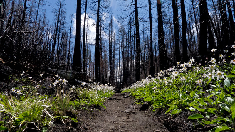
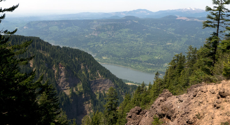
Vista Ridge
7 miles of hiking • 2250' elevation gain •
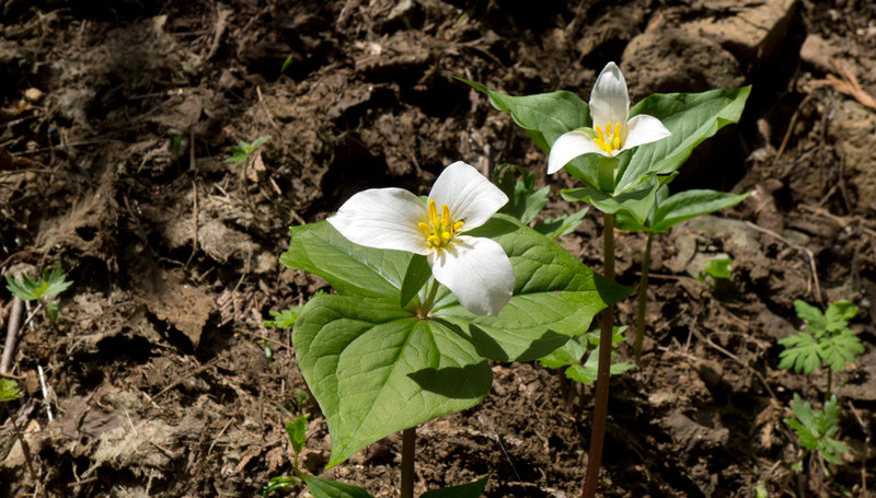
My first time up here and I suppose that I'll never know what this looked like before the Dollar Lake fire last year. The burnt forest, however, with its fresh growth of bear grass and avalanche lilies, displayed its own, interesting beauty.
Getting out of the forest, we moved up along the side of the glacier until we found an open spot for lunch. While eating, the winds kicked up and clouds moved in, obscuring just about everything in a matter of minutes, so we decided to call it a day. This was a gorgeous hike that I hope to get back to later this summer.
July 2, 2012


Devil's Peak
7 miles of hiking • 3000' elevation gain •
Shane didn't mention the best part of the hike, free boxed wine!
June 27, 2012


June 25, 2012

June 23, 2012


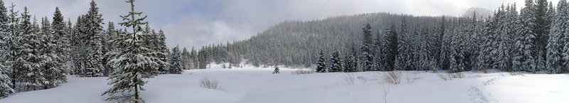
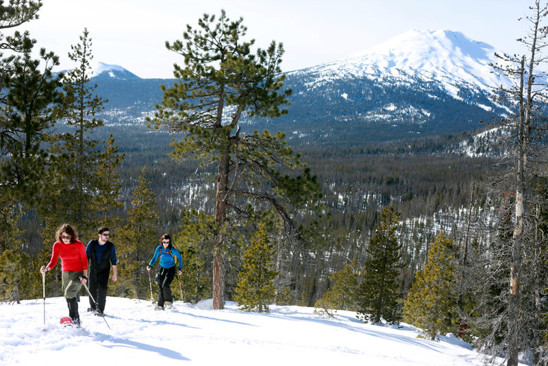
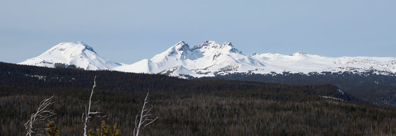
Tumalo Mountain/Deschutes Forest GigaPan
8 miles of hiking • 2000' elevation gain •
My original plan was to get a panorama from the top of Tumalo Mountain. Unfortunately, the weather was not helping at all, and the summit was completely socked in with clouds. We later did some snowshoeing where I was able to get separate photos of Broken Top and South Sister.
A larger version here.
A larger version here.
June 10, 2012
 2
2
Angels Rest (x2) GigaPan Attempt 2
9 miles of hiking • 3250' elevation gain •
This actually accounts for two trips with the GigaPan on consecutive days. Unfortunately, I'm only posting this now due to a heavy work schedule and the sheer amount of time that it takes to put one of these photos together.
Since trying the GigaPan out for the first time in April, I wanted to come back with a larger lens. Thankfully no one else at my work needed to use the 300mm lens, so I grabbed it for the hike. After getting back home and stitching an initial preview of the pano, the autocorrection had cut out too much of the bottom (the river) for my liking. So after work the next day, I made a second trip to reshoot the bottom portion of the photo, but then just decided on redoing the entire thing. I think I'm finally starting to get the hang of it.
A larger version here.
June 6, 2012


 4
4
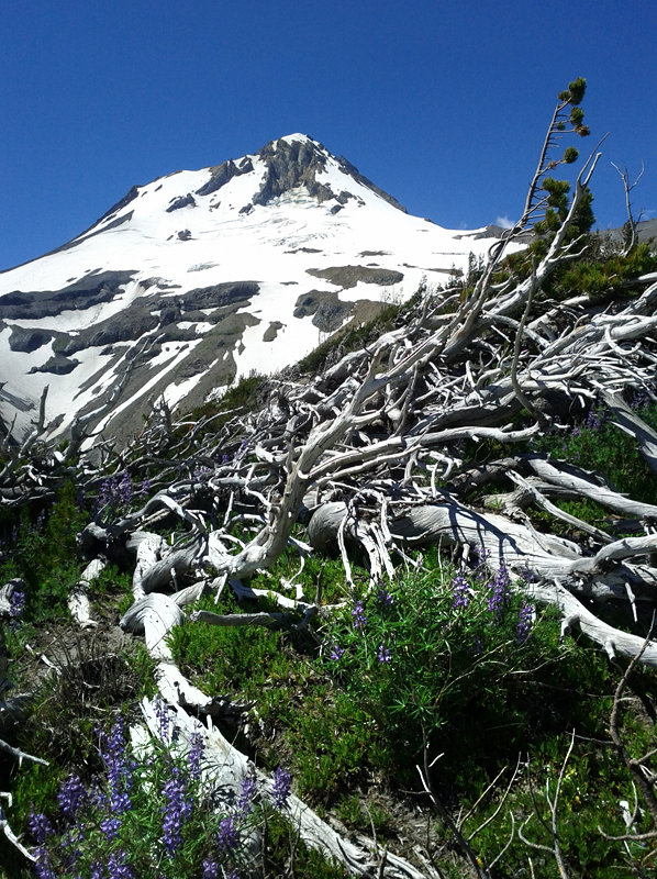
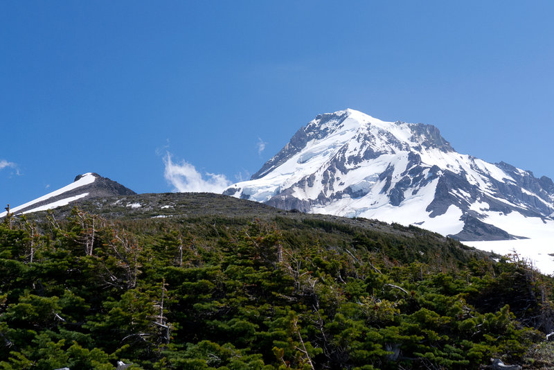
Mount Hood via The Old Chute
6.5 miles of hiking • 5250' elevation gain •
A cold but gorgeous morning on Mount Hood with Shane and our buddy Kevin. The snow in the chute was nice and firm, and the views at the top were fantastic!
May 17, 2012


Nesmith Point
10 miles of hiking • 3750' elevation gain •
This time last year I hiked Nesmith Point and experienced two feet of snow starting around 3000 feet. This year the trail was completely dried out, except for five small snow patches (all of which will probably disappear by the weekend).
May 14, 2012

 3
3
May 6, 2012
 3
3
April 29, 2012


Mount Saint Helens
10 miles of hiking • 5500' elevation gain •
A beautiful day on the mountain mixing warm temperatures with a cold breeze. We left the Marble Mountain Sno Park trailhead at 7:30 and got to the rim a little before noon. We spent about 45 minutes at the top, eating lunch and chatting with other folks. Snow was perfect for glissading by the time we started our descent. All in all, just about as perfect a day as you could ask for up there!
Since I can't seem to get the photo uploader to work, here's a link to a few photos: http://min.us/mbrCL6Xtq9
April 15, 2012


March 26, 2012


Mirror Lake Area
5 miles of hiking • 1000' elevation gain •
A bigger version of the panorama: http://i.minus.com/iHkFXQYzOhigF.jpg
March 17, 2012


Wahkeena Falls/Devils Rest
7 miles of hiking • 2500' elevation gain •
Out and backed to Devil's Rest with some friends from the Wahkeena Falls TH, snow was continuous starting around 1800' or so.
March 4, 2012

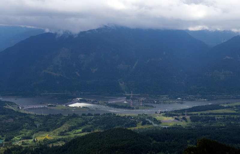
Dog Mountain
6 miles of hiking • 2750' elevation gain •
The steep route seems to be the only available trail right now. Warm weather and no winds at all. We watched a single-seater plane do barrel rolls above the gorge.
February 24, 2012
 2
2
Indian Point
8 miles of hiking • 2750' elevation gain •
Tagged along with a friend who was doing a small hiking article on Indian Point for a newspaper. Hardpack snow started at 1800'.
February 7, 2012


February 6, 2012


January 13, 2012
 1
1
Mount Saint Helens
8.5 miles of hiking • 4250' elevation gain • 1 night
Went with Kyle and some other friends. Summiting wasn't in the cards this weekend, unfortunately.
January 6 – January 7, 2012