

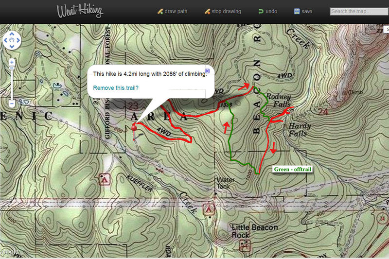
4 miles of hiking • 2000' elevation gain •
I had a free afternoon, and started off Equestrian trailhead to look for a shortcut path between Hardy trail and lower Hamilton trail. Didn't quite expect everything to be snowed in, but decided to go with original plan. The shortcut should have began at the first major junction, but all I encountered was impenetrable brush... Took the right-hand trail for about 1/3 mile past the junction, then went downhill along a small stream. Got down to Hamilton trail after about 40 minutes bushwhacking and a sketchy creek/gully crossing on the logs, then going around some cliffs, far east from where I planned to go.
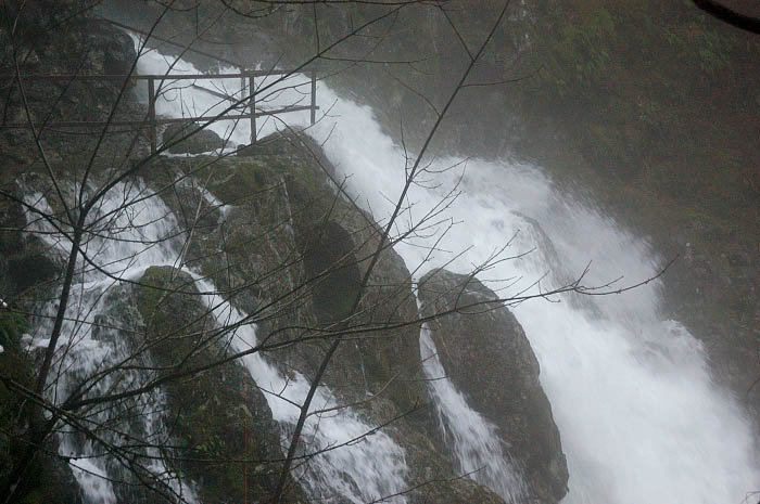
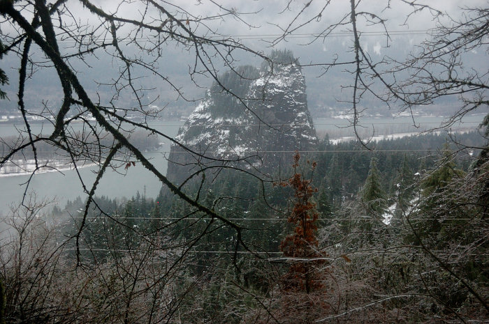
Visited Rodney Falls - it was a monster, and a noise was deafening! The water now runs over Windy Pool viewpoint, and at some point it ran over the rocks that wall Windy Pool. After Rodney, went to Hardy Falls "viewpoint", but at some point it was apparently fenced above where it used to be. It was pretty icy so I didn't want to scramble down above precarious drop-off.
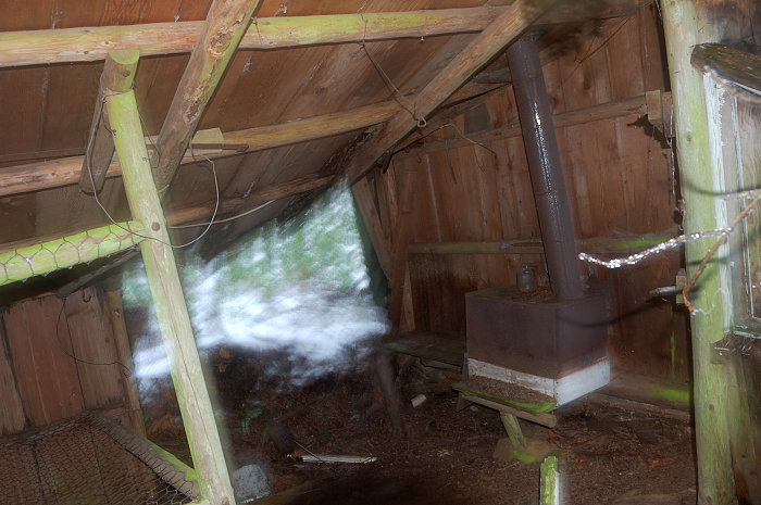
On the way back I went much closer to powerlines and found a trail branching off uphill - the one I thought about. I soon lost it because of snow, but the brush was OK and it was generally easy going. About 1/2 mile up found a structure I don't remember reading about on PH - some kind of wooden shelter with 2 rooms, shelf beds, and a stove. One room is missing a wall, another - two walls, the roof in big room looks like ready to cave in, but the space near the stove is so clean it seems someone still uses it. I would at least expect some fall foliage on the floor.
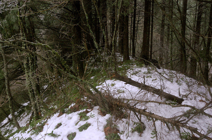
A faint trail re-appeared several times, but for the most part I went off-trail in the general direction "uphill" (forgot my compass). Right before I hit the road, vine maple became almost impenetrable - it took me about 40 minutes for less than 1/4 mile! If not that last part, the shortcut is quite interesting and reasonable easy to follow, but still takes much longer than the same distance on trail.


Comments

Eric Peterson
January 21, 2012
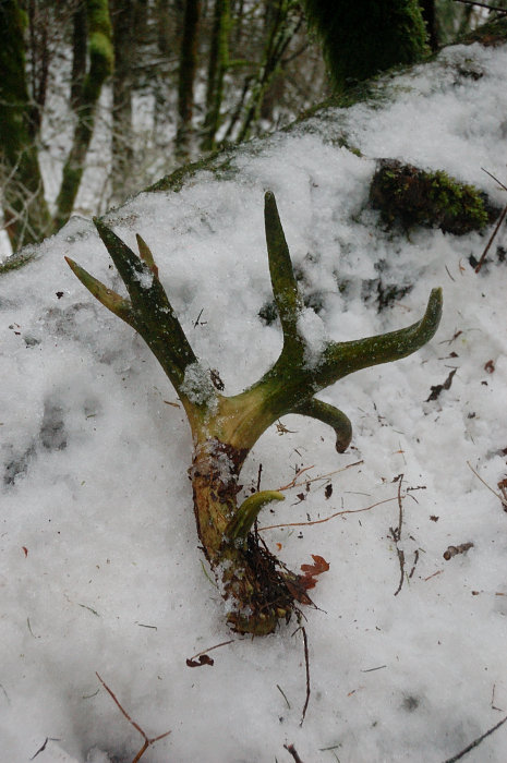
Shelter looks like something to go find!
Roman
January 21, 2012
Official trail would be nice, but it's pretty straightforward without it & feels more adventurous. I want to check this path again without snow and see if it needs any maintenance (nothing major, I just think to clear some downed brush if there's no way around). In the last 1/5 mile or so the brush was really bad, but maybe I just missed a better path in the snow?
I still use a discover pass, but there seems a parcel of GPNF just up Kueffler Road I might try when my pass expires.
Eric Peterson
January 22, 2012
"I still use a discover pass, but there seems a parcel of GPNF just up Kueffler Road I might try when my pass expires."
That's where I was going to park without a DP.
BTW, do you have a actual GPS track of this, or just the hand drawn WH thing?

Chris
January 22, 2012
So where would you park on Kueffler? There are DP signs all the way up to the turn around with the houses, and then there are no parking signs at the turn around.
Roman
January 22, 2012
Eric - this is hand-drawn (I don't have a GPS) but pretty close to actual. If you see my post on off-trail forum, VanMarmot posted a link to his TR with an actual GPS track.
Chris - that's a bummer :( I remember getting to private road sign on Kueffler, but then there weren't DP signs around. Looks like you can talk to a park ranger and show him a topo map which clearly shows GPNF boundary?
Eric Peterson
January 22, 2012
DN says to forget those signs at the end of Kueffler road since the road is still on public GPNF land.
Cool Roman, I'll check that out over there :)
Eric Peterson
January 22, 2012
Oh, I saw that TR way back and even commented in it. VM doesn't upload his GPS tracks into public domain but he does share them with me when I ask, thanks again :)
Eric Peterson
January 24, 2012
Why am I still seeing this old stale hike?
jk
:)
Roman
January 24, 2012
Every time you guys comment it bumps to the top (bump!)
Kyle may need to revise the formula again ;)
Eric Peterson
January 24, 2012
Oh, LOL - I really didn't know the comments were bumping!!
You'll have to excuse me while I go searching for some old hikes to necromance!!
:D

Kyle Meyer
January 26, 2012
Actually I think this is correct! This should be at the top! Lots of hearts, plenty of discussion. Maybe I can make the comments count for less though, and focus more on the hearts.

Karl
November 13, 2013
Sweet! Yes, there needs to be an established route between those two. Nice job. :-)
Chris
January 21, 2012
Thanks for doing this—I've been thinking about this for a while now. It would be great if we could get a (responsible) use trail connecting the two.
Are you using a discovery pass, or have you found a place to park?