

15 miles of hiking • 5250' elevation gain •
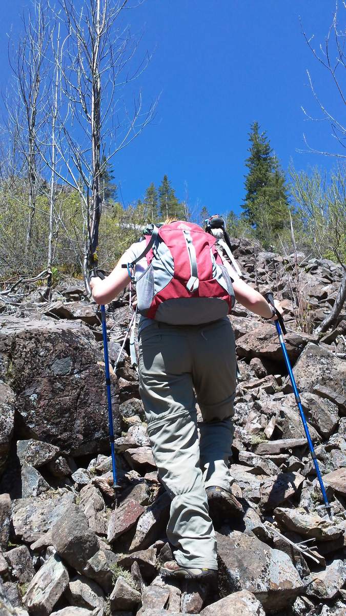
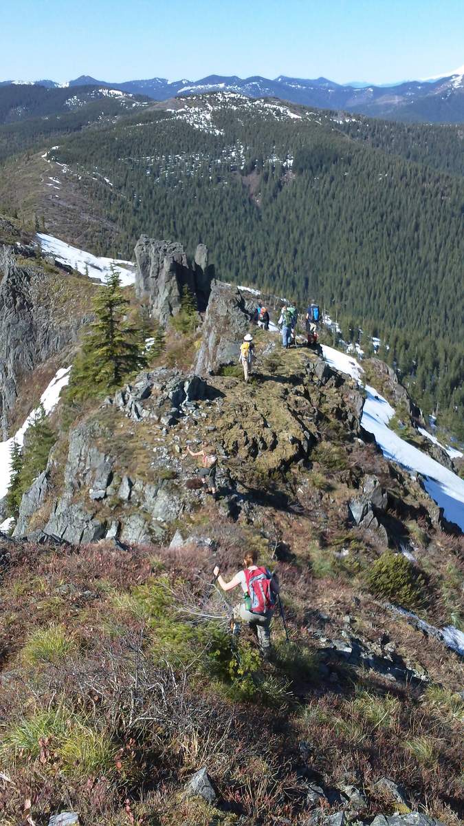
Hiked this with the Mazamas. They call it the Silver Star Grand Tour, which I can easily say is my favorite hike so far. We started off at the Starway Trailhead, then followed an unofficial trail that's being developed by the guy who lead the hike. It took us across a creek crossing and up an extremely steep talus field. We eventually hit the Silver Star parking lot and then followed one of the main trails up to the summit.
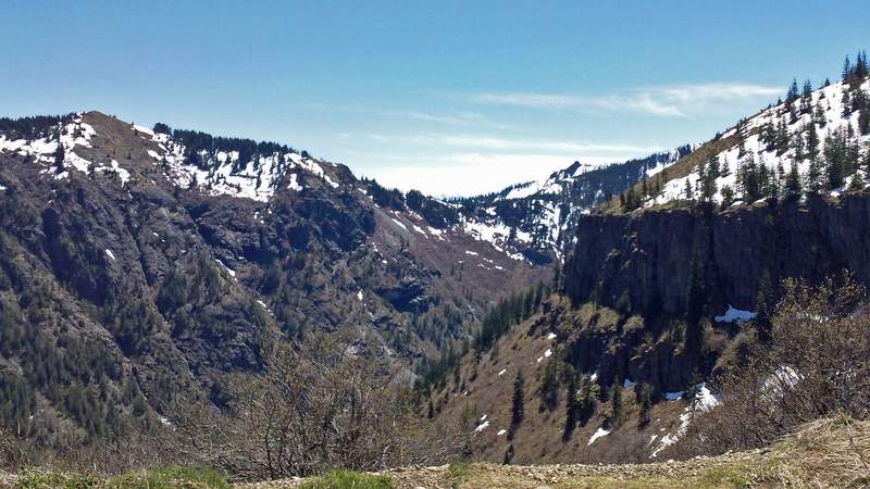
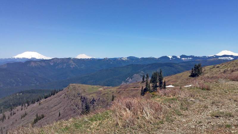
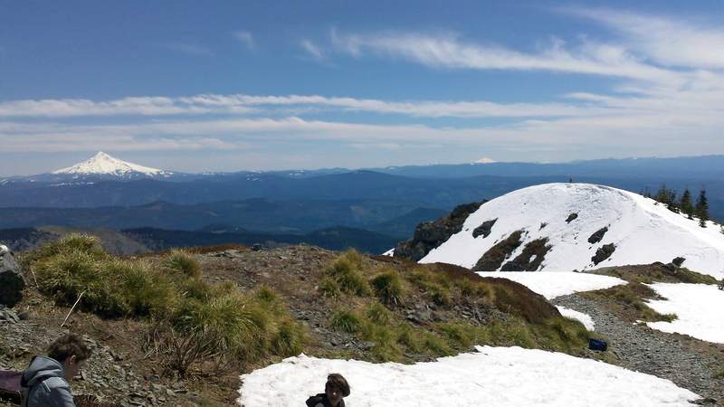
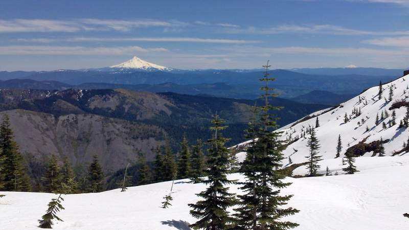
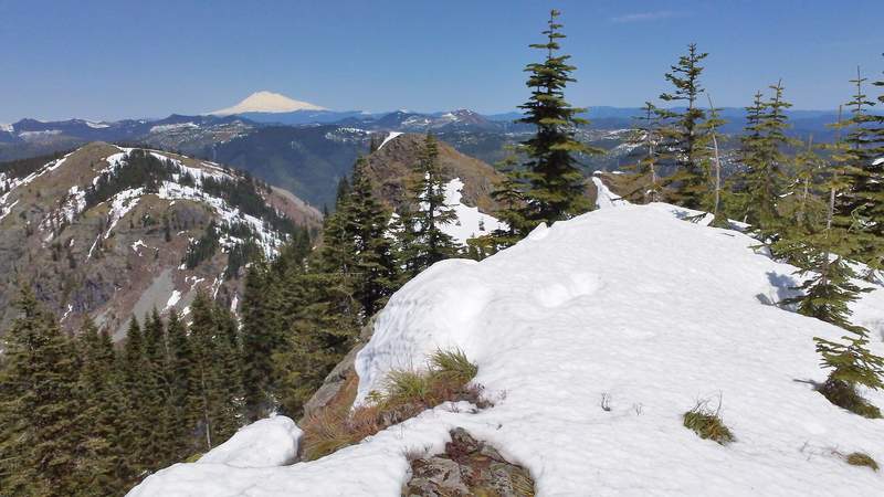
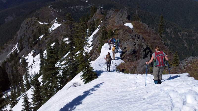
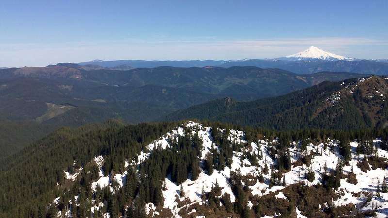
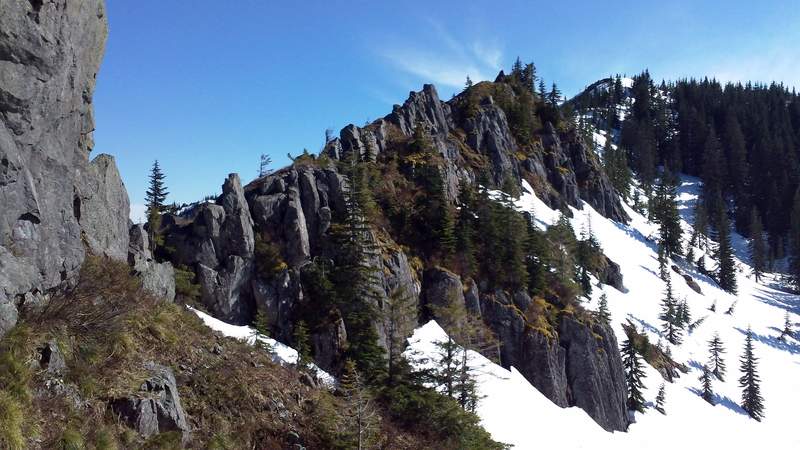
From there, we made our way down Silver Star and then connected up with the trail that leads to Little Baldy. We didn't go up to the summit of Little Baldy due to snow so we went around it. Next stop was the top of Bluff Mountain. There were some amazing views from Bluff Mountain. The trail from there was pretty snow covered, so we ended up coming down the North Ridge of Bluff Mountain, which was very steep and rocky (and also a ton of fun!). We eventually hit a road that we followed down to the creek, where we had to do a tough stream crossing. Tried using garbage bags over our shoes but no luck, all of our shoes were soaked. A few people fell in since the current was so strong from the creek being really high due to snow melt.
Overall, it was an amazing hike. I'm definitely sore today...

Comments

jon
June 5, 2011
Thanks for the TR! I was planning on heading back there Monday/Tuesday so it's nice to see the update.

Chris
June 5, 2011
Can you tell us where this Starway trailhead is? I am not a fan of driving up to that parking lot.
Chris
June 5, 2011
Wait, nevermind. Next time I'll do the google search first.
Chris
June 11, 2011
Okay, this is intriguing, and sounds like a perfect Sunday afternoon hike - more questions:
Tell me more about this unofficial trail. Is it plainly visible from the trailhead? Easy to follow?
How did you get from Bluff Mtn back to Starway? Did you bushwhack all the way from Bluff to FR 41?
Also, does it do a ton of ups and downs? Starway TH to the top of Silver Star is only 2800' or so, so 5250 ft would mean an additional 2500' of ups and downs?
Justin Wright
June 11, 2011
From what I remember, to find the unofficial trail you walk over the bridge from the parking area and then make a right (the starway trail goes left). It sort of follows the creek for a while and eventually we had to cross it on a log (which should have a rope going across it). Not sure how easy it is to follow.
And yeah, we sort of bushwhacked down the ridge north of Bluff Mountain until we hit up with the Bluff Mountain trail. Then took that trail around Howie until we made a left on a forest road down to the creek. We eventually hit the Starway trail and took it back to the parking lot.
I do remember a lot of up and downs. We first climbed Silver Star, then dropped down and came back up to Little Baldy. Then climbed up to Bluff, dropped back down and then back up to Howie and then back down...
We started sometime around 10AM and didn't get done until 8:30 so it was a long day.
Hope that helps.
FYI: It looks like the Mazamas are doing it again on Wednesday the 22nd as well.
Chris
June 12, 2011
Thanks for all the details. Didn't happen today, but it's on my list.
Roman
June 5, 2011
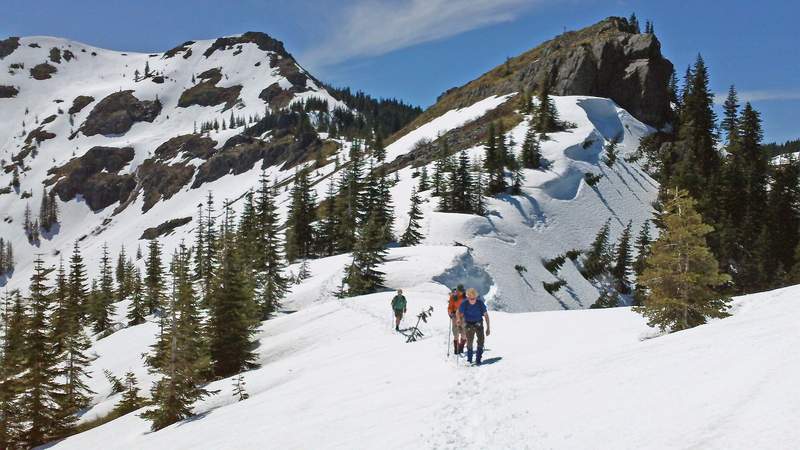
It's beautiful terrain over there, I really need to come there soon! My favorite is a picture with hikers and Silver Star behind them. It's handy info about using garbage bags over shoes for stream crossings, I also planned to try it (for crossing Mill Creek in Ochoco Mtns) so it's good to have somebody tried it before me.