2016 Trips


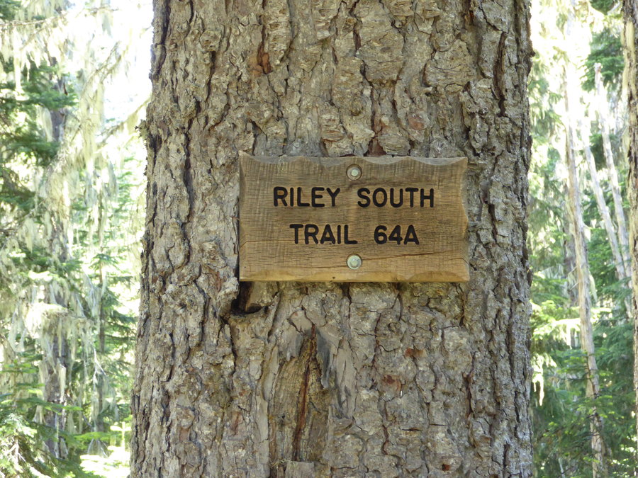
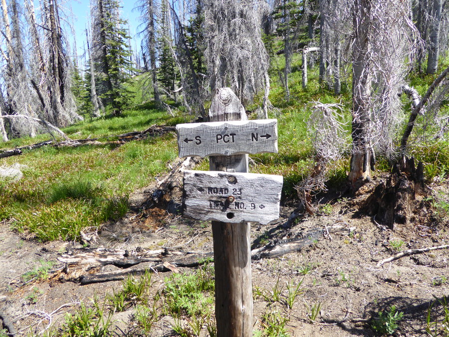
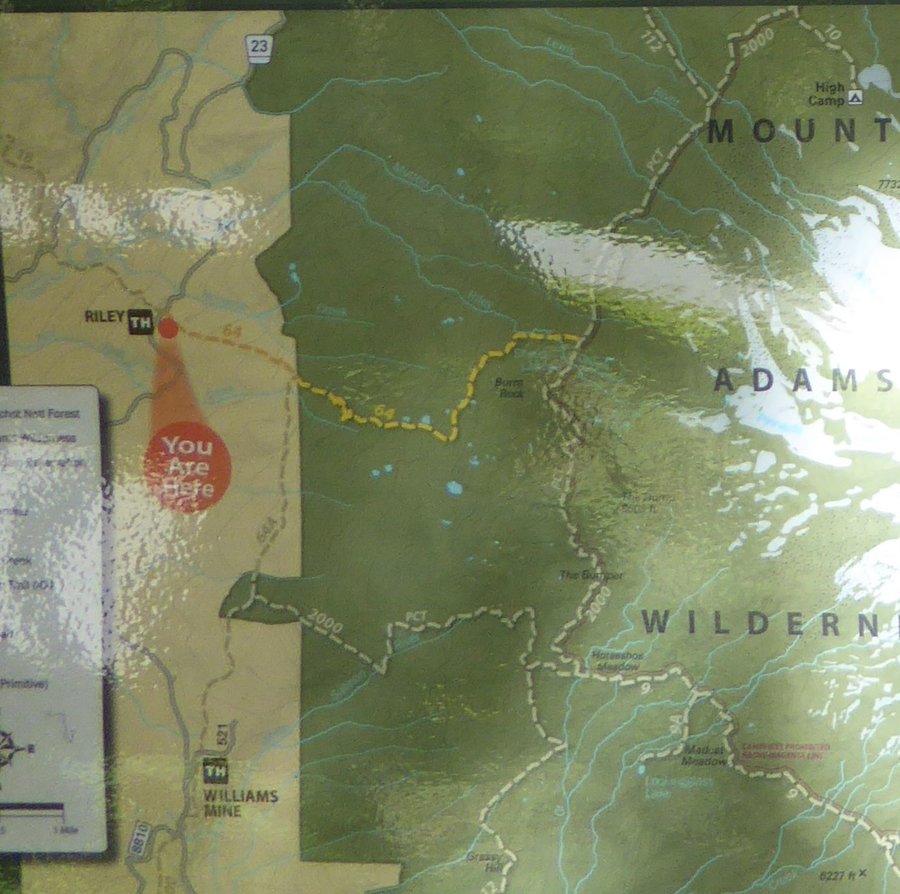
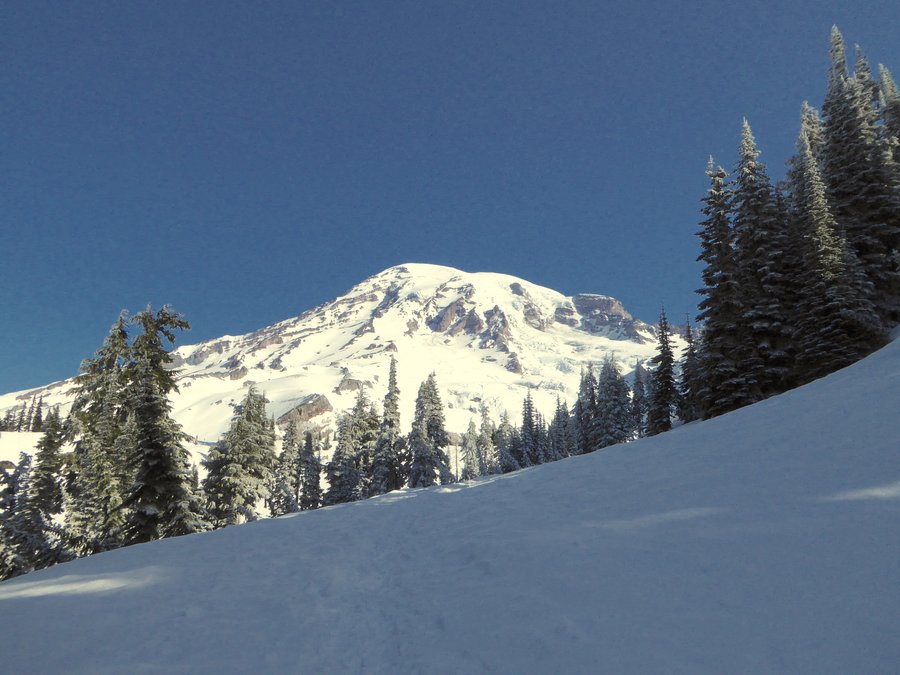
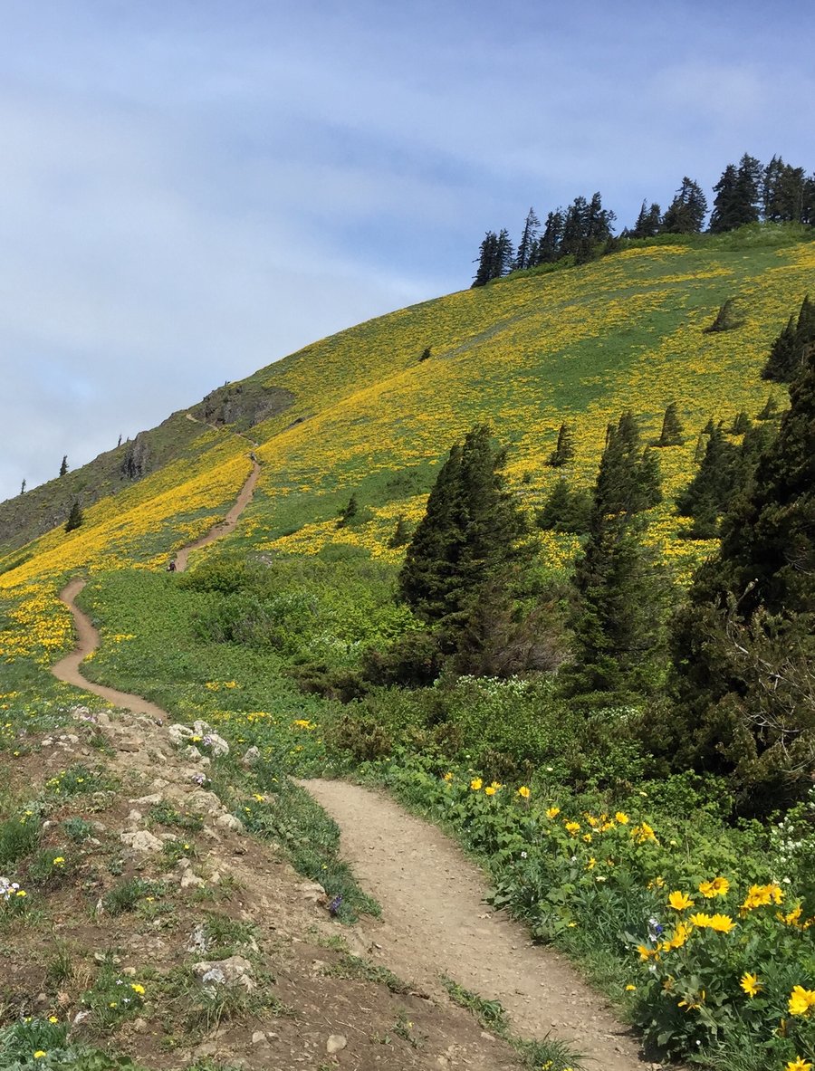
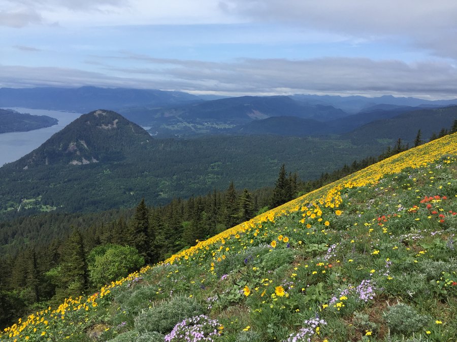
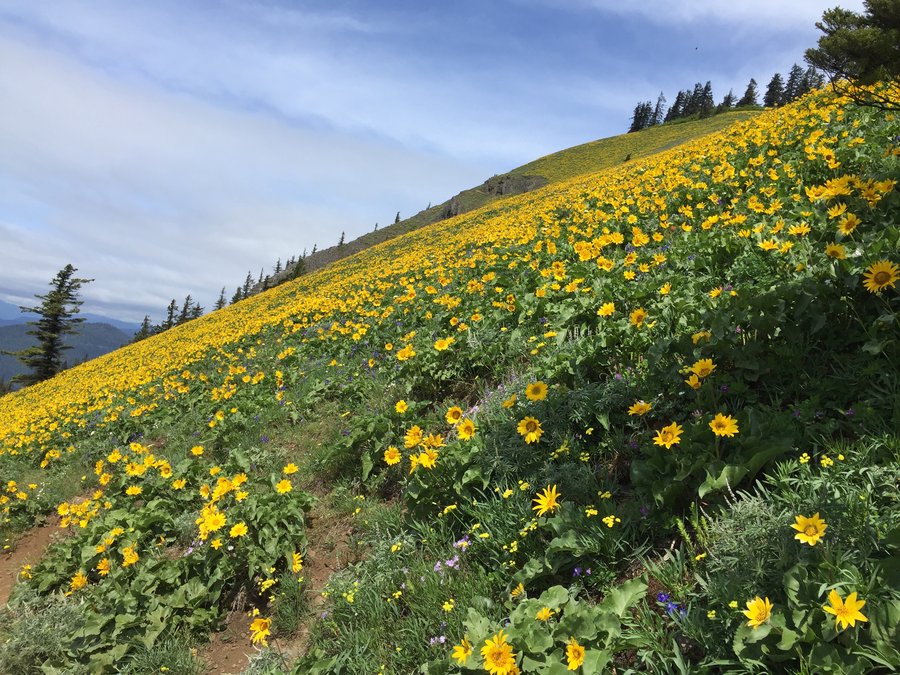
Riley Camp Trail->PCT loop, Mt Adams Wilderness
15 miles of hiking • 3500' elevation gain •
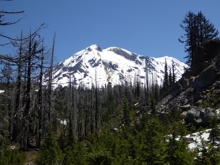
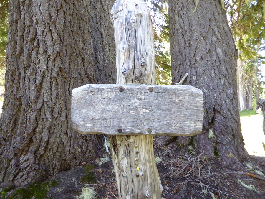
Wide awake at 4am suffering from severe jet lag, I headed to Mt Adams for some trail time. Exploring Riley Camp trail has been on my to do list for awhile and my intention was to do an up and back hike to treeline but instead I ended up doing a longer loop by taking the "Riley Camp cutoff" -- trail 64a -- to the PCT then head north until catching Riley Camp trail (64) again. Mosquitoes werent too bad if I kept moving but were a nuisance whenever I tried to stop. There are still quite a few patches of snow on the PCT but no stretches greater than 75-80 yards.

July 3, 2016

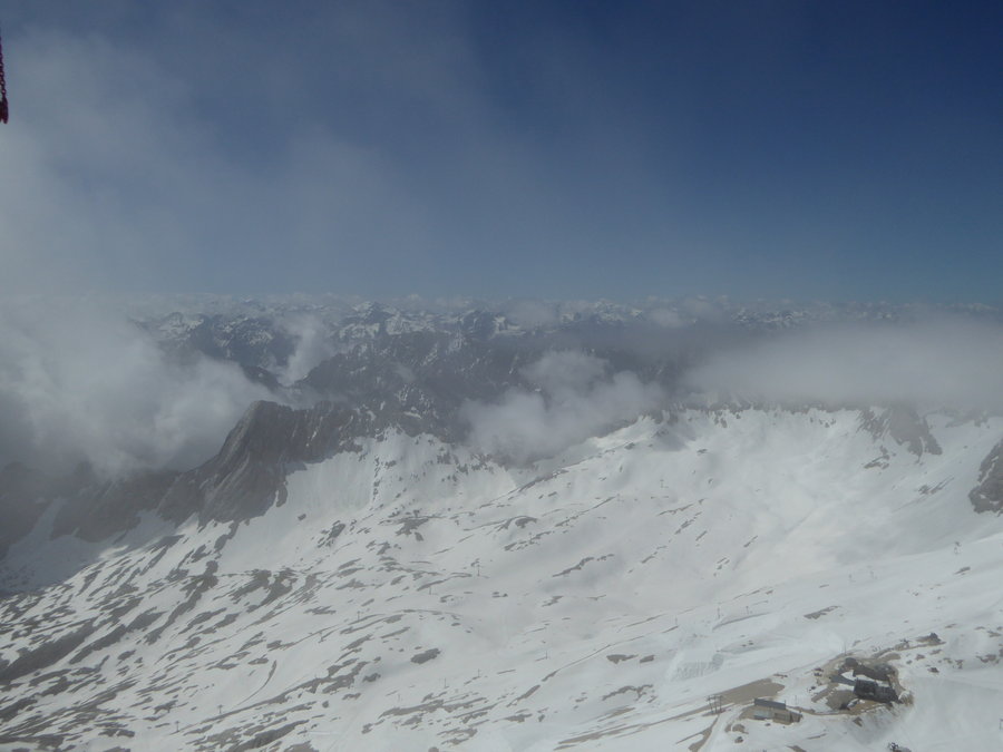
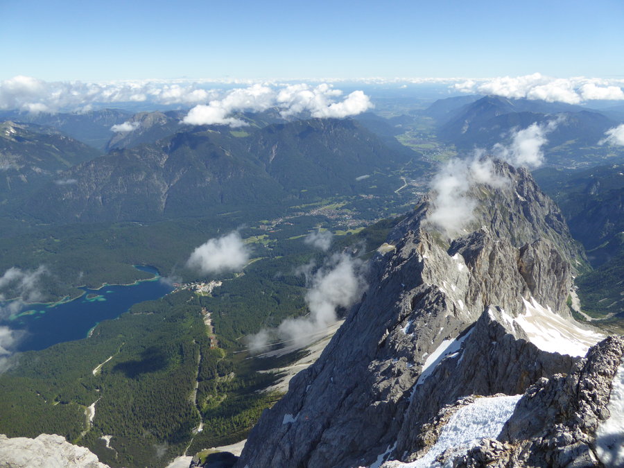
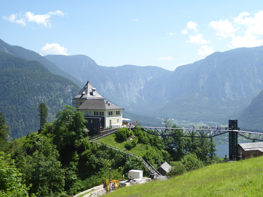
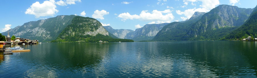
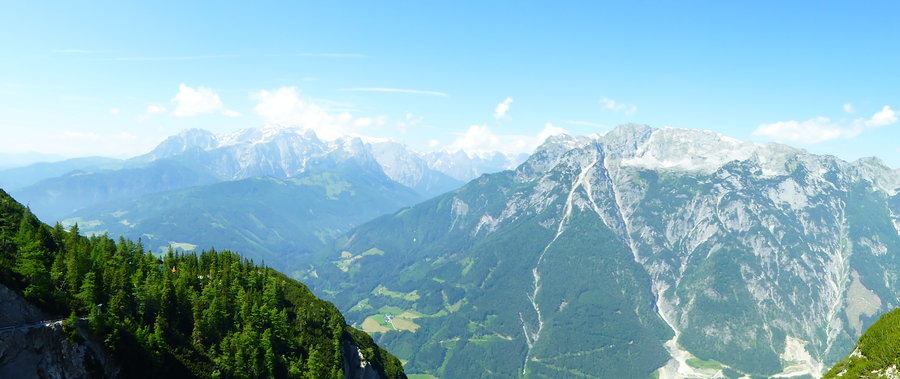
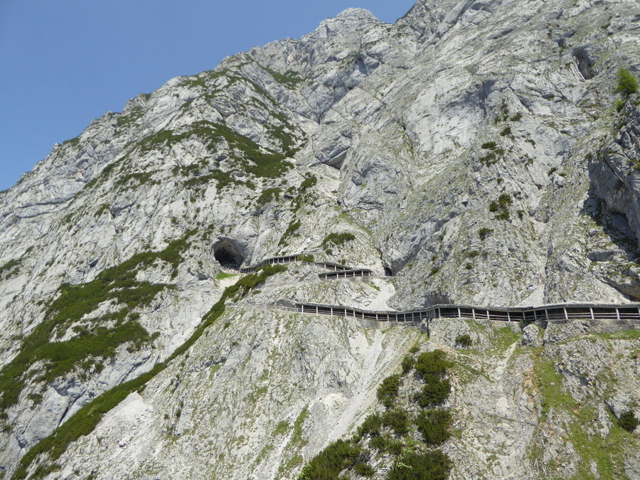
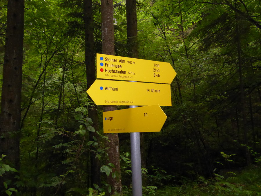
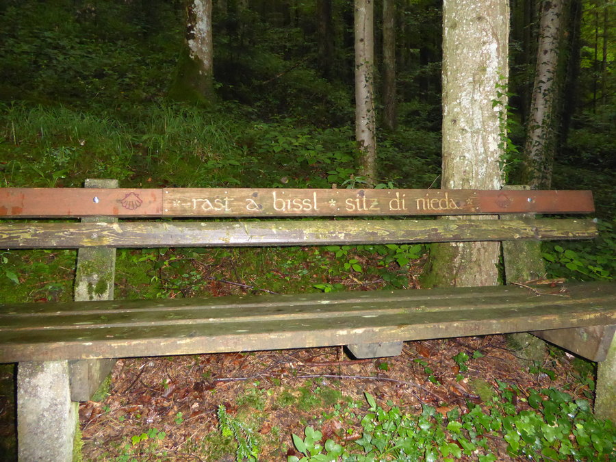
Germany-Austria
10 miles of hiking • 2000' elevation gain •
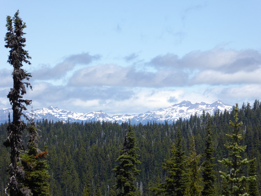
This is more of a compilation of day trips than an actual hiking trip report. We ("the family") spent a couple weeks hitting high spots in Bavaria with several cross border forays into Austria. The Bavarian alps remind me a lot of the north cascades while the Austrian alps go to the next level altogether. I did find it interesting that most hiking signs are marked in time to next destination instead of distance. And, of course, there seems to be a "Biergarten" waiting for you everywhere you go and sometimes along the way as well... http://www.ckemp.com/zugspitze/ I didn't have time to hike the Zugspitze -- or any other longer route but I plan to come back for a "Tiroler" hiking trip in the not too distant future.
June 24, 2016

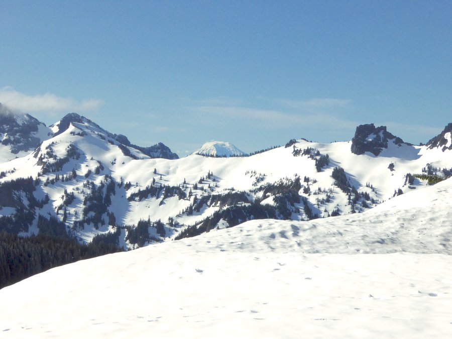
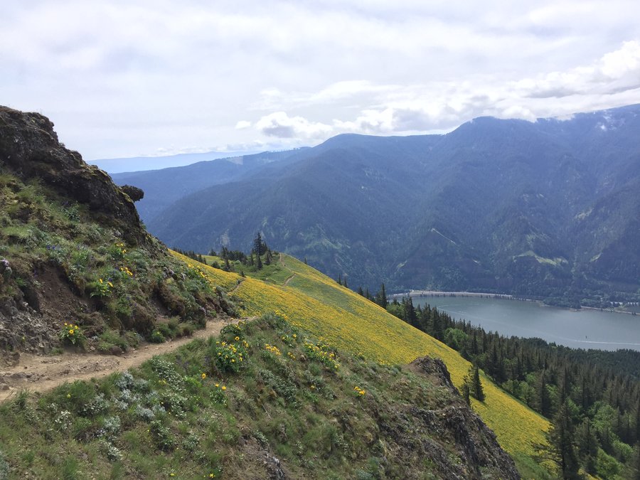
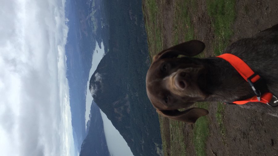
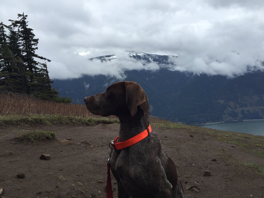
Silver Star via Grouse Vista
7 miles of hiking • 2250' elevation gain •
I needed a nice low key hike to work out the stiff legs from Saturday's Beacon Rock 25k. There's still no finer place in the PNW than Silver Star. Just an awesome place to sit and eat lunch. The views were a little hazy but I could still see as far as North Sister to the south and saddle mountain to the west.
June 6, 2016
 1
1
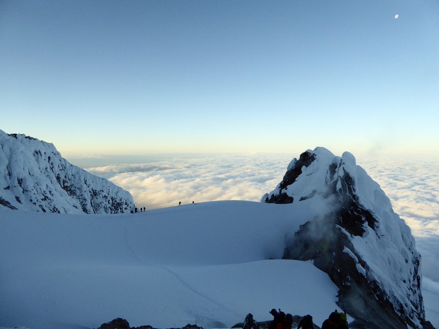
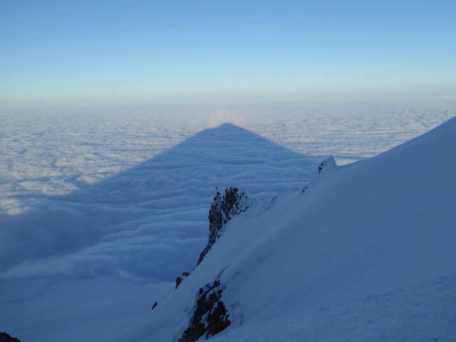
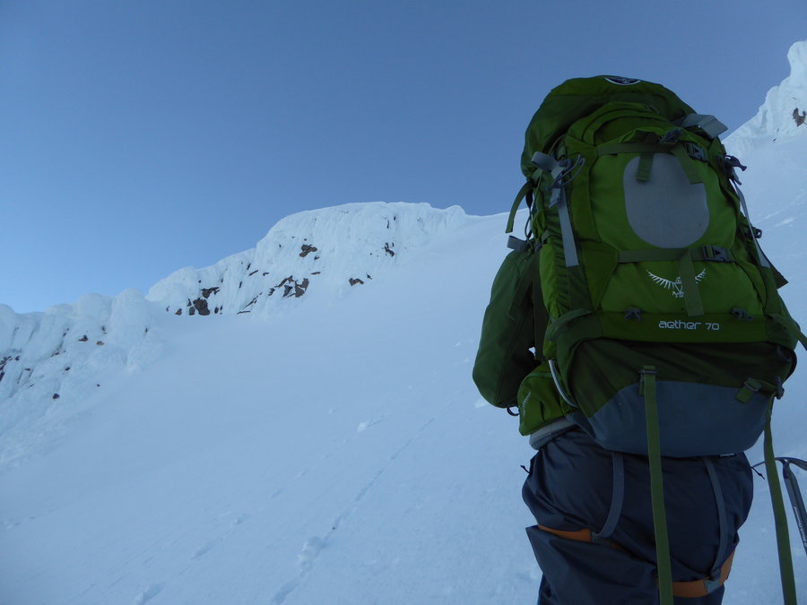
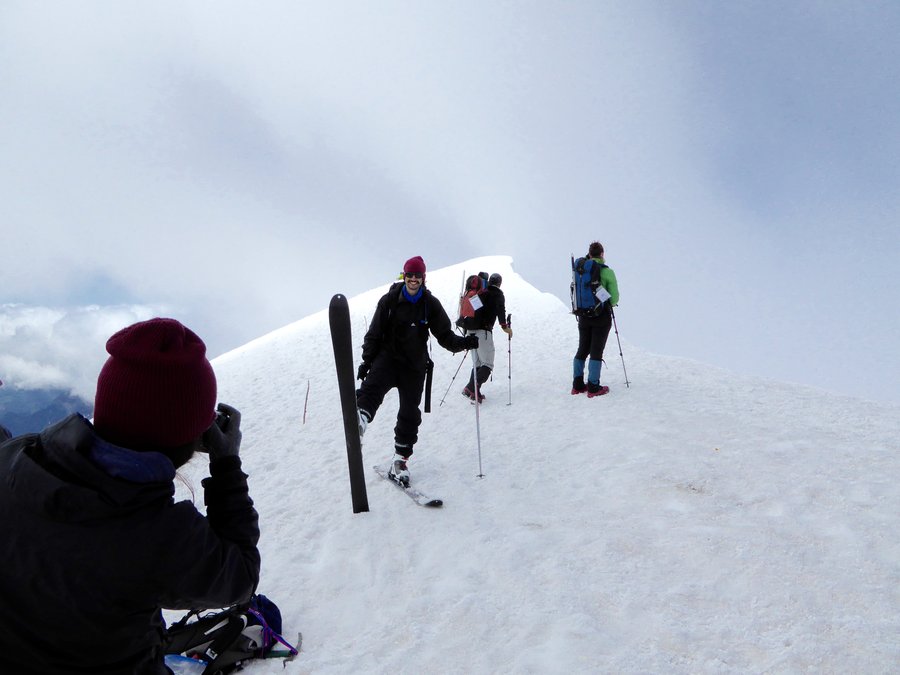
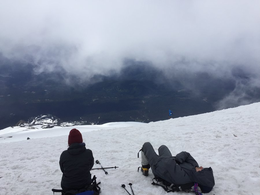
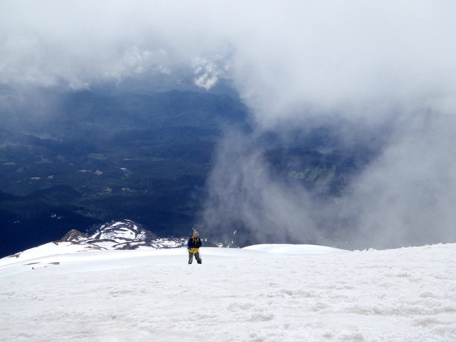
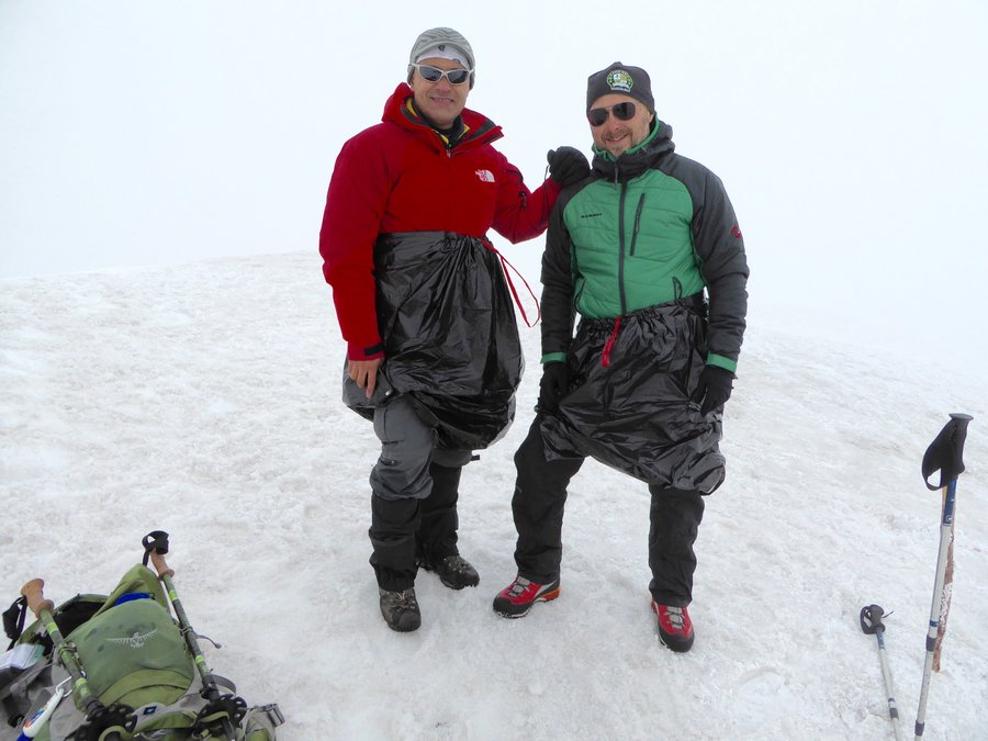
Mt Hood via old chute
4.5 miles of hiking • 3000' elevation gain •
First summit, second attempt. After a cold, windy night in the parking lot, we set out around 2am for the summit. The cloud level remained near the 6000' level the entire time which left the sky clear albeit in the low 20's by the time we reached the hogsback. We ended up taking the old chute route thru the 1 O'clock couloir. 50' or so from the top my iPhone slipped out of my pocket and bounced 800' below into the Hot Rocks fumarole where it remains. It's a little unnerving when you realize the fall line takes you directly into a giant pit of poison gas. Gulp. Pretty cool all in all.
May 25, 2016


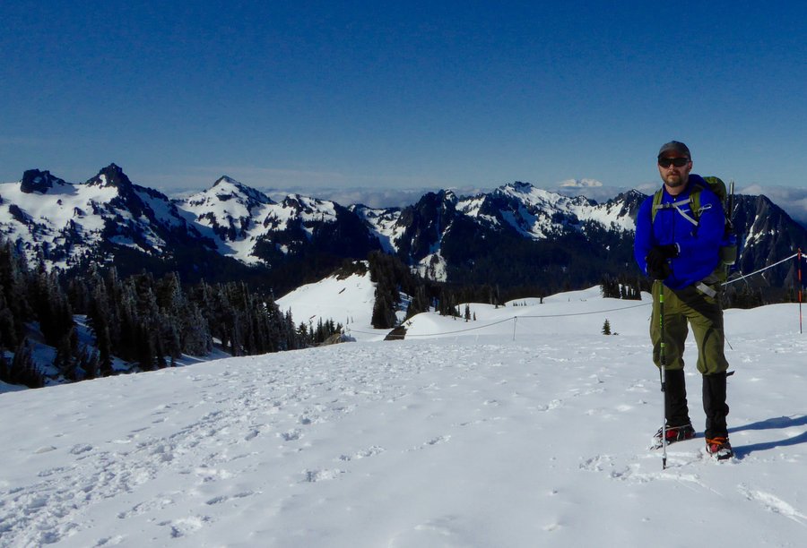
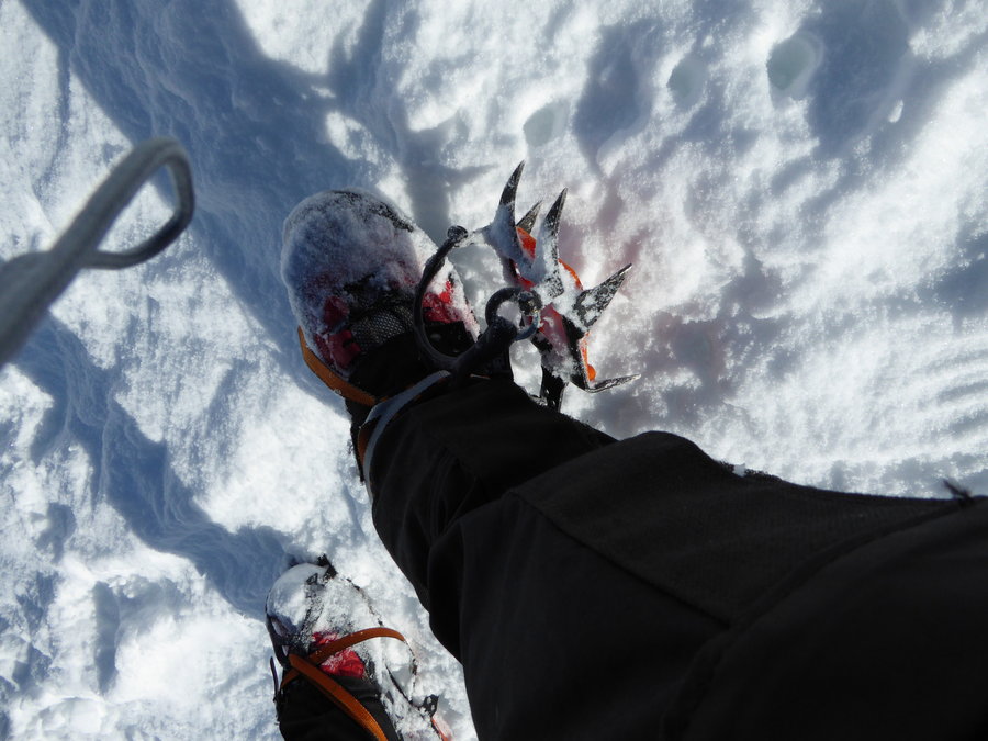
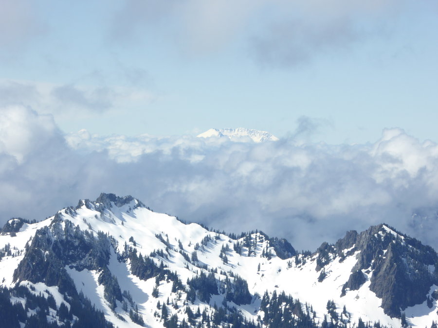
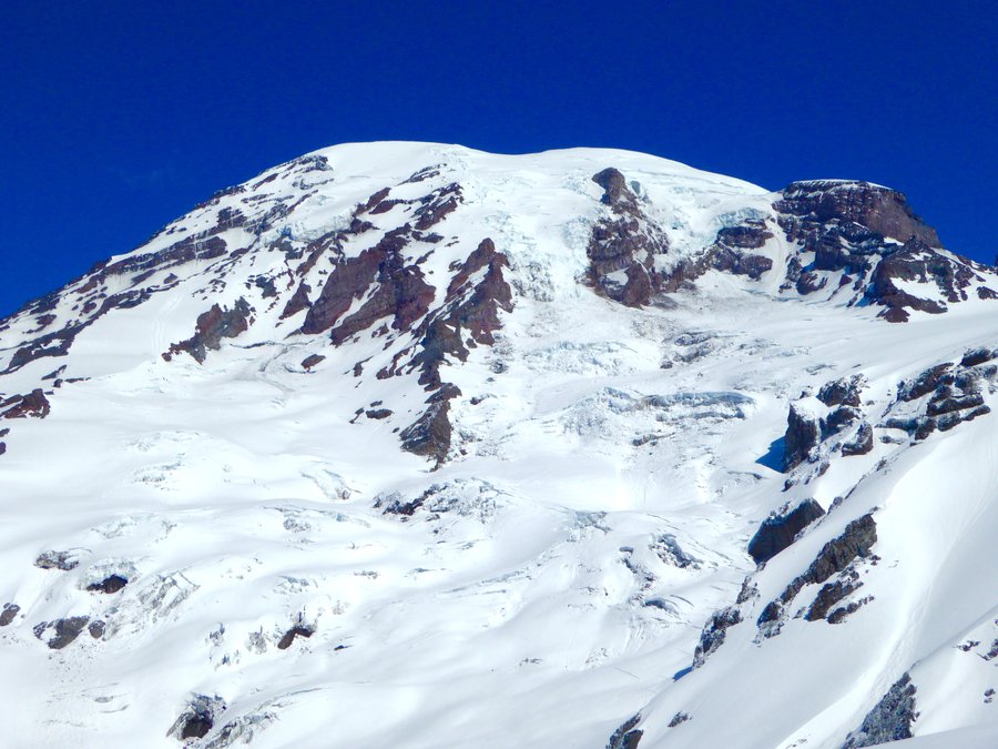
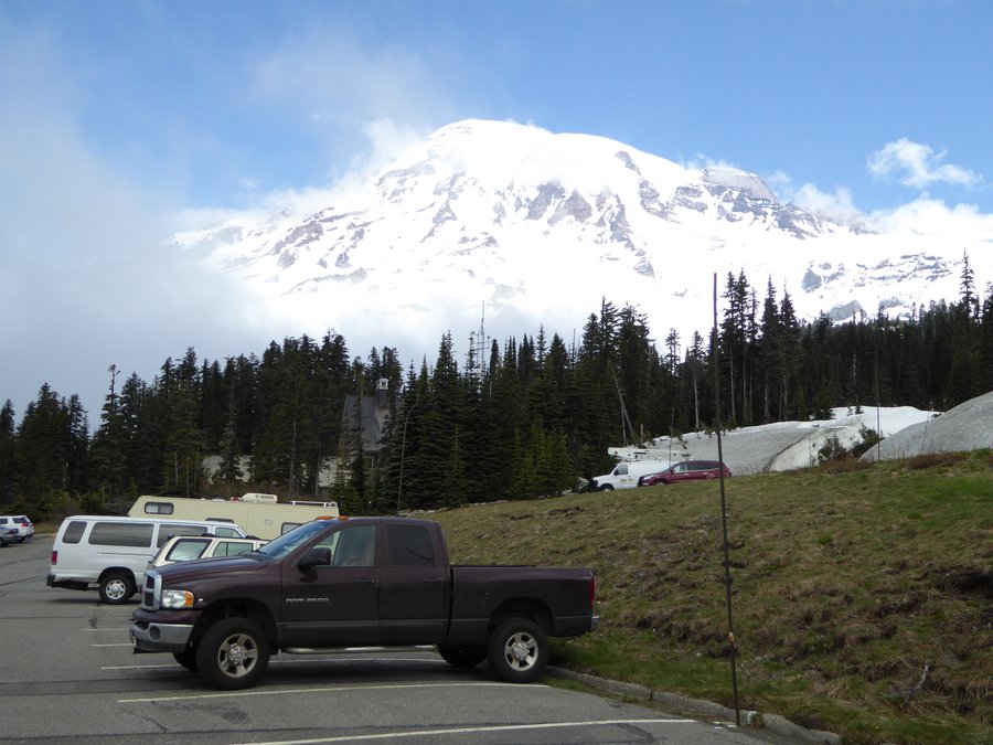
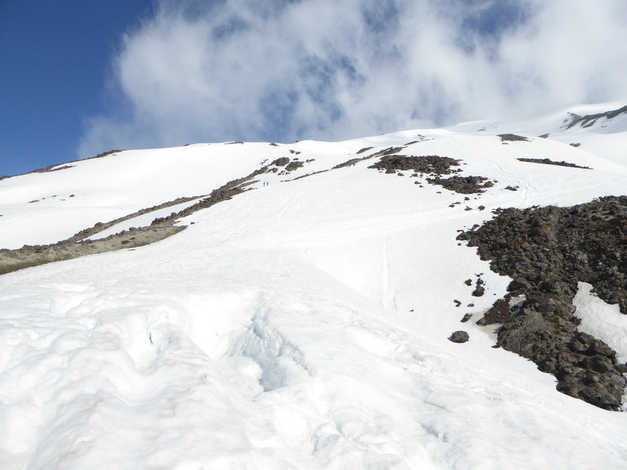
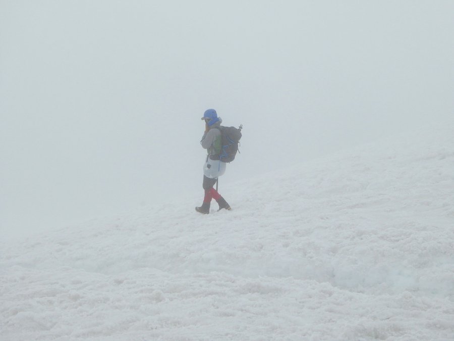
Camp Muir, crampon fail
4.5 miles of hiking • 2000' elevation gain •
Despite the gloomy weather report, the skies were blue at paradise...should have been a great morning at the summit for those who went to the top. My plan was a "quick" up and back to Camp Muir but shortly past panoramic point I had a major crampon blow out. I'd had problems with it on MSH last week but thought it was fixed. Off to REI...
May 20, 2016


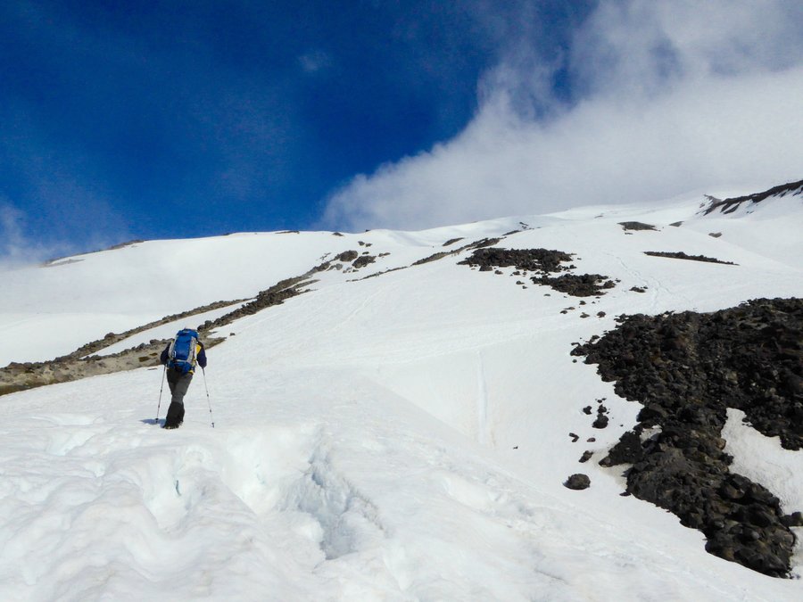
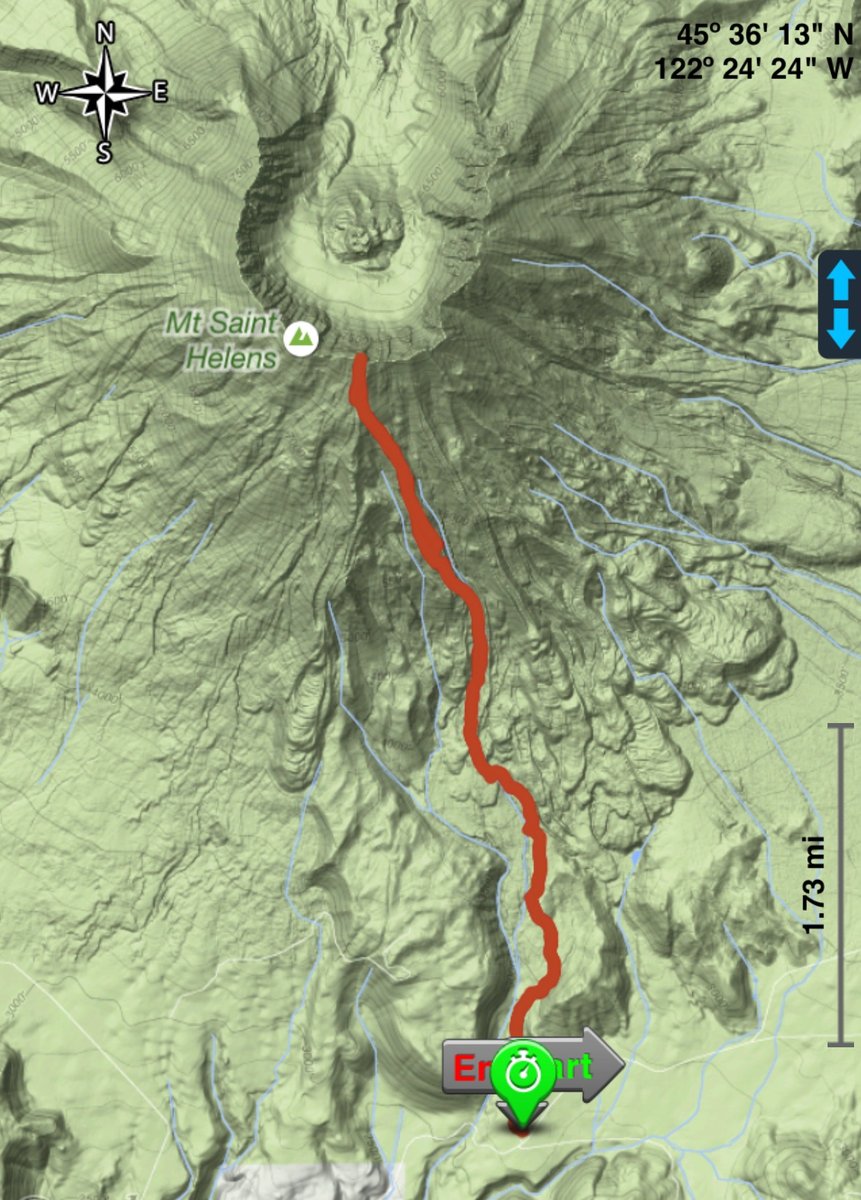
MSH via worm flows
10 miles of hiking • 5750' elevation gain •
Managed to squeeze in a trip before the snowpack completely disappeared. Windy, mostly cloudy with no views of Adams or Hood but tons of fun glissading.
May 9, 2016


 1
1
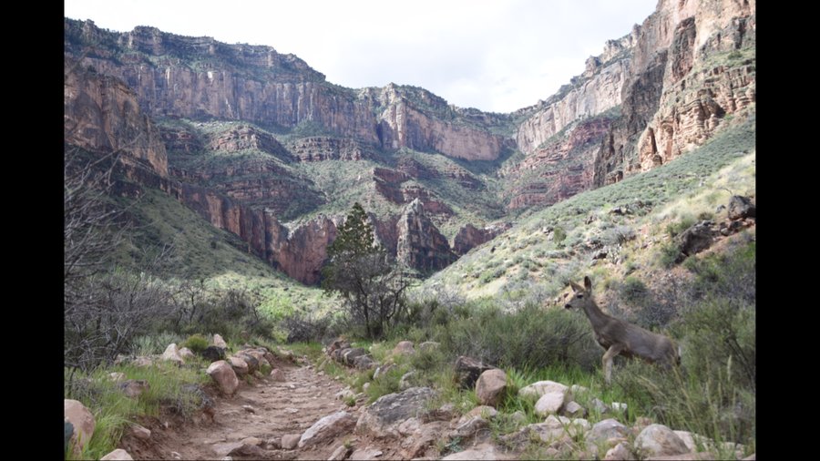
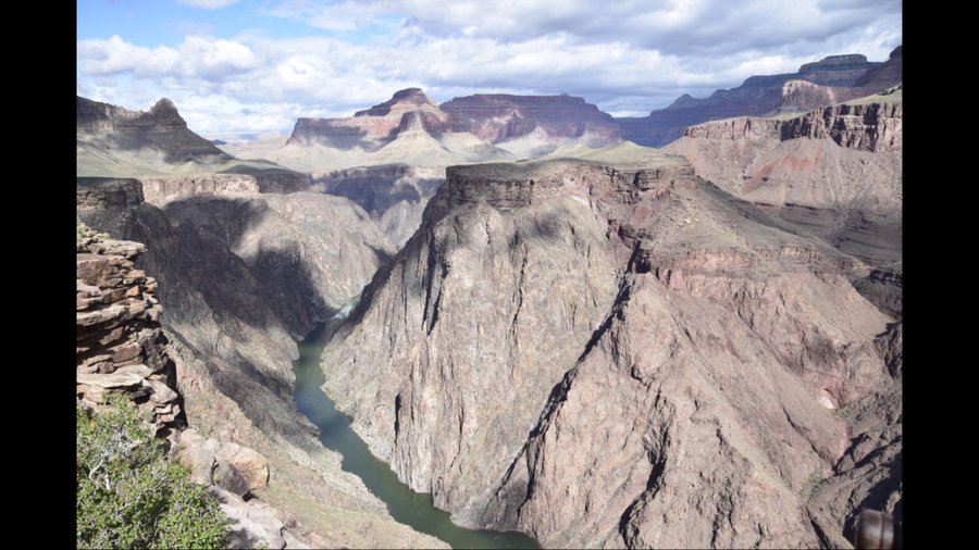
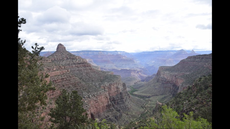
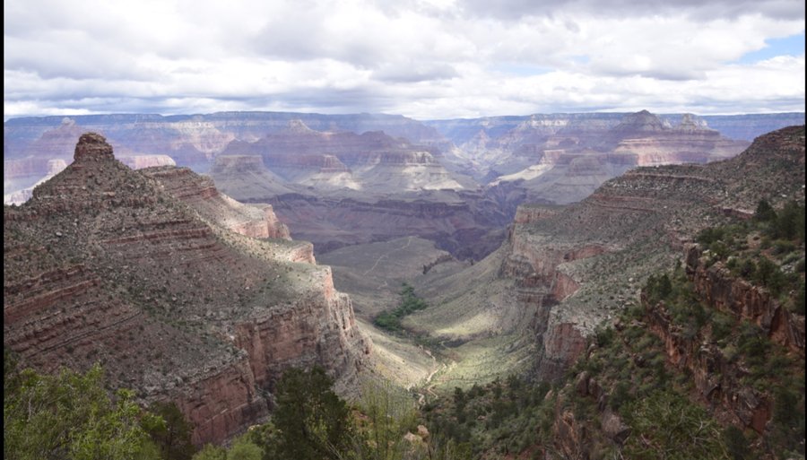
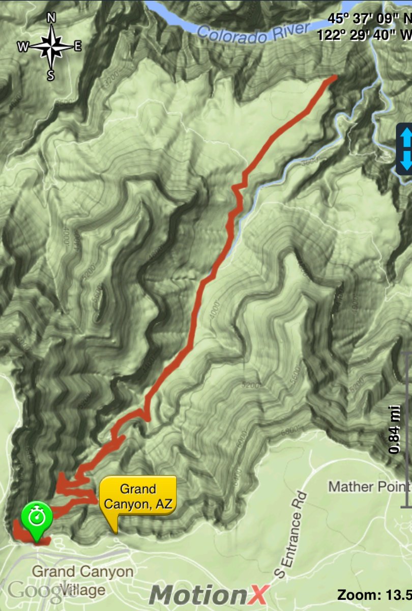
Bright Angel trail to plateau point (and back)
12.5 miles of hiking • 3250' elevation gain •
Not a better way to spend 5 hours of your life.
April 9, 2016


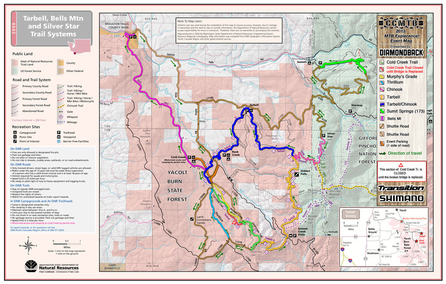
Yacolt Burn bushwack
4 miles of hiking • 500' elevation gain •
Some logging road hiking and rough bushwacking with Henry.
March 1, 2016

Tinker Cliffs via Andy Layne trail
6.5 miles of hiking • 1750' elevation gain •
One of my favorite former day hikes.
February 28, 2016

February 27, 2016
 1
1
AT east from Troutville, Va (short out and back)
6 miles of hiking • 1500' elevation gain •
February 26, 2016

AT to Hay Rock overlook, Daleville, Va
5 miles of hiking • 1250' elevation gain •
Spent some time in Roanoke, Va and managed a few hikes down memory lane in the process.
February 25, 2016
 1
1
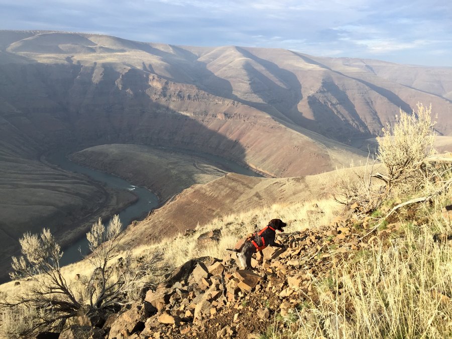
Klickitat trail, from Lyle up and back
4.5 miles of hiking • 250' elevation gain •
Halfway thru an afternoon chasing Chukars, Henry decided to explore the Deschutes Canyon below Macks Canyon by himself and spent a cold night on his own until I could come back the next morning to look for him. The old hunters trick of leaving a piece of clothing in the area worked like a charm as he was laying there at 10am covered in frost sleeping on my old jacket. Anyhow, we took the long way home and couldn't resist a short leg stretcher up the Klickitat trail and back.
February 1, 2016

Tarbell trail, Larch mtn
5.5 miles of hiking • 1250' elevation gain •
Windy with knee deep snow at the top.
January 1, 2016