2015 Trips


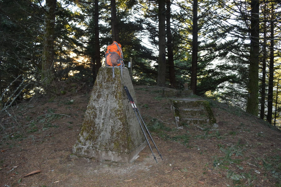
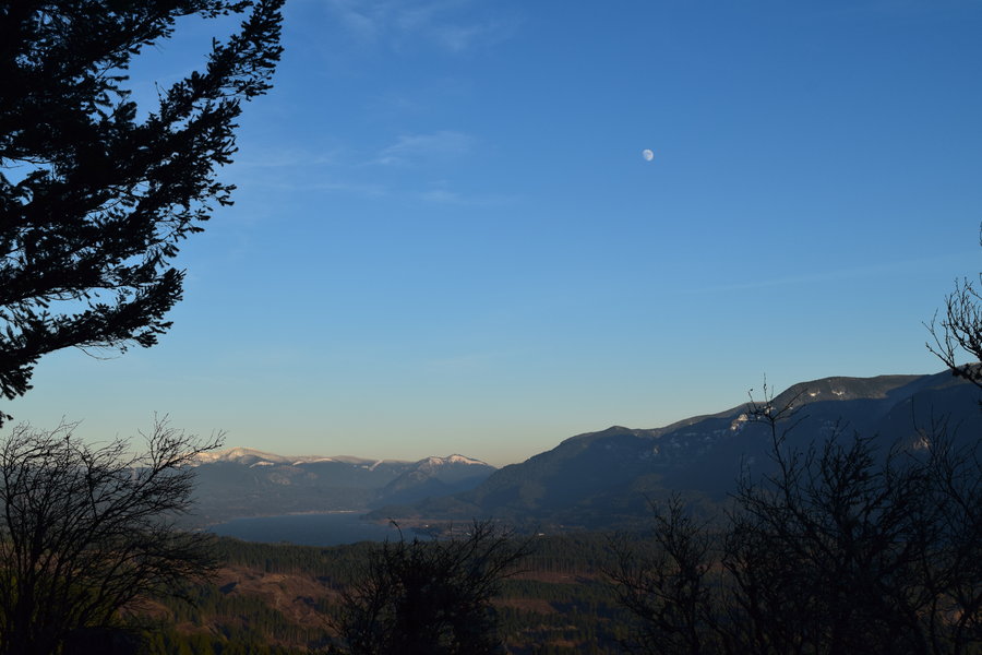
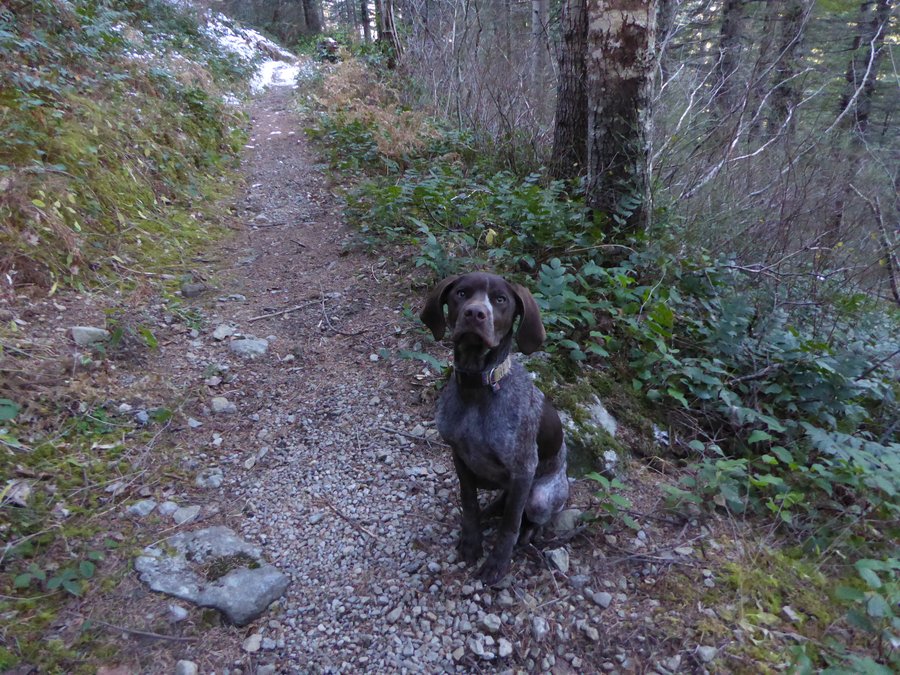
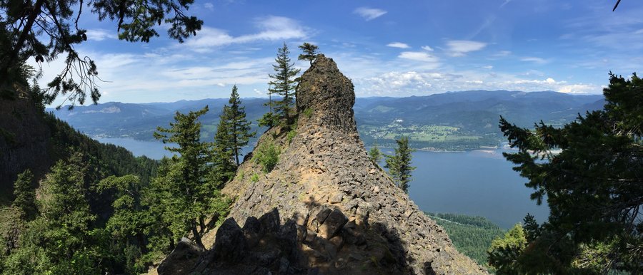
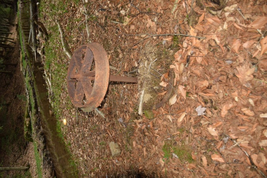
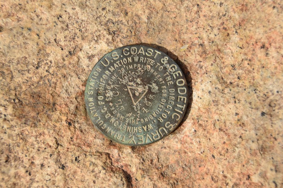
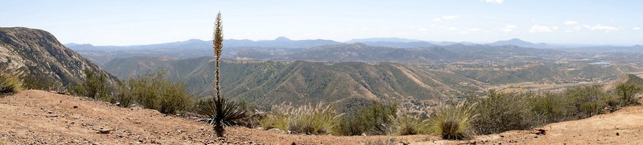
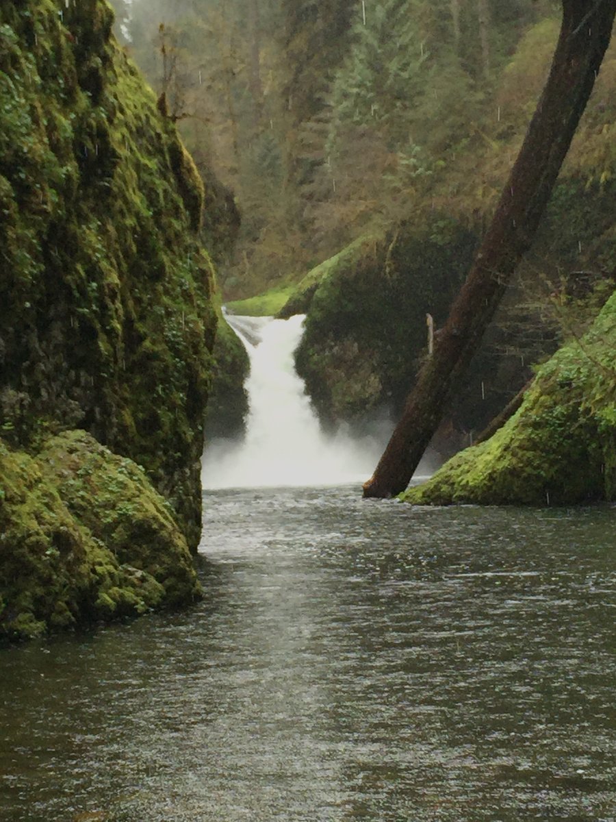
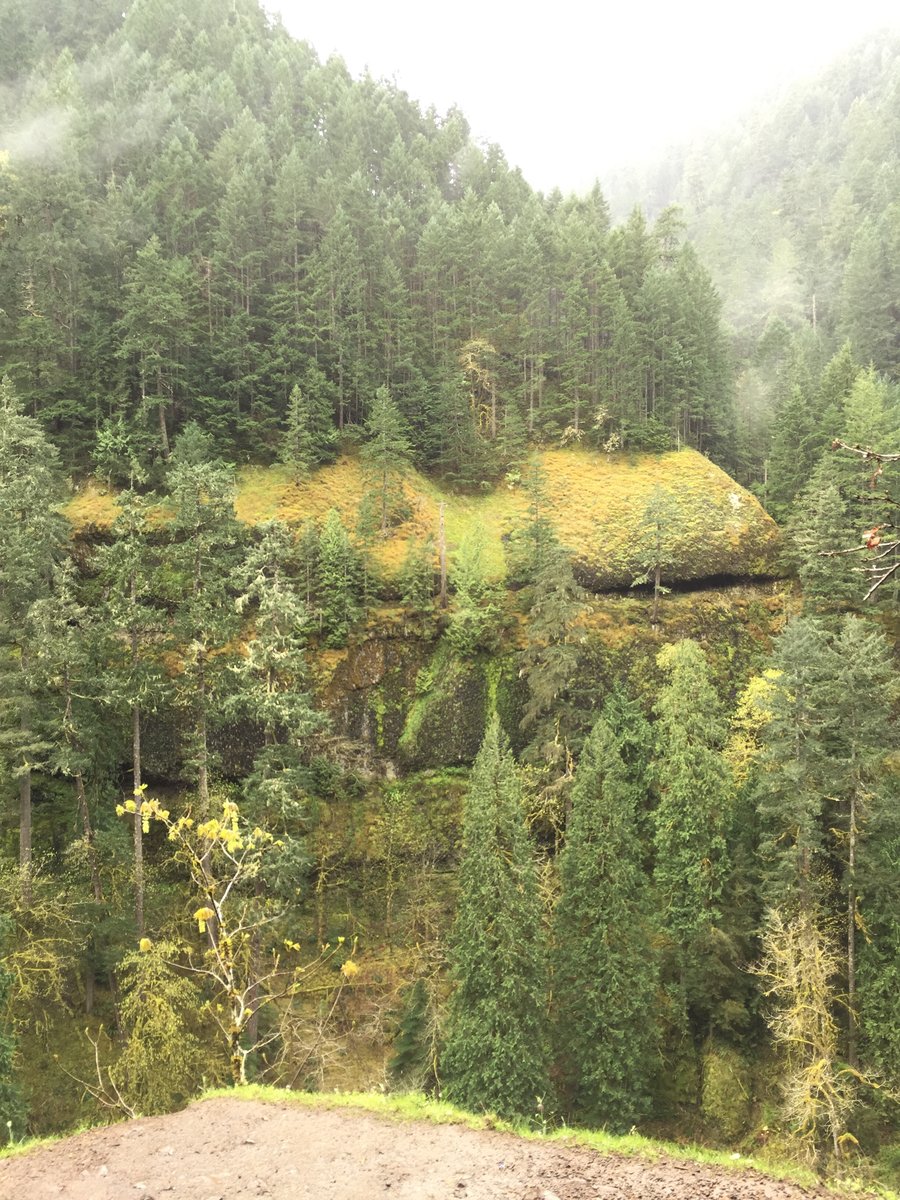
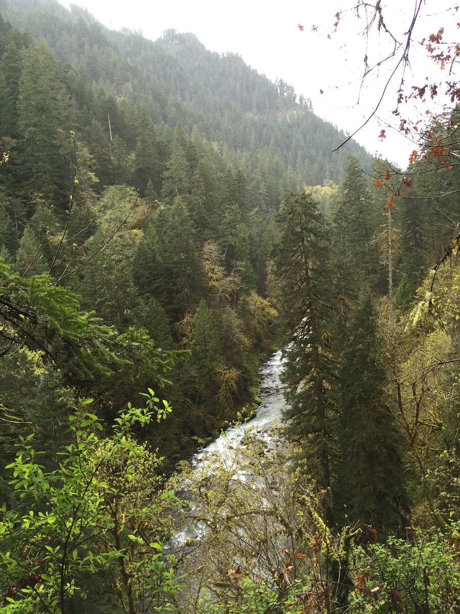
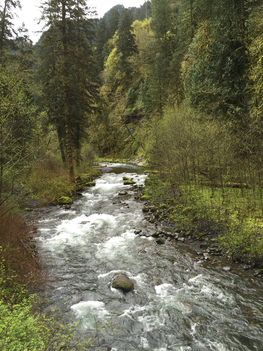
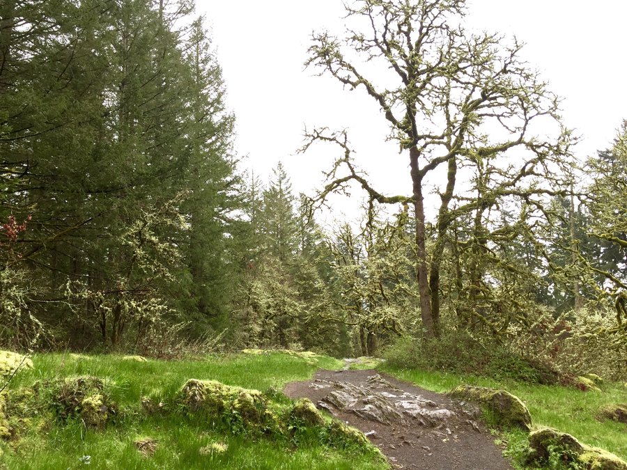
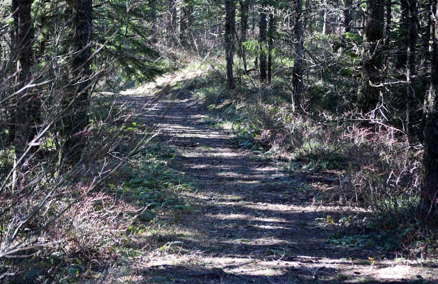
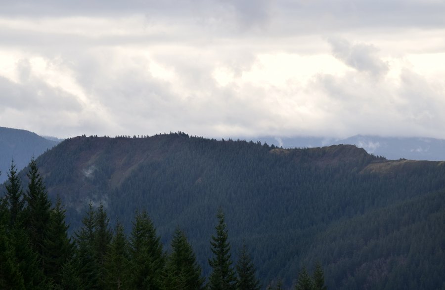
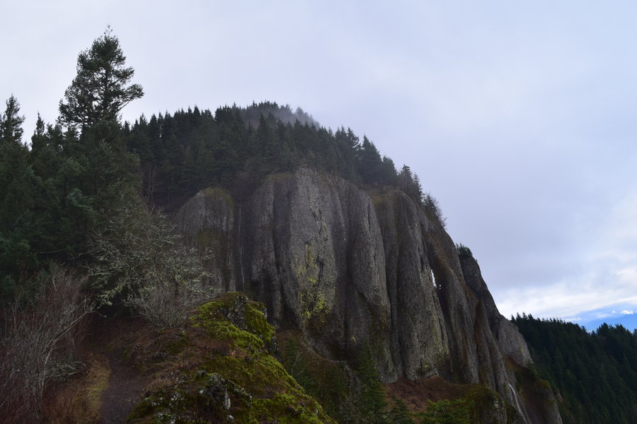
Sturgeon Rock
7 miles of hiking • 1500' elevation gain •
Took Henry, my 5 month old German shorthair pup, out for his maiden hike. 'Twas great fun.

November 27, 2015

 2
2
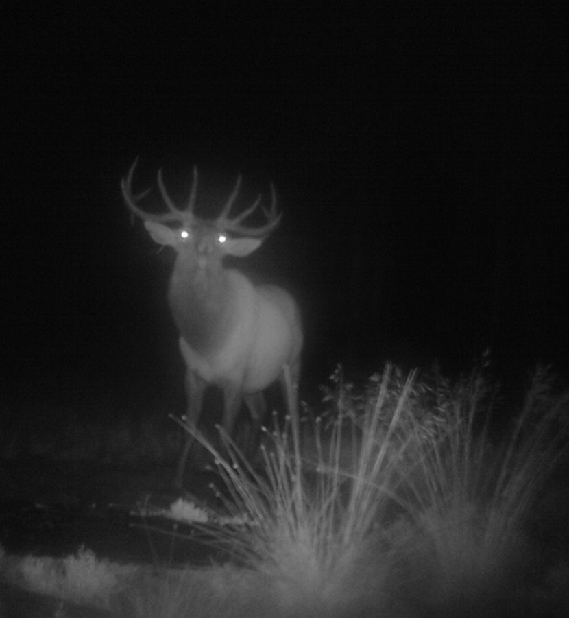
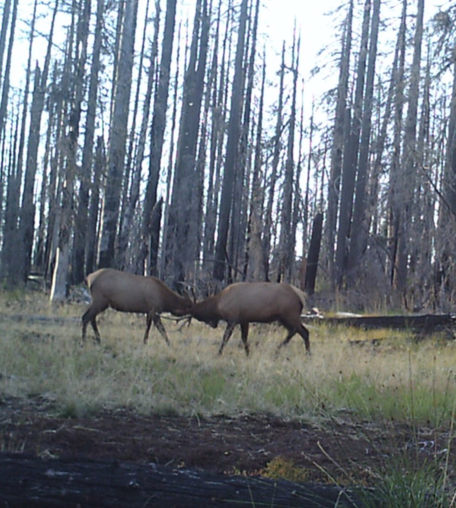
Wilderness exploration, somewhere in central Oregon
16 miles of hiking • 2500' elevation gain • 2 nights
"Central Oregon" wilderness exploring -- mostly off trail. Very hot. Small lakes. Bull elk annoyed with my choice of tent sites.
September 9 – September 11, 2015

August 31, 2015


Red Lake trail
9 miles of hiking • 2500' elevation gain •
Finally managed to get away for some hiking. I decided to visit some off trail lakes above Red and Averill lakes. Several of these lakes hold (held) small populations of trout left over from a previous aerial stocking program. It seems there is no natural reproduction from the efforts and the few remaining trout have disappeared due to the warm water temps this year. I didn't see any fish in the places where I have seen them before. Bummer. Few berries and very little wildlife sign as well. Pretty dry all in all.
August 3, 2015

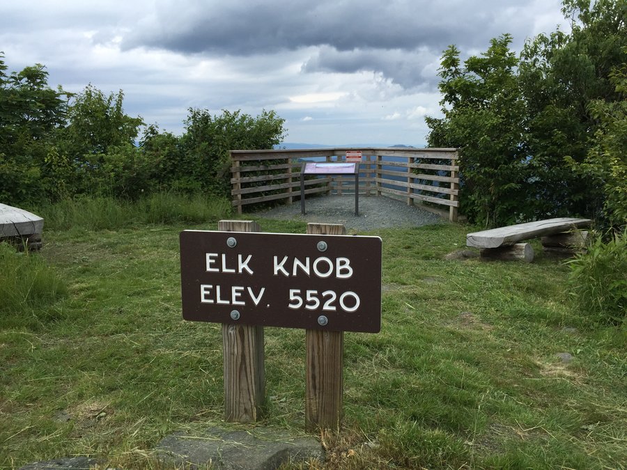
Elk Knob State Park (NC)
4 miles of hiking • 1000' elevation gain •
Quick 2 hour outing followed by a nice reward.
June 29, 2015

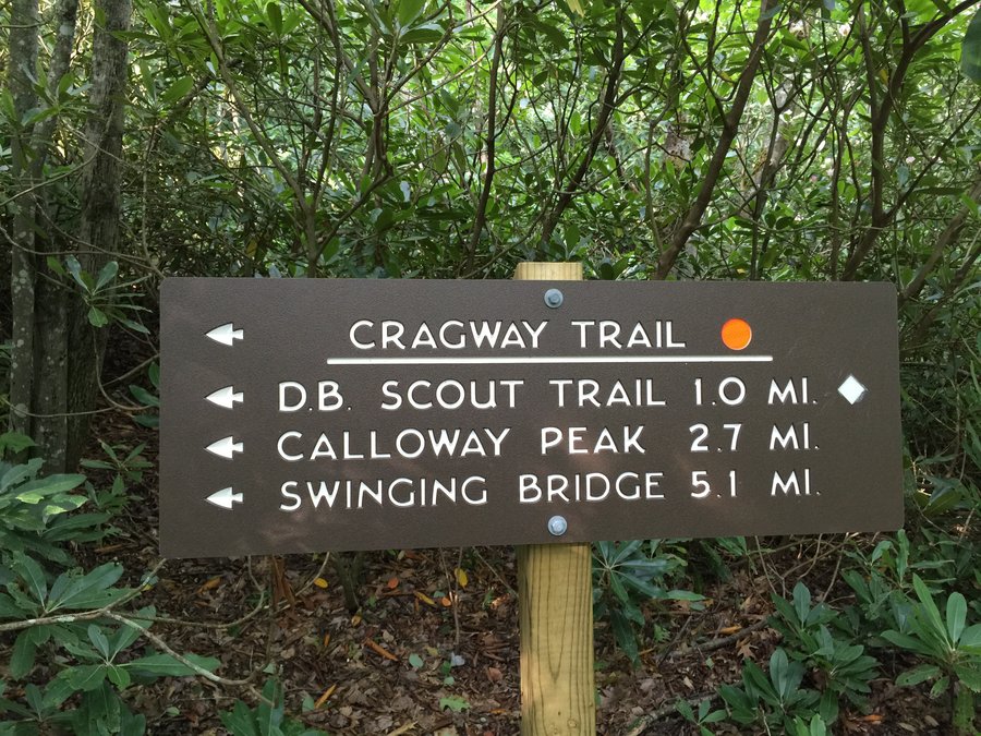
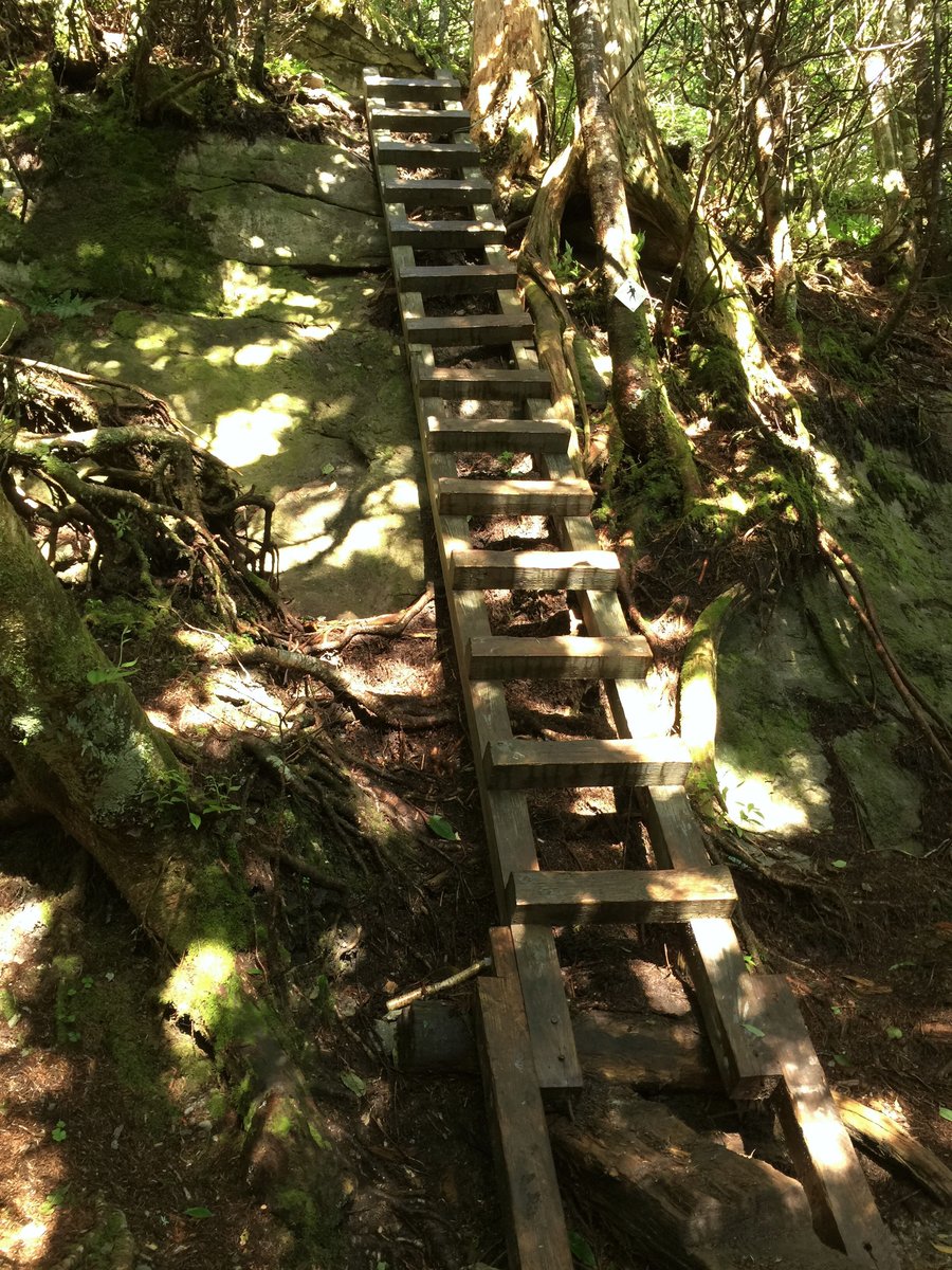
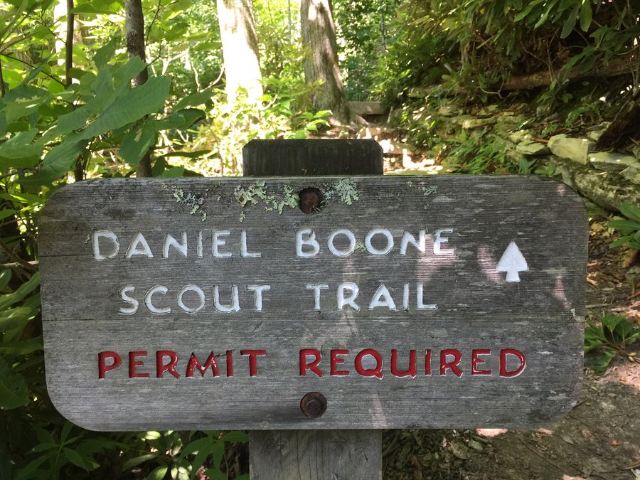
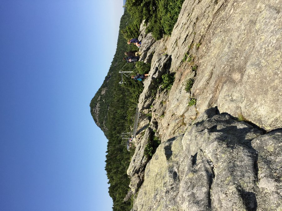
Grandfather Mtn (Calloway peak/McCrae peak)
8 miles of hiking • 2750' elevation gain •
Snuck out for a nice hike while on vacation back east. I'd almost forgot how much I enjoy hiking the Blue Ridge mountains. The flora diversity is amazing and nothing smells quite like a deciduous forest. Plus, at 50F, it was a nice relief after 95+ at the Outerbanks the previous week. Not that I'm complaining about warm weather at the beach...
June 28, 2015

Mt Jefferson summit stroll with the family
1.5 miles of hiking • 500' elevation gain •
If only the "other" Mt Jefferson was so easy. This one has a road to the top and sits in the Blue Ridge Mtns of NC.
June 26, 2015
 2
2
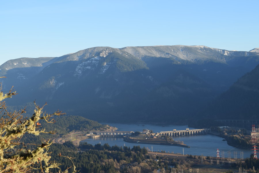
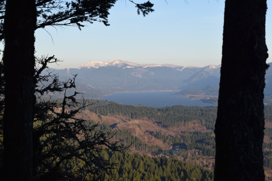
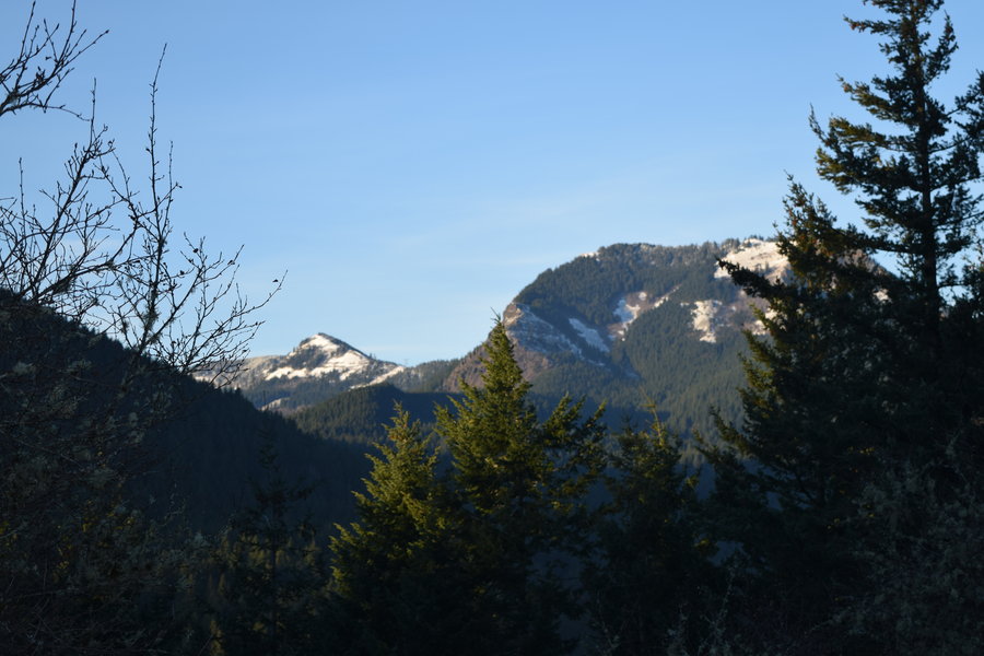
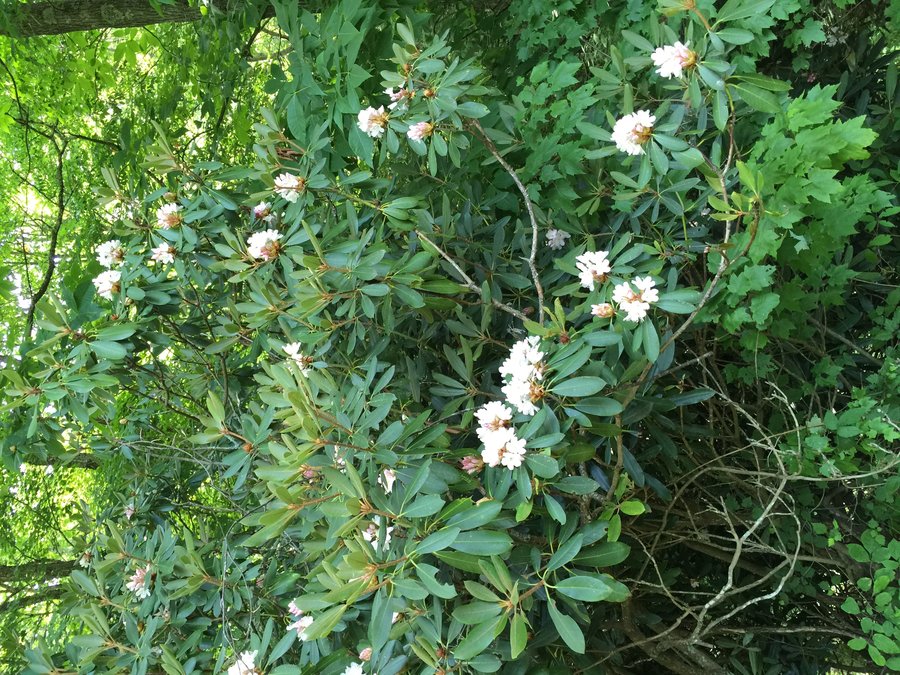
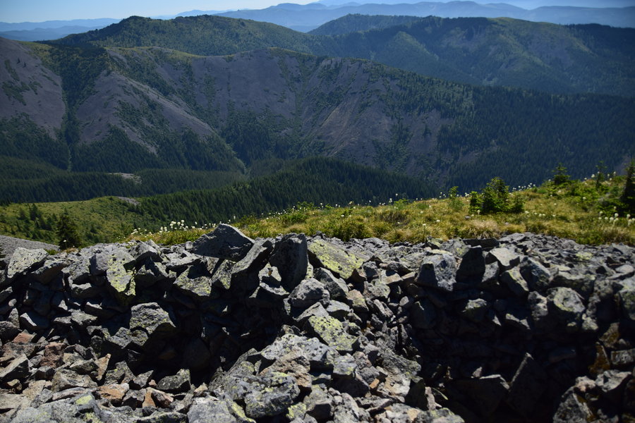
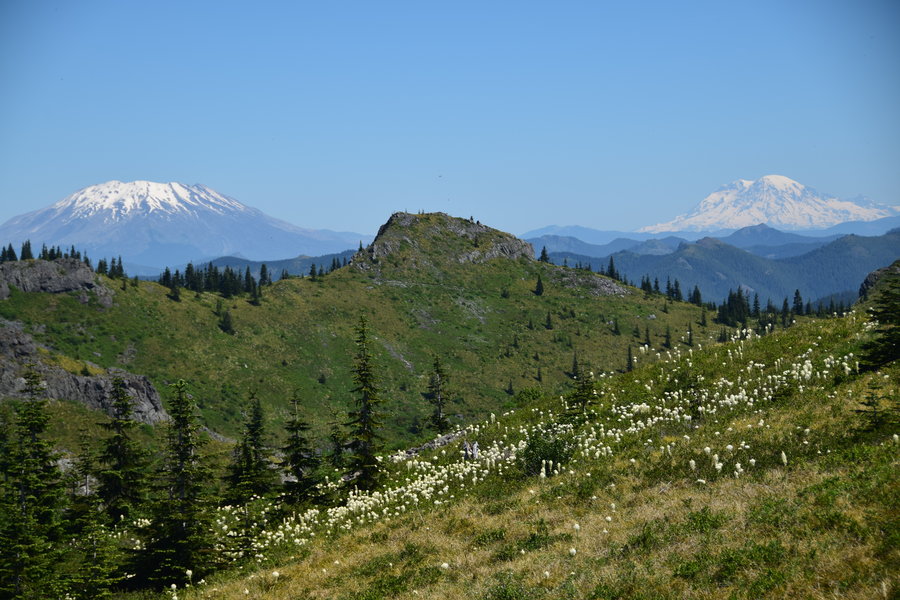
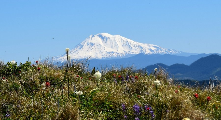
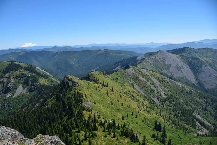
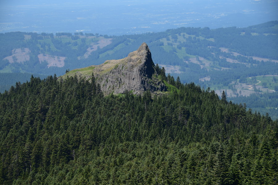
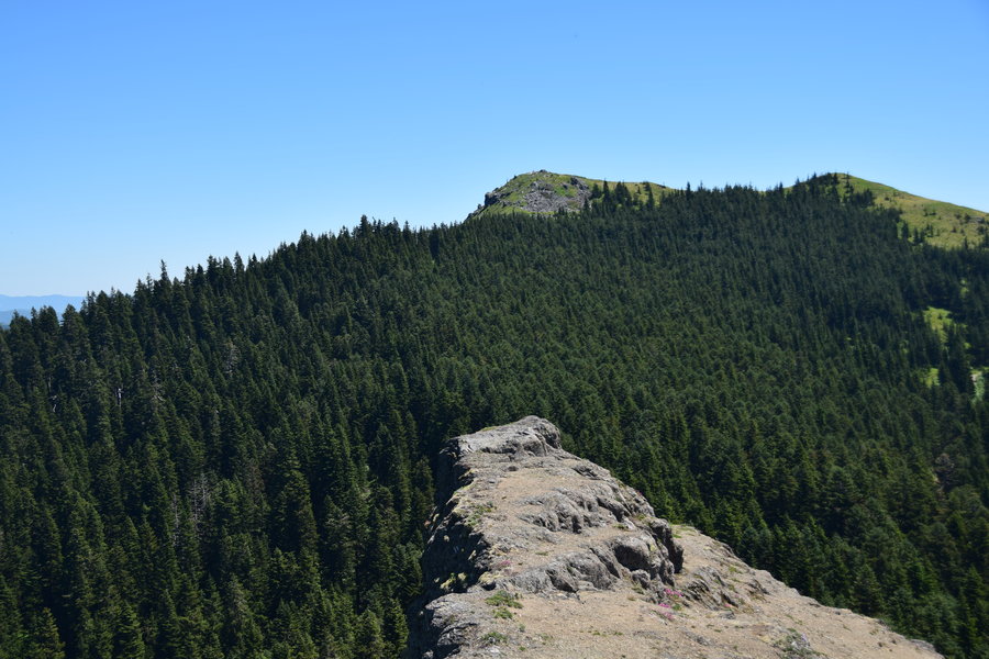
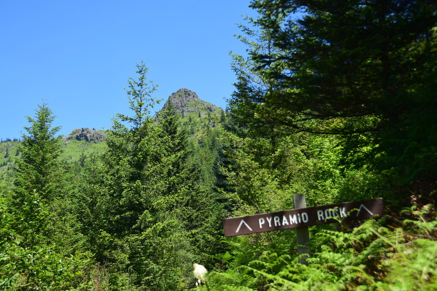
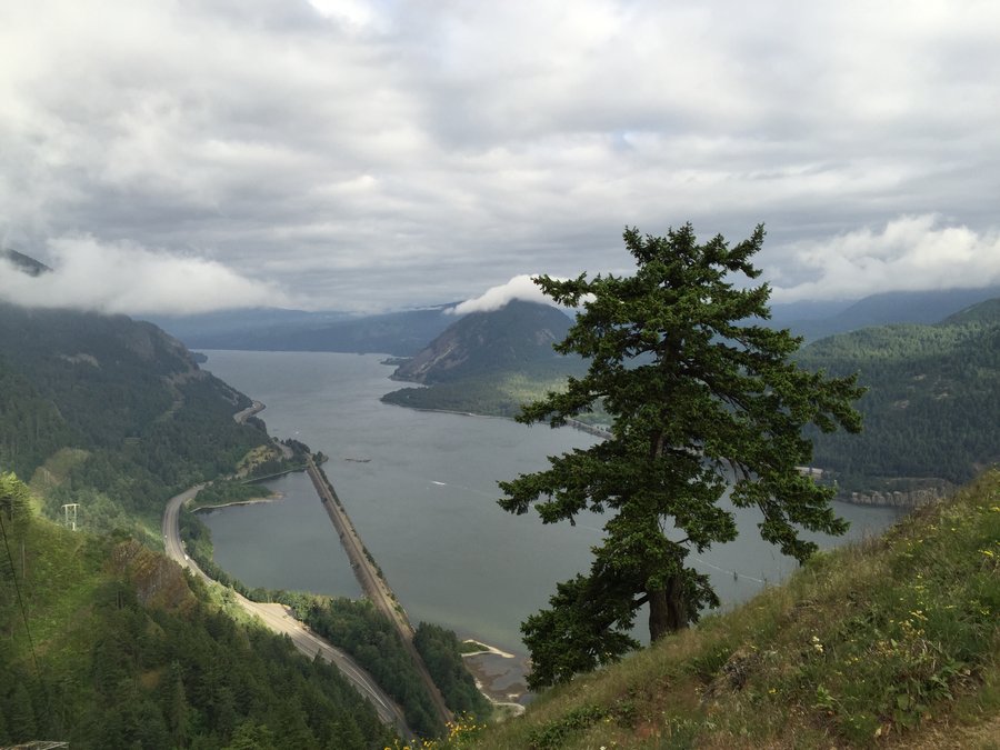
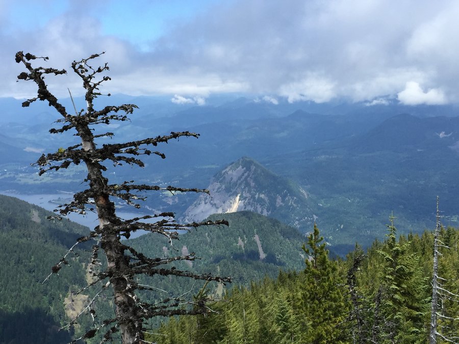
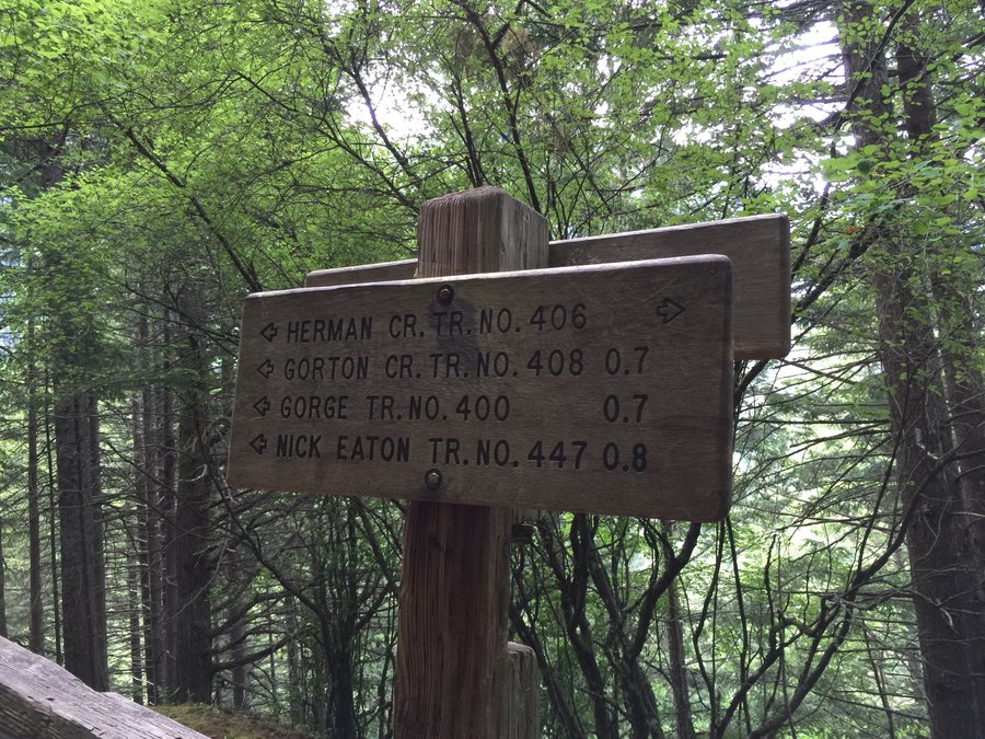
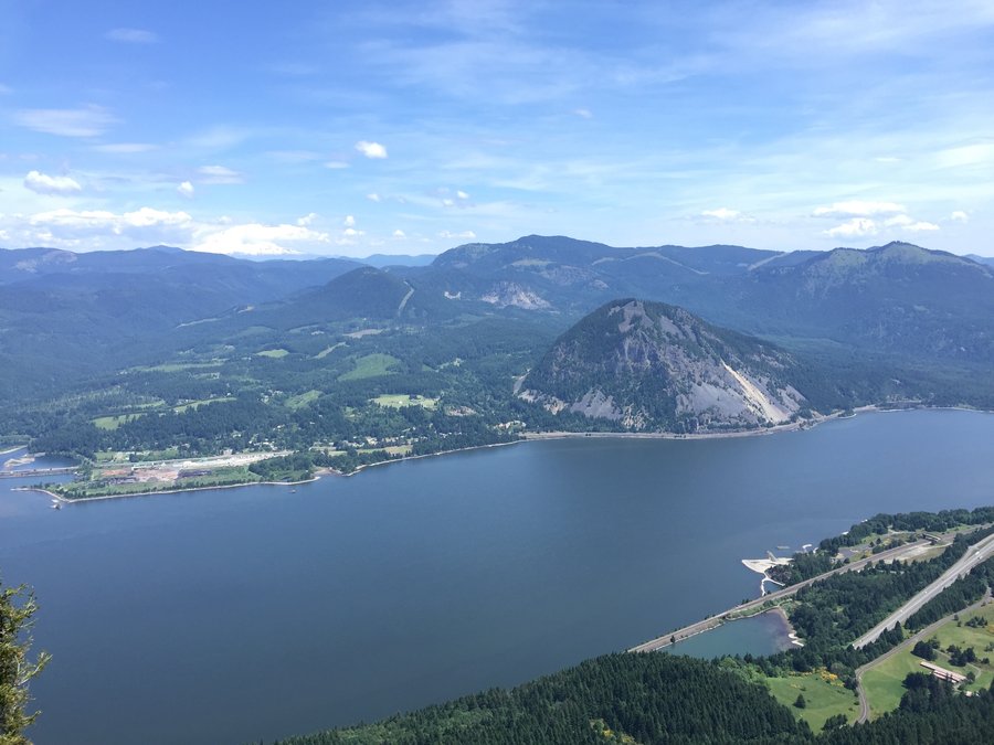
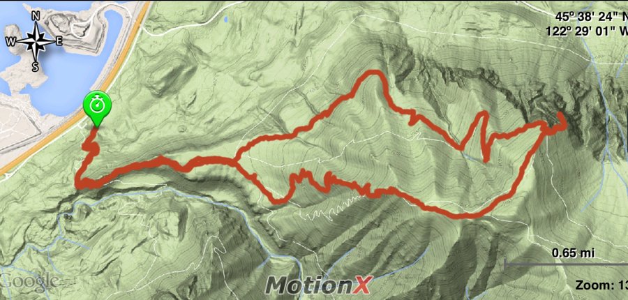
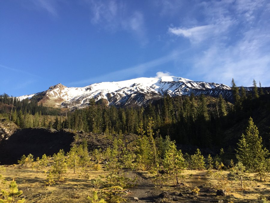
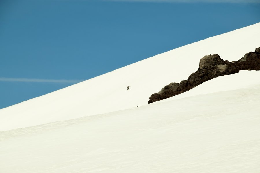
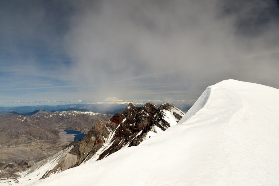
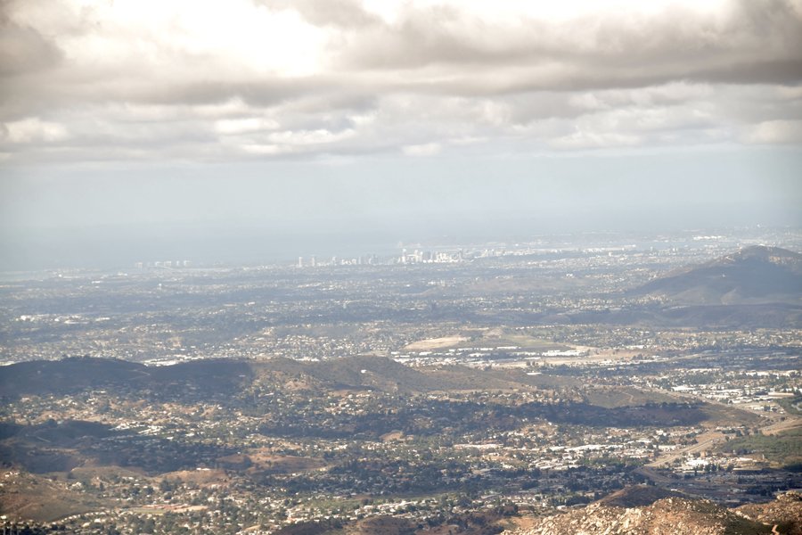
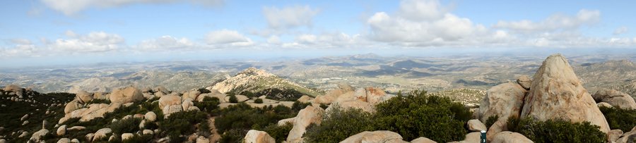
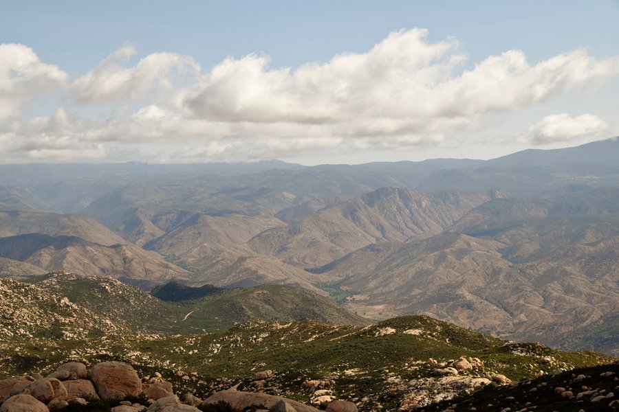
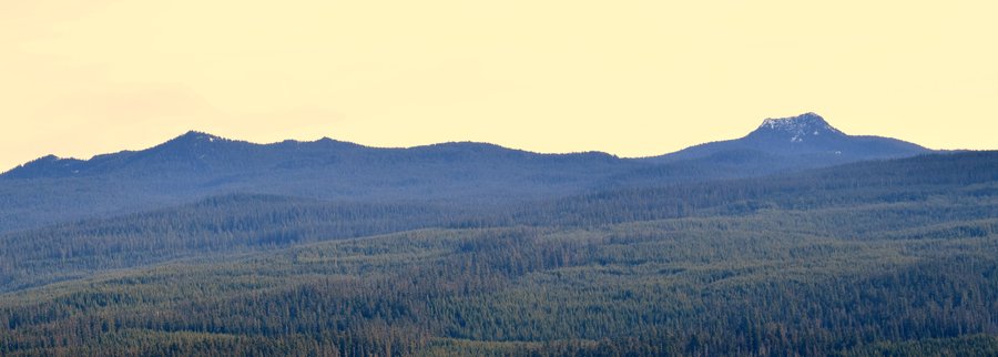
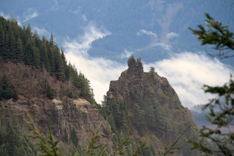
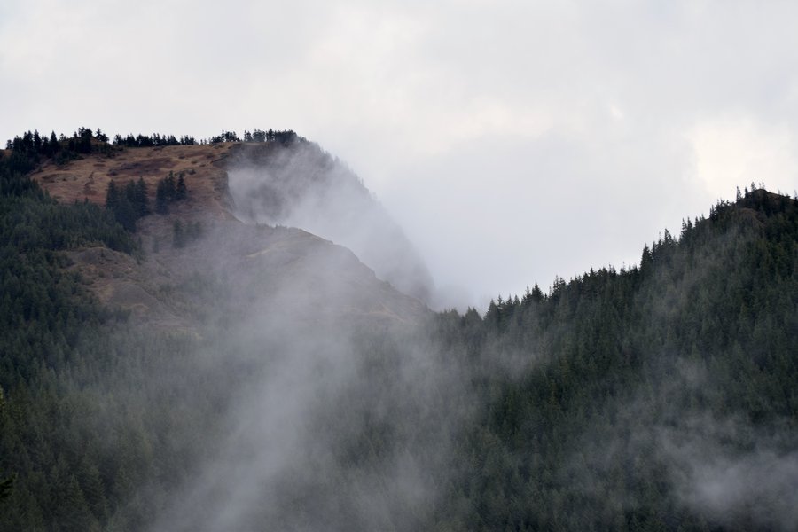
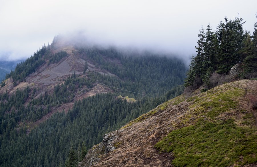
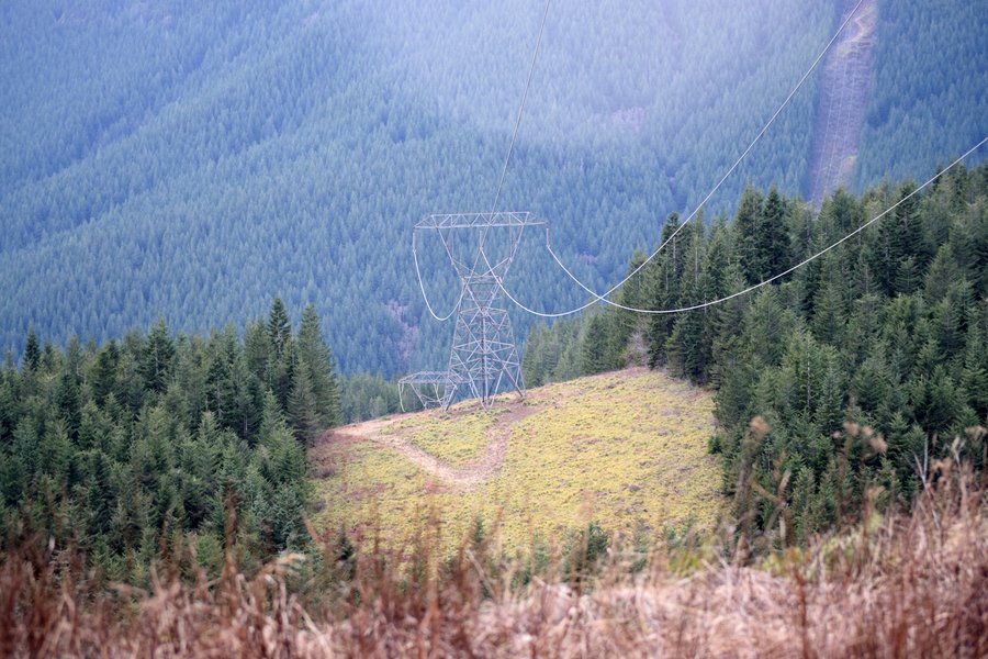
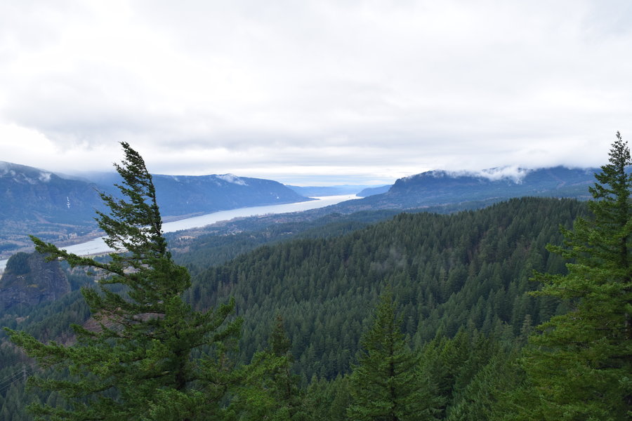
Silver Star
10 miles of hiking • 2750' elevation gain •
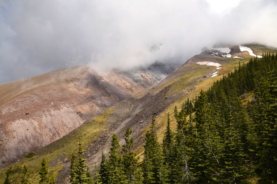
Took off from Grouse Vista up to the Indian Pits to Silver Star to Sturgeon Rock then back via Tarbell. I planned to hit Little Baldy but it was just too hot so I wimped out. Plus, the side trip to the pits plus stopping constantly to take pics put me behind. Beautiful day even if it was a little hot for my tastes.
June 8, 2015

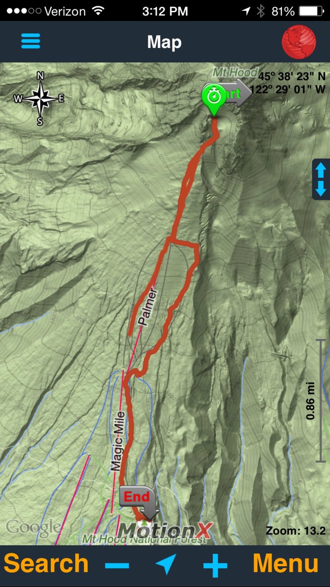
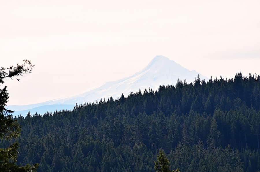
Timberline to hogsback
7.2 miles of hiking • 4750' elevation gain •
Beautiful morning. Long story but no summit.
June 5, 2015

Hardy Ridge loop
7 miles of hiking • 1750' elevation gain •
Not my favorite hike but quick and accessible. No vista view rewards today with the cloud cover.
June 3, 2015

Tunnel trail to Pittock
2 miles of hiking • 500' elevation gain •
Planned to do a longer fire lane hike after stopping at REI to p/u some ship-to-store gear but traffic delays put a stop to those plans. With a 45 minute window, I threw the bag-o-sand in the pack and made the best of a minimal opportunity.
June 2, 2015

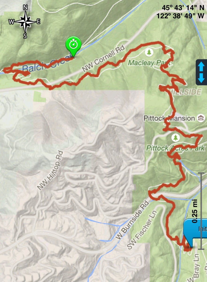
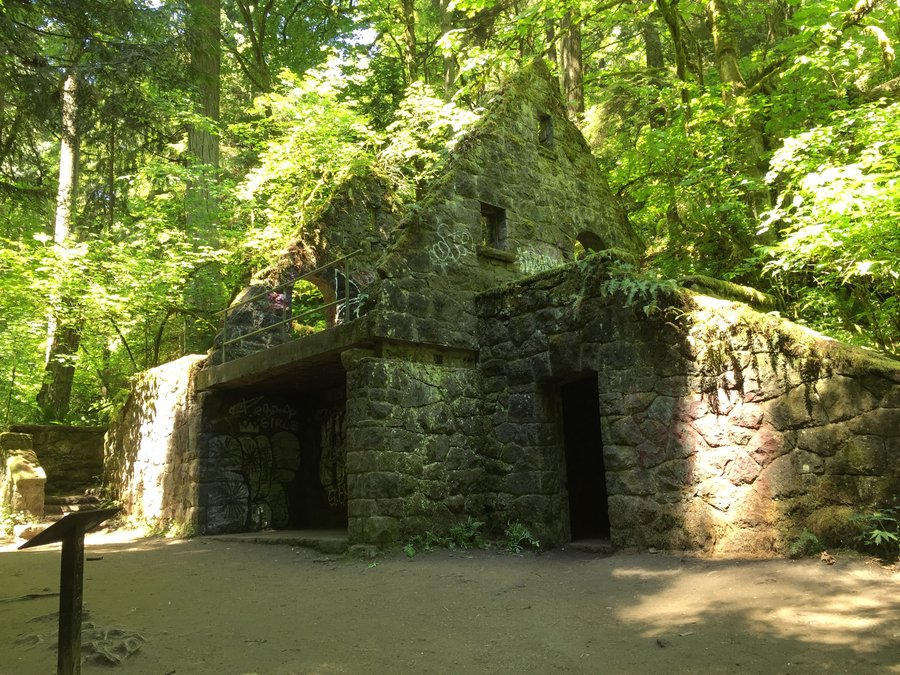
Wildwood trail -> Arboretum to Stone house
5 miles of hiking • 1000' elevation gain •
Nice little out-n-back urban hike after running some errands. Beautiful morning. Hit the food carts afterward then went off to work.
May 28, 2015

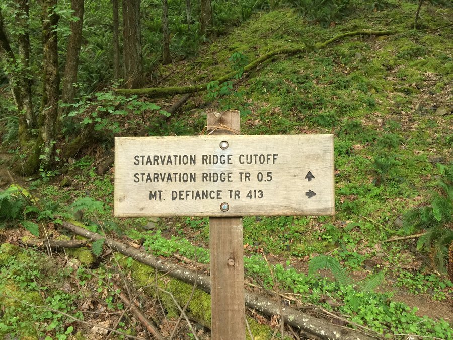
Starvation Ridge-Mt Defiance
11.5 miles of hiking • 5000' elevation gain •
Finally knocked this one out. It's a steep one, no doubt, but not as bad as I anticipated except perhaps the return trip which I decided I'd had enough of about half way down. Round trip took 6 hours including 30 minutes at the top paying peek-a-boo with Mt Hood.
May 26, 2015


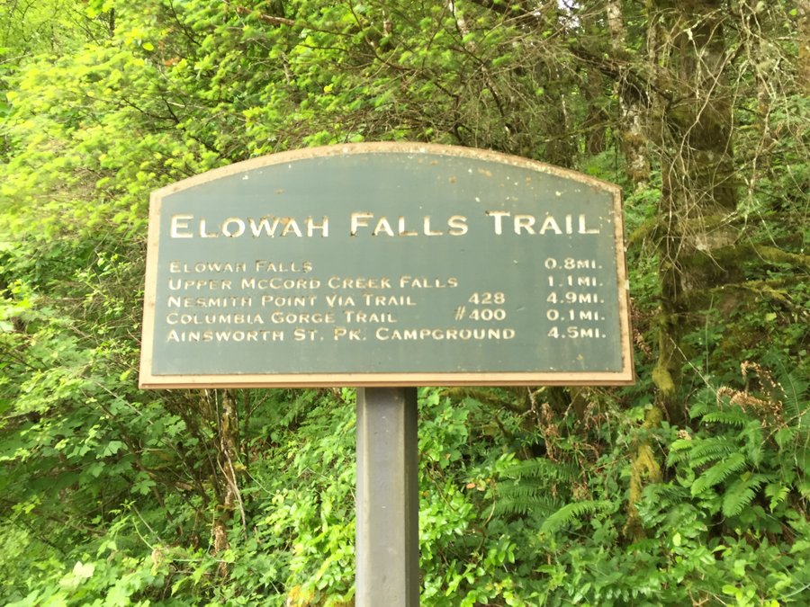
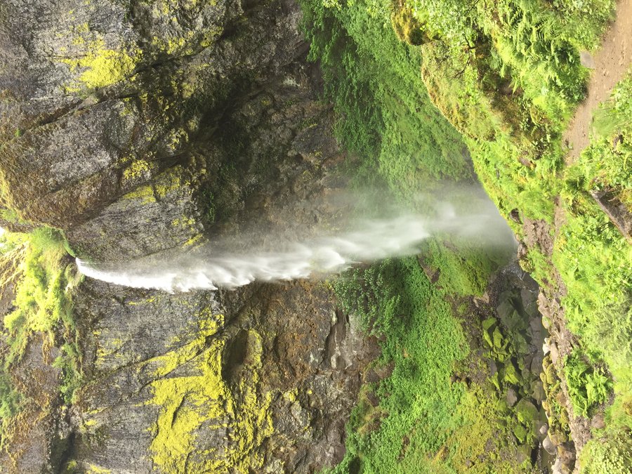
Elowah Falls + Upper mccord
2.5 miles of hiking • 500' elevation gain •
Memorial Day trip with the family followed by a visit to Walking Man for lunch.
May 25, 2015


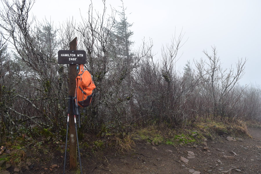
Hamilton Mtn loop
7.2 miles of hiking • 2250' elevation gain •
Managed to pull this one off before work...barely.
May 22, 2015

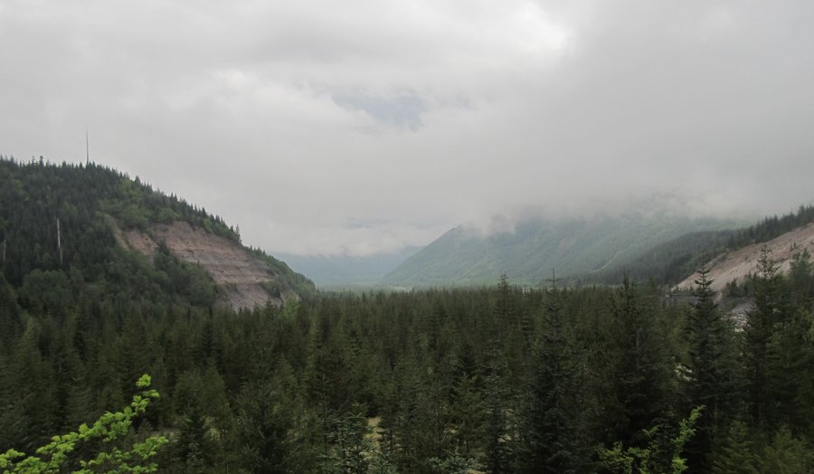
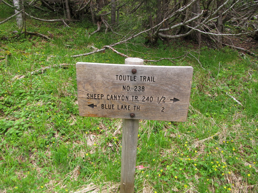
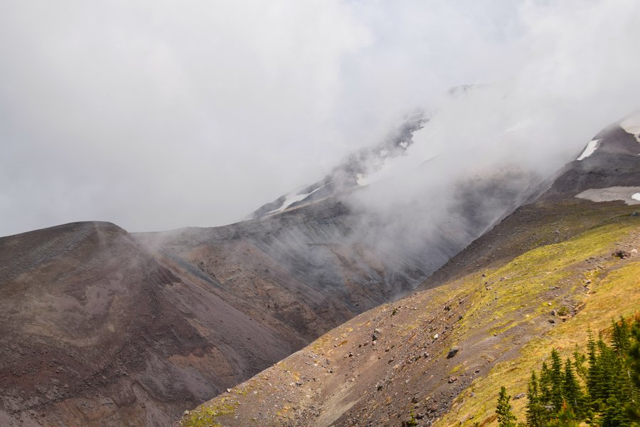
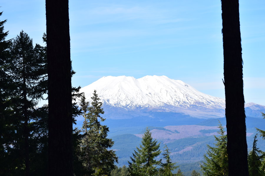
Sheep Canyon via Blue Lake TH
12 miles of hiking • 2750' elevation gain •
Any trip to MSH is special but I really enjoyed this trip. Nice forest hike. Interesting terrain. Incredible scenery. Crazy weather front that rolled in and bombarded the summit with thunder and lightning for half an hour. Perfect. Except for that last part of the Blue Horse trail that -- despite starting out wide and clear -- ends in massive doug fir blowdowns and is overgrown to the point of being unusable. I suspect there is a reroute at some point that I missed.
May 21, 2015

Indian Point loop
8 miles of hiking • 2750' elevation gain •
First time hiking The Gorge this far east on the Oregon side. Looks like Defiance is now on the short list. I really enjoyed this loop and look forward to exploring longer versions in the future.
May 20, 2015

Pioneer Point via Cape Horn trail
2.5 miles of hiking • 750' elevation gain •
Short before work hike. Sure beats a treadmill.
May 15, 2015

Devils Rest via angels rest->foxglove way->primrose->wahkeena loop
8 miles of hiking • 2500' elevation gain •
May 12, 2015


PNW->NWPA
6 miles of hiking • 1000' elevation gain •
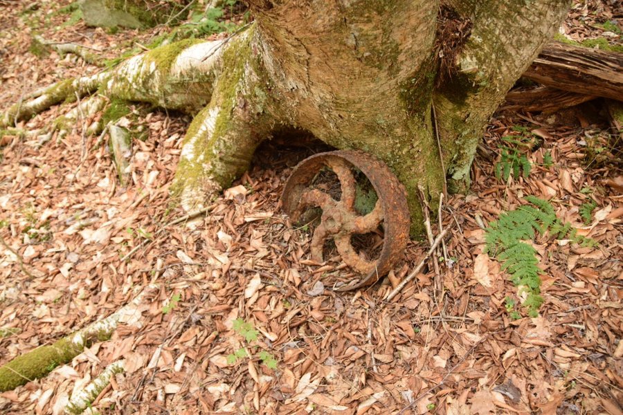
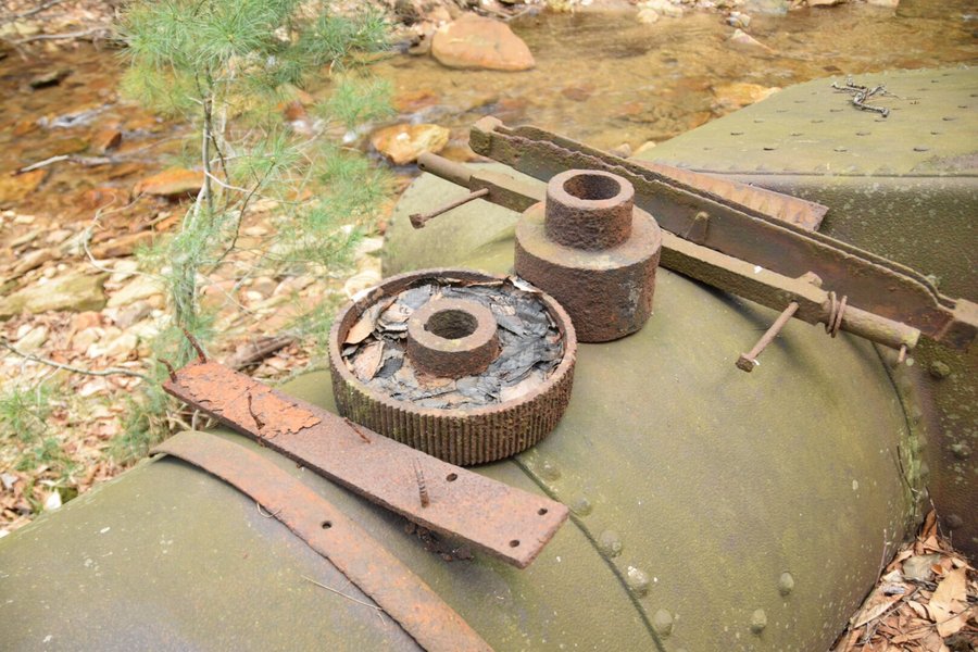
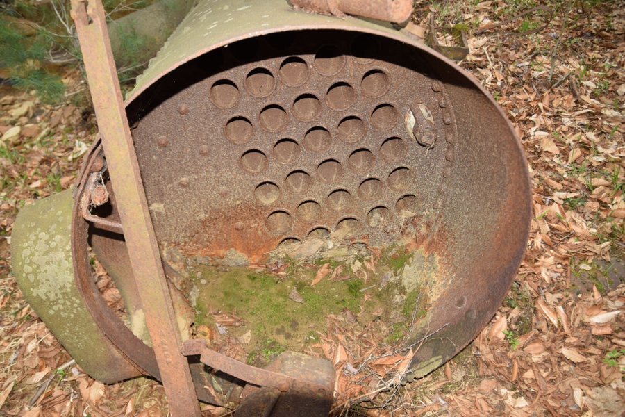
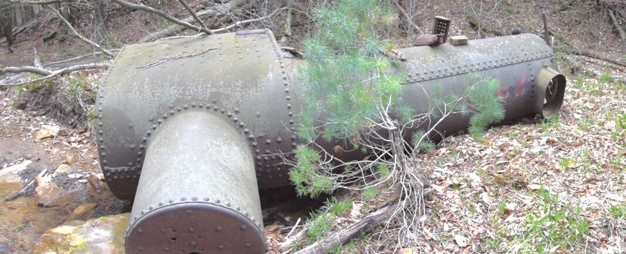
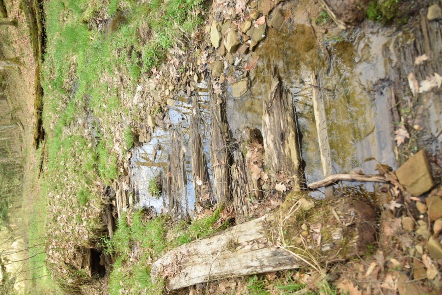
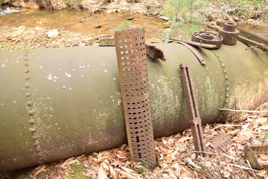
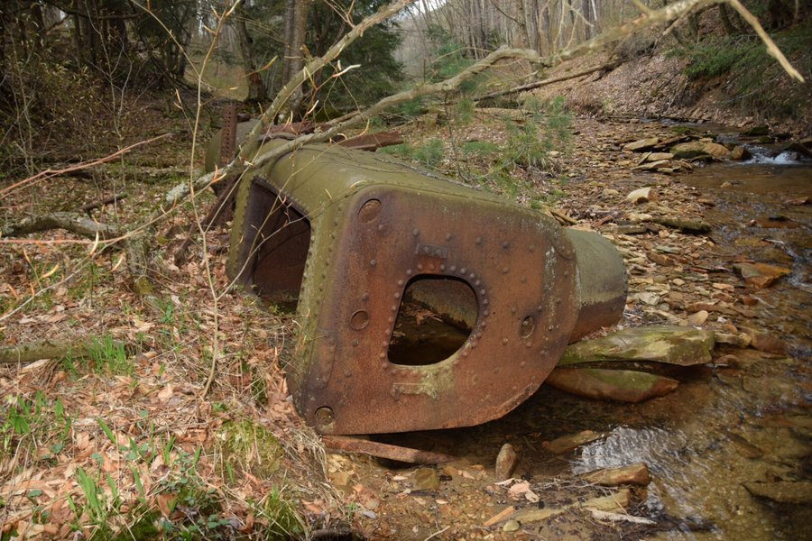
Returned to NW Pa for a brief visit and managed to spend a day exploring places I haven't seen in decades. After starting in the wrong drainage, we eventually found the old steam locomotive and Pinchot road remnants I had found years ago. Nice to visit home even if I haven't lived there for 25 years.
May 7, 2015

 1
1
Pack testing at Lacamas SP
4 miles of hiking • 500' elevation gain •
Took my old hiking buddy -- a 50# bag of sand -- out for a walk before work. He's not much for conversation. And, he just sits there expecting to be carried everywhere. When it comes to testing out new packs, though, he's an expert.
May 5, 2015

Lacamas Park
6 miles of hiking • 750' elevation gain •
Sure, I know. It's the low hanging fruit of the hiking world. Still, I got in a nice little hike before work and the weather is just too incredible to ignore.
May 1, 2015

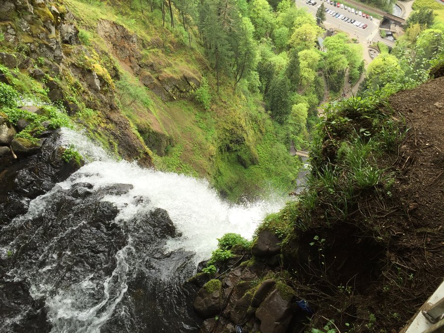
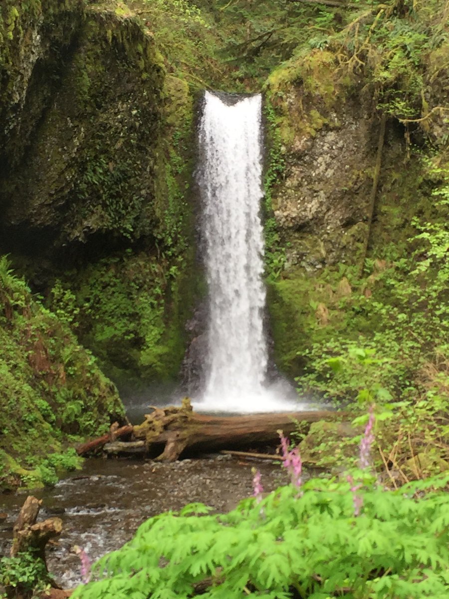
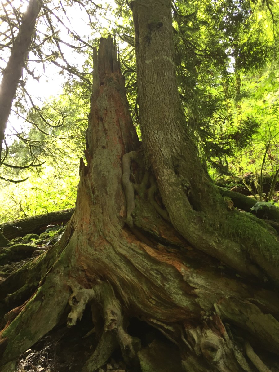
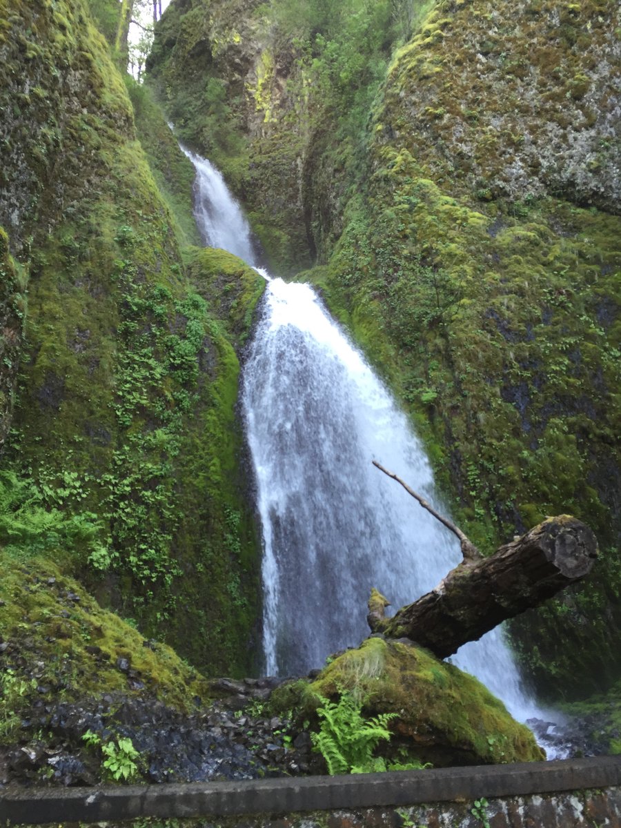
Multnomah-Wahkeena Falls loop
7 miles of hiking • 1500' elevation gain •
Nice day for a stroll in The Gorge. Perfect weather. Everything is green or blooming. A stark contrast to the snow and rock of yesterday's trip. Took a short side trip down the 400 trail to check out the elevator shaft for a future outing.
April 28, 2015

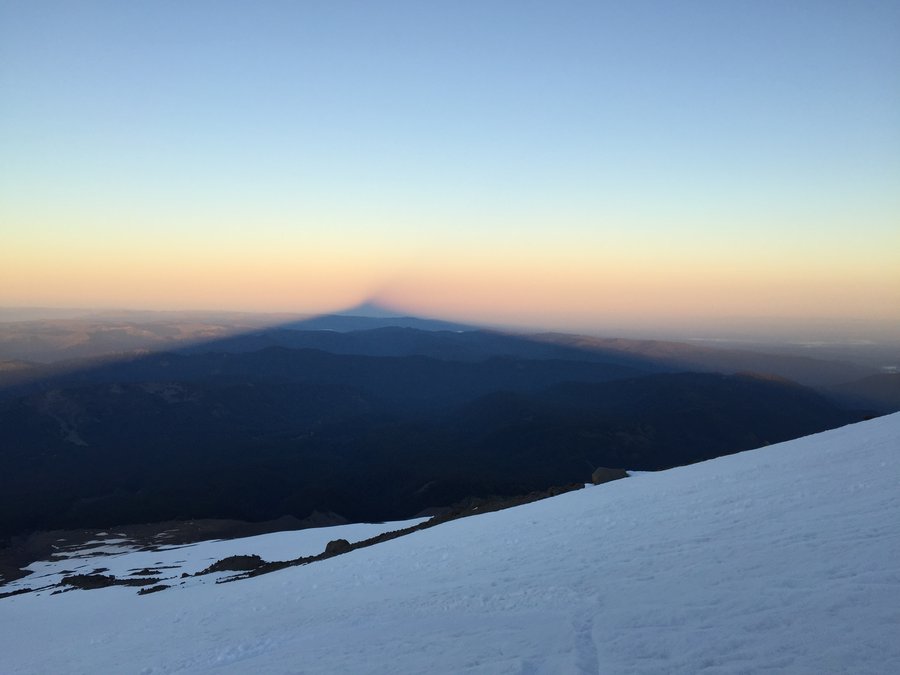
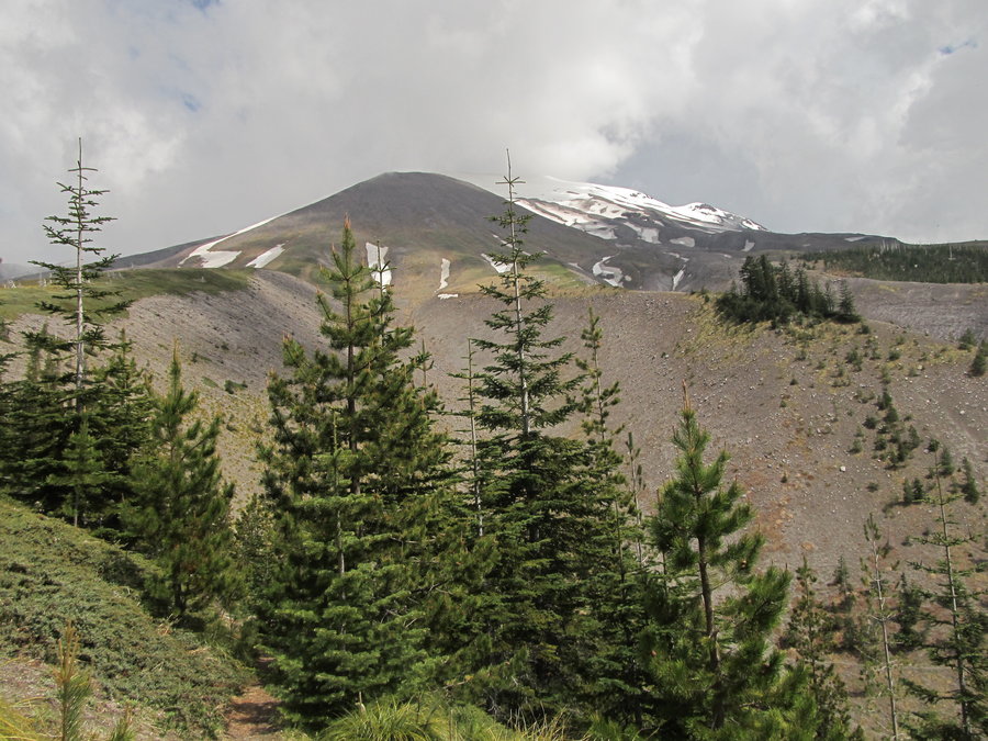
Mt Saint Helens via worm flows
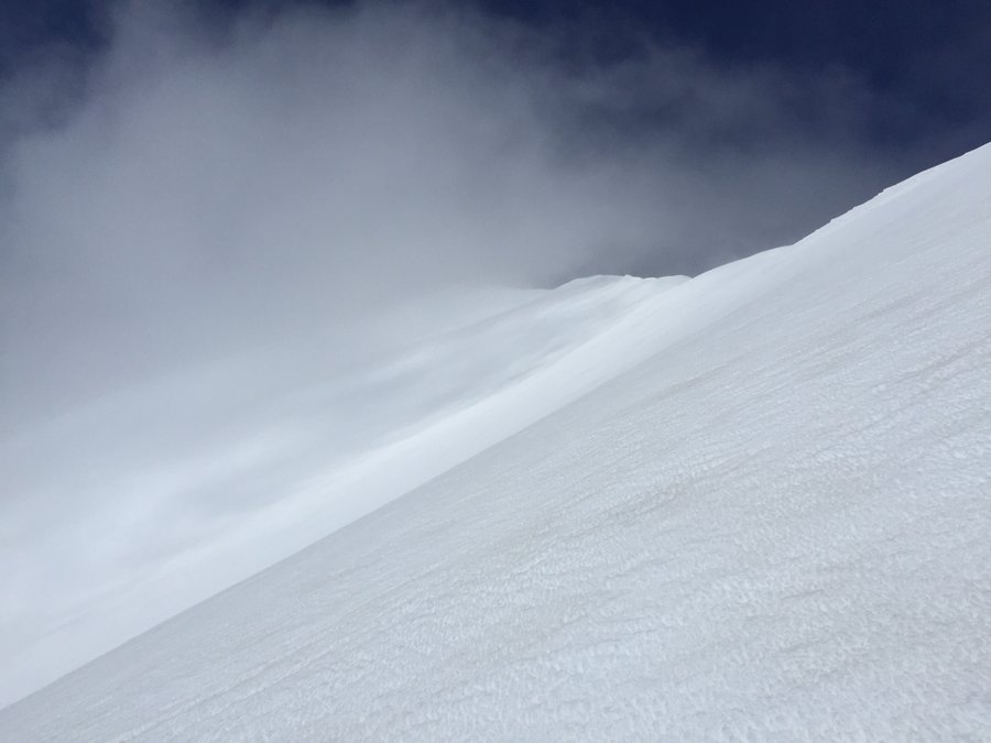
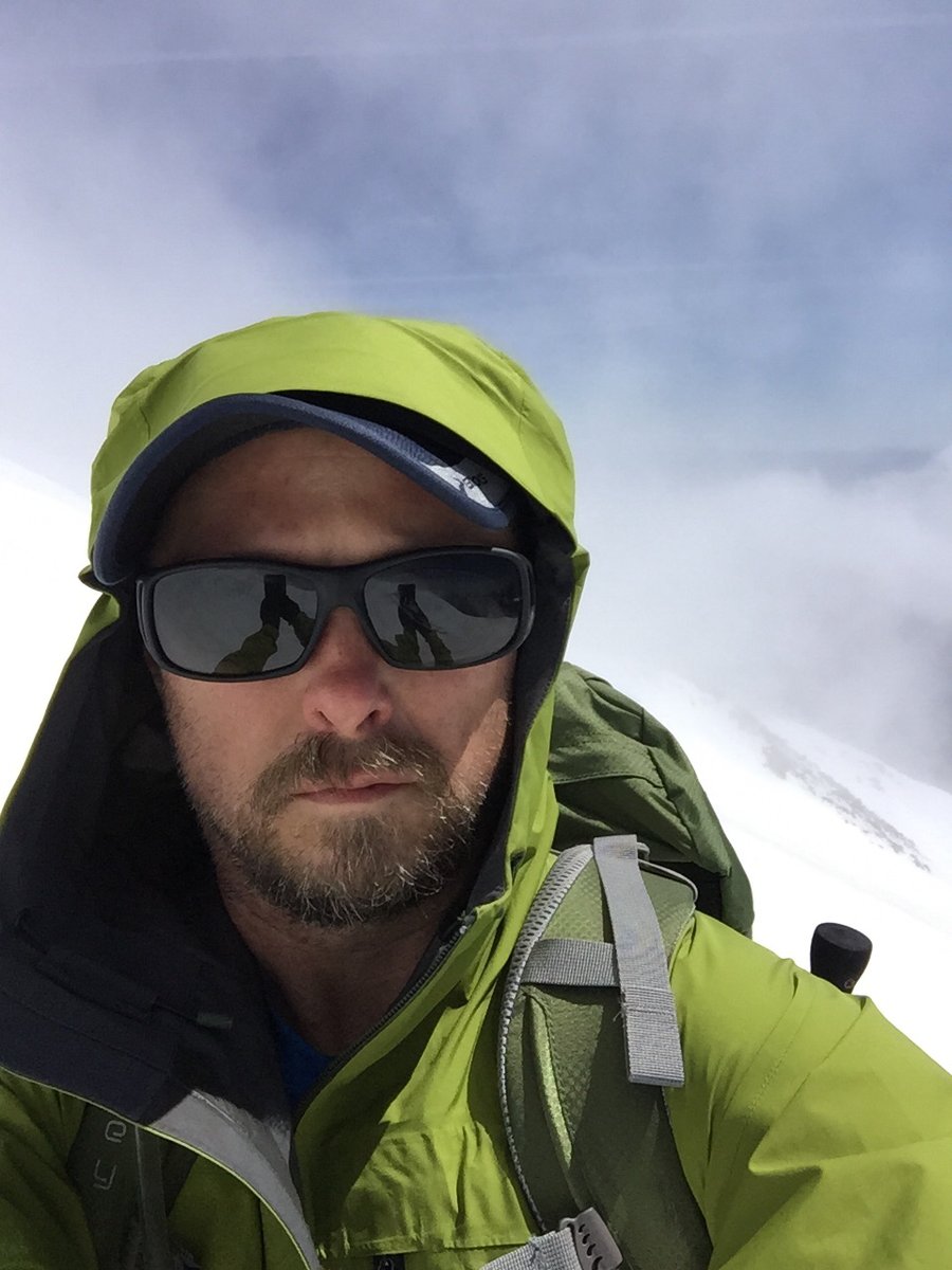
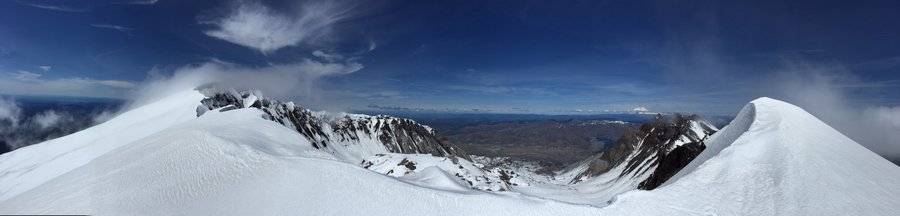
10 miles of hiking • 5750' elevation gain •
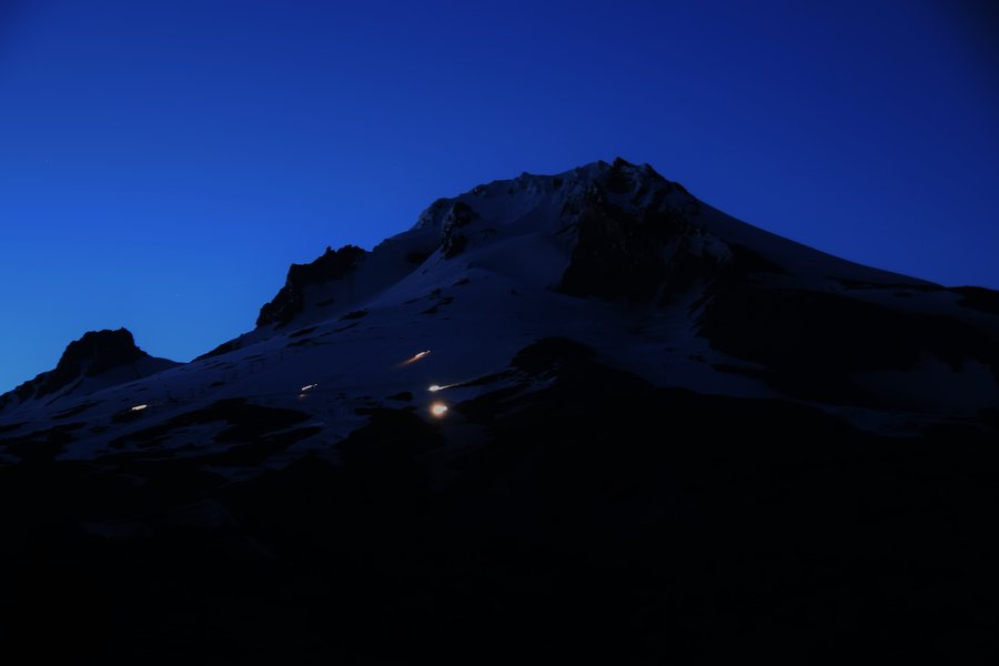
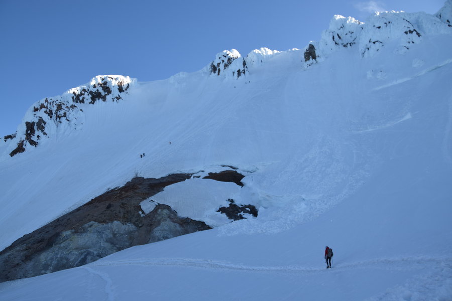
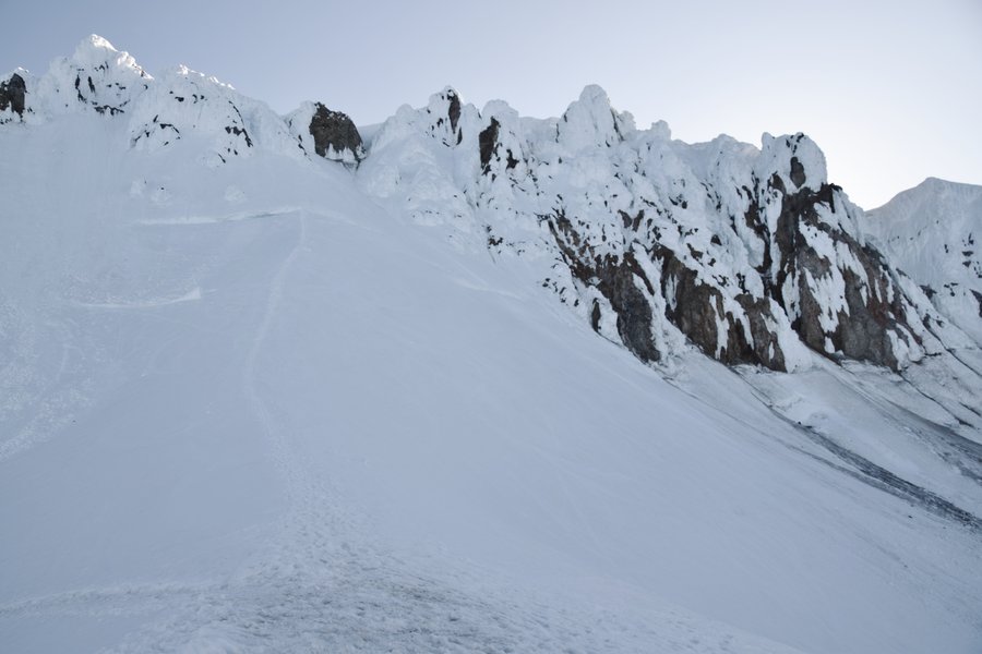
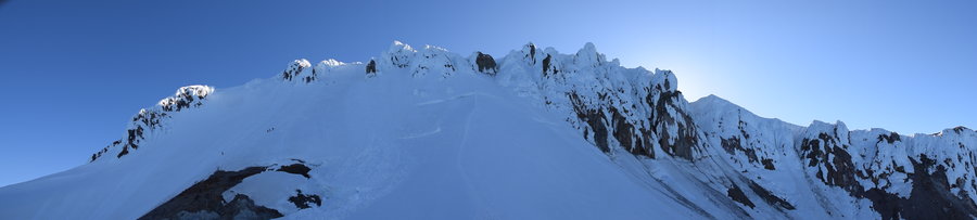
Wanted to do a MSH trip before all the snow melted. The forecast called for partly cloudy skies with temps in the 80's in the valley so off I went. On a whim, I followed a different worm flow thinking it would bring me onto the same approach but that didn't work out as I ended up on the east side of Swift Glacier. Snow was soft, no freezing temps overnight. Snow shoes were more hindrance than help due to the slick snow but crampons helped some. Word of advice though, there's a reason sunscreen is part of the "10 essentials". The only thing stupider than not carrying it is carrying it and not using it. Rookie mistake. Ouch!
April 27, 2015


.jpg)

.jpg)
.jpg)
.jpg)
.jpg)
.jpg)
.jpg)
.jpg)
April 24, 2015

Lacamas Lake
5 miles of hiking • 750' elevation gain •
Been laid up with the flu for the past 5 days and needed to go for a walk.
April 22, 2015


Dog Mountain loop
6.8 miles of hiking • 2750' elevation gain •
Apparently I've never hiked Dog Mtn in shorts before today because until today I hadn't noticed just how much poison oak lines the trail. It is A LOT! The clothes are cleaned, shoes are scrubbed, legs are washed --the waiting begins.
April 15, 2015

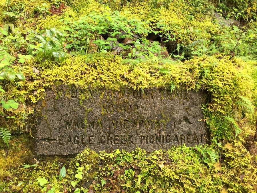
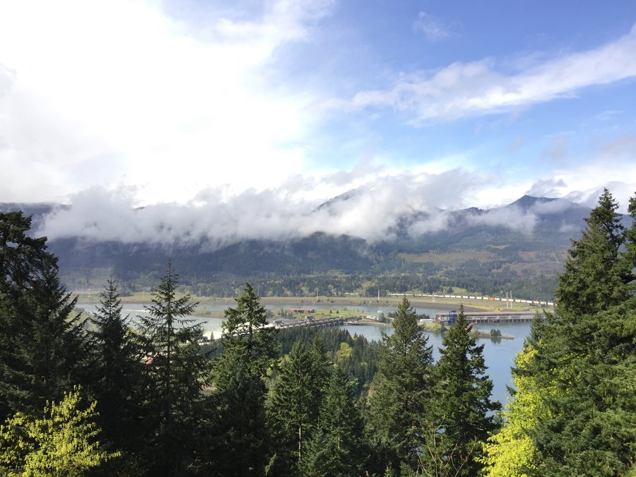
Wauna Point via Eagle Creek
10 miles of hiking • 3000' elevation gain •
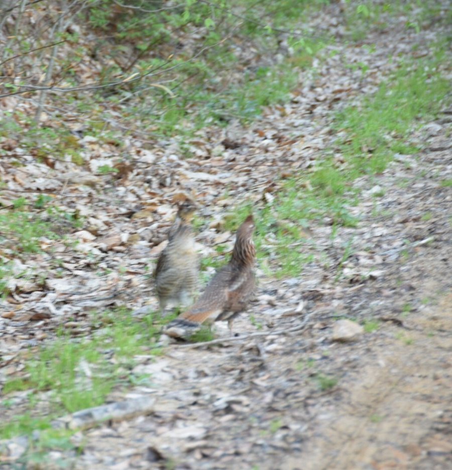
After a week in SoCal, I was anxious to get back out on the trail. Desert hiking is fine in small doses but rattlers, tarantulas, and scorpions aren't really my thing. Today was more to my liking -- rain, sleet, snow, with splashes of sunshine in between. Unfortunately, clouds rolled in along with heavy snow as I made my way down to the point so no views. Dusky grouse with their whoop, whoop, awhoop, whoop mating calls didn't seemed to mind the snow though. I heard at least 4 or 5 different ones calling as I hiked down the 401 trail.
April 14, 2015


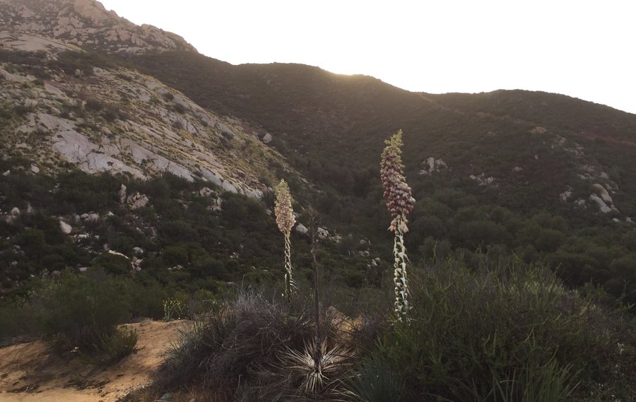
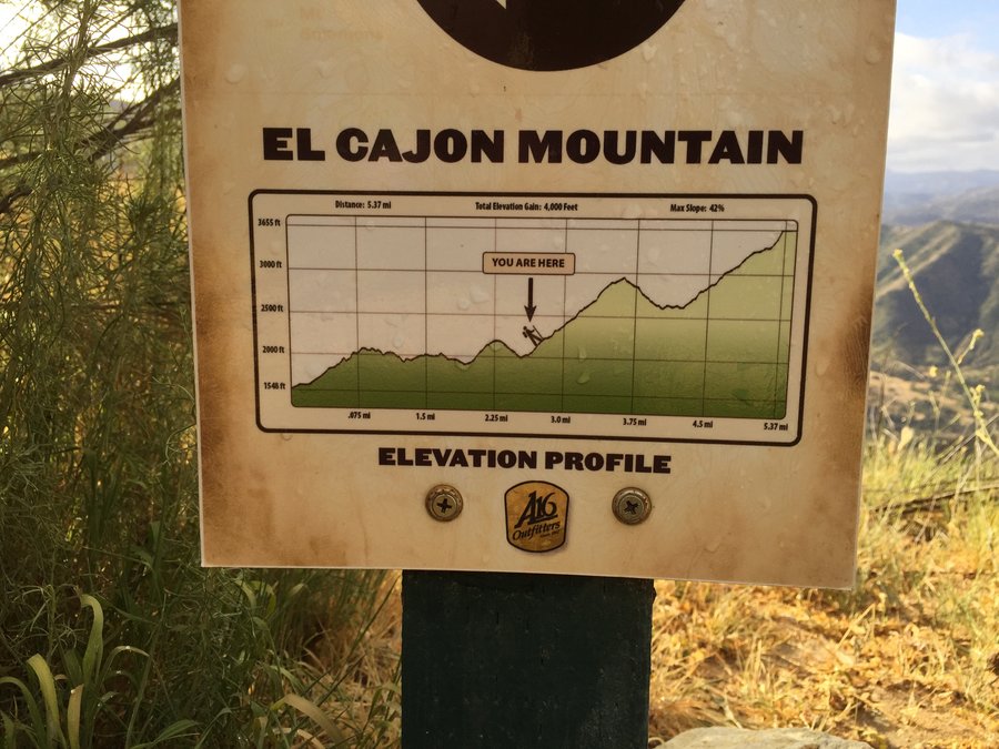
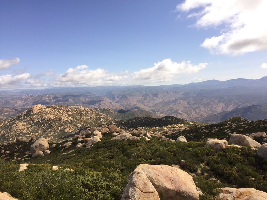
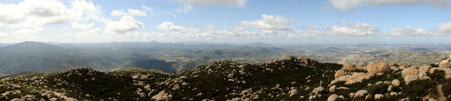
El Cajon Mtn Trail, San Diego County
11 miles of hiking • 4000' elevation gain •
Managed to break away from the family and the beach for this aggressive little hike in the foothills east of San Diego.
April 8, 2015


Punchbowl Falls
5.5 miles of hiking • 500' elevation gain •
Another first (for me). I've learned there's an inverse law that governs over The Gorge -- the worse the weather, the more beautiful the scenery. Not sure if that applies to ice, though. Anyhow, I'd hoped to do a MSH summit trip yesterday but with the looming crazy forecast, I abandoned that plan -- glad I did considering the lightning and sleet/rain/hail -- and headed on a road trip down I-84. I haven't hiked the Gorge on that side of the river east of Horsetail falls so this was really just a plan to scout out the trailheads for the future. And the bucket just keeps getting fuller and fuller...
March 31, 2015


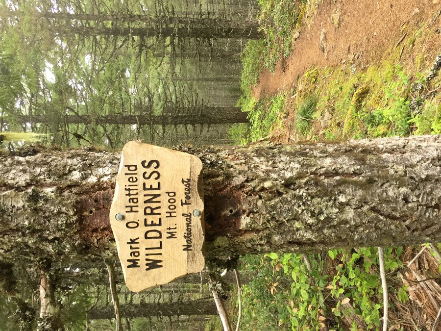
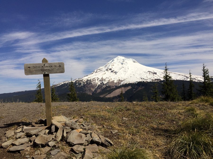
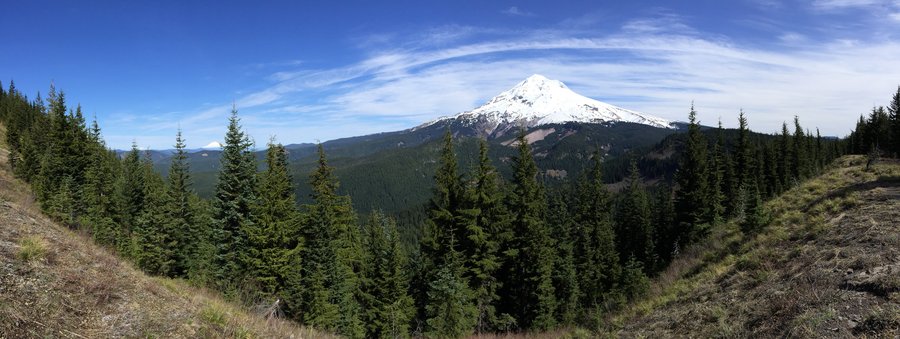
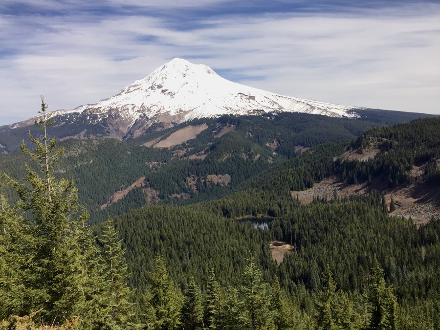
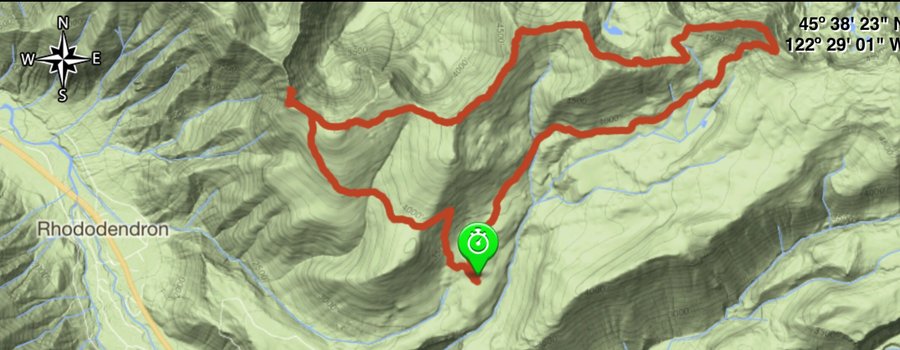
Zigzag Mtn loop via Burnt Lake trailhead
11 miles of hiking • 2750' elevation gain •
In the 3 years since moving here, I've hiked all over the PNW from the Pasayten to Coeur d'alene to central and eastern Oregon. Today was the first time hiking in the Mt Hood Wilderness however. Not really sure why I've avoided it. Probably just a general aversion to "busy" trails. Sometimes you find out the best places are right in your own back yard.
March 30, 2015


.jpg)
.jpg)
.jpg)
.jpg)
.jpg)
.jpg)
.jpg)
.jpg)
.jpg)
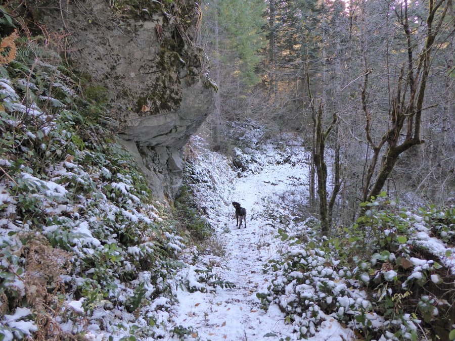
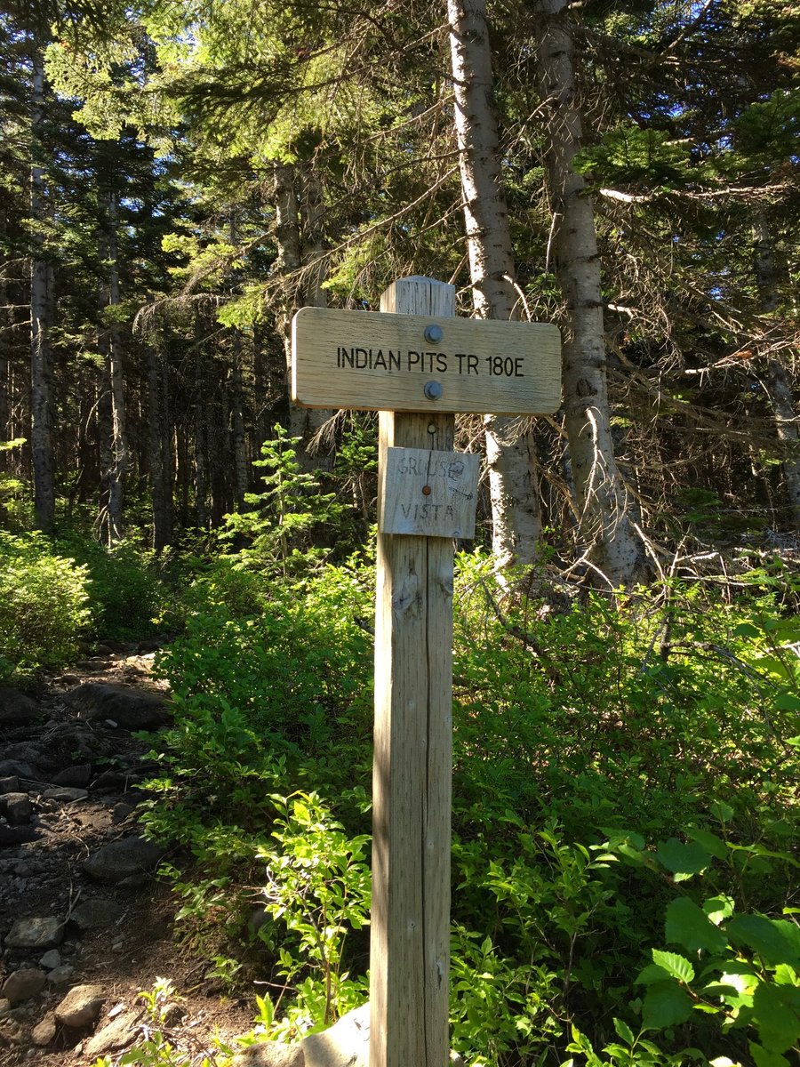
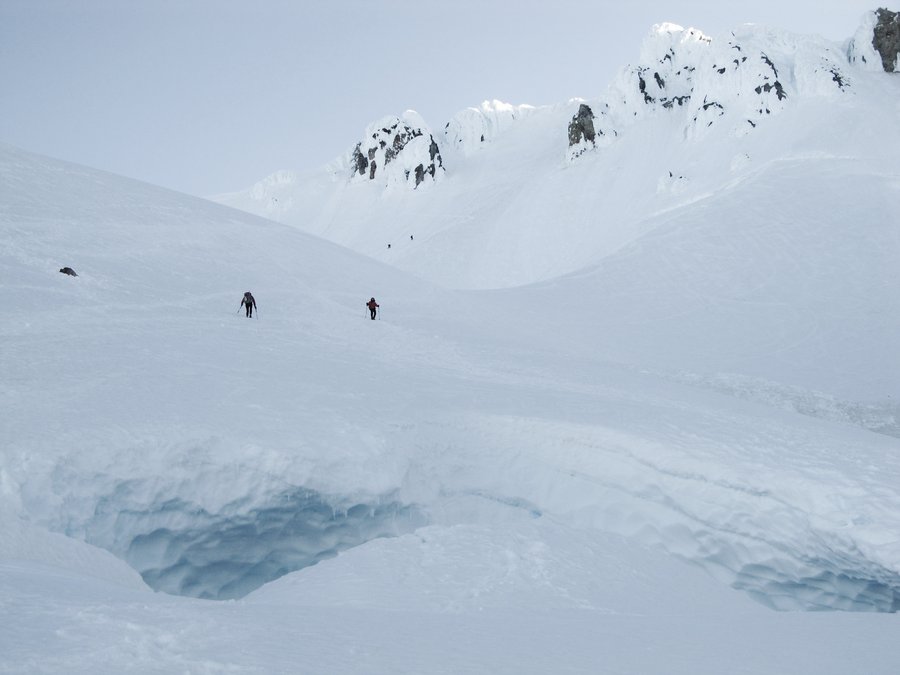
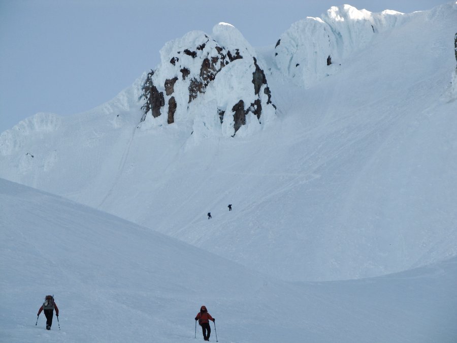
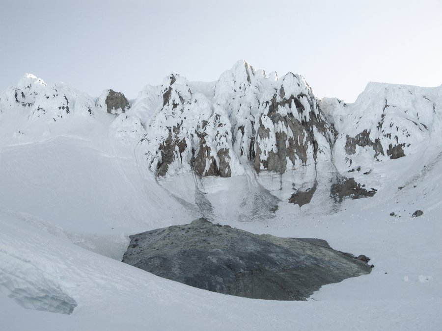
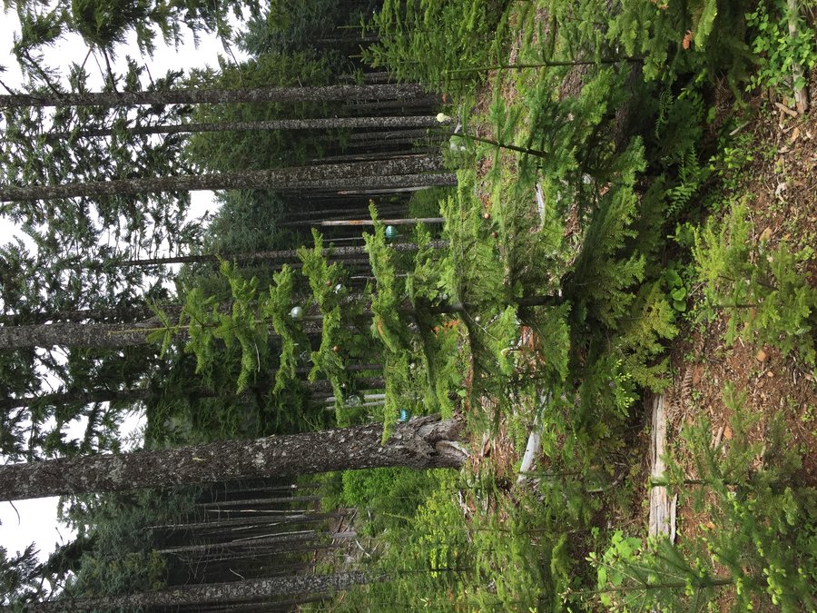
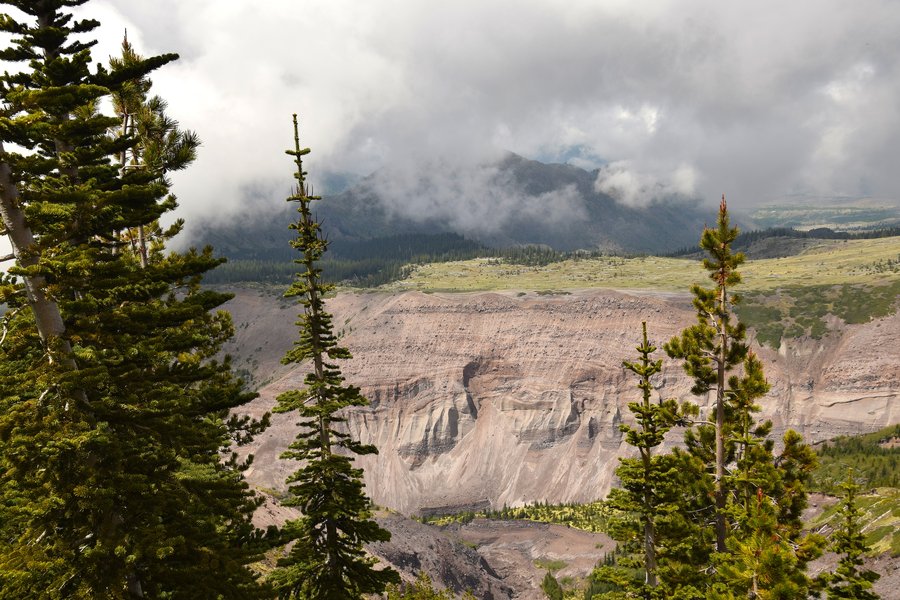
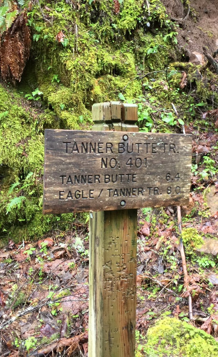
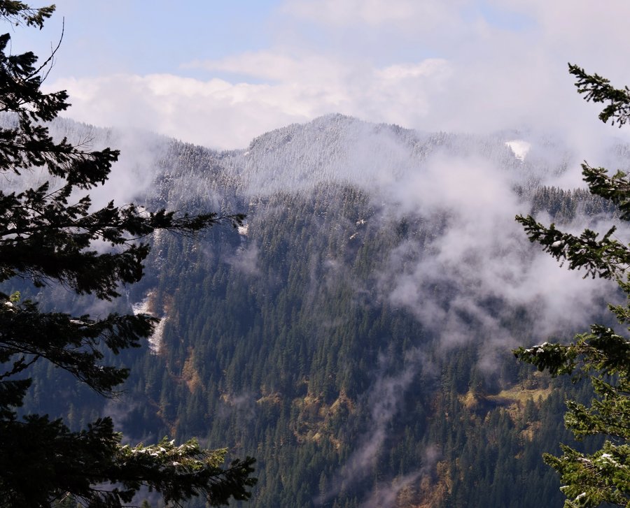
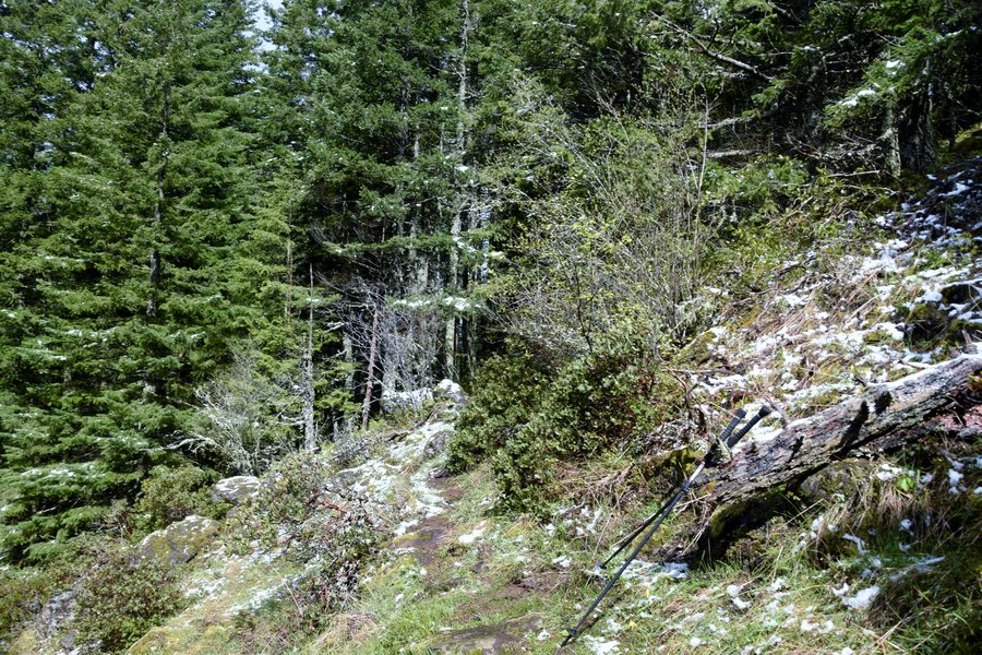
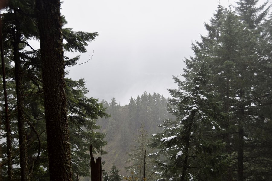
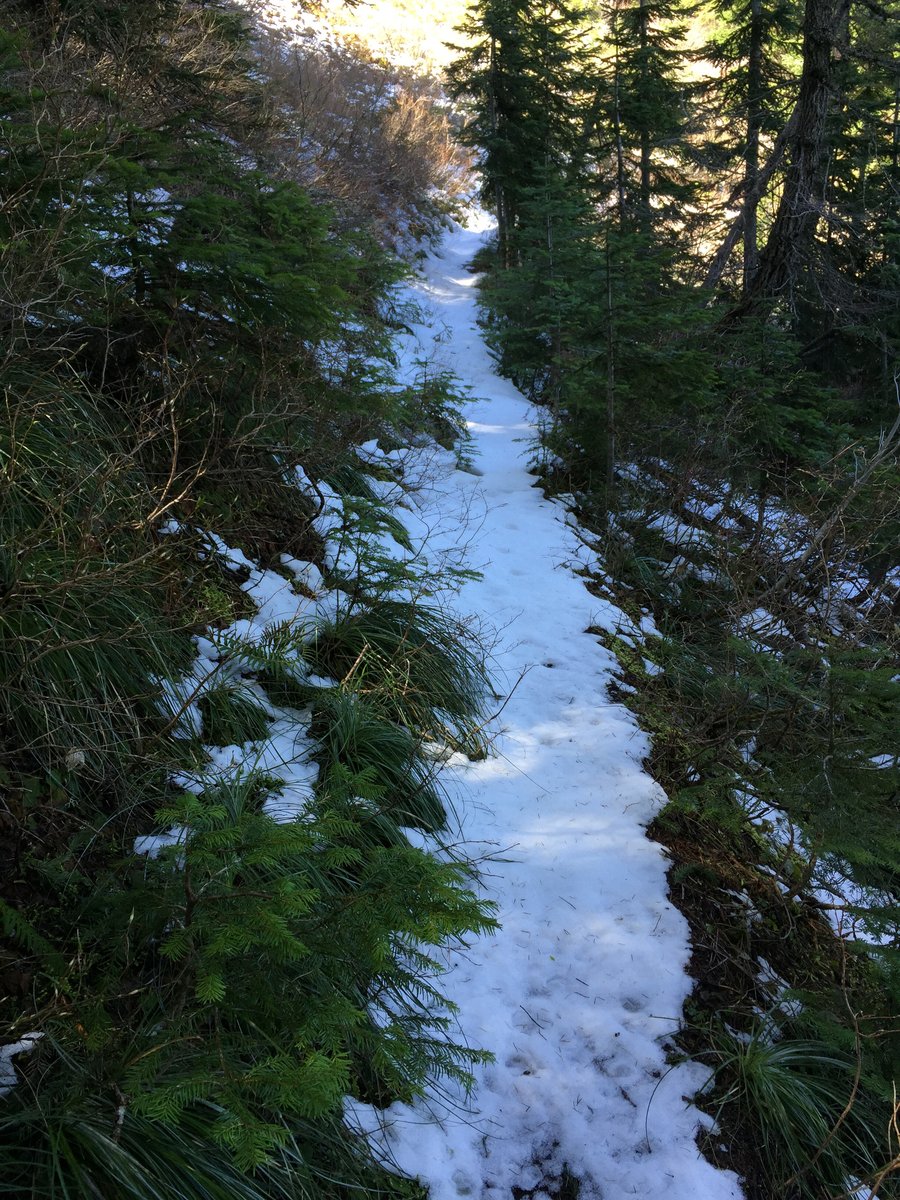
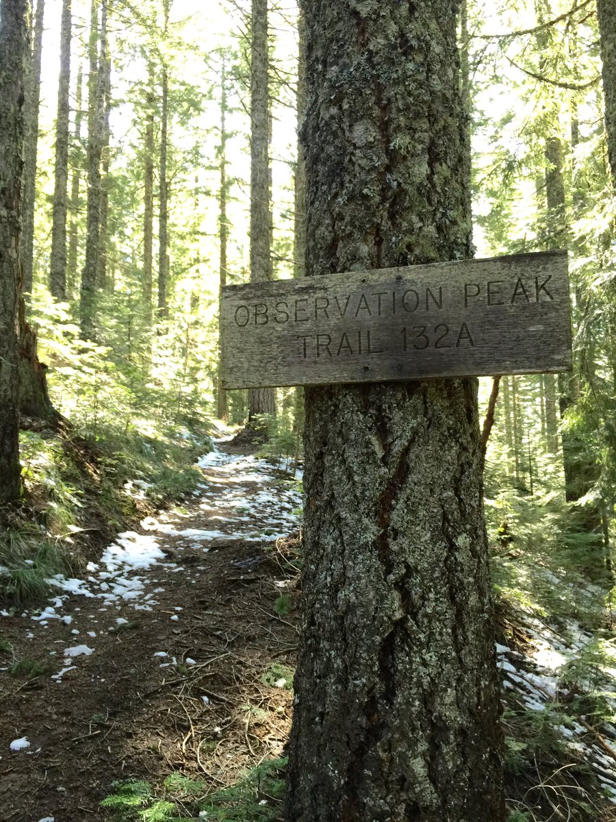
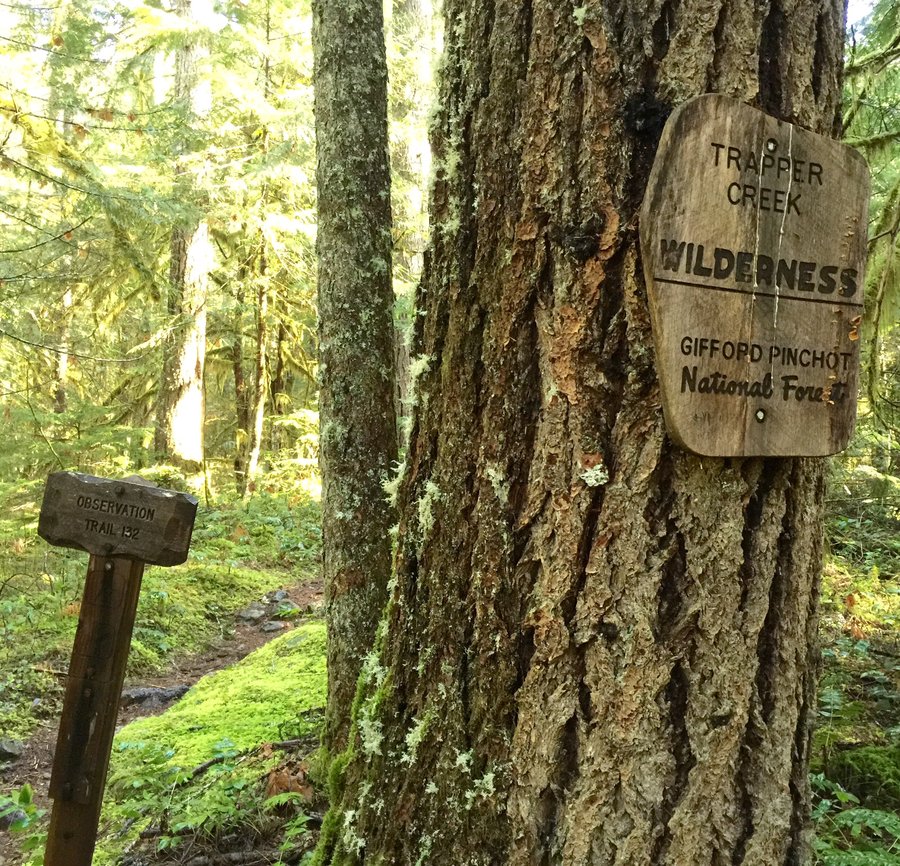
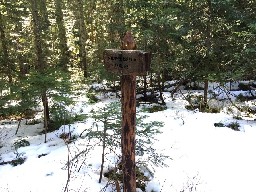
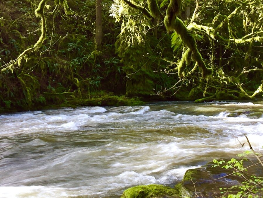
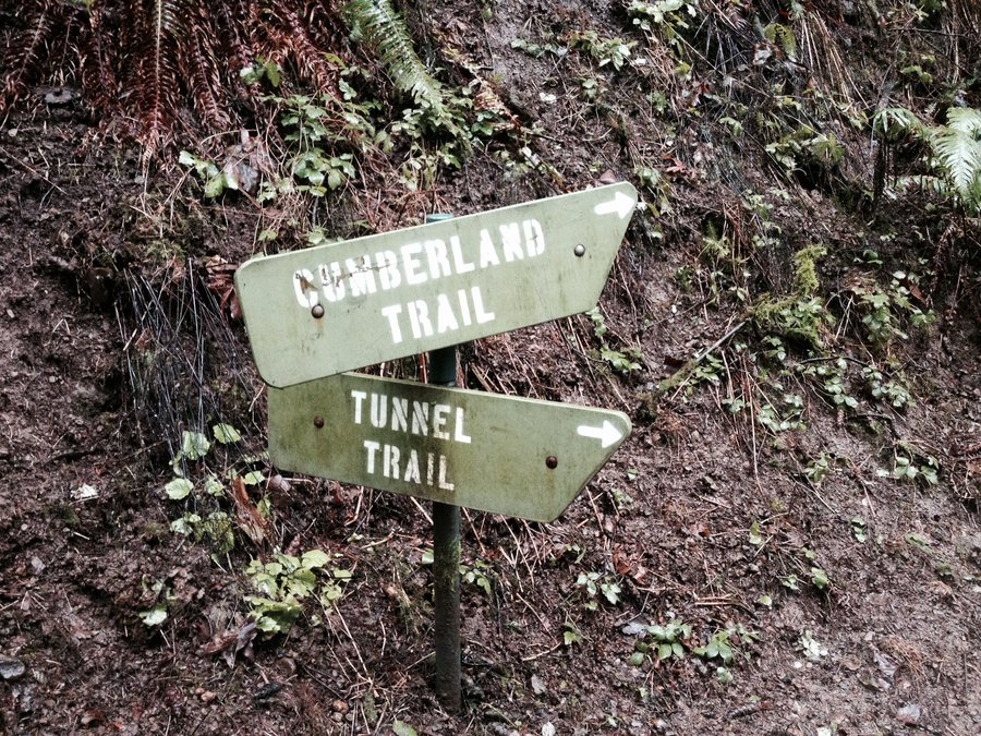
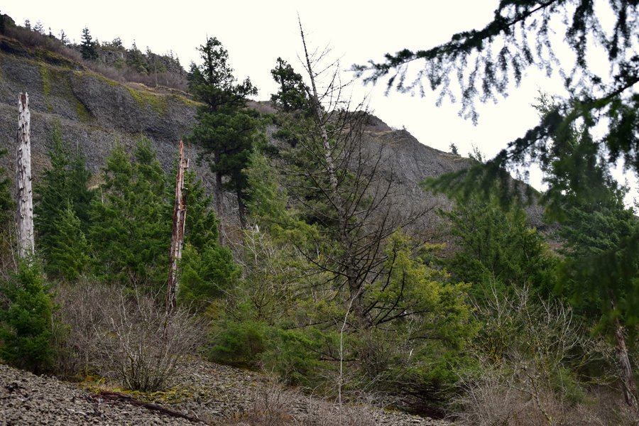
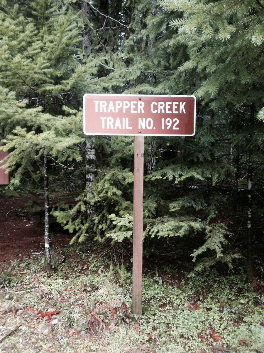
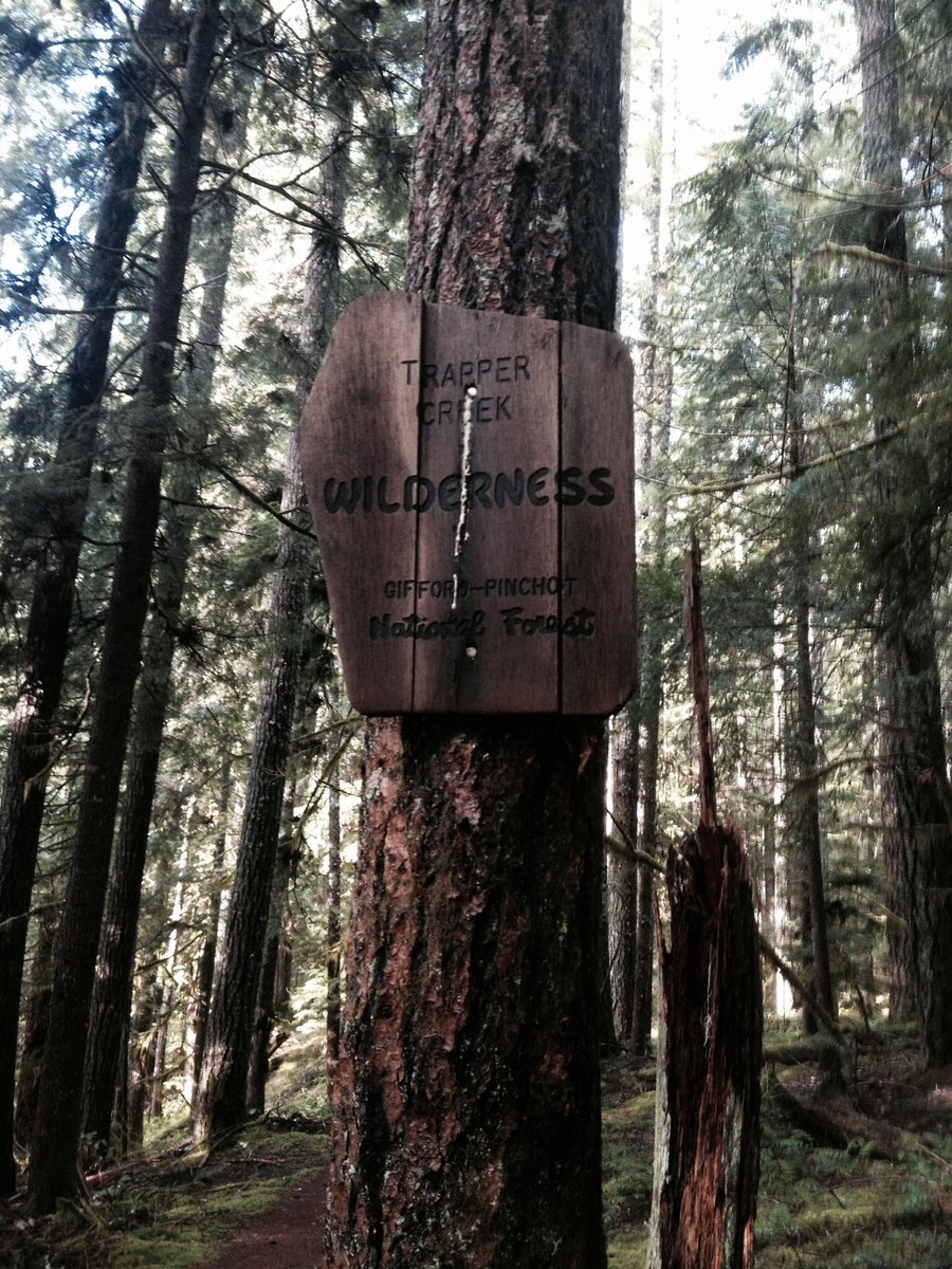
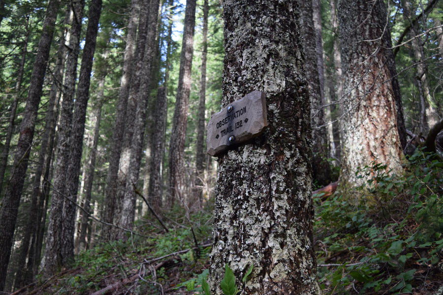
Trapper Creek Wilderness
14.5 miles of hiking • 3750' elevation gain •
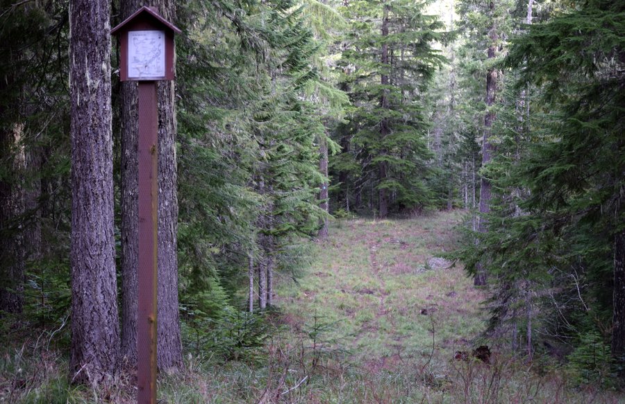
Thursday I hiked to Observation Peak to enjoy some sunshine. This particular loop ran counter-clockwise up the Observation trail to the summit, returning via the Trapper Creek trail. Interesting signage pointed the way.There was about 4-5 inches of wet, slippery snow the last couple miles to and from the summit. Generally, the trails are in good shape with only a few large blowdowns blocking the way. The only issues I had were finding reliable creek crossings in the upper drainage and sliding off a slimy, slippery, tilting foot bridge into the creek. And an elk jam blocking High Bridge at Carson...
March 26, 2015


.jpg)
.jpg)
.jpg)
.jpg)
.jpg)
.jpg)
.jpg)
.jpg)
.jpg)
.jpg)
.jpg)
.jpg)
.jpg)
.jpg)
Lacamas Park
6 miles of hiking • 500' elevation gain •
The original plan was a trip to Greenleaf Falls via Two Chiefs trail but I ran out of time running errands. I ended up wandering around Lacamas Lake park, new iPhone in hand.
March 25, 2015


.jpg)
.jpg)
.jpg)
.jpg)
.jpg)
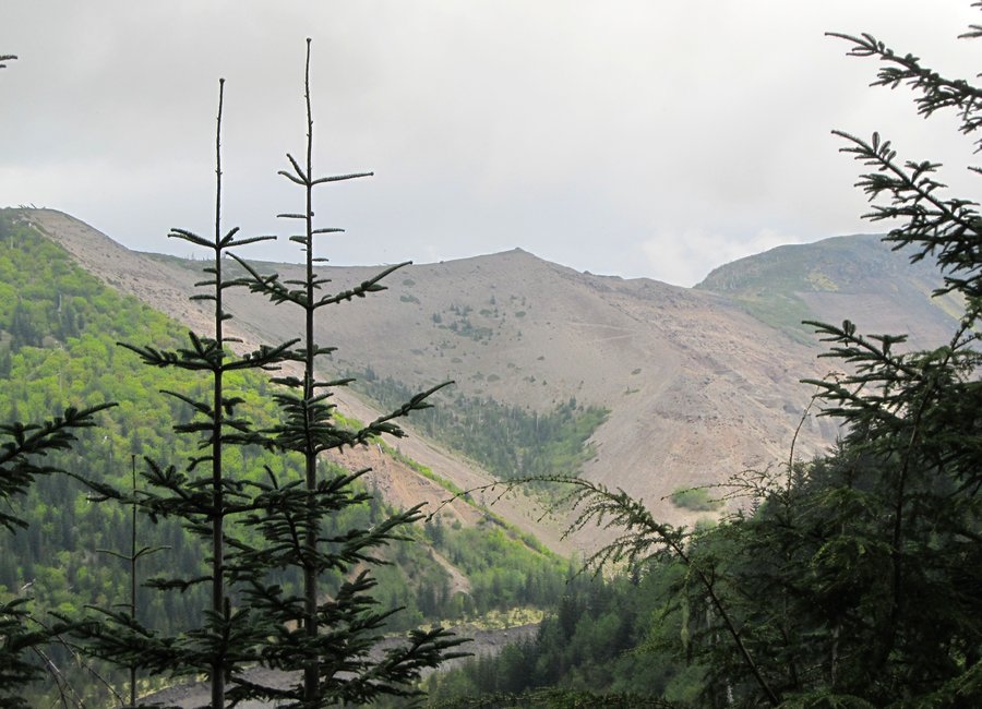
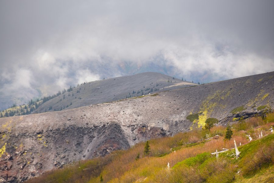
Fossil Trail loop
12.5 miles of hiking • 2750' elevation gain •
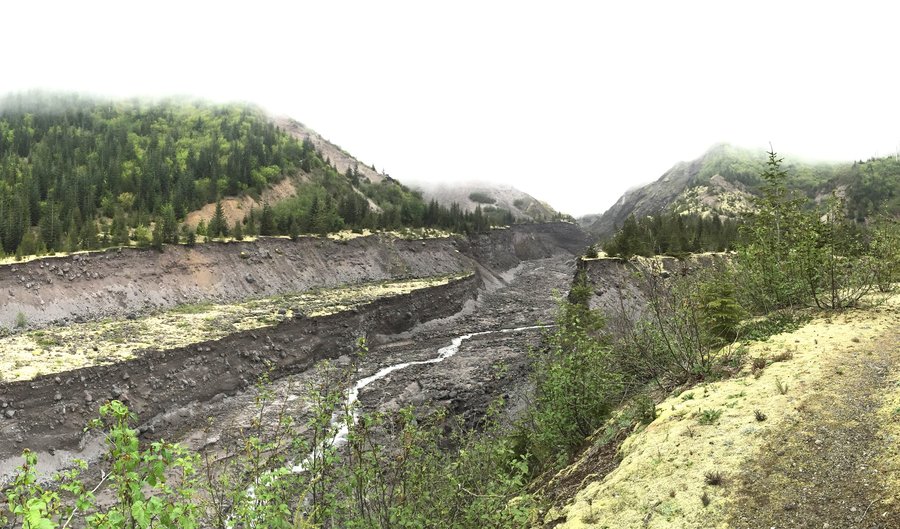
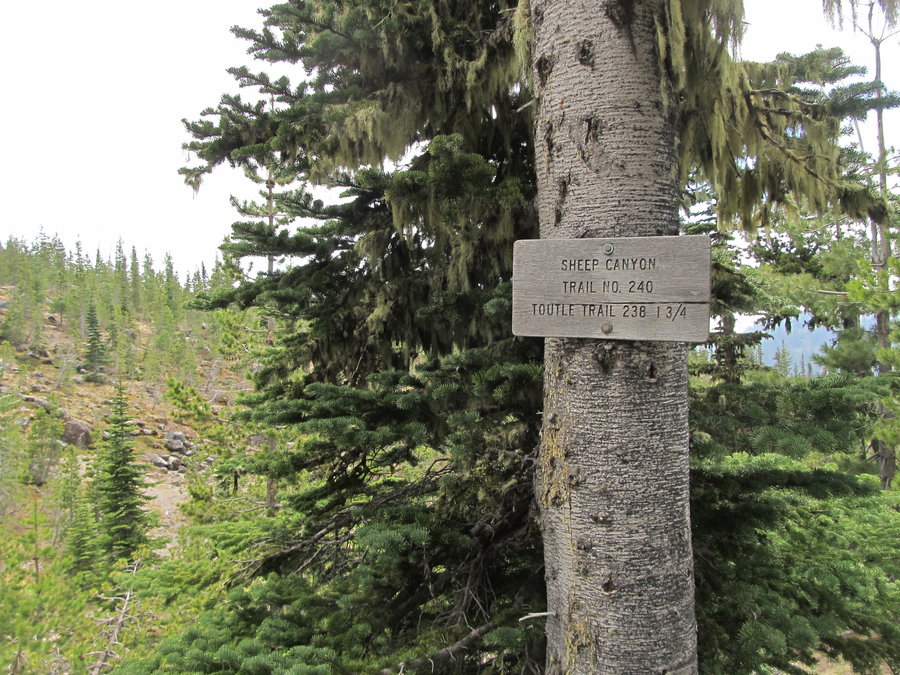
My original destination was Sheep Canyon but NF-81 was gated at Kalama Horse Camp. I hadn't been to this area and even though recent trip reports mention this significant detail, it just didn't register. With no "plan B", I quickly scanned the kiosk at the campground, took a cell phone pic of the map, then set off for Goat Mtn, naively assuming the trail went to the summit of Goat Mtn. It does not. Eventually, I looped my way around to the TH marker which was would have taken me to Sheep Canyon but by now I was 8 miles into the hike and running out of time so I headed back. Obviously there is a lot to explore in this area and I'm looking forward to return visits. Lots of options.
March 12, 2015

.jpg)
.jpg)
.jpg)
.jpg)
.jpg)
.jpg)
.jpg)
.jpg)
.jpg)
.jpg)
.jpg)
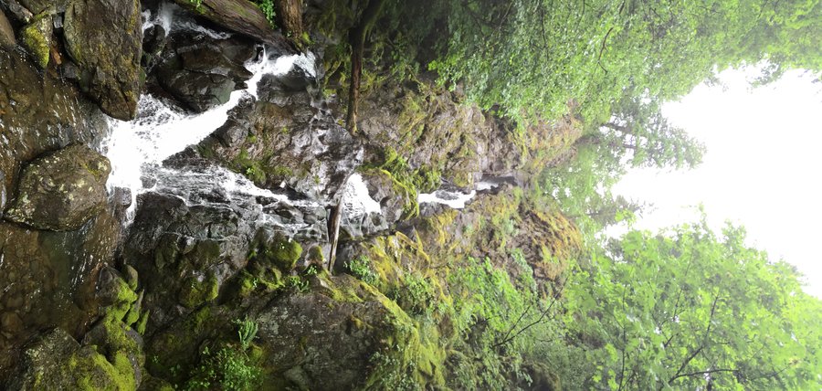
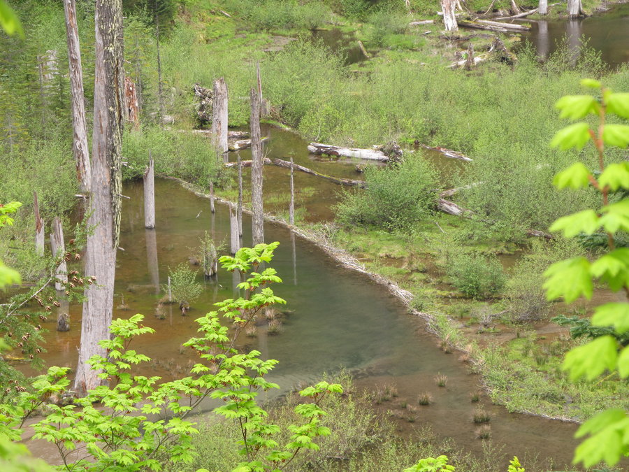
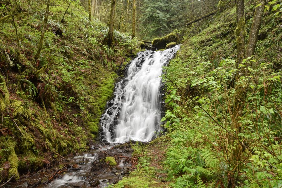
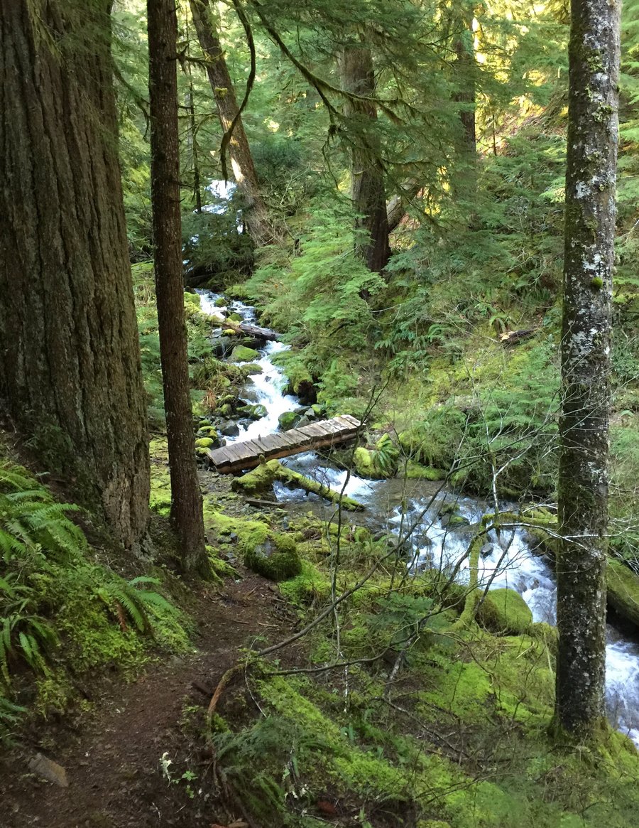
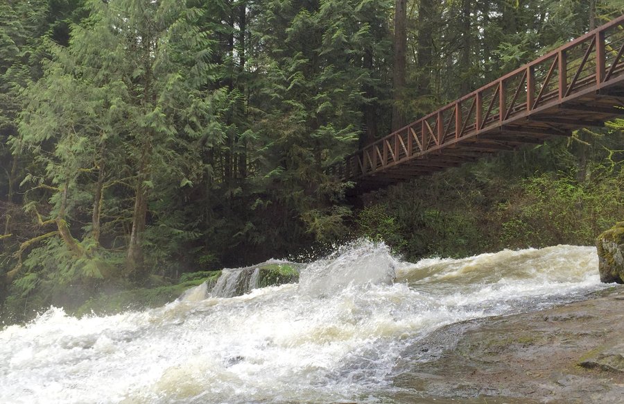
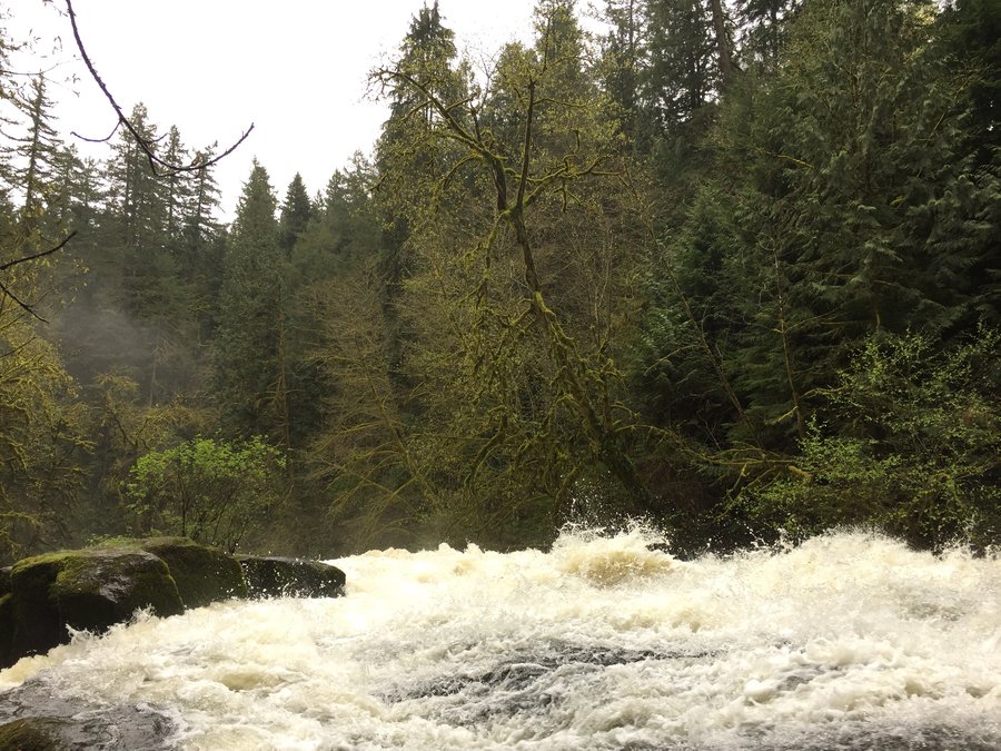
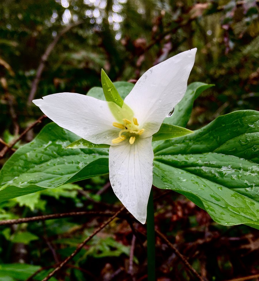
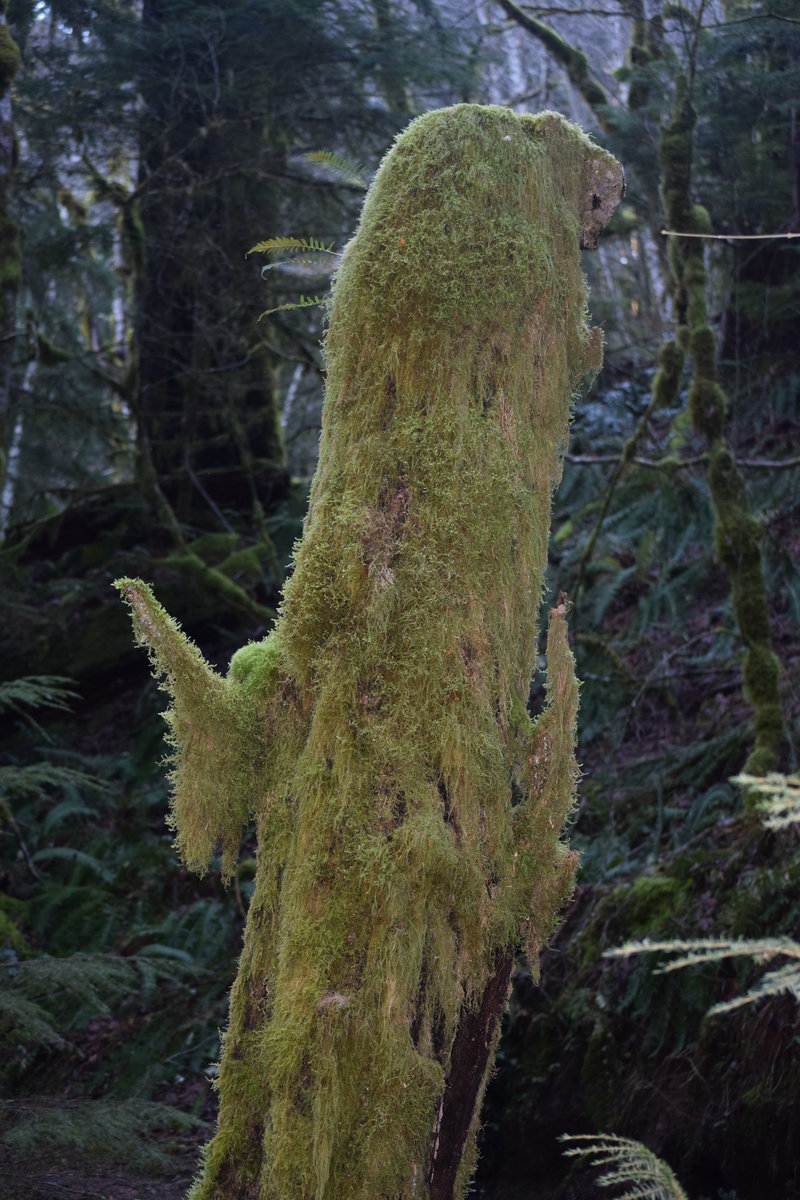
Cedar Falls-Hamilton Creek
7 miles of hiking • 1500' elevation gain •
I had a rough plan to spend my rainy days this winter exploring the area between the Columbia and Sunset-Hemlock rd, and bounded generally by Hamilton Mtn and Bonneville dam. I figured I'd follow the snow line throughout the winter as the mountains filled up and TH access became limited. Obviously this didn't happen and I didn't spend much time in this area as a result. Today, though, I set out on a rainy afternoon to visit Cedar Falls and check out the old RR grade along Hamilton Creek. I only had a few hours which didn't take me too far but it was a nice trip with many future possibilities. The trail to the falls is in great shape with evidence of very recent maintenance work. There were even a couple trilliums blooming along with pink salmonberry flowers here and there. Elk have been hitting the area pretty hard it appears and I had to laugh when I got to the roped up area. The elk had trampled the rope into the dirt as they dove down and across the gully with apparent ease.
March 11, 2015

.jpg)
.jpg)
.jpg)
.jpg)
.jpg)
.jpg)
.jpg)
.jpg) 1
1
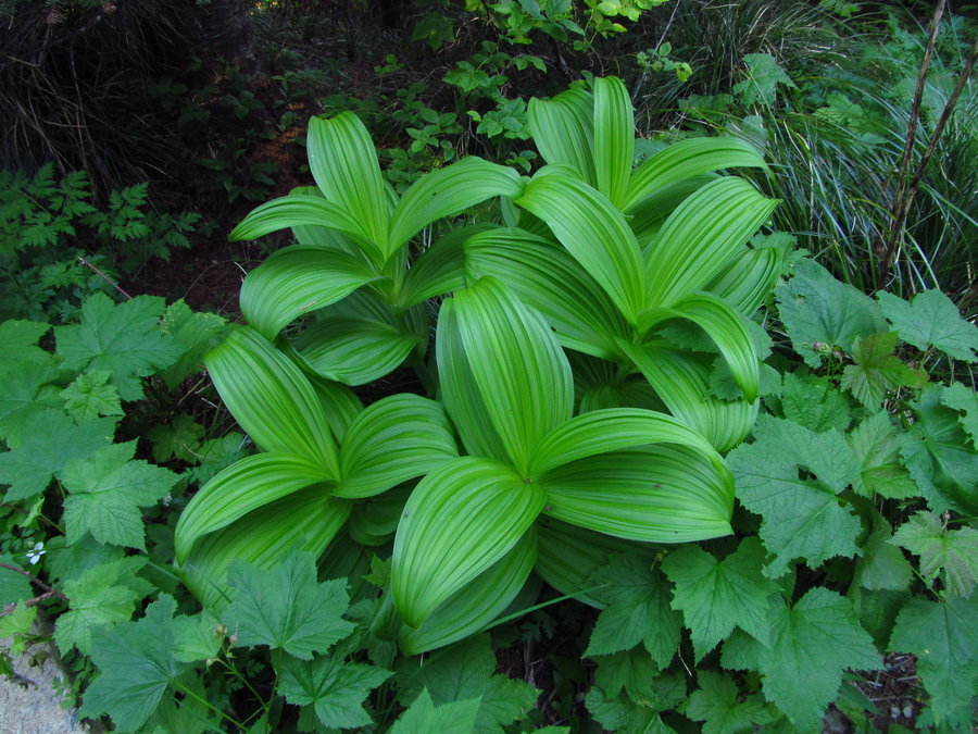
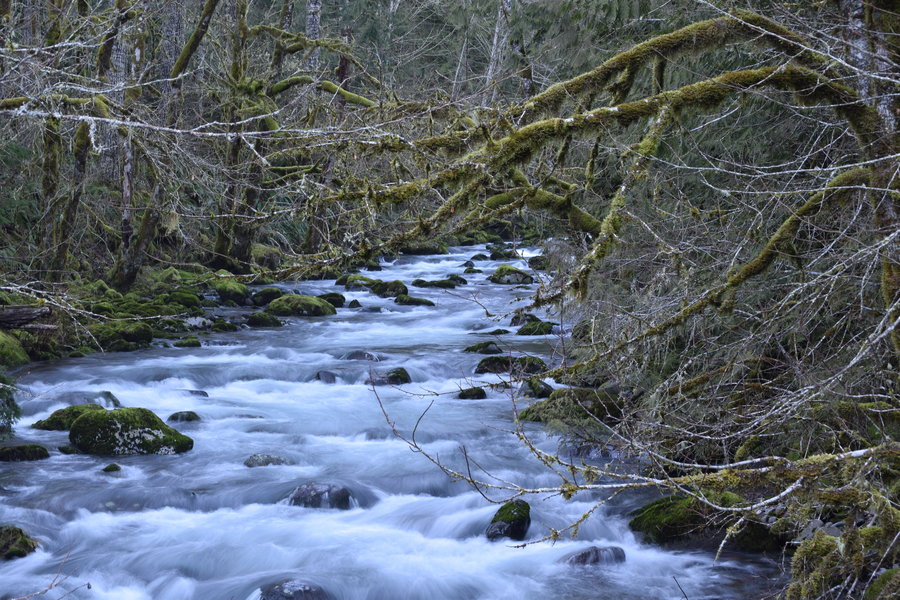
Huffman Peak->N Siouxon Creek->Siouxon Peak triangle loop
9 miles of hiking • 3000' elevation gain •
Starting just below Huffman peak down N Siouxon trail (#126) to creek bottom then east to saddle N of Siouxon peak. Eventually connected to Huffman Peak trail (#129) at Siouxon peack then back to start. Lots of bushwacking and trail finding. Tough hike for just 9 miles.
March 3, 2015

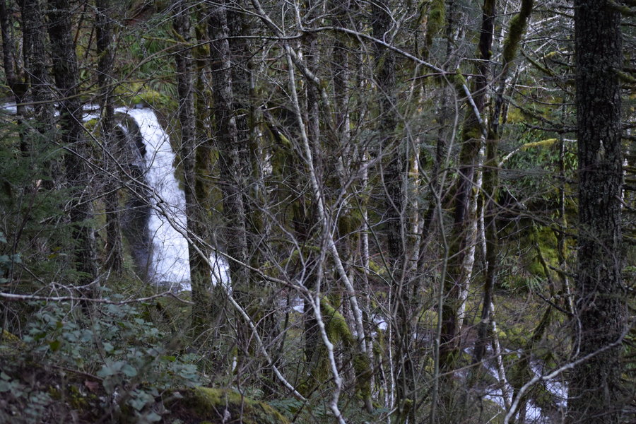
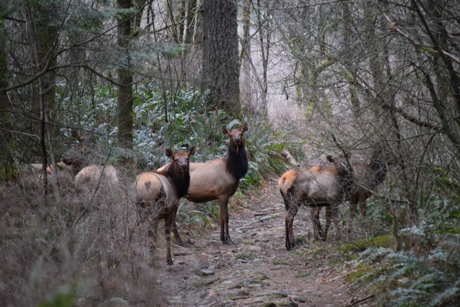
Black Hole Falls - North Siouxon Creek
11.5 miles of hiking • 1500' elevation gain •
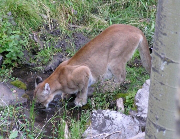
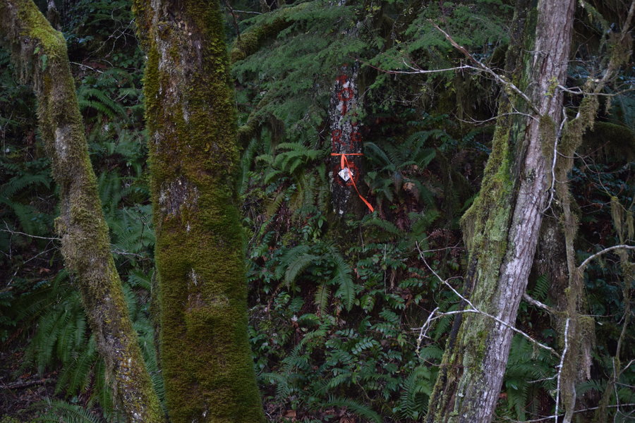
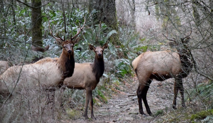
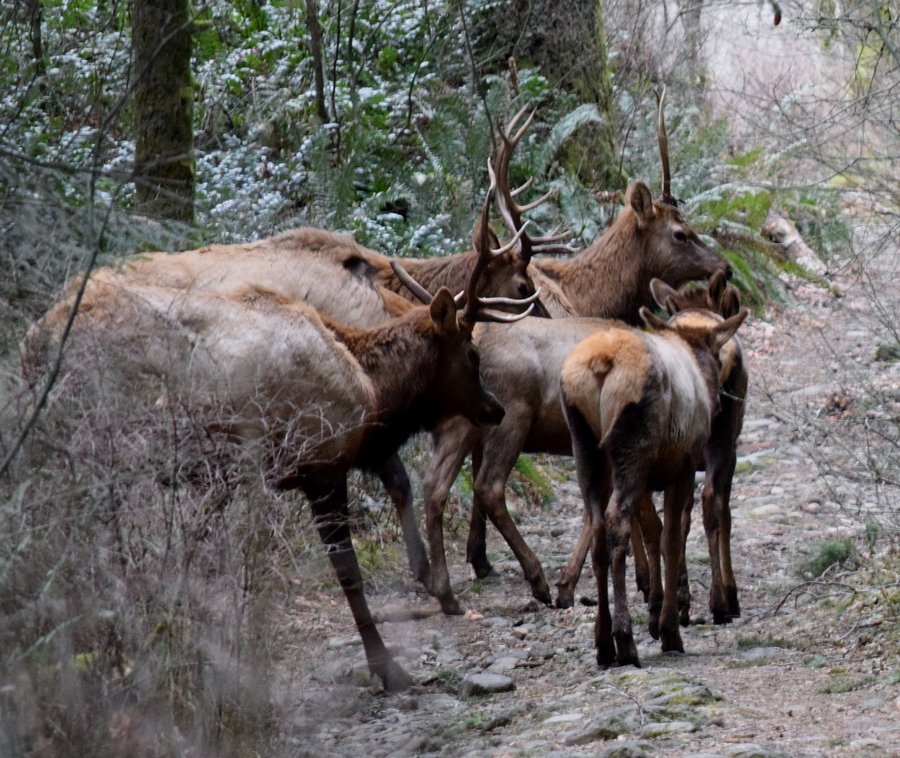
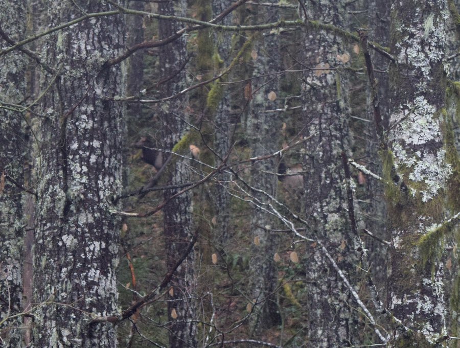
North Siouxon Creek seemed like a perfect rainy day hike to shake off 9 straight days at work. Still suffering from the lingering effects of an annoying cold, I was looking for a place not too steep and not too long. Eventually, I plan to figure out a loop option connecting this trail with the Huffman Peak trail but I wasn't feeling it today.
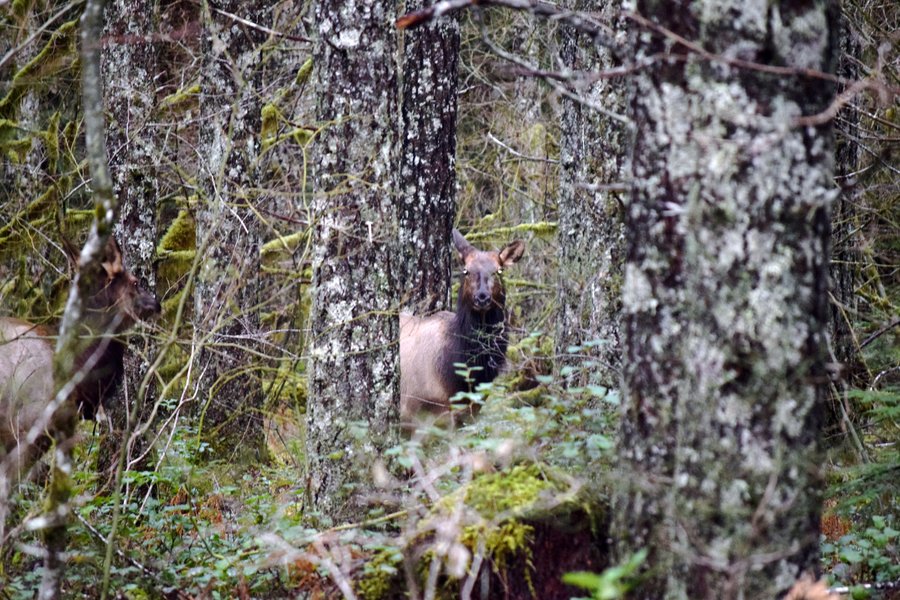
About 2.5 miles down the trail, I thought I heard some brush crash but after a brief stop and look, I moved on. Suddenly, a very large, mature cow elk stood up at the edge of the trail and stared in my direction. I slowly reached into my pack to get the camera when she took a step forward only to collapse on her rear flank. After struggling to regain her feet, she took another step only to have her rear legs give out a second time. On her feet again, she pitched forward, out of sight below the trail and behind a large tree. At this point, I started wondering if I'd just interrupted a lion attack. I kept my eyes open as I crept cautiously up to the point where she disappeared. She hadn't gone anywhere, though, and was lying there unable to get up -- or even attempt to. She appeared to be on the verge of dying so I snapped a couple pictures and moved away, not wanted to stress her any further. In a few hours, I'd have to return and I planned to look for signs of a struggle. I half expected to return to find a dead elk and possibly an annoyed predator aggravated with my constant interference.
Another mile or so down the trail, an owl hooted from deep in the woods. A second owl hooted further up on the hillside. I got the camera out and hooted back (an old turkey hunter trick). Within seconds, one owl, then the other, sailed down the hillside and landed in the canopy 100' above. I snapped a couple marginal pics with a 200mm lens then moved on toward the falls listening to those owls calling the whole time until I walked out of earshot.
Continuing on, I ate lunch at the falls, took a few pics, and headed further up the trail another half mile or so, past the worn out lean to, until I reached the dilapidated foot bridge that crosses one of the forks coming off Mitchell Peak. I was running out of time so this seemed like a good place to turn around. The pics don't make it obvious but that bridge reaches 12-14 feet above the ground at the far end.
As I got closer to the spot where the elk had been, I slowed way down and got the camera ready. Three hours had passed and I wasn't sure what to expect. Despite my caution, though, when I got to the spot she was on her feet and looking at me. As soon as I made eye contact, she took a few quick steps and disappeared into some vine maples. I kept moving as I had concerns she would panic and head further down hill, eventually ending up in the creek bed unable to climb back uphill. I really have no idea what was wrong with the elk. She didn't look emaciated. No obvious broken bones. Poaching seems unlikely given the distance from any road and the time of year. Pregnancy gone bad? Predator attack? Who knows?
February 26, 2015

.jpg)
.jpg)
.jpg)
.jpg)
.jpg)
.jpg)
.jpg)
.jpg)
.jpg)
.jpg)
.jpg)
.jpg)
.jpg)
.jpg)
.jpg)
.jpg)
.jpg)
.jpg)
.jpg)
.jpg)
.jpg)
.jpg)
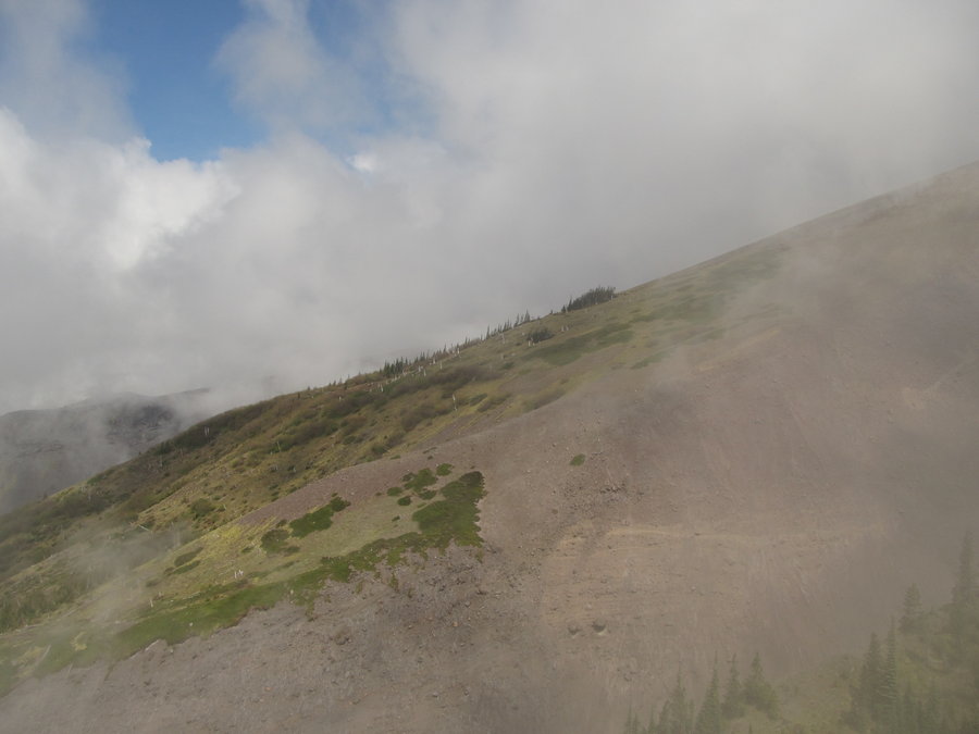
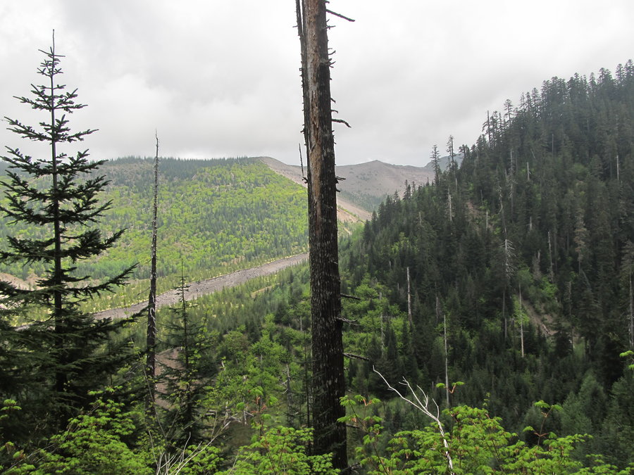
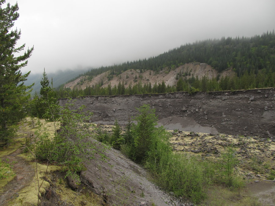
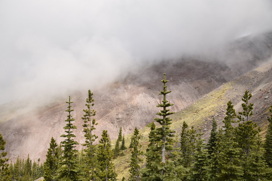
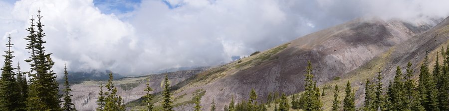
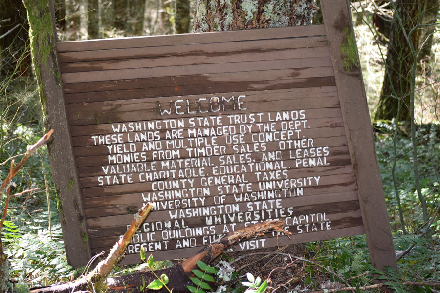
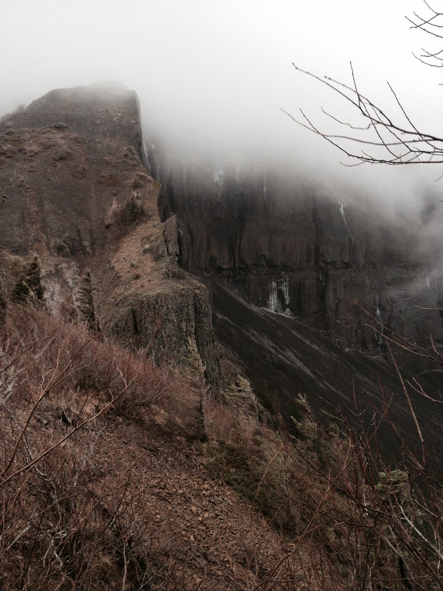
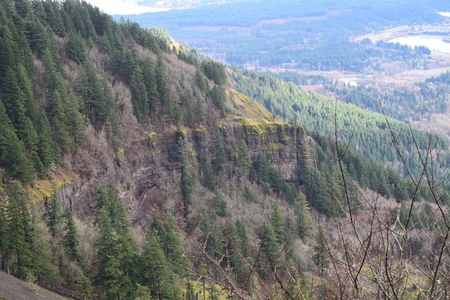
Upper Rock Creek drainage: Red Bluff Rd to Lookout Mtn (almost)
8 miles of hiking • 2250' elevation gain •
February 15, 2015

February 13, 2015

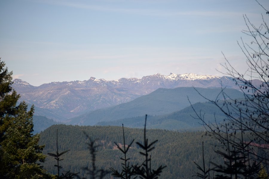
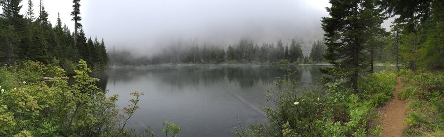
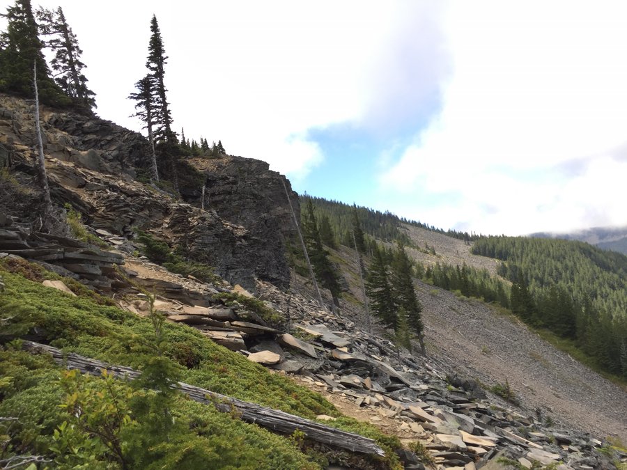
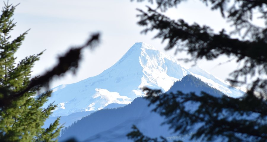
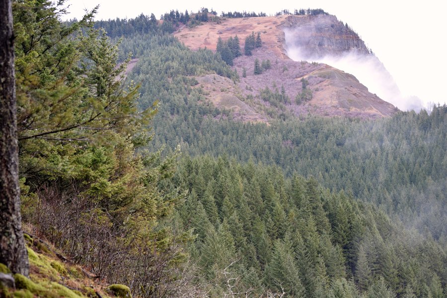
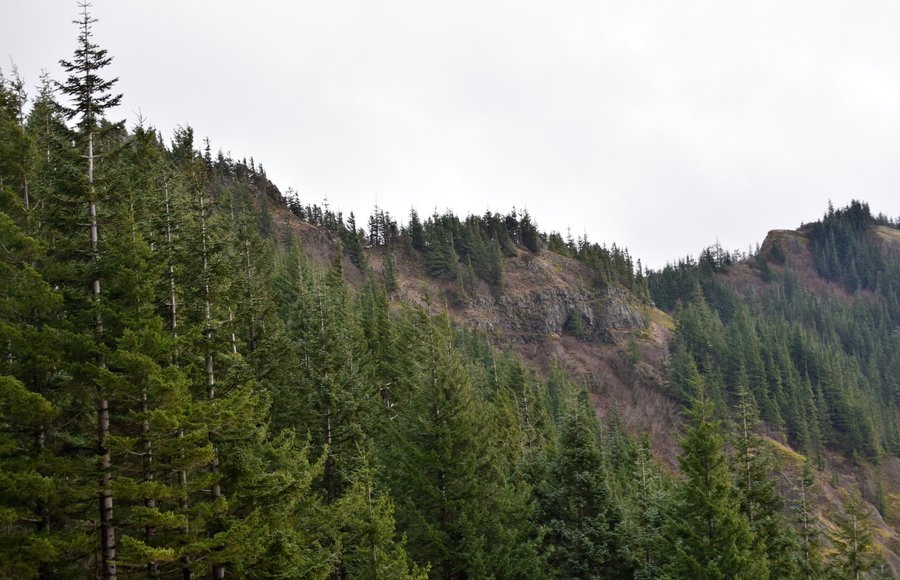
Sedum Ridge->PCT loop
11.5 miles of hiking • 3000' elevation gain •
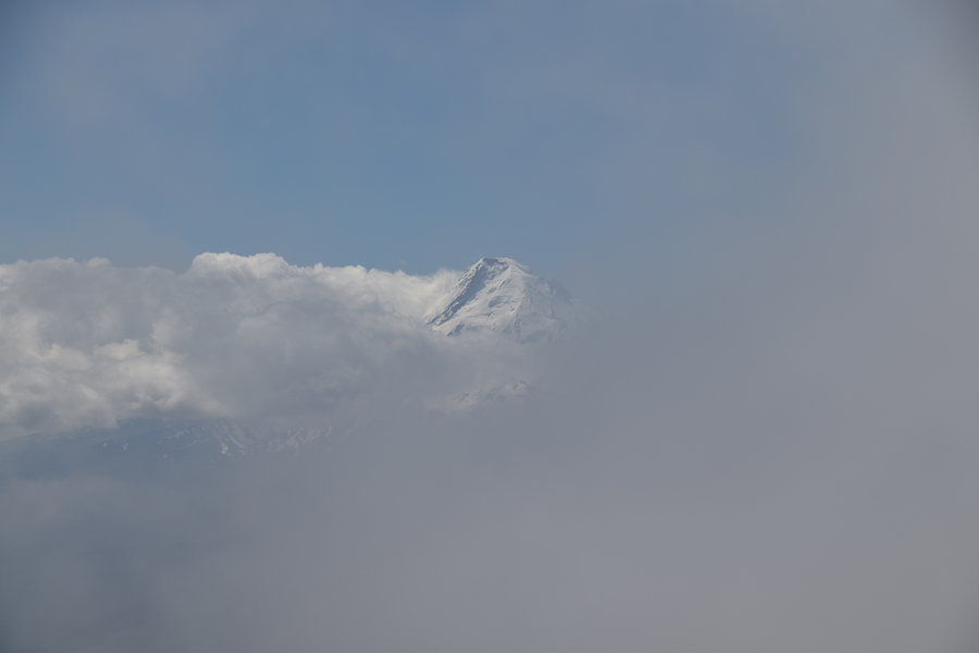
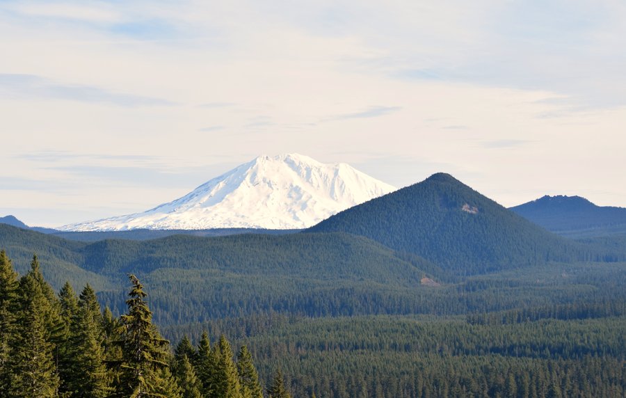
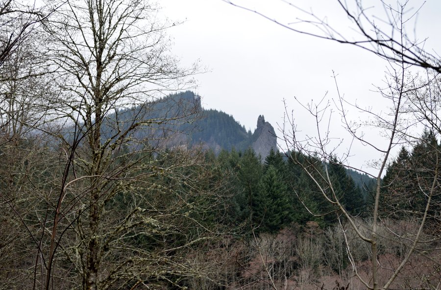
Apparently I don't pay much attention to nor learn from others' experiences. After several dead end attempts to find the Sedum Ridge trailhead, I eventually bushwacked straight up the ridge for several miles before bisecting the actual trail which I had by now assumed was lost to time. In hindsight, a prior trip report from Pablo mirrored my same findings/frustrations -- a TR I had read, of course. The trail itself is in remarkably good condition and a little maintenance work would go a long way in extending the life of this trail. The pic of Mt Hood with Greenleaf Peak (pretty sure, maybe not) in the foreground was taken from the upper end of the PCT.
February 12, 2015


Wildwood--> Tunnel trail and back
4 miles of hiking • 1000' elevation gain •
Just a quick in and out hike with weighted pack before heading off to work. Actually, it's just an excuse to make a guilt-free trip to the food carts. Burn 500 calories, replace them with a 1000. You betcha...
February 6, 2015


Multnomah Falls
4.5 miles of hiking • 1500' elevation gain •
The plan was a quick loop hike before work starting at the I-84 parking area. As it turned out, the connector trail from Multnomah Falls to the Wahkeena Falls trail is closed. Oh, well. Ended up doing an up and back.
February 4, 2015

.jpg)
.jpg)
.jpg)
.jpg)
.jpg)
.jpg) 1
1
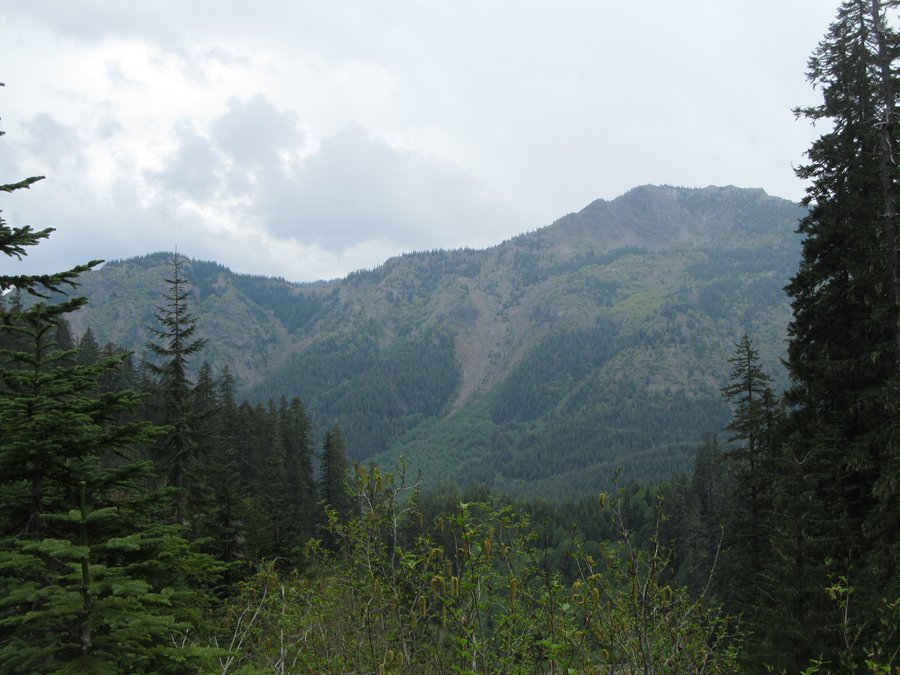
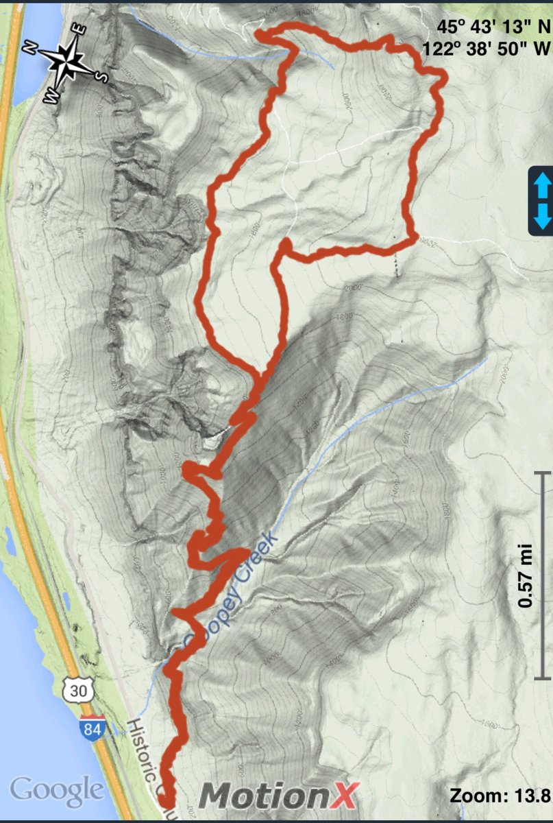
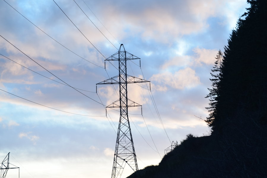
Table Mountain via Cedar Mountain
11 miles of hiking • 4000' elevation gain •
Decided to shake off the post-Superbowl blahs with a long gorge hike. Starting at the powerlines, I started up Cedar Creek. Using the trail along the west side of Aldrich Butte, I eventually crossed the creek, climbing and following Cedar Mountain until reaching the PCT. From there I took the west side trail to TM summit. The gale force winds made the trail along the cliffs more dangerous than usual but the summit was not so bad. From TM, I took the trail north to the powerlines, picked up the PCT, and returned making a figure eight for the day.
February 2, 2015


February 1, 2015

January 28, 2015


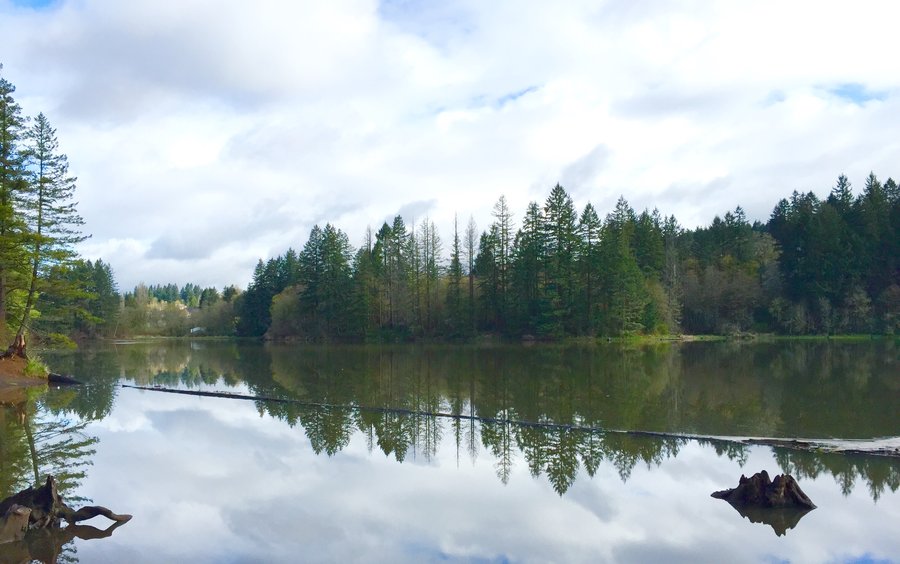
Lacamas Lake Park
3.5 miles of hiking • 500' elevation gain •
Roaming the trails before work today while testing a new pack out. 60# of sand makes even a gentle walk thru the forest into a workout.
January 23, 2015

Lacamas Lake Park
4.5 miles of hiking • 750' elevation gain •
Took a short hike before work. Just too nice a day not to.
January 21, 2015

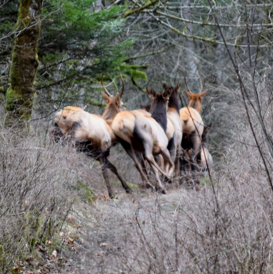
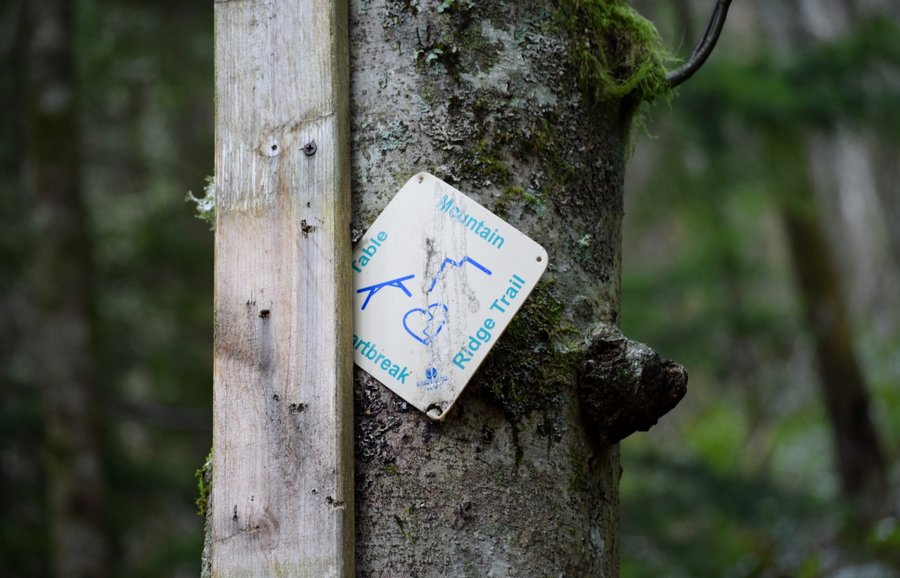
Table Mountain - foiled again
10 miles of hiking • 3500' elevation gain •
After spending the past 7 blue sky days at work, I decided to attempt Table Mountain today. This would be the third time. The first time, I got side tracked exploring a different trail after taking a wrong turn. The second ended in a complete whiteout in the rocks near the summit following the west side trail. Today, I decided if the weather appeared too bad, I would take the PCT up to the power lines past TM for a longer in-out hike. The lure of the Heartbreak Ridge trail was too much however despite my better judgement. Near the top, however, the ice and freezing rain stopped me, again, just short of the summit. I REALLY did not want to go back down via the Heartbreak Ridge trail but I had little choice. Microspikes and trekking poles saved the day -- and my knees. I'm starting to feel like Moses and the promised land. All was not lost however, I ended up bumping into a large herd of elk which always brightens up a rainy day.
January 15, 2015

 1
1
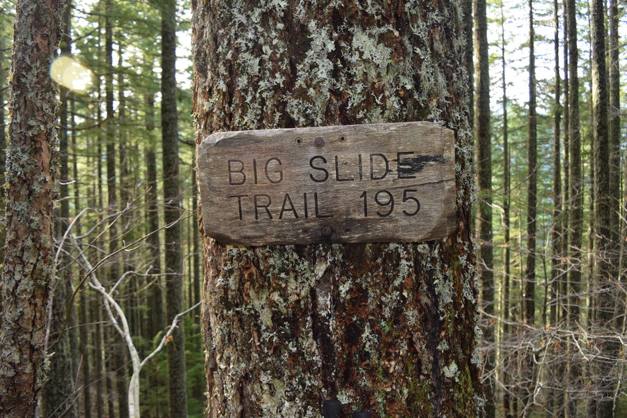
Trapper Creek
7.1 miles of hiking • 1750' elevation gain •
Headed off to McClellan Meadows for a day of bushwacking on snowshoes. It was not meant to be. There wasn't enough snow for snowshoeing and that was covered in ice. Hiking was out of the question. Since I had no plan "B", I pulled out the maps and decided to head into Trapper Creek. It seems like this area is always on my radar but ends up taking a back seat to some more "prestigious" destination so I was glad to finally knock it from the "to do" list. By the time I got there, I only had 3 hours left so I did a loop which included Trapper Creek TH->Observation trail->Big Slide trail->return TC. I'm looking forward to exploring this area in the future. Oh, and I did manage to catch a glimpse of some elk.
January 6, 2015

Hamilton Mtn - Hardy Creek
8 miles of hiking • 2500' elevation gain •
Hiked the loop using the cut-off trail. Visibility was touch and go. No view at all from Hamilton Mtn. Other than wet, trail conditions were good.
January 5, 2015

Aldrich Butte
3.6 miles of hiking • 1250' elevation gain •
Well, I intended the first hike of the new year to be something more spectacular but last minute plan changes and a shortage of daylight resulted in a quick burst up Aldrich Butte. I used the trail that winds along Cedar Creek on the way up then made a loop by coming down the road back past Carpenter Lake to the power line. The day was clear and cold with a lot of wind.
January 1, 2015