

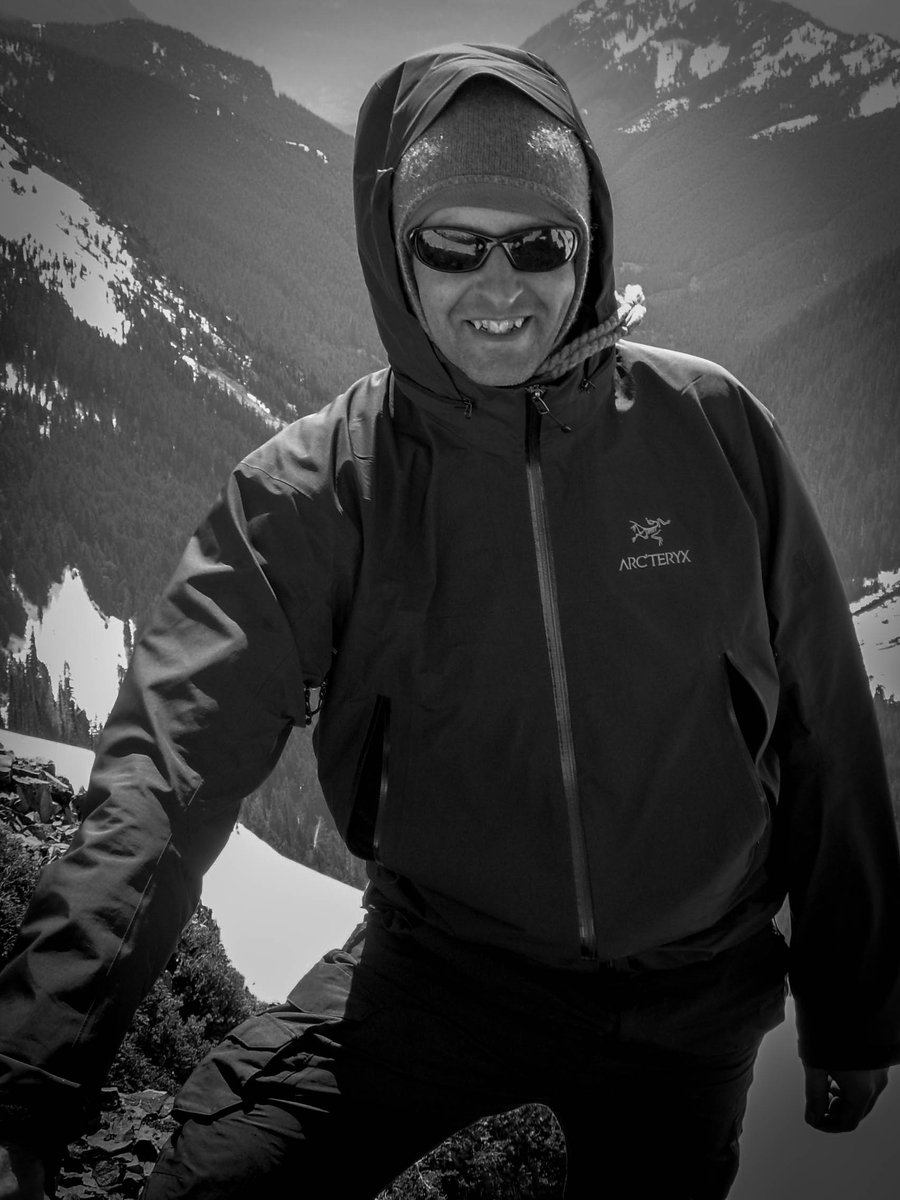
2016 Trips


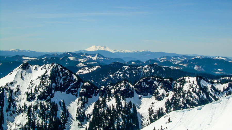
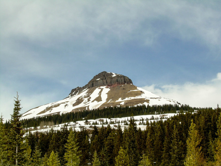
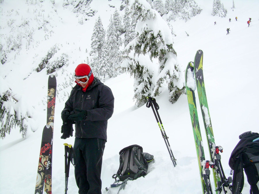
Hyak Ski Tour
1.5 miles of hiking • 1500' elevation gain •
Had an amazing day up on the mountain with Theo and Mindy. We got 2 runs in and plenty of face shots. Up high there was about 6 - 8" of dry fresh snow over a crusty bottom. This was expected after how much rain they had received earlier in the week. On our last run we actually found some really nice turns skiers right of the Hyak Face. We only scraped the crust layer a few times !! Afterwards we enjoyed some good bier at DruBru and filled growlers for our stockings. We also grabbed a bite of food from the commonwealth. That place is legit and I will most certainly be stopping there when I am up at the pass from now on. Happy Holidays and Looking Forward to a Big Year in 2017 !!!!!!!

December 24, 2016

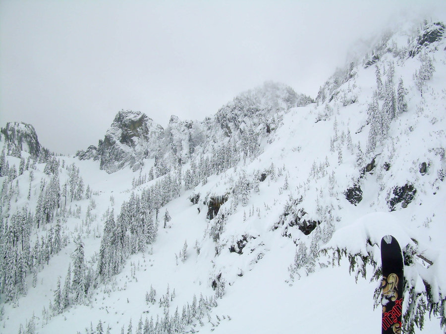
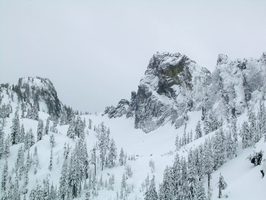
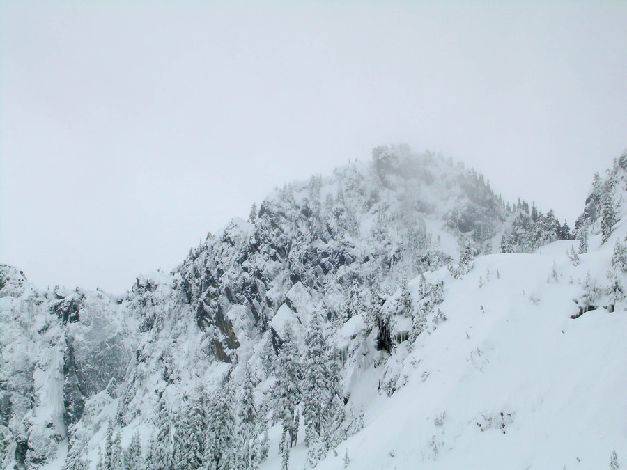
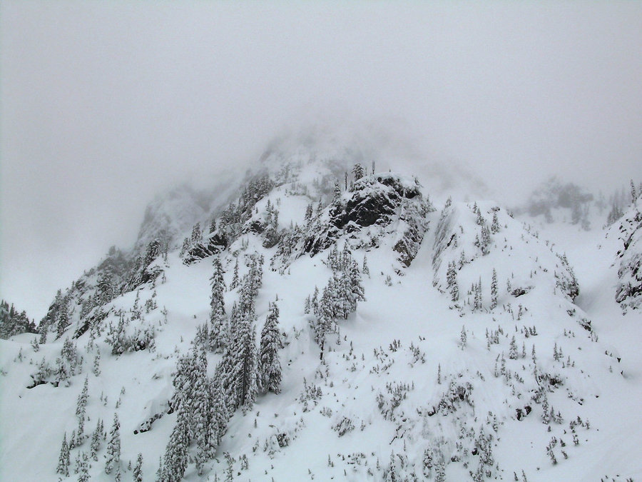
Hyak Face Ski Tour
1 miles of hiking • 1000' elevation gain •
Mindy and I went for a quick tour up Hyak face. Just wanted to get up and check on the conditions. It was amazing how preserved the snow was up there with all the cold temps. It was by far the driest snow that I have ever experienced in my 15 years of living in the PNW. Turns were plentiful and it felt great to really get the season kicked off with bang !!!
December 17, 2016

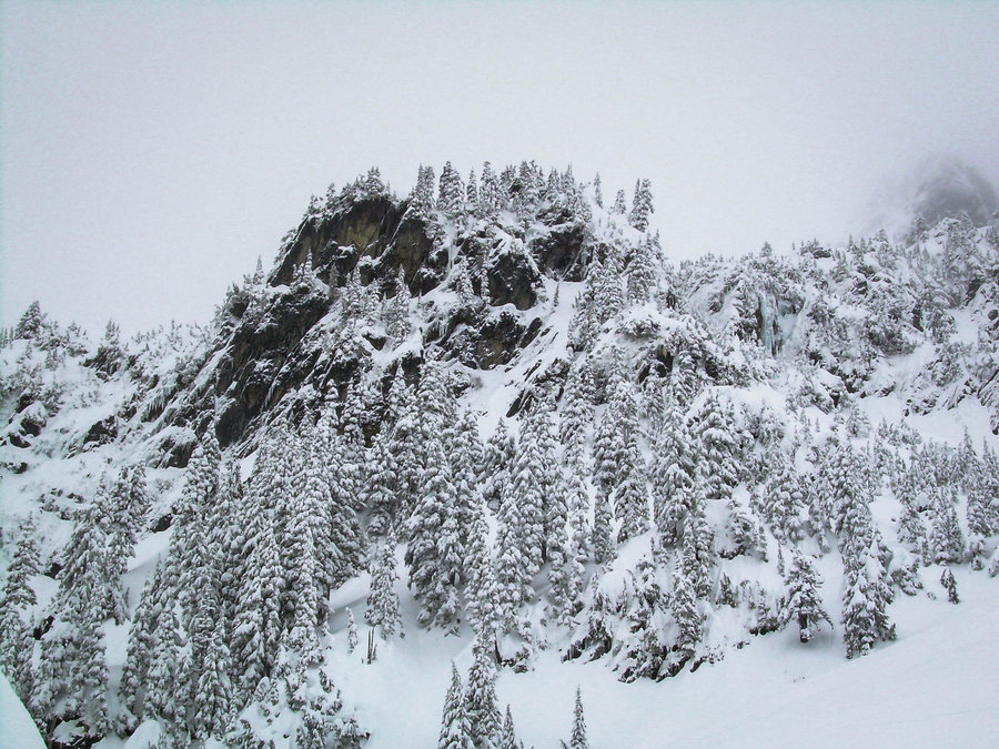
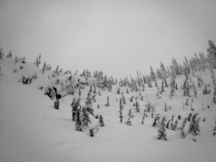
Glacier Basin Ski Tour - MRNP
7 miles of hiking • 2250' elevation gain •
With Chinook Pass & White River Rd closing on the 21st, we decided to make one last run at this area. We had heard about all the great snow that had flying in early Nov. and it didn't disappoint, we actually ended up being one of the last parties for the season. It had snowed all day and the ranger swung by just as we got to the parking lot. He informed us that the gate was going to be locked and this area was done for the season !!! We didn't quite get as high as we had hoped, primarily due to the high winds and low visibility. But it was still a great day in the mountains. Theo, Jason and Russ joined me for this late season trip. Jason and Russ were on slowshoes and Theo was breaking his new AT gear in.
November 19, 2016
 1
1
Labor Day Backpacking Trip to Dewey Lake
7 miles of hiking • 750' elevation gain • 3 nights
We had our annual Labor Day weekend trip and Mayumi got to pick our destination this year. A few weeks ago she enjoyed our trip to Dewey Lake so much that she wanted to go back. We decided to leave on Friday to have a better chance at getting a good spot on the lake. We timed everything just right and missed all the rain on the approach. Just after getting camp setup, it decided to dump again. Luckily we were already cozy in our tents taking naps !! We got lots of fishing in and had plenty of fresh fish to eat for Lunch and Dinner all weekend. This was a great trip and everyone enjoyed it.
September 2 – September 5, 2016
 1
1
ANNUAL SCRAMBLE UP THAT PEAK NAMED GUYE
3.5 miles of hiking • 2000' elevation gain •
On Sunday I took Russ up to the south rib scramble on Guye Peak. Russ earned a feather for completing his first major scramble of a peak. It was a gorgeous day and the temps were just right. When we reached the summit there was a nice breeze and it continued for most of our descent. All around a really great day to be out on a peak !!!
August 21, 2016

Dewey Lakes
6 miles of hiking • 750' elevation gain •
We decided to take a family hike and beat the heat this weekend. Mayumi liked the Chinook pass area so much last weekend, that we decided to try another nearby lake. The flowers were out in full force in all the meadows and it made for a beautiful backdrop. Dewey Lake had a nice sandy beach area that was perfect for swimming. What a great way to cool off !!! I will be going back with my fishing pole next time. There were tons of fish jumping !!!
August 13, 2016

Sourdough Gap / Sheep Lake - MRNP
7.5 miles of hiking • 1750' elevation gain •
What a great afternoon on the East Side of Rainier. We left a grey overcast Kent in the morning and drove into blue sky near chinook pass. I picked a nice easy lake hike with the hopes that Mayumi would want to join me. She ended up saying yes and off we went. The hike up to sheep lake is pretty low key, but the wildflowers were out in full force so there was plenty of eye candy to keep me occupied taking pictures. Once we got to the lake Mayumi was in heaven and was enjoying putting her feet in. I still wanted more of a work out, so I took off to go explore the sourdough gap area. This was a fun little jaunt and I got to do some ridge scrambling on some unnamed peak. Pictures to come soon.... I am way behind in all my digital uploads.
August 6, 2016

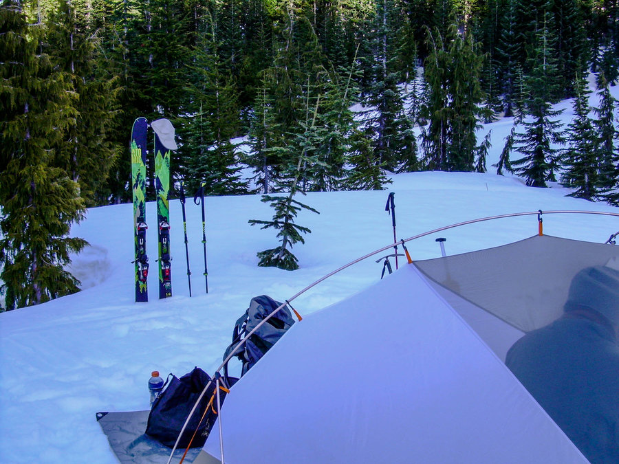
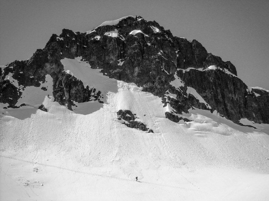
Russel Glacier Ski Tour / MRNP
11 miles of hiking • 6500' elevation gain •
Photos and Details to come.... Nice way to start the 4th of July weekend !!!
July 2, 2016

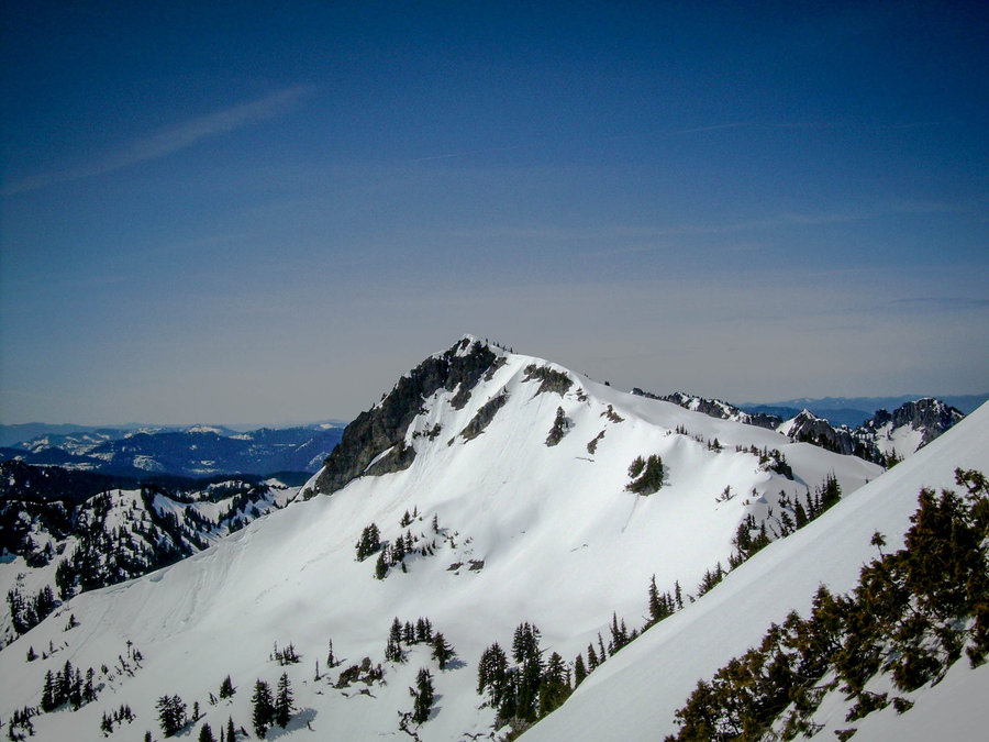
Unicorn Peak
5 miles of hiking • 2750' elevation gain •
Finally slayed me a Unicorn !!! Details and pics to come.....
June 4, 2016

Chinook Pass Ski Tour w/ Fresh Snow
1 miles of hiking • 1250' elevation gain •
I heard that higher elevations had a chance for some fresh snow on Friday night. So I woke up early to check the web cams and sure enough there was some snow in the parking lot at Paradise. So I figured there had to be freshies up at Chinook Pass as well. I quickly packed my gear and grabbed Mindy since we would be hanging out in the Wenatchee Forest side of Yakima Peak. The drive up was nice and we made good time. It's amazing how fast of a drive 410 can be....without all the Crystal Mt traffic !!! There was definitely signs of fresh snow at the pass, but the visibility was poor. I skied this area a few times last year, so I felt comfortable with heading up into the grey abyss above. Cold temps kept the snowpack firm and the fresh snow was schmooooey. It got a little better on the North facing bowl, especially at higher elevations. I took in a few laps just before it started to rain and then I decided to call it. The ski back down to the car was sloppy, but all in all a great day out and nice way to start the memorial day weekend.
May 28, 2016

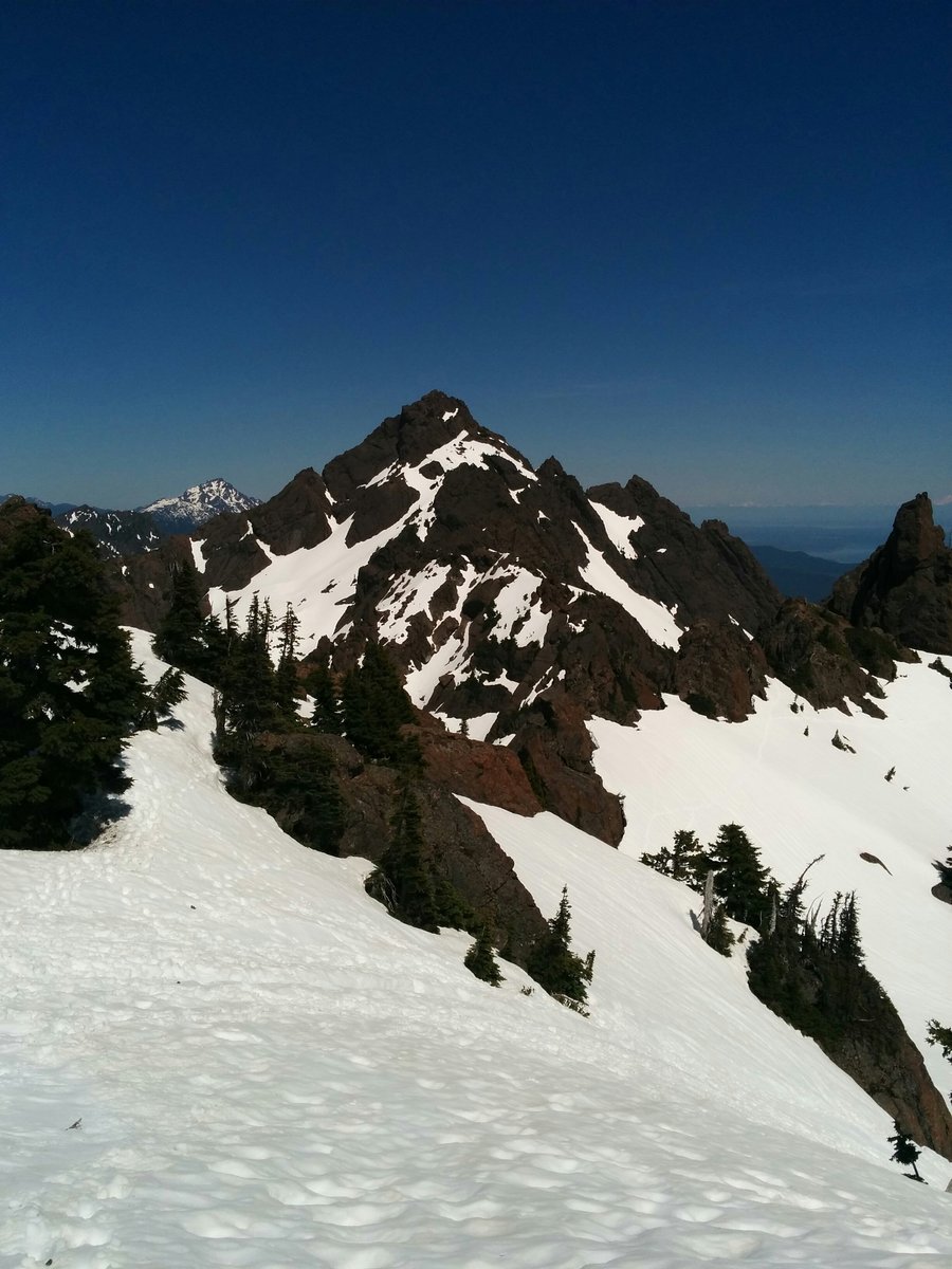
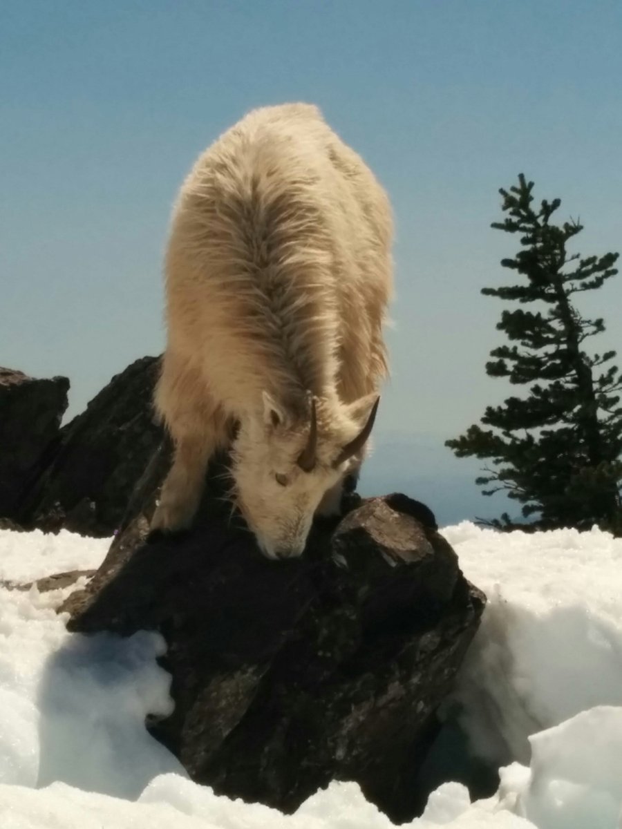
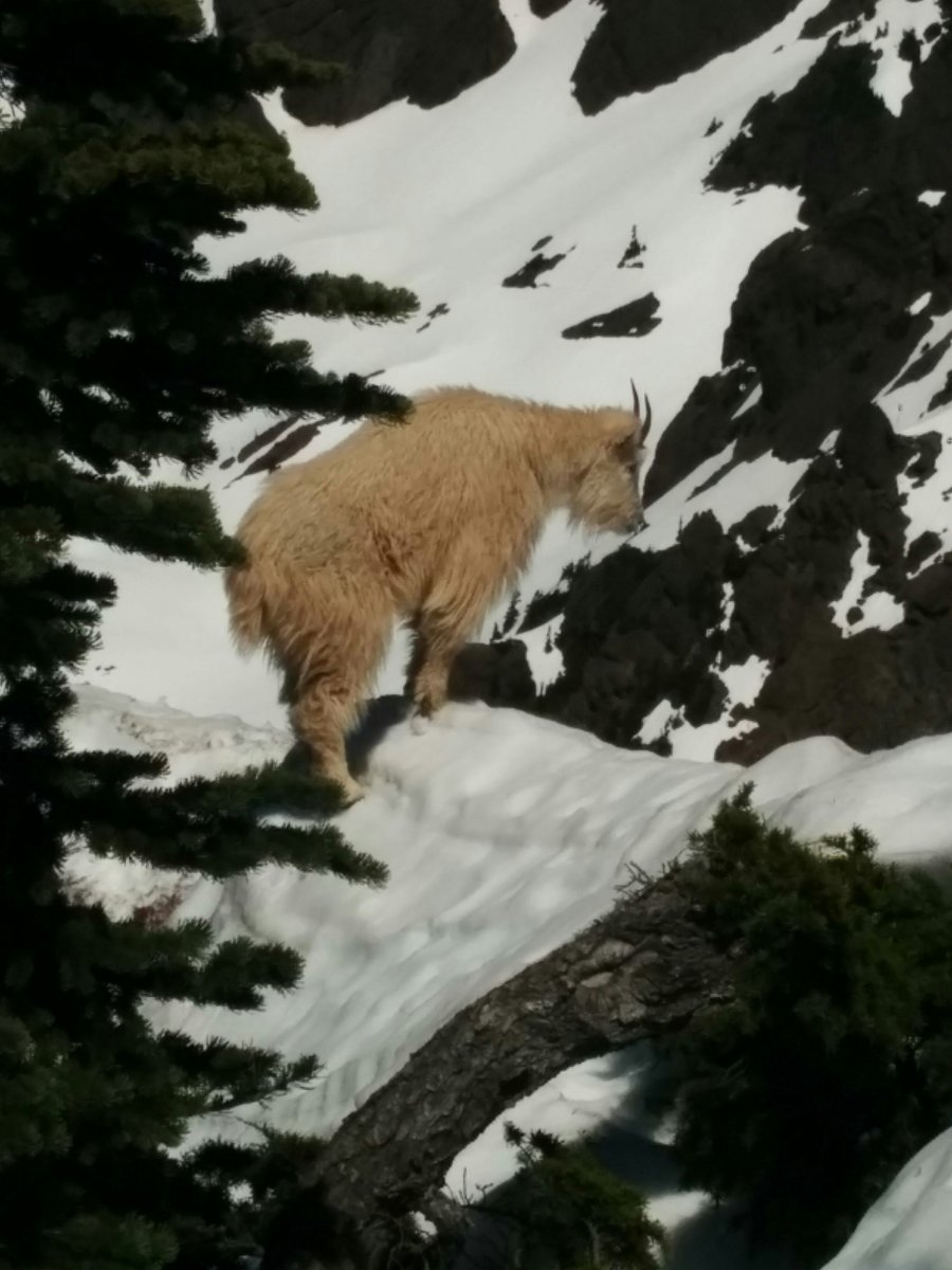
Mount Ellinor - Da Chute
6 miles of hiking • 3250' elevation gain •
My buddy Larry finally had a kid free weekend and the weather / conditions seemed right for a trip to the Oly's !!!! Larry has done some hiking, but he has never truly climbed a mountain. I figured this one would be a great introduction into the alpine world. The views were killer as always and the goats were out in full force. Had another standoff with one near the summit. Quick conditions update: The log that was blocking the road to the upper trail head has been removed and most vehicles were able to make it to the upper lot by the end of the day. There is still one small patch of snow on the road, but it is melting fast. Trucks or SUV's should have no problem. The chute is also getting thin in places. Be sure to pay careful attention to the conditions on your way up, so that you can make the right decisions on your way back down. The typical waterfall points might be exposed in a weeks time. So get up there while you can.
May 7, 2016


Friday Night Hike - Denny Mountain
4 miles of hiking • 2500' elevation gain •
Headed up to Alpental with Russ & TAH Friday after work. We timed it just right. Sunset summit and beers in the parking lot before a headlamp was needed. I skinned most of the way before my skins go to wet and stopped sticking. Had to carry my skis the last few hundred feet. I skied the bowl, but the snow was pretty sticky lower down. The pollen is really bad up there right now. My skis were left with a nice sticky residue to clean up before my next adventure.
May 6, 2016

Camp Muir Ski
5 miles of hiking • 4750' elevation gain •
Pics and More Details to come..... Snow conditions were great and was able to ski car to car.
April 30, 2016

Poo-Poo Point Training Runs
3.5 miles of hiking • 1500' elevation gain •
This is going to be an ongoing entry that will capture my stats for this after work training hike.
The stats for this hike are as follows:
3.8 Miles Round Trip w/ 1,690' of Elevation Gain. This is the Chirico Trail to Poo Poo Point.
............................
April 27, 1st time slaying da poo this year. It was sad to see that they have started the wussification process of this trail now as well. Wasn't Mailbox enough !!! All in all it was still the same trail, just a little more flare at the trail head. Ohh and they closed off my favorite part of the trail.... the shortcut up to the flats. Didn't take an official time, but it had to be around 1:50 ............................
April 27, 2016

Summit West - Last of the Snow
1.5 miles of hiking • 1250' elevation gain •
Yesterday I had half a day to kill and when I checked the web cams from home... the pass looked nice and dry. That would soon change during the drive up, but just after exit 47 it started to get nice again and things looked promising. At first I drove by Summit West and was surprised at home much coverage was still left, but things only got worse further down. Central was patchy and thin. You could eek out a few runs if you were careful and had some spring skis that you didn't mind scratching up. I kept on driving over to Da Fir and that was definitely done for the season. Now on to Hyak....wow that hillside was bare. The warm temps certainly did a number on the face. It looked like you would have to boot about 100' past the barrel to hit continuous snow. I was looking for a car to car tour and didn't want to have to haul skis, so this was out of the question. Last stop was the forest road back to Silver Peak. I figured since I was in the area it would be worth checking out. No such luck though, there is still quite a bit of snow on the road and some downed trees. Looks like the snowmobiles have packed it down pretty good though. If I had another person and shovel with me, I might have explored it a bit further. What to do now I thought........hmmmm........ well the snow up at Summit West looked continuous and the coverage was good. So what the heck, I guess a few short runs are in order to salvage this trip. Overall it ended up being a great way to spend half the day and I just beat the rain. It was misting up top on my last lap and it really started to come down just as I got to my car. Snow conditions were okay, the top half of the mountain skied well and the bottom was heavy and sticky. This might be my last run up here for the season. Highway 20 is now open and its time to get after the good stuff before its gone. Alpental and Silver might provide some afternoon fun well into May, but it's melting fast !!!!
April 23, 2016
 1
1
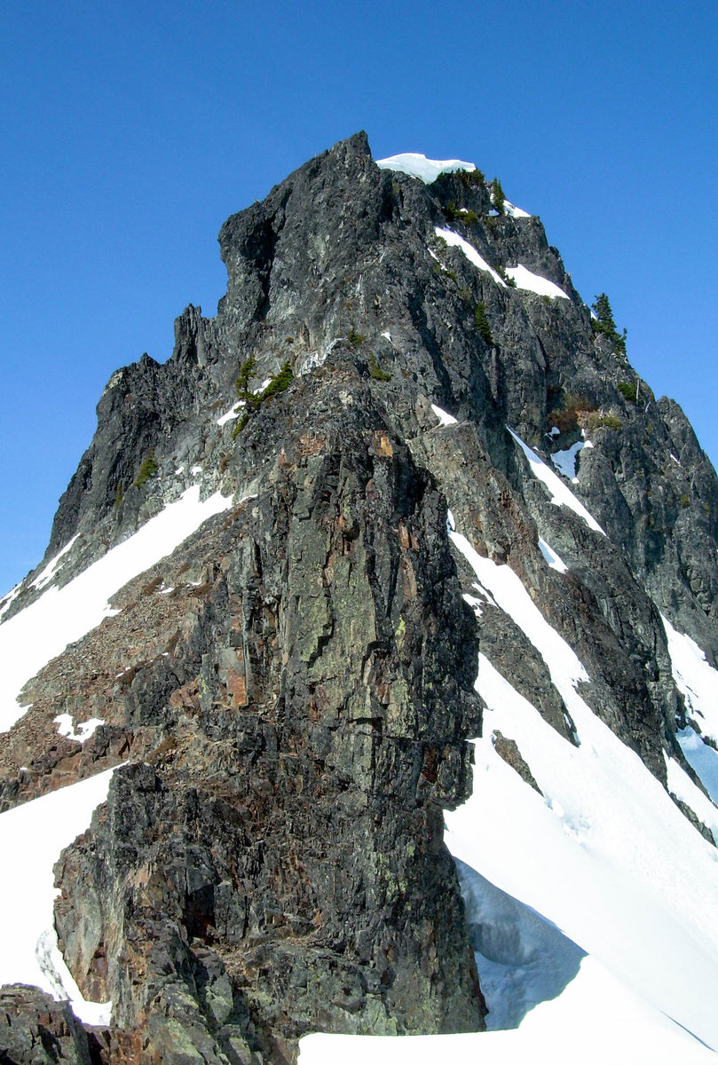
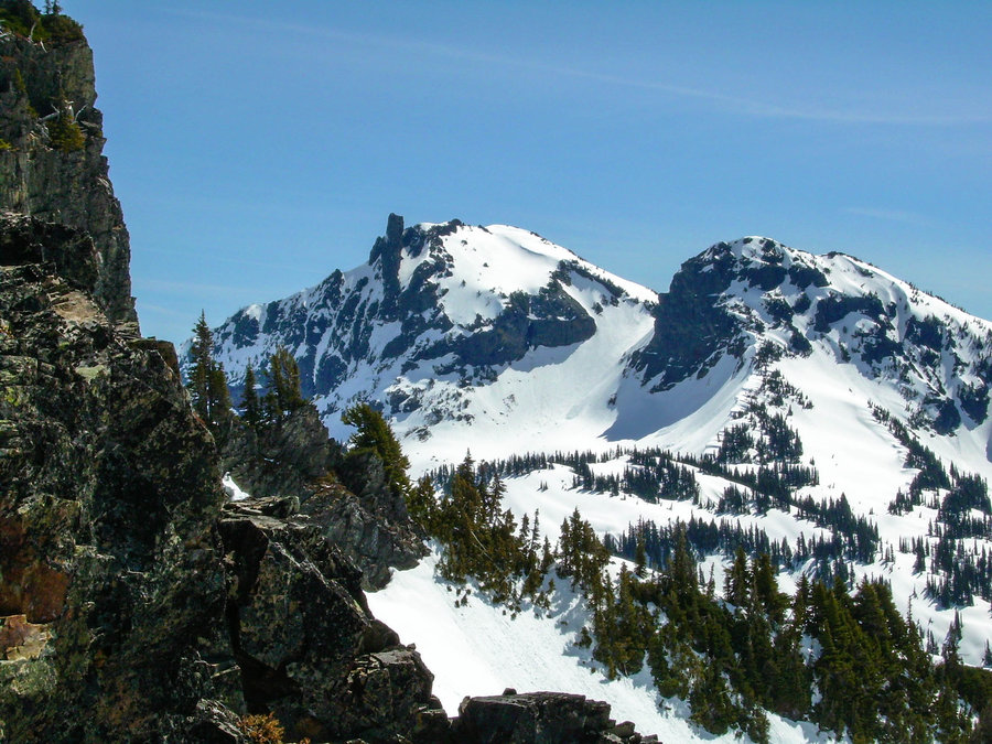
Tatoosh Spring Tour - Castle & Pinnacle
5 miles of hiking • 2500' elevation gain • 1 night
Last weekend Jason Cline and I spent the weekend camping and skiing in the Tatoosh Range. Stevens Canyon road was plowed, but not open yet. So it made for a long approach in ski boots. I was really glad to have packed my trail running shoes. They proved to be a life saver on the long road walk out !!! Snow conditions were prime up high, but down low was heavy and thick. We had an amazing campsite and enjoyed some much needed Vitamin D before packing out. Looking forward to heading back and tagging Unicorn once the road is open.
April 16 – April 17, 2016


Spring Skiing on Hyak
1.5 miles of hiking • 1500' elevation gain •
The day started off with a tee time @ 7:00 a.m. and I got a quick 9 in before heading off to North Bend to meet my buddy Tyson. We finished our round with sometime to spare, so we enjoyed some breakfast and a few screw drivers !!! Not a bad way to start my first day of spring touring. The snow was great and it was definitely T-Shirt & Shorts weather =). We got 2 laps in before I had to head home for a family BBQ. Very busy day, but it felt great to be out in the sun !!!
April 9, 2016
 1
1
Friday Night Tours - Hyak Face
1 miles of hiking • 1000' elevation gain •
I left work at 4:20 and raced home to get my touring gear. Made it to the parking lot of Summit East by 6:00 and started skinning. Got to the top of Mount Hyak just in time to catch the sunset. Quickly stripped my skins and got ready for the ski down. Missed the ripe corn by about 20 min. Things were cooling down fast and it was just enough time for an annoying breakable crust to start forming. Lower down the slush had turned to ice, but it made for a quick exit. Got back to the car by 8:00 with some daylight to spare......Not a bad way to end a work week !!! Here's to the 1st of hopefully many Friday Night Tours this spring season.
March 25, 2016
 2
2
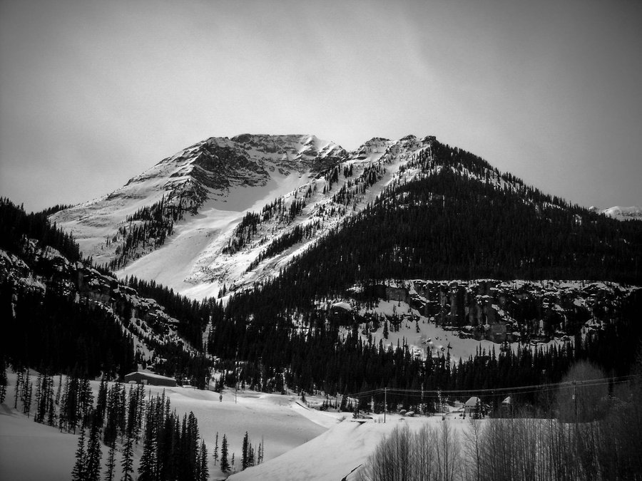
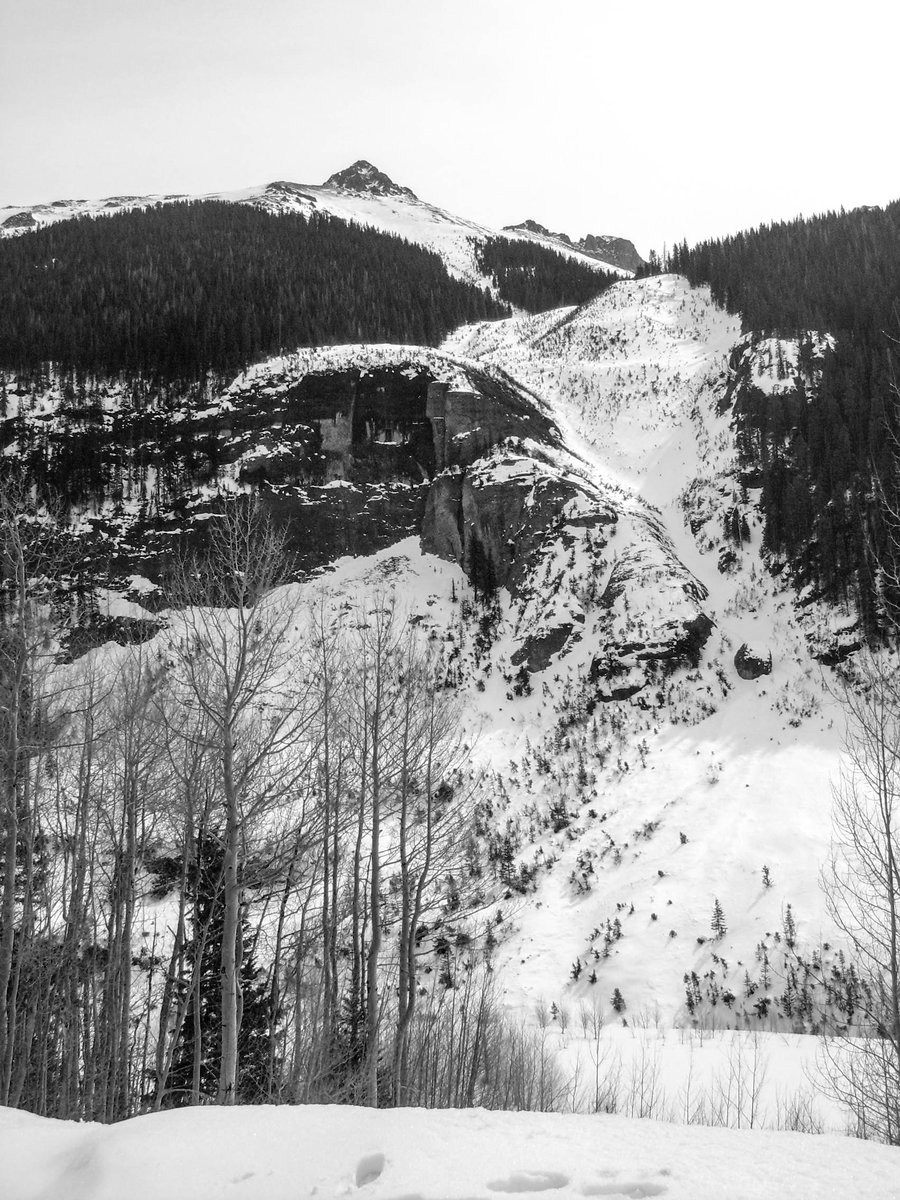
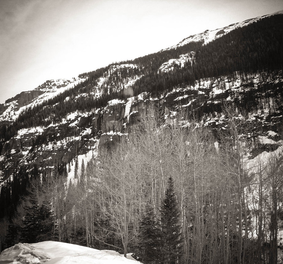
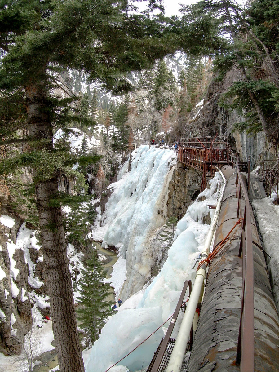
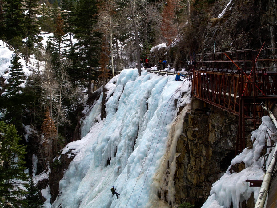
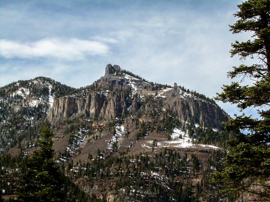
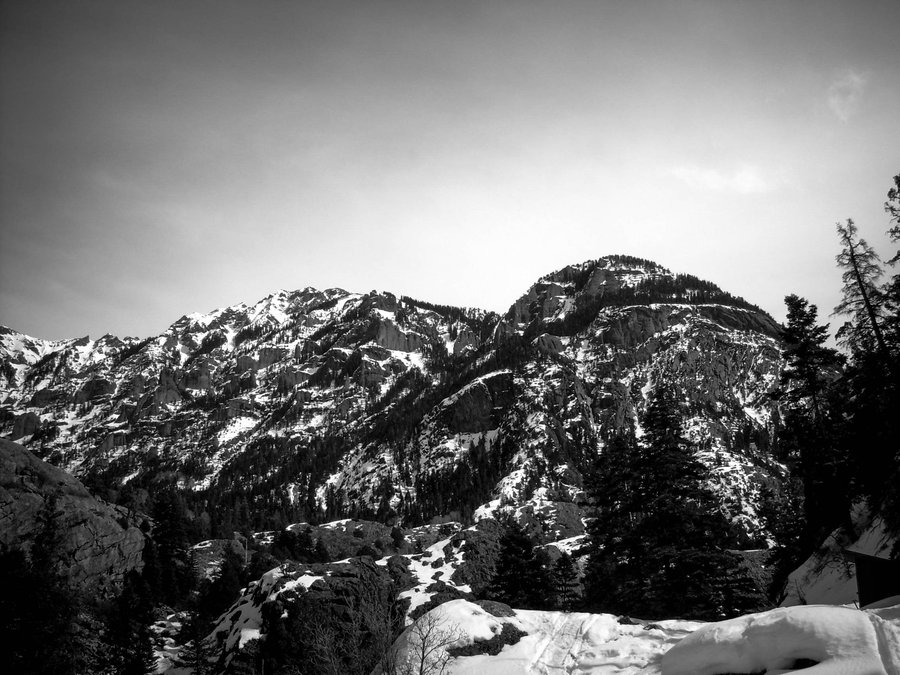
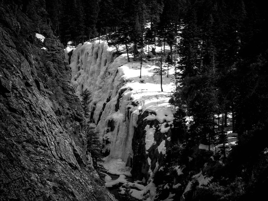
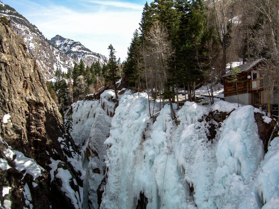
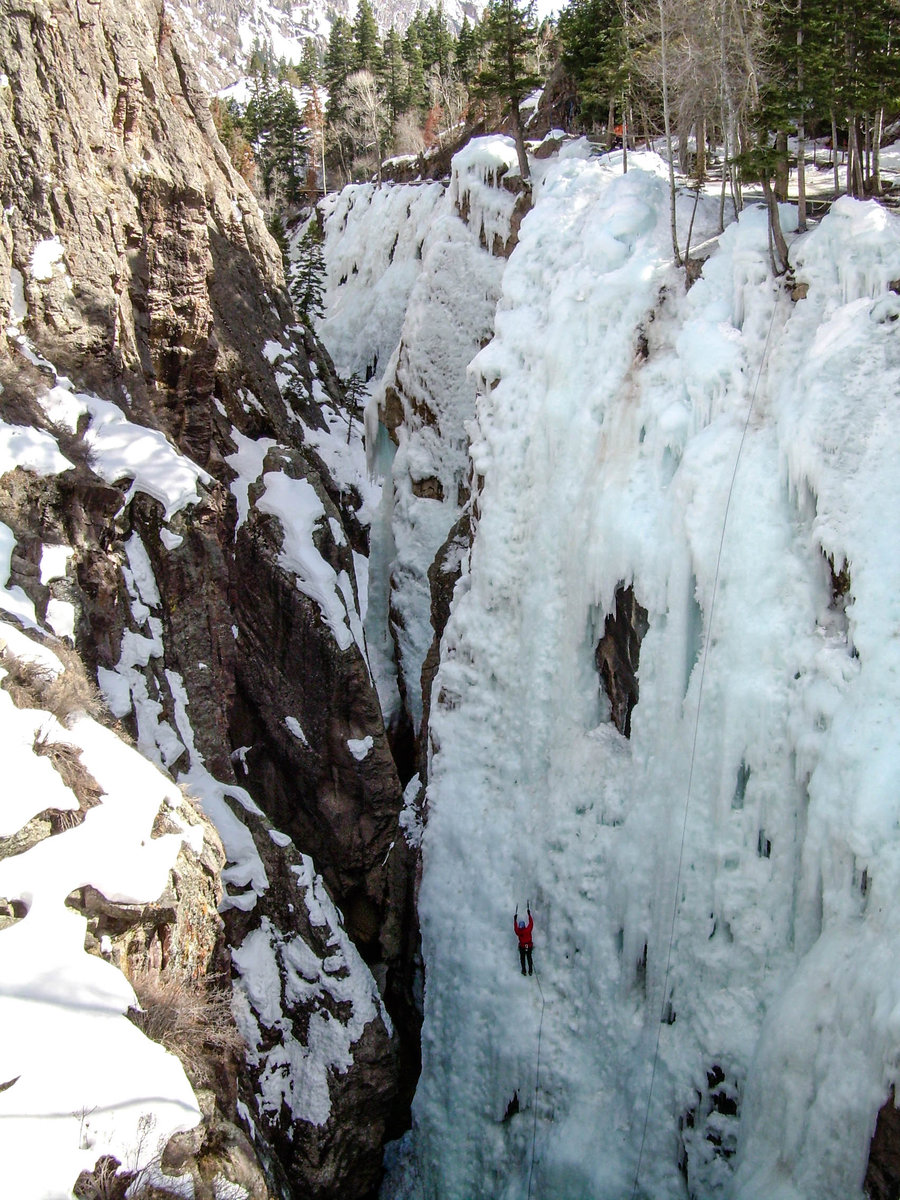
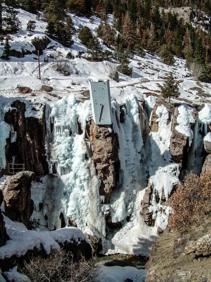
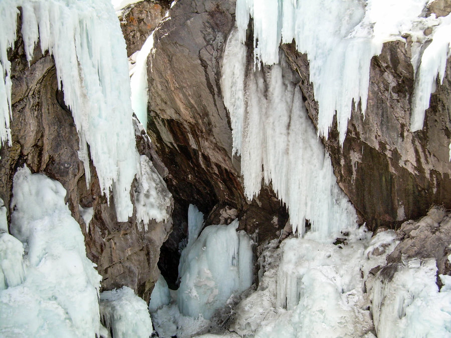
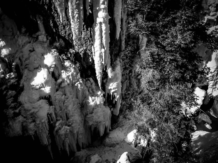
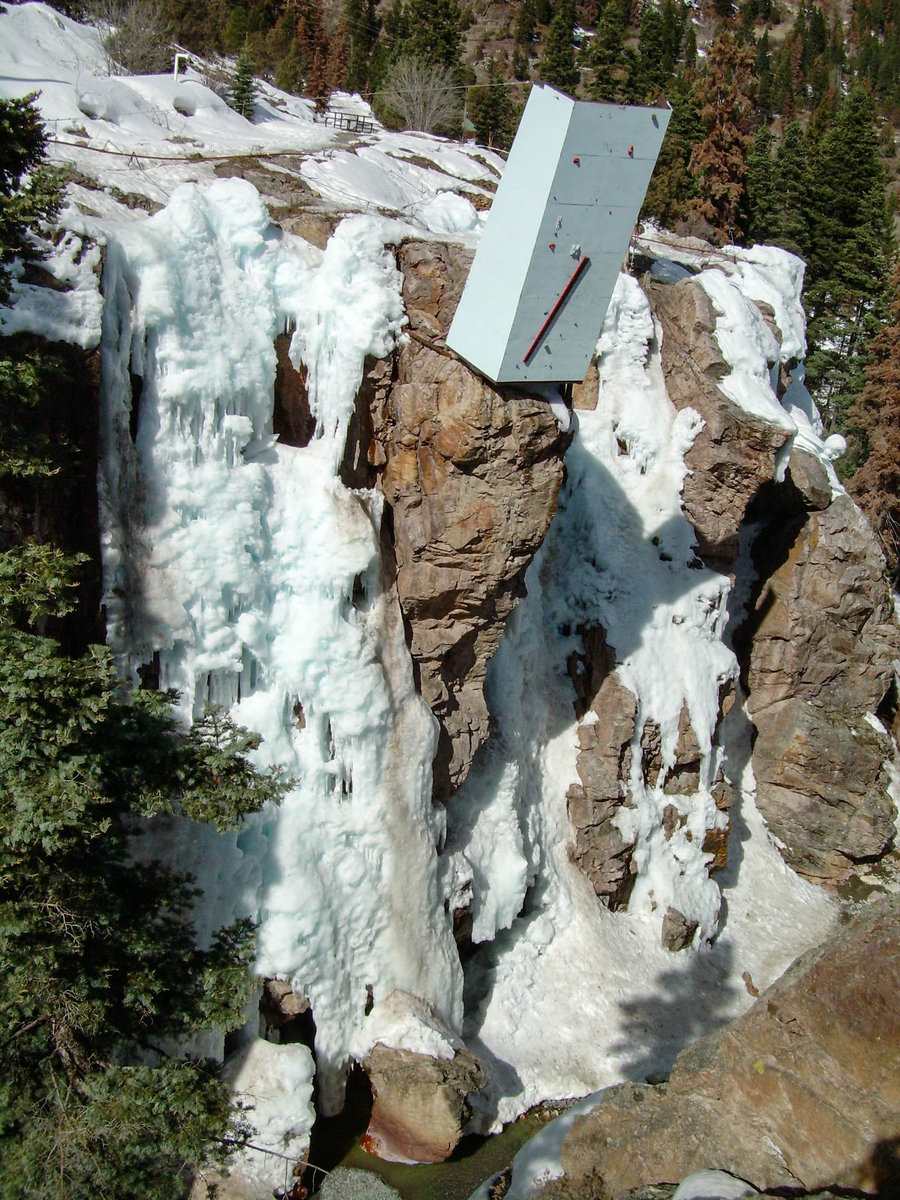
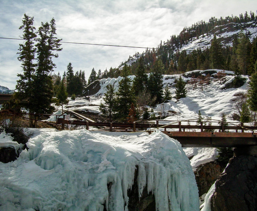
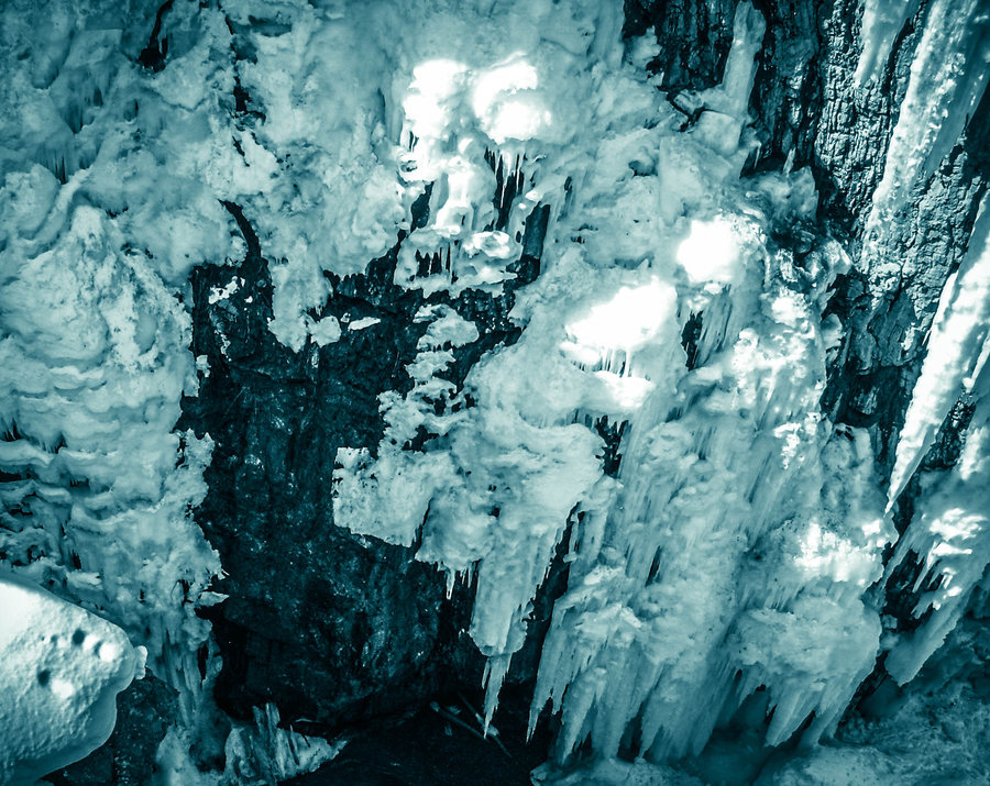
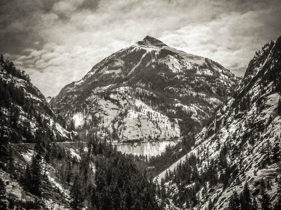
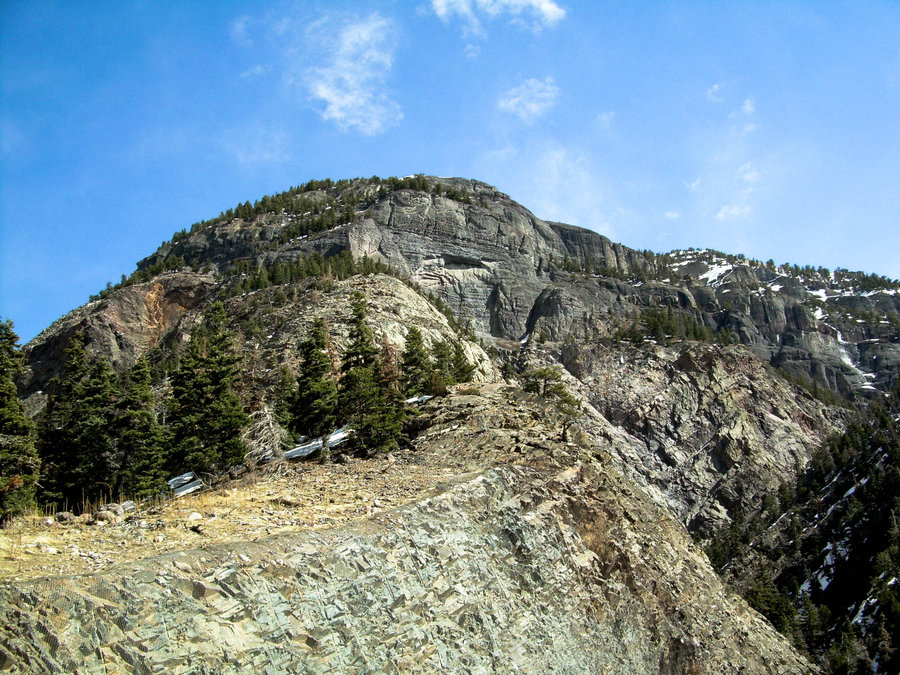
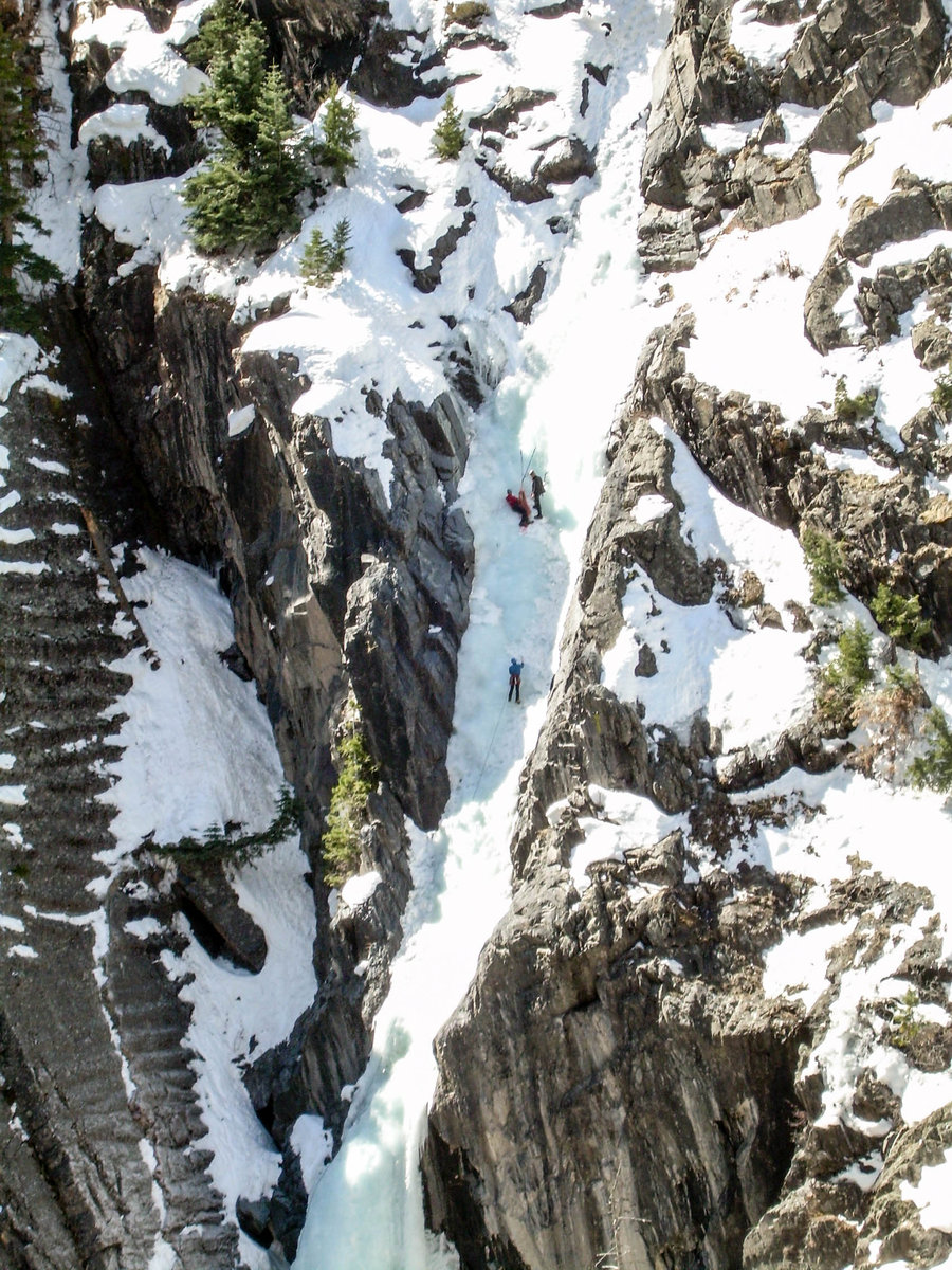
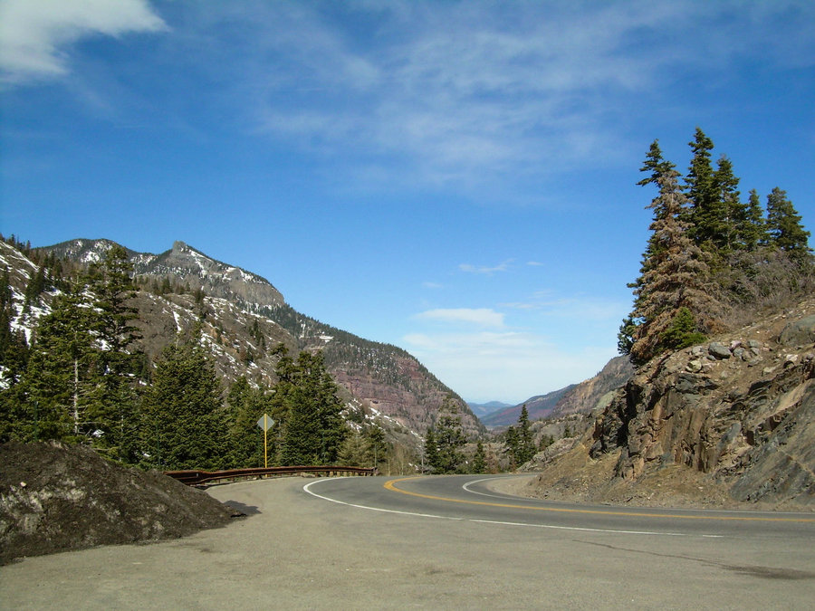
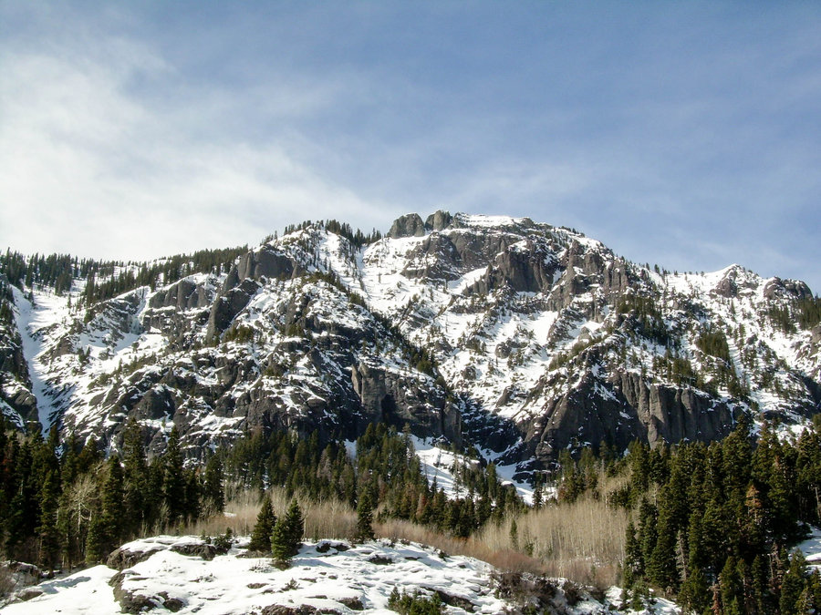
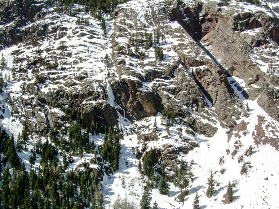
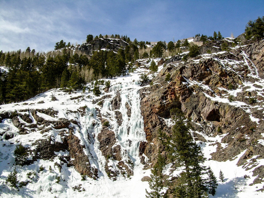
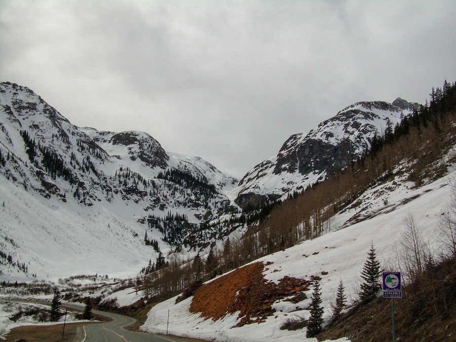
4 Days in the San Juan Mountains of CO
7.5 miles of hiking • 2750' elevation gain •
Here are some photos of our San Juan Mountains Adventure Tour. We spent (4) days Ice Climbing, Skiing, Soaking in Hot Springs.......oh and drinking !!! Celebrations included my birthday and Bilbo's 40th B-Day. Had a great time with the DenCo Boyz and looking forward to the next outing with Thaddeus Bee and Pueblo Picante.
March 2, 2016


Pineapple Pass - Source Lake Area
2 miles of hiking • 2000' elevation gain •
Our goal for the day was Bryant Peak, but after almost being taken down by a loose wet slide near the Bryant Buttress. We decided to play it safe and just head up to Pineapple Pass near Das Tooth. I skinned the entire way up and my friends Jason and Russ were on slowshoes. The ski down was terrible and it rained hard the entire way. The snow was supper heavy and the Cascade Concrete was in full effect !!! Felt great to get out though and thankful to have just missed the slide.
February 28, 2016

Source Lake Ski Tour
2 miles of hiking • 1250' elevation gain •
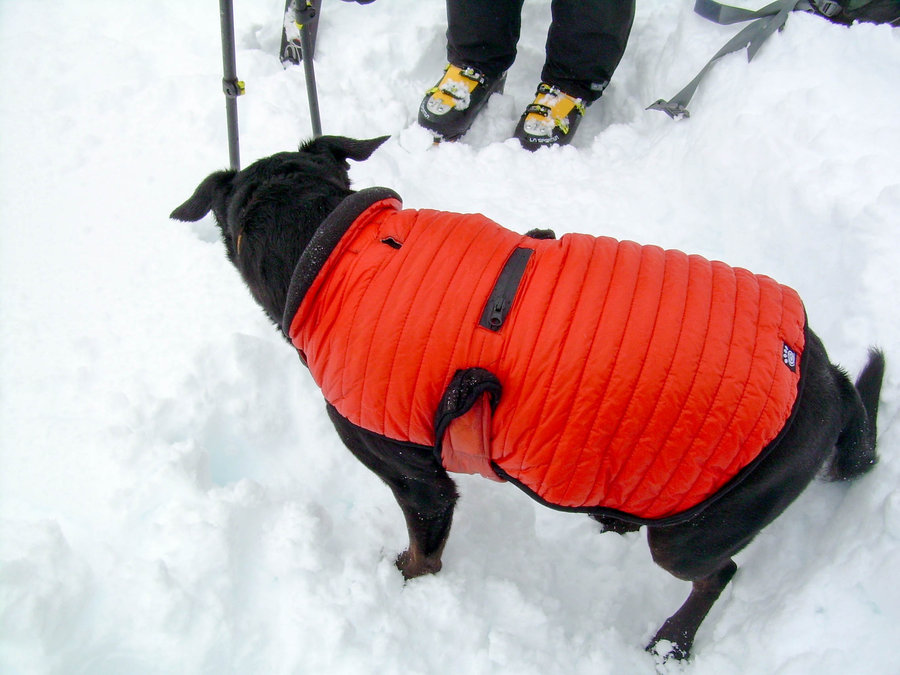
Decided to get out before the big Super Bowl 50 celebration and get some turns in with my buddy Tyson. Our original plan was to head back towards the Lake Annette area and explore that a little bit further, but when we got to the exit for the trail head it was raining !!! It looked like there was fresh snow on the tree line about 600' above where we would have to start, but none the less...... the coverage down low was pretty thin and it looked like we would be carrying our skis for at least a mile before we could skin. We both looked at each other and asked do you really want to do this ??? Ugh not really.... I quickly threw out the option of going up to Alpental. We both agreed that would be a better option for this day. By the time we reached the pass it was snowing and there was about 18" of some fresh snow that had fallen over Thursday and Friday. However it was really heavy !!! We made do and watched my dog Mindy work super hard to plow through the snow to keep up. She slept well on the ride home =) All in all it was a great day out and we were able to drink a few extra pints on Super Bowl Sunday. GO BRONCOS !!!
February 6, 2016


 1
1
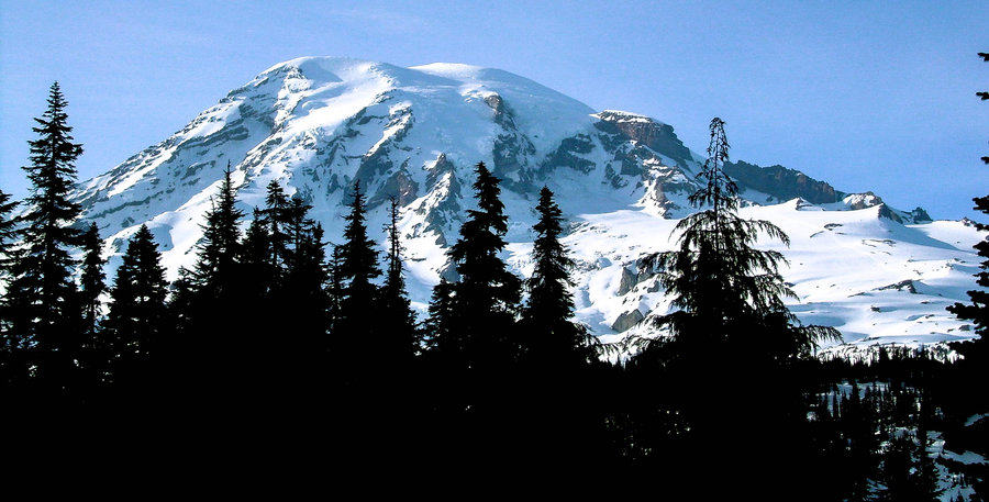
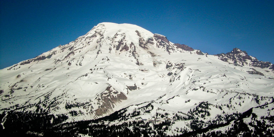
Found Paradise on Mount Rainier
2 miles of hiking • 1250' elevation gain •
Headed down to the park yesterday with my buddy Tyson and did a ski tour up to Panorama Point. We then followed the Ridge Line SE towards a really nice wide open bowl. That bowl eventually led us back down to the Paradise Road below the Visitors Center. It was a gorgeous day on the Mountain. There was fog on the drive in and dark clouds surrounding the Tattoosh, but Paradise was......well Paradise !!!! Blue Skies and the sun was providing enough warmth that it felt like spring at times. There was no wind, which was strange because the forecast had called for 10 - 15 mph winds and a high of 15 degrees. I dressed for the weather, but found myself ripping layers off right out of the gate. The snow conditions were great lower down, but up high there was a small dusting of fresh snow on top of a strong layer of breakable crust. Everything felt really stable and it held your edges just fine. Probably won't be headed to the BC until we get another storm cycle.
January 9, 2016

Lake Annette Ski Tour
5 miles of hiking • 2000' elevation gain •
Went out to find some secret stashes of this epic pow near Snoqualmie. We found a couple nice pockets, but there is a lot of wind blown slabs and variable slope conditions. Be careful out there if you are traveling into the backcountry !!! Other than that, it felt great to get off the couch and burn off some of the Holiday Calories. Looking forward to exploring this area some more after another good storm system rolls through.
January 3, 2016
