

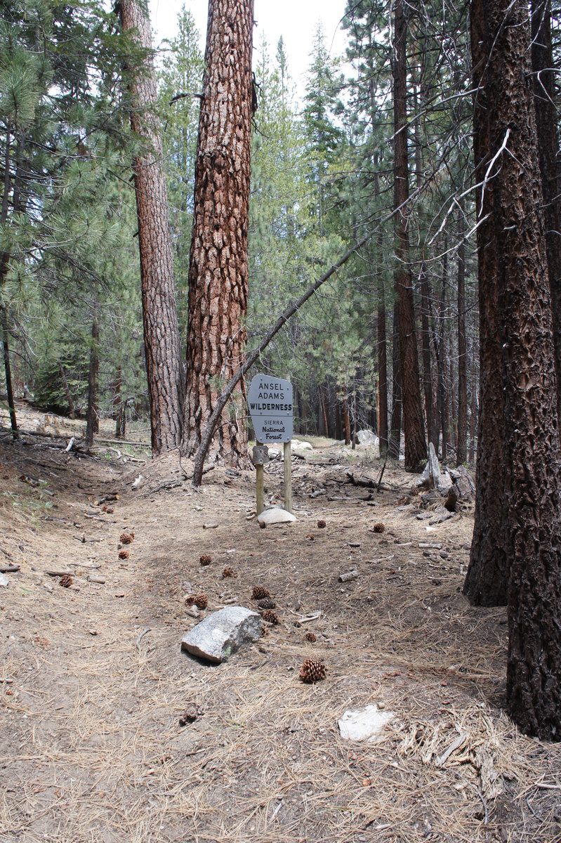
2014 Trips


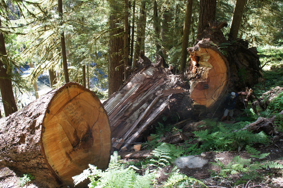
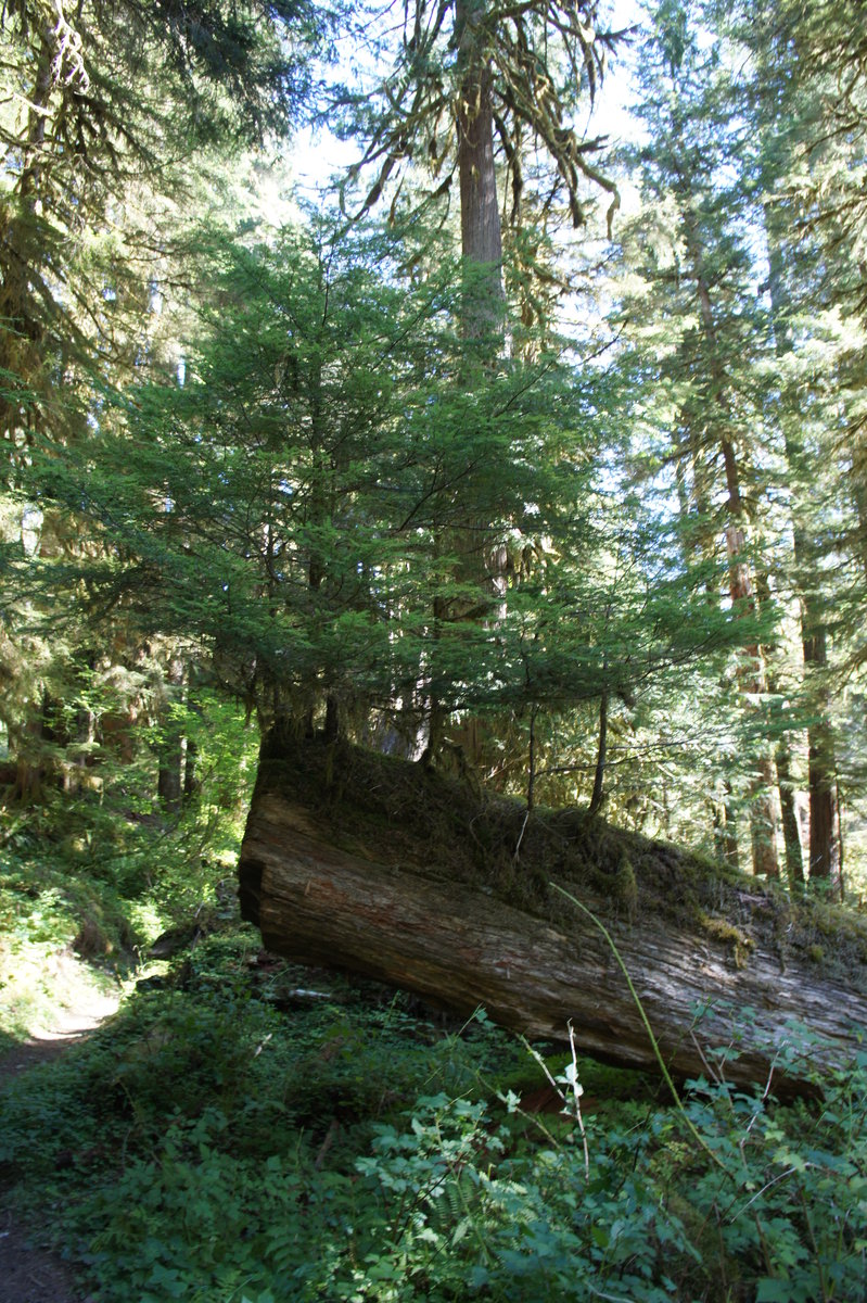
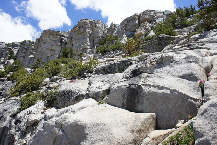
Calaveras Big Trees
4 miles of hiking • 250' elevation gain •
Short 4 mile trail run through the sequoias on Christmas Day.

December 25, 2014
 1
1
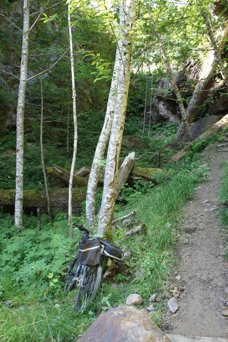
Multnomah Basin - Offtrail Version
10 miles of hiking • 2750' elevation gain •
I'm lazy, so check out Karl's trip report.
http://wenthiking.com/users/295-karl/hikes/4417-elevator-shaft-ornament-loop
December 13, 2014

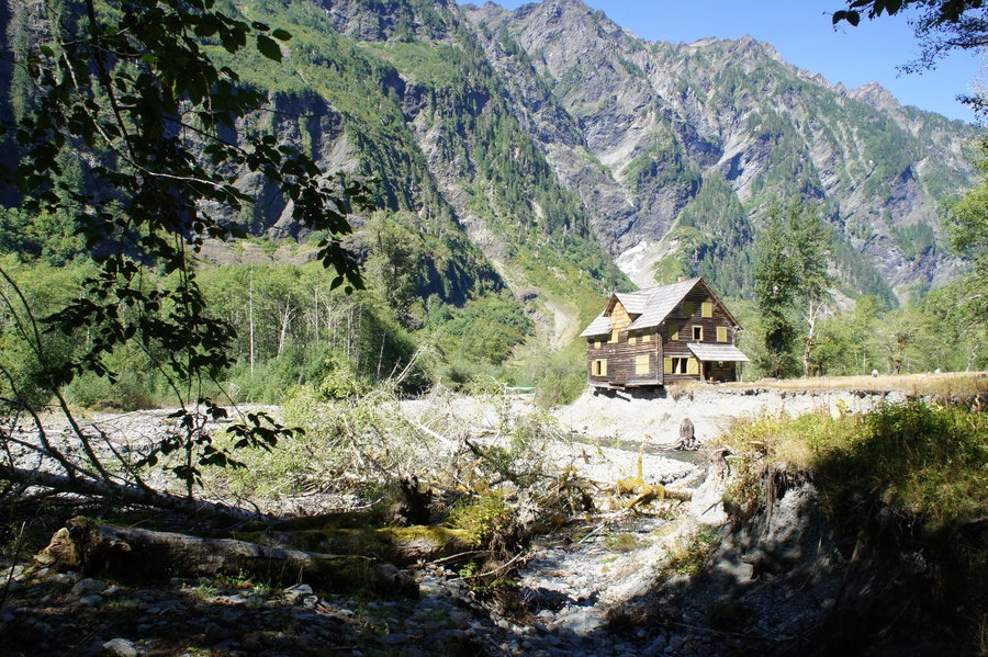
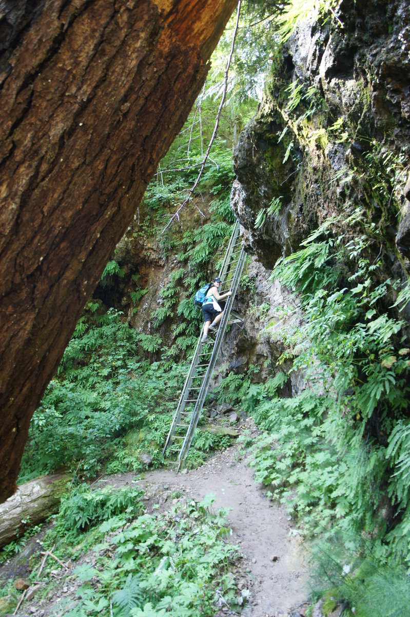
Ornament Trail and Nesika Lodge
10 miles of hiking • 2250' elevation gain •
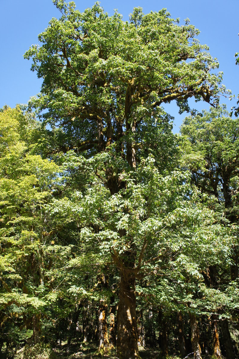
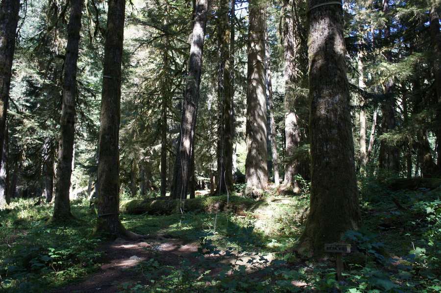
Hiked up to the Nesika Lodge via the Ornament Trail for some early December holiday cheer. An ice storm had hit Multnomah Basin fairly recently, so the trees were heavily laden with ice.
December 6, 2014

Trail 400 - Larch Mountain Trail Bypass
2.5 miles of hiking • 250' elevation gain •
Scoping out the Trail 400 bypass around the Larch Mountain Trail closure.
November 30, 2014

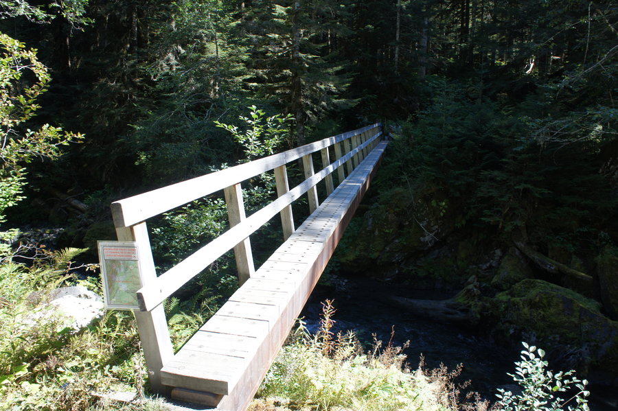
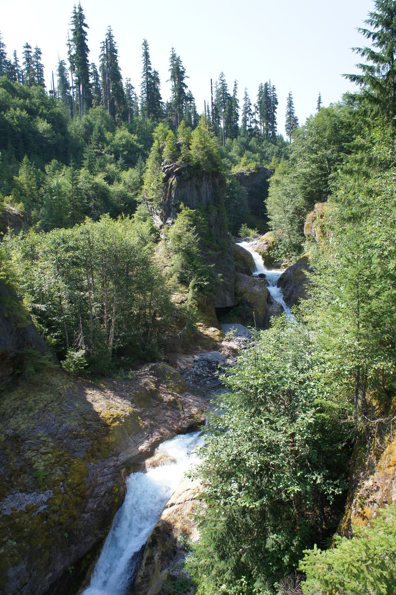
Almost Cedar Flats
10 miles of hiking • 500' elevation gain •
Another Visit to Opal Creek.
Half Bridges are almost complete. Water was running high and swift. Cedar Flat was not accessible due to high water flow at the crossing next to the waterfall shortly before Cedar Flats. Kopetski Trail, between Opal Pool and the road junction was flooded in several areas.
November 28, 2014

Thanksgiving Tryon Creek
5 miles of hiking • 500' elevation gain •
Pre-Thanksgiving trail time at Tryon Creek. :)
November 27, 2014

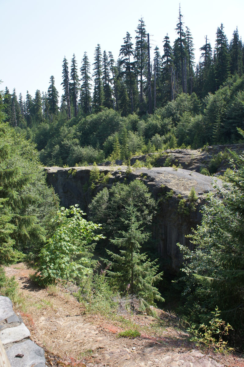
Slightly Snowy Opal Creek
6.5 miles of hiking • 250' elevation gain •
Easy hike to enjoy the first snowfall. Anywhere from 0" - 4" snow and ice on the road, but easily walked without traction.
Half bridge are currently being repaired and should be reopened by mid-December. The far side of Jawbone Flats is accessible by a footbridge a short distance downstream from the old bridge.
November 16, 2014
Casey Creek Loop
13.7 miles of hiking • 5000' elevation gain •
Herman Creek, Casey Creek, Nick Eaton, Gordon Cutoff, Indian Point, Gordon Creek Trail.
November 8, 2014

Timothy Lake
12 miles of hiking • 250' elevation gain •
Saturday morning ended up being a perfect morning for a run around Timothy Lake.
We started at Little Crater Lake, circling Timothy Lake counter-clockwise. Conditions were fantastic for late October, slightly overcast with few puddles. After a stop at the Zig-Zag Inn for post run eats, we arrived back in PDX before the rain and windstorms.
October 25, 2014
 3
3
Mt. Hood - Vista Ridge to Hood River Meadows
18.8 miles of hiking • 4750' elevation gain •
Our original plan was a weekend Timberline 360 with an overnight stay at Timberline Lodge. Unfortunately, the mountain had other plans.
We started at Vista Ridge heading clockwise around Mt. Hood. Shortly after passing the Cooper Spur shelter, it started lightly hailing. That turned into sideways hail, snow, and thunderstorms as we crossed the exposed flanks of Mt. Hood between Cooper Spur and Lamberson Spur. After running / jogging the last couple miles before Lamberson Spur, we decided to bail out at the Elk Meadow TH. We arrived at Timberline Lodge completely drenched, despite wearing rain gear. Our weekend attempt at the Timberline Trail was over, as there just was not enough time for our waterlogged boots and packs to dry. Instead, we hiked to the Timberline Lodge Buffet before driving back to Vista Ridge to pick-up the car.
October 11, 2014

 1
1
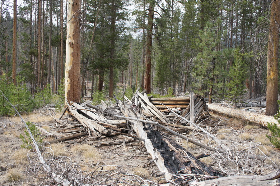
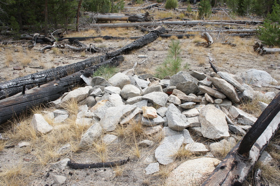
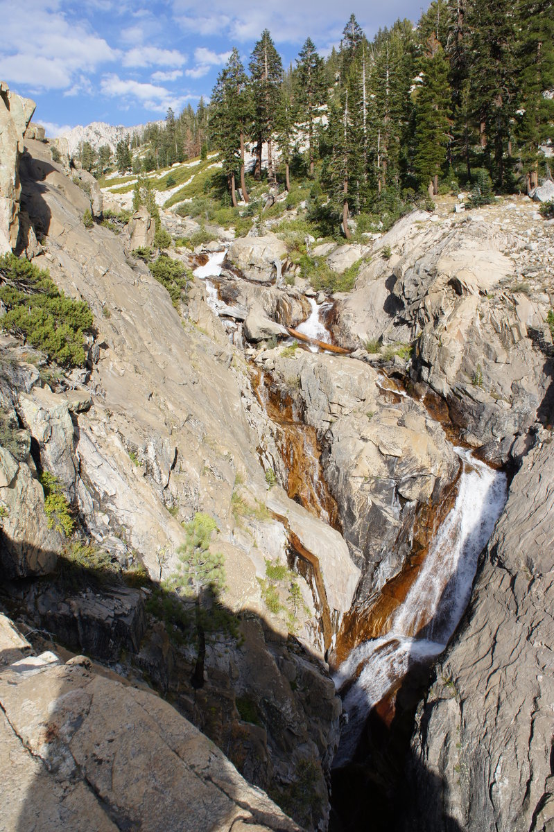
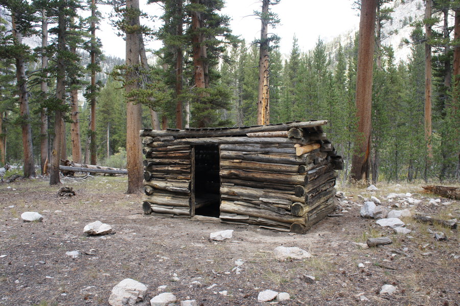
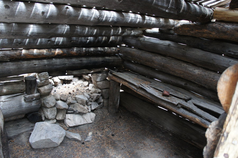
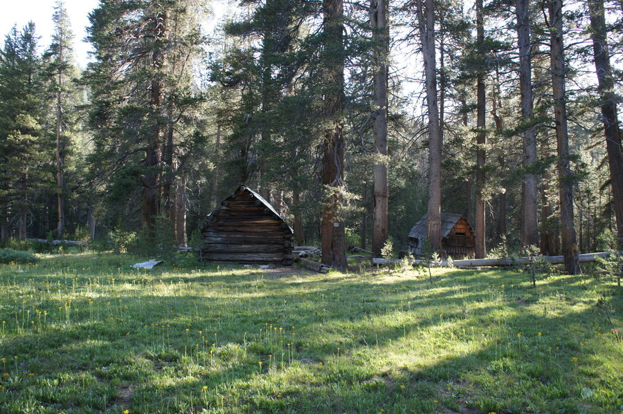
Jennie Lakes Wilderness and Kings Canyon NP - Shorty's Cabin at Crowley Canyon
16.7 miles of hiking • 3500' elevation gain • 2 nights
Work sent me to central CA for a couple of day at the end of last week, which meant another weekend to locate another one of Shorty Lovelace's cabins in Kings Canyon NP. Our target this time, Shorty's "headquarters" in Crowley Canyon. This particular set of cabins was built somewhere around 1912.
We got a late start, picking up permits at Grant Grove at 3pm. This put us at the Rowell Meadow TH at 4pm. The first night, we only hiked in about 2.5 miles to an established campsite near Rowell Meadow, maybe a half mile from the snow survey cabin.
Saturday morning, woke up to the sound of what I thought was rain. It turns out, that we got a dusting of snow and hail overnight. We got a late start, getting on the trail around 11am to head to Comanche Meadow. We cached gear at Comanche, and then headed cross country up Crowley Canyon to look for Shorty's Cabin. We were about 0.2 miles from our target location (based on a set of 1970's era UTM coordinates), when we stumbled upon an area littered with old rusted metal sheets and broken glass. No more than 50 yards away, was the ruins of Shorty's Crowley Canyon Cabin. :)
After exploring the cabin ruins, and the site with metal and glass, which was likely the location of the second building at that location, we headed back to our gear cache at Comanche Meadow. We contemplated continuing on to Seville Lake, but with dark grey clouds overhead and it was already getting cold, we opted to stay at Comanche for the night and build our first ever backcountry campfire. About an hour after dark, we heard one heck of a racket coming up the trail. As it passed our camp we heard a woman say "Hello, I am the ranger from the Roaring River station. Please do not shine any lights in my direction, as I am packing out and the lights might spook the horses." We talked briefly, but she wanted to let us know the forecast had changed and that there would be snow overnight at the 9000' level. She also said there was one group behind us and then inquired about our travel plans. After a brief conversation, she continued along in the darkness.
Sunday morning, we woke to a steady rain, which then turned to snow. We hiked out with snowflakes falling and a light blanket of snow covering the trail. There's nothing like fresh tracks in the snow. :)
September 26 – September 28, 2014

 1
1
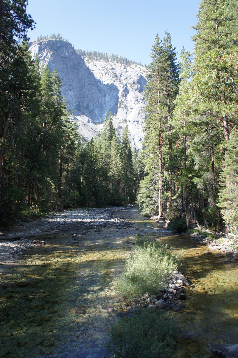
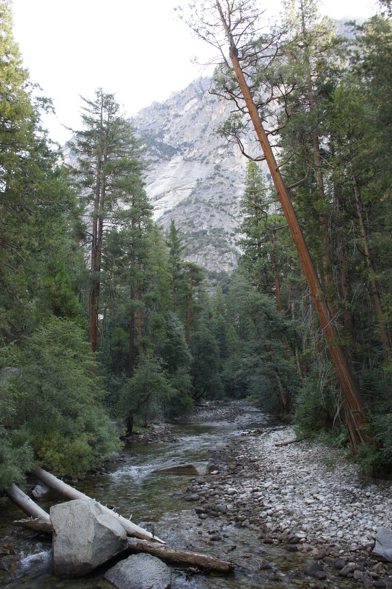
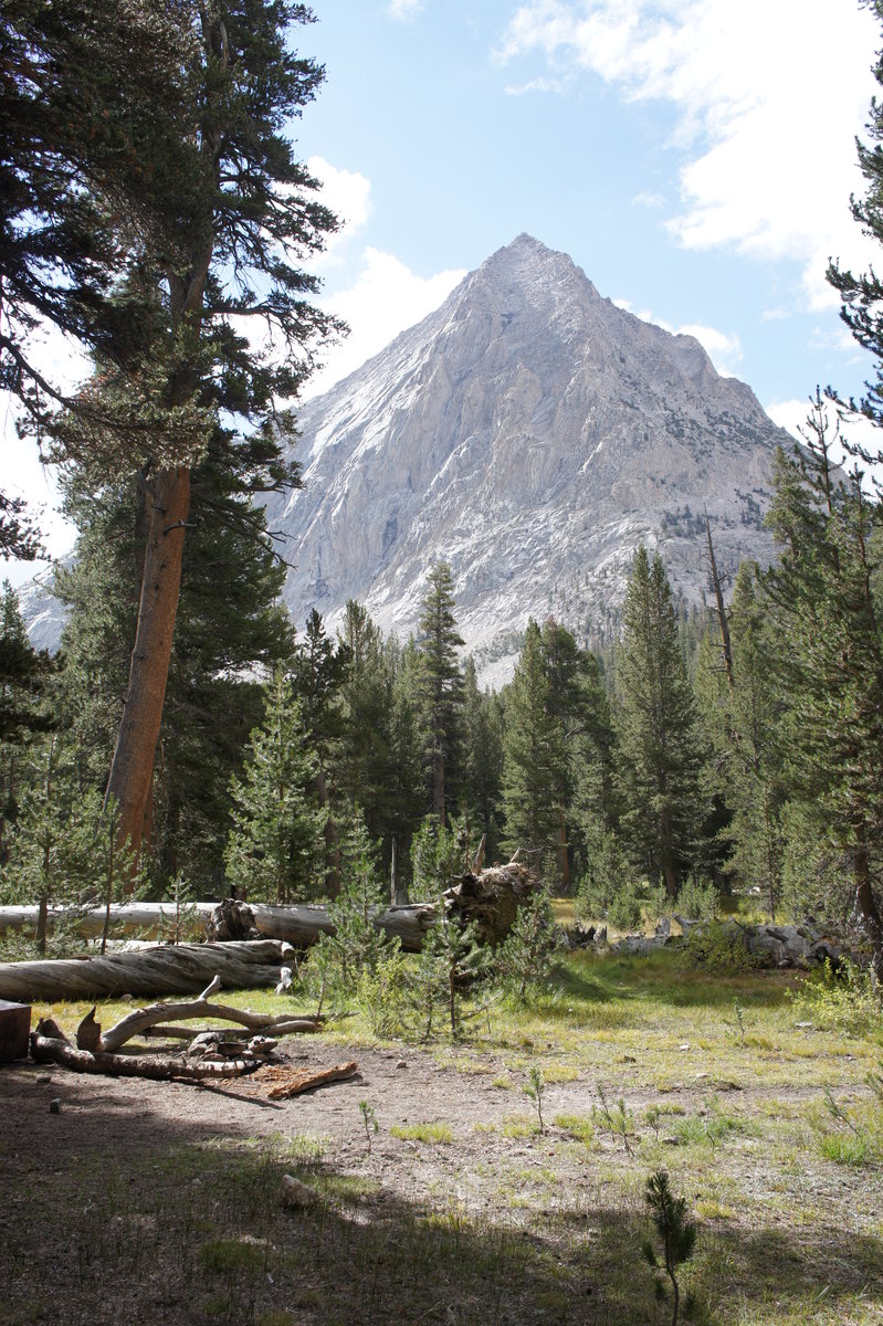
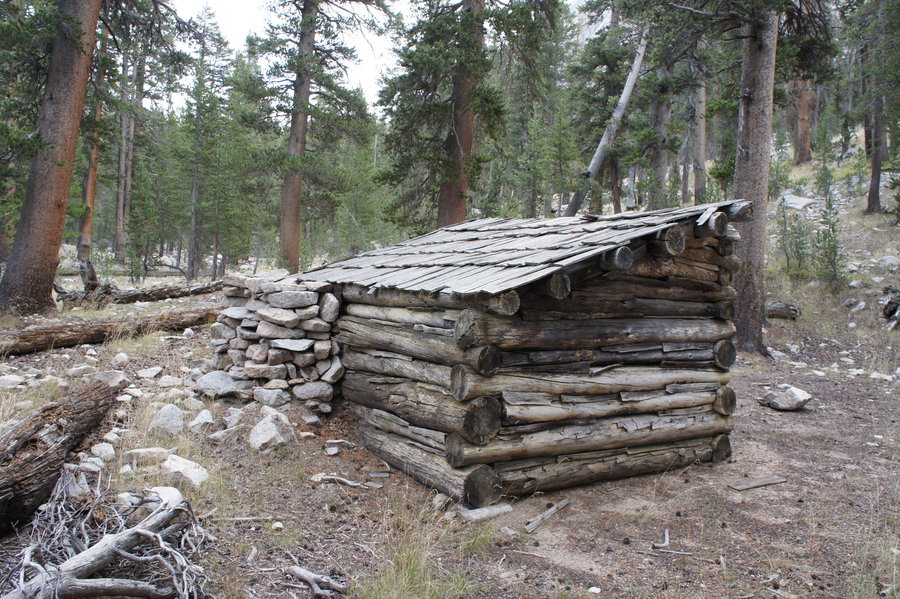
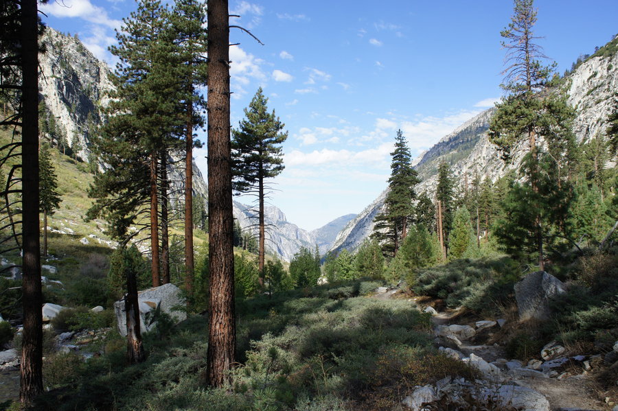
Kings Canyon NP - Shorty's Cabin at Vidette Meadow
33.5 miles of hiking • 6000' elevation gain • 2 nights
We started from the Road's End TH in King's Canyon NP around 9am Saturday morning. Most backpackers along our route were hiking the Rae Lakes Loop, but we had a different goal in mind; Shorty Lovelace's cabin in Vidette Meadow.
From the National Register of Historic Places Nomination (1977):
"Joseph Walter ("Shorty") Lovelace, 1886-1963, spent most of his life fur trapping in the Sierra Nevada. Beginning in 1910 and ending about 1940, when Kings Canyon National Park was created, Shorty trapped the watershed of the South Fork of the Kings River. As a necessary adjunct to this trapping, he established a system of small cabins and shelters which may have numbered as many as thirty-six." Shorty's cabin at Vidette Meadow is one of two cabins restored and maintained by the forest service.
The trail from Road's End to Vidette Meadow follows Bubbs Creek. We camped the first night near Lower Vidette Meadow, and the second night near Charlotte Creek.
*Solomon Quest GTX #1
September 13 – September 15, 2014


 1
1
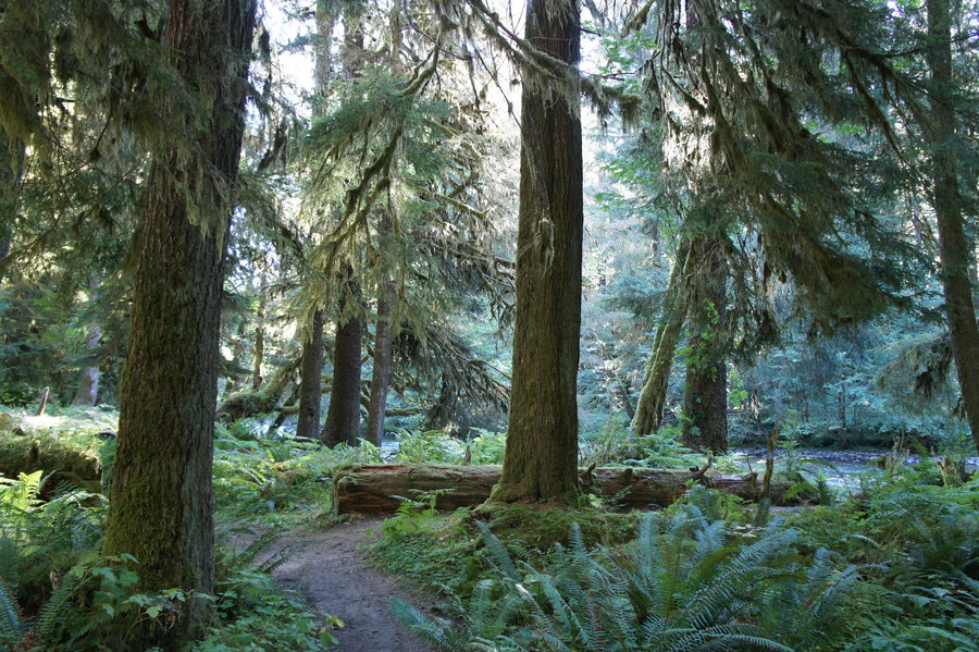
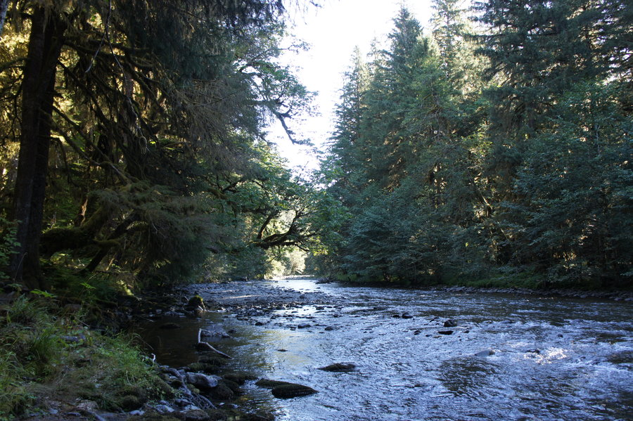
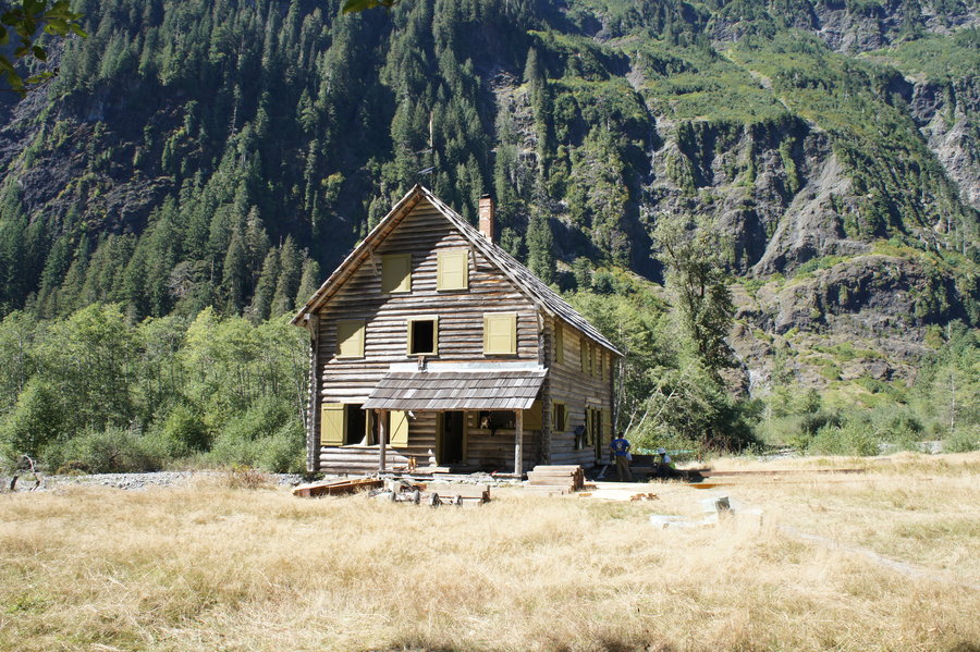
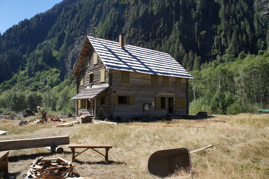
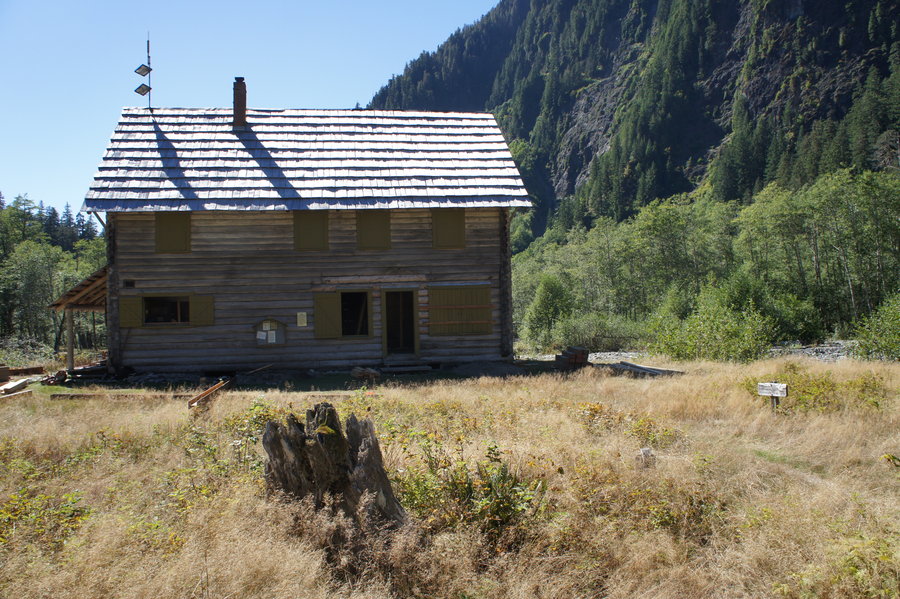
Enchanted Valley
28 miles of hiking • 4000' elevation gain •
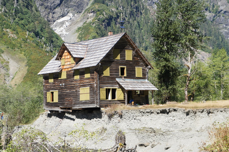
I have been wanting to get up to Enchanted Valley since I first heard about the chalet in January. A planned May trip was cancelled due to a miserable weather forecast, and with all the distractions of summer, just never got rescheduled. Then came the announcement of the big move. With a love of hiking and an engineering background, the chance to see them move the chalet was the perfect "geek out" opportunity. With previous commitments already filling up my weekends, I opted to take a day off work to make this happen.
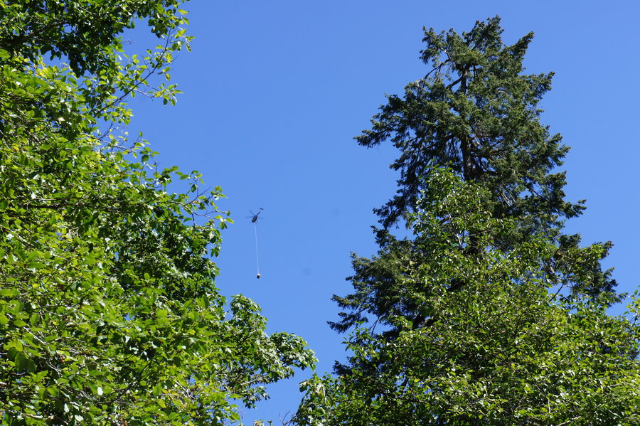
We left PDX Thursday afternoon and car camped so we wouldn't have to make the four hour drive in the morning. We were on the trail by 8am Friday morning, winding our way up the Quinault River Valley. The morning was cool as we hiked under a canopy of large trees and surrounded by ferns. Hiking in, we took our time taking in our surroundings along the way; the river, large trees, massive sized downed trees, bridges, campsites, the helicopter transporting materials for the chalet project, and the unfortunate trail graffiti. By the time we arrived at the bridge just before Enchanted Valley it was almost 2pm.
At the bridge, we were stopped by a USFS intern, whose job was to make sure the valley stayed clear of park visitors when the helicopter was coming in for drops. We waited for about 15 minutes before we were given the all clear to proceed to the chalet. We were told, once the helicopter started making its way back the work site, we would have to be back the bridge, and that we should stay about 30 - 40 feet away from the chalet. They were finishing prep work on the building. The next day, they would be lifting it from it's foundation. We had about 20 - 30 minutes to take photos and talk with the ranger managing the work site, before heading out to get to the bridge before the helicopter returned.
Back on the other side of the bridge, it was 3pm, and we had about 14 miles to travel before 8pm. We made our way quickly down the trail, with a short stop at a creek for snacks and to filter water. We were back at the car with 15 minutes to spare.
*Brooks Cascadia 7
September 5, 2014

 1
1
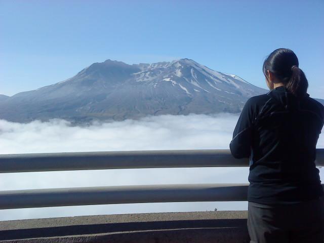
Cooper Spur
8 miles of hiking • 3000' elevation gain •
I had a friend visiting from out of state this past weekend. He wanted to see the glaciers on Mt. Hood, so what better place to go glacier viewing than Mt. Hood.
We arrived at the TH around 10:30am, and noticed a ranger in a USFS vehicle in front of Cloud Cap. He was there to give a tour of the Cloud Cap Inn at 11am, and there were still openings for the tour! We jumped at the opportunity and learned much about Portland history and those who have owned / operated Cloud Cap for the past 125+ years.
After the tour, we finally got on the trail around 12:30pm. The day was mostly overcast with limited views, but we continued on to tie-in rock anyways. The trail was much busier than the last time I hiked it, shortly before the road closure in 2012. As the day progressed, they skies slowly started clearing. Around 4pm it was finally clear and sunny with fantastic views of the glaciers and eastern Oregon.
- Solomon Quest GTX #2
August 31, 2014

Indian Heaven Loop
11 miles of hiking • 2000' elevation gain •
Indian Race Track TH - Race Track - PCT - Blue Lake - Rock Lake - Thomas Lake TH.
No mosquitos. Lots of huckleberries.
*Brooks Cascadia 7
August 24, 2014
 1
1
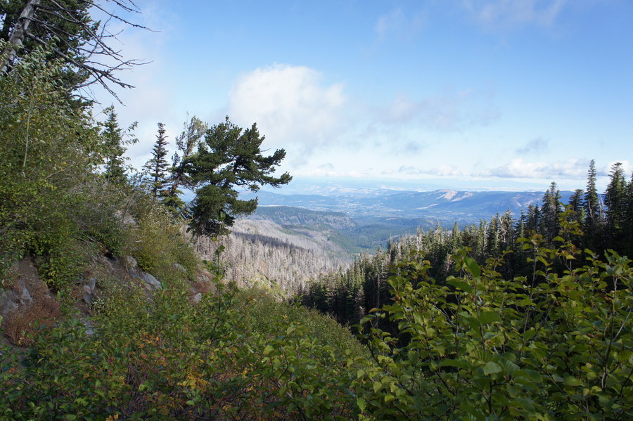
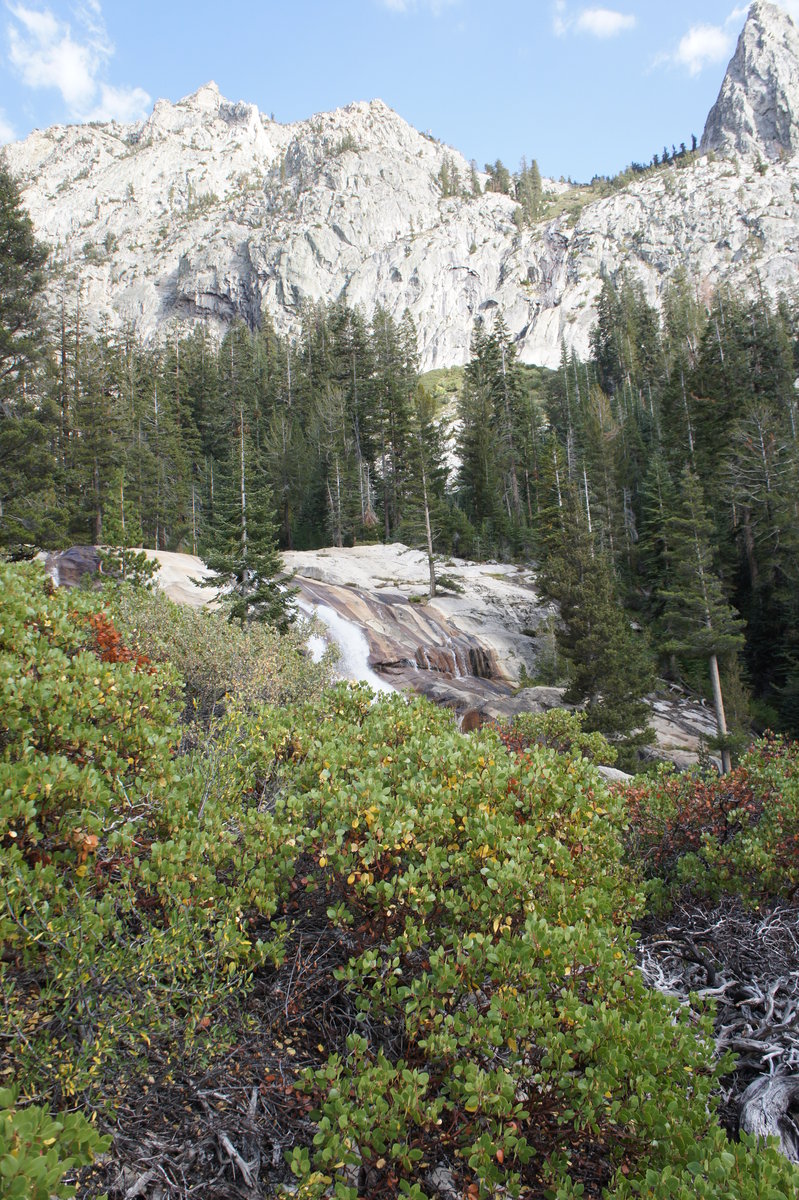
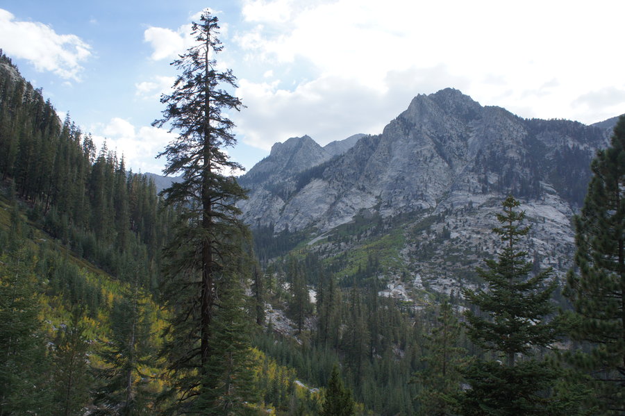
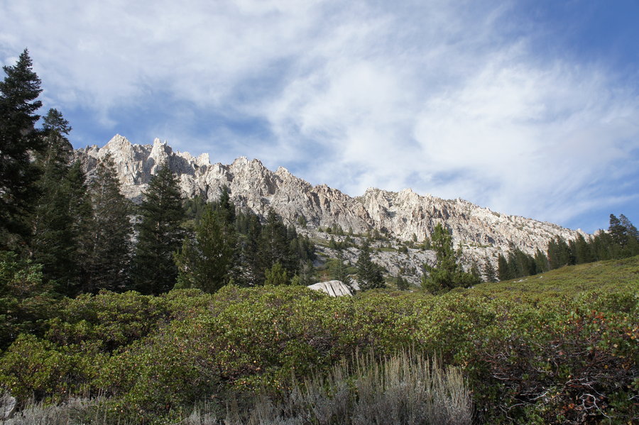
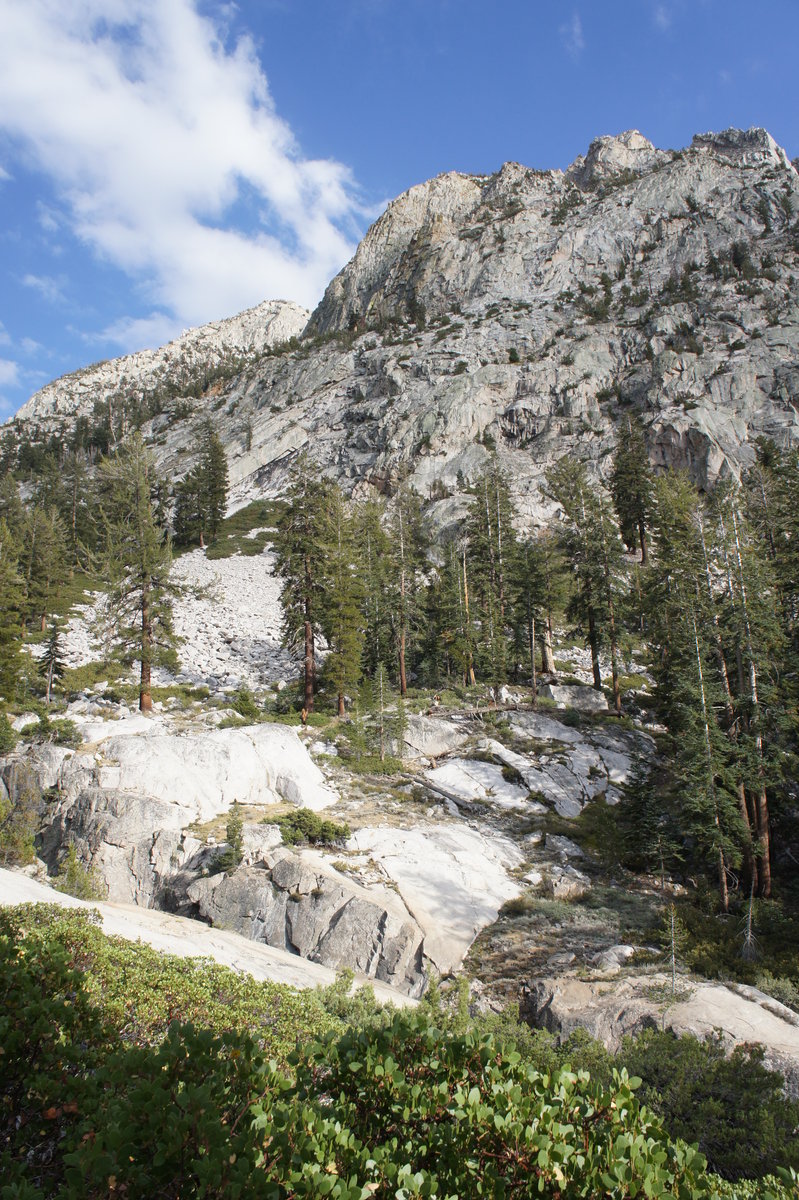
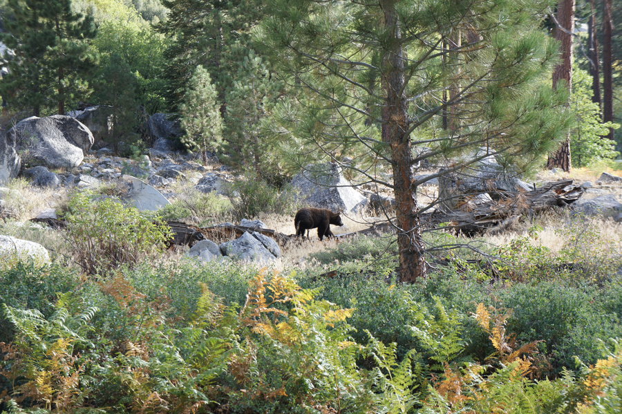
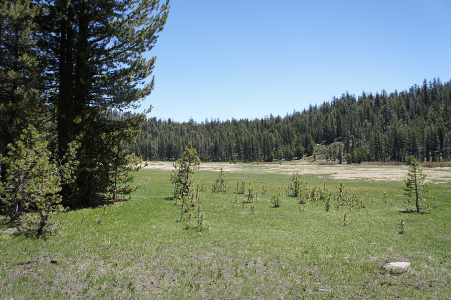
Mt. Margaret Backcountry
29.5 miles of hiking • 8500' elevation gain • 3 nights
Three nights at Bear Camp in the Mt. Margaret Backcountry with day hikes to Mt. Margaret and Coldwater Peak and a Lakes Basin / Whittier Traverse Loop. Fantastic scenery, lots of huckleberries, and daily mountain goat sightings.
Day 1 - Norway Pass TH to Bear Camp (4.4 miles, 1980' EG) Left PDX around 11am. Hiked to camp under overcast skies and light drizzle.
Day 2 - Day hike to Mt. Margaret and Coldwater Peak (11.5 miles, 3240' EG) Woke up to sunny skies and fabulous views of Mt. Rainier and MSH. Hiked the Boundary Trail to Mt. Margaret and Coldwater Peak. Fantastic views from Mt. Margaret, but Coldwater Peak stayed stubbornly fogged in. Scoped out both Margaret Camp and Dome Camp for a potential future trip, and could not find water at either location.
Day 3 - Day hike - Lakes Basin and Whittier Traverse Loop (9.3 miles, 3000' EG) Headed back towards Bear Pass on the Boundary Trail where we took the Lakes Trail to Grizzly, Obscurity, Panhandle, and Shovel Lakes. We sat and watched the tadpoles for awhile in Obscurity Lake before continuing. We decided to take the Whittier Trail back to camp, and its was FUN! Just as it's known for, lots of exposure, narrow trail, and steeps. If you're comfortable with Ruckel Ridge, you might be ok with Whittier...
Day 4 - Out - 4.4 miles, 160' EG Sadly, time to go home. I did not want to leave this beautiful place...
August 15 – August 18, 2014

Larch Mountain Crater and Sherrard Point
6.5 miles of hiking • 1500' elevation gain •
Hiked the Larch Mountain Crater Loop described on PH and then went to the top of Sherrard Point to view the super moon.
August 10, 2014

4T Trail
4 miles of hiking • 500' elevation gain •
I took eight of my high school robotics students for a team building day on the 4T trail, starting at the Oregon Zoo.
We hiked to Council Crest Park, where the kids worked together to complete a scavenger hunt. Then we sat on the lawn to eat lunch before continuing down the Marquam Trail to OSHU, the tram, and then the trolley. We made an ice cream stop near Pioneer Courthouse Square before jumping on the MAX to take us back to the start.
Also, my apologies to anyone we ran into on the trail. Eight teenagers can be loud!!!
August 9, 2014

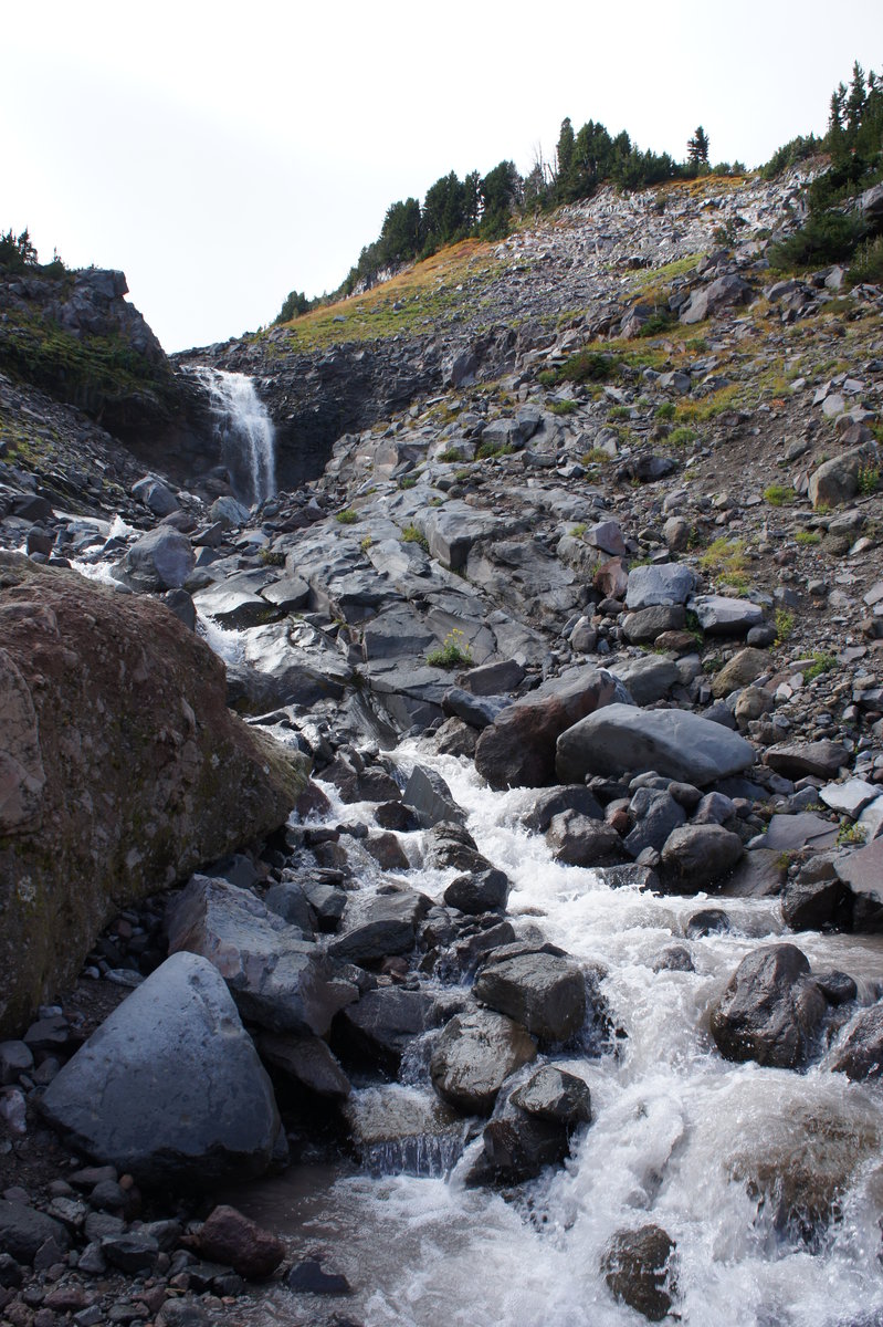
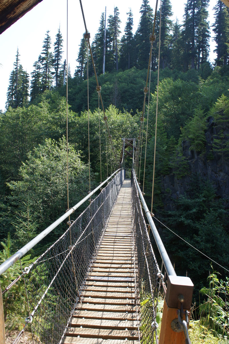
MSH - Lava Canyon to the Ship
3.5 miles of hiking • 750' elevation gain •
This is a hike I've been wanting to do for awhile. The description of a trail with a suspension bridge, ladders, and stairs matched with fantastic scenery sounded a bit like a playground. However, I couldn't justify a 2 hour drive for a 2 hour hike. Thus the plan to hike this and then hike Ape Canyon.
We were the first car in the parking lot at 9am. Back to the TH before 11am, which by that time it was starting to get busy.
August 3, 2014

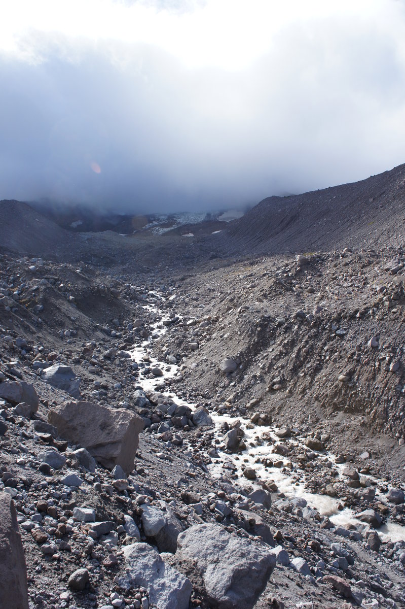
MSH - Ape Canyon to Plains of Abraham
11 miles of hiking • 2500' elevation gain •
Following our hike in Lava Canyon, we took a brisk hike up the Ape Canyon Trail to Plains of Abraham.
August 3, 2014

Paradise Park, Mississippi Head, and Mt. Hood Snowfields
10.5 miles of hiking • 4000' elevation gain •
Timberline Lodge to Split Rock, then x-country to Mississippi Head, visiting the old plane crash, then above Zig Zag Canyon, and down Palmer.
Link is the GPS track.
July 20, 2014

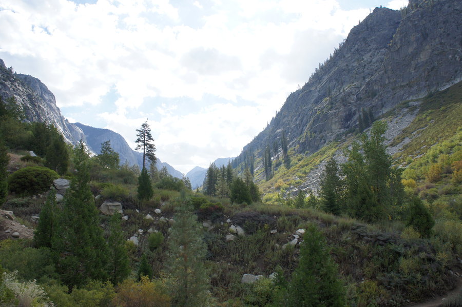
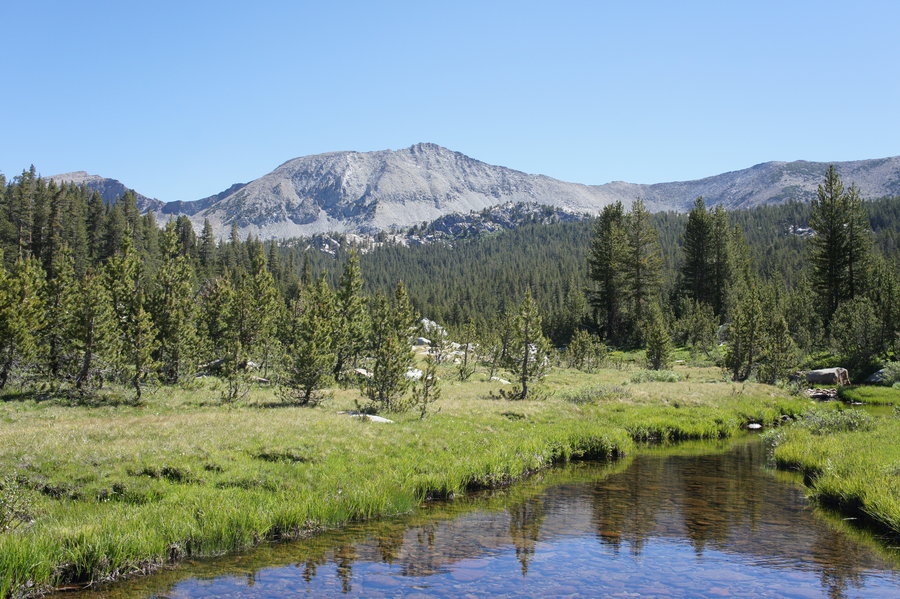
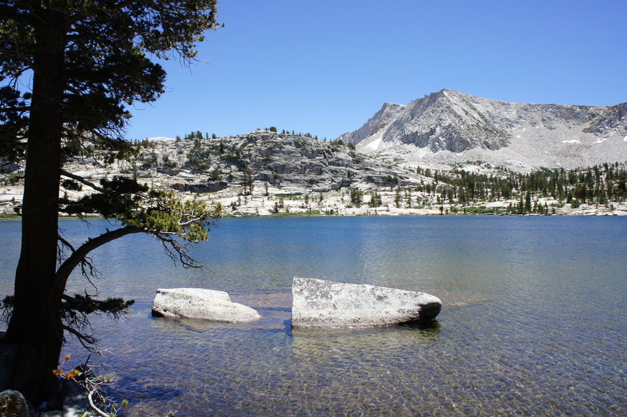
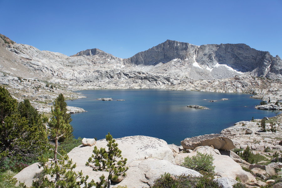
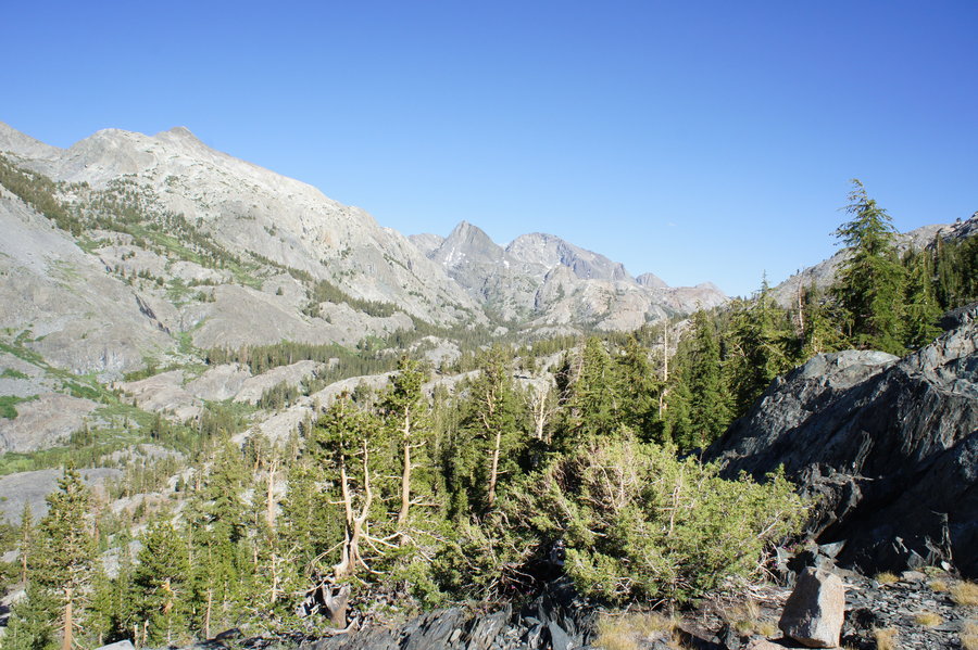
John Muir Wilderness / Kings Canyon Backpacking
50.5 miles of hiking • 10500' elevation gain • 4 nights
Picked up permits in Prather, CA for the Maxson TH at Courtright Reservoir. Then set off to explore Red Mountain Basin, Goddard Canyon, Blackcap Basin, and Bench Valley.
Day 1 - 10.7 miles, 2376'elevation gain Hiked 10.7 miles in from the TH and camped somewhere along the trail.
Day 2 - 10.5 miles, 3022' elevation gain Made stops at Disappointment Lake and Hell for Sure Lake before heading over the LeConte Divide via Hell for Sure Pass to Goddard Canyon. Spent the night camped along the South Fork of the San Joaquin River.
Day 3 - 6.1 miles, 2190' elevation gain Hiked up to Martha Lake before heading back over the LeConte Divide via Confusion Pass. After a stop at Confusion Lake, we descended to Rainbow Lake to camp for the night.
Day 4 - 9.4 miles, 1153' elevation gain Headed down into the higher elevations of Blackcap Basin to take Blackcap Pass into Bench Valley. Very brief stops at Guest Lake and McGuire Lakes. Passed through Big Maxson Meadow as we looked for camp along the North Fork of the Kings River.
Day 5 - 13.9 miles, 1711' elevation gain Hiked out the TH under overcast skies.
July 2 – July 6, 2014

 1
1
Waucoma Lakes Loop
18.5 miles of hiking • 3750' elevation gain •
Longer hike for summer solstice. Stops at Rainy Lake, North Lake, Green Point Mountain, Mud Lake, and Wahtum Lake. Garmin track is the referenced in URL.
June 22, 2014

Triple A
20.5 miles of hiking • 7500' elevation gain •
Aldrich Butte + Augsperger Mountain + Angels Rest
June 7, 2014

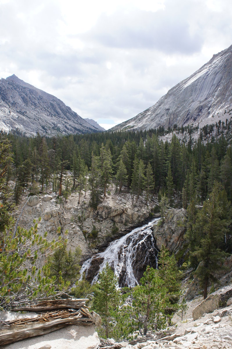
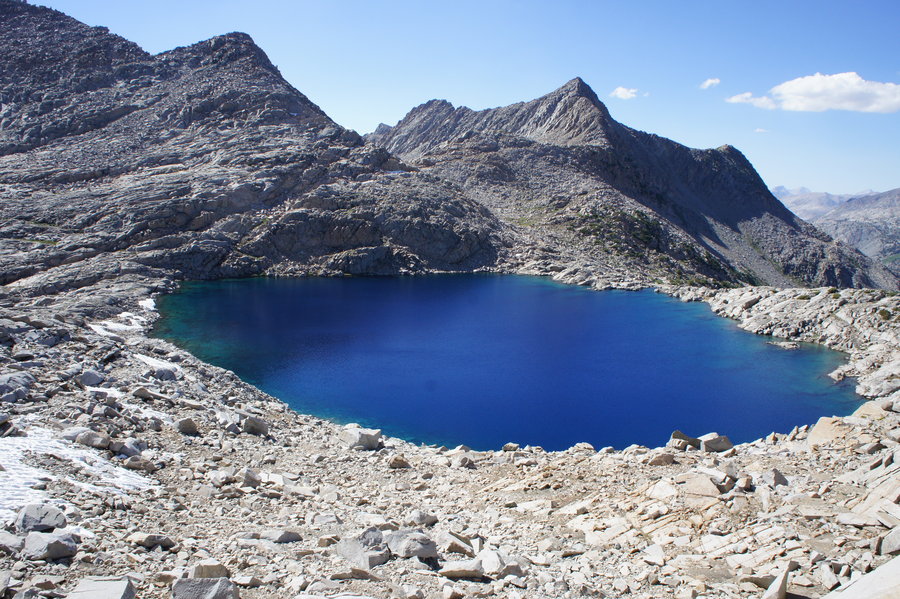
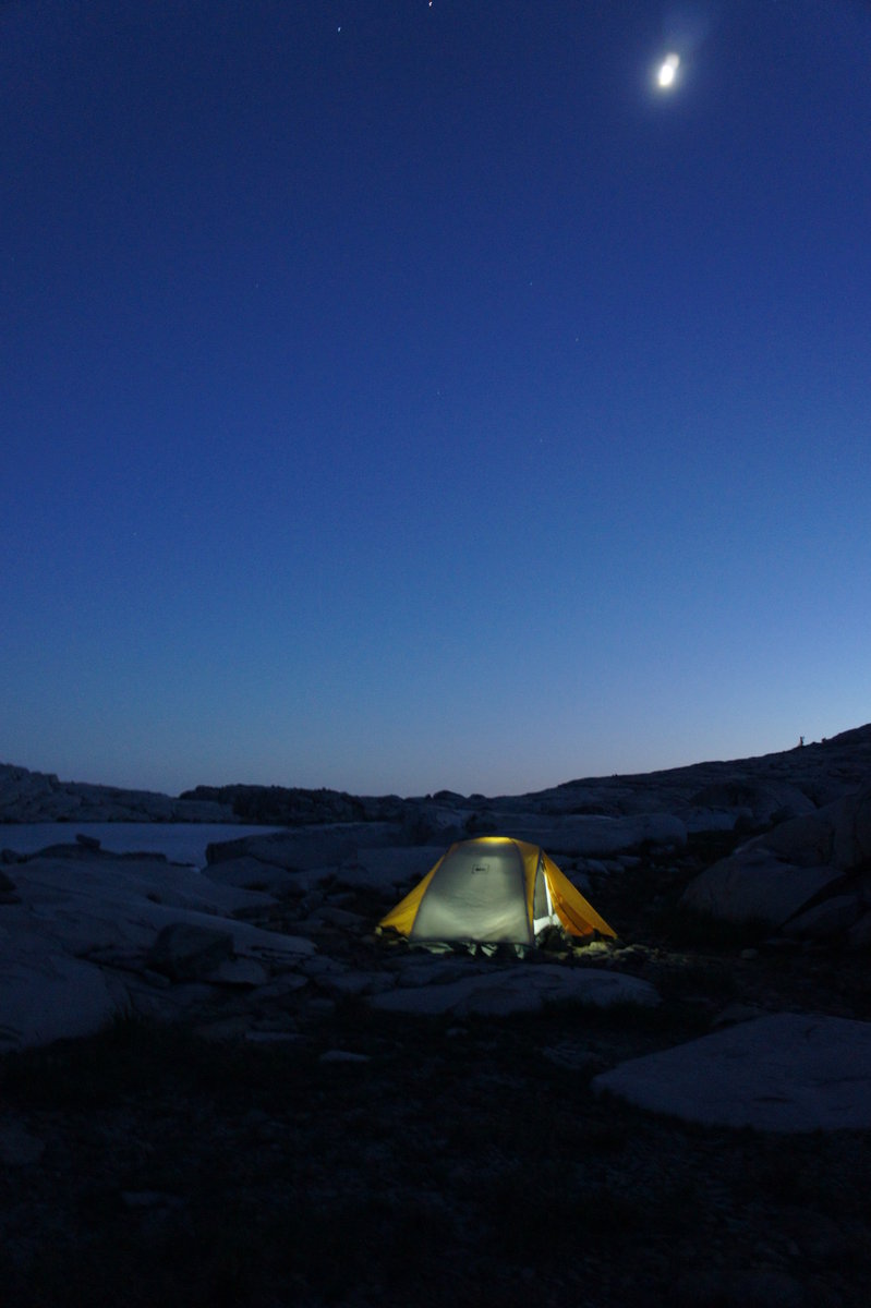
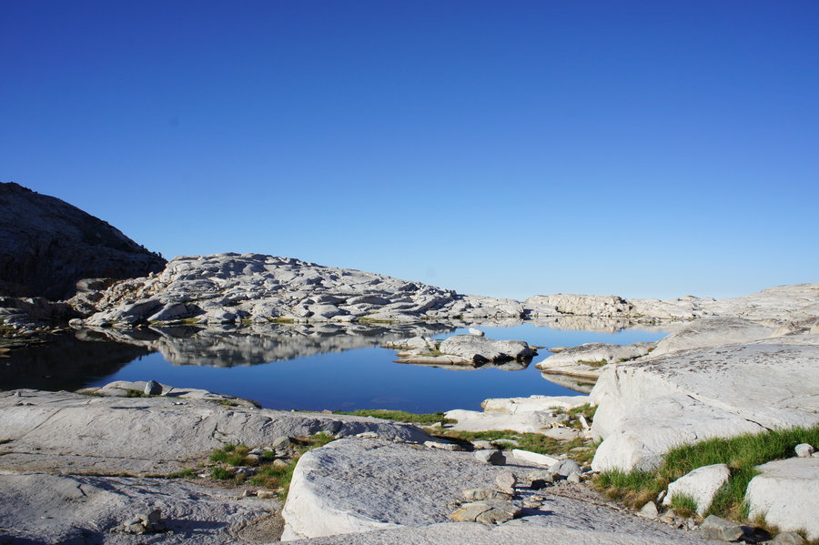
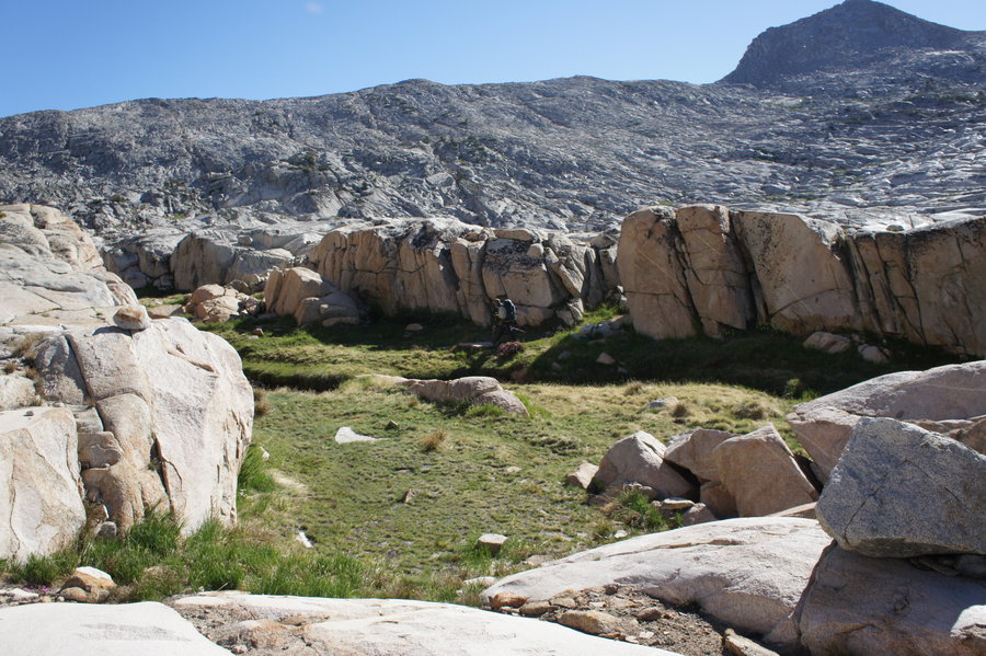
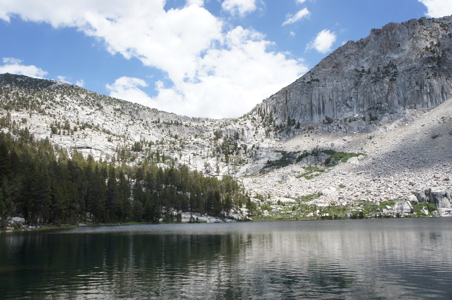
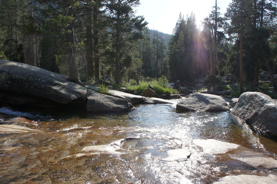
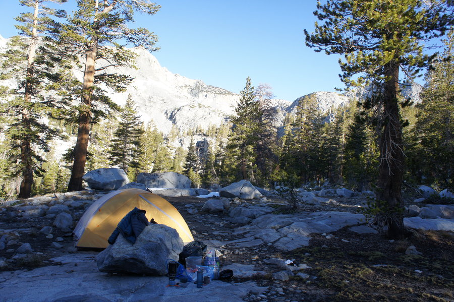
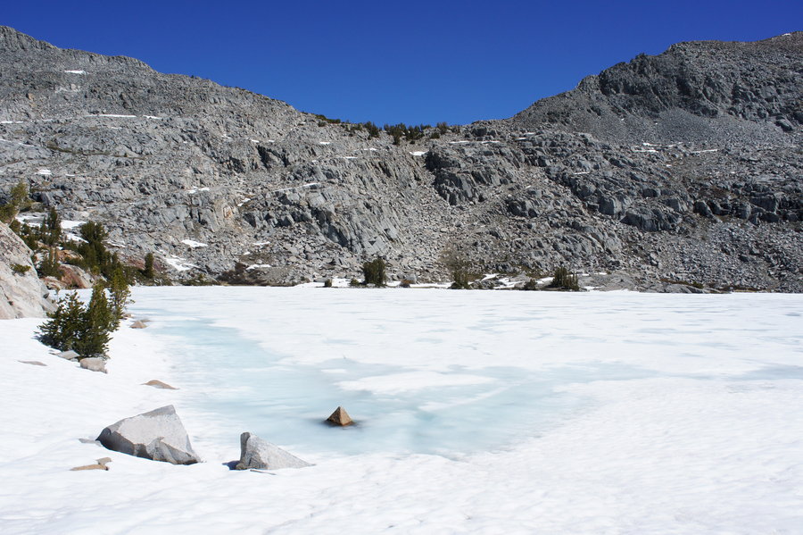
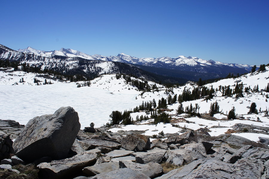
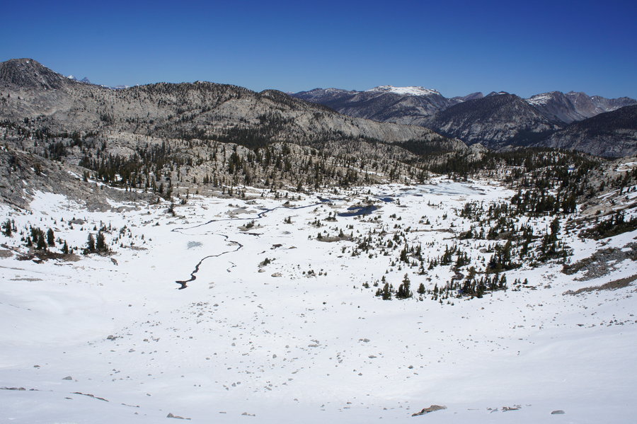
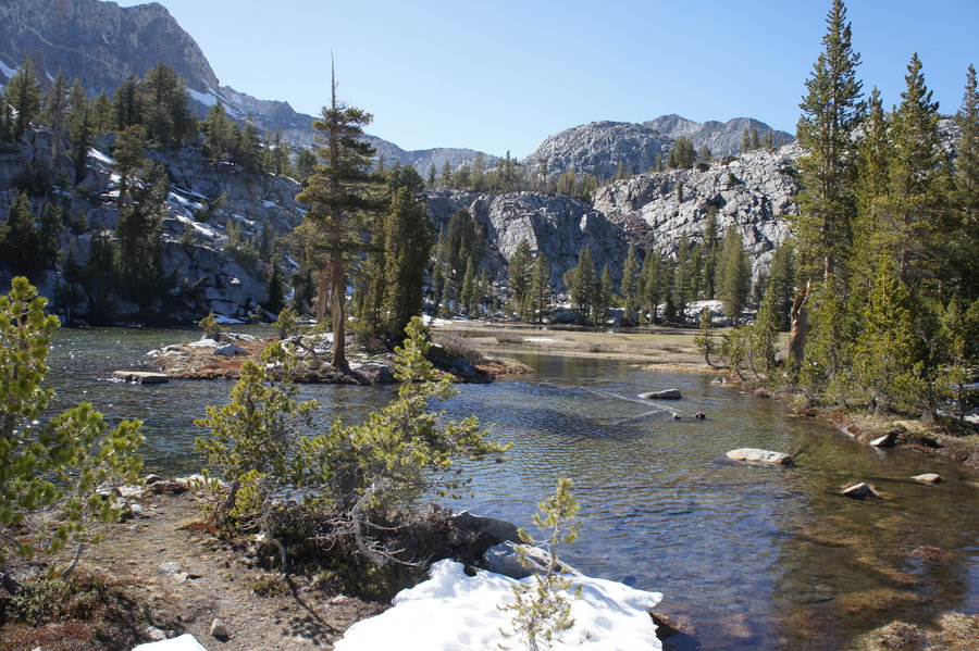
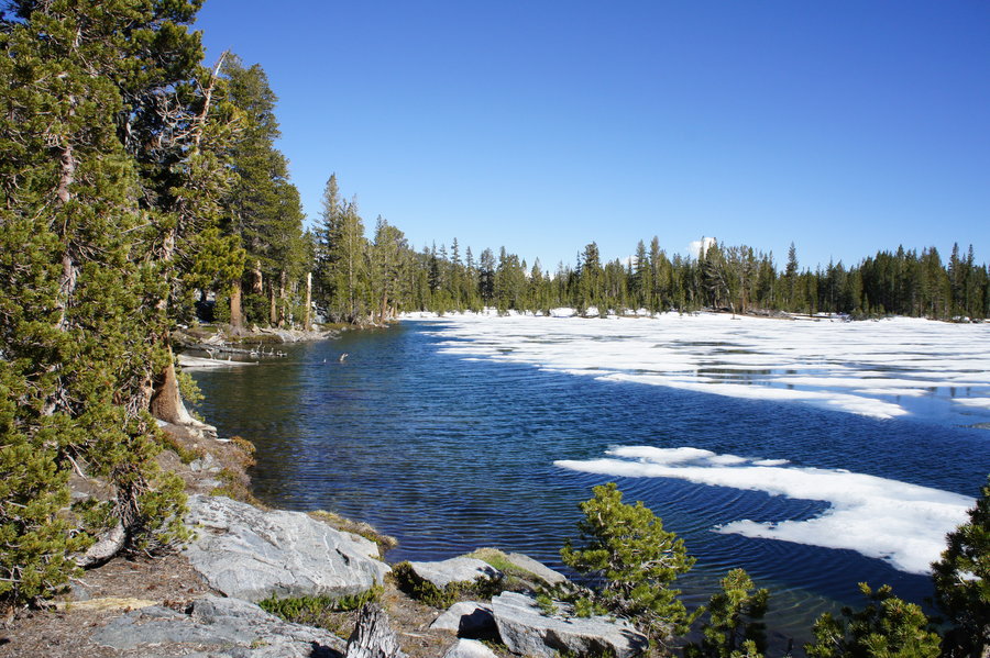
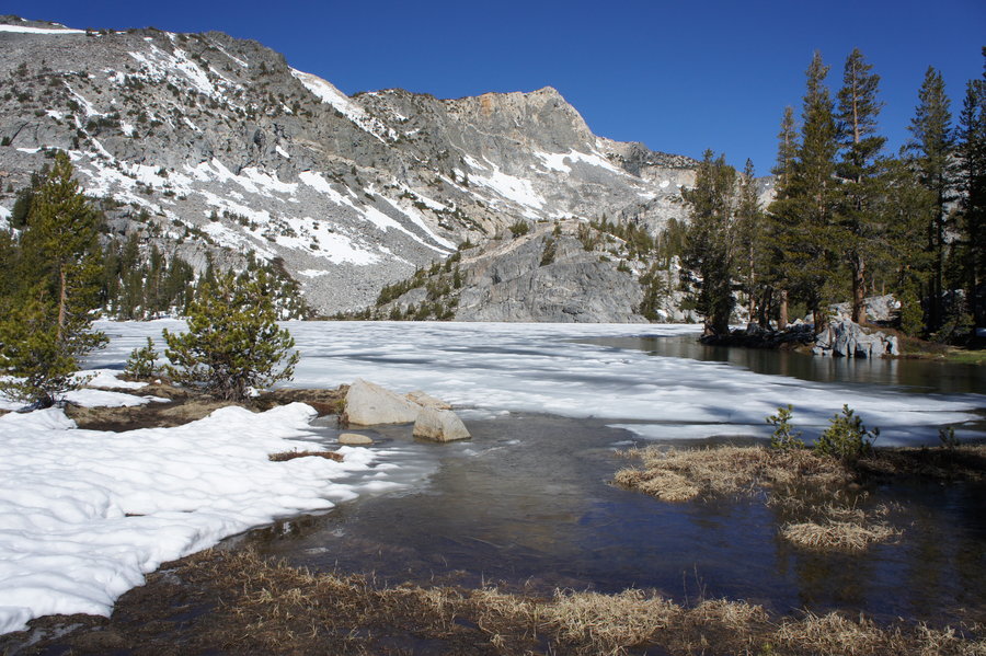
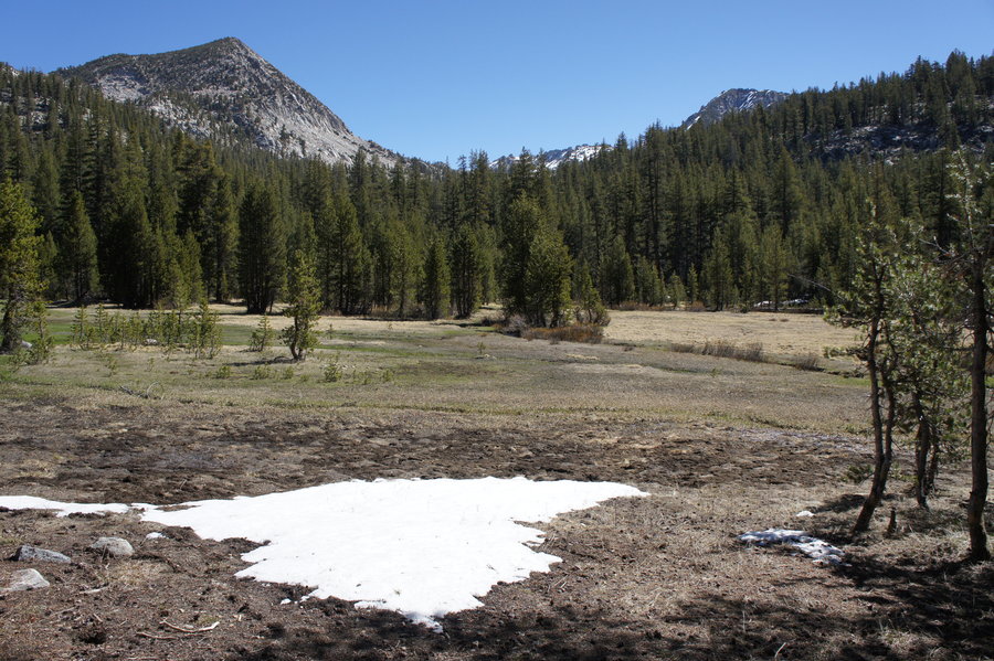
Central Sierra Backpacking - Graveyard Lakes
20 miles of hiking • 4000' elevation gain • 2 nights
Decided to take advantage of the long weekend to head south to backpack in the central Sierras with a friend from back in my Fresno days.
We left Fresno at about 9am for the long drive to the TH at Edison Lake. It's not that far in terms of mileage (about 90 miles), but the last 30 miles are over a single lane road with lots of steep drop offs, blind curves and hills, and with the holiday weekend, traffic. We were on the trail by 1pm.
The first mile or so is along Lake Edison, part of Southern California Edison's system of lakes and reservoirs in the area. The lake frighteningly low for this time of year. Note: Vermilion Valley Resort (VVR) usually runs a hiker shuttle across the lake. This year they are running small boats (4 seat fishing boats) instead of their larger pontoon boat from the boat launch down the road because there is so little water.
After leaving the lake behind, it was steady uphill for most of the hike to Graveyard Lakes. Patches of snow starting appearing around 8000ft, and we had to cross some smaller snowfields at around 9000ft. Lower Graveyard Lakes still had some ice and snow on the surface. We set up camp at Lower Graveyard Lakes.
The next morning, we packed up and headed cross country toward the Silver Divide and Silver Fox Pass. Upper Graveyard Lakes was still snowed in. The approach to Silver Fox Pass was clear on the south side, but completely snow covered on the north side. After enjoying the views, we retreated to Lower Graveyard Lakes for a second night.
Tuesday morning, we packed up and headed back to our car. We passed three groups heading in. When we got back to our car, there were only four in the parking lot. It was at that point, we realized we probably had the wilderness all to ourselves the last night of our trip. :)
On the way out we stopped at VVR, where we met three PCT thru hikers from Ashland, OR. They were one of the early groups to pass through for the season. The first PCT thru hikers arrived at VVR less than a week earlier on May 24th! We left them with our surplus snacks and then headed on our way back down the mountain.
May 24 – May 26, 2014


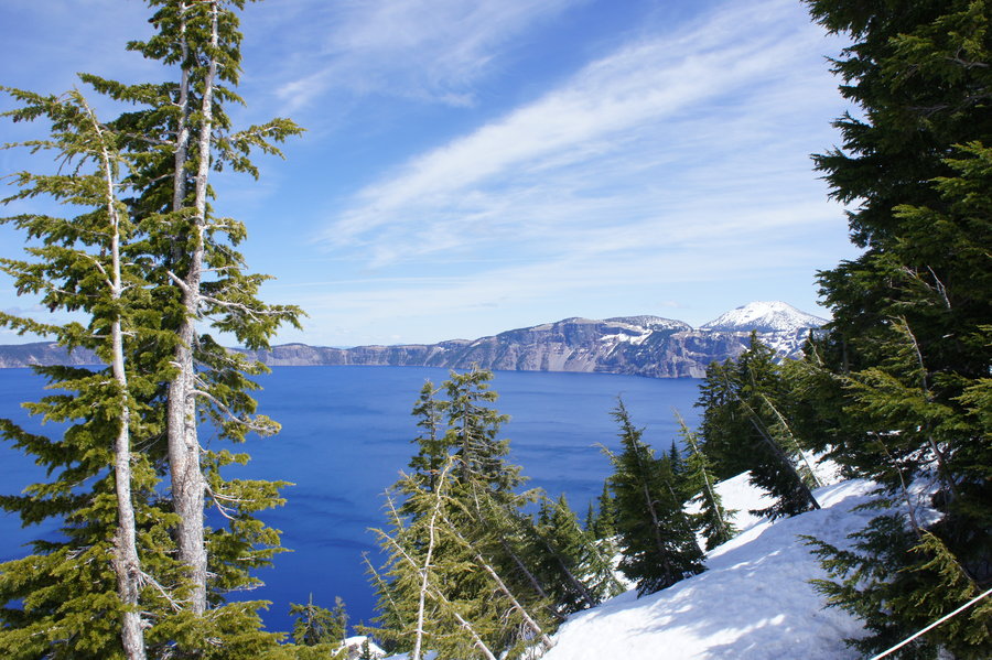
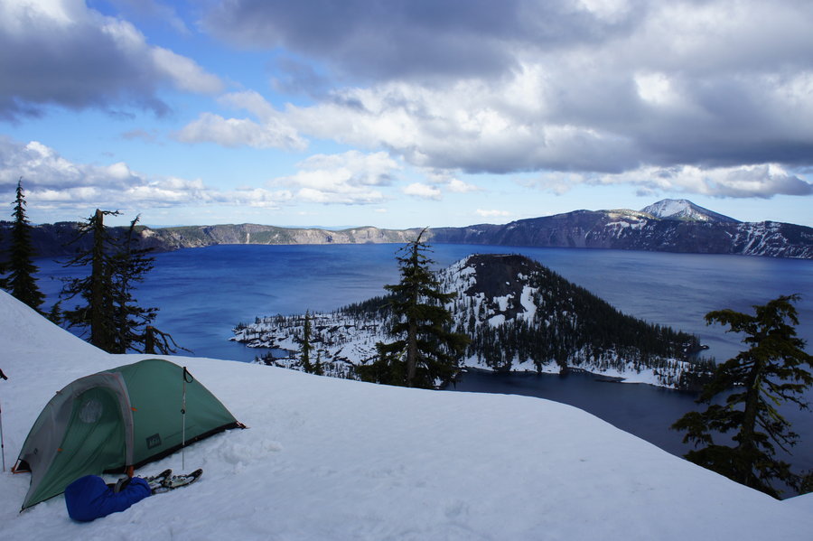
Crater Lake Overnight
10 miles of hiking • 1000' elevation gain • 1 night
Last minute weekend snow camp at Crater Lake. We left PDX at 6am on Saturday. After picking up permits, we were on the "trail" a shortly after noon.
They had already started plowing the west side of Rim Drive, which made for an easy road walk the first 4 miles. The weather was gorgeous. We set up camp on the rim, near Wizard Island, and then set off on snowshoes for more exploring.
As expected, the weather turned overnight. We woke up to find our tents covered with a little more than a dusting of fresh snow and the view of the lake completely fogged in. With the cold, windy, and snowy weather, we packed up camp and headed back down the road for warm coffee and grilled cheese sandwiches before driving home.
May 3 – May 4, 2014

Deschutes River Trail Run - Warm Springs
10 miles of hiking • 0' elevation gain •
Avoided a rainy day in PDX by heading east for a run!
April 27, 2014

Partial Fort to Sea Trail Run
8 miles of hiking • 500' elevation gain •
Trail running on a sunny day at the coast!
April 13, 2014

March 24, 2014

Silver Falls Loop
7.5 miles of hiking • 750' elevation gain •
Part trail run, part hike, part sightseeing. Fun way to spend a sunny day.
March 23, 2014

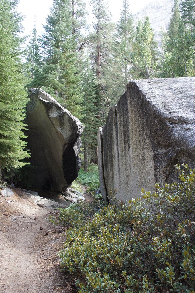
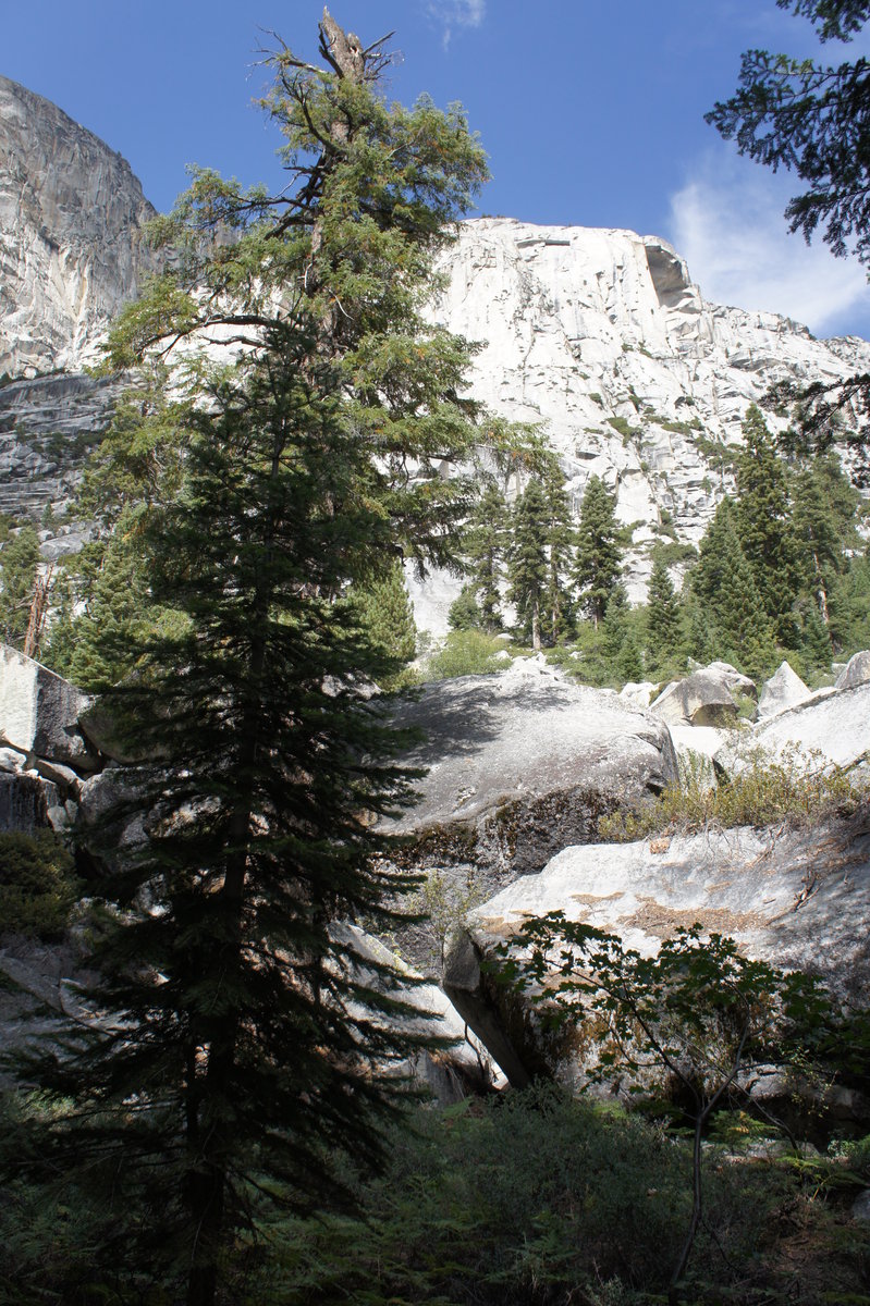
YNP - Curry Village up the Snow Creek Trail
11 miles of hiking • 2500' elevation gain •
Day hike up the Snow Creek Trail from Curry Village. Turned around just short of the trail junction after the climb out of the valley.
February 3, 2014

Cape Lookout Trail Run
9.5 miles of hiking • 2250' elevation gain •
Headed out to the coast yesterday to enjoy warm temperatures, sunshine and run the Cape Lookout Trail.
Started at the North Trail, where we discovered signage marking the North Trail as closed. There was no information provided regarding when the trail will be reopened, but it appears that the log bridge over Cape Creek is being replaced by a suspension bridge.
Trails are dry, very little to no mud.
No photos, as I wasn't carrying my camera or phone. :(
January 26, 2014

Trail Running on The Crown Zellerbach Trail
8 miles of hiking • 500' elevation gain •
Out and back run on the Crown Zellerbach trail outside Scappoose. The CZ trail is supposed to eventually connect up with the Vernonia-Banks trail, which would provide a recreation path from Banks to the Columbia River.
January 12, 2014

January 1, 2014
