

2012 Trips


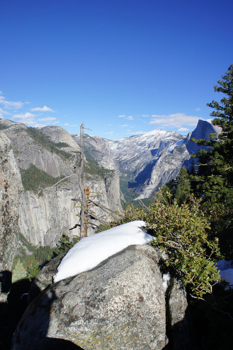
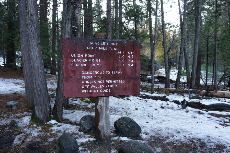
YNP - Four Mile Trail to Glacier Point
9.5 miles of hiking • 3250' elevation gain •
Decided to do a repeat of the Four Mile Trail the day after Thanksgiving. The past two weeks (since our last attempt) has been warm and dry, so we thought that this might be the last chance for awhile to visit Glacier Point without the mammoth size Yosemite crowds (unless we ski or snowshoe 24 miles).
We arrived at a full TH at 10am. We drove to the next parking area at the Swinging Bridge and started our hike there. It was a gorgeous day, and all the snow and ice we encountered two weeks ago was completely gone. Our total hiking time was a little over 4 hours.

November 23, 2012

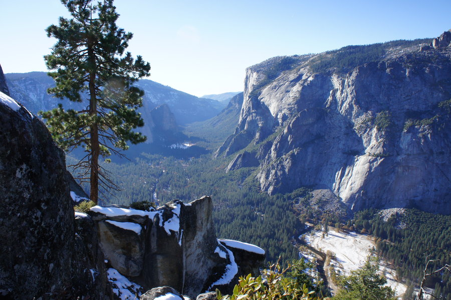
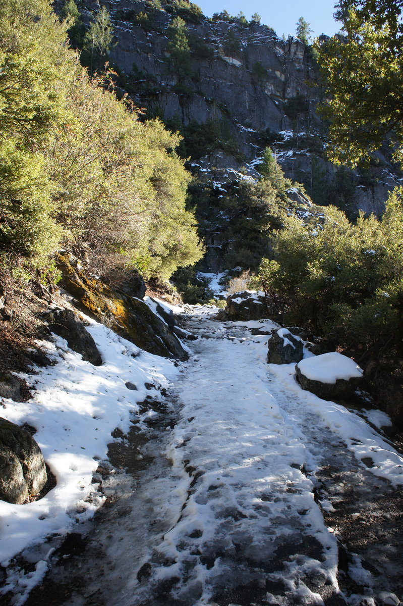
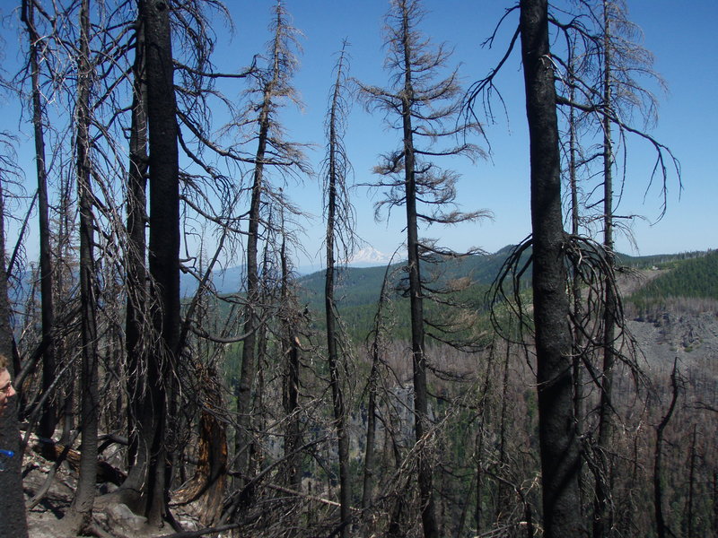
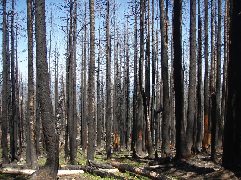
YNP - Four Mile Trail to Union Point
6 miles of hiking • 2000' elevation gain •
We got a late start (noon) on the Four Mile Trail. With icy, snowy conditions and an early sunset, we spent a little under 4 hours hiking the 6 mile RT to Union Point.
November 12, 2012


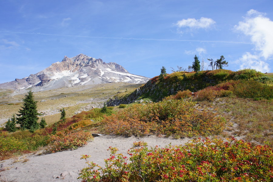
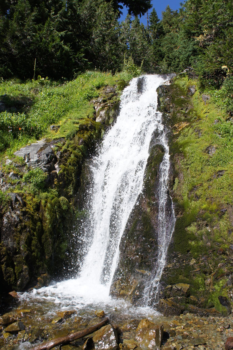
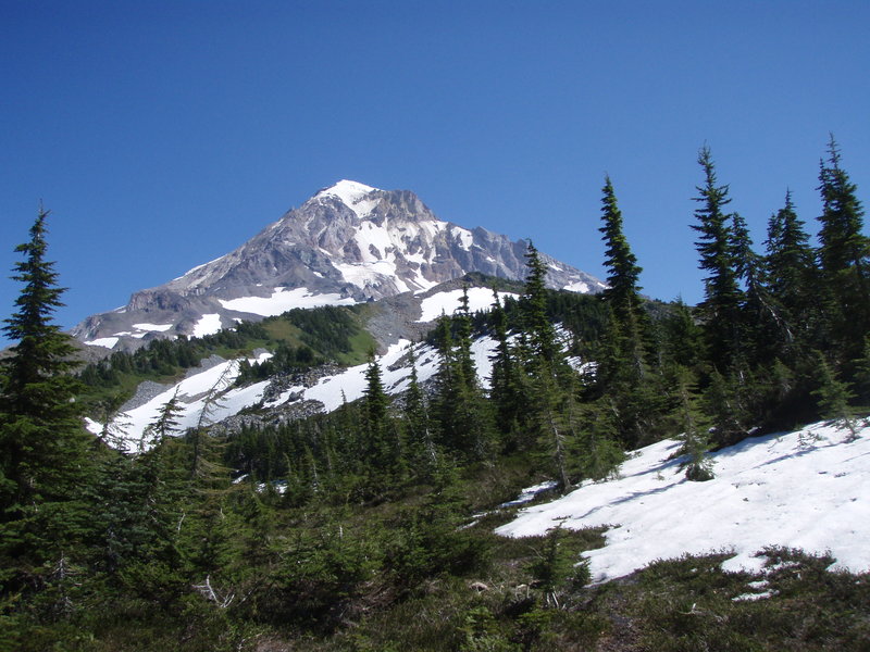
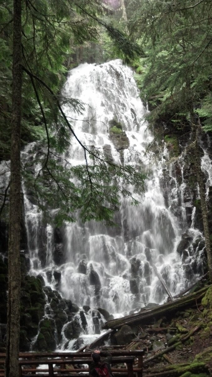
Paradise Park Loop
12.5 miles of hiking • 2250' elevation gain •
Hiked the Paradise Park loop from Timberline Lodge, with a side trip up Zig Zag Canyon to the waterfall.
Lots of gorgeous fall color. Avoid the crowds by hiking the loop clockwise.
September 29, 2012

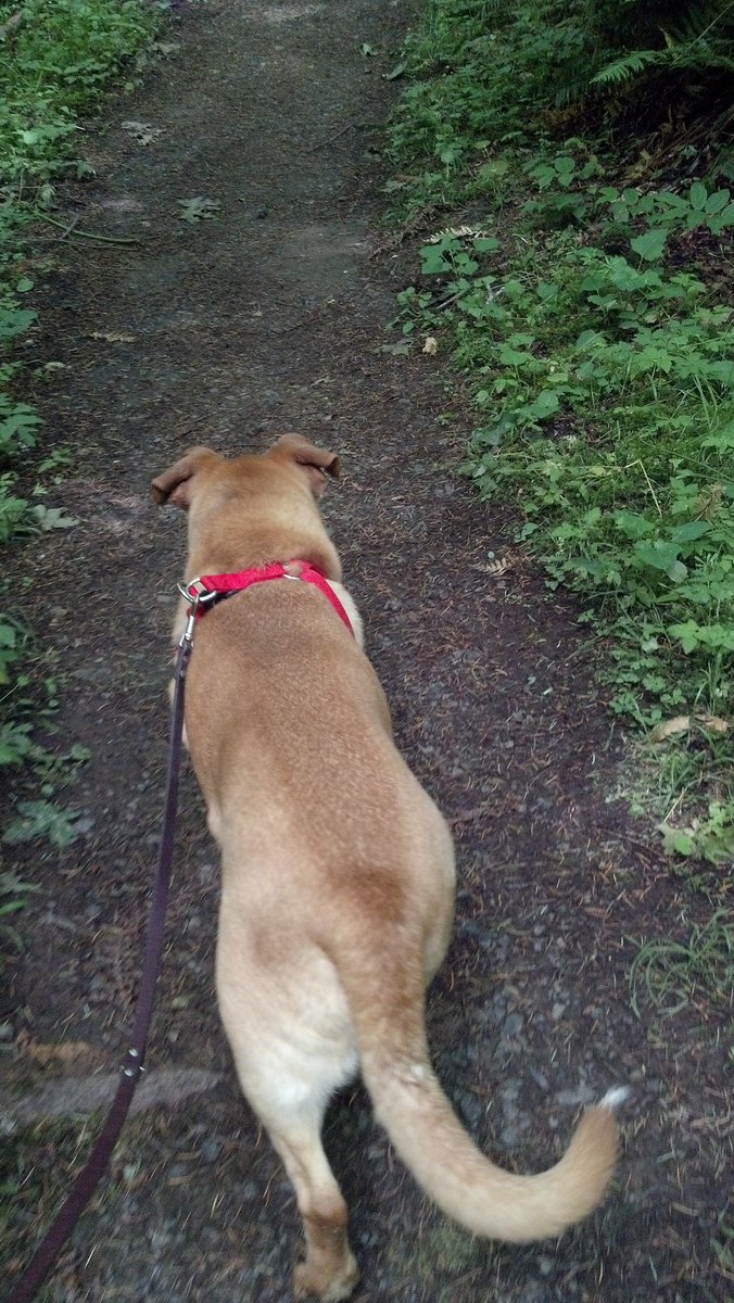
Hike for Gordy - Champoeg State Park
5 miles of hiking • 0' elevation gain •
Short hike for the dog.
Hiked RT from the Frisbee golf area to the Butteville store.
Lots of blackberries along the bike path.
September 3, 2012
 4
4
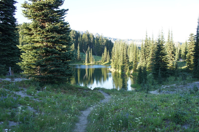
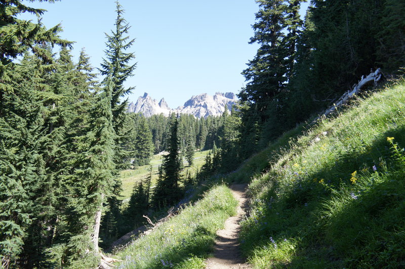
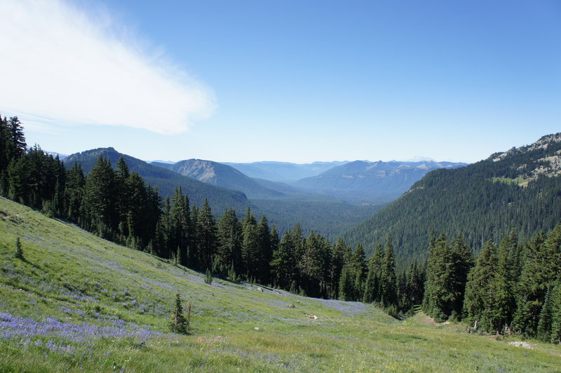
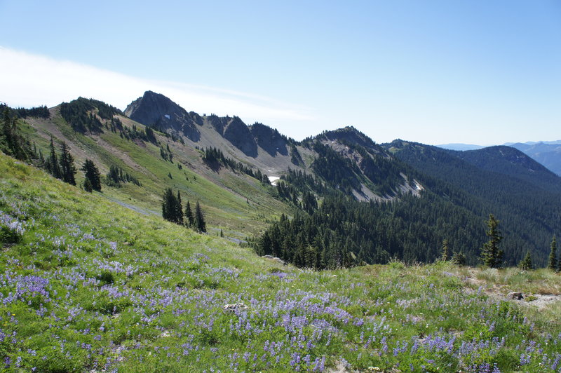
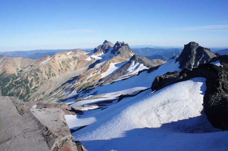
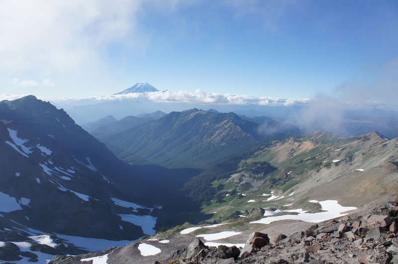
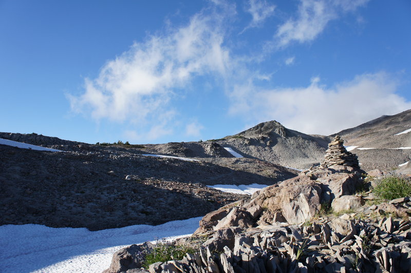
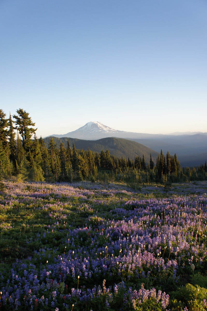
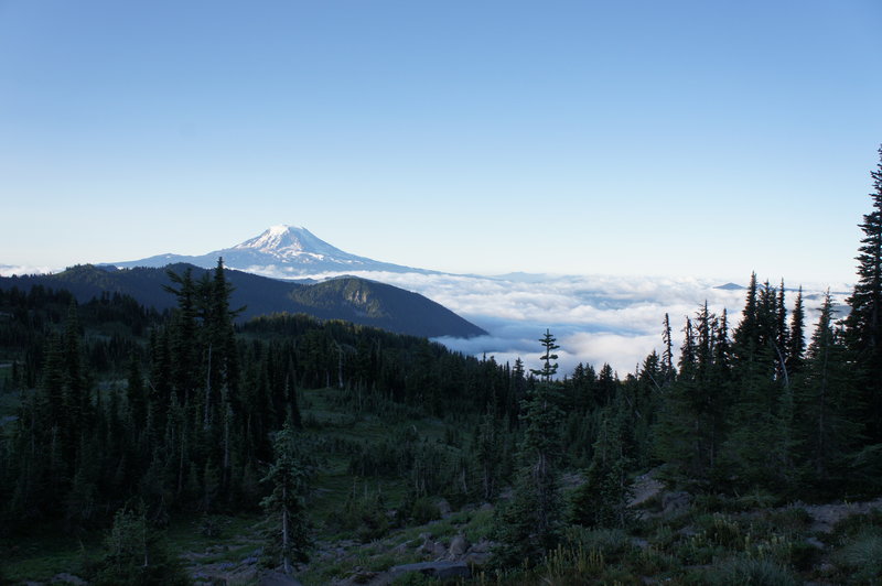
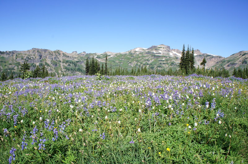
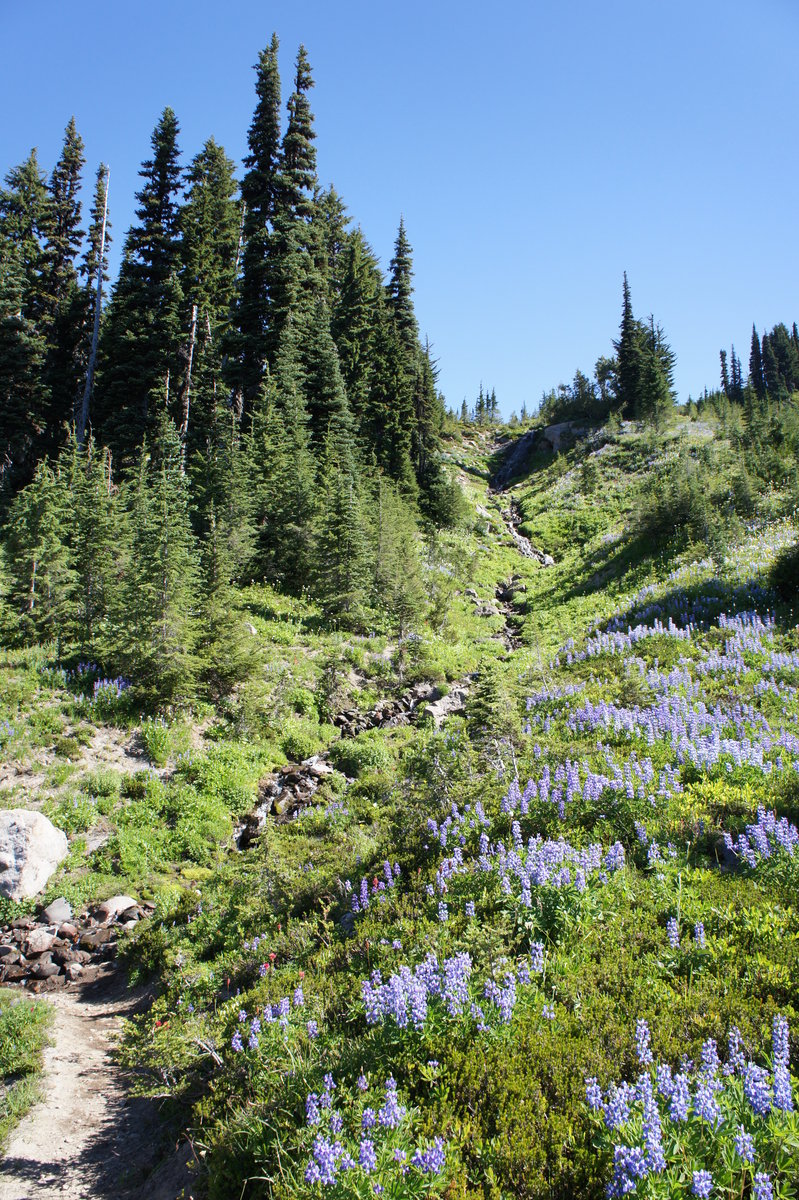
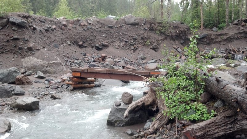
Goat Rocks Backpack
23.5 miles of hiking • 5500' elevation gain • 2 nights
We had originally planned for this to be a 4 day / 3 night trip, but after encountering holiday weekend crowds and few campsites along Goat Ridge decided to cut it a day short. None the less, it was a fantastic weekend, with sunny warm days and miles of trails through endless fields of wildflowers.
Day 1 (Thursday) - Walupt Lake to Sheep Lake Started our trip on the Nannie Ridge trail from Walupt Lake. We got a late start, arriving at the TH around 3:30pm. We arrived at Sheep Lake around 7pm, where we found very few available campsites. There was a solo tent that was set-up in the large established campsite on the northeast end of the lake. We didn't want to camp too close to them, so we ended further back in the trees. By the next morning, we were able to determine the tent had been unoccupied all night! After surmising the possible reasons it could be there, our plan was to report it to the ranger station once we got back to the TH.
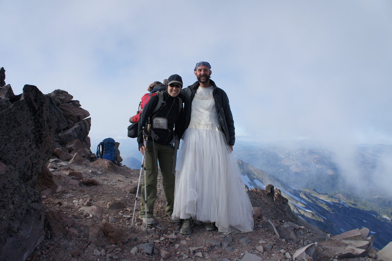
Day 2 (Friday) - Sheep Lake to Old Snowy Got a late start, finally getting on the trail shortly before 11am. We left Sheep Lake and headed north on the PCT, over Cispus Pass and into Cispus Valley. We happened across a PCTA trail crew shortly before the Snowgrass Flats junction, they were doing some fantastic work to improve water drainage and maintain culverts along the trail. After chatting with them for awhile about volunteer opportunities and the mystery tent at Sheep Lake (they said it may be holding the site for a volunteer work crew based at Sheep Lake over the weekend), we hike a short distance to our second camp near the PCT / Snowgrass Flats Junction. Once we unloaded gear from our packs we hiked up to Packwood Glacier and then summited Old Snowy. As we were coming back down from Old Snowy, we looked down and there was Train (www.hiking26.com) at the PCT / Old Snowy junction! I had been following his blog sporadically through the season, so it was an unexpected and pleasant surprise to see him on the trail. After some introductions and photos, we were back on our way to our campsite for the evening.
Day 3 (Saturday) - PCT / Snowgrass Flats Junction to Berry Patch TH Brr...what a cold morning. We woke up to find the thermometer on the watch reading 27F! As we were finishing up breakfast and breaking down camp, we heard some guy cussing up a storm while heading up the trail. I peeked out from behind a tree to see what type of person would take that kind of abuse from their hiking partner; only to find out the guy was by himself, ala Fight Club. It was a reminder to me about why I choose not to hike solo. We left camp at almost 10am, taking the Snowgrass trail to the Lily Basin trail. As were were heading down toward Lily Basin, we could still see frost crystals on the trail that were large enough to make the dirt look like it was standing up! (This is apparently a common phenomena in the PNW, but to a native Californian who only learned about freezing fog last winter, this was pretty cool.) We followed this trail to Goat Lake, which is is starting to melt, but probably will not melt out before the snows return later in the year. From there, were headed down Goat Ridge. Although it was still early afternoon, we started looking for a campsite for the evening. The stretch of trail between Goat Lake and Berry Patch was BUSY. After finding most campsites already occupied and seeing the large number of hikers coming into the wilderness for their first night, we decided to go ahead and hike out to the TH. Seriously, there were A LOT of people. Much more than established campsites in the area would be able to accomodate. We were not the only ones who came to the same conclusion, as another two couples we had been leapfrogging on the trail for a couple days opted to hike out also.
We ended the hike at the Berry Patch TH, where Phil and Jerri (who we had gotten to know on the trail) offered to give us a ride back to Walupt Lake. We talked backpacking in the Cascades and the CA Sierras and after getting back to out car, we met up with them at the Walupt Lake day use area for post backpacking coffee and snacks before the drive home.
August 30 – September 1, 2012

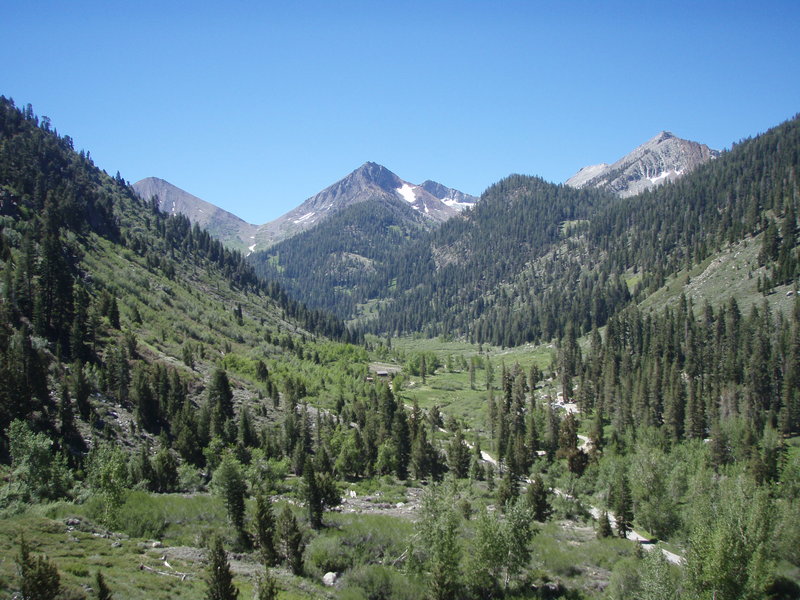
South Sister
12.5 miles of hiking • 5000' elevation gain •
Left Portland on Friday at 3:45pm, arriving at the Devil's Lake TH / campground shortly before 8pm. We were lucky enough to get the last half campsite. (Thanks again to the wonderful folks who were gracious enough to share!) Despite the cool night temperatures, it hasn't gotten cold enough to frost, so the mosquitos were out in force. I think I got about a dozen bites while quickly setting up the tent while there was still a bit of light left in the sky.
We started off Saturday morning with breakfast and coffee in the parking lot before heading up the trail at about 7:40am. Conditions were ok. Weather was great, but the area is affected by smoke from the Waterfalls 2 fire in the Warm Springs area. After following all the other "ants" up the hill, we were at the top by about 1pm. The snow field at the summit has a snow bridge close the the edge, where the trail approaches the summit. We saw one child and a dog fall through (on separate occasions), because they were too close to the edge. Luckily the water is shallow, but I would imagine that it would make for a chilly hike back down. We spent a little over an hour at the top, where we hiked the trail around to the real summit.
Ater traversing the snowfield back to the trail, we headed back down the mountain, arriving at the parking lot 3 hours later at 5:30pm.
Photos coming soon...
August 25, 2012

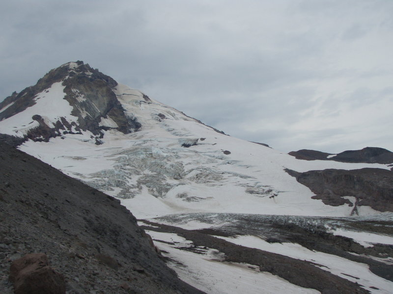
Cooper Spur
8 miles of hiking • 2750' elevation gain •
Another fantastic day on Mt. Hood!
The forecast on Saturday left open the possibility of rain and thunderstorms, so we left the trailhead, with a watchful eye to the sky. As luck would have it, there was only one good and extremely short down pour the entire day; and it occured right after we had ducked into the the Cooper Spur shelter.
After the rain ended, we made a quick exit and headed up to the top of Cooper Spur. The trail is easy to find most of the way up, but at one point through the switchbacks, ended into a snowfield. From that point until the tent shelters before the traverse, it was a open hike up the boulder and scree fields. The traverse and top of Cooper Spur were quite windy. Probably 50mph+ gusts. Visibility was limited due to what we assumed was smoke from the fires in Southeastern Oregon. However what we could see was still spectactular; the east face of Mt. Hood, Cloud Cap, roped climbing teams on Eliot Glacier.
After a short while at the top, we headed back down, just in time to pass the day hike crowds heading up. The sun finally came out when we were back on the Timberline Trail and almost back to the TH.
Note about travel time to the TH: We left the Portland area at about 7:30am and finally got on the trail at 10am. I still a relative newbie to the Pacific NW, so I didn't really plan for the drive to the TH to take so long. So for future reference, hikes on the east side of Hood, allow 2.5 hours travel time to TH...
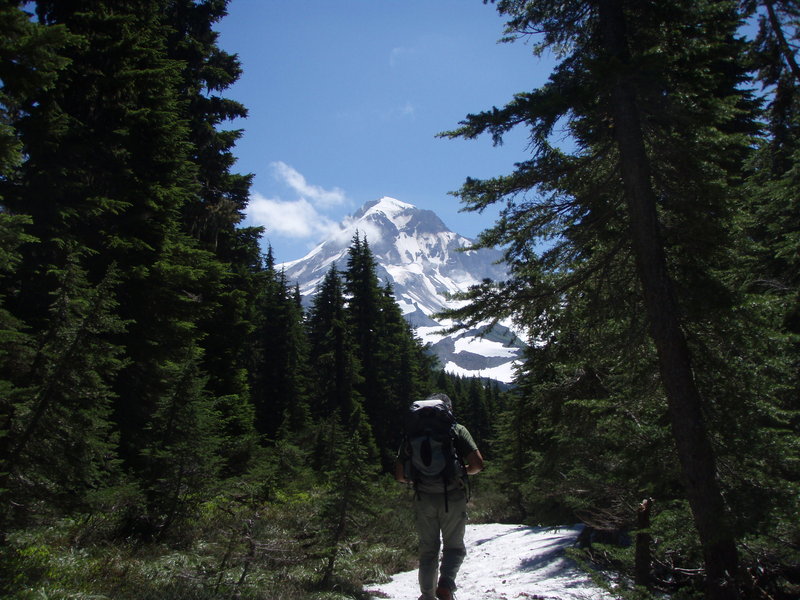
August 18, 2012


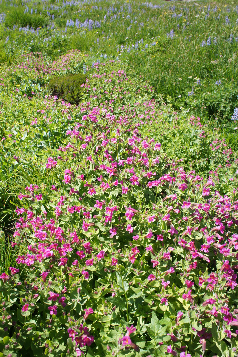
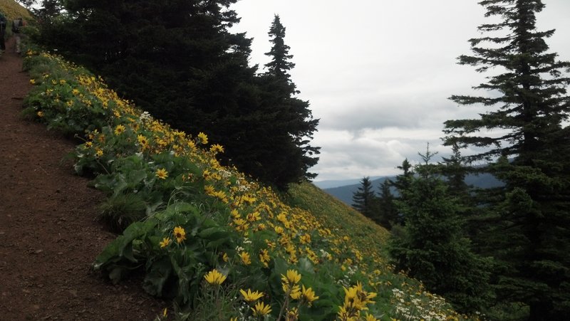
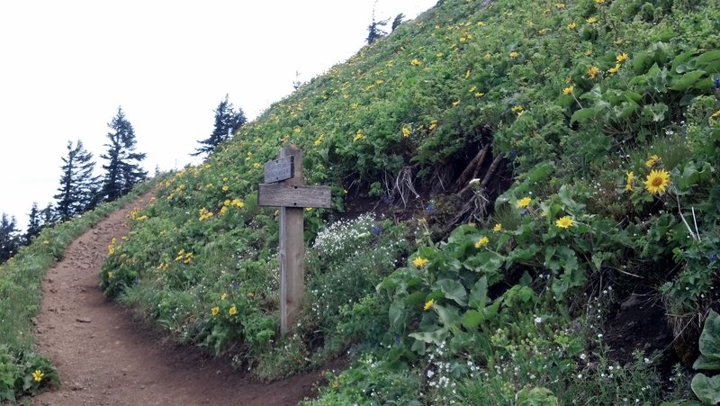
Top Spur to McNeil Point
10.5 miles of hiking • 2250' elevation gain •
We got a late start on this hike, arriving at the trailhead shortly before noon. I was hoping we'd be able to snag a decent parking spot from one of the backpackers getting off the trail. As luck had it, a truck pulled out of a spot in the top spur TH lot, shortly before we arrived. :)
As usual the trail to McNeil point was busy as it usually is on warm weekend days in August. All the snow past the Mazama trail from two weeks ago was melted except for a couple small patches.
The one thing I did notice on this hike, which I have not noticed on a lot of other hikes I have done this season, is that there are a lot of hikers out there who need to spend some time learning LNT ethics. Since the trail was busy and narrow in spots, there were a lot of hikers stepping off the trail and ONTO plants, wildflowers and other foliage to let others pass; even when there were spots of bare dirt or better yet, rock less than a few feet away. Ok, I'm off my soapbox now...
Wildflowers are at their peak now. Overall, another great day on the mountain.
August 12, 2012
 1
1
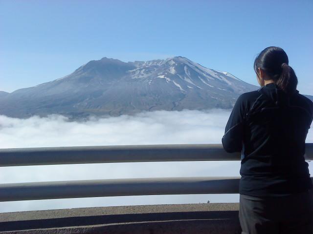
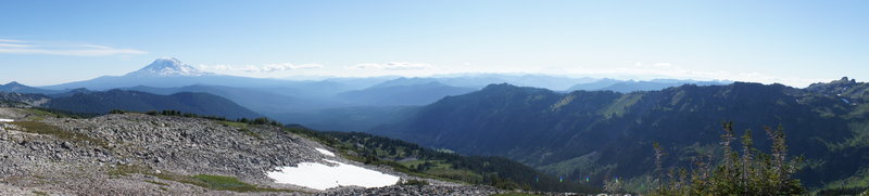
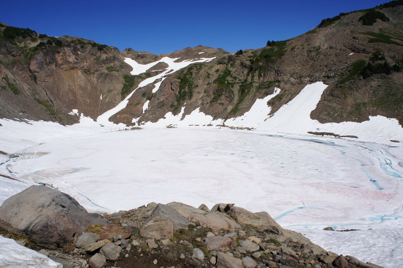
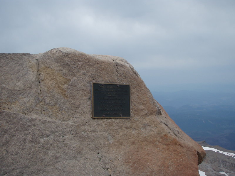
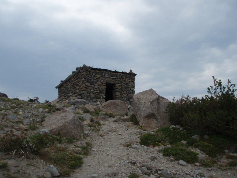
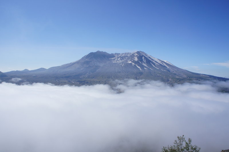
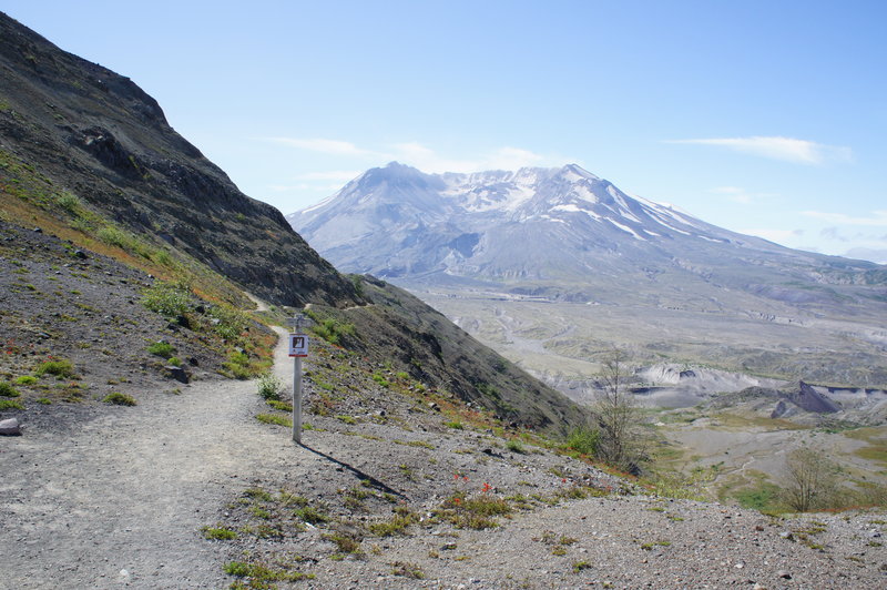
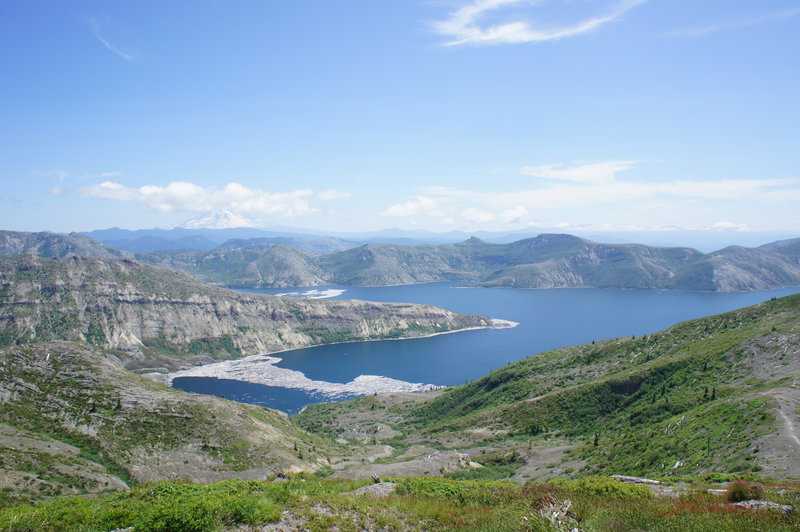
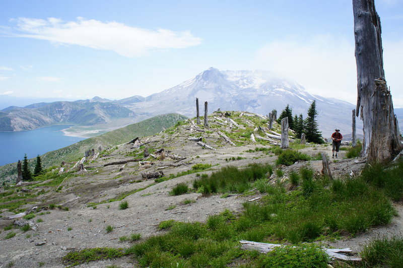
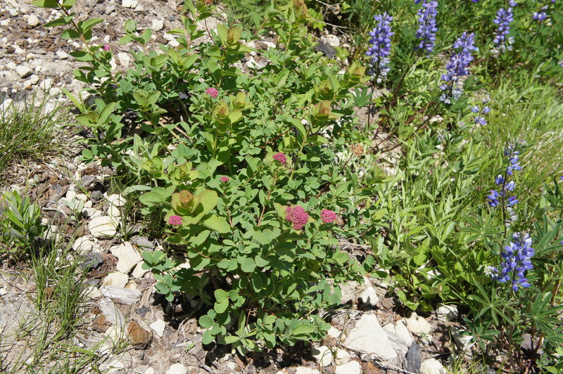
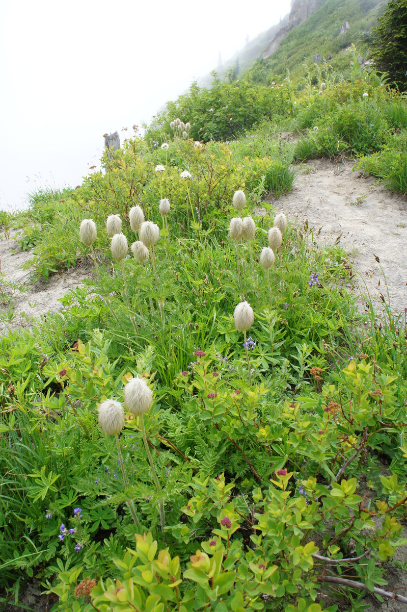
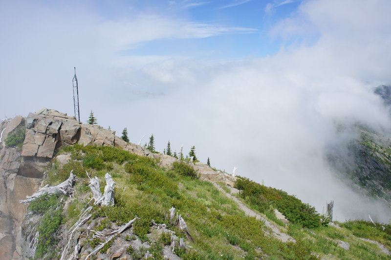
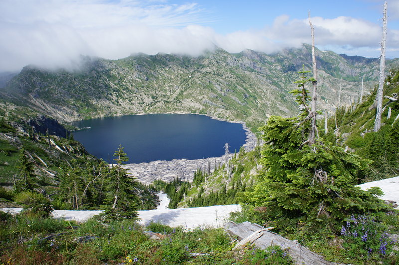
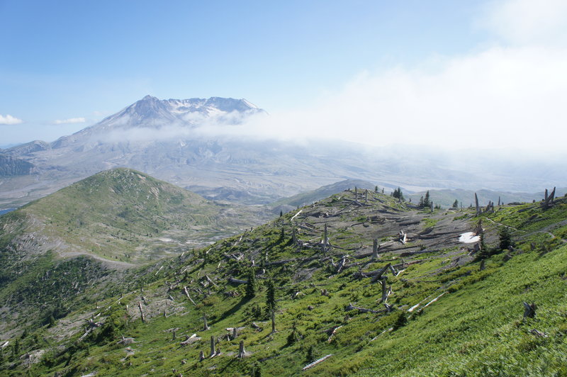
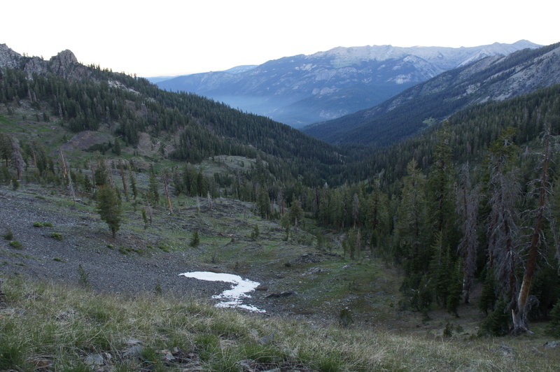
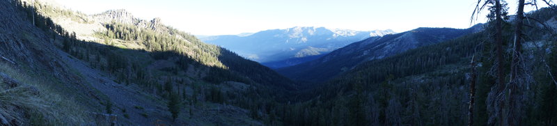
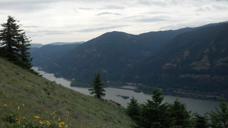
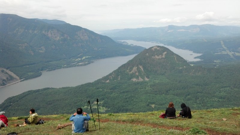
Coldwater Peak from Johnston Ridge
13 miles of hiking • 2000' elevation gain •
This hike followed the Boundary Trail to above St. Helens Lake and then continued to Coldwater Peak.
The trail is easy and wide for the first mile or so, from that point, the trail follows an exposed ledge (which may scare unexperienced hikers) for about 1/4 mile. After, that, its back to easy hiking until past the junction to Harry's Ridge. After Harry's Ridge is when the elevation gain really gets started. There are also a few very steep, narrow and exposed stretches near the rock arch (about 4.5 miles).
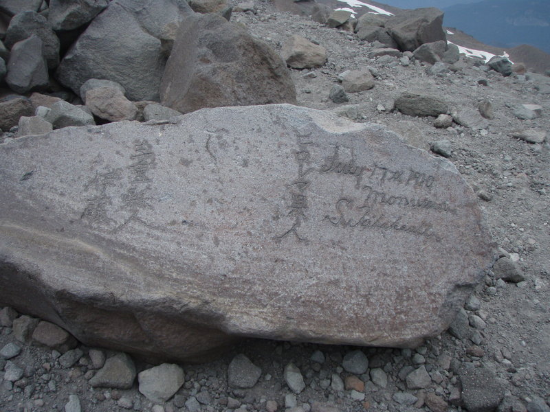
However, the long hike is worth the scenery and the view. Coldwater Peak used to have a fire lookout, and now houses monitoring equipment. From the summit, we were able to enjoy views of Mt. Ranier, Adams, Hood and St. Helens. Supposedly it is possible to see all the way to the coast from this summit, but the clouds were obscuring our view to the west.
Note: To hike from Johnston Ridge Observatory, you have to have a Monument Pass ($8), which can be purchased at the Observatory. Unfortunately the observatory does not open until 10am.
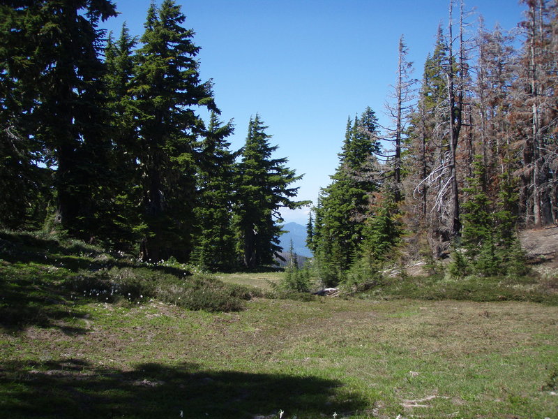
July 29, 2012

Cairn Basin via the Mazama Trail
8 miles of hiking • 2250' elevation gain •
Beautiful day for a hike up to Cairn Basin along the Mazama Trail.
The last time I was up in this area was last year, one day after the Dollar Lake Fire started. It was interesting to see how the fire changed the look of the mountain.
There is still some snow in areas, and we did have to cross a snow bridge to get into Cairn Basin. I'm expecting that the snow bridge could be gone by this upcoming weekend.
July 28, 2012


Siouxson Creek and Horseshoe Ridge Loop
11.5 miles of hiking • 2000' elevation gain •
Went out to hike Siouxson Creek and decided to add on some extra milage by taking the Horseshoe Ridge Trail.
July 8, 2012

Silver Star - Ed's Trail
6.5 miles of hiking • 1500' elevation gain •
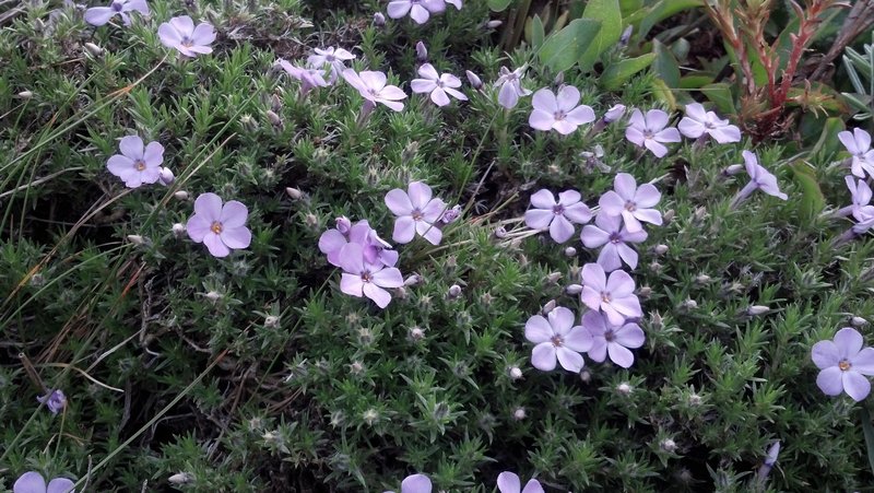
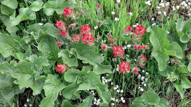
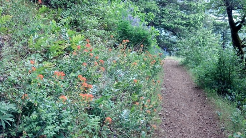
Foggy day on Silver Star. Lots of wildflowers out.
This one is going on the list of hikes to repeat on a clear day.
July 1, 2012
 1
1
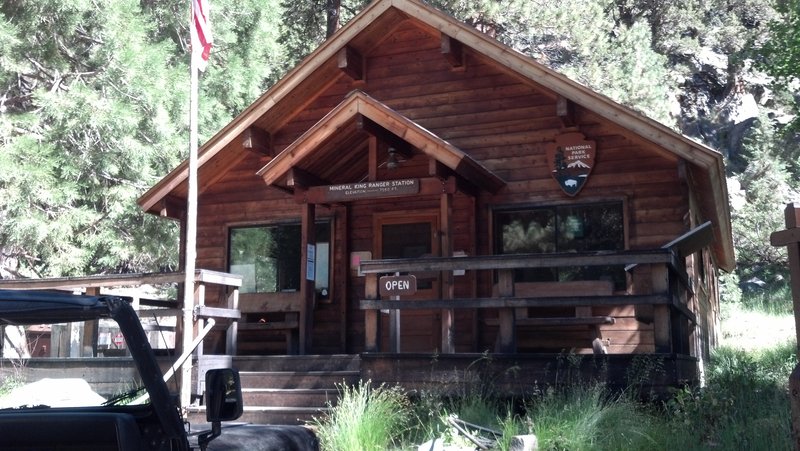
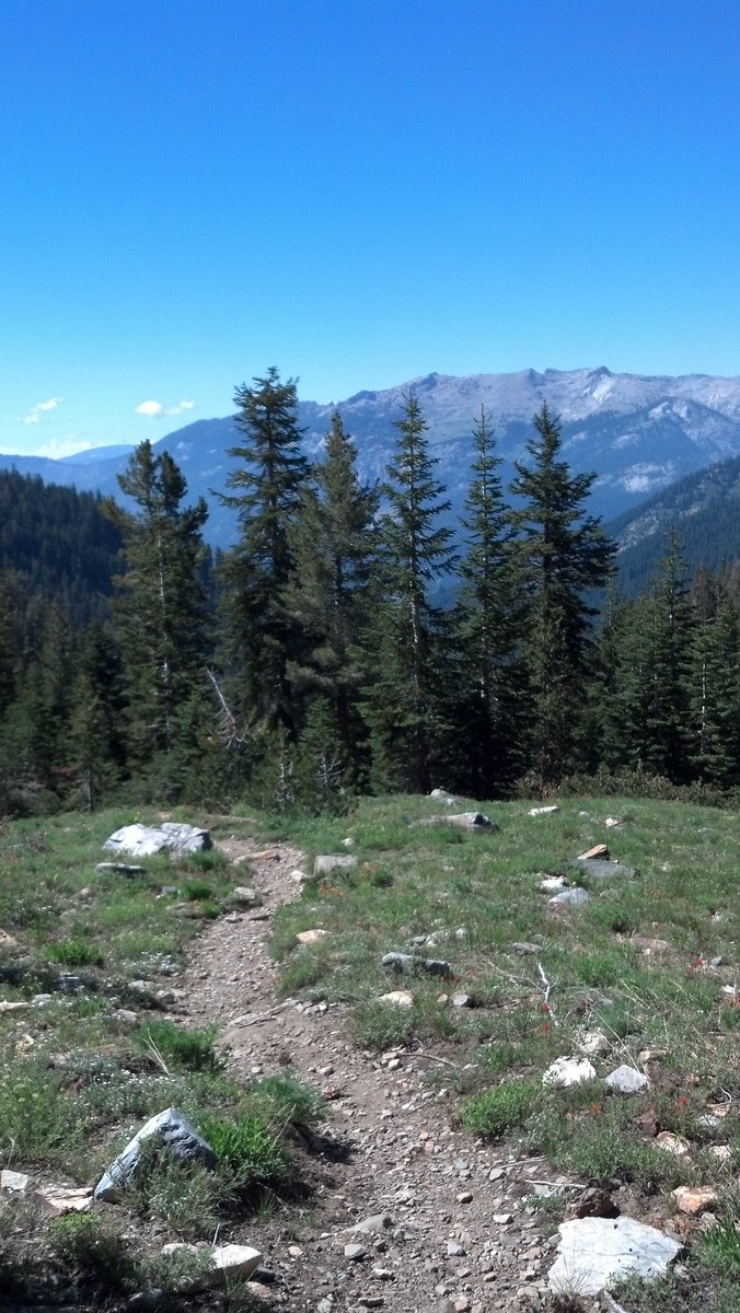
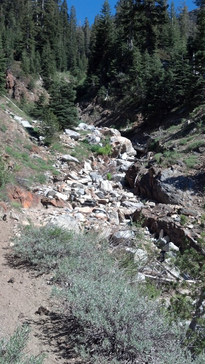
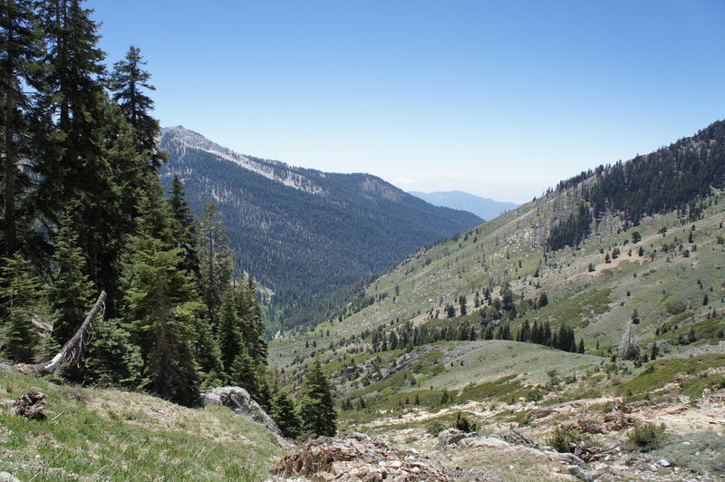
Sequoia NP - Mineral King to Timber Gap
8.5 miles of hiking • 2000' elevation gain • 1 night
First backpacking trip ever!
It's not that I've been avoiding it, in fact I've been collecting backcountry gear for 5+ years (to the point where I've starting upgrading gear). The issue was always finding someone to go with. So when I told a friend I was coming down to Central CA for a few days and I wanted to backpack the Sierras, we threw together a quick overnight trip in the Mineral King area of Sequoia NP.
We left Fresno, CA at 6:30am. After getting permits, chatting with the rangers and being advised of the "dastardly deer" that was in the area, we final hit the trail at 10:30am. We opted to add a couple miles to our trip by leaving the car at the picnic area shortly before the ranger's station at the advice of the rangers in an effort to avoid the marmots that are infamous for eating cars at the Sawtooth trailhead parking lot.
The hike up to Timber Gap allowed us views of Mineral King Valley all the way up the trail. With perfect weather, it was a gorgeous day for hiking and thankfully we were above the inversion layer that typcially socks Central California in smog. It took us about 4 hours to get to the Timber Gap. Typically it would not take nearly 4 hours to travel 3.3 miles, but with a starting elevation of approxmately 7500ft, then add that it was my hiking partner's first hike of the season, we opted to take our time to acclimate to the elevation change.
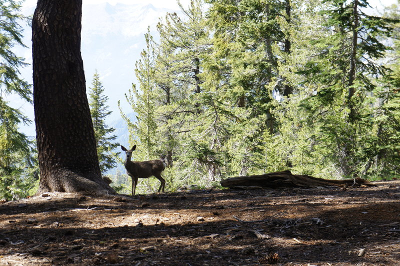
Once we arrived at Timber Gap, I still felt like hiking, so I ditched the pack with my hiking partner and took off to look for a place to camp near water. The map showed a stream along the trail and about a 800 feet below the our location, so I decided to check it out. I hiked followed the trail another mile (and about 1000 ft below Timber Gap). The alpine forest quickly gave way to a short meadow, and then chapparal. Not great areas to make camp. Even better, the stream was dry. So I quickly hiked back up to Timber Gap, where we decided to make camp after finding a small snow field for water.
We didn't meet the "dastardly deer", but we did see several deer, including one we nicknamed "stalker deer" since he kept circling camp to see what we were up to.
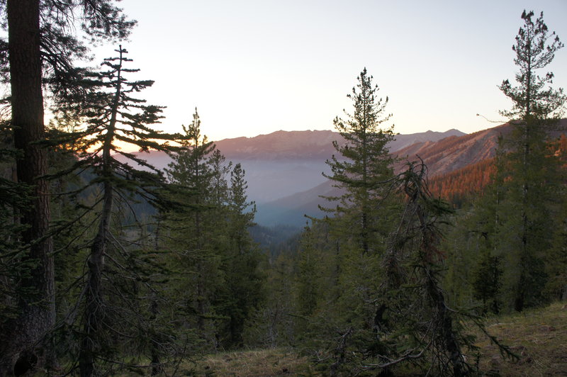
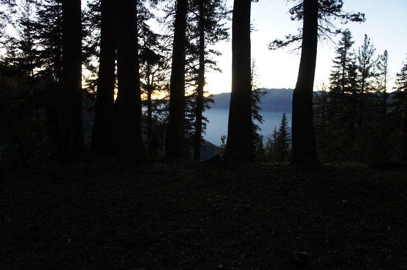
From camp we were able to watch both sunset and sunrise over the SEKI wilderness. We headed back to the trailhead around 9:30am and were back at the car by 11:30am.
June 23 – June 24, 2012


Summer Solstice 4T Trail
4.5 miles of hiking • 500' elevation gain •
To celebrate summer solstice, I hiked the 4T trail (4T - trail, tram, trolley and train) after work with a co-worker.
Started at the Oregon Zoo around 6pm. The trail is very well marked. Made it up to Council Crest at 6:30pm, where we sat down for a potluck dinner. We headed down the trail to OHSU at 7:45pm and got to the aerial tram at 8:45pm. The view from the Aerial Tram was spectacular, with it being clear enough of a day to see MSH and Mt. Hood. Then from there, it was on to the trolley and MAX. We got back to the parking lot at the zoo at 9:30pm.
June 20, 2012

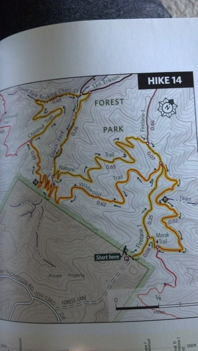
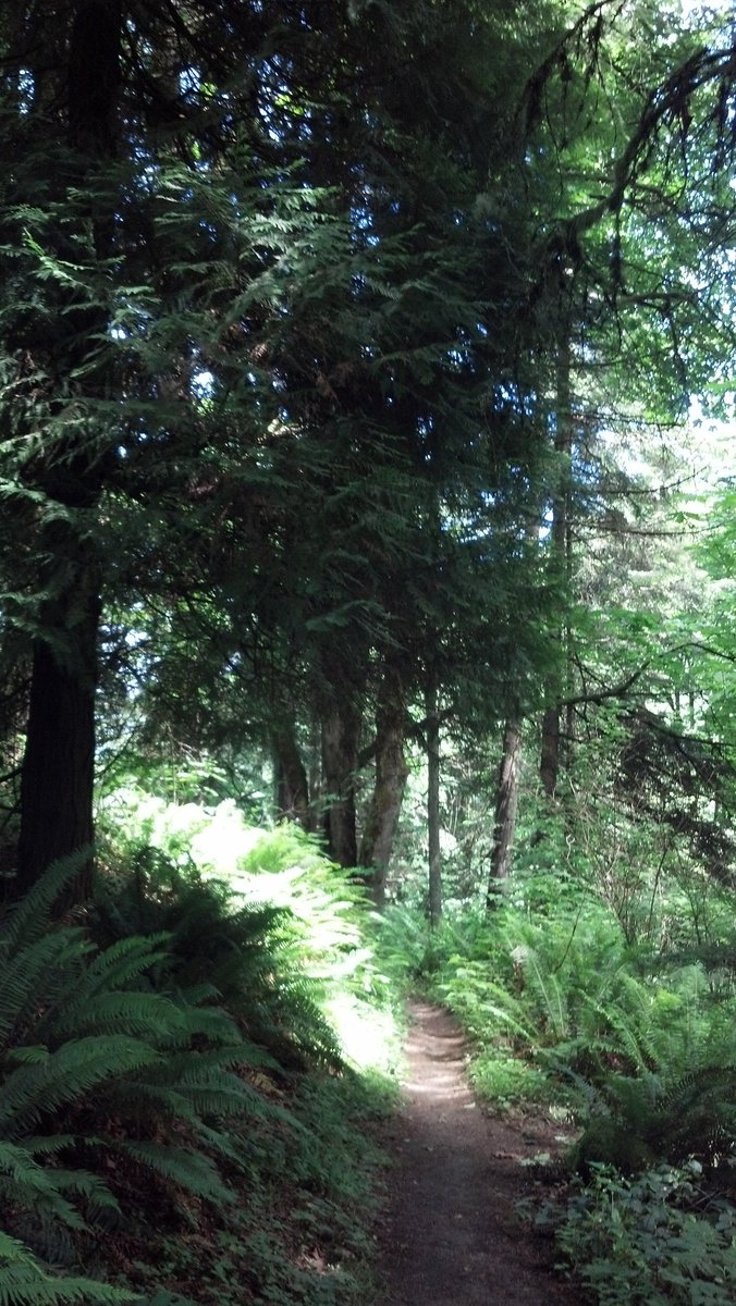
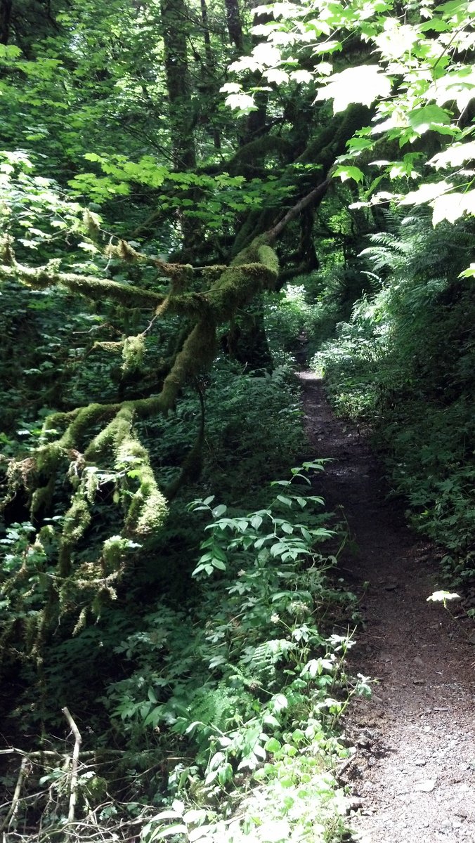
Hike for Gordy - Forest Park - Wildwood, Chestnut, Nature Trail Loop
3.5 miles of hiking • 500' elevation gain •
Another short hike for my ever loveable mutt, Gordy.
We hiked a loop that covered Firelane 1, Wildwood, Chestnut, Nature, and Morak Trails.
Total hiking time ~1.5 hours.
June 10, 2012

Ramona Falls Loop
7 miles of hiking • 1000' elevation gain •
Arrived at the trailhead around 9am. I was leading a group of 8 hikers today. We were the second and third cars in the parking lot.
We set out in the morning drizzle, for a quick hike up to Ramona Falls. We arrived at the falls around 10:30am, taking the southern side of the loop in, and had the area all to ourselves. We didn't see anyone else until we were at least 10 minutes into our hike back the the trailhead on the northern side of the loop. After that, we seemed to be passing other groups heading towards the falls almost non-stop, including a group of about 30 Boy Scouts! We arrived back at the trailhead around 12:30pm to find a busy (but not full) parking lot. Interestingly enough, the one car that was in the parking lot when we arrived, was still there...
On a side note, the rhododendron are starting to bloom at the lower elevations, but have quite a bit of time left until they will be at their peak.
June 9, 2012

Dog Mountain
7 miles of hiking • 2750' elevation gain •
Today was the day for my second annual hike up Dog Mountain.
We got to the parking lot at around 8:30am and got a spot near the start of the second row. As we were getting our boots and packs on, we watched the steady stream of cars pulling into the parking lot. I was almost like parking at Disney Land, complete with the Forest Service setting up cones and directing parking.
We opted to take a loop on today's hike, hiking the eastern trail past the viewpoint up, and the Augspurger Mountain trail down. Trail conditions were pretty good, although there were several long muddy sections on the upper portion of the Augspurger Mountain trail, which made for some good slip-sliding fun on the way down.
The spring wildflower show was pretty much on everywhere, except on the meadows along the last switchbacks at the top of Dog Mountain. That section will probably need another week or two.
Hiking time up the "scenic trail" - slightly less than 2 hours Hiking time down Augspurger Mountain Trail - 1.5 hours
June 3, 2012


Wildwood Trail - Pittock Mansion to Stone House
3.5 miles of hiking • 500' elevation gain •
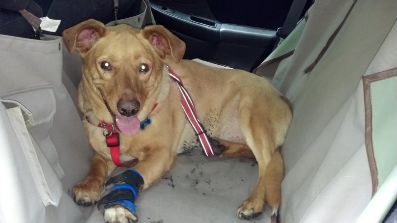
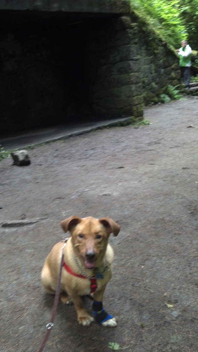
Gordy, my 6.5 year old dog (lab / bassett mix), loves to hike.
The only problem with that is that he was born with a genetic deformity in this front left leg that causes him to hyper-extend his wrist, which in turn is causing his wrist joint to break down as he gets older.
He used to join me on my hikes when he was younger, but now, he can't manage more than a few miles so I have to leave him at home. At first he'd get upset and try to bolt out the door when he saw me heading towards the front door with my backpack. Now he accepts it, but he always looks a little sad when I walk out the door.
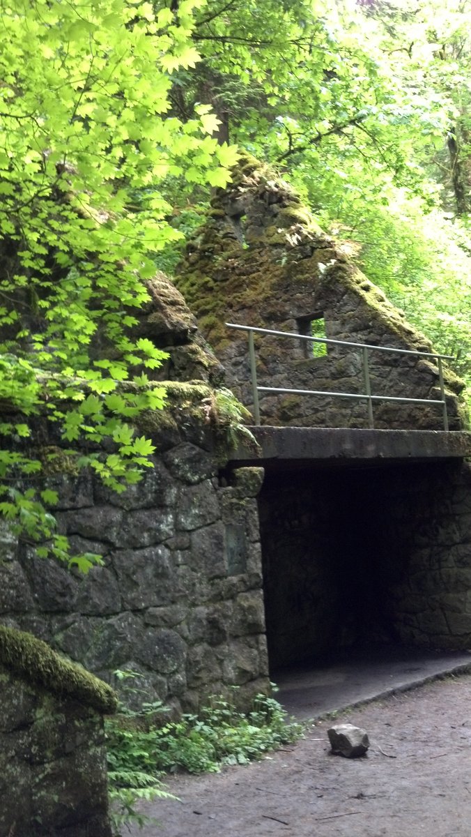
Monday's hike was for Gordy. We started at Pittock Mansion, decending into Forest Park. The trails are soft and easy on Gordy's paws, and with lots of dogs on the trail, he had no problem making lots of "friends". We hiked down to Stone House, our turn around point, on the Wildwood Trail and returned by the same route.
Gordy sped down the trail (on leash, of course) all the way to Stone House, where I forced him to take a break. On the way back, he started slowing down on the final switchbacks up to Pittock, and he really started getting slow the last 100 yards or so before the parking lot. Once we made it to the parking lot, he made a beeline for his car. Once the door was open, he jumped right in, ready to go home. Let's just say he slept really well last night. It was a good day. I definitely need to make more time for "Gordy" hikes this summer. There's nothing like having a happy pup. :)
May 28, 2012


Angels Rest
4.5 miles of hiking • 1500' elevation gain •
Most of my normal hiking group couldn't hike this week due to other commitments over the holiday weekend. We are planning on hiking Dog Mountain next weekend, and the one person who was able to hike this week hasn't hiked anything with any significant elevation gain.
With that in mind, we went to Angel's Rest. Enough elevation to give her some exposure in hiking uphill, but short enough in distance to not scare her.
Weather was overcast but dry. But there were lots of wildflowers in bloom, a lot more than when I was on the same trail a month ago. We saw delphinium (sp?), Oregon Iris, and lots of others. Didn't take any pictures, because well, it's Angel's Rest.
May 27, 2012

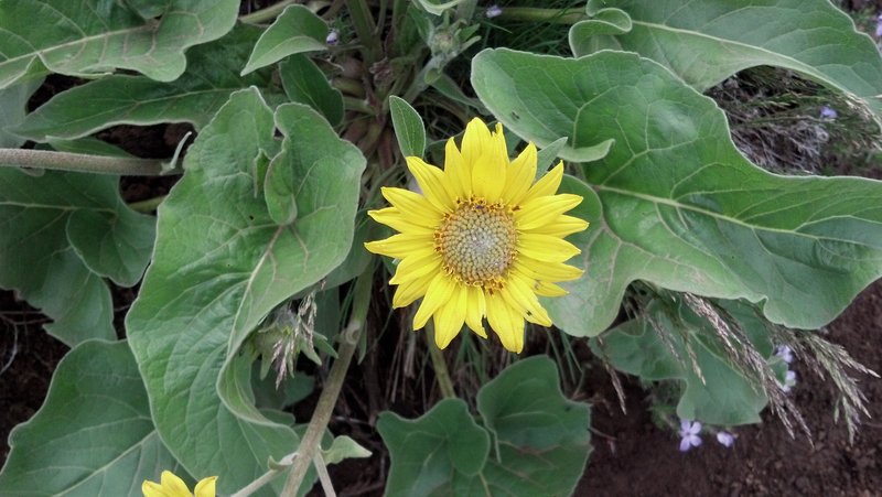
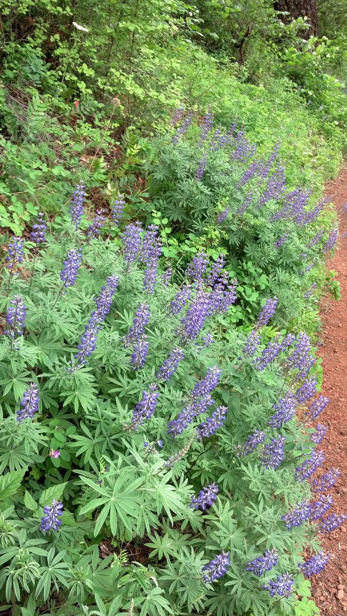
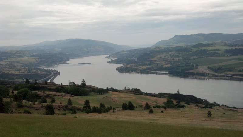
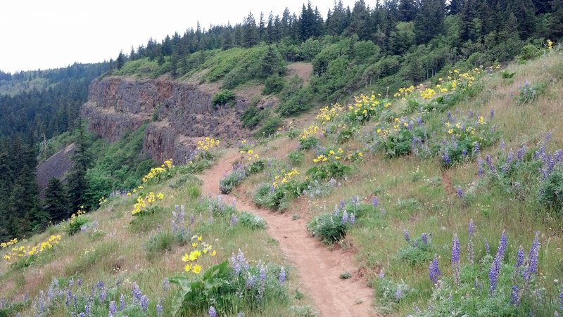
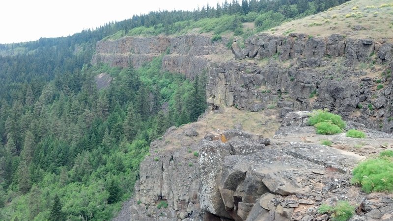
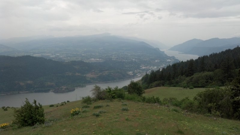
Coyote Wall Long Loop
9 miles of hiking • 2000' elevation gain •
Today's overcast skies and slight drizzle made for an almost perfect day on Coyote Wall. We arrived at the trailhead around 9:40am, and found about 20 cars parked in the dirt lot next to the trailhead and along the road. It seemed that there were more hikers on the trails today than mountain bikers. The lower meadows had some wildflowers. The upper meadows were in bloom with balsamroot and lupine. All along the way, we had spectacular view of the Columbia river both east and west of Mosier. Once we got to the upper meadow, we followed the dirt road to a lookout towards Hood River. Then it was back down the road to the trailhead.
May 20, 2012

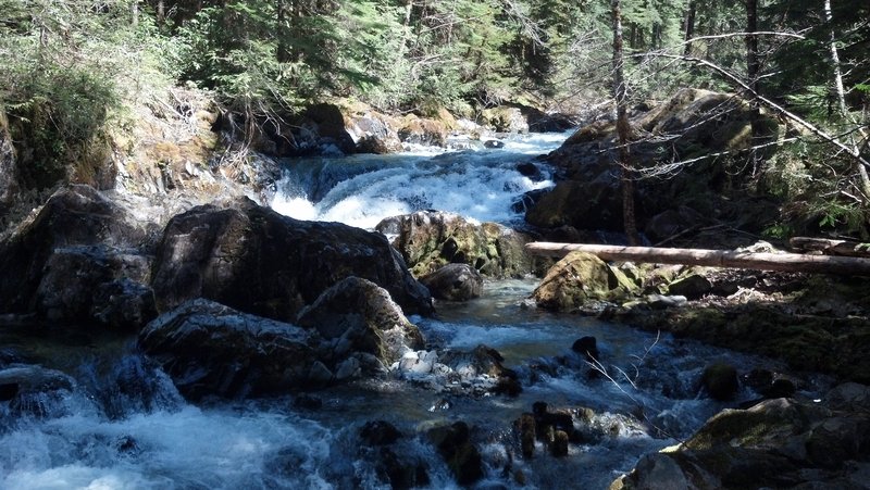
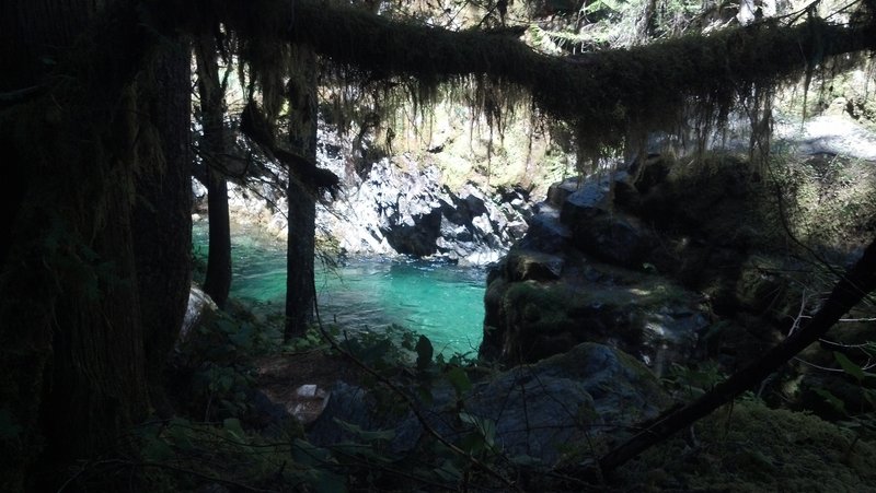
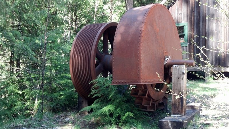
Jawbone Flats / Opal Pool
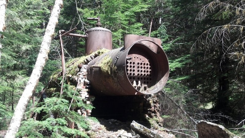
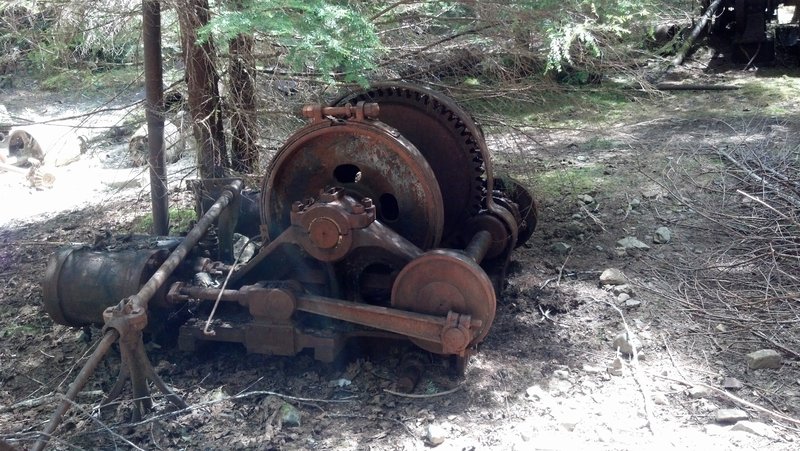
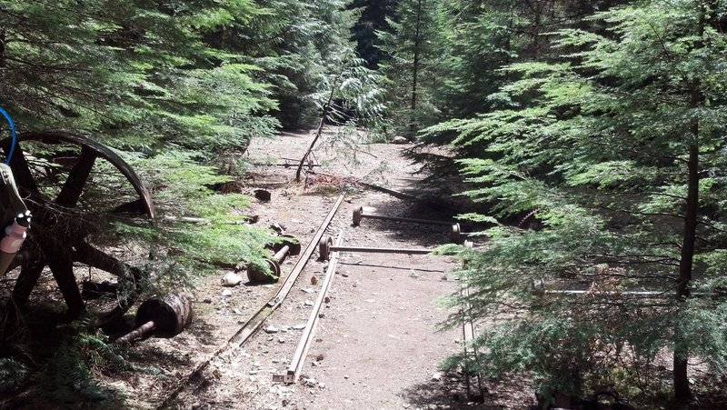
6 miles of hiking • 250' elevation gain •
Beautiful day for a recliner hike to Jawbone Flats. Lots of folks on the trail with small children and strollers, but all the old mining / milling equipment gave me many opportunities to geek out. Operational Pelton wheel? Oh yeah....
May 13, 2012


Angels Rest / Devils Rest / Wakheena Springs
11.5 miles of hiking • 2750' elevation gain •
April 21, 2012

