

2011 Trips

 1
1
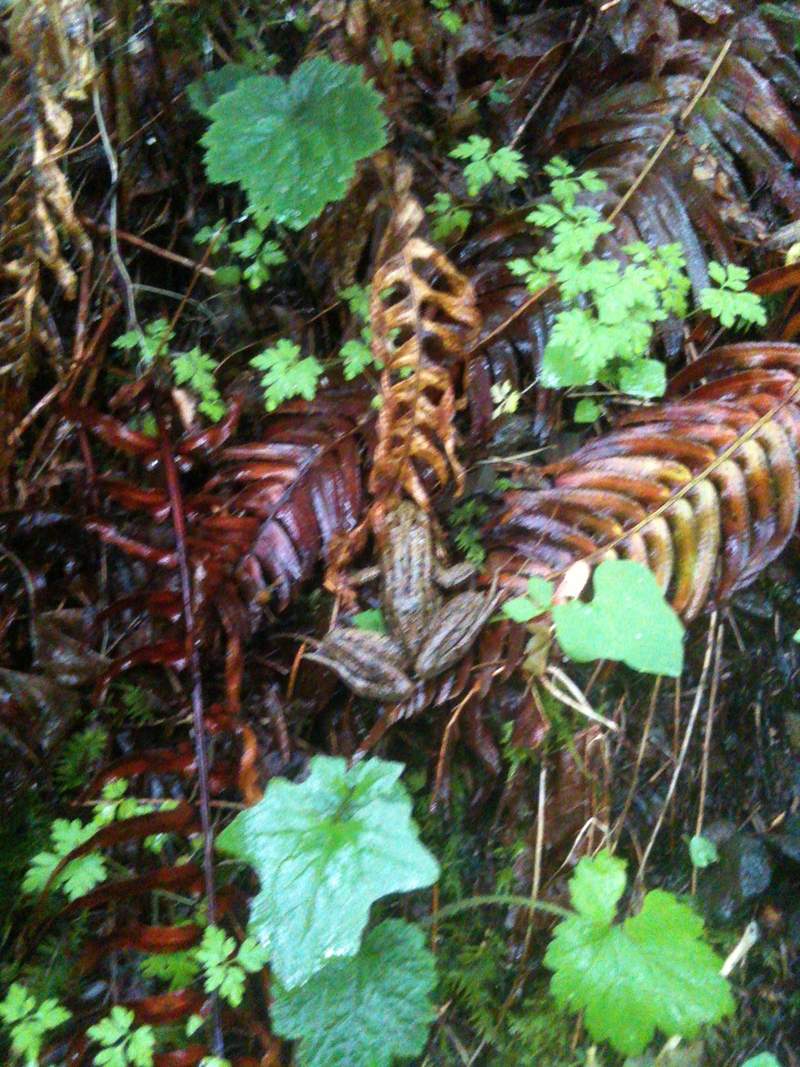
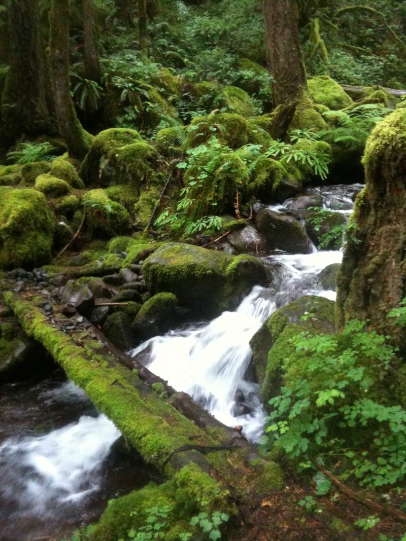
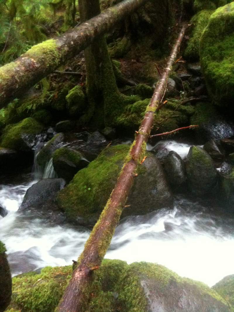
offtrail, horsetail creek trail, oneonta loop
14.5 miles of hiking • 4000' elevation gain •
offtrail kinda near horsetail creek. what an amazing hike!
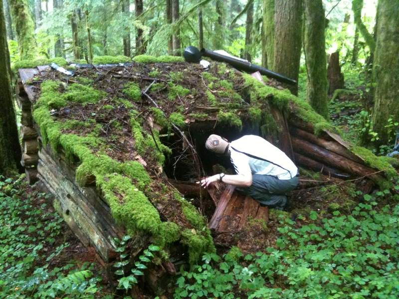
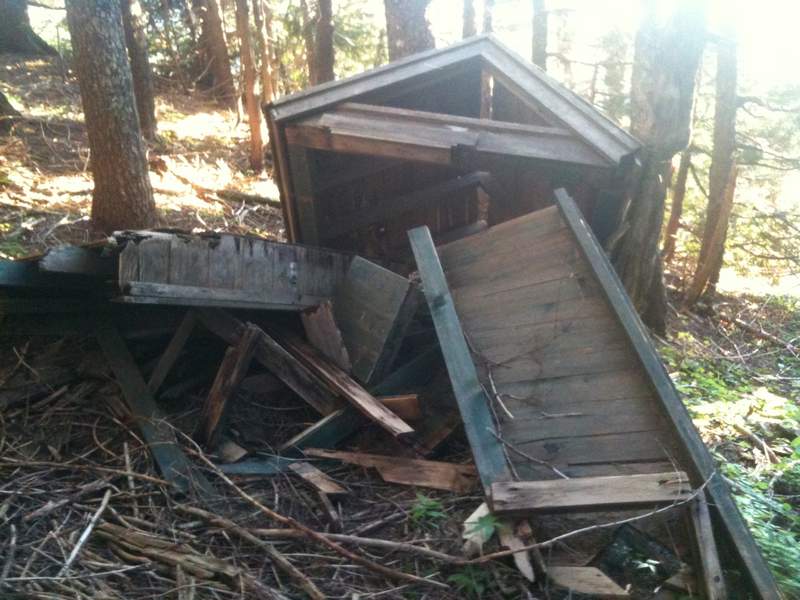
Eric Peterson had the secret locations of several of the old shelters and campsites.
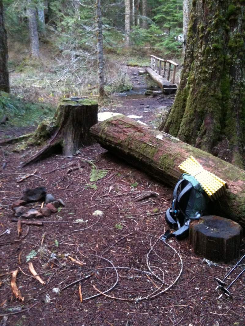
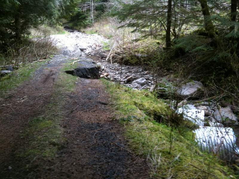
very cool horsetail creek crossing. iphone lens got all foggy towards the end due to prolific rain... on JULY 17th!
connected to horsetail creek trail and headed back down to oneonta. we then bushwacked, literally, north to the 2nd oneonta bridge, to try and make a trail so we could all avoid the oneonta ford. one would probably need 5 heavy hitters and a few chainsaws to forge a decent trail those ~0.13 miles, only for it to be overgrown in a few months. it's filled with 50 years of blowdown, devils club, and salmonberries. it should be called "the two erics' bypass" :-)
great hike, thanks eric!

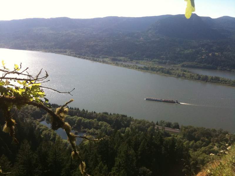
July 17, 2011


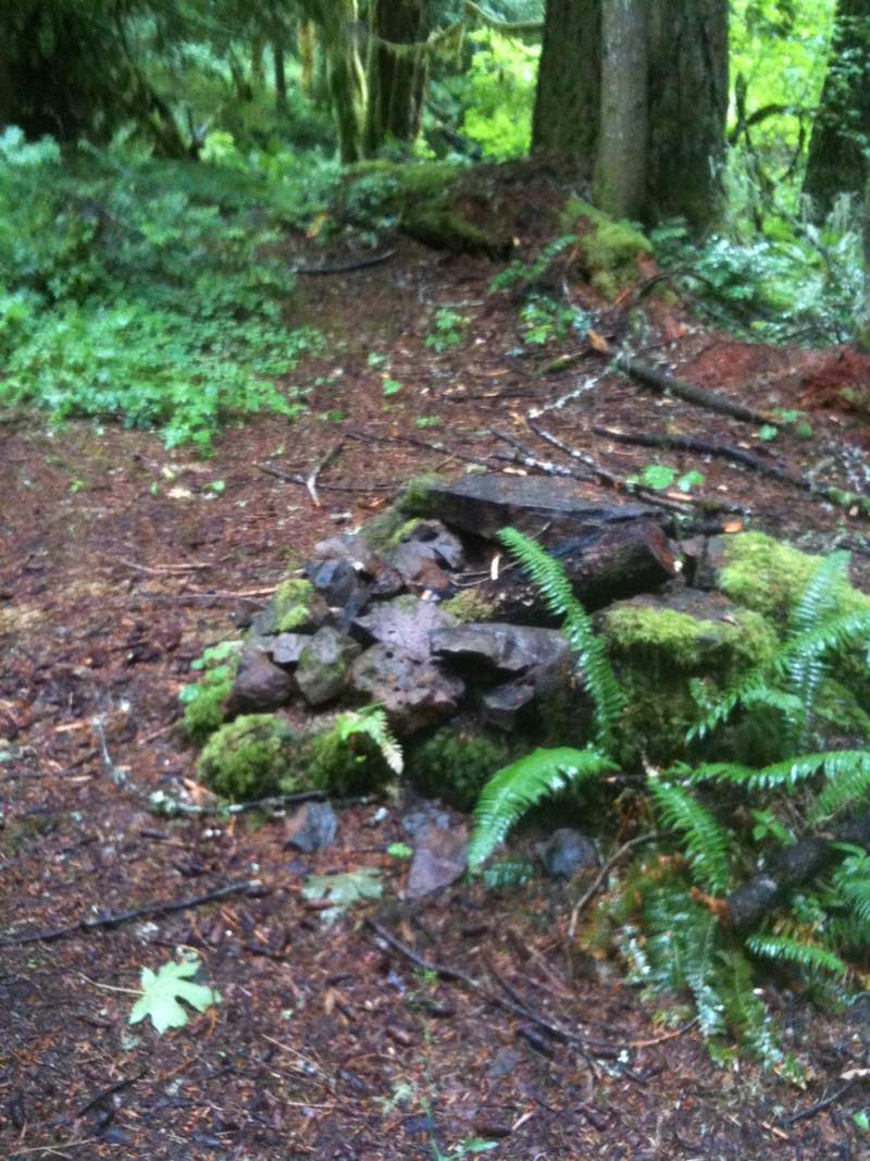

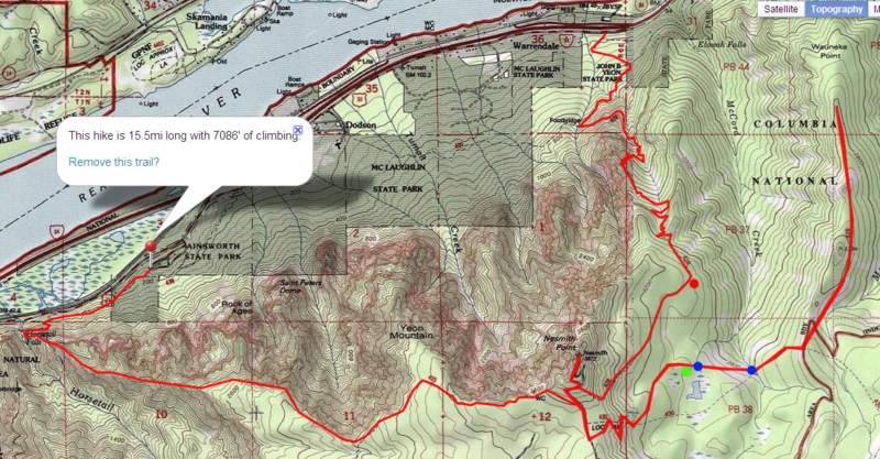
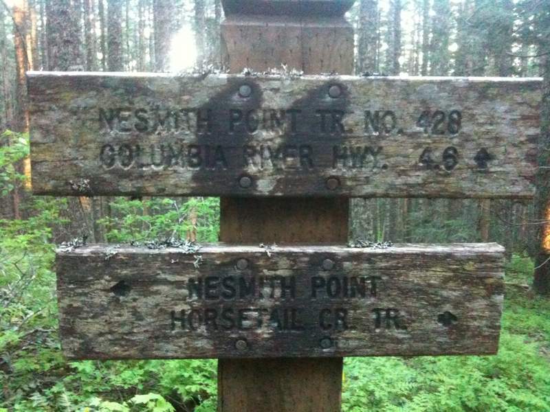
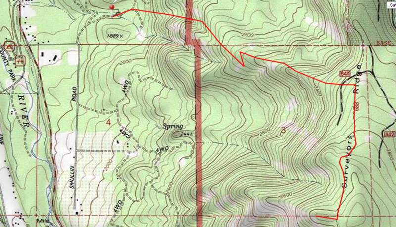
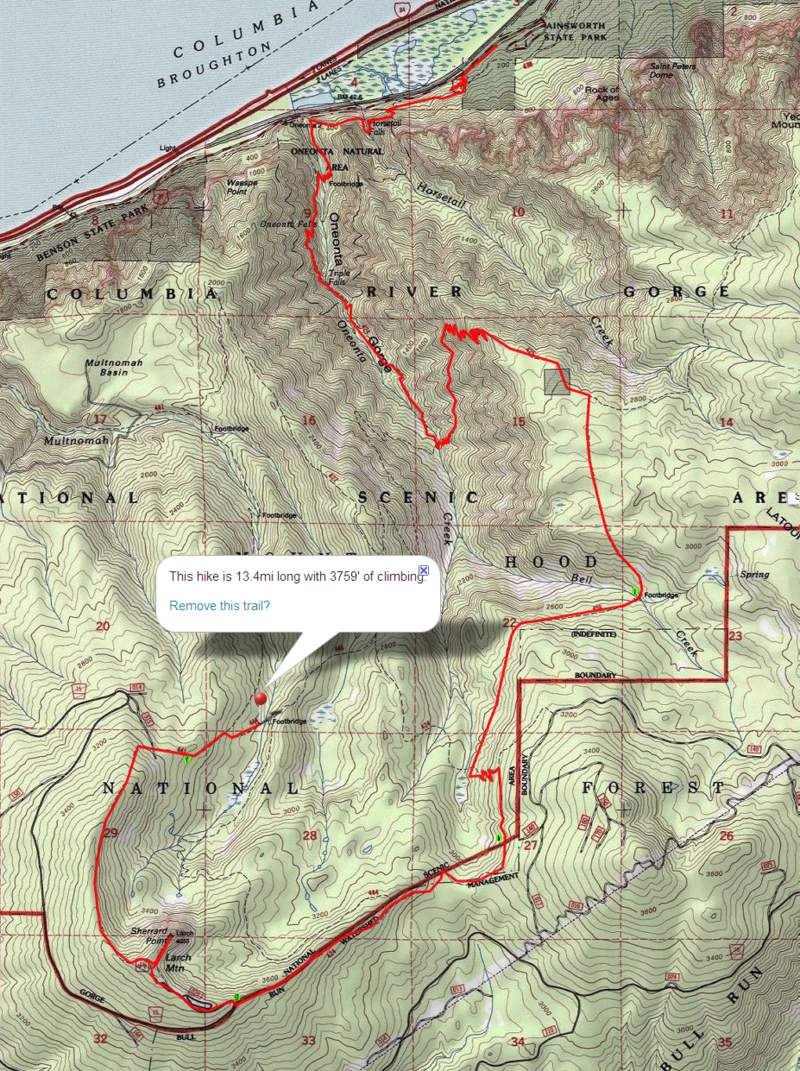
rock of ages to nesmith
16 miles of hiking • 7000' elevation gain • 1 night
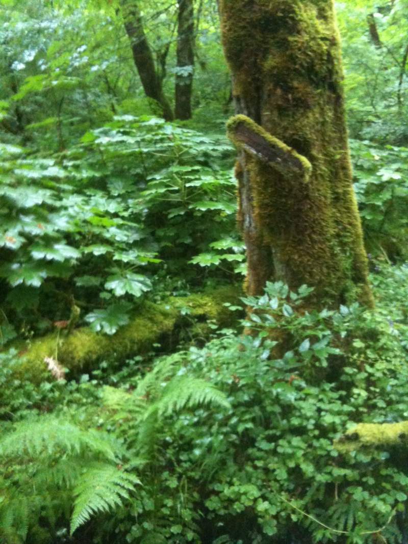
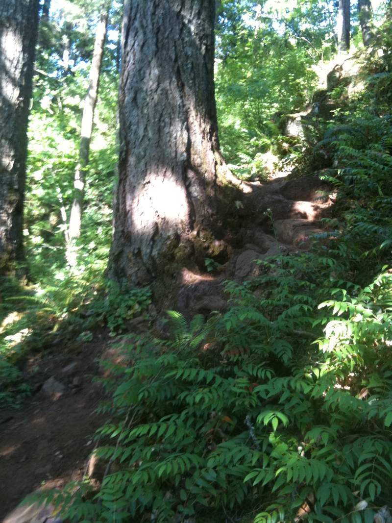
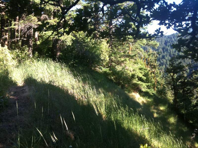
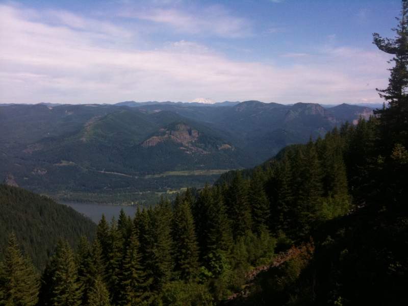
second attempt at rock of ages/nesmith point. hiked from ainsworth (safe parking) to just within view of ponytail falls. hiked up the rock of ages use trail. that trail is... insane. not only the steepest i've ever done in the gorge, but has a bit of poison oak scattered about right where it's hard to keep your balance.
i hiked up towards the horsetail creek trail, and somehow totally missed how to find the actual rock of ages. where is it??
wauneka (wow-neka? wah-oo-neka?) trail i almost missed. the sign was on the ground burried in rhododendron. i propped it up as best i can, but it was right near where it should be on the map. the better viewpoints are the two high points you see on the topo. i couldn't really see anything from the point, but i might have missed it. the trail out there was kinda hard to follow at points.
i did some trail trimming with my lightweight shears between the two forks of the mccord creek.
green is where i camped. blue is water. red dot is where i found two blue tarps, a burned YMCA sweatshirt and a ton of trash. i packed out the tarps, sweatshirt and as much trash as i could find.
July 9 – July 10, 2011


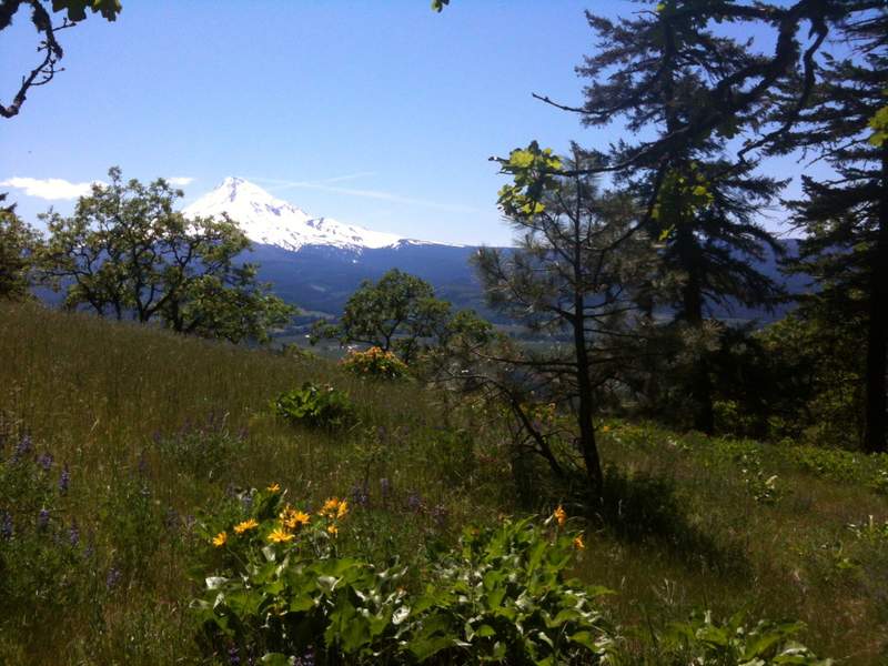
oak ridge trail
6.5 miles of hiking • 2250' elevation gain •
My girlfriend's brother was in town visiting so we went on a fairly mellow hike after showing him the highlights of the gorge. We had to be out in hood river to meet up with some friends anyway, so we wanted a mellow hike with outstanding views nearby.
Oak Ridge Trail to Bald Butte seemed like a good idea given other recent trip reports and the state of the wild flowers. We had AMAZING weather. flowers are probably a bit past their peak.
It was getting late as we got to surveyor's ridge trail, so we opted to not head north to bald butte. We heard there was a viewpoint heading south and we found it about a mile down the trail. Amazing view of Hood, but trees blocked the view to the North.
This should probably be added to PH's field guide as the existing map and description don't detail this viewpoint and option. Bald Butte apparently can get crowded as you can drive most of the way there.
There is a great place to camp in a small meadow about 3/4 mile south of the oak ridge trail intersection.
The only water i saw on the whole route is close to the bottom of oak ridge trail in a tiny muddy stream. The dogs enjoyed this.
It's already getting really dry just east of hood river!
This trail is open to equestrian and mountain bike use, and we saw many of each.
June 25, 2011

 2
2
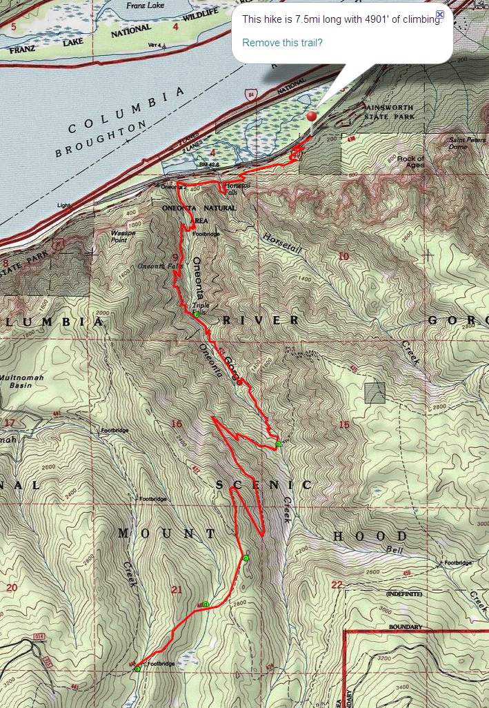
Oneonta to Larch Mtn.
21 miles of hiking • 8500' elevation gain • 1 night
I originally planned to hike from oneonta up towards larch until the snow then cut east/north back to nesmith point. plans don't always work out...
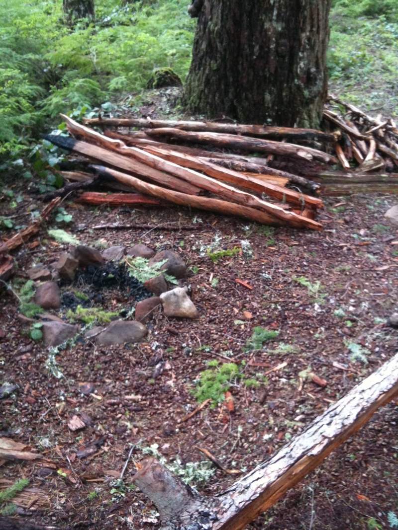
terrific day, albeit a bit crowded for a late start from ainsworth, past horsetail falls, and triple falls. I camped at "e" just off Multnomah spur, trail 446. nice site, but it's right on the trail. less traveled than larch mt. trail, especially with patches of snow around. great water supply and tiny fire ring.
also campsites at a, b, c and d. i'd only use "a" in a pinch. it's right on the oneonta trail after the bridge upstream from triple falls. lots of room though.
site b is right at the trail junction with 425 (nesmith trail) right where the stream ford is. There were four or so tents in there when i walked by on saturday. not too much flat ground in there...
site c was pretty small, with a fire ring and some firewood. no water
site d was the nicest, bit isolated, plenty of water, just wasn't far enough up the trail for me.
on sunday i got up to larch with nice packed out foot prints and no post-holing. no tracks to guide me on the way down 424 and it's REALLY tough to follow those trails buried in 4-10 feet of snow. i lost the trail around "h" and ended up following the stream back to 424 below the intersection with 459. hellish snow and bushwack to get back on trail. i just about kissed the trail when i found it. I was still feeling good at this point and headed up 459. that trail is a disaster. it's almost as bad as the bushwack. i lost count of the blowdowns, some of which you have to crawl under. one of them seems to have stripped my pack of its sleeping pad (somewhere after "i". of course i didn't notice until i got to 425. i backtracked a while but couldn't find it. if you find a z-rest up there, it's yours if you pack it out of there. major trace left :-(
at this point i'm exhausted and my knees are screaming at me and i don't have a sleeping pad, so i head home down 425 back to oneonta. i'll have to get up to nesmith in a couple weeks and see if there is still a viable trail down nesmith road going north...
to add insult to injury my car window was smashed INSIDE ainsworth state park in the walk in camping parking. nothing worth stealing in my car. i should have left the doors unlocked...
May 27 – May 28, 2011


 1
1
palmer mill road to franklin ridge
19 miles of hiking • 5750' elevation gain • 1 night
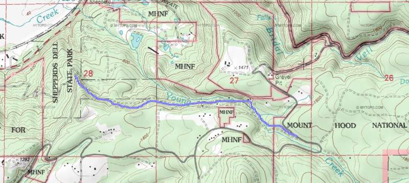
I was trying to find an offroad route from alex barr rd. to ne toll/ne brower (basically to get to Palmer Mill Rd from the west). first picture is my theoretical route. second picture is what it actually looks like (it's all private property, and looks like regularly used logging roads surrounded by clearcuts).
i decided to investigate the logging roads to the north of the high portion of Palmer Mill Rd, where it's now National Forest. You can see my route to where i got tired and it was getting dark. I stealth camped on Franklin Ridge.
I was trying to find a back way from upper Palmer Mill Rd up to Devil's Rest. I found my way rather easily around on the main old logging road at first, but i missed the left hand turn (turns out this turn is very obscured by new moss growth, see further down) and ended up back on Palmer Mill Rd, further to the east. I took my second backup option and tried to find another route from Multnomah Basin Rd? (#129) to Devils Rest. Some pictures included are the washout on upper Palmer Mill Rd. The logging road shown in most maps that goes from the road off of #129 to Devil's Rest Trail seems to have disappeared. I've never been able to find it from either end, but it's a pretty simple bushwack... There is also still the pretty obvious 100 yard trail from #129.
From there i hiked down towards Wahkeena and then to Larch Mountain Trail. The "high water" trail is a shortcut to where Multnomah Basin Rd enters its namesake. There is a maze of trails (for a first timer..) in there that aren't on the maps. One of these trails i've nicknamed the Christmas Tree trail. It cuts off the road's seemingly pointless switchback (it's all flat up there). Just northwest of there are tons of spots one could camp just off trail.
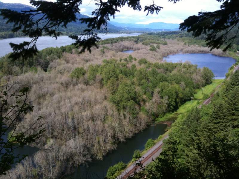
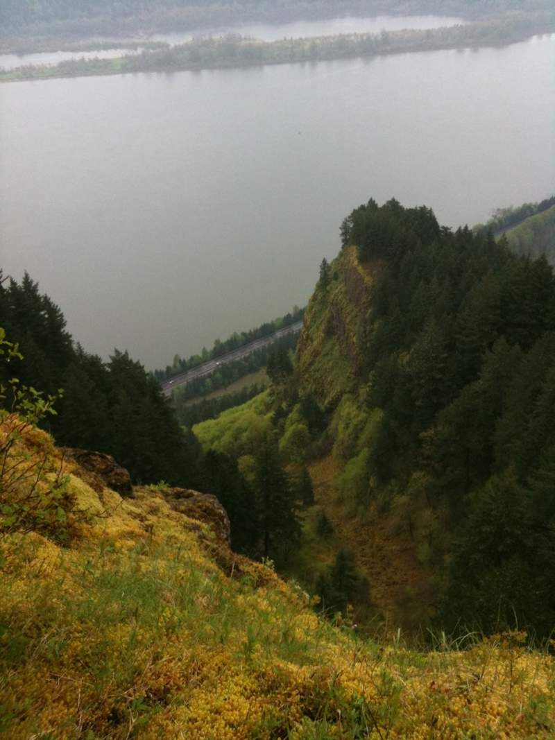
I still had more time so i kept walking to see where it would take me. Turns out there is a Trail Lodge setup on the northeast corner of the basin ridge (Nesika Lodge). Some references to these in the PortlandHikers Trail Guide, as well as about the viewpoint for Waespe point. amazing viewpoint over the highway/river looking east (see pictures)
After a dark and stormy night i hiked back via the Basin road, short-cutting some of the trails. This time i hiked back over Devils Rest so i could try to find the logging road i missed on the way in. Some of you have probably seen it connecting to the foxglove-way trail that goes down to angels rest. I took that left (south) and popped out in some random place i had walked the day before. The blue dots on the maps i've included are sections where there used to be meadows (from clearcuts?) which are being overtaken with alders and hemlocks and they make the old roads/trails extremely hard to follow. someone has put ribbons on the trees in areas where the trail is not obvious. helpful (but not always reliable due to the sheer volume of random old roads back there)
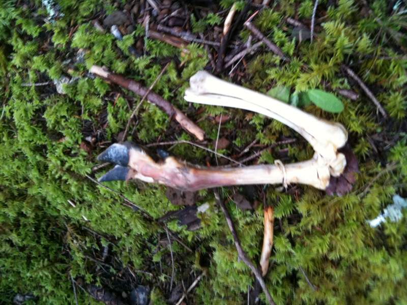
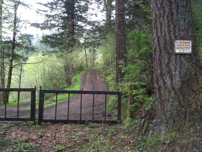
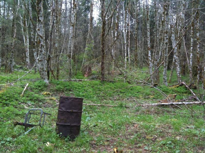
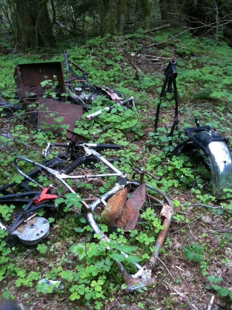
It's kinda weird back there. Not very highly traveled at all, tons of old dumping from when the roads were still open. probably in the 70s or 80s based on the vintage of the motorcycles and tires. lots of bullet holes and beer cans. Someone obviously maintains the trails a bit. Some recent (1-2 years) chainsaw-action on the blow-downs. I even saw what looked to be a Ferris-Wheel car?? I ran into a local resident who gave me some info on lower Palmer Mill Rd closure (he's hoping they'll re-open it) and the 7.5 foot long cougar that owns that ridge above and to the north of upper Palmer Mill. No, that's not a colloquialism, just look at that print i found!
May 13 – May 14, 2011


angel's devil's rest loop
10 miles of hiking • 4500' elevation gain • 1 night
got a really late start, so i needed something close to town with a campsite just a few miles in.
angels rest. got to the TH at about 6pm and started booking it uphill. i've never been up there. sign at the main parking says "day use only" but that's the state park rules, no signs pertaining to overnight parking. i got off without a ticket at the overflow parking, YMMV.
it was starting to look like it was getting dark even though it was only 7:30 or so. I started further east to find the supposed campsite just past angels rest. at this point it started to really rain and walking through the stand of hemlocks (i think) made it really dark. i decided to stealth camp there as it was flat, and wasn't sure how much further the unknown campsite was.
there are a few relatively flat spots sheltered under the conifers with lots of nice soft moss. off course at this point it's pouring, and almost dark. i get my tent setup and don't leave it until after breakfast this morning when it was still puking rain, cooking in the vestibule. looks like i have a few weeping type leaks in my test and it dripped straight on my face at least 10 times. fun :x
in the am i headed off towards wahkeena trail and realized the campsite was less than 1/4 mile further. d'oh! for future reference, the angel's rest campsite (dunno if it has an official name) is just east of the mist creek under some huge cedars.. rock fire ring, old picnic table, tons of water (in spring anyway).
after i filled up my hydration bladder i continued mostly downhill to wahkeena through some brand new deciduous forest, looked like dogwoods?. after that it's straight uphill, feels like, to devil's rest. i completed the loop back to angel's rest trail via the foxglove trail which doesn't appear on most of the public maps. it uses a bunch of the old forest roads which have been mostly re-taken by nature
devil's rest really is a bit anti-climactic as people have said. although, today was probably worse than usual since the whole area was socked in with dense clouds until about 11am. there are several "better" viewpoints just east of devils rest. lots of places to camp all along the ridge, as well as a bit down fox glove, but nothing established.
just a few hints of snow up there on devils rest from the night before.
May 6 – May 7, 2011


View trips from: 2013