

26 miles of hiking • 9000' elevation gain • 2 nights
We left Portland at dinnertime Friday and drove the 4+ hrs up to the Necklace Valley TH, southeast of Skykomish on Hwy 2. We bivied in the parking lot behind the car, and then set out Saturday morning down the remaining few miles of road to the West Fork Foss trailhead. Luckily another backpacker drove by fairly soon and gave us a lift, sparing us most of the walk. Having gotten to bed around 1am and slept till 7:30, we finally started the trail at 9am.
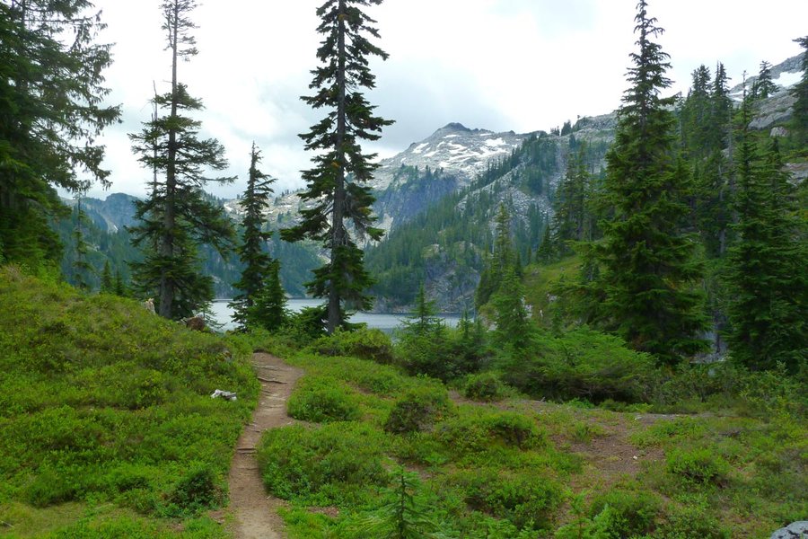
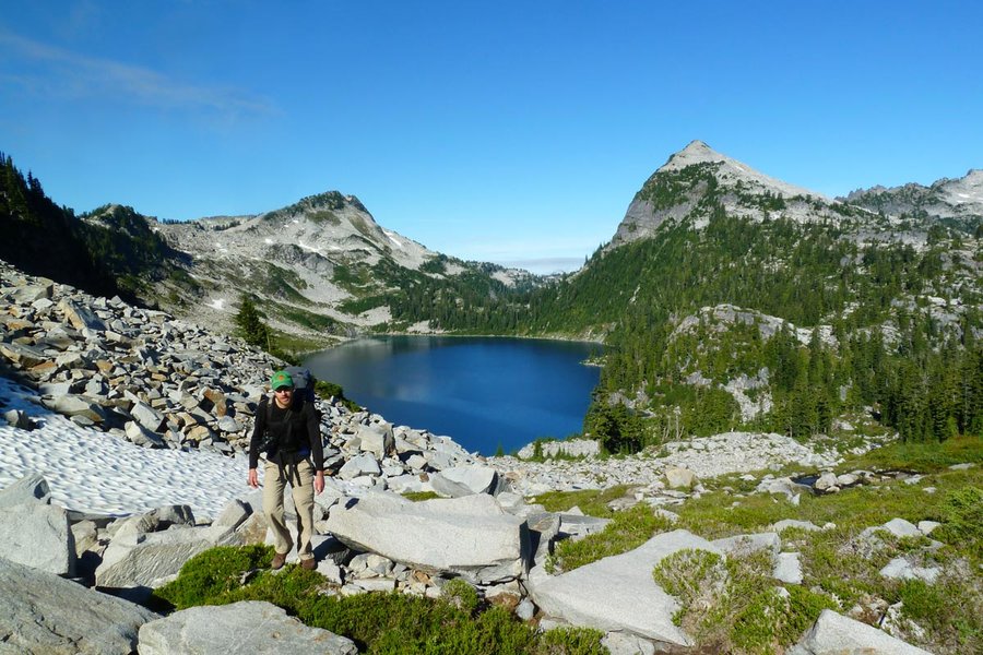
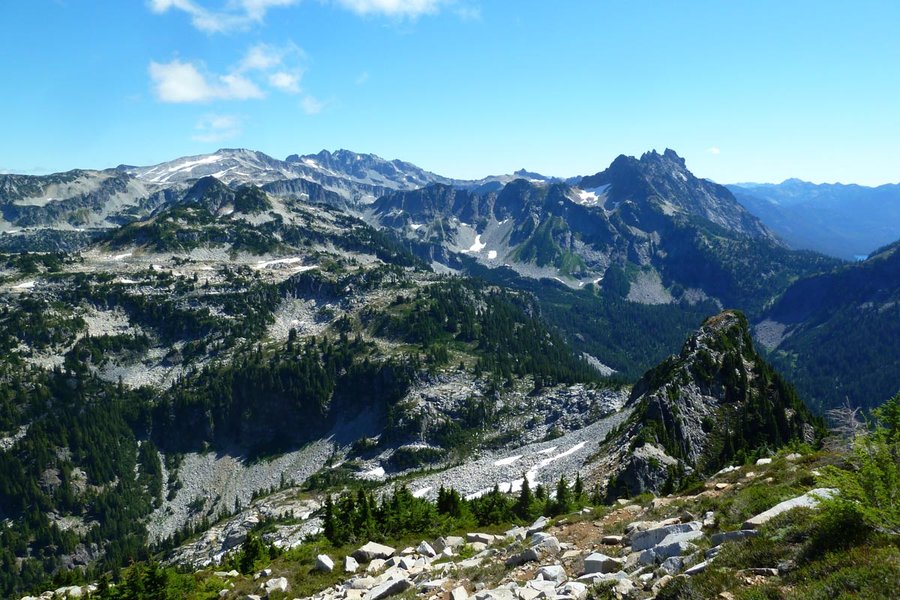
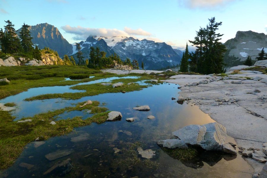
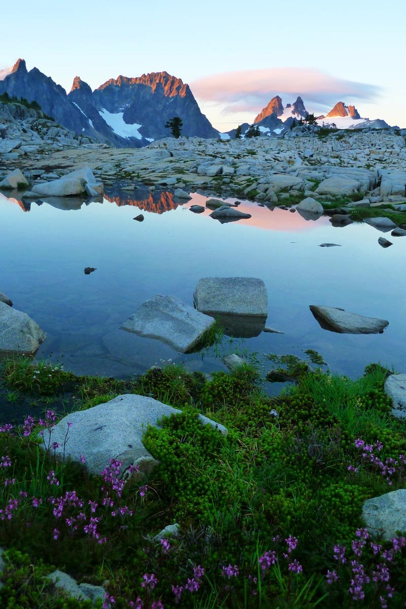
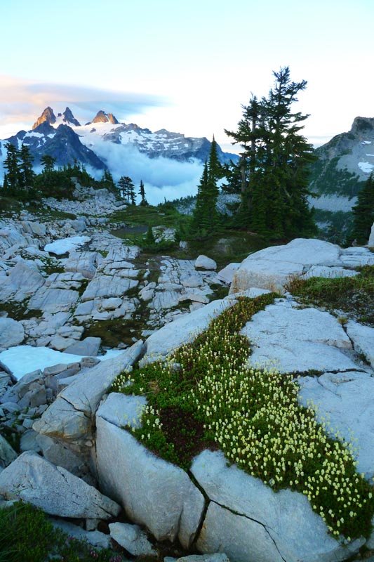
The first leg of this loop heads south on the W Fork Foss trail through forest and then climbing to Copper Lake and Big Heart Lake for about 7 miles. A well worn use trail continues across the ridge east of Big Heart and up through granite-speckled heather meadows to the tarn east of Tourmaline Peak (unnamed on the map, labeled 6245). We made our first camp on a granite slab above the tarn.
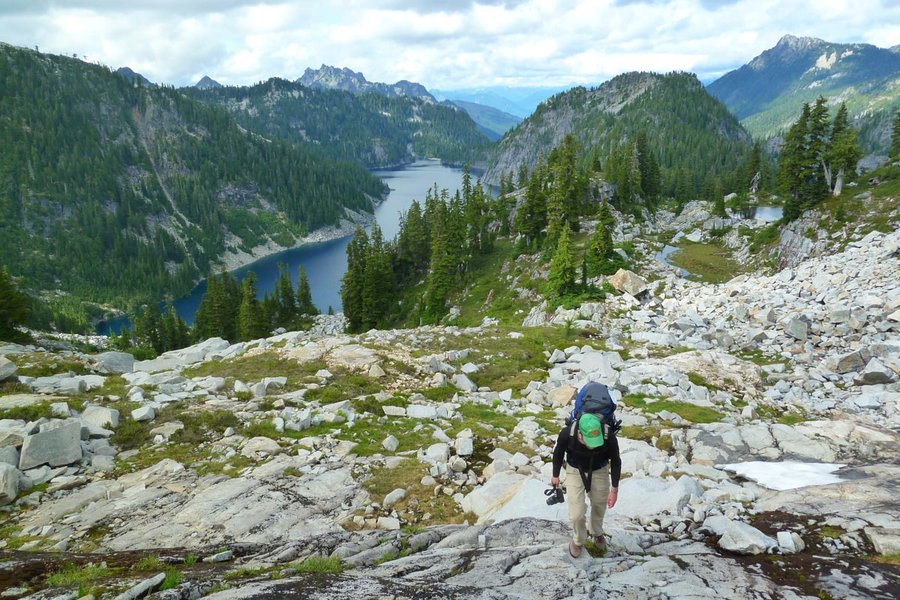
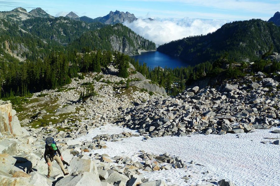
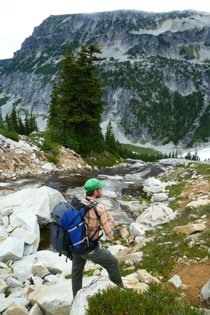
Day 2 took us down the use path from the tarn to the outlet of Chetwoot Lake, where the path disappeared and we climbed up blocky granite talus to the ridge NW of Iron Cap Mountain. We followed the ridge up to the summit via some fun and sometimes technical scrambling (especially with a pack). It was a lovely sunny day, and you could see Rainier to the south and Glacier to the north, not to mention the much closer peaks south across the valley.
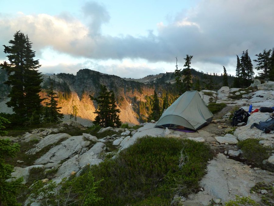
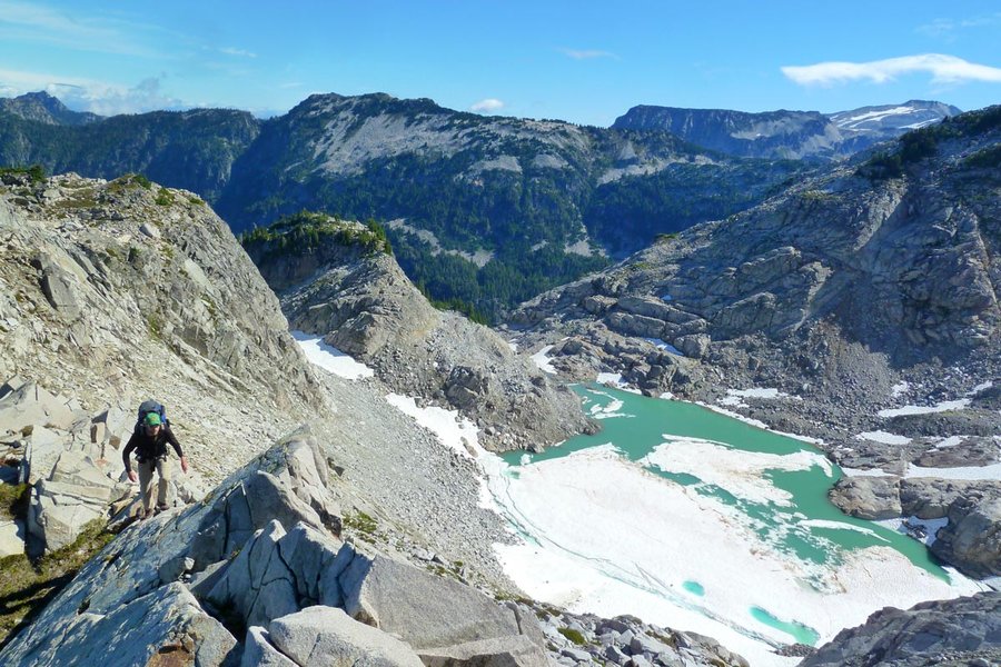
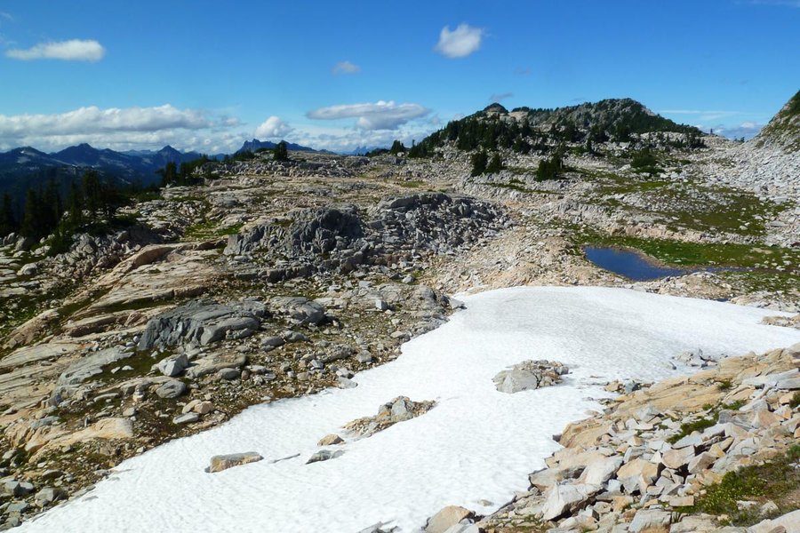
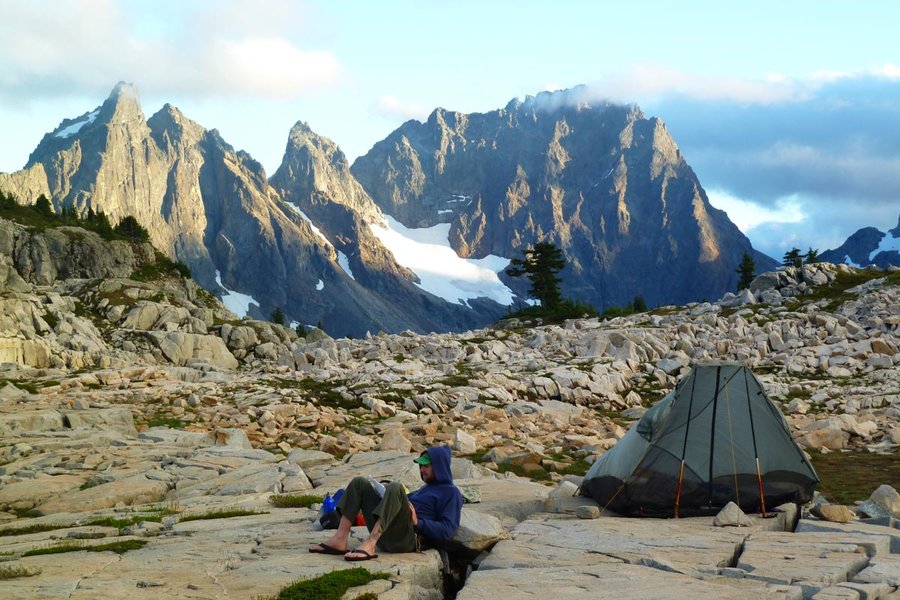
We continued east on the ridge off the summit, only to get cliffed out, and so were forced to backtrack uphill and across Iron Cap's north ridge, then down a complex series of partially cairned ledges and benches, across multiple huge fields of blocky granite talus, finally reaching the saddle to the east. Then up the hill to the plateau and the Tank Lakes for camp 2. We went for a brief and very cold swim at the upper Tank Lake (being fed directly from a nearby snowfield, but it felt so good...), then made camp at a little tarn below lower Tank.
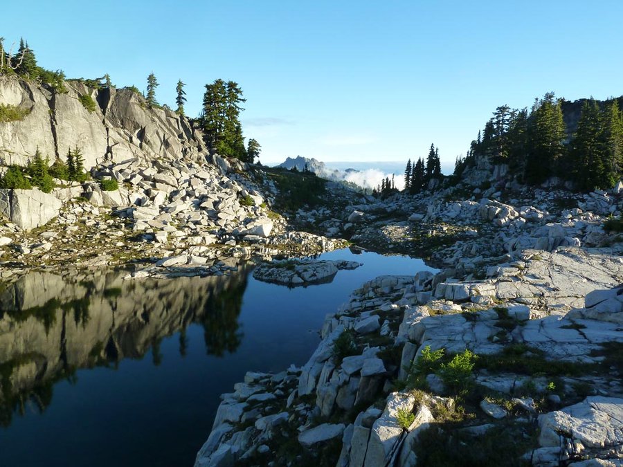
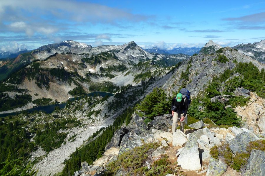
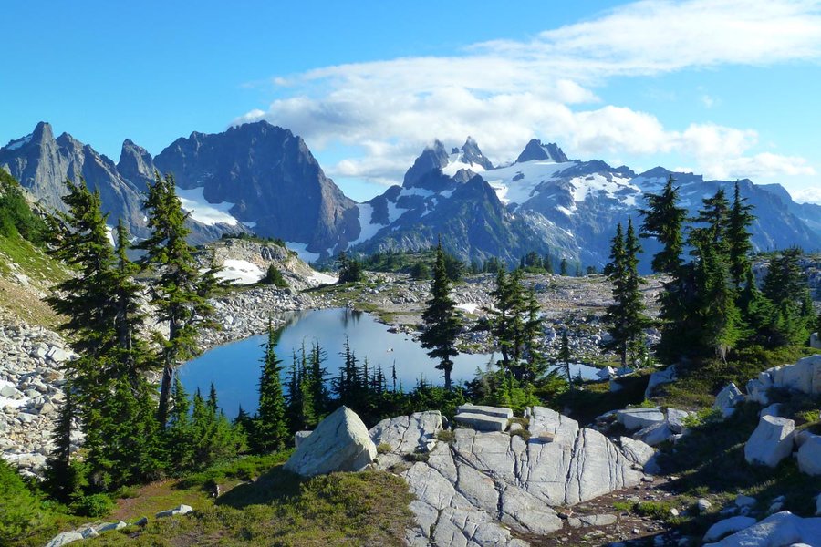
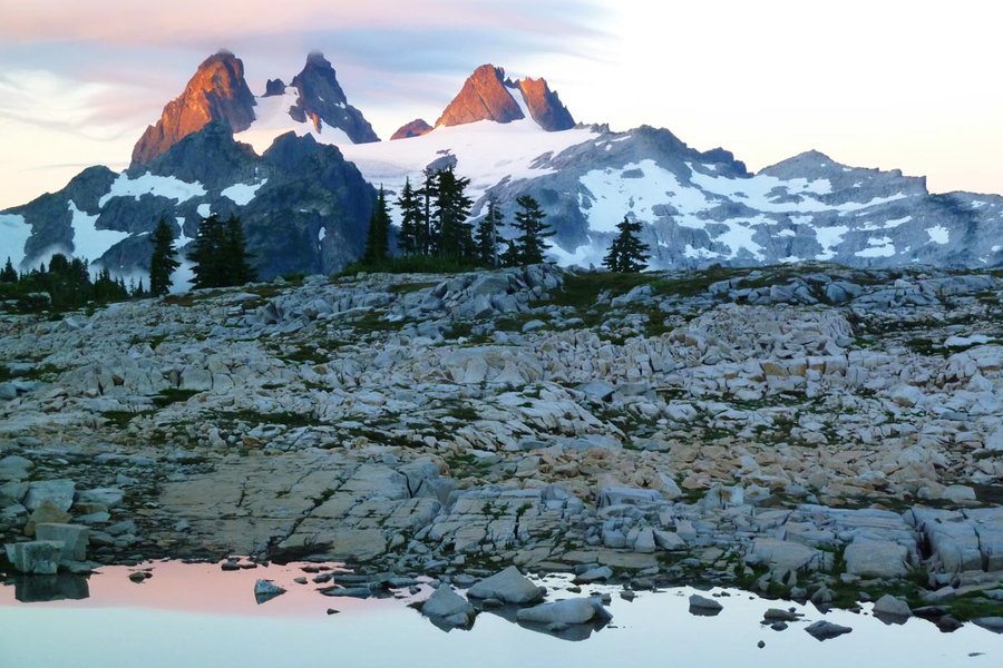
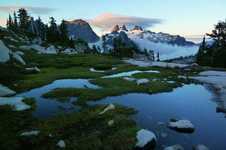
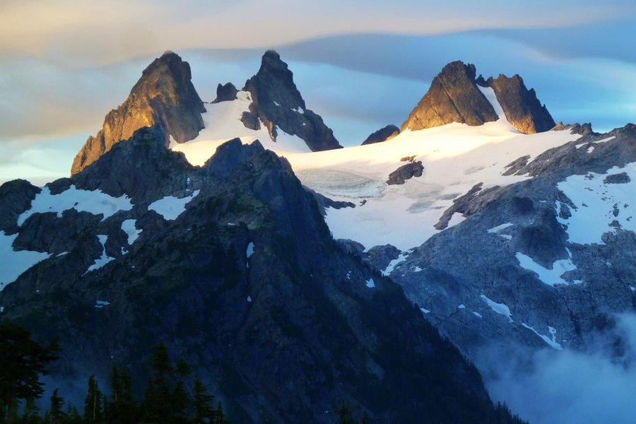
We woke at 6am and caught some nice sunrise light to the south on Chimney Rock, Overcoat Peak, and Summit Chief. Sadly, clouds rolled in and covered everything up. We lazed around, then headed down the drainage to the NE towards Necklace Valley. The route down has intermittent cairns but is pretty rugged and requires some routefinding. On the way down it started to drizzle a bit. Necklace Valley was pretty lackluster after all the alpine lake goodness, so we motored on through it, down the steep trail to cross the East Fork Foss, and then another five or so miles of mostly flat forest hiking that was reminiscent of the Gorge, getting back to the car around 3pm.
This trip has been on my short list since last year and I'm glad I finally got to do it. The alpine highcountry, views of peaks, and rugged scrambling near Iron Cap are all awesome. The good parts are (thankfully?) kind of difficult to access: a forested trail slog on either side, followed by rugged and steep off trail. We saw no one going in past Big Heart Lake, and there was only one group up at Tank Lakes when we got there. Definitely a place worth visiting again.

Comments

JM
August 21, 2013
9000'!?

Water (Matt)
August 21, 2013
just like the brothers "you're gunna get cliffed out!!!"
Water (Matt)
August 21, 2013
just like the brothers "you're gunna get cliffed out!!!"
good report bro

Jeff Reynolds
September 3, 2013
Decided to do this one for labor day weekend and it did not disappoint - scrambling was fun, and the views were unbelievable. One of the prettiest places I've ever been. Thanks for sharing!

Kyle Meyer
September 9, 2013
wat
JM
August 21, 2013
Your pictures are stunning!