

2015 Trips

 1
1
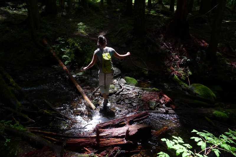
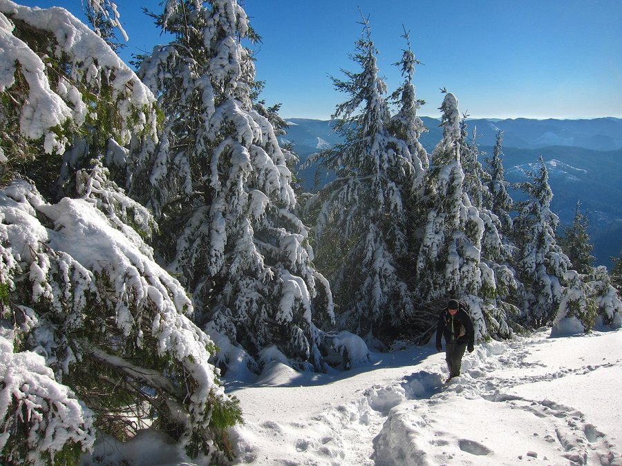
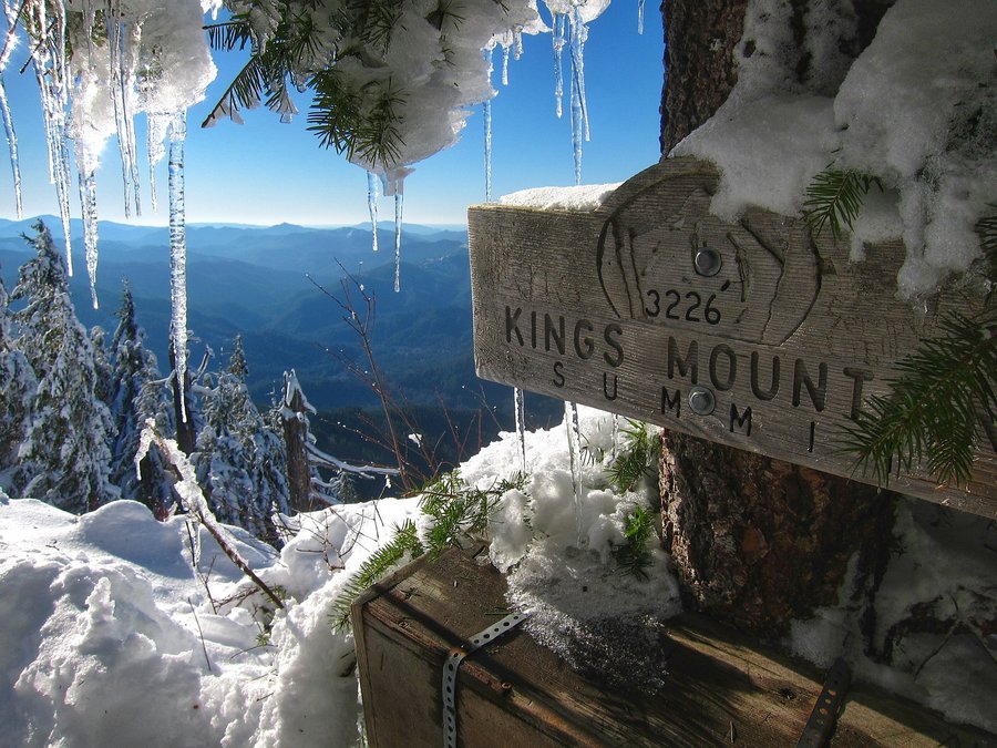
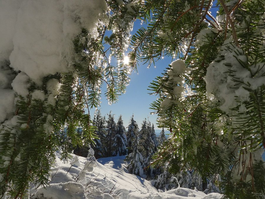
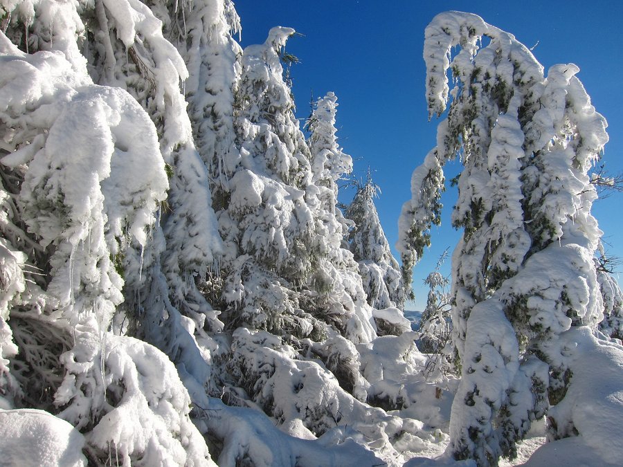
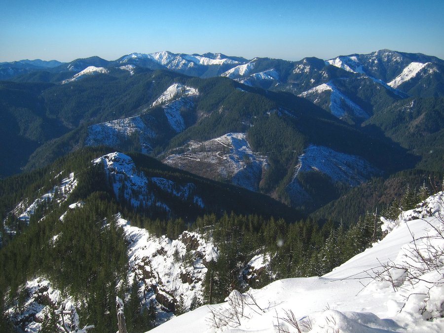
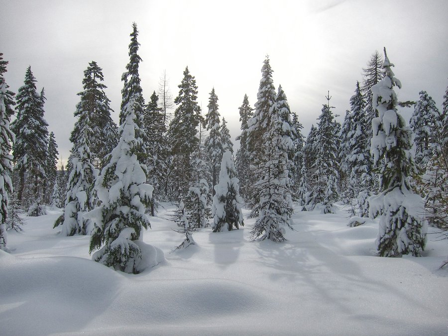
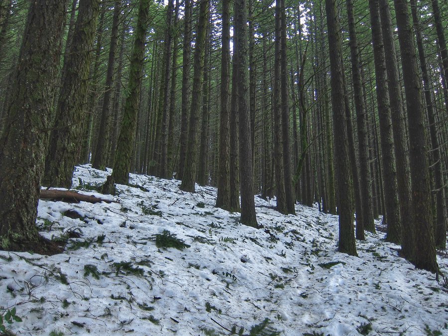
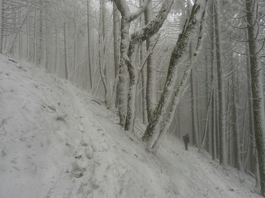
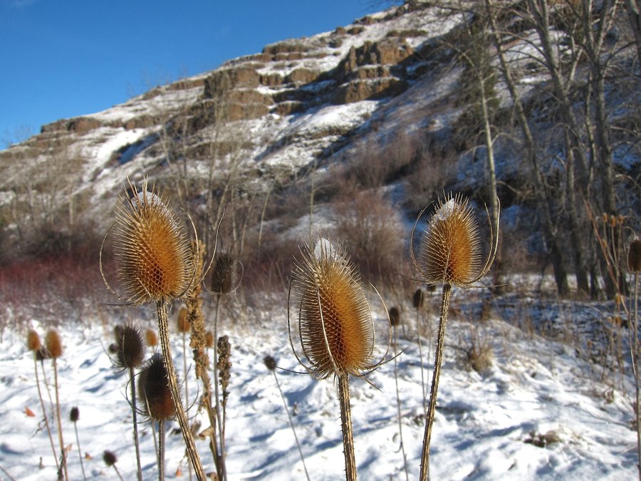
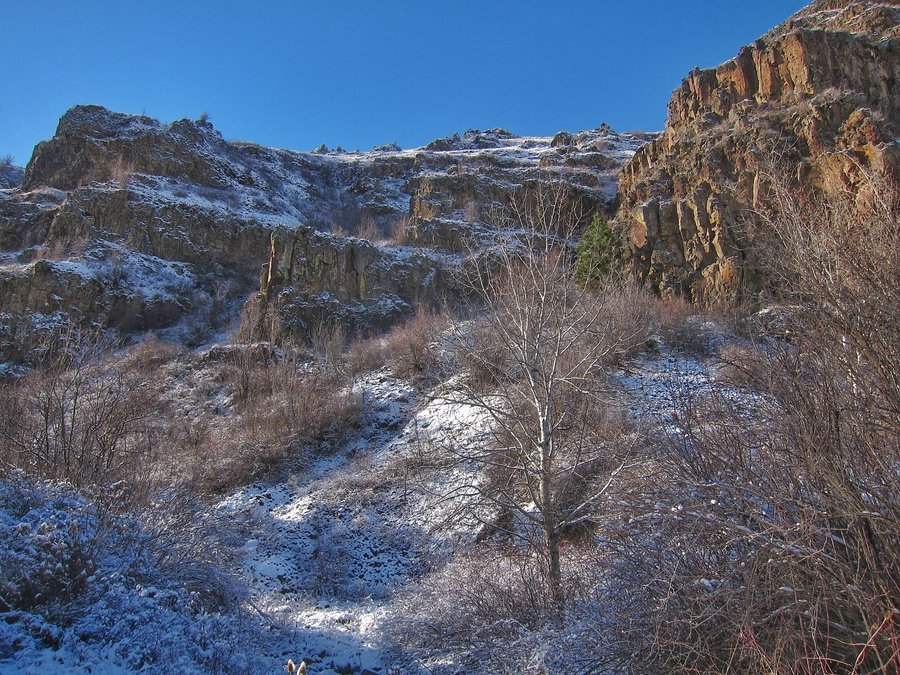
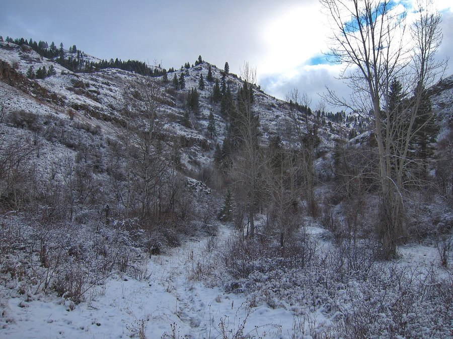
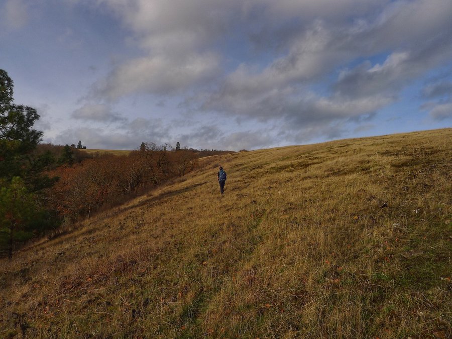
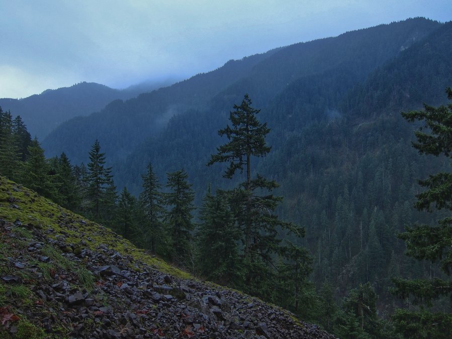
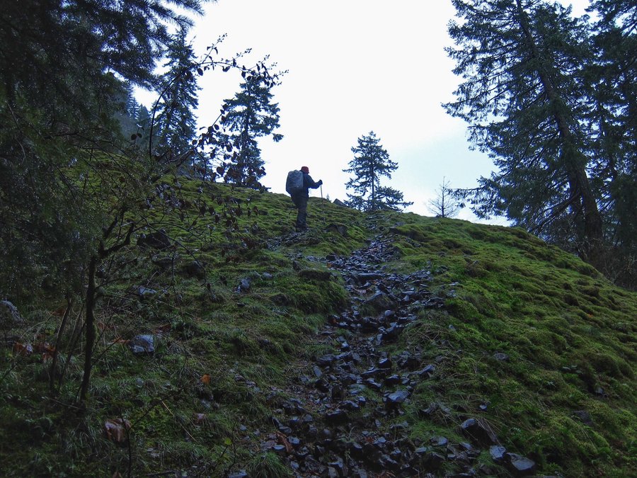
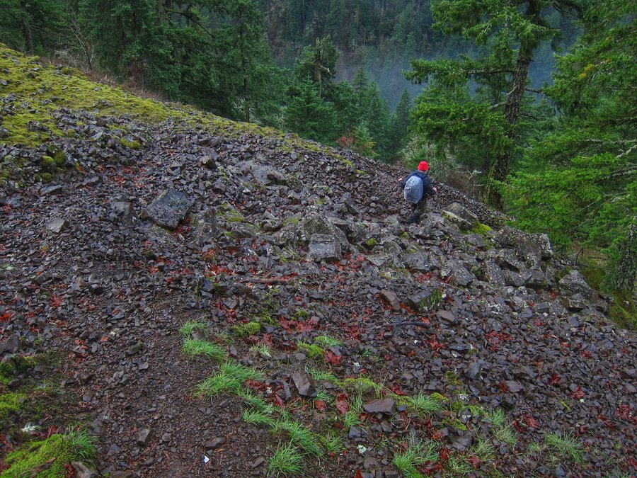
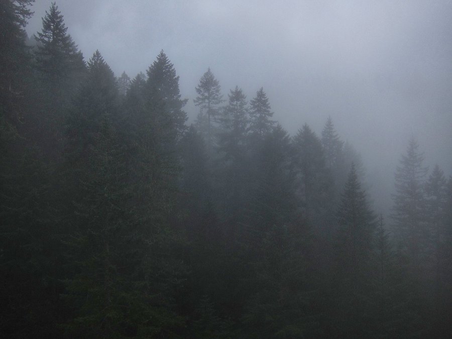
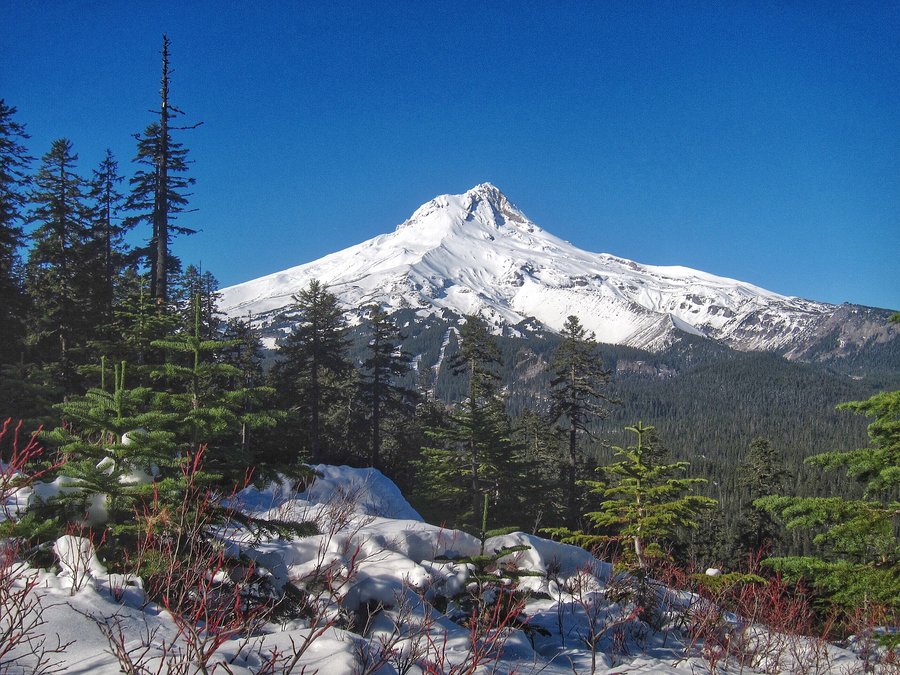
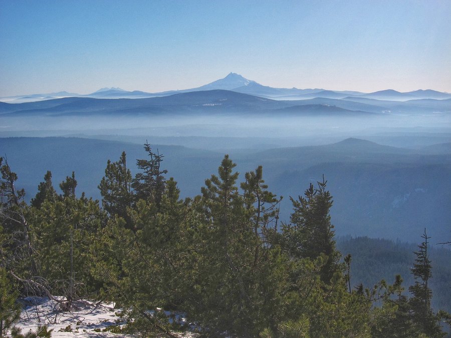
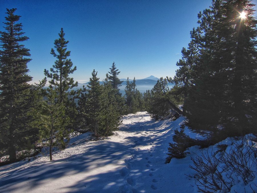
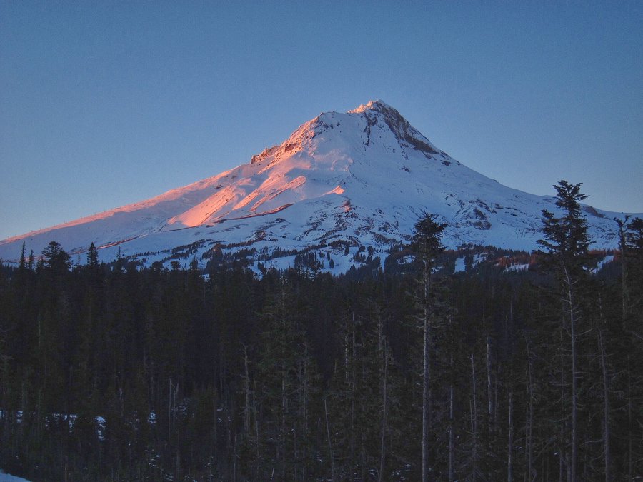
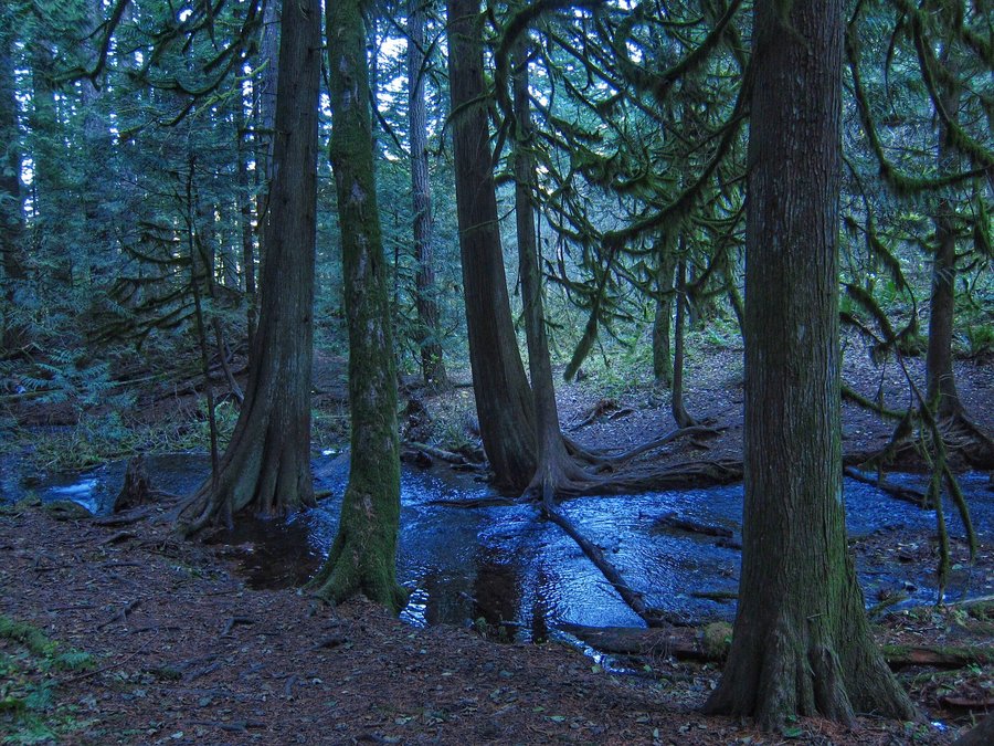
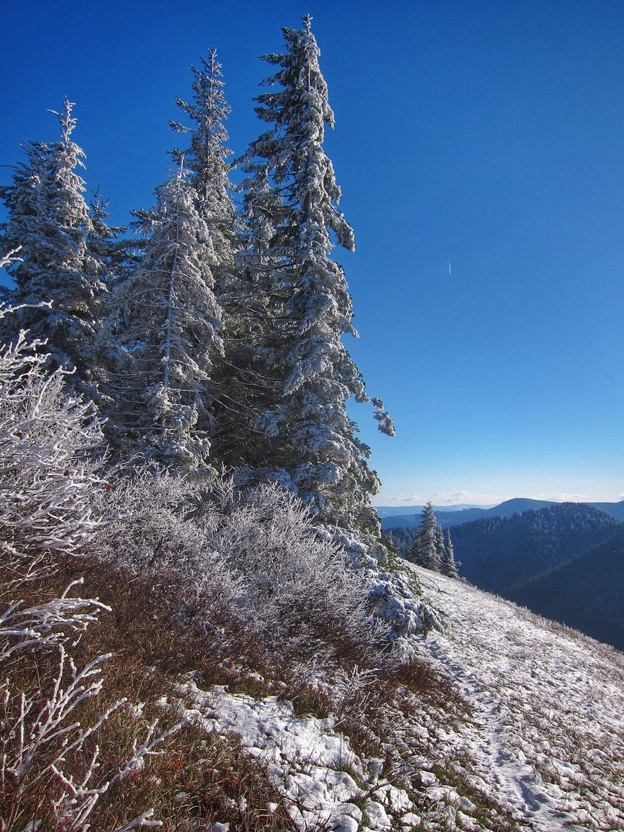
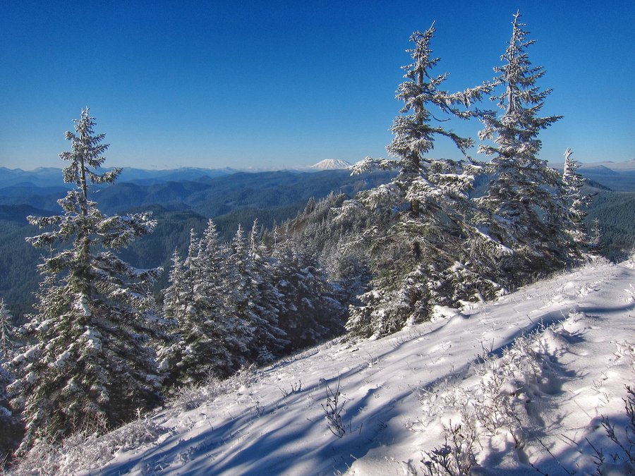
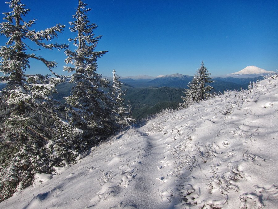
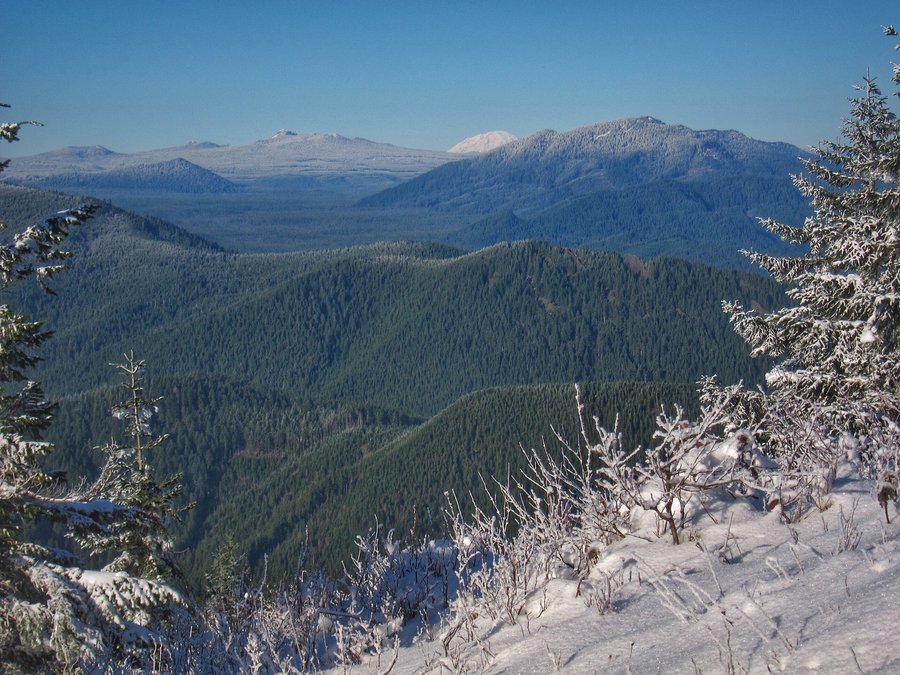
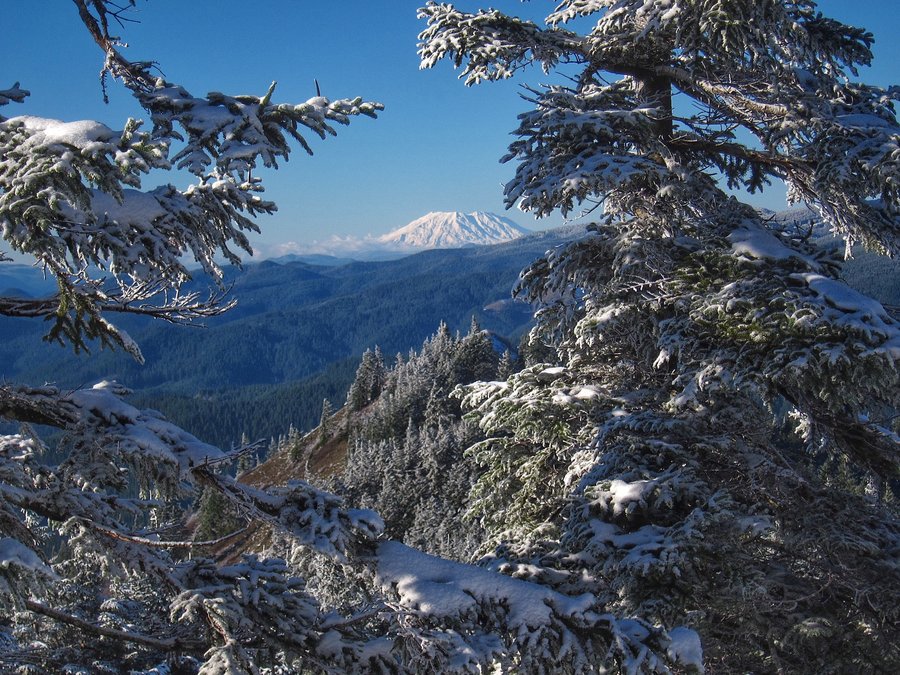
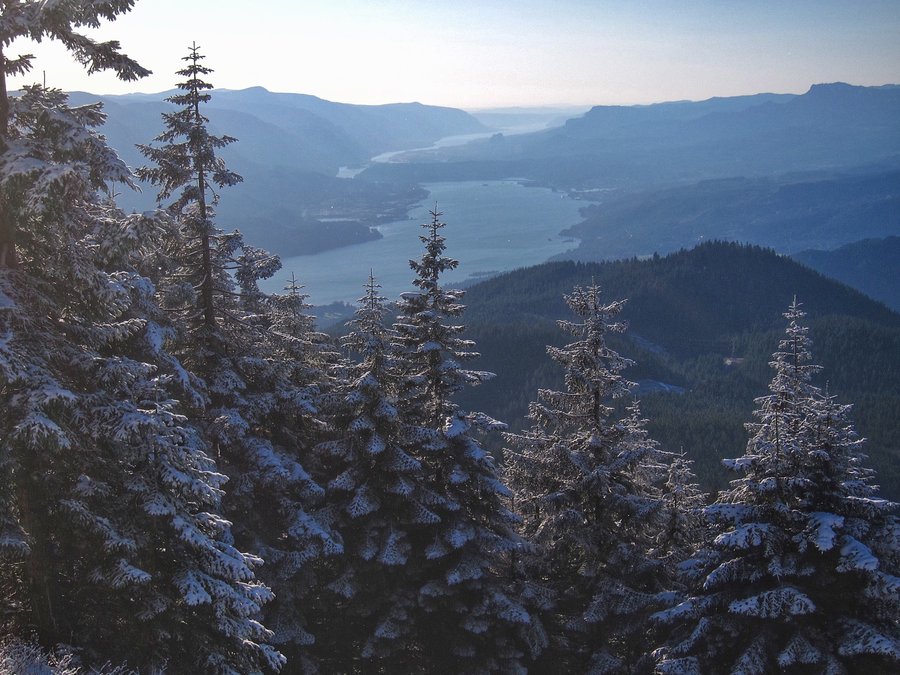
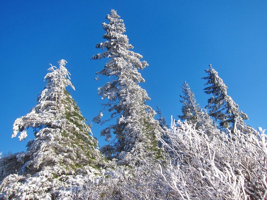
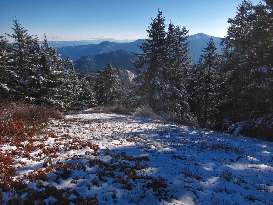
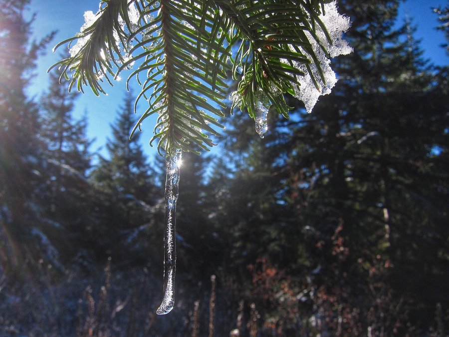
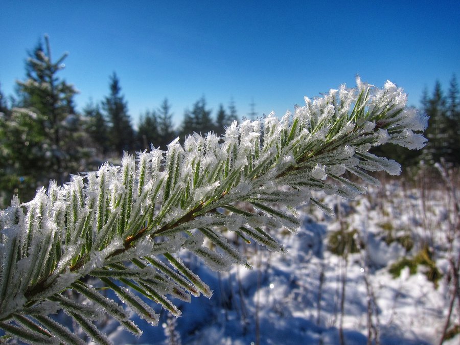
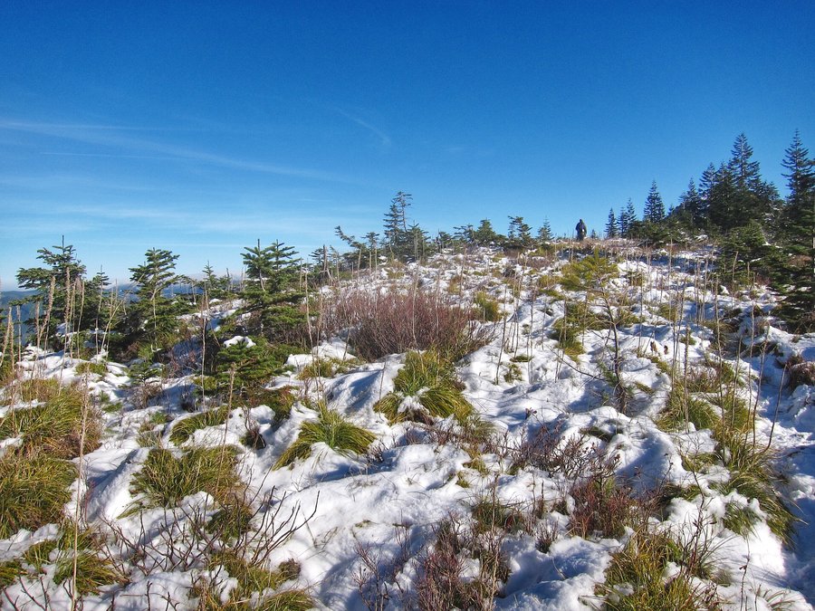
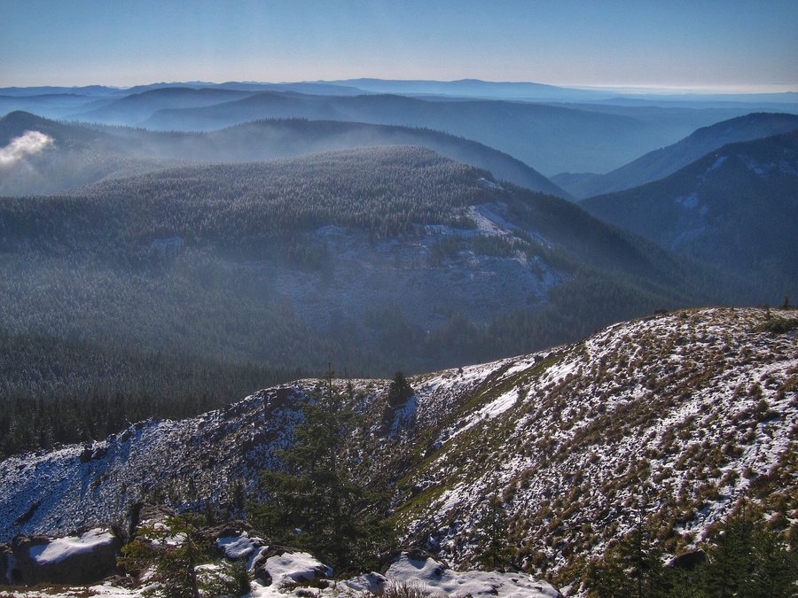
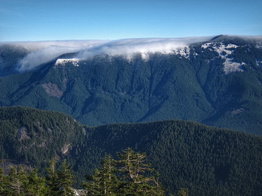
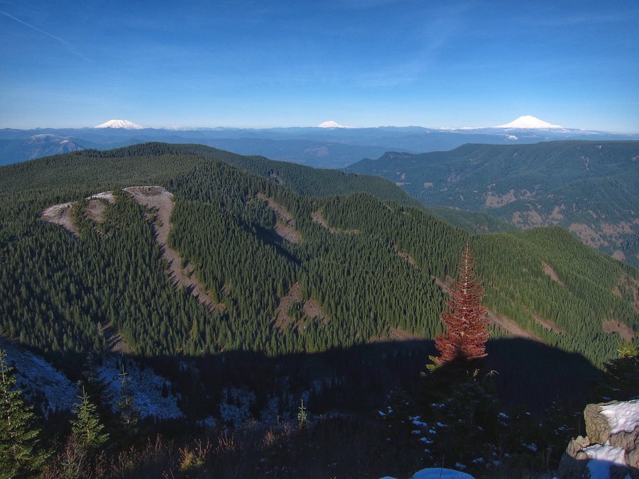
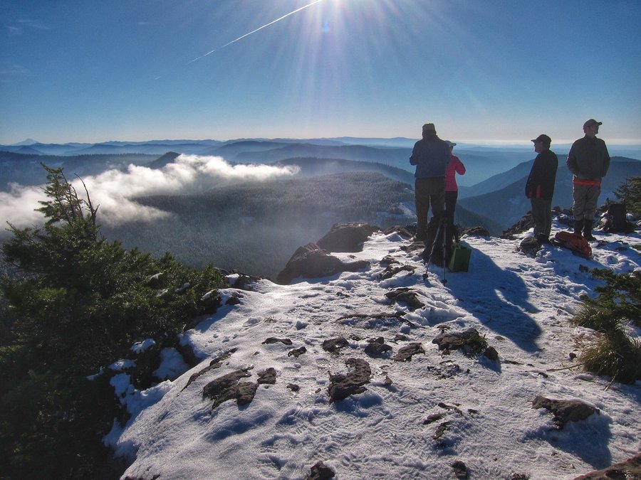
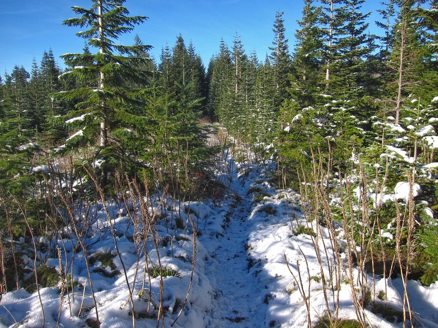
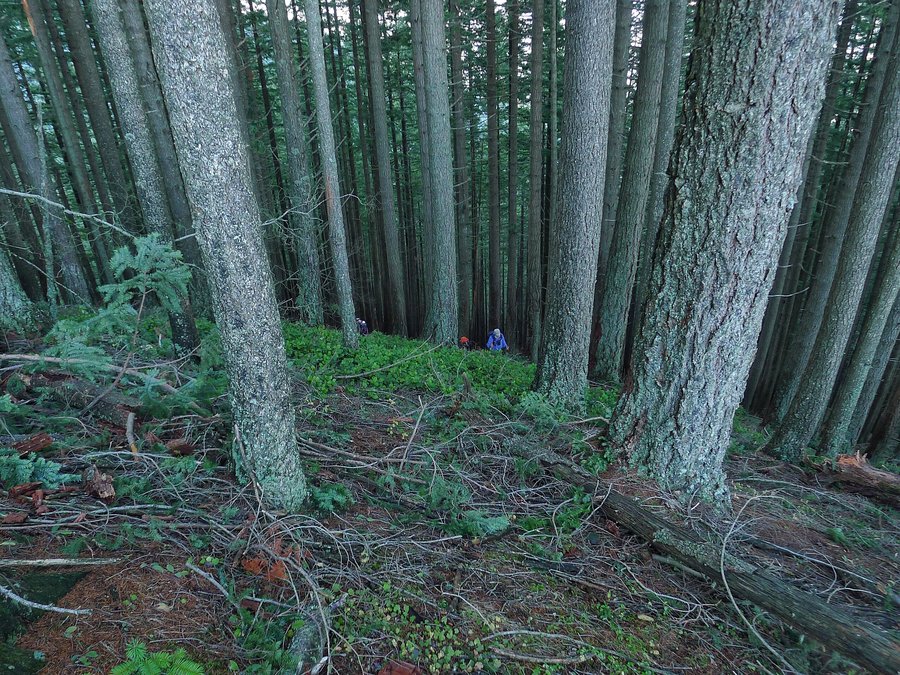
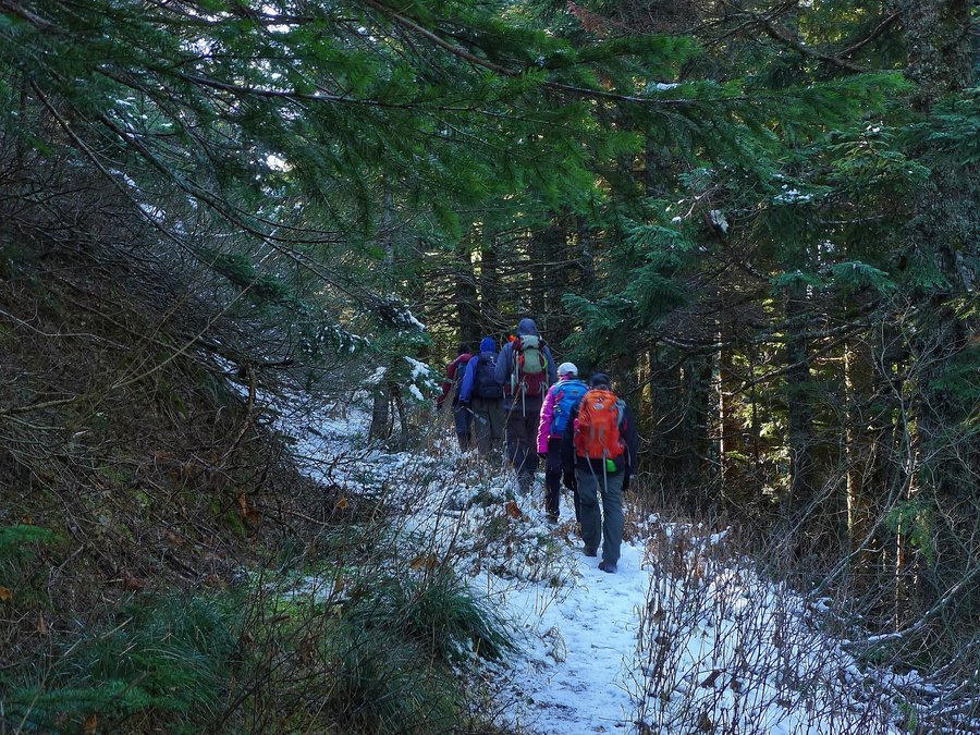
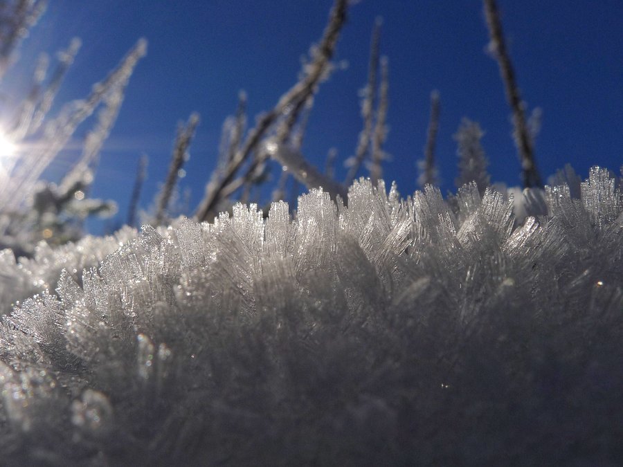
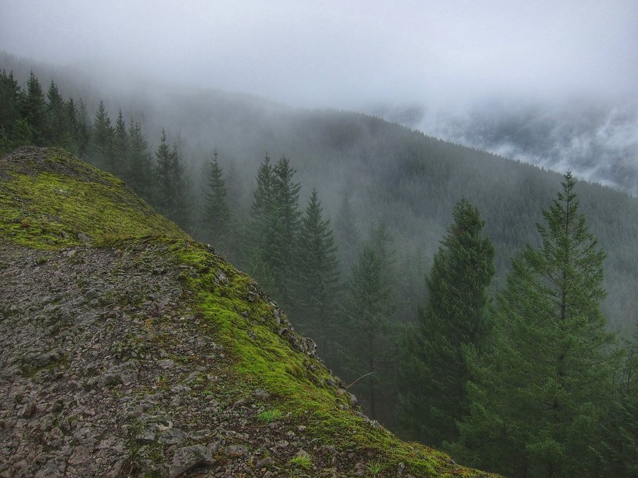
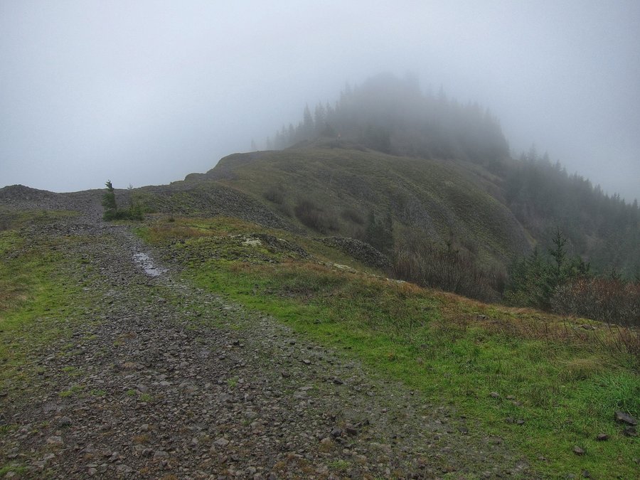
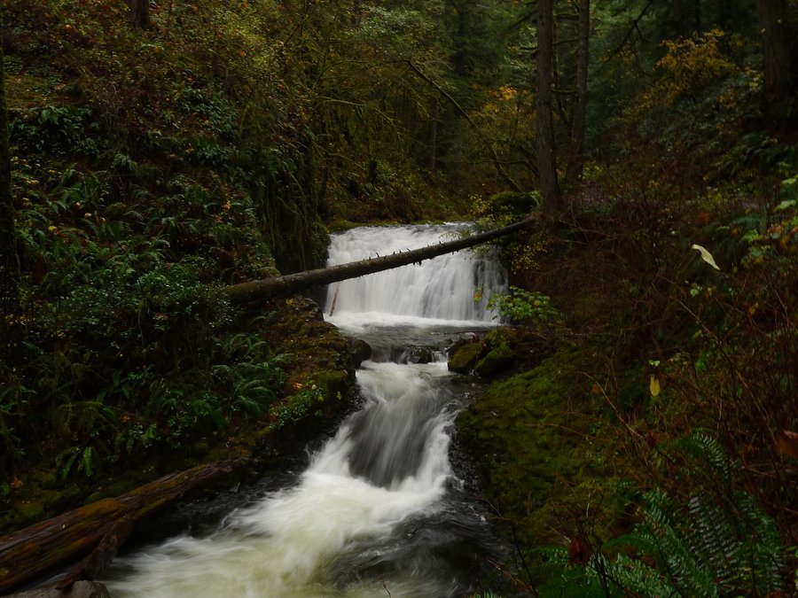
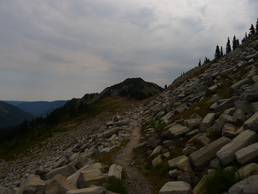
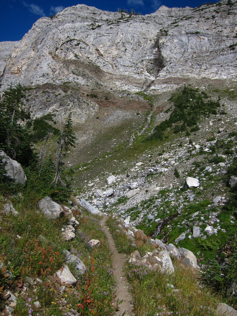
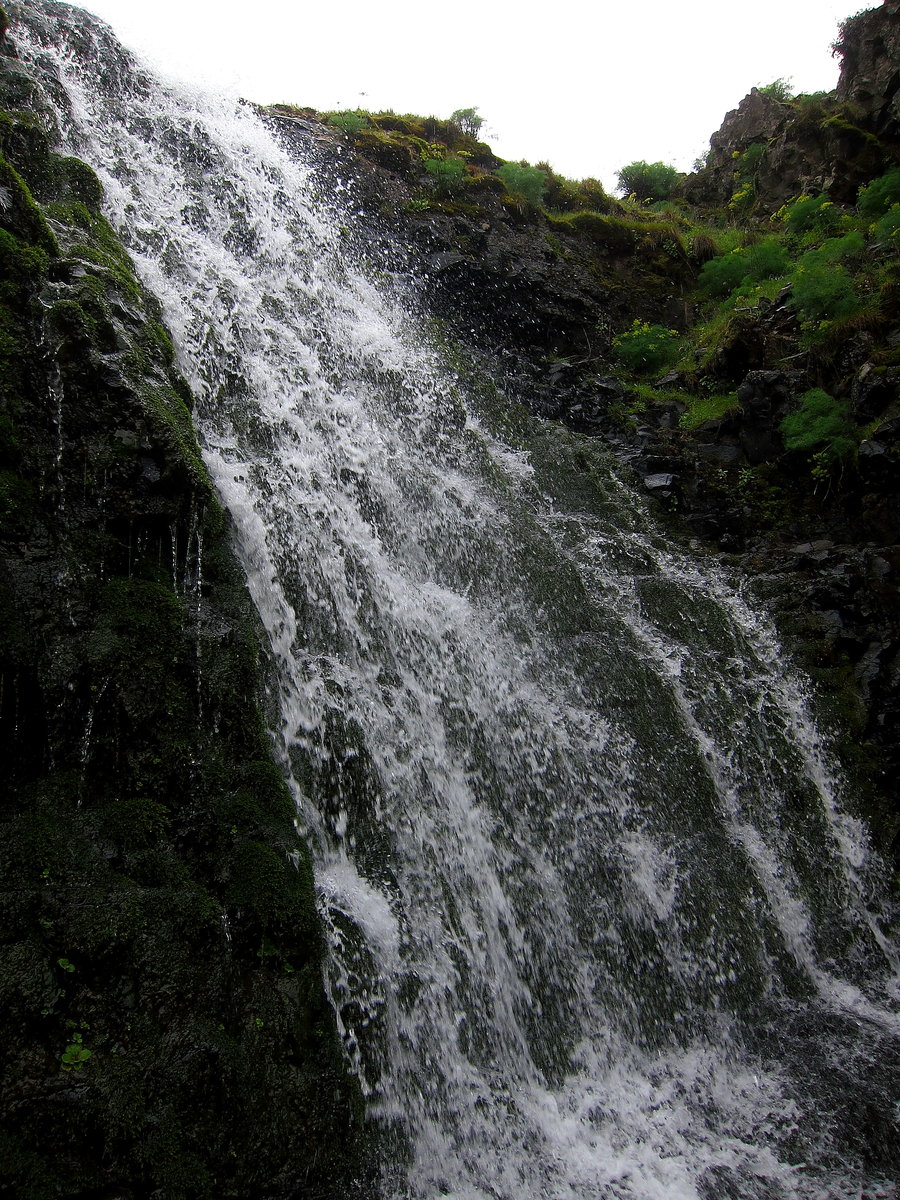
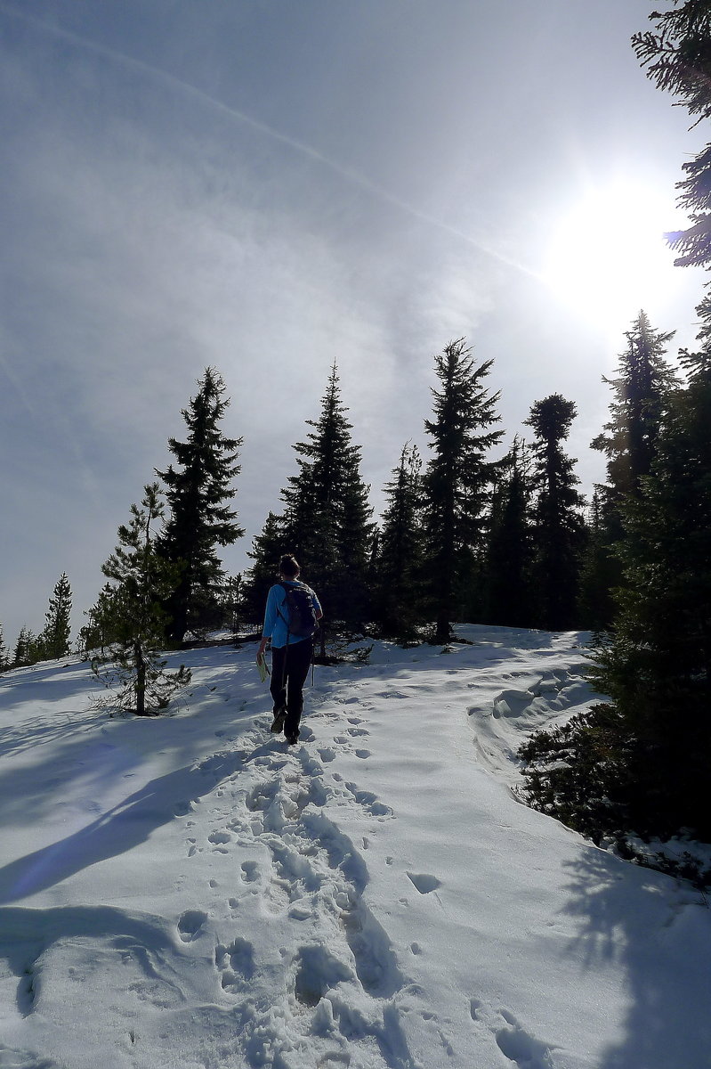
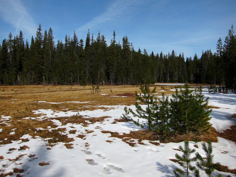
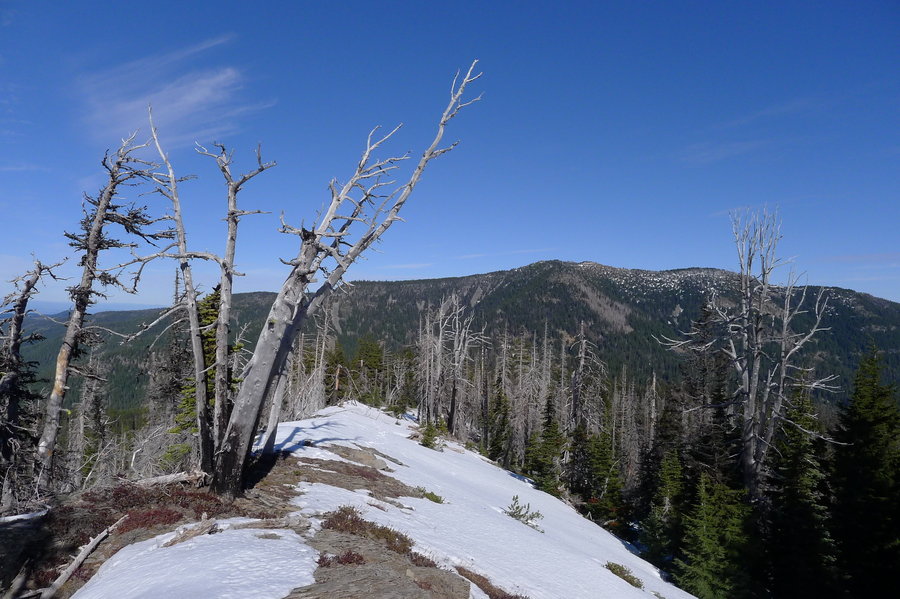
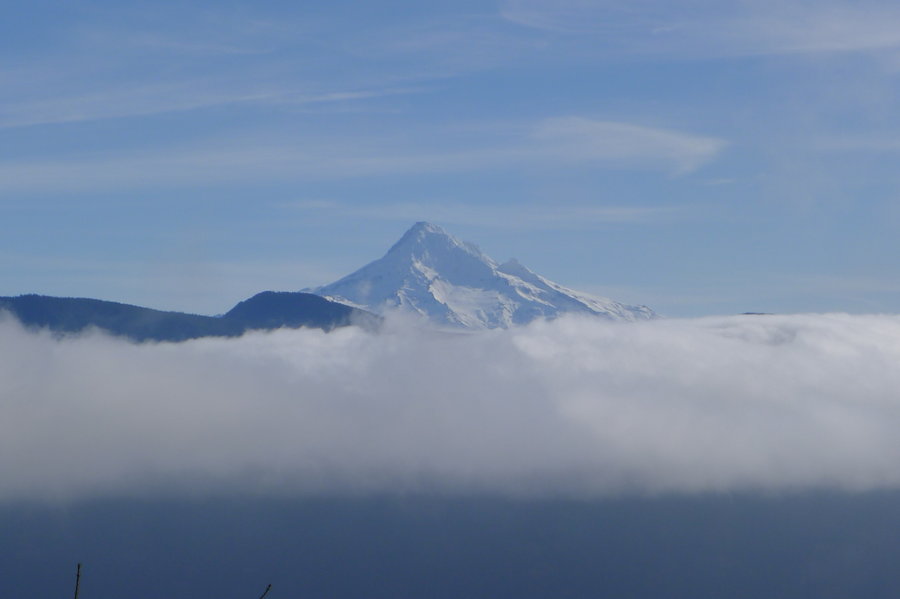
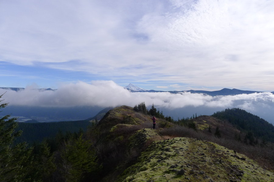
Kings Mountain
5 miles of hiking • 2500' elevation gain •
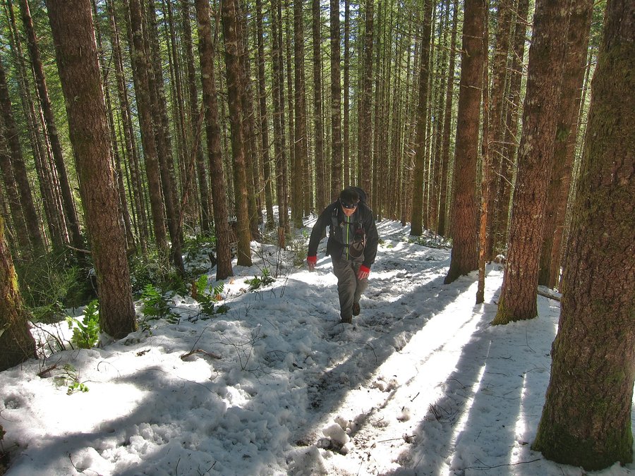
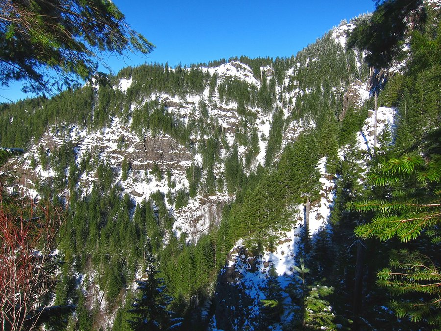
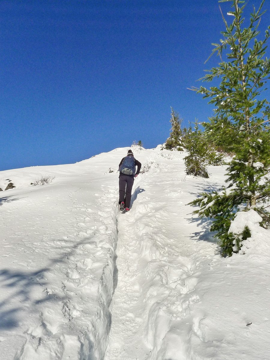
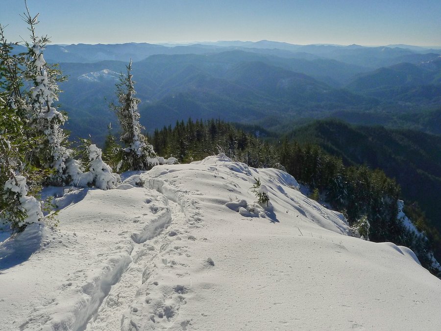
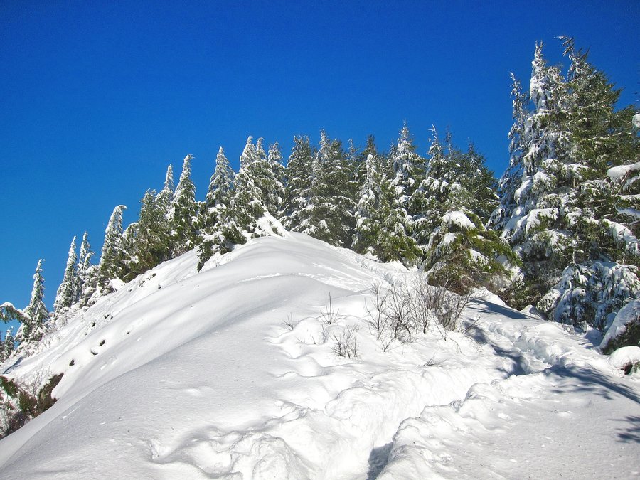
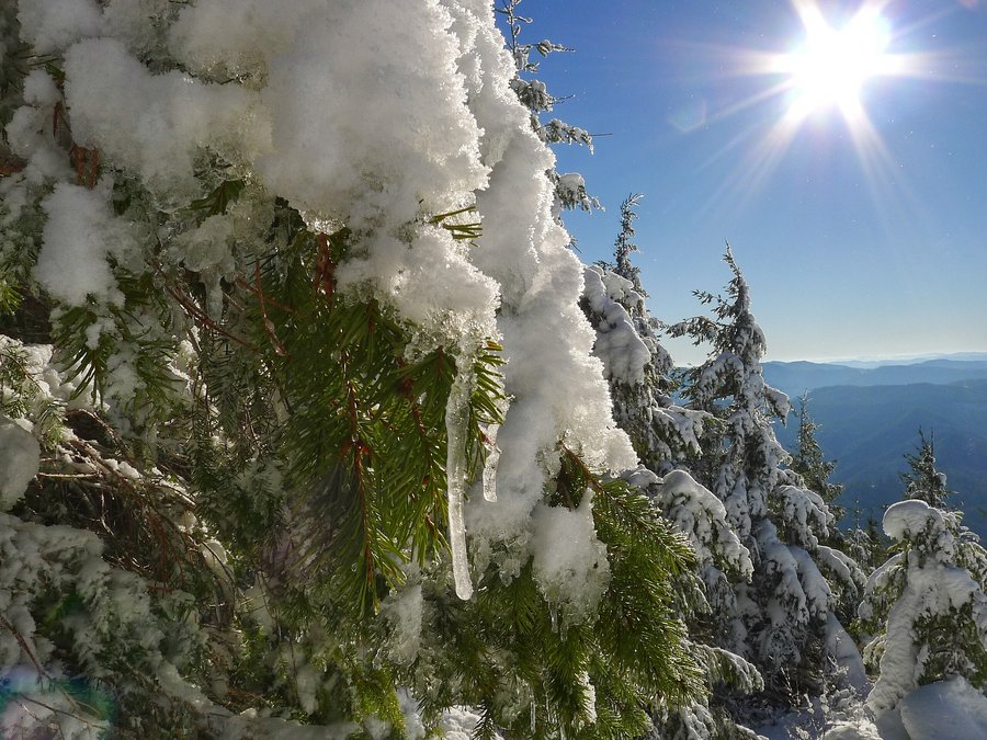
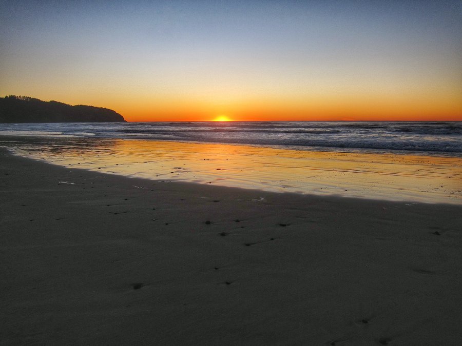
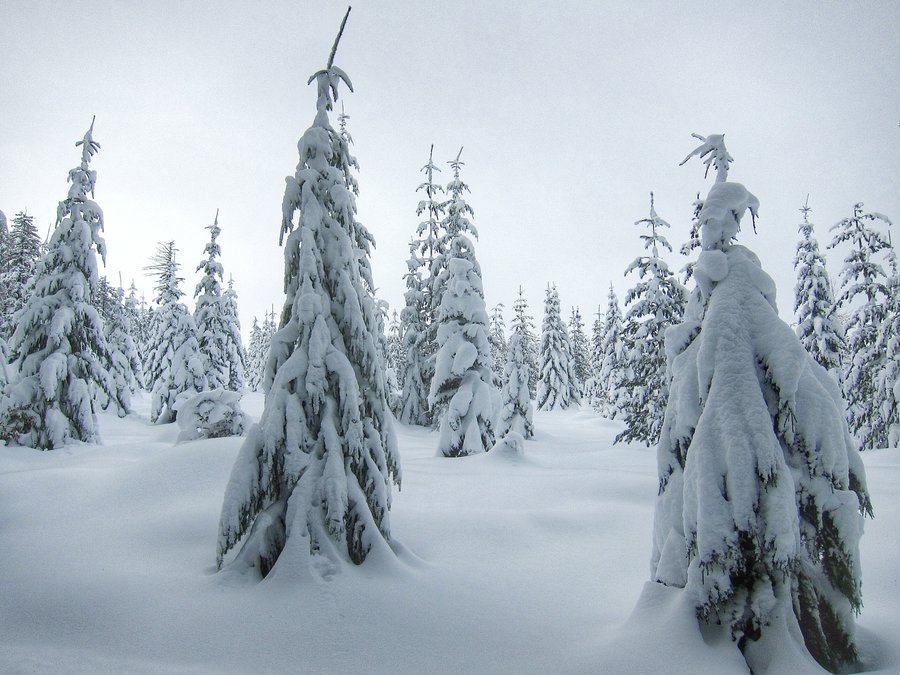
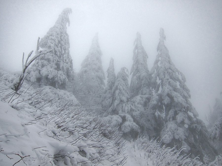
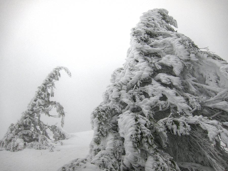
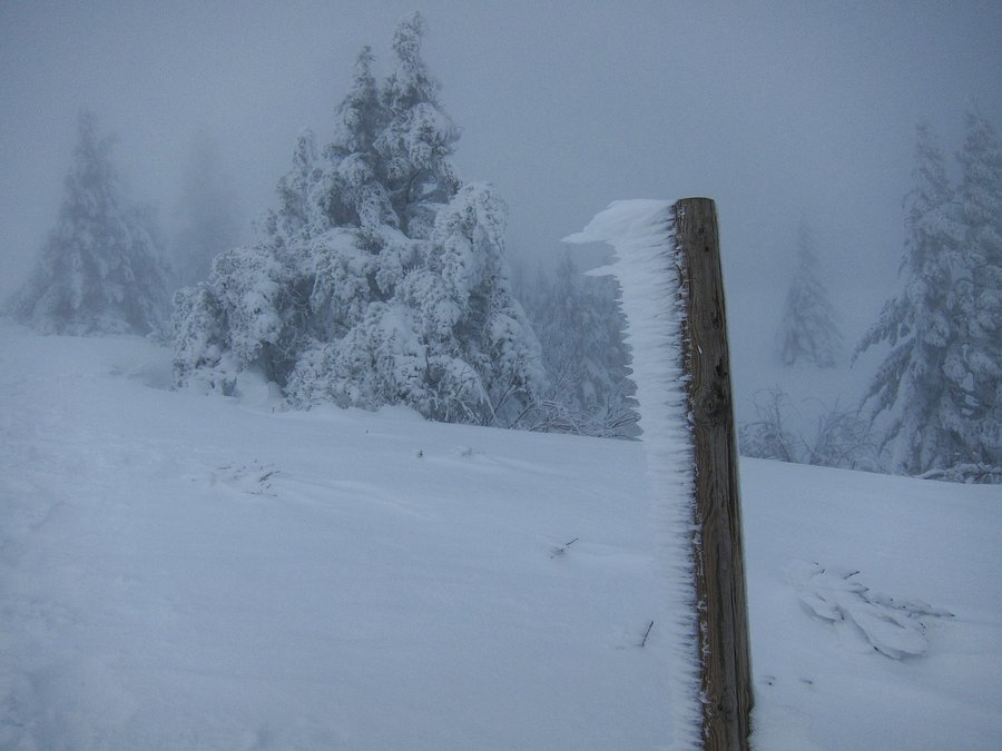
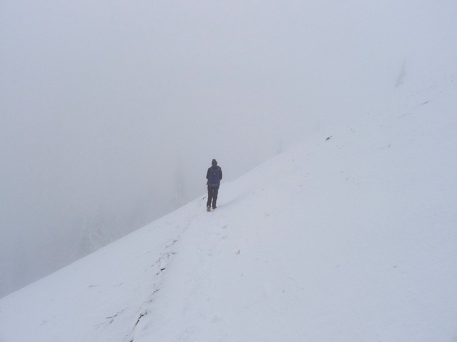
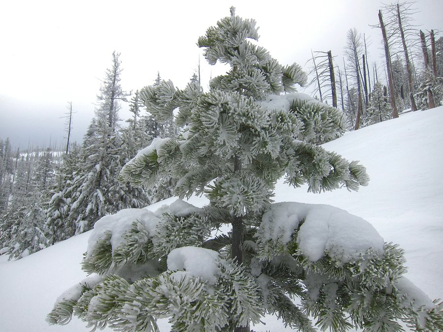
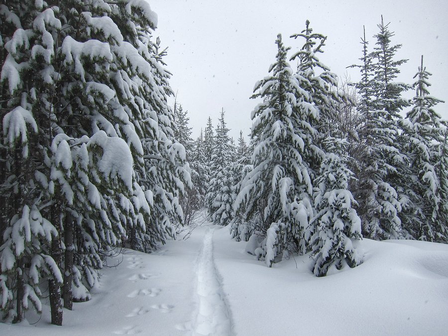
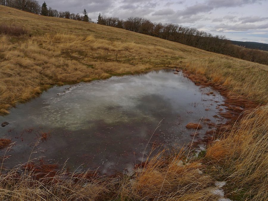
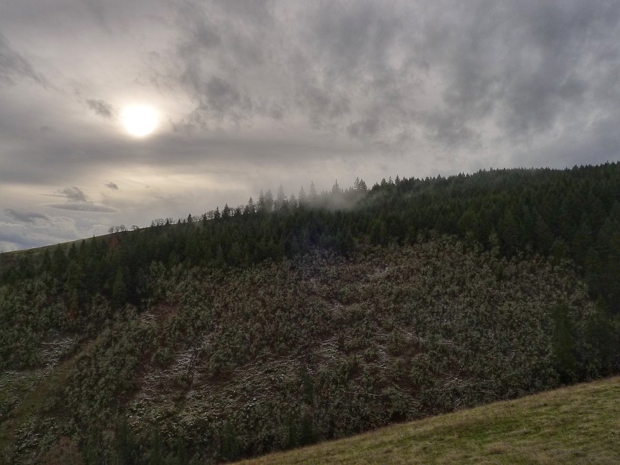
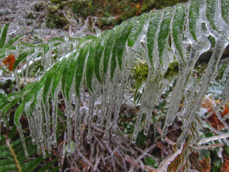
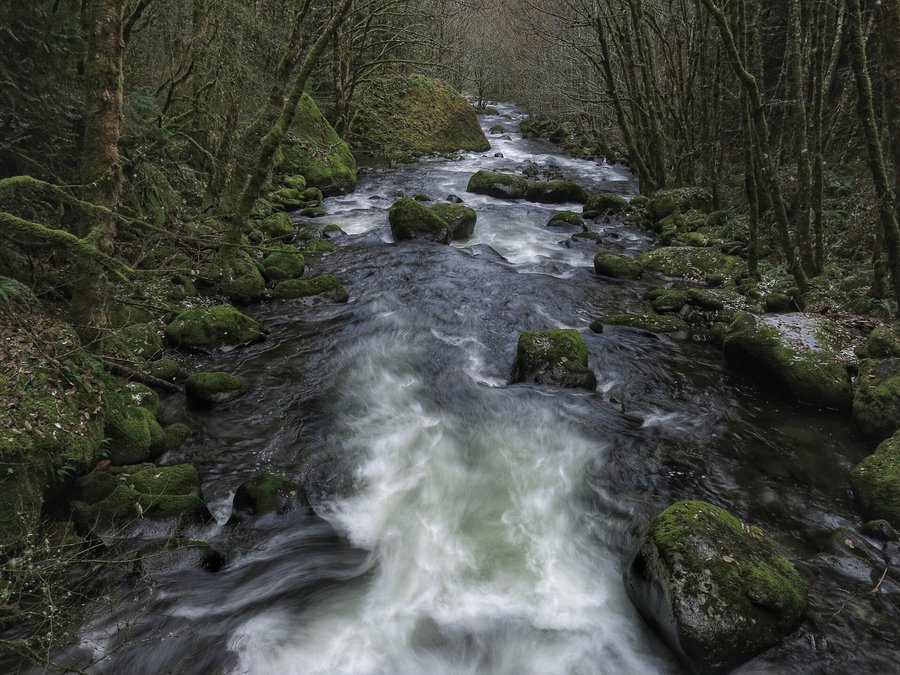
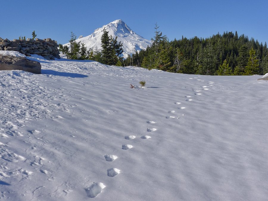
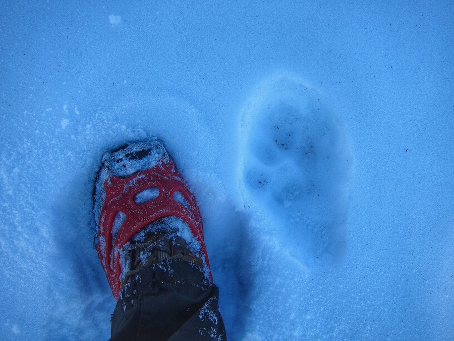
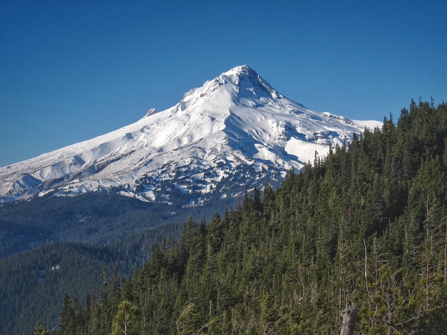
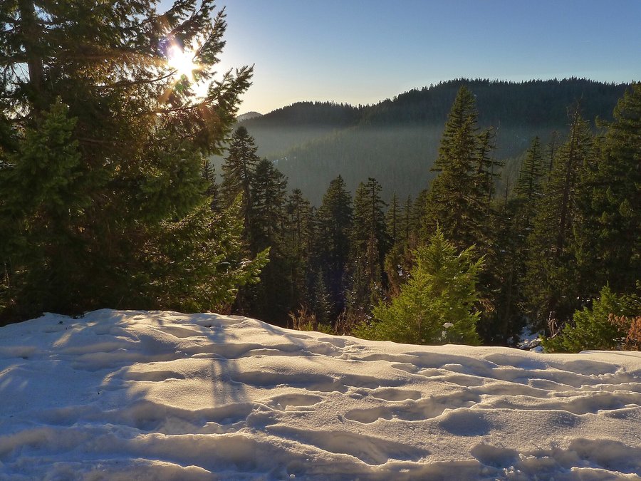
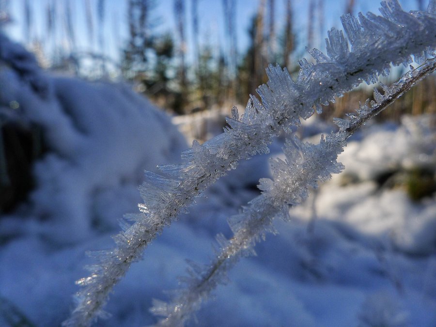
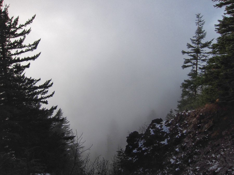
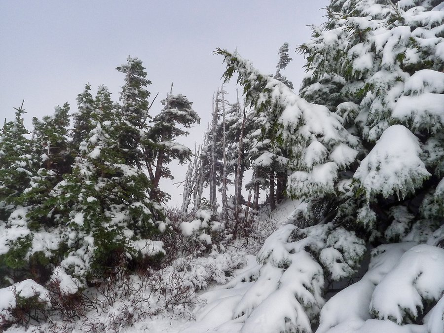
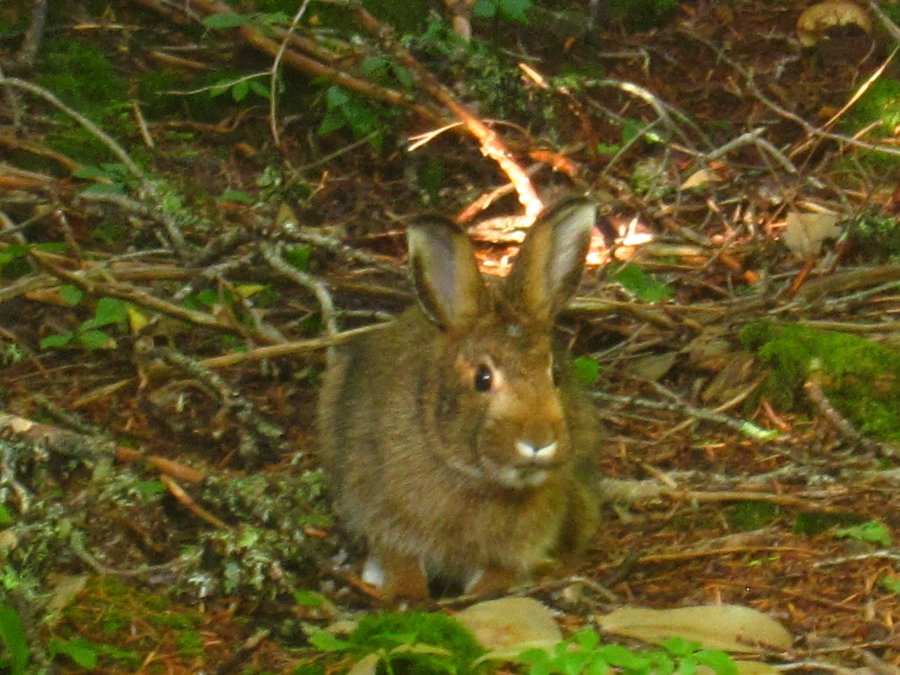
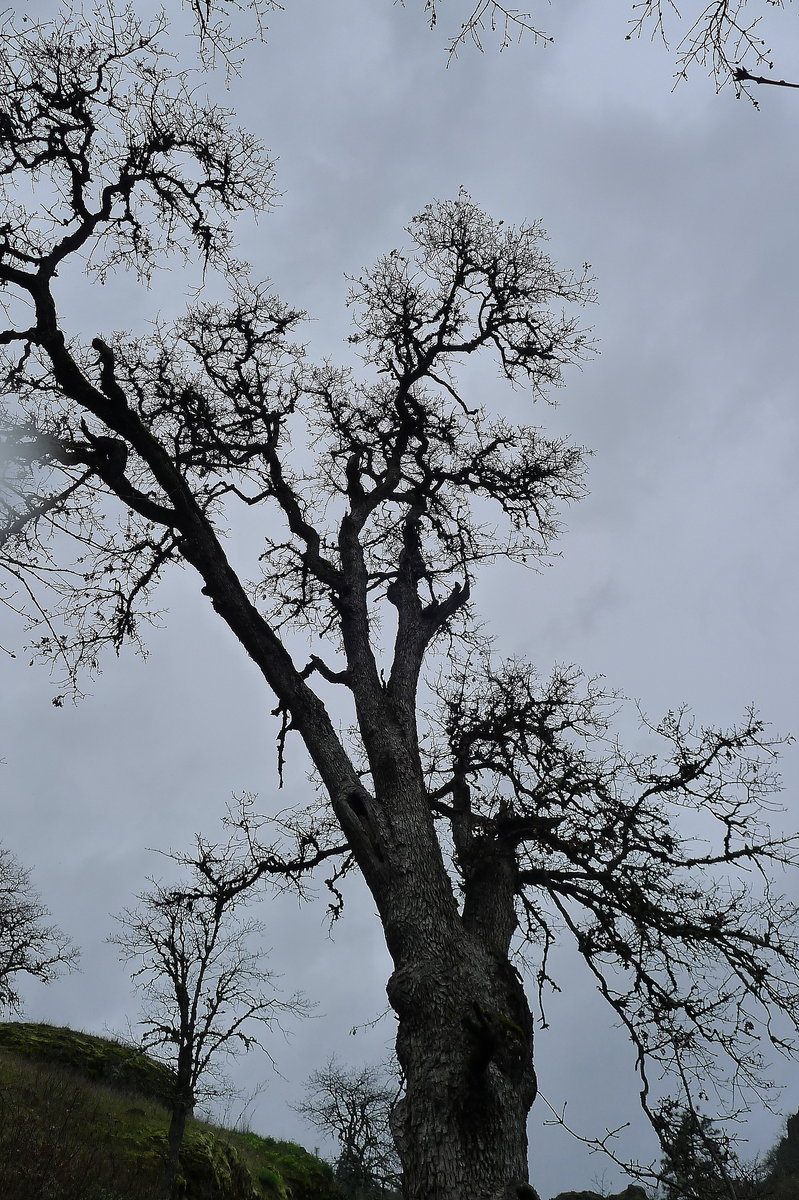
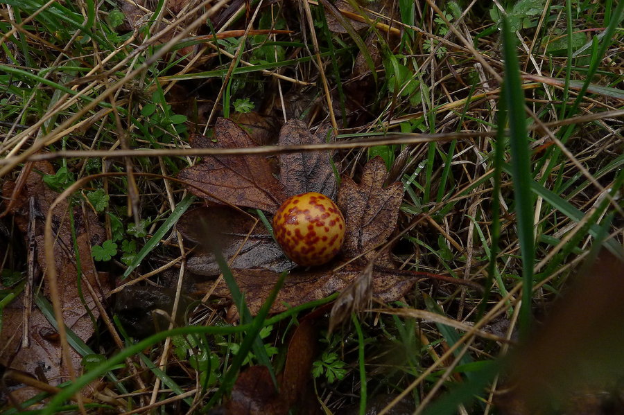
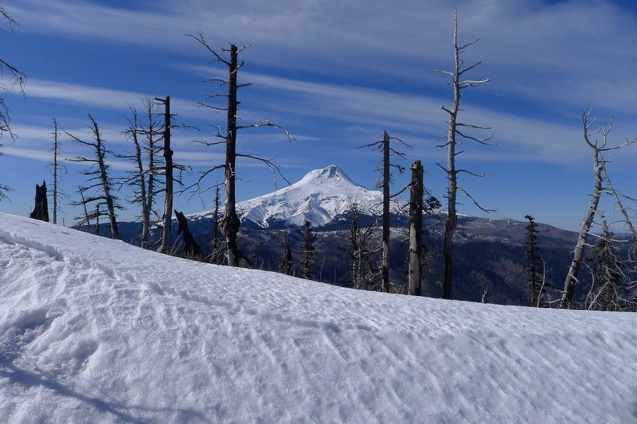
(Dec 31) One last hike this year. We hit snow around 1000 feet elevation. It was packed down and icy. Traction helped. There was about a foot of snow at the summit and bright blue, sunny skies!
After the hike, we drove to Lookout State Park on the coast, walked a couple miles on Netarts Spit, and carried on a sort of tradition for us the last few years - to watch the sun set on the Pacific on the final day of the year. A nice ending to a pretty good year -- I am so glad to have met some great new trail friends this year! --And, I am incredibly grateful for every second of every minute of every mile I spent hiking this year. Every day out there was a gift!
Cheers to 2016!

December 30, 2015


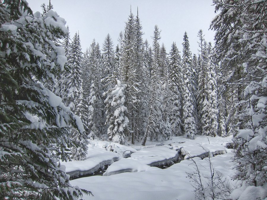
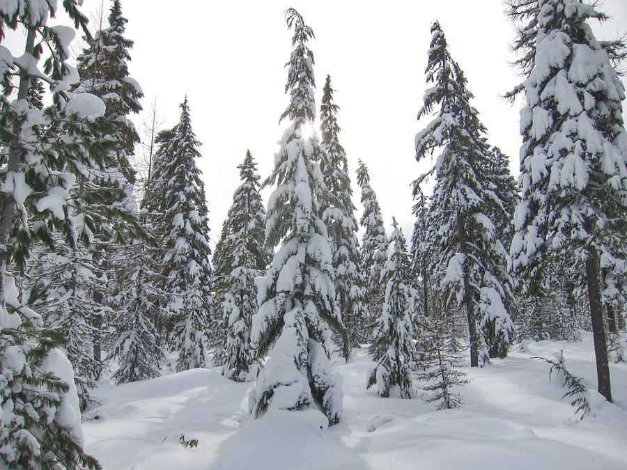
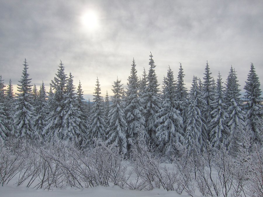
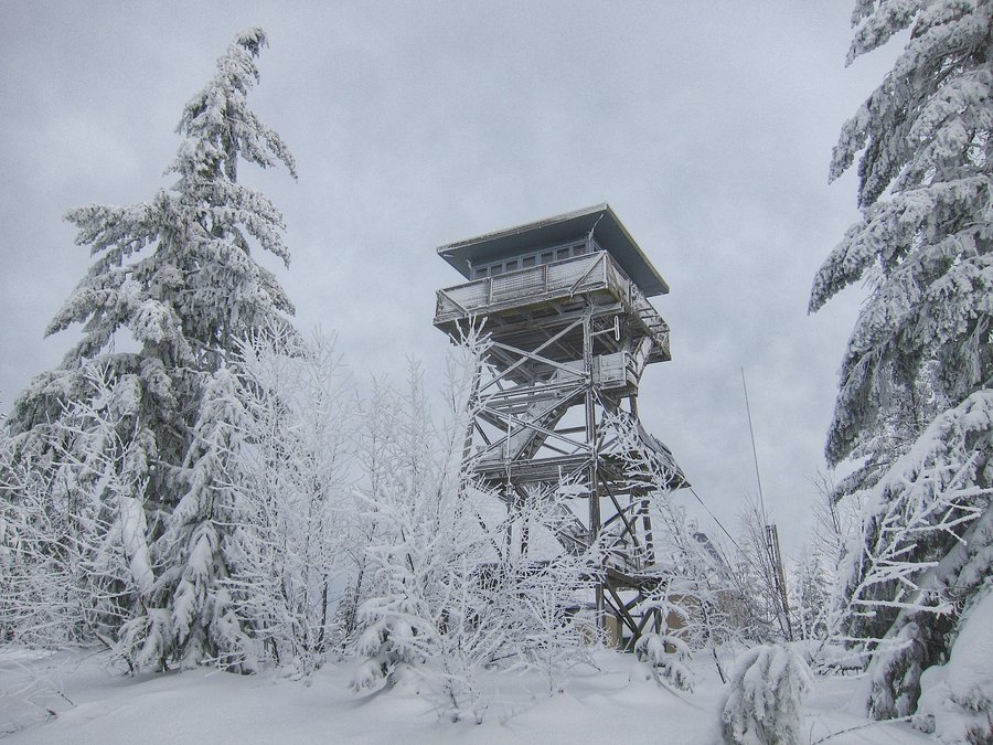
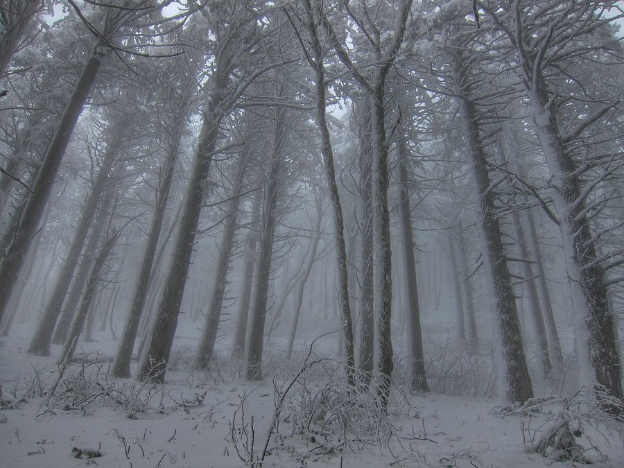
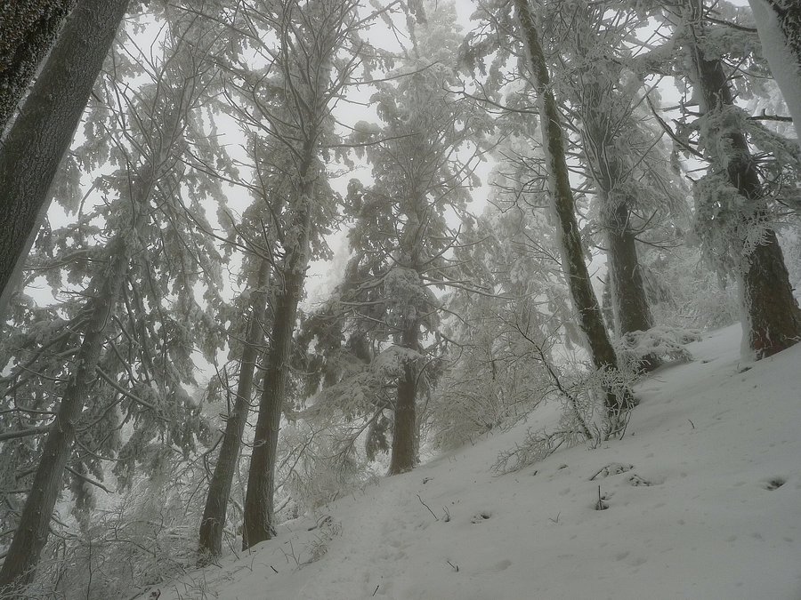
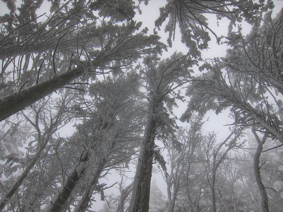
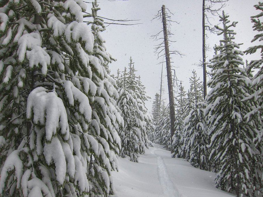
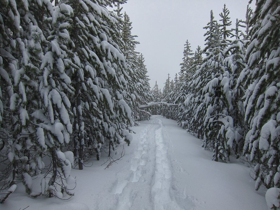
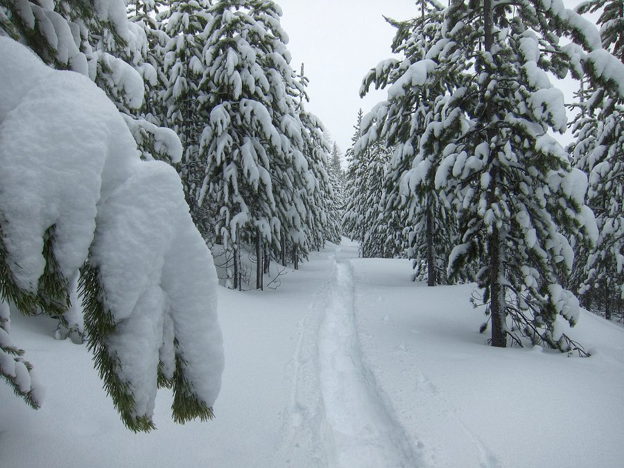
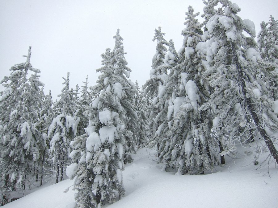
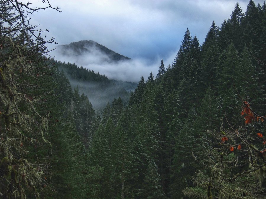
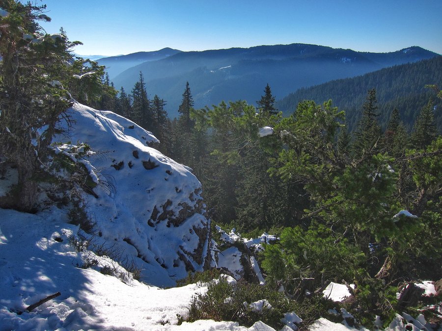
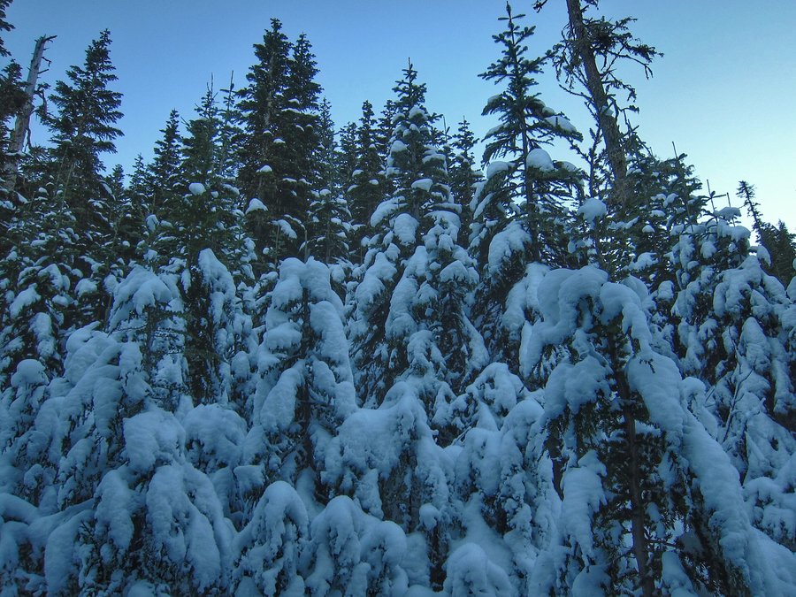
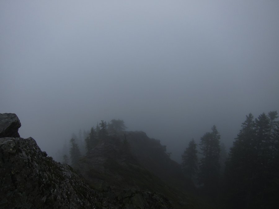
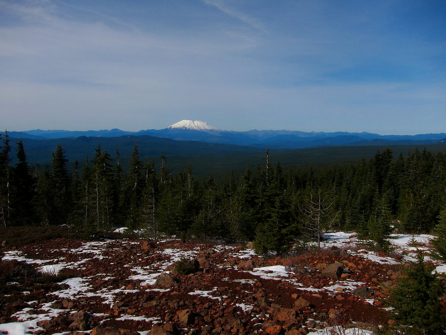
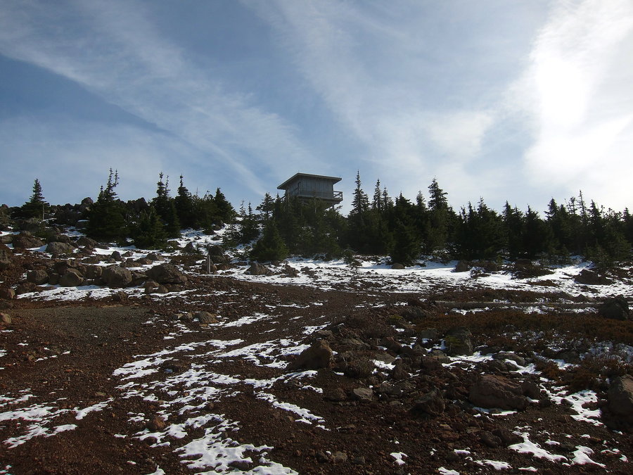
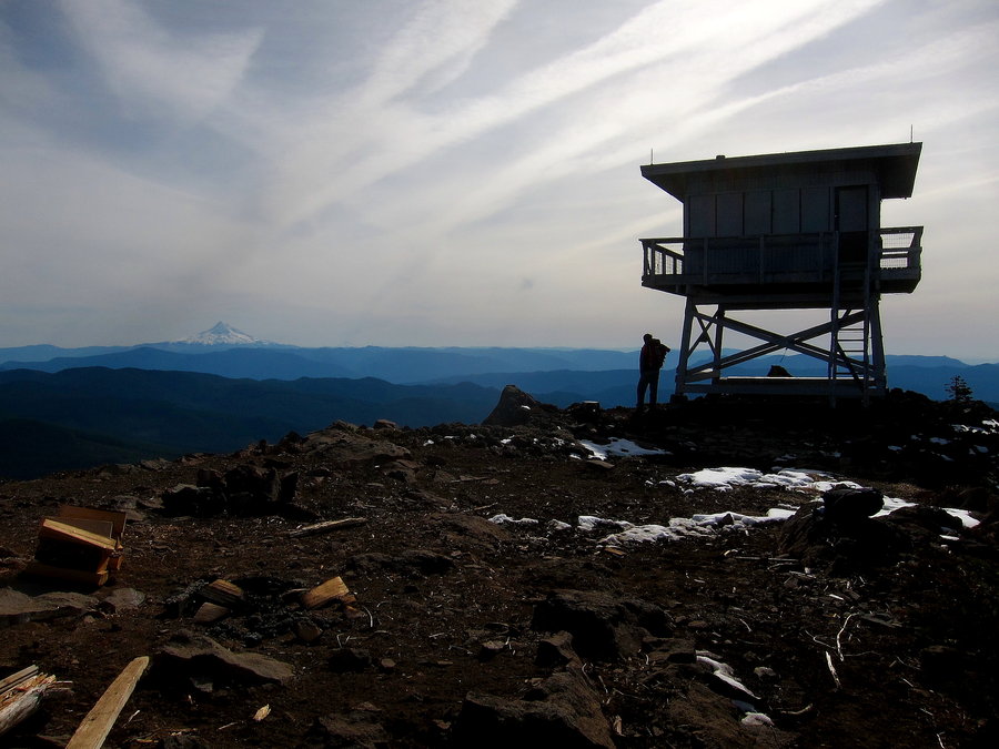
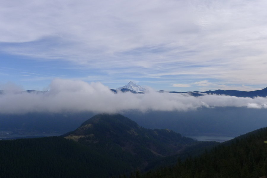
Clear Lake Butte / Clear Lake Snowshoe
10.45 miles of hiking • 1750' elevation gain •
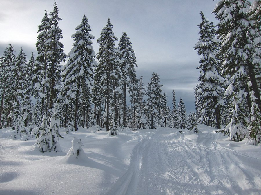
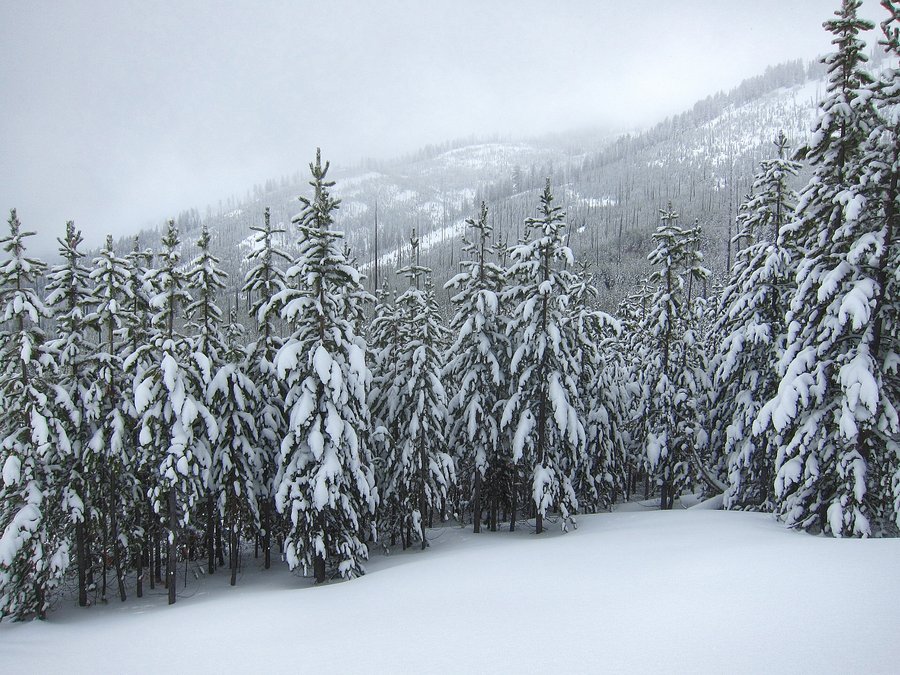
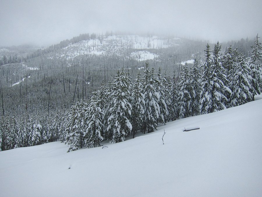
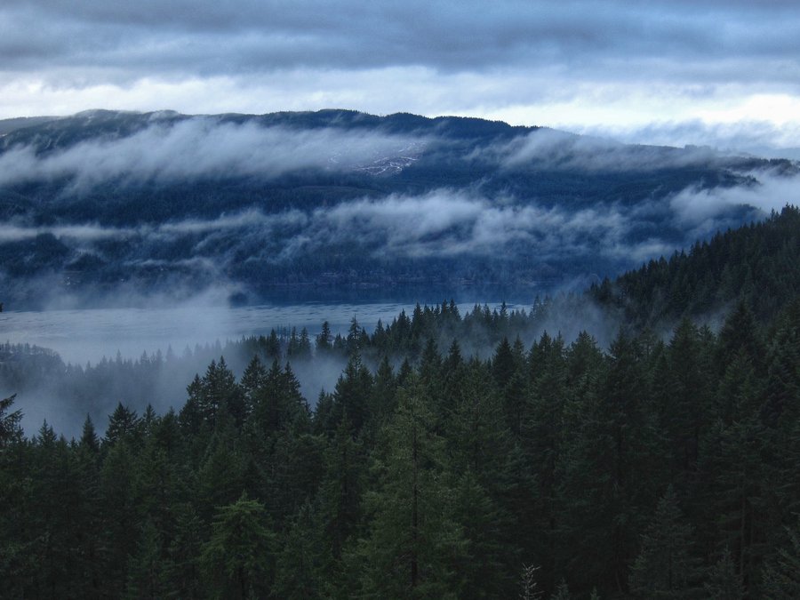
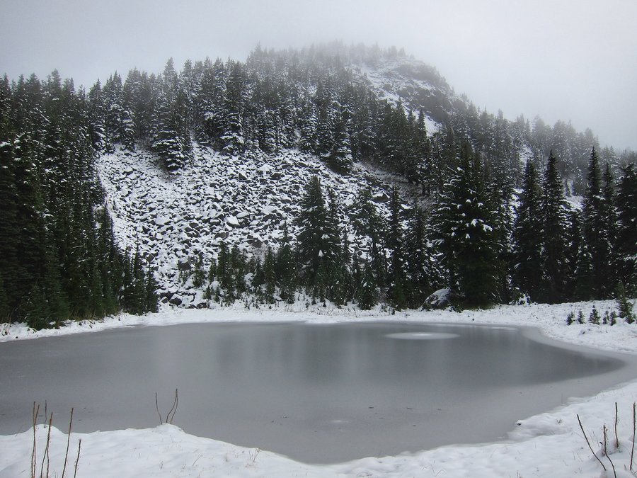
We wanted to do something new to us, so we decided on Clear Lake Butte. We were expecting snowmobile traffic, and there was a lot of it. This is a great little snowshoe, but the exhaust from snowmobiles was overwhelming at times. It is probably better to do this one during the week, or at least, not on a holiday weekend! (We were the only ones snowshoeing to Clear Lake Butte that day!) You can rent the lookout, and near the top of the butte, we crossed paths with the folks who had rented it the night previously. Since they had left, we could not reach the top of the lookout - the final approach to the catwalk is locked. Still, we could see Mt. Hood, Mt. Jefferson, and Timothy Lake. Quite beautiful!!! On the way out, we decided we'd try to get to Clear Lake from Road 4290, but we were unable to find any of the spur roads to the lake that were on our map. So, we returned to near the parking area and followed a great mass of folks, snowmobiles, and a little 4 wheeler on the road to Clear Lake. Someone had ran their snowmobile out onto the lake, and it must have gotten stuck, so it was abandoned out there. We didn't stay long, since things were a little too chaotic. On the way home, we sat in traffic on 26 for a while, moving only a half mile in 40 minutes. We decided to take 35 home because it was flowing freely. Despite the traffic and crowds, it was a good day in the snow!
December 26, 2015


 2
2
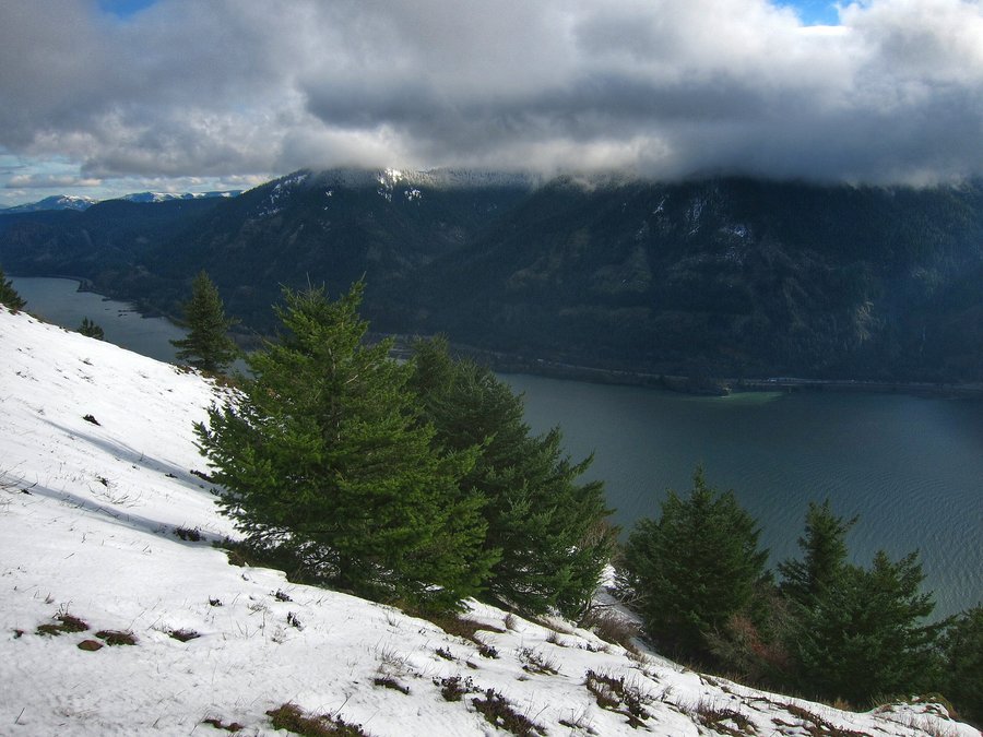
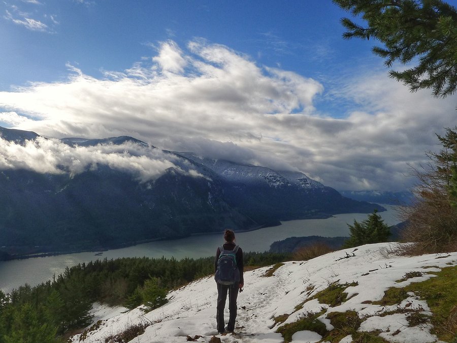
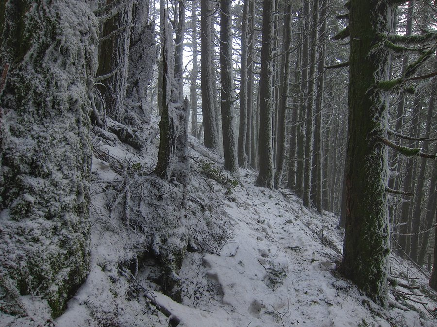
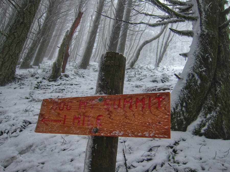
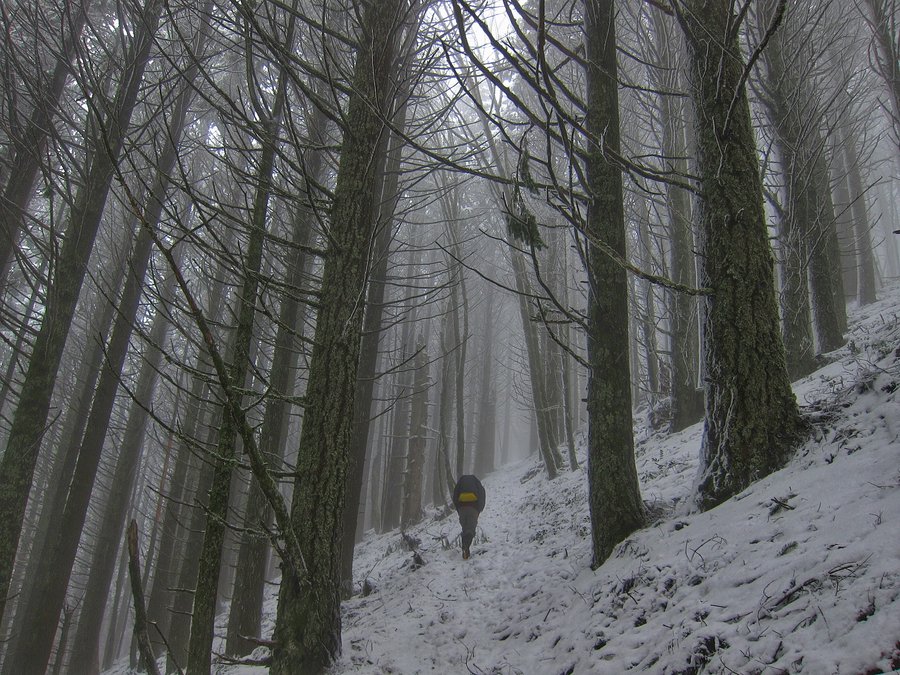
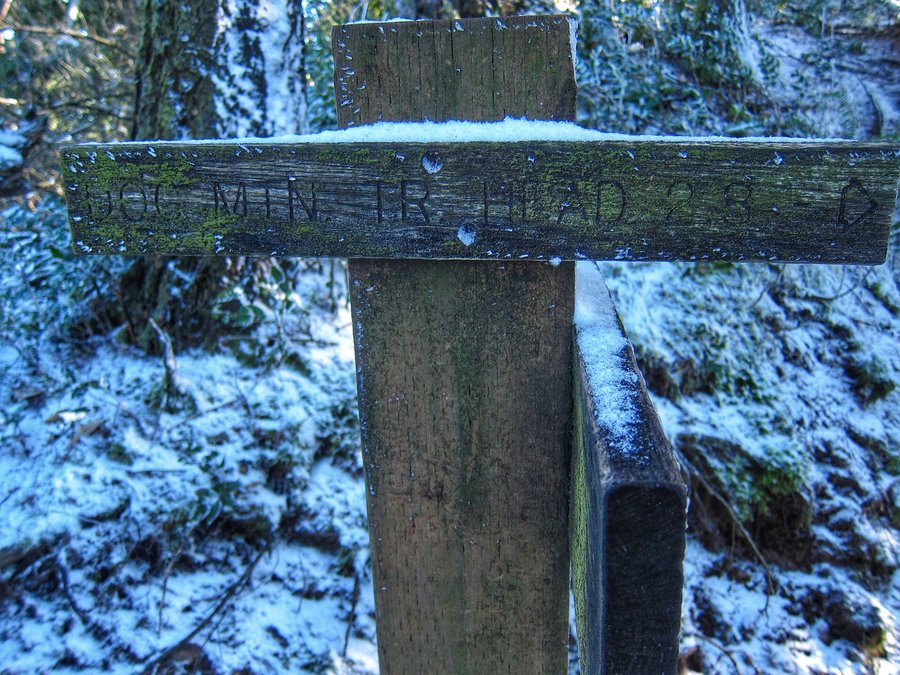
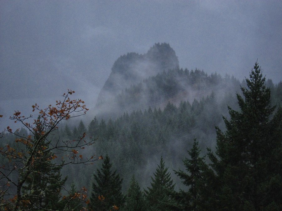
Dog Mountain to Puppy Dog Lookout
5.88 miles of hiking • 2500' elevation gain •
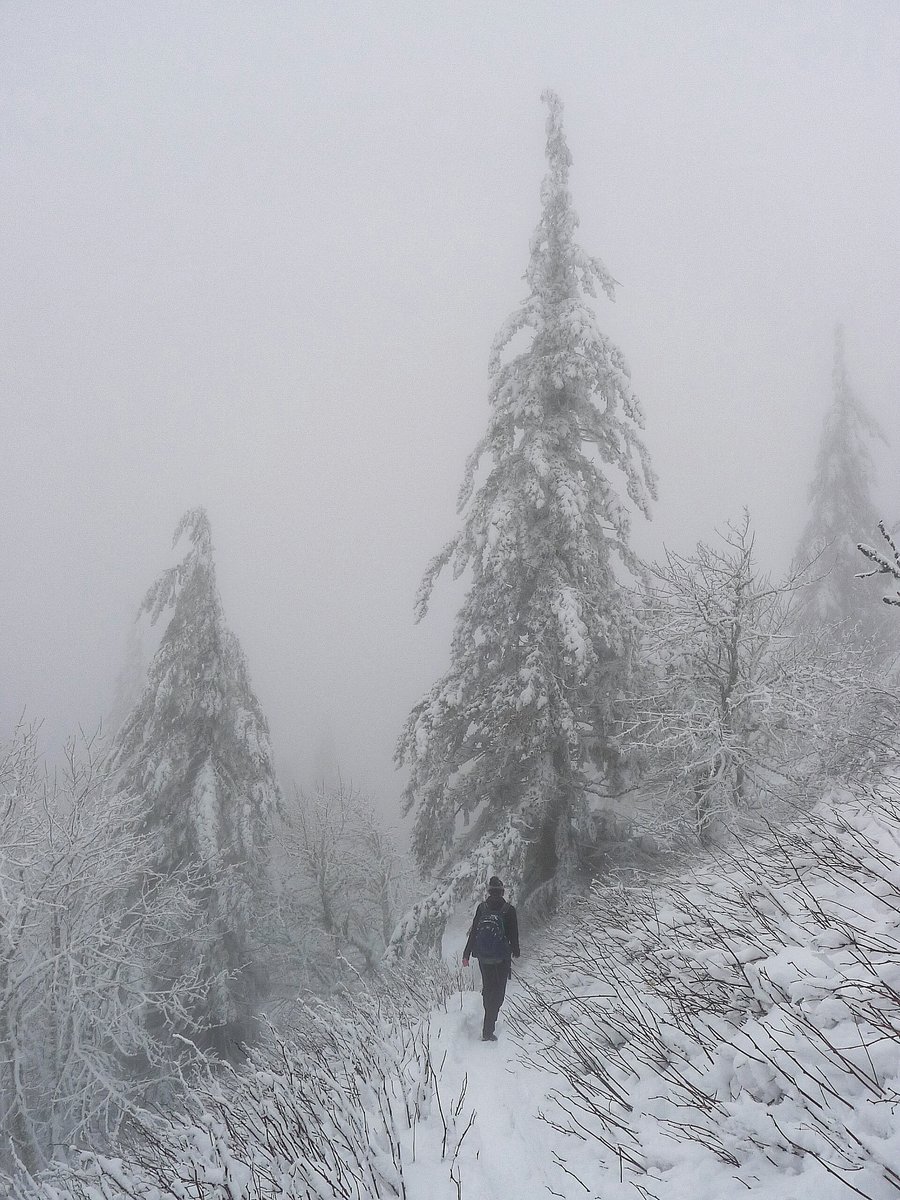
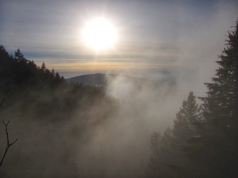
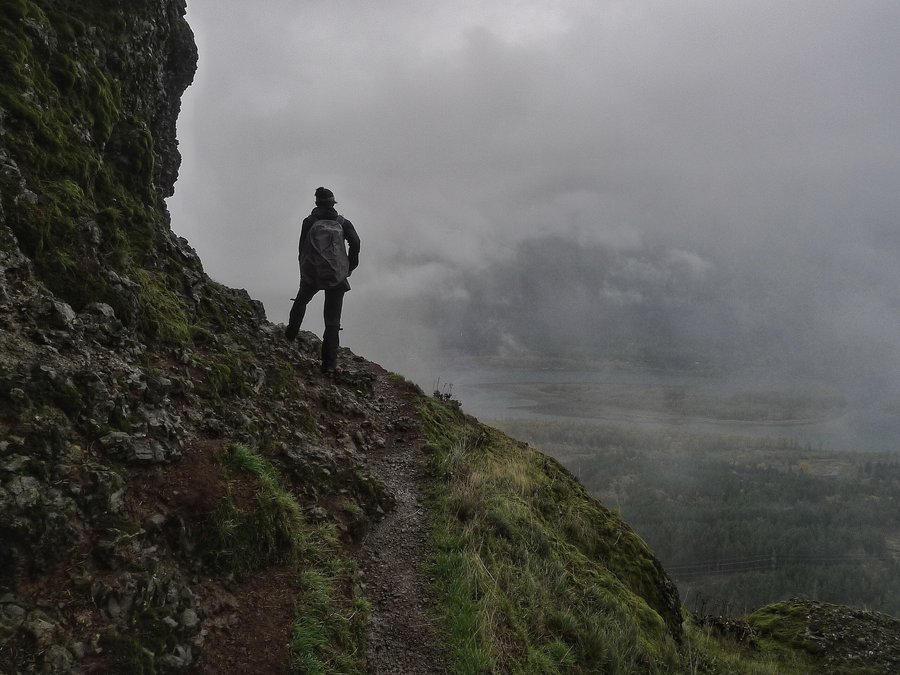
This wasn't our first hike on Dog Mountain on Christmas Day! After a week off the ankle, it was time to test it out with the help of a shoe adjustment. Not much snow until the lower viewpoint. Great views, but, clouds were covering all of the mountaintops, except Defiance. We entered the clouds shortly after the viewpoint and we were pleasantly surprised by the wintry appearance of everything. It was wonderful. Once we got into the meadow area, visibility was pretty low and it was windy and cold. We went to Puppy Dog Lookout and thought about the summit, but ultimately, we decided against it, since we were not going to get above the clouds.
December 25, 2015


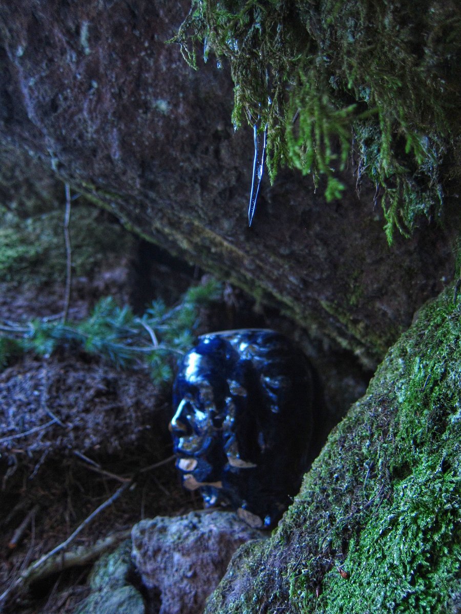
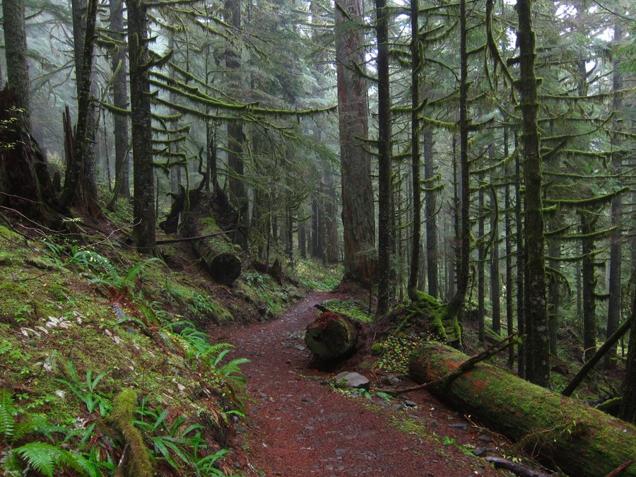
Devil's Gulch
9.9 miles of hiking • 1750' elevation gain •
I had an ankle injury from a previous day's cross country skiing, and just about every step of this hike was painful for me. Still, it was a great time spent in beautiful country.
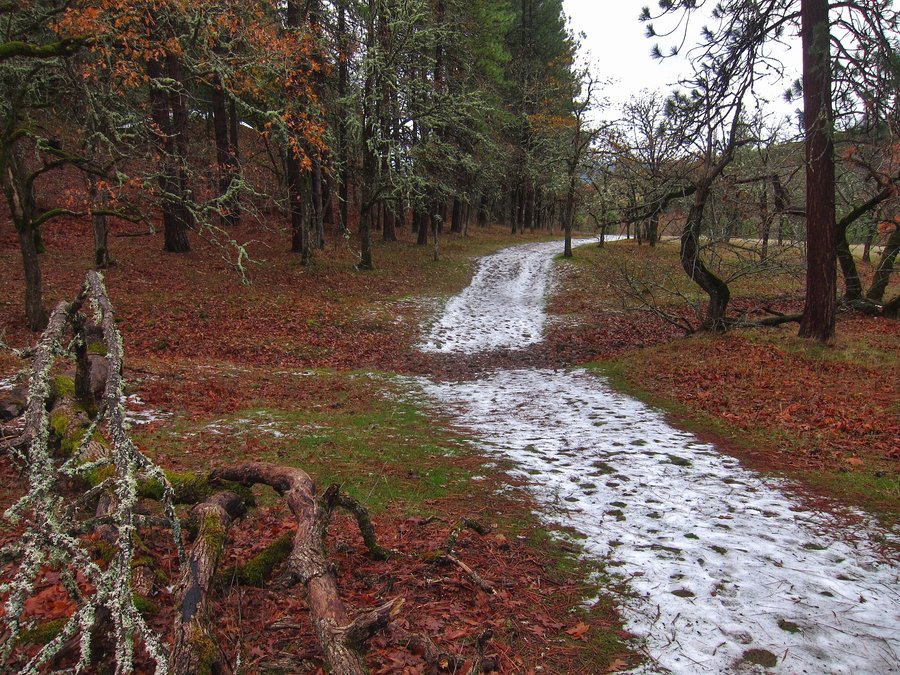
December 15, 2015


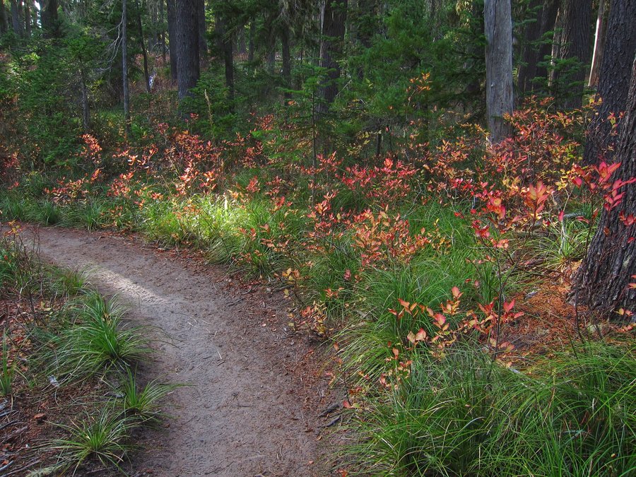
Wagon Road Snowshoe
2.93 miles of hiking • 500' elevation gain •
A shorter than expected snowshoe... but, it was nice to be out in the freshly fallen snow.
December 14, 2015


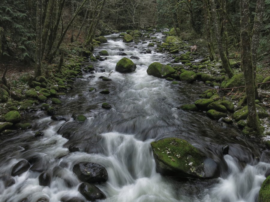
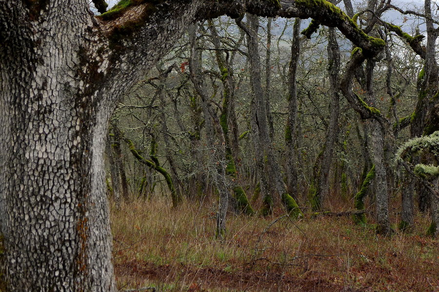
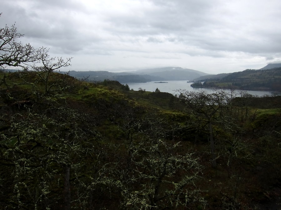
Catherine Creek
7.25 miles of hiking • 2250' elevation gain •
We escaped the rain for a moment, and hiked two loops in the Catherine Creek area.
December 6, 2015


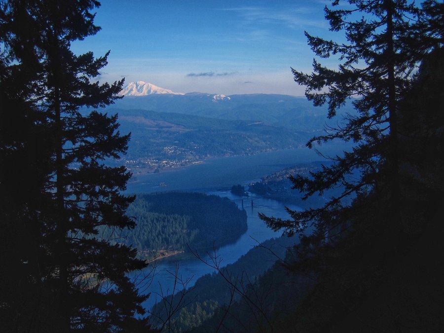
Cascade Locks - Herman Creek after Ruckel Ridge fail
22.5 miles of hiking • 4250' elevation gain •
A fun day hiking in the rain!
December 4, 2015


 2
2
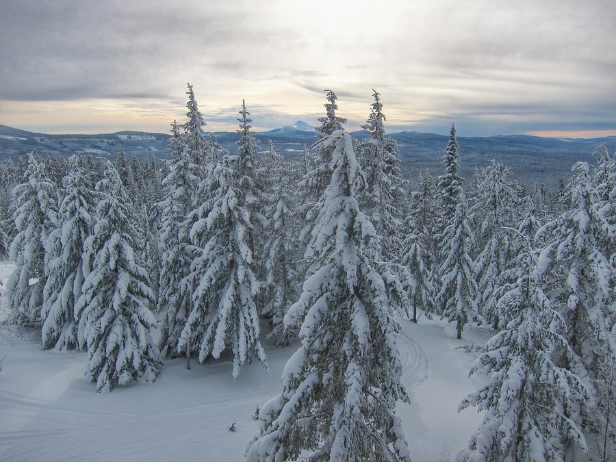
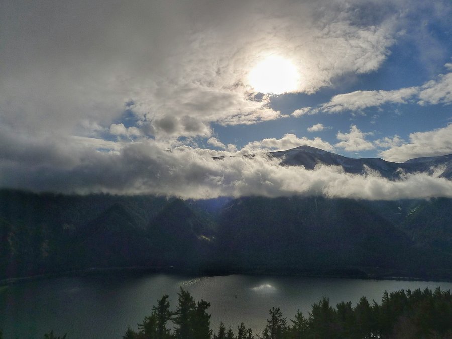
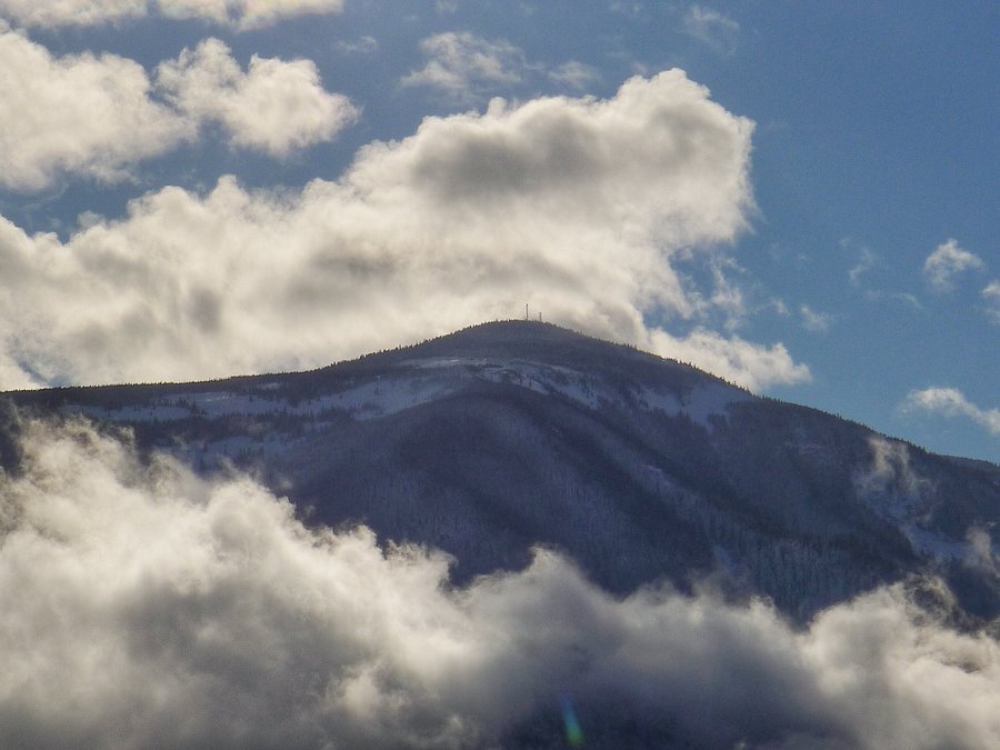
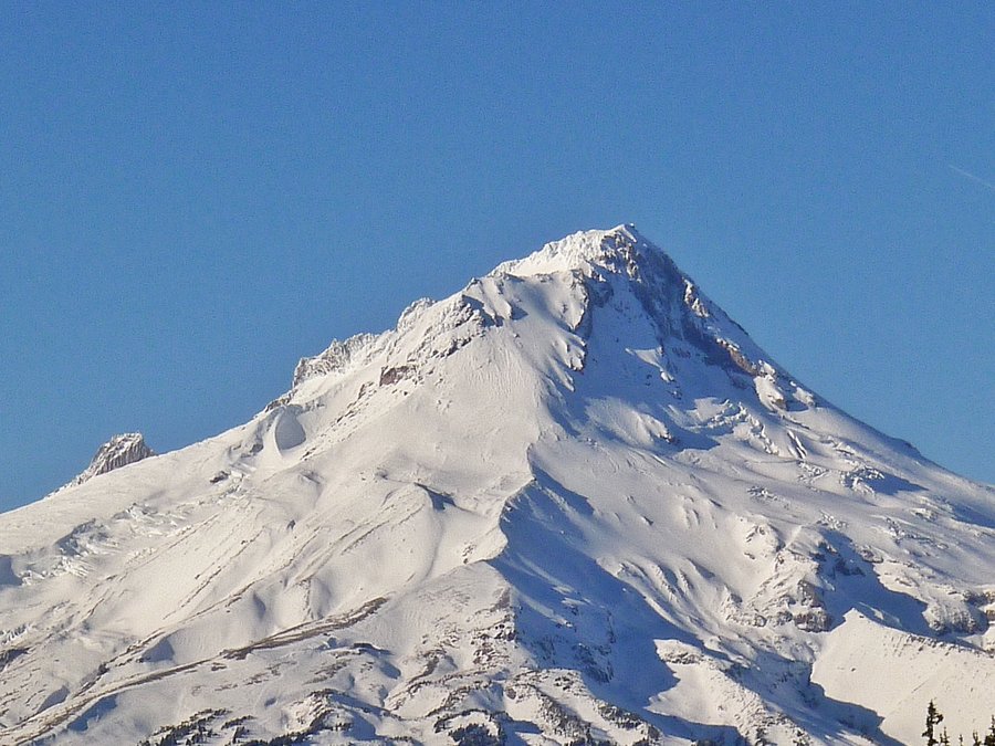
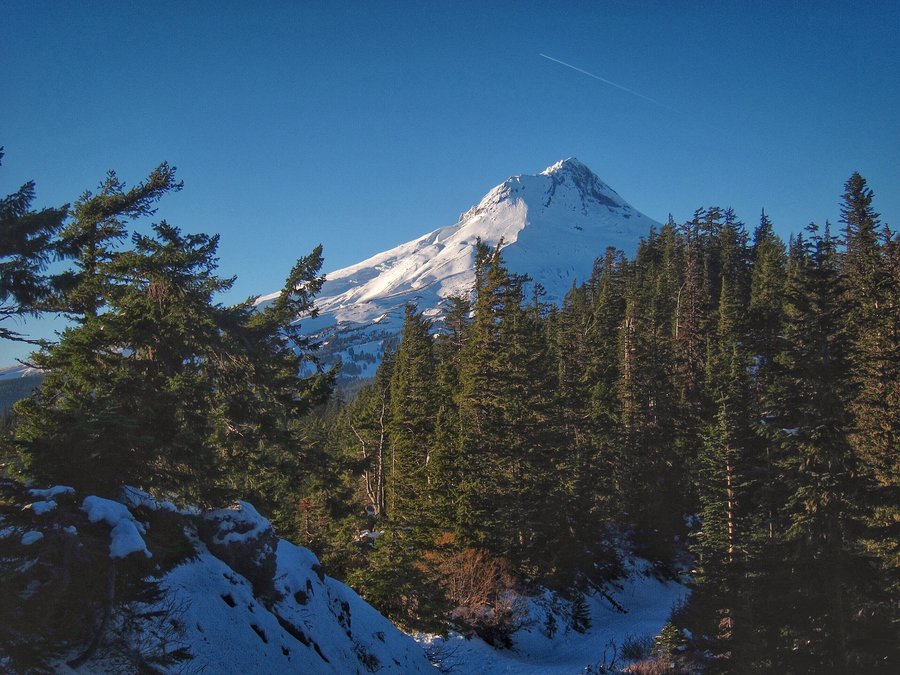
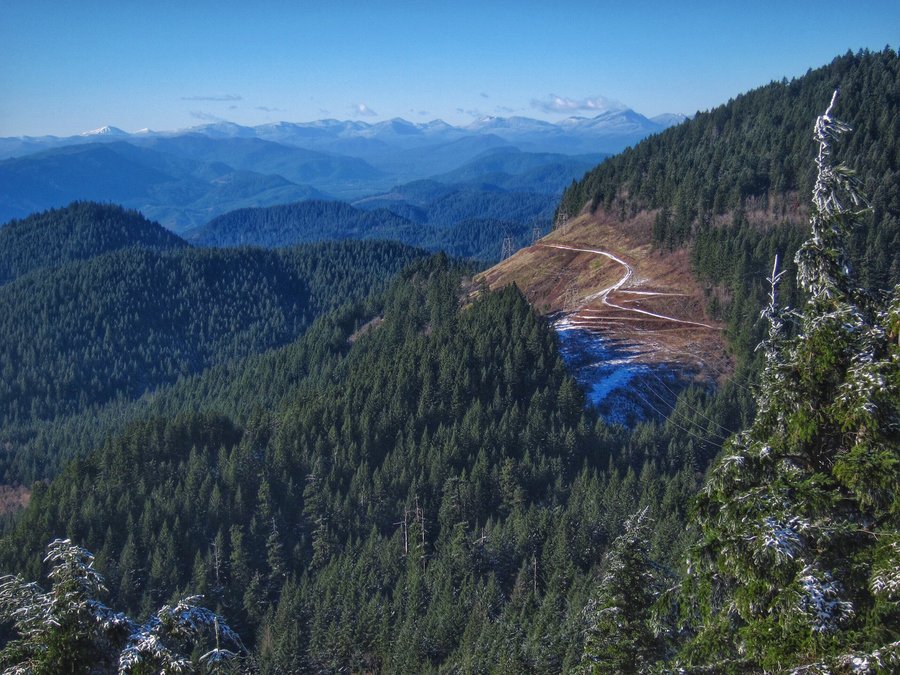
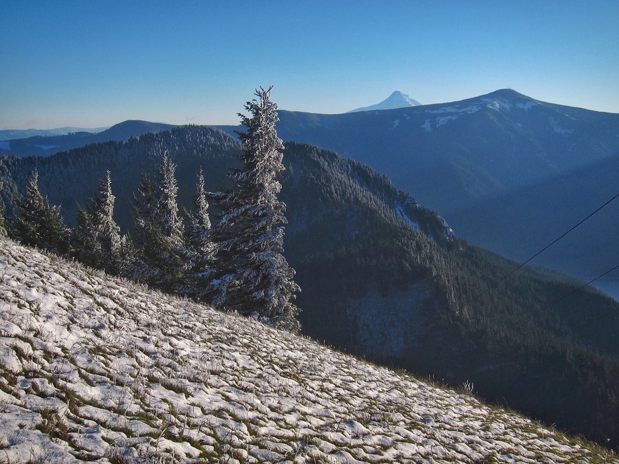
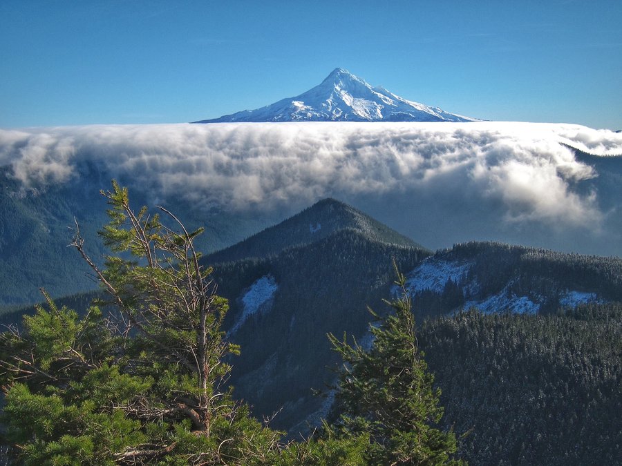
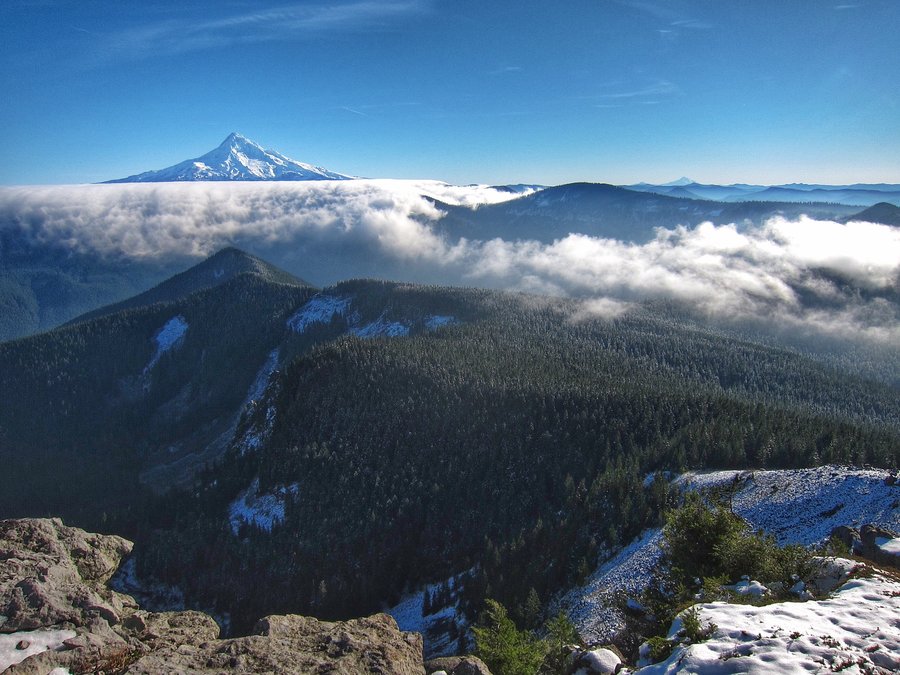
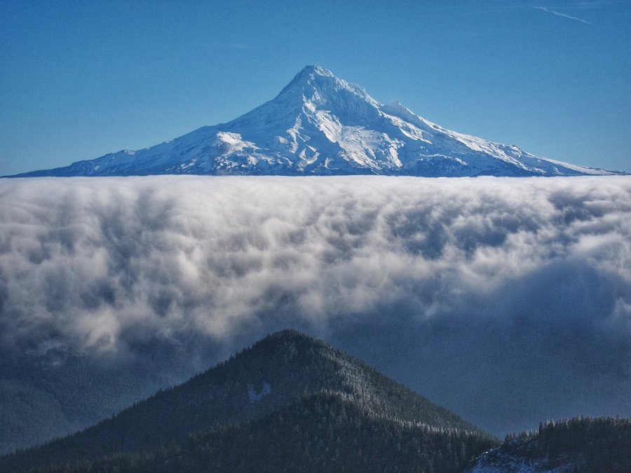
Bennett Pass Sno-Park to Bonney Butte
11.4 miles of hiking • 1500' elevation gain •
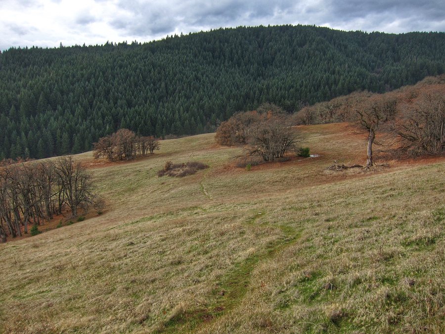
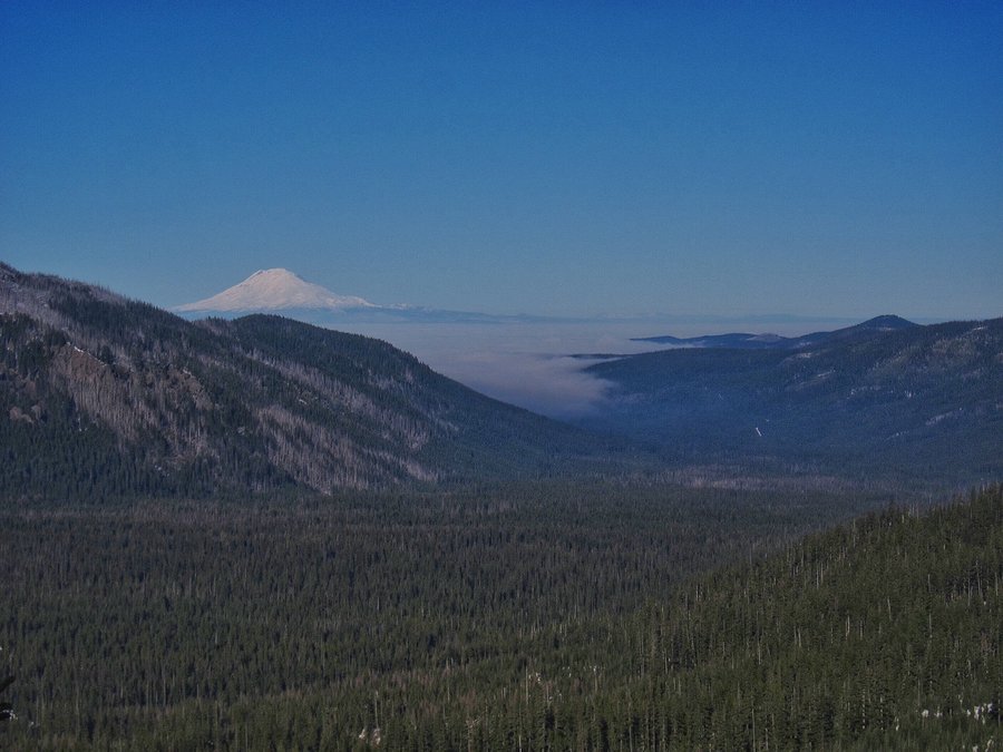
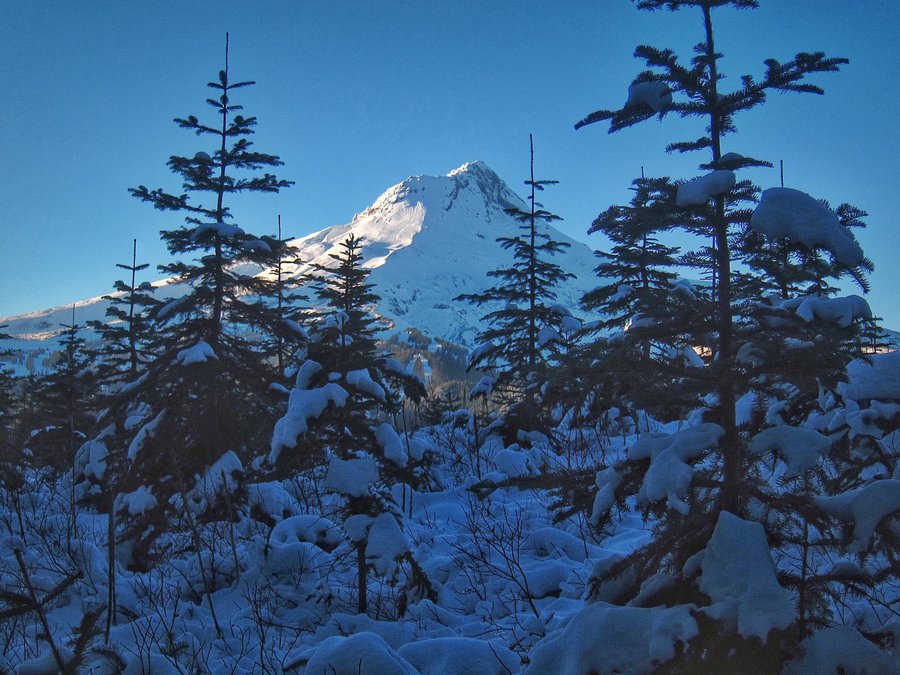
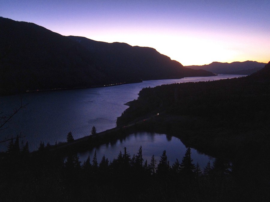
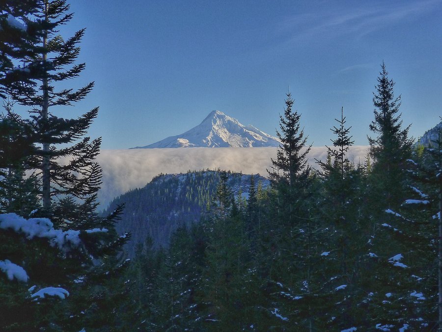
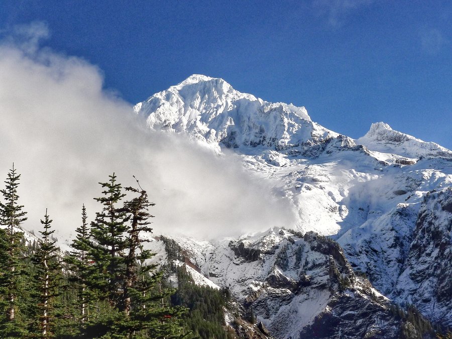
It was one of those days where we thought things were just going to go wrong, but, it ended up being a fantastic day! We planned on hiking on the east side of the Gorge, but, once on the freeway, we saw clouds in that direction. By the time we reached Hood River, the clouds were thick. We decided not to do our planned hike. We drove up highway 35 to Mt. Hood, finally getting above the clouds. An hour later, after finally finding a place with a Sno-Park day pass available for purchase, we were ready to hike. We decided to go to the less crowded, Bennett Pass Sno-Park and walk the snow covered road to Bonney Butte. Once we were a mile out, we saw no one! We used micro spikes, which weren't necessary, but, gave us some added traction. The cliffs on the Terrible Traverse section of the road were not snowy, but we could see why you wouldn't want to spend time there on an avalanche prone day. Once we reached the Bonney Meadows Road junction, tire tracks from a recently driven vehicle really helped pack the snow for easy walking. The spur road to Bonney Butte required us to break trail through about six plus inches of snow, in spots. As we reached the last stretch, we noticed what we guessed were mountain lion tracks going to the top of the butte. At the top, it was 360 views, and we had it all to ourselves! Because of our late start, we did have to move pretty quickly to make it out before dark. We reached the parking lot right as the last few rays of sunlight were hitting Mt. Hood. A great day!
November 29, 2015


 1
1
Devil's and Angel's Loop from Wahkeena
9.92 miles of hiking • 3000' elevation gain •
Thanksgiving Day hike with some friends.
November 26, 2015

 2
2
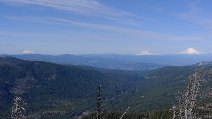
Augspurger Mountain
12.76 miles of hiking • 5000' elevation gain •
A friend and I hiked this trail shortly after the lower elevation snowfall last week. Once past the Dog Mountain junction, the trail had just a bit of snow for most of the way, with several inches at the higher elevations. We continued past the summit down to the opening with views of St. Helens, Rainier, and Adams. We did not have enough time before sunset to loop through Dog Mountain. We finished just as real darkness started to set in.
November 25, 2015


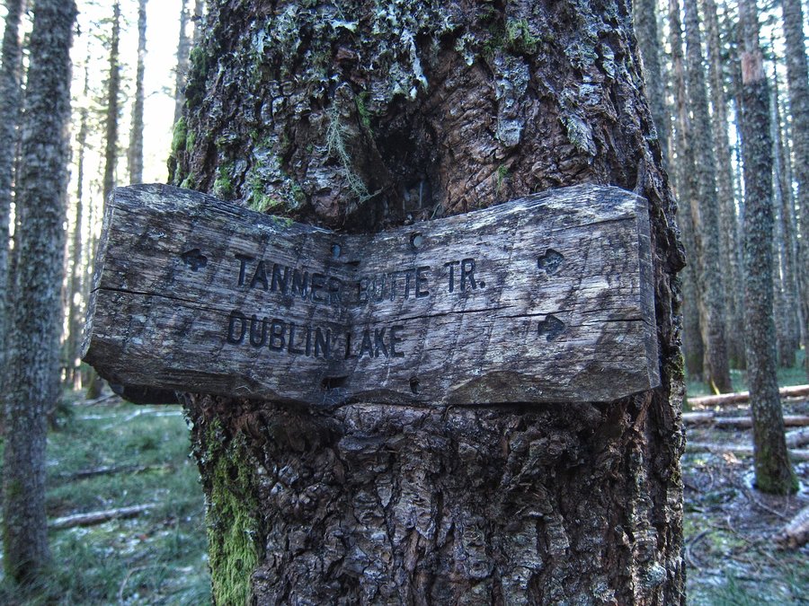
 3
3
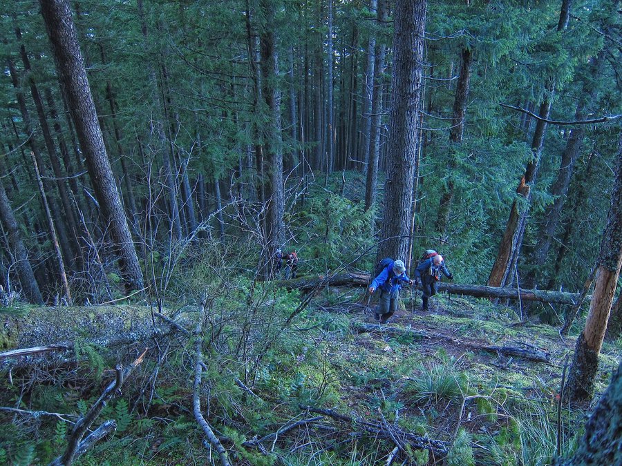
Tanner Butte from Eagle Creek
20 miles of hiking • 5250' elevation gain •
A really great day hiking with some wonderful people. Congratulations to Rhonda and Mark on their first 20 miler and congratulations to Jim on returning to the trail. It was a pleasure to meet all of you. And thanks again, Karl, for inviting us to join the hike!
November 21, 2015


Triple Falls +
6.96 miles of hiking • 1750' elevation gain •
A fun day visiting the gorge after the recent wind storm.
November 20, 2015

Nesmith Point
10.86 miles of hiking • 3750' elevation gain •
Part two of a fun day of post-windstorm hiking!
November 20, 2015


 1
1
Hamilton Mountain Loop
7.5 miles of hiking • 2000' elevation gain •
A quick hike in the rain. Hardy Creek was raging. We did not have any views, but, the clouds always add a unique element to a familiar trail. We saw about six other groups on the trail, who also appeared to be enjoying the day!
November 15, 2015


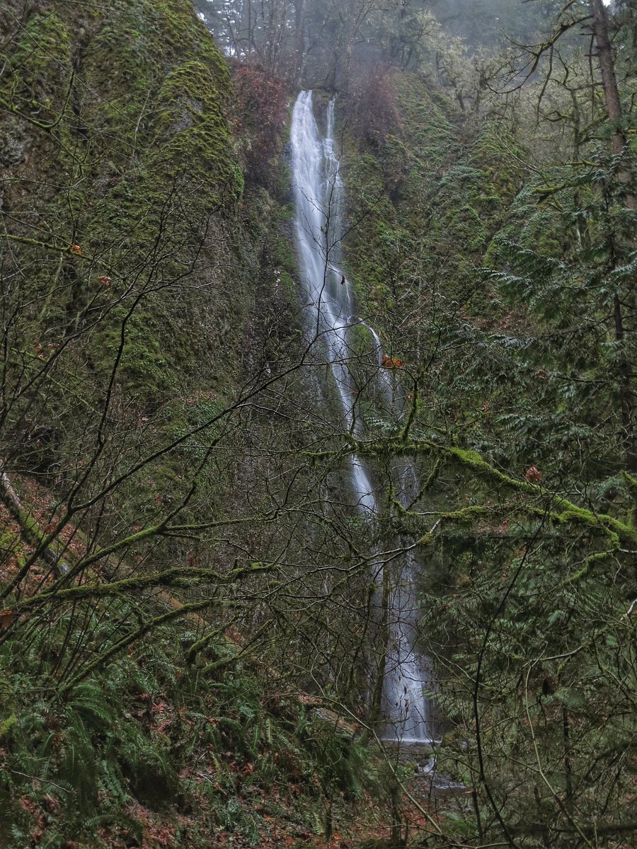
Waterfall Hikes
5.33 miles of hiking • 1500' elevation gain •
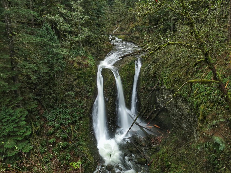
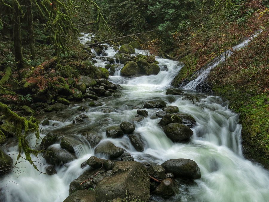
I wasn't feeling that great, so we went to see Tanner Creek and Wahclella Falls. We had not been on that trail in a very long time. The creek was full of water, and water was falling everywhere from the canyon walls. Quite a sight. It's pretty amazing what we have here in the Gorge! To our surprise, we saw only one other person. After finishing up, we went over to Wahkeena Falls trailhead and planned to hike over to Angels Rest and loop back from there. Unfortunately, once we finally cleared the Multnomah Falls junction and all of the people, I kept feeling bad, so we decided to turn around after reaching Wahkeena Spring.
November 13, 2015

 2
2
Larch Mountain from Multnomah Falls
14.38 miles of hiking • 4000' elevation gain •
A very rainy and cold hike from Multnomah Falls to Larch Mountain. No views at Sherrard Point, but Multnomah Creek was full of water again and the forest was foggy and lovely as ever.
November 8, 2015


 3
3
PCT (Lolo Pass) to short of McNeil Point
13.51 miles of hiking • 3000' elevation gain •
This was a late decision to hike up to McNeil Point before the snow starts to add up. We wanted something a little different, so we hiked the PCT from Lolo Pass instead of going up to Top Spur. This added 5 miles round trip and ate up a bit of time, but, it was a very pleasant forest hike, with a section that had a view of Mt. Hood. Once we were on the Timberline trail, we hit snow shortly after that ridge where the trail opens to views. The little lakes were already starting to freeze over. At the McNeil junction off of the Timberline trail, there was plenty of snow and the trail really wasn't visible from there on out. We got up the ridge, and the clouds just closed in on us even more, so, we decided not to proceed to McNeil Point, since there were no views, and it was getting late.
November 6, 2015


Cape Horn Loop
6.87 miles of hiking • 1750' elevation gain •
It had been a while since I hiked the loop. A beautiful sunny fall day with lots of maple leaf color.
November 4, 2015

Silver Falls
9.99 miles of hiking • 1500' elevation gain •
A day with waterfalls, fog, fall color, a little rain, and eventually, some sun. After taking the rim trail from Upper North Falls, I decided to go back into the canyon instead of continuing on the rim trail next to the road. I'm glad I made that decision, because as I approached South Falls, misty fog was forming around the falls just as the sun was nearing the canyon rim. A magical scene.
November 3, 2015

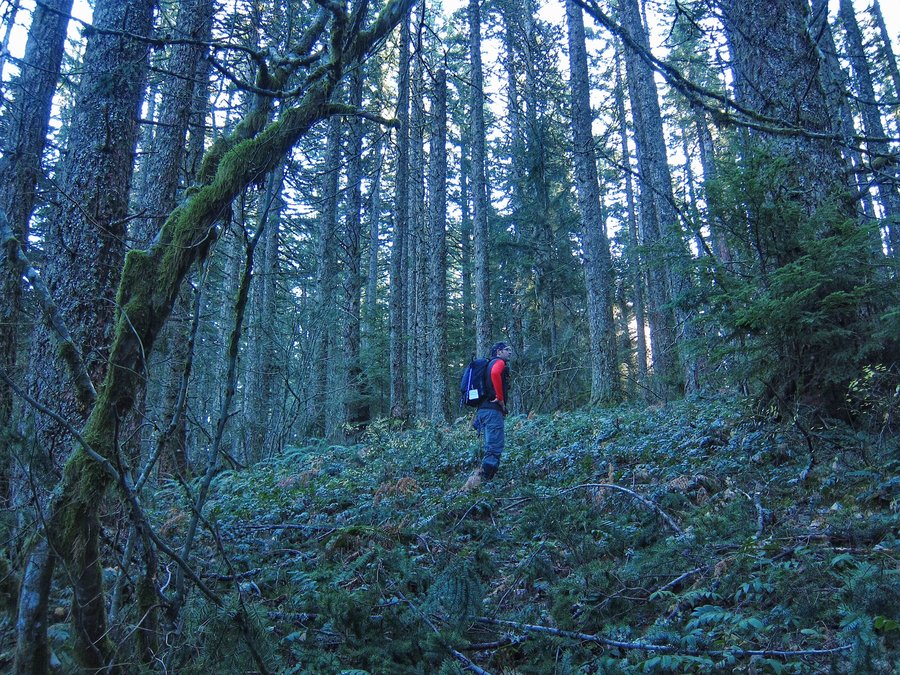
Boulder Ridge Trail
7.08 miles of hiking • 2250' elevation gain •
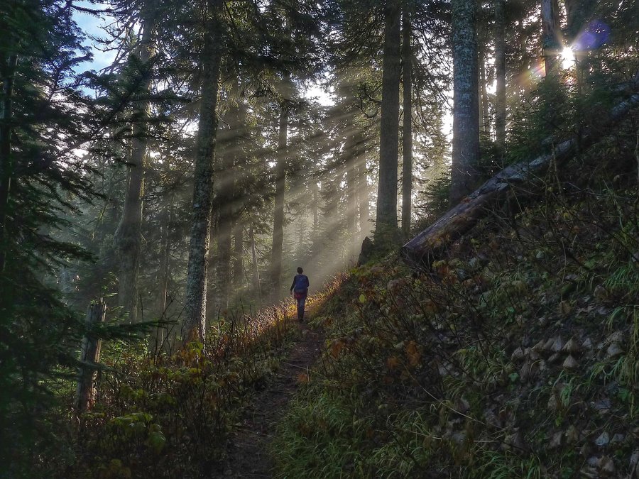
We were not intending to hike this day, but, a friend called, saying she needed to get out. So, we headed over to Wildwood and the Boulder Ridge Trail, intending to reach Huckleberry Mountain. The trail was cleared of all of the huge downed trees that we came across last winter. However, once we got about 3.5 miles in, and crested the ridge, the winds picked up, and the trees were really moving overhead. We continued for a while, but, we ultimately decided not to risk something falling on us, and turned around. Although we never made it to Huckleberry Mountain, it was a great day out, and we missed all of the rain. As soon as we reached the parking lot, the rain started really coming down.
October 31, 2015

Hardy Ridge Loop
7.3 miles of hiking • 2000' elevation gain •
It rained the whole time, we were soaked, we saw no views, but, it was a great time in the forest, catching up with a friend!
October 29, 2015


 3
3
Elk Meadows TH to Gnarl Ridge
11.51 miles of hiking • 3000' elevation gain •
We really wanted to visit a higher elevation before snow starts falling. We decided on Gnarl Ridge and got a pretty late start - around 11:00 am. We stopped at the meadow briefly, then reached the Timberline trail and Gnarl Ridge. We just saw a couple other people, who were on their way out. We continued up the ridge and a bit further - to about 7000 ft elevation. Those views sure are something! I'm never disappointed in this hike. The clouds started to break, giving way to a bit of blue sky. I think the views all around were more beautiful at this time time of year in this lighting than at the height of summer. The blue silhouette of the ridge lines and Mt. Jefferson in the distance were breathtaking! The lack of snow on Mt. Hood let us see all its colorful rock. The western larch trees on the east side of Mt. Hood are in full swing, so the hillsides had some specks of gold. We also could see what we thought was a fire (possibly the small fire in the Badger Creek wilderness? or a prescribed burn?). A great day to visit the mountain.
October 24, 2015


 1
1
Burnt Lake and East ZigZag Mountain
10.32 miles of hiking • 2500' elevation gain •
A great day enjoying Mt. Hood views on a trail we hadn't visited for a couple of years. On the way out, we ran into Karl and Harleigh! So awesome!
October 23, 2015

Easy Pass
8.34 miles of hiking • 3250' elevation gain •
The larches were pretty much done, but the view of Mt. Logan and the Fisher Creek basin- so nice! We continued up Ragged Ridge a bit for some more views.
October 17, 2015

Blue Lake
4.94 miles of hiking • 1000' elevation gain •
We still had some time, so we ran up this trail around 4:00 pm, as the crowds were pouring out. Lots of larches, past prime, with a good many having lost their needles.
October 17, 2015

Stiletto Peak former lookout site
10.35 miles of hiking • 3750' elevation gain •
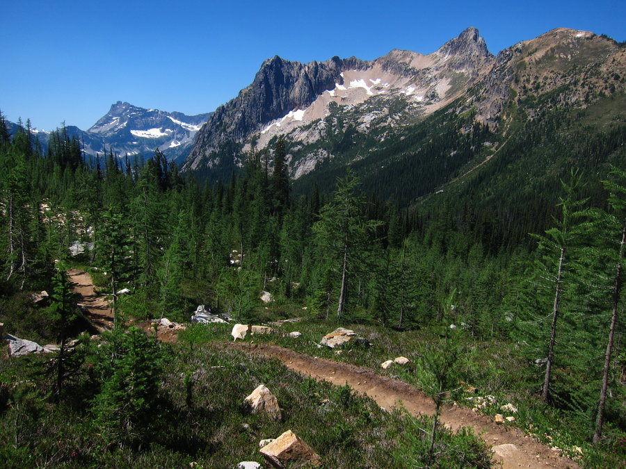
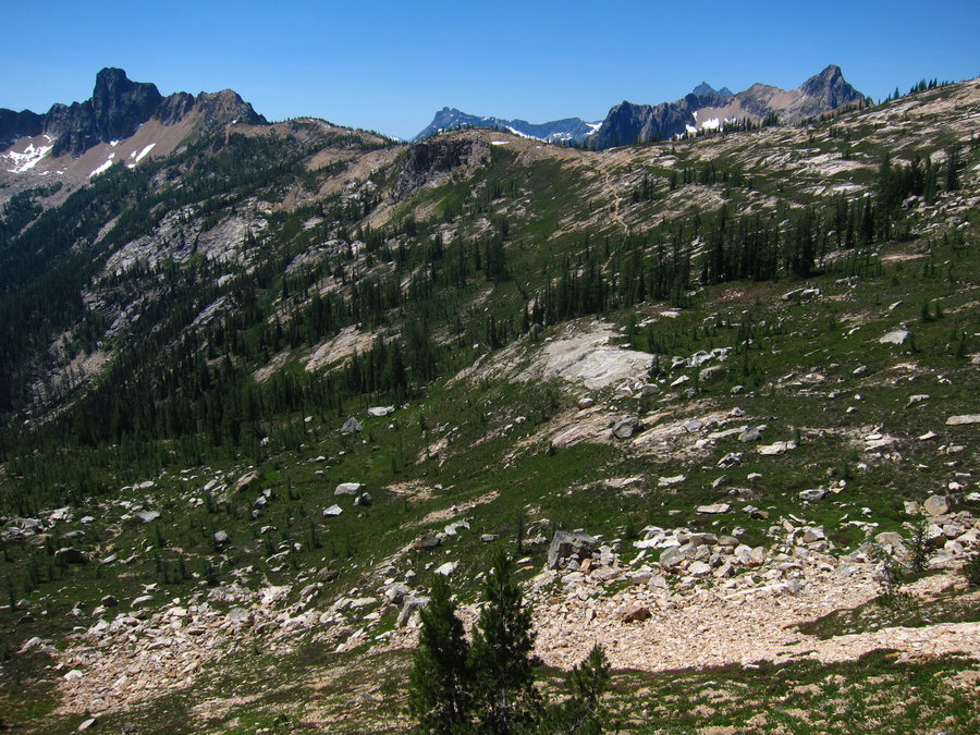
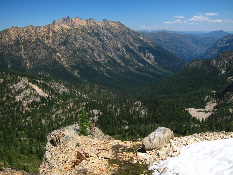
We started at the Bridge Creek trailhead, got on the PCT and immediately ran into a through hiker who needed to finish up in two days so he could catch his plane back home. Hopefully, it worked out for him! After a few different junctions, we reached the spur trail to the former lookout, which is no longer maintained. The brush (including the devil's club) had mostly died off, so we had no problems with the trail. We could see how it would be pretty overgrown in the summer. On the ridge climb up, there were some fallen trees, but nothing bad at all. Once you reach the rocky meadow area, the trail becomes more faint. We were able to follow it though. Cairns were also here and there to help mark the route. We reached the lookout area and really enjoyed the 360 views! Most of the larches had lost their needles, but there were still some golden ones in the meadow below Stiletto Peak, which is over a bit from where the lookout sat. We could see the route over to Stiletto Lake, which we visited on an abandoned trail from Twisp Pass last year. We chatted about coming back someday to do a loop through the lookout site to the lake and Copper Pass. This is a great a hike, that apparently does not get much use any more. The two hiking books we had (the old 100 hikes guide and the current day hiking North Cascades) both said that the round trip mileage would be about 14 miles. Our GPS had significantly less mileage - around 10 miles, which seemed way more accurate to us. Overall, we had a blast, all by ourselves, on a great old trail.
October 16, 2015

Esmeralda Basin to Fortune Pass and Lake Ann
9.82 miles of hiking • 3000' elevation gain •
The trailhead had about 20 cars parked there when we arrived around noon on a Thursday. We suspected everyone was at Lake Ingalls. We opted for the quieter hike to Lake Ann and we had the whole trail to ourselves. Around Lake Ann, a few larch trees were still golden, but most had lost their needles.
October 15, 2015

Metolius River Trail
5.82 miles of hiking • 500' elevation gain •
I was pleasantly surprised by this trail. I hiked up and down river from the hatchery. Most of the leaves were turning brown and falling off, but still some color out there. On the drive out, I noticed that the western larches around Camp Sherman were turning golden. There were quite a few of them in that area, especially near the Lake Creek Trail. If I had more time, I would have enjoyed hiking the Lake Creek Trail and checking out the trails in the Metolius Preserve, which is owned by the Deschutes Land Trust.
October 13, 2015

Clear Lake Loop
4.82 miles of hiking • 500' elevation gain •
I hoped to see fall colors at the lake, and probably missed the best of it by a couple weeks. But, a good deal of color was still out and the lake was lovely, as usual.
October 12, 2015
 2
2
Above Multnomah Falls
10.88 miles of hiking • 3000' elevation gain •
We planned on hiking up to Larch Mountain from Multnomah Falls. But, we reached the area where the Larch Mountain trail breaks into the scree and it was raining, so we decided to just head over to Multnomah Basin instead. We got on the Franklin Ridge trail and then cut over on the path that goes to the Nesika Lodge area. We also detoured on to the ornament trail and then headed back down to the trail head. We spent a lot of time on the way back enjoying the creek. Lots of mushrooms and fungus bursting out everywhere, as well. We looked for the elusive hydnellum peckii, which we have been trying to find for some time now. We thought we had found it, but we think what we found were a type of bracket fungus with some similarity to hydnellum peckii.
October 9, 2015

Sol Duc to beyond Appleton Pass Camp
16.38 miles of hiking • 4000' elevation gain •
We really enjoyed this hike. The first 5 miles is along or near the Sol Duc River in beautiful forest. We saw a lot of backpackers coming out from camping along the High Divide loop, which is also a great hike (we day hiked it a few years ago). At 5 miles, we reached the Appleton Pass trail junction, and once on that trail, we only saw one other set of hikers. Within a mile or so of the pass, the forest starts to open up more, with some small meadow type areas. We continued beyond the pass, on the boot trail to Oyster Lake, and a bit beyond Appleton Camp. The views were best beyond the pass. The huckleberry leaves were still around for the most part, but we missed the prime color by a couple weeks. We did not have enough time that day to continue on the way trail any further- we will be back some day to do the traverse through Spread Eagle Pass to connect to the High Divide.
October 4, 2015

October 3, 2015

Lower Big Quilcene
4.03 miles of hiking • 500' elevation gain •
Cloudy day hike. The first part is a trail made of an old road. It was a pleasant forest walk, but, the trail was high above the river. We were hoping the trail would be closer to it. After two miles, we still had not neared the river, and glanced at the map. It looked like it would eventually meet the river at some point, and then move away from it again. Maybe we should have given the trail more time, but we decided to do something else.
October 2, 2015


Stuart Lake TH to Horseshoe Lake
13.68 miles of hiking • 3500' elevation gain •
For some time, I had wanted to go to the lake beyond Stuart. The way there is not on an officially maintained trail. The last .8 of a mile gains about 1100 feet. Fun! There were only a couple of people at the lake, who soon departed. We enjoyed craggy mountain views and golden needles!
September 27, 2015
 1
1
Chatter Creek to Icicle Ridge and Lake Edna
12.15 miles of hiking • 5500' elevation gain •
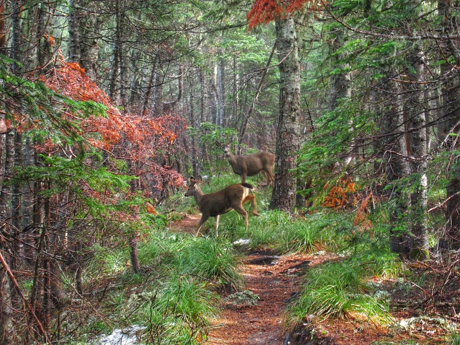
The Wolverine fire impacted my plans to check out some hikes with larch trees at the end of Entiat River Road. With that area closed and maybe even burned, we decided to try out some hikes in the eastern part of the Alpine Lakes Wilderness. We decided to climb up the Chatter Creek trail and go over the ridge on the Icicle Ridge trail to Lake Edna. Once we gained the ridge, there were a ton of larch trees in the basin on the other side. The trail meanders through them and through beautiful meadows. The larch trees were getting golden, but many still had some green in them. This is actually my favorite time to see them, when there are all kinds of variation of yellow and green out there. When combined with the red huckleberry and oranges in the dying vegetation in the meadows, it was perfect, even though there were clouds out and lighting was poor. We continued on to Lake Edna, where it was incredibly windy and cold. We decided not to continue to Cape Horn and Ladies Pass, since it was so cold and there were probably no views at the pass. This was a pretty steep hike with a good amount of elevation gain. We only saw one other group of day hikers. The other few folks we saw were backpacking. I thought we were having a difficult time because we had taken some time away from hiking for a few weeks but, when I saw the elevation gain on our gps track, I could see why we felt a little tired. But, it was well worth the sweat!
September 26, 2015

Mathieu Lakes Yapoah Crater Collier Cone
17.59 miles of hiking • 3500' elevation gain •
We parked at Dee Wright and took the PCT to the Matthieu Lakes trail, eventually getting back on the PCT to go out to Opie Dilldock Pass. We stopped at Yapoah Crater and hiked to the top along the way. We had not intended on hiking to the top of Collier Cone, but we went up a bit to see a better view of North Sister and kept climbing the ridge, so we just continued around the cone. It was a great day - perfect weather and views!
September 7, 2015
 1
1
Badlands Rock Trail - Flatiron Rock Trail Loop
10.66 miles of hiking • 500' elevation gain •
The Cascades were socked in and rainy, so we headed over to the Badlands Wilderness to enjoy complete quiet and an empty trail, despite seeing cars at the first trailhead and horse trailers at the trailhead where we parked. This hike was a great variation from mountain hiking. We enjoyed spending the day with twisted old juniper trees, sagebrush, and lizards!
September 6, 2015

September 3, 2015

Eagle Lake TH to Upper Velma Lake
10.24 miles of hiking • 2250' elevation gain •
Quick hike while in Tahoe to Upper Velma Lake. It was a weekday, so the trail was not crowded. I bet it is very busy in the height of summer here. Poor planning on my part by not junctioning with the PCT and doing the loop through Fontanillis Lake.
September 1, 2015

North Lake
13.19 miles of hiking • 2500' elevation gain •
With limited access to the internet, we were having a difficult time in deciding where to hike to avoid smoky conditions. We ultimately decided to hike up to North Lake from the Gilbert TH at the end of Twisp River Road. We were the only ones at the TH around 11:00 am. It was really hot and windy out. I had a bad feeling about this day, and a number of times we considered not doing the hike or even turning around once we got started. We even started out by hiking in the wrong direction, a mile out on the trail that leads to Twisp Pass, even though we had previously hiked that trail and should have known better. We eventually got back on track and made it up to North Lake. We had clear, beautiful skies, and the lake was lovely. I still wasn't feeling comfortable about the hike, so we did not stay long and we quickly hiked back to the TH. When we arrived at the car around 5 pm, after a few moments, we saw a note on our windshield. It was from the forest service ranger advising that a fire was approaching and provided the name of the area of the fire and the name of the road we needed to take for evacuation. Oh my. It was intense for us at that moment. Once we got out the road maps (thankfully, we had a few and a full tank of gas), we located the area of the fire and our route out. We were very thankful for the note from the ranger. When we made it out, we were south of Carlton and Twisp and cars were streaming along 153 to the south. Unfortunately, we were camped along Highway 20 above Winthrop and could not get back there, so this basically ended our vacation. As we were driving south to Wenatchee, truck after truck of brave firefighters raced by us. It was surreal, with smoke from the Twisp and Chelan fires in every direction. Once out of the area, we were really sad to learn that three firefighters had died fighting that fire. We hope things calm down for the Methow Valley area soon. Very sad.
August 19, 2015
 1
1
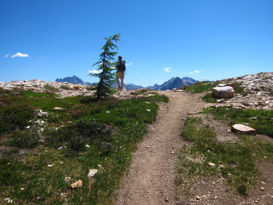
Lewis and Wing Lakes - Heather and Maple Pass Loop
12.63 miles of hiking • 4250' elevation gain •
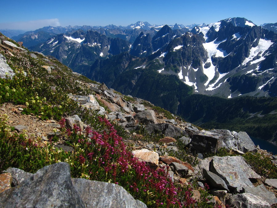
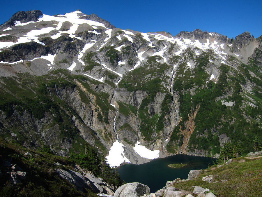
In an effort to hike some areas without smoke, we decided to drive up to the east side of the North Cascades. This decision ended up not being a very good one. But, on this day, we had a nice hike. We hiked up to Heather Pass and continued on the boot path from there in the direction of Lewis and Wing Lakes. There is no official trail to the lakes, but there is a well worn path to them. You do have to cross a number of very large boulder fields and a small, loose dirt gully area on the way to Lewis Lake. There are cairns along the way to help with navigation, but you can see Lewis Lake for most of the time. Some of those boulder sections were a bit intimidating with very steep boulder ridges directly above as you pass through. Lewis Lake was beautiful. We continued on the steep climb from there to Wing Lake. Most of that climb is along a well worn boot path. Wing Lake was amazing. Views of Black Peak and all around the area were fabulous. To finish our hike, we retraced our steps to Heather Pass and finished the loop through Maple Pass.
August 18, 2015

Enchantment Lakes day through hike
19.82 miles of hiking • 5500' elevation gain •
We got a shuttle from the Snow Lakes TH to Stuart Lake TH and set out at 7:00 am. We got to Colchuck Lake before 9:00 am and after a break, we started to climb Aasgard Pass by 9:30 am. As we climbed, it became apparent that the smoke from the nearby fires would be impeding views at the top of the pass. We hoped the lakes basin would not be smoky, but, it was. To our surprise, the basin was pretty quiet and we did not see many hikers or campers beside the couple other through hikers until we reached Perfection Lake. Despite the smoke, we had a great time wandering around and enjoying the cascading water everywhere. We saw a number of mama goats with little babies. Eventually, we reached Lake Viviane and began the long descent back to the Snow Lakes TH.
August 16, 2015

Schaefer Lake
9.07 miles of hiking • 3000' elevation gain •
This was the first hike on our hiking vacation week. You have to cross the bridge-less Chiwawa River in the beginning of the hike. On the way in, we followed the maze of downed logs until we reached the other side. On the way back, we just removed our shoes and walked across. There were a ton of very tiny baby frogs. So cute. Schaefer Lake was quite beautiful. It felt like fall and the huckleberry bushes were turning red. On the ridge, we could see significant smoke from the Wolverine Fire, which caused us to reconsider our plans for more hikes in the Glacier Peak wilderness. As of today, this trail is closed due to evacuation of the Chiwawa River drainage, since the fire is now proceeding in that direction.
August 15, 2015


Thomas Lake TH to Bear and Elk Lakes
12.04 miles of hiking • 1500' elevation gain •
We started at the Thomas Lake TH and intended on getting to Lemei Rock, but we were majorly sidetracked by ripe huckleberries!
August 9, 2015


Walupt Lake to Cispus Pass
14.11 miles of hiking • 3500' elevation gain •
A quick hike up to Cispus Pass. The weather was not great, but Curtis Gilbert, the Goat Rocks massif, and Ives Peak were visible. Great scenery- we wished that we had better weather so that we could spend more time there and go down into the basin. The many huckleberries bushes along the lower reaches of the trail and along Nannie Ridge were pretty much devoid of berries.
August 2, 2015


Box Canyon to Indian Bar
15.77 miles of hiking • 4750' elevation gain •
We hiked the Wonderland trail from Box Canyon to Indian Bar. The flowers were all gone and the meadows were getting pretty dry. It was a beautiful hike, but, it would be really nice to hike it when the wildflowers were at peak. It was a very hot day, and the trail has some elevation gain and up and down moments, including a 500 foot drop into Indian Bar. We planned to go to Panhandle Gap, but, it was so hot that we decided that Indian Bar was enough for the day. We filtered some water at Indian Bar for the hike back and enjoyed many huckleberries along the trail back to the trail head.
August 1, 2015


 1
1
S. Fork Imnaha River to Blue Hole
4.66 miles of hiking • 500' elevation gain •
The Wallowa Mountains were socked in with low clouds, so we headed east and found sunshine along the S. Fork Imnaha River. It was a bit of a drive from Joseph, so we only had time for a short hike. The trail goes through an old burn area and it is brushy. The trail is some distance away from the river and you need to cut down a side trail to see the Blue Hole section.
July 26, 2015

Laverty and Chimney Lakes
11.01 miles of hiking • 2500' elevation gain •
We hiked to Laverty and Chimney Lakes from the Bowman Trailhead. We did not get an early start due to our hiking activities from the prior day. Our intent was to go further along the trail to Hobo Lake, but dark clouds moved in. The ridge up to Hobo Lake did not have tree cover and Hobo Lake itself is pretty exposed, so we decided not to risk getting caught in a thunderstorm there. It was a little disappointing. But, we are definitely interested in re-visiting the area sometime on a backpack loop to Steamboat and Swamp Lakes. The trail was pretty quiet, but, we saw a fair amount of people camping around the lakes.
July 25, 2015
 3
3
W. Fork Wallowa River - Lakes Basin Lollipop Loop
27.91 miles of hiking • 4750' elevation gain •
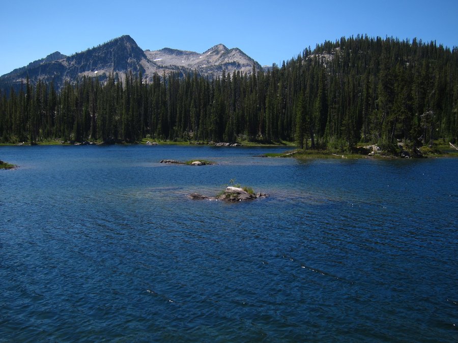
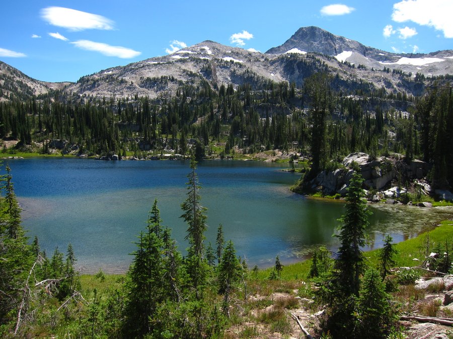
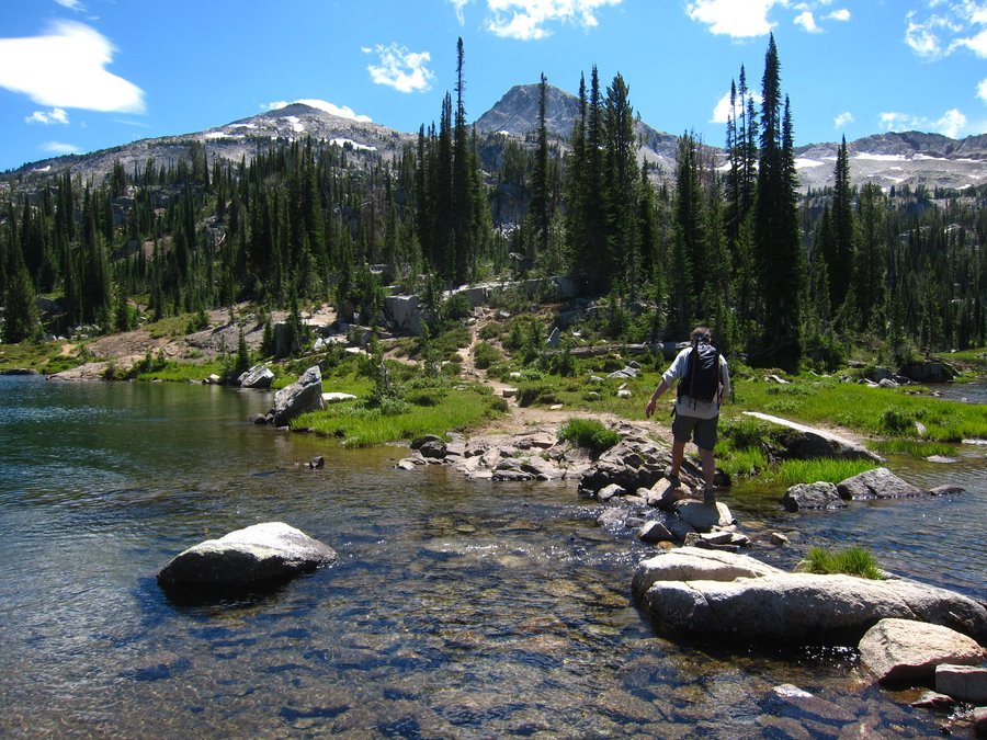
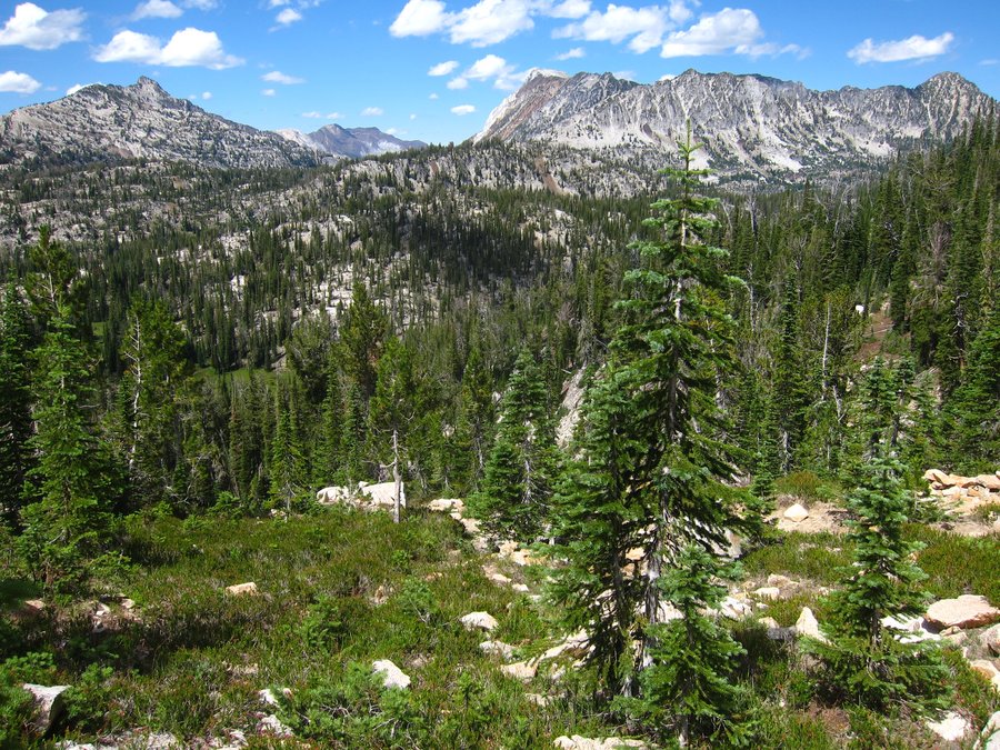
We've been to the Wallowas a few times, but never made it up to the popular Lakes Basin area. We knew we were going to have good weather on Friday, but the rest of the weekend looked doubtful. So, to get some bang for our buck, we did what may be unthinkable sacrilege to many - we day hiked the Lakes Basin area. We sure were hoping that our maps and Sullivan's book were accurate on the mileage! We went up the W. Fork Wallowa River trail to Six Mile Meadow to the junction to start the Lakes Basin Loop, then meandered through the beautiful lake areas and meadows, climbed up over Glacier Pass, dropped down to Glacier Lake (amazing!),continued down past Frazier Lake (really beautiful), then closed the loop. It was a blast! Sure, it would have been great to spend more time there - but, this gave us an idea of the amount of people in the area and some ideas for what we would want to do on several days of backpacking there. The trail from Glacier Pass back down to Six Mile Meadow had a bit of brushy overgrowth, and it was so quiet - we saw no one until right around the meadow. We did have to take off our shoes to cross the river where the trail crosses it beyond Frazier Lake. Overall, the elevation gain was spread out on the hike and it was not too much for us. Going up over Glacier Pass was a little rough after about 14 miles of hiking, but it was mostly all down hill after that! A really great day for us!
July 24, 2015


Green Lakes TH to Golden Lake
18.39 miles of hiking • 2750' elevation gain •
I wanted to visit Golden Lake, but, I was not close to the trailhead where the hike would be the shortest. I would rather hike than drive, so I decided I would take the popular Green Lakes TH to Green Lakes and over the ridge to Golden Lake. The parking lot was full at 9:00 am and I prepared for lots of people, but, it was surprisingly quiet. I didn't see many people on the way up to the Green Lakes area and, then hardly any past that. There were some people setting up camp at Golden Lake. I went up to the ponds above Golden Lake and they were just beautiful. The creek and meadow area through there were wonderful with the view of the Sisters, and a marmot scurrying around. After getting back to the main trail after visiting Golden Lake, I thought about going to Park Meadow, but, feeling tired from a few days of hiking, I turned back toward the trailhead. The way back to the Green Lakes area was really something for me. I didn't see anyone and I had quiet moments at all of those lakes. I really love the northernmost lake, even though it does not have the backdrop of South Sister or Broken Top. There are so many colors of green in that lake - emerald, turquoise, yellow green, and it seems, everything in between. I could not believe the solitude I got - it was the best time I have ever had in that area. Once back on the trail down from the Green Lakes area, I crossed paths with a number of hikers and backpackers. At the trailhead, I noticed that the Forest Service is putting in some effort to control parking in the parking lot. There were a number of signs saying that you could only park in designated parking spots. I also saw some cars with warning notices of $125 fines for having backed in to park against the curb for the RV/trailer spaces.
July 19, 2015

Six Lakes TH to Cliff Lake
14.49 miles of hiking • 1500' elevation gain •
This is a long forested hike with access to many forested lakes. Blow Lake is only a mile from the TH, and Doris Lake is only 2.5 miles from the TH. Most people seemed to visit these lakes. I made it to Cliff Lake and I wanted to go to Porky and Mink Lakes, but, the hike was pretty boring through the woods. I was making good time and there is not a lot of elevation gain, but, I just lost interest. I would like to see many of the other lakes, but, I would do that as a backpack or at least have a companion with me on a long day hike.
July 18, 2015

Sisters Mirror Lake Wicikiup Plain Loop
11.99 miles of hiking • 1250' elevation gain •
I hiked a loop from Sisters Mirror Lake TH out to the lake, then along Wickiup Plain, and back down.
July 17, 2015

South Sister
11.74 miles of hiking • 5000' elevation gain •
I hiked to the top of South Sister from Devil's Lake TH. It was a first time for me. I got a very late start and had a quiet walk up to the lake below Lewis glacier, where I found a number of other hikers. Clear skies, great views at the summit. It was great to finally do this one, but I was disappointed to not have my husband there to enjoy it with me!
July 16, 2015

Soda Peaks Lake from Trapper Creek TH
10.12 miles of hiking • 2750' elevation gain •
A friend was joining us on this hike and we were hoping to find a quiet, moderate trail with few people. We thought Trapper Creek wilderness would be a good area on a Sunday. I did see Karl's post on this hike, but did not have the time to read it. So, we were a little surprised by the steepness of parts of the trail! It was ok, though, since we only saw one other group on the trail, and we had the lake to ourselves. A great day out for us! Plus, there were ripe huckleberries around the lake.
July 12, 2015
 1
1
Tilly Jane Trail to Cooper Spur Shelter
8.41 miles of hiking • 3000' elevation gain •
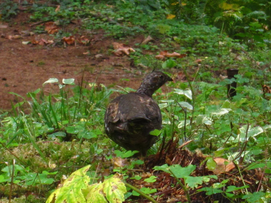
With the clouds and weather, we waited around trying to decide what to hike. We had already nixed our intended hike. Finally, at 3:00 pm, we decided to just hike from Tilly Jane trailhead to Cooper Spur shelter. It was a good choice, and we had sunshine and views of Mount Hood the whole time. When the Tilly Jane trail first breaks out of the woods into the burn area, we saw many old beargrass flowers everywhere. I was disappointed we didn't see it when they were in bloom, it would have been great! The old burn area had a lot of flowers blooming, especially some yellow ones we were not familiar with. We saw some good patches of lupine and a little paintbrush as well. Lots of life in that burn area - many birds and chipmunks making noise and moving about. We also came upon a grouse right off the trail and it did what they usually do - wait until you are about a foot away from it and then pop up quickly, (which always startles me) and fly away. But, this one was a mama grouse, so she just flew over to a branch on a nearby tree. With each of our next steps, five little baby grouses popped up one by one and flew in the direction of mama. They were so cute! Once back in the forest, there seemed to be a lot of campers around the Tilly Jane Shelter and Cloud Cap area. We got up to the Cooper Spur shelter and then walked on the user trail to the right that goes on a small ridge toward Eliot Glacier. With the late start, it was a pretty quiet day on the trail, and we did not see anyone on the Tilly Jane trail on the way up or down.
July 11, 2015
 1
1
Paradise Park from Timberline
14.62 miles of hiking • 3500' elevation gain •
The Timberline Lodge cameras showed mostly blue skies, so we decided to hike from there to Paradise Park. We saw many people on the trail, including some large groups. Once in Paradise Park, we headed up the trail that goes up near Mississippi Head first, had a moment to enjoy the view, and then continued on back down to do the loop. The flowers are moving on already in many areas. Lots of aster, a bit of paintbrush, lots of pasqueflower seed heads. Didn't see much lupine. Beside the uphill on the way back, it was a great day, with mostly sunny skies.
July 10, 2015

Ross Dam TH Big Beaver Trail Greenpoint Camp
9 miles of hiking • 1500' elevation gain •
It was going to be another hot day, around 96, so we decided to hike a trail near one of the lakes. We parked at Ross Dam TH, hiked down to the dam, crossed it, hiked to Ross Lake Resort to check on canoe prices, hiked the Big Beaver trail, hoping to get to a point to see up Ross Lake. We realized that we weren't going to make it to any such point, and turned around and dropped down to Greenpoint Camp. We found a nice spot there to hang out and take a dip in the lake.
July 5, 2015


Rainy Pass to Snowy Lakes
20.42 miles of hiking • 3750' elevation gain •
We had other hikes in mind, but, they had some large elevation gains, and we didn't want to do them in above 90 degree weather. So, we decided to day hike the PCT and on up the spur to Snowy Lakes. We had been to Cutthroat Pass once before when there was snow on the trail. It was great to see it without snow and with wildflowers blooming, especially heather. Beyond Cutthroat Pass is some really spectacular, above timberline ridge hiking. So cool! It is hard to believe that this area is not protected as wilderness or something else. The snow patch that apparently stays around for a while every year was there just before dropping down to Granite Pass, but, it was fairly small and easy to get around. We only saw one other group beyond Cutthroat Pass, so we were surprised to see a number of people at the lakes. There were also a lot of mosquitoes and they were very hungry. A really great hike!
July 4, 2015


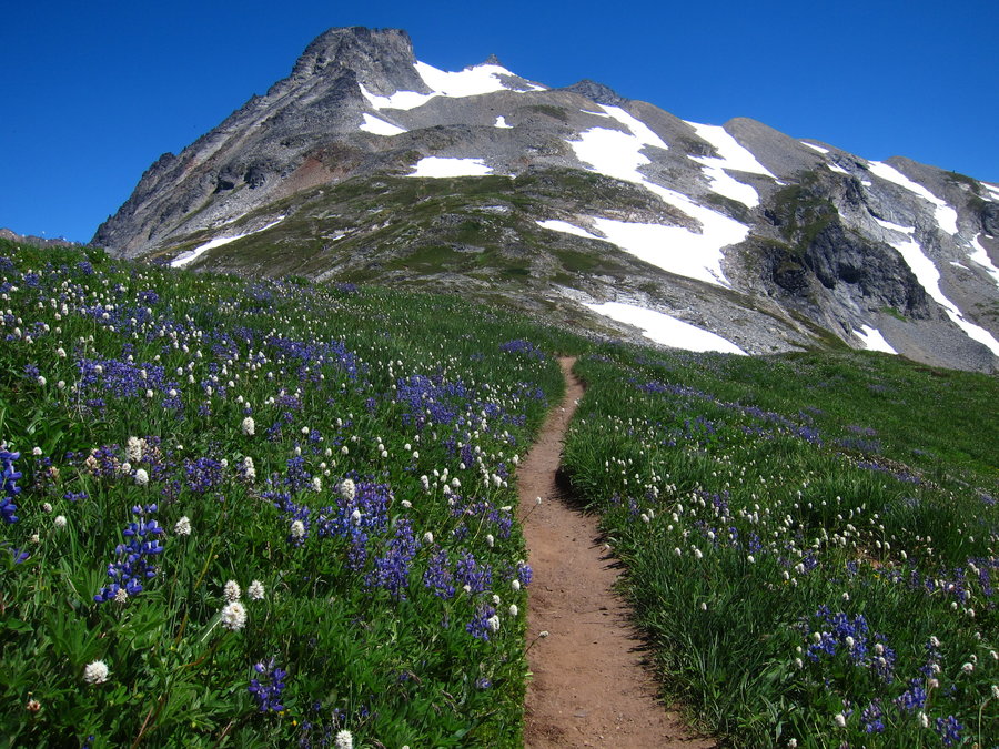
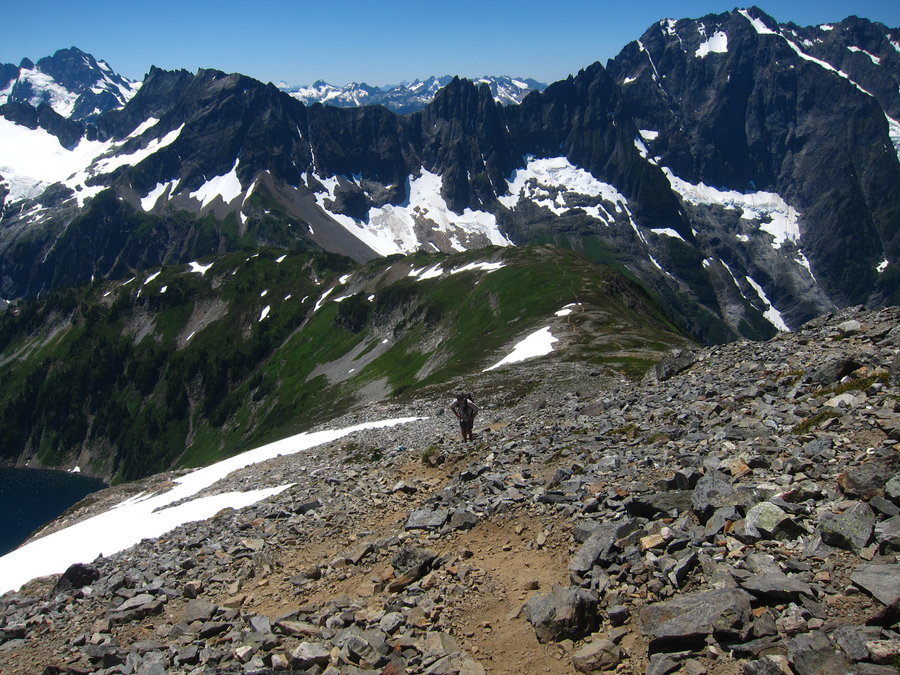
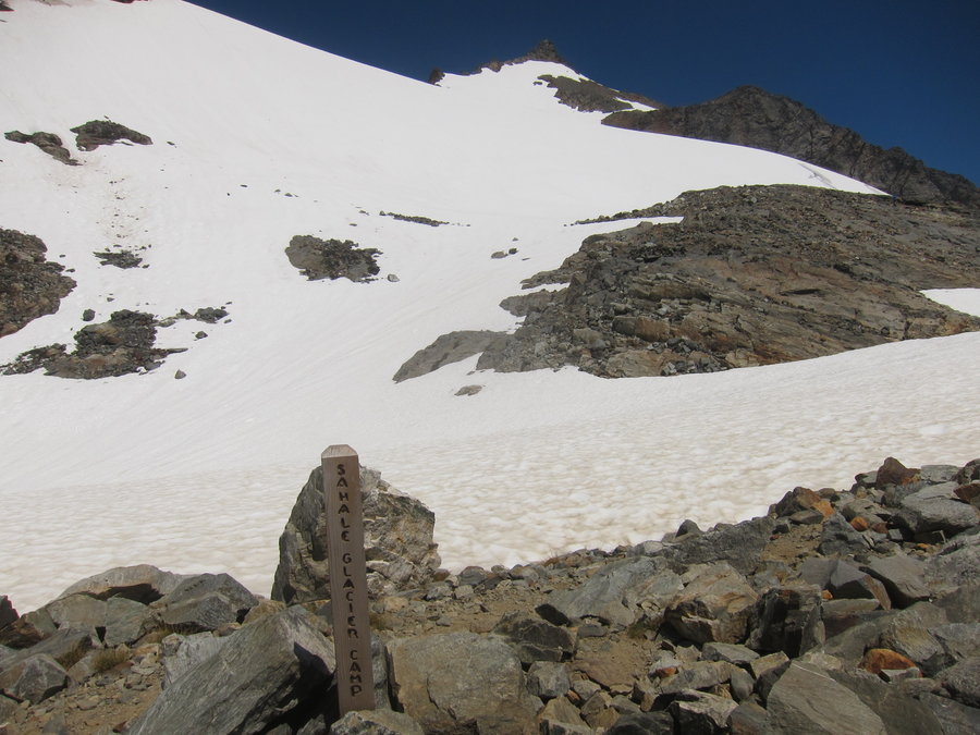
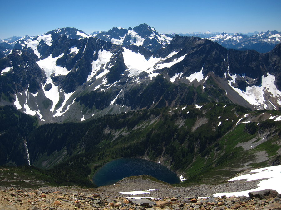
Cascade Pass and Sahale Glacier Camp
12.24 miles of hiking • 4250' elevation gain •
We hiked this trail on Friday, hoping crowds would be thinner than the last time I hiked the trail, but they weren't, really. This is a great hike, though, and worth giving up the solitude. A good portion of the crowds do drop off after Cascade Pass, and as you continue up Sahale Arm. No snow on the trail that I can remember. Views from Sahale Glacier Camp are really spectacular. We could see a fire in the distance toward Lake Chelan. There were human habituated goats up at the camp and along the trail up the Arm looking for salty urine and gear. We had to move off trail to give them space because they weren't moving when they saw or heard us. We had a wonderful day in a beautiful place.
July 3, 2015


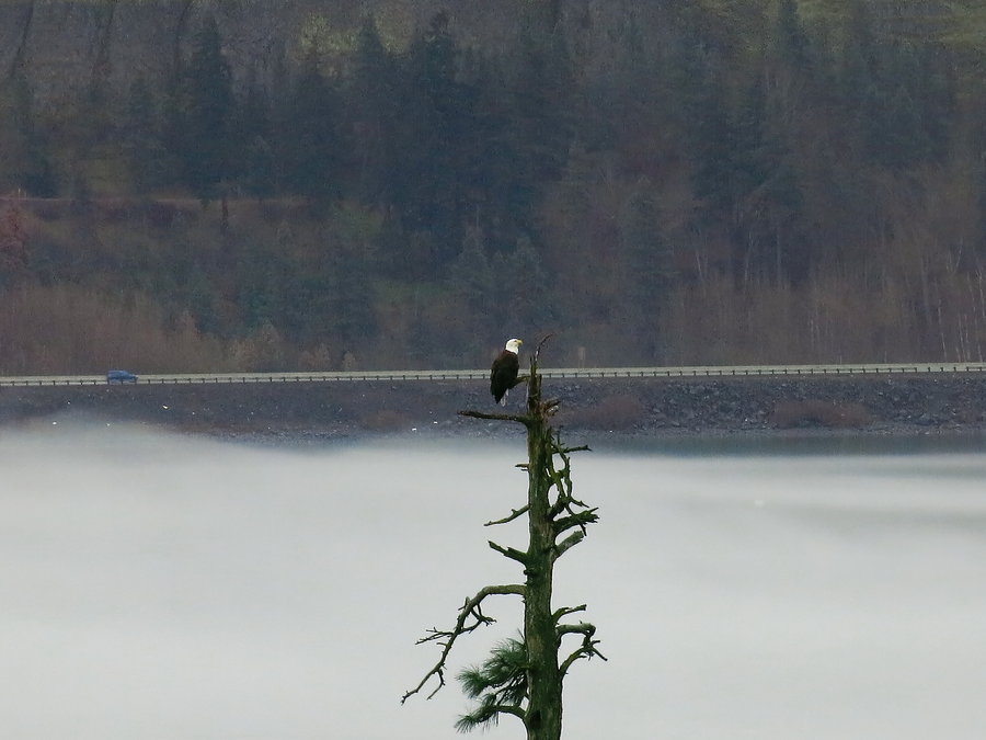
Striped Peak
5.34 miles of hiking • 1250' elevation gain •
Clouds had rolled in over the Olympic Mountains, and we didn't want to risk getting into a lightning storm in the high country, so we decided to check out the Salt Creek Recreation Area. We spent some time on Tongue Point checking out the tide pools, where we saw a couple of otters near the rocks, who were curious about us and were peeking up from the rocks at us. A bald eagle swooped down right over us to the nearby sea stack, and it was finally chased off by some ravens. So cool! The Salt Creek area was also the site of a WWII artillery camp, and there are bunkers, where there were two fixed gun batteries. We toured through the military area, and then we made a quick hike up to the top of Striped Peak. It was a nice forest hike up to a small viewpoint, where we could see out over the strait to Vancouver Island, the San Juan islands and, we think we could even see a bit of the mountains in Canada (maybe Whistler?). We also saw Mt. Baker, but visibility was limited due to clouds. There apparently is also a road to the top of the peak, so at the end of the road, there is the usual trash and burn pile that you typically see. On the way back, we dropped down to Hidden Cove, which was a really nice small beach cove.
June 28, 2015

Royal Lake and Upper Royal Basin
16.62 miles of hiking • 3750' elevation gain •
This is a fabulous hike and I would definitely like to spend a night or two in Royal Basin someday! It is in the national park, so there is limited, permit only camping. The first 3 miles of the hike walk first near the Dungeness River and then Royal Creek, which are beautiful. Then, it goes into and out of brushy avalanche slopes and forest, finally reaching a meadow and then Royal Lake. The elevation gain is spread out over the distance of 7 miles, so the grade never really gets steep up to Royal Lake. We then pushed on up to Upper Royal Basin. The hike up to there is steeper and about another mile, but, this is the place to reach! So incredibly beautiful with Mt. Deception and the Needles and the most turquoise lake and small ponds. We wandered around there for a while (keeping on the rocks and off the plants) and soaked our feet in the lake, while butterflies landed on us. We didn't even give any care about the mosquitoes and flies biting us because the place was so lovely!
June 27, 2015

Lake of the Angels
7.13 miles of hiking • 3500' elevation gain •
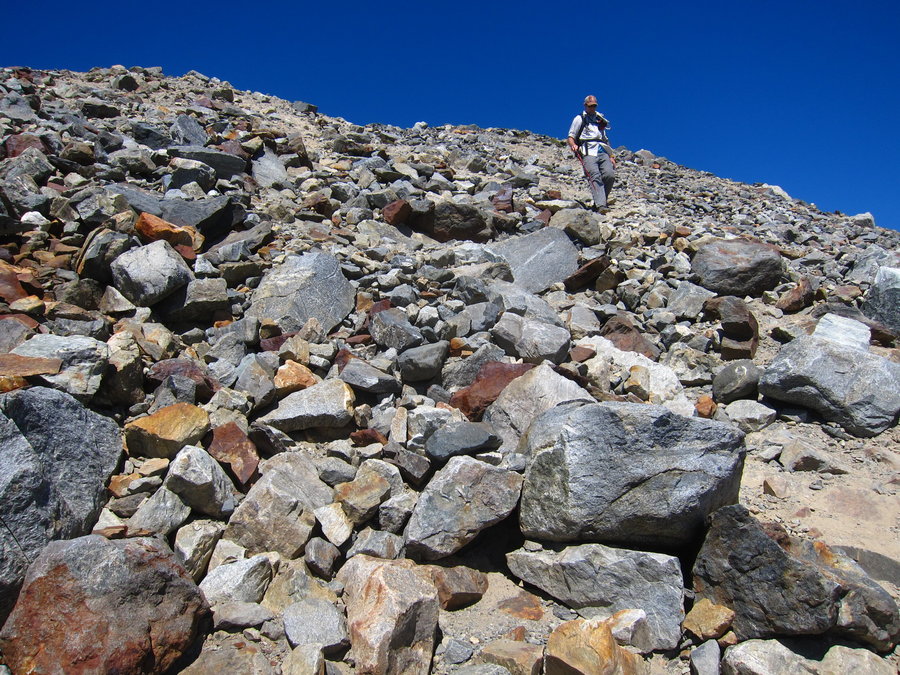
We hiked the Putvin Trail up to the Lake of the Angels. The hike does get pretty steep going over the head wall and it was challenging in the heat. There was no snow anywhere. Despite seeing recent photos with goats near the lake, hoof marks in mud and goat fur on vegetation, we didn't see any goats. The lake is quite lovely and the water was fairly warm. We started late, so we did not have time to explore the ridge above the lake or hike toward Mt. Skokomish or Mt. Stone. We saw just a few people on the trail. Unfortunately, we did see human waste and toilet paper right on the side of the trail, above the head wall, and next to a small drainage stream crossing the trail. Ugh!!!
June 26, 2015

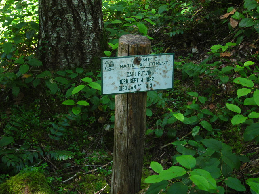
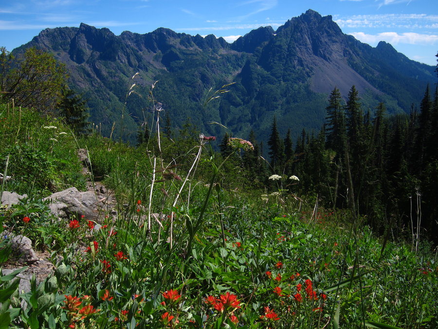
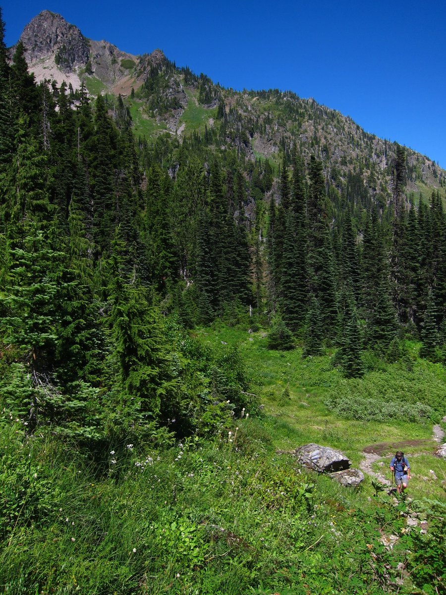
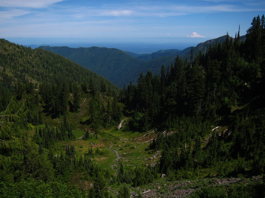


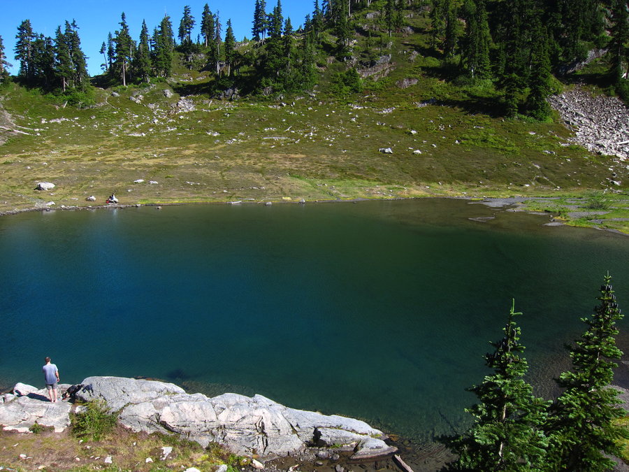
Table Mountain - Mt. Baker area
3.03 miles of hiking • 1000' elevation gain •
This was a short, easy hike on my way out to see 360 views. Good stuff, but this area at the end of hwy 542 obviously gets a lot of use. But, the trail was quiet, with few people on a Monday.
June 23, 2015

Chain Lakes loop
7.64 miles of hiking • 2000' elevation gain •
I met a friend and we hiked the Chain Lakes loop. Quite beautiful hike with great views of Shuksan and Baker. Beside a couple very small patches on the trail, there was no snow.
June 22, 2015

Lake Valhalla and Mount McCausland from Stevens Pass
13.37 miles of hiking • 2500' elevation gain •
I hiked the PCT from Stevens Pass to Lake Valhalla. The trail travels an open forest ridge and then climbs through meadows and forest to the lake. I saw just a couple other hikers coming out from backpacking. A lot of people were at the lake, having apparently hiked from the Smithbrook Trailhead. I decided to hike to the top of Mt. McCausland, since it was just a sort of steep 1/2 mile hike from the PCT. I saw no one on that spur trail and had the summit, the views, and biting insects all to myself!
June 21, 2015

Dirtyface Lookout
7.8 miles of hiking • 4000' elevation gain •
This is was a fairly hot, sun-exposed, brushy hike with some decent elevation gain per mile. Views from the top are great!
June 20, 2015

Colchuck Lake
8.06 miles of hiking • 2500' elevation gain •
It has been a few years since I hiked to Colchuck Lake. I have been considering a hike to Little Annapurna or day thru hike of the Enchantments, so I have been waiting on that. But, I was in the area on a weekday, so I decided to go for it, to enjoy the lake for itself without going on to another destination. The large trailhead parking lot was basically full when I arrived. But, surprisingly, the trail was pretty quiet and the lake was perfectly quiet. I sat at the lake for about an hour, and got to watch an osprey flying overhead around the lake. I was reminded why this lake gets so much love. Really magical place.
June 18, 2015
 1
1
Indian Henry's Hunting Ground + Mirror Lake from Longmire
16.44 miles of hiking • 4000' elevation gain •
This one has been on my list for a while. After seeing Rhonda's trip report (thank you), we decided to check this one off the list. This was a really great, quiet hike, with no one on the Wonderland trail past the Rampart Ridge junction. The avalanche lilies were all over the place in the last mile and up in Indian Henry's Hunting ground. We went past the ranger cabin up the spur trail to Mirror Lake. A beautiful place! The lupine and paintbrush were coming out, but it seems there is much more to bloom yet. Mosquitoes were ferocious. If we stopped for a minute for a photo, we were completely swarmed!!! We only saw four other groups of people around the hunting ground area. No snow anywhere. We finished by completing the Rampart Ridge loop back down to Longmire.
June 14, 2015
 2
2
Snowgrass - Goat Ridge Loop with some PCT
16.96 miles of hiking • 4000' elevation gain •
We hiked the loop from Snowgrass TH. A lot of avalanche lilies out along the entire loop. Some pasqueflowers and pasqueflower seed heads, and a few paintbrush and lupine are out up in the flats and thereafter, but not much else yet. We missed the second PCT junction, went a while down Lilly Basin trail before realizing there was no later PCT junction, and had to double back. Walked on the PCT to see snow levels and thought about going up Old Snowy. Ran into large patches of snow starting around 6700 feet elevation. Had traction, but, decided to turn around. Goat Lake frozen and melting. A little snow on the trail in that area. Saw a good amount of people camping.
June 13, 2015

Eightmile Lake
6.73 miles of hiking • 1500' elevation gain •
This hike does not have a great amount of elevation gain, but, it was tough for me on a day with nearly a 100 degree temperature. Almost the entire way is sun exposed, due to a prior fire in the area. You do get a glimpse of Dragontail and Colchuck peaks from the trail at the beginning of the hike. The lake is quite beautiful, with Eightmile Mountain as a backdrop.
June 8, 2015

West Fork Foss River, Trout and Copper Lakes
8.78 miles of hiking • 2500' elevation gain •
I chose this hike with multiple destinations, so I could turn around when I felt like it. The hike to Trout Lake was easy. The open, brushy switchback climb up to Copper Lake really got to me in the heat. Once at Copper Lake, I continued on the trail along lake shore for a bit, but, I decided to hang out at the lake for a while, instead of pushing on to Little Heart and Big Heart Lakes.
June 7, 2015

Gothic Basin and Foggy Lake
9.92 miles of hiking • 3250' elevation gain •
A spectacular hike. The last part is pretty tough, in the heat especially, but also, pretty fun. After reaching the basin, I continued on to Foggy Lake, being careful to step only on rock, to avoid destroying the delicate plant life in the basin. Foggy Lake was frozen, but had some melting around the edges. What a scene, with Del Campo and Gothic Peaks framing the lake! Views into the distance from up there were quite nice, as well. The way up to Foggy Pass was snow covered, so I did not attempt it.
June 6, 2015

Melakwa Lake
8.94 miles of hiking • 2750' elevation gain •
A nice hike, in a wilderness that starts a short distance from I-90 spanning overhead - very cool. Denny Creek is beautiful. I started around three, so I did not have a lot of time to explore the lake area, which was very pretty, and surprisingly, had only 2 sets of campers when I arrived.
June 5, 2015

Hamilton Mountain
9.08 miles of hiking • 2250' elevation gain •
My plans fell through this weekend. Not wanting to drive too far, I hiked Hamilton Mountain. I got to the TH in the afternoon, and by the time I reached the Hardy Creek trail, I had cleared most of the people. I hiked all the way out on the Upper Hardy Creek trail, then to the Saddle, summit, and back down. Berries are ripening along the Hardy Creek trail.
May 31, 2015

Gnarl Ridge via Elk Meadows
12.4 miles of hiking • 3000' elevation gain •
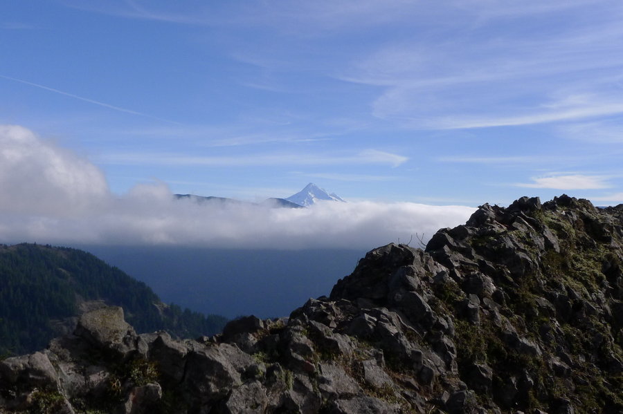
I hiked up to Gnarl Ridge from Elk Meadows / Sahalie Falls TH on Saturday. I passed through a number of downed trees on the switchback climb up the ridge to Elk Meadows, but they were not too hard to get around. There seems to be a good amount of beargrass flowers budding, but not yet blooming, along this portion of the trail. Once up on the ridge, I visited Elk Meadows first, going to the Shelter to take in the Mount Hood view. It is very green and summery in the meadow! At one part, elephant head flowers are blooming. I rarely seem to run into these flowers - they are so fascinating! The small meadow right before the shelter has bloomed with a ton of shooting star and some yellow flowers. I went up to Gnarl Ridge from the connector trail from Elk Meadows. The only snow on the Timberline trail was on the trail side below Lambertson Butte. There were some longer stretches of it, but, it was ok to walk through, although it was a little slushy. With the way the snow is melting, it will probably be gone soon. Once I got to the old shelter remains, the trail was clear of snow. I continued on up the ridge to about 6900 feet elevation. A fair amount of phlox is blooming up there. It was really tempting to continue on to Cooper Spur shelter, but I had extra stuff with me in case I ran into more snow, and I was a little tired of lugging it around in the heat. I thought about taking the Newton Creek trail back, to make a bit of a loop, but the last time I did that, it was difficult to find the trail on the other side of Newton Creek. Cairns were everywhere and not helpful. So, I decided to save that adventure for another day. I took the Gnarl Ridge trail down from the Timberline trail. It had a lot of downed trees along the ridge, some appeared to have been there a while. It was not hard to get around - just annoying. It was a fairly quiet day on the trail. I saw a few people around the meadow and about 4 groups on the Timberline trail around Gnarl Ridge. I made a quick hike out to Sahalie Falls once I got back to the trailhead, and quickly remembered that you can probably see that falls with greater ease from the road. I scrambled to the bottom of it anyway. All in all, it was a great day of hiking.
May 30, 2015

Mt. Defiance Loop
11.3 miles of hiking • 5000' elevation gain •
For some reason, I had not hiked this one before. I found some friends who were willing to hike it with me. I enjoyed the variation of the Starvation Ridge Trail on the way up. We stopped for lunch at Warren Lake, which was quiet, except for some fish jumping in the lake. We didn't see a whole lot of people on the trail - we saw most of the people closer to the summit and as we descended the Mt. Defiance trail. It was a nice day out in the woods, catching up with friends!
May 25, 2015

Jefferson Park
11.86 miles of hiking • 2000' elevation gain •
I made a spur of the moment decision to go day hike Jefferson Park on Sunday - glad I did! I hiked from the Whitewater TH and it had a decent amount of cars parked there. The hike was very foggy the whole way. There's not really much snow until Jeff Park, where it is mostly snow covered, but varies from a couple feet to a smattering of patches of bare ground. I brought microspikes, but didn't use them. There seemed to be a number of campers out at the various lakes. I skipped Scout and Bays Lake to get further out and stopped at Russell Lake. I saw one group of campers there. All the lakes were still pretty much snow/ice covered, but thawing out. I sat at Russell Lake for a while and the skies cleared pretty well, giving me fantastic views of Mt. Jefferson. Good times! On my drive out from the trailhead on Whitewater Road, a bear ran across the road in front of me. It was almost the exact location that the same thing happened the last time I visited last fall. These are the only times I have ever come across a bear in Oregon, on the road or trail.
May 24, 2015

Dog Mountain
6.89 miles of hiking • 3000' elevation gain •
The parking lot was full on a Monday. I resisted the urge to leave, and hopped in line up the Dog Mountain trail. I actually didn't see as many people as seemed to be parked at the trailhead. The balsamroot seems to be finishing up, but, there is nice phlox near the top. To my surprise, I had complete solitude on the Augspurger trail back to the trailhead.
May 18, 2015

Olympic Beach hikes
10.42 miles of hiking • 500' elevation gain •
My intent was to hike Shi Shi Beach, but high tide was not at a favorable time. Instead, I hiked Rialto Beach, Second Beach, and Ruby Beach.
May 17, 2015

Dungeness Spit National Wildlife Refuge
10.72 miles of hiking • 250' elevation gain •
I had hoped for some hiking in the Olympic mountains but, every area seemed socked in with dense clouds. So, I opted to hike the Dungeness Spit. It was a nice and quite long, beach hike. I made it to the lighthouse and walked to the top of it. I saw a few shorebirds, including a pair of black oystercatchers.
May 16, 2015

Comet Falls
4.07 miles of hiking • 1500' elevation gain •
I had hoped to go further to Van Trump Park, but the fog was out and it was dense. I couldn't see much of the upper tier of Comet Falls practically standing next to it.
May 15, 2015

Coldwater Peak from JRO
13.08 miles of hiking • 3000' elevation gain •
I had a great time hiking from JRO to Coldwater Peak on Sunday. I appreciated the high clouds that kept it cool and breezy. I saw just a few people, and most of them were not past Harry's Saddle. I saw no one past Rock Arch Saddle and I had the peak to myself. I was surprised to see western pasqueflowers blooming along the trail up Coldwater Peak. Those are my favorite wildflowers- how interesting to see them so early in the year! On the way back, I realized I had not hiked on the Truman trail from JRO area, so I will be back soon. I just love the MSH area!
May 10, 2015

Ramona Falls
7.31 miles of hiking • 1000' elevation gain •
The only other time I hiked this trail a few years ago, someone had just broken into some cars right before we arrived at the trailhead. Thankfully, nothing like that occurred this time. The waterfall is still so wonderful and the forest is lovely, but, to be honest, the hike is a little boring. Next time I visit, I'll go on to Yocum Ridge.
May 8, 2015

Starvation Ridge (part of)
6 miles of hiking • 2500' elevation gain •
This was an incomplete hike. I started late, and I had planned to at least make it Warren Lake. My husband has an injury that will keep him from hiking for a while, so I was out by myself. Sometimes the long forest hikes are challenging for me solo. That was the case on this day and I lost my motivation about 2.5 miles up the trail. It was not my day, but, I will be back to hike this one to the top of Defiance solo!
May 3, 2015

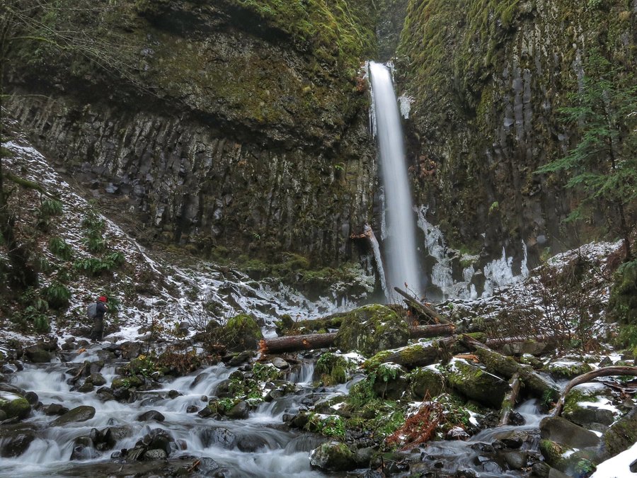
Waterfall hikes
7.49 miles of hiking • 2000' elevation gain •
A weekday trip to get outside and see some waterfalls I haven't seen in a while - Elowah, Upper McCord Creek Falls, Horsetail Falls to Triple Falls. The waterfalls are still beautiful!
April 30, 2015
 1
1
Tanner Butte Trail to Wauna Pt (almost)
11.12 miles of hiking • 3250' elevation gain •
We hiked from the fish hatchery to the Tanner Butte trail, and most of the way to Wauna Point. I had been wanting to see a particular small waterfall on Munra Creek. I knew that there were a bunch of little waterfalls below the old road and a few above. Having never been on the Tanner Butte trail, I was hoping the waterfall I wanted to see was above the road and near the trail. It was. After seeing the five little falls along the trail, we proceeded on the Tanner Butte Trail. We planned to go all the way out to Wauna Point, but once we got on the spine and had another 200 ft or so to drop down and then some climbing up, we decided to call it a day. I was feeling a little under the weather, and didn't feel like pushing it. Otherwise, it was a nice, quiet day on the trail. We saw just a few people.
April 26, 2015

Deception Pass SP - Bowman Bay
5.44 miles of hiking • 1000' elevation gain •
I hiked out to Rosario Head, Lighthouse Point, and Lottie Point. Quite beautiful!!!
April 20, 2015
 1
1
Mt.Dickerman
7.75 miles of hiking • 4000' elevation gain •
I really enjoyed this hike! I saw the first person on the trail at about 2 miles in - very different from my hike at Mailbox Peak on the previous day! I expected to see more people, but, I only saw about 12 groups of people all day. I reached snow at about 4,000 feet. The snow was melting and soft pretty much the whole way to the top. I put the microspikes on once I approached the open snowfield on the final climb to the top. There were some small cornices along the summit ridge edge. The views were so fantastic!!!
April 19, 2015

Big Four Ice Caves
3.25 miles of hiking • 500' elevation gain •
After finishing up my hike of Mt. Dickerman, it was only 3:45 pm, so I decided to go see the Big Four Ice Cave area, since it is right next door to Mt. Dickerman. I knew that this was a popular attraction, but, wowee, the people!!! There were so many people - and I arrived there fairly late in the day. After looking at the ice cave without going inside, I hiked through the rock field to see the waterfalls, then returned to the trailhead, as more people were hiking in.
April 19, 2015
 1
1
Mailbox Peak - new trail
10.39 miles of hiking • 4250' elevation gain •
A nice hike by myself ... and probably 150 or more trail friends. I hiked the new trail out and back. There was a bit of slushy snow and some very muddy trail within the last mile of the summit. The summit was snow free.
April 18, 2015

Lyle Cherry Orchard
5.68 miles of hiking • 1750' elevation gain •
This place is beautiful right now. It is so green, and has quite a bit of flowers blooming on the slopes. The river views are super. I would like to find a way to extend the hike here, but, we were unsure where the Friends of the Gorge land ended, so we stayed on the trail we knew about. We enjoyed seeing the couple remaining cherry trees in the orchard. It seems like there will be quite a bit of lupine blooming in the scrub oak forest in the coming weeks. We saw a LOT of poison oak, and luckily, only one tick.
April 12, 2015

Eagle Creek to 7.5 Mile Camp
14.9 miles of hiking • 1750' elevation gain •
I had a great day hiking the Eagle Creek trail to 7.5 mile camp. It was a Friday, and the crowds were surprisingly thin. I often overlook this trail (except during cold winter days) because of its popularity. But, wow, it is such a great trail. There were a ton of flowers out everywhere! And, since the leaves and brush have not yet grown out, I enjoyed seeing all of the waterfalls littering the creek and the creeks feeding into it. The only bummer for the day was that I brought a tick home with me. Yuck. Luckily, it had not yet bitten me.
April 10, 2015


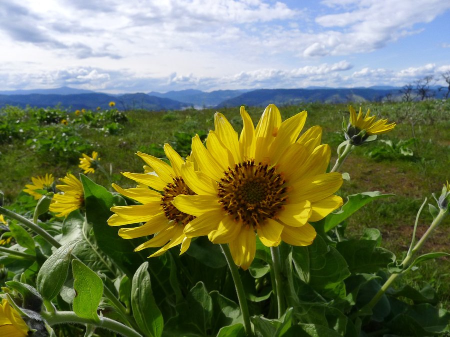
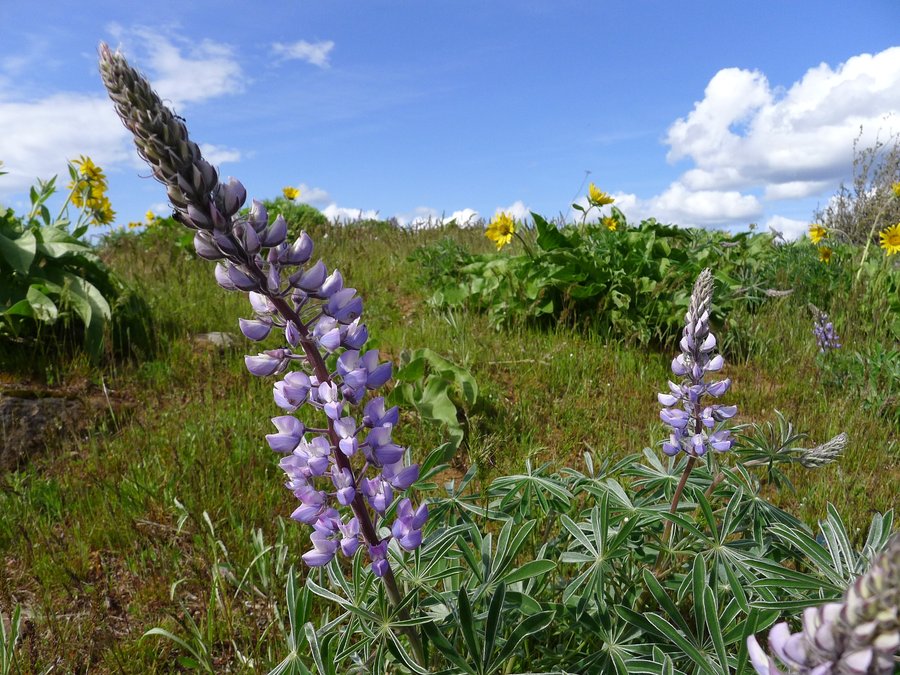
Tom McCall Preserve
6.05 miles of hiking • 1500' elevation gain •
I spent the day hiking the lower and upper trails at Tom McCall Preserve. There is a lot of balsamroot out on the lower trail and quite a bit on the upper trail, with more still to bloom. There are many other wildflowers blooming as well - very beautiful! I was surprised to learn that a fire had occurred there last year. There's quite a bit of trail re-routing, which I understand was necessary after the fire.
April 9, 2015


Cast Creek Trail to Cast Ridge and East ZigZag
11.51 miles of hiking • 3500' elevation gain •
We were looking for some snow and we found it on this hike. We started at the Cast Creek TH. There were two other cars there, but we didn't see anyone the whole day. Snow was melting and falling from the treetops by about 3500 feet elevation. Snow on the ground shortly after that, and by Cast Ridge, a foot or more. There were footprints the whole way until the junction with the ZigZag Mountain Trail. The footprints went in the direction of Cast Lake. We went in the other direction and broke trail up the open ridge to East ZigZag. Views were fantastic with a mixture of colorful clouds and bluish skies, and the snow was still draping the trees all around. So wonderful! Most of Mt. Hood was hiding behind some clouds, but it did peek out for a minute after we returned back to Cast Ridge.
April 4, 2015

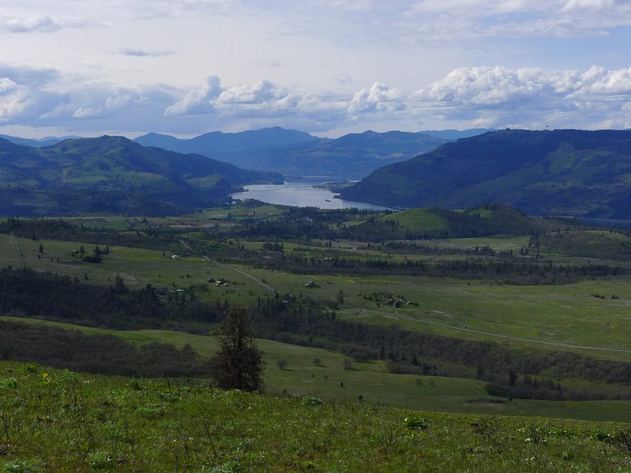
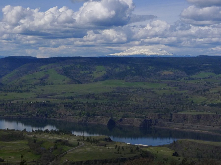
Crawford Oaks TH to Stacker Butte TH
10.92 miles of hiking • 2250' elevation gain •
After seeing trip reports from Woodswalker, Mileage Mike, and Karl, I just had to visit Columbia Hills SP. Thanks, everyone! I have been up to Stacker Butte a few times, but I had not hiked through the lower hills. What a great hike. I had the whole loop to myself, except for a couple coming out at the trailhead and one lonesome mountain biker. Once I reached the ranch area, I decided to get a little more exercise by walking the road up to the Stacker Butte TH. Then, I returned back to the loop and continued toward the east. I really enjoyed the fantastic river views on that portion of the loop!
April 2, 2015

University Falls
6.88 miles of hiking • 1000' elevation gain •
We had not previously hiked this trail. The information we read about the hike mentioned that it was in an area with OHV use. We figured that it wouldn't be that busy since it was a rainy day. We didn't see any hikers until the very end of our hike. However, there were quite a few people riding OHVs. Actually, we really didn't hear much noise from it on this hike. The waterfall and second growth forest were really pretty. There was some target shooting going on that we could hear during the entire hike. We had planned on adding the Storey Burn Loop onto this hike, but, after hiking for a little while on that trail, we decided we just didn't have it in us to finish the loop in the time we had left. We'll try that loop another time.
March 15, 2015

Labyrinth Loop
6.4 miles of hiking • 1250' elevation gain •
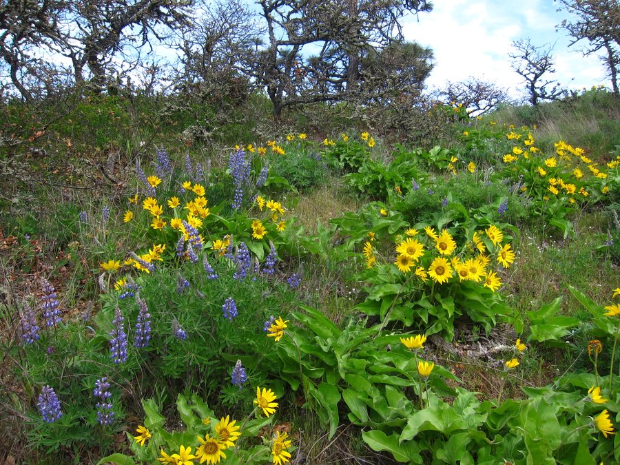
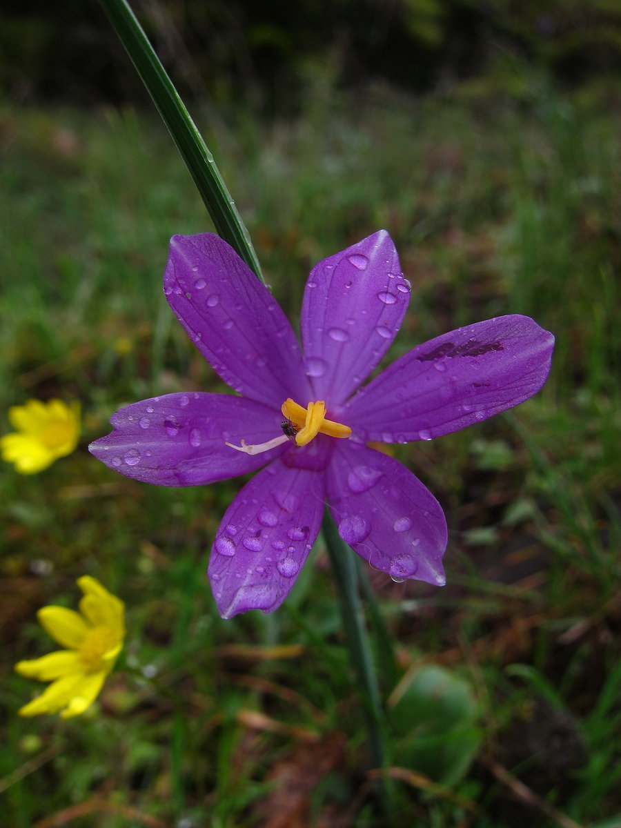
After seeing a few trip reports on the area, we decided to visit in the rain on Saturday to check on the flowers. We saw less people than are usually here on sunny days. We meant to make this a longer loop by going out to Catherine Creek, but, we missed the turn. So, we hiked at an easy pace, stopping to enjoy the clouds and flowers. Just a few flowers were blooming at this time, beside grass widows. We saw shooting stars, larkspur, a few balsamroot, two types of desert parsley, prairie stars, yellow bells, and a few that we were unfamiliar with. My husband took many great photos of the flowers! Afterwards, we drove down to Catherine Creek and walked around the short paved trail. We saw a few camas lilies in bloom in that area.
March 14, 2015


 3
3
Coldwater Lake Loop
12.17 miles of hiking • 1750' elevation gain •
We hiked Coldwater Lake Loop, starting from Hummocks Trailhead, walking the road to the South Coldwater Trail. It was a great day of hiking.
March 8, 2015

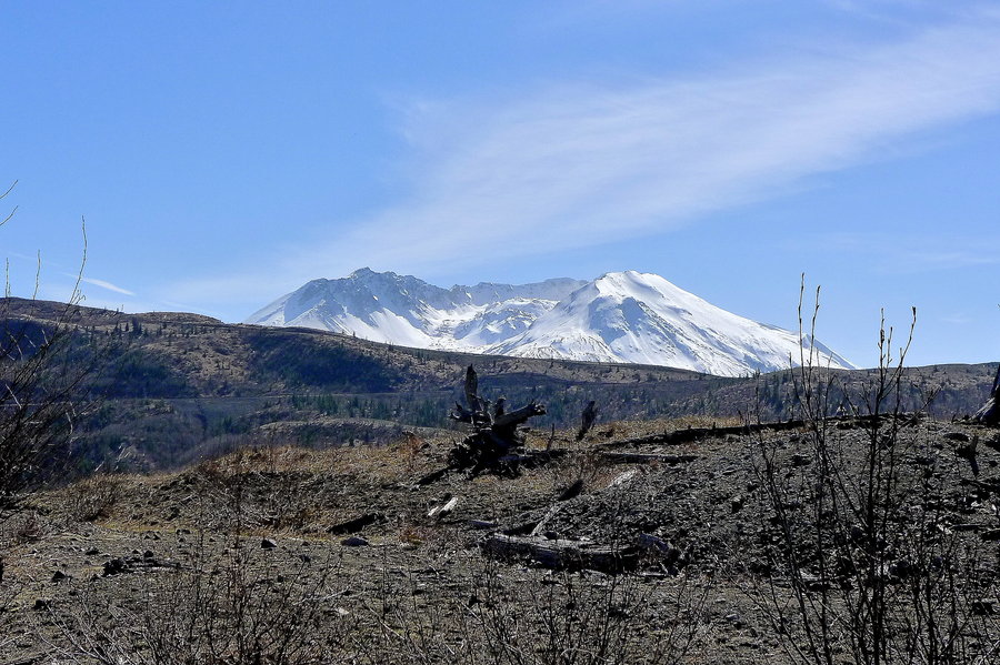
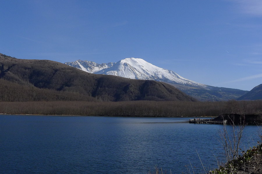
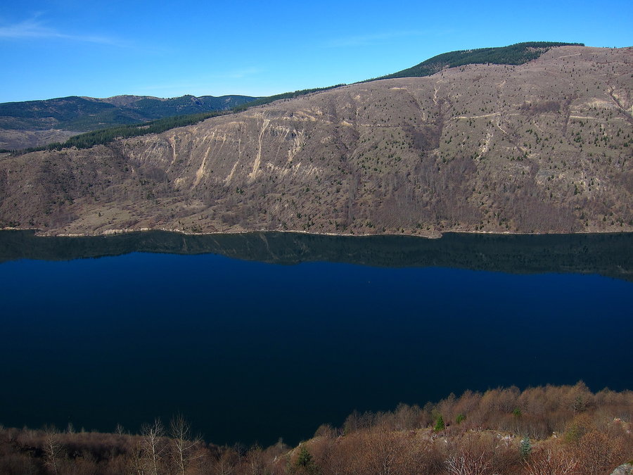

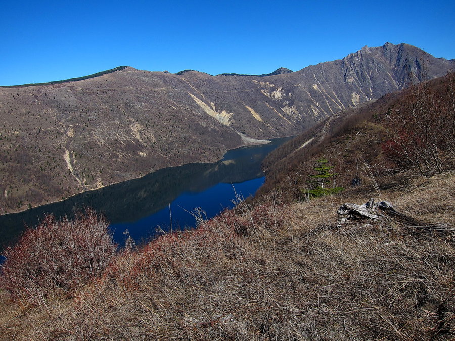


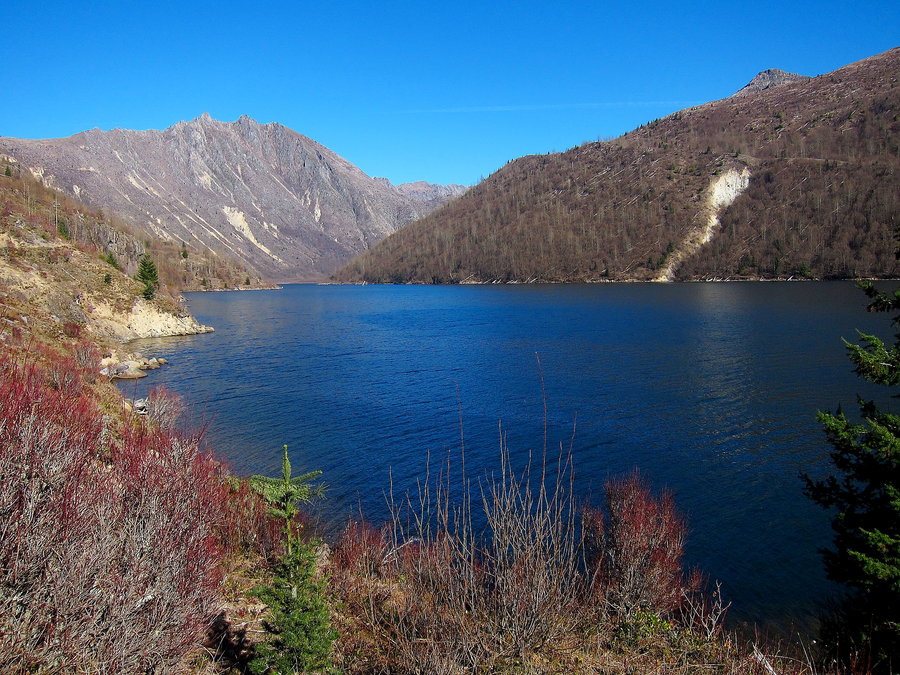
Table Mountain
9.16 miles of hiking • 3500' elevation gain •
We hiked up to the top of Table Mountain from the Hot Springs. We went up and returned via the Heartbreak Ridge Trail. This is one of those hikes we had just never gotten around to doing, for whatever reason, so it was a first for us. It was interesting to see the landslide from the vantage of Table Mountain. We saw a good amount of people on the trail, more than we are accustomed to seeing lately.
March 7, 2015
 1
1
Red Mountain
9.52 miles of hiking • 1500' elevation gain •
We hiked to Indian Racetrack from the PCT and up to Red Mountain. The trail had a few inches of snow, for the most part. There was some deeper snow on the higher parts of the trail up Red Mountain. However, there was basically no snow on the summit. The racetrack area had a bit of melting ice and was really soggy. We attempted to tread lightly in the area and opted to return to the trailhead by the road to the lookout to avoid re-treading through the racetrack area. We saw bicycle tracks throughout the PCT to the racetrack and on the 171 trail in the direction of the road.
We had a great time that day. Wonderful views in one of my favorite wilderness areas. We did not see any other hikers. We wished we had more time to do a larger loop!
March 6, 2015


Augspurger Mountain
11.92 miles of hiking • 3500' elevation gain •
We hiked toward Augspurger Mountain from the Dog Mountain Trailhead. Time limitations kept us from reaching the summit and the viewpoint on the other side. We estimated we were within 500 feet elevation and .5 mile or so from the summit before turning around. We enjoyed the views achieved after first cresting the ridge near the power lines. The trail appeared to us to be in good shape and we felt it was easy to follow. The previous year's brush had been cut back off the trail. We saw a fair amount of people on the Dog Mountain Trail, but we did not see anyone on the Augspurger Trail beyond the Dog Mountain cutoff trail. We'll need to return a bit later once flowers begin to bloom.
I'm new to this site, so I am pretty sure I did not mark the mountain accurately on the google map. I'll work on getting better at that.
March 1, 2015

Greenleaf Creek
9.78 miles of hiking • 1500' elevation gain •
This was a nice leg stretcher to the falls under Greenleaf Falls. The sign at the falls called it Cave Falls.
February 28, 2015

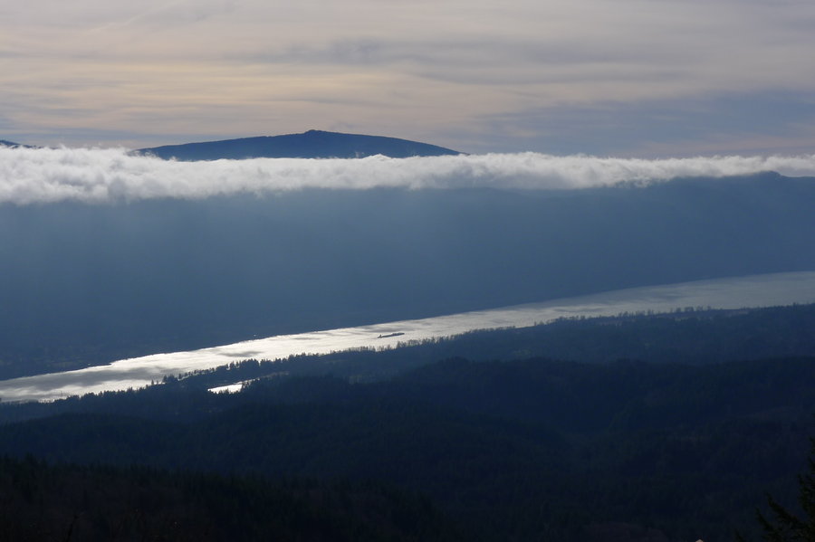
Gunsight Butte
8.51 miles of hiking • 2000' elevation gain •
We hiked from the Gumjuwac trailhead up to the saddle. We had previously been to Lookout Mountain, so we headed for Gunsight Butte. We did not encounter snow until the saddle. We were able to follow the trail for a bit after that, but we lost it in snow once we reached the snag area. At that point, we moved cross country up the ridge, but GPS said we were close to the trail anyway. Views of Mount Hood were great. We returned the same way and then walked on the trail to Lookout Mountain until we reached some easterly views.
February 22, 2015

Ruckel Creek to Benson Plateau
12.56 miles of hiking • 4500' elevation gain •
We hiked the Ruckel Creek Trail to the Benson Plateau and continued on to the 405A trail to the PCT junction, then returned back the same way. We enjoyed the quiet beauty of the plateau and Ruckel Creek. We saw a few people who were completing the loop from Ruckel Ridge.
February 21, 2015

Trapper Creek
8.47 miles of hiking • 1250' elevation gain •
We hiked from the Trapper Creek Trailhead until just after the junction with the Sunshine Trail. There were a couple areas on the trail with large blow down. The bridge over Hidden Creek appeared to have been moved by water at some point and was angled and extremely slippery. We were the only car at trailhead at arrival and departure. This is such a beautiful wilderness area.
February 20, 2015

Silver Falls Loop
9.95 miles of hiking • 1000' elevation gain •
I hiked solo on the Silver Falls Loop. I had never been there during winter, so it was nice to see the falls at this time of year. I proceeded from South Falls to North Falls, but I forgot about Upper North Falls on the other side of the road. I saw online that a portion of the Rim Trail had been closed in certain areas, so, in an effort to avoid the closure, I doubled back and met up with the junction to Winter Falls and proceeded to the Rim trail from there. It turned out that at least some of the closed sections were on the last segment of the Rim Trail as it returns to the Lodge area. So, I ended up walking the bike trail back to the Lodge.
February 19, 2015

Starvation Creek Loop
3.27 miles of hiking • 1000' elevation gain •
This was a short hike on a rainy day to enjoy the waterfalls on this loop hike.
February 17, 2015

Deschutes River Rail Trail
12.47 miles of hiking • 750' elevation gain •
We walked the rail trail until just past the old rail car.
February 16, 2015

Salmon Butte
12.14 miles of hiking • 3250' elevation gain •
We hiked up to the old lookout site on Salmon Butte. No snow anywhere on the trail or at the summit. Great views of Mount Hood, the northern volcanoes, and Mt. Jefferson.
February 15, 2015

Twin Lakes and Palmateer Point
10.17 miles of hiking • 1000' elevation gain •
We hiked to lower twin lake, then to upper twin lake. Both lakes had a bit of ice on them. We then proceeded to Palmateer Point and then took the cut off trail to junction with the PCT and returned by the PCT. The only people we encountered were on the trail around the lower twin lake. There was no snow at Palmateer Butte and only a few small patches on the PCT.
February 14, 2015

Gorton Creek - Nick Eaton Loop
8.93 miles of hiking • 3250' elevation gain •
We hiked up Gorton Creek Trail and dropped down on to Indian Point. It was windy and we witnessed some rock falling off the ridge, so we did not stay there long. We then cutover to the Nick Eaton Trail and returned to the trailhead.
February 8, 2015

Phlox Point Hardy Ridge Lollipop loop
9 miles of hiking • 2750' elevation gain •
We started at the equestrian trailhead and proceeded to Hardy Ridge, then up to Phlox Point. We saw a few people on Hardy Ridge, but no one at Phlox Point. It was quite windy and cold. A crow was entertaining itself by dropping something and swooping down to catch it over and over. Very neat to see. Some low lying clouds hovering over the Columbia added to the beauty of the area.
January 31, 2015


Tillamook Bay Spit
5.57 miles of hiking • 0' elevation gain •
We hiked the trail along the bay and then cut over to the beach and returned back. A nice day at the coast with our old dog, who doesn't go hiking with us any longer.
January 25, 2015

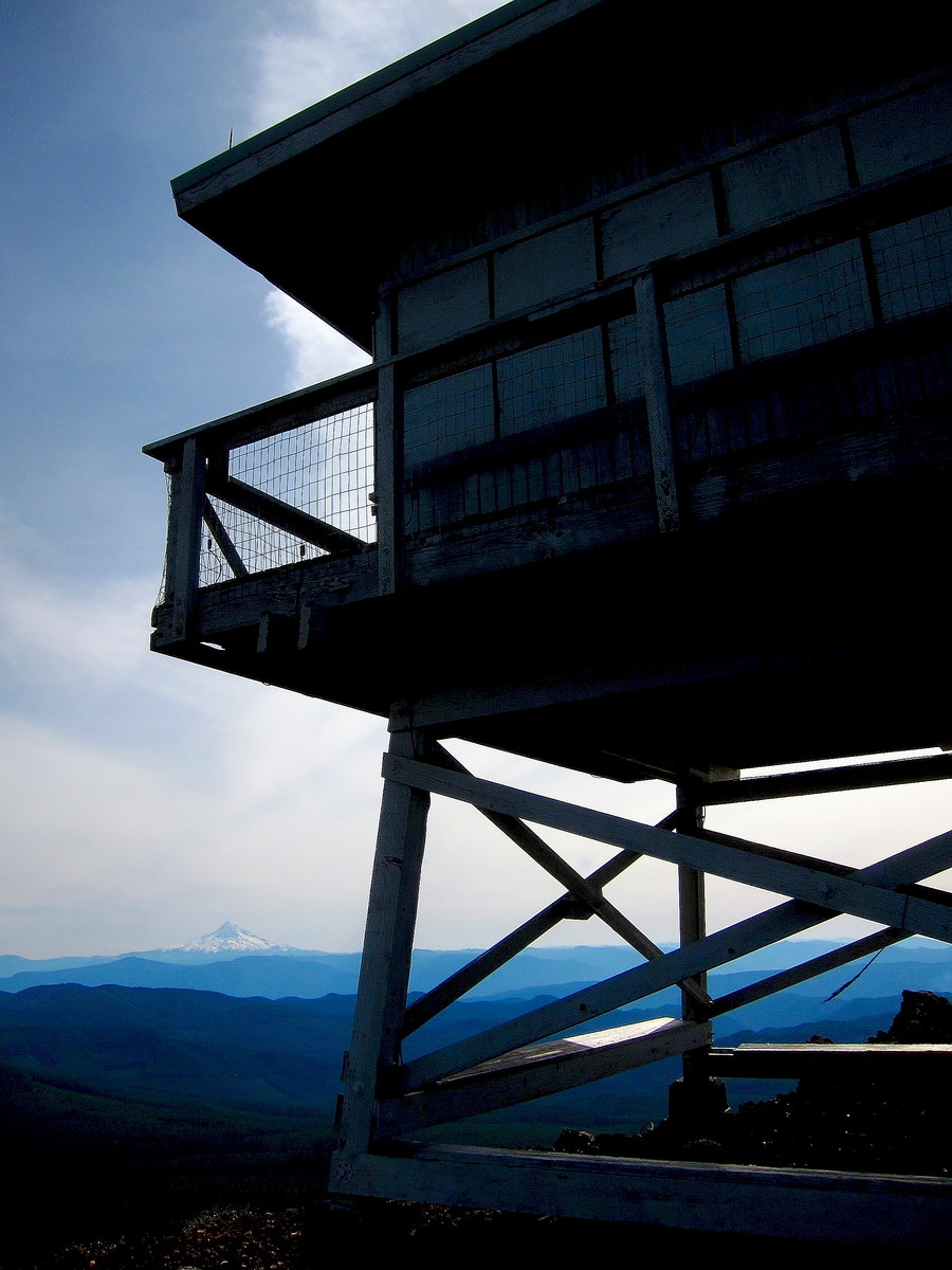
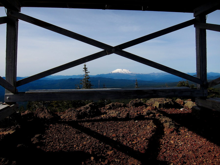
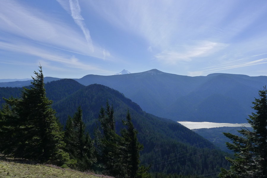
Devil's Peak Lookout
7.61 miles of hiking • 3000' elevation gain •
This was a nice, quiet weekday hike to the lookout on Devil's Peak from the Cool Creek Trail. We encountered some snow within the last .5 mile of the summit.
January 21, 2015

Mt. Walker
5.6 miles of hiking • 2000' elevation gain •
We spent the new year holiday on the Olympic Peninsula. I hiked Mt. Walker on new year's day. There were many people on the trail that day.
January 1, 2015
