

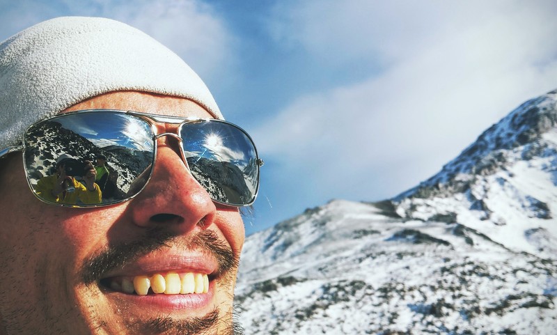
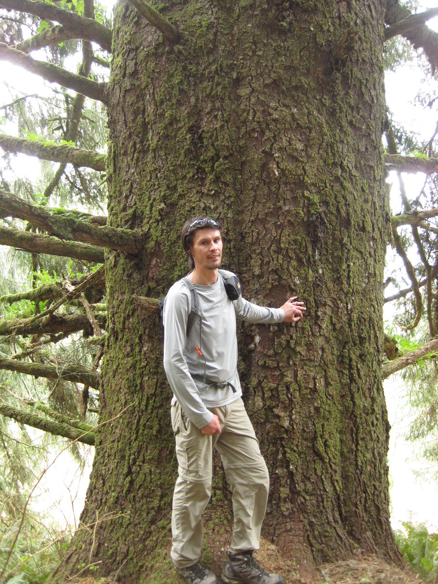
2013 Trips


Rocky Butte homeless camp and garbage dump tour
2.5 miles of hiking • 0' elevation gain •
Hike along the east side above and below the cliffs past many homeless camps and piles and piles of garbage. It's a real shame that it's like that, I wish parks would fund a cleanup or something. The trail sort of faded at the southern end at a homeless campsite so I bushwhacked straight up the butte to the road and back to the car. I'll have to look at the gps tracks again and find out how you can get over to the West side of the Butte.
December 25, 2013

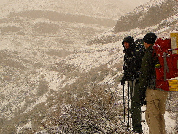
Tillamook Head Traverse (attempt)
9 miles of hiking • 1250' elevation gain • 1 night
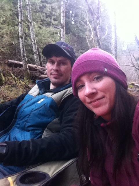
Attempted the traverse from Seaside to Indian Beach, but were dismayed to find that you cannot park overnight at either end of the trail. Since we were overnighting, we tempted fate by parking along the public road in Seaside. No problems. Lucky or legal? Spent the night @ hiker's camp on Tillamook Head. Drizzly day and eve and morn, but no real rain. No views, either! Did an out and back since we couldn't park a car overnight @ Indian Beach in the State Park. I was told that "Salem" is the reason you can't park overnight anymore. It sucks that alot of the things that you used to be able to do, you can't anymore b/c people are idiots and ruin it for everyone.
December 21 – December 22, 2013
 1
1
Salmon River Car Camp (on a hidden island!!!)
1 miles of hiking • 0' elevation gain • 1 night
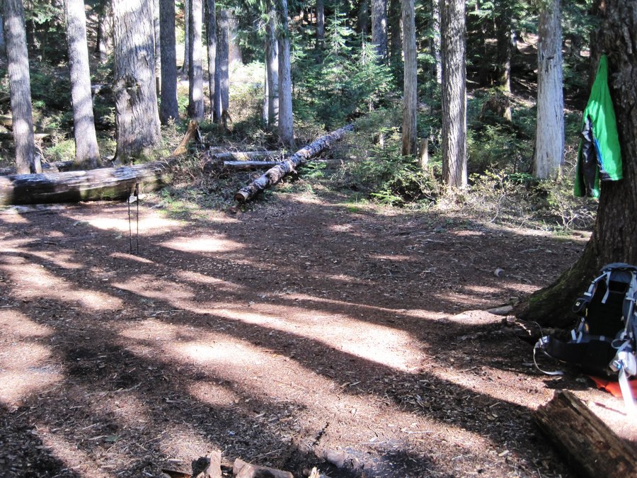
Overnighter on the banks of the Salmon River. The campground was closed, so found a dispersed site on the bank about 1/2 mile from the end of the road @ Salmon Butte Trailhead. Cloudy day and evening, but pleasant around the fire. It began to rain about midnight while we were comfortable in our tent. It continued raining as we snoozed into the late morning. Awoke around 9:15 am and found we had actually camped on an island. A channel of water raged on both sides of us now, where earlier it had been a couple of stagnant ponds, it had become a raging torrent 10 feet across. The river on the other side was swollen to almost twice it's size the night before. We quickly donned our rain gear and packed up, thinking of how we were gonna cross the swollen creek behind our camp.
We threw our gear to the other side and negotiated a big log that thankfully had been lodged in place for some time. Then it was up the steep bank to our waiting vehicle (and the sleeping dog) up above. Great night, but it's a good thing we didn't sleep any longer!
November 30 – December 1, 2013

Wahkeena / Multnomah Falls Loop
5.5 miles of hiking • 1750' elevation gain •
The hoards at the falls was overwhelming. Above the viewpoint, only a dozen or so people.
November 29, 2013

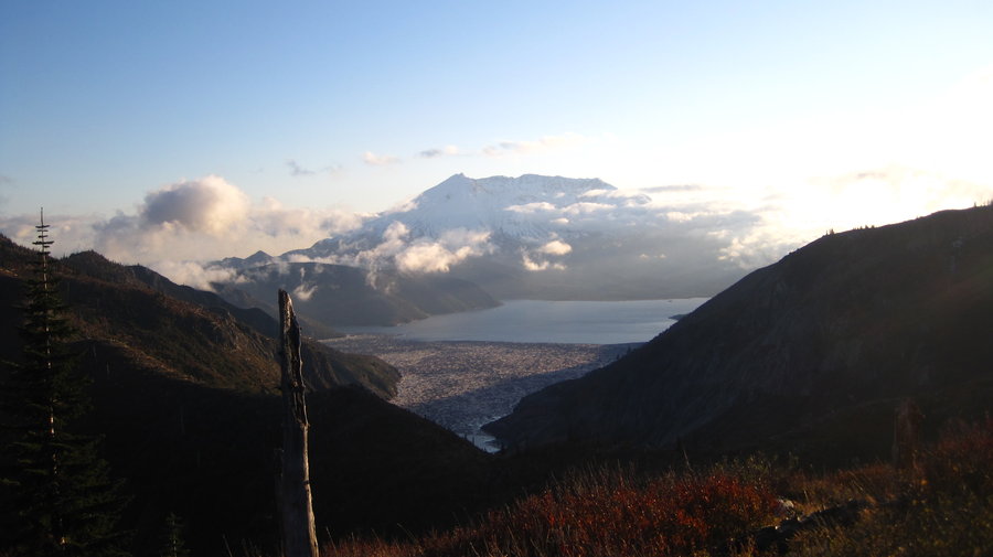
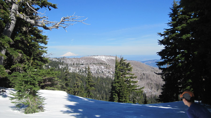
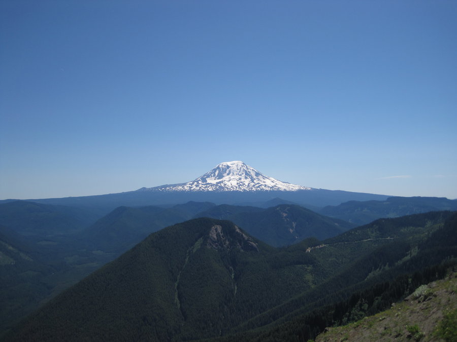
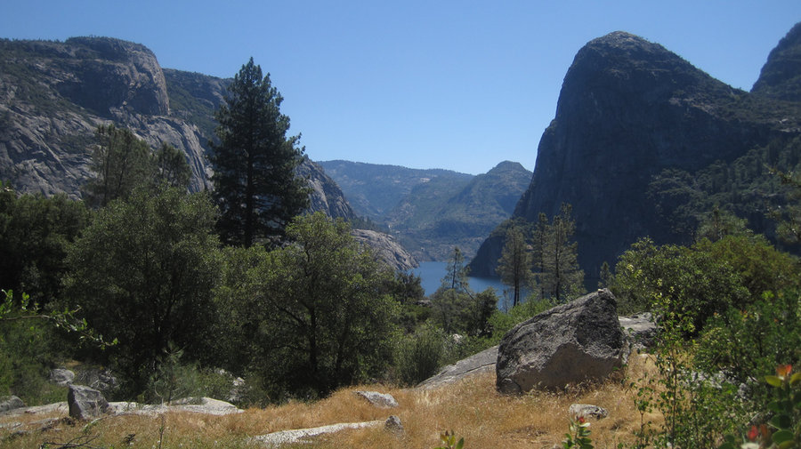
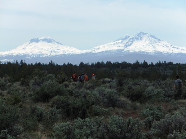
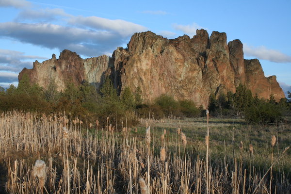
Gray Butte, Terrebonne, OR
11 miles of hiking • 2000' elevation gain • 1 night
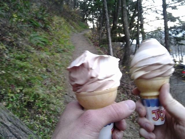
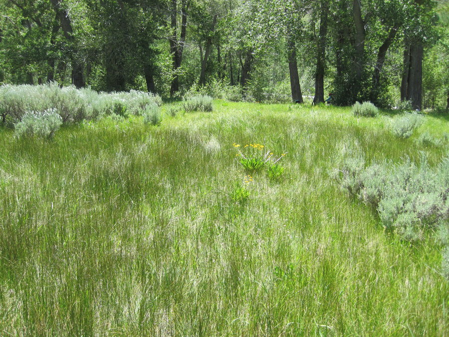
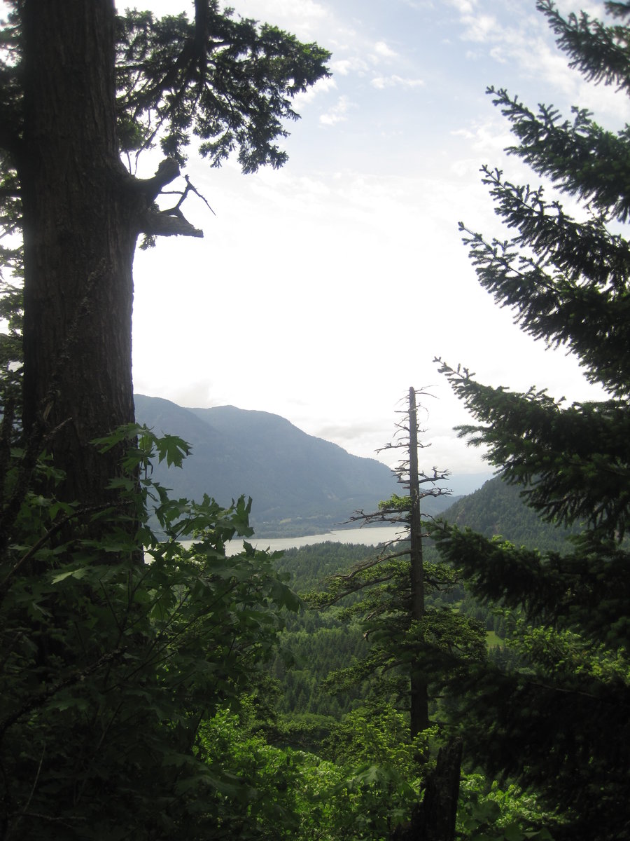
Two day hikes and an overnight camp near Smith Rock State Park. First up was Scout Camp Loop, a 3 mile trail around a lava fin along the Deschutes River near it's confluence w/ Wychus Creek. Enjoyable hike in clear, cold, sunny Central OR. Then on to Steelhead Falls to watch kayakers attempt it. Pretty humorous, but made me cold just watching them plunge into near freezing water on a 35 degree day. We set up camp near the falls in the user campsites near the parking area. The nightime temps plunged to near single digits. I've never camped in such cold weather. We went to dinner @ The Terrebonne Depot to stay warm. Once we returned to camp at bedtime, the stars were incredible and the owls hooted into the crisp night air. After waking up and warming up in town @ Pump House for breakfast, we walked around Gray Butte. Great views of the Cascade Ridge to the West. All the peaks were visible despite an air stagnation alert in Central Oregon. Haze obscured the valleys, but the peaks rose above the smog.
November 23 – November 24, 2013

Hardy Ridge/Hamilton Mtn. (back way)
12.5 miles of hiking • 2750' elevation gain •
Brad, his 2 dogs (Buddy & Timmy), Don Nelson, Gene, Rachelle and I hiked around some forest roads and some some offtrail connectors in the Hamilton Mtn/Hardy Ridge complex. Fell in the creek to start the hike off! Hooray! It was overcast all day, but didn't rain at all. Good time.
November 17, 2013


Observation Peak
15 miles of hiking • 4750' elevation gain •
Hiked up to Observation Peak under rainy and gray skies, lots of freezing rain, high winds, hail and even some thunder. No views, but several waterfalls and large trees.
November 1, 2013


Wonderland Trail (Box Canyon to Indian Bar) out and back
15 miles of hiking • 3000' elevation gain • 1 night
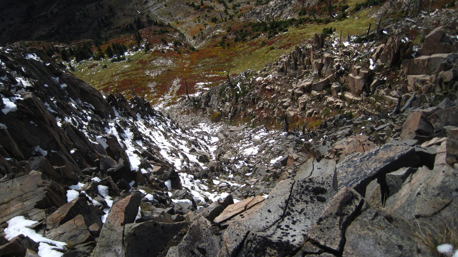
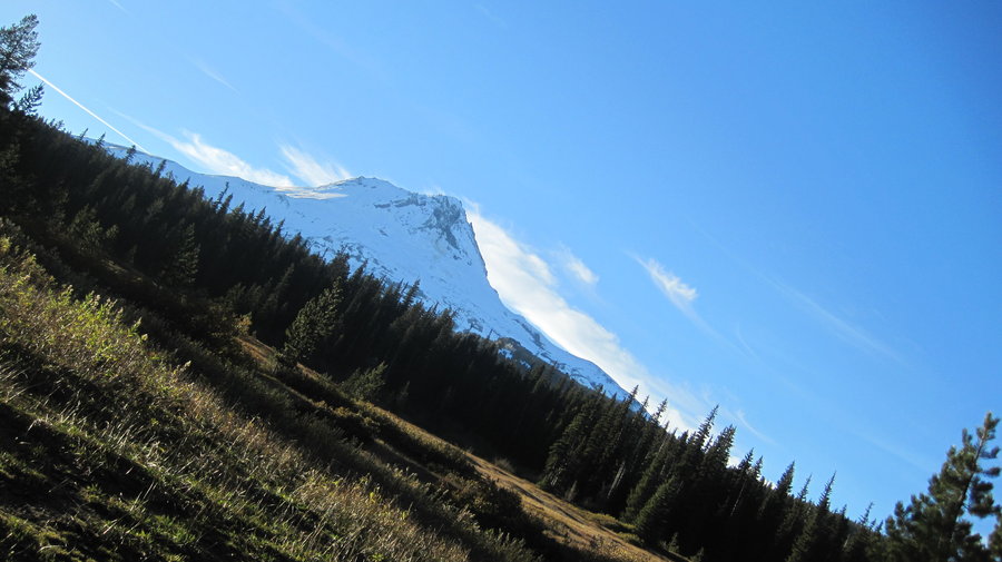
Overnighter @ Indian Bar on the Wonderland Trail. Stayed at the shelter, only saw one mouse. Deep snow and ice on North facing slope into the valley, made it tricky finding the trail and descending down to the bar. Could've used microspikes. Beautiful stars at night, but awoke to low clouds, low temps and snow. Very little visibility, but about 1 inch of new snow made climbing up the icy slopes much easier. Great adventure!
GPSfly.com
http://gpsfly.org/a/2858
October 26 – October 27, 2013

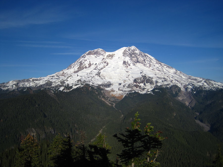
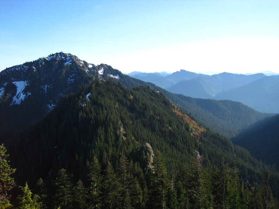
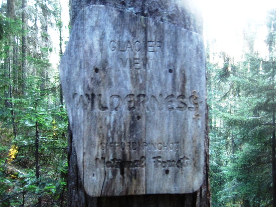
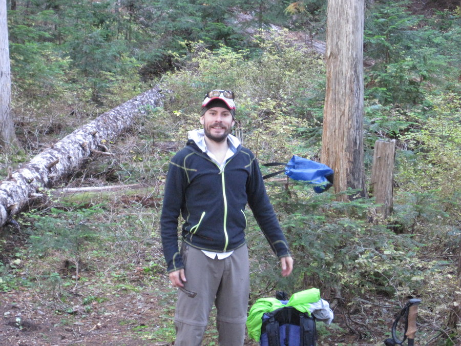
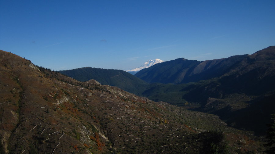
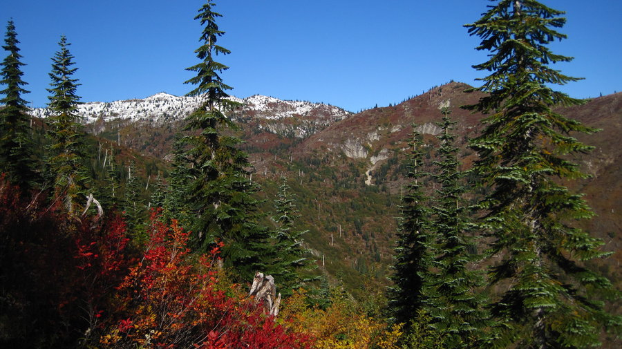
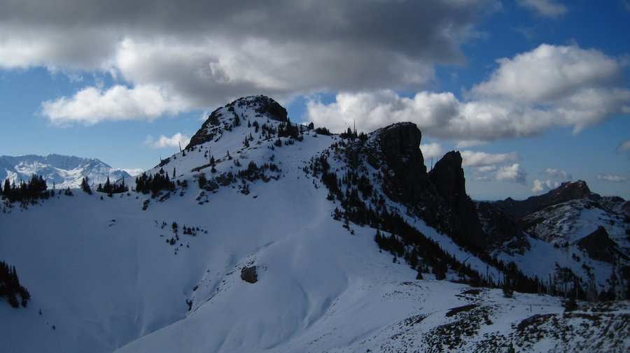
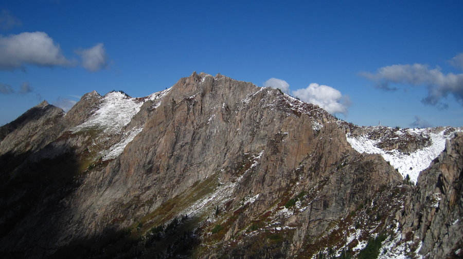
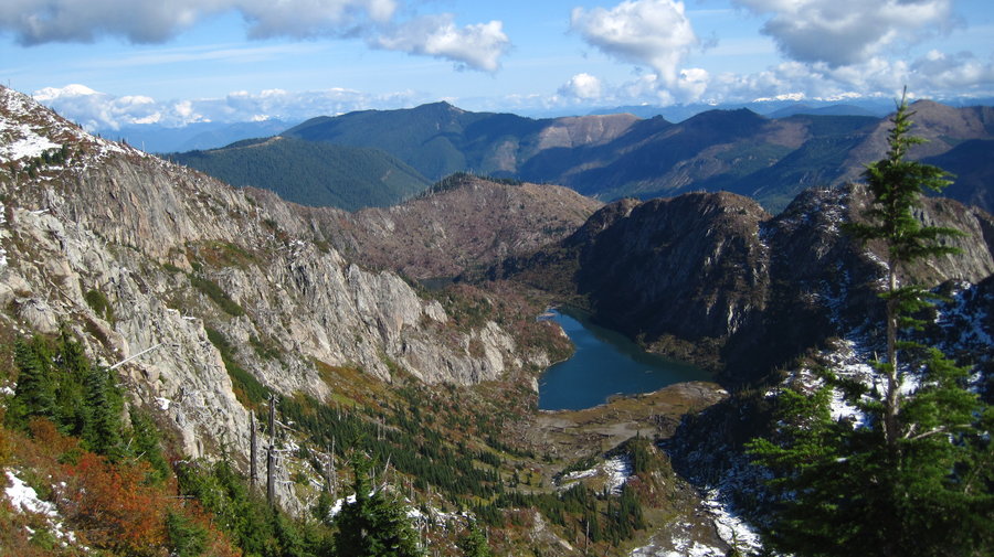
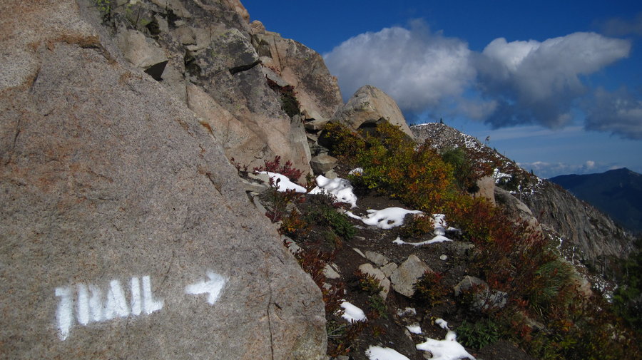
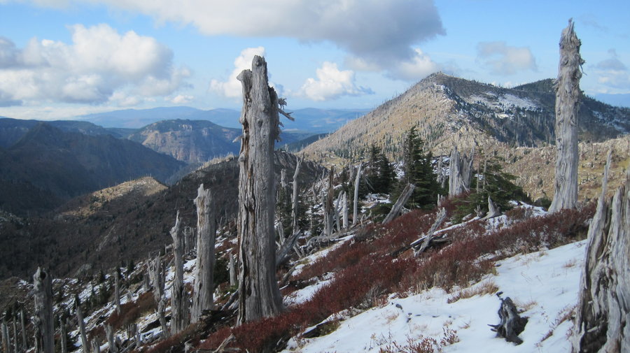
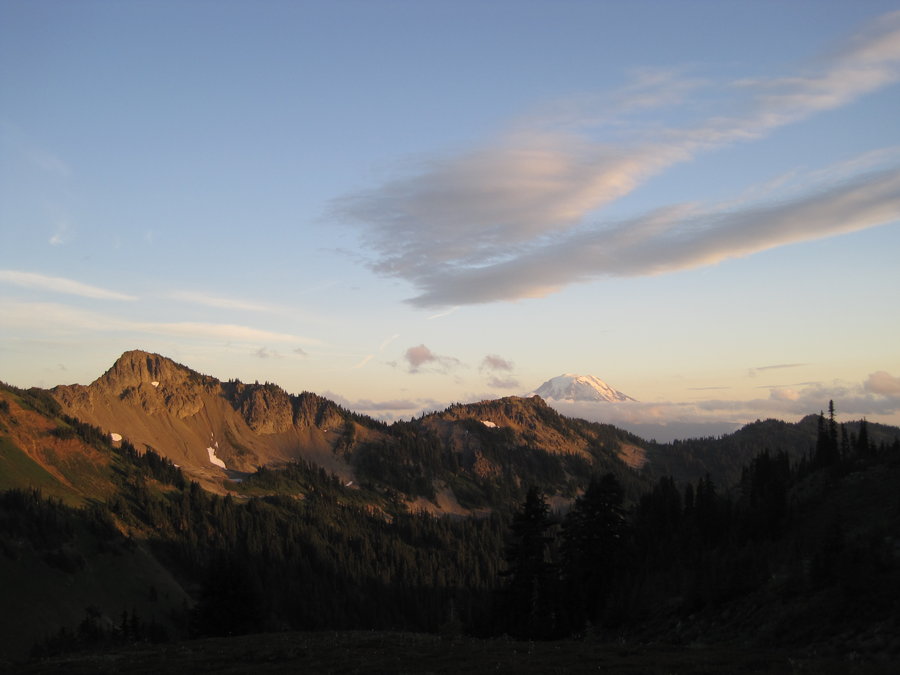
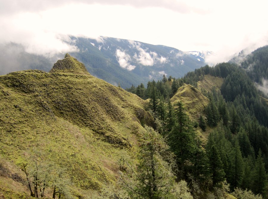
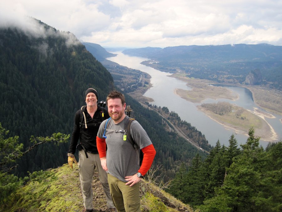
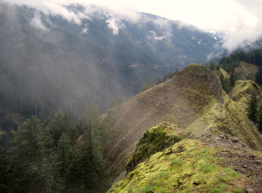
Gobbler's Knob, Glacier View Wilderness, WA
12 miles of hiking • 4500' elevation gain • 1 night
Weekend backpack w/ Water (Matt) to Glacier View Wilderness on the west side of Mt. Rainier. This trail starts in Glacier View and crosses into the Nat'l Park beyond Goat Lake. We went up to Mt. Beljica for some great views before descending down to Goat Lake and setting up camp.
Fish were plentiful, but the lake was shallow and swampy at the edges and not conducive to easy casts. Water caught 4 trout, I caught 1. I also lost a lure and broke the tip of my pole. So yeah.
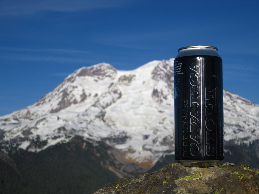
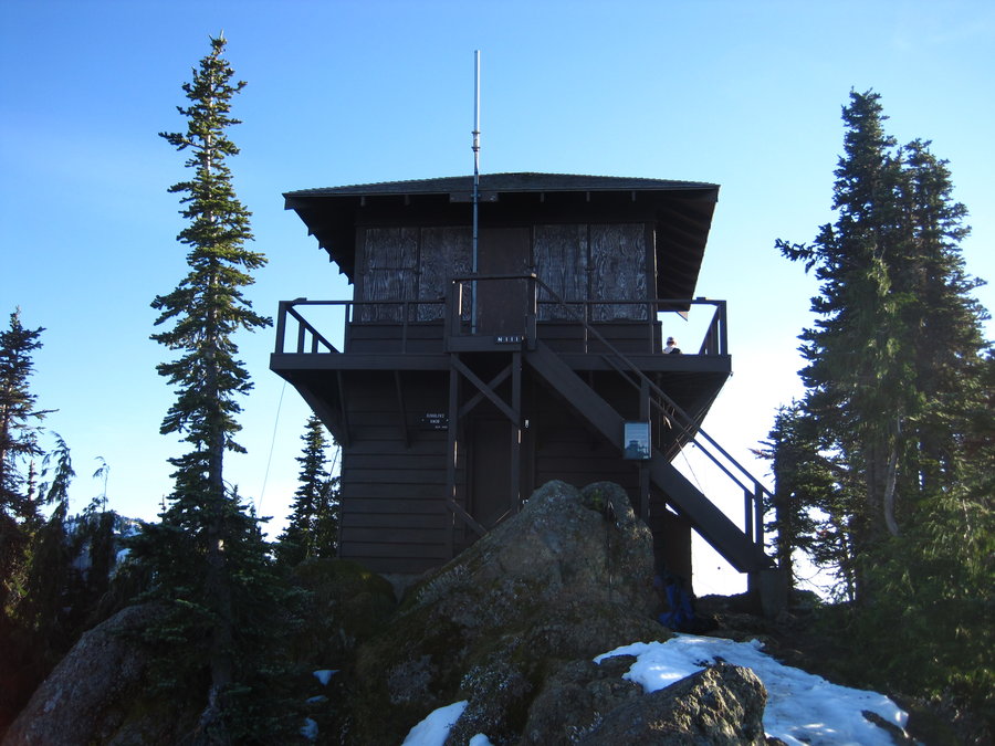
After making the long climb up to Gobblers Knob where there is a lookout tower maintained by the park service, we each enjoyed a Ft. George microbrew as the sun set on gigantic Mt. Rainier to our East. It was fun noting all the peaks and features 360 degrees around, and listening to Water expound on his climbs to the top of Tahoma.
After returning to camp, we made dinner and relaxed by the fire. It was absolutely silent at night, except for a few haunting hoots from a not-too-distant owl.
The next morning we hiked out under a sunny sky and headed to Longmire inside the National Park. (to be continued)
October 19 – October 20, 2013


Alder Ridge, Oxbow State Park
3 miles of hiking • 750' elevation gain •
After work hike around Alder Ridge from the equestrian trailhead off of Homan Road.
October 18, 2013

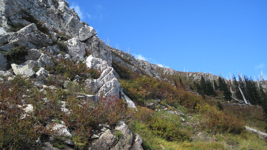
Mt Whittier-Lakes Loop, Mount Margaret Backcountry
15 miles of hiking • 4750' elevation gain •
http://gpsfly.org/g/2859
October 12, 2013


Mary S. Young Park
3 miles of hiking • 250' elevation gain •
Exploration of a little known and really cool park in West Linn. Water front trails. At the end of the hike in the parking lot, a Barred Owl out hunting landed 15 feet from my car on a branch. Great wildlife sighting!
October 8, 2013

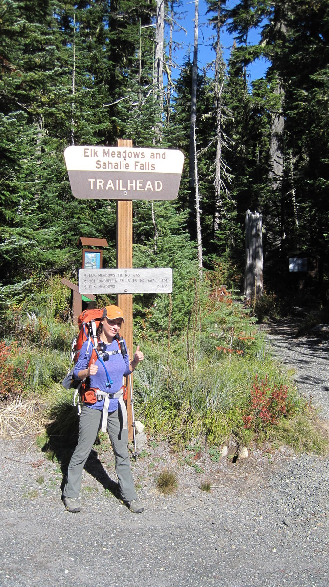
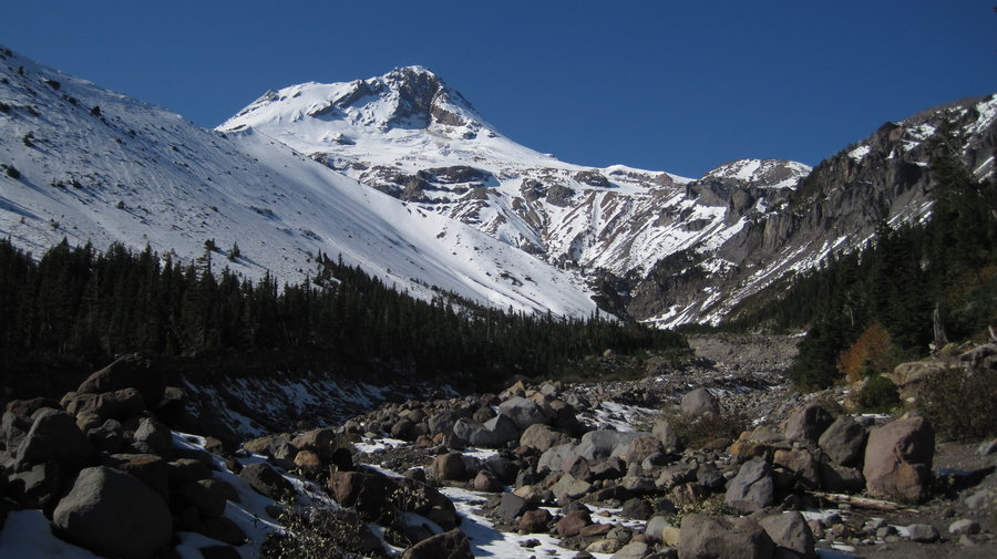
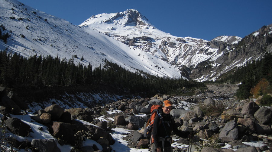
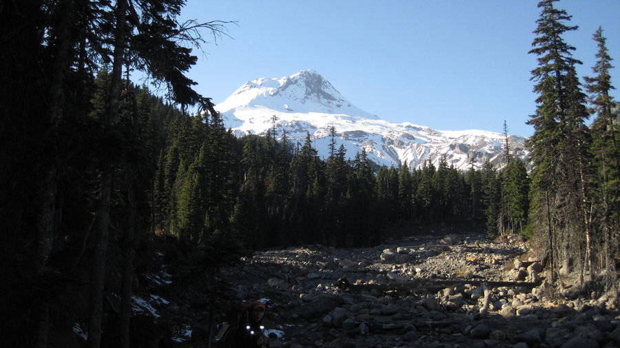
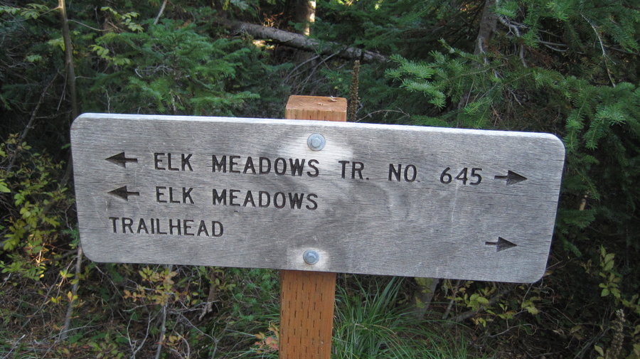
Elk Meadows-Newton Creek Loop
13 miles of hiking • 3250' elevation gain • 1 night
Overnight backpack w/ Carissa to Elk Meadows. Sunny, beautiful fall Saturday. Got to the trailhead around 10:30 and there were about 10 cars and many dayhikers w/ dogs enjoying the weather. About an inch of scattered snow on the trail still and some in the meadows, but most was melting out in the sun. Set up camp in the spot behind the shelter and attempted a Gnarl Ridge ascent but hit snow about a half mile up and thought better of it since it was getting late. Returned to camp and watched the sun set on the mountain. About 39 degrees at night. Saw several shooting stars above Hood and enjoyed the interesting phenomenon of Portland back-lighting the mountain from this vantage point.
The next day we decided to reattempt the Gnarl Ridge climb and get to Lamberson Butte. Carissa said, "I don't want to do 9 miles today!" It seems I always take her on some crazy adventure hikes where we do more miles than she feels comfortable with. Who knew? I assured her it woud be more like 5 or 6. We set off up the trail where we saw some big elk prints. After climbing up up and up we reached the junction of the T-Trail. As we climbed, we ran into more and more snow. Near the treeline there was about 10-12 inches. Saw several other couples on the way up and followed tracks in the snow of some Timberline Trail backpackers. They were calling it quits about halfway around b/c of the snow. Hood looked great in its brand new snow cloak, and we enjoyed this rare snowy closeup for awhile as the wind howled around the twisted old pines.
We descended the now slushy snow trail back to the Gnarl Ridge junction and decided to return via Newton Creek trail. Down, down, down into the giant canyon we were just looking down into an hour earlier. After the sketchy crossing of Newton Creek and the tricky rope climb up the bank, we were finally on our way up to meet Newton Creek trail. There are some really amazing old trees on the high point of this trail. Massive thick silver trunks. There is also some crazy exposure up there for you agoraphobes (my wife) as you walk the narrow ridgetop for about 50 yards or so.
Made our way back down, thankful to be on the easiest section of trail all day. Returned to the car around 5:10pm. "Good news honey! Only 8.5 miles today!" Headed off to Parkdale to try some Solera beer. Pretty good stuff. Back to PDX by 8:30pm.
October 5 – October 6, 2013


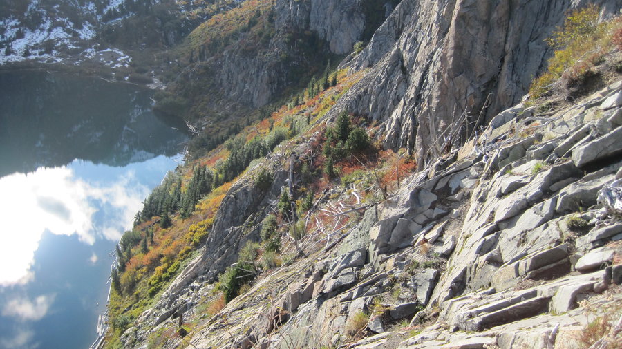
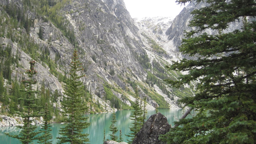
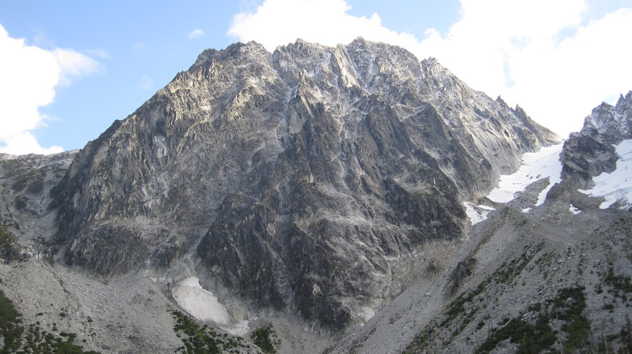
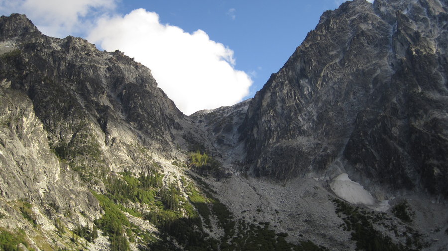
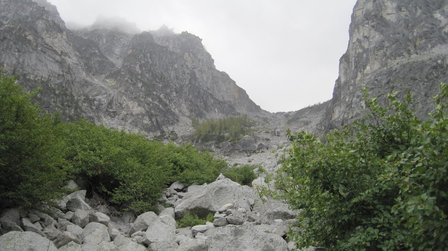
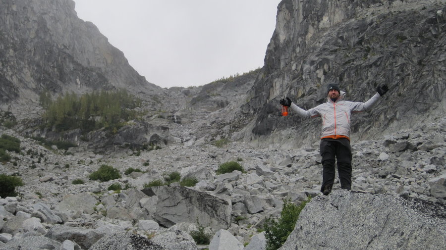
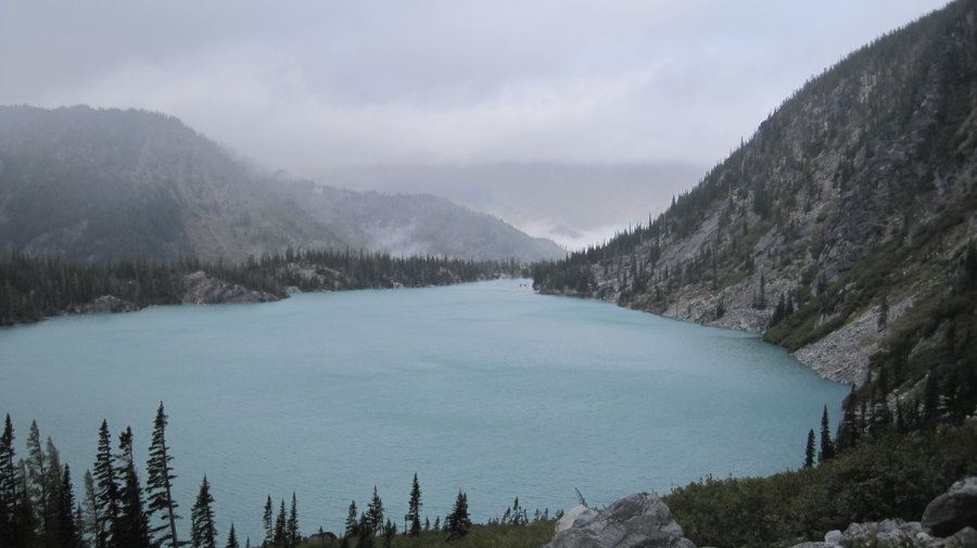
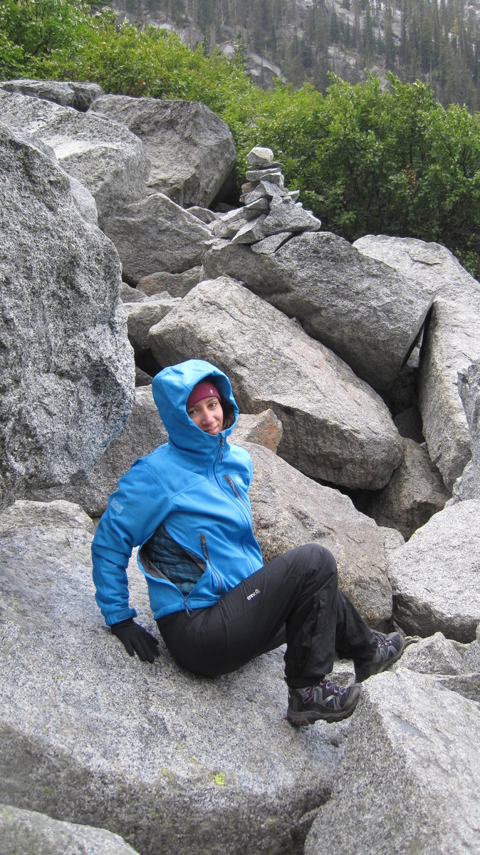
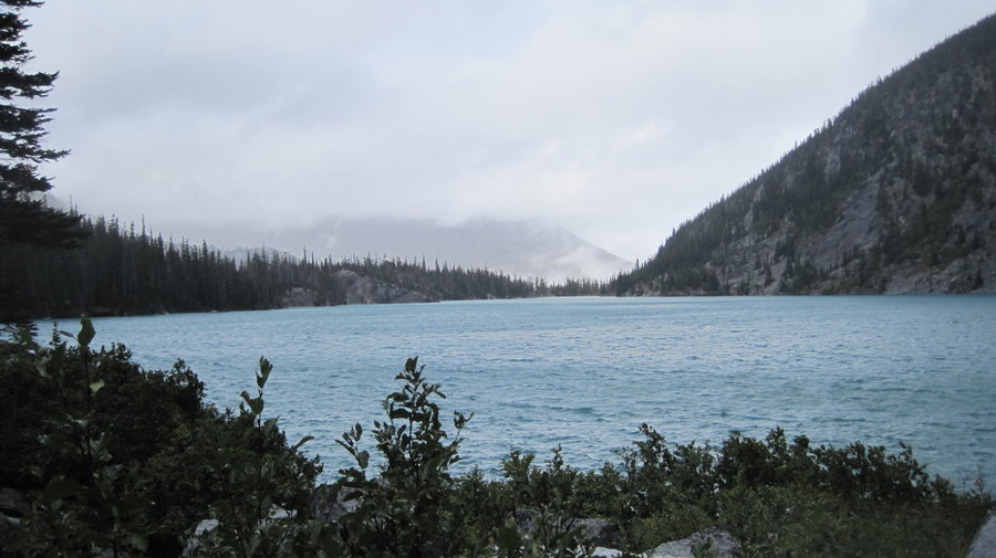
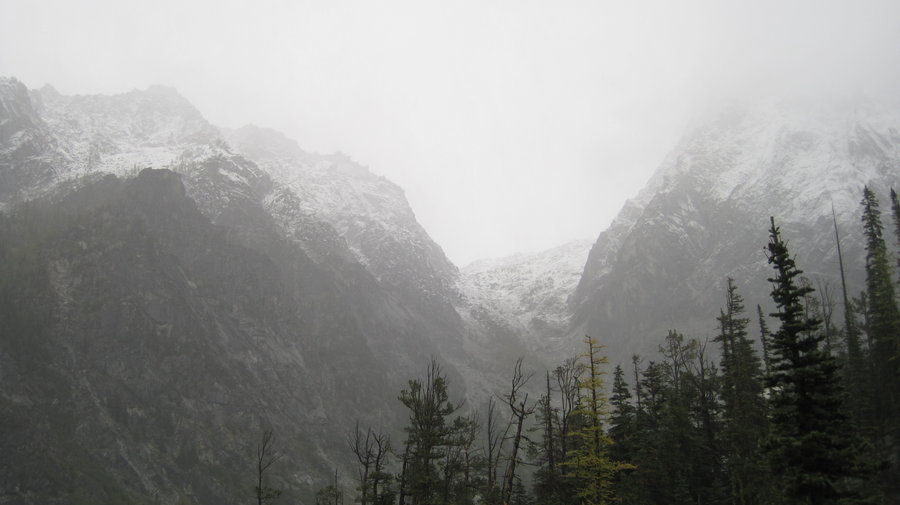
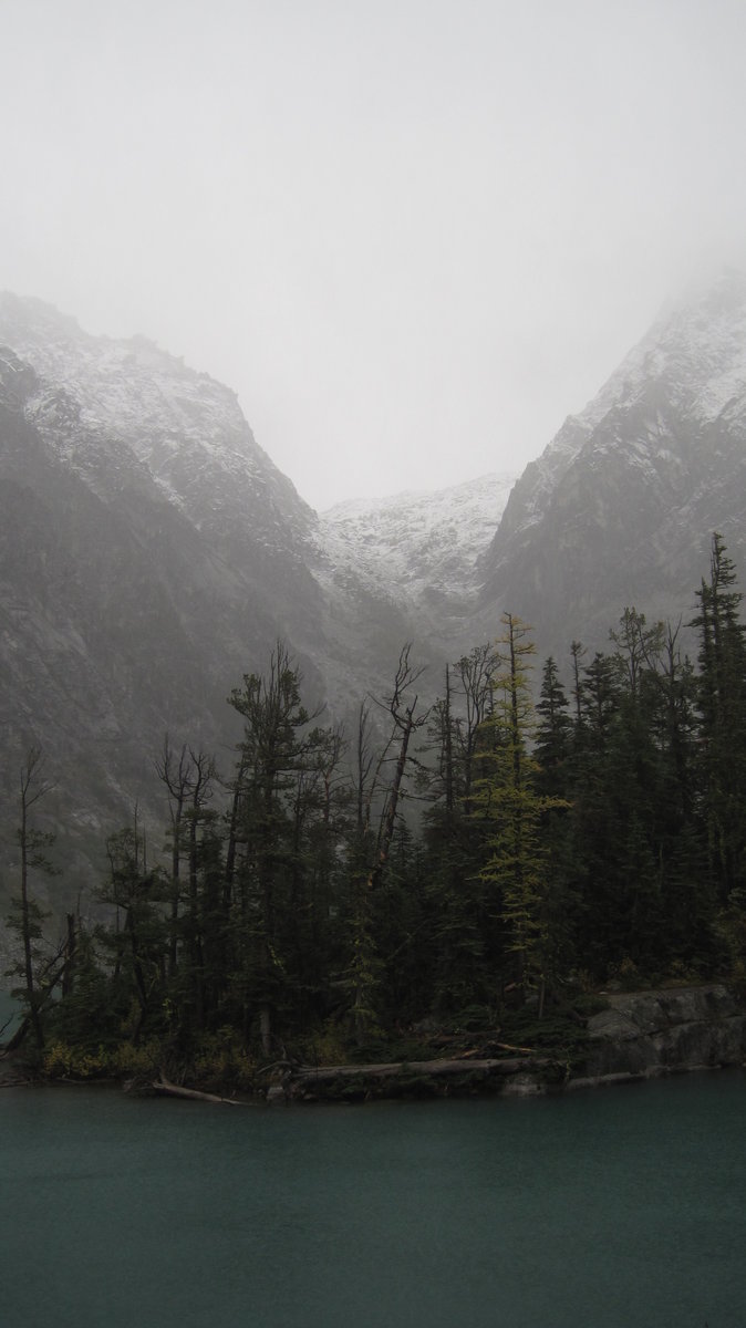
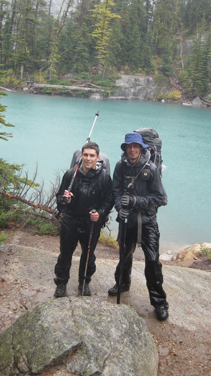
Colchuck Lake, Enchantment Lakes Wilderness
13 miles of hiking • 2000' elevation gain • 2 nights
Got rained out on my Enchantment Lakes trip, so stuck at Colchuck Lake at the bottom of Aasgard Pass for two days hoping for better weather. It never came. Hiked out in the pouring rain.
September 26 – September 28, 2013

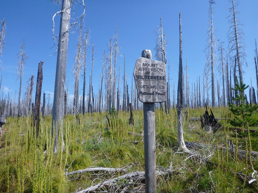
Jefferson Park Loop
20.5 miles of hiking • 4750' elevation gain • 2 nights
Left PDX Friday night and camped at Breitenbush Campground. The next morning we set out to do an overnight loop to Jefferson Park. Starting at S. Breitenbush trailhead, we hiked 5.5 miles up the wooded flank of Park Butte Ridge. As we neared the top, the trail passes through some small meadows and a talus slope and descends into Jefferson Park lakes area. After lunch near Park Lake and a quick swim, we set out for Bays Lake where we would spend the night.
We grabbed the last designated campsite and watched scores of backpackers pass by in search of an open one. After setting up tents, we walked over to Scout Lake where lots of people were scurrying to set up camp or search for an open site.They really should make this area Permit Only to limit use and curb illegal camping, in my opinion. There are not enough sites and too many campers.
After a peaceful evening with a beautiful sunset on the face of a huge Mt. Jefferson towering above us, we went to bed. It was a mostly sleepless night for this hiker, as the wind continued to gust and blow, though the skies were clear, and I tossed and turned. The sun rose through a red sky around 7am. Clouds began to roll in and it threatened rain. After breakfast, we broke camp and decided to explore Russell Lake. The skies cleared as we hiked out the PCT through the huge meadow of Jefferson Park to the now deserted lake. Where did all the campers go? Then we headed back to Park Lake for an early lunch and a swim. After enjoying the sun for a bit, we decided to start the hike out.
Hiking South along the PCT, we passed several thru-hikers on their way to Canada. I hope they make it! We took a turn onto the Whitewater trail which descends along Whitewater creek, so named b/c of the silt from the glacial runoff turns the water a milky white, which it was. The trail slowly descends a long ridge with incredible views back to Mt. Jefferson and the huge Whitewater Creek valley far below. Eventually we reached the Triangulation Point trail, where we split off and ascended a ridge on a scarcely used trail. Some blowdown to contend with, but it was pretty smooth until we reached the Crag "Trail" which is signed as unmaintained. This was an understatement.
The "trail" follows some orange flagging through the forest, with mostly good tread but extremely overgrown vegetation on all sides of you. It descends the ridge steeply, losing almost 2000 feet in about 2.5 miles. Some sections the Rhododendrons had made it almost impassable, but we fought our way to the Breitenbush river where we promptly lost the trail. We bushwhacked through thick alder and maple and realized we needed to cross the river. Frustrated, we turned back, found a giant tree across the river and found it is actually part of the trail. It's marked and slightly worn by tracks across it. We finally made it back to the car and celebrated our "off trail/on trail" return trip w/ Coronas from the cooler! Great weekend all in all.
September 13 – September 15, 2013

Bear & Blue Lake Loop, Indian Heaven Wilderness, WA
13.5 miles of hiking • 1500' elevation gain • 1 night
September 7 – September 8, 2013
 2
2
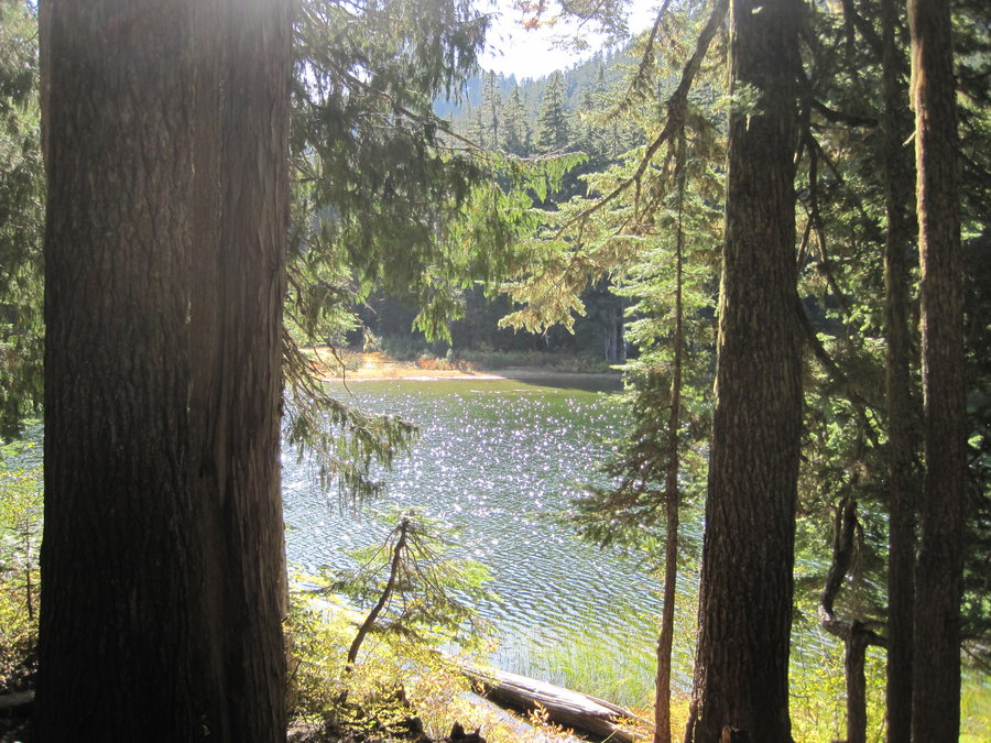
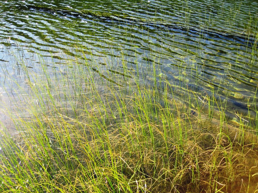
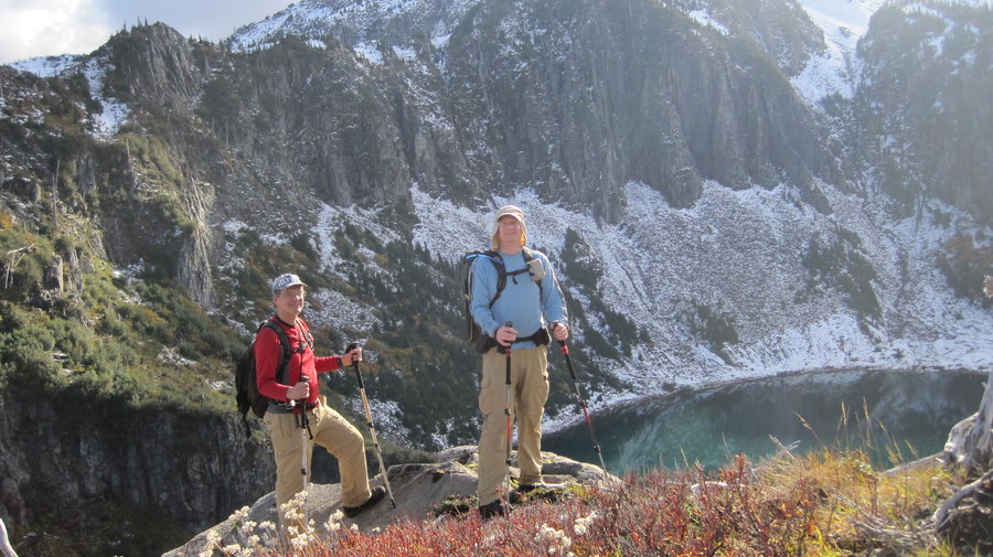
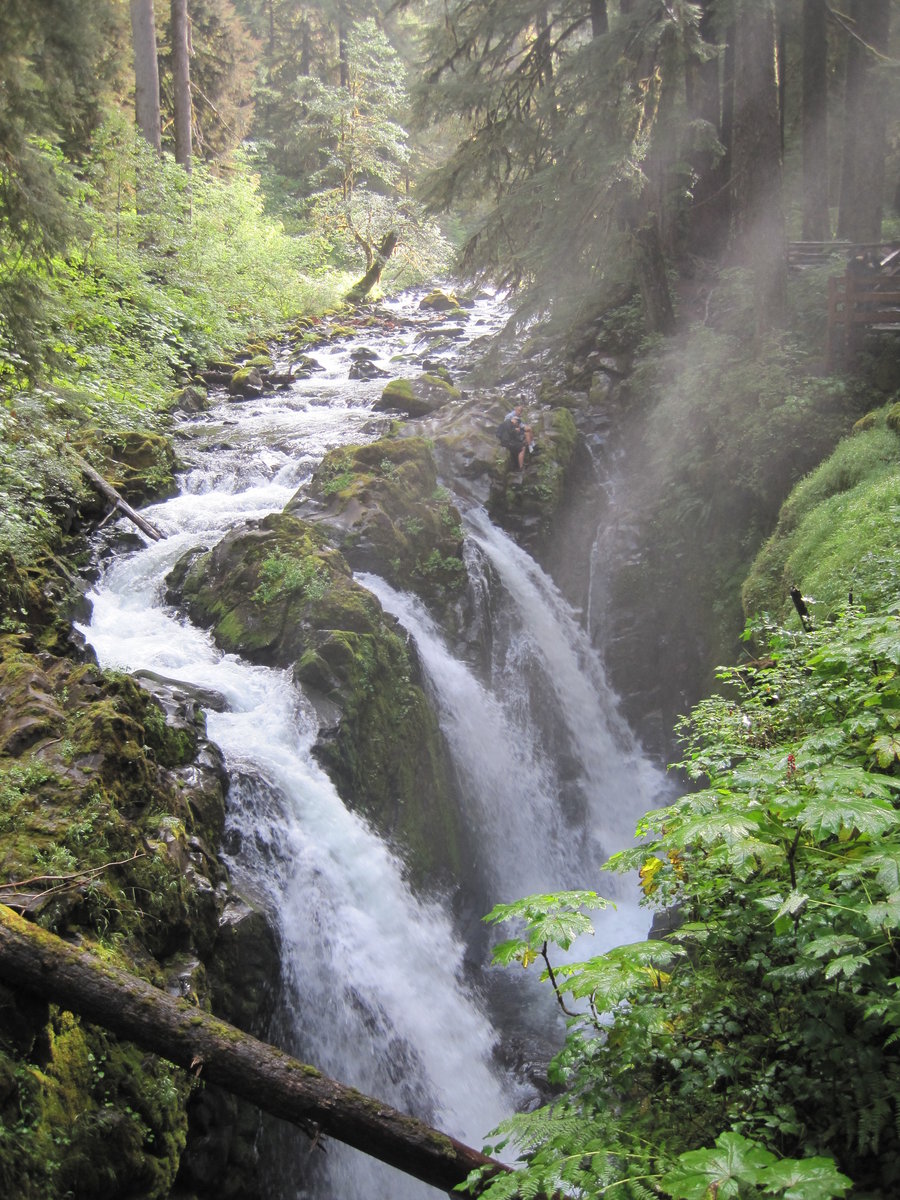
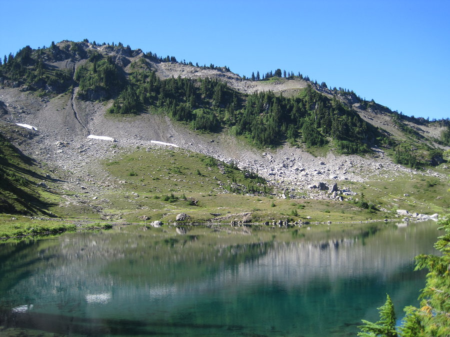
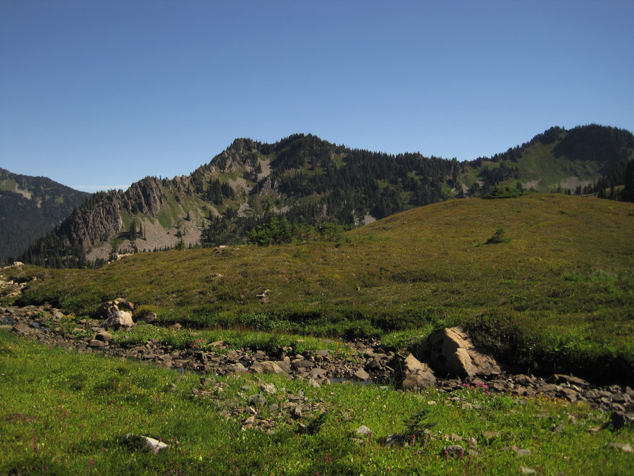
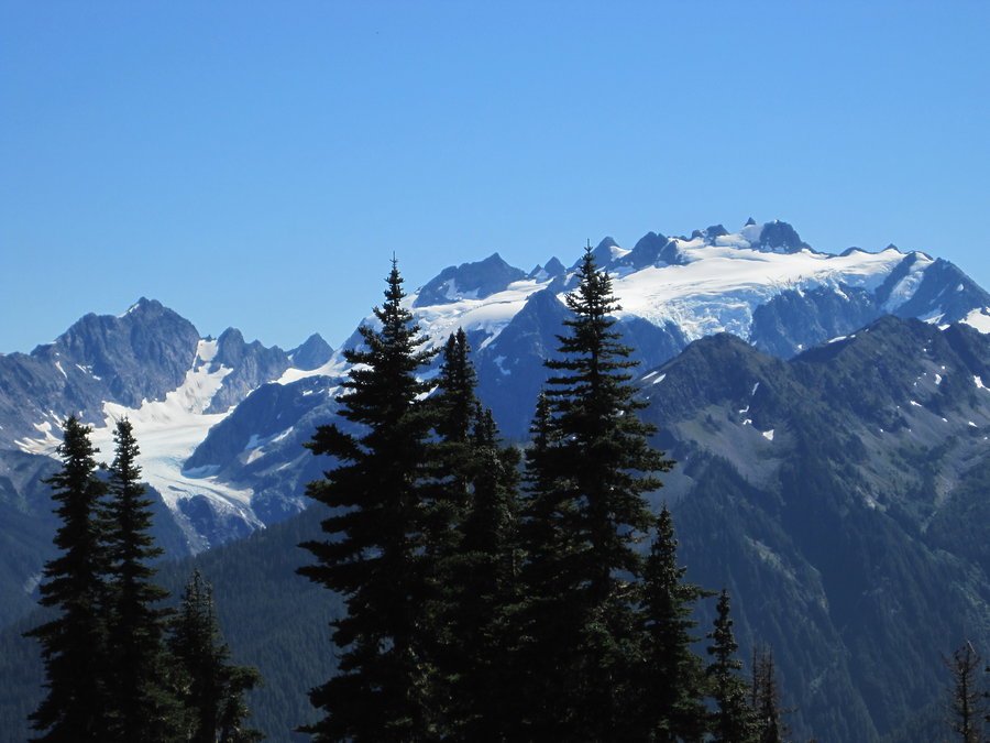
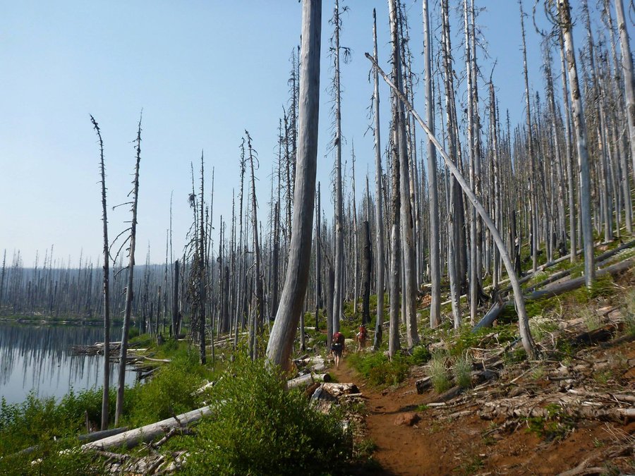
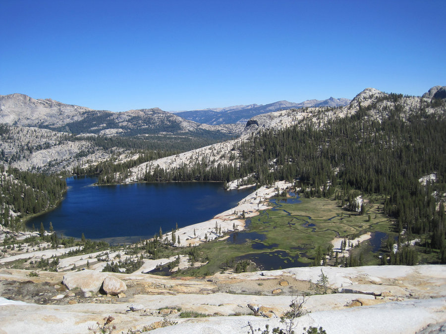
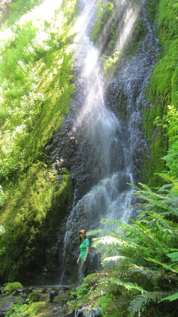
Seven Lakes Basin, Olympic Nat'l Forest, WA
32 miles of hiking • 10250' elevation gain • 4 nights
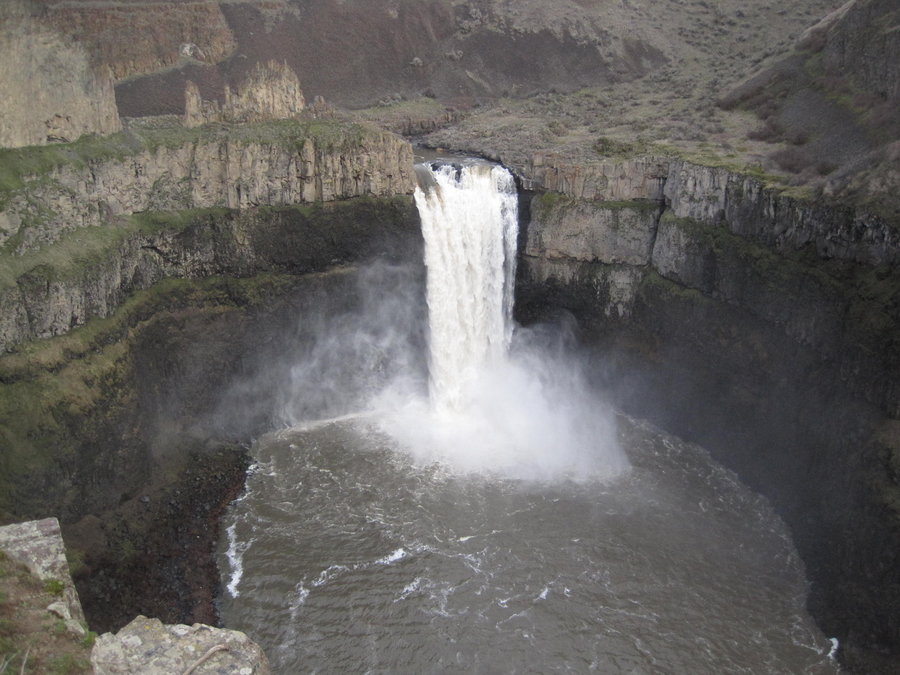
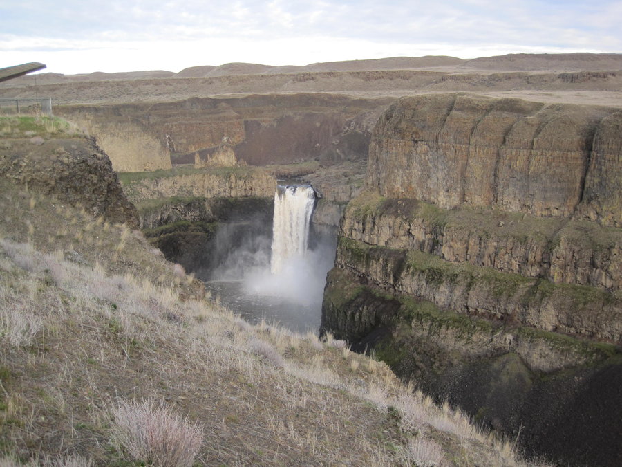
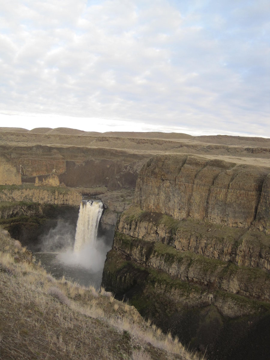
Left PDX around 3:30pm on Thursday and camped at Heart O' the Hills campground. The next morning we arrived at the Ranger station to pick up our permits and bear canisters. About 10 other ppl there with us. We drove another hour or so to the Sol Duck River Trailhead where the loop trail begins. There is a hot springs resort nearby and another campground.
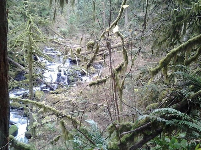
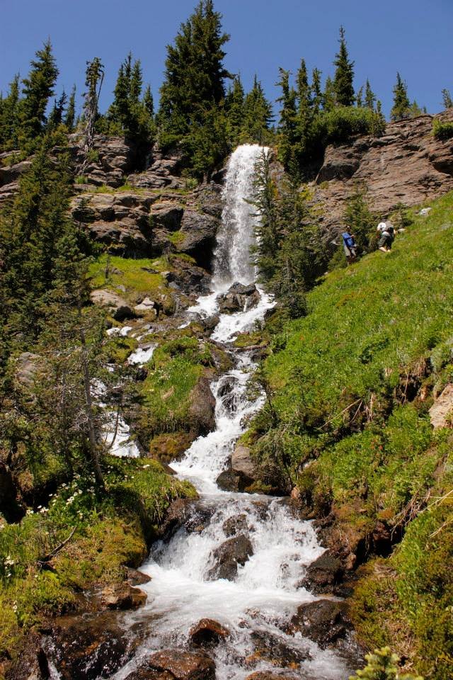
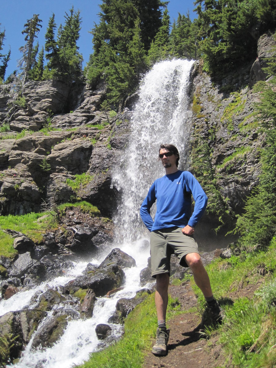
It was partly cloudy and around 65 degrees, pretty humid. The trail starts out in a beautiful rain forest w/ large trees and along the Sol Duck River. After a half mile or so you come to a junction where you begin and end the loop. We went right and shortly arrived at Sol Duck River falls. (photo 1) Apparently this waterfall is the most photographed in the state of Washington. It's cool, but living near the Columbia River Gorge spoils you for waterfalls.
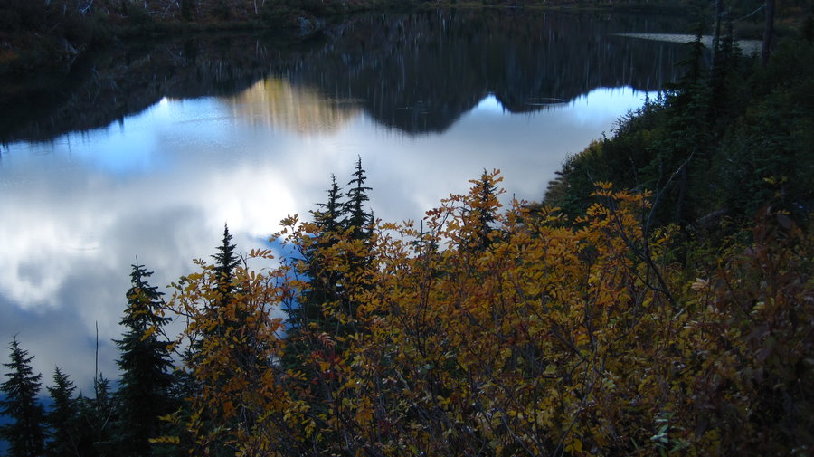
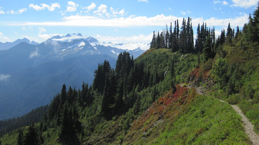
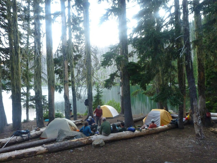
The trail begins climbing out of the drainage and doesn't stop for 7 more miles. There is a brief level spot near Deer Lake about 4.5 miles in, but continues climbing up to the High Divide trail. Once we reached the high divide, we almost immediately came to the use trail down to Lunch Lake, our camp for the next two nights. The use trail was about a mile, descending down steep steps to the lake shore. Continuing on you reach the camps, w/ about 12 sites nestled in and around the foothills surrounding the lake. One site to fit our 4 tents.
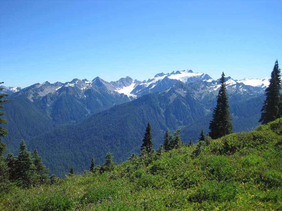
Day 2 we had perfect weather, clear skies and 75 degrees. It was a free day, and we spent it exploring the many lakes and lakelettes nearby. Some of us walked along the High Divide trail, some of us swam and took photos.
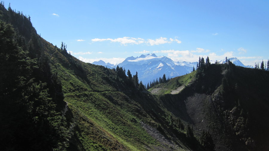
Day 3 we got up, broke down camp and set off for the next destination, Heart Lake about 4.5 miles away along the High Divide. Along the way, we climbed to the top of Bogachiel Peak (5,474 ft), then descended to Hoh Lake. There were thousands of tadpoles swimming in the lake. They were circling the perimeter in an unbroken chain. We also spotted a bear on a steep cliffside meadow way above the lake.
Heart Lake is a small pool with about 7-10 campsites scattered on the various hillsides near the lake. The flies and gnats were terrible here. They were bad all weekend, really. The day started beautifully, but by 5pm the clouds had made their way up one side of the divide and down the other and had us completely socked in. Strangely, we could see blue sky faintly through the clouds directly above so we must have been just barely covered. It stayed cloudy until after sunset, and then again the clouds were there when we awoke.
After breaking down camp, we descended 3 miles down to the Sol Duck River and then 5.5 miles more along the river back to the parking lot. Celebratory beers and burgers at next door gastropub in Port Angeles, WA.
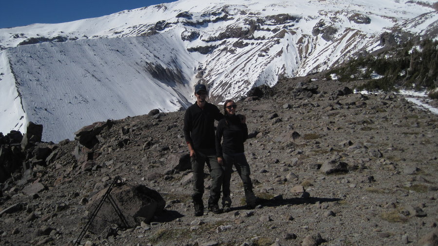
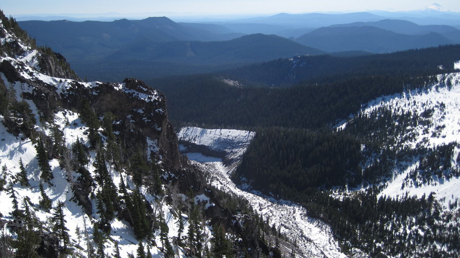
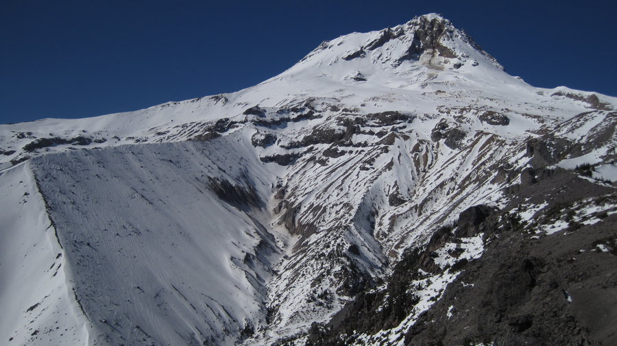
August 29 – September 2, 2013

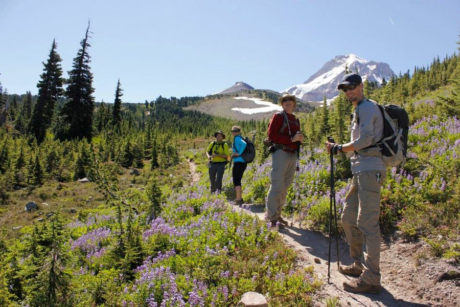
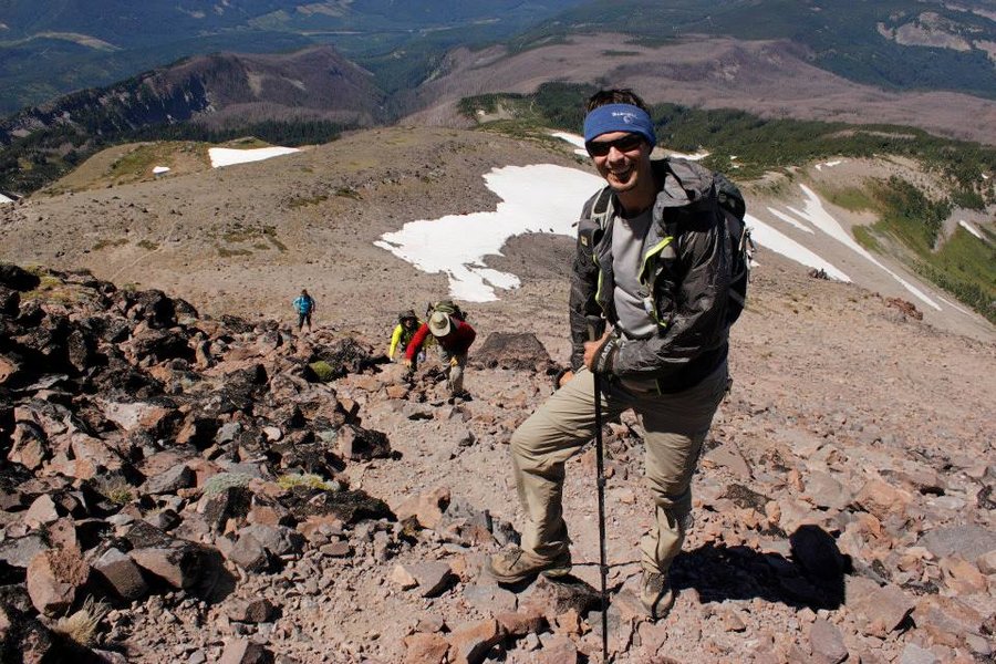
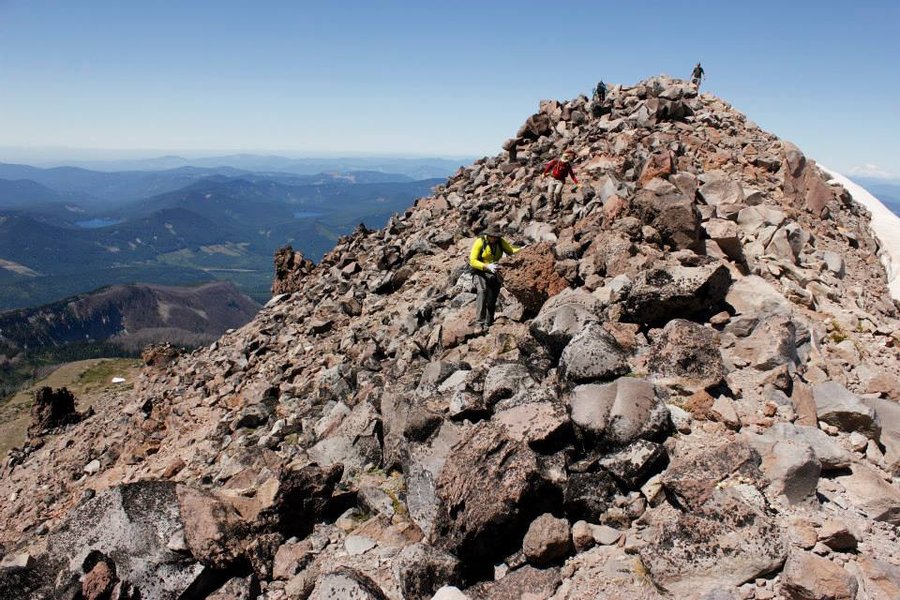
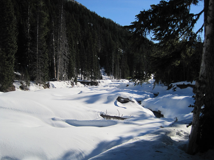
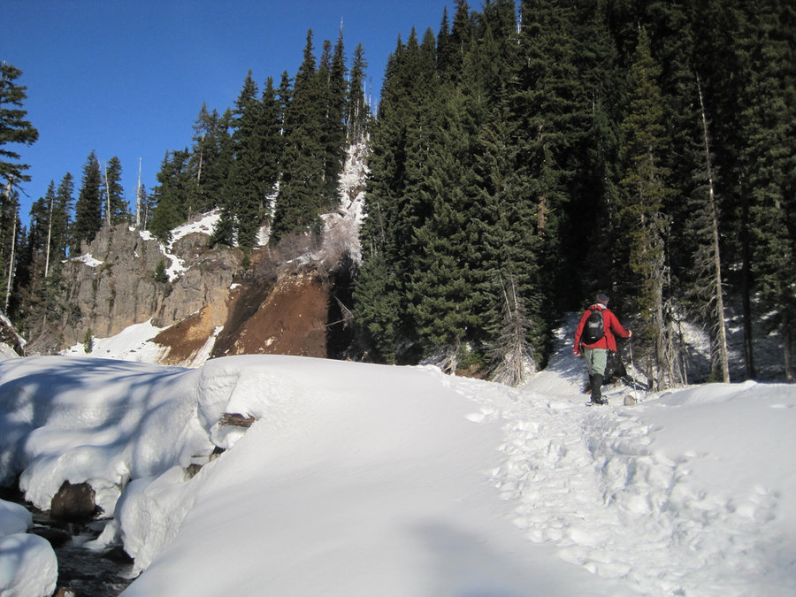
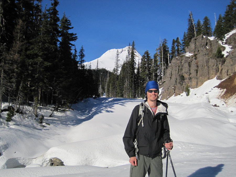
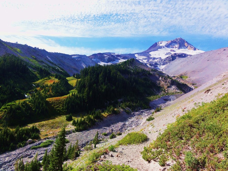
Timberline Trail
50.5 miles of hiking • 11000' elevation gain • 4 nights
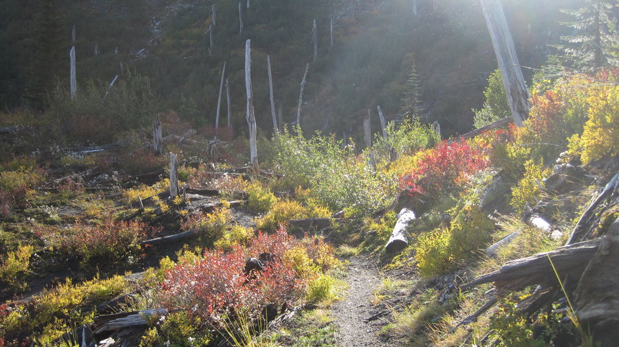
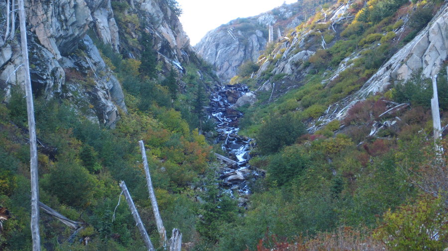
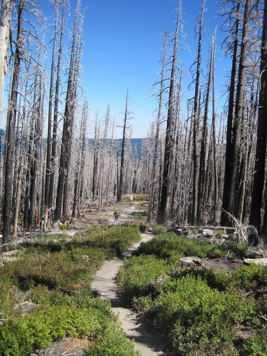
Timberline Trail loop starting at Cloud Cap. Hiked from the closed gate 3 miles up to the campground on Thursday night. Friday morning we set out to cross the Elliot washout and get it out of the way ASAP. We hiked up to the obvious trail going down into the washout, hopped the rocks and streams and approached the giant scree slope. We didn't see any ropes that others have mentioned, so we somehow scratched and clawed our 40lb packs up the wall of ash and rocks. At the top, breathing heavily and looking down at the others in my group suffering their way up, I looked to the right and about 75 yards away saw a cairn and a giant rock with a rope (!) around it! Doh! It's nearly impossible to see from the bottom or the other side of the wash. So much for an easy crossing. We soldiered on, down down down the drainage to a bushwhack back to the T-Trail and on to Elk Cove. First night we camped at Cairn Basin.
Day 2, we trekked to McNeil ridge, past the ponds and down some switch backs to small meadows and took a gnarly shortcut straight down the ridge through the woods down a slope that I can only describe as "hella steep". It cut about 3 miles off our hike, but we paid the price in yellow jacket stings as we disturbed a nest. I can't recommend this route to anyone. We went across the Muddy Fork, around Yocum ridge, had lunch at Ramona Falls and headed for our evening destination, Paradise Park. A sidebar: just past Ramona Falls, at a junction we chatted w/ a 72 yr old man doing the Oregon PCT. It's never too late! It was here that we got distracted and missed the junction that put us on a path to the Ramona Falls parking lot and not the continuation of the T-trail. We went about 1/2 mile before we realized the mistake. The junction is signed well from the OTHER direction. The climb up to Paradise Park from the Sandy River crossing is absolutely brutal. I just kept saying the word "relentless" in my head. We were rewarded for our hard work, however, with a wonderful camp site, the "Split Rock" at Paradise Park. Beautiful cold evening, clear night and nearly full moon with the city lights of Portland in the distance.
Day 3 began w/ visions of lunch and a beer at Timberline Lodge which was to be our lunchtime stop. It didn't dissappoint, with massive baked potato and one of the best salads of recent memory, along with a cold beer. We refilled water, stocked up on Advil and continued the hike across White River where I played in the snow earlier this year. Then another long climb to Mount Hood Meadows and miles of ski lifts and flowers. It's too bad those ugly lift chairs are there, this stretch of mountain is really very tranquil and beautiful. We had determined to camp at Heather Canyon and arrived very tired and a little annoyed that a wonderful spot we had scouted a year previous had become too brushy to camp. We settled for some great sites near the Clark Creek instead. I took a much needed bath in the cold silty creek, dried off in the sun and after sunset, relaxed to the sounds of the rushing water and the dark shadow of Hood looming overhead as the stars twinkled. Wonderful night.
Day 4 we got a quick start and filtered water at Newton Creek knowing the worst was yet to come. We had to begin the 3.4 mile ascent gaining almost 2000 ft. from Newton Creek up Gnarl Ridge to Lamberson Butte. This is no easy feat carrying 40 lbs and with almost 40 miles under your belt in 3 days. We struggled up and up and finally reached the top around 12:30pm. After lunch we had an insanely long descent back to the car, losing almost 4000 ft in 5.5 miles. Our feet and knees were screaming after 3 hours of constant downhill, but our minds and hearts were happy to have completed our goal. On to Double Mountain for pizza and beer!
August 15 – August 19, 2013


 2
2
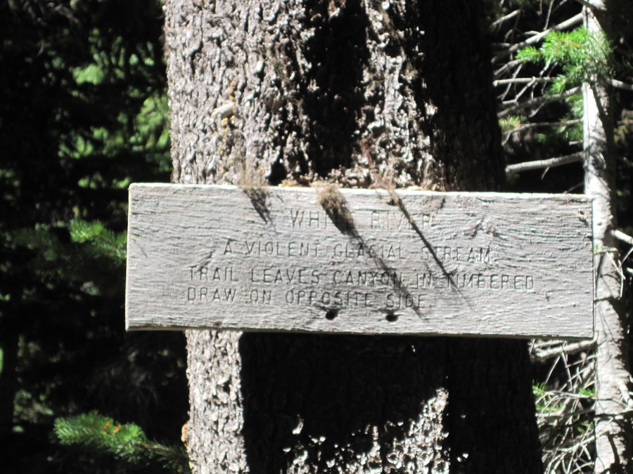
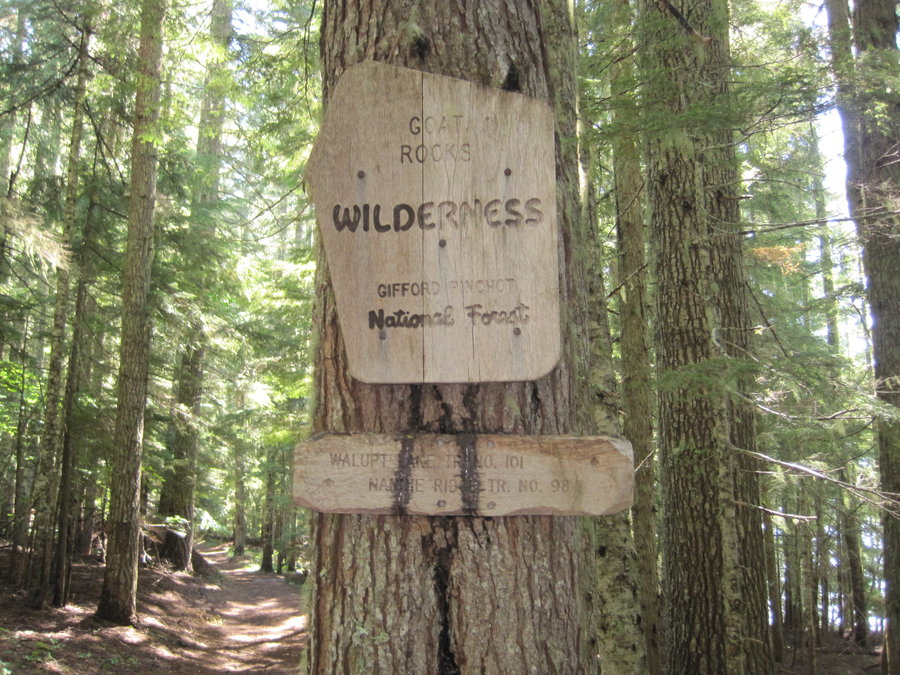
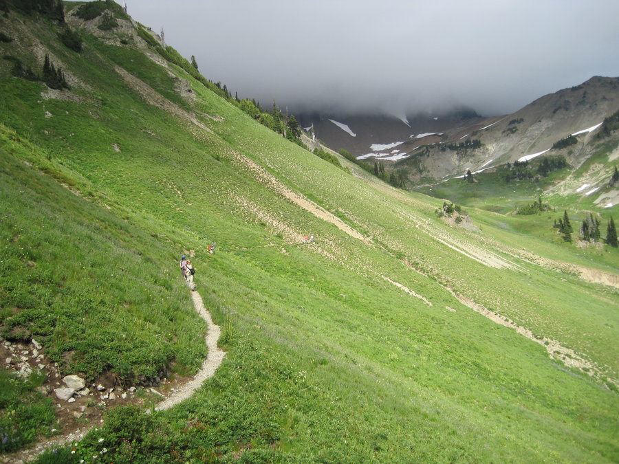
Goat Rocks Wilderness
16.5 miles of hiking • 2250' elevation gain • 2 nights
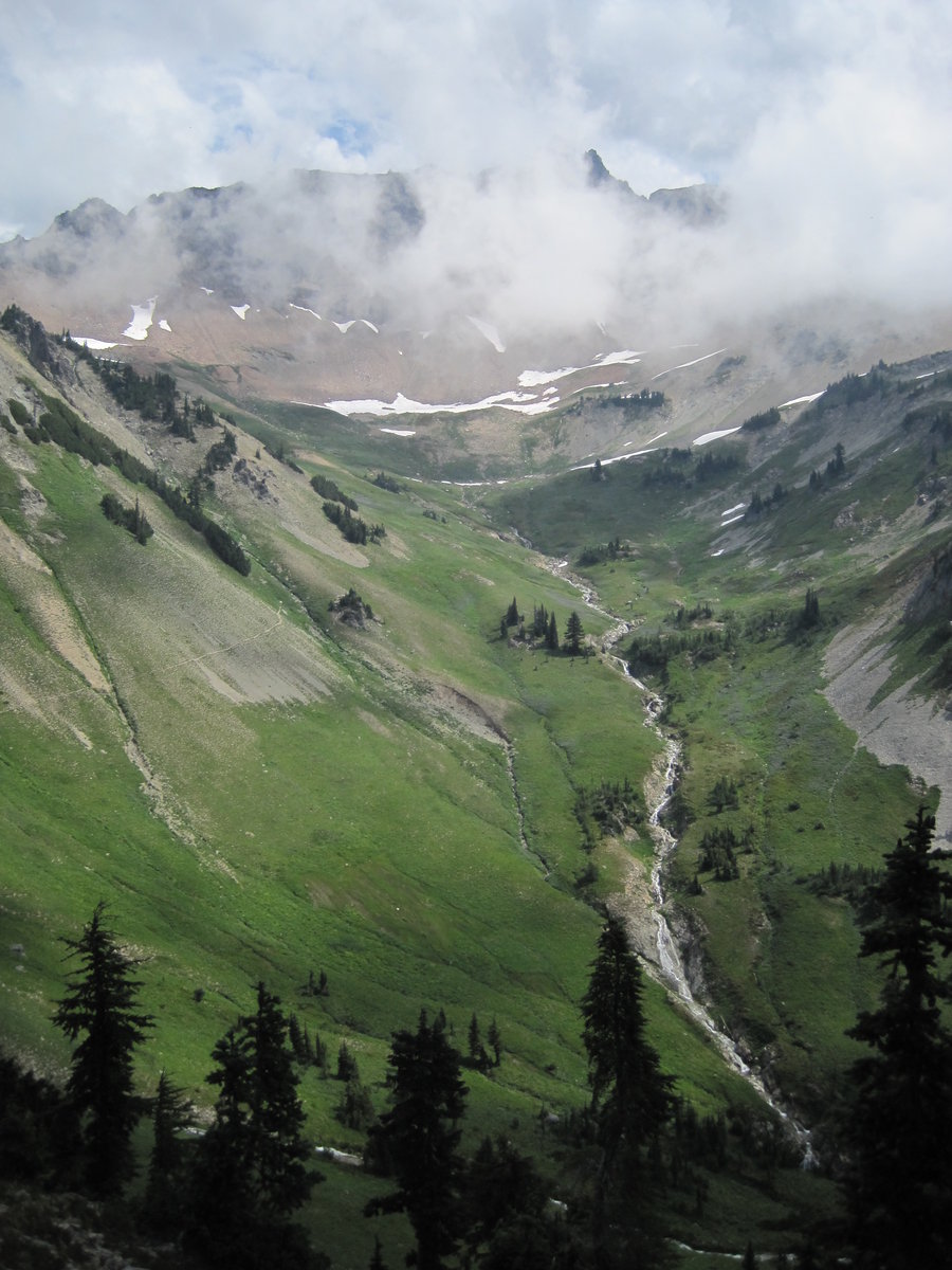
After a complex car shuttle, we parked at Walupt Lake and hiked up the steep wooded trail on Nannie Ridge. It was ridiculously humid from a large storm the night before and we were all soaked in sweat immediately. We left our packs and hiked up the spur trail to Nannie Peak. We didn't have alot of good views due to the clouds but that would remedy itself in the following days. We continued on with plenty of black flys for company. We passed Sheep Lake as thunder sounded in the distance, heading for the PCT.
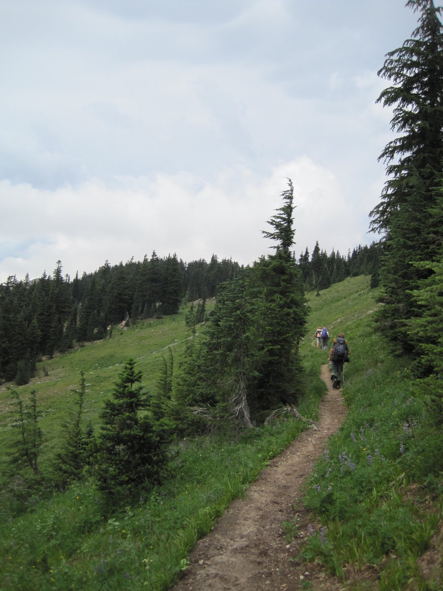
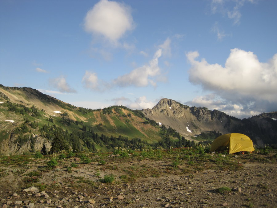
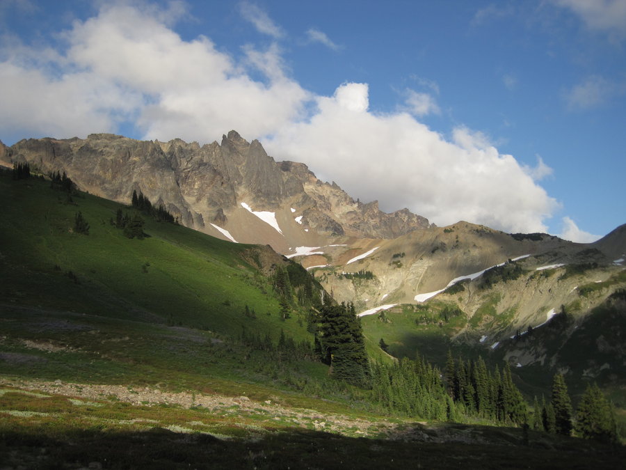
The trail joins the PCT @ Cispus Pass. We hiked up a rocky slope as clouds swirled and gathered overhead and we were passed by some thru-hikers. Near the top, we climbed over a large snowbank covering the trail and got our first views down into the enormous bowl of Cispus Basin. As we snapped pics of the giant sloped hillsides, many waterfalls, flowers, and meadows, it began to sprinkle. Fortunately it didn't last long as we scouted for campsites. We found a pretty good one near the edge of the bowl and settled in for the evening. We had a nice fire and met some interesting PCT hikers camped nearby. Johnny and I hiked up to a ledge above to look at some awesome views of the sunset and an astounding occupied campsite that we wanted for the next night if available.
The next morning, some of the group decided to do a dayhike up to Snowgrass Flats and Old Snowy. Carissa hurt her leg the day before, so we decided to head up and see if that campsite was open today. It was and we settled in and waited for the sky to clear. It finally did as the rest of the group returned from their dayhike around 6pm. Our new spot was up on a ledge overlooking the basin and surrounded by scree slopes and a glacial fed stream flowing nearby. Wildflowers surrounded the edge of the stream. Spectacular spot! We spent the night watching the Perseid meteor shower. We were awakened around midnight by loud crashing rocks from a nearby scree slope rock slide. We were rattled, but went back to sleep with ears open.
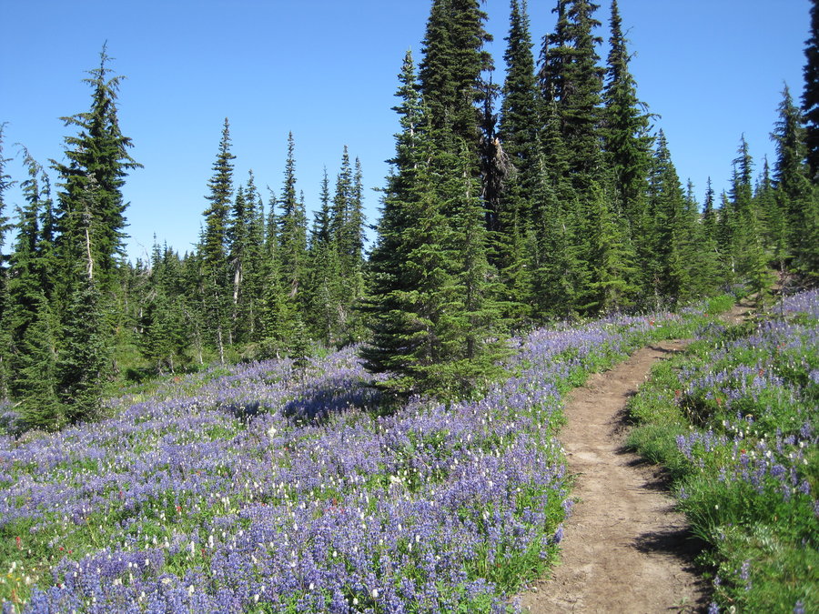
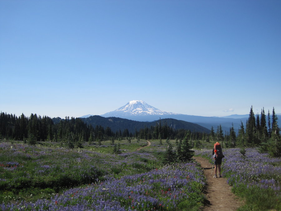
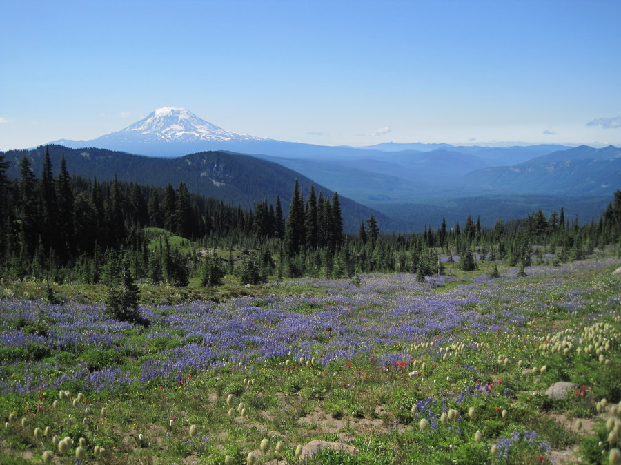
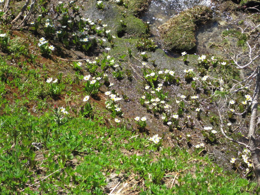
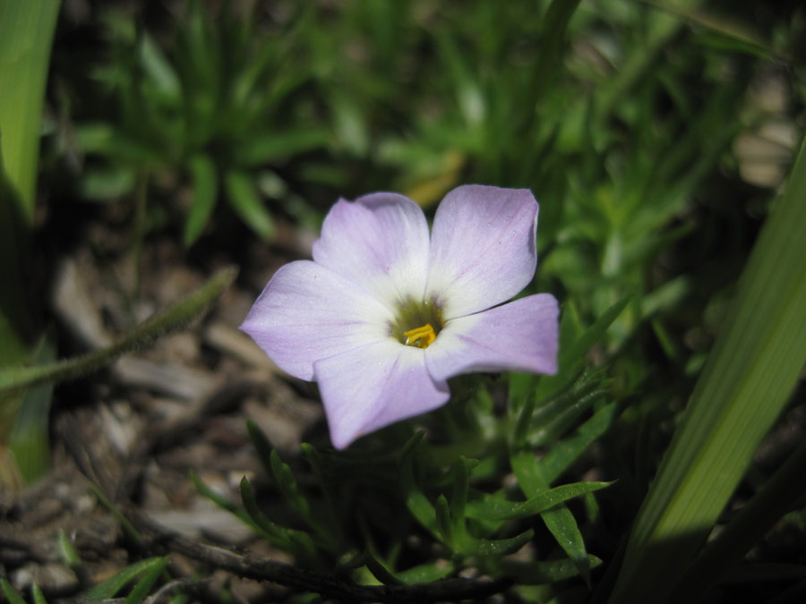
Monday we continued on to the insanely flower filled Snowgrass Flats and huge views of Mt. Adams. Almost every wildflower I know was represented. We went down, down, down through swarms of flies and mosquitoes to a nice creek crossing where I got in to cool off. Then on to the Berry Patch trailhead past scores of backpackers heading in for the week. Stopped in Morton for margaritas and mexican food.
August 10 – August 12, 2013


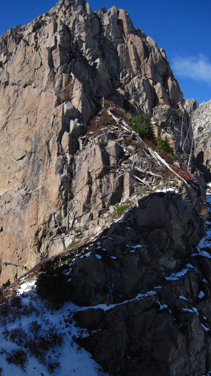
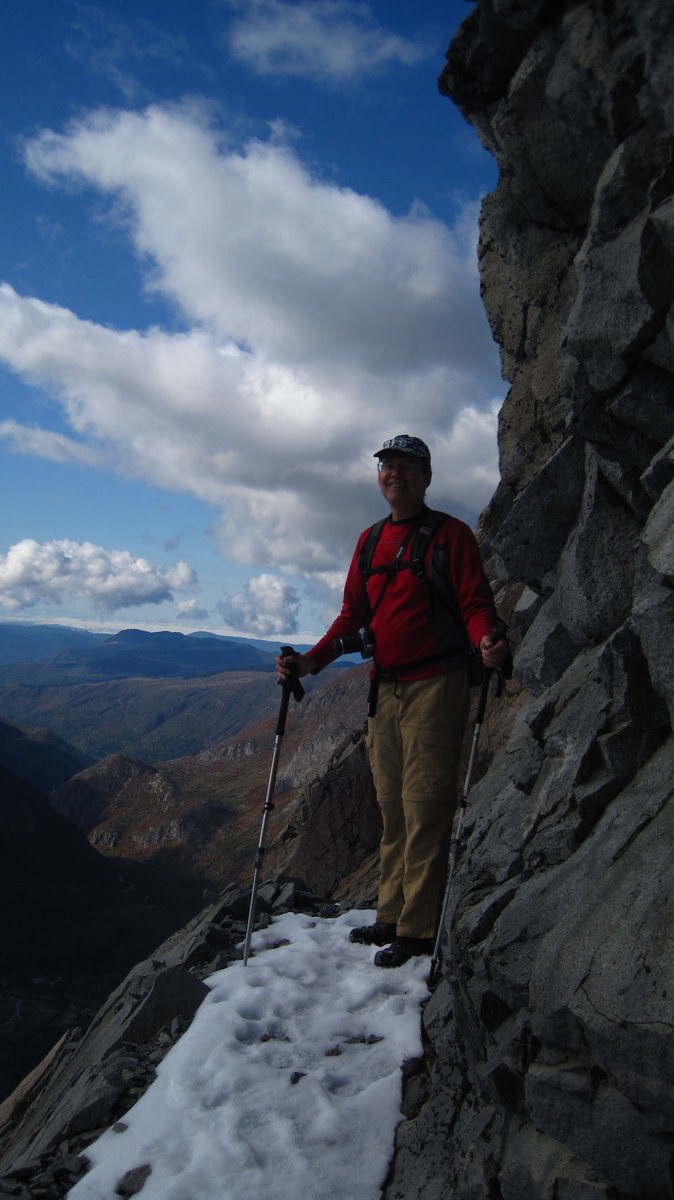
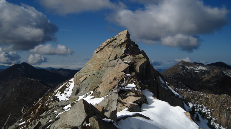
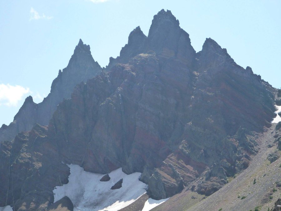
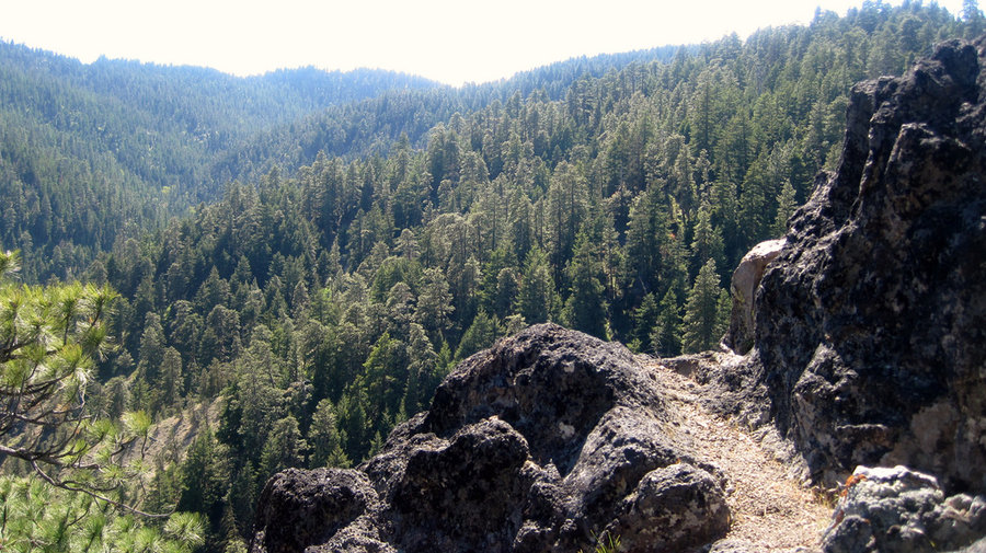
Three Fingered Jack Circumnavigation
25.5 miles of hiking • 2500' elevation gain • 2 nights
Very hot, dusty and smoky trip up the PTC under the peaks of Three Finger Jack to Wasco Lake. Crowded campsite, not alot of bugs. Early start and a trip up Canyon Creek meadows to fading flowers. Return trip via Jack Lake and from there a faint trail to Booth Lake where we took a dip and ate lunch. Even fainter trail and a bushwhack down to beautiful Square Lake. Closed the loop to the trailhead to sounds of Hwy 20.
August 2 – August 4, 2013

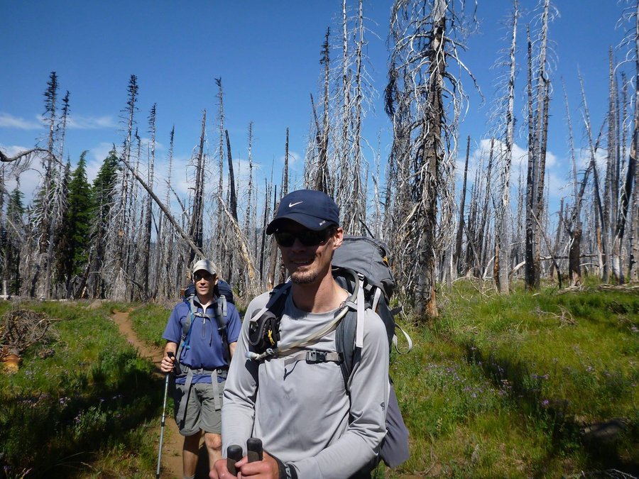
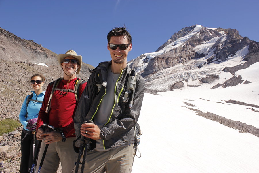
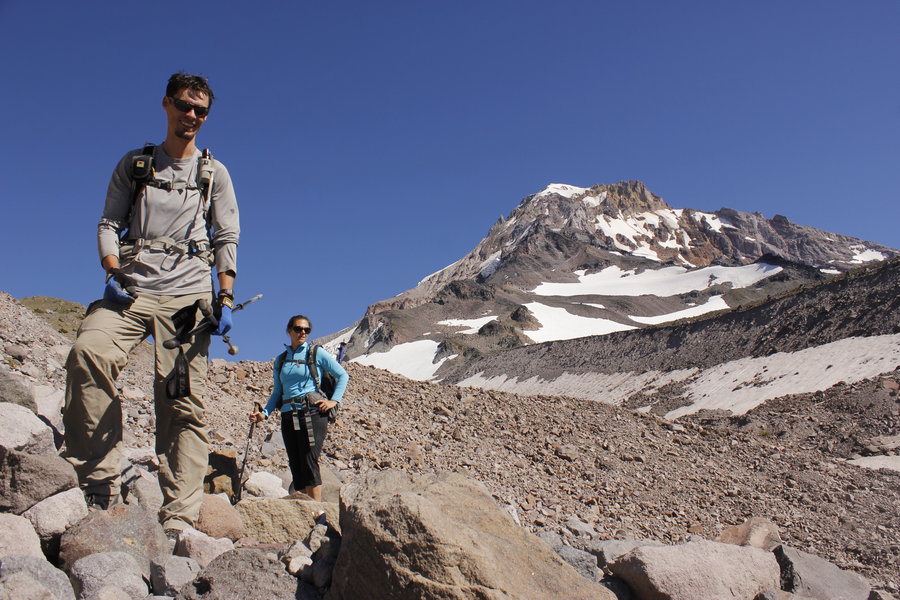
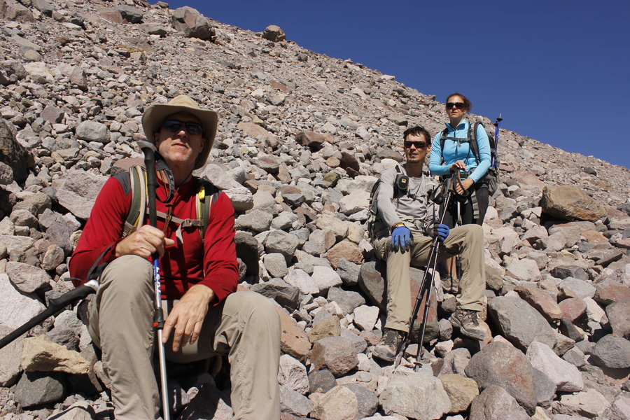
Barrett Spur, Mt. Hood, OR
14.5 miles of hiking • 4750' elevation gain •
A mostly off trail trip up Barrett Spur via the Vista Ridge Trail. Hiked several miles through burned forest to the Timberline trail. A side trip to Elk Cove for some views of the mountain, then back, and a trek up to tiny Dollar Lake led to views of Barrett Spur. We started trekking directly up from there and didn't stop for a long time. At the top we listened to thundering cracks as glaciers moved. We descended directly down the loose shale and scree onto the Ladd Glacier. A little glissading led us further into the Ladd Creek valley where we had to bushwhack, boulder scramble, slide, climb and hop down, down, down to the Timberline Trail and Cairn Basin. Took a short break, then hiked down Eden park for flowers. Continued walking through the burned forest and back to the car. Long day ends with Pizza and Beer at Double Mountain.
July 28, 2013

Salmon River Hike
7 miles of hiking • 250' elevation gain • 1 night
Overnight camp off of Still Creek Rd near Mt. Hood. Neighbors camped nearby shooting guns, fireworks, playing techno music late at night. sigh Nice creek next to camp. Next day was an easy ramble along the Salmon River. Several forays into the river on this 90 degree day.
July 20 – July 21, 2013

Hellroaring Viewpoint
11 miles of hiking • 2000' elevation gain •
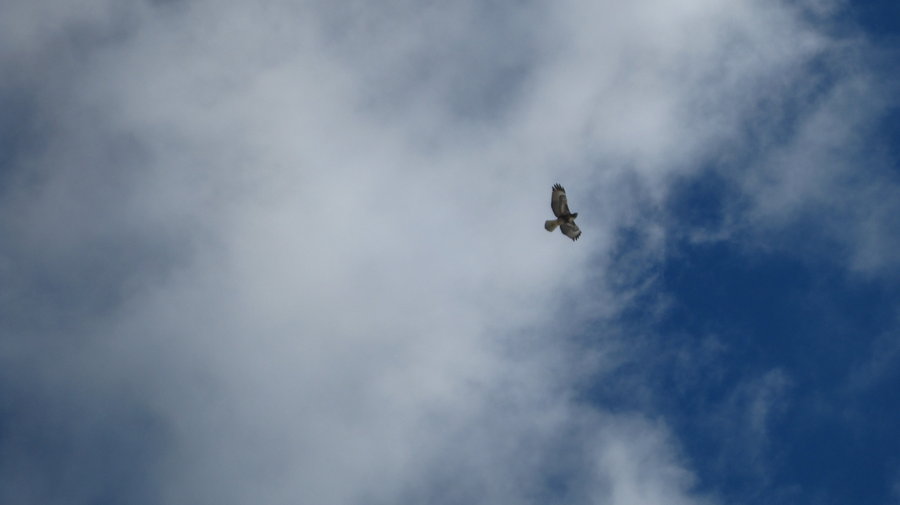
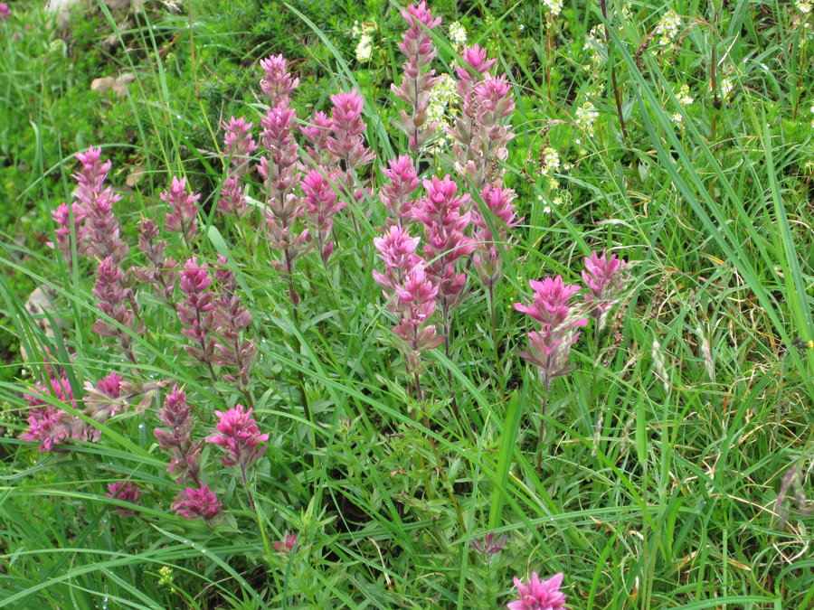
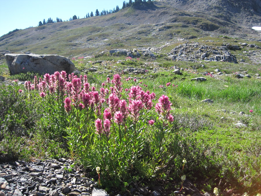
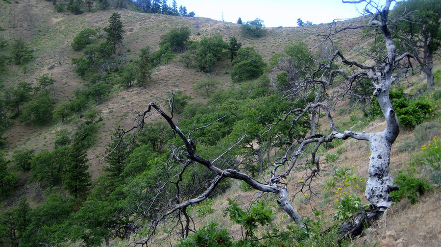
Left from the South Climb Trailhead around 11:00 am. You climb for 1.3 miles through last years burned forest to the Round the Mountain trail, which heads east towards Bird Creek Meadows. The trail was in good condition with minimal snow patches. Flowers have started along much of the trail, though large patches of bare dirt are prevalent. Once you enter the Yakima Tract after 3.5 miles, it's like someone turned on a switch and the green grass, flowers and beautiful streams start flowing. Meadow after meadow, with the promise of more flowers to come surround you. After 4 miles, the trail intersects the Blue Lake trail, which you can hike down to gorgeous Crooked Creek waterfall. We returned up to the Round the Mountain trail and headed for the Hell Roaring Viewpoint trail at about 5 miles. You can hike up 1 mile to an amazing overlook of the Hell Roaring creek canyon, and massive Mt. Adams, red tinted Little Mt Adams and the Ridge of Wonders across the chasm. Perfect weather, great hike.
July 15, 2013


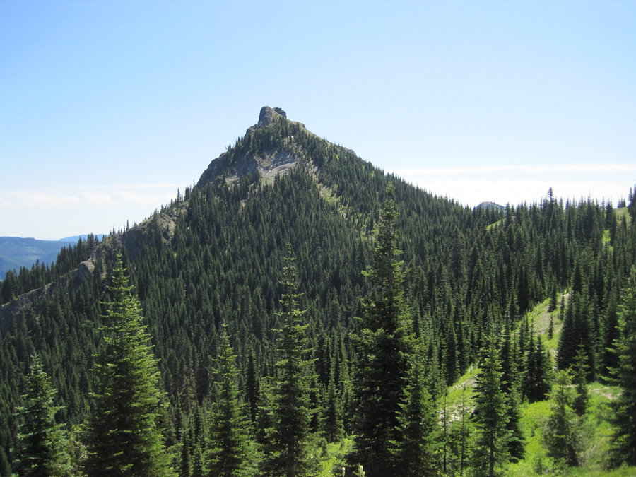
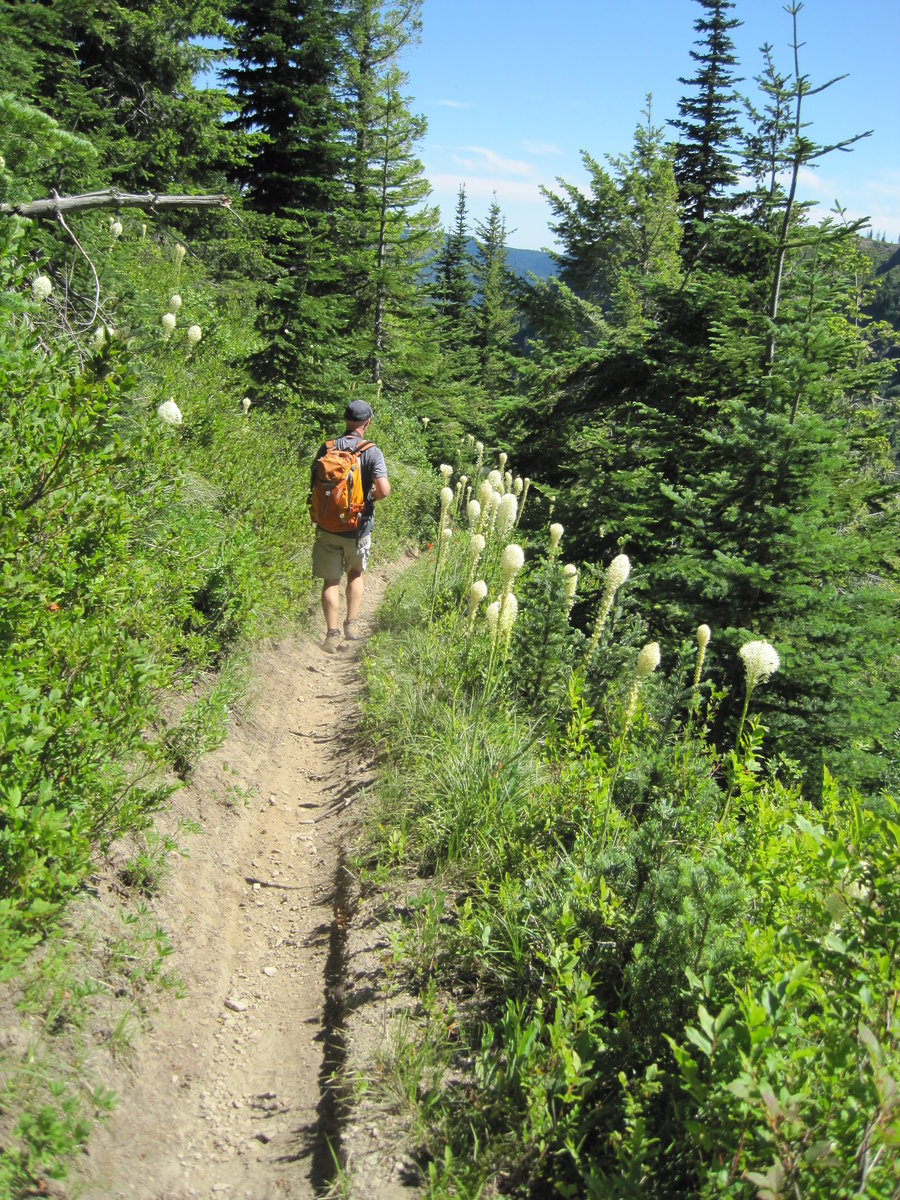
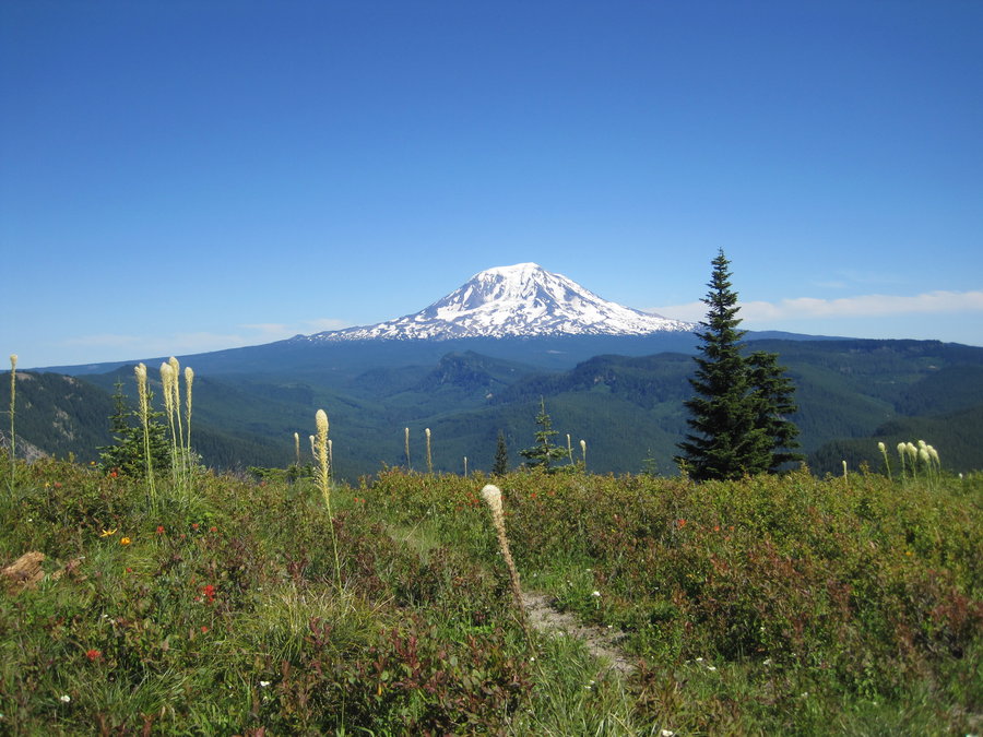
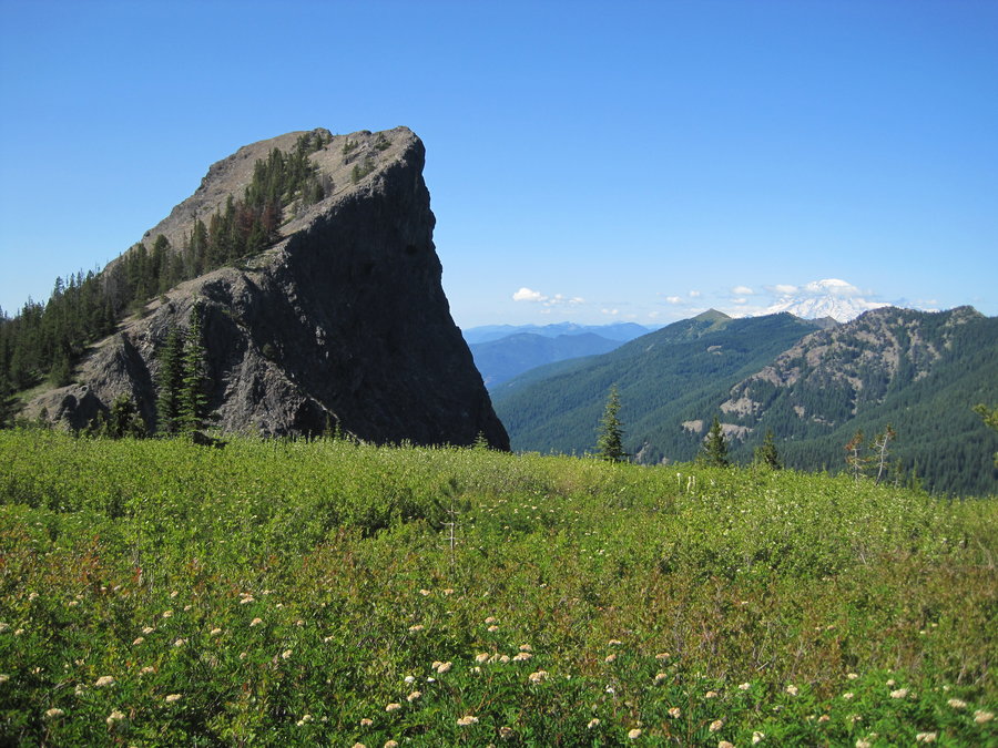
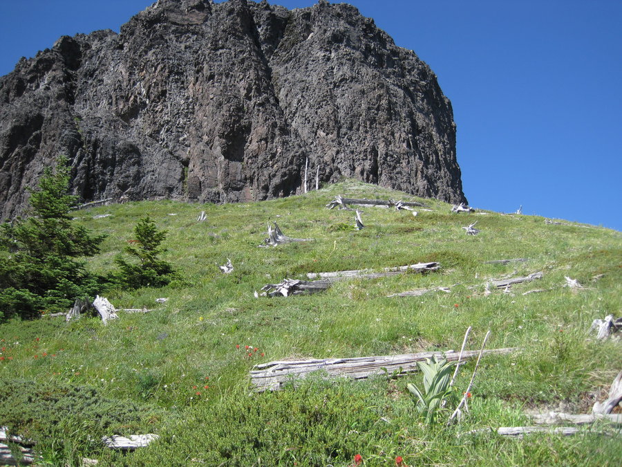
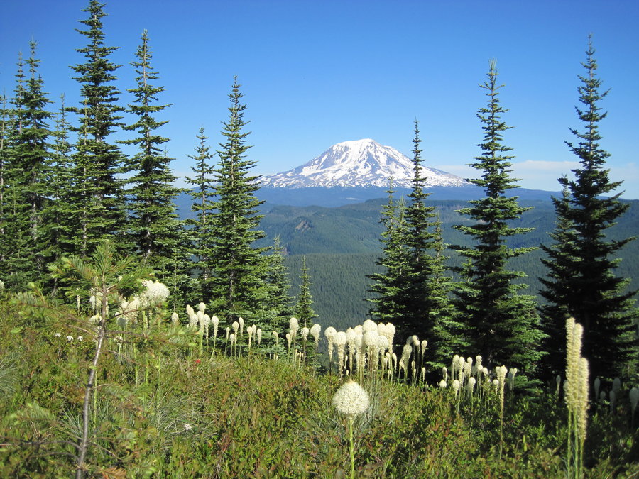
Juniper Ridge
15 miles of hiking • 5750' elevation gain • 1 night
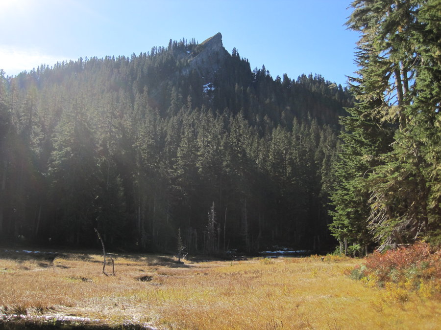
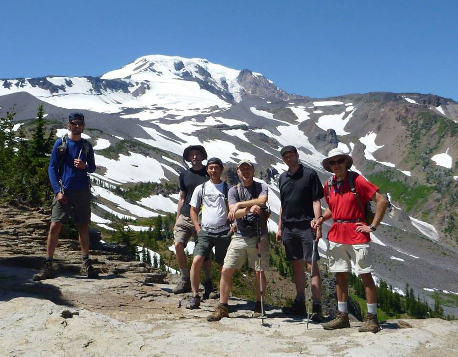
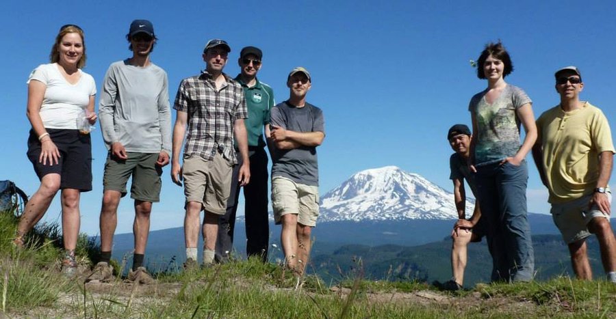
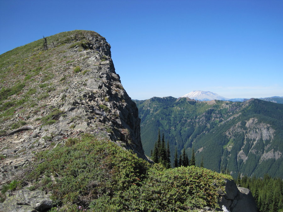
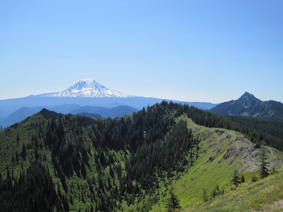
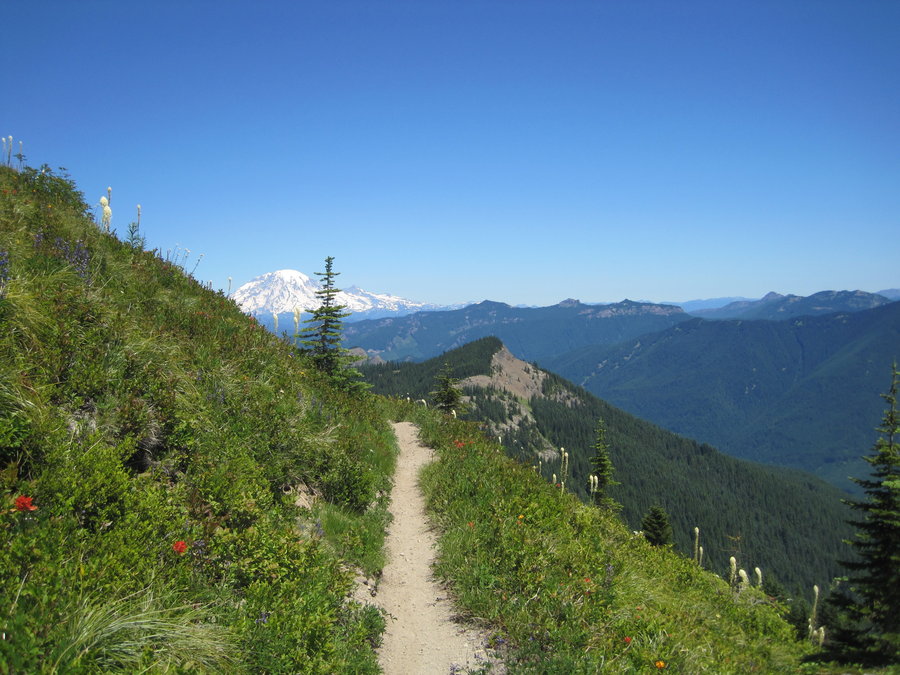
Began the day setting up a car shuttle between Juniper Peak and Dark Meadow. Climbed up, up, up motorcycle ditch (trail) to the top of Juniper Peak with 360 views of Rainier, Adams, St. Helens, Hood, Goat Rocks, etc. along with the strangely shaped Sunrise Peak further South. Followed the ridge trail to Sunrise where some members scrambled to the top for awesome views. Lookout tower foundation still there. Next was a beargrass meadow filled romp to Jumbo Peak for lunchbreak and more killer views. Then a long descent to the banks of the Cispus and out to the waiting shuttle vehicles at the trails end near Dark Meadow trailhead.
July 13 – July 14, 2013

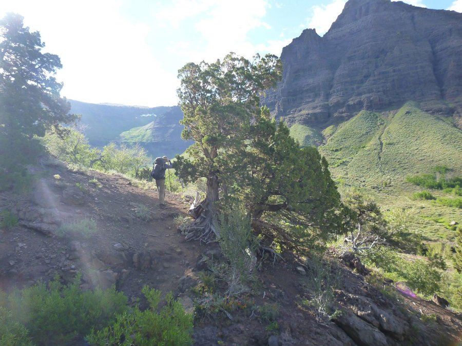
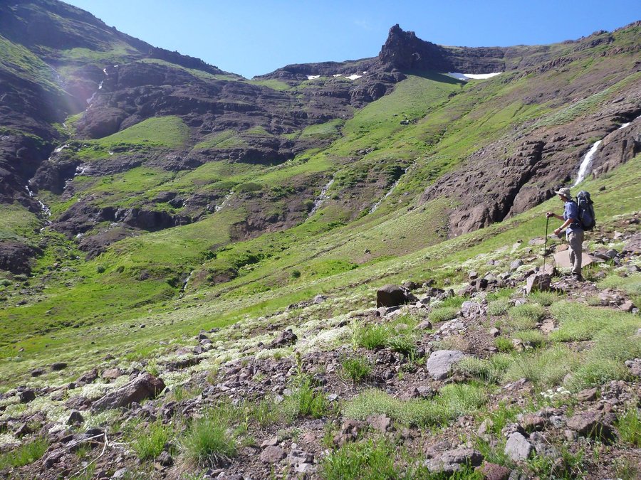
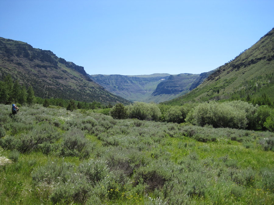
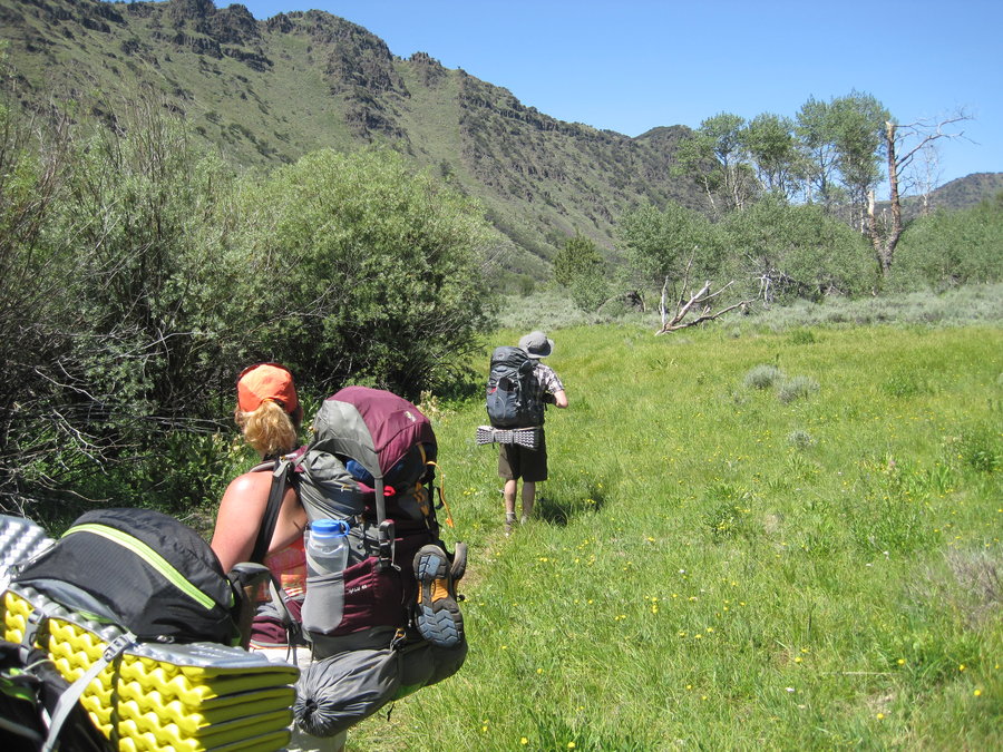
Big Indian Gorge Backpack
20.5 miles of hiking • 1250' elevation gain • 3 nights
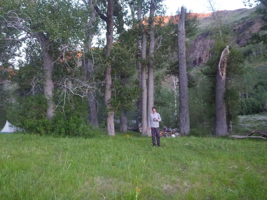
Long weekend backpack up Big Indian Gorge from the South Steens Mtn Rd Campground. Beautiful weather, several welcome stream crossings, the trail leads up to the mouth of the Big Indian Creek gorge. Lots of sagebrush encroaching on the trail, several large groves of Aspens and Cottonwoods line the creek with inviting campsites. We set up camp near the creek under the Cottonwoods and relaxed for the evening. Stargazing and deer watching were the evening activities. The next day we hiked up to the headwall of the creek with the intention of climbing up and over, summitting Steens Mtn., and descending down into Little Blitzen gorge. We couldn't find a route, so we just decided to return to our original camp. Along the return, we took an off trail route past a 100 foot waterfall through an eroded cave. Many trips into the creek and a good nights sleep made the return journey back to the campground enjoyable. A stop in Frenchglen for lunch at the Hotel is a must. After a drive up to the summit and views of the Kiger Gorge, a little trout fishing at the lake, we took the long road home.
July 4 – July 7, 2013


June 15 – June 20, 2013

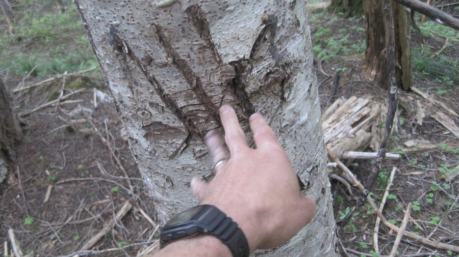
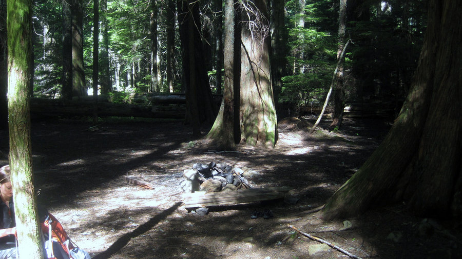
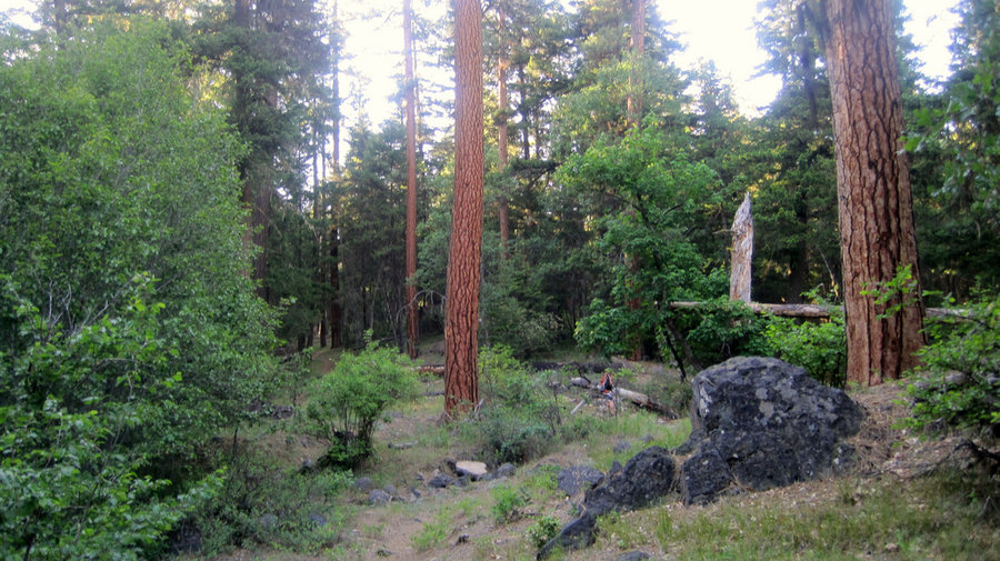
Herman Creek, Columbia River Gorge
18.5 miles of hiking • 8750' elevation gain • 1 night
Backpacking trip up Herman Creek. We arrived at a full parking lot so we had to park along the road. We began the long uphill trudge through the woods intending to stay the first night @ Cedar Swamp camp. Some huge trees up there! Beautiful. After setting up camp, I hiked up to Mud Lake before sunset. Not much to see, with the exception of some giant scratch marks on a tree. Not sure what created them. Back to camp for the night. The next day we packed up and headed down the trail. At Casey Creek, we decided to go up to Nick Eaton Ridge. Oh boy! Didn't realize what we were in for. This "trail" goes straight up an extremely steep hillside almost 2500 feet in only 1.6 mile. After coaxing my angry wife up the hill, we took a well deserved break and decided to head out the ridge and return to the trailhead via the Gorton Creek trail.
June 7 – June 8, 2013


Ball Point//Little Badger Creek MHNF, OR
8 miles of hiking • 2500' elevation gain • 1 night
Dayhike up Ball Point near Little Badger Creek trail. Made a loop by parking at the Little Badger Creek trailhead, hiking up a hillside meadow to the Ball Point Trailhead, and returning via Little Badger Creek Trail. Good variety of trees here, since it's near the Cascade crest where the East/West transition allows both ecosystems to exist. There is some cool rock formations up near "heli-spot viewpoint" where campers from the night before failed to put their fire out properly and the ashes were still hot to the touch. I scattered and buried the ashes. The trail down to Badger Creek from up top is"heli-steep". There is an old mineshaft near the bottom, as well as the miner's shack. Eventually the trail reaches the creek and we spotted some large Cottonwoods in the forest. Got back to the car just before dark.
June 3 – June 4, 2013


Little Boulder Lake, MHNF
4 miles of hiking • 1000' elevation gain • 1 night
Overnight trip up to Boulder Lake near Mt. Hood. Started early on Sat morning and drove up to the parking lot where there were 2 other cars. Hiked 1 mile up to the lake where a family was fishing. They said they caught 12 trout that morning! We attempted tthe hike up to Bonney Meadows, and as we climbed higher the patchy snow got deeper and then became impassable on the North side of Echo Peak. We came back to the lake, but the best site at the lake was taken by some teenagers collecting a huge pile of beer cans, so we decided to check out Little Boulder Lake. Score! No one else there, so we set up camp. I decided to explore the other side of the lake, so I bushwhacked around until I came to a very old fire ring. I continued around and returned to my campsite. Enjoyed a windy night with lots of stars. Returned to the parking lot to find a bunch of garbage strewn around. At least they carried it away from the lake before they left it lying on the ground. I disposed of it properly in town.
June 2 – June 3, 2013

Dog Mountain
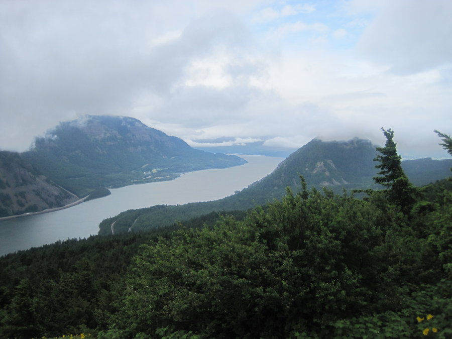
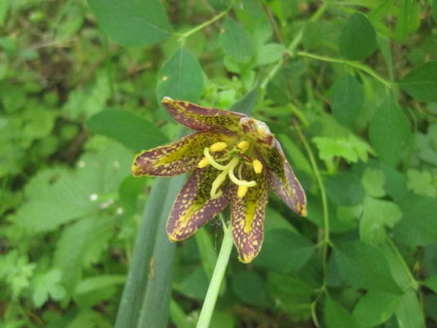
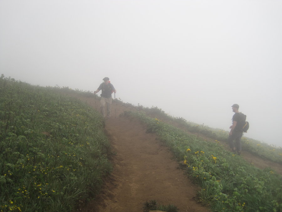
7.5 miles of hiking • 2750' elevation gain •
Dayhike up Dog Mountain. Took the "less difficult" route up, passed Lady Slipper orchids, chocolate lillies, Columbia Wind Flower, and Queens Cup. Nearing the top, you walk through hillsides covered in Arrowleaf Balsamroot, a yellow flower. The views were non-existant at first due to thick clouds. We were disappointed, but took a well deserved lunchbreak at the top. While we waited, the clouds suddenly parted and a vertigo inducing view of the entire Gorge opened up suddenly. It was a strange feeling, like we were about to be thrown into the river far below. We headed West down the loop trail towards Augsperger Mtn. trail and the long gentle downhill back to the parking lot. Enjoyable day.
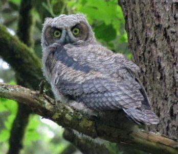
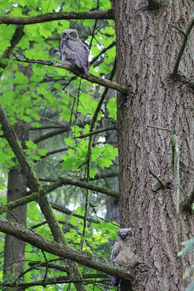
May 12, 2013


Great Horned Owl watch @ Woods Memorial
2.5 miles of hiking • 250' elevation gain •
Baby Great Horned owls on the hike
May 10, 2013


Tualatin River National Wildlife Refuge
1 miles of hiking • 0' elevation gain •
Spotted many interesting birds and also nutria.
May 1, 2013
 1
1
Eagle Creek, Columbia River Gorge
10.5 miles of hiking • 3500' elevation gain • 1 night
Overnighter in Eagle Creek. Lots of Boy Scouts groups on the trail. Hiked up to beautiful Tunnel Falls where you walk behind the waterfall through a tunnel. Camped near the river between Wy'East camp and Blue Grouse Camp. Spotted Osprey feeding their young on the opposite side of the valley.
April 27 – April 28, 2013

April 27 – April 28, 2013


Marion Lake Trail to South Cinder to PCT Snowshoe Camp
12 miles of hiking • 3500' elevation gain • 2 nights
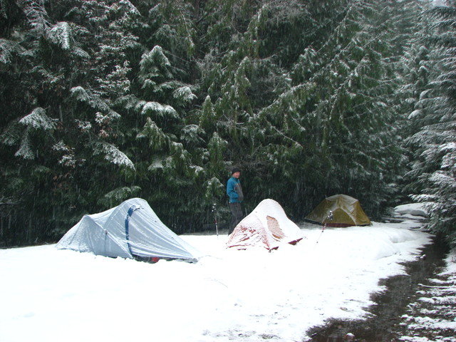
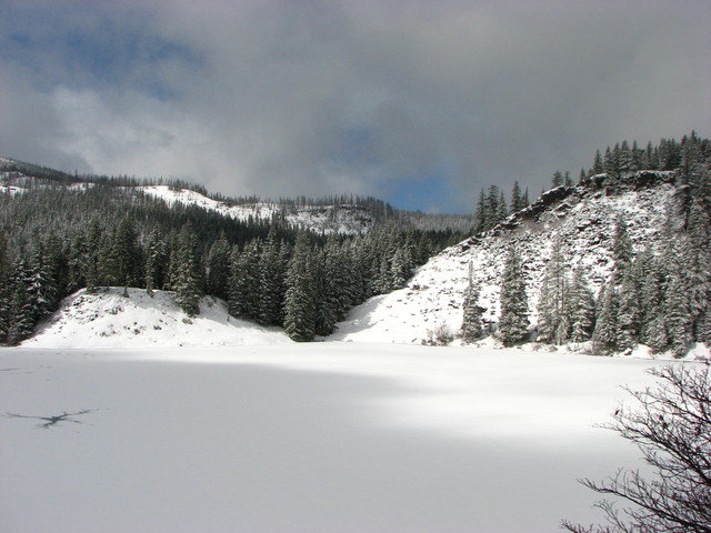
Early Spring snowshoe up to South Cinder peak. Arrived at the Marion Lake TH late at night as it was steadily raining. Camped at the trailhead. Rats scurried outside our tent all night. Set off on a drizzly morning up the trail, headed past snow covered Lake Ann, and giant icy Marion Lake. Ran into a couple of optimistic fisherman, who turned back when they began post-holing in the 3 feet of snow.
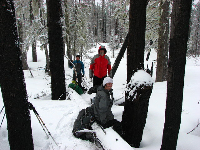
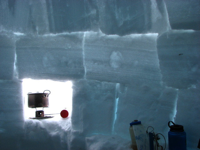
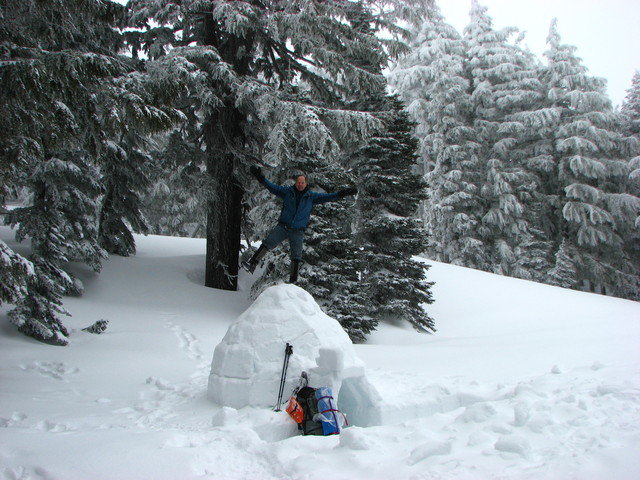
We began hiking up a long ridge through a burned out forest as it snowed. Visibility was very low, so no views of nearby Jefferson and other peaks. We hiked up the side of South Cinder to a ridge overlooking where we believed the PCT went by. We set up camp at 6000' as the wind howled and visibility went to zero and the snow came down heavily. Steve built an igloo out of iceblocks for his shelter, the rest of us set up tents and built windbreaks from snow as we settled in for a cold night.
The night was very cold, temps in the low 20s. Fortunately the wind died down at night. We ate breakfast, broke camp and began the trudge down in lots of new snow. Delightful snowshoe conditions made for an enjoyable hike back to the trail where the snow levels decreased enough to go back to boots. Thanks to Steve and Justin for photos.
April 12 – April 14, 2013


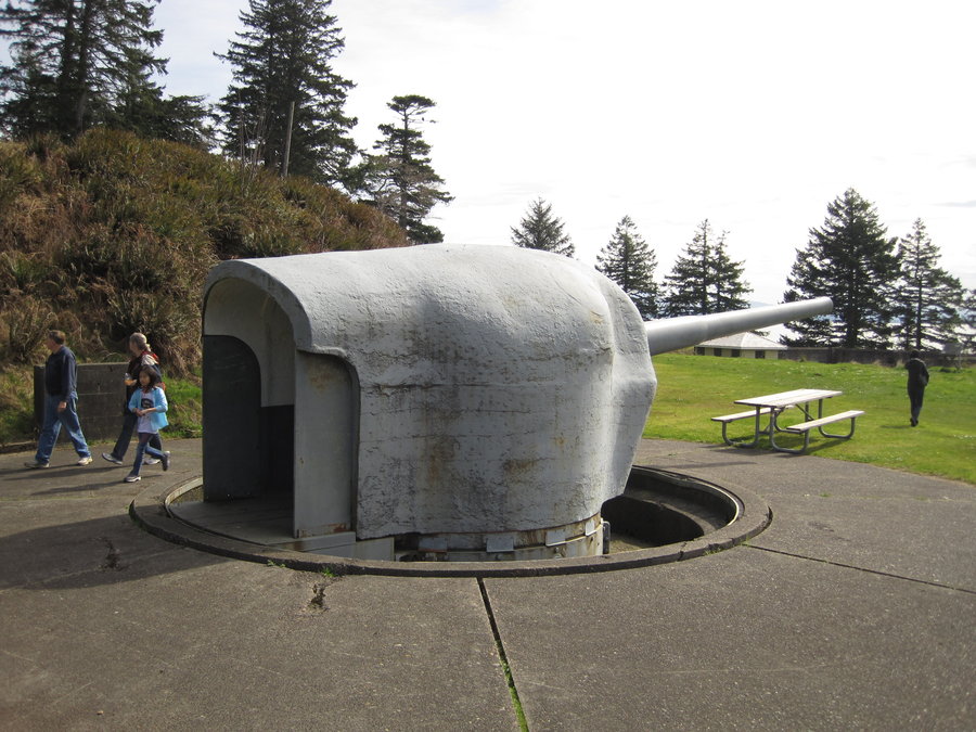
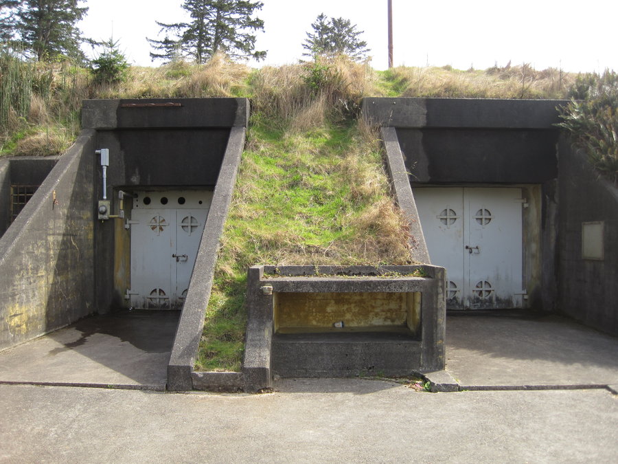
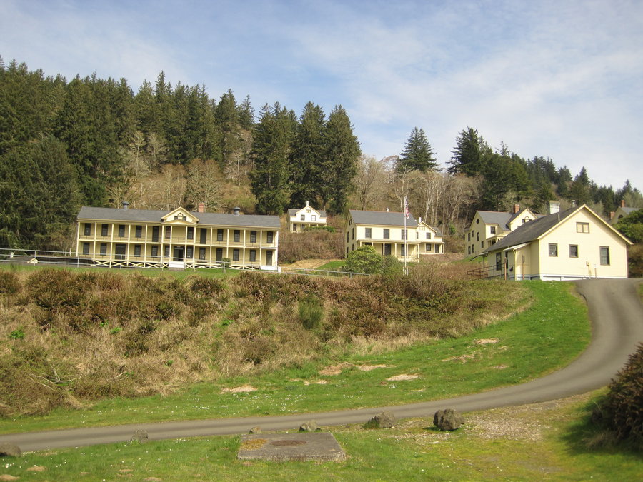
Fort Columbia State Park - Scarborough Hill Trail
2.5 miles of hiking • 750' elevation gain •
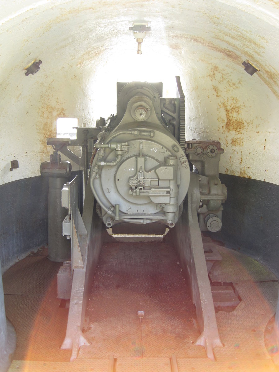
Trip up Scarborough Hill at Fort Columbia. Easy hike uphill through massive old growth trees with occasional views out over the miles wide Columbia River. Viewless summit, main trail down closed, took the Military Road Trail down to the fort. Scrambled around the ruins of the fort, giant gun turret foundations.
March 25, 2013


Trillium Lake Snowshoe
3.5 miles of hiking • 500' elevation gain •
Snowshoe around Trillium lake. We left from the sno-park, hiked down the road and out to the Summit Meadow and past the "grave", yet didn't find it. We snowshoed across the frozen lake(!) and had lunch on the far shore before heading back to the sno-park, passing throngs of people on their way out to the lake. Glad we got there early.
March 16, 2013
 1
1
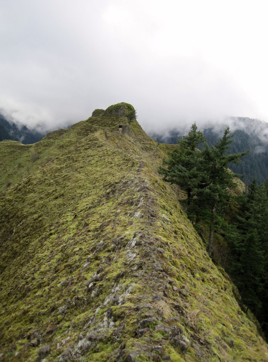
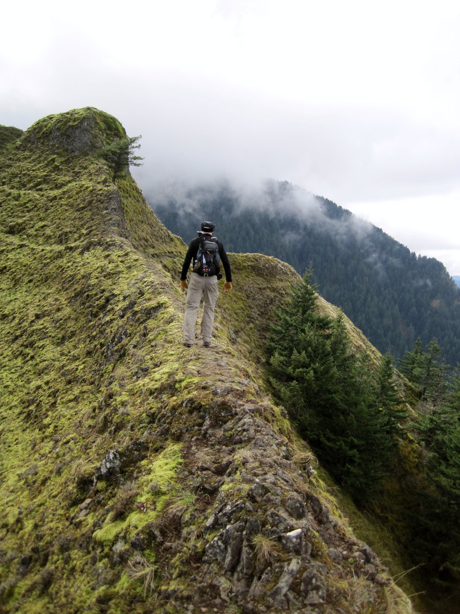
Munra Point
7.5 miles of hiking • 2250' elevation gain •
First Trip up Munra Point. Started out at the Wahclelah Falls Trail head, headed West on the 400 Trail and then headed up the hill on an unmaintained trail. Starts out easy enough, but comes to some tight switchbacks with roots and rocks to navigate. Then up steeper still over rocky outcrops to a vertical slot w/ a rope to climb up. Continue to the top and you will stand on a narrow ridgeline looking out over the entire gorge. Back down the way you came to the trailhead. A truck at the trailhead had the window busted out, with a GPS system inexplicably left on the dashboard. Maybe we startled the thief before he could get away with anything?
March 15, 2013

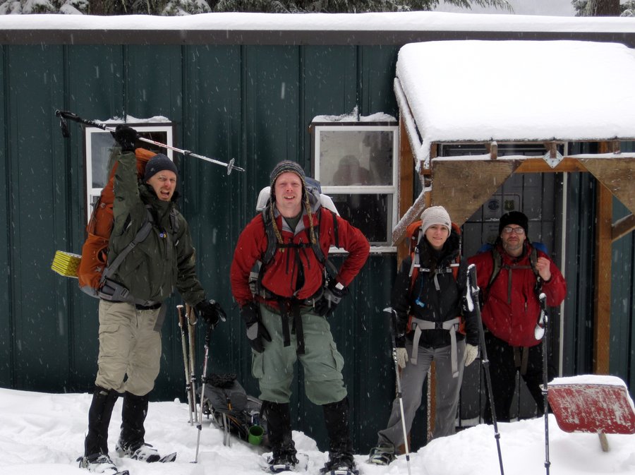
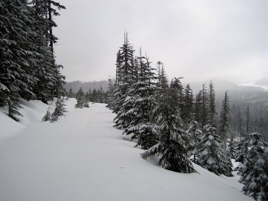
Barlow Pass Snowshoe
6.5 miles of hiking • 1500' elevation gain • 1 night
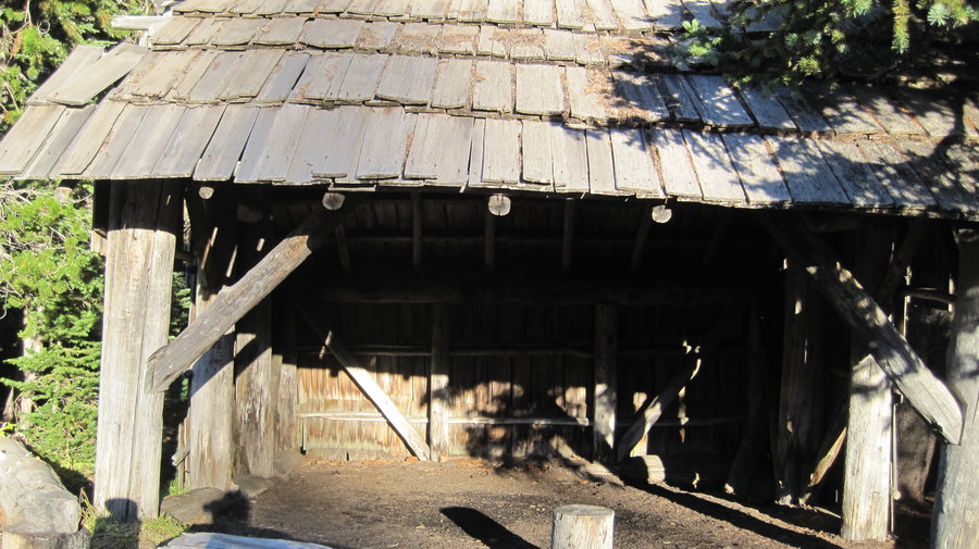
Snowshoe to a ski hut off the Barlow Road area above the White River drainage. Followed the PCT, Mineral jane trail and then a FS road to the shipping container turned into a hut with propane heat and lights. Made a great dinner, drank some beers and played games while it snowed about 8 inches. Awoke to alot of fresh snow and on the hike back, we made a long luge track and slid down on trash bags! Alot of fun.
March 13 – March 14, 2013

March 8, 2013
 1
1
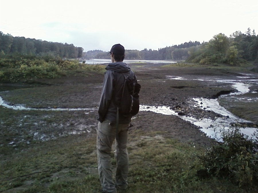
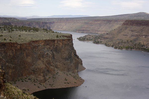
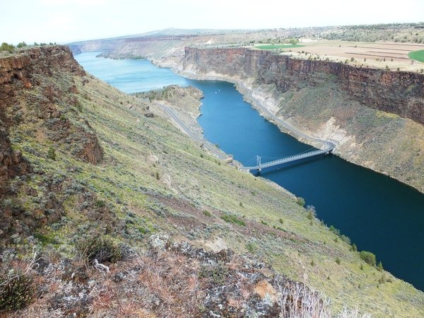
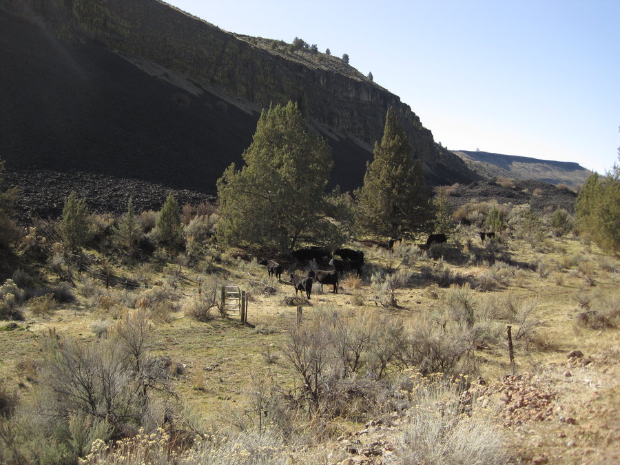
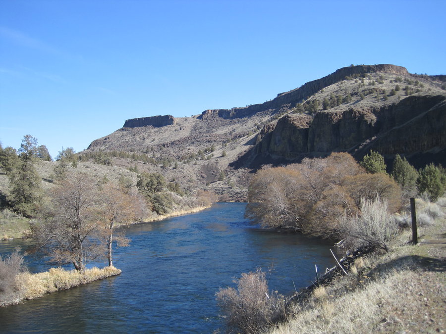
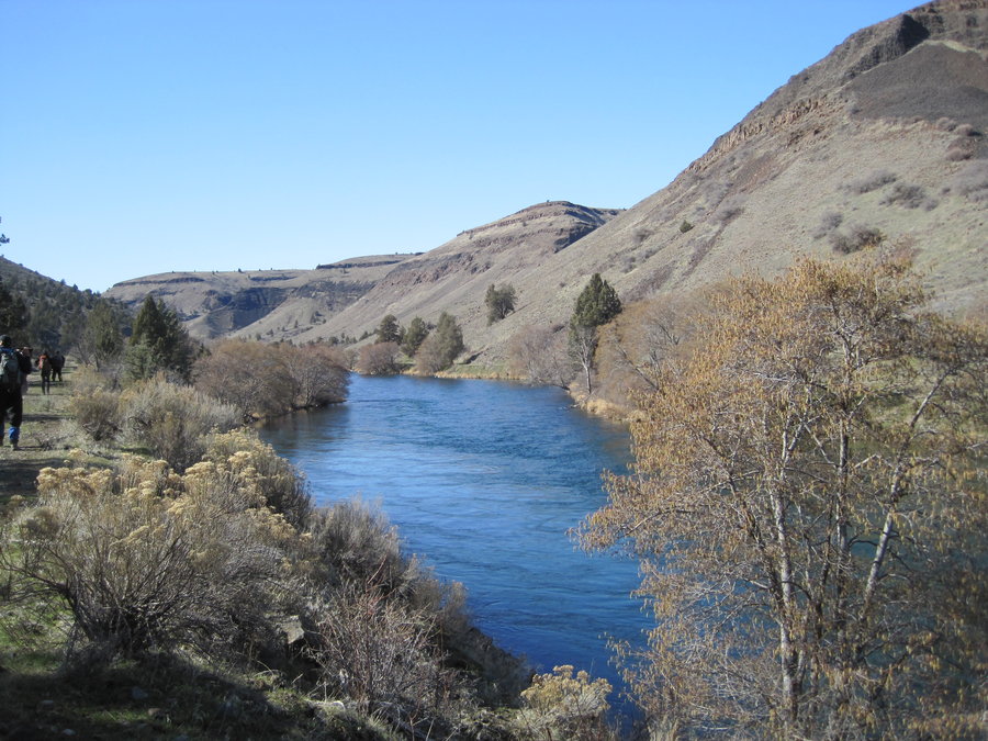
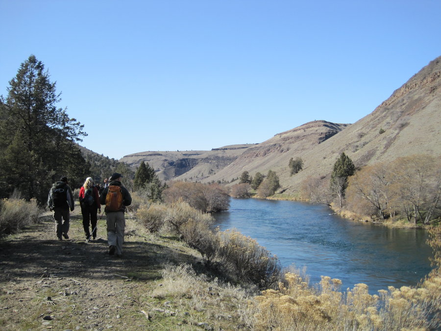
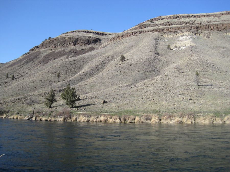
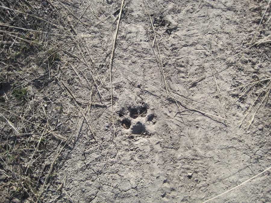
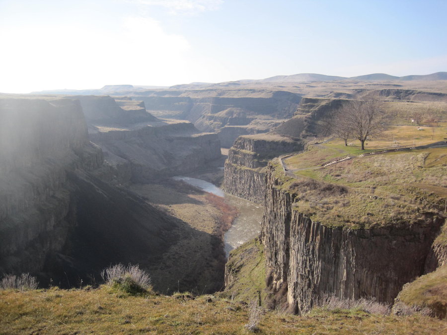
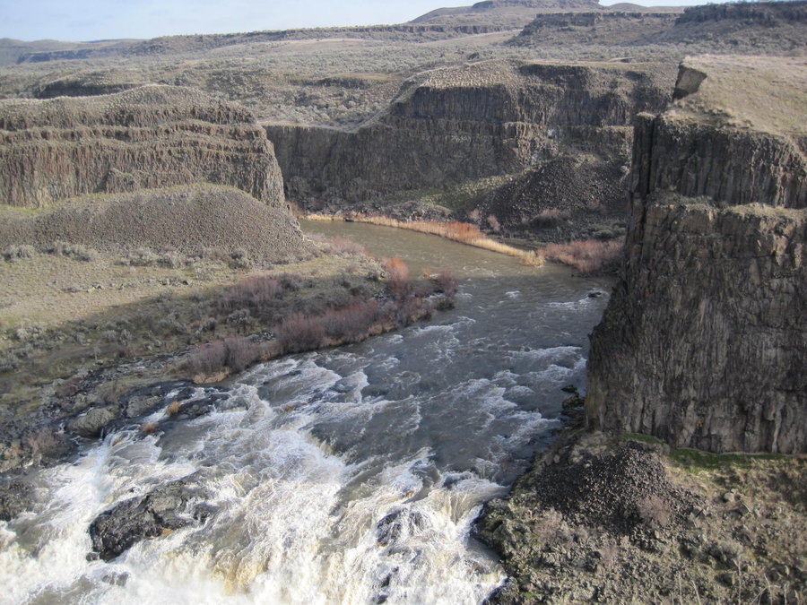
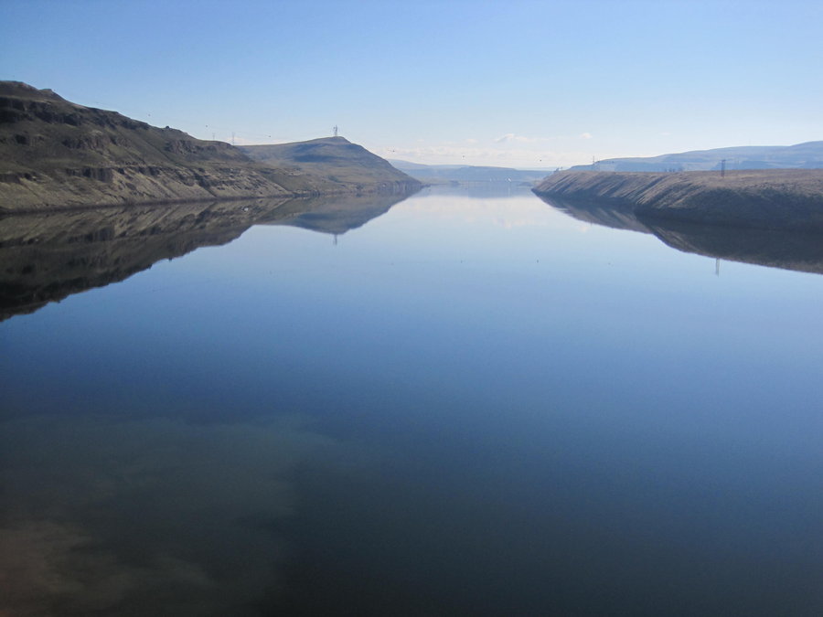
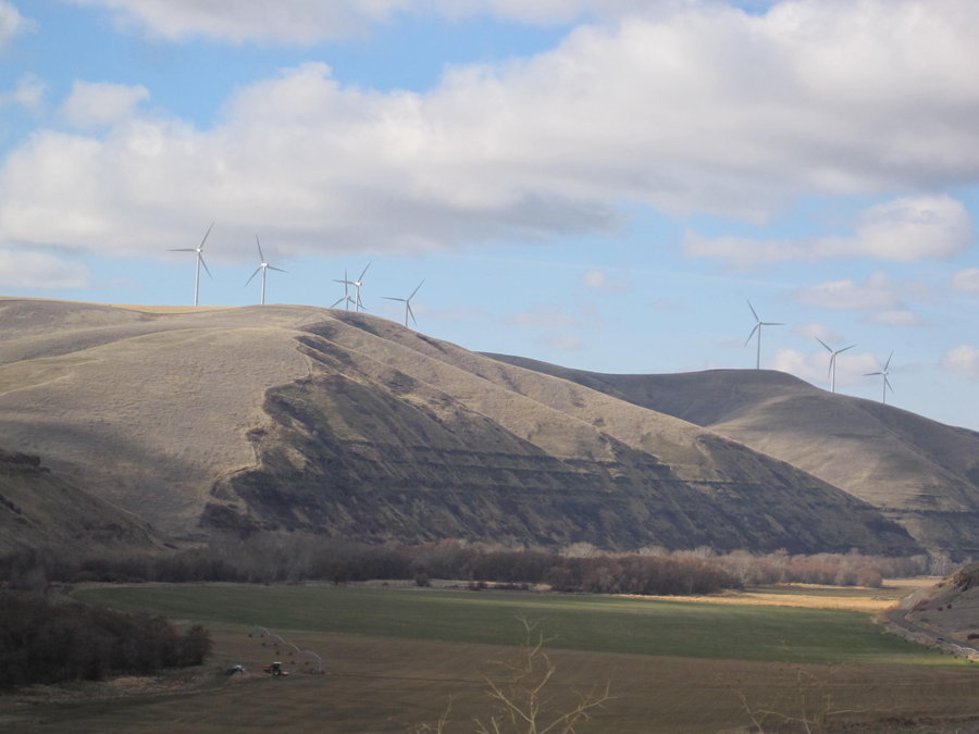
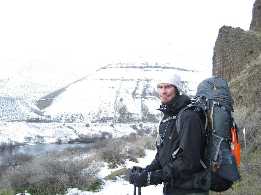
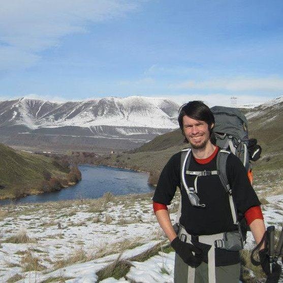
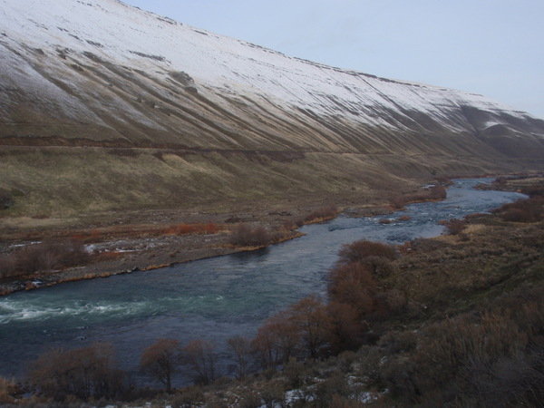
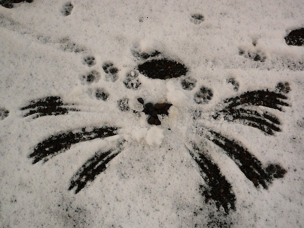
Deschutes River 2
12.5 miles of hiking • 250' elevation gain •
Dayhike along the Deschutes River near Warm Springs. One way w/ very long car shuttle. Lots of cows along the trail. Several shacks on the Warm Springs Reservation on the other side of the river. Beautiful weather, also spotted some bobcat or cougar tracks along the water near the end of the trail.
March 3, 2013


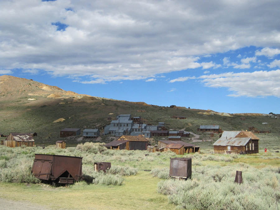
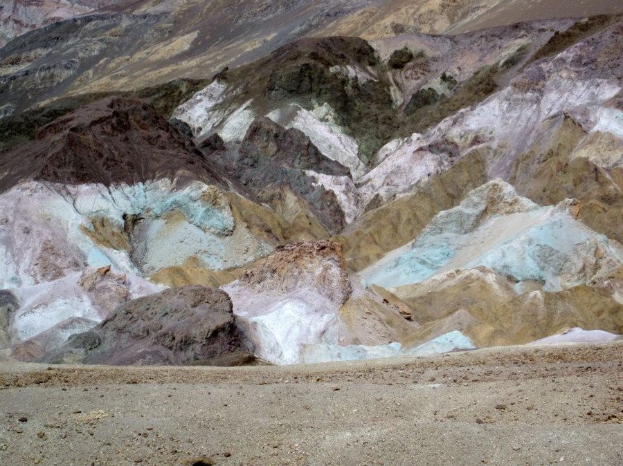
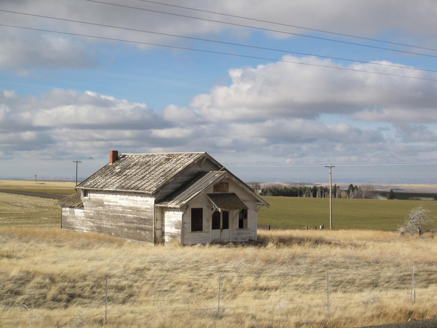
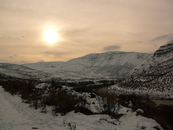
Death Valley, CA
40 miles of hiking • 8500' elevation gain • 4 nights
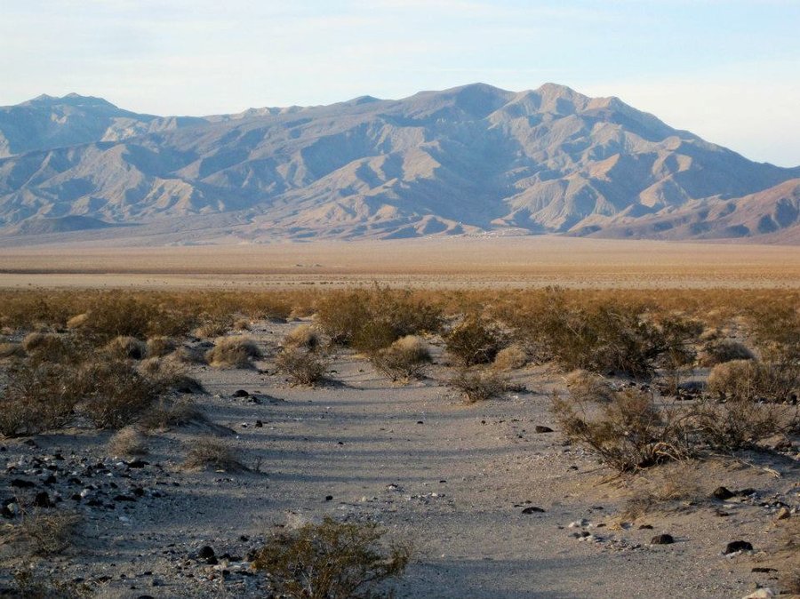
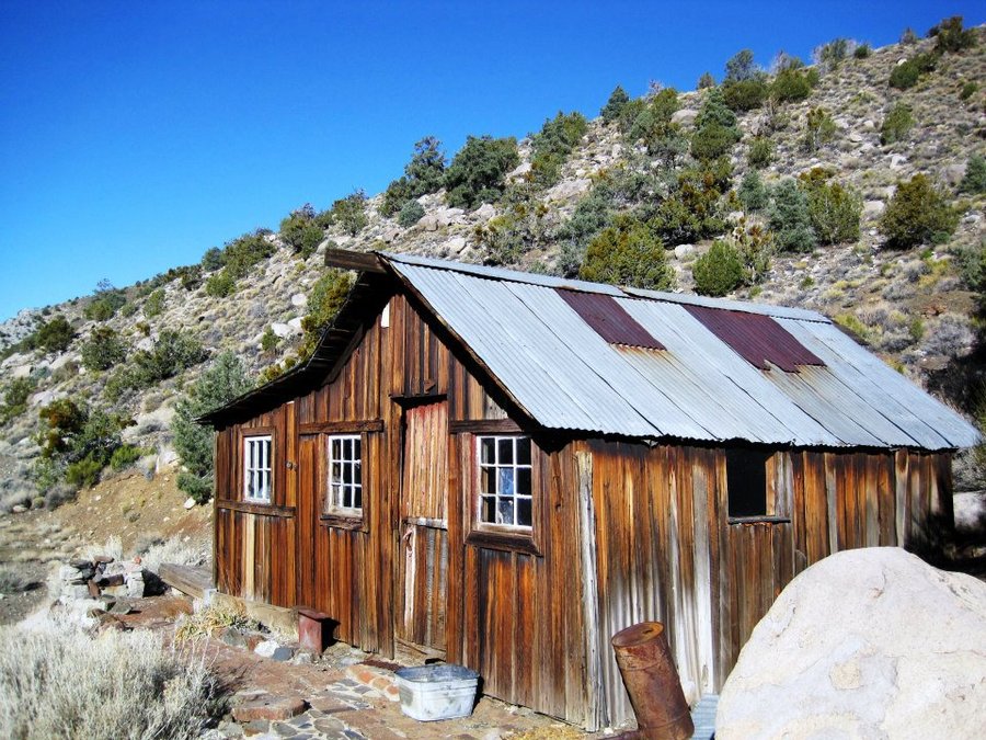
Presidents Day Weekend trip to Death Valley. 4 of us left Weds afternoon and drove the 18 hours to Ballarat, CA. We hiked up Surprise Canyon intending to reach Panamint City, but didn't have the energy or time, so decided to set up cam about 5.5 miles in and hike up to Panamint City in the morning. Panamint City is a deserted ghost town/mining camp in a high valley. Ruins of buildings and mining equipment lay all around, as well as later attempts at squatting in the wilderness. The "Panamint Hilton", a creaky old house with some ratty cots is livable, but the hantavirus threat kept us away. A huge smokestack from a smelter still stands in the town.
We descended to the car and drove the 80 miles to the "town" of Panamint Springs, where there was a campground, for the night. A couple argued next to a car with a leaking radiator as steam billowed out from under the hood. At least they made it to a gas station before being stranded 100 miles from nothing else. In fact, it's so remote, there is a generator on the hill above town which runs constantly to supply the town's power.
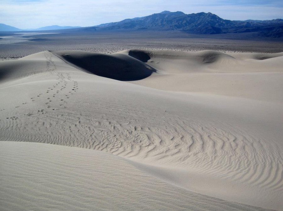
The next morning we decided to hike to the Panamint Dunes. The Dunes are huge sand mountains which look near, but in fact are very far away. We drove 7 or so miles to the parking and walked the remaining 3.5 miles to the first of the dunes. I dropped my camera at the summit of a 700 foot high dune and little grains of sand found their way into the lens and screwed up my focus. It worked for a few more days at least. We marveled at the interesting patterns in the sand, the huge barren landscape around us and took in the strange environment.
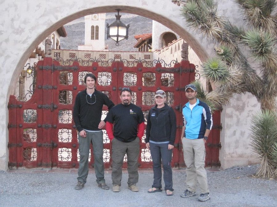
We continued the trek to Stovepipe Wells to get gas and then on to Scotty's Castle, a 1930's mansion which was the product of the strange relationship between a con-man and a wealthy Chicago businessman. Google it. After taking the tour, we needed to continue the trip. We headed for Beatty, NV about 100 miles away. We arrived around 8pm and set up camp in a mobile home park near a creek. The temp dropped into the 30s overnight.
We got up around 4am and began the drive towards Titus Canyon, a one way road through a marvelous rocky canyon. We watched the sun rise and turn the canyon walls all different colors. We passed the ghost town of Leadfield, and several other campers nearby checking out the ruins.
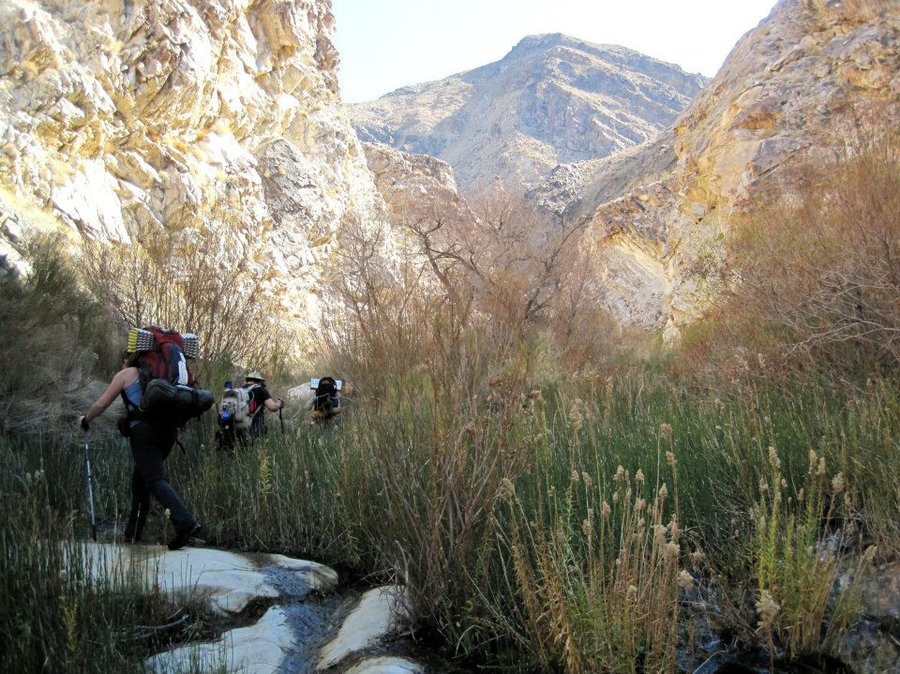
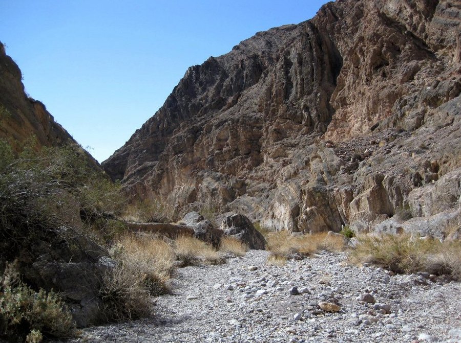
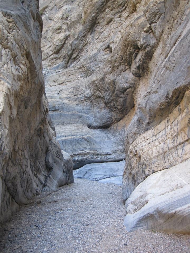
Our destination for the next two days was Fall Canyon at the mouth of Titus Canyon. We began our trek up Fall Canyon, with it's narrow smooth walls that closed in around us, sometimes as narrow as 4 or 5 feet. The walls were smooth from eons of flash floods. We had to scramble around and then with ropes, haul our packs up a twenty foot dry falls. Up higher, Cougar scat was all around, as well as the bones of Bighorn Sheep. Keep walking! We spent a wonderful night (minus the Scorpion sighting) in the Canyon listening to the Coyotes howl.
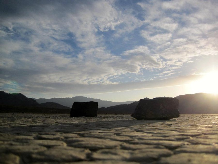
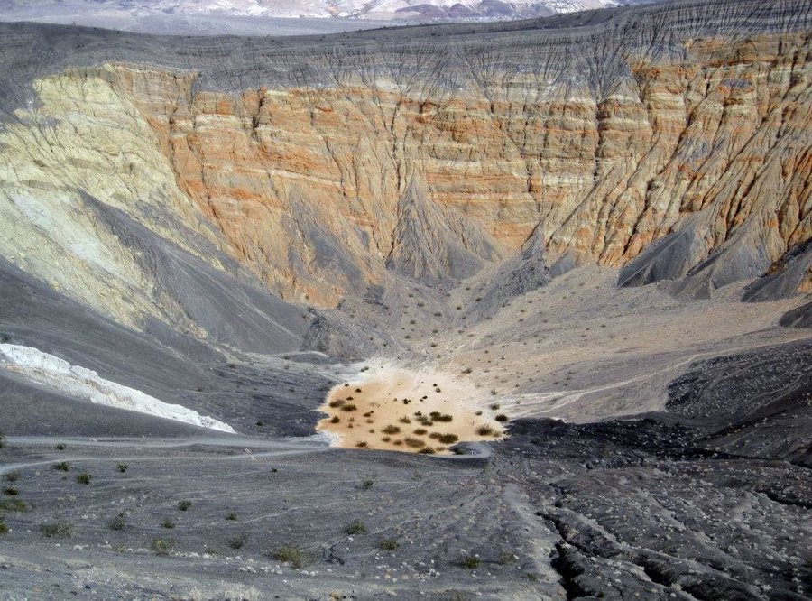
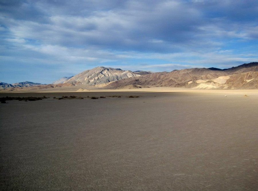
The next day we trekked out and came across a herd of 6 bighorn sheep grazing above the canyon. We marched out to the car and began the long drive towards "The Racetrack", a large mysterious playa where rocks are said to "move" leaving tracks in the dry mud. It was 24 bumpy miles out a rough road to the Homestake campsite. Many photographers were there. We met a guy from Oklahoma who was roadtripping on his own. We shared a campfire that night, and were visited by a curious Desert Fox who stole some of our food! The next morning, we walked out to the "Grandstand", a large rock outcropping in the middle of the playa. After some photos, we began the long drive out towards Furnace Creek, where there is a visitors center and a very nice resort.
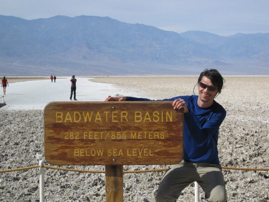
No trip to Death Valley is complete without a visit to Badwater Basin, at 220 ft. below sea level, the lowest point in North America. It was super windy. We completed the Artist's Drive, a section of road snaking through some interesting colored rock formations, and then the long drive home. In a real example of the wide spectrum of conditions we encountered, we drove from the hot desert and through a snow storm in the middle of the night on Willamette Pass. Several white knuckle hours brought us up and over the mountains.
Great trip to a place I had never been or even previously contemplated. There is a real diversity of terrain and temperatures, but I don't doubt that we saw it at it's most pleasant in February.
February 15 – February 19, 2013


 1
1
February 9 – February 11, 2013


February 5, 2013

Boy Scout Ridge snowshoe
3.5 miles of hiking • 1250' elevation gain •
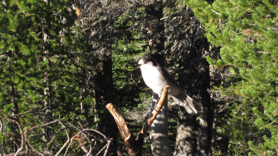
Winter time snow shoe up to Boy Scout Ridge in the White River drainage. We joined lots of people playing in the snow by hiking up the river drainage to where the Timberline Trail crosses the river. We joined another group and hiked directly up the steepest side of the ridge (nearly vertical) using our snowshoes as crampons. We had lunch at the top and decided to slide down a ditch to get back down. Several of us decided to hike up the steep face again and slide down on a garbage bag. Great fun! Others decided they wanted to try after watching us. We hiked back down and watched scores of sledders slide down the various hills. We "fed" some gray jays trail mix from our hands. You simply held a peanut at arms length and they came down and took it from us!
February 3, 2013


Mirror Lake Snowshoe
5 miles of hiking • 1000' elevation gain •
Mid winter snowshoe up to and around Mirror Lake. Walked along Hwy 26 for 1 mile from Ski Bowl. Great day, continually snowing. About 3-6 inches of snow on the ground at the trailhead, more as we climbed up to the frozen over lake.
January 27, 2013

Elk Meadows snowshoe
5 miles of hiking • 1250' elevation gain •
Snowshoe up Newton Creek from Mt. Hood Meadows to Elk Meadows trail. The trail up the hill was faint, and mostly it was cross country to the meadows. We were some of the first footprints in the meadows, two other people arrived after we did. Shelter was mostly buried.
January 27, 2013

Night hike on Wildwood
2.5 miles of hiking • 250' elevation gain •
Night hike on full moon. Nothing notable.
January 25, 2013

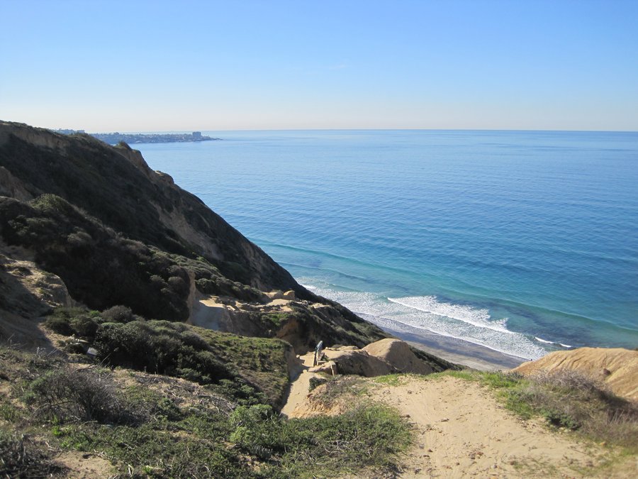
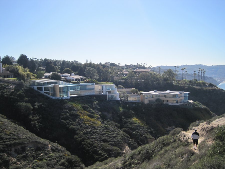
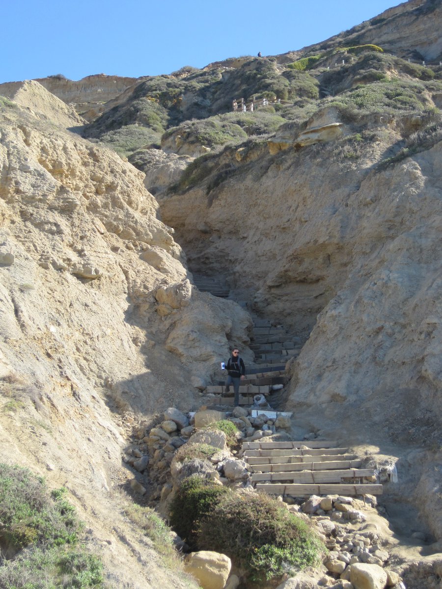
Black Beach, Torrey Pines State Park, CA
4 miles of hiking • 500' elevation gain •
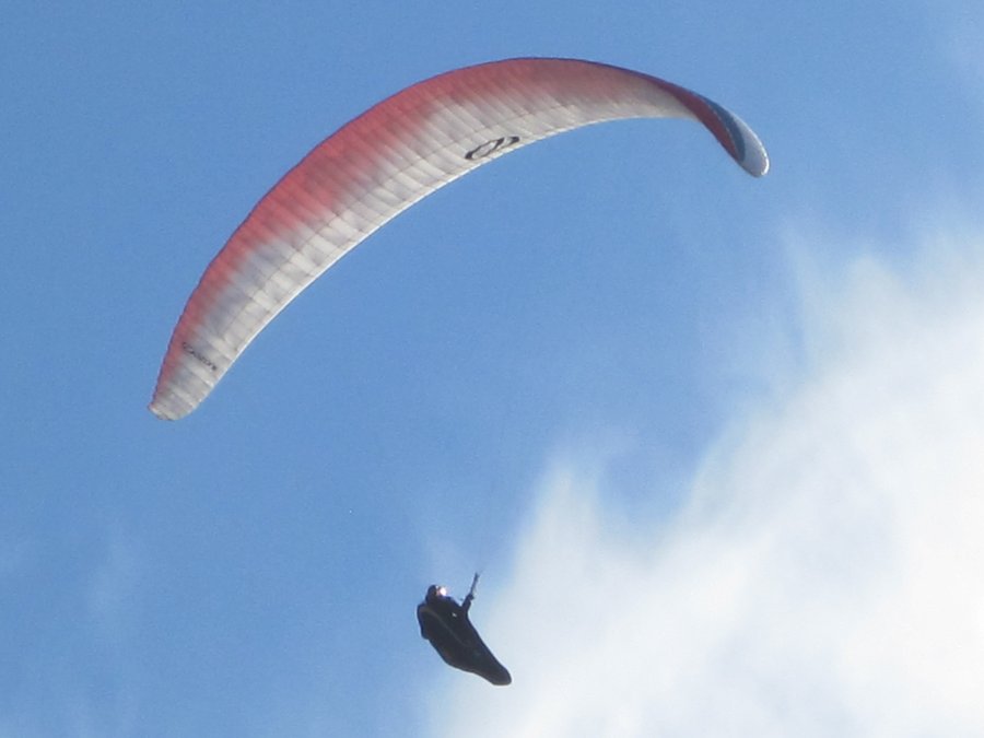
On an anniversary vacation to San Diego, my wife and I decided to take a beach hike in Torrey Pines State Park. Near the world famous golf course we parked and took a use path along a ridge overlooking multi-million dollar homes to a very steep set of stairs almost 400 feet down to the beach and ocean below.
We watched sand pipers scurry on the sand, saw paragliders soaring over our heads, spotted sea lions and dolphins off the shore, and nude joggers(!) strode along the beach. Very peaceful beach scenes and perfect weather in January.
January 15, 2013


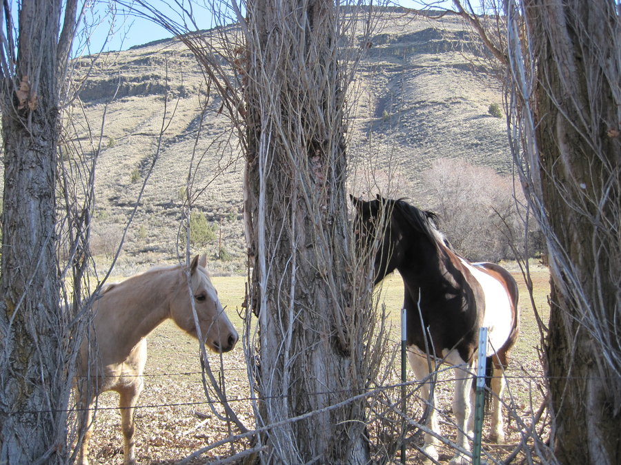
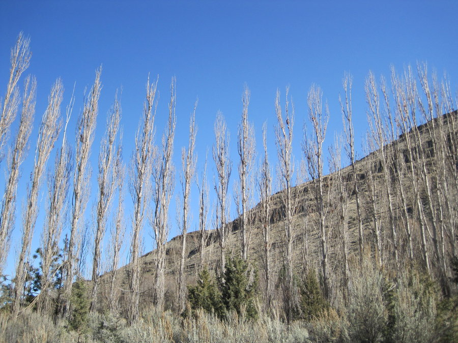
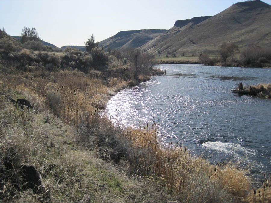
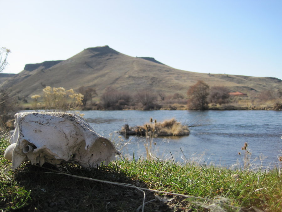
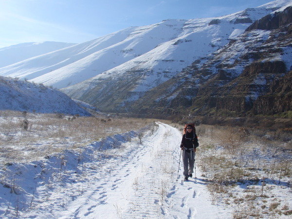
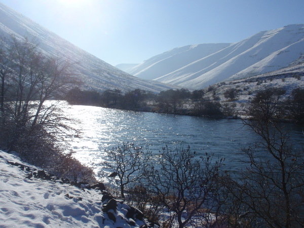
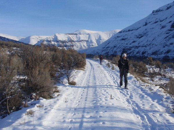
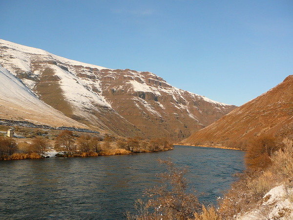
Deschutes River
22 miles of hiking • 250' elevation gain • 2 nights
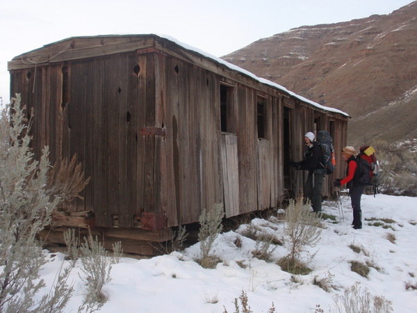
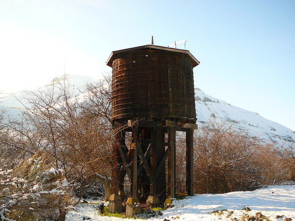
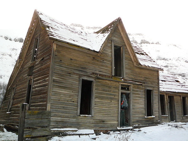
3 Day winter backpack from Macks Canyon Campground down the Deschutes River to the mouth of the Columbia in The Dalles. After a long car shuttle, we got underway. The first 6 miles or so follow a brushy old railroad bed and fencelines with alot of washouts and landslides. The bridge crossings have disintegrated many years ago, so you have to scramble up and down several steep canyons.
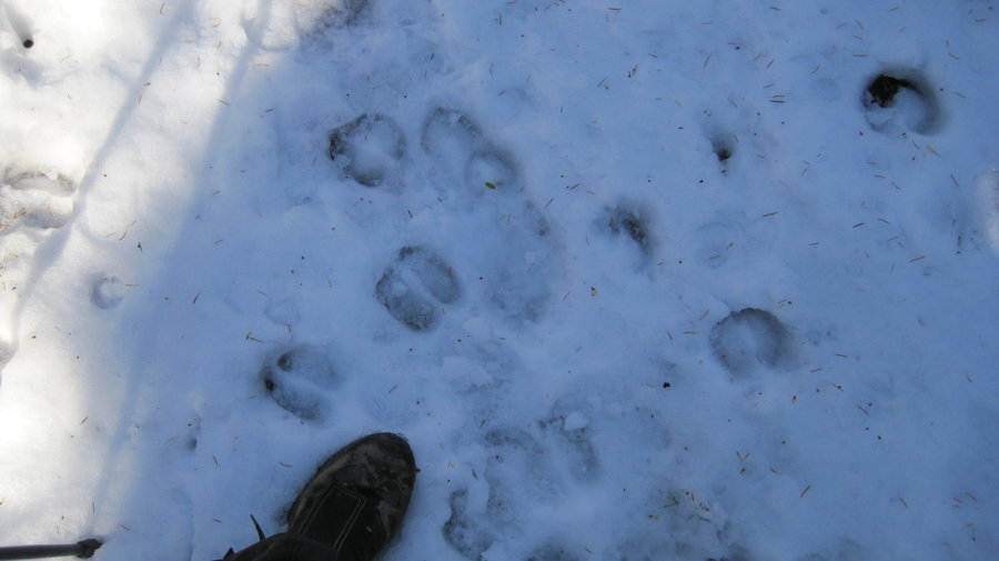
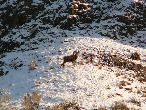
After 6 miles, you begin walking on a somewhat maintained railbed or what is essentially a gravel service road. We hiked the first day in sleeting snow. Alot of animal tracks. Coyote, raccoon, deer, bobcat, bighorn sheep, many birds, etc. The first night was cold and dreary, but we awoke to sunny and clear skies. We had lunch at an an old homestead/rail stop where the Bighorn Sheep scrambled overhead on the steep slopes, munching on scrubby foliage. The buildings were in surprisingly good condition given their age. The weather was wonderful, with highs in the 40's. Some wet feet from walking in the morning snow led to some blisters, we dried out our footwear at the evening fire.
Higher temps on Day 3, sunny skies. We were in short sleeves by lunchtime, as we hiked closer to the end of the trail. We saw another person on Day 3, a biker about 4 miles from the end, the first we encountered since we started. We had lunch high on the hill above the river as raptors flew overhead, enjoying the sun and the grassy hillside. We arrived at the deserted parking lot and headed back to complete our long car shuttle to Mack's Canyon.
January 5 – January 7, 2013

Wildwood Trail
5 miles of hiking • 250' elevation gain •
New years day hike from the end of the Wildwood. Cool ice formations on the leaves.
January 1, 2013
