

2012 Trips


Klickitat Trail (Scenic River Section)
8.6 miles of hiking • 250' elevation gain •
We wanted to end the year with a longer hike, and so we stayed out of the heavily snow covered areas. There was a light dusting of snow on the trail in the areas not getting direct sun. Not many people on the trail. Definitely a nice way to end the year! I would have liked to reach 1000 miles but the knee and shoulder slowed us down quite a bit. Still, an exceptional record breaking year for us!

December 30, 2012

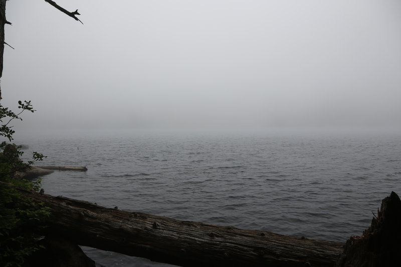
Forest Park Wildwood Trail
7.7 miles of hiking • 750' elevation gain •
We didn't have much time to go on a hike and opted for a trail that was close by. The Wildwood trail was in pretty good condition but did have some muddy areas. There were very few people in the area we went. The icing on the cake was that there were snow flurries for a very short time!
December 29, 2012
 1
1
Mima Mounds Natural Area Preserve
3.7 miles of hiking • 250' elevation gain •
Very interesting place to visit. Snow on the ground and a pleasant easy hike! No people on the trail system
December 25, 2012
 1
1
Capitol State Forest - Greenline trail to Mckenny trail
3.3 miles of hiking • 750' elevation gain •
We finished hiking the Mima Mounds and still had some time for additional hiking. Although it looked like a winter wonderland, the snow was melting everywhere. The trail was full of standing water and slush, but we still kept our feet dry. We only saw two people during the hike.
December 25, 2012

PCT to Gillette Lake & Exploration
7.2 miles of hiking • 1250' elevation gain •
Very nice day for a hike. We only saw two couples the entire day, which was a real plus! There is quite a bit of clear cut that I never saw today, which is quite depressing, but most was replanted. I think the view of Gillette Lake has been spoiled by the logging. :( We looked for a trail that was on the Garmin 24k topoquads, but it no longer exists, from what I could see.
December 24, 2012

Jones Creek Loop A
6.5 miles of hiking • 1500' elevation gain •
This area is littered with OHV trails that can't be accessed by motorized vehicles between December 1-April30! Nobody was on the trail system, but we heard gunshots all day long. Most of what we hiked was forested with only one clearcut area, that was replanted. Definitely a nice rainy day!
December 23, 2012

Gnat Creek & Upper Gnat Creek Trails
7.6 miles of hiking • 1000' elevation gain •
Excellent rainy day at a less travelled trail. Trail was in great condition with very little debris. We stopped at the fish hatchery to feed the fish. Gnat Creek Falls is quite beautiful with a nice bench to sit and enjoy the view! We only saw some anglers on the first segment of the trail but nobody on the upper section.
December 22, 2012

Towards Sedum Ridge & Wind River Arboretum in the Snow
5.5 miles of hiking • 750' elevation gain •
We intended on hiking up Sedum Ridge using Lookout Mt. Road but didn't quite anticipate so much snow! The TH elevation is only at 1200ft, but there was about 5" when we started. We stopped at about 2000ft, where the snow depth was at 12"+ in the open areas. I would have to say that this will make a good snowshoe or cross country ski trailI after another storm or two? t was quite an amazing hike with constant snowfall and no people to be seen the entire day. We also found the cut-in trail to the Wind River Arboretum. We didn't go too far in as there were so many branches across the trail due to loading with snow.
This hike was somewhat special in that we broke our yearly record for miles hiked in one year! The great part is that we still have about 6 hikes left for the year.
December 16, 2012

Forest Park Wildwood Trail & Beyond
5.6 miles of hiking • 1000' elevation gain •
I had to work this morning so we decided to stay close to home. Forest Park is a 20 minute drive and has plenty of trails. The heavy rain and holiday season was effective at keeping the crowds away from the trail system. The remnants of snow were barely obvious at the highest elevations. It was a nice short hike.
December 15, 2012

Rodger's Camp to Brown's Camp via Historic Wagon Trail
7.2 miles of hiking • 1250' elevation gain •
After staying late at the PH Meet n Deet we didn't want to go too far today. Also wanted to take it easy on the knee and shoulder. There were more OHV's at Roger's camp than I've ever seen! However, only saw one hiker and two bikers on the trail today. They were all mushroom hunting, and having great success. All in all, a very nice cool cloudy day with some nice scenery!
December 9, 2012

Moulton Falls to Bells Mt. Summit(not accessible)
8.3 miles of hiking • 1750' elevation gain •
We tried to make it to Bells Mt. Summit from Moulton Falls, but there doesn't seem to be any way to get there easily. There is significant new logging on the Bells Mt. Trail, which isn't very appealing. Saw a half dozen hikers trail was fairly devoid of people. Some views of the valley but none of Mt. St. Helens.
December 8, 2012

Catherine Creek Exploration Hike
8 miles of hiking • 2250' elevation gain •
We felt like staying out of the heavy rain today so we headed east to the Cathering Creek area. We were greeted by a full rainbow! Temperatures were nice and cool but the best part was the amount of sunshine we saw all day! I was lucky enough to see a couple of deer head down toward Catherine Creek before disappearing. We only saw two couples the whole day. Exceptional day for hiking. :)
December 2, 2012

Jones Creek Trail System Hike
7.9 miles of hiking • 2000' elevation gain •
I tried something very different today. I went to the Jones Creek OHV trail system. You may ask why? It turns out that the trail system closes to all motorized vehicles from Dec. 1 through Apr. 22! The trail system was empty, and it was in very good shape (for the most part) for hiking. The unfortunate part is that we took a wrong turn, several times! We still had a great time and the weather was fantastic, cloudy and cool!
For those not aware of the location, this is in the Washougal foothills. Silver Star is about 5 miles due north, and a bit east.
December 1, 2012

Silver Falls State Park Loop Hike
8.2 miles of hiking • 750' elevation gain •
Sunny and cool day at beautiful Silver Falls! We didn't meet anyone (only a few people on the trail near South Falls) on the trail despite there being a huge number of cars in the South Falls parking lot. It could be because we spent the majority of the time in the backcountry!
November 25, 2012

Table Rock Wilderness & Exploration
6.3 miles of hiking • 1500' elevation gain •
We had heard that there was a possible trail at the end of a road past the gate near Table Rock Wilderness. We set out to explore this and found there was no trail. After this short exploration we took the trail into Table Rock Wilderness. We didn't make it too far as we needed to get back to the car before dark. It was a spectacular moody day with drizzle for half the day.
November 24, 2012

Cinnamon Trail Mt. St. Helens(Attempt to connect Failed!)
6.2 miles of hiking • 1750' elevation gain •
Extremely wet day but we were adequately prepared. We attempted to connect from the other side of the Cinnamom Trail (from the Kalama Horse Camp) but got too late a start. We were short by about .4 miles! The trail is in excellent shape, and we hit some snow at about 2900ft. Nobody was on the trail or parked at the horse camp; figure that? We were about 100ft away before spotting an Elk, and it stopped briefly to look back at us before making an exit!
November 23, 2012

Wahclella Falls & Columbia River Historic Hwy
4.3 miles of hiking • 500' elevation gain •
Took a short hike with two of my sons to show them Wahclella Falls. We also hiked a short distance on the historic hwy but turned around due to exhaust fumes from I84. Beautiful sunny day and the trail was crowded, but you still can't beat the scenery!
November 22, 2012

Kalama Horse Camp Toward Kalama Falls (Failed Attempt)
8.4 miles of hiking • 1000' elevation gain •
What an incredibly cold wet/rainy day, but we were quite prepared. We saw the Kalama Falls trail from a previous hike and decided to try it. Last time we lost the trail in the snow. I wasn't sure how far it was and thought we overshot it. We ended up stopping at a flooded area. When we got home we looked at the maps and saw we were about 6/10 mile away from it. That's okay since it was getting late and we barely had enough time to get back before dark. Next time will be a charm!
November 18, 2012

The "Other" Eagle Creek Cutoff Trail #504
5.2 miles of hiking • 2000' elevation gain •
What a fantastic hiking day! I wasn't sure what the weather would be, and it was pouring rain during the entire hike out. There were NO hikers on the trail. This trail does nothing but go down, down and down. Most of the altitude lost is in the last 1 to 1-1/2 miles before reaching the creek. Eagle Creek was quite spectacular, but we didn't cross due to high water flow and no fallen logs across it. On the way back the rain was transitioning to snow! It was soon snowing steadily, and coating all the trees and foliage in a white blanket! Not a long hike, but strenuous and with an extra large dose of solitude and beauty!
November 17, 2012

Klickitat Railroad Trail West to Downed Bridge Crossing
6.3 miles of hiking • 250' elevation gain •
Cloudy and drizzly day at the Klickitat Railroad Trail. Nobody on the trail and plenty of views of the Klickitat River. Saw some fisherman wading and they mentioned having caught some Steelhead. Yum, Yum!
It's a bit long of a drive on such a short day. We'll probably not venture out this far until it starts getting darker later.
November 12, 2012

Herman Creek #406 Trail
7.6 miles of hiking • 1500' elevation gain •
A very nice day for a hike at Herman Creek! We met Sean Thomas at the TH, coming back from his hike. The parking lot was full but we only saw a few groups on the trail. Nobody was seen on the way back.
November 11, 2012

Catherine Creek Loop Hike & Syncline exploration (WTA building new trail!)
6.6 miles of hiking • 1500' elevation gain •
Cool, cloudy with some cold wind made for an exhilarating day! There were a few groups of hikers, and some bicycle riders, but the highlight of the day was bumping into a WTA team that was building a new trail on the syncline. Evidently, the forest service has taken over management of the area and wants to make improvements. The new signage looks great, and somewhat out of place. We saw a nice, but not very colorful, sunset that was still exciting! The knee held up exceptionally well today despite the elevation gain and very rocky terrain. :)
November 10, 2012

University Falls to Stagecoach Camp to Wilson River Historical Trail
7.8 miles of hiking • 1000' elevation gain •
Quite a beautiful fall day spent in the Tillamook State Forest. Almost no people on the trail, but the OHV and truck/car traffic on the forest roads made for a very noisy day.
November 4, 2012

Wahclella Falls & Gorge Trail #400 to Moffett Creek
7.5 miles of hiking • 1000' elevation gain •
It was actually a nice cloudy and cool day with very little rain, except at the end of the hike. The trail up Tanner Creek to Wahclella Falls is excellent. There was a bit of mud in a few places, but not bad. Wahclella Falls is a spectacular punchbowl falls with a huge water flow. The parking lot was full, so we parked at Bonneville. We didn't see many people on the way out, but it was a zoo on the way back. Once we got to the Gorge Trail #400 we saw no person for the remainder of the hike. We have always enjoyed the #400 trail, and today was no exception. Moffett Creek is quite beautiful and there is a nice wood bridge, with steel beams, crossing it.
November 3, 2012
 1
1
Fort Clatsop to Sea Trail (partial)
8.4 miles of hiking • 1000' elevation gain •
We didn't know what to expect on the Fort to Sea Trail but were very pleasantly surprised. The trail was in great shape and we made it as far as US101. It was a very rainy day but we were prepared and had a great time. There were NO people on the trail!
October 28, 2012

Cannon Beach Hike
5.4 miles of hiking • 500' elevation gain •
Rainy, blustery and very windy day with few people on the beach! Awesome!
October 27, 2012

Government Camp Trails & Enid Lake in the Snow
5.4 miles of hiking • 500' elevation gain •
After yesterday's hike in a light dusting of snow I craved more of the white stuff! We headed out to Government camp to hike the myriad of trails in the area. I also wanted to complete the Enid Lake loop that we never finished. The snow was a bit deeper than expected (4"-6"), which made for slower hiking. Enid Lake looks very nice with a dusting of snow around the lake and on the trees! Because the temperature rose above freezing, it felt like it was always raining when we were below the canopy. In addition, the large clumps of snow were always falling from trees like mortars! It snowed for a brief time toward the beginning of the hike and had some occasional clearings during the day. Excellent hike!
October 21, 2012

PCT South of Indian Heaven Along the Lava Beds - First Hike in the Snow!
8.7 miles of hiking • 750' elevation gain •
We reached the TH and there was snow covered trees and a light dusting of snow everywhere but on the road. Hunter camps were all over but the trail was devoid of hikers or hunters. It snowed briefly which only added to the awesome mood! My knee was feeling pretty good for most of the hike, and I didn't want to end the hike so soon, but the earlier sunsets are forcing us to cut the hikes short.
Kyle - Thanks for fixing the mileage entry so we can enter the exact mileage!
October 20, 2012

Clackamas River Trail & Exploration
8.2 miles of hiking • 1250' elevation gain •
A beautiful cloudy day in the Clackamas Wilderness can't be beat! We investigated to see if there were some trails near the TH that were on the map, but they no longer exist. We only saw one group of people the entire day. We tried making it to Pup Creek Falls but had to turn around to get back home. The knee held up pretty well for the distance we hiked!
October 14, 2012

South Falls to Howard Creek Loop Trail - Silver Falls State Park
8.3 miles of hiking • 500' elevation gain •
It was a beautiful rainy day at Silver Falls State Park. It was nice to see water puddles on the ground and rain falling from the sky. We started out at the South Falls parking lot and then visited the South Falls before heading into the backcountry. We ended up hiking the Howard Creek Loop trail and saw no people! There were plenty of people in the campground and on the campground trail but they didn't venture into the backcountry. :) It was a relatively easy hike, even with my bum knee and shoulder!
October 13, 2012

Still Creek Trail & Road Loop with Short hike on Flag Mt. Trail
7.1 miles of hiking • 1000' elevation gain •
Beautiful warm day and we set off to find an easy hike that the knee wouldn't object to. The Still Creek trail is very nice and not too bad on the knees. We made a loop out of it by following back around on some of the forest roads, and stopped to take a quick jaunt on the Flag Mt. Trail. It's interesting to note that the road to the Flag Mt. Trail has been reverted back to its undeveloped state! The new TH is about .4 miles east of the old TH with a berm in front of it.
October 7, 2012

Falls Creek Hike in Caves Area
7.1 miles of hiking • 1000' elevation gain •
Now that I've been diagnosed with a meniscal tear in my knee and a labral tear in my shoulder, my hiking days are numbered until the surgery. I'm hoping the surgery will be sometime at the end of November but still need the MRI's to validate the diagnosis. The sports medicine Orthopedist has told me the prognosis is excellent with full recovery expected. The difficulty is that full recovery of the shoulder can be at 9 months and and the knee is 3 months!!!:( He believes it will only be a 3-4weeks before I can begin short hikes but the shoulder rehab will prevent use of a hiking stick and backpack for some time.
I've been given the go ahead to continue hiking, but with caution. I've significantly reduced the weight of my backpack and it is noticeably lighter and easier on the joints. We decided to try out the Falls Creek trail and investigate the caving area. This area is relatively flat and proved to be a very good decision.
October 6, 2012

Umbrella Falls, continuing to Timberline Trail with loopback past Sahale Falls
8.6 miles of hiking • 1500' elevation gain •
Amazingly clear day with great coolish weather. Parking lot was full at the Elk Meadows TH. Many people headed out to Elk Meadows but we turned toward Umbrella Falls and averted the crowd. Umbrella Falls is quite spectacular with only a few people in the area. After the falls visit we continued on the Umbrella FallsTrail until we intersected the Timberline Trail. We took a look around on the Timberline Trail but left it for another day as we needed to get home. :( We returned along the Umbrella Falls Trail until we intersected the Sahale Falls Trail and looped back around to the parking area. The Sahale Falls trail was practically deserted! The hike was a bit short but there are plenty of hiking opportunities for another day.
September 30, 2012

June Lake TH to Loowit Trail toward Ape Canyon
7.5 miles of hiking • 1750' elevation gain •
Beautiful day that started out a bit cloudy but ended up clear. The June Lake TH had about 6 cars in in when we arrived and about 8 when we finished. June Lake is a must see and has a Fantasy Island feel about it! We traveled CCW on the Loowit toward Ape Canyon. Not many people on the Loowit trail and the views were spectacular. My wife, however, didn't like the lava and scree on this side of Mt. St. Helens and we ended up turning around much sooner than expected. :( The Mt. Adams Cascade Creek fire didn't look very big from this distance but we could see smoke primarily from two locations. It must have been the wind that dissipated it. Great day but I will need to return either alone or with hikers that don't mind this amazing terrain!
September 29, 2012

Salmon River and Dry Lake Trail
7.5 miles of hiking • 1500' elevation gain •
We started the Salmon River trail at the SE border of the Salmon Huckleberry Wilderness. We quickly intercepted the Dry Lake trail, which had been overgrown two years before We decided to check it out and found it had been cleared all the way the the stream at the wilderness boundary. We then headed back west on the Salmon River trail until we reached an old growth tree that had fallen across the trail. It was a beautiful clear and cool day with only two other people on the trail!
September 23, 2012

Molalla River Recreation Area Hike
9 miles of hiking • 1000' elevation gain •
Fantastic clear and cool fall day! My knee is still giving me problems so we wanted to hike an easier trail with a bit less elevation gain. Although I prefer hiking this trail in the winter it was a great hike with only a couple of hikers. There were also two groups of people on horseback and a few bike riders, but we only saw them in the first hour or so.
September 22, 2012

PCT at Panther Creek with loop on abandoned road
8.5 miles of hiking • 1500' elevation gain •
We hiked the PCT at Panther Creek and headed up toward NF-68. Near the top of the switchbacks we bushwacked to an abandoned road that traced the PCt but was a 100ft or so below the trail. The road intersects the PCT in the region of the trail that looks like a boot. We then completed the loop using the PCT to head back toward the car. It was cool in the morning but got hot and very hazy (from the Mt. Adams fire) in the afternoon. Only saw 1 hiker who said she bumped into 2 PCT thru-hikers!
September 16, 2012

Clackamas River Trail Exploration
1 miles of hiking • 250' elevation gain •
I had to work most of the day but still needed to get out for a short hike. We were heading toward Molalla River when we came upon a big accident, and then turned around and headed to the Clackamas River area. We decided to look for trails that show up on the Accuterra maps. Unfortunately, these trails have been reclaimed. :( The good part of this is that there are a huge number of blackberry bushes that had ripe berries and were very tasty! :)
September 15, 2012

Dry Ridge Trail Roaring River Wilderness
3.5 miles of hiking • 1000' elevation gain •
After failing to find the trail at Clackamas River we headed toward the closest trail for a known great hike. The Dry Ridge Trail in Roaring River Wilderness was a short distance away, and doesn't disappoint! The campground was closed, so we parked off of Hwy 224. It was obvious a trail maintenance crew was here as this trail was in need of some tender care. We didn't go far and stopped at a beautiful view area near an exposed cliff! The trail to this point was nothing but switchbacks, which was great! No people and a nice hike in the wilderness made for a short but sweet needed break!
September 15, 2012

PCT from Big Mosquito Lake to just past Steamboat Lake
8 miles of hiking • 750' elevation gain •
Very cool day with temps. in the high 40's. This is a nice forested portion of the PCT and the trail fairly flat with easy grading. We met 9 PCT through hikers and 1 section hiker. We talked for a bit and we wished them well. Steamboat Lake is beautiful and we met 2 fisherman that gave us info about the Mt. Adams Wilderness fire that was sparked by lightning last night. We also bushwacked to an unnamed lake just past Steamboat Lake, which was very nice.
September 9, 2012

Frog & Lower Twin Lake
6.5 miles of hiking • 750' elevation gain •
This was a bit of a rehabilitation hike as I'm trying to get my knee back to normal. It was a beautiful day and the lakes were nice but there were plenty of people on the trail. On our way back there were many backpackers hoping to find a site at Twin Lakes. The parking lot had 21 cars in it when we finished.
September 8, 2012

Bonney Meadows Tr from White River to Bonney Meadows
7.2 miles of hiking • 2250' elevation gain •
We have never been to this area and found it to be a great hike. We parked at the forest road and went down to the White River. We aren't experienced at crossing this type of creek and there was no bridge, so we turned around and went up the trail from the road. This trail passes through a small portion of Badger Creek Wilderness and constantly gains elevation. The trail levels off after reaching Bonney Meadows road. We stopped at Bonney Meadows due to time constraints and my knee not being cooperative (after 9/10 days of hiking). Bonney Meadows is simply spectacular with a great view of Mt. Hood in the background! Not much in the way of insects and the temp. was cool. A great hiking day!
September 3, 2012

Hike to Wood Lake by way of PCT into North Indian Heaven
10 miles of hiking • 1750' elevation gain •
Beautiful cool and clear day on the PCT and hiking into the north side of Indian Heaven Wilderness. It was like Grand Central Station with many people picking the Huckleberries. There was also a PCT Trail Angel waiting for through hikers to show up! We saw at least 8 PCT through hikers and 2 men with 4 horses and 2 dogs that were heading to Snoqualomie Pass. Many other groups were on the trail. We ended up at Wood Lake where there were no people! On the way back we headed up the Sawtooth Mt. trail and had fantastic views of Mt. Adams as well as Mt. St. Helens! There were no people on the Sawtooth Mt. Trail.
September 2, 2012

PCT Hike on north side of Crater Lake
6 miles of hiking • 500' elevation gain •
This was our last hike at Crater Lake. It was cool out but very hazy due to smoke! This was a somewhat bland piece of the PCT but we were under a time constraint since we needed to drive back to Vancouver, WA (~6hrs). We did meet up with more very nice PCT through hikers:
Straw & Willey Spins & Baboon
The through hikers are very optomistic that the weather will hold out late into the fall, and we will see?
August 31, 2012

Mt Lakes Wilderness Hike
9.6 miles of hiking • 1500' elevation gain •
This is one beautiful wilderness. We only made it a 1/2mile past Lake Waban but would have liked to make it farther. From the pictures I've seen of Lake Harriette I need to go back there for a backpack trip! Even though it was hazy from all the forest fires, it was clear enough for great pictures. It was also cool weather with some breezes. Another great perk is that NO people but us were on the trail, and the trail was in excellent shape!
This was the last full day of hiking for our trip but tomorrow we'll do a short piece of the PCT on the north side of Crater Lake before returning home. There are still a large number of PCT through hikers arriving at Crater Lake and we met the following while having dinner in the Annie Creek restaurant (we also gave them a half a family size pizza that was left over from dinner):
Lil'step Shep Dog Cowboy Funk
August 30, 2012

Alternate PCT at Crater Lake Rim & The Watchman Peak
9.5 miles of hiking • 2000' elevation gain •
Today was exceptionally clear in contrast to the previous smoke filled days. The temperature reached into the low 70s and was refreshingly cool in the shade, but we all got burned from the hot sun at the high altitude. The views on the Alternate PCT rim trail were spectacular and continuous throughout the hike. We decided on a side trip up to The Watchman where the view was breathtaking and Mt. McLoughlin to Mt. Thielsen were clear with minimal haze. We met two PCT through hikers, Taka and Hollywood, but the hikers are arriving at the Mazama campground in larger numbers. It is interesting to note that the PCT hikers are looked at of as homeless people by the vacationers as they look dirty and with long hair, and very suntanned(at least from one hikers perspective)! There is concern that they need to push hard if they want to finish before the cold temps and snow make hiking difficult in the North Cascades. After four day's my family is getting tired and tomorrow we will visit Mt. Lakes Wilderness for our last full day of hiking, before driving home on friday!
August 29, 2012
 1
1
PCT north into Mt. Thielsen Wilderness
11 miles of hiking • 1250' elevation gain •
We took the East Crater TH (not on map) and cut in to the PCT in about 1/3 mile. My. Thielsen Wilderness is spectacular! There were almost no bugs and the temperature was in the 60's with just a few clouds rolling by every once in a while. We wanted to intersect the summit trail but it was just beyond our desired stop time. A sign near the TH said the trail would be 5 miles but I estimate the distance at about 6.5 miles? We met two very nice PCT through hikers at about 4.5 miles from the TH, Agasi and Snow Turtle! We stopped at a rock slide where the view of Diamond Lake and Mr. Thielsen were breathtaking. On the way back we met another through hiker, Damsel and her dog Ruby!
Back at the Mazama campground, at Crater Lake, we met another through hiker, Splinter, and had a nice 15 minute talk before leaving him with some of our left over dinner pizza.
Fantastic day!
Tomorrow looks like the alternate PCT route along the rim of Crater Lake.
August 28, 2012

PCT into Sky Lakes Wilderness
10.5 miles of hiking • 1250' elevation gain •
The day started out very hazy with low visibility from fires but cleared as the day progressed. We hiked the PCT around most of Mt. McLoughlin but had no views :(. Met 2 through hikers, Dazzle and Magellan, who talked about all the wildfire issues in California. Beautiful wilderness but it's a wildfire waiting to happen with the huge (and I mean huge) amount of dry wood under the canopy!
August 27, 2012

Garfield Peak Crater Lake NP
3.5 miles of hiking • 1000' elevation gain •
I'm at Crater Lake for the week. Exceptional weather but some haze from all the wildfires. This was a driving day but wanted a short hike to loosen up. Excellent view from the top!
August 26, 2012

Toutle Trail #238 Mt. St. Helens
9 miles of hiking • 1750' elevation gain •
Exceptional weather and clear view of Mt. St. Helens. We took the Toutle Trail #238 to the Sheep Canyon Area. There was a beautiful ~100ft waterfall, from a rock outcropping, a short distance up the Sheep Canyon trail! After turning around we headed back to the TH via the Blue Horse trail. Not many insects except for a few biting flies! The trail was in excellent condition!
August 25, 2012

Douglas Trail Salmon Huckleberry Wilderness
8 miles of hiking • 1500' elevation gain •
I don't recommend this hike as the Douglas trail in this area is heavily brushed and grown over. Large amount of blackberries and oregon grape make for a painful experience. Unfortunately, I tripped on a branch beneath the brush and fell. Nothing broken or torn but my knee doesn't feel the best. Couldn't really be avoided as it was a big branch, covered by the brush, very low to the ground and got locked between my feet!
August 19, 2012
 1
1
Placid Lake Trail to Eunice Lake via PCT in Indian Heaven Wilderness
11.9 miles of hiking • 1750' elevation gain •
Actual mileage 11.9 miles, Elevation Gain1805ft
It was a beautiful day in Indian Heaven Wilderness. We didn't see many bugs until we got close to Eunice Lake, on the PCT. There is NO snow on the PCT and only small pockets in shady or northern facing slopes! Very few people on any of the trails but the parking lot was full due to campers.
August 12, 2012

PCT to Horseshoe Meadows in Mt. Adams Wilderness
14 miles of hiking • 2000' elevation gain •
Exceptional clear day with fantastic coolish weather. We wanted to connect to the Stagman Ridge trail that we had done before. We don't typically do this distance in one day but were feeling great, so we continued to Horseshoe Meadows area for a great view of Mt. Adams! The mosquitos were active above the 5300ft elevation where we first saw snow. Several groups were hiking the area and one indicated that they had seen about 5 PCT through hikers! That's amazing since my understanding is the pack is in the neigborhood of central Oregon, but please correct me if you've heard otherwise as this information is sketchy?
August 11, 2012

Cinnamon Trail Mt. St. Helens
10.5 miles of hiking • 2500' elevation gain •
Actual Mileage 10.4 miles, elevation gain 2421ft
Exceptional views on a ridge trail that weaved in and out of viewpoints. Very hot day and the flies wouldn't leave us alone! We went through 5 liters of water and still had to ration. Highly recommended hike but wait for cooler temps!
August 5, 2012

PCT Hike - North & South from Breitenbush Lake Area
9.5 miles of hiking • 1500' elevation gain •
Actual mileage 9.3 miles, elevation 1588ft
Although the Portland area was burning up with temperatures in the mid-90's, the temps on the snowfields going towards Jefferson Park were in the 70's! We weren't prepared for so much snow and such slow progress and ended up turning around before reaching the ridge that overlooked Jefferson Park. Many people were on the PCT and we met with "Happy Plate" that was trying to hike all of Oregon and Washington. We also met "Plant" who started on the Mexican border, and was hiking about 30 miles/day. The views from the PCT north of NF4220 were spectacular at several locations!
Beware of road NF-4220 as, in my opinion, this road is worse than going to Silver Star Mt.! It took us 45minutes to travel the approx. 6 miles to Clackamas River Hwy!
The mosquitos and biting flies were a nuisance today!
August 4, 2012

Salmon River Backpacking Trip
13.7 miles of hiking • 2000' elevation gain • 1 night
Actual mileage 13.7 miles, elevation gain 2125ft
This is my first backpacking trip this summer and it was with my son. Saturday was a spectacular day with great views of the Salmon River and valley. There were a large number of people camping and on the trail but they diminished with distance from the TH! We ended up camping at a small campsite that was a few blocks before the Kinzel Lake junction. The night was cool but a sleeping bag almost wasn't needed. The mosquitos were out in force during dinner but a small fire seemed to break up that annoyance! We got up early and heard a couple of Coyotes howling for a short time. We returned back to our car quite quickly in the cool morning air. It was a great trip!
July 28 – July 29, 2012

Wahtum Lake to Benson Plateau via PCT
11.9 miles of hiking • 2000' elevation gain •
Actual mileage 11.9miles, elevation 2120ft
What an interesting day. The temperature in Hood River was about 67degF and partly sunny while that at Wahtum Lake was 50degF and fogged in with significant wind gusts. We put on extra clothing and headed out. The PCT is in excellent shape along this segment. The cloud base finally lifted near the rock outcroppings and the view was beautiful! Cold and wet, sure, and an excellent PNW hike day! Unfortunately, we didn't bother going up Chinidere as there was nothing to look see.
July 22, 2012

.jpg)
Fanton Trail to Tumalo Mt. Summit & Sheepshead Rock (Salmon Huckleberry Wilderness)
9.9 miles of hiking • 2500' elevation gain •
Actual Mileage 9.9miles, total elevation 2580ft
This hike was fantastic! We parked at about the 3500ft level next to a cut-in on the Fanton Trail. After about 3/4mile we took the Old Baldy trail to Tumalo Mt. (formerly Squaw Mt.). The view from Tumalo Mt. is nothing short of amazing with no logging to be seen and a clear view of Salmon Huckleberry Wilderness with Mt. Hood in the background. After summiting Tumalo Mt. we headed out east on the Old Baldy trail toward Twin Springs. We intersected the Plaza Trail and hiked into Salmon Huckleberry Wilderness to Sheepshead Rock. The view from Sheepshead Rock is also outstanding and worth visiting. We saw only 5 people on the trails the entire day.
July 21, 2012

Lewis River Trail
10.7 miles of hiking • 2500' elevation gain •
Actual mileage 10.7miles, elevation gain 2424ft using Topofusion software
You just can't go wrong with the Lewis River Trail! It was a perfect sunny day with great views. It turned a bit warm at the end of the day but a few breezes cooled us down. This hike allowed us to complete the entire Lewis River trail system over a few year period. It appears the short gravel road to this area was improved greatly from what I remember.
July 16, 2012

PCT to Olallie Lake
9.3 miles of hiking • 1750' elevation gain •
Actual mileage 9.3miles, elevation 1681ft
I don't know how everyone is calculating "Rough Elevation" but I had been using the formula Max elevation - Min elevation. I will be correcting all my hikes for total elevation as this is a better assessment of how difficult the trail is. I think I've been shorting my elevation gain by using the old method as this hike would have been only 600ft of gain. Any thoughts on this?
My wife and I took about 3 hours to find a cut-in to the PCT. We intended to find a location just a few miles south of Timothy Lake but ended up down by Olallie Butte? The drive was well worth it as we had fantastic views of Olallie Butte, Olallie Lake and Mt. Jefferson! This is a very tame portion of the PCT and we only saw 3 people on the trail during the hike. The temperature was cool and in the low 60's with wind gusts that helped cool us down. There were almost no bugs!
July 15, 2012
 1
1
Indian Heaven Wilderness to Big Mosquito Lake via the PCT
10.1 miles of hiking • 1250' elevation gain •
Actual mileage 10.1miles, elevation gain 1234ft (corrected with gpsfly)
It was a hot day but there was still a large amount of snow on the north slopes of the mts and in the depressions. The area with snow offered a very cool climate that was refreshing. Indian Heaven Wilderness is still snowed in at the northern border (4ft) and the trail is almost completely covered. The mosquitos were out in force but we were prepared and didn't get an y bites! Big Mosquito Lake is beautiful!
July 8, 2012

Lost Lake to PCT Northbound
8.9 miles of hiking • 1500' elevation gain •
Actual mileage 8.9miles, elevation gain 1476ft (corrected with gpsfly)
Hot day but it was only mildly warm at the 4400ft level of the PCT above Lost Lake. Glacial lilies were in profusion! No hikers on trail at all even though the Lake was overcrowded!
July 7, 2012

Monte Carlo #53 to #52 Loop Hike
11.5 miles of hiking • 3250' elevation gain •
Actual mileage 11.5miles, elevation gain 3178ft (corrected with gpsfly)
We hiked a loop starting at the Monte Carlo #53 trail and going clockwise around the Buck Creek Loop trail and back down the Monte Carlo #52 trail. We then hiked back to our car along the Oklahoma Road.
It was a hot day but there were still plenty of breezes to cool us down! However, we did empty 4liters of water between my wife and I! There were a few exceptional views that included Mt. St. Helens, Mt. Adams and Mt. Hood! Plenty of wildflowers on the ridge.
Unfortunately, there was also a new clearcut that obliterated a couple blocks of the trail and we had to follow the GPS to find where it went. They had taken down a significant number of older trees (appeared to be 4+ft in diameter) and it was very depressing:(. I won't be doing that section of the Buck Creek Loop hike again.
July 6, 2012

Forest Park Wildwood Trail and Loop back
7.5 miles of hiking • 750' elevation gain •
Actual mileage 7.5miles, elevation gain 762ft (corrected with gpsfly)
After 4 days of hiking I wanted to throttle back for a fun but easy hike before we try some tougher hikes in our home territory on the last half of my vacation.
July 4, 2012

PCT to Mt. Jefferson & Mt. Washington Wilderness @ Santiam Pass
11.2 miles of hiking • 1000' elevation gain •
Actual mileage 11.2miles, elevation gain 1042ft (corrected with gpsfly)
We wanted to hit 3 wildernesses today and decided to hike the PCT at the Santiam Pass access. Hiking north into Mt. Jefferson Wilderness there is nothing but a burned forest. However, there is also a complete rebirth of th forest evident from the enormous amount of low growing vegetation and huge number of seedlings!
Hiking south toward Mt. Washington Wilderness you must first hike through the Hoodoo Nordic Track area. The mosquitos where overwhelming but we had full battle gear and had almost no bites! After entering into Mt. Washington Wilderness we started to see the remains of a very hot fire. The forest floor was charred and sterilized except for the Beargrass that was starting to come out. There was no one on the trail the entire day!
We saw views of Mt. Washington and Three-Fingered Jack toward the end of the hike. The day started out cold (mid 40's) and raining and ended up somewhat clear and windy but in the 60's.
July 3, 2012

Menagerie Wilderness Rooster Rock TH
1.1 miles of hiking • 500' elevation gain •
Actual mileage 1.1miles, elevation gain 392ft (corrected with gpsfly)
I just wanted to be able to say I visited this wilderness. We were greeted by a huge number of blooming Foxglove and Daisy's! The trail is very lush and we must come back again!
July 3, 2012
 1
1
Lookout Mt. and beyond in Ochoco National Forest
12.1 miles of hiking • 3000' elevation gain •
Actual Mileage 12.1miles, elevation gain 3075ft (corrected with gpsfly)
Excellent hike to one of the best views in the Ochoco Mt's! View of central cascade Mt's was very clear. Weather was cool and windy in morning but turned hazy and hot in afternoon. Connected with previous hike which added 7 miles to hike!
July 2, 2012

.jpg)
Stein's Pillar Ochoco National Forest
4.2 miles of hiking • 750' elevation gain •
Actual mileage 4.2miles elevation gain 872ft (corrected with gpsfly)
Excellent hike on beautiful day in Ochoco National Forest! It's amazing standing at the base of a 350ft+ pillar and looking up!
July 1, 2012

Mill Creek Wilderness Twin Pillars Trail
2.8 miles of hiking • 250' elevation gain •
Actual mileage 2.8miles elevation gain 261ft (corrected with gpsfly)
Beautiful stroll before sunset in Mill Creek Wilderness. We didn't want to get our feet wet but made the first crossing over a downed tree across the creek. We love this area!
July 1, 2012

Gales Creek Trail
8.6 miles of hiking • 1250' elevation gain •
Actual mileage 8.6miles, elevation gain 1280ft (corrected with gpsfly)
Great day at Gales Creek Trail in Tillamook State Forest. This trail is finally open from Storey Burn to Bells Camp Rd.!
June 30, 2012

Fanton Trail #505 toward Squaw Mt.
11.6 miles of hiking • 2500' elevation gain •
Actual mileage 11.6miles elevation gain 2594ft (corrected with gpsfly)
This is a little known trail that offers views and flowers! You will hike through many small ecosystems with a variety of plants. The rhodies and bear grass are in bloom. There are plenty of Huckleberries that will yield in late summer/early fall! Nice cool day with some sun and rain. Only saw 1 person on the trail!
June 24, 2012

Paradise Trail #124
9.3 miles of hiking • 2750' elevation gain •
Actual mileage 9.3miles, elevation gain 2642ft (corrected with gpsfly)
June 23, 2012

Cape Perpetua Hike
10 miles of hiking • 2250' elevation gain •
Actual mileage was 10miles, elevation gain 2273ft (corrected with gpsfly)
It was a beautiful day on the coast! We hiked the Cooks Ridge trail to the Cummins Creek Loop trail and back to the parking lot via the Oregon Coast Trail. We also visited the overlook for the tide pools.
June 16, 2012

Cleanup hike for Larabee State Park - Last visit to Bellingham!
10.1 miles of hiking • 2000' elevation gain •
Actual mileage 10.1miles, elevation gain 2056ft (corrected with gpsfly)
This is potentially my last visit to Larrabee State Park in Bellingham, WA as my youngest son graduated from WWU this weekend. We have been hiking this area for 9 years while our 3 son's all attended and graduated from WWU!
This was basically a cleanup hike that connected a few of our previous hikes togethether. This is one of the nicest State Parks we have seen and there are tremendous opportunites for extended day hiking!
June 9, 2012
 1
1
King's Mt & Elk Creek Loop
12.5 miles of hiking • 3750' elevation gain •
Actual mileage 12.5miles, elevation gain 3760ft (corrected with gpsfly)
Lots of distance and elevation on a nice cool day! Not many people on trail for a Sunday. We saw no one from the King's Mt summit all the way back to the Elk Creek Campground! Entire trail was very clean and free of downed trees.
Never went on backside of King's Mt. and found it a bit too steep and exposed for my taste. The rope set out by Mazamas. at the saddle, was a big help though!
June 3, 2012

.jpg)
.jpg)
.jpg)
.jpg)
Cripple Creek Trail #703 to Cache Meadow Trail #702
8.4 miles of hiking • 2500' elevation gain •
Actual mileage 8.4miles, elevation gain 2599ft (corrected with gpsfly)
Great day with no other hikers on the trail. Entire trail snow free until road before Cache Meadows Trail. Cache Meadows trail completely flooded shortly after sign-in box.
June 2, 2012
 2
2
Goat Marsh Lake Hike
8.8 miles of hiking • 1250' elevation gain •
Actual mileage 8.8miles, elevation gain 1174ft (corrected with gpsfly)
May 28, 2012

Mollala Recreational Area Hike
9.6 miles of hiking • 1750' elevation gain •
Actual mileage 9.6miles, elevation gain 1650ft (corrected with gpsfly)
May 27, 2012

Headwaters Trail #522 to PCT to Warm Springs
10.4 miles of hiking • 1000' elevation gain •
Actual mileage 10.4miles, elevation gain 959ft (corrected with gpsfly)
May 26, 2012

Timothy Lake Southshore Trail #529 to Meditation Point
7.6 miles of hiking • 750' elevation gain •
Actual mileage 7.6miles, elevation gain 693ft (corrected with gpsfly)
May 20, 2012

Hummock Trail & Boundary Trail #1 to Johnston Observatory
10.9 miles of hiking • 2250' elevation gain •
Actual mileage 10.9miles, elevation gain 2171ft (corrected with gpsfly)
May 19, 2012

Observation Peak Trail Trapper Creek Wilderness
11.4 miles of hiking • 2500' elevation gain •
Actual mileage 11.4miles, elevation gain 2534ft (corrected with gpsfly)
May 13, 2012

Lewis River Trail #31
10.1 miles of hiking • 1000' elevation gain •
Actual mileage 10.1miles, elevation gain 950ft (corrected with gpsfly)
May 12, 2012

Escure Ranch
8.2 miles of hiking • 500' elevation gain •
Actual mileage 8.2miles, elevation gain 492ft (corrected with gpsfly)
May 6, 2012

Howard Horse Camp to Perimeter Trail Silver Creek Bridge
9.6 miles of hiking • 1500' elevation gain •
Actual mileage 9.6miles, elevation gain 1536ft (corrected with gpsfly)
April 29, 2012

PCT from Red Bluff Rd. to Sedum Ridge
11.1 miles of hiking • 2500' elevation gain •
Actual mileage 11.1miles, elevation gain 2411ft (corrected with gpsfly)
April 28, 2012

Toutle River Trail to Kalama Trail to Cinnamon Trail to Fossil Trail
6.9 miles of hiking • 750' elevation gain •
Actual mileage 6.9miles, elevation gain 858ft (corrected with gpsfly)
April 22, 2012

Siouxon Trail #130
9.4 miles of hiking • 1750' elevation gain •
Actual mileage 9.4miles, elevation gain 1814ft (corrected with gpsfly)
April 21, 2012

Northrup Creek Loop Trail (partial)
7.5 miles of hiking • 1250' elevation gain •
Actual mileage 7.5miles, elevation gain 1152ft (corrected with gpsfly)
April 15, 2012

Middle Waddell Loop Trail
10.5 miles of hiking • 1500' elevation gain •
Actual mileage 10.5miles, elevation gain 1544ft (corrected with gpsfly)
April 14, 2012

Coyote Wall & Beyond
9.6 miles of hiking • 2250' elevation gain •
Actual mileage 9.6miles, elevation gain 2199ft (corrected with gpsfly)
April 8, 2012

PCT to Bunker Hill and Whistle Punk
9.4 miles of hiking • 2000' elevation gain •
Actual mileage 9.4miles, elevation gain 2108ft (corrected with gpsfly)
April 7, 2012

Swale Canyon Hike
11.3 miles of hiking • 750' elevation gain •
Actual mileage 11.3miles, elevation gain 681ft (corrected with gpsfly)
April 1, 2012

Silver Falls Smith Creek CG to Shellburg Falls Trail
9.1 miles of hiking • 1000' elevation gain •
Actual mileage 9.1miles, elevation gain 958ft (corrected with gpsfly)
March 31, 2012

Beacon Rock State Park Equestrian Trail & Bridge
8.1 miles of hiking • 1250' elevation gain •
Actual mileage 8.1miles, elevation gain 1287ft (corrected with gpsfly)
March 25, 2012

Dry Creek to Falls & PCT to Pinnacles
7.2 miles of hiking • 1000' elevation gain •
Actual mileage 7.2miles, elevation gain 1120ft (corrected with gpsfly)
March 24, 2012

Molalla River Trail
7.6 miles of hiking • 1000' elevation gain •
Actual mileage 7.6miles, elevation gain 893ft (corrected with gpsfly)
March 18, 2012

Gnat Creek Trail
8.3 miles of hiking • 1000' elevation gain •
Actual mileage 8.3miles, elevation gain 1062ft (corrected with gpsfly)
March 17, 2012

Aldrich Butte and Two Chiefs Trail
7.2 miles of hiking • 1500' elevation gain •
Actual mileage 7.2miles, elevation gain 1639ft (corrected with gpsfly)
March 11, 2012

Klickitat Trail Swale Canyon
10.5 miles of hiking • 500' elevation gain •
Actual mileage 10.5miles, elevation gain 480ft (corrected with gpsfly)
March 10, 2012

Deschutes River Trail
11.5 miles of hiking • 500' elevation gain •
Actual mileage 11.5miles, elevation gain 419ft (corrected with gpsfly)
March 4, 2012

Nels Rogers Trail Tillamook State Forest
6 miles of hiking • 1000' elevation gain •
Actual mileage 6.0miles, elevation gain 1104ft (corrected with gpsfly)
March 3, 2012

Gnat Creek Trail
8.1 miles of hiking • 1000' elevation gain •
Actual mileage 8.1miles, elevation gain 1156ft (corrected with gpsfly)
February 26, 2012
Silver Falls Rackett Ridge Trail
8.2 miles of hiking • 1000' elevation gain •
Actual mileage 8.2miles, elevation gain 1087ft (corrected with gpsfly)
February 25, 2012

Gales Creek & Storey Burn Trails
8.5 miles of hiking • 1500' elevation gain •
Actual mileage 8.5miles, elevation gain 1429ft (corrected with gpsfly)
February 20, 2012

PNW Trail from Summerland Rd to Lizard Lake
8.2 miles of hiking • 2000' elevation gain •
Actual mileage 8.2miles, elevation gain 1984ft (corrected with gpsfly)
February 19, 2012

Waddle Creek to #40 Trail
7.8 miles of hiking • 1250' elevation gain •
Actual mileage 7.8miles, Elevation gain 1248ft (corrected with gpsfly)
February 12, 2012

Silver Falls Hike
8.9 miles of hiking • 1000' elevation gain •
Actual mileage 8.9miles, elevation gain 1087ft (corrected with gpsfly)
February 11, 2012

Bells Mt Trail and unknown trail investigation
9.8 miles of hiking • 2250' elevation gain •
Actual mileage 9.8miles, elevation gain 2312ft (corrected with gpsfly)
February 5, 2012

Old Salmon River Trail to Salmon-Huckleberry Wilderness
8.3 miles of hiking • 1000' elevation gain •
Actual mileage 8.3miles, elevation gain 971ft (corrected with gpsfly)
February 4, 2012

Catherine Creek Hike
4.5 miles of hiking • 1000' elevation gain •
Actual mileage 4.5miles, elevation 1119ft (corrected with gpsfly)
January 29, 2012
PCT Hike including Dry Creek Falls
8.2 miles of hiking • 2000' elevation gain •
Actual mileage 8.2miles, elevation gain 1901ft (corrected with gpsfly)
January 28, 2012

Beacon Rock State Park
6.8 miles of hiking • 1250' elevation gain •
Actual mileage 6.8miles, elevation gain 1192ft (corrected with gpsfly)
January 22, 2012

Pioneer Bridle Trail
3.6 miles of hiking • 250' elevation gain •
Actual mileage 3.6miles, elevation gain 276ft (corrected with gpsfly)
January 21, 2012

Gorge #400 Trail to Tanner Creek Trail Exploration
8 miles of hiking • 1750' elevation gain •
Actual mileage 8.0miles, elevation gain 1755ft (corrected with gpsfly)
January 15, 2012

Salmon Butte Trail
7.6 miles of hiking • 2000' elevation gain •
Actual mileage 7.6miles, Elevation gain 1906ft (corrected with gpsfly) Was set to zero as didn't enter value!
January 14, 2012

Trapper Creek Trail to Deer Cutoff Trail
7.3 miles of hiking • 1500' elevation gain •
Actual mileage 7.3miles, Elevation Gain 1387ft (corrected with gpsfly)
January 8, 2012

Clackamas Trail Exploration
0.7 miles of hiking • 500' elevation gain •
Actual Mileage 0.7 miles, Elevation gain 452ft (corrected with gpsfly)
January 7, 2012

Cripple Creek Trail
5.7 miles of hiking • 2000' elevation gain •
Actual mileage 5.7miles, elevation 1943ft (corrected with gpsfly)
January 7, 2012

PCT to Whistle Punk Trail
7.7 miles of hiking • 1500' elevation gain •
Actual mileage 7.7 miles Elevation gain 1409ft (corrected with gpsfly)
January 2, 2012
