

12.5 miles of hiking • 1000' elevation gain • 2 nights
Day 1
Over the past week we've checked the maps and pictures of the wilderness we found online. We had a rough plan of action, starting at the Collins Ridge trail head. There was no other vehicles in the parking lot, checking the registration log, it appeared no one had entered the wilderness from here for a while.
We had a good hike along the Devils Backbone down into Mary Hollow. Ginger particularly liked all the pine trees at the start of the hike. The Devils Backbone was quite impressive with a significant drop off on each side. The point where the trail drops into Mary Hollow is incorrectly marked on the map (it comes out about an eighth of a mile to the east of where it is shown), which caused us a bit of backtracking while we looked for the trail to McGarr Spring. We found the trail but couldn't find the spring, there was evidence of water but there was none running.

We decided to camp further down the Hollow towards the North Fork river, so that we could pick up water in the morning. The trail was very easy walking being mainly soft dirt. It would have suited my Vibram Five Fingers which I hadn't brought along. My Mark II huaraches worked well, but as expected weren't tough enough for the the trip, so after a couple of repairs, I gave up and resorted to trainers for hiking and flip-flops around camp. In total we hiked about 4.25 miles today.
The overnight temperatures dropped into the mid forties, but we were nice and snug.
Day 2
It's our second wedding anniversary, and what better way to celebrate it than backpacking? I sure do know how to show a girl a good time! Ginger it should be added, surprised me with an anniversary gift - a CD. We had no way to play it though.
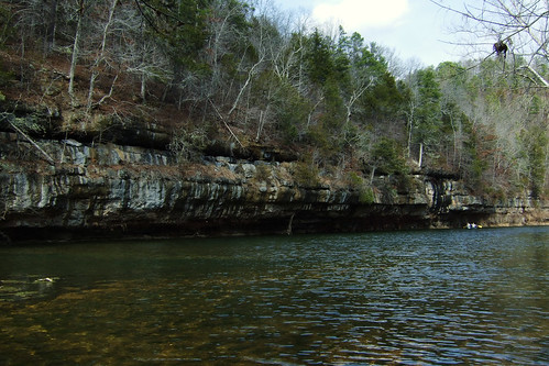
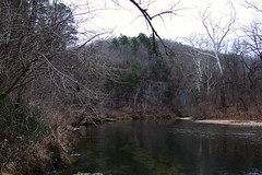
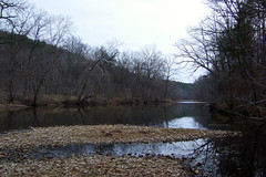
After breakfast and breaking camp, we hiked down Mary Hollow and followed the trail north and west to the North Fork River. The trail was obstructed by fallen trees in many places, and only a couple of trails are marked, so you need a map and to read the ground to make sure you stick to the right trail. We stopped briefly to admire the bluffs on the North Fork and to be completely disgusted at the mess left behind presumably by people camping in the wilderness while floating down the North Fork River. The almost complete lack of trash on the trails of the wilderness would suggest that this is the case.
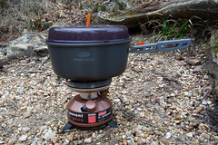
We then climbed the 360 feet to the top of McGarr Ridge, and walked along the ridge and then negotiated the very steep 360 foot descent to visit Blue Spring, where we filled up with water (we have a filter pump and chemically treat our water), and had lunch.
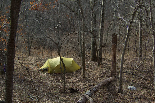
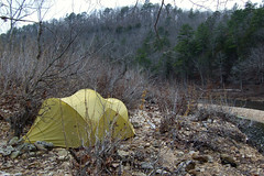
Our plan was to camp somewhere near where we'd first seen the river, and that meant retracing our path, climbing and descending McGarr Ridge again. We surprised oursleves by getting up the ridge quite quickly. Our new (but low-cost) trekking poles, brought for this trip, proved themselves invaluable going up and down the ridge. Once back at the river we didn't want to stop at the campsite that had been abused by all the floaters, so we followed the trail North a short while and then cut down to the river. We found a nice secluded gravel bank where we spent the night, accompanied by the sound of running water.
We had managed around 4.25 miles again, though the climbs and descents took their toll on our legs.
Day 3
It had been quite cold overnight and it started to rain just as we were about to break camp. As the rain had been forecast, we had set the tent up so that we could take it down with the rain fly still up - which meant we were able to put just about everything away dry.
The trail up Collins Ridge doesn't appear to be marked, and we encountered several trails that aren't marked on the map, which made for some educated guesswork on the navigation, which proved correct once we could see the lay of the land and check it against the topo map. The hike started with another 300+ foot ascent, quite enough for us out of condition hikers.
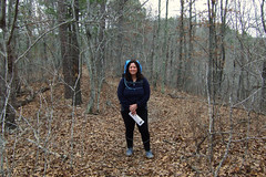
Before too long we were back where the trail along the Devils Backbone splits off, and shortly after that we stopped by a stone pile which acted as a tripod for today's picture. Once back at the trail head, Ginger looked at the trail head check-in, and the log had been changed and maps left. We saw that four people had been in on a day hike yesterday, but in the two and a half days we'd been hiking the trails we'd not met anyone. We saw and heard lots of Armadillos (Dasypus novemcinctus), and the tracks of a bobcat (Lynx rufus) but no people, which is pretty much how we like it.
The van was where we left it (always a worry). It was just a matter of dropping our packs in the back and heading off home.

