37.5 miles of hiking • 8500' elevation gain • 3 nights
-=Second half of our British Columbia trip=-
caveat - long winded
After hiking 6.7miles out from Floe Lake at the Southern Terminus of the Kootenay Nat'l Park Rockwall Trail we went into Radium Hot Springs and Invermere for an afternoon of errands, hot springs, authentic German food, and pre-packing for the next leg of our trip. We contemplated staying at Redstreak Campground but opted for a motel. The room at the Crescent Motel It had a full mini-kitchen that was fully stocked with cooking utensils, and a fridge that included a freezer big enough to refreeze my two one-gallon water containers that I use in our cooler. Okay, thats my plug for them, really impressed though for $90 the accommodations were great--clean, nice layout, supremely comfortable bed, large flat screen on a swivel arm..free pass to the Hot Springs.
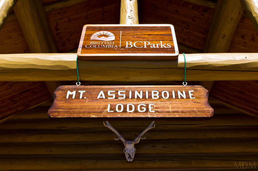
The Rockwall Trail is easy to find information about. There is an entire specialized map for it, it is one of the most popular trails in the Canadian Rockies... The same is somewhat true for Mt. Assiniboine Provincial Park—However the typical Western access routes (from the Kootenay Nat'l Park side were closed due to the Octopus Mountain Fire (thankfully almost out)), and Eastern access routes involve driving an extra 1hr-1.5hr to Banff or Canmore and hiking 27km, paying for a shuttle, or opting for $150 per person/ per way, helicopter ride. However I did find information on a less common way to the core Mt. Assiniboine area--going up Aurora Creek to Marvel Pass, down to Marvel Lake, then up a more traditional route to Wonder Pass and finally the Lake Magog area (destination).
The general approach is more often used as a route to do a Southside ascent of Mt. Assiniboine, however there is a previously official trail that goes up from this same area and links to trail which enter Mt. Assiniboine Park.
I found a TR on clubtread.com that was less than 3 weeks old which really seemed to make the route seem straight-forward and relatively easy. Heck, they had pictures of a gal in a bikini top posing next to a waterfall, so, it couldn't be that harry of a wicked un-official bushwack through prime bear habitat at the peak of berry foraging, right? Well getting info from the Mt. Assiniboine Lodge where the helicopter flies into, or any government source proved to be impossible, with only vague indications that the route was feasible, even though it was shown on a few different maps. Needless to say I had great trepidations (though vague) about this approach. When it comes to the outdoors, I am very sequential in my pursuits--leaning conservative with my choices until I feel comfortable with an area or activity. I just wanted it to workout, and not be epic.
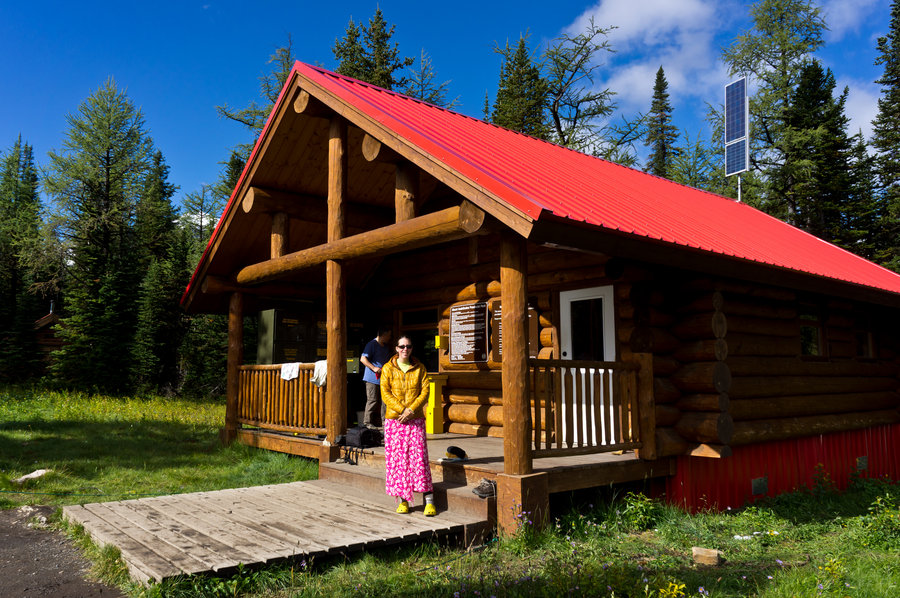
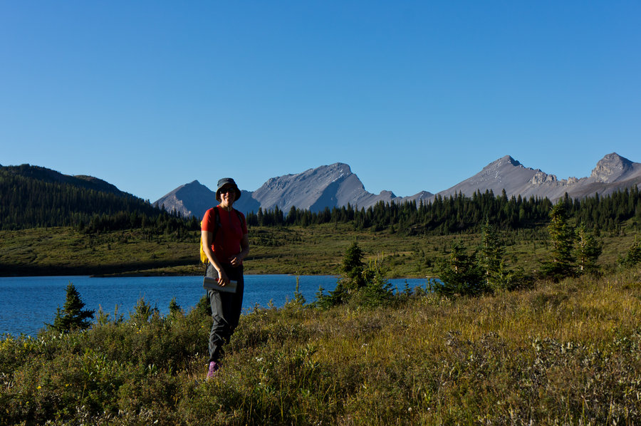
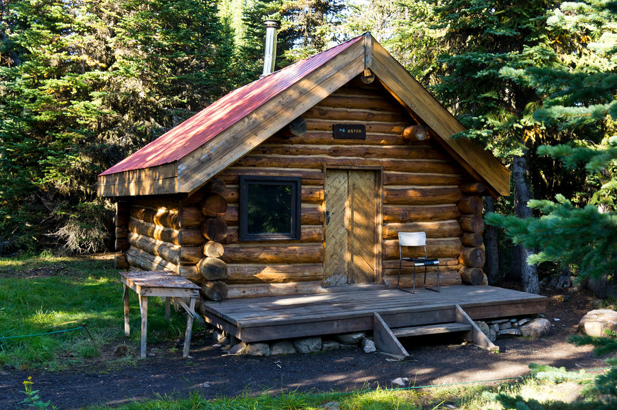
Being that it was after Canadian Labor day (Same as in the US) the brunt of the tourism season is finished. Reserving a spot for two at the Naiset Huts was quite easy. At $25/person/day it is exceedingly reasonable. A comfortable mattress in a hut. Access to a very nicely furnished cooking 'hut', with solar lighting, unlimited propane, bear boxes, etc. And if one wanted, camp spots were available on the other side of Magog Lake for $20/night. Staying in the lodge proper is $150/person/day...steep!
Day 1) This approach starts with ~40km of driving on a road actively used by the Baymag. It looks like a grader runs the 40km daily. The haul trucks from the magnesite mine talk on CB radio and run full bore down this road. It is unnaturally white with a thick layer of dust from the ore they carry out. But the road is in absolutely great shape - aside from the dust, you can blaze down it at a good speed (40mph for a lot of it). The scenery is amazing..
Then you turn off onto a true Canadian Forest Service road which was near the margin of my vehicle as far as the vegetation growing in the median between tire ruts. Two wooden bridges in disrepair (with boards missing and all) must be driven over. Then a rock-slide prevents further access except for 4wd/high clearance vehicles (confirmed by me bottoming out on a large rock which I had to use a trekking pole to get the car free to back up off the slide). But this only adds about half a mile extra of walking.
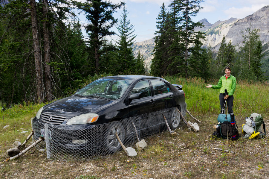
We spent a good hour prepping the car for porcupine protection. Sure I had laughed plenty at previous mention of people chicken-wiring their vehicles in the Bugaboos before climbs.. but when you're 45km up a backroad in the Canadian Rockies, the idea of returning to a vehicle with chewed brake/fuel/radiator lines or tires flat... no thanks! We also had to duct-tape our rubbermaid bin shut to hopefully keep the mice out of it.
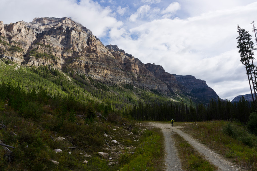
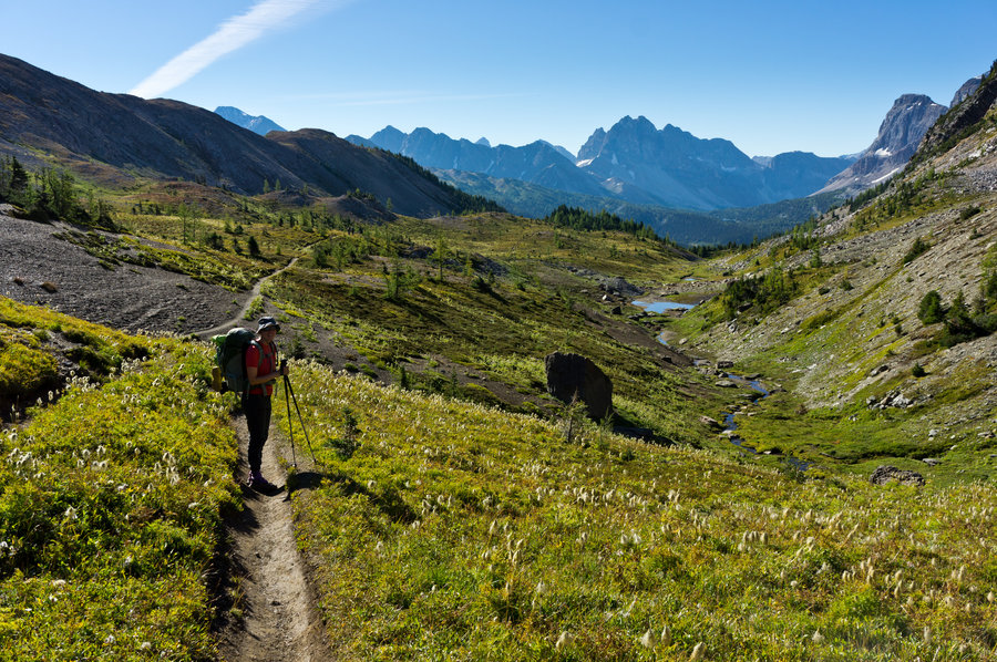
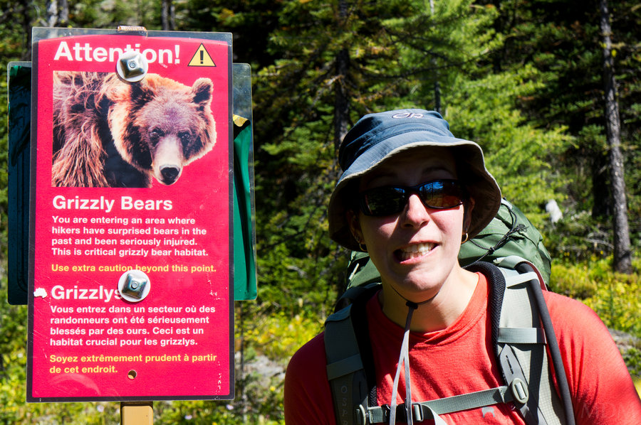
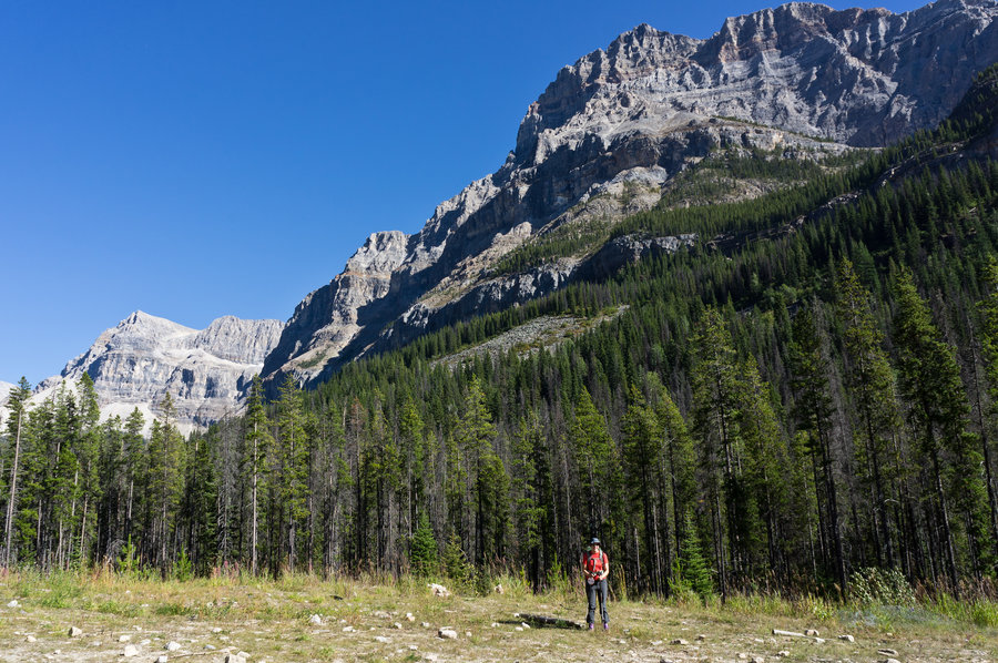
The day started clear but rain was predicted for the afternoon. While I had some basic things on my GPS.. the maps in Canada are 1:50,000...half the resolution of our 7.5' quads, I believe. And I didn't have anything like a track from someone else, just what I mapped out from some maps that showed a 'piece' of trail here or there. Anyways this really ended up being extremely clear and straight forward. There was a gross amount of flagging for the first few miles of trail, then it was just very clear where you're going. I think it is about 500-600m up to the pass (just guessing here) Eventually there was a sign at the top of Aurora Pass giving us some distances. Along with a warning about entering prime grizzle foraging habitat and that others had been injured and killed here. Lovely.. The clouds had been thickening and around the time we ate lunch it started drizzling.
By the time we got going it was quite wet on all the vegetation and the light rain continued. Even with full rain gear on, in short order our trail-runner feet were soaked. I had a brand new shell jacket for Bucket in the car which she took for this leg of our trip and it did make a huge difference for her.
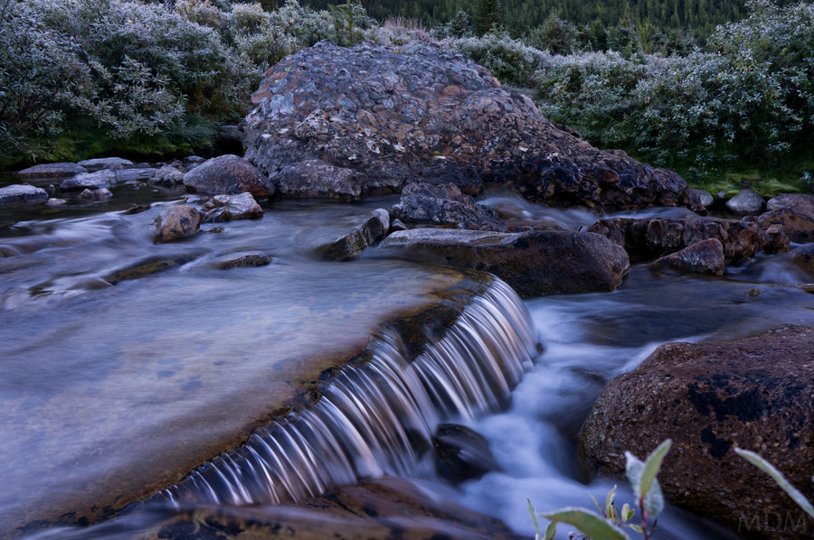
Going down from Marvel Pass to Marvel Lake was more or less down a streambed and full of blowdown. Again for about 500m? (guessing) It was a major hassle. Lots of the stuff where you really have to clamor over it, or awkwardly crawl or limbo under. Not the easy step-across type. At the bottom near the lake the trail was very ripped up and a total mess, along with a few streams going through the area.. we ate a snack and figured which way to go.. and the rain really started coming down hard--making us have to raise our voice to speak, due to the rain and the stream noise. Eventually we found a route through without fording then we were slowly going up towards Wonder Pass (Something like 700m or 800m above us?). Still more blowdown. I took one good fall but didnt really hurt myself much. The rain continued. Then we were going straight up, a slope that was a serious 1:1..going a foot up for every foot forward. The rain lessened. We finally hit a more official trail and the grade turned excellent with plenty of switchbacks. We had a few under-the-cloud views even, our spirits raised. We knew we had a hut to arrive at which really helped us mentally. Then as we neared the treeline, still about a mile or more from the top of the pass, the rain returned and turned to snow. Our hands and feet were soaked, but we were doing okay. We decided to push on as we had no stove and no tent being as we were staying at the hut. It definitely felt more on the cusp of risk than I normally push it. It was 34 degrees out, the snow was accumulating on us. I took Bucket's poles so she could keep her hands protected...we stayed in constant communication encouraging one another..everything is fine until it isn't--you know, someone falls and breaks an ankle..and maybe it is 2-3hrs before help can come--and suddenly the situation is serious. I wanted to keep abreast if either of us was sliding into a mental state due to the cold where we would make a mistake that could harm us. The terrain was safe, except we were still going up hill while the snow accumulated on us. This snow would end up sticking around on the mountains for 3 days after, under full sun. We each had about 2inches of snow on our packs, hat brims, etc, by the time we crested Wonder Pass.
From there the weather moderated greatly and we descended into a fantastic stand of larches and had just 2km to get to the huts. We did the entire gear explosion thing, got into dry clothes, had a fire in the woodstove (they sell a compressed wood 'log' that burns for 3 hours, warms the hut up plenty, and costs $7), and hung out in the cooking hut (very large). Our bunk mates were a father and daughter, and later that night, 3 college gals who were planning on camping but in light of the weather opted to pay $5 more each and stay under a solid roof.
The sun even came out briefly that evening, illuminating lots of fresh snow on the mountains.
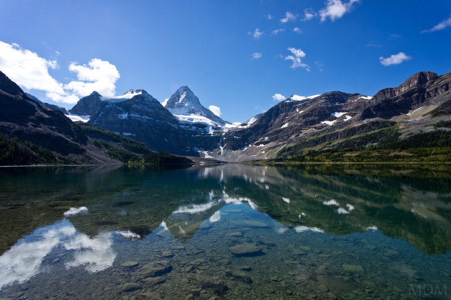
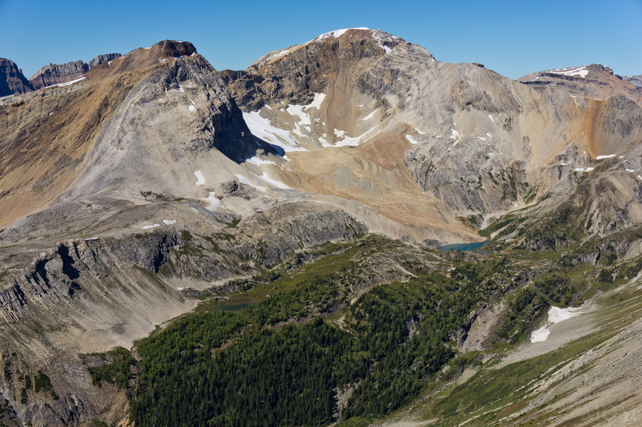
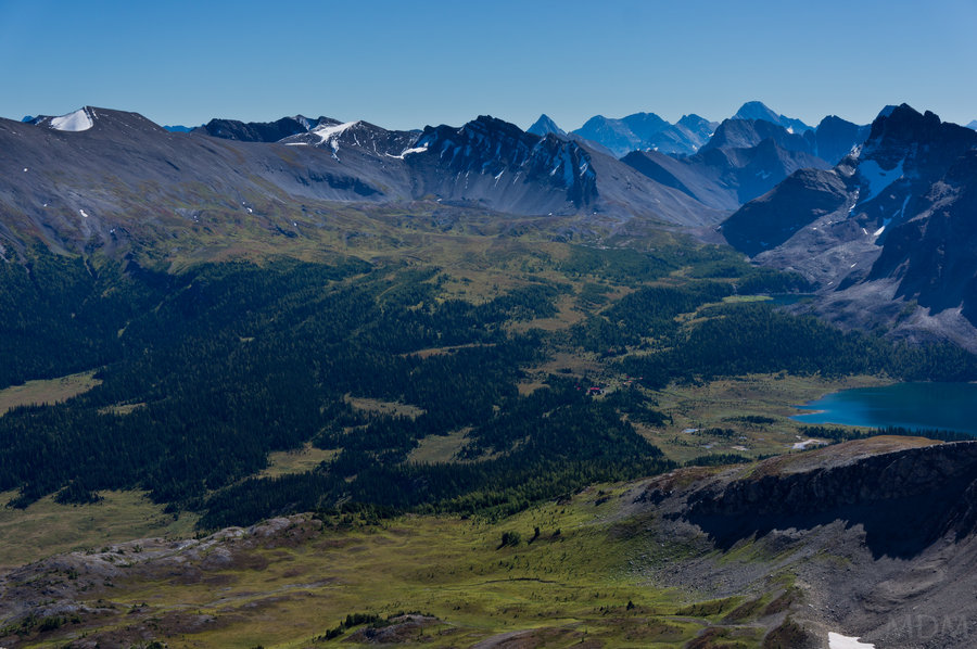
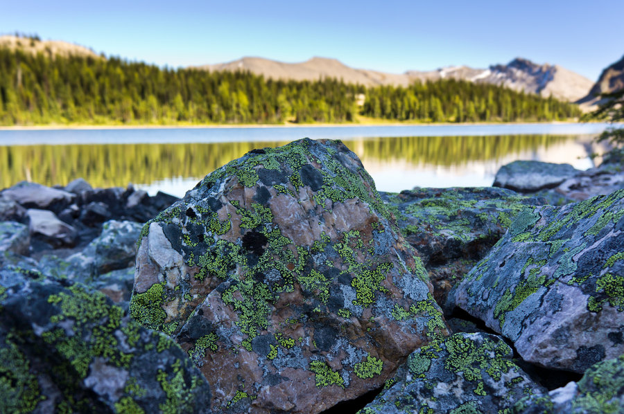
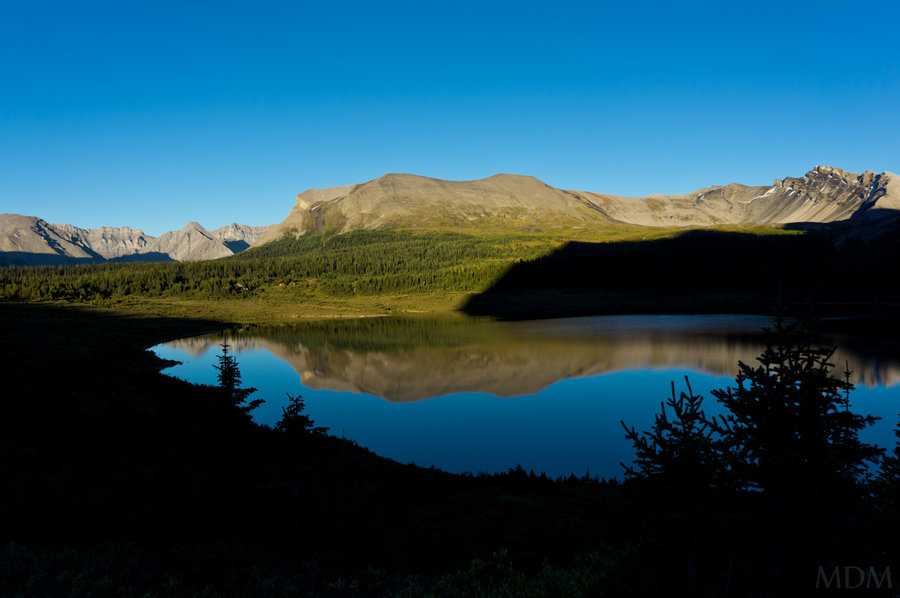
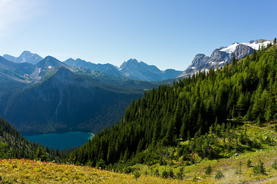
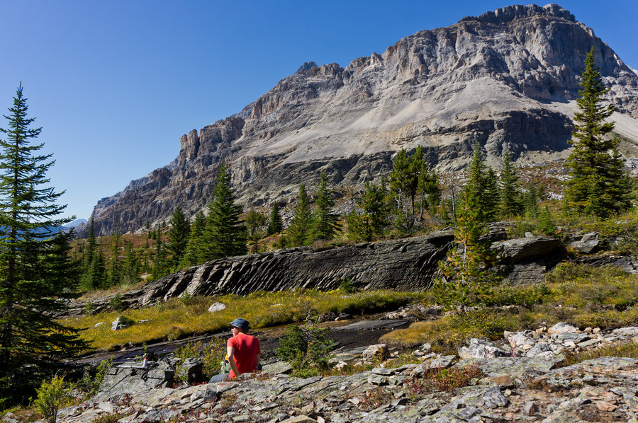
Day 2) Sun Sun Sun! We slept in and enjoyed ourselves. Bucket was feeling like she was going to take it really easy and just hang around the hut for the morning. So that she did, while I went and explored Lake Magog, did some fishing and photography for a few hours then came back to see Bucket. We rounded out the evening with a walk around the lake and socializing in the hut. Almost everyone there with a few exceptions was from Calgary or elsewhere in Alberta. The lake level has increased in the years and was higher than normal so the usual 'foot path' around it was entirely under water in places, requiring us to do some very very light 'bushwacking' around to do a full circling of it. The landscape and scenery was just amazing.
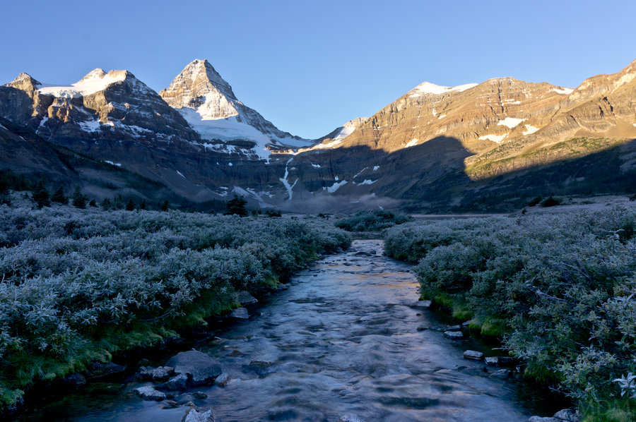
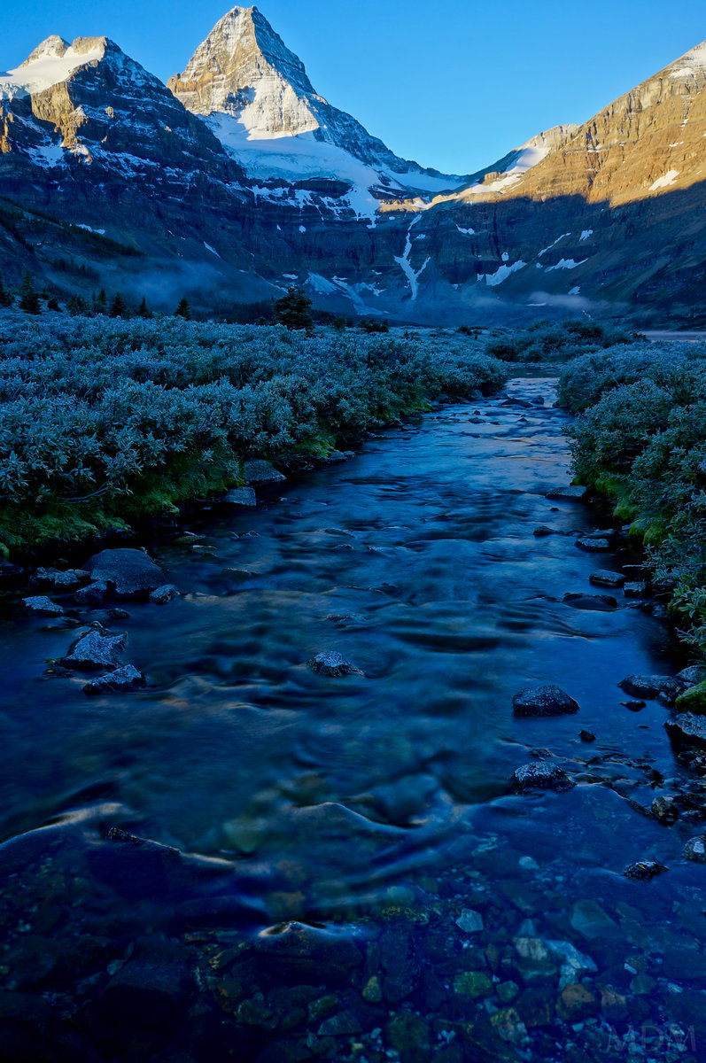
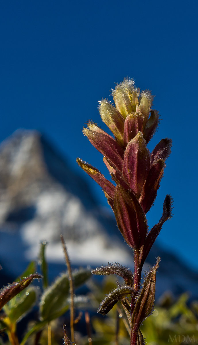
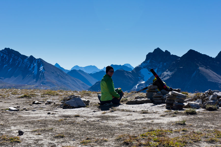
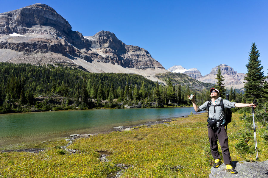
Day 3) This day we planned to go up to The Nub, or the Nib, or the Nublette...meh a bunch of different designations for a very gentle rolling hill that provides one with a spectacular birds-eye view of the entire Assiniboine area and beyond. I started the day with waking up before Bucket and high-tailing it down to the lake for some incredible sunrise shots with the bounty of beauty from a hard frost lacing everything at hand.
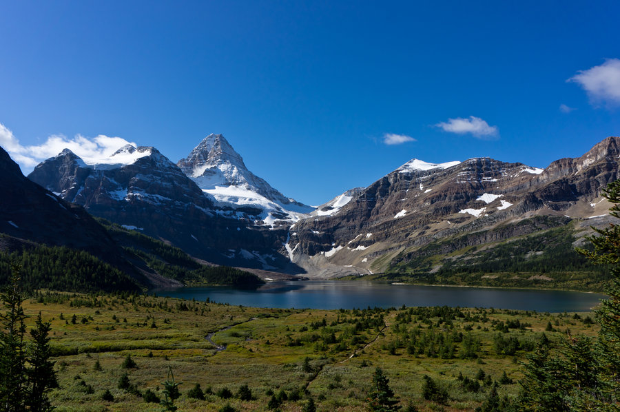
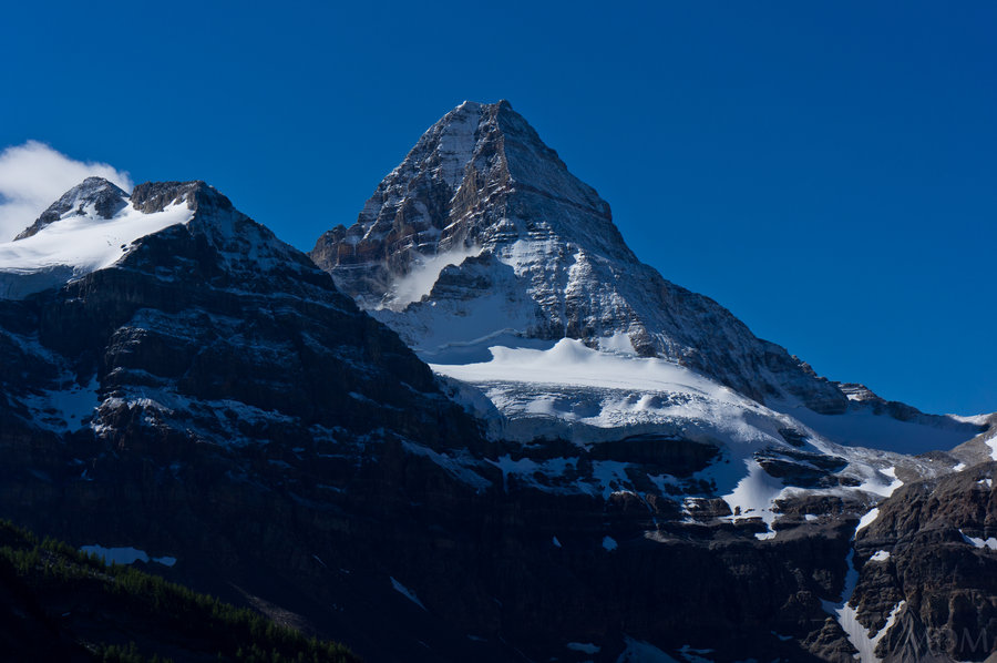
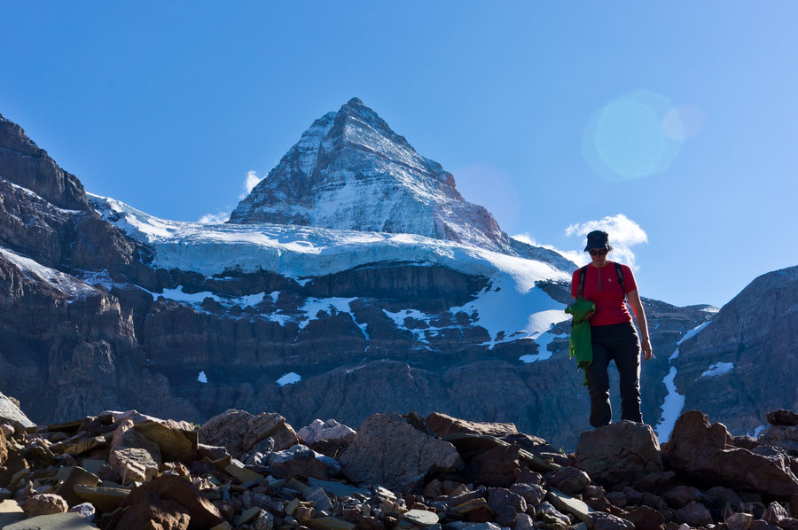
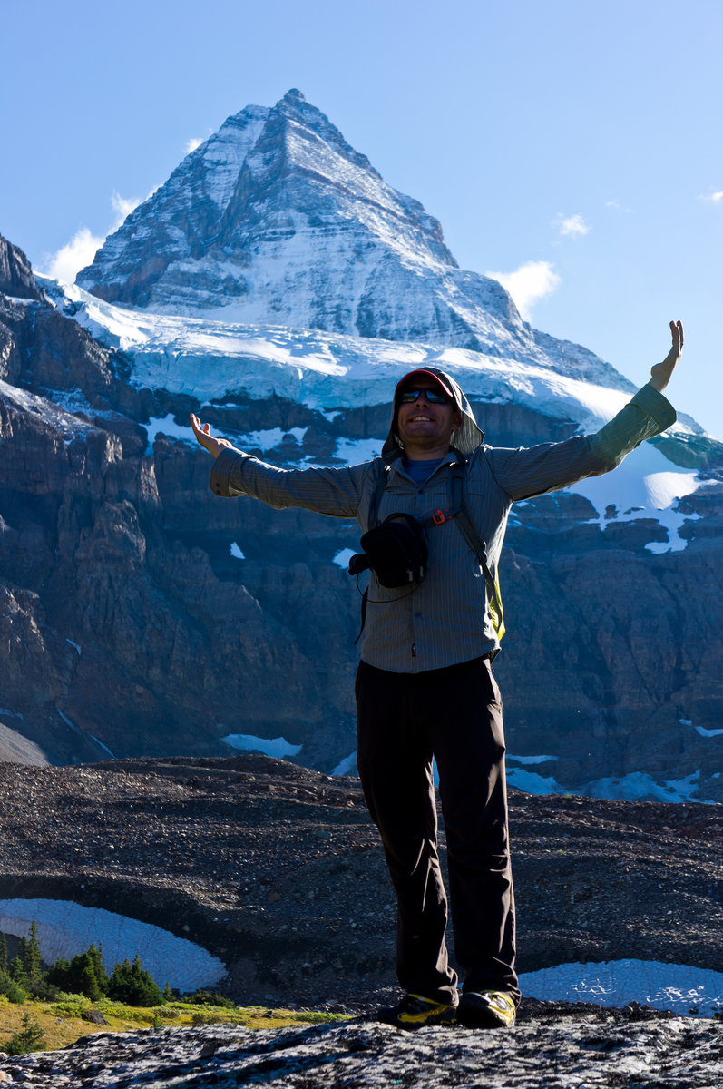
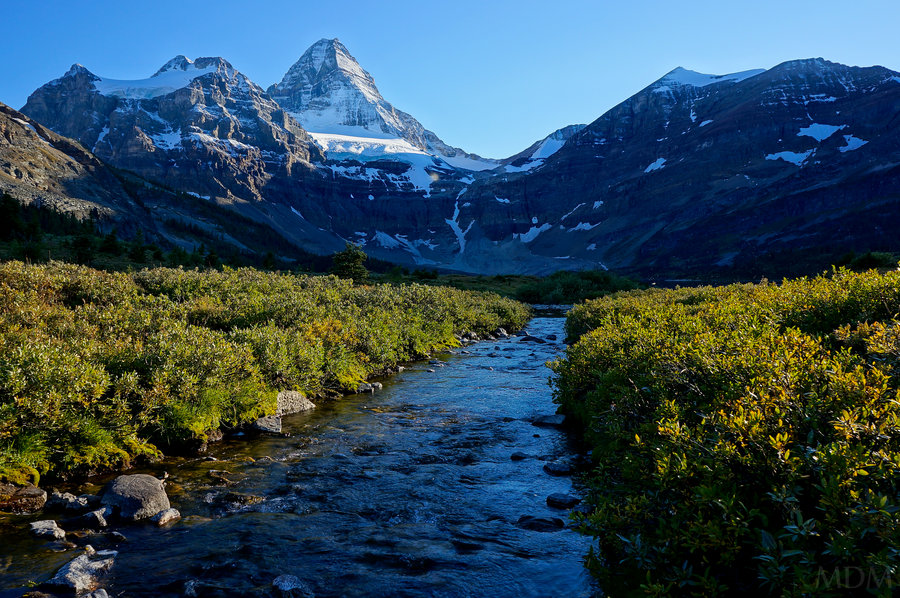
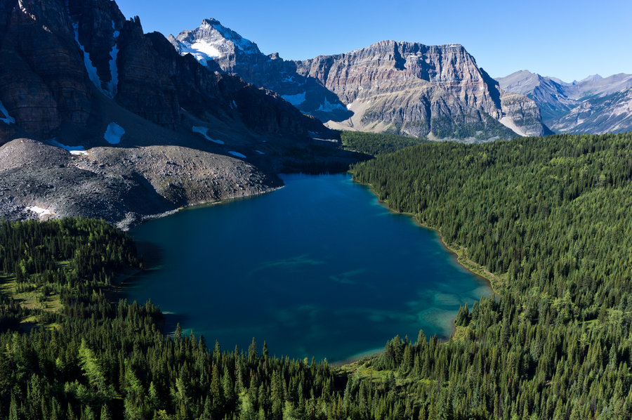
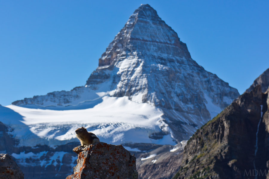
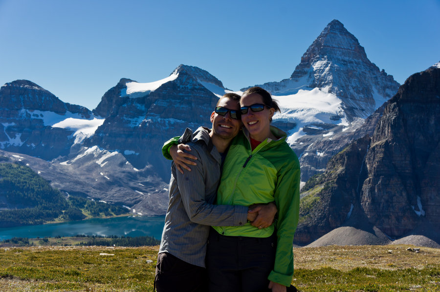
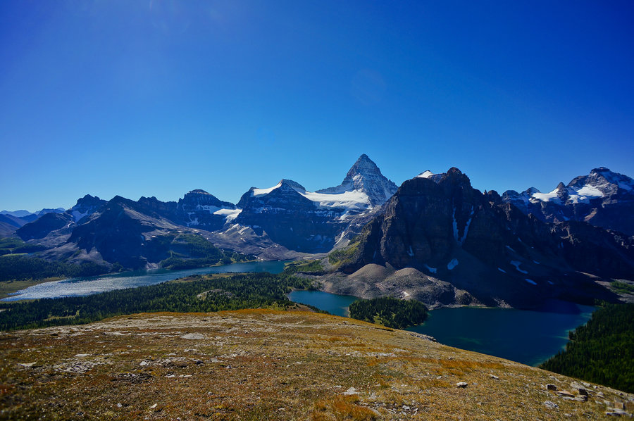
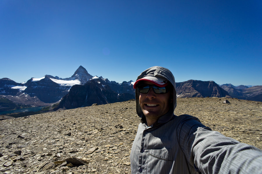
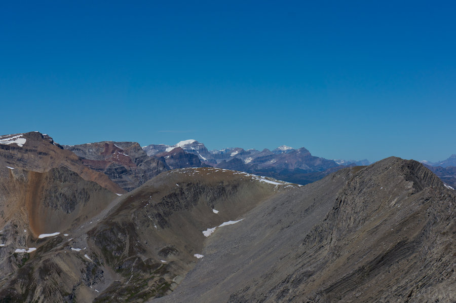
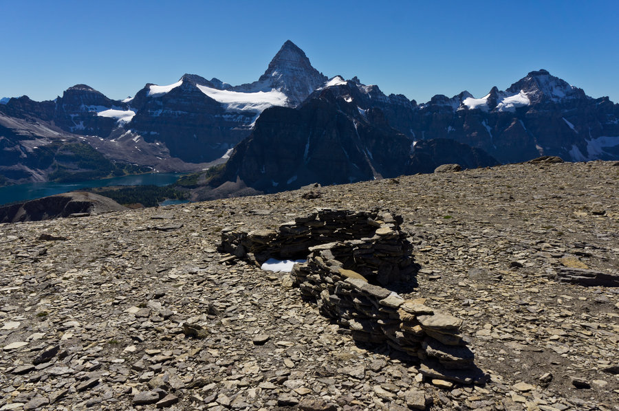
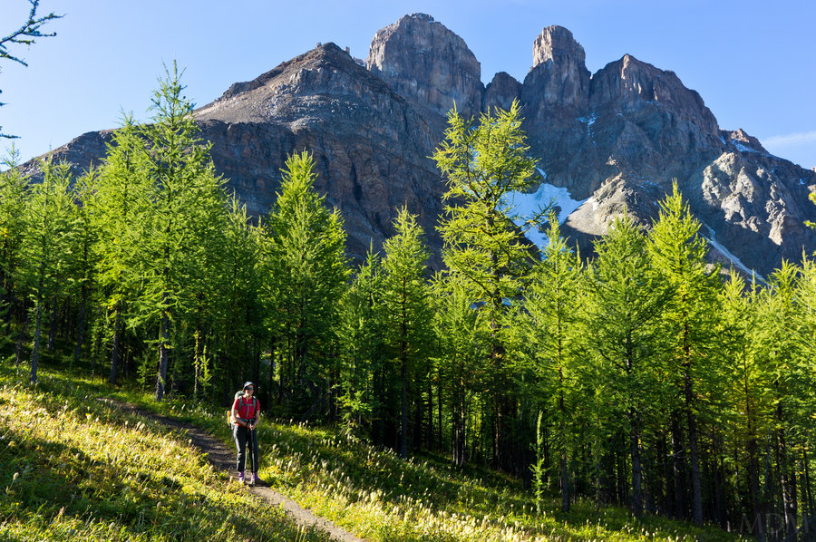
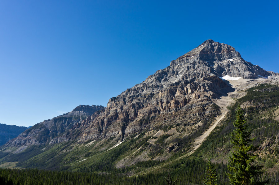
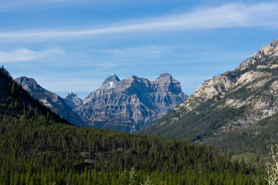
Bucket ended up joining me after I took pictures for a good hour. I didn't even go fishing as planned that morning. We headed off to the Nub or Nib or whatever.. We stopped at a very broad portion, above which the trail increases in steepness, though really it just continues and is not 'risky' in good conditions. We hung out here for a while and then I continued on to the top. This was a very rewarding bit of extra elevation gain. The views were incredible and really for the first time after having taken 2 separate trips to the Canadian Rockies I was getting the 'fullon' mountain views that are famous. Looking at Magog, Cerulean, and Sunburst lake below Mt. Assiniboine was spectacular.
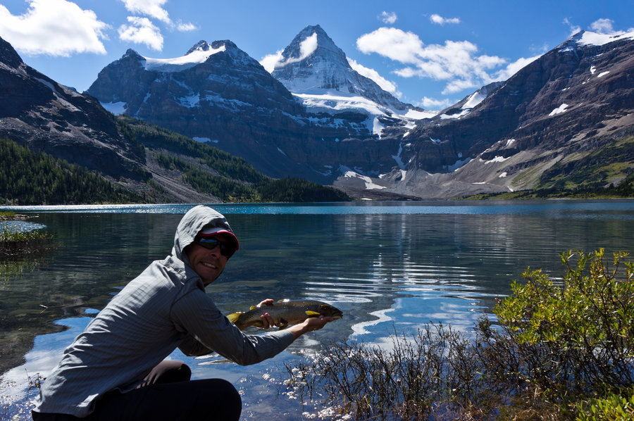
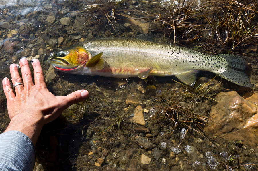
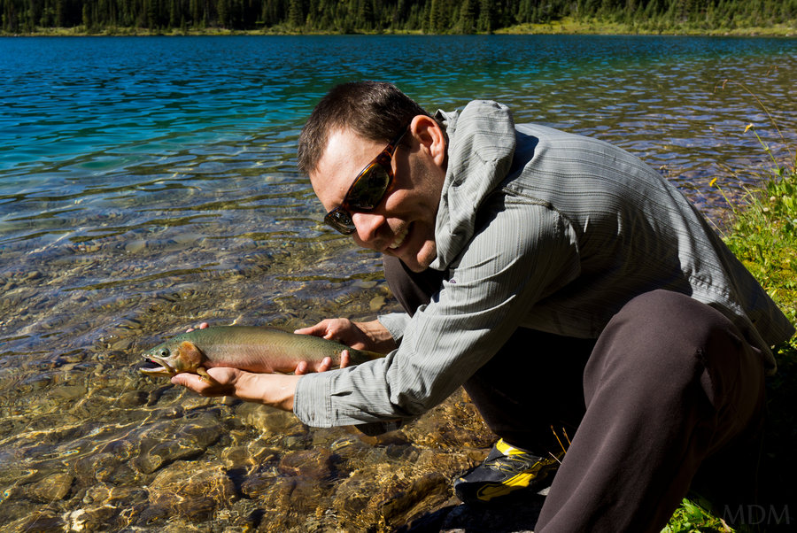
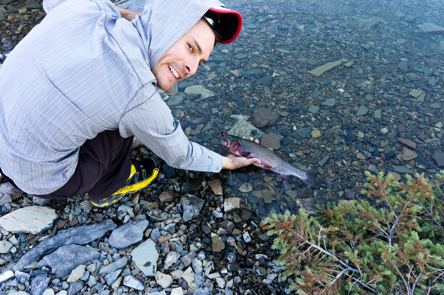
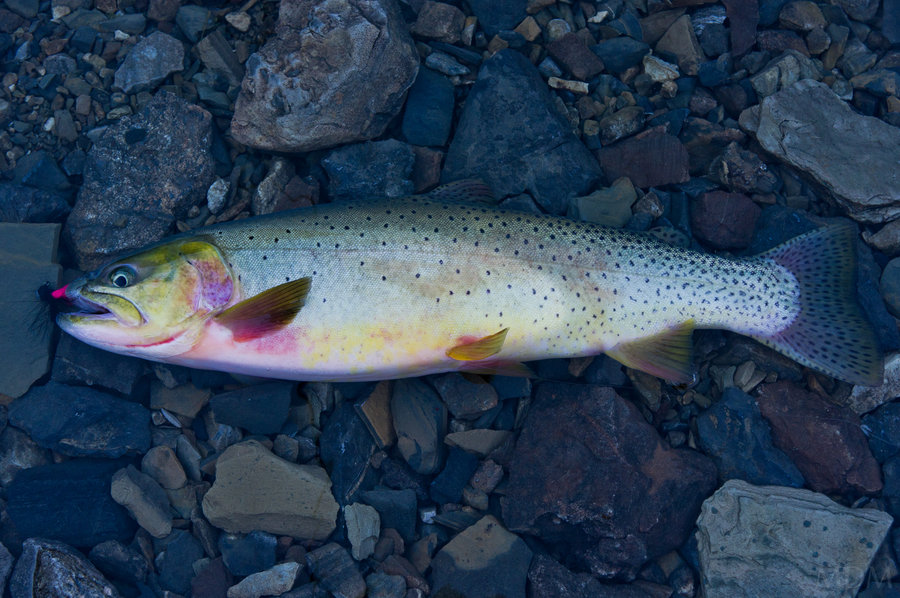
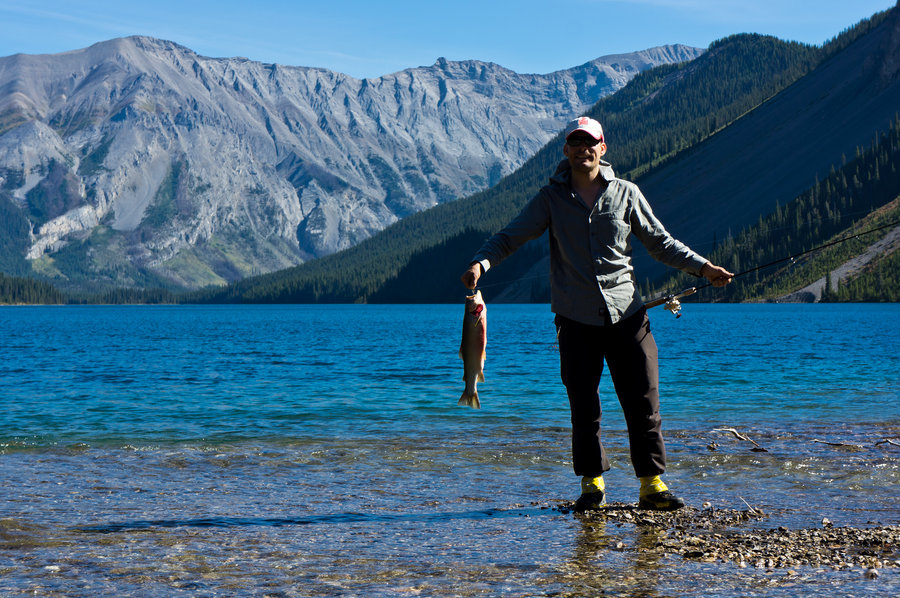
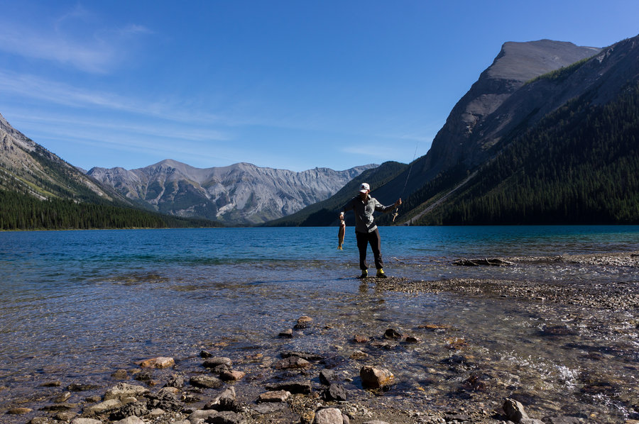
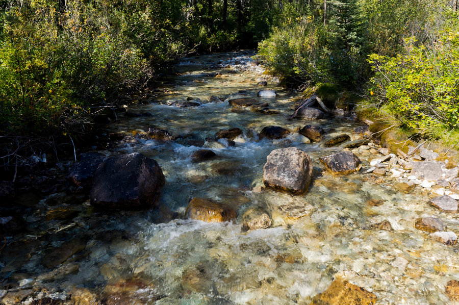
We descended and I fished in Cerulean Lake (one real nice cut throat), Sunburst (two decent Rainbows), and then Bucket headed back to the hut and I fished at the end of Magog Lake right below Mt. Assiniboine for a few hours, catching huge cut throat after huge cut throat..with a rainbow thrown in. It was absolutely phenomenal fishing & catching..the setting, the fish, the beauty and weather, all quite perfect.
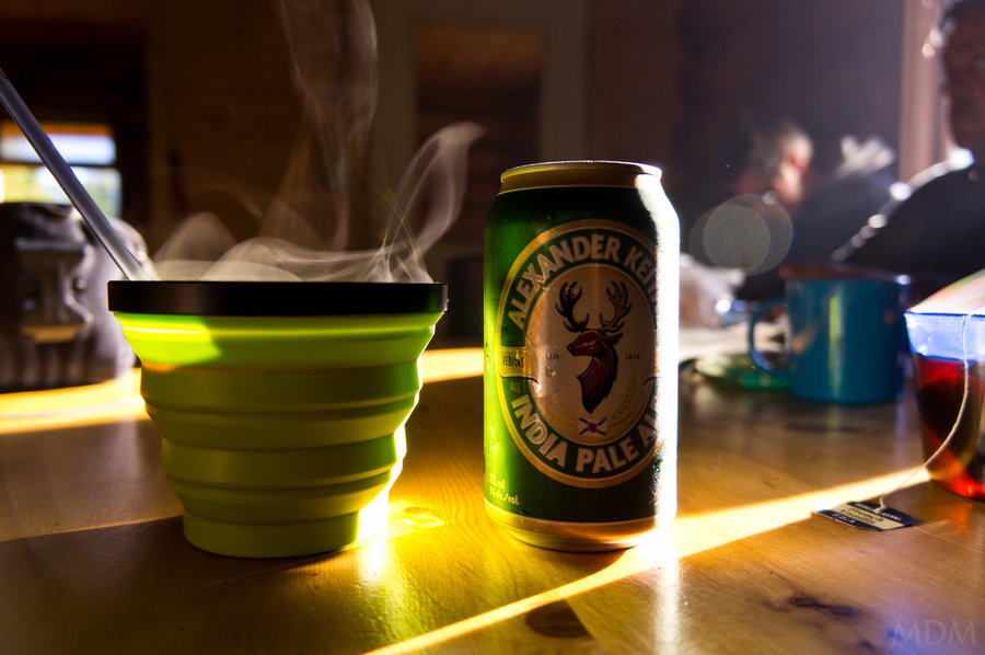
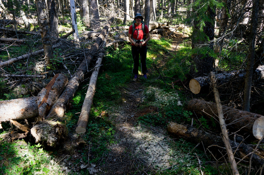
Day 4) Hiked out around 8am, after a guy in the cook hut provided me with a great IPA for the trail. Having hiked about 60 miles over the previous 5-6 days, and eaten almost all of our food, and not having a stove or tent or sleeping pads..our packs were very light and we powered on out of there, sad to leave, but still under a brilliantly clear sky. It was great to see Wonder Pass without snow.. The larch there must be unreal during the peak of their colors. Looking down at the intense blue of Marvel lake was fascinating. We still dreaded the blowdowns we'd deal with, especially going up hill, but with light packs and sun it wasn't a big concern.. Needless to say when we got to the area around the lake we found fresh cuts and lots of sawdust.. it ended up that the entire damn route and every single piece of blowdown we cross from Marvel Pass down to Marvel Lake had been cut!!! I guess you really appreciate some serious trail maintenance once you've dealt with a trail that sure could use some! They even clipped vegetation in areas to make the trail clearer! Had to be over 100 log cuts.
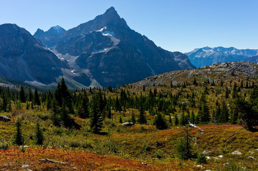
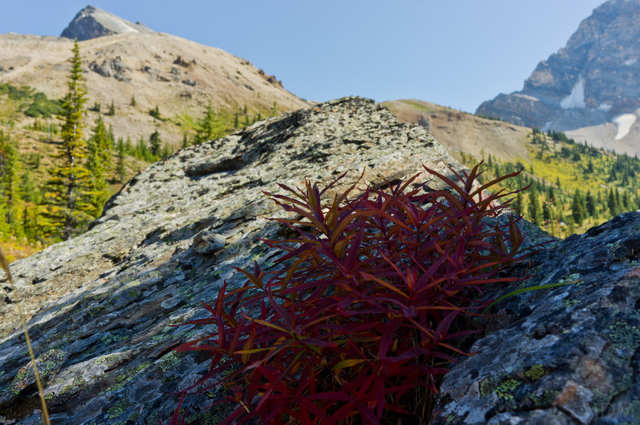
We stopped at Marvel Lake and I fished briefly...so beautiful! Then it was up to Marvel Pass, and finally drinking the IPA, where all the ground cover was already in a beautiful red-stage.. Though the larch trees had not yet begun to turn. We hung out here and had lunch, making lots of noise in the brush to be 'bear aware' before continuing down Aurora Ck back to the car.
The car was all in one piece. No porcupine activity nor any mice venturing into it. What a relief. I had another beer... :) we drank some soda and decompressed. Then it was back to Radium Hot Springs, another night in the same room at the Crescent Motel, some more time soaking in the Hot Springs, and some authentic Austrian Food!
And Sunday we drove home.. with a fun stop not 2 seconds into Idaho from the Idaho St. Patrol. I blew past two 'crime scene management' type trucks of theirs that I could not tell was LE. They pulled me over 50ft past.. gave me a warning, but said 'Hey you going to down through Coeur D'alene on the way to Oregon?? (2hr drive) I said yes.. they said "well tell you what, we're going there too, so we'll be following you and if you go a mile above the speed limit you will get a ticket. Ohhhh shit let me tell you how difficult it was to actually maintain going 60mph or under..even cruise control, with curves and hills it was a task. Thankfully there was a passing lane about 25 minutes later and they passed me.... and we pulled off to let them get plenty ahead.