

26.86 miles of hiking • 9000' elevation gain • 4 nights
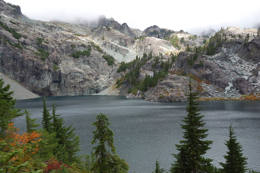
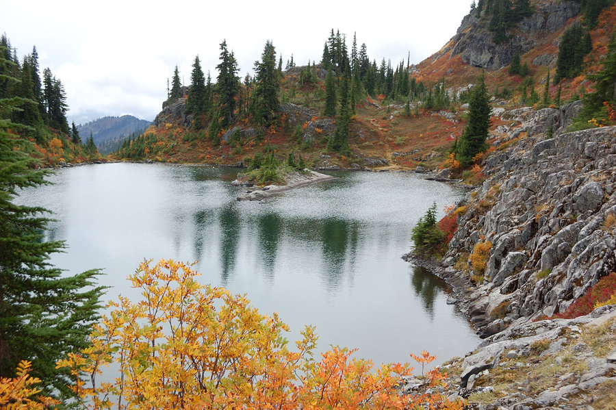
After busy Labor Day, got out on Thursday to explore Alpine Lakes Wilderness for the first time. Started at Rachel Lake trailhead and camped at Rampart Lakes, which was a must-see after reading epic TR's from the area (probably THE most crowded area I ever camped in, but justifiably so). When I came it was already getting dark, and found all campsites busy on Thursday night (!); I went through Rampart Lakes area, turned back, and luckily found one flat spot just big enough for 1 person to sleep (made for strange placement of my 2-person tent).
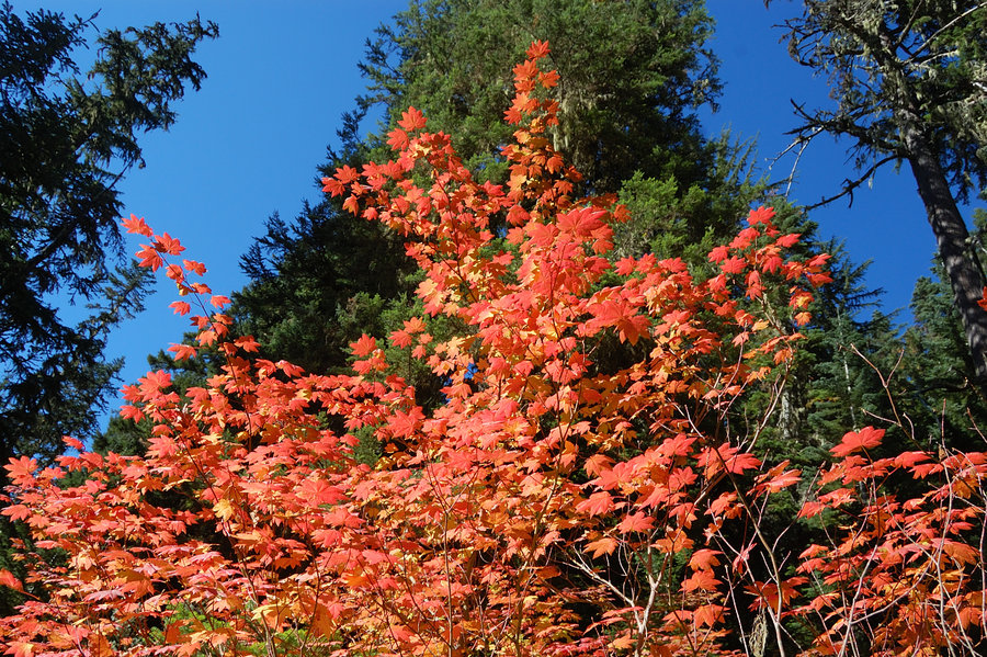
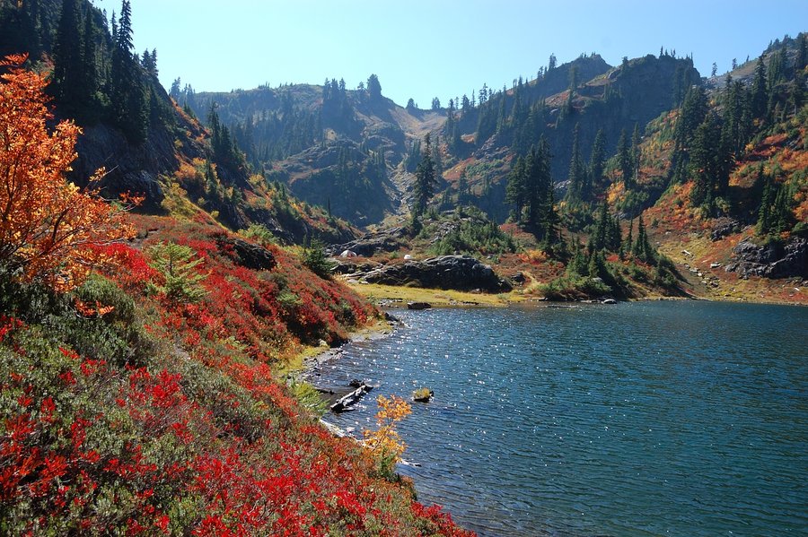
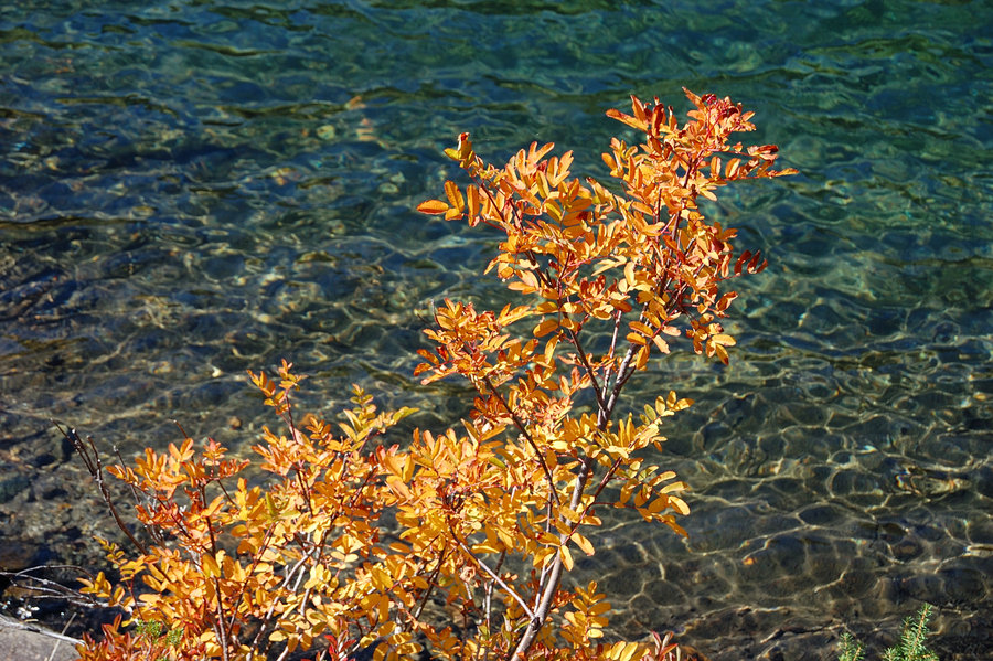
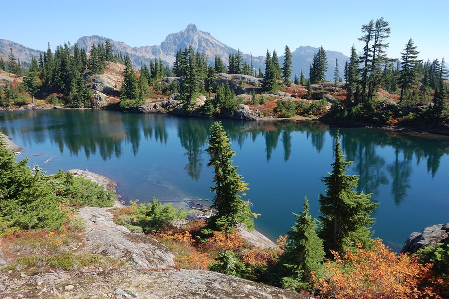
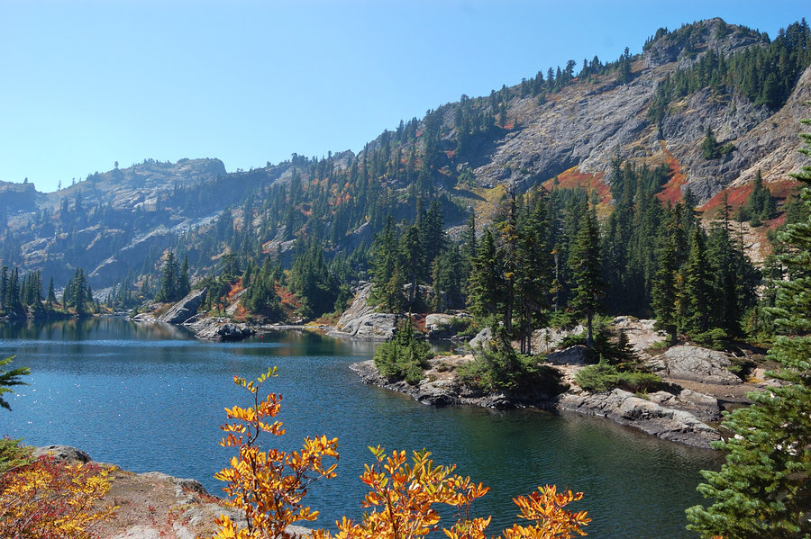
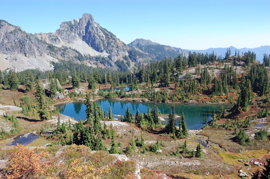
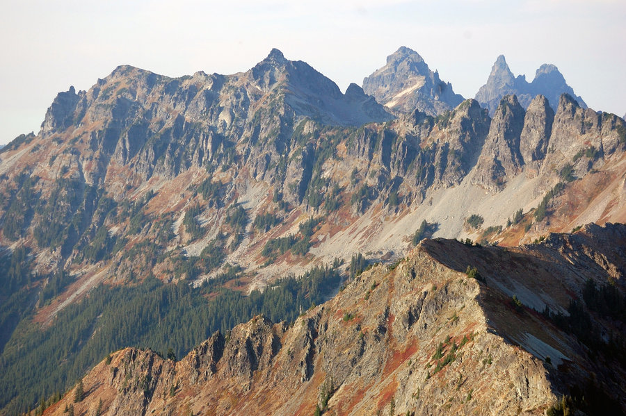
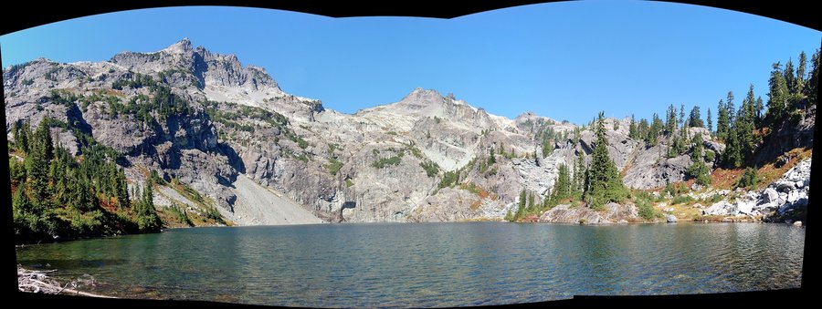
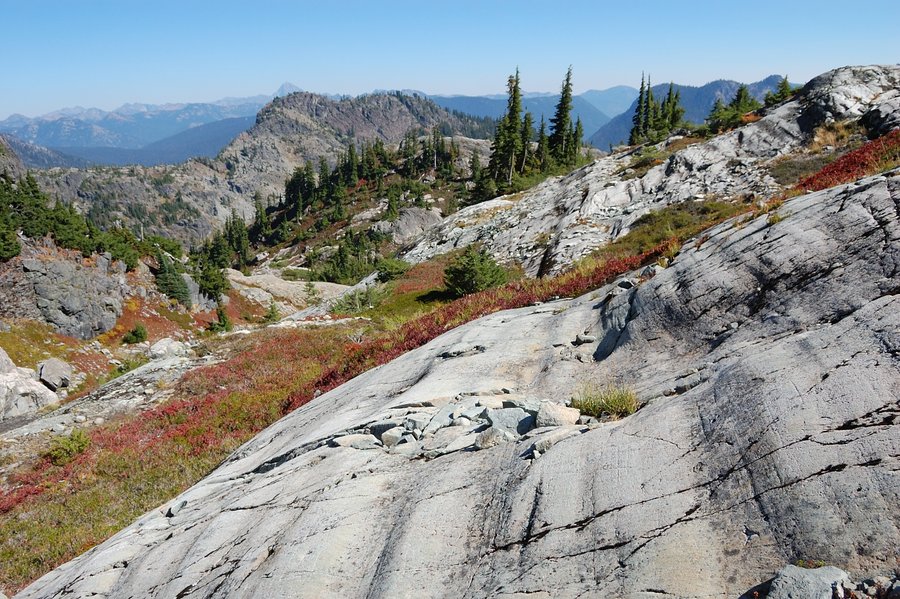
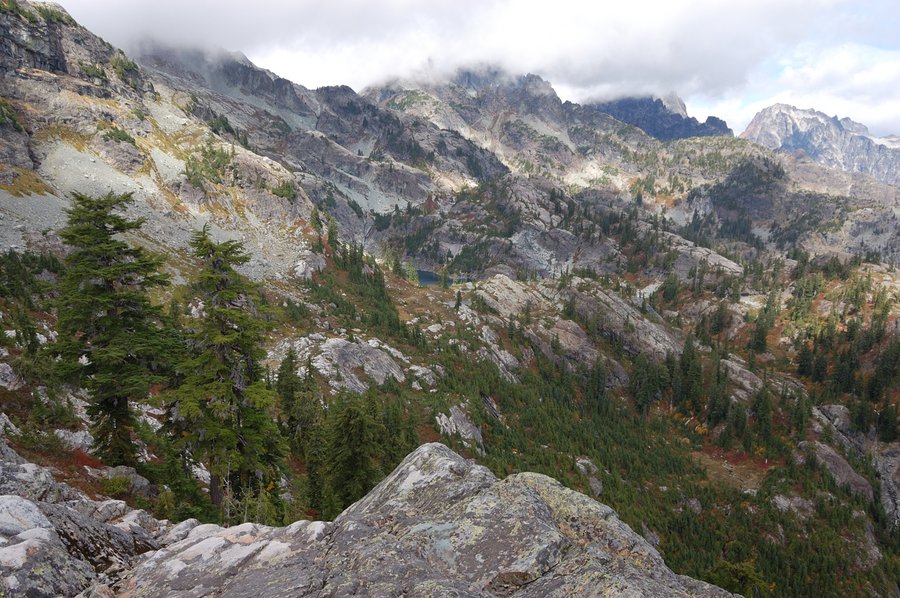
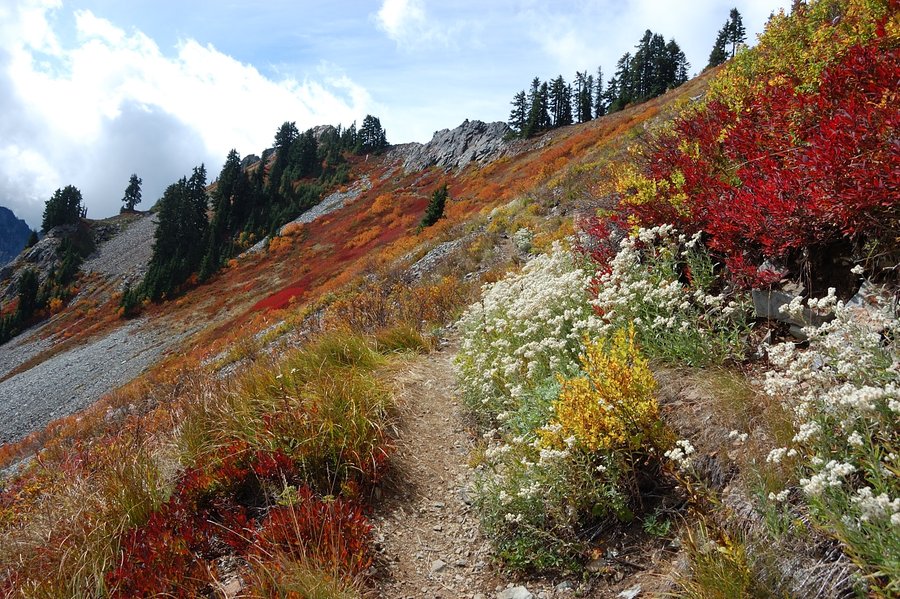
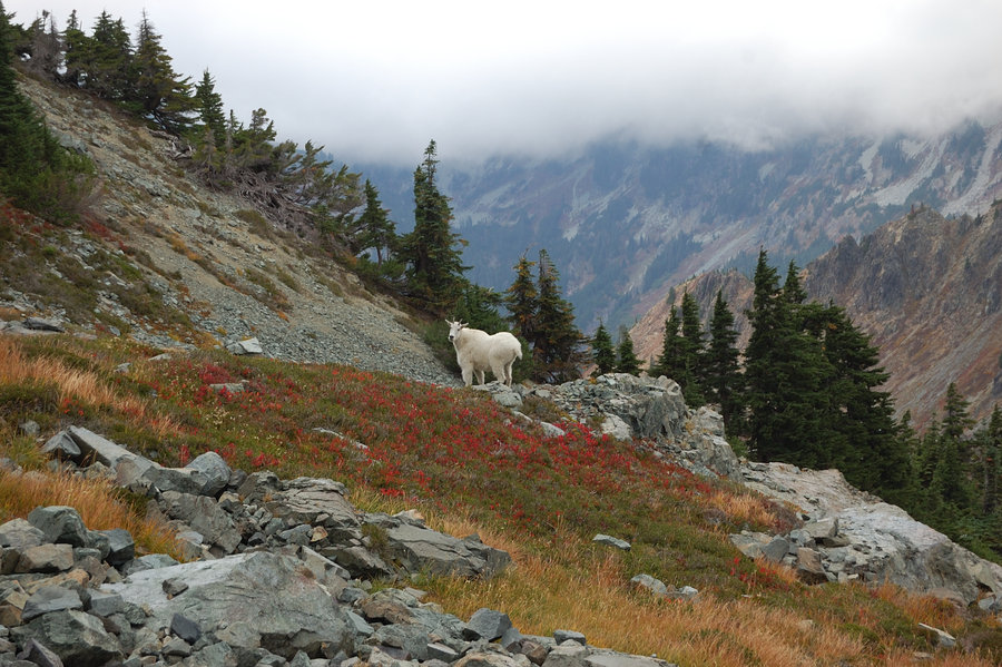
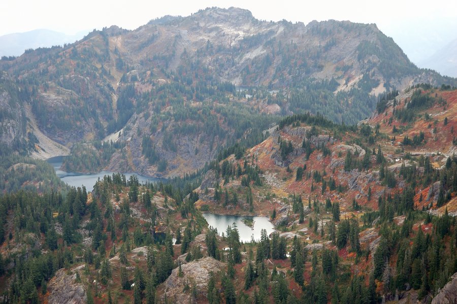
Next morning was a bit of a shocker from incredible scenery which I missed on the way in - white granite cliffs with fall color display as its best, stone-rimmed blue ponds. While this place is crowded but it looks well-kept and never seemed overused. Saw a couple mountain goats high on the cliffs.
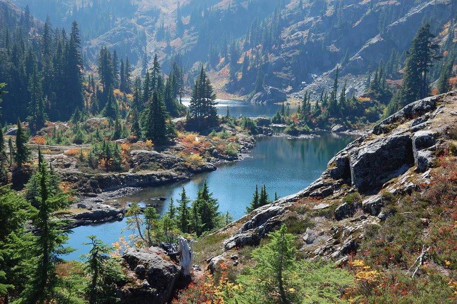
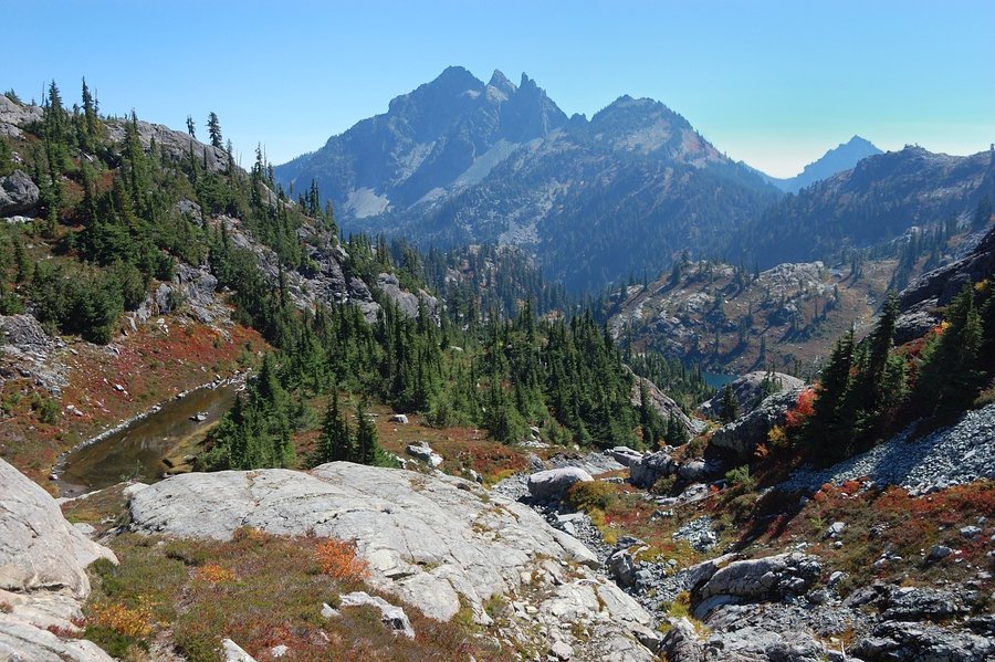
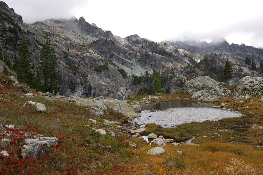
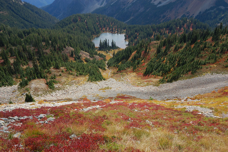
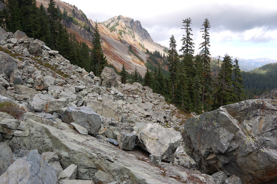
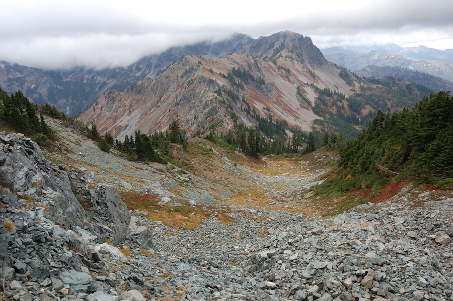
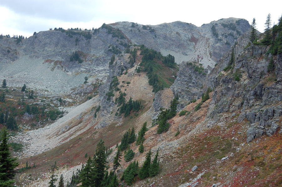
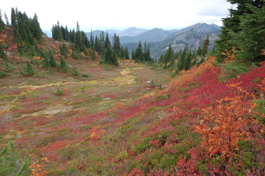
I spent a bit too much time in the lakes basin, exploring side trails and taking pictures, but eventually it was time to move on to offtrail part of the trip, and try to be at Glacier Lake by the evening. To make long story short, the trail peters out at the tarns on the east side of Alta Mtn, and after a short walk in the brush you pick an abandoned (unmapped but mostly good) thread that goes to one of summits of Hi Box Ridge, elevation 6100'. Past the unnamed top, it was trail-less descend on scree on its north side, and then I followed below the ridge on its east side just above tree line for about 1.5 miles, up to PCT at Chikamin Pass. Once on the PCT, it was a quick hike to unsigned junction near Spectacle Point, then down very steep "goat trail" to Glacier Lake.
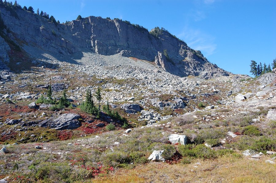
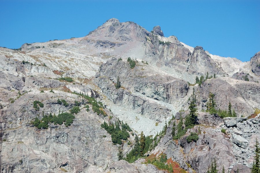
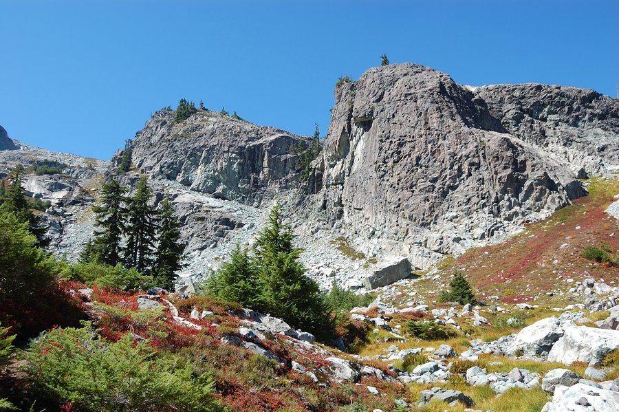
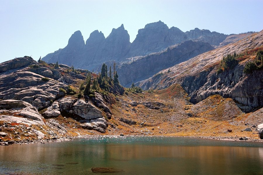
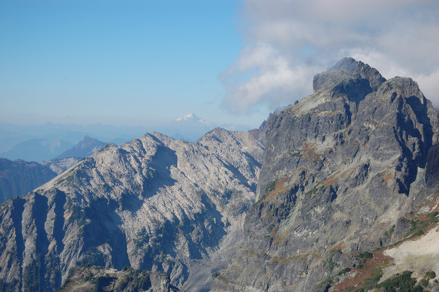
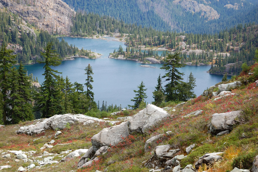
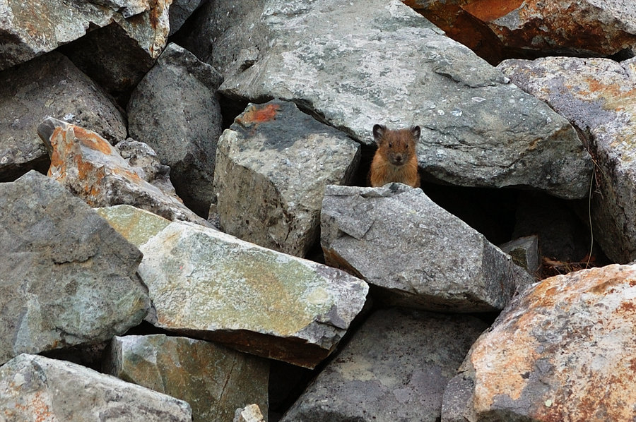
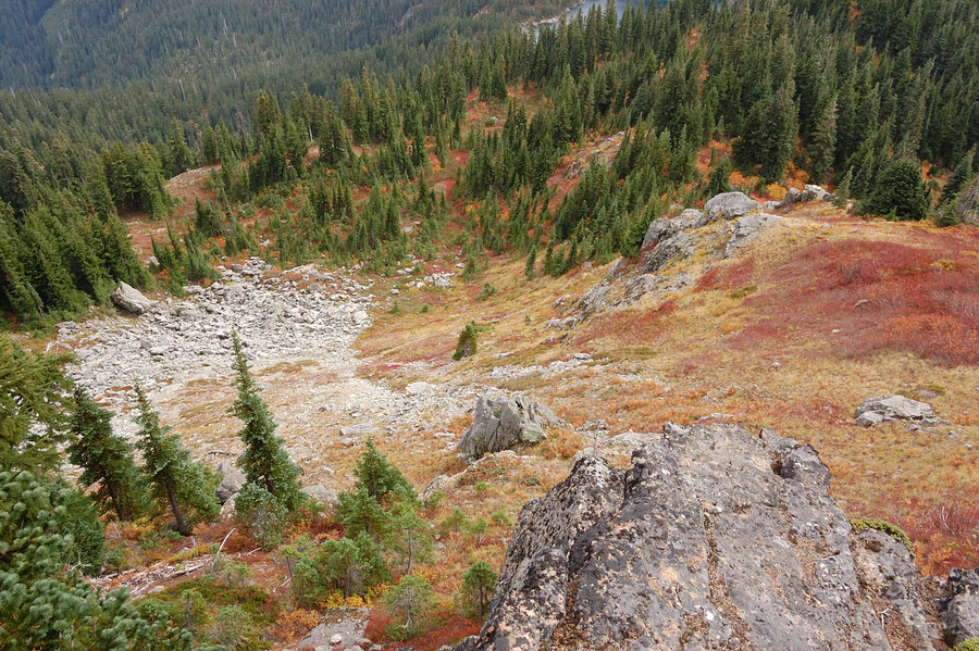
Saturday was my backpack-free day, and I watched several groups of climbers passing above my camp and starting their Chikamin Peak ascent through the gully filled with car- and house-sized rocks. My map showed it was indeed the right (and the only) way up the mountain. After bouldering fun through Crowd Gate the things eased considerably on the way to Ice Box Lake and the summit, with alpine creeks cascading down canyons of glacier-polished granite, more fall colors, better and better views of jagged peaks on all sides. The last 200 feet before the summit it steepened again and required some scrambling at the very end (excellent granite gave way to crumbling basalt), and a vertical stone step about 7 feet high below the top. I think description says it's III class scramble; in the end it was a lot like approaching Gilbert Peak's summit in the GR, only a bit steeper.
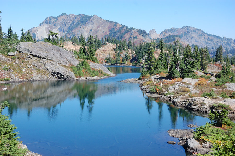
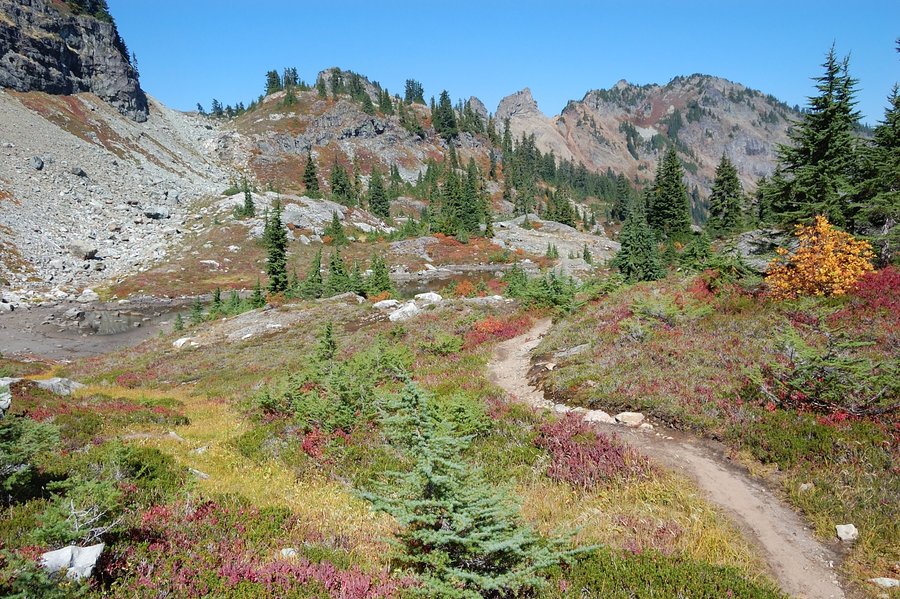
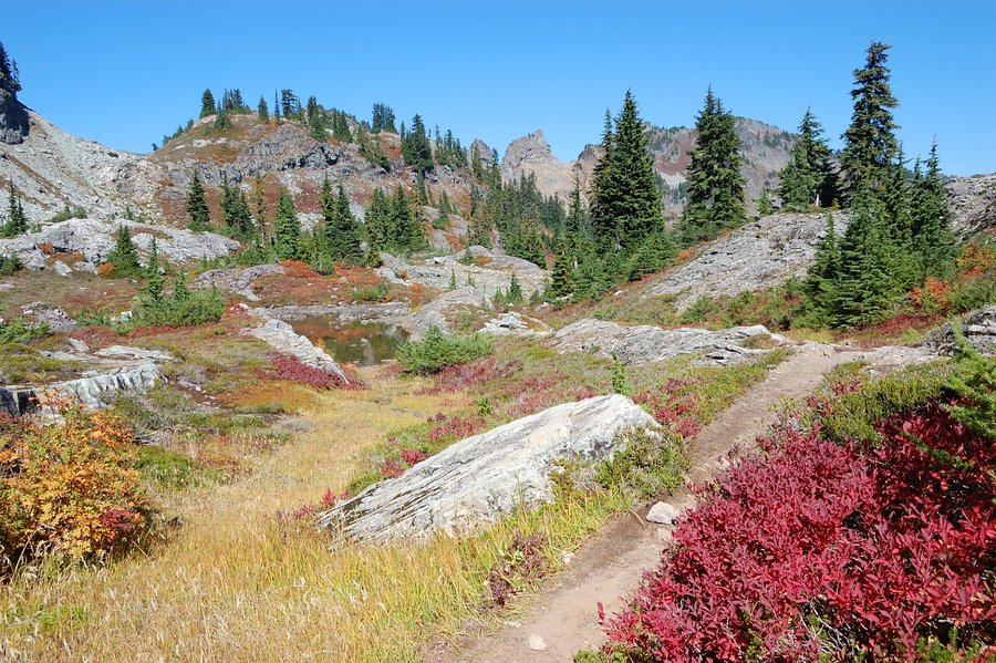
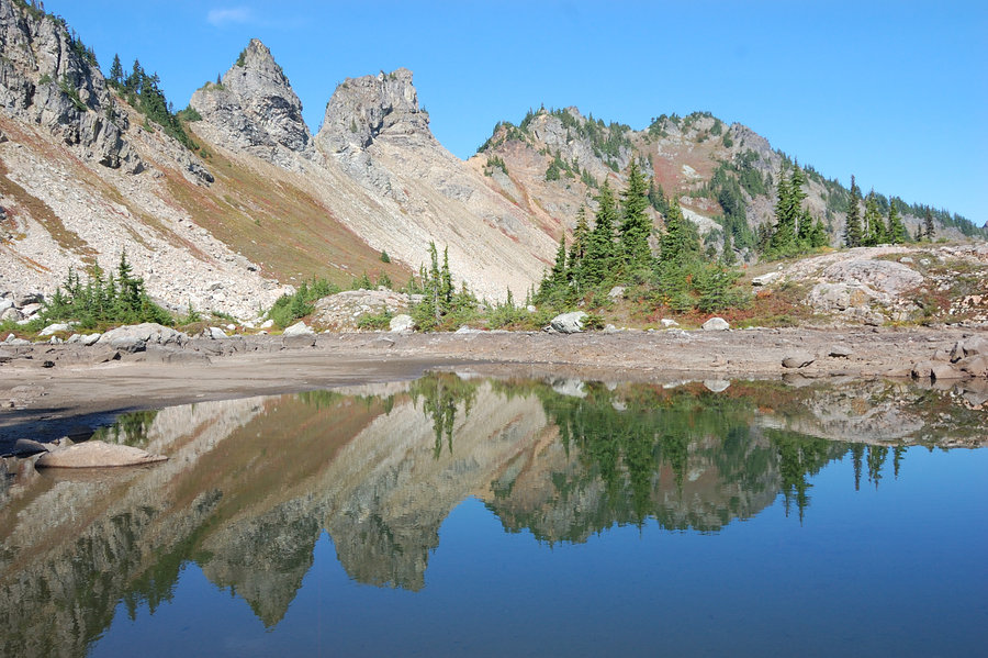
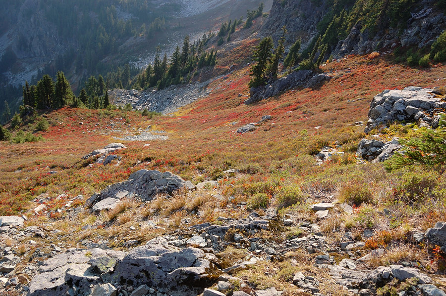
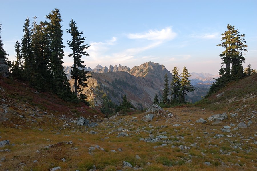
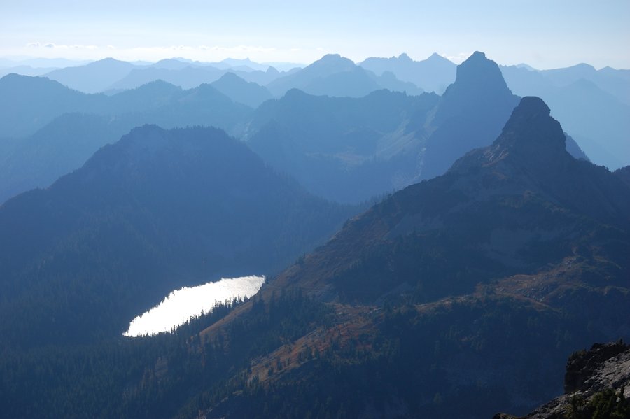
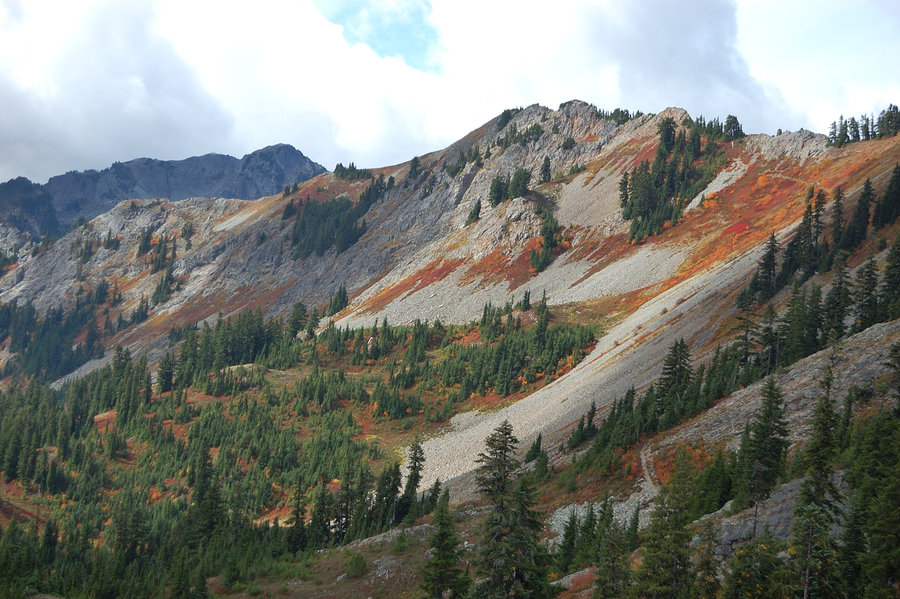
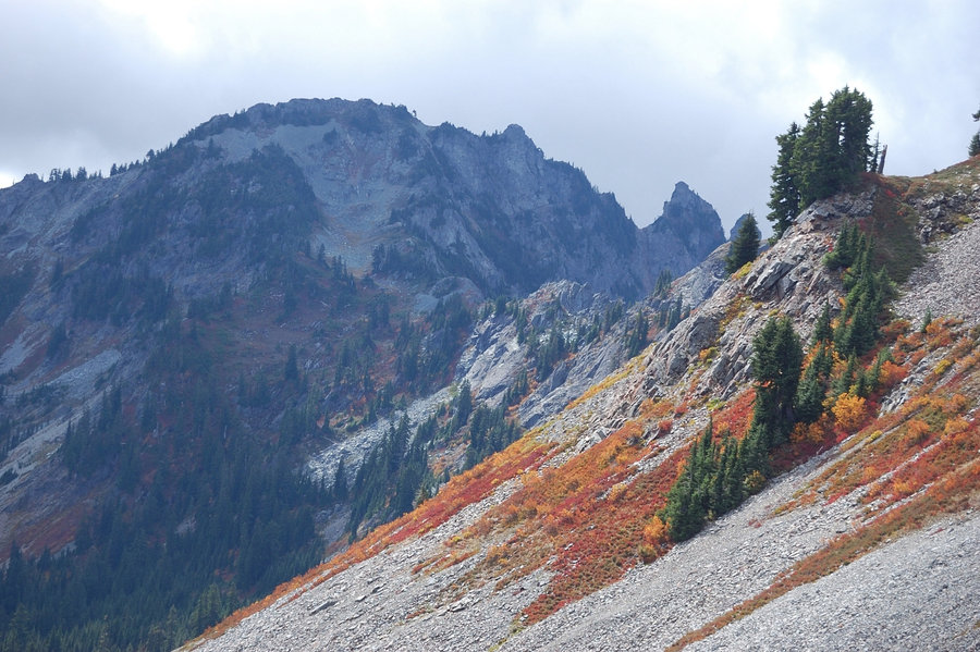
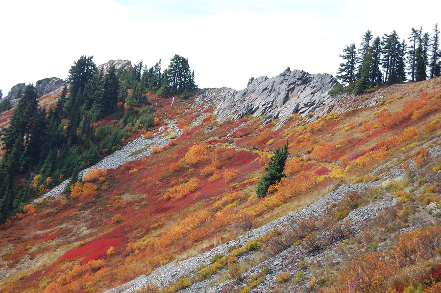
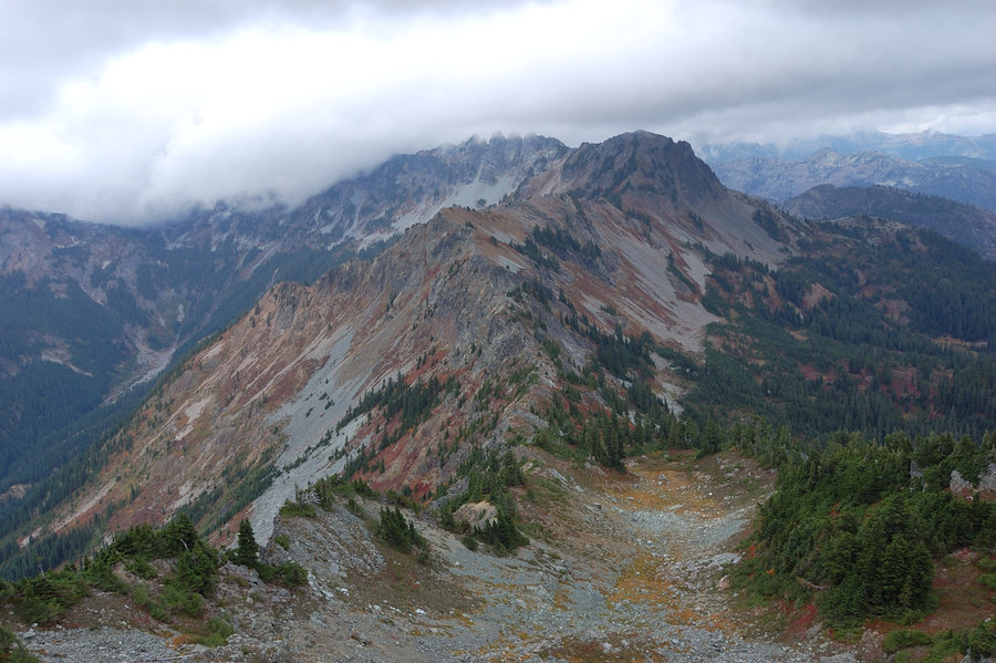
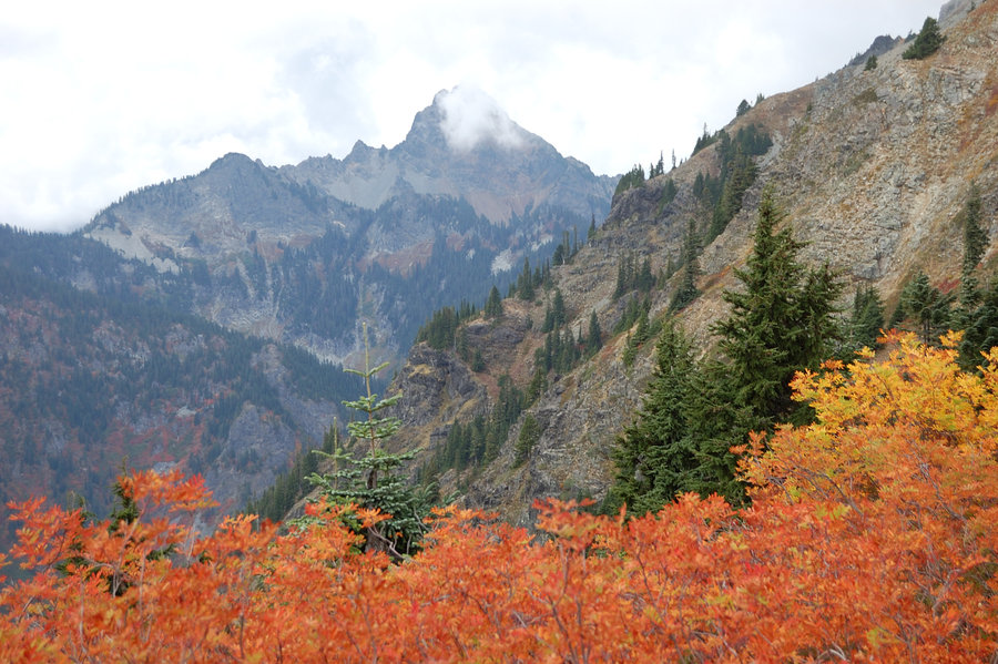
By the time I started down, the wind increased to steady 35-45 mph on the mountain (I remember thinking if it was strong enough to kick down loose rocks), and first clouds started to form over high peaks. The gusts increased even more by night time, and made good waves on the lake below my camp - which was, thankfully, well sheltered from the west. The next morning everything above ~5,500' was socked in clouds (a day before it was forecasted), but views of granite crags were even more dramatic. I didn't delay the hike out - needed to get the first 600 feet to Spectacle Point to see the condition of pass on Hi Box Ridge. Thankfully, my pass was clear and the weather seemed to improve, so I made a short trip to the top of Spectacle Point and took time getting about a million more photos. Since I rated Chikamin Peak 10/10 already, Spectacle got 12 out of 10 - it alone would be worth a 5 day hike to see! Also of note, fall colors along PCT approaching Chikamin Pass were really really good.
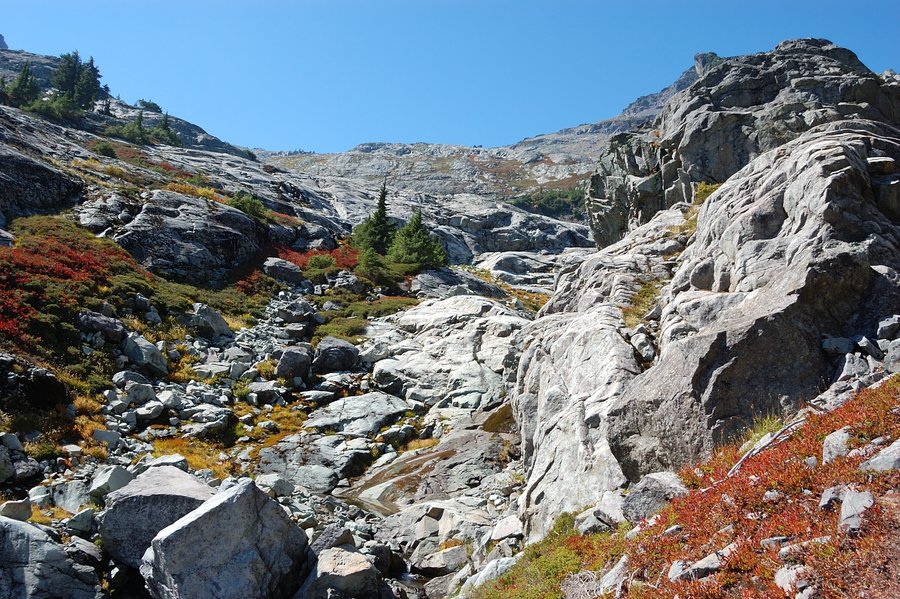
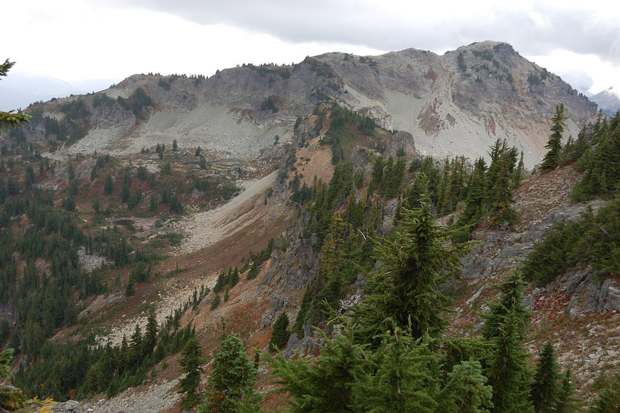
Off-trail hike back was uneventful, except that I was now losing the path constantly (it kind of visible through the brush and it's really helpful, but disappears through long stretches of boulder fields). I rarely lost it on the way in - something about it being easier to see on the way down? Or maybe it was sun shining into my eyes? In any way, it was thanks to my gps track I was able to follow the path through the steepest, brushiest part, maybe 300-400' vertical. It would take eternity to bushwhack this. Up and over the ridge, I continued to follow the old trail and discovered it bypassed the tarns below Alta Mtn, but that meant relatively flat hike instead of 150' bump which I really appreciated now. It joined the main trail, and after another quick search found official path to Lila Lake for my final night (on the entire trip, beyond trailhead I saw ONE trail sign, and it said "trail"! there's some signs that restrict fires or show "restroom" areas away from the water, but none that tell your whereabouts or where the trail is heading. good map is a must in these parts).
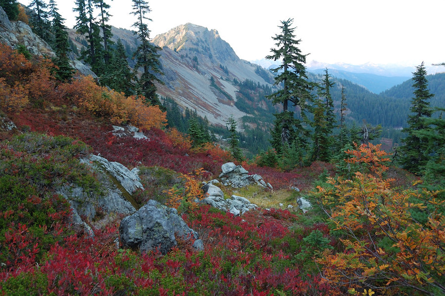
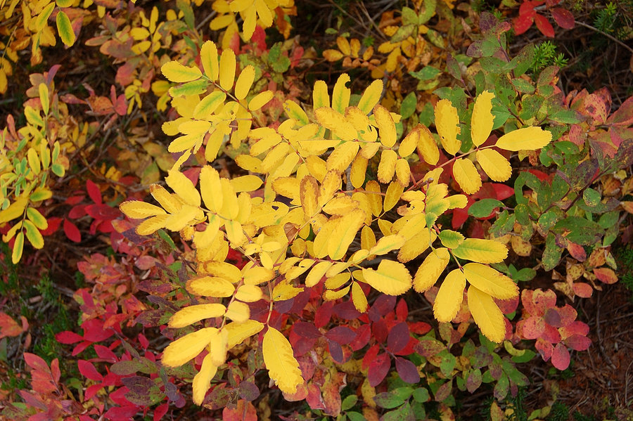
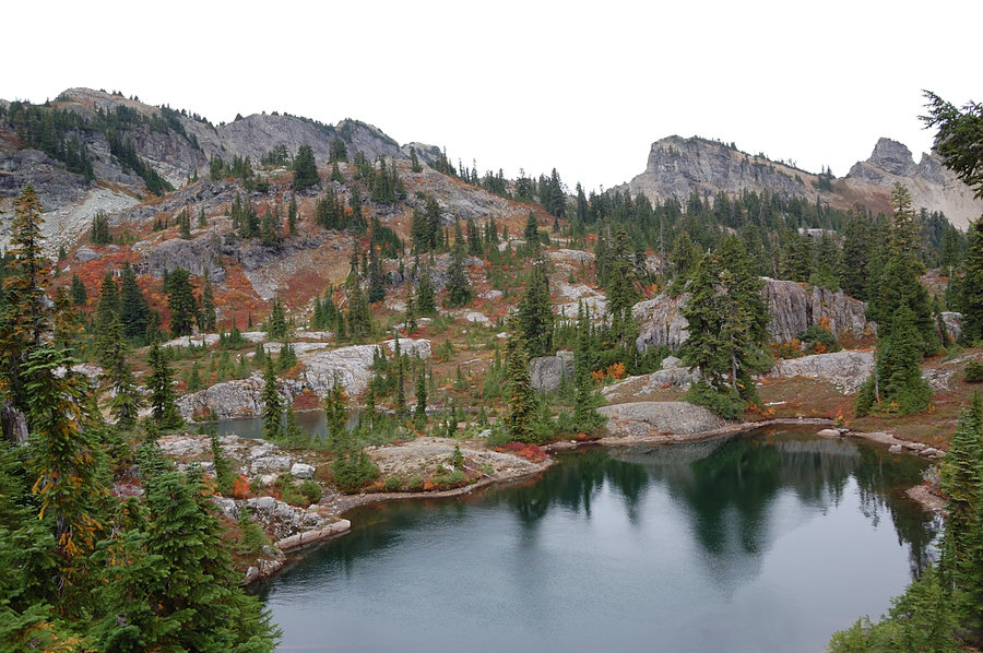
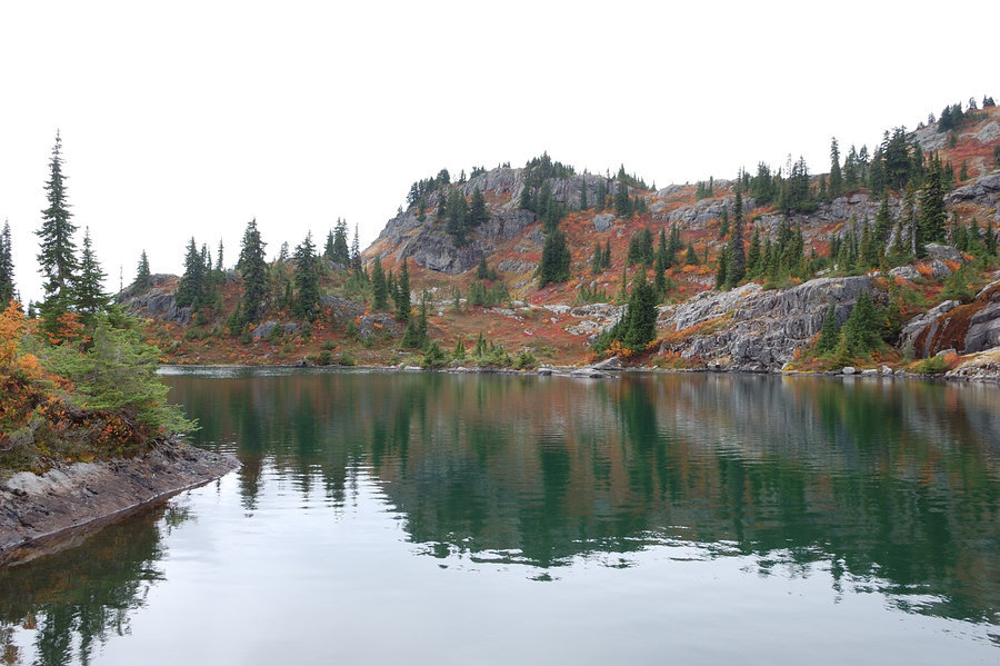
The final night was really cold, mostly because - trying to save weight - I took a summer bag I use down to 50F (it was forecasted to be 47) and I think it dipped into mid- or upper 30's. Have put on everything I had, including rain coat, and while I was cool at night, didn't really get too cold. Lesson - save weight with other items and take a good bag, if the weather looks marginal. Lila Lake looked at least on par with Rampart Lakes: more granite, blazing orange mtn. ash and red huckleberries, view of half dozen peaks... The only difference with Rampart Lakes is that no one else camped at Lila that night. Luckily, it was dry the entire time; the rain held off until I was driving back through Snoqualmie Pass.


Woodswalker
September 24, 2015
This looks absolutely amazing!