

2010 Trips


Baiyun Mountain
8 miles of hiking • 0' elevation gain •
Beautiful little mountain on the edge of Guangzhou. Has a large bird sanctuary. The path is paved, but there are many dirt trails to secluded spots. Many birds, views, and electric shuttles if you tire.

December 25, 2010

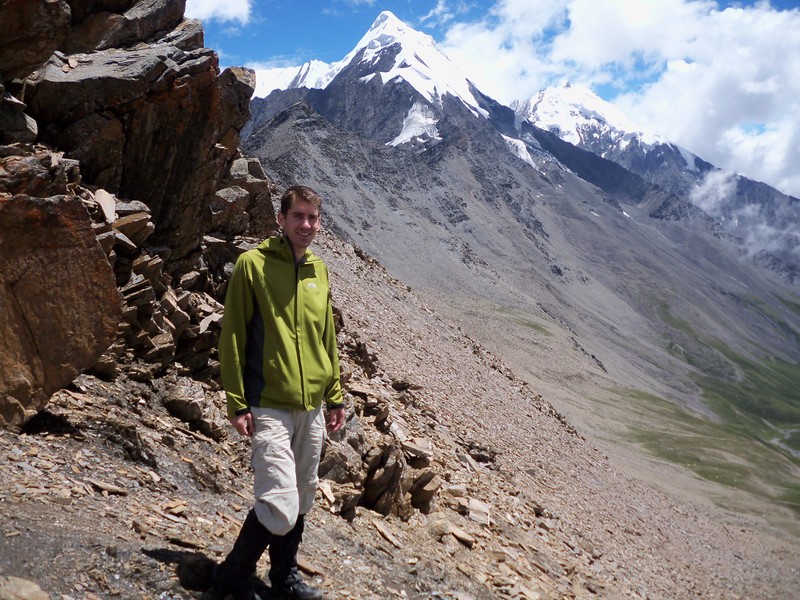
Hei Shui
18 miles of hiking • 0' elevation gain • 1 night
Missed fall colors by a month. Glacier can cost over RMB 400 to see after costs of bus and cable-car inside park. Went up a valley, got good views of some mountains. Slept in a Tibetan village, in a hay shed since the only family home wouldn't take us in. It was nice. Pics on flickr: pieterpan
November 25 – November 26, 2010

Xiling Snow Mountain
17 miles of hiking • 0' elevation gain • 1 night
No snow, except dusting on lookout ridge. Much of the "back door" hiking approach was stairs. Too late for fall colors, too early for snow, much too early for spring blossoms on rhody's and azaleas. Good views of Xiling Mountain proper from where cable-car drops off. You can hike much of the way down instead of cable car.
November 19 – November 20, 2010

Qingcheng Mountain
4 miles of hiking • 0' elevation gain •
No crowds this time, so it was peaceful. Still a rather boring day hike with the temples further along in the restoration process (May 2008 earthquake).
September 17, 2010

Gongga Mountain Circuit
40 miles of hiking • 0' elevation gain • 3 nights
Fantastic! I hiked a half-circuit around the Gongga Mountain area through valleys. There is a lake where the river broadens that has islands in it where horses were feeding. A side trip up to Gongga monastery might reward you with a view of the mountain (taller than Mt. McKinley), or just the lower end of its glacier (if raining). There are herds of yaks, some wild boar, a variety of botany, and great views of glacier covered, very steep mountains. The pass you cross to return to civilization is at 4,800 meters. Most of the trail very slowly rises or descends, except for the approach to the pass. Right up there with Wonderland Trail. Pics on flickr: pieterpan.
August 11 – August 14, 2010

Rock Sea
2 miles of hiking • 0' elevation gain •
Really cool place. Giant dolite, huge cave with many side caves, strange rock formations (eroded limestone in pillars and animal shapes), Bo people hanging coffins, and paths to walk through all this. It's at the top of a mountainous area, so great views, too!
July 13, 2010

Bamboo Sea
15 miles of hiking • 0' elevation gain • 1 night
Beautiful forest of bamboo on a plateau. Lots of waterfalls, a lake, temples, and small farms. Made famous in the West in "Crouching Tiger, Hidden Dragon." Pics on flickr: pieterpan.
July 11 – July 12, 2010

Emei Mountain
20 miles of hiking • 0' elevation gain • 1 night
One of four, most holy Buddhist mountains in China. Many "special" sites. Monkey zones where you must fend off the rascals. Much colder at 3,000+ km top. Stairs the whole way, as is the norm at popular places. There is a short cave. Despite its fame, many NW mountain or gorge hikes are as good or better. Pics on flickr: pieterpan
June 20 – June 21, 2010

Qingcheng Mountain
4 miles of hiking • 0' elevation gain •
Went on a national holiday. Huge mistake. Had to walk last two miles to entrance because of traffic. One of famous Taoist mountains in China. Many famous, "special" things to see. It was like hiking in a mall during Black Friday.
April 30, 2010

Wallace Falls and State Park
11.5 miles of hiking • 0' elevation gain •
Nice view of Cascades at trailhead. Tall waterfall facing south, so lots of sun on it. Some nice lakes further on.
February 14, 2010

Mailbox Peak
6 miles of hiking • 0' elevation gain •
Not a maintained trail. Some very steep parts. Mailbox at top with a ledger awaiting your signature.
February 8, 2010

Eagle Creek
5 miles of hiking • 0' elevation gain •
Nothing I could add that hasn't been said already.
January 9, 2010
